GMT vector example
This example was translated from the equivalent GMT.jl example.
julia
import GMT # for data
using GeoMakie, Polylabel
using DataFrames

import ZipFile, Shapefile

table = Shapefile.Table(joinpath(GMT.TESTSDIR, "COL_adm2.shp.zip")) |> DataFrame

antioquia_geoms = filter(:NAME_1 => ==("Antioquia"), table)

f, a, p = poly(antioquia_geoms.geometry; axis = (; type = GeoAxis))
tp = Makie.text!(a, Polylabel.polylabel.(antioquia_geoms.geometry); text = string.(antioquia_geoms.ID_2), align = (:center, :center))
tp.fontsize = 5
f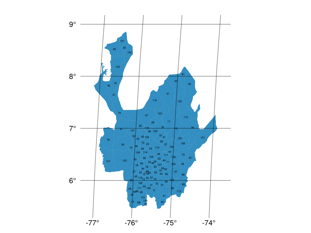
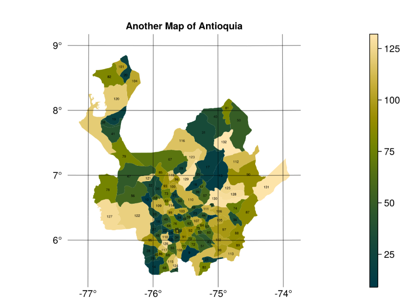
Now that the polygons are labelled, we can also color them:
julia
f, a, p = poly(antioquia_geoms.geometry; color = antioquia_geoms.ID_2 .|> identity, colormap = :bamako, axis = (; type = GeoAxis))
tp = Makie.text!(a, Polylabel.polylabel.(antioquia_geoms.geometry); text = string.(antioquia_geoms.ID_2), align = (:center, :center))
tp.fontsize = 5
a.title = "Another Map of Antioquia"
cb = Colorbar(f[1, 2], p)
f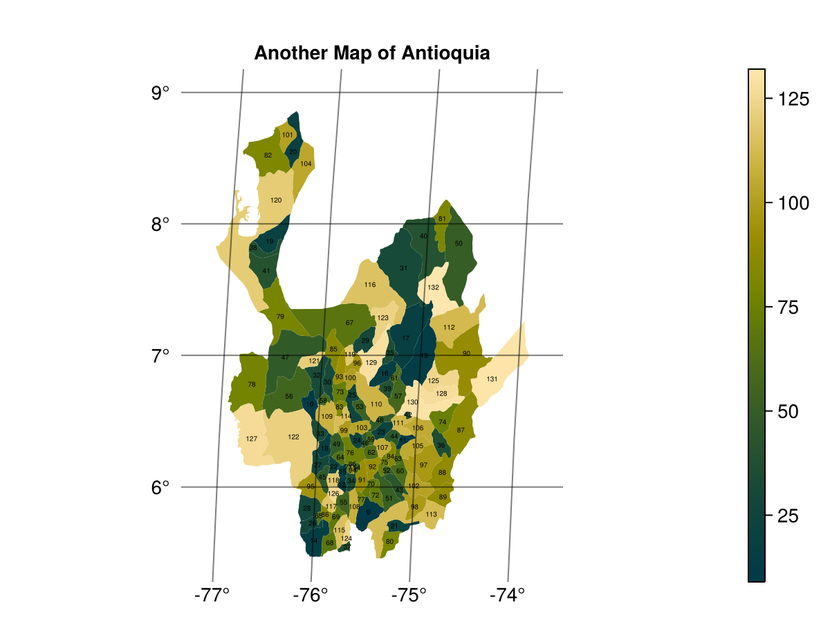
Note that this is not projected - the proj=:guess projection is not implemented in GeoMakie! However, we can project to an orthographic projection centered at the centroid of the geometry, using GeometryOps.jl to calculate the centroid.
julia
import GeometryOps as GO
cx, cy = GO.centroid(antioquia_geoms)
(-75.59169706596079, 6.910416654093001)julia
a.dest = "+proj=ortho +lon_0=$cx +lat_0=$cy"
f
That looks a lot more like what the GMT example does!
This page was generated using Literate.jl.