Piracy at Sea
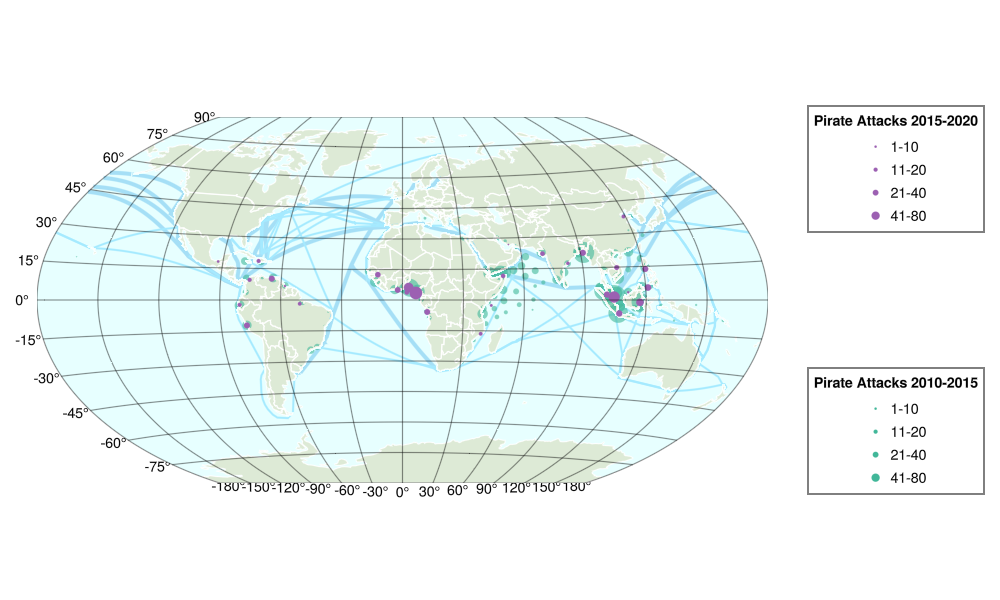
This is a (still WIP) attempt to replicate the plot from https://github.com/newzealandpaul/Shipping-Lanes. Shipping lane and pirate attack data are sourced from https://github.com/newzealandpaul/Shipping-Lanes and https://github.com/newzealandpaul/Maritime-Pirate-Attacks.
The big idea here is that you can "reduce" the number of points by using clustering methods to derive a reasonable pattern of scatter points.
using Makie, GeoMakie
# Data loading
using GeoJSON, QuackIO, CSV, DataFrames
using Downloads, Dates
# Geometry manipulation
import GeometryOps as GO, GeoInterface as GI, ProjData acquisition
We'll download the data and munge it a bit so that we can use it to plot the information we need.
shipping_routes_file = Downloads.download("https://raw.githubusercontent.com/newzealandpaul/Shipping-Lanes/refs/tags/v1.3.1/data/Shipping_Lanes_v1.geojson", "Shipping_Lanes_v1.geojson")
pirate_attacks_file = Downloads.download("https://raw.githubusercontent.com/newzealandpaul/Maritime-Pirate-Attacks/refs/heads/main/data/csv/pirate_attacks.csv", "pirate_attacks.csv")
shipping_routes = GeoJSON.read(shipping_routes_file)
pirate_attacks = QuackIO.read_csv(DataFrame, pirate_attacks_file)| Row | date | time | longitude | latitude | attack_type | location_description | nearest_country | eez_country | shore_distance | shore_longitude | shore_latitude | attack_description | vessel_name | vessel_type | vessel_status | data_source |
|---|---|---|---|---|---|---|---|---|---|---|---|---|---|---|---|---|
| Date | String | Float64 | Float64 | String | String | String | String | Float64 | Float64 | Float64 | String | String | String | String | String | |
| 1 | 1993-01-02 | NA | 116.967 | 19.7 | NA | Hong Kong - Luzon - Hainan | CHN | TWN | 357.502 | 115.826 | 22.7466 | NA | Mv Cosmic Leader | NA | NA | mappingpiracy |
| 2 | 1993-01-04 | NA | 116.0 | 22.35 | NA | Hong Kong - Luzon - Hainan | CHN | CHN | 47.4316 | 115.826 | 22.7466 | NA | Mv Tricolor Star III | NA | NA | mappingpiracy |
| 3 | 1993-01-06 | NA | 115.25 | 19.67 | NA | Hong Kong - Luzon - Hainan | CHN | TWN | 280.812 | 114.303 | 22.0449 | NA | Mv Arktis Star | NA | NA | mappingpiracy |
| 4 | 1993-01-08 | NA | 124.583 | 29.9 | NA | East China Sea | CHN | CHN | 209.923 | 122.41 | 29.9112 | NA | Ussurijsk | NA | NA | mappingpiracy |
| 5 | 1993-01-12 | NA | 120.267 | 18.1333 | NA | Hong Kong - Luzon - Hainan | PHL | PHL | 22.0273 | 120.47 | 18.091 | NA | Mv Chennai Nermai | NA | NA | mappingpiracy |
| 6 | 1993-01-13 | NA | 101.85 | 9.7173 | NA | Gulf of Thailand. South China Sea | KHM | KHM | 184.797 | 103.292 | 10.5832 | NA | Emelyan Yaroslavskiy | NA | NA | mappingpiracy |
| 7 | 1993-01-25 | NA | 106.867 | 8.56667 | NA | South China Sea | VNM | VNM | 27.4373 | 106.656 | 8.69888 | NA | Mv Indira Ghandhi | NA | NA | mappingpiracy |
| 8 | 1993-01-26 | NA | 123.5 | 29.0 | NA | East China Sea | CHN | CHN | 141.516 | 122.395 | 29.8333 | NA | Mt Petrobulk Panther | NA | NA | mappingpiracy |
| 9 | 1993-01-26 | NA | 13.25 | -8.8 | NA | Luanda, Angola | AGO | AGO | 0.509216 | 13.2454 | -8.80006 | NA | Mv Bodrog | NA | Anchored | mappingpiracy |
| 10 | 1993-01-26 | NA | 119.4 | 4.43333 | NA | South China Sea | PHL | PHL | 25.3786 | 119.457 | 4.65571 | NA | Mv Southern King | NA | NA | mappingpiracy |
| 11 | 1993-01-27 | NA | 13.25 | -8.8 | NA | Port of Luanda, Angola | AGO | AGO | 0.509216 | 13.2454 | -8.80006 | NA | NA | NA | NA | mappingpiracy |
| 12 | 1993-02-04 | NA | 123.167 | 25.75 | NA | East China Sea | NA | NA | 34.6023 | 123.511 | 25.7581 | NA | Sukhinichi | NA | NA | mappingpiracy |
| 13 | 1993-02-05 | NA | 7.2267 | 5.00167 | NA | Bonny Anchorage, Nigeria | NGA | NGA | 31.946 | 7.07179 | 4.75812 | NA | Mv Norgas Navigator | NA | Anchored | mappingpiracy |
| 14 | 1993-02-06 | NA | 118.167 | 16.5833 | NA | Hong Kong - Luzon - Hainan | PHL | PHL | 174.737 | 119.758 | 16.2167 | NA | Mv Hulpha Kluang | NA | NA | mappingpiracy |
| 15 | 1993-02-15 | NA | 121.299 | 38.6974 | NA | 7.4 miles SE of Waglan. South China Sea | CHN | CHN | 9.41273 | 121.198 | 38.7279 | NA | Mv Marine Peace | NA | NA | mappingpiracy |
| 16 | 1993-02-16 | NA | 118.717 | 19.3167 | NA | Hong Kong - Luzon - Hainan | PHL | PHL | 214.903 | 120.561 | 18.4868 | NA | Mv Lion | NA | NA | mappingpiracy |
| 17 | 1993-02-16 | NA | 39.3533 | -6.775 | NA | Dar-Es-Salam Anchor, Tanzania | TZA | TZA | 5.97786 | 39.3265 | -6.82195 | NA | Mv Socol 5 | NA | NA | mappingpiracy |
| 18 | 1993-02-16 | NA | 111.033 | 17.3333 | NA | Hong Kong - Luzon - Hainan | CHN | CHN | 107.328 | 111.603 | 16.5334 | NA | Mv Mary Nour | NA | NA | mappingpiracy |
| 19 | 1993-02-16 | NA | 111.2 | 15.7833 | NA | NA | VNM | VNM | 0.475901 | 111.196 | 15.7857 | NA | Mt Samuel L. Cobb | NA | NA | mappingpiracy |
| 20 | 1993-02-16 | NA | 39.3533 | -6.775 | NA | Dar-Es-Salam Roads, Tanzania | TZA | TZA | 5.97786 | 39.3265 | -6.82195 | NA | NA | NA | NA | mappingpiracy |
| 21 | 1993-02-18 | NA | 115.25 | 19.67 | NA | Western Luzon. Hong Kong - Luzon - Hainan | CHN | TWN | 280.812 | 114.303 | 22.0449 | NA | Mv Aleksandr Tsyurupa | NA | NA | mappingpiracy |
| 22 | 1993-02-25 | NA | 104.4 | 8.51667 | NA | South China Sea | VNM | VNM | 36.7996 | 104.723 | 8.60269 | NA | Mv Great Amity | NA | NA | mappingpiracy |
| 23 | 1993-02-25 | NA | 124.433 | 36.2 | NA | East China Sea | KOR | KOR | 162.263 | 126.129 | 36.7119 | NA | Mv Komsomolets | NA | NA | mappingpiracy |
| 24 | 1993-02-28 | NA | 67.1457 | 24.7847 | NA | Base Creek, Anchor. Arabian Sea | PAK | PAK | 1.29138 | 67.156 | 24.7916 | NA | Mv Alam Sempurna | NA | Anchored | mappingpiracy |
| 25 | 1993-03-01 | NA | 50.5833 | 8.93333 | NA | Somalia | SOM | SOM | 9.93972 | 50.4949 | 8.95197 | NA | Somalian Glory | NA | NA | mappingpiracy |
| 26 | 1993-03-03 | NA | 120.467 | 25.4333 | NA | Taiwan Sea | CHN | CHN | 61.0892 | 119.875 | 25.5568 | NA | Mv Tulsidas | NA | NA | mappingpiracy |
| 27 | 1993-03-05 | NA | 120.067 | 17.6 | NA | Hong Kong - Luzon - Hainan | PHL | PHL | 28.7651 | 120.334 | 17.5564 | NA | Mv Zirje | NA | NA | mappingpiracy |
| 28 | 1993-03-06 | NA | 98.7167 | 3.8 | NA | Straits of Malacca-Indonesia | IDN | IDN | 0.793892 | 98.7106 | 3.80378 | NA | Mv Kavo Sidero | NA | NA | mappingpiracy |
| 29 | 1993-03-19 | NA | 122.767 | 37.2833 | NA | East China Sea | CHN | CHN | 12.7748 | 122.679 | 37.3747 | NA | Mv Sibirskiy 2114 | NA | NA | mappingpiracy |
| 30 | 1993-03-21 | NA | 115.25 | 19.67 | NA | SW of Hong Kong. Hong Kong - Luzon - Hainan | CHN | TWN | 280.812 | 114.303 | 22.0449 | NA | M69204Y | NA | NA | mappingpiracy |
| 31 | 1993-03-21 | NA | 109.5 | 15.0 | NA | South China Sea | VNM | VNM | 54.1384 | 109.081 | 14.7295 | NA | Mt Suci | NA | NA | mappingpiracy |
| 32 | 1993-03-23 | NA | 105.85 | 3.81667 | NA | South China Sea | IDN | IDN | 68.7399 | 106.271 | 3.36099 | NA | Mv Kurama | NA | NA | mappingpiracy |
| 33 | 1993-03-23 | NA | 124.333 | 26.75 | NA | East China Sea | NA | NA | 97.1867 | 124.567 | 25.8984 | NA | Mv Vsip Pyatnitskiy | NA | NA | mappingpiracy |
| 34 | 1993-03-24 | NA | -43.1667 | -22.8933 | NA | Anchorage, Rio de Janeiro, Brazil | BRA | BRA | 0.53914 | -43.1621 | -22.8957 | NA | Mv Santos Express | NA | Anchored | mappingpiracy |
| 35 | 1993-04-02 | NA | 121.777 | 38.7931 | NA | 30 miles East of Waglan. Hong Kong - Luzon - Hainan | CHN | CHN | 10.4276 | 121.696 | 38.8629 | NA | Mv Bunga Terasek | NA | NA | mappingpiracy |
| 36 | 1993-04-04 | NA | 123.8 | 22.7333 | NA | Hong Kong - Luzon - Hainan | JPN | JPN | 168.827 | 123.851 | 24.257 | NA | Mv Pernas Proton | NA | NA | mappingpiracy |
| 37 | 1993-04-04 | NA | 115.667 | 22.3333 | NA | Hong Kong - Luzon - Hainan | CHN | CHN | 38.2728 | 115.575 | 22.6683 | NA | Mv Birlad | NA | NA | mappingpiracy |
| 38 | 1993-04-08 | NA | 111.417 | 12.5167 | NA | South China Sea | VNM | VNM | 211.832 | 109.472 | 12.6564 | NA | Mv NL Trader | NA | NA | mappingpiracy |
| 39 | 1993-04-13 | NA | 115.25 | 19.67 | NA | Hong Kong Harbour. Hong Kong - Luzon - Hainan | CHN | TWN | 280.812 | 114.303 | 22.0449 | NA | MV Baltimar Neptune | NA | NA | mappingpiracy |
| 40 | 1993-04-17 | NA | 115.617 | 17.6333 | NA | Hong Kong - Luzon - Hainan | CHN | TWN | 324.793 | 112.737 | 16.6602 | NA | MV Sun Kung No. 8 | NA | NA | mappingpiracy |
| 41 | 1993-04-22 | NA | 117.35 | 20.3 | NA | Hong Kong - Luzon - Hainan | CHN | TWN | 305.362 | 116.495 | 22.9394 | NA | MV OOCL Beacon | NA | NA | mappingpiracy |
| 42 | 1993-04-22 | NA | 98.6767 | 3.77667 | NA | Belawan Port. Straits of Malacca-Indonesia | IDN | IDN | 4.81519 | 98.7106 | 3.80378 | NA | Mv Magic Lady | NA | NA | mappingpiracy |
| 43 | 1993-04-22 | NA | 116.083 | 19.4 | NA | Hong Kong - Luzon - Hainan | CHN | TWN | 346.616 | 114.303 | 22.0449 | NA | MV Salud Ace | NA | NA | mappingpiracy |
| 44 | 1993-04-23 | NA | 116.783 | 21.1667 | NA | Hong Kong - Luzon - Hainan | CHN | TWN | 196.97 | 116.096 | 22.8259 | NA | Bukhta | NA | NA | mappingpiracy |
| 45 | 1993-04-23 | NA | 117.5 | 20.8 | NA | Hong Kong - Luzon - Hainan | CHN | TWN | 258.67 | 116.495 | 22.9394 | NA | Mv Old Sea Beacon | NA | NA | mappingpiracy |
| 46 | 1993-04-29 | NA | 126.033 | 28.85 | NA | East China Sea | JPN | JPN | 241.218 | 128.23 | 27.869 | NA | MT President | NA | NA | mappingpiracy |
| 47 | 1993-04-29 | NA | 114.183 | 17.926 | NA | 300 miles South of Hong Kong. Hong Kong - Luzon - Hainan | CHN | CHN | 207.854 | 112.733 | 16.6661 | NA | Mv Zhongshan | NA | NA | mappingpiracy |
| 48 | 1993-05-02 | NA | 124.95 | 35.2333 | NA | East China Sea | KOR | KOR | 73.4252 | 125.421 | 34.6971 | NA | Mv Konstantin | NA | NA | mappingpiracy |
| 49 | 1993-05-03 | NA | 120.05 | 17.3 | NA | South China Sea | PHL | PHL | 38.1639 | 120.408 | 17.3227 | NA | NA | NA | NA | mappingpiracy |
| 50 | 1993-05-04 | NA | 115.984 | 19.3123 | NA | 235 miles SE of Hong Kong. Hong Kong - Luzon - Hainan | CHN | TWN | 349.586 | 114.303 | 22.0449 | NA | Mv Tricolor Star III | NA | NA | mappingpiracy |
| 51 | 1993-05-04 | NA | 123.85 | 35.7833 | NA | East China Sea | CHN | KOR | 172.486 | 122.517 | 36.9031 | NA | Mv Komsomlskaya Smena | NA | NA | mappingpiracy |
| 52 | 1993-05-17 | NA | 3.3767 | 6.45 | NA | 16 miles South of Lagos, Nigeria | NGA | NGA | 0.745849 | 3.37387 | 6.45612 | NA | Mt Petrobulk Panther | NA | NA | mappingpiracy |
| 53 | 1993-05-19 | NA | 106.0 | -5.95 | NA | Alongside Prointal Jetty, Indonesia | IDN | IDN | 3.5807 | 105.997 | -5.91774 | NA | Maersk Sussex | NA | NA | mappingpiracy |
| 54 | 1993-05-24 | NA | 100.167 | 3.5 | NA | Straits of Malacca-Indonesia | IDN | IDN | 58.1818 | 99.7507 | 3.18049 | NA | Mv Star Lily | NA | NA | mappingpiracy |
| 55 | 1993-05-25 | NA | 108.717 | -5.78333 | NA | Java Sea | IDN | IDN | 64.6491 | 108.36 | -6.2464 | NA | Mt Timur Mercury | NA | NA | mappingpiracy |
| 56 | 1993-05-25 | NA | 108.4 | 6.98333 | NA | South China Sea | IDN | VNM | 248.381 | 108.005 | 4.77237 | NA | Mv Pina | NA | NA | mappingpiracy |
| 57 | 1993-06-02 | NA | 122.183 | 37.4333 | NA | Port of Weihaiwei. East China Sea | CHN | CHN | 1.28473 | 122.198 | 37.4324 | NA | Mv Sibirskiy-2114 | NA | NA | mappingpiracy |
| 58 | 1993-06-03 | NA | 101.45 | 1.67667 | NA | Dumai Port. Straits of Malacca-Indonesia | IDN | IDN | 4.42268 | 101.427 | 1.7093 | NA | Mt Timur Endurance | NA | NA | mappingpiracy |
| 59 | 1993-06-09 | NA | 101.9 | 2.25 | NA | Straits of Malacca-Malaysia | MYS | MYS | 16.4411 | 101.865 | 2.39452 | NA | Mt Royal Arrow | NA | NA | mappingpiracy |
| 60 | 1993-06-09 | NA | 124.667 | 27.6167 | NA | East China Sea | NA | NA | 190.64 | 124.567 | 25.8984 | NA | Mv Soyuz 4 | NA | NA | mappingpiracy |
| 61 | 1993-06-11 | NA | 124.167 | 22.75 | NA | East China Sea | JPN | JPN | 169.711 | 123.873 | 24.2582 | NA | Mt Dooyang Amber | NA | NA | mappingpiracy |
| 62 | 1993-06-11 | NA | 123.567 | 37.7 | NA | East China Sea | CHN | CHN | 84.0371 | 122.688 | 37.4098 | NA | Mv Kap. Modest Ivanov | NA | NA | mappingpiracy |
| 63 | 1993-06-12 | NA | 79.8432 | 6.95 | NA | Colombo Outer Road, Sri Lanka | LKA | LKA | 1.45038 | 79.8482 | 6.96214 | NA | Mv Tiger Stream | NA | NA | mappingpiracy |
| 64 | 1993-06-13 | NA | 123.317 | 36.8167 | NA | East China Sea | CHN | CHN | 70.944 | 122.533 | 36.9259 | NA | Gorets | NA | NA | mappingpiracy |
| 65 | 1993-06-15 | NA | 122.929 | 29.0791 | NA | 150NM SE of Shanghai. East China Sea | CHN | CHN | 93.2801 | 121.991 | 29.2573 | NA | Mv Kovdor | NA | NA | mappingpiracy |
| 66 | 1993-06-16 | NA | 125.154 | 29.2179 | NA | East China Sea | CHN | CHN | 275.989 | 122.395 | 29.8333 | NA | Mv Tokarevsk | NA | NA | mappingpiracy |
| 67 | 1993-06-17 | NA | 127.5 | 29.7833 | NA | East China Sea | JPN | KOR | 196.392 | 129.528 | 29.9023 | NA | Mv Elm | NA | NA | mappingpiracy |
| 68 | 1993-06-21 | NA | 3.3667 | 6.28333 | NA | Nigeria | NGA | NGA | 12.7666 | 3.32618 | 6.39142 | NA | Mt Dan Frigg | NA | NA | mappingpiracy |
| 69 | 1993-06-24 | NA | 111.233 | 20.4167 | NA | Hong Kong - Luzon - Hainan | CHN | CHN | 55.4448 | 110.921 | 20.012 | NA | Mv Kapitan Betkher | NA | NA | mappingpiracy |
| 70 | 1993-06-25 | NA | -77.0667 | 3.87667 | NA | Inner Anchorage, Buenaventura, Colombia | COL | COL | 1.0089 | -77.0686 | 3.86774 | NA | Mv Crion | NA | NA | mappingpiracy |
| 71 | 1993-06-25 | NA | 128.617 | 35.0667 | NA | East China Sea | KOR | KOR | 0.754747 | 128.625 | 35.0682 | NA | Gorets | NA | NA | mappingpiracy |
| 72 | 1993-06-26 | NA | 110.583 | 20.9667 | NA | China | CHN | CHN | 1.04018 | 110.59 | 20.9594 | NA | Mv Pavel Rybin | NA | NA | mappingpiracy |
| 73 | 1993-06-26 | NA | 106.5 | 5.25 | NA | South China Sea | IDN | IDN | 170.434 | 107.937 | 4.70307 | NA | Mv Far Trader | NA | NA | mappingpiracy |
| 74 | 1993-06-26 | NA | 116.25 | 20.7667 | NA | Hong Kong - Luzon - Hainan | CHN | TWN | 221.836 | 115.575 | 22.6683 | NA | Mv Kap. Leo. Borisenko | NA | NA | mappingpiracy |
| 75 | 1993-07-06 | NA | 115.7 | 20.0333 | NA | Hong Kong - Luzon - Hainan | CHN | TWN | 265.891 | 114.303 | 22.0449 | NA | Mv Khudozhnik | NA | NA | mappingpiracy |
| 76 | 1993-07-07 | NA | 99.4333 | 4.18333 | NA | Straits of Malacca-Indonesia | IDN | IDN | 75.0116 | 99.0739 | 3.60899 | NA | Mv Faarabi | NA | NA | mappingpiracy |
| 77 | 1993-07-07 | NA | 124.133 | 35.3167 | NA | East China Sea | KOR | KOR | 135.788 | 125.406 | 34.6826 | NA | Mv Valeriy Volkov | NA | NA | mappingpiracy |
| 78 | 1993-07-08 | NA | 124.167 | 35.3333 | NA | East China Sea | KOR | KOR | 134.162 | 125.413 | 34.692 | NA | Mv Evgenity Zuluz | NA | NA | mappingpiracy |
| 79 | 1993-07-14 | NA | 115.217 | 22.3 | NA | Hong Kong - Luzon - Hainan | CHN | CHN | 42.1289 | 114.919 | 22.5612 | NA | Mv Ivan Skuridin | NA | NA | mappingpiracy |
| 80 | 1993-07-15 | NA | 115.15 | 22.4 | NA | Hong Kong - Luzon - Hainan | CHN | CHN | 29.7156 | 114.919 | 22.5612 | NA | Mv Ko Mal San | NA | NA | mappingpiracy |
| 81 | 1993-08-13 | NA | 115.1 | 22.1333 | NA | Hong Kong - Luzon - Hainan | CHN | CHN | 50.452 | 114.896 | 22.5475 | NA | Mv Hermes Hope | NA | NA | mappingpiracy |
| 82 | 1993-08-20 | NA | 112.747 | -7.1885 | NA | Berlian barat, Surabaya, Indonesia | IDN | IDN | 1.8521 | 112.745 | -7.20517 | NA | Mt Kitsa | NA | NA | mappingpiracy |
| 83 | 1993-08-28 | NA | 115.453 | 19.5783 | NA | Hong Kong - Luzon - Hainan | CHN | TWN | 298.198 | 114.303 | 22.0449 | NA | Mv A.J. 1 | NA | NA | mappingpiracy |
| 84 | 1993-09-02 | NA | 98.6767 | 3.77667 | NA | Berth 105, Belawan Port, Indonesia | IDN | IDN | 4.81519 | 98.7106 | 3.80378 | NA | Mv Gold Future | NA | NA | mappingpiracy |
| 85 | 1993-09-09 | NA | 13.965 | -5.915 | NA | Angola | COD | AGO | 86.692 | 13.1843 | -5.85622 | NA | Mv Tilly | NA | NA | mappingpiracy |
| 86 | 1993-09-11 | NA | 105.0 | 1.0 | NA | Indonesia | IDN | IDN | 16.5372 | 104.852 | 0.98371 | NA | Mv Kota Intan | NA | NA | mappingpiracy |
| 87 | 1993-09-21 | NA | 120.167 | 17.7167 | NA | Hong Kong - Luzon - Hainan | PHL | PHL | 20.2393 | 120.353 | 17.6781 | NA | Mv Inger Riis | NA | NA | mappingpiracy |
| 88 | 1993-09-27 | NA | 98.6767 | 3.77667 | NA | Berth 108-109, Belawan Port, Indonesia | IDN | IDN | 4.81519 | 98.7106 | 3.80378 | NA | Mv Macknight | NA | NA | mappingpiracy |
| 89 | 1993-09-29 | NA | -46.33 | -24.1483 | NA | Outer Road, Santos, Brazil | BRA | BRA | 14.2979 | -46.3863 | -24.03 | NA | Mv Sao Paulo | NA | NA | mappingpiracy |
| 90 | 1993-10-08 | NA | -46.33 | -24.1483 | NA | Outer Road, Santos, Brazil | BRA | BRA | 14.2979 | -46.3863 | -24.03 | NA | Mv Betelgeuse | NA | NA | mappingpiracy |
| 91 | 1993-10-17 | NA | 120.287 | 18.28 | NA | Hong Kong - Luzon - Hainan | PHL | PHL | 25.4218 | 120.518 | 18.2177 | NA | Mt BP Admiral | NA | NA | mappingpiracy |
| 92 | 1993-10-19 | NA | 115.867 | -9.16667 | NA | Indonesia | IDN | IDN | 32.9781 | 116.01 | -8.90447 | NA | Gullhaar | NA | NA | mappingpiracy |
| 93 | 1993-10-22 | NA | 106.667 | 8.28333 | NA | Kampuchea | VNM | VNM | 41.4887 | 106.599 | 8.65241 | NA | Mv Nordsino | NA | NA | mappingpiracy |
| 94 | 1993-10-26 | NA | -58.17 | 6.82167 | NA | Georgetown, Guyana | GUY | GUY | 0.636844 | -58.1657 | 6.81786 | NA | Mv Cottica | NA | NA | mappingpiracy |
| 95 | 1993-10-28 | NA | 98.5833 | -4.73333 | NA | Indonesia | IDN | IDN | 256.577 | 100.337 | -3.22259 | NA | Mv Impala | NA | NA | mappingpiracy |
| 96 | 1993-11-02 | NA | 90.8333 | 22.0833 | NA | Off Brul Reach, Gange River, India | BGD | BGD | 6.0977 | 90.7748 | 22.0759 | NA | LPG/C Polar Endurance | NA | NA | mappingpiracy |
| 97 | 1993-11-05 | NA | 118.367 | 19.8667 | NA | Hong Kong - Luzon - Hainan | PHL | TWN | 276.642 | 120.57 | 18.5018 | NA | Mv Kayax | NA | NA | mappingpiracy |
| 98 | 1993-11-12 | NA | 79.6487 | 6.9499 | NA | 12NM off Colombo Port, Sri Lanka | LKA | LKA | 22.0825 | 79.8482 | 6.96214 | NA | Mv Lanka Asitha | NA | NA | mappingpiracy |
| 99 | 1993-12-04 | NA | 120.183 | 17.95 | NA | Hong Kong - Luzon - Hainan | PHL | PHL | 26.1754 | 120.425 | 17.9024 | NA | Mv Alam Teladan | NA | NA | mappingpiracy |
| 100 | 1993-12-06 | NA | 89.3333 | 1.83333 | NA | Indian Ocean | IDN | NA | 715.237 | 95.6926 | 2.79206 | NA | Mv Usguaua | NA | NA | mappingpiracy |
| 101 | 1993-12-09 | NA | 98.6767 | 3.77667 | NA | Belawan Port, Indonesia | IDN | IDN | 4.81519 | 98.7106 | 3.80378 | NA | Mv Sea Laurel | NA | NA | mappingpiracy |
| 102 | 1994-01-02 | NA | 116.1 | 22.0167 | Attempted | South China Sea | CHN | CHN | 85.6192 | 115.826 | 22.7466 | NA | Francesia | NA | NA | mappingpiracy |
| 103 | 1994-01-05 | NA | 112.033 | 13.6333 | Hijacked | South China Sea | VNM | VNM | 253.56 | 111.197 | 15.7754 | NA | Jui Ho | NA | NA | mappingpiracy |
| 104 | 1994-01-09 | NA | 103.4 | 1.18333 | Attempted | STM-INDO | IDN | IDN | 5.97518 | 103.39 | 1.13028 | NA | Joyama Maru | NA | NA | mappingpiracy |
| 105 | 1994-01-09 | NA | 103.483 | 1.3 | Boarded | Indonesia | MYS | MYS | 2.56604 | 103.504 | 1.28994 | NA | Gyoko Maru | NA | NA | mappingpiracy |
| 106 | 1994-01-09 | NA | 103.45 | 1.16667 | Boarded | STM-INDO | IDN | IDN | 7.81349 | 103.39 | 1.13028 | NA | Hellespont P | NA | NA | mappingpiracy |
| 107 | 1994-01-10 | NA | 118.117 | 18.5667 | Boarded | HLH Area | PHL | PHL | 254.274 | 120.47 | 18.091 | NA | Peder Most | NA | NA | mappingpiracy |
| 108 | 1994-01-11 | NA | 91.8267 | 22.2383 | Attempted | Chittagong B, Bangladesh | BGD | BGD | 0.831338 | 91.8347 | 22.2376 | NA | Moon Bird | NA | NA | mappingpiracy |
| 109 | 1994-01-12 | NA | 104.083 | 1.23333 | Boarded | Singapore Straits | IDN | IDN | 5.09846 | 104.091 | 1.18781 | NA | Bophuthatbwana | NA | NA | mappingpiracy |
| 110 | 1994-01-16 | NA | 123.9 | 28.5667 | Boarded | East China Sea | CHN | CHN | 198.558 | 121.958 | 29.1019 | NA | Lucie Schulte | NA | NA | mappingpiracy |
| 111 | 1994-01-16 | NA | 107.083 | 10.3 | Boarded | Vietnam | VNM | VNM | 2.59955 | 107.087 | 10.3232 | NA | Diyyinah | NA | NA | mappingpiracy |
| 112 | 1994-01-22 | NA | 32.55 | 29.8167 | Boarded | No.8 Suez Canal, Egypt | EGY | EGY | 5.33337 | 32.6045 | 29.8242 | NA | Landka Asitha | NA | NA | mappingpiracy |
| 113 | 1994-01-25 | NA | 103.317 | 1.25 | Boarded | STM-INDO | IDN | IDN | 14.2592 | 103.366 | 1.13117 | NA | Aries Has | NA | NA | mappingpiracy |
| 114 | 1994-01-25 | NA | 119.967 | 17.6833 | Boarded | HLH Area | PHL | PHL | 41.0094 | 120.353 | 17.6781 | NA | Hans Oldendorff | NA | NA | mappingpiracy |
| 115 | 1994-01-26 | NA | -76.7533 | 17.7367 | NA | Off Kingston, Jamaica, Carribean | JAM | JAM | 21.2955 | -76.6131 | 17.8745 | NA | Victoria Faith | NA | NA | mappingpiracy |
| 116 | 1994-01-27 | NA | 122.929 | 29.0791 | NA | East China Sea | CHN | CHN | 93.2801 | 121.991 | 29.2573 | NA | Nanshin Maru | NA | NA | mappingpiracy |
| 117 | 1994-01-27 | NA | 121.4 | 20.0 | Hijacked | HLH Area | PHL | PHL | 56.0202 | 121.851 | 20.2734 | NA | Alicia Star | NA | NA | mappingpiracy |
| 118 | 1994-01-30 | NA | 110.767 | 14.9 | Boarded | HLH Area | VNM | VNM | 107.258 | 111.194 | 15.7761 | NA | Kota Mulia | NA | NA | mappingpiracy |
| 119 | 1994-02-10 | NA | 43.1667 | 11.6667 | Hijacked | Somalia | DJI | DJI | 6.28527 | 43.1519 | 11.6118 | NA | MV Castor | NA | NA | mappingpiracy |
| 120 | 1994-02-16 | NA | 112.033 | 13.6333 | NA | HLH Area | VNM | VNM | 253.56 | 111.197 | 15.7754 | NA | Vlaherna | NA | NA | mappingpiracy |
| 121 | 1994-02-16 | NA | 121.593 | 15.0133 | Boarded | Manila Port, Philippines | PHL | PHL | 4.43169 | 121.56 | 14.9897 | NA | Nord Light | NA | NA | mappingpiracy |
| 122 | 1994-02-21 | NA | 112.9 | 12.2833 | Attempted | South China Sea | CHN | CHN | 202.792 | 114.272 | 11.0458 | NA | Rita Del Mar | NA | NA | mappingpiracy |
| 123 | 1994-02-27 | NA | 121.643 | 22.9833 | Boarded | HLH Area | TWN | TWN | 30.3016 | 121.382 | 23.1107 | NA | Keumgang Glory | NA | NA | mappingpiracy |
| 124 | 1994-03-08 | NA | 116.95 | -1.36667 | Boarded | Indonesia | IDN | IDN | 14.0408 | 116.958 | -1.23992 | NA | Timur Endurance | NA | NA | mappingpiracy |
| 125 | 1994-03-12 | NA | 106.333 | 8.46667 | Attempted | Kampuchea | VNM | VNM | 34.1164 | 106.578 | 8.65546 | NA | Santa Esmeralda | NA | NA | mappingpiracy |
| 126 | 1994-03-14 | NA | -17.4247 | 14.676 | Boarded | Dakar Roads, Senegal | SEN | SEN | 0.261034 | -17.4268 | 14.6749 | NA | Peder Most | NA | NA | mappingpiracy |
| 127 | 1994-03-15 | NA | 79.7583 | 6.945 | Boarded | Sri Lanka | LKA | LKA | 10.1089 | 79.8482 | 6.96214 | NA | California Zeus | NA | NA | mappingpiracy |
| 128 | 1994-03-20 | NA | 114.195 | 22.555 | Hijacked | TCS No.2 Buoy, Hong Kong (Coded as Hong Kong Port) | CHN | CHN | 2.77319 | 114.21 | 22.5345 | NA | Tequila | NA | NA | mappingpiracy |
| 129 | 1994-03-25 | NA | 116.117 | 22.6167 | Attempted | East China Sea | CHN | CHN | 23.2709 | 116.096 | 22.8259 | NA | Khudozhnik N. Rer | NA | NA | mappingpiracy |
| 130 | 1994-03-26 | NA | 121.643 | 25.9833 | Attempted | East China Sea | TWN | TWN | 77.7934 | 121.54 | 25.2874 | NA | Nordsung | NA | NA | mappingpiracy |
| 131 | 1994-03-26 | NA | 114.267 | 22.1167 | Boarded | East China Sea | CHN | CHN | 6.39748 | 114.299 | 22.0671 | NA | Shun Ping | NA | NA | mappingpiracy |
| 132 | 1994-04-19 | NA | 110.472 | 13.3883 | Boarded | South China Sea | VNM | VNM | 121.136 | 109.465 | 12.9133 | NA | Kota Indah | NA | NA | mappingpiracy |
| 133 | 1994-04-23 | NA | 121.22 | 19.6042 | Attempted | Philippines | PHL | PHL | 28.7585 | 121.351 | 19.3759 | NA | Forum Wind | NA | NA | mappingpiracy |
| 134 | 1994-04-25 | NA | 106.903 | -6.09767 | Boarded | Tanjung Priok Roads, Indonesia | IDN | IDN | 7.19038 | 106.838 | -6.10272 | NA | Ikan Beliak | NA | NA | mappingpiracy |
| 135 | 1994-05-03 | NA | 107.3 | 18.75 | Hijacked | Gulf of Tonkin | VNM | CHN | 114.725 | 106.435 | 18.1235 | NA | M63807A | NA | NA | mappingpiracy |
| 136 | 1994-05-08 | NA | 98.7007 | 3.78367 | Boarded | Belawan Roads, Indonesia | IDN | IDN | 2.48207 | 98.7106 | 3.80378 | NA | Bangkok Navee | NA | NA | mappingpiracy |
| 137 | 1994-05-16 | NA | -48.4877 | -24.637 | Boarded | Santos Roads, Brazil | BRA | BRA | 62.4868 | -48.0516 | -25.0368 | NA | Alaska | NA | NA | mappingpiracy |
| 138 | 1994-05-17 | NA | 98.7007 | 3.78367 | Boarded | Outer Anchorage, Dar Es Salaam, Tanzania | IDN | IDN | 2.48207 | 98.7106 | 3.80378 | NA | Finnwood | NA | NA | mappingpiracy |
| 139 | 1994-05-22 | NA | 119.95 | 17.6 | Attempted | HLH Area | PHL | PHL | 41.0303 | 120.334 | 17.5564 | NA | Timber Trader XII | NA | NA | mappingpiracy |
| 140 | 1994-05-24 | NA | 98.7007 | 3.78367 | Boarded | Belawan, Indonesia | IDN | IDN | 2.48207 | 98.7106 | 3.80378 | NA | Nordstar | NA | NA | mappingpiracy |
| 141 | 1994-05-30 | NA | -46.305 | -24.637 | Boarded | Santos Roads, Brazil | BRA | BRA | 67.3312 | -46.5934 | -24.0895 | NA | Cap Polonio | NA | NA | mappingpiracy |
| 142 | 1994-05-30 | NA | 98.7007 | 3.78367 | Boarded | Belawan Roads, Indonesia | IDN | IDN | 2.48207 | 98.7106 | 3.80378 | NA | Ocean GR | NA | NA | mappingpiracy |
| 143 | 1994-05-30 | NA | 117.567 | 0.0833333 | Boarded | Indonesia | IDN | IDN | 8.35647 | 117.517 | 0.140204 | NA | Pacific Gas | NA | NA | mappingpiracy |
| 144 | 1994-06-04 | NA | 122.167 | 6.13333 | Attempted | Philippines | PHL | PHL | 26.84 | 121.94 | 6.04609 | NA | Wold Quince | NA | NA | mappingpiracy |
| 145 | 1994-06-07 | NA | 104.6 | 1.66667 | NA | Malaysia | MYS | MYS | 38.4979 | 104.255 | 1.63776 | NA | vviva | NA | NA | mappingpiracy |
| 146 | 1994-06-09 | NA | -48.4877 | -24.637 | Boarded | Alemoa Terminal, Santos, Brazil | BRA | BRA | 62.4868 | -48.0516 | -25.0368 | NA | San Giovanni | NA | NA | mappingpiracy |
| 147 | 1994-06-13 | NA | 118.055 | 5.815 | Boarded | No.2 Jetty, Sandakan, Malaysia | MYS | MYS | 0.761401 | 118.059 | 5.80899 | NA | Asian Venture | NA | NA | mappingpiracy |
| 148 | 1994-06-15 | NA | 117.138 | -0.540167 | Boarded | Samarinda Anchorage, Indonesia | IDN | IDN | 33.7476 | 117.282 | -0.809177 | NA | Toyo | NA | NA | mappingpiracy |
| 149 | 1994-06-19 | NA | 112.724 | -7.20383 | Boarded | Wharf 108, Surabaya, Indonesia | IDN | IDN | 1.95599 | 112.73 | -7.22047 | NA | Bass Reefer | NA | NA | mappingpiracy |
| 150 | 1994-07-01 | NA | 117.617 | 0.0333333 | Boarded | Indonesia (Documented coordinates 2:00.0N/117:37.0E locates in a forested area. Recoded due N to 2:00.54N in the waterway nearby) | IDN | IDN | 10.9065 | 117.523 | 0.00307852 | NA | Bonny | NA | NA | mappingpiracy |
| 151 | 1994-07-16 | NA | 114.195 | 22.555 | Attempted | South Lamma DG, Hong Kong | CHN | CHN | 2.77319 | 114.21 | 22.5345 | NA | Ervilia | NA | NA | mappingpiracy |
| 152 | 1994-07-17 | NA | 119.05 | 21.25 | Attempted | South China Sea | TWN | TWN | 187.576 | 120.7 | 21.9484 | NA | Rheingas | NA | NA | mappingpiracy |
| 153 | 1994-07-18 | NA | -43.1913 | -22.8765 | Boarded | Inner Roads, Rio de Janeiro, Brazil | BRA | BRA | 2.17865 | -43.1733 | -22.887 | NA | Mister Michael | NA | NA | mappingpiracy |
| 154 | 1994-07-19 | NA | 115.867 | 20.1333 | Attempted | HLH Area | CHN | TWN | 266.844 | 114.303 | 22.0449 | NA | New Hailee | NA | NA | mappingpiracy |
| 155 | 1994-07-26 | NA | 123.187 | 29.63 | Attempted | East China Sea | CHN | CHN | 79.8218 | 122.395 | 29.8333 | NA | Kropotkin | NA | NA | mappingpiracy |
| 156 | 1994-07-26 | NA | 118.083 | 5.8 | Boarded | Sandakan Anchorage, Malaysia | MYS | MYS | 1.71818 | 118.081 | 5.81538 | NA | Gloria Ace | NA | NA | mappingpiracy |
| 157 | 1994-08-02 | NA | 121.593 | 15.0133 | Boarded | Outer Road, Manila, Philippines | PHL | PHL | 4.43169 | 121.56 | 14.9897 | NA | Gorno Altaysk | NA | NA | mappingpiracy |
| 158 | 1994-08-14 | NA | -40.335 | -20.3207 | Boarded | Victoria Roads, Brazil | BRA | BRA | 1.24316 | -40.3239 | -20.3248 | NA | Alexandergracht | NA | NA | mappingpiracy |
| 159 | 1994-08-16 | NA | -46.3093 | -24.0703 | Boarded | Santos Roads, 2nm S of Pt. Ross, Brazil (Measured 5km S of port) | BRA | BRA | 5.87272 | -46.2877 | -24.0212 | NA | Maersk La Plata | NA | NA | mappingpiracy |
| 160 | 1994-08-19 | NA | 120.943 | 14.5212 | Boarded | Manila Bay, Philippines | PHL | PHL | 3.659 | 120.97 | 14.5019 | NA | Fukumaru | NA | NA | mappingpiracy |
| 161 | 1994-08-21 | NA | 91.806 | 22.223 | Boarded | Karnaphuli River, Bangladesh | BGD | BGD | 1.16391 | 91.8169 | 22.2203 | NA | MV Young II | NA | NA | mappingpiracy |
| 162 | 1994-08-24 | NA | 105.933 | -6.01667 | Boarded | Indonesia | IDN | IDN | 3.29417 | 105.957 | -5.99871 | NA | Caroline Oldendorff | NA | NA | mappingpiracy |
| 163 | 1994-08-26 | NA | 105.954 | -6.00817 | Boarded | Cigading Port, Indonesia | IDN | IDN | 1.11669 | 105.957 | -5.99871 | NA | Torben Spirit | NA | NA | mappingpiracy |
| 164 | 1994-08-31 | NA | 104.679 | 1.5505 | Boarded | Horsburg Lighthouse, Singapore Straits | IDN | MYS | 37.7406 | 104.576 | 1.22541 | NA | Essberger Pioneer | NA | NA | mappingpiracy |
| 165 | 1994-08-31 | NA | 104.679 | 1.5505 | Boarded | Horsburg Lighthouse, Singapore Straits | IDN | MYS | 37.7406 | 104.576 | 1.22541 | NA | C. Tahsin | NA | NA | mappingpiracy |
| 166 | 1994-09-09 | NA | 113.467 | 18.3667 | Attempted | HLH Area | CHN | CHN | 198.942 | 112.337 | 16.932 | NA | Lyki | NA | NA | mappingpiracy |
| 167 | 1994-09-12 | NA | 106.883 | 20.64 | Boarded | Haiphong Roads, Vietnam | VNM | VNM | 9.07248 | 106.806 | 20.6776 | NA | Mekong Spring | NA | NA | mappingpiracy |
| 168 | 1994-09-17 | NA | 114.156 | 22.3193 | Boarded | SW Lamma Anchorage, Hong Kong | CHN | CHN | 0.500999 | 114.16 | 22.3223 | NA | Maritime Omi | NA | NA | mappingpiracy |
| 169 | 1994-09-27 | NA | 119.083 | 19.1333 | Attempted | HLH Area | PHL | PHL | 171.4 | 120.561 | 18.4868 | NA | Chitra | NA | NA | mappingpiracy |
| 170 | 1994-10-03 | NA | 113.45 | 11.6167 | Attempted | South China Sea | CHN | CHN | 109.742 | 114.272 | 11.0458 | NA | NA | NA | NA | mappingpiracy |
| 171 | 1994-10-10 | NA | -4.0 | 5.29317 | Boarded | Abidjan Roads, Ivory Coast | CIV | CIV | 1.26866 | -3.99962 | 5.30463 | NA | Nordic Bulker | NA | NA | mappingpiracy |
| 172 | 1994-10-16 | NA | 155.903 | -6.25833 | Attempted | Bougainville Province, Papau New Guinea | PNG | PNG | 15.4224 | 155.813 | -6.36484 | NA | Club Med II | NA | NA | mappingpiracy |
| 173 | 1994-10-20 | NA | -80.0867 | -2.52 | Boarded | Guayaquil Port, Ecuador | ECU | ECU | 4.44608 | -80.0555 | -2.54518 | NA | Sea Wind | NA | NA | mappingpiracy |
| 174 | 1994-10-21 | NA | 112.724 | -7.20383 | Boarded | Container Pier, Surabaya, Indonesia | IDN | IDN | 1.95599 | 112.73 | -7.22047 | NA | Estebrugge | NA | NA | mappingpiracy |
| 175 | 1994-10-25 | NA | 114.122 | 22.16 | Boarded | Hong Kong Anchorage | CHN | CHN | 2.19655 | 114.111 | 22.1771 | NA | United Ambition | NA | NA | mappingpiracy |
| 176 | 1994-10-25 | NA | 112.724 | -7.20383 | Boarded | Inner Anchorage, Surabaya, Indonesia | IDN | IDN | 1.95599 | 112.73 | -7.22047 | NA | Reestborg | NA | NA | mappingpiracy |
| 177 | 1994-10-27 | NA | 107.3 | -3.0 | Boarded | Indonesia | IDN | IDN | 12.89 | 107.398 | -2.93843 | NA | Windward | NA | NA | mappingpiracy |
| 178 | 1994-11-03 | NA | 106.887 | -6.03383 | Boarded | Jakarta Roads, Indonesia | IDN | IDN | 9.34895 | 106.838 | -6.10272 | NA | Melgar | NA | NA | mappingpiracy |
| 179 | 1994-11-04 | NA | -80.0867 | -2.52 | Boarded | Guayaquil Port, Ecuador | ECU | ECU | 4.44608 | -80.0555 | -2.54518 | NA | Sea Wave | NA | NA | mappingpiracy |
| 180 | 1994-11-14 | NA | 107.292 | -3.025 | Boarded | Indonesia | IDN | IDN | 15.2474 | 107.398 | -2.93843 | NA | Dove Arrow | NA | NA | mappingpiracy |
| 181 | 1994-11-15 | NA | 104.583 | 1.4 | Boarded | Indonesia | IDN | IDN | 19.3239 | 104.576 | 1.22541 | NA | Yaya | NA | NA | mappingpiracy |
| 182 | 1994-11-21 | NA | 106.883 | -5.97317 | Attempted | 3.7nm from Breakwater, Jakarta, Indonesia | IDN | IDN | 13.2458 | 106.999 | -6.00351 | NA | Fortunate Star | NA | NA | mappingpiracy |
| 183 | 1994-11-22 | NA | 107.3 | -2.86667 | Boarded | Indonesia | IDN | IDN | 5.10503 | 107.341 | -2.88686 | NA | Essverger Pioneer | NA | NA | mappingpiracy |
| 184 | 1994-11-23 | NA | 107.283 | -2.93333 | Boarded | Indonesia | IDN | IDN | 8.24493 | 107.341 | -2.88686 | NA | Continental Spirit | NA | NA | mappingpiracy |
| 185 | 1994-11-26 | NA | 119.727 | 16.5533 | Attempted | HLH Area | PHL | PHL | 22.5142 | 119.813 | 16.3675 | NA | Audacious | NA | NA | mappingpiracy |
| 186 | 1994-11-26 | NA | -79.9983 | -2.3567 | Boarded | Gye Inner Roads, Ecuador (GYE is for Guayaquil) | ECU | ECU | 0.354074 | -79.9999 | -2.35394 | NA | Caria | NA | NA | mappingpiracy |
| 187 | 1994-11-27 | NA | 125.283 | 33.7 | Attempted | Yellow Sea | KOR | KOR | 40.8695 | 125.134 | 34.0469 | NA | Sea Bird | NA | NA | mappingpiracy |
| 188 | 1994-11-27 | NA | -46.3517 | -24.0133 | Boarded | Santos Roads, Brazil | BRA | BRA | 2.08937 | -46.3721 | -24.0158 | NA | Ocean Competence | NA | NA | mappingpiracy |
| 189 | 1994-11-30 | NA | 53.8958 | 29.8115 | Hijacked | Iranian Territorial Waters | IRN | IRN | 279.281 | 52.4596 | 27.6326 | NA | Dunay | NA | Steaming | mappingpiracy |
| 190 | 1994-11-30 | NA | 53.8958 | 29.8115 | Hijacked | Iranian Territorial Waters | IRN | IRN | 279.281 | 52.4596 | 27.6326 | NA | Ellam | NA | Steaming | mappingpiracy |
| 191 | 1994-11-30 | NA | 90.0183 | 21.9721 | Hijacked | In the vicinity of Barguana, Bangladesh | BGD | BGD | 2.04434 | 90.0282 | 21.9881 | NA | Allya | NA | Steaming | mappingpiracy |
| 192 | 1994-11-30 | NA | 53.8958 | 29.8115 | Hijacked | Iranian Territorial Waters | IRN | IRN | 279.281 | 52.4596 | 27.6326 | NA | Nilkamtha | NA | Steaming | mappingpiracy |
| 193 | 1994-11-30 | NA | 53.8958 | 29.8115 | Hijacked | Iranian Territorial Waters | IRN | IRN | 279.281 | 52.4596 | 27.6326 | NA | Sree Vishnu | NA | Steaming | mappingpiracy |
| 194 | 1994-12-06 | NA | 107.267 | -2.86667 | Boarded | Indonesia | IDN | IDN | 8.58847 | 107.341 | -2.88686 | NA | Eagle Tide | NA | NA | mappingpiracy |
| 195 | 1994-12-09 | NA | 118.115 | 5.82333 | Boarded | Malaysia | MYS | MYS | 2.11089 | 118.096 | 5.82416 | NA | Nanyo | NA | NA | mappingpiracy |
| 196 | 1994-12-28 | NA | 106.887 | -6.03383 | Boarded | Jakarta Anchorage, Indonesia | IDN | IDN | 9.34895 | 106.838 | -6.10272 | NA | Anro Australia | NA | NA | mappingpiracy |
| 197 | 1995-01-05 | NA | 112.687 | -7.17667 | Boarding | Inner Anchorage Surabaya Port, Indonesia | IDN | IDN | 0.370638 | 112.684 | -7.1749 | NA | Bunga Kerayong | NA | NA | mappingpiracy |
| 198 | 1995-01-07 | NA | 122.185 | 37.4387 | Boarding | Subic freeport, Manila, Philippines | CHN | CHN | 1.329 | 122.198 | 37.4324 | NA | Kafu Maru | NA | NA | mappingpiracy |
| 199 | 1995-01-08 | NA | 98.6767 | 3.77667 | Boarding | Belawan Port, Indonesia | IDN | IDN | 4.81519 | 98.7106 | 3.80378 | NA | Troianu | NA | Anchored | mappingpiracy |
| 200 | 1995-01-10 | NA | 131.883 | 43.1167 | Boarding | Near Vladivostok, GOS | RUS | RUS | 2.3247 | 131.879 | 43.1374 | NA | Alaksey Chuyer | NA | NA | mappingpiracy |
| 201 | 1995-01-18 | NA | 98.7983 | 3.98 | Boarding | Belawan Anchorage, Indonesia | IDN | IDN | 15.3297 | 98.6766 | 3.91455 | NA | Captain George II | NA | Anchored | mappingpiracy |
| 202 | 1995-01-21 | NA | 120.087 | 18.425 | Attempted | HLH Area (Hong Kong - Luzon - Hainan) | PHL | PHL | 50.4277 | 120.562 | 18.4697 | NA | Ocean Glory | NA | Steaming | mappingpiracy |
| 203 | 1995-01-23 | NA | 118.105 | 5.81333 | Boarding | Sandankan Anchorage Sabah, Malaysia | MYS | MYS | 1.56122 | 118.096 | 5.82416 | NA | Norbulk Pine | NA | Anchored | mappingpiracy |
| 204 | 1995-01-23 | NA | 120.817 | 16.6 | Attempted | HLH Area (Hong Kong - Luzon - Hainan) | PHL | PHL | 53.8158 | 120.326 | 16.7126 | NA | Golden Alpha | NA | Steaming | mappingpiracy |
| 205 | 1995-01-26 | NA | 39.3533 | -6.775 | Boarding | Dar Es Salam Anchorage, Africa | TZA | TZA | 5.97786 | 39.3265 | -6.82195 | NA | Pegasus | NA | Anchored | mappingpiracy |
| 206 | 1995-01-28 | NA | 52.0142 | 26.8085 | Hijacked | Persian Gulf | IRN | IRN | 83.8469 | 52.6013 | 27.3529 | NA | Shaiboub | NA | NA | mappingpiracy |
| 207 | 1995-01-31 | NA | 106.875 | -6.08867 | Boarding | Jakarta Anchorage, 3.5 M OFF Indonesia | IDN | IDN | 4.40754 | 106.838 | -6.10272 | NA | Darya Chand | NA | Anchored | mappingpiracy |
| 208 | 1995-02-03 | NA | 98.6767 | 3.77667 | Boarding | Belawan Roads, Belawan Indonesia | IDN | IDN | 4.81519 | 98.7106 | 3.80378 | NA | Kapetan Elias | NA | NA | mappingpiracy |
| 209 | 1995-02-04 | NA | 116.797 | -1.27667 | Boarding | Balik Papan Anchorage, Kalimantan, Indonesia | IDN | IDN | 1.98723 | 116.779 | -1.27386 | NA | Bunga Kerayong | NA | Anchored | mappingpiracy |
| 210 | 1995-02-11 | NA | -43.1667 | -22.8933 | Boarding | Rio de Janeiro, Brazil | BRA | BRA | 0.53914 | -43.1621 | -22.8957 | NA | Regina | NA | Anchored | mappingpiracy |
| 211 | 1995-02-15 | NA | 108.583 | 7.3 | Boarding | South China Sea | VNM | VNM | 262.846 | 106.656 | 8.69888 | NA | Lucky Trader No. 1 | NA | Steaming | mappingpiracy |
| 212 | 1995-02-19 | NA | -80.3448 | 8.29 | Boarding | Off Panama Coast, Panama | PAN | PAN | 1.18676 | -80.3342 | 8.28799 | NA | NA | NA | NA | mappingpiracy |
| 213 | 1995-02-21 | NA | 105.947 | -6.00833 | Boarding | Anyer Inner Anchorage, Indonesia | IDN | IDN | 1.56303 | 105.957 | -5.99871 | NA | LPG Norgas Traveller | NA | Anchored | mappingpiracy |
| 214 | 1995-02-23 | NA | 117.417 | 23.2 | Attempted | Taiwan | CHN | CHN | 36.8099 | 117.129 | 23.3994 | NA | Hanjin Kunsan | NA | Steaming | mappingpiracy |
| 215 | 1995-02-26 | NA | -79.9167 | 9.35 | Boarding | Cristobal | PAN | PAN | 1.83992 | -79.9003 | 9.34683 | NA | Shansi | NA | Berthed | mappingpiracy |
| 216 | 1995-02-28 | NA | 43.6167 | 11.5833 | Attempted | Djibouti, E. Africa | SOM | SOM | 26.3462 | 43.4894 | 11.3809 | NA | Nourberg Mofarrij | NA | Steaming | mappingpiracy |
| 217 | 1995-02-28 | NA | 52.0142 | 26.8085 | Hijacked | Persian Gulf | IRN | IRN | 83.8469 | 52.6013 | 27.3529 | NA | NA | NA | NA | mappingpiracy |
| 218 | 1995-02-28 | NA | 52.0142 | 26.8085 | Hijacked | Persian Gulf | IRN | IRN | 83.8469 | 52.6013 | 27.3529 | NA | Capriolo | NA | NA | mappingpiracy |
| 219 | 1995-03-04 | NA | 119.03 | 19.675 | Attempted | Hong Kong - Luzon - Hainan Area | PHL | PHL | 207.688 | 120.57 | 18.5018 | NA | ACX Iris | NA | Steaming | mappingpiracy |
| 220 | 1995-03-07 | NA | -43.1667 | -22.8933 | Boarding | No. 3 Berth, Rio de Janiero, Brazil | BRA | BRA | 0.53914 | -43.1621 | -22.8957 | NA | San Miguel | NA | Anchored | mappingpiracy |
| 221 | 1995-03-07 | NA | 114.2 | 22.2667 | Hijacked | 7 miles east of TCS1 Buoy, Hong Kong | CHN | CHN | 2.47747 | 114.206 | 22.2882 | NA | Xiamen Bridge | NA | Steaming | mappingpiracy |
| 222 | 1995-03-07 | NA | 106.15 | -6.06667 | Boarding | Jakarta Port, Indonesia | IDN | IDN | 6.39935 | 106.159 | -6.00954 | NA | Bunga Melor Satu | NA | Anchored | mappingpiracy |
| 223 | 1995-03-07 | NA | -43.2 | -22.9 | Boarding | Alongside Rio de Janeiro, Brazil | BRA | BRA | 3.09328 | -43.1733 | -22.887 | NA | Marwan | NA | NA | mappingpiracy |
| 224 | 1995-03-08 | NA | 117.85 | 21.7167 | Boarding | Hong Kong - Luzon - Hainan Area | CHN | TWN | 194.49 | 116.495 | 22.9394 | NA | Ling Xian | NA | Steaming | mappingpiracy |
| 225 | 1995-03-15 | NA | 3.4539 | 37.195 | Boarding | Algeria Waters | DZA | DZA | 42.3383 | 3.70948 | 36.8732 | NA | Biban | NA | NA | mappingpiracy |
| 226 | 1995-03-15 | NA | 29.9667 | 41.0167 | Boarding | Istanbul Port, Turkey | TUR | TUR | 16.2339 | 29.8846 | 41.149 | NA | Ayvazovskly | NA | Anchored | mappingpiracy |
| 227 | 1995-03-15 | NA | 113.857 | 21.8865 | Hijacked | Wanshan Quandeo, Pearl river estuary, China | CHN | CHN | 13.064 | 113.764 | 21.9668 | NA | Wing Lee No. 3 | NA | Steaming | mappingpiracy |
| 228 | 1995-03-23 | NA | 117.283 | -1.0 | Boarding | Samarinda Anchorage, Kalimantan, Indonesia | IDN | IDN | 9.92312 | 117.235 | -0.924493 | NA | Navigatore - D | NA | Anchored | mappingpiracy |
| 229 | 1995-03-25 | NA | 112.7 | -7.18333 | Boarding | Surabaya Roads, Inner Anchorage, Indonesia | IDN | IDN | 2.01306 | 112.684 | -7.1749 | NA | Reestborg | NA | NA | mappingpiracy |
| 230 | 1995-04-01 | NA | 112.067 | -7.14567 | Boarding | Surabaya, Indonesia | IDN | IDN | 26.3497 | 112.107 | -6.91082 | NA | Calatang | NA | Anchored | mappingpiracy |
| 231 | 1995-04-02 | NA | 107.35 | -2.7 | Attempted | Gelasa Straits, Indonesia | IDN | IDN | 17.1635 | 107.426 | -2.83522 | NA | Konkar Pioneer | NA | Steaming | mappingpiracy |
| 232 | 1995-04-03 | NA | 50.81 | 12.145 | Boarding | Somalia | SOM | SOM | 17.2946 | 50.7979 | 11.9891 | NA | Full City | NA | Steaming | mappingpiracy |
| 233 | 1995-04-05 | NA | 113.445 | 16.2183 | Attempted | Hong Kong - Luzon - Hainan Area | CHN | CHN | 90.0629 | 112.737 | 16.6602 | NA | Amer Prabha | NA | Steaming | mappingpiracy |
| 234 | 1995-04-05 | NA | 48.4136 | 4.9115 | Attempted | Somalia Coast, Africa | SOM | SOM | 20.8347 | 48.3289 | 5.07966 | NA | Longo Barda | NA | Steaming | mappingpiracy |
| 235 | 1995-04-09 | NA | 52.0142 | 26.8085 | Boarding | Persian Gulf | IRN | IRN | 83.8469 | 52.6013 | 27.3529 | NA | Sea Wolf 102 | NA | NA | mappingpiracy |
| 236 | 1995-04-09 | NA | 120.82 | 18.7617 | Attempted | Hong Kong - Luzon - Hainan Area, Philippines | PHL | PHL | 12.8972 | 120.834 | 18.6459 | NA | Nikolay Kuznetsov | NA | Steaming | mappingpiracy |
| 237 | 1995-04-11 | NA | 121.625 | 19.715 | Attempted | Hong Kong - Luzon - Hainan, N. Philippines | PHL | PHL | 33.4551 | 121.897 | 19.5569 | NA | LNG Rheingas | NA | Steaming | mappingpiracy |
| 238 | 1995-04-11 | NA | 121.625 | 19.7167 | Attempted | Balintan channel, HLH Philippines | PHL | PHL | 33.5519 | 121.897 | 19.5569 | NA | NA | NA | Steaming | mappingpiracy |
| 239 | 1995-04-12 | NA | 117.25 | -1.04167 | Boarding | Muara Jawa anchorage, Samarinda, Indonesia | IDN | IDN | 11.6523 | 117.164 | -0.981703 | NA | Arctic Trader | NA | Anchored | mappingpiracy |
| 240 | 1995-04-18 | NA | 114.262 | 11.0467 | Hijacked | 4.9 miles off Hong Kong waters | CHN | CHN | 1.14226 | 114.272 | 11.0435 | NA | Vietxo 8 | NA | Steaming | mappingpiracy |
| 241 | 1995-04-18 | NA | 104.75 | -2.9765 | Boarding | River Passage, Palembang, Indonesia | IDN | IDN | 32.9229 | 104.547 | -2.75954 | NA | Hafetzah | NA | Steaming | mappingpiracy |
| 242 | 1995-04-18 | NA | 106.6 | 7.91667 | Attempted | South China Sea | VNM | VNM | 81.2436 | 106.583 | 8.65107 | NA | Kuanyin | NA | Steaming | mappingpiracy |
| 243 | 1995-04-22 | NA | 50.8 | 12.15 | Hijacked | Somalia | SOM | SOM | 17.7987 | 50.7979 | 11.9891 | NA | Radnor | NA | Steaming | mappingpiracy |
| 244 | 1995-04-26 | NA | 106.875 | -6.08867 | Boarding | Berth 115, Tanjung Priok, Indonesia | IDN | IDN | 4.40754 | 106.838 | -6.10272 | NA | Bass Reefer | NA | Berthed | mappingpiracy |
| 245 | 1995-04-28 | NA | 50.7167 | 12.1333 | Attempted | Somalia | SOM | SOM | 17.3967 | 50.772 | 11.9858 | NA | Ming Bright | NA | Steaming | mappingpiracy |
| 246 | 1995-04-28 | NA | -46.2872 | -23.9762 | Boarding | Santos, Brazil | BRA | BRA | 0.559772 | -46.2916 | -23.9792 | NA | Nordcloud | NA | Berthed | mappingpiracy |
| 247 | 1995-04-29 | NA | 124.6 | 5.88333 | Attempted | 6 miles off Mindanao Coast, Philippines | PHL | PHL | 11.2647 | 124.636 | 5.97842 | NA | Johanna | NA | Steaming | mappingpiracy |
| 248 | 1995-05-01 | NA | 53.3833 | 12.95 | Attempted | Somalia, East Africa | YEM | YEM | 29.2064 | 53.4999 | 12.7121 | NA | Darya Geeth | NA | Steaming | mappingpiracy |
| 249 | 1995-05-01 | NA | 53.3833 | 12.95 | Attempted | Somalia | YEM | YEM | 29.2064 | 53.4999 | 12.7121 | NA | DSR Tianjin | NA | Steaming | mappingpiracy |
| 250 | 1995-05-01 | NA | 105.917 | -6.04333 | Boarding | Anyer Inner Anchorage, Indonesia | IDN | IDN | 4.38856 | 105.888 | -6.07057 | NA | LPG/C Prins Philips Willem | NA | Anchored | mappingpiracy |
| 251 | 1995-05-03 | NA | 51.0333 | 12.2 | Attempted | Somalia | SOM | SOM | 30.4006 | 50.9701 | 11.9323 | NA | Liliana Dimitrova | NA | Steaming | mappingpiracy |
| 252 | 1995-05-03 | NA | 50.0678 | 4.7999 | Attempted | 100NM off Somalia | SOM | SOM | 174.59 | 48.6467 | 5.48005 | NA | LPG Gas Al-Kuwait | NA | Steaming | mappingpiracy |
| 253 | 1995-05-03 | NA | 50.85 | 12.1 | Attempted | Somalia | SOM | SOM | 13.516 | 50.7979 | 11.9891 | NA | Mecca 1 | NA | Steaming | mappingpiracy |
| 254 | 1995-05-05 | NA | 118.117 | 5.82667 | Boarding | Shell timur Berth, Sandakan, Sabah, Malaysia | MYS | MYS | 2.31377 | 118.096 | 5.82416 | NA | LPG Java Rainbow | NA | Berthed | mappingpiracy |
| 255 | 1995-05-05 | NA | 124.317 | 5.8 | Attempted | 18NM from Mindanao, Philippines | PHL | PHL | 36.2371 | 124.422 | 6.1103 | NA | LPG Lady Rowena | NA | Steaming | mappingpiracy |
| 256 | 1995-05-09 | NA | 100.607 | 13.3517 | Boarding | Pier 22, Bangkok port, Thailand | THA | THA | 18.4541 | 100.556 | 13.5109 | NA | Zim Bangkok | NA | Anchored | mappingpiracy |
| 257 | 1995-05-10 | NA | -43.1667 | -22.8933 | Boarding | Petrobras Terminal, Rio de Janeiro, Brazil | BRA | BRA | 0.53914 | -43.1621 | -22.8957 | NA | Stolt Spur | NA | NA | mappingpiracy |
| 258 | 1995-05-11 | NA | 11.3063 | 56.5878 | NA | Between Anholt Isoalnd and Grena Island, Denmark | DNK | DNK | 17.2017 | 11.5246 | 56.6847 | NA | Anholt | NA | Steaming | mappingpiracy |
| 259 | 1995-05-12 | NA | 43.435 | 12.0072 | Hijacked | Djibouti, E. Africa | DJI | DJI | 4.65428 | 43.3988 | 12.0295 | NA | SB408 | NA | NA | mappingpiracy |
| 260 | 1995-05-12 | NA | 113.533 | 22.1333 | Boarding | China, PRC | CHN | CHN | 1.04342 | 113.527 | 22.1259 | NA | Egmondgracht | NA | Anchored | mappingpiracy |
| 261 | 1995-05-14 | NA | 113.275 | 23.108 | Boarding | Guangzhou, China, PRC | CHN | CHN | 12.9337 | 113.399 | 23.0833 | NA | Quebec | NA | Berthed | mappingpiracy |
| 262 | 1995-05-15 | NA | 112.747 | -7.1885 | Boarding | Berth405, Surabaya port, Indonesia | IDN | IDN | 1.8521 | 112.745 | -7.20517 | NA | Zervos | NA | Berthed | mappingpiracy |
| 263 | 1995-05-16 | NA | -43.1667 | -22.8933 | Boarding | At the Berth of Rio de Janeiro, Brazil | BRA | BRA | 0.53914 | -43.1621 | -22.8957 | NA | IBN Qutalbah | NA | NA | mappingpiracy |
| 264 | 1995-05-18 | NA | 104.11 | 1.323 | Boarding | 3NM off Horsburgh Light House, Singapore Straits | MYS | MYS | 5.04937 | 104.114 | 1.36848 | NA | SMF 1104 | NA | Steaming | mappingpiracy |
| 265 | 1995-05-21 | NA | 113.8 | 22.1167 | Boarding | Guishan Dao, Peral river estuary, China | CHN | CHN | 10.1122 | 113.846 | 22.1971 | NA | Great Cheer | NA | Anchored | mappingpiracy |
| 266 | 1995-05-31 | NA | 50.0833 | 12.015 | Hijacked | 3NM off Alula, Somalia | SOM | SOM | 49.5722 | 50.3723 | 11.6689 | NA | Anomis | NA | Steaming | mappingpiracy |
| 267 | 1995-05-31 | NA | 50.0833 | 12.015 | Hijacked | Alula, Somalia | SOM | SOM | 49.5722 | 50.3723 | 11.6689 | NA | Bonsella | NA | Steaming | mappingpiracy |
| 268 | 1995-06-01 | NA | 119.501 | 23.9273 | Boarding | 45 miles off the Taiwan west Coast, Taiwan Straits | TWN | TWN | 28.2747 | 119.566 | 23.6792 | NA | NA | NA | Steaming | mappingpiracy |
| 269 | 1995-06-02 | NA | 107.057 | 10.344 | Boarding | Vung Tau Anchorage, Vietnam | VNM | VNM | 3.66987 | 107.074 | 10.3726 | NA | Petro Concord | NA | Anchored | mappingpiracy |
| 270 | 1995-06-03 | NA | 113.432 | 16.2217 | Attempted | Vietnam | CHN | CHN | 88.6705 | 112.737 | 16.6602 | NA | Amer Prabha | NA | Steaming | mappingpiracy |
| 271 | 1995-06-04 | NA | 121.967 | 19.35 | Attempted | Hong Kong - Luzon - Hainan Area | PHL | PHL | 15.7048 | 121.961 | 19.4918 | NA | Svea Trader | NA | Steaming | mappingpiracy |
| 272 | 1995-06-07 | NA | 70.3167 | 23.0 | Boarding | 2.9NM SW of Tuna Buoy, Kandla, India | IND | IND | 5.79639 | 70.2918 | 22.953 | NA | Agrilia | NA | Steaming | mappingpiracy |
| 273 | 1995-06-09 | NA | 114.133 | 22.15 | Boarding | Lamma Anchorage ILD, Hong Kong | CHN | CHN | 3.21437 | 114.137 | 22.1788 | NA | Robin | NA | Anchored | mappingpiracy |
| 274 | 1995-06-10 | NA | 114.533 | 22.7 | Hijacked | Hainan, China | CHN | CHN | 0.0988983 | 114.532 | 22.6995 | NA | Faesongsan | NA | Steaming | mappingpiracy |
| 275 | 1995-06-12 | NA | 113.833 | 22.1833 | Hijacked | Between Hong Kong and Macau | CHN | CHN | 2.03912 | 113.846 | 22.1971 | NA | GUIA | NA | Steaming | mappingpiracy |
| 276 | 1995-06-14 | NA | 107.057 | 10.344 | Boarding | Vung Tau, Vietnam | VNM | VNM | 3.66987 | 107.074 | 10.3726 | NA | Ocean Bird | NA | Anchored | mappingpiracy |
| 277 | 1995-06-16 | NA | 104.75 | -2.9765 | Boarding | Plaju, Palembang River, Sumatera, Indonesia | IDN | IDN | 32.9229 | 104.547 | -2.75954 | NA | Hafetzah | NA | NA | mappingpiracy |
| 278 | 1995-06-23 | NA | 102.559 | 10.2285 | Hijacked | Cambodian Territorial Waters | KHM | KHM | 89.3143 | 103.292 | 10.5832 | NA | Hye Mieko | NA | NA | mappingpiracy |
| 279 | 1995-06-23 | NA | 110.4 | 21.1765 | Boarding | Buoy 10, Zhanjiang Inner Anchorage, China | CHN | CHN | 0.0604175 | 110.399 | 21.1766 | NA | Prince of Tokyo | NA | Anchored | mappingpiracy |
| 280 | 1995-06-24 | NA | 106.875 | -6.08867 | Attempted | Outer Roads, Jakarta Anchorage, Indonesia | IDN | IDN | 4.40754 | 106.838 | -6.10272 | NA | Kassos | NA | Anchored | mappingpiracy |
| 281 | 1995-06-30 | NA | 104.917 | -2.80333 | Boarding | Palembang River, Indonesia | IDN | IDN | 31.2547 | 104.731 | -2.59075 | NA | Petro Concord | NA | Steaming | mappingpiracy |
| 282 | 1995-07-04 | NA | 108.382 | 21.4617 | Boarding | Fangcheng Anchorage, China | CHN | CHN | 11.0696 | 108.402 | 21.5598 | NA | Dona | NA | Anchored | mappingpiracy |
| 283 | 1995-07-04 | NA | 101.733 | 2.16667 | Attempted | Malacca Straits | IDN | IDN | 8.58698 | 101.682 | 2.10895 | NA | General Monarch | NA | Steaming | mappingpiracy |
| 284 | 1995-07-07 | NA | 70.3221 | 22.8783 | Boarding | 4.5 miles from Tuna Buoy, Kandla Port, India | IND | IND | 4.44019 | 70.3429 | 22.8432 | NA | Al Wataniah | NA | Anchored | mappingpiracy |
| 285 | 1995-07-07 | NA | 70.2203 | 22.8197 | Boarding | Kandla Anchorage, India | IND | IND | 10.4311 | 70.3215 | 22.8117 | NA | Al Natania | NA | Anchored | mappingpiracy |
| 286 | 1995-07-14 | NA | 114.14 | 20.1167 | Boarding | Hong Kong Port | CHN | CHN | 208.53 | 113.764 | 21.9668 | NA | Summer | NA | Anchored | mappingpiracy |
| 287 | 1995-07-18 | NA | 114.167 | 22.1167 | Boarding | Off port limits, Hong Kong | CHN | CHN | 7.21302 | 114.145 | 22.1787 | NA | Amorgos | NA | Anchored | mappingpiracy |
| 288 | 1995-07-19 | NA | 113.893 | 22.0733 | Boarding | Huangpu Anchorage, China | CHN | CHN | 14.5312 | 113.846 | 22.1971 | NA | Ikan Selangat | NA | Anchored | mappingpiracy |
| 289 | 1995-07-20 | NA | 115.858 | -5.01667 | Attempted | Java Sea, Indonesia | IDN | IDN | 22.2849 | 115.807 | -4.82187 | NA | ICL Rajarajan | NA | Steaming | mappingpiracy |
| 290 | 1995-07-23 | NA | 104.917 | -2.3 | Boarding | Palembang River, Indonesia | IDN | IDN | 1.66021 | 104.909 | -2.31268 | NA | Trans Hercules | NA | Steaming | mappingpiracy |
| 291 | 1995-07-23 | NA | 113.8 | 22.1167 | Boarding | Quarantine Acnhorage, Huangpu, China | CHN | CHN | 10.1122 | 113.846 | 22.1971 | NA | Stalo | NA | Anchored | mappingpiracy |
| 292 | 1995-07-23 | NA | -77.1667 | -12.0167 | Boarding | 335degs, 3.2NM of North Breakwater, Callo, Peru | PER | PER | 2.45562 | -77.1451 | -12.023 | NA | LPG EMSGAS | NA | Anchored | mappingpiracy |
| 293 | 1995-07-24 | NA | 114.24 | 22.1267 | Hijacked | Hainan, China | CHN | CHN | 7.52471 | 114.219 | 22.1919 | NA | Milen Trung | NA | Steaming | mappingpiracy |
| 294 | 1995-07-30 | NA | -43.1667 | -22.8933 | Boarding | Rio de Janeiro, Brazil | BRA | BRA | 0.53914 | -43.1621 | -22.8957 | NA | Hanso Clipper | NA | NA | mappingpiracy |
| 295 | 1995-07-31 | NA | 114.133 | 22.15 | Boarding | Lamma Island, Hong Kong | CHN | CHN | 3.21437 | 114.137 | 22.1788 | NA | MT Star Orchid | NA | NA | mappingpiracy |
| 296 | 1995-07-31 | NA | 114.133 | 22.15 | Boarding | Lamma Island, Hong Kong | CHN | CHN | 3.21437 | 114.137 | 22.1788 | NA | Sang Thai | NA | NA | mappingpiracy |
| 297 | 1995-08-01 | NA | 113.893 | 22.075 | Attempted | Huang pu Anchorage, China | CHN | CHN | 14.3476 | 113.906 | 22.204 | NA | MV Ikan Selangat | NA | Anchored | mappingpiracy |
| 298 | 1995-08-01 | NA | 91.7932 | 22.2167 | Boarding | Chittagong, Bangladesh | BGD | BGD | 2.32997 | 91.812 | 22.205 | NA | Inzhener Yamburenko | NA | Anchored | mappingpiracy |
| 299 | 1995-08-02 | NA | 105.167 | -5.46667 | Boarding | Panjang road, Indonesia | IDN | IDN | 8.92725 | 105.246 | -5.47877 | NA | Gotze Delchev | NA | Anchored | mappingpiracy |
| 300 | 1995-08-04 | NA | 79.8432 | 6.95 | Boarding | Colombo Roads, 1.5NM from port entrance, Sri Lanka | LKA | LKA | 1.45038 | 79.8482 | 6.96214 | NA | Nedlloyd Sao Paolo | NA | Anchored | mappingpiracy |
| 301 | 1995-08-05 | NA | 113.417 | 23.0833 | Boarding | Huangpu, China | CHN | CHN | 1.51472 | 113.417 | 23.097 | NA | Her Fah | NA | NA | mappingpiracy |
| 302 | 1995-08-06 | NA | 114.16 | 22.1167 | Boarding | Hong Kong | CHN | CHN | 7.03291 | 114.145 | 22.1787 | NA | Her Fah | NA | Anchored | mappingpiracy |
| 303 | 1995-08-07 | NA | 114.683 | 22.0667 | Attempted | Huangpu, China | CHN | CHN | 38.5229 | 114.31 | 22.0686 | NA | President Harrison | NA | Steaming | mappingpiracy |
| 304 | 1995-08-08 | NA | 100.3 | 3.7998 | Hijacked | 31NM off Tanjung Sauh, Kuala Lumpur, Malaysia | MYS | MYS | 46.1557 | 100.703 | 3.89887 | NA | NA | NA | Steaming | mappingpiracy |
| 305 | 1995-08-10 | NA | 3.4167 | 6.41667 | Boarding | No. 16 Berth Apapa, Nigeria | NGA | NGA | 0.573719 | 3.42115 | 6.41401 | NA | Kelvin Fortune | NA | Steaming | mappingpiracy |
| 306 | 1995-08-10 | NA | 113.792 | 22.1217 | Boarding | Huangpu, China | CHN | CHN | 10.0816 | 113.846 | 22.1971 | NA | Erasmusgracht | NA | Anchored | mappingpiracy |
| 307 | 1995-08-14 | NA | 107.85 | 6.9 | Attempted | South China Sea | IDN | VNM | 235.913 | 108.005 | 4.77237 | NA | British Esk | NA | Steaming | mappingpiracy |
| 308 | 1995-08-14 | NA | 114.133 | 22.15 | Boarding | Lamma Island, Hong Kong | CHN | CHN | 3.21437 | 114.137 | 22.1788 | NA | National Dignity | NA | NA | mappingpiracy |
| 309 | 1995-08-16 | NA | 4.6667 | 5.1141 | Boarding | Aff Cayos Miskitos, approximately 40nm off coast of Nigaragua | NGA | NGA | 72.823 | 5.19801 | 5.50145 | NA | Lady Diana | NA | NA | mappingpiracy |
| 310 | 1995-08-22 | NA | -43.1667 | -22.8933 | Boarding | Rio Inner Roads, Brazil | BRA | BRA | 0.53914 | -43.1621 | -22.8957 | NA | Nedlloyd Cristobal | NA | Anchored | mappingpiracy |
| 311 | 1995-08-22 | NA | 108.083 | 0.75 | Boarding | Indonesia | IDN | IDN | 60.8317 | 107.602 | 1.00983 | NA | Essberger Pilot | NA | Steaming | mappingpiracy |
| 312 | 1995-08-23 | NA | -46.2872 | -23.9762 | Attempted | Off Port of Santos, Brazil | BRA | BRA | 0.559772 | -46.2916 | -23.9792 | NA | Tamatiki | NA | Steaming | mappingpiracy |
| 313 | 1995-08-23 | NA | -43.1667 | -22.8933 | Boarding | Rio Inner Roads, Brazil | BRA | BRA | 0.53914 | -43.1621 | -22.8957 | NA | Nedlloyd Cristobal | NA | Berthed | mappingpiracy |
| 314 | 1995-08-31 | NA | 114.9 | 21.4167 | Attempted | Vietnam | CHN | CHN | 93.0559 | 114.303 | 22.0449 | NA | Aries | NA | Steaming | mappingpiracy |
| 315 | 1995-09-10 | NA | 88.0717 | 21.8783 | Boarding | Hooghly River, India | IND | IND | 0.528041 | 88.0711 | 21.8736 | NA | Sunny Diamond | NA | NA | mappingpiracy |
| 316 | 1995-09-10 | NA | 88.0717 | 21.8783 | Boarding | Hooghly River, India | IND | IND | 0.528041 | 88.0711 | 21.8736 | NA | NA | NA | Steaming | mappingpiracy |
| 317 | 1995-09-12 | NA | 75.5352 | 10.415 | Boarding | Anchorage of Cartagena, Colombia | IND | IND | 54.4299 | 76.0081 | 10.5671 | NA | NA | NA | Anchored | mappingpiracy |
| 318 | 1995-09-13 | NA | 102.0 | 11.25 | Hijacked | Malaysia | THA | THA | 69.9077 | 102.53 | 11.6049 | NA | Anna Sierra | NA | NA | mappingpiracy |
| 319 | 1995-09-13 | NA | 100.607 | 13.3517 | Boarding | Bangkok Bar Anchorage, Thailand | THA | THA | 18.4541 | 100.556 | 13.5109 | NA | Nzol'Contender | NA | Anchored | mappingpiracy |
| 320 | 1995-09-20 | NA | 79.8432 | 6.95 | Boarding | Colombo Harbour, Sri Lanka | LKA | LKA | 1.45038 | 79.8482 | 6.96214 | NA | Tiger Speed | NA | Anchored | mappingpiracy |
| 321 | 1995-09-28 | NA | 79.8133 | 7.0 | Boarding | Colombo Anchorage, Sri Lanka | LKA | LKA | 5.22662 | 79.8592 | 6.98867 | NA | Cathay Rainbow | NA | Anchored | mappingpiracy |
| 322 | 1995-10-04 | NA | 17.1932 | 40.4265 | Boarding | At anchora off Port of Taranto East, Y3 Anchorage, italy | ITA | ITA | 0.901597 | 17.2002 | 40.4204 | NA | Duhallow | NA | Anchored | mappingpiracy |
| 323 | 1995-10-07 | NA | 70.2203 | 22.8197 | Attempted | Kandlaa Port, India | IND | IND | 10.4311 | 70.3215 | 22.8117 | NA | Torm Gotland | NA | NA | mappingpiracy |
| 324 | 1995-10-08 | NA | 70.2195 | 22.8937 | Boarding | Off Tunabuoy anchorage, Kandela, India | IND | IND | 6.6697 | 70.2041 | 22.9522 | NA | Bow Lady | NA | NA | mappingpiracy |
| 325 | 1995-10-10 | NA | 88.3167 | 22.5333 | Boarding | Hugly River, Culcutta port, India | IND | IND | 40.7398 | 88.0773 | 22.2404 | NA | Yun Cheng | NA | Steaming | mappingpiracy |
| 326 | 1995-10-15 | NA | -46.3167 | -24.0925 | Boarding | At anchora 11 miles south of Santos, Brazil | BRA | BRA | 8.43221 | -46.3174 | -24.0164 | NA | CMBT America | NA | NA | mappingpiracy |
| 327 | 1995-10-15 | NA | 114.183 | 22.2667 | Boarding | Hong Kong territorial waters | CHN | CHN | 1.47788 | 114.179 | 22.2794 | NA | Australian Endeavour | NA | Anchored | mappingpiracy |
| 328 | 1995-10-17 | NA | 114.133 | 22.15 | Boarding | Lamma Anchorage ILD, Hong Kong | CHN | CHN | 3.21437 | 114.137 | 22.1788 | NA | Hastula | NA | Anchored | mappingpiracy |
| 329 | 1995-10-17 | NA | 79.8432 | 6.95 | Boarding | Colombo Anchorage, Sri Lanka | LKA | LKA | 1.45038 | 79.8482 | 6.96214 | NA | Hastula | NA | Anchored | mappingpiracy |
| 330 | 1995-10-18 | NA | 119.4 | -5.13333 | Boarding | Alongside Pandang, Indonesia | IDN | IDN | 1.09667 | 119.404 | -5.12412 | NA | Atoyak | NA | NA | mappingpiracy |
| 331 | 1995-10-18 | NA | 100.607 | 13.3517 | Boarding | Bangkok Anchorage, Thailand | THA | THA | 18.4541 | 100.556 | 13.5109 | NA | Socofl Wave | NA | Anchored | mappingpiracy |
| 332 | 1995-10-19 | NA | -46.2872 | -23.9762 | Boarding | Santos Road, Brazil | BRA | BRA | 0.559772 | -46.2916 | -23.9792 | NA | Nedlloyd Zeelandia | NA | NA | mappingpiracy |
| 333 | 1995-10-19 | NA | -46.2872 | -23.9762 | Boarding | At anchor off Port of Santos, Brazil | BRA | BRA | 0.559772 | -46.2916 | -23.9792 | NA | TRSL Concord | NA | Anchored | mappingpiracy |
| 334 | 1995-10-23 | NA | -43.1667 | -22.8933 | Boarding | Rio de Janeiro, Brazil | BRA | BRA | 0.53914 | -43.1621 | -22.8957 | NA | Siboeif | NA | NA | mappingpiracy |
| 335 | 1995-10-27 | NA | 122.769 | 7.7433 | Boarding | Coast of Kabasaian Zamboanga Del Sur, Philippines | PHL | PHL | 2.22837 | 122.78 | 7.75983 | NA | NA | NA | Steaming | mappingpiracy |
| 336 | 1995-10-30 | NA | -13.7167 | 9.51667 | Boarding | At Conackry Roads, Guinea | GIN | GIN | 0.666718 | -13.7189 | 9.52228 | NA | Dodo | NA | Steaming | mappingpiracy |
| 337 | 1995-10-30 | NA | 79.8432 | 6.95 | Boarding | Colombo Anchorage, Sri Lanka | LKA | LKA | 1.45038 | 79.8482 | 6.96214 | NA | NA | NA | Anchored | mappingpiracy |
| 338 | 1995-10-30 | NA | 107.317 | -2.97 | Boarding | Indonesia | IDN | IDN | 9.24768 | 107.369 | -2.90517 | NA | Charisma | NA | Steaming | mappingpiracy |
| 339 | 1995-10-31 | NA | 98.7 | 4.65 | Boarding | Straits of Malacca | IDN | IDN | 53.25 | 98.2756 | 4.42536 | NA | Kota Barlian | NA | Steaming | mappingpiracy |
| 340 | 1995-10-31 | NA | 118.883 | 4.15 | Boarding | Off Pulay Ligitan, Sabah, Malaysia | MYS | MYS | 36.7896 | 118.756 | 4.45722 | NA | Tropical 88 | NA | Steaming | mappingpiracy |
| 341 | 1995-11-01 | NA | 114.167 | 22.1167 | Boarding | China, PRC | CHN | CHN | 7.21302 | 114.145 | 22.1787 | NA | Nicosia | NA | Steaming | mappingpiracy |
| 342 | 1995-11-03 | NA | -46.2872 | -23.9762 | Boarding | At anchor, 15 miles south of pilot station Santos Roads, Brazil | BRA | BRA | 0.559772 | -46.2916 | -23.9792 | NA | Nedlloyd Zeelandia | NA | Anchored | mappingpiracy |
| 343 | 1995-11-04 | NA | 9.5 | 0.283333 | Boarding | On the road to Owenda, Gabon | GAB | GAB | 0.870703 | 9.49806 | 0.290961 | NA | Kuusalu | NA | Steaming | mappingpiracy |
| 344 | 1995-11-09 | NA | 118.206 | -2.1352 | Boarding | Macassar Straits, Indonesia | IDN | IDN | 86.2883 | 118.806 | -2.62982 | NA | Ivory Ace | NA | Steaming | mappingpiracy |
| 345 | 1995-11-12 | NA | 108.365 | 21.5778 | Boarding | Fang Cheng | CHN | CHN | 2.62272 | 108.39 | 21.5751 | NA | Rainbow Sky | NA | Anchored | mappingpiracy |
| 346 | 1995-11-12 | NA | 118.081 | 5.805 | Boarding | Sandakan, Sabah, East Malaysia | MYS | MYS | 1.14771 | 118.081 | 5.81538 | NA | Jianshe 35 | NA | Berthed | mappingpiracy |
| 347 | 1995-11-14 | NA | 107.215 | -4.51167 | Boarding | Indonesia | IDN | IDN | 144.936 | 105.909 | -4.54664 | NA | Stolt Emerald | NA | Steaming | mappingpiracy |
| 348 | 1995-11-15 | NA | 39.3533 | -6.775 | Boarding | Dar Es Salam Anchorage, Tanzania | TZA | TZA | 5.97786 | 39.3265 | -6.82195 | NA | Eurogracht | NA | Anchored | mappingpiracy |
| 349 | 1995-11-16 | NA | 105.999 | 1.01867 | Boarding | South of Singapore | IDN | IDN | 127.665 | 104.853 | 0.975491 | NA | Scan Eagle | NA | NA | mappingpiracy |
| 350 | 1995-11-25 | NA | 114.183 | 22.2667 | Boarding | Hong Kong waters | CHN | CHN | 1.47788 | 114.179 | 22.2794 | NA | Yeung Kong | NA | Steaming | mappingpiracy |
| 351 | 1995-11-25 | NA | 114.2 | 22.2667 | Boarding | Hong Kong Harbour | CHN | CHN | 2.47747 | 114.206 | 22.2882 | NA | Sokoinki | NA | Anchored | mappingpiracy |
| 352 | 1995-11-26 | NA | 90.025 | 21.9698 | Attempted | Somalia | BGD | BGD | 2.04946 | 90.0282 | 21.9881 | NA | Triptolemos | NA | Steaming | mappingpiracy |
| 353 | 1995-11-27 | NA | 116.767 | -1.44333 | Boarding | Lawi Lawi, Indonesia | IDN | IDN | 8.20304 | 116.74 | -1.37428 | NA | Stena Concert | NA | Anchored | mappingpiracy |
| 354 | 1995-11-30 | NA | 120.153 | 16.6962 | Attempted | Northern Philippines (Luzon coordinates used) | PHL | PHL | 16.1213 | 120.276 | 16.6119 | NA | NA | NA | NA | mappingpiracy |
| 355 | 1995-12-05 | NA | 128.0 | 9.66667 | Attempted | East Philippines | PHL | PHL | 199.333 | 126.225 | 9.29096 | NA | Orhan Ekinci | NA | NA | mappingpiracy |
| 356 | 1995-12-12 | NA | 121.043 | 13.75 | Boarding | Batangas Bay, Indonesia | PHL | PHL | 1.02953 | 121.04 | 13.7587 | NA | Lady Rowena | NA | Anchored | mappingpiracy |
| 357 | 1995-12-14 | NA | 117.25 | -1.03833 | Boarding | Maura Jawa, Indonesia | IDN | IDN | 11.4466 | 117.164 | -0.981703 | NA | Pearl Prosperity | NA | Anchored | mappingpiracy |
| 358 | 1995-12-17 | NA | -46.2872 | -23.9762 | Boarding | Santos Roads, Santos, Brazil | BRA | BRA | 0.559772 | -46.2916 | -23.9792 | NA | Zim Santos | NA | Anchored | mappingpiracy |
| 359 | 1995-12-21 | NA | 114.26 | 22.1692 | Attempted | Off Po Toi Island, Hong Kong | CHN | CHN | 3.82909 | 114.256 | 22.2036 | NA | NA | NA | Steaming | mappingpiracy |
| 360 | 1995-12-22 | NA | 106.875 | -6.08867 | Boarding | Tanjung Priok, Jakarta, Indonesia | IDN | IDN | 4.40754 | 106.838 | -6.10272 | NA | Tacora | NA | Anchored | mappingpiracy |
| 361 | 1995-12-23 | NA | 116.66 | -1.69167 | Boarding | Adang bay Anchorage, East Kalimantan, Indonesia | IDN | IDN | 14.814 | 116.557 | -1.60622 | NA | Magnus Stove | NA | Anchored | mappingpiracy |
| 362 | 1995-12-27 | NA | -4.0283 | 5.21667 | Boarding | Ghana, Western Africa | CIV | CIV | 3.97113 | -3.99576 | 5.23168 | NA | Columbine | NA | Anchored | mappingpiracy |
| 363 | 1996-01-03 | NA | 79.8517 | 6.95833 | Attempted | Colombo Roads, Sri Lanka | LKA | LKA | 0.57539 | 79.8482 | 6.96214 | NA | Ardmore | NA | Anchored | mappingpiracy |
| 364 | 1996-01-03 | NA | 112.724 | -7.20383 | Boarded | Surabaya, Indonesia | IDN | IDN | 1.95599 | 112.73 | -7.22047 | NA | Juntha Sarunpak | NA | Anchored | mappingpiracy |
| 365 | 1996-01-04 | NA | -74.7583 | 10.9583 | Boarded | Baranquilla Anchorage, Colombia | COL | COL | 12.753 | -74.7432 | 11.0727 | NA | Puma | NA | Anchored | mappingpiracy |
| 366 | 1996-01-05 | NA | -58.1875 | 6.69333 | Attempted | Georgetown, Guyana | GUY | GUY | 13.4261 | -58.1697 | 6.81342 | NA | Kamillo Sjenfuegoss | NA | Anchored | mappingpiracy |
| 367 | 1996-01-07 | NA | 100.598 | 13.6908 | Boarded | Bangkok Bar, Thailand | THA | THA | 8.6943 | 100.598 | 13.6123 | NA | Bonsoon 2 | NA | Anchored | mappingpiracy |
| 368 | 1996-01-08 | NA | 79.8517 | 6.95833 | Attempted | Colombo Roads, Sri Lanka | LKA | LKA | 0.57539 | 79.8482 | 6.96214 | NA | Nedlloyd Rio | NA | Anchored | mappingpiracy |
| 369 | 1996-01-08 | NA | 112.663 | 7.10833 | Boarded | Gresik, Indonesia | MYS | BRN | 313.676 | 113.976 | 4.59471 | NA | Ossolineum | NA | Anchored | mappingpiracy |
| 370 | 1996-01-08 | NA | 112.724 | -7.20383 | Boarded | Surabaya, Indonesia | IDN | IDN | 1.95599 | 112.73 | -7.22047 | NA | Celje | NA | Anchored | mappingpiracy |
| 371 | 1996-01-10 | NA | 79.8517 | 6.95833 | Boarded | Colombo Roads, Sri Lanka | LKA | LKA | 0.57539 | 79.8482 | 6.96214 | NA | Med Marseilles | NA | Anchored | mappingpiracy |
| 372 | 1996-01-12 | NA | -77.205 | -12.1283 | Boarded | Callao Anchorage, Peru | PER | PER | 1.48887 | -77.2044 | -12.1149 | NA | Abiasgracht | NA | Anchored | mappingpiracy |
| 373 | 1996-01-13 | NA | 106.903 | -6.09767 | Boarded | Tanjung Priok, Indonesia | IDN | IDN | 7.19038 | 106.838 | -6.10272 | NA | Heug-a-Strait | NA | Anchored | mappingpiracy |
| 374 | 1996-01-16 | NA | 112.724 | -7.20383 | Boarded | Surabaya, Indonesia | IDN | IDN | 1.95599 | 112.73 | -7.22047 | NA | Botic | NA | Anchored | mappingpiracy |
| 375 | 1996-01-16 | NA | 39.7363 | 41.0033 | Hijacked | Trabzon, Turkey | TUR | TUR | 1.62436 | 39.73 | 41.0172 | NA | Avrasya | NA | Anchored | mappingpiracy |
| 376 | 1996-01-18 | NA | 112.663 | 7.10833 | Boarded | Gresik, Indonesia | MYS | BRN | 313.676 | 113.976 | 4.59471 | NA | Y. Lutibrodski | NA | Anchored | mappingpiracy |
| 377 | 1996-01-18 | NA | 112.663 | 7.10833 | Attempted | Gresik Roads, Surabaya, Indonesia | MYS | BRN | 313.676 | 113.976 | 4.59471 | NA | Y. Lutibrodski | NA | Anchored | mappingpiracy |
| 378 | 1996-01-19 | NA | 100.598 | 13.6908 | Boarded | Bangkok, Thailand | THA | THA | 8.6943 | 100.598 | 13.6123 | NA | Cotnari | NA | Anchored | mappingpiracy |
| 379 | 1996-01-20 | NA | 112.663 | 7.10833 | Attempted | Gresik, Indonesia | MYS | BRN | 313.676 | 113.976 | 4.59471 | NA | Y. Lutibrodski | NA | Anchored | mappingpiracy |
| 380 | 1996-01-20 | NA | 123.867 | 30.8333 | Attempted | East China Sea | CHN | CHN | 128.629 | 122.529 | 30.7208 | NA | Grigorly Petrenko | NA | Steaming | mappingpiracy |
| 381 | 1996-01-21 | NA | 39.2765 | -6.8265 | Boarded | Outer Anchorage, Dar Es Salaam, Tanzania | TZA | TZA | 0.608712 | 39.2803 | -6.8305 | NA | Rundale | NA | Anchored | mappingpiracy |
| 382 | 1996-01-27 | NA | 105.919 | -6.04183 | Boarded | Anyer, Indonesia | IDN | IDN | 4.71237 | 105.888 | -6.07057 | NA | Norgas Pioneer | NA | Anchored | mappingpiracy |
| 383 | 1996-01-29 | NA | 96.1687 | 6.7595 | Boarded | Yangon, Burma | IDN | IDN | 132.213 | 95.3418 | 5.89643 | NA | Lily | NA | Anchored | mappingpiracy |
| 384 | 1996-02-07 | NA | 70.2203 | 23.0243 | Attempted | Kandia Roads, India | IND | IND | 2.98171 | 70.2331 | 23.0001 | NA | Norgas Trader | NA | Anchored | mappingpiracy |
| 385 | 1996-02-07 | NA | -4.0 | 5.29317 | Boarded | Abidjan, Ivory Coast | CIV | CIV | 1.26866 | -3.99962 | 5.30463 | NA | Mega Sun | NA | Anchored | mappingpiracy |
| 386 | 1996-02-08 | NA | -76.7533 | 17.7367 | Boarded | Off Kingston, Jamaica | JAM | JAM | 21.2955 | -76.6131 | 17.8745 | NA | Norgas Transported | NA | Steaming | mappingpiracy |
| 387 | 1996-02-09 | NA | 106.887 | -6.03383 | Boarded | Jakarta Anchorage, Indonesia | IDN | IDN | 9.34895 | 106.838 | -6.10272 | NA | Equator Crystal | NA | Anchored | mappingpiracy |
| 388 | 1996-02-11 | NA | 106.887 | -6.03383 | Boarded | Jakarta Roads, Indonesia | IDN | IDN | 9.34895 | 106.838 | -6.10272 | NA | Cimbria | NA | Anchored | mappingpiracy |
| 389 | 1996-02-11 | NA | 104.722 | 1.289 | Attempted | Tanjung Pagar, Singapore (Documentation listed incorrectly as Indonesia) | IDN | IDN | 16.8426 | 104.587 | 1.21992 | NA | Dragon Komodo | NA | Anchored | mappingpiracy |
| 390 | 1996-02-13 | NA | 112.724 | -7.20383 | Boarded | Surabaya, Indonesia | IDN | IDN | 1.95599 | 112.73 | -7.22047 | NA | A. Selamat | NA | Anchored | mappingpiracy |
| 391 | 1996-02-19 | NA | 100.598 | 13.6908 | Boarded | Bangkok Bar, Thailand | THA | THA | 8.6943 | 100.598 | 13.6123 | NA | Berge Commander | NA | Anchored | mappingpiracy |
| 392 | 1996-02-26 | NA | 121.996 | 6.7427 | Boarded | Off Basilan Island, Philippines | PHL | PHL | 2.31161 | 122.013 | 6.72993 | NA | MN-3 Nomina | NA | Steaming | mappingpiracy |
| 393 | 1996-02-27 | NA | 70.2203 | 23.0243 | Boarded | Kandia Roads, India | IND | IND | 2.98171 | 70.2331 | 23.0001 | NA | Norgas Trader | NA | Anchored | mappingpiracy |
| 394 | 1996-03-04 | NA | 103.75 | 10.45 | Attempted | Sihanoukville, Cambodia | KHM | KHM | 1.6276 | 103.752 | 10.4646 | NA | Mint Zoom | NA | Steaming | mappingpiracy |
| 395 | 1996-03-04 | NA | 120.943 | 14.5212 | Boarded | Mandave, Manila, Philippines | PHL | PHL | 3.659 | 120.97 | 14.5019 | NA | Prins Alexander | NA | Anchored | mappingpiracy |
| 396 | 1996-03-05 | NA | 120.943 | 14.5212 | Boarded | Manila Bay, Philippines | PHL | PHL | 3.659 | 120.97 | 14.5019 | NA | Emmagracht | NA | Anchored | mappingpiracy |
| 397 | 1996-03-05 | NA | 102.463 | 1.85 | Attempted | Malacca Straits | MYS | MYS | 20.9061 | 102.569 | 2.00642 | NA | Mighty Tide | NA | Steaming | mappingpiracy |
| 398 | 1996-03-06 | NA | -56.204 | -34.9033 | Boarded | Montevideo, Uruguay | URY | URY | 0.518035 | -56.2047 | -34.8987 | NA | Nedlloyd Recife | NA | Anchored | mappingpiracy |
| 399 | 1996-03-08 | NA | 120.943 | 14.5212 | Boarded | Manila Roads, Philippines | PHL | PHL | 3.659 | 120.97 | 14.5019 | NA | Sea Muse | NA | Anchored | mappingpiracy |
| 400 | 1996-03-09 | NA | 91.8267 | 22.2383 | Boarded | Chittagong Anchorage, Bangladesh | BGD | BGD | 0.831338 | 91.8347 | 22.2376 | NA | Eagle Prestige | NA | Anchored | mappingpiracy |
| 401 | 1996-03-11 | NA | -4.0 | 5.29317 | Attempted | SBM, Abidjan, Ivory Coast | CIV | CIV | 1.26866 | -3.99962 | 5.30463 | NA | Mega Sun | NA | Berthed | mappingpiracy |
| 402 | 1996-03-12 | NA | 100.633 | 13.3333 | Boarded | Bangkok Bar, Thailand | THA | THA | 20.1021 | 100.68 | 13.5092 | NA | Norbulk Pine | NA | Anchored | mappingpiracy |
| 403 | 1996-03-12 | NA | 106.9 | -6.0 | Boarded | Tanjung Priok, Indonesia | IDN | IDN | 10.9713 | 106.999 | -6.00351 | NA | CHL Innovator | NA | Anchored | mappingpiracy |
| 404 | 1996-03-16 | NA | 112.954 | 3.25467 | Boarded | Off Bintulu, Malaysia (Measured 10km NW of Bintulu) | MYS | MYS | 11.9231 | 113.008 | 3.16169 | NA | Finima | NA | Anchored | mappingpiracy |
| 405 | 1996-03-18 | NA | 100.598 | 13.6908 | Attempted | Bangkok Bar, Thailand | THA | THA | 8.6943 | 100.598 | 13.6123 | NA | Eburna | NA | Anchored | mappingpiracy |
| 406 | 1996-03-19 | NA | 112.95 | 3.25467 | Boarded | Off Bintulu Anchorage, Malaysia (Measured 10km NW of Bintulu) | MYS | MYS | 12.1247 | 113.008 | 3.16169 | NA | Waglan Light | NA | NA | mappingpiracy |
| 407 | 1996-03-24 | NA | 114.156 | 22.3193 | Boarded | Hong Kong Anchorage | CHN | CHN | 0.500999 | 114.16 | 22.3223 | NA | Ekhabi | NA | Anchored | mappingpiracy |
| 408 | 1996-03-27 | NA | -13.7093 | 9.50983 | Boarded | Conakry, Guinea | GIN | GIN | 0.35219 | -13.7071 | 9.51215 | NA | Esperanza | NA | Anchored | mappingpiracy |
| 409 | 1996-03-28 | NA | 100.598 | 13.6908 | Boarded | Bangkok Bar, Thailand | THA | THA | 8.6943 | 100.598 | 13.6123 | NA | Hansa Rostok | NA | Anchored | mappingpiracy |
| 410 | 1996-03-28 | NA | 98.7007 | 3.78367 | Boarded | Pertamina Citra Jetty, Belawan, Indonesia | IDN | IDN | 2.48207 | 98.7106 | 3.80378 | NA | Sembawang | NA | Anchored | mappingpiracy |
| 411 | 1996-03-29 | NA | 112.32 | 11.79 | Hijacked | South China Sea | CHN | VNM | 228.396 | 114.272 | 11.0458 | NA | Elaine | NA | Steaming | mappingpiracy |
| 412 | 1996-03-30 | NA | -46.305 | -24.637 | Boarded | Santos Roads, Brazil | BRA | BRA | 67.3312 | -46.5934 | -24.0895 | NA | Vogtland | NA | Anchored | mappingpiracy |
| 413 | 1996-03-30 | NA | 114.0 | 20.1167 | Boarded | Hong Kong | CHN | CHN | 204.502 | 112.8 | 21.5791 | NA | Asia Venus | NA | Anchored | mappingpiracy |
| 414 | 1996-04-06 | NA | 100.598 | 13.6908 | Boarded | Bangkok Bar, Thailand | THA | THA | 8.6943 | 100.598 | 13.6123 | NA | Alam Tenteram | NA | Anchored | mappingpiracy |
| 415 | 1996-04-08 | NA | 114.156 | 22.3193 | Boarded | Lamma Anchorage, Hong Kong | CHN | CHN | 0.500999 | 114.16 | 22.3223 | NA | Rathrowan | NA | Anchored | mappingpiracy |
| 416 | 1996-04-08 | NA | -38.5045 | -12.9552 | Boarded | Inner Anchorage, Salvador, Brazil | BRA | BRA | 1.98776 | -38.5184 | -12.9669 | NA | Clipper Sao Paulo | NA | Anchored | mappingpiracy |
| 417 | 1996-04-11 | NA | 112.724 | -7.20383 | Boarded | Surabaya Inner Anchorage, Indonesia | IDN | IDN | 1.95599 | 112.73 | -7.22047 | NA | Bunga Melor Dua | NA | Anchored | mappingpiracy |
| 418 | 1996-04-11 | NA | 98.7007 | 3.78367 | Boarded | Belawan Anchorage, Indonesia | IDN | IDN | 2.48207 | 98.7106 | 3.80378 | NA | Bunga Tanjung | NA | Anchored | mappingpiracy |
| 419 | 1996-04-12 | NA | 106.887 | -6.03383 | Boarded | Jakarta Anchorage, Indonesia | IDN | IDN | 9.34895 | 106.838 | -6.10272 | NA | Southgate | NA | Anchored | mappingpiracy |
| 420 | 1996-04-18 | NA | 114.156 | 22.3193 | Boarded | Anchorage Hong Kong | CHN | CHN | 0.500999 | 114.16 | 22.3223 | NA | Darya Kamal | NA | Anchored | mappingpiracy |
| 421 | 1996-04-20 | NA | 112.867 | 3.18333 | Boarded | Bintulu Port, Malaysia | MYS | MYS | 12.6691 | 112.801 | 3.09003 | NA | Asean Success | NA | Anchored | mappingpiracy |
| 422 | 1996-04-21 | NA | 100.598 | 13.6908 | Attempted | Bangkok Bar, Thailand | THA | THA | 8.6943 | 100.598 | 13.6123 | NA | Chuy | NA | Anchored | mappingpiracy |
| 423 | 1996-04-21 | NA | 112.867 | 3.18333 | Boarded | Bintulu, Malaysia | MYS | MYS | 12.6691 | 112.801 | 3.09003 | NA | Alpha Prestige | NA | Anchored | mappingpiracy |
| 424 | 1996-04-24 | NA | 5.4483 | 5.43333 | Boarded | Nigeria | NGA | NGA | 1.00099 | 5.43995 | 5.42988 | NA | Aros | NA | Steaming | mappingpiracy |
| 425 | 1996-04-24 | NA | 95.1267 | 6.07117 | Attempted | Pulau Rondo, Straits of Malacca (Located island coordinates, point on N shore of island) | IDN | IDN | 20.2974 | 95.2146 | 5.9101 | NA | Gotia | NA | Steaming | mappingpiracy |
| 426 | 1996-04-25 | NA | 42.9565 | 13.6773 | Boarded | Off North Yemen | YEM | YEM | 19.5755 | 42.7918 | 13.7507 | NA | Sun Fish 3 | NA | Steaming | mappingpiracy |
| 427 | 1996-04-26 | NA | -43.1913 | -22.8765 | Boarded | Rio de Janeiro, Brazil | BRA | BRA | 2.17865 | -43.1733 | -22.887 | NA | Catharina Oldendorff | NA | Berthed | mappingpiracy |
| 428 | 1996-04-27 | NA | 104.832 | -2.9922 | Boarded | Plaju Port, Palembang, Indonesia | IDN | IDN | 40.8147 | 104.547 | -2.75954 | NA | Sari Marina | NA | Steaming | mappingpiracy |
| 429 | 1996-05-01 | NA | 113.914 | 22.0248 | Boarded | Off Dan Gan Island, China | CHN | CHN | 14.8758 | 113.776 | 21.9859 | NA | M62935A | NA | Steaming | mappingpiracy |
| 430 | 1996-05-02 | NA | -43.1913 | -22.8765 | Boarded | Rio de Janeiro, Brazil | BRA | BRA | 2.17865 | -43.1733 | -22.887 | NA | San Marino | NA | Anchored | mappingpiracy |
| 431 | 1996-05-02 | NA | -52.0757 | -32.0537 | Boarded | Rio Grande, Brazil | BRA | BRA | 1.8527 | -52.0815 | -32.0377 | NA | Nemea | NA | Berthed | mappingpiracy |
| 432 | 1996-05-02 | NA | 114.183 | 22.2667 | Boarded | Hong Kong Waters | CHN | CHN | 1.47788 | 114.179 | 22.2794 | NA | Zim Canada | NA | Steaming | mappingpiracy |
| 433 | 1996-05-04 | NA | 100.598 | 13.6908 | Boarded | Bangkok Bar, Thailand | THA | THA | 8.6943 | 100.598 | 13.6123 | NA | Mare Balticum | NA | Anchored | mappingpiracy |
| 434 | 1996-05-07 | NA | -46.305 | -24.637 | Boarded | Santos, Brazil | BRA | BRA | 67.3312 | -46.5934 | -24.0895 | NA | Masovia | NA | Anchored | mappingpiracy |
| 435 | 1996-05-08 | NA | -77.205 | -12.1283 | Boarded | Callao Anchorage, Peru | PER | PER | 1.48887 | -77.2044 | -12.1149 | NA | Isla Bartolome | NA | Anchored | mappingpiracy |
| 436 | 1996-05-16 | NA | 91.8267 | 22.2383 | Boarded | Chittagong, Bangladesh | BGD | BGD | 0.831338 | 91.8347 | 22.2376 | NA | British Esk | NA | Berthed | mappingpiracy |
| 437 | 1996-05-16 | NA | 100.825 | 13.138 | Boarded | Kosichang, Thailand | THA | THA | 7.25375 | 100.878 | 13.0983 | NA | Devotion | NA | Steaming | mappingpiracy |
| 438 | 1996-05-16 | NA | -38.4867 | -12.7917 | Boarded | Aratu, Brazil | BRA | BRA | 1.35113 | -38.4991 | -12.7912 | NA | Socofi | NA | Anchored | mappingpiracy |
| 439 | 1996-05-17 | NA | -80.0867 | -2.52 | Boarded | Guayaquil Port, Ecuador | ECU | ECU | 4.44608 | -80.0555 | -2.54518 | NA | Porer | NA | Berthed | mappingpiracy |
| 440 | 1996-05-19 | NA | 104.722 | 1.289 | Hijacked | OPL Singapore East Anchorage (Coded as Singapore Port) | IDN | IDN | 16.8426 | 104.587 | 1.21992 | NA | Samudra Samrat | NA | Anchored | mappingpiracy |
| 441 | 1996-05-20 | NA | 46.974 | -8.0018 | Hijacked | 16nm off Arab Bank Sandbar, Somalia (Off Somali coast | SYC | SYC | 158.691 | 46.4478 | -9.33766 | NA | SB408 | NA | Steaming | mappingpiracy |
| 442 | 1996-05-21 | NA | 116.516 | -8.7838 | Boarded | Tanjung Lelar, Bangka Straits, Indonesia | IDN | IDN | 0.661438 | 116.519 | -8.77856 | NA | Pan United | NA | Steaming | mappingpiracy |
| 443 | 1996-05-26 | NA | 114.465 | 21.929 | Attempted | 20.5m from Waglan Island, HMH | CHN | CHN | 21.1405 | 114.303 | 22.0449 | NA | NA | NA | Steaming | mappingpiracy |
| 444 | 1996-05-27 | NA | 79.8517 | 6.95833 | Boarded | Colombo Anchorage, Sri Lanka | LKA | LKA | 0.57539 | 79.8482 | 6.96214 | NA | Aris | NA | Anchored | mappingpiracy |
| 445 | 1996-05-31 | NA | -77.1617 | 3.65667 | Boarded | Buenaventura, Colombia | COL | COL | 0.0809581 | -77.1619 | 3.65595 | NA | Holck Larsen | NA | Anchored | mappingpiracy |
| 446 | 1996-06-08 | NA | -80.0867 | -2.52 | Boarded | Guayaquil Port, Ecuador | ECU | ECU | 4.44608 | -80.0555 | -2.54518 | NA | FMG Quito | NA | Anchored | mappingpiracy |
| 447 | 1996-06-10 | NA | 117.55 | 19.6333 | Attempted | HLH Area | PHL | TWN | 341.359 | 120.561 | 18.4868 | NA | Nordpol Ozel 2 | NA | Steaming | mappingpiracy |
| 448 | 1996-06-12 | NA | 88.0717 | 21.8783 | Boarded | Hoogly River, India | IND | IND | 0.528041 | 88.0711 | 21.8736 | NA | Amer Energy | NA | Steaming | mappingpiracy |
| 449 | 1996-06-14 | NA | 106.887 | -6.03383 | Boarded | Jakarta Anchorage, Indonesia | IDN | IDN | 9.34895 | 106.838 | -6.10272 | NA | Wana Bhum | NA | Anchored | mappingpiracy |
| 450 | 1996-06-15 | NA | -38.5045 | -12.9552 | Boarded | Madre de Dues Terminal, Port of Salvador | BRA | BRA | 1.98776 | -38.5184 | -12.9669 | NA | United Selma | NA | Anchored | mappingpiracy |
| 451 | 1996-06-16 | NA | 79.8245 | 6.93783 | Boarded | 10m off Colombo Port, Sri Lanka (Measured 15km W of Colombo) | LKA | LKA | 3.74989 | 79.8482 | 6.96214 | NA | Gulf Spirit | NA | Steaming | mappingpiracy |
| 452 | 1996-06-21 | NA | 118.383 | 19.1333 | Attempted | HLH Area | PHL | TWN | 240.428 | 120.561 | 18.4868 | NA | Hal Soong | NA | Steaming | mappingpiracy |
| 453 | 1996-06-23 | NA | -38.5045 | -12.9552 | Boarded | Salvador Anchorage, Brazil | BRA | BRA | 1.98776 | -38.5184 | -12.9669 | NA | Bow Fortune | NA | Anchored | mappingpiracy |
| 454 | 1996-06-27 | NA | 101.833 | 2.3 | Attempted | Malacca Straits | MYS | MYS | 11.0388 | 101.865 | 2.39452 | NA | Alexia | NA | Steaming | mappingpiracy |
| 455 | 1996-06-27 | NA | 117.138 | -0.540167 | Boarded | Samarinda Anchorage, Indonesia | IDN | IDN | 33.7476 | 117.282 | -0.809177 | NA | Vista | NA | Anchored | mappingpiracy |
| 456 | 1996-07-08 | NA | -38.4867 | -12.7917 | Boarded | Port of Aratu, Brazil | BRA | BRA | 1.35113 | -38.4991 | -12.7912 | NA | Kapitan Betkher | NA | Anchored | mappingpiracy |
| 457 | 1996-07-09 | NA | 50.3683 | 29.1875 | Boarded | Kharg Anchorage, Iran | IRN | IRN | 4.71438 | 50.3264 | 29.2089 | NA | Berge Stadt | NA | Anchored | mappingpiracy |
| 458 | 1996-07-10 | NA | 79.8517 | 6.95833 | Attempted | Colombo, Sri Lanka | LKA | LKA | 0.57539 | 79.8482 | 6.96214 | NA | Unknown | NA | Anchored | mappingpiracy |
| 459 | 1996-07-10 | NA | 79.8517 | 6.95833 | Boarded | Colombo, Sri Lanka | LKA | LKA | 0.57539 | 79.8482 | 6.96214 | NA | Unknown | NA | Anchored | mappingpiracy |
| 460 | 1996-07-10 | NA | 79.8517 | 6.95833 | Attempted | Colombo Anchorage, Sri Lanka | LKA | LKA | 0.57539 | 79.8482 | 6.96214 | NA | Unknown | NA | Anchored | mappingpiracy |
| 461 | 1996-07-10 | NA | 105.954 | -6.00817 | Boarded | Cigading, Indonesia | IDN | IDN | 1.11669 | 105.957 | -5.99871 | NA | You Yi | NA | Anchored | mappingpiracy |
| 462 | 1996-07-13 | NA | 100.598 | 13.6908 | Boarded | Bangkok Bar, Thailand | THA | THA | 8.6943 | 100.598 | 13.6123 | NA | Shalamar | NA | Anchored | mappingpiracy |
| 463 | 1996-07-25 | NA | -38.5045 | -12.9552 | Boarded | Bahia Salvador, Brazil | BRA | BRA | 1.98776 | -38.5184 | -12.9669 | NA | Avila | NA | Anchored | mappingpiracy |
| 464 | 1996-07-26 | NA | 106.887 | -6.03383 | Boarded | Jakarta Bay, Indonesia | IDN | IDN | 9.34895 | 106.838 | -6.10272 | NA | Flaxservice 3 | NA | NA | mappingpiracy |
| 465 | 1996-07-28 | NA | -17.4247 | 14.676 | Boarded | Dakar, Senegal | SEN | SEN | 0.261034 | -17.4268 | 14.6749 | NA | Bow Eagle | NA | Anchored | mappingpiracy |
| 466 | 1996-08-01 | NA | 105.919 | -6.04183 | Boarded | Anyer, Indonesia | IDN | IDN | 4.71237 | 105.888 | -6.07057 | NA | Max Planck | NA | Anchored | mappingpiracy |
| 467 | 1996-08-02 | NA | -70.03 | 18.4188 | Boarded | Rio Haina, Dominican Republic | DOM | DOM | 1.64036 | -70.0166 | 18.4114 | NA | Tol Trader | NA | Anchored | mappingpiracy |
| 468 | 1996-08-02 | NA | 39.2765 | -6.8265 | Boarded | Dar Es Salaam Outer Anchorage, Tanzania | TZA | TZA | 0.608712 | 39.2803 | -6.8305 | NA | Mimosa | NA | Anchored | mappingpiracy |
| 469 | 1996-08-03 | NA | 114.117 | 22.1333 | Attempted | HLH Area | CHN | CHN | 4.88044 | 114.111 | 22.1771 | NA | Maritime Grace | NA | Anchored | mappingpiracy |
| 470 | 1996-08-09 | NA | 70.2203 | 23.0243 | Boarded | Kandia, India | IND | IND | 2.98171 | 70.2331 | 23.0001 | NA | Bow Spring | NA | Anchored | mappingpiracy |
| 471 | 1996-08-12 | NA | -38.5045 | -12.9552 | Boarded | Bahia, Jetty DT Base, Brazil (Coded as Port of Salvador) | BRA | BRA | 1.98776 | -38.5184 | -12.9669 | NA | Jo Elm | NA | Anchored | mappingpiracy |
| 472 | 1996-08-13 | NA | -43.1913 | -22.8765 | Boarded | Rio de Janeiro, Brazil | BRA | BRA | 2.17865 | -43.1733 | -22.887 | NA | Nordkap | NA | Berthed | mappingpiracy |
| 473 | 1996-08-14 | NA | 39.2765 | -6.8265 | Attempted | Dar Es Salaam, Tanzania | TZA | TZA | 0.608712 | 39.2803 | -6.8305 | NA | Skauholt | NA | Anchored | mappingpiracy |
| 474 | 1996-08-15 | NA | 114.135 | 22.305 | Boarded | 2.5m S of Lamma Island, Hong Kong (Measured 5km S of Lamma Island) | CHN | CHN | 1.85102 | 114.139 | 22.2887 | NA | Islas Gas | NA | NA | mappingpiracy |
| 475 | 1996-08-18 | NA | 109.358 | -0.0179 | Attempted | Selat Bangka, Indonesia | IDN | IDN | 7.1223 | 109.3 | 0.0104841 | NA | Falmast | NA | Anchored | mappingpiracy |
| 476 | 1996-08-19 | NA | 100.891 | 13.071 | Boarded | Laemchabang, Thailand | THA | THA | 1.39178 | 100.892 | 13.0835 | NA | Thor Marie | NA | Anchored | mappingpiracy |
| 477 | 1996-08-20 | NA | 14.06 | 36.76 | Boarded | Sicilia, Italy | ITA | ITA | 36.2176 | 14.3945 | 36.945 | NA | Renalo | NA | Anchored | mappingpiracy |
| 478 | 1996-08-21 | NA | 106.903 | -6.09767 | Boarded | Tanjung Priok, Jakarta, Indonesia | IDN | IDN | 7.19038 | 106.838 | -6.10272 | NA | Cheklang | NA | Anchored | mappingpiracy |
| 479 | 1996-08-24 | NA | 70.2203 | 23.0243 | Boarded | Kandia, India | IND | IND | 2.98171 | 70.2331 | 23.0001 | NA | Bow Eagle | NA | Anchored | mappingpiracy |
| 480 | 1996-08-25 | NA | 0.007 | 5.62583 | Boarded | Tema, Ghana | GHA | GHA | 3.0612 | 0.0345158 | 5.62836 | NA | Serov | NA | Anchored | mappingpiracy |
| 481 | 1996-08-28 | NA | 98.7007 | 3.78367 | Boarded | Belawan, Indonesia | IDN | IDN | 2.48207 | 98.7106 | 3.80378 | NA | Wawasan Murni | NA | Anchored | mappingpiracy |
| 482 | 1996-08-30 | NA | 117.138 | -0.540167 | Boarded | Samarinda Anchorage, Indonesia | IDN | IDN | 33.7476 | 117.282 | -0.809177 | NA | Maritime Mosaic | NA | Anchored | mappingpiracy |
| 483 | 1996-09-01 | NA | 105.5 | 3.21667 | Attempted | South China Sea | IDN | IDN | 27.2092 | 105.689 | 3.05996 | NA | Joanna V | NA | Steaming | mappingpiracy |
| 484 | 1996-09-03 | NA | 106.887 | -6.03383 | Boarded | T.G. Jakarta, Indonesia | IDN | IDN | 9.34895 | 106.838 | -6.10272 | NA | Dinoussian Strength | NA | Anchored | mappingpiracy |
| 485 | 1996-09-03 | NA | -17.4247 | 14.676 | Attempted | Port of Dakar, Senegal | SEN | SEN | 0.261034 | -17.4268 | 14.6749 | NA | Philippines | NA | Anchored | mappingpiracy |
| 486 | 1996-09-05 | NA | -38.5045 | -12.9552 | Boarded | Terminal Usiba Salvador, Arafu, Brazil | BRA | BRA | 1.98776 | -38.5184 | -12.9669 | NA | Sergo Zakariadze | NA | Berthed | mappingpiracy |
| 487 | 1996-09-06 | NA | 91.8267 | 22.2383 | Boarded | Chittagong, Bangladesh | BGD | BGD | 0.831338 | 91.8347 | 22.2376 | NA | Breeze | NA | Anchored | mappingpiracy |
| 488 | 1996-09-09 | NA | 105.992 | -5.95317 | Boarded | Merak, Indonesia | IDN | IDN | 3.73728 | 105.977 | -5.98349 | NA | Tarquin Navigator | NA | Anchored | mappingpiracy |
| 489 | 1996-09-14 | NA | 107.25 | -2.6667 | Attempted | Gelasa Straits, Indonesia | IDN | IDN | 25.5206 | 107.348 | -2.87517 | NA | Senho | NA | Steaming | mappingpiracy |
| 490 | 1996-09-14 | NA | 105.992 | -5.95317 | Boarded | Merak, Indonesia | IDN | IDN | 3.73728 | 105.977 | -5.98349 | NA | Bariki | NA | Anchored | mappingpiracy |
| 491 | 1996-09-15 | NA | 106.903 | -6.09767 | Boarded | Tanjung Priok, Jakarta, Indonesia | IDN | IDN | 7.19038 | 106.838 | -6.10272 | NA | Bunga Kesidang | NA | Anchored | mappingpiracy |
| 492 | 1996-09-16 | NA | 98.7007 | 3.78367 | Boarded | Belawan, Indonesia | IDN | IDN | 2.48207 | 98.7106 | 3.80378 | NA | Iver Pride | NA | Anchored | mappingpiracy |
| 493 | 1996-09-21 | NA | 70.2203 | 23.0243 | Boarded | Kandia Anchorage, India | IND | IND | 2.98171 | 70.2331 | 23.0001 | NA | Oriental Fern | NA | Anchored | mappingpiracy |
| 494 | 1996-09-22 | NA | 119.615 | 5.05417 | Boarded | Philippines | PHL | PHL | 14.5455 | 119.746 | 5.04401 | NA | Britoil 15 | NA | Steaming | mappingpiracy |
| 495 | 1996-09-25 | NA | -4.03 | 5.19333 | Boarded | Abidjan, Somalia | CIV | CIV | 5.69111 | -3.99576 | 5.23168 | NA | Finnsnes | NA | Anchored | mappingpiracy |
| 496 | 1996-09-25 | NA | 98.7007 | 3.78367 | Boarded | Belawan, Indonesia | IDN | IDN | 2.48207 | 98.7106 | 3.80378 | NA | Sembawang | NA | Anchored | mappingpiracy |
| 497 | 1996-09-26 | NA | -43.1913 | -22.8765 | Boarded | Exxon Terminal, Rio de Janeiro, Brazil | BRA | BRA | 2.17865 | -43.1733 | -22.887 | NA | Trans Scandic | NA | Anchored | mappingpiracy |
| 498 | 1996-09-26 | NA | 117.138 | -0.540167 | Boarded | Samarinda Anchorage, Indonesia | IDN | IDN | 33.7476 | 117.282 | -0.809177 | NA | Star Glory | NA | Anchored | mappingpiracy |
| 499 | 1996-09-26 | NA | 19.9073 | 39.6242 | Boarded | Corfu, Greece | GRC | GRC | 0.619583 | 19.9038 | 39.6291 | NA | Carenia | NA | Anchored | mappingpiracy |
| 500 | 1996-09-27 | NA | 120.083 | 17.7833 | Attempted | Philippines | PHL | PHL | 30.9044 | 120.353 | 17.6781 | NA | Alexandergracht | NA | NA | mappingpiracy |
| 501 | 1996-09-28 | NA | 98.7007 | 3.78367 | Attempted | Belawan, Indonesia | IDN | IDN | 2.48207 | 98.7106 | 3.80378 | NA | Bunga Sesumba | NA | Anchored | mappingpiracy |
| 502 | 1996-09-30 | NA | -13.7093 | 9.50983 | Boarded | Conakry, Guinea | GIN | GIN | 0.35219 | -13.7071 | 9.51215 | NA | Lady Lela | NA | Anchored | mappingpiracy |
| 503 | 1996-09-30 | NA | 5.25 | 5.6 | Boarded | Wari, Nigeria | NGA | NGA | 1.52752 | 5.23911 | 5.60847 | NA | Amursk | NA | Steaming | mappingpiracy |
| 504 | 1996-10-01 | NA | 88.0717 | 21.8783 | Boarded | Hoogly River, India | IND | IND | 0.528041 | 88.0711 | 21.8736 | NA | Parapola | NA | Anchored | mappingpiracy |
| 505 | 1996-10-02 | NA | 105.992 | -5.95317 | Boarded | Merak Anchorage, Indonesia | IDN | IDN | 3.73728 | 105.977 | -5.98349 | NA | Stolt Sunrise | NA | Anchored | mappingpiracy |
| 506 | 1996-10-03 | NA | 98.7007 | 3.78367 | Boarded | Belawan, Indonesia | IDN | IDN | 2.48207 | 98.7106 | 3.80378 | NA | Osprey Sky | NA | Anchored | mappingpiracy |
| 507 | 1996-10-05 | NA | -77.1617 | 3.65667 | Attempted | Buenaventura, Colombia | COL | COL | 0.0809581 | -77.1619 | 3.65595 | NA | CSAV Longquimay | NA | Steaming | mappingpiracy |
| 508 | 1996-10-07 | NA | -80.0867 | -2.52 | Boarded | Port Guayaquil, Ecuador | ECU | ECU | 4.44608 | -80.0555 | -2.54518 | NA | CSAV Longquimay | NA | Anchored | mappingpiracy |
| 509 | 1996-10-10 | NA | 106.887 | -6.03383 | Boarded | Jakarta, Indonesia | IDN | IDN | 9.34895 | 106.838 | -6.10272 | NA | Daphne | NA | Anchored | mappingpiracy |
| 510 | 1996-10-11 | NA | -43.1913 | -22.8765 | Attempted | Rio de Janeiro, Brazil | BRA | BRA | 2.17865 | -43.1733 | -22.887 | NA | NA | NA | Anchored | mappingpiracy |
| 511 | 1996-10-12 | NA | -13.95 | 8.8083 | Boarded | Sierra Leone | GIN | GIN | 74.3674 | -13.3216 | 9.05663 | NA | Aley III | NA | Steaming | mappingpiracy |
| 512 | 1996-10-18 | NA | 17.1887 | 40.4862 | Boarded | Taranto, Italy | ITA | ITA | 0.487817 | 17.19 | 40.4819 | NA | Berge Adria | NA | Anchored | mappingpiracy |
| 513 | 1996-10-18 | NA | 0.007 | 5.62583 | Boarded | Tema Roads, Ghana | GHA | GHA | 3.0612 | 0.0345158 | 5.62836 | NA | Virana | NA | Anchored | mappingpiracy |
| 514 | 1996-10-20 | NA | 98.7007 | 3.78367 | Boarded | Belawan, Indonesia | IDN | IDN | 2.48207 | 98.7106 | 3.80378 | NA | Bunga Cenderawasih | NA | Anchored | mappingpiracy |
| 515 | 1996-10-26 | NA | 106.553 | -5.8214 | Attempted | P. Payung Besar Island, Indonesia | IDN | IDN | 20.4762 | 106.549 | -6.00652 | NA | Awobasan | NA | Anchored | mappingpiracy |
| 516 | 1996-10-27 | NA | 100.733 | 12.8567 | Attempted | Gulf of Thailand | THA | THA | 15.6818 | 100.869 | 12.9062 | NA | Mathios | NA | Steaming | mappingpiracy |
| 517 | 1996-10-27 | NA | 107.3 | -2.85 | Boarded | Indonesia | IDN | IDN | 6.06692 | 107.348 | -2.87517 | NA | Norgas Energy | NA | Steaming | mappingpiracy |
| 518 | 1996-10-31 | NA | 98.7007 | 3.78367 | Boarded | Belawan, Indonesia | IDN | IDN | 2.48207 | 98.7106 | 3.80378 | NA | Leo M | NA | Berthed | mappingpiracy |
| 519 | 1996-11-05 | NA | 53.8104 | 12.1614 | Attempted | Squotra Isles, Somalia | YEM | YEM | 16.3085 | 53.7764 | 12.305 | NA | Scoff Reefer | NA | Steaming | mappingpiracy |
| 520 | 1996-11-09 | NA | 105.307 | -5.45617 | Boarded | Panjang, Indonesia | IDN | IDN | 1.17483 | 105.311 | -5.466 | NA | Sembawang | NA | Anchored | mappingpiracy |
| 521 | 1996-11-09 | NA | 105.954 | -6.00817 | Boarded | Cigading Road, Sunda Straits, Indonesia | IDN | IDN | 1.11669 | 105.957 | -5.99871 | NA | Arktis Force | NA | Anchored | mappingpiracy |
| 522 | 1996-11-11 | NA | 107.283 | -2.91667 | Boarded | Off Banka, Indonesia | IDN | IDN | 7.24112 | 107.341 | -2.88686 | NA | Sun Shine | NA | Steaming | mappingpiracy |
| 523 | 1996-11-11 | NA | 107.25 | -2.6667 | Boarded | Gelasa Straits, Indonesia | IDN | IDN | 25.5206 | 107.348 | -2.87517 | NA | Om Sunshine | NA | Steaming | mappingpiracy |
| 524 | 1996-11-13 | NA | 107.3 | -2.0 | Boarded | Gelasa Straits, Indonesia | IDN | IDN | 74.5018 | 107.67 | -2.56146 | NA | Olga | NA | Steaming | mappingpiracy |
| 525 | 1996-11-13 | NA | 114.488 | 22.2083 | Boarded | Hong Kong | CHN | CHN | 19.2429 | 114.358 | 22.3324 | NA | Cosmobil Ace | NA | Steaming | mappingpiracy |
| 526 | 1996-11-14 | NA | -43.1913 | -22.8765 | Boarded | Rio de Janeiro, Brazil | BRA | BRA | 2.17865 | -43.1733 | -22.887 | NA | San Marino | NA | Anchored | mappingpiracy |
| 527 | 1996-11-14 | NA | 118.055 | 5.815 | Boarded | SPA Jetty, Sandakan, Malaysia | MYS | MYS | 0.761401 | 118.059 | 5.80899 | NA | Bunga Semarak | NA | Berthed | mappingpiracy |
| 528 | 1996-11-14 | NA | 104.321 | 0.875 | Attempted | Riau Straits, Indonesia | IDN | IDN | 6.48925 | 104.266 | 0.855862 | NA | NA | NA | NA | mappingpiracy |
| 529 | 1996-11-19 | NA | 80.305 | 13.1067 | Attempted | Madras Roads, India | IND | IND | 0.951875 | 80.3137 | 13.1058 | NA | Al Badlyah | NA | Anchored | mappingpiracy |
| 530 | 1996-11-19 | NA | 104.051 | 1.2705 | Hijacked | E of Singapore | IDN | IDN | 9.40326 | 104.031 | 1.18789 | NA | Suci | NA | Steaming | mappingpiracy |
| 531 | 1996-11-24 | NA | 104.153 | -0.613333 | Boarded | Indonesia | IDN | IDN | 19.0415 | 104.256 | -0.475518 | NA | Katong | NA | Steaming | mappingpiracy |
| 532 | 1996-11-30 | NA | 3.3767 | 6.45 | Boarding | Lagos, Nigeria | NGA | NGA | 0.745849 | 3.37387 | 6.45612 | NA | NA | NA | NA | mappingpiracy |
| 533 | 1996-12-02 | NA | 106.887 | -6.03383 | Boarded | Jakarta, Indonesia | IDN | IDN | 9.34895 | 106.838 | -6.10272 | NA | Opal Ray | NA | Anchored | mappingpiracy |
| 534 | 1996-12-06 | NA | 70.2203 | 23.0243 | Boarded | Kandia, India | IND | IND | 2.98171 | 70.2331 | 23.0001 | NA | Sanmar Sentinel | NA | Berthed | mappingpiracy |
| 535 | 1996-12-08 | NA | -13.2075 | 8.48983 | Boarded | Freetown, Sierra Leone | SLE | SLE | 0.533179 | -13.2108 | 8.49339 | NA | Altair | NA | Anchored | mappingpiracy |
| 536 | 1996-12-15 | NA | 114.488 | 22.2083 | Boarded | Hong Kong | CHN | CHN | 19.2429 | 114.358 | 22.3324 | NA | NA | NA | NA | mappingpiracy |
| 537 | 1996-12-26 | NA | 91.8267 | 22.2383 | Boarded | Chittagong, Bangladesh | BGD | BGD | 0.831338 | 91.8347 | 22.2376 | NA | Stamford | NA | Anchored | mappingpiracy |
| 538 | 1997-01-01 | NA | 50.75 | 11.95 | Boarding | Somalia | SOM | SOM | 3.42038 | 50.7616 | 11.9787 | NA | NA | NA | NA | mappingpiracy |
| 539 | 1997-01-01 | NA | -79.9 | -2.26667 | Boarding | Guayaquil, Ecuador | ECU | ECU | 3.85923 | -79.8653 | -2.26678 | NA | NA | NA | NA | mappingpiracy |
| 540 | 1997-01-04 | NA | 106.875 | -6.08867 | Boarding | Jakarta Roads, Indonesia | IDN | IDN | 4.40754 | 106.838 | -6.10272 | NA | Petrobulk Racer | NA | NA | mappingpiracy |
| 541 | 1997-01-06 | NA | -0.0167 | 5.61667 | Hijacked | Tema, Ghana | GHA | GHA | 3.55227 | -0.0450333 | 5.60163 | NA | Jahan | NA | Steaming | mappingpiracy |
| 542 | 1997-01-08 | NA | 122.185 | 37.4387 | Boarding | Subic bay, Philippines | CHN | CHN | 1.329 | 122.198 | 37.4324 | NA | Cheebong | NA | NA | mappingpiracy |
| 543 | 1997-01-08 | NA | 122.185 | 37.4387 | Boarding | Subic bay, Philippines | CHN | CHN | 1.329 | 122.198 | 37.4324 | NA | Jing Jang | NA | NA | mappingpiracy |
| 544 | 1997-01-08 | NA | 79.8432 | 6.95 | Boarding | Colombo Anchorage, Sri Lanka | LKA | LKA | 1.45038 | 79.8482 | 6.96214 | NA | Mumbay Bay | NA | Anchored | mappingpiracy |
| 545 | 1997-01-11 | NA | 33.3406 | 40.6047 | Attempted | Off the coast of Turkey | TUR | TUR | 146.028 | 32.9261 | 41.8818 | NA | Ivan Chernych | NA | Steaming | mappingpiracy |
| 546 | 1997-01-13 | NA | 106.875 | -6.08867 | Boarding | Jakarta Roads, Indonesia | IDN | IDN | 4.40754 | 106.838 | -6.10272 | NA | Petrobulk Racer | NA | NA | mappingpiracy |
| 547 | 1997-01-14 | NA | 120.755 | 14.5227 | Boarding | Manila bay, Philippines | PHL | PHL | 14.9671 | 120.878 | 14.4589 | NA | Ocean Prize | NA | Anchored | mappingpiracy |
| 548 | 1997-01-17 | NA | -79.9 | -2.26667 | Boarding | Guayaquil, Ecuador | ECU | ECU | 3.85923 | -79.8653 | -2.26678 | NA | Tamamonta | NA | NA | mappingpiracy |
| 549 | 1997-01-18 | NA | 112.747 | -7.1885 | Boarding | Berlian Wharf, Surabaya, Indonesia | IDN | IDN | 1.8521 | 112.745 | -7.20517 | NA | Auk Arrow | NA | NA | mappingpiracy |
| 550 | 1997-01-18 | NA | 112.747 | -7.1885 | Boarding | Surabaya, Indonesia | IDN | IDN | 1.8521 | 112.745 | -7.20517 | NA | Nandu Arrow | NA | NA | mappingpiracy |
| 551 | 1997-01-18 | NA | 119.133 | 22.0667 | Attempted | HLH Area | TWN | TWN | 131.136 | 120.246 | 22.6425 | NA | Paramushir | NA | Steaming | mappingpiracy |
| 552 | 1997-01-20 | NA | 116.793 | -1.25 | Boarding | Balikpapan, Indonesia | IDN | IDN | 0.277697 | 116.791 | -1.24912 | NA | Maersk Bovavista | NA | Anchored | mappingpiracy |
| 553 | 1997-01-21 | NA | 121.0 | 14.5932 | Boarding | Manila harbour, Philippines | PHL | PHL | 4.43853 | 120.959 | 14.5918 | NA | Sea Rainbow | NA | NA | mappingpiracy |
| 554 | 1997-01-22 | NA | -73.4121 | -4.3684 | Boarding | Amazon river, Peru | ECU | PER | 728.515 | -79.7264 | -2.59385 | NA | Rio Amazonis | NA | Steaming | mappingpiracy |
| 555 | 1997-01-27 | NA | 121.0 | 14.5932 | Boarding | Manila North harbour, Philippines | PHL | PHL | 4.43853 | 120.959 | 14.5918 | NA | Eagle Prosperity | NA | NA | mappingpiracy |
| 556 | 1997-02-01 | NA | 48.4136 | 4.9115 | Boarding | Somalia | SOM | SOM | 20.8347 | 48.3289 | 5.07966 | NA | Clove | NA | Steaming | mappingpiracy |
| 557 | 1997-02-01 | NA | 121.618 | 6.5616 | Hijacked | Baluk-Baluk Islands, Philippines | PHL | PHL | 0.212717 | 121.616 | 6.56143 | NA | NA | NA | NA | mappingpiracy |
| 558 | 1997-02-05 | NA | -4.0 | 5.29317 | Boarding | Abidjan, Ivory Coast | CIV | CIV | 1.26866 | -3.99962 | 5.30463 | NA | Kenmare | NA | NA | mappingpiracy |
| 559 | 1997-02-05 | NA | 103.05 | 10.7167 | NA | Cambodia | KHM | KHM | 16.9664 | 103.202 | 10.7476 | NA | Lung Shun 8 | NA | NA | mappingpiracy |
| 560 | 1997-02-07 | NA | 99.6682 | 6.35 | Hijacked | Langkawi, Malaysia | MYS | MYS | 1.74668 | 99.6587 | 6.36262 | NA | Zaidenha | NA | Anchored | mappingpiracy |
| 561 | 1997-02-09 | NA | 34.6432 | 36.7667 | Attempted | Mersin port, Turkey | TUR | TUR | 2.85966 | 34.6267 | 36.7888 | NA | Tirana | NA | Steaming | mappingpiracy |
| 562 | 1997-02-09 | NA | -70.0 | 18.4167 | Boarding | Rio Haina, Dominican Republic | DOM | DOM | 0.433617 | -70.004 | 18.4175 | NA | Anthos | NA | NA | mappingpiracy |
| 563 | 1997-02-09 | NA | 121.0 | 14.5932 | Boarding | Manila Port, Philippines | PHL | PHL | 4.43853 | 120.959 | 14.5918 | NA | Yakov Bondarenko | NA | Anchored | mappingpiracy |
| 564 | 1997-02-09 | NA | 121.774 | 12.8797 | Boarding | Jojo Osland, Sulu Sea, Philippines | PHL | PHL | 6.21627 | 121.722 | 12.9036 | NA | Rainbow Dragon | NA | NA | mappingpiracy |
| 565 | 1997-02-11 | NA | -13.7167 | 9.51667 | Attempted | Conakry roads, Guinea | GIN | GIN | 0.666715 | -13.7189 | 9.52228 | NA | NA | NA | Steaming | mappingpiracy |
| 566 | 1997-02-12 | NA | 81.6353 | 6.5527 | Hijacked | Coastal waters, Sri Lanka | LKA | LKA | 11.2423 | 81.6815 | 6.46214 | NA | NA | NA | NA | mappingpiracy |
| 567 | 1997-02-13 | NA | 76.25 | 9.96667 | Boarding | Cochin roads, India | IND | IND | 0.424258 | 76.2515 | 9.96312 | NA | Adamas | NA | Steaming | mappingpiracy |
| 568 | 1997-02-15 | NA | 13.25 | -8.8 | Boarding | Luanda, Angola | AGO | AGO | 0.509216 | 13.2454 | -8.80006 | NA | Mas Venture | NA | Berthed | mappingpiracy |
| 569 | 1997-02-18 | NA | 39.2833 | -6.83333 | Boarding | Dar Es Salam, Tanzania | TZA | TZA | 0.457587 | 39.2803 | -6.8305 | NA | La Bourdannais | NA | NA | mappingpiracy |
| 570 | 1997-02-19 | NA | 41.638 | 42.1641 | Boarding | Poti, Georgia | GEO | GEO | 1.62331 | 41.6572 | 42.1671 | NA | Lady Linda | NA | NA | mappingpiracy |
| 571 | 1997-02-23 | NA | 121.408 | 7.5827 | Hijacked | 80km off Sirawai, Philippines | PHL | PHL | 70.6838 | 121.933 | 7.21792 | NA | Fortune | NA | NA | mappingpiracy |
| 572 | 1997-02-25 | NA | 112.747 | -7.1885 | Boarding | Surabaya, Indonesia | IDN | IDN | 1.8521 | 112.745 | -7.20517 | NA | Siskin Arrow | NA | NA | mappingpiracy |
| 573 | 1997-02-26 | NA | 70.2203 | 22.8197 | Boarding | Kandla Anchorage, India | IND | IND | 10.4311 | 70.3215 | 22.8117 | NA | NA | NA | Anchored | mappingpiracy |
| 574 | 1997-02-27 | NA | 5.7167 | 5.5 | Attempted | Warri, Nigeria | NGA | NGA | 9.6002 | 5.6399 | 5.54019 | NA | NA | NA | Berthed | mappingpiracy |
| 575 | 1997-02-28 | NA | 70.2203 | 22.8197 | Attempted | Kandla Anchorage, India | IND | IND | 10.4311 | 70.3215 | 22.8117 | NA | NA | NA | Anchored | mappingpiracy |
| 576 | 1997-02-28 | NA | 89.5765 | 22.4765 | Attempted | Mongla, Bangladesh | BGD | BGD | 16.3867 | 89.6265 | 22.336 | NA | Gold Spring | NA | NA | mappingpiracy |
| 577 | 1997-03-03 | NA | -43.1667 | -22.8933 | Boarding | Rio de Janeiro, Brazil | BRA | BRA | 0.53914 | -43.1621 | -22.8957 | NA | Mt Chemical Ruby | NA | NA | mappingpiracy |
| 578 | 1997-03-05 | NA | 104.6 | 1.56667 | Hijacked | Indonesia | MYS | MYS | 35.5793 | 104.284 | 1.51748 | NA | Wint Thai No. 1 | NA | NA | mappingpiracy |
| 579 | 1997-03-05 | NA | 47.6446 | 12.5182 | Hijacked | Gulf of Aden, Yemen | YEM | YEM | 128.557 | 47.3982 | 13.6549 | NA | NA | NA | NA | mappingpiracy |
| 580 | 1997-03-07 | NA | 50.8333 | 12.1167 | Attempted | Somalia | SOM | SOM | 14.6277 | 50.7979 | 11.9891 | NA | Helena | NA | Steaming | mappingpiracy |
| 581 | 1997-03-09 | NA | -43.1667 | -22.8933 | Boarding | Rio de Janeiro, Brazil | BRA | BRA | 0.53914 | -43.1621 | -22.8957 | NA | Libra Buenos Aires | NA | NA | mappingpiracy |
| 582 | 1997-03-11 | NA | 4.7561 | 4.0699 | Boarding | Nigeria | NGA | NGA | 112.162 | 5.56691 | 4.67524 | NA | NA | NA | NA | mappingpiracy |
| 583 | 1997-03-13 | NA | 121.749 | 6.8048 | Boarding | Off Basilan Islands, Philippines | PHL | PHL | 17.8595 | 121.822 | 6.66096 | NA | Rakam | NA | NA | mappingpiracy |
| 584 | 1997-03-15 | NA | 100.867 | 13.0667 | Attempted | Leam Chabang, Thailand | THA | THA | 2.92274 | 100.883 | 13.0878 | NA | Oriental Bright | NA | NA | mappingpiracy |
| 585 | 1997-03-16 | NA | 105.167 | -5.46667 | Boarding | Tarahan, Panjang, Indonesia | IDN | IDN | 8.92725 | 105.246 | -5.47877 | NA | Great Calm | NA | NA | mappingpiracy |
| 586 | 1997-03-18 | NA | 78.3 | 8.75 | Boarding | Tuitcorn, India | IND | IND | 9.48788 | 78.2152 | 8.76545 | NA | Grobnik | NA | NA | mappingpiracy |
| 587 | 1997-03-28 | NA | 108.325 | 11.0698 | Attempted | 10NM South off Vietnam | VNM | VNM | 7.0632 | 108.369 | 11.0228 | NA | Ratana Sopa | NA | steaming | mappingpiracy |
| 588 | 1997-03-28 | NA | -4.0 | 5.29317 | Boarding | Abidjan, Ivory Coast | CIV | CIV | 1.26866 | -3.99962 | 5.30463 | NA | Jean Alleaume | NA | NA | mappingpiracy |
| 589 | 1997-03-31 | NA | -46.2872 | -23.9762 | Boarding | Santos, Brazil | BRA | BRA | 0.559772 | -46.2916 | -23.9792 | NA | Berge Saga | NA | NA | mappingpiracy |
| 590 | 1997-04-01 | NA | -17.3667 | 14.6667 | Boarding | Dakar, Senegal | SEN | SEN | 6.53997 | -17.4268 | 14.6749 | NA | CBMT Express | NA | Steaming | mappingpiracy |
| 591 | 1997-04-02 | NA | -13.7167 | 9.51667 | Attempted | Conakry roads, Guinea | GIN | GIN | 0.666715 | -13.7189 | 9.52228 | NA | South County | NA | Anchored | mappingpiracy |
| 592 | 1997-04-03 | NA | -43.1667 | -22.8933 | Boarding | Rio de Janeiro, Brazil | BRA | BRA | 0.53914 | -43.1621 | -22.8957 | NA | Hansa Carrier | NA | NA | mappingpiracy |
| 593 | 1997-04-03 | NA | 49.4167 | -18.15 | Boarding | Tomascina, Madagascar | MDG | MDG | 1.74286 | 49.4246 | -18.1638 | NA | Nedloyd Main | NA | NA | mappingpiracy |
| 594 | 1997-04-03 | NA | 103.733 | 8.91667 | Attempted | Vietnam | VNM | VNM | 113.64 | 104.72 | 8.61376 | NA | Zim Kaohsiung 1 | NA | Steaming | mappingpiracy |
| 595 | 1997-04-09 | NA | 101.877 | 13.1167 | Attempted | Si Racha, Thailand | THA | THA | 47.0031 | 101.766 | 12.7059 | NA | NA | NA | Anchored | mappingpiracy |
| 596 | 1997-04-12 | NA | -17.3667 | 14.6667 | Boarding | South of Goree Island, Dakar, Senegal | SEN | SEN | 6.53997 | -17.4268 | 14.6749 | NA | Trein Maesk | NA | NA | mappingpiracy |
| 597 | 1997-04-17 | NA | 49.3771 | 6.9092 | Hijacked | Garad, Somalia | SOM | SOM | 9.78312 | 49.2932 | 6.88093 | NA | Bahari Hindi | NA | NA | mappingpiracy |
| 598 | 1997-04-18 | NA | 100.825 | 13.138 | Hijacked | Koh Sichang, Thailand | THA | THA | 7.25375 | 100.878 | 13.0983 | NA | Lawas Cantik | NA | NA | mappingpiracy |
| 599 | 1997-04-19 | NA | 5.1767 | 5.16667 | Hijacked | Forcados, Nigeria | NGA | NGA | 20.7306 | 5.36362 | 5.17158 | NA | NA | NA | NA | mappingpiracy |
| 600 | 1997-04-21 | NA | -76.8382 | 17.975 | Boarding | Kingston, Jamaica | JAM | JAM | 1.26553 | -76.8368 | 17.9864 | NA | Sydney Star | NA | NA | mappingpiracy |
| 601 | 1997-04-22 | NA | -13.2265 | 8.5 | Boarding | Freetown, Sierra Leone | SLE | SLE | 0.743618 | -13.2289 | 8.49372 | NA | Antartica Elrus | NA | NA | mappingpiracy |
| 602 | 1997-04-22 | NA | 89.5765 | 22.4765 | Boarding | Mongla, Bangladesh | BGD | BGD | 16.3867 | 89.6265 | 22.336 | NA | Alam Talang | NA | NA | mappingpiracy |
| 603 | 1997-04-23 | NA | 107.25 | -2.6667 | Attempted | Gelasa Straits, Indonesia | IDN | IDN | 25.5206 | 107.348 | -2.87517 | NA | Kota Hadiah | NA | NA | mappingpiracy |
| 604 | 1997-04-24 | NA | -76.8382 | 17.975 | Boarding | Kingston, Jamaica | JAM | JAM | 1.26553 | -76.8368 | 17.9864 | NA | NA | NA | NA | mappingpiracy |
| 605 | 1997-04-27 | NA | 107.25 | -2.6667 | Boarding | Gelasa Straits, Indonesia | IDN | IDN | 25.5206 | 107.348 | -2.87517 | NA | Cape Sable | NA | Steaming | mappingpiracy |
| 606 | 1997-04-28 | NA | 105.95 | -6.01667 | Boarding | Cigading, Indonesia | IDN | IDN | 2.13314 | 105.957 | -5.99871 | NA | Jewel I | NA | NA | mappingpiracy |
| 607 | 1997-04-29 | NA | 121.967 | 6.7 | Attempted | Isabela, Basilan, Philippines | PHL | PHL | 1.07364 | 121.958 | 6.69505 | NA | Miguel Lujan | NA | Steaming | mappingpiracy |
| 608 | 1997-04-29 | NA | 121.967 | 6.7 | Attempted | Isabela, Basilan, Philippines | PHL | PHL | 1.07364 | 121.958 | 6.69505 | NA | Leonora | NA | Steaming | mappingpiracy |
| 609 | 1997-04-30 | NA | -46.2872 | -23.9762 | Boarding | Santos, Brazil | BRA | BRA | 0.559772 | -46.2916 | -23.9792 | NA | NA | NA | Steaming | mappingpiracy |
| 610 | 1997-05-01 | NA | 9.6667 | 4.04317 | Boarding | Douala, Cameroon | CMR | CMR | 1.43065 | 9.67563 | 4.03384 | NA | Rybinsk | NA | NA | mappingpiracy |
| 611 | 1997-05-01 | NA | 113.826 | 23.0667 | Attempted | Xinggang anchorage, China | CHN | CHN | 5.64144 | 113.83 | 23.1175 | NA | Silver Sky | NA | Anchored | mappingpiracy |
| 612 | 1997-05-01 | NA | 94.532 | 15.1047 | Hijacked | Myanmar | MMR | MMR | 80.2936 | 94.7479 | 15.7995 | NA | NA | NA | NA | mappingpiracy |
| 613 | 1997-05-03 | NA | 98.6767 | 3.77667 | Boarding | Belawan Port, Indonesia | IDN | IDN | 4.81519 | 98.7106 | 3.80378 | NA | Sun Sapphire | NA | Anchored | mappingpiracy |
| 614 | 1997-05-04 | NA | 41.9016 | 14.078 | Boarding | Abu Ali Channel, Yemen | ERI | ERI | 19.3901 | 41.806 | 13.9297 | NA | Vasilios II | NA | NA | mappingpiracy |
| 615 | 1997-05-04 | NA | 41.9016 | 14.078 | Boarding | Abu Ali Channel, Yemen | ERI | ERI | 19.3901 | 41.806 | 13.9297 | NA | Vasilios XII | NA | NA | mappingpiracy |
| 616 | 1997-05-04 | NA | 70.2203 | 22.8197 | Boarding | Kandla, India | IND | IND | 10.4311 | 70.3215 | 22.8117 | NA | NA | NA | Steaming | mappingpiracy |
| 617 | 1997-05-04 | NA | 70.2203 | 22.8197 | Boarding | Kandla port, India | IND | IND | 10.4311 | 70.3215 | 22.8117 | NA | Prins Alexander | NA | Berthed | mappingpiracy |
| 618 | 1997-05-06 | NA | 116.793 | -1.25 | Boarding | Balikpapan, Indonesia | IDN | IDN | 0.277697 | 116.791 | -1.24912 | NA | Neptune Gale | NA | Anchored | mappingpiracy |
| 619 | 1997-05-09 | NA | -17.3667 | 14.6667 | Boarding | Dakar, Senegal | SEN | SEN | 6.53997 | -17.4268 | 14.6749 | NA | Zaccar | NA | NA | mappingpiracy |
| 620 | 1997-05-11 | NA | -46.2872 | -23.9762 | Boarding | Santos, Brazil | BRA | BRA | 0.559772 | -46.2916 | -23.9792 | NA | Jummegas | NA | NA | mappingpiracy |
| 621 | 1997-05-12 | NA | 3.3767 | 6.45 | Boarding | Lagos Anchorage, Nigeria | NGA | NGA | 0.745849 | 3.37387 | 6.45612 | NA | Meghna | NA | NA | mappingpiracy |
| 622 | 1997-05-16 | NA | 148.384 | -10.3323 | Boarding | Off Baramata Point, Papua New Guinea | PNG | PNG | 14.7226 | 148.402 | -10.2005 | NA | Got-Cha-Covered | NA | NA | mappingpiracy |
| 623 | 1997-05-18 | NA | -46.2872 | -23.9762 | Boarding | Santos, Brazil | BRA | BRA | 0.559772 | -46.2916 | -23.9792 | NA | Ilya Ehrenberg | NA | NA | mappingpiracy |
| 624 | 1997-05-20 | NA | -52.0757 | -32.0537 | Boarding | Rio Grande, Brazil | BRA | BRA | 1.8527 | -52.0815 | -32.0377 | NA | Panaustral | NA | Anchored | mappingpiracy |
| 625 | 1997-05-20 | NA | -43.1667 | -22.8933 | Boarding | Rio de Janeiro, Brazil | BRA | BRA | 0.53914 | -43.1621 | -22.8957 | NA | CALAPALOS | NA | Steaming | mappingpiracy |
| 626 | 1997-05-20 | NA | 19.0126 | 40.5383 | Boarding | In the straits, Albania | ALB | ALB | 26.5251 | 19.2896 | 40.4272 | NA | Sagittarius | NA | Steaming | mappingpiracy |
| 627 | 1997-05-23 | NA | 115.133 | 30.3167 | Boarding | Chang Jiang Anchorage, China | CHN | CHN | 474.228 | 119.606 | 32.1969 | NA | NA | NA | NA | mappingpiracy |
| 628 | 1997-05-25 | NA | 9.6667 | 4.04317 | Boarding | Douala, Cameroon | CMR | CMR | 1.43065 | 9.67563 | 4.03384 | NA | Torm Freya | NA | NA | mappingpiracy |
| 629 | 1997-05-29 | NA | 81.2333 | 8.56667 | Boarding | Tricomalee, Sri Lanka | LKA | LKA | 1.03277 | 81.23 | 8.55793 | NA | Athena | NA | Anchored | mappingpiracy |
| 630 | 1997-05-30 | NA | 104.052 | 1.1245 | Boarding | Off Batam Island, Indonesia | IDN | IDN | 3.18519 | 104.071 | 1.14594 | NA | Sinfa | NA | NA | mappingpiracy |
| 631 | 1997-05-30 | NA | 5.396 | 52.9646 | Boarding | Workum, Netherlands | NLD | NLD | 13.4507 | 5.27947 | 53.0629 | NA | Feeling | NA | NA | mappingpiracy |
| 632 | 1997-05-30 | NA | -9.425 | 39.364 | Boarding | Peniche Marina, Portugal | PRT | PRT | 1.83733 | -9.40929 | 39.3752 | NA | Fair Lady | NA | NA | mappingpiracy |
| 633 | 1997-05-31 | NA | 70.2203 | 22.8197 | Boarding | Kandla, India | IND | IND | 10.4311 | 70.3215 | 22.8117 | NA | ICL Raja Rajan | NA | NA | mappingpiracy |
| 634 | 1997-06-03 | NA | -64.6267 | 10.25 | Boarding | Puerta la Cruz, Venezuela | VEN | VEN | 0.557419 | -64.6314 | 10.2481 | NA | Nord-Jahre | NA | NA | mappingpiracy |
| 635 | 1997-06-04 | NA | -70.0 | 18.4167 | Boarding | Rio Haina, Dominican Republic | DOM | DOM | 0.433617 | -70.004 | 18.4175 | NA | Nordfarer | NA | Anchored | mappingpiracy |
| 636 | 1997-06-06 | NA | 106.004 | -5.93667 | Boarding | Merak, Indonesia | IDN | IDN | 2.21551 | 105.997 | -5.91774 | NA | NA | NA | Steaming | mappingpiracy |
| 637 | 1997-06-11 | NA | 20.1845 | 39.4953 | NA | Near Igoumenitsa, Greece | GRC | GRC | 2.67437 | 20.2156 | 39.4949 | NA | NA | NA | Steaming | mappingpiracy |
| 638 | 1997-06-11 | NA | 19.3401 | 41.3125 | NA | Near Durres, Albania | ALB | ALB | 6.6968 | 19.419 | 41.3226 | NA | NA | NA | Steaming | mappingpiracy |
| 639 | 1997-06-13 | NA | 117.538 | 0.0248333 | Boarding | Tanjun Meranggas, Indonesia | IDN | IDN | 2.55102 | 117.517 | 0.0159366 | NA | Bernadette T. | NA | NA | mappingpiracy |
| 640 | 1997-06-13 | NA | 117.538 | 0.0248333 | Boarding | Tg. Meranggas, Indonesia | IDN | IDN | 2.55102 | 117.517 | 0.0159366 | NA | Bernadette T. | NA | NA | mappingpiracy |
| 641 | 1997-06-13 | NA | -17.3667 | 14.6667 | Boarding | Dakar, Senegal | SEN | SEN | 6.53997 | -17.4268 | 14.6749 | NA | Nord-Jahre | NA | NA | mappingpiracy |
| 642 | 1997-06-13 | NA | 106.967 | -2.8333 | Boarding | Lephlia Strait, Indonesia | IDN | IDN | 7.6336 | 107.017 | -2.88021 | NA | ACX Lilac | NA | NA | mappingpiracy |
| 643 | 1997-06-13 | NA | 105.917 | -6.04333 | Boarding | Anyer, Indonesia | IDN | IDN | 4.38856 | 105.888 | -6.07057 | NA | NA | NA | Anchored | mappingpiracy |
| 644 | 1997-06-15 | NA | -46.2872 | -23.9762 | Boarding | Santos, Brazil | BRA | BRA | 0.559772 | -46.2916 | -23.9792 | NA | Al Burgan | NA | NA | mappingpiracy |
| 645 | 1997-06-17 | NA | 39.2833 | -6.83333 | Boarding | Dar Es Salam, Tanzania | TZA | TZA | 0.457587 | 39.2803 | -6.8305 | NA | Stella TH | NA | NA | mappingpiracy |
| 646 | 1997-06-19 | NA | 117.15 | -0.5265 | Boarding | Samarinda Anchorage, Indonesia | IDN | IDN | 32.4394 | 117.441 | -0.52516 | NA | Maritime Light | NA | NA | mappingpiracy |
| 647 | 1997-06-23 | NA | 70.2203 | 22.8197 | Boarding | Kandla, India | IND | IND | 10.4311 | 70.3215 | 22.8117 | NA | Rita | NA | NA | mappingpiracy |
| 648 | 1997-06-24 | NA | 106.004 | -5.93667 | Boarding | Merak, Indonesia | IDN | IDN | 2.21551 | 105.997 | -5.91774 | NA | Sky Ace | NA | Anchored | mappingpiracy |
| 649 | 1997-06-25 | NA | 151.5 | 46.5 | Attempted | Kurles Islands, Russia | RUS | RUS | 36.8449 | 151.751 | 46.7827 | NA | NA | NA | NA | mappingpiracy |
| 650 | 1997-06-26 | NA | 105.95 | -6.01667 | Boarding | Cigading Port, Indonesia | IDN | IDN | 2.13314 | 105.957 | -5.99871 | NA | Noble Glory | NA | Anchored | mappingpiracy |
| 651 | 1997-06-28 | NA | 101.4 | 3.0 | Attempted | Port Klang, Malaysia | MYS | MYS | 3.0334 | 101.373 | 3.00235 | NA | Ibn Qutaibah | NA | Anchored | mappingpiracy |
| 652 | 1997-06-30 | NA | 103.067 | 1.46667 | Attempted | Indonesia | MYS | MYS | 22.2076 | 103.206 | 1.61042 | NA | Kiso Maru | NA | NA | mappingpiracy |
| 653 | 1997-06-30 | NA | 80.0167 | 9.66667 | Hijacked | Jaffna, Sri Lanka | LKA | LKA | 1.94038 | 80.001 | 9.67471 | NA | Morang Bong | NA | Steaming | mappingpiracy |
| 654 | 1997-06-30 | NA | 81.6353 | 6.5527 | Attempted | Sri Lanka | LKA | LKA | 11.2423 | 81.6815 | 6.46214 | NA | Missen | NA | NA | mappingpiracy |
| 655 | 1997-07-01 | NA | 106.875 | -6.08867 | Boarding | Jakarta bay, Indonesia | IDN | IDN | 4.40754 | 106.838 | -6.10272 | NA | NA | NA | NA | mappingpiracy |
| 656 | 1997-07-01 | NA | 79.8801 | 8.9892 | Attempted | Mannar, Sri Lanka | LKA | LKA | 1.10228 | 79.8701 | 8.98819 | NA | Taraki | NA | NA | mappingpiracy |
| 657 | 1997-07-02 | NA | 107.25 | -2.6667 | Boarding | Gelasa Straits, Indonesia | IDN | IDN | 25.5206 | 107.348 | -2.87517 | NA | Leira | NA | Steaming | mappingpiracy |
| 658 | 1997-07-02 | NA | 118.233 | -7.01667 | Boarding | Indonesia | IDN | IDN | 121.723 | 118.072 | -8.1054 | NA | OOCL Accord | NA | Steaming | mappingpiracy |
| 659 | 1997-07-07 | NA | 106.7 | 20.85 | Boarding | Haiphong, Vietnam | VNM | VNM | 2.42777 | 106.708 | 20.8708 | NA | Oscar Venture | NA | NA | mappingpiracy |
| 660 | 1997-07-08 | NA | 107.089 | 20.9355 | Boarding | Hongai Port, Vietnam | VNM | VNM | 1.81472 | 107.085 | 20.9514 | NA | Argonaut | NA | Anchored | mappingpiracy |
| 661 | 1997-07-09 | NA | 91.7932 | 22.2167 | Boarding | Chittagong, Bangladesh | BGD | BGD | 2.32997 | 91.812 | 22.205 | NA | Bunga Kantan | NA | NA | mappingpiracy |
| 662 | 1997-07-11 | NA | 79.8432 | 6.95 | Boarding | Colombo, Sri Lanka | LKA | LKA | 1.45038 | 79.8482 | 6.96214 | NA | Bunga Mas Lima | NA | Anchored | mappingpiracy |
| 663 | 1997-07-11 | NA | -43.1667 | -22.8933 | Boarding | Rio de Janeiro, Brazil | BRA | BRA | 0.53914 | -43.1621 | -22.8957 | NA | NA | NA | NA | mappingpiracy |
| 664 | 1997-07-13 | NA | -80.1667 | 25.7667 | Boarding | Miami, Florida, USA | USA | USA | 3.26583 | -80.1356 | 25.7753 | NA | Venderpool Express | NA | Steaming | mappingpiracy |
| 665 | 1997-07-13 | NA | 121.0 | 14.5932 | Boarding | Manila Port, Philippines | PHL | PHL | 4.43853 | 120.959 | 14.5918 | NA | Ville D'Aquarius | NA | NA | mappingpiracy |
| 666 | 1997-07-20 | NA | 91.7932 | 22.2167 | Boarding | Chittagong, Bangladesh | BGD | BGD | 2.32997 | 91.812 | 22.205 | NA | Eburna | NA | NA | mappingpiracy |
| 667 | 1997-07-23 | NA | -4.0 | 5.29317 | Boarding | Abidjan, Ivory Coast | CIV | CIV | 1.26866 | -3.99962 | 5.30463 | NA | Kimolos | NA | Anchored | mappingpiracy |
| 668 | 1997-07-26 | NA | 91.7932 | 22.2167 | Boarding | Chittagong, Bangladesh | BGD | BGD | 2.32997 | 91.812 | 22.205 | NA | North Sea | NA | NA | mappingpiracy |
| 669 | 1997-07-26 | NA | 91.7932 | 22.2167 | Boarding | Chittagong, Bangladesh | BGD | BGD | 2.32997 | 91.812 | 22.205 | NA | Star Bird | NA | Anchored | mappingpiracy |
| 670 | 1997-07-29 | NA | 105.167 | -5.46667 | Boarding | Tarahan, Panjang, Indonesia | IDN | IDN | 8.92725 | 105.246 | -5.47877 | NA | Aditya Usha | NA | Anchored | mappingpiracy |
| 671 | 1997-07-31 | NA | -13.2265 | 8.5 | Boarding | Freetown, Sierra Leone | SLE | SLE | 0.743618 | -13.2289 | 8.49372 | NA | Proteus | NA | NA | mappingpiracy |
| 672 | 1997-07-31 | NA | -13.2265 | 8.5 | Boarding | Freetown, Sierra Leone | SLE | SLE | 0.743618 | -13.2289 | 8.49372 | NA | Seaway | NA | NA | mappingpiracy |
| 673 | 1997-08-08 | NA | -79.9 | -2.26667 | Boarding | Off Alpha berth container termina, Guayaquil, Ecuador | ECU | ECU | 3.85923 | -79.8653 | -2.26678 | NA | Lircay | NA | Steaming | mappingpiracy |
| 674 | 1997-08-08 | NA | 100.867 | 13.0667 | Boarding | Laem Chabang, Thailand | THA | THA | 2.92274 | 100.883 | 13.0878 | NA | Alam Tangkas | NA | Anchored | mappingpiracy |
| 675 | 1997-08-08 | NA | 158.926 | -8.6044 | Boarding | South Pacific, Solomon Islands | SLB | SLB | 46.8595 | 159.092 | -8.9944 | NA | Pacani III | NA | Anchored | mappingpiracy |
| 676 | 1997-08-09 | NA | 70.2203 | 22.8197 | Boarding | Kandla, India | IND | IND | 10.4311 | 70.3215 | 22.8117 | NA | Normar Splendour | NA | NA | mappingpiracy |
| 677 | 1997-08-10 | NA | 100.607 | 13.3517 | Boarding | Bangkok, Thailand | THA | THA | 18.4541 | 100.556 | 13.5109 | NA | Oriental Bright | NA | NA | mappingpiracy |
| 678 | 1997-08-14 | NA | 105.167 | -5.46667 | Boarding | Panjang anchorage, Indonesia | IDN | IDN | 8.92725 | 105.246 | -5.47877 | NA | Esperanza Ace | NA | Anchored | mappingpiracy |
| 679 | 1997-08-15 | NA | -79.9 | -2.26667 | Boarding | Guayaquil, Ecuador | ECU | ECU | 3.85923 | -79.8653 | -2.26678 | NA | Illapel | NA | Anchored | mappingpiracy |
| 680 | 1997-08-17 | NA | 14.3754 | 35.9375 | Boarding | Malta | MLT | MLT | 3.51476 | 14.3382 | 35.947 | NA | Seagull | NA | NA | mappingpiracy |
| 681 | 1997-08-20 | NA | 100.867 | 13.0667 | Boarding | Laem Chabang, Thailand | THA | THA | 2.92274 | 100.883 | 13.0878 | NA | Aro | NA | NA | mappingpiracy |
| 682 | 1997-08-21 | NA | -46.2872 | -23.9762 | Boarding | Santos, Brazil | BRA | BRA | 0.559772 | -46.2916 | -23.9792 | NA | Tia Angelica | NA | Anchored | mappingpiracy |
| 683 | 1997-08-22 | NA | -80.0 | -3.26667 | Attempted | Port Bolivar, Ecuador | ECU | ECU | 2.43314 | -80.0169 | -3.2527 | NA | Hectoras | NA | Anchored | mappingpiracy |
| 684 | 1997-08-23 | NA | 9.6667 | 4.04317 | Boarding | Douala, Cameroon | CMR | CMR | 1.43065 | 9.67563 | 4.03384 | NA | CBMT Express | NA | Anchored | mappingpiracy |
| 685 | 1997-08-23 | NA | 39.2833 | -6.83333 | Boarding | Dar Es Salam, Tanzania | TZA | TZA | 0.457587 | 39.2803 | -6.8305 | NA | Rejane Delmas | NA | NA | mappingpiracy |
| 686 | 1997-08-25 | NA | 105.167 | -5.46667 | Boarding | Panjang anchorage, Indonesia | IDN | IDN | 8.92725 | 105.246 | -5.47877 | NA | Chian Mariner | NA | Anchored | mappingpiracy |
| 687 | 1997-08-27 | NA | 5.7167 | 5.5 | Boarding | Warri, Nigeria | NGA | NGA | 9.6002 | 5.6399 | 5.54019 | NA | Rugen | NA | NA | mappingpiracy |
| 688 | 1997-08-30 | NA | 106.875 | -6.08867 | Boarding | Tanjung Priok, Jakarta, Indonesia | IDN | IDN | 4.40754 | 106.838 | -6.10272 | NA | Petrobulk Racer | NA | NA | mappingpiracy |
| 689 | 1997-09-03 | NA | 100.825 | 13.138 | Boarding | Kosichang, Thailand | THA | THA | 7.25375 | 100.878 | 13.0983 | NA | NA | NA | NA | mappingpiracy |
| 690 | 1997-09-05 | NA | 79.8432 | 6.95 | Boarding | Colombo, Sri Lanka | LKA | LKA | 1.45038 | 79.8482 | 6.96214 | NA | CMV Fresena | NA | Anchored | mappingpiracy |
| 691 | 1997-09-08 | NA | 119.4 | 5.46667 | Attempted | Off Lahad Datu, Sabah, Malaysia | MYS | MYS | 18.1224 | 119.265 | 5.37421 | NA | Thor Alice | NA | NA | mappingpiracy |
| 692 | 1997-09-08 | NA | 49.0667 | 30.4167 | Hijacked | Bandar Imama Khomeini, Iran | IRN | IRN | 1.0499 | 49.062 | 30.4081 | NA | Banckert | NA | NA | mappingpiracy |
| 693 | 1997-09-08 | NA | 49.0667 | 30.4167 | Hijacked | Bandar Imama Khomeini, Iran | IRN | IRN | 1.0499 | 49.062 | 30.4081 | NA | Smit Cyclone | NA | NA | mappingpiracy |
| 694 | 1997-09-08 | NA | 49.0667 | 30.4167 | Hijacked | Bandar Imama Khomeini, Iran | IRN | IRN | 1.0499 | 49.062 | 30.4081 | NA | NA | NA | NA | mappingpiracy |
| 695 | 1997-09-09 | NA | 81.6353 | 6.5527 | Attempted | North Eastern Sri Lanka | LKA | LKA | 11.2423 | 81.6815 | 6.46214 | NA | Cordiality | NA | NA | mappingpiracy |
| 696 | 1997-09-09 | NA | 107.238 | -2.84 | Boarding | Gelasa Straits, Indonesia | IDN | IDN | 12.5686 | 107.341 | -2.88686 | NA | Orion Gas | NA | Steaming | mappingpiracy |
| 697 | 1997-09-10 | NA | 79.8432 | 6.95 | Boarding | Colombo, Sri Lanka | LKA | LKA | 1.45038 | 79.8482 | 6.96214 | NA | Raja Brooke | NA | Anchored | mappingpiracy |
| 698 | 1997-09-11 | NA | -13.186 | 8.4933 | Boarding | Kissey Fuel Jetty, Sierra Leone | SLE | SLE | 0.981807 | -13.193 | 8.48778 | NA | Napetco I | NA | NA | mappingpiracy |
| 699 | 1997-09-12 | NA | 114.2 | 22.2667 | Boarding | Anchorage, Hong Kong | CHN | CHN | 2.47747 | 114.206 | 22.2882 | NA | Buxcrown | NA | Anchored | mappingpiracy |
| 700 | 1997-09-12 | NA | 5.7167 | 5.5 | Attempted | Warri, Nigeria | NGA | NGA | 9.6002 | 5.6399 | 5.54019 | NA | Tina Green | NA | Steaming | mappingpiracy |
| 701 | 1997-09-12 | NA | 106.284 | -2.2665 | Boarding | Bangka Island, Indonesia | IDN | IDN | 9.62865 | 106.264 | -2.35133 | NA | NA | NA | NA | mappingpiracy |
| 702 | 1997-09-12 | NA | 111.99 | -5.1882 | Boarding | Java Sea, Indonesia | IDN | IDN | 93.7653 | 112.59 | -5.78558 | NA | NA | NA | NA | mappingpiracy |
| 703 | 1997-09-13 | NA | 107.25 | -2.6667 | Boarding | Gelasa Straits, Indonesia | IDN | IDN | 25.5206 | 107.348 | -2.87517 | NA | Dragon Java | NA | NA | mappingpiracy |
| 704 | 1997-09-14 | NA | -64.6267 | 10.25 | Boarding | Puerta la Cruz, Venezuela | VEN | VEN | 0.557419 | -64.6314 | 10.2481 | NA | Bona Sparrow | NA | Anchored | mappingpiracy |
| 705 | 1997-09-14 | NA | 105.167 | -5.46667 | Boarding | Panjang, Indonesia | IDN | IDN | 8.92725 | 105.246 | -5.47877 | NA | Cape Sable | NA | NA | mappingpiracy |
| 706 | 1997-09-15 | NA | 105.95 | -6.01667 | Boarding | Cigading, Indonesia | IDN | IDN | 2.13314 | 105.957 | -5.99871 | NA | NA | NA | NA | mappingpiracy |
| 707 | 1997-09-16 | NA | 107.283 | -2.85 | Boarding | Indonesia | IDN | IDN | 7.6278 | 107.341 | -2.88686 | NA | Channel Poterne | NA | steaming | mappingpiracy |
| 708 | 1997-09-17 | NA | 80.2932 | 13.0932 | Attempted | Madras, India | IND | IND | 1.63063 | 80.308 | 13.096 | NA | AL Hasa | NA | NA | mappingpiracy |
| 709 | 1997-09-19 | NA | -43.1667 | -22.8933 | Boarding | Rio de Janeiro, Brazil | BRA | BRA | 0.53914 | -43.1621 | -22.8957 | NA | NA | NA | NA | mappingpiracy |
| 710 | 1997-09-21 | NA | 79.8432 | 6.95 | Boarding | Colombo, Sri Lanka | LKA | LKA | 1.45038 | 79.8482 | 6.96214 | NA | Nuova Lloydiana | NA | Anchored | mappingpiracy |
| 711 | 1997-09-21 | NA | -51.1667 | -0.05 | Boarding | Santana, Brazil | BRA | BRA | 1.3881 | -51.1601 | -0.0393206 | NA | Lemmergracht | NA | NA | mappingpiracy |
| 712 | 1997-09-21 | NA | 88.3167 | 22.5265 | Boarding | Calcutta, India | IND | IND | 40.1404 | 88.0773 | 22.2404 | NA | Sunny Diamond | NA | NA | mappingpiracy |
| 713 | 1997-09-22 | NA | 106.875 | -6.08867 | Boarding | Tg. Priok, Indonesia | IDN | IDN | 4.40754 | 106.838 | -6.10272 | NA | Ken Leader | NA | Anchored | mappingpiracy |
| 714 | 1997-09-25 | NA | 79.8432 | 6.95 | Boarding | Colombo, Sri Lanka | LKA | LKA | 1.45038 | 79.8482 | 6.96214 | NA | Maersk Busan | NA | NA | mappingpiracy |
| 715 | 1997-09-26 | NA | 101.167 | 12.6667 | Boarding | Map Ta Phut, Thailand | THA | THA | 8.71476 | 101.088 | 12.6806 | NA | Karonga | NA | NA | mappingpiracy |
| 716 | 1997-09-27 | NA | -79.9 | -2.26667 | Boarding | Guayaquil, Ecuador | ECU | ECU | 3.85923 | -79.8653 | -2.26678 | NA | Concord | NA | NA | mappingpiracy |
| 717 | 1997-09-27 | NA | 5.7167 | 5.5 | Boarding | Chanomi Creek, Off Warri, Nigeria | NGA | NGA | 9.6002 | 5.6399 | 5.54019 | NA | Fischland | NA | Steaming | mappingpiracy |
| 718 | 1997-09-27 | NA | 105.95 | -6.01667 | Attempted | Cigading, Indonesia | IDN | IDN | 2.13314 | 105.957 | -5.99871 | NA | Northern Ice | NA | Anchored | mappingpiracy |
| 719 | 1997-09-27 | NA | 104.407 | 1.3303 | Boarding | Off Horsburgh Lt. Hourse, South China Sea | IDN | MYS | 14.1441 | 104.4 | 1.20262 | NA | Product Queen | NA | NA | mappingpiracy |
| 720 | 1997-09-27 | NA | -17.3667 | 14.6667 | Boarding | Dakar, Senegal | SEN | SEN | 6.53997 | -17.4268 | 14.6749 | NA | NorthelyIsland | NA | Steaming | mappingpiracy |
| 721 | 1997-09-29 | NA | -80.0 | -3.26667 | Boarding | Puerto Bolivar, Ecuador | ECU | ECU | 2.43314 | -80.0169 | -3.2527 | NA | Virginia Universal | NA | Anchored | mappingpiracy |
| 722 | 1997-09-29 | NA | 101.167 | 12.6667 | Boarding | Map Ta Phut, Thailand | THA | THA | 8.71476 | 101.088 | 12.6806 | NA | Trono | NA | Anchored | mappingpiracy |
| 723 | 1997-10-01 | NA | 105.95 | -6.01667 | Attempted | Cigading anchorage, Indonesia | IDN | IDN | 2.13314 | 105.957 | -5.99871 | NA | Anastassia | NA | Anchored | mappingpiracy |
| 724 | 1997-10-01 | NA | 106.875 | -6.08867 | Boarding | Jakarta, Indonesia | IDN | IDN | 4.40754 | 106.838 | -6.10272 | NA | Krabi Navee | NA | Anchored | mappingpiracy |
| 725 | 1997-10-06 | NA | 100.867 | 13.0667 | Boarding | Laem Chabang, Thailand | THA | THA | 2.92274 | 100.883 | 13.0878 | NA | Alligator Pride | NA | Anchored | mappingpiracy |
| 726 | 1997-10-06 | NA | -76.8382 | 17.975 | Boarding | Kingston, Jamaica | JAM | JAM | 1.26553 | -76.8368 | 17.9864 | NA | Ice Stream | NA | NA | mappingpiracy |
| 727 | 1997-10-11 | NA | 114.333 | 22.1283 | Hijacked | Off Hong Kong | CHN | CHN | 7.03298 | 114.31 | 22.0686 | NA | Vosa Carrier | NA | steaming | mappingpiracy |
| 728 | 1997-10-18 | NA | 121.0 | 14.5932 | Boarding | Manila Breakwater, Philippines | PHL | PHL | 4.43853 | 120.959 | 14.5918 | NA | Yi He | NA | Steaming | mappingpiracy |
| 729 | 1997-10-21 | NA | 101.167 | 12.6667 | Attempted | Map Ta Phut, Thailand | THA | THA | 8.71476 | 101.088 | 12.6806 | NA | Nand Rati | NA | Anchored | mappingpiracy |
| 730 | 1997-10-22 | NA | -43.1667 | -22.8933 | Boarding | Rio de Janeiro, Brazil | BRA | BRA | 0.53914 | -43.1621 | -22.8957 | NA | Zim Montevideo | NA | Anchored | mappingpiracy |
| 731 | 1997-10-27 | NA | 106.004 | -5.93667 | Boarding | Merak, Indonesia | IDN | IDN | 2.21551 | 105.997 | -5.91774 | NA | Sea Kap | NA | Berthed | mappingpiracy |
| 732 | 1997-10-27 | NA | 102.379 | 7.2131 | Hijacked | 200km off Songkhla, Thailand | THA | THA | 99.1981 | 101.566 | 6.83222 | NA | Oriental City | NA | NA | mappingpiracy |
| 733 | 1997-10-28 | NA | 104.433 | 1.36667 | Boarding | Singapore | MYS | MYS | 16.8859 | 104.282 | 1.38264 | NA | Indian Goodwill | NA | NA | mappingpiracy |
| 734 | 1997-10-28 | NA | 104.407 | 1.3303 | Boarding | Horsbourgh light house, Singapore | IDN | MYS | 14.1441 | 104.4 | 1.20262 | NA | Maersk Virtue | NA | Steaming | mappingpiracy |
| 735 | 1997-10-29 | NA | 105.167 | -5.46667 | Boarding | Panjang, Indonesia | IDN | IDN | 8.92725 | 105.246 | -5.47877 | NA | Eva Maria | NA | NA | mappingpiracy |
| 736 | 1997-10-30 | NA | 104.6 | 1.38333 | Boarding | Singapore | IDN | IDN | 17.6707 | 104.576 | 1.22541 | NA | Bugaz | NA | Steaming | mappingpiracy |
| 737 | 1997-11-03 | NA | 103.635 | 1.18633 | Boarding | Singapore | SGP | IDN | 13.4518 | 103.665 | 1.3041 | NA | Prabhu Jivesh | NA | NA | mappingpiracy |
| 738 | 1997-11-04 | NA | 104.542 | 1.36667 | Boarding | Singapore | IDN | IDN | 16.0712 | 104.576 | 1.22541 | NA | North Sea Bellows | NA | NA | mappingpiracy |
| 739 | 1997-11-05 | NA | 112.3 | 3.76667 | Boarding | South China Sea | MYS | MYS | 86.5858 | 112.575 | 3.03392 | NA | Rahah | NA | NA | mappingpiracy |
| 740 | 1997-11-06 | NA | 101.167 | 12.6667 | Boarding | Map Ta Phut, Thailand | THA | THA | 8.71476 | 101.088 | 12.6806 | NA | Hanjin Yingkou | NA | NA | mappingpiracy |
| 741 | 1997-11-08 | NA | 42.167 | 15.05 | Attempted | Zubair Island, Red Sea | YEM | YEM | 48.8677 | 42.5457 | 15.2944 | NA | Poloflat | NA | Steaming | mappingpiracy |
| 742 | 1997-11-08 | NA | 5.7167 | 5.5 | Boarding | Warri, Nigeria | NGA | NGA | 9.6002 | 5.6399 | 5.54019 | NA | Nadia J | NA | NA | mappingpiracy |
| 743 | 1997-11-09 | NA | 101.293 | 12.6267 | Boarding | Raygon, Thailand | THA | THA | 3.70126 | 101.323 | 12.6422 | NA | Falcon Chemist | NA | Berthed | mappingpiracy |
| 744 | 1997-11-12 | NA | 105.017 | 2.73333 | Attempted | South China Sea | IDN | IDN | 77.1532 | 105.696 | 2.87348 | NA | Petro Ranger | NA | NA | mappingpiracy |
| 745 | 1997-11-13 | NA | 105.333 | 3.01667 | Boarding | South China Sea | IDN | IDN | 38.7564 | 105.682 | 3.01146 | NA | Michal | NA | NA | mappingpiracy |
| 746 | 1997-11-14 | NA | 96.1667 | 16.7667 | Attempted | Yangon, Myanmar | MMR | MMR | 0.719504 | 96.1712 | 16.7716 | NA | Brilliant Pescadores | NA | NA | mappingpiracy |
| 747 | 1997-11-18 | NA | 136.209 | -8.7763 | Hijacked | Arafura Sea, Indonesia | IDN | IDN | 162.012 | 137.638 | -8.42588 | NA | Atlanta 95 | NA | Steaming | mappingpiracy |
| 748 | 1997-11-19 | NA | 106.004 | -5.93667 | Boarding | Merak, Indonesia | IDN | IDN | 2.21551 | 105.997 | -5.91774 | NA | Global Venture | NA | NA | mappingpiracy |
| 749 | 1997-11-22 | NA | 115.933 | 21.5833 | Attempted | East China Sea | CHN | CHN | 125.696 | 115.575 | 22.6683 | NA | Sea Pioneer | NA | Steaming | mappingpiracy |
| 750 | 1997-11-26 | NA | 106.27 | 4.63 | Boarding | South China Sea | IDN | IDN | 139.556 | 106.292 | 3.36815 | NA | Theresa | NA | Steaming | mappingpiracy |
| 751 | 1997-11-27 | NA | 73.7833 | 15.4167 | Boarding | Goa Roads, India | IND | IND | 0.97058 | 73.7829 | 15.4079 | NA | Cape Sounion | NA | NA | mappingpiracy |
| 752 | 1997-11-27 | NA | -76.8382 | 17.975 | Boarding | Kingston, Jamaica | JAM | JAM | 1.26553 | -76.8368 | 17.9864 | NA | Westminster Bridge | NA | Anchored | mappingpiracy |
| 753 | 1997-11-28 | NA | 114.333 | 22.1283 | Hijacked | Off Hong Kong | CHN | CHN | 7.03298 | 114.31 | 22.0686 | NA | Asian Friendship | NA | steaming | mappingpiracy |
| 754 | 1997-11-29 | NA | 118.117 | 5.82667 | Attempted | Sandakan, Indonesia | MYS | MYS | 2.31377 | 118.096 | 5.82416 | NA | Chris - T | NA | NA | mappingpiracy |
| 755 | 1997-11-29 | NA | 106.004 | -5.93667 | Boarding | Merak, Indonesia | IDN | IDN | 2.21551 | 105.997 | -5.91774 | NA | PM Alpha | NA | NA | mappingpiracy |
| 756 | 1997-11-30 | NA | 105.603 | 4.4535 | Attempted | Natuna, Indonesia | IDN | IDN | 141.744 | 106.271 | 3.36099 | NA | Unspecified | NA | Steaming | mappingpiracy |
| 757 | 1997-11-30 | NA | 80.8221 | 9.2711 | Boarded | Mullaitivu, Sri Lanka | LKA | LKA | 0.209228 | 80.8239 | 9.27049 | NA | Princess Kash | NA | Steaming | mappingpiracy |
| 758 | 1997-11-30 | NA | 120.698 | 14.4467 | Attempted | Manila Bay, Philippines | PHL | PHL | 12.0616 | 120.588 | 14.467 | NA | OOCL Alliance | NA | Steaming | mappingpiracy |
| 759 | 1997-11-30 | NA | 91.3167 | 21.6 | Boarded | Chittagong, Bangladesh | BGD | BGD | 54.8267 | 91.824 | 21.7426 | NA | NA | NA | Anchored | mappingpiracy |
| 760 | 1997-12-01 | NA | 91.7932 | 22.2167 | Boarding | Chittagong roads, Bangladesh | BGD | BGD | 2.32997 | 91.812 | 22.205 | NA | Champion Trader | NA | Anchored | mappingpiracy |
| 761 | 1997-12-01 | NA | 101.067 | 12.5667 | Boarding | Raygon, Thailand | THA | THA | 10.6076 | 100.974 | 12.598 | NA | United Ocean | NA | Anchored | mappingpiracy |
| 762 | 1997-12-02 | NA | -64.6267 | 10.25 | Boarding | Puerto de Cruz, Venezuela | VEN | VEN | 0.557419 | -64.6314 | 10.2481 | NA | Bona Spray | NA | Anchored | mappingpiracy |
| 763 | 1997-12-06 | NA | 114.0 | 17.0 | Hijacked | South China Sea | CHN | CHN | 139.783 | 112.737 | 16.6602 | NA | Anabas | NA | Steaming | mappingpiracy |
| 764 | 1997-12-07 | NA | 101.293 | 12.6267 | Attempted | Raygon, Thailand | THA | THA | 3.70126 | 101.323 | 12.6422 | NA | Rangitane | NA | Anchored | mappingpiracy |
| 765 | 1997-12-20 | NA | 120.755 | 14.5227 | Attempted | Manila bay, Philippines | PHL | PHL | 14.9671 | 120.878 | 14.4589 | NA | Sky Princess | NA | Steaming | mappingpiracy |
| 766 | 1997-12-21 | NA | -79.9 | -2.26667 | Attempted | Guayaquil, Ecuador | ECU | ECU | 3.85923 | -79.8653 | -2.26678 | NA | Golden Alpha | NA | NA | mappingpiracy |
| 767 | 1997-12-25 | NA | -4.0 | 5.29317 | Boarding | Abidjan, Ivory Coast | CIV | CIV | 1.26866 | -3.99962 | 5.30463 | NA | Brimnes | NA | Steaming | mappingpiracy |
| 768 | 1997-12-31 | NA | 106.004 | -5.93667 | Boarding | Merak, Indonesia | IDN | IDN | 2.21551 | 105.997 | -5.91774 | NA | Petrobulk Racer | NA | NA | mappingpiracy |
| 769 | 1997-12-31 | NA | 39.645 | -4.04833 | Boarded | Mombasa, Kenya | KEN | KEN | 2.41762 | 39.6501 | -4.06959 | NA | NA | NA | NA | mappingpiracy |
| 770 | 1998-01-05 | NA | -80.0867 | -2.52 | Boarded | Guayaquil, Ecuador | ECU | ECU | 4.44608 | -80.0555 | -2.54518 | NA | Torbon Maersk | NA | Anchored | mappingpiracy |
| 771 | 1998-01-08 | NA | 107.717 | -3.78333 | Attempted | Gelasa Straits, Indonesia | IDN | IDN | 60.7296 | 107.631 | -3.24086 | NA | China Joy | NA | Steaming | mappingpiracy |
| 772 | 1998-01-08 | NA | 105.307 | -5.45617 | Attempted | Panjang, Indonesia | IDN | IDN | 1.17483 | 105.311 | -5.466 | NA | Lissom | NA | NA | mappingpiracy |
| 773 | 1998-01-09 | NA | -46.305 | -24.637 | Boarded | Santos, Brazil | BRA | BRA | 67.3312 | -46.5934 | -24.0895 | NA | Isomeria | NA | Anchored | mappingpiracy |
| 774 | 1998-01-11 | NA | 104.4 | 2.08333 | Boarded | Pulau Aur, Malaysia | MYS | MYS | 34.0783 | 104.113 | 1.97614 | NA | Tioman I | NA | NA | mappingpiracy |
| 775 | 1998-01-19 | NA | 78.1868 | 8.755 | Attempted | Tuticorin, India | IND | IND | 1.11297 | 78.1865 | 8.74494 | NA | Maersk Shetland | NA | Anchored | mappingpiracy |
| 776 | 1998-01-21 | NA | 105.991 | -5.96833 | Boarded | Tanjung Geram, Indonesia | IDN | IDN | 2.26047 | 105.977 | -5.98349 | NA | Petrobulk Racer | NA | NA | mappingpiracy |
| 777 | 1998-01-21 | NA | 121.774 | 12.8797 | Boarded | Tingutan Island, Philippines | PHL | PHL | 6.21627 | 121.722 | 12.9036 | NA | NA | NA | NA | mappingpiracy |
| 778 | 1998-01-24 | NA | -80.1667 | 25.7667 | Boarded | Miami River, USA | USA | USA | 3.26583 | -80.1356 | 25.7753 | NA | NSS Shandeline | NA | Berthed | mappingpiracy |
| 779 | 1998-01-27 | NA | 105.954 | -6.00817 | Boarded | Cigading, Indonesia | IDN | IDN | 1.11669 | 105.957 | -5.99871 | NA | Meridian Spica | NA | NA | mappingpiracy |
| 780 | 1998-01-27 | NA | 70.2203 | 23.0243 | Boarded | Kandia Road, India | IND | IND | 2.98171 | 70.2331 | 23.0001 | NA | Jo Clipper | NA | Anchored | mappingpiracy |
| 781 | 1998-01-28 | NA | -13.7093 | 9.50983 | Boarded | Conakry, Guinea | GIN | GIN | 0.35219 | -13.7071 | 9.51215 | NA | Fu Yang Shan | NA | Anchored | mappingpiracy |
| 782 | 1998-01-31 | NA | 48.4136 | 4.9115 | Hijacked | Somalia | SOM | SOM | 20.8347 | 48.3289 | 5.07966 | NA | Alfa BG | NA | Steaming | mappingpiracy |
| 783 | 1998-01-31 | NA | 39.645 | -4.04833 | Boarded | Mombasa, Kenya | KEN | KEN | 2.41762 | 39.6501 | -4.06959 | NA | NA | NA | Anchored | mappingpiracy |
| 784 | 1998-02-02 | NA | 121.333 | -6.23333 | Attempted | Indonesia | IDN | IDN | 87.4319 | 120.553 | -6.11012 | NA | Paris Junior | NA | NA | mappingpiracy |
| 785 | 1998-02-03 | NA | 120.2 | 17.9667 | Attempted | Philippines | PHL | PHL | 24.7709 | 120.428 | 17.9167 | NA | Aspidoforos | NA | Steaming | mappingpiracy |
| 786 | 1998-02-08 | NA | 74.807 | 12.9228 | Boarded | New Mangalore, India | IND | IND | 6.85276 | 74.8176 | 12.8618 | NA | Atoyac | NA | Anchored | mappingpiracy |
| 787 | 1998-02-09 | NA | 119.385 | 15.8283 | Attempted | Philippines | PHL | PHL | 41.7488 | 119.756 | 15.9446 | NA | Puteri Zamrud | NA | NA | mappingpiracy |
| 788 | 1998-02-09 | NA | 9.4367 | 0.405 | Boarded | Liberville, Gabon | GAB | GAB | 5.58354 | 9.45932 | 0.359931 | NA | Socol I | NA | Anchored | mappingpiracy |
| 789 | 1998-02-09 | NA | 120.05 | 17.3567 | Attempted | Philippines | PHL | PHL | 36.8871 | 120.341 | 17.5388 | NA | RORO Sarawak | NA | Steaming | mappingpiracy |
| 790 | 1998-02-10 | NA | 91.8267 | 22.2383 | Boarded | Chittagong, Bangladesh | BGD | BGD | 0.831338 | 91.8347 | 22.2376 | NA | Ras Al Zour | NA | Anchored | mappingpiracy |
| 791 | 1998-02-15 | NA | 91.3167 | 21.6 | Attempted | Chittagong, Bangladesh | BGD | BGD | 54.8267 | 91.824 | 21.7426 | NA | Gretke Oldendorff | NA | Anchored | mappingpiracy |
| 792 | 1998-02-15 | NA | 39.645 | -4.04833 | Boarded | Mombasa, Kenya | KEN | KEN | 2.41762 | 39.6501 | -4.06959 | NA | NA | NA | NA | mappingpiracy |
| 793 | 1998-02-16 | NA | 120.698 | 14.4467 | Attempted | Manila Bay, Philippines | PHL | PHL | 12.0616 | 120.588 | 14.467 | NA | Martravelier | NA | Steaming | mappingpiracy |
| 794 | 1998-02-16 | NA | 123.439 | 6.8014 | Boarded | Moro Gulf, Philippines | PHL | PHL | 58.2961 | 123.966 | 6.82128 | NA | NA | NA | Berthed | mappingpiracy |
| 795 | 1998-02-20 | NA | 123.439 | 6.8014 | Boarded | Moro Gulf, Philippines | PHL | PHL | 58.2961 | 123.966 | 6.82128 | NA | NA | NA | NA | mappingpiracy |
| 796 | 1998-02-22 | NA | 119.612 | 26.054 | Hijacked | Fujan Coast, China | CHN | CHN | 1.3828 | 119.62 | 26.0642 | NA | NA | NA | Steaming | mappingpiracy |
| 797 | 1998-02-28 | NA | 48.4136 | 4.9115 | Hijacked | Somalia | SOM | SOM | 20.8347 | 48.3289 | 5.07966 | NA | Natasha I | NA | Steaming | mappingpiracy |
| 798 | 1998-03-03 | NA | 106.887 | -6.03383 | Boarded | Jakarta, Indonesia | IDN | IDN | 9.34895 | 106.838 | -6.10272 | NA | Xin Hua No.8 | NA | Anchored | mappingpiracy |
| 799 | 1998-03-04 | NA | 116.072 | 5.98583 | Boarded | Kota Kinabalu, Malaysia | MYS | MYS | 6.13717 | 116.066 | 5.93065 | NA | Pernas Propane | NA | Anchored | mappingpiracy |
| 800 | 1998-03-07 | NA | 147.6 | -2.4 | Boarded | Papau New Guinea | PNG | PNG | 16.6372 | 147.73 | -2.32643 | NA | Little Swan | NA | Steaming | mappingpiracy |
| 801 | 1998-03-09 | NA | 91.8267 | 22.2383 | Boarded | Chittagong, Bangladesh | BGD | BGD | 0.831338 | 91.8347 | 22.2376 | NA | Jan No.51 | NA | Anchored | mappingpiracy |
| 802 | 1998-03-11 | NA | 112.724 | -7.20383 | Boarded | Surabaya Inner Harbour, Indonesia | IDN | IDN | 1.95599 | 112.73 | -7.22047 | NA | Bali Sea | NA | Anchored | mappingpiracy |
| 803 | 1998-03-12 | NA | 39.2765 | -6.8265 | Boarded | Dar Es Salaam, Tanzania | TZA | TZA | 0.608712 | 39.2803 | -6.8305 | NA | Jan No.35 | NA | Anchored | mappingpiracy |
| 804 | 1998-03-12 | NA | 108.58 | -6.7197 | Boarded | Off Cirebon, Indonesia | IDN | IDN | 5.45066 | 108.605 | -6.76165 | NA | Nam Dhien | NA | NA | mappingpiracy |
| 805 | 1998-03-16 | NA | -51.0422 | 0.026 | Boarded | Macapa, Brazil | BRA | BRA | 5.73253 | -51.0174 | 0.0714379 | NA | Industrial Explorer | NA | Anchored | mappingpiracy |
| 806 | 1998-03-18 | NA | -80.0867 | -2.52 | Boarded | Guayaquil, Ecuador | ECU | ECU | 4.44608 | -80.0555 | -2.54518 | NA | NA | NA | NA | mappingpiracy |
| 807 | 1998-03-19 | NA | 120.943 | 14.5212 | Attempted | Manila, Philippines | PHL | PHL | 3.659 | 120.97 | 14.5019 | NA | OOCL Alliance | NA | Steaming | mappingpiracy |
| 808 | 1998-03-22 | NA | 7.098 | 4.6719 | Boarded | Dawes Island, Nigeria | NGA | NGA | 1.11574 | 7.09791 | 4.66181 | NA | Sanmar Pageant | NA | Anchored | mappingpiracy |
| 809 | 1998-03-22 | NA | 48.4136 | 4.9115 | Fired Upon | Somalian Waters | SOM | SOM | 20.8347 | 48.3289 | 5.07966 | NA | Dhow Al Waleed | NA | Steaming | mappingpiracy |
| 810 | 1998-03-26 | NA | 106.887 | -6.03383 | Boarded | Jakarta, Indonesia | IDN | IDN | 9.34895 | 106.838 | -6.10272 | NA | Zhen No.14 | NA | Anchored | mappingpiracy |
| 811 | 1998-03-28 | NA | -80.0867 | -2.52 | Boarded | Guayaquil, Ecuador | ECU | ECU | 4.44608 | -80.0555 | -2.54518 | NA | Thorkil Maersk | NA | Anchored | mappingpiracy |
| 812 | 1998-03-29 | NA | -80.0867 | -2.52 | Boarded | Guayaquil, Ecuador | ECU | ECU | 4.44608 | -80.0555 | -2.54518 | NA | Paraskevi II | NA | Anchored | mappingpiracy |
| 813 | 1998-03-31 | NA | 39.645 | -4.04833 | Boarded | Mombasa, Kenya | KEN | KEN | 2.41762 | 39.6501 | -4.06959 | NA | NA | NA | Anchored | mappingpiracy |
| 814 | 1998-04-01 | NA | 29.2204 | 31.24 | Boarded | 25nm Egypt | EGY | EGY | 40.3627 | 29.3557 | 30.8951 | NA | Nemesis | NA | Steaming | mappingpiracy |
| 815 | 1998-04-02 | NA | 9.4367 | 0.405 | Boarded | Liberville, Gabon | GAB | GAB | 5.58354 | 9.45932 | 0.359931 | NA | Ocean Challenger | NA | Anchored | mappingpiracy |
| 816 | 1998-04-02 | NA | 70.2203 | 23.0243 | Boarded | Kandia Port, India | IND | IND | 2.98171 | 70.2331 | 23.0001 | NA | Sanmar Symphony | NA | Anchored | mappingpiracy |
| 817 | 1998-04-03 | NA | -43.1913 | -22.8765 | Boarded | Rio de Janeiro, Brazil | BRA | BRA | 2.17865 | -43.1733 | -22.887 | NA | Igloo Moon | NA | Anchored | mappingpiracy |
| 818 | 1998-04-04 | NA | 125.654 | 7.105 | Hijacked | Near Sasa Port, Saragani Bay, Philippines (Coded as Davao Port, which includes Sasa Wharf) | PHL | PHL | 0.889821 | 125.646 | 7.10786 | NA | Virgin Pearl | NA | Steaming | mappingpiracy |
| 819 | 1998-04-05 | NA | 125.367 | 4.96667 | Attempted | Philippines | PHL | IDN | 44.2905 | 125.364 | 5.36717 | NA | Shun Kim | NA | Steaming | mappingpiracy |
| 820 | 1998-04-06 | NA | 105.992 | -5.95317 | Boarded | Cilegon Merak, Indonesia | IDN | IDN | 3.73728 | 105.977 | -5.98349 | NA | Multitank Calabria | NA | Anchored | mappingpiracy |
| 821 | 1998-04-14 | NA | -80.0867 | -2.52 | Attempted | Guayaquil, Ecuador | ECU | ECU | 4.44608 | -80.0555 | -2.54518 | NA | Simone J | NA | Anchored | mappingpiracy |
| 822 | 1998-04-15 | NA | 51.15 | 12.085 | Attempted | Somalian Waters | SOM | SOM | 22.956 | 51.1277 | 11.8786 | NA | Silver Star | NA | Steaming | mappingpiracy |
| 823 | 1998-04-16 | NA | 104.833 | 2.0 | Attempted | Indonesia | MYS | MYS | 74.325 | 104.223 | 1.72687 | NA | Northwest Sanderling | NA | Steaming | mappingpiracy |
| 824 | 1998-04-17 | NA | 105.35 | 3.81667 | Hijacked | SCS | IDN | IDN | 91.751 | 105.689 | 3.05996 | NA | Petro Ranger | NA | Steaming | mappingpiracy |
| 825 | 1998-04-20 | NA | 105.919 | -6.04183 | Boarded | Anyer Anchorage, Indonesia | IDN | IDN | 4.71237 | 105.888 | -6.07057 | NA | Swift Tiger | NA | Anchored | mappingpiracy |
| 826 | 1998-04-22 | NA | -17.4247 | 14.676 | Boarded | Dakar, Senegal | SEN | SEN | 0.261034 | -17.4268 | 14.6749 | NA | Arcadia | NA | Steaming | mappingpiracy |
| 827 | 1998-04-24 | NA | -52.0757 | -32.0537 | Boarded | Rio Grande, Brazil | BRA | BRA | 1.8527 | -52.0815 | -32.0377 | NA | Bretagene | NA | Anchored | mappingpiracy |
| 828 | 1998-04-24 | NA | 94.5833 | 6.43333 | Attempted | Off Rondo Island, Indian Ocean | NA | IDN | 85.8919 | 93.9031 | 6.80829 | NA | Tiger Wave | NA | Steaming | mappingpiracy |
| 829 | 1998-04-24 | NA | 91.8267 | 22.2383 | Boarded | Chittagong, Bangladesh | BGD | BGD | 0.831338 | 91.8347 | 22.2376 | NA | Waid Al Agouz | NA | Anchored | mappingpiracy |
| 830 | 1998-04-26 | NA | 1.0583 | 49.4385 | Boarded | Rouen, France | FRA | FRA | 41.4197 | 0.493175 | 49.4936 | NA | Hellen C | NA | Berthed | mappingpiracy |
| 831 | 1998-04-26 | NA | -80.0867 | -2.52 | Boarded | Guayaquil, Ecuador | ECU | ECU | 4.44608 | -80.0555 | -2.54518 | NA | CSAV Rio de la Plata | NA | Anchored | mappingpiracy |
| 832 | 1998-04-28 | NA | 106.887 | -6.03383 | Boarded | Jakarta Anchorage, Indonesia | IDN | IDN | 9.34895 | 106.838 | -6.10272 | NA | Kwangtung | NA | Anchored | mappingpiracy |
| 833 | 1998-04-28 | NA | 122.567 | 6.71667 | Attempted | Near Sibago Island, Philippines | PHL | PHL | 28.4996 | 122.335 | 6.60334 | NA | Aqua Stoli | NA | Steaming | mappingpiracy |
| 834 | 1998-04-30 | NA | 39.645 | -4.04833 | Boarded | Mombasa, Kenya | KEN | KEN | 2.41762 | 39.6501 | -4.06959 | NA | Yin Chuan | NA | Anchored | mappingpiracy |
| 835 | 1998-04-30 | NA | 112.667 | -7.13833 | Boarded | Indonesia | IDN | IDN | 0.922738 | 112.658 | -7.13763 | NA | Calatagan | NA | Anchored | mappingpiracy |
| 836 | 1998-04-30 | NA | 102.403 | 2.0393 | Hijacked | 10nm off Muar, Malacca Straits | MYS | MYS | 11.3053 | 102.489 | 2.09292 | NA | NA | NA | Steaming | mappingpiracy |
| 837 | 1998-05-05 | NA | -51.09 | 0.0616667 | Boarded | Fazendinha, Brazil | BRA | BRA | 8.15317 | -51.0174 | 0.0714379 | NA | Auk Arrow | NA | Anchored | mappingpiracy |
| 838 | 1998-05-05 | NA | 39.645 | -4.04833 | Boarded | Mombasa, Kenya | KEN | KEN | 2.41762 | 39.6501 | -4.06959 | NA | Yin Chuan | NA | Anchored | mappingpiracy |
| 839 | 1998-05-06 | NA | 48.0 | 12.1333 | Attempted | Somalia | SOM | SOM | 101.991 | 48.3428 | 11.2755 | NA | Leros Star | NA | Steaming | mappingpiracy |
| 840 | 1998-05-07 | NA | 125.583 | -4.31667 | Attempted | Indonesia | IDN | IDN | 102.398 | 126.203 | -3.63099 | NA | Orchid River | NA | Steaming | mappingpiracy |
| 841 | 1998-05-08 | NA | 32.55 | 29.8167 | Boarded | Suez Canal, Egypt (Coded as Port of Suez) | EGY | EGY | 5.33337 | 32.6045 | 29.8242 | NA | Ba Da Ling | NA | Anchored | mappingpiracy |
| 842 | 1998-05-08 | NA | 106.887 | -6.03383 | Boarded | Jakarta, Indonesia | IDN | IDN | 9.34895 | 106.838 | -6.10272 | NA | Brigitte | NA | Anchored | mappingpiracy |
| 843 | 1998-05-09 | NA | 70.2203 | 23.0243 | Boarded | Kandia, India | IND | IND | 2.98171 | 70.2331 | 23.0001 | NA | Maribel | NA | Berthed | mappingpiracy |
| 844 | 1998-05-09 | NA | 74.807 | 12.9228 | Boarded | New Mangalore, India | IND | IND | 6.85276 | 74.8176 | 12.8618 | NA | World Sky | NA | Anchored | mappingpiracy |
| 845 | 1998-05-10 | NA | 97.08 | 8.90833 | Boarded | Thailand | THA | THA | 99.9336 | 97.84 | 9.40428 | NA | Algirdas | NA | Steaming | mappingpiracy |
| 846 | 1998-05-11 | NA | 118.11 | 4.15667 | Boarded | Sandakan, Malaysia | MYS | MYS | 14.3437 | 118.005 | 4.23163 | NA | Shafinaz Ria | NA | Anchored | mappingpiracy |
| 847 | 1998-05-11 | NA | 112.067 | 7.17333 | Boarded | Surabaya, Indonesia | MYS | BRN | 354.97 | 113.976 | 4.59471 | NA | Star Trondanger | NA | Anchored | mappingpiracy |
| 848 | 1998-05-13 | NA | -77.1617 | 3.65667 | Boarded | Buenaventura, Colombia | COL | COL | 0.0809581 | -77.1619 | 3.65595 | NA | NA | NA | Berthed | mappingpiracy |
| 849 | 1998-05-16 | NA | -74.7583 | 10.9583 | Boarded | Barranquilla, Colombia | COL | COL | 12.753 | -74.7432 | 11.0727 | NA | Renate Schulte | NA | Berthed | mappingpiracy |
| 850 | 1998-05-19 | NA | 100.733 | 12.8 | Boarded | Thailand | THA | THA | 14.2132 | 100.855 | 12.7523 | NA | Nickolas | NA | Anchored | mappingpiracy |
| 851 | 1998-05-20 | NA | 70.4417 | 22.9552 | Boarded | Naviakhi, India | IND | IND | 0.497286 | 70.4369 | 22.9549 | NA | NA | NA | Anchored | mappingpiracy |
| 852 | 1998-05-23 | NA | 125.654 | 7.105 | Boarded | Davao, Philippines | PHL | PHL | 0.889821 | 125.646 | 7.10786 | NA | Eagle Venus | NA | NA | mappingpiracy |
| 853 | 1998-05-31 | NA | 104.61 | -5.58167 | Boarded | Teluk Semangka, Indonesia | IDN | IDN | 8.84382 | 104.533 | -5.55983 | NA | Chesapeake City | NA | Anchored | mappingpiracy |
| 854 | 1998-06-01 | NA | 106.887 | -6.03383 | Boarded | Jakarta, Indonesia | IDN | IDN | 9.34895 | 106.838 | -6.10272 | NA | Ping Shan | NA | Anchored | mappingpiracy |
| 855 | 1998-06-02 | NA | 50.9333 | 12.0667 | Attempted | Somalia | SOM | SOM | 15.3918 | 50.9701 | 11.9323 | NA | Rejane Delmas | NA | Steaming | mappingpiracy |
| 856 | 1998-06-04 | NA | 118.055 | 5.815 | Boarded | Sandakan, Malaysia | MYS | MYS | 0.761401 | 118.059 | 5.80899 | NA | Sunny Diamond | NA | Berthed | mappingpiracy |
| 857 | 1998-06-05 | NA | 91.8267 | 22.2383 | Boarded | Chittagong, Bangladesh | BGD | BGD | 0.831338 | 91.8347 | 22.2376 | NA | Arthur Stove | NA | Anchored | mappingpiracy |
| 858 | 1998-06-08 | NA | 39.2765 | -6.8265 | Boarded | Dar Es Salaam, Tanzania | TZA | TZA | 0.608712 | 39.2803 | -6.8305 | NA | MSC Sarah | NA | Berthed | mappingpiracy |
| 859 | 1998-06-08 | NA | -74.7583 | 10.9583 | Boarded | Barranquilla, Colombia | COL | COL | 12.753 | -74.7432 | 11.0727 | NA | NA | NA | Steaming | mappingpiracy |
| 860 | 1998-06-13 | NA | -74.7583 | 10.9583 | Boarded | Barranquilla, Colombia | COL | COL | 12.753 | -74.7432 | 11.0727 | NA | Spar Emerald | NA | Berthed | mappingpiracy |
| 861 | 1998-06-17 | NA | -43.1913 | -22.8765 | Boarded | Rio de Janeiro, Brazil | BRA | BRA | 2.17865 | -43.1733 | -22.887 | NA | Zadar | NA | Berthed | mappingpiracy |
| 862 | 1998-06-19 | NA | 91.8267 | 22.2383 | Boarded | Chittagong, Bangladesh | BGD | BGD | 0.831338 | 91.8347 | 22.2376 | NA | Britoil 4 | NA | Anchored | mappingpiracy |
| 863 | 1998-06-23 | NA | 3.4539 | 37.195 | Attempted | Coast of Algeria | DZA | DZA | 42.3383 | 3.70948 | 36.8732 | NA | Laurissa | NA | Steaming | mappingpiracy |
| 864 | 1998-06-26 | NA | -64.59 | 10.2428 | Boarded | Guanta, Venezuela | VEN | VEN | 1.25077 | -64.5799 | 10.2481 | NA | Sea Explorer II | NA | Berthed | mappingpiracy |
| 865 | 1998-06-29 | NA | 39.645 | -4.04833 | Boarded | Mombasa, Kenya | KEN | KEN | 2.41762 | 39.6501 | -4.06959 | NA | Naval Gent | NA | Berthed | mappingpiracy |
| 866 | 1998-06-29 | NA | 107.267 | -2.88333 | Boarded | Indonesia | IDN | IDN | 8.30227 | 107.341 | -2.88686 | NA | Sea Legend | NA | Steaming | mappingpiracy |
| 867 | 1998-07-11 | NA | 0.007 | 5.62583 | Boarded | Tema, Ghana | GHA | GHA | 3.0612 | 0.0345158 | 5.62836 | NA | Chettinad Tradition | NA | Anchored | mappingpiracy |
| 868 | 1998-07-16 | NA | 15.0905 | 37.4908 | Boarded | Cattania, Sicily, Italy | ITA | ITA | 0.678976 | 15.0967 | 37.4945 | NA | Island Seaway | NA | Berthed | mappingpiracy |
| 869 | 1998-07-17 | NA | 91.8267 | 22.2383 | Attempted | Chittagong, Bangladesh | BGD | BGD | 0.831338 | 91.8347 | 22.2376 | NA | Arktis Crystal | NA | Berthed | mappingpiracy |
| 870 | 1998-07-18 | NA | 106.887 | -6.03383 | Boarded | Jakarta, Indonesia | IDN | IDN | 9.34895 | 106.838 | -6.10272 | NA | Express | NA | Anchored | mappingpiracy |
| 871 | 1998-07-21 | NA | 0.007 | 5.62583 | Boarded | Tema Roads, Ghana | GHA | GHA | 3.0612 | 0.0345158 | 5.62836 | NA | Aschen | NA | Anchored | mappingpiracy |
| 872 | 1998-07-25 | NA | 118.055 | 5.815 | Boarded | Sandakan, Malaysia | MYS | MYS | 0.761401 | 118.059 | 5.80899 | NA | RCL-A | NA | Berthed | mappingpiracy |
| 873 | 1998-08-03 | NA | -4.03 | 5.19333 | Boarded | Abidjan, Djibouti | CIV | CIV | 5.69111 | -3.99576 | 5.23168 | NA | Shearer | NA | Anchored | mappingpiracy |
| 874 | 1998-08-05 | NA | 104.167 | 1.11667 | Hijacked | Batam, Indonesia | IDN | IDN | 1.69729 | 104.152 | 1.11945 | NA | Fu Tai | NA | Anchored | mappingpiracy |
| 875 | 1998-08-05 | NA | -70.03 | 18.4188 | Boarded | Rio Haina, Dominican Republic | DOM | DOM | 1.64036 | -70.0166 | 18.4114 | NA | Nickolas | NA | Anchored | mappingpiracy |
| 876 | 1998-08-10 | NA | -17.4247 | 14.676 | Boarded | Dakar, Senegal | SEN | SEN | 0.261034 | -17.4268 | 14.6749 | NA | Jan-Rasmus | NA | Anchored | mappingpiracy |
| 877 | 1998-08-10 | NA | -79.8243 | 17.9757 | Attempted | Kingston, Jamaica | JAM | JAM | 156.738 | -78.3747 | 18.2656 | NA | Moai | NA | Anchored | mappingpiracy |
| 878 | 1998-08-12 | NA | 9.6667 | 4.04317 | Boarded | Douala, Cameroon | CMR | CMR | 1.43065 | 9.67563 | 4.03384 | NA | Britta | NA | Berthed | mappingpiracy |
| 879 | 1998-08-13 | NA | 9.6667 | 4.04317 | Boarded | Douala, Cameroon | CMR | CMR | 1.43065 | 9.67563 | 4.03384 | NA | Britta | NA | Berthed | mappingpiracy |
| 880 | 1998-08-14 | NA | 91.8267 | 22.2383 | Boarded | Chittagong, Bangladesh | BGD | BGD | 0.831338 | 91.8347 | 22.2376 | NA | Pearl Luck | NA | Anchored | mappingpiracy |
| 881 | 1998-08-14 | NA | 80.8221 | 9.2711 | Boarded | Mullaitivu, Sri Lanka | LKA | LKA | 0.209228 | 80.8239 | 9.27049 | NA | Jan Zizka | NA | Steaming | mappingpiracy |
| 882 | 1998-08-15 | NA | -77.205 | -12.1283 | Boarded | Callao, Peru | PER | PER | 1.48887 | -77.2044 | -12.1149 | NA | Pactol River | NA | Anchored | mappingpiracy |
| 883 | 1998-08-19 | NA | 117.526 | -0.1 | Attempted | Santan, Indonesia | IDN | IDN | 3.9781 | 117.507 | -0.0696347 | NA | British Admiral | NA | Anchored | mappingpiracy |
| 884 | 1998-08-19 | NA | 103.667 | 1.16667 | Attempted | Indonesia | SGP | IDN | 15.1979 | 103.665 | 1.3041 | NA | Sea Hope | NA | Steaming | mappingpiracy |
| 885 | 1998-08-21 | NA | 103.422 | 1.22167 | Boarded | Indonesia | IDN | IDN | 10.7102 | 103.39 | 1.13028 | NA | Paola II | NA | NA | mappingpiracy |
| 886 | 1998-08-23 | NA | -13.7093 | 9.50983 | Boarded | Conakry, Guinea | GIN | GIN | 0.35219 | -13.7071 | 9.51215 | NA | Sky Bird | NA | Anchored | mappingpiracy |
| 887 | 1998-08-24 | NA | -80.0867 | -2.52 | Boarded | Guayaquil, Ecuador | ECU | ECU | 4.44608 | -80.0555 | -2.54518 | NA | CSAV Rungue | NA | Anchored | mappingpiracy |
| 888 | 1998-08-27 | NA | -43.1913 | -22.8765 | Boarded | Rio de Janeiro, Brazil | BRA | BRA | 2.17865 | -43.1733 | -22.887 | NA | Hope | NA | Berthed | mappingpiracy |
| 889 | 1998-09-06 | NA | 98.62 | 4.68667 | Attempted | Indonesia | IDN | IDN | 47.9153 | 98.2756 | 4.42536 | NA | Pacific Splendor | NA | Steaming | mappingpiracy |
| 890 | 1998-09-06 | NA | 120.737 | 14.51 | Attempted | Balikpapan, Indonesia | PHL | PHL | 14.9683 | 120.598 | 14.5056 | NA | Spyros | NA | Anchored | mappingpiracy |
| 891 | 1998-09-07 | NA | 9.6667 | 4.04317 | Boarded | Douala, Cameroon | CMR | CMR | 1.43065 | 9.67563 | 4.03384 | NA | Benguela Stream | NA | Berthed | mappingpiracy |
| 892 | 1998-09-08 | NA | 118.83 | 22.08 | Hijacked | South China Sea | TWN | TWN | 158.569 | 120.246 | 22.6425 | NA | Louisa | NA | Steaming | mappingpiracy |
| 893 | 1998-09-09 | NA | -80.0867 | -2.52 | Boarded | Guayaquil, Ecuador | ECU | ECU | 4.44608 | -80.0555 | -2.54518 | NA | Maersk Lima | NA | Anchored | mappingpiracy |
| 894 | 1998-09-09 | NA | -58.1875 | 6.69333 | Boarded | Georgetown, Guyana | GUY | GUY | 13.4261 | -58.1697 | 6.81342 | NA | Trade Winds | NA | Berthed | mappingpiracy |
| 895 | 1998-09-13 | NA | 105.325 | -5.51667 | Boarded | Indonesia | IDN | IDN | 5.82243 | 105.311 | -5.466 | NA | Mercury Star | NA | Anchored | mappingpiracy |
| 896 | 1998-09-15 | NA | 0.007 | 5.62583 | Boarded | Tema, Ghana | GHA | GHA | 3.0612 | 0.0345158 | 5.62836 | NA | Gili | NA | Anchored | mappingpiracy |
| 897 | 1998-09-15 | NA | -79.8243 | 17.9757 | Boarded | Kingston, Jamaica | JAM | JAM | 156.738 | -78.3747 | 18.2656 | NA | Nelvana | NA | Berthed | mappingpiracy |
| 898 | 1998-09-18 | NA | 89.5858 | 22.4855 | Boarded | Mongla, Bangladesh | BGD | BGD | 17.076 | 89.6265 | 22.336 | NA | OTS Uranus | NA | Anchored | mappingpiracy |
| 899 | 1998-09-24 | NA | 9.6667 | 4.04317 | Boarded | Douala, Cameroon | CMR | CMR | 1.43065 | 9.67563 | 4.03384 | NA | Antwerp Bridge | NA | Berthed | mappingpiracy |
| 900 | 1998-09-27 | NA | 49.1543 | 11.3 | Hijacked | Bosaso Port, Somalia | SOM | SOM | 5.63962 | 49.1084 | 11.2766 | NA | Nourstar | NA | Anchored | mappingpiracy |
| 901 | 1998-09-27 | NA | 119.011 | 4.4018 | Boarded | Bohayan Island, Sabah, Malaysia | MYS | MYS | 28.8775 | 118.76 | 4.47138 | NA | NA | NA | Anchored | mappingpiracy |
| 902 | 1998-09-27 | NA | 99.4517 | 3.3695 | Hijacked | Kuala Tanjung, Indonesia | IDN | IDN | 0.971515 | 99.4539 | 3.36099 | NA | Tenyu | NA | Steaming | mappingpiracy |
| 903 | 1998-09-29 | NA | 107.409 | -2.9 | Boarded | Island Mendenau, Indonesia | IDN | IDN | 3.57483 | 107.428 | -2.92571 | NA | Hanjin Busan | NA | NA | mappingpiracy |
| 904 | 1998-10-05 | NA | 130.7 | -8.95 | Attempted | Indonesia | IDN | IDN | 66.6411 | 130.763 | -8.35076 | NA | Prabhu Yuvika | NA | NA | mappingpiracy |
| 905 | 1998-10-06 | NA | 70.2203 | 23.0243 | Boarded | Kandia Roads, India | IND | IND | 2.98171 | 70.2331 | 23.0001 | NA | Princess Sanee | NA | Anchored | mappingpiracy |
| 906 | 1998-10-06 | NA | 106.903 | -6.09767 | Boarded | Tanjung Priok, Jakarta, Indonesia | IDN | IDN | 7.19038 | 106.838 | -6.10272 | NA | Alam Gula | NA | Berthed | mappingpiracy |
| 907 | 1998-10-11 | NA | 104.286 | 3.9604 | Boarded | 95km off Tanjung Gelang, Malaysia | MYS | MYS | 94.1993 | 103.438 | 3.97504 | NA | Ong Thong | NA | Steaming | mappingpiracy |
| 908 | 1998-10-11 | NA | 147.16 | -9.47 | Boarded | Ports Morresby, Papau New Guinea | PNG | PNG | 2.47842 | 147.145 | -9.48691 | NA | Ma Foroe | NA | Anchored | mappingpiracy |
| 909 | 1998-10-13 | NA | 106.903 | -6.09767 | Boarded | Tanjung Priok, Indonesia | IDN | IDN | 7.19038 | 106.838 | -6.10272 | NA | Asta Samudra | NA | Anchored | mappingpiracy |
| 910 | 1998-10-13 | NA | 104.61 | -5.58167 | Boarded | Teluk Semangka, Indonesia | IDN | IDN | 8.84382 | 104.533 | -5.55983 | NA | Karimun | NA | Anchored | mappingpiracy |
| 911 | 1998-10-15 | NA | -48.519 | -25.505 | Boarded | Paranagua, Brazil | BRA | BRA | 1.20047 | -48.524 | -25.5148 | NA | Oceanic Explorer | NA | Berthed | mappingpiracy |
| 912 | 1998-10-20 | NA | 80.305 | 13.1067 | Boarded | Madras, India | IND | IND | 0.951875 | 80.3137 | 13.1058 | NA | Bunga Mas Empat | NA | Anchored | mappingpiracy |
| 913 | 1998-10-23 | NA | 117.526 | -0.1 | Boarded | Santan, Indonesia | IDN | IDN | 3.9781 | 117.507 | -0.0696347 | NA | Bright Express | NA | Anchored | mappingpiracy |
| 914 | 1998-10-26 | NA | 107.3 | -3.0 | Boarded | Indonesia | IDN | IDN | 12.89 | 107.398 | -2.93843 | NA | Chikuma | NA | NA | mappingpiracy |
| 915 | 1998-10-27 | NA | 107.24 | -2.92 | Boarded | Indonesia | IDN | IDN | 11.8427 | 107.341 | -2.88686 | NA | Thor Marie | NA | NA | mappingpiracy |
| 916 | 1998-10-29 | NA | 121.007 | 13.7418 | Boarded | Tabangao Batangas City, Philippines | PHL | PHL | 3.82758 | 121.016 | 13.7753 | NA | British Resolution | NA | Anchored | mappingpiracy |
| 917 | 1998-10-30 | NA | 115.202 | 20.45 | Boarded | South China Sea | CHN | TWN | 199.731 | 114.303 | 22.0449 | NA | Singapura Timur | NA | Steaming | mappingpiracy |
| 918 | 1998-11-05 | NA | 120.943 | 14.5212 | Attempted | Luzon, Philippines | PHL | PHL | 3.659 | 120.97 | 14.5019 | NA | Chang Ni | NA | Steaming | mappingpiracy |
| 919 | 1998-11-05 | NA | 118.05 | 20.1167 | Attempted | South China Sea | PHL | TWN | 319.528 | 120.57 | 18.5018 | NA | Glory Selatan | NA | Steaming | mappingpiracy |
| 920 | 1998-11-07 | NA | 19.5863 | 41.8057 | Boarded | Shengjin Port, Albania | ALB | ALB | 1.29899 | 19.5998 | 41.7998 | NA | Ermina | NA | Anchored | mappingpiracy |
| 921 | 1998-11-09 | NA | -58.1875 | 6.69333 | Boarded | Georgetown, Guyana | GUY | GUY | 13.4261 | -58.1697 | 6.81342 | NA | Rugig | NA | Anchored | mappingpiracy |
| 922 | 1998-11-10 | NA | 98.1833 | 4.73333 | Attempted | Indonesia | IDN | IDN | 22.4406 | 98.007 | 4.63386 | NA | Louisa | NA | Steaming | mappingpiracy |
| 923 | 1998-11-11 | NA | 143.0 | -1.6 | Attempted | Papau New Guinea | PNG | PNG | 18.8282 | 142.865 | -1.7033 | NA | Cape America | NA | NA | mappingpiracy |
| 924 | 1998-11-16 | NA | 118.817 | 22.3333 | Hijacked | South China Sea | TWN | TWN | 149.611 | 120.055 | 23.0437 | NA | Cheung Son | NA | Steaming | mappingpiracy |
| 925 | 1998-11-25 | NA | 99.7631 | 6.2561 | Hijacked | Tepu Island, Langkawi Island, Malaysia | MYS | MYS | 2.2085 | 99.7489 | 6.27018 | NA | Fishing Boat | NA | Anchored | mappingpiracy |
| 926 | 1998-11-25 | NA | 117.526 | -0.1 | Boarded | Santan, Indonesia | IDN | IDN | 3.9781 | 117.507 | -0.0696347 | NA | Lady Erika | NA | Anchored | mappingpiracy |
| 927 | 1998-11-26 | NA | 117.541 | 0.536667 | Boarded | Tanjung Bara, Kalimantan, Indonesia | IDN | IDN | 9.59946 | 117.62 | 0.502021 | NA | Star Polaris | NA | Anchored | mappingpiracy |
| 928 | 1998-11-27 | NA | 39.2765 | -6.8265 | Boarded | Dar Es Salaam, Tanzania | TZA | TZA | 0.608712 | 39.2803 | -6.8305 | NA | Kyushu Spirit | NA | Anchored | mappingpiracy |
| 929 | 1998-11-29 | NA | 9.6667 | 4.04317 | Boarded | Douala, Cameroon | CMR | CMR | 1.43065 | 9.67563 | 4.03384 | NA | Maersk Launcher | NA | Berthed | mappingpiracy |
| 930 | 1998-11-29 | NA | 123.783 | -8.2 | Boarded | Indonesia | IDN | IDN | 1.58053 | 123.784 | -8.18572 | NA | Lambert Maru | NA | Steaming | mappingpiracy |
| 931 | 1998-11-29 | NA | 105.407 | -5.70333 | Boarded | Indonesia | IDN | IDN | 9.82881 | 105.484 | -5.65895 | NA | Pernas Amang | NA | Steaming | mappingpiracy |
| 932 | 1998-11-30 | NA | 117.541 | 0.536667 | Hijacked | Pulau Batam, Indonesia | IDN | IDN | 9.59946 | 117.62 | 0.502021 | NA | Pulau Mas | NA | Steaming | mappingpiracy |
| 933 | 1998-12-02 | NA | 117.526 | -0.1 | Boarded | Santan, Indonesia | IDN | IDN | 3.9781 | 117.507 | -0.0696347 | NA | Brilliance | NA | Anchored | mappingpiracy |
| 934 | 1998-12-02 | NA | 117.541 | 0.536667 | Boarded | Tanjung Bara, Indonesia | IDN | IDN | 9.59946 | 117.62 | 0.502021 | NA | Tien Shan | NA | Anchored | mappingpiracy |
| 935 | 1998-12-06 | NA | 116.085 | 1.31667 | Boarded | Malaysia (Given coordinates specify a forested area on Kalimantan, Indonesia) | IDN | IDN | 193.132 | 117.62 | 0.502021 | NA | Pernas Butane | NA | Anchored | mappingpiracy |
| 936 | 1998-12-10 | NA | 117.75 | 0.533333 | Boarded | Indonesia | IDN | IDN | 9.0621 | 117.675 | 0.564765 | NA | Atlas | NA | Anchored | mappingpiracy |
| 937 | 1998-12-11 | NA | 117.6 | 0.166667 | Boarded | Bontang, Indonesia | IDN | IDN | 9.66382 | 117.517 | 0.140204 | NA | Mundogas | NA | Anchored | mappingpiracy |
| 938 | 1998-12-13 | NA | 105.289 | -5.47917 | Boarded | Indonesia | IDN | IDN | 2.81325 | 105.311 | -5.466 | NA | Bonvoy 8 | NA | Anchored | mappingpiracy |
| 939 | 1998-12-19 | NA | 117.541 | 0.536667 | Boarded | Tanjung Bara, Indonesia | IDN | IDN | 9.59946 | 117.62 | 0.502021 | NA | Docerio | NA | Anchored | mappingpiracy |
| 940 | 1998-12-21 | NA | 106.887 | -6.03383 | Boarded | Jakarta, Indonesia | IDN | IDN | 9.34895 | 106.838 | -6.10272 | NA | Leona | NA | Anchored | mappingpiracy |
| 941 | 1998-12-24 | NA | 115.184 | 4.9549 | Boarded | Kuala Trusan Lawas, Malaysia | MYS | MYS | 1.75821 | 115.199 | 4.95075 | NA | Fishing Boat | NA | Steaming | mappingpiracy |
| 942 | 1998-12-24 | NA | 106.903 | -6.09767 | Boarded | Tanjung Priok, Indonesia | IDN | IDN | 7.19038 | 106.838 | -6.10272 | NA | Zebu Express | NA | Anchored | mappingpiracy |
| 943 | 1998-12-26 | NA | -79.9983 | -2.3567 | Boarded | Guayaquil, Ecuador | ECU | ECU | 0.354074 | -79.9999 | -2.35394 | NA | NA | NA | NA | mappingpiracy |
| 944 | 1998-12-27 | NA | 49.3212 | -2.7803 | Boarded | Selat Baur, Indoensia | SYC | NA | 532.644 | 53.334 | -5.42018 | NA | CGM Cizanne | NA | Steaming | mappingpiracy |
| 945 | 1998-12-28 | NA | 107.317 | -3.0 | Attempted | Indonesia | IDN | IDN | 11.356 | 107.398 | -2.93843 | NA | Patroclus | NA | Steaming | mappingpiracy |
| 946 | 1998-12-28 | NA | 106.975 | -3.03333 | Boarded | Indonesia | IDN | IDN | 9.01349 | 106.895 | -3.01849 | NA | Rubin Stella | NA | Steaming | mappingpiracy |
| 947 | 1998-12-28 | NA | -43.1913 | -22.8765 | Boarded | Rio de Janeiro, Brazil | BRA | BRA | 2.17865 | -43.1733 | -22.887 | NA | Stride | NA | Berthed | mappingpiracy |
| 948 | 1998-12-28 | NA | 50.0833 | 12.015 | Hijacked | Alula, Somalia | SOM | SOM | 49.5722 | 50.3723 | 11.6689 | NA | Fishing Boat | NA | Steaming | mappingpiracy |
| 949 | 1998-12-28 | NA | -70.03 | 18.4188 | Boarded | Rio Haina, Dominican Republic | DOM | DOM | 1.64036 | -70.0166 | 18.4114 | NA | NA | NA | NA | mappingpiracy |
| 950 | 1998-12-29 | NA | 103.717 | 1.09667 | Boarded | Singapore Straits | IDN | IDN | 17.0095 | 103.845 | 1.01268 | NA | Abdoun Discovery | NA | Steaming | mappingpiracy |
| 951 | 1998-12-30 | NA | 117.526 | -0.1 | Boarded | Santan, Indonesia | IDN | IDN | 3.9781 | 117.507 | -0.0696347 | NA | Nivosa | NA | Anchored | mappingpiracy |
| 952 | 1998-12-30 | NA | 119.851 | -0.719667 | Boarded | Indonesia | IDN | IDN | 0.516025 | 119.854 | -0.716404 | NA | Khairpur Aqor | NA | Anchored | mappingpiracy |
| 953 | 1998-12-30 | NA | 106.967 | -3.05 | Boarded | Indonesia | IDN | IDN | 8.67099 | 106.895 | -3.01849 | NA | Pacific Star | NA | Steaming | mappingpiracy |
| 954 | 1998-12-30 | NA | 48.4136 | 4.9115 | Hijacked | Somalia | SOM | SOM | 20.8347 | 48.3289 | 5.07966 | NA | Sea Johana | NA | NA | mappingpiracy |
| 955 | 1998-12-30 | NA | 105.954 | -6.00817 | Boarded | Cigading, Indonesia | IDN | IDN | 1.11669 | 105.957 | -5.99871 | NA | Santa Bahari | NA | Anchored | mappingpiracy |
| 956 | 1999-01-01 | NA | 91.7932 | 22.2167 | Boarding | Kutubdia, Chittagong, Bangladesh | BGD | BGD | 2.32997 | 91.812 | 22.205 | NA | Lynx | NA | Anchored | mappingpiracy |
| 957 | 1999-01-01 | NA | -79.9 | -2.26667 | Boarding | Guayaquil, Ecuador | ECU | ECU | 3.85923 | -79.8653 | -2.26678 | NA | Wisida Nordic | NA | Anchored | mappingpiracy |
| 958 | 1999-01-03 | NA | 48.4136 | 4.9115 | Hijacked | Somalian Waters | SOM | SOM | 20.8347 | 48.3289 | 5.07966 | NA | Johanna | NA | NA | mappingpiracy |
| 959 | 1999-01-04 | NA | 105.95 | -6.01667 | Boarding | Cigading, Indonesia | IDN | IDN | 2.13314 | 105.957 | -5.99871 | NA | Santa Bahari | NA | NA | mappingpiracy |
| 960 | 1999-01-05 | NA | 103.06 | 6.98333 | Attempted | South China Sea | MYS | MYS | 119.685 | 102.338 | 6.17699 | NA | Sinar Lombok | NA | Steaming | mappingpiracy |
| 961 | 1999-01-07 | NA | -7.6167 | 33.6 | Boarding | Casablanca, Morocco | MAR | MAR | 1.03958 | -7.61726 | 33.6094 | NA | Anna Theresa | NA | Berthed | mappingpiracy |
| 962 | 1999-01-09 | NA | 104.035 | 1.24333 | Attempted | Singapore Straits | IDN | IDN | 6.14697 | 104.031 | 1.18789 | NA | Presnya | NA | Anchored | mappingpiracy |
| 963 | 1999-01-11 | NA | 103.788 | 1.15 | Boarding | Singapore Straits | SGP | IDN | 12.7798 | 103.802 | 1.2648 | NA | Petro Concord | NA | Anchored | mappingpiracy |
| 964 | 1999-01-12 | NA | 103.75 | 1.11667 | Boarding | Singapore Straits | IDN | IDN | 15.6009 | 103.845 | 1.01268 | NA | Jurong Begonia | NA | Steaming | mappingpiracy |
| 965 | 1999-01-13 | NA | 103.5 | 1.05 | Boarding | Singapore Straits | IDN | IDN | 7.54276 | 103.441 | 1.01716 | NA | Shoryu Emmy | NA | Steaming | mappingpiracy |
| 966 | 1999-01-14 | NA | 5.0 | 5.5 | Boarding | Escravos Bar, Nigeria | NGA | NGA | 20.0487 | 5.14487 | 5.60863 | NA | Baco Liner 3 | NA | Anchored | mappingpiracy |
| 967 | 1999-01-15 | NA | 9.6667 | 4.04317 | Boarding | Douala, Cameroon | CMR | CMR | 1.43065 | 9.67563 | 4.03384 | NA | Britta | NA | Berthed | mappingpiracy |
| 968 | 1999-01-15 | NA | 101.783 | 2.5167 | Boarding | Off Port Dickson, Malaysia | MYS | MYS | 2.25487 | 101.803 | 2.51801 | NA | NA | NA | Steaming | mappingpiracy |
| 969 | 1999-01-15 | NA | 103.95 | 1.3086 | Boarding | Philip Channel, Singapore Straits | SGP | SGP | 1.14792 | 103.954 | 1.3181 | NA | Cumbrian Express | NA | Steaming | mappingpiracy |
| 970 | 1999-01-15 | NA | 105.413 | -5.70833 | Boarding | Panjang, Indonesia | IDN | IDN | 9.509 | 105.484 | -5.65895 | NA | Vira Bhum | NA | Steaming | mappingpiracy |
| 971 | 1999-01-16 | NA | 9.9265 | 44.3932 | Boarding | Genoa, Italy | ITA | ITA | 32.2844 | 9.84474 | 44.1086 | NA | Nordana Benefactor | NA | Berthed | mappingpiracy |
| 972 | 1999-01-16 | NA | -43.1667 | -22.8933 | Boarding | Rio de Janeiro, Brazil | BRA | BRA | 0.53914 | -43.1621 | -22.8957 | NA | Millenium Condor | NA | Steaming | mappingpiracy |
| 973 | 1999-01-16 | NA | 103.698 | 1.08 | Boarding | Philip Channel, Singapore Straits | IDN | IDN | 17.8132 | 103.839 | 1.003 | NA | Chaumont | NA | Steaming | mappingpiracy |
| 974 | 1999-01-18 | NA | 103.695 | 1.06 | Boarding | Singapore Straits | IDN | IDN | 17.2096 | 103.839 | 1.003 | NA | Akmala | NA | Steaming | mappingpiracy |
| 975 | 1999-01-19 | NA | -43.1667 | -22.8933 | Boarding | Rio de Janeiro, Brazil | BRA | BRA | 0.53914 | -43.1621 | -22.8957 | NA | NA | NA | NA | mappingpiracy |
| 976 | 1999-01-23 | NA | -4.0 | 5.29317 | Boarding | Abidjan, Ivory Coast | CIV | CIV | 1.26866 | -3.99962 | 5.30463 | NA | Tn Diamond | NA | Anchored | mappingpiracy |
| 977 | 1999-01-26 | NA | 104.422 | 1.35667 | Boarding | Singapore Straits | MYS | MYS | 15.7661 | 104.282 | 1.38264 | NA | Nanshin | NA | Steaming | mappingpiracy |
| 978 | 1999-01-26 | NA | 106.983 | -2.967 | Boarding | Selat Laplia, Around Selasa, Gelasa, Indonesia | IDN | IDN | 7.68963 | 106.916 | -2.95094 | NA | Falcon | NA | Steaming | mappingpiracy |
| 979 | 1999-01-29 | NA | 3.3767 | 6.45 | Boarding | Lagos roads, Nigeria | NGA | NGA | 0.745849 | 3.37387 | 6.45612 | NA | Izmaylovo | NA | Steaming | mappingpiracy |
| 980 | 1999-01-31 | NA | 118.083 | -3.41667 | Attempted | Indonesia | IDN | IDN | 83.2876 | 118.782 | -3.1443 | NA | Energy Pegasus | NA | Steaming | mappingpiracy |
| 981 | 1999-01-31 | NA | 39.3533 | -6.775 | Boarding | Dar Es Salaam, Tanzania | TZA | TZA | 5.97786 | 39.3265 | -6.82195 | NA | Lowlwat Qatar | NA | Steaming | mappingpiracy |
| 982 | 1999-02-06 | NA | 113.067 | 3.26667 | Boarding | Bintulu, Malaysia | MYS | MYS | 1.39494 | 113.069 | 3.279 | NA | Beluga | NA | Anchored | mappingpiracy |
| 983 | 1999-02-14 | NA | 106.7 | 20.85 | Boarding | Haiphong, Vietnam | VNM | VNM | 2.42777 | 106.708 | 20.8708 | NA | Eglantine | NA | Berthed | mappingpiracy |
| 984 | 1999-02-15 | NA | 117.577 | 8.13333 | Boarding | Bontang, Indonesia | PHL | PHL | 25.739 | 117.36 | 8.21906 | NA | Thor Sea | NA | Anchored | mappingpiracy |
| 985 | 1999-02-16 | NA | 117.15 | -0.5265 | Boarding | Muara Jawa, Samarinda, Indonesia | IDN | IDN | 32.4394 | 117.441 | -0.52516 | NA | Apollo Delapan | NA | Anchored | mappingpiracy |
| 986 | 1999-02-21 | NA | -44.0265 | -23.0167 | Boarding | Guaiba Island, Brazil | BRA | BRA | 4.42832 | -44.0015 | -23.0492 | NA | Tiangshenghai | NA | Anchored | mappingpiracy |
| 987 | 1999-02-22 | NA | 39.3533 | -6.775 | Boarding | Dar Es Salaam, Tanzania | TZA | TZA | 5.97786 | 39.3265 | -6.82195 | NA | George | NA | Anchored | mappingpiracy |
| 988 | 1999-02-22 | NA | 5.5932 | 4.25 | Boarding | Pennington Terminal, Nigeria | NGA | NGA | 30.98 | 5.7824 | 4.45596 | NA | NA | NA | Anchored | mappingpiracy |
| 989 | 1999-02-22 | NA | -13.7167 | 9.51667 | Boarding | Conakry, Guinea | GIN | GIN | 0.666715 | -13.7189 | 9.52228 | NA | NA | NA | Anchored | mappingpiracy |
| 990 | 1999-02-22 | NA | -13.7167 | 9.51667 | Boarding | Conakry, Guinea | GIN | GIN | 0.666715 | -13.7189 | 9.52228 | NA | Flint | NA | Steaming | mappingpiracy |
| 991 | 1999-02-22 | NA | -44.0265 | -23.0167 | Boarding | Guaiba Island, Brazil | BRA | BRA | 4.42832 | -44.0015 | -23.0492 | NA | Cape Iris | NA | Berthed | mappingpiracy |
| 992 | 1999-02-24 | NA | 103.869 | 1.2294 | Boarding | Singapore Straits | SGP | SGP | 5.13021 | 103.844 | 1.2685 | NA | Andhika Adinugraha | NA | Steaming | mappingpiracy |
| 993 | 1999-02-26 | NA | 98.6767 | 3.77667 | Boarding | Belawan, Indonesia | IDN | IDN | 4.81519 | 98.7106 | 3.80378 | NA | Stolt Efficiency | NA | Anchored | mappingpiracy |
| 994 | 1999-02-26 | NA | 107.31 | -3.03333 | Attempted | Indonesia | IDN | IDN | 14.3815 | 107.398 | -2.93843 | NA | Ya Samadu | NA | Steaming | mappingpiracy |
| 995 | 1999-03-02 | NA | 112.747 | -7.1885 | Boarding | Surabaya Anchorage, Indonesia | IDN | IDN | 1.8521 | 112.745 | -7.20517 | NA | Alaska Rainbow | NA | Anchored | mappingpiracy |
| 996 | 1999-03-02 | NA | 100.617 | 13.3333 | Boarding | Bangkok bar, Thailand | THA | THA | 20.6266 | 100.68 | 13.5092 | NA | Kimanis | NA | Anchored | mappingpiracy |
| 997 | 1999-03-02 | NA | -76.8382 | 17.975 | Boarding | Kingston, Jamaica | JAM | JAM | 1.26553 | -76.8368 | 17.9864 | NA | Brage Atlantic | NA | Steaming | mappingpiracy |
| 998 | 1999-03-02 | NA | 114.772 | 22.3033 | Attempted | South China Sea | CHN | CHN | 27.9545 | 114.608 | 22.5044 | NA | Chu Xiang | NA | Steaming | mappingpiracy |
| 999 | 1999-03-03 | NA | 100.825 | 13.138 | Boarding | Ko Si Chang, Thailand | THA | THA | 7.25375 | 100.878 | 13.0983 | NA | Destiny | NA | Anchored | mappingpiracy |
| 1000 | 1999-03-08 | NA | 117.15 | -0.5265 | Boarding | Samarinda, Indonesia | IDN | IDN | 32.4394 | 117.441 | -0.52516 | NA | Southern Venture | NA | Anchored | mappingpiracy |
| 1001 | 1999-03-08 | NA | 13.25 | -8.8 | Boarding | Luanda, Angola | AGO | AGO | 0.509216 | 13.2454 | -8.80006 | NA | Fortunato | NA | Anchored | mappingpiracy |
| 1002 | 1999-03-09 | NA | 91.7932 | 22.2167 | Boarding | Chittagong, Bangladesh | BGD | BGD | 2.32997 | 91.812 | 22.205 | NA | Seabulk Command | NA | NA | mappingpiracy |
| 1003 | 1999-03-10 | NA | -17.3667 | 14.6667 | Boarding | Dakar, Senegal | SEN | SEN | 6.53997 | -17.4268 | 14.6749 | NA | Carola | NA | Steaming | mappingpiracy |
| 1004 | 1999-03-10 | NA | -48.5167 | -25.5 | Boarding | Paranagua, Brazil | BRA | BRA | 1.80038 | -48.524 | -25.5148 | NA | Maratha Mission | NA | Berthed | mappingpiracy |
| 1005 | 1999-03-11 | NA | -77.1667 | -12.5 | Boarding | Callao, Peru | PER | PER | 34.4197 | -77.0172 | -12.2258 | NA | NA | NA | Anchored | mappingpiracy |
| 1006 | 1999-03-12 | NA | -77.1667 | -12.5 | Boarding | Callao, Peru | PER | PER | 34.4197 | -77.0172 | -12.2258 | NA | Spring Delight | NA | Anchored | mappingpiracy |
| 1007 | 1999-03-12 | NA | 104.0 | 1.23667 | Boarding | Singapore Straits | IDN | IDN | 6.39841 | 104.031 | 1.18789 | NA | Fiona | NA | Steaming | mappingpiracy |
| 1008 | 1999-03-12 | NA | 117.29 | -2.06667 | Boarding | Samarinda, Indonesia | IDN | IDN | 77.4313 | 116.605 | -2.19362 | NA | Maersk Teluk | NA | Anchored | mappingpiracy |
| 1009 | 1999-03-14 | NA | 50.6583 | 8.325 | Boarding | Somalia | SOM | SOM | 43.8342 | 50.3035 | 8.50458 | NA | Salwah | NA | Steaming | mappingpiracy |
| 1010 | 1999-03-15 | NA | 105.142 | -6.44 | Attempted | Indonesia | IDN | IDN | 12.9781 | 105.188 | -6.54762 | NA | Fortune | NA | Steaming | mappingpiracy |
| 1011 | 1999-03-16 | NA | -64.5932 | 10.1167 | Boarding | Guanta, Venezuela | VEN | VEN | 11.2966 | -64.6676 | 10.1873 | NA | NA | NA | Berthed | mappingpiracy |
| 1012 | 1999-03-16 | NA | -64.5932 | 10.1167 | Boarding | Guanta, Venezuela | VEN | VEN | 11.2966 | -64.6676 | 10.1873 | NA | Cielo Del Venezuela | NA | Berthed | mappingpiracy |
| 1013 | 1999-03-16 | NA | 50.2 | 7.63333 | Attempted | Somalia | SOM | SOM | 43.5953 | 49.825 | 7.75776 | NA | World Kinship | NA | Steaming | mappingpiracy |
| 1014 | 1999-03-17 | NA | 97.1667 | 9.16667 | Hijacked | Thailand (West Coast), Andaman Sea | THA | THA | 78.3117 | 97.8353 | 9.41205 | NA | Marine Master | NA | Steaming | mappingpiracy |
| 1015 | 1999-03-21 | NA | 106.975 | -3.0 | Boarding | Gasper Straits, Indonesia | IDN | IDN | 8.53736 | 106.916 | -2.95094 | NA | Batu Licin | NA | Steaming | mappingpiracy |
| 1016 | 1999-03-21 | NA | 117.15 | -0.5265 | Boarding | Samarinda, Indonesia | IDN | IDN | 32.4394 | 117.441 | -0.52516 | NA | Ivory Bay | NA | Anchored | mappingpiracy |
| 1017 | 1999-03-21 | NA | 103.95 | 1.3086 | Boarding | Philip Channel, Singapore Straits | SGP | SGP | 1.14792 | 103.954 | 1.3181 | NA | Pacific Venture | NA | Steaming | mappingpiracy |
| 1018 | 1999-03-26 | NA | 105.167 | -5.5 | Boarding | Tarahan, Indonesia | IDN | IDN | 8.57688 | 105.202 | -5.56894 | NA | Mihalis P | NA | Anchored | mappingpiracy |
| 1019 | 1999-03-26 | NA | 117.283 | -1.0 | Boarding | Indonesia | IDN | IDN | 9.92312 | 117.235 | -0.924493 | NA | Luna Azul | NA | Anchored | mappingpiracy |
| 1020 | 1999-03-27 | NA | 105.167 | -5.5 | Boarding | Tarahan, Indonesia | IDN | IDN | 8.57688 | 105.202 | -5.56894 | NA | Mihalis P | NA | Anchored | mappingpiracy |
| 1021 | 1999-03-28 | NA | -4.0 | 5.29317 | Boarding | Abidjan, Ivory Coast | CIV | CIV | 1.26866 | -3.99962 | 5.30463 | NA | Horestrand | NA | Anchored | mappingpiracy |
| 1022 | 1999-03-28 | NA | 48.4136 | 4.9115 | Attempted | Somali Coast, Somalia | SOM | SOM | 20.8347 | 48.3289 | 5.07966 | NA | Paraskevi | NA | Anchored | mappingpiracy |
| 1023 | 1999-03-28 | NA | 107.549 | -2.7803 | Boarding | Sunda Straits, Indonesia | IDN | IDN | 5.03079 | 107.594 | -2.78631 | NA | Mihalis P | NA | Steaming | mappingpiracy |
| 1024 | 1999-03-28 | NA | 5.75 | 5.91667 | Boarding | Sapele, Nigeria | NGA | NGA | 42.842 | 5.48512 | 5.63434 | NA | Fione | NA | Anchored | mappingpiracy |
| 1025 | 1999-03-29 | NA | 105.15 | -2.19167 | Boarding | Bangka Straits, Indonesia | IDN | IDN | 12.3497 | 105.147 | -2.08001 | NA | Rahah | NA | Steaming | mappingpiracy |
| 1026 | 1999-04-01 | NA | 121.842 | 7.02167 | Attempted | Philippines | PHL | PHL | 7.38889 | 121.899 | 7.0572 | NA | Anna Oldendorff | NA | Steaming | mappingpiracy |
| 1027 | 1999-04-02 | NA | 1.0833 | 5.6 | Boarding | Tema, Ghana | GHA | GHA | 25.4754 | 0.954845 | 5.79108 | NA | P & O Nedlloyd Lagos | NA | Anchored | mappingpiracy |
| 1028 | 1999-04-04 | NA | -13.7167 | 9.51667 | Boarding | Conakry, Guinea | GIN | GIN | 0.666715 | -13.7189 | 9.52228 | NA | SAAD III | NA | Anchored | mappingpiracy |
| 1029 | 1999-04-05 | NA | 53.6 | 9.16667 | Attempted | Somalia | SOM | SOM | 277.253 | 51.3975 | 10.3958 | NA | Silver Fish | NA | Steaming | mappingpiracy |
| 1030 | 1999-04-07 | NA | 79.8432 | 6.95 | Boarding | Colombo, Sri Lanka | LKA | LKA | 1.45038 | 79.8482 | 6.96214 | NA | Norasia Shanghai | NA | Anchored | mappingpiracy |
| 1031 | 1999-04-08 | NA | 7.2267 | 5.00167 | Attempted | Bonny Anchorage, Nigeria | NGA | NGA | 31.946 | 7.07179 | 4.75812 | NA | Melrose | NA | Steaming | mappingpiracy |
| 1032 | 1999-04-09 | NA | 12.225 | -6.05833 | Boarding | Zaire | AGO | COD | 8.34619 | 12.2751 | -6.11477 | NA | Orionas | NA | Steaming | mappingpiracy |
| 1033 | 1999-04-10 | NA | 104.16 | 1.26167 | Attempted | Singapore Straits | IDN | IDN | 9.58613 | 104.128 | 1.1813 | NA | Gerdt Oldendorff | NA | Steaming | mappingpiracy |
| 1034 | 1999-04-11 | NA | 49.91 | 7.31333 | Attempted | Somali Coast, Somalia | SOM | SOM | 31.5536 | 49.6408 | 7.40913 | NA | Karin S | NA | Steaming | mappingpiracy |
| 1035 | 1999-04-11 | NA | 47.95 | 12.65 | Attempted | Somalia | YEM | YEM | 126.243 | 47.3982 | 13.6549 | NA | Spic Pearl | NA | Steaming | mappingpiracy |
| 1036 | 1999-04-11 | NA | 104.15 | 1.26667 | Attempted | Singapore Straits | MYS | IDN | 9.40676 | 104.174 | 1.34821 | NA | Gas Al Ahmadi | NA | Steaming | mappingpiracy |
| 1037 | 1999-04-14 | NA | 101.45 | 1.67667 | Boarding | Dumai, Indonesia | IDN | IDN | 4.42268 | 101.427 | 1.7093 | NA | Sinfa | NA | Berthed | mappingpiracy |
| 1038 | 1999-04-16 | NA | 113.067 | 3.26667 | Boarding | Bintulu, Malaysia | MYS | MYS | 1.39494 | 113.069 | 3.279 | NA | Puteri Fiirus | NA | Anchored | mappingpiracy |
| 1039 | 1999-04-20 | NA | -79.9 | -2.26667 | Boarding | Guayaquil, Ecuador | ECU | ECU | 3.85923 | -79.8653 | -2.26678 | NA | Crowley Americas | NA | Anchored | mappingpiracy |
| 1040 | 1999-04-20 | NA | 113.067 | 3.26667 | Boarding | Bintulu Port, Malaysia | MYS | MYS | 1.39494 | 113.069 | 3.279 | NA | Aman Bintulu | NA | Anchored | mappingpiracy |
| 1041 | 1999-04-20 | NA | 113.067 | 3.26667 | Boarding | Bintulu Anchorage, Malaysia | MYS | MYS | 1.39494 | 113.069 | 3.279 | NA | Chem Unity | NA | Anchored | mappingpiracy |
| 1042 | 1999-04-20 | NA | 12.2697 | -6.10533 | Attempted | Congo River, Moita Seca, Zaire | AGO | AGO | 1.20038 | 12.2751 | -6.11477 | NA | Aubisque | NA | Anchored | mappingpiracy |
| 1043 | 1999-04-22 | NA | 79.8432 | 6.95 | Boarding | Colombo, Sri Lanka | LKA | LKA | 1.45038 | 79.8482 | 6.96214 | NA | Zim Dalian | NA | Anchored | mappingpiracy |
| 1044 | 1999-04-22 | NA | 5.1767 | 5.16667 | Boarding | Forcados SBM, Nigeria | NGA | NGA | 20.7306 | 5.36362 | 5.17158 | NA | NA | NA | Anchored | mappingpiracy |
| 1045 | 1999-04-23 | NA | 100.343 | 5.41667 | Boarding | Penang, Malaysia | MYS | MYS | 0.10959 | 100.343 | 5.41763 | NA | MCC Vantage | NA | Anchored | mappingpiracy |
| 1046 | 1999-04-26 | NA | 106.967 | -2.93333 | Boarding | 4NM East of Lepar Island, Indonesia | IDN | IDN | 5.99479 | 106.916 | -2.95094 | NA | Rathrowan | NA | Steaming | mappingpiracy |
| 1047 | 1999-04-26 | NA | 100.825 | 13.138 | Boarding | Ko Si Chang, Thailand | THA | THA | 7.25375 | 100.878 | 13.0983 | NA | Monterrey | NA | Anchored | mappingpiracy |
| 1048 | 1999-04-27 | NA | 113.067 | 3.26667 | Boarding | Bintulu, Malaysia | MYS | MYS | 1.39494 | 113.069 | 3.279 | NA | Jasmine Ace | NA | Anchored | mappingpiracy |
| 1049 | 1999-04-27 | NA | 113.067 | 3.26667 | Boarding | Bintulu Anchorage, Sarawak, Malaysia | MYS | MYS | 1.39494 | 113.069 | 3.279 | NA | Cosmic Challenger | NA | Anchored | mappingpiracy |
| 1050 | 1999-04-27 | NA | 117.283 | -1.0 | Boarding | Samarinda, Indonesia | IDN | IDN | 9.92312 | 117.235 | -0.924493 | NA | Atlas | NA | Anchored | mappingpiracy |
| 1051 | 1999-04-28 | NA | 105.756 | -2.508 | Boarding | Bangka Straits, Indonesia | IDN | IDN | 14.8534 | 105.829 | -2.39511 | NA | Sidrela | NA | Steaming | mappingpiracy |
| 1052 | 1999-04-28 | NA | 117.64 | 0.536667 | Boarding | Tg. Bara, Indonesia | IDN | IDN | 4.42687 | 117.62 | 0.502021 | NA | Peoria | NA | Anchored | mappingpiracy |
| 1053 | 1999-04-29 | NA | 109.632 | -5.36667 | Attempted | Indonesia | IDN | IDN | 102.094 | 110.421 | -5.84368 | NA | Sidrela | NA | Steaming | mappingpiracy |
| 1054 | 1999-04-30 | NA | 115.983 | -4.03333 | Boarding | Pulau Laut, Indonesia | IDN | IDN | 7.56326 | 116.05 | -4.0202 | NA | Eastern Queen | NA | Anchored | mappingpiracy |
| 1055 | 1999-05-01 | NA | 105.658 | -2.4 | Attempted | Indonesia | IDN | IDN | 3.30609 | 105.633 | -2.41619 | NA | Pac Bali | NA | Steaming | mappingpiracy |
| 1056 | 1999-05-02 | NA | -64.5932 | 10.1167 | Boarding | Guanta, Venezuela | VEN | VEN | 11.2966 | -64.6676 | 10.1873 | NA | Zim Venezuela III | NA | Berthed | mappingpiracy |
| 1057 | 1999-05-04 | NA | 48.4136 | 4.9115 | Hijacked | North East Coast, Somalia | SOM | SOM | 20.8347 | 48.3289 | 5.07966 | NA | NA | NA | Steaming | mappingpiracy |
| 1058 | 1999-05-04 | NA | 117.538 | 0.0248333 | Attempted | Tg. Meranggas Bontang, Indonesia | IDN | IDN | 2.55102 | 117.517 | 0.0159366 | NA | Sunny Ocean | NA | Anchored | mappingpiracy |
| 1059 | 1999-05-04 | NA | 119.933 | -0.783333 | Attempted | Santan, Indonesia | IDN | IDN | 7.37857 | 119.867 | -0.788344 | NA | Oriental Gas | NA | Steaming | mappingpiracy |
| 1060 | 1999-05-09 | NA | 75.5352 | 10.415 | Boarding | Cartagena, Colombia | IND | IND | 54.4299 | 76.0081 | 10.5671 | NA | Beta I | NA | Anchored | mappingpiracy |
| 1061 | 1999-05-12 | NA | 106.7 | 20.85 | Boarding | Haiphong, Vietnam | VNM | VNM | 2.42777 | 106.708 | 20.8708 | NA | Asian Friendship | NA | Anchored | mappingpiracy |
| 1062 | 1999-05-13 | NA | 91.7932 | 22.2167 | Boarding | Chittagong, Bangladesh | BGD | BGD | 2.32997 | 91.812 | 22.205 | NA | Agios Gerassimos | NA | Anchored | mappingpiracy |
| 1063 | 1999-05-16 | NA | 116.793 | -1.25 | Boarding | Balikpapan, Indonesia | IDN | IDN | 0.277697 | 116.791 | -1.24912 | NA | Pacific Venture | NA | Anchored | mappingpiracy |
| 1064 | 1999-05-19 | NA | 121.0 | 14.5932 | Boarding | Manila Berth, Philippines | PHL | PHL | 4.43853 | 120.959 | 14.5918 | NA | Alcestis | NA | Anchored | mappingpiracy |
| 1065 | 1999-05-19 | NA | 106.875 | -6.08867 | Boarding | Jakarta Outer Anchorage, Indonesia | IDN | IDN | 4.40754 | 106.838 | -6.10272 | NA | Arisbe | NA | Anchored | mappingpiracy |
| 1066 | 1999-05-20 | NA | 98.6767 | 3.77667 | Boarding | Belawan roads, Indonesia | IDN | IDN | 4.81519 | 98.7106 | 3.80378 | NA | Gloria 1 | NA | Anchored | mappingpiracy |
| 1067 | 1999-05-24 | NA | 108.983 | 2.86667 | Attempted | Indonesia | IDN | IDN | 10.6751 | 108.89 | 2.88801 | NA | Jet Tanker | NA | Steaming | mappingpiracy |
| 1068 | 1999-05-24 | NA | 117.64 | 0.536667 | Boarding | Tg. Bara, Indonesia | IDN | IDN | 4.42687 | 117.62 | 0.502021 | NA | Tien Shan | NA | Anchored | mappingpiracy |
| 1069 | 1999-05-24 | NA | 106.183 | -2.95 | Attempted | Indonesia | IDN | IDN | 13.8089 | 106.302 | -2.91326 | NA | Pac Bali | NA | Steaming | mappingpiracy |
| 1070 | 1999-05-26 | NA | 103.417 | 1.25 | Attempted | Singapore Straits | MYS | MYS | 9.68247 | 103.469 | 1.31997 | NA | Petro Foremost | NA | Steaming | mappingpiracy |
| 1071 | 1999-05-27 | NA | 107.288 | -2.83 | Boarding | Indonesia | IDN | IDN | 8.35021 | 107.348 | -2.87517 | NA | Sinar Toba | NA | Steaming | mappingpiracy |
| 1072 | 1999-05-28 | NA | 98.78 | 3.93667 | Boarding | Belawan, Indonesia | IDN | IDN | 11.156 | 98.7003 | 3.8753 | NA | Quixada | NA | Anchored | mappingpiracy |
| 1073 | 1999-05-30 | NA | -86.9 | 20.4833 | Boarding | Cozumel Island, Mexico | MEX | MEX | 7.54634 | -86.9681 | 20.5063 | NA | Mexico I | NA | Steaming | mappingpiracy |
| 1074 | 1999-05-31 | NA | 91.7932 | 22.2167 | Boarding | Chittagong, Bangladesh | BGD | BGD | 2.32997 | 91.812 | 22.205 | NA | Al Badiyah | NA | NA | mappingpiracy |
| 1075 | 1999-05-31 | NA | 118.117 | 5.82667 | Boarding | Sandakan, Sabah, Malaysia | MYS | MYS | 2.31377 | 118.096 | 5.82416 | NA | Dorthe Oldendorff | NA | Berthed | mappingpiracy |
| 1076 | 1999-06-01 | NA | -46.2872 | -23.9762 | Boarding | Santos, Brazil | BRA | BRA | 0.559772 | -46.2916 | -23.9792 | NA | NA | NA | Berthed | mappingpiracy |
| 1077 | 1999-06-01 | NA | -46.2872 | -23.9762 | Boarding | Santos, Brazil | BRA | BRA | 0.559772 | -46.2916 | -23.9792 | NA | Jork | NA | Berthed | mappingpiracy |
| 1078 | 1999-06-05 | NA | 116.067 | 5.9765 | NA | Kota Kinabalu, Malaysia | MYS | MYS | 5.07046 | 116.066 | 5.93065 | NA | Galaxy I | NA | Anchored | mappingpiracy |
| 1079 | 1999-06-05 | NA | 116.067 | 5.9765 | NA | Kota Kinabalu, Malaysia | MYS | MYS | 5.07046 | 116.066 | 5.93065 | NA | Galaxy II | NA | Anchored | mappingpiracy |
| 1080 | 1999-06-08 | NA | 104.28 | 2.8012 | Hijacked | Off Tioman Island, East Coast Malaysia | MYS | MYS | 6.60432 | 104.223 | 2.78559 | NA | Siam Xan Xai | NA | Steaming | mappingpiracy |
| 1081 | 1999-06-09 | NA | 90.0183 | 21.9721 | Attempted | Benin River, Nigeria | BGD | BGD | 2.04434 | 90.0282 | 21.9881 | NA | NA | NA | Steaming | mappingpiracy |
| 1082 | 1999-06-10 | NA | -71.554 | 9.8095 | Boarding | Lake Maracaibo, Venezuela | VEN | VEN | 42.5096 | -71.2069 | 9.98062 | NA | NA | NA | Anchored | mappingpiracy |
| 1083 | 1999-06-11 | NA | -0.0167 | 5.61667 | Boarding | Tema Anchorage, Ghana | GHA | GHA | 3.55228 | -0.0450333 | 5.60163 | NA | Maya | NA | Anchored | mappingpiracy |
| 1084 | 1999-06-16 | NA | -4.0 | 5.29317 | Boarding | Abidjan, Ivory Coast | CIV | CIV | 1.26866 | -3.99962 | 5.30463 | NA | Nordisle | NA | Anchored | mappingpiracy |
| 1085 | 1999-06-23 | NA | 121.0 | 14.5932 | Boarding | Manila, Philippines | PHL | PHL | 4.43853 | 120.959 | 14.5918 | NA | Karen Sackfield | NA | Anchored | mappingpiracy |
| 1086 | 1999-06-24 | NA | 49.833 | 11.9183 | Boarding | 100 km SE nothern town of Bossaso, Somalia | SOM | SOM | 46.1117 | 49.9421 | 11.5156 | NA | NA | NA | Steaming | mappingpiracy |
| 1087 | 1999-06-25 | NA | -64.6267 | 10.25 | Boarding | Puerto La Cruz, Venezuela | VEN | VEN | 0.557419 | -64.6314 | 10.2481 | NA | NA | NA | Anchored | mappingpiracy |
| 1088 | 1999-07-01 | NA | 9.5 | 0.2765 | Boarding | Owendo Anchorage, Gabon | GAB | GAB | 1.61357 | 9.49806 | 0.290961 | NA | Great Happy | NA | Anchored | mappingpiracy |
| 1089 | 1999-07-01 | NA | -15.5765 | 11.8432 | Hijacked | Bissau port, Guinea Bissau | GNB | GNB | 1.28457 | -15.585 | 11.8513 | NA | NA | NA | Steaming | mappingpiracy |
| 1090 | 1999-07-02 | NA | -70.0 | 18.4167 | Boarding | Rio Haina, Dominican Republic | DOM | DOM | 0.433617 | -70.004 | 18.4175 | NA | Kimolian Pride | NA | Berthed | mappingpiracy |
| 1091 | 1999-07-07 | NA | -77.0667 | 3.87667 | Boarding | Buenaventura, Colombia | COL | COL | 1.0089 | -77.0686 | 3.86774 | NA | Pandora P. | NA | Anchored | mappingpiracy |
| 1092 | 1999-07-11 | NA | 5.0 | 5.5 | Attempted | Escravos River, Nigeria | NGA | NGA | 20.0487 | 5.14487 | 5.60863 | NA | Vega | NA | Steaming | mappingpiracy |
| 1093 | 1999-07-13 | NA | 91.7932 | 22.2167 | Boarding | Chittagong, Bangladesh | BGD | BGD | 2.32997 | 91.812 | 22.205 | NA | Alert | NA | Anchored | mappingpiracy |
| 1094 | 1999-07-13 | NA | 117.15 | -0.5265 | Boarding | Samarinda, Indonesia | IDN | IDN | 32.4394 | 117.441 | -0.52516 | NA | Princess Seiko | NA | Anchored | mappingpiracy |
| 1095 | 1999-07-14 | NA | 91.7932 | 22.2167 | Boarding | Chittagong, Bangladesh | BGD | BGD | 2.32997 | 91.812 | 22.205 | NA | Karin Cat | NA | Anchored | mappingpiracy |
| 1096 | 1999-07-16 | NA | 98.6767 | 3.77667 | Boarding | Belawan, Indonesia | IDN | IDN | 4.81519 | 98.7106 | 3.80378 | NA | Rose | NA | Anchored | mappingpiracy |
| 1097 | 1999-07-18 | NA | 116.66 | -1.69167 | Boarding | Adang Bay, E. Kalimantan, Indonesia | IDN | IDN | 14.814 | 116.557 | -1.60622 | NA | Magnus Stove | NA | Anchored | mappingpiracy |
| 1098 | 1999-07-19 | NA | 9.6667 | 4.04317 | Boarding | Douala, Cameroon | CMR | CMR | 1.43065 | 9.67563 | 4.03384 | NA | NA | NA | Berthed | mappingpiracy |
| 1099 | 1999-07-20 | NA | 3.3767 | 6.45 | Boarding | Off Lagos, Nigeria | NGA | NGA | 0.745849 | 3.37387 | 6.45612 | NA | Kilchem Oceanis | NA | Steaming | mappingpiracy |
| 1100 | 1999-07-20 | NA | 121.0 | 14.5932 | Boarding | Manila Berh No. 13, Philippines | PHL | PHL | 4.43853 | 120.959 | 14.5918 | NA | Amer Deep | NA | Berthed | mappingpiracy |
| 1101 | 1999-07-20 | NA | 98.7667 | 3.91667 | Boarding | Belawan, Indonesia | IDN | IDN | 8.68081 | 98.7003 | 3.8753 | NA | Bunga Melati Dua | NA | Anchored | mappingpiracy |
| 1102 | 1999-07-20 | NA | 39.3533 | -6.775 | Boarding | Dar Es Salaam, Tanzania | TZA | TZA | 5.97786 | 39.3265 | -6.82195 | NA | MSC Marina | NA | Anchored | mappingpiracy |
| 1103 | 1999-07-23 | NA | 9.6667 | 4.04317 | Boarding | Douala, Cameroon | CMR | CMR | 1.43065 | 9.67563 | 4.03384 | NA | Sea Lion | NA | Berthed | mappingpiracy |
| 1104 | 1999-07-24 | NA | 98.6767 | 3.77667 | Boarding | Belawan, Indonesia | IDN | IDN | 4.81519 | 98.7106 | 3.80378 | NA | MCC Vantage | NA | Anchored | mappingpiracy |
| 1105 | 1999-07-24 | NA | 104.167 | -0.716667 | Boarding | Berhala Straits, Indonesia | IDN | IDN | 21.9612 | 104.356 | -0.661716 | NA | Enam Enam Kadepe | NA | Steaming | mappingpiracy |
| 1106 | 1999-07-25 | NA | 81.2265 | 8.56667 | Boarding | Trincomalee, Sri Lanka | LKA | LKA | 0.578343 | 81.2233 | 8.57083 | NA | Newco Endurance | NA | Berthed | mappingpiracy |
| 1107 | 1999-07-28 | NA | 107.25 | -2.6667 | Boarding | Gelasa Straits, Indonesia | IDN | IDN | 25.5206 | 107.348 | -2.87517 | NA | Ginger | NA | Steaming | mappingpiracy |
| 1108 | 1999-07-29 | NA | 106.875 | -6.08867 | Boarding | Djakarta Anchorage, Indonesia | IDN | IDN | 4.40754 | 106.838 | -6.10272 | NA | Uni-Obtain | NA | Anchored | mappingpiracy |
| 1109 | 1999-07-30 | NA | 116.793 | -1.25 | Boarding | Balikpapan, Indonesia | IDN | IDN | 0.277697 | 116.791 | -1.24912 | NA | SC Horizon | NA | Anchored | mappingpiracy |
| 1110 | 1999-08-02 | NA | 76.25 | 9.96667 | Boarding | Cochin, India | IND | IND | 0.424258 | 76.2515 | 9.96312 | NA | Alim | NA | Anchored | mappingpiracy |
| 1111 | 1999-08-06 | NA | 98.6767 | 3.77667 | Boarding | Belawan, Indonesia | IDN | IDN | 4.81519 | 98.7106 | 3.80378 | NA | Ayia Markella | NA | Anchored | mappingpiracy |
| 1112 | 1999-08-06 | NA | -52.0757 | -32.0537 | Boarding | Rio Grande, Brazil | BRA | BRA | 1.8527 | -52.0815 | -32.0377 | NA | Emilia Theresa | NA | Anchored | mappingpiracy |
| 1113 | 1999-08-08 | NA | 98.7543 | 3.91333 | Boarding | Indonesia | IDN | IDN | 7.32769 | 98.7003 | 3.8753 | NA | Indian Goodwill | NA | Steaming | mappingpiracy |
| 1114 | 1999-08-08 | NA | -64.5932 | 10.1167 | Boarding | Guanta, Venezuela | VEN | VEN | 11.2966 | -64.6676 | 10.1873 | NA | Nordana Advisor | NA | Berthed | mappingpiracy |
| 1115 | 1999-08-09 | NA | 106.004 | -5.93667 | Boarding | Merak Anchorage, Indonesia | IDN | IDN | 2.21551 | 105.997 | -5.91774 | NA | Golden Asia | NA | Anchored | mappingpiracy |
| 1116 | 1999-08-09 | NA | 159.951 | -9.386 | Boarding | West of Gizo Guidal Canal, Honiara, Solomon Islands | SLB | SLB | 5.32832 | 159.94 | -9.43288 | NA | Wunschtraum | NA | Steaming | mappingpiracy |
| 1117 | 1999-08-10 | NA | 116.633 | -1.7 | Boarding | Tanah Merah, Indonesia | IDN | IDN | 13.3697 | 116.557 | -1.60622 | NA | Full Rich | NA | Anchored | mappingpiracy |
| 1118 | 1999-08-15 | NA | 117.15 | -0.5265 | Boarding | Samarinda, Indonesia | IDN | IDN | 32.4394 | 117.441 | -0.52516 | NA | Largo | NA | Anchored | mappingpiracy |
| 1119 | 1999-08-16 | NA | 117.555 | -0.233333 | Boarding | Muara Berau, Indonesia | IDN | IDN | 11.4004 | 117.456 | -0.205499 | NA | Rosewood | NA | Anchored | mappingpiracy |
| 1120 | 1999-08-18 | NA | 50.3167 | 29.2265 | Boarding | Kharg Island, Iran | IRN | IRN | 1.56842 | 50.3066 | 29.2154 | NA | Jahre Venture | NA | Anchored | mappingpiracy |
| 1121 | 1999-08-19 | NA | 108.737 | -5.77 | Boarding | Indonesia | IDN | IDN | 67.1743 | 108.36 | -6.2464 | NA | Jakarta Star I | NA | Steaming | mappingpiracy |
| 1122 | 1999-08-19 | NA | -76.8382 | 17.975 | Boarding | Kingston, Jamaica | JAM | JAM | 1.26553 | -76.8368 | 17.9864 | NA | Cap Ortegal | NA | Anchored | mappingpiracy |
| 1123 | 1999-08-23 | NA | 117.15 | -0.5265 | Boarding | Samarinda, Indonesia | IDN | IDN | 32.4394 | 117.441 | -0.52516 | NA | Lucky | NA | Anchored | mappingpiracy |
| 1124 | 1999-08-23 | NA | 103.417 | 1.35 | Attempted | Indonesia | MYS | MYS | 3.45156 | 103.446 | 1.35932 | NA | Porthos | NA | Anchored | mappingpiracy |
| 1125 | 1999-08-27 | NA | 119.433 | 18.6333 | Attempted | South China Sea | PHL | PHL | 120.126 | 120.561 | 18.4868 | NA | Pacific Harmony | NA | Steaming | mappingpiracy |
| 1126 | 1999-08-28 | NA | 105.167 | -5.5 | Boarding | Tarahan, Indonesia | IDN | IDN | 8.57688 | 105.202 | -5.56894 | NA | Rubin Peony | NA | Anchored | mappingpiracy |
| 1127 | 1999-08-30 | NA | 116.793 | -1.25 | Attempted | Balikpapan, Indonesia | IDN | IDN | 0.277697 | 116.791 | -1.24912 | NA | Pacific Bravery | NA | Anchored | mappingpiracy |
| 1128 | 1999-09-01 | NA | 98.6767 | 3.77667 | Boarding | Belawan, Indonesia | IDN | IDN | 4.81519 | 98.7106 | 3.80378 | NA | Beatrice | NA | Anchored | mappingpiracy |
| 1129 | 1999-09-02 | NA | 100.825 | 13.138 | Attempted | Ko Si Chang, Thailand | THA | THA | 7.25375 | 100.878 | 13.0983 | NA | Skautopp | NA | Steaming | mappingpiracy |
| 1130 | 1999-09-04 | NA | 106.408 | 1.29167 | Boarding | Indonesia | IDN | IDN | 128.34 | 107.531 | 1.0279 | NA | Vekua | NA | Steaming | mappingpiracy |
| 1131 | 1999-09-06 | NA | 12.2765 | 44.4765 | Boarding | Port of Ravenna, Italy | ITA | ITA | 1.36167 | 12.2837 | 44.4876 | NA | Lady Greta | NA | Anchored | mappingpiracy |
| 1132 | 1999-09-08 | NA | -13.7167 | 9.51667 | Boarding | Conakry, Guinea | GIN | GIN | 0.666715 | -13.7189 | 9.52228 | NA | Pink Sands | NA | Anchored | mappingpiracy |
| 1133 | 1999-09-09 | NA | 106.875 | -6.08867 | Boarding | Tg. Priok roads, Indonesia | IDN | IDN | 4.40754 | 106.838 | -6.10272 | NA | Spiros | NA | Anchored | mappingpiracy |
| 1134 | 1999-09-11 | NA | -70.0 | 18.4167 | Boarding | Rio Haina, Dominican Republic | DOM | DOM | 0.433617 | -70.004 | 18.4175 | NA | Hamilton | NA | Berthed | mappingpiracy |
| 1135 | 1999-09-11 | NA | 48.4136 | 4.9115 | Boarding | Off coast of Somalia | SOM | SOM | 20.8347 | 48.3289 | 5.07966 | NA | Correlation | NA | Steaming | mappingpiracy |
| 1136 | 1999-09-13 | NA | 91.7183 | 22.2233 | Boarding | Chittagong, Bangladesh | BGD | BGD | 6.85789 | 91.7717 | 22.2603 | NA | Dignity | NA | Anchored | mappingpiracy |
| 1137 | 1999-09-16 | NA | 113.14 | -5.56667 | Attempted | Indonesia | IDN | IDN | 49.7313 | 112.736 | -5.76312 | NA | Sincere Success | NA | Steaming | mappingpiracy |
| 1138 | 1999-09-16 | NA | 105.95 | -5.91667 | Boarding | Indonesia | IDN | IDN | 5.23265 | 105.997 | -5.91774 | NA | Alam Aman | NA | Steaming | mappingpiracy |
| 1139 | 1999-09-16 | NA | 106.967 | -2.83333 | Boarding | Selat Leplia, Indonesia | IDN | IDN | 7.6311 | 107.017 | -2.88021 | NA | Maersk Atlantic | NA | Steaming | mappingpiracy |
| 1140 | 1999-09-16 | NA | 116.227 | -3.23167 | Boarding | Kota Baru, Indonesia | IDN | IDN | 1.55838 | 116.229 | -3.24554 | NA | Oriental Pride | NA | Anchored | mappingpiracy |
| 1141 | 1999-09-17 | NA | 91.7932 | 22.2167 | Boarding | Chittagong, Bangladesh | BGD | BGD | 2.32997 | 91.812 | 22.205 | NA | Duke | NA | Anchored | mappingpiracy |
| 1142 | 1999-09-19 | NA | 80.2932 | 13.0932 | Boarding | Chennai, India | IND | IND | 1.63063 | 80.308 | 13.096 | NA | Gem of Vizag | NA | Anchored | mappingpiracy |
| 1143 | 1999-09-19 | NA | 48.4136 | 4.9115 | NA | Off North of Coast of Somalia | SOM | SOM | 20.8347 | 48.3289 | 5.07966 | NA | Sadyba | NA | NA | mappingpiracy |
| 1144 | 1999-09-21 | NA | -13.7167 | 9.51667 | Attempted | Conakry Roads, Guinea | GIN | GIN | 0.666715 | -13.7189 | 9.52228 | NA | Unterwalden | NA | Steaming | mappingpiracy |
| 1145 | 1999-09-22 | NA | 106.875 | -6.08867 | Attempted | Jakarta Anchorage, Indonesia | IDN | IDN | 4.40754 | 106.838 | -6.10272 | NA | Marylaki | NA | Anchored | mappingpiracy |
| 1146 | 1999-09-22 | NA | 91.7932 | 22.2167 | Boarding | Chittagong, Bangladesh | BGD | BGD | 2.32997 | 91.812 | 22.205 | NA | Joy World | NA | Anchored | mappingpiracy |
| 1147 | 1999-09-25 | NA | 56.472 | 26.5945 | Attempted | Straits of Hormuz, Iran | OMN | OMN | 25.2443 | 56.37 | 26.386 | NA | Aspidoforos | NA | Steaming | mappingpiracy |
| 1148 | 1999-09-25 | NA | 81.6387 | 9.2745 | Attempted | 50NM of Mullattivu, Sri Lanka | LKA | LKA | 76.0889 | 81.0928 | 8.85163 | NA | Yu Jia | NA | Steaming | mappingpiracy |
| 1149 | 1999-09-25 | NA | 104.593 | -5.5265 | Boarding | Semangka, Indonesia | IDN | IDN | 3.08766 | 104.587 | -5.49928 | NA | Chesapeake City | NA | Anchored | mappingpiracy |
| 1150 | 1999-09-26 | NA | 116.793 | -1.25 | Boarding | Balikpapan, Indonesia | IDN | IDN | 0.277697 | 116.791 | -1.24912 | NA | Green Valley | NA | Anchored | mappingpiracy |
| 1151 | 1999-09-30 | NA | -77.0667 | 3.87667 | Boarding | Buenaventura, Colombia | COL | COL | 1.0089 | -77.0686 | 3.86774 | NA | P & O Nedlloyd Chile | NA | Anchored | mappingpiracy |
| 1152 | 1999-10-02 | NA | 91.7932 | 22.2167 | Boarding | Chittagong, Bangladesh | BGD | BGD | 2.32997 | 91.812 | 22.205 | NA | Mira | NA | Anchored | mappingpiracy |
| 1153 | 1999-10-03 | NA | 117.15 | -0.5265 | Boarding | Samarinda, Indonesia | IDN | IDN | 32.4394 | 117.441 | -0.52516 | NA | Topaz | NA | Anchored | mappingpiracy |
| 1154 | 1999-10-04 | NA | 29.8267 | 31.1667 | Boarding | Alexandria, Egypt | EGY | EGY | 1.78247 | 29.8384 | 31.1541 | NA | Alwine Oldendorff | NA | Anchored | mappingpiracy |
| 1155 | 1999-10-07 | NA | 106.875 | -6.08867 | Boarding | Jakarta, Indonesia | IDN | IDN | 4.40754 | 106.838 | -6.10272 | NA | Crystal Bulker | NA | Anchored | mappingpiracy |
| 1156 | 1999-10-10 | NA | 79.8432 | 6.95 | Boarding | Colombo roads, Sri Lanka | LKA | LKA | 1.45038 | 79.8482 | 6.96214 | NA | OOCL Honour | NA | Anchored | mappingpiracy |
| 1157 | 1999-10-10 | NA | 122.475 | 13.5758 | Attempted | Mulanai point Luzon, Philippines | PHL | PHL | 7.29287 | 122.513 | 13.6304 | NA | Yukatan | NA | Anchored | mappingpiracy |
| 1158 | 1999-10-12 | NA | 101.467 | 2.7 | Attempted | Tg. Gabang, Indonesia | MYS | MYS | 2.35434 | 101.48 | 2.71699 | NA | Isocardia | NA | Steaming | mappingpiracy |
| 1159 | 1999-10-12 | NA | 98.6767 | 3.77667 | Boarding | Belawan, Indonesia | IDN | IDN | 4.81519 | 98.7106 | 3.80378 | NA | Tinker Bell | NA | Anchored | mappingpiracy |
| 1160 | 1999-10-12 | NA | 117.15 | -0.5265 | Attempted | Samarinda, Indonesia | IDN | IDN | 32.4394 | 117.441 | -0.52516 | NA | Nanyo | NA | Anchored | mappingpiracy |
| 1161 | 1999-10-13 | NA | 4.7561 | 4.0699 | Hijacked | Nigerian waters | NGA | NGA | 112.162 | 5.56691 | 4.67524 | NA | Unicorn 1 | NA | NA | mappingpiracy |
| 1162 | 1999-10-16 | NA | -77.0667 | 3.87667 | Hijacked | Off Buenaventura, Colombia | COL | COL | 1.0089 | -77.0686 | 3.86774 | NA | NA | NA | Steaming | mappingpiracy |
| 1163 | 1999-10-17 | NA | 98.6767 | 3.77667 | Boarding | Belawan, Indonesia | IDN | IDN | 4.81519 | 98.7106 | 3.80378 | NA | Lake George | NA | Anchored | mappingpiracy |
| 1164 | 1999-10-17 | NA | 98.6767 | 3.77667 | Boarding | Belawan, Indonesia | IDN | IDN | 4.81519 | 98.7106 | 3.80378 | NA | L. Star | NA | Anchored | mappingpiracy |
| 1165 | 1999-10-18 | NA | 91.7932 | 22.2167 | Boarding | Chittagong, Bangladesh | BGD | BGD | 2.32997 | 91.812 | 22.205 | NA | Broadgate | NA | Anchored | mappingpiracy |
| 1166 | 1999-10-18 | NA | 80.2932 | 13.0932 | Boarding | Chennai, India | IND | IND | 1.63063 | 80.308 | 13.096 | NA | Actuaria | NA | Anchored | mappingpiracy |
| 1167 | 1999-10-19 | NA | 91.7932 | 22.2167 | Boarding | Chittagong, Bangladesh | BGD | BGD | 2.32997 | 91.812 | 22.205 | NA | Koo Yong | NA | Anchored | mappingpiracy |
| 1168 | 1999-10-20 | NA | 106.875 | -6.08867 | Boarding | Tg. Priok roads, Indonesia | IDN | IDN | 4.40754 | 106.838 | -6.10272 | NA | Bunga Mas Tiga | NA | Anchored | mappingpiracy |
| 1169 | 1999-10-20 | NA | -72.3432 | 18.55 | Boarding | Anchorage Port au Prince, Haiti | HTI | HTI | 0.43584 | -72.3457 | 18.5469 | NA | Hudson Gracht | NA | Anchored | mappingpiracy |
| 1170 | 1999-10-20 | NA | 106.875 | -6.08867 | Boarding | Tg. Priok roads, Indonesia | IDN | IDN | 4.40754 | 106.838 | -6.10272 | NA | Olympic Galaxy | NA | Anchored | mappingpiracy |
| 1171 | 1999-10-21 | NA | 104.052 | 1.1245 | NA | Batam Island, Indonesia | IDN | IDN | 3.18519 | 104.071 | 1.14594 | NA | Intermac 401 | NA | Anchored | mappingpiracy |
| 1172 | 1999-10-22 | NA | 91.7932 | 22.2167 | Boarding | Chittagong, Bangladesh | BGD | BGD | 2.32997 | 91.812 | 22.205 | NA | NA | NA | Anchored | mappingpiracy |
| 1173 | 1999-10-22 | NA | 99.4667 | 3.36667 | Hijacked | Kuala Tg., Indonesia | IDN | IDN | 1.55811 | 99.4539 | 3.36099 | NA | Alondra Rainbow | NA | Steaming | mappingpiracy |
| 1174 | 1999-10-23 | NA | 98.6767 | 3.77667 | Boarding | Belawan, Indonesia | IDN | IDN | 4.81519 | 98.7106 | 3.80378 | NA | Chembulk Trader | NA | Anchored | mappingpiracy |
| 1175 | 1999-10-24 | NA | -0.9516 | 4.6567 | Attempted | 70NM SW Accra, Nigeria (Ghana?) | GHA | GHA | 57.726 | -1.19408 | 5.1186 | NA | Algarrobo | NA | Steaming | mappingpiracy |
| 1176 | 1999-10-24 | NA | 100.343 | 5.41667 | Boarding | Penang, Malaysia | MYS | MYS | 0.10959 | 100.343 | 5.41763 | NA | Jaru Bhum | NA | Anchored | mappingpiracy |
| 1177 | 1999-10-25 | NA | 107.25 | -2.6667 | Boarding | Selat Gelasa, Straits | IDN | IDN | 25.5206 | 107.348 | -2.87517 | NA | Zeno | NA | Steaming | mappingpiracy |
| 1178 | 1999-10-25 | NA | 98.6767 | 3.77667 | Boarding | Belawan, Indonesia | IDN | IDN | 4.81519 | 98.7106 | 3.80378 | NA | Marine Express | NA | Anchored | mappingpiracy |
| 1179 | 1999-10-27 | NA | 70.2203 | 22.8197 | Attempted | Kandla, India | IND | IND | 10.4311 | 70.3215 | 22.8117 | NA | Chandidas | NA | Anchored | mappingpiracy |
| 1180 | 1999-10-27 | NA | 91.7932 | 22.2167 | Boarding | Chittagong, Bangladesh | BGD | BGD | 2.32997 | 91.812 | 22.205 | NA | Vachnadze | NA | Anchored | mappingpiracy |
| 1181 | 1999-10-27 | NA | 49.3212 | -2.7803 | Boarding | Selat Baur, Indonesia | SYC | NA | 532.644 | 53.334 | -5.42018 | NA | Assets Energy | NA | Steaming | mappingpiracy |
| 1182 | 1999-10-27 | NA | -4.0 | 5.29317 | Boarding | Abidjan, Ivory Coast | CIV | CIV | 1.26866 | -3.99962 | 5.30463 | NA | Yria | NA | Berthed | mappingpiracy |
| 1183 | 1999-10-28 | NA | 107.283 | -2.95 | Attempted | Indonesia | IDN | IDN | 9.50352 | 107.341 | -2.88686 | NA | Eastern Highway | NA | Steaming | mappingpiracy |
| 1184 | 1999-10-28 | NA | 107.283 | -2.96667 | Boarding | Indonesia | IDN | IDN | 10.9292 | 107.341 | -2.88686 | NA | Sinar Sumba | NA | Steaming | mappingpiracy |
| 1185 | 1999-10-28 | NA | 106.983 | -2.967 | Boarding | Leplia Straits, Indonesia | IDN | IDN | 7.68963 | 106.916 | -2.95094 | NA | Performance - 9 | NA | Steaming | mappingpiracy |
| 1186 | 1999-10-30 | NA | 91.7932 | 22.2167 | Boarding | Chittagong, Bangladesh | BGD | BGD | 2.32997 | 91.812 | 22.205 | NA | Dea Champion | NA | Anchored | mappingpiracy |
| 1187 | 1999-10-30 | NA | 100.209 | 5.4635 | Boarding | Teluk Bahang Langkawi, Malaysia | MYS | MYS | 1.50663 | 100.197 | 5.45726 | NA | Apollo | NA | Steaming | mappingpiracy |
| 1188 | 1999-10-30 | NA | 118.0 | -2.0 | Boarding | Makasar Straits, Indonesia | IDN | IDN | 113.536 | 118.806 | -2.62982 | NA | Ramform Challenger | NA | Steaming | mappingpiracy |
| 1189 | 1999-10-31 | NA | 76.25 | 9.96667 | Boarding | Cochin, India | IND | IND | 0.424258 | 76.2515 | 9.96312 | NA | St. Irene | NA | Anchored | mappingpiracy |
| 1190 | 1999-11-01 | NA | 102.5 | 1.75333 | Attempted | Indonesia | MYS | MYS | 24.9501 | 102.686 | 1.87906 | NA | Alam Selar | NA | Steaming | mappingpiracy |
| 1191 | 1999-11-03 | NA | 105.167 | -5.46667 | Boarding | Panjang, Indonesia | IDN | IDN | 8.92725 | 105.246 | -5.47877 | NA | Levin | NA | Anchored | mappingpiracy |
| 1192 | 1999-11-04 | NA | 107.283 | -2.91667 | Attempted | Indonesia | IDN | IDN | 7.24112 | 107.341 | -2.88686 | NA | Sinar Sumba | NA | Steaming | mappingpiracy |
| 1193 | 1999-11-07 | NA | 7.2267 | 5.00167 | Boarding | Bonny river, Nigeria | NGA | NGA | 31.946 | 7.07179 | 4.75812 | NA | Sanmar Pavilion | NA | Steaming | mappingpiracy |
| 1194 | 1999-11-08 | NA | 112.747 | -7.1885 | Boarding | Surabaya port, Indonesia | IDN | IDN | 1.8521 | 112.745 | -7.20517 | NA | Nil | NA | Anchored | mappingpiracy |
| 1195 | 1999-11-09 | NA | 102.055 | 2.047 | Attempted | Malacca Straits | MYS | MYS | 23.6165 | 102.154 | 2.23566 | NA | Binhai 252 | NA | Steaming | mappingpiracy |
| 1196 | 1999-11-09 | NA | 91.7932 | 22.2167 | Boarding | Chittagong, Bangladesh | BGD | BGD | 2.32997 | 91.812 | 22.205 | NA | Sun Breeze Master | NA | Anchored | mappingpiracy |
| 1197 | 1999-11-10 | NA | 103.7 | 0.7 | Boarding | Durian Straits, Indonesia | IDN | IDN | 7.063 | 103.713 | 0.762437 | NA | Sun Ray | NA | Steaming | mappingpiracy |
| 1198 | 1999-11-10 | NA | 107.317 | -3.01667 | Boarding | Indonesia | IDN | IDN | 12.5479 | 107.398 | -2.93843 | NA | Asean Chemistry | NA | Steaming | mappingpiracy |
| 1199 | 1999-11-11 | NA | 48.4136 | 4.9115 | Attempted | Somalia | SOM | SOM | 20.8347 | 48.3289 | 5.07966 | NA | Aphrodite III | NA | Steaming | mappingpiracy |
| 1200 | 1999-11-11 | NA | 118.117 | 5.82667 | Boarding | Sandakan, Malaysia | MYS | MYS | 2.31377 | 118.096 | 5.82416 | NA | Bunga Melati Satu | NA | Berthed | mappingpiracy |
| 1201 | 1999-11-11 | NA | 49.3212 | -2.7803 | Boarding | Selat Baur, Indonesia | SYC | NA | 532.644 | 53.334 | -5.42018 | NA | Sinar Sumba | NA | Steaming | mappingpiracy |
| 1202 | 1999-11-13 | NA | 100.343 | 5.41667 | Boarding | Penang Port, Malaysia | MYS | MYS | 0.10959 | 100.343 | 5.41763 | NA | Artemis | NA | Anchored | mappingpiracy |
| 1203 | 1999-11-13 | NA | 70.2203 | 22.8197 | Boarding | Kandla, India | IND | IND | 10.4311 | 70.3215 | 22.8117 | NA | Crane North | NA | Anchored | mappingpiracy |
| 1204 | 1999-11-13 | NA | 112.747 | -7.1885 | Boarding | Surabaya, Indonesia | IDN | IDN | 1.8521 | 112.745 | -7.20517 | NA | Uni-Modest | NA | Berthed | mappingpiracy |
| 1205 | 1999-11-14 | NA | 80.2932 | 13.0932 | Attempted | Madras, India | IND | IND | 1.63063 | 80.308 | 13.096 | NA | Jurong | NA | Anchored | mappingpiracy |
| 1206 | 1999-11-15 | NA | 102.833 | 1.83333 | Attempted | Malacca Straits | MYS | MYS | 1.38606 | 102.836 | 1.84565 | NA | APL Japan | NA | Steaming | mappingpiracy |
| 1207 | 1999-11-17 | NA | 98.6767 | 3.77667 | Boarding | Belawan out anchorage, Indonesia | IDN | IDN | 4.81519 | 98.7106 | 3.80378 | NA | Bunga Melati Satu | NA | Anchored | mappingpiracy |
| 1208 | 1999-11-17 | NA | 106.875 | -6.08867 | Attempted | Tg. Priok roads, Indonesia | IDN | IDN | 4.40754 | 106.838 | -6.10272 | NA | Bunga Mas Tiga | NA | Anchored | mappingpiracy |
| 1209 | 1999-11-17 | NA | 121.0 | 14.5932 | Boarding | Manila, Philippines | PHL | PHL | 4.43853 | 120.959 | 14.5918 | NA | Triada | NA | Berthed | mappingpiracy |
| 1210 | 1999-11-19 | NA | 41.8833 | 15.5333 | Boarding | Somalia | YEM | YEM | 74.1504 | 42.5589 | 15.393 | NA | Leopard Star | NA | Steaming | mappingpiracy |
| 1211 | 1999-11-20 | NA | 96.1667 | 16.7667 | Boarding | Yangon, Myanmar | MMR | MMR | 0.719504 | 96.1712 | 16.7716 | NA | Bravo | NA | Anchored | mappingpiracy |
| 1212 | 1999-11-22 | NA | 48.4136 | 4.9115 | Attempted | Somalia | SOM | SOM | 20.8347 | 48.3289 | 5.07966 | NA | Airflow | NA | Steaming | mappingpiracy |
| 1213 | 1999-11-22 | NA | 107.25 | -2.6667 | Attempted | Gelasa Straits, Indonesia | IDN | IDN | 25.5206 | 107.348 | -2.87517 | NA | Claret | NA | Steaming | mappingpiracy |
| 1214 | 1999-11-23 | NA | 53.8958 | 29.8115 | Attempted | Iran | IRN | IRN | 279.281 | 52.4596 | 27.6326 | NA | Orient Patrior | NA | Steaming | mappingpiracy |
| 1215 | 1999-11-23 | NA | 106.875 | -6.08867 | Boarding | Tg. Priok roads, Indonesia | IDN | IDN | 4.40754 | 106.838 | -6.10272 | NA | Apman II | NA | Berthed | mappingpiracy |
| 1216 | 1999-11-26 | NA | 107.25 | -2.6667 | Boarding | Gelasa Straits, Indonesia | IDN | IDN | 25.5206 | 107.348 | -2.87517 | NA | Erowati | NA | Steaming | mappingpiracy |
| 1217 | 1999-11-26 | NA | 106.967 | -2.98333 | Boarding | Indonesia | IDN | IDN | 6.70627 | 106.916 | -2.95094 | NA | Belicia | NA | Steaming | mappingpiracy |
| 1218 | 1999-11-27 | NA | 106.983 | -2.967 | Attempted | Leplia Straits, Indonesia | IDN | IDN | 7.68963 | 106.916 | -2.95094 | NA | Thor Kirsten | NA | Steaming | mappingpiracy |
| 1219 | 1999-11-29 | NA | 106.967 | -2.88333 | Boarding | Gelasa Straits, Indonesia | IDN | IDN | 5.61142 | 107.017 | -2.88021 | NA | Pac Bali | NA | Steaming | mappingpiracy |
| 1220 | 1999-11-29 | NA | 102.583 | 1.73333 | Boarding | Indonesia | MYS | MYS | 19.0079 | 102.699 | 1.85944 | NA | Victoria L | NA | Steaming | mappingpiracy |
| 1221 | 1999-11-30 | NA | 76.25 | 9.96667 | Attempted | Cochin, India | IND | IND | 0.424258 | 76.2515 | 9.96312 | NA | Norbulk Pine | NA | Anchored | mappingpiracy |
| 1222 | 1999-11-30 | NA | 107.25 | -2.6667 | Boarding | Gelasa Straits, Indonesia | IDN | IDN | 25.5206 | 107.348 | -2.87517 | NA | Alliance Spirit | NA | Steaming | mappingpiracy |
| 1223 | 1999-12-01 | NA | 91.7932 | 22.2167 | Boarding | Chittagong, Bangladesh | BGD | BGD | 2.32997 | 91.812 | 22.205 | NA | Sea Bird | NA | Anchored | mappingpiracy |
| 1224 | 1999-12-01 | NA | 107.25 | -2.6667 | Boarding | Gelasa Straits, Indonesia | IDN | IDN | 25.5206 | 107.348 | -2.87517 | NA | Bali Sea | NA | Steaming | mappingpiracy |
| 1225 | 1999-12-02 | NA | 91.7932 | 22.2167 | Boarding | Chittagong, Bangladesh | BGD | BGD | 2.32997 | 91.812 | 22.205 | NA | Sea Bird | NA | Anchored | mappingpiracy |
| 1226 | 1999-12-02 | NA | 107.25 | -2.6667 | Attempted | Gelasa Straits, Indonesia | IDN | IDN | 25.5206 | 107.348 | -2.87517 | NA | Ruby Indah | NA | Steaming | mappingpiracy |
| 1227 | 1999-12-02 | NA | 106.875 | -6.08867 | Attempted | Tg. Priok roads, Indonesia | IDN | IDN | 4.40754 | 106.838 | -6.10272 | NA | Erkan Mete | NA | Anchored | mappingpiracy |
| 1228 | 1999-12-03 | NA | 109.133 | -1.7 | Boarding | Gresik Island, Indonesia | IDN | IDN | 21.5107 | 108.957 | -1.61956 | NA | Dragon Tekong | NA | Steaming | mappingpiracy |
| 1229 | 1999-12-03 | NA | 91.7932 | 22.2167 | Boarding | Chittagong, Bangladesh | BGD | BGD | 2.32997 | 91.812 | 22.205 | NA | Bunga Mas Lapan | NA | Anchored | mappingpiracy |
| 1230 | 1999-12-03 | NA | 107.25 | -2.6667 | Boarding | Gelasa Straits, Indonesia | IDN | IDN | 25.5206 | 107.348 | -2.87517 | NA | Vincita | NA | Steaming | mappingpiracy |
| 1231 | 1999-12-04 | NA | 106.004 | -5.93667 | Boarding | Merak, Indonesia | IDN | IDN | 2.21551 | 105.997 | -5.91774 | NA | Norgas Energy | NA | Berthed | mappingpiracy |
| 1232 | 1999-12-05 | NA | 91.7932 | 22.2167 | Boarding | Chittagong, Bangladesh | BGD | BGD | 2.32997 | 91.812 | 22.205 | NA | Pacific Centurion | NA | Anchored | mappingpiracy |
| 1233 | 1999-12-05 | NA | 9.5 | 0.2765 | Boarding | Owendo Anchorage, Gabon | GAB | GAB | 1.61357 | 9.49806 | 0.290961 | NA | Baltic Bulker | NA | Anchored | mappingpiracy |
| 1234 | 1999-12-06 | NA | 79.8432 | 6.95 | Boarding | Colombo Anchorage | LKA | LKA | 1.45038 | 79.8482 | 6.96214 | NA | Sagar | NA | Anchored | mappingpiracy |
| 1235 | 1999-12-06 | NA | 91.7932 | 22.2167 | Boarding | Chittagong, Bangladesh | BGD | BGD | 2.32997 | 91.812 | 22.205 | NA | J. Captain Trader | NA | Anchored | mappingpiracy |
| 1236 | 1999-12-06 | NA | 91.7932 | 22.2167 | Boarding | Chittagong, Bangladesh | BGD | BGD | 2.32997 | 91.812 | 22.205 | NA | X-Press Makalu | NA | Anchored | mappingpiracy |
| 1237 | 1999-12-07 | NA | -13.7167 | 9.51667 | Attempted | Conakry, Guinea | GIN | GIN | 0.666715 | -13.7189 | 9.52228 | NA | Louise | NA | Steaming | mappingpiracy |
| 1238 | 1999-12-09 | NA | 118.117 | 5.82667 | Boarding | Sandakan, Malaysia | MYS | MYS | 2.31377 | 118.096 | 5.82416 | NA | Shenton | NA | Anchored | mappingpiracy |
| 1239 | 1999-12-10 | NA | 76.25 | 9.96667 | Boarding | Cochin, India | IND | IND | 0.424258 | 76.2515 | 9.96312 | NA | Norbulk Pine | NA | Anchored | mappingpiracy |
| 1240 | 1999-12-13 | NA | 105.167 | -5.46667 | Boarding | Panjang, Indonesia | IDN | IDN | 8.92725 | 105.246 | -5.47877 | NA | Kariba | NA | Berthed | mappingpiracy |
| 1241 | 1999-12-15 | NA | 98.6767 | 3.77667 | Attempted | Belawan, Indonesia | IDN | IDN | 4.81519 | 98.7106 | 3.80378 | NA | Iver Spendor | NA | Anchored | mappingpiracy |
| 1242 | 1999-12-15 | NA | 98.6767 | 3.77667 | Boarding | Belawan, Indonesia | IDN | IDN | 4.81519 | 98.7106 | 3.80378 | NA | Penang Glory | NA | Anchored | mappingpiracy |
| 1243 | 1999-12-16 | NA | 91.7932 | 22.2167 | Boarding | Chittagong, Bangladesh | BGD | BGD | 2.32997 | 91.812 | 22.205 | NA | Saigon 1 | NA | Anchored | mappingpiracy |
| 1244 | 1999-12-17 | NA | -4.0 | 5.29317 | Boarding | Abidjan, Ivory Coast | CIV | CIV | 1.26866 | -3.99962 | 5.30463 | NA | Pioneer Spirit | NA | Anchored | mappingpiracy |
| 1245 | 1999-12-17 | NA | 91.7932 | 22.2167 | Boarding | Chittagong, Bangladesh | BGD | BGD | 2.32997 | 91.812 | 22.205 | NA | Performance 9 | NA | Anchored | mappingpiracy |
| 1246 | 1999-12-18 | NA | 70.2203 | 22.8197 | Boarding | Kandla, India | IND | IND | 10.4311 | 70.3215 | 22.8117 | NA | Med Riva | NA | Anchored | mappingpiracy |
| 1247 | 1999-12-21 | NA | 88.3167 | 22.5265 | Boarding | Calcutta, India | IND | IND | 40.1404 | 88.0773 | 22.2404 | NA | Tiger Cliff | NA | Anchored | mappingpiracy |
| 1248 | 1999-12-22 | NA | 78.2932 | 8.75 | Attempted | Tuticorin, India | IND | IND | 8.75294 | 78.2152 | 8.76545 | NA | Ariel | NA | Anchored | mappingpiracy |
| 1249 | 1999-12-22 | NA | 88.0717 | 21.8783 | Boarding | Hoogli River, India | IND | IND | 0.528041 | 88.0711 | 21.8736 | NA | Top Wisdom | NA | Anchored | mappingpiracy |
| 1250 | 1999-12-22 | NA | 78.2932 | 8.75 | Boarding | Tuticorin, India | IND | IND | 8.75294 | 78.2152 | 8.76545 | NA | Bugovo | NA | Anchored | mappingpiracy |
| 1251 | 1999-12-25 | NA | 9.5 | 0.2765 | Boarding | Owendo Anchorage, Gabon | GAB | GAB | 1.61357 | 9.49806 | 0.290961 | NA | Great Calm | NA | Anchored | mappingpiracy |
| 1252 | 1999-12-26 | NA | 118.117 | 5.82667 | Attempted | Sandakan, Malaysia | MYS | MYS | 2.31377 | 118.096 | 5.82416 | NA | Kariba | NA | Anchored | mappingpiracy |
| 1253 | 1999-12-26 | NA | 117.15 | -0.5265 | Boarding | Samarinda, Indonesia | IDN | IDN | 32.4394 | 117.441 | -0.52516 | NA | Pacstar | NA | Anchored | mappingpiracy |
| 1254 | 1999-12-26 | NA | 91.7932 | 22.2167 | Boarding | Chittagong, Bangladesh | BGD | BGD | 2.32997 | 91.812 | 22.205 | NA | Sheng Yang | NA | Anchored | mappingpiracy |
| 1255 | 2000-01-02 | NA | 79.8517 | 6.95833 | Boarded | Colombo, Sri Lanka | LKA | LKA | 0.57539 | 79.8482 | 6.96214 | NA | Sinar Java | NA | Anchored | mappingpiracy |
| 1256 | 2000-01-04 | NA | 106.78 | -6.1049 | Boarded | Muara Karang, Indonesia | IDN | IDN | 1.46642 | 106.793 | -6.1041 | NA | Gemini | NA | Berthed | mappingpiracy |
| 1257 | 2000-01-05 | NA | 116.75 | -1.44317 | Boarded | Lawi Lawi, Indonesia | IDN | IDN | 7.7018 | 116.74 | -1.37428 | NA | Naga | NA | Anchored | mappingpiracy |
| 1258 | 2000-01-05 | NA | -80.0867 | -2.52 | Boarded | Guayaquil Anchorage, Ecuador | ECU | ECU | 4.44608 | -80.0555 | -2.54518 | NA | Arctic Dawn | NA | Anchored | mappingpiracy |
| 1259 | 2000-01-05 | NA | 102.55 | 1.73333 | Boarded | Tanjung Tohor, Malacca Straits | MYS | MYS | 21.6967 | 102.699 | 1.85944 | NA | Ocean Winner | NA | Steaming | mappingpiracy |
| 1260 | 2000-01-07 | NA | 106.903 | -6.09767 | Boarded | Tanjung Priok, Indonesia | IDN | IDN | 7.19038 | 106.838 | -6.10272 | NA | Paris | NA | Anchored | mappingpiracy |
| 1261 | 2000-01-08 | NA | 102.683 | 8.16667 | Attempted | South China Sea | THA | THA | 192.123 | 101.557 | 6.84178 | NA | Julie Tide | NA | Anchored | mappingpiracy |
| 1262 | 2000-01-10 | NA | 102.6 | 1.71667 | Attempted | Tanjung Tohor, Malacca Straits | MYS | MYS | 19.2755 | 102.699 | 1.85944 | NA | Carnation | NA | Steaming | mappingpiracy |
| 1263 | 2000-01-12 | NA | 102.467 | 1.85833 | Boarded | Tanjung Tohor, Malacca Straits | MYS | MYS | 19.9323 | 102.569 | 2.00642 | NA | Aqi | NA | Steaming | mappingpiracy |
| 1264 | 2000-01-12 | NA | 100.825 | 13.138 | Attempted | Kosichange, Thailand | THA | THA | 7.25375 | 100.878 | 13.0983 | NA | Noble Star | NA | Steaming | mappingpiracy |
| 1265 | 2000-01-12 | NA | 99.2682 | 4.9173 | Attempted | Malacca Straits | MYS | MYS | 108.501 | 100.18 | 5.27334 | NA | Saturn II | NA | Steaming | mappingpiracy |
| 1266 | 2000-01-16 | NA | 91.7 | 6.11667 | Boarded | India | NA | NA | 237.268 | 93.6492 | 7.01309 | NA | Hadiyah | NA | Steaming | mappingpiracy |
| 1267 | 2000-01-16 | NA | 99.2682 | 4.9173 | Boarded | Malacca Straits | MYS | MYS | 108.501 | 100.18 | 5.27334 | NA | Bandung Ace | NA | Steaming | mappingpiracy |
| 1268 | 2000-01-16 | NA | 99.2682 | 4.9173 | Boarded | Malacca Straits | MYS | MYS | 108.501 | 100.18 | 5.27334 | NA | Ibnu | NA | Steaming | mappingpiracy |
| 1269 | 2000-01-17 | NA | -44.0333 | -23.0062 | Boarded | Sepetiba, Brazil | BRA | BRA | 3.86258 | -44.0308 | -22.9714 | NA | Nasia | NA | Anchored | mappingpiracy |
| 1270 | 2000-01-17 | NA | 116.219 | -3.23683 | Boarded | Kota Baru, Indonesia | IDN | IDN | 1.46839 | 116.229 | -3.24554 | NA | Ocean Ellie | NA | Anchored | mappingpiracy |
| 1271 | 2000-01-17 | NA | 102.525 | 1.72833 | Boarded | Tanjung Tohor, Malacca Straits | MYS | MYS | 24.2215 | 102.699 | 1.85944 | NA | Malayan Princess | NA | Steaming | mappingpiracy |
| 1272 | 2000-01-17 | NA | 99.2682 | 4.9173 | Attempted | Malacca Straits | MYS | MYS | 108.501 | 100.18 | 5.27334 | NA | Mussandam | NA | Steaming | mappingpiracy |
| 1273 | 2000-01-20 | NA | 99.2682 | 4.9173 | Boarded | Malacca Straits | MYS | MYS | 108.501 | 100.18 | 5.27334 | NA | Hanjin Bremen | NA | Steaming | mappingpiracy |
| 1274 | 2000-01-20 | NA | 106.903 | -6.09767 | Boarded | Tanjung Priok, Indonesia | IDN | IDN | 7.19038 | 106.838 | -6.10272 | NA | Tanlong | NA | Anchored | mappingpiracy |
| 1275 | 2000-01-21 | NA | 99.2682 | 4.9173 | Attempted | Malacca Straits | MYS | MYS | 108.501 | 100.18 | 5.27334 | NA | Valiant | NA | Anchored | mappingpiracy |
| 1276 | 2000-01-22 | NA | 89.5858 | 22.4855 | Boarded | Mongla, Bangladesh | BGD | BGD | 17.076 | 89.6265 | 22.336 | NA | Ariel | NA | Anchored | mappingpiracy |
| 1277 | 2000-01-22 | NA | 39.645 | -4.04833 | Boarded | Mombasa Inner Anchorage, Kenya | KEN | KEN | 2.41762 | 39.6501 | -4.06959 | NA | Equity | NA | Anchored | mappingpiracy |
| 1278 | 2000-01-22 | NA | 6.3144 | 4.6704 | Attempted | Olibiri, Nigeria | NGA | NGA | 20.662 | 6.24252 | 4.49803 | NA | Seabulk Lincoln 6 | NA | Steaming | mappingpiracy |
| 1279 | 2000-01-22 | NA | -4.0 | 5.29317 | Boarded | Abidjan Inner Anchorage, Ivory Coast | CIV | CIV | 1.26866 | -3.99962 | 5.30463 | NA | Arktis Mariner | NA | Anchored | mappingpiracy |
| 1280 | 2000-01-23 | NA | -50.1683 | -0.0566667 | Boarded | Fazendinia Anchorage, Brazil (Coded as Santana Port) | BRA | BRA | 9.53025 | -50.1747 | 0.0292829 | NA | Sun Suma | NA | Anchored | mappingpiracy |
| 1281 | 2000-01-23 | NA | 32.55 | 29.8167 | Boarded | Suez Canal Anchorage, Egypt | EGY | EGY | 5.33337 | 32.6045 | 29.8242 | NA | Contship | NA | Anchored | mappingpiracy |
| 1282 | 2000-01-25 | NA | 91.8267 | 22.2383 | Boarded | Chittagong, Bangladesh | BGD | BGD | 0.831338 | 91.8347 | 22.2376 | NA | Dai Hung | NA | Anchored | mappingpiracy |
| 1283 | 2000-01-26 | NA | 6.3144 | 4.6704 | Boarded | Olibiri, Nigeria | NGA | NGA | 20.662 | 6.24252 | 4.49803 | NA | Smit Lloyd | NA | Steaming | mappingpiracy |
| 1284 | 2000-01-26 | NA | 101.455 | 1.6855 | Boarded | Dumai, Indonesia | IDN | IDN | 4.05152 | 101.427 | 1.7093 | NA | Ding An | NA | Berthed | mappingpiracy |
| 1285 | 2000-01-26 | NA | 5.9333 | 4.05 | Boarded | Nigeria | NGA | NGA | 30.2681 | 6.00489 | 4.31411 | NA | Red Martin I | NA | Steaming | mappingpiracy |
| 1286 | 2000-01-27 | NA | 48.4136 | 4.9115 | Boarded | Somalia | SOM | SOM | 20.8347 | 48.3289 | 5.07966 | NA | Gone Troppo | NA | Steaming | mappingpiracy |
| 1287 | 2000-01-27 | NA | 91.8267 | 22.2383 | Boarded | Chittagong, Bangladesh | BGD | BGD | 0.831338 | 91.8347 | 22.2376 | NA | Gur Maiden | NA | Anchored | mappingpiracy |
| 1288 | 2000-01-28 | NA | 98.6767 | 3.77667 | Attempted | Belawan, Indonesia | IDN | IDN | 4.81519 | 98.7106 | 3.80378 | NA | Seaglory | NA | Anchored | mappingpiracy |
| 1289 | 2000-01-30 | NA | 5.0833 | 5.46667 | Attempted | Escravos River, Nigeria | NGA | NGA | 13.2805 | 5.19801 | 5.50145 | NA | Swift | NA | Steaming | mappingpiracy |
| 1290 | 2000-01-31 | NA | 103.5 | 1.21667 | Attempted | Malacca Straits | MYS | MYS | 6.22016 | 103.516 | 1.27045 | NA | Courageventure | NA | Steaming | mappingpiracy |
| 1291 | 2000-01-31 | NA | 116.8 | -1.68333 | Attempted | Adang Bay, Indonesia | IDN | IDN | 28.303 | 116.557 | -1.60622 | NA | Maritime Wisdom | NA | Anchored | mappingpiracy |
| 1292 | 2000-02-01 | NA | 98.7007 | 3.78367 | Attempted | Belawan, Indonesia | IDN | IDN | 2.48207 | 98.7106 | 3.80378 | NA | Amalfi | NA | Anchored | mappingpiracy |
| 1293 | 2000-02-02 | NA | 89.5858 | 22.4855 | Boarded | Mongla, Bangladesh | BGD | BGD | 17.076 | 89.6265 | 22.336 | NA | Apj Anand | NA | Anchored | mappingpiracy |
| 1294 | 2000-02-04 | NA | 99.2682 | 4.9173 | Attempted | Malacca Straits | MYS | MYS | 108.501 | 100.18 | 5.27334 | NA | Hang Ta | NA | Steaming | mappingpiracy |
| 1295 | 2000-02-05 | NA | 70.2203 | 23.0243 | Boarded | Kandla Outer Anchorage, India | IND | IND | 2.98171 | 70.2331 | 23.0001 | NA | ASEAN Success | NA | Anchored | mappingpiracy |
| 1296 | 2000-02-06 | NA | 95.08 | 11.66 | Hijacked | Andaman Sea, India | NA | NA | 147.73 | 93.8728 | 12.2689 | NA | Pilin 21 | NA | Steaming | mappingpiracy |
| 1297 | 2000-02-07 | NA | 89.5858 | 22.4855 | Attempted | Mongla, Bangladesh | BGD | BGD | 17.076 | 89.6265 | 22.336 | NA | Kapitan Ivanchuk | NA | Anchored | mappingpiracy |
| 1298 | 2000-02-09 | NA | 98.7007 | 3.78367 | Boarded | Belawan, Indonesia | IDN | IDN | 2.48207 | 98.7106 | 3.80378 | NA | Artemis | NA | Anchored | mappingpiracy |
| 1299 | 2000-02-11 | NA | 3.3867 | 6.44167 | Boarded | Lagos, Nigeria | NGA | NGA | 0.371344 | 3.38494 | 6.44453 | NA | Dubai Pride | NA | Anchored | mappingpiracy |
| 1300 | 2000-02-13 | NA | 98.7007 | 3.78367 | Boarded | Belawan, Indonesia | IDN | IDN | 2.48207 | 98.7106 | 3.80378 | NA | Miyuki | NA | Anchored | mappingpiracy |
| 1301 | 2000-02-13 | NA | 159.973 | -9.38917 | Boarded | Honiara Roads, Soloman Islands | SLB | SLB | 5.20353 | 159.961 | -9.43467 | NA | Capitan Fearn | NA | Anchored | mappingpiracy |
| 1302 | 2000-02-17 | NA | 106.903 | -6.09767 | Boarded | Tanjung Priok, Indonesia | IDN | IDN | 7.19038 | 106.838 | -6.10272 | NA | Mariner | NA | Anchored | mappingpiracy |
| 1303 | 2000-02-18 | NA | 106.887 | -6.03383 | Boarded | Jakarta, Indonesia | IDN | IDN | 9.34895 | 106.838 | -6.10272 | NA | Kurushima Sea | NA | Berthed | mappingpiracy |
| 1304 | 2000-02-19 | NA | 117.138 | -0.540167 | Boarded | Samarinda, Indonesia | IDN | IDN | 33.7476 | 117.282 | -0.809177 | NA | Flora | NA | Anchored | mappingpiracy |
| 1305 | 2000-02-22 | NA | 70.2203 | 23.0243 | Boarded | Kandla, India | IND | IND | 2.98171 | 70.2331 | 23.0001 | NA | O Violet | NA | Berthed | mappingpiracy |
| 1306 | 2000-02-23 | NA | 106.887 | -6.03383 | Boarded | Jakarta Roads, Indonesia | IDN | IDN | 9.34895 | 106.838 | -6.10272 | NA | Changsha | NA | Anchored | mappingpiracy |
| 1307 | 2000-02-23 | NA | 97.4 | 7.53333 | Hijacked | Malacca Straits | THA | THA | 101.911 | 98.2866 | 7.79169 | NA | Global Mars | NA | Steaming | mappingpiracy |
| 1308 | 2000-02-23 | NA | 107.069 | 23.0657 | Boarded | Vungtau, Vietnam | VNM | CHN | 185.641 | 107.767 | 21.5202 | NA | Orchid | NA | Berthed | mappingpiracy |
| 1309 | 2000-02-24 | NA | 13.4518 | -5.83167 | Boarded | Matadi, Democratic Republic of Congo | COD | COD | 29.7443 | 13.1843 | -5.85622 | NA | Holy Island | NA | Berthed | mappingpiracy |
| 1310 | 2000-02-25 | NA | 114.156 | 22.3193 | Boarded | Anchorage No.2, Hong Kong | CHN | CHN | 0.500999 | 114.16 | 22.3223 | NA | Kota Wangsa | NA | Anchored | mappingpiracy |
| 1311 | 2000-02-25 | NA | 123.894 | 8.1134 | Explosion | Kolambugan, Philippines | PHL | PHL | 0.928745 | 123.886 | 8.1092 | NA | Our Lady of Mediatrix | NA | Steaming | mappingpiracy |
| 1312 | 2000-02-25 | NA | 116.276 | -3.20617 | Boarded | Pulau Laut Coal Terminal, Indonesia | IDN | IDN | 1.70103 | 116.268 | -3.21885 | NA | Eastern Power | NA | Anchored | mappingpiracy |
| 1313 | 2000-02-28 | NA | 13.2883 | -8.62833 | Boarded | Luanda, Angola | AGO | AGO | 10.3456 | 13.3767 | -8.59661 | NA | Clipper Itajai | NA | Berthed | mappingpiracy |
| 1314 | 2000-02-29 | NA | 13.2583 | -8.78667 | Boarded | Luanda, Angola | AGO | AGO | 0.617935 | 13.2637 | -8.78826 | NA | Unspecified | NA | NA | mappingpiracy |
| 1315 | 2000-03-01 | NA | 112.724 | -7.20383 | Attempted | Surabaya, Indonesia | IDN | IDN | 1.95599 | 112.73 | -7.22047 | NA | Thor Skipper | NA | Berthed | mappingpiracy |
| 1316 | 2000-03-01 | NA | 112.724 | -7.20383 | Boarded | Surabaya, Indonesia | IDN | IDN | 1.95599 | 112.73 | -7.22047 | NA | Unspecified | NA | Berthed | mappingpiracy |
| 1317 | 2000-03-02 | NA | -74.137 | 40.7 | Boarded | Newark, USA | USA | USA | 0.992757 | -74.126 | 40.7032 | NA | Alikrator | NA | Berthed | mappingpiracy |
| 1318 | 2000-03-02 | NA | 106.903 | -6.09767 | Attempted | Tanjung Priok, Indonesia | IDN | IDN | 7.19038 | 106.838 | -6.10272 | NA | Tina V | NA | Anchored | mappingpiracy |
| 1319 | 2000-03-05 | NA | 117.138 | -0.540167 | Boarded | Samarinda, Indonesia | IDN | IDN | 33.7476 | 117.282 | -0.809177 | NA | Domiat | NA | Anchored | mappingpiracy |
| 1320 | 2000-03-12 | NA | 54.6897 | 12.987 | Attempted | 40m NE of Socotra Island, Somalia (Measured approximately 70km NE of Socotra) | YEM | YEM | 50.7289 | 54.5268 | 12.5572 | NA | World Kudos | NA | Steaming | mappingpiracy |
| 1321 | 2000-03-12 | NA | 80.305 | 13.1067 | Attempted | Chennai, India | IND | IND | 0.951875 | 80.3137 | 13.1058 | NA | Robert Stove | NA | Anchored | mappingpiracy |
| 1322 | 2000-03-22 | NA | 39.2765 | -6.8265 | Attempted | Dar Es Salaam, Tanzania | TZA | TZA | 0.608712 | 39.2803 | -6.8305 | NA | Master Ann | NA | Anchored | mappingpiracy |
| 1323 | 2000-03-22 | NA | 116.276 | -3.20617 | Boarded | Pulau Laut Coal Terminal, Indonesia | IDN | IDN | 1.70103 | 116.268 | -3.21885 | NA | Yong An 4 | NA | Anchored | mappingpiracy |
| 1324 | 2000-03-26 | NA | 110.438 | 1.58567 | Boarded | Bintulu, Malaysia | MYS | MYS | 4.95059 | 110.466 | 1.62055 | NA | ASEAN Energy | NA | Anchored | mappingpiracy |
| 1325 | 2000-03-27 | NA | 112.724 | -7.20383 | Boarded | Surabaya, Indonesia | IDN | IDN | 1.95599 | 112.73 | -7.22047 | NA | Sanko Sincere | NA | Berthed | mappingpiracy |
| 1326 | 2000-03-29 | NA | -84.0348 | 16.3194 | Boarded | 50m off Gracias a Dios Honduras | HND | HND | 62.7531 | -84.2946 | 15.811 | NA | Unspecified | NA | Anchored | mappingpiracy |
| 1327 | 2000-03-31 | NA | -80.0867 | -2.52 | Boarded | Guayaquil, Ecuador | ECU | ECU | 4.44608 | -80.0555 | -2.54518 | NA | P&O Nedlloyd | NA | Anchored | mappingpiracy |
| 1328 | 2000-03-31 | NA | 116.75 | -1.44317 | Boarded | Lawi Lawi, Indonesia | IDN | IDN | 7.7018 | 116.74 | -1.37428 | NA | Aegean Pride | NA | Anchored | mappingpiracy |
| 1329 | 2000-04-01 | NA | 98.7007 | 3.78367 | Boarded | Belawan Anchorage, Indonesia | IDN | IDN | 2.48207 | 98.7106 | 3.80378 | NA | Kyriakos M | NA | Anchored | mappingpiracy |
| 1330 | 2000-04-02 | NA | 117.0 | -2.45 | Attempted | Balikpapan, Indonesia | IDN | IDN | 48.4685 | 116.573 | -2.36281 | NA | Hidir Selek | NA | Anchored | mappingpiracy |
| 1331 | 2000-04-04 | NA | 98.7007 | 3.78367 | Boarded | Belawan Anchorage, Indonesia | IDN | IDN | 2.48207 | 98.7106 | 3.80378 | NA | Unspecified | NA | Anchored | mappingpiracy |
| 1332 | 2000-04-05 | NA | 98.7007 | 3.78367 | Boarded | Belawan, Indonesia | IDN | IDN | 2.48207 | 98.7106 | 3.80378 | NA | Mimmo Levoli | NA | Anchored | mappingpiracy |
| 1333 | 2000-04-05 | NA | 133.717 | 16.335 | Attempted | Philippines | NA | NA | 888.488 | 138.126 | 9.56599 | NA | United Support | NA | Steaming | mappingpiracy |
| 1334 | 2000-04-06 | NA | 74.5 | 13.8 | Boarded | India | IND | IND | 12.9979 | 74.6146 | 13.8355 | NA | Officer Nirmal Jit Singh Sekhon PVC | NA | Berthed | mappingpiracy |
| 1335 | 2000-04-06 | NA | -70.03 | 18.4188 | Boarded | Rio Haina, Dominican Republic | DOM | DOM | 1.64036 | -70.0166 | 18.4114 | NA | Pietro Barbaro | NA | Berthed | mappingpiracy |
| 1336 | 2000-04-06 | NA | 105.992 | -5.95317 | Boarded | Merak, Indonesia | IDN | IDN | 3.73728 | 105.977 | -5.98349 | NA | Hidir Selek | NA | Anchored | mappingpiracy |
| 1337 | 2000-04-12 | NA | 98.7007 | 3.78367 | Attempted | Belawan, Indonesia | IDN | IDN | 2.48207 | 98.7106 | 3.80378 | NA | Falcon | NA | Anchored | mappingpiracy |
| 1338 | 2000-04-13 | NA | 116.033 | -4.36667 | Attempted | Indonesia | IDN | IDN | 33.7797 | 116.091 | -4.06683 | NA | Amer Rhine | NA | Steaming | mappingpiracy |
| 1339 | 2000-04-13 | NA | 112.867 | 3.18333 | Boarded | Bintulu, Malaysia | MYS | MYS | 12.6691 | 112.801 | 3.09003 | NA | Sukaria | NA | Anchored | mappingpiracy |
| 1340 | 2000-04-17 | NA | 98.7007 | 3.78367 | Boarded | Belawan, Indonesia | IDN | IDN | 2.48207 | 98.7106 | 3.80378 | NA | Mimmo Levoli | NA | Anchored | mappingpiracy |
| 1341 | 2000-04-17 | NA | 98.7007 | 3.78367 | Boarded | Belawan Roads, Indonesia | IDN | IDN | 2.48207 | 98.7106 | 3.80378 | NA | Chainat Naree | NA | Anchored | mappingpiracy |
| 1342 | 2000-04-18 | NA | 104.75 | -2.98333 | Boarded | Palembang Pusri Terminal, Indonesia | IDN | IDN | 33.4775 | 104.547 | -2.75954 | NA | Kelso | NA | Berthed | mappingpiracy |
| 1343 | 2000-04-18 | NA | 101.0 | 2.8833 | Boarded | One Fathom Bank, Malacca Straits | MYS | MYS | 31.1477 | 101.268 | 2.96516 | NA | SLFA 1207 | NA | Steaming | mappingpiracy |
| 1344 | 2000-04-18 | NA | -80.0867 | -2.52 | Boarded | Guayaquil, Ecuador | ECU | ECU | 4.44608 | -80.0555 | -2.54518 | NA | Maersk Tennessee | NA | Steaming | mappingpiracy |
| 1345 | 2000-04-19 | NA | 49.9667 | 7.66667 | Attempted | Somalia | SOM | SOM | 18.1639 | 49.8193 | 7.73994 | NA | Unspecified | NA | Steaming | mappingpiracy |
| 1346 | 2000-04-19 | NA | 83.36 | 17.6283 | Attempted | Vishakhapatnam, India | IND | IND | 7.59109 | 83.2991 | 17.6643 | NA | Hellas Fos | NA | Berthed | mappingpiracy |
| 1347 | 2000-04-19 | NA | -80.0867 | -2.52 | Boarded | Guayaquil, Ecuador | ECU | ECU | 4.44608 | -80.0555 | -2.54518 | NA | White Mountain | NA | Anchored | mappingpiracy |
| 1348 | 2000-04-19 | NA | 116.276 | -3.20617 | Attempted | Pulau Laut Island, Indonesia | IDN | IDN | 1.70103 | 116.268 | -3.21885 | NA | Hidir Selek | NA | Steaming | mappingpiracy |
| 1349 | 2000-04-20 | NA | 105.525 | -5.87083 | Boarded | Sebuku Island, Indonesia | IDN | IDN | 10.8786 | 105.602 | -5.80983 | NA | Amber K | NA | Anchored | mappingpiracy |
| 1350 | 2000-04-21 | NA | 91.8267 | 22.2383 | Boarded | Chittagong, Bangladesh | BGD | BGD | 0.831338 | 91.8347 | 22.2376 | NA | Forest I | NA | Anchored | mappingpiracy |
| 1351 | 2000-04-24 | NA | 80.305 | 13.1067 | Attempted | Chennai, India | IND | IND | 0.951875 | 80.3137 | 13.1058 | NA | Starlight | NA | Anchored | mappingpiracy |
| 1352 | 2000-04-24 | NA | -77.205 | -12.1283 | Boarded | Callao, Peru | PER | PER | 1.48887 | -77.2044 | -12.1149 | NA | Ocelot Max | NA | Anchored | mappingpiracy |
| 1353 | 2000-04-24 | NA | 106.903 | -6.09767 | Boarded | Tanjung Priok, Indonesia | IDN | IDN | 7.19038 | 106.838 | -6.10272 | NA | London | NA | Anchored | mappingpiracy |
| 1354 | 2000-04-24 | NA | 117.474 | 0.0895 | Boarded | Bontang Anchorage, Indonesia | IDN | IDN | 0.458609 | 117.476 | 0.085598 | NA | Jag Kanti | NA | Anchored | mappingpiracy |
| 1355 | 2000-04-25 | NA | 117.538 | 0.0248333 | Attempted | Tanjung Merangas, Indonesia | IDN | IDN | 2.55102 | 117.517 | 0.0159366 | NA | Rubin Power | NA | Anchored | mappingpiracy |
| 1356 | 2000-04-26 | NA | -11.6 | 30.65 | Attempted | Morocco | MAR | MAR | 164.046 | -9.88854 | 30.6483 | NA | Sharda | NA | Steaming | mappingpiracy |
| 1357 | 2000-04-26 | NA | -44.0333 | -23.0062 | Boarded | Sepetiba, Brazil | BRA | BRA | 3.86258 | -44.0308 | -22.9714 | NA | Spear | NA | Berthed | mappingpiracy |
| 1358 | 2000-04-27 | NA | -80.0867 | -2.52 | Boarded | Guayaquil, Ecuador | ECU | ECU | 4.44608 | -80.0555 | -2.54518 | NA | Nordpartner | NA | Steaming | mappingpiracy |
| 1359 | 2000-04-28 | NA | -64.59 | 10.2428 | Boarded | Guanta Anchorage, Venezuela | VEN | VEN | 1.25077 | -64.5799 | 10.2481 | NA | Alexandra | NA | Berthed | mappingpiracy |
| 1360 | 2000-04-28 | NA | 82.2742 | 16.9733 | Boarded | Kakinada, India | IND | IND | 3.3443 | 82.2917 | 16.9984 | NA | Oriental Peony | NA | Berthed | mappingpiracy |
| 1361 | 2000-04-29 | NA | 118.055 | 5.815 | Boarded | Sandakan, Malaysia | MYS | MYS | 0.761401 | 118.059 | 5.80899 | NA | Mana | NA | Berthed | mappingpiracy |
| 1362 | 2000-04-29 | NA | 105.954 | -6.00817 | Boarded | Cigading, Indonesia | IDN | IDN | 1.11669 | 105.957 | -5.99871 | NA | Vanda Naree | NA | Berthed | mappingpiracy |
| 1363 | 2000-04-29 | NA | 112.867 | 3.18333 | Boarded | Bintulu, Malaysia | MYS | MYS | 12.6691 | 112.801 | 3.09003 | NA | Sukaria | NA | Anchored | mappingpiracy |
| 1364 | 2000-05-01 | NA | -76.2217 | -13.7265 | Boarded | Pisco, Peru | PER | PER | 0.863278 | -76.2243 | -13.7339 | NA | Richmond Park | NA | Berthed | mappingpiracy |
| 1365 | 2000-05-01 | NA | 89.5858 | 22.4855 | Boarded | Pussur River, Mongla, Bangladesh (Coded as Mongla Port) | BGD | BGD | 17.076 | 89.6265 | 22.336 | NA | Ardeal | NA | Anchored | mappingpiracy |
| 1366 | 2000-05-01 | NA | -46.305 | -23.98 | Boarded | Santos Roads, Brazil | BRA | BRA | 1.36515 | -46.2916 | -23.9792 | NA | Colleen Sif | NA | Anchored | mappingpiracy |
| 1367 | 2000-05-01 | NA | 80.305 | 13.1067 | Boarded | Chennai Anchorage, India | IND | IND | 0.951875 | 80.3137 | 13.1058 | NA | Orientor | NA | Anchored | mappingpiracy |
| 1368 | 2000-05-03 | NA | 107.069 | 23.0657 | Boarded | Vung Tau, Vietnam | VNM | CHN | 185.641 | 107.767 | 21.5202 | NA | Kelso | NA | Anchored | mappingpiracy |
| 1369 | 2000-05-03 | NA | 105.919 | -6.04183 | Attempted | Anyer, Indonesia | IDN | IDN | 4.71237 | 105.888 | -6.07057 | NA | Phoenix Gas | NA | Anchored | mappingpiracy |
| 1370 | 2000-05-03 | NA | 118.937 | 4.4717 | Boarded | Pulau Boheian, Malaysia | MYS | MYS | 19.6306 | 118.76 | 4.47138 | NA | Unspecified | NA | Anchored | mappingpiracy |
| 1371 | 2000-05-05 | NA | 98.7007 | 3.78367 | Boarded | Belawan, Indonesia | IDN | IDN | 2.48207 | 98.7106 | 3.80378 | NA | Parita | NA | Berthed | mappingpiracy |
| 1372 | 2000-05-06 | NA | 103.061 | 5.7739 | Boarded | Pulau Lima Trengganu, Malaysia | MYS | MYS | 27.974 | 102.959 | 5.54206 | NA | TFA 522 | NA | Steaming | mappingpiracy |
| 1373 | 2000-05-06 | NA | 91.8267 | 22.2383 | Boarded | Chittagong, Bangladesh | BGD | BGD | 0.831338 | 91.8347 | 22.2376 | NA | Gaz Lion | NA | Anchored | mappingpiracy |
| 1374 | 2000-05-06 | NA | -46.305 | -23.98 | Boarded | Santos Outer Roads, Brazil | BRA | BRA | 1.36515 | -46.2916 | -23.9792 | NA | Gefion | NA | Steaming | mappingpiracy |
| 1375 | 2000-05-07 | NA | 48.6167 | -13.1167 | Attempted | Somalia | MDG | MDG | 22.6554 | 48.821 | -13.1596 | NA | Jasali | NA | Steaming | mappingpiracy |
| 1376 | 2000-05-07 | NA | 100.825 | 13.138 | Boarded | Kosichange, Thailand | THA | THA | 7.25375 | 100.878 | 13.0983 | NA | Maria | NA | Berthed | mappingpiracy |
| 1377 | 2000-05-07 | NA | 118.208 | 7.20333 | Attempted | Malaysia | PHL | PHL | 31.4221 | 118.431 | 7.02709 | NA | Seabee | NA | Steaming | mappingpiracy |
| 1378 | 2000-05-07 | NA | 93.7567 | 14.1933 | Attempted | NE of Andaman Islands, Myanmar | MMR | MMR | 39.376 | 93.396 | 14.1404 | NA | X Press Makalu | NA | Steaming | mappingpiracy |
| 1379 | 2000-05-08 | NA | 89.5858 | 22.4855 | Attempted | Mongla, Bangladesh | BGD | BGD | 17.076 | 89.6265 | 22.336 | NA | Ocean Bird | NA | Anchored | mappingpiracy |
| 1380 | 2000-05-08 | NA | 40.6717 | -14.5382 | Boarded | Nacala, Mozambique | MOZ | MOZ | 1.72716 | 40.6653 | -14.5239 | NA | Pacific Ocean | NA | Anchored | mappingpiracy |
| 1381 | 2000-05-09 | NA | 98.7007 | 3.78367 | Boarded | Container Terminal, Belawan, Indonesia | IDN | IDN | 2.48207 | 98.7106 | 3.80378 | NA | Mcc Vantage | NA | Berthed | mappingpiracy |
| 1382 | 2000-05-09 | NA | 109.217 | 2.08333 | Boarded | Indonesia | IDN | IDN | 21.4081 | 109.341 | 1.93553 | NA | Nepline Delima | NA | Steaming | mappingpiracy |
| 1383 | 2000-05-09 | NA | 102.975 | 1.62833 | Attempted | Malacca Straits | MYS | MYS | 11.8628 | 103.037 | 1.71552 | NA | Pacific | NA | Steaming | mappingpiracy |
| 1384 | 2000-05-10 | NA | 80.305 | 13.1067 | Boarded | Chennai Anchorage, India | IND | IND | 0.951875 | 80.3137 | 13.1058 | NA | Gem of Vizag | NA | Anchored | mappingpiracy |
| 1385 | 2000-05-10 | NA | 105.992 | -5.95317 | Attempted | Merak, Indonesia | IDN | IDN | 3.73728 | 105.977 | -5.98349 | NA | OOCL Acclaim | NA | Anchored | mappingpiracy |
| 1386 | 2000-05-10 | NA | 91.8267 | 22.2383 | Boarded | Chittagong, Bangladesh | BGD | BGD | 0.831338 | 91.8347 | 22.2376 | NA | Professor Pavienko | NA | Anchored | mappingpiracy |
| 1387 | 2000-05-12 | NA | 98.7007 | 3.78367 | Boarded | Belawan Anchorage, Indonesia | IDN | IDN | 2.48207 | 98.7106 | 3.80378 | NA | Tam Dao | NA | Anchored | mappingpiracy |
| 1388 | 2000-05-13 | NA | 91.8267 | 22.2383 | Attempted | Chittagong, Bangladesh | BGD | BGD | 0.831338 | 91.8347 | 22.2376 | NA | Clipper Eagle | NA | Berthed | mappingpiracy |
| 1389 | 2000-05-15 | NA | 115.622 | 5.83833 | Attempted | Malaysia | MYS | MYS | 22.474 | 115.605 | 5.63581 | NA | Meridian Star | NA | Steaming | mappingpiracy |
| 1390 | 2000-05-15 | NA | 104.167 | 1.11667 | Boarded | Batu Ampar, Batam, Indonesia | IDN | IDN | 1.69729 | 104.152 | 1.11945 | NA | Erya 3 | NA | Steaming | mappingpiracy |
| 1391 | 2000-05-16 | NA | -72.3625 | 18.5533 | Hijacked | Off Port au Prince, Haiti | HTI | HTI | 1.91218 | -72.3457 | 18.5469 | NA | Ginive Engleche | NA | Steaming | mappingpiracy |
| 1392 | 2000-05-16 | NA | 80.305 | 13.1067 | Boarded | Chennai Anchorage, India | IND | IND | 0.951875 | 80.3137 | 13.1058 | NA | Kota Sabas | NA | Anchored | mappingpiracy |
| 1393 | 2000-05-16 | NA | 114.75 | -13.4 | Attempted | Between Darwin and Christmas Island, Australia | IDN | NA | 504.968 | 115.135 | -8.85076 | NA | Spirit of Juno | NA | Steaming | mappingpiracy |
| 1394 | 2000-05-17 | NA | 98.7007 | 3.78367 | Boarded | Belawan, Indonesia | IDN | IDN | 2.48207 | 98.7106 | 3.80378 | NA | Bunga Cenderawasih | NA | Anchored | mappingpiracy |
| 1395 | 2000-05-17 | NA | 102.212 | 1.9925 | Boarded | Malacca Straits | MYS | MYS | 23.1362 | 102.349 | 2.14997 | NA | Temasek | NA | Steaming | mappingpiracy |
| 1396 | 2000-05-17 | NA | 13.2583 | -8.78667 | Boarded | Luanda, Angola | AGO | AGO | 0.617935 | 13.2637 | -8.78826 | NA | Pacific Challenger | NA | Anchored | mappingpiracy |
| 1397 | 2000-05-21 | NA | 76.05 | 10.0 | Boarded | Cochin Oil Terminal, India | IND | IND | 18.2491 | 76.2146 | 10.0245 | NA | Major Shaitan Singh PVC | NA | Berthed | mappingpiracy |
| 1398 | 2000-05-22 | NA | 105.919 | -6.04183 | Boarded | Anyer, Indonesia | IDN | IDN | 4.71237 | 105.888 | -6.07057 | NA | Four Cutter | NA | Berthed | mappingpiracy |
| 1399 | 2000-05-23 | NA | 117.138 | -0.540167 | Boarded | Samarinda, Indonesia | IDN | IDN | 33.7476 | 117.282 | -0.809177 | NA | Qing Ann | NA | Anchored | mappingpiracy |
| 1400 | 2000-05-25 | NA | 91.8267 | 22.2383 | Boarded | Chittagong, Bangladesh | BGD | BGD | 0.831338 | 91.8347 | 22.2376 | NA | Paulina | NA | Berthed | mappingpiracy |
| 1401 | 2000-05-26 | NA | 114.275 | 22.381 | Hijacked | Off Sai Kung, Hong Kong | CHN | CHN | 0.67699 | 114.269 | 22.3784 | NA | Unspecified | NA | Steaming | mappingpiracy |
| 1402 | 2000-05-27 | NA | 102.35 | 1.93333 | Boarded | Pulau Undan, Malacca Straits | MYS | MYS | 23.4653 | 102.489 | 2.09292 | NA | Ribuan Jaya | NA | Steaming | mappingpiracy |
| 1403 | 2000-05-27 | NA | 102.19 | 2.01833 | Attempted | Pulau Undan, Malacca Straits | MYS | MYS | 21.8999 | 102.188 | 2.21638 | NA | Temasek | NA | Steaming | mappingpiracy |
| 1404 | 2000-05-28 | NA | 102.467 | 2.0 | Boarded | Malacca Straits | MYS | MYS | 9.94642 | 102.55 | 2.03144 | NA | Encounter | NA | Steaming | mappingpiracy |
| 1405 | 2000-05-28 | NA | 102.467 | 1.78333 | Attempted | Malacca Straits | MYS | MYS | 26.6181 | 102.686 | 1.87906 | NA | Cosmo Jupiter | NA | Steaming | mappingpiracy |
| 1406 | 2000-05-30 | NA | -88.326 | 16.2341 | Hijacked | On passage from Guatemala to Belize | BLZ | BLZ | 21.6816 | -88.4886 | 16.3513 | NA | Maria Estela | NA | Steaming | mappingpiracy |
| 1407 | 2000-05-31 | NA | 79.8517 | 6.95833 | Boarded | Colombo Anchorage, Sri Lanka | LKA | LKA | 0.57539 | 79.8482 | 6.96214 | NA | Bunga Teratai 4 | NA | Anchored | mappingpiracy |
| 1408 | 2000-05-31 | NA | 102.417 | 1.88333 | Attempted | Pulau Undan, Malacca Straits | MYS | MYS | 21.6801 | 102.558 | 2.01874 | NA | Builder | NA | Steaming | mappingpiracy |
| 1409 | 2000-05-31 | NA | 102.468 | 1.78333 | Attempted | Malacca Straits | MYS | MYS | 26.4548 | 102.686 | 1.87906 | NA | Clarita | NA | Steaming | mappingpiracy |
| 1410 | 2000-06-01 | NA | 102.467 | 1.78333 | Attempted | Tanjung Tohor, Malacca Straits | MYS | MYS | 26.6181 | 102.686 | 1.87906 | NA | Koa Spirit | NA | Steaming | mappingpiracy |
| 1411 | 2000-06-01 | NA | 105.307 | -5.45617 | Attempted | Panjang Anchorage, Indonesia | IDN | IDN | 1.17483 | 105.311 | -5.466 | NA | Haris | NA | Anchored | mappingpiracy |
| 1412 | 2000-06-01 | NA | 91.8267 | 22.2383 | Attempted | Chittagong, Bangladesh | BGD | BGD | 0.831338 | 91.8347 | 22.2376 | NA | Actuaria | NA | Berthed | mappingpiracy |
| 1413 | 2000-06-01 | NA | 89.5858 | 22.4855 | Boarded | Pussur River Anchorage Area 14, Mongla, Bangladesh (Coded as Mongla Port) | BGD | BGD | 17.076 | 89.6265 | 22.336 | NA | Ardeal | NA | Anchored | mappingpiracy |
| 1414 | 2000-06-01 | NA | 102.443 | 1.81117 | Boarded | Malacca Straits | MYS | MYS | 25.7513 | 102.569 | 2.00642 | NA | Changi | NA | Steaming | mappingpiracy |
| 1415 | 2000-06-02 | NA | -4.0 | 5.03333 | Boarded | Abidjan, Ivory Coast | CIV | CIV | 21.9384 | -3.99576 | 5.23168 | NA | Dubai Pride | NA | Anchored | mappingpiracy |
| 1416 | 2000-06-02 | NA | -4.0 | 5.29317 | Attempted | Abidjan Port, Ivory Coast | CIV | CIV | 1.26866 | -3.99962 | 5.30463 | NA | Ras Dinielsen | NA | Anchored | mappingpiracy |
| 1417 | 2000-06-02 | NA | -80.0867 | -2.52 | Attempted | Guayaquil, Ecuador | ECU | ECU | 4.44608 | -80.0555 | -2.54518 | NA | MSC Andes | NA | Steaming | mappingpiracy |
| 1418 | 2000-06-03 | NA | 118.733 | 18.8667 | Attempted | South China Sea | PHL | PHL | 197.321 | 120.561 | 18.4868 | NA | State of Tripura | NA | Steaming | mappingpiracy |
| 1419 | 2000-06-03 | NA | 80.305 | 13.1067 | Attempted | Chennai, India | IND | IND | 0.951875 | 80.3137 | 13.1058 | NA | Iran Vojdan | NA | Anchored | mappingpiracy |
| 1420 | 2000-06-03 | NA | 91.8267 | 22.2383 | Attempted | Chittagong, Bangladesh | BGD | BGD | 0.831338 | 91.8347 | 22.2376 | NA | Asia Harmony | NA | Anchored | mappingpiracy |
| 1421 | 2000-06-05 | NA | 105.307 | -5.45617 | Boarded | Panjang, Indonesia | IDN | IDN | 1.17483 | 105.311 | -5.466 | NA | Pioneer Skipper | NA | Anchored | mappingpiracy |
| 1422 | 2000-06-05 | NA | 98.7007 | 3.78367 | Boarded | Belawan, Indonesia | IDN | IDN | 2.48207 | 98.7106 | 3.80378 | NA | Steamers Aries | NA | Anchored | mappingpiracy |
| 1423 | 2000-06-06 | NA | 80.305 | 13.1067 | Boarded | Chennai Eastern Breakwater, India (Coded as Chennai Port) | IND | IND | 0.951875 | 80.3137 | 13.1058 | NA | Transporter | NA | Anchored | mappingpiracy |
| 1424 | 2000-06-08 | NA | 102.3 | 1.93333 | Attempted | Pulau Undan, Malacca Straits | MYS | MYS | 24.5584 | 102.349 | 2.14997 | NA | Hellas | NA | Steaming | mappingpiracy |
| 1425 | 2000-06-09 | NA | 91.8267 | 22.2383 | Explosion | Chittagong, Bangladesh | BGD | BGD | 0.831338 | 91.8347 | 22.2376 | NA | Chu Hung | NA | Anchored | mappingpiracy |
| 1426 | 2000-06-10 | NA | 106.903 | -6.09767 | Boarded | Tanjung Priok, Indonesia | IDN | IDN | 7.19038 | 106.838 | -6.10272 | NA | Sis Pacer | NA | Anchored | mappingpiracy |
| 1427 | 2000-06-12 | NA | 102.417 | 1.88333 | Boarded | Pulau Undan, Malacca Straits | MYS | MYS | 21.6801 | 102.558 | 2.01874 | NA | Chahaya Victory | NA | Steaming | mappingpiracy |
| 1428 | 2000-06-20 | NA | 91.8267 | 22.2383 | Boarded | Chittagong Anchorage, Bangladesh | BGD | BGD | 0.831338 | 91.8347 | 22.2376 | NA | Chettinad Glory | NA | Anchored | mappingpiracy |
| 1429 | 2000-06-21 | NA | 91.8267 | 22.2383 | Boarded | Chittagong, Bangladesh | BGD | BGD | 0.831338 | 91.8347 | 22.2376 | NA | Actuaria | NA | Berthed | mappingpiracy |
| 1430 | 2000-06-23 | NA | 100.891 | 13.071 | Boarded | Laem Chabang, Thailand | THA | THA | 1.39178 | 100.892 | 13.0835 | NA | P&O Nedlloyd Chicago | NA | Anchored | mappingpiracy |
| 1431 | 2000-06-23 | NA | 9.6667 | 4.04317 | Boarded | Douala, Cameroon | CMR | CMR | 1.43065 | 9.67563 | 4.03384 | NA | Scan Eagle | NA | Berthed | mappingpiracy |
| 1432 | 2000-06-26 | NA | 117.526 | -0.1 | Boarded | Tanjung Santan, Indonesia | IDN | IDN | 3.9781 | 117.507 | -0.0696347 | NA | Baroness | NA | Anchored | mappingpiracy |
| 1433 | 2000-06-26 | NA | 80.2114 | 9.8358 | Boarded | Petro Point, Sri Lanka | LKA | LKA | 1.82594 | 80.2268 | 9.82958 | NA | Mercs Uhana | NA | Steaming | mappingpiracy |
| 1434 | 2000-06-27 | NA | 106.903 | -6.09767 | Boarded | Tanjung Priok, Indonesia | IDN | IDN | 7.19038 | 106.838 | -6.10272 | NA | Iman | NA | Anchored | mappingpiracy |
| 1435 | 2000-06-28 | NA | 102.053 | 2.135 | Boarded | Malacca Straits | MYS | MYS | 15.8133 | 102.127 | 2.25731 | NA | Humen Bridge | NA | Steaming | mappingpiracy |
| 1436 | 2000-06-29 | NA | -70.03 | 18.4188 | Boarded | Rio Haina, Dominican Republic | DOM | DOM | 1.64036 | -70.0166 | 18.4114 | NA | Ilga | NA | Berthed | mappingpiracy |
| 1437 | 2000-06-30 | NA | 100.825 | 13.138 | Attempted | Kosichange Harbor, Thailand | THA | THA | 7.25375 | 100.878 | 13.0983 | NA | Cape Cornwall | NA | Anchored | mappingpiracy |
| 1438 | 2000-07-02 | NA | -13.7093 | 9.50983 | Boarded | Conakry, Guinea | GIN | GIN | 0.35219 | -13.7071 | 9.51215 | NA | Venezia | NA | Berthed | mappingpiracy |
| 1439 | 2000-07-02 | NA | 100.365 | 5.38633 | Boarded | Container Terminal, Penang, Malaysia | MYS | MYS | 1.75426 | 100.38 | 5.39069 | NA | Kota Selamat | NA | Anchored | mappingpiracy |
| 1440 | 2000-07-03 | NA | -71.9728 | 12.2517 | Boarded | Puerto Bolivar, Ecuador (Port is located in Colombia) | COL | COL | 0.51377 | -71.9696 | 12.2551 | NA | Minnesota | NA | Anchored | mappingpiracy |
| 1441 | 2000-07-03 | NA | -64.59 | 10.2428 | Boarded | Guanta Port, Venezuela | VEN | VEN | 1.25077 | -64.5799 | 10.2481 | NA | ATL Endurance | NA | Berthed | mappingpiracy |
| 1442 | 2000-07-04 | NA | 51.0801 | 11.2854 | Hijacked | Bargal, Somalia | SOM | SOM | 1.04888 | 51.0794 | 11.2759 | NA | Mad Express | NA | Anchored | mappingpiracy |
| 1443 | 2000-07-04 | NA | 56.204 | 27.1378 | Boarded | Bandar Abbas, Iran | IRN | IRN | 3.50824 | 56.2152 | 27.1679 | NA | Al Badiyah | NA | Anchored | mappingpiracy |
| 1444 | 2000-07-04 | NA | 98.7007 | 3.78367 | Boarded | Belawan, Indonesia | IDN | IDN | 2.48207 | 98.7106 | 3.80378 | NA | Dorothea Oldendorff | NA | Berthed | mappingpiracy |
| 1445 | 2000-07-04 | NA | 89.5858 | 22.4855 | Boarded | Mongla, Bangladesh | BGD | BGD | 17.076 | 89.6265 | 22.336 | NA | Handy Lily | NA | Anchored | mappingpiracy |
| 1446 | 2000-07-06 | NA | 91.8267 | 22.2383 | Boarded | Chittagong Roads, Bangladesh | BGD | BGD | 0.831338 | 91.8347 | 22.2376 | NA | Kapitan Petko Voivoda | NA | Anchored | mappingpiracy |
| 1447 | 2000-07-07 | NA | 103.7 | 0.7 | Boarded | Durian Straits, Indonesia | IDN | IDN | 7.063 | 103.713 | 0.762437 | NA | Top Star | NA | Steaming | mappingpiracy |
| 1448 | 2000-07-10 | NA | 91.8267 | 22.2383 | Boarded | Chittagong Anchorage, Bangladesh | BGD | BGD | 0.831338 | 91.8347 | 22.2376 | NA | Boxer Capitan Cook | NA | Anchored | mappingpiracy |
| 1449 | 2000-07-10 | NA | 117.138 | -0.540167 | Boarded | Samarinda River Road, Indonesia | IDN | IDN | 33.7476 | 117.282 | -0.809177 | NA | Tradenes | NA | Anchored | mappingpiracy |
| 1450 | 2000-07-12 | NA | 100.825 | 13.138 | Boarded | Kosichang Roads, Thailand | THA | THA | 7.25375 | 100.878 | 13.0983 | NA | Ever Happy | NA | Anchored | mappingpiracy |
| 1451 | 2000-07-12 | NA | -80.0867 | -2.52 | Boarded | Guayaquil, Ecuador | ECU | ECU | 4.44608 | -80.0555 | -2.54518 | NA | Consensus | NA | Anchored | mappingpiracy |
| 1452 | 2000-07-12 | NA | 3.3867 | 6.44167 | Boarded | Lagos, Nigeria | NGA | NGA | 0.371344 | 3.38494 | 6.44453 | NA | Medemsand | NA | Berthed | mappingpiracy |
| 1453 | 2000-07-13 | NA | 41.4417 | 15.655 | Attempted | Southern Red Sea | ERI | ERI | 110.354 | 40.4142 | 15.5983 | NA | Bonzita | NA | Steaming | mappingpiracy |
| 1454 | 2000-07-14 | NA | -77.205 | -12.1283 | Boarded | Callao, Peru | PER | PER | 1.48887 | -77.2044 | -12.1149 | NA | Wehr Ottensen | NA | Anchored | mappingpiracy |
| 1455 | 2000-07-15 | NA | 42.9333 | 13.6333 | Attempted | Southern Red Sea | YEM | YEM | 20.0707 | 42.7918 | 13.7507 | NA | Bold Endurance | NA | Steaming | mappingpiracy |
| 1456 | 2000-07-15 | NA | 105.954 | -6.00817 | Attempted | Cingading Road, Indonesia | IDN | IDN | 1.11669 | 105.957 | -5.99871 | NA | Linda Oldendorff | NA | Anchored | mappingpiracy |
| 1457 | 2000-07-15 | NA | -17.0413 | 20.9045 | Boarded | Nouabhibou Bay Anchorage, Mauritania | MRT | MRT | 0.759864 | -17.0412 | 20.9114 | NA | Hermanos Pizon | NA | Anchored | mappingpiracy |
| 1458 | 2000-07-16 | NA | 80.305 | 13.1067 | Boarded | Chennai Anchorage, India | IND | IND | 0.951875 | 80.3137 | 13.1058 | NA | Robert Stove | NA | Anchored | mappingpiracy |
| 1459 | 2000-07-18 | NA | 80.305 | 13.1067 | Boarded | Chennai Anchorage, India | IND | IND | 0.951875 | 80.3137 | 13.1058 | NA | Jurong | NA | Anchored | mappingpiracy |
| 1460 | 2000-07-18 | NA | 118.055 | 5.815 | Boarded | Pier No.4, Sandakan, Malaysia | MYS | MYS | 0.761401 | 118.059 | 5.80899 | NA | Erkan Mete | NA | Berthed | mappingpiracy |
| 1461 | 2000-07-19 | NA | 39.305 | -6.78 | Boarded | Dar Es Salaam, Tanzania | TZA | TZA | 3.24821 | 39.2798 | -6.7951 | NA | Amer Oil | NA | Anchored | mappingpiracy |
| 1462 | 2000-07-20 | NA | 102.375 | 1.83667 | Boarded | Malacca Straits | MYS | MYS | 28.5919 | 102.569 | 2.00642 | NA | Gas Fortune | NA | Steaming | mappingpiracy |
| 1463 | 2000-07-21 | NA | 80.305 | 13.1067 | Boarded | Chennai Anchorage, India | IND | IND | 0.951875 | 80.3137 | 13.1058 | NA | Sea Power | NA | Anchored | mappingpiracy |
| 1464 | 2000-07-22 | NA | 99.2682 | 4.9173 | Attempted | Westbound Midchannel, Malacca Straits | MYS | MYS | 108.501 | 100.18 | 5.27334 | NA | Sanko Rose | NA | Steaming | mappingpiracy |
| 1465 | 2000-07-22 | NA | 91.8267 | 22.2383 | Boarded | Chittagong Anchorage, Bangladesh | BGD | BGD | 0.831338 | 91.8347 | 22.2376 | NA | Ocean Breeze | NA | Anchored | mappingpiracy |
| 1466 | 2000-07-24 | NA | 98.7007 | 3.78367 | Boarded | Belawan Container Terminal, Indonesia | IDN | IDN | 2.48207 | 98.7106 | 3.80378 | NA | Malaysia Star I | NA | Berthed | mappingpiracy |
| 1467 | 2000-07-24 | NA | 111.145 | 2.16 | Attempted | Tanjung Manis Sibu, Malaysia | MYS | MYS | 3.83719 | 111.179 | 2.15591 | NA | Abyot | NA | Anchored | mappingpiracy |
| 1468 | 2000-07-24 | NA | 102.673 | 1.4306 | Boarded | Eastern Sumatra, Indonesia | IDN | IDN | 19.7185 | 102.496 | 1.4418 | NA | Grace Frontier | NA | Steaming | mappingpiracy |
| 1469 | 2000-07-24 | NA | 43.0833 | 13.1 | Attempted | Red Sea | YEM | ERI | 21.8568 | 43.2489 | 13.2127 | NA | Dias | NA | Steaming | mappingpiracy |
| 1470 | 2000-07-25 | NA | 98.7007 | 3.78367 | Boarded | Belawan Container Terminal, Indonesia | IDN | IDN | 2.48207 | 98.7106 | 3.80378 | NA | Mcc Vantage | NA | Berthed | mappingpiracy |
| 1471 | 2000-07-26 | NA | 158.639 | -8.421 | Hijacked | 200km from Honiara, Soloman Islands (Measured 200km NW from Honiara Port, between other islands within the group) | SLB | SLB | 53.4149 | 158.948 | -8.04909 | NA | Soltai No.68 | NA | Steaming | mappingpiracy |
| 1472 | 2000-07-27 | NA | 23.6367 | 37.938 | Hijacked | Athens, Greece | GRC | GRC | 0.555242 | 23.6377 | 37.9429 | NA | Erato | NA | Anchored | mappingpiracy |
| 1473 | 2000-07-28 | NA | -13.8033 | 9.165 | Boarded | Conakry, Guinea | GIN | GIN | 38.7277 | -13.7224 | 9.5058 | NA | Alvelos | NA | Anchored | mappingpiracy |
| 1474 | 2000-07-28 | NA | 102.542 | 1.75333 | Boarded | Malacca Straits | MYS | MYS | 21.1071 | 102.699 | 1.85944 | NA | Achiever | NA | Steaming | mappingpiracy |
| 1475 | 2000-07-29 | NA | 43.0167 | 13.1917 | Attempted | Red Sea | YEM | ERI | 24.9051 | 43.2263 | 13.2839 | NA | Saraji Trader | NA | Steaming | mappingpiracy |
| 1476 | 2000-07-29 | NA | 91.8267 | 22.2383 | Attempted | Chittagong Anchorage, Bangladesh | BGD | BGD | 0.831338 | 91.8347 | 22.2376 | NA | Esco Virgo | NA | Anchored | mappingpiracy |
| 1477 | 2000-07-29 | NA | 92.3667 | 20.2167 | Attempted | Myanmar | MMR | MMR | 35.9775 | 92.6971 | 20.3083 | NA | Chu Hong | NA | Steaming | mappingpiracy |
| 1478 | 2000-07-29 | NA | 116.65 | -1.7 | Boarded | Adang Bay, Indonesia | IDN | IDN | 14.6138 | 116.557 | -1.60622 | NA | Maersk Senang | NA | Anchored | mappingpiracy |
| 1479 | 2000-07-29 | NA | 91.8267 | 22.2383 | Boarded | Chittagong Alpha Anchorage, Bangladesh | BGD | BGD | 0.831338 | 91.8347 | 22.2376 | NA | Marquisa | NA | Anchored | mappingpiracy |
| 1480 | 2000-07-31 | NA | -51.09 | 0.0616667 | Attempted | Fazendinha, Amapa, Amazon River, Brazil | BRA | BRA | 8.15317 | -51.0174 | 0.0714379 | NA | Itajuba | NA | Anchored | mappingpiracy |
| 1481 | 2000-07-31 | NA | 102.082 | 1.02333 | Attempted | Malacca Straits (Coordinates are located inland without a visible waterway) | IDN | IDN | 13.3753 | 102.194 | 1.0659 | NA | Handy Logger | NA | Steaming | mappingpiracy |
| 1482 | 2000-07-31 | NA | 109.94 | 10.7917 | Attempted | South China Sea | VNM | VNM | 110.778 | 108.966 | 10.5176 | NA | Lima | NA | Steaming | mappingpiracy |
| 1483 | 2000-08-01 | NA | 42.9633 | 13.7367 | Attempted | Red Sea | YEM | YEM | 18.5767 | 42.7949 | 13.7699 | NA | Arrow | NA | Steaming | mappingpiracy |
| 1484 | 2000-08-01 | NA | 76.05 | 10.0 | Boarded | Cochin, India | IND | IND | 18.2491 | 76.2146 | 10.0245 | NA | Cloud | NA | Anchored | mappingpiracy |
| 1485 | 2000-08-02 | NA | -64.555 | 10.24 | Boarded | Pertigalete Bay Anchorage, Venezuela | VEN | VEN | 0.398138 | -64.5522 | 10.2423 | NA | Brooknes | NA | Anchored | mappingpiracy |
| 1486 | 2000-08-02 | NA | 91.8267 | 22.2383 | Boarded | Chittagong, Bangladesh | BGD | BGD | 0.831338 | 91.8347 | 22.2376 | NA | Actuaria | NA | Anchored | mappingpiracy |
| 1487 | 2000-08-02 | NA | 106.915 | -2.8283 | Boarded | Bangka Straits, Indonesia | IDN | IDN | 10.5013 | 106.89 | -2.91985 | NA | Pac Bintan | NA | Steaming | mappingpiracy |
| 1488 | 2000-08-03 | NA | 103.633 | 0.183333 | Attempted | Malacca Straits (Coordinates are located inland without a visible waterway) | IDN | IDN | 14.4179 | 103.606 | 0.310858 | NA | Contship Action | NA | Steaming | mappingpiracy |
| 1489 | 2000-08-04 | NA | 110.463 | 10.7633 | Attempted | South China Sea | VNM | VNM | 166.053 | 108.966 | 10.5176 | NA | Alam Progreso | NA | Steaming | mappingpiracy |
| 1490 | 2000-08-06 | NA | 98.7007 | 3.78367 | Boarded | Belawan Port, Indonesia | IDN | IDN | 2.48207 | 98.7106 | 3.80378 | NA | Seri Ibonda | NA | Berthed | mappingpiracy |
| 1491 | 2000-08-08 | NA | 112.32 | 11.79 | Boarded | South China Sea | CHN | VNM | 228.396 | 114.272 | 11.0458 | NA | Shuenn Man No.12 | NA | Steaming | mappingpiracy |
| 1492 | 2000-08-09 | NA | 91.8267 | 22.2383 | Attempted | Chittagong, Bangladesh | BGD | BGD | 0.831338 | 91.8347 | 22.2376 | NA | Amethyst | NA | Anchored | mappingpiracy |
| 1493 | 2000-08-09 | NA | 102.35 | 1.89167 | Boarded | Malacca Straits | MYS | MYS | 27.0378 | 102.558 | 2.01874 | NA | Ali Ekinci | NA | Steaming | mappingpiracy |
| 1494 | 2000-08-10 | NA | 100.891 | 13.071 | Boarded | Laemchabang, Thailand | THA | THA | 1.39178 | 100.892 | 13.0835 | NA | Cape Scott | NA | Anchored | mappingpiracy |
| 1495 | 2000-08-11 | NA | 43.215 | 13.0167 | Attempted | Northern end of Bab El Mandeb TSS, Red Sea | YEM | YEM | 14.6151 | 43.3362 | 13.0744 | NA | Dreamtime | NA | Steaming | mappingpiracy |
| 1496 | 2000-08-11 | NA | 42.4833 | 12.5167 | Attempted | Straits of Bab El Mandeb, Red Sea (Coordinates are located inland on Eritrea/Djibouti line) | ERI | DJI | 49.2202 | 42.7813 | 12.8519 | NA | Oceanic Enterprise | NA | Steaming | mappingpiracy |
| 1497 | 2000-08-11 | NA | 110.767 | 11.0 | Attempted | South China Sea | VNM | VNM | 185.159 | 109.243 | 11.7357 | NA | Suchada Naree | NA | Steaming | mappingpiracy |
| 1498 | 2000-08-13 | NA | 104.59 | -6.02783 | Boarded | Anyer Anchorage, Indonesia | IDN | IDN | 11.4397 | 104.561 | -5.92832 | NA | Sea Wisdom | NA | Anchored | mappingpiracy |
| 1499 | 2000-08-14 | NA | 98.7007 | 3.78367 | Boarded | Belawan Container Terminal, Indonesia | IDN | IDN | 2.48207 | 98.7106 | 3.80378 | NA | MCC Vantage | NA | Berthed | mappingpiracy |
| 1500 | 2000-08-14 | NA | 76.0763 | 10.0117 | Boarded | Cochin, India | IND | IND | 15.2295 | 76.2146 | 10.0245 | NA | Nand Kishore | NA | Anchored | mappingpiracy |
| 1501 | 2000-08-15 | NA | 80.305 | 13.1067 | Attempted | Chennai, India | IND | IND | 0.951875 | 80.3137 | 13.1058 | NA | Chettinad Glory | NA | Anchored | mappingpiracy |
| 1502 | 2000-08-15 | NA | 102.339 | 2.142 | Hijacked | Tanjung Laboh, Malacca Straits | MYS | MYS | 1.38832 | 102.349 | 2.14997 | NA | JHF 49B | NA | Steaming | mappingpiracy |
| 1503 | 2000-08-15 | NA | 102.339 | 2.142 | Hijacked | Tanjung Laboh, Malacca Straits | MYS | MYS | 1.38832 | 102.349 | 2.14997 | NA | JHF 885B | NA | Steaming | mappingpiracy |
| 1504 | 2000-08-15 | NA | -13.8167 | 9.08333 | Attempted | 26m from Conakry, Guinea | GIN | GIN | 47.8615 | -13.7224 | 9.5058 | NA | Progreso I | NA | Anchored | mappingpiracy |
| 1505 | 2000-08-15 | NA | 116.283 | -3.2 | Boarded | Pulau Laut, Indonesia | IDN | IDN | 2.70146 | 116.268 | -3.21885 | NA | TK Gloria | NA | Anchored | mappingpiracy |
| 1506 | 2000-08-15 | NA | 102.25 | 2.06667 | Boarded | Malacca Straits | MYS | MYS | 14.3271 | 102.349 | 2.14997 | NA | Harmony 8 | NA | Steaming | mappingpiracy |
| 1507 | 2000-08-16 | NA | 97.6333 | 5.58333 | Attempted | Malacca Straits | IDN | IDN | 39.5409 | 97.5262 | 5.24225 | NA | Belicia | NA | Steaming | mappingpiracy |
| 1508 | 2000-08-17 | NA | 98.7007 | 3.78367 | Boarded | Belawan SPM, Belawan Port, Indonesia | IDN | IDN | 2.48207 | 98.7106 | 3.80378 | NA | Olympic | NA | Berthed | mappingpiracy |
| 1509 | 2000-08-18 | NA | 118.055 | 5.815 | Boarded | Sandakan, Malaysia | MYS | MYS | 0.761401 | 118.059 | 5.80899 | NA | Global Eos | NA | Berthed | mappingpiracy |
| 1510 | 2000-08-18 | NA | 106.903 | -6.09767 | Boarded | Tanjung Priok, Indonesia | IDN | IDN | 7.19038 | 106.838 | -6.10272 | NA | OOCL Authority | NA | Anchored | mappingpiracy |
| 1511 | 2000-08-19 | NA | 106.733 | 10.7667 | Boarded | Vietnam | VNM | VNM | 9.83791 | 106.767 | 10.6843 | NA | Nepline Teratai | NA | Berthed | mappingpiracy |
| 1512 | 2000-08-19 | NA | 107.069 | 23.0657 | Boarded | Vung Tau, Vietnam | VNM | CHN | 185.641 | 107.767 | 21.5202 | NA | Bunga Kelana | NA | Anchored | mappingpiracy |
| 1513 | 2000-08-21 | NA | 91.7167 | 22.2333 | Boarded | Chittagong Anchorage, Bangladesh | BGD | BGD | 6.4051 | 91.7717 | 22.2603 | NA | Quixada | NA | Anchored | mappingpiracy |
| 1514 | 2000-08-22 | NA | 117.138 | -0.540167 | Boarded | Samarinda Anchorage, Indonesia | IDN | IDN | 33.7476 | 117.282 | -0.809177 | NA | Bolivar Light | NA | Anchored | mappingpiracy |
| 1515 | 2000-08-23 | NA | 91.8267 | 22.2383 | Boarded | Chittagong Kutbdia Anchorage, Bangladesh | BGD | BGD | 0.831338 | 91.8347 | 22.2376 | NA | Liberty Spirit | NA | Anchored | mappingpiracy |
| 1516 | 2000-08-24 | NA | 70.2203 | 23.0243 | Boarded | Kandla Outer Roads, India | IND | IND | 2.98171 | 70.2331 | 23.0001 | NA | Effyn N | NA | Anchored | mappingpiracy |
| 1517 | 2000-08-24 | NA | 102.457 | 1.77833 | Boarded | Malacca Straits | IDN | MYS | 27.4874 | 102.349 | 1.55463 | NA | Antara Dua | NA | Steaming | mappingpiracy |
| 1518 | 2000-08-24 | NA | 102.533 | 1.75 | Attempted | Malacca Straits | MYS | MYS | 22.09 | 102.699 | 1.85944 | NA | ASEAN Providence | NA | Steaming | mappingpiracy |
| 1519 | 2000-08-25 | NA | 108.95 | 2.18333 | Attempted | Indonesia | IDN | IDN | 34.5194 | 109.027 | 2.48583 | NA | Sanmar Symphony | NA | Steaming | mappingpiracy |
| 1520 | 2000-08-26 | NA | 102.143 | 2.05833 | Boarded | Malacca Straits | MYS | MYS | 18.1693 | 102.188 | 2.21638 | NA | Kota Cahaya | NA | Steaming | mappingpiracy |
| 1521 | 2000-08-27 | NA | 107.069 | 23.0657 | Boarded | Vung Tau, Vietnam | VNM | CHN | 185.641 | 107.767 | 21.5202 | NA | Paulina | NA | Anchored | mappingpiracy |
| 1522 | 2000-08-27 | NA | 100.352 | 5.42 | Boarded | Penang Anchorage, Malaysia | MYS | MYS | 0.95274 | 100.343 | 5.41763 | NA | Recife | NA | Anchored | mappingpiracy |
| 1523 | 2000-08-28 | NA | 118.055 | 5.815 | Boarded | Sandakan, Sabah, Malaysia | MYS | MYS | 0.761401 | 118.059 | 5.80899 | NA | Zarina III | NA | Anchored | mappingpiracy |
| 1524 | 2000-08-28 | NA | 102.315 | 1.91167 | Boarded | Malacca Straits | MYS | MYS | 26.615 | 102.349 | 2.14997 | NA | Tiger Bridge | NA | Steaming | mappingpiracy |
| 1525 | 2000-08-28 | NA | 1.275 | 6.04167 | Boarded | Lome, Togo | TGO | TGO | 10.1911 | 1.27101 | 6.13373 | NA | Nordstrength | NA | Anchored | mappingpiracy |
| 1526 | 2000-08-29 | NA | 91.8267 | 22.2383 | Boarded | Chittagong Anchorage, Bangladesh | BGD | BGD | 0.831338 | 91.8347 | 22.2376 | NA | Yemaya | NA | Anchored | mappingpiracy |
| 1527 | 2000-08-29 | NA | -13.7093 | 9.50983 | Boarded | Conakry, Guinea | GIN | GIN | 0.35219 | -13.7071 | 9.51215 | NA | Progreso I | NA | Berthed | mappingpiracy |
| 1528 | 2000-08-29 | NA | 0.007 | 5.62583 | Attempted | Tema Anchorage, Ghana | GHA | GHA | 3.0612 | 0.0345158 | 5.62836 | NA | Dawn | NA | Anchored | mappingpiracy |
| 1529 | 2000-08-30 | NA | 101.6 | 2.5 | Attempted | Port Dickson, Malacca Straits | MYS | MYS | 15.2756 | 101.618 | 2.63691 | NA | Salah Aldeen | NA | Steaming | mappingpiracy |
| 1530 | 2000-08-30 | NA | 98.7007 | 3.78367 | Boarded | Belawan Roads, Indonesia | IDN | IDN | 2.48207 | 98.7106 | 3.80378 | NA | Spirit | NA | Anchored | mappingpiracy |
| 1531 | 2000-08-31 | NA | 102.6 | 1.7 | Boarded | Malacca Straits | MYS | MYS | 20.8118 | 102.699 | 1.85944 | NA | Clarissa | NA | Steaming | mappingpiracy |
| 1532 | 2000-08-31 | NA | 89.5858 | 22.4855 | Boarded | Mongla, Bangladesh | BGD | BGD | 17.076 | 89.6265 | 22.336 | NA | Ardeal | NA | Anchored | mappingpiracy |
| 1533 | 2000-08-31 | NA | 105.307 | -5.45617 | Boarded | Panjang Anchorage, Indonesia | IDN | IDN | 1.17483 | 105.311 | -5.466 | NA | Adele | NA | Anchored | mappingpiracy |
| 1534 | 2000-09-01 | NA | 100.365 | 5.38633 | Attempted | Inner Anchorage, Penang, Malaysia | MYS | MYS | 1.75426 | 100.38 | 5.39069 | NA | MCC Vantage | NA | Anchored | mappingpiracy |
| 1535 | 2000-09-01 | NA | 46.3833 | 12.6 | Attempted | Red Sea | YEM | YEM | 90.3272 | 46.313 | 13.4136 | NA | Stellar Light | NA | Steaming | mappingpiracy |
| 1536 | 2000-09-01 | NA | 117.138 | -0.540167 | Boarded | Samarinda Muara Anchorage, Indonesia | IDN | IDN | 33.7476 | 117.282 | -0.809177 | NA | Hatime Ana | NA | Anchored | mappingpiracy |
| 1537 | 2000-09-02 | NA | 105.033 | 0.966667 | Boarded | Indonesia | IDN | IDN | 20.1147 | 104.853 | 0.975491 | NA | Oceanic Confidence | NA | Steaming | mappingpiracy |
| 1538 | 2000-09-02 | NA | 39.645 | -4.04833 | Boarded | Mombasa, Kenya | KEN | KEN | 2.41762 | 39.6501 | -4.06959 | NA | Victoria I | NA | Anchored | mappingpiracy |
| 1539 | 2000-09-02 | NA | 104.908 | 1.06667 | Boarded | Malacca Straits | IDN | IDN | 8.98298 | 104.844 | 1.01822 | NA | Penang Glory | NA | Steaming | mappingpiracy |
| 1540 | 2000-09-03 | NA | 91.8267 | 22.2383 | Attempted | Chittagong, Bangladesh | BGD | BGD | 0.831338 | 91.8347 | 22.2376 | NA | Mekhanik Khnelevskiy | NA | Anchored | mappingpiracy |
| 1541 | 2000-09-03 | NA | 31.023 | -29.8753 | Boarded | Durban, South Africa | ZAF | ZAF | 1.06187 | 31.0158 | -29.8681 | NA | Agios Fanourios | NA | Berthed | mappingpiracy |
| 1542 | 2000-09-04 | NA | -77.205 | -12.1283 | Boarded | Callao, Peru | PER | PER | 1.48887 | -77.2044 | -12.1149 | NA | Pella | NA | Berthed | mappingpiracy |
| 1543 | 2000-09-05 | NA | 9.6667 | 4.04317 | Boarded | Douala Port, Berth No.11, Cameroon | CMR | CMR | 1.43065 | 9.67563 | 4.03384 | NA | Eco Ekram | NA | Berthed | mappingpiracy |
| 1544 | 2000-09-07 | NA | 91.8267 | 22.2383 | Boarded | Chittagong Roads, Bangladesh | BGD | BGD | 0.831338 | 91.8347 | 22.2376 | NA | Mekhanik Khmelevskiy | NA | Anchored | mappingpiracy |
| 1545 | 2000-09-08 | NA | 106.903 | -6.09767 | Boarded | Tanjung Priok, Djakarta, Indonesia | IDN | IDN | 7.19038 | 106.838 | -6.10272 | NA | Wadi Sudr | NA | Anchored | mappingpiracy |
| 1546 | 2000-09-09 | NA | 105.772 | -2.58 | Boarded | Bangka Straits, Indonesia | IDN | IDN | 11.491 | 105.757 | -2.68288 | NA | Hai Soon Viii | NA | Steaming | mappingpiracy |
| 1547 | 2000-09-11 | NA | 110.438 | 1.58567 | Boarded | Bintulu Anchorage, Sarawak, Malaysia | MYS | MYS | 4.95059 | 110.466 | 1.62055 | NA | Aspidoforos | NA | Anchored | mappingpiracy |
| 1548 | 2000-09-12 | NA | -57.5215 | 6.236 | Boarded | Everton Wharf, New Amsterdam, Guyana | GUY | GUY | 3.38632 | -57.5289 | 6.26571 | NA | Northern Venture | NA | Berthed | mappingpiracy |
| 1549 | 2000-09-13 | NA | 64.4 | 21.8833 | Attempted | Arabian Sea | PAK | PAK | 364.453 | 64.6406 | 25.1666 | NA | WS Challenger | NA | Steaming | mappingpiracy |
| 1550 | 2000-09-14 | NA | 3.3867 | 6.44167 | Boarded | Lagos Roads, Nigeria | NGA | NGA | 0.371344 | 3.38494 | 6.44453 | NA | Lassia | NA | Anchored | mappingpiracy |
| 1551 | 2000-09-14 | NA | 91.8267 | 22.2383 | Boarded | Chittagong Anchorage, Bangladesh | BGD | BGD | 0.831338 | 91.8347 | 22.2376 | NA | Mana | NA | Anchored | mappingpiracy |
| 1552 | 2000-09-15 | NA | 80.305 | 13.1067 | Boarded | Chennai Anchorage, India | IND | IND | 0.951875 | 80.3137 | 13.1058 | NA | Vayu Doot | NA | Anchored | mappingpiracy |
| 1553 | 2000-09-15 | NA | 102.483 | 1.76667 | Attempted | Tanjung Tohor, Malacca Straits | MYS | MYS | 25.7707 | 102.686 | 1.87906 | NA | Stolt Bolton | NA | Steaming | mappingpiracy |
| 1554 | 2000-09-15 | NA | 116.75 | -1.44317 | Attempted | Lawi Lawi, Indonesia | IDN | IDN | 7.7018 | 116.74 | -1.37428 | NA | Kent | NA | Anchored | mappingpiracy |
| 1555 | 2000-09-16 | NA | 104.9 | 1.08333 | Attempted | Indonesia | IDN | IDN | 9.55866 | 104.844 | 1.01822 | NA | Alam Aman | NA | Steaming | mappingpiracy |
| 1556 | 2000-09-16 | NA | 70.2203 | 23.0243 | Boarded | Jetty 4, Kandla, India | IND | IND | 2.98171 | 70.2331 | 23.0001 | NA | Champion Trader | NA | Berthed | mappingpiracy |
| 1557 | 2000-09-18 | NA | 108.1 | 7.06667 | Attempted | South China Sea | VNM | VNM | 240.724 | 106.656 | 8.69888 | NA | British Skill | NA | Steaming | mappingpiracy |
| 1558 | 2000-09-18 | NA | -80.0867 | -2.52 | Boarded | Guayaquil, Ecuador | ECU | ECU | 4.44608 | -80.0555 | -2.54518 | NA | Honolulu | NA | Anchored | mappingpiracy |
| 1559 | 2000-09-18 | NA | 100.848 | 13.1317 | Boarded | Sri Racha, Thailand | THA | THA | 4.91496 | 100.878 | 13.0983 | NA | Libra Gas | NA | Anchored | mappingpiracy |
| 1560 | 2000-09-19 | NA | -75.5237 | 10.3167 | Attempted | Bania De Cartagena, Colombia | COL | COL | 0.877431 | -75.5273 | 10.3096 | NA | CSAV Charleston | NA | Steaming | mappingpiracy |
| 1561 | 2000-09-21 | NA | 102.5 | 1.76667 | Attempted | Malacca Straits | MYS | MYS | 24.1596 | 102.686 | 1.87906 | NA | Zi Yun Shan | NA | Steaming | mappingpiracy |
| 1562 | 2000-09-21 | NA | 102.183 | 2.0 | Boarded | Bontang Anchorage, Indonesia | MYS | MYS | 23.9317 | 102.188 | 2.21638 | NA | Kelso | NA | Anchored | mappingpiracy |
| 1563 | 2000-09-21 | NA | 105.366 | -5.5583 | Boarded | Tarahan Pulp Terminal, Indonesia | IDN | IDN | 1.14167 | 105.376 | -5.55771 | NA | Henry Oldendorff | NA | Berthed | mappingpiracy |
| 1564 | 2000-09-21 | NA | 102.833 | 1.63833 | Attempted | Tanjung Labuh, Malacca Straits | MYS | MYS | 16.5178 | 102.935 | 1.74754 | NA | Juta Jaya | NA | Steaming | mappingpiracy |
| 1565 | 2000-09-21 | NA | 99.2682 | 4.9173 | Boarded | Malacca Straits | MYS | MYS | 108.501 | 100.18 | 5.27334 | NA | Andhika Adhiraksha | NA | Steaming | mappingpiracy |
| 1566 | 2000-09-22 | NA | 102.333 | 1.85833 | Boarded | Malacca Straits | MYS | MYS | 30.6189 | 102.558 | 2.01874 | NA | Stena Constellation | NA | Steaming | mappingpiracy |
| 1567 | 2000-09-22 | NA | 102.367 | 1.81667 | Attempted | Pulau Undan, Malacca Straits | IDN | IDN | 28.7233 | 102.338 | 1.5585 | NA | C Bright | NA | Steaming | mappingpiracy |
| 1568 | 2000-09-23 | NA | 117.757 | 3.2089 | Attempted | NW Kalimantan, Indonesia | IDN | IDN | 11.9362 | 117.66 | 3.25528 | NA | Deauville | NA | Steaming | mappingpiracy |
| 1569 | 2000-09-24 | NA | 118.055 | 5.815 | Boarded | Sandakan, Malaysia | MYS | MYS | 0.761401 | 118.059 | 5.80899 | NA | Storm Wind | NA | Berthed | mappingpiracy |
| 1570 | 2000-09-24 | NA | 117.138 | -0.540167 | Boarded | Samarinda Muara Berau, Indonesia | IDN | IDN | 33.7476 | 117.282 | -0.809177 | NA | A Hazer | NA | Anchored | mappingpiracy |
| 1571 | 2000-09-25 | NA | 104.963 | 1.28333 | Hijacked | Indonesia | IDN | IDN | 32.2044 | 104.844 | 1.01822 | NA | Ziangwan | NA | Steaming | mappingpiracy |
| 1572 | 2000-09-25 | NA | 106.3 | 1.66667 | Boarded | Indonesia | IDN | IDN | 118.098 | 106.238 | 2.73286 | NA | Petchem | NA | Steaming | mappingpiracy |
| 1573 | 2000-09-25 | NA | 120.943 | 14.5212 | Boarded | Manila Bay, Philippines (Coded as Manila Port) | PHL | PHL | 3.659 | 120.97 | 14.5019 | NA | Malaysia Bridge | NA | Anchored | mappingpiracy |
| 1574 | 2000-09-25 | NA | 105.057 | 1.09 | Attempted | Indonesia | IDN | IDN | 25.02 | 104.844 | 1.01822 | NA | Penang Glory | NA | Steaming | mappingpiracy |
| 1575 | 2000-09-26 | NA | 104.908 | 1.26 | Attempted | Indonesia | IDN | IDN | 27.5739 | 104.83 | 1.02338 | NA | Naga | NA | Steaming | mappingpiracy |
| 1576 | 2000-09-26 | NA | 102.283 | 1.93333 | Attempted | Pulau Undan, Malacca Straits | MYS | MYS | 25.0334 | 102.349 | 2.14997 | NA | Xpress Resolve | NA | Steaming | mappingpiracy |
| 1577 | 2000-09-26 | NA | 102.617 | 1.78333 | Attempted | Tanjung Tohor, Malacca Straits | MYS | MYS | 12.469 | 102.699 | 1.85944 | NA | Damansara | NA | Steaming | mappingpiracy |
| 1578 | 2000-09-27 | NA | 108.117 | 0.05 | Attempted | Indonesia | IDN | IDN | 95.0271 | 108.929 | 0.31509 | NA | Jo Sypress | NA | Steaming | mappingpiracy |
| 1579 | 2000-09-28 | NA | 0.007 | 5.62583 | Boarded | Tema Anchorage, Ghana | GHA | GHA | 3.0612 | 0.0345158 | 5.62836 | NA | Carina | NA | Anchored | mappingpiracy |
| 1580 | 2000-09-28 | NA | 80.355 | 13.0833 | Boarded | Chennai, India | IND | IND | 5.11816 | 80.3137 | 13.1058 | NA | Maersk Timonel | NA | Berthed | mappingpiracy |
| 1581 | 2000-09-28 | NA | 106.953 | -5.39 | Attempted | Indonesia | IDN | IDN | 58.8546 | 107.044 | -5.91432 | NA | Eastern Eureka | NA | Steaming | mappingpiracy |
| 1582 | 2000-09-29 | NA | 127.308 | 8.03333 | Attempted | 50m off Mindanao, Philippines | PHL | PHL | 87.2072 | 126.583 | 7.71943 | NA | Majestic | NA | Steaming | mappingpiracy |
| 1583 | 2000-09-29 | NA | 102.223 | 1.91167 | Attempted | Malacca Straits | MYS | IDN | 29.8127 | 102.349 | 2.14997 | NA | Achiever | NA | Steaming | mappingpiracy |
| 1584 | 2000-10-01 | NA | 103.573 | 1.21917 | Boarded | Singapore Straits | MYS | SGP | 8.49506 | 103.516 | 1.27045 | NA | Hazel 1 | NA | Anchored | mappingpiracy |
| 1585 | 2000-10-01 | NA | 102.375 | 1.92 | Attempted | Malacca Straits | MYS | MYS | 22.9463 | 102.489 | 2.09292 | NA | Sinar Kudus | NA | Steaming | mappingpiracy |
| 1586 | 2000-10-01 | NA | 101.455 | 1.6855 | Boarded | Dumai Anchorage, Indonesia | IDN | IDN | 4.05152 | 101.427 | 1.7093 | NA | Acada Dolphin | NA | Anchored | mappingpiracy |
| 1587 | 2000-10-01 | NA | 96.2593 | 16.6462 | Attempted | Yangon, Myanmar | MMR | MMR | 0.652288 | 96.2616 | 16.6407 | NA | Kota Mawar | NA | Anchored | mappingpiracy |
| 1588 | 2000-10-02 | NA | 91.5462 | 22.231 | Attempted | 16m NW of Patenga Point, Chittagong, Bangladesh | BGD | BGD | 18.787 | 91.5075 | 22.3968 | NA | Dea Conqueror | NA | Steaming | mappingpiracy |
| 1589 | 2000-10-02 | NA | 101.683 | 2.36 | Attempted | Malacca Straits | MYS | MYS | 20.5289 | 101.858 | 2.41942 | NA | Jet Joanna | NA | Steaming | mappingpiracy |
| 1590 | 2000-10-03 | NA | 91.5454 | 22.5081 | Boarded | Bauria Ghat Snadwip Island, Bangladesh | BGD | BGD | 3.4968 | 91.5564 | 22.4782 | NA | Shafiullah | NA | Steaming | mappingpiracy |
| 1591 | 2000-10-03 | NA | 102.25 | 1.95833 | Boarded | Malacca Straits | MYS | MYS | 23.8633 | 102.349 | 2.14997 | NA | Saipan Winner | NA | Steaming | mappingpiracy |
| 1592 | 2000-10-03 | NA | 100.85 | 13.1383 | Boarded | Kosichang Anchorage, Thailand | THA | THA | 5.38295 | 100.878 | 13.0983 | NA | Handy Dragon | NA | Anchored | mappingpiracy |
| 1593 | 2000-10-03 | NA | 91.8267 | 22.2383 | Boarded | Chittagong Anchorage C, Bangladesh | BGD | BGD | 0.831338 | 91.8347 | 22.2376 | NA | Pu Aspiration | NA | Anchored | mappingpiracy |
| 1594 | 2000-10-04 | NA | -80.0867 | -2.52 | Attempted | Guayaquil, Ecuador | ECU | ECU | 4.44608 | -80.0555 | -2.54518 | NA | CCNI ANCUD | NA | Steaming | mappingpiracy |
| 1595 | 2000-10-04 | NA | 113.7 | 16.4833 | Attempted | South China Sea | CHN | CHN | 104.642 | 112.737 | 16.6602 | NA | Unspecified | NA | Steaming | mappingpiracy |
| 1596 | 2000-10-04 | NA | 113.7 | 16.4833 | Attempted | South China Sea | CHN | CHN | 104.642 | 112.737 | 16.6602 | NA | Unspecified | NA | Steaming | mappingpiracy |
| 1597 | 2000-10-05 | NA | 106.897 | -6.051 | Boarded | Jakarta Anchorage, Indonesia | IDN | IDN | 8.67805 | 106.838 | -6.10272 | NA | Cape Canet | NA | Anchored | mappingpiracy |
| 1598 | 2000-10-06 | NA | 91.8267 | 22.2383 | Boarded | Chittagong, Bangladesh | BGD | BGD | 0.831338 | 91.8347 | 22.2376 | NA | Dea Champion | NA | Anchored | mappingpiracy |
| 1599 | 2000-10-06 | NA | 118.112 | 5.82 | Boarded | Sandakan, Malaysia | MYS | MYS | 1.80322 | 118.096 | 5.82416 | NA | Allwell Perfect | NA | Anchored | mappingpiracy |
| 1600 | 2000-10-06 | NA | 102.517 | 1.75 | Attempted | Malacca Straits | MYS | MYS | 23.6506 | 102.686 | 1.87906 | NA | Nord Kraft | NA | Steaming | mappingpiracy |
| 1601 | 2000-10-07 | NA | 43.0653 | 14.644 | Attempted | Red Sea | YEM | YEM | 7.07962 | 43.001 | 14.6572 | NA | Robella | NA | Steaming | mappingpiracy |
| 1602 | 2000-10-09 | NA | -70.03 | 18.4188 | Boarded | Rio Haina, Dominican Republic | DOM | DOM | 1.64036 | -70.0166 | 18.4114 | NA | Atlantic Pioneer | NA | Berthed | mappingpiracy |
| 1603 | 2000-10-09 | NA | 105.505 | 3.155 | Attempted | Indonesia | IDN | IDN | 22.9682 | 105.689 | 3.05996 | NA | Lian Xiang | NA | Steaming | mappingpiracy |
| 1604 | 2000-10-09 | NA | 120.943 | 14.5212 | Boarded | Manila Anchorage, Philippines | PHL | PHL | 3.659 | 120.97 | 14.5019 | NA | Kota Berkhat | NA | Anchored | mappingpiracy |
| 1605 | 2000-10-11 | NA | 125.654 | 7.105 | Attempted | Davao, Mindanao Island, Philippines | PHL | PHL | 0.889821 | 125.646 | 7.10786 | NA | Fuji Mountain | NA | Anchored | mappingpiracy |
| 1606 | 2000-10-12 | NA | -80.0867 | -2.52 | Attempted | Guayaquil, Ecuador | ECU | ECU | 4.44608 | -80.0555 | -2.54518 | NA | Cielo De Chile | NA | Anchored | mappingpiracy |
| 1607 | 2000-10-12 | NA | 42.7883 | 14.1467 | Attempted | Red Sea | YEM | YEM | 8.60987 | 42.7676 | 14.0715 | NA | Sun King | NA | Steaming | mappingpiracy |
| 1608 | 2000-10-12 | NA | 43.3217 | 12.6 | Attempted | Southern Tip of Red Sea | YEM | DJI | 9.69779 | 43.3928 | 12.6531 | NA | Crystal | NA | Steaming | mappingpiracy |
| 1609 | 2000-10-12 | NA | 86.1033 | 5.77667 | Attempted | Indian Ocean | LKA | NA | 485.175 | 81.8316 | 6.76537 | NA | Bowditch | NA | Steaming | mappingpiracy |
| 1610 | 2000-10-12 | NA | 44.9893 | 12.7907 | Explosion | Aden Anchorage, Yemen | YEM | YEM | 1.16548 | 44.981 | 12.7973 | NA | Cole | NA | Moored | mappingpiracy |
| 1611 | 2000-10-13 | NA | 91.7017 | 22.1367 | Attempted | Chittagong Anchorage, Bangladesh | BGD | BGD | 12.3224 | 91.8193 | 22.156 | NA | Actuaria | NA | Steaming | mappingpiracy |
| 1612 | 2000-10-15 | NA | -4.0 | 5.29317 | Boarded | Abidjan, Ivory Coast | CIV | CIV | 1.26866 | -3.99962 | 5.30463 | NA | Unspecified | NA | Berthed | mappingpiracy |
| 1613 | 2000-10-16 | NA | 96.4717 | 5.76333 | Attempted | Northern Coast, Sumatra, Indonesia | IDN | IDN | 58.3687 | 96.4663 | 5.23554 | NA | Kota Melati | NA | Steaming | mappingpiracy |
| 1614 | 2000-10-18 | NA | 70.2203 | 23.0243 | Boarded | Kandla, India | IND | IND | 2.98171 | 70.2331 | 23.0001 | NA | Oriental Peony | NA | Berthed | mappingpiracy |
| 1615 | 2000-10-18 | NA | 80.305 | 13.1067 | Attempted | Chennai, India | IND | IND | 0.951875 | 80.3137 | 13.1058 | NA | Kohju | NA | Anchored | mappingpiracy |
| 1616 | 2000-10-21 | NA | 103.857 | 1.19833 | Hijacked | Anchorage between Singapore and Batam Island, Singapore Straits (Measured halfway between ports in the shipping lane. Coastal state could fall under Singapore or Indonesia, but coding for Indonesia) | SGP | SGP | 7.78309 | 103.839 | 1.26626 | NA | Samtung 001 | NA | Anchored | mappingpiracy |
| 1617 | 2000-10-21 | NA | 117.474 | 0.0895 | Boarded | Bontang Anchorage, Indonesia | IDN | IDN | 0.458609 | 117.476 | 0.085598 | NA | Jody F Millennium | NA | Anchored | mappingpiracy |
| 1618 | 2000-10-22 | NA | 91.8267 | 22.2383 | Boarded | Chittagong Anchorage, Bangladesh | BGD | BGD | 0.831338 | 91.8347 | 22.2376 | NA | Boxer Captain Cook | NA | Anchored | mappingpiracy |
| 1619 | 2000-10-23 | NA | 89.5917 | 22.4425 | Boarded | Mooring Buoy, Chittagong, Bangladesh | BGD | BGD | 12.3245 | 89.6265 | 22.336 | NA | Oriental Kiku | NA | Anchored | mappingpiracy |
| 1620 | 2000-10-23 | NA | 42.9667 | 13.3333 | Attempted | 17m off Ras Fatuna, Red Sea | YEM | YEM | 28.6577 | 43.2263 | 13.2839 | NA | IBN Al Moataz | NA | Steaming | mappingpiracy |
| 1621 | 2000-10-24 | NA | 106.883 | 20.64 | Boarded | Haiphong Anchorage, Vietnam | VNM | VNM | 9.07248 | 106.806 | 20.6776 | NA | Lady Eline | NA | Anchored | mappingpiracy |
| 1622 | 2000-10-24 | NA | 91.7467 | 22.1983 | Boarded | Chittagong Anchorage B Area, Bangladesh | BGD | BGD | 6.05015 | 91.7871 | 22.2379 | NA | Oriental Dominion II | NA | Anchored | mappingpiracy |
| 1623 | 2000-10-25 | NA | 91.8267 | 22.2383 | Boarded | RM-No.3 Terminal, Chittagong, Bangladesh | BGD | BGD | 0.831338 | 91.8347 | 22.2376 | NA | Warrior | NA | Berthed | mappingpiracy |
| 1624 | 2000-10-25 | NA | 43.2833 | 12.7167 | Attempted | Bab El-Mandeb, Red Sea | YEM | YEM | 12.8724 | 43.3901 | 12.6663 | NA | Sabarimalai | NA | Steaming | mappingpiracy |
| 1625 | 2000-10-25 | NA | 103.703 | 0.746667 | Boarded | Malacca Straits | IDN | IDN | 2.07417 | 103.713 | 0.762437 | NA | Nile River | NA | Steaming | mappingpiracy |
| 1626 | 2000-10-25 | NA | 125.654 | 7.105 | Attempted | Davao, Mindanao Island, Philippines | PHL | PHL | 0.889821 | 125.646 | 7.10786 | NA | Aries Forest | NA | Anchored | mappingpiracy |
| 1627 | 2000-10-25 | NA | 102.498 | 9.21333 | Boarded | South China Sea | KHM | KHM | 172.89 | 103.323 | 10.5452 | NA | Algoa Bay | NA | Steaming | mappingpiracy |
| 1628 | 2000-10-26 | NA | 103.183 | 1.45 | Attempted | Malacca Straits | MYS | MYS | 17.9183 | 103.206 | 1.61042 | NA | Jet Joanna | NA | Steaming | mappingpiracy |
| 1629 | 2000-10-26 | NA | 102.767 | 1.71667 | Attempted | Malacca Straits | MYS | MYS | 14.7021 | 102.739 | 1.84663 | NA | Senari Jaya | NA | Steaming | mappingpiracy |
| 1630 | 2000-10-27 | NA | -79.9045 | 9.35167 | Attempted | Cristobal, Panama | PAN | PAN | 0.709579 | -79.9003 | 9.34683 | NA | Queensland Star | NA | Anchored | mappingpiracy |
| 1631 | 2000-10-29 | NA | 104.633 | -5.55 | Boarded | Teluk Semangka, Indonesia | IDN | IDN | 5.85551 | 104.642 | -5.49782 | NA | Flandre | NA | Anchored | mappingpiracy |
| 1632 | 2000-10-29 | NA | 117.138 | -0.540167 | Boarded | Samarinda Anchorage, Indonesia | IDN | IDN | 33.7476 | 117.282 | -0.809177 | NA | Bright Hope | NA | Anchored | mappingpiracy |
| 1633 | 2000-10-30 | NA | -80.0867 | -2.52 | Boarded | Guayaquil pilot boarding grounds, Ecuador | ECU | ECU | 4.44608 | -80.0555 | -2.54518 | NA | CSAV Taipei | NA | Steaming | mappingpiracy |
| 1634 | 2000-10-30 | NA | 105.317 | -5.51667 | Boarded | Tarahan Anchorage, Indonesia | IDN | IDN | 5.64232 | 105.311 | -5.466 | NA | Harmony | NA | Anchored | mappingpiracy |
| 1635 | 2000-10-30 | NA | 103.407 | -0.516667 | Attempted | Kuala Enok, Indonesia | IDN | IDN | 0.970214 | 103.402 | -0.509535 | NA | Botany Treasure | NA | Anchored | mappingpiracy |
| 1636 | 2000-10-30 | NA | 91.8267 | 22.2383 | Attempted | Chittagong, Bangladesh | BGD | BGD | 0.831338 | 91.8347 | 22.2376 | NA | Pacific Emerald | NA | Berthed | mappingpiracy |
| 1637 | 2000-10-31 | NA | 94.0787 | 14.3402 | Attempted | Myanmar | MMR | MMR | 70.9517 | 93.6904 | 14.8581 | NA | Belicia | NA | Steaming | mappingpiracy |
| 1638 | 2000-11-01 | NA | 90.3483 | 22.8569 | Boarded | Elisha River, Bangladesh | BGD | BGD | 9.22067 | 90.408 | 22.7947 | NA | Munmun Setu | NA | Anchored | mappingpiracy |
| 1639 | 2000-11-01 | NA | 90.3483 | 22.8569 | Boarded | Elisha River, Bangladesh | BGD | BGD | 9.22067 | 90.408 | 22.7947 | NA | Manik Mia 2 | NA | Anchored | mappingpiracy |
| 1640 | 2000-11-01 | NA | 89.1257 | 22.927 | Boarded | Klabadar River, Bangladesh (Kodabak river used) | BGD | BGD | 78.6917 | 89.4758 | 22.2951 | NA | Shamya | NA | Anchored | mappingpiracy |
| 1641 | 2000-11-03 | NA | 118.055 | 5.815 | Boarded | Sandakan Anchorage, Malaysia | MYS | MYS | 0.761401 | 118.059 | 5.80899 | NA | Sea Muse | NA | Anchored | mappingpiracy |
| 1642 | 2000-11-03 | NA | 99.4167 | 4.06667 | Attempted | Malacca Straits | IDN | IDN | 63.2709 | 99.1798 | 3.54634 | NA | OOCL San | NA | Steaming | mappingpiracy |
| 1643 | 2000-11-04 | NA | 109.683 | -3.28333 | Attempted | Indonesia | IDN | IDN | 70.7776 | 110.24 | -2.97308 | NA | Simunye | NA | Steaming | mappingpiracy |
| 1644 | 2000-11-04 | NA | 106.903 | -6.09767 | Boarded | Tanjung Priok, Indonesia | IDN | IDN | 7.19038 | 106.838 | -6.10272 | NA | Pretty Prosperity | NA | Anchored | mappingpiracy |
| 1645 | 2000-11-04 | NA | 9.5083 | 0.286333 | Boarded | Owendo, Gabon | GAB | GAB | 0.752482 | 9.50506 | 0.292304 | NA | Unspecified | NA | Anchored | mappingpiracy |
| 1646 | 2000-11-05 | NA | 102.533 | 1.765 | Boarded | Malacca Straits | MYS | MYS | 21.1779 | 102.686 | 1.87906 | NA | Thor Kirsten | NA | Steaming | mappingpiracy |
| 1647 | 2000-11-05 | NA | -13.745 | 9.175 | Boarded | Conakry, Guinea | GIN | GIN | 36.6723 | -13.7224 | 9.5058 | NA | Torm Alexandra | NA | Anchored | mappingpiracy |
| 1648 | 2000-11-05 | NA | 102.387 | 1.825 | Boarded | Malacca Straits | MYS | MYS | 28.5156 | 102.569 | 2.00642 | NA | Glory Selatan 8 | NA | Steaming | mappingpiracy |
| 1649 | 2000-11-05 | NA | 125.654 | 7.105 | Attempted | Davao, Mindanao Island, Philippines | PHL | PHL | 0.889821 | 125.646 | 7.10786 | NA | James | NA | Anchored | mappingpiracy |
| 1650 | 2000-11-05 | NA | 125.654 | 7.105 | Attempted | Davao, Mindanao Island, Philippines | PHL | PHL | 0.889821 | 125.646 | 7.10786 | NA | Almoria | NA | Anchored | mappingpiracy |
| 1651 | 2000-11-06 | NA | 97.3983 | 10.5783 | Attempted | Myanmar | MMR | MMR | 55.4213 | 97.8963 | 10.4875 | NA | Smit Sulawesi | NA | Steaming | mappingpiracy |
| 1652 | 2000-11-06 | NA | 102.317 | 1.94167 | Boarded | Malacca Straits | MYS | MYS | 23.3058 | 102.349 | 2.14997 | NA | Fortuna | NA | Steaming | mappingpiracy |
| 1653 | 2000-11-06 | NA | -13.745 | 9.175 | Hijacked | 20m off the Guinean Coast, Conakry, Guinea | GIN | GIN | 36.6723 | -13.7224 | 9.5058 | NA | Unspecified | NA | Steaming | mappingpiracy |
| 1654 | 2000-11-06 | NA | 3.3867 | 6.44167 | Boarded | Lagos, Nigeria | NGA | NGA | 0.371344 | 3.38494 | 6.44453 | NA | Unspecified | NA | Anchored | mappingpiracy |
| 1655 | 2000-11-06 | NA | -4.0 | 5.29317 | Boarded | Abidjan, Ivory Coast | CIV | CIV | 1.26866 | -3.99962 | 5.30463 | NA | Unspecified | NA | Anchored | mappingpiracy |
| 1656 | 2000-11-07 | NA | -70.03 | 18.4188 | Boarded | Rio Haina, Dominican Republic | DOM | DOM | 1.64036 | -70.0166 | 18.4114 | NA | Unspecified | NA | Berthed | mappingpiracy |
| 1657 | 2000-11-08 | NA | -80.0867 | -2.52 | Boarded | Guayaquil, Ecuador | ECU | ECU | 4.44608 | -80.0555 | -2.54518 | NA | Unspecified | NA | Anchored | mappingpiracy |
| 1658 | 2000-11-09 | NA | 102.45 | 1.76667 | Boarded | Malacca Straits | IDN | IDN | 26.0016 | 102.349 | 1.55463 | NA | Bangla Muni | NA | Steaming | mappingpiracy |
| 1659 | 2000-11-09 | NA | 91.7333 | 22.25 | Boarded | Chittagong A Anchorage, Bangladesh | BGD | BGD | 4.11566 | 91.7717 | 22.2603 | NA | Bunga Mawar | NA | Anchored | mappingpiracy |
| 1660 | 2000-11-09 | NA | 80.305 | 13.1067 | Boarded | Chennai, India | IND | IND | 0.951875 | 80.3137 | 13.1058 | NA | Maersk Taikung | NA | Anchored | mappingpiracy |
| 1661 | 2000-11-10 | NA | 8.4842 | 3.8335 | Hijacked | Equatorial Guinea | GNQ | GNQ | 23.5301 | 8.66717 | 3.72626 | NA | Rytas | NA | Steaming | mappingpiracy |
| 1662 | 2000-11-11 | NA | 76.05 | 10.0 | Boarded | Cochin, India | IND | IND | 18.2491 | 76.2146 | 10.0245 | NA | Naik Jadunath Singh | NA | Anchored | mappingpiracy |
| 1663 | 2000-11-12 | NA | 106.903 | -6.09767 | Boarded | Tanjung Priok, Indonesia | IDN | IDN | 7.19038 | 106.838 | -6.10272 | NA | NCC Najd | NA | Berthed | mappingpiracy |
| 1664 | 2000-11-12 | NA | 89.5858 | 22.4855 | Boarded | Mongla, Bangladesh | BGD | BGD | 17.076 | 89.6265 | 22.336 | NA | IBN Qutaibah | NA | Anchored | mappingpiracy |
| 1665 | 2000-11-13 | NA | 109.024 | -7.7307 | Boarded | Cilcap CIB No.2, Indonesia | IDN | IDN | 0.377206 | 109.021 | -7.73203 | NA | Naga | NA | Berthed | mappingpiracy |
| 1666 | 2000-11-14 | NA | 90.6963 | 22.8329 | Boarded | Padma River, Bangladesh | BGD | BGD | 3.29239 | 90.6782 | 22.8083 | NA | Unspecified | NA | Steaming | mappingpiracy |
| 1667 | 2000-11-14 | NA | 62.7333 | 11.06 | Attempted | Arabian Sea | YEM | NA | 907.907 | 54.5403 | 12.5502 | NA | Mosel | NA | Steaming | mappingpiracy |
| 1668 | 2000-11-14 | NA | 91.8275 | 22.2394 | Boarded | Anowara Thana, Bangladesh | BGD | BGD | 0.7708 | 91.8347 | 22.2376 | NA | Karia | NA | Anchored | mappingpiracy |
| 1669 | 2000-11-14 | NA | 77.0427 | 8.095 | Boarded | Off Cape Comorin, India | IND | IND | 21.7311 | 77.1288 | 8.2718 | NA | JU253 | NA | Steaming | mappingpiracy |
| 1670 | 2000-11-15 | NA | 91.8267 | 22.2383 | Attempted | Chittagong A Anchorage, Bangladesh | BGD | BGD | 0.831338 | 91.8347 | 22.2376 | NA | Mas Eco | NA | Steaming | mappingpiracy |
| 1671 | 2000-11-15 | NA | 91.8267 | 22.2383 | Boarded | Vott Veg Oil Terminal, Jetty No.3, Chittagong, Bangladesh | BGD | BGD | 0.831338 | 91.8347 | 22.2376 | NA | Bunga Mawar | NA | Berthed | mappingpiracy |
| 1672 | 2000-11-16 | NA | 102.15 | 1.1 | Attempted | Malacca Straits (Coordinates are located inland) | IDN | IDN | 4.82264 | 102.193 | 1.10423 | NA | Jaami | NA | Steaming | mappingpiracy |
| 1673 | 2000-11-16 | NA | 49.7 | 2.35 | Attempted | 80m off Somalia Coast | SOM | SOM | 301.91 | 47.4893 | 3.93635 | NA | Eco Elham | NA | Steaming | mappingpiracy |
| 1674 | 2000-11-17 | NA | 91.765 | 22.17 | Boarded | Chittagong, Bangladesh | BGD | BGD | 5.08066 | 91.813 | 22.1803 | NA | Laemthong Glory | NA | Anchored | mappingpiracy |
| 1675 | 2000-11-18 | NA | 104.117 | 1.26667 | Attempted | Very close to Changi Airport, Singapore | IDN | IDN | 8.66171 | 104.103 | 1.18952 | NA | Lania | NA | Steaming | mappingpiracy |
| 1676 | 2000-11-19 | NA | 105.307 | -5.45617 | Boarded | Panjang Pilot Station, Indonesia | IDN | IDN | 1.17483 | 105.311 | -5.466 | NA | ASEAN Victory | NA | Anchored | mappingpiracy |
| 1677 | 2000-11-20 | NA | 102.529 | 1.74033 | Boarded | Malacca Straits | MYS | MYS | 23.0662 | 102.699 | 1.85944 | NA | Julia I | NA | Steaming | mappingpiracy |
| 1678 | 2000-11-22 | NA | 76.2167 | 8.81667 | Boarded | India | IND | IND | 37.1471 | 76.5215 | 8.96133 | NA | Hang Tuo 2001 | NA | Steaming | mappingpiracy |
| 1679 | 2000-11-23 | NA | 95.2833 | 5.73333 | Attempted | Pulau WE, Indonesia | IDN | IDN | 6.17978 | 95.3027 | 5.78571 | NA | Agios Fanourios | NA | Steaming | mappingpiracy |
| 1680 | 2000-11-24 | NA | -46.305 | -23.98 | Boarded | Santos Roads, Brazil | BRA | BRA | 1.36515 | -46.2916 | -23.9792 | NA | Socrates | NA | Anchored | mappingpiracy |
| 1681 | 2000-11-25 | NA | 40.6717 | -14.5382 | Boarded | Nacala, Mozambique | MOZ | MOZ | 1.72716 | 40.6653 | -14.5239 | NA | Pontoporos | NA | Berthed | mappingpiracy |
| 1682 | 2000-11-25 | NA | 91.8267 | 22.2383 | Boarded | Chittagong, Bangladesh | BGD | BGD | 0.831338 | 91.8347 | 22.2376 | NA | Sea Banian | NA | Anchored | mappingpiracy |
| 1683 | 2000-11-25 | NA | 56.465 | 23.0583 | Attempted | Kalba Breakwater, UAE (Coordiantes located inland in Oman) | OMN | OMN | 121.437 | 57.1515 | 23.9536 | NA | Yuhsho | NA | Anchored | mappingpiracy |
| 1684 | 2000-11-26 | NA | 44.8667 | 12.2833 | Attempted | Somalia | YEM | YEM | 49.4261 | 44.8814 | 12.7299 | NA | Le Lady Lauren | NA | Steaming | mappingpiracy |
| 1685 | 2000-11-30 | NA | 105.307 | -5.45617 | Boarded | Panjang Anchorage, Indonesia | IDN | IDN | 1.17483 | 105.311 | -5.466 | NA | Conquestventure | NA | Anchored | mappingpiracy |
| 1686 | 2000-11-30 | NA | 102.567 | 1.7 | Boarded | Malacca Straits | MYS | MYS | 22.9959 | 102.699 | 1.85944 | NA | Eternal Oil II | NA | Steaming | mappingpiracy |
| 1687 | 2000-12-01 | NA | 9.5083 | 0.286333 | Boarded | Owendo, Gabon | GAB | GAB | 0.752482 | 9.50506 | 0.292304 | NA | Great Happy | NA | Berthed | mappingpiracy |
| 1688 | 2000-12-02 | NA | -50.1683 | -0.0566667 | Boarded | Fazendinha Anchorage, Santana, Brazil (Coded as Santana Port) | BRA | BRA | 9.53025 | -50.1747 | 0.0292829 | NA | President | NA | Anchored | mappingpiracy |
| 1689 | 2000-12-05 | NA | 39.645 | -4.04833 | Boarded | Mombasa, Kenya | KEN | KEN | 2.41762 | 39.6501 | -4.06959 | NA | Nordsun | NA | Berthed | mappingpiracy |
| 1690 | 2000-12-07 | NA | 117.526 | -0.1 | Boarded | Santan, Indonesia | IDN | IDN | 3.9781 | 117.507 | -0.0696347 | NA | Kyushu Spirit | NA | Anchored | mappingpiracy |
| 1691 | 2000-12-08 | NA | 102.367 | 1.9 | Attempted | Malacca Straits | MYS | MYS | 24.9722 | 102.558 | 2.01874 | NA | Julia I | NA | Steaming | mappingpiracy |
| 1692 | 2000-12-08 | NA | 108.25 | 0.3 | Attempted | Indonesia | IDN | IDN | 74.8168 | 108.921 | 0.340277 | NA | Trans Future I | NA | Steaming | mappingpiracy |
| 1693 | 2000-12-08 | NA | 102.623 | 1.77517 | Attempted | Malacca Straits | MYS | MYS | 12.6279 | 102.699 | 1.85944 | NA | Kiti Bhum | NA | Steaming | mappingpiracy |
| 1694 | 2000-12-09 | NA | 39.645 | -4.04833 | Boarded | Kipevu Oil Terminal, Mombasa, Kenya | KEN | KEN | 2.41762 | 39.6501 | -4.06959 | NA | Highseas | NA | Berthed | mappingpiracy |
| 1695 | 2000-12-10 | NA | 103.476 | 1.1095 | Boarded | Indonesia | IDN | IDN | 8.70543 | 103.428 | 1.04719 | NA | Columbus | NA | Anchored | mappingpiracy |
| 1696 | 2000-12-10 | NA | 76.05 | 10.0 | Boarded | Cochin, India | IND | IND | 18.2491 | 76.2146 | 10.0245 | NA | Subedar Joginder Singh | NA | Anchored | mappingpiracy |
| 1697 | 2000-12-10 | NA | 45.0667 | 12.2833 | Attempted | Somalia | YEM | YEM | 52.4064 | 45.0393 | 12.7563 | NA | Cape Cavo | NA | Steaming | mappingpiracy |
| 1698 | 2000-12-11 | NA | 76.05 | 10.0 | Boarded | Cochin, India | IND | IND | 18.2491 | 76.2146 | 10.0245 | NA | Subedar Joginder Singh | NA | Berthed | mappingpiracy |
| 1699 | 2000-12-11 | NA | 46.0367 | 12.8517 | Attempted | Somalia | YEM | YEM | 60.8095 | 45.8905 | 13.3823 | NA | Polymok | NA | Steaming | mappingpiracy |
| 1700 | 2000-12-12 | NA | 104.118 | 1.2525 | Hijacked | Singapore Straits | IDN | IDN | 7.16382 | 104.103 | 1.18952 | NA | Western Targa | NA | Steaming | mappingpiracy |
| 1701 | 2000-12-12 | NA | 111.145 | 2.16 | Boarded | Tanjung Manis Sibu, Malaysia | MYS | MYS | 3.83719 | 111.179 | 2.15591 | NA | Tradenes | NA | Anchored | mappingpiracy |
| 1702 | 2000-12-13 | NA | 102.233 | 1.96667 | Boarded | Malacca Straits | MYS | MYS | 23.9892 | 102.349 | 2.14997 | NA | Uni-Prudent | NA | Steaming | mappingpiracy |
| 1703 | 2000-12-14 | NA | 102.467 | 1.76667 | Attempted | Malacca Straits | IDN | MYS | 26.8574 | 102.349 | 1.55463 | NA | Banga Bonik | NA | Steaming | mappingpiracy |
| 1704 | 2000-12-18 | NA | 109.024 | -7.7307 | Boarded | Berth No.2, Cilacap, Indonesia | IDN | IDN | 0.377206 | 109.021 | -7.73203 | NA | Baroness | NA | Berthed | mappingpiracy |
| 1705 | 2000-12-19 | NA | 3.3867 | 6.44167 | Boarded | Lagos Anchorage, Nigeria | NGA | NGA | 0.371344 | 3.38494 | 6.44453 | NA | Gur Master | NA | Anchored | mappingpiracy |
| 1706 | 2000-12-19 | NA | 116.276 | -3.20617 | Boarded | Pulau Laut, Kotabaru, Indonesia | IDN | IDN | 1.70103 | 116.268 | -3.21885 | NA | Global Fortune | NA | Anchored | mappingpiracy |
| 1707 | 2000-12-20 | NA | 103.322 | 1.26333 | Attempted | Pulau Iyu, Indonesia | IDN | IDN | 15.4398 | 103.366 | 1.13117 | NA | Al Salheia | NA | Steaming | mappingpiracy |
| 1708 | 2000-12-21 | NA | 80.305 | 13.1067 | Boarded | Chennai, India | IND | IND | 0.951875 | 80.3137 | 13.1058 | NA | Jag Vidya | NA | Anchored | mappingpiracy |
| 1709 | 2000-12-21 | NA | 118.055 | 5.815 | Boarded | Sandakan Anchorage, Malaysia | MYS | MYS | 0.761401 | 118.059 | 5.80899 | NA | Atlanta | NA | Anchored | mappingpiracy |
| 1710 | 2000-12-22 | NA | 104.426 | 1.43617 | Boarded | Bintung, Indonesia | MYS | MYS | 14.6244 | 104.295 | 1.44652 | NA | Teignbank | NA | Berthed | mappingpiracy |
| 1711 | 2000-12-22 | NA | 105.93 | -6.035 | Boarded | Anyer, Indonesia | IDN | IDN | 5.00669 | 105.957 | -5.99871 | NA | Tarquin Crest | NA | Berthed | mappingpiracy |
| 1712 | 2000-12-22 | NA | 116.75 | -1.44317 | Boarded | Lawi Lawi, Indonesia | IDN | IDN | 7.7018 | 116.74 | -1.37428 | NA | Silver Paradise | NA | Anchored | mappingpiracy |
| 1713 | 2000-12-23 | NA | 102.3 | 1.86667 | Attempted | Malacca Straits | MYS | IDN | 31.7904 | 102.349 | 2.14997 | NA | Once | NA | Steaming | mappingpiracy |
| 1714 | 2000-12-23 | NA | 89.5858 | 22.4855 | Boarded | Mongla Anchorage, Bangladesh | BGD | BGD | 17.076 | 89.6265 | 22.336 | NA | Marblue | NA | Anchored | mappingpiracy |
| 1715 | 2000-12-24 | NA | 103.34 | 1.255 | Attempted | Indonesia | IDN | IDN | 14.0056 | 103.366 | 1.13117 | NA | Arktis Ocean | NA | Steaming | mappingpiracy |
| 1716 | 2000-12-24 | NA | 103.357 | 1.30333 | Boarded | Indonesia | MYS | MYS | 11.6287 | 103.455 | 1.33942 | NA | Gihuat | NA | Steaming | mappingpiracy |
| 1717 | 2000-12-24 | NA | 105.954 | -6.00817 | Boarded | Cigading, Indonesia | IDN | IDN | 1.11669 | 105.957 | -5.99871 | NA | Brave Pescadores | NA | Berthed | mappingpiracy |
| 1718 | 2000-12-24 | NA | 39.645 | -4.04833 | Boarded | Kipevu Oil Terminal, Kenya | KEN | KEN | 2.41762 | 39.6501 | -4.06959 | NA | Hirma | NA | Anchored | mappingpiracy |
| 1719 | 2000-12-24 | NA | 80.305 | 13.1067 | Boarded | Chennai Anchorage, India | IND | IND | 0.951875 | 80.3137 | 13.1058 | NA | Cape Africa | NA | Anchored | mappingpiracy |
| 1720 | 2000-12-25 | NA | 116.807 | -1.25617 | Attempted | Balikpapan Anchorage, Indonesia | IDN | IDN | 1.48568 | 116.817 | -1.24749 | NA | Siam Veera | NA | Anchored | mappingpiracy |
| 1721 | 2000-12-29 | NA | 104.272 | 1.31 | Attempted | Singapore Straits | MYS | MYS | 6.37111 | 104.277 | 1.36734 | NA | Galaxy | NA | Steaming | mappingpiracy |
| 1722 | 2000-12-30 | NA | 102.53 | 1.31667 | Boarded | Malacca Straits | IDN | IDN | 3.13368 | 102.511 | 1.29531 | NA | Bunga Melawis | NA | Steaming | mappingpiracy |
| 1723 | 2000-12-30 | NA | 103.37 | 1.29333 | Attempted | Malacca Straits | MYS | MYS | 10.7299 | 103.455 | 1.33942 | NA | APL Diamond | NA | Steaming | mappingpiracy |
| 1724 | 2001-01-01 | NA | 48.4136 | 4.9115 | Hijacked | Somalia | SOM | SOM | 20.8347 | 48.3289 | 5.07966 | NA | Jaafar | NA | Steaming | mappingpiracy |
| 1725 | 2001-01-06 | NA | 116.793 | -1.25 | Boarding | Balikpapan, Indonesia | IDN | IDN | 0.277697 | 116.791 | -1.24912 | NA | Halia | NA | Berthed | mappingpiracy |
| 1726 | 2001-01-07 | NA | 89.97 | 22.033 | Boarding | Patharghata Mohishpura, Bangladesh | BGD | BGD | 1.8415 | 89.9828 | 22.0446 | NA | Dilruba | NA | Steaming | mappingpiracy |
| 1727 | 2001-01-08 | NA | 105.033 | 1.13333 | Attempted | Indonesia | IDN | IDN | 24.6619 | 104.844 | 1.01822 | NA | Eagle Aries | NA | Steaming | mappingpiracy |
| 1728 | 2001-01-08 | NA | 105.115 | 0.8625 | Boarding | Indonesia | IDN | IDN | 31.7468 | 104.853 | 0.975491 | NA | Rengganis | NA | Steaming | mappingpiracy |
| 1729 | 2001-01-08 | NA | 118.117 | 5.82667 | Boarding | Sandakan, Malaysia | MYS | MYS | 2.31377 | 118.096 | 5.82416 | NA | CP 31 | NA | Anchored | mappingpiracy |
| 1730 | 2001-01-08 | NA | 116.793 | -1.25 | Boarding | Balikpapan, Indonesia | IDN | IDN | 0.277697 | 116.791 | -1.24912 | NA | British Argosy | NA | Berthed | mappingpiracy |
| 1731 | 2001-01-09 | NA | -0.0167 | 5.61667 | Boarding | Tema Anchorage, Ghana | GHA | GHA | 3.55228 | -0.0450333 | 5.60163 | NA | Barbet Arrow | NA | Anchored | mappingpiracy |
| 1732 | 2001-01-09 | NA | 76.25 | 9.96667 | Boarding | Cochin Anchorage, India | IND | IND | 0.424258 | 76.2515 | 9.96312 | NA | X-Press Malabar | NA | Anchored | mappingpiracy |
| 1733 | 2001-01-09 | NA | 7.9917 | 4.15 | Boarding | Nigeria | NGA | NGA | 43.0386 | 7.97934 | 4.53901 | NA | Seavinha | NA | Anchored | mappingpiracy |
| 1734 | 2001-01-09 | NA | 118.117 | 5.82667 | Boarding | Sandakan Jetty, Sabah, Malaysia | MYS | MYS | 2.31377 | 118.096 | 5.82416 | NA | CP 31 | NA | Berthed | mappingpiracy |
| 1735 | 2001-01-10 | NA | 98.6767 | 3.77667 | Attempted | Belawan Anchorage, Indonesia | IDN | IDN | 4.81519 | 98.7106 | 3.80378 | NA | Broojerdi | NA | Anchored | mappingpiracy |
| 1736 | 2001-01-10 | NA | 80.2932 | 13.0932 | Attempted | Chennai Anchorage, India | IND | IND | 1.63063 | 80.308 | 13.096 | NA | Nautilus | NA | Anchored | mappingpiracy |
| 1737 | 2001-01-12 | NA | 91.7932 | 22.2167 | Attempted | Chittagong Anchorage, Bangladesh | BGD | BGD | 2.32997 | 91.812 | 22.205 | NA | Actuaria | NA | Anchored | mappingpiracy |
| 1738 | 2001-01-12 | NA | 42.5432 | -0.3765 | Hijacked | Kisimayu, Somalia | SOM | SOM | 2.25441 | 42.5508 | -0.357599 | NA | Horrizon I and Horrizon II | NA | Steaming | mappingpiracy |
| 1739 | 2001-01-12 | NA | 76.25 | 9.96667 | Attempted | Cochin Roads, India | IND | IND | 0.424258 | 76.2515 | 9.96312 | NA | Jo Lind | NA | Anchored | mappingpiracy |
| 1740 | 2001-01-13 | NA | 106.875 | -6.08867 | Boarding | Tg. Priok Anchorage, Indonesia | IDN | IDN | 4.40754 | 106.838 | -6.10272 | NA | Balaji Vintage | NA | Anchored | mappingpiracy |
| 1741 | 2001-01-16 | NA | 9.6667 | 4.04317 | Boarding | Douala, Cameroon | CMR | CMR | 1.43065 | 9.67563 | 4.03384 | NA | Southway | NA | Berthed | mappingpiracy |
| 1742 | 2001-01-17 | NA | 82.3167 | 16.9765 | Boarding | Kakinada Inner Anchorage, india | IND | IND | 3.60504 | 82.2917 | 16.9984 | NA | Kristal | NA | Anchored | mappingpiracy |
| 1743 | 2001-01-18 | NA | 89.5765 | 22.4765 | Boarding | Mongla Anchorage, Bangladesh | BGD | BGD | 16.3867 | 89.6265 | 22.336 | NA | Lingfield | NA | Anchored | mappingpiracy |
| 1744 | 2001-01-18 | NA | 116.793 | -1.25 | Attempted | Balikpapan, Indonesia | IDN | IDN | 0.277697 | 116.791 | -1.24912 | NA | Siam Veera | NA | Anchored | mappingpiracy |
| 1745 | 2001-01-20 | NA | -4.0 | 5.29317 | Boarding | Abidjan, Ivory Coast | CIV | CIV | 1.26866 | -3.99962 | 5.30463 | NA | NA | NA | Berthed | mappingpiracy |
| 1746 | 2001-01-20 | NA | 95.676 | 11.215 | Boarding | Andaman Sea, Thailand | MMR | MMR | 203.491 | 97.4443 | 11.8002 | NA | NA | NA | Steaming | mappingpiracy |
| 1747 | 2001-01-20 | NA | 105.167 | -5.46667 | Boarding | Panjang Anchorage, Indonesia | IDN | IDN | 8.92725 | 105.246 | -5.47877 | NA | Sea-Lark | NA | Anchored | mappingpiracy |
| 1748 | 2001-01-22 | NA | 147.317 | -2.05 | Boarding | Lorengau Manus Island, Papua New Guinea | PNG | PNG | 0.106014 | 147.317 | -2.05096 | NA | Petro Navigator | NA | Steaming | mappingpiracy |
| 1749 | 2001-01-23 | NA | 89.97 | 22.033 | Boarding | Patharghata, Northern Maghna River, Bangladesh | BGD | BGD | 1.8415 | 89.9828 | 22.0446 | NA | NA | NA | Steaming | mappingpiracy |
| 1750 | 2001-01-23 | NA | 103.402 | 1.265 | Boarding | Singapore Straits | MYS | MYS | 9.64658 | 103.469 | 1.31997 | NA | Song He | NA | Steaming | mappingpiracy |
| 1751 | 2001-01-25 | NA | 89.55 | 22.8166 | Boarding | Manderbaria, East of Khulna, Bangladesh | BGD | BGD | 53.7982 | 89.6265 | 22.336 | NA | NA | NA | Steaming | mappingpiracy |
| 1752 | 2001-01-26 | NA | 103.383 | 1.2 | Boarding | Singapore Straits | IDN | IDN | 7.41306 | 103.377 | 1.13329 | NA | Khersones | NA | Steaming | mappingpiracy |
| 1753 | 2001-01-27 | NA | 98.6997 | 3.78533 | Boarding | Belawan Port, Indonesia | IDN | IDN | 2.37321 | 98.7106 | 3.80378 | NA | Cementia | NA | Berthed | mappingpiracy |
| 1754 | 2001-01-30 | NA | 103.317 | 1.31667 | Attempted | Malacca Straits | MYS | MYS | 15.1746 | 103.446 | 1.35932 | NA | Hibiscus | NA | Steaming | mappingpiracy |
| 1755 | 2001-01-31 | NA | -4.0 | 5.29317 | Boarding | Abidjan, Ivory Coast | CIV | CIV | 1.26866 | -3.99962 | 5.30463 | NA | Katerina S | NA | Berthed | mappingpiracy |
| 1756 | 2001-02-02 | NA | 103.298 | 1.34667 | Attempted | Malacca Straits | MYS | MYS | 16.53 | 103.446 | 1.35932 | NA | Soon Sing | NA | Steaming | mappingpiracy |
| 1757 | 2001-02-02 | NA | 103.28 | 1.35333 | Attempted | Malacca Straits | MYS | MYS | 18.5191 | 103.446 | 1.35932 | NA | Shafinaz Ria | NA | Steaming | mappingpiracy |
| 1758 | 2001-02-03 | NA | 100.603 | 13.3418 | Boarding | Bagkok bar, Thailand | THA | THA | 19.3804 | 100.556 | 13.5109 | NA | Malaysia Star I | NA | Anchored | mappingpiracy |
| 1759 | 2001-02-03 | NA | 43.3833 | 12.5717 | Attempted | Red Sea | YEM | YEM | 8.55051 | 43.4289 | 12.6347 | NA | Dehkhoda | NA | Steaming | mappingpiracy |
| 1760 | 2001-02-04 | NA | 91.7932 | 22.2167 | Attempted | Chittagong Anchorage, Bangladesh | BGD | BGD | 2.32997 | 91.812 | 22.205 | NA | Actuaria | NA | Anchored | mappingpiracy |
| 1761 | 2001-02-06 | NA | 97.8833 | 5.09667 | Attempted | Malacca Straits | IDN | IDN | 18.4289 | 97.8301 | 4.93879 | NA | Mornes | NA | Steaming | mappingpiracy |
| 1762 | 2001-02-06 | NA | 117.573 | 0.13 | Boarding | Lhotuan Pilot Stn, Indonesia | IDN | IDN | 6.33919 | 117.517 | 0.140204 | NA | Crane North | NA | Anchored | mappingpiracy |
| 1763 | 2001-02-13 | NA | 82.3167 | 16.9765 | Boarding | Kakinada Inner Anchorage, india | IND | IND | 3.60504 | 82.2917 | 16.9984 | NA | Unitank | NA | Anchored | mappingpiracy |
| 1764 | 2001-02-14 | NA | 3.3767 | 6.45 | Boarding | Lagos Anchorage, Nigeria | NGA | NGA | 0.745849 | 3.37387 | 6.45612 | NA | Mina Oldefdorff | NA | Anchored | mappingpiracy |
| 1765 | 2001-02-15 | NA | 101.057 | 2.81667 | Attempted | Malacca Straits | MYS | MYS | 25.7972 | 101.286 | 2.84968 | NA | Star Sea Bird | NA | Steaming | mappingpiracy |
| 1766 | 2001-02-15 | NA | 95.45 | 19.7 | Attempted | Myanmar | MMR | MMR | 148.865 | 94.0739 | 19.3738 | NA | Olympic Flame | NA | Steaming | mappingpiracy |
| 1767 | 2001-02-15 | NA | 105.167 | -5.5 | Boarding | Tarahan, Indonesia | IDN | IDN | 8.57688 | 105.202 | -5.56894 | NA | Jia Ho | NA | Berthed | mappingpiracy |
| 1768 | 2001-02-16 | NA | -70.0 | 18.4167 | Attempted | Rio Haina, Dominican Republic | DOM | DOM | 0.433617 | -70.004 | 18.4175 | NA | Atlantic Pioneer | NA | Steaming | mappingpiracy |
| 1769 | 2001-02-16 | NA | 118.117 | 5.82667 | Attempted | SPA Oil Pier, Sandakan, Malaysia | MYS | MYS | 2.31377 | 118.096 | 5.82416 | NA | Star Sapphire | NA | Berthed | mappingpiracy |
| 1770 | 2001-02-21 | NA | 103.652 | 0.94345 | Boarding | 2NM Jankat Island, Malacca Straits | IDN | IDN | 11.339 | 103.726 | 0.873236 | NA | Profit Maersk | NA | Steaming | mappingpiracy |
| 1771 | 2001-02-22 | NA | 43.0167 | 13.4967 | Attempted | Red Sea | YEM | YEM | 25.9277 | 43.2542 | 13.5266 | NA | Bonita Light | NA | Steaming | mappingpiracy |
| 1772 | 2001-02-23 | NA | 48.2 | 13.7833 | Attempted | Red Sea | YEM | YEM | 20.5937 | 48.1887 | 13.9691 | NA | Ocean Star | NA | Steaming | mappingpiracy |
| 1773 | 2001-02-27 | NA | 97.9733 | 5.29167 | Attempted | Off Ujung Peureulak Lheusemakwe, Indonesia | IDN | IDN | 41.896 | 97.6644 | 5.07343 | NA | Greek Fighter | NA | Steaming | mappingpiracy |
| 1774 | 2001-02-27 | NA | 105.567 | -2.33333 | Boarding | Indonesia | IDN | IDN | 7.32411 | 105.59 | -2.39528 | NA | Pac Bintan | NA | Steaming | mappingpiracy |
| 1775 | 2001-03-02 | NA | 3.3767 | 6.45 | Boarding | Lagos Anchorage, Off break water 044 degs X 7NM Nigeria | NGA | NGA | 0.745849 | 3.37387 | 6.45612 | NA | Marathon | NA | Anchored | mappingpiracy |
| 1776 | 2001-03-07 | NA | 120.083 | 14.6833 | Attempted | Manila Harbour, Philipplines | PHL | PHL | 10.4265 | 120.128 | 14.767 | NA | Franconia | NA | Steaming | mappingpiracy |
| 1777 | 2001-03-08 | NA | 100.825 | 13.138 | Boarding | Kosichang, Thailand | THA | THA | 7.25375 | 100.878 | 13.0983 | NA | Jasper | NA | Anchored | mappingpiracy |
| 1778 | 2001-03-08 | NA | 105.217 | 1.01667 | Boarding | East of Pulau Bintan, Indonesia | IDN | IDN | 40.7215 | 104.852 | 0.98371 | NA | Lingfield | NA | Steaming | mappingpiracy |
| 1779 | 2001-03-09 | NA | 119.33 | 5.3404 | Boarding | Between Selingan and Libaran Island, Sandakan, Malaysia | MYS | MYS | 5.77301 | 119.278 | 5.34463 | NA | NA | NA | Steaming | mappingpiracy |
| 1780 | 2001-03-10 | NA | 91.7932 | 22.2167 | Boarding | Ammonia Jetty, Chittagong, Bangladesh | BGD | BGD | 2.32997 | 91.812 | 22.205 | NA | Oscar Viking | NA | Berthed | mappingpiracy |
| 1781 | 2001-03-12 | NA | 106.875 | -6.08867 | Boarding | Tg. Priok Anchorage, Indonesia | IDN | IDN | 4.40754 | 106.838 | -6.10272 | NA | Emerald Indah | NA | Anchored | mappingpiracy |
| 1782 | 2001-03-14 | NA | 105.193 | 0.975 | Boarding | East of Bintan Island, Indonesia | IDN | IDN | 37.8996 | 104.853 | 0.975491 | NA | Sea Horse | NA | Steaming | mappingpiracy |
| 1783 | 2001-03-15 | NA | 117.423 | -0.616667 | Hijacked | Pulau Riau Waters, Indonesia | IDN | IDN | 10.3173 | 117.441 | -0.52516 | NA | Inabukwa | NA | Steaming | mappingpiracy |
| 1784 | 2001-03-15 | NA | 104.593 | -5.5265 | Boarding | Semangka, Indonesia | IDN | IDN | 3.08766 | 104.587 | -5.49928 | NA | Theotokos | NA | Anchored | mappingpiracy |
| 1785 | 2001-03-15 | NA | 106.875 | -6.08867 | Boarding | Wharf 305, Tg. Priok Jakarta, Indonesia | IDN | IDN | 4.40754 | 106.838 | -6.10272 | NA | Ivory Ace | NA | Berthed | mappingpiracy |
| 1786 | 2001-03-17 | NA | 117.59 | 0.150167 | Boarding | Bontang Roads, Indonesia | IDN | IDN | 8.17159 | 117.517 | 0.140204 | NA | Gaz Kandla | NA | Anchored | mappingpiracy |
| 1787 | 2001-03-18 | NA | 11.65 | -4.81667 | Boarding | Pointe Noires, Congo | COG | COG | 19.2077 | 11.8202 | -4.7848 | NA | Iran Teyfouri | NA | Anchored | mappingpiracy |
| 1788 | 2001-03-19 | NA | 103.25 | 1.38333 | Boarding | Malacca Straits | MYS | MYS | 20.495 | 103.414 | 1.46784 | NA | Matsumi Maru No. 7 | NA | Steaming | mappingpiracy |
| 1789 | 2001-03-20 | NA | -78.9765 | -8.21667 | Attempted | Salaverry, Peru | PER | PER | 1.02151 | -78.9857 | -8.21742 | NA | Baltimar Venus | NA | Anchored | mappingpiracy |
| 1790 | 2001-03-20 | NA | 5.85 | 0.916667 | Attempted | Indonesia | STP | STP | 98.2852 | 6.49781 | 0.31269 | NA | Sea Horse | NA | Steaming | mappingpiracy |
| 1791 | 2001-03-20 | NA | -62.3683 | 10.7433 | Boarding | Punta Toleda, 2NM off the Coast of Venezuela | VEN | VEN | 4.40194 | -62.397 | 10.7155 | NA | Lorna | NA | Steaming | mappingpiracy |
| 1792 | 2001-03-21 | NA | 103.632 | 0.716667 | Boarding | Selat Durian, Indonesia | IDN | IDN | 9.42253 | 103.701 | 0.765692 | NA | Rengganis | NA | Steaming | mappingpiracy |
| 1793 | 2001-03-22 | NA | 121.043 | 13.75 | Boarding | Batangas bay, Philippines | PHL | PHL | 1.02953 | 121.04 | 13.7587 | NA | Tarquin Loch | NA | Anchored | mappingpiracy |
| 1794 | 2001-03-26 | NA | 108.167 | 0.233333 | Attempted | Indonesia | IDN | IDN | 84.7858 | 108.921 | 0.340277 | NA | K Topaz | NA | Steaming | mappingpiracy |
| 1795 | 2001-03-27 | NA | 91.7383 | 22.1833 | Boarding | Chittagong B Anchorage, Bangladesh | BGD | BGD | 7.7109 | 91.813 | 22.1803 | NA | Jaya Mars | NA | Anchored | mappingpiracy |
| 1796 | 2001-03-28 | NA | 3.7265 | 51.0265 | Boarding | Ghent, NA | NLD | BEL | 36.0313 | 3.83399 | 51.3432 | NA | NA | NA | Berthed | mappingpiracy |
| 1797 | 2001-03-29 | NA | 115.25 | 5.26667 | Boarding | Labuan Anchorage, Malaysia | MYS | MYS | 1.13506 | 115.242 | 5.27269 | NA | Red Gold | NA | Anchored | mappingpiracy |
| 1798 | 2001-03-30 | NA | -79.9 | -2.26667 | Boarding | Data Pilot sea buoy, Guayaquil, Ecuador | ECU | ECU | 3.85923 | -79.8653 | -2.26678 | NA | Cielo Del Cile | NA | Anchored | mappingpiracy |
| 1799 | 2001-03-30 | NA | -79.9 | -2.26667 | Boarding | Guayaquil, Ecuador | ECU | ECU | 3.85923 | -79.8653 | -2.26678 | NA | NA | NA | Anchored | mappingpiracy |
| 1800 | 2001-03-30 | NA | 101.0 | 2.78333 | Attempted | Malacca Straits | MYS | IDN | 32.6764 | 101.286 | 2.84968 | NA | Oriental Queen | NA | Steaming | mappingpiracy |
| 1801 | 2001-04-01 | NA | -17.3667 | 14.6667 | Attempted | Dakar, Sengal | SEN | SEN | 6.53997 | -17.4268 | 14.6749 | NA | NA | NA | Steaming | mappingpiracy |
| 1802 | 2001-04-02 | NA | 47.7833 | 12.5833 | Attempted | Gulf of Aden | YEM | YEM | 125.683 | 47.3982 | 13.6549 | NA | Payanke | NA | Steaming | mappingpiracy |
| 1803 | 2001-04-02 | NA | 50.0167 | 6.86667 | Attempted | Somalia | SOM | SOM | 68.6048 | 49.5205 | 7.23965 | NA | Ya Samadu | NA | Steaming | mappingpiracy |
| 1804 | 2001-04-02 | NA | 122.079 | 6.9214 | Attempted | Zambonga, Philippines | PHL | PHL | 2.55432 | 122.087 | 6.89964 | NA | NA | NA | Steaming | mappingpiracy |
| 1805 | 2001-04-04 | NA | 96.5333 | 5.63333 | Attempted | Indonesia | IDN | IDN | 44.6114 | 96.4663 | 5.23554 | NA | Cabanos | NA | Steaming | mappingpiracy |
| 1806 | 2001-04-04 | NA | 76.25 | 9.96667 | Boarding | Cochin, India | IND | IND | 0.424258 | 76.2515 | 9.96312 | NA | Tiger Cloud | NA | Berthed | mappingpiracy |
| 1807 | 2001-04-05 | NA | 102.817 | 1.6 | Attempted | Malacca Straits | MYS | MYS | 20.9338 | 102.935 | 1.74754 | NA | Banglar Shikha | NA | Steaming | mappingpiracy |
| 1808 | 2001-04-07 | NA | 52.1796 | 12.9417 | Attempted | Coast of Yemen, Gulf of Aden | YEM | YEM | 77.7403 | 52.1184 | 12.2415 | NA | Jolly Avorio | NA | Steaming | mappingpiracy |
| 1809 | 2001-04-08 | NA | -34.85 | -8.05 | Boarding | Sugar Termina, Recife, Brazil | BRA | BRA | 1.0313 | -34.8458 | -8.04168 | NA | Magda | NA | Berthed | mappingpiracy |
| 1810 | 2001-04-08 | NA | 9.6667 | 4.04317 | Boarding | Douala, Cameroon | CMR | CMR | 1.43065 | 9.67563 | 4.03384 | NA | Grudun II | NA | Berthed | mappingpiracy |
| 1811 | 2001-04-10 | NA | 44.1033 | -0.146667 | Attempted | 90 miles East of Khisimaio, Somalia | SOM | SOM | 110.203 | 43.2855 | 0.414984 | NA | MSC Floriana | NA | Steaming | mappingpiracy |
| 1812 | 2001-04-11 | NA | 3.3767 | 6.45 | Boarding | Lagos, Nigeria | NGA | NGA | 0.745849 | 3.37387 | 6.45612 | NA | Marine Universal II | NA | Anchored | mappingpiracy |
| 1813 | 2001-04-12 | NA | 80.2932 | 13.0932 | Attempted | Chennai Anchorage, India | IND | IND | 1.63063 | 80.308 | 13.096 | NA | Kota Manis | NA | Anchored | mappingpiracy |
| 1814 | 2001-04-12 | NA | 48.3333 | 12.9167 | Attempted | Gulf of Aden | YEM | YEM | 117.488 | 48.1887 | 13.9691 | NA | Daidy Duck | NA | Steaming | mappingpiracy |
| 1815 | 2001-04-13 | NA | 3.3767 | 6.45 | Boarding | Lagos Anchorage, Nigeria | NGA | NGA | 0.745849 | 3.37387 | 6.45612 | NA | Cheetah | NA | Anchored | mappingpiracy |
| 1816 | 2001-04-13 | NA | 91.7117 | 22.2188 | Boarding | Chittagong B Anchorage, Bangladesh | BGD | BGD | 7.70127 | 91.7717 | 22.2603 | NA | Paulina | NA | Anchored | mappingpiracy |
| 1817 | 2001-04-16 | NA | 109.067 | 24.5667 | Attempted | East China Sea | CHN | CHN | 293.956 | 108.573 | 21.9518 | NA | CEC Force | NA | Steaming | mappingpiracy |
| 1818 | 2001-04-16 | NA | 108.8 | 2.05 | Attempted | Indonesia | IDN | IDN | 54.3907 | 109.027 | 2.48583 | NA | Ace Dragon | NA | Steaming | mappingpiracy |
| 1819 | 2001-04-17 | NA | 89.5765 | 22.4765 | Boarding | Mongla, Bangladesh | BGD | BGD | 16.3867 | 89.6265 | 22.336 | NA | Agia Kyriaki | NA | Anchored | mappingpiracy |
| 1820 | 2001-04-18 | NA | 97.8167 | 5.58333 | Attempted | Indonesia | IDN | IDN | 49.5888 | 97.5262 | 5.24225 | NA | Norasia Sharjah | NA | Steaming | mappingpiracy |
| 1821 | 2001-04-20 | NA | 80.2932 | 13.0932 | Boarding | Chennai Anchorage, India | IND | IND | 1.63063 | 80.308 | 13.096 | NA | Tiger Rhythm | NA | Anchored | mappingpiracy |
| 1822 | 2001-04-20 | NA | -70.0 | 18.4167 | Boarding | Rio Haina, Dominican Republic | DOM | DOM | 0.433617 | -70.004 | 18.4175 | NA | Chaleur Bay | NA | Berthed | mappingpiracy |
| 1823 | 2001-04-20 | NA | 120.75 | 25.85 | Attempted | East China Sea | TWN | CHN | 93.5168 | 121.177 | 25.1 | NA | Nord Ace | NA | Steaming | mappingpiracy |
| 1824 | 2001-04-22 | NA | -0.0167 | 5.61667 | Boarding | Tema Anchorage, Ghana | GHA | GHA | 3.55228 | -0.0450333 | 5.60163 | NA | P & O Nedlloyd | NA | Anchored | mappingpiracy |
| 1825 | 2001-04-22 | NA | 118.117 | 5.82667 | Boarding | Sandakan, Malaysia | MYS | MYS | 2.31377 | 118.096 | 5.82416 | NA | Bunga Melawis Dua | NA | Anchored | mappingpiracy |
| 1826 | 2001-04-24 | NA | -0.0167 | 5.61667 | Boarding | Tema Port, Ghana | GHA | GHA | 3.55228 | -0.0450333 | 5.60163 | NA | Houston | NA | Anchored | mappingpiracy |
| 1827 | 2001-04-25 | NA | 98.3642 | 4.223 | Hijacked | Kampi Island, Pankalan Susu, Indonesia | IDN | IDN | 10.9345 | 98.2664 | 4.21157 | NA | Arbey Jaya | NA | Steaming | mappingpiracy |
| 1828 | 2001-04-27 | NA | 113.967 | 14.8667 | Attempted | South China Sea | CHN | CHN | 238.134 | 112.735 | 16.6579 | NA | Maria | NA | Steaming | mappingpiracy |
| 1829 | 2001-04-27 | NA | 88.3167 | 22.5265 | Hijacked | Bay of Bengal near Calcutta, India | IND | IND | 40.1404 | 88.0773 | 22.2404 | NA | Jubilee | NA | Steaming | mappingpiracy |
| 1830 | 2001-04-27 | NA | 107.089 | 20.9355 | Boarding | Hongai Pilot Boarding Ground, Vietnam | VNM | VNM | 1.81472 | 107.085 | 20.9514 | NA | Siam Veera | NA | Anchored | mappingpiracy |
| 1831 | 2001-05-04 | NA | 113.712 | 16.0333 | Attempted | South China Sea | CHN | CHN | 125.15 | 112.737 | 16.6602 | NA | Great Prestige | NA | Steaming | mappingpiracy |
| 1832 | 2001-05-04 | NA | 97.1333 | 5.16667 | Attempted | ExxonMobil Jetty, Lhokseumawe, Indonesia | IDN | IDN | 3.71153 | 97.166 | 5.17373 | NA | NA | NA | Berthed | mappingpiracy |
| 1833 | 2001-05-05 | NA | 102.036 | 6.2837 | Boarding | Takbai, Thailand | THA | THA | 2.19712 | 102.02 | 6.29564 | NA | NA | NA | Steaming | mappingpiracy |
| 1834 | 2001-05-06 | NA | -79.9 | -2.26667 | Boarding | Guayaquil, Ecuador | ECU | ECU | 3.85923 | -79.8653 | -2.26678 | NA | Hansa Centaur | NA | Anchored | mappingpiracy |
| 1835 | 2001-05-09 | NA | 100.343 | 5.41667 | Boarding | Penang Inner Anchorage, Malaysia | MYS | MYS | 0.10959 | 100.343 | 5.41763 | NA | Gihock | NA | Anchored | mappingpiracy |
| 1836 | 2001-05-09 | NA | 110.417 | -6.95 | Boarding | Semarang, Indonesia | IDN | IDN | 0.844067 | 110.415 | -6.95745 | NA | Aspilos | NA | Anchored | mappingpiracy |
| 1837 | 2001-05-11 | NA | -79.9 | -2.26667 | Attempted | Guayaquil, Ecuador | ECU | ECU | 3.85923 | -79.8653 | -2.26678 | NA | Nordcloud | NA | Steaming | mappingpiracy |
| 1838 | 2001-05-12 | NA | 126.467 | -6.11667 | Boarding | Indonesia | IDN | IDN | 137.455 | 127.551 | -5.51238 | NA | Top Beauty | NA | Steaming | mappingpiracy |
| 1839 | 2001-05-12 | NA | 98.6767 | 3.77667 | Boarding | Belawan Anchorage, Indonesia | IDN | IDN | 4.81519 | 98.7106 | 3.80378 | NA | Princess of Penang | NA | Anchored | mappingpiracy |
| 1840 | 2001-05-12 | NA | 9.45 | 0.283333 | Boarding | Owendo Anchorage, Gabon | GAB | GAB | 4.93658 | 9.49008 | 0.302436 | NA | Pointe Clairette | NA | Anchored | mappingpiracy |
| 1841 | 2001-05-14 | NA | 91.7932 | 22.2167 | Boarding | Chittagong Anchorage, Bangladesh | BGD | BGD | 2.32997 | 91.812 | 22.205 | NA | Mirna | NA | Anchored | mappingpiracy |
| 1842 | 2001-05-15 | NA | 80.3483 | 13.0867 | Boarding | Chennai Anchorage, India | IND | IND | 4.30399 | 80.3137 | 13.1058 | NA | Pacific Champion | NA | Anchored | mappingpiracy |
| 1843 | 2001-05-16 | NA | -61.7517 | 10.691 | Boarding | Chachchacare Island, 8NM W of Trinidad, Trinidad and Tobago | TTO | TTO | 9.36512 | -61.6676 | 10.7068 | NA | Schatzie | NA | Steaming | mappingpiracy |
| 1844 | 2001-05-16 | NA | -9.6265 | 30.4265 | Boarding | Agadir, Morocco | MAR | MAR | 1.06981 | -9.62271 | 30.4174 | NA | Lootsgracht | NA | Berthed | mappingpiracy |
| 1845 | 2001-05-20 | NA | 106.875 | -6.08867 | Boarding | Tg. Priok Anchorage, Indonesia | IDN | IDN | 4.40754 | 106.838 | -6.10272 | NA | Feeder 6 | NA | Anchored | mappingpiracy |
| 1846 | 2001-05-22 | NA | 116.767 | -1.44333 | Boarding | Lawi-Lawi Balikpapan, Indonesia | IDN | IDN | 8.20304 | 116.74 | -1.37428 | NA | Cook Spirit | NA | Anchored | mappingpiracy |
| 1847 | 2001-05-22 | NA | 3.3767 | 6.45 | Boarding | Lagos pilot station, Nigeria | NGA | NGA | 0.745849 | 3.37387 | 6.45612 | NA | Jag Rahul | NA | Anchored | mappingpiracy |
| 1848 | 2001-05-22 | NA | 34.8265 | 27.2265 | NA | Hurghada, Red Sea, Egypt | SAU | SAU | 75.984 | 35.5215 | 27.5185 | NA | NA | NA | Anchored | mappingpiracy |
| 1849 | 2001-05-22 | NA | 49.0667 | 30.4167 | Boarding | Bandar Imam Khomeyni, Iran | IRN | IRN | 1.0499 | 49.062 | 30.4081 | NA | Lady Nil | NA | Anchored | mappingpiracy |
| 1850 | 2001-05-23 | NA | 107.057 | 10.344 | Boarding | Vung Tau, Vietnam | VNM | VNM | 3.66987 | 107.074 | 10.3726 | NA | Baltimar Okeanos | NA | Anchored | mappingpiracy |
| 1851 | 2001-05-23 | NA | 98.6767 | 3.77667 | Boarding | Belawan Anchorage, Indonesia | IDN | IDN | 4.81519 | 98.7106 | 3.80378 | NA | Clipperventure | NA | Anchored | mappingpiracy |
| 1852 | 2001-05-24 | NA | -68.9983 | 19.02 | Boarding | Bahia Reyes, Puerto Icaro, Dominican Republic | DOM | DOM | 0.584399 | -68.993 | 19.0185 | NA | La Bulle | NA | Anchored | mappingpiracy |
| 1853 | 2001-05-24 | NA | 98.6767 | 3.77667 | Boarding | Belawan Port, Indonesia | IDN | IDN | 4.81519 | 98.7106 | 3.80378 | NA | Monalisa | NA | Anchored | mappingpiracy |
| 1854 | 2001-05-26 | NA | 32.5432 | 29.9667 | Boarding | Outer anchorage, Suez Canal, Egypt | EGY | EGY | 0.458414 | 32.5427 | 29.9626 | NA | Ville De Tanya | NA | Anchored | mappingpiracy |
| 1855 | 2001-05-26 | NA | 106.875 | -6.08867 | Boarding | Cargo Acnhorage, Tg. Priok Jakarta, Indonesia | IDN | IDN | 4.40754 | 106.838 | -6.10272 | NA | Able Pilot | NA | Anchored | mappingpiracy |
| 1856 | 2001-05-28 | NA | 80.2932 | 13.0932 | Attempted | Chennai Anchorage, India | IND | IND | 1.63063 | 80.308 | 13.096 | NA | Tiger Metro | NA | Anchored | mappingpiracy |
| 1857 | 2001-05-28 | NA | 107.057 | 10.344 | Boarding | Vung Tau, Vietnam | VNM | VNM | 3.66987 | 107.074 | 10.3726 | NA | Petro Avance | NA | Anchored | mappingpiracy |
| 1858 | 2001-05-29 | NA | 106.883 | -6.01667 | Boarding | Tg. Priok Anchorage, Indonesia | IDN | IDN | 10.7699 | 106.838 | -6.10272 | NA | Dehkhoda | NA | Anchored | mappingpiracy |
| 1859 | 2001-05-31 | NA | 80.2932 | 13.0932 | Boarding | Chennai Roads, India | IND | IND | 1.63063 | 80.308 | 13.096 | NA | Seto | NA | Anchored | mappingpiracy |
| 1860 | 2001-05-31 | NA | 89.5765 | 22.4765 | Boarding | Jetty No, 5, Mongla, Bangladesh | BGD | BGD | 16.3867 | 89.6265 | 22.336 | NA | Halla No. 5 | NA | Berthed | mappingpiracy |
| 1861 | 2001-06-01 | NA | 98.6767 | 3.77667 | Boarding | Belawan Port, Indonesia | IDN | IDN | 4.81519 | 98.7106 | 3.80378 | NA | Scarlet Trader | NA | Berthed | mappingpiracy |
| 1862 | 2001-06-04 | NA | 39.3362 | -6.758 | Attempted | Dar Es Salaam, Tanzania | TZA | TZA | 5.72654 | 39.2844 | -6.75612 | NA | Budi Teguh | NA | Anchored | mappingpiracy |
| 1863 | 2001-06-06 | NA | 89.5765 | 22.4765 | Boarding | Pussur River, Mongla, Bangladesh | BGD | BGD | 16.3867 | 89.6265 | 22.336 | NA | Caravaggio | NA | Berthed | mappingpiracy |
| 1864 | 2001-06-07 | NA | 123.079 | 5.58783 | Attempted | Philippines | PHL | PHL | 135.085 | 121.943 | 6.03364 | NA | Rainbow | NA | Steaming | mappingpiracy |
| 1865 | 2001-06-12 | NA | 80.2932 | 13.0932 | Boarding | Chennai Roads, India | IND | IND | 1.63063 | 80.308 | 13.096 | NA | Tiger Bridge | NA | Anchored | mappingpiracy |
| 1866 | 2001-06-12 | NA | 39.345 | -6.77 | Boarding | Dar Es Salaam, Tanzania | TZA | TZA | 6.09839 | 39.3265 | -6.82195 | NA | Bunga Melor Satu | NA | Anchored | mappingpiracy |
| 1867 | 2001-06-13 | NA | 106.267 | 1.45 | Boarding | Indonesia | IDN | IDN | 141.889 | 106.238 | 2.73286 | NA | Miri Energy | NA | Steaming | mappingpiracy |
| 1868 | 2001-06-14 | NA | 117.917 | 6.404 | Hijacked | Waters of Sabah, Malaysia | MYS | MYS | 19.2551 | 117.744 | 6.38988 | NA | NA | NA | Steaming | mappingpiracy |
| 1869 | 2001-06-14 | NA | 117.917 | 6.404 | Hijacked | Waters of Sabah, Malaysia | MYS | MYS | 19.2551 | 117.744 | 6.38988 | NA | NA | NA | Steaming | mappingpiracy |
| 1870 | 2001-06-14 | NA | 117.917 | 6.404 | Hijacked | Waters of Sabah, Malaysia | MYS | MYS | 19.2551 | 117.744 | 6.38988 | NA | NA | NA | Steaming | mappingpiracy |
| 1871 | 2001-06-14 | NA | 117.917 | 6.404 | Hijacked | Waters of Sabah, Malaysia | MYS | MYS | 19.2551 | 117.744 | 6.38988 | NA | NA | NA | Steaming | mappingpiracy |
| 1872 | 2001-06-14 | NA | 117.917 | 6.404 | Hijacked | Waters of Sabah, Malaysia | MYS | MYS | 19.2551 | 117.744 | 6.38988 | NA | NA | NA | Steaming | mappingpiracy |
| 1873 | 2001-06-14 | NA | 117.917 | 6.404 | Hijacked | Waters of Sabah, Malaysia | MYS | MYS | 19.2551 | 117.744 | 6.38988 | NA | NA | NA | Steaming | mappingpiracy |
| 1874 | 2001-06-14 | NA | 91.7932 | 22.2167 | Boarding | Chittagong Anchorage, Bangladesh | BGD | BGD | 2.32997 | 91.812 | 22.205 | NA | Eminence | NA | Anchored | mappingpiracy |
| 1875 | 2001-06-16 | NA | 100.343 | 5.41667 | Attempted | Penang Anchorage, Malaysia | MYS | MYS | 0.10959 | 100.343 | 5.41763 | NA | Manna | NA | Anchored | mappingpiracy |
| 1876 | 2001-06-16 | NA | 91.7932 | 22.2167 | Boarding | Chittagong Anchorage, Bangladesh | BGD | BGD | 2.32997 | 91.812 | 22.205 | NA | Asean Premier | NA | Anchored | mappingpiracy |
| 1877 | 2001-06-17 | NA | 105.917 | -6.04333 | Boarding | Tripolyta 'A' Jetty, Anyer, Indonesia | IDN | IDN | 4.38856 | 105.888 | -6.07057 | NA | Loyalty | NA | Berthed | mappingpiracy |
| 1878 | 2001-06-19 | NA | 106.523 | -5.5506 | Hijacked | Near Pulau Iyu Kecil, Malacca Straits | IDN | IDN | 50.1706 | 106.299 | -5.945 | NA | Selayang | NA | Steaming | mappingpiracy |
| 1879 | 2001-06-20 | NA | 106.875 | -6.08867 | Boarding | Jakarta Anchorage, Indonesia | IDN | IDN | 4.40754 | 106.838 | -6.10272 | NA | QC Teal | NA | Anchored | mappingpiracy |
| 1880 | 2001-06-20 | NA | 118.117 | 5.82667 | Boarding | Sandakan Anchorage, Malaysia | MYS | MYS | 2.31377 | 118.096 | 5.82416 | NA | Johan III | NA | Anchored | mappingpiracy |
| 1881 | 2001-06-22 | NA | -13.8587 | 8.99467 | Boarding | Sierra Leone | GIN | GIN | 58.4835 | -13.7224 | 9.5058 | NA | Sea Trust | NA | Steaming | mappingpiracy |
| 1882 | 2001-06-23 | NA | -70.0 | 18.4167 | Attempted | Rio Haina Channel, Dominican Republic | DOM | DOM | 0.433617 | -70.004 | 18.4175 | NA | Seaborad Power | NA | Steaming | mappingpiracy |
| 1883 | 2001-06-23 | NA | 91.7932 | 22.2167 | Boarding | Chittagong Anchorage, Bangladesh | BGD | BGD | 2.32997 | 91.812 | 22.205 | NA | NA | NA | Anchored | mappingpiracy |
| 1884 | 2001-06-23 | NA | -13.7167 | 9.51667 | Boarding | Conakry Roads, Guinea | GIN | GIN | 0.666715 | -13.7189 | 9.52228 | NA | Sea Trust | NA | Anchored | mappingpiracy |
| 1885 | 2001-06-24 | NA | 49.4167 | -18.1432 | Boarding | Toamasina, Madagascar | MDG | MDG | 1.99492 | 49.4338 | -18.1355 | NA | NA | NA | Berthed | mappingpiracy |
| 1886 | 2001-06-24 | NA | 30.1505 | -31.2225 | Attempted | Port Edward, South Africa | ZAF | ZAF | 7.18039 | 30.0951 | -31.1786 | NA | Kota Manis | NA | Steaming | mappingpiracy |
| 1887 | 2001-06-24 | NA | 13.25 | -8.8 | Boarding | Luanda, Punta Final (Ilha), Angola | AGO | AGO | 0.509216 | 13.2454 | -8.80006 | NA | Mako | NA | Steaming | mappingpiracy |
| 1888 | 2001-06-25 | NA | 97.95 | 4.9 | Boarding | Malacca Straits | IDN | IDN | 4.67044 | 97.9092 | 4.88959 | NA | Tirta Niaga IV | NA | Anchored | mappingpiracy |
| 1889 | 2001-06-25 | NA | 106.0 | -5.95 | Boarding | Pulau Ular Merak, Indonesia | IDN | IDN | 3.5807 | 105.997 | -5.91774 | NA | Aldebaran | NA | Anchored | mappingpiracy |
| 1890 | 2001-06-27 | NA | 9.6667 | 4.04317 | Boarding | Berth No. 16, Douala Port, Cameroon | CMR | CMR | 1.43065 | 9.67563 | 4.03384 | NA | Tatjana | NA | Berthed | mappingpiracy |
| 1891 | 2001-06-27 | NA | 103.41 | 1.19333 | Boarding | Pulau Iyu Kecil, Malacca Straits | IDN | IDN | 7.32531 | 103.39 | 1.13028 | NA | Caprice Venture | NA | Steaming | mappingpiracy |
| 1892 | 2001-06-27 | NA | 98.7667 | 3.91667 | Boarding | Belawan Anchorage, Indonesia | IDN | IDN | 8.68081 | 98.7003 | 3.8753 | NA | Aspilos | NA | Anchored | mappingpiracy |
| 1893 | 2001-06-27 | NA | 39.3533 | -6.775 | Boarding | Dar Es Salaam, Tanzania | TZA | TZA | 5.97786 | 39.3265 | -6.82195 | NA | MSC Elena | NA | Berthed | mappingpiracy |
| 1894 | 2001-06-28 | NA | 47.95 | 30.0167 | Boarding | Umm Qasr, Iraq | IRQ | IRQ | 0.181106 | 47.9485 | 30.0176 | NA | Kwangtung | NA | Anchored | mappingpiracy |
| 1895 | 2001-06-28 | NA | 49.1791 | 11.2931 | Detained | Bossasu, Somalia | SOM | SOM | 6.65211 | 49.2396 | 11.3003 | NA | Bahari Kenya | NA | Steaming | mappingpiracy |
| 1896 | 2001-06-29 | NA | 42.9667 | 13.7083 | Attempted | Red Sea | YEM | YEM | 19.4854 | 42.7918 | 13.7507 | NA | Sstathis | NA | Steaming | mappingpiracy |
| 1897 | 2001-06-30 | NA | 104.917 | 1.08333 | Attempted | Indonesia | IDN | IDN | 10.8717 | 104.844 | 1.01822 | NA | Cape Byron | NA | NA | mappingpiracy |
| 1898 | 2001-06-30 | NA | 105.0 | 1.05 | Boarding | Pulau Mapor Island, Indonesia | IDN | IDN | 17.7679 | 104.844 | 1.01822 | NA | Batavia | NA | NA | mappingpiracy |
| 1899 | 2001-06-30 | NA | 106.875 | -6.08867 | Boarding | Tg. Priok Anchorage, Indonesia | IDN | IDN | 4.40754 | 106.838 | -6.10272 | NA | Feeder 6 | NA | Anchored | mappingpiracy |
| 1900 | 2001-07-01 | NA | 104.95 | 1.05 | Boarding | Indonesia | IDN | IDN | 12.3619 | 104.844 | 1.01822 | NA | Sheng Qiang | NA | Steaming | mappingpiracy |
| 1901 | 2001-07-02 | NA | 3.3767 | 6.45 | Boarding | Lagos roads, Nigeria | NGA | NGA | 0.745849 | 3.37387 | 6.45612 | NA | Carlisle | NA | Anchored | mappingpiracy |
| 1902 | 2001-07-03 | NA | -15.5765 | 11.8432 | Attempted | Bissua Port, Guinea Bissau | GNB | GNB | 1.28457 | -15.585 | 11.8513 | NA | Baltimar Neptune | NA | Steaming | mappingpiracy |
| 1903 | 2001-07-03 | NA | 91.7932 | 22.2167 | Boarding | Chittagong Anchorage, Bangladesh | BGD | BGD | 2.32997 | 91.812 | 22.205 | NA | Artemis | NA | Anchored | mappingpiracy |
| 1904 | 2001-07-04 | NA | 98.4 | 7.81667 | NA | Ao Chalong Phuket, Thailand | THA | THA | 0.276572 | 98.3981 | 7.81501 | NA | Dreamtime | NA | Anchored | mappingpiracy |
| 1905 | 2001-07-05 | NA | 106.875 | -6.08867 | Boarding | Tg. Priok Anchorage, Indonesia | IDN | IDN | 4.40754 | 106.838 | -6.10272 | NA | Idee Fixe | NA | Anchored | mappingpiracy |
| 1906 | 2001-07-06 | NA | 3.3767 | 6.45 | Boarding | Lagos roads, Nigeria | NGA | NGA | 0.745849 | 3.37387 | 6.45612 | NA | Obi Wan | NA | Anchored | mappingpiracy |
| 1907 | 2001-07-07 | NA | 103.427 | 0.976667 | Hijacked | Tanjung Balai Karimun Island Waters, Indonesia | IDN | IDN | 1.53366 | 103.424 | 0.99018 | NA | Poh Swan | NA | Steaming | mappingpiracy |
| 1908 | 2001-07-08 | NA | 80.2932 | 13.0932 | Boarding | Chennai Anchorage, India | IND | IND | 1.63063 | 80.308 | 13.096 | NA | Tiger Bridge | NA | Anchored | mappingpiracy |
| 1909 | 2001-07-09 | NA | 3.3767 | 6.45 | Boarding | Lagos Anchorage, Nigeria | NGA | NGA | 0.745849 | 3.37387 | 6.45612 | NA | Aegean Falcon | NA | Anchored | mappingpiracy |
| 1910 | 2001-07-10 | NA | 80.2932 | 13.0932 | Boarding | Chennai Anchorage, India | IND | IND | 1.63063 | 80.308 | 13.096 | NA | Tiger Metro | NA | Anchored | mappingpiracy |
| 1911 | 2001-07-12 | NA | 98.6767 | 3.77667 | Attempted | Belawan Anchorage, Indonesia | IDN | IDN | 4.81519 | 98.7106 | 3.80378 | NA | Warrior | NA | Anchored | mappingpiracy |
| 1912 | 2001-07-12 | NA | 105.95 | -6.01667 | Boarding | Cigading port, Indonesia | IDN | IDN | 2.13314 | 105.957 | -5.99871 | NA | CSK Eminence | NA | Berthed | mappingpiracy |
| 1913 | 2001-07-13 | NA | 80.3417 | 13.0967 | Boarding | Chennai Anchorage, India | IND | IND | 3.19614 | 80.3137 | 13.1058 | NA | Tiger Metro | NA | Anchored | mappingpiracy |
| 1914 | 2001-07-14 | NA | 109.517 | 2.09583 | Boarding | 10NM from Tg. Datu Light House, Indonesia | IDN | IDN | 12.6467 | 109.561 | 1.99046 | NA | Sin You | NA | Steaming | mappingpiracy |
| 1915 | 2001-07-15 | NA | 106.875 | -6.08867 | Attempted | Tg. Priok Anchorage, Indonesia | IDN | IDN | 4.40754 | 106.838 | -6.10272 | NA | Virginia | NA | Anchored | mappingpiracy |
| 1916 | 2001-07-15 | NA | 106.875 | -6.08867 | Boarding | Tg. Priok Anchorage, Indonesia | IDN | IDN | 4.40754 | 106.838 | -6.10272 | NA | Virginia | NA | Anchored | mappingpiracy |
| 1917 | 2001-07-16 | NA | 91.7932 | 22.2167 | Boarding | Chittagong Roads, Bangladesh | BGD | BGD | 2.32997 | 91.812 | 22.205 | NA | Zagara | NA | Anchored | mappingpiracy |
| 1918 | 2001-07-19 | NA | 105.167 | -5.46667 | Boarding | Panjang, Indonesia | IDN | IDN | 8.92725 | 105.246 | -5.47877 | NA | NA | NA | Berthed | mappingpiracy |
| 1919 | 2001-07-20 | NA | 107.017 | 10.5667 | Boarding | Ho Chi Minh Port, Vietnam | VNM | VNM | 0.719592 | 107.011 | 10.5628 | NA | Cape Cleveland | NA | Anchored | mappingpiracy |
| 1920 | 2001-07-20 | NA | 105.167 | -5.46667 | Boarding | Panjang, Indonesia | IDN | IDN | 8.92725 | 105.246 | -5.47877 | NA | Pisces Explorer | NA | Berthed | mappingpiracy |
| 1921 | 2001-07-21 | NA | -4.0 | 5.29317 | Boarding | Abidjan, Ivory Coast | CIV | CIV | 1.26866 | -3.99962 | 5.30463 | NA | Jamar | NA | Anchored | mappingpiracy |
| 1922 | 2001-07-22 | NA | -0.0167 | 5.61667 | Boarding | Tema Anchorage, Ghana | GHA | GHA | 3.55228 | -0.0450333 | 5.60163 | NA | Kota Maha | NA | Anchored | mappingpiracy |
| 1923 | 2001-07-24 | NA | 106.875 | -6.08867 | Boarding | Tg. Priok Anchorage, Indonesia | IDN | IDN | 4.40754 | 106.838 | -6.10272 | NA | Matru Kripa | NA | Anchored | mappingpiracy |
| 1924 | 2001-07-26 | NA | 39.3533 | -6.775 | Boarding | Dar Es Salaam, Tanzania | TZA | TZA | 5.97786 | 39.3265 | -6.82195 | NA | Al Dhabiyyah | NA | Anchored | mappingpiracy |
| 1925 | 2001-07-31 | NA | 99.6564 | 3.1528 | Boarding | Between Kuala Perpuk beach and Tanjung Tiram, North Sumatera, Indonesia | IDN | IDN | 6.58125 | 99.6853 | 3.20474 | NA | NA | NA | Steaming | mappingpiracy |
| 1926 | 2001-08-01 | NA | 91.7932 | 22.2167 | Attempted | Chittagong Anchorage, Bangladesh | BGD | BGD | 2.32997 | 91.812 | 22.205 | NA | Budi Aman | NA | Anchored | mappingpiracy |
| 1927 | 2001-08-02 | NA | 119.433 | 14.9167 | Attempted | Philippines | PHL | PHL | 66.3494 | 120.05 | 14.9312 | NA | Glory Selatan VIII | NA | Steaming | mappingpiracy |
| 1928 | 2001-08-03 | NA | 98.6767 | 3.77667 | Boarding | Belawan Anchorage, Indonesia | IDN | IDN | 4.81519 | 98.7106 | 3.80378 | NA | Patricia | NA | Anchored | mappingpiracy |
| 1929 | 2001-08-04 | NA | 116.793 | -1.25 | Attempted | Balikpapan, Indonesia | IDN | IDN | 0.277697 | 116.791 | -1.24912 | NA | Thor Inger | NA | Anchored | mappingpiracy |
| 1930 | 2001-08-07 | NA | -0.0167 | 5.61667 | Boarding | Tema Anchorage, Ghana | GHA | GHA | 3.55228 | -0.0450333 | 5.60163 | NA | Mol Oueme | NA | Anchored | mappingpiracy |
| 1931 | 2001-08-07 | NA | 118.117 | 5.82667 | Boarding | Sandakan Anchorage, Malaysia | MYS | MYS | 2.31377 | 118.096 | 5.82416 | NA | Kiani Satu | NA | Anchored | mappingpiracy |
| 1932 | 2001-08-09 | NA | 98.6767 | 3.77667 | Boarding | Belawan Port, Indonesia | IDN | IDN | 4.81519 | 98.7106 | 3.80378 | NA | Kilchem Acid | NA | Anchored | mappingpiracy |
| 1933 | 2001-08-09 | NA | 100.576 | 13.6932 | Boarding | Wharf No. 21D, Bangkok port, Thailand | THA | THA | 9.24497 | 100.598 | 13.6123 | NA | NA | NA | Berthed | mappingpiracy |
| 1934 | 2001-08-10 | NA | 104.533 | 1.46667 | Attempted | Singapore Straits | MYS | MYS | 26.6469 | 104.295 | 1.44652 | NA | Fabian Schulte | NA | Steaming | mappingpiracy |
| 1935 | 2001-08-10 | NA | 122.233 | 24.5333 | Attempted | Taiwan | TWN | TWN | 36.3121 | 121.882 | 24.5978 | NA | Aquahope | NA | Steaming | mappingpiracy |
| 1936 | 2001-08-10 | NA | 104.467 | 1.56667 | Boarding | Singapore Straits | MYS | MYS | 21.0426 | 104.284 | 1.51748 | NA | Jasmine | NA | Steaming | mappingpiracy |
| 1937 | 2001-08-12 | NA | 48.7167 | 29.65 | Boarding | Umm Qasr Pilot Station, Iraq | IRN | IRQ | 35.5378 | 48.6109 | 29.957 | NA | Bellavia | NA | Anchored | mappingpiracy |
| 1938 | 2001-08-13 | NA | -80.51 | -2.06 | Boarding | 20NM from the Coast of Ecuador | ECU | ECU | 25.3688 | -80.7374 | -2.0435 | NA | Atlantic Pride | NA | Steaming | mappingpiracy |
| 1939 | 2001-08-13 | NA | 106.875 | -6.08867 | Boarding | Tg. Priok Anchorage, Indonesia | IDN | IDN | 4.40754 | 106.838 | -6.10272 | NA | Asean Premier | NA | Anchored | mappingpiracy |
| 1940 | 2001-08-14 | NA | -112.283 | 27.3167 | Boarding | Santa Rosalita Islands, Baja, Mexico | MEX | MEX | 2.93596 | -112.258 | 27.3306 | NA | NA | NA | Steaming | mappingpiracy |
| 1941 | 2001-08-15 | NA | -70.0 | 18.4167 | Boarding | Rio Haina, Dominican Republic | DOM | DOM | 0.433617 | -70.004 | 18.4175 | NA | Samothraki | NA | Berthed | mappingpiracy |
| 1942 | 2001-08-16 | NA | 39.3533 | -6.775 | Boarding | Dar Es Salaam, Tanzania | TZA | TZA | 5.97786 | 39.3265 | -6.82195 | NA | Clipper Chepstow | NA | Anchored | mappingpiracy |
| 1943 | 2001-08-17 | NA | 96.0833 | 4.58333 | Attempted | Indonesia | IDN | IDN | 33.0832 | 95.9035 | 4.34471 | NA | Seagull Spirit | NA | Steaming | mappingpiracy |
| 1944 | 2001-08-18 | NA | 104.5 | 1.66667 | Boarding | Singapore Straits | MYS | MYS | 27.4245 | 104.255 | 1.63776 | NA | Grace Camellia | NA | Steaming | mappingpiracy |
| 1945 | 2001-08-20 | NA | -4.0 | 5.29317 | Boarding | Abidjan, Ivory Coast | CIV | CIV | 1.26866 | -3.99962 | 5.30463 | NA | Kestrel | NA | Anchored | mappingpiracy |
| 1946 | 2001-08-20 | NA | 3.3767 | 6.45 | Boarding | Lagos, Nigeria | NGA | NGA | 0.745849 | 3.37387 | 6.45612 | NA | Denise C | NA | Steaming | mappingpiracy |
| 1947 | 2001-08-23 | NA | -79.9 | -2.26667 | Attempted | 10 miles off Data Sea Buoy, Guayaquil, Ecuador | ECU | ECU | 3.85923 | -79.8653 | -2.26678 | NA | CSAV Manzanillo | NA | Anchored | mappingpiracy |
| 1948 | 2001-08-23 | NA | -13.2265 | 8.5 | Boarding | Freetown, Sierra Leone | SLE | SLE | 0.743618 | -13.2289 | 8.49372 | NA | Hereford | NA | Berthed | mappingpiracy |
| 1949 | 2001-08-25 | NA | 98.0568 | 5.0344 | Hijacked | East Coast of Aceh, Malacca Straits | IDN | IDN | 22.9001 | 97.9092 | 4.88959 | NA | Ocean Silver | NA | Steaming | mappingpiracy |
| 1950 | 2001-08-26 | NA | 76.3016 | 14.6584 | Boarding | India | IND | IND | 198.482 | 74.509 | 14.2503 | NA | Anemone | NA | Steaming | mappingpiracy |
| 1951 | 2001-08-26 | NA | 122.941 | 7.4739 | Boarding | Off Alicia town, Zambonga, Philippines | PHL | PHL | 1.71592 | 122.951 | 7.48603 | NA | NA | NA | Steaming | mappingpiracy |
| 1952 | 2001-08-28 | NA | 71.6667 | 20.6167 | Boarding | India | IND | IND | 36.5791 | 71.4623 | 20.8853 | NA | Anemone | NA | Steaming | mappingpiracy |
| 1953 | 2001-08-29 | NA | 116.793 | -1.25 | Boarding | Inner Anchorage, Balikpapan, Indonesia | IDN | IDN | 0.277697 | 116.791 | -1.24912 | NA | NordTrave | NA | Anchored | mappingpiracy |
| 1954 | 2001-08-29 | NA | -4.0 | 5.29317 | Attempted | Berth 6/7, Abidjan Port, Ivory Coast | CIV | CIV | 1.26866 | -3.99962 | 5.30463 | NA | Kota Manis | NA | Berthed | mappingpiracy |
| 1955 | 2001-08-30 | NA | 104.663 | 1.40333 | Boarding | Singapore Straits | IDN | IDN | 21.9572 | 104.576 | 1.22541 | NA | Giwin | NA | Steaming | mappingpiracy |
| 1956 | 2001-08-31 | NA | 43.3167 | 12.7167 | Attempted | Gulf of Aden | YEM | YEM | 9.72913 | 43.3901 | 12.6663 | NA | CEC Pioneer | NA | Steaming | mappingpiracy |
| 1957 | 2001-08-31 | NA | 129.5 | -2.7094 | Attempted | Off Central Maluku, Indonesia | IDN | IDN | 8.71448 | 129.535 | -2.78004 | NA | NA | NA | Steaming | mappingpiracy |
| 1958 | 2001-08-31 | NA | 43.8833 | 11.1333 | Attempted | Gulf of Aden, off the coast of Somalia | SOM | SOM | 29.3162 | 43.6589 | 10.988 | NA | Maurice Ewing | NA | Steaming | mappingpiracy |
| 1959 | 2001-09-01 | NA | 107.05 | -3.0 | Attempted | Gelasa Straits, Indonesia | IDN | IDN | 10.4689 | 107.07 | -2.90748 | NA | Batangas | NA | Steaming | mappingpiracy |
| 1960 | 2001-09-02 | NA | 76.25 | 9.96667 | Attempted | 2 miles NW Cochin Fairway Buoy, India | IND | IND | 0.424258 | 76.2515 | 9.96312 | NA | NCC Hijaz | NA | Anchored | mappingpiracy |
| 1961 | 2001-09-05 | NA | 3.3767 | 6.45 | Boarding | Lagos roads, Nigeria | NGA | NGA | 0.745849 | 3.37387 | 6.45612 | NA | Steel Trader | NA | Anchored | mappingpiracy |
| 1962 | 2001-09-08 | NA | 43.25 | 12.8 | Attempted | Bab El Mandeb, Gulf of Aden | ERI | NA | 16.5937 | 43.1239 | 12.7153 | NA | Leeds Castle | NA | Steaming | mappingpiracy |
| 1963 | 2001-09-08 | NA | 106.875 | -6.08867 | Boarding | Jakarta Anchorage, Indonesia | IDN | IDN | 4.40754 | 106.838 | -6.10272 | NA | Surabaya Star | NA | Anchored | mappingpiracy |
| 1964 | 2001-09-09 | NA | 9.6667 | 4.04317 | Boarding | Douala Port, Cameroon | CMR | CMR | 1.43065 | 9.67563 | 4.03384 | NA | Turkus | NA | Berthed | mappingpiracy |
| 1965 | 2001-09-10 | NA | 114.617 | -3.3265 | Boarding | Banjarmasin Anchorage, Indonesia | IDN | IDN | 7.75493 | 114.55 | -3.34808 | NA | Norella | NA | Anchored | mappingpiracy |
| 1966 | 2001-09-11 | NA | 9.6667 | 4.04317 | Boarding | Douala Port, Cameroon | CMR | CMR | 1.43065 | 9.67563 | 4.03384 | NA | Safmarine Meroula | NA | Anchored | mappingpiracy |
| 1967 | 2001-09-14 | NA | -14.5217 | 9.18833 | Attempted | Conakry, Guinea | GIN | GIN | 94.3919 | -13.7262 | 9.51105 | NA | Hans Oldendorff | NA | Steaming | mappingpiracy |
| 1968 | 2001-09-17 | NA | 91.005 | -7.89 | Attempted | Indian Ocean | CCK | NA | 791.228 | 96.8215 | -12.1266 | NA | Saint Jude | NA | Steaming | mappingpiracy |
| 1969 | 2001-09-18 | NA | -14.5333 | 9.18333 | Attempted | Conakry, Guinea | GIN | GIN | 95.7813 | -13.7262 | 9.51105 | NA | Kassos | NA | Steaming | mappingpiracy |
| 1970 | 2001-09-18 | NA | 117.467 | 0.1 | Attempted | Bontang Anchorage, Indonesia | IDN | IDN | 0.492879 | 117.471 | 0.1022 | NA | Darya Radhe | NA | Anchored | mappingpiracy |
| 1971 | 2001-09-18 | NA | 108.82 | 2.9039 | Hijacked | Pulau Subi Besar, Indonesia | IDN | IDN | 2.02532 | 108.814 | 2.92145 | NA | Mayang Sari and Baiho | NA | Steaming | mappingpiracy |
| 1972 | 2001-09-19 | NA | 71.35 | 20.5333 | Boarding | Gulf of Cambay, India | IND | IND | 33.7314 | 71.1406 | 20.7657 | NA | Cyborg | NA | Steaming | mappingpiracy |
| 1973 | 2001-09-24 | NA | 42.6833 | 14.0167 | Boarding | Red Sea | YEM | YEM | 1.00689 | 42.6919 | 14.0132 | NA | Ocean Breezee | NA | Steaming | mappingpiracy |
| 1974 | 2001-09-24 | NA | 3.3767 | 6.45 | Boarding | Lagos roads, Nigeria | NGA | NGA | 0.745849 | 3.37387 | 6.45612 | NA | Ghana Star | NA | Anchored | mappingpiracy |
| 1975 | 2001-09-25 | NA | 82.3167 | 16.9765 | Boarding | Southern Pier Kakinada, India | IND | IND | 3.60504 | 82.2917 | 16.9984 | NA | Courageventure | NA | Berthed | mappingpiracy |
| 1976 | 2001-09-26 | NA | 116.793 | -1.25 | Boarding | Balikpapan Anchorage, Indonesia | IDN | IDN | 0.277697 | 116.791 | -1.24912 | NA | New Wisdom | NA | Anchored | mappingpiracy |
| 1977 | 2001-09-27 | NA | 72.3785 | 21.8991 | Boarding | Gulf of Cambay, India | IND | IND | 15.0158 | 72.5071 | 21.9623 | NA | NA | NA | Steaming | mappingpiracy |
| 1978 | 2001-09-28 | NA | 121.0 | 14.5932 | Boarding | OBW 'C' Anchorage, Manila, Philippines | PHL | PHL | 4.43853 | 120.959 | 14.5918 | NA | New Glory | NA | Anchored | mappingpiracy |
| 1979 | 2001-09-29 | NA | 106.875 | -6.08867 | Boarding | Tg. Priok Anchorage, Indonesia | IDN | IDN | 4.40754 | 106.838 | -6.10272 | NA | Little Lady P | NA | Anchored | mappingpiracy |
| 1980 | 2001-09-30 | NA | 105.525 | -5.87083 | Boarding | Sebuku Anchorage, Indonesia | IDN | IDN | 10.8786 | 105.602 | -5.80983 | NA | Canelo Arrow | NA | Anchored | mappingpiracy |
| 1981 | 2001-09-30 | NA | 116.2 | -3.21667 | Boarding | Senakin Anchorage, Kota Baru, Indonesia | IDN | IDN | 2.07772 | 116.183 | -3.20827 | NA | Myron N | NA | Anchored | mappingpiracy |
| 1982 | 2001-10-04 | NA | 9.6667 | 4.04317 | Boarding | Douala Port, Cameroon | CMR | CMR | 1.43065 | 9.67563 | 4.03384 | NA | Antwerp Bridge | NA | Anchored | mappingpiracy |
| 1983 | 2001-10-05 | NA | 119.133 | 24.5167 | Attempted | Taiwan | CHN | CHN | 43.0419 | 118.976 | 24.8778 | NA | Diman II | NA | Steaming | mappingpiracy |
| 1984 | 2001-10-06 | NA | 89.5765 | 22.4765 | Boarding | Mongla Anchorage, Bangladesh | BGD | BGD | 16.3867 | 89.6265 | 22.336 | NA | Nand Srishti | NA | Anchored | mappingpiracy |
| 1985 | 2001-10-06 | NA | -4.0 | 5.29317 | Boarding | Abidjan Roads Anchorage, Ivory Coast | CIV | CIV | 1.26866 | -3.99962 | 5.30463 | NA | Star Sapphire | NA | Anchored | mappingpiracy |
| 1986 | 2001-10-07 | NA | 106.004 | -5.93667 | Attempted | Redeco Jetty 1, Merak, Indonesia | IDN | IDN | 2.21551 | 105.997 | -5.91774 | NA | Coral Rigida | NA | Berthed | mappingpiracy |
| 1987 | 2001-10-11 | NA | -13.2265 | 8.5 | Boarding | Off Cape Sierra Point, Sierra Leone river, Freetown, Sierra Leone | SLE | SLE | 0.743618 | -13.2289 | 8.49372 | NA | Cape Georjean | NA | Anchored | mappingpiracy |
| 1988 | 2001-10-13 | NA | -75.6 | 10.3167 | Attempted | Cartagena, Colombia | COL | COL | 1.05613 | -75.5907 | 10.319 | NA | Baizo | NA | Steaming | mappingpiracy |
| 1989 | 2001-10-16 | NA | -4.0 | 5.29317 | Boarding | Abidjan Jetty,Ivory Cost | CIV | CIV | 1.26866 | -3.99962 | 5.30463 | NA | NA | NA | Berthed | mappingpiracy |
| 1990 | 2001-10-17 | NA | 9.415 | 0.303333 | Boarding | Owendo, Gabon | GAB | GAB | 4.07083 | 9.37867 | 0.307563 | NA | Aegean Hawk | NA | Anchored | mappingpiracy |
| 1991 | 2001-10-18 | NA | 89.5765 | 22.4765 | Boarding | Mongla Anchorage, Bangladesh | BGD | BGD | 16.3867 | 89.6265 | 22.336 | NA | Wise King | NA | Anchored | mappingpiracy |
| 1992 | 2001-10-19 | NA | 39.3533 | -6.775 | Boarding | Dar Es Salaam, Tanzania | TZA | TZA | 5.97786 | 39.3265 | -6.82195 | NA | Niase | NA | Anchored | mappingpiracy |
| 1993 | 2001-10-21 | NA | -48.4765 | -1.46667 | Boarding | Belem Port, Brazil | BRA | BRA | 0.422722 | -48.4761 | -1.47047 | NA | Marie-Therese | NA | Berthed | mappingpiracy |
| 1994 | 2001-10-21 | NA | 107.067 | 10.3433 | Boarding | PTSC Oil Terminal, Vung Tau, Vietnam | VNM | VNM | 3.16091 | 107.087 | 10.3232 | NA | Mimosa | NA | Berthed | mappingpiracy |
| 1995 | 2001-10-22 | NA | 3.3733 | 6.24833 | Boarding | Lagos Anchorage, Nigeria | NGA | NGA | 16.5638 | 3.38453 | 6.39769 | NA | Kapitan Zhuravlyov | NA | Anchored | mappingpiracy |
| 1996 | 2001-10-22 | NA | 98.6767 | 3.77667 | Boarding | Belawan Anchorage, Indonesia | IDN | IDN | 4.81519 | 98.7106 | 3.80378 | NA | Team Mars | NA | Anchored | mappingpiracy |
| 1997 | 2001-10-25 | NA | 126.207 | 6.06667 | Boarding | Southern Mindanao, Philippines | PHL | PHL | 23.9554 | 126.2 | 6.28319 | NA | Bunga Melor Satu | NA | Steaming | mappingpiracy |
| 1998 | 2001-10-25 | NA | 3.0667 | 36.7765 | Boarding | Alongside Pier 6, Algiers,Algeria | DZA | DZA | 0.862955 | 3.07399 | 36.7714 | NA | Aruba | NA | Berthed | mappingpiracy |
| 1999 | 2001-10-28 | NA | 46.3833 | 2.33333 | Attempted | Somalia | SOM | SOM | 36.5342 | 46.1145 | 2.52326 | NA | NCC Najran | NA | Steaming | mappingpiracy |
| 2000 | 2001-10-29 | NA | 3.3767 | 6.45 | Boarding | 5.5NM from South Mole Signal Station, Lagos Anchorage, Nigeria | NGA | NGA | 0.745849 | 3.37387 | 6.45612 | NA | Skua | NA | Anchored | mappingpiracy |
| 2001 | 2001-10-30 | NA | 80.2086 | 9.8951 | Attempted | Off Point Pedro, Jaffna, Sri Lanka | LKA | LKA | 7.51782 | 80.2268 | 9.82958 | NA | Silk Pride | NA | Steaming | mappingpiracy |
| 2002 | 2001-11-03 | NA | 102.525 | 1.82833 | Attempted | Malacca Straits | MYS | MYS | 18.7179 | 102.651 | 1.9409 | NA | Petro Easkem | NA | Steaming | mappingpiracy |
| 2003 | 2001-11-04 | NA | 3.6167 | 6.1 | Boarding | 20' South of Fairway Buoy, Off Lagos, Nigeria | NGA | NGA | 39.3034 | 3.44361 | 6.41035 | NA | Kota Manis | NA | Steaming | mappingpiracy |
| 2004 | 2001-11-04 | NA | 3.5167 | 6.02833 | Attempted | 20NM from Lagos Fairway Buoy, Off Lagos, Nigeria | NGA | NGA | 43.0131 | 3.44361 | 6.41035 | NA | Benarita | NA | Steaming | mappingpiracy |
| 2005 | 2001-11-04 | NA | 44.7167 | 12.4833 | Attempted | 5 NM From Aden Port | YEM | YEM | 28.6422 | 44.7278 | 12.742 | NA | Ali Ekinci | NA | Steaming | mappingpiracy |
| 2006 | 2001-11-05 | NA | 42.5432 | -0.3765 | Attempted | Port Kismayu, Somalia | SOM | SOM | 2.25441 | 42.5508 | -0.357599 | NA | Zahra | NA | Berthed | mappingpiracy |
| 2007 | 2001-11-06 | NA | 111.683 | 11.5167 | Attempted | South China Sea | VNM | VNM | 263.405 | 109.294 | 11.8712 | NA | Sha He Kou | NA | Steaming | mappingpiracy |
| 2008 | 2001-11-06 | NA | 39.3533 | -6.775 | Attempted | Dar Es Salaam Anchorage, Tanzania | TZA | TZA | 5.97786 | 39.3265 | -6.82195 | NA | Duke | NA | Anchored | mappingpiracy |
| 2009 | 2001-11-08 | NA | 98.7 | 3.7765 | Boarding | Wharf No. 201, Belawan Port, Indonesia | IDN | IDN | 3.23899 | 98.7106 | 3.80378 | NA | Feng Sheng | NA | Berthed | mappingpiracy |
| 2010 | 2001-11-11 | NA | 102.95 | 2.03333 | Attempted | Malacca Straits | MYS | MYS | 24.344 | 102.836 | 1.84565 | NA | Front Sabang | NA | Steaming | mappingpiracy |
| 2011 | 2001-11-15 | NA | 116.277 | -3.2 | Boarding | Pulau Laut Anchorage, Indonesia | IDN | IDN | 2.30517 | 116.268 | -3.21885 | NA | Bara | NA | Anchored | mappingpiracy |
| 2012 | 2001-11-17 | NA | 98.6767 | 3.77667 | Boarding | Belawan Port, Indonesia | IDN | IDN | 4.81519 | 98.7106 | 3.80378 | NA | Smit-Lloyd 110 | NA | Berthed | mappingpiracy |
| 2013 | 2001-11-19 | NA | 103.608 | 0.726667 | Boarding | Durian Straits, Indonesia | IDN | IDN | 10.4517 | 103.522 | 0.689846 | NA | Bunga Melawis Satu | NA | Steaming | mappingpiracy |
| 2014 | 2001-11-20 | NA | 98.6767 | 3.77667 | Boarding | Belawan Anchorage, Indonesia | IDN | IDN | 4.81519 | 98.7106 | 3.80378 | NA | Siam Bhavas | NA | Anchored | mappingpiracy |
| 2015 | 2001-11-22 | NA | -79.9 | -2.26667 | Boarding | Guayaquil, Ecuador | ECU | ECU | 3.85923 | -79.8653 | -2.26678 | NA | Maersk La Guaira | NA | Steaming | mappingpiracy |
| 2016 | 2001-11-22 | NA | 89.5967 | 22.4367 | Boarding | Mongla, Bangladesh | BGD | BGD | 11.5609 | 89.6265 | 22.336 | NA | Ivan Zagubanski | NA | Anchored | mappingpiracy |
| 2017 | 2001-11-22 | NA | 117.15 | -0.5265 | Boarding | Muara Berau Anchorage, Samarinda, Indonesia | IDN | IDN | 32.4394 | 117.441 | -0.52516 | NA | Seagrand Ace | NA | Anchored | mappingpiracy |
| 2018 | 2001-11-23 | NA | 88.0717 | 21.8783 | Boarding | Haldia Poort, Hoogly River, India | IND | IND | 0.528041 | 88.0711 | 21.8736 | NA | Lokmanya Tilak | NA | Berthed | mappingpiracy |
| 2019 | 2001-11-25 | NA | 98.6767 | 3.77667 | Attempted | Belawan Anchorage, Indonesia | IDN | IDN | 4.81519 | 98.7106 | 3.80378 | NA | Stelios | NA | Anchored | mappingpiracy |
| 2020 | 2001-11-25 | NA | 97.6833 | 9.86667 | Attempted | Myanmar | MMR | MMR | 36.2222 | 98.0081 | 9.80744 | NA | Gisiang | NA | Steaming | mappingpiracy |
| 2021 | 2001-11-25 | NA | 91.67 | 21.765 | Boarding | Off Kutubdia Island, Chittagong, Bangladesh | BGD | BGD | 16.1197 | 91.824 | 21.7426 | NA | Saucon | NA | Anchored | mappingpiracy |
| 2022 | 2001-11-26 | NA | 3.3767 | 6.45 | Boarding | 5.5NM from South Mole Signal Station, Lagos Anchorage, Nigeria | NGA | NGA | 0.745849 | 3.37387 | 6.45612 | NA | Skua | NA | Anchored | mappingpiracy |
| 2023 | 2001-11-26 | NA | 107.057 | 10.344 | Boarding | Pilot Station, Vung Tau, Vietnam | VNM | VNM | 3.66987 | 107.074 | 10.3726 | NA | Jaya Treasure | NA | Steaming | mappingpiracy |
| 2024 | 2001-11-28 | NA | 106.907 | -6.00833 | Attempted | Jakarta Anchorage, Indonesia | IDN | IDN | 10.2364 | 106.999 | -6.00351 | NA | Bereket Ka | NA | Anchored | mappingpiracy |
| 2025 | 2001-11-29 | NA | 100.742 | 12.9833 | Attempted | Gulf of Thailand | THA | THA | 14.9807 | 100.868 | 12.929 | NA | New Alliance | NA | Steaming | mappingpiracy |
| 2026 | 2001-11-30 | NA | 97.7083 | 7.765 | Hijacked | Off Phuket Island, Thailand (Phucket Island is in Malaysia) | THA | THA | 62.8501 | 98.2542 | 7.92829 | NA | Han Wei | NA | Steaming | mappingpiracy |
| 2027 | 2001-11-30 | NA | 117.714 | 5.9339 | Boarded | Off Beluran, near Sandakan, Malaysia | MYS | MYS | 2.57316 | 117.707 | 5.91161 | NA | NA | NA | Steaming | mappingpiracy |
| 2028 | 2001-12-05 | NA | 112.321 | 11.7915 | Hijacked | Enroute to Vietnam, South China Sea | CHN | VNM | 228.384 | 114.272 | 11.0458 | NA | Yaulie Island 70 | NA | Steaming | mappingpiracy |
| 2029 | 2001-12-05 | NA | 88.0717 | 21.8783 | Boarding | Hoogly River, India | IND | IND | 0.528041 | 88.0711 | 21.8736 | NA | Helena | NA | Anchored | mappingpiracy |
| 2030 | 2001-12-05 | NA | 106.875 | -6.08867 | Boarding | Jakarta Anchorage, Indonesia | IDN | IDN | 4.40754 | 106.838 | -6.10272 | NA | Beteigeuze | NA | Anchored | mappingpiracy |
| 2031 | 2001-12-05 | NA | 118.117 | 5.82667 | Boarding | Sandakan Port, Malaysia | MYS | MYS | 2.31377 | 118.096 | 5.82416 | NA | Scarlet Trader | NA | Berthed | mappingpiracy |
| 2032 | 2001-12-05 | NA | -51.1667 | -0.05 | Boarding | Amazon River, Macapa, Brazil | BRA | BRA | 1.3881 | -51.1601 | -0.0393206 | NA | Seamaster | NA | Anchored | mappingpiracy |
| 2033 | 2001-12-06 | NA | -79.9 | -2.26667 | Boarding | Guayaquil Pilot Station, Ecuador | ECU | ECU | 3.85923 | -79.8653 | -2.26678 | NA | Mercosul Uruguay | NA | Steaming | mappingpiracy |
| 2034 | 2001-12-06 | NA | 106.875 | -6.08867 | Boarding | Jakarta Anchorage, Indonesia | IDN | IDN | 4.40754 | 106.838 | -6.10272 | NA | Uni-Obtain | NA | Anchored | mappingpiracy |
| 2035 | 2001-12-06 | NA | 9.6667 | 4.04317 | Boarding | Douala Port, Cameroon | CMR | CMR | 1.43065 | 9.67563 | 4.03384 | NA | Fiona R | NA | Berthed | mappingpiracy |
| 2036 | 2001-12-06 | NA | 80.3833 | 13.0833 | Boarding | Chennai, India | IND | IND | 7.94249 | 80.3137 | 13.1058 | NA | Kota Mewah | NA | Anchored | mappingpiracy |
| 2037 | 2001-12-06 | NA | -4.03 | 5.19333 | Boarding | Abidjan Anchorage, Ivory Coast | CIV | CIV | 5.69111 | -3.99576 | 5.23168 | NA | NA | NA | Anchored | mappingpiracy |
| 2038 | 2001-12-08 | NA | 107.057 | 10.344 | Boarding | Vung Tau Anchorage, Vietnam | VNM | VNM | 3.66987 | 107.074 | 10.3726 | NA | Iran Motahari | NA | Anchored | mappingpiracy |
| 2039 | 2001-12-08 | NA | 9.5 | 0.2765 | Boarding | Libreville Road, Gabon | GAB | GAB | 1.61357 | 9.49806 | 0.290961 | NA | Fiona R | NA | Anchored | mappingpiracy |
| 2040 | 2001-12-10 | NA | 82.3167 | 16.9765 | Boarding | Kakinada Anchorage, India | IND | IND | 3.60504 | 82.2917 | 16.9984 | NA | Hesiod | NA | Anchored | mappingpiracy |
| 2041 | 2001-12-10 | NA | 104.064 | 1.24183 | Boarding | Singapore Straits | IDN | IDN | 6.68103 | 104.091 | 1.18781 | NA | Andromeda | NA | Steaming | mappingpiracy |
| 2042 | 2001-12-11 | NA | 100.867 | 13.0667 | Attempted | Laem Chabang, Thailand | THA | THA | 2.92274 | 100.883 | 13.0878 | NA | Karin Cat | NA | Anchored | mappingpiracy |
| 2043 | 2001-12-14 | NA | 3.3767 | 6.45 | Attempted | Lagos Anchorage, Nigeria | NGA | NGA | 0.745849 | 3.37387 | 6.45612 | NA | Faarabi | NA | Anchored | mappingpiracy |
| 2044 | 2001-12-14 | NA | 100.1 | 3.9833 | Boarding | Pulau Jarak, Malacca Straits | MYS | MYS | 61.8088 | 100.623 | 4.17585 | NA | NA | NA | Steaming | mappingpiracy |
| 2045 | 2001-12-14 | NA | 91.7932 | 22.2167 | Boarding | Chittagong, Jetty 4, Bangladesh | BGD | BGD | 2.32997 | 91.812 | 22.205 | NA | Monalisa | NA | Berthed | mappingpiracy |
| 2046 | 2001-12-15 | NA | -4.0 | 5.29317 | Boarding | Abidjan Anchorage, Ivory Coast | CIV | CIV | 1.26866 | -3.99962 | 5.30463 | NA | Wise King | NA | Anchored | mappingpiracy |
| 2047 | 2001-12-15 | NA | 91.0 | 19.7917 | Attempted | Myanmar | BGD | BGD | 173.254 | 92.301 | 20.7623 | NA | Banga Barta | NA | Steaming | mappingpiracy |
| 2048 | 2001-12-15 | NA | 103.652 | 1.05 | Attempted | Indonesia | IDN | IDN | 20.0684 | 103.743 | 0.893744 | NA | Ribuan Jaya | NA | Steaming | mappingpiracy |
| 2049 | 2001-12-17 | NA | 118.117 | 5.82667 | Boarding | Sandakan Anchorage, Malaysia | MYS | MYS | 2.31377 | 118.096 | 5.82416 | NA | Jutha Malee | NA | Anchored | mappingpiracy |
| 2050 | 2001-12-20 | NA | 3.3767 | 6.45 | Attempted | Lagos roads, Nigeria | NGA | NGA | 0.745849 | 3.37387 | 6.45612 | NA | Wal Ulanga | NA | Anchored | mappingpiracy |
| 2051 | 2001-12-22 | NA | 88.0717 | 21.8783 | Attempted | Rangatala Crossing Anchorage, Hugli River, India | IND | IND | 0.528041 | 88.0711 | 21.8736 | NA | Tiger Creek | NA | Anchored | mappingpiracy |
| 2052 | 2001-12-22 | NA | 118.9 | 4.68333 | Attempted | Alice Channel, Indonesia | MYS | MYS | 27.5704 | 118.749 | 4.4855 | NA | Alycia | NA | Steaming | mappingpiracy |
| 2053 | 2001-12-22 | NA | 114.617 | -3.3265 | Attempted | Banjarmasin Anchorage, Indonesia | IDN | IDN | 7.75493 | 114.55 | -3.34808 | NA | Dignity T | NA | Anchored | mappingpiracy |
| 2054 | 2001-12-24 | NA | 107.047 | 10.25 | Boarding | Vung Tau Anchorage, Vietnam | VNM | VNM | 9.22957 | 107.087 | 10.3232 | NA | Seraya Spirit | NA | Anchored | mappingpiracy |
| 2055 | 2001-12-24 | NA | 113.2 | -4.55 | Attempted | Java Sea, Indonesia | IDN | IDN | 130.077 | 113.632 | -3.4568 | NA | Coromandel | NA | Steaming | mappingpiracy |
| 2056 | 2001-12-24 | NA | 44.8167 | 12.5 | Attempted | Gulf of Aden | YEM | YEM | 26.2849 | 44.8683 | 12.7321 | NA | United Ocean | NA | Steaming | mappingpiracy |
| 2057 | 2001-12-28 | NA | 116.793 | -1.25 | Boarding | Balikpapan Anchorage, Indonesia | IDN | IDN | 0.277697 | 116.791 | -1.24912 | NA | Thor Alice | NA | Anchored | mappingpiracy |
| 2058 | 2001-12-29 | NA | 89.5765 | 22.4765 | Boarding | Mongla Anchorage, Bangladesh | BGD | BGD | 16.3867 | 89.6265 | 22.336 | NA | Sea Skyline | NA | Anchored | mappingpiracy |
| 2059 | 2002-01-03 | NA | 3.4223 | 6.4405 | Boarded | Lagos Anchorage, Nigeria (Used coordinates from other incidents) | NGA | NGA | 1.13596 | 3.41285 | 6.44453 | NA | Star Polaris | NA | Anchored | mappingpiracy |
| 2060 | 2002-01-03 | NA | 3.4223 | 6.4405 | Boarded | Lagos Anchorage, Nigeria (Located port coordinates) | NGA | NGA | 1.13596 | 3.41285 | 6.44453 | NA | NA | NA | Anchored | mappingpiracy |
| 2061 | 2002-01-04 | NA | 9.4167 | 0.301667 | Boarded | Libreville, Gabon | GAB | GAB | 4.28302 | 9.37867 | 0.307563 | NA | Delmas Surcouf | NA | Anchored | mappingpiracy |
| 2062 | 2002-01-04 | NA | 39.3367 | -6.76 | Boarded | Dar Es Salaam, Tanzania | TZA | TZA | 5.79395 | 39.2844 | -6.75612 | NA | Cape Bonavista | NA | Anchored | mappingpiracy |
| 2063 | 2002-01-05 | NA | -17.35 | 14.6333 | Boarded | Dakar, Senegal | SEN | SEN | 9.43602 | -17.433 | 14.6605 | NA | Oriental Peony | NA | Anchored | mappingpiracy |
| 2064 | 2002-01-06 | NA | 88.0717 | 21.8783 | Boarded | Bedford Anchorage, Hoogly River, India | IND | IND | 0.528041 | 88.0711 | 21.8736 | NA | Jug Prayog | NA | Anchored | mappingpiracy |
| 2065 | 2002-01-08 | NA | -79.903 | -2.28333 | Boarded | Guayaquil Anchorage, Ecuador (Used coordinates from other incidents) | ECU | ECU | 4.57508 | -79.8653 | -2.26678 | NA | CSAV Atlanta | NA | Steaming | mappingpiracy |
| 2066 | 2002-01-08 | NA | 118.055 | 5.815 | Boarded | Sandakan Port, Malaysia | MYS | MYS | 0.761401 | 118.059 | 5.80899 | NA | Amer Oil | NA | Berthed | mappingpiracy |
| 2067 | 2002-01-09 | NA | 51.2367 | 14.6983 | Attempted | Coast of Yemen | YEM | YEM | 53.0657 | 51.0698 | 15.1496 | NA | CEC Pioneer | NA | Steaming | mappingpiracy |
| 2068 | 2002-01-09 | NA | 51.0805 | 14.5403 | Attempted | Gulf of Aden | YEM | YEM | 67.4283 | 51.0698 | 15.1496 | NA | Gas Al Ahmadi | NA | Steaming | mappingpiracy |
| 2069 | 2002-01-09 | NA | 116.983 | -1.36667 | Boarded | Balikpapan Anchorage, Indonesia | IDN | IDN | 14.3015 | 116.958 | -1.23992 | NA | South Fortune | NA | Anchored | mappingpiracy |
| 2070 | 2002-01-09 | NA | 51.375 | 14.565 | Attempted | Gulf of Aden | YEM | YEM | 71.3819 | 51.2688 | 15.2018 | NA | NA | NA | Steaming | mappingpiracy |
| 2071 | 2002-01-10 | NA | 106.903 | -6.09767 | Boarded | Tanjung Priok Anchorage, Indonesia | IDN | IDN | 7.19038 | 106.838 | -6.10272 | NA | Great Bless | NA | Anchored | mappingpiracy |
| 2072 | 2002-01-10 | NA | 123.204 | 6.402 | Attempted | Mindanao, Philippines | PHL | PHL | 93.0526 | 124.035 | 6.53059 | NA | Anyamanil | NA | Steaming | mappingpiracy |
| 2073 | 2002-01-12 | NA | 80.305 | 13.1067 | Boarded | Chennai Anchorage, India | IND | IND | 0.951875 | 80.3137 | 13.1058 | NA | Scan Atlantic | NA | Anchored | mappingpiracy |
| 2074 | 2002-01-12 | NA | -4.0 | 5.29317 | Boarded | Abidjan Anchorage, Ivory Coast | CIV | CIV | 1.26866 | -3.99962 | 5.30463 | NA | Wilana | NA | Anchored | mappingpiracy |
| 2075 | 2002-01-12 | NA | 80.305 | 13.1067 | Attempted | Chennai Anchorage, India | IND | IND | 0.951875 | 80.3137 | 13.1058 | NA | Cemtex Orient | NA | Anchored | mappingpiracy |
| 2076 | 2002-01-12 | NA | 104.826 | -2.98867 | Boarded | Plaju Anchorage, Indonesia | IDN | IDN | 40.0336 | 104.547 | -2.75954 | NA | NA | NA | Anchored | mappingpiracy |
| 2077 | 2002-01-14 | NA | 80.305 | 13.1067 | Attempted | Chennai Anchorage, India | IND | IND | 0.951875 | 80.3137 | 13.1058 | NA | Bharatidasan | NA | Anchored | mappingpiracy |
| 2078 | 2002-01-14 | NA | 49.95 | 7.81667 | Attempted | Somalia Coast, Somalia | SOM | SOM | 14.0021 | 49.8276 | 7.7829 | NA | Princess Sarah | NA | Steaming | mappingpiracy |
| 2079 | 2002-01-14 | NA | 5.4183 | 3.90667 | Boarded | Bonny River Anchorage, Nigeria (Coded as Port Harcourt) | NGA | NGA | 72.8848 | 5.86752 | 4.38727 | NA | Jo Maple | NA | Anchored | mappingpiracy |
| 2080 | 2002-01-17 | NA | 50.2833 | 8.2 | Hijacked | Somalia Coast, Somalia | SOM | SOM | 18.4184 | 50.1414 | 8.28799 | NA | Princess Sarah | NA | Anchored | mappingpiracy |
| 2081 | 2002-01-18 | NA | 89.5167 | 21.8 | Boarded | Hiran Point, Mongla, Bangladesh | BGD | BGD | 1.79614 | 89.5274 | 21.8128 | NA | State of Nagaland | NA | Anchored | mappingpiracy |
| 2082 | 2002-01-18 | NA | 98.7007 | 3.78367 | Boarded | Belawan Port, Indonesia | IDN | IDN | 2.48207 | 98.7106 | 3.80378 | NA | River Stream | NA | Anchored | mappingpiracy |
| 2083 | 2002-01-18 | NA | 39.645 | -4.04833 | Boarded | Berth No.8 Mombasa Port, Kenya | KEN | KEN | 2.41762 | 39.6501 | -4.06959 | NA | Power I | NA | Berthed | mappingpiracy |
| 2084 | 2002-01-18 | NA | 106.903 | -6.09767 | Boarded | Tanjung Priok Anchorage, Indonesia | IDN | IDN | 7.19038 | 106.838 | -6.10272 | NA | Thai Binh | NA | Anchored | mappingpiracy |
| 2085 | 2002-01-20 | NA | 102.683 | 1.95817 | Boarded | 2nm from Parit Jawa, Malacca Straits | MYS | MYS | 4.12365 | 102.651 | 1.9409 | NA | NA | NA | NA | mappingpiracy |
| 2086 | 2002-01-21 | NA | 105.919 | -6.04183 | Boarded | Cigading, Indonesia | IDN | IDN | 4.71237 | 105.888 | -6.07057 | NA | Blessing | NA | Berthed | mappingpiracy |
| 2087 | 2002-01-24 | NA | 51.0333 | 14.9167 | Attempted | Gulf of Aden | YEM | YEM | 26.0764 | 51.0698 | 15.1496 | NA | Grete Maersk | NA | Steaming | mappingpiracy |
| 2088 | 2002-01-27 | NA | 126.804 | 30.8356 | Hijacked | Enroute from Weihai to Kashima Port, East China Sea | JPN | KOR | 251.018 | 129.428 | 30.8464 | NA | Lan Jie | NA | Steaming | mappingpiracy |
| 2089 | 2002-01-28 | NA | 50.2833 | 8.2 | Boarded | Somalia | SOM | SOM | 18.4184 | 50.1414 | 8.28799 | NA | Princess Sarah | NA | Anchored | mappingpiracy |
| 2090 | 2002-01-28 | NA | -79.903 | -2.28333 | Boarded | Guayaquil Pilot Anchorage, Ecuador (Used coordinates from other incidents) | ECU | ECU | 4.57508 | -79.8653 | -2.26678 | NA | Klipper Stream | NA | Anchored | mappingpiracy |
| 2091 | 2002-01-31 | NA | 3.2683 | 6.25 | Boarded | Lagos, Nigeria | NGA | NGA | 16.9004 | 3.32618 | 6.39142 | NA | Spring Falcon | NA | Anchored | mappingpiracy |
| 2092 | 2002-02-03 | NA | 59.765 | 21.6667 | Attempted | Oman | OMN | OMN | 28.6164 | 59.577 | 21.8563 | NA | Arktis Crystal | NA | Steaming | mappingpiracy |
| 2093 | 2002-02-04 | NA | -76.75 | 18.4667 | Attempted | N of Jamaica | JAM | JAM | 16.2959 | -76.8878 | 18.4006 | NA | Stena Queen | NA | Steaming | mappingpiracy |
| 2094 | 2002-02-04 | NA | 116.793 | -1.25 | Boarded | W of Tokong Island, Balikpapan, Indonesia | IDN | IDN | 0.277697 | 116.791 | -1.24912 | NA | Asta Samaudra | NA | Anchored | mappingpiracy |
| 2095 | 2002-02-05 | NA | 44.0 | 13.5333 | Attempted | S of Aden Port, Yemen (Coordinates are located inland in town of Ta'izz, Yemen; Insufficient information to georeference incident) | YEM | YEM | 76.5065 | 43.2952 | 13.5856 | NA | Skiropoula | NA | Steaming | mappingpiracy |
| 2096 | 2002-02-09 | NA | 100.825 | 13.138 | Boarded | Kosichang Ancorage, Thailand | THA | THA | 7.25375 | 100.878 | 13.0983 | NA | Iran Motahari | NA | Anchored | mappingpiracy |
| 2097 | 2002-02-11 | NA | 3.4223 | 6.4405 | Boarded | Lagos Anchorage, Nigeria (Used coordinates from other incidents) | NGA | NGA | 1.13596 | 3.41285 | 6.44453 | NA | Arkaan | NA | Anchored | mappingpiracy |
| 2098 | 2002-02-12 | NA | 106.903 | -6.09767 | Boarded | Tanjung Priok Anchorage, Jakarta, Indonesia | IDN | IDN | 7.19038 | 106.838 | -6.10272 | NA | CMA-GCM Matisse | NA | Anchored | mappingpiracy |
| 2099 | 2002-02-13 | NA | 49.3333 | 13.25 | Attempted | Gulf of Aden (Coordinates are located inland in Ethiopia; Insufficient information to georeference incident) | YEM | YEM | 111.077 | 48.7383 | 14.0682 | NA | Altair | NA | Steaming | mappingpiracy |
| 2100 | 2002-02-13 | NA | -17.2833 | 10.9833 | Attempted | Off Guinea, Bissau | GNB | GNB | 109.628 | -16.4194 | 11.4882 | NA | NA | NA | Steaming | mappingpiracy |
| 2101 | 2002-02-13 | NA | -17.2833 | 10.9833 | Attempted | Guinea Bissau | GNB | GNB | 109.628 | -16.4194 | 11.4882 | NA | Tricolor | NA | Steaming | mappingpiracy |
| 2102 | 2002-02-15 | NA | 116.807 | -1.25617 | Boarded | Balikpapan Anchorage, Indonesia | IDN | IDN | 1.48568 | 116.817 | -1.24749 | NA | Sebu | NA | Berthed | mappingpiracy |
| 2103 | 2002-02-19 | NA | 82.3633 | 17.0183 | Boarded | Kakinada Anchorage, India | IND | IND | 6.32317 | 82.3117 | 17.0466 | NA | Tankoil | NA | Anchored | mappingpiracy |
| 2104 | 2002-02-21 | NA | 82.3543 | 16.9997 | Boarded | Kakinada Fairway Buoy, India | IND | IND | 4.81315 | 82.3489 | 16.9565 | NA | Siam Supha | NA | Anchored | mappingpiracy |
| 2105 | 2002-02-21 | NA | 76.3983 | 8.275 | Boarded | India | IND | IND | 57.3316 | 76.8265 | 8.56981 | NA | NA | NA | Steaming | mappingpiracy |
| 2106 | 2002-02-24 | NA | 100.365 | 5.38633 | Attempted | Penang Anchorage, Malaysia | MYS | MYS | 1.75426 | 100.38 | 5.39069 | NA | Jolly | NA | Anchored | mappingpiracy |
| 2107 | 2002-02-27 | NA | 118.055 | 5.815 | Boarded | Sandakan Port, Malaysia | MYS | MYS | 0.761401 | 118.059 | 5.80899 | NA | Tradewind Sun | NA | Berthed | mappingpiracy |
| 2108 | 2002-02-28 | NA | -14.55 | 9.18333 | Attempted | 55nm WSW of Conakry, Guinea | GIN | GIN | 97.4818 | -13.7262 | 9.51105 | NA | Hornestrand | NA | Steaming | mappingpiracy |
| 2109 | 2002-03-03 | NA | 116.974 | -1.34267 | Boarded | Balikpapan Anchorage, Indonesia | IDN | IDN | 11.4997 | 116.958 | -1.23992 | NA | NA | NA | Anchored | mappingpiracy |
| 2110 | 2002-03-04 | NA | 98.7007 | 3.78367 | Boarded | Belawan Outer Anchorage, Indoensia | IDN | IDN | 2.48207 | 98.7106 | 3.80378 | NA | Apostolovo | NA | Anchored | mappingpiracy |
| 2111 | 2002-03-04 | NA | 159.967 | -9.41667 | Boarded | Honiara Anchorage, Soloman Islands | SLB | SLB | 2.08858 | 159.961 | -9.43467 | NA | Anyamanii | NA | Anchored | mappingpiracy |
| 2112 | 2002-03-05 | NA | -4.0 | 5.29317 | Boarded | Abidjan Outer Anchorage, Ivory Coast | CIV | CIV | 1.26866 | -3.99962 | 5.30463 | NA | Kerstin | NA | Anchored | mappingpiracy |
| 2113 | 2002-03-05 | NA | 118.75 | -5.16667 | Attempted | 40nm from coast of Makassar, Indonesia | IDN | IDN | 69.4602 | 119.361 | -5.30755 | NA | Polar Duke | NA | Steaming | mappingpiracy |
| 2114 | 2002-03-05 | NA | 79.8256 | 6.9545 | Boarded | Off Mutwai, Sri Lanka | LKA | LKA | 2.63192 | 79.8482 | 6.96214 | NA | Tropie | NA | NA | mappingpiracy |
| 2115 | 2002-03-06 | NA | 1.275 | 6.04167 | Attempted | Lome Roads, Togo | TGO | TGO | 10.1911 | 1.27101 | 6.13373 | NA | Merkur Delta | NA | Anchored | mappingpiracy |
| 2116 | 2002-03-08 | NA | 103.457 | -0.806167 | Hijacked | Tanjung Balai, Karimun Island, Indonesia | IDN | IDN | 1.32017 | 103.448 | -0.799412 | NA | Guan Seng 12 & Yuan Cheng 19 | NA | Anchored | mappingpiracy |
| 2117 | 2002-03-08 | NA | -13.2979 | 8.9564 | Attempted | Off Yelibouya Island, Sierra Leone | SLE | SLE | 1.78074 | -13.2884 | 8.96947 | NA | Sewa 2 | NA | Steaming | mappingpiracy |
| 2118 | 2002-03-09 | NA | 27.4578 | 42.4687 | Boarded | Bourgas Port, Bulgaria | BGR | BGR | 0.526615 | 27.4534 | 42.4652 | NA | Blade Runner | NA | Berthed | mappingpiracy |
| 2119 | 2002-03-09 | NA | 114.555 | -3.31983 | Boarded | Outer Anchorage, Banjarmasin, Indonesia | IDN | IDN | 3.16645 | 114.55 | -3.34808 | NA | Kiani Satu | NA | Anchored | mappingpiracy |
| 2120 | 2002-03-10 | NA | 99.4267 | 4.16333 | Attempted | Malacca Straits | IDN | IDN | 72.7515 | 99.0739 | 3.60899 | NA | Al-Noof | NA | Steaming | mappingpiracy |
| 2121 | 2002-03-11 | NA | 101.5 | 2.58333 | Attempted | Malacca Straits | MYS | MYS | 9.8208 | 101.542 | 2.66128 | NA | Mogamigawa | NA | Steaming | mappingpiracy |
| 2122 | 2002-03-11 | NA | 98.7007 | 3.78367 | Boarded | Belawan Anchorage, indonesia | IDN | IDN | 2.48207 | 98.7106 | 3.80378 | NA | Rainier | NA | Anchored | mappingpiracy |
| 2123 | 2002-03-13 | NA | 39.2765 | -6.8265 | Boarded | Dar Es Salaam Container Terminal, Tanzania | TZA | TZA | 0.608712 | 39.2803 | -6.8305 | NA | Kota Sabas | NA | Berthed | mappingpiracy |
| 2124 | 2002-03-14 | NA | 102.459 | 1.8615 | Boarded | Malacca Straits | MYS | MYS | 20.1534 | 102.569 | 2.00642 | NA | Bellatrix | NA | Steaming | mappingpiracy |
| 2125 | 2002-03-14 | NA | -80.7192 | -2.28333 | Boarded | Manta, Ecuador (Located coordinates) | ECU | ECU | 11.9345 | -80.7181 | -2.39126 | NA | Golden Aloe | NA | Berthed | mappingpiracy |
| 2126 | 2002-03-14 | NA | -163.993 | 17.5284 | Hijacked | High seas off Hawaii, USA | NA | NA | 593.721 | -169.513 | 16.7443 | NA | Full Means No.2 | NA | Steaming | mappingpiracy |
| 2127 | 2002-03-15 | NA | 89.5765 | 22.4765 | Boarded | Pussur River Inner Anchorage, Mongla, Bangladesh | BGD | BGD | 16.3867 | 89.6265 | 22.336 | NA | Suisen | NA | Anchored | mappingpiracy |
| 2128 | 2002-03-15 | NA | 89.5765 | 22.4765 | Boarded | Pussur River Inner Anchorage, Mongla, Bangladesh | BGD | BGD | 16.3867 | 89.6265 | 22.336 | NA | Suisen | NA | Anchored | mappingpiracy |
| 2129 | 2002-03-15 | NA | 3.4223 | 6.4405 | Boarded | Lagos Anchorage, Nigeria (Used coordinates from other incidents) | NGA | NGA | 1.13596 | 3.41285 | 6.44453 | NA | Erna Oldendorff | NA | Anchored | mappingpiracy |
| 2130 | 2002-03-18 | NA | 117.305 | -1.0 | Boarded | Samarinda Outer Anchorage, Indonesia | IDN | IDN | 11.4109 | 117.235 | -0.924493 | NA | Lok Prakash | NA | Anchored | mappingpiracy |
| 2131 | 2002-03-18 | NA | 88.2164 | 22.0972 | Boarded | Kalpi Anchorage, Hughli River, India | IND | IND | 0.4918 | 88.2127 | 22.1 | NA | Bharatidasan | NA | Anchored | mappingpiracy |
| 2132 | 2002-03-19 | NA | 116.807 | -1.25617 | Boarded | Balikpapan, Indonesia | IDN | IDN | 1.48568 | 116.817 | -1.24749 | NA | Astro Lyra | NA | Anchored | mappingpiracy |
| 2133 | 2002-03-20 | NA | 3.4223 | 6.4405 | Boarded | Lagos Port, Nigeria (Used coordinates from other incidents) | NGA | NGA | 1.13596 | 3.41285 | 6.44453 | NA | Baltic Trader | NA | Anchored | mappingpiracy |
| 2134 | 2002-03-20 | NA | 120.761 | 21.991 | Hijacked | 80nm from Henstun Town SE, Taiwan | TWN | TWN | 3.56533 | 120.767 | 21.9593 | NA | King Rong Tsai | NA | Steaming | mappingpiracy |
| 2135 | 2002-03-21 | NA | 116.807 | -1.25617 | Attempted | Jetty 5C, Pertamina Terminal, Balikpapan, Indonesia | IDN | IDN | 1.48568 | 116.817 | -1.24749 | NA | Torm Anne | NA | Berthed | mappingpiracy |
| 2136 | 2002-03-21 | NA | 116.807 | -1.25617 | Attempted | Jetty 5C, Pertamina Terminal, Balikpapan, Indonesia | IDN | IDN | 1.48568 | 116.817 | -1.24749 | NA | Torm Anne | NA | Berthed | mappingpiracy |
| 2137 | 2002-03-22 | NA | 107.069 | 23.0657 | Boarded | Vung Tau Outer Anchorage, Vietnam | VNM | CHN | 185.641 | 107.767 | 21.5202 | NA | Sweet Lady II | NA | Anchored | mappingpiracy |
| 2138 | 2002-03-22 | NA | 88.0923 | 22.0355 | Boarded | Oil Jetty No.1, Haldia, India | IND | IND | 1.81601 | 88.0847 | 22.0207 | NA | Hermion | NA | Berthed | mappingpiracy |
| 2139 | 2002-03-25 | NA | 116.807 | -1.25617 | Attempted | Balikpapan Coal Terminal, Indonesia | IDN | IDN | 1.48568 | 116.817 | -1.24749 | NA | Wadi Alkarnak | NA | Berthed | mappingpiracy |
| 2140 | 2002-03-25 | NA | 9.5083 | 0.286333 | Boarded | Owendo Anchorage, Gabon | GAB | GAB | 0.752482 | 9.50506 | 0.292304 | NA | Sea Brilliance | NA | Anchored | mappingpiracy |
| 2141 | 2002-03-25 | NA | 103.92 | 0.755 | Hijacked | Pulau Sitlim Jetty, Indonesia | IDN | IDN | 1.97133 | 103.921 | 0.772773 | NA | E-Line 3 | NA | Anchored | mappingpiracy |
| 2142 | 2002-03-27 | NA | -16.3917 | 10.0667 | Boarded | Conakry, Guina | GNB | GIN | 109.812 | -16.145 | 11.029 | NA | Vostochnyy | NA | Steaming | mappingpiracy |
| 2143 | 2002-03-28 | NA | 51.6667 | 15.25 | Attempted | Gulf of Aden | YEM | YEM | 9.23812 | 51.6553 | 15.3327 | NA | Big Bang | NA | Steaming | mappingpiracy |
| 2144 | 2002-03-28 | NA | 116.613 | -1.90167 | Boarded | Apar Bay, Indonesia | IDN | IDN | 16.3384 | 116.467 | -1.90748 | NA | Diamond Halo | NA | Anchored | mappingpiracy |
| 2145 | 2002-03-29 | NA | 91.7667 | 22.1667 | Boarded | Berth No.2, Chittagong, Bangladesh (Used coordinates from other incidents) | BGD | BGD | 5.00887 | 91.813 | 22.1803 | NA | Clover Star | NA | NA | mappingpiracy |
| 2146 | 2002-03-29 | NA | -4.0 | 5.29317 | Boarded | Berth 18, Abidjan Port, Ivory Coast | CIV | CIV | 1.26866 | -3.99962 | 5.30463 | NA | Advantage | NA | Berthed | mappingpiracy |
| 2147 | 2002-03-30 | NA | 0.007 | 5.62583 | Attempted | Tema Anchorage, Ghana | GHA | GHA | 3.0612 | 0.0345158 | 5.62836 | NA | Petchmanee | NA | Anchored | mappingpiracy |
| 2148 | 2002-03-31 | NA | 9.5083 | 0.286333 | Boarded | Owendo Mooring Station, Gabon | GAB | GAB | 0.752482 | 9.50506 | 0.292304 | NA | Tim Buck | NA | Anchored | mappingpiracy |
| 2149 | 2002-03-31 | NA | 51.8733 | 14.0 | Attempted | Gulf of Aden | YEM | YEM | 146.556 | 51.3678 | 15.2297 | NA | Enalios Titan | NA | Steaming | mappingpiracy |
| 2150 | 2002-03-31 | NA | 9.5083 | 0.286333 | Boarded | Owendo Mooring Station, Gabon | GAB | GAB | 0.752482 | 9.50506 | 0.292304 | NA | NA | NA | Anchored | mappingpiracy |
| 2151 | 2002-03-31 | NA | 9.5083 | 0.286333 | Boarded | Owendo Mooring Station, Gabon | GAB | GAB | 0.752482 | 9.50506 | 0.292304 | NA | NA | NA | Anchored | mappingpiracy |
| 2152 | 2002-04-02 | NA | 8.8117 | -0.646667 | Boarded | Gentil Port Anchorage, Gabon | GAB | GAB | 2.96855 | 8.78736 | -0.657647 | NA | Torm Cote D'Ivoire | NA | Anchored | mappingpiracy |
| 2153 | 2002-04-03 | NA | 76.0833 | 8.91667 | Boarded | Off Quilon Port, India | IND | IND | 46.8928 | 76.4426 | 9.14517 | NA | Abouzar-110 | NA | Steaming | mappingpiracy |
| 2154 | 2002-04-03 | NA | 3.4 | 6.3 | Boarded | Off Lagos Anchorage, Nigeria | NGA | NGA | 10.9382 | 3.38453 | 6.39769 | NA | Charlotte C | NA | NA | mappingpiracy |
| 2155 | 2002-04-05 | NA | 98.775 | 3.92667 | Boarded | Belawan Anchorage, Indonesia | IDN | IDN | 10.0572 | 98.7003 | 3.8753 | NA | Oronotes | NA | Anchored | mappingpiracy |
| 2156 | 2002-04-09 | NA | -79.8468 | -2.4878 | Boarded | 14nm, Data Buoy, Guayaquil, Ecuador | ECU | ECU | 3.02786 | -79.8196 | -2.48591 | NA | Sea Tiger | NA | Anchored | mappingpiracy |
| 2157 | 2002-04-09 | NA | 117.474 | 0.0895 | Boarded | Off Bontang Anchorage, Indonesia (Coded as Bontang Port) | IDN | IDN | 0.458609 | 117.476 | 0.085598 | NA | Oxfordshire | NA | Anchored | mappingpiracy |
| 2158 | 2002-04-10 | NA | 110.438 | 1.58567 | Hijacked | Bintawa Jetty, Kuching, Sarawak, Indonesia | MYS | MYS | 4.95059 | 110.466 | 1.62055 | NA | SF2-2754 | NA | Steaming | mappingpiracy |
| 2159 | 2002-04-12 | NA | 91.7667 | 22.1667 | Boarded | Chittagong Roads, Bangladesh (Used coordinates from other incidents) | BGD | BGD | 5.00887 | 91.813 | 22.1803 | NA | Argo | NA | Anchored | mappingpiracy |
| 2160 | 2002-04-14 | NA | 9.6667 | 4.04317 | Boarded | Douala, Cameroon | CMR | CMR | 1.43065 | 9.67563 | 4.03384 | NA | Guarionex | NA | Berthed | mappingpiracy |
| 2161 | 2002-04-16 | NA | -77.205 | -12.1283 | Attempted | Callao Anchorage, Peru | PER | PER | 1.48887 | -77.2044 | -12.1149 | NA | Salamanca | NA | Anchored | mappingpiracy |
| 2162 | 2002-04-17 | NA | 99.2682 | 4.9173 | Hijacked | Malacca Straits | MYS | MYS | 108.501 | 100.18 | 5.27334 | NA | NA | NA | Steaming | mappingpiracy |
| 2163 | 2002-04-17 | NA | 99.2682 | 4.9173 | Hijacked | Malacca Straits | MYS | MYS | 108.501 | 100.18 | 5.27334 | NA | NA | NA | Steaming | mappingpiracy |
| 2164 | 2002-04-17 | NA | 99.2682 | 4.9173 | Hijacked | Malacca Straits | MYS | MYS | 108.501 | 100.18 | 5.27334 | NA | NA | NA | Steaming | mappingpiracy |
| 2165 | 2002-04-17 | NA | 99.2682 | 4.9173 | Hijacked | Malacca Straits | MYS | MYS | 108.501 | 100.18 | 5.27334 | NA | NA | NA | Steaming | mappingpiracy |
| 2166 | 2002-04-17 | NA | 49.65 | 14.1333 | Attempted | Off Mukalla, Yemen | YEM | YEM | 63.112 | 49.4178 | 14.6569 | NA | Idee Fixe | NA | Steaming | mappingpiracy |
| 2167 | 2002-04-18 | NA | 44.215 | 12.3767 | Attempted | Gulf of Aden | YEM | YEM | 26.9472 | 44.1912 | 12.6191 | NA | Svitzer Meridian | NA | Steaming | mappingpiracy |
| 2168 | 2002-04-18 | NA | 116.655 | -5.715 | Boarded | Adang Bay Roads, Inodnesia | IDN | IDN | 135.999 | 115.858 | -4.77996 | NA | Baytur | NA | Anchored | mappingpiracy |
| 2169 | 2002-04-23 | NA | -46.305 | -24.637 | Boarded | Santos Port, Brazil | BRA | BRA | 67.3312 | -46.5934 | -24.0895 | NA | Altis P | NA | Anchored | mappingpiracy |
| 2170 | 2002-04-24 | NA | -80.7192 | -2.28333 | Boarded | Manta Anchorage, Guayaquil, Ecuador (Used coordinates from other incidents) | ECU | ECU | 11.9345 | -80.7181 | -2.39126 | NA | Maersk La Guaira | NA | Anchored | mappingpiracy |
| 2171 | 2002-04-24 | NA | -80.7192 | -2.28333 | Boarded | Access Channel, Guayaquil, Ecuador (Coded as Guayaquil Port) | ECU | ECU | 11.9345 | -80.7181 | -2.39126 | NA | Maersk La Guaira | NA | Anchored | mappingpiracy |
| 2172 | 2002-04-24 | NA | -78.5344 | 8.5802 | Boarded | Brujas, Bay of Panama | PAN | PAN | 0.550282 | -78.5317 | 8.576 | NA | NA | NA | Steaming | mappingpiracy |
| 2173 | 2002-04-24 | NA | 117.217 | -1.05 | Boarded | Senipah, Indonesia | IDN | IDN | 9.56836 | 117.164 | -0.981703 | NA | Alloro | NA | Anchored | mappingpiracy |
| 2174 | 2002-04-25 | NA | -81.3333 | -1.16667 | Attempted | Guayaquil, Ecuador | ECU | ECU | 47.7529 | -80.9162 | -1.06552 | NA | Seaboard Pioneer | NA | Steaming | mappingpiracy |
| 2175 | 2002-04-26 | NA | 110.474 | 1.63733 | Boarded | IOI Berth Sandakan, Malaysia | MYS | MYS | 0.650539 | 110.471 | 1.63198 | NA | Jo Clipper | NA | Berthed | mappingpiracy |
| 2176 | 2002-04-26 | NA | 110.474 | 1.63733 | Boarded | Tanjong Manis Anchorage, Sarawak, Malaysia | MYS | MYS | 0.650539 | 110.471 | 1.63198 | NA | Assets Victory | NA | Anchored | mappingpiracy |
| 2177 | 2002-04-27 | NA | 91.7667 | 22.1667 | Boarded | Chittagong Anchorage A, Bangladesh (Used coordinates from other incidents) | BGD | BGD | 5.00887 | 91.813 | 22.1803 | NA | Sabine Eagle | NA | Anchored | mappingpiracy |
| 2178 | 2002-04-28 | NA | -51.9067 | -32.235 | Boarded | Rio Grande Outer Anchorage, Brazil | BRA | BRA | 17.2592 | -52.0686 | -32.1624 | NA | MOL Sao Paulo | NA | NA | mappingpiracy |
| 2179 | 2002-05-02 | NA | 114.975 | -3.9318 | Boarded | Jorong Anchorage, Indonesia | IDN | IDN | 11.1601 | 115.06 | -3.98577 | NA | Star Bird | NA | Anchored | mappingpiracy |
| 2180 | 2002-05-02 | NA | 0.007 | 5.62583 | Boarded | Accra Anchorage, Ghana (Coded as Tema Port) | GHA | GHA | 3.0612 | 0.0345158 | 5.62836 | NA | Isola Rossa | NA | Anchored | mappingpiracy |
| 2181 | 2002-05-02 | NA | -58.1717 | 6.81833 | Attempted | Demerara River (Golden Grove), Guyana | GUY | GUY | 0.394562 | -58.1737 | 6.81538 | NA | Carantee | NA | Anchored | mappingpiracy |
| 2182 | 2002-05-05 | NA | 106.903 | -6.09767 | Boarded | Tanjung Priok Anchorage, Indonesia | IDN | IDN | 7.19038 | 106.838 | -6.10272 | NA | Baroness | NA | Anchored | mappingpiracy |
| 2183 | 2002-05-05 | NA | -4.0 | 5.29317 | Boarded | Abidjan, Ivory Coast | CIV | CIV | 1.26866 | -3.99962 | 5.30463 | NA | NA | NA | Anchored | mappingpiracy |
| 2184 | 2002-05-06 | NA | 106.903 | -6.09767 | Boarded | Tanjung Priok Anchorage, Indonesia | IDN | IDN | 7.19038 | 106.838 | -6.10272 | NA | Global Myth | NA | Anchored | mappingpiracy |
| 2185 | 2002-05-06 | NA | 107.069 | 23.0657 | Boarded | Vung Tau Outer Anchorage, Vietnam | VNM | CHN | 185.641 | 107.767 | 21.5202 | NA | CEC Future | NA | Anchored | mappingpiracy |
| 2186 | 2002-05-06 | NA | 80.305 | 13.1067 | Boarded | Chennai Channel, India | IND | IND | 0.951875 | 80.3137 | 13.1058 | NA | S.G.C. Seawind | NA | Steaming | mappingpiracy |
| 2187 | 2002-05-09 | NA | 107.069 | 23.0657 | Boarded | Off Mui Vung Tau Anchorage, Vietnam | VNM | CHN | 185.641 | 107.767 | 21.5202 | NA | Aliana Princess | NA | Anchored | mappingpiracy |
| 2188 | 2002-05-10 | NA | 107.065 | 10.2755 | Attempted | Off Mui Vung Tau Anchorage, Vietnam | VNM | VNM | 5.79771 | 107.087 | 10.3232 | NA | Iran Ershad | NA | Anchored | mappingpiracy |
| 2189 | 2002-05-10 | NA | 105.307 | -5.45617 | Boarded | PT ISAB Wharf, Panjang, Indonesia | IDN | IDN | 1.17483 | 105.311 | -5.466 | NA | Foylebank | NA | NA | mappingpiracy |
| 2190 | 2002-05-11 | NA | 46.3833 | 12.5 | Attempted | Gulf of Aden | YEM | YEM | 101.355 | 46.313 | 13.4136 | NA | Great Ocean | NA | Steaming | mappingpiracy |
| 2191 | 2002-05-11 | NA | 127.744 | -1.3185 | Attempted | Molucca Sea, Indonesia | IDN | IDN | 4.02171 | 127.741 | -1.35475 | NA | Ogrady | NA | Anchored | mappingpiracy |
| 2192 | 2002-05-11 | NA | 117.138 | -0.540167 | Attempted | Samarinda Anchorage, Indonesia | IDN | IDN | 33.7476 | 117.282 | -0.809177 | NA | NA | NA | Anchored | mappingpiracy |
| 2193 | 2002-05-12 | NA | 105.182 | 0.833333 | Boarded | Indonesia | IDN | IDN | 39.8411 | 104.853 | 0.975491 | NA | Kota Bintang | NA | Steaming | mappingpiracy |
| 2194 | 2002-05-13 | NA | -81.0672 | -1.2758 | Attempted | Isla Del Plata, Ecuador | ECU | ECU | 25.1176 | -80.8822 | -1.14577 | NA | Marion Green | NA | Steaming | mappingpiracy |
| 2195 | 2002-05-15 | NA | -58.1875 | 6.6933 | Boarded | Inner Roads Port of Rome, Guyana (Georgetown coordinates used) | GUY | GUY | 13.4297 | -58.1697 | 6.81342 | NA | Coral Actinia | NA | Steaming | mappingpiracy |
| 2196 | 2002-05-15 | NA | -58.1875 | 6.6933 | Boarded | Inner Roads Port of Rome, Guyana (Georgetown coordinates used) | GUY | GUY | 13.4297 | -58.1697 | 6.81342 | NA | Coral Actinia | NA | Anchored | mappingpiracy |
| 2197 | 2002-05-16 | NA | 120.943 | 14.5212 | Boarded | Manila Anchorage, Philippines | PHL | PHL | 3.659 | 120.97 | 14.5019 | NA | Eagle Excellence | NA | Anchored | mappingpiracy |
| 2198 | 2002-05-20 | NA | 9.6667 | 4.04317 | Boarded | Douala, Cameroon | CMR | CMR | 1.43065 | 9.67563 | 4.03384 | NA | Guarionex | NA | Berthed | mappingpiracy |
| 2199 | 2002-05-20 | NA | 98.7702 | 3.99067 | Attempted | Belawan Outer Anchorage, Indonesia | IDN | IDN | 13.3738 | 98.6766 | 3.91455 | NA | Asian Emperor | NA | Anchored | mappingpiracy |
| 2200 | 2002-05-21 | NA | 103.762 | 1.12833 | Attempted | Singapore Straits | SGP | IDN | 15.7295 | 103.802 | 1.2648 | NA | Volvox Hansa | NA | Steaming | mappingpiracy |
| 2201 | 2002-05-21 | NA | 103.795 | 1.155 | Attempted | Singapore Straits | SGP | IDN | 12.163 | 103.802 | 1.2648 | NA | Queen of Penta Ocean | NA | Steaming | mappingpiracy |
| 2202 | 2002-05-24 | NA | 49.295 | -12.2717 | Boarded | Diego Suarez, Madagascar | MDG | MDG | 0.953917 | 49.2883 | -12.2773 | NA | Waddens | NA | Berthed | mappingpiracy |
| 2203 | 2002-05-24 | NA | 105.307 | -5.45617 | Boarded | ISAB Wharf, Panjang, Indonesia | IDN | IDN | 1.17483 | 105.311 | -5.466 | NA | Maria | NA | Anchored | mappingpiracy |
| 2204 | 2002-05-25 | NA | 128.169 | -3.691 | Attempted | Ambon, Moluccas Islands, Indonesia | IDN | IDN | 2.35471 | 128.152 | -3.70306 | NA | Oyo Star | NA | Steaming | mappingpiracy |
| 2205 | 2002-05-29 | NA | 49.295 | -12.2717 | Boarded | Diego Suarez, Madagascar | MDG | MDG | 0.953917 | 49.2883 | -12.2773 | NA | Waddens | NA | Berthed | mappingpiracy |
| 2206 | 2002-06-01 | NA | 99.2682 | 4.9173 | Hijacked | Malacca Straits | MYS | MYS | 108.501 | 100.18 | 5.27334 | NA | NA | NA | Steaming | mappingpiracy |
| 2207 | 2002-06-01 | NA | -74.7583 | 10.9583 | Boarded | Barranquilla Outer Roads, Colombia | COL | COL | 12.753 | -74.7432 | 11.0727 | NA | Active | NA | NA | mappingpiracy |
| 2208 | 2002-06-01 | NA | 9.6667 | 4.04317 | Boarded | No.7 Jetty, Douala Port, Cameroon | CMR | CMR | 1.43065 | 9.67563 | 4.03384 | NA | Western Island | NA | Berthed | mappingpiracy |
| 2209 | 2002-06-01 | NA | 42.9417 | 13.2467 | Attempted | About 25nm from Northern entrance to Straits of Bab Al Mandeb, Gulf of Aden | YEM | ERI | 31.1183 | 43.2263 | 13.2839 | NA | Gina I | NA | Steaming | mappingpiracy |
| 2210 | 2002-06-02 | NA | 9.6667 | 4.04317 | Boarded | No.7 Jetty, Douala Port, Cameroon | CMR | CMR | 1.43065 | 9.67563 | 4.03384 | NA | Western Island | NA | Berthed | mappingpiracy |
| 2211 | 2002-06-03 | NA | -58.1717 | 6.81833 | Boarded | Georgetown, Guyana (Located port coordinates) | GUY | GUY | 0.394562 | -58.1737 | 6.81538 | NA | Deneb | NA | Steaming | mappingpiracy |
| 2212 | 2002-06-03 | NA | 82.2742 | 16.9733 | Boarded | Outer Anchorage Kakinada, India | IND | IND | 3.3443 | 82.2917 | 16.9984 | NA | Fortune Trader | NA | Anchored | mappingpiracy |
| 2213 | 2002-06-04 | NA | 117.583 | -0.002 | Attempted | Bontang Pilot Boarding Ground, Indonesia | IDN | IDN | 6.33889 | 117.529 | -0.0194638 | NA | Maersk Timonel | NA | Anchored | mappingpiracy |
| 2214 | 2002-06-05 | NA | -74.7583 | 10.9583 | Boarded | Barranquilla Port, Colombia | COL | COL | 12.753 | -74.7432 | 11.0727 | NA | Jo Chiara D. | NA | Berthed | mappingpiracy |
| 2215 | 2002-06-09 | NA | -58.1717 | 6.81833 | Boarded | Muneshwers Wharf, Georgetown, Guyana (Used coordinates from other incidents) | GUY | GUY | 0.394562 | -58.1737 | 6.81538 | NA | Deneb | NA | Berthed | mappingpiracy |
| 2216 | 2002-06-09 | NA | 91.7667 | 22.1667 | Boarded | Chittagong Anchorage B, Bangladesh (Used coordinates from other incidents) | BGD | BGD | 5.00887 | 91.813 | 22.1803 | NA | C.S. Valiant | NA | Anchored | mappingpiracy |
| 2217 | 2002-06-12 | NA | 91.7667 | 22.1667 | Boarded | Chittagong Anchorage, Bangladesh (Used coordinates from other incidents) | BGD | BGD | 5.00887 | 91.813 | 22.1803 | NA | MMM Jackson | NA | Anchored | mappingpiracy |
| 2218 | 2002-06-12 | NA | -79.9045 | 9.35167 | Boarded | Anchorage Area B, Cristobal, Panama | PAN | PAN | 0.709579 | -79.9003 | 9.34683 | NA | Seaboard Costa Rica | NA | NA | mappingpiracy |
| 2219 | 2002-06-14 | NA | 8.7852 | -0.707167 | Boarded | Gentil Port, Gabon | GAB | GAB | 2.06278 | 8.79575 | -0.691827 | NA | Bavaria | NA | Berthed | mappingpiracy |
| 2220 | 2002-06-14 | NA | 103.605 | 1.2201 | Boarded | OPL Anchorage, Singapore Straits | SGP | SGP | 10.8525 | 103.648 | 1.30842 | NA | Kim Shun | NA | Anchored | mappingpiracy |
| 2221 | 2002-06-14 | NA | 116.807 | -1.25617 | Hijacked | Balikpapan Anchorage, Indonesia | IDN | IDN | 1.48568 | 116.817 | -1.24749 | NA | Halia | NA | Anchored | mappingpiracy |
| 2222 | 2002-06-15 | NA | 50.1667 | 10.8333 | Hijacked | Alula Cape, Somalia (Coordinates are located inland) | SOM | SOM | 75.415 | 50.0725 | 11.5087 | NA | Panagia Tinou | NA | Anchored | mappingpiracy |
| 2223 | 2002-06-15 | NA | 3.3867 | 6.44167 | Attempted | Lagos Anchorage, Nigeria | NGA | NGA | 0.371344 | 3.38494 | 6.44453 | NA | San Fernando | NA | Anchored | mappingpiracy |
| 2224 | 2002-06-15 | NA | -48.4967 | -1.46 | Boarded | Belem Inner Anchorage, Brazil | BRA | BRA | 0.150878 | -48.4966 | -1.46136 | NA | Natalie Bolten | NA | Anchored | mappingpiracy |
| 2225 | 2002-06-17 | NA | 121.51 | 6.27333 | Boarded | Off Jolo Island, Philippines | PHL | PHL | 32.5005 | 121.403 | 5.99946 | NA | SM 88 | NA | Steaming | mappingpiracy |
| 2226 | 2002-06-18 | NA | 47.2667 | -13.3 | Hijacked | Madagascar | MDG | MDG | 76.7609 | 47.9043 | -13.6032 | NA | Manga Be | NA | Steaming | mappingpiracy |
| 2227 | 2002-06-18 | NA | 117.583 | -0.002 | Attempted | Bontang Pilot Boarding Ground, Indonesia | IDN | IDN | 6.33889 | 117.529 | -0.0194638 | NA | Polar Bird | NA | Anchored | mappingpiracy |
| 2228 | 2002-06-18 | NA | 117.583 | -0.002 | Attempted | Bontang Pilot Boarding Ground, Indonesia | IDN | IDN | 6.33889 | 117.529 | -0.0194638 | NA | Polar Bird | NA | Anchored | mappingpiracy |
| 2229 | 2002-06-20 | NA | 91.75 | 22.25 | Attempted | Chittagong Anchorage, Bangladesh | BGD | BGD | 2.50797 | 91.7717 | 22.2603 | NA | Beluga Superstition | NA | Anchored | mappingpiracy |
| 2230 | 2002-06-20 | NA | 116.417 | -3.7 | Boarded | Sebuku Anchorage, Indonesia | IDN | IDN | 7.50138 | 116.386 | -3.63958 | NA | Doric Trident | NA | Anchored | mappingpiracy |
| 2231 | 2002-06-22 | NA | 91.768 | 22.2145 | Boarded | Chittagong Anchorage, Bangladesh | BGD | BGD | 3.25942 | 91.7871 | 22.2379 | NA | Togo Charm | NA | NA | mappingpiracy |
| 2232 | 2002-06-23 | NA | 117.138 | -0.540167 | Boarded | Samarinda Roads, Indonesia | IDN | IDN | 33.7476 | 117.282 | -0.809177 | NA | Obi Wan | NA | Anchored | mappingpiracy |
| 2233 | 2002-06-25 | NA | 116.65 | -1.88333 | Boarded | Apar Bay, Indonesia | IDN | IDN | 20.583 | 116.467 | -1.90748 | NA | Alaknanda | NA | NA | mappingpiracy |
| 2234 | 2002-06-27 | NA | 106.903 | -6.09767 | Attempted | Tanjung Priok, Jakarta, Indonesia | IDN | IDN | 7.19038 | 106.838 | -6.10272 | NA | Prabhu Jivesh | NA | Anchored | mappingpiracy |
| 2235 | 2002-06-27 | NA | -58.1717 | 6.81833 | Boarded | Georgetown, Guyana (Used coordinates from other incidents) | GUY | GUY | 0.394562 | -58.1737 | 6.81538 | NA | Amer Annapurns | NA | Berthed | mappingpiracy |
| 2236 | 2002-06-28 | NA | 91.7667 | 22.1667 | Boarded | Chittagong Anchorage B, Bangladesh (Used coordinates from other incidents) | BGD | BGD | 5.00887 | 91.813 | 22.1803 | NA | Gati 2 | NA | Anchored | mappingpiracy |
| 2237 | 2002-06-28 | NA | 112.867 | 3.18333 | Boarded | Bintulu Anchorage, Malaysia | MYS | MYS | 12.6691 | 112.801 | 3.09003 | NA | Paulina | NA | Anchored | mappingpiracy |
| 2238 | 2002-06-30 | NA | 119.967 | 17.55 | Attempted | Off Luzon Island, Philippines | PHL | PHL | 38.9843 | 120.334 | 17.5564 | NA | ST Cloud | NA | Steaming | mappingpiracy |
| 2239 | 2002-06-30 | NA | 97.1333 | 5.16667 | Hijacked | Exxon Mobil North Sumatra Offshore Gas Field, off North Aceh, Indonesia | IDN | IDN | 3.71153 | 97.166 | 5.17373 | NA | Pelangi Frontier | NA | Steaming | mappingpiracy |
| 2240 | 2002-06-30 | NA | 107.19 | 10.2333 | Boarded | Vung Tau Outer Anchorage, Vietnam | VNM | VNM | 14.9246 | 107.101 | 10.3352 | NA | Santa Barbara | NA | Anchored | mappingpiracy |
| 2241 | 2002-07-02 | NA | 98.7007 | 3.78367 | Boarded | Berth No.105, Belawan, Indonesia | IDN | IDN | 2.48207 | 98.7106 | 3.80378 | NA | MMM Houston | NA | Berthed | mappingpiracy |
| 2242 | 2002-07-03 | NA | -74.8405 | 11.062 | Attempted | Rio Magdalena Channel, Barranquilla, Colombia | COL | COL | 0.528819 | -74.8453 | 11.0621 | NA | EWL Venezuela | NA | Anchored | mappingpiracy |
| 2243 | 2002-07-03 | NA | -58.1717 | 6.81833 | Boarded | Demerara River, Georgetown, Guyana | GUY | GUY | 0.394562 | -58.1737 | 6.81538 | NA | Thor Kia | NA | Anchored | mappingpiracy |
| 2244 | 2002-07-03 | NA | -58.1717 | 6.81833 | Attempted | Demerara River Anchorage, Guyana | GUY | GUY | 0.394562 | -58.1737 | 6.81538 | NA | Thor Kis | NA | Anchored | mappingpiracy |
| 2245 | 2002-07-03 | NA | 98.7007 | 3.78367 | Attempted | Pertamina Citra Jetty, Belawan, Indonesia | IDN | IDN | 2.48207 | 98.7106 | 3.80378 | NA | Griya Asmat | NA | Berthed | mappingpiracy |
| 2246 | 2002-07-03 | NA | 112.724 | -7.20383 | Boarded | Surabaya Anchorage, Indonesia | IDN | IDN | 1.95599 | 112.73 | -7.22047 | NA | Schwyz | NA | Anchored | mappingpiracy |
| 2247 | 2002-07-04 | NA | 91.7667 | 22.1667 | Boarded | Chittagong Anchorage, Bangladesh (Used coordinates from other incidents) | BGD | BGD | 5.00887 | 91.813 | 22.1803 | NA | Alpha Venture | NA | Steaming | mappingpiracy |
| 2248 | 2002-07-04 | NA | 117.138 | -0.540167 | Boarded | Muara Berau Anchorage, Samarinda, Indonesia | IDN | IDN | 33.7476 | 117.282 | -0.809177 | NA | Guiser Ana | NA | Anchored | mappingpiracy |
| 2249 | 2002-07-05 | NA | 117.526 | -0.1 | Boarded | Santan Anchorage, Indonesia | IDN | IDN | 3.9781 | 117.507 | -0.0696347 | NA | Genmar Hector | NA | Anchored | mappingpiracy |
| 2250 | 2002-07-05 | NA | -0.8717 | 53.6928 | Boarded | Goole Port, England, United Kingdom | GBR | GBR | 9.63178 | -0.726471 | 53.7006 | NA | NA | NA | Berthed | mappingpiracy |
| 2251 | 2002-07-07 | NA | -77.1413 | -12.0405 | Boarded | Callao Port, Peru (Located port coordinates) | PER | PER | 1.51184 | -77.1551 | -12.039 | NA | Pacific Rider | NA | Berthed | mappingpiracy |
| 2252 | 2002-07-08 | NA | 91.7667 | 22.1667 | Boarded | Berth No.3 Chittagong Port, Bangladesh (Used coordinates from other incidents) | BGD | BGD | 5.00887 | 91.813 | 22.1803 | NA | Gati 2 | NA | Berthed | mappingpiracy |
| 2253 | 2002-07-09 | NA | -80.7192 | -0.885667 | Boarded | 2nm off Manta Port, Ecuador (Measured 5km N of Manta Port) | ECU | ECU | 5.038 | -80.7222 | -0.931126 | NA | Madeleine | NA | Steaming | mappingpiracy |
| 2254 | 2002-07-09 | NA | 160.265 | -9.1 | Attempted | Florida Island, Soloman Islands | SLB | SLB | 2.42466 | 160.258 | -9.12078 | NA | Pegasus III | NA | Steaming | mappingpiracy |
| 2255 | 2002-07-09 | NA | -17.4247 | 14.676 | Boarded | Dakar Pilot Station, Senegal | SEN | SEN | 0.261034 | -17.4268 | 14.6749 | NA | Maersk Piraeus | NA | Steaming | mappingpiracy |
| 2256 | 2002-07-09 | NA | -78.9983 | -8.22067 | Boarded | Salaverry Roads, Peru (Located port coordinates) | PER | PER | 1.42971 | -78.9857 | -8.21742 | NA | NA | NA | Anchored | mappingpiracy |
| 2257 | 2002-07-11 | NA | -77.1413 | -12.0405 | Boarded | Callao Roads, Peru (Used coordinates from other incidents) | PER | PER | 1.51184 | -77.1551 | -12.039 | NA | NA | NA | Anchored | mappingpiracy |
| 2258 | 2002-07-11 | NA | 117.538 | 0.0248333 | Boarded | Tanjung Merangas, E of Kalimantan Island, Indonesia | IDN | IDN | 2.55102 | 117.517 | 0.0159366 | NA | Caribbean Frontier | NA | Anchored | mappingpiracy |
| 2259 | 2002-07-12 | NA | 91.7667 | 22.1667 | Boarded | Berth No.2, Chittagong Port, Bangladesh | BGD | BGD | 5.00887 | 91.813 | 22.1803 | NA | Handy Humanity | NA | Berthed | mappingpiracy |
| 2260 | 2002-07-13 | NA | 80.305 | 13.1067 | Attempted | Chennai Anchorage, India | IND | IND | 0.951875 | 80.3137 | 13.1058 | NA | World Rule | NA | Anchored | mappingpiracy |
| 2261 | 2002-07-14 | NA | 106.883 | 20.6333 | Boarded | Haiphong Anchorage, Vietnam | VNM | VNM | 9.43374 | 106.806 | 20.6776 | NA | Anageia | NA | Anchored | mappingpiracy |
| 2262 | 2002-07-14 | NA | 117.526 | -0.1 | Boarded | Santan Anchorage, Indonesia | IDN | IDN | 3.9781 | 117.507 | -0.0696347 | NA | Hellas Constellation | NA | Anchored | mappingpiracy |
| 2263 | 2002-07-14 | NA | 117.138 | -0.540167 | Boarded | Maura Berau Loading Anchorage, Samarinda, Indonesia | IDN | IDN | 33.7476 | 117.282 | -0.809177 | NA | Cosmic Challenger | NA | Anchored | mappingpiracy |
| 2264 | 2002-07-16 | NA | -70.03 | 18.4188 | Boarded | Rio Haina, Dominican Republic (Located port coordinates) | DOM | DOM | 1.64036 | -70.0166 | 18.4114 | NA | NA | NA | Berthed | mappingpiracy |
| 2265 | 2002-07-17 | NA | -89.3317 | 13.485 | Boarded | La Libertad, Ecuador (Located in El Salvador) | SLV | SLV | 0.881787 | -89.3249 | 13.4893 | NA | Zamora | NA | Anchored | mappingpiracy |
| 2266 | 2002-07-17 | NA | 107.069 | 23.0657 | Boarded | Vung Tau Outer Anchorage, Vietnam | VNM | CHN | 185.641 | 107.767 | 21.5202 | NA | CEC Venture | NA | Anchored | mappingpiracy |
| 2267 | 2002-07-18 | NA | -80.0867 | -2.52 | Boarded | Guayaquil Outer Anchorage, Ecuador | ECU | ECU | 4.44608 | -80.0555 | -2.54518 | NA | NA | NA | Steaming | mappingpiracy |
| 2268 | 2002-07-20 | NA | 117.526 | -0.1 | Boarded | Santan Anchorage, Indonesia | IDN | IDN | 3.9781 | 117.507 | -0.0696347 | NA | Lady Barbara | NA | Anchored | mappingpiracy |
| 2269 | 2002-07-20 | NA | -70.03 | 18.4188 | Boarded | Rio Haina Roads, Dominican Republic (Used coordinates from other incidents) | DOM | DOM | 1.64036 | -70.0166 | 18.4114 | NA | Carantee | NA | Steaming | mappingpiracy |
| 2270 | 2002-07-20 | NA | -64.59 | 10.2428 | Boarded | Pertigalete Bay, Guanta, Venezuela | VEN | VEN | 1.25077 | -64.5799 | 10.2481 | NA | Sol I | NA | Anchored | mappingpiracy |
| 2271 | 2002-07-22 | NA | 105.366 | -5.5583 | Boarded | Tarahan Port, Indonesia | IDN | IDN | 1.14167 | 105.376 | -5.55771 | NA | Rubin Pearl | NA | Berthed | mappingpiracy |
| 2272 | 2002-07-24 | NA | 80.305 | 13.1067 | Boarded | Chennai Anchorage, Tamil Nadu, India | IND | IND | 0.951875 | 80.3137 | 13.1058 | NA | Boxer Captain Hook | NA | Anchored | mappingpiracy |
| 2273 | 2002-07-24 | NA | 89.5858 | 22.4855 | Boarded | Mongla Inner Anchorage, Bangladesh | BGD | BGD | 17.076 | 89.6265 | 22.336 | NA | Kelso | NA | Anchored | mappingpiracy |
| 2274 | 2002-07-25 | NA | 119.242 | 16.88 | Attempted | 45m off Luzon Island, Philippines | PHL | PHL | 83.1386 | 119.802 | 16.3579 | NA | Great Immensity | NA | Steaming | mappingpiracy |
| 2275 | 2002-07-25 | NA | 91.7667 | 22.1667 | Boarded | Chittagong Anchorage, Bangladesh (Ysed coordinates from other incidents) | BGD | BGD | 5.00887 | 91.813 | 22.1803 | NA | Gaz Millennium | NA | Anchored | mappingpiracy |
| 2276 | 2002-07-25 | NA | -0.8717 | 53.6928 | Boarded | Goole Port, England, United Kingdom | GBR | GBR | 9.63178 | -0.726471 | 53.7006 | NA | NA | NA | NA | mappingpiracy |
| 2277 | 2002-07-29 | NA | 89.5858 | 22.4855 | Boarded | Mongla Mooring Buoy, Bangladesh | BGD | BGD | 17.076 | 89.6265 | 22.336 | NA | Sea Crown | NA | Anchored | mappingpiracy |
| 2278 | 2002-07-30 | NA | 51.0667 | 11.8833 | Hijacked | Somalia | SOM | SOM | 2.01382 | 51.0488 | 11.8786 | NA | Jenlil | NA | Steaming | mappingpiracy |
| 2279 | 2002-07-31 | NA | 121.007 | 13.7418 | Boarded | Batangas Anchorage, Philippines | PHL | PHL | 3.82758 | 121.016 | 13.7753 | NA | Front Tina | NA | Anchored | mappingpiracy |
| 2280 | 2002-07-31 | NA | 106.888 | -6.045 | Attempted | Jakarta Anchorage, Indonesia | IDN | IDN | 8.48911 | 106.838 | -6.10272 | NA | Sunrise Ocean | NA | Anchored | mappingpiracy |
| 2281 | 2002-08-01 | NA | -64.5333 | 10.2333 | Boarded | Playa Conoma Anchorage, Venezuela | VEN | VEN | 1.84483 | -64.5464 | 10.2438 | NA | Jonathan | NA | Anchored | mappingpiracy |
| 2282 | 2002-08-03 | NA | 116.76 | -1.45833 | Boarded | SBM Lawi-Lawi, Indonesia | IDN | IDN | 9.56315 | 116.74 | -1.37428 | NA | Commo JC Jimenez | NA | Berthed | mappingpiracy |
| 2283 | 2002-08-06 | NA | -70.03 | 18.4188 | Boarded | Rio Haina, Dominican Republic (Used coordinates from other incidents) | DOM | DOM | 1.64036 | -70.0166 | 18.4114 | NA | Glorgis Carras | NA | Berthed | mappingpiracy |
| 2284 | 2002-08-09 | NA | 117.138 | -0.540167 | Boarded | Samarinda Anchorage, Maura Beram, Indonesia | IDN | IDN | 33.7476 | 117.282 | -0.809177 | NA | Pandora P | NA | Anchored | mappingpiracy |
| 2285 | 2002-08-13 | NA | 91.7667 | 22.1667 | Boarded | Chittagong Anchorage, Bangladesh (Used coordinates from other incidents) | BGD | BGD | 5.00887 | 91.813 | 22.1803 | NA | Star 2000 | NA | Anchored | mappingpiracy |
| 2286 | 2002-08-13 | NA | 0.007 | 5.62583 | Boarded | Tema Anchorage, Ghana | GHA | GHA | 3.0612 | 0.0345158 | 5.62836 | NA | Honour I | NA | Anchored | mappingpiracy |
| 2287 | 2002-08-14 | NA | 9.6667 | 4.04317 | Boarded | Douala Port, Cameroon | CMR | CMR | 1.43065 | 9.67563 | 4.03384 | NA | CEC Mirage | NA | Berthed | mappingpiracy |
| 2288 | 2002-08-14 | NA | -17.3257 | 14.6018 | Attempted | 5.7m SE of Is de Goree, Dakar Anchorage, Senegal (Measured 10km SE of Is de Goree) | SEN | SEN | 12.5935 | -17.2816 | 14.7073 | NA | Stena Convey | NA | Anchored | mappingpiracy |
| 2289 | 2002-08-14 | NA | 116.807 | -1.25617 | Boarded | Balikpapan Anchorage, Indonesia | IDN | IDN | 1.48568 | 116.817 | -1.24749 | NA | Sad Samudra | NA | Anchored | mappingpiracy |
| 2290 | 2002-08-16 | NA | -64.657 | 10.2053 | Boarded | Berth No.6, Puerto La Cruz, Venezuela | VEN | VEN | 0.95934 | -64.6576 | 10.1967 | NA | NA | NA | Berthed | mappingpiracy |
| 2291 | 2002-08-20 | NA | 106.75 | 10.6933 | Boarded | Ho Chi Minh City, Vietnam | VNM | VNM | 2.13601 | 106.767 | 10.6843 | NA | Lok Pratima | NA | Anchored | mappingpiracy |
| 2292 | 2002-08-20 | NA | 117.138 | -0.540167 | Attempted | Attaka Oilfield, off river mouth, Samarinda, Indonesia (Coded as Samarinda Port) | IDN | IDN | 33.7476 | 117.282 | -0.809177 | NA | Egelantiersgracht | NA | Anchored | mappingpiracy |
| 2293 | 2002-08-20 | NA | 91.75 | 22.25 | Attempted | Chittagong Port, Bangladesh | BGD | BGD | 2.50797 | 91.7717 | 22.2603 | NA | Gaz Millennium | NA | Berthed | mappingpiracy |
| 2294 | 2002-08-20 | NA | 89.5858 | 22.4855 | Boarded | Mongla Inner Anchorage, Bangladesh | BGD | BGD | 17.076 | 89.6265 | 22.336 | NA | Sea Crown | NA | Steaming | mappingpiracy |
| 2295 | 2002-08-20 | NA | 91.7667 | 22.1667 | Boarded | Chittagong Anchorage, Bangladesh (Used coordinates from other incidents) | BGD | BGD | 5.00887 | 91.813 | 22.1803 | NA | Pacific Spirit | NA | Steaming | mappingpiracy |
| 2296 | 2002-08-21 | NA | 91.75 | 22.25 | Attempted | Chittagong Port, Bangladesh | BGD | BGD | 2.50797 | 91.7717 | 22.2603 | NA | Gaz Millennium | NA | Steaming | mappingpiracy |
| 2297 | 2002-08-22 | NA | 105.366 | -5.5583 | Boarded | Tarahan Anchorage, Indonesia | IDN | IDN | 1.14167 | 105.376 | -5.55771 | NA | Alkyon | NA | Anchored | mappingpiracy |
| 2298 | 2002-08-22 | NA | 106.903 | -6.09767 | Boarded | Tanjung Priok Anchorage, Indonesia | IDN | IDN | 7.19038 | 106.838 | -6.10272 | NA | Jaladoot | NA | Anchored | mappingpiracy |
| 2299 | 2002-08-24 | NA | 9.6857 | 40.8097 | Boarded | Puntaldia Sardegenia, Italy | ITA | ITA | 0.366408 | 9.68979 | 40.8108 | NA | Pantarhei | NA | Anchored | mappingpiracy |
| 2300 | 2002-08-25 | NA | 91.7667 | 22.1667 | Boarded | Chittagong Anchorage A, Bangladesh (Used coordinates from other incidents) | BGD | BGD | 5.00887 | 91.813 | 22.1803 | NA | NA | NA | Anchored | mappingpiracy |
| 2301 | 2002-08-26 | NA | 102.789 | 1.692 | Hijacked | 5nm off Batu Pahat Coast, Malacca Straits (Measured approximately 10km SW of Batu Pahat) | MYS | MYS | 16.5933 | 102.923 | 1.75788 | NA | NA | NA | Steaming | mappingpiracy |
| 2302 | 2002-08-26 | NA | 36.8765 | -17.8757 | Boarded | Quelimane Inner Anchorage, Mozambique | MOZ | MOZ | 1.35115 | 36.888 | -17.881 | NA | Songo | NA | Anchored | mappingpiracy |
| 2303 | 2002-08-27 | NA | -64.657 | 10.2053 | Boarded | Puero La Cruz PdVSA Terminal, Venezuela | VEN | VEN | 0.95934 | -64.6576 | 10.1967 | NA | NA | NA | Berthed | mappingpiracy |
| 2304 | 2002-08-27 | NA | 116.807 | -1.25617 | Boarded | Balikpapan Port, Indonesia | IDN | IDN | 1.48568 | 116.817 | -1.24749 | NA | Gas Fortune | NA | Berthed | mappingpiracy |
| 2305 | 2002-08-27 | NA | 154.681 | -5.46533 | Boarded | Approximately 2nm S of Buka Passage, Papau New Guinea | PNG | PNG | 2.40796 | 154.698 | -5.45192 | NA | Spirit of Wychwood | NA | Anchored | mappingpiracy |
| 2306 | 2002-08-29 | NA | 98.7007 | 3.78367 | Boarded | Belawan Port, Indonesia | IDN | IDN | 2.48207 | 98.7106 | 3.80378 | NA | Tai Ping | NA | Berthed | mappingpiracy |
| 2307 | 2002-08-29 | NA | -66.0983 | 10.5275 | Boarded | Carnero Bay, Venezuela | VEN | VEN | 1.53377 | -66.1024 | 10.5408 | NA | Miss T | NA | Anchored | mappingpiracy |
| 2308 | 2002-08-30 | NA | 106.937 | 10.3558 | Boarded | 10nm Vung Tau Anchorage, Vietnam (Measured approximately 10km E of Anchorage in shipping lanes) | VNM | VNM | 4.26486 | 106.928 | 10.3935 | NA | Independent Spirit | NA | Anchored | mappingpiracy |
| 2309 | 2002-09-01 | NA | -64.59 | 10.2428 | Attempted | Guanta Port, Venezuela | VEN | VEN | 1.25077 | -64.5799 | 10.2481 | NA | Industrial Century | NA | Berthed | mappingpiracy |
| 2310 | 2002-09-02 | NA | 91.7667 | 22.1667 | Boarded | Chittagong Anchorage, Bangladesh (Used coordinates from other incidents) | BGD | BGD | 5.00887 | 91.813 | 22.1803 | NA | Ulla | NA | NA | mappingpiracy |
| 2311 | 2002-09-03 | NA | 105.992 | -5.95317 | Boarded | Merak Anchorage, Indonesia | IDN | IDN | 3.73728 | 105.977 | -5.98349 | NA | Mandat Bersama | NA | Anchored | mappingpiracy |
| 2312 | 2002-09-03 | NA | -58.1717 | 6.81833 | Boarded | Georgetown Anchorage, Guyana (Used coordinates from other incidents) | GUY | GUY | 0.394562 | -58.1737 | 6.81538 | NA | Elsa | NA | Steaming | mappingpiracy |
| 2313 | 2002-09-04 | NA | -70.03 | 18.4188 | Boarded | Rio Haina Port, Dominican Republic (Used coordinates from other incidents) | DOM | DOM | 1.64036 | -70.0166 | 18.4114 | NA | Wijmers | NA | Berthed | mappingpiracy |
| 2314 | 2002-09-06 | NA | 101.907 | 1.59 | Hijacked | Benkalis Straits, Indonesia | IDN | IDN | 10.8828 | 102.004 | 1.58568 | NA | Sandia II & Indo Ocean Marine VII | NA | Steaming | mappingpiracy |
| 2315 | 2002-09-06 | NA | -77.1617 | 3.65667 | Boarded | Inner Anchorage, Buena Ventura, Colombia | COL | COL | 0.0809581 | -77.1619 | 3.65595 | NA | Essco Hope | NA | Anchored | mappingpiracy |
| 2316 | 2002-09-07 | NA | -54.0245 | 5.50333 | Boarded | St. Laurent Port, Guyana (Coded as St. Laurent du Maroni Port, French Guiana) | GUF | GUF | 0.982186 | -54.0331 | 5.50544 | NA | Kim | NA | Berthed | mappingpiracy |
| 2317 | 2002-09-08 | NA | 42.7 | 13.8 | Attempted | Off Yemen | YEM | YEM | 6.6808 | 42.7192 | 13.7426 | NA | Bow Cardinal | NA | Steaming | mappingpiracy |
| 2318 | 2002-09-09 | NA | 116.95 | -1.34333 | Boarded | Balikpapan Anchorage, Indonesia | IDN | IDN | 11.4666 | 116.958 | -1.23992 | NA | Fatma Ana | NA | Anchored | mappingpiracy |
| 2319 | 2002-09-10 | NA | 104.5 | 1.41667 | Attempted | Vicinity of Horsburgh Lighthouse and Tanjung Berakit, Singapore Straits | IDN | MYS | 22.7643 | 104.576 | 1.22541 | NA | Giseng | NA | Steaming | mappingpiracy |
| 2320 | 2002-09-11 | NA | 91.7667 | 22.1667 | Boarded | Chittagong Roads, Bangladesh (Used coordinates from other incidents) | BGD | BGD | 5.00887 | 91.813 | 22.1803 | NA | Vincita | NA | NA | mappingpiracy |
| 2321 | 2002-09-11 | NA | 106.903 | -6.09767 | Boarded | Tanjung Priok Anchorage, Indonesia | IDN | IDN | 7.19038 | 106.838 | -6.10272 | NA | Cem Coaster | NA | Anchored | mappingpiracy |
| 2322 | 2002-09-12 | NA | -64.59 | 10.2428 | Boarded | Guanta Port, Venezuela | VEN | VEN | 1.25077 | -64.5799 | 10.2481 | NA | Daniella | NA | Berthed | mappingpiracy |
| 2323 | 2002-09-13 | NA | 91.7 | 21.8667 | Boarded | Kutubia Island, 40km from Cox's Bazar, Bangladesh | BGD | BGD | 13.7426 | 91.8325 | 21.8767 | NA | NA | NA | Steaming | mappingpiracy |
| 2324 | 2002-09-13 | NA | -5.5 | 5.2205 | Boarded | Outer Roadstead, Abidjan Port, Ivory Coast | CIV | CIV | 11.0387 | -5.41393 | 5.17031 | NA | Fotiy Krylov | NA | Anchored | mappingpiracy |
| 2325 | 2002-09-13 | NA | 39.645 | -4.04833 | Boarded | Mombasa Port, Kenya | KEN | KEN | 2.41762 | 39.6501 | -4.06959 | NA | Sea Elegance | NA | Steaming | mappingpiracy |
| 2326 | 2002-09-14 | NA | 125.654 | 7.105 | Attempted | Davao Anchorage, Philippines | PHL | PHL | 0.889821 | 125.646 | 7.10786 | NA | Ocean Wind | NA | Berthed | mappingpiracy |
| 2327 | 2002-09-14 | NA | 116.95 | -1.34333 | Boarded | Balikpapan Anchorage, Indonesia | IDN | IDN | 11.4666 | 116.958 | -1.23992 | NA | Seaoath | NA | Anchored | mappingpiracy |
| 2328 | 2002-09-17 | NA | 103.592 | -0.116667 | Hijacked | Vicinity of Pulau Busung, Indonesia | IDN | IDN | 2.22323 | 103.576 | -0.104425 | NA | Usda Jaya & Bes-04 | NA | Steaming | mappingpiracy |
| 2329 | 2002-09-17 | NA | 112.875 | 3.16667 | Boarded | Kuala Semanok Bintulu, Malaysia | MYS | MYS | 11.3209 | 112.974 | 3.14423 | NA | Southern Odyssey | NA | NA | mappingpiracy |
| 2330 | 2002-09-18 | NA | -70.03 | 18.4188 | Boarded | Berth No.5, Rio Haina, Dominican Republic (Used coordinates from other incidents) | DOM | DOM | 1.64036 | -70.0166 | 18.4114 | NA | Daniella | NA | Berthed | mappingpiracy |
| 2331 | 2002-09-20 | NA | -77.1617 | 3.65667 | Attempted | Inner Anchorage, Buena Ventura, Colombia | COL | COL | 0.0809581 | -77.1619 | 3.65595 | NA | Essco Hope | NA | Anchored | mappingpiracy |
| 2332 | 2002-09-21 | NA | 118.1 | 5.815 | Boarded | Sandakan Inner Anchorage, Malaysia | MYS | MYS | 1.10789 | 118.096 | 5.82416 | NA | Tate J | NA | Anchored | mappingpiracy |
| 2333 | 2002-09-24 | NA | 91.7667 | 22.1667 | Boarded | Alpha Inner Anchorage, Area 3, Chittagong, Bangladesh (Used coordinates from other incidents) | BGD | BGD | 5.00887 | 91.813 | 22.1803 | NA | Handy Sea | NA | NA | mappingpiracy |
| 2334 | 2002-09-24 | NA | 116.95 | -1.34333 | Boarded | Balikpapan Terminal, Indonesia | IDN | IDN | 11.4666 | 116.958 | -1.23992 | NA | Torm Marina | NA | Berthed | mappingpiracy |
| 2335 | 2002-09-25 | NA | 116.95 | -1.34333 | Boarded | Balikpapan Roads, Indonesia | IDN | IDN | 11.4666 | 116.958 | -1.23992 | NA | Torm Marina | NA | Anchored | mappingpiracy |
| 2336 | 2002-09-27 | NA | 107.065 | 10.2755 | Boarded | Outer Roads Anchorage, off Vung Tau, Vietnam | VNM | VNM | 5.79771 | 107.087 | 10.3232 | NA | CEC Faith | NA | Anchored | mappingpiracy |
| 2337 | 2002-09-28 | NA | 103.353 | 1.1905 | Hijacked | Pulau Ayu Kecil, Vicinity of Karmun Islands, Malacca Straits | IDN | IDN | 6.74191 | 103.366 | 1.13117 | NA | Nautica Kluang | NA | Steaming | mappingpiracy |
| 2338 | 2002-09-29 | NA | -46.3538 | -24.0903 | Boarded | Santos Outer Anchorage No.3, Brazil | BRA | BRA | 7.45103 | -46.3863 | -24.03 | NA | Tarpon Santiago | NA | Anchored | mappingpiracy |
| 2339 | 2002-10-01 | NA | 104.708 | 1.43333 | Boarded | 20nm from Horsburgh Lighthouse, Singapore Straits | IDN | IDN | 27.1911 | 104.587 | 1.21992 | NA | Melati Sutera | NA | Steaming | mappingpiracy |
| 2340 | 2002-10-02 | NA | 107.069 | 23.0657 | Attempted | Anchorage off Vung Tau Island, Vietnam | VNM | CHN | 185.641 | 107.767 | 21.5202 | NA | Pacific Eagle | NA | Anchored | mappingpiracy |
| 2341 | 2002-10-02 | NA | 125.654 | 7.105 | Boarded | Davao Port, Philippines | PHL | PHL | 0.889821 | 125.646 | 7.10786 | NA | Feyza | NA | Berthed | mappingpiracy |
| 2342 | 2002-10-03 | NA | -51.0422 | 0.026 | Boarded | Santa, Macapa, Brazil | BRA | BRA | 5.73253 | -51.0174 | 0.0714379 | NA | Bene | NA | Berthed | mappingpiracy |
| 2343 | 2002-10-03 | NA | 91.7667 | 22.1667 | Boarded | Bravo Anchorage Area, Chittagong Port, Bangladesh (Used coordinates from other incidents) | BGD | BGD | 5.00887 | 91.813 | 22.1803 | NA | Samjin Sun | NA | Anchored | mappingpiracy |
| 2344 | 2002-10-05 | NA | 116.276 | -3.20617 | Boarded | Pulau Laut, Kota Baru, Indonesia | IDN | IDN | 1.70103 | 116.268 | -3.21885 | NA | Thetis | NA | Steaming | mappingpiracy |
| 2345 | 2002-10-06 | NA | 49.8333 | 14.8 | Boarded | Off Ash Shihr Port, Yemen | YEM | YEM | 3.83494 | 49.7986 | 14.7922 | NA | Limburg | NA | Steaming | mappingpiracy |
| 2346 | 2002-10-09 | NA | 105.32 | -5.5 | Boarded | Panjang Anchorage, Indonesia | IDN | IDN | 3.89828 | 105.311 | -5.466 | NA | Seaways 5 | NA | Anchored | mappingpiracy |
| 2347 | 2002-10-11 | NA | -77.205 | -12.1283 | Boarded | Port of Callao, Peru | PER | PER | 1.48887 | -77.2044 | -12.1149 | NA | H. Kirkenes | NA | Berthed | mappingpiracy |
| 2348 | 2002-10-11 | NA | 101.455 | 1.6855 | Boarded | Caltex Jetty No.2, Dumai, Indonesia | IDN | IDN | 4.05152 | 101.427 | 1.7093 | NA | Sad Samudra | NA | Berthed | mappingpiracy |
| 2349 | 2002-10-12 | NA | 97.2657 | 5.5812 | Boarded | 100nm off Pulau Perak, Kuala Perlis, Malacca Straits | IDN | IDN | 43.4611 | 97.0743 | 5.23815 | NA | PSF2315 | NA | Steaming | mappingpiracy |
| 2350 | 2002-10-13 | NA | 112.663 | -7.14833 | Boarded | Gresik, Indonesia | IDN | IDN | 1.30287 | 112.658 | -7.13763 | NA | Emma | NA | Anchored | mappingpiracy |
| 2351 | 2002-10-14 | NA | -86.8 | 8.36667 | Attempted | 40nm SE off Guardian Bank, Costa Rica | CRI | CRI | 210.618 | -85.6638 | 9.90009 | NA | M.H. Baker III | NA | Steaming | mappingpiracy |
| 2352 | 2002-10-14 | NA | 118.055 | 5.815 | Boarded | Wharf No.1, Sandakan Port, Malaysia | MYS | MYS | 0.761401 | 118.059 | 5.80899 | NA | Gihock | NA | Berthed | mappingpiracy |
| 2353 | 2002-10-15 | NA | -16.5702 | 13.44 | Boarded | Inner Roads, Banjul Port, Gambia | GMB | GMB | 1.67829 | -16.5853 | 13.4433 | NA | NA | NA | Anchored | mappingpiracy |
| 2354 | 2002-10-16 | NA | -58.1717 | 6.81833 | Boarded | Georgetown, Guyana (Used coordinates from other incidents) | GUY | GUY | 0.394562 | -58.1737 | 6.81538 | NA | Azania | NA | Berthed | mappingpiracy |
| 2355 | 2002-10-17 | NA | 121.007 | 13.7418 | Boarded | Caltex Refinery, Batanga, Philippines | PHL | PHL | 3.82758 | 121.016 | 13.7753 | NA | Dai Long | NA | Berthed | mappingpiracy |
| 2356 | 2002-10-18 | NA | 105.683 | 1.63333 | Attempted | Near Pengibu Island, Indonesia | IDN | IDN | 115.589 | 104.844 | 1.01822 | NA | Gina | NA | Steaming | mappingpiracy |
| 2357 | 2002-10-19 | NA | 88.1 | 22.32 | Boarded | Hugli River, India | IND | IND | 9.11647 | 88.0773 | 22.2404 | NA | Tiger Cliff | NA | Steaming | mappingpiracy |
| 2358 | 2002-10-20 | NA | -77.4033 | 18.57 | Boarded | Port au Prince, Haiti | JAM | JAM | 11.4764 | -77.4289 | 18.4692 | NA | NA | NA | Anchored | mappingpiracy |
| 2359 | 2002-10-21 | NA | 41.6527 | 42.153 | Boarded | Port Poti, Georgia | GEO | GEO | 1.60608 | 41.6572 | 42.1671 | NA | Pigassos | NA | Berthed | mappingpiracy |
| 2360 | 2002-10-22 | NA | 105.366 | -5.5583 | Boarded | Tarahan Jetty, Indonesia | IDN | IDN | 1.14167 | 105.376 | -5.55771 | NA | BBC Australia | NA | Berthed | mappingpiracy |
| 2361 | 2002-10-22 | NA | 117.4 | -0.25 | Boarded | Samarinda Anchorage, Indonesia | IDN | IDN | 4.06726 | 117.435 | -0.239679 | NA | Lok Kirti | NA | Anchored | mappingpiracy |
| 2362 | 2002-10-22 | NA | -67.9925 | 10.473 | Boarded | Puerto Cabello Port, Venezuela | VEN | VEN | 1.35599 | -67.9888 | 10.4847 | NA | Coastal Sun | NA | Berthed | mappingpiracy |
| 2363 | 2002-10-25 | NA | 97.15 | 6.05 | Hijacked | Malacca Straits | IDN | IDN | 88.078 | 96.9734 | 5.27342 | NA | Pelangi Burak | NA | Steaming | mappingpiracy |
| 2364 | 2002-10-25 | NA | 105.954 | -6.00817 | Boarded | Cigading Anchorage, Indonesia | IDN | IDN | 1.11669 | 105.957 | -5.99871 | NA | Global Trust | NA | Anchored | mappingpiracy |
| 2365 | 2002-10-28 | NA | 3.4223 | 6.4405 | Boarded | Berth No.16, Apapa, Lagos, Nigeria (Used coordinates from other incidents) | NGA | NGA | 1.13596 | 3.41285 | 6.44453 | NA | Kota Hakim | NA | Berthed | mappingpiracy |
| 2366 | 2002-10-30 | NA | 97.6183 | 5.39 | Attempted | Malacca Straits | IDN | IDN | 19.2645 | 97.5262 | 5.24225 | NA | Laurentian | NA | Steaming | mappingpiracy |
| 2367 | 2002-10-30 | NA | 88.0167 | 21.6833 | Boarded | Sagar Roads Anchorage, Hoogly River, India | IND | IND | 2.83407 | 88.044 | 21.6809 | NA | Maria R | NA | Anchored | mappingpiracy |
| 2368 | 2002-10-30 | NA | 91.7667 | 22.1667 | Boarded | Bravo Anchorage, Chittagong, Bangladesh (Used coordinates from other incidents) | BGD | BGD | 5.00887 | 91.813 | 22.1803 | NA | Orient Freedom | NA | Berthed | mappingpiracy |
| 2369 | 2002-10-31 | NA | -77.205 | -12.1283 | Boarded | Berth 5-C, Callao Port, Peru | PER | PER | 1.48887 | -77.2044 | -12.1149 | NA | Bled | NA | Berthed | mappingpiracy |
| 2370 | 2002-10-31 | NA | 7.1667 | 4.66667 | Hijacked | Bonny River, Nigeria | NGA | NGA | 0.675867 | 7.17237 | 4.66889 | NA | Limburg | NA | Steaming | mappingpiracy |
| 2371 | 2002-10-31 | NA | 116.95 | -1.35167 | Attempted | Balikpapan Outer Anchorage, Indonesia | IDN | IDN | 12.3857 | 116.958 | -1.23992 | NA | Brisa Azul | NA | Anchored | mappingpiracy |
| 2372 | 2002-11-01 | NA | 106.917 | 20.6333 | Boarded | Off Haiphong Pilot Station, Vietnam | VNM | VNM | 12.5396 | 106.806 | 20.6776 | NA | Cape Sorrell | NA | Anchored | mappingpiracy |
| 2373 | 2002-11-01 | NA | 116.95 | -1.35167 | Boarded | Balikpapan Outer Anchorage, Indonesia | IDN | IDN | 12.3857 | 116.958 | -1.23992 | NA | Brisa Azul | NA | Anchored | mappingpiracy |
| 2374 | 2002-11-02 | NA | 0.007 | 5.62583 | Boarded | Tema Anchorage, Ghana | GHA | GHA | 3.0612 | 0.0345158 | 5.62836 | NA | Alexandra | NA | Anchored | mappingpiracy |
| 2375 | 2002-11-03 | NA | 104.947 | 1.06333 | Boarded | Indonesia | IDN | IDN | 12.5213 | 104.844 | 1.01822 | NA | Cape York | NA | Steaming | mappingpiracy |
| 2376 | 2002-11-03 | NA | 104.933 | 1.06667 | Boarded | Indonesia | IDN | IDN | 11.3386 | 104.844 | 1.01822 | NA | Mont Blanc | NA | Steaming | mappingpiracy |
| 2377 | 2002-11-04 | NA | 105.118 | 0.876667 | Boarded | Indonesia | IDN | IDN | 31.5078 | 104.853 | 0.975491 | NA | Sinar Batam | NA | Steaming | mappingpiracy |
| 2378 | 2002-11-06 | NA | -70.03 | 18.4188 | Boarded | Pier No.1 East, Rio Haina, Dominican Republic (Used coordinates from other incidents) | DOM | DOM | 1.64036 | -70.0166 | 18.4114 | NA | Lucky Transporter | NA | Berthed | mappingpiracy |
| 2379 | 2002-11-06 | NA | 80.3513 | 13.0967 | Boarded | Chennai Anchorage, India | IND | IND | 4.19688 | 80.3137 | 13.1058 | NA | Orania | NA | Anchored | mappingpiracy |
| 2380 | 2002-11-07 | NA | 91.7667 | 22.1667 | Boarded | Chittagong Bravo Anchorage, Bangladesh (Used coordinates from other incidents) | BGD | BGD | 5.00887 | 91.813 | 22.1803 | NA | BBC Australia | NA | Anchored | mappingpiracy |
| 2381 | 2002-11-07 | NA | 54.75 | 12.3667 | Boarded | E of Socotra Island, Gulf of Aden | YEM | YEM | 30.5314 | 54.5403 | 12.5502 | NA | Sweet Lady II | NA | Steaming | mappingpiracy |
| 2382 | 2002-11-12 | NA | 116.967 | -1.35833 | Attempted | Balikpapan Anchorage, Indonesia | IDN | IDN | 13.1315 | 116.958 | -1.23992 | NA | Sala | NA | Anchored | mappingpiracy |
| 2383 | 2002-11-14 | NA | 120.133 | 17.8583 | Attempted | About 15nm off Luzon, West Coast, Philippines | PHL | PHL | 28.6432 | 120.391 | 17.7814 | NA | Darya Rani | NA | Steaming | mappingpiracy |
| 2384 | 2002-11-16 | NA | 54.57 | 11.555 | Attempted | SE of Socotra Island, Somalia | YEM | YEM | 99.7443 | 54.1405 | 12.3513 | NA | Stavrouia | NA | Steaming | mappingpiracy |
| 2385 | 2002-11-17 | NA | 99.7022 | 4.488 | Attempted | 67nm off Pantai Remis Coast, Perak, Malaysia (Measured approximately 125km E of coastline) | MYS | MYS | 95.0861 | 100.442 | 4.92284 | NA | NA | NA | Steaming | mappingpiracy |
| 2386 | 2002-11-17 | NA | 91.75 | 22.25 | Boarded | Chittagong Anchorage, Bangladesh | BGD | BGD | 2.50797 | 91.7717 | 22.2603 | NA | Naganita | NA | Anchored | mappingpiracy |
| 2387 | 2002-11-17 | NA | 91.75 | 22.25 | Attempted | Chittagong Anchorage, Bangladesh | BGD | BGD | 2.50797 | 91.7717 | 22.2603 | NA | Naganita | NA | Anchored | mappingpiracy |
| 2388 | 2002-11-18 | NA | 76.05 | 10.0 | Boarded | Fairway Buoy, Cochin Anchorage, India | IND | IND | 18.2491 | 76.2146 | 10.0245 | NA | X-Press Malabar | NA | Anchored | mappingpiracy |
| 2389 | 2002-11-18 | NA | 39.2765 | -6.8265 | Boarded | Dar Es Salaam Anchorage No.2, Tanzania | TZA | TZA | 0.608712 | 39.2803 | -6.8305 | NA | Maersk Constellation | NA | Anchored | mappingpiracy |
| 2390 | 2002-11-19 | NA | 3.3867 | 6.44167 | Boarded | Lagos Fairway Buoy, Nigeria | NGA | NGA | 0.371344 | 3.38494 | 6.44453 | NA | NA | NA | Anchored | mappingpiracy |
| 2391 | 2002-11-20 | NA | 116.947 | -1.4 | Boarded | Balikpapan Anchorage, Indonesia | IDN | IDN | 17.7427 | 116.958 | -1.23992 | NA | New Atlantia | NA | Anchored | mappingpiracy |
| 2392 | 2002-11-21 | NA | 43.3333 | 12.6833 | Attempted | Strait of Bab-El-Mandeb, Gulf of Aden | YEM | YEM | 6.45524 | 43.3901 | 12.6663 | NA | Giannis | NA | Steaming | mappingpiracy |
| 2393 | 2002-11-22 | NA | -70.03 | 18.4188 | Boarded | Rio Haina Port, Dominican Republic (Used coordinates from other incidents) | DOM | DOM | 1.64036 | -70.0166 | 18.4114 | NA | Norgas Victory | NA | Berthed | mappingpiracy |
| 2394 | 2002-11-24 | NA | 116.333 | -3.2 | Boarded | Pemancingan Anchorage, Indonesia | IDN | IDN | 7.25051 | 116.276 | -3.23203 | NA | Tarjun | NA | Anchored | mappingpiracy |
| 2395 | 2002-11-24 | NA | 99.7421 | 5.1688 | Boarded | W of Kendi Island, Malacca Straits | MYS | MYS | 49.906 | 100.18 | 5.27334 | NA | KM Abdi Makmur | NA | Steaming | mappingpiracy |
| 2396 | 2002-11-25 | NA | 117.547 | -0.245 | Boarded | Samarinda Anchorage, Indonesia | IDN | IDN | 10.9609 | 117.456 | -0.205499 | NA | Phonenix Hope | NA | Anchored | mappingpiracy |
| 2397 | 2002-11-26 | NA | 117.547 | -0.245 | Boarded | Samarinda Anchorage, Indonesia | IDN | IDN | 10.9609 | 117.456 | -0.205499 | NA | Phonenix Hope | NA | Anchored | mappingpiracy |
| 2398 | 2002-11-28 | NA | 101.849 | 2.4083 | Boarded | Tanjung Tuan, off Port Dickson, Malacca Straits | MYS | MYS | 1.57606 | 101.858 | 2.41942 | NA | NA | NA | Steaming | mappingpiracy |
| 2399 | 2002-11-28 | NA | 116.186 | 6.2254 | Hijacked | Bukit Tinggi, Tuaran, Sabah, Malaysia | MYS | MYS | 1.86701 | 116.201 | 6.21796 | NA | NA | NA | Steaming | mappingpiracy |
| 2400 | 2002-11-28 | NA | 3.3867 | 6.44167 | Boarded | Fairway Buoy, East Mole, Lagos, Nigeria (Coded as Apapa/Lagos) | NGA | NGA | 0.371344 | 3.38494 | 6.44453 | NA | NA | NA | Anchored | mappingpiracy |
| 2401 | 2002-11-30 | NA | -64.1765 | 10.4432 | Boarding | Puerto Santo Bay, Sucre Port, Venezuela | VEN | VEN | 3.1156 | -64.2021 | 10.4554 | NA | Ten-Shun | NA | Anchored | mappingpiracy |
| 2402 | 2002-12-01 | NA | 103.392 | 1.05767 | Hijacked | Indonesia | IDN | IDN | 0.942843 | 103.398 | 1.06415 | NA | NL 925 & TKW 88 | NA | Anchored | mappingpiracy |
| 2403 | 2002-12-02 | NA | -58.1717 | 6.81833 | Boarded | Georgetown, Guyana (Used coordinates from other incidents) | GUY | GUY | 0.394562 | -58.1737 | 6.81538 | NA | Katja | NA | Steaming | mappingpiracy |
| 2404 | 2002-12-06 | NA | -75.525 | 10.32 | Boarded | Bahia de Cartagena, Colombia | COL | COL | 1.02512 | -75.5157 | 10.319 | NA | Tambov | NA | Anchored | mappingpiracy |
| 2405 | 2002-12-07 | NA | 110.425 | -6.94117 | Attempted | Semarang Anchorage, Indonesia | IDN | IDN | 1.61151 | 110.435 | -6.95241 | NA | Christos | NA | Anchored | mappingpiracy |
| 2406 | 2002-12-09 | NA | -77.1617 | 3.65667 | Attempted | 1m W of Sea Buoy, Buenventura Outer Roads, Colombia (Coded as Buenaventura Port) | COL | COL | 0.0809581 | -77.1619 | 3.65595 | NA | Atlantic Harmony | NA | Anchored | mappingpiracy |
| 2407 | 2002-12-10 | NA | 79.772 | 6.96967 | Boarded | 4nm from Colombo Port, Sri Lanka (Measured 5km WNW of Colombo Port in shipping lane) | LKA | LKA | 8.45641 | 79.8482 | 6.96214 | NA | X-Press Malabar | NA | Anchored | mappingpiracy |
| 2408 | 2002-12-11 | NA | 106.887 | -6.03383 | Boarded | Jakarta Anchorage, Indonesia | IDN | IDN | 9.34895 | 106.838 | -6.10272 | NA | Pearl of Jeddah | NA | Anchored | mappingpiracy |
| 2409 | 2002-12-11 | NA | 3.3867 | 6.44167 | Attempted | Lagos Anchorage, Nigeria | NGA | NGA | 0.371344 | 3.38494 | 6.44453 | NA | Greveno | NA | Anchored | mappingpiracy |
| 2410 | 2002-12-15 | NA | 115.999 | -4.02883 | Attempted | 2.3m from L.B.T. Anchorage, Pulaut Laut, Indonesia | IDN | IDN | 5.70403 | 116.05 | -4.0202 | NA | Angelic Glory | NA | Anchored | mappingpiracy |
| 2411 | 2002-12-15 | NA | -76.8243 | 17.9757 | Boarded | Fairway Buoy, Kingston, Jamaica (Located port coordinates) | JAM | JAM | 0.557161 | -76.8191 | 17.9753 | NA | America Star | NA | Steaming | mappingpiracy |
| 2412 | 2002-12-16 | NA | 106.887 | -6.03383 | Boarded | Jakarta Anchorage, Indonesia | IDN | IDN | 9.34895 | 106.838 | -6.10272 | NA | Polar Discovery | NA | Anchored | mappingpiracy |
| 2413 | 2002-12-17 | NA | 117.138 | -0.540167 | Boarded | Samarinda Anchorage, Indonesia | IDN | IDN | 33.7476 | 117.282 | -0.809177 | NA | Blue Princess | NA | Anchored | mappingpiracy |
| 2414 | 2002-12-17 | NA | 116.006 | -3.4491 | Boarded | Batu Licin Anchorage, Indonesia | IDN | IDN | 0.422035 | 116.01 | -3.4511 | NA | Asiapride 2308D | NA | Anchored | mappingpiracy |
| 2415 | 2002-12-18 | NA | 116.4 | -3.7 | Boarded | Sebuku Anchorage, Indonesia | IDN | IDN | 6.85978 | 116.386 | -3.63958 | NA | Tu King | NA | Anchored | mappingpiracy |
| 2416 | 2002-12-20 | NA | -46.2867 | -24.125 | Boarded | Santos Anchorage No.4, Brazil | BRA | BRA | 11.5002 | -46.2877 | -24.0212 | NA | Orange Star | NA | Anchored | mappingpiracy |
| 2417 | 2002-12-21 | NA | 105.919 | -6.04183 | Boarded | Anyer, Indonesia | IDN | IDN | 4.71237 | 105.888 | -6.07057 | NA | Stavanger Oak | NA | Anchored | mappingpiracy |
| 2418 | 2002-12-21 | NA | 97.5117 | 5.4 | Attempted | Off Aceh, Sumatera, Indoensia | IDN | IDN | 16.4603 | 97.4968 | 5.2519 | NA | Maribor | NA | Steaming | mappingpiracy |
| 2419 | 2002-12-22 | NA | 104.052 | 1.1245 | Hijacked | Vicinity of Batam Island, Indonesia | IDN | IDN | 3.18519 | 104.071 | 1.14594 | NA | Modalwan 11 & Coastway 1905c | NA | Steaming | mappingpiracy |
| 2420 | 2002-12-23 | NA | 118.457 | 4.7139 | Hijacked | Batik Kelambu Island, off Semporna, Malaysia | MYS | MYS | 1.84573 | 118.456 | 4.69725 | NA | NA | NA | Steaming | mappingpiracy |
| 2421 | 2002-12-23 | NA | 116.807 | -1.25617 | Boarded | Balikpapan Inner Anchorage, Indonesia | IDN | IDN | 1.48568 | 116.817 | -1.24749 | NA | Santa Vitoria | NA | Anchored | mappingpiracy |
| 2422 | 2002-12-24 | NA | 100.825 | 13.138 | Attempted | Kosichang Anchorage, Thailand | THA | THA | 7.25375 | 100.878 | 13.0983 | NA | Darya Rani | NA | Anchored | mappingpiracy |
| 2423 | 2002-12-24 | NA | 100.733 | 12.9333 | Boarded | 13nm SSW off Kosichang, Thailand | THA | THA | 14.3286 | 100.865 | 12.9196 | NA | Darya Rani | NA | Steaming | mappingpiracy |
| 2424 | 2002-12-27 | NA | 100.833 | 12.4667 | Attempted | 7nm off Kosichang, Thailand | THA | THA | 19.6525 | 100.926 | 12.6191 | NA | UBC Savannah | NA | Steaming | mappingpiracy |
| 2425 | 2002-12-27 | NA | -0.0617 | 5.59167 | Boarded | Tema Outer Roads, Ghana | GHA | GHA | 0.654202 | -0.0627335 | 5.58584 | NA | Sea Star | NA | Anchored | mappingpiracy |
| 2426 | 2002-12-27 | NA | 117.0 | -1.33333 | Boarded | Balikpapan Anchorage, Indonesia | IDN | IDN | 11.3514 | 116.958 | -1.23992 | NA | Alloro | NA | Anchored | mappingpiracy |
| 2427 | 2002-12-31 | NA | -80.0867 | -2.52 | Attempted | POS Outer Anchorage, Guayaquil, Ecuador | ECU | ECU | 4.44608 | -80.0555 | -2.54518 | NA | Alice Oldendorff | NA | Anchored | mappingpiracy |
| 2428 | 2003-01-01 | NA | 88.245 | 20.9883 | Boarding | Sandheads Anchorage, Hoogly River, India | IND | IND | 62.6538 | 88.2661 | 21.5539 | NA | Vivekananda | NA | Anchored | mappingpiracy |
| 2429 | 2003-01-01 | NA | 5.4333 | 4.58333 | Boarding | Off Warri, Nigeria | NGA | NGA | 17.9738 | 5.56691 | 4.67524 | NA | HD Challenger | NA | Steaming | mappingpiracy |
| 2430 | 2003-01-02 | NA | 105.95 | -6.01667 | Boarding | Cigading Anchorage, Indonesia | IDN | IDN | 2.13314 | 105.957 | -5.99871 | NA | CIC Horizon | NA | Anchored | mappingpiracy |
| 2431 | 2003-01-04 | NA | 88.91 | 21.5548 | Boarding | Chaltabari Canal, Sundarbans, India | IND | IND | 0.818729 | 88.9139 | 21.5484 | NA | NA | NA | Steaming | mappingpiracy |
| 2432 | 2003-01-04 | NA | 117.293 | -0.9965 | Boarding | Samarinda Anchorage, Indonesia | IDN | IDN | 10.2772 | 117.235 | -0.924493 | NA | A She Kyae | NA | Anchored | mappingpiracy |
| 2433 | 2003-01-05 | NA | -17.3667 | 14.6667 | Boarding | Dakar Port, Senegal | SEN | SEN | 6.53997 | -17.4268 | 14.6749 | NA | Maresk Dakar | NA | Steaming | mappingpiracy |
| 2434 | 2003-01-06 | NA | 117.15 | -0.5265 | Boarding | Samarinda Anchorage, Indonesia | IDN | IDN | 32.4394 | 117.441 | -0.52516 | NA | Setif II | NA | Anchored | mappingpiracy |
| 2435 | 2003-01-07 | NA | 71.3167 | 20.2333 | Boarding | Off Mumbai India | IND | IND | 61.733 | 71.1406 | 20.7657 | NA | Smit Shoalrunner I | NA | Steaming | mappingpiracy |
| 2436 | 2003-01-08 | NA | 117.15 | -0.5265 | Boarding | Samarinda Anchorage, Indonesia | IDN | IDN | 32.4394 | 117.441 | -0.52516 | NA | Hebei Friendship | NA | Anchored | mappingpiracy |
| 2437 | 2003-01-08 | NA | -62.7078 | 10.7667 | Boarding | Tres puntas Cape, Venezuela | VEN | VEN | 0.566278 | -62.7057 | 10.762 | NA | Ilusion | NA | Steaming | mappingpiracy |
| 2438 | 2003-01-09 | NA | -76.8382 | 17.975 | Boarding | Kingston Anchorage, Jamaica | JAM | JAM | 1.26553 | -76.8368 | 17.9864 | NA | Marilee | NA | Anchored | mappingpiracy |
| 2439 | 2003-01-10 | NA | 116.767 | -1.44333 | Boarding | Lawi Lawi Anchorage, Indonesia | IDN | IDN | 8.20304 | 116.74 | -1.37428 | NA | Agate | NA | Anchored | mappingpiracy |
| 2440 | 2003-01-11 | NA | 125.739 | 1.47 | Hijacked | Sg. Buntong Tg. Uban Bintan island, Indonesia | IDN | IDN | 49.1228 | 125.301 | 1.5312 | NA | Bina Ocean 2 and Bina 82 | NA | Anchored | mappingpiracy |
| 2441 | 2003-01-13 | NA | 5.7167 | 5.5 | Boarding | Berth No. 4, Warri Port, Nigeria | NGA | NGA | 9.6002 | 5.6399 | 5.54019 | NA | CEC Meadow | NA | Berthed | mappingpiracy |
| 2442 | 2003-01-13 | NA | 40.6667 | -14.5265 | Boarding | Nacala Anchorage, Mozambique | MOZ | MOZ | 0.329245 | 40.6653 | -14.5239 | NA | Maersk Alaska | NA | Anchored | mappingpiracy |
| 2443 | 2003-01-15 | NA | 107.067 | 10.2567 | Boarding | Vung Tau Anchorage, Vietnam | VNM | VNM | 7.6919 | 107.087 | 10.3232 | NA | Leyte Spirit | NA | Anchored | mappingpiracy |
| 2444 | 2003-01-17 | NA | -77.101 | 17.7968 | Boarding | 1.3NM West of Pigeon Island, Jamaica | JAM | JAM | 5.46983 | -77.1407 | 17.7653 | NA | UBC Sacramento | NA | Anchored | mappingpiracy |
| 2445 | 2003-01-19 | NA | 114.617 | -3.3265 | Boarding | Taboneo Anchorage, off Banjarmasin, Indonesia | IDN | IDN | 7.75493 | 114.55 | -3.34808 | NA | Castle Peak | NA | Anchored | mappingpiracy |
| 2446 | 2003-01-19 | NA | 4.7561 | 4.0699 | Boarding | Unspecified location, Nigeria | NGA | NGA | 112.162 | 5.56691 | 4.67524 | NA | Gulf Supplier | NA | Steaming | mappingpiracy |
| 2447 | 2003-01-21 | NA | 122.079 | 6.9214 | Boarding | Off Zamboanga Island, Philippines | PHL | PHL | 2.55432 | 122.087 | 6.89964 | NA | NA | NA | Steaming | mappingpiracy |
| 2448 | 2003-01-22 | NA | -82.3432 | 23.1432 | Boarding | Havan Port, Cuba | CUB | CUB | 2.67949 | -82.3671 | 23.153 | NA | Laila Queen | NA | Berthed | mappingpiracy |
| 2449 | 2003-01-22 | NA | -17.3667 | 14.6667 | Boarding | 3.4 Miles off Dakar Pilot Station, Senegal | SEN | SEN | 6.53997 | -17.4268 | 14.6749 | NA | NA | NA | Anchored | mappingpiracy |
| 2450 | 2003-01-23 | NA | 89.2206 | 21.9653 | Boarding | Malancha River, Bangladesh | BGD | BGD | 12.9807 | 89.346 | 21.957 | NA | NA | NA | Steaming | mappingpiracy |
| 2451 | 2003-01-23 | NA | 7.0 | 4.76667 | Boarding | Bonny Town Anchorage, Port Harcourt, Nigeria | NGA | NGA | 5.4229 | 7.00359 | 4.71776 | NA | Awero | NA | Anchored | mappingpiracy |
| 2452 | 2003-01-24 | NA | -0.0167 | 5.61667 | Attempted | 7.4NM South of Tema break water, Tema roads, Ghana | GHA | GHA | 3.55228 | -0.0450333 | 5.60163 | NA | Delmas Keguelen | NA | Anchored | mappingpiracy |
| 2453 | 2003-01-25 | NA | 117.15 | -0.5265 | Boarding | Samarinda Anchorage, Indonesia | IDN | IDN | 32.4394 | 117.441 | -0.52516 | NA | Tiara | NA | Anchored | mappingpiracy |
| 2454 | 2003-01-25 | NA | 74.7765 | 15.4167 | Boarding | Mormugao Port, Goa, India | IND | IND | 83.4058 | 74.2352 | 14.8765 | NA | C-Explorer | NA | Anchored | mappingpiracy |
| 2455 | 2003-01-26 | NA | 90.63 | 23.0833 | Boarding | Meghna River, Bangladesh | BGD | BGD | 0.46901 | 90.6272 | 23.0867 | NA | NA | NA | Steaming | mappingpiracy |
| 2456 | 2003-01-26 | NA | -77.1667 | -12.5 | Boarding | Petroperu Conchan Mooring Buoys, Callao port, Peru | PER | PER | 34.4197 | -77.0172 | -12.2258 | NA | New Concord | NA | Anchored | mappingpiracy |
| 2457 | 2003-01-26 | NA | -82.9265 | 21.9667 | Boarding | Outside Canal of Nueva Gerona, Isla de la Juventud, Cuba | CUB | CUB | 5.70139 | -82.9591 | 21.9251 | NA | Electa | NA | Anchored | mappingpiracy |
| 2458 | 2003-01-27 | NA | 116.767 | -1.44333 | Boarding | Lawi Lawi Anchorage, Indonesia | IDN | IDN | 8.20304 | 116.74 | -1.37428 | NA | Kudos | NA | Anchored | mappingpiracy |
| 2459 | 2003-01-28 | NA | 104.0 | 1.16667 | Hijacked | Batu Ampar Anchorage, Batam, Indonesia | IDN | IDN | 2.52821 | 104.019 | 1.17886 | NA | BW Wisdom | NA | Anchored | mappingpiracy |
| 2460 | 2003-01-29 | NA | 105.167 | -5.46667 | Boarding | Wharf 'D' Panjang Port, Indonesia | IDN | IDN | 8.92725 | 105.246 | -5.47877 | NA | Alberto Topic | NA | Berthed | mappingpiracy |
| 2461 | 2003-01-29 | NA | 91.7932 | 22.2167 | Boarding | Outer Anchorage, Chittagong, Bangladesh | BGD | BGD | 2.32997 | 91.812 | 22.205 | NA | Maritime Songkhla | NA | Steaming | mappingpiracy |
| 2462 | 2003-01-31 | NA | 107.017 | 10.5667 | Attempted | Berth No. 3, Nha Be, Ho Chi Minh City, Vietnam | VNM | VNM | 0.719592 | 107.011 | 10.5628 | NA | British Explorer | NA | Berthed | mappingpiracy |
| 2463 | 2003-02-01 | NA | 39.3533 | -6.775 | Boarding | Berth No. 11, Dar Es Salaam, Tanzania | TZA | TZA | 5.97786 | 39.3265 | -6.82195 | NA | India Star | NA | Berthed | mappingpiracy |
| 2464 | 2003-02-01 | NA | 116.66 | -1.69167 | Boarding | Adang Bay Anchorage, Indonesia | IDN | IDN | 14.814 | 116.557 | -1.60622 | NA | Batu | NA | Anchored | mappingpiracy |
| 2465 | 2003-02-06 | NA | -77.95 | 34.2767 | Boarding | Wilmington Port, USA | USA | USA | 9.50395 | -77.9563 | 34.1911 | NA | Svilas | NA | Berthed | mappingpiracy |
| 2466 | 2003-02-06 | NA | 91.7932 | 22.2167 | Boarding | Berth No. 9, Chittagong Port, Bangladesh | BGD | BGD | 2.32997 | 91.812 | 22.205 | NA | Alexis | NA | Berthed | mappingpiracy |
| 2467 | 2003-02-07 | NA | 1.3483 | 6.07333 | Attempted | Off Lome anchorage, Togo | TGO | TGO | 10.8544 | 1.27101 | 6.13373 | NA | Reliance | NA | Anchored | mappingpiracy |
| 2468 | 2003-02-07 | NA | -46.2872 | -23.9762 | Boarding | Inner roads, Santos, Brazil | BRA | BRA | 0.559772 | -46.2916 | -23.9792 | NA | Mekhanik Karasyov | NA | Anchored | mappingpiracy |
| 2469 | 2003-02-08 | NA | 105.942 | -6.00167 | Boarding | Banten Roads, Indonesia | IDN | IDN | 1.7297 | 105.957 | -5.99871 | NA | Irenes Myth | NA | Anchored | mappingpiracy |
| 2470 | 2003-02-08 | NA | -81.1167 | -5.0765 | Boarding | Terminal Portuario De Paita, Peru | PER | PER | 0.724887 | -81.1126 | -5.08158 | NA | Isola Azzurra | NA | Berthed | mappingpiracy |
| 2471 | 2003-02-09 | NA | -17.3667 | 14.6667 | Boarding | 2NM SE of Ile De Goree, Dakar roads, Senegal | SEN | SEN | 6.53997 | -17.4268 | 14.6749 | NA | Nova Scotia | NA | Anchored | mappingpiracy |
| 2472 | 2003-02-09 | NA | -70.0 | 18.4167 | Boarding | Tanker Berth No. 1-2, Rio Haina, Dominican Republic | DOM | DOM | 0.433617 | -70.004 | 18.4175 | NA | Taman | NA | Berthed | mappingpiracy |
| 2473 | 2003-02-09 | NA | 98.25 | 4.75 | Attempted | Off East Coast of Sumatera Island, Malacca Straits | IDN | IDN | 26.8749 | 98.1382 | 4.53441 | NA | Ocean Olympic | NA | Steaming | mappingpiracy |
| 2474 | 2003-02-09 | NA | 7.15 | 4.65 | Boarding | Bonny River Passage, Onne port, Nigeria | NGA | NGA | 1.1434 | 7.14723 | 4.64004 | NA | Joan Chouest | NA | Steaming | mappingpiracy |
| 2475 | 2003-02-11 | NA | 106.7 | 20.85 | Boarding | Halong Bay Haiphong Discharging area, Vietnam | VNM | VNM | 2.42777 | 106.708 | 20.8708 | NA | Delia | NA | Anchored | mappingpiracy |
| 2476 | 2003-02-11 | NA | 106.7 | 20.85 | Boarding | Halong Bay Haiphong Discharging area, Vietnam | VNM | VNM | 2.42777 | 106.708 | 20.8708 | NA | Delia | NA | Anchored | mappingpiracy |
| 2477 | 2003-02-12 | NA | 3.3767 | 6.45 | Boarding | Lagos Roads, Nigeria | NGA | NGA | 0.745849 | 3.37387 | 6.45612 | NA | Klements Gotvalds | NA | Anchored | mappingpiracy |
| 2478 | 2003-02-13 | NA | 111.417 | 3.33333 | Attempted | Matu, Sarawak, Malaysia | MYS | MYS | 61.0663 | 111.67 | 2.84309 | NA | Handy Rainbow | NA | Steaming | mappingpiracy |
| 2479 | 2003-02-13 | NA | 40.1765 | -10.2667 | Boarding | Mtwara Port, Tanzania | TZA | TZA | 1.17197 | 40.1843 | -10.2595 | NA | Santorini 3 | NA | Berthed | mappingpiracy |
| 2480 | 2003-02-18 | NA | 100.343 | 5.41667 | Hijacked | 17NM Off Penang Island, Malacca Straits | MYS | MYS | 0.10959 | 100.343 | 5.41763 | NA | NA | NA | Steaming | mappingpiracy |
| 2481 | 2003-02-18 | NA | 101.45 | 1.67667 | Boarding | Wharf No. 2, Dumai Port, Indonesia | IDN | IDN | 4.42268 | 101.427 | 1.7093 | NA | Shamrock Moon | NA | Berthed | mappingpiracy |
| 2482 | 2003-02-20 | NA | 105.525 | -5.87083 | Boarding | Sebuku Anchorage, Indonesia | IDN | IDN | 10.8786 | 105.602 | -5.80983 | NA | ICL Parthibhan | NA | Anchored | mappingpiracy |
| 2483 | 2003-02-20 | NA | 75.5352 | 10.415 | Boarding | Cartagena Inner Roads, Colombia | IND | IND | 54.4299 | 76.0081 | 10.5671 | NA | Destiny | NA | Anchored | mappingpiracy |
| 2484 | 2003-02-22 | NA | 51.7167 | 9.93333 | Attempted | Somalia | SOM | SOM | 60.8408 | 51.3761 | 10.3677 | NA | Monneron | NA | Steaming | mappingpiracy |
| 2485 | 2003-02-22 | NA | -77.1667 | -12.5 | Boarding | Berth 5C, Callao Port, Peru | PER | PER | 34.4197 | -77.0172 | -12.2258 | NA | BBC Argentina | NA | Berthed | mappingpiracy |
| 2486 | 2003-02-24 | NA | -17.3667 | 14.6667 | Boarding | Dakar Roads, Senegal | SEN | SEN | 6.53997 | -17.4268 | 14.6749 | NA | Maersk Vancouver | NA | Steaming | mappingpiracy |
| 2487 | 2003-02-25 | NA | 91.7932 | 22.2167 | Boarding | Jetty No. 4, Chittagong, Bangladesh | BGD | BGD | 2.32997 | 91.812 | 22.205 | NA | Prospects | NA | Berthed | mappingpiracy |
| 2488 | 2003-02-25 | NA | 116.793 | -1.25 | Boarding | Outer Roads, Balikpapan, Indonesia | IDN | IDN | 0.277697 | 116.791 | -1.24912 | NA | Pequot | NA | Anchored | mappingpiracy |
| 2489 | 2003-02-25 | NA | 122.842 | 7.5826 | Attempted | Payao, Zamboanga Sibugayin, Mindanao, Philippines | PHL | PHL | 2.95453 | 122.823 | 7.56444 | NA | NA | NA | Steaming | mappingpiracy |
| 2490 | 2003-02-25 | NA | 98.2367 | 4.53333 | Attempted | 8NM to OB Kuala Langsa, East Aceh, Indonesia | IDN | IDN | 5.20027 | 98.2057 | 4.49803 | NA | Suhaila | NA | Steaming | mappingpiracy |
| 2491 | 2003-02-27 | NA | 3.3767 | 6.45 | Boarding | Lagos Roads, Nigeria | NGA | NGA | 0.745849 | 3.37387 | 6.45612 | NA | Awero | NA | Anchored | mappingpiracy |
| 2492 | 2003-02-28 | NA | 101.45 | 1.67667 | Boarding | New Wharf Dumai Port, Indonesia | IDN | IDN | 4.42268 | 101.427 | 1.7093 | NA | Yukikaze | NA | Berthed | mappingpiracy |
| 2493 | 2003-03-01 | NA | -77.0667 | 3.87667 | Attempted | Buenaventura, Colombia | COL | COL | 1.0089 | -77.0686 | 3.86774 | NA | CSAV Chicago | NA | Steaming | mappingpiracy |
| 2494 | 2003-03-01 | NA | 118.117 | 5.82667 | Boarding | Berth No.4, Sandakan Port, Sabah, Malaysia | MYS | MYS | 2.31377 | 118.096 | 5.82416 | NA | Love Me Tender | NA | Berthed | mappingpiracy |
| 2495 | 2003-03-01 | NA | 120.887 | 14.6017 | Boarding | Quarantine Anchorage, MICT, Manila, Philippines | PHL | PHL | 6.95199 | 120.95 | 14.6128 | NA | Hyundai Harmony | NA | Anchored | mappingpiracy |
| 2496 | 2003-03-02 | NA | 48.3467 | 13.5133 | Boarding | Gulf of Aden | YEM | YEM | 53.2449 | 48.1887 | 13.9691 | NA | Bambola | NA | Steaming | mappingpiracy |
| 2497 | 2003-03-05 | NA | 91.7932 | 22.2167 | Attempted | Outer Anchorage, Chittagong, Bangladesh | BGD | BGD | 2.32997 | 91.812 | 22.205 | NA | Ana | NA | Anchored | mappingpiracy |
| 2498 | 2003-03-06 | NA | 3.3767 | 6.45 | Boarding | Lagos Anchorage, Nigeria | NGA | NGA | 0.745849 | 3.37387 | 6.45612 | NA | Bunga Orkid Tiga | NA | Anchored | mappingpiracy |
| 2499 | 2003-03-08 | NA | 91.6312 | 26.1766 | Boarding | Brahmaputra River, India | BGD | IND | 302.542 | 90.6271 | 23.6035 | NA | NA | NA | Berthed | mappingpiracy |
| 2500 | 2003-03-09 | NA | 48.6667 | 13.1833 | Attempted | Gulf of Aden | YEM | YEM | 91.669 | 48.4688 | 13.989 | NA | Sea Dove | NA | Steaming | mappingpiracy |
| 2501 | 2003-03-09 | NA | 48.6667 | 13.1833 | Attempted | Gulf of Aden | YEM | YEM | 91.669 | 48.4688 | 13.989 | NA | Panyllan | NA | Steaming | mappingpiracy |
| 2502 | 2003-03-09 | NA | 48.6667 | 13.1833 | Attempted | Gulf of Aden | YEM | YEM | 91.669 | 48.4688 | 13.989 | NA | Gypsy Day | NA | Steaming | mappingpiracy |
| 2503 | 2003-03-09 | NA | 48.6667 | 13.1833 | Attempted | Gulf of Aden | YEM | YEM | 91.669 | 48.4688 | 13.989 | NA | Narena | NA | Steaming | mappingpiracy |
| 2504 | 2003-03-09 | NA | 48.6667 | 13.1833 | Attempted | Gulf of Aden | YEM | YEM | 91.669 | 48.4688 | 13.989 | NA | Imani | NA | Steaming | mappingpiracy |
| 2505 | 2003-03-09 | NA | 91.7932 | 22.2167 | Boarding | Chittagong Outer Anchorage, Bangladesh | BGD | BGD | 2.32997 | 91.812 | 22.205 | NA | Assets Victory | NA | Anchored | mappingpiracy |
| 2506 | 2003-03-10 | NA | 3.3767 | 6.45 | Boarding | Lagos Anchorage, Nigeria | NGA | NGA | 0.745849 | 3.37387 | 6.45612 | NA | Bunga Orkid Tiga | NA | Anchored | mappingpiracy |
| 2507 | 2003-03-10 | NA | 83.0174 | 11.4555 | Boarding | 185NM North East of Mullaitivu, Sri Lanka | IND | IND | 331.209 | 80.1797 | 12.5326 | NA | NA | NA | Steaming | mappingpiracy |
| 2508 | 2003-03-12 | NA | 91.7932 | 22.2167 | Boarding | Chittagong Port, Bangladesh | BGD | BGD | 2.32997 | 91.812 | 22.205 | NA | Patriarch | NA | Berthed | mappingpiracy |
| 2509 | 2003-03-13 | NA | 51.5 | 12.0 | Boarding | Off Socotra Island, Somalia | SOM | SOM | 29.1688 | 51.2927 | 11.8331 | NA | Trader | NA | Steaming | mappingpiracy |
| 2510 | 2003-03-14 | NA | 3.3767 | 6.45 | Boarding | Lagos Anchorage, Nigeria | NGA | NGA | 0.745849 | 3.37387 | 6.45612 | NA | Friendly Lady | NA | Anchored | mappingpiracy |
| 2511 | 2003-03-17 | NA | 3.3428 | 6.32617 | Boarding | Lagos Anchorage, Nigeria | NGA | NGA | 7.44728 | 3.32618 | 6.39142 | NA | Azija | NA | Anchored | mappingpiracy |
| 2512 | 2003-03-17 | NA | 99.8765 | 4.2272 | Attempted | 40.8NM from Pulau Pangkor, Malacca Straits | MYS | MYS | 77.1538 | 100.565 | 4.31916 | NA | NA | NA | Steaming | mappingpiracy |
| 2513 | 2003-03-18 | NA | 98.89 | 4.25333 | Attempted | Off Belawan, Indonesia | IDN | IDN | 44.3267 | 98.6766 | 3.91455 | NA | Oriental Salvia | NA | Steaming | mappingpiracy |
| 2514 | 2003-03-19 | NA | 116.66 | -1.69167 | Boarding | Adang Bay Anchorage, Indonesia | IDN | IDN | 14.814 | 116.557 | -1.60622 | NA | Alba | NA | Anchored | mappingpiracy |
| 2515 | 2003-03-20 | NA | 80.8136 | 9.4885 | Boarding | 16 miles off Chundikulam, Sri Lanka | LKA | LKA | 16.1479 | 80.7444 | 9.35969 | NA | Ufuan-U 225 | NA | Steaming | mappingpiracy |
| 2516 | 2003-03-20 | NA | 115.975 | -4.04333 | Boarding | Pulau Laut Anchorage, Indonesia | IDN | IDN | 8.72751 | 116.05 | -4.0202 | NA | Iran Azarbayjan | NA | Anchored | mappingpiracy |
| 2517 | 2003-03-21 | NA | 76.25 | 9.96667 | Attempted | Cochin Anchorage, India | IND | IND | 0.424258 | 76.2515 | 9.96312 | NA | Great Happy | NA | Anchored | mappingpiracy |
| 2518 | 2003-03-21 | NA | 76.25 | 9.96667 | Boarding | Cochin Anchorage, India | IND | IND | 0.424258 | 76.2515 | 9.96312 | NA | Great Happy | NA | Anchored | mappingpiracy |
| 2519 | 2003-03-22 | NA | 80.2932 | 13.0932 | Boarding | Chennai Anchorage, India | IND | IND | 1.63063 | 80.308 | 13.096 | NA | NA | NA | Anchored | mappingpiracy |
| 2520 | 2003-03-25 | NA | 3.3767 | 6.45 | Boarding | Lagos Anchorage, Nigeria | NGA | NGA | 0.745849 | 3.37387 | 6.45612 | NA | Arnis | NA | Anchored | mappingpiracy |
| 2521 | 2003-03-26 | NA | 107.3 | -3.01667 | Attempted | Selat Baur, Indonesia | IDN | IDN | 13.9514 | 107.398 | -2.93843 | NA | Maratha Messenger | NA | Steaming | mappingpiracy |
| 2522 | 2003-03-26 | NA | 102.242 | 1.82667 | Boarding | Malacca Straits | IDN | IDN | 28.3561 | 102.238 | 1.57026 | NA | Dewi Madrim | NA | Steaming | mappingpiracy |
| 2523 | 2003-03-26 | NA | 107.308 | -3.04667 | Boarding | Gelasa Straits, Indonesia | IDN | IDN | 15.6108 | 107.398 | -2.93843 | NA | Leviathan | NA | Steaming | mappingpiracy |
| 2524 | 2003-03-26 | NA | -70.0 | 18.4167 | Boarding | Rio Haina, Dominican Republic | DOM | DOM | 0.433617 | -70.004 | 18.4175 | NA | Panam Celeste | NA | Berthed | mappingpiracy |
| 2525 | 2003-03-26 | NA | 76.25 | 9.96667 | Boarding | Cochin Anchorage, India | IND | IND | 0.424258 | 76.2515 | 9.96312 | NA | Tiger Speed | NA | Anchored | mappingpiracy |
| 2526 | 2003-03-27 | NA | 107.983 | -2.96667 | Attempted | Selat Leplia, Indonesia | IDN | IDN | 15.2725 | 107.882 | -3.06015 | NA | Resolution | NA | Steaming | mappingpiracy |
| 2527 | 2003-03-27 | NA | -70.0 | 18.4167 | Boarding | Pier Recodo Oriental , Rio Haina, Dominican Republic | DOM | DOM | 0.433617 | -70.004 | 18.4175 | NA | Chadi I | NA | Berthed | mappingpiracy |
| 2528 | 2003-03-27 | NA | 9.6667 | 4.04317 | Boarding | Berth No. 3, Douala port, Cameroon | CMR | CMR | 1.43065 | 9.67563 | 4.03384 | NA | Rizcun Trader | NA | Berthed | mappingpiracy |
| 2529 | 2003-03-28 | NA | 120.928 | 14.5483 | Attempted | Quarantine Anchorage, South Harbour, Manila Philippines | PHL | PHL | 5.67845 | 120.98 | 14.5574 | NA | Johanna Oldendorff | NA | Anchored | mappingpiracy |
| 2530 | 2003-03-28 | NA | 107.29 | -2.91667 | Attempted | Gelasa Straits, Indonesia | IDN | IDN | 6.58661 | 107.341 | -2.88686 | NA | Sinar Sunda | NA | Steaming | mappingpiracy |
| 2531 | 2003-03-29 | NA | 80.2932 | 13.0932 | Attempted | Chennai Anchorage, India | IND | IND | 1.63063 | 80.308 | 13.096 | NA | Eternal Happy | NA | Anchored | mappingpiracy |
| 2532 | 2003-03-29 | NA | -48.5167 | -25.5 | Boarding | Anchorage No. 6, Paranagua, Brazil | BRA | BRA | 1.80038 | -48.524 | -25.5148 | NA | M. Faruk | NA | Anchored | mappingpiracy |
| 2533 | 2003-03-30 | NA | -70.0 | 18.4167 | Boarding | Rio Haina, Dominican Republic | DOM | DOM | 0.433617 | -70.004 | 18.4175 | NA | Norgas Victory | NA | Berthed | mappingpiracy |
| 2534 | 2003-03-31 | NA | 107.317 | -3.0 | Attempted | Gelasa Straits, Indonesia | IDN | IDN | 11.356 | 107.398 | -2.93843 | NA | Fas Semarang | NA | Steaming | mappingpiracy |
| 2535 | 2003-03-31 | NA | 107.29 | -2.93333 | Boarding | Gelasa Straits, Indonesia | IDN | IDN | 7.67649 | 107.341 | -2.88686 | NA | Kuching | NA | Steaming | mappingpiracy |
| 2536 | 2003-04-02 | NA | -82.3432 | 23.1432 | Hijacked | Havana, Cuba | CUB | CUB | 2.67949 | -82.3671 | 23.153 | NA | NA | NA | Steaming | mappingpiracy |
| 2537 | 2003-04-04 | NA | 107.308 | -2.97 | Attempted | Selat Baur, Indonesia | IDN | IDN | 9.86422 | 107.369 | -2.90517 | NA | Eirini | NA | Steaming | mappingpiracy |
| 2538 | 2003-04-05 | NA | -64.1765 | 10.4432 | Boarding | Puerto Santo Bay, Venezuela | VEN | VEN | 3.1156 | -64.2021 | 10.4554 | NA | Ti-Cinq | NA | Anchored | mappingpiracy |
| 2539 | 2003-04-05 | NA | 119.722 | 5.38833 | Attempted | 16NM off NW Coast of Tawi-Tawi Island, Philippines | PHL | PHL | 30.4586 | 119.829 | 5.13496 | NA | Marine Star | NA | Steaming | mappingpiracy |
| 2540 | 2003-04-06 | NA | 105.067 | 0.95 | Boarding | Indonesia | IDN | IDN | 23.9749 | 104.853 | 0.975491 | NA | Krabi Navee | NA | Steaming | mappingpiracy |
| 2541 | 2003-04-07 | NA | 3.3967 | 6.295 | Boarding | Lagos Anchorage, Nigeria | NGA | NGA | 11.4359 | 3.38453 | 6.39769 | NA | Sitavera | NA | Anchored | mappingpiracy |
| 2542 | 2003-04-07 | NA | 88.0765 | 22.0265 | Boarding | Oil Jetty, Haldia, India | IND | IND | 1.06508 | 88.0847 | 22.0207 | NA | Berge Frost | NA | Berthed | mappingpiracy |
| 2543 | 2003-04-07 | NA | 106.875 | -6.08867 | Boarding | Tg. Priok Tanker Anchorage, Indonesia | IDN | IDN | 4.40754 | 106.838 | -6.10272 | NA | Kempton | NA | Anchored | mappingpiracy |
| 2544 | 2003-04-08 | NA | 98.7267 | 4.36167 | Boarding | Malacca Straits | IDN | IDN | 44.0916 | 98.5578 | 4.0008 | NA | Trimanggada | NA | Steaming | mappingpiracy |
| 2545 | 2003-04-08 | NA | 39.3533 | -6.775 | Boarding | Dar Es Salaam, Tanzania | TZA | TZA | 5.97786 | 39.3265 | -6.82195 | NA | Glory | NA | Berthed | mappingpiracy |
| 2546 | 2003-04-09 | NA | 116.008 | -4.02833 | Boarding | IBT South Pulau Laut Anchorage, Indonesia | IDN | IDN | 4.73262 | 116.05 | -4.0202 | NA | Halo Cygnus | NA | Anchored | mappingpiracy |
| 2547 | 2003-04-10 | NA | 99.389 | 4.2266 | Hijacked | 70NM off Pangkor Malacca Staits | IDN | IDN | 76.6278 | 99.0524 | 3.62171 | NA | NA | NA | Steaming | mappingpiracy |
| 2548 | 2003-04-11 | NA | -68.0 | 10.5 | Boarding | Puerto Cabello, Venezuela | VEN | VEN | 1.45817 | -68.0065 | 10.4885 | NA | Nickolaos | NA | Berthed | mappingpiracy |
| 2549 | 2003-04-11 | NA | 103.083 | 1.41667 | Boarding | Malacca Straits | MYS | MYS | 25.4092 | 103.206 | 1.61042 | NA | Lady Steel | NA | Steaming | mappingpiracy |
| 2550 | 2003-04-13 | NA | -70.0 | 18.4167 | Boarding | Berth 6A, Rio Haina Port, Dominican Republic | DOM | DOM | 0.433617 | -70.004 | 18.4175 | NA | Georgete K. | NA | Berthed | mappingpiracy |
| 2551 | 2003-04-13 | NA | 120.755 | 14.5227 | Boarding | South Harbour Manila Bay Quarantine, Philippines | PHL | PHL | 14.9671 | 120.878 | 14.4589 | NA | ACX Swan | NA | Anchored | mappingpiracy |
| 2552 | 2003-04-13 | NA | 101.908 | 2.23667 | Boarding | Malacca Straits | MYS | MYS | 17.112 | 101.999 | 2.36164 | NA | Tirta Niaga VIII | NA | Steaming | mappingpiracy |
| 2553 | 2003-04-13 | NA | 76.25 | 9.96667 | Boarding | Cochin Anchorage, India | IND | IND | 0.424258 | 76.2515 | 9.96312 | NA | Hope I | NA | Anchored | mappingpiracy |
| 2554 | 2003-04-15 | NA | 4.7561 | 4.0699 | Hijacked | Off the coast of Nigeria | NGA | NGA | 112.162 | 5.56691 | 4.67524 | NA | Maersk Shipper | NA | Steaming | mappingpiracy |
| 2555 | 2003-04-16 | NA | 112.873 | 3.17167 | Boarding | Off Bintulu, Sarawak, Malaysia | MYS | MYS | 11.6371 | 112.974 | 3.14423 | NA | NA | NA | Anchored | mappingpiracy |
| 2556 | 2003-04-17 | NA | -58.17 | 6.82167 | Boarding | Inner Anchorage 'B' Georgetown, Guyana | GUY | GUY | 0.636844 | -58.1657 | 6.81786 | NA | Stena Calypso | NA | Anchored | mappingpiracy |
| 2557 | 2003-04-18 | NA | -61.2 | 14.5932 | Boarding | Fort de France, Martinique | MTQ | MTQ | 8.90341 | -61.1416 | 14.6501 | NA | Vlieland | NA | Berthed | mappingpiracy |
| 2558 | 2003-04-18 | NA | 39.3533 | -6.775 | Boarding | Dar Es Salaam, Tanzania | TZA | TZA | 5.97786 | 39.3265 | -6.82195 | NA | Wehr Ottensen | NA | Anchored | mappingpiracy |
| 2559 | 2003-04-20 | NA | 116.333 | -3.2 | Boarding | Pulau Laut Coal Terminal, Indonesia | IDN | IDN | 7.25051 | 116.276 | -3.23203 | NA | Hedwig Oldendorff | NA | Anchored | mappingpiracy |
| 2560 | 2003-04-20 | NA | 51.2833 | 13.05 | Boarding | About 55NM Off North Eastern Tip of Somali Coast, Gulf of Aden | YEM | YEM | 123.754 | 52.0641 | 12.2355 | NA | Nine Hawk | NA | Steaming | mappingpiracy |
| 2561 | 2003-04-22 | NA | 5.3167 | 5.6 | Boarding | Nana Creek, Benin River, Nigeria | NGA | NGA | 1.19357 | 5.32602 | 5.60541 | NA | Clipper Eagle | NA | Steaming | mappingpiracy |
| 2562 | 2003-04-22 | NA | 106.16 | 1.70833 | Boarding | About 60NM SSE of Anambas Islands, Indonesia | IDN | IDN | 113.618 | 106.238 | 2.73286 | NA | Gimeng | NA | Steaming | mappingpiracy |
| 2563 | 2003-04-22 | NA | 106.15 | 1.86333 | Boarding | About 50NM SSE of Anambas Islands, Indonesia | IDN | IDN | 96.6431 | 106.238 | 2.73286 | NA | Meridian Mira | NA | Steaming | mappingpiracy |
| 2564 | 2003-04-22 | NA | -58.17 | 6.82167 | Boarding | Rome Shell Terminal, Georgetown, Guyana | GUY | GUY | 0.636844 | -58.1657 | 6.81786 | NA | Coral Actinia | NA | Berthed | mappingpiracy |
| 2565 | 2003-04-23 | NA | 50.8265 | 28.9765 | Boarding | Outer Anchorage, Bandar Bushehr, Iran | IRN | IRN | 2.23256 | 50.8428 | 28.9907 | NA | Talca | NA | Anchored | mappingpiracy |
| 2566 | 2003-04-24 | NA | 104.624 | 1.0521 | Hijacked | Teluk Baka, Off Bintan Island, Indonesia | IDN | IDN | 4.79263 | 104.656 | 1.08039 | NA | SD 20 and Winbuild 2403 | NA | Steaming | mappingpiracy |
| 2567 | 2003-04-25 | NA | 5.3167 | 5.6 | Boarding | Nana Creek, Benin River, Nigeria | NGA | NGA | 1.19357 | 5.32602 | 5.60541 | NA | Clipper Eagle | NA | Steaming | mappingpiracy |
| 2568 | 2003-04-25 | NA | 13.25 | -8.8 | Boarding | Luanda Anchorage, Angola | AGO | AGO | 0.509216 | 13.2454 | -8.80006 | NA | NDS Proteus | NA | Anchored | mappingpiracy |
| 2569 | 2003-04-25 | NA | 105.525 | 3.38333 | Attempted | 18NM Ooff NW of Anambas Islands, Indonesia | IDN | IDN | 40.1219 | 105.689 | 3.05996 | NA | Seiyo 9 | NA | Steaming | mappingpiracy |
| 2570 | 2003-04-25 | NA | 5.3333 | 4.8 | Attempted | Nigeria | NGA | NGA | 16.6178 | 5.47543 | 4.84748 | NA | Akademik Golitsyn | NA | Anchored | mappingpiracy |
| 2571 | 2003-04-25 | NA | 76.25 | 9.96667 | Boarding | Berth Q2 Willindon Island, Cochin, India | IND | IND | 0.424258 | 76.2515 | 9.96312 | NA | Asean Explorer | NA | Berthed | mappingpiracy |
| 2572 | 2003-04-25 | NA | 101.75 | 2.13333 | Attempted | Off Tg. Medang, Malacca Straits | IDN | IDN | 7.68263 | 101.707 | 2.0788 | NA | NA | NA | Steaming | mappingpiracy |
| 2573 | 2003-04-26 | NA | 105.45 | 3.15 | Attempted | Vicinity of Anambas Island, Indonesia | IDN | IDN | 28.3429 | 105.689 | 3.05996 | NA | Berge Spirit | NA | Steaming | mappingpiracy |
| 2574 | 2003-04-27 | NA | 105.45 | 3.21767 | Attempted | Vicinity of Anambas Island, Indonesia | IDN | IDN | 31.7994 | 105.689 | 3.05996 | NA | Hua Yue and WB 97 | NA | Steaming | mappingpiracy |
| 2575 | 2003-04-27 | NA | 105.383 | 0.633333 | Boarding | Off Bintan Island, Indonesia | IDN | IDN | 70.0394 | 104.85 | 0.968899 | NA | Danum | NA | Steaming | mappingpiracy |
| 2576 | 2003-04-28 | NA | 96.1167 | 6.08333 | Attempted | Malacca Straits | IDN | IDN | 67.9395 | 95.8726 | 5.51972 | NA | Aegean Hellas | NA | Steaming | mappingpiracy |
| 2577 | 2003-04-28 | NA | 107.3 | -3.0 | Boarding | Gelasa Straits, Indonesia | IDN | IDN | 12.89 | 107.398 | -2.93843 | NA | CMA-CGM Matisse | NA | Steaming | mappingpiracy |
| 2578 | 2003-04-28 | NA | 50.65 | 13.4 | Attempted | Gulf of Aden | SOM | SOM | 156.907 | 50.7979 | 11.9891 | NA | NYK Castor | NA | Steaming | mappingpiracy |
| 2579 | 2003-04-28 | NA | 49.3333 | 13.3 | Attempted | 60 miles Off South Yemen, Gulf of Aden | YEM | YEM | 106.613 | 48.7383 | 14.0682 | NA | NYK Castor | NA | Steaming | mappingpiracy |
| 2580 | 2003-04-28 | NA | 107.325 | -2.94167 | Attempted | 4 miles off Mendanau Island, Gelasa Straits, Indonesia | IDN | IDN | 6.32542 | 107.341 | -2.88686 | NA | Cape Venus | NA | Steaming | mappingpiracy |
| 2581 | 2003-04-28 | NA | 3.345 | 6.32667 | Boarding | 4.3NM Off Lagos port, Nigeria | NGA | NGA | 7.45796 | 3.32618 | 6.39142 | NA | Sabine Eagle | NA | Anchored | mappingpiracy |
| 2582 | 2003-04-29 | NA | 91.7267 | 22.2767 | Boarding | Alpha Anchorage,, Chittagong, Bangladesh | BGD | BGD | 4.97461 | 91.7717 | 22.2603 | NA | Little Lady P | NA | Steaming | mappingpiracy |
| 2583 | 2003-04-30 | NA | 105.083 | 0.93 | Attempted | Off Bintan Island, Indonesia | IDN | IDN | 26.1448 | 104.853 | 0.975491 | NA | Fas Semarang | NA | Steaming | mappingpiracy |
| 2584 | 2003-04-30 | NA | -1.75 | 4.8765 | Attempted | Takoradi Anchorage, Ghana | GHA | GHA | 0.172106 | -1.74861 | 4.87718 | NA | EDFIM Hope | NA | Anchored | mappingpiracy |
| 2585 | 2003-04-30 | NA | 108.883 | 2.61167 | Attempted | Vicinity of Anambas / Natuna Islands, Indonesia | IDN | IDN | 11.6727 | 108.972 | 2.55512 | NA | Gimeng | NA | Steaming | mappingpiracy |
| 2586 | 2003-04-30 | NA | 104.983 | 1.06667 | Boarding | Off Bintan Island, Indonesia | IDN | IDN | 16.4547 | 104.844 | 1.01822 | NA | Pink Star | NA | Steaming | mappingpiracy |
| 2587 | 2003-04-30 | NA | -4.0433 | 5.21667 | Boarding | Pilot Waiting Area, Abidjan Ivory Coast | CIV | CIV | 5.50656 | -4.04857 | 5.26618 | NA | Alsawha | NA | Anchored | mappingpiracy |
| 2588 | 2003-05-01 | NA | 116.687 | 7.222 | Boarding | Off Kampung Tambakau Northern Kudat, Sabah, Malaysia | MYS | MYS | 18.4056 | 116.852 | 7.19807 | NA | NA | NA | Steaming | mappingpiracy |
| 2589 | 2003-05-01 | NA | -4.0433 | 5.21667 | Attempted | Oilot Waiting Area, Abidjan, Ivory Coast | CIV | CIV | 5.50656 | -4.04857 | 5.26618 | NA | Aldawha | NA | Anchored | mappingpiracy |
| 2590 | 2003-05-02 | NA | 76.42 | 8.87 | Boarding | 8 miles West of Quilon, India | IND | IND | 14.4216 | 76.544 | 8.9125 | NA | Burau II and Burau I | NA | Steaming | mappingpiracy |
| 2591 | 2003-05-02 | NA | 91.7932 | 22.2167 | Boarding | Chittagong Anchorage, Bangladesh | BGD | BGD | 2.32997 | 91.812 | 22.205 | NA | MMM Houston | NA | Anchored | mappingpiracy |
| 2592 | 2003-05-02 | NA | 91.6333 | 21.8833 | Attempted | Chittagong Anchorage, Bangladesh | BGD | BGD | 20.6033 | 91.8325 | 21.8767 | NA | NA | NA | Anchored | mappingpiracy |
| 2593 | 2003-05-02 | NA | 97.7192 | 5.43167 | Attempted | Malacca Straits | IDN | IDN | 29.938 | 97.5262 | 5.24225 | NA | Royal Sea | NA | Steaming | mappingpiracy |
| 2594 | 2003-05-03 | NA | 120.755 | 14.5227 | Attempted | South Harbour, Manila Bay Quarantine, Philippines | PHL | PHL | 14.9671 | 120.878 | 14.4589 | NA | ACX Swan | NA | Anchored | mappingpiracy |
| 2595 | 2003-05-04 | NA | -10.8 | 6.34317 | Boarding | Outside Breakwater, Monrovia, Liberia | LBR | LBR | 1.51447 | -10.7891 | 6.33495 | NA | ST. Pauli | NA | Anchored | mappingpiracy |
| 2596 | 2003-05-05 | NA | 111.08 | 3.62233 | Attempted | Off Bintulu, Malaysia | MYS | MYS | 96.2654 | 111.315 | 2.78449 | NA | Apollo Pacific | NA | Steaming | mappingpiracy |
| 2597 | 2003-05-05 | NA | 49.15 | 13.58 | Attempted | Gulf of Aden | YEM | YEM | 69.9896 | 48.7383 | 14.0682 | NA | NA | NA | Steaming | mappingpiracy |
| 2598 | 2003-05-06 | NA | 80.2932 | 13.0932 | Boarding | Chennai Anchorage, India | IND | IND | 1.63063 | 80.308 | 13.096 | NA | Spic Emerald | NA | Anchored | mappingpiracy |
| 2599 | 2003-05-07 | NA | 105.1 | 1.06667 | Boarding | Off Bintan Island, Indonesia | IDN | IDN | 29.0453 | 104.844 | 1.01822 | NA | Samos | NA | Steaming | mappingpiracy |
| 2600 | 2003-05-07 | NA | 90.5988 | 21.7903 | Boarding | 12 km Off Andar Char, Bay of Bengal, Bangladesh | BGD | BGD | 11.2188 | 90.5408 | 21.8759 | NA | NA | NA | Steaming | mappingpiracy |
| 2601 | 2003-05-07 | NA | -77.1667 | -12.5 | Boarding | Berth No. 5, Callao Port, Peru | PER | PER | 34.4197 | -77.0172 | -12.2258 | NA | Darya Chand | NA | Berthed | mappingpiracy |
| 2602 | 2003-05-08 | NA | 102.333 | 1.91667 | Attempted | Malacca Straits | MYS | MYS | 25.8541 | 102.349 | 2.14997 | NA | Pilion | NA | Steaming | mappingpiracy |
| 2603 | 2003-05-08 | NA | 50.3667 | 13.3 | Attempted | Gulf of Aden | SOM | SOM | 151.815 | 50.6411 | 11.9544 | NA | Fu Tong | NA | Steaming | mappingpiracy |
| 2604 | 2003-05-08 | NA | 105.102 | 0.813167 | Boarding | Off Pulau Bintan, Indonesia | IDN | IDN | 32.9208 | 104.85 | 0.968899 | NA | Botany Treasure | NA | Steaming | mappingpiracy |
| 2605 | 2003-05-09 | NA | 28.4765 | 42.5 | Boarding | Bourgas Port, Bulgaria | BGR | BGR | 53.3422 | 27.8923 | 42.7105 | NA | Panormos | NA | Berthed | mappingpiracy |
| 2606 | 2003-05-11 | NA | -79.9 | -2.26667 | Attempted | 20NM off Seabuoy, Guayaquil, Ecuador | ECU | ECU | 3.85923 | -79.8653 | -2.26678 | NA | TMM Chiapas | NA | Steaming | mappingpiracy |
| 2607 | 2003-05-12 | NA | 98.55 | 5.2 | Attempted | Northern Entrance of Malacca Straits | IDN | MYS | 78.85 | 97.9561 | 4.80801 | NA | Mare Phoenicium | NA | Steaming | mappingpiracy |
| 2608 | 2003-05-12 | NA | 50.6117 | 14.3417 | Attempted | Gulf of Aden | YEM | YEM | 70.7107 | 50.343 | 14.9248 | NA | Mighty Confidence | NA | Steaming | mappingpiracy |
| 2609 | 2003-05-12 | NA | -77.0667 | 3.87667 | Boarding | Buoy No. 24, Buenaventura Anchorage, Colombia | COL | COL | 1.0089 | -77.0686 | 3.86774 | NA | Farland | NA | Anchored | mappingpiracy |
| 2610 | 2003-05-13 | NA | 98.3833 | 4.51667 | Attempted | Off Kuala Langsa, Indonesia | IDN | IDN | 15.6496 | 98.2756 | 4.42536 | NA | Agia Philothei | NA | Steaming | mappingpiracy |
| 2611 | 2003-05-13 | NA | 105.417 | 0.416667 | Boarding | Vicinity of Bintan Island, Indonesia | IDN | IDN | 81.6573 | 104.749 | 0.722602 | NA | OOCL Exporter | NA | Steaming | mappingpiracy |
| 2612 | 2003-05-14 | NA | 117.28 | -1.58333 | Boarding | 25miles from outer buoy, Balikpapan, Indonesia | IDN | IDN | 50.6324 | 117.008 | -1.2164 | NA | Sinar Bukom | NA | Steaming | mappingpiracy |
| 2613 | 2003-05-15 | NA | 91.7932 | 22.2167 | Boarding | Chittagong Anchorage, 'A', Bangladesh | BGD | BGD | 2.32997 | 91.812 | 22.205 | NA | Capetan Michalis | NA | Anchored | mappingpiracy |
| 2614 | 2003-05-16 | NA | 91.7932 | 22.2167 | Boarding | Chittagong Anchorage 'A', Bangladesh | BGD | BGD | 2.32997 | 91.812 | 22.205 | NA | Captetan Michalis | NA | Anchored | mappingpiracy |
| 2615 | 2003-05-16 | NA | 47.55 | 12.3 | Attempted | Gulf of Aden | SOM | SOM | 122.654 | 47.4895 | 11.1928 | NA | George | NA | Steaming | mappingpiracy |
| 2616 | 2003-05-16 | NA | 101.448 | 1.70333 | Boarding | Dumai Anchorage, Indonesia | IDN | IDN | 2.45871 | 101.427 | 1.7093 | NA | Feng Zhou | NA | Anchored | mappingpiracy |
| 2617 | 2003-05-17 | NA | 49.375 | 12.8867 | Attempted | Gulf of Aden | YEM | YEM | 147.593 | 48.7018 | 14.0467 | NA | Bunga Saga Tiga | NA | Steaming | mappingpiracy |
| 2618 | 2003-05-17 | NA | 105.167 | 3.11667 | Attempted | Off Anambas Island, Indoesia | IDN | IDN | 58.3662 | 105.689 | 3.05996 | NA | Overseas Chris | NA | Steaming | mappingpiracy |
| 2619 | 2003-05-20 | NA | 50.3683 | 29.1875 | Boarding | Kharg Island, Anchorage area, Iran | IRN | IRN | 4.71438 | 50.3264 | 29.2089 | NA | Polar Endurance | NA | Anchored | mappingpiracy |
| 2620 | 2003-05-21 | NA | 91.7932 | 22.2167 | Boarding | Chittagong Anchorage 'B', Bangladesh | BGD | BGD | 2.32997 | 91.812 | 22.205 | NA | Andhika Aryandhi | NA | Anchored | mappingpiracy |
| 2621 | 2003-05-22 | NA | 91.7932 | 22.2167 | Boarding | Chittagong Anchorage 'A', Bangladesh | BGD | BGD | 2.32997 | 91.812 | 22.205 | NA | Asian Prime | NA | Anchored | mappingpiracy |
| 2622 | 2003-05-23 | NA | 107.087 | 10.2667 | Boarding | 3NM South Off Vung Tau, Vietnam | VNM | VNM | 6.25197 | 107.087 | 10.3232 | NA | Saturn | NA | Anchored | mappingpiracy |
| 2623 | 2003-05-24 | NA | 118.55 | -2.95 | Boarding | South Selat Makassar, Indonesia | IDN | IDN | 26.4919 | 118.772 | -2.86207 | NA | Paclogger | NA | Anchored | mappingpiracy |
| 2624 | 2003-05-25 | NA | 105.005 | 1.03833 | Boarding | Off Bintan Island, Indonesia | IDN | IDN | 18.0278 | 104.85 | 0.991197 | NA | CEC Spring | NA | Steaming | mappingpiracy |
| 2625 | 2003-05-26 | NA | -72.3432 | 18.55 | Boarding | South Pier - National Port Authority, Port Au Prince, Haiti | HTI | HTI | 0.43584 | -72.3457 | 18.5469 | NA | Santana | NA | Berthed | mappingpiracy |
| 2626 | 2003-05-28 | NA | 6.9667 | 4.65 | Boarding | Dowes Lighterage, Nigeria | NGA | NGA | 1.93171 | 6.96697 | 4.66747 | NA | Federal Bergen | NA | Anchored | mappingpiracy |
| 2627 | 2003-05-28 | NA | 100.529 | 4.2206 | Boarding | Off Pangkor Island, Perak, Malacca Straits | MYS | MYS | 8.86411 | 100.6 | 4.25654 | NA | NA | NA | Steaming | mappingpiracy |
| 2628 | 2003-05-30 | NA | 76.25 | 9.96667 | Boarding | Cochin Road, India | IND | IND | 0.424258 | 76.2515 | 9.96312 | NA | Thor Marie | NA | Anchored | mappingpiracy |
| 2629 | 2003-05-30 | NA | 3.3722 | 6.28423 | Boarding | Lagos Anchorage, Nigeria | NGA | NGA | 12.621 | 3.38453 | 6.39769 | NA | Project Workships | NA | Anchored | mappingpiracy |
| 2630 | 2003-05-30 | NA | 107.083 | 20.8717 | Boarding | Honcoc Quand Ninh, Haiphong Anchorage, Vietnam | VNM | VNM | 4.61717 | 107.046 | 20.8489 | NA | Yardbirds | NA | Anchored | mappingpiracy |
| 2631 | 2003-05-31 | NA | 107.283 | -3.05 | Boarding | Vicinity of Mendanau Island, Gelasa Straits, Indonesia | IDN | IDN | 17.7788 | 107.398 | -2.93843 | NA | Vicky I | NA | Steaming | mappingpiracy |
| 2632 | 2003-06-02 | NA | 88.91 | 21.5548 | Boarding | Charakhai Canal, Sundarbans, Bangladesh | IND | IND | 0.818729 | 88.9139 | 21.5484 | NA | NA | NA | Anchored | mappingpiracy |
| 2633 | 2003-06-02 | NA | 89.5765 | 22.4765 | Boarding | Mongla Port, Bangladesh | BGD | BGD | 16.3867 | 89.6265 | 22.336 | NA | Bright Star | NA | Berthed | mappingpiracy |
| 2634 | 2003-06-04 | NA | -59.725 | 12.0267 | Attempted | Vicinity of Tobago Island, Caribbean Sea | BRB | TTO | 115.182 | -59.5361 | 13.0512 | NA | MMM Colorado | NA | Steaming | mappingpiracy |
| 2635 | 2003-06-06 | NA | -80.345 | 8.2889 | Boarding | Unspecified Location, Panama | PAN | PAN | 1.19205 | -80.3342 | 8.28799 | NA | Prince Islander | NA | Steaming | mappingpiracy |
| 2636 | 2003-06-09 | NA | -76.8382 | 17.975 | Boarding | 5 miles from Sea Buoy, Kingston, Jamaica | JAM | JAM | 1.26553 | -76.8368 | 17.9864 | NA | New Venture | NA | Anchored | mappingpiracy |
| 2637 | 2003-06-10 | NA | -77.0667 | 3.87667 | Boarding | Berth No. 5, Buenaventura, Colombia | COL | COL | 1.0089 | -77.0686 | 3.86774 | NA | Tradenes | NA | Berthed | mappingpiracy |
| 2638 | 2003-06-11 | NA | 91.7932 | 22.2167 | Boarding | Fertilizer Jetty Chittagong, Bangladesh | BGD | BGD | 2.32997 | 91.812 | 22.205 | NA | Commander Express | NA | Berthed | mappingpiracy |
| 2639 | 2003-06-12 | NA | -17.2833 | 10.4167 | Boarding | About 90NM West of Guinea | GNB | GNB | 136.191 | -16.2347 | 11.0806 | NA | Hakufu | NA | Steaming | mappingpiracy |
| 2640 | 2003-06-12 | NA | -74.7765 | 10.9667 | Boarding | Barranquilla Anchorage, Colombia | COL | COL | 12.2763 | -74.7432 | 11.0727 | NA | Bussara Naree | NA | Anchored | mappingpiracy |
| 2641 | 2003-06-13 | NA | -76.8382 | 17.975 | Boarding | Kingston Inner Anchorage, Jamaica | JAM | JAM | 1.26553 | -76.8368 | 17.9864 | NA | New Venture | NA | Anchored | mappingpiracy |
| 2642 | 2003-06-13 | NA | -15.5833 | 9.08333 | Attempted | About 90NM West of Guinea | GIN | GIN | 176.231 | -14.4525 | 10.2146 | NA | Hakufu | NA | Steaming | mappingpiracy |
| 2643 | 2003-06-13 | NA | 43.25 | 12.7667 | Attempted | Bab el Mandeb Strait, Southern Red Sea | DJI | NA | 14.7595 | 43.134 | 12.6972 | NA | Rubin Energy | NA | Steaming | mappingpiracy |
| 2644 | 2003-06-13 | NA | 13.25 | -8.8 | Boarding | Luanda Bay, Angola | AGO | AGO | 0.509216 | 13.2454 | -8.80006 | NA | Art Carlson | NA | Anchored | mappingpiracy |
| 2645 | 2003-06-14 | NA | 80.2932 | 13.0932 | Boarding | Chennai Anchorage, India | IND | IND | 1.63063 | 80.308 | 13.096 | NA | Maganda | NA | Anchored | mappingpiracy |
| 2646 | 2003-06-15 | NA | -52.0757 | -32.0537 | Boarding | Outer Anchorage, Rio Grande, Brazil | BRA | BRA | 1.8527 | -52.0815 | -32.0377 | NA | Maersk Valparaiso | NA | Anchored | mappingpiracy |
| 2647 | 2003-06-16 | NA | 80.2932 | 13.0932 | Boarding | Chennai Anchorage, India | IND | IND | 1.63063 | 80.308 | 13.096 | NA | Dignity T | NA | Anchored | mappingpiracy |
| 2648 | 2003-06-18 | NA | 91.7932 | 22.2167 | Boarding | Chittagong Anchorage, Bangladesh | BGD | BGD | 2.32997 | 91.812 | 22.205 | NA | Anne Boye | NA | Anchored | mappingpiracy |
| 2649 | 2003-06-18 | NA | 103.55 | 0.866667 | Hijacked | About 14NM Off Tanjung Balai, Karimun, Indonesia | IDN | IDN | 6.05438 | 103.513 | 0.826809 | NA | Poet Vanda and Winbuild 2405 | NA | Steaming | mappingpiracy |
| 2650 | 2003-06-21 | NA | -17.3667 | 14.6667 | Attempted | Dakar, Senegal | SEN | SEN | 6.53997 | -17.4268 | 14.6749 | NA | Lisboa | NA | Steaming | mappingpiracy |
| 2651 | 2003-06-21 | NA | 105.085 | 0.85 | Boarding | Off Bintan Island, Indonesia | IDN | IDN | 29.3128 | 104.85 | 0.968899 | NA | Hanjin Busan | NA | Steaming | mappingpiracy |
| 2652 | 2003-06-22 | NA | 105.453 | 0.73 | Boarding | Off Bintan Island, Indonesia | IDN | IDN | 72.1424 | 104.853 | 0.975491 | NA | Eastern Honesty | NA | Steaming | mappingpiracy |
| 2653 | 2003-06-22 | NA | 89.6233 | 22.3833 | Attempted | Pussur River, Mongla, Bangladesh | BGD | BGD | 5.25111 | 89.6265 | 22.336 | NA | Garrison Savannah | NA | Steaming | mappingpiracy |
| 2654 | 2003-06-23 | NA | 105.233 | 0.816667 | Boarding | Vicinity of Bintan Island, Indonesia | IDN | IDN | 45.8493 | 104.853 | 0.975491 | NA | Rishikesh | NA | Steaming | mappingpiracy |
| 2655 | 2003-06-23 | NA | 117.224 | -3.1639 | NA | On passage between Surabaya to Tg. Selor, Indonesia | IDN | IDN | 91.8778 | 116.434 | -3.40976 | NA | Hamco Bintang and Hamco Mulia | NA | Steaming | mappingpiracy |
| 2656 | 2003-06-23 | NA | 5.1767 | 5.16667 | Boarding | Off Forcados Export Terminal, Nigeria | NGA | NGA | 20.7306 | 5.36362 | 5.17158 | NA | NA | NA | Steaming | mappingpiracy |
| 2657 | 2003-06-23 | NA | 91.6717 | 22.0633 | Boarding | Off Chittagong Anchorage, Bangladesh | BGD | BGD | 18.0348 | 91.8291 | 22.1341 | NA | Sea Elegance | NA | Anchored | mappingpiracy |
| 2658 | 2003-06-23 | NA | 97.84 | 5.76667 | Attempted | Malacca Straits | IDN | IDN | 67.6167 | 97.5262 | 5.24225 | NA | Shing Chiah Yuh 1 | NA | Steaming | mappingpiracy |
| 2659 | 2003-06-24 | NA | 121.043 | 13.75 | Boarding | Batangas Anchorage, Philippines | PHL | PHL | 1.02953 | 121.04 | 13.7587 | NA | Halia | NA | Anchored | mappingpiracy |
| 2660 | 2003-06-24 | NA | -77.1667 | -12.5 | Boarding | Pier 5C, Callao Port, Peru | PER | PER | 34.4197 | -77.0172 | -12.2258 | NA | Vega | NA | Berthed | mappingpiracy |
| 2661 | 2003-06-25 | NA | 105.083 | 1.11667 | Boarding | Vicinity of Bintan Island, Indonesia | IDN | IDN | 28.8229 | 104.844 | 1.01822 | NA | Doceriver | NA | Steaming | mappingpiracy |
| 2662 | 2003-06-26 | NA | 121.0 | 7.8569 | Boarding | 750 km South of Manila, Philippines | PHL | PHL | 121.578 | 122.097 | 7.7447 | NA | NA | NA | Steaming | mappingpiracy |
| 2663 | 2003-06-27 | NA | 110.4 | 21.1765 | Boarding | Zhenjiang Anchorage, China | CHN | CHN | 0.0604175 | 110.399 | 21.1766 | NA | Setyawati | NA | Anchored | mappingpiracy |
| 2664 | 2003-06-27 | NA | 80.2932 | 13.0932 | Boarding | Chennai Port, India | IND | IND | 1.63063 | 80.308 | 13.096 | NA | Major Hoshiar Singh PVC | NA | Berthed | mappingpiracy |
| 2665 | 2003-06-29 | NA | 105.05 | 1.21667 | Attempted | Vicinity of Bintan Island, Indonesia | IDN | IDN | 31.7752 | 104.844 | 1.01822 | NA | Eco Charger | NA | Steaming | mappingpiracy |
| 2666 | 2003-06-29 | NA | 104.92 | 1.06333 | Boarding | Off Bintan Island, Indonesia | IDN | IDN | 9.86689 | 104.844 | 1.01822 | NA | NA | NA | Anchored | mappingpiracy |
| 2667 | 2003-06-30 | NA | 105.208 | 0.683333 | Boarding | Vicinity of Bintan Island, Indonesia | IDN | IDN | 50.8947 | 104.845 | 0.963324 | NA | Lerong | NA | Steaming | mappingpiracy |
| 2668 | 2003-06-30 | NA | 106.875 | -6.08867 | Boarding | Tg. Priok Anchorage, Indonesia | IDN | IDN | 4.40754 | 106.838 | -6.10272 | NA | White Cattleya 10 | NA | Anchored | mappingpiracy |
| 2669 | 2003-06-30 | NA | 98.6767 | 3.77667 | Attempted | Belawan Anchorage, Indonesia | IDN | IDN | 4.81519 | 98.7106 | 3.80378 | NA | Orapin 3 | NA | Anchored | mappingpiracy |
| 2670 | 2003-07-01 | NA | 91.7932 | 22.2167 | Boarding | Chittagong Anchorage 'A', Bangladesh | BGD | BGD | 2.32997 | 91.812 | 22.205 | NA | Jaladoot | NA | Anchored | mappingpiracy |
| 2671 | 2003-07-01 | NA | 105.0 | 1.08333 | Boarding | Vicinity of Bintan Island, Indonesia | IDN | IDN | 18.8465 | 104.844 | 1.01822 | NA | Thor Star | NA | Steaming | mappingpiracy |
| 2672 | 2003-07-02 | NA | 106.004 | -5.93667 | Attempted | Merak Anchorage, Indonesia | IDN | IDN | 2.21551 | 105.997 | -5.91774 | NA | Pacific Hero | NA | Anchored | mappingpiracy |
| 2673 | 2003-07-03 | NA | -58.17 | 6.82167 | Boarding | Georgetown, Guayana | GUY | GUY | 0.636844 | -58.1657 | 6.81786 | NA | Martinika | NA | Berthed | mappingpiracy |
| 2674 | 2003-07-04 | NA | 88.0765 | 22.0265 | Boarding | Haldia Port, India | IND | IND | 1.06508 | 88.0847 | 22.0207 | NA | Major Hoshiar Singh PVC | NA | Berthed | mappingpiracy |
| 2675 | 2003-07-04 | NA | -62.38 | 10.2917 | Boarding | Golfo de Paria, Venezuela | VEN | VEN | 19.1986 | -62.5176 | 10.1841 | NA | Lion King | NA | Anchored | mappingpiracy |
| 2676 | 2003-07-09 | NA | 91.7932 | 22.2167 | Boarding | Chittagong Anchorage, Bangladesh | BGD | BGD | 2.32997 | 91.812 | 22.205 | NA | Banga Biraj | NA | Anchored | mappingpiracy |
| 2677 | 2003-07-10 | NA | -77.1667 | -12.5 | Boarding | Berth 5D, Callao Port, Peru | PER | PER | 34.4197 | -77.0172 | -12.2258 | NA | TMM Chiapas | NA | Berthed | mappingpiracy |
| 2678 | 2003-07-10 | NA | 104.055 | -0.158333 | Hijacked | Vicinity of Dabo Sinkep, Sinkep Island, Indonesia | IDN | IDN | 32.7676 | 103.802 | -0.00725677 | NA | Bintan 1200 and Bintan Golden 2301 | NA | Steaming | mappingpiracy |
| 2679 | 2003-07-11 | NA | -64.5932 | 10.1167 | Boarding | Guanta Port, Venezuela | VEN | VEN | 11.2966 | -64.6676 | 10.1873 | NA | Baltimar Notos | NA | Berthed | mappingpiracy |
| 2680 | 2003-07-11 | NA | 100.825 | 13.138 | Boarding | 5 miles NW of Ko Khram Island, Kosichang, Thailand | THA | THA | 7.25375 | 100.878 | 13.0983 | NA | Federal St. Laurent | NA | Steaming | mappingpiracy |
| 2681 | 2003-07-14 | NA | 91.7932 | 22.2167 | Attempted | Chittagong Anchorage, Bangladesh | BGD | BGD | 2.32997 | 91.812 | 22.205 | NA | Sea Cross | NA | Anchored | mappingpiracy |
| 2682 | 2003-07-14 | NA | 80.4167 | 13.0833 | Boarding | Chennai Anchorage, India | IND | IND | 11.4391 | 80.3137 | 13.1058 | NA | Cape Africa | NA | Anchored | mappingpiracy |
| 2683 | 2003-07-15 | NA | -83.5733 | 22.2222 | Hijacked | La Coloma, Cuba | CUB | CUB | 1.69781 | -83.5896 | 22.2199 | NA | NA | NA | Anchored | mappingpiracy |
| 2684 | 2003-07-15 | NA | 3.3767 | 6.45 | Boarding | 1.7 NM From the fairway buoy off Lagos, Nigeria | NGA | NGA | 0.745849 | 3.37387 | 6.45612 | NA | NA | NA | Anchored | mappingpiracy |
| 2685 | 2003-07-15 | NA | -68.0 | 10.5 | Attempted | Berth No. 24A, Puerto Cabello port, Venezuela | VEN | VEN | 1.45817 | -68.0065 | 10.4885 | NA | Puerto Limon | NA | Anchored | mappingpiracy |
| 2686 | 2003-07-15 | NA | 107.933 | 0.216667 | Attempted | Indonesia | IDN | IDN | 93.125 | 107.56 | 0.97016 | NA | Marina GR | NA | Steaming | mappingpiracy |
| 2687 | 2003-07-15 | NA | 5.7167 | 5.5 | Boarding | Warri Nigeria | NGA | NGA | 9.6002 | 5.6399 | 5.54019 | NA | NA | NA | Steaming | mappingpiracy |
| 2688 | 2003-07-16 | NA | 107.057 | 10.344 | Boarding | Vung Tau Anchorage, Vietnam | VNM | VNM | 3.66987 | 107.074 | 10.3726 | NA | Artus | NA | Anchored | mappingpiracy |
| 2689 | 2003-07-17 | NA | 103.238 | 1.36667 | Attempted | Malacca Straits | MYS | MYS | 22.5185 | 103.414 | 1.46784 | NA | Glykofiloussa | NA | Steaming | mappingpiracy |
| 2690 | 2003-07-17 | NA | -64.5932 | 10.1167 | Boarding | Guanta Port, Venezuela | VEN | VEN | 11.2966 | -64.6676 | 10.1873 | NA | Caro | NA | Berthed | mappingpiracy |
| 2691 | 2003-07-18 | NA | -68.0 | 10.5 | Boarding | Puerto Cabello, Venezuela | VEN | VEN | 1.45817 | -68.0065 | 10.4885 | NA | H Kirkenes | NA | Berthed | mappingpiracy |
| 2692 | 2003-07-19 | NA | 107.023 | 10.5757 | Boarding | Phumy Port, Vietnam | VNM | VNM | 1.32061 | 107.023 | 10.5876 | NA | Hiya Builder | NA | Berthed | mappingpiracy |
| 2693 | 2003-07-20 | NA | -17.3667 | 14.6667 | Boarding | Dakar Anchorage, Senegal | SEN | SEN | 6.53997 | -17.4268 | 14.6749 | NA | Jag Arpan | NA | Anchored | mappingpiracy |
| 2694 | 2003-07-20 | NA | 103.967 | 1.64 | Attempted | Malacca Straits | MYS | MYS | 0.857502 | 103.96 | 1.63581 | NA | Iran Shariat | NA | Steaming | mappingpiracy |
| 2695 | 2003-07-22 | NA | -68.2128 | 10.8711 | Attempted | Maracaibo Channel, Vicinity of Isla Pescadores, Venezuela | VEN | VEN | 3.23333 | -68.2388 | 10.885 | NA | Maersk Patagonia | NA | Steaming | mappingpiracy |
| 2696 | 2003-07-23 | NA | 3.3767 | 6.45 | Boarding | Lagos Anchorage, Nigeria | NGA | NGA | 0.745849 | 3.37387 | 6.45612 | NA | Magda | NA | Anchored | mappingpiracy |
| 2697 | 2003-07-24 | NA | -82.55 | 0.383333 | Attempted | Off Ecuador | ECU | ECU | 241.42 | -80.9096 | -1.04492 | NA | Pacitimber | NA | Steaming | mappingpiracy |
| 2698 | 2003-07-24 | NA | 91.7932 | 22.2167 | Boarding | TSP Jetty, Chittagong, Bangladesh | BGD | BGD | 2.32997 | 91.812 | 22.205 | NA | Thor Falcon | NA | Berthed | mappingpiracy |
| 2699 | 2003-07-25 | NA | 91.7932 | 22.2167 | Boarding | Chittagong Anchorage, Bangladesh | BGD | BGD | 2.32997 | 91.812 | 22.205 | NA | Thor Falcon | NA | Berthed | mappingpiracy |
| 2700 | 2003-07-25 | NA | -48.4765 | -1.46667 | Boarding | Berth No. 11, Port Belem, Brazil | BRA | BRA | 0.422722 | -48.4761 | -1.47047 | NA | Marfret Guyane | NA | Berthed | mappingpiracy |
| 2701 | 2003-07-25 | NA | -74.7765 | 10.9667 | Boarding | Barranquilla, Colombia | COL | COL | 12.2763 | -74.7432 | 11.0727 | NA | Radesingel | NA | Steaming | mappingpiracy |
| 2702 | 2003-07-26 | NA | 91.7932 | 22.2167 | Boarding | Chittagong Anchorage, Bangladesh | BGD | BGD | 2.32997 | 91.812 | 22.205 | NA | Thor Falcon | NA | Berthed | mappingpiracy |
| 2703 | 2003-07-26 | NA | -46.2872 | -23.9762 | Boarding | Berth No. 16, Port of Santos, Brazil | BRA | BRA | 0.559772 | -46.2916 | -23.9792 | NA | Atol | NA | Berthed | mappingpiracy |
| 2704 | 2003-07-26 | NA | 97.85 | 5.75 | Attempted | Malacca Straits | IDN | IDN | 66.6331 | 97.5262 | 5.24225 | NA | Pan Queen | NA | Steaming | mappingpiracy |
| 2705 | 2003-07-27 | NA | 91.7932 | 22.2167 | Boarding | Chittagong Anchorage, Bangladesh | BGD | BGD | 2.32997 | 91.812 | 22.205 | NA | Thor Falcon | NA | Berthed | mappingpiracy |
| 2706 | 2003-07-28 | NA | 91.7932 | 22.2167 | Boarding | Chittagong Anchorage, Bangladesh | BGD | BGD | 2.32997 | 91.812 | 22.205 | NA | Thor Falcon | NA | Berthed | mappingpiracy |
| 2707 | 2003-07-28 | NA | 102.128 | 1.99 | Attempted | Malacca Straits | MYS | IDN | 25.8977 | 102.188 | 2.21638 | NA | Crystal Marine | NA | Steaming | mappingpiracy |
| 2708 | 2003-07-29 | NA | 91.7932 | 22.2167 | Boarding | Chittagong Anchorage, Bangladesh | BGD | BGD | 2.32997 | 91.812 | 22.205 | NA | Thor Falcon | NA | Berthed | mappingpiracy |
| 2709 | 2003-07-29 | NA | 91.7932 | 22.2167 | Boarding | Chittagong Alpha Anchorage, Bangladesh | BGD | BGD | 2.32997 | 91.812 | 22.205 | NA | Iver Explorer | NA | Anchored | mappingpiracy |
| 2710 | 2003-07-30 | NA | 97.5667 | 5.6 | Attempted | Malacca Straits | IDN | IDN | 39.2654 | 97.4968 | 5.2519 | NA | Jaladoot | NA | Steaming | mappingpiracy |
| 2711 | 2003-07-30 | NA | -62.325 | 14.0667 | Attempted | West of St. Lucia Island, Caribbean Sea | LCA | LCA | 136.255 | -61.0785 | 13.8798 | NA | Lin | NA | Steaming | mappingpiracy |
| 2712 | 2003-07-31 | NA | 96.18 | 5.99 | Attempted | Northern Tip of Sumatra, Indonesia | IDN | IDN | 61.9815 | 95.8875 | 5.51215 | NA | Igloo Espoo | NA | Steaming | mappingpiracy |
| 2713 | 2003-07-31 | NA | -62.5 | 14.0 | Attempted | West of St. Lucia Island, Caribbean Sea | LCA | LCA | 154.182 | -61.0785 | 13.8798 | NA | Nordstjernen | NA | Steaming | mappingpiracy |
| 2714 | 2003-07-31 | NA | 39.6667 | -4.06667 | Boarding | Mombasa Anchorage, Kenya | KEN | KEN | 1.87414 | 39.6501 | -4.06959 | NA | Beira 9 | NA | Anchored | mappingpiracy |
| 2715 | 2003-08-03 | NA | 47.4833 | 12.6167 | Attempted | Gulf of Aden | YEM | YEM | 112.553 | 47.1668 | 13.5856 | NA | Delfinaki | NA | Steaming | mappingpiracy |
| 2716 | 2003-08-03 | NA | 47.5833 | 12.9167 | Attempted | Gulf of Aden | YEM | YEM | 84.0945 | 47.3982 | 13.6549 | NA | Britanis | NA | Steaming | mappingpiracy |
| 2717 | 2003-08-05 | NA | -79.9167 | 9.34317 | Attempted | Cristobal Outer Anchorage, Panama | PAN | PAN | 1.85104 | -79.9003 | 9.34683 | NA | APL Almandine | NA | Anchored | mappingpiracy |
| 2718 | 2003-08-06 | NA | 120.002 | 4.195 | Attempted | Celebes Sea, South of Tawi-Tawi Islands, Philippines | PHL | PHL | 68.6306 | 119.858 | 4.79857 | NA | Sealink Maju | NA | Steaming | mappingpiracy |
| 2719 | 2003-08-08 | NA | -68.0 | 10.5 | Boarding | Berth No. 29, Puerto Cabello Port, Venezuela | VEN | VEN | 1.45817 | -68.0065 | 10.4885 | NA | DS Regent | NA | Berthed | mappingpiracy |
| 2720 | 2003-08-09 | NA | 39.4667 | -6.63333 | Attempted | Dar Es Salaam, Tanzania | TZA | TZA | 19.4143 | 39.5085 | -6.46282 | NA | Asha Ashik | NA | Steaming | mappingpiracy |
| 2721 | 2003-08-09 | NA | 97.7333 | 5.71667 | Attempted | Malacca Straits | IDN | IDN | 57.2619 | 97.5262 | 5.24225 | NA | Dong Yih | NA | Steaming | mappingpiracy |
| 2722 | 2003-08-10 | NA | -17.3667 | 14.6667 | Boarding | Off Dakar Port, Senegal | SEN | SEN | 6.53997 | -17.4268 | 14.6749 | NA | Delmas Casablanca | NA | Steaming | mappingpiracy |
| 2723 | 2003-08-10 | NA | -48.4765 | -1.46667 | Attempted | Belem Anchorage, Brazil | BRA | BRA | 0.422722 | -48.4761 | -1.47047 | NA | Torm Vita | NA | Anchored | mappingpiracy |
| 2724 | 2003-08-10 | NA | 101.088 | 2.79167 | Boarding | Malacca Straits | MYS | MYS | 22.9396 | 101.286 | 2.84968 | NA | Penrider | NA | Anchored | mappingpiracy |
| 2725 | 2003-08-12 | NA | 91.7167 | 22.25 | Boarding | Anchorage 'B' Chittagong, Bangladesh | BGD | BGD | 5.77899 | 91.7717 | 22.2603 | NA | Simoon | NA | Anchored | mappingpiracy |
| 2726 | 2003-08-12 | NA | 108.033 | 4.83333 | Boarding | Indonesia | IDN | IDN | 7.43058 | 108.005 | 4.77237 | NA | 2206 QNG | NA | Steaming | mappingpiracy |
| 2727 | 2003-08-17 | NA | 91.7667 | 22.1667 | Attempted | Anchorage C, Chittagong, Bangladesh | BGD | BGD | 5.00887 | 91.813 | 22.1803 | NA | Founder M | NA | Anchored | mappingpiracy |
| 2728 | 2003-08-17 | NA | -77.4167 | 17.4933 | Attempted | South of Kingston, Jamaica | JAM | JAM | 32.6294 | -77.2161 | 17.7167 | NA | Silverfjord | NA | Steaming | mappingpiracy |
| 2729 | 2003-08-18 | NA | -87.95 | 15.8432 | Boarding | Puerto Cortes Roads, Honduras | HND | HND | 1.18779 | -87.9413 | 15.8498 | NA | Giant | NA | Anchored | mappingpiracy |
| 2730 | 2003-08-18 | NA | 7.15 | 4.4265 | Boarding | Bonny Roads, Nigeria | NGA | NGA | 1.19707 | 7.14772 | 4.41592 | NA | Kota Halus | NA | Anchored | mappingpiracy |
| 2731 | 2003-08-18 | NA | 97.55 | 6.11667 | Attempted | Malacca Straits | IDN | IDN | 95.8117 | 97.4968 | 5.2519 | NA | Gisiang | NA | Steaming | mappingpiracy |
| 2732 | 2003-08-19 | NA | -0.0167 | 5.61667 | Boarding | Tema Roads, Ghana | GHA | GHA | 3.55228 | -0.0450333 | 5.60163 | NA | Delmas Sycamore | NA | Anchored | mappingpiracy |
| 2733 | 2003-08-20 | NA | 9.6667 | 4.04317 | Boarding | Douala Cameroon | CMR | CMR | 1.43065 | 9.67563 | 4.03384 | NA | Snowmass | NA | Berthed | mappingpiracy |
| 2734 | 2003-08-21 | NA | 5.3417 | 5.79667 | Boarding | Deli Creek, Harrison PT, Sapele, Nigeria | NGA | NGA | 7.98761 | 5.33758 | 5.72455 | NA | John N. Pateras | NA | Steaming | mappingpiracy |
| 2735 | 2003-08-22 | NA | 105.375 | 1.61 | Boarding | Vicinity of Bintan Island, Indonesia | IDN | IDN | 88.2072 | 104.844 | 1.01822 | NA | Superior Star | NA | Steaming | mappingpiracy |
| 2736 | 2003-08-22 | NA | 105.05 | 0.95 | Boarding | Vicinity of Bintan Island, Indonesia | IDN | IDN | 22.13 | 104.853 | 0.975491 | NA | Sinar Surya | NA | Steaming | mappingpiracy |
| 2737 | 2003-08-23 | NA | 4.7561 | 4.0699 | Boarding | Off Nigeria, Nigeria | NGA | NGA | 112.162 | 5.56691 | 4.67524 | NA | NA | NA | Steaming | mappingpiracy |
| 2738 | 2003-08-24 | NA | 76.5352 | 10.415 | Boarding | Coal Terminal, Cartagena, Colombia | IND | IND | 37.7203 | 76.2402 | 10.239 | NA | Sunshine Sky | NA | Berthed | mappingpiracy |
| 2739 | 2003-08-24 | NA | 115.717 | -8.73333 | Attempted | Lombok Straits, Indonesia | IDN | IDN | 10.9116 | 115.624 | -8.76891 | NA | Fu Tong | NA | Steaming | mappingpiracy |
| 2740 | 2003-08-25 | NA | 3.3767 | 6.45 | Boarding | Lagos SBM, Nigeria | NGA | NGA | 0.745849 | 3.37387 | 6.45612 | NA | Coral Star | NA | Berthed | mappingpiracy |
| 2741 | 2003-08-26 | NA | 104.967 | 1.33333 | Boarding | About 50NM NE of Bintan Island, Indonesia | IDN | IDN | 37.4442 | 104.844 | 1.01822 | NA | Elegant Pescadores | NA | Steaming | mappingpiracy |
| 2742 | 2003-08-27 | NA | 3.3767 | 6.45 | Attempted | 10 miles off Lagos, Nigeria | NGA | NGA | 0.745849 | 3.37387 | 6.45612 | NA | Maribel | NA | Anchored | mappingpiracy |
| 2743 | 2003-08-28 | NA | 91.7932 | 22.2167 | Boarding | Chittagong Roads Anchorage, Bangladesh | BGD | BGD | 2.32997 | 91.812 | 22.205 | NA | Ambika | NA | Steaming | mappingpiracy |
| 2744 | 2003-08-28 | NA | 105.233 | 0.766667 | Boarding | Off Bintan Island, Indonesia | IDN | IDN | 48.2065 | 104.85 | 0.968899 | NA | Regina V | NA | Steaming | mappingpiracy |
| 2745 | 2003-08-29 | NA | 105.133 | 0.933333 | Attempted | Off Bintan Island, Indonesia | IDN | IDN | 31.5676 | 104.853 | 0.975491 | NA | Vitali | NA | Steaming | mappingpiracy |
| 2746 | 2003-08-30 | NA | -69.2932 | 18.4265 | Boarding | San Pedro de Macoris, Dominican Republic | DOM | DOM | 1.4006 | -69.295 | 18.439 | NA | Solano | NA | Berthed | mappingpiracy |
| 2747 | 2003-08-30 | NA | 105.108 | 1.05667 | Attempted | Off Bintan Island, Indonesia | IDN | IDN | 29.6127 | 104.852 | 0.98371 | NA | Levin | NA | Steaming | mappingpiracy |
| 2748 | 2003-08-31 | NA | 105.332 | 0.798333 | Attempted | Off Bintan Island, Indonesia | IDN | IDN | 56.7907 | 104.853 | 0.975491 | NA | Fas Port Kelang | NA | Steaming | mappingpiracy |
| 2749 | 2003-08-31 | NA | 80.2932 | 13.0932 | Boarding | Chennai Anchorage, India | IND | IND | 1.63063 | 80.308 | 13.096 | NA | E.R. Hobart | NA | Anchored | mappingpiracy |
| 2750 | 2003-09-01 | NA | 104.782 | 1.32167 | Attempted | Vicinity of Bintan Island, Indonesia | IDN | IDN | 24.4229 | 104.587 | 1.21992 | NA | Jacqueline | NA | Steaming | mappingpiracy |
| 2751 | 2003-09-01 | NA | 91.7932 | 22.2167 | Boarding | Berth No.6, Chittagong port, Bangladesh | BGD | BGD | 2.32997 | 91.812 | 22.205 | NA | Marine Universal II | NA | Berthed | mappingpiracy |
| 2752 | 2003-09-02 | NA | -77.1667 | -12.5 | Boarding | Berth No. 5, Callao Port, Peru | PER | PER | 34.4197 | -77.0172 | -12.2258 | NA | Sky Bulker | NA | Berthed | mappingpiracy |
| 2753 | 2003-09-04 | NA | 121.0 | 14.5932 | Boarding | Inner Anchorage No. 2, Manila, Philippines | PHL | PHL | 4.43853 | 120.959 | 14.5918 | NA | Handy Rainbow | NA | Anchored | mappingpiracy |
| 2754 | 2003-09-04 | NA | -58.17 | 6.82167 | Boarding | Georgetown, Guayana | GUY | GUY | 0.636844 | -58.1657 | 6.81786 | NA | Dutch Spear | NA | Berthed | mappingpiracy |
| 2755 | 2003-09-04 | NA | 105.167 | 0.925 | Attempted | 30NM East of Bintan Island, Indonesia | IDN | IDN | 35.3823 | 104.853 | 0.975491 | NA | Hermia | NA | Steaming | mappingpiracy |
| 2756 | 2003-09-05 | NA | 100.07 | 3.9833 | Attempted | Off Pulau Jarak off Lumut, Malacca Straits | MYS | MYS | 64.9672 | 100.623 | 4.17585 | NA | NA | NA | Steaming | mappingpiracy |
| 2757 | 2003-09-05 | NA | 80.2932 | 13.0932 | Boarding | 3 miles off Chennai Breakwater, India | IND | IND | 1.63063 | 80.308 | 13.096 | NA | Akropolis | NA | Anchored | mappingpiracy |
| 2758 | 2003-09-08 | NA | 3.3767 | 6.45 | Boarding | Lagos Anchorage, Nigeria | NGA | NGA | 0.745849 | 3.37387 | 6.45612 | NA | Angel III | NA | Anchored | mappingpiracy |
| 2759 | 2003-09-13 | NA | 7.15 | 4.43333 | Boarding | Bonnie Signal Station, Nigeria | NGA | NGA | 1.94217 | 7.14772 | 4.41592 | NA | Stevns Power | NA | Steaming | mappingpiracy |
| 2760 | 2003-09-15 | NA | 121.0 | 14.5932 | Boarding | Manila Anchorage, Philippines | PHL | PHL | 4.43853 | 120.959 | 14.5918 | NA | Capt Stefanos | NA | Anchored | mappingpiracy |
| 2761 | 2003-09-19 | NA | -48.4765 | -1.46667 | Boarding | Icoaraci Anchorage, Belem | BRA | BRA | 0.422722 | -48.4761 | -1.47047 | NA | Varanasi | NA | Anchored | mappingpiracy |
| 2762 | 2003-09-19 | NA | 103.7 | 0.7 | Hijacked | Off Selat Durian, Indonesia | IDN | IDN | 7.063 | 103.713 | 0.762437 | NA | Poet Vanda | NA | Steaming | mappingpiracy |
| 2763 | 2003-09-20 | NA | 120.833 | 25.1667 | Attempted | NW Of Taiwan | TWN | TWN | 25.168 | 121.032 | 25.0292 | NA | SA Fortius | NA | Steaming | mappingpiracy |
| 2764 | 2003-09-21 | NA | 106.75 | 10.8265 | Boarding | Buoy Rau Qua 3, Saigon Port, Vietnam | VNM | VNM | 15.6964 | 106.772 | 10.6863 | NA | Clipper Ipanema | NA | Anchored | mappingpiracy |
| 2765 | 2003-09-24 | NA | 116.793 | -1.25 | Boarding | Balikpapan Inner Anchorage, Indonesia | IDN | IDN | 0.277697 | 116.791 | -1.24912 | NA | Jag Rishi | NA | Anchored | mappingpiracy |
| 2766 | 2003-09-25 | NA | 3.3767 | 6.45 | Boarding | 6NM Off Lagos, Nigeria | NGA | NGA | 0.745849 | 3.37387 | 6.45612 | NA | Kirsten | NA | Anchored | mappingpiracy |
| 2767 | 2003-09-26 | NA | 116.267 | -3.2167 | Hijacked | Tg. Pemangingan Kalimantan, Indonesia | IDN | IDN | 0.254645 | 116.268 | -3.21885 | NA | Wecoy 3 and Bintang 3 | NA | Steaming | mappingpiracy |
| 2768 | 2003-09-27 | NA | 80.2932 | 13.0932 | Boarding | Chennai Anchorage, India | IND | IND | 1.63063 | 80.308 | 13.096 | NA | China Trader | NA | Anchored | mappingpiracy |
| 2769 | 2003-09-27 | NA | 107.089 | 20.9355 | Boarding | Hon Gai (Cai Lan) Anchorage, Vietnam | VNM | VNM | 1.81472 | 107.085 | 20.9514 | NA | Marlene Green | NA | Anchored | mappingpiracy |
| 2770 | 2003-09-29 | NA | 47.6446 | 12.5182 | Boarding | Gulf of Aden | YEM | YEM | 128.557 | 47.3982 | 13.6549 | NA | NA | NA | Steaming | mappingpiracy |
| 2771 | 2003-09-30 | NA | 117.567 | -0.0833333 | Boarding | Santan Anchorage, Indonesia | IDN | IDN | 6.49183 | 117.525 | -0.0420468 | NA | Namsan Spirit | NA | Anchored | mappingpiracy |
| 2772 | 2003-09-30 | NA | 76.25 | 9.96667 | Attempted | North Tanker Berth, Cochin, India | IND | IND | 0.424258 | 76.2515 | 9.96312 | NA | British Adventure | NA | Berthed | mappingpiracy |
| 2773 | 2003-10-02 | NA | 117.527 | -0.1 | Boarding | Santan Anchorage, Indonesia | IDN | IDN | 3.99008 | 117.507 | -0.0696347 | NA | Sir Ivor | NA | Anchored | mappingpiracy |
| 2774 | 2003-10-02 | NA | 91.7932 | 22.2167 | Boarding | Chittagong Anchorage 'C', Bangladesh | BGD | BGD | 2.32997 | 91.812 | 22.205 | NA | Bunga Siantan | NA | Anchored | mappingpiracy |
| 2775 | 2003-10-02 | NA | 64.0086 | 13.2492 | Boarding | North Arabian Gulf, Arabian Gulf | OMN | NA | 917.608 | 57.8401 | 19.0153 | NA | NA | NA | Steaming | mappingpiracy |
| 2776 | 2003-10-03 | NA | 91.1113 | 22.2937 | Hijacked | Chowmuhini ghat, Meghna River, Bangladesh | BGD | BGD | 4.75113 | 91.0691 | 22.311 | NA | NA | NA | Steaming | mappingpiracy |
| 2777 | 2003-10-03 | NA | 91.1113 | 22.2937 | Hijacked | Chowmuhini ghat, Meghna River, Bangladesh | BGD | BGD | 4.75113 | 91.0691 | 22.311 | NA | NA | NA | Anchored | mappingpiracy |
| 2778 | 2003-10-03 | NA | 89.678 | 23.181 | Boarding | Mukchhura, Madhumati River, Bangladesh | BGD | BGD | 65.8677 | 90.2494 | 23.4554 | NA | Kafela | NA | Steaming | mappingpiracy |
| 2779 | 2003-10-04 | NA | 91.7932 | 22.2167 | Boarding | Chittagong Anchorage 'B', Bangladesh | BGD | BGD | 2.32997 | 91.812 | 22.205 | NA | Pranedya Pratama | NA | Anchored | mappingpiracy |
| 2780 | 2003-10-04 | NA | 107.177 | 20.7267 | Boarding | Hon Gai Anchorage, Vietnam | VNM | VNM | 10.7665 | 107.073 | 20.7322 | NA | Alam Selamat | NA | Anchored | mappingpiracy |
| 2781 | 2003-10-06 | NA | 89.91 | 21.5548 | Boarding | Fhiringi Canal, Sundarbans, Bangladesh | BGD | BGD | 32.5783 | 89.69 | 21.7652 | NA | NA | NA | Steaming | mappingpiracy |
| 2782 | 2003-10-07 | NA | 107.218 | 20.7017 | Boarding | Haiphong, Vietnam | VNM | VNM | 15.4567 | 107.073 | 20.7322 | NA | Marilis T | NA | Anchored | mappingpiracy |
| 2783 | 2003-10-08 | NA | -64.5932 | 10.1167 | Boarding | Guanta Port, Venezuela | VEN | VEN | 11.2966 | -64.6676 | 10.1873 | NA | Nord | NA | Berthed | mappingpiracy |
| 2784 | 2003-10-09 | NA | 90.63 | 23.0833 | Boarding | Meghna River, Bangladesh | BGD | BGD | 0.46901 | 90.6272 | 23.0867 | NA | NA | NA | Steaming | mappingpiracy |
| 2785 | 2003-10-10 | NA | 88.0765 | 22.0265 | Boarding | Sagar Inner Anchorage, Haldia, India | IND | IND | 1.06508 | 88.0847 | 22.0207 | NA | Tiger Arrow | NA | Anchored | mappingpiracy |
| 2786 | 2003-10-12 | NA | -77.0667 | 3.87667 | Boarding | Inner Anchorage Buenaventura, Colombia | COL | COL | 1.0089 | -77.0686 | 3.86774 | NA | Active | NA | Anchored | mappingpiracy |
| 2787 | 2003-10-15 | NA | 88.0388 | 24.6568 | Boarding | Meghna River, Natun Char, Bangladesh | IND | BGD | 247.521 | 87.928 | 22.4242 | NA | NA | NA | Steaming | mappingpiracy |
| 2788 | 2003-10-17 | NA | 105.45 | 3.19167 | Attempted | Vicinity of Anambas Island, Indonesia | IDN | IDN | 30.2698 | 105.689 | 3.05996 | NA | Mekong Pride | NA | Steaming | mappingpiracy |
| 2789 | 2003-10-17 | NA | 3.3767 | 6.45 | Boarding | 16 miles SW of Lagos, Nigeria | NGA | NGA | 0.745849 | 3.37387 | 6.45612 | NA | British Energy | NA | Anchored | mappingpiracy |
| 2790 | 2003-10-18 | NA | 91.855 | 21.8152 | Boarding | Kutubdia, Bangladesh | BGD | BGD | 1.90054 | 91.8704 | 21.8246 | NA | NA | NA | Steaming | mappingpiracy |
| 2791 | 2003-10-18 | NA | 105.1 | 1.01667 | Boarding | East of Bintan Island, Indonesia | IDN | IDN | 27.8089 | 104.852 | 0.98371 | NA | Doric Pride | NA | Steaming | mappingpiracy |
| 2792 | 2003-10-18 | NA | 105.417 | 3.295 | Boarding | SW of Anambas Island, Indonesia | IDN | IDN | 39.871 | 105.689 | 3.05996 | NA | Bow De Feng | NA | Steaming | mappingpiracy |
| 2793 | 2003-10-19 | NA | 90.63 | 23.0833 | Boarding | Meghna River, Tajmuddin, Bangladesh | BGD | BGD | 0.46901 | 90.6272 | 23.0867 | NA | NA | NA | Steaming | mappingpiracy |
| 2794 | 2003-10-19 | NA | -13.7167 | 9.51667 | Boarding | Conakry Roads, Guinea | GIN | GIN | 0.666715 | -13.7189 | 9.52228 | NA | Saad | NA | Anchored | mappingpiracy |
| 2795 | 2003-10-19 | NA | 104.892 | 1.14167 | Boarding | East of Bintan Island, Indonesia | IDN | IDN | 14.6662 | 104.844 | 1.01822 | NA | Amber Halo | NA | Steaming | mappingpiracy |
| 2796 | 2003-10-19 | NA | 104.928 | 1.27 | Boarding | East of Bintan Island, Indonesia | IDN | IDN | 29.3788 | 104.83 | 1.02338 | NA | Konkar Aliki | NA | Steaming | mappingpiracy |
| 2797 | 2003-10-22 | NA | 91.7932 | 22.2167 | Boarding | Chittagong 'B' Anchorage, Bangladesh | BGD | BGD | 2.32997 | 91.812 | 22.205 | NA | Advantage | NA | Steaming | mappingpiracy |
| 2798 | 2003-10-23 | NA | 106.893 | -6.045 | Boarding | Tg. Priok Anchorage, Indonesia | IDN | IDN | 8.86382 | 106.838 | -6.10272 | NA | Star Harmonia | NA | Anchored | mappingpiracy |
| 2799 | 2003-10-23 | NA | 98.6767 | 3.77667 | Boarding | Belawan port, Indonesia | IDN | IDN | 4.81519 | 98.7106 | 3.80378 | NA | Pac Adara | NA | Berthed | mappingpiracy |
| 2800 | 2003-10-25 | NA | 98.1033 | 4.945 | Attempted | Malacca Straits | IDN | IDN | 22.2753 | 97.9561 | 4.80801 | NA | Thor Kirsten | NA | Steaming | mappingpiracy |
| 2801 | 2003-10-25 | NA | 104.593 | -5.5265 | Boarding | Teluk Semangka Anchorage, Indonesia | IDN | IDN | 3.08766 | 104.587 | -5.49928 | NA | Torm Valborg | NA | Anchored | mappingpiracy |
| 2802 | 2003-10-25 | NA | 107.002 | -3.06167 | Boarding | Selat Leplia, Indonesia | IDN | IDN | 12.7579 | 106.895 | -3.01849 | NA | Caroline 7 | NA | Steaming | mappingpiracy |
| 2803 | 2003-10-26 | NA | 103.342 | 7.33333 | Boarding | Gulf of Thailand, Thailand | MYS | MYS | 169.297 | 102.338 | 6.17699 | NA | Rangitane | NA | Steaming | mappingpiracy |
| 2804 | 2003-10-26 | NA | 99.373 | 4.558 | Hijacked | Malacca Straits | IDN | MYS | 105.07 | 98.6766 | 3.91455 | NA | PKFA 8588 | NA | Steaming | mappingpiracy |
| 2805 | 2003-10-26 | NA | 107.017 | 10.5667 | Boarding | Buoy No. RQ2, Ho Chi Minh City, Vietnam | VNM | VNM | 0.719592 | 107.011 | 10.5628 | NA | Pac Aquila | NA | Anchored | mappingpiracy |
| 2806 | 2003-10-27 | NA | 104.367 | -1.0167 | Hijacked | Tanjung Jabung, Selat Berhala, Indonesia | IDN | IDN | 2.00778 | 104.377 | -1.03167 | NA | Royal Palma I and Royal Palma 9 | NA | Steaming | mappingpiracy |
| 2807 | 2003-10-27 | NA | -58.17 | 6.82167 | Boarding | Texaco Berth, Georgetown, Guyana | GUY | GUY | 0.636844 | -58.1657 | 6.81786 | NA | Stena Calypso | NA | Berthed | mappingpiracy |
| 2808 | 2003-10-29 | NA | 105.23 | 1.055 | Attempted | 22.75 miles off Pulau Mapor, off Bintan Island, Indonesia | IDN | IDN | 42.7708 | 104.852 | 0.98371 | NA | Kavo Portland | NA | Steaming | mappingpiracy |
| 2809 | 2003-10-31 | NA | -75.5265 | 10.3265 | Boarding | Mamonal Inner Anchorage, Colombia | COL | COL | 1.44542 | -75.5157 | 10.319 | NA | Bene | NA | Anchored | mappingpiracy |
| 2810 | 2003-11-02 | NA | 90.63 | 23.0833 | Boarding | Meghna River, Bangladesh | BGD | BGD | 0.46901 | 90.6272 | 23.0867 | NA | NA | NA | Steaming | mappingpiracy |
| 2811 | 2003-11-02 | NA | 105.167 | 1.21667 | Boarding | Off Bintan Island, Indonesia | IDN | IDN | 42.1349 | 104.844 | 1.01822 | NA | Jag Pranam | NA | Steaming | mappingpiracy |
| 2812 | 2003-11-02 | NA | 105.358 | 3.08333 | Boarding | Off P. Mangkai, Off Anambas Island, Indonesia | IDN | IDN | 36.8217 | 105.689 | 3.05996 | NA | Arabella | NA | Steaming | mappingpiracy |
| 2813 | 2003-11-02 | NA | -61.4661 | 10.0079 | Boarding | Off Columbus Channel, South Trinidad, Trinidad Island | TTO | TTO | 7.91149 | -61.5031 | 10.0693 | NA | Crystal Clear | NA | Steaming | mappingpiracy |
| 2814 | 2003-11-02 | NA | -61.4661 | 10.0079 | Boarding | Off Columbus Channel, South Trinidad, Trinidad Island | TTO | TTO | 7.91149 | -61.5031 | 10.0693 | NA | Kelly | NA | Steaming | mappingpiracy |
| 2815 | 2003-11-03 | NA | 108.437 | -2.00833 | Boarding | Indonesia | IDN | IDN | 42.1548 | 108.677 | -1.7138 | NA | Victory | NA | Steaming | mappingpiracy |
| 2816 | 2003-11-03 | NA | 105.407 | 3.26667 | Boarding | Off Anambas Island, Indoesia | IDN | IDN | 38.796 | 105.689 | 3.05996 | NA | Sattar | NA | Steaming | mappingpiracy |
| 2817 | 2003-11-03 | NA | 105.365 | 3.275 | Boarding | Off Anambas Island, Indoesia | IDN | IDN | 43.1297 | 105.689 | 3.05996 | NA | Vega Gas | NA | Steaming | mappingpiracy |
| 2818 | 2003-11-03 | NA | 116.66 | -1.69167 | Boarding | Adang Bay Anchorage, Indonesia | IDN | IDN | 14.814 | 116.557 | -1.60622 | NA | Andhika Puspita | NA | Anchored | mappingpiracy |
| 2819 | 2003-11-04 | NA | 91.7932 | 22.2167 | Boarding | Chittagong roads, Bangladesh | BGD | BGD | 2.32997 | 91.812 | 22.205 | NA | Orient Excellence | NA | Anchored | mappingpiracy |
| 2820 | 2003-11-05 | NA | 107.003 | 10.5283 | Boarding | Vung Tau Anchorage, Vietnam | VNM | VNM | 1.13876 | 107.011 | 10.5219 | NA | Jo Oak | NA | Anchored | mappingpiracy |
| 2821 | 2003-11-06 | NA | 101.476 | 10.6969 | NA | Between Kota Kinabalu and Thailand, South China Sea | THA | KHM | 152.796 | 102.53 | 11.6049 | NA | Adi Segara 2 anf Adi Segara 250 | NA | Steaming | mappingpiracy |
| 2822 | 2003-11-07 | NA | 91.7932 | 22.2167 | Boarding | Chittagong Anchorage, Bangladesh | BGD | BGD | 2.32997 | 91.812 | 22.205 | NA | Induruwa Valley | NA | Anchored | mappingpiracy |
| 2823 | 2003-11-09 | NA | 116.793 | -1.25 | Boarding | Balikpapan Inner Anchorage, Indonesia | IDN | IDN | 0.277697 | 116.791 | -1.24912 | NA | Conger | NA | Steaming | mappingpiracy |
| 2824 | 2003-11-10 | NA | 3.38 | 6.33667 | Boarding | Lagos road, Nigeria | NGA | NGA | 6.76717 | 3.38453 | 6.39769 | NA | Nordic Blossom | NA | Anchored | mappingpiracy |
| 2825 | 2003-11-10 | NA | -17.3667 | 14.6667 | Boarding | 1.5 miles from Dakar Pilot Station, Dakar Senegal | SEN | SEN | 6.53997 | -17.4268 | 14.6749 | NA | Nova Friesia | NA | Steaming | mappingpiracy |
| 2826 | 2003-11-10 | NA | 91.7932 | 22.2167 | Boarding | Chittagong Anchorage 'B', Bangladesh | BGD | BGD | 2.32997 | 91.812 | 22.205 | NA | X-press Manaslu | NA | Anchored | mappingpiracy |
| 2827 | 2003-11-11 | NA | 91.7932 | 22.2167 | Boarding | Chittagong Anchorage, Bangladesh | BGD | BGD | 2.32997 | 91.812 | 22.205 | NA | Cec Pacific | NA | Anchored | mappingpiracy |
| 2828 | 2003-11-11 | NA | 5.7167 | 5.5 | Attempted | During River passage, Warri, Nigeria | NGA | NGA | 9.6002 | 5.6399 | 5.54019 | NA | Nickerie | NA | Steaming | mappingpiracy |
| 2829 | 2003-11-14 | NA | 90.5947 | 23.2617 | Hijacked | Vangar, Padma River, Bangladesh | BGD | BGD | 2.0148 | 90.6066 | 23.2472 | NA | Dildar Ali 5 | NA | Steaming | mappingpiracy |
| 2830 | 2003-11-14 | NA | 116.767 | -1.44333 | Boarding | Lawi Lawi Anchorage, Indonesia | IDN | IDN | 8.20304 | 116.74 | -1.37428 | NA | Agate | NA | Anchored | mappingpiracy |
| 2831 | 2003-11-16 | NA | 106.864 | 10.3489 | Boarding | About 6NM Off Ho Chi Minh City, Vietnam | VNM | VNM | 3.62556 | 106.888 | 10.371 | NA | Holnis | NA | Anchored | mappingpiracy |
| 2832 | 2003-11-16 | NA | 116.793 | -1.25 | Attempted | Balikpapan anchorage, Indonesia | IDN | IDN | 0.277697 | 116.791 | -1.24912 | NA | Agate | NA | Anchored | mappingpiracy |
| 2833 | 2003-11-17 | NA | 90.8452 | 22.2166 | Boarding | Charfassion and Lalmohon Upazila in Bhola district, Bangladesh | BGD | BGD | 4.35587 | 90.8362 | 22.1782 | NA | NA | NA | Steaming | mappingpiracy |
| 2834 | 2003-11-17 | NA | 105.9 | -6.01667 | Attempted | Cigading Anchorage, Indonesia | IDN | IDN | 6.11046 | 105.888 | -6.07057 | NA | Iran Deyanat | NA | Anchored | mappingpiracy |
| 2835 | 2003-11-17 | NA | 3.3367 | 6.25333 | Boarding | Lagos Off Shore Anchorage (OPL), Nigeria | NGA | NGA | 15.3155 | 3.32618 | 6.39142 | NA | Emerald | NA | Anchored | mappingpiracy |
| 2836 | 2003-11-18 | NA | 90.8819 | 22.3612 | Boarding | Sonarchar area, Bangladesh | BGD | BGD | 5.38789 | 90.835 | 22.3396 | NA | NA | NA | Steaming | mappingpiracy |
| 2837 | 2003-11-19 | NA | 32.3667 | -30.9667 | Attempted | Port Shepstone, East Coast of South Africa | ZAF | ZAF | 171.753 | 30.7865 | -30.2375 | NA | Linares | NA | Steaming | mappingpiracy |
| 2838 | 2003-11-19 | NA | 104.102 | 1.29833 | Boarding | Near Eastern Buoy, Singapore Straits | MYS | MYS | 7.87632 | 104.114 | 1.36848 | NA | Oxalis Vanda | NA | Steaming | mappingpiracy |
| 2839 | 2003-11-21 | NA | -54.5167 | 17.75 | Attempted | Caribbean Sea | GLP | NA | 706.298 | -60.9892 | 16.3464 | NA | Fafa Piti | NA | Steaming | mappingpiracy |
| 2840 | 2003-11-22 | NA | 3.3767 | 6.45 | Boarding | Lagos Anchorage, Nigeria | NGA | NGA | 0.745849 | 3.37387 | 6.45612 | NA | Rim III | NA | Anchored | mappingpiracy |
| 2841 | 2003-11-22 | NA | 13.25 | -8.8 | Boarding | Luanda roads, Angola | AGO | AGO | 0.509216 | 13.2454 | -8.80006 | NA | NA | NA | Anchored | mappingpiracy |
| 2842 | 2003-11-23 | NA | 91.7932 | 22.2167 | Boarding | Chittagong Anchorage, Bangladesh | BGD | BGD | 2.32997 | 91.812 | 22.205 | NA | Rio Negro | NA | Anchored | mappingpiracy |
| 2843 | 2003-11-24 | NA | 103.802 | -0.657833 | Hijacked | 15NM Off Muara Sabak, Jambi, Indonesia | IDN | IDN | 32.2506 | 103.592 | -0.456313 | NA | Profit No. 8 and Sumber Jaya 8 | NA | Steaming | mappingpiracy |
| 2844 | 2003-11-24 | NA | -13.8167 | 9.35 | Boarding | Conakry, Guinea | GIN | GIN | 20.1052 | -13.7224 | 9.5058 | NA | Perseus | NA | Anchored | mappingpiracy |
| 2845 | 2003-11-24 | NA | 117.017 | -1.35167 | Boarding | 14NM Off Balikpapan, Indonesia | IDN | IDN | 13.9894 | 116.983 | -1.22967 | NA | Seafalcon | NA | Anchored | mappingpiracy |
| 2846 | 2003-11-24 | NA | 105.34 | 0.948333 | Boarding | 41NM Off Bintan Island, Indonesia | IDN | IDN | 54.311 | 104.853 | 0.975491 | NA | ACX Lilac | NA | Steaming | mappingpiracy |
| 2847 | 2003-11-24 | NA | 137.233 | -8.6 | Attempted | 20NM off False Cape, Kolepon Island, Irian Jaya, Indonesia | IDN | IDN | 48.561 | 137.638 | -8.42588 | NA | Java Sea | NA | Steaming | mappingpiracy |
| 2848 | 2003-11-25 | NA | 106.967 | -3.01667 | Boarding | Selat Leplia Off Selat Gelasa, Indonesia | IDN | IDN | 7.94267 | 106.895 | -3.01849 | NA | Pancaran Sinar | NA | Steaming | mappingpiracy |
| 2849 | 2003-11-27 | NA | 6.47 | 5.32 | Boarding | Niger Delta, Nigeria | NGA | NGA | 60.2036 | 6.71559 | 4.83446 | NA | NA | NA | Steaming | mappingpiracy |
| 2850 | 2003-11-28 | NA | 3.3767 | 6.45 | Boarding | Lagos Anchorage, Nigeria | NGA | NGA | 0.745849 | 3.37387 | 6.45612 | NA | CEC Copenhagen | NA | Anchored | mappingpiracy |
| 2851 | 2003-11-29 | NA | -64.6267 | 10.25 | Boarding | Puerto La Cruz Anchorage, Venezuela | VEN | VEN | 0.557419 | -64.6314 | 10.2481 | NA | Rich Duchess | NA | Anchored | mappingpiracy |
| 2852 | 2003-11-29 | NA | -77.0833 | 3.86667 | Boarding | Buenaventura Inner Road, Colombia | COL | COL | 1.63782 | -77.0686 | 3.86774 | NA | Pannon Sun | NA | Anchored | mappingpiracy |
| 2853 | 2003-12-01 | NA | 98.5617 | 4.83 | Attempted | Northern Malacca Straits | IDN | IDN | 53.8815 | 98.219 | 4.48477 | NA | Sea Panther | NA | Steaming | mappingpiracy |
| 2854 | 2003-12-01 | NA | 116.793 | -1.25 | Attempted | Balikpapan anchorage, Indonesia | IDN | IDN | 0.277697 | 116.791 | -1.24912 | NA | Donat | NA | Anchored | mappingpiracy |
| 2855 | 2003-12-03 | NA | 106.875 | -6.08867 | Boarding | Tg. Priok Tanker Anchorage, Indonesia | IDN | IDN | 4.40754 | 106.838 | -6.10272 | NA | Lyra Pioneer | NA | Anchored | mappingpiracy |
| 2856 | 2003-12-06 | NA | -58.17 | 6.82167 | Boarding | Georgetown, Guayana | GUY | GUY | 0.636844 | -58.1657 | 6.81786 | NA | Tradewind Sunrise | NA | Steaming | mappingpiracy |
| 2857 | 2003-12-08 | NA | 127.867 | 1.18333 | Attempted | Molucca Sea, Indonesia | IDN | IDN | 3.76038 | 127.899 | 1.17487 | NA | Asian Phoenix | NA | Steaming | mappingpiracy |
| 2858 | 2003-12-11 | NA | 102.078 | 1.97167 | Attempted | Malacca Straits | MYS | IDN | 29.6835 | 102.188 | 2.21638 | NA | Carnation | NA | Steaming | mappingpiracy |
| 2859 | 2003-12-11 | NA | 75.7932 | 12.9167 | Attempted | New Mangalore, India | IND | IND | 92.5919 | 74.9409 | 12.8786 | NA | Challenge Express | NA | Anchored | mappingpiracy |
| 2860 | 2003-12-16 | NA | 133.25 | -9.3 | Attempted | Indonesia | AUS | AUS | 197.834 | 132.599 | -10.9684 | NA | Sattar | NA | Steaming | mappingpiracy |
| 2861 | 2003-12-16 | NA | 91.72 | 22.2117 | Boarding | Chittagong Anchorage 'B', Bangladesh | BGD | BGD | 7.50676 | 91.7871 | 22.2379 | NA | Piran | NA | Anchored | mappingpiracy |
| 2862 | 2003-12-18 | NA | 104.072 | 1.25667 | Attempted | Singapore Straits | IDN | IDN | 7.89847 | 104.091 | 1.18781 | NA | Sea Angel | NA | Steaming | mappingpiracy |
| 2863 | 2003-12-20 | NA | 103.5 | 1.13333 | Attempted | 7NM NE Off Pulau Karimun Besar, Indonesia | IDN | IDN | 12.1501 | 103.391 | 1.12246 | NA | Impala | NA | Steaming | mappingpiracy |
| 2864 | 2003-12-21 | NA | 116.613 | -1.90167 | Boarding | Apar Bay, Indonesia | IDN | IDN | 16.3384 | 116.467 | -1.90748 | NA | Great Jade | NA | Anchored | mappingpiracy |
| 2865 | 2003-12-22 | NA | 117.283 | -1.08333 | Boarding | Samarinda Anchorage, Indonesia | IDN | IDN | 17.403 | 117.164 | -0.981703 | NA | Amazon | NA | Anchored | mappingpiracy |
| 2866 | 2003-12-24 | NA | 119.717 | 20.9167 | Attempted | South China Sea | TWN | TWN | 153.131 | 120.7 | 21.9484 | NA | Bellona | NA | Steaming | mappingpiracy |
| 2867 | 2003-12-24 | NA | 2.4265 | 6.34317 | Boarding | 3.5 Miles South go Fairway Buoy, Cotonou Anchoragem Benin | BEN | BEN | 13.2874 | 2.30698 | 6.33149 | NA | Captain Panagiotis E. | NA | Anchored | mappingpiracy |
| 2868 | 2004-01-02 | NA | 89.4182 | 22.1731 | Boarded | Pashurtola Sundarbans, Bangladesh (Sundarban coordinates used) | BGD | BGD | 7.8002 | 89.492 | 22.1884 | NA | NA | NA | Steaming | mappingpiracy |
| 2869 | 2004-01-02 | NA | 103.6 | 1.07167 | Attempted | Singapore Straits | IDN | IDN | 18.6356 | 103.443 | 1.01276 | NA | Difko Hanne | NA | Steaming | mappingpiracy |
| 2870 | 2004-01-04 | NA | 91.8 | 22.2167 | Boarded | Near Chittagong Port, Bangladesh | BGD | BGD | 1.78754 | 91.8169 | 22.2203 | NA | NA | NA | Steaming | mappingpiracy |
| 2871 | 2004-01-04 | NA | 116.967 | -1.35 | Boarded | Balikpapan Outer Anchorage, Indonesia | IDN | IDN | 12.213 | 116.958 | -1.23992 | NA | Tamarugal | NA | Anchored | mappingpiracy |
| 2872 | 2004-01-05 | NA | 99.2682 | 4.9173 | Hijacked | Malacca Straits | MYS | MYS | 108.501 | 100.18 | 5.27334 | NA | Cherry 201 | NA | Steaming | mappingpiracy |
| 2873 | 2004-01-05 | NA | 6.7917 | 3.8917 | Boarded | Bonny River, Nigeria | NGA | NGA | 49.4917 | 6.77459 | 4.33893 | NA | Falcon Tide | NA | Steaming | mappingpiracy |
| 2874 | 2004-01-09 | NA | 5.7167 | 5.5 | Boarded | Warri Delta Region, Nigeria | NGA | NGA | 9.6002 | 5.6399 | 5.54019 | NA | NA | NA | Steaming | mappingpiracy |
| 2875 | 2004-01-10 | NA | -77.2167 | -12.2033 | Boarded | Callao Anchorage No.12, Peru | PER | PER | 9.87544 | -77.2044 | -12.1149 | NA | CAP Cortes | NA | Anchored | mappingpiracy |
| 2876 | 2004-01-10 | NA | 105.167 | -5.5 | Boarded | Tarahan Coal Terminal. Indonesia (Used coordinates for Tarahan Port, which houses the coal terminal) | IDN | IDN | 8.57688 | 105.202 | -5.56894 | NA | Pretty Lady | NA | Berthed | mappingpiracy |
| 2877 | 2004-01-11 | NA | 90.3797 | 22.7017 | Boarded | Char Abdani, Kitokhola Channel, Barisal, Bangladesh | BGD | BGD | 5.54544 | 90.3872 | 22.7513 | NA | Darbar Sharif | NA | Steaming | mappingpiracy |
| 2878 | 2004-01-12 | NA | 117.25 | -1.03333 | Boarded | Indonesia | IDN | IDN | 11.1361 | 117.195 | -0.949151 | NA | Rosina Topic | NA | Anchored | mappingpiracy |
| 2879 | 2004-01-14 | NA | 9.6667 | 4.04317 | Boarded | Douala Port, Cameroon (Used coordinates from other incidents) | CMR | CMR | 1.43065 | 9.67563 | 4.03384 | NA | Helena Oldendorff | NA | Berthed | mappingpiracy |
| 2880 | 2004-01-16 | NA | 104.126 | 8.2434 | Boarded | Vietnam's southern coast with Thailand, Vietnam | VNM | VNM | 76.7843 | 104.723 | 8.60269 | NA | NA | NA | Steaming | mappingpiracy |
| 2881 | 2004-01-17 | NA | 91.7667 | 22.1667 | Boarded | Chittagong Alpha Anchorage, Bangladesh (Used coordinates from other incidents) | BGD | BGD | 5.00887 | 91.813 | 22.1803 | NA | Panagia I | NA | Anchored | mappingpiracy |
| 2882 | 2004-01-17 | NA | 0.007 | 5.62583 | Attempted | Tema Anchorage, Ghana | GHA | GHA | 3.0612 | 0.0345158 | 5.62836 | NA | Super League | NA | Anchored | mappingpiracy |
| 2883 | 2004-01-19 | NA | 89.975 | 21.5232 | Boarded | Baruar Bada, 45km S of Patharghata Coast, Bay of Bengal, Bangladesh (Measured 45km S of Patharghata) | BGD | BGD | 35.889 | 90.1091 | 21.8221 | NA | Zikomoni, Matambuhuri, Shima, Vai Vai, Maer Doa, Ahsan, Joynab | NA | Anchored | mappingpiracy |
| 2884 | 2004-01-20 | NA | 94.53 | 15.004 | Boarded | Myanmar | MMR | MMR | 87.2345 | 93.7244 | 14.9138 | NA | NA | NA | Steaming | mappingpiracy |
| 2885 | 2004-01-22 | NA | 0.007 | 5.62583 | Boarded | 0.7 miles from breakwater, Tema Port, Ghana (Coded as Tema Port) | GHA | GHA | 3.0612 | 0.0345158 | 5.62836 | NA | Carmen Reefer | NA | Anchored | mappingpiracy |
| 2886 | 2004-01-22 | NA | 0.007 | 5.62583 | Attempted | Tema Anchorage, Ghana | GHA | GHA | 3.0612 | 0.0345158 | 5.62836 | NA | Hachinohe Bay | NA | Anchored | mappingpiracy |
| 2887 | 2004-01-22 | NA | 0.007 | 5.62583 | Attempted | Tema Anchorage, Ghana | GHA | GHA | 3.0612 | 0.0345158 | 5.62836 | NA | Hachinohe Bay | NA | Anchored | mappingpiracy |
| 2888 | 2004-01-23 | NA | 116.767 | -1.18333 | Boarded | Balikpapan Anchorage, Indonesia | IDN | IDN | 1.07649 | 116.757 | -1.18222 | NA | Mallika Narce | NA | Anchored | mappingpiracy |
| 2889 | 2004-01-27 | NA | -72.3817 | 18.5633 | Attempted | Anchorage D, Port au Prince, Haiti | HTI | HTI | 2.41114 | -72.4018 | 18.5529 | NA | Palucca | NA | Anchored | mappingpiracy |
| 2890 | 2004-01-28 | NA | 7.1582 | 4.69333 | Boarded | Onne Port, Nigeria | NGA | NGA | 3.1271 | 7.17237 | 4.66889 | NA | Seabulk Dove | NA | Berthed | mappingpiracy |
| 2891 | 2004-01-28 | NA | -62.655 | 11.6983 | Boarded | Off Los Testigos, Venezuela | GRD | VEN | 100.244 | -61.7905 | 12.0084 | NA | Joe's Dog | NA | Steaming | mappingpiracy |
| 2892 | 2004-01-29 | NA | -4.0 | 5.29317 | Boarded | Inner Bay Anchorage Pos No.2, Abidjan, Ivory Coast | CIV | CIV | 1.26866 | -3.99962 | 5.30463 | NA | Eco Zara | NA | Anchored | mappingpiracy |
| 2893 | 2004-01-29 | NA | 90.5521 | 22.0257 | Boarded | Bura Gouranga River, Dashmina Thana, Bangladesh | BGD | BGD | 0.8182 | 90.5597 | 22.0237 | NA | NA | NA | Steaming | mappingpiracy |
| 2894 | 2004-01-29 | NA | 103.453 | 1.17667 | Boarded | Singapore Straits | IDN | IDN | 8.73079 | 103.39 | 1.13028 | NA | Cape Haralambos | NA | Steaming | mappingpiracy |
| 2895 | 2004-01-29 | NA | 103.492 | 1.13667 | Boarded | Singapore Straits | IDN | IDN | 11.2767 | 103.391 | 1.12246 | NA | Border | NA | Steaming | mappingpiracy |
| 2896 | 2004-01-30 | NA | 41.935 | 15.215 | Boarded | Southern Red Sea | YEM | YEM | 66.1936 | 42.5457 | 15.2944 | NA | Algosaibi 21 | NA | Steaming | mappingpiracy |
| 2897 | 2004-01-30 | NA | 108.55 | -2.03333 | Attempted | S of Karang Ontario Lighthouse, Karimata Straits, Indonesia | IDN | IDN | 38.0639 | 108.677 | -1.7138 | NA | Coral Essberger | NA | Steaming | mappingpiracy |
| 2898 | 2004-01-30 | NA | 117.167 | -1.39167 | Boarded | 23nm from Balikpapan, Indonesia | IDN | IDN | 26.2337 | 117.008 | -1.2164 | NA | Grace Pioneer | NA | Steaming | mappingpiracy |
| 2899 | 2004-01-31 | NA | -48.505 | -1.4015 | Boarded | Berth No.5, Port Belem, Brazil (Used coordinates from other incidents) | BRA | BRA | 1.2077 | -48.4966 | -1.40838 | NA | Socofl Lake | NA | Berthed | mappingpiracy |
| 2900 | 2004-01-31 | NA | 105.055 | 9.9475 | Hijacked | Off Kien Gieng Province, Vietnam | VNM | VNM | 1.55778 | 105.055 | 9.93342 | NA | NA | NA | Steaming | mappingpiracy |
| 2901 | 2004-02-01 | NA | 5.6697 | 5.9075 | Boarded | Sapele, 40km N of Warri, Nigeria (This is an inland river port) | NGA | NGA | 36.475 | 5.48512 | 5.63434 | NA | NA | NA | Berthed | mappingpiracy |
| 2902 | 2004-02-02 | NA | 100.326 | 5.3195 | Boarded | Off Pulau Jerajak, Malacca Straits | MYS | MYS | 1.29354 | 100.317 | 5.32665 | NA | NA | NA | Steaming | mappingpiracy |
| 2903 | 2004-02-03 | NA | 103.567 | 1.09033 | Boarded | West of Phillip Channel, Singapore Straits | IDN | IDN | 16.0049 | 103.431 | 1.04271 | NA | Pilion | NA | Steaming | mappingpiracy |
| 2904 | 2004-02-03 | NA | 107.137 | 20.84 | Boarded | Hongai Inner Anchorage, Vietnam | VNM | VNM | 5.32062 | 107.108 | 20.8004 | NA | Temasek | NA | Anchored | mappingpiracy |
| 2905 | 2004-02-04 | NA | -4.0 | 5.29317 | Attempted | Abidjan Port, Ivory Coast | CIV | CIV | 1.26866 | -3.99962 | 5.30463 | NA | Sophie Schulte | NA | Berthed | mappingpiracy |
| 2906 | 2004-02-04 | NA | 118.567 | 2.71667 | Attempted | Celebes Sea, Indonesia | IDN | IDN | 44.0149 | 118.578 | 2.31879 | NA | Marine Corona | NA | Steaming | mappingpiracy |
| 2907 | 2004-02-05 | NA | -48.505 | -1.4015 | Boarded | Belem Inner Anchorage, Brazil | BRA | BRA | 1.2077 | -48.4966 | -1.40838 | NA | Grasmere | NA | Anchored | mappingpiracy |
| 2908 | 2004-02-06 | NA | 3.3383 | 6.305 | Boarded | Lagos Anchorage, Nigeria | NGA | NGA | 9.65112 | 3.32618 | 6.39142 | NA | Pactol River | NA | Anchored | mappingpiracy |
| 2909 | 2004-02-07 | NA | 91.7667 | 22.1667 | Boarded | Chittagong Outer Anchorage, Bangladesh (Used coordinates from other incidents) | BGD | BGD | 5.00887 | 91.813 | 22.1803 | NA | Star-4 | NA | Anchored | mappingpiracy |
| 2910 | 2004-02-08 | NA | 119.533 | 15.8167 | Attempted | W of Luzon Island, South China Sea | PHL | PHL | 27.6708 | 119.771 | 15.915 | NA | Prabhu Daya | NA | Steaming | mappingpiracy |
| 2911 | 2004-02-09 | NA | 104.698 | 0.422333 | Hijacked | Between Lingga and Bintan Island, Indonesia (Reference point is halfway between the two islands) | IDN | IDN | 27.5495 | 104.548 | 0.224311 | NA | Singsing Mariner & Kapuas 68 | NA | Steaming | mappingpiracy |
| 2912 | 2004-02-10 | NA | 99.4667 | 4.61667 | Attempted | Northern Malacca Straits | MYS | MYS | 107.383 | 100.184 | 5.26854 | NA | Ocean Support | NA | Steaming | mappingpiracy |
| 2913 | 2004-02-10 | NA | 100.037 | 3.00733 | Hijacked | Off Tg. Balai Asahan, near Belawan, Indonesia (Measured 20km E of Tanjung Balai) | IDN | IDN | 9.08365 | 99.9795 | 2.94847 | NA | KM Champion | NA | Steaming | mappingpiracy |
| 2914 | 2004-02-11 | NA | 5.7167 | 5.5 | Boarded | Chanomi Creek, Rugged Point, Nigeria | NGA | NGA | 9.6002 | 5.6399 | 5.54019 | NA | Baco-Liner 3 | NA | Steaming | mappingpiracy |
| 2915 | 2004-02-12 | NA | 4.35 | 5.15 | Attempted | Off Lagos, Nigeria | NGA | NGA | 101.255 | 5.12916 | 5.62812 | NA | Nerano | NA | Steaming | mappingpiracy |
| 2916 | 2004-02-15 | NA | 101.833 | 1.93333 | Attempted | Dumai Outer Anchorage, Indonesia | IDN | IDN | 6.62462 | 101.776 | 1.94798 | NA | North Challenge | NA | Anchored | mappingpiracy |
| 2917 | 2004-02-19 | NA | -64.59 | 10.2428 | Boarded | Guanta Port, Venezuela | VEN | VEN | 1.25077 | -64.5799 | 10.2481 | NA | SCM Alexander | NA | Berthed | mappingpiracy |
| 2918 | 2004-02-19 | NA | 99.0297 | 7.6587 | Boarded | Northern part of Kolanta, off PV Island, Thailand | THA | THA | 1.60542 | 99.0281 | 7.64427 | NA | Okia | NA | Anchored | mappingpiracy |
| 2919 | 2004-02-23 | NA | -77.4033 | 18.57 | Boarded | F Anchorage, Port au Prince, Haiti | JAM | JAM | 11.4764 | -77.4289 | 18.4692 | NA | Transfer | NA | Anchored | mappingpiracy |
| 2920 | 2004-02-24 | NA | 96.65 | 5.51667 | Attempted | Malacca Straits | IDN | IDN | 32.1062 | 96.7851 | 5.25986 | NA | Sindar Andalas | NA | Steaming | mappingpiracy |
| 2921 | 2004-02-27 | NA | 43.5167 | 12.1833 | Attempted | Bab El Mandeb Traffic Separation Scheme, Southern Red Sea | DJI | DJI | 11.6084 | 43.4114 | 12.1667 | NA | NA | NA | Steaming | mappingpiracy |
| 2922 | 2004-02-27 | NA | 47.5 | 13.4167 | Boarded | Gulf of Aden | YEM | YEM | 28.5628 | 47.3982 | 13.6549 | NA | Notredame | NA | Steaming | mappingpiracy |
| 2923 | 2004-02-28 | NA | -62.0567 | 10.7167 | Boarded | Punta Pargo, Venezuela | VEN | VEN | 2.2568 | -62.0362 | 10.714 | NA | Myriad | NA | Anchored | mappingpiracy |
| 2924 | 2004-02-29 | NA | 3.3383 | 6.305 | Boarded | Lagos Anchorage, Nigeria (Used coordinates from other incidents) | NGA | NGA | 9.65112 | 3.32618 | 6.39142 | NA | Dukhan | NA | Anchored | mappingpiracy |
| 2925 | 2004-02-29 | NA | 61.9167 | 24.7267 | Attempted | North Arabian Sea | PAK | PAK | 34.6762 | 61.7905 | 25.0178 | NA | NA | NA | NA | mappingpiracy |
| 2926 | 2004-03-01 | NA | 106.9 | -6.03333 | Boarded | Jakarta Roads, Indonesia | IDN | IDN | 10.3139 | 106.838 | -6.10272 | NA | Allipen | NA | Anchored | mappingpiracy |
| 2927 | 2004-03-02 | NA | 91.5917 | 21.5625 | Attempted | E of Maiskhal Island, Chittagong, Bangladesh | BGD | BGD | 27.6109 | 91.8555 | 21.5267 | NA | Gulf Discovery | NA | Steaming | mappingpiracy |
| 2928 | 2004-03-03 | NA | 106.902 | -6.02 | Boarded | Tanjung Priok Anchorage, Jakarta, Indonesia (Used coordinates from other incidents) | IDN | IDN | 10.9291 | 106.999 | -6.00351 | NA | Cape Henry | NA | Anchored | mappingpiracy |
| 2929 | 2004-03-05 | NA | 103.372 | 1.24167 | Boarded | Singapore Stratis | IDN | IDN | 11.9971 | 103.377 | 1.13329 | NA | Aqua Perdana | NA | Steaming | mappingpiracy |
| 2930 | 2004-03-05 | NA | 106.902 | -6.02 | Boarded | Tanjung Priok Port, Indonesia (Used coordinates from other incidents) | IDN | IDN | 10.9291 | 106.999 | -6.00351 | NA | Iran Borhan | NA | Berthed | mappingpiracy |
| 2931 | 2004-03-05 | NA | -75.5045 | 10.3193 | Boarded | Mamonal Inner Harbor Anchorage, Colombia | COL | COL | 1.22685 | -75.5157 | 10.319 | NA | Evrotas | NA | Anchored | mappingpiracy |
| 2932 | 2004-03-05 | NA | 108.067 | -1.8 | Attempted | Indonesia | IDN | IDN | 68.6005 | 108.677 | -1.7138 | NA | Lavendar Passage | NA | Steaming | mappingpiracy |
| 2933 | 2004-03-06 | NA | 106.902 | -6.02 | Boarded | Tanjung Priok Port, Indonesia (Used coordinates from other incidents) | IDN | IDN | 10.9291 | 106.999 | -6.00351 | NA | Iran Borhan | NA | Berthed | mappingpiracy |
| 2934 | 2004-03-11 | NA | -64.59 | 10.2428 | Boarded | Berth No.5, Port Guanta, Venezuela | VEN | VEN | 1.25077 | -64.5799 | 10.2481 | NA | MB Caribe | NA | Berthed | mappingpiracy |
| 2935 | 2004-03-13 | NA | 98.325 | 4.85333 | Attempted | Malacca Straits | IDN | IDN | 40.747 | 97.9632 | 4.7895 | NA | Linda | NA | Steaming | mappingpiracy |
| 2936 | 2004-03-15 | NA | -10.7903 | 6.33333 | Attempted | Monrovia Port, Liberia | LBR | LBR | 0.225649 | -10.7891 | 6.33495 | NA | Sophie Schulte | NA | Berthed | mappingpiracy |
| 2937 | 2004-03-15 | NA | 55.0067 | 25.8688 | Boarded | South of Mubarak Field, Island of Abu Musa, UAE | ARE | ARE | 0.956033 | 55.0156 | 25.8719 | NA | KU591 | NA | Anchored | mappingpiracy |
| 2938 | 2004-03-16 | NA | -10.7903 | 6.33333 | Attempted | Monrovia Port, Liberia | LBR | LBR | 0.225649 | -10.7891 | 6.33495 | NA | Sophie Schulte | NA | Berthed | mappingpiracy |
| 2939 | 2004-03-16 | NA | 103.578 | 1.2355 | Boarded | West OPL Anchorage, Singapore Straits | MYS | SGP | 7.90226 | 103.516 | 1.27045 | NA | An Hui | NA | Anchored | mappingpiracy |
| 2940 | 2004-03-17 | NA | 106.902 | -6.02 | Boarded | Tanjung Priok Anchorage, Jakarta, Indonesia | IDN | IDN | 10.9291 | 106.999 | -6.00351 | NA | Vijaudoot | NA | Anchored | mappingpiracy |
| 2941 | 2004-03-17 | NA | 140.642 | -2.30833 | Boarded | Off Jayapura Irian Jaya, Indonesia | IDN | IDN | 14.9795 | 140.608 | -2.43939 | NA | Yayasan Tujuh | NA | Steaming | mappingpiracy |
| 2942 | 2004-03-21 | NA | -17.4247 | 14.676 | Boarded | Off Dakar, Senegal (Coded as Dakar Port) | SEN | SEN | 0.261034 | -17.4268 | 14.6749 | NA | Philine Schulte | NA | Steaming | mappingpiracy |
| 2943 | 2004-03-22 | NA | 89.5933 | 22.4667 | Hijacked | Rampat Upazila, Bagerhat, Bangladesh (Located coordinates for Port of Mongla) | BGD | BGD | 14.8667 | 89.6265 | 22.336 | NA | NA | NA | Steaming | mappingpiracy |
| 2944 | 2004-03-23 | NA | 106.633 | -4.03333 | Boarded | Indonesia | IDN | IDN | 77.7163 | 105.953 | -3.86907 | NA | Gelora Jaya | NA | Steaming | mappingpiracy |
| 2945 | 2004-03-23 | NA | 5.4067 | 5.55667 | Boarded | Warri River, Nigeria | NGA | NGA | 1.59728 | 5.39283 | 5.56061 | NA | MCT Almak | NA | Steaming | mappingpiracy |
| 2946 | 2004-03-24 | NA | 98.7817 | 3.91833 | Boarded | Berth 106, Belawan Port, Indonesia (Used coordinates from other incidents) | IDN | IDN | 10.2193 | 98.7003 | 3.8753 | NA | Isokaze | NA | Berthed | mappingpiracy |
| 2947 | 2004-03-24 | NA | 116.967 | -1.35 | Attempted | Balikpapan Anchorage, Indonesia (Used coordinates from other incidents) | IDN | IDN | 12.213 | 116.958 | -1.23992 | NA | Canna | NA | Anchored | mappingpiracy |
| 2948 | 2004-03-26 | NA | 104.833 | -1.65 | Attempted | About 34m of Selat Berhala, Indonesia | IDN | IDN | 34.8233 | 104.534 | -1.74049 | NA | Gelora Jaya | NA | Steaming | mappingpiracy |
| 2949 | 2004-03-26 | NA | -61.8688 | 9.97217 | Boarded | 13m off Soldado Rock, Cedros, Trinidad and Tobago (Measured 20km SE of Soldado Rock into Columbus Channel) | TTO | VEN | 8.09091 | -61.8898 | 10.0423 | NA | NA | NA | Steaming | mappingpiracy |
| 2950 | 2004-03-27 | NA | 97.8167 | 5.71333 | Attempted | Malacca Straits | IDN | IDN | 61.2369 | 97.5262 | 5.24225 | NA | Prairie Sky | NA | Steaming | mappingpiracy |
| 2951 | 2004-03-28 | NA | -63.8502 | 10.9466 | Boarded | Porlamar, Margarita, Venezuela | VEN | VEN | 1.20659 | -63.85 | 10.9575 | NA | Dream Weaver III | NA | Anchored | mappingpiracy |
| 2952 | 2004-03-28 | NA | 101.462 | 2.62333 | Attempted | Malacca Straits | MYS | MYS | 8.61581 | 101.503 | 2.6894 | NA | Vega Leader | NA | Steaming | mappingpiracy |
| 2953 | 2004-03-28 | NA | 100.783 | 3.05 | Attempted | One Fathom Bank, Malacca Straits | MYS | MYS | 50.4608 | 101.237 | 3.03506 | NA | Duden | NA | Steaming | mappingpiracy |
| 2954 | 2004-03-29 | NA | 3.34 | 6.215 | Attempted | Lagos Anchorage, Nigeria | NGA | NGA | 19.5702 | 3.32618 | 6.39142 | NA | Genmar Harriet | NA | Anchored | mappingpiracy |
| 2955 | 2004-03-30 | NA | 106.972 | -2.96667 | Boarded | Selat Leplia, Indonesia | IDN | IDN | 6.46383 | 106.916 | -2.95094 | NA | White Cattleya 10 | NA | Steaming | mappingpiracy |
| 2956 | 2004-04-02 | NA | -77.603 | 17.8567 | Boarded | Port Kaiser Alumina Jetty, Jamaica | JAM | JAM | 1.6229 | -77.5884 | 17.861 | NA | Turmoil | NA | Berthed | mappingpiracy |
| 2957 | 2004-04-02 | NA | 76.7167 | 8.1 | Boarded | Off Trivendram, SW coast of India | IND | IND | 42.7233 | 76.9959 | 8.36811 | NA | Sylvia Tide | NA | Steaming | mappingpiracy |
| 2958 | 2004-04-05 | NA | 76.7733 | 8.205 | Boarded | 20nm from Trivendram Aero Light, India | IND | IND | 30.3727 | 76.9626 | 8.40469 | NA | Spic Emerald | NA | Steaming | mappingpiracy |
| 2959 | 2004-04-05 | NA | -84.7333 | 3.33333 | Boarded | Off Colombia, Pacific Ocean | COL | CRI | 353.228 | -81.6163 | 3.96381 | NA | Yumemaru | NA | Steaming | mappingpiracy |
| 2960 | 2004-04-07 | NA | 5.0833 | 5.46667 | Boarded | Escravos Anchorage, Nigeria | NGA | NGA | 13.2805 | 5.19801 | 5.50145 | NA | Ashabi | NA | Anchored | mappingpiracy |
| 2961 | 2004-04-08 | NA | 116.967 | -1.35 | Boarded | Balikpapan Anchorage, Indonesia (Used coordinates from other incidents) | IDN | IDN | 12.213 | 116.958 | -1.23992 | NA | Agios Nikolaos III | NA | Anchored | mappingpiracy |
| 2962 | 2004-04-08 | NA | 105.27 | 2.97667 | Boarded | Off Anambas Island, South China Sea | IDN | IDN | 45.9512 | 105.682 | 3.01146 | NA | Singapura Utara | NA | Steaming | mappingpiracy |
| 2963 | 2004-04-08 | NA | 102.167 | 1.66667 | Boarded | Malacca Straits | IDN | IDN | 8.94465 | 102.12 | 1.60073 | NA | Atalanta | NA | Steaming | mappingpiracy |
| 2964 | 2004-04-09 | NA | 105.108 | 3.00833 | Boarded | Off Anambas Island, South China Sea | IDN | IDN | 63.7658 | 105.682 | 3.01146 | NA | Kashima Maru | NA | Steaming | mappingpiracy |
| 2965 | 2004-04-09 | NA | 114.233 | 20.3 | Attempted | South China Sea | CHN | CHN | 190.626 | 114.222 | 22.0217 | NA | Hermes | NA | Steaming | mappingpiracy |
| 2966 | 2004-04-11 | NA | 118.581 | 6.1744 | Boarded | In vicinity of Taganak Island, Sulu Sea, Philippines | MYS | PHL | 45.8867 | 118.411 | 5.79613 | NA | East Ocean 2 & Sarinto 1 | NA | Steaming | mappingpiracy |
| 2967 | 2004-04-14 | NA | 108.335 | 21.4683 | NA | Fang Cheng Roads, China | CHN | CHN | 9.91113 | 108.278 | 21.5401 | NA | Norsul Vitoria | NA | Anchored | mappingpiracy |
| 2968 | 2004-04-14 | NA | 102.242 | 10.0917 | Attempted | Gulf of Thailand, Thailand | KHM | KHM | 127.248 | 103.292 | 10.5832 | NA | ASR | NA | Steaming | mappingpiracy |
| 2969 | 2004-04-15 | NA | 106.883 | -6.03333 | Boarded | Tanjung Priok, Jakarta, Indonesia (Used coordinates from other incidents) | IDN | IDN | 9.18205 | 106.838 | -6.10272 | NA | Christiana L | NA | Berthed | mappingpiracy |
| 2970 | 2004-04-15 | NA | 71.4517 | 20.2583 | Boarded | West coast of India | IND | IND | 64.8674 | 71.1406 | 20.7657 | NA | Spic Emerald | NA | Steaming | mappingpiracy |
| 2971 | 2004-04-16 | NA | 116.967 | -1.35 | Boarded | Coal Berth, Balikpapan, Indonesia (Used coordinates from other incidents) | IDN | IDN | 12.213 | 116.958 | -1.23992 | NA | Halo Cygnus | NA | Berthed | mappingpiracy |
| 2972 | 2004-04-16 | NA | 105.3 | 0.833333 | Boarded | E of Bintan Island, Indonesia | IDN | IDN | 52.1996 | 104.853 | 0.975491 | NA | Shimanami | NA | Steaming | mappingpiracy |
| 2973 | 2004-04-17 | NA | 119.305 | -6.63667 | Attempted | Flores Sea, Indonesia | IDN | IDN | 111.768 | 119.677 | -5.69704 | NA | Giovanni | NA | Steaming | mappingpiracy |
| 2974 | 2004-04-17 | NA | 125.174 | 6.1024 | Boarded | Off General Santos City, Celebes Sea, Philippines | PHL | PHL | 0.746742 | 125.179 | 6.10676 | NA | James Bond | NA | Steaming | mappingpiracy |
| 2975 | 2004-04-18 | NA | -77.1617 | 3.65667 | Attempted | Buenaventura River, Colombia | COL | COL | 0.0809581 | -77.1619 | 3.65595 | NA | CSAV Hamburgo | NA | Steaming | mappingpiracy |
| 2976 | 2004-04-18 | NA | 55.6883 | 15.5983 | Attempted | Arabian Sea | OMN | OMN | 171.58 | 55.0269 | 17.0111 | NA | NA | NA | NA | mappingpiracy |
| 2977 | 2004-04-20 | NA | 101.958 | 2.1 | Attempted | Malacca Straits | IDN | IDN | 24.3476 | 101.758 | 2.0113 | NA | Yue You 602 | NA | Steaming | mappingpiracy |
| 2978 | 2004-04-20 | NA | -4.0 | 5.29317 | Boarded | Container Terminal Abidjan Port, Ivory Coast | CIV | CIV | 1.26866 | -3.99962 | 5.30463 | NA | Sophie Schulte | NA | Berthed | mappingpiracy |
| 2979 | 2004-04-22 | NA | 101.464 | 1.71017 | Boarded | Dumai Anchorage, Indonesia | IDN | IDN | 4.09448 | 101.427 | 1.7093 | NA | Agawam | NA | Anchored | mappingpiracy |
| 2980 | 2004-04-22 | NA | 106.967 | -3.1 | Boarded | Gelasa Strait, Indonesia | IDN | IDN | 12.0118 | 106.895 | -3.01849 | NA | Pac Palawan | NA | Steaming | mappingpiracy |
| 2981 | 2004-04-22 | NA | 107.83 | -1.32833 | Attempted | Indonesia | IDN | IDN | 103.47 | 108.677 | -1.7138 | NA | Lucasta | NA | Steaming | mappingpiracy |
| 2982 | 2004-04-23 | NA | -77.1385 | 17.8233 | Boarded | Rocky Point Inner Anchorage, Jamaica | JAM | JAM | 2.03425 | -77.1544 | 17.8131 | NA | Advance | NA | Anchored | mappingpiracy |
| 2983 | 2004-04-23 | NA | 90.0183 | 21.9721 | Attempted | Benin River, Warri, Niger Delta, Nigeria | BGD | BGD | 2.04434 | 90.0282 | 21.9881 | NA | NA | NA | Steaming | mappingpiracy |
| 2984 | 2004-04-25 | NA | 105.29 | 1.05 | Boarded | E of Bintan Island, Indonesia | IDN | IDN | 49.2647 | 104.852 | 0.98371 | NA | Eastern Eureka | NA | Steaming | mappingpiracy |
| 2985 | 2004-04-25 | NA | 100.876 | 13.0765 | Boarded | Laemchabang Anchorage, Thailand (Located coordinates) | THA | THA | 1.42935 | 100.883 | 13.0878 | NA | Iberian Express | NA | Anchored | mappingpiracy |
| 2986 | 2004-04-25 | NA | 100.184 | 5.252 | Boarded | Pulau Kendi off Pulau Pangkor, Malaysia (Pulau Kendi is very small, measured half distance between Kendi and Penang Island) | MYS | MYS | 1.71642 | 100.19 | 5.26651 | NA | NA | NA | Steaming | mappingpiracy |
| 2987 | 2004-05-02 | NA | -17.0413 | 20.9045 | Boarded | Inner Anchorage Nouadhibou, Mauritania | MRT | MRT | 0.759864 | -17.0412 | 20.9114 | NA | Roko | NA | Anchored | mappingpiracy |
| 2988 | 2004-05-02 | NA | -17.0413 | 20.9045 | Boarded | Inner Anchorage Nouadhibou, Mauritania | MRT | MRT | 0.759864 | -17.0412 | 20.9114 | NA | Roko | NA | Anchored | mappingpiracy |
| 2989 | 2004-05-03 | NA | 101.465 | 1.71333 | Boarded | Inner Roads Dumai Anchorage, Indonesia (Used coordinates from other incidents) | IDN | IDN | 3.86133 | 101.491 | 1.73676 | NA | Ocean Manta | NA | Anchored | mappingpiracy |
| 2990 | 2004-05-04 | NA | 118.055 | 5.815 | Boarded | SPA Oil Berth, Sandakan Port, Malaysia (Located coordinates for Sandakan Port) | MYS | MYS | 0.761401 | 118.059 | 5.80899 | NA | Stolt Hawk | NA | Berthed | mappingpiracy |
| 2991 | 2004-05-04 | NA | 0.0083 | 5.6 | Boarded | Tema Outer Anchorage, Ghana | GHA | GHA | 4.27477 | 0.0345158 | 5.62836 | NA | Cape Bille | NA | Anchored | mappingpiracy |
| 2992 | 2004-05-07 | NA | 80.375 | 13.095 | Boarded | Chennai Anchorage, India | IND | IND | 6.75023 | 80.3137 | 13.1058 | NA | Simba | NA | Anchored | mappingpiracy |
| 2993 | 2004-05-08 | NA | 106.661 | -5.59167 | Boarded | 20nm N of Pulau Panjang, Java Sea, Indonesia | IDN | IDN | 46.0397 | 106.663 | -6.00799 | NA | Cathay 11 | NA | Steaming | mappingpiracy |
| 2994 | 2004-05-09 | NA | -13.2265 | 8.5 | Boarded | Sierra Leone River, Anchorage Area F9, Sierra Leone | SLE | SLE | 0.743618 | -13.2289 | 8.49372 | NA | Eckhardt | NA | Anchored | mappingpiracy |
| 2995 | 2004-05-09 | NA | 105.267 | 1.4025 | Boarded | E of Bintan Island, Indonesia | IDN | IDN | 63.4997 | 104.844 | 1.01822 | NA | Damansara | NA | Steaming | mappingpiracy |
| 2996 | 2004-05-09 | NA | 103.567 | 1.23333 | Boarded | Western OPL Anchorage, Singapore Straits | MYS | SGP | 6.94443 | 103.516 | 1.27045 | NA | Ocean Princess | NA | Anchored | mappingpiracy |
| 2997 | 2004-05-12 | NA | 3.3928 | 6.193 | Boarded | 10m offshore Lagos, Nigeria (Measured 20km S of Appapa Port) | NGA | NGA | 22.6548 | 3.38453 | 6.39769 | NA | Zadar | NA | Anchored | mappingpiracy |
| 2998 | 2004-05-13 | NA | 106.883 | -6.03333 | Boarded | Tanjung Priok Anchorage, Jakarta, Indonesia (Used coordinates from other incidents) | IDN | IDN | 9.18205 | 106.838 | -6.10272 | NA | Sinar Batam | NA | Anchored | mappingpiracy |
| 2999 | 2004-05-13 | NA | 108.388 | -6.35633 | Boarded | Balongan Anchorage, Indonesia (Located coordinates) | IDN | IDN | 2.4451 | 108.372 | -6.34035 | NA | Agate | NA | Anchored | mappingpiracy |
| 3000 | 2004-05-15 | NA | -13.2075 | 8.48983 | Attempted | B1 Inner Road Anchorage, Freetown, Sierra Leone | SLE | SLE | 0.533179 | -13.2108 | 8.49339 | NA | Aramis A | NA | Anchored | mappingpiracy |
| 3001 | 2004-05-16 | NA | -46.3167 | -24.0833 | Boarded | Ilhas Das Palmas (Guaruja), Santos, Brazil | BRA | BRA | 7.41695 | -46.3174 | -24.0164 | NA | NA | NA | Anchored | mappingpiracy |
| 3002 | 2004-05-16 | NA | 80.3667 | 13.1 | Attempted | Outer Roads, Chennai, India | IND | IND | 5.77941 | 80.3137 | 13.1058 | NA | Marylebone | NA | Anchored | mappingpiracy |
| 3003 | 2004-05-18 | NA | -17.4247 | 14.676 | Boarded | Dakar Anchorage, Senegal | SEN | SEN | 0.261034 | -17.4268 | 14.6749 | NA | Henriette Schulte | NA | Anchored | mappingpiracy |
| 3004 | 2004-05-19 | NA | 98.7817 | 3.91833 | Boarded | Belawan Anchorage, Indonesia (Used coordinates from other incidents) | IDN | IDN | 10.2193 | 98.7003 | 3.8753 | NA | Sutra Satu | NA | Anchored | mappingpiracy |
| 3005 | 2004-05-19 | NA | 100.208 | 5.275 | Boarded | Gertak Sanggul, Balik Pulau, Penang Island, Malacca Straits (Measured 2km S of Gertak Sanggul) | MYS | MYS | 1.47229 | 100.195 | 5.27228 | NA | NA | NA | Steaming | mappingpiracy |
| 3006 | 2004-05-19 | NA | -75.525 | 10.3217 | Attempted | Mamonal Inner Anchorage A, Colombia | COL | COL | 1.06103 | -75.5157 | 10.319 | NA | Endurance | NA | Anchored | mappingpiracy |
| 3007 | 2004-05-19 | NA | 118.055 | 5.815 | Attempted | SPA Berth No.1 A/B, Sandakan Port, Malaysia | MYS | MYS | 0.761401 | 118.059 | 5.80899 | NA | Brother Glory | NA | Berthed | mappingpiracy |
| 3008 | 2004-05-20 | NA | -87.9398 | 15.8333 | Attempted | Puerto Cortes Anchorage, Honduras | HND | HND | 1.41123 | -87.9267 | 15.8323 | NA | Maersk Fremantle | NA | Anchored | mappingpiracy |
| 3009 | 2004-05-23 | NA | 114.156 | 22.3193 | Boarded | Lamma Island, Hong Kong, China (Located coordinates for Port of Hong Kong) | CHN | CHN | 0.500999 | 114.16 | 22.3223 | NA | Chung Ho Lin | NA | Steaming | mappingpiracy |
| 3010 | 2004-05-24 | NA | 105.067 | 0.9 | Attempted | Selat Berhala, Indonesia | IDN | IDN | 25.2296 | 104.853 | 0.975491 | NA | Jurong Bebaru | NA | Steaming | mappingpiracy |
| 3011 | 2004-05-25 | NA | 80.375 | 13.095 | Boarded | Chennai Anchorage, India (Used coordinates from other incidents) | IND | IND | 6.75023 | 80.3137 | 13.1058 | NA | Ruhunupura | NA | Anchored | mappingpiracy |
| 3012 | 2004-05-26 | NA | 80.375 | 13.095 | Boarded | Chennai Roads, India (Used coordinates from other incidents for Chennai Anchorage) | IND | IND | 6.75023 | 80.3137 | 13.1058 | NA | Tiger Cloud | NA | Anchored | mappingpiracy |
| 3013 | 2004-05-26 | NA | 104.45 | 1.61667 | Boarded | South China Sea | MYS | MYS | 21.3086 | 104.264 | 1.57217 | NA | Rubin Stella | NA | Steaming | mappingpiracy |
| 3014 | 2004-05-26 | NA | 104.667 | 1.7 | Boarded | South China Sea | MYS | MYS | 46.3009 | 104.255 | 1.63776 | NA | Wan Hai 211 | NA | Steaming | mappingpiracy |
| 3015 | 2004-05-27 | NA | 80.375 | 13.095 | Attempted | Chennai Anchorage, India (Used coordinates from other incidents) | IND | IND | 6.75023 | 80.3137 | 13.1058 | NA | Ruhunupura | NA | Anchored | mappingpiracy |
| 3016 | 2004-05-29 | NA | 100.17 | 5.085 | Attempted | Malacca Straits | MYS | MYS | 20.1901 | 100.19 | 5.26651 | NA | Sun Gas | NA | Steaming | mappingpiracy |
| 3017 | 2004-05-31 | NA | 104.633 | 1.53333 | Boarded | South China Sea | IDN | MYS | 34.6469 | 104.576 | 1.22541 | NA | Rita D'amato | NA | Steaming | mappingpiracy |
| 3018 | 2004-06-01 | NA | 104.833 | 1.2 | Attempted | E of Bintan Island, Indonesia | IDN | IDN | 19.0302 | 104.799 | 1.03148 | NA | Finola | NA | Steaming | mappingpiracy |
| 3019 | 2004-06-03 | NA | 39.645 | -4.04833 | Boarded | Mombasa Inner Anchorage, Kenya | KEN | KEN | 2.41762 | 39.6501 | -4.06959 | NA | Beira 7 | NA | Anchored | mappingpiracy |
| 3020 | 2004-06-04 | NA | -78.9983 | -8.22067 | Attempted | Salaverry Anchorage, Peru | PER | PER | 1.42971 | -78.9857 | -8.21742 | NA | Ruby I | NA | Anchored | mappingpiracy |
| 3021 | 2004-06-04 | NA | 98.6867 | 4.975 | Attempted | Malacca Straits | IDN | MYS | 75.027 | 98.2057 | 4.49803 | NA | Qatif | NA | Steaming | mappingpiracy |
| 3022 | 2004-06-07 | NA | 48.6333 | 12.5 | Attempted | Gulf of Aden | SOM | SOM | 129.378 | 48.6548 | 11.3306 | NA | Astron Spirit | NA | Steaming | mappingpiracy |
| 3023 | 2004-06-11 | NA | 99.3557 | 4.053 | Attempted | Malacca Straits | IDN | IDN | 58.2256 | 99.0739 | 3.60899 | NA | Yon Pung Ho | NA | Steaming | mappingpiracy |
| 3024 | 2004-06-12 | NA | 9.6667 | 4.04317 | Boarded | Berth 8/9, Douala Port, Cameroon (Used coordinates from other incidents) | CMR | CMR | 1.43065 | 9.67563 | 4.03384 | NA | Clipper Ipanema | NA | Berthed | mappingpiracy |
| 3025 | 2004-06-12 | NA | 105.977 | -5.97167 | Attempted | Merak Anchorage, Indonesia | IDN | IDN | 1.30963 | 105.977 | -5.98349 | NA | Eastern Fortitude | NA | Anchored | mappingpiracy |
| 3026 | 2004-06-13 | NA | 9.6667 | 4.04317 | Boarded | Berth 8/9, Douala Port, Cameroon (Used coordinates from other incidents) | CMR | CMR | 1.43065 | 9.67563 | 4.03384 | NA | Clipper Ipanema | NA | Berthed | mappingpiracy |
| 3027 | 2004-06-14 | NA | -70.7005 | 19.0822 | Boarded | Puerto Plata Port, Dominican Republic | DOM | DOM | 71.5953 | -70.6825 | 18.4356 | NA | Clipper Beaufort | NA | Berthed | mappingpiracy |
| 3028 | 2004-06-15 | NA | 98.5667 | 5.46667 | Attempted | Malacca Straits | IDN | MYS | 96.8825 | 97.9092 | 4.88959 | NA | NMT Silvia | NA | Steaming | mappingpiracy |
| 3029 | 2004-06-19 | NA | -17.3893 | 14.6873 | Boarded | Dakar Anchorage, Senegal | SEN | SEN | 4.0249 | -17.4193 | 14.709 | NA | Lovestar | NA | Anchored | mappingpiracy |
| 3030 | 2004-06-20 | NA | 100.1 | 3.9833 | Attempted | Off Pulau Jarak, Malacca Straits | MYS | MYS | 61.8088 | 100.623 | 4.17585 | NA | PKMA 8124 | NA | Steaming | mappingpiracy |
| 3031 | 2004-06-20 | NA | 55.7333 | 26.1667 | Hijacked | Off Saleh Maritime Oilfield, UAE | OMN | OMN | 36.2871 | 56.0733 | 26.0523 | NA | Victorious R151 | NA | Steaming | mappingpiracy |
| 3032 | 2004-06-20 | NA | 51.25 | 10.5 | Attempted | Off Raas Xaafuun, Somalia | SOM | SOM | 0.965729 | 51.2579 | 10.5038 | NA | Alcor | NA | Anchored | mappingpiracy |
| 3033 | 2004-06-23 | NA | -13.7093 | 9.50983 | Boarded | Conakry Port, Guinea | GIN | GIN | 0.35219 | -13.7071 | 9.51215 | NA | Norrland | NA | Berthed | mappingpiracy |
| 3034 | 2004-06-23 | NA | 101.465 | 1.71333 | Boarded | Caltex Berth No.3, Dumai, Indonesia (Used coordinates from other incidents) | IDN | IDN | 3.86133 | 101.491 | 1.73676 | NA | United Will | NA | Berthed | mappingpiracy |
| 3035 | 2004-06-23 | NA | 119.083 | 6.11667 | Attempted | Sulu Sea, Philippines | MYS | PHL | 71.2187 | 118.67 | 5.62303 | NA | Pacific Wyvern | NA | Steaming | mappingpiracy |
| 3036 | 2004-06-27 | NA | 46.307 | -15.7227 | Boarded | Majunga Inner Anchorage, Madagascar | MDG | MDG | 0.575236 | 46.3086 | -15.7177 | NA | African Trader | NA | Anchored | mappingpiracy |
| 3037 | 2004-06-28 | NA | 106.883 | -6.03333 | Boarded | Tanjung Priok Anchorage, Jakarta, Indonesia | IDN | IDN | 9.18205 | 106.838 | -6.10272 | NA | MSC Frederica | NA | Anchored | mappingpiracy |
| 3038 | 2004-06-28 | NA | -79.903 | -2.28333 | Boarded | Outer Anchorage Guayaquil, Ecuador (Used coordinates from other incidents) | ECU | ECU | 4.57508 | -79.8653 | -2.26678 | NA | Aquitana | NA | Anchored | mappingpiracy |
| 3039 | 2004-07-04 | NA | 91.7673 | 22.1382 | Boarded | Chittagong Anchorage, Bangladesh (Used coordinates from other incidents) | BGD | BGD | 5.71866 | 91.8193 | 22.156 | NA | Orient Wisdom | NA | Anchored | mappingpiracy |
| 3040 | 2004-07-07 | NA | -77.4033 | 18.57 | Boarded | Anchorage Hotel, Port au Prince, Haiti | JAM | JAM | 11.4764 | -77.4289 | 18.4692 | NA | Eastern Sea | NA | Anchored | mappingpiracy |
| 3041 | 2004-07-09 | NA | 91.7917 | 22.1817 | Boarded | Chittagong Anchorage C, Bangladesh | BGD | BGD | 2.20159 | 91.813 | 22.1803 | NA | Sutra Empat | NA | Anchored | mappingpiracy |
| 3042 | 2004-07-11 | NA | 105.267 | -2.25667 | Hijacked | Salat Bangka, Indonesia | IDN | IDN | 9.78255 | 105.247 | -2.34287 | NA | Global Semasta Satu | NA | Steaming | mappingpiracy |
| 3043 | 2004-07-12 | NA | 118.1 | 5.807 | Boarded | Sandakan Inner Anchorage, Malaysia | MYS | MYS | 1.94283 | 118.096 | 5.82416 | NA | Keneukai | NA | Anchored | mappingpiracy |
| 3044 | 2004-07-12 | NA | 113.056 | 3.2545 | Boarded | Bintulu Anchorage, Sarawak, Malaysia (Located coordinates) | MYS | MYS | 2.89911 | 113.082 | 3.25678 | NA | June Bride | NA | Anchored | mappingpiracy |
| 3045 | 2004-07-20 | NA | 97.6167 | 5.76667 | Attempted | Malacca Straits | IDN | IDN | 58.4543 | 97.4968 | 5.2519 | NA | Velopoula | NA | Steaming | mappingpiracy |
| 3046 | 2004-07-20 | NA | 3.3167 | 6.3 | Boarded | Lagos Anchorage, Nigeria | NGA | NGA | 10.1648 | 3.32618 | 6.39142 | NA | Lucasta | NA | Anchored | mappingpiracy |
| 3047 | 2004-07-22 | NA | -13.7093 | 9.50983 | Boarded | Conakry Port, Guinea | GIN | GIN | 0.35219 | -13.7071 | 9.51215 | NA | Atlantis Charm | NA | Berthed | mappingpiracy |
| 3048 | 2004-07-23 | NA | -13.7093 | 9.50983 | Boarded | Conakry Port, Guinea | GIN | GIN | 0.35219 | -13.7071 | 9.51215 | NA | Atlantis Charm | NA | Berthed | mappingpiracy |
| 3049 | 2004-07-25 | NA | -51.9667 | -32.1833 | Boarded | Rio Grande Outer Anchorage, Brazil (Used coordinates from other incidents) | BRA | BRA | 9.8873 | -52.0686 | -32.1624 | NA | Montemar Europa | NA | Anchored | mappingpiracy |
| 3050 | 2004-07-26 | NA | -17.3817 | 14.64 | Boarded | 3m off Port Entrance, Dakar, Senegal | SEN | SEN | 5.97701 | -17.433 | 14.6605 | NA | Merkur | NA | Steaming | mappingpiracy |
| 3051 | 2004-07-26 | NA | 100.1 | 3.9833 | Boarded | Off Pulau Jarak, Malacca Straits | MYS | MYS | 61.8088 | 100.623 | 4.17585 | NA | Muara Sele | NA | Steaming | mappingpiracy |
| 3052 | 2004-07-26 | NA | 105.917 | -6.01667 | Boarded | Anyer Anchorage, Indonesia | IDN | IDN | 4.8878 | 105.957 | -5.99871 | NA | Antares Gas | NA | Anchored | mappingpiracy |
| 3053 | 2004-07-26 | NA | 98.6483 | 4.80667 | Boarded | Malacca Straits | IDN | IDN | 59.0634 | 98.2756 | 4.42536 | NA | Hanjin Tampa | NA | Steaming | mappingpiracy |
| 3054 | 2004-07-27 | NA | -4.0 | 5.29317 | Boarded | Abidjan Anchorage, Ivory Coast | CIV | CIV | 1.26866 | -3.99962 | 5.30463 | NA | Stena Victory | NA | Anchored | mappingpiracy |
| 3055 | 2004-07-27 | NA | 76.2108 | 8.8931 | Attempted | 18nm W of Quilon, Kerala, India | IND | IND | 34.883 | 76.5002 | 9.02228 | NA | Sea Diamond III & Kirty II | NA | Steaming | mappingpiracy |
| 3056 | 2004-07-28 | NA | 106.902 | -6.02 | Attempted | Tanjung Priok Anchorage, Indonesia (Used coordinates from other incidents) | IDN | IDN | 10.9291 | 106.999 | -6.00351 | NA | Rio Rubio | NA | Anchored | mappingpiracy |
| 3057 | 2004-07-28 | NA | 98.7817 | 3.91833 | Boarded | Belawan Anchorage, Indonesia (Used coordinates from other incidents) | IDN | IDN | 10.2193 | 98.7003 | 3.8753 | NA | Kinugawa | NA | Anchored | mappingpiracy |
| 3058 | 2004-07-30 | NA | 91.55 | 21.7167 | Boarded | 30nm off Chittagong, Bangladesh | BGD | BGD | 28.4909 | 91.824 | 21.7426 | NA | Dea Chancellor & Bijoyer Aalo 11 | NA | Steaming | mappingpiracy |
| 3059 | 2004-07-30 | NA | 106.895 | -6.01617 | Boarded | Jakarta Tanker Anchorage, Indonesia | IDN | IDN | 11.5106 | 106.838 | -6.10272 | NA | Dai Long | NA | Anchored | mappingpiracy |
| 3060 | 2004-08-02 | NA | -13.2075 | 8.48983 | Boarded | Freetown Outer Anchorage, Sierra Leone | SLE | SLE | 0.533179 | -13.2108 | 8.49339 | NA | Patraikos II | NA | Anchored | mappingpiracy |
| 3061 | 2004-08-02 | NA | -51.47 | -32.2267 | Attempted | Rio Grande, Brazil (Used coordinates for Rio Grande Anchorage, from other incidents) | BRA | BRA | 49.4962 | -51.8635 | -31.9317 | NA | Star Florida | NA | Berthed | mappingpiracy |
| 3062 | 2004-08-06 | NA | 100.5 | 13.75 | Boarded | Berth No.3, Bangkok Port, Thailand (Located coordinates) | THA | THA | 18.5545 | 100.598 | 13.6123 | NA | Chief | NA | Berthed | mappingpiracy |
| 3063 | 2004-08-07 | NA | 98.4783 | 5.09167 | Attempted | Malacca Straits | IDN | IDN | 65.8679 | 97.9561 | 4.80801 | NA | Morning Glory VII | NA | Steaming | mappingpiracy |
| 3064 | 2004-08-07 | NA | 70.222 | 23.0082 | Boarded | Oil Jetty No.4, Kandla, India (Located coordinates) | IND | IND | 1.44206 | 70.2331 | 23.0001 | NA | Montana Star | NA | Berthed | mappingpiracy |
| 3065 | 2004-08-08 | NA | -64.555 | 10.24 | Boarded | Pertigalete Anchorage, Venezuela | VEN | VEN | 0.398138 | -64.5522 | 10.2423 | NA | Cozumel Cement | NA | Anchored | mappingpiracy |
| 3066 | 2004-08-09 | NA | 3.2667 | 6.3 | Attempted | Lagos Outer Anchorage, Nigeria | NGA | NGA | 12.0638 | 3.32618 | 6.39142 | NA | Pioneer K | NA | Anchored | mappingpiracy |
| 3067 | 2004-08-13 | NA | 91.7673 | 22.1382 | Boarded | Chittagong Anchorage, Bangladesh | BGD | BGD | 5.71866 | 91.8193 | 22.156 | NA | Micronesian Heritage | NA | Anchored | mappingpiracy |
| 3068 | 2004-08-15 | NA | 106.897 | -6.04833 | Boarded | Jakarta Anchorage, Indonesia | IDN | IDN | 8.87519 | 106.838 | -6.10272 | NA | Kerry Express | NA | Steaming | mappingpiracy |
| 3069 | 2004-08-16 | NA | -77.4033 | 18.57 | Boarded | Port au Prince, Haiti | JAM | JAM | 11.4764 | -77.4289 | 18.4692 | NA | Senator | NA | Anchored | mappingpiracy |
| 3070 | 2004-08-17 | NA | -77.205 | -12.1283 | Boarded | Anchorage No.5 E1, Callao, Peru | PER | PER | 1.48887 | -77.2044 | -12.1149 | NA | Rora Meru | NA | Anchored | mappingpiracy |
| 3071 | 2004-08-18 | NA | -77.4033 | 18.57 | Boarded | Varroux Terminal, Port au Prince, Haiti | JAM | JAM | 11.4764 | -77.4289 | 18.4692 | NA | Senator | NA | Berthed | mappingpiracy |
| 3072 | 2004-08-20 | NA | 107.967 | 2.67633 | Boarded | Vicinity of Midai Island, Indonesia | IDN | IDN | 38.438 | 107.811 | 2.9868 | NA | Sukarawan Naree | NA | Steaming | mappingpiracy |
| 3073 | 2004-08-21 | NA | 105.366 | -5.5583 | Attempted | Tarahan Coal Terminal, Indonesia | IDN | IDN | 1.14167 | 105.376 | -5.55771 | NA | Violet | NA | Berthed | mappingpiracy |
| 3074 | 2004-08-21 | NA | 108.0 | 2.88333 | Boarded | About 15nm SE of Midai Island, Indonesia | IDN | IDN | 23.9047 | 107.811 | 2.9868 | NA | ACX Hibiscus | NA | Steaming | mappingpiracy |
| 3075 | 2004-08-23 | NA | -15.425 | 14.62 | Boarded | Dakar Outer Roads, Senegal | SEN | SEN | 113.025 | -16.3647 | 14.1678 | NA | Anna | NA | Steaming | mappingpiracy |
| 3076 | 2004-08-24 | NA | 117.0 | -1.33333 | Boarded | Balikpapan Anchorage, Indonesia | IDN | IDN | 11.3514 | 116.958 | -1.23992 | NA | Polaris Star | NA | Anchored | mappingpiracy |
| 3077 | 2004-08-25 | NA | -51.9667 | -32.1833 | Boarded | Rio Grande Anchorage, Brazil | BRA | BRA | 9.8873 | -52.0686 | -32.1624 | NA | Mapocho | NA | Anchored | mappingpiracy |
| 3078 | 2004-08-25 | NA | 3.3928 | 6.32333 | Boarded | 6nm off Lagos Fairway Buoy, Nigeria (Measured 10km S of Appapa Port) | NGA | NGA | 8.2738 | 3.38453 | 6.39769 | NA | West Queen | NA | Anchored | mappingpiracy |
| 3079 | 2004-08-26 | NA | 111.033 | 15.8333 | Attempted | Off Triton Island, South China Sea | VNM | VNM | 18.1521 | 111.193 | 15.7782 | NA | Alpha Gas | NA | Steaming | mappingpiracy |
| 3080 | 2004-08-26 | NA | 41.7333 | 15.0667 | Attempted | Eritrea | ERI | ERI | 77.2585 | 41.1675 | 14.6369 | NA | NA | NA | NA | mappingpiracy |
| 3081 | 2004-08-28 | NA | 106.895 | -6.03833 | Boarded | Jakarta Anchorage, Indonesia | IDN | IDN | 9.53272 | 106.838 | -6.10272 | NA | Ermis | NA | Anchored | mappingpiracy |
| 3082 | 2004-08-30 | NA | 3.3167 | 6.3 | Boarded | Lagos Anchorage, Nigeria (Used coordinates from other incidents) | NGA | NGA | 10.1648 | 3.32618 | 6.39142 | NA | Kali | NA | Anchored | mappingpiracy |
| 3083 | 2004-08-30 | NA | 106.883 | -6.03333 | Boarded | Tanjung Priok Anchorage, Indonesia (Used coordinates from other incidents) | IDN | IDN | 9.18205 | 106.838 | -6.10272 | NA | Sea Satin | NA | Anchored | mappingpiracy |
| 3084 | 2004-08-31 | NA | 104.0 | 1.23333 | Attempted | Singapore Straits | IDN | IDN | 6.09096 | 104.031 | 1.18789 | NA | Multan | NA | Steaming | mappingpiracy |
| 3085 | 2004-09-02 | NA | 3.3667 | 6.33333 | Boarded | 3nm off Fairway Buoy, Lagos Anchorage, Nigeria | NGA | NGA | 7.38559 | 3.38453 | 6.39769 | NA | Bela | NA | Anchored | mappingpiracy |
| 3086 | 2004-09-02 | NA | 116.791 | -1.26567 | Boarded | Balikpapan Inner Anchorage, Indonesia | IDN | IDN | 1.25183 | 116.789 | -1.25449 | NA | APJ Shalin | NA | Anchored | mappingpiracy |
| 3087 | 2004-09-03 | NA | 91.7673 | 22.1382 | Boarded | Chittagong C Anchorage, Bangladesh | BGD | BGD | 5.71866 | 91.8193 | 22.156 | NA | Orient Excellence | NA | Anchored | mappingpiracy |
| 3088 | 2004-09-05 | NA | 119.406 | -5.10783 | Boarded | Makassar, Indonesia (Located coordinates for Makassar Port) | IDN | IDN | 0.924071 | 119.408 | -5.11582 | NA | Mount Travers | NA | Steaming | mappingpiracy |
| 3089 | 2004-09-06 | NA | 106.883 | -6.03333 | Boarded | Tanjung Priok Anchorage, Jakarta, Indonesia (Used coordinates from other incidents) | IDN | IDN | 9.18205 | 106.838 | -6.10272 | NA | Saturn | NA | Anchored | mappingpiracy |
| 3090 | 2004-09-07 | NA | -73.1033 | 18.4633 | Boarded | Miragoane Port, Haiti | HTI | HTI | 1.0531 | -73.098 | 18.4553 | NA | Florida Star 1 | NA | Anchored | mappingpiracy |
| 3091 | 2004-09-10 | NA | 108.367 | 21.45 | Boarded | Fang Cheng Anchorage, China | CHN | CHN | 12.6991 | 108.402 | 21.5598 | NA | Kanpur | NA | Anchored | mappingpiracy |
| 3092 | 2004-09-11 | NA | 106.883 | -6.03333 | Boarded | Tanjung Priok Anchorage, Jakarta, Indonesia (Used coordinates from other incidents) | IDN | IDN | 9.18205 | 106.838 | -6.10272 | NA | Jolly | NA | Berthed | mappingpiracy |
| 3093 | 2004-09-15 | NA | -79.8243 | 17.9757 | Boarded | Outer Anchorage Kingston, Jamaica | JAM | JAM | 156.738 | -78.3747 | 18.2656 | NA | Alemania Express | NA | Anchored | mappingpiracy |
| 3094 | 2004-09-16 | NA | 91.7673 | 22.1382 | Boarded | Chittagong Roads, Bangladesh (Used coordinates from other incidents) | BGD | BGD | 5.71866 | 91.8193 | 22.156 | NA | Dea Lingue | NA | Steaming | mappingpiracy |
| 3095 | 2004-09-17 | NA | -77.1255 | 17.888 | Boarded | Port Esquivel Inner Anchorage, Jamaica | JAM | JAM | 0.933369 | -77.1191 | 17.8938 | NA | Yordan Lutibrodski | NA | Anchored | mappingpiracy |
| 3096 | 2004-09-18 | NA | 111.327 | 2.10833 | Attempted | Tanjung Manis Anchorage, Sarawak, Malaysia | MYS | MYS | 0.270629 | 111.328 | 2.11042 | NA | Alam Sentosa | NA | Anchored | mappingpiracy |
| 3097 | 2004-09-18 | NA | 107.243 | -3.84167 | Attempted | Gelasa Straits, Indonesia | IDN | IDN | 78.6595 | 107.603 | -3.22886 | NA | Golden Wave | NA | Steaming | mappingpiracy |
| 3098 | 2004-09-20 | NA | -13.7093 | 9.50983 | Boarded | Berth No.3, Conakry Port, Guinea | GIN | GIN | 0.35219 | -13.7071 | 9.51215 | NA | Eco Dani | NA | Berthed | mappingpiracy |
| 3099 | 2004-09-20 | NA | 101.465 | 1.71333 | Boarded | Dumai, Indonesia (Used coordinates from other incidents for Dumai Port) | IDN | IDN | 3.86133 | 101.491 | 1.73676 | NA | Cupid Feather | NA | Anchored | mappingpiracy |
| 3100 | 2004-09-21 | NA | 45.955 | 1.458 | Boarded | 100km off Mogadishu, Somalia (Measured 100km SE of Mogadishu) | SOM | SOM | 89.0988 | 45.6056 | 2.18305 | NA | NA | NA | Steaming | mappingpiracy |
| 3101 | 2004-09-23 | NA | 116.343 | -3.2 | Boarded | Tanjung Pemancingan Anchorage, Indonesia | IDN | IDN | 8.23825 | 116.276 | -3.23203 | NA | Energy Rose | NA | Anchored | mappingpiracy |
| 3102 | 2004-09-25 | NA | 99.7867 | 3.46 | Boarded | North Pulau Laut, Indonesia | IDN | IDN | 30.3921 | 99.6853 | 3.20474 | NA | Rinco & Surya Nawa I | NA | Steaming | mappingpiracy |
| 3103 | 2004-09-26 | NA | 47.9167 | 30.1 | Boarded | Khor al Zubair Anchorage, Iraq | IRQ | IRQ | 1.91531 | 47.9348 | 30.1071 | NA | Gloria III | NA | Anchored | mappingpiracy |
| 3104 | 2004-09-26 | NA | 43.32 | 12.625 | Attempted | Off Perim Island, Southern Red Sea | YEM | YEM | 8.49151 | 43.3928 | 12.6531 | NA | NA | NA | NA | mappingpiracy |
| 3105 | 2004-09-27 | NA | -77.025 | -12.1585 | Boarded | Conchan, Peru | PER | PER | 1.54231 | -77.0383 | -12.1537 | NA | Handy Tiger | NA | Berthed | mappingpiracy |
| 3106 | 2004-09-30 | NA | 98.6833 | 4.76667 | Boarded | Malacca Straits | IDN | IDN | 58.9193 | 98.2756 | 4.42536 | NA | Erna & Kingpin | NA | Steaming | mappingpiracy |
| 3107 | 2004-10-02 | NA | 117.697 | 0.55 | Boarded | Malacca Straits | IDN | IDN | 2.93255 | 117.675 | 0.564765 | NA | El Sol Sale | NA | Anchored | mappingpiracy |
| 3108 | 2004-10-03 | NA | 116.349 | -3.18967 | Boarded | Malacca Straits | IDN | IDN | 9.33244 | 116.276 | -3.23203 | NA | Green Power | NA | Anchored | mappingpiracy |
| 3109 | 2004-10-03 | NA | 3.3167 | 6.3 | Boarded | Lagos Outer Anchorage, Nigeria (Used coordinates from other incidents) | NGA | NGA | 10.1648 | 3.32618 | 6.39142 | NA | Mount Robson | NA | Anchored | mappingpiracy |
| 3110 | 2004-10-03 | NA | 100.183 | 3.51667 | Boarded | Tanjung Bara Anchorage, Indonesia | IDN | IDN | 60.7673 | 99.7507 | 3.18049 | NA | Erna | NA | Steaming | mappingpiracy |
| 3111 | 2004-10-09 | NA | 104.488 | 0.311167 | Attempted | Selat Riau, Indonesia | IDN | IDN | 7.41856 | 104.421 | 0.317939 | NA | NA | NA | Steaming | mappingpiracy |
| 3112 | 2004-10-14 | NA | 106.902 | -6.02 | Attempted | Jakarta Anchorage, Indonesia (Used coordinates for Tanjung Priok Anchorage, Jakarta, from other incidents) | IDN | IDN | 10.9291 | 106.999 | -6.00351 | NA | Max Oldendorff | NA | Anchored | mappingpiracy |
| 3113 | 2004-10-16 | NA | -77.09 | 3.87333 | Boarded | Buenaventura Anchorage, Colombia | COL | COL | 2.45667 | -77.0686 | 3.86774 | NA | Joanne I | NA | Anchored | mappingpiracy |
| 3114 | 2004-10-23 | NA | 107.3 | -2.95 | Attempted | 3m W of Mendanau Island, Gelasa Straits, Indonesia | IDN | IDN | 8.35602 | 107.341 | -2.88686 | NA | Jorita | NA | Steaming | mappingpiracy |
| 3115 | 2004-10-23 | NA | 96.3167 | 5.9 | Attempted | Northern tip of Sumatra/Northern entrance of Malacca Straits | IDN | IDN | 64.027 | 95.8875 | 5.51215 | NA | Gosport Maersk | NA | Steaming | mappingpiracy |
| 3116 | 2004-10-24 | NA | 108.022 | 4.95433 | Boarded | Off North Pulau Laut, Indonesia (Measured 20km N of northern tip of island) | IDN | IDN | 20.2112 | 108.005 | 4.77237 | NA | Platres | NA | Anchored | mappingpiracy |
| 3117 | 2004-10-26 | NA | 97.52 | 5.5 | Attempted | Northern entrance of Malacca Straits | IDN | IDN | 27.5559 | 97.4968 | 5.2519 | NA | London Tower | NA | Steaming | mappingpiracy |
| 3118 | 2004-10-27 | NA | 117.602 | 1.00033 | Boarded | Dumai Anchorage, Indonesia | IDN | IDN | 31.01 | 117.788 | 0.792304 | NA | Bunga Melati Satu | NA | Anchored | mappingpiracy |
| 3119 | 2004-10-27 | NA | 102.667 | 1.75 | Attempted | Malacca Straits | MYS | MYS | 12.3642 | 102.722 | 1.84707 | NA | Praslin Reefer | NA | Steaming | mappingpiracy |
| 3120 | 2004-10-28 | NA | 39.455 | -6.695 | Boarded | Outer Roads, Dar Es Salaam, Tanzania | TZA | TZA | 17.7378 | 39.4006 | -6.84588 | NA | Jade Trader | NA | Steaming | mappingpiracy |
| 3121 | 2004-10-28 | NA | 117.565 | -0.0833333 | Boarded | Bontang Anchorage, Indonesia | IDN | IDN | 6.35868 | 117.525 | -0.0420468 | NA | Hebei Courage | NA | Anchored | mappingpiracy |
| 3122 | 2004-10-28 | NA | 45.245 | 12.55 | Attempted | Gulf of Aden | YEM | YEM | 30.9872 | 45.0586 | 12.762 | NA | NA | NA | NA | mappingpiracy |
| 3123 | 2004-10-30 | NA | -71.5833 | 10.6333 | Boarded | Maracaibo Anchorage, Venezuela | VEN | VEN | 2.43804 | -71.6053 | 10.6301 | NA | Yeoman Brook | NA | Anchored | mappingpiracy |
| 3124 | 2004-10-31 | NA | 114.338 | -3.70783 | Attempted | Banjarmasin Anchorage, Indonesia | IDN | IDN | 25.969 | 114.412 | -3.48528 | NA | Scandanavian Express | NA | Anchored | mappingpiracy |
| 3125 | 2004-10-31 | NA | 117.217 | -1.56667 | Boarded | Santan Anchorage, Indonesia | IDN | IDN | 45.1705 | 117.008 | -1.2164 | NA | Gas Fortune | NA | Anchored | mappingpiracy |
| 3126 | 2004-10-31 | NA | 3.355 | 6.29667 | Attempted | Lagos Port, Nigeria | NGA | NGA | 10.9534 | 3.32618 | 6.39142 | NA | NA | NA | NA | mappingpiracy |
| 3127 | 2004-11-03 | NA | 99.1833 | 5.03333 | Attempted | Malacca Straits | MYS | MYS | 113.652 | 100.18 | 5.27334 | NA | Smitwijs London & Ocean Sovereign | NA | Steaming | mappingpiracy |
| 3128 | 2004-11-03 | NA | 116.791 | -1.26567 | Boarded | Balikpapan Anchorage, Indonesia (Used coordinates from other incidents) | IDN | IDN | 1.25183 | 116.789 | -1.25449 | NA | Nanyo | NA | Anchored | mappingpiracy |
| 3129 | 2004-11-04 | NA | 98.4333 | 5.08333 | Attempted | Malacca Straits | IDN | IDN | 61.0609 | 97.9561 | 4.80801 | NA | Mubaraz | NA | Steaming | mappingpiracy |
| 3130 | 2004-11-05 | NA | 114.42 | -3.7 | Attempted | Taboneo-Banjarmasin Anchorage, Indonesia | IDN | IDN | 19.9181 | 114.537 | -3.56341 | NA | Triton Eagle | NA | Anchored | mappingpiracy |
| 3131 | 2004-11-05 | NA | 116.791 | -1.26567 | Boarded | Balikpapan Inner Anchorage, Indonesia (Used coordinates from other incidents) | IDN | IDN | 1.25183 | 116.789 | -1.25449 | NA | South Glory | NA | Anchored | mappingpiracy |
| 3132 | 2004-11-06 | NA | -77.1405 | -12.0407 | Boarded | Callao Anchorage, Peru (Used coordinates from other incidents) | PER | PER | 1.60047 | -77.1551 | -12.039 | NA | Stavanger Breeze | NA | Anchored | mappingpiracy |
| 3133 | 2004-11-07 | NA | 117.392 | -5.1 | Boarded | Off Sunda Islands, Java Sea, Indonesia | IDN | IDN | 173.734 | 115.858 | -4.77996 | NA | Ace Dragon | NA | Steaming | mappingpiracy |
| 3134 | 2004-11-08 | NA | 117.027 | -1.6 | Attempted | Off Balikpapan, Indonesia | IDN | IDN | 39.224 | 116.762 | -1.36533 | NA | Zeal | NA | Steaming | mappingpiracy |
| 3135 | 2004-11-09 | NA | 116.791 | -1.26567 | Boarded | Balikpapan Coal Terminal, Indonesia (Used coordinates from other incidents) | IDN | IDN | 1.25183 | 116.789 | -1.25449 | NA | Eleftheria | NA | Berthed | mappingpiracy |
| 3136 | 2004-11-09 | NA | -13.9333 | 9.03333 | Boarded | 30nm off Conakry Port, Guinea | GIN | GIN | 57.1641 | -13.7224 | 9.5058 | NA | Montana Star | NA | Steaming | mappingpiracy |
| 3137 | 2004-11-11 | NA | 91.7673 | 22.1382 | Boarded | Chittagong Outer Anchorage, Bangladesh (Used coordinates from other incidents) | BGD | BGD | 5.71866 | 91.8193 | 22.156 | NA | Boontrika Naree | NA | Anchored | mappingpiracy |
| 3138 | 2004-11-12 | NA | 8.9917 | 3.75833 | Attempted | Cameroon | GNQ | GNQ | 6.49818 | 8.94923 | 3.71792 | NA | NA | NA | NA | mappingpiracy |
| 3139 | 2004-11-15 | NA | -117.926 | 33.6184 | Boarded | Newport Beach, California, USA | USA | USA | 1.23911 | -117.93 | 33.6079 | NA | Well Deserved | NA | Anchored | mappingpiracy |
| 3140 | 2004-11-17 | NA | -58.0333 | 6.96667 | Boarded | Georgetown Roads, Guyana | GUY | GUY | 16.4804 | -58.0679 | 6.8217 | NA | Lee Frances | NA | Anchored | mappingpiracy |
| 3141 | 2004-11-19 | NA | 101.465 | 1.71333 | Boarded | Dumai Port, Indonesia (Used coordinates from other incidents) | IDN | IDN | 3.86133 | 101.491 | 1.73676 | NA | MMM Jackson | NA | Berthed | mappingpiracy |
| 3142 | 2004-11-19 | NA | 74.8072 | 12.9228 | Boarded | Berth No.1, New Mangalore Port, India | IND | IND | 6.84917 | 74.8176 | 12.8618 | NA | Tiger Arrow | NA | Berthed | mappingpiracy |
| 3143 | 2004-11-20 | NA | -77.1255 | 17.888 | Boarded | Port Esquivel Anchorage, Jamaica | JAM | JAM | 0.933369 | -77.1191 | 17.8938 | NA | Saturn | NA | Anchored | mappingpiracy |
| 3144 | 2004-11-22 | NA | -51.47 | -32.2267 | Attempted | Rio Grande Anchorage, Brazil | BRA | BRA | 49.4962 | -51.8635 | -31.9317 | NA | Mapocho | NA | Anchored | mappingpiracy |
| 3145 | 2004-11-23 | NA | 70.2203 | 23.0243 | Boarded | Kandla Outer Anchorage, India (Used coordinates from other incidents) | IND | IND | 2.98171 | 70.2331 | 23.0001 | NA | Navigator Saturn | NA | Anchored | mappingpiracy |
| 3146 | 2004-11-24 | NA | -58.1875 | 6.69333 | Boarded | Georgetown Anchorage, Guyana | GUY | GUY | 13.4261 | -58.1697 | 6.81342 | NA | Falcon Bay | NA | Steaming | mappingpiracy |
| 3147 | 2004-11-25 | NA | 3.3833 | 6.31667 | Boarded | Off Lagos, Nigeria | NGA | NGA | 8.96136 | 3.38453 | 6.39769 | NA | Allegra | NA | Anchored | mappingpiracy |
| 3148 | 2004-11-26 | NA | -76.8382 | 17.975 | Boarded | Kingston Outer Anchorage, Jamaica | JAM | JAM | 1.26553 | -76.8368 | 17.9864 | NA | CSCL Dalian | NA | Anchored | mappingpiracy |
| 3149 | 2004-11-27 | NA | 102.657 | 1.77333 | Attempted | Malacca Straits | MYS | MYS | 10.6406 | 102.699 | 1.85944 | NA | Oriental Queen | NA | Steaming | mappingpiracy |
| 3150 | 2004-11-27 | NA | 98.4333 | 4.98167 | Boarded | Malacca Straits | IDN | IDN | 56.3037 | 97.9632 | 4.7895 | NA | Svitzer Damka & Svitzer Mora | NA | Steaming | mappingpiracy |
| 3151 | 2004-11-27 | NA | 98.4333 | 4.98167 | Boarded | Malacca Straits | IDN | IDN | 56.3037 | 97.9632 | 4.7895 | NA | Svitzer Damka | NA | Steaming | mappingpiracy |
| 3152 | 2004-11-28 | NA | 116.355 | -3.20017 | Boarded | North Pulau Laut Anchorage, Indonesia | IDN | IDN | 9.37051 | 116.276 | -3.23203 | NA | Bunga Saga Tiga | NA | Anchored | mappingpiracy |
| 3153 | 2004-11-29 | NA | 5.0833 | 5.46667 | Boarded | Buoy No.19, Eskravos River, Nigeria | NGA | NGA | 13.2805 | 5.19801 | 5.50145 | NA | Frio Atlantic I | NA | Steaming | mappingpiracy |
| 3154 | 2004-11-30 | NA | 98.6117 | 5.1015 | Boarded | Malacca Straits | IDN | MYS | 79.6281 | 97.9561 | 4.80801 | NA | Masindra 13 & Tropical Jaya | NA | Steaming | mappingpiracy |
| 3155 | 2004-12-01 | NA | 76.2543 | 9.97333 | Boarded | Kochi (Cochin) Oil Terminal, India (Located coordinates) | IND | IND | 1.17127 | 76.2515 | 9.96312 | NA | Naik Jadunath Singh PVC | NA | Berthed | mappingpiracy |
| 3156 | 2004-12-01 | NA | 101.455 | 1.6855 | Attempted | Dumai Anchorage, Indonesia | IDN | IDN | 4.05152 | 101.427 | 1.7093 | NA | Global Venus | NA | Anchored | mappingpiracy |
| 3157 | 2004-12-01 | NA | 105.067 | 3.26667 | Attempted | Indonesia | IDN | IDN | 72.8195 | 105.689 | 3.05996 | NA | Da Xin | NA | Steaming | mappingpiracy |
| 3158 | 2004-12-02 | NA | 3.355 | 6.29667 | Boarded | Lagos Roads, Nigeria (Used coordinates from other incidents) | NGA | NGA | 10.9534 | 3.32618 | 6.39142 | NA | Awero | NA | Anchored | mappingpiracy |
| 3159 | 2004-12-03 | NA | -76.7533 | 17.7367 | Boarded | Off Kingston, Jamaica | JAM | JAM | 21.2955 | -76.6131 | 17.8745 | NA | Cap Vincent | NA | Steaming | mappingpiracy |
| 3160 | 2004-12-04 | NA | 106.888 | -6.04833 | Boarded | Tanjung Priok Anchorage, Indonesia | IDN | IDN | 8.21555 | 106.838 | -6.10272 | NA | Kaido | NA | Anchored | mappingpiracy |
| 3161 | 2004-12-08 | NA | 39.2765 | -6.8265 | Boarded | Dar Es Salaam Anchorage, Tanzania (Used coordinates from other incidents) | TZA | TZA | 0.608712 | 39.2803 | -6.8305 | NA | S. Caboto | NA | Anchored | mappingpiracy |
| 3162 | 2004-12-08 | NA | 3.355 | 6.29667 | Boarded | Lagos Port, Nigeria | NGA | NGA | 10.9534 | 3.32618 | 6.39142 | NA | Caroline Oldendorgg | NA | Berthed | mappingpiracy |
| 3163 | 2004-12-08 | NA | 118.055 | 5.815 | Attempted | Berth No.1, Sandakan Port, Malaysia | MYS | MYS | 0.761401 | 118.059 | 5.80899 | NA | Kristin Picer | NA | Berthed | mappingpiracy |
| 3164 | 2004-12-10 | NA | 103.974 | -0.0878333 | Hijacked | Indonesia | IDN | IDN | 20.9954 | 103.811 | 0.00853099 | NA | Surya Wira I & Surya Nawa 9 | NA | Steaming | mappingpiracy |
| 3165 | 2004-12-11 | NA | -75.5237 | 10.3167 | Attempted | Caragena De Indias, Colombia | COL | COL | 0.877431 | -75.5273 | 10.3096 | NA | CCNI Angol | NA | Steaming | mappingpiracy |
| 3166 | 2004-12-11 | NA | 68.4377 | 23.1138 | Attempted | NW Coast of India | IND | IND | 19.9638 | 68.5523 | 23.2597 | NA | Normand Prosper | NA | Steaming | mappingpiracy |
| 3167 | 2004-12-12 | NA | 48.21 | 13.56 | Attempted | Gulf of Aden | YEM | YEM | 45.3248 | 48.1887 | 13.9691 | NA | NA | NA | NA | mappingpiracy |
| 3168 | 2004-12-13 | NA | 116.8 | -1.26667 | Boarded | Balikpapan Anchorage, Indonesia | IDN | IDN | 1.82652 | 116.789 | -1.25449 | NA | Peoria | NA | Anchored | mappingpiracy |
| 3169 | 2004-12-13 | NA | 3.355 | 6.29667 | Attempted | Lagos Roads, Nigeria | NGA | NGA | 10.9534 | 3.32618 | 6.39142 | NA | NA | NA | NA | mappingpiracy |
| 3170 | 2004-12-14 | NA | 119.367 | 5.56667 | Hijacked | Philippines | MYS | MYS | 22.3873 | 119.22 | 5.42792 | NA | Christian & Flora | NA | Steaming | mappingpiracy |
| 3171 | 2004-12-15 | NA | 3.3167 | 6.3 | Boarded | Lagos Anchorage, Nigeria (Used coordinates from other incidents) | NGA | NGA | 10.1648 | 3.32618 | 6.39142 | NA | Zhong Hua 6 | NA | Anchored | mappingpiracy |
| 3172 | 2004-12-15 | NA | 98.9333 | 5.98333 | Boarded | Malacca Straits | THA | MYS | 66.975 | 99.174 | 6.53901 | NA | Ena Sovereign | NA | Steaming | mappingpiracy |
| 3173 | 2004-12-16 | NA | 3.3167 | 6.3 | Boarded | Lagos Anchorage, Nigeria (Used coordinates from other incidents) | NGA | NGA | 10.1648 | 3.32618 | 6.39142 | NA | Dilesi | NA | Anchored | mappingpiracy |
| 3174 | 2004-12-16 | NA | 3.355 | 6.29667 | Boarded | Lagos Roads, Nigeria | NGA | NGA | 10.9534 | 3.32618 | 6.39142 | NA | Snowmass | NA | Anchored | mappingpiracy |
| 3175 | 2004-12-17 | NA | 99.9 | 3.9 | Attempted | Malacca Straits | IDN | MYS | 77.0889 | 99.4788 | 3.34601 | NA | Iran Shahryar | NA | Steaming | mappingpiracy |
| 3176 | 2004-12-19 | NA | 50.3333 | 14.5833 | Attempted | Gulf of Aden | YEM | YEM | 33.193 | 50.1795 | 14.8433 | NA | NA | NA | NA | mappingpiracy |
| 3177 | 2004-12-22 | NA | 107.305 | 21.0117 | Boarded | Campha Outer Anchorage, Vietnam (Located coordinates) | VNM | VNM | 0.926018 | 107.311 | 21.0053 | NA | Supertee | NA | Anchored | mappingpiracy |
| 3178 | 2004-12-27 | NA | 117.117 | -0.516667 | Boarded | Samarinda Anchorage, Indonesia (Located coordinates) | IDN | IDN | 36.1461 | 117.441 | -0.517755 | NA | Nedim Bey | NA | Anchored | mappingpiracy |
| 3179 | 2004-12-27 | NA | 70.2203 | 22.1382 | Boarded | Kandla Inner Anchorage, India (Used coordinates from other incidents) | IND | IND | 46.024 | 70.1447 | 22.5478 | NA | Saqer 1 | NA | Anchored | mappingpiracy |
| 3180 | 2004-12-29 | NA | 91.7167 | 22.0833 | Boarded | Off Chittagong, Bangladesh | BGD | BGD | 12.8895 | 91.8291 | 22.1341 | NA | Panagia | NA | Steaming | mappingpiracy |
| 3181 | 2004-12-31 | NA | -70.03 | 18.4188 | Boarded | CBM Rio Haina Terminal, Dominican Republic | DOM | DOM | 1.64036 | -70.0166 | 18.4114 | NA | Suffolk | NA | Anchored | mappingpiracy |
| 3182 | 2005-01-02 | NA | 70.2203 | 22.8197 | Boarding | Kandla Outer Anchorage, India | IND | IND | 10.4314 | 70.3215 | 22.8117 | NA | Afra | NA | Anchored | mappingpiracy |
| 3183 | 2005-01-02 | NA | 57.87 | 26.22 | Attempted | Straits of Hormuz, Persian Gulf / Arabian Sea | IRN | IRN | 54.0494 | 57.7347 | 25.7477 | NA | Maersk Merlion | NA | Steaming | mappingpiracy |
| 3184 | 2005-01-03 | NA | 3.42 | 6.3038 | Boarding | Lagos Port, Nigeria | NGA | NGA | 11.1 | 3.38453 | 6.39769 | NA | Skawhegan | NA | Anchored | mappingpiracy |
| 3185 | 2005-01-06 | NA | 91.7932 | 22.2167 | Boarding | Chittagong Outer Anchorage, Bangladesh | BGD | BGD | 2.33201 | 91.812 | 22.205 | NA | Victoria 1 | NA | Steaming | mappingpiracy |
| 3186 | 2005-01-07 | NA | 106.0 | -6.0661 | Boarding | 3 miles of breakwater, Tanjung Priok Cargo Anchorage, Indonesia | IDN | IDN | 8.84042 | 105.957 | -5.99871 | NA | Star Leikanger | NA | Anchored | mappingpiracy |
| 3187 | 2005-01-09 | NA | 106.875 | -6.0887 | Boarding | Tanjung Priok Anchorage, Indonesia | IDN | IDN | 4.40624 | 106.838 | -6.10272 | NA | Ha Dong | NA | Anchored | mappingpiracy |
| 3188 | 2005-01-11 | NA | -76.8382 | 17.975 | Boarding | Kingston, Jamaica | JAM | JAM | 1.26553 | -76.8368 | 17.9864 | NA | Cape Bird | NA | Steaming | mappingpiracy |
| 3189 | 2005-01-12 | NA | 59.2333 | 20.7833 | Attempted | Off Oman, Arabian Sea | OMN | OMN | 34.6914 | 58.9183 | 20.6815 | NA | MSC Lugano | NA | Steaming | mappingpiracy |
| 3190 | 2005-01-13 | NA | 116.277 | -3.2 | Boarding | Pulau Laut Anchorage, Indonesia | IDN | IDN | 2.30517 | 116.268 | -3.21885 | NA | Joyous Age | NA | Anchored | mappingpiracy |
| 3191 | 2005-01-14 | NA | 118.776 | 32.0432 | Boarding | Nanjing Anchorage, China | CHN | CHN | 80.1186 | 119.606 | 32.1969 | NA | NA | NA | Anchored | mappingpiracy |
| 3192 | 2005-01-15 | NA | -51.1 | 0.1 | Boarding | Macapa Anchorage, Amazon, Brazil | BRA | BRA | 9.72175 | -51.0174 | 0.0714379 | NA | Finch Arrow | NA | Anchored | mappingpiracy |
| 3193 | 2005-01-16 | NA | 106.85 | 20.65 | Boarding | Haiphong Anchorage, Vietnam | VNM | VNM | 5.51427 | 106.806 | 20.6776 | NA | Mekong Straits | NA | Anchored | mappingpiracy |
| 3194 | 2005-01-18 | NA | 98.6767 | 3.7767 | Boarding | Belawan Port, Indonesia | IDN | IDN | 4.8129 | 98.7106 | 3.80378 | NA | Name Withheld | NA | Berthed | mappingpiracy |
| 3195 | 2005-01-19 | NA | -70.0 | 18.4167 | Boarding | Berth No. 2, Rio Haina Port, Dominican Republic | DOM | DOM | 0.43288 | -70.004 | 18.4175 | NA | Asphalt Victory | NA | Berthed | mappingpiracy |
| 3196 | 2005-01-20 | NA | 118.121 | 5.8272 | Boarding | Sandakan Anchorage, Malaysia | MYS | MYS | 2.79362 | 118.096 | 5.82416 | NA | Bunga Mas 11 | NA | Anchored | mappingpiracy |
| 3197 | 2005-01-23 | NA | 105.167 | -5.4667 | Boarding | Panjang Port, Indonesia | IDN | IDN | 8.9267 | 105.246 | -5.47877 | NA | Bahagia | NA | Berthed | mappingpiracy |
| 3198 | 2005-01-24 | NA | -77.1667 | -12.5 | Boarding | Callao Anchorage, Peru | PER | PER | 34.4197 | -77.0172 | -12.2258 | NA | Gulf Progress | NA | Anchored | mappingpiracy |
| 3199 | 2005-01-29 | NA | 70.2203 | 22.8197 | Boarding | Kandla Anchorage, India | IND | IND | 10.4314 | 70.3215 | 22.8117 | NA | Shang Yuan Men | NA | Anchored | mappingpiracy |
| 3200 | 2005-01-31 | NA | 103.167 | 9.2533 | Boarding | Gulf of Thailand | VNM | VNM | 126.364 | 104.011 | 10.0305 | NA | Bow Sailor | NA | Steaming | mappingpiracy |
| 3201 | 2005-02-01 | NA | 107.017 | 10.5667 | Boarding | Tan Thuan Port, Off Ho Chi Minh City, Vietnam | VNM | VNM | 0.721781 | 107.011 | 10.5628 | NA | Cynthia Fagan | NA | Berthed | mappingpiracy |
| 3202 | 2005-02-02 | NA | 70.2203 | 22.8197 | Boarding | Kandla Anchorage, India | IND | IND | 10.4314 | 70.3215 | 22.8117 | NA | Celtic | NA | Anchored | mappingpiracy |
| 3203 | 2005-02-02 | NA | 104.167 | 1.2667 | Boarding | Singapore Straits | MYS | IDN | 9.05055 | 104.174 | 1.34821 | NA | Sun Jupiter | NA | Steaming | mappingpiracy |
| 3204 | 2005-02-02 | NA | 91.7932 | 22.2167 | Boarding | Chittagong Anchorage, Bangladesh | BGD | BGD | 2.33201 | 91.812 | 22.205 | NA | Dragonaria | NA | steaming | mappingpiracy |
| 3205 | 2005-02-03 | NA | 119.333 | 19.7167 | Attempted | Off Luzon Strait, South China Sea | PHL | PHL | 187.032 | 120.591 | 18.5222 | NA | Ida Selmer | NA | Steaming | mappingpiracy |
| 3206 | 2005-02-03 | NA | 116.35 | -3.2 | Boarding | Kota Baru Anchorage, Indonesia | IDN | IDN | 8.91634 | 116.276 | -3.23203 | NA | Helen B. | NA | Anchored | mappingpiracy |
| 3207 | 2005-02-06 | NA | 116.972 | -1.36 | Boarding | Balikpapan Anchorage, Indonesia | IDN | IDN | 13.3687 | 116.958 | -1.23992 | NA | Four Schooner | NA | Anchored | mappingpiracy |
| 3208 | 2005-02-07 | NA | -77.1033 | 3.8583 | Boarding | Buenaventure Inner Anchorage 3, Colombia | COL | COL | 1.39336 | -77.1145 | 3.85261 | NA | DD Fidelity | NA | Anchored | mappingpiracy |
| 3209 | 2005-02-10 | NA | 114.617 | -3.3265 | Attempted | Banjarmasin Roads, Indonesia | IDN | IDN | 7.75493 | 114.55 | -3.34808 | NA | Ju Fu Men | NA | Anchored | mappingpiracy |
| 3210 | 2005-02-15 | NA | 116.66 | -1.6917 | Boarding | Adang Bay Anchorage, Indonesia | IDN | IDN | 14.8164 | 116.557 | -1.60622 | NA | Pearl of Jebel Ali | NA | Anchored | mappingpiracy |
| 3211 | 2005-02-16 | NA | 91.7932 | 22.2167 | Boarding | Chittagong 'B' Anchorage, Bangladesh | BGD | BGD | 2.33201 | 91.812 | 22.205 | NA | MMM Houston | NA | Anchored | mappingpiracy |
| 3212 | 2005-02-22 | NA | 77.8333 | 7.8167 | Boarding | Off Trivandrum, SW Coast of India | IND | IND | 40.4885 | 77.7525 | 8.17381 | NA | Smit Luzon and Smit Cyclone | NA | steaming | mappingpiracy |
| 3213 | 2005-02-24 | NA | 107.093 | 20.9448 | Boarding | Hon Gai Inner Anchorage, Vietnam | VNM | VNM | 1.12548 | 107.085 | 20.9514 | NA | Trinity | NA | Anchored | mappingpiracy |
| 3214 | 2005-02-28 | NA | 99.5397 | 5.0183 | Boarding | Malacca Straits | MYS | MYS | 76.392 | 100.18 | 5.27334 | NA | Highline 26 and Highline 22 | NA | Steaming | mappingpiracy |
| 3215 | 2005-03-01 | NA | 105.525 | -5.8708 | Boarding | Sebuku Anchorage, Pulau Laut, Indonesia | IDN | IDN | 10.8764 | 105.602 | -5.80983 | NA | Grace T. | NA | Anchored | mappingpiracy |
| 3216 | 2005-03-02 | NA | -0.0167 | 5.6167 | Attempted | Tema Roads, Ghana | GHA | GHA | 3.554 | -0.0450333 | 5.60163 | NA | Polestar 1 | NA | Anchored | mappingpiracy |
| 3217 | 2005-03-02 | NA | 91.7932 | 22.2167 | Boarding | Chittagong 'B' Anchorage, Bangladesh | BGD | BGD | 2.33201 | 91.812 | 22.205 | NA | Olympias | NA | Anchored | mappingpiracy |
| 3218 | 2005-03-04 | NA | -7.6167 | 33.6 | Boarding | Casablanca Port, Morocco | MAR | MAR | 1.03958 | -7.61726 | 33.6094 | NA | Mersa Alam | NA | Berthed | mappingpiracy |
| 3219 | 2005-03-07 | NA | 114.233 | -4.7833 | Boarding | Indonesia | IDN | IDN | 80.4947 | 114.625 | -4.17051 | NA | Agate | NA | Steaming | mappingpiracy |
| 3220 | 2005-03-08 | NA | 48.1167 | 13.4667 | Attempted | 30 miles off the Coast of Yemen | YEM | YEM | 56.132 | 48.1887 | 13.9691 | NA | Mahdi | NA | Steaming | mappingpiracy |
| 3221 | 2005-03-08 | NA | 48.1167 | 13.4667 | Attempted | 30 miles off the Coast of Yemen, Gulf of Aden | YEM | YEM | 56.132 | 48.1887 | 13.9691 | NA | Gandalf | NA | Steaming | mappingpiracy |
| 3222 | 2005-03-11 | NA | 104.087 | 1.25 | Attempted | Singapore Straits | IDN | IDN | 6.89006 | 104.091 | 1.18781 | NA | Great Luck | NA | Steaming | mappingpiracy |
| 3223 | 2005-03-12 | NA | 99.6125 | 3.6208 | Boarding | Berhala Island, Malacca Straits | IDN | IDN | 32.9957 | 99.4333 | 3.38288 | NA | Tri Samudra | NA | Steaming | mappingpiracy |
| 3224 | 2005-03-14 | NA | 99.6783 | 4.4267 | Boarding | Malacca Straits | MYS | MYS | 99.1859 | 100.565 | 4.31916 | NA | Idaten and Kuroshio 1 | NA | Steaming | mappingpiracy |
| 3225 | 2005-03-14 | NA | 80.3733 | 13.09 | Attempted | Chennai Outer Anchorage, India | IND | IND | 6.6915 | 80.3137 | 13.1058 | NA | Tyco Durable | NA | Anchored | mappingpiracy |
| 3226 | 2005-03-15 | NA | 51.2767 | 11.985 | Attempted | Somalia | SOM | SOM | 15.5423 | 51.2471 | 11.8476 | NA | Honor Pescadores | NA | Steaming | mappingpiracy |
| 3227 | 2005-03-15 | NA | 50.8333 | 14.3333 | Attempted | Gulf of Aden | YEM | YEM | 82.3466 | 50.6615 | 15.0585 | NA | NMT Silvia | NA | Steaming | mappingpiracy |
| 3228 | 2005-03-16 | NA | 51.553 | 12.7558 | Hijacked | Somalia | YEM | YEM | 80.0004 | 52.0641 | 12.2355 | NA | OR. Sirichainava 12 | NA | Steaming | mappingpiracy |
| 3229 | 2005-03-19 | NA | 91.7932 | 22.2167 | Boarding | Chittagong 'B' Anchorage, Bangladesh | BGD | BGD | 2.33201 | 91.812 | 22.205 | NA | Marissa Green | NA | Steaming | mappingpiracy |
| 3230 | 2005-03-20 | NA | 91.7932 | 22.2167 | Boarding | Chittagong Alpha Anchorage, Bangladesh | BGD | BGD | 2.33201 | 91.812 | 22.205 | NA | Gulf Nomad | NA | Steaming | mappingpiracy |
| 3231 | 2005-03-20 | NA | 116.793 | -1.25 | Boarding | Balikpapan Inner Anchorage, Indonesia | IDN | IDN | 0.277697 | 116.791 | -1.24912 | NA | Isadora | NA | Anchored | mappingpiracy |
| 3232 | 2005-03-22 | NA | 105.99 | -5.9717 | Boarding | Pertamina Jetty - 1 Tg. Gerem, Indonesia | IDN | IDN | 1.91741 | 105.977 | -5.98349 | NA | Bahgia | NA | Berthed | mappingpiracy |
| 3233 | 2005-03-26 | NA | 116.787 | -1.2017 | Attempted | Balikpapan Coal Terminal, Indonesia | IDN | IDN | 0.747324 | 116.793 | -1.2033 | NA | Happy Clipper | NA | Berthed | mappingpiracy |
| 3234 | 2005-03-28 | NA | 106.875 | -6.0887 | Boarding | Tg. Priok Roads, Indonesia | IDN | IDN | 4.40624 | 106.838 | -6.10272 | NA | Akropolis | NA | Anchored | mappingpiracy |
| 3235 | 2005-03-29 | NA | 116.967 | -1.8933 | Boarding | Makassar Straits, Indonesia | IDN | IDN | 52.046 | 116.599 | -2.18385 | NA | Red Orchid | NA | Steaming | mappingpiracy |
| 3236 | 2005-03-30 | NA | 105.299 | -5.4715 | Boarding | Panjang Outer Roads, Indonesia | IDN | IDN | 1.46446 | 105.311 | -5.466 | NA | Jacqueline | NA | Anchored | mappingpiracy |
| 3237 | 2005-03-30 | NA | 105.525 | -5.8708 | Boarding | Sebuku Anchorage, East Kalimantan, Indonesia | IDN | IDN | 10.8764 | 105.602 | -5.80983 | NA | Darya Rani | NA | Anchored | mappingpiracy |
| 3238 | 2005-03-30 | NA | 119.0 | 4.5833 | Boarding | About 3NM East of Mataking Island, Malaysia | MYS | MYS | 29.3668 | 118.76 | 4.47138 | NA | Bonggaya 91 and Bonggaya 90 | NA | Steaming | mappingpiracy |
| 3239 | 2005-03-31 | NA | 100.743 | 3.115 | Boarding | Vicinity of One Fathom Bank, Malacca Straits | MYS | MYS | 55.586 | 101.237 | 3.03506 | NA | Ocean Bridge | NA | Steaming | mappingpiracy |
| 3240 | 2005-03-31 | NA | 48.8183 | 0.675 | Attempted | Somalia | SOM | SOM | 356.319 | 46.6257 | 3.02391 | NA | Trust Dubai | NA | Steaming | mappingpiracy |
| 3241 | 2005-04-03 | NA | 105.4 | 3.1333 | Boarding | 12NM West of P. Mangkai, Anambas Islands, Indonesia | IDN | IDN | 33.1035 | 105.689 | 3.05996 | NA | Arran Trader | NA | Steaming | mappingpiracy |
| 3242 | 2005-04-03 | NA | 76.7222 | 8.1207 | Boarding | Off Trivandrum, SW Coast India | IND | IND | 40.7161 | 76.9959 | 8.36811 | NA | Mahaweli and Pryamee Amma | NA | Steaming | mappingpiracy |
| 3243 | 2005-04-05 | NA | 103.483 | 1.1467 | Attempted | Singapore Straits | IDN | IDN | 10.5612 | 103.39 | 1.13028 | NA | Yohteisan | NA | Steaming | mappingpiracy |
| 3244 | 2005-04-08 | NA | 104.167 | 1.2667 | Attempted | Singapore Straits | MYS | IDN | 9.05055 | 104.174 | 1.34821 | NA | NA | NA | Steaming | mappingpiracy |
| 3245 | 2005-04-08 | NA | 103.562 | 1.255 | Boarding | Off Tg. Pelepas Anchorage, Singapore Straits | MYS | SGP | 5.35826 | 103.516 | 1.27045 | NA | Kyosei Maru | NA | Anchored | mappingpiracy |
| 3246 | 2005-04-10 | NA | 48.4 | 3.5667 | Boarding | 60 Miles from Eastern Coast of Somalia | SOM | SOM | 105.82 | 47.8406 | 4.34138 | NA | Tim Buck | NA | Steaming | mappingpiracy |
| 3247 | 2005-04-10 | NA | 116.367 | -3.2083 | Boarding | Pulau Laut Anchorage, Indonesia | IDN | IDN | 10.3761 | 116.276 | -3.23203 | NA | Haramachi Maru | NA | Anchored | mappingpiracy |
| 3248 | 2005-04-10 | NA | 47.6 | -0.8333 | Hijacked | Off Eastern Coast of Somalia | SOM | NA | 399.602 | 45.8263 | 2.30882 | NA | Name Withheld | NA | Steaming | mappingpiracy |
| 3249 | 2005-04-11 | NA | 104.4 | 3.5 | Attempted | South China Sea | MYS | MYS | 71.7157 | 104.181 | 2.8898 | NA | Advance | NA | Steaming | mappingpiracy |
| 3250 | 2005-04-11 | NA | 98.7107 | 3.791 | Boarding | Pertamina Jetty, Belawan Port, Indonesia | IDN | IDN | 1.41305 | 98.7106 | 3.80378 | NA | Bahagia | NA | Berthed | mappingpiracy |
| 3251 | 2005-04-11 | NA | -41.8872 | -22.7529 | Boarding | Buzios, Brazil | BRA | BRA | 1.51443 | -41.8766 | -22.7624 | NA | Chimera | NA | NA | mappingpiracy |
| 3252 | 2005-04-12 | NA | 106.928 | -6.0373 | Boarding | Tg. Priok Anchorage, Jakarta, Indonesia | IDN | IDN | 8.13523 | 106.988 | -6.07936 | NA | Hephaestus | NA | Anchored | mappingpiracy |
| 3253 | 2005-04-16 | NA | 117.012 | -1.2267 | Boarding | Balikpapan Anchorage, Indonesia | IDN | IDN | 1.21751 | 117.008 | -1.2164 | NA | SE Mariam 2 | NA | Anchored | mappingpiracy |
| 3254 | 2005-04-16 | NA | 106.875 | -6.0887 | Boarding | Wharf 114, Tg. Priok Port, Indonesia | IDN | IDN | 4.40624 | 106.838 | -6.10272 | NA | Hiya Builder | NA | Berthed | mappingpiracy |
| 3255 | 2005-04-18 | NA | 116.95 | -1.3333 | Boarding | Balikpapan Anchorage, Indonesia | IDN | IDN | 10.3606 | 116.958 | -1.23992 | NA | Vana | NA | Anchored | mappingpiracy |
| 3256 | 2005-04-22 | NA | 105.15 | -0.4517 | Hijacked | Off Lingga Islands, Indonesia | IDN | IDN | 23.8675 | 105.003 | -0.294854 | NA | Inabukwa | NA | Steaming | mappingpiracy |
| 3257 | 2005-04-22 | NA | 48.7617 | 29.6233 | Boarding | Umm Qasr, Iraq | IRN | IRQ | 39.6381 | 48.6338 | 29.963 | NA | Star 2000 | NA | Anchored | mappingpiracy |
| 3258 | 2005-04-23 | NA | 98.6767 | 3.7767 | Boarding | Belawan Anchorage, Indonesia | IDN | IDN | 4.8129 | 98.7106 | 3.80378 | NA | Bunga Kerayong | NA | Anchored | mappingpiracy |
| 3259 | 2005-04-25 | NA | 108.34 | 7.2567 | Attempted | South China Sea | VNM | VNM | 244.779 | 106.656 | 8.69888 | NA | Elizaveta | NA | Steaming | mappingpiracy |
| 3260 | 2005-04-28 | NA | -72.3432 | 18.55 | Boarding | Port Au Prince Anchorage, Haiti | HTI | HTI | 0.43584 | -72.3457 | 18.5469 | NA | June B | NA | Anchored | mappingpiracy |
| 3261 | 2005-04-29 | NA | 114.617 | -3.3265 | Boarding | Taboneo Anchorage, Banjarmasin, Indonesia | IDN | IDN | 7.75493 | 114.55 | -3.34808 | NA | Prabhu Yuvika | NA | Anchored | mappingpiracy |
| 3262 | 2005-04-30 | NA | 106.915 | -2.8283 | Boarding | Bangka Straits, Indonesia | IDN | IDN | 10.5013 | 106.89 | -2.91985 | NA | Pac Bintan | NA | Steaming | mappingpiracy |
| 3263 | 2005-04-30 | NA | 118.2 | -0.4 | Attempted | Makassar Straits, Indonesia | IDN | IDN | 62.5957 | 117.639 | -0.436456 | NA | Dong Du | NA | Steaming | mappingpiracy |
| 3264 | 2005-05-02 | NA | 3.3767 | 6.45 | Boarding | Lagos Anchorage, Nigeria | NGA | NGA | 0.745849 | 3.37387 | 6.45612 | NA | Sanmar Symphony | NA | Anchored | mappingpiracy |
| 3265 | 2005-05-03 | NA | 106.875 | -6.0887 | Boarding | Tg. Priok Outer Roads, Indonesia | IDN | IDN | 4.40624 | 106.838 | -6.10272 | NA | Jacqueline | NA | Anchored | mappingpiracy |
| 3266 | 2005-05-04 | NA | 117.12 | -1.7717 | Boarding | Makassar Straits, Indonesia | IDN | IDN | 60.023 | 116.762 | -1.36533 | NA | Noshiro Maru | NA | Steaming | mappingpiracy |
| 3267 | 2005-05-04 | NA | 117.109 | -1.3845 | Attempted | Makassar Straits, Indonesia | IDN | IDN | 21.7607 | 117.008 | -1.2164 | NA | Agate | NA | Steaming | mappingpiracy |
| 3268 | 2005-05-05 | NA | 91.5167 | 21.2667 | Attempted | 60NM SSW Off Chittagong, Bangladesh | BGD | BGD | 43.8653 | 91.8684 | 21.4868 | NA | Thistle | NA | Steaming | mappingpiracy |
| 3269 | 2005-05-05 | NA | 106.205 | 2.7677 | Boarding | NW Bay of Ayerabu Island, Indonesia | IDN | IDN | 1.75645 | 106.213 | 2.78148 | NA | Ten Large | NA | Anchored | mappingpiracy |
| 3270 | 2005-05-05 | NA | -72.3432 | 18.55 | Boarding | Port Au Prince Anchorage, Haiti | HTI | HTI | 0.43584 | -72.3457 | 18.5469 | NA | NA | NA | Anchored | mappingpiracy |
| 3271 | 2005-05-09 | NA | 39.3533 | -6.775 | Boarding | Dar Es Salaam, Tanzania | TZA | TZA | 5.97786 | 39.3265 | -6.82195 | NA | Astor | NA | Anchored | mappingpiracy |
| 3272 | 2005-05-10 | NA | 80.35 | 13.095 | Boarding | Chennai Anchorage, India | IND | IND | 4.10986 | 80.3137 | 13.1058 | NA | Kripa | NA | Anchored | mappingpiracy |
| 3273 | 2005-05-10 | NA | 106.875 | -6.0887 | Boarding | Tanker Anchorage, Jakarta, Indonesia | IDN | IDN | 4.40624 | 106.838 | -6.10272 | NA | Chembulk Singapore | NA | Anchored | mappingpiracy |
| 3274 | 2005-05-13 | NA | -66.1058 | 10.5353 | Boarding | Caranero, Venezuela | VEN | VEN | 0.708793 | -66.1024 | 10.5408 | NA | Madam | NA | Anchored | mappingpiracy |
| 3275 | 2005-05-13 | NA | 98.1 | 5.2167 | Attempted | Malacca Straits | IDN | IDN | 41.2861 | 97.8938 | 4.90583 | NA | Aso | NA | Steaming | mappingpiracy |
| 3276 | 2005-05-14 | NA | 101.45 | 1.6767 | Boarding | Dumai Anchorage, Indonesia | IDN | IDN | 4.41968 | 101.427 | 1.7093 | NA | Arendal | NA | Anchored | mappingpiracy |
| 3277 | 2005-05-18 | NA | -77.1667 | -12.5 | Boarding | Callao Anchorage No. 8, Peru | PER | PER | 34.4197 | -77.0172 | -12.2258 | NA | Sunshine | NA | Anchored | mappingpiracy |
| 3278 | 2005-05-19 | NA | -4.0 | 5.2932 | Boarding | Abidjan Anchorage, Ivory Coast | CIV | CIV | 1.26498 | -3.99962 | 5.30463 | NA | Hyderabad | NA | Anchored | mappingpiracy |
| 3279 | 2005-05-22 | NA | 48.0333 | 3.1167 | Hijacked | Somalia | SOM | SOM | 106.629 | 47.3356 | 3.77875 | NA | Reef Malindi | NA | Steaming | mappingpiracy |
| 3280 | 2005-05-24 | NA | -76.785 | 17.8783 | Boarding | Kingston Outer Anchorage, Jamaica | JAM | JAM | 6.27496 | -76.7801 | 17.9348 | NA | Stadt Kiel | NA | Anchored | mappingpiracy |
| 3281 | 2005-05-24 | NA | 6.9267 | 4.21 | Boarding | Off Bonny River Fairway Buoy, Onne, Nigeria | NGA | NGA | 17.6249 | 6.84596 | 4.34724 | NA | Chriatisn D. | NA | Anchored | mappingpiracy |
| 3282 | 2005-05-24 | NA | 7.15 | 4.65 | Boarding | Vicinity of Bonny River Fairway Buoy, Onne, Nigeria | NGA | NGA | 1.1434 | 7.14723 | 4.64004 | NA | Karin B | NA | Anchored | mappingpiracy |
| 3283 | 2005-05-24 | NA | 41.5417 | 15.325 | Attempted | Southern Red Sea | ERI | ERI | 86.1167 | 41.1675 | 14.6369 | NA | NM Elise | NA | Steaming | mappingpiracy |
| 3284 | 2005-05-29 | NA | 39.3333 | -6.75 | Boarding | No.2 Anchorage, Dar Es Salaam, Tanzania | TZA | TZA | 5.4444 | 39.2844 | -6.75612 | NA | Safmarine Cotonou | NA | Anchored | mappingpiracy |
| 3285 | 2005-05-30 | NA | 105.4 | 3.2 | Boarding | 14NM Off Anambas Island, Indonesia | IDN | IDN | 35.6342 | 105.689 | 3.05996 | NA | Atsuta | NA | Steaming | mappingpiracy |
| 3286 | 2005-05-31 | NA | 47.8167 | 30.5 | Boarding | Deep water Anchorage A, 10NM South of Basrah Oil Terminal, Iraq | IRQ | IRQ | 45.0155 | 47.9348 | 30.1071 | NA | Nordmillennium | NA | Anchored | mappingpiracy |
| 3287 | 2005-06-01 | NA | 100.3 | 4.25 | Boarding | Off Pangkor Island, Malacca Straits | MYS | MYS | 30.4429 | 100.565 | 4.31916 | NA | B.P.P.14 | NA | Steaming | mappingpiracy |
| 3288 | 2005-06-04 | NA | 91.7932 | 22.2167 | Boarding | Chittagong 'A' Anchorage, Bangladesh | BGD | BGD | 2.33201 | 91.812 | 22.205 | NA | Rickbank | NA | Anchored | mappingpiracy |
| 3289 | 2005-06-06 | NA | 46.1167 | 2.3833 | Attempted | Off Mogadishu, Somalia | SOM | SOM | 11.0456 | 46.0476 | 2.45506 | NA | Tigris | NA | Steaming | mappingpiracy |
| 3290 | 2005-06-07 | NA | 116.2 | -3.2167 | Boarding | Kota Baru Anchorage, Indonesia | IDN | IDN | 2.07936 | 116.183 | -3.20827 | NA | Sunny Success | NA | Anchored | mappingpiracy |
| 3291 | 2005-06-07 | NA | 6.955 | 4.205 | Attempted | Bonny River Anchorage, Nigeria | NGA | NGA | 18.821 | 6.96949 | 4.37458 | NA | Frio Caribic | NA | Anchored | mappingpiracy |
| 3292 | 2005-06-07 | NA | 98.6767 | 3.7767 | Boarding | Belawan Anchorage, Indonesia | IDN | IDN | 4.8129 | 98.7106 | 3.80378 | NA | Hoang Long | NA | Anchored | mappingpiracy |
| 3293 | 2005-06-10 | NA | 99.9733 | 5.0417 | Attempted | Malacca Straits | MYS | MYS | 34.3033 | 100.184 | 5.26854 | NA | Nagato | NA | Steaming | mappingpiracy |
| 3294 | 2005-06-12 | NA | -1.75 | 4.8765 | Boarding | Takoradi Anchorage, Ghana | GHA | GHA | 0.172106 | -1.74861 | 4.87718 | NA | Happy Rover | NA | Anchored | mappingpiracy |
| 3295 | 2005-06-12 | NA | 5.7167 | 5.5 | Boarding | Warri Region, Nigeria | NGA | NGA | 9.6002 | 5.6399 | 5.54019 | NA | FPSO Jamestown | NA | Anchored | mappingpiracy |
| 3296 | 2005-06-14 | NA | 99.9633 | 5.5967 | Hijacked | Off Langkwai Island, Malacca Straits | MYS | MYS | 28.4295 | 100.179 | 5.4582 | NA | Nepline Delima | NA | Steaming | mappingpiracy |
| 3297 | 2005-06-14 | NA | 9.6667 | 4.0432 | Boarding | Douala Port, Cameroon | CMR | CMR | 1.4333 | 9.67563 | 4.03384 | NA | Gold Carrier | NA | Berthed | mappingpiracy |
| 3298 | 2005-06-15 | NA | 47.8167 | 30.5 | Boarding | Basra Oil Terminal Anchorage 'B', Iraq | IRQ | IRQ | 45.0155 | 47.9348 | 30.1071 | NA | Prem Putli | NA | Anchored | mappingpiracy |
| 3299 | 2005-06-15 | NA | 104.75 | 1.9833 | Attempted | South China Sea | MYS | MYS | 65.0 | 104.195 | 1.79873 | NA | Winning Run | NA | Steaming | mappingpiracy |
| 3300 | 2005-06-16 | NA | 73.8167 | 18.8932 | Boarding | Berth No. 4, Jawahar Depp Terminal, Mumbai, India | IND | IND | 81.1654 | 73.0568 | 19.0153 | NA | Onozo | NA | Berthed | mappingpiracy |
| 3301 | 2005-06-17 | NA | 116.333 | -3.2 | Boarding | Tanjung Pemancingan Anchorage, Indonesia | IDN | IDN | 7.25051 | 116.276 | -3.23203 | NA | Antigoni B | NA | Anchored | mappingpiracy |
| 3302 | 2005-06-17 | NA | 3.3767 | 6.45 | Boarding | 6NM from Fairway Buoy, Lagos Anchorage, Nigeria | NGA | NGA | 0.745849 | 3.37387 | 6.45612 | NA | Tzini | NA | Anchored | mappingpiracy |
| 3303 | 2005-06-19 | NA | 119.343 | 2.05 | Attempted | North of Makassar Straits, Indonesia | IDN | IDN | 78.0295 | 118.654 | 2.18228 | NA | Spring Peacock | NA | Steaming | mappingpiracy |
| 3304 | 2005-06-20 | NA | 104.2 | 1.2833 | Attempted | Singapore Straits | MYS | MYS | 7.27521 | 104.219 | 1.34618 | NA | Garibaldo | NA | Steaming | mappingpiracy |
| 3305 | 2005-06-23 | NA | 116.7 | -1.4533 | Boarding | Lawi-Lawi Oil Terminal Roads, Balikpapan, Indonesia | IDN | IDN | 8.67527 | 116.719 | -1.37721 | NA | Genmar Kestrel | NA | Anchored | mappingpiracy |
| 3306 | 2005-06-24 | NA | 106.875 | -6.0887 | Boarding | Jakarta Anchorage, Indonesia | IDN | IDN | 4.40624 | 106.838 | -6.10272 | NA | Montreal Senator | NA | Anchored | mappingpiracy |
| 3307 | 2005-06-25 | NA | -0.0167 | 5.6167 | Boarding | Tema Anchorage, Ghana | GHA | GHA | 3.554 | -0.0450333 | 5.60163 | NA | Kota Anggun | NA | Anchored | mappingpiracy |
| 3308 | 2005-06-26 | NA | 91.7932 | 22.2167 | Attempted | Chittagong Anchorage 'C', Bangladesh | BGD | BGD | 2.33201 | 91.812 | 22.205 | NA | Dawei | NA | Anchored | mappingpiracy |
| 3309 | 2005-06-26 | NA | 48.2 | 4.7933 | Hijacked | Off Hobyo, East Coast of Somalia | SOM | SOM | 12.7885 | 48.2024 | 4.90892 | NA | Semlow | NA | Steaming | mappingpiracy |
| 3310 | 2005-06-27 | NA | 91.7932 | 22.2167 | Boarding | Chittagong 'A' Anchorage, Bangladesh | BGD | BGD | 2.33201 | 91.812 | 22.205 | NA | Tu King | NA | Anchored | mappingpiracy |
| 3311 | 2005-06-30 | NA | 47.95 | 30.0167 | Boarding | Umm Qasr, Iraq | IRQ | IRQ | 0.178919 | 47.9485 | 30.0176 | NA | Thunder and Lightning | NA | Steaming | mappingpiracy |
| 3312 | 2005-07-03 | NA | 104.102 | 1.3592 | Hijacked | Tanjung Pengelih, Malaysia | MYS | MYS | 1.71263 | 104.114 | 1.36848 | NA | Samudra Sindo VIII and Anggada VII | NA | Anchored | mappingpiracy |
| 3313 | 2005-07-04 | NA | 3.3667 | 6.325 | Boarding | 4NM from Break Water, Lagos Anchorage, Nigeria | NGA | NGA | 8.27732 | 3.38453 | 6.39769 | NA | Global Union | NA | Anchored | mappingpiracy |
| 3314 | 2005-07-06 | NA | 80.39 | 13.2283 | Boarding | 1.2 miles NE of Fairway Buoy, Ennore Anchorage, India | IND | IND | 6.10361 | 80.3342 | 13.2212 | NA | Gem of Ennore | NA | Anchored | mappingpiracy |
| 3315 | 2005-07-06 | NA | 101.445 | 1.705 | Boarding | Dumai Inner Anchorage, Indonesia | IDN | IDN | 2.05707 | 101.427 | 1.7093 | NA | Greta R | NA | Anchored | mappingpiracy |
| 3316 | 2005-07-06 | NA | 112.747 | -7.1885 | Boarding | Berth GD 107, Surabaya Port, Indonesia | IDN | IDN | 1.8521 | 112.745 | -7.20517 | NA | Atlas Sky | NA | Berthed | mappingpiracy |
| 3317 | 2005-07-10 | NA | 107.017 | 10.5667 | Boarding | Ho Chi Minh City, Vietnam | VNM | VNM | 0.721781 | 107.011 | 10.5628 | NA | Name Withheld | NA | Anchored | mappingpiracy |
| 3318 | 2005-07-11 | NA | 117.158 | -1.2917 | Attempted | Balikpapan, Indonesia | IDN | IDN | 17.9124 | 117.024 | -1.20289 | NA | Big Wave | NA | Steaming | mappingpiracy |
| 3319 | 2005-07-13 | NA | 103.569 | 1.2197 | Boarding | Singapore Straits | MYS | SGP | 8.08802 | 103.516 | 1.27045 | NA | Suhaila | NA | steaming | mappingpiracy |
| 3320 | 2005-07-15 | NA | 91.7932 | 22.2167 | Boarding | Chittagong Port, Banglades | BGD | BGD | 2.33201 | 91.812 | 22.205 | NA | Darya Taal | NA | Steaming | mappingpiracy |
| 3321 | 2005-07-15 | NA | 3.39 | 6.3033 | Boarding | Lagos Anchorage, Nigeria | NGA | NGA | 10.456 | 3.38453 | 6.39769 | NA | Octavia | NA | Anchored | mappingpiracy |
| 3322 | 2005-07-15 | NA | 3.375 | 6.3283 | Boarding | Lagos Anchorage, Nigeria | NGA | NGA | 7.74595 | 3.38453 | 6.39769 | NA | Nana | NA | Anchored | mappingpiracy |
| 3323 | 2005-07-16 | NA | 48.0833 | 3.0833 | Attempted | East Coast of Somalia | SOM | SOM | 113.21 | 47.3356 | 3.77875 | NA | Hanseduo | NA | Steaming | mappingpiracy |
| 3324 | 2005-07-16 | NA | 48.4317 | 4.6233 | Attempted | East Coast of Somalia | SOM | SOM | 40.5543 | 48.2024 | 4.90892 | NA | MMM Parana | NA | Steaming | mappingpiracy |
| 3325 | 2005-07-17 | NA | 50.8667 | 12.1533 | Attempted | Off Caluula, NE Coast of Somalia | SOM | SOM | 19.6477 | 50.7979 | 11.9891 | NA | Car Star 1 | NA | Steaming | mappingpiracy |
| 3326 | 2005-07-18 | NA | 50.45 | 12.1833 | Attempted | Off Caluula, NE Coast of Somalia | SOM | SOM | 32.0967 | 50.5759 | 11.921 | NA | MSC Namibia | NA | Steaming | mappingpiracy |
| 3327 | 2005-07-18 | NA | -76.8382 | 17.975 | Boarding | Kingston Anchorage, Jamaica | JAM | JAM | 1.26553 | -76.8368 | 17.9864 | NA | Elqui | NA | Anchored | mappingpiracy |
| 3328 | 2005-07-18 | NA | 39.4833 | -6.75 | Boarding | Dar Es Salaam, Tanzania | TZA | TZA | 12.0877 | 39.4645 | -6.85768 | NA | Kota Mesra | NA | Steaming | mappingpiracy |
| 3329 | 2005-07-21 | NA | -77.1667 | -12.5 | Boarding | Callao Anchorage No. 1, Peru | PER | PER | 34.4197 | -77.0172 | -12.2258 | NA | UBC Savannah | NA | Anchored | mappingpiracy |
| 3330 | 2005-07-21 | NA | 49.3333 | 3.5 | Attempted | Off East Coast Somalia | SOM | SOM | 186.684 | 47.9485 | 4.4571 | NA | Jollly Marrone | NA | Steaming | mappingpiracy |
| 3331 | 2005-07-21 | NA | 102.339 | 2.0389 | Attempted | 12NM Off Muar, Johor, Malacca Straits | MYS | MYS | 12.3274 | 102.349 | 2.14997 | NA | NA | NA | Steaming | mappingpiracy |
| 3332 | 2005-07-21 | NA | 49.5 | 3.6333 | Attempted | Somalia | SOM | SOM | 193.526 | 48.0557 | 4.61294 | NA | San Felice | NA | Steaming | mappingpiracy |
| 3333 | 2005-07-23 | NA | 43.4433 | 12.5383 | Attempted | SE Lane of Bab El Mandeb TSS, Southern tip of Red Sea | YEM | DJI | 10.414 | 43.4358 | 12.6321 | NA | NA | NA | Steaming | mappingpiracy |
| 3334 | 2005-07-23 | NA | 42.486 | 13.6922 | Attempted | Southern Red Sea | YEM | ERI | 21.6672 | 42.6858 | 13.6785 | NA | NA | NA | Steaming | mappingpiracy |
| 3335 | 2005-07-24 | NA | 116.793 | -1.25 | Attempted | Balikpapan Inner Anchorage, Indonesia | IDN | IDN | 0.277697 | 116.791 | -1.24912 | NA | Count | NA | Anchored | mappingpiracy |
| 3336 | 2005-07-26 | NA | -58.17 | 6.8217 | Boarding | Georgetown Port, Guyana | GUY | GUY | 0.639286 | -58.1657 | 6.81786 | NA | P&O Nedlloyd Trinidad | NA | Berthed | mappingpiracy |
| 3337 | 2005-07-26 | NA | 48.7833 | 3.15 | Attempted | 90NM Off East Coast of Somalia | SOM | SOM | 167.497 | 47.578 | 4.05988 | NA | Cielo di Millano | NA | Steaming | mappingpiracy |
| 3338 | 2005-07-28 | NA | 49.8217 | 4.1417 | Attempted | Off East Coast Somalia | SOM | SOM | 192.747 | 48.448 | 5.20873 | NA | Alexis | NA | Steaming | mappingpiracy |
| 3339 | 2005-07-29 | NA | 106.875 | -6.0887 | Boarding | Jakarta Anchorage, Indonesia | IDN | IDN | 4.40624 | 106.838 | -6.10272 | NA | Name Withheld | NA | Anchored | mappingpiracy |
| 3340 | 2005-07-29 | NA | 50.5 | 12.4 | Attempted | Off Caluula, NE Coast of Somalia | SOM | SOM | 51.6298 | 50.6411 | 11.9544 | NA | Captain George I | NA | Steaming | mappingpiracy |
| 3341 | 2005-07-29 | NA | 116.763 | -1.4565 | Boarding | At SPM Terminal, Lawi-Lawi, Balikpapan, Indonesia | IDN | IDN | 9.44304 | 116.74 | -1.37428 | NA | Agate | NA | Berthed | mappingpiracy |
| 3342 | 2005-07-30 | NA | 113.826 | 23.0667 | Boarding | Xiangang Port, China | CHN | CHN | 5.63776 | 113.83 | 23.1175 | NA | Name Withheld | NA | Berthed | mappingpiracy |
| 3343 | 2005-07-31 | NA | 107.017 | 10.5667 | Boarding | Buoy No. 39, Ho Chi Minh City, Vietnam | VNM | VNM | 0.721781 | 107.011 | 10.5628 | NA | Name Withheld | NA | Anchored | mappingpiracy |
| 3344 | 2005-07-31 | NA | 91.7932 | 22.2167 | Boarding | Chittagong 'A' Anchorage, Bangladesh | BGD | BGD | 2.33201 | 91.812 | 22.205 | NA | Pearl | NA | Anchored | mappingpiracy |
| 3345 | 2005-08-03 | NA | 39.3533 | -6.775 | Attempted | Dar Es Salaam, Tanzania | TZA | TZA | 5.97786 | 39.3265 | -6.82195 | NA | Astor | NA | Steaming | mappingpiracy |
| 3346 | 2005-08-03 | NA | 49.4167 | 13.4 | Attempted | Gulf of Aden | YEM | YEM | 104.157 | 48.7383 | 14.0682 | NA | Takis | NA | Steaming | mappingpiracy |
| 3347 | 2005-08-04 | NA | -71.3667 | -17.6265 | Boarding | No. 2 Anchorage, Ilo, Peru | PER | PER | 1.04652 | -71.3596 | -17.6331 | NA | BBC Ecuador | NA | Anchored | mappingpiracy |
| 3348 | 2005-08-04 | NA | 107.017 | 10.5667 | Boarding | Buoy No. FC-02, Ho Chi Minh City, Vietnam | VNM | VNM | 0.721781 | 107.011 | 10.5628 | NA | Name Withheld | NA | Anchored | mappingpiracy |
| 3349 | 2005-08-04 | NA | -77.1667 | -12.5 | Boarding | Callao Anchorage Area No. 8, Peru | PER | PER | 34.4197 | -77.0172 | -12.2258 | NA | Ugo De Carlini | NA | Anchored | mappingpiracy |
| 3350 | 2005-08-04 | NA | 116.64 | -1.695 | Attempted | Adang Bay Anchorage, Indonesia | IDN | IDN | 13.4435 | 116.557 | -1.60622 | NA | Santa Victoria | NA | Anchored | mappingpiracy |
| 3351 | 2005-08-04 | NA | 101.833 | 2.325 | Attempted | 5NM Off Tanjung Tuan, Malacca Straita | MYS | MYS | 8.4684 | 101.865 | 2.39452 | NA | Stefania L | NA | Steaming | mappingpiracy |
| 3352 | 2005-08-05 | NA | -64.039 | 10.5865 | Boarding | Laguna Grande | VEN | VEN | 0.868212 | -64.0463 | 10.5896 | NA | NA | NA | Anchored | mappingpiracy |
| 3353 | 2005-08-09 | NA | 91.8563 | 21.8479 | Boarding | Off Kutubdia Island, Bangladesh | BGD | BGD | 2.92195 | 91.8845 | 21.8503 | NA | Care Play-14 and Radwan | NA | Steaming | mappingpiracy |
| 3354 | 2005-08-09 | NA | -76.785 | 17.8733 | Attempted | Kingston Outer Anchorage, Jamaica | JAM | JAM | 6.82661 | -76.7801 | 17.9348 | NA | Name Withheld | NA | Anchored | mappingpiracy |
| 3355 | 2005-08-10 | NA | 117.728 | 0.5517 | Boarding | Tanjung Bara Anchorage, Indonesia | IDN | IDN | 6.04337 | 117.679 | 0.574693 | NA | Azul Glory | NA | Anchored | mappingpiracy |
| 3356 | 2005-08-12 | NA | 116.793 | -1.25 | Boarding | Balikpapan Coal Terminal, Indonesia | IDN | IDN | 0.277697 | 116.791 | -1.24912 | NA | Aifanourios | NA | Berthed | mappingpiracy |
| 3357 | 2005-08-16 | NA | 104.0 | 1.0 | Hijacked | Indonesia | IDN | IDN | 1.17056 | 103.996 | 1.00983 | NA | Zara and Zara 3 | NA | Steaming | mappingpiracy |
| 3358 | 2005-08-16 | NA | 42.5432 | -0.3765 | Hijacked | Off Kismayo Port, Somalia | SOM | SOM | 2.25441 | 42.5508 | -0.357599 | NA | Shin Lian Fa No.36 | NA | Anchored | mappingpiracy |
| 3359 | 2005-08-19 | NA | 107.017 | 10.5667 | Boarding | Ho Chi Minh City, Vietnam | VNM | VNM | 0.721781 | 107.011 | 10.5628 | NA | Name Withheld | NA | Anchored | mappingpiracy |
| 3360 | 2005-08-19 | NA | 108.95 | 2.6183 | Attempted | Off Natuna Islands, Indonesia | IDN | IDN | 7.34564 | 108.983 | 2.56061 | NA | Bonia Star 21 and Singa Besar 5 | NA | Anchored | mappingpiracy |
| 3361 | 2005-08-21 | NA | 48.655 | 29.7267 | Boarding | Um Qasr-Khawe Abd Allah Channel, Iraq | IRQ | IRQ | 25.3159 | 48.5469 | 29.9347 | NA | CEY Pioneer | NA | Anchored | mappingpiracy |
| 3362 | 2005-08-22 | NA | 3.3383 | 6.345 | Boarding | Lagos Anchorage, Nigeria | NGA | NGA | 5.30619 | 3.32618 | 6.39142 | NA | ECO Dani | NA | Anchored | mappingpiracy |
| 3363 | 2005-08-25 | NA | 91.7932 | 22.2167 | Boarding | Chittagong Anchorage, Bangladesh | BGD | BGD | 2.33201 | 91.812 | 22.205 | NA | GPS Pioneer | NA | Anchored | mappingpiracy |
| 3364 | 2005-08-25 | NA | 91.3167 | 21.6 | Attempted | Chittagong, Bangladesh | BGD | BGD | 54.8267 | 91.824 | 21.7426 | NA | Eugenia | NA | Steaming | mappingpiracy |
| 3365 | 2005-08-25 | NA | 3.3667 | 6.3 | Boarding | Off Lagos, Nigeria | NGA | NGA | 10.9821 | 3.38453 | 6.39769 | NA | Lieutenant Arun Khetarpal PVC | NA | Anchored | mappingpiracy |
| 3366 | 2005-08-25 | NA | 3.3767 | 6.45 | Boarding | Lagos Anchorage, Nigeria | NGA | NGA | 0.745849 | 3.37387 | 6.45612 | NA | Tower Bridge | NA | Anchored | mappingpiracy |
| 3367 | 2005-08-25 | NA | -77.1083 | 17.8083 | Attempted | Rocky Point Anchorage, Jamaica | JAM | JAM | 4.91654 | -77.1544 | 17.8131 | NA | CB Paradise | NA | Anchored | mappingpiracy |
| 3368 | 2005-08-27 | NA | 48.6517 | 29.7283 | Boarding | Buoy No. 3 and 5, Khawr Adb Allah, Iraq | IRQ | IRQ | 25.0236 | 48.5469 | 29.9347 | NA | Gaz Channel | NA | Anchored | mappingpiracy |
| 3369 | 2005-08-31 | NA | 41.8833 | 15.0167 | Attempted | About 150miles NW of Bab El Mandeb TSS, Southern Red Sea | YEM | YEM | 77.5434 | 42.5457 | 15.2944 | NA | Name Withheld | NA | Steaming | mappingpiracy |
| 3370 | 2005-09-02 | NA | 3.4 | 6.0833 | Boarding | Off Lagos, Nigeria | NGA | NGA | 34.8098 | 3.38453 | 6.39769 | NA | London Tower | NA | Steaming | mappingpiracy |
| 3371 | 2005-09-03 | NA | 9.6667 | 4.0432 | Boarding | Total Jetty, Douala, Cameroon | CMR | CMR | 1.4333 | 9.67563 | 4.03384 | NA | Seabbulk Treasure Island | NA | Berthed | mappingpiracy |
| 3372 | 2005-09-06 | NA | 76.25 | 9.9667 | Boarding | Cochin Port, India | IND | IND | 0.427665 | 76.2515 | 9.96312 | NA | Maersk Arizona | NA | Berthed | mappingpiracy |
| 3373 | 2005-09-08 | NA | -77.1033 | 17.88 | Boarding | Port Old Harbour, Jamaica | JAM | JAM | 2.26733 | -77.1191 | 17.8938 | NA | Saturn | NA | Anchored | mappingpiracy |
| 3374 | 2005-09-10 | NA | 110.204 | -6.0175 | Hijacked | Enroute from Surabaya to Jakarta, Indonesia | IDN | IDN | 29.6904 | 110.43 | -5.87371 | NA | Marco Polo 43 and Marco Polo 48 | NA | Steaming | mappingpiracy |
| 3375 | 2005-09-11 | NA | 105.525 | -5.8708 | Boarding | Tg. Mangkok Anchorage, Sebuku Island, Indonesia | IDN | IDN | 10.8764 | 105.602 | -5.80983 | NA | Intrepid | NA | Anchored | mappingpiracy |
| 3376 | 2005-09-12 | NA | 116.383 | -3.2833 | Boarding | Pulau Laut Anchorage, Indonesia | IDN | IDN | 10.367 | 116.404 | -3.37461 | NA | Tai Progress | NA | Anchored | mappingpiracy |
| 3377 | 2005-09-13 | NA | 46.3265 | -15.7167 | Boarding | Mahajanga Port, Madagascar | MDG | MDG | 0.697174 | 46.3201 | -15.7177 | NA | Orbit | NA | Berthed | mappingpiracy |
| 3378 | 2005-09-13 | NA | 80.2932 | 13.0932 | Boarding | Chennai Outer Anchorage, India | IND | IND | 1.62992 | 80.308 | 13.096 | NA | Jag Palak | NA | Anchored | mappingpiracy |
| 3379 | 2005-09-13 | NA | 91.7932 | 22.2167 | Boarding | Chittagong Anchorage 'A', Bangladesh | BGD | BGD | 2.33201 | 91.812 | 22.205 | NA | Caraka Jaya Niaga III - 32 | NA | Anchored | mappingpiracy |
| 3380 | 2005-09-14 | NA | 106.875 | -6.0887 | Boarding | Jakarta Breakwater Entrance, Indonesia | IDN | IDN | 4.40624 | 106.838 | -6.10272 | NA | Freedom Lily | NA | Steaming | mappingpiracy |
| 3381 | 2005-09-14 | NA | 106.875 | -6.0887 | Boarding | Tanjung Priok Tanker Anchorage, Jakarta, Indonesia | IDN | IDN | 4.40624 | 106.838 | -6.10272 | NA | Port Arthur | NA | Anchored | mappingpiracy |
| 3382 | 2005-09-16 | NA | -4.05 | 5.1667 | Boarding | Anchored Off Abidjan, Ivory Coast | CIV | CIV | 9.36964 | -3.99576 | 5.23168 | NA | Overseas Limar | NA | Anchored | mappingpiracy |
| 3383 | 2005-09-16 | NA | 42.5432 | -0.3765 | Hijacked | Off Kismayo Port, Somalia | SOM | SOM | 2.25441 | 42.5508 | -0.357599 | NA | Cheng Qing Feng | NA | Anchored | mappingpiracy |
| 3384 | 2005-09-16 | NA | 42.5432 | -0.3765 | Hijacked | Off Kismayo Port, Somalia | SOM | SOM | 2.25441 | 42.5508 | -0.357599 | NA | Zhong I No. 218 | NA | Anchored | mappingpiracy |
| 3385 | 2005-09-17 | NA | 76.25 | 9.9667 | Boarding | Cochin Oil Terminal, India | IND | IND | 0.427665 | 76.2515 | 9.96312 | NA | Angelica Schulte | NA | Berthed | mappingpiracy |
| 3386 | 2005-09-20 | NA | 91.7932 | 22.2167 | Boarding | Chittagong Outer Anchorage, Bangladesh | BGD | BGD | 2.33201 | 91.812 | 22.205 | NA | Siam Bhavas | NA | Anchored | mappingpiracy |
| 3387 | 2005-09-23 | NA | 107.057 | 10.344 | Boarding | Anchored 6 Miles SSW of Vung Tau Island, Vietnam | VNM | VNM | 3.66987 | 107.074 | 10.3726 | NA | Syms Huanghe | NA | Anchored | mappingpiracy |
| 3388 | 2005-09-26 | NA | 45.35 | 2.0167 | Hijacked | Vicinity of Mogadishu, Somalia | SOM | SOM | 9.87325 | 45.2662 | 1.98729 | NA | IBN Batouta | NA | Steaming | mappingpiracy |
| 3389 | 2005-09-27 | NA | 5.0 | 5.5 | Boarding | Escravos Anchorage, Nigeria | NGA | NGA | 20.0487 | 5.14487 | 5.60863 | NA | Oragreen | NA | Anchored | mappingpiracy |
| 3390 | 2005-09-28 | NA | 91.7932 | 22.2167 | Attempted | Chittagong Anchorage, Bangladesh | BGD | BGD | 2.33201 | 91.812 | 22.205 | NA | Name Withheld | NA | Anchored | mappingpiracy |
| 3391 | 2005-09-28 | NA | 116.793 | -1.25 | Boarding | Anchored Off Balikpapan, Indonesia | IDN | IDN | 0.277697 | 116.791 | -1.24912 | NA | Tantramar | NA | Anchored | mappingpiracy |
| 3392 | 2005-09-29 | NA | 107.057 | 10.344 | Boarding | Vung Tau Anchorage, Vietnam | VNM | VNM | 3.66987 | 107.074 | 10.3726 | NA | Bunga Mas 12 | NA | Anchored | mappingpiracy |
| 3393 | 2005-09-30 | NA | 51.0833 | 5.0833 | Attempted | 150 miles off Eastern Coast of Somalia | SOM | SOM | 255.348 | 49.0361 | 6.14423 | NA | Pleione | NA | Steaming | mappingpiracy |
| 3394 | 2005-09-30 | NA | 106.685 | -1.4767 | Hijacked | Bangka Island, Indonesia | IDN | IDN | 71.1125 | 106.127 | -1.79013 | NA | Prima Indah | NA | Steaming | mappingpiracy |
| 3395 | 2005-09-30 | NA | -4.0 | 5.2932 | Boarding | Abidjan Anchorage, Ivory Coast | CIV | CIV | 1.26498 | -3.99962 | 5.30463 | NA | Odin Pacific | NA | Anchored | mappingpiracy |
| 3396 | 2005-10-01 | NA | 97.105 | 6.19 | Attempted | Northern Tip of Sumatra, Malacca Straits | IDN | IDN | 102.403 | 96.9734 | 5.27342 | NA | Hal Supporter | NA | Steaming | mappingpiracy |
| 3397 | 2005-10-02 | NA | 91.7932 | 22.2167 | Boarding | Chittagong Anchorage, Bangladesh | BGD | BGD | 2.33201 | 91.812 | 22.205 | NA | Thomas C | NA | Anchored | mappingpiracy |
| 3398 | 2005-10-02 | NA | 91.7932 | 22.2167 | Boarding | Chittagong Anchorage 'B', Bangladesh | BGD | BGD | 2.33201 | 91.812 | 22.205 | NA | Supreme | NA | Anchored | mappingpiracy |
| 3399 | 2005-10-03 | NA | 42.5432 | -0.3765 | Hijacked | Vicinity of Kismayu / Barawa East Coast Somalia | SOM | SOM | 2.25441 | 42.5508 | -0.357599 | NA | Torgelow | NA | Steaming | mappingpiracy |
| 3400 | 2005-10-05 | NA | 80.2932 | 13.0932 | Attempted | Chennai Anchorage, India | IND | IND | 1.62992 | 80.308 | 13.096 | NA | C.V. Raman | NA | Anchored | mappingpiracy |
| 3401 | 2005-10-05 | NA | 117.593 | 0.145 | Boarding | Bontang Anchorage, Indonesia | IDN | IDN | 8.48095 | 117.517 | 0.140204 | NA | Parna Berlian | NA | Berthed | mappingpiracy |
| 3402 | 2005-10-11 | NA | 70.2203 | 22.8197 | Boarding | Kandla Anchorage, India | IND | IND | 10.4314 | 70.3215 | 22.8117 | NA | Joint Grace | NA | Anchored | mappingpiracy |
| 3403 | 2005-10-12 | NA | 112.45 | 5.0167 | Attempted | South China Sea | MYS | MYS | 175.378 | 113.969 | 4.57852 | NA | Tamil Nadu | NA | Steaming | mappingpiracy |
| 3404 | 2005-10-12 | NA | 39.3533 | -6.775 | Boarding | Dar Es Salaam Anchorage, Tanzania | TZA | TZA | 5.97786 | 39.3265 | -6.82195 | NA | Hulder | NA | Anchored | mappingpiracy |
| 3405 | 2005-10-12 | NA | 44.7667 | 1.7167 | Hijacked | Merca Anchorage, 50NM South of Mogadishu, Somalia | SOM | SOM | 5.47484 | 44.8122 | 1.73558 | NA | Miltzow | NA | Anchored | mappingpiracy |
| 3406 | 2005-10-13 | NA | 106.875 | -6.0887 | Boarding | Jakarta Anchorage, Indonesia | IDN | IDN | 4.40624 | 106.838 | -6.10272 | NA | Azure | NA | Anchored | mappingpiracy |
| 3407 | 2005-10-13 | NA | 105.886 | -5.9205 | Attempted | Sunda Straits, Indonesia | IDN | IDN | 11.6985 | 105.957 | -5.99871 | NA | Azure | NA | Steaming | mappingpiracy |
| 3408 | 2005-10-17 | NA | 106.893 | -6.0478 | Boarding | Jakarta Anchorage, Indonesia | IDN | IDN | 8.60422 | 106.838 | -6.10272 | NA | Delfa | NA | Anchored | mappingpiracy |
| 3409 | 2005-10-18 | NA | -13.7533 | 9.2933 | Boarding | Conakry Anchorage, Guinea | GIN | GIN | 23.7476 | -13.7224 | 9.5058 | NA | Salvinia | NA | Anchored | mappingpiracy |
| 3410 | 2005-10-18 | NA | 51.1398 | 6.9863 | Hijacked | About 90 miles East of Somali Coast, Somalia | SOM | SOM | 167.914 | 49.7442 | 7.58906 | NA | Panagia | NA | Steaming | mappingpiracy |
| 3411 | 2005-10-18 | NA | 47.95 | 30.0167 | Boarding | Umm Qasr, Iraq | IRQ | IRQ | 0.178919 | 47.9485 | 30.0176 | NA | Ocean Atlas | NA | Anchored | mappingpiracy |
| 3412 | 2005-10-20 | NA | 49.7333 | 2.2167 | Hijacked | Somalia | SOM | SOM | 313.652 | 47.4893 | 3.93635 | NA | San Carlo | NA | Steaming | mappingpiracy |
| 3413 | 2005-10-23 | NA | 110.4 | 21.1765 | Boarding | Zhanjiang No. 2 Inner Anchorage, China | CHN | CHN | 0.0604175 | 110.399 | 21.1766 | NA | Savvy | NA | Anchored | mappingpiracy |
| 3414 | 2005-10-24 | NA | 3.3767 | 6.45 | Boarding | Lagos Anchorage 15 NM from Port, Nigeria | NGA | NGA | 0.745849 | 3.37387 | 6.45612 | NA | Medea K | NA | Anchored | mappingpiracy |
| 3415 | 2005-10-26 | NA | 53.75 | 6.15 | Attempted | 250NM Off East Coast of Somalia | SOM | NA | 461.092 | 50.3035 | 8.50458 | NA | Orion Princess | NA | Steaming | mappingpiracy |
| 3416 | 2005-10-27 | NA | 118.145 | 1.9933 | Boarding | Off Muara Pantai, East Kalimantan, Indonesia | IDN | IDN | 25.7127 | 118.046 | 1.78311 | NA | Laconia | NA | Anchored | mappingpiracy |
| 3417 | 2005-10-27 | NA | -17.03 | 20.7967 | Boarding | Off Nouadhibou Inner Anchorage, Mauritania | MRT | MRT | 0.943113 | -17.0384 | 20.7998 | NA | Navios Magellan | NA | Anchored | mappingpiracy |
| 3418 | 2005-10-27 | NA | 115.732 | -8.6928 | Attempted | Lombok Strait, Indonesia | IDN | IDN | 12.816 | 115.834 | -8.74887 | NA | Chemroad Wing | NA | Steaming | mappingpiracy |
| 3419 | 2005-10-28 | NA | 108.4 | 21.4167 | Boarding | Fangcheng OPL Anchorage, China | CHN | CHN | 15.6582 | 108.42 | 21.5569 | NA | Iran Kermashah | NA | Anchored | mappingpiracy |
| 3420 | 2005-10-30 | NA | -88.9667 | 13.3 | Boarding | Bahia del Sol, El Salvador | SLV | SLV | 13.2834 | -89.0648 | 13.372 | NA | Rdreamz | NA | Anchored | mappingpiracy |
| 3421 | 2005-10-31 | NA | 47.8167 | 30.5 | Boarding | Basra Oil Terminal Anchorage 'B', Iraq | IRQ | IRQ | 45.0155 | 47.9348 | 30.1071 | NA | Genmar Honour | NA | Anchored | mappingpiracy |
| 3422 | 2005-11-05 | NA | 48.0167 | 2.9833 | Attempted | 70NM from East Coast Somalia | SOM | SOM | 115.975 | 47.2067 | 3.6446 | NA | Seabourn Spirit | NA | Steaming | mappingpiracy |
| 3423 | 2005-11-05 | NA | 54.2433 | 4.4383 | Attempted | East Coast of Somalia | SOM | NA | 605.845 | 49.5866 | 7.31476 | NA | Great Morning | NA | Steaming | mappingpiracy |
| 3424 | 2005-11-06 | NA | 48.47 | 2.4883 | Attempted | East Coast of Somalia | SOM | SOM | 189.915 | 47.2067 | 3.6446 | NA | MSC Selin | NA | Steaming | mappingpiracy |
| 3425 | 2005-11-07 | NA | 48.0167 | 4.4667 | Hijacked | East Coast of Somalia | SOM | SOM | 7.64357 | 47.9485 | 4.4571 | NA | Laemthong Glory | NA | Steaming | mappingpiracy |
| 3426 | 2005-11-08 | NA | 54.9783 | 1.6433 | Attempted | 390NM Off Eastern Somali Coast, Somalia | SYC | NA | 605.676 | 55.6597 | -3.79111 | NA | Makran | NA | Steaming | mappingpiracy |
| 3427 | 2005-11-19 | NA | -75.5333 | 10.3167 | Boarding | Cartagena Bay, Colombia | COL | COL | 1.03113 | -75.5273 | 10.3096 | NA | New Century | NA | Anchored | mappingpiracy |
| 3428 | 2005-11-19 | NA | 48.625 | 29.7233 | Boarding | Umm Qasr Anchorage Off No.5 Buoy, Iraq | IRQ | IRQ | 24.6218 | 48.5469 | 29.9347 | NA | Alexandra I | NA | Anchored | mappingpiracy |
| 3429 | 2005-11-20 | NA | 47.95 | 30.0167 | Boarding | Umm Qasr Anchorage Off No.2 Buoy, Iraq | IRQ | IRQ | 0.178919 | 47.9485 | 30.0176 | NA | Name Withheld | NA | Anchored | mappingpiracy |
| 3430 | 2005-11-21 | NA | 117.467 | 0.1 | Boarding | Bontang Anchorage, Indonesia | IDN | IDN | 0.492879 | 117.471 | 0.1022 | NA | Berlian Ekuator | NA | Anchored | mappingpiracy |
| 3431 | 2005-11-24 | NA | 106.877 | 20.635 | Boarding | Haiphong Anchorage, Vietnam | VNM | VNM | 8.75233 | 106.806 | 20.6776 | NA | Amstel Trader | NA | Anchored | mappingpiracy |
| 3432 | 2005-11-26 | NA | 106.875 | -6.0887 | Boarding | J.I.C.T. Berth No. 1. Tg. Priok, Indonesia | IDN | IDN | 4.40624 | 106.838 | -6.10272 | NA | Acx Magnolia | NA | Berthed | mappingpiracy |
| 3433 | 2005-11-30 | NA | 106.9 | -6.01 | Boarding | Tanjung Priok Anchorage, Indonesia | IDN | IDN | 10.9877 | 106.999 | -6.00351 | NA | Kota Rancak | NA | Anchored | mappingpiracy |
| 3434 | 2005-11-30 | NA | 48.0 | 4.5 | Hijacked | East Coast of Somalia | SOM | SOM | 7.42817 | 47.9485 | 4.4571 | NA | Feng Jung 16 | NA | Steaming | mappingpiracy |
| 3435 | 2005-11-30 | NA | 3.4167 | 6.325 | Boarded | Lagos Outer Anchorage Roads, Nigeria | NGA | NGA | 8.79137 | 3.38453 | 6.39769 | NA | NS Silver | NA | Anchored | mappingpiracy |
| 3436 | 2005-11-30 | NA | 103.58 | 1.23 | Attempted | West OPL, Singapore Straits | MYS | SGP | 8.37619 | 103.516 | 1.27045 | NA | Front Leader | NA | Anchored | mappingpiracy |
| 3437 | 2005-11-30 | NA | 106.893 | -6.0667 | Boarded | Th. Priok Anchorage, Indonesia | IDN | IDN | 7.32745 | 106.838 | -6.10272 | NA | JTS Sentosa | NA | Anchored | mappingpiracy |
| 3438 | 2005-12-01 | NA | 116.642 | -1.7067 | Boarding | Adang Bay Anchorage, Indonesia | IDN | IDN | 14.5366 | 116.557 | -1.60622 | NA | Tenshu Maru | NA | Anchored | mappingpiracy |
| 3439 | 2005-12-02 | NA | 108.833 | 10.3167 | Attempted | Off Vietnam, South China Sea | VNM | VNM | 23.8163 | 108.94 | 10.5042 | NA | Gas Orchis | NA | Steaming | mappingpiracy |
| 3440 | 2005-12-03 | NA | -77.1667 | -12.5 | Boarding | Callao Anchorage Area No. 12, Peru | PER | PER | 34.4197 | -77.0172 | -12.2258 | NA | Swan Lake | NA | Anchored | mappingpiracy |
| 3441 | 2005-12-06 | NA | 117.467 | 0.1 | Boarding | Bontang Anchorage, Indonesia | IDN | IDN | 0.492879 | 117.471 | 0.1022 | NA | Bergen Trader | NA | Anchored | mappingpiracy |
| 3442 | 2005-12-06 | NA | 50.5833 | 12.0167 | Attempted | NE Coast of Somalia | SOM | SOM | 9.24144 | 50.6365 | 11.9516 | NA | Sirichai Petroleum 2 | NA | Steaming | mappingpiracy |
| 3443 | 2005-12-07 | NA | 48.5249 | 5.3515 | Hijacked | Off Hobyo, East Coast of Somalia | SOM | SOM | 3.66166 | 48.5481 | 5.37507 | NA | Julia 54 | NA | Steaming | mappingpiracy |
| 3444 | 2005-12-07 | NA | 116.4 | -3.2833 | Boarding | Off Tg. Mangkok, North Sebuku Island, Indonesia | IDN | IDN | 10.1088 | 116.404 | -3.37461 | NA | Bonzita | NA | Anchored | mappingpiracy |
| 3445 | 2005-12-08 | NA | 105.983 | -5.9 | Boarding | Merak Anchorage, Indonesia | IDN | IDN | 2.49639 | 105.997 | -5.91774 | NA | Michalakis | NA | Anchored | mappingpiracy |
| 3446 | 2005-12-09 | NA | 105.977 | -5.9733 | Boarding | Port of Tanjung Gerem Merak, Indonesia | IDN | IDN | 1.12928 | 105.977 | -5.98349 | NA | Permina Supply | NA | Anchored | mappingpiracy |
| 3447 | 2005-12-11 | NA | 117.233 | -1.0833 | Attempted | Senipah Anchorage, Indonesia | IDN | IDN | 13.6327 | 117.164 | -0.981703 | NA | Century River | NA | Anchored | mappingpiracy |
| 3448 | 2005-12-11 | NA | 49.2167 | 13.1167 | Attempted | Gulf of Aden | YEM | YEM | 117.01 | 48.7018 | 14.0467 | NA | Laemthong Glory | NA | Steaming | mappingpiracy |
| 3449 | 2005-12-12 | NA | 48.0 | -4.8417 | Attempted | Indian Ocean | SYC | NA | 525.941 | 46.4478 | -9.33766 | NA | Zuljalal | NA | Steaming | mappingpiracy |
| 3450 | 2005-12-14 | NA | 46.18 | 12.2133 | Attempted | Gulf of Aden | YEM | YEM | 126.926 | 45.403 | 13.0701 | NA | Fortune Spirit | NA | Steaming | mappingpiracy |
| 3451 | 2005-12-15 | NA | 39.3367 | -6.745 | Attempted | Dar Es Salaam OPL Anchorage, Tanzania | TZA | TZA | 5.90746 | 39.2844 | -6.75612 | NA | Alexandros Th. | NA | Anchored | mappingpiracy |
| 3452 | 2005-12-15 | NA | 39.3533 | -6.775 | Boarding | Dar Es Salaam Outer Anchorage, Tanzania | TZA | TZA | 5.97786 | 39.3265 | -6.82195 | NA | MOL Asante | NA | Anchored | mappingpiracy |
| 3453 | 2005-12-16 | NA | -76.8382 | 17.975 | Boarding | Kingston Harbour, Jamaica | JAM | JAM | 1.26553 | -76.8368 | 17.9864 | NA | Monkey's Business | NA | Anchored | mappingpiracy |
| 3454 | 2005-12-18 | NA | 104.75 | -2.9765 | Hijacked | Palembang Anchorage, Indonesia | IDN | IDN | 32.9229 | 104.547 | -2.75954 | NA | Steadfast | NA | Anchored | mappingpiracy |
| 3455 | 2005-12-24 | NA | 98.3833 | 4.2333 | Hijacked | Near Sembilan Island, Ujung Tamiang, Off Eastern Coast of Ache, Indonesia | IDN | IDN | 13.2021 | 98.2664 | 4.21157 | NA | Serba Guna I | NA | Steaming | mappingpiracy |
| 3456 | 2005-12-26 | NA | 117.467 | 0.1 | Boarding | Bontang Anchorage, Indonesia | IDN | IDN | 0.492879 | 117.471 | 0.1022 | NA | Attar | NA | Anchored | mappingpiracy |
| 3457 | 2005-12-27 | NA | 117.64 | 0.5367 | Boarding | Tg. Bara Inner Anchorage, E. Kalimantan, Indonesia | IDN | IDN | 4.43006 | 117.62 | 0.502021 | NA | Unity T | NA | Anchored | mappingpiracy |
| 3458 | 2005-12-29 | NA | 88.015 | 21.6717 | Boarding | Sagar Anchorage, India | IND | IND | 2.84718 | 88.0422 | 21.6682 | NA | Kota Naga | NA | Anchored | mappingpiracy |
| 3459 | 2006-01-02 | NA | 104.593 | -5.5265 | Boarded | Teluk Semangka Anchorage, SW Sumatra Island, Indonesia (Located coordinates) | IDN | IDN | 3.08766 | 104.587 | -5.49928 | NA | Torm Ingeborg | NA | Anchored | mappingpiracy |
| 3460 | 2006-01-06 | NA | 112.983 | -2.5667 | Hijacked | Off Sampit, Indonesia | IDN | IDN | 39.8126 | 113.035 | -2.92295 | NA | Alfa Gemilang | NA | Steaming | mappingpiracy |
| 3461 | 2006-01-07 | NA | 49.3467 | 13.9767 | Attempted | Gulf of Aden | YEM | YEM | 53.4289 | 49.0037 | 14.3248 | NA | Golden Friendship | NA | Steaming | mappingpiracy |
| 3462 | 2006-01-07 | NA | 49.15 | 13.7167 | Attempted | Gulf of Aden | YEM | YEM | 59.0965 | 48.7383 | 14.0682 | NA | Golden Friendship | NA | Steaming | mappingpiracy |
| 3463 | 2006-01-11 | NA | 106.9 | -6.1 | Boarded | JICT Terminal, Pier No. 1, Jakarta, Indonesia (aka Tanjung Priok, located coordinates) | IDN | IDN | 6.89846 | 106.838 | -6.10272 | NA | CSCL Felixstowe | NA | Berthed | mappingpiracy |
| 3464 | 2006-01-11 | NA | 5.35 | 4.8167 | Boarded | 8m SW of Dodo River, Off EA Oilfield, Nigeria | NGA | NGA | 14.3242 | 5.47543 | 4.84748 | NA | Liberty Service | NA | Steaming | mappingpiracy |
| 3465 | 2006-01-13 | NA | 106.9 | -6.1 | Boarded | Jakarta Anchorage, Indonesia (Used coordinates from other incidents) | IDN | IDN | 6.89846 | 106.838 | -6.10272 | NA | Golden Top | NA | Anchored | mappingpiracy |
| 3466 | 2006-01-13 | NA | 106.888 | -6.041 | Boarded | Tg, Priok Anchorage, Indonesia | IDN | IDN | 8.79153 | 106.838 | -6.10272 | NA | Iberian Express | NA | Anchored | mappingpiracy |
| 3467 | 2006-01-14 | NA | 98.359 | 7.605 | Hijacked | Racha Yas Island, Off Phuket, Thailand (Measured 300m from shore in cove with other anchored vessels on E side of island) | THA | THA | 18.7749 | 98.3231 | 7.77094 | NA | Wado Ryu | NA | Anchored | mappingpiracy |
| 3468 | 2006-01-15 | NA | 101.465 | 1.7133 | Boarded | Dumai Anchorage, Indonesia (Used coordinates from other incidents) | IDN | IDN | 3.8638 | 101.491 | 1.73676 | NA | Siam Suchada | NA | Anchored | mappingpiracy |
| 3469 | 2006-01-15 | NA | 121.0 | 12.5 | Boarded | Bashi Channel, Philippines | PHL | PHL | 6.66684 | 120.939 | 12.494 | NA | Man Chun Yi | NA | Steaming | mappingpiracy |
| 3470 | 2006-01-17 | NA | 117.64 | 0.5367 | Boarded | Tg. Bara Anchorage, Indonesia (Located coordinates) | IDN | IDN | 4.43006 | 117.62 | 0.502021 | NA | Ji May | NA | Anchored | mappingpiracy |
| 3471 | 2006-01-20 | NA | 52.5767 | 5.4183 | Attempted | 213nm E of Somali Coast, Somalia | SOM | NA | 391.682 | 49.5866 | 7.31476 | NA | Delta Ranger | NA | Steaming | mappingpiracy |
| 3472 | 2006-01-20 | NA | 3.25 | 6.15 | Attempted | Lagos Anchorage, Nigeria | NGA | NGA | 27.5696 | 3.2142 | 6.39671 | NA | Johann Oldendorff | NA | Steaming | mappingpiracy |
| 3473 | 2006-01-21 | NA | 41.75 | 15.8333 | Attempted | Southern Red Sea | SAU | YEM | 93.8191 | 42.1558 | 16.585 | NA | Victoria Island | NA | Steaming | mappingpiracy |
| 3474 | 2006-01-25 | NA | 42.9833 | 13.46 | Attempted | Southern Red Sea | YEM | YEM | 30.2441 | 43.2542 | 13.5266 | NA | Dal Madagascar | NA | Steaming | mappingpiracy |
| 3475 | 2006-01-27 | NA | -13.515 | 8.8617 | Boarded | Off Yelibuya Island, Sierra Leone (Measured 20km SW of Yelibuya Island) | SLE | SLE | 27.6217 | -13.2884 | 8.96947 | NA | Mujin 5 | NA | Steaming | mappingpiracy |
| 3476 | 2006-01-27 | NA | 51.3167 | 11.9167 | Attempted | Off Cape Guardafui, Somalia | SOM | SOM | 9.60972 | 51.2927 | 11.8331 | NA | Osman Mete | NA | Steaming | mappingpiracy |
| 3477 | 2006-01-28 | NA | 91.7667 | 22.1667 | Boarded | Chittagong B Anchorage, Bangladesh (Used coordinates from other incidents) | BGD | BGD | 5.00775 | 91.813 | 22.1803 | NA | Coastal Express I | NA | Anchored | mappingpiracy |
| 3478 | 2006-01-29 | NA | -79.903 | -2.2833 | Boarded | Inner Guayaquil Anchorage, Ecuador (Used coordinates from other incidents) | ECU | ECU | 4.57361 | -79.8653 | -2.26678 | NA | Anglia | NA | Anchored | mappingpiracy |
| 3479 | 2006-01-31 | NA | 118.759 | 4.506 | Boarded | Off Pulau Kulapuan, Semporna, Sabah, Malaysia (Measured approximately half distance between Pulau Kulapuan and coastal area of Semporna) | MYS | MYS | 2.51958 | 118.749 | 4.4855 | NA | NA | NA | Steaming | mappingpiracy |
| 3480 | 2006-01-31 | NA | 91.7667 | 22.1667 | Boarded | Chittagong Alpha Anchorage Area, Bangladesh (Used coordinates from other incidents) | BGD | BGD | 5.00775 | 91.813 | 22.1803 | NA | Pacific Onyx | NA | Steaming | mappingpiracy |
| 3481 | 2006-02-01 | NA | 106.005 | -5.8783 | Boarded | Merak Anchorage, Indoensia | IDN | IDN | 2.34541 | 106.02 | -5.89324 | NA | Eco Vision | NA | Anchored | mappingpiracy |
| 3482 | 2006-02-04 | NA | -77.1405 | -12.0407 | Boarded | Callao Anchorage No. 1, Peru (Used coordinates from other incidents) | PER | PER | 1.6009 | -77.1551 | -12.039 | NA | Ocean Premier | NA | Anchored | mappingpiracy |
| 3483 | 2006-02-05 | NA | 4.2932 | 51.292 | Boarded | Antwerp Port, Belgium (Located coordinates) | NLD | BEL | 0.82042 | 4.30299 | 51.2961 | NA | Borkum | NA | Berthed | mappingpiracy |
| 3484 | 2006-02-05 | NA | 116.982 | -1.345 | Boarded | Balikpapan Anchorage, Indonesia | IDN | IDN | 11.9221 | 116.958 | -1.23992 | NA | Trinity | NA | Anchored | mappingpiracy |
| 3485 | 2006-02-07 | NA | 104.117 | 1.25 | Attempted | Singapore Straits | IDN | IDN | 6.85418 | 104.103 | 1.18952 | NA | Bestair | NA | Steaming | mappingpiracy |
| 3486 | 2006-02-13 | NA | -6.6193 | 4.4878 | Boarded | Off San Pedro, Ivory Coast (Measured 20km due S of San Pedro) | CIV | CIV | 26.1985 | -6.62682 | 4.7246 | NA | Aspen Arrow | NA | Anchored | mappingpiracy |
| 3487 | 2006-02-14 | NA | 91.735 | 22.29 | Boarded | Chittagong Anchorage B, Bangladesh (Used coordinates from other incidents) | BGD | BGD | 5.0074 | 91.7717 | 22.2603 | NA | Mir Damad | NA | Anchored | mappingpiracy |
| 3488 | 2006-02-17 | NA | 91.7667 | 22.1667 | Boarded | Chittagong Charlie Anchorage, Bangladesh (Used coordinates from other incidents) | BGD | BGD | 5.00775 | 91.813 | 22.1803 | NA | Name Withheld | NA | Anchored | mappingpiracy |
| 3489 | 2006-02-18 | NA | 49.3 | 13.65 | Attempted | Gulf of Aden | YEM | YEM | 74.9009 | 48.8525 | 14.167 | NA | Kota Perkasa | NA | Steaming | mappingpiracy |
| 3490 | 2006-02-18 | NA | 51.7267 | 14.4 | Attempted | Gulf of Aden | YEM | YEM | 99.6014 | 51.3678 | 15.2297 | NA | Golden Georgia | NA | Steaming | mappingpiracy |
| 3491 | 2006-02-18 | NA | 4.95 | 5.45 | NA | ?anoeuvr ?anoe, Nigeria (PDF does not recognize characters) | NGA | NGA | 27.8198 | 5.14487 | 5.60863 | NA | NA | NA | NA | mappingpiracy |
| 3492 | 2006-02-19 | NA | 33.7833 | 27.5617 | Boarded | Endeavour Harbor, Tawila Island, Red Sea | EGY | EGY | 13.5385 | 33.9136 | 27.5237 | NA | Name Withheld | NA | Anchored | mappingpiracy |
| 3493 | 2006-02-19 | NA | 91.7667 | 22.1667 | Boarded | Anchorage B, Chittagong Roads, Bangladesh (Used coordinates from other incidents) | BGD | BGD | 5.00775 | 91.813 | 22.1803 | NA | Germana | NA | Anchored | mappingpiracy |
| 3494 | 2006-02-20 | NA | 106.113 | -5.9383 | Boarded | PT Cilegon Fabricators Jetty, West Java, Indonesia | IDN | IDN | 3.10641 | 106.107 | -5.9109 | NA | Orient Iris | NA | Berthed | mappingpiracy |
| 3495 | 2006-02-21 | NA | 104.167 | 2.7833 | Boarded | Tioman Islands, Malaysia | MYS | MYS | 2.76492 | 104.151 | 2.80239 | NA | Kumara | NA | Anchored | mappingpiracy |
| 3496 | 2006-02-21 | NA | 104.167 | 2.7833 | Boarded | Tioman Islands, Malaysia | MYS | MYS | 2.76492 | 104.151 | 2.80239 | NA | Ten Large | NA | Anchored | mappingpiracy |
| 3497 | 2006-02-23 | NA | 118.685 | 4.5388 | Boarded | Off Pulau Boey Duland, Semporna, Sabah, Malaysia (Measured approximately half the distance between Pulau Boey Duland and coastal Semporna) | MYS | MYS | 4.6093 | 118.675 | 4.49836 | NA | NA | NA | Steaming | mappingpiracy |
| 3498 | 2006-02-23 | NA | 116.975 | -1.5417 | Attempted | Off Balikpapan, Indonesia | IDN | IDN | 30.6624 | 116.762 | -1.36533 | NA | Mercedes | NA | Steaming | mappingpiracy |
| 3499 | 2006-02-23 | NA | -77.1405 | -12.0407 | Boarded | Callao Anchorage, Peru (Used coordinates from other incidents) | PER | PER | 1.6009 | -77.1551 | -12.039 | NA | SJN Lopez | NA | Anchored | mappingpiracy |
| 3500 | 2006-02-26 | NA | 45.6 | 1.9667 | Hijacked | Off Mogadishu, Somalia | SOM | SOM | 23.9314 | 45.6056 | 2.18305 | NA | Bhakti Sagar | NA | Steaming | mappingpiracy |
| 3501 | 2006-02-26 | NA | 3.4 | 6.2913 | Attempted | Bonny Fairway Buoy, Nigeria (Used coordinates for 2008 incident of 27.9.2008 at same buoy) | NGA | NGA | 11.8894 | 3.38453 | 6.39769 | NA | C-Endeavor | NA | Steaming | mappingpiracy |
| 3502 | 2006-02-27 | NA | 116.333 | -3.2 | Boarded | North Pulau Laut Outer Anchorage, Indonesia | IDN | IDN | 7.25051 | 116.276 | -3.23203 | NA | Centurion | NA | Anchored | mappingpiracy |
| 3503 | 2006-02-28 | NA | 117.117 | -0.5167 | Boarded | Samarinda Anchorage, Indonesia (Located coordinates) | IDN | IDN | 36.146 | 117.441 | -0.517755 | NA | Don Frane Bulic | NA | Anchored | mappingpiracy |
| 3504 | 2006-03-01 | NA | 104.167 | 2.7833 | Boarded | Tioman Islands, Malaysia | MYS | MYS | 2.76492 | 104.151 | 2.80239 | NA | Cin Cin | NA | Anchored | mappingpiracy |
| 3505 | 2006-03-02 | NA | 105.886 | 0.9052 | Attempted | Indonesia | IDN | IDN | 115.296 | 104.853 | 0.975491 | NA | Serenity | NA | Steaming | mappingpiracy |
| 3506 | 2006-03-04 | NA | -81.4758 | -4.5702 | Boarded | Anchored off Talara, Peru (Measured 20km due E of Talara) | PER | PER | 18.0053 | -81.3165 | -4.60125 | NA | Isabel Barreto | NA | Anchored | mappingpiracy |
| 3507 | 2006-03-04 | NA | 91.7667 | 22.1667 | Attempted | Chittagong Charlie Anchorage, Bangladesh (Used coordinates from other incidents) | BGD | BGD | 5.00775 | 91.813 | 22.1803 | NA | Name Withheld | NA | Anchored | mappingpiracy |
| 3508 | 2006-03-05 | NA | 107.308 | -3.025 | Attempted | Gelasa Straits, Indonesia | IDN | IDN | 13.8596 | 107.398 | -2.93843 | NA | Tuas Express | NA | Steaming | mappingpiracy |
| 3509 | 2006-03-05 | NA | 91.7667 | 22.1667 | Boarded | Chittagong Charlie Anchorage, Bangladesh (Used coordinates from other incidents) | BGD | BGD | 5.00775 | 91.813 | 22.1803 | NA | Name Withheld | NA | Anchored | mappingpiracy |
| 3510 | 2006-03-07 | NA | 107.04 | 10.3283 | Boarded | Vung Tau Anchorage, Vietnam | VNM | VNM | 5.19718 | 107.087 | 10.3232 | NA | Sima Pride | NA | Anchored | mappingpiracy |
| 3511 | 2006-03-08 | NA | 117.567 | -7.9333 | Attempted | Bali Sea, Indonesia | IDN | IDN | 23.4375 | 117.563 | -8.1452 | NA | Mallina | NA | Steaming | mappingpiracy |
| 3512 | 2006-03-08 | NA | 91.7667 | 22.1667 | Boarded | Chittagong B Anchorage, Bangladesh (Used coordinates from other incidents) | BGD | BGD | 5.00775 | 91.813 | 22.1803 | NA | Axion | NA | Anchored | mappingpiracy |
| 3513 | 2006-03-09 | NA | 13.0518 | -5.8658 | Boarded | Port of Boma Anchorage, Congo River, Congo (Located coordinates) | COD | AGO | 1.74403 | 13.0672 | -5.86263 | NA | Safemarine Basilea | NA | Anchored | mappingpiracy |
| 3514 | 2006-03-11 | NA | 118.372 | 4.9083 | Boarded | 5nm of Sinakut Coast, Lahad Datu, Sabah, Malaysia (Measured 7km due S of Pulau Sakar-forms bay including Lahad Datu) | MYS | MYS | 11.7781 | 118.291 | 4.97785 | NA | NA | NA | Steaming | mappingpiracy |
| 3515 | 2006-03-12 | NA | 117.128 | -1.7217 | Boarded | 32deg SE of Balikpapan, Indonesia | IDN | IDN | 56.5545 | 116.958 | -1.23992 | NA | Protesilaus | NA | Steaming | mappingpiracy |
| 3516 | 2006-03-13 | NA | 13.4 | -5.7833 | Boarded | Ikungulu Anchorage, Matadi, Congo River, Congo (Located coordinates) | COD | COD | 25.209 | 13.1843 | -5.85622 | NA | Sandino Bay | NA | Steaming | mappingpiracy |
| 3517 | 2006-03-13 | NA | 44.6833 | 1.3217 | Attempted | Off Merca, East Coast of Somalia | SOM | SOM | 30.1457 | 44.5501 | 1.55907 | NA | Rozen | NA | Steaming | mappingpiracy |
| 3518 | 2006-03-14 | NA | 47.9288 | 30.11 | Boarded | Khawr Az Zubayr Roads, Iraq | IRQ | IRQ | 0.664695 | 47.9348 | 30.1071 | NA | Nanking | NA | Anchored | mappingpiracy |
| 3519 | 2006-03-17 | NA | 91.7667 | 22.1667 | Boarded | Chittagong Anchorage Area, Bangladesh (Used coordinates from other incidents) | BGD | BGD | 5.00775 | 91.813 | 22.1803 | NA | Ambitious F. | NA | Steaming | mappingpiracy |
| 3520 | 2006-03-21 | NA | 91.735 | 22.29 | Boarded | Chittagong Anchorage, Bangladesh (Used coordinates from other incidents) | BGD | BGD | 5.0074 | 91.7717 | 22.2603 | NA | Iran Bayan | NA | Anchored | mappingpiracy |
| 3521 | 2006-03-21 | NA | 107.268 | -2.9067 | Boarded | Gelasa Straits, Indonesia | IDN | IDN | 8.4065 | 107.341 | -2.88686 | NA | Martha Verity | NA | Steaming | mappingpiracy |
| 3522 | 2006-03-24 | NA | 91.7667 | 22.1667 | Boarded | Chittagong Anchorage, Bangladesh (Used coordinates from other incidents) | BGD | BGD | 5.00775 | 91.813 | 22.1803 | NA | Sea Master One | NA | Steaming | mappingpiracy |
| 3523 | 2006-03-25 | NA | -46.2933 | -23.9433 | Boarded | Quarantine Anchorage No.2, Santos Roads, Brazil (Located coordinates) | BRA | BRA | 0.307539 | -46.293 | -23.9461 | NA | CSAV Rio Loa | NA | Anchored | mappingpiracy |
| 3524 | 2006-03-29 | NA | 45.7167 | 2.1333 | Hijacked | Somalia | SOM | SOM | 12.2887 | 45.7119 | 2.24433 | NA | Lin I | NA | Steaming | mappingpiracy |
| 3525 | 2006-04-01 | NA | 49.5467 | 13.545 | Attempted | Gulf of Aden | YEM | YEM | 101.814 | 48.8525 | 14.167 | NA | Regal Star | NA | Steaming | mappingpiracy |
| 3526 | 2006-04-03 | NA | 91.7667 | 22.1667 | Attempted | Chittagong Anchorage, Bangladesh (Used coordinates from other incidents) | BGD | BGD | 5.00775 | 91.813 | 22.1803 | NA | Westernstar | NA | Anchored | mappingpiracy |
| 3527 | 2006-04-03 | NA | 47.9317 | 30.1123 | Attempted | Khawr Az Zubayr Roads, Khor Al Zabayr Anchorage, Iraq | IRQ | IRQ | 0.652115 | 47.9348 | 30.1071 | NA | Glory | NA | Anchored | mappingpiracy |
| 3528 | 2006-04-04 | NA | 91.7667 | 22.1667 | Attempted | Chittagong Anchorage, Bangladesh (Used coordinates from other incidents) | BGD | BGD | 5.00775 | 91.813 | 22.1803 | NA | Westernstar | NA | Anchored | mappingpiracy |
| 3529 | 2006-04-04 | NA | 49.35 | 4.9 | Hijacked | Somalia | SOM | SOM | 100.831 | 48.6201 | 5.444 | NA | Dong Won No.628 | NA | Steaming | mappingpiracy |
| 3530 | 2006-04-04 | NA | -77.1405 | -12.0407 | Boarded | Callao Anchorage, Peru (Used coordinates from other incidents) | PER | PER | 1.6009 | -77.1551 | -12.039 | NA | Atlantic Frontier | NA | Anchored | mappingpiracy |
| 3531 | 2006-04-05 | NA | 102.76 | 1.6548 | Boarded | North Long Beacon, 13.6nm of Tg. Segenting Batu Pahat, Malacca Straits (Measured 15km SW of nearest coastline to Batu Pahat, in Malacca Straits) | MYS | MYS | 21.3421 | 102.739 | 1.84663 | NA | NA | NA | Steaming | mappingpiracy |
| 3532 | 2006-04-06 | NA | 118.623 | 4.3062 | Boarded | 3nm of Pulau Mabul, Semporna, Sabah, Malaysia (Measured 5km due N of Pulau Mabul, toward Semporna, based on other incidents in area) | MYS | MYS | 9.41422 | 118.572 | 4.37458 | NA | KM Kapal Dobo I | NA | Steaming | mappingpiracy |
| 3533 | 2006-04-11 | NA | 106.888 | -6.041 | Boarded | Th. Priok Anchorage, Jakarta (Used coordinates from other incidents) | IDN | IDN | 8.79153 | 106.838 | -6.10272 | NA | Orange Breeze | NA | Anchored | mappingpiracy |
| 3534 | 2006-04-13 | NA | 91.7843 | 22.181 | Boarded | Chittagong C Anchorage, Bangladesh | BGD | BGD | 2.96069 | 91.813 | 22.1803 | NA | Britoil 44 | NA | Anchored | mappingpiracy |
| 3535 | 2006-04-16 | NA | 107.308 | -2.9667 | Attempted | Gelasa Straits, Indonesia | IDN | IDN | 9.56027 | 107.341 | -2.88686 | NA | Bulk Asia | NA | Steaming | mappingpiracy |
| 3536 | 2006-04-16 | NA | 107.307 | -2.8833 | Boarded | Gelasa Straits, Indonesia | IDN | IDN | 3.86602 | 107.341 | -2.88686 | NA | Sanko Rally | NA | Steaming | mappingpiracy |
| 3537 | 2006-04-17 | NA | 102.788 | 1.7033 | Boarded | 10nm off Bagan Coast, Batu Pahat, Malacca Straits (Measured 13km SW of nearest coastline to Batu Pahat, in Malacca Straits) | MYS | MYS | 15.9221 | 102.887 | 1.80711 | NA | NA | NA | Steaming | mappingpiracy |
| 3538 | 2006-04-17 | NA | 100.507 | 4.5018 | Attempted | 9nm off Parit Haji Baki Coast, Malacca Straits (Measured 10km due E of Parit Haji) | MYS | MYS | 12.5374 | 100.615 | 4.46776 | NA | NA | NA | Steaming | mappingpiracy |
| 3539 | 2006-04-18 | NA | -75.5167 | 10.3167 | Attempted | Mamonal Roads, Colombia (Located coordinates) | COL | COL | 0.276807 | -75.5157 | 10.319 | NA | Margara | NA | Anchored | mappingpiracy |
| 3540 | 2006-04-19 | NA | 91.7667 | 22.1667 | Attempted | Chittagong Anchorage, Bangladesh (Used coordinates from other incidents) | BGD | BGD | 5.00775 | 91.813 | 22.1803 | NA | Westernstar | NA | Anchored | mappingpiracy |
| 3541 | 2006-04-22 | NA | 105.842 | -1.1003 | Hijacked | Enroute from Belawan Port to Batu Licin, Banjarmasin, Indonesia | IDN | IDN | 43.1623 | 105.876 | -1.48919 | NA | Martha Dini & Sentana V | NA | Steaming | mappingpiracy |
| 3542 | 2006-04-22 | NA | 91.735 | 22.29 | Boarded | Chittagong Anchorage A, Bangladesh (Used coordinates from other incidents) | BGD | BGD | 5.0074 | 91.7717 | 22.2603 | NA | C.Emerald | NA | Anchored | mappingpiracy |
| 3543 | 2006-04-22 | NA | 77.5402 | 7.9258 | Boarded | Kannyakumari, Cape Comorin, India (Measured 20km S of town coordinates) | IND | IND | 16.9218 | 77.5109 | 8.076 | NA | Idle Vice of Kip | NA | Steaming | mappingpiracy |
| 3544 | 2006-04-23 | NA | 107.292 | -2.87 | Attempted | Gelasa Straits, Indonesia | IDN | IDN | 5.82027 | 107.341 | -2.88686 | NA | Raiju | NA | Steaming | mappingpiracy |
| 3545 | 2006-04-26 | NA | 114.365 | 10.1813 | Boarded | Off Spratly Islands, South China Sea | PHL | PHL | 0.599962 | 114.37 | 10.1839 | NA | Jinghai 03012 | NA | Steaming | mappingpiracy |
| 3546 | 2006-04-27 | NA | 44.0689 | 1.071 | Hijacked | Off Barawe, SW of Mogadishu, Somalia | SOM | SOM | 4.96365 | 44.0329 | 1.09748 | NA | Al Taj | NA | Steaming | mappingpiracy |
| 3547 | 2006-04-28 | NA | -65.9457 | 12.8162 | Boarded | Islas de Piritu Anchorage, off Puerto la Cruz, Venezuela | VEN | VEN | 110.981 | -66.1085 | 11.8258 | NA | Escapada | NA | Anchored | mappingpiracy |
| 3548 | 2006-04-28 | NA | 3.29 | 6.0217 | Attempted | Lagos Roads, Nigeria | NGA | NGA | 41.0825 | 3.32618 | 6.39142 | NA | Hadra | NA | Anchored | mappingpiracy |
| 3549 | 2006-04-29 | NA | 107.3 | -2.9167 | Boarded | Gelasa Straits, Indonesia | IDN | IDN | 5.65366 | 107.341 | -2.88686 | NA | Alabanda | NA | Steaming | mappingpiracy |
| 3550 | 2006-04-30 | NA | 80.9225 | 15.7215 | Hijacked | River Krishna, Andhra Pradesh, India | IND | IND | 3.05163 | 80.9426 | 15.7411 | NA | NA | NA | Berthed | mappingpiracy |
| 3551 | 2006-04-30 | NA | 80.9225 | 15.7215 | Hijacked | River Krishna, Andhra Pradesh, India | IND | IND | 3.05163 | 80.9426 | 15.7411 | NA | NA | NA | Berthed | mappingpiracy |
| 3552 | 2006-04-30 | NA | 107.287 | -3.0717 | Attempted | Gelasa Straits, Indonesia | IDN | IDN | 19.2747 | 107.398 | -2.93843 | NA | Queenie | NA | Steaming | mappingpiracy |
| 3553 | 2006-05-01 | NA | 108.75 | 3.2167 | Attempted | Natuna Islands, Indonesia | IDN | IDN | 26.3554 | 108.856 | 3.00336 | NA | Hellespont Tatina | NA | Steaming | mappingpiracy |
| 3554 | 2006-05-02 | NA | -14.1033 | 9.2183 | Attempted | Off Conakry, Guinea | GIN | GIN | 52.5528 | -13.7224 | 9.5058 | NA | Maersk Belfast | NA | Steaming | mappingpiracy |
| 3555 | 2006-05-04 | NA | 104.45 | 1.3917 | Boarded | Off Horsburgh Lighthouse, Singapore Straits | MYS | MYS | 18.3161 | 104.295 | 1.44652 | NA | Voyager V | NA | Steaming | mappingpiracy |
| 3556 | 2006-05-05 | NA | 91.7667 | 22.1667 | Boarded | Chittagong Anchorage B, Bangladesh (Used coordinates from other incidents) | BGD | BGD | 5.00775 | 91.813 | 22.1803 | NA | X-Press Manaslu | NA | Anchored | mappingpiracy |
| 3557 | 2006-05-09 | NA | 91.7667 | 22.1667 | Boarded | Chittagong Anchorage A, Bangladesh (Used coordinates from other incidents) | BGD | BGD | 5.00775 | 91.813 | 22.1803 | NA | Falcon Trader | NA | Anchored | mappingpiracy |
| 3558 | 2006-05-09 | NA | -76.7767 | 17.8817 | Boarded | Kingston Outer Anchorage, Jamaica | JAM | JAM | 5.88816 | -76.7801 | 17.9348 | NA | Westerkade | NA | Anchored | mappingpiracy |
| 3559 | 2006-05-10 | NA | 91.7667 | 22.1667 | Attempted | Chittagong Anchorage A, Bangladesh (Used coordinates from other incidents) | BGD | BGD | 5.00775 | 91.813 | 22.1803 | NA | Falcon Trader | NA | Anchored | mappingpiracy |
| 3560 | 2006-05-10 | NA | 49.61 | 12.92 | Attempted | Gulf of Guinea | SOM | SOM | 152.424 | 50.5612 | 11.9079 | NA | Palenque | NA | Steaming | mappingpiracy |
| 3561 | 2006-05-12 | NA | 91.7667 | 22.1667 | Boarded | Chittagong Anchorage B, Bangladesh (Used coordinates from other incidents) | BGD | BGD | 5.00775 | 91.813 | 22.1803 | NA | Alison | NA | Anchored | mappingpiracy |
| 3562 | 2006-05-12 | NA | 91.7667 | 22.1667 | Boarded | Chittagong Anchorage B, Bangladesh (Used coordinates from other incidents) | BGD | BGD | 5.00775 | 91.813 | 22.1803 | NA | Uranus | NA | Anchored | mappingpiracy |
| 3563 | 2006-05-13 | NA | 106.867 | -6.0167 | Attempted | Tg. Priok Outer Roads, Indonesia | IDN | IDN | 10.038 | 106.838 | -6.10272 | NA | Mars | NA | Anchored | mappingpiracy |
| 3564 | 2006-05-13 | NA | -17.15 | 19.0667 | Attempted | Nouadhibou Roads, Mauritania | MRT | MRT | 73.3785 | -16.5355 | 19.3808 | NA | EW Cook | NA | Steaming | mappingpiracy |
| 3565 | 2006-05-15 | NA | 118.759 | 4.8255 | Hijacked | Enroute from Bintulu Port to Lahad Datu, Sabah, Malaysia (Based on other incidents in the area, coordinates are measured approximately 40km SE of Lahad Datu) | MYS | MYS | 14.6382 | 118.727 | 4.95392 | NA | E. Pillars & Asiapride 2378 | NA | Steaming | mappingpiracy |
| 3566 | 2006-05-20 | NA | -76.7767 | 17.8783 | Attempted | Kingston Outer Anchorage, Jamaica (Used coordinates from other incidents) | JAM | JAM | 6.26381 | -76.7801 | 17.9348 | NA | Pampero | NA | Anchored | mappingpiracy |
| 3567 | 2006-05-20 | NA | -76.7767 | 17.8783 | Attempted | Kingston Outer Anchorage, Jamaica | JAM | JAM | 6.26381 | -76.7801 | 17.9348 | NA | Westerkade | NA | Anchored | mappingpiracy |
| 3568 | 2006-05-22 | NA | 91.7667 | 22.1667 | Boarded | Chittagong Anchorage B, Bangladesh (Used coordinates from other incidents) | BGD | BGD | 5.00775 | 91.813 | 22.1803 | NA | Cape Bonavista | NA | Steaming | mappingpiracy |
| 3569 | 2006-05-22 | NA | -14.7083 | 9.2783 | Boarded | 60nm from Conakry, Guinea | GIN | GIN | 105.376 | -14.1532 | 10.0557 | NA | Shkotovo | NA | Steaming | mappingpiracy |
| 3570 | 2006-05-22 | NA | 45.5167 | 1.95 | Attempted | 10.5nm SE of Mogadishu, Somalia | SOM | SOM | 27.6041 | 45.6056 | 2.18305 | NA | Torgelow | NA | Steaming | mappingpiracy |
| 3571 | 2006-05-23 | NA | 123.3 | 11.0833 | Hijacked | Vicinity of Sacramento Rock, Visayan Sea, Iloilo Province, Indonesia (Used coordinates for Google Earth point of interest Sacremento Rock, no landmark visible from satellite view) | PHL | PHL | 10.729 | 123.26 | 10.9948 | NA | Cadiz City | NA | Steaming | mappingpiracy |
| 3572 | 2006-05-24 | NA | 91.735 | 22.29 | Boarded | Chittagong Anchorage A, Bangladesh (Used coordinates from other incidents) | BGD | BGD | 5.0074 | 91.7717 | 22.2603 | NA | Amanat Shah | NA | Anchored | mappingpiracy |
| 3573 | 2006-05-24 | NA | 106.337 | -3.17 | Boarded | S of Bangka Island, Indonesia | IDN | IDN | 21.7071 | 106.517 | -3.09482 | NA | Tirta Niaga I | NA | Steaming | mappingpiracy |
| 3574 | 2006-05-24 | NA | 3.4167 | 6.325 | Boarded | Lagos Outer Anchorage, Nigeria (Used coordinates from other incidents) | NGA | NGA | 8.79137 | 3.38453 | 6.39769 | NA | Bonita | NA | Anchored | mappingpiracy |
| 3575 | 2006-05-28 | NA | 91.7667 | 22.1667 | Attempted | Chittagong Anchorage B, Bangladesh (Used coordinates from other incidents) | BGD | BGD | 5.00775 | 91.813 | 22.1803 | NA | New Sea Star | NA | Anchored | mappingpiracy |
| 3576 | 2006-05-31 | NA | 106.075 | -5.87 | Boarded | Tg. Priok Anchorage, Indonesia | IDN | IDN | 2.05484 | 106.085 | -5.88551 | NA | New Guardian | NA | Anchored | mappingpiracy |
| 3577 | 2006-06-04 | NA | 57.0667 | 25.6667 | Attempted | Off NE coast of Oman, Arabian Sea | IRN | IRN | 27.8004 | 57.3115 | 25.7841 | NA | Al Shahaba | NA | Steaming | mappingpiracy |
| 3578 | 2006-06-05 | NA | 106.088 | -5.888 | Boarded | P.P. Kali Anchorage, Merak, Indonesia | IDN | IDN | 0.430016 | 106.085 | -5.88551 | NA | Princess Mary | NA | Anchored | mappingpiracy |
| 3579 | 2006-06-05 | NA | 39.2765 | -6.8265 | Boarded | Dar Es Salaam Roads, Tanzania (Used coordinates from other incidents) | TZA | TZA | 0.608712 | 39.2803 | -6.8305 | NA | Wappen Von Munchen | NA | Anchored | mappingpiracy |
| 3580 | 2006-06-06 | NA | 106.867 | -6.0167 | Attempted | Tanjung Priok Tanker Anchorage, Indonesia (Used coordinates from other incidents) | IDN | IDN | 10.038 | 106.838 | -6.10272 | NA | Haustrum | NA | Anchored | mappingpiracy |
| 3581 | 2006-06-06 | NA | 91.7667 | 22.1667 | Boarded | Chittagong Anchorage B, Bangladesh (Used coordinates from other incidents) | BGD | BGD | 5.00775 | 91.813 | 22.1803 | NA | Samsun Apollo | NA | Anchored | mappingpiracy |
| 3582 | 2006-06-07 | NA | 91.7667 | 22.1667 | Attempted | Chittagong Anchorage A, Bangladesh (Used coordinates from other incidents) | BGD | BGD | 5.00775 | 91.813 | 22.1803 | NA | Sea Master | NA | Anchored | mappingpiracy |
| 3583 | 2006-06-16 | NA | 91.7462 | 22.1595 | Attempted | Cement Clinker Jetty, Chittagong, Bangladesh (Used coordinates from other incidents) | BGD | BGD | 7.26522 | 91.813 | 22.1803 | NA | Ocean Star | NA | Berthed | mappingpiracy |
| 3584 | 2006-06-16 | NA | -74.8413 | 11.0625 | Boarded | Magdalena River, Barranquilla, Colombia | COL | COL | 0.443112 | -74.8453 | 11.0621 | NA | Arctic Clipper | NA | Anchored | mappingpiracy |
| 3585 | 2006-06-20 | NA | 3.4167 | 6.325 | Boarded | Lagos Roads Anchorage, Nigeria (Used coordinates from other incidents) | NGA | NGA | 8.79137 | 3.38453 | 6.39769 | NA | IVS Kenso | NA | Anchored | mappingpiracy |
| 3586 | 2006-06-21 | NA | 107.017 | 10.65 | Boarded | Berth B1, Godau Port, Vietnam (Located coordinates) | VNM | VNM | 0.828878 | 107.011 | 10.6553 | NA | Eastern Honesty | NA | Berthed | mappingpiracy |
| 3587 | 2006-06-26 | NA | 114.267 | 23.0767 | Boarded | Huangpu Port, China (Located coordinates) | CHN | CHN | 44.958 | 113.83 | 23.1175 | NA | Jag Rani | NA | Berthed | mappingpiracy |
| 3588 | 2006-06-28 | NA | 112.922 | 3.3083 | Boarded | Bintulu Anchorage, Malaysia | MYS | MYS | 16.7258 | 113.069 | 3.279 | NA | Canpotex | NA | Anchored | mappingpiracy |
| 3589 | 2006-06-28 | NA | 105.293 | -5.4783 | Boarded | Panjang Anchorage, Indonesia | IDN | IDN | 2.36169 | 105.311 | -5.466 | NA | Star Langanger | NA | Anchored | mappingpiracy |
| 3590 | 2006-07-01 | NA | 9.6667 | 4.0432 | Boarded | Bonaberi Berth No.52, Douala Port, Cameroon (Used coordinates from other incidents) | CMR | CMR | 1.4333 | 9.67563 | 4.03384 | NA | Emperor | NA | Berthed | mappingpiracy |
| 3591 | 2006-07-02 | NA | 98.0105 | 4.9237 | Boarded | Off Acheh, Malacca Straits | IDN | IDN | 11.8528 | 97.9092 | 4.88959 | NA | Pacific Spirit | NA | Steaming | mappingpiracy |
| 3592 | 2006-07-03 | NA | 98.2133 | 4.64 | Boarded | 12m NE of Kuala Langsa, off Acheh, Malacca Straits | IDN | IDN | 14.3126 | 98.1597 | 4.52228 | NA | Bintang Samudra I | NA | Steaming | mappingpiracy |
| 3593 | 2006-07-03 | NA | 98.025 | 5.2833 | Attempted | Off Acheh, Malacca Straits | IDN | IDN | 43.647 | 97.8739 | 4.91885 | NA | Island Oasis | NA | Steaming | mappingpiracy |
| 3594 | 2006-07-04 | NA | -58.1667 | 6.8167 | Boarded | Texaco Berth, Guyana | GUY | GUY | 0.170591 | -58.1657 | 6.81786 | NA | Sea Bird II | NA | Anchored | mappingpiracy |
| 3595 | 2006-07-04 | NA | -46.3217 | -25.9355 | Attempted | Santos Anchorage No.3, Brazil (Used coordinates from other incidents) | BRA | BRA | 177.841 | -47.1814 | -24.5334 | NA | Kota Gembira | NA | Anchored | mappingpiracy |
| 3596 | 2006-07-07 | NA | -64.5767 | 10.264 | Boarded | Guanta Anchorage, Venezuela | VEN | VEN | 0.533406 | -64.5724 | 10.2617 | NA | Hansa Greifswald | NA | Anchored | mappingpiracy |
| 3597 | 2006-07-13 | NA | 112.25 | -10.2 | Attempted | South of Java, Indonesia | IDN | IDN | 199.367 | 112.673 | -8.44704 | NA | Kohfukusan | NA | Steaming | mappingpiracy |
| 3598 | 2006-07-15 | NA | 106.13 | -5.2667 | Boarded | Enroute to Batam from Merak, Indonesia | IDN | IDN | 29.4561 | 105.865 | -5.25555 | NA | Tropical Eagle | NA | Steaming | mappingpiracy |
| 3599 | 2006-07-16 | NA | 13.25 | -8.8 | Boarded | Luanda Anchorage, Angola (Used coordinates from other incidents) | AGO | AGO | 0.509216 | 13.2454 | -8.80006 | NA | Range | NA | Anchored | mappingpiracy |
| 3600 | 2006-07-18 | NA | 105.951 | -6.0217 | Boarded | Telok Banten, Merak, Indonesia (Located coordinates) | IDN | IDN | 2.63735 | 105.957 | -5.99871 | NA | Swissco Swift | NA | Steaming | mappingpiracy |
| 3601 | 2006-07-20 | NA | 13.2767 | -8.765 | Boarded | Luanda Bay Anchorage, Angola | AGO | AGO | 0.475778 | 13.281 | -8.76474 | NA | Safmarine Basilea | NA | Anchored | mappingpiracy |
| 3602 | 2006-07-23 | NA | 91.7667 | 22.1667 | Boarded | Chittagong Anchorage A, Bangladesh (Used coordinates from other incidents) | BGD | BGD | 5.00775 | 91.813 | 22.1803 | NA | Atlantica I | NA | Anchored | mappingpiracy |
| 3603 | 2006-07-24 | NA | 11.8167 | -4.7833 | Boarded | Breakwater off Pointe Noire, Congo | COG | COG | 0.42326 | 11.8202 | -4.7848 | NA | San Giorgio | NA | Anchored | mappingpiracy |
| 3604 | 2006-07-26 | NA | 98.7817 | 3.9183 | Boarded | Belawan Anchorage, Indonesia (Used coordinates from other incidents) | IDN | IDN | 10.2176 | 98.7003 | 3.8753 | NA | Global Pallas | NA | Anchored | mappingpiracy |
| 3605 | 2006-07-27 | NA | 98.6283 | 6.2317 | Boarded | 67nm from Langkawi, Malacca Straits (Measured 124km due E of center island coastline) | THA | THA | 68.6553 | 99.1585 | 6.55439 | NA | NA | NA | Steaming | mappingpiracy |
| 3606 | 2006-07-27 | NA | 98.6283 | 6.2317 | Boarded | 67nm from Langkawi, Malacca Straits (Measured 124km due E of center island coastline) | THA | THA | 68.6553 | 99.1585 | 6.55439 | NA | NA | NA | Steaming | mappingpiracy |
| 3607 | 2006-07-28 | NA | 91.7667 | 22.1667 | Boarded | Chittagong Anchorage A, Bangladesh (Used coordinates from other incidents) | BGD | BGD | 5.00775 | 91.813 | 22.1803 | NA | Hans Scholl | NA | Anchored | mappingpiracy |
| 3608 | 2006-07-30 | NA | 91.7667 | 22.1667 | Boarded | Chittagong Outer Anchorage B, Banglade (Used coordinates from other incidents)sh | BGD | BGD | 5.00775 | 91.813 | 22.1803 | NA | Pacific Express | NA | Anchored | mappingpiracy |
| 3609 | 2006-08-04 | NA | 104.617 | -5.5633 | Boarded | Teluk Semangka Anchorage, Indonesia | IDN | IDN | 7.09102 | 104.613 | -5.49928 | NA | Morning Lady | NA | Anchored | mappingpiracy |
| 3610 | 2006-08-08 | NA | 6.47 | 5.32 | Boarded | Off Niger Delta Region, Nigeria | NGA | NGA | 60.2036 | 6.71559 | 4.83446 | NA | Northern Comrade | NA | Steaming | mappingpiracy |
| 3611 | 2006-08-11 | NA | -77.1405 | -12.0407 | Boarded | Callao Anchorage No.12, Peru (Used coordinates from other incidents) | PER | PER | 1.6009 | -77.1551 | -12.039 | NA | Mineral Capeasia | NA | Anchored | mappingpiracy |
| 3612 | 2006-08-11 | NA | 120.967 | 14.5833 | Boarded | Manila South Harbor Anchorage, Philippines (Located coordinates) | PHL | PHL | 1.26479 | 120.959 | 14.5918 | NA | Hub Bintulu | NA | Anchored | mappingpiracy |
| 3613 | 2006-08-12 | NA | 59.2667 | 24.9833 | Attempted | Gulf of Oman, Iran | IRN | IRN | 47.7792 | 59.1384 | 25.3985 | NA | CMA CGM Simba | NA | Steaming | mappingpiracy |
| 3614 | 2006-08-21 | NA | -46.2867 | -24.1383 | Boarded | Santos Anchorage No.4, Brazil | BRA | BRA | 12.9733 | -46.2877 | -24.0212 | NA | MSC Manaus | NA | Anchored | mappingpiracy |
| 3615 | 2006-08-22 | NA | -13.7383 | 9.4208 | Boarded | 2.5nm S of Conakry, Guinea | GIN | GIN | 9.56262 | -13.7224 | 9.5058 | NA | Janis Guzzle | NA | Anchored | mappingpiracy |
| 3616 | 2006-08-24 | NA | 104.782 | 9.6112 | Boarded | Southern Kien Giang Province, Vietnam | VNM | VNM | 8.45583 | 104.836 | 9.55622 | NA | NA | NA | Steaming | mappingpiracy |
| 3617 | 2006-08-30 | NA | 0.0183 | 5.6083 | Boarded | 1.2m iff Tema Breakwater, Tema Roads, Ghana | GHA | GHA | 2.85485 | 0.0345158 | 5.62836 | NA | Africa | NA | Anchored | mappingpiracy |
| 3618 | 2006-08-31 | NA | 106.897 | -6.028 | Boarded | Tanjung Priok Anchorage, Indonesia | IDN | IDN | 10.5709 | 106.838 | -6.10272 | NA | Clara | NA | Anchored | mappingpiracy |
| 3619 | 2006-09-03 | NA | 91.7667 | 22.1667 | Boarded | Chittagong Anchorage A, Bangladesh (Used coordinates from other incidents) | BGD | BGD | 5.00775 | 91.813 | 22.1803 | NA | Eternal Island | NA | Anchored | mappingpiracy |
| 3620 | 2006-09-04 | NA | 91.7667 | 22.1667 | Boarded | Chittagong Anchorage A, Bangladesh (Used coordinates from other incidents) | BGD | BGD | 5.00775 | 91.813 | 22.1803 | NA | Eternal Island | NA | Anchored | mappingpiracy |
| 3621 | 2006-09-07 | NA | 91.7183 | 22.21 | Attempted | Chittagong Anchorage, Bangladesh | BGD | BGD | 7.74057 | 91.7871 | 22.2379 | NA | Iberian Express | NA | Anchored | mappingpiracy |
| 3622 | 2006-09-10 | NA | 91.7667 | 22.1667 | Boarded | Chittagong Anchorage, Bangladesh (Used coordinates from other incidents) | BGD | BGD | 5.00775 | 91.813 | 22.1803 | NA | Salam 4 | NA | Steaming | mappingpiracy |
| 3623 | 2006-09-14 | NA | -13.2083 | 8.4967 | Boarded | 4nm N of Queen Elizabeth II Berth 4, Freetown, Sierra Leone | SLE | SLE | 0.455282 | -13.2108 | 8.49339 | NA | Janis Guzzle | NA | Anchored | mappingpiracy |
| 3624 | 2006-09-16 | NA | 91.718 | 22.2823 | Attempted | Chittagong Anchorage A, Bangladesh | BGD | BGD | 6.04207 | 91.7717 | 22.2603 | NA | Aliki L | NA | Anchored | mappingpiracy |
| 3625 | 2006-09-16 | NA | 101.638 | 1.6627 | Boarded | Pelintung Wharf, Dumai, Indonesia | IDN | IDN | 3.98979 | 101.674 | 1.6695 | NA | New Setokaze | NA | Berthed | mappingpiracy |
| 3626 | 2006-09-17 | NA | 91.7522 | 22.1652 | Attempted | Chittagong Anchorage C, Bangladesh | BGD | BGD | 6.4904 | 91.813 | 22.1803 | NA | X-Press Manaslu | NA | Anchored | mappingpiracy |
| 3627 | 2006-09-19 | NA | -46.3033 | -24.1283 | Boarded | Santos Anchorage Area No.4, Brazil | BRA | BRA | 11.9713 | -46.2877 | -24.0212 | NA | MSC Mexico | NA | Anchored | mappingpiracy |
| 3628 | 2006-09-19 | NA | -46.35 | -24.1167 | Boarded | Santos Anchorage No.4, Brazil | BRA | BRA | 10.2835 | -46.3863 | -24.03 | NA | Zim Sao Paulo II | NA | Anchored | mappingpiracy |
| 3629 | 2006-09-19 | NA | -46.3583 | -24.085 | Boarded | Santos Outer Anchorage No.3, Brazil | BRA | BRA | 6.72024 | -46.3863 | -24.03 | NA | Maersk Valparaiso | NA | Anchored | mappingpiracy |
| 3630 | 2006-09-20 | NA | 91.7462 | 22.1595 | Attempted | Chittagong Anchorage, Bangladesh | BGD | BGD | 7.26522 | 91.813 | 22.1803 | NA | Iberian Express | NA | Anchored | mappingpiracy |
| 3631 | 2006-09-21 | NA | -77.225 | -12.0167 | Boarded | Callao Road Anchorage No.12, Peru | PER | PER | 5.10868 | -77.2441 | -12.0589 | NA | CSAV Montreal | NA | Anchored | mappingpiracy |
| 3632 | 2006-09-23 | NA | 91.7667 | 22.1667 | Boarded | Chittagong Anchorage A, Bangladesh (Used coordinates from other incidents) | BGD | BGD | 5.00775 | 91.813 | 22.1803 | NA | Startec | NA | Anchored | mappingpiracy |
| 3633 | 2006-09-24 | NA | 83.2738 | 17.6922 | Boarded | Visakhapatnam Anchorage, India (Located coordinates) | IND | IND | 0.489232 | 83.272 | 17.6881 | NA | Murshidabad | NA | Anchored | mappingpiracy |
| 3634 | 2006-09-24 | NA | 39.3533 | -6.7817 | Boarded | Dar Es Salaam Outer Anchorage, Tanzania | TZA | TZA | 5.34684 | 39.3265 | -6.82195 | NA | Rio Gracia | NA | Anchored | mappingpiracy |
| 3635 | 2006-10-01 | NA | 106.069 | -5.88 | Boarded | Sulfindo Jetty, Indonesia | IDN | IDN | 1.82579 | 106.053 | -5.88104 | NA | Falcon Trader | NA | Berthed | mappingpiracy |
| 3636 | 2006-10-01 | NA | -46.3583 | -24.0917 | Boarded | Santos Outer Anchorage Area No.4, Brazil | BRA | BRA | 7.39906 | -46.3863 | -24.03 | NA | Cap Bisti | NA | Anchored | mappingpiracy |
| 3637 | 2006-10-02 | NA | 7.0839 | 4.449 | Hijacked | Cawthorne Channel, Rivers State of the Niger Delta, Nigeria | NGA | NGA | 0.850124 | 7.07862 | 4.44343 | NA | NA | NA | Steaming | mappingpiracy |
| 3638 | 2006-10-05 | NA | -61.853 | 10.1897 | Attempted | 8nm off Cedros, Trinidad and Tobago (Measured 10km NW of Cedros, in Gulf of Paria) | TTO | TTO | 8.13277 | -61.8059 | 10.1329 | NA | Miss Sucilla 11 | NA | Anchored | mappingpiracy |
| 3639 | 2006-10-07 | NA | -13.6767 | 9.3817 | Boarded | Conakry Anchorage, Guinea | GIN | GIN | 14.5296 | -13.7143 | 9.50764 | NA | Zuljalal | NA | Anchored | mappingpiracy |
| 3640 | 2006-10-07 | NA | 98.025 | 5.0783 | Attempted | Malacca Straits | IDN | IDN | 23.988 | 97.8938 | 4.90583 | NA | Mrinal | NA | Steaming | mappingpiracy |
| 3641 | 2006-10-07 | NA | 39.3317 | -6.7517 | Boarded | Dar Es Salaam Anchorage Area No.2, Tanzania | TZA | TZA | 5.24809 | 39.2844 | -6.75612 | NA | MOL Silver Fern | NA | Anchored | mappingpiracy |
| 3642 | 2006-10-09 | NA | 91.75 | 22.2017 | Boarded | Chittagong Anchorage B, Bangladesh | BGD | BGD | 5.54551 | 91.7871 | 22.2379 | NA | CSAV California | NA | Anchored | mappingpiracy |
| 3643 | 2006-10-09 | NA | 105.308 | -5.5217 | Boarded | Tarahan Anchorage, Indonesia | IDN | IDN | 5.70446 | 105.257 | -5.51727 | NA | New Light | NA | Anchored | mappingpiracy |
| 3644 | 2006-10-09 | NA | 39.3333 | -6.7333 | Boarded | Dar Es Salaam, Tanzania | TZA | TZA | 5.9275 | 39.28 | -6.72715 | NA | Maersk Alabama | NA | Steaming | mappingpiracy |
| 3645 | 2006-10-10 | NA | 91.735 | 22.29 | Boarded | Chittagong Anchorage A, Bangladesh | BGD | BGD | 5.0074 | 91.7717 | 22.2603 | NA | Furia R | NA | Anchored | mappingpiracy |
| 3646 | 2006-10-12 | NA | 39.4717 | -6.7117 | Attempted | 10nm E of Dar Es Salaam Pilot Station, Tanzania | TZA | TZA | 16.1633 | 39.4645 | -6.85768 | NA | Delmas Sycamore | NA | Steaming | mappingpiracy |
| 3647 | 2006-10-13 | NA | -64.1417 | 10.4783 | Boarded | Navimca Cumana, Venezuela | VEN | VEN | 0.279606 | -64.1435 | 10.4801 | NA | Yab Yum | NA | Anchored | mappingpiracy |
| 3648 | 2006-10-14 | NA | 115.795 | -1.255 | Boarded | Balikpapn Inner Anchorage, Indonesia | IDN | IDN | 75.4804 | 116.232 | -1.77711 | NA | Murshidabad | NA | Anchored | mappingpiracy |
| 3649 | 2006-10-18 | NA | 123.553 | 7.6557 | Boarded | Off Ticala, San Pable, Zamboanga Del Sur, Southern Mindanao, Philippines (Measured point due E of San Pabl*o* in Southern Mindanao, point located in shipping lanes) | PHL | PHL | 7.49937 | 123.486 | 7.66356 | NA | NA | NA | Steaming | mappingpiracy |
| 3650 | 2006-10-18 | NA | 91.675 | 22.2017 | Boarded | Chittagong B Anchorage, Bangladesh | BGD | BGD | 11.8927 | 91.7717 | 22.2603 | NA | Mona | NA | Anchored | mappingpiracy |
| 3651 | 2006-10-18 | NA | 91.675 | 22.2017 | Boarded | Chittagong B Anchorage, Bangladesh | BGD | BGD | 11.8927 | 91.7717 | 22.2603 | NA | Mona | NA | Anchored | mappingpiracy |
| 3652 | 2006-10-19 | NA | 49.4737 | 28.7835 | Boarded | Off Lulu Oilfield, Ras Al-Khafji, Saudi Arabia | IRN | SAU | 94.2279 | 50.3066 | 29.2154 | NA | Salis No.10158 | NA | Steaming | mappingpiracy |
| 3653 | 2006-10-19 | NA | 91.675 | 22.2017 | Boarded | Chittagong Anchorage B, Bangladesh | BGD | BGD | 11.8927 | 91.7717 | 22.2603 | NA | Mona | NA | Anchored | mappingpiracy |
| 3654 | 2006-10-20 | NA | -77.1833 | -12.0167 | Boarded | Callao Anchorage 1A, Peru | PER | PER | 3.93855 | -77.1551 | -12.039 | NA | Nord Explorer | NA | Anchored | mappingpiracy |
| 3655 | 2006-10-21 | NA | 88.0188 | 21.691 | Boarded | Sagar Road Anchorage, Hugli River, Calcutta, India | IND | IND | 2.83541 | 88.044 | 21.6809 | NA | X-Press Pumori | NA | Anchored | mappingpiracy |
| 3656 | 2006-10-21 | NA | 91.725 | 22.1885 | Boarded | Chittagong B Anchorage, Bangladesh | BGD | BGD | 8.42604 | 91.7871 | 22.2379 | NA | Mona | NA | Anchored | mappingpiracy |
| 3657 | 2006-10-25 | NA | 39.345 | -6.7632 | Boarded | Dar Es Salaam Anchorage, Tanzania | TZA | TZA | 6.74123 | 39.2844 | -6.75612 | NA | Bow Lancer | NA | Anchored | mappingpiracy |
| 3658 | 2006-11-01 | NA | -58.9667 | -34.15 | Boarded | Parana River Anchorage, Argentina | ARG | ARG | 39.6022 | -58.5704 | -34.2882 | NA | Arami | NA | Anchored | mappingpiracy |
| 3659 | 2006-11-01 | NA | 45.6022 | 2.1541 | Hijacked | Off Elmann, Somalia | SOM | SOM | 3.22408 | 45.6056 | 2.18305 | NA | Veesham I | NA | Steaming | mappingpiracy |
| 3660 | 2006-11-05 | NA | 99.6333 | 4.15 | Attempted | Malacca Straits | IDN | MYS | 83.6271 | 99.1798 | 3.54634 | NA | Agnes Scan | NA | Steaming | mappingpiracy |
| 3661 | 2006-11-08 | NA | 91.6667 | 21.8667 | Boarded | Kutubdua Roads, Bangladesh | BGD | BGD | 17.175 | 91.8325 | 21.8767 | NA | Tigris | NA | Anchored | mappingpiracy |
| 3662 | 2006-11-08 | NA | 39.345 | -6.69 | Boarded | 6m off Dar Es Salaam, Tanzania | TZA | TZA | 8.27397 | 39.28 | -6.72715 | NA | Maersk Alabama | NA | Steaming | mappingpiracy |
| 3663 | 2006-11-09 | NA | 13.28 | -8.7633 | Boarded | Luanda Anchorage, Angola | AGO | AGO | 0.19495 | 13.281 | -8.76474 | NA | Coral Lophelia | NA | Anchored | mappingpiracy |
| 3664 | 2006-11-11 | NA | -64.3783 | 11.025 | Boarded | Bahia De Robledal, Margarita, Venezuela | VEN | VEN | 0.839914 | -64.3839 | 11.0198 | NA | Lady Ann | NA | Anchored | mappingpiracy |
| 3665 | 2006-11-13 | NA | 0.0483 | 5.6067 | Boarded | Tema Outer Roads, Ghana | GHA | GHA | 2.84099 | 0.0345158 | 5.62836 | NA | Raiatea | NA | Anchored | mappingpiracy |
| 3666 | 2006-11-14 | NA | 106.871 | -6.0397 | Boarded | Tg. Priok Anchorage, Jakarta, Indonesia | IDN | IDN | 7.8972 | 106.838 | -6.10272 | NA | Northern Felicity | NA | Anchored | mappingpiracy |
| 3667 | 2006-11-15 | NA | 98.7817 | 3.9183 | Boarded | Belawan Port, Indonesia (Used coordinates from other incidents) | IDN | IDN | 10.2176 | 98.7003 | 3.8753 | NA | Belle Ayura | NA | Berthed | mappingpiracy |
| 3668 | 2006-11-16 | NA | 39.665 | -6.7083 | Boarded | 20nm ENE of Dar Es Salaam Harbor Entrance, Tanzania | TZA | TZA | 27.4002 | 39.4717 | -6.86338 | NA | MacAndrews Swala | NA | Steaming | mappingpiracy |
| 3669 | 2006-11-19 | NA | 106.888 | -6.1033 | Boarded | Berth No. 209 T.g. Priok Port, Jakarta, Indonesia | IDN | IDN | 5.59717 | 106.838 | -6.10272 | NA | Belle Ayura | NA | Berthed | mappingpiracy |
| 3670 | 2006-11-20 | NA | 101.455 | 1.7058 | Boarded | Dumai Inner Anchorage, Indonesia | IDN | IDN | 3.1712 | 101.427 | 1.7093 | NA | Bering Wind | NA | Anchored | mappingpiracy |
| 3671 | 2006-11-22 | NA | 7.087 | 4.21 | Boarded | Off Port Harcourt, Nigeria (Measured 20km due S of Niger Delta center) | NGA | NGA | 20.2588 | 7.01629 | 4.37889 | NA | FPSO Mystras | NA | Anchored | mappingpiracy |
| 3672 | 2006-11-24 | NA | 91.7217 | 22.2917 | Boarded | Chittagong Outer Anchorage A, Bangladesh | BGD | BGD | 6.21149 | 91.7717 | 22.2603 | NA | Ulcas | NA | Anchored | mappingpiracy |
| 3673 | 2006-11-28 | NA | 44.4167 | 12.4167 | Attempted | Gulf of Aden | YEM | YEM | 28.0388 | 44.4155 | 12.6702 | NA | Vinashin Iron | NA | Steaming | mappingpiracy |
| 3674 | 2006-11-28 | NA | 112.982 | 3.2117 | Boarded | Kuala Bintulu Anchorage, Malaysia | MYS | MYS | 6.24605 | 113.008 | 3.16169 | NA | Southern Odyssey | NA | Anchored | mappingpiracy |
| 3675 | 2006-11-29 | NA | 98.7 | 4.6833 | Attempted | Malacca Straits | IDN | IDN | 55.0633 | 98.2756 | 4.42536 | NA | Genco Beauty | NA | Steaming | mappingpiracy |
| 3676 | 2006-11-30 | NA | 48.4136 | 4.9115 | Hijacked | Somalia | SOM | SOM | 20.8347 | 48.3289 | 5.07966 | NA | Ching Fong Hwa 168 | NA | NA | mappingpiracy |
| 3677 | 2006-12-04 | NA | 103.5 | 1.1583 | Attempted | Off Racon Delta, Singapore Straits | MYS | IDN | 12.5344 | 103.516 | 1.27045 | NA | Grand King | NA | Steaming | mappingpiracy |
| 3678 | 2006-12-06 | NA | -77.2 | -12.0167 | Boarded | Callao Outer Anchorage No.1, Peru | PER | PER | 5.45163 | -77.1665 | -12.0533 | NA | Avocet Arrow | NA | Anchored | mappingpiracy |
| 3679 | 2006-12-07 | NA | 1.2905 | 6.1402 | Boarded | Lome Port, Togo | TGO | TGO | 2.27302 | 1.27101 | 6.13373 | NA | Aliki L | NA | Berthed | mappingpiracy |
| 3680 | 2006-12-07 | NA | 91.7117 | 21.7983 | Boarded | Chittagong Anchorage, Bangladesh | BGD | BGD | 13.1484 | 91.824 | 21.7426 | NA | Medi Melbourne | NA | Anchored | mappingpiracy |
| 3681 | 2006-12-08 | NA | 103.566 | 1.15 | Attempted | Singapore Straits | MYS | IDN | 14.3979 | 103.516 | 1.27045 | NA | Eastern Honesty | NA | Steaming | mappingpiracy |
| 3682 | 2006-12-09 | NA | 116.817 | -1.45 | Boarded | Lawi-Lawi Anchorage, Off Balikapan, Indonesia | IDN | IDN | 11.1444 | 116.762 | -1.36533 | NA | Valiant | NA | Anchored | mappingpiracy |
| 3683 | 2006-12-10 | NA | 59.8333 | 14.25 | Attempted | Arabian Sea | OMN | NA | 539.467 | 56.0956 | 17.5189 | NA | Laemthong Pride | NA | Steaming | mappingpiracy |
| 3684 | 2006-12-13 | NA | 13.2833 | -8.75 | Boarded | Luanda Roads, Angola | AGO | AGO | 0.788887 | 13.2871 | -8.75604 | NA | Tor Futura | NA | Anchored | mappingpiracy |
| 3685 | 2006-12-18 | NA | 56.225 | 27.0567 | Boarded | Merchant Anchorage Bandar Abbas, Iran | IRN | IRN | 6.08016 | 56.2124 | 27.003 | NA | Maritime Gisela | NA | Anchored | mappingpiracy |
| 3686 | 2006-12-18 | NA | 123.917 | 10.3 | Attempted | Cebu Inner Anchorage, Philippines (Located coordinates) | PHL | PHL | 1.29521 | 123.906 | 10.2945 | NA | Cefalu | NA | Anchored | mappingpiracy |
| 3687 | 2006-12-18 | NA | 98.785 | 3.905 | Boarded | Belawan Outer Anchorage, Indonesia | IDN | IDN | 9.9671 | 98.7003 | 3.8753 | NA | Kristina Theresa | NA | Anchored | mappingpiracy |
| 3688 | 2006-12-19 | NA | 106.883 | -6.0383 | Boarded | Pilot Ground, Jakarta Roads, Indonesia | IDN | IDN | 8.72828 | 106.838 | -6.10272 | NA | Buxcrown | NA | Steaming | mappingpiracy |
| 3689 | 2006-12-19 | NA | 43.9633 | -1.5433 | Attempted | Off Somalia | SOM | SOM | 203.906 | 42.4764 | -0.465997 | NA | Sheila McDevitt | NA | Steaming | mappingpiracy |
| 3690 | 2006-12-21 | NA | 3.335 | 6.1833 | Boarded | 13nm S of Lagos, Nigeria | NGA | NGA | 23.0367 | 3.32618 | 6.39142 | NA | Maersk Norfolk | NA | Steaming | mappingpiracy |
| 3691 | 2006-12-21 | NA | 119.425 | 5.88 | Attempted | Sibutu Passage, Philippines | MYS | PHL | 54.0971 | 119.205 | 5.44335 | NA | Gagarmayang | NA | Steaming | mappingpiracy |
| 3692 | 2006-12-23 | NA | 80.8667 | 9.4 | Hijacked | 8.2nm off Mullaittivu, Sri Lanka | LKA | LKA | 13.1939 | 80.7852 | 9.3124 | NA | Farah-3 | NA | Anchored | mappingpiracy |
| 3693 | 2006-12-26 | NA | 39.6833 | -7.1 | Boarded | 10nm off Dar Es Salaam Coast, Tanzania | TZA | TZA | 14.9082 | 39.5486 | -7.09189 | NA | Francisca Schulte | NA | Steaming | mappingpiracy |
| 3694 | 2006-12-26 | NA | -77.1833 | -12.02 | Boarded | Inner Anchorage No.1, Callao, Peru | PER | PER | 3.72084 | -77.1551 | -12.039 | NA | Destino Dos | NA | Anchored | mappingpiracy |
| 3695 | 2007-01-06 | NA | 13.0518 | -5.8658 | Boarded | Boma Anchorage, Congo River, DRC | COD | AGO | 1.74403 | 13.0672 | -5.86263 | NA | CEC Accord | NA | Anchored | mappingpiracy |
| 3696 | 2007-01-07 | NA | 104.088 | -2.985 | Boarded | Pertamina Jetty No. 4, Plaju, Indonesia | IDN | IDN | 54.574 | 104.531 | -2.77264 | NA | Gas Fortune | NA | Berthed | mappingpiracy |
| 3697 | 2007-01-08 | NA | 3.3833 | 6.3167 | Boarded | Lagos Roads, Nigeria | NGA | NGA | 8.95768 | 3.38453 | 6.39769 | NA | Trom Estrid | NA | Anchored | mappingpiracy |
| 3698 | 2007-01-10 | NA | 13.0518 | -5.8658 | Boarded | Boma Anchorage, Congo River, DRC | COD | AGO | 1.74403 | 13.0672 | -5.86263 | NA | Niledutch Nordica | NA | Anchored | mappingpiracy |
| 3699 | 2007-01-16 | NA | -77.1962 | -12.0292 | Attempted | Callao Anchorage, Peru | PER | PER | 4.19298 | -77.1665 | -12.0533 | NA | Maersk Rotterdam | NA | Anchored | mappingpiracy |
| 3700 | 2007-01-16 | NA | 39.5333 | -6.58 | Boarded | 18NM Off Dar Es Salaam Roads, Tanzania | TZA | TZA | 13.2461 | 39.5085 | -6.46282 | NA | CMA CGM Simba | NA | Steaming | mappingpiracy |
| 3701 | 2007-01-18 | NA | 108.446 | -6.2512 | Boarded | Balongan Anchorage, Indonesia | IDN | IDN | 9.35359 | 108.365 | -6.27264 | NA | Kourion | NA | Anchored | mappingpiracy |
| 3702 | 2007-01-19 | NA | 116.417 | -3.2267 | Boarded | Pulau Laut (NPLCT) Anchorage, Indonesia | IDN | IDN | 15.4805 | 116.279 | -3.24472 | NA | Power Steel | NA | Anchored | mappingpiracy |
| 3703 | 2007-01-20 | NA | 5.4083 | 5.5583 | Hijacked | Chanomi Creek, Nigeria | NGA | NGA | 1.73275 | 5.39283 | 5.56061 | NA | Baco-Liner 2 | NA | Steaming | mappingpiracy |
| 3704 | 2007-01-21 | NA | 80.0321 | 9.822 | Attempted | Kanka santhurai Harbour, Jaffna Peninsula, Sri Lanka | LKA | LKA | 3.84694 | 80.0667 | 9.81611 | NA | City of Liverpool | NA | Steaming | mappingpiracy |
| 3705 | 2007-01-21 | NA | 99.5 | 3.645 | Boarded | Malacca Straits | IDN | IDN | 29.3719 | 99.4209 | 3.39155 | NA | Sinar Merak | NA | Steaming | mappingpiracy |
| 3706 | 2007-01-22 | NA | 101.483 | 1.7 | Boarded | Dumai Anchorage, Indonesia | IDN | IDN | 2.66373 | 101.494 | 1.6787 | NA | Arendal | NA | Anchored | mappingpiracy |
| 3707 | 2007-01-26 | NA | 108.433 | -6.2107 | Boarded | Balongan Anchorage, Indonesia | IDN | IDN | 9.01475 | 108.36 | -6.2464 | NA | Zeal | NA | Anchored | mappingpiracy |
| 3708 | 2007-01-27 | NA | 79.7417 | 6.9898 | Attempted | Colombo Roads, Sri Lanka | LKA | LKA | 12.1545 | 79.8482 | 6.96214 | NA | Pelopnesian Pride | NA | Steaming | mappingpiracy |
| 3709 | 2007-01-27 | NA | 106.9 | -6.0383 | Boarded | TG. Priok Anchorage, Indonesia | IDN | IDN | 9.91204 | 106.838 | -6.10272 | NA | ACX Hibiscus | NA | Anchored | mappingpiracy |
| 3710 | 2007-01-28 | NA | 65.165 | 11.3333 | Attempted | Arabian Sea | IND | NA | 767.635 | 72.1726 | 10.83 | NA | Ganta | NA | Steaming | mappingpiracy |
| 3711 | 2007-01-29 | NA | 39.3533 | -6.775 | Boarded | Dar Es Salaam, Tanzania | TZA | TZA | 5.97786 | 39.3265 | -6.82195 | NA | Francisca Schulte | NA | Berthed | mappingpiracy |
| 3712 | 2007-01-29 | NA | -64.7083 | 10.2567 | Boarded | Bahia De Pozuelos, Puerto La Cruz, Venezuela | VEN | VEN | 3.35715 | -64.717 | 10.2276 | NA | Marsk Roubaix | NA | Anchored | mappingpiracy |
| 3713 | 2007-02-02 | NA | 62.1167 | 10.6667 | Attempted | Arabian Sea | YEM | NA | 852.064 | 54.5403 | 12.5502 | NA | Achilles | NA | Steaming | mappingpiracy |
| 3714 | 2007-02-03 | NA | 3.425 | 6.05 | Boarded | Lagos Roads, Nigeria | NGA | NGA | 38.7102 | 3.38453 | 6.39769 | NA | Watford | NA | Steaming | mappingpiracy |
| 3715 | 2007-02-08 | NA | 5.195 | 5.39 | Boarded | Victinity of Forcados River, Nigeria | NGA | NGA | 9.07462 | 5.25847 | 5.44184 | NA | Ocean Satin | NA | Steaming | mappingpiracy |
| 3716 | 2007-02-08 | NA | 45.345 | 2.0073 | Attempted | 1.5NM Off Mogadishu, Somalia | SOM | SOM | 9.041 | 45.2662 | 1.98729 | NA | Sea Energy | NA | Anchored | mappingpiracy |
| 3717 | 2007-02-09 | NA | 3.25 | 6.25 | Boarded | Lagos Roads, Nigeria | NGA | NGA | 16.7013 | 3.2142 | 6.39671 | NA | Bow Bahia | NA | Anchored | mappingpiracy |
| 3718 | 2007-02-12 | NA | 47.9223 | 12.5331 | Attempted | Gulf of Aden | YEM | YEM | 136.496 | 47.3982 | 13.6549 | NA | Gipsy Moth IV | NA | Steaming | mappingpiracy |
| 3719 | 2007-02-14 | NA | 91.7283 | 22.27 | Boarded | Chittagong Anchorage, Bangladesh | BGD | BGD | 4.59556 | 91.7717 | 22.2603 | NA | Palau | NA | Anchored | mappingpiracy |
| 3720 | 2007-02-15 | NA | 80.1783 | 12.0833 | Boarded | India | IND | IND | 25.739 | 80.0051 | 12.2418 | NA | DCI Tug VII | NA | Steaming | mappingpiracy |
| 3721 | 2007-02-15 | NA | 43.0333 | 13.45 | Attempted | 15 miles NW of Al Mukha, Southern Red Sea | YEM | YEM | 25.3764 | 43.2542 | 13.5266 | NA | NA | NA | Steaming | mappingpiracy |
| 3722 | 2007-02-18 | NA | 108.462 | -6.27 | Boarded | SBM Balongan, Indonesia | IDN | IDN | 10.756 | 108.365 | -6.27264 | NA | Agate | NA | Berthed | mappingpiracy |
| 3723 | 2007-02-25 | NA | 51.5833 | 11.8333 | Hijacked | Somalia | SOM | SOM | 31.6666 | 51.2927 | 11.8331 | NA | Rozen | NA | Steaming | mappingpiracy |
| 3724 | 2007-02-26 | NA | 39.5333 | -6.6233 | Boarded | Drifting Off Dar Es Salaam Port, Tanzania | TZA | TZA | 17.9581 | 39.5085 | -6.46282 | NA | Diler 4 | NA | Steaming | mappingpiracy |
| 3725 | 2007-02-27 | NA | 3.351 | 6.3233 | Boarded | 5NM Off Lagos, Nigeria | NGA | NGA | 8.01856 | 3.32618 | 6.39142 | NA | Moselle | NA | Anchored | mappingpiracy |
| 3726 | 2007-02-27 | NA | 59.5617 | 21.1912 | Attempted | Oman | OMN | OMN | 35.9511 | 59.3362 | 21.4377 | NA | Rainbow Warrior | NA | Steaming | mappingpiracy |
| 3727 | 2007-02-28 | NA | -81.718 | -6.8843 | Attempted | 50NM Off Islas Lobos de Afuera, West Coast of Peru | PER | PER | 104.69 | -80.8638 | -6.47584 | NA | Cabo Negro II | NA | Steaming | mappingpiracy |
| 3728 | 2007-03-08 | NA | 88.0175 | 21.665 | Boarded | Sagar Anchorage, India | IND | IND | 2.58511 | 88.0422 | 21.6682 | NA | Shimakaze | NA | Anchored | mappingpiracy |
| 3729 | 2007-03-09 | NA | 13.2732 | -8.7662 | Boarded | Luanda Inner Anchorage, Angola | AGO | AGO | 0.874981 | 13.281 | -8.76474 | NA | NDS Princess | NA | Anchored | mappingpiracy |
| 3730 | 2007-03-11 | NA | 38.2042 | 18.5427 | Attempted | Red Sea | SDN | SDN | 16.2282 | 38.1093 | 18.4274 | NA | Northern Explorer | NA | Steaming | mappingpiracy |
| 3731 | 2007-03-12 | NA | -13.8533 | 8.7433 | Boarded | 40NM Off Freetown, Sierra Leone | SLE | SLE | 66.9811 | -13.2884 | 8.96947 | NA | Atropos | NA | Steaming | mappingpiracy |
| 3732 | 2007-03-12 | NA | 38.321 | 18.4837 | Attempted | Red Sea | SDN | SDN | 19.6709 | 38.3062 | 18.3065 | NA | Northern Explorer | NA | Steaming | mappingpiracy |
| 3733 | 2007-03-13 | NA | 108.442 | -6.2367 | Attempted | Balongan Anchorage, Indonesia | IDN | IDN | 9.07511 | 108.36 | -6.2464 | NA | Zeal | NA | Anchored | mappingpiracy |
| 3734 | 2007-03-14 | NA | 105.061 | 1.1215 | Boarded | 30NM East of Bintan Island, Indonesia | IDN | IDN | 26.7649 | 104.844 | 1.01822 | NA | Ai Maru | NA | Steaming | mappingpiracy |
| 3735 | 2007-03-15 | NA | 107.08 | 10.24 | Boarded | 5NM South of Vung Tau, Vietnam | VNM | VNM | 9.2348 | 107.087 | 10.3232 | NA | MSC Denisse | NA | Anchored | mappingpiracy |
| 3736 | 2007-03-21 | NA | 101.465 | 1.6867 | Boarded | Dumai Port, Indonesia | IDN | IDN | 3.39721 | 101.494 | 1.6787 | NA | Kourion | NA | Berthed | mappingpiracy |
| 3737 | 2007-03-21 | NA | 49.1167 | 14.06 | Attempted | Gulf of Aden | YEM | YEM | 30.3902 | 48.9358 | 14.2705 | NA | NA | NA | Steaming | mappingpiracy |
| 3738 | 2007-03-22 | NA | -58.75 | 7.6167 | Boarded | Pomeroon River Mouth, Guyana | GUY | GUY | 0.676184 | -58.7541 | 7.61211 | NA | NA | NA | NA | mappingpiracy |
| 3739 | 2007-03-22 | NA | 76.2333 | 8.7167 | Boarded | SW coast, India | IND | IND | 40.4598 | 76.544 | 8.9125 | NA | Aban VII | NA | Steaming | mappingpiracy |
| 3740 | 2007-03-28 | NA | 99.2583 | 4.6667 | Attempted | Malacca Straits | IDN | MYS | 105.296 | 98.6766 | 3.91455 | NA | Heinrich Oldendorff | NA | Steaming | mappingpiracy |
| 3741 | 2007-03-29 | NA | 112.967 | 3.2333 | Boarded | Bintulu G.Cargo Anchorage, Malaysia | MYS | MYS | 9.1431 | 113.008 | 3.16169 | NA | Grace Casablanca | NA | Anchored | mappingpiracy |
| 3742 | 2007-03-29 | NA | 91.7932 | 22.2167 | Boarded | Chittagong Roads, Bangladesh | BGD | BGD | 2.33201 | 91.812 | 22.205 | NA | Rhoneborg | NA | Anchored | mappingpiracy |
| 3743 | 2007-03-31 | NA | 3.24 | 6.24 | Boarded | 12NM Off Lagos, Nigeria | NGA | NGA | 17.5642 | 3.2142 | 6.39671 | NA | Severn Fisher | NA | Anchored | mappingpiracy |
| 3744 | 2007-04-01 | NA | 4.8296 | 4.7787 | Boarded | 64 km Off the coast of Nigeria | NGA | NGA | 70.8773 | 5.44125 | 4.96418 | NA | Bueford Dolphin | NA | Anchored | mappingpiracy |
| 3745 | 2007-04-01 | NA | 45.35 | 2.0167 | Hijacked | Off Mogadishu Port, Somalia | SOM | SOM | 9.87325 | 45.2662 | 1.98729 | NA | Nimatullah | NA | Anchored | mappingpiracy |
| 3746 | 2007-04-03 | NA | 45.3333 | 2.05 | Attempted | Off Mogadishu Port, Somalia | SOM | SOM | 10.1882 | 45.2662 | 1.98729 | NA | Nishan | NA | Anchored | mappingpiracy |
| 3747 | 2007-04-05 | NA | 39.6 | -6.6 | Boarded | 23NM East of Dar Es Salaam Entrance Channel, Tanzania | TZA | TZA | 17.6069 | 39.5443 | -6.45086 | NA | MOL Rise | NA | Steaming | mappingpiracy |
| 3748 | 2007-04-05 | NA | 42.5667 | -0.4167 | Attempted | Off Kismayo Port, Somalia | SOM | SOM | 6.77078 | 42.5508 | -0.357599 | NA | Sahiba | NA | Steaming | mappingpiracy |
| 3749 | 2007-04-06 | NA | 3.3767 | 6.45 | Boarded | Lagos, Nigeria | NGA | NGA | 0.745849 | 3.37387 | 6.45612 | NA | Rio Bravo | NA | Berthed | mappingpiracy |
| 3750 | 2007-04-06 | NA | 101.451 | 1.7075 | Boarded | Dumai Anchorage, Indonesia | IDN | IDN | 2.67647 | 101.427 | 1.7093 | NA | Shimakaze | NA | Anchored | mappingpiracy |
| 3751 | 2007-04-08 | NA | 116.767 | -1.4433 | Attempted | Lawi-Lawi Anchorage, Balikpapan, Indonesia | IDN | IDN | 8.19961 | 116.74 | -1.37428 | NA | Braveheart | NA | Anchored | mappingpiracy |
| 3752 | 2007-04-11 | NA | 32.2933 | 31.2667 | Boarded | Egypt Mooring Buoy, Port Said, Suez Canal, Egypt | EGY | EGY | 0.996269 | 32.283 | 31.2653 | NA | Rickmers Hamburg | NA | Anchored | mappingpiracy |
| 3753 | 2007-04-11 | NA | 39.5833 | -6.3833 | Boarded | 28 Miles NE of Dar Es Salaam, Tanzania | TZA | TZA | 1.19931 | 39.5741 | -6.37762 | NA | MSC Emilia S | NA | Steaming | mappingpiracy |
| 3754 | 2007-04-11 | NA | 52.4 | 15.2 | Attempted | Gulf of Aden | YEM | YEM | 49.5936 | 52.2284 | 15.6161 | NA | Belfin | NA | Steaming | mappingpiracy |
| 3755 | 2007-04-12 | NA | 52.95 | 15.2167 | Attempted | Gulf of Aden | YEM | YEM | 89.0091 | 52.2336 | 15.6218 | NA | Tor Anglia | NA | Steaming | mappingpiracy |
| 3756 | 2007-04-13 | NA | 60.3833 | 11.95 | Attempted | 350NM East of Socotra, Arabian Sea | YEM | NA | 639.169 | 54.5403 | 12.5502 | NA | Atlantic Breeze | NA | Steaming | mappingpiracy |
| 3757 | 2007-04-13 | NA | 76.5333 | 8.3333 | Boarded | Off Trivandum India | IND | IND | 41.5537 | 76.8265 | 8.56981 | NA | Marina Stellar 2 and CPC 3007 | NA | Steaming | mappingpiracy |
| 3758 | 2007-04-14 | NA | 60.9333 | 17.4167 | Attempted | Arabian Sea | OMN | OMN | 371.949 | 57.8401 | 19.0153 | NA | Alexi I | NA | Steaming | mappingpiracy |
| 3759 | 2007-04-16 | NA | 116.55 | -8.8067 | Attempted | 1.5NM East of P. Kera Island, Selat Alas, SE of Lombok, Indonesia | IDN | IDN | 3.3926 | 116.541 | -8.83604 | NA | Pacific Discoverer | NA | Anchored | mappingpiracy |
| 3760 | 2007-04-18 | NA | 99.941 | 6.6545 | Hijacked | Chebilang Bay, Satun Province, Thailand | THA | THA | 1.18873 | 99.947 | 6.6634 | NA | PSF 1737 | NA | Steaming | mappingpiracy |
| 3761 | 2007-04-19 | NA | 6.47 | 5.32 | Boarded | Delta Region, Nigeria | NGA | NGA | 60.2036 | 6.71559 | 4.83446 | NA | Mike One | NA | NA | mappingpiracy |
| 3762 | 2007-04-21 | NA | 104.333 | 1.4167 | Boarded | 2.5NM East of Tanjung Punggai, Malaysia | MYS | MYS | 5.41621 | 104.295 | 1.44652 | NA | Majullah Jasmine | NA | Steaming | mappingpiracy |
| 3763 | 2007-04-22 | NA | 59.2833 | 20.645 | Attempted | Coast of Oman, 20NM NE Masirah Island, Oman | OMN | OMN | 37.024 | 58.9539 | 20.5199 | NA | Gas Beauty | NA | Steaming | mappingpiracy |
| 3764 | 2007-04-23 | NA | 3.2578 | 6.2778 | Attempted | Lagos Outer Port Limit, Nigeria | NGA | NGA | 14.0073 | 3.2142 | 6.39671 | NA | EW Hastings | NA | Anchored | mappingpiracy |
| 3765 | 2007-04-23 | NA | 108.433 | -6.2333 | Attempted | Balongan Anchorage, Indonesia | IDN | IDN | 8.21075 | 108.36 | -6.2464 | NA | Arendal | NA | Anchored | mappingpiracy |
| 3766 | 2007-04-24 | NA | -0.0167 | 5.6167 | Boarded | 2.2 Miles from Tema Port Brakwater, Tema Outer Anchorage, Ghana | GHA | GHA | 3.554 | -0.0450333 | 5.60163 | NA | Pioneer Sea | NA | Anchored | mappingpiracy |
| 3767 | 2007-04-25 | NA | 103.517 | 1.0667 | Boarded | Off Karimun Island, Singapore Straits | IDN | IDN | 9.8568 | 103.431 | 1.04271 | NA | Echigo Maru | NA | Anchored | mappingpiracy |
| 3768 | 2007-04-26 | NA | 114.365 | 10.1813 | Boarded | Spratly Islands, South Cina Sea | PHL | PHL | 0.590374 | 114.37 | 10.1839 | NA | Qionghai 08099 | NA | Steaming | mappingpiracy |
| 3769 | 2007-04-27 | NA | 3.3617 | 6.2833 | Boarded | Lagos Outer Anchorage, Nigeria | NGA | NGA | 12.5865 | 3.32618 | 6.39142 | NA | EW Hastings | NA | Anchored | mappingpiracy |
| 3770 | 2007-04-27 | NA | 104.233 | 1.3 | Boarded | Off Singapore Eastern OPL, Malaysia | MYS | MYS | 5.34015 | 104.219 | 1.34618 | NA | Bunga Kelana 5 | NA | Anchored | mappingpiracy |
| 3771 | 2007-04-29 | NA | 103.47 | 1.0933 | Boarded | Karimun Island, Singapore Straits | IDN | IDN | 6.88777 | 103.428 | 1.04719 | NA | Shoko Maru | NA | Anchored | mappingpiracy |
| 3772 | 2007-04-30 | NA | 40.7333 | -6.6667 | Attempted | Dar Es Salaam, Tanzania | TZA | TZA | 131.555 | 39.5695 | -6.42083 | NA | MSC Emilia S | NA | Steaming | mappingpiracy |
| 3773 | 2007-05-01 | NA | 5.5932 | 4.25 | Boarded | Pennington River, Bayelsa State, Nigeria | NGA | NGA | 30.98 | 5.7824 | 4.45596 | NA | Oloibiri | NA | Anchored | mappingpiracy |
| 3774 | 2007-05-03 | NA | 91.7932 | 22.2167 | Boarded | Chittagong 'B' Anchorage, Bangladesh | BGD | BGD | 2.33201 | 91.812 | 22.205 | NA | Cape Bonavista | NA | Anchored | mappingpiracy |
| 3775 | 2007-05-03 | NA | 116.78 | -1.195 | Boarded | Balikpapan Port, Indonesia | IDN | IDN | 1.73453 | 116.793 | -1.2033 | NA | Greta R | NA | Berthed | mappingpiracy |
| 3776 | 2007-05-03 | NA | 7.2833 | 2.9833 | Boarded | Port Harcourt, Nigeria | GNQ | NGA | 132.553 | 8.42205 | 3.3393 | NA | FPSO Mystras | NA | Anchored | mappingpiracy |
| 3777 | 2007-05-03 | NA | 45.3521 | 1.9083 | Hijacked | 12 miles Off Mogadishu, Somalia | SOM | SOM | 12.9465 | 45.2662 | 1.98729 | NA | Mariam Queen | NA | NA | mappingpiracy |
| 3778 | 2007-05-05 | NA | 4.7561 | 4.0699 | Boarded | Off Nigeria Coast, Nigeria | NGA | NGA | 112.162 | 5.56691 | 4.67524 | NA | Trident VIII | NA | NA | mappingpiracy |
| 3779 | 2007-05-07 | NA | 116.809 | -1.268 | Boarded | Balikpapan Pertamina Jetty No. 2, Indonesia | IDN | IDN | 1.38061 | 116.82 | -1.26141 | NA | Temasek | NA | Berthed | mappingpiracy |
| 3780 | 2007-05-08 | NA | 83.3667 | 17.6383 | Boarded | Visakhapatnam Anchorage, india | IND | IND | 7.73017 | 83.2991 | 17.6643 | NA | Onozo | NA | Anchored | mappingpiracy |
| 3781 | 2007-05-08 | NA | 107.082 | 10.26 | Boarded | Vung Tau Anchorage, Ho Chi Minh City, Vietnam | VNM | VNM | 7.01479 | 107.087 | 10.3232 | NA | Cape Forby | NA | Anchored | mappingpiracy |
| 3782 | 2007-05-08 | NA | -57.1034 | 5.8689 | Boarded | Corentyne River, Suriname | SUR | SUR | 1.60469 | -57.1138 | 5.85884 | NA | NA | NA | NA | mappingpiracy |
| 3783 | 2007-05-08 | NA | 5.0 | 5.5 | Boarded | 10 km Off Escravos, Delta State, Nigeria | NGA | NGA | 20.0487 | 5.14487 | 5.60863 | NA | DLV Cheyenne | NA | NA | mappingpiracy |
| 3784 | 2007-05-09 | NA | 118.352 | 5.0172 | Boarded | Berth No, 4, Lahad Datu Port, Sabah, Malaysia | MYS | MYS | 2.02064 | 118.336 | 5.02513 | NA | Nin | NA | Berthed | mappingpiracy |
| 3785 | 2007-05-09 | NA | 120.35 | 7.7833 | Attempted | Sulu Sea, Philippines | PHL | PHL | 128.35 | 119.961 | 8.8771 | NA | Surya Putra 5 and Surya Cakra 5 | NA | Steaming | mappingpiracy |
| 3786 | 2007-05-10 | NA | 123.55 | 3.3 | Attempted | Indonesia | IDN | IDN | 210.105 | 125.36 | 2.75332 | NA | Thetis | NA | Steaming | mappingpiracy |
| 3787 | 2007-05-10 | NA | 98.7798 | 3.9225 | Boarded | Belawan Anchorage, Indonesia | IDN | IDN | 10.2596 | 98.7003 | 3.8753 | NA | Alam Cepat | NA | Anchored | mappingpiracy |
| 3788 | 2007-05-12 | NA | -10.8 | 6.3432 | Hijacked | Monrovia, Liberia | LBR | LBR | 1.51668 | -10.7891 | 6.33495 | NA | Tahoma Reefer | NA | Anchored | mappingpiracy |
| 3789 | 2007-05-14 | NA | 48.8653 | 1.327 | Attempted | 180NM Off Somalia | SOM | SOM | 308.917 | 46.8342 | 3.23249 | NA | IBN Younus | NA | Steaming | mappingpiracy |
| 3790 | 2007-05-15 | NA | 49.0 | 1.1667 | Hijacked | 210NM Off Somalia | SOM | SOM | 331.983 | 46.8342 | 3.23249 | NA | Mavuno No. 1 | NA | Steaming | mappingpiracy |
| 3791 | 2007-05-15 | NA | 49.0 | 1.1667 | Hijacked | 210NM Off Somalia | SOM | SOM | 331.983 | 46.8342 | 3.23249 | NA | Mavuno No. 2 | NA | Steaming | mappingpiracy |
| 3792 | 2007-05-16 | NA | 6.8833 | 4.0667 | Attempted | 11NM Off Bonny River Outer Fairwar Buoy Racon 'B ', Nigeria | NGA | NGA | 31.2975 | 6.84596 | 4.34724 | NA | EW Hastings | NA | Steaming | mappingpiracy |
| 3793 | 2007-05-17 | NA | 91.7932 | 22.2167 | Boarded | Chittagong 'A' Anchorage, Bangladesh | BGD | BGD | 2.33201 | 91.812 | 22.205 | NA | Mugat | NA | Anchored | mappingpiracy |
| 3794 | 2007-05-17 | NA | 39.6667 | -4.0667 | Boarded | Mombasa Port Inner Anchorage, Kenya | KEN | KEN | 1.87351 | 39.6501 | -4.06959 | NA | Lissy Schulte | NA | Anchored | mappingpiracy |
| 3795 | 2007-05-17 | NA | 39.6667 | -4.0667 | Boarded | B' Inner Anchorage, Mombasa, Kenya | KEN | KEN | 1.87351 | 39.6501 | -4.06959 | NA | MSC Emilia S | NA | Anchored | mappingpiracy |
| 3796 | 2007-05-19 | NA | 44.75 | 1.5667 | Attempted | 9NM off the Coast, Somalia | SOM | SOM | 11.3471 | 44.6763 | 1.6376 | NA | Victoria | NA | Steaming | mappingpiracy |
| 3797 | 2007-05-19 | NA | 7.0 | 4.7667 | Boarded | Berth No. 4, Port Harcourt, Nigeria | NGA | NGA | 5.42658 | 7.00359 | 4.71776 | NA | Name Withheld | NA | Berthed | mappingpiracy |
| 3798 | 2007-05-20 | NA | 54.6 | 7.1333 | Attempted | Somalia | SOM | NA | 486.193 | 50.8303 | 9.41962 | NA | Bitumen Ride | NA | Steaming | mappingpiracy |
| 3799 | 2007-05-20 | NA | 46.0667 | -2.9167 | Attempted | 300NM from Coast of Kenya | SOM | NA | 478.637 | 42.8911 | 0.00307852 | NA | Reef Azania | NA | Steaming | mappingpiracy |
| 3800 | 2007-05-22 | NA | 102.0 | 7.0 | Hijacked | Gulf of Siam, Thailand | THA | THA | 51.4011 | 101.566 | 6.83222 | NA | Thanadol 4 | NA | Steaming | mappingpiracy |
| 3801 | 2007-05-23 | NA | 107.093 | 10.255 | Boarded | 4NM South of Vung Tau Cape, Vietnam | VNM | VNM | 7.57205 | 107.087 | 10.3232 | NA | Beckman Sea | NA | Anchored | mappingpiracy |
| 3802 | 2007-05-24 | NA | 104.267 | 1.3217 | Attempted | Singapore Straits | MYS | MYS | 5.18366 | 104.277 | 1.36734 | NA | Kudam | NA | Anchored | mappingpiracy |
| 3803 | 2007-05-24 | NA | 45.35 | 2.0167 | Hijacked | Off Mogadishu, Somalia | SOM | SOM | 9.87325 | 45.2662 | 1.98729 | NA | Al-Caqiq | NA | Steaming | mappingpiracy |
| 3804 | 2007-05-30 | NA | 104.128 | 1.315 | Boarded | Johor Anchorage, Malaysia | MYS | MYS | 5.0474 | 104.154 | 1.35228 | NA | Kota Azam | NA | Anchored | mappingpiracy |
| 3805 | 2007-05-31 | NA | 39.6217 | -6.8367 | Attempted | 22NM Off Dar Es Salaam Pilot Stn, Tanzania | TZA | TZA | 15.7882 | 39.4943 | -6.9013 | NA | MSC Aurora | NA | Steaming | mappingpiracy |
| 3806 | 2007-06-02 | NA | 53.0859 | 8.7432 | Hijacked | Enroute from Sharjah to Mombasa, Off Somalia | SOM | SOM | 258.819 | 50.8374 | 9.4372 | NA | Danica White | NA | Steaming | mappingpiracy |
| 3807 | 2007-06-02 | NA | 107.075 | 2.3057 | Attempted | Anambas Islands, Indoensia | IDN | IDN | 104.262 | 106.242 | 2.73802 | NA | Freiheit | NA | Steaming | mappingpiracy |
| 3808 | 2007-06-06 | NA | 49.5102 | -1.338 | Attempted | 315NM SE of Mogadishu, Somalia | SOM | NA | 569.576 | 46.0476 | 2.45506 | NA | Ken | NA | Steaming | mappingpiracy |
| 3809 | 2007-06-06 | NA | 39.6438 | -4.055 | Attempted | Mombasa Inner Anchorage, Kenya | KEN | KEN | 1.75783 | 39.6501 | -4.06959 | NA | MSC Aurora | NA | Anchored | mappingpiracy |
| 3810 | 2007-06-07 | NA | 40.6009 | 15.8166 | Hijacked | Off Eritrean Water, Eritrea | ERI | ERI | 28.7264 | 40.4063 | 15.6381 | NA | NA | NA | Steaming | mappingpiracy |
| 3811 | 2007-06-07 | NA | 116.817 | -1.4667 | Boarded | Lawi Lawi Anchorage, Balikpapn, Indonesia | IDN | IDN | 12.7351 | 116.762 | -1.36533 | NA | Guru Gobind Singh | NA | Anchored | mappingpiracy |
| 3812 | 2007-06-09 | NA | 3.3767 | 6.45 | Boarded | 3NM Away from Jetty at Outer Roads of Lagos, Nigeria | NGA | NGA | 0.745849 | 3.37387 | 6.45612 | NA | Silvia | NA | Berthed | mappingpiracy |
| 3813 | 2007-06-10 | NA | 106.887 | -6.01 | Boarded | Kjakarta Tanker Anchorage, Indonesia | IDN | IDN | 11.5976 | 106.838 | -6.10272 | NA | Panagia Lady | NA | Anchored | mappingpiracy |
| 3814 | 2007-06-13 | NA | 54.8333 | 3.0833 | Attempted | Somalia | SOM | NA | 726.809 | 49.0361 | 6.14423 | NA | Bitumen Ride | NA | Steaming | mappingpiracy |
| 3815 | 2007-06-16 | NA | 3.3767 | 6.45 | Boarded | Lagos Anchorage, Nigeria | NGA | NGA | 0.745849 | 3.37387 | 6.45612 | NA | Baltic Force | NA | Anchored | mappingpiracy |
| 3816 | 2007-06-20 | NA | 52.3533 | 13.35 | Attempted | Somalia | YEM | YEM | 125.25 | 52.1184 | 12.2415 | NA | CSK Beilun | NA | Steaming | mappingpiracy |
| 3817 | 2007-06-21 | NA | 5.5833 | 4.25 | Attempted | Pennington, Nigeria | NGA | NGA | 31.7352 | 5.7824 | 4.45596 | NA | Cape Brindisi | NA | Anchored | mappingpiracy |
| 3818 | 2007-06-23 | NA | 114.433 | -3.6833 | Attempted | Banjarmasin Coal Loading Anchorage, Kalimantan, Indonesia | IDN | IDN | 17.5548 | 114.537 | -3.56341 | NA | Darya Shakti | NA | Anchored | mappingpiracy |
| 3819 | 2007-06-23 | NA | -48.4765 | -1.4667 | Boarded | Berth 11, Belem Port, Brazil | BRA | BRA | 0.419057 | -48.4761 | -1.47047 | NA | Manfret Normandie | NA | Berthed | mappingpiracy |
| 3820 | 2007-06-23 | NA | 104.357 | 1.4467 | Boarded | Pulau Lima Kota Tinggi, Malaysia | MYS | MYS | 6.90095 | 104.295 | 1.44652 | NA | Mujur Samudra | NA | Berthed | mappingpiracy |
| 3821 | 2007-06-25 | NA | 105.047 | -1.8583 | Boarded | Dep. Tanjung Ular Port, Palembang, Indonesia | IDN | IDN | 14.734 | 105.154 | -1.93597 | NA | Siam Bhavas | NA | Steaming | mappingpiracy |
| 3822 | 2007-06-26 | NA | 98.7667 | 3.9167 | Boarded | Belawan Anchorage, Indonesia | IDN | IDN | 8.68275 | 98.7003 | 3.8753 | NA | Chem Jasmine | NA | Anchored | mappingpiracy |
| 3823 | 2007-06-27 | NA | 91.7932 | 22.2167 | Boarded | Chittagong 'A' Anchorage, Bangladesh | BGD | BGD | 2.33201 | 91.812 | 22.205 | NA | Eagle Prestige | NA | Anchored | mappingpiracy |
| 3824 | 2007-06-30 | NA | 106.898 | -6.0467 | Boarded | Jakarta Anchorage, Indonesia | IDN | IDN | 9.12785 | 106.838 | -6.10272 | NA | Name Withheld | NA | Anchored | mappingpiracy |
| 3825 | 2007-07-01 | NA | 91.7932 | 22.2167 | Boarded | Chittagong Anchorage, Bangladesh | BGD | BGD | 2.33201 | 91.812 | 22.205 | NA | BBC Finlandia | NA | Anchored | mappingpiracy |
| 3826 | 2007-07-02 | NA | 105.933 | -5.9833 | Boarded | Merak Anchorage, Indonesia | IDN | IDN | 3.13277 | 105.957 | -5.99871 | NA | Sigloo Discovery | NA | Anchored | mappingpiracy |
| 3827 | 2007-07-03 | NA | -77.1398 | -12.0395 | Boarded | Pier 5D, Callao Port, Peru | PER | PER | 1.66691 | -77.1551 | -12.039 | NA | Madeleine | NA | Berthed | mappingpiracy |
| 3828 | 2007-07-05 | NA | 91.725 | 22.1833 | Boarded | Chittagong 'B' Anchorage, Bangladesh | BGD | BGD | 8.81114 | 91.7871 | 22.2379 | NA | X-Press Manaslu | NA | Anchored | mappingpiracy |
| 3829 | 2007-07-06 | NA | -76.7768 | 17.8698 | Boarding | Kingston Anchorage, Jamaica | JAM | JAM | 7.2027 | -76.7801 | 17.9348 | NA | Mizar | NA | Anchored | mappingpiracy |
| 3830 | 2007-07-08 | NA | 50.75 | 0.3167 | Attempted | Somalia | SOM | NA | 539.227 | 47.2067 | 3.6446 | NA | Trave Trader | NA | Steaming | mappingpiracy |
| 3831 | 2007-07-10 | NA | 49.2833 | 12.9833 | Attempted | 90NM North of Somalian Northern Coast, Gulf of Aden | YEM | YEM | 133.43 | 48.7018 | 14.0467 | NA | Stadt Master | NA | Steaming | mappingpiracy |
| 3832 | 2007-07-11 | NA | 3.5432 | 53.6765 | Attempted | Liverpool, United Knigdom | NLD | NLD | 102.206 | 4.87892 | 53.2209 | NA | Broadgate | NA | Berthed | mappingpiracy |
| 3833 | 2007-07-11 | NA | 98.7333 | 3.9167 | Boarded | Belawan Anchorage, Indonesia | IDN | IDN | 5.86618 | 98.7003 | 3.8753 | NA | Maersk Barry | NA | Anchored | mappingpiracy |
| 3834 | 2007-07-12 | NA | 91.7932 | 22.2167 | Boarded | Chittagong 'B' Anchorage, Bangladesh | BGD | BGD | 2.33201 | 91.812 | 22.205 | NA | OEL Freedom | NA | Anchored | mappingpiracy |
| 3835 | 2007-07-13 | NA | -46.2872 | -23.9762 | Boarded | Santos, Brazil | BRA | BRA | 0.557581 | -46.2916 | -23.9792 | NA | HS Discoverer | NA | Anchored | mappingpiracy |
| 3836 | 2007-07-16 | NA | -77.1955 | -12.0265 | Boarded | Callao Anchorage, Peru | PER | PER | 4.33323 | -77.1665 | -12.0533 | NA | Cap Blanche | NA | Anchored | mappingpiracy |
| 3837 | 2007-07-17 | NA | 91.7932 | 22.2167 | Boarded | Chittagong 'B' Anchorage, Bangladesh | BGD | BGD | 2.33201 | 91.812 | 22.205 | NA | Excellent Pescadores | NA | Anchored | mappingpiracy |
| 3838 | 2007-07-18 | NA | 91.7932 | 22.2167 | Attempted | Chittagong 'B' Anchorage, Bangladesh | BGD | BGD | 2.33201 | 91.812 | 22.205 | NA | Excellent Pescadores | NA | Anchored | mappingpiracy |
| 3839 | 2007-07-20 | NA | 48.1809 | 30.3986 | Attempted | Shatt Al Arab River, Khorramshahr, Iran | IRQ | IRN | 39.6481 | 48.1192 | 30.045 | NA | Bagdad | NA | Steaming | mappingpiracy |
| 3840 | 2007-07-20 | NA | 44.05 | 12.5333 | Attempted | Gulf of Aden | YEM | YEM | 8.05338 | 44.0337 | 12.6043 | NA | CEC Svendborg | NA | Steaming | mappingpiracy |
| 3841 | 2007-07-20 | NA | 44.2 | 12.5167 | Attempted | Gulf of Aden | YEM | YEM | 11.3717 | 44.1912 | 12.6191 | NA | CEC Svendborg | NA | Steaming | mappingpiracy |
| 3842 | 2007-07-20 | NA | 52.78 | 11.15 | Attempted | South of Socotra Island, Somalia | YEM | YEM | 112.338 | 53.0566 | 12.1283 | NA | MSC Natalia | NA | Steaming | mappingpiracy |
| 3843 | 2007-07-21 | NA | -46.3252 | -24.1788 | Boarded | Approx. 11NM Offshore, Santos, Brazil | BRA | BRA | 17.6085 | -46.3863 | -24.03 | NA | HS Berlioz | NA | Anchored | mappingpiracy |
| 3844 | 2007-07-21 | NA | 107.118 | 10.21 | Boarded | Ho Chi Minh City Outer Anchorage, Vietnam | VNM | VNM | 12.9758 | 107.087 | 10.3232 | NA | Bahamian Express | NA | Anchored | mappingpiracy |
| 3845 | 2007-07-22 | NA | 80.0083 | 6.0233 | Attempted | 12NM Off SW Sri Lanka | LKA | LKA | 15.5559 | 80.097 | 6.13239 | NA | BBC Sweden | NA | Steaming | mappingpiracy |
| 3846 | 2007-07-23 | NA | 106.995 | -5.9583 | Boarded | Prointal, Merak, Indonesia | IDN | IDN | 3.39337 | 107.026 | -5.95867 | NA | Eastern Mermaid | NA | Berthed | mappingpiracy |
| 3847 | 2007-07-26 | NA | 91.8183 | 23.27 | Boarded | Dry Dock Berth No. 2, Chittagong, Bangladesh | BGD | BGD | 52.5948 | 91.4905 | 22.9045 | NA | Pancaldo | NA | Berthed | mappingpiracy |
| 3848 | 2007-07-26 | NA | 105.0 | 3.0998 | Attempted | 40NM West of Anambas Islands, South China Sea | IDN | IDN | 76.3838 | 105.682 | 3.01146 | NA | Huyu 908 | NA | Steaming | mappingpiracy |
| 3849 | 2007-07-27 | NA | -59.7055 | 8.3118 | Boarded | Waini River, Guyana | GUY | GUY | 1.32162 | -59.7007 | 8.32274 | NA | Ballie | NA | Steaming | mappingpiracy |
| 3850 | 2007-07-27 | NA | -59.7054 | 8.3118 | Boarded | Waini River, Guyana | GUY | GUY | 1.31722 | -59.7007 | 8.32274 | NA | Molissa | NA | Steaming | mappingpiracy |
| 3851 | 2007-07-29 | NA | 49.6067 | -0.4583 | Attempted | 270NM Off Somali Coast, Somalia | SOM | NA | 507.89 | 46.2894 | 2.69623 | NA | Great Jade | NA | Steaming | mappingpiracy |
| 3852 | 2007-07-29 | NA | 50.2283 | -0.3167 | Attempted | Off Somali Coast, Somalia | SOM | NA | 544.641 | 46.8342 | 3.23249 | NA | Great Jade | NA | Steaming | mappingpiracy |
| 3853 | 2007-08-02 | NA | 48.6683 | 29.7267 | Boarded | Umm Qasr Anchorage, Iraq | IRQ | IRQ | 25.873 | 48.5469 | 29.9347 | NA | Sima Touba | NA | Anchored | mappingpiracy |
| 3854 | 2007-08-02 | NA | 118.117 | 5.8267 | Boarded | Shell Jetty, Sandakan, Sabah, Malaysia | MYS | MYS | 2.31421 | 118.096 | 5.82416 | NA | Semua Bersatu | NA | Berthed | mappingpiracy |
| 3855 | 2007-08-03 | NA | 51.7 | 2.9 | Attempted | 240NM Off Somali Coast, Somalia | SOM | NA | 442.222 | 48.448 | 5.20873 | NA | Maersk Nolanville | NA | Steaming | mappingpiracy |
| 3856 | 2007-08-05 | NA | 3.3983 | 6.31 | Attempted | Lagos Anchorage, Nigeria | NGA | NGA | 9.81649 | 3.38453 | 6.39769 | NA | SPT Champion | NA | Anchored | mappingpiracy |
| 3857 | 2007-08-05 | NA | 13.4432 | -5.8167 | Boarded | Ango-Ango Matadi Port, DRC | COD | COD | 28.9993 | 13.1843 | -5.85622 | NA | Vega | NA | Anchored | mappingpiracy |
| 3858 | 2007-08-05 | NA | 3.3937 | 6.3167 | Boarded | Lagos Anchorage, Nigeria | NGA | NGA | 9.01389 | 3.38453 | 6.39769 | NA | Gas Amazon | NA | Anchored | mappingpiracy |
| 3859 | 2007-08-05 | NA | 117.585 | 0.0217 | Boarded | Bentang Anchorage, Indonesia | IDN | IDN | 7.15462 | 117.523 | 0.00307852 | NA | Alam Penting | NA | Anchored | mappingpiracy |
| 3860 | 2007-08-07 | NA | 50.75 | -1.4 | Attempted | Somalia | SYC | NA | 529.187 | 53.334 | -5.42018 | NA | Med Carrara | NA | Steaming | mappingpiracy |
| 3861 | 2007-08-11 | NA | 53.9833 | 1.7667 | Attempted | Somalia | SYC | NA | 642.237 | 55.6597 | -3.79111 | NA | Parana | NA | Steaming | mappingpiracy |
| 3862 | 2007-08-13 | NA | 99.0783 | 4.2383 | Boarded | Malacca Straits | IDN | IDN | 57.1931 | 98.6766 | 3.91455 | NA | Brantas 25 and Singa Besar 3 | NA | Steaming | mappingpiracy |
| 3863 | 2007-08-13 | NA | 91.7932 | 22.2167 | Boarded | River Mooring No. 3, Chittagong, Bangladesh | BGD | BGD | 2.33201 | 91.812 | 22.205 | NA | Jo Lind | NA | Anchored | mappingpiracy |
| 3864 | 2007-08-13 | NA | 98.775 | 3.925 | Boarded | Belawan Outer Roads, Indonesia | IDN | IDN | 9.95424 | 98.7003 | 3.8753 | NA | Sichem Melbourne | NA | Anchored | mappingpiracy |
| 3865 | 2007-08-15 | NA | 13.4 | -5.85 | Boarded | Matadi Roads, DRC | COD | COD | 23.8931 | 13.1843 | -5.85622 | NA | Saturnas | NA | Anchored | mappingpiracy |
| 3866 | 2007-08-18 | NA | 98.778 | 3.9078 | Boarded | Belawan Anchorage, Indonesia | IDN | IDN | 9.35115 | 98.7003 | 3.8753 | NA | Megah Satu | NA | Anchored | mappingpiracy |
| 3867 | 2007-08-18 | NA | 78.2932 | 8.75 | Boarded | Tuticorin Anchorage, India | IND | IND | 8.75294 | 78.2152 | 8.76545 | NA | Name Withheld | NA | Anchored | mappingpiracy |
| 3868 | 2007-08-18 | NA | 78.1625 | 5.3763 | Attempted | 78NM from Coast, Sri Lanka | LKA | LKA | 229.247 | 80.032 | 6.26634 | NA | Flying Germania II | NA | Steaming | mappingpiracy |
| 3869 | 2007-08-21 | NA | 120.95 | 14.5833 | Boarded | Manila Anchorage, Philippines | PHL | PHL | 1.33668 | 120.959 | 14.5918 | NA | Cape Falcon | NA | Anchored | mappingpiracy |
| 3870 | 2007-08-22 | NA | 103.507 | 1.0683 | Boarded | Karimun STS Anchorage, Indonesia | IDN | IDN | 8.84496 | 103.431 | 1.04271 | NA | Petrolimex 04 | NA | Anchored | mappingpiracy |
| 3871 | 2007-08-23 | NA | 32.325 | 31.2683 | Boarded | Port Said Inner Harbour, Egypt | EGY | EGY | 0.675772 | 32.3201 | 31.2727 | NA | CEC Svendborg | NA | Steaming | mappingpiracy |
| 3872 | 2007-08-23 | NA | 70.0317 | 22.7792 | Boarded | Kandla Outer Anchorage, India | IND | IND | 13.182 | 69.9969 | 22.8938 | NA | Aviona | NA | Anchored | mappingpiracy |
| 3873 | 2007-08-23 | NA | 50.8 | 0.9667 | Attempted | Somalia | SOM | NA | 493.336 | 47.4893 | 3.93635 | NA | Safmarin Cotonou | NA | Steaming | mappingpiracy |
| 3874 | 2007-08-24 | NA | 98.776 | 3.9217 | Boarded | Belawan Anchorage, Indonesia | IDN | IDN | 9.85219 | 98.7003 | 3.8753 | NA | Sichem Eva | NA | Anchored | mappingpiracy |
| 3875 | 2007-08-25 | NA | -13.7167 | 9.5167 | Boarded | Conakry Anchorage, Guinea | GIN | GIN | 0.663284 | -13.7189 | 9.52228 | NA | Wappen Von Leipzig | NA | Anchored | mappingpiracy |
| 3876 | 2007-08-27 | NA | -76.8382 | 17.975 | Boarded | Kingston Outer Anchorage, Jamaica | JAM | JAM | 1.26553 | -76.8368 | 17.9864 | NA | Hafentor | NA | Anchored | mappingpiracy |
| 3877 | 2007-08-28 | NA | 98.5117 | 6.115 | Attempted | Malacca Straits | THA | THA | 86.498 | 99.1585 | 6.55439 | NA | Martha Russ | NA | Steaming | mappingpiracy |
| 3878 | 2007-08-30 | NA | 118.5 | -2.5 | Attempted | Makassar Straits, Indonesia | IDN | IDN | 36.4959 | 118.792 | -2.65 | NA | Jasmine Ace | NA | Steaming | mappingpiracy |
| 3879 | 2007-09-02 | NA | -77.1667 | -12.5 | Boarded | Callao Anchorage, Peru | PER | PER | 34.4197 | -77.0172 | -12.2258 | NA | CCNI Arica | NA | Anchored | mappingpiracy |
| 3880 | 2007-09-08 | NA | 104.357 | 1.4467 | Boarded | 3.5 NM off Tg. Punggai, Kota Tinggi, Malaysia | MYS | MYS | 6.90095 | 104.295 | 1.44652 | NA | Qasidah | NA | Steaming | mappingpiracy |
| 3881 | 2007-09-09 | NA | 108.454 | -6.2572 | Boarded | Balongan Anchorage, Indonesia | IDN | IDN | 10.0245 | 108.365 | -6.27264 | NA | Kourion | NA | Anchored | mappingpiracy |
| 3882 | 2007-09-09 | NA | 106.525 | 1.9017 | Attempted | 48NM SE of Pulau Repong, South China Sea | IDN | IDN | 97.2919 | 106.238 | 2.73286 | NA | Dilan | NA | Steaming | mappingpiracy |
| 3883 | 2007-09-11 | NA | 104.17 | 2.7902 | Boarded | Off Tioman Islands, Malaysia | MYS | MYS | 2.53958 | 104.151 | 2.80239 | NA | Qasidah | NA | Steaming | mappingpiracy |
| 3884 | 2007-09-11 | NA | 150.675 | -9.5221 | Boarded | Vicinity of Fergusson Island, Milne Bay Province, Papua New Guinea | PNG | PNG | 9.23046 | 150.674 | -9.43865 | NA | Nosy | NA | Steaming | mappingpiracy |
| 3885 | 2007-09-13 | NA | -72.3833 | 18.565 | Boarded | Anchorage 'D', Port Au Prince, Haiti | HTI | HTI | 2.36342 | -72.4018 | 18.5529 | NA | MCP Nicosia | NA | Anchored | mappingpiracy |
| 3886 | 2007-09-14 | NA | 3.355 | 6.275 | Attempted | Lagos Anchorage, Nigeria | NGA | NGA | 13.2641 | 3.32618 | 6.39142 | NA | Overseas Capemar | NA | Anchored | mappingpiracy |
| 3887 | 2007-09-14 | NA | 3.3667 | 6.3 | Attempted | Lagos Anchorage, Nigeria | NGA | NGA | 10.9821 | 3.38453 | 6.39769 | NA | Overseas Allenmar | NA | Anchored | mappingpiracy |
| 3888 | 2007-09-19 | NA | 7.2267 | 5.0017 | Boarded | Bonny River Anchorage, Nigeria | NGA | NGA | 31.9491 | 7.07179 | 4.75812 | NA | Ravnanger | NA | Anchored | mappingpiracy |
| 3889 | 2007-09-20 | NA | 43.6987 | 11.721 | Hijacked | 110NM West of Berbera, Somalia | SOM | SOM | 44.0025 | 43.4894 | 11.3809 | NA | Greko 2 | NA | Steaming | mappingpiracy |
| 3890 | 2007-09-22 | NA | 104.75 | -2.9765 | Hijacked | Off Palembang, Indonesia | IDN | IDN | 32.9229 | 104.547 | -2.75954 | NA | Kraton | NA | Steaming | mappingpiracy |
| 3891 | 2007-09-23 | NA | 91.79 | 21.8117 | Boarded | Kutubdia Anchorage, Chittagong, Bangladesh | BGD | BGD | 5.37653 | 91.8399 | 21.8255 | NA | Dubai Crown | NA | Anchored | mappingpiracy |
| 3892 | 2007-09-24 | NA | 39.5833 | -6.6 | Boarded | Pt Ros Ndge, Dar Es Salaam, Tanzania | TZA | TZA | 17.0484 | 39.5443 | -6.45086 | NA | Maersk Alabama | NA | Steaming | mappingpiracy |
| 3893 | 2007-09-26 | NA | 120.868 | 14.6067 | Boarded | North Harbour anchorage, Manila, Philippines | PHL | PHL | 8.93634 | 120.95 | 14.6128 | NA | Bay Bridge | NA | Anchored | mappingpiracy |
| 3894 | 2007-09-30 | NA | 39.3483 | -6.7767 | Boarded | Anchorage No.6, Port Dar Es Salaam, Tanzania | TZA | TZA | 5.55422 | 39.3265 | -6.82195 | NA | Emirates Meru | NA | Anchored | mappingpiracy |
| 3895 | 2007-10-01 | NA | -77.2 | -12.0333 | Boarded | Callao Anchorage No. 1, Peru | PER | PER | 4.26784 | -77.1665 | -12.0533 | NA | Auk Arrow | NA | Anchored | mappingpiracy |
| 3896 | 2007-10-01 | NA | 120.888 | 14.6108 | Boarded | Manila International Container Terminal, Manila, Philippines | PHL | PHL | 6.75961 | 120.95 | 14.6128 | NA | Ratstor | NA | Anchored | mappingpiracy |
| 3897 | 2007-10-03 | NA | 7.15 | 4.4265 | Boarded | Bonny Channel, Bonny River, Nigeria | NGA | NGA | 1.19707 | 7.14772 | 4.41592 | NA | NA | NA | Steaming | mappingpiracy |
| 3898 | 2007-10-03 | NA | -13.7167 | 9.5167 | Boarded | Conakry Anchorage, Guinea | GIN | GIN | 0.663284 | -13.7189 | 9.52228 | NA | Thamisa Naree | NA | Anchored | mappingpiracy |
| 3899 | 2007-10-04 | NA | 58.0833 | 25.3667 | Attempted | Off Iran Coast, Gulf of Aden | IRN | IRN | 21.0121 | 58.1379 | 25.5498 | NA | Lovestar | NA | Steaming | mappingpiracy |
| 3900 | 2007-10-07 | NA | 104.988 | 1.2367 | Attempted | Off Bintan Islands, Indonesia | IDN | IDN | 29.0399 | 104.844 | 1.01822 | NA | Naxos | NA | Steaming | mappingpiracy |
| 3901 | 2007-10-08 | NA | 73.8167 | 15.4833 | Boarded | Panaji Off the Yermal Coast, Udupi, Karnataka, India | IND | IND | 0.991438 | 73.8088 | 15.488 | NA | NA | NA | Steaming | mappingpiracy |
| 3902 | 2007-10-10 | NA | 82.4617 | 17.0583 | Boarded | Kakinada Anchorage, India | IND | IND | 9.93777 | 82.4229 | 17.14 | NA | Gundulic | NA | Anchored | mappingpiracy |
| 3903 | 2007-10-10 | NA | 7.15 | 4.4265 | Boarded | Bonny Inland Anchorage, Nigeria | NGA | NGA | 1.19707 | 7.14772 | 4.41592 | NA | Marilee | NA | Anchored | mappingpiracy |
| 3904 | 2007-10-10 | NA | -72.385 | 18.5567 | Boarded | Port Au Prince Anchorage, Haiti | HTI | HTI | 1.81839 | -72.4018 | 18.5529 | NA | Hybur Star | NA | Anchored | mappingpiracy |
| 3905 | 2007-10-12 | NA | 48.69 | 29.8667 | Boarded | Off Al Faw, Iraq | IRN | IRN | 11.9792 | 48.6338 | 29.963 | NA | Bagdad | NA | Anchored | mappingpiracy |
| 3906 | 2007-10-12 | NA | 91.7932 | 22.2167 | Boarded | TSP Jetty Chittagong Port, Bangladesh | BGD | BGD | 2.33201 | 91.812 | 22.205 | NA | Banglar Mookh | NA | Berthed | mappingpiracy |
| 3907 | 2007-10-16 | NA | 48.4067 | 30.1 | Boarded | Shatt Al Arab River, Iran | IRQ | IRQ | 16.4504 | 48.2996 | 29.9845 | NA | Navid | NA | Steaming | mappingpiracy |
| 3908 | 2007-10-17 | NA | 45.3519 | 1.8817 | Hijacked | 10-20NM Off Mogadishu Port, Somalia | SOM | SOM | 15.0739 | 45.2662 | 1.98729 | NA | Almarjan | NA | Steaming | mappingpiracy |
| 3909 | 2007-10-17 | NA | 120.92 | 14.5533 | Boarded | Manila Anchorage, Philippines | PHL | PHL | 5.97 | 120.959 | 14.5918 | NA | CNC Bangkok | NA | Anchored | mappingpiracy |
| 3910 | 2007-10-18 | NA | 51.5 | 3.75 | Attempted | Somalia | SOM | NA | 369.903 | 48.6467 | 5.48005 | NA | Mariam Queen | NA | Steaming | mappingpiracy |
| 3911 | 2007-10-18 | NA | 7.1783 | 4.4867 | Boarded | Bonny Inland Anchorage, Nigeria | NGA | NGA | 1.63119 | 7.17823 | 4.50145 | NA | Allstar | NA | Anchored | mappingpiracy |
| 3912 | 2007-10-18 | NA | 70.075 | 22.8167 | Boarded | 3NM Off Outer Tuna Buoy, Kndla Anchorage, India | IND | IND | 11.3218 | 70.0618 | 22.9182 | NA | Pegasus 7 | NA | Anchored | mappingpiracy |
| 3913 | 2007-10-18 | NA | 50.6182 | 3.9057 | Attempted | 155NM Off Mogadishu, Somalia | SOM | SOM | 279.427 | 48.6201 | 5.444 | NA | Rabbana | NA | Steaming | mappingpiracy |
| 3914 | 2007-10-19 | NA | 3.3767 | 6.45 | Boarded | Offshore Lagos, Lagos, Nigeria | NGA | NGA | 0.745849 | 3.37387 | 6.45612 | NA | Zygi | NA | Anchored | mappingpiracy |
| 3915 | 2007-10-19 | NA | 46.3265 | -15.7167 | Boarded | Majunga Harbour, Madagascar | MDG | MDG | 0.697174 | 46.3201 | -15.7177 | NA | Ciel & Mer | NA | Anchored | mappingpiracy |
| 3916 | 2007-10-19 | NA | -9.25 | 32.2932 | Boarded | Safi Port, Morocco | MAR | MAR | 4.37765 | -9.26476 | 32.3306 | NA | Domenico Ievoli | NA | Berthed | mappingpiracy |
| 3917 | 2007-10-19 | NA | 115.547 | -6.0517 | Boarded | Approximately 120NM North of Bali, Indonesia | IDN | IDN | 87.9801 | 115.461 | -6.84254 | NA | Anchor 2 | NA | Steaming | mappingpiracy |
| 3918 | 2007-10-19 | NA | 99.8667 | 4.1233 | Boarded | NW of Pulau Perak, Malacca Straits | MYS | MYS | 80.5405 | 100.565 | 4.31916 | NA | Kota Teraju | NA | Steaming | mappingpiracy |
| 3919 | 2007-10-21 | NA | 44.6333 | 0.4333 | Attempted | 60NM Offshore Brava, Somalia | SOM | SOM | 99.2977 | 44.0329 | 1.09748 | NA | Jaikur II | NA | Steaming | mappingpiracy |
| 3920 | 2007-10-21 | NA | 48.2167 | 13.2333 | Attempted | Gulf of Aden | YEM | YEM | 81.4668 | 48.1887 | 13.9691 | NA | Oriental Queen | NA | Steaming | mappingpiracy |
| 3921 | 2007-10-22 | NA | 45.25 | 12.4917 | Attempted | Gulf of Aden | YEM | YEM | 36.4247 | 45.0586 | 12.762 | NA | Jag Pavitra | NA | Steaming | mappingpiracy |
| 3922 | 2007-10-23 | NA | 98.795 | 3.9333 | Boarded | Belawan Anchorage, Indonesia | IDN | IDN | 12.3216 | 98.7003 | 3.8753 | NA | Merkur Lake | NA | Anchored | mappingpiracy |
| 3923 | 2007-10-24 | NA | 3.4167 | 6.4167 | Boarded | Off Lagos Apapa Lightening Area, Nigeria | NGA | NGA | 0.575615 | 3.42115 | 6.41401 | NA | BW Danube | NA | Anchored | mappingpiracy |
| 3924 | 2007-10-26 | NA | 40.6642 | -14.5288 | Attempted | Nacala Anchorage, Mozambique | MOZ | MOZ | 0.559333 | 40.6653 | -14.5239 | NA | Border | NA | Anchored | mappingpiracy |
| 3925 | 2007-10-26 | NA | 40.6642 | -14.5288 | Boarded | Nacala Anchorage, Mozambique | MOZ | MOZ | 0.559333 | 40.6653 | -14.5239 | NA | Border | NA | Anchored | mappingpiracy |
| 3926 | 2007-10-27 | NA | -46.33 | -24.1483 | Boarded | Santos Outer Roads Anchorage No.4, Brazil | BRA | BRA | 14.2945 | -46.3863 | -24.03 | NA | Conrad S | NA | Anchored | mappingpiracy |
| 3927 | 2007-10-28 | NA | 91.6667 | 21.6667 | Boarded | Chittagong Anchorage, Bangladesh | BGD | BGD | 18.3179 | 91.824 | 21.7426 | NA | Onozo | NA | Anchored | mappingpiracy |
| 3928 | 2007-10-28 | NA | 50.4 | 13.0833 | Hijacked | Gulf of Aden | SOM | SOM | 127.605 | 50.6411 | 11.9544 | NA | Golden Nori | NA | Steaming | mappingpiracy |
| 3929 | 2007-10-29 | NA | 45.7992 | 2.1928 | Hijacked | Mogadishu Inner Anchorage, Somalia | SOM | SOM | 11.2568 | 45.7119 | 2.24433 | NA | Dai Hong Dan | NA | Anchored | mappingpiracy |
| 3930 | 2007-10-31 | NA | 39.5837 | -6.7473 | Boarded | Dar Es Salaam, Tanzania | TZA | TZA | 17.8351 | 39.4717 | -6.86338 | NA | Emirates Gondwana | NA | Steaming | mappingpiracy |
| 3931 | 2007-10-31 | NA | 3.25 | 6.25 | Boarded | 15NM Off Fareway Buoy, Bonny Town, Nigeria | NGA | NGA | 16.7013 | 3.2142 | 6.39671 | NA | Unique Sunshine | NA | Steaming | mappingpiracy |
| 3932 | 2007-11-01 | NA | -57.1034 | 5.8416 | Boarded | Off Corentyne Coast, Guyana | SUR | SUR | 2.23048 | -57.1138 | 5.85884 | NA | NA | NA | Steaming | mappingpiracy |
| 3933 | 2007-11-01 | NA | 102.158 | 1.875 | Attempted | Malacca Straits | IDN | IDN | 29.4325 | 102.072 | 1.62324 | NA | Islamabad | NA | Steaming | mappingpiracy |
| 3934 | 2007-11-04 | NA | 88.0167 | 21.6667 | Boarded | Hoogli River, Sagar Roads Anchorage, India | IND | IND | 2.64906 | 88.0422 | 21.6682 | NA | Southern Zebra | NA | Anchored | mappingpiracy |
| 3935 | 2007-11-04 | NA | 7.15 | 4.4265 | Boarded | Bonny River, Niger Delta, Nigeria | NGA | NGA | 1.19707 | 7.14772 | 4.41592 | NA | Seamark | NA | Steaming | mappingpiracy |
| 3936 | 2007-11-05 | NA | 34.8333 | -19.821 | Boarded | Beira Container Terminal, Mozambique | MOZ | MOZ | 0.918074 | 34.8328 | -19.8293 | NA | Border | NA | Berthed | mappingpiracy |
| 3937 | 2007-11-06 | NA | 99.77 | 3.92 | Attempted | Malacca Straits | IDN | IDN | 70.1339 | 99.4209 | 3.39155 | NA | Bow Fertility | NA | Steaming | mappingpiracy |
| 3938 | 2007-11-06 | NA | 159.96 | -9.4288 | Boarded | Off Point Cruz, Solomon Islands | SLB | SLB | 0.657065 | 159.961 | -9.43467 | NA | Quan Yong 168 | NA | Anchored | mappingpiracy |
| 3939 | 2007-11-11 | NA | -57.1034 | 5.8689 | Boarded | Corentyne River, Suriname | SUR | SUR | 1.60469 | -57.1138 | 5.85884 | NA | NA | NA | Steaming | mappingpiracy |
| 3940 | 2007-11-11 | NA | 107.017 | 10.5833 | Boarded | Berth 'A', Phu My Port, Vietnam | VNM | VNM | 0.811654 | 107.023 | 10.5876 | NA | Marinus Green | NA | Berthed | mappingpiracy |
| 3941 | 2007-11-19 | NA | 105.383 | 3.2167 | Boarded | Off Mangkai Island, Indonesia | IDN | IDN | 38.1179 | 105.689 | 3.05996 | NA | Selendang Sari | NA | Steaming | mappingpiracy |
| 3942 | 2007-11-21 | NA | 6.3 | 6.2 | Boarded | Lagos, Nigeria | NGA | NGA | 103.283 | 5.6399 | 5.54019 | NA | Champion Polar | NA | Steaming | mappingpiracy |
| 3943 | 2007-11-24 | NA | 3.3533 | 6.2967 | Boarded | Lagos Anchorage, Nigeria | NGA | NGA | 10.8966 | 3.32618 | 6.39142 | NA | Paris | NA | Anchored | mappingpiracy |
| 3944 | 2007-11-28 | NA | 3.3767 | 6.45 | Boarded | Lagos Roads, Nigeria | NGA | NGA | 0.745849 | 3.37387 | 6.45612 | NA | Athlos | NA | Anchored | mappingpiracy |
| 3945 | 2007-11-29 | NA | 98.8 | 3.85 | Boarded | Belawan, Indonesia | IDN | IDN | 11.1659 | 98.7106 | 3.80378 | NA | Gandari | NA | Anchored | mappingpiracy |
| 3946 | 2007-12-07 | NA | 3.3667 | 6.2333 | Boarded | Lagos Anchorage, Nigeria | NGA | NGA | 18.0522 | 3.32618 | 6.39142 | NA | Frederike Oldendorff | NA | Steaming | mappingpiracy |
| 3947 | 2007-12-09 | NA | 39.5333 | -6.7333 | Boarded | Port of Dar Es Salaam, Tanzania | TZA | TZA | 15.7161 | 39.4645 | -6.85768 | NA | Jasper S | NA | Steaming | mappingpiracy |
| 3948 | 2007-12-09 | NA | -55.2148 | 6.2105 | Boarded | 16NM Off Shore, Suriname | SUR | SUR | 27.1664 | -55.1169 | 5.98526 | NA | NA | NA | Steaming | mappingpiracy |
| 3949 | 2007-12-16 | NA | -13.95 | 8.8083 | Boarded | Off Sierra Leone | GIN | GIN | 74.3674 | -13.3216 | 9.05663 | NA | Jamal Massry | NA | Steaming | mappingpiracy |
| 3950 | 2007-12-17 | NA | 120.875 | 14.5867 | Boarded | Manila North Anchorage, Philippines | PHL | PHL | 8.60171 | 120.95 | 14.6128 | NA | Hyundai Concord | NA | Anchored | mappingpiracy |
| 3951 | 2007-12-24 | NA | 3.4167 | 6.4167 | Boarded | Apapa Berth No. 20, Lagos Port, Nigeria | NGA | NGA | 0.575615 | 3.42115 | 6.41401 | NA | Althea | NA | Berthed | mappingpiracy |
| 3952 | 2007-12-25 | NA | 117.228 | -1.1502 | Boarded | Samarinda Anchorage, Indonesia | IDN | IDN | 18.422 | 117.065 | -1.12184 | NA | Costantinoupolis | NA | Anchored | mappingpiracy |
| 3953 | 2007-12-28 | NA | 3.3333 | 6.3333 | Boarded | Lagos Anchorage, Nigeria | NGA | NGA | 6.47596 | 3.32618 | 6.39142 | NA | Jag Payal | NA | Anchored | mappingpiracy |
| 3954 | 2007-12-31 | NA | 3.305 | 6.2683 | Boarded | Lagos Anchorage, Nigeria | NGA | NGA | 13.8163 | 3.32618 | 6.39142 | NA | Kriton | NA | Anchored | mappingpiracy |
| 3955 | 2007-12-31 | NA | 3.4167 | 6.4167 | Boarded | Berth No. 2 Apapa, Lagos, Nigeria | NGA | NGA | 0.575615 | 3.42115 | 6.41401 | NA | Althea | NA | Berthed | mappingpiracy |
| 3956 | 2008-01-04 | NA | 107.123 | 20.8633 | Boarded | Vinh Ha Long Inner Anchorage, Haiphong, Vietnam | VNM | VNM | 5.96146 | 107.087 | 20.8215 | NA | SYMS Husshan | NA | Steaming | mappingpiracy |
| 3957 | 2008-01-04 | NA | 3.3783 | 6.27 | Attempted | 7.5nm off shore Lagos, Nigeria | NGA | NGA | 14.1379 | 3.38453 | 6.39769 | NA | Althea | NA | Anchored | mappingpiracy |
| 3958 | 2008-01-05 | NA | 82.445 | 16.9967 | Boarded | Kakinada Roads, India | IND | IND | 11.1614 | 82.3489 | 16.9565 | NA | Acavus | NA | Anchored | mappingpiracy |
| 3959 | 2008-01-07 | NA | 34.8295 | -19.7998 | Boarded | Berth No.5, Beira Port, Mozambique | MOZ | MOZ | 0.234906 | 34.8274 | -19.8006 | NA | W-O Noroe | NA | Berthed | mappingpiracy |
| 3960 | 2008-01-08 | NA | 0.0063 | 5.6223 | Boarded | Tema Anchorage, Ghana (Located port coordinates) | GHA | GHA | 3.19705 | 0.0345158 | 5.62836 | NA | Risanger | NA | Anchored | mappingpiracy |
| 3961 | 2008-01-09 | NA | 6.8012 | 4.0558 | Boarded | Bonny River, Nigeria (Coded as Port Harcourt; used coordinates from other incidents) | NGA | NGA | 31.4482 | 6.77459 | 4.33893 | NA | Bourbon | NA | Steaming | mappingpiracy |
| 3962 | 2008-01-10 | NA | 103.575 | 1.0933 | Attempted | Phillip Channel, Singapore Straits | IDN | IDN | 16.9326 | 103.431 | 1.04271 | NA | Lion City River | NA | Steaming | mappingpiracy |
| 3963 | 2008-01-14 | NA | 13.3133 | -8.715 | Boarded | Luanda Anchorage, Angola | AGO | AGO | 4.87941 | 13.2942 | -8.75482 | NA | Global Patriot | NA | Anchored | mappingpiracy |
| 3964 | 2008-01-15 | NA | -64.65 | 11.05 | Boarded | Bahia de Robledal, Isla de Margarita, Venezuela | VEN | VEN | 27.9202 | -64.4086 | 10.9675 | NA | Ti Ve | NA | NA | mappingpiracy |
| 3965 | 2008-01-16 | NA | 82.4043 | 16.9695 | Boarded | Kakinada Roads, India | IND | IND | 5.9013 | 82.3612 | 16.936 | NA | Gondwana | NA | Steaming | mappingpiracy |
| 3966 | 2008-01-18 | NA | 3.3538 | 6.3462 | Boarded | 3nm off Lagos, Nigeria | NGA | NGA | 5.86084 | 3.32618 | 6.39142 | NA | Scottish Bard | NA | Anchored | mappingpiracy |
| 3967 | 2008-01-19 | NA | 108.068 | -1.7485 | Boarded | Karimata Straits, Indonesia | IDN | IDN | 67.8777 | 108.677 | -1.7138 | NA | PU 2406 & PU 3006 | NA | Steaming | mappingpiracy |
| 3968 | 2008-01-23 | NA | 13.2733 | -8.77 | Boarded | Luanda Inner Anchorage, Angola | AGO | AGO | 0.816235 | 13.2805 | -8.77166 | NA | Global Patriot | NA | Anchored | mappingpiracy |
| 3969 | 2008-01-27 | NA | -9.5928 | 30.4257 | Attempted | Agadir Port, Morocco (Located port coordinates) | MAR | MAR | 2.97864 | -9.61164 | 30.4044 | NA | Safmarine Memling | NA | Berthed | mappingpiracy |
| 3970 | 2008-01-29 | NA | 82.0317 | 6.0133 | Attempted | Sri Lanka | LKA | LKA | 62.5772 | 81.6501 | 6.43085 | NA | Cobra | NA | Steaming | mappingpiracy |
| 3971 | 2008-01-29 | NA | 116.276 | 3.2103 | Boarded | Pulau Laut Anchorage, Indonesia | IDN | IDN | 93.9402 | 117.031 | 3.59439 | NA | Princess Nadia | NA | Anchored | mappingpiracy |
| 3972 | 2008-01-30 | NA | 3.4115 | 6.2937 | Boarded | Lagos Anchorage, Nigeria | NGA | NGA | 11.8809 | 3.38453 | 6.39769 | NA | Scottish Bard | NA | Anchored | mappingpiracy |
| 3973 | 2008-01-30 | NA | -4.0 | 5.2932 | Boarded | Abidjan Inner Anchorage, Ivory Coast (Used coordinates from other incidents) | CIV | CIV | 1.26498 | -3.99962 | 5.30463 | NA | Go Friendship | NA | Anchored | mappingpiracy |
| 3974 | 2008-01-31 | NA | 8.6 | 3.2 | Boarded | 15nm SW off Bioko Island, Equatorial Guinea (Georeferenced location placed incident in coastal waters of Milabo) | GNQ | GNQ | 3.95811 | 8.62761 | 3.2226 | NA | Elbia | NA | Steaming | mappingpiracy |
| 3975 | 2008-01-31 | NA | -77.1967 | -12.03 | Boarded | Callao No.1 Anchorage, Peru | PER | PER | 4.17994 | -77.1665 | -12.0533 | NA | Samsun Earnest | NA | Anchored | mappingpiracy |
| 3976 | 2008-02-01 | NA | 3.445 | 6.125 | Boarded | Berth Tin Can No.4, Lagos Port, Nigeria (Used coordinates from other incidents) | NGA | NGA | 30.8897 | 3.38453 | 6.39769 | NA | Emilia | NA | Berthed | mappingpiracy |
| 3977 | 2008-02-01 | NA | 99.5833 | 4.0 | Attempted | Malacca Straits | IDN | IDN | 66.7775 | 99.27 | 3.48459 | NA | Jasagisan | NA | Steaming | mappingpiracy |
| 3978 | 2008-02-01 | NA | 51.3933 | 12.9167 | Attempted | 65nm NNE of Somalian Coast, Cape Raas Caseyr, Gulf of Aden | YEM | YEM | 104.848 | 52.0641 | 12.2355 | NA | Oriental Green | NA | Steaming | mappingpiracy |
| 3979 | 2008-02-01 | NA | 51.4 | 12.95 | Hijacked | N/NE of Somalian Coast, Cape Raas Caseyr, Gulf of Aden | YEM | YEM | 107.031 | 52.0641 | 12.2355 | NA | Svitzer Korsakov | NA | Steaming | mappingpiracy |
| 3980 | 2008-02-03 | NA | 39.3333 | -6.7667 | Boarded | Dar Es Salaam Anchorage Area 4, Tanzania | TZA | TZA | 5.52742 | 39.2844 | -6.75612 | NA | MSC Emilia S | NA | Anchored | mappingpiracy |
| 3981 | 2008-02-06 | NA | -77.1405 | -12.0407 | Boarded | Callao Anchorage No. 1, Peru (Used coordinates from other incidents) | PER | PER | 1.6009 | -77.1551 | -12.039 | NA | Cap Vilano | NA | Anchored | mappingpiracy |
| 3982 | 2008-02-09 | NA | 70.0015 | 22.7783 | Boarded | Kandlia Outer Anchorage, India | IND | IND | 12.7976 | 69.9969 | 22.8938 | NA | Bow Clipper | NA | Anchored | mappingpiracy |
| 3983 | 2008-02-13 | NA | 91.6 | 22.4167 | Boarded | Chittagong Anchorage C, Bangladesh | BGD | BGD | 4.29041 | 91.5636 | 22.4356 | NA | Kota Tegap | NA | Anchored | mappingpiracy |
| 3984 | 2008-02-14 | NA | 39.73 | -6.725 | Boarded | 20nm off Tanzania Coast, Tanzania | TZA | TZA | 32.3965 | 39.4717 | -6.86338 | NA | Safmarine Cotonou | NA | Steaming | mappingpiracy |
| 3985 | 2008-02-17 | NA | 118.083 | 5.8 | Boarded | Berth No. 2, Sandakan Port, Malaysia (Located port coordinates) | MYS | MYS | 1.71818 | 118.081 | 5.81538 | NA | Shahrazade Dream | NA | Berthed | mappingpiracy |
| 3986 | 2008-02-20 | NA | 78.2717 | 8.7633 | Boarded | Tuticorin Anchorage, India | IND | IND | 6.22334 | 78.2152 | 8.76545 | NA | Tiamjin | NA | Anchored | mappingpiracy |
| 3987 | 2008-02-21 | NA | 3.34 | 6.3067 | Attempted | Lagos Anchorage, Nigeria | NGA | NGA | 9.49345 | 3.32618 | 6.39142 | NA | London Star | NA | Anchored | mappingpiracy |
| 3988 | 2008-02-21 | NA | 3.3917 | 6.4383 | Boarded | Apapa Berth No.12, Lagos, Nigeria | NGA | NGA | 0.945102 | 3.3991 | 6.43403 | NA | Happy River | NA | Berthed | mappingpiracy |
| 3989 | 2008-03-02 | NA | 3.3423 | 6.305 | Boarded | Lagos Lighthouse Anchorage, Nigeria | NGA | NGA | 9.72248 | 3.32618 | 6.39142 | NA | London Star | NA | Anchored | mappingpiracy |
| 3990 | 2008-03-02 | NA | 57.6483 | 4.67 | Attempted | 930nm off Somalia Coast | SOM | NA | 915.363 | 50.6336 | 9.07319 | NA | Eide Trader | NA | Steaming | mappingpiracy |
| 3991 | 2008-03-02 | NA | 40.6667 | -14.5267 | Boarded | Nacala Bay Anchorage, Mozambique (Located port coordinates) | MOZ | MOZ | 0.349039 | 40.6653 | -14.5239 | NA | BW Orinoco | NA | Anchored | mappingpiracy |
| 3992 | 2008-03-04 | NA | 3.4033 | 6.3917 | Attempted | Off Lagos, Nigeria | NGA | NGA | 2.17947 | 3.38453 | 6.39769 | NA | Jeannie | NA | Steaming | mappingpiracy |
| 3993 | 2008-03-04 | NA | 124.307 | 3.2867 | Attempted | Indonesia | IDN | IDN | 130.816 | 125.421 | 3.66804 | NA | Murshidabad | NA | Steaming | mappingpiracy |
| 3994 | 2008-03-04 | NA | 91.7667 | 22.1667 | Boarded | Ruby Cement Jetty, Chittagong, Bangladesh (Used Chittagong Anchorage coordinates from other incidents) | BGD | BGD | 5.00775 | 91.813 | 22.1803 | NA | Theodor | NA | Berthed | mappingpiracy |
| 3995 | 2008-03-05 | NA | 70.0417 | 22.825 | Boarded | Kandia Outer Anchorage, India | IND | IND | 8.89644 | 69.9969 | 22.8938 | NA | Atlantic Star | NA | Anchored | mappingpiracy |
| 3996 | 2008-03-08 | NA | 98.6923 | 3.7852 | Boarded | Berth Jetty No. 106, Belawan Port, Indonesia (Used coordinates from other incidents) | IDN | IDN | 2.89182 | 98.7106 | 3.80378 | NA | Motivator | NA | Berthed | mappingpiracy |
| 3997 | 2008-03-09 | NA | 39.8583 | -6.53 | Boarded | 35nm off Dar Es Salaam Pilot Station, Tanzania | TZA | TZA | 34.1495 | 39.5695 | -6.42083 | NA | Nordstar | NA | Steaming | mappingpiracy |
| 3998 | 2008-03-09 | NA | 119.924 | 18.0617 | Attempted | Off Luzon, Philippines | PHL | PHL | 55.7318 | 120.428 | 17.9167 | NA | Taizan | NA | Steaming | mappingpiracy |
| 3999 | 2008-03-12 | NA | 7.814 | 4.4284 | Boarded | Enroute from Calabar to Port Harcourt, Nigeria | NGA | NGA | 10.5544 | 7.75709 | 4.50487 | NA | Berger Explorer | NA | Steaming | mappingpiracy |
| 4000 | 2008-03-17 | NA | 121.9 | 14.4825 | Boarded | Enroute Cagbalite, Mauban and Balisen, Polilio Island, Philippines | PHL | PHL | 17.9656 | 121.94 | 14.6401 | NA | Baby Renze | NA | Steaming | mappingpiracy |
| 4001 | 2008-03-18 | NA | 50.245 | 12.8867 | Attempted | Gulf of Aden | SOM | SOM | 111.767 | 50.6411 | 11.9544 | NA | Front Lady | NA | Steaming | mappingpiracy |
| 4002 | 2008-03-19 | NA | 39.1833 | -5.0167 | Boarded | Tanga Anchorage, Tanzania | TZA | TZA | 5.71547 | 39.1322 | -5.01019 | NA | MOL Rise | NA | Anchored | mappingpiracy |
| 4003 | 2008-03-23 | NA | 0.0333 | 5.5667 | Boarded | Tema Anchorage, Ghana | GHA | GHA | 6.82036 | 0.0345158 | 5.62836 | NA | Tristar Kuwait | NA | Anchored | mappingpiracy |
| 4004 | 2008-03-24 | NA | 91.8067 | 22.2767 | Boarded | Chittagong TSP Jetty, Bangladesh | BGD | BGD | 0.296896 | 91.8045 | 22.2785 | NA | Butet | NA | Berthed | mappingpiracy |
| 4005 | 2008-03-24 | NA | 105.183 | 2.875 | Boarded | Off Anambas Island, Indonesia | IDN | IDN | 56.9637 | 105.696 | 2.88459 | NA | Ocean Seal | NA | Steaming | mappingpiracy |
| 4006 | 2008-03-28 | NA | 70.0772 | 22.7863 | Boarded | Kandia Outer Anchorage, India | IND | IND | 14.4771 | 69.9969 | 22.8938 | NA | Fantasy I | NA | Anchored | mappingpiracy |
| 4007 | 2008-03-29 | NA | 50.7467 | 14.2017 | Attempted | Gulf of Aden | YEM | YEM | 91.0639 | 50.343 | 14.9248 | NA | Name Withheld | NA | Steaming | mappingpiracy |
| 4008 | 2008-03-31 | NA | 52.1667 | 12.1667 | Hijacked | Abd Al-Kuri Island, Gulf of Aden | YEM | YEM | 1.45452 | 52.1758 | 12.1763 | NA | Lina 2 | NA | Steaming | mappingpiracy |
| 4009 | 2008-04-01 | NA | 49.3132 | 13.7635 | Attempted | Gulf of Aden | YEM | YEM | 66.8591 | 48.8525 | 14.167 | NA | Sunshine Sky | NA | Steaming | mappingpiracy |
| 4010 | 2008-04-01 | NA | 49.1667 | 14.5 | Hijacked | 75nm S of Mukalla Port, Gulf of Aden | YEM | YEM | 2.09582 | 49.1719 | 14.5183 | NA | Brum Ocean | NA | Steaming | mappingpiracy |
| 4011 | 2008-04-02 | NA | 13.0518 | -5.8658 | Boarded | Boma Anchorage, Democratic Republic of Congo (Located port coordinates) | COD | AGO | 1.74403 | 13.0672 | -5.86263 | NA | Nova Flandria | NA | Anchored | mappingpiracy |
| 4012 | 2008-04-02 | NA | 91.7667 | 22.1667 | Boarded | Chittagong Anchorage Bravo, Bangladesh (Used Chittagong Anchorage coordinates from other incidents) | BGD | BGD | 5.00775 | 91.813 | 22.1803 | NA | Tabago Bay | NA | Anchored | mappingpiracy |
| 4013 | 2008-04-04 | NA | 50.2438 | 13.214 | Hijacked | Gulf of Aden | SOM | SOM | 145.879 | 50.6411 | 11.9544 | NA | Le Ponant | NA | Steaming | mappingpiracy |
| 4014 | 2008-04-06 | NA | 4.7167 | 5.295 | Attempted | Off Escravos, Nigeria | NGA | NGA | 58.0232 | 5.19801 | 5.50145 | NA | Genmar George T | NA | Steaming | mappingpiracy |
| 4015 | 2008-04-08 | NA | 39.3417 | -6.7733 | Boarded | Dar Es Salaam Anchorage No.6, Tanzania | TZA | TZA | 5.63662 | 39.3265 | -6.82195 | NA | Hudson River | NA | Anchored | mappingpiracy |
| 4016 | 2008-04-11 | NA | 120.838 | 14.5183 | Boarded | Manila Bay, Philippines | PHL | PHL | 7.84037 | 120.878 | 14.4589 | NA | Kuwana | NA | Anchored | mappingpiracy |
| 4017 | 2008-04-13 | NA | 105.433 | 3.2167 | Boarded | 12nm off Mangkai Island, Indonesia | IDN | IDN | 33.264 | 105.689 | 3.05996 | NA | Spar Cetus | NA | Steaming | mappingpiracy |
| 4018 | 2008-04-13 | NA | 105.445 | 3.2697 | Boarded | Off Mangkai Island, Indonesia | IDN | IDN | 35.6876 | 105.689 | 3.05996 | NA | Monalisa | NA | Steaming | mappingpiracy |
| 4019 | 2008-04-14 | NA | 3.3733 | 6.2883 | Boarded | Lagos Anchorage, Nigeria | NGA | NGA | 12.161 | 3.38453 | 6.39769 | NA | Sumy | NA | Anchored | mappingpiracy |
| 4020 | 2008-04-16 | NA | 106.897 | -6.0317 | Boarded | Tanjung Priok, Indonesia | IDN | IDN | 10.2117 | 106.838 | -6.10272 | NA | Yangon Star | NA | Anchored | mappingpiracy |
| 4021 | 2008-04-17 | NA | 3.445 | 6.125 | Boarded | Apapa-Tin Can Island, Nigeria (Used coordinates from other incidents) | NGA | NGA | 30.8897 | 3.38453 | 6.39769 | NA | Claes Maersk | NA | Berthed | mappingpiracy |
| 4022 | 2008-04-17 | NA | 3.3733 | 6.2883 | Boarded | Lagos Anchorage, Nigeria (Used coordinates from other incidents) | NGA | NGA | 12.161 | 3.38453 | 6.39769 | NA | Name Withheld | NA | Anchored | mappingpiracy |
| 4023 | 2008-04-17 | NA | 98.769 | 3.9385 | Boarded | Belawan Anchorage, Indonesia | IDN | IDN | 10.3491 | 98.7003 | 3.8753 | NA | UBT Bay | NA | Anchored | mappingpiracy |
| 4024 | 2008-04-20 | NA | 49.1427 | -0.104 | Hijacked | Somalia | SOM | NA | 443.498 | 46.2894 | 2.69623 | NA | Playa De Bakio | NA | Steaming | mappingpiracy |
| 4025 | 2008-04-21 | NA | 107.05 | 10.4067 | Boarded | Vung Tau Song Go Gia STS Anchorage, Vietnam (Located port coordinates) | VNM | VNM | 3.65274 | 107.079 | 10.391 | NA | Chelsea Bridge | NA | Anchored | mappingpiracy |
| 4026 | 2008-04-21 | NA | 49.1233 | 13.005 | Attempted | Gulf of Aden | YEM | YEM | 123.875 | 48.6958 | 14.0436 | NA | Takayama | NA | Steaming | mappingpiracy |
| 4027 | 2008-04-21 | NA | 49.1867 | 11.3908 | Hijacked | 11km off Bossaso Port, Somalia (Measured 10km due N of Bossaso Port) | SOM | SOM | 11.5586 | 49.2396 | 11.3003 | NA | Al-Khaleej | NA | Steaming | mappingpiracy |
| 4028 | 2008-04-22 | NA | 39.3417 | -6.7733 | Boarded | Dar Es Salaam Anchorage No.1, Tanzania (Used coordinates from other incidents) | TZA | TZA | 5.63662 | 39.3265 | -6.82195 | NA | Kapitan Maslov | NA | Anchored | mappingpiracy |
| 4029 | 2008-04-22 | NA | 72.865 | 18.9217 | Attempted | H1 Anchorage, Mumbai, India | IND | IND | 3.95213 | 72.8276 | 18.9184 | NA | Fugro Gauss | NA | Anchored | mappingpiracy |
| 4030 | 2008-04-22 | NA | 39.7017 | -6.6833 | Boarded | 28nm off Dar Es Salaam Pilot Station, Tanzania | TZA | TZA | 31.0459 | 39.5443 | -6.45086 | NA | Sean Rickmers | NA | Anchored | mappingpiracy |
| 4031 | 2008-04-25 | NA | 104.408 | 1.5167 | Boarded | 16nm N off Horsburg Light House, Malaysia | MYS | MYS | 13.6927 | 104.294 | 1.47158 | NA | Pataravarin 2 | NA | Steaming | mappingpiracy |
| 4032 | 2008-04-26 | NA | 91.7667 | 22.1667 | Boarded | Chittagong Port, Bangladesh (Used coordinates from other incidents) | BGD | BGD | 5.00775 | 91.813 | 22.1803 | NA | Martha Russ | NA | Steaming | mappingpiracy |
| 4033 | 2008-04-27 | NA | 1.2833 | 6.0833 | Boarded | Lome Anchorage, Togo | TGO | TGO | 5.74099 | 1.27101 | 6.13373 | NA | Raiatea | NA | Anchored | mappingpiracy |
| 4034 | 2008-04-28 | NA | 50.1967 | 14.2583 | Attempted | 35nm off Yemen Coast, Gulf of Aden | YEM | YEM | 63.8849 | 50.0604 | 14.8202 | NA | Navajo Princess | NA | Steaming | mappingpiracy |
| 4035 | 2008-04-28 | NA | 49.7817 | 12.6467 | Attempted | 90nm off Bosasso, North Coast of Somalia, Gulf of Aden | SOM | SOM | 117.775 | 50.5612 | 11.9079 | NA | Alexander Carl | NA | Steaming | mappingpiracy |
| 4036 | 2008-04-29 | NA | 91.7467 | 22.1958 | Boarded | Chittagong Anchorage Bravo, Bangladesh | BGD | BGD | 6.25652 | 91.7871 | 22.2379 | NA | Tabago Bay | NA | Anchored | mappingpiracy |
| 4037 | 2008-04-29 | NA | 3.37 | 6.2517 | Boarded | Lagos Anchorage, Nigeria | NGA | NGA | 16.1946 | 3.32618 | 6.39142 | NA | Freja Spring | NA | Anchored | mappingpiracy |
| 4038 | 2008-04-30 | NA | 104.4 | 2.3667 | Boarded | Off Tioman Islands, Malaysia | MYS | MYS | 43.8946 | 104.211 | 2.71507 | NA | PU 2008 & PU 3006 | NA | Steaming | mappingpiracy |
| 4039 | 2008-05-02 | NA | 100.722 | 3.815 | Hijacked | 4nm off Tanjung Sauh, Malaysia | MYS | MYS | 5.11995 | 100.735 | 3.85944 | NA | KNF 7548 | NA | Anchored | mappingpiracy |
| 4040 | 2008-05-02 | NA | 100.722 | 3.815 | Boarded | 4nm off Tanjung Sauh, Malaysia | MYS | MYS | 5.11995 | 100.735 | 3.85944 | NA | KNF 7547 | NA | Anchored | mappingpiracy |
| 4041 | 2008-05-04 | NA | -10.7903 | 6.33 | Boarded | Port Monrovia, Liberia (Used coordinates from other incidents) | LBR | LBR | 0.564239 | -10.7891 | 6.33495 | NA | Vaal River | NA | Berthed | mappingpiracy |
| 4042 | 2008-05-04 | NA | 51.7167 | 0.95 | Attempted | Off Somalia | SOM | NA | 570.883 | 47.9485 | 4.4571 | NA | Fairchem Pegasus | NA | Steaming | mappingpiracy |
| 4043 | 2008-05-04 | NA | 91.75 | 22.215 | Boarded | Chittagong Anchorage Bravo, Bangladesh | BGD | BGD | 4.59342 | 91.7871 | 22.2379 | NA | Hudson Strait | NA | Anchored | mappingpiracy |
| 4044 | 2008-05-06 | NA | 120.915 | 5.8383 | Hijacked | Off Tapul Island and Parang, Sulu, Philippines (Coded as half the distance between City of Parang and closest coastline of Tapul Island) | PHL | PHL | 5.65086 | 120.934 | 5.88569 | NA | Al-Aziz | NA | Steaming | mappingpiracy |
| 4045 | 2008-05-10 | NA | 3.445 | 6.125 | Boarded | Tin Can Port, Lagos, Nigeria (Used coordinates from other incidents) | NGA | NGA | 30.8897 | 3.38453 | 6.39769 | NA | Emilia | NA | Berthed | mappingpiracy |
| 4046 | 2008-05-10 | NA | 97.0833 | 5.5833 | Attempted | Northern tip of Sumatera, Malacca Straits | IDN | IDN | 36.3676 | 96.9734 | 5.27342 | NA | Bow Clipper | NA | Steaming | mappingpiracy |
| 4047 | 2008-05-13 | NA | 6.75 | 4.0833 | Hijacked | Fairway Buoy Area of Rivers State, Nigeria (Used coordinates located 2nm from Fairway Buoy used in other incident) | NGA | NGA | 28.3996 | 6.77459 | 4.33893 | NA | Lourdes Tide | NA | Steaming | mappingpiracy |
| 4048 | 2008-05-17 | NA | 46.823 | 2.2198 | Hijacked | Coastal Waters off Somalia | SOM | SOM | 79.3559 | 46.2894 | 2.69623 | NA | Victoria | NA | Steaming | mappingpiracy |
| 4049 | 2008-05-19 | NA | 50.605 | 12.8217 | Attempted | 55nm off Somalia Coast, Gulf of Aden | SOM | SOM | 94.2393 | 50.772 | 11.9858 | NA | River Elegance | NA | Steaming | mappingpiracy |
| 4050 | 2008-05-21 | NA | 116.522 | 5.5407 | Boarded | Enroute from Sulawesi to Surabaya, Indonesia (Coded as half the distance between SW coastline of Sulawesi Island and NE coastline of Surabaya Island) | MYS | MYS | 61.9884 | 116.051 | 5.84227 | NA | Blue Ocean 7 | NA | Steaming | mappingpiracy |
| 4051 | 2008-05-23 | NA | 49.145 | 13.27 | Attempted | Gulf of Aden | YEM | YEM | 98.4022 | 48.7018 | 14.0467 | NA | Cape Merlin | NA | Steaming | mappingpiracy |
| 4052 | 2008-05-24 | NA | 50.7 | 13.9667 | Attempted | Gulf of Aden | YEM | YEM | 112.062 | 50.1795 | 14.8433 | NA | Taiyoh II | NA | Steaming | mappingpiracy |
| 4053 | 2008-05-25 | NA | 50.8303 | 13.2728 | Hijacked | Gulf of Aden | SOM | SOM | 142.054 | 50.7979 | 11.9891 | NA | Amiya Scan | NA | Steaming | mappingpiracy |
| 4054 | 2008-05-25 | NA | 47.9633 | 13.42 | Attempted | Gulf of Aden | YEM | YEM | 59.3914 | 47.821 | 13.9385 | NA | Furtrans Bulk | NA | Steaming | mappingpiracy |
| 4055 | 2008-05-27 | NA | 3.4167 | 6.4167 | Boarded | Offshore Lagos, Nigeria | NGA | NGA | 0.575615 | 3.42115 | 6.41401 | NA | Leone | NA | Anchored | mappingpiracy |
| 4056 | 2008-05-27 | NA | 103.76 | 1.1083 | Hijacked | Singapore Straits | IDN | IDN | 14.1904 | 103.845 | 1.01268 | NA | Cathay 5 | NA | Steaming | mappingpiracy |
| 4057 | 2008-05-28 | NA | 48.9795 | 13.17 | Hijacked | Gulf of Aden | YEM | YEM | 101.41 | 48.6958 | 14.0436 | NA | Lehmann Timber | NA | Steaming | mappingpiracy |
| 4058 | 2008-05-31 | NA | 7.1833 | 4.4933 | Attempted | Nigeria (Georeferenced in Port Harcourt) | NGA | NGA | 1.06235 | 7.17823 | 4.50145 | NA | Berge Okoloba Toru | NA | Anchored | mappingpiracy |
| 4059 | 2008-06-03 | NA | 105.525 | 3.41 | Boarded | Off Anambas Island, Indonesia | IDN | IDN | 42.7707 | 105.689 | 3.05996 | NA | Medbothnia | NA | Steaming | mappingpiracy |
| 4060 | 2008-06-03 | NA | 49.8583 | 12.73 | Attempted | Gulf of Aden | SOM | SOM | 118.756 | 50.5759 | 11.921 | NA | YM Ocean | NA | Steaming | mappingpiracy |
| 4061 | 2008-06-04 | NA | 105.165 | 2.6133 | Boarded | Off Anambas Island, Indonesia | IDN | IDN | 65.4675 | 105.699 | 2.86164 | NA | Red Wing | NA | Steaming | mappingpiracy |
| 4062 | 2008-06-05 | NA | 11.825 | -4.7583 | Boarded | Pointe Noire Anchorage, Congo | COG | COG | 1.55819 | 11.8241 | -4.77236 | NA | Nova Friesia | NA | Anchored | mappingpiracy |
| 4063 | 2008-06-07 | NA | 125.097 | 3.3083 | Attempted | Vicinity of Kepulauan Sangir, Indonesia | IDN | IDN | 48.746 | 125.507 | 3.46332 | NA | Hereford Express | NA | Steaming | mappingpiracy |
| 4064 | 2008-06-08 | NA | 3.3967 | 6.1783 | Boarded | Tanker Berth, Lagos Port, Nigeria (Used coordinates from other incidents) | NGA | NGA | 24.2993 | 3.38453 | 6.39769 | NA | Belisaire | NA | Berthed | mappingpiracy |
| 4065 | 2008-06-13 | NA | 91.7383 | 22.23 | Boarded | Chittagong Outer Road Anchorage B, Bangladesh | BGD | BGD | 4.806 | 91.7717 | 22.2603 | NA | Ellen S | NA | Anchored | mappingpiracy |
| 4066 | 2008-06-13 | NA | 107.261 | 20.8973 | Boarded | Port Campha Inner Anchorage, Vietnam | VNM | VNM | 7.60243 | 107.333 | 20.8833 | NA | Ji Mei Da | NA | Anchored | mappingpiracy |
| 4067 | 2008-06-18 | NA | -72.4033 | 18.57 | Boarded | Port au Prince Anchorage, Haiti | HTI | HTI | 1.38425 | -72.4098 | 18.5591 | NA | Lyra Leader | NA | Anchored | mappingpiracy |
| 4068 | 2008-06-19 | NA | 4.2062 | 5.6567 | Boarded | App. 53nm W of Escravos (Measured 100km W of Escravos) | NGA | NGA | 77.6572 | 4.60873 | 6.23176 | NA | Name Withheld | NA | Steaming | mappingpiracy |
| 4069 | 2008-06-21 | NA | 48.0617 | 13.145 | Attempted | Gulf of Aden | YEM | YEM | 89.3306 | 47.5642 | 13.7891 | NA | Hudson Bay | NA | Steaming | mappingpiracy |
| 4070 | 2008-06-23 | NA | 48.4136 | 4.9115 | Hijacked | Off Somali Coast, Somalia | SOM | SOM | 20.8347 | 48.3289 | 5.07966 | NA | Rockall | NA | Steaming | mappingpiracy |
| 4071 | 2008-06-26 | NA | 96.2583 | 16.6467 | Attempted | N.E.A. Anchorage, Yangon, Myanmar | MMR | MMR | 0.750631 | 96.2616 | 16.6407 | NA | Bunga Mas 12 | NA | Anchored | mappingpiracy |
| 4072 | 2008-06-28 | NA | -1.7267 | 4.875 | Attempted | Takoradi Anchorage, Ghana (Located port coordinates) | GHA | GHA | 2.44176 | -1.74861 | 4.87718 | NA | Yasa H. Mehment | NA | Anchored | mappingpiracy |
| 4073 | 2008-06-29 | NA | 104.233 | 2.51 | Boarded | Tioman Island, Malaysia | MYS | MYS | 22.483 | 104.192 | 2.70905 | NA | Wecoy 6 | NA | Steaming | mappingpiracy |
| 4074 | 2008-06-30 | NA | 39.65 | -4.0585 | Attempted | Berth No.12, Mombasa, Kenya (Located port coordinates) | KEN | KEN | 1.2268 | 39.6501 | -4.06959 | NA | Harrier Explorer | NA | Berthed | mappingpiracy |
| 4075 | 2008-07-01 | NA | 106.75 | 10.2433 | Boarded | Nha Be River, Ho Chi Minh City, Vietnam (Used port coordinates for Ho Chi Minh from other incidents) | VNM | VNM | 0.843615 | 106.752 | 10.2361 | NA | Marcomeptition | NA | Anchored | mappingpiracy |
| 4076 | 2008-07-01 | NA | 107.117 | 10.25 | Boarded | Vung Tau Anchorage, Vietnam | VNM | VNM | 8.71767 | 107.087 | 10.3232 | NA | Garden City River | NA | Anchored | mappingpiracy |
| 4077 | 2008-07-05 | NA | -4.0 | 5.2932 | Boarded | Abidjan Anchorage, Ivory Coast (Used coordinates from other incidents) | CIV | CIV | 1.26498 | -3.99962 | 5.30463 | NA | Kristina Theresa | NA | Anchored | mappingpiracy |
| 4078 | 2008-07-05 | NA | -63.0 | 10.75 | Boarded | 8nm off Puerto Santos, Venezuela | VEN | VEN | 3.55596 | -63.0142 | 10.7211 | NA | Raven-Eye | NA | Steaming | mappingpiracy |
| 4079 | 2008-07-06 | NA | 43.4267 | 12.5717 | Attempted | Off Mayyun Island, Gulf of Aden | YEM | YEM | 6.75987 | 43.4358 | 12.6321 | NA | Shamrock | NA | Steaming | mappingpiracy |
| 4080 | 2008-07-06 | NA | 91.7 | 21.8 | Boarded | Kutubdia Island, Bangladesh | BGD | BGD | 14.311 | 91.824 | 21.7426 | NA | Port Louis | NA | Anchored | mappingpiracy |
| 4081 | 2008-07-09 | NA | 6.8067 | 4.0617 | Attempted | Nigeria | NGA | NGA | 30.8633 | 6.77459 | 4.33893 | NA | Name Withheld | NA | Steaming | mappingpiracy |
| 4082 | 2008-07-11 | NA | 106.895 | -6.0423 | Boarded | Jakarta Inner Cargo Anchorage, Indonesia | IDN | IDN | 9.18687 | 106.838 | -6.10272 | NA | Eighth Ocean | NA | Anchored | mappingpiracy |
| 4083 | 2008-07-13 | NA | -72.4 | 18.5667 | Boarded | Port au Prince Anchorage, Haiti | HTI | HTI | 1.33127 | -72.4069 | 18.5566 | NA | CFL Prudence | NA | Anchored | mappingpiracy |
| 4084 | 2008-07-13 | NA | 121.0 | 14.6 | Boarded | Manila Quarantine Anchorage, Philippines | PHL | PHL | 4.52803 | 120.959 | 14.5918 | NA | Gaz Millennium | NA | Anchored | mappingpiracy |
| 4085 | 2008-07-15 | NA | 49.1933 | 13.5167 | Attempted | 44nm off Yemen, Gulf of Aden | YEM | YEM | 78.3799 | 48.7383 | 14.0682 | NA | Chemstar Moon | NA | Steaming | mappingpiracy |
| 4086 | 2008-07-15 | NA | 8.573 | 4.1878 | Boarded | E Rio del Rey Field KLB Bouy | CMR | CMR | 33.6288 | 8.57667 | 4.49189 | NA | Name Withheld | NA | Anchored | mappingpiracy |
| 4087 | 2008-07-16 | NA | 7.1038 | 4.6728 | Boarded | Bonny River Anchorage, Nigeria | NGA | NGA | 1.37975 | 7.09791 | 4.66181 | NA | Spar Gemini | NA | Anchored | mappingpiracy |
| 4088 | 2008-07-18 | NA | 51.0333 | 12.7917 | Attempted | Gulf of Aden | SOM | SOM | 92.4034 | 50.7979 | 11.9891 | NA | MCS Rania | NA | Steaming | mappingpiracy |
| 4089 | 2008-07-19 | NA | 39.43 | -6.665 | Boarded | 15nm off Dar Es Salaam, Tanzania | TZA | TZA | 17.9483 | 39.28 | -6.72715 | NA | Lissy Schulte | NA | Steaming | mappingpiracy |
| 4090 | 2008-07-20 | NA | 98.7483 | 3.9233 | Boarded | 1nm from Buoy No. 2, Belawan Anchorage, Indonesia | IDN | IDN | 7.52495 | 98.7003 | 3.8753 | NA | Palau | NA | Anchored | mappingpiracy |
| 4091 | 2008-07-20 | NA | 50.0578 | 13.2832 | Hijacked | SE of Al Mukalla, Gulf of Aden | SOM | SOM | 160.08 | 50.6411 | 11.9544 | NA | Stella Maris | NA | Steaming | mappingpiracy |
| 4092 | 2008-07-20 | NA | 55.4233 | -4.6022 | Boarded | Beau Vallon Bay, Mahe Island, Seychelles (Measured 500m due W from center of bay) | SYC | SYC | 0.175363 | 55.4223 | -4.60343 | NA | Cool Change | NA | Anchored | mappingpiracy |
| 4093 | 2008-07-22 | NA | 120.918 | 14.5567 | Boarded | Manila South Port, Outer Anchorage, Philippines | PHL | PHL | 5.8434 | 120.959 | 14.5918 | NA | Victoria Strait | NA | Anchored | mappingpiracy |
| 4094 | 2008-07-24 | NA | 6.7562 | 4.0337 | Hijacked | Sambreiro River (Geolocation reference locates incident in international waters, outside river delta) | NGA | NGA | 33.8146 | 6.77459 | 4.33893 | NA | Name Withheld | NA | Steaming | mappingpiracy |
| 4095 | 2008-07-25 | NA | 107.017 | 10.65 | Boarded | Go Dau Port, Vietnam (Located coordinates) | VNM | VNM | 0.82112 | 107.011 | 10.6553 | NA | CSL Sams | NA | Berthed | mappingpiracy |
| 4096 | 2008-07-25 | NA | 7.1833 | 4.4933 | Fired Upon | Bonny River | NGA | NGA | 1.06235 | 7.17823 | 4.50145 | NA | Berge Okoloba Toru | NA | Anchored | mappingpiracy |
| 4097 | 2008-07-26 | NA | 98.8 | 3.95 | Boarded | Belawan Anchorage, Indonesia | IDN | IDN | 13.817 | 98.7003 | 3.8753 | NA | CPO Germany | NA | Anchored | mappingpiracy |
| 4098 | 2008-07-31 | NA | 107.047 | 10.2727 | Boarded | Vung Tau Anchorage, Vietnam | VNM | VNM | 7.07579 | 107.087 | 10.3232 | NA | Rengganis | NA | Anchored | mappingpiracy |
| 4099 | 2008-08-04 | NA | 104.17 | 2.7902 | Hijacked | Off Bosasso, Somalia | MYS | MYS | 2.52077 | 104.151 | 2.80239 | NA | Yenegoa Ocean | NA | Steaming | mappingpiracy |
| 4100 | 2008-08-06 | NA | 98.78 | 3.9367 | Boarded | Belawan Anchorage, Indonesia | IDN | IDN | 11.1582 | 98.7003 | 3.8753 | NA | Kriti Ruby | NA | Anchored | mappingpiracy |
| 4101 | 2008-08-06 | NA | 117.602 | 0.1698 | Boarded | Bontang Anchorage, Indonesia | IDN | IDN | 9.98437 | 117.517 | 0.140204 | NA | Sylvie | NA | Anchored | mappingpiracy |
| 4102 | 2008-08-08 | NA | 49.9333 | 13.2 | Attempted | Gulf of Aden | SOM | SOM | 157.791 | 50.5759 | 11.921 | NA | Gem of Kilakaral | NA | Steaming | mappingpiracy |
| 4103 | 2008-08-11 | NA | 106.917 | -6.0848 | Boarded | Jakarta Car Terminal, Indonesia | IDN | IDN | 7.94781 | 106.988 | -6.07936 | NA | Straits Success | NA | Berthed | mappingpiracy |
| 4104 | 2008-08-12 | NA | 49.7523 | 13.6468 | Hijacked | Gulf of Aden | YEM | YEM | 110.311 | 49.0037 | 14.3248 | NA | Thor Star | NA | Steaming | mappingpiracy |
| 4105 | 2008-08-13 | NA | -80.4433 | -2.7217 | Boarded | Guayaquil Outer Anchorage, Ecuador | ECU | ECU | 8.86035 | -80.4204 | -2.64495 | NA | Sun Genius | NA | Anchored | mappingpiracy |
| 4106 | 2008-08-13 | NA | -77.2017 | -12.0133 | Boarded | Callao Anchorage, Peru | PER | PER | 5.81625 | -77.1551 | -12.039 | NA | Darya Sur | NA | Anchored | mappingpiracy |
| 4107 | 2008-08-19 | NA | 47.9197 | 12.7707 | Hijacked | Gulf of Aden | YEM | YEM | 112.974 | 47.3982 | 13.6549 | NA | Bunga Melati Dua | NA | Steaming | mappingpiracy |
| 4108 | 2008-08-20 | NA | 76.0833 | 9.9167 | Boarded | Cochin Anchorage, India | IND | IND | 17.2484 | 76.2363 | 9.9527 | NA | OEL Dubai | NA | Anchored | mappingpiracy |
| 4109 | 2008-08-21 | NA | 48.945 | 12.965 | Hijacked | Gulf of Aden | YEM | YEM | 122.343 | 48.6958 | 14.0436 | NA | BBC Trinidad | NA | Steaming | mappingpiracy |
| 4110 | 2008-08-21 | NA | 50.3983 | 13.8217 | Hijacked | Gulf of Aden | YEM | YEM | 115.473 | 50.1795 | 14.8433 | NA | Iran Deyanat | NA | Steaming | mappingpiracy |
| 4111 | 2008-08-21 | NA | 49.941 | 14.4403 | Hijacked | Gulf of Aden | YEM | YEM | 41.848 | 49.7986 | 14.7922 | NA | Irene | NA | Steaming | mappingpiracy |
| 4112 | 2008-08-23 | NA | 50.3383 | 14.1883 | Attempted | Gulf of Aden | YEM | YEM | 74.4681 | 50.1795 | 14.8433 | NA | St. Anna | NA | Steaming | mappingpiracy |
| 4113 | 2008-08-23 | NA | 50.3233 | 14.2667 | Attempted | Gulf of Aden | YEM | YEM | 65.6551 | 50.1795 | 14.8433 | NA | Aizu | NA | Steaming | mappingpiracy |
| 4114 | 2008-08-24 | NA | 82.3567 | 16.995 | Boarded | Kakinada, India | IND | IND | 4.3425 | 82.3489 | 16.9565 | NA | Clipper Tobago | NA | Anchored | mappingpiracy |
| 4115 | 2008-08-24 | NA | 9.2667 | 41.505 | Boarded | Golfe De Porto Novo, Corsica, France (Island of Corsica is French Island, or protectorate, not on mainland coast) | FRA | FRA | 0.291091 | 9.26466 | 41.5029 | NA | Name Withheld | NA | Anchored | mappingpiracy |
| 4116 | 2008-08-25 | NA | 3.3967 | 6.1783 | Boarded | Lagos Anchorage, Nigeria | NGA | NGA | 24.2993 | 3.38453 | 6.39769 | NA | Hellespont Chivalry | NA | Anchored | mappingpiracy |
| 4117 | 2008-08-29 | NA | 39.3613 | -6.7825 | Boarded | Dar Es Salaam Anchorage, Tanzania | TZA | TZA | 5.81627 | 39.3265 | -6.82195 | NA | MOL Ultimate | NA | Anchored | mappingpiracy |
| 4118 | 2008-08-29 | NA | 46.6167 | 13.2 | Hijacked | Gulf of Aden | YEM | YEM | 25.3868 | 46.5402 | 13.4169 | NA | Bunga Melati 5 | NA | Steaming | mappingpiracy |
| 4119 | 2008-08-30 | NA | 117.572 | -0.068 | Boarded | Santan Port, Indonesia | IDN | IDN | 5.91488 | 117.525 | -0.0420468 | NA | Deauville | NA | Anchored | mappingpiracy |
| 4120 | 2008-08-30 | NA | -4.0333 | 5.2167 | Boarded | Port Abidjan Anchorage, Ivory Coast | CIV | CIV | 4.47932 | -3.99576 | 5.23168 | NA | Zallaq | NA | Anchored | mappingpiracy |
| 4121 | 2008-08-30 | NA | 39.67 | -6.79 | Boarded | Dar Es Salaam Roads, Tanzania | TZA | TZA | 22.9911 | 39.4943 | -6.9013 | NA | Kots Hapas | NA | Steaming | mappingpiracy |
| 4122 | 2008-08-30 | NA | 39.5383 | -6.81 | Boarded | Dar Es Salaam Outer Roads, Tanzania | TZA | TZA | 9.43674 | 39.4717 | -6.86338 | NA | Pac Antilia | NA | Steaming | mappingpiracy |
| 4123 | 2008-09-02 | NA | 50.5333 | 11.807 | Hijacked | Gulf of Aden | SOM | SOM | 1.81639 | 50.5189 | 11.8153 | NA | Carre D'AS IV | NA | Steaming | mappingpiracy |
| 4124 | 2008-09-03 | NA | 49.2033 | 13.615 | Attempted | 39nm off Yemeni Coast, Gulf of Aden | YEM | YEM | 71.0006 | 48.7383 | 14.0682 | NA | Orsolina Bottiglieri | NA | Steaming | mappingpiracy |
| 4125 | 2008-09-03 | NA | 49.6667 | 14.45 | Hijacked | Off Al Mukalla, Yemeni Coast, Gulf of Aden | YEM | YEM | 33.1888 | 49.5781 | 14.7373 | NA | Al Mansourah | NA | Steaming | mappingpiracy |
| 4126 | 2008-09-05 | NA | 47.0667 | 12.9583 | Attempted | Gulf of Aden | YEM | YEM | 63.0469 | 46.8242 | 13.4763 | NA | Jin Yuan Men | NA | Steaming | mappingpiracy |
| 4127 | 2008-09-06 | NA | 47.2833 | 12.95 | Attempted | 38nm off Yemen Coast, Gulf of Aden | YEM | YEM | 71.4415 | 47.1668 | 13.5856 | NA | Front Voyager | NA | Steaming | mappingpiracy |
| 4128 | 2008-09-06 | NA | 117.723 | 0.555 | Boarded | Tanjung Bara Anchorage, Indonesia | IDN | IDN | 5.38581 | 117.679 | 0.574693 | NA | Spar Neptun | NA | Anchored | mappingpiracy |
| 4129 | 2008-09-06 | NA | 47.0267 | 12.9633 | Attempted | 33nm S of Yemeni Coast, Gulf of Aden | YEM | YEM | 60.85 | 46.8242 | 13.4763 | NA | Sigloo Discovery | NA | Steaming | mappingpiracy |
| 4130 | 2008-09-07 | NA | 104.167 | 2.7833 | Hijacked | Off Pulau Tioman, Malaysia | MYS | MYS | 2.76492 | 104.151 | 2.80239 | NA | Whale 7 & Sinobest 2503 | NA | Steaming | mappingpiracy |
| 4131 | 2008-09-07 | NA | 3.5833 | 6.1583 | Boarded | Off Lagos, Nigeria | NGA | NGA | 31.8721 | 3.44361 | 6.41035 | NA | Maersk Needham | NA | Steaming | mappingpiracy |
| 4132 | 2008-09-07 | NA | 45.8333 | 12.7667 | Attempted | Gulf of Aden | YEM | YEM | 56.7683 | 45.4341 | 13.0983 | NA | Fonarun Naree | NA | Steaming | mappingpiracy |
| 4133 | 2008-09-08 | NA | 3.3967 | 6.1783 | Boarded | Berth No.4, Tincan Island Container Terminal, Lagos, Nigeria (Used coordinates of Lagos port from other incidents) | NGA | NGA | 24.2993 | 3.38453 | 6.39769 | NA | CMA CGM Aguila | NA | Berthed | mappingpiracy |
| 4134 | 2008-09-08 | NA | 46.07 | 12.9033 | Attempted | Gulf of Aden | YEM | YEM | 55.8838 | 46.1113 | 13.4068 | NA | OOCL Tokyo | NA | Steaming | mappingpiracy |
| 4135 | 2008-09-08 | NA | 104.782 | 1.1705 | Boarded | Vicinity of Bintan Islands, Indonesia | IDN | IDN | 15.4761 | 104.799 | 1.03148 | NA | Kimtrans Echo | NA | Steaming | mappingpiracy |
| 4136 | 2008-09-08 | NA | 46.0883 | 12.758 | Attempted | Gulf of Aden | YEM | YEM | 71.8216 | 46.1113 | 13.4068 | NA | Ocean Queen | NA | Steaming | mappingpiracy |
| 4137 | 2008-09-09 | NA | 107.158 | 10.2667 | Attempted | Vung Tau Anchorage, Vietnam | VNM | VNM | 9.86282 | 107.101 | 10.3352 | NA | Maersk Aberdeen | NA | Anchored | mappingpiracy |
| 4138 | 2008-09-10 | NA | 47.95 | 13.151 | Hijacked | Gulf of Aden | YEM | YEM | 80.6116 | 47.436 | 13.678 | NA | Bright Ruby | NA | Steaming | mappingpiracy |
| 4139 | 2008-09-10 | NA | 48.375 | 12.675 | Attempted | Gulf of Aden | YEM | YEM | 144.591 | 48.1887 | 13.9691 | NA | Michael S | NA | Steaming | mappingpiracy |
| 4140 | 2008-09-12 | NA | 48.3333 | 13.4 | Attempted | Gulf of Aden | YEM | YEM | 64.8811 | 48.1887 | 13.9691 | NA | Le Tong | NA | Steaming | mappingpiracy |
| 4141 | 2008-09-13 | NA | 54.6667 | 2.1667 | Attempted | 450nm off Mogadishu, Somalia | SYC | NA | 667.987 | 55.6597 | -3.79111 | NA | Drennee | NA | Steaming | mappingpiracy |
| 4142 | 2008-09-13 | NA | 76.2632 | 9.9625 | Boarded | Warf No Q4, Cochin Port, India | IND | IND | 1.28745 | 76.2515 | 9.96312 | NA | Kindship Prosperity | NA | Anchored | mappingpiracy |
| 4143 | 2008-09-13 | NA | 48.7883 | 13.5383 | Attempted | Gulf of Aden | YEM | YEM | 56.7932 | 48.6893 | 14.0424 | NA | Golden Elizabeth | NA | Steaming | mappingpiracy |
| 4144 | 2008-09-14 | NA | 48.9833 | 13.642 | Attempted | Gulf of Aden | YEM | YEM | 54.0767 | 48.7195 | 14.0573 | NA | Shou Change Hai | NA | Steaming | mappingpiracy |
| 4145 | 2008-09-15 | NA | 49.0097 | 13.5757 | Hijacked | Gulf of Aden | YEM | YEM | 61.8331 | 48.7195 | 14.0573 | NA | Stolt Valor | NA | Steaming | mappingpiracy |
| 4146 | 2008-09-18 | NA | 39.5833 | -6.6667 | Boarded | 18nm Off Dar Es Salaam, Tanzania | TZA | TZA | 24.0172 | 39.5085 | -6.46282 | NA | Torm Freya | NA | Steaming | mappingpiracy |
| 4147 | 2008-09-18 | NA | 49.9833 | 14.2167 | Hijacked | Gulf of Aden | YEM | YEM | 66.7138 | 49.7986 | 14.7922 | NA | Great Creation | NA | Steaming | mappingpiracy |
| 4148 | 2008-09-18 | NA | 50.9192 | 2.3688 | Hijacked | 250nm off Mogadishu, Somalia | SOM | NA | 402.85 | 47.9485 | 4.4571 | NA | Centauri | NA | Steaming | mappingpiracy |
| 4149 | 2008-09-18 | NA | 49.5167 | 13.9 | Attempted | 40nm SE of Al Mukalla, Gulf of Aden | YEM | YEM | 72.647 | 49.0037 | 14.3248 | NA | Jo Oak | NA | Steaming | mappingpiracy |
| 4150 | 2008-09-19 | NA | 49.5173 | 13.2177 | Attempted | Gulf of Aden | YEM | YEM | 126.325 | 48.7383 | 14.0682 | NA | Uni-Premier | NA | Steaming | mappingpiracy |
| 4151 | 2008-09-19 | NA | -64.5687 | 10.2705 | Boarded | Guanta Roads, Venezuela | VEN | VEN | 1.05464 | -64.5724 | 10.2617 | NA | Natacha-C | NA | Anchored | mappingpiracy |
| 4152 | 2008-09-20 | NA | 39.4343 | -6.7343 | Boarded | Dar Es Salaam, Tanzania | TZA | TZA | 12.8908 | 39.4006 | -6.84588 | NA | Safmarine Asia | NA | Steaming | mappingpiracy |
| 4153 | 2008-09-20 | NA | 51.4167 | 2.6167 | Attempted | Off Somali Coast, Somalia | SOM | NA | 433.758 | 48.0557 | 4.61294 | NA | Hengam | NA | Steaming | mappingpiracy |
| 4154 | 2008-09-20 | NA | 3.3167 | 6.3 | Boarded | 6.6nm off Lagos Breakwater, Nigeria | NGA | NGA | 10.1648 | 3.32618 | 6.39142 | NA | Greataf | NA | Anchored | mappingpiracy |
| 4155 | 2008-09-21 | NA | 51.9883 | 2.5 | Hijacked | Off Somali Coast, Somalia | SOM | NA | 494.276 | 48.448 | 5.20873 | NA | Capt. Stefanos | NA | Steaming | mappingpiracy |
| 4156 | 2008-09-23 | NA | 39.3333 | -6.75 | Boarded | Dar Es Salaam Anchorage, Tanzania | TZA | TZA | 5.4444 | 39.2844 | -6.75612 | NA | Nordstar | NA | Anchored | mappingpiracy |
| 4157 | 2008-09-23 | NA | 0.015 | 5.55 | Boarded | Tema Anchorage, Ghana | GHA | GHA | 8.76586 | -0.0450333 | 5.60163 | NA | CMA CGE Comoe | NA | Anchored | mappingpiracy |
| 4158 | 2008-09-23 | NA | 106.91 | -6.0408 | Boarded | Tg Priok Cargo Anchorage, Jakarta, Indonesia | IDN | IDN | 9.63936 | 106.988 | -6.07936 | NA | Kuo Hung | NA | Anchored | mappingpiracy |
| 4159 | 2008-09-25 | NA | 50.6667 | 2.1667 | Hijacked | East Coast of Somalia | SOM | NA | 394.194 | 47.9485 | 4.4571 | NA | Faina | NA | Steaming | mappingpiracy |
| 4160 | 2008-09-26 | NA | 48.606 | 13.5372 | Hijacked | Gulf of Aden | YEM | YEM | 52.1383 | 48.4688 | 13.989 | NA | Genius | NA | Steaming | mappingpiracy |
| 4161 | 2008-09-27 | NA | 3.4 | 6.2913 | Boarded | Fairway Buoy, Lagos Roadstead, Nigeria | NGA | NGA | 11.8894 | 3.38453 | 6.39769 | NA | Berta | NA | Anchored | mappingpiracy |
| 4162 | 2008-09-30 | NA | 105.153 | 2.8 | Boarded | Vicinity of Anambas Island, Indonesia | IDN | IDN | 60.9351 | 105.696 | 2.87348 | NA | J.K.M. Muhieddine | NA | Steaming | mappingpiracy |
| 4163 | 2008-10-01 | NA | 47.9587 | 13.2265 | Attempted | Gulf of Aden | YEM | YEM | 75.4881 | 47.5642 | 13.7891 | NA | Four Springs | NA | Steaming | mappingpiracy |
| 4164 | 2008-10-01 | NA | 48.15 | 13.3833 | Attempted | Gulf of Aden | YEM | YEM | 64.9508 | 48.1887 | 13.9691 | NA | Vancouver Victory | NA | Steaming | mappingpiracy |
| 4165 | 2008-10-01 | NA | 47.7167 | 13.1667 | Attempted | Gulf of Aden | YEM | YEM | 64.0822 | 47.3982 | 13.6549 | NA | Athena 4 | NA | Steaming | mappingpiracy |
| 4166 | 2008-10-01 | NA | 49.1717 | 12.7078 | Attempted | Gulf of Aden | SOM | SOM | 144.908 | 49.5768 | 11.46 | NA | Ever Unicorn | NA | Steaming | mappingpiracy |
| 4167 | 2008-10-02 | NA | 6.7538 | 3.9862 | Attempted | 20nm S of Bonny Signal Station, Bonny River, Nigeria | NGA | NGA | 39.0737 | 6.77459 | 4.33893 | NA | Ivan Pribyiskiy | NA | Steaming | mappingpiracy |
| 4168 | 2008-10-02 | NA | 105.371 | 3.1917 | Boarded | Off Mangkai Island, Indonesia | IDN | IDN | 38.2551 | 105.689 | 3.05996 | NA | Sun Geranium | NA | Steaming | mappingpiracy |
| 4169 | 2008-10-02 | NA | -77.1405 | -12.0407 | Attempted | Callao Anchorage No. 12, Peru (Used coordinates from other incidents) | PER | PER | 1.6009 | -77.1551 | -12.039 | NA | CCNI Mejillones | NA | Anchored | mappingpiracy |
| 4170 | 2008-10-02 | NA | 3.4 | 6.2913 | Boarded | 5nm off Bonny Fairway Buoy (Used coordinates for 2008 incident of 27.9.2008 at same buoy) | NGA | NGA | 11.8894 | 3.38453 | 6.39769 | NA | Calypso III | NA | Steaming | mappingpiracy |
| 4171 | 2008-10-02 | NA | 48.7633 | 13.1233 | Attempted | Gulf of Aden | YEM | YEM | 100.939 | 48.4688 | 13.989 | NA | Toronto | NA | Steaming | mappingpiracy |
| 4172 | 2008-10-03 | NA | 105.517 | 3.0842 | Boarded | 5nm off Mangkai Island, Indonesia | IDN | IDN | 19.31 | 105.689 | 3.05996 | NA | Diamond Coral | NA | Steaming | mappingpiracy |
| 4173 | 2008-10-04 | NA | 6.325 | 3.6 | Attempted | 53nm offshore SW of Bonny River, Nigeria | NGA | NGA | 76.8094 | 6.18873 | 4.28099 | NA | Ocean Grace | NA | Steaming | mappingpiracy |
| 4174 | 2008-10-04 | NA | 103.9 | 1.2005 | Boarded | Singapore Straits | IDN | IDN | 8.73396 | 103.945 | 1.13524 | NA | Sin Hust | NA | Steaming | mappingpiracy |
| 4175 | 2008-10-08 | NA | 104.25 | 1.315 | Boarded | 2.7nm S of Teluk Ramunia, Johor, Malaysia | MYS | MYS | 4.78045 | 104.224 | 1.34951 | NA | APL Chiwan | NA | Anchored | mappingpiracy |
| 4176 | 2008-10-09 | NA | 43.15 | -2.1167 | Attempted | Off Somalia | SOM | KEN | 172.798 | 41.8854 | -1.20965 | NA | As Salaam | NA | Steaming | mappingpiracy |
| 4177 | 2008-10-09 | NA | 50.8707 | 14.0753 | Hijacked | Gulf of Aden | YEM | YEM | 109.837 | 50.3582 | 14.9333 | NA | Wael H | NA | Steaming | mappingpiracy |
| 4178 | 2008-10-10 | NA | 51.75 | 15.1667 | Attempted | Gulf of Aden | YEM | YEM | 20.7684 | 51.6764 | 15.3403 | NA | Sophia | NA | Steaming | mappingpiracy |
| 4179 | 2008-10-10 | NA | 47.2238 | 13.1027 | Hijacked | Gulf of Aden | YEM | YEM | 53.7799 | 47.1668 | 13.5856 | NA | Action | NA | Steaming | mappingpiracy |
| 4180 | 2008-10-13 | NA | 107.438 | 10.2433 | Boarded | Vung Tau Anchorage, Vietnam | VNM | VNM | 23.5681 | 107.272 | 10.3785 | NA | Sumire | NA | Anchored | mappingpiracy |
| 4181 | 2008-10-14 | NA | 48.4953 | 12.9903 | Hijacked | Gulf of Aden | YEM | YEM | 110.524 | 48.4688 | 13.989 | NA | Shri Shiv Shamboo | NA | Steaming | mappingpiracy |
| 4182 | 2008-10-15 | NA | 50.1783 | 13.5653 | Hijacked | Gulf of Aden | YEM | YEM | 139.354 | 50.0518 | 14.8188 | NA | African Sanderling | NA | Steaming | mappingpiracy |
| 4183 | 2008-10-16 | NA | 45.8667 | 12.7333 | Attempted | Gulf of Aden | YEM | YEM | 61.9262 | 45.4341 | 13.0983 | NA | Hormoz | NA | Steaming | mappingpiracy |
| 4184 | 2008-10-21 | NA | 0.0667 | 5.5733 | Boarded | Tema Anchorage, Ghana | GHA | GHA | 7.05638 | 0.0345158 | 5.62836 | NA | Aquamarine I | NA | Anchored | mappingpiracy |
| 4185 | 2008-10-23 | NA | 42.8325 | -3.5905 | Attempted | 180nm of Mombasa, Kenya | KEN | KEN | 247.987 | 41.1553 | -2.11207 | NA | Kota Hening | NA | Steaming | mappingpiracy |
| 4186 | 2008-10-25 | NA | 9.6667 | 4.0432 | Boarded | Doula Port, Cameroon (Used coordinates from other incidents) | CMR | CMR | 1.4333 | 9.67563 | 4.03384 | NA | Dynamic Installer | NA | Berthed | mappingpiracy |
| 4187 | 2008-10-28 | NA | 45.4817 | 12.67 | Attempted | Gulf of Aden | YEM | YEM | 44.2903 | 45.3652 | 13.0537 | NA | Noor | NA | Steaming | mappingpiracy |
| 4188 | 2008-10-28 | NA | 48.45 | 13.4333 | Attempted | Gulf of Aden | YEM | YEM | 61.5098 | 48.4688 | 13.989 | NA | Leander | NA | Steaming | mappingpiracy |
| 4189 | 2008-10-28 | NA | 46.6667 | 12.9 | Attempted | Gulf of Aden | YEM | YEM | 58.3583 | 46.6838 | 13.4272 | NA | Leander | NA | Steaming | mappingpiracy |
| 4190 | 2008-10-28 | NA | 48.5905 | 13.2847 | Attempted | Gulf of Aden | YEM | YEM | 79.022 | 48.4688 | 13.989 | NA | Aquilo | NA | Steaming | mappingpiracy |
| 4191 | 2008-10-29 | NA | 46.6788 | 13.0025 | Hijacked | Gulf of Aden | YEM | YEM | 46.9923 | 46.6838 | 13.4272 | NA | Yasa Neslihan | NA | Steaming | mappingpiracy |
| 4192 | 2008-10-31 | NA | 8.5647 | 4.2223 | Boarded | Bakasi Peninsula, Kole Oil Terminal, Cameroon | CMR | CMR | 29.8409 | 8.57667 | 4.49189 | NA | Bourbon Sagitta | NA | Steaming | mappingpiracy |
| 4193 | 2008-10-31 | NA | 103.842 | 1.1833 | Boarded | Off Batu Berhenti, Singapore Straits | SGP | IDN | 9.12596 | 103.826 | 1.26431 | NA | Arowana Rangers | NA | Anchored | mappingpiracy |
| 4194 | 2008-11-01 | NA | 3.44 | 6.31 | Boarded | OPL Lagos Anchorage, Nigeria | NGA | NGA | 11.1042 | 3.44361 | 6.41035 | NA | Freja Breeze | NA | Anchored | mappingpiracy |
| 4195 | 2008-11-02 | NA | 46.6167 | 13.0333 | Attempted | Gulf of Aden | YEM | YEM | 43.2404 | 46.5402 | 13.4169 | NA | Britta Maersk | NA | Steaming | mappingpiracy |
| 4196 | 2008-11-02 | NA | 3.3848 | 6.4428 | Hijacked | Berth No.8 Apapa Port, Lagos, Nigeria | NGA | NGA | 0.191434 | 3.38494 | 6.44453 | NA | Pontica | NA | Berthed | mappingpiracy |
| 4197 | 2008-11-05 | NA | 114.445 | -3.68 | Boarded | Taboneo Anchorage, Kalimantan, Indonesia | IDN | IDN | 16.444 | 114.537 | -3.56341 | NA | Trident Endeavor | NA | Anchored | mappingpiracy |
| 4198 | 2008-11-07 | NA | 45.9333 | 12.7667 | Hijacked | Gulf of Aden | YEM | YEM | 65.3687 | 45.4815 | 13.1575 | NA | CEC Future | NA | Steaming | mappingpiracy |
| 4199 | 2008-11-07 | NA | 91.735 | 22.2633 | Boarded | Chittagong Anchorage A Bangladesh | BGD | BGD | 3.79274 | 91.7717 | 22.2603 | NA | Balzo | NA | Anchored | mappingpiracy |
| 4200 | 2008-11-08 | NA | -80.1167 | 0.8 | Boarded | Pedernales, Ecuador | ECU | ECU | 3.06566 | -80.0973 | 0.780341 | NA | Sarana | NA | Anchored | mappingpiracy |
| 4201 | 2008-11-10 | NA | 103.868 | 1.1848 | Boarded | Off Batu Berhenti, Singapore Straits | SGP | IDN | 9.58438 | 103.839 | 1.26626 | NA | Maju Daya 3 & Marco Polo 188 | NA | Steaming | mappingpiracy |
| 4202 | 2008-11-10 | NA | 48.4467 | 13.46 | Hijacked | Gulf of Aden | YEM | YEM | 58.571 | 48.4688 | 13.989 | NA | Stolt Strength | NA | Steaming | mappingpiracy |
| 4203 | 2008-11-10 | NA | 50.685 | 1.2083 | Attempted | 250nm E of Mogadishu, Somalia | SOM | NA | 466.13 | 47.4893 | 3.93635 | NA | Al Mareekh | NA | Steaming | mappingpiracy |
| 4204 | 2008-11-11 | NA | 46.0667 | 12.75 | Attempted | Gulf of Aden | YEM | YEM | 72.5172 | 45.8905 | 13.3823 | NA | Jag Arnav | NA | Steaming | mappingpiracy |
| 4205 | 2008-11-12 | NA | 45.1767 | 12.56 | Attempted | Gulf of Aden | YEM | YEM | 25.7702 | 45.0586 | 12.762 | NA | Haraz | NA | Steaming | mappingpiracy |
| 4206 | 2008-11-12 | NA | 46.8 | 13.1167 | Hijacked | Gulf of Aden | YEM | YEM | 36.3277 | 46.7007 | 13.4303 | NA | Karagol | NA | Steaming | mappingpiracy |
| 4207 | 2008-11-13 | NA | 49.3583 | 13.4667 | Attempted | Gulf of Aden | YEM | YEM | 94.4664 | 48.7383 | 14.0682 | NA | Tai Bai Hai | NA | Steaming | mappingpiracy |
| 4208 | 2008-11-13 | NA | 44.9017 | -4.8567 | Attempted | Off Southern Somalia | KEN | NA | 510.507 | 41.4177 | -1.84726 | NA | Kapitan Maslov | NA | Steaming | mappingpiracy |
| 4209 | 2008-11-13 | NA | -74.7912 | 10.9583 | Boarded | Mamoral A Anchorage, Cartagena, Colombia (Located coordinates for Barranquilla, the port in Cartagena) | COL | COL | 12.6226 | -74.8615 | 11.0488 | NA | Glory Ocean | NA | Anchored | mappingpiracy |
| 4210 | 2008-11-14 | NA | 44.6155 | 0.4167 | Hijacked | Off Southern Somalia | SOM | SOM | 99.3586 | 44.0329 | 1.09748 | NA | Tianyu No.8 | NA | Steaming | mappingpiracy |
| 4211 | 2008-11-14 | NA | 48.975 | -4.4267 | Attempted | Off Southern Somalia | SYC | NA | 495.781 | 53.334 | -5.42018 | NA | TS Colombo | NA | Steaming | mappingpiracy |
| 4212 | 2008-11-14 | NA | 47.3143 | 13.355 | Attempted | Gulf of Aden | YEM | YEM | 30.0965 | 47.1668 | 13.5856 | NA | Golden Ambrosia | NA | Steaming | mappingpiracy |
| 4213 | 2008-11-15 | NA | 48.7167 | -4.6833 | Hijacked | Off Southern Somalia | SYC | NA | 513.807 | 52.7419 | -6.99432 | NA | Sirius Star | NA | Steaming | mappingpiracy |
| 4214 | 2008-11-15 | NA | 46.7167 | 12.85 | Hijacked | Gulf of Aden | YEM | YEM | 63.9594 | 46.6838 | 13.4272 | NA | Chemstar Venus | NA | Steaming | mappingpiracy |
| 4215 | 2008-11-16 | NA | 5.3732 | 5.5755 | Boarded | Warri River, Nigeria | NGA | NGA | 0.948417 | 5.36524 | 5.57233 | NA | Thor Galaxy | NA | Steaming | mappingpiracy |
| 4216 | 2008-11-16 | NA | 6.8333 | 4.1333 | Attempted | Bonny Outer Road Anchorage, Nigeria | NGA | NGA | 23.1292 | 6.81463 | 4.34162 | NA | Frio Roma | NA | Anchored | mappingpiracy |
| 4217 | 2008-11-18 | NA | 51.0833 | 14.3833 | Hijacked | Gulf of Aden | YEM | YEM | 84.1895 | 50.8513 | 15.1099 | NA | Delight | NA | Steaming | mappingpiracy |
| 4218 | 2008-11-18 | NA | 50.2617 | 14.2858 | Hijacked | 30nm E of Ash Shir, Gulf of Aden | YEM | YEM | 62.3198 | 50.1795 | 14.8433 | NA | Ekawatnava 5 | NA | Steaming | mappingpiracy |
| 4219 | 2008-11-20 | NA | 0.0583 | 5.575 | Boarded | Tema Anchorage, Ghana | GHA | GHA | 6.46278 | 0.0345158 | 5.62836 | NA | Northern Joy | NA | Anchored | mappingpiracy |
| 4220 | 2008-11-21 | NA | 119.542 | 16.2833 | Attempted | West Coast of Luzon, Philippines | PHL | PHL | 24.2506 | 119.758 | 16.2167 | NA | Vancouver Victory | NA | Steaming | mappingpiracy |
| 4221 | 2008-11-22 | NA | 104.207 | 1.3042 | Boarded | East OPL Singapore, Singapore Straits | MYS | MYS | 4.8472 | 104.219 | 1.34618 | NA | Kirana Dwitya | NA | Anchored | mappingpiracy |
| 4222 | 2008-11-24 | NA | 49.9842 | 14.1953 | Attempted | Gulf of Aden | YEM | YEM | 69.0056 | 49.7986 | 14.7922 | NA | Josco Suzhou | NA | Steaming | mappingpiracy |
| 4223 | 2008-11-26 | NA | 3.34 | 6.3167 | Boarded | Lagos Anchorage, Nigeria | NGA | NGA | 8.40389 | 3.32618 | 6.39142 | NA | Seychelles Pride | NA | Anchored | mappingpiracy |
| 4224 | 2008-11-28 | NA | 107.037 | 10.2683 | Boarded | Vung Tau Outer Anchorage, Vietnam | VNM | VNM | 8.21098 | 107.087 | 10.3232 | NA | BBC Orinoco | NA | Anchored | mappingpiracy |
| 4225 | 2008-11-28 | NA | 49.15 | 13.9 | Hijacked | Gulf of Aden | YEM | YEM | 43.6446 | 48.8525 | 14.167 | NA | Biscaglia | NA | Steaming | mappingpiracy |
| 4226 | 2008-11-29 | NA | 44.1833 | 12.3333 | Attempted | Gulf of Aden | YEM | YEM | 31.5496 | 44.1691 | 12.6182 | NA | Tai Shun Hai | NA | Steaming | mappingpiracy |
| 4227 | 2008-11-29 | NA | 49.4333 | 13.9 | Attempted | Gulf of Aden | YEM | YEM | 66.0372 | 49.0037 | 14.3248 | NA | Neverland | NA | Steaming | mappingpiracy |
| 4228 | 2008-11-30 | NA | 49.7283 | 14.045 | Attempted | Gulf of Aden | YEM | YEM | 75.3085 | 49.4605 | 14.6736 | NA | Nautica | NA | Steaming | mappingpiracy |
| 4229 | 2008-12-01 | NA | 104.317 | 2.85 | Boarded | 7.3nm off Teluk Juara, E of Pulau Tioman, Malaysia | MYS | MYS | 12.0453 | 104.211 | 2.82787 | NA | Entebe Star 21 | NA | Steaming | mappingpiracy |
| 4230 | 2008-12-02 | NA | -0.0167 | 5.617 | Boarded | Tema Anchorage, Ghana (Used coordinates from other incidents) | GHA | GHA | 3.56968 | -0.0450333 | 5.60163 | NA | Afrodite | NA | Anchored | mappingpiracy |
| 4231 | 2008-12-03 | NA | 47.6927 | 12.9915 | Attempted | Gulf of Aden | YEM | YEM | 80.0246 | 47.3982 | 13.6549 | NA | Ginga Saker | NA | Steaming | mappingpiracy |
| 4232 | 2008-12-06 | NA | 98.7817 | 3.9183 | Boarded | Belawan Anchorage, Indonesia (Used coordinates from other incidents) | IDN | IDN | 10.2176 | 98.7003 | 3.8753 | NA | Conti Guinea | NA | Anchored | mappingpiracy |
| 4233 | 2008-12-06 | NA | 46.9667 | -6.7 | Attempted | Off Southern Somalia | SYC | SYC | 297.27 | 46.4478 | -9.33766 | NA | Maersk Regensburg | NA | Steaming | mappingpiracy |
| 4234 | 2008-12-11 | NA | 91.7333 | 22.25 | Boarded | Chittagong Anchorage A, Bangladesh | BGD | BGD | 4.11566 | 91.7717 | 22.2603 | NA | Tulum | NA | Anchored | mappingpiracy |
| 4235 | 2008-12-12 | NA | 48.625 | 13.545 | Attempted | Gulf of Aden | YEM | YEM | 51.9431 | 48.4688 | 13.989 | NA | Altair | NA | Steaming | mappingpiracy |
| 4236 | 2008-12-12 | NA | 48.65 | 13.5167 | Attempted | Gulf of Aden | YEM | YEM | 55.8049 | 48.4688 | 13.989 | NA | Ionian Sea | NA | Steaming | mappingpiracy |
| 4237 | 2008-12-13 | NA | 48.2833 | 13.7167 | Attempted | 31nm SW of Ras Al Kalb, Gulf of Aden | YEM | YEM | 29.7421 | 48.1887 | 13.9691 | NA | Conti Express | NA | Steaming | mappingpiracy |
| 4238 | 2008-12-16 | NA | 47.9605 | 13.347 | Hijacked | Gulf of Aden | YEM | YEM | 65.056 | 47.5642 | 13.7891 | NA | Bosphorus Prodigy | NA | Steaming | mappingpiracy |
| 4239 | 2008-12-16 | NA | 49.65 | 13.9 | Hijacked | Gulf of Aden | YEM | YEM | 84.1399 | 49.0037 | 14.3248 | NA | Masindra 7 & AMD 1 | NA | Steaming | mappingpiracy |
| 4240 | 2008-12-16 | NA | 7.23 | 3.7217 | Attempted | 41nm S of Bonny River, Nigeria | NGA | NGA | 73.2158 | 7.18165 | 4.38203 | NA | Ekturus | NA | Steaming | mappingpiracy |
| 4241 | 2008-12-17 | NA | 51.6 | 14.4667 | Boarded | Gulf of Aden | YEM | YEM | 88.0458 | 51.3678 | 15.2297 | NA | Zhen Hua 4 | NA | Steaming | mappingpiracy |
| 4242 | 2008-12-20 | NA | 91.7405 | 22.2398 | Boarded | Chittagong Anchorage B, Bangladesh | BGD | BGD | 3.93435 | 91.7717 | 22.2603 | NA | A Elephant | NA | Anchored | mappingpiracy |
| 4243 | 2008-12-25 | NA | 50.8508 | 14.2287 | Attempted | Gulf of Aden | YEM | YEM | 94.0514 | 50.6615 | 15.0585 | NA | Wadi Alarab | NA | Steaming | mappingpiracy |
| 4244 | 2008-12-25 | NA | 106.76 | 10.687 | Boarded | Mid Steam of Saigon River, Vietnam | VNM | VNM | 0.848404 | 106.767 | 10.6843 | NA | Eugenia B | NA | Anchored | mappingpiracy |
| 4245 | 2008-12-26 | NA | -38.5203 | -12.9743 | Boarded | Bahia de Todos os Santos, Brazil (Located port coordinates) | BRA | BRA | 0.845555 | -38.5184 | -12.9669 | NA | Maclow | NA | Anchored | mappingpiracy |
| 4246 | 2008-12-26 | NA | 104.148 | 1.3008 | Boarded | Johor Outer Port Limits, Malaysia | MYS | MYS | 5.73377 | 104.154 | 1.35228 | NA | Allied Centurion | NA | Anchored | mappingpiracy |
| 4247 | 2008-12-28 | NA | -77.185 | -12.0317 | Boarded | Callao Anchorage, Peru | PER | PER | 3.12724 | -77.1665 | -12.0533 | NA | Velebit | NA | Anchored | mappingpiracy |
| 4248 | 2008-12-31 | NA | 47.45 | 13.1333 | Attempted | Gulf of Aden | YEM | YEM | 57.9735 | 47.3982 | 13.6549 | NA | S. Venus | NA | Steaming | mappingpiracy |
| 4249 | 2009-01-01 | NA | 47.05 | 13.0833 | Attempted | Gulf of Aden | YEM | YEM | 49.8896 | 46.8242 | 13.4763 | NA | Abul Kalam Azad | NA | Steaming | mappingpiracy |
| 4250 | 2009-01-01 | NA | 50.5667 | 14.35 | Attempted | Gulf of Aden | YEM | YEM | 68.0054 | 50.343 | 14.9248 | NA | S. Venus | NA | Steaming | mappingpiracy |
| 4251 | 2009-01-01 | NA | 49.4833 | 13.8833 | Attempted | Gulf of Aden | YEM | YEM | 71.1919 | 49.0037 | 14.3248 | NA | Corina | NA | Steaming | mappingpiracy |
| 4252 | 2009-01-01 | NA | 51.7833 | 14.7833 | Attempted | Gulf of Aden | YEM | YEM | 62.3349 | 51.6553 | 15.3327 | NA | S. Venus | NA | Steaming | mappingpiracy |
| 4253 | 2009-01-01 | NA | 51.1167 | 14.6033 | Attempted | Gulf of Aden | YEM | YEM | 60.6616 | 51.0698 | 15.1496 | NA | Super Star III | NA | Steaming | mappingpiracy |
| 4254 | 2009-01-01 | NA | 48.9667 | 13.9167 | Hijacked | Gulf of Aden | YEM | YEM | 29.83 | 48.7383 | 14.0682 | NA | Blue Star | NA | Steaming | mappingpiracy |
| 4255 | 2009-01-01 | NA | 51.2433 | 14.3917 | Attempted | Gulf of Aden | YEM | YEM | 85.9182 | 51.0698 | 15.1496 | NA | Cristina A | NA | Steaming | mappingpiracy |
| 4256 | 2009-01-02 | NA | 50.8667 | 14.315 | Attempted | Gulf of Aden | YEM | YEM | 85.1828 | 50.6615 | 15.0585 | NA | Samanyolu | NA | Steaming | mappingpiracy |
| 4257 | 2009-01-02 | NA | 50.65 | 13.7 | Attempted | Gulf of Aden | YEM | YEM | 136.306 | 50.1795 | 14.8433 | NA | Kriti Episkopi | NA | Steaming | mappingpiracy |
| 4258 | 2009-01-02 | NA | 47.5433 | 13.2167 | Attempted | Gulf of Aden | YEM | YEM | 50.9577 | 47.3982 | 13.6549 | NA | Chipolbrok Sun | NA | Steaming | mappingpiracy |
| 4259 | 2009-01-02 | NA | 47.5417 | 13.1833 | Attempted | Gulf of Aden | YEM | YEM | 54.4353 | 47.3982 | 13.6549 | NA | King Daniel | NA | Steaming | mappingpiracy |
| 4260 | 2009-01-03 | NA | -77.1567 | 3.8267 | Boarding | Buenaventura Anchorage, Colombia | COL | COL | 1.60314 | -77.1504 | 3.81367 | NA | Atlantic Dream | NA | Anchored | mappingpiracy |
| 4261 | 2009-01-03 | NA | 45.1667 | 12.9167 | Hijacked | Gulf of Aden | YEM | YEM | 7.24921 | 45.1182 | 12.9617 | NA | Sea Princess II | NA | Steaming | mappingpiracy |
| 4262 | 2009-01-04 | NA | 48.25 | 13.4 | Attempted | Gulf of Aden | YEM | YEM | 63.3158 | 48.1887 | 13.9691 | NA | Donat | NA | Steaming | mappingpiracy |
| 4263 | 2009-01-04 | NA | 48.7083 | 13.5667 | Attempted | Gulf of Aden | YEM | YEM | 52.6732 | 48.6893 | 14.0424 | NA | Vulturnus | NA | Steaming | mappingpiracy |
| 4264 | 2009-01-04 | NA | 50.5333 | 14.3 | Attempted | Gulf of Aden | YEM | YEM | 71.1848 | 50.1795 | 14.8433 | NA | Darin Naree | NA | Steaming | mappingpiracy |
| 4265 | 2009-01-05 | NA | -77.2183 | -12.025 | Boarding | Callao Anchorage Area No.12, Peru | PER | PER | 4.68418 | -77.2441 | -12.0589 | NA | Spar Topaz | NA | Anchored | mappingpiracy |
| 4266 | 2009-01-08 | NA | 41.495 | -1.743 | Boarding | Off Kiunga, Kenya | KEN | KEN | 5.38764 | 41.4583 | -1.77483 | NA | Victoria Four | NA | Anchored | mappingpiracy |
| 4267 | 2009-01-09 | NA | -77.2025 | -12.025 | Boarding | Callao Anchorage No.1, Peru | PER | PER | 5.01845 | -77.1665 | -12.0533 | NA | Maruba Africa | NA | Anchored | mappingpiracy |
| 4268 | 2009-01-10 | NA | -38.5167 | -3.7333 | Boarding | Maucuripe Termina, Fortaleza Port, Brazil | BRA | BRA | 1.99069 | -38.5262 | -3.71803 | NA | Challenge Pacific | NA | Berthed | mappingpiracy |
| 4269 | 2009-01-11 | NA | -64.5932 | 10.1167 | Boarding | Guanta Port, Venezuela | VEN | VEN | 11.2941 | -64.6676 | 10.1873 | NA | Ines | NA | Berthed | mappingpiracy |
| 4270 | 2009-01-12 | NA | -72.3432 | 18.55 | Attempted | S1 Anchorage, Port Au Prince, Haiti | HTI | HTI | 0.43584 | -72.3457 | 18.5469 | NA | Crowley Shipper | NA | Anchored | mappingpiracy |
| 4271 | 2009-01-13 | NA | 45.9617 | 12.4083 | Attempted | Gulf of Aden | YEM | YEM | 95.0892 | 45.403 | 13.0701 | NA | Nedlloyd Barentsz | NA | Steaming | mappingpiracy |
| 4272 | 2009-01-14 | NA | 47.3843 | 13.0363 | Attempted | Gulf of Aden | YEM | YEM | 65.1782 | 47.1668 | 13.5856 | NA | Daylam | NA | Steaming | mappingpiracy |
| 4273 | 2009-01-15 | NA | 5.0833 | 5.35 | Boarding | Lagos Outer Anchorage, Nigeria | NGA | NGA | 21.0263 | 5.19801 | 5.50145 | NA | Samho Cordelia | NA | Anchored | mappingpiracy |
| 4274 | 2009-01-15 | NA | 1.2633 | 6.09 | Attempted | Lome Anchorage, Togo | TGO | TGO | 4.91111 | 1.27101 | 6.13373 | NA | Lake Aru | NA | Steaming | mappingpiracy |
| 4275 | 2009-01-15 | NA | 1.2633 | 6.09 | Attempted | Lome Anchorage, Togo | TGO | TGO | 4.91111 | 1.27101 | 6.13373 | NA | Lake Aru | NA | Steaming | mappingpiracy |
| 4276 | 2009-01-15 | NA | 107.067 | 10.2495 | Boarding | Vungtau Outer Anchorage, Vietnam | VNM | VNM | 8.44469 | 107.087 | 10.3232 | NA | Kakusho I | NA | Anchored | mappingpiracy |
| 4277 | 2009-01-17 | NA | 7.2333 | 4.1667 | Boarding | Bonny offshore Terminal, SPM-1, Nigeria | NGA | NGA | 24.4914 | 7.18165 | 4.38203 | NA | Front Chief | NA | Berthed | mappingpiracy |
| 4278 | 2009-01-19 | NA | -0.0167 | 5.6167 | Boarding | Tema Roads, Ghana | GHA | GHA | 3.554 | -0.0450333 | 5.60163 | NA | MOL Splendor | NA | Anchored | mappingpiracy |
| 4279 | 2009-01-21 | NA | -75.55 | 10.3833 | Boarding | Cartagena Anchorage 'D', Colombia | COL | COL | 1.23104 | -75.5392 | 10.3863 | NA | Avocet Arrow | NA | Anchored | mappingpiracy |
| 4280 | 2009-01-21 | NA | -77.1265 | -11.9265 | Boarding | La Pampilla Port, Peru | PER | PER | 2.20142 | -77.1459 | -11.9321 | NA | Histria Coral | NA | Berthed | mappingpiracy |
| 4281 | 2009-01-28 | NA | 39.3083 | -6.7283 | Attempted | Dar Es Salaam Roads, Tanzania | TZA | TZA | 3.12698 | 39.28 | -6.72715 | NA | Flora Delmas | NA | Steaming | mappingpiracy |
| 4282 | 2009-01-29 | NA | 50.9667 | 14.1667 | Hijacked | Gulf of Aden | YEM | YEM | 104.009 | 50.6615 | 15.0585 | NA | Longchamp | NA | Steaming | mappingpiracy |
| 4283 | 2009-01-29 | NA | 108.425 | -6.1733 | Boarding | Balongan Anchorage, Indonesia | IDN | IDN | 10.8015 | 108.36 | -6.2464 | NA | Elka Athina | NA | Anchored | mappingpiracy |
| 4284 | 2009-01-29 | NA | 44.175 | 12.4617 | Attempted | Gulf of Aden | YEM | YEM | 17.3194 | 44.1691 | 12.6182 | NA | Eleni G | NA | Steaming | mappingpiracy |
| 4285 | 2009-02-01 | NA | 107.017 | 10.5667 | Boarding | Ho Chi Minh City Mooring Buoys RQ2, Vietnam | VNM | VNM | 0.721781 | 107.011 | 10.5628 | NA | Bossclip Trader | NA | Anchored | mappingpiracy |
| 4286 | 2009-02-06 | NA | -77.205 | -12.025 | Boarding | Callao Anchorage No.1, Peru | PER | PER | 5.23387 | -77.1665 | -12.0533 | NA | CSAV Maresias | NA | Anchored | mappingpiracy |
| 4287 | 2009-02-08 | NA | -38.6738 | -12.8863 | Boarding | Off Itaparica Marina, Brazil | BRA | BRA | 1.7867 | -38.6835 | -12.8732 | NA | Pico Alto | NA | Anchored | mappingpiracy |
| 4288 | 2009-02-09 | NA | 82.3667 | 17.0167 | Boarding | Kakinada Lightering Anchorage, India | IND | IND | 6.72723 | 82.3117 | 17.0466 | NA | Port Shanghai | NA | Anchored | mappingpiracy |
| 4289 | 2009-02-10 | NA | 5.7833 | 5.9833 | Attempted | Off SE of Pennington Terminal, Nigeria | NGA | NGA | 50.7911 | 5.48512 | 5.63434 | NA | Aramis | NA | Steaming | mappingpiracy |
| 4290 | 2009-02-11 | NA | 48.2817 | 12.9917 | Attempted | 58NM South of Balhaf, Gulf of Aden | YEM | YEM | 108.607 | 48.1887 | 13.9691 | NA | Polaris | NA | Steaming | mappingpiracy |
| 4291 | 2009-02-11 | NA | 54.8467 | 10.65 | Attempted | 108NM SE of Socotra Island, Somalia | YEM | YEM | 203.359 | 54.1405 | 12.3513 | NA | Ocean Diamond | NA | Steaming | mappingpiracy |
| 4292 | 2009-02-12 | NA | 49.15 | 13.15 | Attempted | Gulf of Aden | YEM | YEM | 110.409 | 48.6958 | 14.0436 | NA | Jolbos | NA | Steaming | mappingpiracy |
| 4293 | 2009-02-12 | NA | 104.24 | 1.301 | Boarding | Off Tanjung Bulat, Malaysia | MYS | MYS | 5.51757 | 104.219 | 1.34618 | NA | Arya Payam | NA | Anchored | mappingpiracy |
| 4294 | 2009-02-12 | NA | 47.77 | 12.7333 | Attempted | Gulf of Aden | YEM | YEM | 109.63 | 47.3982 | 13.6549 | NA | Prem Divya | NA | Steaming | mappingpiracy |
| 4295 | 2009-02-14 | NA | 3.3167 | 6.25 | Boarding | Lagos Entrance, Nigeria | NGA | NGA | 15.675 | 3.32618 | 6.39142 | NA | Histria Tiger | NA | Anchored | mappingpiracy |
| 4296 | 2009-02-14 | NA | -77.1667 | -12.5 | Boarding | Callao Anchorage, Peru | PER | PER | 34.4197 | -77.0172 | -12.2258 | NA | CSAV Santos | NA | Anchored | mappingpiracy |
| 4297 | 2009-02-14 | NA | 39.3333 | -6.7167 | Boarding | Dar Es Salaam Roads, Tanzania | TZA | TZA | 6.00065 | 39.28 | -6.72715 | NA | Safmarine Zambezi | NA | Anchored | mappingpiracy |
| 4298 | 2009-02-15 | NA | 104.168 | 1.295 | Boarding | Off Tanjung Penyusup, Malaysia | MYS | MYS | 5.919 | 104.174 | 1.34821 | NA | Mandakini | NA | Anchored | mappingpiracy |
| 4299 | 2009-02-16 | NA | 99.2682 | 4.9173 | Boarding | Malacca Straits | MYS | MYS | 108.501 | 100.18 | 5.27334 | NA | Majullah Jasmine | NA | Steaming | mappingpiracy |
| 4300 | 2009-02-18 | NA | -77.1667 | -12.5 | Boarding | Callao Anchorage No.12, Peru | PER | PER | 34.4197 | -77.0172 | -12.2258 | NA | Norasia Polaris | NA | Anchored | mappingpiracy |
| 4301 | 2009-02-19 | NA | 99.1005 | 5.175 | Boarding | Malacca Straits | MYS | MYS | 120.1 | 100.179 | 5.27798 | NA | MLC Nancy 5 & Miclyn 3316 | NA | Steaming | mappingpiracy |
| 4302 | 2009-02-19 | NA | 52.9167 | 4.55 | Attempted | East Coast of Somalia | SOM | NA | 464.464 | 49.0713 | 6.21992 | NA | Thai Union 1 | NA | Steaming | mappingpiracy |
| 4303 | 2009-02-21 | NA | 53.7183 | 14.5183 | Attempted | Gulf of Aden | YEM | YEM | 200.744 | 53.5189 | 12.7144 | NA | Bahia | NA | Steaming | mappingpiracy |
| 4304 | 2009-02-22 | NA | 47.022 | 12.5663 | Hijacked | Gulf of Aden | YEM | YEM | 101.745 | 46.7007 | 13.4303 | NA | Saldanha | NA | Steaming | mappingpiracy |
| 4305 | 2009-02-22 | NA | 82.3877 | 17.0273 | Boarding | Kakinada Anchorage, India | IND | IND | 7.02891 | 82.3421 | 17.0732 | NA | Janesia Asphalt I | NA | Anchored | mappingpiracy |
| 4306 | 2009-02-22 | NA | 6.7708 | 3.9935 | Attempted | 20.5NM Off Onne, Nigeria | NGA | NGA | 38.2005 | 6.77459 | 4.33893 | NA | Khatanga | NA | Steaming | mappingpiracy |
| 4307 | 2009-02-24 | NA | -77.1967 | -12.02 | Boarding | Callao Anchorage No.1, Peru | PER | PER | 4.93994 | -77.1665 | -12.0533 | NA | CSCL Sao Paulo | NA | Anchored | mappingpiracy |
| 4308 | 2009-02-24 | NA | 49.7 | 13.8667 | Attempted | Gulf of Aden | YEM | YEM | 90.6806 | 49.0037 | 14.3248 | NA | Lia | NA | Steaming | mappingpiracy |
| 4309 | 2009-02-25 | NA | 49.1583 | 13.14 | Attempted | Gulf of Aden | YEM | YEM | 111.8 | 48.6958 | 14.0436 | NA | Yan Dang Hai | NA | Steaming | mappingpiracy |
| 4310 | 2009-02-26 | NA | 43.5167 | 12.1833 | Attempted | Straits of Bab El Mandeb, Red Sea | DJI | DJI | 11.6084 | 43.4114 | 12.1667 | NA | Diana C | NA | Steaming | mappingpiracy |
| 4311 | 2009-02-27 | NA | 76.25 | 9.9667 | Boarding | Cochin Anchorage, India | IND | IND | 0.427665 | 76.2515 | 9.96312 | NA | Ganda | NA | Anchored | mappingpiracy |
| 4312 | 2009-03-02 | NA | 45.55 | 12.15 | Attempted | Gulf of Aden | YEM | YEM | 86.2445 | 45.0586 | 12.762 | NA | Pro Alliance | NA | Steaming | mappingpiracy |
| 4313 | 2009-03-03 | NA | 48.7167 | 13.0333 | Attempted | Gulf of Aden | YEM | YEM | 109.083 | 48.4688 | 13.989 | NA | Courier | NA | Steaming | mappingpiracy |
| 4314 | 2009-03-04 | NA | 44.165 | 12.2983 | Attempted | Gulf of Aden | YEM | YEM | 35.3866 | 44.1691 | 12.6182 | NA | Consul Pope | NA | Steaming | mappingpiracy |
| 4315 | 2009-03-05 | NA | 65.4667 | 7.9333 | Attempted | 900NM Off Somalia, Indian Ocean | IND | NA | 802.27 | 72.1727 | 10.8092 | NA | Prabhu Daya | NA | Steaming | mappingpiracy |
| 4316 | 2009-03-07 | NA | 82.3583 | 16.9917 | Boarding | Kakinada Anchorage, India | IND | IND | 4.02371 | 82.3489 | 16.9565 | NA | Magic | NA | Anchored | mappingpiracy |
| 4317 | 2009-03-08 | NA | 107.128 | 10.265 | Boarding | Vung Tau Anchorage, Vietnam | VNM | VNM | 7.85639 | 107.087 | 10.3232 | NA | Olympian Racer | NA | Anchored | mappingpiracy |
| 4318 | 2009-03-09 | NA | 58.7183 | 8.085 | Attempted | Off Somalia | YEM | NA | 673.121 | 54.5279 | 12.5374 | NA | Shanghai Venture | NA | Steaming | mappingpiracy |
| 4319 | 2009-03-10 | NA | 59.1633 | 8.75 | Attempted | 385NM SE of Socotra Island, Somalia | YEM | NA | 657.607 | 54.5403 | 12.5502 | NA | Mar Reina | NA | Steaming | mappingpiracy |
| 4320 | 2009-03-11 | NA | 49.7383 | 13.275 | Attempted | 88NM Off Al Mukalla, Gulf of Aden | YEM | YEM | 137.54 | 48.8525 | 14.167 | NA | Atalanta | NA | Steaming | mappingpiracy |
| 4321 | 2009-03-11 | NA | 46.55 | -4.0333 | Attempted | About 360NM SE of Mogadishu, Somalia | SYC | NA | 585.943 | 46.3152 | -9.32643 | NA | Chong Chon Gang | NA | Steaming | mappingpiracy |
| 4322 | 2009-03-11 | NA | 3.4292 | 6.33 | Boarding | Lagos Anchorage, Nigeria | NGA | NGA | 8.96998 | 3.38453 | 6.39769 | NA | Emirates Swan | NA | Anchored | mappingpiracy |
| 4323 | 2009-03-13 | NA | 58.8333 | 7.1833 | Attempted | Off Somalia | YEM | NA | 757.325 | 54.5279 | 12.5374 | NA | Felipe Ruano | NA | Steaming | mappingpiracy |
| 4324 | 2009-03-14 | NA | 49.2917 | 13.675 | Attempted | 47NM Off Al Mukalla, Gulf of Aden | YEM | YEM | 72.2163 | 48.8525 | 14.167 | NA | Diamond Falcon | NA | Steaming | mappingpiracy |
| 4325 | 2009-03-15 | NA | 91.7767 | 22.1783 | Boarding | Chittagong Anchorage 'C' , Bangladesh | BGD | BGD | 3.75028 | 91.813 | 22.1803 | NA | OEL Singapore | NA | Anchored | mappingpiracy |
| 4326 | 2009-03-16 | NA | 43.425 | 12.5567 | Attempted | Straits of Bab El Mandeb, Red Sea | YEM | YEM | 8.42866 | 43.4358 | 12.6321 | NA | Northern Star | NA | Steaming | mappingpiracy |
| 4327 | 2009-03-16 | NA | 51.791 | -8.1854 | Hijacked | Enroute from Seychelles to Madagascar, Off Southern Somalia | SYC | SYC | 167.672 | 52.7434 | -7.00408 | NA | Serenity | NA | Steaming | mappingpiracy |
| 4328 | 2009-03-19 | NA | 47.35 | 12.5833 | Hijacked | Gulf of Aden | YEM | YEM | 112.65 | 47.1668 | 13.5856 | NA | Titan | NA | Steaming | mappingpiracy |
| 4329 | 2009-03-20 | NA | 42.4633 | 13.71 | Attempted | Southern Red Sea | ERI | ERI | 24.1328 | 42.2884 | 13.5746 | NA | Valle di Aragona | NA | Steaming | mappingpiracy |
| 4330 | 2009-03-20 | NA | 49.2167 | 13.1667 | Attempted | Gulf of Aden | YEM | YEM | 112.174 | 48.7018 | 14.0467 | NA | Iasonas | NA | Steaming | mappingpiracy |
| 4331 | 2009-03-20 | NA | 45.075 | -7.8633 | Attempted | Off Somalia | SYC | SYC | 209.469 | 46.2074 | -9.38551 | NA | Ryu Gyong | NA | Steaming | mappingpiracy |
| 4332 | 2009-03-21 | NA | 50.4167 | 4.1833 | Boarding | 145NM East of Somalia Coast | SOM | SOM | 243.123 | 48.6467 | 5.48005 | NA | Al Rafiquei | NA | Steaming | mappingpiracy |
| 4333 | 2009-03-22 | NA | 52.186 | -2.7667 | Attempted | About 490NM SE of Mogadishu, Somalia | SYC | SYC | 319.91 | 53.334 | -5.42018 | NA | Jasmine Ace | NA | Steaming | mappingpiracy |
| 4334 | 2009-03-22 | NA | 51.1883 | -2.4467 | Attempted | About 433NM SE of Mogadishu, Somalia | SYC | SYC | 406.063 | 53.334 | -5.42018 | NA | MSC Denisse | NA | Steaming | mappingpiracy |
| 4335 | 2009-03-22 | NA | 50.225 | -2.245 | Attempted | About 380NM SE of Mogadishu, Somalia | SYC | NA | 492.438 | 53.334 | -5.42018 | NA | Patanassa | NA | Steaming | mappingpiracy |
| 4336 | 2009-03-23 | NA | 50.8167 | 2.4667 | Attempted | 212NM Of Mogadishu, Somalia | SOM | NA | 387.307 | 47.9485 | 4.4571 | NA | Ryu Gyong | NA | Steaming | mappingpiracy |
| 4337 | 2009-03-24 | NA | 99.2333 | 6.6667 | Boarding | Off Koh Tong (Tong Island), Satun Province, Thailand | THA | THA | 9.96285 | 99.2393 | 6.57681 | NA | Mr. Bean | NA | NA | mappingpiracy |
| 4338 | 2009-03-25 | NA | 42.5667 | 13.5167 | Attempted | Southern Red Sea | YEM | ERI | 20.9391 | 42.6885 | 13.6638 | NA | Mount Adams | NA | Steaming | mappingpiracy |
| 4339 | 2009-03-25 | NA | -72.5217 | 18.5667 | Boarding | Port Au Prince Outer Anchorage S1, Haiti | HTI | HTI | 7.92751 | -72.5965 | 18.5609 | NA | Iver Prosperity | NA | Anchored | mappingpiracy |
| 4340 | 2009-03-25 | NA | 56.025 | 0.4017 | Attempted | About 600NM East of Mogadishu, Somalia | SYC | NA | 465.401 | 55.6597 | -3.79111 | NA | Explorer III | NA | Steaming | mappingpiracy |
| 4341 | 2009-03-25 | NA | 46.87 | -7.9067 | Attempted | Off Southern Somalia | SYC | SYC | 164.946 | 46.4478 | -9.33766 | NA | Preventer | NA | Steaming | mappingpiracy |
| 4342 | 2009-03-25 | NA | 53.6987 | 1.7088 | Hijacked | About 370NM ESE of Hobyo, Somalia | SYC | NA | 646.107 | 55.6597 | -3.79111 | NA | Nipayia | NA | Steaming | mappingpiracy |
| 4343 | 2009-03-26 | NA | 48.1833 | -2.4333 | Hijacked | About 310NM SE of Mogadishu, Somalia | SOM | NA | 585.537 | 45.6056 | 2.18305 | NA | Bow Asir | NA | Steaming | mappingpiracy |
| 4344 | 2009-03-26 | NA | 43.3 | 12.6333 | Attempted | Straits of Bab El Mandeb, Red Sea | YEM | YEM | 10.3108 | 43.3928 | 12.6531 | NA | Hugli Spirit | NA | Steaming | mappingpiracy |
| 4345 | 2009-03-26 | NA | 3.4177 | 6.2993 | Attempted | Lagos Anchorage, Nigeria | NGA | NGA | 11.483 | 3.38453 | 6.39769 | NA | MS Simon | NA | Steaming | mappingpiracy |
| 4346 | 2009-03-28 | NA | 46.74 | -7.3617 | Attempted | Off Tanzania/Southern Somalia | SYC | SYC | 220.895 | 46.4478 | -9.33766 | NA | Maersk Neustadt | NA | Steaming | mappingpiracy |
| 4347 | 2009-03-28 | NA | 47.0 | -9.0 | Hijacked | Approx. 09S - 047E, Off Seychelles/Off Southern Somalia | SYC | SYC | 67.0942 | 46.5252 | -9.38128 | NA | Indian Ocean Explorer | NA | Steaming | mappingpiracy |
| 4348 | 2009-03-28 | NA | 46.8833 | 12.4333 | Attempted | Gulf of Aden | YEM | YEM | 112.066 | 46.7007 | 13.4303 | NA | Grandezza | NA | Steaming | mappingpiracy |
| 4349 | 2009-03-29 | NA | 47.9223 | 12.5331 | Attempted | Gulf of Aden | YEM | YEM | 136.496 | 47.3982 | 13.6549 | NA | FGS Spessart | NA | Steaming | mappingpiracy |
| 4350 | 2009-03-29 | NA | 44.8883 | 11.8367 | Attempted | Gulf of Aden | YEM | YEM | 98.8111 | 44.8814 | 12.7299 | NA | Siteam Leader | NA | Steaming | mappingpiracy |
| 4351 | 2009-03-30 | NA | 106.746 | 10.707 | Boarding | Mooring Buoy No.41, Port of Ho Chi Minh City, Vietnam | VNM | VNM | 3.45924 | 106.767 | 10.6843 | NA | Bulk Voyager | NA | Anchored | mappingpiracy |
| 4352 | 2009-03-30 | NA | 58.8333 | 9.75 | Attempted | Off Somalia | YEM | NA | 561.953 | 54.5403 | 12.5502 | NA | Eastern Queen | NA | Steaming | mappingpiracy |
| 4353 | 2009-03-31 | NA | 104.82 | 2.2953 | Boarding | 13NM South of Pulau Aur, Malaysia | MYS | MYS | 81.6445 | 104.223 | 2.72411 | NA | PU 2414 | NA | Steaming | mappingpiracy |
| 4354 | 2009-04-01 | NA | 104.403 | 2.5017 | Boarding | 6NM NW Off Pulau Aur, Malaysia | MYS | MYS | 31.7539 | 104.223 | 2.72411 | NA | Terus Daya 23 | NA | Steaming | mappingpiracy |
| 4355 | 2009-04-02 | NA | 51.2367 | 13.8517 | Attempted | 94NM SSW of Ras Sharwayn, Gulf of Aden | YEM | YEM | 144.732 | 51.0698 | 15.1496 | NA | Grain Express | NA | Steaming | mappingpiracy |
| 4356 | 2009-04-02 | NA | 56.5417 | 5.5167 | Attempted | Off Somalia | SOM | NA | 761.69 | 50.6336 | 9.07319 | NA | CMA CGM Azteca | NA | Steaming | mappingpiracy |
| 4357 | 2009-04-04 | NA | 58.5833 | 9.6 | Hijacked | Off Somalia | YEM | NA | 549.164 | 54.5403 | 12.5502 | NA | Tanit | NA | Steaming | mappingpiracy |
| 4358 | 2009-04-04 | NA | 48.05 | -2.6667 | Hijacked | About 315NM SE of Mogadishu, Somalia | SOM | NA | 600.67 | 45.2662 | 1.98729 | NA | Hansa Stravanger | NA | Steaming | mappingpiracy |
| 4359 | 2009-04-04 | NA | 58.257 | 9.4087 | Attempted | 287NM Off Socotra Island, Somalia | YEM | NA | 534.529 | 54.5403 | 12.5502 | NA | Africa Star | NA | Steaming | mappingpiracy |
| 4360 | 2009-04-05 | NA | 47.9223 | 12.5331 | Hijacked | Gulf of Aden | YEM | YEM | 136.496 | 47.3982 | 13.6549 | NA | Al Shahir | NA | Steaming | mappingpiracy |
| 4361 | 2009-04-06 | NA | 67.2502 | 15.2245 | Attempted | 350NM West Coast of India, Arabian Sea | IND | NA | 664.182 | 73.303 | 16.533 | NA | Shanghai Venture | NA | Steaming | mappingpiracy |
| 4362 | 2009-04-06 | NA | 105.767 | 10.05 | Boarding | Off Can Tho, Vietnam | VNM | VNM | 7.38388 | 105.819 | 10.008 | NA | Astaka | NA | Steaming | mappingpiracy |
| 4363 | 2009-04-06 | NA | 49.0333 | -12.55 | Hijacked | Gulf of Aden | MDG | MDG | 12.2696 | 48.9458 | -12.4799 | NA | Malaspina Castle | NA | Steaming | mappingpiracy |
| 4364 | 2009-04-06 | NA | 55.4167 | -1.85 | Hijacked | About 630NM SE of Mogadishu, Somalia | SYC | SYC | 216.336 | 55.6597 | -3.79111 | NA | Win Far 161 | NA | Steaming | mappingpiracy |
| 4365 | 2009-04-07 | NA | 105.43 | 5.7625 | Hijacked | En route Singapore to Vietnam, South China Sea | MYS | MYS | 243.85 | 103.448 | 4.80655 | NA | Prospaq T1 & Prospaq B1 | NA | Steaming | mappingpiracy |
| 4366 | 2009-04-07 | NA | 54.5167 | 6.45 | Hijacked | Off Somalia | SOM | NA | 517.294 | 50.6336 | 9.07319 | NA | Maersk Alabama | NA | Steaming | mappingpiracy |
| 4367 | 2009-04-08 | NA | -77.1667 | 3.825 | Boarding | Buenaventura No.5 Anchorage, Colombia | COL | COL | 2.2038 | -77.1504 | 3.81367 | NA | Genco Charger | NA | Anchored | mappingpiracy |
| 4368 | 2009-04-09 | NA | 49.155 | 13.1283 | Attempted | Gulf of Aden | YEM | YEM | 112.802 | 48.6958 | 14.0436 | NA | Calm Seas | NA | Steaming | mappingpiracy |
| 4369 | 2009-04-09 | NA | 51.4833 | 14.1333 | Attempted | Gulf of Aden | YEM | YEM | 120.462 | 51.2688 | 15.2018 | NA | Ryu Gyong | NA | Steaming | mappingpiracy |
| 4370 | 2009-04-09 | NA | 39.3343 | -6.7475 | Boarding | Dar Es Salaam Anchorage, Tanzania | TZA | TZA | 5.59453 | 39.2844 | -6.75612 | NA | Ludwig Schulte | NA | Anchored | mappingpiracy |
| 4371 | 2009-04-10 | NA | 49.1833 | 11.2833 | Hijacked | In the vicinity of Ras Kampomi, Off Bossaso, Gulf of Aden | SOM | SOM | 6.42667 | 49.2396 | 11.3003 | NA | Momtaz 1 | NA | Steaming | mappingpiracy |
| 4372 | 2009-04-10 | NA | 49.1833 | 11.2833 | Hijacked | In the vicinity of Ras Kampomi, Off Bossaso, Gulf of Aden | SOM | SOM | 6.42667 | 49.2396 | 11.3003 | NA | Samarah Ahmed | NA | Steaming | mappingpiracy |
| 4373 | 2009-04-11 | NA | 46.3167 | 12.4 | Hijacked | Gulf of Aden | YEM | YEM | 112.131 | 46.313 | 13.4136 | NA | Buccaneer | NA | Steaming | mappingpiracy |
| 4374 | 2009-04-11 | NA | 51.7383 | 0.3033 | Attempted | 330NM Off Somalia | SOM | NA | 620.271 | 47.4893 | 3.93635 | NA | DAL Madagascar | NA | Steaming | mappingpiracy |
| 4375 | 2009-04-11 | NA | 46.3933 | 12.2667 | Attempted | Gulf of Aden | YEM | YEM | 127.175 | 46.313 | 13.4136 | NA | Anatolia | NA | Steaming | mappingpiracy |
| 4376 | 2009-04-12 | NA | 120.885 | 14.6033 | Boarding | MICT Pilot Boarding Ground, Manila North Harbour, Philippines | PHL | PHL | 7.10339 | 120.95 | 14.6128 | NA | Olympian Racer | NA | Steaming | mappingpiracy |
| 4377 | 2009-04-12 | NA | 48.8167 | 13.05 | Attempted | Gulf of Aden | YEM | YEM | 110.499 | 48.4688 | 13.989 | NA | Panamax Anna | NA | Steaming | mappingpiracy |
| 4378 | 2009-04-13 | NA | 48.25 | 12.9 | Hijacked | Gulf of Aden | YEM | YEM | 118.47 | 48.1887 | 13.9691 | NA | Irene E.M. | NA | Steaming | mappingpiracy |
| 4379 | 2009-04-14 | NA | 48.3333 | -3.75 | Attempted | About 380NM SE of Mogadishu, Somalia | SYC | NA | 584.814 | 53.334 | -5.42018 | NA | Safmarine Asia | NA | Steaming | mappingpiracy |
| 4380 | 2009-04-14 | NA | 47.6333 | 2.2667 | Hijacked | About 100NM East of Mogadishu, Soalia | SOM | SOM | 138.921 | 46.8342 | 3.23249 | NA | Sea Horse | NA | Steaming | mappingpiracy |
| 4381 | 2009-04-14 | NA | 46.4167 | -2.6833 | Attempted | Off Southern Somalia | SOM | NA | 488.662 | 43.2855 | 0.414984 | NA | Liberty Sun | NA | Steaming | mappingpiracy |
| 4382 | 2009-04-17 | NA | 47.8167 | 12.85 | Attempted | Gulf of Aden | YEM | YEM | 99.928 | 47.3982 | 13.6549 | NA | Puma | NA | Steaming | mappingpiracy |
| 4383 | 2009-04-18 | NA | 56.8 | -2.75 | Hijacked | Off Southern Somalia | SYC | SYC | 171.215 | 55.6597 | -3.79111 | NA | Pompei | NA | Steaming | mappingpiracy |
| 4384 | 2009-04-18 | NA | 45.75 | 12.2333 | Attempted | Gulf of Aden | YEM | YEM | 95.2329 | 45.0586 | 12.762 | NA | Handytankers Magic | NA | Steaming | mappingpiracy |
| 4385 | 2009-04-18 | NA | 46.495 | 12.305 | Attempted | Gulf of Aden | YEM | YEM | 122.611 | 46.52 | 13.413 | NA | Front Ardenne | NA | Steaming | mappingpiracy |
| 4386 | 2009-04-18 | NA | 47.6446 | 12.5182 | Hijacked | International waters of Gulf of Aden | YEM | YEM | 128.557 | 47.3982 | 13.6549 | NA | Afraaf | NA | Steaming | mappingpiracy |
| 4387 | 2009-04-18 | NA | 47.6446 | 12.5182 | Hijacked | International waters of Gulf of Aden | YEM | YEM | 128.557 | 47.3982 | 13.6549 | NA | Farei Ali | NA | Steaming | mappingpiracy |
| 4388 | 2009-04-19 | NA | 3.3617 | 3.4817 | Boarding | Berth No. 1, Tin Can Island Terminal, Lagos Port, Nigeria | NGA | NGA | 278.165 | 5.56691 | 4.67524 | NA | Aristeas P | NA | Berthed | mappingpiracy |
| 4389 | 2009-04-20 | NA | 47.6817 | 13.2483 | Attempted | Gulf of Aden | YEM | YEM | 54.4562 | 47.3982 | 13.6549 | NA | Atlantica | NA | Steaming | mappingpiracy |
| 4390 | 2009-04-20 | NA | 6.125 | 4.0 | Boarding | 30NM Off Onne, Nigeria | NGA | NGA | 30.1262 | 6.1128 | 4.27216 | NA | Aleyna Mercan | NA | Steaming | mappingpiracy |
| 4391 | 2009-04-20 | NA | 47.7917 | 12.725 | Attempted | Gulf of Aden | YEM | YEM | 111.364 | 47.3982 | 13.6549 | NA | New Legend Honor | NA | Steaming | mappingpiracy |
| 4392 | 2009-04-20 | NA | 105.287 | 3.0833 | Boarding | Off Pulau Mangkai, South China Sea | IDN | IDN | 44.6436 | 105.682 | 3.01146 | NA | Quds | NA | Steaming | mappingpiracy |
| 4393 | 2009-04-21 | NA | 39.35 | -6.7667 | Boarding | Dar Es Salaam Anchorage, Tanzania | TZA | TZA | 6.63946 | 39.3265 | -6.82195 | NA | Gotland Carolina | NA | Anchored | mappingpiracy |
| 4394 | 2009-04-21 | NA | 118.117 | 5.8267 | Boarding | Sandakan Port, Malaysia | MYS | MYS | 2.31421 | 118.096 | 5.82416 | NA | MCP Rotterdam | NA | Berthed | mappingpiracy |
| 4395 | 2009-04-22 | NA | 105.475 | 3.18 | Boarding | Off Pulau Mangkai, South China Sea | IDN | IDN | 27.2139 | 105.689 | 3.05996 | NA | Ellen S | NA | Steaming | mappingpiracy |
| 4396 | 2009-04-22 | NA | 105.483 | 3.2167 | Boarding | Off Pulau Mangkai, South China Sea | IDN | IDN | 28.667 | 105.689 | 3.05996 | NA | Sider Lion | NA | Steaming | mappingpiracy |
| 4397 | 2009-04-24 | NA | 98.7617 | 3.9433 | Boarded | Belawan Roads, Indonesia | IDN | IDN | 9.96957 | 98.6766 | 3.91455 | NA | London Tower | NA | Anchored | mappingpiracy |
| 4398 | 2009-04-25 | NA | 51.5283 | 14.015 | Attempted | Gulf of Aden | YEM | YEM | 134.258 | 51.2688 | 15.2018 | NA | S. Bothnia | NA | Steaming | mappingpiracy |
| 4399 | 2009-04-25 | NA | 51.5667 | 14.0167 | Hijacked | Gulf of Aden | YEM | YEM | 134.997 | 51.2688 | 15.2018 | NA | Patriot | NA | Steaming | mappingpiracy |
| 4400 | 2009-04-25 | NA | 55.65 | -1.5833 | Attempted | About 645NM ESE of Mogadishu, Somalia | SYC | SYC | 244.135 | 55.6597 | -3.79111 | NA | Melody | NA | Steaming | mappingpiracy |
| 4401 | 2009-04-26 | NA | 47.4067 | 13.425 | Hijacked | Gulf of Aden | YEM | YEM | 25.4464 | 47.3982 | 13.6549 | NA | GNA | NA | Steaming | mappingpiracy |
| 4402 | 2009-04-27 | NA | 56.62 | 13.1383 | Attempted | Gulf of Aden | YEM | YEM | 234.941 | 54.5403 | 12.5502 | NA | NS Commander | NA | Steaming | mappingpiracy |
| 4403 | 2009-04-28 | NA | 56.5043 | 13.8167 | Attempted | Gulf of Aden | YEM | YEM | 254.869 | 54.5403 | 12.5502 | NA | Boularibank | NA | Steaming | mappingpiracy |
| 4404 | 2009-04-28 | NA | 46.1167 | 12.5167 | Attempted | Gulf of Aden | YEM | YEM | 98.1451 | 45.4341 | 13.0983 | NA | Skaftafell | NA | Steaming | mappingpiracy |
| 4405 | 2009-04-29 | NA | 47.2 | -1.6667 | Attempted | 250NM SE of Mogadishu, Somalia | SOM | NA | 457.678 | 45.2322 | 1.96768 | NA | Jolly Smeraldo | NA | Steaming | mappingpiracy |
| 4406 | 2009-04-30 | NA | 51.5333 | -7.7667 | Attempted | Alphouse Island, Off Southern Somalia | SYC | SYC | 157.993 | 52.7434 | -7.00408 | NA | Jasper S | NA | Steaming | mappingpiracy |
| 4407 | 2009-04-30 | NA | 50.1333 | 0.6 | Attempted | 255NM ESE of Mogadishu, Somalia | SOM | NA | 468.056 | 47.0398 | 3.46927 | NA | Jolly Smeraldo | NA | Steaming | mappingpiracy |
| 4408 | 2009-04-30 | NA | 59.5617 | -4.0217 | Attempted | About 900NM ESE of Mogadishu, Somalia | SYC | NA | 405.292 | 55.9248 | -4.33708 | NA | Cristina A | NA | Steaming | mappingpiracy |
| 4409 | 2009-05-01 | NA | 53.3167 | -3.0833 | Attempted | About 560NM SE of Mogadishu, Somalia | SYC | SYC | 258.421 | 53.334 | -5.42018 | NA | Mare Caribbean | NA | Steaming | mappingpiracy |
| 4410 | 2009-05-01 | NA | 60.1 | -4.8667 | Attempted | About 960NM ESE of Mogadishu, Somalia | SYC | NA | 461.405 | 55.9501 | -4.59099 | NA | IVS Cabernet | NA | Steaming | mappingpiracy |
| 4411 | 2009-05-02 | NA | 52.1833 | -7.3167 | Hijacked | Off Southern Somalia | SYC | SYC | 70.8735 | 52.7434 | -7.00408 | NA | Ariana | NA | Steaming | mappingpiracy |
| 4412 | 2009-05-02 | NA | 50.2 | -6.1167 | Attempted | Off Southern Somalia | SYC | SYC | 297.401 | 52.7419 | -6.99432 | NA | Mare Caribbean | NA | Steaming | mappingpiracy |
| 4413 | 2009-05-02 | NA | 47.9667 | 4.2 | Hijacked | Off Mogadishu, Somalia | SOM | SOM | 20.9859 | 47.8406 | 4.34138 | NA | Almezaan | NA | Steaming | mappingpiracy |
| 4414 | 2009-05-03 | NA | 118.098 | 5.8117 | Boarding | Sandakan Inner Anchorage, Malaysia | MYS | MYS | 1.40255 | 118.096 | 5.82416 | NA | Jbu Opal | NA | Anchored | mappingpiracy |
| 4415 | 2009-05-03 | NA | 118.117 | 5.8267 | Boarding | Karamunting Palm Oil Terminal, Sandakan Port, Malaysia | MYS | MYS | 2.31421 | 118.096 | 5.82416 | NA | Jbu Opal | NA | Berthed | mappingpiracy |
| 4416 | 2009-05-03 | NA | 118.117 | 5.8267 | Attempted | Sandakan Anchorage, Malaysia | MYS | MYS | 2.31421 | 118.096 | 5.82416 | NA | MCP Rotterdam | NA | Anchored | mappingpiracy |
| 4417 | 2009-05-04 | NA | 76.1078 | 9.9155 | Boarding | Cochin Anchorage, India | IND | IND | 14.6841 | 76.2363 | 9.9527 | NA | United Ambassador | NA | Anchored | mappingpiracy |
| 4418 | 2009-05-05 | NA | 49.3833 | 13.3667 | Hijacked | Gulf of Aden | YEM | YEM | 104.358 | 48.7383 | 14.0682 | NA | Victoria | NA | Steaming | mappingpiracy |
| 4419 | 2009-05-05 | NA | -72.3432 | 18.55 | Boarding | Port Au Prince, Haiti | HTI | HTI | 0.43584 | -72.3457 | 18.5469 | NA | Wesertor | NA | Anchored | mappingpiracy |
| 4420 | 2009-05-05 | NA | 49.15 | 13.1333 | Attempted | Gulf of Aden | YEM | YEM | 112.067 | 48.6958 | 14.0436 | NA | Neverland | NA | Steaming | mappingpiracy |
| 4421 | 2009-05-05 | NA | 49.1483 | 13.1617 | Attempted | Gulf of Aden | YEM | YEM | 109.168 | 48.6958 | 14.0436 | NA | Michael S | NA | Steaming | mappingpiracy |
| 4422 | 2009-05-05 | NA | 91.7932 | 22.2167 | Attempted | Chittagong Outer Anchorage, Bangladesh | BGD | BGD | 2.33201 | 91.812 | 22.205 | NA | Chitral | NA | Anchored | mappingpiracy |
| 4423 | 2009-05-05 | NA | 53.8167 | -2.6333 | Attempted | Off Southern Somalia | SYC | SYC | 241.413 | 55.6519 | -3.8012 | NA | Grand Victory | NA | Steaming | mappingpiracy |
| 4424 | 2009-05-06 | NA | 49.9917 | 13.5933 | Attempted | Gulf of Aden | YEM | YEM | 132.572 | 49.4605 | 14.6736 | NA | Nepheli | NA | Steaming | mappingpiracy |
| 4425 | 2009-05-07 | NA | 50.5833 | 13.7167 | Hijacked | Gulf of Aden | YEM | YEM | 132.046 | 50.1795 | 14.8433 | NA | Marathon | NA | Steaming | mappingpiracy |
| 4426 | 2009-05-07 | NA | 51.2333 | 14.7333 | Attempted | Gulf of Aden | YEM | YEM | 49.3101 | 51.0698 | 15.1496 | NA | Omo Wonz | NA | Steaming | mappingpiracy |
| 4427 | 2009-05-07 | NA | 45.7533 | 12.2067 | Attempted | Gulf of Aden | YEM | YEM | 97.349 | 45.0586 | 12.762 | NA | Sea Giant | NA | Steaming | mappingpiracy |
| 4428 | 2009-05-07 | NA | 49.0 | 13.0667 | Attempted | Gulf of Aden | YEM | YEM | 112.984 | 48.6958 | 14.0436 | NA | Anny Petrakis | NA | Steaming | mappingpiracy |
| 4429 | 2009-05-07 | NA | 39.3067 | -6.7017 | Boarding | Dar Es Salaam Anchorage, Tanzania | TZA | TZA | 4.07519 | 39.28 | -6.72715 | NA | Mol Silver Fern | NA | Anchored | mappingpiracy |
| 4430 | 2009-05-09 | NA | -77.1667 | -12.5 | Boarding | Pier 5D, Callao Port, Peru | PER | PER | 34.4197 | -77.0172 | -12.2258 | NA | Cap Villano | NA | Berthed | mappingpiracy |
| 4431 | 2009-05-10 | NA | 43.4333 | 12.55 | Attempted | Straits of Bab El Mandeb, Red Sea | YEM | DJI | 9.0918 | 43.4358 | 12.6321 | NA | NS Spirit | NA | Steaming | mappingpiracy |
| 4432 | 2009-05-12 | NA | 57.3017 | -1.04 | Attempted | About 740NM East of Mogadishu, Somalia | SYC | SYC | 354.808 | 55.6597 | -3.79111 | NA | Safmarine Bandama | NA | Steaming | mappingpiracy |
| 4433 | 2009-05-13 | NA | 49.3 | 13.3 | Attempted | Gulf of Aden | YEM | YEM | 104.477 | 48.7383 | 14.0682 | NA | Amira | NA | Steaming | mappingpiracy |
| 4434 | 2009-05-17 | NA | 51.9167 | 14.15 | Attempted | Gulf of Aden | YEM | YEM | 132.838 | 51.4743 | 15.2707 | NA | Dubai Princess | NA | Steaming | mappingpiracy |
| 4435 | 2009-05-17 | NA | 103.737 | 4.7767 | Attempted | 3.8NM East of Pulau Tenggol, Malaysia | MYS | MYS | 32.027 | 103.449 | 4.79507 | NA | Pacific Copper | NA | Steaming | mappingpiracy |
| 4436 | 2009-05-18 | NA | 48.5 | 12.7667 | Attempted | Gulf of Aden | YEM | YEM | 135.265 | 48.4688 | 13.989 | NA | Noor | NA | Steaming | mappingpiracy |
| 4437 | 2009-05-18 | NA | 48.5 | 12.9333 | Attempted | Gulf of Aden | YEM | YEM | 116.841 | 48.4688 | 13.989 | NA | Jurkalne | NA | Steaming | mappingpiracy |
| 4438 | 2009-05-19 | NA | 49.1717 | 13.23 | Attempted | Gulf of Aden | YEM | YEM | 103.677 | 48.7018 | 14.0467 | NA | Maria K | NA | Steaming | mappingpiracy |
| 4439 | 2009-05-19 | NA | 54.0 | -9.9167 | Attempted | Off Southern Somalia | MUS | MUS | 280.395 | 56.5242 | -10.33 | NA | Vinalines Galaxy | NA | Steaming | mappingpiracy |
| 4440 | 2009-05-21 | NA | -83.0967 | 10.0333 | Boarding | Puerto Moin Outer Roads, Costa Rica | CRI | CRI | 3.17 | -83.1247 | 10.0406 | NA | Pluto | NA | Anchored | mappingpiracy |
| 4441 | 2009-05-21 | NA | 3.7333 | 6.0833 | Boarding | Lagos Roads, Nigeria | NGA | NGA | 41.3962 | 3.87029 | 6.43163 | NA | Reval | NA | Steaming | mappingpiracy |
| 4442 | 2009-05-23 | NA | -77.1893 | -12.031 | Boarding | Callao Anchorage, Peru | PER | PER | 3.50175 | -77.1665 | -12.0533 | NA | Jandavid S | NA | Anchored | mappingpiracy |
| 4443 | 2009-05-23 | NA | 91.7932 | 22.2167 | Boarding | Chittagong Anchorage 'C' , Bangladesh | BGD | BGD | 2.33201 | 91.812 | 22.205 | NA | Martha Russ | NA | Anchored | mappingpiracy |
| 4444 | 2009-05-23 | NA | 106.898 | -6.0117 | Attempted | Jakarta Tanker Anchorage, Indonesia | IDN | IDN | 11.1892 | 106.999 | -6.00351 | NA | Challenge Paragon | NA | Anchored | mappingpiracy |
| 4445 | 2009-05-25 | NA | 3.4167 | 6.4167 | Attempted | Folawiyo Terminal, Nispan Jetty, Apapa Port, Lagos, Nigeria | NGA | NGA | 0.575615 | 3.42115 | 6.41401 | NA | Marimba | NA | Berthed | mappingpiracy |
| 4446 | 2009-05-25 | NA | 49.3317 | 13.1833 | Attempted | Gulf of Aden | YEM | YEM | 117.078 | 48.7383 | 14.0682 | NA | Costis | NA | Steaming | mappingpiracy |
| 4447 | 2009-05-26 | NA | 48.9667 | 13.0833 | Attempted | Gulf of Aden | YEM | YEM | 110.215 | 48.6958 | 14.0436 | NA | Antonis | NA | Steaming | mappingpiracy |
| 4448 | 2009-05-28 | NA | 48.8105 | 13.0228 | Attempted | Gulf of Aden | YEM | YEM | 113.112 | 48.4688 | 13.989 | NA | Maud | NA | Steaming | mappingpiracy |
| 4449 | 2009-05-28 | NA | 96.2588 | 16.648 | Boarding | MITT Anchorage Yangon, Myanmar | MMR | MMR | 0.860872 | 96.2616 | 16.6407 | NA | Sianr Bangka | NA | Anchored | mappingpiracy |
| 4450 | 2009-05-28 | NA | 104.4 | 2.4 | Boarding | Off Aur Island, Malaysia | MYS | MYS | 40.7013 | 104.211 | 2.71507 | NA | Topniche 5 | NA | Steaming | mappingpiracy |
| 4451 | 2009-05-29 | NA | 13.0518 | -5.8658 | Boarding | Boma Roads, Democratic Republic of Congo | COD | AGO | 1.74403 | 13.0672 | -5.86263 | NA | Nordertor | NA | Anchored | mappingpiracy |
| 4452 | 2009-05-29 | NA | 46.4333 | 12.3333 | Attempted | Gulf of Aden | YEM | YEM | 119.82 | 46.52 | 13.413 | NA | Lake Globe | NA | Steaming | mappingpiracy |
| 4453 | 2009-05-29 | NA | 46.3667 | 12.1983 | Attempted | Gulf of Aden | YEM | YEM | 134.569 | 46.313 | 13.4136 | NA | Sea Phantom | NA | Steaming | mappingpiracy |
| 4454 | 2009-05-31 | NA | 48.705 | 12.995 | Attempted | Gulf of Aden | YEM | YEM | 112.902 | 48.4688 | 13.989 | NA | British Mallard | NA | Steaming | mappingpiracy |
| 4455 | 2009-05-31 | NA | 43.0167 | 13.4833 | Attempted | Gulf of Aden | YEM | YEM | 26.1581 | 43.2542 | 13.5266 | NA | Stolt Strength | NA | Steaming | mappingpiracy |
| 4456 | 2009-06-01 | NA | 50.4833 | 13.5533 | Attempted | Gulf of Aden | YEM | YEM | 146.448 | 50.1795 | 14.8433 | NA | United Lady | NA | Steaming | mappingpiracy |
| 4457 | 2009-06-01 | NA | 104.265 | 1.3205 | Boarding | East OPL Anchorage, Singapore Straits | MYS | MYS | 5.36407 | 104.277 | 1.36734 | NA | Garnet | NA | Anchored | mappingpiracy |
| 4458 | 2009-06-03 | NA | -48.505 | -1.2862 | Boarding | Icoaraci Inner Anchorage, Brazil | BRA | BRA | 2.5345 | -48.4828 | -1.2813 | NA | BBC Alabama | NA | Anchored | mappingpiracy |
| 4459 | 2009-06-03 | NA | 52.5407 | 9.8464 | Hijacked | Enroute from Somali Port to Sharjahm UAE. Somalia | SOM | SOM | 139.25 | 51.3975 | 10.3958 | NA | Vishwa Kalyan | NA | Steaming | mappingpiracy |
| 4460 | 2009-06-03 | NA | -77.2217 | -12.01 | Attempted | Callao Anchorage No.12, Peru | PER | PER | 5.93201 | -77.2441 | -12.0589 | NA | Norasia Polaris | NA | Anchored | mappingpiracy |
| 4461 | 2009-06-04 | NA | -75.5167 | 10.3117 | Boarding | Mamonal Anchorage, Cartagena, Colombia | COL | COL | 0.814525 | -75.5157 | 10.319 | NA | Corona | NA | Anchored | mappingpiracy |
| 4462 | 2009-06-06 | NA | -1.69 | 4.8917 | Boarding | 2.5NM East of Takoradi Breakwater, Ghana | GHA | GHA | 5.10379 | -1.71882 | 4.92768 | NA | Nord Express | NA | Anchored | mappingpiracy |
| 4463 | 2009-06-07 | NA | 48.9 | 13.0533 | Attempted | Gulf of Aden | YEM | YEM | 111.77 | 48.6958 | 14.0436 | NA | Cemtex Venture | NA | Steaming | mappingpiracy |
| 4464 | 2009-06-07 | NA | 48.895 | 13.0833 | Attempted | Gulf of Aden | YEM | YEM | 108.409 | 48.6958 | 14.0436 | NA | Aisha | NA | Steaming | mappingpiracy |
| 4465 | 2009-06-09 | NA | 9.5392 | 3.8965 | Boarding | Douala Anchorage, Cameroon | CMR | CMR | 7.24228 | 9.4769 | 3.91584 | NA | Sevastopolskaya Bukhta | NA | Anchored | mappingpiracy |
| 4466 | 2009-06-09 | NA | 9.5367 | 3.8883 | Boarding | Douala Anchorage, Cameroon | CMR | CMR | 7.30657 | 9.4769 | 3.91584 | NA | Anuket Ivory | NA | Anchored | mappingpiracy |
| 4467 | 2009-06-10 | NA | 6.81 | 4.0167 | Boarding | 20NM Off Nigeria Coast, Nigeria | NGA | NGA | 35.849 | 6.77459 | 4.33893 | NA | Tennei Maru | NA | Anchored | mappingpiracy |
| 4468 | 2009-06-10 | NA | 58.0167 | 18.6967 | Attempted | Off Oman | OMN | OMN | 38.7836 | 57.8011 | 18.9807 | NA | Gokcan | NA | Steaming | mappingpiracy |
| 4469 | 2009-06-12 | NA | 59.85 | 21.9167 | Hijacked | Off Oman | OMN | OMN | 20.3969 | 59.655 | 21.9457 | NA | Charelle | NA | Steaming | mappingpiracy |
| 4470 | 2009-06-12 | NA | 91.7 | 22.2333 | Boarding | Chittagong Alpha Anchorage, Bangladesh | BGD | BGD | 7.96968 | 91.7717 | 22.2603 | NA | Hong Kong Sun | NA | Steaming | mappingpiracy |
| 4471 | 2009-06-13 | NA | 43.4167 | 13.6 | Attempted | Straits of Bab El Mandeb, Red Sea | YEM | YEM | 13.2476 | 43.2952 | 13.5856 | NA | Gorgonilla | NA | Steaming | mappingpiracy |
| 4472 | 2009-06-14 | NA | 43.4917 | 12.5583 | Attempted | Straits of Bab El Mandeb, Red Sea | YEM | YEM | 10.1073 | 43.4474 | 12.6387 | NA | Richmond Bridge | NA | Steaming | mappingpiracy |
| 4473 | 2009-06-14 | NA | 43.15 | 12.9833 | Attempted | Straits of Bab El Mandeb, Red Sea | ERI | ERI | 17.4338 | 43.0431 | 12.8656 | NA | Milos | NA | Steaming | mappingpiracy |
| 4474 | 2009-06-14 | NA | 43.4667 | 12.5833 | Attempted | Straits of Bab El Mandeb, Red Sea | YEM | YEM | 6.3618 | 43.4358 | 12.6321 | NA | Salalah LNG | NA | Steaming | mappingpiracy |
| 4475 | 2009-06-14 | NA | 43.155 | 12.965 | Attempted | Straits of Bab El Mandeb, Red Sea | ERI | ERI | 16.3772 | 43.0431 | 12.8656 | NA | Al Masilah | NA | Steaming | mappingpiracy |
| 4476 | 2009-06-15 | NA | 48.45 | 12.9667 | Attempted | Gulf of Aden | YEM | YEM | 113.116 | 48.4688 | 13.989 | NA | Hadi | NA | Steaming | mappingpiracy |
| 4477 | 2009-06-18 | NA | 41.4117 | 16.0 | Attempted | Southern Red Sea | SAU | YEM | 94.0024 | 41.8941 | 16.7104 | NA | Kang Long | NA | Steaming | mappingpiracy |
| 4478 | 2009-06-19 | NA | 91.7667 | 22.1667 | Boarding | Chittagong Anchorage 'C' , Bangladesh | BGD | BGD | 5.00775 | 91.813 | 22.1803 | NA | Appen Anita | NA | Anchored | mappingpiracy |
| 4479 | 2009-06-19 | NA | 43.3617 | 12.635 | Attempted | Straits of Bab El Mandeb, Red Sea | YEM | YEM | 3.92074 | 43.3928 | 12.6531 | NA | Tenjun | NA | Steaming | mappingpiracy |
| 4480 | 2009-06-22 | NA | 50.3167 | 13.55 | Attempted | Gulf of Aden | YEM | YEM | 143.236 | 50.0604 | 14.8202 | NA | Bolan | NA | Steaming | mappingpiracy |
| 4481 | 2009-06-22 | NA | 103.597 | 1.1333 | Boarding | Off Nipa Shoal, Singapore Straits | MYS | IDN | 17.6049 | 103.516 | 1.27045 | NA | Salviceroy | NA | Steaming | mappingpiracy |
| 4482 | 2009-06-22 | NA | 50.3417 | 13.485 | Attempted | Gulf of Aden | YEM | YEM | 150.819 | 50.0604 | 14.8202 | NA | Maersk Phoenix | NA | Steaming | mappingpiracy |
| 4483 | 2009-06-24 | NA | 117.047 | -1.3367 | Attempted | Balikpapan Outer Anchorage, Indonesia | IDN | IDN | 13.7725 | 116.983 | -1.22967 | NA | Navios Aldebaran | NA | Anchored | mappingpiracy |
| 4484 | 2009-06-25 | NA | 105.183 | 2.9667 | Boarding | Off Pulau Mangkai, South China Sea | IDN | IDN | 55.6489 | 105.682 | 3.01146 | NA | Galax | NA | Steaming | mappingpiracy |
| 4485 | 2009-06-25 | NA | 105.237 | 2.9717 | Boarding | Off Pulau Mangkai, South China Sea | IDN | IDN | 49.6867 | 105.682 | 3.01146 | NA | Sao Bien 09 Alci | NA | Steaming | mappingpiracy |
| 4486 | 2009-06-27 | NA | 105.127 | 2.785 | Boarding | Off Pulau Mangkai, South China Sea | IDN | IDN | 64.0999 | 105.696 | 2.87348 | NA | Sigloo Discovery | NA | Steaming | mappingpiracy |
| 4487 | 2009-06-27 | NA | 3.3833 | 6.2667 | Boarding | Lagos Outer Anchoarage, Nigeria | NGA | NGA | 14.4867 | 3.38453 | 6.39769 | NA | Duden | NA | Anchored | mappingpiracy |
| 4488 | 2009-06-28 | NA | 104.797 | 1.9638 | Boarding | 32NM Off Pulau Aur, Malaysia | MYS | MYS | 69.0588 | 104.223 | 1.72687 | NA | White Tokio | NA | Steaming | mappingpiracy |
| 4489 | 2009-06-29 | NA | 76.25 | 9.9667 | Boarding | Cochin Oil Terminal, India | IND | IND | 0.427665 | 76.2515 | 9.96312 | NA | Atlantic Eagle | NA | Berthed | mappingpiracy |
| 4490 | 2009-06-29 | NA | -4.0497 | 5.2163 | Boarding | Abidjan Anchorage, Ivory Coast | CIV | CIV | 5.5174 | -4.04857 | 5.26618 | NA | Pearl River | NA | Anchored | mappingpiracy |
| 4491 | 2009-06-30 | NA | -17.25 | 11.3333 | Attempted | 45NM Off Guinea Bissau | GNB | GNB | 92.2495 | -16.4194 | 11.4882 | NA | Anna Stevns | NA | Steaming | mappingpiracy |
| 4492 | 2009-07-04 | NA | 58.4967 | 14.855 | Attempted | Off Oman | OMN | OMN | 390.911 | 56.0956 | 17.5189 | NA | Svyatoy Ioan | NA | Steaming | mappingpiracy |
| 4493 | 2009-07-06 | NA | 91.7667 | 22.1833 | Boarding | Chittagong Anchorage 'C' , Bangladesh | BGD | BGD | 4.78616 | 91.813 | 22.1803 | NA | OEL Freedom | NA | Anchored | mappingpiracy |
| 4494 | 2009-07-08 | NA | 50.7167 | 13.7333 | Hijacked | Gulf of Aden | YEM | YEM | 135.804 | 50.1795 | 14.8433 | NA | Horizon 1 | NA | Steaming | mappingpiracy |
| 4495 | 2009-07-12 | NA | 107.077 | 10.27 | Boarding | Vung Tau Outer Anchorage, Vietnam | VNM | VNM | 5.99378 | 107.087 | 10.3232 | NA | Dagmar | NA | Anchored | mappingpiracy |
| 4496 | 2009-07-12 | NA | -4.065 | 5.2083 | Boarding | Abidjan Roads, Ivory Coast | CIV | CIV | 6.37922 | -4.05919 | 5.26569 | NA | Abram Schulte | NA | Anchored | mappingpiracy |
| 4497 | 2009-07-12 | NA | 103.752 | 1.1485 | Boarding | Off Raffles Light House, Singapore Straits | SGP | SGP | 13.8543 | 103.79 | 1.26789 | NA | Kenryo | NA | Steaming | mappingpiracy |
| 4498 | 2009-07-13 | NA | 44.905 | 12.3467 | Attempted | Gulf of Aden | YEM | YEM | 42.4683 | 44.8814 | 12.7299 | NA | A Elephant | NA | Steaming | mappingpiracy |
| 4499 | 2009-07-21 | NA | 104.154 | 1.299 | Boarding | Off Tanjong Stapa, Malaysia | MYS | MYS | 5.88272 | 104.174 | 1.34821 | NA | PNG Express | NA | Anchored | mappingpiracy |
| 4500 | 2009-07-23 | NA | -83.0083 | 9.975 | Boarding | Puerto Limon Anchorage, Costa Rica | CRI | CRI | 1.33068 | -83.0198 | 9.97871 | NA | APL Bogota | NA | Anchored | mappingpiracy |
| 4501 | 2009-07-27 | NA | -48.4847 | -1.0902 | Boarding | Mosqueiro Anchorage, Brazil | BRA | BRA | 6.53097 | -48.4557 | -1.14153 | NA | Laura | NA | Anchored | mappingpiracy |
| 4502 | 2009-07-28 | NA | 112.75 | 4.6533 | Attempted | 75NM Off Miri, Sarawak, Malaysia | MYS | MYS | 125.145 | 113.453 | 3.76874 | NA | Baltic Strait | NA | Steaming | mappingpiracy |
| 4503 | 2009-08-02 | NA | 105.102 | 2.8608 | Boarding | Off Pulau Mangkai, South China Sea | IDN | IDN | 66.0455 | 105.696 | 2.88459 | NA | Tahir | NA | Steaming | mappingpiracy |
| 4504 | 2009-08-02 | NA | 6.622 | 3.9243 | Attempted | Bonny River, Port Harcourt Roads, Nigeria | NGA | NGA | 44.9476 | 6.6185 | 4.33076 | NA | Duden | NA | Anchored | mappingpiracy |
| 4505 | 2009-08-03 | NA | 5.0735 | 5.474 | Boarding | Escravos Anchorage, Nigeria | NGA | NGA | 14.056 | 5.1906 | 5.52285 | NA | Saturnas | NA | Anchored | mappingpiracy |
| 4506 | 2009-08-03 | NA | 50.705 | 13.775 | Attempted | Gulf of Aden | YEM | YEM | 131.094 | 50.1795 | 14.8433 | NA | Rimar | NA | Steaming | mappingpiracy |
| 4507 | 2009-08-04 | NA | 48.8333 | 13.5333 | Attempted | Gulf of Aden | YEM | YEM | 58.3835 | 48.6958 | 14.0436 | NA | Notos Scan | NA | Steaming | mappingpiracy |
| 4508 | 2009-08-09 | NA | -79.9 | -2.2667 | Boarding | Punta Arena Anchorage, Guayaquil, Ecuador | ECU | ECU | 3.85922 | -79.8653 | -2.26678 | NA | NA | NA | Steaming | mappingpiracy |
| 4509 | 2009-08-12 | NA | 88.0765 | 22.0265 | Boarding | Haldia Port | IND | IND | 1.06508 | 88.0847 | 22.0207 | NA | Summer Fortune | NA | Berthed | mappingpiracy |
| 4510 | 2009-08-14 | NA | 47.4167 | 12.5833 | Attempted | Gulf of Aden | YEM | YEM | 114.148 | 47.1668 | 13.5856 | NA | Elgiznur Cebi | NA | Steaming | mappingpiracy |
| 4511 | 2009-08-15 | NA | 13.0518 | -5.8658 | Boarding | Boma Roads, Democratic Republic of Congo | COD | AGO | 1.74403 | 13.0672 | -5.86263 | NA | China Frost | NA | Anchored | mappingpiracy |
| 4512 | 2009-08-15 | NA | 104.27 | 1.315 | Boarding | 2.6NM Off Tanjung Ramunia, Malaysia | MYS | MYS | 5.84944 | 104.277 | 1.36734 | NA | Kirana Tritya | NA | Anchored | mappingpiracy |
| 4513 | 2009-08-16 | NA | 54.6867 | 6.2883 | Attempted | Somalia | SOM | NA | 542.409 | 50.3035 | 8.50458 | NA | Tian Wang Xing | NA | Steaming | mappingpiracy |
| 4514 | 2009-08-18 | NA | 106.004 | -5.9367 | Boarding | Port Merak, Indonesia | IDN | IDN | 2.21899 | 105.997 | -5.91774 | NA | Koombana Bay | NA | Berthed | mappingpiracy |
| 4515 | 2009-08-23 | NA | 106.862 | 20.6433 | Boarding | Haiphong Anchorage, Vietnam | VNM | VNM | 6.94056 | 106.806 | 20.6776 | NA | Name Withheld | NA | Anchored | mappingpiracy |
| 4516 | 2009-08-24 | NA | 82.3933 | 17.0417 | Attempted | Kakinada Inner Roads, India | IND | IND | 6.47352 | 82.3421 | 17.0732 | NA | Tigris | NA | Anchored | mappingpiracy |
| 4517 | 2009-08-26 | NA | 107.023 | 10.5757 | Boarding | Phy My Port, Vietnam | VNM | VNM | 1.31693 | 107.023 | 10.5876 | NA | Beluga Federation | NA | Berthed | mappingpiracy |
| 4518 | 2009-08-26 | NA | 83.105 | 10.0667 | Boarding | Moin Anchorage, Costa Rica | LKA | LKA | 257.749 | 81.1502 | 8.77717 | NA | HS Liszt | NA | Anchored | mappingpiracy |
| 4519 | 2009-08-27 | NA | 3.4167 | 6.4167 | Boarding | No. 5 Berth, Apapa Port, Lagos, Nigeria | NGA | NGA | 0.575615 | 3.42115 | 6.41401 | NA | Venezia D | NA | Berthed | mappingpiracy |
| 4520 | 2009-08-27 | NA | 50.6213 | 45.5248 | Boarding | North Field Coral (2) Eastern Region, Caspian Sea | KAZ | KAZ | 53.3684 | 50.3484 | 45.0849 | NA | Taj Island III | NA | Steaming | mappingpiracy |
| 4521 | 2009-08-28 | NA | 106.189 | -5.8022 | Boarding | Berth No. 5, Ciwandan Port, Indonesia | IDN | IDN | 14.7563 | 106.085 | -5.88551 | NA | Darling River | NA | Berthed | mappingpiracy |
| 4522 | 2009-08-30 | NA | 103.615 | 1.1529 | Attempted | Nippa Anchorage, Singapore Straits | MYS | IDN | 17.0494 | 103.516 | 1.27045 | NA | Good Luck | NA | Anchored | mappingpiracy |
| 4523 | 2009-09-04 | NA | -75.5172 | 10.3255 | Boarding | Mamonal Inner Anchorage, Colombia | COL | COL | 0.73798 | -75.5157 | 10.319 | NA | Omega Emmanuel | NA | Anchored | mappingpiracy |
| 4524 | 2009-09-04 | NA | 9.4173 | 3.8005 | Attempted | Near Buoy No.B3, Douala Port, Cameroon | CMR | CMR | 11.257 | 9.41212 | 3.90217 | NA | Loex | NA | Steaming | mappingpiracy |
| 4525 | 2009-09-05 | NA | 45.5008 | 2.0633 | Attempted | 10NM Off Mogadishu Anchorage, Somalia | SOM | SOM | 17.6455 | 45.6056 | 2.18305 | NA | An San | NA | Steaming | mappingpiracy |
| 4526 | 2009-09-06 | NA | 5.4667 | 6.0 | Boarding | Koko Port, Nigeria | NGA | NGA | 21.9086 | 5.29038 | 5.9101 | NA | Erria Anne | NA | Berthed | mappingpiracy |
| 4527 | 2009-09-07 | NA | 6.7917 | 3.8917 | Hijacked | Bonny River, Nigeria | NGA | NGA | 49.4917 | 6.77459 | 4.33893 | NA | Jascon 40 | NA | Steaming | mappingpiracy |
| 4528 | 2009-09-09 | NA | 91.7733 | 22.1767 | Boarding | Chittagong Anchorage 'C' , Bangladesh | BGD | BGD | 4.11387 | 91.813 | 22.1803 | NA | Sanne | NA | Anchored | mappingpiracy |
| 4529 | 2009-09-13 | NA | 98.7683 | 3.945 | Boarding | Belawan Anchorage, Indonesia | IDN | IDN | 10.7244 | 98.6766 | 3.91455 | NA | Maersk Aberdeen | NA | Anchored | mappingpiracy |
| 4530 | 2009-09-14 | NA | 104.209 | 1.305 | Boarding | EOPL, Singapore Straits | MYS | MYS | 4.68588 | 104.219 | 1.34618 | NA | MMM Kingston | NA | Anchored | mappingpiracy |
| 4531 | 2009-09-14 | NA | 104.23 | 1.3083 | Attempted | Singapore Straits | MYS | MYS | 4.35585 | 104.219 | 1.34618 | NA | Pacific Harmony | NA | Anchored | mappingpiracy |
| 4532 | 2009-09-15 | NA | 91.7867 | 22.1567 | Boarding | Chittagong Anchorage 'C' , Bangladesh | BGD | BGD | 3.36847 | 91.8193 | 22.156 | NA | Jin Hui | NA | Anchored | mappingpiracy |
| 4533 | 2009-09-16 | NA | 56.4633 | 15.3333 | Attempted | Off Oman | OMN | OMN | 240.625 | 55.0718 | 17.0422 | NA | CSAV Morumbi | NA | Steaming | mappingpiracy |
| 4534 | 2009-09-16 | NA | 41.5667 | 15.4833 | Attempted | Red Sea | ERI | ERI | 103.016 | 41.1675 | 14.6369 | NA | North Sea | NA | Steaming | mappingpiracy |
| 4535 | 2009-09-18 | NA | 49.785 | 14.3367 | Attempted | Gulf of Aden | YEM | YEM | 49.6147 | 49.5781 | 14.7373 | NA | Harmony | NA | Steaming | mappingpiracy |
| 4536 | 2009-09-18 | NA | 88.015 | 21.6967 | Boarding | Sagar Anchorage, Kolkata, India | IND | IND | 3.47244 | 88.044 | 21.6809 | NA | Kota Ratu | NA | Anchored | mappingpiracy |
| 4537 | 2009-09-18 | NA | 105.368 | 3.395 | Boarding | Off Anambas Island, South China Sea | IDN | IDN | 51.3895 | 105.689 | 3.05996 | NA | Prospect | NA | Steaming | mappingpiracy |
| 4538 | 2009-09-19 | NA | 51.1633 | 13.9033 | Attempted | Gulf of Aden | YEM | YEM | 137.676 | 50.8513 | 15.1099 | NA | Danny Boy | NA | Steaming | mappingpiracy |
| 4539 | 2009-09-19 | NA | 51.0695 | 13.8683 | Attempted | Gulf of Aden | YEM | YEM | 138.841 | 50.6615 | 15.0585 | NA | Prisco Alexandra | NA | Steaming | mappingpiracy |
| 4540 | 2009-09-19 | NA | 105.267 | 3.0667 | Boarding | Off Pulau Mangkai, South China Sea | IDN | IDN | 46.5572 | 105.682 | 3.01146 | NA | Normannia | NA | Steaming | mappingpiracy |
| 4541 | 2009-09-19 | NA | 51.1167 | 13.8667 | Attempted | Gulf of Aden | YEM | YEM | 140.499 | 50.8513 | 15.1099 | NA | Harvest Moon | NA | Steaming | mappingpiracy |
| 4542 | 2009-09-20 | NA | 48.155 | 12.81 | Attempted | Gulf of Aden | YEM | YEM | 123.668 | 47.436 | 13.678 | NA | BBC Portugal | NA | Steaming | mappingpiracy |
| 4543 | 2009-09-20 | NA | 6.7667 | 3.9833 | Boarding | 20NM Off Bonny River Fariway Buoy, Nigeria | NGA | NGA | 39.3359 | 6.77459 | 4.33893 | NA | Nova Galicia | NA | Steaming | mappingpiracy |
| 4544 | 2009-09-21 | NA | 3.4117 | 6.365 | Attempted | Lagos Breakwater, Nigeria | NGA | NGA | 4.70152 | 3.38453 | 6.39769 | NA | Morning Ninni | NA | Steaming | mappingpiracy |
| 4545 | 2009-09-22 | NA | 91.7167 | 22.2433 | Boarding | Chittagong Anchorage, Bangladesh | BGD | BGD | 5.97031 | 91.7717 | 22.2603 | NA | Serasih | NA | Anchored | mappingpiracy |
| 4546 | 2009-09-26 | NA | 48.75 | 13.1333 | Attempted | Gulf of Aden | YEM | YEM | 99.4398 | 48.4688 | 13.989 | NA | Southern Cross | NA | Steaming | mappingpiracy |
| 4547 | 2009-09-26 | NA | 45.65 | 12.25 | Attempted | Gulf of Aden | YEM | YEM | 85.6778 | 45.0586 | 12.762 | NA | Panamax Peppou | NA | Steaming | mappingpiracy |
| 4548 | 2009-09-26 | NA | 49.4185 | 13.1928 | Attempted | Gulf of Aden | YEM | YEM | 121.642 | 48.7383 | 14.0682 | NA | Handy V | NA | Steaming | mappingpiracy |
| 4549 | 2009-09-26 | NA | 49.319 | 13.1992 | Attempted | Gulf of Aden | YEM | YEM | 114.853 | 48.7383 | 14.0682 | NA | Gem of Cochin | NA | Steaming | mappingpiracy |
| 4550 | 2009-09-27 | NA | 91.725 | 22.2567 | Boarding | Chittagong Anchorage 'A', Bangladesh | BGD | BGD | 4.82589 | 91.7717 | 22.2603 | NA | Wehr Elbe | NA | Anchored | mappingpiracy |
| 4551 | 2009-09-27 | NA | 91.7207 | 22.187 | Boarding | Chittagong Anchorage 'B', Bangladesh | BGD | BGD | 8.87248 | 91.7871 | 22.2379 | NA | Kirana Quartya | NA | Anchored | mappingpiracy |
| 4552 | 2009-09-28 | NA | -64.7017 | 10.2783 | Boarding | Puerto La Cruz Anchorage, Venezuela | VEN | VEN | 5.85331 | -64.717 | 10.2276 | NA | Baltic Soul | NA | Anchored | mappingpiracy |
| 4553 | 2009-09-28 | NA | 91.7367 | 22.2367 | Attempted | Chittagong Anchorage'B', Bangladesh | BGD | BGD | 4.45274 | 91.7717 | 22.2603 | NA | DD Vigilant | NA | Anchored | mappingpiracy |
| 4554 | 2009-09-29 | NA | 88.0167 | 21.6667 | Boarding | Sagar Anchorage, India | IND | IND | 2.64906 | 88.0422 | 21.6682 | NA | Yasa H. Mulla | NA | Anchored | mappingpiracy |
| 4555 | 2009-10-01 | NA | -48.416 | -27.5755 | Boarding | Barra Da Lagoa, Ilha De Santa Catarina, Brazil | BRA | BRA | 0.95924 | -48.4072 | -27.5792 | NA | Iemanja | NA | Anchored | mappingpiracy |
| 4556 | 2009-10-02 | NA | 48.5667 | -2.6 | Hijacked | 335NM SE of Mogadishu, Somalia | SYC | NA | 614.38 | 53.334 | -5.42018 | NA | Alakrana | NA | Steaming | mappingpiracy |
| 4557 | 2009-10-03 | NA | 91.6667 | 22.0 | Attempted | Chittagong Anchorage 'A', Bangladesh | BGD | BGD | 20.9618 | 91.8434 | 21.907 | NA | Livanita | NA | Steaming | mappingpiracy |
| 4558 | 2009-10-04 | NA | 56.1183 | -1.7867 | Attempted | 620NM East of Somali Coast, Somalia | SYC | SYC | 227.432 | 55.6597 | -3.79111 | NA | Hoegh Pusan | NA | Steaming | mappingpiracy |
| 4559 | 2009-10-05 | NA | 50.8417 | 13.6367 | Attempted | Gulf of Aden | YEM | YEM | 151.425 | 50.1795 | 14.8433 | NA | Seagreen | NA | Steaming | mappingpiracy |
| 4560 | 2009-10-06 | NA | -14.1 | 9.15 | Boarding | Conakry Anchorage, Guinea | GIN | GIN | 57.1788 | -13.7224 | 9.5058 | NA | Isola Verde | NA | Steaming | mappingpiracy |
| 4561 | 2009-10-07 | NA | 45.46 | 12.1167 | Attempted | Gulf of Aden | YEM | YEM | 83.6724 | 45.0586 | 12.762 | NA | Delta Ios | NA | Steaming | mappingpiracy |
| 4562 | 2009-10-07 | NA | 58.0883 | 25.0317 | Attempted | Gulf of Oman | IRN | IRN | 57.361 | 58.1704 | 25.5441 | NA | Zhong Chi | NA | Steaming | mappingpiracy |
| 4563 | 2009-10-10 | NA | -64.6917 | 10.258 | Boarding | Puerto La Cruz Anchorage, No. 10, Venezuela | VEN | VEN | 4.35925 | -64.717 | 10.2276 | NA | Baltic Commander I | NA | Anchored | mappingpiracy |
| 4564 | 2009-10-11 | NA | -14.0167 | 9.25 | Attempted | 27NM Off Conackry, Guinea | GIN | GIN | 42.959 | -13.7224 | 9.5058 | NA | Iver Prosperity | NA | Steaming | mappingpiracy |
| 4565 | 2009-10-12 | NA | 44.079 | 12.2638 | Attempted | Gulf of Aden | YEM | YEM | 37.9904 | 44.0337 | 12.6043 | NA | MCP Salzburg | NA | Steaming | mappingpiracy |
| 4566 | 2009-10-12 | NA | 104.425 | 2.767 | Boarding | Enroute from Singapore to Kuantan, Malaysia | MYS | MYS | 22.4468 | 104.225 | 2.73591 | NA | Intan T3501 & Kreuz 331 | NA | Steaming | mappingpiracy |
| 4567 | 2009-10-13 | NA | 91.79 | 22.17 | Boarding | Chittagong Anchorage 'C', Bangladesh | BGD | BGD | 2.63313 | 91.813 | 22.1803 | NA | Serasih | NA | Anchored | mappingpiracy |
| 4568 | 2009-10-13 | NA | 104.175 | 1.2833 | Boarding | EOPL, Singapore Straits | MYS | MYS | 7.17836 | 104.174 | 1.34821 | NA | Lantana | NA | Anchored | mappingpiracy |
| 4569 | 2009-10-14 | NA | 107.717 | 6.4833 | Attempted | South China Sea | IDN | IDN | 191.883 | 108.005 | 4.77237 | NA | Win Lai Far | NA | Steaming | mappingpiracy |
| 4570 | 2009-10-15 | NA | 55.8667 | -1.55 | Hijacked | Off Somalia | SYC | SYC | 248.882 | 55.6597 | -3.79111 | NA | Kota Wajar | NA | Steaming | mappingpiracy |
| 4571 | 2009-10-16 | NA | 50.925 | 13.725 | Attempted | Gulf of Aden | YEM | YEM | 146.841 | 50.343 | 14.9248 | NA | Thor Spring | NA | Steaming | mappingpiracy |
| 4572 | 2009-10-16 | NA | 3.44 | 6.3433 | Boarding | Lagos Anchorage, Nigeria | NGA | NGA | 7.42523 | 3.44361 | 6.41035 | NA | Union Grace | NA | Anchored | mappingpiracy |
| 4573 | 2009-10-19 | NA | 60.0833 | -1.8833 | Hijacked | Off Somalia | SYC | NA | 535.148 | 55.6597 | -3.79111 | NA | De Xin Hai | NA | Steaming | mappingpiracy |
| 4574 | 2009-10-19 | NA | 91.7217 | 22.1783 | Boarding | Chittagong Anchorage 'B', Bangladesh | BGD | BGD | 9.41849 | 91.813 | 22.1803 | NA | Hansa Straslund | NA | Anchored | mappingpiracy |
| 4575 | 2009-10-19 | NA | 104.425 | 2.767 | Boarding | Enroute from Kuantan to Singapore, Malaysia | MYS | MYS | 22.4468 | 104.225 | 2.73591 | NA | Intan T3501 & Kreuz 331 | NA | Steaming | mappingpiracy |
| 4576 | 2009-10-21 | NA | -14.2 | 11.3833 | Attempted | 35NM Off Conackry Pilot Station, Guinea | GIN | GIN | 63.56 | -14.5002 | 10.8911 | NA | MSC Isabelle | NA | Steaming | mappingpiracy |
| 4577 | 2009-10-22 | NA | 46.7207 | -3.7547 | Attempted | Off Somalia | SOM | NA | 594.817 | 42.7703 | -0.129327 | NA | Jolly Rosso | NA | Steaming | mappingpiracy |
| 4578 | 2009-10-22 | NA | 51.5833 | -4.15 | Hijacked | Off Somalia | SYC | SYC | 239.678 | 53.334 | -5.42018 | NA | Al Khaliq | NA | Steaming | mappingpiracy |
| 4579 | 2009-10-23 | NA | 47.7576 | -5.6861 | Hijacked | Enroute to Tanzania from Seychelles, Off Somalia | SYC | NA | 428.927 | 46.4478 | -9.33766 | NA | Lynn Rival | NA | Steaming | mappingpiracy |
| 4580 | 2009-10-24 | NA | 106.88 | 20.6417 | Boarding | Haiphong Anchorage, Vietnam | VNM | VNM | 8.68055 | 106.806 | 20.6776 | NA | Ellen S | NA | Anchored | mappingpiracy |
| 4581 | 2009-10-25 | NA | 45.1667 | -6.1283 | Attempted | Off Somalia | SYC | NA | 375.592 | 46.278 | -9.33847 | NA | CMA CGM Maasai | NA | Steaming | mappingpiracy |
| 4582 | 2009-10-26 | NA | -80.0667 | -2.5 | Boarding | Guayaquil Anchorage, Ecuador | ECU | ECU | 4.61453 | -80.0343 | -2.47389 | NA | Madeleine | NA | Steaming | mappingpiracy |
| 4583 | 2009-10-26 | NA | -14.7217 | 9.4233 | Boarding | Ile Blanche Anchorage, Guinea | GIN | GIN | 92.3676 | -14.4525 | 10.2146 | NA | Vega Star | NA | Anchored | mappingpiracy |
| 4584 | 2009-10-27 | NA | 50.6833 | 1.4167 | Attempted | Off Somalia | SOM | NA | 451.39 | 47.4893 | 3.93635 | NA | Cap Saint Vincent | NA | Steaming | mappingpiracy |
| 4585 | 2009-10-29 | NA | 56.8833 | -1.9167 | Hijacked | Off Somalia | SYC | SYC | 247.924 | 55.6597 | -3.79111 | NA | Thai Union 3 | NA | Steaming | mappingpiracy |
| 4586 | 2009-10-30 | NA | 3.55 | 6.1667 | Boarding | Lagos Anchorage, Nigeria | NGA | NGA | 29.4036 | 3.44361 | 6.41035 | NA | Mykines | NA | Steaming | mappingpiracy |
| 4587 | 2009-10-30 | NA | 3.4613 | 6.136 | Boarding | 20NM Off Lagos, Nigeria | NGA | NGA | 30.1608 | 3.38453 | 6.39769 | NA | Silvretta | NA | Steaming | mappingpiracy |
| 4588 | 2009-10-31 | NA | 49.7 | 13.4333 | Attempted | Gulf of Aden | YEM | YEM | 122.414 | 48.8525 | 14.167 | NA | Alcyon | NA | Steaming | mappingpiracy |
| 4589 | 2009-11-02 | NA | 47.715 | -7.8783 | Attempted | Around 600NM SSE of Mogadishu, Somalia | SYC | SYC | 202.091 | 47.513 | -9.69443 | NA | Jo Cedar | NA | Steaming | mappingpiracy |
| 4590 | 2009-11-02 | NA | 45.6683 | -3.5717 | Attempted | 335NM South of Mogadishu, Somalia | SOM | NA | 493.95 | 42.4728 | -0.469903 | NA | Harriette | NA | Steaming | mappingpiracy |
| 4591 | 2009-11-05 | NA | 51.935 | 13.7133 | Attempted | Gulf of Aden | YEM | YEM | 163.709 | 52.0941 | 12.2418 | NA | BBC Thames | NA | Steaming | mappingpiracy |
| 4592 | 2009-11-05 | NA | 45.0913 | -9.6785 | Hijacked | Around 690NM South of Mogadishu, Somalia | SYC | SYC | 126.748 | 46.2074 | -9.38551 | NA | Delvina | NA | Steaming | mappingpiracy |
| 4593 | 2009-11-05 | NA | 105.94 | -6.01 | Boarding | Ciwadan Anchorage, Indonesia | IDN | IDN | 2.26233 | 105.957 | -5.99871 | NA | Tequila Sunrise | NA | Anchored | mappingpiracy |
| 4594 | 2009-11-05 | NA | 49.235 | 13.17 | Attempted | Gulf of Aden | YEM | YEM | 112.857 | 48.7018 | 14.0467 | NA | Theoforos I | NA | Steaming | mappingpiracy |
| 4595 | 2009-11-06 | NA | 80.3583 | 13.0817 | Attempted | Chennai Anchorage, India | IND | IND | 5.51878 | 80.3137 | 13.1058 | NA | Norna N | NA | Anchored | mappingpiracy |
| 4596 | 2009-11-07 | NA | 47.1933 | 12.622 | Attempted | Gulf of Aden | YEM | YEM | 102.64 | 46.8242 | 13.4763 | NA | Sea Diamond | NA | Steaming | mappingpiracy |
| 4597 | 2009-11-09 | NA | 61.5833 | -1.15 | Attempted | Around 990NM East of Mogadishu, Somalia | SYC | NA | 720.581 | 55.6597 | -3.79111 | NA | BW Lion | NA | Steaming | mappingpiracy |
| 4598 | 2009-11-10 | NA | 62.9633 | -0.7283 | Attempted | Around 1000NM East of Mogadishu, Somalia | SYC | NA | 878.495 | 55.9248 | -4.33708 | NA | Nele Maersk | NA | Steaming | mappingpiracy |
| 4599 | 2009-11-10 | NA | 48.2333 | -6.55 | Attempted | Around 540NM SE of Mogadishu, Somalia | SYC | SYC | 356.708 | 47.513 | -9.69443 | NA | Felicitas Rickmers | NA | Steaming | mappingpiracy |
| 4600 | 2009-11-11 | NA | 62.6667 | -0.5833 | Hijacked | Around 1050NM East of Mogadishu, Somalia | SYC | NA | 856.274 | 55.6597 | -3.79111 | NA | Filitsa | NA | Steaming | mappingpiracy |
| 4601 | 2009-11-12 | NA | 54.2417 | 14.6017 | Attempted | Gulf of Aden | YEM | YEM | 210.689 | 54.1194 | 12.7011 | NA | Full Strong | NA | Steaming | mappingpiracy |
| 4602 | 2009-11-12 | NA | 54.24 | 14.5717 | Attempted | Gulf of Aden | YEM | YEM | 207.365 | 54.1194 | 12.7011 | NA | Fengli 8 | NA | Steaming | mappingpiracy |
| 4603 | 2009-11-13 | NA | -64.6267 | 10.25 | Boarding | Puerto La Cruz Anchorage, Venezuela | VEN | VEN | 0.557419 | -64.6314 | 10.2481 | NA | British Serenity | NA | Anchored | mappingpiracy |
| 4604 | 2009-11-13 | NA | 43.7 | -11.4333 | Attempted | Around 810NM South of Mogadishu, Somalia | NA | NA | 32.8425 | 43.3994 | -11.4184 | NA | Jolly Rosso | NA | Steaming | mappingpiracy |
| 4605 | 2009-11-13 | NA | 47.9667 | -0.7 | Attempted | Around 220NM SE of Mogadishu, Somalia | SOM | NA | 408.667 | 46.027 | 2.43814 | NA | Golina | NA | Steaming | mappingpiracy |
| 4606 | 2009-11-15 | NA | 3.395 | 6.2133 | Boarding | Lagos Anchorage, Nigeria | NGA | NGA | 20.4243 | 3.38453 | 6.39769 | NA | Amyntor | NA | Anchored | mappingpiracy |
| 4607 | 2009-11-16 | NA | 46.974 | -8.0018 | Hijacked | Off Somalia | SYC | SYC | 158.691 | 46.4478 | -9.33766 | NA | Theresa VIII | NA | Steaming | mappingpiracy |
| 4608 | 2009-11-16 | NA | 105.492 | 3.2067 | Boarding | Off Pulau Mangkai, South China Sea | IDN | IDN | 27.2566 | 105.689 | 3.05996 | NA | Florinda | NA | Steaming | mappingpiracy |
| 4609 | 2009-11-16 | NA | 47.9167 | 12.8333 | Attempted | Gulf of Aden | YEM | YEM | 106.858 | 47.3982 | 13.6549 | NA | Lady Juliet | NA | Steaming | mappingpiracy |
| 4610 | 2009-11-18 | NA | 54.5 | 6.5833 | Attempted | Around 600NM NE of Mogadishu, Somalia | SOM | NA | 507.571 | 50.6336 | 9.07319 | NA | Maersk Alabama | NA | Steaming | mappingpiracy |
| 4611 | 2009-11-19 | NA | 47.6833 | 13.6317 | Attempted | Gulf of Aden | YEM | YEM | 21.6629 | 47.5642 | 13.7891 | NA | Red Sea Spirit | NA | Steaming | mappingpiracy |
| 4612 | 2009-11-19 | NA | 105.45 | 3.1617 | Boarding | 9NM West of Pulau Mangkai, South China Sea | IDN | IDN | 28.8227 | 105.689 | 3.05996 | NA | High Energy | NA | Steaming | mappingpiracy |
| 4613 | 2009-11-20 | NA | 62.6667 | -1.3333 | Attempted | 1200NM East Coast of Somalia, Somalia | SYC | NA | 819.807 | 55.9248 | -4.33708 | NA | Aspendos | NA | Steaming | mappingpiracy |
| 4614 | 2009-11-20 | NA | 62.4167 | -1.4167 | Attempted | Around 1020NM East of Mogadishu, Somalia | SYC | NA | 790.647 | 55.9248 | -4.33708 | NA | Margarita | NA | Steaming | mappingpiracy |
| 4615 | 2009-11-20 | NA | 7.0 | 4.7667 | Boarding | Port Harcourt, Nigeria | NGA | NGA | 5.42658 | 7.00359 | 4.71776 | NA | Glory I | NA | Berthed | mappingpiracy |
| 4616 | 2009-11-21 | NA | 117.988 | -1.3567 | Boarding | Balikpapan Outer Anchorage, Indonesia | IDN | IDN | 75.5027 | 117.623 | -0.781508 | NA | Gulf Jumeirah | NA | Anchored | mappingpiracy |
| 4617 | 2009-11-24 | NA | 108.517 | -6.2167 | Attempted | Balongan Anchorage, Indonesia | IDN | IDN | 17.6204 | 108.36 | -6.2464 | NA | LR2 Poseidon | NA | Anchored | mappingpiracy |
| 4618 | 2009-11-24 | NA | 63.2083 | 0.4883 | Attempted | Around 1100NM East of Mogadishu, Somalia | SYC | NA | 963.912 | 55.6597 | -3.79111 | NA | Smiti | NA | Steaming | mappingpiracy |
| 4619 | 2009-11-24 | NA | 2.6767 | 6.135 | Boarding | O18.5NM Off Cotonou, Benin | BEN | BEN | 25.9688 | 2.7033 | 6.36831 | NA | Cancale Star | NA | Anchored | mappingpiracy |
| 4620 | 2009-11-25 | NA | -77.2 | -12.0167 | Boarding | Callao Anchorage No.1, Peru | PER | PER | 5.45163 | -77.1665 | -12.0533 | NA | Gundulic | NA | Anchored | mappingpiracy |
| 4621 | 2009-11-26 | NA | 43.7667 | -5.8833 | Attempted | Around 470NM SxW Of Mogadishu, Somalia | TZA | NA | 438.867 | 39.856 | -5.25302 | NA | Delmas Nacala | NA | Steaming | mappingpiracy |
| 4622 | 2009-11-28 | NA | 132.0 | -3.7 | Attempted | East of Seram Islands, Indonesia | IDN | IDN | 70.8867 | 131.416 | -3.95859 | NA | Spar Cetus | NA | Steaming | mappingpiracy |
| 4623 | 2009-11-29 | NA | 61.505 | 3.1565 | Hijacked | Around 970NM ExN of Mogadishu, Somalia | SYC | NA | 1006.51 | 55.6597 | -3.79111 | NA | Maran Centaurus | NA | Steaming | mappingpiracy |
| 4624 | 2009-12-01 | NA | -72.3833 | 18.55 | Boarding | Port Au Prince Anchorage, Haiti | HTI | HTI | 1.97589 | -72.4018 | 18.5529 | NA | Marina 1 | NA | Anchored | mappingpiracy |
| 4625 | 2009-12-01 | NA | 63.5333 | 12.1667 | Attempted | 1200NM from Mogadishu, Somalia | IND | NA | 954.018 | 72.1726 | 10.83 | NA | Sikinos | NA | Steaming | mappingpiracy |
| 4626 | 2009-12-02 | NA | 54.3033 | 14.44 | Attempted | Gulf of Aden | YEM | YEM | 193.409 | 54.1194 | 12.7011 | NA | BBC Togo | NA | Steaming | mappingpiracy |
| 4627 | 2009-12-05 | NA | 91.7733 | 22.21 | Boarding | Chittagong Anchorage 'B', Bangladesh | BGD | BGD | 3.40639 | 91.7871 | 22.2379 | NA | Tropical Star | NA | Anchored | mappingpiracy |
| 4628 | 2009-12-06 | NA | 60.0 | 10.8333 | Hijacked | Off Somalia | YEM | NA | 624.777 | 54.5403 | 12.5502 | NA | Shahzaib | NA | Steaming | mappingpiracy |
| 4629 | 2009-12-07 | NA | 61.65 | 0.45 | Attempted | Off Somalia | SYC | NA | 814.877 | 55.6597 | -3.79111 | NA | Coral Globe | NA | Steaming | mappingpiracy |
| 4630 | 2009-12-07 | NA | 48.1167 | 12.9 | Attempted | Gulf of Aden | YEM | YEM | 113.353 | 47.436 | 13.678 | NA | Nordic Sprite | NA | Steaming | mappingpiracy |
| 4631 | 2009-12-08 | NA | 108.472 | -6.227 | Boarding | Balongan Anchorage, Indonesia | IDN | IDN | 12.495 | 108.36 | -6.2464 | NA | Wafrah | NA | Anchored | mappingpiracy |
| 4632 | 2009-12-11 | NA | 123.418 | -5.265 | Attempted | Indonesia | IDN | IDN | 11.3545 | 123.52 | -5.25172 | NA | Gallant Pescadores | NA | Steaming | mappingpiracy |
| 4633 | 2009-12-14 | NA | -77.1933 | -12.0333 | Boarding | Callao Anchorage No. 1, Peru | PER | PER | 3.6638 | -77.1665 | -12.0533 | NA | Cap Castillo | NA | Anchored | mappingpiracy |
| 4634 | 2009-12-15 | NA | 0.0483 | 5.6467 | Boarding | Tema Roads, Ghana | GHA | GHA | 0.335459 | 0.0506291 | 5.64476 | NA | Connorth | NA | Anchored | mappingpiracy |
| 4635 | 2009-12-15 | NA | -64.6267 | 10.25 | Attempted | Puerto La Cruz Anchorage, Venezuela | VEN | VEN | 0.557419 | -64.6314 | 10.2481 | NA | Zim Sao Paulo II | NA | Anchored | mappingpiracy |
| 4636 | 2009-12-16 | NA | -77.1667 | -12.5 | Boarding | Callao Anchorage No. 1, Peru | PER | PER | 34.4197 | -77.0172 | -12.2258 | NA | Swan Ace | NA | Anchored | mappingpiracy |
| 4637 | 2009-12-16 | NA | 42.6185 | -2.7617 | Hijacked | Off Somalia | KEN | KEN | 167.526 | 41.4177 | -1.84726 | NA | Nafeya | NA | Steaming | mappingpiracy |
| 4638 | 2009-12-17 | NA | 76.0333 | 9.95 | Boarding | Kochi Anchorage, India | IND | IND | 21.5189 | 76.2146 | 10.0245 | NA | Havildar Abdul Hamid PVC | NA | Anchored | mappingpiracy |
| 4639 | 2009-12-18 | NA | -14.8217 | 9.2967 | Attempted | 60NM Off Conackry, Guinea | GIN | GIN | 109.305 | -14.4525 | 10.2146 | NA | NS Stream | NA | Steaming | mappingpiracy |
| 4640 | 2009-12-18 | NA | 47.9223 | 12.5331 | Hijacked | Gulf of Aden | YEM | YEM | 136.496 | 47.3982 | 13.6549 | NA | Almahmoud 2 | NA | Steaming | mappingpiracy |
| 4641 | 2009-12-19 | NA | 91.73 | 22.175 | Boarding | Chittagong Anchorage 'B', Bangladesh | BGD | BGD | 8.58021 | 91.813 | 22.1803 | NA | X-Press Dhaulagiri | NA | Steaming | mappingpiracy |
| 4642 | 2009-12-20 | NA | 104.193 | 1.305 | Boarding | 2NM South of Tanjung Ayam, Singapore Straits | MYS | MYS | 5.23495 | 104.174 | 1.34821 | NA | Tempest | NA | Anchored | mappingpiracy |
| 4643 | 2009-12-22 | NA | 98.7767 | 3.925 | Boarding | Belawan Outer Anchorage, Indonesia | IDN | IDN | 10.1122 | 98.7003 | 3.8753 | NA | MSC Calcutta | NA | Anchored | mappingpiracy |
| 4644 | 2009-12-25 | NA | 3.3767 | 6.45 | Boarding | Lagos Anchorage, Nigeria | NGA | NGA | 0.745849 | 3.37387 | 6.45612 | NA | Name Withheld | NA | Anchored | mappingpiracy |
| 4645 | 2009-12-27 | NA | 61.0167 | 8.4667 | Attempted | 650NM East of Somalia | YEM | NA | 840.453 | 54.5403 | 12.5502 | NA | Maersk Warsaw | NA | Steaming | mappingpiracy |
| 4646 | 2009-12-28 | NA | 103.642 | 1.0783 | Attempted | Philip Channel, Singapore Straits | IDN | IDN | 23.2592 | 103.443 | 1.01276 | NA | Gulf Coral | NA | Steaming | mappingpiracy |
| 4647 | 2009-12-28 | NA | 59.7333 | -3.3667 | Hijacked | Off Somalia | SYC | NA | 436.403 | 55.9248 | -4.33708 | NA | Navios Apollon | NA | Steaming | mappingpiracy |
| 4648 | 2009-12-28 | NA | 3.4333 | 6.3417 | Boarding | Lagos Anchorage, Nigeria | NGA | NGA | 7.67668 | 3.44361 | 6.41035 | NA | Nikolis | NA | Anchored | mappingpiracy |
| 4649 | 2009-12-28 | NA | 48.5667 | 12.9667 | Hijacked | Gulf of Aden | YEM | YEM | 113.593 | 48.4688 | 13.989 | NA | St James Park | NA | Steaming | mappingpiracy |
| 4650 | 2009-12-29 | NA | 3.3678 | 6.2955 | Boarding | Lagos Anchorage, Nigeria | NGA | NGA | 11.4517 | 3.38453 | 6.39769 | NA | Anna Maria A | NA | Anchored | mappingpiracy |
| 4651 | 2009-12-30 | NA | 113.697 | 22.69 | Boarding | Nansha Anchorage, China | CHN | CHN | 6.42224 | 113.685 | 22.7469 | NA | Gulf Elan | NA | Anchored | mappingpiracy |
| 4652 | 2009-12-30 | NA | 63.0 | 11.55 | Attempted | 500NM East of Socotra, Somalia | YEM | NA | 927.687 | 54.5403 | 12.5502 | NA | Album | NA | Steaming | mappingpiracy |
| 4653 | 2010-01-01 | NA | 47.3 | 12.5167 | Hijacked | Gulf of Aden | YEM | YEM | 118.043 | 46.8242 | 13.4763 | NA | Pramoni | NA | Steaming | mappingpiracy |
| 4654 | 2010-01-01 | NA | 61.6167 | 10.7833 | Hijacked | About 620nm E of Somali Coast, Somalia | YEM | NA | 795.893 | 54.5403 | 12.5502 | NA | Asian Glory | NA | Steaming | mappingpiracy |
| 4655 | 2010-01-03 | NA | 132.755 | 1.6567 | Attempted | Indonesia | IDN | PLW | 177.337 | 131.271 | 1.07201 | NA | Treasure Sunshine | NA | Steaming | mappingpiracy |
| 4656 | 2010-01-04 | NA | 106.903 | -6.0977 | Boarded | Koja Container Terminal, Tanjung Priok, Indonesia | IDN | IDN | 7.1901 | 106.838 | -6.10272 | NA | Sanya | NA | Berthed | mappingpiracy |
| 4657 | 2010-01-05 | NA | -4.0 | 5.2997 | Boarded | Abidjan Outer Anchorage, Ivory Coast (Used coordinates from other cases) | CIV | CIV | 0.547093 | -3.99962 | 5.30463 | NA | SCF Tomsk | NA | Anchored | mappingpiracy |
| 4658 | 2010-01-09 | NA | 112.823 | -7.1522 | Boarded | Petrokemia Terminal, Gresik Port, Indonesia (Located coordinates) | IDN | IDN | 1.16072 | 112.818 | -7.16139 | NA | Bow Sagami | NA | Berthed | mappingpiracy |
| 4659 | 2010-01-12 | NA | 107.075 | 10.2533 | Boarded | Mui Vung Tau Outer Anchorage, Vietnam | VNM | VNM | 7.84433 | 107.087 | 10.3232 | NA | MSC Kiwi | NA | Anchored | mappingpiracy |
| 4660 | 2010-01-13 | NA | 116.383 | -3.2167 | Boarded | Tanjung Pemancingan, Indonesia | IDN | IDN | 12.0041 | 116.276 | -3.23203 | NA | PFS Narayana | NA | Anchored | mappingpiracy |
| 4661 | 2010-01-15 | NA | 105.3 | -5.5267 | Boarded | Tarahan Anchorage, Indonesia | IDN | IDN | 4.87653 | 105.257 | -5.51727 | NA | Crane Island | NA | Anchored | mappingpiracy |
| 4662 | 2010-01-16 | NA | 48.7 | 12.9667 | Attempted | Gulf of Aden | YEM | YEM | 115.835 | 48.4688 | 13.989 | NA | Jag Layak | NA | Steaming | mappingpiracy |
| 4663 | 2010-01-17 | NA | 47.565 | 12.655 | Attempted | Gulf of Aden | YEM | YEM | 111.639 | 47.1668 | 13.5856 | NA | Miltiades | NA | Steaming | mappingpiracy |
| 4664 | 2010-01-18 | NA | 116.65 | -1.7 | Boarded | Adang Bay Anchorage, Indonesia | IDN | IDN | 14.6138 | 116.557 | -1.60622 | NA | Berlin | NA | Anchored | mappingpiracy |
| 4665 | 2010-01-20 | NA | -80.4433 | -2.775 | Boarded | Guayaquil Outer Anchorage, Ecuador | ECU | ECU | 14.0579 | -80.3775 | -2.66644 | NA | Patent | NA | Anchored | mappingpiracy |
| 4666 | 2010-01-21 | NA | 120.921 | 14.5623 | Boarded | Manila South Harbor Anchorage, Philippines | PHL | PHL | 5.24653 | 120.959 | 14.5918 | NA | British Holly | NA | Anchored | mappingpiracy |
| 4667 | 2010-01-22 | NA | 104.087 | 1.2427 | Attempted | Malaysia (Located between Singapore and Indonesia, closer to Indonesia) | IDN | IDN | 6.08629 | 104.091 | 1.18781 | NA | Alina XXIII | NA | Steaming | mappingpiracy |
| 4668 | 2010-01-22 | NA | 82.3117 | 17.005 | Boarded | Kakinada Anchorage, India | IND | IND | 2.25233 | 82.2917 | 16.9984 | NA | Osprey Explorer | NA | Anchored | mappingpiracy |
| 4669 | 2010-01-29 | NA | 105.942 | -6.0083 | Boarded | Ciwandan Anchorage, Indonesia | IDN | IDN | 2.00233 | 105.957 | -5.99871 | NA | PAC Alnath | NA | Anchored | mappingpiracy |
| 4670 | 2010-02-03 | NA | 47.0667 | 13.0667 | Hijacked | Gulf of Aden | YEM | YEM | 52.3823 | 46.8242 | 13.4763 | NA | Rim | NA | Steaming | mappingpiracy |
| 4671 | 2010-02-05 | NA | 48.75 | 13.0 | Boarded | Gulf of Aden | YEM | YEM | 113.571 | 48.4688 | 13.989 | NA | Ariella | NA | Steaming | mappingpiracy |
| 4672 | 2010-02-05 | NA | -77.19 | -12.0233 | Boarded | Callao Anchorage No. 1, Peru | PER | PER | 4.17809 | -77.1551 | -12.039 | NA | Tenca Arrow | NA | Anchored | mappingpiracy |
| 4673 | 2010-02-06 | NA | 104.024 | 3.2017 | Hijacked | North of Tioman Island, Malaysia | MYS | MYS | 38.0091 | 104.171 | 2.8911 | NA | Asta & Callista | NA | Steaming | mappingpiracy |
| 4674 | 2010-02-07 | NA | -80.0167 | -3.45 | Boarded | Puerto Bolivar Inner Anchorage, Ecuador | ECU | ECU | 18.9148 | -80.1356 | -3.32757 | NA | Atlantic Mermaid | NA | Anchored | mappingpiracy |
| 4675 | 2010-02-07 | NA | 116.983 | -1.3633 | Attempted | Balikpapan Anchorage, Indonesia | IDN | IDN | 13.9369 | 116.958 | -1.23992 | NA | Blue Jasper | NA | Anchored | mappingpiracy |
| 4676 | 2010-02-13 | NA | 104.208 | 1.3067 | Boarded | Malaysia | MYS | MYS | 4.54118 | 104.219 | 1.34618 | NA | Theodore Storm | NA | Anchored | mappingpiracy |
| 4677 | 2010-02-13 | NA | -14.5338 | 9.1897 | Boarded | Off Conakry Island, Guinea | GIN | GIN | 95.5673 | -13.7262 | 9.51105 | NA | Songa Emerald | NA | Steaming | mappingpiracy |
| 4678 | 2010-02-14 | NA | 83.36 | 17.6283 | Boarded | Visakhapatnam Roads, India (Located Port in city, aka: Visakhapatnam Anchorage, used coordinates from other observations.) | IND | IND | 7.59303 | 83.2991 | 17.6643 | NA | Sampurna Swarajya | NA | Anchored | mappingpiracy |
| 4679 | 2010-02-14 | NA | 83.36 | 17.6283 | Boarded | Visakhapatnam Anchorage, India | IND | IND | 7.59303 | 83.2991 | 17.6643 | NA | Prospect | NA | Anchored | mappingpiracy |
| 4680 | 2010-02-15 | NA | -72.3717 | 18.5822 | Attempted | Port Au Prince Anchorage, Haiti | HTI | HTI | 3.27077 | -72.3434 | 18.5701 | NA | Inagua Espana | NA | Stationary | mappingpiracy |
| 4681 | 2010-02-19 | NA | -58.1875 | 6.6933 | Boarded | Georgetown Anchorage, Guyana | GUY | GUY | 13.4297 | -58.1697 | 6.81342 | NA | CIC Breves | NA | Anchored | mappingpiracy |
| 4682 | 2010-02-23 | NA | 58.8333 | 16.5 | Attempted | 190 NM Off Oman Coast, Arabian Sea | OMN | OMN | 295.465 | 57.7194 | 18.9469 | NA | Kalypso | NA | Steaming | mappingpiracy |
| 4683 | 2010-02-24 | NA | 107.082 | 10.2567 | Boarded | Vung Tau Anchorage, Vietnam | VNM | VNM | 7.37853 | 107.087 | 10.3232 | NA | Iclcos Celebrity | NA | Anchored | mappingpiracy |
| 4684 | 2010-02-28 | NA | 43.4333 | 12.5417 | Attempted | Bab Al Mandeb, Southern Tip of Red Sea | YEM | DJI | 10.0096 | 43.4358 | 12.6321 | NA | Vinalines Glory | NA | Steaming | mappingpiracy |
| 4685 | 2010-03-01 | NA | 47.6446 | 12.5182 | Hijacked | Gulf of Aden | YEM | YEM | 128.557 | 47.3982 | 13.6549 | NA | Al Nisr Al Saudi | NA | Steaming | mappingpiracy |
| 4686 | 2010-03-02 | NA | 44.79 | 12.64 | Attempted | 6 NM South Off Little Aden, Gulf of Aden | YEM | YEM | 12.6521 | 44.8396 | 12.7435 | NA | Alpine Endurance | NA | Steaming | mappingpiracy |
| 4687 | 2010-03-02 | NA | 59.8833 | 15.55 | Attempted | Off Oman, Arabian Sea | OMN | NA | 439.498 | 57.8011 | 18.9807 | NA | Pantelis | NA | Steaming | mappingpiracy |
| 4688 | 2010-03-03 | NA | 42.6167 | -5.2333 | Hijacked | 151nm E of Pembra Island (Tanzania), off Somalia | TZA | TZA | 304.858 | 39.8782 | -4.98773 | NA | Sakoba | NA | Steaming | mappingpiracy |
| 4689 | 2010-03-03 | NA | 42.975 | 13.6167 | Attempted | Southern Part of Red Sea | YEM | YEM | 24.7478 | 42.7918 | 13.7507 | NA | Antonis A | NA | Steaming | mappingpiracy |
| 4690 | 2010-03-03 | NA | -10.7903 | 6.33 | Boarded | Monrovia Port, Liberia (Located port coordinates) | LBR | LBR | 0.564239 | -10.7891 | 6.33495 | NA | Sound Proodos | NA | Berthed | mappingpiracy |
| 4691 | 2010-03-04 | NA | 47.1167 | -1.2833 | Attempted | Approx. 227 NM SE of Kismayo, Somalia | SOM | NA | 416.183 | 45.2662 | 1.98729 | NA | Beautemps-Beaupre | NA | Steaming | mappingpiracy |
| 4692 | 2010-03-04 | NA | 47.1833 | -3.4333 | Attempted | About 340 NM SSE of Mogadishu, Somalia | SOM | NA | 607.571 | 43.2855 | 0.414984 | NA | Albacan | NA | Steaming | mappingpiracy |
| 4693 | 2010-03-05 | NA | 44.3 | -9.5833 | Hijacked | 680nm S of Mogadishu, Somalia (Identified closest to Adabra Atoll, Seychelles) | SYC | SYC | 210.583 | 46.2074 | -9.38551 | NA | UBT Ocean | NA | Steaming | mappingpiracy |
| 4694 | 2010-03-05 | NA | 45.8667 | -2.9333 | Attempted | 300 NM South off Mogadishu, Somalia | SOM | NA | 463.504 | 42.7703 | -0.129327 | NA | Intertuna Dos | NA | Steaming | mappingpiracy |
| 4695 | 2010-03-05 | NA | 91.746 | 22.1957 | Boarded | Chittagong Anchorage B, Bangladesh | BGD | BGD | 6.31303 | 91.7871 | 22.2379 | NA | Bluegreen Tigre | NA | Anchored | mappingpiracy |
| 4696 | 2010-03-08 | NA | 42.5167 | 13.625 | Attempted | 9 NM from Hanish Al Kubra Island, Southern Part of Red Sea | YEM | ERI | 19.0754 | 42.6885 | 13.6638 | NA | Vogebulker | NA | Steaming | mappingpiracy |
| 4697 | 2010-03-08 | NA | 107.067 | 10.35 | Boarded | Vung Tau Anchorage, Vietnam | VNM | VNM | 2.61877 | 107.074 | 10.3726 | NA | Intrepid | NA | Anchored | mappingpiracy |
| 4698 | 2010-03-11 | NA | 62.1833 | -3.5333 | Attempted | 1050 NM East of Mogadishu Somalia | SYC | NA | 700.716 | 55.9248 | -4.33708 | NA | E. R. Lubeck | NA | Steaming | mappingpiracy |
| 4699 | 2010-03-11 | NA | 104.178 | 1.2967 | Boarded | Malaysia | MYS | MYS | 5.71523 | 104.174 | 1.34821 | NA | SP Athens | NA | Anchored | mappingpiracy |
| 4700 | 2010-03-15 | NA | 46.95 | -11.0333 | Attempted | Around 775 NM South of Mogadishu, Somalia | NA | NA | 68.7851 | 47.2996 | -11.5506 | NA | Tortugas | NA | Steaming | mappingpiracy |
| 4701 | 2010-03-16 | NA | 63.235 | 12.225 | Attempted | (Indian Ocean), Somalia | YEM | NA | 946.143 | 54.5403 | 12.5502 | NA | MSC Shanghai | NA | Steaming | mappingpiracy |
| 4702 | 2010-03-16 | NA | 117.472 | 6.8745 | Hijacked | Tigabu Island, Sabah, Malaysia (Located and provided measurement for S side of small island, which is closest to mainland.) | MYS | MYS | 11.9314 | 117.469 | 6.76667 | NA | NA | NA | Steaming | mappingpiracy |
| 4703 | 2010-03-18 | NA | 47.6446 | 12.5182 | Hijacked | Gulf of Aden | YEM | YEM | 128.557 | 47.3982 | 13.6549 | NA | Al-Asa'A | NA | Steaming | mappingpiracy |
| 4704 | 2010-03-19 | NA | 91.7333 | 22.25 | Boarded | Chittagong Anchorage, Bangladesh | BGD | BGD | 4.11566 | 91.7717 | 22.2603 | NA | Laura Bulker | NA | Anchored | mappingpiracy |
| 4705 | 2010-03-20 | NA | 62.3817 | 11.1667 | Attempted | 780 NM NE of Eyl, Somalia | YEM | NA | 867.942 | 54.5403 | 12.5502 | NA | YM Unison | NA | Steaming | mappingpiracy |
| 4706 | 2010-03-20 | NA | 104.243 | 1.315 | Boarded | 2.4nm SE of Tanjung Ayam, Malaysia | MYS | MYS | 4.36455 | 104.219 | 1.34618 | NA | Hesnes | NA | Anchored | mappingpiracy |
| 4707 | 2010-03-20 | NA | 8.3083 | 4.7833 | Boarded | Calabar, Nigeria | NGA | NGA | 0.758028 | 8.30494 | 4.77733 | NA | Pacific Supplier | NA | Steaming | mappingpiracy |
| 4708 | 2010-03-22 | NA | 55.0267 | 14.94 | Attempted | Gulf of Aden | OMN | OMN | 223.81 | 54.8084 | 16.9515 | NA | Knock Muir | NA | Steaming | mappingpiracy |
| 4709 | 2010-03-22 | NA | 68.2717 | 15.685 | Attempted | (Arabian Sea), Off Somalia | IND | NA | 546.329 | 73.303 | 16.533 | NA | Pisces Star | NA | Steaming | mappingpiracy |
| 4710 | 2010-03-23 | NA | 56.7 | 17.4667 | Hijacked | 20nm E of Khuriya Muriya Islands (150nm NE of Salalah), off Somalia | OMN | OMN | 63.8239 | 56.3563 | 17.94 | NA | Talca | NA | Steaming | mappingpiracy |
| 4711 | 2010-03-23 | NA | 66.0897 | 11.6922 | Hijacked | 670nm E of Socotra (1350nm off Mogadishu), Somalia | IND | NA | 670.989 | 72.1726 | 10.83 | NA | Frigia | NA | Steaming | mappingpiracy |
| 4712 | 2010-03-23 | NA | 106.45 | 5.0833 | Attempted | South China Sea | IDN | IDN | 170.156 | 107.935 | 4.69839 | NA | Maan Yi Feng | NA | Steaming | mappingpiracy |
| 4713 | 2010-03-23 | NA | 106.5 | 5.2667 | Attempted | South China Sea | IDN | IDN | 171.096 | 107.937 | 4.70307 | NA | Lian Man Tsai | NA | Steaming | mappingpiracy |
| 4714 | 2010-03-25 | NA | 43.15 | -3.8 | Attempted | 370 NM South of Mogadishu, Somalia | KEN | KEN | 289.332 | 41.3035 | -1.95615 | NA | Africa Star | NA | Steaming | mappingpiracy |
| 4715 | 2010-03-25 | NA | 3.4033 | 6.3117 | Boarded | Lagos Anchorage, Nigeria | NGA | NGA | 9.73365 | 3.38453 | 6.39769 | NA | Ozay-5 | NA | Anchored | mappingpiracy |
| 4716 | 2010-03-26 | NA | 42.55 | -0.3833 | Hijacked | Off Kismaayoo, Somalia (Located nearest port in the city, Port of Kismayo, coded port coordinates.) | SOM | SOM | 2.84329 | 42.5508 | -0.357599 | NA | Vishva Kalyan VRL No. 2315 | NA | Steaming | mappingpiracy |
| 4717 | 2010-03-26 | NA | 44.7517 | 12.5367 | Attempted | Gulf of Aden | YEM | YEM | 22.861 | 44.7278 | 12.742 | NA | Stolt Capability | NA | Steaming | mappingpiracy |
| 4718 | 2010-03-26 | NA | 49.19 | 13.2567 | Attempted | Gulf of Aden | YEM | YEM | 102.121 | 48.7018 | 14.0467 | NA | Jo Betula | NA | Steaming | mappingpiracy |
| 4719 | 2010-03-27 | NA | 11.85 | -4.8 | Boarded | Pointe Noire Anchorage, Congo (Located port coordinates) | COG | COG | 1.44497 | 11.8433 | -4.78878 | NA | Acergy Hawl | NA | Anchored | mappingpiracy |
| 4720 | 2010-03-28 | NA | 48.75 | 13.1333 | Attempted | Gulf of Aden | YEM | YEM | 99.4398 | 48.4688 | 13.989 | NA | Valle Di Castiglia | NA | Steaming | mappingpiracy |
| 4721 | 2010-03-28 | NA | 57.24 | -1.0183 | Attempted | 740 NM of Mogadishu, East of Somalia | SYC | SYC | 353.406 | 55.6597 | -3.79111 | NA | Saveh | NA | Steaming | mappingpiracy |
| 4722 | 2010-03-29 | NA | 46.6667 | 13.25 | Hijacked | 10nm off Yemeni coast, Gulf of Aden | YEM | YEM | 19.6956 | 46.6838 | 13.4272 | NA | Iceberg I | NA | Steaming | mappingpiracy |
| 4723 | 2010-03-29 | NA | -76.93 | -12.2583 | Boarded | Conchan Terminal, Peru | PER | PER | 2.25409 | -76.949 | -12.2501 | NA | Torum Signe | NA | Anchored | mappingpiracy |
| 4724 | 2010-03-30 | NA | 101.493 | 1.7553 | Attempted | Lubik Gaung, Dumai, Indonesia (Located jetty coordinates, 7.5m from Dumai Port) | IDN | IDN | 2.06816 | 101.491 | 1.73676 | NA | Overseas Mykonos | NA | Berthed | mappingpiracy |
| 4725 | 2010-03-30 | NA | 57.55 | 10.5667 | Hijacked | 360nm E of Ras Hafun (880nm NE of Mogadishu), Somalia (Coded as Yemen because of proximity to Socotra) | YEM | NA | 394.847 | 54.5403 | 12.5502 | NA | Jih Chun Tsai No. 68 | NA | Steaming | mappingpiracy |
| 4726 | 2010-03-31 | NA | 65.1617 | 1.4667 | Attempted | Somalia | MDV | NA | 867.757 | 72.867 | 2.68895 | NA | Delmas Nacala | NA | Steaming | mappingpiracy |
| 4727 | 2010-03-31 | NA | 64.6667 | 14.4167 | Attempted | NE of Somalia | OMN | NA | 888.031 | 57.8401 | 19.0153 | NA | Julia Schulte | NA | Steaming | mappingpiracy |
| 4728 | 2010-03-31 | NA | 41.5817 | -2.2513 | Attempted | 125 NM from Kismayo, Somalia | KEN | KEN | 44.9788 | 41.3035 | -1.95615 | NA | Chol San Bong Chong Nyon Ho | NA | Steaming | mappingpiracy |
| 4729 | 2010-03-31 | NA | 52.4333 | 2.05 | Attempted | 420 NM East of Mogadishu, Somalia | SOM | NA | 562.99 | 48.0557 | 4.61294 | NA | Evita | NA | Steaming | mappingpiracy |
| 4730 | 2010-03-31 | NA | 40.05 | -5.05 | Attempted | South of Somalia | TZA | TZA | 20.2599 | 39.8782 | -4.98773 | NA | DL Cosmos | NA | Steaming | mappingpiracy |
| 4731 | 2010-03-31 | NA | 58.0 | 10.5333 | Attempted | NE of Somalia | YEM | NA | 438.392 | 54.5403 | 12.5502 | NA | Rei-Man-Fa | NA | Steaming | mappingpiracy |
| 4732 | 2010-04-02 | NA | 58.1667 | 12.8433 | Attempted | Gulf of Aden | YEM | NA | 395.21 | 54.5403 | 12.5502 | NA | Ital Garland | NA | Steaming | mappingpiracy |
| 4733 | 2010-04-02 | NA | 46.1167 | -11.1 | Attempted | 770 NM South of Mogadishu, Somalia | NA | NA | 137.836 | 47.2879 | -11.5655 | NA | Westermoor | NA | Steaming | mappingpiracy |
| 4734 | 2010-04-03 | NA | 51.085 | 13.8617 | Attempted | Gulf of Aden | YEM | YEM | 140.07 | 50.6615 | 15.0585 | NA | Torm Ragnhild | NA | Steaming | mappingpiracy |
| 4735 | 2010-04-03 | NA | 106.768 | 10.6343 | Boarded | Hiep Phouc, Vietnam | VNM | VNM | 0.804683 | 106.761 | 10.6315 | NA | Tirta Samudra XVII | NA | Berthed | mappingpiracy |
| 4736 | 2010-04-03 | NA | -4.0 | 5.2932 | Boarded | Abidjan Anchorage, Ivory Coast (Used coordinates from other cases) | CIV | CIV | 1.26498 | -3.99962 | 5.30463 | NA | Conti Equator | NA | Anchored | mappingpiracy |
| 4737 | 2010-04-04 | NA | 51.4167 | 13.98 | Attempted | Gulf of Aden | YEM | YEM | 134.705 | 51.0698 | 15.1496 | NA | Iran Faraz | NA | Steaming | mappingpiracy |
| 4738 | 2010-04-04 | NA | 44.5033 | -9.405 | Attempted | 675 NM South of Mogadishu, Somalia | SYC | SYC | 187.18 | 46.2074 | -9.38551 | NA | MSC Anafi | NA | Steaming | mappingpiracy |
| 4739 | 2010-04-04 | NA | 65.0 | 8.35 | Hijacked | Indian Ocean, off Somalia | IND | NA | 832.982 | 72.1727 | 10.8092 | NA | Samho Dream | NA | Steaming | mappingpiracy |
| 4740 | 2010-04-04 | NA | 120.688 | 4.1717 | Attempted | South of Tawi-Tawi, Celebes Sea, Philippines | PHL | PHL | 115.338 | 119.858 | 4.79857 | NA | Theresa Jupiter | NA | Steaming | mappingpiracy |
| 4741 | 2010-04-05 | NA | -77.1667 | -12.05 | Boarded | Callao Anchorage No. 1, Peru | PER | PER | 0.367732 | -77.1665 | -12.0533 | NA | Libra Niteroi | NA | Anchored | mappingpiracy |
| 4742 | 2010-04-05 | NA | 60.35 | 12.3833 | Boarded | 1074nm NE of Mogadishu, Somalia (Coded as Yemen because of proximity to Socotra) | YEM | NA | 631.84 | 54.5403 | 12.5502 | NA | Taipan | NA | Steaming | mappingpiracy |
| 4743 | 2010-04-05 | NA | 59.0167 | 18.35 | Attempted | 110 NM South of Masirah Island (Arabian Sea), Off Somalia | OMN | OMN | 144.322 | 57.8401 | 19.0153 | NA | Rising Sun | NA | Steaming | mappingpiracy |
| 4744 | 2010-04-05 | NA | 55.6367 | 13.645 | Attempted | 90 NM NE of Socotra Island, Somalia | YEM | YEM | 169.72 | 54.5403 | 12.5502 | NA | Hamburg Bridge | NA | Steaming | mappingpiracy |
| 4745 | 2010-04-06 | NA | 51.8633 | 14.1 | Attempted | Gulf of Aden | YEM | YEM | 135.914 | 51.3678 | 15.2297 | NA | Aquarius Leader | NA | Steaming | mappingpiracy |
| 4746 | 2010-04-07 | NA | 91.8267 | 22.2383 | Boarded | Chittagong Port, Bangladesh | BGD | BGD | 0.830994 | 91.8347 | 22.2376 | NA | Sagittarius | NA | Berthed | mappingpiracy |
| 4747 | 2010-04-07 | NA | 105.272 | 2.7367 | Boarded | Off Mangkai Island, South China Sea (Identified closer to Jemaja Island, Indonesia) | IDN | IDN | 49.5289 | 105.699 | 2.86164 | NA | Theresa Libra | NA | Steaming | mappingpiracy |
| 4748 | 2010-04-07 | NA | 43.8667 | -4.9833 | Boarded | 415nm S of Mogadishu, Somalia | KEN | NA | 437.655 | 41.1553 | -2.11207 | NA | Yasin C | NA | Steaming | mappingpiracy |
| 4749 | 2010-04-08 | NA | -71.5833 | 10.6333 | Attempted | Inner Anchorage, Maracaibo Port, Venezuela | VEN | VEN | 2.4375 | -71.6053 | 10.6301 | NA | Industrial Dawn | NA | Stationary | mappingpiracy |
| 4750 | 2010-04-08 | NA | 56.6833 | 13.7167 | Attempted | Gulf of Aden | YEM | YEM | 265.784 | 54.5403 | 12.5502 | NA | CSAV Rio De Janeiro | NA | Steaming | mappingpiracy |
| 4751 | 2010-04-08 | NA | 105.445 | 3.2483 | Boarded | Off Mangkai Island, South China Sea (Identified closer to Jemaja Island, Indonesia) | IDN | IDN | 34.1973 | 105.689 | 3.05996 | NA | Star Ypsilon | NA | Steaming | mappingpiracy |
| 4752 | 2010-04-09 | NA | -77.2 | -12.0 | Attempted | Callao Anchorage No.8, Peru | PER | PER | 6.45457 | -77.1407 | -11.9992 | NA | Franz Schulte | NA | Stationary | mappingpiracy |
| 4753 | 2010-04-09 | NA | 56.1333 | 13.6333 | Attempted | Gulf of Aden | YEM | YEM | 210.237 | 54.5403 | 12.5502 | NA | Nada | NA | Steaming | mappingpiracy |
| 4754 | 2010-04-10 | NA | 116.815 | -1.4767 | Boarded | Lawi-Lawi Anchorage, Balikpapan, Indonesia | IDN | IDN | 13.6361 | 116.762 | -1.36533 | NA | South Sea | NA | Anchored | mappingpiracy |
| 4755 | 2010-04-10 | NA | 116.383 | -3.1833 | Attempted | Tanjung Pemancingan Anchorage, Indonesia | IDN | IDN | 13.0485 | 116.276 | -3.23203 | NA | Star Providence | NA | Anchored | mappingpiracy |
| 4756 | 2010-04-11 | NA | 59.9967 | 2.4483 | Attempted | 882 NM East of Mogadishu, Somalia | SYC | NA | 841.919 | 55.6597 | -3.79111 | NA | City of Guangzhou | NA | Steaming | mappingpiracy |
| 4757 | 2010-04-11 | NA | 51.0 | -4.75 | Hijacked | 530nm SE of Mogadishu, Somalia | SYC | SYC | 269.204 | 53.334 | -5.42018 | NA | Rak Afrikana | NA | Steaming | mappingpiracy |
| 4758 | 2010-04-12 | NA | 3.4483 | 6.2767 | Attempted | Lagos Roads, Nigeria | NGA | NGA | 14.7887 | 3.44361 | 6.41035 | NA | CMA CGM Montenegro | NA | Steaming | mappingpiracy |
| 4759 | 2010-04-14 | NA | 47.3833 | 12.7 | Attempted | Gulf of Aden | YEM | YEM | 100.747 | 47.1668 | 13.5856 | NA | Thor Traveller | NA | Steaming | mappingpiracy |
| 4760 | 2010-04-16 | NA | 104.212 | 1.307 | Boarded | 1.4nm S of Tg. Ayam, Malaysia | MYS | MYS | 4.41275 | 104.219 | 1.34618 | NA | Semua Gembira | NA | Anchored | mappingpiracy |
| 4761 | 2010-04-17 | NA | 99.75 | 4.0383 | Attempted | 20nm W of Pulau Jarak, Malacca Straits | IDN | MYS | 80.3192 | 99.4209 | 3.39155 | NA | Toyo | NA | Steaming | mappingpiracy |
| 4762 | 2010-04-17 | NA | 104.751 | 2.5428 | Boarded | Off Pulau Aur, Malaysia | MYS | MYS | 62.1311 | 104.223 | 2.72411 | NA | Greenville 16 | NA | Steaming | mappingpiracy |
| 4763 | 2010-04-18 | NA | 68.9233 | 9.495 | Attempted | Approx. 260 NM West of Minicoy Islands (indian Ocean), Off Somalia | IND | IND | 384.614 | 72.1727 | 10.8092 | NA | White Sea | NA | Steaming | mappingpiracy |
| 4764 | 2010-04-18 | NA | 69.3 | 9.4833 | Hijacked | 230nm WNW of Minicoy Island, Indian Ocean, off Somalia | IND | IND | 347.296 | 72.1727 | 10.8092 | NA | Prantalay 11 | NA | Steaming | mappingpiracy |
| 4765 | 2010-04-18 | NA | 69.3 | 9.4833 | Hijacked | 230nm WNW of Minicoy Island, Indian Ocean, off Somalia | IND | IND | 347.296 | 72.1727 | 10.8092 | NA | Prantalay 12 | NA | Steaming | mappingpiracy |
| 4766 | 2010-04-18 | NA | 69.3 | 9.4833 | Hijacked | 230nm WNW of Minicoy Island, Indian Ocean, off Somalia | IND | IND | 347.296 | 72.1727 | 10.8092 | NA | Prantalay 14 | NA | Steaming | mappingpiracy |
| 4767 | 2010-04-19 | NA | 51.5 | -0.8333 | Attempted | 400 NM ESE of Mogadishu, Off Somalia | SYC | NA | 546.623 | 53.334 | -5.42018 | NA | Somme | NA | Steaming | mappingpiracy |
| 4768 | 2010-04-19 | NA | 104.483 | 4.5333 | Hijacked | South China Sea | MYS | MYS | 111.918 | 103.494 | 4.33662 | NA | PU 2007 & PU 3116 | NA | Steaming | mappingpiracy |
| 4769 | 2010-04-20 | NA | 106.902 | -6.04 | Boarded | Tanjung Priok Anchorage, Indonesia | IDN | IDN | 9.91135 | 106.838 | -6.10272 | NA | Kurobe | NA | Anchored | mappingpiracy |
| 4770 | 2010-04-21 | NA | 65.0 | 1.1667 | Attempted | 1170 NM East of Mogadishu (Indian Ocean), Off Somalia | MDV | NA | 886.577 | 72.937 | 0.493638 | NA | Ina | NA | Steaming | mappingpiracy |
| 4771 | 2010-04-21 | NA | 57.2167 | 16.4167 | Hijacked | 170nm SE of Kuria Muria Island, Oman, Gulf of Aden | OMN | OMN | 170.691 | 56.0956 | 17.5189 | NA | VOC Daisy | NA | Steaming | mappingpiracy |
| 4772 | 2010-04-22 | NA | 104.268 | 1.33 | Attempted | Eastern OPL Anchorage, Malaysia | MYS | MYS | 4.24965 | 104.277 | 1.36734 | NA | Sea Power | NA | Anchored | mappingpiracy |
| 4773 | 2010-04-22 | NA | 107.083 | 10.2283 | Boarded | Vung Tau Anchorage, Vietnam | VNM | VNM | 10.504 | 107.087 | 10.3232 | NA | Linden Pride | NA | Steaming | mappingpiracy |
| 4774 | 2010-04-23 | NA | 65.3 | 14.8 | Attempted | Around 665 NM from Suqutra Island (Arabian Sea), Off Somalia | IND | NA | 862.679 | 70.2635 | 20.9804 | NA | Pyxis Delta | NA | Steaming | mappingpiracy |
| 4775 | 2010-04-24 | NA | 13.0518 | -5.8658 | Boarded | Boma Anchorage, Democratic Republic of Congo (Located port coordinates) | COD | AGO | 1.74403 | 13.0672 | -5.86263 | NA | Yema | NA | Anchored | mappingpiracy |
| 4776 | 2010-04-24 | NA | 104.232 | 1.3083 | Boarded | Malaysia | MYS | MYS | 4.41157 | 104.219 | 1.34618 | NA | LPG Linda | NA | Anchored | mappingpiracy |
| 4777 | 2010-04-25 | NA | 42.9617 | 13.7703 | Attempted | Bab El Mandeb, Southern Red Sea | YEM | YEM | 18.0344 | 42.7949 | 13.7699 | NA | Good Season | NA | Steaming | mappingpiracy |
| 4778 | 2010-04-25 | NA | 65.8167 | 17.9833 | Attempted | Around 760 NM from Suqutra Island (Arabian Sea), Off Somalia | IND | NA | 564.956 | 69.5682 | 21.6501 | NA | Bunga Melati Dua | NA | Steaming | mappingpiracy |
| 4779 | 2010-04-25 | NA | 65.7833 | 18.1 | Attempted | Around 760 NM from Suqutra Island (Arabian Sea), Off Somalia | IND | NA | 558.128 | 69.5682 | 21.6501 | NA | Isuzugawa | NA | Steaming | mappingpiracy |
| 4780 | 2010-04-25 | NA | 43.0 | 13.8 | Attempted | Bab El Mandeb, Southern Red Sea | YEM | YEM | 22.423 | 42.7949 | 13.7699 | NA | Al-Masilah | NA | Steaming | mappingpiracy |
| 4781 | 2010-04-27 | NA | 104.759 | 1.2038 | Hijacked | Off Bintan Island, Indonesia | IDN | IDN | 16.5821 | 104.647 | 1.10497 | NA | Atlantic 3 & Atlantic 5 | NA | Steaming | mappingpiracy |
| 4782 | 2010-04-27 | NA | 3.25 | 6.1 | Attempted | 19 NM SW of Fairway Buoy Lagos, Nigeria | NGA | NGA | 33.0512 | 3.2142 | 6.39671 | NA | Orange Express | NA | Steaming | mappingpiracy |
| 4783 | 2010-04-27 | NA | 103.967 | 4.7333 | Boarded | Kerteh, South China Sea | MYS | MYS | 57.1608 | 103.452 | 4.70108 | NA | PU 2402 | NA | Steaming | mappingpiracy |
| 4784 | 2010-04-28 | NA | 107.128 | 10.2267 | Boarded | Vung Tau Anchorage, Vietnam | VNM | VNM | 11.5846 | 107.087 | 10.3232 | NA | APL Experience | NA | Anchored | mappingpiracy |
| 4785 | 2010-05-01 | NA | 91.8167 | 22.2667 | Boarded | Mooring Buoy M10, Chittagong, Bangladesh | BGD | BGD | 0.818449 | 91.8172 | 22.2741 | NA | Santa Suria II | NA | Anchored | mappingpiracy |
| 4786 | 2010-05-01 | NA | 103.75 | 3.6333 | Attempted | Off Tanjung Gelang, South China Sea | MYS | MYS | 32.6483 | 103.482 | 3.51179 | NA | PU 2417 & PU 3314 | NA | Steaming | mappingpiracy |
| 4787 | 2010-05-01 | NA | 44.0667 | 12.0667 | Attempted | Gulf of Aden | YEM | YEM | 59.5819 | 44.0337 | 12.6043 | NA | N/A | NA | Steaming | mappingpiracy |
| 4788 | 2010-05-02 | NA | 105.922 | -6.0183 | Boarded | Anyer Anchorage, Indonesia | IDN | IDN | 4.47237 | 105.957 | -5.99871 | NA | Sinar Busan | NA | Anchored | mappingpiracy |
| 4789 | 2010-05-03 | NA | -74.7583 | 10.9583 | Attempted | Pallermo Terminal, Barranquilla Port, Colombia | COL | COL | 12.7566 | -74.7432 | 11.0727 | NA | Amazoneborg | NA | Stationary | mappingpiracy |
| 4790 | 2010-05-04 | NA | 3.3583 | 6.2983 | Boarded | Lagos Outer Anchorage, Nigeria | NGA | NGA | 10.8943 | 3.32618 | 6.39142 | NA | Ocean Beauty | NA | Anchored | mappingpiracy |
| 4791 | 2010-05-05 | NA | 59.5033 | 12.2617 | Boarded | 300nm E of Suqutra Island, Arabian Sea, off Somalia (Coded as Yemen because of proximity to Socotra.) | YEM | NA | 540.597 | 54.5403 | 12.5502 | NA | Moscow University | NA | Steaming | mappingpiracy |
| 4792 | 2010-05-05 | NA | 48.6167 | 13.1 | Attempted | Gulf of Aden | YEM | YEM | 99.6453 | 48.4688 | 13.989 | NA | The Oceanic | NA | Steaming | mappingpiracy |
| 4793 | 2010-05-05 | NA | 41.265 | -9.7533 | Attempted | Off Southern Somalia | TZA | TZA | 109.987 | 40.427 | -10.3001 | NA | Ocean Trader | NA | Steaming | mappingpiracy |
| 4794 | 2010-05-06 | NA | 67.8333 | 1.8333 | Hijacked | Indian Ocean, off Somalia | MDV | NA | 567.843 | 72.867 | 2.68895 | NA | Tal Yuan No. 227 | NA | Steaming | mappingpiracy |
| 4795 | 2010-05-08 | NA | 105.453 | 3.3717 | Attempted | 20 NM Off Pulau Mangkai, South China Sea | IDN | IDN | 43.2779 | 105.689 | 3.05996 | NA | Star Sea Rainbow | NA | Steaming | mappingpiracy |
| 4796 | 2010-05-08 | NA | 105.417 | 3.2667 | Boarded | Around 20nm of Pulau Mangkai, South China Sea | IDN | IDN | 37.9058 | 105.689 | 3.05996 | NA | GSL Africa | NA | Steaming | mappingpiracy |
| 4797 | 2010-05-08 | NA | 54.7833 | 14.9667 | Hijacked | Gulf of Aden | OMN | OMN | 219.626 | 54.7918 | 16.9514 | NA | Marida Marguerite | NA | Steaming | mappingpiracy |
| 4798 | 2010-05-10 | NA | 65.0 | 0.0333 | Attempted | Around 1140 NM East of Mogadishu (Indian Ocean), Off Somalia | MDV | NA | 884.985 | 72.937 | 0.491441 | NA | Apostolos II | NA | Steaming | mappingpiracy |
| 4799 | 2010-05-11 | NA | 47.1333 | 12.5167 | Hijacked | Gulf of Aden | YEM | YEM | 111.331 | 46.8242 | 13.4763 | NA | Panega | NA | Steaming | mappingpiracy |
| 4800 | 2010-05-12 | NA | 60.8333 | 15.9167 | Hijacked | Around 285nm E of Kuria Muriya Island, Oman, Arabian Sea, off Somalia | OMN | NA | 467.486 | 57.8157 | 18.9918 | NA | Eleni P | NA | Steaming | mappingpiracy |
| 4801 | 2010-05-12 | NA | -77.2017 | -12.0283 | Boarded | Callao Anchorage No. 1, Peru | PER | PER | 4.72814 | -77.1665 | -12.0533 | NA | Portoroz | NA | Anchored | mappingpiracy |
| 4802 | 2010-05-12 | NA | 42.25 | -9.9667 | Attempted | 150 NM East of Lindi (Tanzania), Off Somalia | MOZ | TZA | 192.008 | 40.655 | -10.6869 | NA | MSC Peggy | NA | Steaming | mappingpiracy |
| 4803 | 2010-05-12 | NA | 43.7233 | 12.4617 | Attempted | 16 NM from TSS Entrance, Gulf of Aden | YEM | YEM | 26.5927 | 43.8578 | 12.6625 | NA | Kumano | NA | Steaming | mappingpiracy |
| 4804 | 2010-05-15 | NA | 104.182 | 1.2567 | Boarded | Singapore Straits | MYS | IDN | 10.1544 | 104.174 | 1.34821 | NA | Lanpan 6 & JMC 2510 | NA | Steaming | mappingpiracy |
| 4805 | 2010-05-16 | NA | 9.4098 | 3.7337 | Boarded | Douala Outer Anchorage, Cameroon | CMR | CMR | 17.1935 | 9.55152 | 3.79621 | NA | Argo | NA | Anchored | mappingpiracy |
| 4806 | 2010-05-17 | NA | 9.4167 | 3.7333 | Boarded | Douala Outer Anchorage, Cameroon | CMR | CMR | 16.5132 | 9.55152 | 3.79621 | NA | North Spirit | NA | Anchored | mappingpiracy |
| 4807 | 2010-05-18 | NA | 114.467 | -3.7167 | Boarded | Taboneo Anchorage, Indonesia | IDN | IDN | 16.4468 | 114.611 | -3.68385 | NA | Capstone | NA | Anchored | mappingpiracy |
| 4808 | 2010-05-20 | NA | 68.44 | 0.77 | Attempted | 1400 NM East of Mogadishu (Indian Ocean), Off Somalia | MDV | NA | 501.507 | 72.937 | 0.493638 | NA | Nord Sincere | NA | Steaming | mappingpiracy |
| 4809 | 2010-05-21 | NA | 70.9667 | 5.5667 | Attempted | (Maldives Islands), Off Somalia | MDV | MDV | 211.774 | 72.6848 | 6.40839 | NA | TI Guardian | NA | Steaming | mappingpiracy |
| 4810 | 2010-05-22 | NA | 91.7467 | 22.165 | Boarded | Chittagong Anchorage, Bangladesh | BGD | BGD | 7.04526 | 91.813 | 22.1803 | NA | Kota Ratna | NA | Steaming | mappingpiracy |
| 4811 | 2010-05-25 | NA | 39.4833 | -5.65 | Attempted | (North of Zanzibar Island), Off Somalia | TZA | TZA | 20.2765 | 39.3135 | -5.71844 | NA | Nordneptun | NA | Steaming | mappingpiracy |
| 4812 | 2010-05-25 | NA | 54.3717 | 14.4267 | Attempted | Gulf of Aden | YEM | YEM | 192.854 | 54.1194 | 12.7011 | NA | King Darius | NA | Steaming | mappingpiracy |
| 4813 | 2010-05-25 | NA | 46.8667 | -12.8333 | Attempted | Mozambique Channel (Off Madagascar Island), Off Somalia | MDG | MDG | 140.901 | 47.9178 | -13.5826 | NA | Campolibre Alai | NA | Steaming | mappingpiracy |
| 4814 | 2010-05-25 | NA | 47.6446 | 12.5182 | Hijacked | Gulf of Aden | YEM | YEM | 128.557 | 47.3982 | 13.6549 | NA | Al Jawat | NA | Steaming | mappingpiracy |
| 4815 | 2010-05-26 | NA | 91.8 | 22.2167 | Boarded | Chittagong Anchorage B, Bangladesh | BGD | BGD | 1.78754 | 91.8169 | 22.2203 | NA | MCC Melaka | NA | Anchored | mappingpiracy |
| 4816 | 2010-05-29 | NA | -72.3833 | 18.5667 | Attempted | Port Au Prince Anchorage, Haiti | HTI | HTI | 2.4747 | -72.4018 | 18.5529 | NA | Marcajama | NA | Stationary | mappingpiracy |
| 4817 | 2010-05-30 | NA | 48.7 | 13.1 | Attempted | Gulf of Aden | YEM | YEM | 101.485 | 48.4688 | 13.989 | NA | Avenue Beauty | NA | Steaming | mappingpiracy |
| 4818 | 2010-05-31 | NA | 39.3333 | -6.75 | Boarded | Dar Es Salaam Anchorage, Tanzania | TZA | TZA | 5.4444 | 39.2844 | -6.75612 | NA | MSC Chitra | NA | Anchored | mappingpiracy |
| 4819 | 2010-06-02 | NA | 59.6838 | 21.495 | Attempted | 73NM NE of Masirah Island (Oman), Off Somalia | OMN | OMN | 28.2927 | 59.4486 | 21.6249 | NA | Albedo | NA | Steaming | mappingpiracy |
| 4820 | 2010-06-02 | NA | 50.3 | 13.75 | Hijacked | Gulf of Aden | YEM | YEM | 121.2 | 50.0604 | 14.8202 | NA | QSM Dubai | NA | Steaming | mappingpiracy |
| 4821 | 2010-06-02 | NA | 43.4673 | 12.6007 | Attempted | Bab El Mandeb Straits, Red Sea | YEM | YEM | 4.72117 | 43.4474 | 12.6387 | NA | Al-Masilah | NA | Steaming | mappingpiracy |
| 4822 | 2010-06-03 | NA | 44.1833 | 12.2833 | Attempted | Gulf of Aden | YEM | YEM | 37.0752 | 44.1691 | 12.6182 | NA | Androniki | NA | Steaming | mappingpiracy |
| 4823 | 2010-06-04 | NA | 42.8 | 13.35 | Attempted | Bab El Mandeb Straits, Red Sea | ERI | ERI | 31.2019 | 42.5599 | 13.1943 | NA | Islamabad | NA | Steaming | mappingpiracy |
| 4824 | 2010-06-04 | NA | 100.762 | 12.2883 | Boarded | Thailand | THA | THA | 40.7299 | 100.926 | 12.6191 | NA | Thuleland | NA | Steaming | mappingpiracy |
| 4825 | 2010-06-07 | NA | 42.7667 | 13.3833 | Attempted | Red Sea | ERI | ERI | 30.2335 | 42.5339 | 13.2326 | NA | Bum Young | NA | Steaming | mappingpiracy |
| 4826 | 2010-06-10 | NA | 108.617 | 3.1667 | Boarded | Off Pulau Subi Kecil, Indonesia, South China Sea (Identified closer to Subi Besar Island) | IDN | IDN | 32.1272 | 108.856 | 3.00336 | NA | Orkim Leader | NA | Steaming | mappingpiracy |
| 4827 | 2010-06-10 | NA | 108.502 | 3.2133 | Attempted | Off Pulau Subi Kecil (Indonesia), South China Sea | IDN | IDN | 45.6891 | 108.856 | 3.00336 | NA | JK Galaxy | NA | Steaming | mappingpiracy |
| 4828 | 2010-06-12 | NA | 105.803 | 3.355 | Boarded | 20nm of Pulau Mangkai, Indonesia, South China Sea | IDN | IDN | 33.8383 | 105.703 | 3.06611 | NA | Iller Trader | NA | Steaming | mappingpiracy |
| 4829 | 2010-06-13 | NA | 105.49 | 3.225 | Boarded | 9nm NW of Pulau Mangkai, Indonesia, South China Sea | IDN | IDN | 28.6529 | 105.689 | 3.05996 | NA | Ai Ding Hu | NA | Steaming | mappingpiracy |
| 4830 | 2010-06-13 | NA | 49.5833 | 13.4 | Attempted | Gulf of Aden | YEM | YEM | 115.951 | 48.8525 | 14.167 | NA | Meriom Iris | NA | Steaming | mappingpiracy |
| 4831 | 2010-06-14 | NA | -4.3433 | 5.22 | Boarded | Abidjan Anchorage, Ivory Coast | CIV | CIV | 2.38842 | -4.33776 | 5.24087 | NA | RHL Aqua | NA | Anchored | mappingpiracy |
| 4832 | 2010-06-15 | NA | 42.6833 | 13.4333 | Attempted | North of Bab El Mandeb, Red Sea | YEM | ERI | 25.5036 | 42.6885 | 13.6638 | NA | Alaskan Sea | NA | Steaming | mappingpiracy |
| 4833 | 2010-06-15 | NA | 91.7533 | 22.215 | Boarded | Chittagong Anchorage B, Bangladesh | BGD | BGD | 4.31407 | 91.7871 | 22.2379 | NA | SP Athens | NA | Anchored | mappingpiracy |
| 4834 | 2010-06-15 | NA | 108.183 | 2.9917 | Boarded | Off Pulau Besar, Indonesia, South China Sea | IDN | IDN | 41.1403 | 107.813 | 2.99494 | NA | Kota Damai | NA | Steaming | mappingpiracy |
| 4835 | 2010-06-16 | NA | 121.722 | 38.9467 | Boarded | Dalian Anchorage No. 1, China | CHN | CHN | 4.78353 | 121.694 | 38.9096 | NA | Warnow Sun | NA | Anchored | mappingpiracy |
| 4836 | 2010-06-16 | NA | 108.263 | 3.0317 | Boarded | 35nm W of Pualu Subi Besar, Indonesia, South China Sea | IDN | IDN | 50.1962 | 107.813 | 2.99494 | NA | Kota Dahlia | NA | Steaming | mappingpiracy |
| 4837 | 2010-06-18 | NA | 42.7467 | 13.3933 | Attempted | Bab El Mandeb, Red Sea | ERI | ERI | 29.1129 | 42.5339 | 13.2326 | NA | BSLE Teresa | NA | Steaming | mappingpiracy |
| 4838 | 2010-06-18 | NA | -77.1667 | -12.05 | Boarded | Callao Anchorage, Peru | PER | PER | 0.367732 | -77.1665 | -12.0533 | NA | Singapore Star | NA | Anchored | mappingpiracy |
| 4839 | 2010-06-20 | NA | 91.7183 | 22.215 | Boarded | Chittagong Anchorage, Bangladesh | BGD | BGD | 7.446 | 91.7717 | 22.2603 | NA | Orto | NA | Anchored | mappingpiracy |
| 4840 | 2010-06-20 | NA | 82.3167 | 16.9833 | Boarded | Kakinada Anchorage, India | IND | IND | 3.14769 | 82.2917 | 16.9984 | NA | BM Adventure | NA | Anchored | mappingpiracy |
| 4841 | 2010-06-21 | NA | 42.985 | 13.545 | Attempted | Bab El Mandeb, Red Sea | YEM | YEM | 29.2161 | 43.2542 | 13.5266 | NA | Ellenita | NA | Steaming | mappingpiracy |
| 4842 | 2010-06-22 | NA | -64.6333 | 10.25 | Boarded | Puerto La Cruz Anchorage, Venezuela | VEN | VEN | 0.293249 | -64.6314 | 10.2481 | NA | Atlantic Rose | NA | Anchored | mappingpiracy |
| 4843 | 2010-06-23 | NA | -64.7033 | 10.273 | Attempted | Puerto La Cruz Anchorage No.7, Venezuela | VEN | VEN | 5.24143 | -64.717 | 10.2276 | NA | Mare Tirrenum | NA | Stationary | mappingpiracy |
| 4844 | 2010-06-23 | NA | 43.46 | 12.5717 | Attempted | Bab El Mandeb, Red Sea (Coordinates are located at an inland point; coding as Yemeni territorial waters) | YEM | YEM | 7.18546 | 43.4358 | 12.6321 | NA | Diplomat | NA | Steaming | mappingpiracy |
| 4845 | 2010-06-23 | NA | 104.055 | 1.1685 | Boarded | Enroute from Batam to Platong field, Indonesia (Measured to shipping lane outside primary port on Batam. Most Malay incidents occur close to shore. If incident occurred at sea, it could be coded as Indonesia or Malaysia, and the ship would probably pass | IDN | IDN | 2.0582 | 104.041 | 1.18138 | NA | Salvigilant, Pacific Copper & Intermac 60 | NA | Steaming | mappingpiracy |
| 4846 | 2010-06-24 | NA | 43.0633 | 13.2033 | Attempted | Bab El Mandeb, Red Sea | YEM | YEM | 19.7904 | 43.2263 | 13.2839 | NA | YM Taichung | NA | Steaming | mappingpiracy |
| 4847 | 2010-06-25 | NA | 91.7493 | 22.1593 | Attempted | Chittagong Anchorage, Bangladesh | BGD | BGD | 6.97013 | 91.813 | 22.1803 | NA | Kota Ratna | NA | Stationary | mappingpiracy |
| 4848 | 2010-06-26 | NA | 91.7333 | 22.23 | Boarded | Chittagong Anchorage B, Bangladesh | BGD | BGD | 5.18729 | 91.7717 | 22.2603 | NA | Sunny Dream | NA | Anchored | mappingpiracy |
| 4849 | 2010-06-27 | NA | 42.6433 | 13.4533 | Attempted | Bab El Mandeb, Red Sea | YEM | ERI | 23.7928 | 42.6885 | 13.6638 | NA | Alpine Mystery | NA | Steaming | mappingpiracy |
| 4850 | 2010-06-27 | NA | 43.4017 | 12.61 | Attempted | Bab El Mandeb, Red Sea | YEM | YEM | 4.0214 | 43.4289 | 12.6347 | NA | Kergi | NA | Steaming | mappingpiracy |
| 4851 | 2010-06-27 | NA | 7.0317 | 4.1517 | Attempted | 3 NM South of Bonny River Fairway Buoy No.1, Nigeria | NGA | NGA | 24.8031 | 7.0066 | 4.37458 | NA | Name Withheld | NA | Stationary | mappingpiracy |
| 4852 | 2010-06-28 | NA | 103.565 | 1.0592 | Attempted | Karimun Island, Indonesia | IDN | IDN | 14.4729 | 103.443 | 1.01276 | NA | Joy Chemist | NA | Steaming | mappingpiracy |
| 4853 | 2010-06-28 | NA | 49.9667 | 13.4 | Hijacked | Gulf of Aden | YEM | YEM | 145.963 | 49.0037 | 14.3248 | NA | Golden Blessing | NA | Steaming | mappingpiracy |
| 4854 | 2010-06-28 | NA | 103.733 | 1.1 | Boarded | Pulau Takong Kecil Light House, Phillip Channel, Singapore Straits | IDN | IDN | 15.7181 | 103.845 | 1.01268 | NA | Name Withheld & Name Withheld | NA | Steaming | mappingpiracy |
| 4855 | 2010-06-29 | NA | 107.039 | 10.2633 | Boarded | Phu My Anchorage, Vietnam | VNM | VNM | 8.45511 | 107.087 | 10.3232 | NA | Bahia | NA | Anchored | mappingpiracy |
| 4856 | 2010-07-02 | NA | 6.9173 | 4.1875 | Boarded | Off Bonny Port, Nigeria | NGA | NGA | 19.3579 | 6.84596 | 4.34724 | NA | BBC Polonia | NA | Steaming | mappingpiracy |
| 4857 | 2010-07-03 | NA | -58.1875 | 6.6933 | Boarded | Georgetown Roads, Guyana (Located Port, aka: Georgetown Anchorage, used coordinates from other observations.) | GUY | GUY | 13.4297 | -58.1697 | 6.81342 | NA | Cemisle | NA | Anchored | mappingpiracy |
| 4858 | 2010-07-04 | NA | 41.8267 | 15.3067 | Attempted | Red Sea | YEM | YEM | 77.2366 | 42.5457 | 15.2944 | NA | Hellas Symphony | NA | Steaming | mappingpiracy |
| 4859 | 2010-07-04 | NA | 42.9333 | 13.2667 | Hijacked | Bab El Mandeb, Red Sea | YEM | ERI | 31.8106 | 43.2263 | 13.2839 | NA | Motivator | NA | Steaming | mappingpiracy |
| 4860 | 2010-07-07 | NA | -48.4938 | -1.102 | Boarded | Mosquerio Anchorage, Brazil | BRA | BRA | 6.09198 | -48.4557 | -1.14153 | NA | Laurita Rickmers | NA | Anchored | mappingpiracy |
| 4861 | 2010-07-07 | NA | 104.26 | 1.325 | Boarded | STS Lightering Area, Johor Port Limit, Malaysia | MYS | MYS | 4.82511 | 104.224 | 1.34951 | NA | Noemi | NA | Anchored | mappingpiracy |
| 4862 | 2010-07-08 | NA | -13.7167 | 9.5167 | Boarded | Berth No. 4, Conakry Port, Guinea | GIN | GIN | 0.663284 | -13.7189 | 9.52228 | NA | Chang Tai Hong | NA | Berthed | mappingpiracy |
| 4863 | 2010-07-09 | NA | 42.9167 | 13.3333 | Attempted | North of Bab El Mandeb, Red Sea | YEM | ERI | 33.9906 | 43.2263 | 13.2839 | NA | Ital Glamour | NA | Steaming | mappingpiracy |
| 4864 | 2010-07-09 | NA | 41.7067 | 15.4867 | Attempted | Red Sea | YEM | YEM | 92.0236 | 42.5459 | 15.317 | NA | Vitapride | NA | Steaming | mappingpiracy |
| 4865 | 2010-07-12 | NA | 91.7198 | 22.2697 | Boarded | Chittagong Anchorage A, Bangladesh | BGD | BGD | 5.4449 | 91.7717 | 22.2603 | NA | Vergina | NA | Anchored | mappingpiracy |
| 4866 | 2010-07-13 | NA | 109.0 | 1.9833 | Boarded | 11nm S of Pulau Merundung, Indonesia | IDN | IDN | 38.2708 | 109.289 | 1.79597 | NA | Harbour Hornbill | NA | Steaming | mappingpiracy |
| 4867 | 2010-07-14 | NA | 108.73 | 1.9817 | Attempted | NorthEast of Muri Island, Indonesia | IDN | IDN | 61.8548 | 109.096 | 1.56061 | NA | Johan Star | NA | Steaming | mappingpiracy |
| 4868 | 2010-07-18 | NA | 107.307 | -3.0583 | Attempted | Gelasa Straits, Indonesia | IDN | IDN | 16.7254 | 107.398 | -2.93843 | NA | Bourbon Liberty 226 | NA | Steaming | mappingpiracy |
| 4869 | 2010-07-18 | NA | 98.7667 | 3.9167 | Boarded | Belawan Anchorage, Indonesia | IDN | IDN | 8.68275 | 98.7003 | 3.8753 | NA | AS Poseidon | NA | Anchored | mappingpiracy |
| 4870 | 2010-07-20 | NA | -75.05 | -8.3167 | Boarded | Puerto Bolivar Anchorage, Peru | PER | PER | 385.832 | -78.2294 | -9.79378 | NA | Condor Bay | NA | Anchored | mappingpiracy |
| 4871 | 2010-07-21 | NA | 42.1333 | 14.3667 | Attempted | Red Sea | ERI | ERI | 59.2033 | 41.9216 | 13.8731 | NA | Clipper Morning | NA | Steaming | mappingpiracy |
| 4872 | 2010-07-22 | NA | 104.515 | 1.3918 | Boarded | Malaysia | IDN | IDN | 19.5994 | 104.576 | 1.22541 | NA | Cape Cosmos | NA | Anchored | mappingpiracy |
| 4873 | 2010-07-23 | NA | 104.458 | 1.3567 | Attempted | Malaysia | IDN | IDN | 17.9911 | 104.413 | 1.20063 | NA | Pacific Valkyrie | NA | Anchored | mappingpiracy |
| 4874 | 2010-07-25 | NA | 8.8667 | 4.2667 | Attempted | Cameroon | CMR | CMR | 7.85446 | 8.93629 | 4.27953 | NA | Geo Mariner | NA | Stationary | mappingpiracy |
| 4875 | 2010-07-31 | NA | 121.028 | 13.7383 | Boarded | Batangas Anchorage, Philippines | PHL | PHL | 2.57668 | 121.04 | 13.7587 | NA | Altair Trader | NA | Anchored | mappingpiracy |
| 4876 | 2010-07-31 | NA | -48.7717 | -1.54 | Boarded | Vila Do Conde Roads, Brazil | BRA | BRA | 5.0074 | -48.7368 | -1.51141 | NA | Angus Express | NA | Anchored | mappingpiracy |
| 4877 | 2010-08-01 | NA | -72.3917 | 18.5733 | Boarded | Port au Prince Anchorage, Haiti | HTI | HTI | 2.44485 | -72.4069 | 18.5566 | NA | Eot Spar | NA | Anchored | mappingpiracy |
| 4878 | 2010-08-02 | NA | 91.7333 | 22.15 | Boarded | Chittagong Anchorage, Bangladesh | BGD | BGD | 8.87971 | 91.813 | 22.1803 | NA | PFS Kershava | NA | Anchored | mappingpiracy |
| 4879 | 2010-08-02 | NA | 48.9 | 13.0333 | Hijacked | Gulf of Aden | YEM | YEM | 113.94 | 48.6958 | 14.0436 | NA | Suez | NA | Steaming | mappingpiracy |
| 4880 | 2010-08-03 | NA | 107.257 | 20.6617 | Boarded | SE of Cailan Pilot Station, Vietnam | VNM | VNM | 19.1829 | 107.35 | 20.8109 | NA | Nordbaltic | NA | Anchored | mappingpiracy |
| 4881 | 2010-08-03 | NA | 42.95 | 13.7083 | Attempted | Hanish Al Kubra Island, Red Sea | YEM | YEM | 17.7385 | 42.7918 | 13.7507 | NA | Songa Sapphire | NA | Steaming | mappingpiracy |
| 4882 | 2010-08-03 | NA | 48.1333 | 12.9333 | Attempted | Gulf of Aden | YEM | YEM | 111.786 | 47.436 | 13.678 | NA | Bow Saga | NA | Steaming | mappingpiracy |
| 4883 | 2010-08-04 | NA | 41.4283 | 15.81 | Attempted | Red Sea | SAU | ERI | 110.614 | 41.9555 | 16.6701 | NA | London 2012 | NA | Steaming | mappingpiracy |
| 4884 | 2010-08-05 | NA | 105.367 | 2.85 | Boarded | Off Pulau Damar, Indonesia, South China Sea | IDN | IDN | 36.7553 | 105.696 | 2.87348 | NA | Sur | NA | Steaming | mappingpiracy |
| 4885 | 2010-08-05 | NA | 43.4 | 12.58 | Attempted | Bab El Mandeb, Red Sea | YEM | YEM | 6.8138 | 43.4289 | 12.6347 | NA | Pelicana | NA | Steaming | mappingpiracy |
| 4886 | 2010-08-05 | NA | 49.0667 | 13.1833 | Hijacked | Gulf of Aden | YEM | YEM | 103.296 | 48.6958 | 14.0436 | NA | Syria Star | NA | Steaming | mappingpiracy |
| 4887 | 2010-08-07 | NA | 91.8215 | 21.8777 | Boarded | Chittagong Kutubdia Anchorage, Bangladesh | BGD | BGD | 1.14539 | 91.8325 | 21.8767 | NA | Ocean Crown | NA | Anchored | mappingpiracy |
| 4888 | 2010-08-08 | NA | 48.6683 | 29.695 | Boarded | Umm Qasr Anchorage, Iraq | IRQ | IRQ | 29.0492 | 48.5469 | 29.9347 | NA | Arminia | NA | Anchored | mappingpiracy |
| 4889 | 2010-08-08 | NA | 45.7267 | 12.1933 | Attempted | Gulf of Aden | YEM | YEM | 96.0889 | 45.0586 | 12.762 | NA | Aniek | NA | Steaming | mappingpiracy |
| 4890 | 2010-08-08 | NA | 48.6717 | 29.7 | Boarded | Umm Qasr Anchorage, Iraq | IRQ | IRQ | 28.6796 | 48.5469 | 29.9347 | NA | Sagamore | NA | Anchored | mappingpiracy |
| 4891 | 2010-08-10 | NA | 104.245 | 1.3233 | Boarded | 2.8nm SE of Tanjung Ayam, Malaysia | MYS | MYS | 3.71425 | 104.224 | 1.34951 | NA | Genmar Gulf | NA | Anchored | mappingpiracy |
| 4892 | 2010-08-11 | NA | 42.635 | 13.5987 | Attempted | Red Sea | YEM | ERI | 9.23647 | 42.6885 | 13.6638 | NA | Aniek | NA | Steaming | mappingpiracy |
| 4893 | 2010-08-11 | NA | 6.75 | 4.0833 | Boarded | 2.5nm off Bonny River Fairway Buoy, Nigeria | NGA | NGA | 28.3996 | 6.77459 | 4.33893 | NA | UAL Tycoon | NA | Steaming | mappingpiracy |
| 4894 | 2010-08-12 | NA | 101.459 | 1.7137 | Boarded | Dumai Inner Anchorage, Indonesia | IDN | IDN | 3.62548 | 101.427 | 1.7093 | NA | BBC Rosario | NA | Anchored | mappingpiracy |
| 4895 | 2010-08-12 | NA | 120.922 | 14.5517 | Boarded | Manila Quarantine Anchorage, Philippines | PHL | PHL | 5.9733 | 120.959 | 14.5918 | NA | Pontremoli | NA | Anchored | mappingpiracy |
| 4896 | 2010-08-12 | NA | 106.817 | 1.4333 | Attempted | 16nm N of Pulau Dumdum, Indonesia | IDN | IDN | 91.29 | 107.531 | 1.0279 | NA | Great Perseus | NA | Steaming | mappingpiracy |
| 4897 | 2010-08-15 | NA | 91.6883 | 22.2583 | Boarded | Chittagong Alpha Anchorage, Bangladesh | BGD | BGD | 8.59488 | 91.7717 | 22.2603 | NA | Hong Kong Star | NA | Steaming | mappingpiracy |
| 4898 | 2010-08-16 | NA | 105.308 | 3.25 | Boarded | 19nm off Pulau Mangkai, Indonesia, South China Sea | IDN | IDN | 47.2192 | 105.689 | 3.05996 | NA | Stolt Botan | NA | Steaming | mappingpiracy |
| 4899 | 2010-08-16 | NA | -48.7633 | -1.5083 | Boarded | Vila do Conde Anchorage, Brazil | BRA | BRA | 2.96826 | -48.7368 | -1.51141 | NA | S. Pacific | NA | Anchored | mappingpiracy |
| 4900 | 2010-08-17 | NA | 105.117 | 3.0833 | Boarded | Off Pulau Mangkai, Indonesia, South China Sea | IDN | IDN | 63.3291 | 105.682 | 3.01146 | NA | Bet Fighter | NA | Steaming | mappingpiracy |
| 4901 | 2010-08-17 | NA | 105.483 | 3.2833 | Boarded | 12.6nm off Pulau Mangkai, Indoensia, South China Sea | IDN | IDN | 33.6344 | 105.689 | 3.05996 | NA | Chem Orchid | NA | Steaming | mappingpiracy |
| 4902 | 2010-08-18 | NA | 49.1333 | 13.2583 | Attempted | Gulf of Aden | YEM | YEM | 98.9316 | 48.7018 | 14.0467 | NA | SE Viridian | NA | Steaming | mappingpiracy |
| 4903 | 2010-08-18 | NA | 100.493 | 3.3783 | Attempted | Malacca Straits | MYS | MYS | 57.2353 | 100.823 | 3.77607 | NA | Futami | NA | Steaming | mappingpiracy |
| 4904 | 2010-08-18 | NA | 105.4 | 3.0833 | Boarded | 10nm W of Pulau Mangkai, Indonesia, South China Sea | IDN | IDN | 32.1991 | 105.689 | 3.05996 | NA | Vinalines Star | NA | Steaming | mappingpiracy |
| 4905 | 2010-08-19 | NA | -77.2033 | -12.0167 | Boarded | Callao Anchorage No. 1, Peru | PER | PER | 5.69837 | -77.1665 | -12.0533 | NA | Rio Cardiff | NA | Anchored | mappingpiracy |
| 4906 | 2010-08-20 | NA | 106.543 | 5.2133 | Attempted | Off Kakap Natuna Oil Terminal, South China Sea | IDN | IDN | 164.522 | 107.937 | 4.70307 | NA | Muroran | NA | Steaming | mappingpiracy |
| 4907 | 2010-08-21 | NA | 105.37 | 3.1867 | Boarded | 15nm NW of Pulau Mangkai, Indonesia, South China Sea | IDN | IDN | 38.0997 | 105.689 | 3.05996 | NA | Umm Al Amad | NA | Steaming | mappingpiracy |
| 4908 | 2010-08-22 | NA | 49.8167 | 13.325 | Attempted | Gulf of Aden | YEM | YEM | 139.823 | 48.8525 | 14.167 | NA | Beluga Family | NA | Steaming | mappingpiracy |
| 4909 | 2010-08-22 | NA | 49.6933 | 13.435 | Attempted | Gulf of Aden | YEM | YEM | 121.747 | 48.8525 | 14.167 | NA | Hanover Express | NA | Steaming | mappingpiracy |
| 4910 | 2010-08-23 | NA | 91.8035 | 22.2683 | Boarded | Chittagong Port, Bangladesh | BGD | BGD | 1.13111 | 91.8045 | 22.2785 | NA | Kirana Tritya | NA | Berthed | mappingpiracy |
| 4911 | 2010-08-25 | NA | -13.7533 | 9.32 | Boarded | Ile Blanche, 8nm S of Conakry, Guinea | GIN | GIN | 20.8291 | -13.7224 | 9.5058 | NA | Delmas Bonny | NA | Anchored | mappingpiracy |
| 4912 | 2010-08-28 | NA | 49.97 | 13.5317 | Attempted | Gulf of Aden | YEM | YEM | 136.397 | 49.0037 | 14.3248 | NA | Caribbean Carrier I | NA | Steaming | mappingpiracy |
| 4913 | 2010-08-29 | NA | 116.8 | -1.25 | Boarded | Balikpapn Inner Anchorage, Indonesia | IDN | IDN | 1.02149 | 116.791 | -1.24912 | NA | High Force | NA | Anchored | mappingpiracy |
| 4914 | 2010-08-29 | NA | -72.3533 | 18.555 | Boarded | South Finger Pier, Port Au Prince, Haiti | HTI | HTI | 1.20689 | -72.3457 | 18.5469 | NA | Eot Spar | NA | Anchored | mappingpiracy |
| 4915 | 2010-08-30 | NA | 105.353 | 2.995 | Boarded | Off Pulau Mangkai, Indonesia, South China Sea | IDN | IDN | 36.5745 | 105.682 | 3.01146 | NA | Ideal Bulker | NA | Steaming | mappingpiracy |
| 4916 | 2010-08-30 | NA | 105.36 | 3.0633 | Boarded | 12nm NW of Pulau Mangkai, Indonesia, South China Sea | IDN | IDN | 36.2395 | 105.682 | 3.01146 | NA | Yangtze Spring | NA | Steaming | mappingpiracy |
| 4917 | 2010-08-31 | NA | 116.383 | -3.2167 | Boarded | Tanjung Pemancingan Anchorage, Indonesia | IDN | IDN | 12.0041 | 116.276 | -3.23203 | NA | Magic | NA | Anchored | mappingpiracy |
| 4918 | 2010-08-31 | NA | 13.0518 | -5.8658 | Boarded | Boma Anchorage, Democratic Republic of Congo | COD | AGO | 1.74403 | 13.0672 | -5.86263 | NA | Yema | NA | Anchored | mappingpiracy |
| 4919 | 2010-09-01 | NA | 105.42 | 3.1482 | Boarded | Off Pulau Mangkai, Indonesia, South China Sea | IDN | IDN | 31.4245 | 105.689 | 3.05996 | NA | Name Withheld | NA | Steaming | mappingpiracy |
| 4920 | 2010-09-01 | NA | 105.327 | 3.2383 | Boarded | Off Pulau Mangkai, Indonesia, South China Sea | IDN | IDN | 44.8129 | 105.689 | 3.05996 | NA | La Paz | NA | Steaming | mappingpiracy |
| 4921 | 2010-09-04 | NA | 91.8 | 22.2167 | Boarded | Chittagong Anchorage, Bangladesh | BGD | BGD | 1.78754 | 91.8169 | 22.2203 | NA | Jindal Varuna | NA | Anchored | mappingpiracy |
| 4922 | 2010-09-04 | NA | 13.0518 | -5.8658 | Boarded | Democratic Republic of Congo (Located in Boma Port) | COD | AGO | 1.74403 | 13.0672 | -5.86263 | NA | Bright Star | NA | Steaming | mappingpiracy |
| 4923 | 2010-09-05 | NA | 105.287 | 3.2367 | Boarded | Off Pulau Mangkai, Indonesia, South China Sea | IDN | IDN | 48.7734 | 105.689 | 3.05996 | NA | Chemroad Luna | NA | Steaming | mappingpiracy |
| 4924 | 2010-09-05 | NA | 112.44 | 6.1283 | Attempted | 11 NM North of Friendship Shoal, South China Sea | MYS | MYS | 240.283 | 113.976 | 4.59471 | NA | Kota Hening | NA | Steaming | mappingpiracy |
| 4925 | 2010-09-05 | NA | -77.195 | -12.0283 | Boarded | Callao Anchorage No. 1, Peru | PER | PER | 4.15862 | -77.1665 | -12.0533 | NA | IVS Nightjar | NA | Anchored | mappingpiracy |
| 4926 | 2010-09-06 | NA | -77.1 | 3.85 | Boarded | Buenaventura Anchorage, Colombia | COL | COL | 1.63515 | -77.1145 | 3.85261 | NA | Clipper Grace | NA | Anchored | mappingpiracy |
| 4927 | 2010-09-06 | NA | 49.6617 | 13.5333 | Attempted | Gulf of Aden | YEM | YEM | 112.1 | 48.8525 | 14.167 | NA | Atlantic Grace | NA | Steaming | mappingpiracy |
| 4928 | 2010-09-08 | NA | 49.9667 | 13.3833 | Boarded | Gulf of Aden | YEM | YEM | 147.267 | 49.0037 | 14.3248 | NA | Magellan Star | NA | Steaming | mappingpiracy |
| 4929 | 2010-09-08 | NA | 47.6446 | 12.5182 | Hijacked | Gulf of Aden | YEM | YEM | 128.557 | 47.3982 | 13.6549 | NA | Olib G | NA | Steaming | mappingpiracy |
| 4930 | 2010-09-09 | NA | 109.073 | 2.0088 | Attempted | Off Pulau Merundung (Indonesia), South China Sea | IDN | IDN | 30.875 | 109.341 | 1.93553 | NA | Semua Selamat | NA | Steaming | mappingpiracy |
| 4931 | 2010-09-10 | NA | 109.083 | 1.9167 | Boarded | Off Pulau Merundung, Indonesia, South China Sea | IDN | IDN | 26.5183 | 109.289 | 1.79597 | NA | Cheerleader | NA | Steaming | mappingpiracy |
| 4932 | 2010-09-11 | NA | 43.1783 | 12.9 | Attempted | Bab El Mandeb, Red Sea | ERI | ERI | 13.269 | 43.0864 | 12.8209 | NA | OOCL Kaohsiung | NA | Steaming | mappingpiracy |
| 4933 | 2010-09-12 | NA | 91.75 | 22.1567 | Boarded | Chittagong Anchorage C, Bangladesh | BGD | BGD | 7.00453 | 91.813 | 22.1803 | NA | Maren S | NA | Anchored | mappingpiracy |
| 4934 | 2010-09-12 | NA | 9.5333 | 3.8833 | Boarded | Douala Outer Roads, Cameroon | CMR | CMR | 7.17662 | 9.54591 | 3.81965 | NA | Salma | NA | Anchored | mappingpiracy |
| 4935 | 2010-09-16 | NA | -72.525 | 18.5683 | Boarded | Port au Prince Anchorage, Haiti | HTI | HTI | 7.59749 | -72.5965 | 18.5609 | NA | Shamrock | NA | Anchored | mappingpiracy |
| 4936 | 2010-09-18 | NA | 106.872 | 20.6433 | Boarded | Haiphong Roads, Vietnam | VNM | VNM | 7.83398 | 106.806 | 20.6776 | NA | Malte Rambow | NA | Anchored | mappingpiracy |
| 4937 | 2010-09-19 | NA | 9.6667 | 4.0432 | Boarded | Berth No. 5, Douala Port, Cameroon (Used coordinates from other cases) | CMR | CMR | 1.4333 | 9.67563 | 4.03384 | NA | F Spirit | NA | Berthed | mappingpiracy |
| 4938 | 2010-09-20 | NA | 100.583 | 13.7 | Boarded | Dolphin No. 1-6, Bangkok, Thailand | THA | THA | 9.83477 | 100.598 | 13.6123 | NA | Star Island H | NA | Berthed | mappingpiracy |
| 4939 | 2010-09-22 | NA | 3.3867 | 6.4417 | Boarded | Berth No. 9, Apapa Port, Lagos, Nigeria | NGA | NGA | 0.368214 | 3.38494 | 6.44453 | NA | Fen Shun Shan | NA | Berthed | mappingpiracy |
| 4940 | 2010-09-22 | NA | 6.91 | 3.8333 | Boarded | 18nm from Fairway Buoy, Bonny River, Nigeria | NGA | NGA | 57.1989 | 6.81463 | 4.34162 | NA | Jascon 30 | NA | Steaming | mappingpiracy |
| 4941 | 2010-09-23 | NA | 3.3767 | 6.45 | Boarded | Lagos, Nigeria (Ship was berthed, so port coordinates for the Port of Lagos aka Apapa were used from other cases) | NGA | NGA | 0.745849 | 3.37387 | 6.45612 | NA | IS Trinity | NA | Berthed | mappingpiracy |
| 4942 | 2010-09-24 | NA | 91.6783 | 22.1817 | Boarded | Chittagong Anchorage, Bangladesh | BGD | BGD | 12.8329 | 91.7871 | 22.2379 | NA | BM Adventure | NA | Anchored | mappingpiracy |
| 4943 | 2010-09-25 | NA | -48.4633 | -1.0843 | Boarded | Mosquerito Anchorage, Brazil | BRA | BRA | 4.68243 | -48.4215 | -1.07952 | NA | Barbara | NA | Anchored | mappingpiracy |
| 4944 | 2010-09-25 | NA | 64.8333 | 7.4 | Boarded | Indian Ocean, off Somalia | MDV | NA | 874.613 | 72.6848 | 6.40839 | NA | Lugela | NA | Steaming | mappingpiracy |
| 4945 | 2010-09-25 | NA | 40.2333 | -9.5667 | Attempted | (Around 170 NM SE of Dar Es Salaam, Tanzania), Off Southern Somalia | TZA | TZA | 55.1704 | 39.7409 | -9.66676 | NA | Mchona | NA | Steaming | mappingpiracy |
| 4946 | 2010-09-26 | NA | 40.45 | -6.9 | Attempted | Around 50 NM east of Dar es Salaam, Tanzania off Southern Somalia | TZA | TZA | 99.6696 | 39.5537 | -7.00075 | NA | Geo Barents | NA | Steaming | mappingpiracy |
| 4947 | 2010-09-28 | NA | 40.45 | -6.4667 | Attempted | (Around 40 NM NE of Dar Es Salaam, Tanzania), Off Southern Somalia | TZA | TZA | 97.4001 | 39.5741 | -6.37762 | NA | Mississippi Star | NA | Steaming | mappingpiracy |
| 4948 | 2010-09-28 | NA | 41.0333 | -7.1167 | Hijacked | Around 100nm SE of Dar Es Salaam, Tanzania, off Southern Somalia | TZA | TZA | 137.44 | 39.911 | -7.65447 | NA | Asphalt Venture | NA | Steaming | mappingpiracy |
| 4949 | 2010-09-29 | NA | 61.85 | 6.7917 | Attempted | (Indian Ocean), Off Somalia | YEM | NA | 1024.03 | 54.5403 | 12.5502 | NA | Maersk Alabama | NA | Steaming | mappingpiracy |
| 4950 | 2010-09-30 | NA | 104.308 | -0.8837 | Boarded | Selat Berhala, Indonesia | IDN | IDN | 16.6305 | 104.32 | -1.03362 | NA | Surya Ratna | NA | Steaming | mappingpiracy |
| 4951 | 2010-10-01 | NA | 6.8012 | 4.0575 | Boarded | Outer Bonny River, Port Harcourt, Nigeria | NGA | NGA | 31.261 | 6.77459 | 4.33893 | NA | Eckhardt | NA | Anchored | mappingpiracy |
| 4952 | 2010-10-02 | NA | 91.7207 | 22.1977 | Attempted | Chittagong Anchorage, Bangladesh | BGD | BGD | 8.17031 | 91.7871 | 22.2379 | NA | Phoenix Ace | NA | Stationary | mappingpiracy |
| 4953 | 2010-10-02 | NA | -48.76 | -1.5233 | Boarded | Vila do Conde Anchorage, Brazil | BRA | BRA | 2.89677 | -48.7368 | -1.51141 | NA | Diamond Ocean | NA | Anchored | mappingpiracy |
| 4954 | 2010-10-02 | NA | 50.5967 | 3.8833 | Attempted | Off Somalia | SOM | SOM | 279.066 | 48.6201 | 5.444 | NA | Amira S | NA | Steaming | mappingpiracy |
| 4955 | 2010-10-03 | NA | 104.35 | 1.3693 | Boarded | Approximately 2nm N of Batu Putih, Malaysia | MYS | MYS | 7.68805 | 104.282 | 1.38264 | NA | Tatiana Schulte | NA | Anchored | mappingpiracy |
| 4956 | 2010-10-03 | NA | 49.485 | 13.3533 | Attempted | Gulf of Aden | YEM | YEM | 113.045 | 48.7383 | 14.0682 | NA | Star II | NA | Steaming | mappingpiracy |
| 4957 | 2010-10-07 | NA | -64.7167 | 10.2683 | Boarded | Puerto La Cruz Tanker Anchorage, Venezuela | VEN | VEN | 4.50123 | -64.717 | 10.2276 | NA | Name Withheld | NA | Anchored | mappingpiracy |
| 4958 | 2010-10-07 | NA | 107.082 | 10.2267 | Boarded | Ho Chi Minh City Outer Anchorage, Vietnam | VNM | VNM | 10.6893 | 107.087 | 10.3232 | NA | Wilhelm E. | NA | Anchored | mappingpiracy |
| 4959 | 2010-10-09 | NA | 41.717 | -1.6667 | Hijacked | Off Kiunga, Kenya, off Somalia | SOM | KEN | 13.3386 | 41.6333 | -1.58034 | NA | Golden Wave 305 | NA | Steaming | mappingpiracy |
| 4960 | 2010-10-09 | NA | 91.2083 | 21.1117 | Boarded | Around 50nm off Chittagong Port, Bangladesh | BGD | BGD | 80.0557 | 91.8626 | 21.4949 | NA | Northwind | NA | Steaming | mappingpiracy |
| 4961 | 2010-10-10 | NA | 67.1067 | 4.99 | Attempted | Around 1300 NM E x N of Mogadishu (Indian Ocean), Off Somalia | MDV | NA | 630.219 | 72.6991 | 3.9995 | NA | Kavo Portland | NA | Steaming | mappingpiracy |
| 4962 | 2010-10-10 | NA | 40.8167 | -3.4667 | Hijacked | Around 70nm off Mombasa, Kenya, off Somalia | KEN | KEN | 80.0217 | 40.1291 | -3.25189 | NA | Izumi | NA | Steaming | mappingpiracy |
| 4963 | 2010-10-10 | NA | 40.15 | -9.9067 | Attempted | (Off Tanzania Coast), Off Southern Somalia | TZA | TZA | 28.3833 | 40.0848 | -10.155 | NA | Anuket Jade | NA | Steaming | mappingpiracy |
| 4964 | 2010-10-11 | NA | 91.7397 | 22.1843 | Boarded | Chittagong Anchorage B, Bangladesh | BGD | BGD | 7.5721 | 91.813 | 22.1803 | NA | Maren S | NA | Anchored | mappingpiracy |
| 4965 | 2010-10-12 | NA | 67.9333 | 8.1833 | Boarded | Indian Ocean, off Somalia | IND | NA | 548.639 | 72.1727 | 10.8092 | NA | Ardmore Seafarer | NA | Steaming | mappingpiracy |
| 4966 | 2010-10-12 | NA | 104.202 | 1.305 | Boarded | Eastern OPL Anchorage, Malaysia | MYS | MYS | 4.95438 | 104.219 | 1.34618 | NA | Kiel | NA | Anchored | mappingpiracy |
| 4967 | 2010-10-14 | NA | 108.76 | -2.1028 | Boarded | Karimata Straits, Indonesia | IDN | IDN | 42.5754 | 108.725 | -1.71941 | NA | Eagle Corona | NA | Steaming | mappingpiracy |
| 4968 | 2010-10-15 | NA | -48.785 | -1.5283 | Boarded | Vila do Conde Inner Anchorage, Brazil | BRA | BRA | 5.67906 | -48.7368 | -1.51141 | NA | Bergen Arrow | NA | Anchored | mappingpiracy |
| 4969 | 2010-10-16 | NA | 117.604 | -0.02 | Boarded | Botand Roads, Indonesia | IDN | IDN | 8.35131 | 117.53 | -0.0323219 | NA | Ribbon | NA | Anchored | mappingpiracy |
| 4970 | 2010-10-16 | NA | 106.902 | -6.0433 | Boarded | Jakarta Anchorage, Indonesia | IDN | IDN | 9.65949 | 106.838 | -6.10272 | NA | Livanita | NA | Anchored | mappingpiracy |
| 4971 | 2010-10-18 | NA | 91.8 | 22.2167 | Boarded | Silo Jetty, Chittagong Port, Bangladesh | BGD | BGD | 1.78754 | 91.8169 | 22.2203 | NA | Santa Suria II | NA | Berthed | mappingpiracy |
| 4972 | 2010-10-19 | NA | 50.2283 | 2.0333 | Attempted | Around 290 NM East of Mogadishu, Somalia | SOM | SOM | 368.186 | 47.8406 | 4.34138 | NA | Dafne | NA | Steaming | mappingpiracy |
| 4973 | 2010-10-20 | NA | 120.915 | 14.5367 | Boarded | Manila South Anchorage, Philippines | PHL | PHL | 6.67256 | 120.943 | 14.4831 | NA | Wadi Alrayan | NA | Anchored | mappingpiracy |
| 4974 | 2010-10-20 | NA | 3.445 | 6.125 | Boarded | 15nm S of Tin Can Island, Fairway Buoy, Lagos, Nigeria | NGA | NGA | 30.8897 | 3.38453 | 6.39769 | NA | Marianne Schulte | NA | Steaming | mappingpiracy |
| 4975 | 2010-10-20 | NA | 101.455 | 1.6855 | Boarded | Indopalm Berth No. 1, Dumai Port, Indonesia (Located Dumai Port and provided coordinates.) | IDN | IDN | 4.05152 | 101.427 | 1.7093 | NA | Alpine Maya | NA | Berthed | mappingpiracy |
| 4976 | 2010-10-20 | NA | 104.567 | 1.4 | Boarded | Eastern OPL, Indonesia | IDN | IDN | 19.3313 | 104.576 | 1.22541 | NA | Atlantic Innovator | NA | Anchored | mappingpiracy |
| 4977 | 2010-10-21 | NA | 39.9333 | -9.75 | Attempted | (Off Tanzania), Off Somalia | TZA | TZA | 16.6894 | 39.8006 | -9.82383 | NA | Safmarine Zambezi | NA | Steaming | mappingpiracy |
| 4978 | 2010-10-21 | NA | 40.4167 | -4.34 | Attempted | (Around 43 NM East of Mombasa, Kenya), Off Somalia | KEN | KEN | 84.167 | 39.7864 | -3.91717 | NA | Endeavor I | NA | Steaming | mappingpiracy |
| 4979 | 2010-10-22 | NA | 48.7333 | 13.1333 | Attempted | Gulf of Aden | YEM | YEM | 98.9014 | 48.4688 | 13.989 | NA | MSC Sudan | NA | Steaming | mappingpiracy |
| 4980 | 2010-10-23 | NA | 49.21 | 13.1517 | Attempted | Gulf of Aden | YEM | YEM | 113.265 | 48.7018 | 14.0467 | NA | Merlin Arrow | NA | Steaming | mappingpiracy |
| 4981 | 2010-10-23 | NA | 41.3167 | -4.2333 | Hijacked | Approximately 98nm E of Mombasa, Kenya, off Somalia | KEN | KEN | 170.061 | 40.114 | -3.28167 | NA | York | NA | Steaming | mappingpiracy |
| 4982 | 2010-10-24 | NA | 59.5833 | 3.4833 | Boarded | Indian Ocean, off Somalia | SYC | NA | 915.169 | 55.6597 | -3.79111 | NA | Beluga Fortune | NA | Steaming | mappingpiracy |
| 4983 | 2010-10-24 | NA | 104.48 | -1.0133 | Boarded | 1nm of Tanjung Jabung, Selat Berhala, Indonesia | IDN | IDN | 11.3395 | 104.382 | -1.04079 | NA | Surya Putra 5 | NA | Steaming | mappingpiracy |
| 4984 | 2010-10-25 | NA | 4.385 | 5.8133 | Attempted | North of ABO Field, Off shore Onne, Nigeria | NGA | NGA | 52.362 | 4.64186 | 6.21088 | NA | Maersk Beater | NA | Stationary | mappingpiracy |
| 4985 | 2010-10-26 | NA | 40.7067 | -8.3367 | Boarded | 62nm from Jibondo Island, off Tanzania, off Somalia | TZA | TZA | 106.222 | 39.8015 | -8.00659 | NA | Maldo | NA | Steaming | mappingpiracy |
| 4986 | 2010-10-26 | NA | 41.1634 | -7.2127 | Hijacked | Off Tanzania Coast, off Somalia | TZA | TZA | 146.633 | 39.911 | -7.65447 | NA | Choizil | NA | Steaming | mappingpiracy |
| 4987 | 2010-10-27 | NA | 63.4667 | 10.85 | Attempted | Around 710 NM East of Raas Xaafuun, Somalia | IND | NA | 951.928 | 72.1726 | 10.83 | NA | Maersk Karachi | NA | Steaming | mappingpiracy |
| 4988 | 2010-10-27 | NA | 68.9333 | 13.3 | Attempted | (Around 345 NM West of New Mangalore, India), Off Somalia | IND | IND | 445.191 | 72.1893 | 10.8649 | NA | Starlight Venture | NA | Steaming | mappingpiracy |
| 4989 | 2010-10-28 | NA | 49.2333 | 13.1333 | Attempted | Gulf of Aden | YEM | YEM | 116.276 | 48.7018 | 14.0467 | NA | Hellespont Protector | NA | Steaming | mappingpiracy |
| 4990 | 2010-10-28 | NA | 39.9333 | -4.1667 | Attempted | (12 NM Off Mombassa, Kenya), Off Somalia | KEN | KEN | 28.7739 | 39.7083 | -4.03753 | NA | MSC Ayala | NA | Steaming | mappingpiracy |
| 4991 | 2010-10-28 | NA | 54.4167 | 12.1333 | Hijacked | Vicinity of Socotra Island, Yemen, off Somalia | YEM | YEM | 35.637 | 54.3282 | 12.4435 | NA | Al Nasser | NA | Steaming | mappingpiracy |
| 4992 | 2010-10-29 | NA | 39.9667 | -4.3667 | Attempted | (Off Kenya), Off Somalia | KEN | KEN | 43.1878 | 39.6159 | -4.19785 | NA | Moscow Sea | NA | Steaming | mappingpiracy |
| 4993 | 2010-10-29 | NA | 83.4167 | 17.6667 | Attempted | Visakhapatnam Anchorage, India | IND | IND | 9.7714 | 83.3413 | 17.7174 | NA | Maersk Phoenix | NA | Stationary | mappingpiracy |
| 4994 | 2010-10-30 | NA | -48.755 | -1.5183 | Boarded | Vila do Conde Anchorage, Brazil | BRA | BRA | 2.16337 | -48.7368 | -1.51141 | NA | Kujawy | NA | Anchored | mappingpiracy |
| 4995 | 2010-10-30 | NA | 55.9667 | 15.1 | Boarded | Approximately 170nm SE of Salalah, Oman, off Somalia | OMN | OMN | 234.176 | 55.0269 | 17.0111 | NA | Go Trader | NA | Steaming | mappingpiracy |
| 4996 | 2010-10-30 | NA | 64.8833 | 12.2 | Hijacked | 633nm E of Socotra Island, off Somalia | IND | NA | 809.487 | 72.1726 | 10.83 | NA | Polar | NA | Steaming | mappingpiracy |
| 4997 | 2010-10-31 | NA | 42.3167 | -9.95 | Boarded | Off Tanzania, off Somalia | NA | NA | 189.821 | 43.2765 | -11.3796 | NA | Sichem Pandora | NA | Steaming | mappingpiracy |
| 4998 | 2010-10-31 | NA | -13.2833 | 9.2917 | Boarded | Off Conakry Pilot Station, Guinea | GIN | GIN | 3.31137 | -13.3011 | 9.31586 | NA | Friendship | NA | Steaming | mappingpiracy |
| 4999 | 2010-11-02 | NA | 64.1667 | 7.3133 | Attempted | (Indian Ocean), Off Somalia | MDV | NA | 946.769 | 72.6848 | 6.40839 | NA | Batavia | NA | Steaming | mappingpiracy |
| 5000 | 2010-11-02 | NA | 41.6333 | -4.0167 | Attempted | (Off Mombasa, Kenya), Off Somalia | KEN | KEN | 187.144 | 40.1229 | -3.26735 | NA | Majestic | NA | Steaming | mappingpiracy |
| 5001 | 2010-11-02 | NA | 43.8167 | -3.9767 | Attempted | (150 NM East of Mombasa, Kenya), Off Somalia | KEN | KEN | 355.774 | 41.4177 | -1.84726 | NA | Majestic | NA | Steaming | mappingpiracy |
| 5002 | 2010-11-02 | NA | 98.7817 | 3.9183 | Boarded | Belawan Port, Indonesia (Port coordinates from other observations) | IDN | IDN | 10.2176 | 98.7003 | 3.8753 | NA | Libre | NA | Berthed | mappingpiracy |
| 5003 | 2010-11-02 | NA | 48.3193 | 13.5237 | Hijacked | Gulf of Aden | YEM | YEM | 51.2657 | 48.1887 | 13.9691 | NA | Or. Sirichainava 11 | NA | Steaming | mappingpiracy |
| 5004 | 2010-11-03 | NA | 43.65 | -5.25 | Hijacked | Off Mombasa, Kenya, off Somalia | TZA | NA | 419.217 | 39.8782 | -4.98773 | NA | Aly Zoulfecar | NA | Steaming | mappingpiracy |
| 5005 | 2010-11-03 | NA | -64.79 | 10.2 | Boarded | Bahia de Barcelonda Anchorage, Puerto Jose, Venezuela | VEN | VEN | 7.62833 | -64.7218 | 10.214 | NA | Leyla K | NA | Anchored | mappingpiracy |
| 5006 | 2010-11-05 | NA | -83.0 | 9.9667 | Boarded | Puerto Limon Anchorage, Costa Rica | CRI | CRI | 1.87051 | -83.0167 | 9.96312 | NA | APL Bogota | NA | Anchored | mappingpiracy |
| 5007 | 2010-11-05 | NA | 40.7167 | -5.4 | Attempted | (Around 52 NM East of Pemba Island, Off Tanzania), Off Somalia | TZA | TZA | 96.7798 | 39.856 | -5.25302 | NA | Torm Kansas | NA | Steaming | mappingpiracy |
| 5008 | 2010-11-05 | NA | 8.3733 | 4.6333 | Boarded | 10nm S of Parrot Island, Calabar, Nigeria | NGA | NGA | 2.05585 | 8.35646 | 4.62556 | NA | Pacific Supplier | NA | Steaming | mappingpiracy |
| 5009 | 2010-11-06 | NA | 106.683 | 1.0167 | Boarded | Around 40nm W of Kepulauan Tambelan, Indonesia | IDN | IDN | 94.1897 | 107.53 | 1.01805 | NA | Mineral Hokkaido | NA | Steaming | mappingpiracy |
| 5010 | 2010-11-06 | NA | 42.5167 | -1.8 | Attempted | Around 85 NM South of Kismayo, Off Somalia | SOM | KEN | 95.8962 | 41.8854 | -1.20965 | NA | SPS Infanta Cristina | NA | Steaming | mappingpiracy |
| 5011 | 2010-11-07 | NA | 101.45 | 1.7 | Boarded | Dumai Inner Anchorage, Indonesia | IDN | IDN | 2.75664 | 101.427 | 1.7093 | NA | NCC Haiel | NA | Anchored | mappingpiracy |
| 5012 | 2010-11-07 | NA | 3.66 | 6.0 | Attempted | 24 NM Off Lagos, Nigeria | NGA | NGA | 51.3103 | 3.44361 | 6.41035 | NA | Mol Valparaiso | NA | Steaming | mappingpiracy |
| 5013 | 2010-11-08 | NA | 51.25 | -6.7167 | Attempted | Off Somalia | SYC | SYC | 167.729 | 52.7419 | -6.99432 | NA | Gulf Coast | NA | Steaming | mappingpiracy |
| 5014 | 2010-11-08 | NA | -48.75 | -1.5333 | Boarded | Vila do Conde Anchorage, Brazil | BRA | BRA | 2.83127 | -48.7368 | -1.51141 | NA | Torm San Jacinto | NA | Anchored | mappingpiracy |
| 5015 | 2010-11-08 | NA | -48.7767 | -1.5267 | Boarded | Vila do Conde Anchorage, Brazil | BRA | BRA | 4.7506 | -48.7368 | -1.51141 | NA | Alcyone | NA | Anchored | mappingpiracy |
| 5016 | 2010-11-09 | NA | -77.05 | 3.9167 | Boarded | Buenaventura Anchorage No. 5, Colombia | COL | COL | 1.60206 | -77.046 | 3.90278 | NA | UBC Bremen | NA | Anchored | mappingpiracy |
| 5017 | 2010-11-09 | NA | 65.0 | 6.05 | Attempted | (indian Ocean), Around 900 NM East of Eyl, Off Somalia | MDV | NA | 851.368 | 72.6848 | 6.40839 | NA | Konrad Schulte | NA | Steaming | mappingpiracy |
| 5018 | 2010-11-09 | NA | 53.1667 | 1.0833 | Attempted | Off Somalia | SYC | NA | 606.167 | 55.6597 | -3.79111 | NA | Floyen | NA | Steaming | mappingpiracy |
| 5019 | 2010-11-11 | NA | 65.0167 | 17.2167 | Boarded | Arabian Sea, off Somalia | IND | NA | 684.948 | 69.5682 | 21.6501 | NA | BBC Orinoco | NA | Steaming | mappingpiracy |
| 5020 | 2010-11-11 | NA | 65.3833 | 17.25 | Attempted | (Indian Ocean), Off Somalia | IND | NA | 654.071 | 70.0576 | 21.1492 | NA | Flandre | NA | Steaming | mappingpiracy |
| 5021 | 2010-11-11 | NA | 49.5417 | -0.8417 | Attempted | Around 300 NM SE of Mogadishu, Somalia | SOM | NA | 532.626 | 46.105 | 2.51057 | NA | Jolly Bianco | NA | Steaming | mappingpiracy |
| 5022 | 2010-11-11 | NA | 66.0833 | 11.4333 | Hijacked | Indian Ocean, off Somalia | IND | NA | 668.514 | 72.1726 | 10.83 | NA | Hannibal II | NA | Steaming | mappingpiracy |
| 5023 | 2010-11-12 | NA | -13.9667 | 9.2833 | Boarded | 21nm off Conakry Pilot Station, Guinea | GIN | GIN | 36.4094 | -13.7224 | 9.5058 | NA | Torm Fox | NA | Anchored | mappingpiracy |
| 5024 | 2010-11-12 | NA | 66.0565 | 18.0425 | Hijacked | Arabian Sea, off Somalia | IND | NA | 542.597 | 70.0576 | 21.1492 | NA | Yuan Xiang | NA | Steaming | mappingpiracy |
| 5025 | 2010-11-15 | NA | 49.1333 | 14.05 | Attempted | Gulf of Aden | YEM | YEM | 32.3966 | 48.9358 | 14.2705 | NA | Valerie | NA | Steaming | mappingpiracy |
| 5026 | 2010-11-16 | NA | 39.9583 | -4.0283 | Attempted | (10 NM NE of Mombasa Pilot Station, Kenya), Off Somalia | KEN | KEN | 22.7047 | 39.7864 | -3.91717 | NA | African Eagle | NA | Steaming | mappingpiracy |
| 5027 | 2010-11-16 | NA | 106.667 | 1.0283 | Boarded | W of Kepulauan Tambelan, Indonesia | IDN | IDN | 96.0437 | 107.53 | 1.01805 | NA | Brazil Star | NA | Steaming | mappingpiracy |
| 5028 | 2010-11-16 | NA | 66.7 | 5.15 | Attempted | (Around 350 NM West of Maldives Islands, Indian Ocean), Off Somalia | MDV | NA | 677.298 | 72.6848 | 6.40839 | NA | Samurai | NA | Steaming | mappingpiracy |
| 5029 | 2010-11-16 | NA | 108.758 | 2.0 | Boarded | Off Pulau Merundung, Indonesia | IDN | IDN | 61.4167 | 109.096 | 1.56061 | NA | Nautica Kluang | NA | Steaming | mappingpiracy |
| 5030 | 2010-11-16 | NA | 112.658 | -7.1417 | Boarded | Berth No. 5, Gresik Port, Indonesia | IDN | IDN | 0.450423 | 112.658 | -7.13763 | NA | Valente Angel | NA | Berthed | mappingpiracy |
| 5031 | 2010-11-17 | NA | -64.7183 | 10.29 | Attempted | Puerto La Cruz, Venezuela | VEN | VEN | 6.90271 | -64.717 | 10.2276 | NA | Zim Santos | NA | Stationary | mappingpiracy |
| 5032 | 2010-11-18 | NA | 52.7833 | -1.3 | Attempted | (Indian Ocean), Around 430 NM SE of Mogadishu, Off Somalia | SYC | NA | 422.121 | 55.6597 | -3.79111 | NA | Northern Valour | NA | Steaming | mappingpiracy |
| 5033 | 2010-11-18 | NA | 66.55 | 12.4167 | Attempted | (Indian Ocean), Off Somalia | IND | NA | 637.752 | 72.1726 | 10.83 | NA | Le Cong | NA | Steaming | mappingpiracy |
| 5034 | 2010-11-20 | NA | 60.0167 | 20.5 | Boarded | Off Oman, off Somalia | OMN | OMN | 110.873 | 58.9539 | 20.5199 | NA | Tai An Kou | NA | Steaming | mappingpiracy |
| 5035 | 2010-11-20 | NA | 67.57 | 13.0833 | Attempted | (Indian Ocean), Off Somalia | IND | NA | 559.525 | 72.179 | 10.8487 | NA | Vega Libra | NA | Steaming | mappingpiracy |
| 5036 | 2010-11-20 | NA | 67.0833 | -1.1167 | Attempted | (India Ocean), Off Somalia | MDV | NA | 671.285 | 73.0912 | -0.586033 | NA | Graceful Madonna | NA | Steaming | mappingpiracy |
| 5037 | 2010-11-20 | NA | 66.3667 | 12.3333 | Attempted | (Indian Ocean), Around 690 NM East of Socotra Island, Off Somalia | IND | NA | 654.679 | 72.1726 | 10.83 | NA | NYK Altair | NA | Steaming | mappingpiracy |
| 5038 | 2010-11-21 | NA | 53.95 | 14.8333 | Attempted | Gulf of Aden | YEM | YEM | 204.001 | 52.2336 | 15.6218 | NA | Northern Promotion | NA | Steaming | mappingpiracy |
| 5039 | 2010-11-21 | NA | 59.2833 | 15.5 | Boarded | Arabian Sea, off Somalia | OMN | NA | 407.082 | 56.0956 | 17.5189 | NA | Front Alfa | NA | Steaming | mappingpiracy |
| 5040 | 2010-11-21 | NA | 91.525 | 21.8367 | Attempted | Katubdia Anchorage, Chittagong, Bangladesh | BGD | BGD | 32.095 | 91.8325 | 21.8767 | NA | Trust Runner | NA | Stationary | mappingpiracy |
| 5041 | 2010-11-21 | NA | -4.0335 | 5.2233 | Boarded | Abidjan Anchorage, Ivory Coast | CIV | CIV | 4.28539 | -3.99576 | 5.23168 | NA | Alpine Marie | NA | Anchored | mappingpiracy |
| 5042 | 2010-11-21 | NA | 55.3333 | 2.7167 | Attempted | (Indian Ocean), Off Somalia | SYC | NA | 720.52 | 55.6597 | -3.79111 | NA | Intertuna Tres | NA | Steaming | mappingpiracy |
| 5043 | 2010-11-22 | NA | 55.8167 | 1.5333 | Attempted | Around 620 NM East of Mogadishu, Off Somalia | SYC | NA | 589.009 | 55.6597 | -3.79111 | NA | Sea Spirit | NA | Steaming | mappingpiracy |
| 5044 | 2010-11-22 | NA | 58.2333 | 15.8833 | Attempted | (Around 250 NM ESE of Salalah, Oman), Off Somalia | OMN | OMN | 291.101 | 56.0956 | 17.5189 | NA | Carmencita | NA | Steaming | mappingpiracy |
| 5045 | 2010-11-22 | NA | 55.4167 | 1.5 | Attempted | Around 600 NM East of Mogadishu, Off Somalia | SYC | NA | 585.691 | 55.6597 | -3.79111 | NA | Campolibre Alai | NA | Steaming | mappingpiracy |
| 5046 | 2010-11-24 | NA | 65.995 | 14.7433 | Attempted | (Around 690 NM ESE of Salalah), Off Somalia | IND | NA | 797.586 | 72.1893 | 10.8649 | NA | Pagona | NA | Steaming | mappingpiracy |
| 5047 | 2010-11-24 | NA | 67.0967 | 15.0783 | Attempted | (Arabian Sea), Off Somalia | IND | NA | 684.088 | 73.303 | 16.533 | NA | Norna N | NA | Steaming | mappingpiracy |
| 5048 | 2010-11-25 | NA | 62.97 | 19.83 | Attempted | (around 525 NM NE of Salalah), Off Somalia | OMN | NA | 416.538 | 59.6453 | 21.9258 | NA | Hadi | NA | Steaming | mappingpiracy |
| 5049 | 2010-11-25 | NA | 68.0 | 14.8667 | Attempted | (Around 810 NM ESE of Salalah, Oman), Off Somalia | IND | NA | 597.513 | 73.3058 | 16.5227 | NA | Guru Gobind Singh | NA | Steaming | mappingpiracy |
| 5050 | 2010-11-26 | NA | 67.3833 | 9.65 | Boarded | Around 950nm E of Raas Zaafuun, Somalia | IND | NA | 540.158 | 72.1727 | 10.8092 | NA | MCL Bremen | NA | Steaming | mappingpiracy |
| 5051 | 2010-11-26 | NA | 68.45 | 5.6333 | Hijacked | Around 255nm W of Maldives Islands, off Somalia | MDV | NA | 476.602 | 72.6848 | 6.40839 | NA | Albedo | NA | Steaming | mappingpiracy |
| 5052 | 2010-11-26 | NA | 69.9 | -0.3333 | Attempted | (Around 185 NM West of Maldives Islands), Off Somalia | MDV | MDV | 349.829 | 72.9572 | 0.399156 | NA | Medi Chennai | NA | Steaming | mappingpiracy |
| 5053 | 2010-11-27 | NA | -62.7067 | 10.2767 | Boarded | Puerto La Cruz Anchorage, Venezuela | VEN | VEN | 3.93542 | -62.675 | 10.2934 | NA | Atlantic Rose | NA | Anchored | mappingpiracy |
| 5054 | 2010-11-27 | NA | 56.8167 | 13.7167 | Boarded | Around 245nm SE of Salalah, off Oman, off Somalia (Coded as Yemen because of proximity to Socotra) | YEM | YEM | 278.517 | 54.5403 | 12.5502 | NA | Agustos | NA | Steaming | mappingpiracy |
| 5055 | 2010-11-27 | NA | 64.85 | 0.655 | Attempted | Off Somalia | MDV | NA | 900.375 | 72.937 | 0.493638 | NA | D&K 1 | NA | Steaming | mappingpiracy |
| 5056 | 2010-11-28 | NA | 68.225 | 14.85 | Attempted | (Around 820 NM ESE of Salalah, Oman/Arabian Sea), Off Somalia | IND | NA | 575.219 | 73.3058 | 16.5227 | NA | Pistis | NA | Steaming | mappingpiracy |
| 5057 | 2010-11-28 | NA | -13.7833 | 9.3667 | Boarded | Conakry Roads, Guinea | GIN | GIN | 16.7763 | -13.7224 | 9.5058 | NA | Luxury SW | NA | Anchored | mappingpiracy |
| 5058 | 2010-11-29 | NA | 67.205 | 16.9933 | Attempted | (Around 750 NM East of Salalah, Off Oman), Off Somalia | IND | NA | 546.192 | 70.3367 | 20.9271 | NA | Iver Exact | NA | Steaming | mappingpiracy |
| 5059 | 2010-11-30 | NA | 69.5 | 9.3167 | Attempted | (Indian Ocean), Around 1000 NM East of Raas Xaafuun, Off Somalia | IND | IND | 336.278 | 72.1727 | 10.8092 | NA | Kythira | NA | Steaming | mappingpiracy |
| 5060 | 2010-12-02 | NA | 58.4738 | 0.3088 | Attempted | (Off Seychelles), Off Somalia | SYC | NA | 550.937 | 55.6597 | -3.79111 | NA | Marcampania | NA | Steaming | mappingpiracy |
| 5061 | 2010-12-02 | NA | 70.4 | 9.3667 | Attempted | (Around 160 NM NW of Minicoy Island, India), Off Somalia | IND | IND | 251.417 | 72.1727 | 10.8092 | NA | CMA CGM Wagner | NA | Steaming | mappingpiracy |
| 5062 | 2010-12-03 | NA | -77.2 | -12.0333 | Boarded | Callao Anchorage No. 1, Peru | PER | PER | 4.26784 | -77.1665 | -12.0533 | NA | Rudolf Schepers | NA | Anchored | mappingpiracy |
| 5063 | 2010-12-05 | NA | 71.7167 | 8.1667 | Hijacked | Around 67nm W of Minicoy Island, Indian Ocean, off Somalia | IND | IND | 144.366 | 73.0225 | 8.27436 | NA | Jahan Moni | NA | Steaming | mappingpiracy |
| 5064 | 2010-12-07 | NA | 32.325 | 31.2672 | Boarded | Port Said Inner Harbor, Egypt | EGY | EGY | 0.768311 | 32.3201 | 31.2727 | NA | Norna N | NA | Anchored | mappingpiracy |
| 5065 | 2010-12-08 | NA | 107.08 | 10.242 | Boarded | Vung Tau Anchorage, Vietnam | VNM | VNM | 9.01252 | 107.087 | 10.3232 | NA | Oshairij | NA | Anchored | mappingpiracy |
| 5066 | 2010-12-10 | NA | 41.7667 | -9.95 | Hijacked | Around 240nm SE of Dar Es Salaam, off Tanzania, off Somalia | MOZ | TZA | 146.277 | 40.6467 | -10.6703 | NA | MSC Panama | NA | Steaming | mappingpiracy |
| 5067 | 2010-12-10 | NA | 62.7833 | 20.9167 | Attempted | (North of Arabian Sea), Off Somalia | OMN | OMN | 340.709 | 59.8118 | 22.2374 | NA | United Star | NA | Steaming | mappingpiracy |
| 5068 | 2010-12-11 | NA | 67.3167 | 6.15 | Hijacked | Around 360nm SW of Minicoy Island, off Somalia | MDV | NA | 594.699 | 72.6848 | 6.40839 | NA | Renuar | NA | Steaming | mappingpiracy |
| 5069 | 2010-12-13 | NA | 38.9983 | -5.475 | Attempted | (Off Pemba Island, Tanzania), Off Somalia (Coordinates provided by IMB are located at a coastal inland point on the mainland, SW of Pemba Island; coding within Tanzania's territorial waters) | TZA | TZA | 1.07795 | 38.9988 | -5.46526 | NA | SCF Alpine | NA | Steaming | mappingpiracy |
| 5070 | 2010-12-13 | NA | 48.4833 | 13.15 | Attempted | Gulf of Aden | YEM | YEM | 92.8319 | 48.4688 | 13.989 | NA | Nordic Apollo | NA | Steaming | mappingpiracy |
| 5071 | 2010-12-13 | NA | 107.48 | 10.2417 | Boarded | Vung Tao Outer Anchorage, Vietnam | VNM | VNM | 25.6827 | 107.43 | 10.4685 | NA | Forest Harmony | NA | Anchored | mappingpiracy |
| 5072 | 2010-12-13 | NA | 51.1183 | 13.8733 | Attempted | Gulf of Aden | YEM | YEM | 139.819 | 50.8513 | 15.1099 | NA | Lemeshev | NA | Steaming | mappingpiracy |
| 5073 | 2010-12-14 | NA | 61.6167 | 18.25 | Attempted | (Around 436 NM NE of Salalah, Off Oman), Off Somalia | OMN | NA | 372.908 | 58.7852 | 20.2795 | NA | Michele Bottiglieri | NA | Steaming | mappingpiracy |
| 5074 | 2010-12-14 | NA | 106.903 | -6.0117 | Boarded | Tanjung Priok Anchorage, Jakarta, Indonesia | IDN | IDN | 10.6375 | 106.999 | -6.00351 | NA | Cougar | NA | Anchored | mappingpiracy |
| 5075 | 2010-12-14 | NA | 3.2833 | 5.9167 | Boarded | 30nm off Lagos, Nigeria | NGA | NGA | 52.7125 | 3.32618 | 6.39142 | NA | BM Warrior | NA | Steaming | mappingpiracy |
| 5076 | 2010-12-14 | NA | 106.988 | -5.56 | Attempted | Indonesia | IDN | IDN | 39.6731 | 107.044 | -5.91432 | NA | Cape Flamingo | NA | Steaming | mappingpiracy |
| 5077 | 2010-12-15 | NA | 3.5583 | 6.01 | Attempted | Approximately 25 NM Off Lagos, Nigeria | NGA | NGA | 46.0566 | 3.44361 | 6.41035 | NA | Andre Rickmers | NA | Steaming | mappingpiracy |
| 5078 | 2010-12-15 | NA | 60.3833 | 12.15 | Attempted | (370 NM East of Socotra Island, Yemen), Off Somalia | YEM | NA | 637.012 | 54.5403 | 12.5502 | NA | Michalakis | NA | Steaming | mappingpiracy |
| 5079 | 2010-12-16 | NA | 32.3067 | 31.2383 | Boarded | Inner Anchorage, Port Said, Egypt | EGY | EGY | 1.82953 | 32.2898 | 31.2305 | NA | OXL Lotus | NA | Anchored | mappingpiracy |
| 5080 | 2010-12-16 | NA | 68.3333 | 16.1667 | Attempted | (Around 300 NM SW of Mumbai, India), Off Somalia | IND | NA | 532.523 | 73.303 | 16.533 | NA | Hellespont Trinity | NA | Steaming | mappingpiracy |
| 5081 | 2010-12-19 | NA | 62.1667 | 19.0667 | Attempted | (Around 475 NM NE of Salalah, Oman), Off Somalia | OMN | OMN | 372.948 | 58.95 | 20.5089 | NA | Doubtless | NA | Steaming | mappingpiracy |
| 5082 | 2010-12-20 | NA | 60.8667 | -1.7 | Hijacked | 950nm E of Mogadishu, off Somalia | SYC | NA | 621.923 | 55.9248 | -4.33708 | NA | Orna | NA | Steaming | mappingpiracy |
| 5083 | 2010-12-22 | NA | 62.8833 | 17.0 | Attempted | (Around 500 NM East of Salalah, Oman), Off Somalia | OMN | NA | 564.521 | 58.7852 | 20.2795 | NA | Nord Strait | NA | Steaming | mappingpiracy |
| 5084 | 2010-12-22 | NA | 62.5167 | 12.1667 | Attempted | (Around 470 NM East of Socotra, Yemen), Off Somalia | YEM | NA | 868.49 | 54.5403 | 12.5502 | NA | Thor Nautilus | NA | Steaming | mappingpiracy |
| 5085 | 2010-12-23 | NA | 103.57 | 1.2053 | Boarded | 5nm SE of Tg. Piai, Singapore Straits | MYS | SGP | 9.33446 | 103.516 | 1.27045 | NA | Surya Wira I | NA | Steaming | mappingpiracy |
| 5086 | 2010-12-23 | NA | -77.1535 | -12.0412 | Boarded | Callao Anchorage Area, Peru | PER | PER | 0.29975 | -77.1551 | -12.039 | NA | Vitruvius | NA | Steaming | mappingpiracy |
| 5087 | 2010-12-24 | NA | 105.283 | 3.0433 | Attempted | Off Mangkai Island, South China Sea | IDN | IDN | 44.4496 | 105.682 | 3.01146 | NA | Han Hui | NA | Steaming | mappingpiracy |
| 5088 | 2010-12-24 | NA | 2.62 | 6.1167 | Boarded | 60nm SW of Lagos, Nigeria | BEN | BEN | 29.3124 | 2.7033 | 6.36831 | NA | Valle Di Cordoba | NA | Anchored | mappingpiracy |
| 5089 | 2010-12-24 | NA | 39.8917 | -18.8533 | Attempted | (115 NM SE of Macalonga Point, Mozambique), Off Somalia | MOZ | MOZ | 223.522 | 39.0746 | -16.9914 | NA | NS Africa | NA | Steaming | mappingpiracy |
| 5090 | 2010-12-25 | NA | 38.7 | -19.08 | Attempted | (Around 205 NM Off Beira, Mozambique), Off Somalia | MOZ | MOZ | 206.058 | 37.7245 | -17.4684 | NA | Majestic | NA | Steaming | mappingpiracy |
| 5091 | 2010-12-25 | NA | 51.8667 | -12.9667 | Hijacked | Around 120nm E of Nosy Ankao, Madagascar, off Somalia | MDG | MDG | 203.527 | 50.0329 | -13.3605 | NA | Shiuh Fu No.1 | NA | Steaming | mappingpiracy |
| 5092 | 2010-12-25 | NA | 60.2 | 16.0167 | Hijacked | 380nm E of Salalah, Oman, off Somalia | OMN | NA | 415.321 | 57.8011 | 18.9807 | NA | Thor Nexus | NA | Steaming | mappingpiracy |
| 5093 | 2010-12-27 | NA | 57.8333 | 18.1667 | Hijacked | Off Oman, off Somalia | OMN | OMN | 87.0198 | 57.7097 | 18.944 | NA | EMS River | NA | Steaming | mappingpiracy |
| 5094 | 2010-12-27 | NA | 56.38 | 15.29 | Attempted | (Around 160 NM SE of Salalah, Oman), Off Somalia | OMN | OMN | 239.099 | 55.0718 | 17.0422 | NA | Sigloo Star | NA | Steaming | mappingpiracy |
| 5095 | 2010-12-28 | NA | 35.6 | -21.9167 | Hijacked | Around 10nm NE off Ilha Magaruque, Mozambique Channel, off Somalia | MOZ | MOZ | 21.1722 | 35.4553 | -21.7813 | NA | Vega 5 | NA | Steaming | mappingpiracy |
| 5096 | 2010-12-30 | NA | 104.293 | 1.3317 | Boarded | Around 4nm S of Tg. Penyusop, Johor, Malaysia | MYS | MYS | 4.32163 | 104.277 | 1.36734 | NA | Samho T-8 | NA | Anchored | mappingpiracy |
| 5097 | 2010-12-31 | NA | 103.448 | 1.2483 | Boarded | Around 4nm SW of Tg. Piai, Johor, Malaysia | MYS | MYS | 7.72924 | 103.504 | 1.28994 | NA | Hub I | NA | Steaming | mappingpiracy |
| 5098 | 2011-01-01 | NA | 55.8667 | 15.75 | Hijacked | Off Oman, Off Somalia | OMN | OMN | 165.91 | 55.0269 | 17.0111 | NA | Bilda | NA | Steaming | mappingpiracy |
| 5099 | 2011-01-01 | NA | 63.765 | 14.8833 | Attempted | About 575NM East of Socotra Island, Yemen. Off Somalia | OMN | NA | 779.187 | 57.8401 | 19.0153 | NA | Ratna Shalini | NA | Steaming | mappingpiracy |
| 5100 | 2011-01-01 | NA | 59.55 | 3.9333 | Attempted | Around 672NM East of Hobyo, Somalia | SYC | NA | 957.502 | 55.6597 | -3.79111 | NA | Tiba Folk | NA | Steaming | mappingpiracy |
| 5101 | 2011-01-01 | NA | 59.2833 | 2.6833 | Attempted | Off Somalia | SYC | NA | 821.619 | 55.6597 | -3.79111 | NA | Tiba Folk | NA | Steaming | mappingpiracy |
| 5102 | 2011-01-01 | NA | 48.8167 | 13.15 | Attempted | Gulf of Aden | YEM | YEM | 99.6921 | 48.6893 | 14.0424 | NA | Green Park | NA | Steaming | mappingpiracy |
| 5103 | 2011-01-02 | NA | 59.3933 | 15.4833 | Attempted | 320NM SE of Salalah, Oman. Off Somalia | OMN | NA | 417.953 | 56.0956 | 17.5189 | NA | Tien Hau | NA | steaming | mappingpiracy |
| 5104 | 2011-01-03 | NA | 65.2167 | 19.5833 | Attempted | Around 430NM West of Mumbai, India. Off Somalia | IND | NA | 488.471 | 68.9942 | 22.2039 | NA | Maersk Pelican | NA | Steaming | mappingpiracy |
| 5105 | 2011-01-03 | NA | 59.8167 | 15.8 | Boarded | Around 330NM ESE of Salalah, Oman. Off Somalia | OMN | NA | 412.035 | 57.8011 | 18.9807 | NA | CPO China | NA | Steaming | mappingpiracy |
| 5106 | 2011-01-06 | NA | 64.0 | 20.0 | Attempted | Arabian Sea. Off Somalia | OMN | NA | 500.364 | 59.7918 | 22.1981 | NA | Front Warrior | NA | Steaming | mappingpiracy |
| 5107 | 2011-01-06 | NA | 63.29 | 21.1733 | Attempted | Around 205NM ESE of Ras al Hadd, Oman. Off Somalia | OMN | NA | 378.686 | 59.8118 | 22.2374 | NA | BW Austria | NA | Steaming | mappingpiracy |
| 5108 | 2011-01-06 | NA | 63.35 | 21.0667 | Attempted | Around 220NM ESE of Ras al Hadd, Oman. Off Somalia | OMN | NA | 388.494 | 59.8118 | 22.2374 | NA | Achilleas | NA | Steaming | mappingpiracy |
| 5109 | 2011-01-07 | NA | 62.75 | 21.1333 | Attempted | Around 180NM ESE of Ras Al Hadd, Oman. Off Somalia | OMN | OMN | 327.716 | 59.8118 | 22.2374 | NA | BW Bauhinia | NA | Steaming | mappingpiracy |
| 5110 | 2011-01-08 | NA | 55.6583 | 15.8 | Attempted | Around 115NM SE of Salalah, Oman. Off Somalia | OMN | OMN | 150.041 | 55.0269 | 17.0111 | NA | Hong Ocean | NA | Steaming | mappingpiracy |
| 5111 | 2011-01-09 | NA | 3.3833 | 6.2667 | Boarded | 7NM SE of Lagos Fairway Buoy, Nigeria | NGA | NGA | 14.4867 | 3.38453 | 6.39769 | NA | Chassiron | NA | Anchored | mappingpiracy |
| 5112 | 2011-01-09 | NA | 57.2833 | 17.7 | Hijacked | Around 152NM ENE of Salalah, Oman. Off Somalia | OMN | OMN | 91.2356 | 56.5613 | 18.1492 | NA | Al Musa | NA | Steaming | mappingpiracy |
| 5113 | 2011-01-09 | NA | -77.2167 | -10.0183 | Boarded | Callao Anchorage, Peru | PER | PER | 95.4479 | -78.0064 | -10.3825 | NA | Hoegh Kunsan | NA | Anchored | mappingpiracy |
| 5114 | 2011-01-10 | NA | 42.4833 | 14.5167 | Attempted | 31NM NE of Al Hudayadah, Yemen. Red Sea | YEM | YEM | 51.311 | 42.9593 | 14.5135 | NA | Orient Crusader | NA | Steaming | mappingpiracy |
| 5115 | 2011-01-10 | NA | 3.35 | 6.3 | Boarded | 8NM Off Lagos Port, Nigeria | NGA | NGA | 10.4483 | 3.32618 | 6.39142 | NA | Glory 2 | NA | Anchored | mappingpiracy |
| 5116 | 2011-01-11 | NA | 67.405 | 14.0117 | Attempted | Around 380NM Off Mormugao, India. Off Somalia | IND | NA | 625.837 | 72.1893 | 10.8649 | NA | Alpine Persefone | NA | Steaming | mappingpiracy |
| 5117 | 2011-01-11 | NA | 59.7333 | 16.75 | Attempted | Around 300NM East of Oman. Off Somalia | OMN | OMN | 320.715 | 57.8157 | 18.9918 | NA | Barbarosa | NA | Steaming | mappingpiracy |
| 5118 | 2011-01-12 | NA | 58.3 | 15.1833 | Boarded | Around 270NM NE of Socotra Island, Yemen. Off Somalia | OMN | OMN | 349.669 | 56.0956 | 17.5189 | NA | Leopard | NA | Steaming | mappingpiracy |
| 5119 | 2011-01-12 | NA | 45.4167 | 12.1167 | Attempted | Gulf of Aden | YEM | YEM | 81.3163 | 45.0586 | 12.762 | NA | Bourbon Hector | NA | Steaming | mappingpiracy |
| 5120 | 2011-01-13 | NA | 120.9 | 14.5583 | Boarded | Manila South Port Anchorage, Indonesia | PHL | PHL | 7.34285 | 120.959 | 14.5918 | NA | German S | NA | Anchored | mappingpiracy |
| 5121 | 2011-01-13 | NA | 104.558 | 1.3018 | Boarded | Tanjung Ayam, Malaysia | IDN | IDN | 8.66588 | 104.576 | 1.22541 | NA | Torm Clara | NA | Anchored | mappingpiracy |
| 5122 | 2011-01-13 | NA | 56.75 | 13.8333 | Attempted | Around 150NM NE of Socotra Island, Yemen. Off Somalia | YEM | YEM | 278.429 | 54.5403 | 12.5502 | NA | New Fortuner | NA | Steaming | mappingpiracy |
| 5123 | 2011-01-14 | NA | 56.5 | 13.8833 | Attempted | Off Socotra Island, Yemen. Off Somalia | YEM | YEM | 258.586 | 54.5403 | 12.5502 | NA | Le Li | NA | Steaming | mappingpiracy |
| 5124 | 2011-01-14 | NA | 61.35 | 17.1833 | Boarded | Around 410NM East of Salalah, Oman. Off Somalia | OMN | NA | 423.219 | 57.8401 | 19.0153 | NA | Smeraldo | NA | Steaming | mappingpiracy |
| 5125 | 2011-01-15 | NA | 64.0 | 22.0 | Hijacked | Around 310NM ExS of Musqat, Oman. Off Somalia | PAK | PAK | 356.736 | 64.6004 | 25.1732 | NA | Samho Jewelry | NA | Steaming | mappingpiracy |
| 5126 | 2011-01-15 | NA | -83.01 | 9.98 | Boarded | Puerto Limon Port, Costa Rica | CRI | CRI | 1.08905 | -83.0198 | 9.97871 | NA | Aries | NA | Anchored | mappingpiracy |
| 5127 | 2011-01-15 | NA | 44.8017 | 12.695 | Attempted | Around 3NM SW Of Little Aden Island, Yemen. Gulf of Aden | YEM | YEM | 6.74448 | 44.8308 | 12.7488 | NA | Rudeef Gna | NA | Steaming | mappingpiracy |
| 5128 | 2011-01-16 | NA | 61.0833 | 12.5 | Attempted | Around 385NM East of Socotra Island, Yemen. Off Somalia | YEM | NA | 711.145 | 54.5403 | 12.5502 | NA | Seacrest | NA | Steaming | mappingpiracy |
| 5129 | 2011-01-16 | NA | 116.793 | -1.25 | Boarded | Balikpapan Inner Anchorage, Indonesia | IDN | IDN | 0.277697 | 116.791 | -1.24912 | NA | Spar Taurus | NA | Anchored | mappingpiracy |
| 5130 | 2011-01-16 | NA | -4.0 | 5.2333 | Boarded | Abidjan Anchorage, Ivory Coast | CIV | CIV | 0.503446 | -3.99576 | 5.23168 | NA | Torm Signe | NA | Anchored | mappingpiracy |
| 5131 | 2011-01-17 | NA | 61.55 | 17.0333 | Attempted | Around 420NM East of Salalah, Oman. Off Somalia | OMN | NA | 449.916 | 57.8401 | 19.0153 | NA | Courier | NA | Steaming | mappingpiracy |
| 5132 | 2011-01-17 | NA | 61.7 | 13.2833 | Hijacked | Around 417NM East of Socotra Island, Yemen. Off Somalia | OMN | NA | 755.802 | 57.8011 | 18.9807 | NA | Eagle | NA | Steaming | mappingpiracy |
| 5133 | 2011-01-17 | NA | 64.3667 | 18.6 | Hijacked | Around 370NM East of Oman. Off Somalia | OMN | NA | 606.368 | 58.95 | 20.5089 | NA | Hoang Son Sun | NA | Steaming | mappingpiracy |
| 5134 | 2011-01-18 | NA | 58.9033 | 19.4133 | Attempted | Around 60NM East of Oman. Off Somalia | OMN | OMN | 87.5984 | 58.6636 | 20.1714 | NA | Lucky Viship | NA | Steaming | mappingpiracy |
| 5135 | 2011-01-18 | NA | 51.1833 | 3.1667 | Attempted | Off Somalia | SOM | NA | 378.422 | 48.448 | 5.20873 | NA | Advantage | NA | Steaming | mappingpiracy |
| 5136 | 2011-01-19 | NA | 64.4833 | 20.2667 | Attempted | Around 320NM East of Oman. Off Somalia | PAK | NA | 506.569 | 67.4785 | 23.8915 | NA | Torm Kristina | NA | Steaming | mappingpiracy |
| 5137 | 2011-01-19 | NA | -83.0167 | 10.0 | Boarded | Puerto Limon Roads, Costa Rica | CRI | CRI | 0.514483 | -83.0206 | 9.99738 | NA | Shippan Island | NA | Anchored | mappingpiracy |
| 5138 | 2011-01-19 | NA | 65.1 | 13.4667 | Attempted | Around 620NM East of Socotra Island, Yemen. Off Somalia | IND | NA | 823.018 | 72.179 | 10.8487 | NA | Hoegh Oslo | NA | Steaming | mappingpiracy |
| 5139 | 2011-01-20 | NA | 59.2333 | 14.9333 | Attempted | Around 300NM NE of Socotra Island, Yemen. Off Somalia | OMN | NA | 440.883 | 56.0956 | 17.5189 | NA | Ariana | NA | Steaming | mappingpiracy |
| 5140 | 2011-01-20 | NA | 49.2433 | 13.1533 | Attempted | Gulf of Aden | YEM | YEM | 114.905 | 48.7018 | 14.0467 | NA | JBU Oslo | NA | Steaming | mappingpiracy |
| 5141 | 2011-01-20 | NA | 63.9667 | 20.15 | Boarded | Around 273NM SE of Ras Al Hadd, Oman. Off Somalia | OMN | NA | 489.244 | 59.7918 | 22.1981 | NA | Bunga Laurel | NA | Steaming | mappingpiracy |
| 5142 | 2011-01-20 | NA | 59.6333 | 15.1833 | Hijacked | Around 330NM EsSE of Salalah, Oman. Off Somalia | OMN | NA | 457.877 | 56.0956 | 17.5189 | NA | Khaled Muhieddine K | NA | Steaming | mappingpiracy |
| 5143 | 2011-01-21 | NA | 65.0 | 12.6167 | Attempted | Around 620NM East of Socotra Island, Yemen. Off Somalia | IND | NA | 806.443 | 72.1726 | 10.83 | NA | Zhen Hua 26 | NA | Steaming | mappingpiracy |
| 5144 | 2011-01-21 | NA | -48.7833 | -1.525 | Boarded | Vila Do Conde Roads, Brazil | BRA | BRA | 5.3878 | -48.7368 | -1.51141 | NA | Limousin Express | NA | Anchored | mappingpiracy |
| 5145 | 2011-01-23 | NA | -13.7167 | 9.5167 | Boarded | Conakry Outer Anchorare, Guinea | GIN | GIN | 0.663284 | -13.7189 | 9.52228 | NA | Safmarine Sanaga | NA | Anchored | mappingpiracy |
| 5146 | 2011-01-24 | NA | 103.733 | 1.0833 | Boarded | Around 2NM SE of Palau Takong Kecil, Singapore Straits | IDN | IDN | 14.6564 | 103.845 | 1.01268 | NA | Highline 66 and Highline 22 | NA | Steaming | mappingpiracy |
| 5147 | 2011-01-26 | NA | 63.8333 | 11.2333 | Attempted | Around 490NM East of Socotra Island, Yemen. Off Somalia | IND | NA | 912.346 | 72.1726 | 10.83 | NA | Andinet | NA | Steaming | mappingpiracy |
| 5148 | 2011-01-26 | NA | 103.55 | 4.75 | Boarded | Off Tanjung Piai, Malaysia | MYS | MYS | 11.9372 | 103.443 | 4.74282 | NA | Crest Atlas | NA | Steaming | mappingpiracy |
| 5149 | 2011-01-27 | NA | 6.9717 | 4.1933 | Boarded | 3NM of SW Bonny Fairway Buoy, Nigeria | NGA | NGA | 20.0474 | 6.96949 | 4.37458 | NA | Ark Charly | NA | Steaming | mappingpiracy |
| 5150 | 2011-01-28 | NA | 73.0333 | 9.4167 | Attempted | Around 65NM North of Minicoy Island, India. Off Somalia | IND | IND | 96.6637 | 73.6326 | 10.0573 | NA | CMA CGM Verdi | NA | Steaming | mappingpiracy |
| 5151 | 2011-01-28 | NA | 106.875 | -6.0887 | Boarded | Tanjung Priok Anchorage, Jakarta, Indonesia | IDN | IDN | 4.40624 | 106.838 | -6.10272 | NA | British Integrity | NA | Anchored | mappingpiracy |
| 5152 | 2011-01-28 | NA | 63.5567 | 11.2917 | Boarded | 560NM East of Socotra Island, Yemen. Off Somalia | IND | NA | 942.768 | 72.1726 | 10.83 | NA | New York Star | NA | Steaming | mappingpiracy |
| 5153 | 2011-01-30 | NA | 60.3833 | 25.0333 | Attempted | Off Chabahar, Iran, Gulf of Oman. Off Somalia | IRN | IRN | 29.656 | 60.4556 | 25.2928 | NA | Star of Abu Dhabi | NA | Steaming | mappingpiracy |
| 5154 | 2011-01-30 | NA | 66.3333 | 4.3333 | Attempted | Around 375NM West of Male Island. Off Somalia | MDV | NA | 707.734 | 72.6991 | 3.9995 | NA | Maysora | NA | Steaming | mappingpiracy |
| 5155 | 2011-02-01 | NA | 69.4 | 6.7333 | Attempted | Around 230NM SW of Minicoy Island, India. Off Somalia | MDV | MDV | 365.05 | 72.6848 | 6.40839 | NA | Jia Ning Shan | NA | Steaming | mappingpiracy |
| 5156 | 2011-02-01 | NA | 56.2667 | 11.2167 | Attempted | Around 123NM SE of Socotra Island, Yemen. Off Somalia | YEM | YEM | 239.035 | 54.5403 | 12.5502 | NA | Kara Sea | NA | Steaming | mappingpiracy |
| 5157 | 2011-02-01 | NA | 54.5967 | 15.2767 | Attempted | Around 105NM South of Salalah, Oman. Gulf of Aden | OMN | OMN | 186.494 | 54.7918 | 16.9514 | NA | Maersk Phoenix | NA | Steaming | mappingpiracy |
| 5158 | 2011-02-02 | NA | 63.5 | 13.05 | Attempted | Around 530NM East of Socotra Island, Yemen. Off Somalia | OMN | NA | 895.536 | 57.8157 | 18.9918 | NA | Port Stewart | NA | Steaming | mappingpiracy |
| 5159 | 2011-02-02 | NA | 63.6 | 20.2667 | Attempted | Around 225NM ESE of Ras al Hadd, Oman. Off Somalia | OMN | NA | 449.426 | 59.7918 | 22.1981 | NA | Duqm | NA | Steaming | mappingpiracy |
| 5160 | 2011-02-05 | NA | 71.99 | 10.0017 | Attempted | Around 155NM NW of Minicoy Island, India. Off Somalia | IND | IND | 91.5343 | 72.1727 | 10.8092 | NA | Chios | NA | Steaming | mappingpiracy |
| 5161 | 2011-02-08 | NA | 65.5833 | 12.1167 | Hijacked | Around 490NM NW of Minicoy Island, India. Off Somalia. | IND | NA | 732.879 | 72.1726 | 10.83 | NA | Savina Caylyn | NA | Steaming | mappingpiracy |
| 5162 | 2011-02-08 | NA | 64.15 | 13.1 | Attempted | Around 560NM East of Socotra Island, Yemen. Off Somalia | IND | NA | 909.073 | 72.1726 | 10.83 | NA | Delphinius Leader | NA | Steaming | mappingpiracy |
| 5163 | 2011-02-09 | NA | 63.3 | 21.45 | Hijacked | Around 205NM WNW of Ras al Hadd, Oman. Off Somalia | OMN | NA | 370.783 | 59.8249 | 22.2814 | NA | Irene SL | NA | Steaming | mappingpiracy |
| 5164 | 2011-02-09 | NA | 104.342 | 1.3467 | Boarded | South of Tanjung Penyusop, Malaysia | MYS | MYS | 7.5157 | 104.277 | 1.36734 | NA | Jose Bright | NA | Anchored | mappingpiracy |
| 5165 | 2011-02-10 | NA | 3.09 | 5.5317 | Attempted | Around 50NM Off Lagos, Nigeria | NGA | NGA | 93.9796 | 3.08237 | 6.3815 | NA | Elbtank Germany | NA | Steaming | mappingpiracy |
| 5166 | 2011-02-10 | NA | 43.1083 | 13.16 | Attempted | Bab El Mandeb, Red Sea | YEM | YEM | 16.3162 | 43.2489 | 13.2127 | NA | CS Daisy | NA | Steaming | mappingpiracy |
| 5167 | 2011-02-11 | NA | 103.583 | 1.1667 | Boarded | Around 3NM East of Pilot Western Boarding Ground B, Singapore Straits | MYS | IDN | 13.6787 | 103.516 | 1.27045 | NA | Pacific History & Barbeel | NA | Steaming | mappingpiracy |
| 5168 | 2011-02-12 | NA | 64.2682 | 20.2572 | Hijacked | Around 280NM SE of Ras al Hadd, Oman. Off Somalia | OMN | NA | 511.853 | 59.8118 | 22.2374 | NA | Sinin | NA | Steaming | mappingpiracy |
| 5169 | 2011-02-13 | NA | 52.035 | 12.0 | Hijacked | Around 8NM Aouth of Samhah Island, Temen. Gulf of Aden | YEM | YEM | 23.5304 | 52.1123 | 12.1986 | NA | Al Fardous | NA | Steaming | mappingpiracy |
| 5170 | 2011-02-14 | NA | 115.3 | 5.4167 | Boarded | Off Labuan, Malaysia | MYS | MYS | 7.22738 | 115.242 | 5.3874 | NA | Ever Master | NA | Steaming | mappingpiracy |
| 5171 | 2011-02-16 | NA | 69.6517 | 20.8867 | Attempted | Around 40NM South of Porbandar, India. Off Somalia | IND | IND | 51.2416 | 70.0576 | 21.1492 | NA | NS Century | NA | Steaming | mappingpiracy |
| 5172 | 2011-02-17 | NA | 103.537 | 1.135 | Boarded | Singapore Straits | MYS | IDN | 15.1477 | 103.516 | 1.27045 | NA | Poorna | NA | Steaming | mappingpiracy |
| 5173 | 2011-02-17 | NA | 115.841 | 5.9887 | Boarded | 11NM of Kota Kinabalu, Sabah, Malaysia | MYS | MYS | 25.7482 | 116.06 | 5.91128 | NA | Panmas | NA | Steaming | mappingpiracy |
| 5174 | 2011-02-17 | NA | 91.7667 | 22.2333 | Boarded | Chittagong Alpha Anchorage, Bangladesh | BGD | BGD | 2.16695 | 91.7871 | 22.2379 | NA | Melina I | NA | Anchored | mappingpiracy |
| 5175 | 2011-02-17 | NA | 76.25 | 9.9667 | Boarded | Cochin Anchorage, India | IND | IND | 0.427665 | 76.2515 | 9.96312 | NA | Serpentine | NA | Anchored | mappingpiracy |
| 5176 | 2011-02-18 | NA | 61.0333 | 18.0 | Hijacked | Around 345NM Exn of Salalah, Oman. Off Somalia | OMN | OMN | 345.174 | 58.7243 | 20.2152 | NA | Quest | NA | Steaming | mappingpiracy |
| 5177 | 2011-02-19 | NA | 50.75 | -11.55 | Attempted | Around 90NM off Northern Madagascar. Off Somalia | MDG | SYC | 160.558 | 49.5394 | -12.3782 | NA | Delmas Keta | NA | Steaming | mappingpiracy |
| 5178 | 2011-02-19 | NA | 44.1 | 12.3167 | Attempted | Gulf of Aden | YEM | YEM | 32.6239 | 44.0337 | 12.6043 | NA | Lopi Z | NA | Steaming | mappingpiracy |
| 5179 | 2011-02-19 | NA | 114.427 | -3.7367 | Boarded | Taboneo Anchorage, Indonesia | IDN | IDN | 21.3013 | 114.611 | -3.68385 | NA | Capstone | NA | Anchored | mappingpiracy |
| 5180 | 2011-02-21 | NA | 91.7333 | 22.2667 | Boarded | Chirragong Anchorage, Bangladesh | BGD | BGD | 4.01614 | 91.7717 | 22.2603 | NA | Asashio Maru | NA | Anchored | mappingpiracy |
| 5181 | 2011-02-21 | NA | 120.867 | 14.6 | Boarded | Manila North Anchorage, Philippines | PHL | PHL | 9.10774 | 120.95 | 14.6128 | NA | Westerems | NA | Anchored | mappingpiracy |
| 5182 | 2011-02-21 | NA | 91.7932 | 22.2167 | Boarded | chittagong Outer Anchorage, Bangladesh | BGD | BGD | 2.33201 | 91.812 | 22.205 | NA | Wehr Blankenese | NA | Anchored | mappingpiracy |
| 5183 | 2011-02-22 | NA | 56.5833 | 1.8167 | Hijacked | Around 360NM North of Seychelles Island. Off Somalia | SYC | NA | 628.544 | 55.6597 | -3.79111 | NA | Beluga Nomination | NA | Steaming | mappingpiracy |
| 5184 | 2011-02-24 | NA | 48.4136 | 4.9115 | Hijacked | Off Somalia | SOM | SOM | 20.8347 | 48.3289 | 5.07966 | NA | ING | NA | Steaming | mappingpiracy |
| 5185 | 2011-02-25 | NA | 58.7667 | 14.7 | Attempted | Around 295NM SE of Salalah, Oman. Off Somalia | OMN | NA | 423.007 | 56.0956 | 17.5189 | NA | Great Legend | NA | Steaming | mappingpiracy |
| 5186 | 2011-02-25 | NA | 58.4 | 15.3333 | Attempted | Around 270NM SE Salalah, Oman. Off Somalia | OMN | OMN | 345.058 | 56.0956 | 17.5189 | NA | Genco Augustus | NA | Steaming | mappingpiracy |
| 5187 | 2011-02-25 | NA | 61.5667 | 11.5667 | Attempted | Around 410NM East of Socotra Island, Yemen. Off Somalia | YEM | NA | 772.696 | 54.5403 | 12.5502 | NA | Bani Yas | NA | Steaming | mappingpiracy |
| 5188 | 2011-02-25 | NA | 58.835 | 14.9867 | Attempted | Around 295NM SE of Salalah, Oman. Off Somalia | OMN | NA | 405.288 | 56.0956 | 17.5189 | NA | MSC Camille | NA | Steaming | mappingpiracy |
| 5189 | 2011-02-25 | NA | 58.65 | 14.7667 | Attempted | Around 290NM SE of Salalah, Oman. Off Somalia | OMN | NA | 409.126 | 56.0956 | 17.5189 | NA | MSC Kalina | NA | Steaming | mappingpiracy |
| 5190 | 2011-02-26 | NA | 107.212 | 20.7167 | Boarded | Campha Anchorage, Vietnam | VNM | VNM | 14.2585 | 107.108 | 20.8004 | NA | Sam Dragon | NA | Anchored | mappingpiracy |
| 5191 | 2011-02-27 | NA | 60.1333 | 20.4833 | Attempted | Around 120NM SxE of Ras al Hadd, Oman. Off Somalia | OMN | OMN | 123.086 | 58.9539 | 20.5199 | NA | Kiran Asya | NA | Steaming | mappingpiracy |
| 5192 | 2011-02-28 | NA | 58.4167 | 18.8 | Hijacked | Around 265NM NE of Salalah, Oman. Off Somalia | OMN | OMN | 65.2536 | 57.8401 | 19.0153 | NA | Dover | NA | Steaming | mappingpiracy |
| 5193 | 2011-02-28 | NA | 55.6167 | 16.7333 | Attempted | Around 90NM ExS of Salalah, Oman. Off Somalia | OMN | OMN | 64.3969 | 55.1892 | 17.1448 | NA | Alfa Karadeniz | NA | Steaming | mappingpiracy |
| 5194 | 2011-03-01 | NA | 46.1167 | -2.4 | Attempted | Around 265NM SxE of Mogadishu, Somalia | SOM | NA | 442.909 | 43.2855 | 0.414984 | NA | NA | NA | Steaming | mappingpiracy |
| 5195 | 2011-03-02 | NA | 64.9733 | 12.1967 | Boarded | 550NM East of Socotra, Yemen. Off Somalia | IND | NA | 799.781 | 72.1726 | 10.83 | NA | Capricorn | NA | Steaming | mappingpiracy |
| 5196 | 2011-03-03 | NA | 3.4167 | 6.3117 | Attempted | 3NM South of Lagos Fairway Buoy, Nigeria | NGA | NGA | 10.1538 | 3.38453 | 6.39769 | NA | Maersk Etienne | NA | Anchored | mappingpiracy |
| 5197 | 2011-03-03 | NA | 58.9167 | 11.9667 | Attempted | Around 260NM East of Socotra Island, Yemen. Off Somalia | YEM | NA | 480.492 | 54.5403 | 12.5502 | NA | Voge Dignity | NA | Steaming | mappingpiracy |
| 5198 | 2011-03-03 | NA | 2.4265 | 6.3432 | Hijacked | Around 12,5NM of Cotonou, Benin | BEN | BEN | 13.2878 | 2.30698 | 6.33149 | NA | Duzgit Venture | NA | Steaming | mappingpiracy |
| 5199 | 2011-03-03 | NA | 62.4333 | 9.9917 | Attempted | Around 500NM ESE of Socotra Island, Yemen. Off Somalia | YEM | NA | 906.991 | 54.5403 | 12.5502 | NA | Front Pride | NA | Steaming | mappingpiracy |
| 5200 | 2011-03-03 | NA | 52.0717 | 15.3867 | Attempted | Gulf of Aden | YEM | YEM | 18.8594 | 52.0169 | 15.5487 | NA | Brattingsborg | NA | Steaming | mappingpiracy |
| 5201 | 2011-03-03 | NA | 57.5317 | 17.52 | Attempted | Sround 205NM ExN of Salalah, Oman. Off Somalia | OMN | OMN | 124.224 | 56.5613 | 18.1492 | NA | D&K 1 | NA | Steaming | mappingpiracy |
| 5202 | 2011-03-04 | NA | 63.7833 | 18.5833 | Attempted | Around 320NM SE of Ras al Hadd, Oman. Off Somalia | OMN | NA | 550.147 | 58.95 | 20.5089 | NA | Aegea | NA | Steaming | mappingpiracy |
| 5203 | 2011-03-04 | NA | 48.7217 | -4.795 | Attempted | Sround 420NM West of Seychelles Islands. Off Somalia | SYC | NA | 507.254 | 52.7419 | -6.99432 | NA | E.R. Elsfleth | NA | Steaming | mappingpiracy |
| 5204 | 2011-03-04 | NA | 64.7 | 11.05 | Attempted | Around 520NM WNW of Minicoy Island, India. Off Somalia | IND | NA | 817.17 | 72.1726 | 10.83 | NA | CMA CGM Musset | NA | Steaming | mappingpiracy |
| 5205 | 2011-03-04 | NA | 61.6167 | 17.5667 | Attempted | Around 380NM West of Seychelles Islands. Off Somalia | OMN | NA | 422.833 | 58.7243 | 20.2152 | NA | Argent Gerbera | NA | Steaming | mappingpiracy |
| 5206 | 2011-03-04 | NA | 59.2017 | 20.6367 | Attempted | Around 115NM South of Ras al Hadd, Oman. Off Somalia | OMN | OMN | 28.8852 | 58.9539 | 20.5199 | NA | Ince Pacific | NA | Steaming | mappingpiracy |
| 5207 | 2011-03-05 | NA | 62.7667 | 16.05 | Boarded | Around 526NM NE of Socotra Island, Yemen. Off Somalia | OMN | NA | 617.459 | 57.8401 | 19.0153 | NA | Guanabara | NA | Steaming | mappingpiracy |
| 5208 | 2011-03-05 | NA | 66.2383 | 12.03 | Attempted | Around 450NM NW of Minicoy Island, India. Off Somalia | IND | NA | 661.03 | 72.1726 | 10.83 | NA | Chariot | NA | Steaming | mappingpiracy |
| 5209 | 2011-03-06 | NA | 51.8367 | 7.4067 | Attempted | Around 500NM NE of Mogadishu, Somalia | SOM | SOM | 208.131 | 50.3035 | 8.50458 | NA | KMC Rhino | NA | Steaming | mappingpiracy |
| 5210 | 2011-03-07 | NA | 107.223 | 20.6967 | Boarded | Cai Lan Pilot Station, Vietnam | VNM | VNM | 16.0909 | 107.073 | 20.7322 | NA | Forest Harmony | NA | Anchored | mappingpiracy |
| 5211 | 2011-03-08 | NA | 104.288 | 1.3283 | Boarded | Off Pulau Mungging, Malaysia | MYS | MYS | 4.48503 | 104.277 | 1.36734 | NA | Maersk Christiansbro | NA | Anchored | mappingpiracy |
| 5212 | 2011-03-08 | NA | 48.8167 | -7.55 | Attempted | Around 390NM SW of Comoros | SYC | SYC | 277.203 | 47.513 | -9.69443 | NA | Maersk Alabama | NA | Steaming | mappingpiracy |
| 5213 | 2011-03-09 | NA | 104.258 | 1.3217 | Boarded | Tanjung Bulat, Malaysia | MYS | MYS | 4.89065 | 104.224 | 1.34951 | NA | Front Queen | NA | Anchored | mappingpiracy |
| 5214 | 2011-03-09 | NA | 106.883 | -6.0 | Boarded | Tanjung Priok Anchorage, Jakarta, Indonesia | IDN | IDN | 12.4285 | 106.838 | -6.10272 | NA | Glory Star | NA | Anchored | mappingpiracy |
| 5215 | 2011-03-10 | NA | 65.3333 | 13.65 | Attempted | Around 550NM NW of Minicoy Island, India. Off Somalia | IND | NA | 806.627 | 72.179 | 10.8487 | NA | RT Leader | NA | Steaming | mappingpiracy |
| 5216 | 2011-03-10 | NA | 65.3333 | 13.65 | Attempted | Around 550NMNW of Minicoy Island, India. Off Somalia | IND | NA | 806.627 | 72.179 | 10.8487 | NA | RT Champion | NA | Steaming | mappingpiracy |
| 5217 | 2011-03-11 | NA | 66.55 | 10.9167 | Attempted | Around 413NM NW of Minicoy Island, India. Off Somalia | IND | NA | 614.809 | 72.1726 | 10.83 | NA | Vancouver Bridge | NA | Steaming | mappingpiracy |
| 5218 | 2011-03-12 | NA | 91.75 | 22.25 | Boarded | Chittagong Alpha Anchorage, Bangladesh | BGD | BGD | 2.50797 | 91.7717 | 22.2603 | NA | Larch Arrow | NA | Anchored | mappingpiracy |
| 5219 | 2011-03-12 | NA | 105.372 | 3.0083 | Attempted | 14.5NM Off Pulau Mangkai, South China Sea | IDN | IDN | 34.4852 | 105.682 | 3.01146 | NA | Asian Progress IV | NA | Steaming | mappingpiracy |
| 5220 | 2011-03-12 | NA | 66.7 | 12.4 | Attempted | Around 446NM NW of Minicoy Island, India. Off Somalia | IND | NA | 621.542 | 72.1726 | 10.83 | NA | Sagittarius Leader | NA | Steaming | mappingpiracy |
| 5221 | 2011-03-14 | NA | 20.025 | 35.1967 | Boarded | Mediterranean Sea | GRC | GRC | 228.138 | 21.6958 | 36.7404 | NA | Anwaar Afriqya | NA | Steaming | mappingpiracy |
| 5222 | 2011-03-14 | NA | 70.0368 | 22.8197 | Boarded | Kandla Anchorage, India | IND | IND | 9.16865 | 69.9969 | 22.8938 | NA | Splendour | NA | Anchored | mappingpiracy |
| 5223 | 2011-03-15 | NA | 58.05 | 11.9333 | Attempted | Around 215NM East of Socotra Island, Yemen. Off Somalia | YEM | NA | 387.918 | 54.5403 | 12.5502 | NA | Achilleas | NA | Steaming | mappingpiracy |
| 5224 | 2011-03-16 | NA | 59.4167 | 14.35 | Hijacked | 310NM Off Socotra Island, Yemen/ Off Somalia | OMN | NA | 499.367 | 56.0956 | 17.5189 | NA | Sinar Kudus | NA | Steaming | mappingpiracy |
| 5225 | 2011-03-16 | NA | 98.7733 | 3.945 | Boarded | Belawan Anchorage, Indonesia | IDN | IDN | 11.1886 | 98.7003 | 3.8753 | NA | MCP Hamburg | NA | Anchored | mappingpiracy |
| 5226 | 2011-03-17 | NA | 60.4333 | 16.25 | Attempted | Around 360NM East of Salalah, Oman. Off Somalia | OMN | NA | 411.383 | 57.8157 | 18.9918 | NA | Emperor | NA | Steaming | mappingpiracy |
| 5227 | 2011-03-18 | NA | 103.583 | 1.0833 | Attempted | Singapore Straits | IDN | IDN | 17.4425 | 103.443 | 1.01276 | NA | Cape Med | NA | Steaming | mappingpiracy |
| 5228 | 2011-03-19 | NA | 42.925 | -3.9 | Attempted | Around 190NM NE of Pemba Island, Tanzania. Off Somalia | KEN | KEN | 278.906 | 41.1553 | -2.11207 | NA | E.R. Copenhagen | NA | Steaming | mappingpiracy |
| 5229 | 2011-03-19 | NA | 101.45 | 1.6767 | Boarded | Dumai Anchorage, Indonesia | IDN | IDN | 4.41968 | 101.427 | 1.7093 | NA | Fairchem Filly | NA | Anchored | mappingpiracy |
| 5230 | 2011-03-20 | NA | 105.287 | 2.9183 | Boarded | Off Pulau Mangkai, South China Sea | IDN | IDN | 45.126 | 105.682 | 3.01146 | NA | Thor Nereus | NA | Steaming | mappingpiracy |
| 5231 | 2011-03-21 | NA | 53.55 | 3.7833 | Attempted | Around 495NM NE of Mogadishu, Somalia | SOM | NA | 564.565 | 49.0361 | 6.14423 | NA | Al-Nouf | NA | Steaming | mappingpiracy |
| 5232 | 2011-03-21 | NA | 105.123 | 1.585 | Attempted | Around 45NM NE of Horsburgh Lighthouse, South China Sea | IDN | IDN | 69.9809 | 104.844 | 1.01822 | NA | Rena | NA | Steaming | mappingpiracy |
| 5233 | 2011-03-21 | NA | 63.3057 | 17.2253 | Boarded | Around 522NM East of Salalah, Oman. Off Somalia | OMN | NA | 584.317 | 58.7852 | 20.2795 | NA | Liquid Crystal | NA | Steaming | mappingpiracy |
| 5234 | 2011-03-22 | NA | 104.415 | 2.7537 | Hijacked | Off Tioman Island, Malaysia | MYS | MYS | 21.206 | 104.225 | 2.73591 | NA | Marina 26 & Marine Power 3301 | NA | Steaming | mappingpiracy |
| 5235 | 2011-03-22 | NA | 49.1 | 13.1667 | Attempted | Gulf of Aden | YEM | YEM | 106.421 | 48.6958 | 14.0436 | NA | Avocet | NA | Steaming | mappingpiracy |
| 5236 | 2011-03-23 | NA | 66.4575 | 9.001 | Attempted | Around 390NM West of Minicoy Island, India. Off Somalia | IND | NA | 657.894 | 72.1727 | 10.8092 | NA | MSC Eva | NA | Steaming | mappingpiracy |
| 5237 | 2011-03-24 | NA | 63.7333 | 22.9667 | Attempted | Around 225NM East of Ras al Hadd, Oman. Off Somalia | PAK | PAK | 247.791 | 63.5005 | 25.1937 | NA | Front Alfa | NA | Steaming | mappingpiracy |
| 5238 | 2011-03-24 | NA | 63.6667 | 22.4333 | Boarded | Around 22NM East of Ras al Hadd, Oman. Off Somalia | PAK | PAK | 306.195 | 63.5005 | 25.1937 | NA | Falcon Trader II | NA | Steaming | mappingpiracy |
| 5239 | 2011-03-25 | NA | 65.1 | 11.65 | Attempted | Around 490NM WNW of Minicoy Island, India. Off Somalia | IND | NA | 777.6 | 72.1726 | 10.83 | NA | Avocet | NA | Steaming | mappingpiracy |
| 5240 | 2011-03-25 | NA | 104.85 | 2.05 | Attempted | Off Tg. Sedili Besar, Malaysia | MYS | MYS | 77.9567 | 104.195 | 1.79873 | NA | Chem Norma | NA | Steaming | mappingpiracy |
| 5241 | 2011-03-25 | NA | 105.385 | 3.1883 | Attempted | Off Pulau Mangkai, South China Sea | IDN | IDN | 36.6226 | 105.689 | 3.05996 | NA | Chem Norma | NA | Steaming | mappingpiracy |
| 5242 | 2011-03-26 | NA | 42.9667 | -11.1333 | Attempted | around 24NM NW of Grand Comoro Island. Off Somalia | NA | NA | 43.4364 | 43.2765 | -11.3796 | NA | Prosper | NA | Steaming | mappingpiracy |
| 5243 | 2011-03-26 | NA | 76.0983 | 9.9417 | Boarded | Cochin Anchorage, India | IND | IND | 15.1858 | 76.2363 | 9.9527 | NA | Star Express | NA | Anchored | mappingpiracy |
| 5244 | 2011-03-27 | NA | 55.8617 | 15.9217 | Attempted | About 122NM SE of Salalah, Oman. Off Somalia | OMN | OMN | 149.938 | 55.0269 | 17.0111 | NA | NS Asia | NA | Steaming | mappingpiracy |
| 5245 | 2011-03-28 | NA | 57.0667 | 15.6 | Hijacked | Around 189NM SE of Salalah, Oman. Off Somalia | OMN | OMN | 235.898 | 56.0638 | 17.4996 | NA | Zirku | NA | Steaming | mappingpiracy |
| 5246 | 2011-03-29 | NA | 47.5038 | 13.502 | Attempted | Gulf of Aden | YEM | YEM | 20.4105 | 47.3982 | 13.6549 | NA | Rudeef Gna | NA | Steaming | mappingpiracy |
| 5247 | 2011-03-31 | NA | 106.0 | 2.0667 | Boarded | Around 50NM South of Anambas Islands, South China Sea | IDN | IDN | 78.2655 | 106.238 | 2.73286 | NA | Pioneer 3701 | NA | Steaming | mappingpiracy |
| 5248 | 2011-04-01 | NA | 65.75 | 19.2833 | Boarded | Approximately 398NM SE of Sur, Oman. Off Somalia | IND | NA | 466.511 | 69.103 | 22.0764 | NA | Arrilah-I | NA | Steaming | mappingpiracy |
| 5249 | 2011-04-01 | NA | 51.7167 | 14.0833 | Attempted | Gulf of Aden | YEM | YEM | 132.295 | 51.3678 | 15.2297 | NA | Fairchem Filly | NA | Steaming | mappingpiracy |
| 5250 | 2011-04-02 | NA | 52.9883 | 15.365 | Attempted | Around 17NM SE of Wushn, Yemen. Gulf of Aden | YEM | YEM | 85.7975 | 52.2366 | 15.6293 | NA | Lyulin | NA | Steaming | mappingpiracy |
| 5251 | 2011-04-03 | NA | 117.25 | -1.1167 | Boarded | Samarinda Anchorage, Indonesia | IDN | IDN | 17.7379 | 117.164 | -0.981703 | NA | Anna Elisabeth | NA | Anchored | mappingpiracy |
| 5252 | 2011-04-03 | NA | 105.067 | 1.25 | Boarded | South China Sea | IDN | IDN | 35.6916 | 104.844 | 1.01822 | NA | Tirta Samudra XVII | NA | Steaming | mappingpiracy |
| 5253 | 2011-04-03 | NA | 40.3333 | -5.5833 | Attempted | Around 30NM SE of Pemba Island, Tanzania. Off Somalia. | TZA | TZA | 62.6417 | 39.8006 | -5.39365 | NA | Eleni G | NA | Steaming | mappingpiracy |
| 5254 | 2011-04-05 | NA | 101.37 | 1.7537 | Attempted | Indopalm Terminal, Lubuk Gaung, Dumai, Indonesia | IDN | IDN | 2.34384 | 101.378 | 1.77326 | NA | Torm Amalie | NA | Berthed | mappingpiracy |
| 5255 | 2011-04-05 | NA | 59.8683 | 16.01 | Attempted | Around 375NM of Socotra Island, Yemen. Off Somalia | OMN | NA | 395.32 | 57.8011 | 18.9807 | NA | Pacific Opal | NA | Steaming | mappingpiracy |
| 5256 | 2011-04-08 | NA | 57.45 | 18.4167 | Hijacked | Around 30NM of Ras Al Masirah, Oman. Off Somalia | OMN | OMN | 58.5163 | 57.4453 | 18.9453 | NA | Susan K | NA | Steaming | mappingpiracy |
| 5257 | 2011-04-10 | NA | 45.1333 | 12.0333 | Attempted | Gulf of Aden | YEM | YEM | 80.6317 | 45.0393 | 12.7563 | NA | North Contender | NA | Steaming | mappingpiracy |
| 5258 | 2011-04-11 | NA | 43.6333 | 12.5167 | Attempted | Gulf of Aden | YEM | DJI | 22.4984 | 43.5256 | 12.6904 | NA | Happy Dolphin | NA | Steaming | mappingpiracy |
| 5259 | 2011-04-12 | NA | 49.9333 | 13.6667 | Attempted | Gulf of Aden | YEM | YEM | 122.539 | 49.4605 | 14.6736 | NA | Saint Ram | NA | Steaming | mappingpiracy |
| 5260 | 2011-04-12 | NA | 42.6 | 14.3667 | Attempted | Red Sea | YEM | YEM | 37.3105 | 42.744 | 14.0601 | NA | Vinaship Pearl | NA | Steaming | mappingpiracy |
| 5261 | 2011-04-13 | NA | 2.0833 | 5.2667 | Boarded | Around 67NM SxW of Cotonou, Benin | BEN | BEN | 113.635 | 1.88453 | 6.27481 | NA | Alessandra Bottiglieri | NA | Anchored | mappingpiracy |
| 5262 | 2011-04-15 | NA | 101.497 | 1.6933 | Boarded | Dumai Inner Anchorage, Indonesia | IDN | IDN | 1.63357 | 101.494 | 1.6787 | NA | Kition | NA | Anchored | mappingpiracy |
| 5263 | 2011-04-16 | NA | 54.0833 | 11.9 | Hijacked | Around 25NM South of Socotra Island, Yemen. Off Somalia | YEM | YEM | 48.249 | 54.0082 | 12.3299 | NA | Abdi Khan | NA | Steaming | mappingpiracy |
| 5264 | 2011-04-19 | NA | 55.6833 | -3.7833 | Hijacked | Off Denis Island, Seychelles. Off Somalia | SYC | SYC | 2.76233 | 55.6597 | -3.79111 | NA | Gloria | NA | Steaming | mappingpiracy |
| 5265 | 2011-04-19 | NA | 101.453 | 1.7055 | Boarded | Dumai Inner Anchorage, Indonesia | IDN | IDN | 2.88891 | 101.427 | 1.7093 | NA | Sichem Edinburgh | NA | Anchored | mappingpiracy |
| 5266 | 2011-04-20 | NA | 3.7383 | 5.01 | Attempted | Around 85NM South of Lagos Port, Nigeria | NGA | NGA | 157.889 | 3.87029 | 6.43163 | NA | Star Gamma | NA | Steaming | mappingpiracy |
| 5267 | 2011-04-20 | NA | 59.9167 | 12.9667 | Boarded | Around 270NM East of Socotra Island, Yemen. Off Somalia | YEM | NA | 585.62 | 54.5403 | 12.5502 | NA | Hanjin Tianjin | NA | Steaming | mappingpiracy |
| 5268 | 2011-04-21 | NA | 59.0933 | 13.2783 | Hijacked | Around 365NM Southeast of Salalah, Oman. Off Somalia | YEM | NA | 500.613 | 54.5403 | 12.5502 | NA | Rosalia D'Amato | NA | Steaming | mappingpiracy |
| 5269 | 2011-04-22 | NA | 42.85 | 14.0333 | Attempted | Around 6NM of Jabal Zuqar Islands, Yemen. Red Sea | YEM | YEM | 5.32993 | 42.8018 | 14.0231 | NA | MSC Dymphna | NA | Steaming | mappingpiracy |
| 5270 | 2011-04-22 | NA | 51.606 | 15.1838 | Attempted | Gulf of Aden | YEM | YEM | 16.5541 | 51.5495 | 15.323 | NA | Rudeef Gna | NA | Steaming | mappingpiracy |
| 5271 | 2011-04-23 | NA | 76.25 | 9.9667 | Boarded | Cochin Anchorage, India | IND | IND | 0.427665 | 76.2515 | 9.96312 | NA | Tridonawati | NA | Anchored | mappingpiracy |
| 5272 | 2011-04-23 | NA | 48.6667 | -2.85 | Attempted | Around 355NM SE of Mogadishu, Somalia | SYC | NA | 590.998 | 53.334 | -5.42018 | NA | A Ladybug | NA | Steaming | mappingpiracy |
| 5273 | 2011-04-24 | NA | 60.4 | 12.2167 | Attempted | Around 345NM East of Socotra Island, Yemen. Off Somalia | YEM | NA | 638.275 | 54.5403 | 12.5502 | NA | Vienna Express | NA | Steaming | mappingpiracy |
| 5274 | 2011-04-24 | NA | 47.7167 | -4.1633 | Attempted | Around 395NM ESE of Mogadishu, Somalia | SYC | NA | 589.167 | 46.4478 | -9.33766 | NA | Port Union | NA | Steaming | mappingpiracy |
| 5275 | 2011-04-24 | NA | 45.7167 | -6.9333 | Attempted | Around 360NM East of Zanzibar Island, Tanzania. Off Somalia | SYC | SYC | 272.766 | 46.3152 | -9.32643 | NA | Atlantia | NA | Steaming | mappingpiracy |
| 5276 | 2011-04-25 | NA | 105.267 | 3.1333 | Boarded | Around 20NM West of Anambas Islands, South China Sea | IDN | IDN | 47.6079 | 105.689 | 3.05996 | NA | Shao Shan 2 | NA | Steaming | mappingpiracy |
| 5277 | 2011-04-25 | NA | 105.283 | 2.95 | Boarded | Around 25NM West of Anambas Islands, South China Sea | IDN | IDN | 44.8299 | 105.682 | 3.01146 | NA | Tay Son 2 | NA | Steaming | mappingpiracy |
| 5278 | 2011-04-27 | NA | 105.295 | 2.8983 | Boarded | Off Anambas Island, South China Sea | IDN | IDN | 44.5604 | 105.696 | 2.88459 | NA | Ellina | NA | Steaming | mappingpiracy |
| 5279 | 2011-04-27 | NA | 41.4167 | -10.7333 | Attempted | Around 115NM NW of Comoros Islands. Off Somalia | MOZ | MOZ | 83.4867 | 40.655 | -10.6869 | NA | Northern Explorer | NA | Steaming | mappingpiracy |
| 5280 | 2011-04-29 | NA | 2.6167 | 6.1 | Attempted | Around 17NM Southeast of Cotonou, Benin | BEN | BEN | 31.1813 | 2.7033 | 6.36831 | NA | Gladiator | NA | Anchored | mappingpiracy |
| 5281 | 2011-04-30 | NA | 104.1 | 1.3333 | Boarded | 1,8NM South of Batu Pengerang, Johor, Malaysia | MYS | MYS | 4.191 | 104.114 | 1.36848 | NA | Highline 26 & Highline 22 | NA | Steaming | mappingpiracy |
| 5282 | 2011-04-30 | NA | 41.3333 | -7.0 | Hijacked | Around 115NM ESE of Zanzibar Island, Tanzania.Off Somalia | TZA | TZA | 172.923 | 39.911 | -7.65447 | NA | Gemini | NA | Steaming | mappingpiracy |
| 5283 | 2011-05-01 | NA | 0.2833 | 4.4167 | Boarded | Off Kuala Baram, Malaysia | GHA | GHA | 134.512 | -0.077382 | 5.57807 | NA | Ever Gorgeous & Ever Giant | NA | Steaming | mappingpiracy |
| 5284 | 2011-05-02 | NA | -83.0167 | 9.9767 | Boarded | Puerto Limon Anchorage, Costa Rica | CRI | CRI | 0.41011 | -83.0198 | 9.97871 | NA | Shamrock | NA | Anchored | mappingpiracy |
| 5285 | 2011-05-03 | NA | 49.3133 | 13.1817 | Attempted | Gulf of Aden | YEM | YEM | 116.148 | 48.7383 | 14.0682 | NA | Nord Neptune | NA | Steaming | mappingpiracy |
| 5286 | 2011-05-04 | NA | 66.9 | 13.8333 | Attempted | Around 530NM NW of Minicoy Island, India. Off Somalia | IND | NA | 662.26 | 72.179 | 10.8487 | NA | Ital Glamour | NA | Steaming | mappingpiracy |
| 5287 | 2011-05-05 | NA | 101.433 | 1.7167 | Boarded | Dumai Anchorage, Indonesia | IDN | IDN | 1.0769 | 101.427 | 1.7093 | NA | High Mercury | NA | Anchored | mappingpiracy |
| 5288 | 2011-05-05 | NA | 67.8 | 14.8333 | Boarded | Around 540NM Nortwest of Minicoy Island, India. Off Somalia | IND | NA | 619.102 | 73.3058 | 16.5227 | NA | Full City | NA | Steaming | mappingpiracy |
| 5289 | 2011-05-05 | NA | 56.2167 | 14.7167 | Attempted | Around 190NM Southeast of Salalah, Oman. Off Somalia | OMN | OMN | 284.08 | 55.0269 | 17.0111 | NA | King Grace | NA | Steaming | mappingpiracy |
| 5290 | 2011-05-06 | NA | 55.7833 | 16.2333 | Attempted | Around 115NM ESE of Salalah, Oman. Off Somalia | OMN | OMN | 117.368 | 55.0718 | 17.0422 | NA | D&K 1 | NA | Steaming | mappingpiracy |
| 5291 | 2011-05-06 | NA | 2.7233 | 4.9033 | Boarded | Takoradi Anchorage, Ghana | BEN | BEN | 162.024 | 2.7033 | 6.36831 | NA | Endeavour | NA | Anchored | mappingpiracy |
| 5292 | 2011-05-07 | NA | -79.9667 | -2.3333 | Boarded | Guayaquil Inner Anchorage, Ecuador | ECU | ECU | 0.808541 | -79.9704 | -2.33961 | NA | Wehr Koblenz | NA | Anchored | mappingpiracy |
| 5293 | 2011-05-08 | NA | 59.3383 | 12.15 | Attempted | Around 280NM East of Socotra Island, Yemen. Off Somalia | YEM | NA | 523.698 | 54.5403 | 12.5502 | NA | Rabee | NA | Steaming | mappingpiracy |
| 5294 | 2011-05-08 | NA | 2.445 | 6.265 | Boarded | Cotonou Anchorage, Benin | BEN | BEN | 16.9504 | 2.30698 | 6.33149 | NA | Sea King | NA | Anchored | mappingpiracy |
| 5295 | 2011-05-08 | NA | 2.3667 | 6.0 | Boarded | Around 20NM South of Cotonou, Benin | BEN | BEN | 37.2495 | 2.30698 | 6.33149 | NA | Freja Nordica | NA | Steaming | mappingpiracy |
| 5296 | 2011-05-10 | NA | 58.0 | 17.5667 | Attempted | Around 235NM East of Salalah, Oman. Off Somalia | OMN | OMN | 155.504 | 57.7097 | 18.944 | NA | MBA Liberty | NA | Steaming | mappingpiracy |
| 5297 | 2011-05-10 | NA | 58.1133 | 25.2967 | Attempted | Gulf of Oman. Off Somalia | IRN | IRN | 28.0021 | 58.1704 | 25.5441 | NA | APL Amman | NA | Steaming | mappingpiracy |
| 5298 | 2011-05-11 | NA | 59.5333 | 18.7 | Attempted | Around 220NM South of Ras al Hadd, Oman. Off Somalia | OMN | OMN | 181.812 | 57.8401 | 19.0153 | NA | UACC Al Medina | NA | Steaming | mappingpiracy |
| 5299 | 2011-05-12 | NA | -1.7017 | 4.9183 | Boarded | Takoradi Roads, Ghana | GHA | GHA | 2.13072 | -1.70665 | 4.93692 | NA | Highland Endurance | NA | Anchored | mappingpiracy |
| 5300 | 2011-05-13 | NA | 103.869 | 1.2294 | Boarded | Singapore Straits | SGP | SGP | 5.13021 | 103.844 | 1.2685 | NA | Swissco Swift & Eastern Rose | NA | Steaming | mappingpiracy |
| 5301 | 2011-05-13 | NA | 48.6167 | 13.1783 | Attempted | Gulf of Aden | YEM | YEM | 91.1056 | 48.4688 | 13.989 | NA | Maersk Alabama | NA | Steaming | mappingpiracy |
| 5302 | 2011-05-14 | NA | 60.3167 | 19.2167 | Attempted | Around 190NM SxE of Ras al Hadd, Oman. Off Somalia | OMN | OMN | 199.022 | 58.7852 | 20.2795 | NA | Gulf Muttrah | NA | Steaming | mappingpiracy |
| 5303 | 2011-05-14 | NA | 58.9367 | 13.9117 | Attempted | Around 220NM ENE of Socotra Island, Yemen. Off Somalia | YEM | NA | 499.719 | 54.5403 | 12.5502 | NA | Merle | NA | Steaming | mappingpiracy |
| 5304 | 2011-05-14 | NA | 69.8833 | 8.5333 | Attempted | Around 304NM West of Minicoy Island, India. Off Somalia | IND | IND | 346.906 | 73.0225 | 8.27436 | NA | Maersk Glory | NA | Steaming | mappingpiracy |
| 5305 | 2011-05-15 | NA | 117.283 | -1.1667 | Boarded | Samarinda Anchorage, Indonesia | IDN | IDN | 24.393 | 117.164 | -0.981703 | NA | Ourania Luck | NA | Anchored | mappingpiracy |
| 5306 | 2011-05-15 | NA | 2.4265 | 6.3432 | Hijacked | Off Cotonou, Benin | BEN | BEN | 13.2878 | 2.30698 | 6.33149 | NA | Eagle Miri | NA | Anchored | mappingpiracy |
| 5307 | 2011-05-15 | NA | 98.6767 | 3.7767 | Boarded | Belawan Anchorage, Indonesia | IDN | IDN | 4.8129 | 98.7106 | 3.80378 | NA | Justine | NA | Anchored | mappingpiracy |
| 5308 | 2011-05-15 | NA | 55.4167 | 14.15 | Attempted | Around 110NM NE of Socotra Island, Yemen. Off Somalia | YEM | OMN | 200.843 | 54.5403 | 12.5502 | NA | MSC Ayala | NA | Steaming | mappingpiracy |
| 5309 | 2011-05-15 | NA | 104.988 | 1.2383 | Boarded | Singapore Straits | IDN | IDN | 29.1873 | 104.844 | 1.01822 | NA | Posh Pahlawan & Crest 289 | NA | Steaming | mappingpiracy |
| 5310 | 2011-05-16 | NA | 61.1833 | 24.1833 | Attempted | Around 145NM ENE of Muscat, Oman. Off Somalia | IRN | IRN | 99.7622 | 61.4117 | 25.0594 | NA | Artemis Glory | NA | Steaming | mappingpiracy |
| 5311 | 2011-05-17 | NA | 13.0518 | -5.8658 | Boarded | Boma Anchorage, Democratic Republic of Congo | COD | AGO | 1.74403 | 13.0672 | -5.86263 | NA | Stadt Flensburg | NA | Anchored | mappingpiracy |
| 5312 | 2011-05-17 | NA | 40.7433 | -9.41 | Attempted | Around 183NM SE of Comoros Islands. Off Somalia | TZA | TZA | 103.488 | 40.2454 | -10.2047 | NA | Felicity Ace | NA | Steaming | mappingpiracy |
| 5313 | 2011-05-17 | NA | 41.9333 | -8.9833 | Attempted | Around 160NM SE of Dar Es Salaam, Tanzania. Off Somalia | TZA | TZA | 220.324 | 40.427 | -10.3001 | NA | Alakrantxu | NA | Steaming | mappingpiracy |
| 5314 | 2011-05-17 | NA | 51.3667 | 6.8333 | Attempted | Around 122NM SE of Garacad, Somalia | SOM | SOM | 197.734 | 49.7442 | 7.58906 | NA | Punchdan | NA | Steaming | mappingpiracy |
| 5315 | 2011-05-18 | NA | 106.9 | -6.0167 | Boarded | Tanker Anchorage Jakarta, Indonesia | IDN | IDN | 11.0608 | 106.999 | -6.00351 | NA | Pacific Quartz | NA | Anchored | mappingpiracy |
| 5316 | 2011-05-20 | NA | 43.0167 | 13.25 | Attempted | Around 20NM NE of Assab, Eritrea. Red Sea | YEM | YEM | 23.0242 | 43.2263 | 13.2839 | NA | Cape Spencer | NA | Steaming | mappingpiracy |
| 5317 | 2011-05-21 | NA | 57.5167 | 25.4833 | Attempted | 16NM South of Rase Jask, Iran. Off Somalia | IRN | IRN | 28.7801 | 57.5456 | 25.7418 | NA | Samin 1 | NA | Steaming | mappingpiracy |
| 5318 | 2011-05-22 | NA | 61.75 | 15.7667 | Attempted | Around 460NM NE of Socotra Island, Yemen. Off Somalia | OMN | NA | 549.383 | 57.8401 | 19.0153 | NA | Fortune Clover | NA | Steaming | mappingpiracy |
| 5319 | 2011-05-22 | NA | 106.895 | -6.025 | Boarded | Jakarta Anchorage, Indonesia | IDN | IDN | 10.6791 | 106.838 | -6.10272 | NA | CMA CGM Aegean | NA | Anchored | mappingpiracy |
| 5320 | 2011-05-22 | NA | 112.667 | -7.1167 | Boarded | Surabaya Inner Anchorage, Indonesia | IDN | IDN | 2.49039 | 112.658 | -7.13763 | NA | Athena | NA | Anchored | mappingpiracy |
| 5321 | 2011-05-22 | NA | 42.2167 | 14.5167 | Attempted | Around 45NM WxS of Al Hudaydah, Yemen. Red Sea | YEM | ERI | 75.1651 | 42.7009 | 14.0283 | NA | Golden Yosa | NA | Steaming | mappingpiracy |
| 5322 | 2011-05-23 | NA | 117.267 | -1.1667 | Boarded | Muara Jawa Anchorage, Samarinda, Indonesia | IDN | IDN | 22.9689 | 117.065 | -1.12184 | NA | Navdhenu Purna | NA | Anchored | mappingpiracy |
| 5323 | 2011-05-23 | NA | -13.7407 | 9.424 | Boarded | Conakry Anchorage, Guinea | GIN | GIN | 9.26841 | -13.7224 | 9.5058 | NA | Aras | NA | Anchored | mappingpiracy |
| 5324 | 2011-05-24 | NA | 107.233 | 20.6833 | Boarded | Hon Gai Outer Anchorage, Vietnam | VNM | VNM | 17.5039 | 107.073 | 20.7322 | NA | Kiveli | NA | Anchored | mappingpiracy |
| 5325 | 2011-05-25 | NA | 43.4333 | 12.55 | Attempted | Bab El Mandeb, Red Sea | YEM | DJI | 9.0918 | 43.4358 | 12.6321 | NA | British Hazel | NA | Steaming | mappingpiracy |
| 5326 | 2011-05-25 | NA | 106.916 | 0.4765 | Hijacked | Enroute from Kuching to Port Klang, South China Sea | IDN | IDN | 89.3376 | 107.547 | 0.976264 | NA | Solid 8 & Solid 66 | NA | Steaming | mappingpiracy |
| 5327 | 2011-05-25 | NA | 48.9733 | 13.2117 | Attempted | Gulf of Aden | YEM | YEM | 96.8125 | 48.6958 | 14.0436 | NA | Damavand | NA | Steaming | mappingpiracy |
| 5328 | 2011-05-25 | NA | 43.32 | 12.62 | Attempted | Bab El Mandeb, Red Sea | YEM | YEM | 8.70904 | 43.3928 | 12.6531 | NA | Hanjin Milano | NA | Steaming | mappingpiracy |
| 5329 | 2011-05-26 | NA | 76.0817 | 9.9233 | Boarded | Cochin Anchorage, India | IND | IND | 17.2668 | 76.2363 | 9.9527 | NA | Stadt Aachen | NA | Anchored | mappingpiracy |
| 5330 | 2011-05-26 | NA | 103.933 | 1.1833 | Boarded | West of Batu Berhenti, Indonesia | IDN | IDN | 5.32865 | 103.956 | 1.14077 | NA | Tiong Woon Ocean 19 | NA | Steaming | mappingpiracy |
| 5331 | 2011-05-27 | NA | 117.267 | -1.1667 | Boarded | Samarinda Anchorage, Indonesia | IDN | IDN | 22.9689 | 117.065 | -1.12184 | NA | SD Progress | NA | Anchored | mappingpiracy |
| 5332 | 2011-05-29 | NA | 96.25 | 16.6333 | Boarded | Yangon River NE Anchorage, Myanmar | MMR | MMR | 0.471251 | 96.2461 | 16.6313 | NA | Elena | NA | Anchored | mappingpiracy |
| 5333 | 2011-05-29 | NA | 109.061 | -0.021 | Hijacked | 20 Miles West of Persenal buoy, Muara Jankut, Pontianak, Indonesia | IDN | IDN | 10.8201 | 109.157 | -0.00929127 | NA | Mitra Jaya V & Makmur Abadi V | NA | Steaming | mappingpiracy |
| 5334 | 2011-05-29 | NA | 13.0167 | -5.8667 | Boarded | Democratic Republic of Congo | COD | COD | 2.41611 | 13.0364 | -5.85721 | NA | Humboldt Bay | NA | Anchored | mappingpiracy |
| 5335 | 2011-05-29 | NA | 42.0667 | 14.4 | Attempted | Red Sea | ERI | ERI | 59.1149 | 41.7981 | 13.9344 | NA | Hawk I | NA | Steaming | mappingpiracy |
| 5336 | 2011-05-30 | NA | 104.875 | 1.35 | Boarded | South China Sea | IDN | IDN | 35.1393 | 104.587 | 1.21992 | NA | Dong Jiang | NA | Steaming | mappingpiracy |
| 5337 | 2011-05-31 | NA | 42.5833 | 13.5 | Boarded | Red Sea | YEM | ERI | 21.3977 | 42.6885 | 13.6638 | NA | Atlas | NA | Steaming | mappingpiracy |
| 5338 | 2011-05-31 | NA | 42.6167 | 13.5833 | Attempted | Red Sea | YEM | ERI | 11.8148 | 42.6885 | 13.6638 | NA | Astir Lady | NA | Steaming | mappingpiracy |
| 5339 | 2011-06-02 | NA | 103.833 | 1.1667 | Boarded | Singapore Straits | SGP | IDN | 10.8235 | 103.826 | 1.26431 | NA | Shipinco I | NA | Steaming | mappingpiracy |
| 5340 | 2011-06-02 | NA | 106.875 | -6.0887 | Boarded | Jakarta Anchorage, Indonesia | IDN | IDN | 4.40624 | 106.838 | -6.10272 | NA | Hanjin Sao Paulo | NA | Anchored | mappingpiracy |
| 5341 | 2011-06-06 | NA | 42.3167 | 14.1667 | Attempted | Red Sea | YEM | ERI | 43.9356 | 42.6919 | 14.0132 | NA | Emperor | NA | Steaming | mappingpiracy |
| 5342 | 2011-06-07 | NA | 50.4567 | 13.555 | Attempted | Gulf of Aden | YEM | YEM | 145.648 | 50.1795 | 14.8433 | NA | Achilleas | NA | Steaming | mappingpiracy |
| 5343 | 2011-06-08 | NA | 2.5167 | 6.2833 | Hijacked | Cotonou Anchorage, Benin | BEN | BEN | 22.6861 | 2.7033 | 6.36831 | NA | Aristofanis | NA | Anchored | mappingpiracy |
| 5344 | 2011-06-10 | NA | 42.6167 | 13.4833 | Attempted | Around 30NM North of Assab, Eritrea. Red Sea | YEM | ERI | 21.4242 | 42.6885 | 13.6638 | NA | Tai Shun Hai | NA | Steaming | mappingpiracy |
| 5345 | 2011-06-11 | NA | 61.49 | 12.3 | Attempted | Around 405NM East of Socotra Island, Yemen. Off Somalia | YEM | NA | 756.12 | 54.5403 | 12.5502 | NA | Stolt Achievement | NA | Steaming | mappingpiracy |
| 5346 | 2011-06-11 | NA | 42.7167 | 13.4833 | Attempted | Red Sea | YEM | YEM | 20.1978 | 42.6885 | 13.6638 | NA | Everbright | NA | Steaming | mappingpiracy |
| 5347 | 2011-06-11 | NA | 61.45 | 12.2833 | Attempted | Around 400NM NE of Socotra Island, Yemen. Off Somalia | YEM | NA | 751.868 | 54.5403 | 12.5502 | NA | Emperor | NA | Steaming | mappingpiracy |
| 5348 | 2011-06-11 | NA | 42.5967 | 13.7017 | Attempted | Around 40NM North of Assab, Eritrea. Red Sea | YEM | ERI | 9.9737 | 42.6858 | 13.6785 | NA | Nautic | NA | Steaming | mappingpiracy |
| 5349 | 2011-06-11 | NA | 42.6233 | 13.5817 | Attempted | Around 30NM North of Assab, Eritrea. Red Sea | YEM | ERI | 11.4973 | 42.6885 | 13.6638 | NA | Emma Victory | NA | Steaming | mappingpiracy |
| 5350 | 2011-06-12 | NA | 32.5432 | 29.9667 | Boarded | Suez Canal Anchorage, Egypt | EGY | EGY | 0.462088 | 32.5427 | 29.9626 | NA | CSAV Lonqimay | NA | Anchored | mappingpiracy |
| 5351 | 2011-06-12 | NA | 61.7667 | 12.55 | Attempted | Around 420NM East of Socotra Island, Yemen. Off Somalia | YEM | NA | 785.318 | 54.5403 | 12.5502 | NA | Caravos Horizon | NA | Steaming | mappingpiracy |
| 5352 | 2011-06-13 | NA | -75.5433 | 10.3083 | Boarded | Cartagena Tanker Anchorage, Colombia | COL | COL | 1.76332 | -75.5273 | 10.3096 | NA | Saltina | NA | Anchored | mappingpiracy |
| 5353 | 2011-06-14 | NA | 2.6 | 5.8667 | Hijacked | Cotonou Anchorage, Benin | BEN | BEN | 56.638 | 2.7033 | 6.36831 | NA | New Ranger | NA | Anchored | mappingpiracy |
| 5354 | 2011-06-15 | NA | 51.25 | 9.3 | Boarded | Around 26NM Off the Coast of Somalia | SOM | SOM | 47.7935 | 50.8374 | 9.4372 | NA | Suez | NA | Steaming | mappingpiracy |
| 5355 | 2011-06-16 | NA | 42.9467 | 13.73 | Attempted | Around 42NM NxE of Assab, Eritrea.Red Sea | YEM | YEM | 16.9049 | 42.7918 | 13.7507 | NA | Anna | NA | Steaming | mappingpiracy |
| 5356 | 2011-06-17 | NA | -58.17 | 6.8217 | Boarded | Georgetown Inner Anchorage, Guyana | GUY | GUY | 0.639286 | -58.1657 | 6.81786 | NA | Stadt Rotenburg | NA | Anchored | mappingpiracy |
| 5357 | 2011-06-18 | NA | -64.7183 | 10.2883 | Boarded | Bahia Pozuelos, Puerto La Cruz, Venezuela | VEN | VEN | 6.71472 | -64.717 | 10.2276 | NA | Industrial Dart | NA | Anchored | mappingpiracy |
| 5358 | 2011-06-18 | NA | 13.0518 | -5.8658 | Boarded | Boma Anchorage, Democratic Republic of Congo | COD | AGO | 1.74403 | 13.0672 | -5.86263 | NA | Fuji Bay | NA | Anchored | mappingpiracy |
| 5359 | 2011-06-18 | NA | 76.6667 | 8.4833 | Attempted | Around 15NM West of Trivandrum, India. Off Somalia | IND | IND | 20.0277 | 76.8265 | 8.56981 | NA | Royal Diamond 7 | NA | Steaming | mappingpiracy |
| 5360 | 2011-06-18 | NA | 76.4333 | 8.6167 | Attempted | Around 30NM NW of Trivandrum, India. Off Somalia | IND | IND | 31.922 | 76.6956 | 8.73981 | NA | Pacific Marchioness | NA | Steaming | mappingpiracy |
| 5361 | 2011-06-23 | NA | 112.725 | -7.1917 | Boarded | Surabaya Anchorage, Indonesia | IDN | IDN | 2.67625 | 112.745 | -7.20517 | NA | Liberty | NA | Anchored | mappingpiracy |
| 5362 | 2011-06-23 | NA | 13.4117 | -5.8667 | Boarded | Matadi Anchorage, Democratic Republic of Congo | COD | COD | 25.2052 | 13.1843 | -5.85622 | NA | Fuji Bay | NA | Anchored | mappingpiracy |
| 5363 | 2011-06-24 | NA | 2.471 | 6.1432 | Boarded | Around 12NM Off Cotonou, Benin | BEN | BEN | 27.6234 | 2.30698 | 6.33149 | NA | Silvaplana | NA | Anchored | mappingpiracy |
| 5364 | 2011-06-24 | NA | 2.5333 | 6.1583 | Hijacked | Off Cotonou, Benin | BEN | BEN | 29.8878 | 2.7033 | 6.36831 | NA | Paterna | NA | Steaming | mappingpiracy |
| 5365 | 2011-06-24 | NA | 60.2 | 21.05 | Attempted | Around 74NM East of Ghalat, Oman. Off Somalia | OMN | OMN | 98.9948 | 59.3442 | 21.4447 | NA | Omega Duke | NA | Steaming | mappingpiracy |
| 5366 | 2011-06-24 | NA | 2.565 | 6.265 | Boarded | 8NM of the Fairway Buoy, Cotonou Anchorage, Benin | BEN | BEN | 19.0971 | 2.7033 | 6.36831 | NA | SP Atlanta | NA | Anchored | mappingpiracy |
| 5367 | 2011-06-26 | NA | 60.4833 | 21.6833 | Attempted | Around 62NM SE of Ras al Hadd, Oman. Off Somalia | OMN | OMN | 90.4347 | 59.655 | 21.9457 | NA | Sagar Ratan | NA | Steaming | mappingpiracy |
| 5368 | 2011-06-29 | NA | 42.9833 | 13.2833 | Attempted | Red Sea | YEM | YEM | 26.3348 | 43.2263 | 13.2839 | NA | Omega Duke | NA | Steaming | mappingpiracy |
| 5369 | 2011-06-30 | NA | 107.068 | 20.9193 | Boarded | Cai Lai Anchorage, Vietnam | VNM | VNM | 3.95469 | 107.085 | 20.9514 | NA | Kota Juta | NA | Anchored | mappingpiracy |
| 5370 | 2011-06-30 | NA | 2.4833 | 6.0 | Boarded | Cotonou, Benin | BEN | BEN | 41.5293 | 2.30698 | 6.33149 | NA | Freja Hafnia | NA | Anchored | mappingpiracy |
| 5371 | 2011-07-01 | NA | 104.213 | 1.2767 | Attempted | Around 3.7NM South of Tg. Ayam, Malaysia | MYS | MYS | 7.71094 | 104.219 | 1.34618 | NA | Woodstar | NA | Steaming | mappingpiracy |
| 5372 | 2011-07-01 | NA | 104.537 | 1.5267 | Boarded | South China Sea | MYS | MYS | 27.7184 | 104.294 | 1.47158 | NA | Octopus | NA | Steaming | mappingpiracy |
| 5373 | 2011-07-04 | NA | 106.883 | -6.0983 | Boarded | Tg. Priok Port, Jakarta, Indonesia | IDN | IDN | 5.06694 | 106.838 | -6.10272 | NA | Diana Island | NA | Berthed | mappingpiracy |
| 5374 | 2011-07-06 | NA | 2.3833 | 6.26 | Attempted | Around 4NM South of Cotonou Fairway Buoy, Benin | BEN | BEN | 11.5683 | 2.30698 | 6.33149 | NA | Varg Star | NA | Anchored | mappingpiracy |
| 5375 | 2011-07-06 | NA | 44.7333 | 12.4833 | Boarded | Around 20NM SW of Aden, Yemen. Gulf of Aden | YEM | YEM | 28.6267 | 44.7278 | 12.742 | NA | Brillante Virtuoso | NA | Steaming | mappingpiracy |
| 5376 | 2011-07-08 | NA | 120.917 | 14.5333 | Boarded | Manila South Anchorage, Philippines | PHL | PHL | 6.25424 | 120.943 | 14.4831 | NA | CSCL Montevideo | NA | Anchored | mappingpiracy |
| 5377 | 2011-07-09 | NA | -14.105 | 9.1 | Attempted | Conakry, Guinea | GIN | GIN | 61.4929 | -13.7224 | 9.5058 | NA | Team Spirit | NA | Steaming | mappingpiracy |
| 5378 | 2011-07-10 | NA | -72.3833 | 18.5333 | Boarded | Port Au Prince Anchorage, Haiti | HTI | HTI | 0.377949 | -72.381 | 18.5307 | NA | Henriette Schulte | NA | Anchored | mappingpiracy |
| 5379 | 2011-07-13 | NA | 106.893 | 20.6533 | Boarded | Haiphong Pilot Station, Vietnam | VNM | VNM | 9.49296 | 106.806 | 20.6776 | NA | Paphos | NA | Anchored | mappingpiracy |
| 5380 | 2011-07-13 | NA | 43.3 | 12.7333 | Attempted | Red Sea | YEM | YEM | 12.2785 | 43.3901 | 12.6663 | NA | North Fighter | NA | Steaming | mappingpiracy |
| 5381 | 2011-07-15 | NA | -75.5883 | 10.315 | Attempted | Cartagena Pilot Station, Colombia | COL | COL | 0.516682 | -75.5907 | 10.319 | NA | Cap Palmerson | NA | Steaming | mappingpiracy |
| 5382 | 2011-07-15 | NA | 32.52 | 29.8217 | Boarded | Suez Anchorage, Egypt | EGY | EGY | 4.52079 | 32.4915 | 29.8541 | NA | Abram Schulte | NA | Anchored | mappingpiracy |
| 5383 | 2011-07-16 | NA | 2.5133 | 6.1467 | Boarded | OPL Cotonou, Benin | BEN | BEN | 30.642 | 2.30698 | 6.33149 | NA | Aegean Star | NA | Anchored | mappingpiracy |
| 5384 | 2011-07-16 | NA | 50.2883 | 13.605 | Attempted | Gulf of Aden | YEM | YEM | 136.685 | 50.0604 | 14.8202 | NA | Elinakos | NA | Steaming | mappingpiracy |
| 5385 | 2011-07-16 | NA | 51.4167 | 13.8 | Hijacked | Around 130NM NW of Socotra Island, Yemen. Gulf of Aden | YEM | YEM | 153.94 | 51.0698 | 15.1496 | NA | Jubba XX | NA | Steaming | mappingpiracy |
| 5386 | 2011-07-17 | NA | 117.594 | -0.2243 | Boarded | Samarinda Muara Berau Anchorage, Indonesia | IDN | IDN | 15.3622 | 117.462 | -0.185724 | NA | CMB Maxime | NA | Anchored | mappingpiracy |
| 5387 | 2011-07-18 | NA | 42.3183 | 14.6017 | Attempted | Around 38NM WSW of Al Hudaydah, Yemen. Red Sea | YEM | YEM | 67.751 | 42.8945 | 14.8475 | NA | Stella Kosan | NA | Steaming | mappingpiracy |
| 5388 | 2011-07-19 | NA | 12.35 | -8.4167 | Attempted | Around 60NM West of Luanda, Angola | AGO | AGO | 95.9674 | 13.0303 | -8.95957 | NA | Rich Duke II | NA | Steaming | mappingpiracy |
| 5389 | 2011-07-20 | NA | 113.633 | 22.75 | Boarded | Huangpu Anchorage, China | CHN | CHN | 2.29607 | 113.654 | 22.7587 | NA | Diana Bolten | NA | Anchored | mappingpiracy |
| 5390 | 2011-07-20 | NA | 98.7633 | 3.9317 | Boarded | Belawan Anchorage, Indonesia | IDN | IDN | 9.3753 | 98.7003 | 3.8753 | NA | Sichem Aneline | NA | Anchored | mappingpiracy |
| 5391 | 2011-07-20 | NA | 42.6933 | 13.4317 | Attempted | Around 24NM North of Assab, Eritrea. Red Sea | YEM | ERI | 25.6797 | 42.6885 | 13.6638 | NA | Front Pride | NA | Steaming | mappingpiracy |
| 5392 | 2011-07-20 | NA | 42.5983 | 13.4933 | Attempted | Around 30NM NxW of Assab, Eritrea. Red Sea | YEM | ERI | 21.2355 | 42.6885 | 13.6638 | NA | Fortune Victoria | NA | Steaming | mappingpiracy |
| 5393 | 2011-07-21 | NA | 42.8433 | 13.4167 | Attempted | Around 24NM NxE of Assab, Eritrea. Red Sea | YEM | ERI | 31.9291 | 42.7439 | 13.6884 | NA | Abadeh | NA | Steaming | mappingpiracy |
| 5394 | 2011-07-21 | NA | 42.6 | 13.4833 | Attempted | Around 30NM NxW of Assab, Eritrea. Red Sea | YEM | ERI | 22.1438 | 42.6885 | 13.6638 | NA | F Blue | NA | Steaming | mappingpiracy |
| 5395 | 2011-07-22 | NA | 48.5 | 12.9333 | Attempted | Gulf of Aden | YEM | YEM | 116.841 | 48.4688 | 13.989 | NA | Andinet | NA | Steaming | mappingpiracy |
| 5396 | 2011-07-22 | NA | 42.7033 | 13.5283 | Attempted | Around 30NM North of Assab, Eritrea. Red Sea | YEM | YEM | 15.0726 | 42.6885 | 13.6638 | NA | Front Splendour | NA | Steaming | mappingpiracy |
| 5397 | 2011-07-22 | NA | -13.7167 | 9.5167 | Boarded | Conakry Port, Guinea | GIN | GIN | 0.663284 | -13.7189 | 9.52228 | NA | Sebring Express | NA | Berthed | mappingpiracy |
| 5398 | 2011-07-22 | NA | 48.3667 | 13.0067 | Attempted | Gulf of Aden | YEM | YEM | 108.209 | 48.1887 | 13.9691 | NA | Ever Ethic | NA | Steaming | mappingpiracy |
| 5399 | 2011-07-23 | NA | 42.9567 | 13.6883 | Attempted | Around 40NM NxE of Assab, Eritrea. Red Sea | YEM | YEM | 19.1224 | 42.7918 | 13.7507 | NA | Ever Ethic | NA | Steaming | mappingpiracy |
| 5400 | 2011-07-24 | NA | 2.4018 | 5.9893 | Hijacked | Around 20NM South of Cotonou, Benin | BEN | BEN | 39.27 | 2.30698 | 6.33149 | NA | RBD Anema E Core | NA | Anchored | mappingpiracy |
| 5401 | 2011-07-29 | NA | 91.7718 | 22.0627 | Boarded | Around 10NM South of Pattanga Lt. House, Chittagong OPL, Bangladesh | BGD | BGD | 9.23728 | 91.8399 | 22.1169 | NA | BM Warrior | NA | Anchored | mappingpiracy |
| 5402 | 2011-07-31 | NA | 2.4265 | 6.3432 | Boarded | Cotonou, Benin | BEN | BEN | 13.2878 | 2.30698 | 6.33149 | NA | Gotland Sofia | NA | Anchored | mappingpiracy |
| 5403 | 2011-08-01 | NA | 39.6433 | -4.0617 | Boarded | Mombasa Port, Kenya | KEN | KEN | 1.15242 | 39.6501 | -4.06959 | NA | Hansa Ravensburg | NA | Anchored | mappingpiracy |
| 5404 | 2011-08-01 | NA | 12.8433 | -4.7933 | Boarded | Pointe Noire Roads, The Congo | AGO | COD | 82.0797 | 12.1371 | -5.015 | NA | Port Tejo | NA | Anchored | mappingpiracy |
| 5405 | 2011-08-03 | NA | 91.7217 | 22.1767 | Boarded | Chittagong Anchorage, Bangladesh | BGD | BGD | 9.42443 | 91.813 | 22.1803 | NA | Francoise Gilot | NA | Anchored | mappingpiracy |
| 5406 | 2011-08-04 | NA | -75.5283 | 10.3217 | Attempted | Mamonal Inner Anchorage, Colombia | COL | COL | 1.3481 | -75.5273 | 10.3096 | NA | Atlantic Pisces | NA | Anchored | mappingpiracy |
| 5407 | 2011-08-06 | NA | 43.0817 | 13.12 | Attempted | Around 24NM NxW of Assab, Eritrea. Red Sea | YEM | ERI | 20.8246 | 43.2489 | 13.2127 | NA | Vogebulker | NA | Steaming | mappingpiracy |
| 5408 | 2011-08-06 | NA | 109.259 | 2.1927 | Boarded | Around 12NM from Pulau Merendung, Indonesia, South China Sea | IDN | IDN | 29.2323 | 109.359 | 1.94831 | NA | Highline 26 | NA | Steaming | mappingpiracy |
| 5409 | 2011-08-07 | NA | 11.7783 | -4.765 | Boarded | Pointe Noire Anchorage, The Congo | COG | COG | 4.80679 | 11.8193 | -4.77916 | NA | Hansa Flensburg | NA | Anchored | mappingpiracy |
| 5410 | 2011-08-07 | NA | 99.8333 | 4.4167 | Hijacked | Pangkor Island, Malacca Straits | MYS | MYS | 81.979 | 100.565 | 4.31916 | NA | PKFB(U) 928 & PKFB 982 C2 | NA | Steaming | mappingpiracy |
| 5411 | 2011-08-08 | NA | 101.493 | 1.7083 | Boarded | Dumai Quarantine Anchorage, Indonesia | IDN | IDN | 3.1601 | 101.491 | 1.73676 | NA | Rainbow River | NA | Anchored | mappingpiracy |
| 5412 | 2011-08-08 | NA | 103.46 | 1.2513 | Boarded | Tanjung Piai Racon (M), Malaysia | MYS | MYS | 6.53097 | 103.504 | 1.28994 | NA | Gas Batam | NA | Anchored | mappingpiracy |
| 5413 | 2011-08-09 | NA | 48.6933 | 13.1467 | Attempted | Gulf of Aden | YEM | YEM | 96.3006 | 48.4688 | 13.989 | NA | Greta | NA | Steaming | mappingpiracy |
| 5414 | 2011-08-09 | NA | -80.5833 | -2.8333 | Boarded | Guayaquil Roads, Ecuador | ECU | ECU | 27.0523 | -80.4679 | -2.61793 | NA | San Antonio | NA | Steaming | mappingpiracy |
| 5415 | 2011-08-10 | NA | 43.0667 | 13.1467 | Attempted | Red Sea | YEM | ERI | 21.0556 | 43.2489 | 13.2127 | NA | Golden Topstar | NA | Steaming | mappingpiracy |
| 5416 | 2011-08-11 | NA | 106.916 | 0.4765 | Boarded | Enroute from Port Klang to Kuching, Malaysia | IDN | IDN | 89.3376 | 107.547 | 0.976264 | NA | Highline 66 and Highline 22 | NA | Steaming | mappingpiracy |
| 5417 | 2011-08-11 | NA | 42.9167 | 15.15 | Boarded | Around 60NM WNW of Al Hudaydah, Yemen. Red Sea | YEM | YEM | 5.37758 | 42.8775 | 15.1199 | NA | Caravos Horizon | NA | Steaming | mappingpiracy |
| 5418 | 2011-08-12 | NA | 101.478 | 1.7045 | Boarded | Dumai, Indonesia | IDN | IDN | 3.37352 | 101.494 | 1.6787 | NA | Cape Banks | NA | Anchored | mappingpiracy |
| 5419 | 2011-08-12 | NA | 42.3983 | 14.57 | Attempted | Around 32NM SW of Al Hudaydah, Yemen. Red Sea | YEM | YEM | 60.787 | 42.9593 | 14.5135 | NA | Gas Pride | NA | Steaming | mappingpiracy |
| 5420 | 2011-08-15 | NA | 43.425 | 12.5917 | Attempted | Around 2,6NM South of Mayyun Usland, Bab El Mandeb. Red Sea | YEM | YEM | 4.62595 | 43.4358 | 12.6321 | NA | Lady Z | NA | Steaming | mappingpiracy |
| 5421 | 2011-08-16 | NA | -72.46 | 18.5517 | Boarded | Port Au Prince Anchorage, Haiti | HTI | HTI | 3.24033 | -72.4298 | 18.5467 | NA | Shamrock | NA | Anchored | mappingpiracy |
| 5422 | 2011-08-17 | NA | 43.0183 | 13.28 | Attempted | Around 22NM NE of Assab, Eritrea. Red Sea | YEM | YEM | 22.5463 | 43.2263 | 13.2839 | NA | Bosna | NA | Steaming | mappingpiracy |
| 5423 | 2011-08-17 | NA | 48.0 | 13.0667 | Attempted | Gulf of Aden | YEM | YEM | 91.1386 | 47.436 | 13.678 | NA | Kristinita | NA | Steaming | mappingpiracy |
| 5424 | 2011-08-19 | NA | -79.6265 | 1.0 | Boarded | Esmeraldas Anchorage, Ecuador | ECU | ECU | 1.36641 | -79.6149 | 0.99608 | NA | CPO Norway | NA | Anchored | mappingpiracy |
| 5425 | 2011-08-20 | NA | 2.65 | 5.6333 | Hijacked | Off Cotonou, Benin | BEN | BEN | 81.4964 | 2.7033 | 6.36831 | NA | Emocean | NA | Anchored | mappingpiracy |
| 5426 | 2011-08-20 | NA | 54.05 | 16.9 | Hijacked | Salalah Anchorage, Oman | OMN | OMN | 5.9861 | 54.0095 | 16.9374 | NA | Fairchem Bogey | NA | Anchored | mappingpiracy |
| 5427 | 2011-08-20 | NA | 98.7017 | 3.7883 | Boarded | Belawan Port, Indonesia | IDN | IDN | 1.97783 | 98.7106 | 3.80378 | NA | Navios Armonia | NA | Berthed | mappingpiracy |
| 5428 | 2011-08-21 | NA | 53.6 | 16.15 | Attempted | Around 55NM SSW of Salalah, Oman. Gulf of Aden | OMN | OMN | 66.4177 | 53.5827 | 16.7499 | NA | Al Balad | NA | Steaming | mappingpiracy |
| 5429 | 2011-08-22 | NA | 11.7617 | -4.75 | Boarded | Pointe Noire Port, The Congo | COG | COG | 7.15412 | 11.8193 | -4.77916 | NA | E.R. Wilhelmshaven | NA | Anchored | mappingpiracy |
| 5430 | 2011-08-23 | NA | 49.1833 | 13.1333 | Attempted | Gulf of Aden | YEM | YEM | 113.694 | 48.6958 | 14.0436 | NA | MSC Namibia II | NA | Steaming | mappingpiracy |
| 5431 | 2011-08-24 | NA | 42.365 | 14.6067 | Attempted | Around 35NM WxS of Al Hudaydah, Yemen. Red Sea | YEM | YEM | 62.9404 | 42.8945 | 14.8475 | NA | Amber Sun | NA | Steaming | mappingpiracy |
| 5432 | 2011-08-26 | NA | -64.7675 | 10.1753 | Attempted | Jose Port Anchorage, Venezuela | VEN | VEN | 5.54011 | -64.717 | 10.1723 | NA | Maria L | NA | Anchored | mappingpiracy |
| 5433 | 2011-08-27 | NA | 116.81 | -1.46 | Boarded | Lawe-Lawe Anchorage, Balikpapan, Indonesia | IDN | IDN | 11.7331 | 116.762 | -1.36533 | NA | Tataki | NA | Anchored | mappingpiracy |
| 5434 | 2011-08-29 | NA | 43.8728 | 12.5042 | Attempted | Gulf of Aden | YEM | YEM | 13.0994 | 43.9463 | 12.598 | NA | Theresa Arctic | NA | Steaming | mappingpiracy |
| 5435 | 2011-09-07 | NA | -48.5267 | -1.4367 | Attempted | Belem Inner Anchorage, Brazil | BRA | BRA | 2.86015 | -48.5016 | -1.43125 | NA | Alexandria | NA | Anchored | mappingpiracy |
| 5436 | 2011-09-08 | NA | 103.596 | 1.1242 | Boarded | Nipah Island, Indonesia | MYS | IDN | 18.4305 | 103.516 | 1.27045 | NA | Pacific Harmony | NA | Anchored | mappingpiracy |
| 5437 | 2011-09-08 | NA | 52.2333 | 15.45 | Hijacked | Arounf 20NM South of Nishtun, Gulf of Aden | YEM | YEM | 18.1929 | 52.2207 | 15.614 | NA | Tribal Kat | NA | Steaming | mappingpiracy |
| 5438 | 2011-09-09 | NA | 101.45 | 1.6767 | Boarded | Dumai Inner Anchorage, Indonesia | IDN | IDN | 4.41968 | 101.427 | 1.7093 | NA | Fairchem Birdie | NA | Anchored | mappingpiracy |
| 5439 | 2011-09-09 | NA | 103.511 | 1.0638 | Boarded | KTB Anchorage Off Tebing Island, Indonesia | IDN | IDN | 9.12825 | 103.431 | 1.04271 | NA | Ginga Falcon | NA | Steaming | mappingpiracy |
| 5440 | 2011-09-10 | NA | 42.85 | 14.0667 | Boarded | Around 4NM Off Jazirat Jabal Zuwar Island. Red Sea | YEM | YEM | 6.70883 | 42.7957 | 14.0372 | NA | United Emblem | NA | Steaming | mappingpiracy |
| 5441 | 2011-09-13 | NA | 2.4265 | 6.3432 | Hijacked | Around 62NM SW of Cotonou, Benin | BEN | BEN | 13.2878 | 2.30698 | 6.33149 | NA | Mattheos I | NA | Anchored | mappingpiracy |
| 5442 | 2011-09-13 | NA | 2.4265 | 6.3432 | Boarded | Around 62NM SW of Cotonou, Benin | BEN | BEN | 13.2878 | 2.30698 | 6.33149 | NA | Northern Bell | NA | Anchored | mappingpiracy |
| 5443 | 2011-09-14 | NA | 1.3267 | 6.0117 | Attempted | Lome Anchorage, Togo | TGO | TGO | 14.8369 | 1.27101 | 6.13373 | NA | Cape Talara | NA | Anchored | mappingpiracy |
| 5444 | 2011-09-14 | NA | 1.305 | 6.0232 | Attempted | Around 7NM South of Lome Breakwater, Togo | TGO | TGO | 12.7897 | 1.27101 | 6.13373 | NA | Abu Dhabi Star | NA | Anchored | mappingpiracy |
| 5445 | 2011-09-15 | NA | 91.8198 | 22.2692 | Boarded | Superoil Refinery Terminal, Chittagong, Bangladesh | BGD | BGD | 0.601241 | 91.8172 | 22.2741 | NA | Torm Agnete | NA | Berthed | mappingpiracy |
| 5446 | 2011-09-16 | NA | 1.2917 | 6.0617 | Attempted | Lome Anchorage, Togo | TGO | TGO | 8.28885 | 1.27101 | 6.13373 | NA | E.R. Bergamo | NA | Anchored | mappingpiracy |
| 5447 | 2011-09-17 | NA | 41.0783 | -3.91 | Attempted | Around 85NM East of Mombasa, Kenya. Off Somalia | KEN | KEN | 127.69 | 40.114 | -3.28167 | NA | An Ning Jiang | NA | Steaming | mappingpiracy |
| 5448 | 2011-09-17 | NA | -48.4765 | -1.4667 | Attempted | Ocrim Terminal, Port of Belem,Brazil | BRA | BRA | 0.419057 | -48.4761 | -1.47047 | NA | Alexandria | NA | Berthed | mappingpiracy |
| 5449 | 2011-09-20 | NA | 44.5833 | -4.7833 | Boarded | Around 300NM East of Mombasa, Kenya. Off Somalia | KEN | NA | 478.696 | 41.4177 | -1.84726 | NA | Pacific Express | NA | Steaming | mappingpiracy |
| 5450 | 2011-09-20 | NA | 82.4 | 17.05 | Boarded | Kakinada Anchorage, India | IND | IND | 6.68114 | 82.3421 | 17.0732 | NA | Ocean Crescent | NA | Anchored | mappingpiracy |
| 5451 | 2011-09-21 | NA | 46.3083 | -12.7767 | Attempted | Around 60NM East of Mayotte Island, Madagascar. Off Somalia | MYT | MYT | 110.475 | 45.2909 | -12.774 | NA | Mekong River | NA | Steaming | mappingpiracy |
| 5452 | 2011-09-22 | NA | 1.25 | 6.0167 | Attempted | Lome Anchorage, Togo | GHA | TGO | 11.0121 | 1.19955 | 6.10253 | NA | Torm Esbjerg | NA | Anchored | mappingpiracy |
| 5453 | 2011-09-22 | NA | 43.325 | -12.2683 | Attempted | Around 20NM South of Grance Comore, Comoros Islands. Off Somalia | NA | NA | 33.2222 | 43.6299 | -12.2517 | NA | Spar Gemini | NA | Steaming | mappingpiracy |
| 5454 | 2011-09-24 | NA | 43.6367 | 12.43 | Attempted | Gulf of Aden | DJI | DJI | 30.4771 | 43.3605 | 12.383 | NA | Panforce | NA | Steaming | mappingpiracy |
| 5455 | 2011-09-25 | NA | 42.8167 | 14.15 | Boarded | Red Sea | YEM | YEM | 10.1745 | 42.7676 | 14.0715 | NA | CS Cihan | NA | Steaming | mappingpiracy |
| 5456 | 2011-09-28 | NA | 42.8167 | 14.0417 | Attempted | Red Sea | YEM | YEM | 2.31799 | 42.7957 | 14.0372 | NA | Lime Galaxy | NA | Steaming | mappingpiracy |
| 5457 | 2011-09-28 | NA | 43.9833 | 14.1 | Attempted | Red Sea | YEM | YEM | 84.7368 | 43.2332 | 13.8764 | NA | Ginga Bobcat | NA | Steaming | mappingpiracy |
| 5458 | 2011-09-28 | NA | 41.8707 | 14.0697 | Attempted | Red Sea | ERI | ERI | 16.9001 | 41.7981 | 13.9344 | NA | Manolis P | NA | Steaming | mappingpiracy |
| 5459 | 2011-09-29 | NA | 63.0833 | 11.68 | Attempted | Around 500NM East of Socotra Island, Yemen. Off Somalia | YEM | NA | 934.881 | 54.5403 | 12.5502 | NA | Torm Republican | NA | Steaming | mappingpiracy |
| 5460 | 2011-09-29 | NA | -13.7167 | 9.4 | Boarded | Conakry Anchorage, Guinea | GIN | GIN | 11.7192 | -13.7224 | 9.5058 | NA | Thor Light | NA | Anchored | mappingpiracy |
| 5461 | 2011-09-30 | NA | 107.067 | 10.2258 | Boarded | Vung Tau Outer Anchorage, Vietnam | VNM | VNM | 10.9897 | 107.087 | 10.3232 | NA | OOCL Antwerp | NA | Anchored | mappingpiracy |
| 5462 | 2011-10-02 | NA | 3.85 | 4.1 | Boarded | Off Cotonou, Benin | NGA | NGA | 198.429 | 5.47543 | 4.84748 | NA | Baltic Mariner | NA | Steaming | mappingpiracy |
| 5463 | 2011-10-02 | NA | 56.39 | 3.835 | Attempted | Around 650NM ExN of Mogadishu, Somalia | SOM | NA | 845.031 | 49.7442 | 7.58906 | NA | UACC Shams | NA | Steaming | mappingpiracy |
| 5464 | 2011-10-02 | NA | 62.7933 | 16.1055 | Attempted | Around 500NM East of Salalah, Oman. Off Somalia | OMN | NA | 616.557 | 57.8401 | 19.0153 | NA | Lara Rickmers | NA | Steaming | mappingpiracy |
| 5465 | 2011-10-02 | NA | 48.8167 | 13.0167 | Attempted | Gulf of Aden | YEM | YEM | 113.971 | 48.4688 | 13.989 | NA | Theoforos I | NA | Steaming | mappingpiracy |
| 5466 | 2011-10-03 | NA | 58.0 | 4.9833 | Attempted | Around 558NM East of Hobyo, Somalia | YEM | NA | 917.15 | 54.4447 | 12.4847 | NA | Glenan | NA | Steaming | mappingpiracy |
| 5467 | 2011-10-03 | NA | 40.2333 | -7.8167 | Attempted | Off Mafia Island, Tanzania. Off Somalia | TZA | TZA | 38.125 | 39.8934 | -7.75408 | NA | Ocean Rig Poseidon | NA | Steaming | mappingpiracy |
| 5468 | 2011-10-04 | NA | -64.5745 | 10.3043 | Attempted | Guanta Port Pilot Boarding Area, Venezuela | VEN | VEN | 4.71696 | -64.5724 | 10.2617 | NA | Aurette A | NA | Steaming | mappingpiracy |
| 5469 | 2011-10-06 | NA | 42.2633 | -6.0583 | Attempted | Around 160NM East of Zanzibar Island, Tanzania. Off Somalia | TZA | TZA | 281.16 | 39.856 | -5.25302 | NA | Kota Nasrat | NA | Steaming | mappingpiracy |
| 5470 | 2011-10-07 | NA | -79.9833 | -2.35 | Boarded | Guayaquil River, Ecuador | ECU | ECU | 0.611072 | -79.9885 | -2.35174 | NA | Marfret Douce France | NA | Steaming | mappingpiracy |
| 5471 | 2011-10-08 | NA | 3.2667 | 4.9167 | Hijacked | Around 90NM South of Lagos, Nigeria | NGA | NGA | 163.216 | 3.32618 | 6.39142 | NA | Cape Bird | NA | Steaming | mappingpiracy |
| 5472 | 2011-10-10 | NA | 61.8083 | 12.5233 | Boarded | Around 430NM East of Socotra Island, Yemen. Off Somalia | YEM | NA | 789.885 | 54.5403 | 12.5502 | NA | Montecristo | NA | Steaming | mappingpiracy |
| 5473 | 2011-10-10 | NA | 103.638 | 1.0467 | Boarded | Singapore Straits | IDN | IDN | 20.5656 | 103.743 | 0.893744 | NA | Britoil 71 | NA | Steaming | mappingpiracy |
| 5474 | 2011-10-10 | NA | 107.223 | 10.1517 | Boarded | Vung Tau Outer Anchorage, Vietnam | VNM | VNM | 24.1294 | 107.087 | 10.3232 | NA | Kalitihi Sea | NA | Anchored | mappingpiracy |
| 5475 | 2011-10-11 | NA | 42.58 | -11.4383 | Attempted | Off Grande Comore Island, Comoros. Off Somalia | NA | NA | 72.7673 | 43.2468 | -11.4406 | NA | Colorado | NA | Steaming | mappingpiracy |
| 5476 | 2011-10-14 | NA | 64.4717 | 22.0483 | Attempted | Around 285NM West of Porbandar, India. Off Somalia | PAK | PAK | 345.769 | 64.655 | 25.1657 | NA | Tai Progress | NA | Steaming | mappingpiracy |
| 5477 | 2011-10-15 | NA | 50.5333 | 0.65 | Attempted | Off SOmalia | SOM | NA | 496.169 | 47.3356 | 3.77875 | NA | Via Mistral | NA | Steaming | mappingpiracy |
| 5478 | 2011-10-15 | NA | 50.2167 | 0.9 | Attempted | Off SOmalia | SOM | NA | 451.662 | 47.3356 | 3.77875 | NA | Bernica | NA | Steaming | mappingpiracy |
| 5479 | 2011-10-16 | NA | 40.0623 | -5.0225 | Attempted | Around 10NM East of Pemba Island, Tanzania. Off Somalia | TZA | TZA | 20.777 | 39.8782 | -4.98773 | NA | Gas Bali | NA | Steaming | mappingpiracy |
| 5480 | 2011-10-16 | NA | 52.8167 | 14.4333 | Attempted | Gulf of Aden | YEM | YEM | 145.367 | 52.2284 | 15.6161 | NA | Burak A | NA | Steaming | mappingpiracy |
| 5481 | 2011-10-17 | NA | 40.13 | -6.4433 | Attempted | Around 35NM East of Zanzibar Island, Tanzania. Off Somalia | TZA | TZA | 61.9293 | 39.5741 | -6.37762 | NA | Emirates Zambezi | NA | Steaming | mappingpiracy |
| 5482 | 2011-10-18 | NA | 118.117 | 5.8188 | Boarded | Sandakan Anchorage, Malaysia | MYS | MYS | 2.43692 | 118.096 | 5.82416 | NA | Highline 26 | NA | Anchored | mappingpiracy |
| 5483 | 2011-10-20 | NA | 58.5383 | -1.1917 | Attempted | Around 270NM NE of Seychelles. Off Somalia | SYC | NA | 430.226 | 55.6597 | -3.79111 | NA | HR Constellation | NA | Steaming | mappingpiracy |
| 5484 | 2011-10-23 | NA | 54.4833 | 4.9833 | Attempted | Around 360NM East of Hobyo, Somalia | SOM | NA | 598.325 | 49.7442 | 7.58906 | NA | Sea Voyager | NA | Steaming | mappingpiracy |
| 5485 | 2011-10-24 | NA | 119.747 | 6.9983 | Attempted | Off Pangutaran Group Islands, Sulu Sea, Philippines | PHL | PHL | 114.355 | 120.57 | 6.37189 | NA | Marina R | NA | Steaming | mappingpiracy |
| 5486 | 2011-10-25 | NA | 104.033 | 1.2583 | Boarded | Singapore Straits | IDN | IDN | 7.78969 | 104.031 | 1.18789 | NA | Mermaid Guardian & Crest 250 | NA | Steaming | mappingpiracy |
| 5487 | 2011-10-25 | NA | 105.3 | 1.5 | Hijacked | Off Pulau Bintan, Indonesia | IDN | IDN | 73.6139 | 104.844 | 1.01822 | NA | Ever Commander & Ever Growth | NA | Steaming | mappingpiracy |
| 5488 | 2011-10-26 | NA | 1.4267 | 4.26 | Attempted | Off Togo | GHA | GHA | 177.122 | 0.914399 | 5.77709 | NA | Nova Friesia | NA | Steaming | mappingpiracy |
| 5489 | 2011-10-26 | NA | 101.488 | 1.7033 | Attempted | Dumai Inner Anchorage, Indonesia | IDN | IDN | 2.80596 | 101.494 | 1.6787 | NA | JBU Oslo | NA | Anchored | mappingpiracy |
| 5490 | 2011-10-27 | NA | 104.567 | 1.4 | Hijacked | Around 10NM NE of Horsburgh, Off Bintan Islands, Indonesia | IDN | IDN | 19.3313 | 104.576 | 1.22541 | NA | Nautica Johor Bahru | NA | Steaming | mappingpiracy |
| 5491 | 2011-10-29 | NA | 59.65 | 2.15 | Hijacked | Off Somalia | SYC | NA | 792.887 | 55.6597 | -3.79111 | NA | Nimesha Duwa | NA | Steaming | mappingpiracy |
| 5492 | 2011-10-30 | NA | 2.8167 | 4.6667 | Boarded | Off Lagos, Nigeria | BEN | BEN | 188.591 | 2.7033 | 6.36831 | NA | Desert Voyager | NA | Steaming | mappingpiracy |
| 5493 | 2011-10-30 | NA | 121.067 | 3.5 | Attempted | Celebes Seas, Philippines | PHL | PHL | 196.567 | 119.858 | 4.79857 | NA | Yutai Ambitions | NA | Steaming | mappingpiracy |
| 5494 | 2011-10-30 | NA | 43.7117 | -4.3217 | Attempted | Around 240NM East of Mombasa, Kenya. Off Somalia | KEN | NA | 374.01 | 41.4177 | -1.84726 | NA | SCF Plymouth | NA | Steaming | mappingpiracy |
| 5495 | 2011-10-30 | NA | 6.705 | 3.4417 | Hijacked | OPL Bonny, Nigeria | NGA | NGA | 98.615 | 6.6775 | 4.33308 | NA | Halifax | NA | Steaming | mappingpiracy |
| 5496 | 2011-10-31 | NA | 46.1 | -8.1667 | Attempted | Around 72NM North of Aldabra Islands, Tanzania. Off Somalia | SYC | SYC | 130.433 | 46.3152 | -9.32643 | NA | Dynatank | NA | Steaming | mappingpiracy |
| 5497 | 2011-10-31 | NA | 45.55 | 12.0 | Hijacked | Gulf of Aden | YEM | YEM | 99.81 | 45.0586 | 12.762 | NA | Liquid Velvet | NA | Steaming | mappingpiracy |
| 5498 | 2011-10-31 | NA | 117.945 | 38.9207 | Boarded | Tianjin Bulk Chemical Anchorage, China | CHN | CHN | 16.1677 | 117.775 | 38.9811 | NA | Teras Navigator | NA | Anchored | mappingpiracy |
| 5499 | 2011-11-01 | NA | 57.5667 | 17.4 | Attempted | Of Kuria Muria Island, Oman. Off Somalia | OMN | OMN | 134.946 | 56.5472 | 18.1297 | NA | Elka Athina | NA | Steaming | mappingpiracy |
| 5500 | 2011-11-03 | NA | -13.2303 | 8.501 | Boarded | Freetown Inner Free Anchorage, Sierra Leone | SLE | SLE | 0.819557 | -13.2289 | 8.49372 | NA | OXL Emir | NA | Anchored | mappingpiracy |
| 5501 | 2011-11-03 | NA | 51.1667 | -6.1667 | Hijacked | Around 260NM SW of Seychelles Island. Off Somalia | SYC | SYC | 196.779 | 52.7419 | -6.99432 | NA | Chin I Wen | NA | Steaming | mappingpiracy |
| 5502 | 2011-11-08 | NA | -64.655 | 10.4517 | Boarded | Guanta Outer Roads, Venezuela | VEN | VEN | 22.3938 | -64.5883 | 10.2603 | NA | Hansa Arendal | NA | Steaming | mappingpiracy |
| 5503 | 2011-11-11 | NA | 47.2333 | -3.9333 | Attempted | Around 450NM East of Mombasa, Kenya. Off Somalia | SYC | NA | 603.942 | 46.4478 | -9.33766 | NA | E.R. Copenhagen | NA | Steaming | mappingpiracy |
| 5504 | 2011-11-14 | NA | 116.935 | -1.3743 | Boarded | Balikpapan Anchorage, Indonesia | IDN | IDN | 15.0756 | 116.958 | -1.23992 | NA | Eria Colossus | NA | Anchored | mappingpiracy |
| 5505 | 2011-11-14 | NA | 118.079 | 5.8008 | Boarded | KPO Terminal Sandakan Port, Sabah, Malaysia | MYS | MYS | 1.62498 | 118.081 | 5.81538 | NA | Sun Diana | NA | Berthed | mappingpiracy |
| 5506 | 2011-11-15 | NA | 55.08 | 15.8183 | Attempted | SE of Salalah, Oman. Off Somalia | OMN | OMN | 128.713 | 54.8084 | 16.9515 | NA | BW Danube | NA | Steaming | mappingpiracy |
| 5507 | 2011-11-16 | NA | 91.7033 | 22.205 | Boarded | Chittagong Anchorage 'B', Bangladesh | BGD | BGD | 9.33755 | 91.7717 | 22.2603 | NA | Ellen S | NA | Anchored | mappingpiracy |
| 5508 | 2011-11-16 | NA | 98.7917 | 3.9367 | Boarded | Belawan Anchorage, Indonesia | IDN | IDN | 12.2151 | 98.7003 | 3.8753 | NA | Beth | NA | Anchored | mappingpiracy |
| 5509 | 2011-11-17 | NA | 5.5417 | 3.975 | Boarded | Nigeria | NGA | NGA | 58.1979 | 5.86752 | 4.38727 | NA | Lamnalco Falcon | NA | Steaming | mappingpiracy |
| 5510 | 2011-11-17 | NA | 107.07 | 10.2167 | Boarded | Mui Vung Tao Anchorage, Vietnam | VNM | VNM | 11.9278 | 107.087 | 10.3232 | NA | Celtic Sea | NA | Anchored | mappingpiracy |
| 5511 | 2011-11-20 | NA | 43.7833 | 12.45 | Attempted | Bab El Mandeb Straits, Red Sea | YEM | YEM | 23.6268 | 43.9271 | 12.6102 | NA | Pioneer Pacific | NA | Steaming | mappingpiracy |
| 5512 | 2011-11-20 | NA | 91.75 | 22.2 | Boarded | Chittagong Anchorage 'B', Bangladesh | BGD | BGD | 5.68324 | 91.7871 | 22.2379 | NA | Maritime Fidelity | NA | Anchored | mappingpiracy |
| 5513 | 2011-11-21 | NA | 42.9167 | -4.05 | Attempted | Around 190NM East of Mombasa, Kenya. Off Somalia | KEN | KEN | 290.265 | 41.1553 | -2.11207 | NA | MSC Jeanne | NA | Steaming | mappingpiracy |
| 5514 | 2011-11-29 | NA | 56.65 | 15.0333 | Attempted | Around 128NM SE of Salalah, Oman. Off Somalia | OMN | OMN | 279.174 | 55.0718 | 17.0422 | NA | Christina IV | NA | Steaming | mappingpiracy |
| 5515 | 2011-11-30 | NA | 11.495 | 1.7047 | Boarded | Off Dumai Port, Indonesia | GNQ | GAB | 189.229 | 9.80974 | 1.93496 | NA | Garden City River | NA | Anchored | mappingpiracy |
| 5516 | 2011-11-30 | NA | 44.05 | 12.3 | Attempted | Around 65NM WSW of Aden, Yemen. Gulf of Aden | YEM | YEM | 33.7118 | 44.0337 | 12.6043 | NA | Faneromeni | NA | Steaming | mappingpiracy |
| 5517 | 2011-12-01 | NA | 101.473 | 1.7 | Boarded | Dumai Anchorage, Indonesia | IDN | IDN | 3.33185 | 101.494 | 1.6787 | NA | AS Orelia | NA | Anchored | mappingpiracy |
| 5518 | 2011-12-02 | NA | -77.1592 | 3.8255 | Boarded | Buenaventure Inner Bay Anchorage, Colmbia | COL | COL | 1.63467 | -77.1504 | 3.81367 | NA | Cielo Di Venezia | NA | Anchored | mappingpiracy |
| 5519 | 2011-12-04 | NA | 60.0 | 20.65 | Attempted | 70NM East of Masirah, Oman. Off Somalia | OMN | OMN | 110.003 | 58.9539 | 20.5199 | NA | Atlantica | NA | Steaming | mappingpiracy |
| 5520 | 2011-12-06 | NA | 30.865 | 31.175 | Boarded | Alexandria Inner Anchorage, Egypt | EGY | EGY | 26.7038 | 30.7344 | 31.3881 | NA | Helen Bolten | NA | Anchored | mappingpiracy |
| 5521 | 2011-12-06 | NA | 116.629 | -1.7027 | Boarded | Adang Bay Anchorage, Indonesia | IDN | IDN | 13.2752 | 116.54 | -1.62274 | NA | Glorysun | NA | Anchored | mappingpiracy |
| 5522 | 2011-12-08 | NA | 114.432 | -3.695 | Boarded | Banjarmasin Anchorage, Indonesia | IDN | IDN | 18.662 | 114.537 | -3.56341 | NA | Eria Colossus | NA | Anchored | mappingpiracy |
| 5523 | 2011-12-10 | NA | 101.483 | 1.7 | Boarded | Dumai Inner Anchorage, Indonesia | IDN | IDN | 2.66373 | 101.494 | 1.6787 | NA | Trident Star | NA | Anchored | mappingpiracy |
| 5524 | 2011-12-13 | NA | 103.35 | 1.2175 | Boarded | Indonesia | IDN | IDN | 9.72012 | 103.366 | 1.13117 | NA | RM Jaya & Hai Hang 1 | NA | Steaming | mappingpiracy |
| 5525 | 2011-12-19 | NA | 47.05 | 12.6 | Attempted | Gulf of Aden | YEM | YEM | 99.3676 | 46.7007 | 13.4303 | NA | Nordic Apollo | NA | Steaming | mappingpiracy |
| 5526 | 2011-12-20 | NA | -79.9817 | -2.3483 | Boarded | Guayaquil Data Pilot Station, Ecuador | ECU | ECU | 0.429736 | -79.9779 | -2.34743 | NA | Ranjan | NA | Steaming | mappingpiracy |
| 5527 | 2011-12-22 | NA | -81.3133 | -4.57 | Boarded | Talara Anchorage, Peru | PER | PER | 2.28374 | -81.3079 | -4.55006 | NA | Overseas Silvermar | NA | Anchored | mappingpiracy |
| 5528 | 2011-12-22 | NA | 112.663 | -7.0833 | Boarded | Surabaya Inner Anchorage, Indonesia | IDN | IDN | 3.16196 | 112.666 | -7.05486 | NA | Ocean Amazing | NA | Anchored | mappingpiracy |
| 5529 | 2011-12-24 | NA | 103.65 | 1.1667 | Boarded | Western Boarding Grous 'B', Singapore Straits | SGP | IDN | 15.2885 | 103.665 | 1.3041 | NA | OMS Quest | NA | Steaming | mappingpiracy |
| 5530 | 2011-12-25 | NA | 101.477 | 1.7067 | Boarded | Dumai Inner Anchorage, Indonesia | IDN | IDN | 3.67257 | 101.491 | 1.73676 | NA | Sichem Contester | NA | Anchored | mappingpiracy |
| 5531 | 2011-12-26 | NA | 91.75 | 22.1667 | Boarded | 2,2NM SW of Chittagong Pilot Station, Bangladesh | BGD | BGD | 6.67031 | 91.813 | 22.1803 | NA | Hansa Caledonia | NA | Anchored | mappingpiracy |
| 5532 | 2011-12-27 | NA | -79.9983 | -2.3567 | Boarded | Guayaquil Inner Anchorage, Ecuador | ECU | ECU | 0.354074 | -79.9999 | -2.35394 | NA | CCNI Guayas | NA | Anchored | mappingpiracy |
| 5533 | 2011-12-27 | NA | 57.6 | 18.3 | Hijacked | Around 44NM SSW of Ras Al Madrakah, Oman. Off Somalia | OMN | OMN | 72.2168 | 57.7097 | 18.944 | NA | Enrico Ievoli | NA | Steaming | mappingpiracy |
| 5534 | 2011-12-28 | NA | 103.869 | 1.2294 | Hijacked | Singapore Straits | SGP | SGP | 5.13021 | 103.844 | 1.2685 | NA | Sinhin 5 & Sinhin 6 | NA | Steaming | mappingpiracy |
| 5535 | 2011-12-29 | NA | 101.45 | 1.6767 | Boarded | Dumai Inner Anchorage, Indonesia | IDN | IDN | 4.41968 | 101.427 | 1.7093 | NA | Pacific Apollo | NA | Anchored | mappingpiracy |
| 5536 | 2012-01-01 | NA | 114.45 | -3.7333 | Attempted | Taboneo Anchorage, off Banjarmasin, Indonesia | IDN | IDN | 18.7124 | 114.611 | -3.68385 | NA | Grace One | NA | Anchored | mappingpiracy |
| 5537 | 2012-01-02 | NA | 49.17 | 12.1558 | Hijacked | 60 nm of Bosaso, Gulf of Aden (Measured 100km N of Bosaso in the Gulf of Aden) | SOM | SOM | 88.4804 | 49.5586 | 11.4535 | NA | Safina Al Salam | NA | Steaming | mappingpiracy |
| 5538 | 2012-01-03 | NA | 120.885 | 14.61 | Boarded | Manila, Philippines | PHL | PHL | 7.03216 | 120.95 | 14.6128 | NA | San Amerigo | NA | Anchored | mappingpiracy |
| 5539 | 2012-01-04 | NA | 44.1833 | 12.2333 | Attempted | Gulf of Aden | YEM | YEM | 42.6022 | 44.1691 | 12.6182 | NA | Jag Lok | NA | Steaming | mappingpiracy |
| 5540 | 2012-01-04 | NA | 49.2 | 13.1667 | Attempted | Gulf of Aden | YEM | YEM | 111.288 | 48.7018 | 14.0467 | NA | Delta | NA | Steaming | mappingpiracy |
| 5541 | 2012-01-04 | NA | 44.1967 | 12.2433 | Attempted | Gulf of Aden | YEM | YEM | 41.5764 | 44.1691 | 12.6182 | NA | Senanur Cebi | NA | Steaming | mappingpiracy |
| 5542 | 2012-01-05 | NA | 60.9833 | 22.45 | Attempted | Around 146nm SE of Muscat, Gulf of Oman, Off Somalia | OMN | OMN | 117.216 | 59.8446 | 22.4453 | NA | Sunshine | NA | Steaming | mappingpiracy |
| 5543 | 2012-01-05 | NA | -77.205 | -12.1283 | Boarded | Callao Anchorage, Peru | PER | PER | 1.48519 | -77.2044 | -12.1149 | NA | Bahia Blanca | NA | Anchored | mappingpiracy |
| 5544 | 2012-01-06 | NA | 120.888 | 14.6117 | Boarded | Manila, Philippines | PHL | PHL | 6.67093 | 120.95 | 14.6128 | NA | Pearl River Bridge | NA | Anchored | mappingpiracy |
| 5545 | 2012-01-07 | NA | 106.883 | -6.0167 | Boarded | Jakarta Roads, Indonesia | IDN | IDN | 10.7667 | 106.838 | -6.10272 | NA | Sarah Schulte | NA | Anchored | mappingpiracy |
| 5546 | 2012-01-07 | NA | 106.75 | 10.2433 | Attempted | Container Terminal, Ho Chi Minh City Port, Vietnam (Used other cases) | VNM | VNM | 0.843615 | 106.752 | 10.2361 | NA | Sima Saman | NA | Berthed | mappingpiracy |
| 5547 | 2012-01-09 | NA | 7.4667 | 3.0 | Attempted | Around 85nm S of Bonny Island, Nigeria | GNQ | GNQ | 112.621 | 8.42205 | 3.3393 | NA | Nedlloyd Teslin | NA | Steaming | mappingpiracy |
| 5548 | 2012-01-09 | NA | 7.215 | 3.3567 | Boarded | Around 80 nm S of Bonny River Fairway Buoy, Nigeria | NGA | NGA | 113.44 | 7.18165 | 4.38203 | NA | Spar Rigel | NA | Steaming | mappingpiracy |
| 5549 | 2012-01-11 | NA | -4.0432 | 5.2183 | Boarded | Abidjan Outer Anchorage, Ivory Coast | CIV | CIV | 5.32822 | -4.04857 | 5.26618 | NA | Hansa Cloppenberg | NA | Anchored | mappingpiracy |
| 5550 | 2012-01-11 | NA | 116.8 | -1.2883 | Boarded | Balikpapan Inner Anchorage, Indonesia | IDN | IDN | 2.82477 | 116.779 | -1.27386 | NA | Name Withheld | NA | Anchored | mappingpiracy |
| 5551 | 2012-01-12 | NA | 56.5333 | 14.8617 | Attempted | Around 200nm NE of Socotra Island, Yemen, off Somalia | OMN | OMN | 287.376 | 55.0269 | 17.0111 | NA | Happy Bird | NA | Steaming | mappingpiracy |
| 5552 | 2012-01-12 | NA | 46.0 | 1.6167 | Attempted | Around 43nm SE of Mogadishu, Somalia | SOM | SOM | 76.4438 | 45.7119 | 2.24433 | NA | SPS Patino | NA | Steaming | mappingpiracy |
| 5553 | 2012-01-13 | NA | -77.1405 | -12.0407 | Attempted | Callao Anchorage Area No. 12, Peru (Located coordinates) | PER | PER | 1.6009 | -77.1551 | -12.039 | NA | Ero L | NA | Anchored | mappingpiracy |
| 5554 | 2012-01-13 | NA | 116.8 | -1.6833 | Boarded | Adang Bay Anchorage, Indonesia | IDN | IDN | 28.3019 | 116.557 | -1.60622 | NA | Triton Lark | NA | Anchored | mappingpiracy |
| 5555 | 2012-01-14 | NA | 104.701 | 1.4047 | Attempted | Around 12 nm NE of Bintan Island, Indonesia | IDN | IDN | 24.0848 | 104.587 | 1.21992 | NA | OOCL Antwerp | NA | Anchored | mappingpiracy |
| 5556 | 2012-01-14 | NA | 49.1362 | 14.0222 | Hijacked | 38 nm from Mukalla Port, Yemen, Gulf of Aden (Measured 70km S of Mukalla in Gulf of Aden) | YEM | YEM | 34.5668 | 48.8525 | 14.167 | NA | Al Wasil | NA | Steaming | mappingpiracy |
| 5557 | 2012-01-16 | NA | 3.3333 | 6.3 | Hijacked | Lagos Anchorage, Nigeria | NGA | NGA | 10.1411 | 3.32618 | 6.39142 | NA | Name Withheld | NA | Anchored | mappingpiracy |
| 5558 | 2012-01-16 | NA | 58.2833 | 15.0667 | Attempted | Around 265nm NE of Socotra Island, Yemen, off Somalia | OMN | OMN | 358.187 | 56.0956 | 17.5189 | NA | Valdarno | NA | Steaming | mappingpiracy |
| 5559 | 2012-01-17 | NA | 55.7333 | 13.5333 | Attempted | Around 93nm NE of Socotra Island, Yemen, off Somalia | YEM | YEM | 169.033 | 54.5403 | 12.5502 | NA | Flintstone | NA | Steaming | mappingpiracy |
| 5560 | 2012-01-20 | NA | 57.4567 | 24.89 | Attempted | Around 95nm NW of Muscat, Gulf of Oman, off Somalia | IRN | IRN | 88.4785 | 57.7717 | 25.6356 | NA | Troitsky Bridge | NA | Steaming | mappingpiracy |
| 5561 | 2012-01-21 | NA | 91.7017 | 22.205 | Boarded | Chittagong Outer Anchorage 'B', Bangladesh | BGD | BGD | 9.46266 | 91.7717 | 22.2603 | NA | OXL Lotus | NA | Anchored | mappingpiracy |
| 5562 | 2012-01-21 | NA | 91.7367 | 22.2333 | Boarded | Chittagong Outer Anchorage 'A', Bangladesh | BGD | BGD | 4.68386 | 91.7717 | 22.2603 | NA | Hana | NA | Anchored | mappingpiracy |
| 5563 | 2012-01-22 | NA | 101.457 | 1.705 | Boarded | Dumai Inner Anchorage, Indonesia | IDN | IDN | 3.33731 | 101.427 | 1.7093 | NA | Fairchem Birdie | NA | Anchored | mappingpiracy |
| 5564 | 2012-01-23 | NA | 39.3333 | -6.6833 | Attempted | 7.7nm E of Dar Es Salaam Port, Tanzania | TZA | TZA | 7.62808 | 39.28 | -6.72715 | NA | Papillon | NA | Steaming | mappingpiracy |
| 5565 | 2012-01-23 | NA | 101.433 | 1.7 | Boarded | Dumai Inner Anchorage, Indonesia | IDN | IDN | 1.2434 | 101.427 | 1.7093 | NA | Mid Nature | NA | Anchored | mappingpiracy |
| 5566 | 2012-01-24 | NA | 43.0442 | 13.1967 | Attempted | Bab El Mandeb Straits, Red Sea | YEM | YEM | 21.9694 | 43.2263 | 13.2839 | NA | Conti Lapislazuli | NA | Steaming | mappingpiracy |
| 5567 | 2012-01-25 | NA | 70.2203 | 23.0243 | Boarded | Kandla Anchorage, India (Located coordinates) | IND | IND | 2.9784 | 70.2331 | 23.0001 | NA | Annette | NA | Anchored | mappingpiracy |
| 5568 | 2012-01-26 | NA | -79.3 | 2.4333 | Attempted | 45 nm off Tomaco, Colombia | COL | COL | 71.6386 | -78.7032 | 2.18981 | NA | NYK Joanna | NA | Steaming | mappingpiracy |
| 5569 | 2012-01-27 | NA | 106.883 | 20.64 | Boarded | Haiphong Anchorage, Vietnam | VNM | VNM | 9.07248 | 106.806 | 20.6776 | NA | Istrian Express | NA | Anchored | mappingpiracy |
| 5570 | 2012-01-27 | NA | -50.995 | 0.0467 | Attempted | Macapa Anchorage, Amazon River, Brazil | BRA | BRA | 3.70172 | -51.0174 | 0.0714379 | NA | Eagle Strait | NA | Anchored | mappingpiracy |
| 5571 | 2012-01-28 | NA | 58.2333 | 4.9167 | Attempted | Around 620nm NE of Mogadishu, Somalia | YEM | NA | 934.976 | 54.4447 | 12.4847 | NA | BBC California | NA | Steaming | mappingpiracy |
| 5572 | 2012-01-28 | NA | 118.083 | 5.8 | Boarded | Sandakan Inner Anchorage, Sabah, Malaysia | MYS | MYS | 1.71818 | 118.081 | 5.81538 | NA | Golden Fountain | NA | Anchored | mappingpiracy |
| 5573 | 2012-01-28 | NA | 116.638 | 1.73 | Boarded | Adang Bay Anchorage, Indonesia | IDN | IDN | 127.505 | 117.741 | 2.04499 | NA | MP Panamax 5 | NA | Anchored | mappingpiracy |
| 5574 | 2012-01-30 | NA | 103.5 | 1.0833 | Boarded | 5 nm off Karimun, Indonesia | IDN | IDN | 8.85595 | 103.431 | 1.04271 | NA | Fuji Spirit | NA | Anchored | mappingpiracy |
| 5575 | 2012-01-30 | NA | 11.8 | -4.75 | Boarded | Pointe Noire Anchorage, The Congo | COG | COG | 3.63916 | 11.8241 | -4.77236 | NA | Stormbas II | NA | Anchored | mappingpiracy |
| 5576 | 2012-02-01 | NA | 104.167 | 1.1167 | Boarded | Batam Outer Anchorage, Indonesia | IDN | IDN | 1.69662 | 104.152 | 1.11945 | NA | Siteam Neptun | NA | Anchored | mappingpiracy |
| 5577 | 2012-02-04 | NA | 11.7833 | -4.7667 | Boarded | Pointe Noire Anchorage, The Congo | COG | COG | 4.22112 | 11.8193 | -4.77916 | NA | Gallia | NA | Anchored | mappingpiracy |
| 5578 | 2012-02-04 | NA | 99.4588 | 3.3873 | Boarded | Jetty No. 3 MNA, Kuala Tanjung, Indonesia | IDN | IDN | 2.87789 | 99.4333 | 3.38288 | NA | Tequila Sunrise | NA | Berthed | mappingpiracy |
| 5579 | 2012-02-06 | NA | 66.1333 | -5.05 | Attempted | Around 400nm of Diego Garcia, Indian Ocean, off Somalia | NA | NA | 586.66 | 71.261 | -6.37802 | NA | Ping An | NA | Steaming | mappingpiracy |
| 5580 | 2012-02-06 | NA | 43.2983 | 12.8117 | Attempted | Bab El Mandeb Straits, Red Sea | YEM | YEM | 17.0698 | 43.4226 | 12.9062 | NA | Rabigh Sunrise | NA | Steaming | mappingpiracy |
| 5581 | 2012-02-06 | NA | 43.3167 | 12.7333 | Attempted | Bab El Mandeb Straits, Red Sea | YEM | YEM | 10.8873 | 43.3901 | 12.6663 | NA | Fanja | NA | Steaming | mappingpiracy |
| 5582 | 2012-02-06 | NA | 43.2833 | 12.7167 | Attempted | Bab El Mandeb Straits, Red Sea | YEM | YEM | 12.874 | 43.3901 | 12.6663 | NA | Norgas Sonoma | NA | Steaming | mappingpiracy |
| 5583 | 2012-02-07 | NA | 103.478 | 1.1033 | Boarded | Karimun STS Anchorage, Indonesia | IDN | IDN | 8.3276 | 103.428 | 1.04719 | NA | Swarna Godavari | NA | Anchored | mappingpiracy |
| 5584 | 2012-02-07 | NA | 62.4333 | 16.0 | Hijacked | (Arabian Sea) Off Somalia | OMN | NA | 590.941 | 57.8401 | 19.0153 | NA | Free Goddess | NA | Steaming | mappingpiracy |
| 5585 | 2012-02-08 | NA | 59.9833 | -4.3 | Attempted | Around 240nm E of Seychelles Island, off Somalia | SYC | NA | 448.781 | 55.9501 | -4.59099 | NA | Saturn Glory | NA | Steaming | mappingpiracy |
| 5586 | 2012-02-09 | NA | -1.706 | 4.9168 | Boarded | Ghana | GHA | GHA | 1.86265 | -1.71882 | 4.92768 | NA | Hessepont Drive | NA | Anchored | mappingpiracy |
| 5587 | 2012-02-09 | NA | 61.5467 | 18.7417 | Attempted | Around 180nm SE of Masirah Island, Oman, off Somalia | OMN | OMN | 335.333 | 58.95 | 20.5089 | NA | Talassa | NA | Steaming | mappingpiracy |
| 5588 | 2012-02-09 | NA | 2.2783 | 4.9583 | Hijacked | Around 83 nm S of Cotonou, Benin | BEN | BEN | 149.992 | 2.22682 | 6.31367 | NA | Saphina | NA | Steaming | mappingpiracy |
| 5589 | 2012-02-10 | NA | 112.663 | 7.1083 | Boarded | Gresik Port Inner Anchorage, Indonesia | MYS | BRN | 313.673 | 113.976 | 4.59471 | NA | Warnow Mars | NA | Anchored | mappingpiracy |
| 5590 | 2012-02-11 | NA | 3.4517 | 5.1917 | Attempted | 74nm S of Lagos Fairway Buoy, Nigeria | NGA | NGA | 133.399 | 3.32618 | 6.39142 | NA | Cassiperia Star | NA | Steaming | mappingpiracy |
| 5591 | 2012-02-12 | NA | 107.233 | 20.6667 | Boarded | Cailan Outer Anchorage, Vietnam | VNM | VNM | 18.1571 | 107.073 | 20.7322 | NA | Clipper Morning | NA | Anchored | mappingpiracy |
| 5592 | 2012-02-13 | NA | 3.7333 | 4.7167 | Boarded | Around 110 nm S of Lagos, Nigeria | NGA | NGA | 184.137 | 5.19801 | 5.50145 | NA | Fourseas SW | NA | Steaming | mappingpiracy |
| 5593 | 2012-02-13 | NA | 103.575 | 1.2133 | Boarded | Singapore Straits | MYS | SGP | 9.08399 | 103.516 | 1.27045 | NA | Kim Hock Tug 3 & LKH 3883 | NA | Steaming | mappingpiracy |
| 5594 | 2012-02-14 | NA | 59.5253 | 20.4917 | Boarded | (Around 35 nm of Masirah Island, Oman) Off Somalia (Measured 60km E of Masirah Island) | OMN | OMN | 59.6785 | 58.9539 | 20.5199 | NA | NA | NA | Steaming | mappingpiracy |
| 5595 | 2012-02-15 | NA | 76.0533 | 9.95 | Attempted | Around 2.5 nm S of SPM, Cochin Anchorage, India | IND | IND | 19.5112 | 76.2146 | 10.0245 | NA | Olympic Flair | NA | Anchored | mappingpiracy |
| 5596 | 2012-02-15 | NA | 55.3733 | 16.871 | Hijacked | Around 25 nm SE of Sadh, Oman) Off Somalia (Measured 45km SE of Sadh) | OMN | OMN | 36.0736 | 55.1248 | 17.0925 | NA | Leila | NA | Steaming | mappingpiracy |
| 5597 | 2012-02-15 | NA | 43.3333 | 12.5833 | Attempted | Bab El Mandeb Straits, Red Sea | DJI | DJI | 9.72915 | 43.2596 | 12.5334 | NA | Bow Sagami | NA | Steaming | mappingpiracy |
| 5598 | 2012-02-18 | NA | 64.0333 | -5.4833 | Attempted | Around 500nm E of Seychelles Island, off Somalia | NA | NA | 806.385 | 71.261 | -6.37802 | NA | Alpine Mystery | NA | Steaming | mappingpiracy |
| 5599 | 2012-02-22 | NA | 50.3667 | 13.55 | Attempted | Gulf of Aden | YEM | YEM | 144.375 | 50.0604 | 14.8202 | NA | North Sea | NA | Steaming | mappingpiracy |
| 5600 | 2012-02-23 | NA | 99.45 | 3.3833 | Boarded | Kuala Tanjung Anchorage, Indonesia | IDN | IDN | 1.85875 | 99.4333 | 3.38288 | NA | Hellen | NA | Steaming | mappingpiracy |
| 5601 | 2012-02-25 | NA | 59.39 | 20.3267 | Attempted | Around 30nm E of Masirah Island, Oman, off Somalia | OMN | OMN | 50.1544 | 58.95 | 20.5089 | NA | Kota Arif | NA | Steaming | mappingpiracy |
| 5602 | 2012-02-25 | NA | 56.7017 | 26.1483 | Attempted | Northern approaches to Straits of Hormuz, off Somalia | OMN | OMN | 22.1873 | 56.4798 | 26.1458 | NA | Kota Hakim | NA | Steaming | mappingpiracy |
| 5603 | 2012-02-26 | NA | -4.0167 | 5.2667 | Boarded | Abidjan Inner Anchorage No. 9, Ivory Coast | CIV | CIV | 1.53638 | -4.0292 | 5.27269 | NA | Pacific Amethyst | NA | Anchored | mappingpiracy |
| 5604 | 2012-02-26 | NA | 104.293 | 1.2667 | Boarded | 11 nm from Horsberg Lighthouse, Singapore Straits | IDN | IDN | 11.0152 | 104.341 | 1.17959 | NA | Crest Gold 1 & Crest 282 | NA | Steaming | mappingpiracy |
| 5605 | 2012-02-27 | NA | 43.6833 | 12.4833 | Attempted | Bab El Mandeb Straits, Red Sea | YEM | YEM | 25.2095 | 43.7515 | 12.7011 | NA | Happy Venture | NA | Steaming | mappingpiracy |
| 5606 | 2012-02-28 | NA | 6.9333 | 4.2 | Boarded | 3 nm from Fairway Buoy Port Harcourt, Nigeria | NGA | NGA | 18.9498 | 6.84596 | 4.34724 | NA | Breiz Klipper | NA | Anchored | mappingpiracy |
| 5607 | 2012-02-28 | NA | 58.9817 | 16.065 | Attempted | Around 280nm ExS of Salah, Oman, off Somalia | OMN | OMN | 345.453 | 56.5472 | 18.1297 | NA | Pacific Horizon II | NA | Steaming | mappingpiracy |
| 5608 | 2012-02-28 | NA | 54.9333 | 15.0167 | Hijacked | (130 nm SSE of Salalah, Oman) Off Somalia | OMN | OMN | 214.517 | 54.8084 | 16.9515 | NA | Al Assma | NA | Steaming | mappingpiracy |
| 5609 | 2012-02-29 | NA | 91.6167 | 21.7333 | Boarded | 12 nm W of Kutubdia Island, Bangladesh | BGD | BGD | 21.4686 | 91.824 | 21.7426 | NA | Ocean Arrow | NA | Anchored | mappingpiracy |
| 5610 | 2012-02-29 | NA | 104.038 | 1.2372 | Boarded | Singapore Straits | IDN | IDN | 5.50852 | 104.031 | 1.18789 | NA | Kimtrans Laut | NA | Steaming | mappingpiracy |
| 5611 | 2012-02-29 | NA | 5.7833 | 4.3333 | Attempted | Around 5nm off Baylesa, Nigeria | NGA | NGA | 11.054 | 5.83912 | 4.41608 | NA | Olivia I | NA | Steaming | mappingpiracy |
| 5612 | 2012-03-02 | NA | 62.6167 | 21.45 | Hijacked | (Around 211 nm ENE of Masirah Island, Oman) Off Somalia | OMN | OMN | 302.775 | 59.8118 | 22.2374 | NA | Royal Grace | NA | Steaming | mappingpiracy |
| 5613 | 2012-03-02 | NA | 49.1667 | 12.9333 | Hijacked | (Around 95 nm S of Mukalla, Yemen), Gulf of Aden | YEM | YEM | 132.998 | 48.6958 | 14.0436 | NA | Ghazal Howlf | NA | Steaming | mappingpiracy |
| 5614 | 2012-03-03 | NA | 82.4192 | 17.048 | Boarded | Kakinada Anchorage, India | IND | IND | 8.61597 | 82.3704 | 17.1101 | NA | Ten Yoshi Maru | NA | Anchored | mappingpiracy |
| 5615 | 2012-03-04 | NA | -1.7083 | 4.9 | Boarded | Takoradi Outer Anchorage, Ghana | GHA | GHA | 3.27578 | -1.71882 | 4.92768 | NA | Geo Endeavour | NA | Anchored | mappingpiracy |
| 5616 | 2012-03-06 | NA | 52.5667 | 14.3333 | Attempted | Gulf of Aden | YEM | YEM | 144.746 | 51.8687 | 15.4516 | NA | Advance Victoria | NA | Steaming | mappingpiracy |
| 5617 | 2012-03-07 | NA | 6.91 | 4.2083 | Attempted | Around 5.8nm off Port Harcourt Fairway Buoy, Nigeria | NGA | NGA | 16.9287 | 6.84596 | 4.34724 | NA | SP Atlanta | NA | Steaming | mappingpiracy |
| 5618 | 2012-03-08 | NA | 101.485 | 1.7067 | Attempted | Dumai Inner Anchorage, Indonesia | IDN | IDN | 3.27107 | 101.494 | 1.6787 | NA | Mare Italicum | NA | Anchored | mappingpiracy |
| 5619 | 2012-03-10 | NA | 43.4467 | 12.5417 | Attempted | Red Sea | YEM | DJI | 10.0758 | 43.4358 | 12.6321 | NA | Hatef | NA | Steaming | mappingpiracy |
| 5620 | 2012-03-11 | NA | 57.9333 | 13.15 | Attempted | Around 210nm ENE of Socotra Island, Yemen, off Somalia | YEM | NA | 374.233 | 54.5403 | 12.5502 | NA | Estelle Maersk | NA | Steaming | mappingpiracy |
| 5621 | 2012-03-11 | NA | 106.883 | -6.0167 | Boarded | Tanjung Priok Anchorage, Indonesia | IDN | IDN | 10.7667 | 106.838 | -6.10272 | NA | Ocean Amazing | NA | Anchored | mappingpiracy |
| 5622 | 2012-03-14 | NA | 13.0518 | -5.8658 | Boarded | Boma Anchorage, Democratic Republic of Congo | COD | AGO | 1.74403 | 13.0672 | -5.86263 | NA | Season Trader | NA | Anchored | mappingpiracy |
| 5623 | 2012-03-17 | NA | -4.0333 | 5.2167 | Boarded | Abidjan Anchorage, Ivory Coast | CIV | CIV | 4.47932 | -3.99576 | 5.23168 | NA | Maersk Harmony | NA | Anchored | mappingpiracy |
| 5624 | 2012-03-17 | NA | 48.8667 | 13.15 | Attempted | Gulf of Aden | YEM | YEM | 100.579 | 48.6958 | 14.0436 | NA | Trans Catalonia | NA | Steaming | mappingpiracy |
| 5625 | 2012-03-18 | NA | 116.783 | -1.3 | Boarded | Balikpapan Inner Anchorage, Indonesia | IDN | IDN | 2.26167 | 116.763 | -1.29852 | NA | Ina-Lottie | NA | Anchored | mappingpiracy |
| 5626 | 2012-03-19 | NA | 53.3833 | 5.6667 | Attempted | Around 520nm NE of Mogadishu, Somalia | SOM | NA | 455.104 | 49.7442 | 7.58906 | NA | MSC Anafi | NA | Steaming | mappingpiracy |
| 5627 | 2012-03-20 | NA | 91.7667 | 22.1667 | Boarded | Chittagong Anchorage, Bangladesh | BGD | BGD | 5.00775 | 91.813 | 22.1803 | NA | Maple Express | NA | Anchored | mappingpiracy |
| 5628 | 2012-03-22 | NA | 91.7333 | 22.25 | Boarded | Around 3.9 nm off Patenga Point Ligh, Bangladesh | BGD | BGD | 4.11566 | 91.7717 | 22.2603 | NA | Andakini | NA | Anchored | mappingpiracy |
| 5629 | 2012-03-22 | NA | 6.2075 | 2.9533 | Boarded | Around 100 nm SW off Bonny Island, Nigeria | NGA | NGA | 146.217 | 6.1128 | 4.27216 | NA | ZouZou | NA | Steaming | mappingpiracy |
| 5630 | 2012-03-23 | NA | 63.53 | 22.625 | Attempted | Around 220nm E of Sur, Oman, off Somalia | PAK | PAK | 284.514 | 63.5005 | 25.1937 | NA | Andinet | NA | Steaming | mappingpiracy |
| 5631 | 2012-03-24 | NA | -72.4033 | 18.57 | Boarded | Port Au Prince H-Anchorage, Haiti | HTI | HTI | 1.38425 | -72.4098 | 18.5591 | NA | Nord Princess | NA | Anchored | mappingpiracy |
| 5632 | 2012-03-24 | NA | 62.45 | 20.8167 | Attempted | Around 175nm ESE of Ras Al Hadd, Oman, off Somalia | OMN | OMN | 315.04 | 59.7918 | 22.1981 | NA | Cosmic Jewel | NA | Steaming | mappingpiracy |
| 5633 | 2012-03-25 | NA | 101.433 | 1.7167 | Boarded | Lubuk Gaung, Dumai Anchorage, Indonesia | IDN | IDN | 1.0769 | 101.427 | 1.7093 | NA | Unique Harmony | NA | Anchored | mappingpiracy |
| 5634 | 2012-03-25 | NA | 56.82 | 14.3083 | Attempted | Around 170nm NE of Socotra Island, Yemen, off Somalia | YEM | OMN | 314.286 | 54.5403 | 12.5502 | NA | Blue Diamond | NA | Steaming | mappingpiracy |
| 5635 | 2012-03-25 | NA | 104.467 | 1.835 | Boarded | Malaysia | MYS | MYS | 29.6435 | 104.223 | 1.72687 | NA | V.L.6 | NA | Steaming | mappingpiracy |
| 5636 | 2012-03-26 | NA | 69.75 | 7.0 | Hijacked | (Around 200 nm SW of Minicoy Island, India) Off Somalia | MDV | MDV | 331.012 | 72.6848 | 6.40839 | NA | Eglantine | NA | Steaming | mappingpiracy |
| 5637 | 2012-03-26 | NA | 49.3 | -5.35 | Attempted | Around 370nm W of Victoria, Seychelles, off Somalia | SYC | NA | 422.104 | 52.7419 | -6.99432 | NA | LR2 Polaris | NA | Steaming | mappingpiracy |
| 5638 | 2012-03-26 | NA | 50.2233 | 6.3083 | Hijacked | Off Somalia (Used last known coordinates in description) | SOM | SOM | 120.396 | 49.1979 | 6.67357 | NA | Naham 3 | NA | Steaming | mappingpiracy |
| 5639 | 2012-03-26 | NA | 59.4167 | 16.5333 | Attempted | Around 370nm NE of Socotra Island, Yemen, off Somalia | OMN | OMN | 320.496 | 57.8011 | 18.9807 | NA | Alex Challenger | NA | Steaming | mappingpiracy |
| 5640 | 2012-03-27 | NA | 76.53 | 8.51 | Attempted | Around 20nm SW of Kollam, India, off Somalia | IND | IND | 30.2594 | 76.7417 | 8.68452 | NA | Carpathia | NA | Steaming | mappingpiracy |
| 5641 | 2012-03-29 | NA | 34.8283 | -19.8 | Boarded | Jetty No. 12, Beira Port, Mozambique | MOZ | MOZ | 0.11203 | 34.8274 | -19.8006 | NA | Name Withheld | NA | Berthed | mappingpiracy |
| 5642 | 2012-04-02 | NA | 101.458 | 1.7033 | Boarded | Dumai Inner Anchorage, Indonesia | IDN | IDN | 3.54394 | 101.427 | 1.7093 | NA | Diamond Orchid | NA | Anchored | mappingpiracy |
| 5643 | 2012-04-03 | NA | 101.438 | 1.7183 | Boarded | Dumai Inner Anchorage, Indonesia | IDN | IDN | 1.60271 | 101.427 | 1.7093 | NA | AS Ophelia | NA | Anchored | mappingpiracy |
| 5644 | 2012-04-04 | NA | 59.9833 | 21.6167 | Attempted | Around 50nm SxE of Ras al Haad, Oman, off Somalia | OMN | OMN | 48.9289 | 59.6453 | 21.9258 | NA | African Sanderling | NA | Steaming | mappingpiracy |
| 5645 | 2012-04-04 | NA | 1.275 | 6.0417 | Attempted | Lome Anchorage, Togo | TGO | TGO | 10.1874 | 1.27101 | 6.13373 | NA | Atlantic Olive | NA | Anchored | mappingpiracy |
| 5646 | 2012-04-06 | NA | 101.458 | 1.7033 | Attempted | Dumai Anchorage, Indonesia | IDN | IDN | 3.54394 | 101.427 | 1.7093 | NA | Erin Schulte | NA | Anchored | mappingpiracy |
| 5647 | 2012-04-06 | NA | 57.5333 | 25.4667 | Hijacked | (Around 16 nm SW of Bandar-E-Jask, Iran/Gulf of Oman) Off Somalia | IRN | IRN | 30.3995 | 57.7717 | 25.6356 | NA | Xiang Hua Men | NA | Steaming | mappingpiracy |
| 5648 | 2012-04-06 | NA | 101.447 | 1.7057 | Boarded | 1.4 nm off Tanker Berth I, Dumai Inner Anchorage, Indonesia (Measured distance of 2km NW from port for coordinates) | IDN | IDN | 2.29214 | 101.427 | 1.7093 | NA | Genuine Galaxy | NA | Anchored | mappingpiracy |
| 5649 | 2012-04-07 | NA | 117.192 | -1.185 | Boarded | Muara Jawa Anchorage, Samarinda, Indonesia | IDN | IDN | 15.7165 | 117.065 | -1.12184 | NA | Aphrodite L | NA | Anchored | mappingpiracy |
| 5650 | 2012-04-08 | NA | 98.77 | 3.9117 | Boarded | Belawan Anchorage, Indonesia | IDN | IDN | 8.72794 | 98.7003 | 3.8753 | NA | Oriental Protea | NA | Anchored | mappingpiracy |
| 5651 | 2012-04-09 | NA | 61.8317 | 12.2183 | Attempted | Around 400nm E of Socotra Island, Yemen, off Somalia | YEM | NA | 793.735 | 54.5403 | 12.5502 | NA | MTM Gibraltar | NA | Steaming | mappingpiracy |
| 5652 | 2012-04-12 | NA | 1.2883 | 6.02 | Attempted | Around 7nm SE of Lome, Togo | TGO | TGO | 12.7224 | 1.27101 | 6.13373 | NA | Seapowet | NA | Anchored | mappingpiracy |
| 5653 | 2012-04-12 | NA | 1.28 | 5.975 | Boarded | Around 9.6 nm S of Lome Breakwater, Lome, Togo | GHA | TGO | 16.6792 | 1.19955 | 6.10253 | NA | SCF Provider | NA | Anchored | mappingpiracy |
| 5654 | 2012-04-13 | NA | 41.0033 | -11.3133 | Attempted | Around 40nm E of Mocimboa Da Praia, Mozambique, off Somalia | MOZ | MOZ | 55.9295 | 40.552 | -11.0743 | NA | Canarsie Princess | NA | Steaming | mappingpiracy |
| 5655 | 2012-04-14 | NA | 65.9833 | 16.9 | Attempted | Around 410nm WSW of Mumbai, India, off Somalia | IND | NA | 636.473 | 70.0576 | 21.1492 | NA | Alpine Minute | NA | Steaming | mappingpiracy |
| 5656 | 2012-04-14 | NA | 52.845 | 14.2917 | Attempted | Gulf of Aden | YEM | YEM | 160.858 | 52.2284 | 15.6161 | NA | Salamina | NA | Steaming | mappingpiracy |
| 5657 | 2012-04-15 | NA | 104.617 | 1.5833 | Boarded | Around 24 nm NE of Tg. Penyusop, Malaysia | MYS | MYS | 37.7281 | 104.284 | 1.51748 | NA | Great Fish | NA | Steaming | mappingpiracy |
| 5658 | 2012-04-17 | NA | -79.903 | -2.2833 | Attempted | Guayaquil Inner Anchorage, Ecuador (Located coordinates) | ECU | ECU | 4.57361 | -79.8653 | -2.26678 | NA | Nedlloyd Marita | NA | Steaming | mappingpiracy |
| 5659 | 2012-04-17 | NA | 104.337 | 1.2867 | Hijacked | (Enroute to Tawau after transiting Singapore Straits) South China Sea (Measured at mouth of South China Sea from Straits, and assigned to Indonesia based on probable transit route to Tawau) | MYS | IDN | 11.096 | 104.277 | 1.36734 | NA | Wantas 6 & Wantas VII | NA | Steaming | mappingpiracy |
| 5660 | 2012-04-20 | NA | 117.252 | -1.1767 | Boarded | Muara Jawa, Samarinda Anchorage, Indonesia | IDN | IDN | 21.6256 | 117.065 | -1.12184 | NA | Intrans Tina | NA | Anchored | mappingpiracy |
| 5661 | 2012-04-21 | NA | 52.2 | 15.3333 | Hijacked | (17 nm S of Ras Fartak, Yemen), Gulf of Aden | YEM | YEM | 30.5168 | 52.0257 | 15.5512 | NA | Alabass | NA | Steaming | mappingpiracy |
| 5662 | 2012-04-22 | NA | 42.03 | 14.97 | Attempted | 53nm W of Al Hudaydah, Yemen, Red Sea | YEM | YEM | 66.0422 | 42.5457 | 15.2944 | NA | Theresa Pelintung | NA | Steaming | mappingpiracy |
| 5663 | 2012-04-24 | NA | 105.592 | 1.24 | Boarded | Singapore Straits | IDN | IDN | 86.8074 | 104.844 | 1.01822 | NA | Blackpool Tower | NA | Anchored | mappingpiracy |
| 5664 | 2012-04-26 | NA | 44.65 | 11.9333 | Attempted | Around 19nm from A IRTC, Gulf of Aden | YEM | YEM | 85.4109 | 44.4155 | 12.6702 | NA | Samos | NA | Steaming | mappingpiracy |
| 5665 | 2012-04-26 | NA | 1.25 | 6.0333 | Attempted | Around 5nm SSE of Lome, Togo | GHA | TGO | 9.4757 | 1.19955 | 6.10253 | NA | Atlantic Gemini | NA | Anchored | mappingpiracy |
| 5666 | 2012-04-27 | NA | 13.415 | -5.865 | Boarded | Around 4.5 nm from Port of Matadi, Democratic Republic of Congo | COD | COD | 25.5625 | 13.1843 | -5.85622 | NA | Grand | NA | Anchored | mappingpiracy |
| 5667 | 2012-04-30 | NA | 29.7567 | 31.2067 | Boarded | El Dekheila Anchorage, Egypt | EGY | EGY | 6.9312 | 29.7815 | 31.1479 | NA | Vergina | NA | Anchored | mappingpiracy |
| 5668 | 2012-04-30 | NA | 1.3367 | 6.019 | Hijacked | Lome Anchorage, Togo | TGO | TGO | 14.6244 | 1.27101 | 6.13373 | NA | BW Rhine | NA | Anchored | mappingpiracy |
| 5669 | 2012-05-03 | NA | 11.8333 | -4.7667 | Boarded | Point-Noire Anchorage, The Congo | COG | COG | 0.841491 | 11.83 | -4.77353 | NA | Pacific Raider | NA | Anchored | mappingpiracy |
| 5670 | 2012-05-07 | NA | 56.4967 | 8.295 | Attempted | Around 275nm SSE of Socotra Island, Yemen, off Somalia | YEM | NA | 515.01 | 54.4447 | 12.4847 | NA | Julie Delmas | NA | Steaming | mappingpiracy |
| 5671 | 2012-05-07 | NA | 4.974 | 4.4365 | Hijacked | Nigeria | NGA | NGA | 70.8936 | 5.56691 | 4.67524 | NA | Ark Charly | NA | Steaming | mappingpiracy |
| 5672 | 2012-05-08 | NA | 5.78 | 3.8917 | Boarded | Off Pennington Oil Terminal, Nigeria | NGA | NGA | 52.4023 | 5.9463 | 4.33519 | NA | King of Calabar | NA | Steaming | mappingpiracy |
| 5673 | 2012-05-08 | NA | 104.883 | 1.223 | Boarded | 16 nm NE from Bintan Island, Indonesia | IDN | IDN | 22.8533 | 104.83 | 1.02338 | NA | Savvy | NA | Steaming | mappingpiracy |
| 5674 | 2012-05-09 | NA | 60.0667 | 10.6667 | Attempted | Around 345nm ESE of Socotra Island, Yemen, off Somalia | YEM | NA | 637.656 | 54.5403 | 12.5502 | NA | Super Lady | NA | Steaming | mappingpiracy |
| 5675 | 2012-05-10 | NA | 58.45 | 14.3 | Attempted | Around 260nm ENE of Socotra Island, Yemen, off Somalia | OMN | NA | 436.368 | 56.0956 | 17.5189 | NA | Moyra | NA | Steaming | mappingpiracy |
| 5676 | 2012-05-10 | NA | 61.0333 | 15.9667 | Hijacked | (Around 250 nm SE of Ras Al Madrakah, Oman) Off Somalia | OMN | NA | 478.347 | 57.8401 | 19.0153 | NA | Smyrni | NA | Steaming | mappingpiracy |
| 5677 | 2012-05-10 | NA | 114.45 | -3.7 | Boarded | Taboneo Anchorage, Indonesia | IDN | IDN | 17.6602 | 114.596 | -3.63787 | NA | Nord Express | NA | Anchored | mappingpiracy |
| 5678 | 2012-05-12 | NA | 117.232 | -1.185 | Boarded | Muara Jawa Anchorage, Samarinda, Indonesia | IDN | IDN | 19.8037 | 117.065 | -1.12184 | NA | Greta | NA | Anchored | mappingpiracy |
| 5679 | 2012-05-12 | NA | 104.141 | 1.243 | Boarded | Around 4 nm NNE of Pulau Batam, Indonesia | IDN | IDN | 6.75354 | 104.116 | 1.18724 | NA | BS Pacific | NA | Steaming | mappingpiracy |
| 5680 | 2012-05-12 | NA | 42.8667 | 13.8667 | Attempted | Red Sea | YEM | YEM | 10.7403 | 42.7886 | 13.9267 | NA | Maersk Genesis | NA | Steaming | mappingpiracy |
| 5681 | 2012-05-13 | NA | -77.4567 | 3.7767 | Boarded | Around 9.4 nm from Isla La Palma, Buenaventura, Colombia | COL | COL | 19.7589 | -77.3621 | 3.92805 | NA | Steven C | NA | Steaming | mappingpiracy |
| 5682 | 2012-05-14 | NA | 32.5267 | 29.835 | Boarded | Port Suez Anchorage, Egypt | EGY | EGY | 3.9007 | 32.5095 | 29.8668 | NA | Louise | NA | Anchored | mappingpiracy |
| 5683 | 2012-05-15 | NA | 32.55 | 29.8167 | Boarded | Suez Anchorage, Egypt (Used other cases) | EGY | EGY | 5.33279 | 32.6045 | 29.8242 | NA | Name Withheld | NA | Anchored | mappingpiracy |
| 5684 | 2012-05-15 | NA | 103.683 | 1.1667 | Boarded | Singapore Straits | SGP | IDN | 15.325 | 103.665 | 1.3041 | NA | Budget 19 | NA | Steaming | mappingpiracy |
| 5685 | 2012-05-17 | NA | 4.7533 | 4.6533 | Boarded | Aroung 45 nm offshore Escravos, Nigeria | NGA | NGA | 82.941 | 5.47543 | 4.84748 | NA | UAL Transporter | NA | Steaming | mappingpiracy |
| 5686 | 2012-05-17 | NA | -83.0017 | 9.97 | Attempted | Puerto Limon Anchorage, Costa Rica | CRI | CRI | 1.80948 | -83.0167 | 9.96312 | NA | Hansa Ronneburg | NA | Anchored | mappingpiracy |
| 5687 | 2012-05-17 | NA | 90.6963 | 22.8329 | Boarded | Off Talicud Island, Philippines | BGD | BGD | 3.29239 | 90.6782 | 22.8083 | NA | Manyplus 18 | NA | Steaming | mappingpiracy |
| 5688 | 2012-05-18 | NA | 57.5767 | 25.3483 | Attempted | Around 25nm S of Ra's-e-Jask, Iran/Gulf of Oman, off Somalia | IRN | IRN | 37.3802 | 57.7717 | 25.6356 | NA | Aquarius Wing | NA | Steaming | mappingpiracy |
| 5689 | 2012-05-18 | NA | 114.447 | -3.7117 | Boarded | Taboneo Anchorage, Banjarmasin, Indonesia | IDN | IDN | 18.5203 | 114.611 | -3.68385 | NA | MP Panamax 4 | NA | Anchored | mappingpiracy |
| 5690 | 2012-05-23 | NA | 43.3 | 12.75 | Attempted | Bab El Mandeb Straits, Red Sea | YEM | YEM | 13.4739 | 43.3901 | 12.6663 | NA | MBA Rosaria | NA | Steaming | mappingpiracy |
| 5691 | 2012-05-23 | NA | 99.0667 | 4.8333 | Hijacked | Malacca Straits | IDN | MYS | 98.6958 | 98.2756 | 4.42536 | NA | PKFB 1340 ( C ) | NA | Steaming | mappingpiracy |
| 5692 | 2012-05-23 | NA | 112.658 | -7.1522 | Boarded | PT Petrokemia Jetty, Gresik, Indonesia (Measured E of Gresik, in port area) | IDN | IDN | 1.61167 | 112.658 | -7.13763 | NA | Bow Victor | NA | Berthed | mappingpiracy |
| 5693 | 2012-05-23 | NA | 57.28 | 25.4933 | Attempted | Around 28nm WSW of Bandar-e-Jask, Iran/Gulf of Oman, off Somalia | IRN | IRN | 31.7698 | 57.3262 | 25.777 | NA | Maersk Texas | NA | Steaming | mappingpiracy |
| 5694 | 2012-05-24 | NA | 39.645 | -4.0483 | Boarded | Berth No. 8, Mombasa Port, Kenya | KEN | KEN | 2.4212 | 39.6501 | -4.06959 | NA | Elisabeth Schulte | NA | Berthed | mappingpiracy |
| 5695 | 2012-05-25 | NA | 29.8167 | 31.1265 | Boarded | El Dekheila Outer Anchorage, Egypt (Located coordinates) | EGY | EGY | 1.88935 | 29.8093 | 31.1423 | NA | Joanna A | NA | Anchored | mappingpiracy |
| 5696 | 2012-05-27 | NA | -79.9017 | -2.2833 | Boarded | Contecon Guayaquil Terminal, Ecuador | ECU | ECU | 4.44142 | -79.8653 | -2.26678 | NA | Maersk Niamey | NA | Berthed | mappingpiracy |
| 5697 | 2012-05-30 | NA | 3.0667 | 36.7765 | Boarded | Port of Alger, Algeria (Correctly named as Port of Algiers; located coordinates) | DZA | DZA | 0.862955 | 3.07399 | 36.7714 | NA | Falcon Trader | NA | Berthed | mappingpiracy |
| 5698 | 2012-06-01 | NA | 3.4902 | 6.3223 | Boarded | Lagos Anchorage, Nigeria | NGA | NGA | 11.0168 | 3.44361 | 6.41035 | NA | Ermar | NA | Anchored | mappingpiracy |
| 5699 | 2012-06-04 | NA | 98.7927 | 3.9573 | Boarded | Belawan Outer Anchorage, Indonesia | IDN | IDN | 13.6964 | 98.7003 | 3.8753 | NA | DD Vanguard | NA | Anchored | mappingpiracy |
| 5700 | 2012-06-10 | NA | 29.7067 | 31.2283 | Boarded | El Dekheila Anchorage, Egypt | EGY | EGY | 11.4119 | 29.7815 | 31.1479 | NA | Billion Trader II | NA | Anchored | mappingpiracy |
| 5701 | 2012-06-12 | NA | 43.265 | 12.8267 | Attempted | Off Mauyyun Island, Red Sea | ERI | NA | 18.7607 | 43.0933 | 12.8078 | NA | Neo Energy | NA | Steaming | mappingpiracy |
| 5702 | 2012-06-12 | NA | 42.9483 | 13.3367 | Attempted | Red Sea | YEM | YEM | 30.6855 | 43.2263 | 13.2839 | NA | Pacific Galaxy | NA | Steaming | mappingpiracy |
| 5703 | 2012-06-17 | NA | 82.3 | 17.0 | Boarded | Kakinada Anchorage, India | IND | IND | 0.902918 | 82.2917 | 16.9984 | NA | CS Manatee | NA | Anchored | mappingpiracy |
| 5704 | 2012-06-17 | NA | 110.474 | 1.6373 | Boarded | Kuching Anchorage, Malaysia | MYS | MYS | 0.647193 | 110.471 | 1.63198 | NA | Highline 26 & Highline 22 | NA | Anchored | mappingpiracy |
| 5705 | 2012-06-18 | NA | 43.95 | 12.3167 | Attempted | Gulf of Aden | YEM | YEM | 31.1271 | 43.9463 | 12.598 | NA | Marsi | NA | Steaming | mappingpiracy |
| 5706 | 2012-06-20 | NA | 59.5033 | 20.8467 | Attempted | Around 35nm NE of Masirah Island, Oman, off Somalia | OMN | OMN | 63.6048 | 58.9183 | 20.6815 | NA | MNG Aries | NA | Steaming | mappingpiracy |
| 5707 | 2012-06-20 | NA | 59.05 | 20.4833 | Hijacked | (Around 13 nm East of Masirah, Oman) Off Somalia | OMN | OMN | 10.8065 | 58.95 | 20.5089 | NA | Shamsi | NA | Steaming | mappingpiracy |
| 5708 | 2012-06-25 | NA | 57.2733 | 25.25 | Attempted | Around 48nm E of Fujairah, UAE/Gulf of Oman, off Somalia | IRN | IRN | 58.6234 | 57.3262 | 25.777 | NA | Etagas | NA | Steaming | mappingpiracy |
| 5709 | 2012-06-25 | NA | 3.5333 | 5.5333 | Hijacked | Around 50 nm SE of Lagos, Nigeria | NGA | NGA | 96.9986 | 3.38453 | 6.39769 | NA | Name Withheld | NA | Steaming | mappingpiracy |
| 5710 | 2012-06-26 | NA | 91.71 | 22.175 | Boarded | Chittagong Anchorage 'B', Bangladesh | BGD | BGD | 10.5741 | 91.7871 | 22.2379 | NA | Cape Frio | NA | Anchored | mappingpiracy |
| 5711 | 2012-06-27 | NA | 54.6377 | 14.3765 | Attempted | Around 110nm N of Socotra Island, Yemen, off Somalia | YEM | YEM | 193.661 | 54.1194 | 12.7011 | NA | Namrun | NA | Steaming | mappingpiracy |
| 5712 | 2012-06-27 | NA | 106.75 | 10.6933 | Boarded | Nha Be Terminal, Ho Chi Minh City Port, Vietnam | VNM | VNM | 2.13429 | 106.767 | 10.6843 | NA | Overseas Kimolos | NA | Berthed | mappingpiracy |
| 5713 | 2012-06-30 | NA | 6.1383 | 2.6667 | Attempted | Around 136nm SW of Port Harcourt, Nigeria | STP | STP | 175.5 | 7.37184 | 1.67719 | NA | Cap Guillaume | NA | Steaming | mappingpiracy |
| 5714 | 2012-06-30 | NA | 6.1583 | 2.6483 | Attempted | Around 120nm SW of Bonny Island, Nigeria | STP | STP | 172.493 | 7.37184 | 1.67719 | NA | Anglia | NA | Steaming | mappingpiracy |
| 5715 | 2012-06-30 | NA | 6.1017 | 4.0283 | Attempted | Around 70nm SW of Port Harcourt, Nigeria | NGA | NGA | 26.9945 | 6.1128 | 4.27216 | NA | Fair Ermis | NA | Steaming | mappingpiracy |
| 5716 | 2012-07-02 | NA | -80.105 | -2.5617 | Boarded | Around 25 nm SW of Guayaquil, Ecudaor | ECU | ECU | 4.01382 | -80.0689 | -2.5608 | NA | Lutetia | NA | Steaming | mappingpiracy |
| 5717 | 2012-07-03 | NA | 39.2765 | -6.8265 | Boarded | Dar Es Salaam Port, Tanzania (Located coordinates) | TZA | TZA | 0.608712 | 39.2803 | -6.8305 | NA | Stadt Sevilla | NA | Berthed | mappingpiracy |
| 5718 | 2012-07-04 | NA | 83.3883 | 17.6583 | Boarded | Visakhapatnam Anchorage, India | IND | IND | 8.22654 | 83.3413 | 17.7174 | NA | Maersk Visual | NA | Anchored | mappingpiracy |
| 5719 | 2012-07-13 | NA | 103.885 | 1.441 | Boarded | Malacca Straits (Based on description, coded and georeferenced as Johor Port) | SGP | MYS | 3.10538 | 103.857 | 1.43871 | NA | Confidence | NA | Steaming | mappingpiracy |
| 5720 | 2012-07-15 | NA | -13.79 | 9.2317 | Boarded | Around 22 nm SSW of Conakry, Guinea | GIN | GIN | 31.2131 | -13.7224 | 9.5058 | NA | Olivia | NA | Steaming | mappingpiracy |
| 5721 | 2012-07-17 | NA | 2.4683 | 6.2883 | Boarded | Around 1 nm off Fairway Buoy, Cotonou Anchorage, Benin | BEN | BEN | 18.4783 | 2.30698 | 6.33149 | NA | Argos | NA | Anchored | mappingpiracy |
| 5722 | 2012-07-17 | NA | 101.462 | 1.7178 | Boarded | Dumai Anchorage, Indonesia | IDN | IDN | 3.82332 | 101.491 | 1.73676 | NA | K. Neptune | NA | Anchored | mappingpiracy |
| 5723 | 2012-07-18 | NA | 113.917 | 4.4 | Boarded | 4.6 nm off coast of Miri, Sarawak, Malaysia | MYS | MYS | 6.47121 | 113.961 | 4.36152 | NA | Arifah Aryana | NA | Anchored | mappingpiracy |
| 5724 | 2012-07-18 | NA | 34.8333 | -19.8167 | Boarded | Beira Port, Mozambique | MOZ | MOZ | 1.39353 | 34.8328 | -19.8293 | NA | Wehr Blankenese | NA | Berthed | mappingpiracy |
| 5725 | 2012-07-21 | NA | 29.8 | 31.15 | Attempted | Berth No. 92, El Dekheila Port, Egypt | EGY | EGY | 1.23197 | 29.8093 | 31.1423 | NA | King Hakan | NA | Berthed | mappingpiracy |
| 5726 | 2012-07-22 | NA | 103.467 | 1.1 | Boarded | Karimun Transhipment Anchorage, Indonesia | IDN | IDN | 7.2304 | 103.428 | 1.04719 | NA | Eagle Auriga | NA | Anchored | mappingpiracy |
| 5727 | 2012-07-27 | NA | 42.65 | 13.5667 | Attempted | Red Sea | YEM | ERI | 11.518 | 42.6885 | 13.6638 | NA | Maa Samuda Khatun | NA | Steaming | mappingpiracy |
| 5728 | 2012-07-27 | NA | 116.936 | 7.0048 | Hijacked | Between Kudat Port and Bangi Island, Sabah, Malaysia (Measured halfway between Kudat Port and Bangi Island) | MYS | MYS | 11.8275 | 116.838 | 6.96214 | NA | Woodman 38 & Woodman 39 | NA | Steaming | mappingpiracy |
| 5729 | 2012-07-27 | NA | 1.2833 | 6.0 | Attempted | Around 8nm of Lome, Togo | GHA | TGO | 14.6457 | 1.19955 | 6.10253 | NA | Blue Sky I | NA | Anchored | mappingpiracy |
| 5730 | 2012-07-27 | NA | 1.3 | 6.0833 | Boarded | Lome Anchorage, Around 3 nm SE off breakwater, Togo | TGO | TGO | 6.43482 | 1.27101 | 6.13373 | NA | Ursula | NA | Anchored | mappingpiracy |
| 5731 | 2012-07-28 | NA | 112.726 | -7.1975 | Boarded | Tanjung Perak Port, Surabaya, Indonesia | IDN | IDN | 2.2562 | 112.745 | -7.20517 | NA | Sichem Fumi | NA | Berthed | mappingpiracy |
| 5732 | 2012-07-30 | NA | 1.275 | 6.0417 | Attempted | Lome Anchorage, Togo | TGO | TGO | 10.1874 | 1.27101 | 6.13373 | NA | Eships Dugon | NA | Anchored | mappingpiracy |
| 5733 | 2012-07-31 | NA | -77.1617 | 3.6567 | Boarded | Buenaventura Anchorage, Colombia | COL | COL | 0.0845602 | -77.1619 | 3.65595 | NA | Nord Aarhus | NA | Anchored | mappingpiracy |
| 5734 | 2012-08-02 | NA | 101.465 | 1.7133 | Boarded | Dumai Anchorage, Indonesia (Used coordinates from other observations) | IDN | IDN | 3.8638 | 101.491 | 1.73676 | NA | Highbury Park | NA | Anchored | mappingpiracy |
| 5735 | 2012-08-03 | NA | 6.6667 | 3.7667 | Boarded | Around 45 nm SW of Bonny Island, Nigeria | NGA | NGA | 62.6024 | 6.6185 | 4.33076 | NA | Jascon 33 | NA | Anchored | mappingpiracy |
| 5736 | 2012-08-06 | NA | 1.2667 | 6.05 | Attempted | 4nm SW of Lome Breakwater, Lome Anchorage, Togo | TGO | TGO | 9.27219 | 1.27101 | 6.13373 | NA | Ternen | NA | Anchored | mappingpiracy |
| 5737 | 2012-08-06 | NA | 106.893 | -6.005 | Boarded | Tanjung Priok Anchorage, Jakarta, Indonesia | IDN | IDN | 11.7183 | 106.999 | -6.00351 | NA | Ruby Indah | NA | Anchored | mappingpiracy |
| 5738 | 2012-08-09 | NA | 91.7417 | 22.1517 | Boarded | Chittagong Inner Anchorage, Bangladesh | BGD | BGD | 8.00789 | 91.813 | 22.1803 | NA | Otto Schulte | NA | Anchored | mappingpiracy |
| 5739 | 2012-08-10 | NA | -13.545 | 8.5 | Boarded | Freetown Outer Anchorage, Sierra Leone | SLE | SLE | 28.432 | -13.2868 | 8.50023 | NA | Nord Sincere | NA | Anchored | mappingpiracy |
| 5740 | 2012-08-16 | NA | 11.8167 | -4.75 | Boarded | Pointe Noire Anchorage, The Congo | COG | COG | 2.60423 | 11.8241 | -4.77236 | NA | Pacific Retriever | NA | Anchored | mappingpiracy |
| 5741 | 2012-08-17 | NA | 91.7 | 21.8667 | Boarded | Kutubdia Anchorage, Bangladesh | BGD | BGD | 13.7423 | 91.8325 | 21.8767 | NA | Triton Stork | NA | Anchored | mappingpiracy |
| 5742 | 2012-08-17 | NA | 103.7 | 1.0667 | Boarded | Singapore Straits | IDN | IDN | 16.9866 | 103.839 | 1.003 | NA | Bina Marine 61 | NA | Steaming | mappingpiracy |
| 5743 | 2012-08-17 | NA | 104.175 | 1.1067 | Boarded | Around 1.3 nm off Kabil Port, Batam, Indonesia | IDN | IDN | 2.9515 | 104.152 | 1.11945 | NA | Pacific Buccaneer | NA | Anchored | mappingpiracy |
| 5744 | 2012-08-18 | NA | 1.2743 | 6.056 | Hijacked | Lome Anchorage, Togo | TGO | TGO | 8.60413 | 1.27101 | 6.13373 | NA | Annuket Emerald | NA | Steaming | mappingpiracy |
| 5745 | 2012-08-19 | NA | 103.653 | 0.9508 | Boarded | Selat Durian, Indonesia | IDN | IDN | 11.8103 | 103.726 | 0.873236 | NA | Marcopolo 17 & Marcopolo 268 | NA | Steaming | mappingpiracy |
| 5746 | 2012-08-21 | NA | -13.9717 | 9.265 | Boarded | Around 20 nm SW of Conakry Port, Guinea | GIN | GIN | 38.1992 | -13.7224 | 9.5058 | NA | Costanza | NA | Anchored | mappingpiracy |
| 5747 | 2012-08-28 | NA | 1.2667 | 6.0 | Hijacked | Lome Anchorage, Togo | GHA | TGO | 13.5573 | 1.19955 | 6.10253 | NA | Energy Centurion | NA | Anchored | mappingpiracy |
| 5748 | 2012-08-28 | NA | 117.598 | -0.2567 | Boarded | Muara Berau Anchorage, Samarinda, Indonesia | IDN | IDN | 14.2784 | 117.495 | -0.333754 | NA | Miletus | NA | Anchored | mappingpiracy |
| 5749 | 2012-08-28 | NA | 103.9 | 1.05 | Boarded | PT Global Industries Yard, Batam, Indonesia | IDN | IDN | 2.03367 | 103.918 | 1.05134 | NA | Svitzer Beta | NA | Berthed | mappingpiracy |
| 5750 | 2012-08-31 | NA | 101.465 | 1.7133 | Boarded | Dumai Anchorage, Indonesia | IDN | IDN | 3.8638 | 101.491 | 1.73676 | NA | Taiho Maru | NA | Anchored | mappingpiracy |
| 5751 | 2012-09-02 | NA | 117.597 | -0.2225 | Boarded | Muara Berau Anchorage, Samarinda, Indonesia | IDN | IDN | 15.5444 | 117.462 | -0.185724 | NA | IS Trinity | NA | Anchored | mappingpiracy |
| 5752 | 2012-09-03 | NA | 98.7767 | 3.9167 | Boarded | Belawan Anchorage, Indonesia | IDN | IDN | 9.6443 | 98.7003 | 3.8753 | NA | Rudolf Schulte | NA | Anchored | mappingpiracy |
| 5753 | 2012-09-04 | NA | 104.143 | 1.1063 | Boarded | Kabil Port, Batam, Indonesia (Located coordinates) | IDN | IDN | 1.73513 | 104.152 | 1.11945 | NA | Bum Chin | NA | Berthed | mappingpiracy |
| 5754 | 2012-09-05 | NA | 2.9333 | 6.1833 | Hijacked | Lagos Anchorage, Nigeria | NGA | NGA | 22.7678 | 2.92774 | 6.38911 | NA | Abu Dhabi Star | NA | Steaming | mappingpiracy |
| 5755 | 2012-09-07 | NA | 88.0167 | 21.6667 | Boarded | Sagar Anchorage, Haldia, India | IND | IND | 2.64906 | 88.0422 | 21.6682 | NA | Malhari | NA | Anchored | mappingpiracy |
| 5756 | 2012-09-08 | NA | 104.61 | -5.5817 | Boarded | Teluk Semangka, Indonesia | IDN | IDN | 8.84483 | 104.533 | -5.55983 | NA | BW Broker | NA | Anchored | mappingpiracy |
| 5757 | 2012-09-08 | NA | 9.6667 | 4.0432 | Boarded | Douala Port, Cameroon (Located coordinates) | CMR | CMR | 1.4333 | 9.67563 | 4.03384 | NA | Emmanuel | NA | Berthed | mappingpiracy |
| 5758 | 2012-09-08 | NA | 103.58 | 1.2303 | Boarded | Tanjung Piai, Johor, Malaysia | MYS | SGP | 8.37739 | 103.516 | 1.27045 | NA | Kiel | NA | Anchored | mappingpiracy |
| 5759 | 2012-09-09 | NA | 2.8893 | 6.1505 | Attempted | Around 34nm SW of Lagos, Nigeria | NGA | NGA | 26.7275 | 2.92774 | 6.38911 | NA | Torm Gertrud | NA | Steaming | mappingpiracy |
| 5760 | 2012-09-11 | NA | 98.7667 | 3.9 | Boarded | Belawan Anchorage, Indonesia | IDN | IDN | 7.86734 | 98.7003 | 3.8753 | NA | Sinar Banten | NA | Anchored | mappingpiracy |
| 5761 | 2012-09-14 | NA | 103.466 | 1.2473 | Boarded | 3 nm off Tanjung Piai, Malaysia | MYS | MYS | 6.19295 | 103.516 | 1.27045 | NA | Scorpio | NA | Anchored | mappingpiracy |
| 5762 | 2012-09-16 | NA | 106.887 | -6.0338 | Boarded | Jakarta Anchorage, Indonesia | IDN | IDN | 9.35195 | 106.838 | -6.10272 | NA | E.R. Copenhagen | NA | Anchored | mappingpiracy |
| 5763 | 2012-09-19 | NA | 91.7667 | 22.1667 | Boarded | Chittagong Anchorage, Bangladesh (Used other cases) | BGD | BGD | 5.00775 | 91.813 | 22.1803 | NA | Liberty Prrudencia | NA | Anchored | mappingpiracy |
| 5764 | 2012-09-21 | NA | -72.3668 | 18.5515 | Boarded | Port Au Prince-Anchorage, Haiti | HTI | HTI | 2.28676 | -72.3457 | 18.5469 | NA | Western Cruiser | NA | Anchored | mappingpiracy |
| 5765 | 2012-09-24 | NA | 103.59 | 1.1183 | Attempted | Nipah Anchorage, Indonesia | MYS | IDN | 18.714 | 103.516 | 1.27045 | NA | E Elephant | NA | Anchored | mappingpiracy |
| 5766 | 2012-09-25 | NA | 104.235 | 1.2683 | Boarded | 6.8 nm NW of Bintan Island, Indonesia | MYS | IDN | 8.7879 | 104.219 | 1.34618 | NA | Go Canopus | NA | Steaming | mappingpiracy |
| 5767 | 2012-09-29 | NA | 98.7817 | 3.9183 | Boarded | Belawan Anchorage, Indonesia (Used coordinates from other observation) | IDN | IDN | 10.2176 | 98.7003 | 3.8753 | NA | Fairchem Colt | NA | Anchored | mappingpiracy |
| 5768 | 2012-10-04 | NA | 1.4183 | 4.8133 | Hijacked | Around 80 nm S of Lome, Togo | GHA | GHA | 119.71 | 0.954845 | 5.79108 | NA | Wappen Von Hamburg | NA | Steaming | mappingpiracy |
| 5769 | 2012-10-05 | NA | -4.0613 | 5.2093 | Hijacked | 3 nm S of Abidjan Port Anchorage, Ivory Coast | CIV | CIV | 6.24045 | -4.05919 | 5.26569 | NA | Orfeas | NA | Anchored | mappingpiracy |
| 5770 | 2012-10-05 | NA | 117.55 | -0.2317 | Boarded | Muara Berau Anchorage, Samarinda, Indonesia | IDN | IDN | 10.8157 | 117.456 | -0.205499 | NA | Ken Spirit | NA | Anchored | mappingpiracy |
| 5771 | 2012-10-05 | NA | 32.55 | 29.8167 | Boarded | Suez Anchorage, Egypt | EGY | EGY | 5.33279 | 32.6045 | 29.8242 | NA | Henry Hudson Bridge | NA | Anchored | mappingpiracy |
| 5772 | 2012-10-08 | NA | 91.7217 | 22.2317 | Boarded | Chittagong Inner Anchorage, Bangladesh | BGD | BGD | 6.04692 | 91.7717 | 22.2603 | NA | Vilisia | NA | Anchored | mappingpiracy |
| 5773 | 2012-10-10 | NA | 50.65 | 0.4333 | Attempted | Around 320nm ESE of Mogadishu, Somalia | SOM | NA | 522.257 | 47.3356 | 3.77875 | NA | Izurdia | NA | Steaming | mappingpiracy |
| 5774 | 2012-10-12 | NA | 104.307 | 1.3467 | Boarded | Around 1.57 nm SSE of Pulau Mungging, Malaysia | MYS | MYS | 3.98404 | 104.277 | 1.36734 | NA | Ever Joy | NA | Anchored | mappingpiracy |
| 5775 | 2012-10-13 | NA | 91.7433 | 22.2517 | Boarded | Chittagong Anchorage 'A', Bangladesh | BGD | BGD | 3.07495 | 91.7717 | 22.2603 | NA | Samjin | NA | Anchored | mappingpiracy |
| 5776 | 2012-10-15 | NA | 6.2333 | 3.65 | Boarded | Around 40 nm S of Brass, Nigeria | NGA | NGA | 69.9502 | 6.18873 | 4.28099 | NA | Bourbon Liberty | NA | Steaming | mappingpiracy |
| 5777 | 2012-10-15 | NA | 104.17 | 1.1117 | Boarded | Kabil Citranusa Port, Batam, Indonesia | IDN | IDN | 2.20945 | 104.152 | 1.11945 | NA | AAL Bangkok | NA | Anchored | mappingpiracy |
| 5778 | 2012-10-16 | NA | -13.765 | 9.4017 | Boarded | Conakry Roads, Guinea | GIN | GIN | 12.4284 | -13.7224 | 9.5058 | NA | Marciana | NA | Anchored | mappingpiracy |
| 5779 | 2012-10-16 | NA | 117.593 | -0.26 | Boarded | Muara Berau Anchorage, Samarinda, Indonesia | IDN | IDN | 13.6141 | 117.495 | -0.333754 | NA | Bulk Neptune | NA | Anchored | mappingpiracy |
| 5780 | 2012-10-17 | NA | 105.178 | 0.8817 | Boarded | Around 19.4 nm E of Pulau Mapur, Indonesia | IDN | IDN | 37.6855 | 104.853 | 0.975491 | NA | Salvage Champion | NA | Steaming | mappingpiracy |
| 5781 | 2012-10-18 | NA | 109.652 | 2.0765 | Boarded | Tanjung Datu, Sarawak, Malaysia (This is a park reference. Measurement made 1km off coast on Malay side of peninsula.) | IDN | MYS | 0.968743 | 109.645 | 2.08259 | NA | Hub I | NA | Steaming | mappingpiracy |
| 5782 | 2012-10-18 | NA | 104.8 | 1.3 | Boarded | Off Pulau Bintan, Indonesia | IDN | IDN | 25.3132 | 104.587 | 1.21992 | NA | Hub III | NA | Steaming | mappingpiracy |
| 5783 | 2012-10-19 | NA | 103.42 | 1.139 | Boarded | Karimun STS Anchorage, Indonesia (Located coordinates) | IDN | IDN | 3.49455 | 103.39 | 1.13028 | NA | Northia | NA | Anchored | mappingpiracy |
| 5784 | 2012-10-20 | NA | 98.7817 | 3.9183 | Boarded | Belawan Anchorage, Indonesia | IDN | IDN | 10.2176 | 98.7003 | 3.8753 | NA | Pearl River Bridge | NA | Anchored | mappingpiracy |
| 5785 | 2012-10-21 | NA | 98.7017 | 3.7967 | Attempted | Belawan International Container Terminal, Indonesia | IDN | IDN | 1.2629 | 98.7106 | 3.80378 | NA | Pearl River Bridge | NA | Berthed | mappingpiracy |
| 5786 | 2012-10-24 | NA | 5.4183 | 3.9067 | Attempted | Niger Estuary, Port Harcourt, Nigeria | NGA | NGA | 72.8821 | 5.86752 | 4.38727 | NA | Baco-Liner 2 | NA | Steaming | mappingpiracy |
| 5787 | 2012-10-27 | NA | 98.7733 | 3.8983 | Boarded | Belawan Outer Anchorage, Indonesia | IDN | IDN | 8.50047 | 98.7003 | 3.8753 | NA | Glovis Mermaid | NA | Anchored | mappingpiracy |
| 5788 | 2012-10-27 | NA | 98.7833 | 3.9333 | Boarded | Belawan Anchorage, Indonesia | IDN | IDN | 11.2324 | 98.7003 | 3.8753 | NA | MSC London | NA | Anchored | mappingpiracy |
| 5789 | 2012-10-27 | NA | 114.465 | -3.6917 | Boarded | Taboneo Anchorage, Banjarmasin, Indonesia | IDN | IDN | 15.7693 | 114.596 | -3.63787 | NA | Medi Imabari | NA | Anchored | mappingpiracy |
| 5790 | 2012-11-02 | NA | 116.635 | -1.6967 | Boarded | Adang Bay Anchorage, Indonesia | IDN | IDN | 13.2115 | 116.557 | -1.60622 | NA | Vishva Nidhi | NA | Anchored | mappingpiracy |
| 5791 | 2012-11-03 | NA | 106.91 | -6.0067 | Boarded | Jakarta Anchorage, Indonesia | IDN | IDN | 9.8635 | 106.999 | -6.00351 | NA | Westerdick | NA | Anchored | mappingpiracy |
| 5792 | 2012-11-06 | NA | 106.19 | 1.743 | Boarded | Around 58 nm south of Pulau Airabu, Anambas Islands, Indonesia | IDN | IDN | 109.582 | 106.238 | 2.73286 | NA | Highline 66 & Hub 18 | NA | Steaming | mappingpiracy |
| 5793 | 2012-11-11 | NA | -81.3197 | -4.5693 | Boarded | Talara Anchorage, Peru | PER | PER | 2.49612 | -81.3079 | -4.55006 | NA | Overseas Jademar | NA | Anchored | mappingpiracy |
| 5794 | 2012-11-11 | NA | 104.297 | 1.3217 | Boarded | Around 2 nm SSW of Pulau Mungging, Malaysia | MYS | MYS | 5.48632 | 104.277 | 1.36734 | NA | Yunita | NA | Anchored | mappingpiracy |
| 5795 | 2012-11-13 | NA | -80.0867 | -2.52 | Boarded | Guayaquil, Ecuador | ECU | ECU | 4.44608 | -80.0555 | -2.54518 | NA | Madeleine | NA | Steaming | mappingpiracy |
| 5796 | 2012-11-16 | NA | -75.5237 | 10.3167 | Boarded | Cartagena Inner Anchorage, Colombia | COL | COL | 0.880734 | -75.5273 | 10.3096 | NA | JBU Schelde | NA | Anchored | mappingpiracy |
| 5797 | 2012-11-16 | NA | 98.8067 | 3.9317 | Boarded | 7.4 nm E of Nipahlarangan, Belawan, Indonesia | IDN | IDN | 13.3647 | 98.7003 | 3.8753 | NA | Moor | NA | Anchored | mappingpiracy |
| 5798 | 2012-11-17 | NA | 112.658 | -7.091 | Boarded | Surabaya Inner Anchorage, Indonesia | IDN | IDN | 4.0299 | 112.634 | -7.06373 | NA | Nord Copenhagen | NA | Anchored | mappingpiracy |
| 5799 | 2012-11-18 | NA | 109.09 | 3.2837 | Hijacked | South China Sea | IDN | IDN | 38.7264 | 108.881 | 3.003 | NA | Zafirah | NA | Steaming | mappingpiracy |
| 5800 | 2012-11-20 | NA | -69.3077 | 18.4417 | Boarded | San Pedro de Macoris Port, Dominican Republic (Located coordinates) | DOM | DOM | 1.24909 | -69.3151 | 18.4505 | NA | CPO Norway | NA | Berthed | mappingpiracy |
| 5801 | 2012-11-21 | NA | 106.917 | -6.0167 | Boarded | East Cargo Anchorage, Jakarta, Indonesia | IDN | IDN | 9.23125 | 106.999 | -6.00351 | NA | CMB Maxime | NA | Anchored | mappingpiracy |
| 5802 | 2012-11-21 | NA | 116.634 | -1.7153 | Boarded | Adang Bay Anchorage, Indonesia | IDN | IDN | 14.6175 | 116.54 | -1.62274 | NA | APJ Kats | NA | Anchored | mappingpiracy |
| 5803 | 2012-11-21 | NA | 1.2743 | 6.056 | Attempted | Lome Anchorage, Togo | TGO | TGO | 8.60413 | 1.27101 | 6.13373 | NA | Ocean Atlas | NA | Anchored | mappingpiracy |
| 5804 | 2012-11-24 | NA | 116.788 | -1.46 | Boarded | Lawe-Lawe Anchorage, Balikpapan, Indonesia | IDN | IDN | 10.8583 | 116.762 | -1.36533 | NA | Kiowa Spirit | NA | Anchored | mappingpiracy |
| 5805 | 2012-11-24 | NA | 82.4167 | 17.0333 | Boarded | Kakinada Anchorage, India | IND | IND | 9.0905 | 82.3421 | 17.0732 | NA | APJ Shirin | NA | Anchored | mappingpiracy |
| 5806 | 2012-11-25 | NA | -75.56 | 10.3067 | Boarded | Cartagena Anchorage, Colombia | COL | COL | 2.19992 | -75.5634 | 10.2871 | NA | Freja Andromeda | NA | Anchored | mappingpiracy |
| 5807 | 2012-11-27 | NA | 98.7633 | 3.9317 | Boarded | Belawan Anchorage, Indonesia | IDN | IDN | 9.3753 | 98.7003 | 3.8753 | NA | Torm Helvig | NA | Anchored | mappingpiracy |
| 5808 | 2012-11-27 | NA | 117.667 | -0.3087 | Boarded | Samarinda Anchorage, Indonesia | IDN | IDN | 12.8276 | 117.63 | -0.418715 | NA | Hispanic G | NA | Anchored | mappingpiracy |
| 5809 | 2012-11-29 | NA | 106.9 | -6.025 | Boarded | Tanjung Priok Anchorage, Indonesia | IDN | IDN | 11.0167 | 106.838 | -6.10272 | NA | Kasugta | NA | Anchored | mappingpiracy |
| 5810 | 2012-11-30 | NA | 1.305 | 6.0383 | Attempted | Lome Anchorage, Togo | TGO | TGO | 11.2046 | 1.27101 | 6.13373 | NA | Atlantic Lily | NA | Anchored | mappingpiracy |
| 5811 | 2012-11-30 | NA | 104.567 | 1.4373 | Boarded | Around 12 nm N of Bintan Island, Indonesia | IDN | IDN | 23.4475 | 104.576 | 1.22541 | NA | Hua An | NA | Anchored | mappingpiracy |
| 5812 | 2012-11-30 | NA | 76.05 | 10.0 | Boarded | Cochin Outer Anchorage, India | IND | IND | 18.2491 | 76.2146 | 10.0245 | NA | Pecos | NA | Anchored | mappingpiracy |
| 5813 | 2012-12-01 | NA | 116.983 | -1.3833 | Attempted | Balikpapan Outer Anchorage, Indonesia | IDN | IDN | 16.108 | 116.958 | -1.23992 | NA | Triton Lark | NA | Anchored | mappingpiracy |
| 5814 | 2012-12-05 | NA | 98.7007 | 3.7837 | Boarded | Belawan Port, Indonesia | IDN | IDN | 2.47877 | 98.7106 | 3.80378 | NA | K. Neptune | NA | Berthed | mappingpiracy |
| 5815 | 2012-12-08 | NA | 98.7917 | 3.9183 | Attempted | Belawan Roads, Indonesia | IDN | IDN | 11.2126 | 98.7003 | 3.8753 | NA | Kore | NA | Anchored | mappingpiracy |
| 5816 | 2012-12-10 | NA | 114.44 | -3.73 | Boarded | Taboneo Anchorage, Indonesia | IDN | IDN | 19.6797 | 114.611 | -3.68385 | NA | Name Withheld | NA | Anchored | mappingpiracy |
| 5817 | 2012-12-11 | NA | 1.2722 | 6.0738 | Attempted | Lome Anchorage, Togo | TGO | TGO | 6.62928 | 1.27101 | 6.13373 | NA | Faouet | NA | Anchored | mappingpiracy |
| 5818 | 2012-12-11 | NA | 104.006 | 1.2932 | Boarded | Around 3 nm S of Tanjung Stapa, Pengerang, Johor, Malaysia | SGP | SGP | 5.7222 | 103.975 | 1.33446 | NA | Merlion Dua | NA | Anchored | mappingpiracy |
| 5819 | 2012-12-13 | NA | 5.33 | 4.2667 | Attempted | Around 25nm SW offshore, Bayelsa, Nigeria | NGA | NGA | 50.361 | 5.5949 | 4.63646 | NA | PM Salem | NA | Steaming | mappingpiracy |
| 5820 | 2012-12-14 | NA | 120.759 | 32.004 | Boarded | Nantong Working Anchorage, China | CHN | CHN | 2.96869 | 120.75 | 31.9783 | NA | Loreto | NA | Anchored | mappingpiracy |
| 5821 | 2012-12-15 | NA | 57.5383 | 24.6 | Boarded | (About 80 nm NW of Musacat, Gulf of Oman) Off Somalia | OMN | OMN | 80.3566 | 57.0583 | 24.0231 | NA | Torm Kristina | NA | Steaming | mappingpiracy |
| 5822 | 2012-12-15 | NA | 59.1333 | 24.1667 | Attempted | Around 45nm NE of Muscat, Gulf of Oman, off Somalia | OMN | OMN | 78.844 | 58.7621 | 23.5421 | NA | Agistri | NA | Steaming | mappingpiracy |
| 5823 | 2012-12-17 | NA | 5.6212 | 3.7348 | Boarded | 40 nm from coastline, Nigeria | NGA | NGA | 75.5714 | 5.9463 | 4.33519 | NA | SP Brussels | NA | Steaming | mappingpiracy |
| 5824 | 2012-12-17 | NA | 4.35 | 5.36 | Boarded | Enroute Mobil Erah Oilfield, Nigeria | NGA | NGA | 89.1905 | 5.04469 | 5.76748 | NA | WAO Brass | NA | Steaming | mappingpiracy |
| 5825 | 2012-12-18 | NA | 49.1543 | 11.3 | Hijacked | Bossaso Anchorage, Somalia | SOM | SOM | 5.63962 | 49.1084 | 11.2766 | NA | Dae San | NA | Anchored | mappingpiracy |
| 5826 | 2012-12-20 | NA | 98.7817 | 3.95 | Boarded | Belawan Anchorage, Indonesia | IDN | IDN | 12.2481 | 98.7003 | 3.8753 | NA | Clipper Karen | NA | Anchored | mappingpiracy |
| 5827 | 2012-12-20 | NA | 57.9133 | 24.7817 | Attempted | Around 25nm S of Bandar-e-Jask, Iran/Gulf of Oman, off Somalia | IRN | IRN | 88.046 | 58.1379 | 25.5498 | NA | Tsurumi | NA | Steaming | mappingpiracy |
| 5828 | 2012-12-23 | NA | 5.2333 | 4.0167 | Boarded | 40 nm from coastline, Bayelsa State, Nigeria | NGA | NGA | 77.2182 | 5.74977 | 4.48444 | NA | Asso Venturo | NA | Steaming | mappingpiracy |
| 5829 | 2012-12-23 | NA | -4.0 | 5.2932 | Boarded | Abidjan Anchorage, Ivory Coast (Located coordinates) | CIV | CIV | 1.26498 | -3.99962 | 5.30463 | NA | Madonna 1 | NA | Anchored | mappingpiracy |
| 5830 | 2012-12-29 | NA | 114.462 | -3.7183 | Boarded | Taboneo Anchorage, Indonesia | IDN | IDN | 17.0276 | 114.611 | -3.68385 | NA | Sanko Mercury | NA | Anchored | mappingpiracy |
| 5831 | 2012-12-29 | NA | 114.427 | -3.7383 | Boarded | Taboneo Anchorage, Indonesia | IDN | IDN | 21.3505 | 114.611 | -3.68385 | NA | Nord Discovery | NA | Anchored | mappingpiracy |
| 5832 | 2013-01-03 | NA | 70.05 | 22.8167 | Boarded | Kandla Outer Anchorage, India | IND | IND | 10.1268 | 69.9969 | 22.8938 | NA | Jade Sky | NA | Anchored | mappingpiracy |
| 5833 | 2013-01-04 | NA | 116.817 | -1.2667 | Boarded | Jetty No. 5C, Balikpapan Port, Indonesia | IDN | IDN | 0.681354 | 116.82 | -1.26141 | NA | Histria Prince | NA | Berthed | mappingpiracy |
| 5834 | 2013-01-05 | NA | 51.8517 | 3.12 | Attempted | Around 400NM ENE of Mogadishu, Somalia | SOM | NA | 441.211 | 48.6467 | 5.48005 | NA | MSC Jasmine | NA | Steaming | mappingpiracy |
| 5835 | 2013-01-08 | NA | 103.63 | 1.1917 | Boarded | Singapore Straits | SGP | IDN | 13.035 | 103.665 | 1.3041 | NA | De Hui & Haiyangshiyou 229 | NA | Steaming | mappingpiracy |
| 5836 | 2013-01-09 | NA | -58.1867 | 6.7533 | Boarded | LPG Berth, Ramsburg Termina, Georgetown, Guyana | GUY | GUY | 6.91034 | -58.1697 | 6.81342 | NA | Coniston | NA | Berthed | mappingpiracy |
| 5837 | 2013-01-12 | NA | 116.778 | -1.185 | Boarded | Balikpapan Anchorage, Indonesia | IDN | IDN | 2.19948 | 116.792 | -1.17116 | NA | Hua Heng 167 | NA | Anchored | mappingpiracy |
| 5838 | 2013-01-13 | NA | -77.1 | 3.8667 | Boarded | Buenaventura Inner Anchorage, Colombia | COL | COL | 2.24039 | -77.1145 | 3.85261 | NA | Hellespont Crusader | NA | Anchored | mappingpiracy |
| 5839 | 2013-01-15 | NA | 11.7783 | -4.7317 | Boarded | Pointe Noire Anchorage, The Congo | COG | COG | 5.27762 | 11.8241 | -4.71868 | NA | Grand | NA | Anchored | mappingpiracy |
| 5840 | 2013-01-16 | NA | 91.7225 | 22.2842 | Boarded | Chittagong Anchorage, Bangladesh | BGD | BGD | 5.71489 | 91.7717 | 22.2603 | NA | Diana Bolten | NA | Anchored | mappingpiracy |
| 5841 | 2013-01-16 | NA | -4.0 | 5.2932 | Hijacked | Abidjan Anchorage, Ivory Coast | CIV | CIV | 1.26498 | -3.99962 | 5.30463 | NA | Itri | NA | NA | mappingpiracy |
| 5842 | 2013-01-17 | NA | 116.94 | -1.3667 | Boarded | Balikpapan Outer Anchorage, Indonesia | IDN | IDN | 14.156 | 116.958 | -1.23992 | NA | Torm Ohio | NA | Anchored | mappingpiracy |
| 5843 | 2013-01-22 | NA | 101.487 | 1.705 | Boarded | Dumai Inner Anchorage, Indonesia | IDN | IDN | 3.03446 | 101.494 | 1.6787 | NA | Siva Mumbai | NA | Anchored | mappingpiracy |
| 5844 | 2013-01-23 | NA | -81.2833 | -4.5667 | Boarded | MBM Terminal, Talara Port, Peru | PER | PER | 3.29489 | -81.3079 | -4.55006 | NA | Overseas Pearlmar | NA | Berthed | mappingpiracy |
| 5845 | 2013-01-24 | NA | 108.756 | 2.1388 | Boarded | 20NM WNW of Pulau Merendung, South China Sea | IDN | IDN | 48.7965 | 109.027 | 2.48583 | NA | Manyplus 12 and Highline 22 | NA | steaming | mappingpiracy |
| 5846 | 2013-01-27 | NA | 82.4133 | 17.025 | Boarded | Kakinada Anchorage, India | IND | IND | 9.27209 | 82.3421 | 17.0732 | NA | Champion Trust | NA | Anchored | mappingpiracy |
| 5847 | 2013-01-29 | NA | 88.1683 | 20.9433 | Boarded | Haldia Anchorage, India | IND | IND | 68.2789 | 88.2544 | 21.5547 | NA | BW Yangtze | NA | Anchored | mappingpiracy |
| 5848 | 2013-01-31 | NA | 5.8183 | 3.7717 | Attempted | Around 45NM SSW of Brass, Nigeria | NGA | NGA | 63.458 | 6.00489 | 4.31411 | NA | Olivia II | NA | Steaming | mappingpiracy |
| 5849 | 2013-01-31 | NA | -16.995 | 20.885 | Boarded | Nouadhibou Anchorage, Mauritania | MRT | MRT | 4.33741 | -17.0358 | 20.8768 | NA | Damaco Francia | NA | Anchored | mappingpiracy |
| 5850 | 2013-01-31 | NA | 120.9 | 14.55 | Boarded | Manila South Quarantine Anchorage, Philippines | PHL | PHL | 7.84644 | 120.959 | 14.5918 | NA | AAL Nanjing | NA | Anchored | mappingpiracy |
| 5851 | 2013-02-02 | NA | 98.81 | 3.9267 | Attempted | Belawan Anchorage, Indonesia | IDN | IDN | 13.4471 | 98.7003 | 3.8753 | NA | Fairchem Stallion | NA | Anchored | mappingpiracy |
| 5852 | 2013-02-03 | NA | -3.907 | 4.123 | Hijacked | 70NM South of Abidjan, Ivory Coast | CIV | CIV | 119.155 | -3.8275 | 5.19758 | NA | Gascogne | NA | Steaming | mappingpiracy |
| 5853 | 2013-02-04 | NA | 3.4095 | 6.3193 | Attempted | Lagos Anchorage, Nigeria | NGA | NGA | 9.0986 | 3.38453 | 6.39769 | NA | Pyxis Delta | NA | Anchored | mappingpiracy |
| 5854 | 2013-02-04 | NA | 107.017 | 10.5667 | Boarded | Cat Lai Terminal, Ho Chi Minh City Port, Vietnam | VNM | VNM | 0.721781 | 107.011 | 10.5628 | NA | Wehr Blankenese | NA | Berthed | mappingpiracy |
| 5855 | 2013-02-06 | NA | 116.61 | -1.6967 | Boarded | Adang Bay Anchorage, Indonesia | IDN | IDN | 11.278 | 116.54 | -1.62274 | NA | Ince Inebolu | NA | Anchored | mappingpiracy |
| 5856 | 2013-02-07 | NA | 5.8853 | 3.6747 | Hijacked | 40NM SSW of Brass Terminal, Nigeria | NGA | NGA | 70.7332 | 6.1128 | 4.27216 | NA | Armada Tugas I | NA | Steaming | mappingpiracy |
| 5857 | 2013-02-07 | NA | 5.8 | 2.7833 | Boarded | Around 96NM SSW of Brass, Nigeria | NGA | NGA | 168.265 | 6.1128 | 4.27216 | NA | Esther C | NA | Steaming | mappingpiracy |
| 5858 | 2013-02-10 | NA | 6.5898 | 3.5592 | Boarded | Around 45NM OFF Bonny River, Nigeria | NGA | NGA | 84.8332 | 6.51987 | 4.32315 | NA | Walvis 7 | NA | Steaming | mappingpiracy |
| 5859 | 2013-02-11 | NA | 6.8762 | 4.1113 | Attempted | 13NM South of Coastline, Nigeria | NGA | NGA | 26.305 | 6.84596 | 4.34724 | NA | Safmarine Sahel | NA | Steaming | mappingpiracy |
| 5860 | 2013-02-12 | NA | 116.796 | -1.2848 | Boarded | Balikpapan Inner Anchorage, Indonesia | IDN | IDN | 2.21177 | 116.779 | -1.27386 | NA | Name Withheld | NA | Anchored | mappingpiracy |
| 5861 | 2013-02-12 | NA | 101.454 | 1.706 | Boarded | Dumai Anchorage, Indonesia | IDN | IDN | 3.08017 | 101.427 | 1.7093 | NA | Stargate | NA | Anchored | mappingpiracy |
| 5862 | 2013-02-13 | NA | 103.603 | 1.1067 | Boarded | Nipah Anchorage, Singapore Straits | IDN | IDN | 20.3982 | 103.431 | 1.04271 | NA | Forward Fortune | NA | Anchored | mappingpiracy |
| 5863 | 2013-02-14 | NA | 106.864 | 20.6208 | Boarded | Haiphong Anchorage, Vietnam | VNM | VNM | 8.7031 | 106.806 | 20.6776 | NA | Selma | NA | Anchored | mappingpiracy |
| 5864 | 2013-02-14 | NA | 76.1333 | 9.9 | Boarded | Cochin Anchorage, India | IND | IND | 12.4623 | 76.2468 | 9.89374 | NA | Atlantic Latvia | NA | Anchored | mappingpiracy |
| 5865 | 2013-02-15 | NA | 91.7 | 22.25 | Boarded | Chittagong Anchorage, Bangladesh | BGD | BGD | 7.47413 | 91.7717 | 22.2603 | NA | Kiran America | NA | Anchored | mappingpiracy |
| 5866 | 2013-02-17 | NA | 3.3833 | 6.45 | Boarded | Berth No. 2, Apapa, Lagos, Nigeria | NGA | NGA | 0.631985 | 3.38494 | 6.44453 | NA | African Joy | NA | Berthed | mappingpiracy |
| 5867 | 2013-02-17 | NA | 5.3467 | 3.9567 | Boarded | Around 55NM WSW of Brass, Nigeria | NGA | NGA | 73.4016 | 5.7824 | 4.45596 | NA | Armada Tuah 101 | NA | Steaming | mappingpiracy |
| 5868 | 2013-02-18 | NA | 91.7667 | 22.185 | Boarded | Chittagong Anchorage 'C', Bangladesh | BGD | BGD | 4.80276 | 91.813 | 22.1803 | NA | Jasmine Express | NA | Anchored | mappingpiracy |
| 5869 | 2013-02-18 | NA | 106.315 | 0.1483 | Boarded | 52NM West of Pulau Penjantan, Indonesia | IDN | IDN | 152.691 | 105.011 | -0.281508 | NA | APL Bahrain | NA | Steaming | mappingpiracy |
| 5870 | 2013-02-18 | NA | 101.45 | 1.705 | Boarded | Dumai Inner Anchorage, Indonesia | IDN | IDN | 2.60156 | 101.427 | 1.7093 | NA | Star Osprey | NA | Anchored | mappingpiracy |
| 5871 | 2013-02-18 | NA | 52.2867 | 7.24 | Attempted | Around 150NM ESE of Eyl, Somalia | SOM | SOM | 259.595 | 50.3035 | 8.50458 | NA | Alba Star | NA | Steaming | mappingpiracy |
| 5872 | 2013-02-20 | NA | 112.667 | -7.15 | Boarded | Gresik Area, Surabaya, Indonesia | IDN | IDN | 1.00817 | 112.675 | -7.15447 | NA | CS Solaris | NA | Steaming | mappingpiracy |
| 5873 | 2013-02-20 | NA | 116.942 | -1.3883 | Boarded | Balikpapan Anchorage, Indonesia | IDN | IDN | 16.503 | 116.958 | -1.23992 | NA | Eships Prelude | NA | Anchored | mappingpiracy |
| 5874 | 2013-02-20 | NA | 104.583 | -5.5667 | Boarded | Teluk Semangka Anchorage, Indonesia | IDN | IDN | 5.60127 | 104.533 | -5.55983 | NA | Red Rum | NA | Anchored | mappingpiracy |
| 5875 | 2013-02-22 | NA | 6.95 | 3.85 | Attempted | Around 31NM SSW of Brass, Nigeria | NGA | NGA | 56.1848 | 6.84596 | 4.34724 | NA | Kota Bahagia | NA | Steaming | mappingpiracy |
| 5876 | 2013-02-24 | NA | -75.5193 | 10.3022 | Boarded | Cartagena ' A' Anchorage, Colombia | COL | COL | 1.19194 | -75.5273 | 10.3096 | NA | Fortunato | NA | Anchored | mappingpiracy |
| 5877 | 2013-02-27 | NA | -81.3133 | -4.5733 | Attempted | Talara Anchorage, Peru | PER | PER | 2.63774 | -81.3079 | -4.55006 | NA | Overseas Ambermar | NA | Anchored | mappingpiracy |
| 5878 | 2013-02-27 | NA | 101.485 | 1.7032 | Boarded | Dumai Quarantine Anchorage, Indonesia | IDN | IDN | 2.8994 | 101.494 | 1.6787 | NA | Stolt Rindo | NA | Anchored | mappingpiracy |
| 5879 | 2013-03-04 | NA | 114.442 | -3.556 | Boarded | Taboneo Acnhorage, Indonesia | IDN | IDN | 6.41342 | 114.452 | -3.49871 | NA | Castlegate | NA | Anchored | mappingpiracy |
| 5880 | 2013-03-04 | NA | 49.8617 | 14.29 | Attempted | Around 40NM SE of Mukalla City, Yemen, Gulf of Aden | YEM | YEM | 55.9783 | 49.7986 | 14.7922 | NA | Al Buhaira | NA | Steaming | mappingpiracy |
| 5881 | 2013-03-04 | NA | 5.35 | 3.955 | Boarded | Around 57NM WSW of Brass, Nigeria | NGA | NGA | 73.3027 | 5.7824 | 4.45596 | NA | Name Withheld | NA | Berthed | mappingpiracy |
| 5882 | 2013-03-12 | NA | 98.7467 | 3.94 | Boarded | Belawan Anchorage, Indonesia | IDN | IDN | 8.27638 | 98.6766 | 3.91455 | NA | Princes Park | NA | Anchored | mappingpiracy |
| 5883 | 2013-03-14 | NA | 116.652 | -1.67 | Boarded | Adang Bay Anchorage, Indonesia | IDN | IDN | 12.6372 | 116.557 | -1.60622 | NA | Kilian S | NA | Anchored | mappingpiracy |
| 5884 | 2013-03-14 | NA | 50.8 | 13.65 | Attempted | Gulf of Aden | YEM | YEM | 148.04 | 50.1795 | 14.8433 | NA | Orange Stars | NA | Steaming | mappingpiracy |
| 5885 | 2013-03-16 | NA | -74.2667 | 11.1333 | Boarded | Puerto Prodeco Anchorage, Colombia | COL | COL | 3.39847 | -74.2357 | 11.136 | NA | Caroline Oldendorff | NA | Anchored | mappingpiracy |
| 5886 | 2013-03-21 | NA | 112.657 | -7.0883 | Boarded | Gresik Inner Anchorage, Indonesia | IDN | IDN | 3.71231 | 112.634 | -7.06373 | NA | Global Andes | NA | Anchored | mappingpiracy |
| 5887 | 2013-03-22 | NA | 91.7333 | 22.25 | Boarded | Chittagong Anchorage ' A', Bangladesh | BGD | BGD | 4.11566 | 91.7717 | 22.2603 | NA | Nord Optimiser | NA | Anchored | mappingpiracy |
| 5888 | 2013-03-23 | NA | 101.467 | 1.7 | Boarded | Dumai Anchorage, Indonesia | IDN | IDN | 3.88607 | 101.494 | 1.6787 | NA | Princes Park | NA | Anchored | mappingpiracy |
| 5889 | 2013-03-24 | NA | 39.2967 | -6.8417 | Boarded | Berth No. 11, Dar Es Salaam Port, Tanzania | TZA | TZA | 0.945786 | 39.3005 | -6.84938 | NA | JPO Sagittarius | NA | Berthed | mappingpiracy |
| 5890 | 2013-03-24 | NA | 106.9 | -5.9833 | Boarded | Tanjung Priok Anchorage, Indonesia | IDN | IDN | 11.1901 | 106.999 | -6.00351 | NA | Cape Norviega | NA | Anchored | mappingpiracy |
| 5891 | 2013-03-24 | NA | -4.0 | 5.2932 | Boarded | Abidjan Anchorage, Ivory Coast | CIV | CIV | 1.26498 | -3.99962 | 5.30463 | NA | Ocean Charger | NA | Berthed | mappingpiracy |
| 5892 | 2013-03-25 | NA | 101.45 | 1.7 | Boarded | Dumai Inner Anchorage, Indonesia | IDN | IDN | 2.75664 | 101.427 | 1.7093 | NA | Pandurata | NA | Anchored | mappingpiracy |
| 5893 | 2013-03-26 | NA | 114.434 | -3.0742 | Boarded | Taboneo Acnhorage, Indonesia | IDN | IDN | 17.0389 | 114.365 | -3.21152 | NA | Mosor | NA | Anchored | mappingpiracy |
| 5894 | 2013-03-26 | NA | 32.3017 | 31.24 | Boarded | Port Said, West Terminal, Egypt | EGY | EGY | 1.55052 | 32.2898 | 31.2305 | NA | Christy | NA | Berthed | mappingpiracy |
| 5895 | 2013-03-27 | NA | 98.7833 | 3.9333 | Boarded | Belawan Anchorage, Indonesia | IDN | IDN | 11.2324 | 98.7003 | 3.8753 | NA | Siberian Express | NA | Anchored | mappingpiracy |
| 5896 | 2013-03-28 | NA | 51.3 | 11.8667 | Hijacked | 11NM WNW of Raas Caseyr, Somalia | SOM | SOM | 3.80022 | 51.2927 | 11.8331 | NA | Saad I | NA | Steaming | mappingpiracy |
| 5897 | 2013-03-28 | NA | 117.25 | -1.1333 | Boarded | Muara Jawa Anchorage, Smarinda, Indonesia | IDN | IDN | 19.3081 | 117.164 | -0.981703 | NA | Theometor | NA | Anchored | mappingpiracy |
| 5898 | 2013-03-29 | NA | 117.267 | -1.1833 | Boarded | Samarinda Anchorage, Indonesia | IDN | IDN | 23.4339 | 117.065 | -1.12184 | NA | Dietrich Oldendorff | NA | Anchored | mappingpiracy |
| 5899 | 2013-03-30 | NA | 6.6833 | 3.955 | Attempted | Around 52NM SSW of Port Harcourt, Nigeria | NGA | NGA | 41.8126 | 6.6775 | 4.33308 | NA | Sea Hermes | NA | Steaming | mappingpiracy |
| 5900 | 2013-04-01 | NA | 91.7333 | 22.2667 | Boarded | Chittagong Anchorage, Bangladesh | BGD | BGD | 4.01614 | 91.7717 | 22.2603 | NA | Crane | NA | Anchored | mappingpiracy |
| 5901 | 2013-04-02 | NA | 44.025 | 0.8783 | Attempted | Around 13NM South of Baraawe, Somalia | SOM | SOM | 17.8113 | 43.9326 | 1.00983 | NA | Alpha Kirawira | NA | Steaming | mappingpiracy |
| 5902 | 2013-04-03 | NA | 101.417 | 1.7 | Attempted | Dumai Anchorage, Indonesia | IDN | IDN | 1.54055 | 101.427 | 1.7093 | NA | Iver Exact | NA | Anchored | mappingpiracy |
| 5903 | 2013-04-03 | NA | 116.65 | -1.7167 | Boarded | Adang Bay Anchorage, Indonesia | IDN | IDN | 15.9773 | 116.557 | -1.60622 | NA | Sher-E-Punjab | NA | Anchored | mappingpiracy |
| 5904 | 2013-04-04 | NA | 101.49 | 1.7017 | Boarded | Dumai Inner Anchorage, Indonesia | IDN | IDN | 2.59188 | 101.494 | 1.6787 | NA | Garden City River | NA | Anchored | mappingpiracy |
| 5905 | 2013-04-05 | NA | 83.4 | 17.65 | Attempted | Visakhapatnam Anchorage, India | IND | IND | 9.71904 | 83.3413 | 17.7174 | NA | New Century | NA | Anchored | mappingpiracy |
| 5906 | 2013-04-06 | NA | 98.735 | 3.9483 | Boarded | Belawan Anchorage, Indonesia | IDN | IDN | 7.48122 | 98.6766 | 3.91455 | NA | Maersk Bering | NA | Anchored | mappingpiracy |
| 5907 | 2013-04-09 | NA | 107.017 | 10.5667 | Boarded | Ho Chi Minh City Port, Vietnam | VNM | VNM | 0.721781 | 107.011 | 10.5628 | NA | Westgate | NA | Berthed | mappingpiracy |
| 5908 | 2013-04-11 | NA | -13.1833 | 8.5 | Boarded | Freetown Inner Roads, Sierra Leone | SLE | SLE | 1.72147 | -13.193 | 8.48778 | NA | RMS Baerl | NA | Anchored | mappingpiracy |
| 5909 | 2013-04-13 | NA | -81.3183 | -4.5733 | Boarded | Talara Anchorage, Peru | PER | PER | 2.81541 | -81.3079 | -4.55006 | NA | Unique Guardian | NA | Anchored | mappingpiracy |
| 5910 | 2013-04-13 | NA | 112.658 | -7.0933 | Boarded | Surabaya Port, Indonesia | IDN | IDN | 4.24465 | 112.634 | -7.06373 | NA | Densa Jaguar | NA | Berthed | mappingpiracy |
| 5911 | 2013-04-15 | NA | -79.9 | -2.2667 | Boarded | Guayaquil, Ecuador | ECU | ECU | 3.85922 | -79.8653 | -2.26678 | NA | Maersk Nienburg | NA | Steaming | mappingpiracy |
| 5912 | 2013-04-16 | NA | -75.55 | 10.3667 | Boarded | Cartagena Inner Anchorage, Colombia | COL | COL | 0.657102 | -75.5559 | 10.3678 | NA | Shamrock | NA | Anchored | mappingpiracy |
| 5913 | 2013-04-16 | NA | 6.7667 | 1.8 | Attempted | Around 174NM South of Port Harcourt, Nigeria | STP | STP | 65.9537 | 7.33009 | 1.61465 | NA | Cap Theodora | NA | Steaming | mappingpiracy |
| 5914 | 2013-04-17 | NA | 107.343 | 21.0167 | Boarded | Campha Outer Anchorage, Vietnam | VNM | VNM | 0.883881 | 107.348 | 21.01 | NA | IVS Magpie | NA | Anchored | mappingpiracy |
| 5915 | 2013-04-18 | NA | 11.8117 | -4.7467 | Attempted | Pointe Noire Anchorage, The Congo | COG | COG | 3.15189 | 11.8241 | -4.77236 | NA | Corinth | NA | Anchored | mappingpiracy |
| 5916 | 2013-04-19 | NA | 101.5 | 1.6833 | Boarded | Dumai Anchorage, Indonesia | IDN | IDN | 0.797977 | 101.494 | 1.6787 | NA | Singapore River | NA | Anchored | mappingpiracy |
| 5917 | 2013-04-22 | NA | 6.8333 | 2.5167 | Boarded | Around 133NM South of Port Harcourt, Nigeria | STP | STP | 109.907 | 7.38526 | 1.69233 | NA | Hansa Marburg | NA | Steaming | mappingpiracy |
| 5918 | 2013-04-23 | NA | 104.783 | 1.3167 | Boarded | Around 15NM NE of Bintan Island, Indonesia | IDN | IDN | 24.3346 | 104.587 | 1.21992 | NA | AD Phoenix | NA | Steaming | mappingpiracy |
| 5919 | 2013-04-24 | NA | 5.6667 | 3.85 | Attempted | Around 40NM SW of Brass, Nigeria | NGA | NGA | 61.9874 | 5.9463 | 4.33519 | NA | Bosun | NA | Steaming | mappingpiracy |
| 5920 | 2013-04-24 | NA | 104.833 | 1.2833 | Boarded | Around 16NM NE of Bintan Island, Indonesia | IDN | IDN | 28.1115 | 104.799 | 1.03148 | NA | Nadiya Melisende | NA | Steaming | mappingpiracy |
| 5921 | 2013-04-24 | NA | 105.383 | 1.6 | Boarded | South China Sea | IDN | IDN | 88.018 | 104.844 | 1.01822 | NA | Hub 21 | NA | Steaming | mappingpiracy |
| 5922 | 2013-04-25 | NA | 5.5 | 4.1667 | Boarded | Around 45NM WSW of Brass, Nigeria | NGA | NGA | 44.7575 | 5.74977 | 4.48444 | NA | City of Xiamen | NA | Steaming | mappingpiracy |
| 5923 | 2013-04-26 | NA | 5.95 | 3.8 | Attempted | Around 83NM WSW of Brass, Nigeria | NGA | NGA | 55.2529 | 6.1128 | 4.27216 | NA | City of Guangzhou | NA | Steaming | mappingpiracy |
| 5924 | 2013-04-27 | NA | 98.6767 | 3.7767 | Boarded | Berth Ocean Quay 106, Belawan Port, Indonesia | IDN | IDN | 4.8129 | 98.7106 | 3.80378 | NA | Fairchem Maverick | NA | Berthed | mappingpiracy |
| 5925 | 2013-04-29 | NA | 104.033 | 1.2333 | Boarded | Singapore Straits | IDN | IDN | 5.02777 | 104.031 | 1.18789 | NA | Crest Gold I and Crest 2821 | NA | Steaming | mappingpiracy |
| 5926 | 2013-04-30 | NA | 98.7 | 3.7833 | Boarded | Belawan Anchorage, Indonesia | IDN | IDN | 2.55345 | 98.7106 | 3.80378 | NA | Kohinoor | NA | Berthed | mappingpiracy |
| 5927 | 2013-05-04 | NA | 6.915 | 4.0383 | Attempted | Around 28NM SW of Bonny, Nigeria | NGA | NGA | 35.0116 | 6.84596 | 4.34724 | NA | CMA CGM Africa Four | NA | Steaming | mappingpiracy |
| 5928 | 2013-05-04 | NA | 6.6867 | 3.825 | Attempted | 33NM SW of Bonny River Fairway, Nigeria | NGA | NGA | 56.1922 | 6.6775 | 4.33308 | NA | Frio Athens | NA | Steaming | mappingpiracy |
| 5929 | 2013-05-05 | NA | -80.0683 | -2.4767 | Attempted | Around 18NM SSW of Guayaquil, Ecuador | ECU | ECU | 2.27082 | -80.076 | -2.4577 | NA | Cap Portland | NA | Steaming | mappingpiracy |
| 5930 | 2013-05-05 | NA | 1.3367 | 5.695 | Attempted | Around 27NM SSE off Lome, Togo | GHA | TGO | 41.0453 | 0.995291 | 5.83934 | NA | Seapride | NA | Steaming | mappingpiracy |
| 5931 | 2013-05-05 | NA | 1.3367 | 5.695 | Boarded | Around 27NM SSE of Lome, Togo | GHA | TGO | 41.0453 | 0.995291 | 5.83934 | NA | Madonna I | NA | Steaming | mappingpiracy |
| 5932 | 2013-05-07 | NA | 99.2682 | 4.9173 | Hijacked | Malacca Straits | MYS | MYS | 108.501 | 100.18 | 5.27334 | NA | PKFB (U2) 1532 | NA | Steaming | mappingpiracy |
| 5933 | 2013-05-07 | NA | 8.345 | 4.7217 | Attempted | Calabar River, Nigeria | NGA | NGA | 1.4677 | 8.33237 | 4.71776 | NA | Centenario Blu | NA | Steaming | mappingpiracy |
| 5934 | 2013-05-09 | NA | 1.25 | 6.0667 | Attempted | Lome Anchorage, Togo | GHA | TGO | 6.84674 | 1.19955 | 6.10253 | NA | Cap Lara | NA | Anchored | mappingpiracy |
| 5935 | 2013-05-12 | NA | 114.45 | -3.6833 | Boarded | Taboneo Acnhorage, Indonesia | IDN | IDN | 16.3986 | 114.537 | -3.56341 | NA | Sam Hawk | NA | Anchored | mappingpiracy |
| 5936 | 2013-05-12 | NA | -77.1833 | 3.8 | Boarded | Buenaventura Inner Anchorage, Colombia | COL | COL | 3.53494 | -77.1515 | 3.80044 | NA | Nord Mumbai | NA | Anchored | mappingpiracy |
| 5937 | 2013-05-15 | NA | 103.8 | 3.2833 | Boarded | Around 31NM NW of Pulau Tioman, Malaysia | MYS | MYS | 39.2245 | 103.456 | 3.20376 | NA | TCL 4401 and Crest 289 | NA | Anchored | mappingpiracy |
| 5938 | 2013-05-17 | NA | 1.295 | 6.0517 | Attempted | Lome Anchorage, Togo | TGO | TGO | 9.45271 | 1.27101 | 6.13373 | NA | Mariella Bottiglieri | NA | Anchored | mappingpiracy |
| 5939 | 2013-05-18 | NA | 29.8267 | 31.1667 | Boarded | Alexandria Waiting Anchorage, Egypt | EGY | EGY | 1.78536 | 29.8384 | 31.1541 | NA | Gandhi | NA | Anchored | mappingpiracy |
| 5940 | 2013-05-19 | NA | 44.3333 | 12.2 | Attempted | Gulf of Aden | YEM | YEM | 48.7951 | 44.2896 | 12.639 | NA | SE Pelagica | NA | Steaming | mappingpiracy |
| 5941 | 2013-05-21 | NA | -77.1167 | 3.8333 | Attempted | Buenaventura Inner Anchorage, Colombia | COL | COL | 0.540997 | -77.1119 | 3.83405 | NA | Fiesta | NA | Anchored | mappingpiracy |
| 5942 | 2013-05-21 | NA | 33.55 | 29.8333 | Boarded | Suez E16 Anchorage, Egypt | EGY | EGY | 83.7594 | 32.6931 | 29.7228 | NA | APL Le Havre | NA | Anchored | mappingpiracy |
| 5943 | 2013-05-23 | NA | 91.8 | 22.2667 | Boarded | Chittagong Port, Banglaesh | BGD | BGD | 1.38453 | 91.8045 | 22.2785 | NA | Golden Adventure | NA | Berthed | mappingpiracy |
| 5944 | 2013-05-23 | NA | 29.7 | 31.2 | Boarded | Alexandria Waiting Anchorage, Egypt | EGY | EGY | 9.67953 | 29.7815 | 31.1479 | NA | B Elephant | NA | Anchored | mappingpiracy |
| 5945 | 2013-05-24 | NA | 105.95 | -5.9833 | Boarded | Cigading Anchorage, Indonesia | IDN | IDN | 1.8742 | 105.957 | -5.99871 | NA | Anna-Barbara | NA | Anchored | mappingpiracy |
| 5946 | 2013-05-24 | NA | -81.3 | -4.5667 | Boarded | Talara Anchorage, Peru | PER | PER | 2.03949 | -81.3079 | -4.55006 | NA | Ardmore Capella | NA | Anchored | mappingpiracy |
| 5947 | 2013-05-24 | NA | 5.4667 | 3.875 | Boarded | Around50NM WSW of Brass, Nigeria | NGA | NGA | 72.0385 | 5.86752 | 4.38727 | NA | Matrix I | NA | Steaming | mappingpiracy |
| 5948 | 2013-05-27 | NA | 29.7767 | 31.2117 | Boarded | El Dekheila Anchorage, Alexandria port, Egypt | EGY | EGY | 7.08458 | 29.7815 | 31.1479 | NA | Global F | NA | Anchored | mappingpiracy |
| 5949 | 2013-05-27 | NA | -81.0 | -2.3667 | Boarded | Estero Salado, Guayaquil, Ecuador | ECU | ECU | 10.7914 | -80.9212 | -2.30975 | NA | Rio Eider | NA | Steaming | mappingpiracy |
| 5950 | 2013-06-01 | NA | 34.8265 | -19.8265 | Boarded | Beira Port, Mozambique | MOZ | MOZ | 0.725693 | 34.8328 | -19.8293 | NA | Eships Liwa | NA | Berthed | mappingpiracy |
| 5951 | 2013-06-03 | NA | 98.7822 | 3.9245 | Attempted | Belawan Anchorage, Indonesia | IDN | IDN | 10.6017 | 98.7003 | 3.8753 | NA | Atlantic Canyon | NA | Anchored | mappingpiracy |
| 5952 | 2013-06-03 | NA | 8.33 | 4.7 | Attempted | Calabar River, Nigeria | NGA | NGA | 1.27628 | 8.32895 | 4.71149 | NA | Bluegreen Tigre | NA | Steaming | mappingpiracy |
| 5953 | 2013-06-03 | NA | 117.265 | -1.1783 | Boarded | Muara Jawa Anchorage, Smarinda, Indonesia | IDN | IDN | 23.0973 | 117.065 | -1.12184 | NA | Spar Libra | NA | Anchored | mappingpiracy |
| 5954 | 2013-06-04 | NA | 7.7617 | 4.2483 | Boarded | Usari Field, Nigeria | NGA | NGA | 27.8978 | 7.73552 | 4.49921 | NA | Bourbon Arethouse | NA | Steaming | mappingpiracy |
| 5955 | 2013-06-05 | NA | 49.25 | 11.6 | Hijacked | Around 20NM North of Bosasso, Gulf of Aden | SOM | SOM | 28.7566 | 49.3035 | 11.3454 | NA | Shahe Faize Noori | NA | Steaming | mappingpiracy |
| 5956 | 2013-06-08 | NA | 98.7767 | 3.9117 | Boarded | Belawan Anchorage, Indonesia | IDN | IDN | 9.39451 | 98.7003 | 3.8753 | NA | Bandai V | NA | Anchored | mappingpiracy |
| 5957 | 2013-06-09 | NA | 103.983 | 4.5 | Boarded | Off Keteh, Terengganu | MYS | MYS | 57.2184 | 103.494 | 4.33662 | NA | PU 2417 | NA | Steaming | mappingpiracy |
| 5958 | 2013-06-10 | NA | 114.475 | -3.705 | Boarded | Taboneo Anchorage, Indonesia | IDN | IDN | 15.2985 | 114.611 | -3.68385 | NA | Anna-Barbara | NA | Anchored | mappingpiracy |
| 5959 | 2013-06-12 | NA | 104.127 | 1.26 | Boarded | Singapore Straits | IDN | IDN | 8.14234 | 104.116 | 1.18724 | NA | Crest Jade I and Crest 285 | NA | Steaming | mappingpiracy |
| 5960 | 2013-06-12 | NA | 117.233 | -1.0833 | Boarded | Senipah Tanker Anchorage, Off Balikpapan, Indonesia | IDN | IDN | 13.6327 | 117.164 | -0.981703 | NA | Sentosa River | NA | Anchored | mappingpiracy |
| 5961 | 2013-06-13 | NA | 1.3 | 6.0167 | Hijacked | Lome Anchorage, Togo | TGO | TGO | 13.3345 | 1.27101 | 6.13373 | NA | Adour | NA | Anchored | mappingpiracy |
| 5962 | 2013-06-13 | NA | 117.222 | -1.205 | Boarded | Muara Jawa Anchorage, Smarinda, Indonesia | IDN | IDN | 19.6966 | 117.065 | -1.12184 | NA | CSK Brilliance | NA | Anchored | mappingpiracy |
| 5963 | 2013-06-13 | NA | 8.0333 | 4.0333 | Boarded | Approximately 30NM South of Kwa Ibo, Nigeria | NGA | NGA | 56.2413 | 7.97934 | 4.53901 | NA | MDPL Continental One | NA | Steaming | mappingpiracy |
| 5964 | 2013-06-13 | NA | 103.6 | 1.1 | Boarded | Nipah Anchorage, Singapore Straits | IDN | IDN | 19.8049 | 103.431 | 1.04271 | NA | Name Withheld | NA | Anchored | mappingpiracy |
| 5965 | 2013-06-15 | NA | 114.417 | -3.6833 | Attempted | Taboneo Anchorage, Indonesia | IDN | IDN | 18.8153 | 114.537 | -3.56341 | NA | Emerald Star | NA | Anchored | mappingpiracy |
| 5966 | 2013-06-15 | NA | 91.7833 | 22.15 | Boarded | Chittagong Anchorage, Bangladesh | BGD | BGD | 3.77619 | 91.8193 | 22.156 | NA | Golden Avenue | NA | steaming | mappingpiracy |
| 5967 | 2013-06-16 | NA | 106.903 | -6.037 | Boarded | Jakarta Cargo Anchorage, Indonesia | IDN | IDN | 10.2316 | 106.838 | -6.10272 | NA | CMA CGM Kailas | NA | Anchored | mappingpiracy |
| 5968 | 2013-06-17 | NA | 113.867 | 4.5167 | Boarded | Around 8NM WNW of Lutong, Sarawak, Malaysia | MYS | MYS | 13.2908 | 113.969 | 4.57852 | NA | King River | NA | Steaming | mappingpiracy |
| 5969 | 2013-06-19 | NA | 117.2 | -1.1833 | Boarded | Muara Jawa Anchorage, Smarinda, Indonesia | IDN | IDN | 16.4707 | 117.065 | -1.12184 | NA | Ocean Garnet | NA | Anchored | mappingpiracy |
| 5970 | 2013-06-19 | NA | -13.955 | 9.2367 | Boarded | Around 25NM SW of Conakry, Guinea | GIN | GIN | 39.2259 | -13.7224 | 9.5058 | NA | Langenes | NA | Anchored | mappingpiracy |
| 5971 | 2013-06-20 | NA | 103.64 | 1.155 | Boarded | Nipah Transit Anchorage, Indonesia | SGP | IDN | 16.7257 | 103.665 | 1.3041 | NA | Senna Jumbo | NA | Anchored | mappingpiracy |
| 5972 | 2013-06-27 | NA | 106.898 | -6.02 | Attempted | Jakarta Tanker Anchorage, Indonesia | IDN | IDN | 11.3004 | 106.999 | -6.00351 | NA | Stellar Lilac | NA | Anchored | mappingpiracy |
| 5973 | 2013-06-30 | NA | 70.2333 | 22.9667 | Boarded | Kandla Inner Anchorage, India | IND | IND | 0.920974 | 70.2319 | 22.9749 | NA | APJ Jad | NA | Anchored | mappingpiracy |
| 5974 | 2013-07-01 | NA | 103.869 | 1.2294 | Boarded | Singapore Straits | SGP | SGP | 5.13021 | 103.844 | 1.2685 | NA | Svitzer Foxtrot | NA | Steaming | mappingpiracy |
| 5975 | 2013-07-04 | NA | 114.422 | -3.68 | Boarded | Taboneo Anchorage, Indonesia | IDN | IDN | 18.1645 | 114.537 | -3.56341 | NA | Sanko Mercury | NA | Anchored | mappingpiracy |
| 5976 | 2013-07-07 | NA | 103.617 | 1.1167 | Boarded | Nipah Anchorage, Indonesia | MYS | IDN | 20.3404 | 103.516 | 1.27045 | NA | Afromax Rio | NA | Anchored | mappingpiracy |
| 5977 | 2013-07-08 | NA | 43.1 | 13.1667 | Attempted | Bab El Mandeb Straits, Red Sea | YEM | YEM | 16.9218 | 43.2489 | 13.2127 | NA | Blue Eternity | NA | Steaming | mappingpiracy |
| 5978 | 2013-07-10 | NA | 104.3 | 3.0333 | Boarded | Around 12NM NNW of Pulau Tioman, Malaysia | MYS | MYS | 20.6306 | 104.181 | 2.8898 | NA | LG Asphalt I | NA | Steaming | mappingpiracy |
| 5979 | 2013-07-11 | NA | 103.618 | 1.11 | Boarded | Nipah STS Anchorage Area, Indonesia | MYS | IDN | 21.059 | 103.516 | 1.27045 | NA | Guanabara | NA | Anchored | mappingpiracy |
| 5980 | 2013-07-12 | NA | 104.967 | 3.2167 | Boarded | Around 35NM WNW of Anambas Island, South China Sea | IDN | IDN | 82.1065 | 105.689 | 3.05996 | NA | Crest Apache | NA | Steaming | mappingpiracy |
| 5981 | 2013-07-14 | NA | 8.85 | -0.4833 | Boarded | Port Gentil, Gabon | GAB | GAB | 17.5868 | 8.75082 | -0.60711 | NA | Renovation | NA | Steaming | mappingpiracy |
| 5982 | 2013-07-15 | NA | 8.8575 | -0.4415 | Hijacked | Off Gentil Port, Gabon | GAB | GAB | 21.3853 | 8.71656 | -0.572931 | NA | Cotton | NA | Steaming | mappingpiracy |
| 5983 | 2013-07-16 | NA | 43.0167 | 13.4667 | Attempted | Red Sea | YEM | YEM | 26.5564 | 43.2542 | 13.5266 | NA | Concord | NA | Steaming | mappingpiracy |
| 5984 | 2013-07-16 | NA | 1.6333 | 5.4833 | Hijacked | Around 46NM SSE of Lome, Togo | TGO | TGO | 80.4891 | 1.42954 | 6.18195 | NA | Ocean Centurion | NA | Steaming | mappingpiracy |
| 5985 | 2013-07-17 | NA | 104.867 | 1.1167 | Boarded | Around 7NM NxE of Pulau Mapur, Indonesia | IDN | IDN | 11.094 | 104.83 | 1.02338 | NA | Name Withheld | NA | Steaming | mappingpiracy |
| 5986 | 2013-07-18 | NA | 1.2833 | 6.0833 | Attempted | Lome Anchorage, Togo | TGO | TGO | 5.74099 | 1.27101 | 6.13373 | NA | Liberty Grace | NA | Anchored | mappingpiracy |
| 5987 | 2013-07-21 | NA | 106.759 | 10.684 | Boarded | Nha Be Terminal, Vietnam | VNM | VNM | 0.926539 | 106.767 | 10.6843 | NA | Kirana Tritya | NA | Berthed | mappingpiracy |
| 5988 | 2013-07-22 | NA | 120.875 | 14.6005 | Boarded | Manila North Port Anchorage, Philippines | PHL | PHL | 8.19489 | 120.95 | 14.6128 | NA | Helmuth Rambow | NA | Anchored | mappingpiracy |
| 5989 | 2013-07-24 | NA | 8.9333 | 4.2667 | Boarded | 40NM SE of Port Harcourt, Nigeria | CMR | CMR | 1.45674 | 8.93629 | 4.27953 | NA | Loulou | NA | Steaming | mappingpiracy |
| 5990 | 2013-07-24 | NA | 104.617 | 1.2667 | Boarded | Around 3NM NE Tanjung Berakit, Indonesia | IDN | IDN | 6.14349 | 104.587 | 1.21992 | NA | Surya Wira 5 | NA | Steaming | mappingpiracy |
| 5991 | 2013-07-24 | NA | 70.05 | 22.8 | Boarded | Kandla Inner Anchorage, India | IND | IND | 11.7282 | 69.9969 | 22.8938 | NA | Bunga Lucerne | NA | Anchored | mappingpiracy |
| 5992 | 2013-07-25 | NA | 104.683 | 1.3 | Boarded | Around 7NM NE of Tanjung Berakit, Indonesia | IDN | IDN | 13.909 | 104.587 | 1.21992 | NA | Surya Wira 2 | NA | Steaming | mappingpiracy |
| 5993 | 2013-07-26 | NA | 120.917 | 14.55 | Boarded | Manila South Harbour Quarantine Anchorage, Philippines | PHL | PHL | 6.4797 | 120.959 | 14.5918 | NA | APL Los Angeles | NA | Anchored | mappingpiracy |
| 5994 | 2013-07-27 | NA | 93.2333 | 22.15 | Boarded | Chittagong Anchorage, Bangladesh | BGD | MMR | 133.797 | 92.0293 | 21.7049 | NA | Torm Loire | NA | Anchored | mappingpiracy |
| 5995 | 2013-07-27 | NA | 32.5432 | 29.9667 | Boarded | Suez Anchorage, Egypt | EGY | EGY | 0.462088 | 32.5427 | 29.9626 | NA | Hong Kong Bridge | NA | Anchored | mappingpiracy |
| 5996 | 2013-07-28 | NA | 112.65 | 7.0833 | Boarded | Gresik Inner Anchorage, Indonesia | MYS | BRN | 311.917 | 113.976 | 4.59471 | NA | Global Peace | NA | Anchored | mappingpiracy |
| 5997 | 2013-07-29 | NA | 104.182 | 1.105 | Boarded | Tanjung Uban Anchorage, Indonesia | IDN | IDN | 3.70134 | 104.152 | 1.11945 | NA | Reference Point | NA | Anchored | mappingpiracy |
| 5998 | 2013-07-30 | NA | 6.0833 | 3.5167 | Attempted | Around 45NM South of Brass, Nigeria | NGA | NGA | 83.6028 | 6.1128 | 4.27216 | NA | High Jupiter | NA | Steaming | mappingpiracy |
| 5999 | 2013-07-31 | NA | -4.05 | 5.2167 | Boarded | Abidjan Anchorage, Ivory Coast | CIV | CIV | 5.47404 | -4.04857 | 5.26618 | NA | Athos | NA | Anchored | mappingpiracy |
| 6000 | 2013-07-31 | NA | 29.8267 | 31.1667 | Boarded | Berth No.49, Alexandria Port, Egypt | EGY | EGY | 1.78536 | 29.8384 | 31.1541 | NA | Mary Schulte | NA | Berthed | mappingpiracy |
| 6001 | 2013-08-02 | NA | 103.633 | 1.1 | Boarded | Nipah Anchorage, Indonesia | SGP | IDN | 22.8479 | 103.665 | 1.3041 | NA | Mare Nostrum | NA | Anchored | mappingpiracy |
| 6002 | 2013-08-02 | NA | 104.5 | 1.3833 | Boarded | South China Sea | IDN | IDN | 19.3849 | 104.576 | 1.22541 | NA | Danai 6 | NA | Steaming | mappingpiracy |
| 6003 | 2013-08-04 | NA | 91.6667 | 22.1833 | Boarded | Chittagong 'B' Anchorage, Bangladesh | BGD | BGD | 13.7782 | 91.7717 | 22.2603 | NA | St. Michaelis | NA | Anchored | mappingpiracy |
| 6004 | 2013-08-10 | NA | 117.605 | 0.2667 | Boarded | Samarinda Anchorage, Indonesia | IDN | IDN | 9.087 | 117.523 | 0.263088 | NA | Star Manx | NA | Anchored | mappingpiracy |
| 6005 | 2013-08-11 | NA | 3.4333 | 6.3 | Attempted | Lagos Anchorage, Nigeria | NGA | NGA | 12.076 | 3.38453 | 6.39769 | NA | FPMC 25 | NA | Anchored | mappingpiracy |
| 6006 | 2013-08-12 | NA | 3.45 | 6.3167 | Hijacked | Lagos Anchorage, Nigeria | NGA | NGA | 10.3802 | 3.44361 | 6.41035 | NA | SP Atlanta | NA | Anchored | mappingpiracy |
| 6007 | 2013-08-15 | NA | 3.4667 | 6.35 | Attempted | Lagos Anchorage, Nigeria | NGA | NGA | 7.14557 | 3.44361 | 6.41035 | NA | Bluegreen Tigre | NA | Anchored | mappingpiracy |
| 6008 | 2013-08-16 | NA | 91.7 | 22.1667 | Boarded | Chittagong Anchorage, Bangladesh | BGD | BGD | 11.7515 | 91.813 | 22.1803 | NA | Herniette Schulte | NA | Anchored | mappingpiracy |
| 6009 | 2013-08-23 | NA | 117.602 | 1.26 | Boarded | Samarinda Working Anchorage, Indonesia | IDN | IDN | 36.3324 | 117.894 | 1.11347 | NA | Tequila Sunrise | NA | Anchored | mappingpiracy |
| 6010 | 2013-08-23 | NA | 117.608 | 0.2817 | Boarded | Muara Berau Anchorage, Indonesia | IDN | IDN | 9.65089 | 117.554 | 0.349514 | NA | Kayu Eboni | NA | Anchored | mappingpiracy |
| 6011 | 2013-08-23 | NA | 98.6767 | 3.7767 | Boarded | Belawan Port, Indonesia | IDN | IDN | 4.8129 | 98.7106 | 3.80378 | NA | Brahman Express | NA | Berthed | mappingpiracy |
| 6012 | 2013-08-27 | NA | 91.7 | 22.1833 | Boarded | Chittagong Anchorage, Bangladesh | BGD | BGD | 10.8306 | 91.7871 | 22.2379 | NA | Nadir | NA | Anchored | mappingpiracy |
| 6013 | 2013-08-28 | NA | 107.317 | 20.9333 | Boarded | Cam Pha Anchorage, Vietnam | VNM | VNM | 5.29652 | 107.334 | 20.8883 | NA | Name Withheld | NA | Anchored | mappingpiracy |
| 6014 | 2013-09-03 | NA | 107.033 | 10.2167 | Boarded | Vung Tau, Vietnam | VNM | VNM | 13.1742 | 107.087 | 10.3232 | NA | Atlantic Star | NA | Anchored | mappingpiracy |
| 6015 | 2013-09-04 | NA | 5.5667 | 4.1833 | Attempted | 4NM South of Pennington Oil Terminal, Nigeria | NGA | NGA | 38.5017 | 5.7824 | 4.45596 | NA | Sampatiki | NA | Steaming | mappingpiracy |
| 6016 | 2013-09-15 | NA | 103.574 | 1.153 | Boarded | Nipah Anchorage, Indonesia | MYS | IDN | 14.4849 | 103.516 | 1.27045 | NA | Cartola | NA | Anchored | mappingpiracy |
| 6017 | 2013-09-16 | NA | 112.67 | 7.165 | Boarded | Gresik Port, Indonesia | MYS | BRN | 318.902 | 113.976 | 4.59471 | NA | Fen | NA | Berthed | mappingpiracy |
| 6018 | 2013-09-21 | NA | 117.695 | 0.2733 | Boarded | Samarinda Anchorage, Indonesia | IDN | IDN | 17.8424 | 117.554 | 0.349514 | NA | Usolie | NA | Anchored | mappingpiracy |
| 6019 | 2013-09-21 | NA | 106.883 | 6.0167 | Boarded | Jakarta Anchorage, Indonesia | IDN | IDN | 185.067 | 107.998 | 4.77045 | NA | Name Withheld | NA | Anchored | mappingpiracy |
| 6020 | 2013-09-22 | NA | 103.6 | 1.2 | Boarded | Singapore Straits | MYS | SGP | 12.1377 | 103.516 | 1.27045 | NA | Budget 17 and Budget 27 | NA | Steaming | mappingpiracy |
| 6021 | 2013-09-23 | NA | 104.083 | 4.8667 | Boarded | Around 22NM ENE of Pulau Tenggul, Malaysia | MYS | MYS | 70.7834 | 103.448 | 4.80655 | NA | JM Damai | NA | Steaming | mappingpiracy |
| 6022 | 2013-09-23 | NA | 103.617 | 1.1167 | Boarded | Nipah Anchorage, Indonesia | MYS | IDN | 20.3404 | 103.516 | 1.27045 | NA | Armada Ali | NA | Anchored | mappingpiracy |
| 6023 | 2013-09-26 | NA | 117.15 | 0.5265 | Boarded | Samarinda Anchorage, Indonesia | IDN | IDN | 48.4737 | 117.517 | 0.290961 | NA | Rosalia D'Amato | NA | Anchored | mappingpiracy |
| 6024 | 2013-09-27 | NA | 98.75 | 3.9667 | Boarded | Belawan Anchorage, Indonesia | IDN | IDN | 9.98362 | 98.6766 | 3.91455 | NA | Fairchem Maverick | NA | Anchored | mappingpiracy |
| 6025 | 2013-10-01 | NA | 104.052 | 1.1245 | Boarded | Batam Anchorage, Indonesia | IDN | IDN | 3.16299 | 104.071 | 1.14594 | NA | Belsize Park | NA | Anchored | mappingpiracy |
| 6026 | 2013-10-03 | NA | 6.9333 | 4.2 | Boarded | Bonny Outer Anchorage, Nigeria | NGA | NGA | 18.9498 | 6.84596 | 4.34724 | NA | Malpensa | NA | Anchored | mappingpiracy |
| 6027 | 2013-10-05 | NA | 117.533 | 0.1 | Boarded | Santan Anchorage, Indonesia | IDN | IDN | 4.69266 | 117.507 | 0.133043 | NA | HS Carmen | NA | Anchored | mappingpiracy |
| 6028 | 2013-10-06 | NA | 103.6 | 1.1 | Attempted | Nipah Anchorage, Indonesia | IDN | IDN | 19.8049 | 103.431 | 1.04271 | NA | Nara | NA | Anchored | mappingpiracy |
| 6029 | 2013-10-06 | NA | 103.583 | 1.1333 | Boarded | Nipah Anchorage, Indonesia | MYS | IDN | 16.8964 | 103.516 | 1.27045 | NA | Armada Ali | NA | Anchored | mappingpiracy |
| 6030 | 2013-10-07 | NA | 103.427 | 0.9767 | Boarded | Karimun Transhipment Anchorage, Indonesia | IDN | IDN | 1.53007 | 103.424 | 0.99018 | NA | SKS Donggang | NA | Anchored | mappingpiracy |
| 6031 | 2013-10-07 | NA | 103.467 | 1.0833 | Boarded | Karimun Transhipment Anchorage, Indonesia | IDN | IDN | 5.84133 | 103.428 | 1.04719 | NA | Pioneer Express | NA | Anchored | mappingpiracy |
| 6032 | 2013-10-10 | NA | 117.688 | 0.255 | Boarded | Muara Berau Anchorage, Indonesia | IDN | IDN | 18.0626 | 117.527 | 0.242174 | NA | Port Hainan | NA | Anchored | mappingpiracy |
| 6033 | 2013-10-10 | NA | 104.8 | 2.2667 | Hijacked | Off Pulau Aur, Malaysia | MYS | MYS | 81.7362 | 104.223 | 2.72411 | NA | Danai 4 | NA | Steaming | mappingpiracy |
| 6034 | 2013-10-11 | NA | 52.3167 | 4.65 | Attempted | Around 230NM East of Hobyo, Somalia | SOM | NA | 399.359 | 49.0361 | 6.14423 | NA | Island Splendor | NA | Steaming | mappingpiracy |
| 6035 | 2013-10-12 | NA | 106.892 | 6.015 | Boarded | Kjakarta Tanker Anchorage, Indonesia | IDN | IDN | 184.307 | 107.998 | 4.77045 | NA | Nord Nightingale | NA | Anchored | mappingpiracy |
| 6036 | 2013-10-13 | NA | 104.05 | 1.2333 | Boarded | Singapore Straits | IDN | IDN | 5.45081 | 104.031 | 1.18789 | NA | Magna Satu and Lingco 1813 | NA | Steaming | mappingpiracy |
| 6037 | 2013-10-15 | NA | 38.8333 | 19.8167 | Boarded | Berth No. 5, Beira Port, Mozambique | SAU | SAU | 111.021 | 39.6465 | 20.4616 | NA | Kota Nabil | NA | Berthed | mappingpiracy |
| 6038 | 2013-10-19 | NA | 117.55 | 0.2333 | Boarded | Muara Berau Anchorage, Indonesia | IDN | IDN | 2.78971 | 117.527 | 0.242174 | NA | Mika Manx | NA | Anchored | mappingpiracy |
| 6039 | 2013-10-19 | NA | 104.575 | 1.4167 | Boarded | Around 11NM North of Tanjung Berakit, Pulau Bintan, Indonesia | IDN | IDN | 21.1521 | 104.576 | 1.22541 | NA | High Presence | NA | Anchored | mappingpiracy |
| 6040 | 2013-10-19 | NA | -58.17 | 6.8133 | Boarded | Georgetown, Guyana | GUY | GUY | 0.0391893 | -58.1697 | 6.81342 | NA | Kinatsi | NA | Anchored | mappingpiracy |
| 6041 | 2013-10-20 | NA | 88.4367 | 17.6017 | Boarded | Visakhapatnam Anchorage, India | IND | IND | 339.603 | 86.4263 | 19.9992 | NA | Shanghai | NA | Anchored | mappingpiracy |
| 6042 | 2013-10-21 | NA | 104.7 | 1.3667 | Boarded | About 12NM NE of Bintan Island, Indonesia | IDN | IDN | 20.5377 | 104.587 | 1.21992 | NA | Svitzer Kallang | NA | Anchored | mappingpiracy |
| 6043 | 2013-10-22 | NA | 101.44 | 1.7133 | Boarded | Dumai Inner Anchorage, Indonesia | IDN | IDN | 1.51142 | 101.427 | 1.7093 | NA | Stolt Gulf Mishref | NA | Anchored | mappingpiracy |
| 6044 | 2013-10-22 | NA | 98.7667 | 3.7833 | Boarded | Belawan Anchorage, Indonesia | IDN | IDN | 6.62777 | 98.7106 | 3.80378 | NA | Malhari | NA | Anchored | mappingpiracy |
| 6045 | 2013-10-22 | NA | -70.0233 | 18.4017 | Boarded | Rio Haina Refidomsa, Dominican Republic | DOM | DOM | 1.28314 | -70.0166 | 18.4114 | NA | Fortunato | NA | Berthed | mappingpiracy |
| 6046 | 2013-10-22 | NA | 70.105 | 22.83 | Boarded | Kandla Anchorage, India | IND | IND | 10.6383 | 70.1201 | 22.925 | NA | Senna 3 | NA | Anchored | mappingpiracy |
| 6047 | 2013-10-23 | NA | 112.65 | 7.0833 | Boarded | Gresik Anchorage, Indonesia | MYS | BRN | 311.917 | 113.976 | 4.59471 | NA | Name Withheld | NA | Anchored | mappingpiracy |
| 6048 | 2013-10-26 | NA | 103.917 | 3.6667 | Attempted | Off Kuantan Port, Malaysia | MYS | MYS | 51.2245 | 103.482 | 3.51179 | NA | Danai 5 | NA | Steaming | mappingpiracy |
| 6049 | 2013-10-27 | NA | 98.75 | 3.9333 | Boarded | Belawan Outer Anchorage, Indonesia | IDN | IDN | 8.40932 | 98.6766 | 3.91455 | NA | Princes Park | NA | Anchored | mappingpiracy |
| 6050 | 2013-10-28 | NA | 91.6367 | 21.7483 | Boarded | Chittagong Outer Roads, Bangladesh | BGD | BGD | 19.384 | 91.824 | 21.7426 | NA | Hansa Castella | NA | Anchored | mappingpiracy |
| 6051 | 2013-10-30 | NA | 70.0833 | 22.8167 | Boarded | Kandla Anchorage, India | IND | IND | 11.4551 | 70.0618 | 22.9182 | NA | Chembulk Jakarta | NA | Anchored | mappingpiracy |
| 6052 | 2013-10-30 | NA | 104.405 | 1.3533 | Boarded | Horsburgh Light House, Singapore Straits | MYS | MYS | 14.0242 | 104.282 | 1.38264 | NA | Name Withheld | NA | steaming | mappingpiracy |
| 6053 | 2013-11-02 | NA | 88.0167 | 21.6667 | Boarded | Sagar Anchorage, India | IND | IND | 2.64906 | 88.0422 | 21.6682 | NA | Jindal Tara | NA | Anchored | mappingpiracy |
| 6054 | 2013-11-04 | NA | 98.7667 | 3.9 | Boarded | Belawan Anchorage, Indonesia | IDN | IDN | 7.86734 | 98.7003 | 3.8753 | NA | Lady Gloria | NA | Anchored | mappingpiracy |
| 6055 | 2013-11-06 | NA | 46.9833 | -5.6667 | Attempted | About 450NM ESE Off Mombasa, Kenya. Off Somalia | SYC | NA | 410.263 | 46.4478 | -9.33766 | NA | Zhongji No. 1 | NA | Steaming | mappingpiracy |
| 6056 | 2013-11-07 | NA | 103.3 | 1.3333 | Hijacked | Around 7.3NM West of Pulau Kukup, Malaysia | MYS | MYS | 16.5338 | 103.446 | 1.35932 | NA | GPT 21 | NA | Steaming | mappingpiracy |
| 6057 | 2013-11-08 | NA | 116.633 | -1.7167 | Boarded | Adang Bay Anchorage, Indonesia | IDN | IDN | 14.6713 | 116.54 | -1.62274 | NA | Kittiwake | NA | Anchored | mappingpiracy |
| 6058 | 2013-11-08 | NA | 107.019 | 10.6545 | Boarded | Gas-PVS Phuc Thai Jetty, Go Dau, Vietnam | VNM | VNM | 0.602618 | 107.024 | 10.6563 | NA | Diamond Coral | NA | Berthed | mappingpiracy |
| 6059 | 2013-11-09 | NA | 48.6117 | -7.33 | Attempted | Around 277NM NNW of Madagascar. Off Somalia | SYC | SYC | 288.126 | 47.513 | -9.69443 | NA | Torm Kansas | NA | Steaming | mappingpiracy |
| 6060 | 2013-11-09 | NA | 114.433 | -3.6667 | Boarded | Taboneo Anchorage, Indonesia | IDN | IDN | 16.2134 | 114.537 | -3.56341 | NA | An Ho | NA | Anchored | mappingpiracy |
| 6061 | 2013-11-14 | NA | 104.7 | 1.3833 | Boarded | Around 11NM North of Tanjung Berakit, Pulau Bintan, Indonesia | IDN | IDN | 22.017 | 104.587 | 1.21992 | NA | Marine Express | NA | Anchored | mappingpiracy |
| 6062 | 2013-11-16 | NA | 98.7667 | 3.9 | Boarded | Belawan Anchorage, Indonesia | IDN | IDN | 7.86734 | 98.7003 | 3.8753 | NA | Marex Express | NA | Anchored | mappingpiracy |
| 6063 | 2013-11-19 | NA | -13.1833 | 8.5 | Boarded | Freetown Inner Anchorage, Sierra leone | SLE | SLE | 1.72147 | -13.193 | 8.48778 | NA | Bremen Trader | NA | Anchored | mappingpiracy |
| 6064 | 2013-11-21 | NA | 70.9167 | 22.65 | Boarded | Sikka Crude Oil Anchorage, India | IND | IND | 55.7467 | 70.4976 | 22.97 | NA | G Whale | NA | Anchored | mappingpiracy |
| 6065 | 2013-11-21 | NA | 69.8833 | 22.6333 | Boarded | Sikka Crude Oil Anchorage, India | IND | IND | 13.5391 | 69.9621 | 22.5353 | NA | Tokio | NA | Anchored | mappingpiracy |
| 6066 | 2013-11-22 | NA | 101.45 | 1.6767 | Boarded | Dumai Port, Indonesia | IDN | IDN | 4.41968 | 101.427 | 1.7093 | NA | Chembulk Kings Point | NA | Berthed | mappingpiracy |
| 6067 | 2013-11-23 | NA | 98.7507 | 3.9195 | Boarded | Belawan Anchorage, Indonesia | IDN | IDN | 7.43345 | 98.7003 | 3.8753 | NA | Name Withheld | NA | Anchored | mappingpiracy |
| 6068 | 2013-11-23 | NA | 106.917 | -5.9833 | Boarded | Tg. Priok Anchorage, Indonesia | IDN | IDN | 9.38569 | 106.999 | -6.00351 | NA | Pine 2 | NA | Anchored | mappingpiracy |
| 6069 | 2013-11-24 | NA | 101.483 | 1.7 | Attempted | Dumai Anchorage, Indonesia | IDN | IDN | 2.66373 | 101.494 | 1.6787 | NA | Cartagena | NA | Anchored | mappingpiracy |
| 6070 | 2013-11-24 | NA | 11.8317 | -4.76 | Boarded | Pointe Noire Anchorage, The Congo | COG | COG | 1.50885 | 11.83 | -4.77353 | NA | Jaya Concordia | NA | Anchored | mappingpiracy |
| 6071 | 2013-11-25 | NA | 39.6667 | -4.0667 | Boarded | Berth No. 17, Kilindini Container Terminal, Mombasa Port, Kenya | KEN | KEN | 1.87351 | 39.6501 | -4.06959 | NA | Welle | NA | Berthed | mappingpiracy |
| 6072 | 2013-11-27 | NA | 103.633 | 1.1 | Boarded | Nipah Anchorage, Indonesia | SGP | IDN | 22.8479 | 103.665 | 1.3041 | NA | Amber Sun | NA | Anchored | mappingpiracy |
| 6073 | 2013-11-27 | NA | 104.7 | 1.4167 | Boarded | Around 13NM NE of Tanjung Berakit, Pulau Bintan, Indonesia | IDN | IDN | 25.1362 | 104.587 | 1.21992 | NA | Clipper Helen | NA | Anchored | mappingpiracy |
| 6074 | 2013-11-29 | NA | 103.6 | 1.1 | Attempted | Nipah Anchorage, Indonesia | IDN | IDN | 19.8049 | 103.431 | 1.04271 | NA | Oceanis | NA | Anchored | mappingpiracy |
| 6075 | 2013-12-01 | NA | 103.583 | 1.1 | Boarded | Nipah Anchorage, Indonesia | IDN | IDN | 18.0536 | 103.431 | 1.04271 | NA | Amber Sun | NA | Anchored | mappingpiracy |
| 6076 | 2013-12-02 | NA | 107.083 | 20.5833 | Boarded | Off Norway Island, Haiphong, Vietnam | VNM | VNM | 13.9391 | 107.046 | 20.7043 | NA | Sanuki | NA | Steaming | mappingpiracy |
| 6077 | 2013-12-04 | NA | 70.0833 | 22.7833 | Boarded | Kandla Anchorage, India | IND | IND | 15.1014 | 70.0618 | 22.9182 | NA | Thurgau | NA | Anchored | mappingpiracy |
| 6078 | 2013-12-05 | NA | 114.417 | -3.7167 | Attempted | Taboneo Anchorage, Indonesia | IDN | IDN | 21.5773 | 114.537 | -3.56341 | NA | Eilhard Schilte | NA | Anchored | mappingpiracy |
| 6079 | 2013-12-07 | NA | 103.583 | 1.1167 | Boarded | Nipah Anchorage, Indonesia | MYS | IDN | 18.5616 | 103.516 | 1.27045 | NA | Trident Star | NA | Anchored | mappingpiracy |
| 6080 | 2013-12-09 | NA | 47.8167 | 12.8333 | Attempted | Gulf of Aden | YEM | YEM | 101.578 | 47.3982 | 13.6549 | NA | Gulf Pearl | NA | Steaming | mappingpiracy |
| 6081 | 2013-12-09 | NA | 47.8733 | 12.875 | Attempted | Gulf of Aden | YEM | YEM | 100.471 | 47.3982 | 13.6549 | NA | Golden Ice | NA | Steaming | mappingpiracy |
| 6082 | 2013-12-10 | NA | 104.692 | 1.42 | Boarded | Off Pulai Bintan, Indonesia | IDN | IDN | 25.009 | 104.587 | 1.21992 | NA | Baizo | NA | Anchored | mappingpiracy |
| 6083 | 2013-12-12 | NA | 103.617 | 1.1 | Boarded | Nipah Anchorage, Indonesia | IDN | IDN | 21.5741 | 103.431 | 1.04271 | NA | Sunrise | NA | Anchored | mappingpiracy |
| 6084 | 2013-12-16 | NA | 117.567 | -0.1 | Boarded | Santan Anchorage, Indonesia | IDN | IDN | 7.41254 | 117.507 | -0.0696347 | NA | Mare Nostrum | NA | Anchored | mappingpiracy |
| 6085 | 2013-12-16 | NA | 4.7561 | 4.0699 | Boarded | Off Nigeria | NGA | NGA | 112.162 | 5.56691 | 4.67524 | NA | Name Withheld | NA | Steaming | mappingpiracy |
| 6086 | 2013-12-18 | NA | 117.588 | -0.26 | Boarded | Muara Berau Anchorage, Indonesia | IDN | IDN | 13.1727 | 117.495 | -0.333754 | NA | Glovis Maria | NA | Anchored | mappingpiracy |
| 6087 | 2013-12-18 | NA | 104.117 | 1.25 | Boarded | Singapore Straits | IDN | IDN | 6.85418 | 104.103 | 1.18952 | NA | Svitzer Foxtrot | NA | Steaming | mappingpiracy |
| 6088 | 2013-12-18 | NA | 98.71 | 3.7917 | Boarded | Belawan Port, Indonesia | IDN | IDN | 1.33741 | 98.7106 | 3.80378 | NA | Raina | NA | Berthed | mappingpiracy |
| 6089 | 2013-12-19 | NA | -9.2483 | 32.3117 | Attempted | Safi Port, Morocco | MAR | MAR | 2.60971 | -9.26476 | 32.3306 | NA | Ionic Huntress | NA | Berthed | mappingpiracy |
| 6090 | 2013-12-19 | NA | 98.7983 | 3.9133 | Boarded | 9NM of Belawan Port, Indonesia | IDN | IDN | 11.6703 | 98.7003 | 3.8753 | NA | Concord | NA | Anchored | mappingpiracy |
| 6091 | 2013-12-19 | NA | 104.267 | 1.3167 | Attempted | Malaysia | MYS | MYS | 5.72328 | 104.277 | 1.36734 | NA | Prime Serene | NA | Anchored | mappingpiracy |
| 6092 | 2013-12-20 | NA | 98.7833 | 3.9 | Boarded | Around 7.0NM NNE of Belawan Port, Indonesia | IDN | IDN | 9.6177 | 98.7003 | 3.8753 | NA | Topaz | NA | Anchored | mappingpiracy |
| 6093 | 2013-12-22 | NA | -46.3167 | -24.1167 | Boarded | Santos Anchorage Area No. 4, Brazil | BRA | BRA | 10.9847 | -46.2877 | -24.0212 | NA | Mapocho | NA | Anchored | mappingpiracy |
| 6094 | 2013-12-28 | NA | -75.5333 | 10.3 | Boarded | Mamonal Anchorage, Colombia | COL | COL | 1.24748 | -75.5273 | 10.3096 | NA | Noemi | NA | Anchored | mappingpiracy |
| 6095 | 2013-12-31 | NA | -1.6833 | 4.8833 | Boarded | Takoradi Roads, Ghana | GHA | GHA | 6.29337 | -1.71882 | 4.92768 | NA | UAL Houston | NA | Anchored | mappingpiracy |
| 6096 | 2014-01-02 | NA | 8.3833 | 0.9833 | Boarded | Around 55NM west of Corisco Island, Gabon | GNQ | GNQ | 109.446 | 9.34669 | 1.18171 | NA | Super League | NA | Drifting | mappingpiracy |
| 6097 | 2014-01-03 | NA | 117.669 | -0.2917 | Boarded | Muara Berau Anchorage, Samarinda, Indonesia | IDN | IDN | 14.7023 | 117.63 | -0.418715 | NA | Giovanna Iuliano | NA | Anchored | mappingpiracy |
| 6098 | 2014-01-03 | NA | 98.7833 | 3.95 | Boarded | Belawan Outer Anchorage, Indonesia | IDN | IDN | 12.3799 | 98.7003 | 3.8753 | NA | Lady Cordelia | NA | Anchored | mappingpiracy |
| 6099 | 2014-01-06 | NA | 98.7667 | 3.9167 | Boarded | Belawan Outer Anchorage, Indonesia | IDN | IDN | 8.68275 | 98.7003 | 3.8753 | NA | Jo Spruce | NA | Anchored | mappingpiracy |
| 6100 | 2014-01-07 | NA | 112.65 | -7.0833 | Boarded | Gresik Inner Anchorage, Indonesia | IDN | IDN | 2.80805 | 112.634 | -7.06373 | NA | Fairchem Stallion | NA | Anchored | mappingpiracy |
| 6101 | 2014-01-07 | NA | 9.6783 | 4.0417 | Boarded | Douala Port, Cameroon | CMR | CMR | 0.918343 | 9.67563 | 4.03384 | NA | Karin S | NA | Berthed | mappingpiracy |
| 6102 | 2014-01-08 | NA | -10.8 | 6.3333 | Boarded | Monrovia Port, Liberia | LBR | LBR | 0.606667 | -10.8004 | 6.32783 | NA | Ocean Crescent | NA | Berthed | mappingpiracy |
| 6103 | 2014-01-09 | NA | 114.443 | -3.7 | Boarded | Taboneo Anchorage, Indonesia | IDN | IDN | 18.3423 | 114.537 | -3.56341 | NA | E.R. Brighton | NA | Anchored | mappingpiracy |
| 6104 | 2014-01-10 | NA | 106.891 | -6.104 | Boarded | Jakarta Container Terminal, Indonesia | IDN | IDN | 5.87524 | 106.838 | -6.10272 | NA | Sinar Biak | NA | Berthed | mappingpiracy |
| 6105 | 2014-01-16 | NA | 39.2833 | -6.8167 | Boarded | Berth No. 3 Dar Es Salaam Port, Tanzania | TZA | TZA | 1.1628 | 39.2937 | -6.8152 | NA | Sam Jaguar | NA | Berthed | mappingpiracy |
| 6106 | 2014-01-17 | NA | 54.3833 | 15.1 | Attempted | (Around 115 NM South of Salalah, Oman) Off Somalia | OMN | OMN | 201.038 | 53.6154 | 16.7579 | NA | Nave Atropos | NA | Steaming | mappingpiracy |
| 6107 | 2014-01-18 | NA | 13.25 | -8.8 | Hijacked | Off Luanda Anchorage, Angola | AGO | AGO | 0.509216 | 13.2454 | -8.80006 | NA | Kerala | NA | Anchored | mappingpiracy |
| 6108 | 2014-01-18 | NA | 104.267 | 1.1 | Boarded | Batam, Indonesia | IDN | IDN | 1.51242 | 104.256 | 1.10887 | NA | Oriental Sapphire | NA | Anchored | mappingpiracy |
| 6109 | 2014-01-31 | NA | 104.05 | 1.2333 | Boarded | Singapore Straits | IDN | IDN | 5.45081 | 104.031 | 1.18789 | NA | Tango 7 amd Lewek Lea | NA | Steaming | mappingpiracy |
| 6110 | 2014-01-31 | NA | 106.883 | -6.0333 | Boarded | Tanhung Priok Anchorage, Jakarta, Indonesia | IDN | IDN | 9.18512 | 106.838 | -6.10272 | NA | Au Co 01 | NA | Anchored | mappingpiracy |
| 6111 | 2014-01-31 | NA | 76.15 | 9.9333 | Boarded | Kochi Anchorage, India | IND | IND | 9.70799 | 76.2363 | 9.9527 | NA | Mt. SP Berlin | NA | Anchored | mappingpiracy |
| 6112 | 2014-02-01 | NA | 101.427 | 1.71 | Boarded | Dumai Inner Anchorage, Indonesia | IDN | IDN | 0.0852645 | 101.427 | 1.7093 | NA | BSS Pride | NA | Anchored | mappingpiracy |
| 6113 | 2014-02-04 | NA | 11.82 | -4.9 | Boarded | Pointe Noire Roads, The Congo | COG | COG | 8.61597 | 11.8957 | -4.88264 | NA | Ual Lobito | NA | Anchored | mappingpiracy |
| 6114 | 2014-02-05 | NA | 91.75 | 22.25 | Boarded | Chittagong Anchorage, Bangladesh | BGD | BGD | 2.50797 | 91.7717 | 22.2603 | NA | Phoenix Nereid | NA | Anchored | mappingpiracy |
| 6115 | 2014-02-05 | NA | 104.567 | 1.4167 | Boarded | Around 11NM North of Tanjung Berakit, Pulau Bintan, Indonesia | IDN | IDN | 21.1756 | 104.576 | 1.22541 | NA | NCC Huda | NA | Anchored | mappingpiracy |
| 6116 | 2014-02-05 | NA | 6.4 | 3.7667 | Attempted | Around 30NM South East of Brass Terminal, Nigeria | NGA | NGA | 59.5286 | 6.33627 | 4.30121 | NA | Suez Vasilis | NA | Drifting | mappingpiracy |
| 6117 | 2014-02-06 | NA | 5.0167 | 4.0167 | Boarded | Around 75 NM WSW of Brass, Nigeria | NGA | NGA | 93.8947 | 5.5949 | 4.63646 | NA | Cher | NA | Steaming | mappingpiracy |
| 6118 | 2014-02-06 | NA | 103.6 | 1.05 | Boarded | Singapore Straits | IDN | IDN | 17.9373 | 103.445 | 1.00617 | NA | Kota Berkat | NA | Steaming | mappingpiracy |
| 6119 | 2014-02-07 | NA | 98.6833 | 3.7833 | Boarded | Wharf 106, Belawan Port, Indonesia | IDN | IDN | 3.78663 | 98.7106 | 3.80378 | NA | Verity | NA | Berthed | mappingpiracy |
| 6120 | 2014-02-08 | NA | 43.5333 | 12.4 | Attempted | Gulf of Aden | DJI | DJI | 18.8561 | 43.3635 | 12.3653 | NA | Geise | NA | Steaming | mappingpiracy |
| 6121 | 2014-02-10 | NA | 104.692 | 1.355 | Boarded | Around 10NM NE of Tg. Berakit, Palau Bintan, Indonesia | IDN | IDN | 18.9494 | 104.587 | 1.21992 | NA | Prosperity | NA | Anchored | mappingpiracy |
| 6122 | 2014-02-10 | NA | 83.4 | 17.6167 | Boarded | Visakhapatnam Anchorage, India | IND | IND | 11.9344 | 83.2991 | 17.6643 | NA | Progress | NA | Anchored | mappingpiracy |
| 6123 | 2014-02-13 | NA | 44.5667 | 1.1167 | Attempted | 32NM East of Barawe, Somolia | SOM | SOM | 39.8845 | 44.3328 | 1.38996 | NA | Andrea | NA | Steaming | mappingpiracy |
| 6124 | 2014-02-14 | NA | 106.927 | -5.9983 | Boarded | Jakarta Roads, Indonesia | IDN | IDN | 8.02908 | 106.999 | -6.00351 | NA | Karin Rambow | NA | Anchored | mappingpiracy |
| 6125 | 2014-02-19 | NA | 5.3 | 3.95 | Attempted | 26 NM SW of Pennington Oil Terminal, Nigeria | NGA | NGA | 77.369 | 5.74977 | 4.48444 | NA | Masters Force II | NA | Steaming | mappingpiracy |
| 6126 | 2014-02-20 | NA | 11.82 | -4.9 | Boarded | Pointe Noire Anchorage, The Congo | COG | COG | 8.61597 | 11.8957 | -4.88264 | NA | Maersk Handler | NA | Anchored | mappingpiracy |
| 6127 | 2014-02-20 | NA | 91.6167 | 21.0 | Boarded | Around 25 NM off coastline, Bangladesh | BGD | BGD | 48.4036 | 92.0454 | 21.171 | NA | SG Victory | NA | Steaming | mappingpiracy |
| 6128 | 2014-02-23 | NA | 103.567 | 1.1833 | Boarded | Singapore Straits | MYS | IDN | 11.1467 | 103.516 | 1.27045 | NA | Juara Smooth 1 | NA | Underway | mappingpiracy |
| 6129 | 2014-02-24 | NA | 91.72 | 22.2633 | Boarded | Chittagong Anchorage, Bangladesh | BGD | BGD | 5.33465 | 91.7717 | 22.2603 | NA | Alpine Mia | NA | Anchored | mappingpiracy |
| 6130 | 2014-03-01 | NA | 91.7333 | 22.2333 | Boarded | Chittagong Anchorage, Bangladesh | BGD | BGD | 4.95856 | 91.7717 | 22.2603 | NA | Latmar | NA | Anchored | mappingpiracy |
| 6131 | 2014-03-04 | NA | 5.26 | 4.0033 | Attempted | Around 58 NM WSW of Brass, Nigeria | NGA | NGA | 76.0728 | 5.74977 | 4.48444 | NA | Name Withheld | NA | Steaming | mappingpiracy |
| 6132 | 2014-03-06 | NA | 103.5 | 1.15 | Boarded | Nipa Transit, Singapore Straits | IDN | IDN | 12.455 | 103.39 | 1.13028 | NA | Orpheas | NA | Steaming | mappingpiracy |
| 6133 | 2014-03-06 | NA | 103.433 | 1.1833 | Boarded | 3 NM off Karimun Kecil, Indonesia | IDN | IDN | 7.60212 | 103.39 | 1.13028 | NA | Sea Voyager | NA | Steaming | mappingpiracy |
| 6134 | 2014-03-06 | NA | 11.7483 | -4.74 | Boarded | Pointe Noire Anchorage, The Congo | COG | COG | 7.55649 | 11.7816 | -4.68041 | NA | Apollogracht | NA | Anchored | mappingpiracy |
| 6135 | 2014-03-06 | NA | 5.7333 | 4.1833 | Hijacked | Around 30 NM WxS of Brass, Nigeria | NGA | NGA | 26.8922 | 5.8899 | 4.36884 | NA | Prime Lady | NA | Drifting | mappingpiracy |
| 6136 | 2014-03-07 | NA | 53.3167 | 14.3333 | Attempted | Gulf of Aden_Yemen | YEM | YEM | 180.446 | 53.5189 | 12.7144 | NA | Jolly Quarzo | NA | Steaming | mappingpiracy |
| 6137 | 2014-03-10 | NA | 103.483 | 1.1333 | Boarded | Around 4 nm East of Pulau Karimun Kecil, Indonesia | IDN | IDN | 10.3018 | 103.391 | 1.12246 | NA | Cape Veni | NA | Underway | mappingpiracy |
| 6138 | 2014-03-20 | NA | 5.0 | 4.2333 | Attempted | Around 40 nm SW of Bayelsea, Nigeria | NGA | NGA | 79.6678 | 5.56691 | 4.67524 | NA | Crete | NA | Drifting | mappingpiracy |
| 6139 | 2014-03-20 | NA | 105.917 | -5.9833 | Boarded | Cigading Anchorage, Indonesia | IDN | IDN | 4.7806 | 105.957 | -5.99871 | NA | Pac Schedar | NA | Anchored | mappingpiracy |
| 6140 | 2014-03-23 | NA | 42.8667 | 13.3 | Attempted | Red Sea_Djibouti | ERI | ERI | 32.3936 | 42.7046 | 13.054 | NA | Jo Spruce | NA | Steaming | mappingpiracy |
| 6141 | 2014-03-29 | NA | 10.51 | 1.13 | Boarded | Around 6 NM East of Pulau Karimun Kecil, Indonesia | GNQ | GNQ | 74.0092 | 9.8475 | 1.07246 | NA | Name Withheld | NA | Steaming | mappingpiracy |
| 6142 | 2014-03-30 | NA | 56.6967 | 26.4067 | Attempted | Around 8 NM ENE of Mussandam Island Oman | OMN | OMN | 20.2237 | 56.5111 | 26.3335 | NA | Album | NA | Steaming | mappingpiracy |
| 6143 | 2014-03-31 | NA | 104.695 | 1.41 | Boarded | Around 12 NM NNE off Tanjung Berakit, Pulau Bintan, Indonesia | IDN | IDN | 24.2166 | 104.587 | 1.21992 | NA | Samos | NA | Anchored | mappingpiracy |
| 6144 | 2014-03-31 | NA | 103.567 | 1.1 | Boarded | Around 9nm ENE of Pulau Karimun Besar, Indonesia | IDN | IDN | 16.3363 | 103.431 | 1.04271 | NA | Mystic | NA | Steaming | mappingpiracy |
| 6145 | 2014-04-01 | NA | 107.117 | 20.8667 | Boarded | Cailan Channel, Vietnam | VNM | VNM | 5.87099 | 107.087 | 20.8215 | NA | Centaur | NA | Grounded | mappingpiracy |
| 6146 | 2014-04-02 | NA | 104.717 | 1.4 | Boarded | Around 13nm NE of Bintan Island, Indonesia | IDN | IDN | 24.599 | 104.587 | 1.21992 | NA | Pacific Galaxy | NA | Anchored | mappingpiracy |
| 6147 | 2014-04-04 | NA | 104.633 | 1.4167 | Boarded | Around 12 nm NNE of Pulau Bintan, Indonesia | IDN | IDN | 22.1022 | 104.576 | 1.22541 | NA | Ridgebury John B | NA | Anchored | mappingpiracy |
| 6148 | 2014-04-05 | NA | 43.4333 | 12.5917 | Attempted | Bab El Mandeb Straits, Red Sea | YEM | YEM | 4.48285 | 43.4358 | 12.6321 | NA | Name Withheld | NA | Underway | mappingpiracy |
| 6149 | 2014-04-09 | NA | 98.7667 | 3.9 | Boarded | Belawan Anchorage, Indonesia | IDN | IDN | 7.86734 | 98.7003 | 3.8753 | NA | Blackfin | NA | Anchored | mappingpiracy |
| 6150 | 2014-04-12 | NA | -48.4833 | -1.0783 | Boarded | Mosqueiro Pilot Station Anchorage, Brazil | BRA | BRA | 6.87986 | -48.4215 | -1.07952 | NA | Name Withheld | NA | Anchored | mappingpiracy |
| 6151 | 2014-04-13 | NA | 55.5383 | 13.9817 | Attempted | (Around 106 nm NE of Socotra Island, Yemen) Off Somalia | YEM | YEM | 191.771 | 54.5403 | 12.5502 | NA | Everhard Schulte | NA | Underway | mappingpiracy |
| 6152 | 2014-04-14 | NA | 43.7167 | 12.4167 | Attempted | Gulf of Aden, Yemen | YEM | DJI | 31.2199 | 43.8578 | 12.6625 | NA | Spyros K | NA | Underway | mappingpiracy |
| 6153 | 2014-04-17 | NA | 43.7 | 12.4 | Attempted | Gulf of Aden, Yemen | YEM | DJI | 33.7276 | 43.8578 | 12.6625 | NA | Flag Thenia | NA | Underway | mappingpiracy |
| 6154 | 2014-04-17 | NA | 104.423 | 1.9966 | Hijacked | 26 nm SSW of Pulau Aur, Malaysia | MYS | MYS | 32.9148 | 104.167 | 1.84707 | NA | Sri Phang-NGA | NA | NA | mappingpiracy |
| 6155 | 2014-04-18 | NA | 117.583 | -0.2167 | Attempted | Samarinda Anchorage, Indonesia | IDN | IDN | 13.9387 | 117.462 | -0.185724 | NA | Vishva Nidhi | NA | Anchored | mappingpiracy |
| 6156 | 2014-04-18 | NA | 76.1417 | 9.8883 | Attempted | Kochi Anchorage, India | IND | IND | 11.5377 | 76.2468 | 9.89374 | NA | Prem Mala | NA | Anchored | mappingpiracy |
| 6157 | 2014-04-19 | NA | 98.7667 | 3.9167 | Boarded | Belawan Anchorage, Indonesia | IDN | IDN | 8.68275 | 98.7003 | 3.8753 | NA | New Sailing 2 | NA | Anchored | mappingpiracy |
| 6158 | 2014-04-20 | NA | 104.633 | 1.4333 | Boarded | Around 12 nm NNE of Pulau Bintan, Indonesia | IDN | IDN | 23.8647 | 104.576 | 1.22541 | NA | SN Federica | NA | Anchored | mappingpiracy |
| 6159 | 2014-04-21 | NA | 104.58 | 1.4066 | Boarded | 11 nm North of Pulau Bintan, Indonesia | IDN | IDN | 20.0409 | 104.576 | 1.22541 | NA | SKS Darent | NA | Anchored | mappingpiracy |
| 6160 | 2014-04-22 | NA | 100.9 | 2.9833 | Hijacked | 3 nm WNW of One Fathom Bank, Off Port Klang, Malacca Straits | MYS | MYS | 37.8969 | 101.237 | 3.03506 | NA | Naniwa Maru No. 1 | NA | NA | mappingpiracy |
| 6161 | 2014-04-23 | NA | 3.35 | 6.2833 | Attempted | 6.3nm SSW of Lagos Breakwater Nigeria | NGA | NGA | 12.2442 | 3.32618 | 6.39142 | NA | Hellespont Progress | NA | Anchored | mappingpiracy |
| 6162 | 2014-04-24 | NA | 91.6667 | 21.85 | Boarded | Chittagong OPL, Bangladesh | BGD | BGD | 17.3933 | 91.8325 | 21.8767 | NA | Loyalty | NA | Anchored | mappingpiracy |
| 6163 | 2014-04-29 | NA | 4.8167 | 4.9333 | Boarded | Near Tulja Oil terminal, Nigeria | NGA | NGA | 65.9726 | 5.36557 | 5.16348 | NA | SP Brussels | NA | Underway | mappingpiracy |
| 6164 | 2014-04-30 | NA | 104.687 | 1.4033 | Boarded | Around 12 nm NNE of Pulau Bintan, Indonesia | IDN | IDN | 23.1189 | 104.587 | 1.21992 | NA | Zhongji No. 1 | NA | Anchored | mappingpiracy |
| 6165 | 2014-04-30 | NA | 91.6933 | 22.135 | Boarded | Chittagong Anchorage, Bangladesh | BGD | BGD | 13.2079 | 91.8193 | 22.156 | NA | Njord Thyra | NA | Anchored | mappingpiracy |
| 6166 | 2014-05-01 | NA | 104.585 | 1.4 | Attempted | Around 10 nm North of Pulau Bintan, Indonesia | IDN | IDN | 19.3331 | 104.576 | 1.22541 | NA | Jan Van Gent | NA | Anchored | mappingpiracy |
| 6167 | 2014-05-01 | NA | 104.791 | 1.4897 | Boarded | Around 20 nmNE of Pulau Bintan, Indonesia | IDN | IDN | 37.4793 | 104.587 | 1.21992 | NA | Prime Express | NA | Drifting | mappingpiracy |
| 6168 | 2014-05-03 | NA | 104.687 | 1.4067 | Attempted | Around 12 nm NNE of Pulau Bintan, Indonesia | IDN | IDN | 23.4493 | 104.587 | 1.21992 | NA | Zhongji No. 1 | NA | Anchored | mappingpiracy |
| 6169 | 2014-05-03 | NA | 103.5 | 1.1667 | Boarded | Around 5nm ENE of Pulau Karimun Kecil, Indonesia | MYS | IDN | 11.6162 | 103.516 | 1.27045 | NA | MSC Mealtilde | NA | Drifting | mappingpiracy |
| 6170 | 2014-05-04 | NA | 104.083 | 1.2333 | Boarded | Singapore Straits | IDN | IDN | 5.09483 | 104.091 | 1.18781 | NA | Harbour Oscar-Harbour Pioneer | NA | Towed | mappingpiracy |
| 6171 | 2014-05-04 | NA | 104.587 | 1.4533 | Boarded | Around 13nm North of Pulau Bintan, Indonesia | IDN | IDN | 25.2287 | 104.576 | 1.22541 | NA | Iver Express | NA | Anchored | mappingpiracy |
| 6172 | 2014-05-05 | NA | -13.2217 | 8.49 | Boarded | Berth No. 2 Freetown port, Sierra leone | SLE | SLE | 0.894327 | -13.2289 | 8.49372 | NA | China Spirit | NA | Berthed | mappingpiracy |
| 6173 | 2014-05-05 | NA | 91.7667 | 22.1333 | Boarded | Chittagong Roads, Bangladesh | BGD | BGD | 5.9821 | 91.8193 | 22.156 | NA | Histria Agata | NA | Anchored | mappingpiracy |
| 6174 | 2014-05-07 | NA | 104.667 | 1.4783 | Boarded | Around 15 nm NNE of Pulau Bintan, Indonesia | IDN | IDN | 29.741 | 104.576 | 1.22541 | NA | Maple Express | NA | Anchored | mappingpiracy |
| 6175 | 2014-05-10 | NA | 91.765 | 22.2233 | Attempted | Chittagong Anchorage, Bangladesh | BGD | BGD | 2.79806 | 91.7871 | 22.2379 | NA | Front Avon | NA | Anchored | mappingpiracy |
| 6176 | 2014-05-12 | NA | 104.533 | 1.5933 | Boarded | Malaysia | MYS | MYS | 28.9779 | 104.284 | 1.51748 | NA | Baltic Galaxy | NA | Anchored | mappingpiracy |
| 6177 | 2014-05-13 | NA | 6.9833 | 4.75 | Boarded | Port Harcourt Anchorage, Nigeria | NGA | NGA | 3.11829 | 6.96266 | 4.73086 | NA | Ungieshi | NA | Anchored | mappingpiracy |
| 6178 | 2014-05-14 | NA | 103.477 | 1.08 | Attempted | Karimun Anchorage, Indonesia | IDN | IDN | 6.48605 | 103.428 | 1.04719 | NA | Sea Bay | NA | Anchored | mappingpiracy |
| 6179 | 2014-05-21 | NA | 1.2333 | 6.05 | Attempted | About 4 nm South of Lome Port, Togo | GHA | TGO | 6.90607 | 1.19955 | 6.10253 | NA | Ungieshi | NA | Anchored | mappingpiracy |
| 6180 | 2014-05-22 | NA | 98.7817 | 3.9267 | Boarded | Belawan Anchorage, Indonesia | IDN | IDN | 10.6815 | 98.7003 | 3.8753 | NA | Nordic Agnetha | NA | Anchored | mappingpiracy |
| 6181 | 2014-05-23 | NA | 106.9 | -6.0167 | Boarded | Jakarta Anchorage, Indonesia | IDN | IDN | 11.0608 | 106.999 | -6.00351 | NA | Maratha Paramount | NA | Anchored | mappingpiracy |
| 6182 | 2014-05-25 | NA | 104.517 | 1.85 | Boarded | Around 30nm South of Pulau Aur, Malaysia | MYS | MYS | 35.4105 | 104.223 | 1.72687 | NA | New Glory | NA | Underway | mappingpiracy |
| 6183 | 2014-05-27 | NA | 104.617 | 1.4667 | Boarded | Around 14 nm NNE of Pulau Bintan, Indonesia | IDN | IDN | 27.0682 | 104.576 | 1.22541 | NA | Independence | NA | NA | mappingpiracy |
| 6184 | 2014-05-28 | NA | 104.833 | 1.5 | Hijacked | Around 23nm NE of Pulau Bintan, Indonesia | IDN | IDN | 41.3635 | 104.587 | 1.21992 | NA | Orapin 4 | NA | Underway | mappingpiracy |
| 6185 | 2014-05-28 | NA | 103.5 | 1.1333 | Boarded | 4 nm of Karimun Kecil Island, Indonesia | IDN | IDN | 12.1498 | 103.391 | 1.12246 | NA | Ore Victoria | NA | Underway | mappingpiracy |
| 6186 | 2014-05-29 | NA | 104.45 | 1.5667 | Attempted | Malaysia | MYS | MYS | 19.2544 | 104.284 | 1.51748 | NA | Charlotte Kosan | NA | Anchored | mappingpiracy |
| 6187 | 2014-05-29 | NA | 91.7833 | 21.7167 | Boarded | Kutubdia Anchorage, Bangladesh | BGD | BGD | 5.09459 | 91.824 | 21.7426 | NA | Alpine Monique | NA | Anchored | mappingpiracy |
| 6188 | 2014-05-29 | NA | 103.5 | 1.1333 | Boarded | 4nm of Karimun Kecil Island, Indonesia | IDN | IDN | 12.1498 | 103.391 | 1.12246 | NA | Eastern Star | NA | Underway | mappingpiracy |
| 6189 | 2014-05-30 | NA | -9.2493 | 32.3117 | Boarded | Safi Port, Morocco | MAR | MAR | 2.55491 | -9.26476 | 32.3306 | NA | Argenta Gerbera | NA | Anchored | mappingpiracy |
| 6190 | 2014-05-31 | NA | 104.383 | 1.3333 | Boarded | Around 6 nm SE of Pulau Lima, Johor Malaysia | MYS | MYS | 12.3767 | 104.277 | 1.36734 | NA | Avra | NA | Underway | mappingpiracy |
| 6191 | 2014-05-31 | NA | 112.433 | 4.05 | Boarded | Around 60nm NW of Bintulu, Malaysia | MYS | MYS | 110.308 | 113.2 | 3.41551 | NA | Lucas | NA | Underway | mappingpiracy |
| 6192 | 2014-06-02 | NA | 8.3 | 4.8167 | Attempted | Calabar River, Nigeria | NGA | NGA | 3.17496 | 8.27394 | 4.80484 | NA | Luhai | NA | Anchored | mappingpiracy |
| 6193 | 2014-06-03 | NA | 106.9 | -6.0 | Attempted | Around 4.9 nm NE of Tg. Priok, Indonesia | IDN | IDN | 10.9713 | 106.999 | -6.00351 | NA | Ocean Bird | NA | Anchored | mappingpiracy |
| 6194 | 2014-06-03 | NA | 120.628 | 14.485 | Boarded | Manila Anchorage Area, Philippines | PHL | PHL | 3.99089 | 120.598 | 14.5056 | NA | Name Withheld | NA | Anchored | mappingpiracy |
| 6195 | 2014-06-03 | NA | 104.35 | 1.2667 | Boarded | Malaysia | IDN | IDN | 8.98659 | 104.4 | 1.20262 | NA | Gemina | NA | Anchored | mappingpiracy |
| 6196 | 2014-06-05 | NA | -0.789 | 4.2173 | Hijacked | Off Ghana | GHA | GHA | 109.332 | -1.19408 | 5.1186 | NA | Marine 711 | NA | NA | mappingpiracy |
| 6197 | 2014-06-05 | NA | -0.2 | 4.7833 | Hijacked | Around 45 nm South of Accra Ghana | GHA | GHA | 73.1767 | -0.507436 | 5.36884 | NA | Fair Artemis | NA | Drifting | mappingpiracy |
| 6198 | 2014-06-07 | NA | 104.432 | 1.67 | Boarded | Around 10nm ENE of Tanjung Balau, Johor, Malaysia | MYS | MYS | 19.9586 | 104.255 | 1.63776 | NA | Kweichow | NA | Anchored | mappingpiracy |
| 6199 | 2014-06-07 | NA | 111.95 | 3.95 | Hijacked | 80 nm NW off Bintulu port, Malaysia | MYS | MYS | 115.991 | 112.298 | 2.961 | NA | Budi Mesra Dua | NA | Underway | mappingpiracy |
| 6200 | 2014-06-08 | NA | 91.6667 | 22.4833 | Boarded | Chittagong Anchorage, Bangladesh | BGD | BGD | 5.76292 | 91.676 | 22.5346 | NA | Gas Batam | NA | Anchored | mappingpiracy |
| 6201 | 2014-06-10 | NA | 1.3 | 6.0167 | Attempted | Lome Anchorage, Togo | TGO | TGO | 13.3345 | 1.27101 | 6.13373 | NA | Stadt Sevilla | NA | Anchored | mappingpiracy |
| 6202 | 2014-06-10 | NA | 83.4 | 17.6167 | Boarded | Visakhapatnam Anchorage, India | IND | IND | 11.9344 | 83.2991 | 17.6643 | NA | Ratna Shalini | NA | Anchored | mappingpiracy |
| 6203 | 2014-06-10 | NA | 123.169 | 7.5923 | Hijacked | Off Margosatubig, Zamboanga Del Sur, Philippines | PHL | PHL | 0.938259 | 123.177 | 7.58906 | NA | Ronald | NA | Underway | mappingpiracy |
| 6204 | 2014-06-10 | NA | 108.622 | 2.1058 | Hijacked | Around 27 nm West of Pulau Merundung, Indonesia | IDN | IDN | 61.3643 | 109.012 | 2.49754 | NA | Manyplus 12 | NA | Underway | mappingpiracy |
| 6205 | 2014-06-14 | NA | 104.633 | 2.075 | Hijacked | Around 32nm ENE of Tanjung Sedili, Malaysia | MYS | MYS | 57.5116 | 104.195 | 1.79873 | NA | Ai Maru | NA | Underway | mappingpiracy |
| 6206 | 2014-06-17 | NA | 98.7667 | 3.95 | Boarded | Belawan Anchorage, Indonesia | IDN | IDN | 10.745 | 98.6766 | 3.91455 | NA | Bulk Ecuador | NA | Anchored | mappingpiracy |
| 6207 | 2014-06-25 | NA | 121.033 | 13.7333 | Boarded | Batangas Anchorage, Philippines | PHL | PHL | 2.50891 | 121.053 | 13.7221 | NA | MT British Gannet | NA | Anchored | mappingpiracy |
| 6208 | 2014-06-25 | NA | 104.575 | 1.42 | Boarded | Around 11nm North of Bintan Island, Indonesia | IDN | IDN | 21.517 | 104.576 | 1.22541 | NA | Torm Helene | NA | Anchored | mappingpiracy |
| 6209 | 2014-06-25 | NA | 103.867 | 1.1833 | Boarded | Singapore Straits | SGP | IDN | 9.68202 | 103.839 | 1.26626 | NA | NCC Tihama | NA | Underway | mappingpiracy |
| 6210 | 2014-06-25 | NA | -75.5183 | 10.32 | Boarded | Cartagena Inner Anchorage, Colombia | COL | COL | 0.306079 | -75.5157 | 10.319 | NA | Umgeni | NA | Anchored | mappingpiracy |
| 6211 | 2014-06-26 | NA | 104.667 | 1.4 | Attempted | Around 11 nm NNE of Pulau Bintan, Indonesia | IDN | IDN | 21.8008 | 104.576 | 1.22541 | NA | RHL Calliditas | NA | Anchored | mappingpiracy |
| 6212 | 2014-06-27 | NA | 116.793 | -1.2933 | Boarded | Balikpapan Inner Anchorage, Indonesia | IDN | IDN | 2.67055 | 116.779 | -1.27386 | NA | Piera | NA | Anchored | mappingpiracy |
| 6213 | 2014-06-30 | NA | -4.0633 | 5.2083 | Boarded | Abidjan Anchorage, Ivory Coast | CIV | CIV | 6.36297 | -4.05919 | 5.26569 | NA | Jandavid S | NA | Anchored | mappingpiracy |
| 6214 | 2014-06-30 | NA | 104.525 | 1.5083 | Boarded | 15nm ENE of Tanjung Punggai, Johor, Malaysia | MYS | MYS | 26.0565 | 104.294 | 1.47158 | NA | Mercury | NA | Anchored | mappingpiracy |
| 6215 | 2014-06-30 | NA | 106.904 | -5.9912 | Boarded | Tg. Priok Anchorage, Indonesia | IDN | IDN | 10.6094 | 106.999 | -6.00351 | NA | Barcelona | NA | Anchored | mappingpiracy |
| 6216 | 2014-06-30 | NA | 104.738 | 1.4217 | Boarded | Around 15 nm NE of Pulau Bintan, Indonesia | IDN | IDN | 27.9579 | 104.587 | 1.21992 | NA | Hanjin Qingdao | NA | Anchored | mappingpiracy |
| 6217 | 2014-06-30 | NA | 103.5 | 1.1167 | Boarded | 5 nm East of Karimun Kecil Island, Indonesia | IDN | IDN | 11.0722 | 103.428 | 1.04719 | NA | G. Commander | NA | Underway | mappingpiracy |
| 6218 | 2014-07-02 | NA | 104.667 | 1.4667 | Boarded | Around 15 nm NNE of Pulau Bintan, Indonesia | IDN | IDN | 28.5383 | 104.576 | 1.22541 | NA | Pacific Dawn | NA | Anchored | mappingpiracy |
| 6219 | 2014-07-04 | NA | 105.133 | 3.3833 | Hijacked | Around 34 nm WNW of Anambas Island, Indonesia | IDN | IDN | 71.3395 | 105.689 | 3.05996 | NA | Moresby 9 | NA | Underway | mappingpiracy |
| 6220 | 2014-07-05 | NA | 118.48 | 7.0015 | Fired Upon | Vicinity of Mapun de Tawi-Tawi, Philippines | PHL | PHL | 2.51985 | 118.477 | 6.97895 | NA | Glenn Mar-B | NA | Fishing | mappingpiracy |
| 6221 | 2014-07-06 | NA | 70.0167 | 22.8 | Boarded | Kandla Anchorage, India | IND | IND | 10.5825 | 69.9969 | 22.8938 | NA | Nord Gainer | NA | Anchored | mappingpiracy |
| 6222 | 2014-07-07 | NA | 70.05 | 22.7833 | Boarded | Kandla Anchorage, India | IND | IND | 13.3936 | 69.9969 | 22.8938 | NA | Concept | NA | Anchored | mappingpiracy |
| 6223 | 2014-07-09 | NA | 108.467 | 1.9833 | Boarded | Around 37nm WSW of Pulau Merundung, Indonesia | IDN | IDN | 82.9595 | 108.974 | 2.5329 | NA | Harbour Hornbill | NA | Underway | mappingpiracy |
| 6224 | 2014-07-09 | NA | 104.6 | 1.4333 | Boarded | Around 12 nm North of Tg. Berakit, Bintan Island, Indonesida | IDN | IDN | 23.1461 | 104.576 | 1.22541 | NA | Kmarin Mugunghwa | NA | Anchored | mappingpiracy |
| 6225 | 2014-07-09 | NA | 104.642 | 1.4533 | Boarded | Around 13 nm NNE of Pulau Bintan, Indonesia | IDN | IDN | 26.2478 | 104.576 | 1.22541 | NA | Vinalines Glory | NA | Anchored | mappingpiracy |
| 6226 | 2014-07-13 | NA | 104.483 | 2.0167 | Boarded | Around 24 nm South of Pulau Aur, Malaysia | MYS | MYS | 39.8289 | 104.167 | 1.84707 | NA | C. P. 41 | NA | Underway | mappingpiracy |
| 6227 | 2014-07-15 | NA | 105.117 | 1.7333 | Hijacked | Around 44nm NE of Pulau Bintan, Indonesia | IDN | IDN | 81.8425 | 104.587 | 1.21992 | NA | Oriental Glory | NA | Underway | mappingpiracy |
| 6228 | 2014-07-15 | NA | 104.717 | 1.4833 | Boarded | Around 17nm NNE of Pulau Bintan, Indonesia | IDN | IDN | 32.508 | 104.587 | 1.21992 | NA | Stella Kosan | NA | Anchored | mappingpiracy |
| 6229 | 2014-07-19 | NA | 121.033 | 13.7333 | Boarded | Batangas Anchorage, Philippines | PHL | PHL | 2.50891 | 121.053 | 13.7221 | NA | Pacific Silver | NA | Anchored | mappingpiracy |
| 6230 | 2014-07-24 | NA | 91.7667 | 22.1667 | Boarded | Chittagong Anchorage, Bangladesh | BGD | BGD | 5.00775 | 91.813 | 22.1803 | NA | Golden Adventure | NA | Anchored | mappingpiracy |
| 6231 | 2014-07-25 | NA | 98.7517 | 3.9183 | Boarded | Belawan anchorage, Indonesia | IDN | IDN | 7.43191 | 98.7003 | 3.8753 | NA | JBU Opal | NA | Anchored | mappingpiracy |
| 6232 | 2014-07-25 | NA | 0.82 | 5.0017 | Hijacked | Around 45nm South of Anloga, Ghana | GHA | GHA | 84.0351 | 0.723481 | 5.75544 | NA | Hai Soon 6 | NA | Bunkering operations | mappingpiracy |
| 6233 | 2014-07-25 | NA | 117.578 | -0.2567 | Boarded | Muara Berau Anchorage, Indonesia | IDN | IDN | 12.5623 | 117.495 | -0.333754 | NA | Sea Dias | NA | Anchored | mappingpiracy |
| 6234 | 2014-07-25 | NA | 104.258 | 1.3257 | Boarded | Around 2nm South of Teluk Ramuni, Johor, Malaysia | MYS | MYS | 4.57057 | 104.224 | 1.34951 | NA | Ji Xiang | NA | Anchored | mappingpiracy |
| 6235 | 2014-07-31 | NA | 91.8267 | 22.2383 | Boarded | Chittagong Anchorage, Bangladesh | BGD | BGD | 0.831338 | 91.8347 | 22.2376 | NA | Amur River | NA | Anchored | mappingpiracy |
| 6236 | 2014-08-02 | NA | 100.083 | 5.4017 | Attempted | Around 6 nm West of Penang Island, Malaysia | MYS | MYS | 11.0149 | 100.179 | 5.42691 | NA | Pentrader | NA | Underway | mappingpiracy |
| 6237 | 2014-08-04 | NA | 13.4667 | -5.8167 | Attempted | Matadi Inner Anchorage, Democratic Republic of Congo | COD | COD | 31.5745 | 13.1843 | -5.85622 | NA | Castlegate | NA | Anchored | mappingpiracy |
| 6238 | 2014-08-04 | NA | 104.633 | -5.5667 | Boarded | Teluk Semangka Anchorage, Indonesia | IDN | IDN | 7.68191 | 104.642 | -5.49782 | NA | BW Tokyo | NA | Anchored | mappingpiracy |
| 6239 | 2014-08-08 | NA | 117.683 | -0.2833 | Boarded | Muara Berau Anchorage, Indonesia | IDN | IDN | 16.1005 | 117.63 | -0.418715 | NA | Giuseppe Mauro | NA | Anchored | mappingpiracy |
| 6240 | 2014-08-09 | NA | 2.9167 | 2.9833 | Attempted | Around 205nm south of Lagos, Nigeria | NGA | NGA | 348.781 | 5.56691 | 4.67524 | NA | BW Lena | NA | Underway | mappingpiracy |
| 6241 | 2014-08-10 | NA | 104.267 | 1.3167 | Boarded | Around 2nm South of Teluk Ramuni, Johor, Malaysia | MYS | MYS | 5.72328 | 104.277 | 1.36734 | NA | Dews | NA | Anchored | mappingpiracy |
| 6242 | 2014-08-11 | NA | 98.7667 | 3.9 | Boarded | Belawan Outer Anchorage, Indonesia | IDN | IDN | 7.86734 | 98.7003 | 3.8753 | NA | Bomar Prelude | NA | Anchored | mappingpiracy |
| 6243 | 2014-08-11 | NA | 11.7783 | -4.765 | Boarded | Pointe Noire Anchorage, The Congo | COG | COG | 4.80679 | 11.8193 | -4.77916 | NA | Skandi Singapore | NA | Anchored | mappingpiracy |
| 6244 | 2014-08-14 | NA | 11.8 | -4.7333 | Boarded | Pointe Noire Anchorage, The Congo | COG | COG | 3.1212 | 11.8241 | -4.71868 | NA | Odin Finder | NA | Anchored | mappingpiracy |
| 6245 | 2014-08-18 | NA | 43.2367 | 12.8767 | Attempted | Bab El Mandeb Straits, Red Sea | ERI | ERI | 17.3368 | 43.0933 | 12.8078 | NA | Priceless Seas | NA | Underway | mappingpiracy |
| 6246 | 2014-08-20 | NA | 104.767 | 1.55 | Boarded | Around 23nm of Tg. Berakit, Indonesia | IDN | IDN | 41.6226 | 104.587 | 1.21992 | NA | Challenge Procyon | NA | NA | mappingpiracy |
| 6247 | 2014-08-20 | NA | -1.7183 | 4.9133 | Boarded | Takoradi Anchorage, Ghana | GHA | GHA | 1.5912 | -1.71882 | 4.92768 | NA | Blizzard | NA | Anchored | mappingpiracy |
| 6248 | 2014-08-20 | NA | 117.667 | -0.2333 | Boarded | Samarinda Anchorage, Indonesia | IDN | IDN | 20.9022 | 117.63 | -0.418715 | NA | Lake Dahlia | NA | Anchored | mappingpiracy |
| 6249 | 2014-08-22 | NA | 103.567 | 1.1667 | Boarded | Around 5nm WNW of Nipah Island, Indonesia | MYS | IDN | 12.767 | 103.516 | 1.27045 | NA | Kota Juta | NA | Underway | mappingpiracy |
| 6250 | 2014-08-22 | NA | 104.617 | 1.4333 | Boarded | Around 13nm NNE of Bintan Island, Indonesia | IDN | IDN | 23.4361 | 104.576 | 1.22541 | NA | Zealand Amsterdam | NA | Anchored | mappingpiracy |
| 6251 | 2014-08-22 | NA | 91.7167 | 22.25 | Boarded | Around 4nm West ofPatenga, Chittagong, Bangladesh | BGD | BGD | 5.77899 | 91.7717 | 22.2603 | NA | Navios Oriana | NA | Underway | mappingpiracy |
| 6252 | 2014-08-23 | NA | 106.883 | -6.0833 | Boarded | Berth 114, Jakarta Port, Indonesia | IDN | IDN | 5.48145 | 106.838 | -6.10272 | NA | Port Hainan | NA | Berthed | mappingpiracy |
| 6253 | 2014-08-24 | NA | 103.883 | 1.2167 | Boarded | Singapore Straits | SGP | SGP | 7.20098 | 103.844 | 1.2685 | NA | Lincoln Express | NA | Underway | mappingpiracy |
| 6254 | 2014-08-25 | NA | 106.883 | -6.0167 | Attempted | Tanhung Priok Anchorage, Jakarta, Indonesia | IDN | IDN | 10.7667 | 106.838 | -6.10272 | NA | Bro Vario | NA | Anchored | mappingpiracy |
| 6255 | 2014-08-26 | NA | 5.222 | 4.2408 | Boarded | Around 33nm SW of Bayelsa Coast, Nigeria | NGA | NGA | 60.2262 | 5.5949 | 4.63646 | NA | Sea Sterling | NA | Underway | mappingpiracy |
| 6256 | 2014-08-26 | NA | 5.5583 | 4.135 | Attempted | Around 24nm SW of Bayelsa Coast, Nigeria | NGA | NGA | 43.3421 | 5.7824 | 4.45596 | NA | Huascar | NA | Underway | mappingpiracy |
| 6257 | 2014-08-27 | NA | 104.733 | 1.4667 | Boarded | Around 18nm NE of Tg. Berakit, Bintan Island, Indonesia | IDN | IDN | 31.7806 | 104.587 | 1.21992 | NA | Name Withheld | NA | Anchored | mappingpiracy |
| 6258 | 2014-08-27 | NA | -3.5003 | 4.717 | Boarded | Around 45nm SE of Abidjan Coast, Ivory Coast | CIV | CIV | 46.9202 | -3.37804 | 5.1232 | NA | SP Boston | NA | Drifting | mappingpiracy |
| 6259 | 2014-08-28 | NA | 104.067 | 3.4 | Hijacked | Around 30nm North of Pulau Tioman, Malaysia | MYS | MYS | 57.4473 | 104.171 | 2.8911 | NA | V. L. 14 | NA | Underway | mappingpiracy |
| 6260 | 2014-09-03 | NA | 70.0167 | 22.7333 | Boarded | Kandla Outer Anchorage, India | IND | IND | 17.888 | 69.9969 | 22.8938 | NA | Chemroad Echo | NA | Anchored | mappingpiracy |
| 6261 | 2014-09-14 | NA | 83.3833 | 17.6667 | Boarded | Visakhapatnam Anchorage, India | IND | IND | 7.16686 | 83.3413 | 17.7174 | NA | Kokuka Courageous | NA | Anchored | mappingpiracy |
| 6262 | 2014-09-15 | NA | 70.0333 | 22.7333 | Boarded | Kandla Anchorage, India | IND | IND | 18.1606 | 69.9969 | 22.8938 | NA | Geneva Queen | NA | Anchored | mappingpiracy |
| 6263 | 2014-09-15 | NA | 70.0 | 22.75 | Boarded | Kandla Outer Anchorage, India | IND | IND | 15.9261 | 69.9969 | 22.8938 | NA | Reliance 2 | NA | Anchored | mappingpiracy |
| 6264 | 2014-09-17 | NA | 107.052 | 10.2483 | Boarded | Vung Tau Inner Anchorage, Vietnam | VNM | VNM | 9.14925 | 107.087 | 10.3232 | NA | Pacific London | NA | Anchored | mappingpiracy |
| 6265 | 2014-09-17 | NA | 104.833 | 1.4333 | Hijacked | 20nm NE of Tg Berakit, Bintan Island, Indonesia | IDN | IDN | 36.1735 | 104.587 | 1.21992 | NA | Orapin 2 | NA | Underway | mappingpiracy |
| 6266 | 2014-09-18 | NA | 91.7932 | 22.2167 | Boarded | Chittagong Outer Anchorage, Bangladesh | BGD | BGD | 2.32997 | 91.812 | 22.205 | NA | Golden Fan | NA | Anchored | mappingpiracy |
| 6267 | 2014-09-22 | NA | 98.2 | 7.1667 | Boarded | Around 34 nm SSW of Phuket Island, Thailand | THA | THA | 67.5514 | 98.3091 | 7.76773 | NA | Ocean Osprey | NA | Underway | mappingpiracy |
| 6268 | 2014-09-22 | NA | 98.0 | 7.2 | Hijacked | Around 38nm SW of Phuket, Thailand | THA | THA | 71.4571 | 98.3091 | 7.76773 | NA | Pentrader | NA | Underway | mappingpiracy |
| 6269 | 2014-09-24 | NA | 104.567 | 1.4 | Boarded | Around 10nm North of Tg. Berakit, Bintan Island, Indonesia | IDN | IDN | 19.3313 | 104.576 | 1.22541 | NA | Zilos | NA | Anchored | mappingpiracy |
| 6270 | 2014-09-25 | NA | 104.676 | 1.4053 | Boarded | Around 16nm NE of Tg. Beerakit, Bintan Island, Indonesia | IDN | IDN | 22.7555 | 104.587 | 1.21992 | NA | Stena Superior | NA | Anchored | mappingpiracy |
| 6271 | 2014-09-25 | NA | 56.75 | 26.25 | Attempted | Around 13nm ESE of Musandam, Oman | OMN | OMN | 25.4209 | 56.509 | 26.3237 | NA | Ocean Queen | NA | Underway | mappingpiracy |
| 6272 | 2014-09-25 | NA | 104.591 | 1.4035 | Boarded | Around 10 nm North of Bintan Island, Indonesia | IDN | IDN | 19.7659 | 104.576 | 1.22541 | NA | Sentek 23 | NA | Anchored | mappingpiracy |
| 6273 | 2014-09-27 | NA | 91.8 | 21.85 | Boarded | Chittagong Literage Anchorage, Bangladesh | BGD | BGD | 4.47691 | 91.8325 | 21.8767 | NA | Front Arrow | NA | Anchored | mappingpiracy |
| 6274 | 2014-09-29 | NA | 11.8197 | -4.75 | Boarded | Pointe Noire Anchorage, The Congo | COG | COG | 2.51965 | 11.8241 | -4.77236 | NA | Lauren Foss | NA | Anchored | mappingpiracy |
| 6275 | 2014-10-03 | NA | 105.45 | 3.21767 | Hijacked | Vicinity of Anambas Islands, South China Sea | IDN | IDN | 31.7994 | 105.689 | 3.05996 | NA | Sunrise 689 | NA | Underway | mappingpiracy |
| 6276 | 2014-10-05 | NA | -58.1667 | 6.7833 | Boarded | Georgetown Port, Guyana | GUY | GUY | 3.34729 | -58.1697 | 6.81342 | NA | Name Withheld | NA | Berthed | mappingpiracy |
| 6277 | 2014-10-05 | NA | 104.567 | -5.5833 | Boarded | Teluk Semangka Anchorage, Indonesia | IDN | IDN | 4.52798 | 104.533 | -5.55983 | NA | Name Withheld | NA | Anchored | mappingpiracy |
| 6278 | 2014-10-08 | NA | 91.7667 | 21.7833 | Boarded | Around 3 nm West of Kutubdia Island, Bangladesh | BGD | BGD | 7.44285 | 91.824 | 21.7426 | NA | Arizona | NA | Anchored | mappingpiracy |
| 6279 | 2014-10-09 | NA | 112.893 | -5.192 | Hijacked | Enroute from Sampit to Surabaya, Indonesia | IDN | IDN | 62.7729 | 112.701 | -5.72601 | NA | Srikandi 515 | NA | Underway | mappingpiracy |
| 6280 | 2014-10-11 | NA | 106.75 | 10.6933 | Boarded | Mooring Buoys, Ho Chi Minh City, Vietnam | VNM | VNM | 2.13429 | 106.767 | 10.6843 | NA | Jules Point | NA | Moored | mappingpiracy |
| 6281 | 2014-10-11 | NA | 6.4003 | 4.5394 | Boarded | Nembe Kiberi-Bio Area, Bayelsa State Nigeria | NGA | NGA | 13.6314 | 6.33253 | 4.43659 | NA | NA | NA | Underway | mappingpiracy |
| 6282 | 2014-10-12 | NA | 114.417 | -3.7 | Boarded | Taboneo Anchorage, Indonesia | IDN | IDN | 20.1591 | 114.537 | -3.56341 | NA | Venus | NA | Anchored | mappingpiracy |
| 6283 | 2014-10-14 | NA | 104.617 | 1.4667 | Boarded | Around 14 nm NNE of Bintan Island, Indonesia | IDN | IDN | 27.0682 | 104.576 | 1.22541 | NA | Veronique D | NA | Anchored | mappingpiracy |
| 6284 | 2014-10-14 | NA | 106.767 | -5.95 | Boarded | Bay of Jakarta, Indonesia | IDN | IDN | 10.2807 | 106.706 | -6.0202 | NA | Tangguh Towuti | NA | Anchored | mappingpiracy |
| 6285 | 2014-10-15 | NA | 91.7833 | 21.7667 | Boarded | Chittagong Lightening Anchorage, Bangladesh | BGD | BGD | 4.98191 | 91.824 | 21.7426 | NA | Shropshire | NA | Anchored | mappingpiracy |
| 6286 | 2014-10-15 | NA | 104.483 | 1.4333 | Hijacked | Around 11nm East of Tanjung Punggai, Johor, Malyasia | MYS | MYS | 21.0404 | 104.295 | 1.44652 | NA | Suratchanya | NA | Underway | mappingpiracy |
| 6287 | 2014-10-17 | NA | 105.3 | -5.5 | Boarded | Tarahan Anchorage, Indonesia | IDN | IDN | 3.94339 | 105.311 | -5.466 | NA | Bulk Singapore | NA | Anchored | mappingpiracy |
| 6288 | 2014-10-18 | NA | 103.467 | 1.1333 | Boarded | Around 3nm East of Pulau Karimun Kecil, Indonesia | IDN | IDN | 8.4695 | 103.391 | 1.12246 | NA | SC Tianjin | NA | Underway | mappingpiracy |
| 6289 | 2014-10-19 | NA | 103.533 | 1.1667 | Boarded | Around 7nm ENE of PulauKarimun Kecil, Indonesia | MYS | IDN | 11.6262 | 103.516 | 1.27045 | NA | Lycaste Peace | NA | Underway | mappingpiracy |
| 6290 | 2014-10-20 | NA | 103.483 | 1.1333 | Boarded | Around 4nm East of Pulau Karimun, Kecil, Indonesia | IDN | IDN | 10.3018 | 103.391 | 1.12246 | NA | Spar Taurus | NA | Underway | mappingpiracy |
| 6291 | 2014-10-20 | NA | 91.7833 | 21.7833 | Boarded | Kutubdia Anchorage, Bangladesh | BGD | BGD | 6.16418 | 91.824 | 21.7426 | NA | Mimi Selmer | NA | Anchored | mappingpiracy |
| 6292 | 2014-10-21 | NA | 107.1 | 10.15 | Boarded | Around 10nm South of Vung Tau, Vietnam | VNM | VNM | 19.2077 | 107.087 | 10.3232 | NA | Irenes Beliance | NA | Drifting | mappingpiracy |
| 6293 | 2014-10-21 | NA | 104.517 | 1.8 | Boarded | Around 24nm ESE of Tg. Sedili Besar, Malaysia | MYS | MYS | 33.557 | 104.228 | 1.7121 | NA | Yufeng 6 | NA | Underway | mappingpiracy |
| 6294 | 2014-10-22 | NA | 104.583 | 1.4167 | Boarded | Around 11nm NNE of Tg. Berakit, Bintan Island, Indonesia | IDN | IDN | 21.1689 | 104.576 | 1.22541 | NA | Aruna Hulya | NA | Anchored | mappingpiracy |
| 6295 | 2014-10-23 | NA | 103.533 | 1.1 | Boarded | Pulau Karimun Kecil, Indonesia | IDN | IDN | 12.99 | 103.431 | 1.04271 | NA | Glory Sun | NA | Underway | mappingpiracy |
| 6296 | 2014-10-24 | NA | 91.7167 | 22.25 | Boarded | Chittagong Anchorage, Bangladesh | BGD | BGD | 5.77899 | 91.7717 | 22.2603 | NA | Shropshire | NA | Anchored | mappingpiracy |
| 6297 | 2014-10-24 | NA | -64.5667 | 10.2667 | Boarded | Guanta Anchorage, Venezuela | VEN | VEN | 0.835239 | -64.5724 | 10.2617 | NA | Jura | NA | Anchored | mappingpiracy |
| 6298 | 2014-10-25 | NA | 3.4 | 6.3167 | Boarded | Lagos Anchorage, Nigeria | NGA | NGA | 9.11867 | 3.38453 | 6.39769 | NA | Strider | NA | Anchored | mappingpiracy |
| 6299 | 2014-10-26 | NA | 104.583 | 1.4 | Boarded | Around 10nm Noth of Tg. Berakit, Bintan Island, Indonesia | IDN | IDN | 19.3239 | 104.576 | 1.22541 | NA | Fred | NA | Anchored | mappingpiracy |
| 6300 | 2014-10-26 | NA | 103.55 | 4.75 | Boarded | 3nm SE of Tanjung Piai, Malaysia | MYS | MYS | 11.9372 | 103.443 | 4.74282 | NA | Jade Palms | NA | Anchored | mappingpiracy |
| 6301 | 2014-10-27 | NA | 103.6 | 1.08 | Boarded | Around 11nm ENE of Pulau Karimun Besar, Indonesia | IDN | IDN | 18.9772 | 103.443 | 1.01276 | NA | Pavian | NA | Underway | mappingpiracy |
| 6302 | 2014-11-04 | NA | 103.567 | 1.2167 | Boarded | Around 4nm SE of Tanjung Piai, Johor, Malaysia | MYS | SGP | 8.16739 | 103.516 | 1.27045 | NA | Bluster | NA | Anchored | mappingpiracy |
| 6303 | 2014-11-04 | NA | 5.4667 | 4.05 | Attempted | Around 30 nm of Bayelsa Coast, Nigeria | NGA | NGA | 56.952 | 5.7824 | 4.45596 | NA | Irenes Logos | NA | Underway | mappingpiracy |
| 6304 | 2014-11-07 | NA | -77.15 | 3.8167 | Boarded | Buenaventura Inner Anchorage, Colombia | COL | COL | 0.338133 | -77.1504 | 3.81367 | NA | Sagarjeet | NA | Anchored | mappingpiracy |
| 6305 | 2014-11-08 | NA | 117.6 | -1.0167 | Boarded | Muara Berau Anchorage, Samarinda, Indonesia | IDN | IDN | 23.0259 | 117.447 | -0.877048 | NA | Vishva Nidhi | NA | Anchored | mappingpiracy |
| 6306 | 2014-11-08 | NA | 104.633 | 1.4667 | Boarded | Around 14nm NNE of Tg. Berakit, Bintan Island, Indonesia | IDN | IDN | 27.4401 | 104.576 | 1.22541 | NA | Galissas | NA | Anchored | mappingpiracy |
| 6307 | 2014-11-08 | NA | 5.05 | 4.4 | Attempted | Pennington Oil Terminal, Nigeria | NGA | NGA | 64.9369 | 5.56691 | 4.67524 | NA | Lady Elizabeth | NA | Underway | mappingpiracy |
| 6308 | 2014-11-11 | NA | 104.2 | 1.0667 | Boarded | Tanjung Uban Anchorage, Indonesia | IDN | IDN | 3.77611 | 104.233 | 1.07559 | NA | Ayame | NA | Berthed | mappingpiracy |
| 6309 | 2014-11-13 | NA | 103.467 | 1.0167 | Boarded | Around 2nm SW of Tanjung Piai, Johor, Malaysia | IDN | IDN | 2.65973 | 103.443 | 1.01276 | NA | Ephesos | NA | Anchored | mappingpiracy |
| 6310 | 2014-11-16 | NA | 104.917 | 1.6333 | Boarded | Around 30nmof Tg. Berakit, Bintan Island, Indonesia | IDN | IDN | 58.6192 | 104.587 | 1.21992 | NA | Berge Kangchenjunga | NA | Anchored | mappingpiracy |
| 6311 | 2014-11-16 | NA | 117.583 | -1.2333 | Boarded | Muara Berau Anchorage, Samarinda, Indonesia | IDN | IDN | 42.2308 | 117.447 | -0.877048 | NA | Beatrice | NA | Anchored | mappingpiracy |
| 6312 | 2014-11-16 | NA | 103.5 | 1.1333 | Boarded | Around 5nm East of Pulau Karimun Kecil, Indonesia | IDN | IDN | 12.1498 | 103.391 | 1.12246 | NA | Name Withheld | NA | Underway | mappingpiracy |
| 6313 | 2014-11-16 | NA | -4.0333 | 5.2 | Boarded | Abidjan Anchorage, Ivory Coast | CIV | CIV | 5.43984 | -3.99576 | 5.23168 | NA | Name Withheld | NA | Anchored | mappingpiracy |
| 6314 | 2014-11-19 | NA | 107.233 | 10.2 | Boarded | Around 11nm SE of Vung Tau, Vietnam | VNM | VNM | 19.9218 | 107.254 | 10.3789 | NA | King Bruce | NA | Drifting | mappingpiracy |
| 6315 | 2014-11-19 | NA | 104.85 | 1.4833 | Boarded | Around 22nm NE of Tg. Berakit, Bintan Island, Indonesia | IDN | IDN | 41.2958 | 104.587 | 1.21992 | NA | Aral Sea | NA | Anchored | mappingpiracy |
| 6316 | 2014-11-20 | NA | 107.15 | 10.25 | Boarded | Mui Vung Tau, Vietnam | VNM | VNM | 10.6256 | 107.087 | 10.3232 | NA | Gas Aries | NA | Anchored | mappingpiracy |
| 6317 | 2014-11-22 | NA | 103.5 | 1.1167 | Boarded | Around 5nm ESE of Pulau Karimun Kecil, Indonesia | IDN | IDN | 11.0722 | 103.428 | 1.04719 | NA | Alpine Maya | NA | Underway | mappingpiracy |
| 6318 | 2014-11-22 | NA | 104.683 | 1.4 | Boarded | Around 12nm NNE of Tg. Berakit, Bintan Island, Indonesia | IDN | IDN | 22.6176 | 104.587 | 1.21992 | NA | Norgas Sonoma | NA | Anchored | mappingpiracy |
| 6319 | 2014-11-23 | NA | 103.483 | 1.1167 | Boarded | Around 4nm ESE of Pulau Karimun Kecil, Indonesia | IDN | IDN | 9.81952 | 103.428 | 1.04719 | NA | Cape York | NA | Underway | mappingpiracy |
| 6320 | 2014-11-23 | NA | 91.8 | 22.1167 | Boarded | Chittagong Anchorage, Bangladesh | BGD | BGD | 3.56845 | 91.8291 | 22.1341 | NA | Kimolos Trader | NA | Anchored | mappingpiracy |
| 6321 | 2014-11-25 | NA | 76.2543 | 9.9733 | Boarded | Kochi Anchorage, India | IND | IND | 1.16771 | 76.2515 | 9.96312 | NA | Doradus | NA | Anchored | mappingpiracy |
| 6322 | 2014-11-27 | NA | 88.1167 | 20.9167 | Boarded | Around 40nm South of Sagar Islands, India | IND | IND | 72.0684 | 88.2544 | 21.5547 | NA | Dimitris L | NA | Anchored | mappingpiracy |
| 6323 | 2014-11-30 | NA | 6.25 | -0.75 | Attempted | Around 47nm SSW of Sao Tome and Principe Island, Democratic Republic of Sao Tome and Principe | STP | STP | 90.9675 | 6.52662 | 0.0241153 | NA | Name Withheld | NA | Underway | mappingpiracy |
| 6324 | 2014-12-04 | NA | 104.65 | 1.4333 | Boarded | Around 13nm NNE of Tg. Berakit, Bintan Island, Indonesia | IDN | IDN | 24.4297 | 104.576 | 1.22541 | NA | Olympic Gemini | NA | Anchored | mappingpiracy |
| 6325 | 2014-12-04 | NA | 104.667 | 1.4833 | Boarded | Around 16nm NNE of Tg. Berakit, Bintan Island, Indonesia | IDN | IDN | 30.2614 | 104.576 | 1.22541 | NA | Gaschem Pacific | NA | Anchored | mappingpiracy |
| 6326 | 2014-12-07 | NA | 104.822 | 2.2525 | Boarded | Around 20 nm SE of Pulau Aur, Johor, Malaysia | MYS | MYS | 84.5743 | 104.113 | 1.97614 | NA | VP Asphalt 2 | NA | Underway | mappingpiracy |
| 6327 | 2014-12-07 | NA | 104.583 | 1.5167 | Boarded | Around 17nm ENE of Tanjung Punggai, Johor, Malaysia | IDN | MYS | 32.2206 | 104.576 | 1.22541 | NA | Semua Berjaya | NA | Underway | mappingpiracy |
| 6328 | 2014-12-13 | NA | 11.8333 | -4.7667 | Boarded | Pointe Noire Anchorage, The Congo | COG | COG | 0.841491 | 11.83 | -4.77353 | NA | Odin Finder | NA | Anchored | mappingpiracy |
| 6329 | 2014-12-16 | NA | 34.83 | -19.8 | Boarded | Biera Port, Mozambique | MOZ | MOZ | 0.278844 | 34.8274 | -19.8006 | NA | Torm Vita | NA | Berthed | mappingpiracy |
| 6330 | 2014-12-17 | NA | 91.725 | 22.19 | Boarded | Chittagong Anchorage, Bangladesh | BGD | BGD | 8.31905 | 91.7871 | 22.2379 | NA | CS Summer | NA | Anchored | mappingpiracy |
| 6331 | 2014-12-19 | NA | 3.3167 | 6.4333 | Boarded | Capital Oil Jetty, Lagos, Nigeria | NGA | NGA | 4.74822 | 3.32618 | 6.39142 | NA | Name Withheld | NA | Berthed | mappingpiracy |
| 6332 | 2014-12-20 | NA | 120.9 | 14.5667 | Boarded | Manila South Harbour Quarantine Anchorage, Philippines | PHL | PHL | 6.9205 | 120.959 | 14.5918 | NA | Name Withheld | NA | Anchored | mappingpiracy |
| 6333 | 2014-12-20 | NA | 104.667 | 1.39 | Boarded | Around 11 nm NNE of Pulau Bintan, Indonesia | IDN | IDN | 20.7973 | 104.587 | 1.21992 | NA | Los Andes Bridge | NA | Anchored | mappingpiracy |
| 6334 | 2014-12-20 | NA | 104.142 | 1.3167 | Boarded | Around 1.5nm South of Tanjung Setapa, Johor, Malaysia | MYS | MYS | 4.18318 | 104.154 | 1.35228 | NA | Maersk Mediterranean | NA | Anchored | mappingpiracy |
| 6335 | 2014-12-25 | NA | 107.2 | 20.6833 | Boarded | Campha Anchorage, Vietnam | VNM | VNM | 14.2452 | 107.073 | 20.7322 | NA | Name Withheld | NA | Anchored | mappingpiracy |
| 6336 | 2014-12-25 | NA | 103.633 | 1.0333 | Boarded | 13nm East of Pulau Karimun Besar, Indonesia | IDN | IDN | 19.7066 | 103.743 | 0.893744 | NA | Alabra | NA | Underway | mappingpiracy |
| 6337 | 2014-12-28 | NA | 104.167 | 1.11667 | Boarded | Batu Ampar Anchorage, Batam, Indonesia | IDN | IDN | 1.69729 | 104.152 | 1.11945 | NA | Svenja | NA | Anchored | mappingpiracy |
| 6338 | 2014-12-30 | NA | 42.0 | 15.1 | Attempted | Red Sea | YEM | YEM | 62.4626 | 42.5457 | 15.2944 | NA | Captain Nikolas I | NA | Underway | mappingpiracy |
| 6339 | 2015-01-08 | 02:34 | 104.167 | 1.11667 | Boarded | Kabil Anchorage, Pulau Batam | IDN | IDN | 1.69364 | 104.152 | 1.11945 | 08.01.2015: 0234 LT: Posn: Kabil Port, Batam, Indonesia. Duty watchman on routine rounds on board an anchored tanker heard the sound of a boat engine. Upon checking he found a person attempting to board. Alarm raised and crew mustered. A boat was seen departing from near the bow as the crew carried out checks throughout the tanker. Port Control informed. | NA | Chemical Tanker | Anchored | imb |
| 6340 | 2015-01-08 | 14:30 | 103.617 | 1.18333 | Boarded | Around 2.7nm NW of Pulau Nipah | SGP | IDN | 14.254 | 103.648 | 1.30842 | 08.01.2015: 1430 LT: Posn: 01:11N - 103:37E, Around 2.7nm NW of Pulau Nipah, Indonesia. Robbers in three small boats approached and boarded a barge under tow. They stole some of the cargo and escaped. The tug reported the incident to the Local Authorities. | NA | Tug and Barge | NA | imb |
| 6341 | 2015-01-09 | 07:00 | -75.55 | 10.3 | Boarded | Cartagena Anchorage | COL | COL | 2.0462 | -75.5634 | 10.2871 | 09.01.2015: 0700 LT: Posn: 10:18.31N – 075:33.14W, Cartagena Anchorage, Colombia. Robbers boarded an anchored general cargo ship during bunkering operations and stole the forward life raft. The theft was noticed by the duty crew during departure time. Incident report to the Harbour Authorities. | NA | General Cargo | Anchored | imb |
| 6342 | 2015-01-10 | 05:00 | 104.167 | 1.08 | Boarded | Tanjung Uban Anchorage, Pulau Bintan, | IDN | IDN | 4.6695 | 104.152 | 1.11945 | 10.01.2015: 0500 LT: Posn: 01:04.8N – 104:10.9E, Tanjung Uban Anchorage, Indonesia. Three armed robbers boarded an anchored LPG tanker, took hostage and secured the duty AB. They entered the engine room store with intention to steal spares. Before leaving the vessel, the robbers freed the AB who reported the incident to the duty officer. Alarm raised and crew mustered. On searching the vessel no stores found missing. AB sustained slight bruises on his wrists and a mild swelling on the forehead. Remaining crew safe. Port Authority informed immediately via VHF channel. | NA | LPG Tanker | Anchored | imb |
| 6343 | 2015-01-11 | 05:00 | 4.98333 | 3.73333 | Hijacked | Around 63nm SW of Bayelsa | NGA | NGA | 118.915 | 5.74977 | 4.48444 | 11.01.2015: 0500 LT: Posn: 03:44N – 004:59E, Around 63nm SW of Bayelsa, Nigeria. Ten pirates armed with AK47 rifles boarded and hijacked a product tanker and took hostage all nine crew. They transferred the fuel oil cargo to another vessel and two pirates departed with that vessel. The Ghanaian navy dispatched a naval vessel to investigate as the vessel moved into its waters. The naval boarding team arrested the remaining eight pirates. During the incident the crew were mistreated by the pirates. | NA | Product Tanker | NA | imb |
| 6344 | 2015-01-14 | 21:30 UTC | 1.35 | 3.4 | Boarded | Around 157nm SSE of Accra | GHA | GHA | 267.268 | 0.914399 | 5.77709 | 14.01.2015: 2130 UTC: Posn: 03:24N – 001:21E, Around 157nm SSE of Accra, Ghana. Eight heavily armed pirates boarded a drifting bulk carrier. They opened fire to intimidate the crew. The pirates destroyed the communication equipment, manhandled some crew members and stole crew and ship's properties. Before leaving the ship on 15 Jan at 0215 UTC, the crew were warned not to sail until sunrise. | NA | Bulk Carrier | NA | imb |
| 6345 | 2015-01-14 | 05:50 | 103.9 | 1.035 | Boarded | PT Idros Private Jetty, Tanjung Uncang, Batam | IDN | IDN | 2.25364 | 103.88 | 1.03148 | 14.01.2015: 0550 LT: Posn: 01:02.1N – 103:54.8E, PT Idros Private Jetty, Tanjung Uncang, Batam, Indonesia. Duty AB onboard a berthed tug spotted several robbers armed with long knives. The AB raised the alarm, armed himself with a long knife and started shouting at the robbers. One of the robbers tried to attack the AB. However, seeing the alerted crew members, the robbers escaped. A search was carried out throughout the tug and barge. Ship’s property from the barge were found stolen. Incident reported to the terminal security department. | NA | Tug and Barge | Berthed | imb |
| 6346 | 2015-01-18 | 06:32 | 103.517 | 1.11667 | Boarded | Around 6nm East of Pulau Karimun Kecil | IDN | IDN | 12.4718 | 103.428 | 1.04719 | 18.01.2015: 0632 LT: Posn: 01:07N – 103:31E, Around 6nm East of Pulau Karimun Kecil, Indonesia. Duty crew on routine rounds onboard a bulk carrier underway noticed two robbers on the poop deck. He immediately informed the OOW who raised the alarm and crew mustered. A search was carried out throughout the ship. No robbers found onboard, but ship’s properties were stolen from the emergency generator room. Incident reported to Singapore VTIS. | NA | Bulk Carrier | NA | imb |
| 6347 | 2015-01-20 | 17:10 | -3.83333 | 4.05 | Suspicious | Around 70nm SSE of Abidjan | CIV | CIV | 126.114 | -3.67854 | 5.17984 | Suspicious approach: This incident will not feature in the IMB statistics. 20.01.2015: 1710 LT: Posn: 04:05N - 003:50W, around 70nm SSE of Abidjan, Ivory Coast. During bunker operations, an offshore supply vessel noticed a skiff with eight persons on board approaching at high speed. The bunkering vessels raised the alarm, carried out an emergency disconnection and moved away at full speed. Seeing the vessels actions, the skiff aborted the approach. All crew safe. | NA | Offshore Supply Ship | NA | imb |
| 6348 | 2015-01-22 | 03:50 | 103.533 | 1.1 | Boarded | Around 7nm ENE of Pulau Karimun Besar | IDN | IDN | 12.9933 | 103.431 | 1.04271 | 22.01.2015: 0350 LT: Posn: 01:06N – 103:32E, Around 7nm ENE of Pulau Karimun Besar, Indonesia. Bosun on board a bulk carrier underway noticed five robbers armed with long knives on the poop deck. He informed the OOW who raised the alarm and crew mustered. The robbers assaulted some of the crew who came on deck to assist the bosun. The crew retaliated. The bosun was injured in the fight. As more crew arrived to assist the robbers escaped empty handed in their boat. | NA | Bulk Carrier | NA | imb |
| 6349 | 2015-01-22 | 22:20 | 106.897 | -5.90467 | Boarded | Jakarta Anchorage | IDN | IDN | 13.8767 | 107.021 | -5.92409 | 22.01.2015: 2220 LT: Posn: 05:50.6S – 106:55.8E, Jakarta Anchorage, Indonesia. Duty oiler during routine rounds onboard an anchored ship noticed four robbers in the engine room. One of the robbers took him as hostage and threatened him with a knife. The remaining robbers stole engine spares and escaped. Alarm raised and all crew alerted. Port Authority informed. | NA | Vehicle Carrier | Anchored | imb |
| 6350 | 2015-01-25 | 06:55 | 107.033 | 10.1686 | Boarded | Vung Tau Anchorage | VNM | VNM | 18.0863 | 107.087 | 10.3232 | 25.01.2015: 0655 LT: Posn: 10:10.7N – 107:02.1E, Vung Tau Anchorage, Vietnam. Duty officer onboard an anchored bulk carrier noticed a small fishing boat approaching the ship. He alerted the duty AB to check. The AB noticed the boat slowly moving away from the ship. As he continued his patrol he noticed five robbers stealing ship’s stores. Seeing the approaching AB the robbers chased him with long pipes and knives. The AB retreated into the accommodation, secured it, and informed the duty officer who raised the alarm and crew mustered. Seeing the crew alertness, the robbers escaped with the stolen items. Upon inspection, it was reported that stores from the paint locker were stolen. Port Control was informed and the Harbour Master boarded the ship for investigation. | NA | Bulk Carrier | Anchored | imb |
| 6351 | 2015-01-28 | 06:00 | 103.65 | 1.03333 | Boarded | Around 5.9nm South of Pulau Nipah | IDN | IDN | 18.6106 | 103.743 | 0.893744 | 28.01.2015: 0600 LT: Posn: 01:02.5N - 103:39.0E, Around 5.9nm South of Pulau Nipah, Indonesia. Five robbers boarded a bulk carrier underway, stole ship’s engine spares and escaped. Alarm raised and search initiated. All crew safe. | NA | Bulk Carrier | NA | imb |
| 6352 | 2015-01-28 | 22:30 | 125.287 | 1.41091 | Hijacked | Vicinity of Lembeh Island, North Sulawesi | IDN | IDN | 2.28147 | 125.267 | 1.4138 | 28.01.2015: 2230 LT: Vicinity of Lembeh island, north Sulawesi, Indonesia. Eight pirates on a fast boat boarded and hijacked a tanker underway. All crew were set adrift in a life raft and later saved by local fisherman. On 24.02.2015 the tanker was located grounded off Davao city, Philippines. The authorities are investigating. | NA | Crude Tanker | NA | imb |
| 6353 | 2015-01-28 | 12:30 | 104.2 | 1.32806 | Hijacked | Around 0.9nm SSE of Tanjung Ayam, Johor | MYS | MYS | 2.93332 | 104.219 | 1.34618 | 28.01.2015: 1230 LT: Posn: 01:19.41N – 104:12.37E, Around 0.9nm SSE of Tanjung Ayam, Johor, Malaysia. Nine unauthorised persons armed with guns boarded and hijacked an anchored chemical tanker and took her 10 crew as hostage. The Owners reported the incident to MMEA who immediately deployed several patrol boats to search for the tanker. On 29 Jan 2015 a patrol boat intercepted the tanker. Upon seeing the MMEA personnel boarding, two unauthorised persons jumped overboard and were later rescued by a passing vessel which handed them to a MMEA patrol boat. The remaining seven were arrested. The tanker sailed to Pengerang, Johor for investigation. All crew members safe. | NA | Chemical Tanker | Anchored | imb |
| 6354 | 2015-01-29 | 00:50 | 106.917 | -6.01667 | Boarded | Tanjung Priok Outer Roads, Jakarta | IDN | IDN | 9.23431 | 106.999 | -6.00351 | 29.01.2015: 0050 LT: Posn: 06:01.2S – 106:55.1E, Tanjung Priok Outer Roads, Jakarta, Indonesia. Two deck watchmen on routine rounds onboard an anchored bulk carrier noticed two robbers on the forecastle deck. They immediately informed the OOW who raised the alarm and crew mustered. Seeing the crew alertness, the robbers escaped with their accomplices in their boat. The crew members carried out a thorough search. Nothing stolen. The incident was reported to Port Control via VHF channel 12. | NA | Bulk Carrier | Anchored | imb |
| 6355 | 2015-01-30 | 05:00 | -1.7325 | 4.43333 | Hijacked | Around 27nm South of Takoradi | GHA | GHA | 44.3692 | -1.96727 | 4.75812 | 30.01.2015: 0500 LT: Posn: 04:26N - 001:43W, Around 27nm South of Takoradi, Ghana. Armed pirates boarded and hijacked a fishing vessel underway. The Togo Navy responded and engaged the pirates. Twenty crew jumped overboard in an attempt to escape, and were rescued by the patrol boat. The remaining seven crew were taken hostage as the pirates fled headed out to sea. The pirates later left the vessel and the crew sailed towards a safe port. One crew has been reported killed in the incident and three crew were missing. | NA | Fishing Vessel | NA | imb |
| 6356 | 2015-01-31 | 15:30 | 98.7667 | 3.91667 | Boarded | Belawan Anchorage | IDN | IDN | 8.67766 | 98.7003 | 3.8753 | 31.01.2015: 1530 LT: Posn: 03:55N – 098:46E, Belawan Anchorage, Indonesia. Duty AB on routine rounds onboard an anchored bulk carrier noticed a child on the forecastle deck. He immediately informed the D/O who raised the alarm and crew mustered. Seeing the crew alertness, the child jumped overboard and swam to a nearby boat in which the AB noticed two other persons. On investigating it was noticed that the child had accessed the forecastle deck by climbing the anchor chain and crawling through the hawse pipe cover opening. Nothing stolen. | NA | Bulk Carrier | Anchored | imb |
| 6357 | 2015-01-31 | 05:05 | 103.45 | 1.15111 | Boarded | Around 2.7nm ENE of Pulau Karimun Kecil | IDN | IDN | 7.08285 | 103.39 | 1.13028 | 31.01.2015: 0505 LT: Posn: 01:09.4N – 103:27.2E, Around 2.7nm ENE of Pulau Karimun Kecil, Indonesia. Five robbers armed with a short gun and knives boarded a bulk carrier underway and entered the engine room. The Chief Engineer noticed the robbers and informed bridge. Alarm raised and crew mustered. Incident reported to local authorities. Investigation revealed that ship’s engine spares were stolen. Upon arriving at Eastern Boarding Ground, the Singaporean Authorities boarded the vessel for investigation. | NA | Bulk Carrier | NA | imb |
| 6358 | 2015-02-01 | 18:30 UTC | 5.08333 | 5.46667 | Attempted | Around 10nm SW of Escravos Offshore | NGA | NGA | 13.277 | 5.19801 | 5.50145 | 01.02.2015: 1830 UTC: Posn: 05:28N – 005:05E, Around 10nm SW of Escravos Offshore, Nigeria. Two crew on the forecastle of an anchored tanker noticed a boat approaching at high speed. As the boat closed the crew noticed something being thrown towards the vessel. The boat moved away and waited. After a while the two crew noticed the boat slowly approach the vessel again. The crew noticed the persons in the boat light an object and throw it towards the vessel, which hit the ship's rail and fell into the water. A loud explosion was heard. The boat moved away. Nigerian Navy and Port Authority informed. A gun boat was deployed and the vessel moved to a secure anchorage. | NA | Crude Tanker | Anchored | imb |
| 6359 | 2015-02-02 | 16:30 | 150.75 | -10.6167 | Boarded | NA | PNG | PNG | 2.20606 | 150.767 | -10.6057 | 02.02.2015: 1630 LT: Posn: 10:37S - 150:45E, Papua New Guinea. Six robbers armed with guns and knives in an orange and white dingy approached and boarded a local passenger boat. Shots were fired in the air and the Captain and some crew were assaulted. The robbers stole crew and ship cash and property, destroyed communication and navigation equipment and escaped. The crew sailed to Alotau where the Authorities boarded for investigation. Captain provided medical attention, rest of the crew reported safe. | NA | Other | NA | imb |
| 6360 | 2015-02-04 | 07:30 | 107.05 | 10.2 | Boarded | Around 7nm South of Vung Tau | VNM | VNM | 14.2211 | 107.087 | 10.3232 | 04.02.2015: 0730 LT: Posn: 10:12N - 107:03E, Around 7nm South of Vung Tau, Vietnam. Five robbers boarded an anchored container ship. Alert crew spotted the robbers and raised the alarm. Seeing the crew alertness, the robbers escaped with stolen ship’s stores. | NA | Container | Anchored | imb |
| 6361 | 2015-02-05 | 03:20 | 3.40576 | 6.42517 | Attempted | Berth 5 & 6, ENL Jetty, Lagos Harbours | NGA | NGA | 0.423768 | 3.40886 | 6.42292 | 05.02.2015: 0320 LT: Posn: Berth 5&6, ENL Jetty, Lagos Harbours, Nigeria. Duty AB onboard a berthed chemical tanker spotted a robber attempting to board the vessel. He alerted the onboard security team who chased the robbers away. After a while the robbers attempted to return and the security team fired one warning shot resulting in the robbers aborting the approach. | NA | Product Tanker | Berthed | imb |
| 6362 | 2015-02-10 | 03:50 | 106.74 | 20.8552 | Boarded | Nam Hai Container Terminal, Haiphong | VNM | VNM | 0.84089 | 106.744 | 20.8489 | 10.02.2015: 0350 LT: Posn: Nam Hai Container Terminal, Haiphong, Vietnam. During routine rounds, deck watchman onboard a berthed container ship noticed two robbers near the forward store. He alerted the chief officer and the local police onboard the ship. Seeing the watchman the robbers escaped. Upon investigation ship’s stores were found missing. The police personnel onboard the ship refused to take any action. Agent and port authorities notified. | NA | Container | Berthed | imb |
| 6363 | 2015-02-12 | 20:00 | 114.467 | -3.68333 | Boarded | Around 11nm from Entrance of Banjarmasin, Taboneo Anchorage | IDN | IDN | 15.269 | 114.596 | -3.63787 | 12.02.2015: 2000 LT: Posn: 03:41S – 114:28E, Around 11nm from Entrance of Banjarmasin, Taboneo Anchorage, Indonesia. Two robbers boarded an anchored bulk carrier using hooks attached with ropes. Duty crew spotted the robbers and informed the bridge. Alarm raised and crew mustered. Seeing the crew alertness, the robbers escaped in their boat. Upon investigation, it was found that two padlocks were broken but nothing stolen. | NA | Bulk Carrier | Anchored | imb |
| 6364 | 2015-02-12 | 02:54 | 107.2 | 20.6833 | Boarded | Around 4nm SSE of L' Orange Island, Hongai Outer Anchorage | VNM | VNM | 14.2438 | 107.073 | 20.7322 | 12.02.2015: 0254 LT: Posn: 20:41N – 107:12E, Around 4nm SSE of L'Orange Island, Hongai Outer Anchorage, Vietnam. Five robbers armed with knives boarded an anchored bulk carrier. OOW noticed some movements on the forecastle and instructed the duty AB to check. As the AB proceeded forward the OOW directed the Aldis lamp towards the robbers who escaped in their boat. Upon investigation, it was found that ship’s stores and property were stolen. | NA | Bulk Carrier | Anchored | imb |
| 6365 | 2015-02-13 | 19:55 | 100.717 | 3.18333 | Hijacked | Malacca Straits | MYS | MYS | 54.111 | 101.108 | 3.47394 | 13.02.2015: 1955 LT: Posn: 03:11N – 100:43E, Malacca Straits. Eight pirates armed with guns and long knives in a speedboat boarded and hijacked a product tanker underway. All crew taken hostage. The pirates transferred all the fuel oil cargo and some bunker oil into another vessel. They stole crew and ship's properties and escaped on 14.02.2015. All crew safe. The tanker sailed to a safe port in Thailand where the Authorities are investigating the incident. | NA | Product Tanker | NA | imb |
| 6366 | 2015-02-14 | 02:54 | 98.6933 | 3.78833 | Boarded | Berth 107, Belawan Port | IDN | IDN | 2.57002 | 98.7106 | 3.80378 | 14.02.2015: 0254 LT: Posn: 03:47.3N - 098:41.9E, Berth 107, Belawan Port, Indonesia. Ten robbers armed with knives boarded a berthed bulk carrier. Alarm raised and crew mustered. Local authorities boarded the vessel. Seeing the alerted authorities the robbers escaped with stolen ship’s cargoes. | NA | Bulk Carrier | Berthed | imb |
| 6367 | 2015-02-14 | 22:10 | 106.85 | 20.6025 | Boarded | Haiphong OPL Anchorage | VNM | VNM | 9.49517 | 106.806 | 20.6776 | 14.02.2015: 2210 LT: Posn: 20:36.9N – 106:51.3E, Haiphong OPL Anchorage, Vietnam. Duty AB on routine rounds noticed five robbers on the forecastle deck. He immediately informed OOW, who raised the alarm and crew mustered. Upon hearing the alarm and seeing the crew alertness, the robbers escaped in their wooden motor boat. Investigation revealed that the paint store door was damaged and ship’s stores stolen. Incident reported to Port Control via VHF channel 16. | NA | Container | NA | imb |
| 6368 | 2015-02-20 | 21:30 | 104.653 | 2.135 | Hijacked | Around 18nm SE of Pulau Aur | MYS | MYS | 62.5252 | 104.121 | 1.95405 | 20.02.2015: 2130 LT: Posn: 02:08.6N - 104:39.2E, Around 18nm SE of Pulau Aur, Malaysia. Seven pirates armed with guns and knives in a small boat boarded and hijacked a product tanker underway. All crew taken hostage. The pirates transferred part of the base gasoline cargo into another vessel. They stole crew properties and ship’s cash and escaped on 21.02.2015. All crew safe. | NA | Product Tanker | NA | imb |
| 6369 | 2015-02-21 | 05:15 | 103.434 | 1.16722 | Boarded | Around 2nm NE of Pulau Karimun Kecil | IDN | IDN | 6.38315 | 103.39 | 1.13028 | 21.02.2015: 0515 LT: Posn: 01:10.2N - 103:26.2E, Around 2nm NE of Pulau Karimun Kecil, Indonesia. Duty engine crew onboard a bulk carrier underway noticed two robbers in the engine room. He immediately informed the bridge. Alarm raised and crew mustered. Seeing the crew alertness, the robbers escaped without stealing anything. | NA | Bulk Carrier | NA | imb |
| 6370 | 2015-02-25 | 04:30 | 103.467 | 1.13333 | Boarded | Around 3nm East of Pulau Karimun Kecil | IDN | IDN | 8.46635 | 103.391 | 1.12246 | 25.02.2015: 0430 LT: Posn: 01:08N - 103:28E, Around 3nm East of Pulau Karimun Kecil, Indonesia. Three robbers boarded a bulk carrier underway. Alarm raised and crew mustered. Seeing the crew alertness, the robbers escaped empty handed. | NA | Bulk Carrier | NA | imb |
| 6371 | 2015-02-25 | 06:15 | 103.6 | 1.06778 | Boarded | Around 5nm SW of Pulau Nipah | IDN | IDN | 18.4897 | 103.443 | 1.01276 | 25.02.2015: 0615 LT: Posn: 01:04.4N – 103:36.4E, Around 5nm SW of Pulau Nipah, Indonesia. Four robbers armed with long knives boarded a bulk carrier underway. 4/E noticed the robbers and informed the bridge who raised the alarm, sent SSAS alert and crew mustered. The robbers escaped upon hearing the alarm and seeing the crew alertness. A search was carried out throughout the ship and the generator spares were reported stolen. When the ship arrived and dropped anchor at Singapore, the police boarded for investigation. | NA | Bulk Carrier | NA | imb |
| 6372 | 2015-02-25 | 01:30 | 107.283 | 20.6856 | Boarded | Off Hon Gai | VNM | VNM | 15.5338 | 107.35 | 20.8109 | 25.02.2015: 0130 LT: Posn: 20:41.8N – 107:17.0E, Off Hon Gai, Vietnam. Four robbers armed with knives boarded an anchored bulk carrier. OOW raised the alarm and all crew alerted. Seeing the alerted crew the robbers escaped with stolen ship’s stores. Agent and port authorities notified. | NA | Bulk Carrier | Anchored | imb |
| 6373 | 2015-02-25 | 03:05 | 103.567 | 1.06667 | Boarded | Around 8.4nm NE of Pulau Karimun Besar | IDN | IDN | 14.9865 | 103.443 | 1.01276 | 25.02.2015: 0305 LT: Posn: 01:04N - 103:34E, Around 8.4nm NE of Pulau Karimun Besar, Indonesia. While underway, the third engineer on board a container ship noticed three robbers in the engine room. He immediately informed the Master. Alarm raised and crew mustered. Upon investigation, no robbers were found and nothing was reported stolen. | NA | Container | NA | imb |
| 6374 | 2015-03-03 | 04:25 | 3.37251 | 6.45964 | Boarded | Berth No.9, Apapa Port, Lagos | NGA | NGA | 0.417434 | 3.37387 | 6.45612 | 03.03.2015: 0425 LT: Posn: Berth No.9, Apapa Port, Lagos, Nigeria. Eight robbers boarded a berthed reefer ship. Ship’s security watch spotted the robbers and raised the alarm. Seeing the crew alertness, the robbers escaped empty handed. | NA | Refrigerated Cargo | Berthed | imb |
| 6375 | 2015-03-07 | 09:30 | 119.833 | 6.21972 | Attempted | Around 18nm NNW of Laparan Island | PHL | PHL | 72.6543 | 120.489 | 6.26016 | 07.03.2015: 0930 LT: Posn: 06:13.11N – 119:50.18E, Around 18nm NNW of Laparan Island, Philippines. A suspected mother vessel disguised as fishing vessel deployed six high speed skiffs which chased a bulk carrier underway. The persons onboard the skiffs wearing camouflage clothes circled around and attempted to board the ship. Master raised alarm, water spray system activated, increased speed, took evasive manoeuvres, broadcast security messages continuously via VHF channel 16 and contacted Philippines navy for assistance. Upon hearing the Philippines navy’s reply on the VHF channel, the skiffs aborted the attempted attack and moved away. | NA | Bulk Carrier | NA | imb |
| 6376 | 2015-03-09 | 21:08 UTC | 105.833 | 1.7175 | Hijacked | Around 37nm South of Pulau Repong | IDN | IDN | 120.953 | 106.238 | 2.73286 | 09.03.2015: 2108 UTC: Posn: 01:43N – 105:50E, Around 37nm South of Pulau Repong, Indonesia. Seven pirates, in a speed boat, wearing masks and armed with guns and long knives boarded and hijacked a product tanker underway. They took hostage the crew members, damaged all the communication and navigational equipment, transferred the MFO cargo into another vessel and escaped. One crew suffered minor injury during the incident. The Owners informed the MMEA who dispatched their vessel for investigations. | NA | Product Tanker | NA | imb |
| 6377 | 2015-03-11 | 05:00 | 107.033 | 10.2508 | Boarded | Vung Tau Anchorage | VNM | VNM | 9.94116 | 107.087 | 10.3232 | 11.03.2015: 0500 LT: Posn: 10:15N – 107:02E, Vung Tau Anchorage, Vietnam. Duty AB onboard an anchored bulk carrier noticed robbers on deck. He immediately informed the duty officer. Alarm raised and crew alerted. The robbers stole ship’s stores and escaped. No injury to crew. | NA | Bulk Carrier | Anchored | imb |
| 6378 | 2015-03-12 | 22:54 | 3.37236 | 6.45341 | Boarded | Terminal 5, Apapa Port, Lagos | NGA | NGA | 0.343486 | 3.37387 | 6.45612 | 12.03.2015: 2254 LT: Posn: Terminal 5, Apapa Port, Lagos, Nigeria. Duty pump man onboard a berthed product tanker, noticed two robbers hiding near the hatch cover of No.1 Cargo oil tank. He immediately informed the duty officer and alerted all crew. Seeing the alerted crew the robbers jumped overboard, disconnected their own hoses and escaped. Upon inspection, it was noticed that around five cubic meters of base oil was stolen. Agents and Port Security Officer informed. | NA | Product Tanker | Berthed | imb |
| 6379 | 2015-03-14 | 05:30 | 11.8 | -4.75 | Boarded | Pointe Noire Outer Anchorage | COG | COG | 3.63916 | 11.8241 | -4.77236 | 14.03.2015: 0530 LT: Posn: 04:45S - 011:48E, Point Noire Outer Anchorage, The Congo. Unnoticed by ship's crew, robbers boarded an anchored barge. They broke open store room, stole ship’s properties and escaped. The incident was detected the next morning. | NA | Pipe Lay Barge | Anchored | imb |
| 6380 | 2015-03-16 | 19:00 | 83.4167 | 17.6333 | Boarded | Visakhapatnam Anchorage | IND | IND | 12.2697 | 83.3413 | 17.7174 | 16.03.2015: 1900 LT: Posn: 17:38.3N – 083:25.2E, Visakhapatnam Anchorage, India. Robbers boarded an anchored product tanker, stole ship’s stores and escaped unnoticed. The theft was detected the next morning. | NA | Product Tanker | Anchored | imb |
| 6381 | 2015-03-19 | 02:48 | 104.267 | 1.26667 | Boarded | Singapore Straits | MYS | IDN | 10.2541 | 104.219 | 1.34618 | 19.03.2015: 0248 LT: Posn: 01:16.7N - 104:16.6E, Singapore Straits. Three robbers boarded a bulk carrier underway. Duty crew noticed the robbers and informed the bridge. Alarm raised and all crew mustered at the bridge. Master informed VTIS who then dispatched a patrol boat to investigate. The robbers escaped when the patrol boat approached the vessel. All crew safe. | NA | Bulk Carrier | NA | imb |
| 6382 | 2015-03-19 | 00:30 | 8.03333 | 4.23667 | Boarded | Around 19nm South of Kwa Ibo | NGA | NGA | 33.917 | 7.99871 | 4.54141 | 19.03.2015: 0030 LT: Posn: 04:14.1N -008:02.1E, Around 19nm South of Kwa Ibo, Nigeria. Six pirates armed with rifles boarded a supply vessel. Master raised the alarm, sent SSAS alert and crew mustered. Two crew members were kidnapped. The Nigerian Navy dispatched a patrol boat to the location 15 minutes after the call. Remaining crew reported safe. | NA | Offshore Supply Ship | NA | imb |
| 6383 | 2015-03-20 | 11:55 | 119.217 | 6.0 | Attempted | Around 27nm WNW of Pearl Bank | MYS | PHL | 60.8145 | 119.189 | 5.45075 | 20.03.2015: 1155 LT: Posn: 06:00N – 119:13E, Around 27nm WNW of Pearl Bank, Philippines. Persons in four speed boats approached a bulk carrier underway. Master raised the alarm, called Malaysian navy via VHF channel, increased speed, took evasive manoeuvres, crew mustered and activated anti-piracy preventive measures. The boats chased the ship for around 20 minutes and then moved away. | NA | Bulk Carrier | NA | imb |
| 6384 | 2015-03-20 | 03:35 | 101.483 | 1.70028 | Boarded | Dumai Inner Anchorage | IDN | IDN | 2.68922 | 101.494 | 1.6787 | 20.03.2015: 0335 LT: Posn: 01:42.1N – 101:29.4E, Dumai Inner Anchorage, Indonesia. Eight robbers in a small craft armed with long knives approached an anchored product tanker. Five robbers managed to board the tanker and entered into the engine room. Duty crew on routine rounds noticed the robbers and raised the alarm. Seeing the crew alertness, the robbers escaped in their boat with their accomplices. Crew mustered and made a search throughout the tanker and found ship’s engine spares were stolen. Port control informed. | NA | Product Tanker | Anchored | imb |
| 6385 | 2015-03-21 | 02:30 | 98.75 | 3.93333 | Boarded | Belawan Anchorage | IDN | IDN | 8.41023 | 98.6766 | 3.91455 | 21.03.2015: 0230 LT: Posn: 03:56N – 098:45E, Belawan Anchorage, Indonesia. Five robbers armed with a gun and knives boarded an anchored bulk carrier. They took hostage the duty AB and tied him up. The robbers stole ship's stores from the paint locker and escaped. The AB managed to untie himself and informed bridge who raised the alarm. Crew mustered and a search was carried out. | NA | Bulk Carrier | Anchored | imb |
| 6386 | 2015-03-21 | 21:00 | 91.7333 | 22.1 | Boarded | Chittagong Anchorage | BGD | BGD | 10.579 | 91.8291 | 22.1341 | 21.03.2015: 2100 LT: Posn: 22:06N – 091:44E, Chittagong Anchorage, Bangladesh. Armed robbers boarded an anchored tug and stole ship’s stores and properties. Alarm raised and crew mustered. As the crew approached the robbers, they threw stones at the crew resulting in the Master being injured. The robbers escaped with the stolen items in their boat. The Master heaved up the anchor and sailed further away from the anchorage area. | NA | Tug | Anchored | imb |
| 6387 | 2015-03-21 | 01:00 | 103.967 | 1.21667 | Boarded | Singapore Straits | IDN | IDN | 7.18901 | 104.019 | 1.17886 | 21.03.2015: 0100 LT: Posn: 01:13.6N - 103:58.3E, Singapore Straits. Four robbers boarded a bulk carrier underway. Duty Engineer spotted the robbers and informed the bridge. Alarm raised, crew mustered and Master informed the VTIS. Seeing the crew alertness, the robbers escaped empty handed. Singapore Coast Guard boarded the vessel for investigation. All crew safe. | NA | Bulk Carrier | NA | imb |
| 6388 | 2015-03-21 | 05:30 | 103.567 | 1.11667 | Boarded | Around 5nm WSW of Nipah Island | IDN | IDN | 17.1321 | 103.431 | 1.04271 | 21.03.2015: 0530 LT: Posn: 01:07N - 103:34E, Around 5nm WSW of Nipah Island, Indonesia. Seven robbers armed with knives boarded a container ship underway. They robbed the 2/E of his personal belongings, tied him and escaped. The duty wiper on routine rounds noticed the 2/E and released him. The Master informed the VTIS. Singapore Coast Guard boarded the vessel for investigation. All crew safe. | NA | Container | NA | imb |
| 6389 | 2015-03-21 | 22:30 | 7.51667 | 4.33556 | Boarded | Around 36nm SE of Bonny Islands | NGA | NGA | 13.2972 | 7.49903 | 4.45449 | 21.03.2015: 2230 LT: Posn: 04:02N – 007:31E, Around 36nm SE of Bonny Islands, Nigeria. Six pirates armed with guns boarded an anchored FPSO. They entered the accommodation area but were deterred by the sounding of the alarm. The pirates managed to kidnap and escape with three crew members. | NA | Floating Production Storage and Offloading | Anchored | imb |
| 6390 | 2015-03-22 | 22:15 | 104.5 | 2.835 | Hijacked | Around 18nm East of Tioman Island | MYS | MYS | 31.316 | 104.223 | 2.78559 | 22.03.2015: 2215 LT: Posn: 02:50.6N -104:30.7E, Around 18nm East of Tioman Island, Malaysia. Around ten pirates armed with guns and knives boarded and hijacked a tug towing a barge. They entered the bridge, apprehended the bridge team, then took them to the Chief Engineer's cabin where they robbed and held them hostage. The pirates took the Chief Engineer to the engine room and transferred part of the tug's bunkers into a small tanker. Before departing the pirates stole some equipment and damaged the tug's communication equipment. The entire operation lasted about five hours. | NA | Offshore Tug | NA | imb |
| 6391 | 2015-03-23 | 04:30 | 107.183 | 20.7167 | Boarded | Cailan Outer Anchorage | VNM | VNM | 11.5685 | 107.073 | 20.7322 | 23.03.2015: 0430 LT: Posn: 20:43N - 107:11E, Cailan Outer Anchorage, Vietnam. Robbers boarded an anchored wood chips carrier, broke into the forward store, stole ship’s property and escaped unnoticed. | NA | Wood Chips Carrier | Anchored | imb |
| 6392 | 2015-03-25 | 02:30 | -4.01556 | 5.26944 | Boarded | Fishing Port Berth DNP 23, Abidjan | CIV | CIV | 1.34696 | -4.0056 | 5.27643 | 25.03.2015: 0230 LT: Posn: Fishing Port Berth DNP 23, Abidjan, Ivory Coast. Four robbers boarded a berthed refrigerated cargo ship. 2nd officer on routine rounds noticed the padlock to the central store room missing. As he opened the door to investigate four robbers pushed him and escaped. One robber jumped overboard while the other three left the vessel by the gangway. Local security watch observed the situation but did not take any action. Alarm raised, crew mustered and a search was carried out. A number of cartons had been removed from the cargo holds and lay ready to lower into a wooden boat, however due to the alert 2/O, no cargo was stolen. | NA | Refrigerated Cargo | Berthed | imb |
| 6393 | 2015-03-25 | 19:30 | 100.56 | 13.707 | Boarded | Dolphin Buoy No.16, Bangkok | THA | THA | 11.2534 | 100.598 | 13.6123 | 25.03.2015: 1930 LT: Posn: Dolphin Buoy No.16, Bangkok, Thailand Four robbers armed with knives boarded a berthed bulk carrier. Alarm raised and crew mustered. Seeing the crew alertness, the robbers escaped with stolen ship’s properties. | NA | Bulk Carrier | Berthed | imb |
| 6394 | 2015-03-29 | 03:30 | 103.583 | 1.0875 | Boarded | Around 5nm SW of Nipah Island | IDN | IDN | 17.6198 | 103.431 | 1.04271 | 29.03.2015: 0330 LT: Posn: 01:05N - 103:35E, Around 5nm SW of Nipah Island, Indonesia. Ship’s crew noticed three robbers on the poop deck. Alarm raised, crew mustered on the bridge and all water tight doors locked. A search was carried out and engine spares were discovered missing. VTIS informed. | NA | Bunkering Tanker | NA | imb |
| 6395 | 2015-03-29 | 04:45 | 103.433 | 1.16667 | Boarded | Around 2nm NE of Pulau Karimun Kecil | IDN | IDN | 6.29633 | 103.39 | 1.13028 | 29.03.2015: 0445 LT: Posn: 01:10N – 103:26E, Around 2nm NE of Pulau Karimun Kecil, Indonesia. Six robbers armed with long knives in a narrow wooden craft boarded a bulk carrier underway using a rope attached with a hook. Duty crew noticed the robbers stealing engine spares and raised the alarm. Crew mustered. Upon hearing the alarm, the robbers escaped with the stolen spares in their boat. VTIS Singapore and Indonesian Navy were informed. An Indonesian naval vessel approached the tanker for assistance. Upon arrival Singapore the Coast Guard boarded for investigation. | NA | Bulk Carrier | NA | imb |
| 6396 | 2015-03-30 | 00:45 | 82.3 | 16.9833 | Boarded | Kakinada Inner Anchorage | IND | IND | 1.89223 | 82.2917 | 16.9984 | 30.03.2015: 0045 LT: Posn: 16:59N – 082:18E, Kakinada Inner Anchorage, India. Four robbers in a fishing boat approached an anchored dredger. Two robbers boarded the ship. They were noticed by the 2nd Officer on routine rounds, who informed the bridge and raised the alarm. Seeing the alerted crew the robbers escaped without stealing anything. Pilot Station informed. | NA | Hopper Dredger | Anchored | imb |
| 6397 | 2015-03-30 | 01:00 | 104.65 | 1.45 | Boarded | Around 14nm NNE of Tg. Berakit, Pulau Bintan | IDN | IDN | 26.1747 | 104.576 | 1.22541 | 30.03.2015: 0100 LT: Posn: 01:27N – 104:39E, Around 14nm NNE of Tg. Berakit, Pulau Bintan, Indonesia. Robbers armed with knives boarded an anchored bulk carrier and entered the steering gear room. The robbers stole ship’s generator spares and escaped. The theft was noticed during routine rounds. | NA | Bulk Carrier | Anchored | imb |
| 6398 | 2015-03-30 | 04:10 | 103.517 | 1.1 | Boarded | Around 7nm NE of Pulau Karimun Besar | IDN | IDN | 11.4095 | 103.431 | 1.04271 | 30.03.2015: 0410 LT: Posn: 01:06N - 103:31E, Around 7nm NE of Pulau Karimun Besar, Indonesia. While transiting Singapore Straits the third engineer onboard a tanker noticed an unknown person. He immediately informed the Master who raised the general alarm followed by PA announcement. All crew mustered on the bridge. A search was carried out throughout the ship. No unauthorised person found onboard. Singapore VTIS informed. | NA | Product Tanker | NA | imb |
| 6399 | 2015-04-01 | 13:03 UTC | 107.533 | 2.15 | Hijacked | Around 62nm North of Pulau Uwi | IDN | IDN | 94.8993 | 107.756 | 2.97846 | 01.04.2015: 1303 UTC: Posn: 02:09.50N – 107:32.32E, Around 62nm North of Pulau Uwi, Indonesia. Around 15-25 pirates armed with pistols boarded and hijacked a product tanker underway. They took hostage all crew members, damaged all the equipment and stole crew personal belongings. The pirates also transferred the ship’s cargo into another vessel and escaped. All crew are safe and the tanker is sailing to a safe port. | NA | Product Tanker | NA | imb |
| 6400 | 2015-04-01 | 02:30 UTC | -13.7167 | 9.25 | Attempted | Conakry Anchorage | GIN | GIN | 28.3 | -13.7224 | 9.5058 | 01.04.2015: 0230 UTC: Posn: 09:15N – 013:43W, Conakry Anchorage, Guinea. Six robbers in a blue hull fishing boat approached and attempted to board an anchored container ship using a hook attached with a long pole. One of the robbers pointed a gun towards the duty watchman who escaped and raised the alarm. All crew mustered in a safe room. The Master contacted the CSO, local agents and MTISC for assistance. Upon hearing the alarm, the robbers aborted the attempted boarding and escaped. Port control contacted but no response received. The Authorities sent a patrol boat to check the surrounding waters. | NA | Container | Anchored | imb |
| 6401 | 2015-04-02 | 05:36 | 103.65 | 1.05 | Boarded | Around 5.53nm South of Pulau Nipah | IDN | IDN | 20.1654 | 103.743 | 0.893744 | 02.04.2015: 0536 LT: Posn: 01:03N - 103:39E, Around 5.53nm South of Pulau Nipah, Indonesia. Two robbers boarded a tanker underway. Alarm raised and crew mustered. Seeing the crew alertness, the robbers escaped empty handed. | NA | Crude Tanker | NA | imb |
| 6402 | 2015-04-03 | 13:00 | 118.083 | 5.8 | Boarded | Berth No.4, Sandakan Port | MYS | MYS | 1.71872 | 118.081 | 5.81538 | 03.04.2015: 1300 LT: Posn: 05:48N - 118:05E, Berth No.4, Sandakan Port, Malaysia. Two robbers boarded a general cargo ship at berth. Alarm raised and crew mustered. Seeing the crew alertness, the robbers escaped with stolen ship's properties. Local Police boarded the vessel for investigation. | NA | General Cargo | Berthed | imb |
| 6403 | 2015-04-05 | 23:00 | 107.0 | 10.2675 | Boarded | Vung Tau OPL | VNM | VNM | 11.3627 | 107.087 | 10.3232 | 05.04.2015: 2300 LT: Posn: 10:16.03N – 107:00.43E, Vung Tau OPL, Vietnam. Duty crew on routine rounds onboard an anchored container ship noticed the paint store padlock broken. He informed the OOW who raised the alarm. All crew mustered and a search was carried. Ship’s stores were reported stolen. Incident report to Port Control and the Immigration and Security Authorities who boarded the ship for investigation. | NA | Container | Anchored | imb |
| 6404 | 2015-04-09 | 01:44 | 3.38333 | 6.28333 | Boarded | Lagos Anchorage | NGA | NGA | 12.6473 | 3.38453 | 6.39769 | 09.04.2015: 0144 LT: Posn: 06:17N - 003:23E, Lagos Anchorage, Nigeria. Two robbers boarded an anchored product tanker. The onboard Nigerian Naval personal spotted the robbers and fired warning shots resulting in the robbers jumping overboard to escape. A Nigerian patrol boat captured one of the robbers. All crew safe. | NA | Product Tanker | Anchored | imb |
| 6405 | 2015-04-11 | 03:50 | 104.617 | 1.41667 | Boarded | Around 12nm NNE of Bintan Island | IDN | IDN | 21.6343 | 104.576 | 1.22541 | 11.04.2015: 0350 LT: Posn: 01:25N - 104:37E, Around 12nm NNE of Bintan Island, Indonesia. Duty AB onboard an anchored bulk carrier noticed robbers on the poop deck. He immediately informed the duty officer. Alarm raised and crew alerted. Seeing the crew alertness, the robbers escaped empty handed. | NA | Bulk Carrier | Anchored | imb |
| 6406 | 2015-04-15 | 23:00 | -73.0061 | 19.6144 | Boarded | Baie de Port-a-Piment | HTI | HTI | 1.0881 | -73.0089 | 19.605 | 15.04.2015: 2300 LT: Posn: 19:36.52N – 072:59.82W, Baie de Port-a-Piment, Haiti. Around 10-15 robbers armed with machetes, clubs and sticks in a boat came alongside an anchored yacht. They were violent and assaulted the skipper and his wife. They ransacked the yacht, stole personal belongings, navigational equipment, properties and escaped. Mayday calls on VHF was transmitted but no response received. The following morning, locals assisted the couple and informed the police who are investigating the incident. The couple needed hospitalisation due to the severe beating. The skipper’s fingers and arms were broken and his wife was severely bruised. | NA | Yacht | Anchored | imb |
| 6407 | 2015-04-16 | 02:30 | 103.667 | 1.05 | Boarded | Around 4.6nm SSE of Nipah Island | IDN | IDN | 19.2745 | 103.743 | 0.893744 | 16.04.2015: 0230 LT: Posn: 01:03N - 103:40E, Around 4.6nm SSE of Nipah Islands, Indonesia. Five robbers armed with knives boarded a bulk carrier underway and entered the engine room store unnoticed. Duty oiler on routine rounds was threatened with a knife and tied up. The third engineer noticed the robbers and raised the alarm resulting in the robbers escaping with stolen ship's stores. VTIS informed. Singapore Coast Guard boarded the vessel for investigation. | NA | Bulk Carrier | NA | imb |
| 6408 | 2015-04-18 | 03:35 | 103.75 | 1.11806 | Boarded | Around 2.6nm ENE of Pulau Takong Kecil | IDN | IDN | 15.7145 | 103.845 | 1.01268 | 18.04.2015: 0335 LT: Posn: 01:07.5N – 103:45.5E, Around 2.6nm ENE of Pulau Takong Kecil, Indonesia. Four robbers armed with machetes in a small wooden speedboat boarded a tanker underway using a rope attached with a hook. Duty engine crew spotted the robbers hiding behind the boiler and raised the alarm. Crew mustered. The robbers escaped immediately upon hearing the alarm and seeing the crew alertness. A search was carried out throughout the tanker and found nothing stolen. IFC Singapore informed. | NA | Product Tanker | NA | imb |
| 6409 | 2015-04-20 | 22:58 | 104.3 | 3.6175 | Boarded | Around 42nm North of Tioman Island | MYS | MYS | 81.5401 | 104.181 | 2.8898 | 20.04.2015: 2258 LT: Posn: 03:36N - 104:18E, Around 42nm North of Tioman Island, Malaysia. Pirates armed with knives boarded a bulk carrier ship underway. They took hostage all crew members, stole ship’s and crew cash, properties, documents and crew personal belongings and escaped. No injuries to crew. Incident reported to Vietnam Maritime Security Center. | NA | Bulk Carrier | NA | imb |
| 6410 | 2015-04-20 | 04:10 | 103.667 | 1.06667 | Boarded | Around 5nm South of Pulau Nipah | IDN | IDN | 20.4194 | 103.839 | 1.003 | 20.04.2015: 0410 LT: Posn: 01:04N – 103:40E, Around 5nm South of Pulau Nipah, Indonesia. Four robbers armed with long knives boarded a tanker underway. Duty crew noticed the robbers in the engine room and raised the alarm. Upon hearing the alarm and seeing the crew alertness, the robbers escaped empty handed. VTIS informed. | NA | Crude Tanker | NA | imb |
| 6411 | 2015-04-21 | 11:05 | 104.439 | 2.47806 | Attempted | Around 4nm East of Pulau Aur, Johor | MYS | MYS | 36.3509 | 104.223 | 2.72411 | 21.04.2015: 1105 LT: Posn: 02:28N – 104:26E, Around 4nm East of Pulau Aur, Johor, Malaysia. A nine metre long, light green coloured fishing boat with two outboard engines approached a tanker underway from the stern. Master raised the alarm, sounded fog horn, increased speed, crew mustered and took anti-piracy preventive measures as the boat closed to seven metres and tried to get alongside the tanker. It was noticed that there were seven persons armed with knives onboard the boat. Due to increase in the speed, the boat was unable to keep up and moved away. Crew and vessel safe. | NA | Product Tanker | NA | imb |
| 6412 | 2015-04-22 | 03:30 | 104.033 | 1.25111 | Boarded | Around 4nm North of Batam Island | IDN | IDN | 6.99543 | 104.031 | 1.18789 | 22.04.2015: 0330 LT: Posn: 01:15.4N – 104:02.2E, Around 4nm North of Batam Island, Indonesia. While underway, five robbers were spotted in the engine room. Alarm raised and crew alerted. Seeing the alerted crew the robbers escaped empty handed. All crew safe. | NA | Bulk Carrier | NA | imb |
| 6413 | 2015-04-23 | 04:15 | 104.183 | 1.29028 | Boarded | Around 3.4nm SSW of Tanjung Ayam, Johor | MYS | MYS | 6.48826 | 104.174 | 1.34821 | 23.04.2015: 0415 LT: Posn: 01:16.85N – 104:11.35E, Around 3.4nm SSW of Tanjung Ayam, Johor, Malaysia. Duty wiper onboard a product tanker enroute to Singapore noticed two robbers armed with knives entering the engine room workshop. He immediately informed the C/E who informed the Master. Alarm raised. Upon sounding of the alarm the C/E saw five robbers leaving the engine room. Crew mustered and a search was carried out. The robbers had stolen generator spares before escaping. The incident was reported to VTIS Singapore. At 1010 LT, the Singapore Coast Guard boarded the tanker for investigation. | NA | Product Tanker | NA | imb |
| 6414 | 2015-04-24 | 00:45 | 91.7833 | 22.1167 | Boarded | Chittagong Outer Anchorage 'C' | BGD | BGD | 5.10236 | 91.8291 | 22.1341 | 24.04.2015: 0045 LT : Posn: 22:07N - 091:47E, Chittagong Outer Anchorage ‘C’, Bangladesh. Duty AB onboard anchored product tanker spotted one small motor boat approaching from the starboard quarter. Alarm raised and crew mustered on the bridge. Three armed robbers boarded the tanker, stole ship properties and escaped. | NA | Product Tanker | Anchored | imb |
| 6415 | 2015-04-24 | 01:25 | -13.7167 | 9.41667 | Attempted | Around 5nm South of Conakry | GIN | GIN | 9.87915 | -13.7224 | 9.5058 | 24.04.2015: 0125 LT : Posn: 09:25N - 013:43W, around 5nm South of Conakry, Guinea. Duty AB onboard an anchored bulk carrier spotted a small wooden boat with eight persons attempting to board the vessel. Alarm raised and crew mustered. Seeing the crew alertness, the robbers aborted and moved away. | NA | Bulk Carrier | Anchored | imb |
| 6416 | 2015-04-24 | 01:45 | 7.38333 | 4.22083 | Attempted | Around 13nm Offshore Bonny | NGA | NGA | 23.231 | 7.28484 | 4.4062 | 24.04.2015: 0145 LT: Posn: 04:13.15N – 007:23.53E, Around 13nm Offshore Bonny, Nigeria. Ten pirates armed with guns and a ladder in a fast wooden boat approached a moored FSO. Four pirates managed to gain access onto the vessel. Duty crew noticed the pirates and informed the Master who raised the alarm and mustered all crew in a safe room. The onboard armed Naval personal fired a warning shot resulting in the pirates aborting and moving away. A security message was sent to all ships in the vicinity. | NA | Floating Storage and Offloading | NA | imb |
| 6417 | 2015-04-25 | 01:20 | 91.75 | 22.1 | Boarded | Chittagong OPL | BGD | BGD | 8.99366 | 91.8291 | 22.1341 | 25.04.2015: 0120 LT: Posn: 22:06N - 091:45E, Chittagong OPL, Bangladesh. Six armed robbers boarded a bulk carrier at anchor. Alarm raised, crew mustered and Port Control informed. The robbers stole ship's properties and escaped. Later the coast guard approached the vessel for investigation. | NA | Bulk Carrier | NA | imb |
| 6418 | 2015-04-25 | 21:55 | 91.7167 | 22.1833 | Boarded | Chittagong Anchorage | BGD | BGD | 9.45182 | 91.7871 | 22.2379 | 25.04.2015: 2155 LT: Posn: 22:11N – 091:43E, Chittagong Anchorage, Bangladesh. Four robbers in a boat approached and came alongside an anchored container ship. One of the robbers armed with a long knife boarded the ship and stole ship’s stores. Duty crew noticed the robber and raised the alarm. Crew mustered and rushed to the location resulting in the robber escaping with his accomplices in their boat with the stolen stores. Port Control and Coast Guard informed. A coast guard patrol boat came for investigation. | NA | Container | Anchored | imb |
| 6419 | 2015-04-25 | 04:00 | 104.4 | 1.33333 | Boarded | Around 7nm ESE of Tanjung Penyusop, Johor | MYS | MYS | 14.1575 | 104.277 | 1.36734 | 25.04.2015: 0400 LT: Posn: 01:20N – 104:24E, Around 7nm ESE of Tanjung Penyusop, Johor, Malaysia. Robbers boarded a bulk carrier underway. They forced their way into the engine room, stole engine spares and escaped. The theft was noticed by the 2/E while trying to get some spares from the engine room. | NA | Bulk Carrier | NA | imb |
| 6420 | 2015-04-26 | 01:50 | 104.117 | 1.25 | Boarded | Singapore Straits | IDN | IDN | 6.85337 | 104.103 | 1.18952 | 26.04.2015: 0150 LT: Posn: 01:15N – 104:07E, Singapore Straits. Two robbers boarded a bulk carrier underway. Master immediately raised the alarm and crew mustered. Upon hearing the alarm and seeing the crew alertness, the robbers escaped empty handed. VTIS Singapore informed. | NA | Bulk Carrier | NA | imb |
| 6421 | 2015-04-27 | 02:30 | 104.117 | 1.23333 | Attempted | Singapore Straits | IDN | IDN | 5.0711 | 104.103 | 1.18952 | 27.04.2015: 0230 LT: Posn: 01:14N - 104:07E, Singapore Straits. Six persons armed with guns and long knives in a fast unlit boat approached a container ship underway. As the boat came closer to the ship, the Master raised the alarm, all crew mustered and the duty AB directed the Aldis Lamp towards the boat resulting in the persons moving away. Singapore VTIS informed. | NA | Container | NA | imb |
| 6422 | 2015-05-01 | 04:10 | 101.4 | 1.71667 | Attempted | Dumai Anchorage | IDN | IDN | 2.20199 | 101.397 | 1.7364 | 01.05.2015: 0410 LT: Posn: 01:43N - 101:24E, Dumai Anchorage, Indonesia. Duty motorman onboard an anchored product tanker noticed a small boat with five persons roaming around the vessel. After a while the persons attempted to board the vessel from the poop deck. Alarm raised and crew mustered. Seeing the crew alertness, the persons jumped into the water and escaped. Nothing is stolen. | NA | Product Tanker | Anchored | imb |
| 6423 | 2015-05-01 | 04:20 | 120.833 | 14.5853 | Boarded | Manila North Anchorage | PHL | PHL | 12.9552 | 120.95 | 14.6128 | 01.05.2015: 0420 LT: Posn: 14:35.7N – 120:50.5E, Manila North Anchorage, Philippines. During routine rounds, duty crew members on board an anchored container ship noticed the paint store door open and heard voices. A small wooden boat was observed at the port bow with two persons on board. Alarm raised, ship’s whistle sounded and crew mustered. The robbers escaped in their boat upon hearing the alarm and seeing crew alertness. A search was carried out and ship’s properties and stores found stolen. Several attempts to contact VTMS Manila but no response received. VTMS acknowledged the report at 0535 LT. Coast Guard boarded the ship at 0835 LT for investigation. | NA | Container | Anchored | imb |
| 6424 | 2015-05-02 | 21:30 | 101.936 | 2.23333 | Hijacked | (Around 11nm SSE of Tanjung Tuan, Malaysia), Malacca Straits | MYS | MYS | 15.8337 | 101.999 | 2.36164 | 02.05.2015: 2130 LT: Posn: 02:14N – 101:56E (Around 11nm SSE of Tanjung Tuan, Malaysia), Malacca Straits. Eight persons armed with guns and long knives boarded a tanker carrying gasoil enroute from Singapore to Myanmar. They held the third officer at gunpoint, took control of the bridge, locked the Master in a cabin and all other crew members in the ship’s hospital, and hijacked the tanker. They damaged all communication equipment and anchored in position 02:19.3N - 101:40.4E (around 13nm SSW of Port Dickson, Malaysia), Malacca Straits. Another cargo vessel came alongside and the cargo was transferred. Before leaving the tanker they stole ship’s and crew cash, Iridium phone, and crew personal belongings. All crew safe. Master managed to inform the Owners. The Malaysian Authority boarded the tanker enroute to Singapore for investigation. | NA | Product Tanker | Anchored | imb |
| 6425 | 2015-05-03 | 15:00 | 98.7 | 3.78333 | Boarded | Berth No.112/113, Belawan Port | IDN | IDN | 2.55018 | 98.7106 | 3.80378 | 03.05.2015: 1500 LT : Posn: 03:47N -098:42E, Berth No. 112/113, Belawan Port, Indonesia. Three robbers armed with knives boarded a berthed bulk carrier. Duty crew on patrol noticed the robbers, raised the alarm and crew mustered. The robbers threatened the crew when approached and then escaped with stolen ship’s stores. All crew safe. Robbers took both the watchmen as hostage, tied them up and escaped with ship’s stores. | NA | Bulk Carrier | Berthed | imb |
| 6426 | 2015-05-04 | 03:50 | 103.717 | 1.08333 | Boarded | Around 1.2nm South of Pulau Takong Kecil | IDN | IDN | 16.246 | 103.839 | 1.003 | 04.05.2015: 0350 LT: Posn: 01:05N - 103:43E, Around 1.2nm South of Pulau Takong Kecil, Indonesia. Four robbers boarded a bulk carrier underway. Duty crew spotted the robbers and informed the bridge. Alarm raised and crew mustered. Seeing the crew alertness, the robbers escaped empty handed. | NA | Bulk Carrier | NA | imb |
| 6427 | 2015-05-05 | 04:45 | 103.617 | 1.05167 | Attempted | Around 5.3nm SSW of Pulau Nipah | IDN | IDN | 19.7757 | 103.445 | 1.00617 | 05.05.2015: 0445 LT: Posn: 01:03.6N - 103:37.2E, Around 5.3nm SSW of Pulau Nipah, Indonesia. While underway, a skiff increased speed and came alongside a bulk carrier. Alert crew spotted the skiff and informed bridge. Master raised alarm, announced on PA and alerted the crew. Two robbers with the help of a hook climbed up to the ship's rails but retreated when they saw the crew alertness. Singapore VTIS informed. | NA | Bulk Carrier | NA | imb |
| 6428 | 2015-05-05 | 19:58 | 91.7 | 21.8003 | Boarded | Chittagong Outer Anchorage | BGD | BGD | 14.3247 | 91.824 | 21.7426 | 05.05.2015: 1958 LT: Posn: 21:48.1N – 091:42.0E, Chittagong Outer Anchorage, Bangladesh. Armed robbers boarded an anchored tanker and began arguing with the two shore watchmen. Duty crew heard raised voices and noticed the robbers attacking the watchmen. He informed the bridge. A gun shot was heard and the crew immediately ran into the accommodation. Alarm raised, ship’s whistle sounded and crew mustered. Seeing alerted crew the robbers jumped overboard and escaped. Attempts to contact the port control was unsuccessful. Upon investigation, it was found that the robbers took both the watchmen as hostage, tied them up and escaped with ship’s stores. | NA | Crude Tanker | Anchored | imb |
| 6429 | 2015-05-06 | 17:30 | 104.023 | 1.29444 | Boarded | EABB Singapore Anchorage | SGP | SGP | 6.97666 | 103.975 | 1.33446 | 06.05.2015: 1730 LT: Posn: 01:17.40N - 104:01.24E, EABB Singapore Anchorage, Singapore Straits. Unauthorised persons boarded an anchored general cargo ship engaged in bunkering and stores replenishment. They stole ship’s property and escaped unnoticed. Investigation revealed that ship’s engine spares were stolen. | NA | General Cargo | Anchored | imb |
| 6430 | 2015-05-07 | 07:00 | 13.4 | -5.8525 | Boarded | Ikungulu Anchorage, Matadi | COD | COD | 23.8867 | 13.1843 | -5.85622 | 07.05.2015: 0700 LT: Posn: 05:51.9S – 013:24.8E, Ikungulu Anchorage, Matadi, Democratic Republic of the Congo. Duty crew on routine rounds onboard an anchored general cargo ship noticed two boats approaching the ship. He immediately informed the duty officer. The robbers armed with bolos and knives boarded the ship. Alarm raised, ship’s whistle sounded and all crew mustered on the bridge. Port control contacted but no response received. Master immediately reported the incident to the agents. At 0735 LT, the robbers escaped with ship’s stores and a number of boxes. Upon investigation, it was found that one container was opened and its contents stolen. | NA | General Cargo | Anchored | imb |
| 6431 | 2015-05-08 | 03:55 | 103.65 | 1.03333 | Attempted | 5.6nm South of Pulau Nipah | IDN | IDN | 18.6106 | 103.743 | 0.893744 | 08.05.2015: 0355 LT: Posn: 01:02N - 103:39E, 5.6nm South of Pulau Nipah, Indonesia. Four robbers in an unlit boat approached a tanker underway from the stern. They were spotted by the alert crew who raised the alarm. Noticing the alerted crew the robbers moved away. | NA | LPG Tanker | NA | imb |
| 6432 | 2015-05-09 | 01:40 | 103.833 | 1.16667 | Boarded | Singapore Straits | SGP | IDN | 10.8274 | 103.826 | 1.26431 | 09.05.2015: 0140 LT: Posn: 01:10N – 103:50E, Singapore Straits. Two robbers armed with long knives boarded a bulk carrier underway. Duty crew noticed the robbers and raised the alarm. All crew members mustered in the citadel except the bridge team. VTIS Singapore informed. They advised the ship to continue sailing at slow speed. While waiting for the Singapore navy to approach the ship, the crew thoroughly searched the ship and found no robbers onboard and nothing stolen. The search result was informed to VTIS and Singapore navy. | NA | Bulk Carrier | NA | imb |
| 6433 | 2015-05-09 | 03:00 | 103.666 | 1.06691 | Boarded | Around 3.8nm SW of Pulau Takong Kecil | IDN | IDN | 20.4513 | 103.839 | 1.003 | 09.05.2015: 0300 LT: Posn: 01:04N – 103:40E, Around 3.8nm SW of Pulau Takong Kecil, Indonesia. Duty oiler onboard a bulk carrier underway spotted four robbers armed with long knives in the engine room. He immediately retreated and informed the Master who in turn raised the alarm and crew mustered. Upon hearing the alarm, the robbers escaped without stealing anything. VTIS Singapore informed. A search was carried out throughout the ship and found that the padlock to the funnel door was broken and the door was open. At 0706 LT, the Singapore Coast Guard boarded the ship for investigation. | NA | Bulk Carrier | NA | imb |
| 6434 | 2015-05-10 | 04:15 | 101.467 | 1.7 | Boarded | Dumai Tanker Anchorage | IDN | IDN | 3.88902 | 101.494 | 1.6787 | 10.05.2015: 0415 LT: Posn: 01:42N - 101:28E, Dumai Tanker Anchorage, Indonesia. During watch changeover, the deck watch keeper onboard an anchored chemical tanker noticed two robbers trying to gain access into the engine room by opening the butterfly nuts of the skylight. OOW informed and alarm raised. Seeing the alerted crew the robbers jumped overboard and escaped. A search was carried out and ship's in the vicinity informed. | NA | Chemical Tanker | Anchored | imb |
| 6435 | 2015-05-11 | 12:30 | 107.067 | 10.2219 | Boarded | Around 6.5nm South of Vung Tau | VNM | VNM | 11.4215 | 107.087 | 10.3232 | 11.05.2015: 1230 LT: Posn: 10:12.79N – 107:04.54E, Around 6.5nm South of Vung Tau, Vietnam. Robbers in a fishing boat came alongside and boarded an anchored bulk carrier with a hook attached with rope. They broke two padlocks of the deck stores and stole ship’s stores and escaped. Alarm raised and crew made a thorough search and found several footprints on the deck. Incident reported to port control. | NA | Bulk Carrier | Anchored | imb |
| 6436 | 2015-05-15 | 03:45 | -13.7186 | 9.36889 | Boarded | Conakry Anchorage | GIN | GIN | 15.1492 | -13.7224 | 9.5058 | 15.05.2015: 0345 LT: Posn: 09:22N - 013:43W, Conakry Anchorage, Guinea. Six robbers armed with AK47 rifles boarded an anchored bulk carrier. 2nd officer saw two robbers on the poop deck and immediately raised the alarm and informed the Master. The robbers aimed the AK47 towards the 2nd officer and duty AB who immediately retreated into the citadel. The robbers broke into the Masters cabin, fired a few rounds towards the deckhead and demanded money from the Master. Before escaping the robbers stole crew properties and ship’s cash. Port control informed. | NA | Bulk Carrier | Anchored | imb |
| 6437 | 2015-05-15 | 03:00 | 70.2231 | 23.0296 | Boarded | Berth No.5, Oil Jetty, Kandla Port | IND | IND | 3.41839 | 70.2331 | 23.0001 | 15.05.2015: 0300 LT: Posn: Berth No.5, Oil Jetty, Kandla Port, India. Unauthorised persons boarded a berthed product tanker during cargo operations. They stole ship’s properties and escaped. Duty crew on routine rounds noticed the theft and raised the alarm. Upon investigation, it was found that the persons gained entry through the forward fire wire and escaped by opening the anchor cover securing bolts and nuts. Small foot prints were visible on forecastle deck. Local agents and PFSO informed. | NA | Product Tanker | Berthed | imb |
| 6438 | 2015-05-15 | 06:00 | 110.583 | 3.58333 | Hijacked | Around 64nm NW of Tanjung Sirik Lighthouse Mukahi, Sarawak | MYS | MYS | 120.101 | 111.315 | 2.78449 | 15.05.2015: 0600 LT: Posn: 03:35.00N – 110:35.50E, Around 64nm NW of Tanjung Sirik Lighthouse Mukahi, Sarawak, Malaysia. More than 10 pirates wearing masks, armed with a pistol, knives and axe in two big fishing boats and four small boats approached and boarded a product tanker underway. They took hostage all crew members, damaged the ship’s equipment and hijacked the tanker. They transferred the oil cargo into another vessel, stole crew personnel belongings and escaped on 16.05.2015. All crew safe. The tanker managed to sail to a safe port. The Malaysian Authorities boarded the tanker for investigation. | NA | Product Tanker | NA | imb |
| 6439 | 2015-05-15 | 21:40 | 104.045 | 1.25694 | Boarded | 3.5 Nm North of Batam Island, Singapore Straits | IDN | IDN | 7.78801 | 104.031 | 1.18789 | 16.05.2015: 2140 LT: Posn : 01:15.25N-104:02.41E: Singapore Straits. Two robbers from a small boat boarded a barge being towed by a tug. Master alerted all crew, raised alarm and informed authorities. The tug was manoeuvred towards the barge and the robbers warned on public address system to leave. On seeing the tug and alert crew, the robbers escaped. Upon arrival at the next port ship properties were found stolen. | NA | Tug and Barge | NA | imb |
| 6440 | 2015-05-16 | 04:30 | 91.7 | 21.7667 | Boarded | Around 7nm West of Kutubdia Island | BGD | BGD | 13.0983 | 91.824 | 21.7426 | 16.05.2015: 0001 – 0430 LT: Posn: 21:46N – 091:42E, Around 7nm West of Kutubdia Island, Bangladesh. Robbers boarded an anchored bulk carrier, stole ship’s properties and stores and escaped. Duty crew on routine rounds noticed the theft and raised the alarm. Incident reported to Port Control and Coast Guard. | NA | Bulk Carrier | Anchored | imb |
| 6441 | 2015-05-16 | 05:25 | 108.85 | 8.3175 | Boarded | Around 158nm SE of Vung Tau | VNM | VNM | 242.017 | 108.961 | 10.5029 | 16.05.2015: 0525 LT: Posn: 08:19.3N – 108:51.8E, Around 158nm SE of Vung Tau, Vietnam. While underway, the chief officer onboard a heavy lift cargo ship detected some suspicious noises near the aft of the ship. He immediately switched on the deck lights, sent the duty crew to investigate and informed the Master. As the duty crew approached the aft, he noticed a boat moving away from the stern of the ship. Upon investigation, it was found that the padlocks to all the ship’s stores and engine room entrance were missing and ship’s properties stolen. | NA | General Cargo | NA | imb |
| 6442 | 2015-05-16 | 10:43 | 121.167 | 4.16667 | Suspicious | Around 69nm SSE of Bintoulan Island, Philippines, Celebes Sea | PHL | PHL | 148.694 | 120.217 | 5.11498 | Suspicious Incident: This incident will not be included in the statistics. 16.05.2015: 1000 - 1043 LT: Posn: 04:10N - 121:10E, Around 69nm SSE of Bintoulan Island, Philippines, Celebes Sea. A passenger vessel underway noticed several suspicious fast inflatable boats approaching. Master realised that they were power boats, and at a distance of 0.5nm, ship's speed was increased and course altered. All the boats stopped following the ship, but one of the boats continued to chase for another 15 minutes before aborting the approach, around 65nm SE of Bintoulan Island, Philippines. The ship continued her passage. | NA | Passenger Ship | NA | imb |
| 6443 | 2015-05-17 | 02:40 | 91.7167 | 22.2 | Boarded | Chittagong Outer Anchorage 'B' | BGD | BGD | 8.39147 | 91.7871 | 22.2379 | 17.05.2015: 0240 LT: Posn: 22:12N – 091:43E, Chittagong Outer Anchorage 'B', Bangladesh. Three robbers armed with long knives boarded an anchored general cargo ship using a hook attached with rope. Duty crew noticed the robbers and raised the alarm, sounded ship’s whistle, directed search lights towards forecastle and crew mustered. Seeing the crew alertness, the robbers escaped empty handed in their boat. Port Control and Coast Guard informed. A coast guard boat came for assistance and investigation. | NA | General Cargo | Anchored | imb |
| 6444 | 2015-05-18 | 06:30 | 103.6 | 1.08333 | Boarded | Around 4nm SW of Pulau Nipah | IDN | IDN | 19.1246 | 103.443 | 1.01276 | 18.05.2015: 0630 LT: Posn: 01:05N – 103:36E, Around 4nm SW of Pulau Nipah, Indonesia. Duty oiler on routine rounds onboard a tanker underway noticed four robbers in the steering room. He immediately informed the first engineer who raised the alarm. Master notified VTIS Singapore. Bridge look out saw the four robbers escaping in their boat. Upon investigation, it was found that the robbers gained access to the engine room via the hatch cover of the CO2 bottle room and later escaped through the steering room with ship’s property and generator spares. | NA | Crude Tanker | NA | imb |
| 6445 | 2015-05-18 | 23:40 | 7.95 | 4.21667 | Boarded | Around 19nm South of Kwa Ibo | NGA | NGA | 35.682 | 7.93531 | 4.53901 | 18.05.2015: 2340 LT: Posn: 04:13N – 007:57E, Around 19nm South of Kwa Ibo, Nigeria. Six pirates armed with guns in a speed boat boarded a drifting vessel. They assaulted two duty crew members of which one was injured. Alarm raised and the rest of the crew took shelter in the safe room. Attempts to contact the security vessel received no response. At 0400 LT, the crew members emerged from the safe room and found that five crew members were kidnapped. After negotiations, on 03.06.2015 the five abducted crew members were released safely. | NA | Offshore Support Vessel | NA | imb |
| 6446 | 2015-05-19 | 04:10 | 99.9 | 4.13333 | Boarded | (Around 13nm NW of Pulau Jarak, Malaysia), Malacca Straits | MYS | MYS | 76.6809 | 100.565 | 4.31916 | 19.05.2015: 0410 LT: Posn: 04:08.0N – 099:54.2E (Around 13nm NW of Pulau Jarak, Malaysia), Malacca Straits. While underway, seven pirates armed with knives boarded a product tanker. As they entered the bridge they assaulted the 2/O resulting in minor injuries. They stole crew belongings and cash. Master reported that the pirates inquired about the loaded cargo before escaping. | NA | Product Tanker | NA | imb |
| 6447 | 2015-05-20 | 06:30 | 101.483 | 1.71667 | Boarded | Dumai Inner Anchorage | IDN | IDN | 2.36967 | 101.491 | 1.73676 | 20.05.2015: 0630 LT: Posn: 01:43N - 101:29E, Dumai Inner Anchorage, Indonesia. Robbers boarded an anchored product tanker unnoticed. They broke the padlock of the aft E/R casing door but nothing was reported stolen. The Master informed the CSO of the security breach. | NA | Product Tanker | Anchored | imb |
| 6448 | 2015-05-20 | 00:01 | 121.033 | 13.7333 | Boarded | Batangas Anchorage | PHL | PHL | 2.50759 | 121.053 | 13.7221 | 20.05.2015: 0001 LT: Posn: 13:44.0N – 121:02.3E, Batangas Anchorage, Philippines. Three robbers in an unlit boat boarded an anchored product tanker using a hook attached with rope while the crew were busy with pilot arrangements and berthing procedures. The robbers broke into the bosun store and stole ship’s properties. The duty officer on the bridge noticed the robbers and raised the alarm. Upon hearing the alarm and seeing the crew alertness, the robbers jumped overboard and escaped with the stolen items in their boat. VTMS Batangas and Coast Guard were informed. | NA | Product Tanker | Berthed | imb |
| 6449 | 2015-05-21 | 01:30 | 106.9 | -6.03333 | Boarded | Jakarta Tanker Anchorage | IDN | IDN | 10.3139 | 106.838 | -6.10272 | 21.05.2016: 0130 LT: Posn: 06:02.5S - 106:54.0E, Jakarta Tanker Anchorage, Indonesia. Robbers boarded an anchored product tanker, stole ship’s properties and escaped unnoticed. After berthing, the theft was discovered by the third mate during routine rounds. Additional checks reveals that the robbery probably took place between 0100 LT to 0330 LT during heavy rain. | NA | Product Tanker | Berthed | imb |
| 6450 | 2015-05-22 | 06:30 | 107.05 | 10.1833 | Boarded | Vung Tau Roads | VNM | VNM | 15.9962 | 107.087 | 10.3232 | 22.05.2015: 0630 LT: Posn: 10:11N – 107:03E, Vung Tau Roads, Vietnam. Duty Bosun on routine rounds onboard an anchored container ship noticed the forward paint locker broken into. Upon checking, he found traces of foot prints visible on the deck and ship’s stores stolen from the paint locker. Incident reported to the local agents and CSO. On berthing, an immigration officer boarded the ship and inspected the paint locker and took some photos. | NA | Container | Berthed | imb |
| 6451 | 2015-05-22 | 03:15 | 103.7 | 1.06667 | Boarded | Around 2.5nm SSW of Pulau Takong Kecil | IDN | IDN | 16.9851 | 103.839 | 1.003 | 22.05.2015: 0315 LT: Posn: 01:04N – 103:42E, Around 2.5nm SSW of Pulau Takong Kecil, Indonesia. Two robbers boarded a bulk carrier underway. Duty crew noticed the robbers and raised the alarm, crew mustered and switched on all the deck lights. Upon hearing the alarm and seeing the crew alertness, the robbers escaped without stealing anything. VTIS Singapore informed. | NA | Bulk Carrier | NA | imb |
| 6452 | 2015-05-23 | 03:30 | 103.65 | 1.03472 | Boarded | Around 5.3nm South of Pulau Nipah | IDN | IDN | 18.7382 | 103.743 | 0.893744 | 23.05.2015: 0330 LT: Posn: 01:02.5N – 103:39.0E, Around 5.3nm South of Pulau Nipah, Indonesia. Four robbers boarded a container ship underway. Crew spotted them near the aft deck and alerted the other crew members. Seeing alerted crew the robbers escaped in their speed boat. A search was carried out. Nothing stolen. | NA | Container | NA | imb |
| 6453 | 2015-05-26 | 01:00 | 3.36158 | 6.43189 | Attempted | Tincan Berth No 1, Lagos Port | NGA | NGA | 1.80156 | 3.37501 | 6.44111 | 26.05.2015: 0100 LT: Posn: Tincan Berth No. 1, Lagos Port, Nigeria. The deck watch onboard an anchored product tanker noticed a small boat with three persons attempting to board the vessel and raised the alarm. Seeing the alerted crew, the robbers aborted and moved away. Lagos Port Control informed. | NA | Product Tanker | Berthed | imb |
| 6454 | 2015-05-27 | 04:00 | 70.2231 | 23.0297 | Boarded | Jetty OJ4, Kandla Port | IND | IND | 3.42591 | 70.2331 | 23.0001 | 27.05.2015: 0400 LT: Posn: Jetty OJ4, Kandla Port, India. Four robbers in a fast boat approached a berthed product tanker. One robber managed to board the tanker and steal ship’s stores from the forward lockers. Duty crew noticed the robber and raised the alarm resulting in the robber escaping. Incident reported to local agents. | NA | Product Tanker | Berthed | imb |
| 6455 | 2015-06-01 | 01:20 | 91.7 | 22.25 | Boarded | 3.7nm West of Patenga | BGD | BGD | 7.47413 | 91.7717 | 22.2603 | 01.06.2015: 0120 LT: Posn: 22:15.54N – 091:42.65E, 3.7nm West of Patenga, Bangladesh. Five robbers armed with knives boarded an anchored bulk carrier with a rope ladder. The robbers tried to attack the crew watchmen. Alarm raised and crew mustered. Upon hearing the alarm, the robbers escaped with stolen ship’s properties. | NA | Bulk Carrier | Anchored | imb |
| 6456 | 2015-06-04 | 00:15 | 104.367 | 2.35 | Hijacked | 8nm SW of Pulau Aur, Johor | MYS | MYS | 43.9147 | 103.984 | 2.25365 | 04.06.2015: 0015 LT: Posn: 02:21.76N – 104:22.81E, 8nm SW of Pu Aur, Johor, Malaysia. Armed persons boarded and hijacked a product tanker underway. They took hostage all crew members, altered course and sailed the vessel until it rendezvoused with another vessel into which part of the oil cargo was transferred and stolen. Before departing, crew and ship's properties were stolen and all communication equipment was damaged. All crew reported safe. Vessel sailed to a safe port. | NA | Product Tanker | NA | imb |
| 6457 | 2015-06-04 | 23:00 | 107.033 | 10.0833 | Boarded | Vung Tau Roads | VNM | VNM | 26.3036 | 106.797 | 10.1254 | 04.06.2015: 2300 LT: Posn: 10:05N - 107:02E, Vung Tau Anchorage, Vietnam. Two robbers boarded an anchored container ship. Duty crew on rounds noticed the robbers and informed the Duty Officer. Alarm raised and crew mustered. Seeing the crew alertness, the robbers escaped with stolen ship’s store. | NA | Container | Anchored | imb |
| 6458 | 2015-06-05 | 14:00 | -77.09 | 3.86143 | Boarded | Buenaventura Inner Anchorage | COL | COL | 2.47305 | -77.0686 | 3.86774 | 05.06.2015: 1400 LT: Posn: 03:51.6N – 077:05.9W, Buenaventura Inner Anchorage, Colombia. Duty AB on routine rounds onboard an anchored product tanker noticed the paint store’s padlock broken. Upon checking, he found that ship’s stores were missing. Port control informed. | NA | Product Tanker | Anchored | imb |
| 6459 | 2015-06-06 | 15:15 | 107.033 | 10.35 | Attempted | Vung Tau Anchorage | VNM | VNM | 5.08396 | 107.074 | 10.3726 | 06.06.2015: 1515 LT: Posn: 10:21N - 107:02E, Vung Tau Anchorage, Vietnam. An unauthorised person from a small boat attempted to board an anchored cable ship. Alert crew raised the alarm resulting in the person aborting and moving away. | NA | Cable Ship | Anchored | imb |
| 6460 | 2015-06-08 | 04:10 | 103.417 | 1.18556 | Boarded | Around 2.5nm NE of Pulau Karimun Kecil | IDN | IDN | 6.80367 | 103.39 | 1.13028 | 08.06.2015: 0410 LT: Posn: 01:11.8N - 103:25.1E, Around 2.5nm NE of Pulau Karimun Kecil, Indonesia. Three robbers boarded a product tanker underway. Alert crew noticed the robbers near the steering gear room and raised the alarm resulting in the robbers escaping without stealing anything. | NA | Product Tanker | NA | imb |
| 6461 | 2015-06-08 | 00:23 | 11.75 | -4.73333 | Boarded | Pointe Noire Anchorage | COG | COG | 6.82413 | 11.7816 | -4.68041 | 08.06.2015: 0023 LT: Posn: 04:44S – 011:45E, Pointe Noire Anchorage, The Congo. Six robbers armed with bolos in a wooden boat approached an anchored general cargo ship. Two robbers managed to board the ship and were noticed by the duty crew. One robber armed with the bolo chased the duty crew who managed to retreat into the accommodation and raise the alarm. Seeing the crew alertness, the robbers escaped empty handed. Port control informed. | NA | General Cargo | Anchored | imb |
| 6462 | 2015-06-08 | 00:10 | 34.8333 | -19.8167 | Boarded | Beira Port | MOZ | MOZ | 1.39736 | 34.8328 | -19.8293 | 08.06.2015: 0010 LT: Posn: 19:49S – 034:50E, Beira Port, Mozambique. Three robbers armed with knives in a small wooden boat approached a berthed general cargo ship. One of the robbers managed to board the ship and cut off a mooring rope. Duty crew tried to approach the robber but was threatened with the knife. Alarm raised and crew mustered. Seeing the crew alertness, the robber escaped with the stolen stores. Port Authorities informed. | NA | General Cargo | Berthed | imb |
| 6463 | 2015-06-08 | 03:00 | 9.68333 | 4.04944 | Boarded | Berth 4/5, Douala Port | CMR | CMR | 1.92595 | 9.67563 | 4.03384 | 08.06.2015: 0300 LT: Berth No.4/5, Douala Port, Cameroon. During cargo operations a duty crew onboard a berthed bulk carrier noticed the padlock to the forecastle store broken and ship's properties missing. The crew suspected the stevedores to be involved in the theft. | NA | Bulk Carrier | Berthed | imb |
| 6464 | 2015-06-11 | 06:30 | 91.8063 | 22.2732 | Attempted | CUFL Jetty | BGD | BGD | 0.609444 | 91.8045 | 22.2785 | 11.06.2015: 0630 LT : Posn: CUFL Jetty, Bangladesh Chief officer onboard a berthed chemical tanker noticed four robbers attempting to steal ship’s properties and raised the alarm. Seeing alerted crew the robbers escaped empty handed. | NA | Chemical Tanker | Berthed | imb |
| 6465 | 2015-06-11 | 21:00 | 104.45 | 2.13583 | Hijacked | Around 17nm South of Pulau Aur, Johor | MYS | MYS | 41.4608 | 104.113 | 1.97614 | 11.06.2015: 2100 LT: Posn: 02:08.9N – 104:27.3E, Around 17nm South of Pulau Aur, Johor, Malaysia. Armed pirates boarded and hijacked a laden product tanker, enroute from Singapore to Kuantan, Malaysia. The Owners reported to the MMEA that since 11.06.2015 they were unable to establish contact with their tanker. The MMEA deployed patrol boats to search for the tanker. On 17.06.2015, during the search, a RAAF aircraft reported that a tanker with a similar name and description was located in position 09:21N – 102:44E. The Royal Malaysian Navy and MMEA dispatched and intercepted the tanker. The pirates threatened the Navy to keep well clear failing which they would harm the crew. Under cover of darkness the pirates managed to escape using the tanker's lifeboat. The tanker was boarded by the Navy/MMEA personnel on 19.06.2015 and all crew members rescued and tanker sailed to a safe port. One crew member who had been shot by the pirates was hospitalised. The pirates were identified and detained by the Vietnam Coast Guard. | NA | Product Tanker | NA | imb |
| 6466 | 2015-06-12 | 02:40 | 98.9014 | 4.00111 | Boarded | Belawan Anchorage | IDN | IDN | 26.3141 | 98.7003 | 3.8753 | 12.06.2015: 0240 LT: Posn: 04:00N - 098:54E, Belawan Anchorage, Indonesia. Duty officer onboard an anchored wood chips carrier noticed an unlit boat approaching the ship. He informed the duty crew on deck watch who reported that around 5-7 robbers had boarded the vessel. The robbers threatened the crew with long knives. Alarm raised and crew mustered. The robbers escaped with stolen ship’s properties. | NA | Wood Chips Carrier | Anchored | imb |
| 6467 | 2015-06-13 | 20:00 | 105.0 | 1.58333 | Boarded | Around 35nm NE of Pulau Bintan | IDN | IDN | 61.0576 | 104.587 | 1.21992 | 13.06.2015: 2000 LT: Posn: 01:35N - 105:00E, Around 35nm NE of Pulau Bintan, Indonesia. Five pirates armed with guns and knives boarded a tug towing a barge unnoticed. The pirates stole crew’s and ship’s properties and damaged the ship’s communication equipment before escaping. Master was able to send a distress message to a nearby vessel. All crew safe. | NA | Tug and Barge | NA | imb |
| 6468 | 2015-06-17 | 05:00 | 103.586 | 1.06667 | Boarded | 4.5nm SW of Pulau Nipah | IDN | IDN | 16.994 | 103.443 | 1.01276 | 17.06.2015: 0500 LT: Posn: 01:04N – 103:34E, 4.5nm SW of Pulau Nipah, Indonesia. Five robbers armed with knives boarded a tanker approaching the Eastern anchorage area. They stole ship’s properties and escaped. Alarm sounded, crew mustered and a search of the accommodation and engine room carried out. Local authorities boarded the vessel after it had anchored. | NA | Crude Tanker | Anchored | imb |
| 6469 | 2015-06-17 | 04:12 | 103.6 | 1.06667 | Boarded | Around 5.6nm SW of Pulau Nipah | IDN | IDN | 18.4496 | 103.443 | 1.01276 | 17.06.2015: 0412 LT: Posn: 01:04N - 103:36E, around 5.6nm SW of Pulau Nipa, Indonesia. Five robbers boarded a LPG tanker underway. Alarm raised and crew mustered. Seeing the crew alertness, the robbers escaped empty handed. | NA | LPG Tanker | NA | imb |
| 6470 | 2015-06-17 | 02:30 | 103.733 | 1.1 | Boarded | Around 0.85nm East of Pulau Takong Kecil | IDN | IDN | 15.7152 | 103.845 | 1.01268 | 17.06.2015: 0230 LT: Posn: 01:06N – 103:44E, Around 0.85nm East of Pulau Takong Kecil, Indonesia. Three robbers armed with long knives boarded a bulk carrier underway. Duty oiler sighted the robbers in the steering gear room and raised the alarm. Master activated SSAS and informed VTIS Singapore. The robbers escaped upon hearing the alarm. Crew mustered and a search was carried out. Ship’s engine spares were reported stolen. Traces of wet footprints were also found on the quarter deck. Coast Guard sent a patrol boat to escort the ship. | NA | Bulk Carrier | NA | imb |
| 6471 | 2015-06-18 | 05:45 | 103.5 | 1.11667 | Boarded | Around 5.4nm ESE of Pulau Karimun Kecil | IDN | IDN | 11.0697 | 103.428 | 1.04719 | 18.06.2015: 0545 LT: Posn: 01:07N – 103:30E, Around 5.4nm ESE of Pulau Karimun Kecil, Indonesia. Duty crew onboard a bulk carrier underway noticed one robber on the poop deck and another robber attempting to climb onboard. He informed bridge. The Master raised the alarm, switched on all deck lights, activated SSAS, informed VTIS Singapore and crew mustered in the citadel. Hearing the alarm and seeing the crew alertness, the robbers escaped in their boat. A search was carried out. Nothing stolen. | NA | Bulk Carrier | NA | imb |
| 6472 | 2015-06-19 | 02:50 | 98.7667 | 3.91667 | Boarded | Belawan Anchorage | IDN | IDN | 8.67766 | 98.7003 | 3.8753 | 19.06.2015: 0250 LT: Posn: 03:55N - 098:46E, Belawan Anchorage, Indonesia. Duty crew on board an anchored bulk carrier noticed seven robbers armed with knives boarding the vessel from two motorboats. He informed the Duty Officer who raised the alarm and mustered the crew. Seeing the crew alertness, the robbers escaped empty handed. All crew safe. | NA | Bulk Carrier | Anchored | imb |
| 6473 | 2015-06-20 | 06:30 | 91.7042 | 22.1667 | Boarded | Chittagong 'B' Anchorage | BGD | BGD | 11.326 | 91.813 | 22.1803 | 20.06.2015: 0630 LT: Posn: 22:10N – 091:42E, Chittagong 'B' Anchorage, Bangladesh. Three robbers armed with long knives in a speed boat boarded a container ship approaching the anchorage point. The bridge duty officer informed the deck crew who shouted at the robbers. Seeing crew alertness the robbers threw stolen ship’s properties into the waiting boat and escaped. Port authorities and coast guard notified. | NA | Container | NA | imb |
| 6474 | 2015-06-22 | 21:45 | 91.7347 | 22.15 | Boarded | Chittagong Anchorage | BGD | BGD | 8.74409 | 91.813 | 22.1803 | 22.06.2015: 2145 LT: Posn: 22:09N – 091:44E, Chittagong Anchorage, Bangladesh. During heavy rainfall, duty crew onboard an anchored container vessel noticed robbers attempting to enter the accommodation. He informed the OOW on the bridge who raised the alarm and alerted the crew. The robbers chased the crew before escaping with stolen ship's stores. One crew slipped and injured himself. Coast guard informed. | NA | Container | Anchored | imb |
| 6475 | 2015-06-22 | 03:10 | 103.567 | 1.08333 | Boarded | Around 5.8nm SW of Pulau Nipah | IDN | IDN | 15.7103 | 103.431 | 1.04271 | 22.06.2015: 0310 LT: Posn: 01:05.0N – 103:34.8E, Around 5.8nm SW of Pulau Nipah, Indonesia. Five masked robbers boarded a bulk carrier underway using a hook attached with a rope. They broke open the padlock of the fire locker and stole ship’s properties. Duty crew sighted the robbers, raised the alarm and crew mustered. Hearing the alarm and seeing the alerted crew, the robbers escaped in their wooden boat. VTIS Singapore informed. | NA | Bulk Carrier | NA | imb |
| 6476 | 2015-06-24 | 03:35 | 117.667 | -0.3 | Boarded | Muara Berau Anchorage, Samarinda | IDN | IDN | 13.7422 | 117.63 | -0.418715 | 24.06.2015: 0335 LT: Posn: 00:18S – 117:40E, Muara Berau Anchorage, Samarinda, Indonesia. Two robbers armed with long knives boarded a bulk carrier during cargo operations. They boarded the vessel via the anchor chain and forcing their way thru the hawse pipe cover. They took hostage the duty AB, tied him up and stole his personal belongings. The robbers then entered the forward store and stole ship's properties. The incident was noticed by another duty AB who raised the alarm. Seeing the alerted crew the robbers escaped in their boat. | NA | Bulk Carrier | NA | imb |
| 6477 | 2015-06-24 | 03:15 | 103.667 | 1.05 | Boarded | Around 5.3nm South of Pulau Nipah | IDN | IDN | 19.2745 | 103.743 | 0.893744 | 24.06.2015: 0315 LT: Posn: 01:03N - 103:40E, Around 5.3nm South of Pulau Nipah, Indonesia. Five robbers boarded a bulk carrier underway. Duty Engineer immediately informed the Master who raised the alarm and switched on all deck lights. Crew mustered. Upon hearing the alarm and seeing the crew alertness, the robbers escaped. A search was carried out. Nothing stolen. Incident reported to VTIS Singapore. | NA | Bulk Carrier | NA | imb |
| 6478 | 2015-06-24 | 04:30 | 103.052 | 1.04227 | Boarded | Around 1nm NE of Pulau Rangsang | IDN | IDN | 1.71735 | 103.037 | 1.04458 | 24.06.2015: 0430 LT: Posn: 01:02.5N – 103:02.8E, Around 1nm NE of Pulau Rangsang, Indonesia. Four robbers armed with long knives in a small speed boat boarded a bulk carrier underway. They entered the engine room by breaking the padlock securing the door to the engine room. Duty oiler, on routine rounds noticed footprints on the deck outside the workshop. The robbers confronted the oiler, took him hostage and tied him up. As the robbers continued to steal the engine room spares the oiler managed to escape and raised the alarm. Crew mustered. Hearing the alarm and seeing the crew alertness, the robbers escaped. A search was carried out. Incident reported to coast guard. On arrival at Singapore anchorage, the coast guard boarded the ship for investigation. | NA | Bulk Carrier | NA | imb |
| 6479 | 2015-06-26 | 01:50 | 103.733 | 1.1 | Boarded | Around 1nm ESE of Pulau Takong Kecil | IDN | IDN | 15.7152 | 103.845 | 1.01268 | 26.06.2015: 0150 LT: Posn: 01:06N – 103: 44E, Around 1nm ESE of Pulau Takong Kecil, Indonesia. While underway robbers armed with long knives boarded a bulk carrier from the stern. As they broke the padlock to the engine room entrance, alarm was raised and the robbers escaped without stealing anything. | NA | Bulk Carrier | NA | imb |
| 6480 | 2015-06-26 | 03:00 | 103.417 | 1.18417 | Boarded | Around 2.5nm NE of Pulau Karimun Kecil | IDN | IDN | 6.66603 | 103.39 | 1.13028 | 26.06.2015: 0300 LT: Posn: 01:11.3N - 103:25.5E, Around 2.5nm NE of Pulau Karimun Kecil, Indonesia. Robbers boarded a tanker underway, stole ship’s properties and escaped. The incident was discovered later in the day. | NA | Crude Tanker | NA | imb |
| 6481 | 2015-06-27 | 00:10 | 121.033 | 13.7333 | Boarded | Batangas Anchorage | PHL | PHL | 2.50759 | 121.053 | 13.7221 | 27.06.2015: 0010 LT: Posn: 13:44N - 121:02E, Batangas Anchorage, Philippines. Robbers boarded an anchored tanker, broke into the forepeak store and escaped with ship’s properties. The duty crew on routine rounds noticed the theft and informed the OOW who raised the alarm and crew mustered. A search was carried out. Ship’s properties were found stolen. Attempts to call the port control received no response. | NA | Crude Tanker | Anchored | imb |
| 6482 | 2015-06-27 | 23:40 | 39.6333 | -4.05 | Boarded | Shimanzi Oil Terminal, Mombasa | KEN | KEN | 2.27465 | 39.6151 | -4.05934 | 27.06.2015: 2340 LT: Posn: 04:02.6S – 039:38.5E, Shimanzi Oil Terminal, Mombasa, Kenya. Robbers armed with long knives boarded a tanker from a boat using a hook. They were spotted by a duty crew who alerted the C/O. Alarm raised and crew alerted. The robbers stole mooring ropes and escaped. The incident was reported to Port control and local agent. | NA | Product Tanker | NA | imb |
| 6483 | 2015-06-28 | 04:00 | 103.533 | 1.1 | Boarded | Around 7nm SW of Pulau Nipah | IDN | IDN | 12.9933 | 103.431 | 1.04271 | 28.06.2015: 0400 LT: Posn: 01:06N - 103:32E, Around 7nm SW of Pulau Nipah, Indonesia. Eight robbers armed with knives boarded a tanker underway. Alarm raised, SSAS activated and non-essential crew mustered in the citadel. The robbers escaped with stolen engine spares. | NA | Crude Tanker | NA | imb |
| 6484 | 2015-06-28 | 02:45 | -75.5692 | 10.3906 | Boarded | Cartagena Anchorage | COL | COL | 1.05964 | -75.5694 | 10.4001 | 28.06.2015: 0245 LT: Posn: 10:22.86N – 075:33.69W, Cartagena Anchorage, Columbia. Five robbers armed with guns boarded an anchored general cargo ship from a wooden boat. They entered the forecastle store and stole ship's properties. When duty crew sighted the robbers, alarm raised and crew mustered. The robbers escaped with stolen properties. | NA | General Cargo | Anchored | imb |
| 6485 | 2015-07-04 | 07:38 | 98.7163 | 3.79485 | Boarded | Belawan International Container Terminal | IDN | IDN | 1.17103 | 98.7106 | 3.80378 | 04.07.2015: 0738 LT: Posn: Belawan International Container Terminal, Indonesia. Three robbers in a wooden boat approached a berthed container ship. Duty watchman noticed two robbers boarded the ship at the forward deck and he shouted at the robbers and alerted the crew. Seeing the alerted crew the robbers aborted and moved away without stealing anything. | NA | Container | Berthed | imb |
| 6486 | 2015-07-05 | 07:40 | 83.4 | 17.6747 | Boarded | Visakhapatnam Anchorage | IND | IND | 7.81658 | 83.3413 | 17.7174 | 05.07.2015: 0740 LT: Posn: 17:40.29N – 083:24.24E, Visakhapatnam Anchorage, India. Five persons in a boat approached an anchored product tanker and attempted to board using the anchor chain. The alert duty watchman raised the alarm and informed the bridge. Seeing the alerted crew the boat moved away. As most of the crew gathered on the forecastle another boat approached the vessel from the stern. Two robbers boarded via the poop deck and stole ship's properties. Aft duty watchman noticed the robbers and raised the alarm resulting in the robbers escaping. | NA | Product Tanker | Anchored | imb |
| 6487 | 2015-07-11 | 12:30 | 107.091 | 10.1708 | Boarded | Vung Tau Anchorage | VNM | VNM | 16.8629 | 107.087 | 10.3232 | 11.07.2015: 1230 LT: Posn: 10:10N - 107:05E, Vung Tau Anchorage, Vietnam. Unnoticed robber boarded an anchored product tanker, stole ship's stores and escaped. The incident was noticed later in the day and reported to the Authorities. | NA | Product Tanker | Anchored | imb |
| 6488 | 2015-07-15 | 03:40 | 106.7 | 10.7522 | Boarded | Fertilizer Terminal, Ho Chi Minh City Port | VNM | VNM | 10.1297 | 106.748 | 10.6737 | 15.07.2015: 0340 LT: Posn: 10:45.8N – 106:42.6E, Fertilizer Terminal, Ho Chi Minh City Port, Vietnam. Eight robbers in two wooden boats approached and boarded a berthed bulk carrier. Duty crew on routine rounds noticed the robbers and immediately informed the duty officer who raised the alarm. The duty crew proceeded towards the robbers but aborted when they saw the robbers were armed with long knives. Upon hearing the alarm and seeing the alerted crew, the robbers escaped with the stolen ship’s properties in their boats. | NA | Bulk Carrier | Berthed | imb |
| 6489 | 2015-07-19 | NA | 101.468 | 0.0 | Boarded | Between 19.07.2015 to 29.07.2015, While enroute from EOPL to Off Mangkai Island via Dumai Port, Indonesia | IDN | IDN | 110.599 | 102.43 | 0.246324 | Between 19.07.2015 to 29.07.2015: While enroute from EOPL to Off Mangkai Island via Dumai Port, Indonesia. Robbers boarded a tanker unnoticed and entered engine room and stole ship’s spares and escaped. The theft was only discovered while the vessel was in the vicinity of Mangkai Island, Off Anambas Island. Master reported the incident to the Owners. | NA | Crude Tanker | NA | imb |
| 6490 | 2015-07-20 | 04:40 | 39.6412 | -4.04148 | Attempted | Mbaraki Terminal, Mombasa Port | KEN | KEN | 2.43367 | 39.6261 | -4.02549 | 20.07.2015: 0440 LT: Posn: 04:04.6S - 039:39.8E, Mbaraki Terminal, Mombasa Port, Kenya. Two robbers attempted to board a berthed product tanker during cargo operations. Alert crew and shore watchmen noticed the robbers as they attempted to gain access via the mooring lines and raised the alarm. Seeing the alerted crew the robbers aborted and moved away. Port control and coast guard informed. A coast guard patrol boat was dispatched to investigate. | NA | Product Tanker | Berthed | imb |
| 6491 | 2015-07-23 | 23:45 | 70.171 | 22.8393 | Boarded | Kandla Anchorage | IND | IND | 10.6928 | 70.1354 | 22.93 | 23.07.2015: 2345 LT: Posn: Kandla Port Anchorage, India. Duty officer on board an anchored product tanker noticed two robbers who had boarded using a ladder in a small boat. Master on bridge raised the general alarm followed by PA announcement. All crew gathered on the forecastle deck. Upon hearing alarm and seeing crew alertness, the robbers jumped overboard and escaped. Nothing reported stolen. Port Control informed and security message sent to all vessels on VHF CH-16. | NA | Chemical Tanker | Anchored | imb |
| 6492 | 2015-07-24 | 04:45 | 70.1899 | 22.84 | Boarded | Kandla Anchorage | IND | IND | 11.4254 | 70.1354 | 22.93 | 24.07.2015: 0445 LT: Posn: Kandla Port Anchorage, India. Duty watchman informed duty officer on the bridge that two robbers had boarded an anchored product tanker at the forecastle. Alarm was raised and crew mustered. Seeing crew alertness, the robbers escaped with stolen ship’s properties. | NA | Product Tanker | Anchored | imb |
| 6493 | 2015-07-25 | 02:00 | 103.65 | 1.05222 | Boarded | Around 4.3nm SW of Pulau Takong Kecil | IDN | IDN | 20.3763 | 103.743 | 0.893744 | 25.07.2015: 0200 LT: Posn: 01:03.8N – 103:39.4E, Around 4.3nm SW of Pulau Takong Kecil, Indonesia. Duty oiler and C/E onboard a bulk carrier underway sighted two robbers armed with knives in the engine room stealing engine spares. Emergency alarm raised, crew mustered and switched on all deck lights. Upon hearing the alarm and seeing the crew alertness, the robbers escaped in their unlit boat with the stolen spares. | NA | Bulk Carrier | NA | imb |
| 6494 | 2015-07-26 | 05:40 | 103.6 | 1.06861 | Attempted | Around 5.1nm SW of Pulau Nipah | IDN | IDN | 18.5202 | 103.443 | 1.01276 | 26.07.2015: 0540 LT: Posn: 01:04.7N – 103:36.0E, Around 5.1nm SW of Pulau Nipah, Indonesia. Persons in an unlit boat attempted to board an underway tanker. Duty anti-piracy crew observed the boat approaching to 20 meters. Crew flashed lights resulting in the boat aborting the attempt and moving away. VTIS Singapore informed. | NA | Crude Tanker | NA | imb |
| 6495 | 2015-07-26 | 03:30 | 125.701 | 6.79076 | Boarded | Davao Port Anchorage | PHL | PHL | 14.0208 | 125.768 | 6.89887 | 26.07.2015: 0330 LT: Posn: 07:11N - 125:40E, Davao Anchorage, Philippines. Two robbers in a small boat approached and boarded an anchored product tanker. Alert duty crew informed the OOW who raised the alarm. All crew mustered and a search was carried. Ship’s stores were reported stolen. Incident reported to local agents. | NA | Product Tanker | Anchored | imb |
| 6496 | 2015-07-27 | 01:10 | 103.6 | 1.05167 | Boarded | Around 5.6nm SW of Pulau Nipah | IDN | IDN | 17.9825 | 103.443 | 1.01276 | 27.07.2015: 0110 LT: Posn: 01:03.6N – 103:36.7E, Around 5.6nm SW of Pulau Nipah, Indonesia. Duty engineer onboard an underway product tanker discovered three robbers in the engine room near the incinerator space. The robbers escaped onto the poop deck. The engineer immediately closed and locked the engine room door from inside and raised the alarm. Crew mustered and all deck lights switched on. Hearing the alarm and seeing crew alertness, the robbers escaped in their boat. A search was carried out. No robbers found on board and nothing reported stolen. VTIS Singapore informed. Coast Guard boarded the tanker for investigation upon arrival at Singapore Pilot Eastern Boarding Area. | NA | Product Tanker | NA | imb |
| 6497 | 2015-07-28 | 16:00 | 103.947 | 1.25234 | Boarded | While transiting in the Singapore Straits | SGP | SGP | 6.75462 | 103.932 | 1.31147 | 28.07.2015: While transiting in the Singapore Straits. A tug with a barge under tow departed Batam anchorage at 1600 LT for Kuantan Port, Malaysia. The duty AB discovered some properties on the barge missing during routine rounds the next morning. Duty officer notified the master and owners. On arrival Kuantan port a report was lodged and the police boarded for investigation. | NA | Tug | NA | imb |
| 6498 | 2015-07-31 | 01:45 | 103.683 | 1.06806 | Attempted | Around 2.1nm SW of Pulau Takong Kecil | IDN | IDN | 18.7475 | 103.839 | 1.003 | 31.07.2015: 0145 LT: Posn: 01:04.5N – 103:41.8E, Around 2.1nm SW of Pulau Takong Kecil, Indonesia. Five robbers armed with long knives in a small unlit high speed boat approached a bulk carrier underway. One of the robbers attempted to board the ship using a hook attached to a rope. Alert crew noticed the robber and raised the alarm and crew rushed to the location. Hearing the alarm and seeing the crew alertness, the robbers aborted the attempted attack and moved away. Incident reported to VTIS Singapore. On arrival at Singapore waters, the Coast Guard boarded the ship for investigation. | NA | Bulk Carrier | NA | imb |
| 6499 | 2015-08-03 | 07:40 | 98.7333 | 3.93417 | Boarded | Belawan Anchorage | IDN | IDN | 6.66179 | 98.6766 | 3.91455 | 03.08.2015: 0740 LT: Posn: 03:56.3N – 098:44.8E, Belawan Anchorage, Indonesia. Two robbers armed with knives in a wooden boat boarded an anchored chemical tanker. Duty crew on routine rounds sighted the robbers at the forecastle and informed the bridge. Alarm raised. Crew mustered and rushed to the location. Hearing the alarm and seeing the crew alertness, the robbers escaped in their boat. A search was carried out. Ship’s properties were reported stolen from the forecastle store. | NA | Chemical Tanker | Anchored | imb |
| 6500 | 2015-08-03 | 01:36 | 103.619 | 1.05083 | Boarded | Around 5.50nm SSW of Pulau Nipah | IDN | IDN | 19.9921 | 103.445 | 1.00617 | 03.08.2015: 0136 LT: Posn: 01:03.3N – 103:37.6E, Around 5.50nm SSW of Pulau Nipah, Indonesia. Five robbers boarded a bulk carrier underway. Duty crew on routine rounds sighted the robbers near the aft deck and alerted the other crew members. Master raised the general alarm and made an announcement on the PA system. Seeing the crew alertness, the robbers escaped empty handed. All crew safe. VTIS Singapore informed. | NA | Bulk Carrier | NA | imb |
| 6501 | 2015-08-08 | 20:00 | 101.983 | 2.05111 | Hijacked | (Around 13.4nm ENE of Pulau Rupat, Indonesia), Malacca Straits | IDN | IDN | 24.803 | 101.77 | 1.98505 | 08.08.2015: 2000 LT: Posn: 02:03.4N - 101:59.3E (Around 13.4nm ENE of Pulau Rupat, Indonesia), Malacca Straits. Armed pirates attacked and hijacked a product tanker underway enroute to Malaysia. A search was launched for the missing tanker by the authorities. On 09.08.2015 the tanker was located. The pirates had stolen part of the oil cargo and escaped after disabling all communication equipment. Two crew members were reported injured and were provided medical attention. | NA | Product Tanker | NA | imb |
| 6502 | 2015-08-09 | NA | 114.467 | -3.70111 | Boarded | Taboneo Anchorage | IDN | IDN | 15.9684 | 114.596 | -3.63787 | 09.08.2015: Posn: 03:42.4S – 114:28.2E, Taboneo Anchorage, Indonesia. A surveyor arrived from a service boat and requested the C/O of an anchored bulk carrier to carry out a draft survey. As the C/O was taking the draft readings a small wooden boat approached the shipside. A robber boarded the service boat, harassed the boat operator and then approached and stabbed the C/O with an ice pick. The C/O defended himself but received injuries in the elbow. The robber escaped. The C/O was treated in the nearby floating barge clinic. | NA | Bulk Carrier | Anchored | imb |
| 6503 | 2015-08-10 | 05:53 | 103.567 | 1.08417 | Boarded | Around 5.5nm SW of Pulau Nipah | IDN | IDN | 15.7369 | 103.431 | 1.04271 | 10.08.2015: 0553 LT: Posn: 01:05.3N – 103:34.9E, Around 5.5nm SW of Pulau Nipah, Indonesia. Five robbers armed with long knives boarded a tanker underway. They entered the engine room and tied up the chief engineer and stole his personal effects. The chief engineer managed to free himself and raised the alarm. Seeing the alerted crew, the robbers escaped. VTIS Singapore informed. | NA | Crude Tanker | NA | imb |
| 6504 | 2015-08-10 | 06:40 | 103.55 | 1.08556 | Boarded | Around 6.3nm SW of Pulau Nipah | IDN | IDN | 14.0239 | 103.431 | 1.04271 | 10.08.2015: 0640 LT: Posn: 01:05.8N – 103:33.7E, Around 6.3nm SW of Pulau, Nipah, Indonesia. Six robbers armed with long knives in a small fast boat boarded a bulk carrier underway from the stern. They entered into the engine room and stole ship’s spares. Duty crew sighted the robbers when they were leaving the ship. Alarm raised and crew mustered. A search was carried out. Engine spares were reported stolen. MPA Singapore was informed. When the ship entered Singapore anchorage, the Coast Guard boarded the ship for investigation. | NA | Bulk Carrier | NA | imb |
| 6505 | 2015-08-12 | 10:45 | 98.7575 | 4.02111 | Boarded | Around 13nm NNE of Belawan | IDN | IDN | 14.8168 | 98.6766 | 3.91455 | 12.08.2015: 1045 LT: Posn: 04:00N-098:45E: Around 13nm NNE of Belawan, Indonesia. Pirates boarded an anchored product tanker via the anchor chain and hawse pipe, stole ship properties and escaped before being spotted by the crew. When the crew returned to work after the morning break they noticed the forward store room door broken into and wet foot prints on the deck. Ships agent notified. | NA | Product Tanker | Anchored | imb |
| 6506 | 2015-08-13 | 06:00 | 103.5 | 1.11778 | Boarded | Around 5.37nm East of Pulau Karimun Kecil | IDN | IDN | 11.1553 | 103.428 | 1.04719 | 13.08.2015: 0600 LT: Posn: 01:07.4N – 103:30.0E, Around 5.37nm East of Pulau Karimun Kecil, Indonesia. Five robbers armed with long knives boarded a container vessel underway. Alarm raised and crew mustered. Hearing the alarm and seeing the crew alertness, the robbers escaped. A search was carried out. Nothing reported stolen. Incident reported to VTIS Singapore. | NA | Container | NA | imb |
| 6507 | 2015-08-15 | 10:00 | 104.117 | 1.25167 | Boarded | Around 4.12nm NNE of Pulau Batam | IDN | IDN | 7.03332 | 104.103 | 1.18952 | 15.08.2015: 1000 LT: Posn: 01:15.6N – 104:07.8E, Around 4.12nm NNE of Pulau Batam, Indonesia. While enroute to Tianjin, China, duty crew onboard a container ship noticed padlocks on three store rooms damaged. He immediately raised the alarm and crew mustered. Hearing the alarm, a robber was observed escaping from the CO2 room. A search was carried out. Nothing reported stolen. | NA | Container | NA | imb |
| 6508 | 2015-08-15 | 05:00 | 107.05 | 10.2344 | Boarded | Vung Tau Anchorage | VNM | VNM | 10.6268 | 107.087 | 10.3232 | 15.08.2015: 0001 – 0500 LT: Posn: 10:14.4N – 107:03.6E, Vung Tau Anchorage, Vietnam. Robbers boarded an anchored bulk carrier. They broke into the paint locker, stole ship’s stores and escaped. The theft was noticed by the C/O at 0830 LT. The incident was reported to Port Control. | NA | Bulk Carrier | Anchored | imb |
| 6509 | 2015-08-15 | 23:30 | 98.9833 | 6.23333 | Hijacked | (Around 38nm West of Pulau Langkawi, Malaysia) | THA | MYS | 39.8456 | 99.174 | 6.53901 | 15.08.2015: 2330 LT: Posn: 06:14N – 098:59E (Around 38nm West of Pulau Langkawi, Malaysia), Malacca Straits. Five pirates armed with rifles in a speed boat attacked and hijacked a fishing vessel and sailed towards Thailand’s territorial waters. On receiving information about the hijack from the Fisheries Department, the MMEA contacted with the Royal Thailand Marine Police who launched a search. The fishing vessel was located at Taratao Island on 17.08.2015 and towed to Saturn, Thailand. On 19.08.2015 a MMEA vessel escorted the fishing vessel safely to Kuala Kedah. | NA | Fishing Vessel | NA | imb |
| 6510 | 2015-08-15 | 02:30 | 103.633 | 1.03333 | Boarded | Around 6.6nm SW of Pulau Takong Kecil | IDN | IDN | 19.7072 | 103.743 | 0.893744 | 15.08.2015: 0230 LT: Posn: 01:02N – 103:38E, Around 6.6nm SW of Pulau Takong Kecil, Indonesia. Eight robbers armed with long knives boarded a container ship underway using hooks attached with ropes. They took hostage the duty oiler, tied his hands and feet and put a cloth bag over his head. The boarding was noticed by the duty watch keeper who raised the alarm. Crew mustered and a search was carried out. Seeing the alerted crew the robbers escaped without stealing anything. VTIS Singapore informed. Coast guard boarded the ship for investigation. | NA | Container | NA | imb |
| 6511 | 2015-08-16 | 08:00 | -64.55 | 10.2678 | Boarded | Guanta Anchorage | VEN | VEN | 1.80804 | -64.5594 | 10.2543 | 16.08.2015: 0800 LT: Posn: 10:16.4N - 064:33.9W, Guanta Anchorage, Venezuela. Bosun on routine rounds onboard an anchored general cargo ship noticed three store rooms opened and their padlocks broken. He immediately raised the alarm and crew mustered. It was noticed that the robbers had boarded the ship via the anchor chain, stolen ship’s properties and escaped. | NA | General Cargo | Anchored | imb |
| 6512 | 2015-08-18 | 03:50 | 13.0281 | -5.86833 | Boarded | Boma Anchorage | COD | COD | 1.5354 | 13.0364 | -5.85721 | 18.08.2015: 0350 LT: Posn: 05:52.6S – 013:01.7E, Boma Anchorage, Democratic Republic of the Congo. A robber boarded an anchored bulk carrier awaiting berthing instructions. Duty AB and OS spotted a robber on the main deck near cargo hold No.2. Seeing the duty crew approaching the robber jumped overboard and escaped. Duty officer informed, alarm raised and crew mustered. A search was carried but nothing reported stolen. | NA | Bulk Carrier | Berthed | imb |
| 6513 | 2015-08-20 | 05:35 | 103.601 | 1.08528 | Boarded | Around 5.67nm SSW of Pulau Nipah | IDN | IDN | 19.354 | 103.443 | 1.01276 | 20.08.2015: 0535 LT: Posn: 01:04N - 103:36E, Around 5.67nm SSW of Pulau Nipah, Indonesia. While underway around seven robbers armed with knives boarded a bulk carrier. Crew spotted the robbers and immediately retreated to the bridge. Two crew remained in the engine room. The vessel transmitted a SSAS alert and informed VTIS Singapore which indicated that a patrol boat was dispatched to provide assistance. Later the vessel informed the robbers had left the vessel. All crew safe. | NA | Bulk Carrier | NA | imb |
| 6514 | 2015-08-20 | 10:50 | 125.65 | 7.03333 | Boarded | New Davao Oil Mill, Davao Port | PHL | PHL | 4.78263 | 125.678 | 7.06639 | 20.08.2015: 1050 LT: Posn: 07:02N - 125:39E, New Davao Oil Mill, Davao Port, Philippines. Bosun onboard a berthed product tanker noticed and shouted at an unauthorised person on deck. Seeing the alerted crew the person jumped overboard and escaped. Upon searching the vessel ship's properties were found stolen. | NA | Product Tanker | Berthed | imb |
| 6515 | 2015-08-21 | 02:30 | 103.433 | 1.16833 | Attempted | Around 2.9nm NE of Pulau Karimun Kecil | IDN | IDN | 6.41567 | 103.39 | 1.13028 | 21.08.2015: 0230 LT: Posn: 01:10.6N – 103:26.7E, Around 2.9nm NE of Pulau Karimun Kecil, Indonesia. Five robbers in a speed boat approached and attempted to board a tanker underway using a grappling hook. Duty crew noticed the robbers and raised the alarm. Hearing the alarm and seeing the alerted crew, the robbers aborted the attempted attack and moved away. VTIS Singapore informed. | NA | Crude Tanker | NA | imb |
| 6516 | 2015-08-21 | 22:00 | 103.733 | 1.1 | Boarded | Around 0.92nm ESE of Pulau Takong Kecil | IDN | IDN | 15.7152 | 103.845 | 1.01268 | 21.08.2015: 2200 LT: Posn: 01:06N – 103:44E, Around 0.92nm ESE of Pulau Takong Kecil, Indonesia. Three robbers boarded a product tanker underway and entered into the steering room. Duty crew noticed the robbers, raised the alarm and crew mustered. Upon hearing the alarm and seeing the alerted crew, the robbers escaped. A search was carried out. Nothing reported stolen. Authorities informed about the incident via the agents. | NA | Product Tanker | NA | imb |
| 6517 | 2015-08-21 | 01:40 | -77.1506 | 3.83833 | Boarded | Buenaventura Inner Anchorage | COL | COL | 2.2249 | -77.1339 | 3.82709 | 21.08.2015: 0140 LT: Posn: 03:50.18N - 077:09.2W, Buenaventura Inner Anchorage, Colombia. Duty AB on routine rounds onboard a tanker noticed four robbers lowering paint drums into a waiting boat. He immediately informed the duty officer who raised the alarm. Crew mustered and made their way towards the robbers. Seeing the approaching crew the robbers escaped with ship's stores. Port control informed. | NA | Product Tanker | NA | imb |
| 6518 | 2015-08-21 | 04:10 | 103.483 | 1.16667 | Boarded | Around 5.68nm East of Pulau Karimun Kecil | IDN | IDN | 11.1584 | 103.39 | 1.13028 | 21.08.2015: 0410 LT: Posn: 01:10N - 103:29E, Around 5.68nm East of Pulau Karimun Kecil, Indonesia. Alert crew onboard a drifting container ship noticed a hook attached to a rope on the poop deck. Alarm raised, crew mustered and a search was carried out. Seeing the crew alertness, the robbers escaped with stolen ship’s properties. | NA | Container | NA | imb |
| 6519 | 2015-08-21 | 23:30 | 103.717 | 1.06667 | Boarded | Around 2.9nm NW of Pulau Kapaladjernih | IDN | IDN | 15.3162 | 103.839 | 1.003 | 21.08.2015: 2330 LT: Posn: 01:04N - 103:43E, Around 2.9nm NW of Pulau Kapaladjernih, Indonesia. Four robbers boarded a bulk carrier underway. Alarm raised and crew mustered. Seeing the crew alertness, the robbers escaped empty handed. | NA | Bulk Carrier | NA | imb |
| 6520 | 2015-08-21 | 03:40 | 103.519 | 1.08333 | Boarded | Around 6.36nm NE of Pulau Karimun Besar | IDN | IDN | 10.7229 | 103.431 | 1.04271 | 21.08.2015: 0340 LT: Posn: 01:05N – 103:31E, Around 6.36nm NE of Pulau Karimun Besar, Indonesia. Four robbers armed with knives boarded a chemical tanker underway and entered the engine room. They tied up the duty 3/E, stole ship’s engine spares and escaped. Duty crew on routine rounds found 3/E and released him. Alarm raised, crew mustered and a search carried out. VTIS Singapore and Indonesian Navy informed. | NA | Chemical Tanker | NA | imb |
| 6521 | 2015-08-22 | 05:20 | 103.533 | 1.1 | Boarded | Around 7.63nm ESE of Pulau Nipah | IDN | IDN | 12.9933 | 103.431 | 1.04271 | 22.08.2015: 0520 LT: Posn: 01:06N – 103:32E, Around 7.63nm ESE of Pulau Nipah, Indonesia. Four robbers in a boat boarded a container ship underway. They broke the padlock to the entrance of the engine room. Alert duty oiler on routine rounds spotted the robbers and informed bridge. Master raised the general alarm, contacted Singapore VTIS for assistance and crew mustered. Seeing the alerted crew the robbers escaped. A search was carried out. Footsteps were noticed on the poop deck. Nothing reported stolen. A navy patrol boat escorted the vessel to the pilot boarding area. When alongside, the Authorities boarded the ship for investigation. | NA | Container | NA | imb |
| 6522 | 2015-09-05 | 00:38 | 103.433 | 1.18333 | Boarded | Around 2.86nm NE of Pulau Karimun Kecil | IDN | IDN | 7.60732 | 103.39 | 1.13028 | 05.09.2015: 0038 LT: Posn: 01:11N - 103:26E, Around 2.86nm NE of Pulau Karimun Kecil, Indonesia. Six robbers boarded a bulk carrier underway. Alarm raised and deck lights switched on. Seeing the crew alertness, the robbers escaped without stealing anything. | NA | Bulk Carrier | NA | imb |
| 6523 | 2015-09-06 | 10:30 | 103.983 | 1.26806 | Boarded | Singapore Straits | SGP | SGP | 6.40491 | 103.954 | 1.3181 | 06.09.2015: 1030 LT: Posn: 01:16.5N – 103:59.4E, Singapore Straits. Four robbers boarded an anchored tanker unnoticed. They broke into the engine room, stole engine spares and escaped. The Master informed the CSO of the security breach. | NA | Crude Tanker | Anchored | imb |
| 6524 | 2015-09-08 | 02:30 | 103.417 | 1.18333 | Boarded | Around 1.8NM NE of Pulau Karimun Kecil | IDN | IDN | 6.58379 | 103.39 | 1.13028 | 08.09.2015: 0230 LT: Posn: 01:11N – 103:25E, Around 1.8nm NE of Pulau Karimun Kecil, Indonesia. While transiting Singapore Straits, robbers boarded a bulk carrier and were spotted by the Master who raised the alarm and switched on all deck lights. Crew mustered. A search was carried out. Nothing reported stolen. VTIS Singapore informed. When the ship entered Singapore anchorage, the Coast Guard boarded for investigation. | NA | Bulk Carrier | NA | imb |
| 6525 | 2015-09-08 | 03:30 | 103.567 | 1.14222 | Boarded | Around 4.88nm WSW of Pulau Nipah | MYS | IDN | 15.2442 | 103.516 | 1.27045 | 08.09.2015: 0330 LT: Posn: 01:08.32N – 103:34.27E, Around 4.88nm WSW of Pulau Nipah, Indonesia. Four robbers armed with long knives boarded a tanker underway. Engine room crew noticed the robbers, raised the alarm and crew mustered. A search was carried out but no robbers were found and nothing reported stolen. Singapore VTIS and Indonesian Navy informed. When the vessel entered Singapore waters, the Authorities boarded for investigation. | NA | Crude Tanker | NA | imb |
| 6526 | 2015-09-09 | 05:00 | 103.517 | 1.11667 | Boarded | Around 6.4nm SE of Pulau Karimun Kecil | IDN | IDN | 12.4718 | 103.428 | 1.04719 | 09.09.2015: 0500 LT: Posn: 01:07.0N – 103:31.0E, Around 6.4nm SE of Pulau Karimun Kecil, Indonesia. Chief officer onboard a container ship underway noticed the duty engineer laying on the floor bound and gagged with mouth bleeding. Alarm raised. Upon searching the vessel it was noticed that robber had boarded unnoticed, stole ship’s spares and escaped. | NA | Container | NA | imb |
| 6527 | 2015-09-12 | 05:00 | 103.9 | 1.07056 | Boarded | PT Dharma Sentosa Marindo Yard, Pulau Batam | IDN | IDN | 0.761411 | 103.907 | 1.07168 | 12.09.2015: 0500 LT: Posn: 01:04.14N – 103:54.23E, PT Dharma Sentosa Marindo Yard, Pulau Batam, Indonesia. Three robbers boarded a berthed tug. One robber armed with a sword and knife stood guard while the other two started stealing ship’s stores. The cook noticed the robbers and was threatened with the knife and ordered to retreat into the accommodation. Alarm raised and the robbers escaped. Authorities informed. | NA | Tug | Berthed | imb |
| 6528 | 2015-09-16 | 08:20 | 107.033 | 10.2333 | Boarded | Vung Tau Anchorage | VNM | VNM | 11.5567 | 107.087 | 10.3232 | 16.09.2015: 0820 LT: Posn: 10:14N - 107:02E, Vung Tau Anchorage, Vietnam. Robbers boarded an anchored bulk carrier unnoticed, stole ship’s properties and escaped. The incident was discovered later in the day. | NA | Bulk Carrier | Anchored | imb |
| 6529 | 2015-09-16 | 04:20 | 103.517 | 1.1 | Boarded | Around 6.6nm ESE of Pulau Karimun Kecil | IDN | IDN | 11.4095 | 103.431 | 1.04271 | 16.09.2015: 0420 LT: Posn: 01:06N - 103:31E, Around 6.6nm ESE of Pulau Karimun Kecil, Indonesia. Duty lookout onboard a bulk carrier underway noticed a speed boat alongside the ship. Alarm raised, crew mustered and SSAS activated. The robbers entered the engine room, tied up the Duty Oiler and escaped with ship’s engine spares. | NA | Bulk Carrier | NA | imb |
| 6530 | 2015-09-18 | 06:00 | 121.052 | 13.6745 | Boarded | JG Summit Petrochemical Group Jetty No. 1, Batangas | PHL | PHL | 1.32787 | 121.046 | 13.6638 | 18.09.2015: 0600 LT: Posn: 13:40.46N - 121:03.10E, JG Summit Petrochemical Group Jetty No. 1, Batangas, Philippines. Robbers boarded a berthed product tanker unnoticed, stole ship properties and escaped. The theft was reported by AB on rounds who found the forward mooring rope cut and ship's properties missing. | NA | Product Tanker | Berthed | imb |
| 6531 | 2015-09-19 | 04:20 | 103.55 | 1.11667 | Boarded | Around 6nm WSW of Pulau Nipah | IDN | IDN | 15.5273 | 103.431 | 1.04271 | 19.09.2015: 0420 LT: Posn: 01:07N -103:33E, Around 6nm WSW of Pulau Nipah, Indonesia. Five robbers armed with knives boarded an anchored tanker. The duty officer called the deck patrol AB via the walkie talkie. As no response was received the duty officer raised the alarm and crew mustered. The crew noticed the robbers exiting from the accommodation block and escaping. Upon searching the vessel the duty AB was found tied near the aft mooring winches. Engine room spares stolen. Incident reported to the local authority. | NA | Crude Tanker | Anchored | imb |
| 6532 | 2015-09-20 | 04:00 | 103.417 | 1.18361 | Boarded | Around 1.92nm NE of Pulau Karimun Kecil | IDN | IDN | 6.61117 | 103.39 | 1.13028 | 20.09.2015: 0400 LT: Posn: 01:11.1N – 103:25.0E, Around 1.92nm NE of Pulau Karimun Kecil, Indonesia. Three robbers armed with a bolo boarded a bulk carrier underway. They entered the engine room, stole ship's properties and escaped. Duty crew sighted the robbers, raised the alarm and crew mustered. VTIS Singapore was informed. A naval vessel was observed in the vicinity. | NA | Bulk Carrier | NA | imb |
| 6533 | 2015-09-20 | 23:20 | 103.683 | 1.06667 | Attempted | Around 3.09nm SW of Pulau Takong Kecil | IDN | IDN | 18.6891 | 103.839 | 1.003 | 20.09.2015: 2320 LT: Posn: 01:04N - 103:41E, Around 3.09nm SW of Pulau Takong Kecil, Indonesia. Alert crew onboard a bulk carrier underway noticed a speed boat with eight persons approaching. Alarm raised, crew mustered, VTIS informed and anti-piracy measures deployed. As the boat came alongside the Master commenced manoeuvring resulting in the robbers aborting and moving away. Naval vessels in the vicinity were dispatched to assist the vessel. | NA | Bulk Carrier | NA | imb |
| 6534 | 2015-09-22 | 15:10 | 3.21667 | 6.26917 | Attempted | Around 14.8nm SSW of Lagos | NGA | NGA | 14.1079 | 3.2142 | 6.39671 | 22.09.2015: 1510 LT: Posn:006:16.9N - 003:13.1E: 14.8nm SSW off Lagos, Nigeria. A small boat approached and came alongside an anchored product tanker. The persons onboard pretended to be cargo inspectors and produced a fake letter of authorisation purportedly signed by the Master of the vessel. Seeing the fraudulent document, and suspecting an attempt to board the vessel illegally, the Master contacted a nearby naval security boat, which responded and detained the suspected persons. | NA | Product Tanker | Anchored | imb |
| 6535 | 2015-09-25 | NA | 98.7503 | 3.93361 | Boarded | Belawan Anchorage | IDN | IDN | 8.44774 | 98.6766 | 3.91455 | 25.09.2015: Posn: 03:56.1N – 098:45.6E, Belawan Anchorage, Indonesia. Robbers boarded an anchored product tanker unnoticed. All crew mustered and a search was carried out. Ship’s stores and engine spares were reported stolen. Incident reported to local agents. | NA | Product Tanker | Anchored | imb |
| 6536 | 2015-09-29 | 02:20 | 101.5 | 1.70278 | Boarded | Dumai Anchorage | IDN | IDN | 2.73274 | 101.494 | 1.6787 | 29.09.2015: 0220 LT: Posn: 01:42.10N - 101:30.53E, Dumai Anchorage, Indonesia. Four robbers armed with machetes boarded a product tanker at anchor. Hearing the intrusion alarm the OOW contacted the duty crew to check. When the aft crew did not reply the AB keeping watch on the forecastle was instructed to investigate. The aft duty crew was found gagged and tied up. Alarm was raised and crew alerted. Seeing the alerted crew the robbers escaped without stealing anything. Attempts to contact port control were futile. | NA | Product Tanker | NA | imb |
| 6537 | 2015-09-30 | 04:00 | 106.733 | 10.7694 | Boarded | Vietnam International Container Terminal, Ho Chi Minh City Port | VNM | VNM | 10.1205 | 106.768 | 10.6847 | 30.09.2015: 0400 LT: Posn: 10:46.10N – 106:44.10E, Vietnam International Container Terminal, Ho Chi Minh City Port, Vietnam. A stevedore onboard a berthed container ship noticed two robbers near the forecastle and alerted the duty AB who in turn notified the OOW. The AB stopped his approach towards the robbers when he noticed them to be armed with a long bladed weapon. When the robbers saw the alerted crew they jumped overboard and escaped. Upon checking, the padlock on the bosun store was found to be forced opened and ship’s properties stolen. | NA | Container | Berthed | imb |
| 6538 | 2015-10-01 | 19:20 | 118.1 | 5.81944 | Boarded | Sandakan anchorage | MYS | MYS | 0.687613 | 118.096 | 5.82416 | 01.10.2015: 1920 LT: 05:49.10N-118:05.54E: Around 1.5nm NNE off Sandakan, Malaysia. Two robbers boarded a tanker via the anchor chain. Alert crew spotted the robbers and raised the alarm, resulting in the robbers abandoning the collected stolen items and escaping. | NA | Chemical Tanker | NA | imb |
| 6539 | 2015-10-05 | 07:05 | 98.8167 | 3.93333 | Boarded | Belawan Anchorage | IDN | IDN | 14.4324 | 98.7003 | 3.8753 | 05.10.2015: 0705 LT: Posn: 03:56.00N – 098:49.05E, Belawan Anchorage, Indonesia. A fishing boat saw five intruders boarding an anchored product tanker and immediately notified the tanker. Alarm raised, fog horn sounded and crew mustered. The robbers threatened the approaching crew with long knives and escaped empty handed. | NA | Product Tanker | Anchored | imb |
| 6540 | 2015-10-05 | 05:00 | 106.883 | -6.02444 | Boarded | Tanjung Priok Anchorage | IDN | IDN | 10.0199 | 106.838 | -6.10272 | 05.10.2015: 0001 – 0500 LT: Posn: 06:01.28S – 106:53.52E, Tanjung Priok Anchorage, Indonesia. Unnoticed, robbers boarded an anchored general cargo ship in the early morning. They entered into the engine room workshop, stole ship’s properties and escaped. The theft was noticed by the duty crew during routine rounds. | NA | General Cargo | Anchored | imb |
| 6541 | 2015-10-06 | 03:00 | 118.15 | 5.8175 | Boarded | Sandakan Anchorage, Sabah | MYS | MYS | 2.04799 | 118.166 | 5.82754 | 06.10.2015: 0300 LT: Posn: 05:49.3N – 118:09.1E, Sandakan Anchorage, Sabah, Malaysia. Unnoticed, robbers boarded an anchored product tanker during the hours of darkness and forced their way into the bosun store. They stole several ship’s spares and escaped. The theft was noticed by the duty crew during routine rounds. The incident was reported to Port Authorities. | NA | Product Tanker | Anchored | imb |
| 6542 | 2015-10-09 | 05:15 | 103.583 | 1.08389 | Boarded | Around 5.57nm SW of Pulau Nipah | IDN | IDN | 17.4751 | 103.443 | 1.01276 | 09.10.2015: 0515 LT: Posn: 01:05.2N – 103:35.0E, Around 5.57nm SW of Pulau Nipah, Indonesia. Three robbers armed with bolos boarded a bulk carrier underway and entered the engine room. Master raised the alarm and crew mustered on the bridge and informed the authorities. The robbers escaped with stolen engine spares. After dropping anchor, the Authorities boarded the ship for investigation. | NA | Bulk Carrier | NA | imb |
| 6543 | 2015-10-10 | 09:15 | 125.533 | 5.46083 | Boarded | 4.5nm SE of Olanivan Island, General Santos Port | PHL | PHL | 13.1076 | 125.422 | 5.42023 | 10.10.2015: 0915 LT: Posn: 4.5nm SE of Olanivan Island, General Santos Port, Philippines. While enroute to Tambler, General Santos City, a general cargo ship noticed two speed boats with seven persons armed with guns approaching. Suspecting a boarding attempt the Master instructed the crew to close and lock all access to the vessel’s accommodation. The armed robbers boarded the vessel but departed when they could not enter into the accommodation. The Master raised the alarm, informed the local authorities and notified the owners. A coast guard vessel was dispatched to investigate. | NA | General Cargo | NA | imb |
| 6544 | 2015-10-15 | 03:20 | 103.519 | 1.11778 | Boarded | Around 6.3nm East of Pulau Karimun Kecil | IDN | IDN | 12.718 | 103.428 | 1.04719 | 15.10.2015: 0320 LT: Posn: 01:07N - 103:31E, Around 6.3nm East of Pulau Karimun Kecil, Indonesia. 3/E noticed four robbers armed with long knives opening the aft door to the engine room workshop. 3/E and Junior Engineer were taken hostage and their hands tied up. The robbers stole their personal belongings and spare parts and escaped. Junior Engineer managed to free himself and alerted the other crew members. A search was carried. | NA | LPG Tanker | NA | imb |
| 6545 | 2015-10-15 | 01:20 | 103.5 | 1.11667 | Attempted | Around 6nm East of Pulau Karimun Kecil | IDN | IDN | 11.0697 | 103.428 | 1.04719 | 15.10.2015: 0120 LT: Posn: 01:07N - 103:30E, Around 6nm East of Pulau Karimun Kecil, Indonesia. Duty crew onboard a bulk carrier underway noticed a speed boat approaching the ship. Alarm raised, crew mustered and search light directed towards the speedboat. Seeing the crew alertness, the robbers aborted and move away. | NA | Bulk Carrier | NA | imb |
| 6546 | 2015-10-15 | 05:40 | 103.433 | 1.16917 | Boarded | Around 2.85nm NE of Pulau Karimun Kecil | IDN | IDN | 6.47648 | 103.39 | 1.13028 | 15.10.2015: 0540 LT: Posn: 01:10.9N – 103:26.4E, Around 2.85nm NE of Pulau Karimun Kecil, Indonesia. Six robbers in a small boat boarded a tanker underway using hooks attached with ropes. Two of the robbers entered the engine room and were spotted by the 2/E. One of the robbers threatened the 2/E with a long knife and signalled him to be quiet or he would cut his throat. The 2/E escaped and raised the alarm. Crew mustered. Hearing the alarm and seeing the crew alertness, the robbers escaped. Nothing was reported stolen. VTIS Singapore informed. Authorities boarded the tanker for investigation. | NA | Crude Tanker | NA | imb |
| 6547 | 2015-10-18 | 09:00 | 107.1 | 10.1019 | Boarded | Mui Vung Tau Anchorage | VNM | VNM | 24.5119 | 107.087 | 10.3232 | 18.10.2015: 0900 LT: Posn: 10:06.7N – 107:06.9E, Mui Vung Tau Anchorage, Vietnam. Duty AB on routine rounds onboard an anchored tanker noticed two robbers on the poop deck. He shouted at them and retreated to a safe location and raised the alarm. Crew mustered and approached the robbers. Seeing the alert crew, the robbers escaped. A search was carried out and nothing found stolen. Vung Tau port control informed. | NA | Crude Tanker | Anchored | imb |
| 6548 | 2015-10-18 | 19:10 | 9.18333 | 2.70194 | Suspicious | Around 45nm WSW of Kribi | CMR | CMR | 72.7667 | 9.82293 | 2.56293 | Suspicious Incident: This incident will not be included in the statistics. 18.10.2015: 1910 LT: Posn: 02:42.7N – 009:11.1E, Around 45nm WSW of Kribi, Cameroon. Two suspicious high speed skiffs approached a LPG tanker underway. 2/O immediately informed Master who in turn raised the alarm and made announcements. As the skiffs approached the vessel, the Master increased speed and took evasive manoeuvres resulting in the skiffs aborting and moving away. | NA | LPG Tanker | NA | imb |
| 6549 | 2015-10-19 | 19:54 UTC | 5.41667 | 3.96667 | Boarded | Around 36nm SW of Bayelsa Coast | NGA | NGA | 67.6473 | 5.7824 | 4.45596 | 19.10.2015: 1954 UTC: Posn: 03:58N – 005:25E, Around 36nm SW of Bayelsa Coast, Nigeria. Pirates armed with submachine guns boarded a refrigerated cargo ship underway. They opened fire, damaged some equipment, stole ship’s cash, kidnapped four crew members and escaped. The remaining crew were able to retreat to the engine room. Nigerian authorities notified. On 12.11.2015, the four crew members were released and they returned home safely. | NA | Refrigerated Cargo | NA | imb |
| 6550 | 2015-10-20 | 07:30 UTC | -75.5172 | 10.3172 | Boarded | Mamonal Anchorage | COL | COL | 0.257815 | -75.5157 | 10.319 | 20.10.2015: 0730 UTC: Posn: 10:19.2N – 075:31.2W, Mamonal Anchorage, Colombia. Duty watchman on board and anchored product tanker noticed two robbers on the forecastle and informed the OOW. Alarm raised, search light directed towards to the forecastle area and forward fog horn sounded. Upon hearing alarm, the robbers escaped. Nothing reported stolen. Port Authorities informed by VHF CH-14. | NA | Product Tanker | Anchored | imb |
| 6551 | 2015-10-22 | 05:30 | 103.533 | 1.10222 | Boarded | Around 7.57nm ENE of Pulau Karimun Besar | IDN | IDN | 13.1148 | 103.431 | 1.04271 | 22.10.2015: 0530 LT: Posn: 01:06.8N – 103:32.0E, Around 7.57nm ENE of Pulau Karimun Besar, Indonesia. Three robbers armed with long knives boarded a bulk carrier underway using a rope ladder. Duty oiler sighted the robbers in the Engine Room Store and immediately informed the bridge. The Master raised the alarm followed by PA announcement. Upon hearing the alarm and seeing the alerted crew, the robbers escaped with stolen ship’s stores. VTIS Singapore informed. An Indonesian naval vessel approached the bulk carrier for assistance. Upon arrival Singapore the Coast Guard boarded for investigation. | NA | Bulk Carrier | NA | imb |
| 6552 | 2015-10-22 | 23:00 | 107.218 | 20.6847 | Boarded | Cai Lan Outer Anchorage | VNM | VNM | 15.9212 | 107.073 | 20.7322 | 22.10.2015: 2300 LT: Posn: 20:41N - 107:13E, Cai Lan Outer Anchorage, Vietnam. AB on anti-piracy watch onboard an anchored bulk carrier noticed six robbers climbing onto the forecastle using a rope attached to a hook. He notified the OOW who raised the alarm and crew mustered. Seeing the alerted crew the robbers escaped. A search was carried out and nothing found stolen. Port authority and local agent informed. | NA | Bulk Carrier | Anchored | imb |
| 6553 | 2015-10-22 | 05:16 | 98.7833 | 3.88333 | Boarded | Around 8nm NE of Belawan Anchorage | IDN | IDN | 9.26828 | 98.7003 | 3.8753 | 22.10.2015: 0516 LT: Posn: 03:53N - 098:47E, Around 8nm NE of Belawan Anchorage, Indonesia. Robbers boarded an anchored tanker unnoticed using a rope attached to a hook. Duty crew on routine rounds noticed the open forecastle door and raised the general alarm. A search was carried out and nothing found stolen. Incident reported to port control. | NA | Chemical Tanker | Anchored | imb |
| 6554 | 2015-10-22 | 03:45 | 103.517 | 1.12083 | Attempted | Around 6.50nm ESE of Pulau Karimun Kecil | IDN | IDN | 12.7607 | 103.428 | 1.04719 | 22.10.2015: 0345 LT: Posn: 01:07.15N – 103:31.00E, Around 6.50nm ESE of Pulau Karimun Kecil, Indonesia. Four persons in a small boat approached and attempted to board a bulk carrier underway. Master raised the general alarm. CSO and Singapore Coast Guard informed. A coast guard vessel was seen approaching the vessel in response to the call. | NA | Bulk Carrier | NA | imb |
| 6555 | 2015-10-24 | 08:30 | -10.85 | 6.33333 | Boarded | Monrovia Anchorage | LBR | LBR | 5.28464 | -10.8079 | 6.31086 | 24.10.2015: 0830 LT: Posn: 06:20N - 010:51W, Monrovia Anchorage, Liberia. Unnoticed robbers boarded an anchored bulk carrier, stole ship’s properties and escaped. The theft was noticed when the crew noticed the padlock to the safety locker broken. Incident reported to local agents. | NA | Bulk Carrier | Anchored | imb |
| 6556 | 2015-10-29 | NA | 69.9333 | 22.6667 | Boarded | Reliance Crude Anchorage | IND | IND | 14.4535 | 69.973 | 22.5414 | 29.10.2015: Morning Hrs: Posn: 22:40N - 069:56E, Reliance Crude Anchorage, India. Unnoticed, robbers boarded an anchored tanker via the anchor chain, stole ship’s properties from the forecastle and escaped. The theft was noticed by duty crew on routine rounds. PFSO informed. | NA | Crude Tanker | Anchored | imb |
| 6557 | 2015-10-31 | 02:00 | 70.0333 | 22.7786 | Boarded | Kandla Anchorage | IND | IND | 13.291 | 69.9969 | 22.8938 | 31.10.2015: 0017 – 0200 LT: Posn: 22:46.43N – 070:02.23E, Kandla Anchorage, India. Robbers boarded an anchored bulk carrier unnoticed. Duty crew on routine rounds noticed the pad locks to the bosun stores were damaged and ship’s stores were stolen. Incident report to port control. | NA | Bulk Carrier | Anchored | imb |
| 6558 | 2015-11-01 | 06:35 | 106.75 | 10.7192 | Boarded | Cat Lai Container Terminal, Ho Chi Minh City | VNM | VNM | 4.29304 | 106.767 | 10.6843 | 01.11.2015: 0635 LT: Posn: 10:43.9N - 106:45.6E, Cat Lai Container Terminal, Ho Chi Minh City, Vietnam. Three robbers in a speed boat, armed with long knives boarded an anchored container ship using ropes. Duty AB spotted them and informed the bridge. Alarm raised, ship’s whistle sounded and crew mustered. Hearing the alarm and seeing the crew alertness, the robbers escaped. Nothing reported stolen and no injuries to crew. Port Authorities informed. | NA | Container | Anchored | imb |
| 6559 | 2015-11-03 | 02:05 | 114.433 | -3.7 | Boarded | Taboneo Anchorage | IDN | IDN | 18.9857 | 114.537 | -3.56341 | 03.11.2015: 0205 LT: Posn: 03:42S - 114:26E, Taboneo Anchorage, Indonesia. Three robbers boarded an anchored bulk carrier via the anchor chain. Alarm raised and crew mustered. Seeing the crew alertness, the robbers escaped empty handed. | NA | Bulk Carrier | Anchored | imb |
| 6560 | 2015-11-06 | 15:05 | 98.8167 | 3.93333 | Boarded | Belawan Anchorage | IDN | IDN | 14.4324 | 98.7003 | 3.8753 | 06.11.2015: 1505 LT: Posn: Belawan Anchorage, Indonesia. Two robbers boarded an anchored container ship. Duty crew on routine rounds noticed the robbers and raised the alarm. Upon hearing the alarm, the robbers escaped. Nothing reported stolen. | NA | Container | Anchored | imb |
| 6561 | 2015-11-07 | 02:30 | 29.7336 | 31.2019 | Boarded | Around 9.42nm West of Alexandria | EGY | EGY | 7.53014 | 29.7815 | 31.1479 | 07.11.2015: 0230 LT: Posn: 31:12N - 029:44E, Around 9.42nm West of Alexandria, Egypt. Two robbers armed with knives boarded an anchored container ship using a hook attached to a rope. Duty crew on routine rounds noticed the robbers on the quarter deck. Before he could report the boarding the robbers attacked him and hit him on his neck rendering him to black out. After coming to the duty crew reported the incident and a search was carried out. Nothing reported stolen. Incident report to port control and local agent. | NA | Container | Anchored | imb |
| 6562 | 2015-11-10 | 04:45 | 107.05 | 10.25 | Boarded | Mui Vung Tau Anchorage | VNM | VNM | 9.06149 | 107.087 | 10.3232 | 10.11.2015: 0445 LT: Posn: 10:15N - 107:03E, Mui Vung Tau Anchorage, Vietnam. Unnoticed robbers boarded an anchored container ship. The theft was noticed when the crew noticed the padlock to the steering gear room broken. A thorough search carried out and found nothing stolen. | NA | Container | Anchored | imb |
| 6563 | 2015-11-12 | 07:20 | 98.75 | 3.93333 | Boarded | Belawan Outer Anchorage | IDN | IDN | 8.41023 | 98.6766 | 3.91455 | 12.11.2015: 0720 LT: Posn: 03:56N - 098:45E, Belawan Outer Anchorage, Indonesia. Two robbers boarded an anchored bulk carrier via the hawse pipe. Alarm raised and crew mustered. Seeing the crew alertness, the robbers escaped with stolen ship’s properties. | NA | Bulk Carrier | Anchored | imb |
| 6564 | 2015-11-13 | 02:15 | 106.917 | -5.84167 | Boarded | Berth 115, Tanjung Priok Port, Jakarta | IDN | IDN | 14.7377 | 107.021 | -5.92409 | 13.11.2015: 0215 LT: Berth 115, Tanjung Priok Port, Jakarta, Indonesia. Five robbers armed with knives boarded a berthed bulk carrier during cargo operations. They were noticed by the crew who raised the alarm. Seeing the alerted crew the robbers escaped with stolen ship’s properties. | NA | Bulk Carrier | Berthed | imb |
| 6565 | 2015-11-14 | 05:40 | 107.033 | 10.2333 | Boarded | Vung Tau Anchorage | VNM | VNM | 11.5567 | 107.087 | 10.3232 | 14.11.2015: 0540 LT: Posn: 10:14N – 107:02E, Vung Tau Anchorage, Vietnam. Six robbers armed with long knives and iron bars boarded an anchored container ship. Duty deck watchman noticed the robbers and informed the duty officer who raised the alarm and crew mustered. Hearing the alarm and seeing the crew alertness, the robbers jumped overboard and escaped in a wooden boat. A search was carried out and found, pad lock to the paint locker was damaged and ship’s stores were reported stolen. Port control informed. | NA | Container | Anchored | imb |
| 6566 | 2015-11-18 | 22:00 | -72.3897 | 18.5653 | Boarded | Port-au-Prince Anchorage | HTI | HTI | 1.86699 | -72.4018 | 18.5529 | 18.11.2015: 2200 LT: Posn: 18:33N - 072:23W, Port-au-Prince Anchorage, Haiti. Two robbers boarded an anchored general cargo ship. Duty AB noticed the robbers hiding near the forward mooring station and informed the C/O. As the AB approached the forward station, he saw the robbers armed with sharp knives busy cutting the mooring ropes. By the time the crew mustered the robbers had escaped with the mooring ropes. C/O immediately informed the pilot station and requested for a police boat. | NA | General Cargo | Anchored | imb |
| 6567 | 2015-11-18 | 23:00 UTC | 11.8167 | -4.75 | Boarded | Pointe Noire Anchorage | COG | COG | 2.60539 | 11.8241 | -4.77236 | 18.11.2015: 2300 UTC: Posn: 04:45S - 011:49E, Pointe Noire Anchorage, The Congo. Duty AB onboard an anchored product tanker noticed a robber near the forecastle entrance. He immediately informed the Master who in turn raised the alarm and the 2/O made PA announcement. The deck crew members immediately rushed to the forecastle. Hearing the alarm and seeing the crew alertness, the robber escaped empty handed in a small wooden boat. Incident reported to port control and ships in the vicinity informed. | NA | Product Tanker | Anchored | imb |
| 6568 | 2015-11-20 | 09:42 | 49.0 | 13.2019 | Suspicious | Gulf of Aden | YEM | YEM | 98.7642 | 48.6958 | 14.0436 | Suspicious Incident: This incident will not be included in the statistics. 20.11.2015: 0942 LT: Posn: 13:12.7N – 049:00.4E, Gulf of Aden. Bridge lookout onboard a general cargo ship underway detected three skiffs approaching. Alarm raised, crew mustered, security message transmitted via vhf channel and the onboard security team took their position. Indian warship acknowledge the VHF call. A boarding ladder and armed persons were observed in the skiffs. UKMTO was in contact with the vessel. The skiffs approached to a distance of 3-4 cables, altered their courses to the stern of the vessel and moved away. The vessel resumed her passage. | NA | General Cargo | NA | imb |
| 6569 | 2015-11-20 | 11:15 | 103.667 | 1.18222 | Attempted | Around 2.15nm NNE of Nipah Island | SGP | IDN | 13.4779 | 103.665 | 1.3041 | 20.11.2015: 1115 LT: Posn: 01:10.56N – 103:40.55E, Around 2.15nm NNE of Nipah Island, Indonesia. Three persons in a wooden boat attempted to board a barge being towed by the tug. Master raised the general alarm followed by PA announcement. All crew gathered on the forecastle deck. Nothing reported stolen. VTIS Singapore informed. | NA | Tug and Barge | NA | imb |
| 6570 | 2015-11-25 | 00:45 | 82.4 | 17.05 | Boarded | Kakinada Anchorage | IND | IND | 6.68114 | 82.3421 | 17.0732 | 25.11.2015: 0045 LT: Posn: 17:03N – 082:24E, Kakinada Anchorage, India. Three robbers armed with knives in a small boat approached an anchored bulk carrier. Two robbers boarded the ship and began to collecting ship’s stores to steal. Deck crew on routine rounds noticed the robbers and notified the duty officer on the bridge. Alarm raised, PA announcement made and crew mustered. Hearing the alarm and seeing the crew alertness, the robbers escaped in their boat leaving the stores onboard. Incident reported to port authorities. | NA | Bulk Carrier | Anchored | imb |
| 6571 | 2015-11-26 | 23:00 UTC | 6.0 | 4.0 | Boarded | Around 70nm SW of Port Harcourt | NGA | NGA | 32.5769 | 6.09669 | 4.27814 | 26.11.2015: 2300 UTC: Posn: 04:00N – 006:00E, Around 70nm SW of Port Harcourt, Nigeria. Pirates in two speedboats approached and boarded a general cargo ship underway. Eleven crew managed to retreat and secure themselves in the engine room. The remaining five crew were kidnapped and taken ashore by the pirates. On 08.12.2015, the five crew members were released and they returned home safely, in good health on the next day. | NA | General Cargo | NA | imb |
| 6572 | 2015-12-01 | 04:00 | 11.8333 | -4.75 | Attempted | Pointe Noire Anchorage | COG | COG | 1.91556 | 11.8504 | -4.75284 | 01.12.2015: 0400 LT: Posn: 04:45S - 011:50E, Pointe Noire Anchorage, The Congo. Three persons in a boat approached and tried to board an anchored tug. Alert duty crew directed the search light towards the boat and approached the person attempting to board via the tire fender. Seeing the alerted crew, the persons moved away. | NA | Tug | Anchored | imb |
| 6573 | 2015-12-02 | 06:15 | 69.95 | 22.6522 | Boarded | Sikka Crude Tanker Anchorage | IND | IND | 12.4926 | 69.973 | 22.5414 | 02.12.2015: 0615 LT: Posn: 22:39.8N – 069:57.9E, Sikka Crude Tanker Anchorage, India. Five robbers armed with iron rods boarded an anchored product tanker and entered the tank cleaning store by breaking the padlock. Duty AB on routine rounds noticed the robbers as they were lowering stolen ship’s items into their boat. He immediately informed the duty officer on the bridge and retreated into the accommodation. Alarm raised and crew mustered. Hearing the alarm and seeing the crew alertness, the robbers escaped. Port control informed. | NA | Product Tanker | Anchored | imb |
| 6574 | 2015-12-04 | 21:00 | 107.167 | 20.7 | Boarded | Campha Outer Anchorage | VNM | VNM | 10.3378 | 107.073 | 20.7322 | 04.12.2015: 2100 LT: Posn: 20:42N – 107:10E, Campha Outer Anchorage, Vietnam. Six robbers in a wooden boat, armed with long knives approached an anchored bulk carrier. Three robbers boarded the vessel and threatened the crew on anti-piracy watch. The crew notified the duty officer and retreated into the accommodation. Alarm raised. Crew mustered and remained on the bridge until the robbers departed with stolen ship's stores. | NA | Bulk Carrier | Anchored | imb |
| 6575 | 2015-12-05 | 01:39 | 11.8014 | -4.75 | Boarded | Pointe Noire Anchorage | COG | COG | 3.52766 | 11.8241 | -4.77236 | 05.12.2015: 0139 LT: Posn: 04:45S - 011:47E, Pointe Noire Anchorage, The Congo. Three robbers boarded an anchored bulk carrier via the anchor chain. Duty crew on routine rounds noticed the robbers, raised the alarm and crew mustered. Seeing the alerted crew the robbers escaped. A search was carried out and nothing found stolen. Incident reported to port control. | NA | Bulk Carrier | Anchored | imb |
| 6576 | 2015-12-08 | 00:20 | 118.383 | 38.7686 | Boarded | Tianjin Deep water anchorage | CHN | CHN | 19.6524 | 118.503 | 38.919 | 08.12.2015: 0020 LT: Posn: 38:46.7N – 118:23.6E, Tianjin Anchorage, China. Robbers armed with long knives in a wooden fishing boat approached and boarded a bulk carrier at anchor. Alert crew spotted three robbers and raised the alarm. Seeing the alerted crew the robbers escaped in their waiting boat along with their five accomplices. A search was carried out and no ship stores, properties reported stolen. All crew safe. Incident reported to port authorities and local agents. | NA | Bulk Carrier | NA | imb |
| 6577 | 2015-12-08 | 13:55 | 98.7833 | 3.95028 | Boarded | Belawan Anchorage | IDN | IDN | 12.4032 | 98.7003 | 3.8753 | 08.12.2015: 1355 LT: Posn: 03:57.1N – 098:47.3E, Belawan Anchorage, Indonesia. Duty watchman on routine rounds onboard an anchored chemical tanker noticed a person on the main deck. He immediately notified the OOW who in turn raised the alarm and crew mustered. Upon hearing the alarm, the person escaped empty handed in a wooden motor boat with his three accomplices. The incident was reported to port authorities. | NA | Chemical Tanker | Anchored | imb |
| 6578 | 2015-12-08 | 04:20 | 118.8 | 38.7 | Boarded | Caofeidian Anchorage | CHN | CHN | 34.7738 | 118.514 | 38.9194 | 08.12.2015: 0420 LT: Posn: 38:42N – 118:48E, Caofeidian Anchorage, China. Duty oiler onboard an anchored ore carrier noticed two unidentified persons on the aft deck trying to open the diesel oil tank manhole cover. The oiler shouted and seeing the alerted crew the persons jumped overboard and escaped. Alarm raised, crew mustered and a search was carried out throughout the ship. Nothing reported stolen. Caofeidian VTS was informed. | NA | Ore Carrier | Anchored | imb |
| 6579 | 2015-12-14 | 01:25 | 118.317 | 38.8017 | Boarded | Tianjin Outer Anchorage | CHN | CHN | 20.4967 | 118.48 | 38.9348 | 14.12.2015: 0125 LT: Posn: 38:48.6N – 118:19.8E, Tianjin Outer Anchorage, China. Duty officer onboard an anchored bulk carrier noticed a suspicious boat alongside the starboard quarter of the vessel and immediately informed the Master. Alarm raised, crew mustered and proceeded to investigate. The crew noticed a diesel oil tank manhole cover opened and a hose inserted. Seeing the approaching crew, the robbers tried to retrieve the hose and escaped in their boat. On sounding the tank it was noticed that part of the bunkers was stolen. Incident report to China Coast Guard. | NA | Bulk Carrier | Anchored | imb |
| 6580 | 2015-12-15 | 08:00 | 107.017 | 10.2342 | Boarded | Vung Tau Anchorage | VNM | VNM | 12.5141 | 107.087 | 10.3232 | 15.12.2015: 0800 LT: Posn: 10:14.3N – 107:01.4E, Vung Tau Anchorage, Vietnam. Robbers boarded an anchored container ship unnoticed and stole ship’s stores while crew were busy preparing to anchor. Theft was noticed during routine rounds and reported to the port authorities and local agents. | NA | Container | Anchored | imb |
| 6581 | 2015-12-16 | 04:30 | 107.3 | 20.94 | Boarded | Campha Anchorage | VNM | VNM | 6.73928 | 107.334 | 20.8883 | 16.12.2015: 0430 LT: Posn: 20:55.84N - 107:17.59E, Campha Anchorage, Vietnam. Robbers boarded an anchored bulk carrier during cargo operations unnoticed, stole ship’s properties and escaped. The theft was noticed by the bosun during routine rounds. Incident reported to local authorities through the local agents. | NA | Bulk Carrier | Anchored | imb |
| 6582 | 2015-12-16 | 04:02 | 13.4167 | -5.83556 | Boarded | Matadi Anchorage | COD | COD | 25.8305 | 13.1843 | -5.85622 | 16.12.2015: 0402 LT: Posn: 05:50.8S – 013:25.8E, Matadi Anchorage, Democratic Republic of the Congo. Seven robbers armed with knives in a boat approached an anchored general cargo ship. Two robbers managed to board the ship. Upon seeing the duty crew approaching, the robbers escaped. Incident reported to local authorities through the local agents. | NA | General Cargo | Anchored | imb |
| 6583 | 2015-12-18 | 13:42 | 119.833 | 5.95 | Fired Upon | Around 6.82nm NW of Doc Can Island | PHL | PHL | 77.433 | 120.146 | 5.32388 | 18.12.2015: 1342 LT: Posn: 05:57N - 119:50E, Around 6.82nm NW of Doc Can Island, Philippines. Around five robbers armed with guns in a speed boat approached and attempted to board a bulk carrier underway. The 2/O increased speed and commenced evasive manoeuvres. Seeing the ship moving away the robbers opened fire towards the bridge causing damage to the superstructure. All crew safe. | NA | Bulk Carrier | NA | imb |
| 6584 | 2015-12-19 | 04:30 | 120.817 | 14.5856 | Boarded | Manila Anchorage | PHL | PHL | 14.7005 | 120.95 | 14.6128 | 19.12.2015: 0430 LT: Posn: 14:35N - 120:49E, Manila Anchorage, Philippines. Robbers boarded an anchored container ship unnoticed, stole ship’s properties and escaped. The incident was discovered later in the day. | NA | Container | Anchored | imb |
| 6585 | 2015-12-24 | 08:00 | 70.0333 | 22.7667 | Boarded | Kandla Anchorage | IND | IND | 14.5651 | 69.9969 | 22.8938 | 24.12.2015: 0800 LT: Posn: 22:46N - 070:02E, Kandla Anchorage, India. Robbers boarded an anchored tanker unnoticed, stole ship’s properties and escaped. The incident was discovered later in the day. | NA | Product Tanker | Anchored | imb |
| 6586 | 2015-12-27 | 22:00 | 114.417 | -3.71806 | Attempted | Taboneo Anchorage | IDN | IDN | 21.6975 | 114.537 | -3.56341 | 27.12.2015: 2200 LT: Posn: 03:43.5S-114:25.8E, Taboneo Anchorage, Indonesia. Four robbers approached an anchored bulk carrier. One robber attempted to board the vessel via the hawse pipe but was spotted by the alert crew who raised the alarm. Seeing the alerted crew the robbers aborted and moved away. | NA | Bulk Carrier | Anchored | imb |
| 6587 | 2015-12-29 | 02:55 | 118.267 | 38.7853 | Attempted | Caofeidian Anchorage | CHN | CHN | 24.8867 | 118.48 | 38.9348 | 29.12.2015: 0255 LT: Posn: 38:47.7N - 118:16.2E, Caofeidian Anchorage, China. Five robbers in large boat came alongside and attempted to board an anchored bulk carrier. Alert crew spotted the boat, raised the alarm and all crew mustered. Seeing the alerted crew the robbers aborted and moved away. | NA | Bulk Carrier | Anchored | imb |
| 6588 | 2015-12-30 | NA | 69.9167 | 22.6167 | Boarded | Sikka Anchorage | IND | IND | 10.1447 | 69.9621 | 22.5353 | 30.12.2015 : Posn: 22:37N - 069:55E, Sikka Anchorage, India. Two robbers in a small fast craft boarded an anchored tanker. Duty crew noticed the robbers, raised the alarm and crew mustered. Seeing the alerted crew the robbers escaped with stole ship properties. Incident reported to port control. | NA | Chemical Tanker | Anchored | imb |
| 6589 | 2016-01-01 | NA | 118.317 | 38.8 | Boarded | Tianjin Outer Anchorage | CHN | CHN | 20.6306 | 118.48 | 38.9348 | 01.01.2016: Morning hrs: Posn: 38:48N - 118:19E, Tianjin Outer Anchorage, China. During dense fog robbers boarded an anchored bulk carrier unnoticed. They opened the aft diesel oil tank, stole part of the oil and escaped. The theft was noticed later in the day by the duty crew who noticed the open manhole cover. Incident reported to port authority and local agent. | NA | Bulk Carrier | Anchored | imb |
| 6590 | 2016-01-05 | 05:00 | 107.167 | 20.6875 | Boarded | Hon Gai Anchorage | VNM | VNM | 10.8926 | 107.073 | 20.7322 | 05.01.2016: 0500 LT: Posn: 20:41.15N – 107:10.32E, Hon Gai Anchorage, Vietnam. Robbers boarded an anchored bulk carrier, stole ship’s stores and properties and escaped unnoticed. Theft was discovered by the duty crew. | NA | Bulk Carrier | Anchored | imb |
| 6591 | 2016-01-07 | 01:55 | 107.15 | 20.7167 | Boarded | Hon Cam Anchorage | VNM | VNM | 8.15118 | 107.073 | 20.7322 | 07.01.2016: 0155 LT: Posn: 20:43N – 107:09E, Hon Cam Anchorage, Vietnam. During routine rounds onboard an anchored bulk carrier, the duty AB heard voices near the forecastle. As he approached to investigate, he saw three men with knives approaching him. The AB managed to safely retreat to the accommodation and informed the duty officer who sounded the ship's whistle and raised the alarm. Seeing the alerted crew, the robbers escaped with stolen ship’s stores. Local authorities and agents informed. | NA | Bulk Carrier | Anchored | imb |
| 6592 | 2016-01-07 | 19:35 | 70.0667 | 22.8167 | Boarded | Kandla Anchorage | IND | IND | 11.1435 | 69.9969 | 22.8938 | 07.01.2016: 1935 LT: Posn: 22:49N – 070:04E, Kandla Anchorage, India. Robbers boarded an anchored general cargo ship unnoticed. Duty deck crew on routine rounds heard voices and immediately informed the OOW who in turn raised the alarm, sounded the fog horn and mustered the crew. Hearing the alarm and seeing the alerted crew the robbers escaped empty handed. Port authorities and coast guard informed. | NA | General Cargo | Anchored | imb |
| 6593 | 2016-01-11 | 23:55 | 69.9833 | 22.7667 | Boarded | Kandla Anchorage | IND | IND | 13.9357 | 69.9407 | 22.8861 | 11.01.2016: 2355 LT: Posn: Kandla Anchorage, India. Duty watchman onboard an anchored chemical tanker noticed a small boat loitering near the tanker. Later eight persons were noticed near the forecastle store armed with knives. Alarm raised, crew mustered on bridge and coast guard / port authorities informed. Seeing the alerted crew the robbers escaped without stealing anything. | NA | Chemical Tanker | Anchored | imb |
| 6594 | 2016-01-11 | 20:30 | 69.9833 | 22.7681 | Boarded | Kandla OTB Anchorage, Kandla Port | IND | IND | 13.7898 | 69.9407 | 22.8861 | 11.01.2016: 2030 LT: Posn: 22:46.5N – 069:59.0E, Kandla OTB Anchorage, Kandla Port, India. During cargo operations, robbers boarded an anchored bulk carrier unnoticed, stole ship’s properties and escaped. The theft was noticed by the crew while securing the deck. Incident reported to local authorities. | NA | Bulk Carrier | Anchored | imb |
| 6595 | 2016-01-15 | 01:00 | 104.15 | 0.733333 | Boarded | Galang Anchorage, Batam | IDN | IDN | 4.84415 | 104.192 | 0.745998 | 15.01.2016: 0100 LT: Posn: 00:44N - 104:09E, Galang Anchorage, Batam, Indonesia. Four robbers boarded an anchored offshore support vessel. Oiler noticed the robbers via the security camera and informed the OOW. Alarm raised and crew mustered. Seeing the crew alertness, the robbers escaped with stolen ship’s properties. | NA | Offshore Support Vessel | Anchored | imb |
| 6596 | 2016-01-15 | 05:40 UTC | 5.41667 | 4.08333 | Boarded | Around 30nm SW of Bayelsa | NGA | NGA | 57.7468 | 5.74977 | 4.48444 | 15.01.2016: 0540 UTC: Posn: 04:05N - 005:25E, Around 30nm SW of Bayelsa, Nigeria. Ten pirates in a speedboat chased and fired upon a tug underway. The crew retreated and locked themselves in the safe area. The pirates boarded the tug, damaged its navigation equipment, stole crew’s personal effect and cash and escaped. | NA | Offshore Tug | NA | imb |
| 6597 | 2016-01-19 | 13:00 | 5.55 | 3.86667 | Fired Upon | Around 37nm SW of Bayelsa | NGA | NGA | 67.1417 | 5.8899 | 4.36884 | 19.01.2016: 1000 - 1300 LT: Posn: 03:52N - 005:33E, Around 37nm SW of Bayelsa, Nigeria. Pirates in two speed boats chased and fired upon a vehicle carrier underway. Master raised the alarm and SSAS, mustered all crew and activated the water hoses. After three hours the pirates abandon the chase. One crew member reported minor injury. Remaining crew safe. | NA | Vehicle Carrier | NA | imb |
| 6598 | 2016-01-23 | 06:30 | 83.4 | 17.65 | Boarded | Visakhapatnam Anchorage | IND | IND | 9.71904 | 83.3413 | 17.7174 | 23.01.2016: 0630 LT: Posn: 17:39N – 083:24E, Visakhapatnam Anchorage, India. Duty crew onboard an anchored LPG Tanker on routine rounds, noticed foot marks on the upper deck aft area. Alarm raised and a thorough search was made. It was reported that ship’s properties were stolen from the stores. Port control was informed. | NA | LPG Tanker | Anchored | imb |
| 6599 | 2016-01-24 | 04:18 UTC | 13.4167 | -5.83472 | Boarded | Ango Ango Anchorage | COD | COD | 25.8388 | 13.1843 | -5.85622 | 24.01.2016: 0418 UTC: Posn: 05:50.5S - 013:25.9E, Ango Ango Anchorage, Democratic Republic of the Congo. Two robbers boarded an anchored product tanker. Duty crew on routine rounds noticed the robbers and informed the bridge. Alarm raised and crew mustered. Seeing the crew alertness, the robbers aborted and escaped without stealing anything. | NA | Product Tanker | Anchored | imb |
| 6600 | 2016-01-25 | 23:55 | -64.5667 | 10.2775 | Boarded | Guanta Anchorage | VEN | VEN | 1.85722 | -64.5724 | 10.2617 | 25.01.2016: 2355 LT: Posn: 10:16.3N - 064:34.3W, Guanta Anchorage, Venezuela. Unnoticed, robber boarded an anchored general cargo ship, stole ship's properties and escaped. The incident was noticed later by the duty crew on safety rounds. | NA | General Cargo | Anchored | imb |
| 6601 | 2016-01-25 | 01:30 | 70.0333 | 22.7833 | Boarded | Around 12NM SW of Kandla | IND | IND | 12.79 | 69.9969 | 22.8938 | 25.01.2016: 0130 LT: Posn: 22:47N - 070:02E, Around 12nm SW of Kandla, India. Five robbers armed with knives boarded an anchored tanker. Duty crew on routine rounds noticed the robbers near the forecastle and informed the OOW who raised the alarm. All crew mustered and proceeded towards the forecastle. Seeing the alerted crew the robbers escaped with stolen ship's stores. Kandla Port Control informed. | NA | Product Tanker | Anchored | imb |
| 6602 | 2016-01-28 | 03:00 | 70.1267 | 22.8167 | Boarded | Kandla Outer Anchorage | IND | IND | 12.0197 | 70.1201 | 22.925 | 28.01.2016: 0300 LT: Posn: 22:49N – 070:07E, Kandla Outer Anchorage, India. Six robbers in a small boat approach and boarded an anchored product tanker using a grappling hook. Alert duty crew noticed the robbers and raised the alarm, sounded ship’s whistle and crew mustered. Hearing the alarm and seeing the crew alertness, the robbers escaped in their boat without stealing anything. Incident reported to port control. | NA | Product Tanker | Anchored | imb |
| 6603 | 2016-01-29 | 22:36 UTC | 5.58333 | 2.5 | Hijacked | Around 110nm SSW of Bayelsa | NGA | NGA | 204.604 | 6.1128 | 4.27216 | 29.01.2016: 2236 UTC: Posn: 02:30N – 005:35E, Around 110nm SSW of Bayelsa, Nigeria. Armed pirates attacked and hijacked a product tanker underway enroute from Lome to Bata. The Owners lost communication with the tanker and reported to the IMB Piracy Reporting Centre who in turn notified and liaise with the authorities in the region. It was reported that the pirates shot and seriously injured one crew member. Before escaping the pirates damaged the communication equipment and kidnapped five crew members. The remaining crew members managed to sail the tanker to Benin where a navy patrol boat assisted in the evacuation of the injured crew member. The tanker was then escorted to Cotonou anchorage for investigation. On 22.02.2016, the five kidnapped crew members were released safely and they have been repatriated back to their home country in good state of health. | NA | Product Tanker | NA | imb |
| 6604 | 2016-02-03 | 02:00 | -77.2022 | -12.0019 | Boarded | Callao Anchorage | PER | PER | 6.5673 | -77.1551 | -12.039 | 03.02.2016: 0200 LT: Posn: 12:00S - 077:12W, Callao Port Anchorages, Peru. Seven robbers in two speedboats came alongside a product tanker. Two robbers boarded the vessel but were spotted by the alert crew resulting in the robbers escaping without stealing anything. | NA | Product Tanker | NA | imb |
| 6605 | 2016-02-05 | 07:20 | 6.96667 | 4.15194 | Attempted | Around 16nm SW of Bonny Island | NGA | NGA | 24.621 | 6.96949 | 4.37458 | 05.02.2016: 0720 LT: Posn: 04:09.7N - 006:58.3E, Around 16nm SW of Bonny Island, Nigeria. Around seven persons wearing dark boiler suits with red caps in a speed boat chased and attempted to board a LNG tanker underway. Alarm raised, fire hoses activated, Master increased speed to maximum and took evasive manoeuvres. When the speed boat close in to a distance of 10 meters, machine guns and a ladder were sighted. Due to the hardening measures taken by the Master, the persons aborted the attempted boarding and moved away. | NA | LNG Tanker | NA | imb |
| 6606 | 2016-02-05 | 03:50 | -58.1667 | 6.8 | Boarded | Georgetown Anchorage | GUY | GUY | 1.52094 | -58.1697 | 6.81342 | 05.02.2016: 0350 LT: Georgetown Anchorage, Guyana. While at anchor robbers armed with knives boarded a container ship and broke into the paint locker. Alert duty crew spotted the robbers and raised the alarm. Master notified the coast guard who dispatched a boat. Seeing the alerted crew and the approaching coast guard boat the robbers escaped with stolen ship's stores. | NA | Container | NA | imb |
| 6607 | 2016-02-08 | 04:05 | 70.0 | 22.7833 | Boarded | Kandla Outer Anchorage | IND | IND | 12.2357 | 69.9969 | 22.8938 | 08.02.2016: 0405 LT: Posn: 22:47N – 070:00E, Kandla Outer Anchorage, India. Five robbers in a boat approached an anchored tanker. Two robbers boarded the tanker using a grappling hook attached to a rope. Duty officer on bridge noticed the robbers and raised the alarm. Crew mustered. Hearing the alarm and seeing the crew alertness, the robbers escaped in their boat with their accomplices. A thorough search was made throughout the tanker. Cargo sampling equipment was reported stolen. Port control informed. | NA | Product Tanker | Anchored | imb |
| 6608 | 2016-02-09 | 02:10 | 13.0333 | -5.86667 | Boarded | Boma Anchorage | COD | AGO | 1.09803 | 13.0364 | -5.85721 | 09.02.2016: 0210 LT: Posn: 05:52S – 013:02E, Boma Anchorage, Democratic Republic of the Congo. Four robbers armed with knives in a motor boat approached and boarded an anchored bulk carrier. The duty crew on watch noticed the robbers and informed the OOW who in turn raised the alarm and crew mustered. Hearing the alarm and seeing the crew alertness, the robbers escaped with stolen ship’s stores. Attempts to contact port control received no response. | NA | Bulk Carrier | Anchored | imb |
| 6609 | 2016-02-11 | 15:10 | 5.7 | 3.58333 | Boarded | Around 54nm SW of Brass | NGA | NGA | 87.524 | 5.9463 | 4.33519 | 11.02.2016: 1510 LT: Posn: 03:35N – 005:42E, Around 54nm SW of Brass, Nigeria. A product tanker underway spotted two skiffs approaching from the stern. Master raised the alarm, increased speed, commenced evasive manoeuvres and contacted the CSO. As the skiffs closed in weapons and ladders were noticed. The pirates opened fire at the superstructure and threw handmade explosive devices onto the main deck, which did not explode. Three pirates managed to board the tanker using a ladder and fired several rounds. Non-essential crew retreated into the citadel. Master continued with the evasive manoeuvres. The pirates cut off the fuel to the main engines and generators. Master instructed the bridge team to go to the citadel. The pirates tried to gain access to the citadel but failed. Before escaping the pirates damaged all the communication equipment and stole crew personal effects. The Nigerian navy boarded the tanker and rescued the crew members. No injuries reported. The tanker sailed to a safe port. | NA | Product Tanker | NA | imb |
| 6610 | 2016-02-11 | 20:00 UTC | -3.98901 | 3.85751 | Hijacked | Around 77nm South of Abidjan | CIV | CIV | 149.266 | -3.8275 | 5.19758 | 11.02.2016: 2000 UTC: Posn: 04:00N – 004:00W, Around 77nm South of Abidjan, Ivory Coast. Fourteen armed pirates boarded and hijacked a tanker underway. All crew taken hostage. The pirates ransacked all the cabins and stole crew personal effects. Eight pirates disembarked the vessel on the high seas with two kidnapped crew members. A Togo navy patrol boat was able to make contact and take a picture of the tanker. As the pirates had repainted the vessel's name and provided false information to the Togo navy, a picture of the tanker was sent to the owners for verification. As the tanker sailed into the Nigerian EEZ waters, the Togo navy hand over the co-ordination to the Nigerian navy who dispatched a warship to shadow the tanker. On 20.02.2016, the Nigerian navy boarded the tanker. After an exchange of fire, the pirates surrendered and the crew were rescued. One pirate was reported killed. The kidnapped crew were released on 20.03.2016. Throughout the incident the IMB Piracy Reporting Centre liaised and shared information among the Regional Authorities, vessel owner and the flag state. | NA | Product Tanker | NA | imb |
| 6611 | 2016-02-14 | 03:00 | 121.033 | 13.7167 | Boarded | Batangas Anchorage | PHL | PHL | 2.26065 | 121.053 | 13.7221 | 14.02.2016: 0300 LT: Posn: 13:43N – 121:02E, Batangas Anchorage, Philippines. Robbers boarded an anchored product tanker and escaped with ship’s properties. The C/O who was preparing the tanker for berthing noticed grappling hook marks on the deck. Security checks made throughout the tanker. Ship’s properties were reported stolen. Local authorities were informed through agents. | NA | Product Tanker | Berthed | imb |
| 6612 | 2016-02-14 | 00:15 | 70.0 | 22.7667 | Boarded | SW of Tuna Buoy Anchorage, Kandla | IND | IND | 14.0808 | 69.9969 | 22.8938 | 14.02.2016: 0015 LT: Posn: 22:46N – 070:00E, SW of Tuna Buoy Anchorage, Kandla, India. Four robbers boarded an anchored bulk carrier using a grappling hook attached with a rope. The duty AB on routine rounds noticed the robbers trying to break open a store’s padlock. He immediately informed the bridge. Alarm raised, PA announcement made and crew mustered. Upon hearing the alarm and seeing the crew alertness, the robbers escaped empty handed. Kandla Tower informed. | NA | Bulk Carrier | Anchored | imb |
| 6613 | 2016-02-15 | 06:30 | 88.0994 | 22.0306 | Boarded | Haldia Oil Jetty No. 1 | IND | IND | 1.30146 | 88.1112 | 22.0349 | 15.02.2016: 0630 LT: Posn: 22:02N - 088:06E, Haldia Oil Jetty No. 1, India. An unknown number of robbers boarded a berthed tanker, stole ship’s stores and escaped. The robbery was noticed when the crew approached the aft stations to adjust the mooring ropes. Incident reported to authorities. | NA | Product Tanker | Berthed | imb |
| 6614 | 2016-02-19 | 14:45 | 72.2667 | 21.2344 | Boarded | Around 11nm SSE of Alang | IND | IND | 16.8894 | 72.1045 | 21.2222 | 19.02.2016: 1445 LT: Posn: 21:14.4N – 072:16.6E, Around 11nm SSE of Alang, India. Robbers in four fishing vessels approached and boarded a rig towed by a tug underway. The tug’s crew noticed the robbers stealing the rig’s properties. After around one hour five minutes, another two fishing vessels came alongside the rig. The tug raised the alarm, sounded five short blast, crew mustered and VTS and local police were informed. | NA | Tug | NA | imb |
| 6615 | 2016-02-26 | 16:07 UTC | 4.65 | 3.85 | Boarded | Around 74nm SW of Bayelsa Coast | NGA | NGA | 136.261 | 5.5949 | 4.63646 | 26.02.2016: 1607 UTC: Posn: 03:51N – 004:39E, Around 74nm SW of Bayelsa Coast, Nigeria. An offshore tug underway noticed a speed boat being launched from a mother vessel. Five armed pirates approached and boarded the tug. Alarm and SSAS activated. All crew members retreated into the citadel. The pirates damaged the securing doors and entered the accommodation. They ransacked and stole crew personal belongings. Before leaving the vessel they destroyed all navigation and communication equipment. The crew emerged from the citadel after around 10 hours and managed to sail the vessel to a safe port. | NA | Tug | NA | imb |
| 6616 | 2016-02-27 | NA | 106.874 | -6.10569 | Boarded | Berth 202, Tanjung Priok Port, Jakarta | IDN | IDN | 4.06193 | 106.838 | -6.10272 | 27.02.2016 to 03.03.2016: Posn: Berth 202, Tanjung Priok Port, Jakarta, Indonesia. While at berth, unauthorized persons boarded a bulk carrier and escaped with ship’s properties. The ship departed from berth to OPL Jakarta anchorage where the theft was discovered when the duty crew noticed the store’s padlock broken. Alarm raised and crew mustered. A search was carried out and ship’s properties were reported stolen. | NA | Bulk Carrier | Berthed | imb |
| 6617 | 2016-03-03 | 04:45 | 39.6636 | -4.07694 | Boarded | Mbaraki Wharf North, Mombasa | KEN | KEN | 1.39504 | 39.6697 | -4.08799 | 03.03.2016: 0445 LT: Posn: 04:04.6S - 039:39.8E, Mbaraki Wharf North, Mombasa. Kenya. A robber armed with a knife boarded a berthed product tanker. Duty crew on routine rounds noticed the robber, who threatened him and escaped with ship’s stores. The duty crew informed the OOW. Alarm raised and crew mustered. Mombasa port control informed. | NA | Product Tanker | Berthed | imb |
| 6618 | 2016-03-05 | 09:00 | 6.68333 | 4.08333 | Boarded | Around 32nm SW of Bonny Island, | NGA | NGA | 27.6241 | 6.6775 | 4.33308 | 05.03.2016: 0900 LT: Posn: 04:05N – 006:41E, Around 32nm SW of Bonny Island, Nigeria. Ten armed pirates in a black speed boat approached and opened fire at a chemical tanker underway. They boarded the tanker using a grappling hook and ladder. Alarm raised and non-essential crew members retreated to the citadel. Pirates kidnapped four crew members and left. The four kidnapped crew members were released safely on the 27.03.2016. | NA | Chemical Tanker | NA | imb |
| 6619 | 2016-03-11 | 13:25 UTC | 4.86667 | 2.86667 | Attempted | Around 108nm SW of Bayelsa Coast | NGA | NGA | 201.283 | 5.8899 | 4.36884 | 11.03.2016: 1325 UTC: Posn: 02:52N – 004:52E, Around 108nm SW of Bayelsa Coast, Nigeria. Eight pirates in a boat approached a tanker underway. Master raised the alarm, increased speed, commenced evasive manoeuvres, activated SSAS, sent distress messages and informed the CSO. All non-essential crew members mustered in the citadel. The pirates chased the tanker and told the Master to slow down claiming to be the navy. At a distance of 50 meters, the lookout identified guns and ladders in the boat. The Master continued with the evasive manoeuvres, fired two parachute rockets and continued with the Mayday calls via VHF. Due to the hardening measures of the tanker, the pirates aborted the attempted attack and moved away. Nigerian navy responded on VHF to the distress call. | NA | Crude Oil Tanker | NA | imb |
| 6620 | 2016-03-11 | 20:05 UTC | 5.05 | 3.5 | Fired Upon | Around 96nm SW of Bayelsa | NGA | NGA | 133.378 | 5.7824 | 4.45596 | 11.03.2016: 2005 UTC: Posn: 03:03N - 005:03E, Around 96nm SW of Bayelsa, Nigeria. Armed pirates approached and fired upon a drifting bulk carrier. Alarm raised, main engine started and non-essential crew mustered in the citadel. After an hour the pirates aborted the attempt and moved away. All crew safe. | NA | Bulk Carrier | NA | imb |
| 6621 | 2016-03-22 | 01:20 | 106.872 | -5.89746 | Boarded | Tg. Priok, Jakarta Anchorage | IDN | IDN | 16.7595 | 107.021 | -5.92409 | 22.03.2016: 0120 LT: Posn: 06:00.6S - 106:54.0E, Tg. Priok, Jakarta Anchorage, Indonesia. Five robbers boarded an anchored bulk carrier. Duty AB on routine rounds was attacked and hit on the head. One robber stood guard near the AB, while the remaining entered the accommodation. The AB managed to call the bridge on the walkie-talkie. Alarm raised and crew mustered. Hearing the alarm and seeing the alerted crew, the robbers escaped with items stolen from the engine room. | NA | Bulk Carrier | Anchored | imb |
| 6622 | 2016-03-22 | NA | 125.196 | 1.44148 | Boarded | Samudra Jetty No.2, Bitung Port | IDN | IDN | 1.77616 | 125.205 | 1.42813 | 22.03.2016: Night Hours: Posn: 01:26.31N - 125:11.47E, Samudra Jetty No.2, Bitung Port, Indonesia. Robbers boarded a berthed product tanker during cargo operations. They broke into the safety locker, stole ship’s equipment and escaped unnoticed. The incident was noticed during routine inspection upon departure. Incident reported to Owners. | NA | Product Tanker | Berthed | imb |
| 6623 | 2016-03-23 | 22:20 | -77.2 | -12.0167 | Boarded | Callao Anchorage No.1 | PER | PER | 5.45437 | -77.1665 | -12.0533 | 23.03.2016: 2220 LT: Posn: 12:01S – 077:12W, Callao Anchorage No.1, Peru. Two robbers wearing face masks boarded an anchored vehicle carrier preparing for berthing operations. Duty AB on routine rounds noticed some movements near the forecastle store and reported it to the OOW. Master immediately mustered the crew and asked them to investigate. As the crew approached the forecastle they noticed two robbers jumping overboard with stolen ship’s stores. The crew notified the Master that the robbers were wearing a uniform which resembled the shore watchman’s uniform. Indent reported to Harbour Master. | NA | Vehicle Carrier | Berthed | imb |
| 6624 | 2016-03-25 | 16:29 | 119.206 | 4.81556 | Hijacked | Around 11nm WSW of Omapoy Island | PHL | PHL | 27.1713 | 119.435 | 4.90278 | 25.03.2016: 1629 LT: Posn : 04:48.56N – 119:12.53E, Around 11nm WSW of Omapoy Island Philippines. A tug towing a barge laden with coal was boarded by unknown persons. They cast off the barge, hijacked the tug and took its 10 crew as hostage. The tug was later abandoned off Languyan Island, Philippines and the ten crew members kidnapped. The tug was ransacked and all communication equipment onboard was damaged. The Philippines police have taken custody of the tug and are presently investigating the case. On 01.04.2016, the missing barge was located by MMEA and it has been towed to a safe port for investigation. We were advised that the ten kidnapped crew members were safely released on 01.05.2016. They have arrived home safely. | NA | Tug | NA | imb |
| 6625 | 2016-03-26 | 00:40 | 5.16667 | 4.33333 | Hijacked | Around 31nm SW of Bayelsa Coast | NGA | NGA | 58.1574 | 5.5949 | 4.63646 | 26.03.2016: 0040 LT: Posn: 04:20N – 005:10E, Around 31nm SW of Bayelsa Coast, Nigeria. Eight armed pirates boarded the tanker underway. They ransacked all the cabins, stole crew personal effects and kidnapped 5 crew members including the Master. On 09.05.2016, the 5 kidnapped crew members were released safely and they have been repatriated back to their home country in good state of health. | NA | Product Tanker | NA | imb |
| 6626 | 2016-03-27 | 06:10 | 119.445 | 32.2723 | Boarded | Yangzhou Conch Terminal | CHN | CHN | 17.3117 | 119.606 | 32.1969 | 27.03.2016: 0610 LT: Posn: Yangzhou Conch Terminal, China. Robbers disguised as stevedores boarded a berthed bulk carrier during cargo operations and escaped with ship’s properties. Duty crew on routine rounds noticed the theft and raised the alarm. Crew mustered and a search was carried out. Incident reported to port authorities through local agents. | NA | Bulk Carrier | Berthed | imb |
| 6627 | 2016-03-30 | 01:30 | 106.9 | -6.0 | Attempted | Tg. Priok, Jakarta Anchorage | IDN | IDN | 10.9713 | 106.999 | -6.00351 | 30.03.2016: 0130 LT: Posn: 06:00S - 106:54E, Tg. Priok, Jakarta Anchorage, Indonesia. Three skiffs approached and attempted to board a bulk carrier at anchored. Alarm raised and crew mustered. The crew managed to deter the robbers by using the water cannon. | NA | Bulk Carrier | Anchored | imb |
| 6628 | 2016-04-01 | 18:15 | 118.938 | 4.13222 | Boarded | Around 17nm East of Pulau Sipadan, Sabah | MYS | MYS | 41.2099 | 118.756 | 4.45722 | 01.04.2016: 1815 LT: Posn: 04:07.56N - 118:55.76E, Around 17nm East of Pulau Sipadan, Sabah, Malaysia. Eight armed pirates in a speed boat approached and boarded the tug underway. They opened fire, stole crew personal belongings and kidnapped four crew members and escaped. The remaining crew members sailed the vessel to the vicinity of Semporna and thereafter a MMEA patrol boat escorted the vessel to a safe port. The four crew members were released on 8 June 2016. The four crew members arrived home safely. | NA | Tug | NA | imb |
| 6629 | 2016-04-01 | 01:45 | 117.569 | -0.25 | Boarded | Samarinda Anchorage | IDN | IDN | 12.3589 | 117.495 | -0.333754 | 01.04.2016: 0145 LT: Posn: 00:15.2S – 117:34.8E, Samarinda Anchorage, Indonesia. D/O onboard an anchored bulk carrier heard voices on the forecastle deck. Alarm raised and an announcement was made on the PA system. As crew rushed to the location the robbers escaped with stolen ship’s stores. Master tried to contact the coast guard but received no response. | NA | Bulk Carrier | Anchored | imb |
| 6630 | 2016-04-01 | 11:53 | 5.68333 | 3.9 | Fired Upon | Around 41nm SW of Brass | NGA | NGA | 56.2885 | 5.9463 | 4.33519 | 01.04.2016: 1153 LT: Posn: 03:54N – 005:41E, Around 41nm SW of Brass, Nigeria. Duty officers onboard a chemical tanker underway noticed a black speed boat approaching. Master raised the alarm, sent distress messages, took anti-piracy preventive measures and crew members locked all entrance doors. As the boat closed in, nine pirates armed with AK47s opened fire at the tanker and attempted to board the tanker several times using ladders and grappling hook attached with a rope. All non-essential crew members mustered in a safe room. The navy was contacted but received no response. The IMB Piracy Reporting Centre received information from the Owners and immediately informed the Nigerian navy for assistance. The Nigerian navy advised that they will action accordingly. Due to the hardening measures taken by the tanker, the pirates aborted the attempted boarding and moved away. No injuries to crew members. | NA | Chemical Tanker | NA | imb |
| 6631 | 2016-04-03 | 23:45 | 106.91 | -5.99562 | Boarded | Jakarta Anchorage | IDN | IDN | 9.9303 | 106.999 | -6.00351 | 03.04.2016: 2345 LT: Posn: 05:59.4S – 106:54.3E, Jakarta Anchorage, Indonesia. Five robbers boarded an anchored container ship using a hook attached with a rope. Alert crew noticed the robbers and raised the alarm. Seeing the alerted crew, the robbers jumped overboard and escaped. Nothing reported stolen. Incident reported to pilot station and local agent who then reported to the port police. When the ship came alongside on 04.04.2016, the port police boarded the ship for investigation. | NA | Container | Anchored | imb |
| 6632 | 2016-04-07 | 09:20 UTC | 5.38583 | 3.30167 | Attempted | Around 78nm SW of Brass | NGA | NGA | 130.141 | 5.9463 | 4.33519 | 07.04.2016: 0920 UTC: Posn: 03:18.6N - 005:23.9E, Around 78nm SW of Brass, Nigeria. Seven pirates in a wooden speed boat, armed with automatic weapons approached a drifting tanker waiting for cargo loading instructions. The pirates attempted to board the tanker using an aluminium ladder but failed due to the high freeboard. General alarm raised, SSAS activated and crew mustered. The tanker immediately proceeded towards the terminal and the terminal’s security boat escorted the tanker. | NA | Crude Oil Tanker | NA | imb |
| 6633 | 2016-04-10 | 10:00 | 5.51667 | 3.28556 | Attempted | Around 74nm SW of Brass | NGA | NGA | 125.495 | 5.9463 | 4.33519 | 10.04.2016: 1000 LT: Posn: 03:17.8N - 005:31.0E, Around 74nm SW of Brass, Nigeria. Seven pirates in a skiff approached a drifting tanker awaiting berthing instructions. The pirates came alongside and attempted to board the tanker using a metal expandable ladder but failed due to the vessel's high freeboard. Alarm raised, fire pump activated, crew mustered and all entrance doors locked. Master contacted the terminal via vhf channel 16, started the main engine and proceeded close to the terminal. Upon realizing that the security boats were approaching, the pirates aborted the attempted attack and moved away. | NA | Crude Oil Tanker | Berthed | imb |
| 6634 | 2016-04-11 | 01:30 | 6.66917 | 2.80111 | Boarded | Around 118nm SSW of Port Harcourt | STP | STP | 146.207 | 7.38526 | 1.69233 | 11.04.2016: 0130 LT: Posn: 02:48.4N - 006:40.9E, Around 118nm SSW of Port Harcourt, Nigeria. Eight pirates in a speed boat armed with rifles boarded a product tanker while enroute from Douala port to Abidjan port. They stole cash, ship’s properties, crew personal belongings and kidnapped six crew members before escaping. The tanker continued her passage towards a safe port. No injuries to crew. On 25.04.2016, the six kidnapped crew members were released safely. | NA | Product Tanker | NA | imb |
| 6635 | 2016-04-11 | 20:56 | 5.38472 | 4.13389 | Boarded | Around 30nm SW of Bayelsa Coast | NGA | NGA | 56.078 | 5.74977 | 4.48444 | 11.04.2016: 2056 LT: Posn: 04:08.02N – 005:23.05E, Around 30nm SW of Bayelsa Coast, Nigeria. Armed pirates boarded a container ship underway. Master raised the alarm, activated SSAS and all crew members, except two crew, mustered in the citadel. The Owners sent a message to the IMB Piracy Reporting Centre reporting that they had lost contact with the vessel. The IMB PRC immediately informed and liaised with the Nigerian Authorities and transmitted a warning broadcast to ships at sea. After about 12 hours, the crew emerged from the citadel. Two crew were reported kidnapped. The Nigerian navy boarded the vessel for investigations. All other crew safe. On 19.05.2016, the two kidnapped crew members were released safely. | NA | Container | NA | imb |
| 6636 | 2016-04-12 | 07:30 | 110.367 | -6.9 | Boarded | Semarang Anchorage | IDN | IDN | 7.65291 | 110.335 | -6.96136 | 12.04.2016: 0730 LT: Posn: 06:54S – 110:22E, Semarang Anchorage, Indonesia. Three robbers boarded an anchored container ship. Crew on duty sighted robbers in the engine room and informed the bridge. Alarm raised and crew mustered. Seeing the crew alertness, the robbers escaped with stolen engine spare parts. | NA | Container | Anchored | imb |
| 6637 | 2016-04-12 | 04:00 UTC | -77.1432 | 3.83274 | Boarded | Buenaventura Inner Anchorage Zone G | COL | COL | 1.2078 | -77.1339 | 3.82709 | 12.04.2016: 0400 UTC: Posn: Buenaventura Inner Anchorage Zone G, Colombia. Three robbers armed with guns and a knife boarded an anchored bulk carrier. Duty AB on routine rounds noticed the robbers on the forecastle deck and reported to the OOW. Alarm raised and crew mustered. Seeing the alerted crew the robbers escaped with forward liferaft and three lifebuoys. | NA | Bulk Carrier | Anchored | imb |
| 6638 | 2016-04-15 | 10:32 UTC | 119.0 | 4.51667 | Boarded | Around 4.3nm SE of Pulau Sibuan, Sabah | MYS | MYS | 27.0995 | 118.76 | 4.47138 | 15.04.2016: 1032 UTC: Posn: 04:31.26N – 119:00.00E, Around 4.3 SE of Pulau Sibuan, Sabah, Malaysia. Armed persons in a speed boat approached, fired upon and boarded a tug towing a barge underway. One crew was injured. The armed persons kidnapped four crew members and escaped. The Malaysian Marine Police escorted the tug to a safe port and transferred the injured crew to a hospital for medical treatment. On 12.05.2016, the four kidnapped crew members were released safely. | NA | Tug | NA | imb |
| 6639 | 2016-04-16 | 03:45 | 104.467 | 1.38333 | Boarded | Around 10nm East of Pulau Lima, Johor | MYS | IDN | 20.3742 | 104.295 | 1.44652 | 16.04.2016: 0345 LT: Posn: 01:23N – 104:28E, Around 10nm East of Pulau Lima, Johor, Malaysia. Five unauthorized persons were noticed by the duty crew onboard a pipe laying barge. The persons tried to communicate with the duty crew in their local dialect. One of the persons was armed with a metal rod. The duty crew did not respond and the persons walked towards the stern. The duty crew retreated and informed the duty officer who in turn raised the alarm, made PA announcement and crew mustered. A search was carried out throughout the vessel. No unauthorized persons located and nothing reported stolen. Incident reported to the Authorities. | NA | Pipe Layer | NA | imb |
| 6640 | 2016-04-17 | 23:45 | 104.867 | 1.5 | Attempted | Around 24nm NE of Bintan Island | IDN | IDN | 43.9131 | 104.587 | 1.21992 | 17.04.2016: 2345 LT: Posn: 01:30N – 104:52E, Around 24nm NE of Bintan Island, Indonesia. Four persons in a wooden boat approached and attempted to board an anchored general cargo ship. Alarm raised, whistle sounded and crew mustered. Hearing the alarm and seeing the crew alertness, the persons aborted the attempted boarding and moved away. | NA | General Cargo | Anchored | imb |
| 6641 | 2016-04-18 | 16:15 | 5.63333 | 3.9 | Fired Upon | Around 31nm SW of Bayelsa Coast | NGA | NGA | 59.1556 | 5.8899 | 4.36884 | 18.04.2016: 1615 LT: Posn: 03:54N – 005:38E, Around 31nm SW of Bayelsa Coast, Nigeria. Pirates approached, fired upon and attempted to board a tanker underway. The armed guard onboard the tanker returned fire while the Master carried out evasive manoeuvres resulting in the pirates aborting the attack. All crew reported safe. | NA | Chemical Tanker | NA | imb |
| 6642 | 2016-04-19 | 02:47 | 98.75 | 3.93333 | Boarded | Belawan Anchorage | IDN | IDN | 8.41023 | 98.6766 | 3.91455 | 19.04.2016: 0247 LT: Posn: 03:56N – 098:45E, Belawan Anchorage, Indonesia. Duty AB on routine rounds noticed a robber on the forecastle deck and informed the OOW who raised the alarm. Upon hearing the alarm the robber escaped. All crew mustered and a thorough search was made. Incident was reported to the port control. No response received. | NA | Chemical Tanker | NA | imb |
| 6643 | 2016-04-19 | 07:17 | 4.83333 | 3.5 | Boarded | Around 97nm SW of Brass | NGA | NGA | 149.022 | 5.74977 | 4.48444 | 19.04.2016: 0717 LT: Posn: 03:30N - 004:50E, Around 97nm SW of Brass, Nigeria. Pirates attacked and boarded an offshore supply vessel underway. Alarm raised and crew mustered. Non-essential crews retreated into the citadel. Pirates robbed and kidnapped two crew members. All remaining crew is safe and proceeding to a safe port. The two kidnapped crew members were released on 03 June 2016. They arrived safely in their respective country. | NA | Tug | NA | imb |
| 6644 | 2016-04-19 | 17:15 UTC | 5.36667 | 3.88333 | Attempted | Around 58nm SW of Brass | NGA | NGA | 78.3585 | 5.7824 | 4.45596 | 19.04.2016: 1715 UTC: Posn: 03:53N - 005:22E, Around 58nm SW of Brass, Nigeria. Seven pirates armed with guns approached a tanker underway. Alarm raised, crew mustered, water hose activated and Master commenced evasive manoeuvers. Due to the high free board and hardening measures deployed by the vessel, the pirates aborted the attack and moved away. All crew safe. | NA | Product Tanker | NA | imb |
| 6645 | 2016-04-20 | 05:30 UTC | 6.13333 | 3.65 | Boarded | Around 39nm SSW of Brass | NGA | NGA | 68.8362 | 6.1128 | 4.27216 | 20.04.2016: 0530 UTC: Posn: 03:39N - 006:08E, Around 39nm SxW of Brass, Nigeria. Pirates attacked and boarded an offshore supply vessel underway. Alarm raised and crew mustered. Non-essential crews retreated into the citadel. Pirates escaped before Nigerian Navy boarded the vessel. All crew reported safe. Vessel escorted to a safe port by Nigerian Navy. | NA | Offshore Supply | NA | imb |
| 6646 | 2016-04-21 | 18:30 | 120.568 | 10.6353 | Attempted | Around 18nm East of Dalanganem, Island | PHL | PHL | 53.895 | 121.018 | 10.8341 | 21.04.2016: 1830 LT: Posn: 10:38N - 120:34E, Around 18nm East of Dalanganem Island, Philippines. Crew onboard a bulk carrier underway noticed a speed boat approaching at high speed. Alarm raised, whistle sounded, crew mustered and fire hoses activated. The boat closed to a distance of 40 meters and seeing the alerted crew aborted the approach. | NA | Bulk Carrier | NA | imb |
| 6647 | 2016-04-21 | 23:30 | -77.2256 | -12.0261 | Boarded | San Lorenzo LT House Callao Anchorage, Peru | PER | PER | 4.14962 | -77.2441 | -12.0589 | 21.04.2016: 2330 LT: Posn: 12:01.34S – 077:13.32W, Callao Anchorage No.12, Peru. Deck watch keepers on routine rounds on board a product tanker noticed a robber attempting to break into the forecastle store. OOW informed, alarm raised, fog horn sounded and crew mustered. Seeing the alerted crew the robber escaped. Nothing reported stolen. | NA | Product Tanker | NA | imb |
| 6648 | 2016-04-23 | 01:45 | 120.017 | 37.8333 | Boarded | Longkou Anchorage | CHN | CHN | 24.1243 | 120.216 | 37.6841 | 23.04.2016: 0145 LT: Posn: 37:50.5N – 120:01.9E, Longkou Anchorage, China. Duty AB on routine rounds noticed a hose pipe inserted into a diesel oil tank. OOW on the bridge informed and alarm raised. Upon hearing the alarm the robbers pulled the hose out and escaped. | NA | Crude Oil Tanker | NA | imb |
| 6649 | 2016-04-24 | 21:15 UTC | 49.1356 | 14.4189 | Fired Upon | Port Al Mukalla | YEM | YEM | 11.473 | 49.078 | 14.5061 | 24.04.2016: 2115 UTC: Posn: 14:25N – 049:08E, Port Al Mukalla, Yemen. Master onboard a tanker underway reported suspected gun shots directed towards his vessel. The armed team onboard the vessel noticed two skiffs in the vicinity and fired warning shots resulting in the skiffs moving away. All crew reported safe. | NA | Product Tanker | NA | imb |
| 6650 | 2016-04-24 | 19:00 | 119.533 | 35.35 | Boarded | NA | CHN | CHN | 1.04682 | 119.522 | 35.3527 | 24.04.2016: 1900 LT: Posn: 35:21.5N – 119:32.0E, Rizhao Port, China. An unauthorised person boarded a berthed bulk carrier during cargo operations. Duty OS noticed the person hiding on the poop deck area and raised the alarm. Seeing the alerted crew, the person jumped overboard and escaped. Upon searching the vessel it was reported that ship's store were stolen. Master informed to the local agent. | NA | Bulk Carrier | Berthed | imb |
| 6651 | 2016-04-25 | 02:00 | 11.8333 | -4.75 | Boarded | Pointe Noire Inner Achorage | COG | COG | 1.91556 | 11.8504 | -4.75284 | 25.04.2016: 0200 LT: Posn: 04:45S - 011:50E, Pointe Noire Inner Anchorage, The Congo. Two robbers boarded an anchored general cargo ship, stole ship’s properties and escaped. | NA | Research Vessel | Anchored | imb |
| 6652 | 2016-04-25 | 04:00 | 103.933 | 1.15 | Boarded | Batu Ampar Anchorage, Pulau Batam | IDN | IDN | 2.05204 | 103.945 | 1.13524 | 25.04.2016: 0400 LT: Posn: 01:09.35N – 103:56.68E, Batu Ampar Anchorage, Pulau Batam, Indonesia. Four robbers in a wooden boat approached and boarded an anchored dredger via the stern. They stole ship’s properties and escaped. Incident reported to the coastal state. The authorities boarded the ship on the following day for investigations. | NA | Dredger | Anchored | imb |
| 6653 | 2016-04-28 | 11:12 | 4.71667 | 3.93333 | Fired Upon | Around 67nm SW of Bayelsa | NGA | NGA | 124.7 | 5.5949 | 4.63646 | 28.04.2016: 1112 LT: Posn: 03:56N - 004:43E, around 67NM SW of Bayelsa, Nigeria Pirates in a speed boat approached and opened fire on a tanker underway. Alarm raised, all crew mustered, SSAS activated and Master carried out evasive manoeuvres. Armed security team onboard return fire resulting in the pirates aborting the attack. All crew safe. | NA | Product Tanker | NA | imb |
| 6654 | 2016-04-29 | 01:40 | 119.217 | 38.9167 | Boarded | Jingtang Anchorage | CHN | CHN | 34.3745 | 118.94 | 39.1389 | 29.04.2016: 0020 – 0140 LT: Posn: 38:55.5N – 119:13.8E, Jingtang Anchorage, China. Duty crew onboard an anchored ore carrier noticed the level gauges for the diesel oil tanks lower than normal. The diesel oil tank vents were found damaged with indications of oil being stolen. Incident reported to port authority through the local agents. Upon berthing, the police boarded the ship for investigation. | NA | Ore Carrier | Berthed | imb |
| 6655 | 2016-04-30 | 06:50 | 83.4167 | 17.5833 | Boarded | Visakhapatnam Anchorage | IND | IND | 15.3626 | 83.2991 | 17.6643 | 30.04.2016: 0650 LT: Posn: 17:35.4N – 083:24.9E, Visakhapatnam Anchorage, India. Robbers in a boat approached and boarded an anchored tanker awaiting berthing instructions. Duty watchman noticed two robbers on the poop deck trying to open the deck locker. He immediately informed the D/O who raised the alarm, made PA announcement, crew mustered and approached the location. Hearing the alarm and seeing the crew alertness, the robbers escaped. A search was made throughout the tanker. The paint locker was found broken into and ship’s property stolen. Port control informed. | NA | Crude Oil Tanker | Berthed | imb |
| 6656 | 2016-05-02 | 01:10 | 39.6635 | -4.07671 | Boarded | Mombasa Port | KEN | KEN | 1.42142 | 39.6697 | -4.08799 | 02.05.2016: 0110 LT: Posn: Mombasa Port, Kenya. One robber boarded a berthed product tanker. Alert crew noticed the robber and raised the alarm. Crew mustered and rushed to the location. Upon hearing the alarm and seeing the crew alertness, the robber escaped with stolen ship’s stores. Incident reported to Harbour Master. A police boat came and searched the area. | NA | Product Tanker | Berthed | imb |
| 6657 | 2016-05-03 | 07:00 UTC | -75.5611 | 10.3111 | Boarded | Carteagena Anchorage | COL | COL | 2.47977 | -75.5823 | 10.319 | 03.05.2016: 0700 UTC: Posn: 10:18.40N – 075:33.40W, Cartagena Anchorage, Colombia. Robbers boarded an anchored heavy lift carrier, stole ship’s stores and escaped unnoticed. The theft was noticed during routine rounds and incident reported to Port Control. | NA | Heavy Load Carrier | Anchored | imb |
| 6658 | 2016-05-04 | 05:00 | 117.667 | -0.25 | Boarded | Samarinda Anchorage | IDN | IDN | 19.0936 | 117.63 | -0.418715 | 04.05.2016: 0500 LT: Posn: 00:15S - 117:40E, Samarinda Anchorage, Indonesia. Four robbers armed with knives boarded a bulk carrier at anchor. They tied up the duty AB on patrol. Alarm raised and crew mustered. The robbers escaped with stolen ship’s stores. | NA | Bulk Carrier | NA | imb |
| 6659 | 2016-05-04 | 03:30 | 116.867 | -1.33333 | Boarded | Balikpapan Inner Anchorage | IDN | IDN | 7.79742 | 116.852 | -1.26442 | 04.05.2016: 0330 LT: Posn: 01:20S - 116:52E, Balikpapan Inner Anchorage, Indonesia. Robbers boarded a bulk carrier underway, stole ship’s stores and property and escaped. The theft was noticed by the duty crew on routine rounds. | NA | Bulk Carrier | NA | imb |
| 6660 | 2016-05-04 | 00:20 | 5.28333 | 3.9 | Fired Upon | Around 44nm SW of Bayelsa Coast | NGA | NGA | 82.763 | 5.7824 | 4.45596 | 04.05.2016: 0020 LT: Posn: 03:54.1N – 005-17.6E, Around 44nm SW of Bayelsa Coast, Nigeria. Armed pirates approached, fired upon and attempted to board a tanker underway. The armed guard onboard the tanker returned fire resulting in the pirates aborting the attack. All crew reported safe. | NA | Chemical Tanker | NA | imb |
| 6661 | 2016-05-05 | 15:52 UTC | 5.415 | 3.84833 | Fired Upon | Around 43NM SW of Bayelsa, Nigeria | NGA | NGA | 77.9506 | 5.86752 | 4.38727 | 05.05.2016: 1552 UTC Posn: 03:50.9N – 005:24.9E, around 43nm SW of Bayelsa coast, Nigeria. Pirates in two speed boats chased and fired upon a tanker underway. Armed security team onboard returned fire resulting in the pirates aborting the attack. All crew safe. Nigerian authorities notified. | NA | Crude Oil Tanker | NA | imb |
| 6662 | 2016-05-05 | NA | 5.6 | 3.88333 | Fired Upon | Around 36NM SW of Bayelsa, Nigeria | NGA | NGA | 62.5976 | 5.8899 | 4.36884 | 05.05.2016: 0226 UTS: Posn: 03:53N – 005:36E, around 34nm SW of Bayelsa coast, Nigeria. Armed pirates in a speed boat chased and fired upon a tanker underway. Master made pa announcement and all crew mustered on the bridge. Attack was aborted due to presence of navy personnel onboard and anti-piracy measures. | NA | Chemical Tanker | NA | imb |
| 6663 | 2016-05-07 | 15:00 UTC | 5.16667 | 3.7 | Fired Upon | Around 58nm SW of Bayelsa Coast | NGA | NGA | 107.993 | 5.7824 | 4.45596 | 07.05.2016: 1500 UTC: Posn: 03:42N – 005:10E, Around 58nm SW of Bayelsa Coast, Nigeria. Pirates armed with automatic weapons in a FRP boat approached, fired upon and attempted to board a tanker underway. Master raised the alarm, took evasive manoeuvres and all non-essential crew mustered in the citadel. A ladder was sighted on the boat. The armed guard onboard returned fire resulting in the pirates aborting the attack. All crew reported safe. | NA | Product Tanker | NA | imb |
| 6664 | 2016-05-07 | 20:45 | 108.658 | -2.08 | Hijacked | Around 21nm South of Pulau Serutu | IDN | IDN | 40.5524 | 108.677 | -1.7138 | 07.05.2016: 2045 LT: Posn: 02:04.48S – 108:39.27E, Around 21nm South of Pulau Serutu, Indonesia. A product tanker underway, enroute from Singapore to Sunda Straits was boarded by armed pirates. They took hostage all crew members and hijacked the tanker. As the Owners failed to receive the updates from the Master, they reported the incident to the IMB Piracy Reporting Centre who in turn reported and liaised with the Indonesian Authorities. The IMB PRC sent a broadcast to all ships to look out for the hijacked tanker. The Indonesian Navy dispatched their patrol boats, located and intercepted the tanker and rescued the crew. Nine pirates detained. All crew reported safe. | NA | Product Tanker | NA | imb |
| 6665 | 2016-05-08 | 20:50 | 109.6 | 3.33333 | Boarded | Around 48nm NE of Pulau Subi Besar | IDN | IDN | 87.0619 | 108.899 | 2.98286 | 08.05.2016: 2050 LT: Posn: 03:20N – 109:36E, Around 48nm NE of Pulau Subi Besar, Indonesia. While enroute from Labuan to Kuantan, 3/E onboard a chemical tanker underway noticed some unauthorized persons trying to enter the accommodation. The 3/E immediately informed the D/O who in turn raised the alarm and switched on all deck lights. Crew mustered and a search was carried out. Nothing reported stolen. | NA | Chemical Tanker | NA | imb |
| 6666 | 2016-05-08 | 07:30 | 83.3667 | 17.6167 | Boarded | Visakhapatnam Anchorage | IND | IND | 8.90052 | 83.2991 | 17.6643 | 08.05.2016: 0730 LT: Posn: 17:37.1N – 083:22.0E, Visakhapatnam Anchorage, India. Three persons in a fishing boat approached an anchored LPG tanker. They boarded the tanker using a heaving line attached to a hook. Alert OOW noticed the persons and ordered them to leave. The persons tried to explained that their intention was to stay on ship’s stern and fishing but disembarked shortly after they were told to leave. Master suspected intention to steal ship’s stores. | NA | LPG Tanker | Anchored | imb |
| 6667 | 2016-05-09 | 21:06 | 107.074 | 10.1853 | Boarded | Mui Vung Tau Anchorage | VNM | VNM | 15.3263 | 107.087 | 10.3232 | 09.05.2016: 2106 LT: Posn: 10:11N – 107:04E, Mui Vung Tau Anchorage, Vietnam. Robbers boarded an anchored container ship and stole ship’s stores. The alarm was raised and the robbers escaped. Port control informed. | NA | Container | Anchored | imb |
| 6668 | 2016-05-11 | 01:31 UTC | 1.25 | 6.08333 | Boarded | Lome Anchorage | GHA | TGO | 5.97374 | 1.19955 | 6.10253 | 11.05.2016: 0131 UTC: Posn: 06:05.7N - 001:15.0E, Lome Anchorage, Togo. About seven robbers in a wooden boat approached an anchored product tanker. One robber managed to board the tanker using a manrope. Alert crew noticed the robbers and informed the D/O who in turn raised the alarm and crew mustered. Upon hearing the alarm and seeing the crew alertness, the robber escaped empty handed with his accomplices in their boat. Togo navy informed. | NA | Product Tanker | Anchored | imb |
| 6669 | 2016-05-12 | 21:50 | -64.7833 | 10.1842 | Boarded | Puerto Jose Anchorage, Barcelona | VEN | VEN | 7.31304 | -64.7167 | 10.188 | 12.05.2016: 2150 LT: Posn: 10:11.3N – 064:47.0W, Puerto Jose Anchorage, Barcelona, Venezuela. Four robbers armed with steel pipes boarded an anchored LPG tanker. Duty crew on routine rounds noticed the robbers and raised the alarm. Seeing the alerted crew the robbers escaped. A search was carried out by the crew. Ship's stores were reported stolen. Incident reported to VTS. | NA | LPG Tanker | Anchored | imb |
| 6670 | 2016-05-14 | 04:00 | 70.2231 | 23.034 | Boarded | Berth Iffco-5, Kandla Port | IND | IND | 3.88957 | 70.2331 | 23.0001 | 14.05.2016: 0400 LT: Posn: 23:02N - 070:13E, Berth Iffco-5, Kandla Port, India. A robber boarded a berthed LPG tanker, stole ship’s properties and escaped. The incident was discovered later by the crew during routine rounds. | NA | LPG Tanker | Berthed | imb |
| 6671 | 2016-05-15 | 02:42 | 91.75 | 22.1 | Attempted | Chittagong 'C' Anchorage | BGD | BGD | 8.99366 | 91.8291 | 22.1341 | 15.05.2016: 0242 LT: Posn: 22:06N – 091:45E, Chittagong ‘C’ Anchorage, Bangladesh. Seven robbers in a small boat came alongside and attempted to board an anchored container ship. Alert crew noticed the robbers and informed the D/O who in turn raised the alarm, sounded ship’s whistle and crew mustered. Upon hearing the alarm and seeing the crew alertness, the robbers aborted the attempted boarding and escaped. | NA | Container | Anchored | imb |
| 6672 | 2016-05-16 | 05:12 UTC | 50.9667 | 14.75 | Attempted | Gulf of Aden | YEM | YEM | 41.714 | 50.8513 | 15.1099 | 16.05.2016: 0512 UTC: Posn: 14:45N – 050:58E, Gulf of Aden. A container ship underway spotted five skiffs approaching from astern. Master raised the alarm, increase speed and crew mustered. As the skiffs closed to five cables from the ship a ladder was noticed in one approaching skiff. Armed team onboard the vessel fired warning shots. Master contacted the authorities and a nearby Japanese warship dispatched its helicopter, which resulted in the skiffs aborting and moving away. | NA | Container | NA | imb |
| 6673 | 2016-05-18 | 04:00 | 117.567 | -0.233333 | Boarded | Samarinda Anchorage | IDN | IDN | 12.6557 | 117.456 | -0.205499 | 18.05.2016: 0001 - 0400 LT: Posn: 00:14S - 117:34E, Samarinda Anchorage, Indonesia. A robber boarded an anchored bulk carrier unnoticed, stole ship’s properties and escaped. The incident was discovered later by the crew during routine rounds. | NA | Bulk Carrier | Anchored | imb |
| 6674 | 2016-05-19 | 04:30 | 103.95 | 1.18333 | Boarded | Batam Anchorage | IDN | IDN | 4.75039 | 103.956 | 1.14077 | 19.05.2016: 0430 LT: Posn: 01:11N – 103:57E, Batam Anchorage, Indonesia. Four robbers in a small craft boarded an anchored research vessel, stole ship’s properties and escaped. | NA | Research Vessel | Anchored | imb |
| 6675 | 2016-05-21 | 03:30 | 103.967 | 1.16667 | Boarded | Batam Anchorage | IDN | IDN | 2.76444 | 103.967 | 1.14167 | 21.05.2016: 0330 LT: Posn: 01:10N – 103:58E, Batam Anchorage, Indonesia. Six robbers in a skiff approached and came alongside an anchored tug. Four robbers wearing ski masks managed to board the vessel. Duty watchman noticed the robbers and informed the D/O on the bridge who raised the alarm and crew mustered. Upon hearing the alarm and seeing the crew alertness, the robbers escaped. Nothing reported stolen. | NA | Tug | Anchored | imb |
| 6676 | 2016-05-23 | 20:00 | 31.038 | -29.8866 | Boarded | Island View Berth No.9, Durban Port | ZAF | ZAF | 1.21074 | 31.0505 | -29.8852 | 23.05.2016: 2000 LT: Posn: Island View Berth No.9, Durban Port, South Africa. An unauthorized person disguised as a bunker crew boarded a berthed tanker while ship’s crew were busy with bunkering operations. He entered into the accommodation and stole crew members cash and properties from the cabins. Incident reported to port control. | NA | LPG Tanker | Berthed | imb |
| 6677 | 2016-06-02 | 23:00 | 112.587 | 3.12333 | Hijacked | Around 11nm NNE of Balingian, Sarawak | MYS | MYS | 9.98415 | 112.575 | 3.03392 | 02.06.2016: 2300 LT: Posn: 03:07.24N - 112:35.14E, Around 11nm NNE of Balingian, Sarawak, Malaysia. Armed persons in two speed boats approached and boarded a tug towing a barge laden with a cargo of crude palm kernel oil (CPKO). They took hostage all crew members, tied them up, damaged all ship communication equipment and hijacked the vessels. As the Owners were unable to contact the tug, they reported the incident to the MMEA. In addition to stealing the cargo it was reported that crew valuables were also stolen. One crew was reported injured during the incident. MMEA patrol boats escorted the vessels to a safe port for investigation. | NA | Tug | NA | imb |
| 6678 | 2016-06-13 | 21:45 | 13.2983 | -8.73333 | Boarded | Luanda Anchorage | AGO | AGO | 2.41905 | 13.2942 | -8.75482 | 13.06.2016: 2145 LT: Posn: 08:44.7S - 013:17.9E, Luanda Anchorage, Angola. A robber boarded an anchored tanker and managed to transfer ship's stores into his boat. Alarm sounded and the crew were able to detain the robber. Port officials and the local police were informed and the robber arrested. | NA | Product Tanker | Anchored | imb |
| 6679 | 2016-06-14 | 01:40 | 91.7333 | 22.1333 | Boarded | Chittagong 'C' Anchorage | BGD | BGD | 9.21958 | 91.8193 | 22.156 | 14.06.2016: 0140 LT: Posn: 22:08N - 091:44E, Chittagong Anchorage, Bangladesh. Five robbers boarded an anchored container ship. Security watchmen noticed the robbers armed with long knives on the poop deck and informed the duty officer. Alarm raised and whistle sounded. Hearing the alarm and seeing the crew alertness the robbers escaped with stolen ship's stores. | NA | Container | Anchored | imb |
| 6680 | 2016-06-16 | 03:00 | 103.95 | 1.16667 | Boarded | Around 2.5nm West of Batu Ampar, Batam Island | IDN | IDN | 2.93548 | 103.956 | 1.14077 | 16.06.2016: 0300 LT: Posn: 01:10N - 103:57E, Around 2.5nm West of Batu Ampar, Batam Island, Indonesia. Four robbers armed with guns boarded an anchored Heavy Lift Carrier, held hostage the duty AB at gun point, stole ship’s engine spares and escaped. Theft reported to the authorities via the ships agent | NA | Heavy Load Carrier | Anchored | imb |
| 6681 | 2016-06-18 | 01:10 | 101.484 | 1.68794 | Boarded | Dumai Anchorage | IDN | IDN | 1.52003 | 101.494 | 1.6787 | 18.06.2016: 0110 LT: Posn: 01:41.9N – 101:29.2E, Dumai Anchorage, Indonesia. Three robbers boarded an anchored product tanker. Duty AB on routine rounds noticed the robbers and informed the D/O who raised the alarm and crew mustered. One of the robbers rushed towards the duty AB and threatened him with a knife not to make any movements. Hearing the alarm and seeing the crew alertness, the robbers jumped overboard and escaped with their accomplices in their boat. A search was made throughout the tanker. The padlock to the steering gear room entrance was found broken, but nothing reported stolen. Attempts made to call the port control via vhf channel received no response. | NA | Product Tanker | Anchored | imb |
| 6682 | 2016-06-21 | 05:40 | 101.51 | 1.69583 | Boarded | Dumai Inner Anchorage | IDN | IDN | 2.58491 | 101.494 | 1.6787 | 21.06.2016: 0540 LT: Posn: 01:41.45N – 101:30.37E, Dumai Inner Anchorage, Indonesia. Three robbers armed with knives boarded an anchored bulk carrier. Two robbers managed to enter the engine room via the open skylight. They threatened the duty oiler with knives and ordered him not to raise the alarm. The robbers then stole engine spares and escaped. After the robbers left the oiler informed the D/O who in turn raised the alarm and crew mustered. No injuries to crew members. Incident reported to local authorities. | NA | Bulk Carrier | Anchored | imb |
| 6683 | 2016-06-25 | 06:00 | -75.5356 | 10.3019 | Boarded | Mamonal Tanker Anchorage | COL | COL | 1.23943 | -75.5273 | 10.3096 | 25.06.2016: 0300 – 0600 LT: Posn: 10:18.7N – 075:32.8W, Mamonal Tanker Anchorage, Colombia. Robbers boarded an anchored product tanker and escaped with ship’s properties unnoticed. The theft was discovered by the deck crew while performing routine work near the forepeak store. Alarm raised and crew mustered. Investigations indicated the robbers had gained access to the vessel via the hawse pipe. Incident reported to port control and coast guard. | NA | Product Tanker | Anchored | imb |
| 6684 | 2016-06-26 | 00:06 | -77.1696 | -12.0459 | Boarded | Callao Anchorage | PER | PER | 0.889682 | -77.1665 | -12.0533 | 26.06.2016: 0006 LT: Posn: 12:01S – 077:11W, Callao Anchorage, Peru. Robbers boarded an anchored bulk carrier and escaped with ship’s stores unnoticed. The theft was discovered by the duty crew during routine rounds at the forecastle. Incident was reported to the Port Authorities and Police through the local agents. | NA | Bulk Carrier | Anchored | imb |
| 6685 | 2016-06-28 | 00:50 | 116.8 | -1.46667 | Attempted | Balikpapan Anchorage | IDN | IDN | 11.9619 | 116.762 | -1.36533 | 28.06.2016: 0050 LT: Posn: 01:28.0S – 116:48.0E, Balikpapan Anchorage, Indonesia. Two unauthorised persons attempted to board an anchored tanker. Alert duty crew noticed the persons and informed the bridge officer. Alarm raised and crew mustered. Upon hearing the alarm and seeing the crew alertness, the unauthorised persons aborted the boarding. All crew safe. Port control and Pertamina pilots informed. | NA | Crude Oil Tanker | Anchored | imb |
| 6686 | 2016-06-28 | 19:45 UTC | 105.167 | 3.0 | Boarded | Around 26nm WSW of Mangkai Island | IDN | IDN | 57.2906 | 105.682 | 3.01146 | 28.06.2016: 1945 UTC: Posn: 03:00N – 105:10E, Around 26nm WSW of Mangkai Island, Indonesia. Ten pirates boarded a tanker and entered the bridge as the 2/Off was altering course. They held the 2/Off and the duty AB hostage at gun point and beat them. They then took the 2/Off to the Master's cabin and took the Master and the other crew hostage as well. The pirates stole the GPS and Navtex equipment and removed the cabling from the remaining satellite communication equipment. Before escaping they stole cash and other personal effects from the crew and released the Master. | NA | Product Tanker | NA | imb |
| 6687 | 2016-07-03 | NA | 88.0704 | 22.0158 | Boarded | Berth No.4B, Haldia Port | IND | IND | 1.58024 | 88.0847 | 22.0207 | 03.07.2016: Night hours: Berth No: 4B, Haldia port, India. Robbers boarded a berthed bulk carrier, entered into the engine room, stole engine spares and escaped unnoticed. The theft was noticed on 6th July 2016 after the vessel sailed out. Upon investigation it was reported that all stores were accounted for on 2 July and it was suspected the theft may have occurred on 3rd July before the vessel sailed out. Local agents informed. | NA | Bulk Carrier | Berthed | imb |
| 6688 | 2016-07-03 | 04:35 | 117.618 | -0.251389 | Boarded | Muara Berau Anchorage, Samarinda | IDN | IDN | 16.3637 | 117.495 | -0.333754 | 03.07.2016: 0435 LT: Posn: 00:15.5S - 117:37.3E, Muara Berau Anchorage, Samarinda, Indonesia. Robbers boarded an anchored bulk carrier, stole ship’s stores and escaped. The theft was noticed by the duty crew during routine rounds. | NA | Bulk Carrier | Anchored | imb |
| 6689 | 2016-07-04 | 04:50 | -13.6858 | 9.385 | Boarded | Conakry Anchorage | GIN | GIN | 13.9207 | -13.7143 | 9.50764 | 03.07.2016: 0450 LT: Posn: 09:23.6N – 013:41.9W, Conakry Anchorage, Guinea. Six robbers in a boat armed with machine guns and knives boarded an anchored heavy lift vessel. They attacked the duty O/S causing injuries and took the 2/O hostage. They opened fire to threaten the crew members and damaged the accommodation. Under gun threat, they robbed the crew members of their cash and personal belongings before escaping. Master tried to contact the port control, but received no response. The incident was reported to Port Authorities through the local agents. After an hour a security boat came to the location. | NA | Heavy Load Carrier | Anchored | imb |
| 6690 | 2016-07-04 | 09:00 | 11.81 | -4.74833 | Boarded | Pointe Noire Outer Anchorage | COG | COG | 3.08142 | 11.8241 | -4.77236 | 04.07.2016: 0900 LT: Posn: 04:44.9S - 011:48.6E, Pointe Noire Outer Anchorage, The Congo. Robbers in a small boat boarded an anchored pipe laying barge, stole ship’s stores and escaped unnoticed. The theft was noticed during routine rounds and incident reported to Port Control. | NA | Pipe Layer | Anchored | imb |
| 6691 | 2016-07-07 | 06:50 UTC | 5.15 | 3.26667 | Fired Upon | Around 89nm SW of Brass | NGA | NGA | 146.997 | 5.8899 | 4.36884 | 07.07.2016: 0650 UTC: Posn: 03:16N - 005:09E, Around 89nm SW of Brass, Nigeria. Armed pirates approached and fired upon a tanker underway. As the boat came alongside the vessel the alarm was raised and all crew retreated into the citadel from where they controlled the vessel. After around four hours the crew emerged from the citadel. Bridge windows were found shattered due to the firing. All crew members reported safe. The vessel continued her voyage to the port of destination. (This incident has been amended after receiving further information.) | NA | Crude Oil Tanker | NA | imb |
| 6692 | 2016-07-07 | 14:30 UTC | 4.88333 | 3.08333 | Boarded | Around 98nm SW of Bayelsa | NGA | NGA | 180.856 | 5.8899 | 4.36884 | 07.07.2016: 1430 UTC: Posn: 03:05N - 004:53E, Around 98nm SW of Bayelsa, Nigeria. Three pirates armed with guns fired upon and boarded an offshore supply vessel underway. Alarm raised, distress alert activated and non-essential crew retreated into the citadel. The pirates kidnapped five crew members and escaped with crew personal belongings. One crew was injured during the incident. Nigerian Authorities notified. | NA | Offshore Supply | NA | imb |
| 6693 | 2016-07-08 | 22:20 | 3.36577 | 6.41569 | Boarded | Folawiyo Nispan Jetty, Apapa, Lagos | NGA | NGA | 2.26669 | 3.38413 | 6.42479 | 08.07.2016: 2220 LT: Posn: 06:25N - 003:22E, Folawiyo Nispan Jetty, Apapa, Lagos, Nigeria. A robber armed with a knife boarded a berthed product tanker near the forward main deck. D/O raised the alarm, sounded ship's whistle and crew mustered. Upon hearing the alarm and seeing the crew alertness, the robber escaped empty handed in a waiting boat with his accomplices. Port Authorities informed through the local agents. | NA | Product Tanker | Berthed | imb |
| 6694 | 2016-07-10 | 05:00 | 114.455 | -3.66415 | Boarded | Taboneo Anchorage | IDN | IDN | 14.3733 | 114.537 | -3.56341 | 10.07.2016: 0500 LT: Posn: 03:41.17S – 114:25.2W, Taboneo Anchorage, Indonesia. Robbers boarded an anchored bulk carrier unnoticed and escaped with ship’s properties. The theft was discovered by the duty crew while performing routine rounds. Two mooring ropes were reported stolen. Port control informed. | NA | Bulk Carrier | Anchored | imb |
| 6695 | 2016-07-15 | 05:00 | 117.668 | -0.284722 | Boarded | Muara Berau Anchorage, Samarinda | IDN | IDN | 15.3972 | 117.63 | -0.418715 | 15.07.2016: 0500 LT: Posn: 00:17.5S - 117:40.4E, Muara Berau Anchorage, Samarinda, Indonesia. Duty crew noticed one robber with long knives onboard an anchored bulk carrier and another 3-4 robbers in the boat. The duty crew retreated into the accommodation and raised the alarm, resulting in the robbers escaping without stealing anything. | NA | Bulk Carrier | Anchored | imb |
| 6696 | 2016-07-16 | 12:30 | 125.66 | 7.16275 | Boarded | New Davao Oil Mill Berth, Davao Port | PHL | PHL | 1.42892 | 125.659 | 7.14985 | 16.07.2016: 1230 LT: Posn: 07:10N - 125:40E, New Davao Oil Mill Berth, Philippines. Three robbers armed with knives boarded a berthed product tanker while three accomplices remained in the boats. Alarm raised and crew mustered. Upon hearing the alarm and seeing the crew alertness, the robbers escaped with ship's properties. Port Authorities informed through the local agents. | NA | Product Tanker | Berthed | imb |
| 6697 | 2016-07-16 | 22:20 | 105.337 | 2.91667 | Boarded | Around 18nm SW of Pulau Mangkai | IDN | IDN | 39.7555 | 105.682 | 3.01146 | 16.07.2016: 2220 LT: Posn: 02:55N - 105:19E, Around 18nm SW of Pulau Mangkai, Indonesia. Seven persons armed with knives boarded a bulk carrier while enroute to Lanshan. They tied up the Master and escaped with stolen cash, ship's properties and crew personal belongings. | NA | Bulk Carrier | NA | imb |
| 6698 | 2016-07-16 | 04:50 | 11.8097 | -4.74833 | Boarded | Pointe Noire Outer Anchorage | COG | COG | 3.09714 | 11.8241 | -4.77236 | 16.07.2016: 0450 LT: Posn: 04:44.9S - 011:48.6E, Pointe Noire Outer Anchorage, The Congo. Robbers in a fishing canoe boarded an anchored pipe laying barge. Duty crew on routine rounds noticed the robbers and raised the alarm. Seeing the alerted crew, the robbers escaped with stolen ship’s stores. Incident reported to Port Control. | NA | Pipe Layer | Anchored | imb |
| 6699 | 2016-07-17 | 02:45 | 11.7833 | -4.78333 | Boarded | Pointe Noire Anchorage | COG | COG | 4.01281 | 11.8193 | -4.77916 | 17.07.2016: 0245 LT: Posn: 04:47.0S - 011:47.9E, Pointe Noire Anchorage, The Congo. A robber armed with a knife in a small boat boarded an anchored pipe laying barge. Duty crew on routine rounds noticed the robber and informed the bridge. Alarm raised and crew mustered. Seeing the crew alertness, the robber jumped overboard and escaped. A search was carried out and it was reported that ship's stores was stolen. Incident reported to Port Control. | NA | Pipe Layer | Anchored | imb |
| 6700 | 2016-07-17 | 21:15 | -72.3833 | 18.5667 | Boarded | Port Au Prince E Anchorage | HTI | HTI | 2.46966 | -72.4018 | 18.5529 | 17.07.2016: 2115 LT: Posn: 18:34N - 072:23W, Port Au Prince E Anchorage, Haiti. Robbers in a small boat boarded an anchored product tanker. Duty crew on routine rounds noticed the robbers. Alarm raised and crew mustered. Seeing the crew alertness, the robbers jumped overboard and escaped empty handed. Incident reported to Port Authority and Coast Guard. | NA | Product Tanker | Anchored | imb |
| 6701 | 2016-07-20 | 00:45 | -77.1577 | -12.0514 | Boarded | Callao Anchorage | PER | PER | 0.983752 | -77.1665 | -12.0533 | 20.07.2016: 0045 LT: Posn: Callao Anchorage, Peru. Robbers boarded an anchored bulk carrier. Duty OS noticed the robbers at the forecastle and immediately informed the OOW. Alarm raised and crew mustered. Upon hearing the alarm and seeing the crew alertness, the robbers escaped without stealing anything. Incident reported to port control and local agent. | NA | Bulk Carrier | Anchored | imb |
| 6702 | 2016-07-20 | 04:30 | -81.31 | -4.565 | Attempted | Talara Roads | PER | PER | 1.66764 | -81.3079 | -4.55006 | 20.07.2016: 0430 LT: Posn: 04:33.9S – 081:18.6W, Talara Roads, Peru. During routine security rounds onboard an anchored tanker the duty crew noticed a small motor boat near the starboard anchor chain with one robber in the boat and another climbing up the anchor chain. He immediately informed the OOW who raised the alarm and directed a search light towards the robbers. Hearing the alarm and seeing the crew alertness, the robbers escaped in their boat. Incident reported to port control. | NA | Product Tanker | Anchored | imb |
| 6703 | 2016-07-24 | 22:20 | 117.575 | -0.23 | Boarded | Samarinda Anchorage | IDN | IDN | 13.5088 | 117.456 | -0.205499 | 24.07.2016: 2220 LT: Posn: 00:13.4S - 117:33.9E, Samarinda Anchorage, Indonesia. Three robbers in a small wooden motor boat approached and boarded an anchored bulk carrier. Duty crew on routine rounds noticed the robbers and raised the alarm. Seeing the crew alertness, the robbers escaped with stolen ship’s stores. A search was carried out throughout the ship. Incident reported to port control and the port police arrived at the location for investigation. | NA | Bulk Carrier | Anchored | imb |
| 6704 | 2016-07-24 | 05:15 | 3.31667 | 6.43333 | Boarded | Capital Terminal Berth, Lagos Port | NGA | NGA | 4.75263 | 3.32618 | 6.39142 | 24.07.2016: 0515 LT: Posn: 06:26.1N - 003:19.6E, Capital Terminal Berth, Lagos Port, Nigeria. Three robbers in a small boat approached and boarded a berthed tanker. An armed guard on security round on deck noticed the robber and raised the alarm. Hearing the alarm and seeing crew alertness, the robber escaped with his accomplices. A thorough search conducted and nothing reported stolen. Incident reported to Naval Authorities and Terminal PFSO. | NA | Product Tanker | Berthed | imb |
| 6705 | 2016-07-26 | 03:38 | -1.70357 | 4.93601 | Boarded | Sekondi Naval Berth, Takoradi | GHA | GHA | 0.356614 | -1.70665 | 4.93692 | 26.07.2016: 0338 LT: Posn: Sekondi Naval Berth, Takoradi, Ghana. A robber armed with a knife in a small boat boarded a berthed offshore tug. Deck crew noticed the robber, raised the alarm and approached the robber. Seeing the approaching crew the robber escaped. A search was conducted and ship’s property reported stolen. Port control informed. | NA | Offshore Tug | Berthed | imb |
| 6706 | 2016-07-28 | 05:20 | 101.398 | 1.72322 | Boarded | SDS Terminal, Lubuk Gaung | IDN | IDN | 1.46115 | 101.397 | 1.7364 | 28.07.2016: 0520 LT: Posn: SDS Terminal, Lubuk Gaung, Indonesia. Six robbers armed with knives boarded a berthed product tanker and entered the engine room. They took hostage the Oiler and 3/E, stole ship’s spares and 3/E's personal effects and escaped. Incident reported to the Port Control. | NA | Product Tanker | Berthed | imb |
| 6707 | 2016-07-29 | 23:00 | 107.017 | 10.2667 | Boarded | Vung Tau Anchorage | VNM | VNM | 9.93606 | 107.087 | 10.3232 | 29.07.2016: 2300 LT: Posn: 10:16.03N – 107:01.83E, Vung Tau Anchorage, Vietnam. Robbers boarded an anchored bulk carrier. Duty crew on routine rounds noticed the robbers. Seeing the alert crew, robbers escaped with stolen ship’s stores. A search was carried out. Incident reported to VTIS Vung Tau. | NA | Bulk Carrier | Anchored | imb |
| 6708 | 2016-08-05 | 02:00 | 3.37231 | 6.45318 | Boarded | Folawiyo Nispan Jetty, Apapa, Lagos | NGA | NGA | 0.368073 | 3.37387 | 6.45612 | 05.08.2016: 0200 LT: Posn: Folawiyo Nispan Jetty, Apapa, Lagos, Nigeria. Four robbers armed with long knives boarded a berthed product tanker at the forecastle. They took hostage the duty pumpman on routine rounds and threatened him with long knives. The robbers submerged two hoses into the forward tank dome and commenced stealing the cargo. Once the cargo was filled into their boat, the robbers released the pumpman, and escaped. Alarm raised and a search was carried out. | NA | Product Tanker | Berthed | imb |
| 6709 | 2016-08-07 | 00:30 | 11.7667 | -4.74833 | Boarded | Pointe Noire Outer Anchorage | COG | COG | 6.75797 | 11.8193 | -4.77916 | 07.08.2016: 0030 LT: Posn: 04:44.9S – 011:46.3E, Pointe Noire Outer Anchorage, The Congo. Four robbers in a small motor boat approached an anchored bulk carrier. Two robbers boarded the ship and broke into the bosun store, which triggered an alarm on the bridge. Duty officer raised the alarm and alerted the piracy watch crew members who started making their way towards the forward. Seeing the alerted crew, the two robbers escaped with their accomplices waiting in the boat. Upon investigation, nothing reported stolen. | NA | Bulk Carrier | Anchored | imb |
| 6710 | 2016-08-07 | 00:05 | 107.017 | 10.2639 | Boarded | Vung Tau Anchorage | VNM | VNM | 10.1322 | 107.087 | 10.3232 | 07.08.2016: 0005 LT: Posn: 10:15.50N – 107:01.26E, Vung Tau Anchorage, Vietnam. Three robbers in a small boat approached and boarded an anchored bulk carrier. Duty crew on routine rounds noticed the robbers and raised the alarm. All crew mustered on the main deck. Hearing the alarm and seeing the crew alertness, the robbers escaped in their boat, with stolen ship’s stores. Port Control informed. | NA | Bulk Carrier | Anchored | imb |
| 6711 | 2016-08-07 | 21:30 | 104.869 | 2.0025 | Boarded | Around 32nm SE of Pulau Aur, Johor | MYS | MYS | 78.0955 | 104.223 | 1.72687 | 07.08.2016: 2130 LT: Posn: 02:00.9N – 104:52.9E, Around 32nm SE of Pulau Aur, Johor, Malaysia. While enroute from Singapore to Haiphong, an asphalt tanker was boarded by five pirates armed with guns and knives. The Master and C/O were taken hostage and taken to the bridge. The remaining crew were forced to muster in the crew mess room and were threatened at gun point. Master was forced to switched off the Bridge Navigational Watch Alarm System (BNWAS) and was ordered to slow down the tanker. The pirates then took the Master to his cabin and stole ship’s cash and locked him in the mess room with other crew. The pirates ransacked the crew cabins and escaped with crew cash and personal belongings. The Master and crew later emerged from the mess room and activated the SSAS, informed their head office and made an announcement on VHF channel 16 to alert other ships in the vicinity. Incident reported to Authorities. | NA | Asphalt/Bitumen Tanker | NA | imb |
| 6712 | 2016-08-13 | 04:30 | 3.37111 | 6.43421 | Boarded | Folawiyo Nispan Jetty, Apapa, Lagos | NGA | NGA | 0.876544 | 3.37501 | 6.44111 | 13.08.2016: 0430 LT: Posn: 06:26.00N – 003:22.13E, Folawiyo Nispan Jetty, Apapa, Lagos, Nigeria. Robbers boarded a berthed product tanker. Duty crew on routine rounds noticed the robbers and notified the bridge. Alarm was raised and fog horn sounded. Hearing the alarm, the robbers escaped with no stolen item. A search was carried out. Incident reported to NIMASA and Nigerian Navy. | NA | Product Tanker | Berthed | imb |
| 6713 | 2016-08-17 | 13:27 | 7.155 | 3.90833 | Boarded | Around 28nm South of Bonny | NGA | NGA | 52.4644 | 7.18165 | 4.38203 | 17.08.2016: 1327 LT: Posn: 03:54.5N - 007:09.3E, Around 28nm South of Bonny, Nigeria. Pirates with guns boarded a general cargo ship underway. Alarm raised, SSAS activated and crew retreated to the citadel. Pirates left when Nigerian Navy intercepted and boarded the ship. Ship was escorted to Bonny River Anchorage for investigation. Incident reported to Nigerian Navy. | NA | General Cargo | NA | imb |
| 6714 | 2016-08-19 | 01:30 | 103.867 | 1.18333 | Attempted | Singapore Straits | SGP | IDN | 9.67734 | 103.839 | 1.26626 | 19.08.2016: 0130 LT: Posn: 01:11N - 103:52E, Singapore Straits. Four armed robbers attempted to board a tug underway. Alarm raised and crew mustered. Seeing the crew alertness, the robbers aborted the attempt and moved away. | NA | Tug | NA | imb |
| 6715 | 2016-08-24 | 01:10 | -13.7167 | 9.4 | Boarded | Around 5.5nm South of Conakry | GIN | GIN | 11.7194 | -13.7224 | 9.5058 | 24.08.2016: 0110 LT: Posn: 09:24.5N - 013:43.3W, Around 5.5nm South of Conakry, Guinea. Seven robbers armed with guns and knives boarded an anchored bulk carrier. Two crew were taken hostage and beaten. The robbers escaped with crew’s cash and properties. Incident reported to the local agent. | NA | Bulk Carrier | Anchored | imb |
| 6716 | 2016-08-27 | 06:30 UTC | -77.1856 | -12.0194 | Boarded | Callao Anchorage | PER | PER | 3.97301 | -77.1551 | -12.039 | 27.08.2016: 0630 UTC: Posn: 12:01.0S - 077:10.9W, Callao Anchorage, Peru Three robbers armed with guns boarded an anchored bulk carrier. One crew on routine rounds managed to notify the bridge of the robbers presence before being taken hostage at gunpoint. Alarm raised, SSAS activated and all crew mustered on the bridge. Hearing the alarm, the robbers escaped. Incident reported to the Callao Port Control and the Coastguard sent a boarding party to investigate. All crew safe. Nothing reported stolen. | NA | Bulk Carrier | Anchored | imb |
| 6717 | 2016-09-01 | 04:10 | -1.68333 | 4.9 | Boarded | Takoradi Anchorage | GHA | GHA | 4.83277 | -1.70665 | 4.93692 | 01.09.2016: 0410 LT: Posn: 04:54N - 001:41W, Takoradi Anchorage, Ghana. Three robbers in a canoe approached an anchored offshore tug. One robber managed to board the vessel and was detected by the CCTV, which triggered the alarm. The robber entered the vessel’s work shop, pump room and the crew mess and escaped with stolen ship’s properties. Several attempts made to contact the Secondi Naval Base but no response received. | NA | Offshore Tug | Anchored | imb |
| 6718 | 2016-09-02 | 08:20 | 125.66 | 7.16167 | Boarded | New Davao Oil Mill Terminal, Davao Port | PHL | PHL | 1.30903 | 125.659 | 7.14985 | 02.09.2016: 0820 LT: Posn: 07:09.7N - 125:39.6E, New Davao Oil Mill Terminal, Davao Port, Philippines. Duty crew on a berthed product tanker noticed a robber onboard and raised the alarm. Seeing the crew alertness, the robber escaped with stolen ship’s properties. | NA | Product Tanker | Berthed | imb |
| 6719 | 2016-09-02 | 02:00 | -72.535 | 18.5678 | Boarded | Port Au Prince Anchorage | HTI | HTI | 6.54207 | -72.5965 | 18.5609 | 02.09.2016: 0200 LT: Posn: Port Au Prince Anchorage, Haiti. Two robbers boarded an anchored bulk carrier and threatened duty crew with a long knife and stones. Alarm raised and crews mustered. Seeing the alerted crew the robbers escaped in a small boat with stolen ship’s stores. Incident reported to Port Au Prince Authority. | NA | Bulk Carrier | Anchored | imb |
| 6720 | 2016-09-06 | 03:50 | 34.8293 | -19.7997 | Boarded | Jetty No.10, Beira Port | MOZ | MOZ | 0.223213 | 34.8274 | -19.8006 | 06.09.2016: 0350 LT: Posn: Jetty No.10, Beira Port, Mozambique. Crew onboard a berthed tanker noticed robbers stealing ship’s properties and raised the alarm. Seeing the alerted crew, the robbers escaped. | NA | Crude Oil Tanker | Berthed | imb |
| 6721 | 2016-09-06 | 23:35 | 101.433 | 1.72167 | Boarded | Dumai Inner Anchorage | IDN | IDN | 1.53811 | 101.427 | 1.7093 | 06.09.2016: 2335 LT: Posn: 01:43.3N - 101:26.0E, Dumai Inner Anchorage, Indonesia. Four armed robbers boarded an anchored bulk carrier and entered the engine room via the funnel door. They threatened the duty oiler with knives and tied him up. The robbers then stole engine spares and escaped. After the robbers left the oiler managed to free himself and alert the duty officer who in turn raised the alarm. No injuries to crew members. Incident reported to port authorities. | NA | Bulk Carrier | Anchored | imb |
| 6722 | 2016-09-08 | 03:45 | 101.495 | 1.69667 | Boarded | Dumai Inner Anchorage | IDN | IDN | 1.98785 | 101.494 | 1.6787 | 08.09.2016: 0345 LT: Posn: 01:41.8N – 101:29.7E, Dumai Inner Anchorage, Indonesia. Four robbers armed with knives boarded an anchored tanker and entered into the engine room. Duty 2/E noticed the robbers and informed the D/O on the bridge who raised the alarm and all crew mustered. On hearing the alarm, the robbers escaped through the steering gear room with ship’s spares. Port control informed. | NA | Crude Oil Tanker | Anchored | imb |
| 6723 | 2016-09-12 | 06:45 | 11.8333 | -4.75111 | Boarded | Pointe Noire Inner Anchorage | COG | COG | 1.89929 | 11.8504 | -4.75284 | 12.09.2016: 0645 LT: Posn: 04:45.4S – 011:50.1E, Pointe Noire Inner Anchorage, The Congo. Robbers boarded an anchored offshore supply ship and escaped with the rescue boat outboard motor. The theft was discovered by the duty bosun during routine rounds and reported to the bridge. Alarm raised and a search was carried out. It was reported that footprints were found around the rescue boat area and the forecastle deck. | NA | Offshore Supply | Anchored | imb |
| 6724 | 2016-09-14 | 05:00 | 101.384 | 1.73157 | Boarded | Private Jetty, PT Semen Padang, Dumai | IDN | IDN | 1.52919 | 101.397 | 1.7364 | 14.09.2016: 0500 LT: Posn: 01:44N – 101:23E, Private Jetty, PT Semen Padang, Dumai, Indonesia. Five robbers wearing masks boarded a berthed bulk carrier during cargo operations. Duty crew noticed the robbers were armed with long knives and appeared to be aggressive. Alarm raised and crew mustered. Seeing the alerted crew, the robbers escaped. Local agents and port security informed. | NA | Bulk Carrier | Berthed | imb |
| 6725 | 2016-09-14 | 15:00 | 91.6839 | 22.2181 | Boarded | Chittagong Bravo ANchorage | BGD | BGD | 10.1867 | 91.7717 | 22.2603 | 14.09.2016: 1500 LT: Posn: 22:13N – 091:41E, Chittagong Bravo Anchorage, Bangladesh. Duty crew on a bulk carrier carrying out cargo operations at anchorage noticed the store room broken into. Upon alerting the crew and carrying out a search, along with the security crew it was noticed that the mooring gang employed onboard the vessel has stolen ship’s properties. The robbers were apprehended and disembarked onto the lightering barge. All stolen property recovered. Agent informed. | NA | Bulk Carrier | NA | imb |
| 6726 | 2016-09-16 | NA | 104.168 | 0.718056 | Boarded | Galang, Batam | IDN | IDN | 4.05593 | 104.192 | 0.745998 | 16.09.2016: Morning Hours: Posn: 00:43.5N - 104:10.5E, Galang, Batam, Indonesia. During routine rounds on an anchored OSV, the Chief Engineer noticed the spares cabinet and lockers broken into and some items missing. The incident was reported to the authorities who boarded the vessel and inspected the vessel. | NA | Offshore Tug | Anchored | imb |
| 6727 | 2016-09-16 | 02:50 | 5.33333 | 3.86667 | Boarded | Around 44nm SW of Bayelsa | NGA | NGA | 82.0503 | 5.7824 | 4.45596 | 16.09.2016: 0250 LT: Posn: 03:52N - 005:20E, Around 44nm SW of Bayelsa, Nigeria. While enroute from Port Harcourt to Lagos, 12 pirates armed with guns approached a chemical tanker. One pirate boarded the vessel and heaved up two aluminum ladders to assist the others to board. Seeing movement on the deck the 2/O raised the alarm, made an announcement on the PA and all non-essential crew members mustered in a safe room. Master activated the SSAS, sent distress message and informed the armed Naval guard onboard. As the pirate boat tried to come alongside and make fast to the tanker, the Master and the Naval Commander onboard decided to fire warning shots. The pirates returned fire. After an exchange of fire for 30 minutes the pirates aborted and moved away. At daybreak a search was carried out and no pirates were found onboard. The superstructure and deck of the vessel sustained some damage due to the firing. No injuries to the crew or the naval guards reported. | NA | Chemical Tanker | NA | imb |
| 6728 | 2016-09-21 | 01:46 | -13.7642 | 9.31306 | Boarded | Conakry Anchorage | GIN | GIN | 21.8067 | -13.7224 | 9.5058 | 21.09.2016: 0146 LT: Posn: 09:18.47N - 013:45.51W, Conakry Anchorage, Guinea. Six robbers armed with guns boarded and fired upon the duty crew onboard an anchored container ship. Master activated the SSAS alert, raised the alarm and locked the accommodation. The robbers however, gained access into the ship by breaking the bridge wing windows. After taking the crew hostage the robbers ransacked and looted every crew cabin, stole crew personal belongings, ship’s cash and escaped. The IMB Piracy Reporting Centre liaised with the Guinea Navy who responded and boarded the ship. All crew reported safe. | NA | Container | Anchored | imb |
| 6729 | 2016-09-22 | 23:50 | -64.78 | 10.1617 | Boarded | Barcelona Anchorage | VEN | VEN | 6.30253 | -64.7286 | 10.1361 | 22.09.2016: 2350 LT: Posn: 10:09.7N – 064:46.8W, Barcelona Anchorage, Venezuela. Around four small fishing vessels were engaged in fishing around an anchored tanker. Robbers disguised as fishermen approached and boarded the tanker, stole ship’s properties and escaped unnoticed. The theft was noticed during routine rounds by the duty crew. A search was made throughout the tanker and the incident was reported to Port Control. Authorities boarded the tanker for investigation. | NA | Crude Oil Tanker | Anchored | imb |
| 6730 | 2016-09-23 | 01:45 | -7.60872 | 33.6049 | Attempted | Berth No.60-61, Port of Casablanca | MAR | MAR | 0.451887 | -7.60619 | 33.6083 | 23.09.2016: 0145 LT: Posn: Port of Casablanca, Morocco. Duty crew onboard a berthed bulk carrier observed two suspicious persons hiding on the jetty. The persons attempted to board the vessel at four different times but were unsuccessful because of the alert crew. Incident reported to the PFSO and agent. No action taken. | NA | Bulk Carrier | Berthed | imb |
| 6731 | 2016-09-25 | 02:30 | 109.067 | -7.76667 | Boarded | Cilacap Anchorage | IDN | IDN | 2.21379 | 109.047 | -7.768 | 25.09.2016: 0230 LT: Posn: 07:46S – 109:04E, Cilacap Anchorage, Indonesia. Three robbers armed with long knives boarded an anchored bulk carrier. They took hostage the duty AB, threatened and tied him with the gangway railing. Then, they entered into the engine room, took hostage and tied up the duty 2/E and oiler. The oiler managed to free himself and raised the alarm. The robbers escaped with the stolen engine spares. Crew mustered and a search was carried out. No injuries to crew members. Incident was reported to Port Authorities. | NA | Bulk Carrier | Anchored | imb |
| 6732 | 2016-09-27 | 02:20 | 107.017 | 10.2508 | Boarded | Vung Tau Anchorage | VNM | VNM | 11.1217 | 107.087 | 10.3232 | 27.09.2016: 0220 LT: Posn: 10:15.3N – 107:01.0E, Vung Tau Anchorage, Vietnam. Duty AB on routine rounds onboard an anchored general cargo ship noticed three robbers near the paint locker. While two robbers stole paint drums the third robber armed with a gun and a jungle bolo stood watch. The AB afraid for his safety, hid near the windlass until the three robbers escaped in a small boat. Alarm raised, crew mustered and a search was carried out. Incident reported to Vung Tau VTS and Port Control. | NA | General Cargo | Anchored | imb |
| 6733 | 2016-10-02 | 05:15 | 105.284 | -5.48528 | Boarded | Panjang Anchorage | IDN | IDN | 3.63381 | 105.311 | -5.466 | 02.10.2016: 0515 LT: Posn: 05:29.7S – 105:17.3E, Panjang Anchorage, Indonesia. Three robbers in a wooden boat approach and boarded an anchored bulk carrier ship awaiting for departure clearance. Duty AB on rounds spotted the robbers whom had just boarded the ship and reported to the bridge. Hearing the AB reporting via vhf radio, the robbers jumped and escaped in their boat empty handed. Crew mustered and a search was carried out. Nothing reported stolen. Port control informed. | NA | Bulk Carrier | Anchored | imb |
| 6734 | 2016-10-02 | 05:15 | 105.283 | -5.48333 | Boarded | Panjang Anchorage | IDN | IDN | 3.58969 | 105.311 | -5.466 | 02.10.2016: 0515 LT: Posn: 05:29.7S - 105:17.3E, Panjang Anchorage, Indonesia. Duty crew onboard an anchored bulk carrier identified three robbers boarding the ship via a small wooden boat. Alarm raised and crew mustered. Seeing the crew alertness, the robbers escaped without stealing anything. | NA | Bulk Carrier | Anchored | imb |
| 6735 | 2016-10-06 | 04:12 | -77.1839 | -12.0167 | Boarded | Callao Anchorage | PER | PER | 3.99103 | -77.1551 | -12.039 | 06.10.2016: 0412 LT: Posn: 12:01.1S - 077:11.2W, Callao Anchorage, Peru. Robbers in a wooden skiff approach and boarded an anchored general cargo ship. They stole ship’s properties and escaped unnoticed. The theft was discovered by the duty AB during routine rounds. Incident reported to Port Control. | NA | General Cargo | Anchored | imb |
| 6736 | 2016-10-12 | 02:55 | 101.484 | 1.70139 | Boarded | Dumai Anchorage | IDN | IDN | 2.75898 | 101.494 | 1.6787 | 12.10.2016: 0255 LT: Posn: 01:42.5N – 101:29.3E, Dumai Anchorage, Indonesia. Four robbers armed with knives boarded an anchored bulk carrier. They took one crew as hostage, threatened him with a knife and tied him up. They then stole ship's properties from the engine room and escaped. Alarm raised and crew mustered. Incident reported to Dumai Port Control. | NA | Bulk Carrier | Anchored | imb |
| 6737 | 2016-10-12 | 03:00 | 107.064 | 10.2672 | Boarded | Vung Tau Anchorage | VNM | VNM | 6.70663 | 107.087 | 10.3232 | 12.10.2016: 0300 LT: Posn: 10:16.02N – 107:03.49, Vung Tau Anchorage, Vietnam. Three robbers boarded an anchored bulk carrier. Seeing the robbers, the alert crew raised the alarm and confronted them. Seeing the alerted crew the robbers escaped empty handed. Incident reported to Vung Tau Port Control. The Authorities boarded the ship to investigate. | NA | Bulk Carrier | Anchored | imb |
| 6738 | 2016-10-14 | 02:45 | -77.1735 | -12.0071 | Attempted | Callao Anchorage | PER | PER | 3.55845 | -77.1451 | -12.023 | 14.10.2016: 0245 LT: Posn: Callao Anchorage, Peru. Four robbers wearing face masks in a small boat approached and came alongside an anchored general cargo ship. Alert crew noticed the robbers, raised the alarm and activated the pressurized fire hoses resulting in the robbers aborting the attempted attack and moving away. | NA | General Cargo | Anchored | imb |
| 6739 | 2016-10-18 | 03:02 | 3.36667 | 6.31667 | Attempted | Lagos Anchorage | NGA | NGA | 9.17576 | 3.38453 | 6.39769 | 18.10.2016: 0302 LT: Posn: 06:19.31N – 003:22.46E, Lagos Anchorage, Nigeria. Three robbers in a small unlit wooden boat approached an anchored product tanker at high speed. As the boat tried to come alongside, the alert duty crew raised the alarm, sounded the ship’s whistle and started the fire pump to activate the fire hoses. Seeing the alerted crew and the razor wire hardening the persons aborted the attack and moved away. Port control informed. | NA | Product Tanker | Anchored | imb |
| 6740 | 2016-10-20 | 04:00 | 101.481 | 1.7125 | Boarded | Dumai Tanker Anchorage | IDN | IDN | 2.88851 | 101.491 | 1.73676 | 20.10.2016: 0001 - 0400 LT: Posn: 01:42.45N – 101:27.52E, Dumai Tanker Anchorage, Indonesia. An unknown number of robbers boarded and anchored tanker. They stole engine spare parts and escaped unnoticed. The incident was discovered during routine rounds and was reported to the port control. No response received. | NA | Product Tanker | Anchored | imb |
| 6741 | 2016-10-20 | 13:47 | 119.55 | 4.54167 | Boarded | Around 8.2nm SE of Sibutu Island | PHL | PHL | 16.3264 | 119.457 | 4.65571 | 20.10.2016: 1347 LT: Posn: 04:32.9N – 119:33.5E, Around 8.2nm SE of Sibutu Island, Philippines. Six persons armed with guns attacked and boarded a general cargo ship underway. SSAS alert activated and all non-essential crew retreated to the citadel. The unidentified persons stole crew personal belongings, kidnapped two crew members and escaped. The IMB Piracy Reporting Centre relayed the incident to the Philippine and Malaysian Authorities. A Philippine naval vessel had responded and boarded the ship. | NA | General Cargo | NA | imb |
| 6742 | 2016-10-21 | 04:00 | -77.5167 | -12.0333 | Boarded | Callao Anchorage | PER | PER | 28.8307 | -77.2537 | -12.0635 | 21.10.2016: 0400 LT: Posn: 12:02S – 077:31W, Callao Anchorage, Peru. While crew onboard an anchored product tanker were busy in bunkering operations, robbers boarded the vessel, stole ship’s properties and escaped. The theft was discovered by the duty crew during routine rounds. Incident reported to local police through the agents. | NA | Product Tanker | Anchored | imb |
| 6743 | 2016-10-22 | 09:55 | 53.37 | 4.46667 | Fired Upon | Around 300nm East of Somali Coast | SOM | NA | 514.382 | 49.0713 | 6.21992 | 22.10.2016: 0955 LT: Posn: 04:28.1N – 053:22.2E, Around 300nm East of Somali Coast, Somalia. A blue hulled boat with 5-6 persons on board approached the tanker underway. At a CPA of 2 cables, the on board security team fired warning shots. Persons in the boat returned fire and tried to board the tanker but failed. The boat later aborted the attempt and moved away. Tanker reported safe. | NA | Product Tanker | NA | imb |
| 6744 | 2016-10-25 | 20:30 | 112.5 | 4.13556 | Hijacked | Around 62nm NW of Tanjung Kidurong, Bintulu, Sarawak | MYS | MYS | 110.076 | 113.308 | 3.55931 | 25.10.2016: 2030 LT: Posn: 04:08.8N – 112:30.0E, Around 62nm NW of Tanjung Kidurong, Bintulu, Sarawak, Malaysia. Armed pirates in a wooden boat approached, boarded and hijacked a tug towing a barge laden with crude palm kernel oil (CPKO) and took the 10 crew hostage. The pirates stole navigation equipment, crew’s personal belongings and part of the cargo before escaping on 26.10.2016 at around 1000 LT. The incident was reported to the MMEA who dispatched their patrol boat to escort the tug and barge to a safe port. | NA | Tug | NA | imb |
| 6745 | 2016-10-26 | 03:30 | 107.054 | 10.3906 | Boarded | Vung Tau Anchorage | VNM | VNM | 2.75889 | 107.079 | 10.391 | 26.10.2016: 0330 LT: Posn: 10:23.26N - 107:03.15E, Vung Tau Anchorage, Vietnam. Alert crew onboard an anchored container ship spotted robbers boarding the ship via a small wooden boat. Master raised the alarm and crew managed to catch one robber. The incident was reported to the Port Authorities and the robber was handed over to the local police. | NA | Container | Anchored | imb |
| 6746 | 2016-11-01 | 04:10 | -72.3517 | 18.5763 | Boarded | Port Au Prince Anchorage | HTI | HTI | 1.11216 | -72.3434 | 18.5701 | 01.11.2016: 0410 LT: Posn: Port Au Prince Anchorage, Haiti. An unknown number of robbers boarded an anchored bulk carrier, via the anchor chain, stole ship's stores and escaped unnoticed. Crew noticed the theft on routine rounds and informed port control. | NA | Bulk Carrier | Anchored | imb |
| 6747 | 2016-11-04 | 03:12 | -1.66722 | 4.92278 | Boarded | Takoradi Anchorage | GHA | GHA | 4.64451 | -1.70665 | 4.93692 | 03.11.2016: 0312 LT: Posn: 04:52.22N – 001:39.62, Takoradi Anchorage, Ghana. An unknown number of robbers boarded an anchored LPG Tanker. The duty watchmen noticed one robber on the poop deck and raised the alarm. Seeing the alerted crew, the robbers escaped in a small boat with stolen ship’s store. Port control informed. | NA | LPG Tanker | Anchored | imb |
| 6748 | 2016-11-05 | 02:45 | 106.889 | -6.03778 | Boarded | Tanjung Priok Anchorage | IDN | IDN | 9.16416 | 106.838 | -6.10272 | 05.11.2016: 0245 LT: Posn: 06:01.76S – 106:53.21E, Tanjung Priok Anchorage, Indonesia. Two robbers in a small boat boarded an anchored LPG tanker using a rope attached with a hook. They stole ship’s spares and escaped. 2/E on routine rounds noticed the theft and informed the OOW on the bridge. Alarm raised and crew mustered. Incident reported to local authorities who boarded the tanker to investigate. | NA | LPG Tanker | Anchored | imb |
| 6749 | 2016-11-06 | 04:05 | 125.667 | 7.18333 | Boarded | Davao Anchorage | PHL | PHL | 3.7795 | 125.654 | 7.21507 | 06.11.2016: 0405 LT: Posn: 07:11N - 125:40E, Davao Anchorage, Philippines. Unnoticed by the crew robbers boarded an anchored tanker, stole ship’s stores and escaped. The theft was noticed by the duty crew on routine rounds. Port Control informed. | NA | Product Tanker | Anchored | imb |
| 6750 | 2016-11-07 | 05:00 | -57.5265 | 6.21741 | Attempted | Berbice Port | GUY | GUY | 5.34815 | -57.5289 | 6.26571 | 07.11.2016: 0500 LT: Posn: Berbice Port, Guyana. Duty officer onboard a berthed general cargo ship noticed a robber attempting to board the vessel from the stern using a hook attached to a pole. The duty officer and A/B confronted the robber and threatened to call the police resulting in the robber aborting the boarding. No injury to crew and nothing stolen. | NA | General Cargo | Berthed | imb |
| 6751 | 2016-11-09 | 04:50 | 101.501 | 1.68472 | Boarded | Dumai Anchorage | IDN | IDN | 0.949416 | 101.494 | 1.6787 | 09.11.2016: 0450 LT: Posn: 01:41.5N – 101:30.2E, Dumai Anchorage, Indonesia. Ten robbers armed with knives boarded an anchored tanker and entered the engine room. They took hostage the duty oiler, punched him, tied him up and threatened him with a knife. They then stole engine spares and escaped. The oiler managed to untie himself and notified the Master. Alarm raised, crew mustered and onboard investigation was conducted. Incident reported to Dumai Port Authority. | NA | Product Tanker | Anchored | imb |
| 6752 | 2016-11-11 | 04:33 | 122.517 | 6.66667 | Boarded | Around 11nm ENE of Basilan Island | PHL | PHL | 21.2517 | 122.335 | 6.60334 | 11.11.2016: 0433 LT: Posn: 06:40N – 122:31E, Around 11nm ENE of Basilan Island, Philippines. Ten persons armed with guns approached a general cargo ship underway. Master raised the alarm and activated the SSAS. The armed persons boarded the vessel and took its crew hostage. They stole ship's properties, kidnapped six crew and escaped. One crew was injured during the incident. Incident reported to the Philippines Coast Guard. A patrol vessel was dispatched and the authorities boarded and escorted the vessel to a safe port. | NA | General Cargo | NA | imb |
| 6753 | 2016-11-11 | 01:45 | -75.5183 | 10.3167 | Boarded | Mamonal Inner Anchorage | COL | COL | 0.387131 | -75.5157 | 10.319 | 11.11.2016: 0145 LT: Posn: 10:19.4N – 075:31.6W, Mamonal Inner Anchorage, Colombia. Around four robbers armed with knives boarded an anchored LPG Tanker. Duty AB on routine rounds spotted the robbers and reported to the bridge. Duty 2/O raised the alarm, made PA announcement and sounded the fog horn continuously. Seeing the crew alertness, the robbers escaped with stolen ship’s properties. All crew mustered and a search was carried out. Incident reported to port control and a coast guard patrol boat was dispatched to the area. | NA | LPG Tanker | Anchored | imb |
| 6754 | 2016-11-13 | 16:20 | 119.852 | 3.66778 | Attempted | 65nm SE of Sibutu Island | PHL | PHL | 117.724 | 119.457 | 4.65571 | 13.11.2016: 1620 LT: Posn: 03:40.4N - 119:51.6E, 65nm SE of Sibutu Island, Philippines. While underway, a chemical tanker was approached and chased by six speed boats with one armed person in each boat. Master alerted ships in the vicinity and commenced manoeuvring the vessel. Attempts to contact the Philippines Navy were futile. After around 15 minutes the boats moved away. Vessel and crew safe. | NA | Chemical Tanker | NA | imb |
| 6755 | 2016-11-15 | 03:00 | 104.685 | 1.43389 | Boarded | Around 13nm NE of Tanjung Berakit, Pulau Bintan | IDN | IDN | 26.0433 | 104.587 | 1.21992 | 15.11.2016: 0100 - 0300 LT: Posn: 01:25N - 104:41E, Around 13nm NE of Tanjung Berakit, Pulau Bintan, Indonesia Unnoticed, an unknown number of robbers boarded an anchored heavy load carrier, stole ship's spares and escaped. Theft noticed by crew on routine rounds. | NA | Heavy Load Carrier | Anchored | imb |
| 6756 | 2016-11-16 | 19:40 | -77.1586 | -12.0458 | Boarded | Callao Port | PER | PER | 0.847585 | -77.1551 | -12.039 | 16.11.2016: 1940 LT: Posn: 12:02.45S - 077:08.91W, Callao Port, Peru. Two robbers wearing masks and armed with knives boarded a berthed bulk carrier. Seeing the duty crew, the robbers threatened them with the knives. Alarm raised and crew alerted. The robbers escaped with stolen ship's properties. Incident reported to the PFSO who boarded the vessel to investigate. | NA | Bulk Carrier | Berthed | imb |
| 6757 | 2016-11-19 | 02:40 | 117.567 | -0.25 | Boarded | Muara Berau Anchorage, Samarinda | IDN | IDN | 12.1965 | 117.495 | -0.333754 | 19.11.2016: 0240 LT: Posn: 00:15.0S - 117:34.8E, Muara Berau Anchorage, Samarinda, Indonesia. During cargo operations, duty crew on routine rounds onboard an anchored bulk carrier, noticed the forecastle store door open and the padlock broken. Upon approaching the store, several robbers armed with long knives were seen stealing ship’s stores. The duty crew shouted at the robbers, raised the alarm and retreated towards the accommodation. Seeing the alerted crew, the robbers escaped with the stolen stores. Incident reported to the security guards who notified the local police. Master called the port authorities, but received no response. Master instructed the 2/O to cross check the stevedores ID cards with the authorized list. This revealed one unauthorized person, who attacked the 2/O with a knife. The agent and the 2/O were able to avert the attack. The armed person jumped overboard and escaped. | NA | Bulk Carrier | Anchored | imb |
| 6758 | 2016-11-19 | 19:30 | 118.773 | 4.82083 | Boarded | Around 8.7nm South of Merabung, Lahad Datu, Sabah | MYS | MYS | 15.5578 | 118.727 | 4.95392 | 19.11.2016: 1930 LT: Posn: 04:49.15N - 118:46.22E, Around 8.7nm South of Merabung, Lahad Datu, Sabah, Malaysia. Five armed persons wearing masks, in a small boat, boarded a fishing vessel engaged in fishing activities. They stole crew personal belongings and an outboard engine. Before escaping, they kidnapped two crew members. Malaysian authorities are investigating the incident. | NA | Fishing Vessel | NA | imb |
| 6759 | 2016-11-20 | 19:15 | 114.417 | -3.68333 | Boarded | Taboneo Anchorage, Banjarmasin | IDN | IDN | 18.8206 | 114.537 | -3.56341 | 20.11.2016: 1915 LT: Posn: 03:41S - 114:25E, Taboneo Anchorage, Banjarmasin, Indonesia. Duty OS onboard an anchored bulk carrier noticed two robbers on the forecastle deck. On seeing the OS the robbers threatened him with a long knife. Alarm raised and crew alerted. The robbers managed to lower one mooring line into their boat and escaped. | NA | Bulk Carrier | Anchored | imb |
| 6760 | 2016-11-23 | 01:50 | 107.0 | 10.25 | Boarded | Vung Tau Anchorage | VNM | VNM | 12.5184 | 107.087 | 10.3232 | 23.11.2016: 0150 LT: Posn: 10:15.6N - 107:00.2E, Vung Tau Anchorage, Vietnam. Two duty crew on board an anchored bulk carrier noticed a fishing boat slowly approaching the vessel. The boat circled the vessel and then stopped near the bow. One crew stayed near the forecastle to keep watch on the boat. Unknown to the crew another boat had come alongside the vessel near the accommodation. Two robbers armed with knives boarded the vessel and started stealing ship’s stores. As the second crew made his routine rounds the robbers confronted and threatened him with the knife. The duty crew retreated into the accommodation and raised the alarm, resulting in the robbers escaping. Incident reported to Port Control via VHF. | NA | Bulk Carrier | Anchored | imb |
| 6761 | 2016-11-23 | 09:40 | 119.886 | 6.35139 | Fired Upon | Around 25nm NW of Cap Island | PHL | PHL | 67.4874 | 120.489 | 6.26016 | 23.11.2016: 0940 LT: Posn 06:21.5N - 119:53.8E, Around 25nm NW of Cap Island, Philippines. Eight persons wearing masks, and armed with automatic weapons, in a speed boat attempted to board a bulk carrier underway using a long pole attached with hook. Master raised the alarm and activated the SSAS. Vessel speed increased and evasive manoeuvres undertaken. The persons in the boat opened fire and tried to board the vessel but failed due to the hardening measures taken by the vessel and moved away. Master warned other vessels via VHF channel 16 and reported the incident to the Philippines authorities. All crew reported safe. | NA | Bulk Carrier | NA | imb |
| 6762 | 2016-11-23 | 05:30 | 5.21833 | 3.58444 | Boarded | Around 61nm SW of Bayelsa Coast | NGA | NGA | 114.362 | 5.86752 | 4.38727 | 23.11.2016: 0530 LT: Posn: 03:35.4N - 005:13.6E, Around 61nm SW of Bayelsa Coast, Nigeria. Pirates armed with automatic weapons in a speed boat approached and fired upon a tanker underway. Alarm raised, SSAS activated, crew alerted and the onboard security team returned fire. The pirates managed to board the tanker using a ladder and all crew retreated to the citadel. After two hours, the pirates left the tanker. Vessel sustained some damages at the superstructure due to the firing. All crew are safe and no injuries reported. One pirate reported killed. | NA | Product Tanker | NA | imb |
| 6763 | 2016-11-23 | 01:45 | -64.7511 | 10.1833 | Boarded | Puerto Jose Anchorage | VEN | VEN | 3.8049 | -64.7167 | 10.188 | 23.11.2016: 0145 LT: Posn: 10:11.4N - 064:45.4W, Puerto Jose Anchorage, Venezuela. Duty crew on routine rounds, onboard an anchored bulk carrier noticed the bosun store door open. Upon approaching the store, two robbers armed with knives were seen stealing ship’s properties. The crew tried to confront the robbers but were threatened. Alarm raised. Seeing the alerted crew, the robbers escaped with the stolen ship’s properties. The incident was reported to the Port Authority. | NA | Bulk Carrier | Anchored | imb |
| 6764 | 2016-11-26 | 05:00 | 103.651 | 1.20278 | Boarded | Singapore Straits | SGP | SGP | 11.3191 | 103.665 | 1.3041 | 26.11.2016: 0001-0500 LT: Posn: 01:11.70N - 103:39.03E, Singapore Straits. Unnoticed robbers boarded an anchored offshore tug, stole ship's spares and escaped. Theft noticed by crew on routine rounds. | NA | Offshore Tug | Anchored | imb |
| 6765 | 2016-11-27 | 22:10 | -72.3833 | 18.5667 | Attempted | Port Au Prince Anchorage | HTI | HTI | 2.46966 | -72.4018 | 18.5529 | 27.11.2016: 2210 LT: Posn: 18:34N – 072:23W, Port Au Prince Anchorage, Haiti. Robbers attempted to board an anchored tanker via the hawse pipe. Alert crew on routine rounds noticed the robbers and raised the alarm resulting in the robbers retreating. Crew mustered and a search was carried out. Nothing reported stolen. Port control informed. | NA | Product Tanker | Anchored | imb |
| 6766 | 2016-11-27 | 21:45 | 2.58167 | 6.23583 | Hijacked | Cotonou Outer Anchorage | BEN | BEN | 19.8941 | 2.7033 | 6.36831 | 27.11.2016: 2145 LT: Posn: 06:14.09N - 002:34.54E, Cotonou Outer Anchorage, Benin. Owners of a reefer ship reported that they had lost contact with their ship which was at anchor. The IMB PRC relayed the message to the authorities in the region and the Nigerian Navy dispatched two warships to locate and intercept the vessel. As the warships approached the hijacked ship it was reported that 15 pirates escaped along with three kidnapped crew. The remaining crew managed to sail the ship to a safe port. | NA | Refrigerated Cargo | NA | imb |
| 6767 | 2016-11-30 | 20:00 UTC | 109.073 | -7.77139 | Boarded | Cilacap Anchorage | IDN | IDN | 2.90722 | 109.047 | -7.768 | 30.11.2016: 2000 UTC: Posn: 07:46.17S – 109:04.22E, Cilacap Anchorage, Indonesia. Four robbers armed with knives boarded an anchored LPG Tanker from the poop deck using a hook attached to a rope. They took hostage the duty AB and forced him to guide them into the engine room. The robbers also took the duty oiler hostage and threatened both of them with a knife. The robbers stole engine spares and escaped. The hostage crew later raised the alarm. Incident reported to the local agents and authorities. | NA | LPG Tanker | Anchored | imb |
| 6768 | 2016-12-01 | 00:30 | 13.2833 | -8.73333 | Boarded | Luanda Anchorage | AGO | AGO | 2.54526 | 13.2871 | -8.75604 | 01.12.2016: 0030 LT: Posn: 08:44.9S - 013:17.5E, Luanda Anchorage, Angola. Two robbers boarded an anchored product tanker. Alarm raised and crew mustered. Seeing the crew alertness, the robbers escaped with stolen ship’s stores. | NA | Product Tanker | Anchored | imb |
| 6769 | 2016-12-01 | 19:00 | 118.5 | -3.66667 | Boarded | Taboneo Anchorage, Banjarmasin | IDN | IDN | 48.1704 | 118.917 | -3.54681 | 01.12.2016: 1900 LT: Posn: 03:40S - 114:27E, Taboneo Anchorage, Banjaramasin, Indonesia. Duty AB on routine rounds, onboard an anchored general cargo ship noticed three robbers on the forecastle deck. Duty officer raised the alarm and crew mustered. Seeing the crew alertness, the robbers escaped via the hawse pipe. Port Authority informed. | NA | General Cargo | Anchored | imb |
| 6770 | 2016-12-02 | 03:30 | 104.167 | 1.08583 | Boarded | Kabil Anchorage, Batam | IDN | IDN | 4.0734 | 104.152 | 1.11945 | 02.12.2016: 0330 LT: Posn: 01:05.9N - 104:10.0E, Kabil Anchorage, Batam, Indonesia. Alert crew onboard an anchored heavy load carrier spotted robbers boarding the ship. Duty officer raised the alarm, made the PA announcement and crew mustered. Seeing the crew alertness, the robbers escaped without stealing anything. Incident reported to Batam VTS and Port Control. Authorities boarded the ship for investigation. | NA | Heavy Load Carrier | Anchored | imb |
| 6771 | 2016-12-07 | 22:00 | 117.586 | -0.244167 | Boarded | Muara Berau Anchorage, Samarinda | IDN | IDN | 14.1257 | 117.495 | -0.333754 | 07.12.2016: 2200 LT: Posn: 00:14.39S – 117:35.09E, Muara Berau Anchorage, Samarinda, Indonesia. Duty AB on routine rounds onboard an anchored bulk carrier noticed the skylight of forecastle store opened and the cover of the anchor chain removed. He also saw two robbers in a small boat leaving the vessel. The AB immediately informed the duty officer who raised the alarm and crew mustered. Upon inspection, it was found that ship’s stores were stolen. Incident reported to the Port Authorities through the local agents. | NA | Bulk Carrier | Anchored | imb |
| 6772 | 2016-12-08 | 00:50 | 117.653 | -0.285278 | Boarded | Muara Berau Anchorage, Samarinda | IDN | IDN | 14.9443 | 117.616 | -0.415216 | 08.12.2016: 0050 LT: Posn: 00:17.7S – 117:39.9E, Muara Berau Anchorage, Samarinda, Indonesia. Three robbers boarded an anchored bulk carrier. Alarm raised and crew mustered. Seeing the crew alertness, the robbers escaped with stolen ship’s stores. Port control and PFSO informed. Authorities boarded the ship for investigation. | NA | Bulk Carrier | Anchored | imb |
| 6773 | 2016-12-12 | 05:33 | 3.36833 | 6.30861 | Attempted | Lagos Anchorage | NGA | NGA | 10.0129 | 3.38453 | 6.39769 | 12.12.2016: 0533 LT: Posn: 06:18.31N - 003:21.66E, Lagos Anchorage, Nigeria. Three robbers in a small speed boat attempted to board an anchored product tanker using ropes. Alarm raised and crew mustered in the accommodation. The armed security team onboard fired warning shots resulting in the robbers aborting the attempted attack and moved away. Authorities informed. | NA | Product Tanker | Anchored | imb |
| 6774 | 2016-12-15 | 23:42 | 8.05 | 4.2 | Attempted | Qua Iboe Anchorage | NGA | NGA | 38.1801 | 7.99871 | 4.54141 | 15.12.2016: 2342 LT: Posn: Qua Iboe Anchorage, Nigeria. Eight robbers in a skiff approach and attempted to board an anchored tanker using a long ladder. Duty officer on the bridge noticed the attempt and informed the Master. Alarm raised and crew mustered in the accommodation. Master requested immediate assistance from the local Naval Security patrol boat. Upon seeing the approaching patrol boat, the robbers abort the attempted boarding and moved away. | NA | Crude Oil Tanker | Anchored | imb |
| 6775 | 2017-01-03 | 15:24 | 122.683 | 6.6 | Fired Upon | Around 21.6nm East of Basilan Island | PHL | PHL | 38.4988 | 122.335 | 6.60334 | 03.01.2017: 1524 LT: Posn: 06:36.0N – 122:41.0E, Around 21.6nm East of Basilan Island, Philippines. Six persons in two speed boats, armed with automatic rifles, chased and fired upon a general cargo ship underway. Master raised the alarm and increased speed. Ship’s distress message was relayed by Zamboanga radio station to the local authorities who dispatched patrol boats to assist the vessel. Due to the firing the vessel sustained multiple gunshot damage on the port and starboard sides. Vessel however, managed to evade the attack. All crew safe. | NA | General Cargo | NA | imb |
| 6776 | 2017-01-05 | 16:30 UTC | 104.051 | 1.25028 | Attempted | Singapore Straits | IDN | IDN | 7.25446 | 104.031 | 1.18789 | 05.01.2017: 1630 UTC: Posn: 01:15.1N – 104:03.4E, Singapore Straits. A tanker underway was chased by a speed boat. Master raised the alarm, contacted the VTS, commenced evasive manoeuvers, increased speed and directed the spot light towards the speed boat. Seeing the alerted crew, the speed boat aborted and moved away. | NA | Chemical Tanker | NA | imb |
| 6777 | 2017-01-07 | 14:50 UTC | 121.033 | 13.7333 | Boarded | Batangas Anchorage | PHL | PHL | 2.50759 | 121.053 | 13.7221 | 07.01.2017: 1450 UTC: Posn: 13:44.0N – 121:02.2E, Batangas Anchorage, Philippines. Robbers in two unlit boats approached and boarded an anchored product tanker. Duty AB on routine rounds noticed the robbers and raised the alarm. Hearing the alarm, the robbers escaped in their boats. Crew mustered and a search was carried out. It was reported that ship’s properties were stolen. Incident reported to Coast Guard, who boarded the tanker for investigation. | NA | Product Tanker | Anchored | imb |
| 6778 | 2017-01-08 | 17:35 UTC | 117.567 | -0.250556 | Boarded | Muara Berau Anchorage, Samarinda | IDN | IDN | 12.1499 | 117.495 | -0.333754 | 08.01.2017: 1735 UTC: Posn: 00:15.2S – 117:34.0E, Muara Berau Anchorage, Samarinda, Indonesia. Five robbers boarded an anchored bulk carrier. They took hostage the duty crew and tied him at the fore mast. Another duty crew tried to contact the crew but received no response. As he approached the forecastle to investigate, he noticed the robbers and informed the OOW who raised the alarm. Hearing the alarm and seeing the crew alertness, the robbers escaped in their speed boat with the stolen ship’s stores. | NA | Bulk Carrier | Anchored | imb |
| 6779 | 2017-01-15 | 02:15 UTC | -64.7858 | 10.2 | Boarded | Jose Anchorage | VEN | VEN | 7.18192 | -64.7218 | 10.214 | 15.01.2017: 0215 UTC: Posn: 10:12.0N – 064:47.9W, Jose Anchorage, Venezuela. Two robbers boarded an anchored LPG tanker via the anchor chain. The robbers took hostage the duty AB on the forecastle, tied him up and threatened him with a knife. They then removed the hawse pipe cover and four more robbers boarded the tanker. The robbers took the AB’s mobile phone, stole ship’s properties and escaped. The AB managed to free himself and informed bridge who raised the alarm and crew mustered. Port Control informed. | NA | LPG Tanker | Anchored | imb |
| 6780 | 2017-01-16 | 20:50 UTC | 91.7344 | 22.1017 | Boarded | Chittagong Anchorage | BGD | BGD | 10.4069 | 91.8291 | 22.1341 | 16.01.2017: 2050 UTC: Posn: 22:06.6N – 091:44.4E, Chittagong Anchorage, Bangladesh. Robbers, armed with knives boarded an anchored container ship. The duty crew on security watch noticed the robbers and notified the duty officer who raised the alarm, made a PA announcement and mustered the crew. Seeing the crew alertness, the robbers escaped with ship’s stores. The incident was reported to the Authorities who boarded the ship to investigate. | NA | Container | Anchored | imb |
| 6781 | 2017-01-16 | 19:30 UTC | 118.026 | 5.78718 | Boarded | Mowtas Oil Terminal (MOT), Sandakan Port, Sabah | MYS | MYS | 2.5063 | 118.035 | 5.80777 | 16.01.2017: 1930 UTC: Posn: 05:47.2N - 118:01.5E, Mowtas Oil Terminal (MOT), Sandakan Port, Sabah, Malaysia. During cargo operations, crew onboard a berthed product tanker observed a robber on the forecastle. Seeing the alert crew approaching the forecastle the robber jumped overboard and escaped with stolen ship's stores. | NA | Product Tanker | Berthed | imb |
| 6782 | 2017-01-18 | 19:55 UTC | 91.8133 | 22.0944 | Boarded | Chittagong Anchorage | BGD | BGD | 3.6967 | 91.8399 | 22.1169 | 18.01.2017: 1955 UTC: Posn: 22:05.8N – 091:48.8E, Chittagong Anchorage, Bangladesh. Four robbers armed with knives boarded an anchored container ship using a hook attached with a rope. Duty crew noticed the robbers on the aft mooring station and raised the alarm, made an announcement on PA system and mustered the crew. Seeing the alerted crew, the robbers escaped with the ship’s stores. The incident was reported to the Port Control and Chittagong Coast Guard. After a few hours the Coast Guard notified the ship that two suspicious boats were stopped and searched but the stolen stores were not recovered. | NA | Container | Anchored | imb |
| 6783 | 2017-01-19 | 15:00 | 118.341 | 6.14124 | Boarded | Vicinity of Taganak Island | MYS | PHL | 34.2447 | 118.233 | 5.85114 | 19.01.2017: Posn: Vicinity of Taganak Island, Philippines. A fishing trawler with three crew onboard sailed from Sandakan Jetty on 18.01.2017 at around 1500 LT for fishing activities. On 19.01.2017 at around 1500 LT, the Owners received information from the Marine Police of Sandakan that the fishing vessel was found drifting at Taganak Island without crew members. Information from Taganak Authorities indicated that the vessel was found without the crew. The vessel was towed to Taganak for investigation. The missing three crew members are believed to be kidnapped. | NA | Fishing Vessel | NA | imb |
| 6784 | 2017-01-19 | 07:55 UTC | -80.4 | -2.71667 | Boarded | Guayaquil Outer Anchorage | ECU | ECU | 6.09123 | -80.3775 | -2.66644 | 19.01.2017: 0755 UTC: Posn: 02:43.0S – 080:24.0W, Guayaquil Outer Anchorage, Ecuador. Unknown numbers of robbers boarded an anchored bulk carrier, stole ship’s properties and escaped unnoticed. The theft was noticed by the duty crew during routine rounds. Incident was reported to the local agents. | NA | Bulk Carrier | Anchored | imb |
| 6785 | 2017-01-23 | 04:00 UTC | 91.7167 | 21.2 | Boarded | Around 19nm SW of Cox's Bazar | BGD | BGD | 33.9952 | 92.044 | 21.192 | 23.01.2017: 0400 UTC: Posn: 21:12N – 091:43E, Around 19nm SW of Cox’s Bazar, Bangladesh. An ex-bulk carrier to be broken up under tow by an offshore tug was approached by numerous small boats. The tug made zig-zag manoeuvres to deter small boats from approaching the tow. The Master contacted the authorities for assistance. The pirates boarded the tow and set fire to the wheel house and accommodation. When the pirates noticed a patrol boat was approaching they disembarked from the tow and escaped. | NA | Tug | NA | imb |
| 6786 | 2017-01-24 | 17:50 | -75.5336 | 10.3217 | Boarded | Mamonal Inner Anchorage | COL | COL | 1.5098 | -75.5273 | 10.3096 | 24.01.2017: 1750 LT: Posn: 10:19.3N - 075:32.1W, Mamonal Inner Anchorage, Colombia. Unnoticed, robbers boarded an anchored chemical tanker, stole the ship’s properties and escaped. The theft was discovered by the crew during routine rounds. | NA | Chemical Tanker | Anchored | imb |
| 6787 | 2017-01-25 | 00:35 UTC | -13.3503 | 8.45 | Boarded | Pepel Outer Anchorage | SLE | SLE | 7.5403 | -13.2868 | 8.42451 | 25.01.2017: 0035 UTC: Posn: 08:27.1N - 013:21.2W, Pepel Outer Anchorage, Sierra Leone. Three robbers with knives boarded an anchored bulk carrier. Duty crew noticed the robbers on the forecastle and notified the duty officer who raised the alarm. Robbers threatened the duty AB with knives and escaped with stolen ship’s properties. | NA | Bulk Carrier | Anchored | imb |
| 6788 | 2017-01-30 | 03:45 UTC | -13.44 | 8.45361 | Boarded | Freetown Outer Anchorage | SLE | SLE | 17.178 | -13.2868 | 8.42451 | 30.01.2017: 0345 UTC: Posn: 08:27.3N – 013:26.4W, Freetown Outer Anchorage, Sierra Leone. Duty deck crew onboard an anchored container ship informed the OOW that two robbers were sighted on the forecastle. Alarm raised, PA announcement made and crew mustered. Hearing the alarm and seeing the crew alertness, the robbers escaped without stealing anything. | NA | Container | Anchored | imb |
| 6789 | 2017-02-04 | 00:00 UTC | 91.81 | 21.8647 | Boarded | 1nm West of Kutubdia Island | BGD | BGD | 2.67955 | 91.8325 | 21.8767 | 04.02.2017: 1400 to 0000 UTC: Posn: 21:51.53N - 091:48.36E, 1nm West of Kutubdia Island, Bangladesh. An unknown number of robbers boarded an anchored offshore supply vessel. They broke into the paint locker and escaped with a large amount of paint. The theft was noticed by crew when they commenced work in the morning. Authorities informed. | NA | Offshore Supply Ship | Anchored | imb |
| 6790 | 2017-02-04 | 00:00 UTC | 91.81 | 21.8647 | Boarded | 1nm West of Kutubdia Island | BGD | BGD | 2.67955 | 91.8325 | 21.8767 | 04.02.2017: 1400 to 0000 UTC: Posn: 21:51.53N - 091: 48.36E, 1nm West of Kutubdia Island, Bangladesh. Robbers boarded an anchored offshore supply vessel and attempted to enter the accommodation. As all doors were secured the robbers were unsuccessful. | NA | Offshore Supply Ship | Anchored | imb |
| 6791 | 2017-02-04 | 09:15 UTC | 4.8525 | 2.90111 | Suspicious | Around 110NM SW of Bayelsa, Nigeria. | NGA | NGA | 199.057 | 5.8899 | 4.36884 | This attack will not be included in the IMB statistics 04.02.2017: 0915 UTC: Posn: 02:54.4N – 004:51.9E, Around 110NM SW of Bayelsa, Nigeria. While underway, a crude oil tanker spotted a suspicious skiff approaching from astern. The Master informed the escort vessel which fired warning shots resulting in the skiff aborting and moving away. All crew and vessel safe. | NA | Crude Tanker | NA | imb |
| 6792 | 2017-02-05 | 10:25 UTC | 5.48417 | 4.00139 | Boarded | Around 31nm SW of Bayelsa Coast | NGA | NGA | 60.191 | 5.7824 | 4.45596 | 05.02.2017: 1025 UTC: Posn: 04:00.5N – 005:29.3E, Around 31nm SW of Bayelsa Coast, Nigeria. Armed pirates attacked and boarded a general cargo ship underway, kidnapped eight crew members and escaped. One crew came out from hiding and raised the SSAS. The IMB Piracy Reporting Centre received information from the Netherlands Coast Guard and contacted the ship, Owners and liaised with the Nigerian Navy for assistance. Later, two more crew members came out of hiding and steered the ship further away from the coast, before heading towards a safe port. | NA | General Cargo | NA | imb |
| 6793 | 2017-02-07 | 19:04 UTC | 7.21806 | 3.36667 | Boarded | Around 60nm South of Bonny Island | NGA | NGA | 112.351 | 7.18165 | 4.38203 | 07.02.2017: 1904 UTC: Posn: 03:22.0N - 007:13.5E, Around 60nm South of Bonny Island, Nigeria. Armed pirates boarded a LPG tanker underway. Alarm raised and most crew members managed to retreat into the citadel. The Owners notified the IMB Piracy Reporting Centre, who in turn informed and liaised with the Nigerian Navy and all other relevant parties. A naval vessel was dispatched to assist the tanker. The naval boarding team reported the tanker to be free of pirates before the crew emerged from the citadel. Three crew members were reported missing and believed to be kidnapped. The naval vessel escorted the tanker to Bonny anchorage for investigation. On 28.02.2017, the three crew members were released safely. | NA | LPG Tanker | NA | imb |
| 6794 | 2017-02-07 | 06:30 UTC | -77.2 | -12.0281 | Boarded | Callao Anchorage | PER | PER | 4.59383 | -77.1665 | -12.0533 | 07.02.2017: 0630 UTC: Posn: 12:01.2S – 077:12.0W, Callao Anchorage, Peru. Four robbers in a small boat came alongside and boarded an anchored bulk carrier using a rope. They took hostage the duty crew and tied him up. The robbers then stole ship’s stores and escaped. Duty officer raised the alarm, crew mustered and a search was carried out. Incident reported to port authorities and the local agents. | NA | Bulk Carrier | Anchored | imb |
| 6795 | 2017-02-09 | 21:30 UTC | 11.8167 | -4.75 | Boarded | Pointe Noire Anchorage | COG | COG | 2.60539 | 11.8241 | -4.77236 | 09.02.2017: 2130 UTC: Posn: 04:45.2S - 011:49.2E, Pointe Noire Anchorage, Congo. Duty crew onboard an anchored supply vessel noticed a boat alongside near the bow and informed the OOW. Alarm raised and crew mustered. Seeing the crew alertness, the robbers escaped with stolen ship’s properties. | NA | Supply Vessel | Anchored | imb |
| 6796 | 2017-02-14 | 17:10 UTC | 119.167 | 38.8667 | Boarded | Jingtang Anchorage | CHN | CHN | 35.9592 | 118.926 | 39.1306 | 14.02.2017: 1710 UTC: Posn: 38:52.6N – 119:10.0E, Jingtang Anchorage, China. Four robbers boarded an anchored bulk carrier and tried to open the port side Marine Diesel Oil (MDO) manhole. Duty officer raised the alarm and SSAS Alert was activated. Seeing the crew alertness, the robbers escaped without stealing anything. Crew mustered and a search was carried out. Incident reported to the port authorities and the local agents. | NA | Bulk Carrier | Anchored | imb |
| 6797 | 2017-02-17 | 21:55 UTC | 72.8736 | 18.9064 | Boarded | 6.3nm West of JNPT Port, Mumbai | IND | IND | 2.77808 | 72.8968 | 18.8945 | 17.02.2017: 2155 UTC: Posn: 18:54N - 072:52E, 6.3nm West of JNPT Port, Mumbai, India. Two robbers boarded an offshore support vessel from an unlit wooden boat, stole ship's equipment and escaped. Incident reported to Coast Guard who boarded the vessel to investigate and collect evidence. | NA | Offshore Support Vessel | NA | imb |
| 6798 | 2017-02-19 | 10:24 UTC | 119.655 | 6.15722 | Boarded | Around 17nm North of Pearl Bank | PHL | PHL | 92.9568 | 120.489 | 6.26016 | 19.02.2017: 1024 UTC: Posn: 06:09.26N - 119:39.18E, Around 17nm North of Pearl Bank, Philippines. Five persons armed with rifles in a speedboat approached, fired upon and boarded the ship underway. One crew member tried to stop the persons from entering the bridge was shot dead. They damaged the navigation equipment, took hostage all crew members and stole ship’s properties. The persons intended to kidnap six crew members by taking them into their boat. However, while moving the six crews into their boat, one crew fell into the sea and was reported dead. The body of the crew was not found. The persons escaped with the stolen ship’s properties along with the five kidnapped crew members. The remaining crew members managed to sail the ship until the Philippines Coast Guard intercepted and boarded the ship for investigation. | NA | General Cargo | NA | imb |
| 6799 | 2017-02-19 | 07:09 UTC | 4.8 | 5.2 | Boarded | Around 33nm WSW of Forcados | NGA | NGA | 55.2932 | 5.19801 | 5.50145 | 19.02.2017: 0709 UTC: Posn: 05:12.66N - 004:48.57E, around 33nm WSW of Forcados, Nigeria. Armed pirates in a speedboat approached and boarded an asphalt tanker underway. Alarm raised, SSAS activated and all crew retreated to the citadel. The IMB Piracy Reporting Centre received the information from the Nigerian Navy and contacted the Owners for further details and liaised with all parties. Two naval vessels were dispatched to assist the vessel. The pirates damaged ships equipment, stole ship’s properties and crew personal belongings and escaped before the naval teams boarded the vessel to rescue the crew. All crew were reported safe. | NA | Asphalt/Bitumen Tanker | NA | imb |
| 6800 | 2017-02-23 | 03:55 | 103.983 | 1.16917 | Boarded | Batu Ampar Anchorage, Batam | IDN | IDN | 3.53958 | 103.967 | 1.14167 | 23.02.2017: 0355 LT: Posn: 01:10.9N - 103:59.2E, Batu Ampar Anchorage, Batam, Indonesia. Five robbers armed with a knife boarded an anchored offshore tug. Alert crew noticed the robbers on the CCTV cameras and raised the alarm. Seeing the crew alertness, the robbers escaped without stealing anything. | NA | Offshore Tug | Anchored | imb |
| 6801 | 2017-03-01 | 02:50 | -64.7022 | 10.2692 | Boarded | Puerto La Cruz Anchorage | VEN | VEN | 4.87481 | -64.717 | 10.2276 | 01.03.2017: 0250 LT: Posn: 10:16.9N - 064:42.8W, Puerto La Cruz Anchorage, Venezuela. Three robbers boarded an anchored chemical tanker. Alert crew noticed the robbers. Alarm raised and crew mustered. Seeing the crew alertness, the robbers escaped without stealing anything. | NA | Chemical Tanker | Anchored | imb |
| 6802 | 2017-03-02 | 16:40 UTC | 2.50167 | 4.46694 | Suspicious | 127nm SW Off Lagos, Nigeria. | BEN | BEN | 206.477 | 2.22682 | 6.31367 | This is a suspicious incident and will not be included in the IMB statistics 02.03.2017: 1640 UTC: Posn: 04:28.1N - 002:30.6E: 127nm SW Off Lagos, Nigeria. Crew onboard a general cargo vessel underway noticed a suspicious boat doing 9 knots at a distance of 0.9nm astern. The vessel increased speed and made large course alterations and the boat appeared to follow. As the vessel was slightly faster, after nearly two hours, the distance increased and the boat aborted and moved away. The vessel continued passage. | NA | General Cargo | NA | imb |
| 6803 | 2017-03-05 | 10:30 UTC | 118.133 | 6.33472 | Attempted | Around 4.43nm NE of Lihiman Island | MYS | PHL | 32.9027 | 118.017 | 6.06098 | 05.03.2017: 0800 – 1030 UTC: Posn: 06:20.5N - 118:08.0E, Around 4.43nm NE of Lihiman Island, Philippines. A skiff with around six persons onboard approached and followed a general cargo ship for around 1.5 hours. Master raised the alarm, increased speed and activated fire hoses. Incident reported to Malaysian authorities. A patrol vessel rendezvoused with the vessel and escorted her to Sandakan port. All crew safe. | NA | General Cargo | NA | imb |
| 6804 | 2017-03-08 | 08:00 UTC | 4.46667 | 3.33333 | Fired Upon | Around 106nm SW of Bayelsa Coast | NGA | NGA | 190.951 | 5.5949 | 4.63646 | 08.03.2017: 0800 UTC: Posn: 03:20.0N - 004:28.9E, Around 106nm SW of Bayelsa Coast, Nigeria. Seven persons armed with guns in a skiff approached and fired upon a bulk carrier underway. Vessel increased speed and commenced evasive maneuver. All non-essential crew retreated to the Citadel. After 40 minutes, the skiffs aborted the attack and moved away. All crews reported safe. | NA | Bulk Carrier | NA | imb |
| 6805 | 2017-03-09 | 19:06 UTC | 105.985 | -5.86917 | Boarded | Merak Anchorage OPL | IDN | IDN | 4.70497 | 106.02 | -5.89324 | 09.03.2017: 1906 UTC: Posn: 05:52.9S - 105:59.6E, Merak Anchorage OPL, Indonesia. Duty crew onboard an anchored product tanker noticed a boat close to the stern and informed the OOW. Alarm raised and crew mustered. Hearing the alarm, one robber was seen jumping overboard and escaping in the boat. Nothing stolen. | NA | Product Tanker | Anchored | imb |
| 6806 | 2017-03-10 | 05:18 UTC | 6.95 | 3.05 | Fired Upon | 84nm South of Bonny | NGA | NGA | 143.615 | 6.81463 | 4.34162 | 10.03.2017: 0518 UTC: Posn : 03:03N - 006:57E,84nm South of Bonny, Nigeria. A speed boat approached and fired upon a LNG tanker. Master raised the alarm, activated the water spray, commenced evasive manoeuvres, activated the SSAS, broadcast a distress message via VHF and mustered non-essential crew in the citadel. The boat managed to come alongside near the mid-ship manifold and attempted to hook on a ladder, which was unsuccessful due to the evasive manoeuvring. A security boat in the vicinity contacted the tanker via VHF and indicated that they were proceeding to assist, and the small boat moved away. The vessel continued her voyage. All crew safe. | NA | LNG Tanker | NA | imb |
| 6807 | 2017-03-11 | 18:45 UTC | 101.434 | 1.70222 | Boarded | Lubuk Gaung Inner Anchorage, Dumai | IDN | IDN | 1.13827 | 101.427 | 1.7093 | 11.03.2017: 1845 UTC: Posn: 01:42.80N - 101:26.04E, Lubuk Gaung Inner Anchorage, Dumai, Indonesia. An unknown number of robbers boarded an anchored chemical tanker, stole ship’s properties and escaped unnoticed. The theft was noticed by the duty crew during routine rounds. Incident reported to the local agents. | NA | Chemical Tanker | Anchored | imb |
| 6808 | 2017-03-13 | 18:20 UTC | 121.04 | 13.7381 | Boarded | Batangas Anchorage | PHL | PHL | 2.28384 | 121.04 | 13.7587 | 13.03.2017: 1750 - 1820 UTC: Posn: 13:44.9N - 121:01.5E, Batangas Anchorage, Philippines. Unnoticed, robbers boarded an anchored product tanker. Duty AB on routine rounds noticed that the forepeak store lock was broken and immediately informed the duty officer on the bridge. A search was made throughout the tanker. It was reported that ship’s properties were stolen. | NA | Product Tanker | Anchored | imb |
| 6809 | 2017-03-14 | 18:30 UTC | 50.75 | 11.9833 | Hijacked | 1nm North of Aluula, Bari, Puntland, Northern Somalia | SOM | SOM | 1.3581 | 50.7616 | 11.9787 | 14.03.2017: 1830 UTC: Posn: 11:59N – 050:45E, 1nm North of Aluula, Bari, North of Somalia. Armed pirates hijacked a bunkering tanker and took hostage it's eight crew members. On 16.03.2017 the crew and vessel were released. All crew safe. | NA | Bunkering Tanker | NA | imb |
| 6810 | 2017-03-20 | 20:20 UTC | 101.476 | 1.71 | Attempted | Dumai Inner Anchorage. | IDN | IDN | 3.37697 | 101.491 | 1.73676 | 19.03.2017: 2020 UTC: Posn: 01:42N – 101:28E: About 0.8nm Off Pulat Rupat Off Dumai, Indonesia. Duty AB on routine rounds onboard an anchored tanker noticed one person attempting to climb onboard by using a bamboo stick attached to a hook. The duty AB informed the DO who raised alarm. Seeing the alerted crew and the intruders aborted and moved away. | NA | Product Tanker | Anchored | imb |
| 6811 | 2017-03-22 | 23:15 | 34.8345 | -19.8122 | Boarded | Berth No 6, Port of Beira | MOZ | MOZ | 1.4882 | 34.8274 | -19.8006 | 22.03.2017: 2315 LT: Posn: 19:48.85S - 034:50.06E, Berth No 6, Port of Beira, Mozambique During cargo operations, duty crew on routine rounds onboard a bulk carrier noticed two robbers armed with knives on the poop deck. Chief Officer informed via walkie talkie. Crew mustered and then proceed to the poop deck. Seeing the crew alertness, the robber jumped overboard and escaped without stealing anything. The incident was reported to the Authorities who boarded the ship to investigate. | NA | Bulk Carrier | Berthed | imb |
| 6812 | 2017-03-23 | 11:59 | 122.386 | 6.70757 | Boarded | Around 24nm SE of Sibago Island | PHL | PHL | 12.0952 | 122.329 | 6.61384 | 23.03.2017: 1159 LT: Posn: Around 24nm SE of Sibago Island, Philippines. Six persons armed with rifles in speed boats approached a tug towing a ro-ro ship. They boarded the tug, stole crew and vessel documents, kidnapped two crew and escaped with stolen properties. The incident was reported to the Philippines Authorities who conducted a rescue operation and successfully rescued the two kidnapped crew. | NA | Tug | NA | imb |
| 6813 | 2017-03-23 | NA | 49.9081 | 7.91915 | Hijacked | Vicinity of Eyl | SOM | SOM | 8.73559 | 49.8421 | 7.96271 | 23.03.2017: Morning Hrs: Posn: Vicinity of Eyl, Somalia. Pirates attacked and hijacked a dhow and took hostage its 20 crew members. The dhow had three skiffs onboard. The pirates released 13 crew members in one skiff. The dhow with the remaining crew and an unknown number of pirates sailed to an unknown location. The pirates released the dhow on 26.03.2017 after stealing one skiff along with food and diesel. | NA | Dhow | NA | imb |
| 6814 | 2017-03-26 | 12:54 UTC | 103.538 | 1.11667 | Suspicious | Around 7.1nm WSW of Pulau Nipah | IDN | IDN | 14.4397 | 103.431 | 1.04271 | This incident will not be included in the IMB statistics 26.03.2017: 1254 UTC: Posn: 01:07.00N - 103:32.30E, Around 7.1nm WSW of Pulau Nipah, Indonesia. Two suspicious speed boats with 2-3 persons in each boat approached a tanker underway. Master took evasive actions, sounded the ship’s horn and directed the signalling lamp towards the boats. At a distance of 15 metres from the tanker the boats aborted and moved away. The tanker continued her passage. | NA | Crude Tanker | NA | imb |
| 6815 | 2017-03-26 | 01:15 | 101.433 | 1.71667 | Attempted | Lubuk Gaung anchorage | IDN | IDN | 1.07652 | 101.427 | 1.7093 | 26.03.2017: 0115 LT: Posn: 01:43N - 101:264E, Lubuk Gaung Anchorage, Dumai, Indonesia A robber attempted to board an anchored product tanker. Alert crew noticed the robber and raised the alarm. Seeing the crew alertness, the robber escaped in a boat with three accomplices. The robbers were apprehended by Indonesian Marine Police who were patrolling in the vicinity. | NA | Product Tanker | Anchored | imb |
| 6816 | 2017-03-26 | 12:00 UTC | 114.419 | -3.71889 | Boarded | Taboneo Anchorage, Banjarmasin | IDN | IDN | 21.6196 | 114.537 | -3.56341 | 26.03.2017: 1200 UTC: Posn: 03:43.08S – 114:25.08E, Taboneo Anchorage, Banjarmasin, Indonesia. Duty AB on routine rounds onboard an anchored bulk carrier noticed the forecastle store door lock was broken. Further checks made on the forecastle indicated that the hawse pipe cover securing arrangements were cut through. The AB immediately informed the bridge and alarm raised. Crew mustered and went to the forecastle and found ship’s stores were stolen. Port Control informed. | NA | Bulk Carrier | Anchored | imb |
| 6817 | 2017-03-26 | 17:30 UTC | 121.034 | 13.7186 | Boarded | Batangas Anchorage | PHL | PHL | 2.1539 | 121.053 | 13.7221 | 26.03.2017: 1730 UTC: Posn: 13:43.7N – 121:02.20E, Batangas Anchorage, Philippines. Duty crew onboard an anchored tanker noticed a robber on the forecastle as he approached during routine rounds. The robber threatened the crew with a knife, resulting in the duty crew raising the alarm and retreating. Seeing the crew alertness, the robber escape in a boat. On conducting a thorough security check, ship properties found missing. Incident reported to the Philippines Coast Guard and Port Authority. | NA | Chemical Tanker | Anchored | imb |
| 6818 | 2017-03-29 | 12:00 UTC | 4.7 | 4.08333 | Fired Upon | Around 64nm SW of Bayelsa Coast | NGA | NGA | 116.375 | 5.56691 | 4.67524 | 29.03.2017: 1200 UTC: Posn: 04:05.89N - 004:42.03E, Around 64nm SW of Bayelsa Coast, Nigeria. Armed pirates in a boat chased and fired upon a tanker underway. The onboard armed naval security team returned fire resulting in the pirates aborting the attack and moving away. All crew safe. The tanker continued her voyage to her next port. | NA | Product Tanker | NA | imb |
| 6819 | 2017-03-30 | NA | 6.80028 | 4.02472 | Boarded | Around 32nm SW of Bonny | NGA | NGA | 34.8625 | 6.77459 | 4.33893 | 30.03.2017: Early Morning Hours: Posn: 04:01N - 006:48E, Around 32nm SW of Bonny, Nigeria. Four persons in a small boat approached, came alongside and boarded a bulk carrier as it approached the pilot boarding station. They kidnapped six crew members and escaped. On 20.04.2017, the six kidnapped crew members were released safely. | NA | Bulk Carrier | NA | imb |
| 6820 | 2017-03-30 | 08:45 UTC | -75.5333 | 10.3167 | Boarded | Cartagena anchorage | COL | COL | 1.03066 | -75.5273 | 10.3096 | 28.03.2017: 0845 UTC: Posn: 10:19.3N - 075:32.1W, Cartagena anchorage, Colombia Four robbers boarded an anchored tanker. Alarm raised and crew mustered. Seeing the crew alertness, the robbers escaped with stolen ship’s properties. Port Control notified. | NA | Asphalt/Bitumen Tanker | Anchored | imb |
| 6821 | 2017-04-01 | NA | 49.3176 | 11.6307 | Hijacked | Enroute to Bosaso, Off Somalia | SOM | SOM | 31.5939 | 49.3035 | 11.3454 | 01.04.2017: Posn: Enroute to Bosaso, Off Somalia. (Incident amended on 17 April 2017) A dhow with 11 crew onboard was boarded and hijacked by pirates while enroute to Bosaso. The dhow was anchored in Somali coastal waters between Hobyo and El Hur. On 12.04.2017, Somali Forces managed to release the vessel and its crew. All crew members are in good health. A warship escorted the vessel to its next port of call.Hur. | NA | Dhow | Anchored | imb |
| 6822 | 2017-04-07 | 01:00 UTC | 13.0397 | -5.86989 | Boarded | Congo River | COD | AGO | 1.45189 | 13.0364 | -5.85721 | 07.04.2017: 0100 UTC: Posn: 05:52.11S – 013:02.49E, Congo River, Angola. Duty crew on routine rounds onboard an anchored bulk carrier noticed six robbers on the forecastle and immediately informed the duty officer on the bridge. Alarm and ship's whistle sounded. Seeing the alerted crew, the robbers escaped in their boat with the stolen ship’s properties. | NA | Bulk Carrier | Anchored | imb |
| 6823 | 2017-04-08 | 13:10 UTC | 51.6667 | 14.0358 | Boarded | Gulf of Aden | YEM | YEM | 135.944 | 51.2688 | 15.2018 | 08.04.2017: 1310 UTC: Posn: 14:02.9N – 051:40.0E, 147nm SE of Al Mukalla, Gulf of Aden. While underway armed pirates in a skiff came alongside and boarded a tanker. The Master and crew stopped the engine and retreated into the citadel and requested for help. On 09.04.2017 the vessel was boarded by authorities and all crew rescued. No pirates were found on board. The crew resumed control of the vessel and sailed to a safe port. | NA | Bulk Carrier | NA | imb |
| 6824 | 2017-04-08 | 05:20 UTC | 51.6167 | 14.15 | Suspicious | Gulf Of Aden | YEM | YEM | 122.261 | 51.2688 | 15.2018 | This incident will not be included in the IMB statistics. 08.04.2017: 0520 UTC: Posn: 14:09N - 051:37E, Guf of Aden A suspicious skiff with three persons on board approached a tanker underway. Alarm raised, crew alerted and onboard security guard showed weapons. Seeing the vessel hardening and alerted crew, the skiff aborted the approach and moved away from the tanker. All crew safe. The tanker continued her passage. | NA | Crude Tanker | NA | imb |
| 6825 | 2017-04-14 | 07:00 UTC | 52.3544 | 15.9322 | Fired Upon | Around 10nm NE of Nishtun | YEM | YEM | 16.8372 | 52.2244 | 15.8467 | 14.04.2017: 0700 UTC: Posn: 15:55.56N – 052:20.75E, Around 10nm NE of Nishtun, Yemen. Six persons armed with rifles in a small boat approached and fired upon an anchored tanker. They attempted to board the tanker several times but failed and moved away. All crew safe. The tanker continued her passage. | NA | Product Tanker | Anchored | imb |
| 6826 | 2017-04-15 | 13:06 UTC | 48.0478 | 12.9047 | Fired Upon | Gulf of Aden | YEM | YEM | 108.228 | 47.436 | 13.678 | 15.04.2017: 1306 UTC: Posn: 12:53.77N – 048:02.52E, Gulf of Aden. Around five to six pirates armed with automatic weapons in a white coloured skiff approached and fired upon a product tanker underway. Master raised the alarm, contacted UKMTO and the non-essential crew members took shelter in the citadel. Warship in the vicinity informed. The armed security team onboard returned fire resulting in the pirates aborting the attack and moving away. Crew and tanker safe. | NA | Product Tanker | NA | imb |
| 6827 | 2017-04-16 | 10:22 UTC | 43.2667 | 12.8169 | Suspicious | Bab el Mandeb | ERI | NA | 18.852 | 43.0933 | 12.8078 | This incident will not be included in the IMB statistics. 16.04.2017: 1022 UTC: Posn: 12:49.1N – 043:16.0E, Bab el Mandeb, Red Sea. Three suspicious, blue hull skiffs with five persons in each approached a container ship underway. Master raised the alarm, the non-essential crew retreated into the citadel and the armed security team showed their weapons. Master informed the coalition warship about the approaching skiffs. When the skiffs were around one nm from the ship, the armed team fired a rocket flair resulting in the skiffs aborting the approach. At 1035 UTC, another white hull skiff with six persons onboard approached the ship. The security team fired another rocket flair towards the skiff resulting in the skiff crossing the ships bow and moving away. At 1050 UTC, another two skiffs were seen approaching the ship. At a distance of 0.7nm from the ship the security guards showed their weapons resulting in the skiffs aborting and seen heading towards Mayyun. All crew safe. The ship continued her passage. | NA | Container | NA | imb |
| 6828 | 2017-04-19 | 18:00 UTC | 117.567 | -0.25 | Boarded | Muara Berau Anchorage, Samarinda | IDN | IDN | 12.1965 | 117.495 | -0.333754 | 19.04.2017: 1800 UTC: Posn: 00:15.7S - 117:34.5E, Muara Berau Anchorage, Samarinda, Indonesia. Three robbers boarded an anchored bulk carrier. Alarm raised and crew mustered. Seeing the crew alertness, the robbers escaped without stealing anything. | NA | Bulk Carrier | Anchored | imb |
| 6829 | 2017-04-19 | 08:45 UTC | 5.76667 | 3.41667 | Fired Upon | Around 59nm SSW of Brass | NGA | NGA | 102.07 | 6.09669 | 4.27814 | 19.04.2017: 0845 UTC: Posn: 03:25N - 005:46E, Around 59nm SSW of Brass, Nigeria. Nine pirates in a skiff approached and fired upon a tanker underway. Alarm raised, fire pumps started and non-essential crew retreated to the citadel. Vessel increased speed and conduct evasive maneuvers. While the Master communicated with the escort vessel the skiff was seen aborting and moving away. Crew and tanker reported safe. | NA | Crude Oil Tanker | NA | imb |
| 6830 | 2017-04-20 | 09:34 UTC | 6.25944 | 4.11194 | Boarded | Around 10.8 nm South of Brass | NGA | NGA | 20.018 | 6.27052 | 4.29263 | 19.04.2017: 0934 UTC: Posn: 04:06.43N - 006:15.34E, around 10.8nm South of Brass, Nigeria An offshore tug was attacked and boarded by armed persons. They kidnapped eight crew members and escaped. The Nigerian Navy responded to the incident. One crew was reported injured and evacuated by helicopter. | NA | Tug | NA | imb |
| 6831 | 2017-04-21 | 19:00 UTC | 121.05 | 13.6667 | Boarded | JG Summit Terminal Jetty 1, Batangas | PHL | PHL | 0.505043 | 121.046 | 13.6638 | 21.04.2017: 1900 UTC: Posn: 13:40.5N - 121:03.1E, JG Summit Terminal Jetty 1, Batangas, Philippines. Unnoticed, robbers boarded a LPG tanker at berth, stole ship’s properties and escaped. The theft was discovered by the crew during routine rounds. | NA | LPG Tanker | Berthed | imb |
| 6832 | 2017-04-22 | 19:40 UTC | 122.653 | 7.16917 | Boarded | Around 10nm SW of Olutanga Coast | PHL | PHL | 22.8488 | 122.817 | 7.29491 | 22.04.2017: 1940 UTC: 07:10.9N – 122:39.9E, Around 10nm SW of Olutanga Coast, Philippines. Duty crew onboard an anchored container vessel noticed a small boat near the anchor chain and the hawse pipe cover opened and immediately informed the OOW, who raised the alarm. Two robbers were seen escaping from the vessel. Upon inspection, no stores were reported stolen. Incident reported to Davao coast guard and pilot station via VHF CH. 16. | NA | Container | Anchored | imb |
| 6833 | 2017-04-22 | 14:42 UTC | 48.8833 | 5.7 | Fired Upon | Around 5.7nm East of Somali Coast | SOM | SOM | 14.2458 | 48.8501 | 5.82445 | 22.04.2017: 1442 UTC: Posn: 05:42N - 048:53E, Around 5.7nm East of Somali Coast, Somalia. Six armed persons in a skiff chased and fired upon a tanker underway. Master raised the alarm and sent distress message, to which a warship responded. The skiff chased the tanker for nearly two hours and then moved away due to the continuous evasive manoeuvres. One crew reported injured. | NA | Product Tanker | NA | imb |
| 6834 | 2017-04-28 | 18:50 UTC | 7.06667 | 3.81667 | Fired Upon | Around 32nm SSW of Bonny | NGA | NGA | 62.0534 | 7.0066 | 4.37458 | 28.04.2017: 1850 UTC: Posn: 03:49.00N – 007:04.00E, Around 32NM SSW of Bonny, Nigeria. Four boats chased and fired upon a refrigerated cargo ship underway. Master increased speed and conducted evasive manoeuvres. The pirates aborted the attack after they failed to board the vessel. Incident reported to the local authorities. | NA | Refrigerated Cargo | NA | imb |
| 6835 | 2017-04-28 | 06:20 UTC | -58.1685 | 6.81829 | Boarded | Georgetown Anchorage, Guyana | GUY | GUY | 0.316468 | -58.1657 | 6.81786 | 28.04.2017: 0620 UTC: Posn: 06:49.4N - 058:10.2W, Georgetown Anchorage, Guyana. Duty officer on routine rounds onboard a seismic support vessel noticed a boat alongside the vessel and raised the alarm. Seeing the alerted crew, five robbers were seen escaping with stolen ship’s properties. | NA | Research Vessel | NA | imb |
| 6836 | 2017-04-29 | 17:40 UTC | 6.73333 | 3.61667 | Fired Upon | Around 50nm SSW of Bonny Island | NGA | NGA | 79.4625 | 6.6775 | 4.33308 | 29.04.2017: 1740 UTC: Posn: 03:37.6N – 006:44.1E, Around 50nm SSW of Bonny Island, Nigeria. Two boats with four to five pirates armed with rifles chased and fired upon a LNG tanker underway. The tanker raised the alarm and took anti-piracy preventive measures. Master noticed a ladder in one boat. The boats managed to come alongside the tanker but due to the hardening measures the pirates were unable to board and aborted the attack. All crew safe. The tanker sustained some damage due to the firing. | NA | LNG Tanker | NA | imb |
| 6837 | 2017-04-29 | 04:08 UTC | 6.76667 | 3.85 | Fired Upon | Around 38nm SW of Bonny Island | NGA | NGA | 54.0735 | 6.77459 | 4.33893 | 29.04.2017: 0408 UTC: Posn: 03:51.20N – 006:46.00E, Around 38nm SW of Bonny Island, Nigeria. Two aluminum hulled motorized boats with three to five pirates armed with automatic rifles chased and fired upon a refrigerated cargo ship underway. Master raised the alarm, SSAS activated and Nigerian navy called on VHF Ch 16. Speed increased and evasive manoeuvres commenced. The pirates came close and attempted to board the ship using a ladder. Three rocket flares were fired. The Master headed towards the Okwari oil field to seek assistance from the security vessels but seeing the boats aborting and moving away the Master altered and headed towards Bonny fairway buoy. The ship sustained damages due to the firing. | NA | Refrigerated Cargo | NA | imb |
| 6838 | 2017-04-29 | 07:37 UTC | 6.76917 | 3.68472 | Boarded | Around 47nm SW of Bonny Islands | NGA | NGA | 72.3451 | 6.77459 | 4.33893 | 29.04.2017: 0737 UTC: Posn: 03:41N - 006:46E, Around 47nm SW of Bonny Islands, Nigeria. Armed pirates in a speedboat approached and boarded a general cargo vessel underway. Alarm raised, SSAS activated and all crew retreated into the citadel. The Owners notified the IMB Piracy Reporting Centre, who in turn informed and liaised with the Nigerian Navy. A naval vessel was dispatched to assist the vessel. The pirates damaged ship’s equipment, stole crew cash and belongings and escaped before the naval team boarded the vessel to rescue the crew. All crew reported safe. | NA | General Cargo | NA | imb |
| 6839 | 2017-05-02 | 17:15 UTC | 91.7333 | 22.2167 | Boarded | Chittagong Anchorage | BGD | BGD | 6.02492 | 91.7871 | 22.2379 | 02.05.2017: 1715 UTC: Posn: 22:13.9N - 091:44.1E, Chittagong Anchorage, Bangladesh. Duty crew onboard an anchored product tanker spotted two robbers on the poop deck and informed the OOW. Alarm raised, PA announcement made and crew mustered. Hearing the alarm and seeing the crew alertness, the robbers escaped without stealing anything. | NA | Product Tanker | Anchored | imb |
| 6840 | 2017-05-02 | 18:00 UTC | 106.918 | -5.95139 | Boarded | Tanjung Priok Anchorage, Jakarta | IDN | IDN | 10.3801 | 107.005 | -5.98821 | 02.05.2017: 1800 UTC: Posn: 05:57.5S – 106:55.6E, Tanjung Priok Anchorage, Jakarta, Indonesia. Three robbers boarded an anchored bulk carrier and entered into the engine room. They stole ship’s engine spares and escaped. Duty AB noticed the robbers escaping in an unlit boat and raised the alarm. Port Control informed. | NA | Bulk Carrier | Anchored | imb |
| 6841 | 2017-05-02 | 06:50 UTC | -64.5572 | 10.2458 | Boarded | Berth No.5, Pertigalete | VEN | VEN | 0.667854 | -64.5522 | 10.2423 | 02.05.2017: 0650 UTC: Posn: 10:14.75N - 064:33.44W, Berth No.5, Pertigalete, Venezuela. Three robbers armed with knives boarded a berthed cement carrier. Alarm raised and crew mustered. Seeing the crew alertness, the robbers escaped without stealing anything. | NA | Cement Carrier | Berthed | imb |
| 6842 | 2017-05-03 | 17:06 UTC | 103.284 | 1.26694 | Boarded | Around 7.8nm SSW of Pulau Kukup, Johor | IDN | IDN | 17.5363 | 103.342 | 1.1197 | 03.05.2017: 1706 UTC: Posn: 01:16.6N – 103:17.6E, Around 7.8nm SSW of Pulau Kukup, Johor, Malaysia. Second Engr onboard a tanker underway noticed five robbers in the engine room. Alarm raised. Seeing alerted crew the robbers escaped. All crew safe. | NA | Crude Oil Tanker | NA | imb |
| 6843 | 2017-05-04 | 06:30 UTC | -77.2017 | -12.0172 | Boarded | Callao Anchorage | PER | PER | 5.53288 | -77.1665 | -12.0533 | 04.05.2017: 0630 UTC: Posn: 12:01.02S – 077:12.06W, Callao Anchorage, Peru. Six robbers armed with knives boarded an anchored container ship. They took hostage the duty AB and the shore security watchman and tied them up. The robbers then broke into the forecastle store and escaped with stolen ship's stores. The duty AB and watchman managed to free themselves and informed the bridge who raised the alarm. Incident reported to the Local Agent and Port Authority. | NA | Container | Anchored | imb |
| 6844 | 2017-05-06 | 00:30 UTC | -4.08667 | 5.19111 | Attempted | Abidjan Anchorage | CIV | CIV | 8.53448 | -4.07022 | 5.26651 | 06.05.2017: 0030 UTC: Posn: 05:10.88N - 004:04.72W, Abidjan Anchorage, Ivory Coast. While at anchor, duty officer onboard a container ship noticed a suspicious boat approaching from astern and alerted the duty crew on deck. As the boat came alongside alarm and ship’s whistle sounded and fire pump started. Seeing the alerted crew, the boat slowly moved away, circled the ship once and then departed. Port Control informed. | NA | Container | NA | imb |
| 6845 | 2017-05-11 | 12:12 UTC | 117.646 | -0.650926 | Boarded | Muara Berau Anchorage, Samarinda | IDN | IDN | 8.10573 | 117.576 | -0.629978 | 11.05.2017: 1212 UTC: Posn: Muara Berau Anchorage, Samarinda, Indonesia. A robber, armed with a knife boarded an anchored bulk carrier via the anchor chain. Duty AB on routine rounds noticed the robber and informed the OOW who raised the alarm and crew mustered. Hearing the alarm and seeing the crew alertness, the robber escaped via the anchor chain. A search was carried out. Nothing reported stolen. | NA | Bulk Carrier | Anchored | imb |
| 6846 | 2017-05-16 | 18:03 UTC | 126.383 | 3.53333 | Attempted | Around 26nm SW of Kepulauan Talaud, North Sulawesi | IDN | IDN | 44.9687 | 126.678 | 3.81224 | 16.05.2017: 1803 UTC: Posn: 03:32N - 126:23E, Around 26nm SW of Kepulauan Talaud, North Sulawesi, Indonesia. An offshore supply ship underway was approached by a small speed boat, which closed to approximately 30meters. Alarm raised, crew mustered and fire pump started to charge fire hoses. Seeing the alerted crew the boat aborted and moved away. | NA | Offshore Supply ship | NA | imb |
| 6847 | 2017-05-17 | NA | 6.76667 | 3.98333 | Boarded | Around 21nm South of Nigerian Coast | NGA | NGA | 39.3323 | 6.77459 | 4.33893 | 17.05.2017: Posn: 03:59N – 006:46E, Around 21nm South of Nigerian Coast, Nigeria. While underway, armed pirates boarded a general cargo ship. They kidnapped six crew members and escaped. The remaining crew sailed the vessel to Bonny anchorage. The Nigerian Navy is investigating the case. | NA | General Cargo | NA | imb |
| 6848 | 2017-05-18 | 05:30 | -64.7711 | 10.1919 | Boarded | 4nm West of Lecheria | VEN | VEN | 5.92582 | -64.7218 | 10.214 | 18.05.2017: 0001 - 0530 LT: Posn : 10:11.31N – 064:46.16W: Around 4nm West of Lecheria, Venezuela. Robbers boarded an anchored chemical tanker, stole ship’s equipment, stores and escaped unnoticed. Theft noticed by crew on routine rounds | NA | Chemical Tanker | Anchored | imb |
| 6849 | 2017-05-19 | 11:30 UTC | 118.25 | 10.9667 | Attempted | Around 56nm NW of Cacnipa Island | PHL | PHL | 103.509 | 118.99 | 10.3833 | 19.05.2017: 1130 UTC: Posn: 10:58N - 118:15E, Around 56nm NW of Cacnipa Island, Philippines. An offshore tug underway was chased by two speed boats. Master increased speed, conducted evasive manoeuvres and activated fire hoses. Incident reported to Philippines Authorities. Vessel managed to escape and crew are safe. | NA | Offshore Supply ship | NA | imb |
| 6850 | 2017-05-19 | 04:24 UTC | 7.55167 | 3.96722 | Suspicious | Yoho Anchorage | NGA | NGA | 53.1343 | 7.44923 | 4.43659 | This incident will not be included in the IMB statistics. 12.05.2017: 0424 UTC: Posn: 03:58.2N - 007:33.6E, Yoho Anchorage, Nigeria Crew onboard a tanker underway noticed two skiffs with around nine persons approaching in suspicious way. Alarm raised and crew mustered. One skiff closed to a distance of three meters and seeing the alerted crew moved away. | NA | Crude Oil Tanker | NA | imb |
| 6851 | 2017-05-20 | 18:00 UTC | 101.385 | 1.73154 | Boarded | MSSP Jetty, Lubuk Gaung Port, Dumai | IDN | IDN | 1.5164 | 101.397 | 1.7364 | 20.05.2017: 1800 UTC: Posn: 01:43.72N – 101:23.21E, MSSP Jetty, Lubuk Gaung Port, Dumai, Indonesia. Six robbers wearing face masks and armed with long knives boarded a berthed chemical tanker. Alert crew noticed the robbers and raised the alarm. The robbers stole ship’s property and escaped in their boat. Crew mustered and a search was carried out. Local police informed. | NA | Chemical Tanker | Berthed | imb |
| 6852 | 2017-05-24 | 22:15 UTC | 101.417 | 1.71667 | Boarded | Dumai Anchorage | IDN | IDN | 1.41049 | 101.427 | 1.7093 | 24.05.2017: 2215 UTC: Posn: 01:43.1N - 101:25.8E, Dumai Anchorage, Indonesia. Two robbers armed with a machete boarded an anchored product tanker. Alarm raised and crew mustered. The robbers escaped with stolen ship’s properties. | NA | Product Tanker | Anchored | imb |
| 6853 | 2017-05-24 | 04:20 UTC | -64.7019 | 10.2894 | Boarded | Off Isla Boraccha, Pozuelos Bay Anchorage | VEN | VEN | 7.0367 | -64.717 | 10.2276 | 24.05.2017: 0420 UTC: Posn: 10:17.22N – 064:42.79W, Off Isla Boraccha, Pozuelos Bay Anchorage, Venezuela. Six robbers boarded an anchored general cargo ship and broke into the forecastle store. Alert duty crew noticed the robbers and informed the duty officer who raised the alarm. Seeing the alert crew, the robbers escaped with stolen ship's property. Master tried to contact Port Authorities by VHF but received no response. | NA | General Cargo | Anchored | imb |
| 6854 | 2017-05-26 | 02:00 UTC | -13.4667 | 8.43333 | Boarded | Freetown Offroads Anchorage | SLE | SLE | 19.8348 | -13.2868 | 8.42451 | 26.05.2017: 0200 UTC: Posn: 08:26.33N - 013:28.16W, Freetown Offroads Anchorage, Sierra Leone. Unnoticed, robber boarded an anchored container ship, stole ship’s properties and escaped. The theft was discovered by duty crew during routine rounds. | NA | Container | Anchored | imb |
| 6855 | 2017-05-28 | 15:00 UTC | 105.284 | 2.81917 | Boarded | Around 24nm West of Pulau Jemaja | IDN | IDN | 46.2014 | 105.696 | 2.87348 | 28.05.2017: 1500 UTC: Posn: 02:49.9N - 105:17.4E, Around 24nm West of Pulau Jemaja, Indonesia. While underway, six persons armed with guns boarded a tanker using a rope. They tied up the crew, threatened them with their weapons, stole ship’s cash and Masters personal belongings and escaped. Incident reported to the CSO, who notified the authorities. | NA | Product Tanker | NA | imb |
| 6856 | 2017-05-31 | 06:47 UTC | 43.45 | 12.5833 | Fired Upon | Bab el-Mandeb | YEM | YEM | 5.61621 | 43.4358 | 12.6321 | 31.05.2017: 0647 UTC: Posn: 12:35.0N – 043:27.2E, Bab el-Mandeb, Red Sea. Three pirates in a skiff armed with guns and RPG chased and fired upon a laden tanker underway. Alarm raised and non-essential crew mustered in the citadel. The onboard armed security team fired warning shots resulting in the skiff moving away. UKMTO notified. Two warships proceeded to the area to assist the vessel. The vessel sustained damages due to the firing. All crew reported safe. | NA | Crude Oil Tanker | NA | imb |
| 6857 | 2017-06-01 | 21:00 UTC | 109.074 | -7.76806 | Boarded | Cilacap Anchorage | IDN | IDN | 2.97488 | 109.047 | -7.768 | 31.05.2017: 2100 UTC: Posn: 07:45.65S - 109:04.25E, Cilacap Anchorage, Indonesia. Unnoticed robbers boarded an anchored bulk carrier, stole ship’s properties and escaped. The theft was noticed by the duty crew during routine rounds. Incident reported to the local agents. | NA | Bulk Carrier | Anchored | imb |
| 6858 | 2017-06-01 | 04:30 UTC | 60.4383 | 23.54 | Fired Upon | Around 103nm East of Muscat | OMN | OMN | 128.961 | 59.8032 | 22.5347 | 01.06.2017: 0430 UTC: Posn: 23:32.4N - 060:26.3E, Around 103nm East of Muscat, Oman. Six persons armed with guns in a skiff approached and fired upon a tanker underway. Alarm raised, non-essential crew retreated to the citadel. Speed increased, evasive manoeuvres conducted and onboard armed security team fired warning shots resulting in the skiffs moving away. A mother vessel was seen in the vicinity. Vessel is safe. | NA | Product Tanker | NA | imb |
| 6859 | 2017-06-02 | 20:20 UTC | 98.75 | 3.91667 | Boarded | Belawan Anchorage | IDN | IDN | 7.17127 | 98.7003 | 3.8753 | 02.06.2017: 2020 UTC: Posn: 03:55.7N – 098:45.5E, Belawan Anchorage, Indonesia. Two robbers armed with knives boarded an anchored bulk carrier. They held a knife to the duty watchman's neck and took him hostage. At the same time, the OOW called the watchman, who was forced to reply and indicate all clear. The robbers then tied up the watchman, removed the hawse pipe cover and let another robber onboard. They broke into the paint locker and bosun stores and stole ship's stores. The OOW noticed some abnormal movements on the forecastle and raised the alarm. The robbers stole the personal belongings of the watchman before escaping. Crew mustered and a search was carried out. | NA | Bulk Carrier | Anchored | imb |
| 6860 | 2017-06-06 | 03:03 UTC | -13.3667 | 8.46667 | Boarded | Freetown Anchorage | SLE | SLE | 9.54815 | -13.2868 | 8.50023 | 06.06.2017: 0303 UTC: Posn: 08:28.3N – 013:22.9W, Freetown Anchorage, Sierra Leone. A robber boarded an anchored bulk carrier. The security watchman noticed the robber and raised the alarm, resulting in the robber escaping empty handed. | NA | Bulk Carrier | Anchored | imb |
| 6861 | 2017-06-07 | 19:55 UTC | 104.6 | 1.35 | Boarded | Around 8nm North of Tg. Berakit, Bintan Islands | IDN | IDN | 14.0397 | 104.576 | 1.22541 | 07.06.2017: 1955 UTC: Posn: 01:21N – 104:36E, Around 8nm North of Tg. Berakit, Bintan Island, Indonesia. While at anchor, two robbers boarded a tanker. They threatened the duty AB with a knife, took his walkie talkie and held him hostage. They then entered the engine room through the steering flat door. When the AB failed to report to the bridge the duty officer raised the alarm resulting in the robbers escaping with stolen ship’s property. | NA | Product Tanker | NA | imb |
| 6862 | 2017-06-12 | 18:49 UTC | 104.145 | 0.756667 | Boarded | Galang Layup Anchorage | IDN | IDN | 4.89013 | 104.188 | 0.764472 | 12.06.2017: 1849 UTC: Posn: 00:45.40N - 104:08.70E, Galang Layup Anchorage, Indonesia. Six robbers boarded an anchored research vessel, stole ship’s properties and escaped. The theft was discovered in the morning during routine rounds. Incident reported to the local agents and Port Authorities. | NA | Research Vessel | Anchored | imb |
| 6863 | 2017-06-13 | 20:50 UTC | 104.249 | 1.0025 | Boarded | Singatac Anchorage, Pulau Bintan | IDN | IDN | 1.68886 | 104.246 | 1.01728 | 13.06.2017: 2050 UTC: Posn: 01:00.09N – 104:14.58E, Singatac Anchorage, Pulau Bintan, Indonesia. Duty AB onboard an anchored offshore supply vessel noticed four robbers near the stern of the vessel. He immediately informed the duty officer, switched on the search lights, sounded ship’s whistle and shouted at the robbers. Seeing the crew alertness, the robbers escaped. A search was carried out. Nothing reported stolen. | NA | Offshore Supply ship | Anchored | imb |
| 6864 | 2017-06-14 | 22:00 UTC | 121.019 | 13.7336 | Boarded | Batangas Inner Anchorage | PHL | PHL | 3.56137 | 121.04 | 13.7587 | 14.06.2017: 2200 UTC: Posn: 13:44.01N – 121:01.09E, Batangas Inner Anchorage, Philippines. A robber boarded an anchored tanker via the hawse pipe, stole ship’s properties and escaped unnoticed. The theft was discovered by duty crew during routine rounds. | NA | Chemical Tanker | Anchored | imb |
| 6865 | 2017-06-19 | 23:00 UTC | 39.6538 | -4.06521 | Boarded | Mbaraki Teminal, Mombasa | KEN | KEN | 0.638513 | 39.6501 | -4.06959 | 19.06.2017: 2300 UTC: Posn: 04:04S – 039:39E, Mbaraki Terminal, Mombasa, Kenya. Duty crew on anti-piracy watch onboard a berthed product tanker noticed a robber attempting to board via the poop deck using a hook attached with rope and informed the OOW in the cargo control room. As the robber approached the ship’s railing the duty crew shouted at him resulting in the robber escaping. A search was made throughout the tanker. It was reported that nothing was stolen. | NA | Product Tanker | Berthed | imb |
| 6866 | 2017-06-21 | 20:30 UTC | 104.143 | 1.0775 | Boarded | Jetty No. 3, CPO Kabil Port, Batam | IDN | IDN | 3.44327 | 104.131 | 1.04877 | 21.06.2017: 2030 UTC: Posn: 01:04.39N – 104:08.35E, Jetty No. 3, CPO Kabil Port, Batam, Indonesia. While carrying out pre-departure checks the duty AB noticed wet footsteps on the poop deck. On carrying out further checks he noticed the padlocks to the steering gear and engine room were removed and engine spares missing. Alarm raised, crew mustered and a search was carried out. The incident was reported to Port VTS and local agents. No intruders were found on board. | NA | Product Tanker | NA | imb |
| 6867 | 2017-06-23 | 13:00 UTC | 103.869 | 3.92417 | Hijacked | Around 33nm ENE of Kuantan | MYS | MYS | 48.1829 | 103.438 | 3.97504 | 23.06.2017: 1300 UTC: Posn: 03:55.2N – 103:52.8E, Around 33nm ENE of Kuantan, Malaysia. A tanker enroute from Singapore to Songkhla, Thailand was boarded by six pirates armed with guns in a speed boat. They took all the crew hostage, hit a few crew with their guns and damaged the navigation and communication equipment. They then sailed the tanker to an unknown location where part of the gas oil cargo was stolen and transferred into another vessel. Before escaping the pirates stole crew personal belongings and ship’s properties. After the pirates departure, the crew sailed to a safe port | NA | Product Tanker | NA | imb |
| 6868 | 2017-06-24 | 04:24 UTC | -64.8 | 10.2 | Boarded | Jose Terminal Anchorage | VEN | VEN | 8.70401 | -64.7218 | 10.214 | 24.06.2017: 0424 UTC: Posn: 10:12N - 064:46W, Jose Terminal Anchorage, Venezuela. Eight robbers boarded an anchored tanker during the pre-departure inspection. They assaulted the duty AB on security rounds. Another crew noticed the robbers, raised the alarm and injured himself as he fled from the robbers.The duty officer sounded the general alarm and ship’s whistle resulting in the robbers escaping. No loss of property was reported. The injured crew was sent ashore for medical attention. Coast Guard informed. | NA | Crude Oil Tanker | Anchored | imb |
| 6869 | 2017-06-30 | 03:30 UTC | -64.7006 | 10.2692 | Boarded | Puerto La Cruz Anchorage | VEN | VEN | 4.93858 | -64.717 | 10.2276 | 30.06.2017: 0330 UTC: Posn: 10:16N - 064:42W, Puerto La Cruz Anchorage, Venezuela. Around four to five robbers boarded an anchored chemical tanker and entered the forepeak store. Alert crew noticed the robbers and raised the alarm resulting in the robbers escaping without stealing anything. | NA | Chemical Tanker | Anchored | imb |
| 6870 | 2017-07-02 | 00:10 UTC | 40.7117 | -14.3711 | Attempted | Nacala Anchorage | MOZ | MOZ | 2.00763 | 40.6952 | -14.3627 | 02.07.2017: 0010 UTC: Posn: 14:22.46S - 040:42.42E, Nacala Anchorage, Mozambique. Duty crew onboard an anchored container ship noticed two robbers attempting to board. Alarm raised and crew mustered. Seeing the crew alertness, the robbers escaped without stealing anything. | NA | Container | Anchored | imb |
| 6871 | 2017-07-13 | 06:52 UTC | 6.98333 | 4.13333 | Boarded | Around 16nm SSW of Bonny | NGA | NGA | 26.7213 | 6.96949 | 4.37458 | 13.07.2017: 0652 UTC: Posn: 04:08.91N - 006:59.83E, Around 16NM SSW of Bonny, Nigeria. Six persons in a skiff boarded a general cargo ship underway. Alarm raised, SSAS activated and all crew retreated to the Citadel. Nigerian Navy boarded the vessel and found all crew safe. | NA | General Cargo | NA | imb |
| 6872 | 2017-07-14 | 11:30 UTC | 120.917 | 14.5667 | Boarded | Manila South Harbour Anchorage | PHL | PHL | 5.32613 | 120.959 | 14.5918 | 14.07.2017: 1130 UTC: Posn: 14:33.3N – 120:55.2E, Manila South Harbour Anchorage, Philippines. Two robbers boarded an anchored container ship via the hawse pipe. Duty watch keeper informed the Chief Officer who raised the alarm. Crew mustered and moved towards the forward. Seeing the alerted crew, the robbers escaped with ship’s properties. Manila VTMS informed. The coast guard boarded the ship for investigation. | NA | Container | Anchored | imb |
| 6873 | 2017-07-22 | 02:49 UTC | -18.1667 | 15.5192 | Attempted | Around 65nm NW of Dakar | SEN | SEN | 108.162 | -17.536 | 14.7574 | 22.07.2017: 0249 UTC: Posn: 15:31.9N - 018:10.0W, Around 65nm NW of Dakar, Senegal. A fishing boat approached and attempted to board a bulk carrier underway. Alarm raised, all crew mustered, Master increased speed and conducted evasive maneuver. Due to bad weather, vessel managed to evade the boarding. All crew safe. | NA | Bulk Carrier | NA | imb |
| 6874 | 2017-07-30 | NA | 6.99556 | 4.17 | Boarded | Around 15nm SW of Bonny Island | NGA | NGA | 22.6557 | 7.0066 | 4.37458 | 30.07.2017: Posn: 04:10.12N – 006:59.44E, Around 15nm SW of Bonny Island, Nigeria. Armed pirates boarded a general cargo ship underway. The incident was reported to the Nigerian navy who responded and located the ship. It was reported that some crew members were missing. The Nigerian navy vessel towed the ship to a safe port for investigation. | NA | General Cargo | NA | imb |
| 6875 | 2017-07-31 | 17:50 UTC | 7.0 | 4.11667 | Boarded | Around 21nm SSW of Bonny | NGA | NGA | 28.5295 | 7.0066 | 4.37458 | 31.07.2017: 1750 UTC: Posn. 04:07.527N - 007:00.048E, around 21nm SSW off Bonny, Nigeria. Pirates attacked a tanker and stole the crews’ personal belongings. Three crew members were reported missing. Nigerian navy escorted vessel to Bonny anchorage. | NA | Product Tanker | NA | imb |
| 6876 | 2017-08-02 | 23:00 UTC | 104.55 | 1.4 | Boarded | Around 10nm North of Tanjung Berakit, Pulau Bintan | IDN | IDN | 19.516 | 104.576 | 1.22541 | 02.08.2017: 2300 UTC: Posn: 01:24N - 104:33E, Around 10nm North of Tanjung Berakit, Pulau Bintan, Indonesia. Unnoticed robber boarded an anchored tanker, stole ship’s properties and escaped. The theft was discovered on the next day by the deck crew. | NA | Crude Oil Tanker | Anchored | imb |
| 6877 | 2017-08-04 | 21:55 UTC | -1.66917 | 4.90972 | Boarded | Takoradi Anchorage | GHA | GHA | 5.13135 | -1.70665 | 4.93692 | 04.08.2017: 2155 UTC: Posn: 04:54.35N – 001:39.69W, Takoradi Anchorage, Ghana. Deck watch keepers onboard an anchored LPG tanker noticed a robber near the STBD side poop deck and informed the OOW who raised the alarm. Hearing the alarm and seeing the crew alertness, the robber jumped overboard and escaped with his accomplice waiting in a boat. On carrying out a thorough search, it was reported that the ship’s properties were stolen. | NA | LPG Tanker | Anchored | imb |
| 6878 | 2017-08-05 | 19:00 UTC | -79.65 | 0.990995 | Boarded | Esmeraldas Port | ECU | ECU | 0.263539 | -79.6504 | 0.993354 | 05.08.2017: 1900 UTC: Posn: Esmeraldas Port, Ecuador. Unnoticed by crew, robbers boarded a berthed container ship, stole brass sounding pipe covers and escaped. The theft was noticed by duty crew on routine rounds. | NA | Container | Berthed | imb |
| 6879 | 2017-08-07 | 22:40 UTC | 3.37778 | 6.45033 | Boarded | Folawiyo Terminal, Apapa, Lagos | NGA | NGA | 0.773214 | 3.37387 | 6.45612 | 07.08.2017: 2240 UTC: Posn: Folawiyo Terminal, Apapa, Lagos, Nigeria. Duty AB onboard a berthed tanker noticed two robbers trying to insert a flexible hose into 1P / 1S cargo tank. He immediately informed the duty officer who raised the alarm. Seeing the alerted crew, the robbers escaped with the flexible hose. A search was carried out throughout the tanker. Nothing reported stolen. Port control informed. | NA | Chemical Tanker | Berthed | imb |
| 6880 | 2017-08-09 | 17:40 UTC | 120.925 | 14.5553 | Boarded | Manila Anchorage | PHL | PHL | 5.44115 | 120.959 | 14.5918 | 09.08.2017: 1740 UTC: Posn: 14:32.79N – 120:55.35E, Manila Anchorage, Philippines. Robbers boarded an anchored container ship and entered the forecastle store. Security guard on routine rounds noticed the robbers and raised the alarm. Seeing the alerted crew, the robbers escaped with stolen ship’s properties. | NA | Container | Anchored | imb |
| 6881 | 2017-08-12 | 21:55 UTC | 118.082 | 5.80944 | Attempted | Sandakan Port | MYS | MYS | 0.674815 | 118.081 | 5.81538 | 12.08.2017: 2155 UTC: Posn: 05:48.34N – 118:04.57E, Sandakan, Malaysia. Two robbers attempted to board a berthed tanker but failed. Port authorities informed. | NA | Chemical Tanker | Berthed | imb |
| 6882 | 2017-08-15 | 20:50 UTC | 120.933 | 14.5525 | Boarded | Manila South Harbour Anchorage | PHL | PHL | 5.10512 | 120.98 | 14.5574 | 15.08.2017: 2050 UTC: Posn: 14:33.9N – 120:55.59E, Manila South Harbour Anchorage, Philippines. Alert duty crew on security rounds, onboard an anchored container ship noticed two persons inside the starboard hawse pipe trying to open the cover and gain access onto the ship. Crew alerted and alarm raised. Hearing the alerted crew the two robbers escaped in a waiting boat along with three accomplices. Incident reported to VTMS Manila via VHF. | NA | Container | Anchored | imb |
| 6883 | 2017-08-19 | 02:50 UTC | 3.30056 | 6.33528 | Boarded | Lagos General Purpose Anchorage | NGA | NGA | 6.82591 | 3.32618 | 6.39142 | 19.08.2017: 0250 UTC: Posn: 06:20.7N – 003:18.2E, Lagos General Purpose Anchorage, Nigeria. Alert duty watch keepers onboard the bridge of an anchored tanker spotted a floating object near the stbd bow and informed the armed security guard who fired warning shots. One robber was seen jumping overboard from the forecastle. Alarm raised and PA announcement made. All crew except watch keepers were directed to the citadel. After the security guards checked the deck areas to ensure no unauthorised persons on board, the crew emerged from the citadel and carried out a thorough search on board the tanker. The crew noticed a flexible hose pipe inserted into a Butterworth pocket of No. 1S COT. One robber was noticed hiding in the hawse pipe. He was apprehended and tied up by the security guard and later handed over to the local agents. It was reported that the robbers had managed to steal some oil from the tanker. | NA | Product Tanker | Anchored | imb |
| 6884 | 2017-08-20 | 18:00 UTC | 103.698 | 1.07051 | Boarded | Around 4.7nm SSE of Pulau Nipah | IDN | IDN | 17.3345 | 103.839 | 1.003 | 20.08.2017: 1800 UTC: Posn: 01:04.20N – 103:41.70E, Around 4.7nm SSE of Pulau Nipah, Indonesia. Two robbers boarded a bulk carrier underway and entered the steering gear room. They threatened the duty oiler with a knife. Once the robbers left the steering gear room the oiler immediately informed the 3/E who notified the bridge. Master noticed on the radar two small boats heading towards Indonesian coast. Alarm raised and crew mustered. VTS Central Traffic Control informed. A warship responded and assisted the ship to the anchorage area. The Chief Officer made checks and found all crew safe. The ship anchored in Singapore Anchorage and the Coast Guard and Customs boarded for investigations. | NA | Bulk Carrier | Anchored | imb |
| 6885 | 2017-08-29 | 21:00 UTC | 82.282 | 16.9774 | Boarded | Kakinada Port | IND | IND | 2.54348 | 82.2917 | 16.9984 | 29.08.2017: 2100 UTC: Posn: North Berth, Kakinada Port, India. Unnoticed, robbers boarded an anchored chemical tanker during cargo operations. They stole ship’s stores and escaped. The theft was noticed by the duty crew during routine rounds. Port control informed. | NA | Chemical Tanker | Berthed | imb |
| 6886 | 2017-09-01 | 03:15 UTC | -64.7333 | 10.2342 | Boarded | Puerto La Cruz Anchorage | VEN | VEN | 1.92793 | -64.717 | 10.2276 | 01.09.2017: 0315 UTC: Posn: 10:14.3N – 064:44.0W, Puerto La Cruz Anchorage, Venezuela. Five robbers in a small fishing boat armed with pistols, knives and sticks boarded an anchored tanker. They assaulted the aft duty watchman, tied him up and took him hostage. When the watchman failed to report, the OOW sent another duty crew to investigate. The OOW was notified about the robbers and the alarm was raised. Hearing the alarm and seeing the crew alertness, the robbers jumped overboard and escaped in their boat. A search was carried out and the watchman was found with minor injuries. Ship’s stores were reported stolen. Port control was informed through local agents. | NA | Crude Oil Tanker | Anchored | imb |
| 6887 | 2017-09-02 | 06:20 UTC | -75.5389 | 10.3239 | Boarded | Cartagena Inner Anchorage | COL | COL | 1.88299 | -75.5463 | 10.3393 | 02.09.2017: 0620 UTC: Posn: 10:19.26N – 075:32.20W, Cartagena Inner Anchorage, Colombia. Duty officer onboard an anchored LPG tanker noticed a small boat approaching near the bow and asked the duty watch crew to investigate. Upon checking, the duty crew reported that the padlock to the forepeak store and paint locker were broken and ship’s stores and properties stolen. | NA | LPG Tanker | Anchored | imb |
| 6888 | 2017-09-02 | 19:45 UTC | 91.7333 | 22.2333 | Boarded | Chittagong Alpha Anchorage | BGD | BGD | 4.95359 | 91.7717 | 22.2603 | 02.09.2017: 1945 UTC: Posn: 22:14.08N – 091:44.53E, Chittagong Alpha Anchorage, Bangladesh. Four robbers armed with long knives boarded an anchored bulk carrier during cargo operations. The watchmen and duty AB on routine rounds noticed the robbers on the forecastle and informed the bridge. Alarm raised and crew alerted. Hearing the alarm, the robbers escaped with stolen ship’s stores. Port control and coast guard were informed. | NA | Bulk Carrier | Anchored | imb |
| 6889 | 2017-09-06 | 07:00 UTC | 103.189 | 5.64167 | Hijacked | Around 3nm East of Pulau Yu | MYS | MYS | 24.8516 | 103.028 | 5.4855 | 06.09.2017: 0700 UTC: Posn: 05:38.30N - 103:11.80E, 3nm East of Pulau Yu, Malaysia. About ten persons boarded and hijacked the tanker underway and switched off the AIS equipment. The Malaysian Maritime Enforcement Agency (MMEA) was notified and dispatched its patrol vessel and an aircraft to locate the tanker. The aircraft spotted the hijacked tanker with another unknown vessel alongside. A speed boat with three persons was seen moving away from the tanker. A MMEA boarding team boarded the tanker and detained the 10 pirates and escorted the tanker to a safe port. | NA | Product Tanker | NA | imb |
| 6890 | 2017-09-07 | 19:10 UTC | 104.983 | 2.05 | Boarded | Around 35nm SSE of Pulau Aur | MYS | MYS | 91.8393 | 104.223 | 1.72687 | 07.09.2017: 1910 UTC: Posn: 02:03.55N - 104:59.28E, Around 35nm SSE of Pulau Aur, Malaysia. Four persons armed with a gun and knives boarded a LPG carrier underway. They stole crew and ship’s properties and escaped. All crew safe. | NA | LPG Tanker | NA | imb |
| 6891 | 2017-09-07 | 02:30 UTC | -64.7983 | 10.2069 | Boarded | Puerto La Cruz Anchorage | VEN | VEN | 8.41854 | -64.7218 | 10.214 | 07.09.2017: 0230 UTC: 10:12.25N – 064:47.54W, Puerto La Cruz Anchorage, Venezuela. Seven robbers armed with guns and knives boarded an anchored tanker. They attacked two watchman and tied them up. When the watchman did not report to the bridge, the OOW sent a crew to investigate. Master was informed and alarm raised. On noticing the alerted crew, the robbers escaped with stolen ship’s stores. Terminal authorities notified. | NA | Crude Oil Tanker | Anchored | imb |
| 6892 | 2017-09-08 | 03:16 UTC | -13.7443 | 9.50152 | Boarded | Conakry Anchorage | GIN | GIN | 2.24351 | -13.7262 | 9.51105 | 08.09.2017: 0316 UTC: Posn: 09:21.96N - 013:44.48W, Conakry Anchorage, Guinea. Seven robbers armed with knives and crowbars boarded an anchored bulk carrier. They stole Master and ship’s properties and escaped. All crew safe. | NA | Bulk Carrier | Anchored | imb |
| 6893 | 2017-09-11 | 20:30 UTC | 117.551 | -0.2175 | Boarded | Muara Berau Anchorage, Samarinda | IDN | IDN | 10.5607 | 117.462 | -0.185724 | 11.09.2017: 2030 UTC: Posn: 00:13.3S – 117:33.5E, Muara Berau Anchorage, Samarinda, Indonesia. During cargo operations onboard an anchored bulk carrier, duty crew on routine rounds noticed the forecastle hatch opened and two mooring ropes missing. Local agents informed. | NA | Bulk Carrier | Anchored | imb |
| 6894 | 2017-09-15 | 01:45 UTC | -13.5791 | 8.87422 | Boarded | Conakry Anchorage | SLE | SLE | 33.6584 | -13.2884 | 8.96947 | 15.09.2017: 0145 UTC: Posn: 09:24.22N – 013:44.89W, Conakry Anchorage, Guinea. Around seven robbers armed with a gun, knives and iron bars boarded an anchored container ship. They assaulted three crew members, stole ship’s properties and escaped. Authorities informed. | NA | Container | Anchored | imb |
| 6895 | 2017-09-19 | 23:00 UTC | 107.275 | 20.9083 | Boarded | Campha Inner Anchorage | VNM | VNM | 6.51226 | 107.334 | 20.8883 | 19.09.2017: 1700 – 2300 UTC: Posn: 20:54.3N – 107:16.3E, Campha Inner Anchorage, Vietnam. Unnoticed robbers boarded an anchored bulk carrier during cargo operations. Duty crew on routine rounds noticed the paint store padlock broken and raised the alarm. Incident reported to Port Authorities through local agents. Ship’s stores were reported stolen. | NA | Bulk Carrier | Anchored | imb |
| 6896 | 2017-09-20 | 03:00 UTC | 3.36667 | 6.31667 | Boarded | Lagos Anchorage | NGA | NGA | 9.17576 | 3.38453 | 6.39769 | 20.09.2017: 0300 UTC: Posn: 06:19.0N – 003:22.0E, Lagos Anchorage, Nigeria. A robber boarded an anchored tanker. Duty crew noticed the robber and raised the alarm, resulting in the robber escaping empty handed. Incident reported to the local authorities. | NA | Crude Oil Tanker | Anchored | imb |
| 6897 | 2017-09-22 | 03:00 UTC | -64.8008 | 10.1575 | Boarded | Puerto Jose Anchorage | VEN | VEN | 7.88276 | -64.7766 | 10.0904 | 22.09.2017: 0300 UTC: Posn: 10:09.27N – 064:47.63W, Puerto Jose Anchorage, Venezuela. Duty officer onboard an anchored bulk carrier raised the alarm when the duty AB did not respond to a call on the walkie talkie. Crew mustered and carried out a search for the duty AB who was found tied up on the forecastle. Hearing the alarm and seeing the alerted crew the robbers were seen escaping. Upon inspecting the bosun store it was found large quantity of ship’s stores stolen. Authorities notified. | NA | Bulk Carrier | Anchored | imb |
| 6898 | 2017-09-26 | 02:30 UTC | -72.4 | 18.5667 | Attempted | Port Au Prince Anchorage | HTI | HTI | 1.32818 | -72.4069 | 18.5566 | 26.09.2017: 0230 UTC: Posn: 18:34N – 072:24W, Port Au Prince Anchorage, Haiti. Three robbers attempted to board an anchored tanker via the hawse pipe. Duty crew noticed the robbers and raised the alarm, resulting in the robbers escaping empty handed. | NA | Product Tanker | Anchored | imb |
| 6899 | 2017-09-29 | 06:30 UTC | -64.7001 | 10.2668 | Boarded | Puerto La Cruz Anchorage | VEN | VEN | 4.71407 | -64.717 | 10.2276 | 29.09.2017: 0630 UTC: Posn: 10:16.6N – 064:42.3W, Puerto La Cruz Anchorage, Venezuela. Duty AB on board an anchored tanker spotted two robbers armed with knives on the poop deck and immediately informed the OOW. Alarm raised, PA announcement made and crew mastered. Hearing the alarm and seeing the crew alertness, the robbers escaped without stealing anything. Incident reported to port authorities and the local agents. | NA | Crude Oil Tanker | Anchored | imb |
| 6900 | 2017-09-30 | 15:15 UTC | 120.933 | 14.5683 | Boarded | Manila South Port Anchorage | PHL | PHL | 3.77806 | 120.959 | 14.5918 | 30.09.2017: 0600 – 1515 UTC Posn: Manila South Port Anchorage, Philippines. While approaching an anchored container ship, a port authority service boat noticed a small boat with four persons near the bow. As the service boat approached the bow two robbers were seen jumping overboard and escaping. On searching the vessel ship’s property was reported stolen. Later, while on routine deck rounds duty AB noticed a rope secured to the shipside and notified the OOW who sounded the ships horn and alarm. Three robbers were then noticed jumping overboard and escaping. On searching the vessel, it was again reported that ship’s properties were stolen. Coast Guard notified. | NA | Container | Anchored | imb |
| 6901 | 2017-10-03 | 16:50 UTC | 120.9 | 14.55 | Boarded | Manila South Port Anchorage | PHL | PHL | 7.84644 | 120.959 | 14.5918 | 03.10.2017: 1650 UTC: Posn: 14:33.4N - 120:54.6E, Manila South Port Anchorage, Philippines. Around six to eight robbers boarded an anchored container ship. They were noticed by the duty crew who raised the alarm. Seeing the crew alertness, the robbers escaped with stolen ship’s properties. | NA | Container | Anchored | imb |
| 6902 | 2017-10-05 | 12:38 UTC | 71.4833 | 20.7167 | Attempted | around 10 NM South of Pipavav, India | IND | IND | 18.8011 | 71.4623 | 20.8853 | 05.10.2017: 1238 UTC: Posn: 20:43.5N - 071:29.1E, Around 10nm South of Pipavav, India. Robbers attempted to board an unmanned tanker under tow. Alarm raised, crew mustered and evasive manoeuvres initiated. Seeing the alerted crew the robbers escaped and stole the buoys attached to the tow wire. Incident reported to the local Authorities. | NA | Tug | NA | imb |
| 6903 | 2017-10-06 | 07:00 UTC | 50.05 | 13.5 | Attempted | Gulf of Aden | YEM | YEM | 144.612 | 49.4605 | 14.6736 | 06.10.2017: 0700 UTC: Posn: 13:30N - 050:03E, Gulf of Aden. Master onboard a bulk carrier underway observed a boat with two skiffs approaching. Naval vessel notified. As the boat closed in, ladders were sighted. Master raised alarm and all crew mustered. The Naval vessel chased the boat and later boarded it and confiscated weapons and ladders. Vessel and crew safe. | NA | Bulk Carrier | NA | imb |
| 6904 | 2017-10-12 | 00:20 UTC | 103.55 | 1.18333 | Boarded | Singapore Straits | MYS | IDN | 10.3349 | 103.516 | 1.27045 | 12.10.2017: 0020 UTC: Posn: 01:11.1N - 103:33.6E, Singapore Straits. Five persons in two wooden crafts approached and boarded an unmanned rig under tow. The tug Master raised the alarm and notified the local authorities. MMEA dispatched its assets to assist, however the persons had escaped. Vessel and crew safe. | NA | Tug | NA | imb |
| 6905 | 2017-10-13 | 17:05 UTC | 117.594 | -0.236389 | Boarded | Muara Berau Anchorage, Samarinda | IDN | IDN | 15.3681 | 117.495 | -0.333754 | 13.10.2017: 1705 UTC: Posn: 00:13.71S - 117:35.38E, Muara Berau Anchorage, Samarinda, Indonesia. Two robbers in a wooden craft boarded an anchored bulk carrier via the anchor chain. They stole ship’s properties and threatened duty AB with knives. As the robbers were escaping, with stolen ship’s properties, the duty AB raised the alarm and crew alerted. Local agent informed. | NA | Bulk Carrier | Anchored | imb |
| 6906 | 2017-10-17 | 15:50 UTC | 104.202 | 1.26694 | Boarded | Around 9nm NW of Todang, Bintan island | MYS | IDN | 8.97035 | 104.219 | 1.34618 | 17.10.2017: 1550 UTC: Posn: 01:16.1N – 104:12.7E, Around 9nm NW of Todang, Bintan Island, Indonesia. While underway, duty crew onboard a bulk carrier noticed two unauthorised persons on the aft deck. OOW notified and alarm raised. Seeing the alerted crew, the persons escaped in their waiting boat. On carrying out a search, engine spares were reported missing. | NA | Bulk Carrier | NA | imb |
| 6907 | 2017-10-17 | 16:30 UTC | 70.0167 | 22.7833 | Boarded | Kandla Anchorage | IND | IND | 12.3984 | 69.9969 | 22.8938 | 17.10.2017: 1630 UTC: Posn: 22:47.3N - 070:01.8E, Kandla Anchorage, India. Two robbers boarded an anchored bulk carrier. Duty officer spotted the robbers and raised the alarm. Seeing the alerted crew, the robbers escaped with stolen ship’s properties. | NA | Bulk Carrier | Anchored | imb |
| 6908 | 2017-10-20 | 03:20 UTC | -64.7692 | 10.1842 | Boarded | Puerto Jose Anchorage | VEN | VEN | 5.76398 | -64.7167 | 10.188 | 20.10.2017: 0320 UTC: Posn: 10:11.3N – 064:46.9W, Puerto Jose Anchorage, Venezuela. Crew onboard an anchored tanker noticed five robbers on the poop deck and raised the alarm. Seeing the crew alertness, the robbers escaped. A search was carried out throughout the tanker. Nothing reported stolen. | NA | LPG Tanker | Anchored | imb |
| 6909 | 2017-10-21 | 06:06 UTC | 7.13333 | 3.78333 | Boarded | Around 34nm South of Bonny | NGA | NGA | 66.4204 | 7.18165 | 4.38203 | 21.10.2017: 0606 UTC: Posn: 03:47.7N – 007:08.6E, Around 38nm South of Bonny, Nigeria. While underway, pirates attacked a container ship. Six crew members reported missing. The ship and remaining crew are safe. The ship continued her passage. | NA | Container | NA | imb |
| 6910 | 2017-10-24 | 07:10 UTC | 54.5 | 11.8333 | Fired Upon | Around 37nm SE of Socotra Island | YEM | YEM | 69.3027 | 54.155 | 12.3598 | 24.10.2017: 0710 UTC: Posn: 11:50N – 054:30E, Around 37nm SE of Socotra Island, Yemen. Armed pirates in two skiffs approached, fired upon and damaged a fishing dhow underway. One crew was reported killed and three injured, because of the firing. The coalition navies responded and assisted the fishing dhow. Medical and damage control assistance were provided by the coalition navies resulting in the fishing dhow being able to continue her journey. | NA | Dhow | NA | imb |
| 6911 | 2017-10-25 | 20:12 UTC | 103.685 | 1.01861 | Attempted | Around 1.8nm NW of Pulau Cula | IDN | IDN | 15.2748 | 103.743 | 0.893744 | 25.10.2017: 2012 UTC: Posn: 01:03.7N – 103:41.5E, Around 1.8nm NW of Pulau Cula, Indonesia. Alert crew onboard a general cargo ship underway, noticed three to four persons onboard a small wooden craft closing in to the stern of the ship. Alarm raised and crew mustered. Seeing the alerted crew, the boat moved away. Master reported the attempted boarding to Singapore VTIS via VHF. | NA | General Cargo | NA | imb |
| 6912 | 2017-10-25 | 20:05 UTC | 6.81722 | 3.58472 | Boarded | Around 51nm SSW of Bonny Island | NGA | NGA | 83.5348 | 6.77459 | 4.33893 | 25.10.2017: 2005 UTC: Posn : 03:35.5N – 006:49.2E, Around 51nm SSW of Bonny Island, Nigeria. While underway, armed pirates from a speed boat boarded the tanker. The 23 crew retreated into the citadel and contacted the owners for help. The IMB Piracy Reporting Centre received the message and immediately liaised with the Nigerian Navy who dispatched a warship which arrived at the location and went alongside the tanker. After the crew emerged from the citadel a search was conducted. No pirates were found onboard the tanker. The warship escorted the tanker until she was out of the HRA. The tanker continued her passage to the next port. | NA | Crude Oil Tanker | NA | imb |
| 6913 | 2017-10-25 | 20:20 UTC | 109.067 | -7.73333 | Boarded | Around 3.77nm of Cilacap Port, Cilacap Anchorage | IDN | IDN | 3.99312 | 109.033 | -7.72015 | 25.10.2017: 2020 UTC: Posn: 07.44.1S - 109.04.0E, Around 3.77nm of Cilacap Port, Cilacap Anchorage, Indonesia. Four robbers armed with knives boarded an anchored LPG tanker. The duty crew on routine rounds spotted the robbers on the main deck. Alarm raised, SSAS activated and all crew mustered. Seeing the crew alertness, the robbers escaped with stolen ship’s properties. Local authorities boarded the vessel for investigation. | NA | LPG Tanker | Anchored | imb |
| 6914 | 2017-10-27 | 11:20 UTC | 6.05 | 0.683333 | Attempted | Around 35nm NW of Sao Tome and Principe Coast | STP | STP | 64.5331 | 6.49781 | 0.31269 | 27.10.2017: 1120 UTC: Posn: 00:41.8N - 006:03.6E, Around 35nm NW of Sao Tome & Principe Coast. Five skiffs approached a LPG Tanker underway. Alarm raised, crew mustered, Master increased speed and commenced evasive manoeuvres. Due to the bad weather and the evasive manoeuvres the skiffs aborted the attack and moved away. | NA | LPG Tanker | NA | imb |
| 6915 | 2017-10-27 | 21:30 UTC | 104.633 | 1.45 | Boarded | Around 13nm NNE of Tanjung Berakit, Pulau Bintan | IDN | IDN | 25.6492 | 104.576 | 1.22541 | 27.10.2017: 2130 UTC: Posn: 01:27.2N - 104:38.4E, Around 13nm NNE of Tanjung Berakit, Pulau Bintan, Indonesia. Five robbers armed with knives boarded an anchored product tanker. Duty crew on routine rounds spotted the robbers and informed the bridge. Alarm raised and crew mustered. Seeing the crew alertness, the robbers escaped empty handed. All crew safe. | NA | Product Tanker | Anchored | imb |
| 6916 | 2017-10-27 | 20:00 UTC | 109.067 | -7.85 | Boarded | Cilacap Anchorage | IDN | IDN | 8.27988 | 109.043 | -7.7789 | 27.10.2017: 2000 UTC: Posn: 07:51S – 109:04E, Cilacap Anchorage, Indonesia. Duty watch on board an anchored tanker spotted a robber near the emergency generator room. Alarm raised and crew mustered. Hearing the alarm, the robber along with three others were seen escaping from the emergency generator room. On carrying out a search, nothing reported stolen. Port control informed through local agents. | NA | Crude Oil Tanker | Anchored | imb |
| 6917 | 2017-10-29 | 17:42 UTC | 104.222 | 1.27139 | Boarded | Around 4nm SSE of Kampung Sungai Buntu Coast, Johor | MYS | IDN | 8.27411 | 104.219 | 1.34618 | 29.10.2017: 1742 UTC: Posn: 01:16.17N - 104:13.18E, Around 4nm SSE of Kampung Sungai Buntu Coast, Johor, Malaysia. Five robbers with knives in a skiff boat boarded a tanker underway and entered the engine room, threatened the duty oiler with a knife and tied him up. As the robbers moved away the duty oiler retreated into the control room and notified the OOW. Alarm raised and crew mustered. Seeing the alerted crew, the robbers escaped with stolen ship’s spares and properties. A search was then carried out. Incident reported to Singapore port operations. Singapore Coast Guard later called the Master to ensure the tanker was safe. | NA | Crude Oil Tanker | NA | imb |
| 6918 | 2017-10-29 | 06:30 UTC | -75.5186 | 10.3181 | Boarded | Cartagena Inner Anchorage | COL | COL | 0.335853 | -75.5157 | 10.319 | 29.10.2017: 0630 UTC: Posn: 10:19.5N – 075:31.7W, Cartagena Inner Anchorage, Columbia. Duty officers onboard an anchored LPG tanker noticed a small boat near the anchor chain. Alarm raised. Seeing the crew alertness, the robbers were seen escaping with stolen ship’s properties. Port control was informed. Roving craft sent by port control to investigate. | NA | LPG Tanker | Anchored | imb |
| 6919 | 2017-10-31 | 19:45 UTC | 104.717 | 1.48333 | Boarded | Around 17.7nm NNE of Tanjung Berakit, Pulau Bintan | IDN | IDN | 32.5097 | 104.587 | 1.21992 | 31.10.2017: 1945 UTC: Posn: 01:29.0N - 104:43.5E, Around 17.7nm NNE of Tanjung Berakit, Pulau Bintan, Indonesia. During routine rounds, duty engineer on board an anchored product tanker noticed footprints in the Engine Room. On carrying out a search, engine spares were reported missing. Review of the CCTV recording confirmed that the tanker was boarded by about five robbers. | NA | Product Tanker | Anchored | imb |
| 6920 | 2017-11-01 | 10:06 UTC | 7.05833 | 4.045 | Attempted | Around 21nm SSW of Bonny Island | NGA | NGA | 36.8947 | 7.0066 | 4.37458 | 01.11.2017: 1006 UTC: Posn: 04:02.7N - 007:03.5E. Around 21nm SSW of Bonny Island, Nigeria. Lookout onboard a tanker underway noticed two speed boats approaching at high speed. OOW immediately raised the emergency alarm and Master notified the terminal who relayed the information to a Nigerian naval ship. As the speed boats closed in to the tanker, guns and ladders were sighted. The Master ordered the crew to secure all access to the vessel and retreat into the citadel. The bridge team commenced evasive manoeuvres to prevent the pirates from boarding. On seeing the approaching naval ship, the pirates aborted the attempted boarding and moved away. The tanker continued her passage. All crew safe. | NA | Crude Oil Tanker | NA | imb |
| 6921 | 2017-11-03 | 13:30 UTC | 91.8 | 22.05 | Boarded | Kutubdia Anchorage | BGD | BGD | 8.47207 | 91.8399 | 22.1169 | 03.11.2017: 1330 UTC: Posn: 22:02.99N – 091:48.44E, Kutubdia Anchorage, Bangladesh. A robber armed with a knife boarded a barge under tow. The tug Master switched on the search light and directed it towards the barge and notified port control and the Coast Guard. Seeing the alerted crew the robber escaped with stolen barge properties. Coast Guard come onboard for investigation. | NA | Tug | NA | imb |
| 6922 | 2017-11-03 | 19:09 UTC | 103.985 | 1.18361 | Boarded | Batu Ampar Anchorage, Batam | IDN | IDN | 3.81359 | 104.019 | 1.17886 | 03.11.2017: 1909 UTC: Posn: 01:11.1N – 103:59.7E, Batu Ampar Anchorage, Batam, Indonesia. Three robbers armed with knives, in a small wooden boat with outboard engine boarded an anchored offshore supply ship. Duty AB on routine rounds noticed the robbers and shouted at them resulting in the robbers threatening him with their knives. The AB immediately informed the bridge and the alarm was raised. Hearing the alarm and seeing the crew alertness, the robbers escaped. A search was carried out and ship’s properties reported stolen. | NA | Offshore Supply ship | Anchored | imb |
| 6923 | 2017-11-03 | 20:50 UTC | 117.581 | -0.270278 | Boarded | Muara Berau Anchorage, Samarinda | IDN | IDN | 11.7975 | 117.495 | -0.333754 | 03.11.2017: 2050 UTC: Posn: 00:15.73S – 117:34.50E, Muara Berau Anchorage, Samarinda, Indonesia. Two robbers armed with knives and sticks boarded an anchored bulk carrier via the anchor chain during cargo operations. They threatened the duty AB and OOW with knives, stole ship's properties and escaped with their accomplices in a waiting boat. Alarm raised and crew alerted. Master was unsuccessful in contacting port control. | NA | Bulk Carrier | Anchored | imb |
| 6924 | 2017-11-07 | 21:45 UTC | 105.283 | 2.88333 | Boarded | Around 21nm SW of Pulau Mangkai, Kepulauan Anambas | IDN | IDN | 45.8321 | 105.696 | 2.88459 | 07.11.2017: 2145 UTC: Posn: 02:53.0N - 105:17.5E, Around 21nm SW of Pulau Mangkai, Kepulauan Anambas, Indonesia. Robbers armed with knives boarded a bulk carrier underway. They threatened the crew with the knives, stole ship’s properties, cash and crew personal belongings, damaged ship's communication equipment and escaped in a boat. All crew safe. | NA | Bulk Carrier | NA | imb |
| 6925 | 2017-11-10 | 22:15 UTC | 104.655 | 1.4725 | Boarded | Around 14nm NNE of Tanjung Berakit, Pulau Bintan | IDN | IDN | 28.7122 | 104.576 | 1.22541 | 10.11.2017: 2215 UTC: Posn: 01:28.21N - 104:38.78E, Around 14nm NNE of Tanjung Berakit, Pulau Bintan, Indonesia. Crew on routine rounds onboard an anchored LNG tanker noticed three unauthorised persons on the poop deck. Alarm raised and crew mustered. A search was carried throughout the tanker. The pad lock of a mooring hatch cover was found broken. Nothing reported stolen. | NA | LNG Tanker | Anchored | imb |
| 6926 | 2017-11-11 | 08:22 UTC | 6.99917 | 4.11944 | Boarded | Around 17nm SSW of Bonny Island | NGA | NGA | 28.225 | 7.0066 | 4.37458 | 11.11.2017: 0822 UTC: Posn: 04:07.10N - 006:59.57E, Around 17nm SSW Of Bonny Island, Nigeria. Armed pirates boarded a drifting bulk carrier. They entered the bridge and fired their weapons damaging the bridge windows. The pirates stole ship's properties, crew personal belongings, kidnapped 10 crew and escaped in their boat. Two Nigerian navy vessels intercepted the pirates, rescued the crew and apprehended five pirates. The ship was escorted into the inner anchorage under naval escort and armed guards were placed onboard during the vessel's stay. On 12 Nov 2017, the ship resumed passage under naval escort to Port Harcourt and berthed. | NA | Bulk Carrier | Berthed | imb |
| 6927 | 2017-11-16 | 09:45 UTC | 6.75 | 3.5 | Attempted | Around 56nm SSW of Bonny Island | NGA | NGA | 92.4722 | 6.6775 | 4.33308 | 16.11.2017: 0945 UTC: Posn: 03:30.6N – 006:45.9E, Around 56nm SSW of Bonny Island, Nigeria. Seven pirates in a speed boat chased a tanker underway. As the boat closed in to 300 meters the crew noticed a long ladder. Alarm raised, Master increased speed, commenced evasive manoeuvres and the crew mustered in a safe place. After chasing the tanker for a while the boat stopped its approach and then once again attempted to close in to the ship to board. Due to the hardening measures employed by the tanker the boat aborted and moved away. Nigerian Navy HQ notified. | NA | Crude Oil Tanker | NA | imb |
| 6928 | 2017-11-16 | 06:30 UTC | -75.5167 | 10.3167 | Boarded | Mamonal Anchorage | COL | COL | 0.278781 | -75.5157 | 10.319 | 16.11.2017: 0630 UTC: Posn: 10:19N – 075:31W, Mamonal Anchorage, Colombia. Robbers armed with guns and knives boarded an anchored chemical tanker. Duty crew on routine rounds noticed the robbers and notified the OOW who raised the alarm. Hearing the alarm, the robbers escaped with stolen ship’s property. A search was carried out and port control notified. All crew safe. | NA | Chemical Tanker | Anchored | imb |
| 6929 | 2017-11-16 | 11:10 UTC | 6.96861 | 4.13333 | Boarded | Around 18nm SW of Bonny Island | NGA | NGA | 26.6772 | 6.96949 | 4.37458 | 16.11.2017: 1110 UTC: Posn: 04:08.0N – 006:58.7E, Around 18nm SW of Bonny Island, Nigeria. Eight pirates in a speed boat, armed with rifles, approached a bulk carrier underway around 15 minutes after its Nigerian Navy security escort boat had moved away. Five pirates managed to board the ship and opened fire at the bridge. Master raised the alarm, sent “Mayday” message and crew mustered in the citadel. The pirates broke the bridge window using sledge hammer, entered the accommodation and ransacked crew cabins, stole ship’s cash, properties and crew personal belongings. On receiving the “Mayday” message, the Nigerian Navy security boat returned to the ship and fired upon the pirate boat resulting in the pirates escaping with the stolen items. Under the guidance of the Nigerian Navy, the crew members emerged from the citadel. The Nigerian Navy security boat then escorted the ship to Bonny Anchorage. | NA | Bulk Carrier | NA | imb |
| 6930 | 2017-11-17 | 09:17 UTC | 47.9333 | -1.91667 | Fired Upon | Around 282nm SSE of Mogadishu | SOM | NA | 522.127 | 45.6056 | 2.18305 | 17.11.2017: 0917 UTC: Posn: 01:55.9S - 047:56.8E, Around 282nm SSE of Mogadishu, Somalia. Lookout on board a container ship underway noticed two skiffs approaching and notified the OOW, who raised the alarm. As the skiffs closed in, weapons, RPG and ladder were sighted in the skiffs. Master, increased speed, commenced evasive manoeuvres and all non-essential crew mustered in the citadel. The pirates tried to come alongside to hook on the ladder but due to the evasive manoeuvres and swell caused by the wake they failed. They then fired two RPG rockets towards the ship, which missed. Due to the increase in the ship’s speed, the skiffs aborted the attack. UKMTO notified. | NA | Container | NA | imb |
| 6931 | 2017-11-17 | 21:30 UTC | 104.591 | 1.43444 | Boarded | Around 12nm North of Tg. Berakit, Pulau Bintan | IDN | IDN | 23.1799 | 104.576 | 1.22541 | 17.11.2017: 2130 UTC: Posn: 01:25.64N - 104:35.29E, Around 12nm North of Tg. Berakit, Pulau Bintan, Indonesia. Three robbers armed with pistols and knives boarded an anchored product tanker. Duty crew on routine rounds noticed the robbers. Alarm raised and crew mustered. Hearing the alarm and seeing the crew alertness, the robbers escaped with ship’s properties. A search was carried out. Incident report to MPA Singapore. | NA | Product Tanker | Anchored | imb |
| 6932 | 2017-11-20 | 19:30 UTC | 103.65 | 1.03333 | Attempted | Around 6nm South of Pulau Nipah | IDN | IDN | 18.6106 | 103.743 | 0.893744 | 20.11.2017: 1930 UTC: Posn: 01:02.4N – 103:39.2E, Around 6nm South of Pulau Nipah, Indonesia. An unlit boat approached a bulk carrier underway and came alongside the STBD quarter. Crew on deck watch noticed the boat and informed the duty officer. Deck lights and search lights switched on and directed towards the boat. Duty officer noticed around eight robbers in the boat. A ladder was seen hooked onto the ships rail. Alarm raised and crew mustered. Seeing the alerted crew the robbers unhooked the ladder and moved away. VTIS informed. Once the vessel arrived at the anchorage, the Singapore Coast Guard boarded the vessel for investigation. | NA | Bulk Carrier | NA | imb |
| 6933 | 2017-11-21 | 18:30 UTC | 48.9508 | 14.1353 | Fired Upon | Around 33nm SW of Mukalla | YEM | YEM | 11.1756 | 48.8525 | 14.167 | 21.11.2017: 1830 UTC: Posn: 14:03.25N - 048:48.92E, Around 33nm SW of Mukalla, Yemen. Armed persons in a speed boat chased and fired upon a product tanker underway. Alarm raised, speed increased, evasive manoeuvres commenced and all non-essential crew mustered in the engine room. Due to the hardening measures and the presence of the AST, the boarding was averted. All crew safe. | NA | Product Tanker | NA | imb |
| 6934 | 2017-11-21 | 00:50 UTC | 3.20222 | 6.32917 | Attempted | Lagos Secure Anchorage Area | NGA | NGA | 7.58668 | 3.2142 | 6.39671 | 21.11.2017: 0050 UTC: Posn: 06:19.45N - 003:11.68E, Lagos Secure Anchorage Area, Nigeria. Ten robbers in two boats attempted to board an anchored product tanker. Duty crew noticed the robbers and raised the alarm. Seeing the alert crew, the robbers aborted the attempted boarding. Incident reported to local agent. | NA | Chemical Tanker | Anchored | imb |
| 6935 | 2017-11-21 | 21:20 UTC | -4.08333 | 5.21667 | Suspicious | Abidjan Anchorage | CIV | CIV | 5.69992 | -4.07022 | 5.26651 | This incident will not be included in the IMB statistics. 21.11.2017: 2120 UTC: Posn: 05:13N – 004:05W, Abidjan Anchorage, Ivory Coast. While at anchor, duty officer onboard a bulk carrier observed a boat approaching from astern towards the vessel. Alarm raised and all crew mustered on bridge. The boat came alongside and moved slowly towards mid ship and finally stayed alongside near the bow. Around 13 to 15 persons were sighted on the boat. Port control was notified. Due to a passing squall and heavy rain, the boat moved away from the bow but maintained her position around 20-30 metres from the vessel. After around 30 minutes, the boat moved away from the vessel. | NA | Bulk Carrier | NA | imb |
| 6936 | 2017-11-22 | 04:00 | 107.109 | 2.21278 | Boarded | Around 59NM SE of Pulau Airabu | IDN | IDN | 110.75 | 107.745 | 2.98355 | 22.11.2017: 0400 LT: Posn: 02:12.46N - 107:06.33E, Around 59NM SE of Pulau Airabu, Indonesia While steaming, several persons armed with knives boarded a tug towing a barge laden with palm oil cargo. They tied up the four, tug crew. They detached the barge, took six crew on the barge hostage and escaped. The crew on the tug managed to free themselves and sailed to a save location. The next day, the barge and its six crew were located by the Authorities. All crew safe. | NA | Tug | Steaming | imb |
| 6937 | 2017-11-22 | 02:31 UTC | 6.875 | 3.29167 | Attempted | Around 66nm SSW of Bonny Island | NGA | NGA | 116.297 | 6.81463 | 4.34162 | 22.11.2017: 0231 UTC: Posn: 03:17.5N - 006:52.5E, Around 66nm SSW of Bonny Island, Nigeria. A speed boat approached and chased a container ship underway. Alarm raised, evasive manoeuvres commenced, SSAS activated, local authorities notified and crew mustered in the citadel. A Nigerian navy vessel was dispatched to assist the container ship, however after around 20 minutes, the speed boat aborted the chase and moved away. Vessel and crew safe. | NA | Container | NA | imb |
| 6938 | 2017-11-26 | 21:00 UTC | 104.684 | 1.41667 | Boarded | Around 13nm NNE of Tg. Berakit, Pulau Bintan | IDN | IDN | 24.3125 | 104.587 | 1.21992 | 26.11.2017: 1700 – 2100 UTC: Posn: 01:25.4N – 104:41.4E, Around 13nm NNE of Tg. Berakit, Pulau Bintan, Indonesia. During routine rounds, duty crew onboard an anchored product tanker noticed two damaged padlocks and raised the alarm. Crew mustered and a search was carried out. Nothing reported stolen. Authorities informed. | NA | Product Tanker | Anchored | imb |
| 6939 | 2017-12-03 | 16:10 UTC | 120.924 | 14.57 | Boarded | Manila Quarantine Anchorage | PHL | PHL | 4.49593 | 120.959 | 14.5918 | 03.12.2017: 1610 UTC: Posn: 14:33.72N – 120:55.25E, Manila Quarantine Anchorage, Philippines. During routine security rounds, crew onboard an anchored container ship noticed the securing cables for the forward lifesaving appliances cut and the liferafts and immersion suites missing. On inspecting the area, it was noticed that the robbers had boarded the vessel via the anchor chain and hawse pipe. VTS Manila and the coast guard carried out a security search around the vessel. | NA | Container | Anchored | imb |
| 6940 | 2017-12-05 | 21:30 UTC | 91.7556 | 21.8764 | Boarded | AROUND 4.47 NM WEST OF KUTUBDIA ISLAND, BANGLADESH | BGD | BGD | 7.9555 | 91.8325 | 21.8767 | 05.12.2017: 2130 UTC: POSN: 21:52.35N - 091:45.20E, Around 4.47nm West of Kutubdia Island, Bangladesh. Robbers boarded a barge under tow, stole properties and escape. No injury to crews. Incident reported to the authorities. | NA | Tug | NA | imb |
| 6941 | 2017-12-07 | 19:45 UTC | 104.65 | 1.46667 | Boarded | around 15NM NE of Tanjung Berakit, Pulau Bintan | IDN | IDN | 27.9293 | 104.576 | 1.22541 | 07.12.2017: 1945 UTC: Posn: 01:28N - 104:39E, Around 15NM NE of Tanjung Berakit, Pulau Bintan, Indonesia Four robbers armed with knives boarded an anchored tanker. They threatened the Duty Engineer with knives and tied him up. Alarm raised and crew alerted. The robbers escaped with stolen ship’s engine spares. | NA | Crude Oil Tanker | Anchored | imb |
| 6942 | 2017-12-07 | 18:39 UTC | 104.182 | 0.730556 | Boarded | Singapore Straits (Indonesian waters) | IDN | IDN | 2.038 | 104.192 | 0.745998 | 07.12.2017: 1839 UTC: Posn: 00:43.50N - 104:10.54E, Galang Anchorage, Indonesia. Four robbers, armed with knives, boarded an anchored offshore supply vessel. Duty watchman spotted the robbers and inform the OOW. Alarm raised and crew mustered. Seeing the crew alertness, the robbers escaped empty handed. | NA | Offshore Supply ship | Anchored | imb |
| 6943 | 2017-12-07 | 21:55 UTC | 104.133 | 0.734444 | Boarded | Galang Lay Up Anchorage | IDN | IDN | 6.61697 | 104.192 | 0.745998 | 07.12.2017: 2155 UTC: Posn: 00:44.4N - 104:08.1E, Galang Lay Up Anchorage, Indonesia. Crew onboard an anchored offshore support vessel noticed robbers armed with crow bars and raised the alarm. Seeing the alerted crew the robbers escaped with stolen ship’s stores. Local authorities contacted. A security team boarded the vessel for investigations. | NA | Offshore Supply ship | Anchored | imb |
| 6944 | 2017-12-07 | 17:38 UTC | 120.851 | 14.605 | Boarded | Manila Anchorage | PHL | PHL | 10.7711 | 120.95 | 14.6128 | 07.12.2017: 1738 UTC: Posn: 14:35.78N - 120:51.02E, Manila anchorage, Philippine. Duty watchmen onboard a container ship noticed three robbers near the forecastle and immediately notified the officer on watch. Alarm raised and crew mustered. Seeing the alerted crew, the robbers escaped with ship properties. Coastguard notified. | NA | Container | NA | imb |
| 6945 | 2017-12-09 | 19:45 UTC | 120.917 | 14.585 | Boarded | Manila South Harbour Anchorage | PHL | PHL | 4.546 | 120.959 | 14.5918 | 09.12.2017: 1945 UTC: Posn: 14:35.6N - 120:55.2E, Manila South Harbour Anchorage, Philippines. Robbers boarded an anchored container ship via the anchor chain, cut through the forecastle store padlock, stole ship's properties and escaped. The incident was noticed and reported by the bosun after berthing. Local authorities informed and the coast guard boarded the vessel to investigate. | NA | Container | Berthed | imb |
| 6946 | 2017-12-10 | 01:10 UTC | 3.28333 | 6.31667 | Boarded | Around 5NM South of Lagos | NGA | NGA | 9.5302 | 3.32618 | 6.39142 | 10.12.2017: 0110 UTC: Posn: 06:19N - 003:17E, Around 5NM South of Lagos, Nigeria Duty crew onboard an anchored tanker noticed three robbers on the main deck and raised the alarm. Seeing the alerted crew, the robbers escaped empty handed. | NA | Product Tanker | Anchored | imb |
| 6947 | 2017-12-13 | 12:00 UTC | 104.034 | 1.235 | Boarded | Singapore Straits | IDN | IDN | 5.22125 | 104.031 | 1.18789 | 13.12.2017: 1200 UTC: Posn: 01:14.6N – 104:02.3E, Singapore Straits. Four robbers armed with knives boarded a tanker underway. As they entered the engine room they came across the duty oiler and assaulted him. Alarm raised and crew mustered. Seeing the crew alertness, the robbers escaped with stolen ship’s engine spare parts. | NA | Crude Oil Tanker | NA | imb |
| 6948 | 2017-12-14 | 08:30 UTC | 6.28389 | 3.76778 | Boarded | Around 32nm South of Brass. | NGA | NGA | 57.7265 | 6.18873 | 4.28099 | 14.12.2017: 0830 UTC: Posn : 03:46.4N – 006:17.2E, Around 32nm South of Brass, Nigeria. A bulk carrier underway was attacked and boarded by six pirates from a small boat. Ten crew members were reported missing. The remaining crew onboard sailed the vessel to a safe port. | NA | Bulk Carrier | NA | imb |
| 6949 | 2017-12-14 | 01:10 UTC | 6.20111 | 3.96667 | Attempted | Around 19nm South of Brass | NGA | NGA | 34.7853 | 6.18873 | 4.28099 | 14.12.2017: 0110 UTC: Posn: 03:58.3N - 006:12.4E, Around 19nm South of Brass, Nigeria. Four to five persons in a wooden boat approached and tried to board a general cargo ship underway. Master increased speed and took anti-piracy measures resulting in the ship being able to evade the boarding. | NA | General Cargo | NA | imb |
| 6950 | 2017-12-16 | 16:30 UTC | 107.268 | 20.8856 | Boarded | Hon Net Anchorage, Cam Pha | VNM | VNM | 6.68441 | 107.333 | 20.8833 | 16.12.2017: 1630 UTC: Posn : 20:53.8N – 107:16.6E, Hon Net Anchorage, Cam Ph, Vietnam. During cargo operations around 10 to 12 robbers boarded an anchored bulk carrier via the mooring ropes of the cargo barge alongside. Duty AB noticed the robbers stealing paint drums and raised the alarm. Seeing the alerted crew the robbers escaped with stolen ship’s properties. | NA | Bulk Carrier | Anchored | imb |
| 6951 | 2017-12-16 | 08:50 UTC | 91.7833 | 21.2333 | Boarded | Around 14 NM West Of Nidania | BGD | BGD | 27.4419 | 92.044 | 21.192 | 16.12.2017: 0850 UTC: Posn: 21:14.7N - 091:47.5E, Around 14NM West of Nidania, Bangladesh Robbers boarded a barge under tow, stole barge’s properties and escaped. All crew safe. | NA | Tug | NA | imb |
| 6952 | 2017-12-20 | 16:05 UTC | 117.572 | -0.228333 | Boarded | Muara Berau Anchorage, Samarinda | IDN | IDN | 13.0784 | 117.456 | -0.205499 | 20.12.2017: 1605 UTC: Posn: 00:13.7S ? 117:34.3E, Muara Berau Anchorage, Samarinda, Indonesia. During cargo operations, crew on board an anchored bulk carrier noticed the forepeak store lock broken and mooring ropes missing. A small boat was seen moving away from the vessel. A few hours later the duty crew noticed four robbers on the forecastle. Seeing the crew the robbers threatened them with knives. Alarm raised and crew mustered resulting in the robbers escaping. Incident reported to port control and agents. | NA | Bulk Carrier | Anchored | imb |
| 6953 | 2017-12-22 | 03:18 UTC | -90.7473 | 13.916 | Suspicious | Puerto Quetzal Anchorage | GTM | GTM | 4.07481 | -90.7846 | 13.9215 | This sitrep will not be included in the IMB stats. 22.12.2017: 0318 UTC: Puerto Quetzal Anchorage, Guatemala. Duty crew on routine rounds noticed a speed boat with two persons approach the vessel from astern. The speedboat disappeared under the stern of the ship. Later the duty crew noticed two more persons wearing diving suites with a package boarding the speed boat. The incident was reported to the port control. The authorities from the harbour master’s office boarded the vessel and conducted an investigation in and around the ship. Their divers found a black package near the ship's seachest. | NA | General Cargo | NA | imb |
| 6954 | 2017-12-24 | 01:18 UTC | 3.21667 | 6.28333 | Attempted | SSA Anchorage, Lagos | NGA | NGA | 12.5415 | 3.2142 | 6.39671 | 24.12.2017: 0118 UTC: Posn: 06:17.42N - 003:13.81E, SSA Anchorage, Lagos, Nigeria Duty watchmen onboard an anchored product tanker noticed three robbers attempting to board the vessel and immediately notified the officer on watch. Alarm raised and crew mustered. Seeing the alerted crew, the robbers escaped empty handed. Incident reported to the Nigerian Navy and a patrol boat was dispatched to investigate. | NA | Product Tanker | Anchored | imb |
| 6955 | 2017-12-24 | 07:30 UTC | 6.81667 | 3.78333 | Boarded | Around 39nm SW of Bonny Island | NGA | NGA | 61.6157 | 6.77459 | 4.33893 | 24.12.2017: 0730 UTC: Posn: 03:47.1N - 006:49.8E, Around 39nm SW of Bonny Island, Nigeria. Seven pirates armed with guns approached and came alongside a container ship underway. One pirate boarded the ship using a long ladder and opened fire towards the bridge. The Master contacted the Nigerian Navy and proceeded at full speed towards a security boat. Seeing the security boat, the pirates aborted the attack. | NA | Asphalt/Bitumen Tanker | NA | imb |
| 6956 | 2017-12-25 | 20:30 UTC | 109.067 | -7.76667 | Boarded | Cilacap Anchorage | IDN | IDN | 2.21379 | 109.047 | -7.768 | 25.12.2017: 2030 UTC: Posn: 07:46.9S - 109:04.0E, Cilacap Anchorage, Indonesia Duty watch on board an anchored tanker spotted four robbers near the poop deck. Alarm raised and crew mustered. Seeing the crew alertness, the robbers escaped with stolen ship’s engine spares. | NA | Crude Oil Tanker | Anchored | imb |
| 6957 | 2017-12-28 | 14:30 UTC | 104.033 | 1.26667 | Boarded | Singapore Straits | IDN | IDN | 8.71447 | 104.031 | 1.18789 | 28.12.2017: 1430 UTC: Posn: 01:16.0N - 104:02.8E, Singapore Straits. Four robbers boarded a bulk carrier waiting Pilot boarding. They entered the engine room and threatened the duty engineer with a knife. The engineer managed to escape and raise the alarm. Seeing the alerted crew the robbers escaped empty handed. Incident reported to VTIS East Singapore. | NA | Bulk Carrier | NA | imb |
| 6958 | 2017-12-29 | 18:05 UTC | 118.5 | 38.7667 | Boarded | Caofeidian Anchorage | CHN | CHN | 16.9156 | 118.503 | 38.919 | 29.12.2017: 1805 UTC: Posn: 38:46.25N – 118:30.76E, Caofeidian Anchorage, China. Duty AB onboard an anchored bulk carrier noticed some suspicious movements on the main deck. Upon checking, he noticed two unauthorized persons standing near the emergency generator room. The AB informed the duty officer who immediately directed the ALDIS lamp and noticed two persons pulling out a hose from the D.O tank sounding pipe. Alarm raised and crew mustered. Hearing the alarm and seeing the crew alertness, the persons pulled out the hose from the sounding pipe and escaped in a small boat. On sounding the D.O tanks it was reported that D.O had been stolen. | NA | Bulk Carrier | Anchored | imb |
| 6959 | 2017-12-29 | 08:15 UTC | -75.5186 | 10.3178 | Boarded | Cartagena Inner Anchorage | COL | COL | 0.346608 | -75.5157 | 10.319 | 29.12.2017: 0815 UTC: Posn: 10:19.4N - 075:31.87W, Cartagena Inner Anchorage, Colombia. Three robbers in wooden boat boarded a general cargo vessel. Duty crew noticed the robbers and raised the alarm. Seeing the crew alertness, the robbers escaped with stolen ship’s properties. Incident reported to port control. | NA | General Cargo | NA | imb |
| 6960 | 2017-12-30 | 04:00 | 91.5667 | 21.8167 | Boarded | west of Kutubdia Island | BGD | BGD | 27.8465 | 91.824 | 21.7426 | 31.12.2017: 0400 LT: Posn: 21:49N - 091:34E, west of Kutubdia Island, Bangladesh Robbers boarded a barge under tow, stole barge’s properties and escaped. All crew safe. | NA | Tug | NA | imb |
| 6961 | 2018-01-01 | 00:30 UTC | 107.326 | 20.9522 | Boarded | Cam Pha Loading Anchorage | VNM | VNM | 5.99497 | 107.334 | 21.0058 | 01.01.2018: 0030 UTC: Posn: Cam Pha Loading Anchorage, Vietnam A robber boarded an anchored vessel during cargo operations and escape with stolen ship properties. The theft was noticed by crew on routine rounds. | NA | Bulk Carrier | Anchored | imb |
| 6962 | 2018-01-01 | 03:00 | 120.902 | 14.5514 | Boarded | Manila South Harbour Anchorage | PHL | PHL | 7.58658 | 120.959 | 14.5918 | 01.01.2018: 0300 LT: Posn: 14:33.5N - 120:54.7E, South Harbour Anchorage, Philippines. Around seven robbers boarded an anchored container ship stole ship's properties and escaped. The master reported the incident to the port authorities who notified the coast guard. A patrol boat was dispatched resulting in the perpetrators being apprehended and the stolen properties recovered. | NA | Container | Anchored | imb |
| 6963 | 2018-01-03 | 07:00 UTC | -64.8564 | 10.2081 | Attempted | Puerto Jose Anchorage | VEN | VEN | 13.5374 | -64.8883 | 10.0898 | 03.01.2018: 0700 UTC: Posn: 10:12N - 064:51W, Puerto Jose Anchorage, Venezuela. Five robbers armed with knives in a small boat attempted to board an anchored ship via the anchor chain. Duty AB noticed the robbers and reported to OOW, who raised the alarm. Seeing the alerted crew, the robbers abort the attempted boarding and escaped. Master contacted port control but did not receive a reply. All crew safe. | NA | Bulk Carrier | Anchored | imb |
| 6964 | 2018-01-03 | 06:00 UTC | 101.653 | 2.45111 | Attempted | Around 9nm WSW of Port Dickson | MYS | MYS | 17.4293 | 101.713 | 2.59658 | 03.01.2018: 0600 UTC: Posn: 02:27.4N - 101:39.11E, Around 9nm WSW Of Port Dickson, Malaysia. OOW noticed a speed boat with five masked persons holding a long hook approaching the vessel. Alarm raised and crew mustered with fire hoses. Seeing the crew alertness, the speed boat moved away. | NA | Bulk Carrier | NA | imb |
| 6965 | 2018-01-03 | 21:58 UTC | 104.783 | 1.55 | Boarded | Around 22nm NNE of Tanjung Berakit, Pulau Bintan, Indonesia | IDN | IDN | 42.5434 | 104.587 | 1.21992 | 03.01.2018: 2158 UTC: Posn: 01:33.1N - 104:47.0E: Around 22nm NNE of Tanjung Berakit, Pulau Bintan, Indonesia. While at anchor, duty watchkeeper spotted five robbers boarding the vessel from the stern. Alarm raised and crew proceeded to the citadel. Later, a search was carried out and no robbers were found onboard. Nothing reported stolen. | NA | Product Tanker | NA | imb |
| 6966 | 2018-01-05 | 18:30 UTC | 117.603 | -0.272778 | Attempted | Muara Berau Anchorage, Samarinda | IDN | IDN | 13.7532 | 117.495 | -0.333754 | 05.01.2018: 1830 UTC: Posn: 00:16.22S - 117:36.11E, Muara Berau Anchorage, Samarinda, Indonesia. Five robbers approached an anchored bulk carrier in a small boat and attempted to board via the anchor chain. Alert duty crew noticed the robbers and shouted at them resulting in the robbers retreating and moving away. | NA | Bulk Carrier | Anchored | imb |
| 6967 | 2018-01-05 | 06:15 UTC | 3.32833 | 6.29667 | Boarded | Around 6 NM South of Lagos | NGA | NGA | 10.4818 | 3.32618 | 6.39142 | 05.01.2018: 0615 UTC: Posn: 06:17.8N - 003:19.7E, around 6.24 NM South of Lagos, Nigeria Duty crew onboard on board a tanker carrying out STS operations spotted two robbers near the forecastle. Alarm raised and crew mustered. Seeing the crew alertness, the robbers escaped empty handed. Incident reported to the Nigerian Navy. | NA | Product Tanker | NA | imb |
| 6968 | 2018-01-07 | 08:08 UTC | 72.2 | 21.2 | Boarded | 11nm south of Alang, Gujarat | IND | IND | 9.90596 | 72.1047 | 21.2051 | 07.01.2018: 0808 UTC, Posn: 21:12.6N - 072:12.79E, 11nm south of Alang, Gujarat, India. Three robbers boarded a tanker under tow by a tug. Alarm raised and crew mustered. Seeing the crew alertness, the robbers escaped with ship's stores and engine spares. Incident was reported to Indian Coast Guard. The three robbers were later arrested by the marine police and the stolen items recovered. | NA | Tug | NA | imb |
| 6969 | 2018-01-08 | 23:00 UTC | 117.717 | -0.270833 | Attempted | Muara Berau Anchorage, Samarinda | IDN | IDN | 18.9937 | 117.63 | -0.418715 | 08.01.2018: 2300 UTC: Posn: 00:16.15S – 117:43.01E, Muara Berau Anchorage, Samarinda, Indonesia. Ship's crew on board an anchored bulk carrier noticed robbers attempting to board the vessel via the anchor chain and informed the OOW who sounded the fog horn. Seeing the alerted crew the robbers aborted the attempt and escaped in a small boat. | NA | Bulk Carrier | Anchored | imb |
| 6970 | 2018-01-08 | 23:05 UTC | 3.33333 | 6.31667 | Boarded | Around 5.6nm SW of Lagos, Nigeria | NGA | NGA | 8.30512 | 3.32618 | 6.39142 | 08.01.2018: 2305 UTC: Posn: 06:19.15N - 003:20.35E: Around 5.6nm SW of Lagos, Nigeria. Two robbers boarded an anchored tanker engaged in STS operations. Upon being noticed by the crew, the robbers jumped overboard and escaped. On searching the tanker, the crew found a hose near a cargo oil tank and concluded that the robbers had boarded to steal cargo. Incident reported to the naval patrol boat. All crew are safe. No cargo reported stolen. | NA | Product Tanker | Anchored | imb |
| 6971 | 2018-01-10 | NA | -72.3908 | 18.5761 | Boarded | Port Au Prince Anchorage, Haiti | HTI | HTI | 2.74305 | -72.4069 | 18.5566 | 10.01.2018: 2200UTC: Posn: 18:34.34N - 072:22.87W, Port Au Prince Anchorage, Haiti. Unnoticed a robber boarded an anchored tanker, stole ships properties and escape. The theft was discovered by duty crew during routine rounds. | NA | Asphalt/Bitumen Tanker | Anchored | imb |
| 6972 | 2018-01-10 | NA | 2.43759 | 6.30438 | Hijacked | Cotonou anchorage, | BEN | BEN | 14.7599 | 2.30698 | 6.33149 | 10.01.2018: Posn: Cotonou anchorage, Benin. The managers of an anchored product tanker informed the IMB that they had lost communications with their vessel. The IMB notified the Nigerian and Benin navies. On 16 January 2018, the managers reported that the vessel and its crew were safe and in Lagos, Nigeria where the Authorities were investigating the incident. | NA | Product Tanker | Anchored | imb |
| 6973 | 2018-01-13 | 19:45 UTC | 12.3267 | -6.03131 | Boarded | Congo Terminal, Democratic Republic Of Congo | AGO | COD | 5.26855 | 12.3336 | -6.07844 | 13.01.2018: 1945 UTC: Congo Terminal, Democratic Republic of Congo. A robber, armed with a knife, boarded an anchored product tanker via the anchor chain and started stealing the ships mooring ropes. Noticing the Chief Officer on the forecastle deck, the robber threatened him with the knife. As the Chief Officer retreated to the accommodation he raised the alarm. Seeing the alerted crew, the robber escaped with stolen ships stores. | NA | Product Tanker | Anchored | imb |
| 6974 | 2018-01-15 | 03:00 UTC | 3.40028 | 6.30139 | Attempted | Lagos Outer Anchorage | NGA | NGA | 10.7914 | 3.38453 | 6.39769 | 15.01.2018: 0300 UTC: Posn: 06:18.05N – 003:23.61E, Lagos Outer Anchorage, Nigeria. Ship’s crew preparing for STS cargo operations onboard an anchored tanker noticed robbers attempting to board the vessel and informed the OOW who raised the alarm. All crew mustered on the bridge, ship’s whistle sounded continuously, additional lights switched on, search lights directed towards the robbers and all access to the accommodation secured. Seeing the crew alertness, the robbers aborted the boarding and moved away. | NA | Product Tanker | Anchored | imb |
| 6975 | 2018-01-20 | 21:35 UTC | 117.588 | -0.263333 | Boarded | Muara Berau Anchorage, Samarinda | IDN | IDN | 12.9507 | 117.495 | -0.333754 | 20.01.2018: 2135 UTC: Posn: 00:15.8S – 117:35.3E, Muar Berau Anchorage, Indonesia. Two robbers boarded an anchored vessel, stole ship's properties and escaped. The theft was noticed by crew on routine rounds. Port control informed. | NA | Bulk Carrier | Anchored | imb |
| 6976 | 2018-01-21 | 00:01 UTC | 9.67445 | 4.00813 | Attempted | Douala Port | CMR | CMR | 2.06927 | 9.65919 | 4.01887 | 21.01.2018: 0001 UTC: Posn: 04:00.8N 009:40.3E, Douala Port, Cameroon. Two robbers attempted to board a berthed utility vessel via the scaffolding installed at the stern. The Duty Watchman noticed the robbers and informed the security guard on board who fired a warning shot, resulting in the robbers aborting the attempted boarding and escaped. Port authority informed. | NA | Offshore Support Vessel | Berthed | imb |
| 6977 | 2018-01-23 | 05:30 UTC | -13.7231 | 9.51007 | Attempted | Conakry | GIN | GIN | 0.355079 | -13.7262 | 9.51105 | 23.01.2018: 0530 UTC: Posn: 09:30N - 013:43W, Conakry Port Terminal, Guinea. Crew on routine rounds onboard a berthed container ship noticed one person attempting to gain access onboard the vessel by using the ship's line. Another person was seen in the water. Alarm raised. Seeing the alerted crew the intruders aborted and swam away. | NA | Container | Berthed | imb |
| 6978 | 2018-01-24 | 09:00 UTC | 6.33333 | 3.5 | Attempted | Around 48nm South of Brass | NGA | NGA | 87.8422 | 6.18873 | 4.28099 | 24.01.2018: 0900 UTC: Posn: 03:30N - 006:20E, Around 48nm South of Brass, Nigeria. Armed pirates chased and attacked a product tanker underway. The presence of armed naval personnel onboard the tanker resulted in the pirates aborting the attack. The tanker and crew members are safe. | NA | Product Tanker | NA | imb |
| 6979 | 2018-01-24 | 05:15 UTC | 6.61667 | 3.63333 | Fired Upon | Around 55 nm SW off Bonny, Nigeria. | NGA | NGA | 77.0331 | 6.51987 | 4.32315 | 24.01.2018: 0515 UTC: 03:38N - 006:37E, Around 55 nm SW off Bonny, Nigeria. While underway, two skiffs with two to three armed pirates in each skiff chased and fired upon a bulk carrier underway. Vessel increased speed, all non-essential crew mustered in a safe place and the armed guards were on standby. Due to the hardning measures the pirates aborted and moved away. | NA | Bulk Carrier | NA | imb |
| 6980 | 2018-01-26 | 22:00 UTC | 91.7 | 22.1667 | Boarded | Chittagong B Anchorage, Bangladesh | BGD | BGD | 11.752 | 91.813 | 22.1803 | 26.01.2018: 2200 UTC: Posn: 22:10N - 091:42E, Chittagong B Anchorage, Bangladesh. During routine rounds duty AB found three Lub oil drums on deck and suspecting something amiss, informed the OOW who alerted the Master and Chief Engr. An investigation carried out. The shore watchmen admitted to have drained the lub oil from the anchor windlass feed tank into the drums. Local agents informed. | NA | Bulk Carrier | NA | imb |
| 6981 | 2018-01-27 | 00:01 UTC | 3.33333 | 6.3 | Boarded | Lagos STS Anchorage | NGA | NGA | 10.1414 | 3.32618 | 6.39142 | 27.01.2018: 0001 UTC: Posn: 06:18.23N - 003:20.11E, Lagos STS Anchorage, Nigeria. Duty AB onboard an anchored product tanker noticed some suspicious movement on the forecastle and immediately informed the D/O who noticed a person hiding behind the mooring winches. Alarm raised, PA announcement made, ship's horn continuously blown, crew mustered and a Nigerian Navy patrol boat notified. The patrol boat arrived and searched the waters around the tanker. Crew searched the tanker. Nothing reported stolen. | NA | Product Tanker | Anchored | imb |
| 6982 | 2018-01-27 | 12:55 UTC | -72.4 | 18.5667 | Boarded | Port Au Prince Inner Anchorage | HTI | HTI | 1.32818 | -72.4069 | 18.5566 | 27.01.2018: 1255 UTC: Posn: 18:34N - 072:24W, Port Au Prince, Inner Anchorage, Haiti. Unnoticed robber boarded an anchored product tanker, stole two mooring ropes and a messenger rope and escaped. The theft was noticed during routine rounds. Local Authorities notified. | NA | Product Tanker | Anchored | imb |
| 6983 | 2018-01-27 | 05:50 UTC | -77.2017 | -12.0278 | Boarded | Callao Anchorage | PER | PER | 4.75562 | -77.1665 | -12.0533 | 27.01.2018: 0550 UTC: Posn: 12:01.67S- 077:12.10W, Callao Anchorage, Peru. Three robbers armed with knives boarded an anchored bulk carrier. They tied up the forward duty crew, stole ship's sores and crews personal belongings and escaped. A search was carried out. Incident report to port authorities and the local agents. | NA | Bulk Carrier | Anchored | imb |
| 6984 | 2018-01-30 | 22:00 UTC | 91.8 | 21.8 | Boarded | Kutubdia Anchorage | BGD | BGD | 4.9958 | 91.8399 | 21.8255 | 30.01.2018: 2200 UTC: Posn: 21:48N - 091:48E, Kutubdia Anchorage, Bangladesh. Five robbers armed with knives boarded an anchored bulk carrier. They threatened the Duty AB, who managed to escape and raise the alarm. Seeing the alerted crew, the robbers escaped with stolen ship's stores. The incident was reported to Bangladesh Coast Guard who boarded the ship for investigation. Later, the Coast Guard managed to recover the stolen stores and delivered to the ship. | NA | Bulk Carrier | Anchored | imb |
| 6985 | 2018-01-30 | 00:50 UTC | -64.7 | 10.2667 | Boarded | NA | VEN | VEN | 4.70608 | -64.717 | 10.2276 | 30.01.2018: 0050 UTC: Posn: 10:16.5N - 064:42.3W, Puerto La Cruz Anchorage, Venezuela. Seven robbers armed with knives boarded an anchored tanker and took hostage the duty AB on routine rounds. They threatened him with a knife, tied him up to the windlass rail and stole his safety shoes and portable UHF radio. Another crew near the accommodation noticed the robbers and raised the alarm. Crew mustered and a search was carried out and the duty AB was released. The paint store was found broken into and ship's stores stolen. Attempts to contact the Port Control were futile. | NA | Product Tanker | Anchored | imb |
| 6986 | 2018-01-31 | 19:10 UTC | 107.015 | 10.6501 | Boarded | Godau Anchorage | VNM | VNM | 0.670301 | 107.011 | 10.6553 | 31.01.2018: 1910 UTC: Posn: 10:39N - 107:00.9E, Godau Port, Vietnam. Two robbers armed with knives boarded an anchored bulk carrier. They took the bosun hostage, threatened and injured him with a knife and then tied him up. The Bosun managed to free himself and informed the Master who then raised the alarm and crew mustered. A search was carried out and ships stores were reported missing. Incident reported to Port Authorities who boarded the vessel for investigation. The bosun was sent ashore for medical treatment. | NA | Bulk Carrier | Anchored | imb |
| 6987 | 2018-01-31 | 22:06 UTC | 3.41537 | 6.35113 | Boarded | Lagos Anchorage | NGA | NGA | 6.17738 | 3.38453 | 6.39769 | 31.01.2018: 2206 UTC: Lagos Anchorage, Nigeria. Duty AB on routine rounds onboard an anchored tanker noticed two small boats tied up to the anchor chain and one robber on the forecastle deck. Duty Officer on bridge notified. Alarm raised and fog horn sounded. Seeing the alerted crew, the robber escaped. Nigerian Navy patrol boat notified. The patrol boat arrived and searched the waters around the tanker. Crew searched the tanker. Nothing reported stolen. | NA | Chemical Tanker | Anchored | imb |
| 6988 | 2018-02-01 | 07:48 UTC | 2.45647 | 6.3095 | Hijacked | Cotonou Anchorage | BEN | BEN | 16.7193 | 2.30698 | 6.33149 | 01.02.2018: 0748 UTC: Posn: 06:16N - 002:31E, Cotonou Anchorage, Benin. The IMB Piracy Reporting Centre (IMB PRC) received a missing vessel report from the Owners of an anchored tanker awaiting berthing instruction. The Owners reported that they had lost contact with the tanker laden with gasoline. The last communication received was on 01 Feb 2018 at 0748 UTC. The IMB PRC immediately notified all the Regional Authorities and the International warships in the Gulf of Guinea, and a search was carried out. The IMB PRC broadcast a message to all ships in the region to look out for the missing tanker. On 06 Feb 2018, the Owners confirmed that the tanker was released. The crew and cargo safe. | NA | Product Tanker | Berthed | imb |
| 6989 | 2018-02-02 | 02:45 UTC | -1.71667 | 4.9 | Boarded | TAKORADI ANCHORAGE | GHA | GHA | 3.0702 | -1.71882 | 4.92768 | 02.02.2018: 0245 UTC: Posn: 04:54.4N – 001:43.1W, Takoradi Anchorage, Ghana. Two robbers boarded an anchored offshore supply vessel. Duty watchman noticed the robbers and raised the alarm, resulting in the robbers escaping with stolen ships stores. The OOW contacted the Naval base via VHF. A patrol boat was dispatched to the location. | NA | OFFSHORE SUPPLY SHIP | Anchored | imb |
| 6990 | 2018-02-03 | 16:39 UTC | 6.6 | 3.48333 | Fired Upon | Around 60 nm SW of Bonny Island, Nigeria | NGA | NGA | 93.2916 | 6.51987 | 4.32315 | 03.02.2018: 1639 UTC: Posn: 03:29.40N - 006:36.42E, around 60nm SW of Bonny Island, Nigeria. Around 10 to 12 armed pirates in a high-speed boat, chased and fired upon a tanker underway. Alarm raised and non-essential crew retreated to the citadel. Due to the Master's evasive manoeuvres and the presence of the onboard Naval armed team the pirates aborted and moved away. Incident was reported to Nigerian navy. All crew was safe. | NA | Asphalt/Bitumen Tanker | NA | imb |
| 6991 | 2018-02-06 | 17:15 UTC | 91.7333 | 22.1333 | Boarded | Chittagong Anchorage C | BGD | BGD | 9.21958 | 91.8193 | 22.156 | 06.02.2018: 1715 UTC: Posn: 22:08.6N - 091:44.0E, Chittagong Anchorage C, Bangladesh. Four robbers armed with guns boarded an anchored general cargo vessel and threatened the duty watchman who managed to escape. Alarm raised, PA announcement made and crew mustered. Seeing the crew alertness, the robbers escaped with stolen ship's properties. The incident reported to the Coast Guard. | NA | General Cargo | Anchored | imb |
| 6992 | 2018-02-09 | 19:30 UTC | 88.975 | 22.198 | Attempted | Diamond Harbor Anchorage, Kolkata, India | IND | IND | 9.7562 | 89.0437 | 22.1374 | 09.02.2018: 1930 UTC: Posn: 22:11.56N - 088:09.59E, Diamond Harbour Anchorage, Kolkata India. Duty AB on routine rounds onboard an anchored bulk carrier heard an unusual sound coming from the anchor chain. Upon checking, he noticed one robber climbing the anchor chain. He also saw two more persons waiting in a small boat. The duty AB shouted at the robber resulting in the robber aborting the climb and escaping. | NA | Bulk Carrier | Anchored | imb |
| 6993 | 2018-02-09 | 12:45 UTC | 8.85 | 4.1 | Boarded | Around 10nm SW of Idenao | CMR | CMR | 13.4581 | 8.9712 | 4.10078 | 09.02.2018: 1245 UTC: Posn: 04:06.0N - 008:51.0E, Around 10nm SW of Idenao, Cameroon. Persons armed with AK47 assault rifles boarded a fishing vessel, kidnapped three crew members and escaped. The Cameroonian Authorities notified and are currently investigating the incident. | NA | Fishing Vessel | NA | imb |
| 6994 | 2018-02-09 | 06:00 UTC | 6.75 | 3.66667 | Boarded | Around 48nm SSW of Bonny Island | NGA | NGA | 74.1297 | 6.6775 | 4.33308 | 09.02.2018: 0600 UTC: Posn: 03:40N - 006: 45E, Around 48nm SSW of Bonny Island, Nigeria. Heavily armed pirates attacked, fired upon and boarded a refrigerated cargo ship underway. A crew member was injured due to the firing. The pirates kidnapped four crew members, stole ships property and cash and escaped. The remaining crew sailed the ship to open seas. | NA | Refrigerated Cargo | NA | imb |
| 6995 | 2018-02-11 | 21:20 UTC | 91.7281 | 22.1186 | Attempted | Chittagong Anchorage | BGD | BGD | 10.2855 | 91.8193 | 22.156 | 11.02.2018: 2120 UTC: Posn: 22:07.70N - 091:43.41E, Chittagong Anchorage, Bangladesh. Five robbers armed with knives in a small boat attempted to board an anchored bulk carrier using ropes attached with hooks. The crew noticed the robbers and informed the Master and prepared the fire hoses to stop the robbers. Seeing the alerted crew, the robbers escaped empty handed. | NA | Bulk Carrier | Anchored | imb |
| 6996 | 2018-02-15 | 01:12 UTC | -64.7333 | 10.2339 | Boarded | NA | VEN | VEN | 1.91658 | -64.717 | 10.2276 | 15.02.2018: 0112 UTC: Posn: 10:14.2N - 064:44.2W, Puerto La Cruz Anchorage, Venezuela. Three robbers armed with knives boarded an anchored tanker. Duty AB on routine rounds saw the robbers and notified the OOW. The AB was threatened by one of the robbers. Alarm raised and crew mustered. Seeing the alerted crew, the robbers escaped with stolen ship's stores. Incident reported to the Puerto La Cruz VTS. A Coast Guard patrol boat was dispatched to investigate. | NA | Product Tanker | Anchored | imb |
| 6997 | 2018-02-15 | 18:50 UTC | 7.09972 | 3.71639 | Fired Upon | Around 40nm SSW of Bonny, Nigeria. | NGA | NGA | 73.5134 | 7.0066 | 4.37458 | 15.02.2018: 1850 UTC: Posn: 03:42.59N - 007:05.59E, around 40nm SSW of Bonny, Nigeria. Four pirates in a speed boat chased and fired upon a container ship underway. The Master increased speed and commenced evasive manoeuvres. Due to the presence of a Nigerian naval escort boat the pirates aborted and moved away. Crew and ship reported safe. | NA | Container | NA | imb |
| 6998 | 2018-02-16 | NA | 122.397 | 6.73917 | Fired Upon | Off Sibago Island | PHL | PHL | 15.7654 | 122.329 | 6.61384 | 16.02.2018: Night hours: Posn: 06:44.21N - 122:23.50E: Off Sibago Island, Philippines. Armed persons in a boat approached a general cargo ship underway. Alarm raised and distress calls made. The Philippines Coast Guard (PCG) immediately responded by dispatching its naval boats. As the armed persons attempted to board the ship the crews poured hot water on the perpetrators who fired upon the ship, injuring one crew, before aborting the attack. The PCG boarding team provided medical assistance to the injured crew. | NA | General Cargo | NA | imb |
| 6999 | 2018-02-17 | 22:50 UTC | 2.50083 | 6.28583 | Boarded | NA | BEN | BEN | 22.0364 | 2.30698 | 6.33149 | 17.02.2018: 2250 UTC: Posn 06:17.9N - 002:30.3E, Cotonou Anchorage, Benin. Duty OOW onboard an anchored tanker noticed three armed persons on deck and immediately raised the alarm. SSAS activated and all crew retreated to the citadel. The IMB Piracy Reporting Centre received the incident information from the CSO and immediately informed the Benin Authorities. Three patrol boats were dispatched to the location. They searched the waters around the tanker. A navy team boarded the tanker. On confirmation from the team that the tanker was clear of pirates, the Master and crew emerged from the citadel. On investigating, the ship's office port hole was damaged due to a gunshot and other ship's property found damaged | NA | Product Tanker | Anchored | imb |
| 7000 | 2018-02-18 | 18:45 UTC | 6.61667 | 3.68333 | Fired Upon | Around 42nm SE off Brass, Nigeria. | NGA | NGA | 71.5623 | 6.51987 | 4.32315 | 18.02.2018: 1845 UTC, Posn: 03:41.5N - 006:37.5E, around 42nm SE off Brass, Nigeria. A speed boat with six to seven armed pirates chased and fired upon a tanker underway. Alarm raised, crew mustered, evasive manoeuvres commenced and Nigerian authorities contacted. Due to the vessel hardening the pirates were unable to board the vessel and moved away. The vessel was escorted to Bonny anchorage by two navy vessels. All crew safe. Vessel sustained minor damage due to being fired upon. | NA | Tanker | NA | imb |
| 7001 | 2018-02-18 | 19:00 UTC | 103.934 | 1.15194 | Boarded | Around 3nm West of Batu Ampar Port | IDN | IDN | 2.16023 | 103.945 | 1.13524 | 18.02.2018: 1900 UTC, Posn: 01:09.7N - 103:56.4E, Around 3nm West of Batu Ampar Port, Indonesia. During routine rounds onboard an anchored offshore tug, the bosun reported the lock to the engine room hatch as broken. Investigations revealed several foot prints on the aft deck and a large number of spare parts missing. | NA | Tug | Anchored | imb |
| 7002 | 2018-02-19 | 08:24 UTC | 6.56667 | 4.03333 | Fired Upon | Around 25nm SE of Brass | NGA | NGA | 32.4661 | 6.51987 | 4.32315 | 19.02.2018: 0824 UTC: Posn: 04:02.66N - 006:34.33E, Around 25nm SE of Brass, Nigeria. Six pirates armed with AK-47 rifles in a black hull speed boat approached and attempted to board a crude oil tanker underway. Master raised the alarm, activated SSAS, transmitted distress message, increased speed, took evasive manoeuvres and crew secured all access doors. The pirates made seven attempts to hook an aluminum ladder on the tanker's railing but were unsuccessful due to the evasive manoeuvres taken by the Master. They then, fired upon at the tanker and moved away. A Nigerian Navy boat was in contact with the tanker and arrived at the location. The tanker and crew are safe. | NA | Tanker | NA | imb |
| 7003 | 2018-02-20 | 01:45 UTC | 3.21667 | 6.28333 | Boarded | Lagos Anchorage | NGA | NGA | 12.5415 | 3.2142 | 6.39671 | 20.02.2018: 0145 UTC: Posn: 06:17N - 003:13E, Lagos Anchorage, Nigeria. Duty AB onboard an anchored tanker noticed six robbers boarding and notified the OOW. Master informed, ship's horn sounded, alarm raised and crew mustered in the citadel. The onboard Safety Advisor established communication with the Nigerian Navy patrol boat in the secure anchorage area and requested for immediate assistance. Upon hearing the alarm, the robbers escaped in their small black skiff. The patrol boat proceeded towards the tanker and tried to chase the speed boat. The crew emerged from the citadel. Upon investigation, the ullage caps of some oil tanks were found opened. Nothing reported stolen. | NA | Product Tanker | Anchored | imb |
| 7004 | 2018-02-22 | 05:25 UTC | -72.4054 | 18.5709 | Boarded | Port Au Prince "H" Anchorage | HTI | HTI | 1.3847 | -72.4098 | 18.5591 | 22.02.2018: 0525 UTC: Posn: 18:34.15N - 072:24.29E, Port Au Prince Anchorage, Haiti. Duty AB on routine rounds onboard an anchored tanker noticed robbers armed with guns on the forecastle deck and immediately raised the alarm. Crew mustered. Seeing the alerted crew, one of the robbers fired a warning shot and escaped. Crew and ship reported safe. Incident reported to Port Authorities. | NA | Product Tanker | Anchored | imb |
| 7005 | 2018-02-22 | 20:30 UTC | 50.45 | 3.46667 | Fired Upon | Around 315nm ENE of Mogadishu | SOM | SOM | 294.092 | 48.448 | 5.20873 | 22.02.2018: 2030 UTC, Posn: 03-28.1N - 050-27.8 E, around 315nm ENE of Mogadishu, Somalia Two skiffs chased and fired upon a product tanker underway. Alarm raised and crew mustered. Vessel increased speed and armed guards returned fired resulting in the pirates aborting the attack. | NA | Product Tanker | NA | imb |
| 7006 | 2018-02-24 | 15:20 UTC | 6.7 | 3.63333 | Fired Upon | NA | NGA | NGA | 77.4175 | 6.6775 | 4.33308 | 24.02.2018: 1520 UTC, POSN: 03:38.1N - 006:42.0E, around 40nm SSW off Bonny fairway buoy, Nigeria. Around 10 pirates in a speed boat, armed with automatic weapons, chased and fired upon a reefer vessel underway. The armed guards onboard the vessel returned fire, resulting in the pirates aborting the attach and moving away. All crew safe. Vessel sustained minor damage due to the firing. | NA | Refrigerated Cargo | NA | imb |
| 7007 | 2018-02-24 | 10:16 UTC | 7.03333 | 3.55 | Attempted | Around 50nm SSW of Bonny Island, Nigeria. | NGA | NGA | 90.5806 | 6.84596 | 4.34724 | 24.02.2018: 1016 UTC, Posn: 03:33.8N - 007:02.7E, around 50nm SSW of Bonny Island, Nigeria. Around eight armed pirates in a speed boat chased a container vessel underway. Alarm raised, SSAS activated, speed increased and all non-essential crew retreated to the citadel. Nigerian navy contacted, who informed the Master to rendezvous with their naval vessel in the vicinity. As the pirate boat closed the Master commenced evasive manoeuvres. Due to the hardening the pirates were unable to hook their ladder onto the vessel and moved away. Nigerian navy escorted the vessel to the pilot boarding point. | NA | Container | NA | imb |
| 7008 | 2018-02-25 | 08:42 UTC | -79.9833 | -2.35833 | Boarded | NA | ECU | ECU | 0.92941 | -79.9885 | -2.35174 | 25.02.2018: 0842 UTC, Posn: 02:21.3S - 079:59.7W, Guayaquil Inner Anchorage, Ecuador. Duty AB on routine rounds onboard an anchored container ship saw five robbers on the aft deck. One robber, with a gun was seen near the entrance to the steering gear room. The AB immediately retreated and informed the Duty Officer. Alarm raised and port control notified. A coast guard boat was sent to the vessel. All crew safe. Nothing reported stolen. | NA | Container | Anchored | imb |
| 7009 | 2018-02-26 | 23:30 UTC | 2.49 | 6.27528 | Boarded | Cotonou Anchorage | BEN | BEN | 21.1842 | 2.30698 | 6.33149 | 26.02.2018: 2330 UTC: Posn: 06:16.31N - 002:29.24E, Cotonou Anchorage, Benin. Five armed persons approached an anchored tanker in a speed boat. As they boarded the vessel they commenced firing and injured one of the Benin navy guards onboard the tanker. All crew except the OOW on the bridge retreated into the citadel. As the armed persons made their way to the bridge they fired upon and injured another Navy Guard. They took hostage the OOW and demanded the Master, Chief Officer and Chief Engineer come on the bridge. The armed persons demanded the Master heave up anchor but when they were notified that the tanker was in ballast they stole crew properties, kidnapped the Master and one engineer and left the vessel in the tankers rescue boat. The Benin Navy was notified to medivac the injured guards. Once the armed persons were safely ashore they released the Master and engineer who were able to make contact with the local police and later joined the tanker. | NA | Product Tanker | Anchored | imb |
| 7010 | 2018-02-28 | 08:15 UTC | 7.06667 | 3.86667 | Fired Upon | Around 30nm SSW of Bonny Island | NGA | NGA | 56.5595 | 7.0066 | 4.37458 | 28.02.2019: 0815 UTC: Posn: 03:52.8N - 007:04.5E, Around 30nm SSW of Bonny Island, Nigeria. Two speed boats with 16-armed person chased and fired upon an offshore supply vessel underway. Alarm raised, vessel increased speed and commenced evasive manoeuvres and non-essential crew mustered in the citadel. The escorting security vessel intervened to repel the attack. Vessel sustain bullet damage on the bridge. All crew reported safe. Nigerian Navy escorted the vessel to a safe port. | NA | Offshore Supply Ship | NA | imb |
| 7011 | 2018-03-02 | 05:40 UTC | 3.37956 | 6.43704 | Boarded | Berth No. 14, Lagos Port | NGA | NGA | 0.136233 | 3.37989 | 6.43586 | 02.03.2018: 0540 UTC: Posn: 06:26N – 003:23E, Berth No.14, Lagos Port, Nigeria. Eight robbers boarded a berthed reefer carrier, stole ship's stores and escaped. The theft was noticed during routine rounds. Incident reported to local agent. | NA | Refrigerated Cargo | Berthed | imb |
| 7012 | 2018-03-03 | 15:45 UTC | 106.884 | -6.03583 | Boarded | Tanjung Priok Anchorage, Indonesia. | IDN | IDN | 9.02428 | 106.838 | -6.10272 | 03.03.2018: 1545 UTC: Posn: 06:02.9S - 106:53.4E, Tanjung Priok Anchorage, Indonesia. Duty Motorman onboard an anchored bulk carrier noticed two robbers on the aft deck and raised the alarm. Seeing the alerted crew, the robbers escaped in a waiting boat. On searching the vessel nothing reported stolen. | NA | Bulk Carrier | Anchored | imb |
| 7013 | 2018-03-06 | 10:00 UTC | 6.95 | 4.08333 | Boarded | Around 21nm SW of Bonny Island | NGA | NGA | 31.3852 | 6.84596 | 4.34724 | 06.03.2018: 1000 UTC: Posn: 04:05N - 006:57E, Around 21nm SW of Bonny Island, Nigeria. Pirates, armed with guns, boarded a product tanker approaching the Bonny Fairway Buoy. Alarm raised, SSAS activated and all crew mustered in the citadel. Nigerian Navy notified and patrol boats were immediately deployed to assist the vessel. As all crew were secure in the citadel, the pirates were unable to take any hostages. They damaged some navigation and communication equipment and escaped. Later, the Master and crew emerged from the citadel and took back control of their tanker and sailed to a safe port. All crew safe. | NA | Product Tanker | NA | imb |
| 7014 | 2018-03-07 | 21:10 UTC | 117.617 | -0.25 | Boarded | Muara Berau Anchorage, Samarinda | IDN | IDN | 16.3731 | 117.495 | -0.333754 | 07.03.2018: 2110 UTC: Posn: 00:15.1S - 117:37.7E, Muara Berau Anchorage, Indonesia. Unnoticed robber boarded an anchored bulk carrier, stole two mooring ropes and escaped. The theft was noticed during routine rounds. | NA | Bulk Carrier | Anchored | imb |
| 7015 | 2018-03-15 | 05:30 UTC | -77.1842 | -12.0252 | Boarded | Callao Anchorage | PER | PER | 3.51967 | -77.1551 | -12.039 | 15.03.2018: 0530 UTC: Posn: 12:01.8 N - 077:11.2 W, Callao Anchorage, Peru. Four robbers armed with knives boarded an anchored bulk carrier. Alarm raised and crew mustered. The robbers escaped with stolen ship's stores. A search was carried out. Incident reported to the local agents. | NA | Bulk Carrier | Anchored | imb |
| 7016 | 2018-03-16 | 08:00 UTC | 6.7 | 3.95 | Boarded | Around 36nm SW of Bonny Island | NGA | NGA | 42.4341 | 6.6775 | 4.33308 | 16.03.2018: 0800 UTC: Posn: 03:57.0N - 006:42.5E, Around 36nm SW of Bonny Island, Nigeria. Armed pirates attacked and boarded a general cargo ship underway. Alarm raised and all crew retreated into the citadel. The Owners contacted the IMB Piracy Reporting Centre and requested for assistance. The Centre immediately informed the Nigerian Navy who dispatched patrol boats to assist the ship. The IMB PRC liaised with the Owners and the Navy on the incident. The Naval personnel boarded the ship. No pirates found onboard. The crew emerged from the citadel and sailed to a safe port along under the Naval personnel's escort. | NA | General Cargo | NA | imb |
| 7017 | 2018-03-16 | 08:10 UTC | 6.86667 | 3.95 | Fired Upon | Around 29nm SW of Bonny Island | NGA | NGA | 43.6892 | 6.81463 | 4.34162 | 16.03.2018: 0810 UTC, Posn: 03:57.31N - 006: 52.39E, Around 29nm SW of Bonny Island, Nigeria. Eight armed pirates in a small high-speed boat approached and fired upon a tanker underway. Master notified the onboard naval armed team, commenced evasive manoeuvres and all non-essential crew retreated to the citadel. Seeing the vessel hardening the pirates aborted and moved away. Nigerian Navy notified. | NA | Product Tanker | NA | imb |
| 7018 | 2018-03-16 | 22:40 UTC | 3.41694 | 6.28556 | Boarded | Around 13.55nm SSE of Lagos | NGA | NGA | 12.909 | 3.38453 | 6.39769 | 16.03.2018: 2240 UTC: Posn : 06:17.8N - 003:25.1E, Around 13.55nm SSE of Lagos, Nigeria. Armed guards onboard an anchored product tanker noticed three unauthorised persons onboard the vessel and fired a warning shot. One person managed to escape in a small boat while the remaining two were captured and handed over to Nigerian Navy. | NA | Product Tanker | Anchored | imb |
| 7019 | 2018-03-17 | 16:40 UTC | 118.533 | 38.8506 | Attempted | Caofeidian Anchorage | CHN | CHN | 7.82377 | 118.514 | 38.9194 | 17.03.2018: 1640 UTC: Posn: 38:51.2 N - 118 36.6 E, Caofeidian Anchorage, China. Three robbers, in a small boat, approached an anchored bulk carrier and attempted to board using ropes attached with hooks. The crew noticed the robbers, informed the Master and raised the alarm. Seeing the alerted crew, the robbers aborted the attempted boarding and escaped empty handed. | NA | Bulk Carrier | Anchored | imb |
| 7020 | 2018-03-20 | 15:30 UTC | 114.467 | -3.7 | Boarded | Taboneo Anchorage, Banjarmasin | IDN | IDN | 15.9707 | 114.596 | -3.63787 | 20.03.2018: 1530 UTC: Posn: 03:42.6S - 114:28.2E, Taboneo Anchorage, Indonesia. Around six robbers armed with knives boarded an anchored bulk carrier. Duty crew noticed the robbers and informed the OOW. Alarm raised, crew mustered and port control notified. Seeing the alerted crew, the robbers escaped empty handed | NA | Bulk Carrier | Anchored | imb |
| 7021 | 2018-03-22 | 01:15 UTC | 2.5 | 6.25 | Boarded | Around 7.50nm SE of Cotonou | BEN | BEN | 23.182 | 2.30698 | 6.33149 | 22.03.2018: 0115 UTC: Posn: 06:15.4N - 002:30.5E, around 7.5NM SE of Cotonou, Benin. Eight persons in a small boat, armed with guns and knives boarded an anchored reefer ship. They demanded the crew to start the main engine and sail. As the engines were unable to be started the persons stole ship and crew property and left the vessel. Incident reported to the Benin navy who dispatched a naval boat to investigate. | NA | Refrigerated Cargo | Anchored | imb |
| 7022 | 2018-03-22 | 21:29 UTC | 6.73333 | 3.58333 | Fired Upon | Around 53nm SW of Bonny Island | NGA | NGA | 83.1377 | 6.6775 | 4.33308 | 22.03.2018: 2129 UTC, Posn: 03:35.0N - 006:44.0E, around 53NM SW of Bonny, Nigeria. Pirates in a small speed boat chased and fired upon a tanker underway. Alarm raised and crew mustered. The armed guards onboard returned fire resulting in the pirates aborting the attack. All crew safe. | NA | Tanker | NA | imb |
| 7023 | 2018-03-22 | 10:00 UTC | 3.2 | 6.01667 | Hijacked | Around 30nm SSE of Badagry | NGA | NGA | 42.0578 | 3.2142 | 6.39671 | 22.03.2018: 1000 UTC: Posn: 06:01.0N - 003:12.0E, Around 30nm SSE of Badagry, Nigeria. Pirates in a speed boat hijacked a fishing boat and forced it to sail into Benin waters. They kidnapped two crew members before releasing the fishing boat. | NA | Fishing Vessel | NA | imb |
| 7024 | 2018-03-24 | 01:42 UTC | -64.7014 | 10.2833 | Boarded | Puerto La Cruz Anchorage | VEN | VEN | 6.39767 | -64.717 | 10.2276 | 24.03.2018: 0142 UTC: Posn: 10:17.0N - 064:42.5W, Puerto La Cruz Anchorage, Venezuela. Robbers armed with guns boarded an anchored tanker. Duty crew on routine rounds noticed the robbers on the forecastle deck and immediately raised the alarm. Seeing the alerted crew, two robbers were seen escaping. On conducting a search, the forecastle store padlock was reported broken and ship's properties stolen. Port Control notified via Vhf Ch. 16/13. The Coast Guard later dispatched a vessel to search the anchorage waters around the vessel. | NA | Product Tanker | Anchored | imb |
| 7025 | 2018-03-24 | 15:15 UTC | 118.535 | 38.7192 | Attempted | Caofeidian Anchorage | CHN | CHN | 22.3058 | 118.514 | 38.9194 | 24.03.2018: 1515 UTC: Posn : 38:43.9N - 118:32.6E, Caofeidian Anchorage, China. Two robbers in a wooden boat came alongside an anchored bulk carrier. Duty crew noticed the robbers attempting to board the vessel using a ladder and immediately informed the duty officer who raised the alarm. Crew mustered. Seeing the alerted crew, the robbers fled. | NA | Bulk Carrier | Anchored | imb |
| 7026 | 2018-03-26 | 17:20 UTC | 0.85 | 5.33333 | Hijacked | Around 27nm South of Anloga | GHA | GHA | 48.738 | 0.723481 | 5.75544 | 26.03.2018: 1720 UTC: Posn: 05:20.0N - 000:51.4E, Around 27nm South of Anloga, Ghana. Armed pirates attacked and hijacked a fishing vessel underway. The Owners of the fishing vessel reported the incident to the IMB Piracy Reporting Centre (PRC) who immediately contacted and liaised with the Ghana Navy Ops Centre. As the fishing vessel moved from Ghanaian waters into Togo and Benin waters the PRC continually updated the respective naval authorities. Naval boats were deployed by the respective navies within their waters to look for the fishing vessel. On 28 Mar 2018, the Owners confirmed that the fishing vessel has been released and it is sailing to a safe port. Three crew members were reported missing. All navies were informed accordingly. | NA | Fishing Vessel | NA | imb |
| 7027 | 2018-03-27 | 20:30 UTC | 117.683 | -0.266667 | Boarded | Muara Berau Anchorage, Samarinda | IDN | IDN | 17.825 | 117.63 | -0.418715 | 27.03.2018: 2030 UTC: Posn: 00:16.5S - 117:41.5E, Muara Berau Anchorage, Indonesia. Four robbers in a small boat approached an anchored bulk carrier. Two robbers boarded while another two waiting in the boat. Duty crew on routine rounds noticed the robbers and immediately raised the alarm. Seeing the alerted crew, the robbers escaped empty handed. | NA | Bulk Carrier | Anchored | imb |
| 7028 | 2018-03-28 | 04:00 UTC | 3.40181 | 6.5125 | Boarded | MRS Terminal, ALPHA-Jetty, Lagos Port | NGA | NGA | 0.466456 | 3.40602 | 6.51284 | 28.03.2018: 0400 UTC: Posn: MRS Terminal, ALPHA-Jetty, Lagos Port, Nigeria. Two robbers boarded a berthed tanker. Duty watchman on routine rounds spotted the robbers trying to hide near a forward cargo tank dome with a flexible hose. D/O notified. Alarm raised and crew mustered. Upon hearing the alarm and seeing the crew alertness, the robbers escaped. Two skiffs with eight robbers were seen moving away from the tanker. The Terminal Watchman and Jetty Duty Officer immediately boarded and searched the tanker. Nothing reported stolen. | NA | Product Tanker | Berthed | imb |
| 7029 | 2018-03-31 | 05:20 UTC | 51.4167 | 13.9667 | Fired Upon | Gulf of Aden | YEM | YEM | 136.122 | 51.0698 | 15.1496 | 31.03.2018: 0520 UTC: Posn: 13:58.1N - 051-25.3E, Gulf of Aden. Two skiffs with two armed pirates in each skiff chased and closed in onto a tanker underway. Alarm raised and crew mustered. When the skiffs closed in to around 100m from the tanker the pirates fired upon the tanker. The armed guards onboard the tanker returned fire, resulting in the pirates aborting the attack and moving away. All crew safe. Ship sustained minor damage due to the firing. Ladders sighted in the skiffs. | NA | Tanker | NA | imb |
| 7030 | 2018-04-04 | 06:50 UTC | -50.9667 | 0.0583333 | Boarded | Macapa Anchorage, Brazil | BRA | BRA | 5.83105 | -51.0174 | 0.0714379 | 04.04.2018: 0650 UTC: Posn: 00:03.88N - 050:58.34W: Around 6nm NE of Macapa Port, Brazil. Two robbers armed with long knives boarded an anchored bulk carrier. Duty AB noticed the robbers and immediately informed D/O who raised the alarm, sounded the ship's whistle and alerted the crew on the PA system. Seeing the alerted crew the two robbers escaped in their speed boat. On searching the ship, nothing reported stolen. | NA | Bulk Carrier | Anchored | imb |
| 7031 | 2018-04-04 | 20:05 UTC | 117.567 | -0.25 | Boarded | Muara Berau Anchorage, Samarinda, Indonesia | IDN | IDN | 12.1965 | 117.495 | -0.333754 | 04.04.2018: 2005 UTC: Posn: 00:15.41S - 117:34.18E, Muara Berau Anchorage, Samarinda, Indonesia. Robbers boarded an anchored bulk carrier during cargo operations, broke into the forepeak store, stole ship's stores and escaped unnoticed. The crew noticed a suspicious boat in the vicinity and notified the OOW who raised the alarm. On searching the ship, the theft was identified. Agent and Port security officer informed. | NA | Bulk Carrier | Anchored | imb |
| 7032 | 2018-04-07 | 04:30 UTC | 6.61667 | 3.73333 | Boarded | Around 41nm SSE of Brass | NGA | NGA | 66.0632 | 6.6185 | 4.33076 | 07.04.2018: 0430 UTC: Posn: 03:44 N - 006:37E, Around 41nm SSE of Brass, Nigeria. Four pirates in a speed boat armed with guns chased and boarded a bulk carrier underway. Alarm raised and all crew mustered in the citadel. The IMB Piracy Reporting Centre liaised with the Nigerian Navy and the Owners. The Navy sent a patrol boat to the location. The pirates fired upon and damaged the ship's equipment and accommodation and before escaping, stole ship's cash and properties. Naval personnel boarded the ship, rescued the crew and escorted the ship to a safe port. | NA | Bulk Carrier | NA | imb |
| 7033 | 2018-04-10 | 07:00 UTC | 104.134 | 1.20703 | Boarded | Off Batam | IDN | IDN | 2.92822 | 104.128 | 1.1813 | 10.04.2018: 0700 UTC: Posn: Off Batam, Indonesia. Unnoticed, robbers boarded a barge, stole its properties and escaped. The theft was noticed during routine rounds. | NA | Tug | NA | imb |
| 7034 | 2018-04-12 | 16:35 UTC | 91.7483 | 22.2239 | Boarded | Chittagong Anchorage | BGD | BGD | 4.2908 | 91.7871 | 22.2379 | 12.04.2018: 1635 UTC: Posn: 22:12.86N - 091:44.54E, Chittagong Anchorage, Bangladesh. Three robbers in small boat boarded an anchored product tanker. Alarm raised and crew mustered. The robbers armed with an iron rod, injured the local watch keeper, stole ship’s properties and escaped. Incident reported to Bangladesh Coast Guard who dispatched a patrol boat to search the area. | NA | Product Tanker | Anchored | imb |
| 7035 | 2018-04-13 | 02:30 UTC | 3.37212 | 6.45672 | Boarded | BERTH NO 17, APAPA PORT, LAGOS | NGA | NGA | 0.205205 | 3.37387 | 6.45612 | 13.04.2018: 0230 UTC: Posn: Apapa Port, Lagos, Nigeria. Four robbers in a skiff boarded a berthed container ship shortly after the mooring operations. Duty crew on routine rounds noticed the robbers and raised the alarm. Seeing the alerted crew, the robbers escaped. On searching the ship, the bosun store padlock was found broken into and ship’s stores and properties missing. | NA | CONTAINER | Berthed | imb |
| 7036 | 2018-04-17 | 19:15 UTC | 91.7003 | 22.1842 | Boarded | Chittagong Anchorage | BGD | BGD | 10.7534 | 91.7871 | 22.2379 | 17.04.2018: 1915 UTC: Posn: 22:11.3N - 091:42.1E, Chittagong Anchorage, Bangladesh. Six robbers in a black boat tried to board an anchored general cargo vessel from astern. The crew noticed the robbers and raised the alarm. One robber managed to board the vessel and threatened the crew by showing a knife. Hearing the alarm and seeing the alerted crew the robber escaped without stealing anything. All crew reported safe. | NA | General Cargo | Anchored | imb |
| 7037 | 2018-04-18 | 22:00 UTC | 117.6 | -0.258056 | Boarded | Muara Berau Anchorage, Samarinda | IDN | IDN | 14.3428 | 117.495 | -0.333754 | 18.04.2018: 1800 - 2200 UTC: Posn: 00:15.29S - 117:36.70E, Muara Berau Anchorage, Samarinda, Indonesia. Unnoticed, robbers boarded an anchored bulk carrier, stole ship store's and escaped. The theft was noticed during routine rounds. | NA | Bulk Carrier | Anchored | imb |
| 7038 | 2018-04-20 | 19:00 UTC | 117.585 | -0.2425 | Attempted | Muara Berau Anchorage, Samarinda | IDN | IDN | 14.2119 | 117.495 | -0.333754 | 20.04.2018: 1900 UTC: Posn: 00:14.33S - 117:35.07E, Muara Berau Anchorage, Samarinda, Indonesia. Robbers in a wooden boat tried to board an anchored bulk carrier via the anchor chain. The crew noticed the boats and raised the alarm. Seeing the crew alertness, the robbers aborted the attempted boarding and escaped. | NA | Bulk Carrier | Anchored | imb |
| 7039 | 2018-04-21 | 13:00 UTC | 117.583 | -0.233333 | Attempted | Muara Berau Anchorage, Samarinda | IDN | IDN | 14.4624 | 117.456 | -0.205499 | 21.04.2018: 1300 UTC: Posn: 00:14.33S - 117:35.07E, Muara Berau Anchorage, Samarinda, Indonesia. Robbers in a boat approached an anchored bulk carrier and attempted to board via the anchor chain. Duty crew directed lights towards the robbers and raised the alarm. Seeing the alerted crew, the robbers aborted their attempt and escaped in their boat. | NA | Bulk Carrier | Anchored | imb |
| 7040 | 2018-04-21 | 05:34 UTC | 6.83333 | 3.8 | Boarded | Around 38nm SSW of Bonny Island | NGA | NGA | 59.9283 | 6.81463 | 4.34162 | 21.04.2018: 0534 UTC: Posn: 03:48N - 006:50E, Around 38nm SSW of Bonny Island, Nigeria. Armed pirates boarded a general cargo ship enroute from Takoradi, Ghana to Port Harcourt, Nigeria, kidnapped 11 crew members and escaped. The incident was reported to the Nigerian Navy and a patrol boat was sent to the location. Naval personnel boarded and searched the ship, and found three crew members onboard. The ship sailed under the escort of the patrol boat to a safe location. | NA | General Cargo | NA | imb |
| 7041 | 2018-04-21 | 15:45 UTC | 104.183 | 1.26667 | Boarded | Around 4.7nm NE of Nongsa, Pulau Batam | MYS | IDN | 9.07544 | 104.174 | 1.34821 | 21.04.2018: 1545 UTC: Posn: 01:15.9N - 104:08.6E, Around 4.7nm NE of Nongsa, Pulau Batam, Indonesia. Duty crew onboard a bulk carrier underway noticed unauthorized persons in the engine room and raised the alarm. Hearing the alarm the persons escaped. On searching the vessel nothing reported stolen. | NA | Bulk Carrier | NA | imb |
| 7042 | 2018-04-24 | 06:17 UTC | 119.617 | 4.96667 | Attempted | Around 6nm WSW of Bongao Island | PHL | PHL | 16.6784 | 119.746 | 5.04401 | 24.04.2018: 0617 UTC: Posn: 04:58.25N - 119:37.90E, Around 6nm WSW of Bongao Island, Philippines. While transiting the Sibutu passage, two high speed crafts were sighted approaching an ore carrier underway. As the boats closed to the ship, the crew could see a blue colored boat with two persons wearing face masks and a white colored boat with one person wearing a face mask. Two Philippine Naval patrol vessels contacted the ore carrier via vhf channel 16. The high-speed boats closed to three cables from the ship, noticed the hardening, crossed the ship’s stern and moved away. The ship had received cautionary advice from the Philippine Navy and Coast Guard Coast Watch as they were transiting the Sibutu passage. | NA | Ore Carrier | NA | imb |
| 7043 | 2018-04-24 | 03:15 UTC | 3.38333 | 6.45 | Boarded | Berth No.8, ENL Terminal, Apapa Port, Lagos | NGA | NGA | 0.630937 | 3.38494 | 6.44453 | 24.04.2018: 0315 UTC: Posn: 06:26.82N – 003:22.58E, Berth No.8, ENL Terminal, Apapa Port, Lagos, Nigeria. Four robbers boarded a berthed bulk carrier, took hostage and threatened the duty watchman and stole his mobile phone and VHF radio. As all the stores were secured, the robbers were unable to steal anything and escaped. The duty watchmen shouted and called for assistance. Incident reported to Apapa FPSO. A search was carried out around the area. | NA | Bulk Carrier | Berthed | imb |
| 7044 | 2018-04-28 | 14:30 UTC | 117.535 | -0.235833 | Boarded | Muara Berau Anchorage, Samarinda | IDN | IDN | 9.40037 | 117.456 | -0.205499 | 28.04.2018: 1430 UTC: Posn: 00:14.9S - 117:32.7E, Muara Berau, Samarinda, Indonesia. Duty AB on routine rounds onboard an anchored general cargo vessel was threatened by four robbers armed with knives. The AB managed to escape and raised the alarm. Seeing the alerted crew the robbers escaped in two boats. Nothing reported stole. | NA | General Cargo | Anchored | imb |
| 7045 | 2018-04-28 | 20:00 UTC | 105.3 | -5.5 | Boarded | Panjang Anchorage | IDN | IDN | 3.94339 | 105.311 | -5.466 | 28.04.2018: 2000 UTC: Posn: 05:30.13S - 105:18.13E, Panjang Anchorage, Indonesia. While at anchor, DO noticed a fishing boat approaching the vessel. DO ordered the duty AB to check the fishing boats activity. As the duty AB approached the gangway he noticed three robbers on board the vessel and notified the DO who raised the alarm and alerted all crew via the P.A. system. Seeing the alerted crew, the robbers escaped in their boat. | NA | Product Tanker | NA | imb |
| 7046 | 2018-04-28 | 03:45 UTC | -64.8 | 10.1689 | Attempted | Puerto Jose Anchorage | VEN | VEN | 8.62368 | -64.7286 | 10.1361 | 28.04.2018: 0345 UTC: Posn: 10:09.69N - 064:48.49W, Puerto Jose Anchorage, Venezuela. During routine rounds onboard an anchored bulk carrier crew noticed robbers trying to access the vessel via the hawse pipe. Alarm raised and crew mustered. Seeing the alerted crew the robbers escaped in empty handed. | NA | Bulk Carrier | Anchored | imb |
| 7047 | 2018-04-29 | 23:00 UTC | 104.769 | 1.40194 | Boarded | Around 16nm NE of Tanjung Berakit, Pulau Bintan, Indonesia. | IDN | IDN | 28.5521 | 104.587 | 1.21992 | 29.04.2018: 1600 - 2300 UTC: Posn: 01:24.7N - 104:46.8E, Around 16nm NE of Tanjung Berakit, Pulau Bintan, Indonesia. Unnoticed robbers boarded an anchored general cargo ship. While carrying out routine deck work, the next day, the bosun noticed that the paint store padlock was broken and the door left opened. Further investigation showed that the padlocks to the garbage room, oxygen locker, acetylene locker and the bunker station were also broken into and the doors left open. On investigating nothing reported stolen. | NA | General Cargo | Anchored | imb |
| 7048 | 2018-04-29 | 04:00 UTC | -1.68333 | 4.9 | Boarded | Takoradi anchorage | GHA | GHA | 4.83277 | -1.70665 | 4.93692 | 29.04.2018: 0400 UTC: Posn: 04:54N - 001:41W, Takoradi anchorage, Ghana. Crew on board an anchored bulk carrier noticed a robber on the poop deck and raised the alarm. Seeing the alerted crew, the robber escaped without stealing anything. | NA | Bulk Carrier | Anchored | imb |
| 7049 | 2018-05-03 | 00:30 UTC | -1.7 | 4.9 | Boarded | Takoradi Anchorage | GHA | GHA | 3.70494 | -1.71882 | 4.92768 | 03.05.2018: 0030 UTC: Posn: 04:54N - 001:42W, Takoradi Anchorage, Ghana. Two robbers boarded an offshore supply vessel. Duty watchman noticed the robbers and raised the alarm resulting in the robbers escaping. The crew noticed padlock for the paint locker broken but no items stolen. Port Control informed. | NA | Offshore Support Vessel | NA | imb |
| 7050 | 2018-05-05 | 05:30 UTC | -77.1686 | -12.0178 | Boarded | Callao Anchorage | PER | PER | 2.62672 | -77.1451 | -12.023 | 05.05.2018: 0530 UTC: Posn: 12:01.4S - 077:10.7W, Callao Anchorage, Peru. Three robbers in a wooden boat with an outboard engine approached and boarded an anchored bulk carrier using a hook attached to a rope. Duty lookout noticed the robbers, raised the alarm and crew mustered. OOW sounded the ships whistle and notified the Port Authorities. Seeing the crew alertness, the robbers escaped with stolen ships stores. | NA | Bulk Carrier | Anchored | imb |
| 7051 | 2018-05-05 | 08:00 UTC | 104.601 | 1.45111 | Boarded | Around 12nm NNE of Tanjung Berakit, Bintan Island | IDN | IDN | 25.1133 | 104.576 | 1.22541 | 05.05.2018: 0800 UTC: Posn: 01:27.4N - 104:36.3E, Around 12nm NNE of Tanjung Berakit, Bintan Island, Indonesia. Unnoticed, robbers boarded an anchored tanker, stole ships properties and escaped. The theft was noticed during routine emergency drill. | NA | Product Tanker | Anchored | imb |
| 7052 | 2018-05-06 | 15:30 UTC | 117.552 | -0.218889 | Attempted | Muara Berau Anchorage, Samarinda | IDN | IDN | 10.6999 | 117.462 | -0.185724 | 06.05.2018: 1530 UTC: Posn: 00:13.8S - 117:33.8E, Muara Berau Anchorage, Samarinda, Indonesia. Duty AB on routine rounds onboard an anchored bulk carrier heard noise coming from the hawse pipe and sighted somebody trying to remove the hawse pipe protection cover. OOW immediately informed, alarm raised and ships whistle sounded. Upon hearing the alarm, the robbers aborted their attempted boarding and escaped. Crew mustered and a search was carried out. Nothing reported stolen. SSO tried to call the port control on VHF but received no response. | NA | Bulk Carrier | Anchored | imb |
| 7053 | 2018-05-06 | 15:25 UTC | 91.7358 | 22.25 | Attempted | Chittagong Alpha Anchorage | BGD | BGD | 3.86548 | 91.7717 | 22.2603 | 06.05.2018: 1525 UTC: Posn: 22:15.0N 091:44.9E, Chittagong Alpha Anchorage, Bangladesh. Seven robbers in a wooden boat with an outboard engine approached and attempted to board an anchored bulk carrier using a hook attached to a rope. The crew noticed the robbers and raised the alarm. Seeing the crew alertness, the robbers aborted the boarding attempt. Local Authorities informed. | NA | Bulk Carrier | Anchored | imb |
| 7054 | 2018-05-08 | 09:20 UTC | 6.26778 | 3.61722 | Attempted | Around 41nm South of Brass | NGA | NGA | 73.9225 | 6.18873 | 4.28099 | 08.05.2018: 0920 UTC: Posn: 03:37.2N - 006:16.4E, Around 41nm South of Brass, Nigeria. Six pirates in a speed boat approached and came alongside a bulk carrier underway. They hooked a ladder on the ships railing and attempted to board. Master raised the alarm, activated SSAS, increased speed, took evasive manoeuvres and non-essential crew members mustered in the citadel. Due to the hardening measures taken by the Master, the pirates aborted the attempted attack and moved away leaving their ladder hanging on the ships side. | NA | Bulk Carrier | NA | imb |
| 7055 | 2018-05-08 | 18:00 UTC | 119.103 | 4.92204 | Attempted | Around 10m SSE of Felda Sahabat, Sabah | MYS | PHL | 19.4637 | 118.973 | 5.03994 | 08.05.2018: 1800 UTC: Posn: 04:55.12N – 119:06.70E, Around 10nm SSE of Felda Sahabat, Sabah, Malaysia. Armed persons in a boat approached a group of fishing vessels at high speed. A Malaysian Marine Police boat in the vicinity noticed the approach and chased the boat resulting in the persons firing upon the Marine Police boat. In the ensuing exchange of fire four armed persons were killed. The Malaysian Marine Police indicated the intentions of the armed persons was to kidnap the fishermen for ransom. | NA | Fishing Vessel | NA | imb |
| 7056 | 2018-05-15 | 20:45 UTC | 104.183 | 1.1 | Boarded | Tanjung Uban Anchorage | IDN | IDN | 4.12548 | 104.152 | 1.11945 | 15.05.2018: 2045 UTC: Posn: 01:06.25N - 104:11.17E, Tanjung Uban Anchorage, Indonesia. Unnoticed, robbers boarded an anchored Product Tanker, stole ships properties and escaped. The theft was noticed during routine rounds. | NA | Product Tanker | Anchored | imb |
| 7057 | 2018-05-18 | 19:35 UTC | 108.0 | -5.53333 | Boarded | TARAHAN ANCHORAGE | IDN | IDN | 73.3842 | 107.885 | -6.18692 | 18.05.2018: 1935 UTC: Posn: 05:32.0S - 105:18.8E, Tarahan Anchorage, Indonesia. Five robbers armed with knives boarded an anchored bulk carrier using a rope. They took hostage the duty AB, tied him up and threatened him with knives. The robbers stole ship’s properties and engine spares and escaped. The AB managed to free himself and raised the alarm. OOW sounded the ship’s horn and crew mustered. A search was carried out throughout the ship and found no unauthorized person onboard. | NA | BULK CARRIER | Anchored | imb |
| 7058 | 2018-05-19 | 02:02 UTC | 3.395 | 6.43833 | Attempted | Lagos Anchorage | NGA | NGA | 0.657553 | 3.3991 | 6.43403 | 19.05.2018: 0202 UTC: Posn: 06:26N - 003:23E, Lagos Anchorage, Nigeria. Seven robbers attempted to board an anchored bulk carrier using a rope attached to a hook. Duty crew noticed the robbers, raised the alarm and alerted the security watchmen who notified the local authorities. Seeing the alerted crew the robbers aborted the attempted boarding and moved away. | NA | Bulk Carrier | Anchored | imb |
| 7059 | 2018-05-19 | 18:01 UTC | 103.45 | 1.16667 | Boarded | Around 2.5nm ENE of Pulau Karimun Kecil | IDN | IDN | 7.81349 | 103.39 | 1.13028 | 19.05.2018: 1801 UTC: Posn: 01:10N - 103:27E, Around ENE 2.5Nm of Pulau Karimun Kecil, Indonesia. Six robbers boarded a tanker underway. Duty Engineer noticed the robbers, informed the master who raised the alarm. Seeing the crew alertness, the robbers escaped empty handed. | NA | Chemical Tanker | NA | imb |
| 7060 | 2018-05-19 | 19:25 UTC | 106.067 | -5.8675 | NA | MERAK ANCHORAGE | IDN | IDN | 2.14883 | 106.053 | -5.88104 | 19.05.2018: 1925 UTC: Posn: 05:52.3S - 106:04.8E, Merak Anchorage, Indonesia. Three robbers armed with knives, boarded an anchored bulk carrier and threatened the Duty AB on routine rounds. The robbers entered the engine room stole ship’s spares and escaped. | NA | BULK CARRIER | Anchored | imb |
| 7061 | 2018-05-19 | 07:00 UTC | 103.57 | 1.21556 | Boarded | Singapore Straits | MYS | SGP | 8.49164 | 103.516 | 1.27045 | 19.05.2018: 0700 UTC: Posn: 01:12N - 103:34E, Singapore Straits. Robbers in six boats boarded an unmanned barge under tow. They stole the barge cargo of scrap metal and escaped. Incident reported to the Singapore Marine Police. | NA | Tug / Barge | NA | imb |
| 7062 | 2018-05-22 | 00:07 UTC | 1.5 | 3.76667 | Attempted | AROUND 140NM SOUTH OF LOME | GHA | GHA | 231.613 | 0.914399 | 5.77709 | 22.05.2018: 0007 UTC: Posn: 03:46N – 001:30E, Around 140nm South of Lome, Togo. Seven pirates in a skiff came alongside a drifting product tanker and tried to board via the poop deck. Alert duty crew spotted the pirates and raised the alarm resulting in the pirates aborting the boarding attempt and the skiff moving away. All crew safe. Master reported a suspicious vessel in the vicinity from which the pirates could have approached his vessel. | NA | PRODUCT TANKER | NA | imb |
| 7063 | 2018-05-23 | 07:00 UTC | -64.7833 | 10.1833 | Attempted | PUERTO JOSE ANCHORAGE | VEN | VEN | 7.31894 | -64.7167 | 10.188 | 23.05.2018: 0700 UTC: Posn: 10:11.34N – 064:47.74W, Puerto Jose Anchorage, Venezuela. A white skiff with three robbers onboard came alongside an anchored product tanker. They tried to board the tanker via the poop deck. Duty crew spotted the robbers and raised the alarm resulting in the robbers aborting the attempted boarding and moving away. | NA | PRODUCT TANKER | Anchored | imb |
| 7064 | 2018-05-23 | 23:10 UTC | 3.2 | 6.25 | Boarded | LAGOS ANCHORAGE | NGA | NGA | 16.3008 | 3.2142 | 6.39671 | 23.05.2018: 2310 UTC: Posn: 06:15.9N - 003:12.2E, Lagos Anchorage, Nigeria. Duty crew onboard an anchored product tanker noticed robbers onboard the ship and raised the alarm, resulting in the robbers escaping empty handed. | NA | PRODUCT TANKER | Anchored | imb |
| 7065 | 2018-05-25 | 23:35 UTC | 3.33333 | 6.3 | Boarded | LAGOS ANCHORAGE | NGA | NGA | 10.1414 | 3.32618 | 6.39142 | 25.05.2018: 2335 UTC: Posn: 06:18.0N – 003:20.2E, Lagos Anchorage, Nigeria. Two robbers in a small boat approached and boarded an anchored product tanker conducting STS operations. Duty watchman noticed the robbers near the forward cargo oil tanks with a hose and raised the alarm. OOW immediately sounded the ship’s horn and crew mustered. Seeing the crew alertness, the robbers aborted their attempt to steal cargo and escaped. The Nigerian Navy boat patrolling the anchorage was notified. Nothing reported stolen. | NA | PRODUCT TANKER | Anchored | imb |
| 7066 | 2018-05-26 | 01:15 UTC | 3.40027 | 6.50175 | Boarded | LAGOS PORT | NGA | NGA | 0.200462 | 3.40203 | 6.50218 | 26.05.2018: 0115 UTC: Posn: Lagos Port, Nigeria. Seven robbers boarded a berthed ro-ro ship. They took hostage the duty crew, tied him up, took his UHF radio and asked for the location of the paint store and then stole ship’s stores. The duty crew managed to free himself and raised the alarm resulting in the robbers escaping. A search was carried out. PFSO and local agents informed. | NA | RO-RO CARGO SHIP | Berthed | imb |
| 7067 | 2018-05-26 | 21:15 UTC | 117.569 | -0.0344444 | Attempted | Around 5nm SE of Bontang | IDN | IDN | 4.33475 | 117.53 | -0.0323219 | 26.05.2018: 2115 UTC: Posn: 00:02.4S – 117:34.9E, Around 5nm SE of Bontang, Indonesia. Duty AB on routine rounds onboard an anchored bulk carrier noticed robbers attempting to board the vessel via the hawse pipe. Alarm raised and crew mustered. Seeing the alerted crew, the robbers aborted their attempt and retreated to their boat. | NA | Bulk Carrier | Anchored | imb |
| 7068 | 2018-05-31 | 19:00 UTC | 104.252 | 2.30833 | Boarded | Around 6.6nm East of Pulau Tinggi, Mersing, Johor | MYS | MYS | 30.449 | 103.984 | 2.25365 | 31.05.2018: 1900 UTC: Posn: 02:18.23N – 104:15.07E, Around 6.6nm East of Pulau Tinggi, Mersing, Johor, Malaysia. Fourteen armed persons boarded a tanker underway. After realising the tanker was in ballast the armed persons stole crew personal belongings and disembarked. The Malaysian Maritime Enforcement Agencies (MMEA) received information on the incident and deployed a patrol boat and an aircraft, which spotted a tanker drifting suspiciously. A special forces team from the MMEA boarded the suspected tanker and found some weapons and the stolen items belonging to the tanker that the 14 persons had attacked earlier. The 14 persons were detained for investigation. In collaboration with the Indonesian Enforcement Authorities, two suspects have been arrested. | NA | Product Tanker | NA | imb |
| 7069 | 2018-06-01 | 02:30 UTC | 3.38523 | 6.43666 | Boarded | Apapa Port, Lagos | NGA | NGA | 0.596585 | 3.37989 | 6.43586 | 01.06.2018: 0230 UTC: Posn: Apapa Port, Lagos, Nigeria. Robbers boarded a berthed container ship and tried to steal ship’s properties. The duty OS intervened and the robbers assaulted and injured the OS. Medical treatment was provided to the OS and was later repatriated from the next port for full recovery. | NA | Container | Berthed | imb |
| 7070 | 2018-06-03 | 02:30 UTC | 3.35 | 6.28333 | Boarded | LAGOS ANCHORAGE | NGA | NGA | 12.2406 | 3.32618 | 6.39142 | 03.06.2018: 0230 UTC: Posn: 06:17N – 003:21E, Lagos Anchorage, Nigeria. Two robbers boarded an anchored bulk carrier using a hook attached to a rope. The Duty Officer and the armed security guard noticed the robbers on the forecastle deck. The armed guard fired a warning shot resulting in the robbers escaping. On conducting a search ship stores were reported as stolen. MRCC Nigeria informed. | NA | BULK CARRIER | Anchored | imb |
| 7071 | 2018-06-09 | 03:30 UTC | 3.37411 | 6.45041 | Boarded | NOJ Terminal, Apapa Port, Lagos | NGA | NGA | 0.478334 | 3.3698 | 6.45002 | 09.06.2018: 0330 UTC: Posn: 06:27.3N – 003:22.3E, NOJ Terminal, Apapa Port, Lagos, Nigeria. Seven robbers in a small boat came alongside a berthed tanker. One robber managed to board the tanker and started lowering a rubber hose into one of the cargo tanks. Duty AB spotted the robber and raised the alarm resulting in the robber jumping overboard and escaping. | NA | Product Tanker | Berthed | imb |
| 7072 | 2018-06-13 | 03:45 UTC | -1.7 | 4.88333 | Boarded | TAKORADI ANCHORAGE | GHA | GHA | 5.32975 | -1.71882 | 4.92768 | 13.06.2018: 0345 UTC : Posn : 04:53.6N – 001:43.3W, Takoradi Anchorage, Ghana. Watchmen onboard a supply vessel noticed a small boat approaching the vessel. As the watchmen made their way aft,the robbers boarded the vessel. Alarm raised. Seeing alerted crew the robbers escaped. | NA | OFFSHORE SUPPLY SHIP | NA | imb |
| 7073 | 2018-06-15 | 04:25 UTC | -50.923 | 0.0988769 | Boarded | Macapa Anchorage | BRA | BRA | 6.28733 | -50.9289 | 0.155422 | 15.02.2018: 0425 UTC: Posn: Macapa Anchorage, Brazil. The OOW onboard an anchored bulk carrier noticed the forecastle door open and unauthorised persons on the forward deck. Alarm raised and crew mustered. Seeing the alerted crew, the robbers escaped. On searching the vessel, ship's stores were reported stolen. Port Authority notified via local agent. | NA | Bulk Carrier | Anchored | imb |
| 7074 | 2018-07-01 | 05:00 UTC | -58.0333 | 6.98333 | Boarded | Georgetown Outer Anchorage | GUY | GUY | 18.2776 | -58.0679 | 6.8217 | 01.07.2018: 0500 UTC: Posn: 06:59.0N – 058:02.0W, Georgetown Outer Anchorage, Guyana. Unnoticed, an anchored reefer carrier was boarded by robbers who stole ship’s stores and escaped. The theft was noticed during routine rounds. Incident reported to local agent. | NA | Refrigerated Cargo | Anchored | imb |
| 7075 | 2018-07-01 | 10:30 UTC | 6.91667 | 4.1 | Fired Upon | Around 20nm SW of Bonny Island | NGA | NGA | 28.444 | 6.84596 | 4.34724 | 01.07.2018: 1030 UTC: Posn: 04:06.4N – 006:55.9E, Around 20nm SW of Bonny, Nigeria. While steaming, a refrigerated cargo vessel was fired upon by seven pirates in a blue coloured speed boat. Master raised the alarm, contacted local authorities, activated SSAS, increased the vessel’s speed and all crew mustered. A naval warship responded and escorted the vessel to a safe anchorage Ships superstructure damaged by the gun shots. All crew reported safe. | NA | Refrigerated Cargo | Steaming | imb |
| 7076 | 2018-07-03 | 00:29 UTC | 3.18333 | 6.26667 | Boarded | Lagos Secure Anchorage Area | NGA | NGA | 14.7817 | 3.2142 | 6.39671 | 03.07.2018: 0029 UTC: Posn: 06:16N – 003:11E, Lagos Secure Anchorage, Nigeria. Duty AB on routine rounds onboard an anchored product tanker noticed a boat tied up to the anchor chain and alerted the bridge. The AB sighted a robber approaching him and retreated into the accommodation and secured the doors. Master raised the alarm, SSAS activated, distress message sent, patrol boats informed via VHF, crew mustered and ship’s whistle sounded. Upon hearing the alarm, the robber escaped. Two patrol boats responded to the calls and searched the area. | NA | Product Tanker | Anchored | imb |
| 7077 | 2018-07-03 | 22:00 UTC | 91.7267 | 22.3292 | Boarded | Chittagong Anchorage | BGD | BGD | 5.79161 | 91.7544 | 22.3747 | 03.07.2018: 2200 UTC: Posn: 22:19.45N – 091:43.67E, Chittagong Anchorage, Bangladesh. Eight robbers armed with knives boarded an anchored bulk carrier using ropes attached to hooks. The robbers took hostage and tied up the deck watchman, stole the aft mooring ropes and escaped. Incident reported to local agent. | NA | Bulk Carrier | Anchored | imb |
| 7078 | 2018-07-03 | 19:20 UTC | 0.0 | 0.0 | Attempted | Around 220nm SW of Bayelsa | NA | NA | 0.683922 | 0.00432801 | -0.00438993 | 03.07.2018: 1920 UTC: Posn: 01:49.9N – 003:12.1 E, Around 220nm SW of Bayelsa, Nigeria. Duty officer onboard a tug noticed a fishing boat lowering a long skiff into the water. The skiff with four to five persons onboard started approaching the tug and closed in to a distance of 0.5nm. Master raised the alarm, increased speed and headed into the swell. Several attempts were made by the skiff to get closer to the tug, but failed due to the rough weather. After following the tug for over five hours the skiff moved away. | NA | Tug | NA | imb |
| 7079 | 2018-07-03 | 05:10 UTC | 103.55 | 1.2 | Boarded | 3.6nm SSW of Singapore Island | MYS | IDN | 8.6429 | 103.516 | 1.27045 | 03.07.2018: 0510 UTC: Posn: 01:12N - 103:33E, 3.6nm SSW of Singapore Island, Singapore Straits. Ten robbers in small boats approached and boarded a barge being towed by a tug. The crew contacted VTIS Singapore and a police boat was dispatched to the location. As the robbers saw the police boat approaching they escaped from the barge. Once the police boat had left the location they re-embarked and stole the cargo being carried by the barge. | NA | Tug | NA | imb |
| 7080 | 2018-07-05 | 16:40 UTC | 121.003 | 13.7622 | Boarded | Batangas Anchorage | PHL | PHL | 2.07207 | 121.004 | 13.7809 | 05.07.2018: 1640 UTC: Posn: 13:45.44N – 121:00.82E, Batangas Anchorage, Philippines. During routine rounds, duty crew onboard an anchored gas tanker noticed an unauthorized person on the forecastle deck. He immediately informed the duty officer. Alarm raised, crew mustered and a search was carried out. Upon checking, ship’s stores were reported as missing. No unauthorized persons found onboard. Incident reported to local Authorities. | NA | LNG Tanker | Anchored | imb |
| 7081 | 2018-07-10 | 06:00 UTC | 118.076 | 5.80582 | Boarded | Sandakan Port, Sabah | MYS | MYS | 1.17955 | 118.081 | 5.81538 | 10.07.2018: 0600 UTC: Sandakan Port, Sabah, Malaysia. Unnoticed robbers boarded a berthed tanker, stole ship's properties and escaped. The theft was noticed by the duty crew on routine rounds. Incident reported to the local agent who informed the port police and PFSO. Local police boarded the tanker for investigation. | NA | Product Tanker | Berthed | imb |
| 7082 | 2018-07-19 | 17:00 UTC | 91.7681 | 22.0356 | Boarded | Chittagong Outer Anchorage | BGD | BGD | 11.6628 | 91.8399 | 22.1169 | 19.07.2018: 1700 UTC: Posn: 22:02.8N – 091:46.5E, Chittagong Outer Anchorage, Bangladesh. Unnoticed, robbers boarded an anchored container vessel, stole three mooring ropes and escaped. On noticing the theft the crew notified the Bangladesh Coast Guard who dispatched a patrol boat to the location. They searched the waters around the area and were able to identify the robber's boat and recover the stolen mooring ropes, which were returned to the vessel. | NA | Container | Anchored | imb |
| 7083 | 2018-07-20 | 22:20 UTC | 117.589 | -0.23014 | Boarded | Muara Berau Anchorage, Samarinda | IDN | IDN | 15.0214 | 117.462 | -0.185724 | 20.07.2018: 2220 UTC: Posn: 00:17.3S - 117:40.6E, Muara Berau Anchorage, Samarinda, Indonesia. Duty officer onboard an anchored bulk carrier noticed suspicious movement on the forecastle deck and raised the alarm. The crew rushed forward to notice a small boat with four persons onboard moving away from the ship side with stolen ship's stores. | NA | Bulk Carrier | Anchored | imb |
| 7084 | 2018-07-22 | 13:50 UTC | 1.25 | 1.5 | Attempted | Around 257nm SSE of Accra | NA | NA | 215.773 | 0.00432801 | 0.0048169 | 22.07.2018: 1350 UTC: Posn: 01:30.1N – 001:15.7E, Around 257nm SSE of Accra, Ghana. Duty officer onboard a tug underway, noticed a fishing boat lowering two skiffs into the water. As the skiffs closed in to the tug, the Master raised the alarm, increased speed and took evasive manoeuvres. Due to the hardening measure taken by the tug, the skiffs aborted the attempted attack and returned to the fishing boat. | NA | Tug | NA | imb |
| 7085 | 2018-07-22 | 00:05 UTC | -4.00231 | 5.23052 | Boarded | Abidjan Anchorage | CIV | CIV | 0.7373 | -3.99576 | 5.23168 | 22.07.2018: 0005 UTC: Posn: 05:11.45N – 004:04.27W, Abidjan, Anchorage, Ivory Coast. Three robbers in a small boat approached and boarded an anchored product tanker. Duty watchman noticed the robbers near the port quarter and raised the alarm resulting in the robbers escaping with three mooring ropes. Incident reported to local Authorities. | NA | Product Tanker | Anchored | imb |
| 7086 | 2018-07-25 | 07:35 UTC | -75.5167 | 10.3 | Boarded | Mamonal Anchorage | COL | COL | 1.56896 | -75.5273 | 10.3096 | 25.07.2018: 0735 UTC: Posn: 10:19.3N – 075:31.7W, Mamonal Anchorage, Colombia. Duty officer onboard an anchored tanker noticed the locking device on the forward store cut and ship's stores missing. On investigating it was noticed that the robbers had gained access via the anchor chain. Incident reported to the local agent who informed the local police. | NA | Product Tanker | Anchored | imb |
| 7087 | 2018-07-26 | 02:18 UTC | 40.668 | -14.5388 | Boarded | Port of Nacala | MOZ | MOZ | 1.6768 | 40.6653 | -14.5239 | 26.07.2018: 0218 UTC: Posn: 14:32.27S – 040:40.15E, Port of Nacala, Mozambique. Three robbers in a small boat approached a berthed product tanker during discharging operations. Using a bamboo pole attached with hook and a portable wooden ladder, one robber managed to board the tanker. The duty deck watch crew noticed the robber and immediately informed the OOW who raised the alarm. Upon hearing the alarm, the robber escaped with his two accomplices. A search was made throughout the tanker. It was reported that ship’s properties were stolen. Incident reported to Port Authorities through the local agents. | NA | Product Tanker | Berthed | imb |
| 7088 | 2018-07-26 | 05:00 UTC | -58.171 | 6.80469 | Boarded | Georgetown Port | GUY | GUY | 0.977576 | -58.1697 | 6.81342 | 26.07.2018: 0500 UTC: Posn: Georgetown Port, Guyana. Unnoticed, robbers boarded a berthed container ship, stole ship’s stores and escaped. The theft was noticed during routine rounds. Incident reported to port control. | NA | Container | Berthed | imb |
| 7089 | 2018-07-28 | 14:40 UTC | 121.033 | 13.7333 | Attempted | Batangas Anchorage | PHL | PHL | 2.50759 | 121.053 | 13.7221 | 28.07.2018: 1440 UTC: Posn: 13:44.4N – 121:01.9E, Batangas Anchorage, Philippines. During routine rounds, duty crew onboard an anchored bulk carrier noticed an unauthorized person attempting to board the ship from a small boat using a hook attached with a rope. Duty crew informed the bridge and SSO. Alarm activated and crew mustered. Seeing the crew alertness, the person aborted the boarding attempt and escaped. Incident was reported to the local agent and the Coast Guard. | NA | Bulk Carrier | Anchored | imb |
| 7090 | 2018-07-31 | 19:15 UTC | 117.552 | -0.233889 | Boarded | Muara Berau Anchorage, Samarinda | IDN | IDN | 11.0905 | 117.456 | -0.205499 | 31.07.2018: 1915 UTC: Posn: 00:14.2S – 117:33.7E, Muara Berau Anchorage, Samarinda, Indonesia. During security rounds, duty personnel onboard an anchored bulk carrier noticed five robbers on the forecastle deck armed with knives and immediately informed OOW. Alarm raised. Seeing the alerted crew approach the forecastle deck, the robbers escaped with stolen ship's stores. | NA | Bulk Carrier | Anchored | imb |
| 7091 | 2018-08-02 | 20:00 UTC | 106.884 | -6.03389 | Boarded | Tanjung Priok Anchorage, Jakarta | IDN | IDN | 9.20135 | 106.838 | -6.10272 | 02.08.2018: 2000 UTC: Posn: 06:02.2S - 106:53.4E, Tanjung Priok Anchorage, Jakarta, Indonesia. Unnoticed, robbers boarded an anchored bulk carrier, stole engine spares and escaped. The theft was noticed during routine rounds and a search throughout the vessel was carried out. | NA | Bulk Carrier | Anchored | imb |
| 7092 | 2018-08-02 | 17:30 UTC | 91.7667 | 22.0167 | Boarded | Off Kutubdia Anchorage | BGD | BGD | 11.8401 | 91.8809 | 22.007 | 02.08.2018: 1730 UTC: Posn: 22:01N - 091:46E, Off Kutubdia Anchorage, Bangladesh. Six robbers in a small boat boarded an anchored tanker using a hook attached with a rope. They stole ship’s stores and properties and escaped. The incident was reported to the Bangladesh Coast Guard who searched the area. | NA | Tanker | Anchored | imb |
| 7093 | 2018-08-04 | 15:00 UTC | 112.901 | 3.40139 | Boarded | Around 11nm NW of Tanjung Kidurong, Bintulu, Sarawak | MYS | MYS | 23.0556 | 113.069 | 3.279 | 04.08.2018: 1500 UTC: Posn: 03:24.5N – 112:54.5E, Around 11nm NW of Tanjung Kidurong, Bintulu, Sarawak, Malaysia. Five robbers armed with knives and handgun boarded a tanker underway. After realising the tanker was in ballast, the robbers stole crew personal belongings and disembarked. Incident reported to local police. | NA | Oil Tanker | NA | imb |
| 7094 | 2018-08-05 | 05:00 UTC | -50.9667 | 0.0666667 | Boarded | Macapa Anchorage | BRA | BRA | 5.67272 | -51.0174 | 0.0714379 | 05.08.2018: 0500 UTC: Posn: 00:04.0N – 050:58.5W, Macapa Anchorage, Brazil. Unnoticed, robbers boarded an anchored bulk carrier, stole ship’s stores and escaped. The theft was noticed during routine rounds. Incident reported to local agent. | NA | Bulk Carrier | Anchored | imb |
| 7095 | 2018-08-10 | 10:00 UTC | 119.159 | 5.48408 | Boarded | Off Tambisan Island, NE of Sabah | MYS | MYS | 4.14312 | 119.164 | 5.44697 | 10.08.2018: 1000 UTC: Posn: Off Tambisan Island, NE of Sabah, Malaysia. Several persons in speed boats boarded a tug towing a barge underway. The Crew locked all access into the tug and contacted the local authorities who dispatched a security boat. Due to the hardening of the tug the persons were unable to enter the accommodation and escaped when they noticed the security boat approaching. The tug continued her voyage to the next port. Crew reported safe. | NA | Tug | NA | imb |
| 7096 | 2018-08-10 | 20:55 UTC | 88.0264 | 21.685 | Boarded | Sagar Inner Anchorage | IND | IND | 1.87509 | 88.044 | 21.6809 | 10.08.2018: 2055 UTC: Posn: 21:41.60N - 088:01.35E, Sagar Inner Anchorage, India. Duty crew onboard an anchored bulk carrier noticed six robbers stealing the mooring ropes and raised the alarm. Seeing the alerted crew the robbers escaped with stolen ship's stores. Incident reported to local authority. | NA | Bulk Carrier | Anchored | imb |
| 7097 | 2018-08-12 | 06:22 UTC | -46.2833 | -24.0833 | Boarded | Santos Anchorage | BRA | BRA | 6.89894 | -46.2877 | -24.0212 | 12.08.2018: 0622 UTC: Posn: 24:05.9S - 046:17.4W, Santos Anchorage, Brazil. Around four robbers boarded an anchored ro-ro ship using a rope attached to a hook and started opening the containers on deck. Duty crew noticed the robbers and raised the alarm and notified the authorities. Hearing the alarm, the robbers escaped without stealing anything. After berthing the local police and customs boarded for investigation. | NA | Ro-Ro | Berthed | imb |
| 7098 | 2018-08-14 | 09:35 UTC | -80.0167 | -2.41667 | Attempted | Off Punta Tambulinero, Guayaquil Approaches | ECU | ECU | 2.37434 | -80.017 | -2.3952 | 14.08.2018: 0935 UTC: Posn: 02:25S – 080:01W, Off Punta Tambulinero, Guayaquil Approaches, Ecuador. Six persons in a small boat approached a container ship underway during pilotage. Master raised the alarm and crew directed flash lights and search lights towards the boat. The boat closed to a distance of five meters from the ship and aborted the attempted boarding after seeing the alerted crew. | NA | Container | NA | imb |
| 7099 | 2018-08-16 | 19:35 UTC | 91.7353 | 22.1019 | Boarded | Chittagong Outer Anchorage | BGD | BGD | 10.3155 | 91.8291 | 22.1341 | 16.08.2018: 1935 UTC: Posn: 22:06.7N – 091:44.7E, Chittagong Outer Anchorage, Bangladesh Unnoticed, four robbers boarded an anchored container vessel and escaped with stolen ship's store. The theft was noticed during routine rounds. Incident reported to Chittagong Port Control. | NA | Container | Anchored | imb |
| 7100 | 2018-08-16 | 21:05 UTC | 91.7339 | 22.2006 | Boarded | Chittagong Outer Anchorage | BGD | BGD | 6.87458 | 91.7871 | 22.2379 | 16.08.2018: 2105 UTC: Posn: 22:12.02N – 091:44.2E, Chittagong Outer Anchorage, Bangladesh. During anchoring operations, Master and Second Officer on the bridge of a container vessel noticed three robbers on the poop deck. Alarm raised and crew mustered. Second Officer proceeded to the poop deck and was threatened with a knife. Seeing the remaining crew approach the robbers escaped with stolen ship’s stores. Port Control and Coast Guard informed via VHF. | NA | Container | NA | imb |
| 7101 | 2018-08-20 | 15:51 UTC | -80.0125 | -2.36375 | Attempted | Estero Salada Passage, Guayaquil | ECU | ECU | 0.675887 | -80.0089 | -2.35882 | 20.08.2018: 1551 UTC: Posn: 02:22.3S – 080:00.9W, Estero Salada Passage, Guayaquil, Ecuador. Two persons in a small skiff came alongside a container vessel underway. The onboard security guards spotted the persons, raised the alarm and switched on all deck lighting. Seeing the crew alertness, the persons aborted the attempted boarding and moved away. Incident reported to Guayaquil Port Control. | NA | Container | NA | imb |
| 7102 | 2018-08-27 | 12:54 UTC | 117.683 | -0.264444 | Attempted | Muara Berau Anchorage, Samarinda | IDN | IDN | 18.057 | 117.63 | -0.418715 | 27.08.2018: 1254 UTC: Posn: 00:15.52S – 117:41.96E, Muara Berau Anchorage, Samarinda, Indonesia. Two robbers attempted to board an anchored bulk carrier via the anchor chain during cargo operations. Alert duty crew stationed on the forecastle deck spotted the robbers and immediately notified the Master and D/O. Alarm sounded and crew made their way to the forward deck. Hearing the alerted crew approach, the robbers aborted the attempt and escaped in their boat. Incident reported to the agent. | NA | Bulk Carrier | Anchored | imb |
| 7103 | 2018-08-27 | 20:15 UTC | 125.66 | 7.11472 | Attempted | Insular Oil Terminal, Davao | PHL | PHL | 0.842959 | 125.655 | 7.11957 | 27.08.2018: 2015 UTC: Posn: 07:06.9N – 125:39.5E, Insular Oil Terminal, Davao, Philippines. Four robbers in a boat attempted to board a berthed product tanker. Duty crew noticed the robbers and raised the alarm. Seeing the crew alertness, the robbers aborted the boarding attempt and escaped. Coast Guard informed. | NA | Product Tanker | Berthed | imb |
| 7104 | 2018-08-28 | 09:35 UTC | -80.0836 | -2.5025 | Attempted | Around 16nm SW of Guayaquil | ECU | ECU | 5.0253 | -80.076 | -2.4577 | 28.08.2018: 0935 UTC: Posn: 02:30.9S – 080:05.1W, Around 16nm SW of Guayaquil, Ecuador. Three persons armed with handguns, in a small skiff came alongside a container vessel underway. One person attempted to board the ship. The crew spotted the attempted boarding and raised the alarm. Upon hearing the alarm, the persons aborted the attempted boarding and moved away. Incident reported to Guayaquil Port Control and Ecuador Coast Guard. | NA | Container | NA | imb |
| 7105 | 2018-09-07 | 03:00 UTC | -1.71667 | 4.91667 | Boarded | Takoradi Anchorage | GHA | GHA | 1.24107 | -1.71882 | 4.92768 | 07.09.2018: 0300 UTC: Posn: 04:55N – 001:43W, Takoradi Anchorage, Ghana. One robber boarded an anchored tug and managed to steal a high-pressure washer. Two crew members noticed the robber and tried to stop him. The robber waved a knife towards the crew and escaped in a boat. Port control informed via VHF. A security boat responded and caught the robber. | NA | Tug | Anchored | imb |
| 7106 | 2018-09-10 | 20:30 UTC | 105.349 | -5.5287 | Boarded | Jetty No.2, Tarahan Port | IDN | IDN | 4.36009 | 105.376 | -5.55771 | 10.09.2018: 2030 UTC: Posn: Jetty No.2, Tarahan Port, Indonesia. Duty AB, on routine rounds, onboard a berthed tanker noticed two robbers on deck and raised the alarm. Seeing the alerted crew, the robbers escaped empty handed. | NA | Product Tanker | Berthed | imb |
| 7107 | 2018-09-10 | 18:00 UTC | 118.72 | 4.67667 | Boarded | Around 3nm NNW of Pulau Gaya, Semporna, Sabah | MYS | MYS | 13.8764 | 118.6 | 4.64265 | 10.09.2018: 1800 UTC: Posn: 04:40.36N – 118:43.12E, Around 3nm NNW of Pulau Gaya, Semporna, Sabah, Malaysia. Two armed persons in a speed boat approached and boarded a fishing vessel underway and kidnapped two crew. The remaining crew managed to retreat to a safe location. Once the armed persons left the vessel, the remaining crew sailed the vessel to a safe port. Incident reported to the local police. Investigations on going. | NA | Fishing Vessel | NA | imb |
| 7108 | 2018-09-11 | 20:15 UTC | 118.067 | 5.8 | Boarded | Sandakan Port, Sabah | MYS | MYS | 1.3181 | 118.059 | 5.80899 | 11.09.2018: 2015 UTC: Posn: 05:48.5N – 118:04.9E, Sandakan Port, Sabah, Malaysia. A robber boarded a berthed ship via the anchor chain. Alert duty crew stationed on the forecastle deck spotted the robber and immediately notified the Master and D/O. Alarm raised and the crew made their way to the forward deck to investigate. Hearing the alerted crew, the robber escaped with his accomplices in their speed boat. Incident reported to local authority. | NA | Bulk Carrier | Berthed | imb |
| 7109 | 2018-09-16 | 03:15 UTC | 117.067 | 7.75 | Suspicious | Around 4nm SW of Balabac Island | PHL | PHL | 6.9692 | 117.026 | 7.79841 | 16.09.2018: 0315 UTC: Posn: 07:45.14N – 117:03.95E, Around 4nm SW of Balabac Island, Philippines. Six persons, in two skiffs approached an asphalt tanker underway. Alarm raised, PA announcement made, and crew mustered. As the skiffs closed to the tanker the Master noticed the persons face covered with masks. Evasive manoeuvres commenced. After around five minutes, the skiffs aborted the approach and moved to another vessel in the vicinity. Master informed the other vessel about the approaching skiffs by VHF. | NA | Asphalt/Bitumen Tanker | NA | imb |
| 7110 | 2018-09-17 | 03:00 UTC | -13.7175 | 9.33556 | Boarded | Conakry Anchorage | GIN | GIN | 18.8379 | -13.7224 | 9.5058 | 17.09.2018: 0300 UTC: Posn: 09:20.8N – 013:43.3W, Conakry Anchorage, Guinea. An anchored tanker was boarded by four armed robbers. Master raised the alarm, locked the accommodation and all crew mustered in the citadel. The armed robbers fired at the bridge windows and gained access into the accommodation. They ransacked all crew cabins and escaped with crew personal belongings. A navy boat arrived at the location to provide assistance. All crew reported safe. | NA | Product Tanker | Anchored | imb |
| 7111 | 2018-09-18 | 19:15 UTC | 117.651 | -0.343877 | Boarded | Muara Berau Anchorage, Samarinda | IDN | IDN | 8.58379 | 117.63 | -0.418715 | 18.09.2018: 1915 UTC: Posn: 00:14.2S – 117:34.9E, Muara Berau Anchorage, Samarinda, Indonesia. Robbers armed with knives boarded an anchored bulk carrier twice in three hours. On both occasions, the duty watchman noticed the robbers on the forecastle deck and raised the alarm resulting in the robbers escaping with stolen ship's stores. | NA | Bulk Carrier | Anchored | imb |
| 7112 | 2018-09-18 | 20:45 UTC | 103.951 | 1.23528 | Boarded | Singapore Straits | SGP | IDN | 8.69966 | 103.932 | 1.31147 | 18.09.2018: 2045 UTC: Posn: 01:14.7N – 103:57.5E, Singapore Straits. Three robbers armed with knives boarded an LPG tanker underway. They confronted and injured a duty crew and stole his personal belongings. Alarm raised, and crew mustered resulting in the robbers escaping. Incident reported to Singapore VTIS. | NA | LPG Tanker | NA | imb |
| 7113 | 2018-09-21 | 00:01 UTC | 3.21667 | 6.26667 | Boarded | Lagos Secure Anchorage Area | NGA | NGA | 14.3843 | 3.2142 | 6.39671 | 21.09.2018: 0001 UTC: Posn: 06:16.51N – 003:13.15E, Lagos Secure Anchorage Area, Nigeria. Duty AB on routine rounds onboard an anchored product tanker noticed two boats close to the anchor chain. He immediately notified the OOW and tried to chase away the boats. As the AB approached the No. 1 Cargo Tank he noticed two robbers hiding on deck. The AB raised the alarm and shouted at the robbers resulting in the robbers jumping overboard and escaping. A search was made throughout the tanker. The razor wire abreast the forward cargo tank was found to have been bent allowing access to deck. Nigerian navy informed. A patrol boat came and searched the area. Nothing reported stolen. | NA | Product Tanker | Anchored | imb |
| 7114 | 2018-09-22 | 05:00 UTC | 6.66667 | 3.66667 | Boarded | Around 51NM SW of Bonny Island | NGA | NGA | 73.6293 | 6.6185 | 4.33076 | 22.09.2018: 0500 UTC: Posn: 03:40.0N – 006:40.0E, Around 51nm SW of Bonny Island, Nigeria. Armed pirates boarded a bulk carrier underway, kidnapped 12 crew members and escaped. Incident reported to the Nigerian navy who dispatched a naval boat to assist the vessel. Remaining crew sailed the vessel under naval escort to a safe anchorage. | NA | Bulk Carrier | NA | imb |
| 7115 | 2018-09-25 | 11:42 UTC | 6.65 | 2.75 | Fired Upon | Around 100nm SSW of Bonny Island | STP | STP | 142.714 | 7.38526 | 1.69233 | 25.09.2018: 1142 UTC: Posn: 02:45.6N – 006:39.1E, Around 100nm SSW of Bonny Island, Nigeria. Six armed pirates in a speed boat approached a tanker underway. Master raised the alarm, increased speed, took evasive manoeuvres, contacted the escort vessel and the non-essential crew mustered in the citadel. The pirates fired towards the tanker and then moved away when they saw the escort vessel approaching. All crew safe and no damages reported. | NA | Tanker | NA | imb |
| 7116 | 2018-09-25 | 05:10 UTC | -64.7022 | 10.2678 | Boarded | Puerto La Cruz Anchorage | VEN | VEN | 4.73022 | -64.717 | 10.2276 | 25.09.2018: 0510 UTC: Posn: 10:16.4N - 064:42.8W: Puerto La Cruze Anchorage, Venezuela. Two robbers boarded an anchored product tanker. The alert watchkeeper noticed the robbers, raised the alarm and crew mustered. Seeing the alerted crew, the robbers escaped without stealing anything. Master contacted the IMB Piracy Reporting Centre which immediately relayed the incident information to the authorities. A coast guard patrol boat was dispatched and the officers boarded the tanker for investigations. | NA | Product Tanker | Anchored | imb |
| 7117 | 2018-09-25 | 19:30 UTC | 104.233 | 1.33333 | Boarded | Around 1.5nm SE of Tanjung Bulat, Johor | MYS | MYS | 2.06151 | 104.224 | 1.34951 | 25.09.2018: 1930 UTC: Posn: 01:20.02N – 104:14.81E, Around 1.5nm SE of Tanjung Bulat, Johor, Malaysia. Two men armed with swords boarded a drilling rig and robbed two onboard security guards. The robbers tied up the security guards and stole their personal items and communications equipment before departing the rig. The security guards were released by shore-based staff after a few hours when they failed to radio in. | NA | Other | NA | imb |
| 7118 | 2018-09-30 | 04:02 UTC | -1.695 | 4.90278 | Boarded | Takoradi Anchorage | GHA | GHA | 3.81619 | -1.71882 | 4.92768 | 30.09.2018: 0402 UTC: Posn: 04:54.10N – 001:41.17W, Takoradi Anchorage, Ghana. Two robbers boarded an anchored tug via the anchor chain. Alert crew noticed the robbers and raised the alarm, resulting in the robbers escaping without stealing anything. | NA | Tug | Anchored | imb |
| 7119 | 2018-10-03 | 13:00 UTC | 122.849 | 10.3176 | Boarded | Around 0.29nm West of Negros Island | PHL | PHL | 4.30132 | 122.869 | 10.3505 | 03.10.2018: 1300 UTC: Posn : 10:19N – 122:51E: 0.29nm West of Negroes Island, Philippines. Three robbers armed with a rifle and pistols boarded a fishing boat and stole the fishing catch and valuables. The skipper notified the local authorities and two patrol vessels were dispatched to search for the robber’s boat. The Coast Guard also warned all fishing boats in the area to be cautious and lookout for and report any suspicious boats or activity to the local authorities. | NA | Fishing Vessel | NA | imb |
| 7120 | 2018-10-03 | 23:30 UTC | 118.235 | 38.8172 | Boarded | Tianjin Anchorage | CHN | CHN | 24.9896 | 118.48 | 38.9348 | 03.10.2018: 2330 UTC: Posn: 38:49.2N – 118:14.5E, Tianjin Anchorage, China. During morning routine rounds onboard an anchored bulk carrier the Master noticed a diesel oil tank manhole opened and traces of oil leading towards the shipside. Investigations indicated that robbers had boarded the vessel, stole oil from the tank and escaped unnoticed. | NA | Bulk Carrier | Anchored | imb |
| 7121 | 2018-10-09 | 03:15 UTC | -1.66583 | 4.90778 | Boarded | Takoradi Anchorage | GHA | GHA | 5.55709 | -1.70665 | 4.93692 | 09.10.2018: 0315 UTC: Posn: 04:54.28N – 001:39.57W, Takoradi Anchorage, Ghana. Duty AB on routine rounds onboard an anchored bulk carrier noticed a robber on the deck. He immediately informed 2/O, who informed the Master accordingly. Alarm raised, public announcement made and crew mustered. Hearing the alarm and seeing the crew alertness, the robber escaped empty handed. A search was made and found the anchor chain grating cover was removed and forecastle padlock was broken into. Port control informed. | NA | Bulk Carrier | Anchored | imb |
| 7122 | 2018-10-10 | 17:30 UTC | 69.9842 | 22.8003 | Boarded | Deendayal Anchorage, Kandla | IND | IND | 10.4375 | 69.9969 | 22.8938 | 10.10.2018: 1730 UTC: Posn: 22:48.1N – 069:59.3E, Deendayal Anchorage, Kandla, India. Unnoticed, robbers boarded an anchored LPG tanker, stole ship’s stores and escaped. The theft was noticed by ship's crew during routine stowaway search. Incident reported to Port Control. | NA | LPG Tanker | Anchored | imb |
| 7123 | 2018-10-10 | 02:30 UTC | -64.8333 | 10.2167 | Boarded | Puerto Jose Anchorage | VEN | VEN | 12.2203 | -64.7218 | 10.214 | 10.10.2018: 0230 UTC: Posn: 10:13N – 064:50W, Puerto Jose Anchorage, Venezuela. Duty watchman onboard an anchored tanker was overpowered by five robbers armed with large knives. The robbers tied up and threatened to killed the duty crew if he made any noise. The robbers then, opened the ship's store, stole ship's properties and the emergency food supplies from the forward life raft and escaped. The incident was reported to local authorities. | NA | Tanker | Anchored | imb |
| 7124 | 2018-10-11 | 02:30 UTC | 70.0333 | 22.8167 | Boarded | Kandla Anchorage | IND | IND | 9.32219 | 69.9969 | 22.8938 | 11.10.2018: 0230 UTC: Posn: 22:49N – 070:02E, Kandla Anchorage, India. Duty crew onboard an anchored gas tanker noticed several footprints on the main deck. Upon checking, several ship’s properties were found missing. Incident reported to local authorities. | NA | LPG Tanker | Anchored | imb |
| 7125 | 2018-10-14 | 00:45 UTC | 3.24083 | 6.28389 | Boarded | Lagos Secure Anchorage Area | NGA | NGA | 12.8203 | 3.2142 | 6.39671 | 14.10.2018: 0045 UTC: Posn: 06:17.20N – 003:13.87E, Lagos Secure Anchorage Area, Nigeria. Two robbers boarded an anchored product tanker. Duty watchman noticed the robbers, raised the alarm and sounded ship’s horn resulting in the robbers jumping overboard and escaping. A search was made throughout the tanker. Incident reported to local authorities who dispatched a patrol vessel. Upon investigation, nothing reported stolen. | NA | Product Tanker | Anchored | imb |
| 7126 | 2018-10-16 | 12:38 UTC | 50.8833 | 0.816667 | Fired Upon | Around 341nm ESE of Mogadishu | SOM | NA | 511.344 | 47.4893 | 3.93635 | 16.10.2018: 1238 UTC: Posn: 00:49.0N - 050:53.0E, 341nm ESE of Mogadishu, Somalia. Four armed pirates with AK-47 in a speed boat approached a bulk carrier underway. Master raised the alarm, contacted local authorities, activated SSAS and all crew mustered in citadel.The armed guards onboard the vessel returned fire, resulting in the pirates aborting the attack and moving away. All crew safe. | NA | Bulk Carrier | NA | imb |
| 7127 | 2018-10-17 | 01:55 UTC | 3.21667 | 6.265 | Attempted | Lagos Secure Anchorage Area (SAA) | NGA | NGA | 14.5686 | 3.2142 | 6.39671 | 17.10.2018: 0155 UTC: Posn: 06:15.9N - 003:13.3E, Lagos Secure Anchorage Area, Nigeria. Duty AB on routine rounds onboard an anchored product tanker noticed a speed boat alongside the anchor chain. Around five persons armed with guns and hooks were noticed attempting to board the tanker. The AB shouted at the intruders and informed the bridge. Alarm raised and fire pump activated. Upon hearing the alarm, the persons aborted the attempted boarding and moved away. Incident reported to local authorities who dispatched a patrol vessel which searched the waters around the tanker. A search was made throughout the tanker. Nothing reported stolen. | NA | Product Tanker | Anchored | imb |
| 7128 | 2018-10-17 | 18:30 UTC | 117.583 | -0.25 | Boarded | Muara Berau Anchorage, Samarinda | IDN | IDN | 13.4776 | 117.495 | -0.333754 | 17.10.2018: 1730-1830 UTC: Posn: 00:15.0S - 117:35.8E, Muara Berau Anchorage, Samarinda, Indonesia. Two robbers armed with a knife boarded an anchored bulk carrier. Duty AB noticed the robbers on the forecastle deck and immediately informed the D/O. Alarm raised. Crew mustered and proceeded to the forward deck to investigate. On conducting a search, ship's stores were reported stolen. Incident reported to local authorities. | NA | Bulk Carrier | Anchored | imb |
| 7129 | 2018-10-17 | 00:01 UTC | 107.269 | 20.8844 | Boarded | Campha Anchorage | VNM | VNM | 6.62315 | 107.333 | 20.8833 | 17.10.2018: 0001 UTC: Posn: 20:53.4N – 107:16.8E, Campha Anchorage, Vietnam. Unnoticed, robbers pretending to be stevedores, boarded an anchored bulk carrier during cargo operations, stole ship’s stores and escaped. The theft was noticed during routine rounds after departure. Incident reported to local agent. | NA | Bulk Carrier | Anchored | imb |
| 7130 | 2018-10-20 | 23:15 UTC | 10.7472 | -5.10694 | Boarded | Pointe Noire Anchorage | COG | COG | 121.506 | 11.4506 | -4.26473 | 20.10.2018: 2315 UTC: Posn: Pointe Noire Anchorage, Republic of the Congo. Duty crew onboard an anchored landing craft noticed two robbers armed with long knives lowering mooring ropes to their accomplice in a wooden boat. Alarm raised and crew alerted, resulting in the robbers escaping in their boat. Master contacted port control via VHF to request for assistance. Upon checking, several mooring ropes were found missing from the poop deck. | NA | Landing Craft | Anchored | imb |
| 7131 | 2018-10-20 | 17:00 UTC | 121.04 | 13.735 | Boarded | Tabangao Anchorage, Batangas | PHL | PHL | 2.03903 | 121.053 | 13.7221 | 20.10.2018: 1700 UTC: Posn: Tabangao Anchorage, Batangas, Philippines. During routine rounds, duty crew onboard an anchored tanker noticed two robbers armed with knives on the forecastle deck. Duty officer notified, alarm raised and crew mustered. Seeing the crew alertness, the robbers escaped. On conducting a search, ship's properties were reported stolen. | NA | Tanker | Anchored | imb |
| 7132 | 2018-10-22 | 23:10 UTC | 11.7833 | -4.76861 | Boarded | Pointe Noire Anchorage | COG | COG | 4.15339 | 11.8193 | -4.77916 | 22.10.2018: 2310 UTC: Posn: 04:46.7S - 011:47.0E, Pointe Noire Anchorage, Republic of the Congo. Duty AB on routine rounds onboard an anchored crude oil tanker noticed three armed robbers on the forecastle deck. Alarm raised and crew mustered. Seeing the crew alertness, the robbers escaped. A search was made throughout the tanker and ship’s properties were reported as missing. Incident reported to the port control who dispatched a police boat which searched the waters around the tanker. | NA | Tanker | Anchored | imb |
| 7133 | 2018-10-24 | 14:00 UTC | 121.051 | 13.6781 | Boarded | JG Summit Terminal Jetty 1, Batangas | PHL | PHL | 1.14072 | 121.049 | 13.6883 | 24.10.2018: 1400 UTC: Posn: JG Summit Terminal Jetty 1, Batangas, Philippines. Robbers in a small bamboo boat approached a berthed LPG tanker during cargo operations. One robber managed to board the tanker. Duty crew spotted the robber and raised the alarm resulting in the robber escaping. Crew directed flashlights towards the boat as it moved away. A search was carried out and ship’s properties were reported stolen. | NA | LPG Tanker | Berthed | imb |
| 7134 | 2018-10-27 | 03:00 UTC | 6.53333 | 3.35 | Boarded | Around 71nm SW of Bonny Island | NGA | NGA | 107.438 | 6.33627 | 4.30121 | 27.10.2018: 0300 UTC: Posn: 03:21N – 006:32E, Around 71nm SW of Bonny Island, Nigeria. Pirates boarded a container vessel underway, kidnapped 11 crew members and escaped. Incident reported to the Nigerian navy who dispatched a patrol boat and escorted the ship to a safe anchorage. On 19.12.2018, received confirmation from the Owners that the 11 kidnapped crew members have been released safely and are being repatriated. | NA | Container | NA | imb |
| 7135 | 2018-10-28 | 02:30 UTC | -1.70404 | 4.93444 | Boarded | Sekondi Port | GHA | GHA | 0.398723 | -1.70665 | 4.93692 | 28.10.2018: 0230 UTC: Posn: 04:56.4N – 001:42.0W, Sekondi Port, Ghana. Unnoticed, a robber managed to board a berthed AHTS vessel and stole ship’s properties and escaped. During routine rounds, crew noticed the padlock to the container was damaged and the theft was identified from the CCTV recording. Incident reported to local Authorities. | NA | Offshore Supply Ship | Berthed | imb |
| 7136 | 2018-10-29 | 12:10 UTC | 10.1342 | -4.76861 | Fired Upon | Around 101nm West of Pointe Noire | GAB | GAB | 140.834 | 11.0702 | -3.90881 | 29.10.2018: 1210 UTC: Posn: 04:46.7S – 010:08.3E, Around 101nm, West of Pointe Noire, Republic of the Congo. Pirates in a speed boat chased and fired upon a LPG tanker carrying out bunkering operations at sea. During the attack, bunkering was stopped and cast off initiated and speed increased. The tanker made evasive manoeuvres and escaped. All crew reported safe. | NA | LPG Tanker | NA | imb |
| 7137 | 2018-10-29 | 18:30 UTC | 40.6556 | -14.5032 | Attempted | Nacala Outer Anchorage | MOZ | MOZ | 2.08559 | 40.6362 | -14.5043 | 29.10.2018: 1830 UTC: Posn: 14:22.75S – 040:42.05E, Nacala Outer Anchorage, Mozambique. During security rounds, duty crew onboard the anchored tanker noticed a boat tied up to the anchor chain, a robber was seen trying to board the tanker via the anchor chain. Alarm raised and all crew mustered. Hearing the alarm, the robber aborted the attempted boarding and escaped. A search was carried out. Nothing reported stolen. | NA | Product Tanker | Anchored | imb |
| 7138 | 2018-10-29 | 12:12 UTC | 10.1333 | -4.78333 | Hijacked | Around 102nm West of Pointe Noire | GAB | GAB | 142.006 | 11.0702 | -3.90881 | 29.10.2018: 1212 UTC: Posn: 04:47S – 010:08E, Around 102nm West of Pointe Noire, Republic of The Congo. Armed pirates in a speed boat attacked a product tanker carrying out bunkering operations at sea. They took hostage the crew members and hijacked the tanker. The IMB Piracy Reporting Centre received information from the Owners, and alerted the relevant authorities in the Gulf of Guinea. On 02 Nov 2018, the Owners confirmed the tanker was released around 50nm SW of Bayelsa, Nigeria. Eight crew members are reported missing. The remaining crew members sailed the tanker to a safe port. | NA | Product Tanker | NA | imb |
| 7139 | 2018-10-31 | 19:00 UTC | 105.989 | -5.89635 | Boarded | Merak Anchorage | IDN | IDN | 2.53616 | 105.997 | -5.91774 | 31.10.2018: 1900 UTC: Posn: 05:53.2S – 105:59.7E, Merak Anchorage, Indonesia. Unnoticed, robbers managed to board an anchored tanker, stole engine spare's and escaped. The theft was noticed during routine rounds when the ship's crew noticed the store room door was opened and engine spares were missing. | NA | Product Tanker | Anchored | imb |
| 7140 | 2018-11-03 | 17:20 UTC | 121.044 | 13.7272 | Boarded | Tabangao Anchorage, Batangas | PHL | PHL | 1.15484 | 121.053 | 13.7221 | 03.11.2018: 1720 UTC: Posn: 13:43.38N – 121:02.39E, Tabangao Anchorage, Batangas, Philippines. Duty watchman onboard an anchored container ship noticed two robbers on deck and notified the Second Officer. Alarm raised, PA announcement made and all crew mustered. Seeing the crew alertness, the robbers escaped with stolen ship’s properties. Coast Guard was immediately notified via VHF. They arrived at the location and managed to apprehend the robbers and recover the stolen items. | NA | Container | Anchored | imb |
| 7141 | 2018-11-04 | 20:35 UTC | 105.102 | 0.934722 | Boarded | Around 11nm East of Pulau Merapas | IDN | IDN | 28.126 | 104.853 | 0.975491 | 04.11.2018: 2035 UTC: Posn: 00:56.5N – 105:06.8E, Around 11nm East of Pulau Merapas, Indonesia. Five robbers armed with knives boarded a bulk carrier underway. They threatened the Master, stole his personal effects and money from the ship’s safe and escaped. SSAS activated. Incident reported to local authority. | NA | Bulk Carrier | NA | imb |
| 7142 | 2018-11-06 | 06:12 UTC | 6.84972 | 3.95111 | Fired Upon | Around 30nm SW of Bonny | NGA | NGA | 43.358 | 6.81463 | 4.34162 | 06.11.2018: 0612 UTC: Posn: 03:57.37N – 006:50.59E, Around 30nm SW of Bonny, Nigeria. While underway, the LNG tanker was chased by nine pirates in a speed boat. Emergency alarm raised, all crew mustered in citadel and SSAS alert activated. The pirates approached the tanker several times but due to the increased speed and evasive manoeuvres, the pirates were unsuccessful. They also fired shots towards the tanker and later aborted the attack and moved away. The tanker and all crew are safe. | NA | LNG Tanker | NA | imb |
| 7143 | 2018-11-17 | 22:15 UTC | 82.3339 | 17.0143 | Boarded | Kakinada Anchorage | IND | IND | 4.0876 | 82.2993 | 17.0303 | 17.11.2018: 2215 UTC: Posn: 17:02.4N – 082:26.1E, Kakinada Anchorage India. Unnoticed, robbers boarded an anchored product tanker, stole ship’s stores and escaped. The theft was noticed during routine rounds. Port control and agents informed. | NA | Product Tanker | Anchored | imb |
| 7144 | 2018-11-21 | 03:00 UTC | -13.7361 | 9.33 | Boarded | Conakry Anchorage | GIN | GIN | 19.5029 | -13.7224 | 9.5058 | 21.11.2018: 0300 UTC: Posn: 09:19.8N – 013:44.1W, Conakry Anchorage, Guinea. Eight robbers armed with guns and knives boarded an anchored bulk carrier. They took hostage the duty AB and forced him, with a knife on his throat, to take them to the bridge. The armed robbers then took the 2nd Officer and the AB to the Master’s cabin, where they hit the Master and threatened to shoot the 2nd Officer before stealing cash from the ship's safe and other personal belongings. The robbers kept the three-crew hostage until they disembarked in waiting boats. Port control informed. | NA | Bulk Carrier | Anchored | imb |
| 7145 | 2018-11-22 | 21:18 UTC | 3.3175 | 6.35111 | Boarded | Lagos Anchorage | NGA | NGA | 4.56053 | 3.32618 | 6.39142 | 21.11.2018: 2118 UTC: Posn: 06:21.4N – 003:19.3E, Lagos Anchorage, Nigeria. Duty crew onboard a tanker noticed two robbers boarding the vessel using a rope. Alarm raised and non-essential crew retreated to the citadel. Hearing the alerted crew, the robbers escaped empty handed. | NA | Product Tanker | NA | imb |
| 7146 | 2018-11-23 | 02:00 UTC | 8.78333 | 4.30278 | Boarded | Around 13nm WNW of Idenao | CMR | CMR | 15.1496 | 8.91896 | 4.31806 | 23.11.2018: 0200 UTC: Posn: 04:18.31N – 008:47.63E, Around 13nm WNW of Idenao, Cameroon. Armed persons boarded a fishing trawler underway, kidnapped three crew members and escaped. The remaining crew sailed the vessel to a safe port. | NA | Fishing Vessel | NA | imb |
| 7147 | 2018-11-23 | 02:00 UTC | 8.80083 | 4.31028 | Boarded | Around 13nm WNW of Idenao | CMR | CMR | 13.1406 | 8.91896 | 4.31806 | 23.11.2018: 0200 UTC: Posn: 04:18.31N – 008:47.63E, Around 13nm WNW of Idenao, Cameroon. Armed persons boarded a fishing trawler underway, kidnapped five crew members and escaped. The remaining crew sailed the vessel to a safe port. | NA | Fishing Vessel | NA | imb |
| 7148 | 2018-11-23 | 02:00 UTC | 8.80083 | 4.30861 | Boarded | Around 13nm WNW of Idenao | CMR | CMR | 13.1539 | 8.91896 | 4.31806 | 23.11.2018: 0200 UTC: Posn: 04:18.31N – 008:47.63E, Around 13nm WNW of Idenao, Cameroon. Armed persons boarded a fishing trawler underway, kidnapped five crew members and escaped. The remaining crew sailed the vessel to a safe port. | NA | Fishing Vessel | NA | imb |
| 7149 | 2018-11-23 | 02:00 UTC | 8.80083 | 4.30861 | Boarded | Around 13nm WNW of Idenao | CMR | CMR | 13.1539 | 8.91896 | 4.31806 | 23.11.2018: 0200 UTC: Posn: 04:18.31N – 008:47.63E, Around 13nm WNW of Idenao, Cameroon. Armed persons boarded a fishing trawler underway, kidnapped three crew members and escaped. The remaining crew sailed the vessel to a safe port. | NA | Fishing Vessel | NA | imb |
| 7150 | 2018-11-23 | 02:00 UTC | 8.78333 | 4.30861 | Boarded | Around 13nm WNW of Idenao | CMR | CMR | 15.0912 | 8.91896 | 4.31806 | 23.11.2018: 0200 UTC: Posn: 04:18.31N – 008:47.63E, Around 13nm WNW of Idenao, Cameroon. Armed persons boarded a fishing trawler underway, kidnapped two crew members and escaped. The remaining crew sailed the vessel to a safe port. | NA | Fishing Vessel | NA | imb |
| 7151 | 2018-11-24 | 05:05 UTC | -77.1842 | -12.0178 | Boarded | Callao Anchorage | PER | PER | 3.9404 | -77.1551 | -12.039 | 24.11.2018: 0505 UTC: Posn: 12:01.4S - 077:11.3W, Callao Anchorage, Peru. During routine rounds, duty crew onboard an anchored vehicle carrier noticed a masked robber on the forecastle deck and immediately informed the bridge. Alarm raised, ship’s whistle sounded and crew mustered. Port control informed via VHF. Upon investigation, ship’s stores were reported stolen. | NA | Vehicle Carrier | Anchored | imb |
| 7152 | 2018-12-01 | 06:30 UTC | -64.705 | 10.2501 | Boarded | Puerto La Cruz Anchorage | VEN | VEN | 2.81115 | -64.717 | 10.2276 | 01.12.2018: 0630 UTC: Puerto La Cruz Anchorage, Venezuela. Two robbers boarded an anchored product tanker and attempted to open the forward store. Duty watch keeper spotted the robbers and raised the alarm. Hearing the alerted crew, the robbers escaped without steeling anything. Incident reported to local authorities. | NA | Product Tanker | Anchored | imb |
| 7153 | 2018-12-03 | 19:00 UTC | 106.069 | -5.86694 | Boarded | Merak Anchorage | IDN | IDN | 2.3716 | 106.053 | -5.88104 | 03.12.2018: 1900 UTC: Posn: 05:52.1S – 106:04.7E, Merak Anchorage, Indonesia. Three robbers armed with guns and knives boarded an anchored LPG tanker. The robbers took hostage two crew members and tied them up. They then entered the engine room, stole engine spare parts and escaped. | NA | LPG Tanker | Anchored | imb |
| 7154 | 2018-12-03 | 03:30 UTC | 3.34111 | 6.32722 | Suspicious | Lagos Anchorage | NGA | NGA | 7.28962 | 3.32618 | 6.39142 | SUSPICIOUS INCIDENT: This incident will not be added in the IMB Statistics 03.12.2018: 0330 UTC: Posn: 06:19.38N – 003:19.88E, Lagos Anchorage, Nigeria. Duty AB on anti-piracy watch onboard an anchored product tanker reported that he could hear the outboard motor of an unlit boat approaching. D/O immediately raised the alarm, made PA announcement and blew the ship’s horn. Hearing the alarm, the boat moved away. | NA | Product Tanker | Anchored | imb |
| 7155 | 2018-12-04 | 18:00 UTC | 6.33333 | 3.13333 | Boarded | Around 70nm South Of Brass | NGA | NGA | 127.919 | 6.18873 | 4.28099 | 04.12.2018: 1800 UTC: Posn: 03:08N – 006:20E, Around 70nm South of Brass, Nigeria. Nine pirates in a speedboat chased and successfully boarded a supply vessel underway. All crews mustered in the citadel. The Nigerian Navy sent a patrol boat to intercept the pirates. Upon arriving to the vessel's location, the navy opened fire, resulting in the pirates escaping with stolen personal belongings. The vessel was escorted to a safe port. All crew reported safe. | NA | Offshore Support Vessel | NA | imb |
| 7156 | 2018-12-05 | 10:30 UTC | 118.95 | 5.63333 | Fired Upon | Around 12nm NE of Sabah | MYS | MYS | 19.2328 | 118.832 | 5.50544 | 05.12.2018: 1030 UTC: Posn: 05:38N – 118: 57E, Around 12nm NE of Sabah, Malaysia. Four armed persons in a speed boat approached and fired upon a tug towing an unladen barge resulting in the Master being shot in the leg. Alarm raised and distress message sent on VHF Ch 16. The Malaysian Authorities responded and intercepted the tug and rescued the crews. They took the injured Master to hospital. Investigations are ongoing. | NA | Tug / Barge | NA | imb |
| 7157 | 2018-12-05 | 12:00 UTC | 118.95 | 5.63333 | Boarded | Off Kinabatangan, Sabah | MYS | MYS | 19.2328 | 118.832 | 5.50544 | 05.12.2018: 1200 UTC: Off Kinabatangan, Sabah, Malaysia. The owner of a fishing trawler lost contact with the crew and notified the police. A search was carried out and the fishing trawler was found drifting without any crew. Authorities are investigating the disappearance of the crew who are believed to have been kidnapped. | NA | Fishing Vessel | NA | imb |
| 7158 | 2018-12-09 | 23:10 UTC | 107.283 | 20.9167 | Boarded | Campha Anchorage | VNM | VNM | 6.12373 | 107.334 | 20.8883 | 09.12.2018: 2310 UTC: Posn: 20:55.12N – 107:17.41E, Campha Anchorage, Vietnam. During routine rounds, duty crew onboard an anchored bulk carrier noticed robbers armed with knives and bamboo stick on the forward deck. Duty officer notified, alarm raised and crew mustered. Seeing the crew alertness, the robbers escaped in a wooden boat. Upon investigation, ship’s stores were reported stolen. Local agents and authorities informed. | NA | Bulk Carrier | Anchored | imb |
| 7159 | 2018-12-09 | 19:16 UTC | 106.9 | -6.0 | Boarded | Tanjung Priok Anchorage Area 'ECHO' | IDN | IDN | 10.9713 | 106.999 | -6.00351 | 09.12.2018: 1916 UTC: Posn: 06:00S – 106:54E, Tanjung Priok Anchorage Area 'ECHO', Indonesia. Duty watchman onboard an anchored container vessel noticed three robbers on the aft deck and notified the OOW. Alarm raised, announcement on PA system made and all crew mustered on the bridge. Master contacted the pilot station and agents. Authorities boarded the vessel to render assistance and investigate. | NA | Container | Anchored | imb |
| 7160 | 2018-12-14 | 23:35 UTC | 4.01667 | 4.6525 | Fired Upon | Around 93nm West of Bayelsa | NGA | NGA | 159.927 | 5.36557 | 5.16348 | 14.12.2018: 2335 UTC: Posn: 04:39.9N – 004:01.0E, Around 93nm West of Bayelsa, Nigeria. Seven armed pirates, in a speed boat, approached and fired upon a chemical tanker underway. Alarm sounded and all crew mustered in the citadel. The onboard armed security guard returned fire resulting in the pirates aborting the attack and moving away. All crew safe. | NA | Chemical Tanker | NA | imb |
| 7161 | 2018-12-14 | 08:10 UTC | -64.7692 | 10.2072 | Boarded | Puerto Jose Anchorage | VEN | VEN | 5.24054 | -64.7218 | 10.214 | 14.12.2018: 0810 UTC: Posn: 10:11.86N – 064:46.9W, Puerto Jose Anchorage, Venezuela. Four robbers were sighted on the forecastle deck of an anchored crude oil tanker. At daybreak crew searched the entire tanker. Nothing reported as stolen. Incident reported to Puerto Jose VTS through agent resulting in a patrol boat responding carrying out a check of the surrounding waters. | NA | Tanker | Anchored | imb |
| 7162 | 2018-12-22 | 00:59 UTC | 11.7511 | -4.73583 | Boarded | Pointe Noire Anchorage | COG | COG | 7.00221 | 11.7816 | -4.68041 | 22.12.2018: 0059 UTC: Posn: 04:44.9S – 011:45.4E, Pointe Noire Anchorage, Republic of The Congo. Four armed robbers boarded an anchored container ship via the anchor chain. General alarm raised, crew mustered in citadel and rocket flares were fired. The robbers escaped. Upon investigation, ship’s stores were reported stolen. Incident reported to Pointe Noire Port Control via VHF. | NA | Container | Anchored | imb |
| 7163 | 2019-01-02 | 00:01 UTC | 2.35 | 5.46667 | Boarded | Around 55nm South of Cotonou | BEN | BEN | 94.6543 | 2.22682 | 6.31367 | 02.01.2019: 0001 UTC: Posn: 05:28N - 002:21E, Around 55nm South of Cotonou, Benin. Armed pirates attack and boarded a container ship underway. Six crew members reported kidnapped. The remaining crew sailed the ship to a safe port. Owners confirmed all kidnapped crew released safely on 01.02.2019. | NA | Container | NA | imb |
| 7164 | 2019-01-03 | 23:25 UTC | 3.3175 | 6.28556 | Boarded | Lagos Security Anchorage Area | NGA | NGA | 11.7472 | 3.32618 | 6.39142 | 03.01.2019: 2325 UTC: Posn: 06:17.8N - 003:19.3E, Lagos Security Anchorage Area, Nigeria. Two unauthorised persons boarded a tanker during STS operations. The security guard noticed the robber and raised the alarm resulting in the persons escaping. Nothing was stolen. | NA | Product Tanker | NA | imb |
| 7165 | 2019-01-03 | 03:28 UTC | -75.5175 | 10.3169 | Boarded | Mamonal Anchorage | COL | COL | 0.300951 | -75.5157 | 10.319 | 03.01.2019: 0328 UTC: Posn: 10:19.1N - 075:31.3W, Mamonal Anchorage, Colombia. Deck watchmen onboard an anchored container vessel noticed three robbers near the forecastle and informed the duty officer. Alarm raised, crew mustered inside the accommodation and all doors were locked from inside. Master reported the incident to the coast guard and requested assistance. A coast guard boat arrived and searched the waters around the vessel. Ship’s properties were reported missing. | NA | Container | Anchored | imb |
| 7166 | 2019-01-03 | 04:45 UTC | -64.7 | 10.2667 | Attempted | Puerto La Cruz Anchorage | VEN | VEN | 4.70608 | -64.717 | 10.2276 | 03.01.2019: 0445 UTC: Posn: 10:16N – 064:42W, Puerto La Cruz Anchorage, Venezuela. Duty crew onboard an anchored tanker noticed robbers attempting to board using a grappling hook hooked to the guardrails of the poop deck. Alarm was raised and ship’s horn sounded. Hearing the alerted crew the robbers aborted the boarding attempt and escaped in their boat. Incident reported to Port Control. | NA | Tanker | Anchored | imb |
| 7167 | 2019-01-07 | 03:20 UTC | 3.33333 | 6.26667 | Boarded | Lagos STS Anchorage | NGA | NGA | 13.8194 | 3.32618 | 6.39142 | 07.01.2019: 0320 UTC: Posn: 06:16.3N - 003:20.1E, Lagos STS Anchorage, Nigeria. Two robbers with plastic hoses boarded an anchored tanker during STS operations. They connected the hoses to the ullage ports of the forward cargo tanks and attempted to steal cargo. Duty crew noticed the robbers and raised the alarm resulting in the robbers escaping. The incident was immediately reported to the Nigerian Navy patrol boat who came to the location and carried out a check on the surrounding waters. Nothing reported stolen. | NA | Tanker | Anchored | imb |
| 7168 | 2019-01-10 | 22:00 UTC | 105.951 | -6.01076 | Boarded | Ciwandan Anchorage | IDN | IDN | 1.50118 | 105.957 | -5.99871 | 10.01.2019: 2200 UTC: Posn: 05:59.1S - 105:56.2E, Ciwandan Anchorage, Indonesia. During routine rounds, duty crew onboard an anchored cargo vessel noticed the lock to the Engine store broken and ship's spares missing. Incident reported to local agents. | NA | General Cargo | Anchored | imb |
| 7169 | 2019-01-11 | 20:30 UTC | 118.6 | 38.9 | Boarded | Caofeidian Anchorage | CHN | CHN | 7.73971 | 118.514 | 38.9194 | 11.01.2019: 2030 UTC: Posn: 38:53.60N – 118:36.65E, Caofeidian Anchorage, China. Two robbers, armed with a steel bar, boarded an anchored bulk carrier. Duty crew noticed the robbers and raised the alarm. Hearing the alerted crew, the robbers escaped without stealing anything. Incident reported to port authorities. | NA | Bulk Carrier | Anchored | imb |
| 7170 | 2019-01-17 | 03:40 UTC | -64.7883 | 10.195 | Boarded | Puerto Jose Anchorage | VEN | VEN | 7.58408 | -64.7218 | 10.214 | 17.01.2019: 0340 UTC: Posn: 10:11.7N - 064:47.3W, Puerto Jose Anchorage, Venezuela. Unnoticed robbers boarded an anchored tanker. They stole ship’s stores and escaped. The theft was noticed by the duty crew during routine rounds. Port control informed. | NA | Tanker | Anchored | imb |
| 7171 | 2019-01-19 | 22:40 UTC | -4.03333 | 5.2 | Boarded | Abidjan Anchorage | CIV | CIV | 5.44267 | -3.99576 | 5.23168 | 19.01.2019: 2240 UTC: Posn: 05:12.4N – 004:02.8W, Abidjan Anchorage, Ivory Coast. Two robbers armed with long knives boarded an anchored product tanker. Duty OS on routine rounds noticed a ladder hooked to the ship’s rail and two robbers near the poop deck winch. OOW notified and alarm raised. Master directed the searchlight towards the poop deck resulting in the robbers escaping with stolen ship’s stores. | NA | Product Tanker | Anchored | imb |
| 7172 | 2019-01-24 | 19:35 UTC | 6.16667 | 3.71667 | Fired Upon | Around 35nm South of Brass | NGA | NGA | 61.7171 | 6.1128 | 4.27216 | 24.01.2019: 1935 UTC: Posn: 03:43N - 006:10E, Around 35NM South of Brass, Nigeria. A product tanker was fired upon while underway. General alarm raised, non-essential crews mustered in citadel and vessel conduct evasive manoeuvres. Due to the hardening measures, the pirates moved away. Incident reported to the Nigerian Navy. | NA | Product Tanker | NA | imb |
| 7173 | 2019-01-25 | 15:30 UTC | 6.08333 | 3.03333 | Fired Upon | Around 76nm SSW of Brass | NGA | NGA | 137.027 | 6.1128 | 4.27216 | 25.01.2019: 1530 UTC: Posn: 03:02N - 006:05E, Around 76 NM SSW of Brass, Nigeria. Around seven to eight armed pirates in a skiff chased, fired upon and tried to board a tanker underway. General alarm raised, non-essential crews mustered in the citadel and Master commenced evasive manoeuvres. Due to the hardening measures, the pirates moved away. Vessel and crews reported safe. | NA | Tanker | NA | imb |
| 7174 | 2019-01-25 | 00:15 UTC | 6.185 | 3.53556 | Fired Upon | Around 45nm South of Brass | NGA | NGA | 81.8473 | 6.1128 | 4.27216 | 25.01.2019: 0015 UTC: Posn: 03:32.8N - 006:11.6E, Around 45nm South of Brass, Nigeria. Around five to seven armed pirates in a skiff chased and fired upon a bulk carrier underway. General alarm raised, deck lights switched on, speed increased and crew mustered in citadel. Armed guards onboard the vessel managed to repel the attempted attack. | NA | Bulk Carrier | NA | imb |
| 7175 | 2019-01-29 | 16:55 UTC | 119.183 | 38.8667 | Boarded | Jingtang Anchorage | CHN | CHN | 36.815 | 118.926 | 39.1306 | 29.01.2019: 1655 UTC: Posn: 38:52.8N – 119:11.8E, Jingtang Anchorage, China. Duty crew onboard an anchored ore carrier noticed an unlit barge alongside and raised the alarm. Two robbers wearing masks were seen lowering hoses and escaping from the quarter deck. On searching the ship, oil stains were noticed near the MDO tank sounding pipe. All tanks were sounded. Nothing reported stolen. VTS informed. | NA | Ore Carrier | Anchored | imb |
| 7176 | 2019-02-03 | 05:30 UTC | 4.78417 | 2.535 | Boarded | Around 136nm SW of Brass | NGA | NGA | 237.1 | 5.8899 | 4.36884 | 03.02.2019: 0530 UTC: Posn: 02:32.6N – 004:47.3E, Around 136nm SW of Brass, Nigeria. Five armed pirates attacked and boarded a landing craft underway, kidnapped three crew members and escaped. Incident reported to the Nigerian Navy who dispatched a naval boat to assist the vessel. Remaining crew sailed the vessel under naval escort to a safe anchorage. On 01.03.2019, Owners confirmed the kidnapped crew were released safely. | NA | Landing Craft | NA | imb |
| 7177 | 2019-02-03 | 16:30 UTC | 70.2229 | 23.0369 | Boarded | Oil Jetty No.4, Kandla Port | IND | IND | 4.20049 | 70.2331 | 23.0001 | 03.02.2019: 1630 UTC: Posn: 23:02.02N – 070:13.39E, Oil Jetty No.4, Kandla Port, India. The chief officer on routine rounds onboard a berthed tanker noticed a boat under the forecastle and notified the other deck crew. Seeing the alerted crew, the boat moved away. On inspection it was noticed that a store room had been broken into, but nothing reported stolen. Port Authorities notified. | NA | Product Tanker | Berthed | imb |
| 7178 | 2019-02-05 | 22:05 UTC | 98.7833 | 3.91778 | Boarded | Belawan Anchorage | IDN | IDN | 10.3522 | 98.7003 | 3.8753 | 05.02.2019: 2205 UTC: Posn: 03:55.4N – 098:47.0E, Belawan Anchorage, Indonesia. Duty crew on routine rounds onboard an anchored tanker noticed a robber escaping via the hawse pipe and raised the alarm. Crew mustered and on searching the vessel, ship's properties reported missing. | NA | Chemical Tanker | Anchored | imb |
| 7179 | 2019-02-09 | 03:40 UTC | -10.799 | 6.3478 | Boarded | Port of Monrovia | LBR | LBR | 1.44552 | -10.7923 | 6.35904 | 09.02.2019: 0340 UTC: Posn: 06:21.1N – 010:47.8W, Port of Monrovia, Liberia. Duty crew on routine rounds onboard a berthed product tanker noticed a robber armed with a knife. Alarm sounded, resulting in the robber escaping. On searching the vessel, ship's stores were reported stolen. Incident reported to local agent and port control. | NA | Product Tanker | Berthed | imb |
| 7180 | 2019-02-10 | 18:40 UTC | 118.7 | 38.8667 | Boarded | Caofeidian Anchorage | CHN | CHN | 14.8744 | 118.594 | 38.9722 | 10.02.2019: 1840 UTC: Posn: 38:52.50N – 118:42.60E, Caofeidian Anchorage, China. Duty officer onboard an anchored bulk carrier noticed from the bridge wing a hose connected from an opened DO tank manhole to a small unlit barge alongside the ship. Alarm raised, and duty AB instructed to investigate. Hearing the alarm, the duty officer noticed a robber lowering the hose and escaping in the barge. On sounding the tank, it was reported that DO had been stolen. Incident reported to VTS Caofeidian. | NA | Bulk Carrier | Anchored | imb |
| 7181 | 2019-02-19 | 13:45 UTC | 114.433 | -3.68333 | Boarded | Taboneo Anchorage | IDN | IDN | 17.5552 | 114.537 | -3.56341 | 19.02.2019: 1345 UTC: Posn: 03:41.36S – 114:26.46E, Taboneo Anchorage, Indonesia. While carrying out routine rounds onboard an anchored bulk carrier, duty crew noticed the forecastle store door broken into and ship's properties missing. Incident reported to Taboneo Port Control. Marine police boarded the vessel to investigate and collect evidence. | NA | Bulk Carrier | Anchored | imb |
| 7182 | 2019-02-21 | 00:16 UTC | 5.935 | 2.98472 | Fired Upon | Around 80nm South of Brass | NGA | NGA | 143.727 | 6.1128 | 4.27216 | 21.02.2019: 0016 UTC: Posn: 02:59.5N – 005:56.6E, Around 80nm South of Brass, Nigeria. Around four to six armed pirates in a speed boat chased and fired upon a container vessel underway. Alarm raised and non-essential crew mustered in the citadel. Due to evasive manoeuvres, the boarding was evaded. Nigerian Navy notified. Vessel and crew reported safe. | NA | Container | NA | imb |
| 7183 | 2019-02-23 | 04:00 UTC | -1.66722 | 4.90167 | Boarded | Takoradi Anchorage | GHA | GHA | 5.8585 | -1.70665 | 4.93692 | 23.02.2019: 0400 UTC: Posn: 04:54.6N – 001:40.2W, Takoradi Anchorage, Ghana. Unnoticed, robbers boarded an anchored cargo vessel. They stole ship’s stores and escaped. Incident reported to local Authorities. | NA | General Cargo | Anchored | imb |
| 7184 | 2019-02-25 | 11:06 UTC | 114.448 | -3.72974 | Attempted | Taboneo Anchorage | IDN | IDN | 18.8101 | 114.611 | -3.68385 | 25.02.2019: 1106 UTC: Posn: 03:43.1S – 114:26.3E, Taboneo Anchorage, Indonesia. Duty watchman on routine rounds onboard an anchored bulk carrier noticed two robbers attempting to board via the anchor chain. He immediately informed the OOW who raised the alarm and crew mustered. Seeing the crew alertness, the robbers retreated into their waiting skiff and escaped. Incident reported to Taboneo Port Control. | NA | Bulk Carrier | Anchored | imb |
| 7185 | 2019-02-27 | 08:54 UTC | 6.20111 | 3.11861 | Fired Upon | Around 69nm South of Brass | NGA | NGA | 127.935 | 6.1128 | 4.27216 | 27.02.2019: 0854 UTC: Posn: 03:07.7N– 006:12.4E, Around 69nm South of Brass, Nigeria. Two skiffs with 16 armed persons chased, fired upon and attempted to board a tanker underway. General alarm raised, SSAS activated and non-essential crew mustered in the citadel. A security vessel in the vicinity responded to the Master's call resulting in the skiffs aborting and moving away. Crew and vessel reported safe. Incident reported to Nigerian Navy. | NA | Crude Oil Tanker | NA | imb |
| 7186 | 2019-02-27 | 20:00 UTC | 6.05 | 3.13333 | Fired Upon | Around 70nm South of Brass | NGA | NGA | 126.124 | 6.1128 | 4.27216 | 27.02.2019: 2000 UTC: Posn: 03:08N – 006:03E, Around 70nm South of Brass, Nigeria. Duty officer onboard a product tanker underway noticed on radar, two targets at a distance of 4nm. At 2nm the targets were seen to cross the stern, increase speed and approach at high speed. As the skiffs closed in to the tanker they opened fire. The onboard Nigerian naval personnel returned fire. The skiffs retreated and followed the tanker for a short duration before moving away. | NA | Product Tanker | NA | imb |
| 7187 | 2019-02-27 | 05:00 UTC | -1.5675 | 4.93444 | Boarded | Aboadze Anchorage | GHA | GHA | 8.47612 | -1.62776 | 4.98159 | 27.02.2019: 0500 UTC: Posn: 04:56.4N – 001:34.3W, Aboadze Anchorage, Ghana. Unnoticed, robbers boarded an anchored tanker. They stole ship’s stores and escaped. Incident reported to local Authorities. | NA | Crude Oil Tanker | Anchored | imb |
| 7188 | 2019-03-02 | 12:33 UTC | 3.23333 | 4.5 | Boarded | Around 105nm South of Lagos | NGA | NGA | 208.736 | 3.08237 | 6.3815 | 02.03.2019: 1233 UTC: Posn: 04:38.0N – 003:14.1E, Around 105nm South of Lagos, Nigeria. Armed pirates in a speed boat approached and boarded a tanker underway. Alarm raised and all crew mustered in the citadel. Upon receiving information on the incident, the IMB Piracy Reporting Centre (PRC) immediately informed the Nigerian Authorities. A naval patrol boat was dispatched to assist the tanker. The IMB PRC continued to liaise with the Authorities and the Owners until the naval team boarded the tanker and confirmed all crew safe. The tanker later resumed her intended passage to the next port. | NA | Crude Oil Tanker | NA | imb |
| 7189 | 2019-03-03 | 19:40 UTC | 1.4 | 5.86667 | Boarded | Around 17nm SSE of Lome | TGO | TGO | 32.8057 | 1.27101 | 6.13373 | 03.03.2019: 1940 UTC: Posn: 05:52N - 001:24E, Around 17nm SSE of Lome, Togo. Armed pirates attack and boarded a product tanker underway. Alarm raised and crew mustered in the citadel. On taking the headcount, four crew were identified as missing. Upon receiving a MAYDAY message from the Master, the IMB Piracy Reporting Centre (PRC) immediately informed the Togo Authorities. A naval patrol boat was dispatched to assist the tanker. The IMB PRC continued to liaise with the Authorities and the Owners until the naval patrol boat arrived at the location of the tanker and the crew emerged from the citadel. On searching the ship one crew was found hiding in a compartment. The tanker was escorted to Lome anchorage for further investigations. Three crew remain missing. On 11 Apr 2019, the Owners confirmed that the three kidnapped crew members were released safely. | NA | Product Tanker | NA | imb |
| 7190 | 2019-03-09 | 11:15 UTC | 6.66474 | 3.95925 | Boarded | Around 32nm SE of Brass | NGA | NGA | 41.3624 | 6.6775 | 4.33308 | 09.03.2019: 1115 UTC: Posn: 03:57.2N – 006:39.0E, Around 32nm SE of Brass, Nigeria. Pirates armed with machine guns in two speed boats approached an offshore support vessel underway. The Captain immediately notified the naval escort security boat which maneuvered to engage the attackers. One speed boat closed in from port side of the vessel and crossed the bow, while the other speed boat exchanged fire with the security boat. Alarm raised, crew proceeded to the engine room and all power was shut down. The pirates boarded the vessel with the aid of an elongated ladder. They broke into the accommodation, vandalized the cabins and took crew belongings and vessel’s properties. The pirates then proceeded to the engine room, kidnapped five men and escaped. The remaining crews sailed the vessel under escort to a safe anchorage. One Nigerian Navy armed guard reported killed in the exchange of fire between the naval security boat and the pirates. On 12 Dec 2019, the Owners confirmed that the five kidnapped crew members were released safely on June 2019. | NA | Offshore Support Vessel | NA | imb |
| 7191 | 2019-03-10 | 04:30 UTC | -50.95 | 0.05 | Boarded | Macapa Anchorage | BRA | BRA | 6.79721 | -50.9251 | -0.00614894 | 10.03.2019: 0430 UTC: Posn: 00:03.5N – 050:57.8W, Macapa Anchorage, Brazil. Two robbers armed with knives boarded an anchored bulk carrier using a rope attached with a hook. Duty AB on routine rounds spotted the robbers and immediately informed the OOW, who raised the alarm. PA announcement made, and all crew mustered. Seeing the alerted crew, the robbers escaped without stealing anything. Incident reported to Port Authorities. | NA | Bulk Carrier | Anchored | imb |
| 7192 | 2019-03-19 | 07:00 UTC | -77.2 | -12.0333 | Attempted | Callao Anchorage | PER | PER | 4.26593 | -77.1665 | -12.0533 | 19.03.2019: 0700 UTC: Posn: 12:01.66S – 077:12.03W, Callao Anchorage, Peru. Four robbers wearing jackets and caps in a small boat approached an anchored vehicle carrier. Duty crew on routine rounds noticed the robbers attempting to board the ship via the anchor cable. Alarm raised, ship’s horn sounded and crew directed flash lights towards the robbers. Seeing the alerted crew, the robbers aborted the attempted boarding and escaped. VTS Tramar and local agents informed. A patrol boat was dispatched to search the anchorage area. | NA | Vehicle Carrier | Anchored | imb |
| 7193 | 2019-03-21 | 09:00 UTC | -69.3169 | 18.4022 | Boarded | San Pedro de Macoris | DOM | DOM | 3.86968 | -69.336 | 18.4321 | 21.03.2019: 0900 UTC: Posn: 18:24.8N – 069:19.1W, San Pedro de Macoris anchorage, Dominican Republic. Unnoticed robbers boarded an anchored tanker, stole ship’s properties and escaped. Incident was noticed during routine rounds. | NA | LPG Tanker | Anchored | imb |
| 7194 | 2019-03-21 | 04:35 UTC | -64.7844 | 10.1839 | Boarded | Jose Terminal Anchorage | VEN | VEN | 7.4364 | -64.7167 | 10.188 | 21.03.2019: 0435 UTC: Posn: 10:11.2N – 064:47.4W, Jose Terminal Anchorage, Venezuela. Three robbers armed with knives boarded an anchored crude oil tanker. Deck watch on routine rounds spotted the robbers and notified the OOW just before the robbers threatened him with a knife and stole his radio. Alarm raised and crew mustered resulting in the robbers escaping with their accomplices in a waiting boat. Incident reported to port authorities. | NA | Tanker | Anchored | imb |
| 7195 | 2019-03-24 | 22:35 UTC | 3.2 | 6.25 | Boarded | Lagos Secure Anchorage Area | NGA | NGA | 16.3008 | 3.2142 | 6.39671 | 24.03.2019: 2235 UTC: Posn: 06:15.2N – 003:12.3E, Lagos Secure Anchorage Area, Nigeria. Two robbers managed to board an anchored product tanker and started stealing the oil cargo using a hose pipe. Duty watch keeper noticed the hose and immediately inform Master. Incident reported to the a Navy patrol boat in the vicinity. Seeing the alerted crew, the robbers escaped. All crew and vessel are safe. It was reported that the Navy patrol boat managed to intercept the boat and apprehend the robbers. | NA | Product Tanker | Anchored | imb |
| 7196 | 2019-03-26 | 12:30 UTC | 121.033 | 13.7333 | Boarded | Batangas Anchorage | PHL | PHL | 2.50759 | 121.053 | 13.7221 | 26.03.2019: 1230 UTC: Posn: 13:44N – 121:02E, Batangas Anchorage, Philippines. Duty crew on routine rounds noticed a robber near the forecastle and raised the alarm. Crew mustered and approached the forecastle. Seeing the alerted crew, the robber escaped with stolen ship's stores. On investigating it was reported that the robber gained access via the anchor chain. Incident reported to Coast Guard. | NA | Product Tanker | NA | imb |
| 7197 | 2019-03-26 | 20:30 UTC | 120.9 | 14.55 | Boarded | Manila South Quarantine Anchorage | PHL | PHL | 7.84644 | 120.959 | 14.5918 | 26.03.2019: 2030 UTC: Posn: 14:33.3N – 120:54.1E, Manila South Quarantine Anchorage, Philippines. Unnoticed, robbers boarded an anchored container ship and escaped with ship’s properties. The theft was noticed by duty watchman during routine rounds. It was reported that the razor wire installed at the hawse pipe was removed, footprints were found on the deck and the bosun store was broken into. VTMS Manila and local agent informed. Coast Guard boarded the ship for investigation. | NA | Container | Anchored | imb |
| 7198 | 2019-03-28 | 04:10 UTC | -64.8667 | 10.1833 | Boarded | Jose Terminal Anchorage | VEN | VEN | 10.6114 | -64.8883 | 10.0898 | 28.03.2019: 0410 UTC: Posn: 10:11.4N - 064:52.1W, Jose Terminal Anchorage, Venezuela. Five robbers armed with knives and a pipe wrench boarded an anchored tanker. They tied up the aft watch keeper and broke into the paint store. Alarm raised and crew mustered. Hearing the alerted crew, the robbers escaped with stolen ship’s stores. | NA | Crude Oil Tanker | Anchored | imb |
| 7199 | 2019-03-29 | 02:36 UTC | -1.695 | 4.89056 | Boarded | Takoradi Anchorage | GHA | GHA | 4.88199 | -1.71882 | 4.92768 | 29.03.2019: 0236 UTC: Posn: 04:52.86N – 001:41.42W, Takoradi Anchorage, Ghana. OOW onboard an anchored product tanker noticed the paint room door was open and spotted robbers on the forecastle. He immediately directed the search light towards the robbers and sounded the ship’s horn. Seeing the alerted crew, the robbers escaped with stolen ship’s stores. Takoradi Port Control informed and the Takoradi Marine Police boarded the ship for investigation. | NA | Product Tanker | Anchored | imb |
| 7200 | 2019-03-30 | 03:10 UTC | 3.28444 | 6.3025 | Boarded | Lagos STS Anchorage | NGA | NGA | 10.8643 | 3.32618 | 6.39142 | 30.03.2019: 0310 UTC: Posn: 06:18.9N - 003:17.4E, Lagos STS Anchorage, Nigeria. Duty watchkeeper onboard an anchored product tanker noticed some robbers near a cargo tank and also near the ship's rails. Alarm raised. Seeing the alerted crew, the robbers escaped without stealing anything. Nigerian Navy patrol boat notified and a search in the waters around the tanker was carried out. | NA | Product Tanker | Anchored | imb |
| 7201 | 2019-03-30 | 19:10 UTC | 9.5 | 3.88333 | Boarded | Around 15nm SW of Douala | CMR | CMR | 4.41622 | 9.4769 | 3.91584 | 30.03.2019: 1910 UTC: Posn : 03:53N - 009:30E, Around 15nm SW Of Douala, Cameroon. Armed persons boarded an anchored ship. They kidnapped four crew members and escaped. The remaining crew sailed the ship to Douala port. Investigation are ongoing. The owners confirmed that the four kidnapped crew were released on 06 May 2019 and repatriated to their respective countries. | NA | Container | Anchored | imb |
| 7202 | 2019-04-01 | 07:45 UTC | -80.0833 | -2.51667 | Fired Upon | Around 3.6nm WNW of Isla Escalante Island, Guayas | ECU | ECU | 4.41595 | -80.0555 | -2.54518 | 01.04.2019: 0745 UTC: Posn: 02:31.8S – 080:05.4W, Around 3.6nm WNW of Isla Escalante Island, Guayas, Ecuador. Duty officer onboard a container ship under pilotage noticed a fast-moving target on the radar approaching from astern. Crew alerted, and both searchlights were directed towards the approaching boat. A second boat was noticed. One boat, with around 10 persons with grappling hooks followed the ship, the other, approached the ship from the starboard side and attempted to hook on a telescopic ladder to the ship’s rails. The pilot notified port control and the coast guard. The persons fired a few shots towards the search lights resulting in all crew retreating into the bridge and accommodation. Later the boats aborted their approach and moved away. All crew safe. | NA | Container | NA | imb |
| 7203 | 2019-04-01 | 06:00 UTC | -7.60477 | 33.6093 | Boarded | Berth T36, Casablanca Port | MAR | MAR | 0.168736 | -7.60619 | 33.6083 | 01.04.2019: 0600 UTC: Berth T36, Casablanca Port, Morocco. Duty officer onboard a berthed bulk carrier, heard noises from the boat deck. As he approached the area, he noticed the life raft cover was opened and two robbers stealing the equipment. Seeing the duty officer, the robbers jumped overboard and escaped. Incident reported to the Port Authority. Subsequently, the Harbour Master, Port Police and PSC Inspector boarded the ship to investigate. | NA | Bulk Carrier | Berthed | imb |
| 7204 | 2019-04-05 | 21:00 UTC | 3.34425 | 6.16908 | Hijacked | Lagos Offshore | NGA | NGA | 24.6693 | 3.32618 | 6.39142 | 05.04.2019: 2100 UTC: Posn: 05:49.10N - 003:49.00E, Lagos Offshore, Nigeria. Nine pirates armed with automatic weapons and a RPG boarded a tanker underway undergoing sea trials. Duty officer raised the alarm and crew took shelter. The pirates took hostage the duty officer and instructed all the crew members to come out of hiding. They damaged the navigation and all communication equipment, stole crew and ship's property, locked all the crew in one cabin and took the Master as hostage. On 09 Apr 2019, a Spanish Navy Warship tried to establish communication with the tanker. On receiving no response, the warship approached the tanker, resulting in the pirates escaping. The Master told the naval boarding team that they had been held hostage for four days. After investigations, the naval boarding team disembarked. While continuing on her voyage, the main engines had to be shut down due to overheating. The C/E noticed ingress of water into the engine room, which was later fixed. Without any communication equipment that is still working, the tanker was adrift for 12 days before being able to hail a fishing boat for assistance. The Master then established contact with the Owners who then arranged for the tanker to be towed to Ghana. The tanker arrived at Ghana anchorage on 22 April 2019. | NA | Chemical Tanker | NA | imb |
| 7205 | 2019-04-13 | 10:06 UTC | 83.3172 | 17.6169 | Boarded | Visakhapatnam SPM Anchorage | IND | IND | 5.39316 | 83.2892 | 17.6576 | 13.04.2019: 1006 UTC: Posn: 17:37.1N - 083:19.2E, Visakhapatnam SPM Anchorage, India. Five boats with eleven persons approached a tanker during anchoring operations. Up on anchoring the boats came alongside, hooked on ropes to the ships rails and commenced boarding the tanker. Alarm raised, ships horn sounded, and crew mustered on deck. Port authorities notified. The unauthorised persons remained on deck as the crew prevented them from entering the accommodation. They did not confront the crew but refused to leave the tanker. Finally, on seeing the approaching pilot boat the unauthorised persons disembarked. | NA | Tanker | NA | imb |
| 7206 | 2019-04-14 | 06:45 UTC | -77.1889 | -12.0192 | Boarded | Callao Anchorage | PER | PER | 4.28352 | -77.1551 | -12.039 | 14.04.2019: 0645 UTC: Posn: 12:01.9S – 077:11.2W, Callao Anchorage, Peru. Five robbers boarded an anchored bulk carrier using a rope attached with a hook. Duty AB on routine rounds was attacked, threatened and beaten. Alarm raised and crew mustered. Seeing the alerted crew, the robbers escaped with the duty AB’s personal belongings. Incident reported to local Authorities who boarded the vessel for investigation. | NA | Bulk Carrier | Anchored | imb |
| 7207 | 2019-04-15 | 20:20 UTC | 7.16944 | 4.46944 | Boarded | Bonny River Inner Anchorage | NGA | NGA | 2.09034 | 7.15065 | 4.47061 | 15.04.2019: 2020 UTC: Posn: 04:28.1N – 007:10.1E, Bonny River Inner Anchorage, Nigeria. Four persons in a speed boat armed with automatic weapons approached an anchored product tanker. Two persons managed to board the tanker and open fire towards the accommodation. The onboard Nigerian naval guards returned fire resulting in the persons retreating into their boat and escaping. Alarm raised, PA announcement made, and crew mustered in the citadel. Bonny Signal Station and Nigerian Navy notified. One guard was injured during the shooting and was given first aid by the crew. Two security boats responded and approached the tanker. The injured guard was transferred to a security boat and taken ashore for medical assistance. Remaining crew reported safe. | NA | Product Tanker | Anchored | imb |
| 7208 | 2019-04-19 | 05:35 UTC | -77.2342 | 3.785 | Attempted | Buenaventura Channel, Near Buoy No.13 | COL | COL | 5.22488 | -77.1954 | 3.75821 | 19.04.2019: 0535 UTC: Posn: 03:47.6N – 077:14.3W, Buenaventura Channel, Near Buoy No.13, Colombia. A boat with around eight to 10 persons approached a container ship under pilotage and attempted to board via the rigged pilot ladder. Duty lookout noticed the boat and raised the alarm. Crew mustered near the pilot ladder resulting in the boat aborting and moving away. The pilot notified the Coast Guard and a patrol boat was dispatched to investigate. | NA | Container | NA | imb |
| 7209 | 2019-04-19 | 13:30 UTC | 7.17957 | 4.33203 | Boarded | Bonny Outer Anchorage | NGA | NGA | 5.53304 | 7.18165 | 4.38203 | 19.04.2019: 1330 UTC: Posn: Bonny Outer Anchorage, Nigeria. An anchored tanker was boarded by unauthorised persons who kidnapped six crew and escaped. Remaining crew reported safe. Nigerian navy notified and investigations are ongoing. | NA | Product Tanker | Anchored | imb |
| 7210 | 2019-04-21 | 09:00 UTC | 48.7 | -1.05 | Suspicious | Around 270nm SE of Mogadishu | SOM | NA | 487.096 | 46.027 | 2.43814 | This incident will not be included in the IMB statistics. 21.04.2019: 0900 UTC: Posn: 01:03S – 048:42E, Around 270nm SE of Mogadishu, Somalia. A fishing vessel underway was approached by two suspicious small boats. The Captain noticed the boats did not belong to his fishing group and raised the alarm. Other nearby fishing vessels responded and chased the suspicious boats away. | NA | Fishing Vessel | NA | imb |
| 7211 | 2019-04-24 | 02:00 UTC | -64.75 | 10.2 | Boarded | Puerto Jose Anchorage | VEN | VEN | 3.45385 | -64.7218 | 10.214 | 26.04.2019: 0200 UTC: Posn: 10:12.3N – 064:45.9W, Puerto Jose Anchorage, Venezuela. Six persons in a small boat with an outboard motor approached and boarded an anchored tanker. Duty crew on routine rounds noticed the robbers and raised the alarm. Hearing the alarm and seeing the crew alertness, the robbers escaped in their boat. A search was carried out. Nothing reported stolen. Incident reported to the Coast Guard through the local agents. | NA | Tanker | Anchored | imb |
| 7212 | 2019-04-24 | 02:15 UTC | 3.33472 | 6.33417 | Boarded | Lagos Anchorage | NGA | NGA | 6.40217 | 3.32618 | 6.39142 | 24.04.2019: 0215 UTC: Posn: 06:20.3N – 003:20.5E, Lagos Anchorage, Nigeria. Three robbers in a small craft approached and boarded an anchored tanker. Duty AB on routine rounds noticed the robbers near the cargo tank and notified the OOW. Alarm raised, PA announcement made and crew mustered. Hearing the alarm and seeing the crew alertness, the robbers jumped overboard along with their hose and escaped in their boat. The incident was reported to a naval patrol boat. Nothing reported stolen. | NA | Product Tanker | Anchored | imb |
| 7213 | 2019-04-25 | 03:40 UTC | -72.0167 | 12.2833 | Boarded | Puerto Bolivar Anchorage | COL | COL | 2.60069 | -72.0049 | 12.2629 | 25.04.2019: 0340 UTC: Posn: 12:17.9N – 072:01.2W, Puerto Bolivar Anchorage, Colombia. Two robbers in a small boat approached and boarded an anchored bulk carrier. Alert crew noticed the robbers and raised the alarm. Crew mustered. Hearing the alarm and seeing the crew alertness, the robbers escaped empty handed. Coast guard informed. | NA | Bulk Carrier | Anchored | imb |
| 7214 | 2019-04-26 | 21:05 UTC | 106.897 | -6.09729 | Boarded | Jakarta Container Terminal | IDN | IDN | 6.59372 | 106.838 | -6.10272 | 26.04.2019: 2105 UTC: Posn: 06:05.7S - 106:55.2E, Jakarta Container Terminal, Indonesia. Two robbers boarded a berthed container ship. Duty oiler on routine rounds noticed the robbers in the engine room and raised the alarm. Hearing the alarm, the robbers escaped empty handed. A search was made throughout the ship. Nothing reported stolen. | NA | Container | Berthed | imb |
| 7215 | 2019-04-26 | 03:30 UTC | -64.7 | 10.2833 | Boarded | Puerto La Cruz Anchorage | VEN | VEN | 6.44009 | -64.717 | 10.2276 | 26.04.2019: 0330 UTC: Posn: 10:17.0N – 064:42.2W, Puerto La Cruz Anchorage, Venezuela. Duty Officer noticed on the CCTV one unauthorised person on the forecastle and raised the alarm. Hearing the alerted crew the robber escaped. A security search of the vessel showed ship's properties stolen from the forecastle store. | NA | Tanker | NA | imb |
| 7216 | 2019-04-26 | 07:00 UTC | -77.2167 | -12.0167 | Boarded | Callao Anchorage | PER | PER | 5.54367 | -77.2441 | -12.0589 | 26.04.2019: 0700 UTC: Posn: 12:01S – 077:13W, Callao Anchorage, Peru. Unnoticed, robbers boarded an anchored bulk carrier and escaped with ship’s stores. The theft was noticed by the duty crew during routine rounds. Port Control informed. | NA | Bulk Carrier | Anchored | imb |
| 7217 | 2019-04-28 | 05:04 UTC | 13.4315 | -5.85203 | Boarded | Ango-Ango Inner Anchorage, Port Matadi | COD | COD | 27.3724 | 13.1843 | -5.85622 | 28.04.2019: 0504 UTC: Posn: 05:50.5S - 013:25.5E, Ango-Ango Inner Anchorage, Port Matadi, Democratic Republic of the Congo. Two robbers armed with long knives boarded an anchored product tanker and broke into the forecastle store. Duty watch keeper spotted the robbers and notified the OOW. Alarm raised, and crew mustered. Upon hearing the alarm, the robbers escaped with stolen ship’s stores. | NA | Product Tanker | Anchored | imb |
| 7218 | 2019-05-02 | 07:30 UTC | -78.1292 | 9.27778 | Boarded | Around 1.9nm ENE Of San Ignacio De Tupile | PAN | PAN | 1.39762 | -78.1237 | 9.26636 | 02.05.2019:Apprx 0730 UTC Posn: 09:16.40N – 078:07.45W, Around 1.9NM ENE of San Ignacio De Tupile, Panama The IMB Piracy Reporting Centre received a distress call from a family on an anchored pleasure boat indicating that unknown persons had boarded the boat, shot and killed one person and injured the other. Two other family members were unharmed. The IMB Piracy Reporting Centre (PRC) immediately informed the Panamanian Authorities who dispatched a patrol boat to the location to render assistance. The IMB PRC continued to liaise with the authorities and the family on the boat until the marine police boat arrived at location and rendered medical assistance. | NA | Pleasure Craft | Anchored | imb |
| 7219 | 2019-05-03 | 20:00 UTC | 5.27 | 2.97361 | Fired Upon | Around 98.54nm SW of Brass | NGA | NGA | 168.267 | 5.9463 | 4.33519 | 03.05.2019: 2000 UTC: Posn: 02:58.25N – 005:16.12E, 98.54nm SW of Brass, Nigeria. Armed persons in a speedboat chased and fired upon at a tanker underway. Alarm raised, vessel increased speed and commenced evasive manoeuvres and non-essential crew mustered in the citadel. Due to evasive manoeuvres, the boarding was evaded. Nigerian Navy notified. Vessel and crew reported safe. | NA | Product Tanker | NA | imb |
| 7220 | 2019-05-03 | 00:10 UTC | 3.21972 | 6.26861 | Boarded | Lagos Secure Anchorage Area (SAA) | NGA | NGA | 14.1798 | 3.2142 | 6.39671 | 03.05.2019: 0010 UTC: Posn: 06:16.07N – 003:13.11E, Lagos Secure Anchorage Area (SAA), Nigeria. Duty crew onboard an anchored tanker noticed two robbers near the cargo tank with a hose. Alarm raised, and PA announcement made. Seeing the alerted crew, the robbers escaped in their boat with their hose. A patrol boat was informed who came and searched the area. Nothing reported stolen. | NA | Product Tanker | Anchored | imb |
| 7221 | 2019-05-03 | 20:10 UTC | -81.3273 | -0.148358 | Attempted | Around 52nm WNW of Cabo Pasado | ECU | ECU | 96.006 | -80.4965 | -0.381374 | 03.05.2019: 2010 UTC: Posn: 00:08.0S - 081:19.9W, Around 52nm WNW of Cabo Pasado, Ecuador. Two speed boats with five persons in each boat approached a bulk carrier underway. Alarm raised and crew mustered. Vessel increase speed, commenced evasive manoeuvres and started spraying the boats with charged fire hoses, resulting in the boats moving away. Crew and vessel reported safe. | NA | Bulk Carrier | NA | imb |
| 7222 | 2019-05-05 | 12:00 UTC | 7.98333 | 3.06667 | Hijacked | Around 41nm SW of Luba | GNQ | GNQ | 56.6844 | 8.45021 | 3.27294 | 05.05.2019: 1200 UTC: Posn: 03:04N – 007:59E, Around 41nm SW of Luba, Equatorial Guinea. Armed pirates hijacked the tug underway and took its crew hostage. The pirates used the tug to attack and board another ship. Incident reported to authorities and a Spanish and Equatorial Guinean Naval vessel responded resulting in both ships being released. | NA | Tug | NA | imb |
| 7223 | 2019-05-05 | 12:16 UTC | 7.98333 | 3.08333 | Boarded | Around 48nm SW of Luba | GNQ | GNQ | 55.9679 | 8.45021 | 3.27294 | 05.05.2019: 1216 UTC: Posn: 03:03.2N – 007:52.3E, Around 48nm SW of Luba, Equatorial Guinea. Pirates onboard a previously hijacked tug approached and boarded a heavy load carrier ship underway. Alarm sounded, and the crew retreated into the citadel. Regional Authorities notified. A nearby Spanish Naval vessel and the Equatorial Guinean Navy responded to the incident resulting in the pirates escaping and the crews released. The tug and the ship were escorted by the Equatorial Guinean Navy to a safe port for further investigations. | NA | Heavy Load Carrier | NA | imb |
| 7224 | 2019-05-10 | 01:00 UTC | 128.483 | 7.66889 | Attempted | Around 115nm East of Baganga | PHL | PHL | 208.025 | 126.607 | 7.48517 | 10.05.2019: 0100 UTC: Posn: 07:40.8N – 128:29.3E, Around 115nm East of Baganga, Philippines. Unidentified persons in a speedboat approached and closed in to the ship underway. Alarm raised, crew mustered, and fire hoses pressurized. The persons were observed to be shouting towards the ship while holding steel hooks. After 30 mins of chasing, the boat aborted and moved away. The ship resumed her passage. | NA | Bulk Carrier | NA | imb |
| 7225 | 2019-05-11 | 10:00 UTC | 101.45 | 1.72111 | Boarded | Lubuk Gaung Anchorage, Dumai Port | IDN | IDN | 2.87215 | 101.427 | 1.7093 | 11.05.2019: 1000 UTC: Posn: 01:42.76N - 101:26.62E, Lubuk Gaung Anchorage, Dumai Port, Indonesia. The ship’s crew discovered that the engine spare parts room padlock was broken and engine spare parts were missing. The crew is unsure when and how the spare parts were lost. | NA | Bulk Carrier | NA | imb |
| 7226 | 2019-05-12 | 18:10 UTC | 104.914 | 1.0 | Boarded | Around 4nm East of Pulau Mapur | IDN | IDN | 7.05723 | 104.852 | 0.98371 | 12.05.2019: 1810 UTC: Posn: 01:00.1N – 104:54.8E, Around 4nm East of Pulau Mapur, Indonesia. Four robbers armed with long knives boarded a general cargo ship underway. They took hostage the duty AB and entered into the Master’s cabin. They tied up the AB and the Master and escaped with their personal cash and effects. | NA | General Cargo | NA | imb |
| 7227 | 2019-05-12 | 01:00 UTC | 1.29587 | 6.10335 | Hijacked | Lome Anchorage | TGO | TGO | 4.34379 | 1.27101 | 6.13373 | 12.05.2019: 0100 UTC: Posn: Lome Anchorage, Togo. Armed persons boarded and hijacked an anchored tanker with her crew. The Togo Navy received a call from the Owners that their tanker had been attacked. Togo Navy immediately responded by dispatching patrol boats to investigate. The tanker was intercepted 25nm from the anchorage area and forced to divert to Lome port. The crew were reported safe and the armed persons were captured and handed over to the relevant Authorities. | NA | Chemical Tanker | Anchored | imb |
| 7228 | 2019-05-14 | 01:42 UTC | -13.6833 | 9.38333 | Boarded | Conakry Anchorage | GIN | GIN | 14.1639 | -13.7143 | 9.50764 | 14.05.2019: 0142 UTC: Posn: 09:23.94N – 013:41.26W, Conakry Anchorage, Guinea. Four robbers armed with automatic rifles and knives boarded an anchored bulk carrier. They took the crew hostage, ransacked their cabins and stole ship's and crew cash and properties before escaping. Master was injured during the incident. The incident was reported to Conakry Port Control and a patrol boat came for investigation. | NA | Bulk Carrier | Anchored | imb |
| 7229 | 2019-05-15 | 07:00 UTC | -72.3466 | 18.5738 | Boarded | Martissant Terminal, Port Au Prince | HTI | HTI | 0.53075 | -72.3434 | 18.5701 | 15.05.2019: 0700 UTC: Posn: Martissant Terminal, Port Au Prince, Haiti. Two armed robbers boarded a berthed tanker using a hook attached to a rope. Duty crew noticed the robbers and raised the alarm resulting in the robbers escaping with ship’s stores. Incident reported to PFSO. | NA | Product Tanker | Berthed | imb |
| 7230 | 2019-05-18 | 08:00 UTC | 103.567 | 1.21667 | Boarded | Around 3.4nm SSE of Tanjung Piai, Johor | MYS | SGP | 8.16753 | 103.516 | 1.27045 | 18.05.2019: 0800 UTC: Posn: 01:13.00N – 103:34.50E, Around 3.4nm SSE of Tanjung Piai, Johor, Malaysia. Persons from five wooden boats approached, illegally boarded and stole properties from a crane barge under tow by a tug and escaped. The tug Master contacted the Authorities and reported the incident. | NA | Tug | NA | imb |
| 7231 | 2019-05-18 | 05:55 UTC | -77.1833 | -11.9833 | Boarded | Callao Anchorage | PER | PER | 4.96001 | -77.1407 | -11.9992 | 18.05.2019: 0555 UTC: Posn: 11:59.8S – 077:11.9W, Callao Anchorage, Peru. Around four to five robbers wearing face masks boarded an anchored LNG tanker via the hawse pipe. They took hostage the duty crew on routine rounds. Alarm raised, ship’s whistle sounded and crew mustered. Hearing the alarm, the robbers took the duty crew’s radio, pushed him and escaped in their boat. Incident was reported to Port Control and a patrol boat was dispatched to the anchorage area. | NA | LNG Tanker | Anchored | imb |
| 7232 | 2019-05-22 | 14:00 UTC | 131.236 | -0.890801 | Attempted | Around 0.18nm SE of Pulau Doom, Sorong | IDN | IDN | 2.56237 | 131.25 | -0.872654 | 22.05.2019: 1400 UTC: Posn: 00:53.52S – 131:14.36E, Around 0.18nm SE of Pulau Doom, Sorong, Indonesia. A person in a fishing boat approached an anchored sailing vessel and attempted to steal the sailing vessel’s dinghy. The skipper noticed the person and directed his hand lamp towards the person and shouted at the person. Seeing the alerted skipper, the person let go of the dinghy and moved away. Incident reported to the local authorities. | NA | Yacht | Anchored | imb |
| 7233 | 2019-05-23 | 13:30 UTC | 114.434 | -3.71667 | Boarded | Taboneo Anchorage | IDN | IDN | 19.9869 | 114.611 | -3.68385 | 23.05.2019: 1330 UTC: Posn: 03:43.0S - 114:26.3E, Taboneo Anchorage, Indonesia. Seven persons armed with knives, boarded an anchored bulk carrier. They were noticed by the duty watchman who raised the alarm. Crew mustered. The persons threatened the crew with their knives, stole ship’s stores and escaped. Incident reported to Taboneo Port Control. A patrol boat was dispatched to investigate. | NA | Bulk Carrier | Anchored | imb |
| 7234 | 2019-05-26 | 20:00 UTC | 40.6544 | -14.5472 | Boarded | Nacala Inner Anchorage | MOZ | MOZ | 0.418635 | 40.6506 | -14.5471 | 26.05.2019: 2000 UTC: Posn: 14:32.56S – 040:39.16E, Nacala Inner Anchorage, Mozambique. Duty crew noticed the forward store broken into and reported same to the duty officer. Alarm raised. A search was carried out. Foot prints were noticed on the forecastle deck. Ship's stores reported stolen. | NA | Product Tanker | NA | imb |
| 7235 | 2019-05-28 | 18:52 UTC | 105.959 | -6.00837 | Boarded | D6 Berth, Cigading Port | IDN | IDN | 1.08425 | 105.957 | -5.99871 | 28.05.2019: 1852 UTC: Posn: 05:59.8S - 105:57.8E, D6 Berth, Cigading Port, Indonesia. Duty watchman on routine rounds onboard an anchored bulk carrier noticed two robbers in the steering gear room and immediately informed the OOW who sounded the ship’s whistle and PA announcement made. On searching the vessel, ship’s crew found the steering gear room's lock broken and ship's engine spares stolen. | NA | Bulk Carrier | Berthed | imb |
| 7236 | 2019-05-31 | 15:30 UTC | 104.385 | 1.57344 | Boarded | Around 13nm ENE of Bandar Penawar, Johor | MYS | MYS | 12.8586 | 104.284 | 1.51748 | 31.05.2019: 1530 UTC: Posn: 01:35.83N - 104:28.73E, Around 13nm ENE of Bandar Penawar, Johor, Malaysia. Duty officers onboard an anchored bulk carrier noticed an unauthorised person on the forecastle and proceeded to investigate. As the officers arrived, the person threatened them with a knife and escaped with his accomplice who was waiting in a boat. Incident reported to the local authorities. Coast Guard boarded the vessel to investigate. Nothing reported stolen. | NA | Bulk Carrier | Anchored | imb |
| 7237 | 2019-05-31 | 05:25 UTC | -50.977 | 0.0575 | Boarded | Macapa Anchorage | BRA | BRA | 4.75894 | -51.0174 | 0.0714379 | 31.05.2019: 0525 UTC: Posn: 00:03.27N – 050:58.93W, Macapa Anchorage, Brazil. Six robbers armed with knives boarded an anchored bulk carrier through the anchor chain. Duty AB on routine rounds spotted the robbers and immediately informed the Master, who raised the alarm. PA announcement made, whistle sounded, and all crew mustered. A search was carried out. Ship’s crew found the paint store room's lock broken and ship's stores reported stolen. | NA | Bulk Carrier | Anchored | imb |
| 7238 | 2019-06-17 | 18:00 UTC | 119.322 | 5.18053 | Boarded | Enroute from Tambisan to Semporna, Sabah | MYS | MYS | 6.47825 | 119.267 | 5.20108 | 17.06.2019: 1800 UTC: Posn: Enroute from Tambisan to Semporna, Sabah, Malaysia. Two fishing vessels with 16 crews were approached and boarded by armed persons while enroute from Tambisan to Semporna. The armed persons kidnapped 10 crews and escaped. Local authorities notified.The nine crew were reported released on 21.06.2019. One remaining crew still held. | NA | Fishing Vessel | NA | imb |
| 7239 | 2019-06-30 | 09:30 UTC | 106.884 | -6.09869 | Boarded | Berth 115, Tanjung Priok Port, Jakarta | IDN | IDN | 5.13377 | 106.838 | -6.10272 | 30.06.2019: 0930 UTC: Tanjung Priok Port, Jakarta, Indonesia. Unnoticed, robbers boarded a berthed bulk carrier during cargo operations. Duty Bosun on routine rounds noticed the store padlock broken and notified the Duty Officer. Alarm raised and crew mustered. It was reported that ship’s properties were stolen. Incident reported to the Port Authorities. The Port Security Police and the Coast Guard boarded the ship for inspection. | NA | Bulk Carrier | Berthed | imb |
| 7240 | 2019-07-11 | 02:30 UTC | 103.517 | 1.21667 | Boarded | Around 2.9nm South of Tanjung Piai, Johor | MYS | MYS | 5.94753 | 103.516 | 1.27045 | 11.07.2019: 0230 UTC: Posn: 01:13N - 103:31E, Around 2.9nm South of Tanjung Piai, Johor, Malaysia. Six small wooden boats approached a tug and barge underway. The unauthorised persons boarded the barge, stole its cargo of scrap metal and escaped. The Master contacted the local authorities who dispatched a patrol vessel to investigate. | NA | Tug | NA | imb |
| 7241 | 2019-07-13 | 22:50 UTC | 4.66667 | 2.96667 | Hijacked | Around 124nm SW of Brass | NGA | NGA | 206.09 | 5.86752 | 4.38727 | 13.07.2019: 2250 UTC: Posn: 02:58N - 004:40E, Around 124nm SW of Brass, Nigeria. Armed pirates in two speed boats boarded and hijacked a general cargo ship underway. The Owners were unable to contact the ship and immediately informed the Nigerian Authorities. The IMB Piracy Reporting Centre (IMB PRC) received the information from the Nigerian Authorities and made contact with the Owners. The IMB PRC notified the Regional Authorities and the Ghana Navy Maritime Ops center dispatched a patrol boat to intercept the ship. On 15.07.2019, the Ghana Navy Patrol Boat located the ship and escorted her to a safe port for investigation. It was reported that 10 crew members were kidnapped from the ship. On 19.08.2019, the Owners confirmed that the 10 kidnapped crew members were released safely on 09.08.2019. | NA | General Cargo | NA | imb |
| 7242 | 2019-07-21 | 19:25 UTC | 105.169 | 2.91889 | Boarded | Around 16nm NW of Pulau Damar | IDN | IDN | 57.943 | 105.682 | 3.01146 | 21.07.2019: 1925 UTC: Posn: 02:55.8N – 105:10.8E, Around 16nm NW of Pulau Damar, Indonesia. Seven pirates armed with a pistol and knives in a small speed boat boarded a bulk carrier underway using a ladder attached with a hook. Master and the second officer taken hostage, tied up and assaulted by the pirates. The pirates stole cash and crew personal belongings before escaping. Incident reported to Korean Authorities. | NA | Bulk Carrier | NA | imb |
| 7243 | 2019-07-21 | 02:40 UTC | -13.4669 | 8.46694 | Boarded | Freetown Anchorage | SLE | SLE | 20.1772 | -13.2868 | 8.50023 | 21.07.2019: 0240 UTC: Posn: 08:28.1N – 013:28.1W, Freetown Anchorage, Sierra Leone. Five robbers armed with knives in a small wooden boat approached and boarded an anchored container ship using a rope attached with a hook. The robbers took hostage the duty crew and stole his personal belongings and ship’s properties. Alert crew noticed the robbers and raised the alarm. All doors locked and crew mustered. Hearing the alarm and seeing the crew alertness, the robbers escaped. Port Control informed. During the incident the duty crew sustained injuries. | NA | Container | Anchored | imb |
| 7244 | 2019-07-22 | 23:00 UTC | 103.904 | 1.06825 | Boarded | PT Dharma Sentosa Marindo Yard, Batam | IDN | IDN | 0.522386 | 103.907 | 1.07168 | 22.07.2019: 2300 UTC: Posn: 01:04.15N – 103:54.20E, PT Dharma Sentosa Marindo Yard, Batam, Indonesia. Four robbers in a boat approached and boarded a berthed offshore tug. Second mate on routine rounds noticed footprints on the main deck. Further checks revealed a storeroom padlock broken. Alarm raised and crew mustered. Vessel’s properties were reported stolen. The following day at 2100 UTC, a suspicious boat came alongside the tug with two persons onboard. One of them was armed with a knife. Alert crew raised the alarm resulting in the boat moving away. Incident reported to PFSO and Yard Manager. | NA | Offshore Tug | Berthed | imb |
| 7245 | 2019-07-25 | 04:42 UTC | 3.33658 | 6.43149 | Boarded | Berth No.TC09, Lagos | NGA | NGA | 4.20803 | 3.3698 | 6.45002 | 25.07.2019: 0442 UTC: Posn: 06:25.76N – 003:20.52E, Berth No.TC09, Lagos, Nigeria. Ten robbers boarded a berthed bulk carrier during cargo operations. They assaulted and took hostage the duty AB on routine rounds. The robbers stole ship’s stores from the paint room. They released the duty AB and escaped in their boat. Alarm raised, crew mustered and a search was carried out. The AB received minor injuries during the incident. Port Control and PFSO informed. | NA | Bulk Carrier | Berthed | imb |
| 7246 | 2019-07-25 | 12:40 UTC | 106.745 | 10.7416 | Boarded | Lotus Port, Ho Chi Minh City | VNM | VNM | 6.79733 | 106.768 | 10.6847 | 25.07.2019: 1240 UTC: Posn: 10:44.45N – 106:44.71E, Lotus Port, Ho Chi Minh City, Vietnam. Third officer on routine rounds onboard a berthed general cargo ship noticed an unauthorised person on deck throwing items over the shipside. On checking, the duty officer noticed two boats collecting the items. Alarm raised. Seeing the approaching officer, the unauthorised person escaped. Upon checking it was found that the padlock of the forward store was broken, and ship’s properties were stolen. Local authorities notified. | NA | General Cargo | Berthed | imb |
| 7247 | 2019-07-26 | 21:30 UTC | 39.653 | -4.07202 | Boarded | Mbaraki Wharf, Mombasa | KEN | KEN | 0.425061 | 39.6501 | -4.06959 | 26.07.2019: 2130 UTC: Posn: 04:04.6S – 039:39.8E, Mbaraki Wharf, Mombasa, Kenya. Duty AB on routine rounds onboard a berthed tanker, noticed a person climbing the mooring rope. Alarm sounded, crew mustered, and port control informed. Before a patrol boat could respond, the person had cut two mooring ropes and escaped. | NA | Tanker | Berthed | imb |
| 7248 | 2019-07-26 | 03:30 UTC | 3.38917 | 6.30083 | Boarded | Lagos Anchorage | NGA | NGA | 10.7236 | 3.38453 | 6.39769 | 26.07.2019: 0330 UTC: Posn: 06:18.06N – 003:23.35E, Lagos Anchorage, Nigeria. During routine rounds, duty crew, getting a strong smell of cargo, approached the forward cargo tanks and noticed one unauthorized person jumping overboard with a hose. Alarm raised and crew mustered. Investigations indicated that the person was trying to steal cargo. Incident reported to the Navy patrol boat in the vicinity. A search of the surrounding waters conducted. Nothing reported stolen. | NA | Product Tanker | NA | imb |
| 7249 | 2019-07-27 | 19:55 UTC | 101.367 | 1.75745 | Boarded | SDS Terminal, St 1, Lubuk Gaung | IDN | IDN | 2.08157 | 101.378 | 1.77326 | 27.07.2019: 1955 UTC: Posn: 01:45.5N - 101:22.0E, SDS Terminal, St 1, Lubuk Gaung, Indonesia. Four armed robbers boarded a berthed tanker during cargo operations. Alert crew noticed the robbers near the engine room and raised the alarm. Upon hearing the alarm and seeing the crew alertness, the robbers escaped through the steering gear room. A search was carried out. It was reported that engine spares were stolen. Incident reported to the PFSO. | NA | Product Tanker | Berthed | imb |
| 7250 | 2019-07-29 | 03:10 UTC | 3.35418 | 6.43199 | Boarded | Tin Can Island Terminal, Port of Lagos | NGA | NGA | 2.51557 | 3.37501 | 6.44111 | 29.07.2019: 0310 UTC: Posn: Tin Can Island Terminal, Port of Lagos, Nigeria. Three robbers armed with metal sticks in a small boat approached and boarded a berthed container ship. They attacked the duty AB on routine rounds, stole his personal belongings and escaped. Alarm raised and a search was carried out. The duty AB was slightly injured during the incident and further medical checkup was initiated. The incident was reported to the PFSO and Harbour Master. | NA | Container | Berthed | imb |
| 7251 | 2019-07-29 | 03:30 UTC | -10.8336 | 6.31976 | Boarded | Monrovia Roads | LBR | LBR | 3.01923 | -10.8079 | 6.31086 | 29.07.2019: 0330 UTC: Posn: 06:19.8N – 010:51.4W, Monrovia Roads, Liberia. Duty AB noticed an unauthorized person on the deck and raised the alarm. Seeing the alerted crew the person cut the self-igniting light off the lifebuoy and then jumped overboard with the lifebuoy and escaped in a waiting boat. Local Authorities notified. | NA | Bulk Carrier | NA | imb |
| 7252 | 2019-07-30 | 22:20 UTC | 106.867 | -6.00847 | Boarded | Around 5nm North of Tanjung Priok, Jakarta | IDN | IDN | 10.903 | 106.838 | -6.10272 | 30.07.2019: 2220 UTC: Posn: 06:01.1S - 106:52.8E, Around 5nm North of Tanjung Priok, Jakarta, Indonesia. Six robbers armed with knives boarded a chemical tanker waiting for pilot. They injured the Chief Engineer on routine rounds. Alarm raised and crew mustered. Seeing the crew alertness, the robbers escaped empty handed. Incident reported to the VTS. | NA | Chemical Tanker | NA | imb |
| 7253 | 2019-07-30 | 23:20 UTC | 98.7725 | 3.87853 | Boarded | Belawan Anchorage | IDN | IDN | 8.03418 | 98.7003 | 3.8753 | 30.07.2019: 2320 UTC: Posn: 03:56.8N - 098:48.7E, Belawan Anchorage, Indonesia. Two robbers boarded an anchored bulk carrier. Alarm raised and crew mustered. Seeing the crew alertness, the robbers escaped empty handed. Incident reported to the Port Control. | NA | Bulk Carrier | Anchored | imb |
| 7254 | 2019-08-04 | 12:00 UTC | -92.0072 | 19.0367 | Boarded | Ciudad del Carmen Anchorage | MEX | MEX | 37.5035 | -92.0601 | 18.7016 | 04.08.2019: 1200 UTC: Posn: 18:48.8N - 091:47.8W, Ciudad del Carmen Anchorage, Mexico. Crew onboard a maintenance pontoon reported ship's stores and properties were stolen. A machete was found near the store room. Master later received information from another vessel in the vicinity, that robbers had attempted to board their vessel also. Incident reported to the Mexican Coast Guard/Navy. Three patrol boats were dispatched to investigate. | NA | Maintenance Pontoon | NA | imb |
| 7255 | 2019-08-06 | 20:00 UTC | 104.169 | 1.10556 | Attempted | Tanjung Uban Anchorage | IDN | IDN | 2.42949 | 104.152 | 1.11945 | 06.08.2019: 2000 UTC: Posn: 01:06.2N – 104:10.7E, Tanjung Uban Anchorage, Indonesia. Three robbers in a wooden boat came alongside an anchored chemical tanker. They attempted to board the tanker using hooks attached with ropes. Duty Officer on security rounds on the bridge noticed the robbers and raised the alarm, sounded ship’s whistle and shouted at the robbers. Hearing the alarm and seeing the crew alertness, the robbers aborted the attempted boarding and escaped. Batam VTIS informed. | NA | Chemical Tanker | Anchored | imb |
| 7256 | 2019-08-07 | 19:30 UTC | 40.7 | -14.3842 | Boarded | Nacala Outer Anchorage | MOZ | MOZ | 2.42906 | 40.6952 | -14.3627 | 07.08.2019: 1930 UTC: Posn: 14:23.3S – 040:42.0E, Nacala Outer Anchorage, Mozambique. Two armed robbers boarded an anchored chemical tanker via the hawse pipe and broke into the forecastle store. Alert crew noticed the robbers and raised the alarm resulting in the robbers escaping with stolen ship's stores. | NA | Chemical Tanker | Anchored | imb |
| 7257 | 2019-08-11 | 19:30 UTC | 106.77 | 10.7381 | Boarded | Phuoc Long Mooring Buoy No. 3 | VNM | VNM | 5.72603 | 106.772 | 10.6863 | 11.08.2019: 1930 UTC: Posn: 10:44.3N – 106:46.2E, Phuoc Long Mooring Buoy No. 03, Vietnam. Duty AB on routine rounds onboard a berthed container vessel noticed two robbers armed with knives trying to break into the steering gear room. Duty Officer notified. Alarm raised and crew mustered. Seeing the alerted crew, the robbers escaped. Nothing reported stolen. | NA | Container | Berthed | imb |
| 7258 | 2019-08-14 | 01:30 UTC | 7.15517 | 4.675 | Boarded | Federal Ocean Terminal, Onne Port | NGA | NGA | 1.47527 | 7.15821 | 4.66201 | 14.08.2019: 0130 UTC: Posn: 04:40.50N – 007:09.31E, Federal Ocean Terminal, Onne Port, Nigeria. Duty officer onboard a berthed offshore supply ship noticed a robber on the CCTV stealing ship’s properties from the pump room and immediately informed the Master. Crew quickly locked the robber inside the pump room. Seeing the alerted crew, the accomplice waiting in a canoe alongside the vessel escaped. Port authority was notified and the robber was taken ashore for questioning and investigation. | NA | Offshore Supply Ship | Berthed | imb |
| 7259 | 2019-08-14 | 10:50 UTC | 8.36806 | 4.15167 | Fired Upon | Around 23nm SSE of Okposo | CMR | CMR | 43.4831 | 8.52556 | 4.5117 | 14.08.2019: 1050 UTC: Posn: 04:09.6N – 008:22.5E, Around 23nm SSE of Okposo, Nigeria. A suspicious boat approached and fired upon a tanker underway. Alarm raised and crews mustered in the citadel. Master took evasive actions resulting in the boat abandoning the attack. Vessel and crew are safe. | NA | LPG Tanker | NA | imb |
| 7260 | 2019-08-15 | 02:30 UTC | 9.51667 | 3.86667 | Boarded | Douala Anchorage | CMR | CMR | 6.13046 | 9.54591 | 3.81965 | 15.08.2019: 0230 UTC: Posn: 03:52N - 009:31E, Douala Anchorage, Cameroon. Armed persons boarded a general cargo ship. The Cameroon navy dispatched a patrol boat. When the crew emerged from hiding, it was reported that eight crew members were missing. Investigations are on-going. | NA | General Cargo | NA | imb |
| 7261 | 2019-08-15 | 01:18 UTC | 9.52 | 3.86667 | Boarded | Douala Anchorage | CMR | CMR | 5.9426 | 9.54591 | 3.81965 | 15.08.2019: 0118 UTC: Posn: 03:52.40N - 009:31.12E, Douala Anchorage, Cameroon. Armed persons boarded a bulk carrier, stole crew and ship's property and escaped. The Cameroon navy dispatched a patrol boat. When the crew emerged from hiding, it was reported that nine crew members were missing. Investigations are on-going. | NA | Bulk Carrier | NA | imb |
| 7262 | 2019-08-17 | 03:25 UTC | 6.6875 | 3.5875 | Boarded | 50nm SE of Brass | NGA | NGA | 82.4529 | 6.6775 | 4.33308 | 17.08.2019: 0325 UTC: Posn: 03:34.84N – 006:40.75E, 50nm SE of Brass, Nigeria. Pirates boarded a LPG tanker underway. Alarm sounded and crew mustered in the citadel. Headcount indicated that one crew was missing in the citadel. Owners and Nigerian navy notified and a naval patrol boat was dispatched. After the Nigerian naval team boarded the vessel and confirmed that no pirates found on board, the crew emerged from the citadel. On 12 Dec 2019, the Owners confirmed that one kidnapped crew member was released safely on 05 Oct 2019. | NA | LPG Tanker | NA | imb |
| 7263 | 2019-08-20 | 20:40 UTC | 103.884 | 1.1025 | Boarded | Batam Anchorage | IDN | IDN | 2.44188 | 103.903 | 1.09052 | 20.08.2019: 2040 UTC: Posn: 01:06.15N – 103:53.06E, Batam Anchorage, Indonesia. Five robbers armed with knives boarded an anchored tug. Crew alerted and alarm raised. All crew mustered in a safe location and called the local authorities who responded and boarded the tug for investigations. Deck and engine room spares were reported stolen. All crew safe. | NA | Tug | Anchored | imb |
| 7264 | 2019-08-22 | 18:30 UTC | 98.7394 | 3.83971 | Boarded | Belawan Anchorage | IDN | IDN | 4.45242 | 98.6997 | 3.83393 | 22.08.2019: 1830 UTC: Posn: 03:54.40N – 098:47.25E, Belawan Anchorage, Indonesia. Duty crew onboard an anchored bulk carrier noticed a small boat near the anchor chain and told the boat to move away as they were about to heave up the anchor. As the duty crew was about to raise the alarm, two armed robbers who had already boarded the ship, held the duty crew at knife point and tied him up. When the ship was ready to heave up the anchor, the remaining crew proceeded to the forecastle. On seeing these crew members approaching, the robbers snatched the duty crew’s walkie-talkie and escaped through the hawse pipe after opening the security cover. Incident reported to Port Control. On berthing, Marine Police boarded the ship for investigation. | NA | Bulk Carrier | Berthed | imb |
| 7265 | 2019-08-25 | 20:45 UTC | 104.533 | 1.58333 | Boarded | Around 17nm ENE of Bandar Penawar, Johor | MYS | MYS | 28.6821 | 104.284 | 1.51748 | 25.08.2019: 2045 UTC: Posn: 01:35N – 104:32E, Around 17nm ENE of Bandar Penawar, Johor, Malaysia. Duty crew onboard an anchored tanker noticed armed persons on the forecastle and notified the duty officer. Alarm raised and forward whistle sounded. Master advised all crew to retreat into the accommodation. Hearing the alarm, the armed persons escaped with a life raft and other ship's properties. | NA | Crude Oil Tanker | Anchored | imb |
| 7266 | 2019-08-27 | 12:25 UTC | 118.082 | 5.80781 | Boarded | Sandakan Port, Sabah | MYS | MYS | 0.841766 | 118.081 | 5.81538 | 27.08.2019: 1225 UTC: Posn: Sandakan Port, Sabah, Malaysia. During routines round, duty AB onboard a berthed bulk carrier noticed two robbers on the forecastle and raised the alarm. Seeing alerted crew, the robbers jumped overboard and escaped in a boat alongside the vessel with another robber. Upon investigation, ship’s properties reported stolen. Incident reported to local police. | NA | Bulk Carrier | Berthed | imb |
| 7267 | 2019-09-08 | 09:08 UTC | 104.515 | 1.56833 | Boarded | Around 15nm East of Bandar Penawar, Johor | MYS | MYS | 26.3103 | 104.284 | 1.51748 | 08.09.2019: 0908 UTC: Posn: 01:34.6N – 104:30.9E, Around 15nm East of Bandar Penawar, Johor, Malaysia. Three persons boarded an anchored tanker via the anchor cable. They stole the forward liferaft, ship’s properties and stores and escaped. The theft was noticed through the CCTV recording. | NA | LNG Tanker | Anchored | imb |
| 7268 | 2019-09-12 | 07:00 UTC | 9.68642 | 4.0488 | Boarded | Port of Douala | CMR | CMR | 2.04298 | 9.67563 | 4.03384 | 12.09.2019: 0001-0700 UTC: Posn: 04:03.1N – 009:41.3E, Port of Douala, Cameroon. Unnoticed, robbers boarded a berthed bulk carrier during cargo operations. During routine rounds in the morning, it was noticed that the store’s padlock was broken and the door’s hinge damaged and bent. After checking, several ship’s properties and stores were reported stolen. Port Authorities informed. | NA | Bulk Carrier | Berthed | imb |
| 7269 | 2019-09-13 | 22:00 UTC | 8.92722 | 4.17389 | Boarded | Around 4.5nm SW of Idenao | CMR | CMR | 6.8272 | 8.96941 | 4.12897 | 13.09.2019: 2200 UTC: Posn: 04:10.26N – 008:55.38E, Around 4.5nm SW of Idenao, Cameroon. Eight persons in a speed boat, boarded a fishing vessel conducting fishing operations. The perpetrators kidnapped two crew members and escaped. Cameroon navy notified and investigations are ongoing. | NA | Fishing Vessel | NA | imb |
| 7270 | 2019-09-16 | 02:50 UTC | -13.7333 | 9.41667 | Boarded | Around 5nm SSW of Conakry | GIN | GIN | 9.93187 | -13.7224 | 9.5058 | 16.09.2019: 0250 UTC: Posn: 09:25.0N – 013:44.1W, Around 5nm SSW of Conakry, Guinea. Four robbers armed with a gun and knives boarded an anchored tanker. They took hostage the duty AB, tide his hands and forced him to lead them to the bridge. Once inside the bridge the robbers took hostage the duty officer and forced him to lead them to the Captain, Chief Engineer, third officer and bosun's cabins. After looting the cabins, the robbers locked the crew in a cabin and escaped. Crew personal belongings, cash and ship’s properties stolen. | NA | Product Tanker | Anchored | imb |
| 7271 | 2019-09-18 | 19:00 UTC | 116.734 | -1.10964 | Boarded | Dermaga Kencana Terminal, Balikpapan | IDN | IDN | 1.37482 | 116.746 | -1.11053 | 18.09.2019: 1900 UTC: Posn: Dermaga Kencana Terminal, Balikpapan, Indonesia. Two robbers boarded a berthed tanker. Alert crew noticed the robbers and raised the alarm resulting in the robbers escaping without stealing anything. Incident reported to local authorities. | NA | Product Tanker | Berthed | imb |
| 7272 | 2019-09-22 | 01:00 UTC | -80.1028 | -2.54556 | Boarded | Around 4.5nm WNW of Isla Escalante | ECU | ECU | 4.1258 | -80.0689 | -2.5608 | 22.09.2019: 0100 UTC: Posn: 02:32.44S – 080:05.72W, Around 4.5nm WNW of Isla Escalante, Ecuador. Two duty crew onboard a container ship under pilotage failed to respond to routine radio checks from the OOW. Investigations revealed that both the crews had been assaulted and tied up. They reported that seven persons armed with a shotgun had boarded, taken them hostage and stolen their personal effects and radios before escaping. The ship proceeded to Posorja roads where the coast guard and anti-narcotics police team boarded and searched the vessel. Once clearance was given the ship resumed her passage. | NA | Container | NA | imb |
| 7273 | 2019-09-23 | 19:25 UTC | 82.4364 | 17.0631 | Boarded | Kakinada Anchorage | IND | IND | 8.63194 | 82.4229 | 17.14 | 23.09.2019: 1925 UTC: Posn: 17:03.8N – 082:26.2E, Kakinada Anchorage, India. Four robbers boarded an anchored LPG tanker using a hook attached with rope. Alert crew noticed the robbers and raised the alarm resulting in the robbers escaping in their boat with ship’s stores. Incident reported to port authorities. | NA | LPG Tanker | Anchored | imb |
| 7274 | 2019-09-23 | 17:00 UTC | 120.983 | 13.7667 | Attempted | Mabini Anchorage | PHL | PHL | 1.54767 | 120.981 | 13.7805 | 23.09.2019: 1700 UTC: Posn: 13:46N – 120:59E, Mabini Anchorage, Philippines. Duty crew onboard an anchored tanker noticed a person attempting to open the anchor hawse pipe cover. Alarm raised and crew mustered. Incident reported to local agent. | NA | Chemical Tanker | Anchored | imb |
| 7275 | 2019-09-23 | 03:58 UTC | 119.117 | 5.56667 | Boarded | Around 6.3nm North of Pulau Tambisan, Sabah | MYS | MYS | 14.2312 | 119.164 | 5.44697 | 23.09.2019: 0358 UTC: Posn: 05:34.05N – 119:07.05E, Around 6.3nm North of Pulau Tambisan, Sabah, Malaysia. Seven armed persons in two pump boats, wearing camouflage uniforms and masks, approached two fishing vessels. The persons boarded the fishing vessels, held the crew at gunpoint and took their personal effects, phones and documentation. Before leaving the armed persons kidnapped three crew members from one fishing vessel and headed to Tawi-Tawi Islands. | NA | Fishing Vessel | NA | imb |
| 7276 | 2019-09-23 | 03:15 UTC | 3.23361 | 6.28361 | Boarded | Lagos Secure Anchorage Area | NGA | NGA | 12.6909 | 3.2142 | 6.39671 | 23.09.2019: 0315 UTC: Posn: 06:17.7N – 003:14.1E, Lagos Secure Anchorage Area, Nigeria. Duty watchmen onboard a tanker noticed two robbers near the forward cargo tanks and raised the alarm. One robber shouted at the watchkeeper and made a threatening gesture. Alarm raised and Nigerian navy patrol boat responded and searched the waters around the tanker. Investigations showed a section of the razor wire was broken and the vapour locks of the forward cargo tanks were opened. | NA | Product Tanker | NA | imb |
| 7277 | 2019-09-25 | 22:06 UTC | 104.533 | 1.6 | Boarded | Around 16nm East of Bandar Penawar, Johor | MYS | MYS | 29.2043 | 104.284 | 1.51748 | 25.09.2019: 2206 UTC: Posn: 01:36N – 104:32E, Around 16nm East of Bandar Penawar, Johor, Malaysia. A Bosun onboard an anchored general cargo ship sighted three robbers on the forecastle and immediately informed the OOW, who raised the alarm. The crew mustered and proceeded towards the forward. Seeing the alerted crew, the robbers escaped with a mooring rope. | NA | General Cargo | Anchored | imb |
| 7278 | 2019-09-25 | 20:15 UTC | 104.517 | 1.56833 | Boarded | Around 16nm East of Bandar Penawar, Johor | MYS | MYS | 26.5217 | 104.284 | 1.51748 | 25.09.2019: 2015 UTC: Posn: 01:34N – 104:31E, Around 16nm East of Bandar Penawar, Johor, Malaysia. Unnoticed, robbers boarded an anchored tanker via anchor chain and stole ship’s equipment from the forward store and escaped. Incident reported to regional authorities. | NA | Crude Oil Tanker | Anchored | imb |
| 7279 | 2019-09-30 | 06:55 UTC | -77.1858 | -12.0306 | Boarded | Callao Anchorage | PER | PER | 3.28255 | -77.1665 | -12.0533 | 30.09.2019: 0655 UTC: Posn: Callao Port, Peru. Robbers boarded an anchored bulk carrier. They took hostage the duty AB and tied his hands. When the duty officer did not receive a response from the duty AB he order other crew to investigate. Upon arriving at the forecastle, the crew saw the duty AB, who raised the alarm. hearing the alerted crew the robbers escaped. The duty AB was unharmed. Two mooring ropes were reported missing. Incident reported to the port authority and local agent. | NA | Bulk Carrier | Anchored | imb |
| 7280 | 2019-09-30 | 15:15 UTC | 103.65 | 1.03528 | Boarded | Singapore Straits | IDN | IDN | 18.7893 | 103.743 | 0.893744 | 30.09.2019: 1515 UTC: Posn: 01:02.7N – 103:39.0E, Singapore Straits. Deck crew on routine rounds onboard a bulk carrier underway in the Singapore TSS spotted five armed robbers on the aft deck. Alarm raised, SSAS activated and PA announcement made resulting in the robbers escaping without stealing anything. Incident reported to Singapore VTIS. After almost one hour and in Singapore waters, a Singapore police coast guard boat intercepted and escorted the ship to Singapore, where they boarded and searched the ship to ensure that the robbers had left. | NA | Bulk Carrier | NA | imb |
| 7281 | 2019-10-05 | NA | 6.86667 | 4.35194 | Boarded | Around 0.26nm South of Akuku Toru Coast | NGA | NGA | 1.07893 | 6.87078 | 4.36079 | 05.10.2019: Early Hours: Posn: 04:21.07N – 006:52.20E, Nigeria. A fishing vessel, having machinery problems drifted to the mouth of Sambreiro river where it was attacked by several persons. The persons vandaliZed the vessel and escaped. The vessel owners notified the Nigerian Navy who were able to located and inspect the vessel. | NA | Fishing Vessel | NA | imb |
| 7282 | 2019-10-05 | 23:59 UTC | 104.117 | 1.3 | Boarded | Johor Anchorage | MYS | MYS | 7.1498 | 104.154 | 1.35228 | 05.10.2019: 1800 – 2359 UTC: Posn: 01:18.14N – 104:07.03E, Johor Anchorage, Malaysia. Unnoticed, robbers boarded an anchored tanker, stole ship's properties and escaped. Duty crew on routine rounds noticed the theft and notified the OOW. | NA | LPG Tanker | Anchored | imb |
| 7283 | 2019-10-05 | 02:00 UTC | 3.21889 | 6.28389 | Boarded | Lagos Secure Anchorage Area | NGA | NGA | 12.4879 | 3.2142 | 6.39671 | 05.10.2019: 0200 UTC: Posn: 06:17.2N – 003:13.8E, Lagos Secure Anchorage Area, Nigeria. Duty security patrol onboard an anchored product tanker noticed three robbers on the forecastle and immediately informed the OOW, who raised the alarm. Upon hearing the alarm, the robbers escaped without stealing anything. Incident reported to Nigerian Navy and a patrol boat arrived for investigation. | NA | Product Tanker | Anchored | imb |
| 7284 | 2019-10-06 | 22:30 UTC | 3.37202 | 6.45695 | Boarded | Apapa BOP Terminal, Lagos | NGA | NGA | 0.224457 | 3.37387 | 6.45612 | 06.10.2019: 2230 UTC: Posn: Apapa BOP Terminal, Lagos, Nigeria. During cargo operations, around seven to eight armed persons in two wooden boats came alongside and boarded a berthed tanker. Alert crew noticed the persons, raised the alarm and stopped the discharging operations. Before escaping, the persons fired towards the crew. No injuries reported. Cargo from the terminal’s manifolds was reported stolen. | NA | Product Tanker | Berthed | imb |
| 7285 | 2019-10-08 | 19:20 UTC | 101.434 | 1.71667 | Boarded | Dumai Inner Anchorage | IDN | IDN | 1.13927 | 101.427 | 1.7093 | 08.10.2019: 1920 UTC: Posn: 01:43N – 101:26E, Dumai Inner Anchorage, Indonesia. Duty officer onboard an anchored tanker noticed four robbers on deck and informed Master. Alarm raised, crew mustered, and PA announcement made. The robbers escaped without stealing anything and a search carried out. Incident reported to local agent. | NA | Product Tanker | Anchored | imb |
| 7286 | 2019-10-08 | 22:40 UTC | 11.8652 | -4.83702 | Boarded | Pointe Noire Anchorage | COG | COG | 3.08046 | 11.8862 | -4.85524 | 08.10.2019: 2240 UTC: Posn: 04:45.4S - 011:49.7E, Pointe Noire Anchorage, The Congo. Master onboard the anchored research vessel heard a sound near the forward and noticed one unknown person onboard. Master shouted and the person escaped. Emergency alarm raised and crew mustered. A boat was seen departing the vessel with stolen ship's store. | NA | Research Vessel | Anchored | imb |
| 7287 | 2019-10-12 | 07:30 UTC | -77.1836 | -11.985 | Boarded | Callao Anchorage | PER | PER | 4.92645 | -77.1407 | -11.9992 | 12.10.2019: 0730 UTC: Posn: 11:59.6S - 077:11.1W, Callao Anchorage, Peru. Duty watchmen onboard an anchored tanker noticed three unauthorised persons on the forecastle deck and raised the alarm. The OOW, sounded the forward horn, raised the alarm, made and announcement on the PA and crew mustered. Seeing the alerted crew the persons escaped in their boat. Further investigations indicated that the perpetrators opened the bosun store skylight but were unable to steal anything. | NA | Product Tanker | Anchored | imb |
| 7288 | 2019-10-12 | 00:10 UTC | -72.3833 | 18.5525 | Boarded | Port Au Prince Anchorage | HTI | HTI | 1.94624 | -72.4018 | 18.5529 | 12.10.2019: 0010 UTC: Posn: 18:33.9N – 072:23.2W, Port Au Prince Anchorage, Haiti. During routine rounds, duty AB onboard an anchored ship was taken hostage by robbers armed with guns and long knives. Alarm raised and crew mustered. Seeing the alerted crew the robbers escaped with stolen ship’s properties. Incident reported to Pilot Station. | NA | Bulk Carrier | Anchored | imb |
| 7289 | 2019-10-14 | 22:00 UTC | 98.8 | 3.91667 | Attempted | Belawan Anchorage | IDN | IDN | 11.9837 | 98.7003 | 3.8753 | 14.10.2019: 2200 UTC: Posn: 03:55N – 098:48E, Belawan Anchorage, Indonesia. Duty crew onboard an anchored tanker noticed a person attempting to board via the anchor chain, while two other persons were waiting in the boat alongside the tanker. The duty crew reported the incident to the OOW who raised the alarm. Seeing the alerted crew, the persons escaped in their boat. | NA | Product Tanker | Anchored | imb |
| 7290 | 2019-10-18 | 15:07 UTC | 103.7 | 1.08333 | Boarded | Singapore Straits | IDN | IDN | 17.828 | 103.839 | 1.003 | 18.10.2019: 1507 UTC: Posn: 01:05.1N – 103:42.3E, Singapore Straits. Five robbers armed with knives and crowbars boarded a tanker underway and entered the engine room. Duty Engine crew noticed the robbers and raised the alarm, resulting in the robbers escaping without stealing anything. Incident reported to Singapore VTIS. | NA | Crude Oil Tanker | NA | imb |
| 7291 | 2019-10-19 | 17:00 UTC | 103.645 | 1.0575 | Boarded | Singapore Straits | IDN | IDN | 21.1629 | 103.743 | 0.893744 | 19.10.2019: 1700 UTC: Posn: 01:03.45N – 103:38.70E, Singapore Straits. Duty oiler on routine rounds onboard a bulk carrier underway was taken hostage by five robbers armed with a gun and knives. The robbers threatened the oiler and tied his hands. They then stole ships spares and escaped. The oiler reported the incident to the OOW who raised the alarm and notified Singapore VTIS. | NA | Bulk Carrier | NA | imb |
| 7292 | 2019-10-20 | 03:20 UTC | 11.7794 | -4.75306 | Boarded | Pointe Noire Anchorage | COG | COG | 5.27718 | 11.8193 | -4.77916 | 20.10.2019: 0320 UTC: Posn: 04:45.19S – 011:46.77E, Pointe Noire South Anchorage, The Congo. Duty officer on routine rounds, onboard an anchored container vessel noticed a mooring rope in the water and notified the bridge. Alarm raised and crew mustered. Investigations showed the forward storeroom door was opened, and ship's stores stolen. A boat with two persons was seen moving away from the vessel. Incident reported to Port Control. | NA | Container | Anchored | imb |
| 7293 | 2019-10-21 | 17:47 UTC | 105.936 | -6.01754 | Boarded | Cigading Anchorage | IDN | IDN | 3.14552 | 105.957 | -5.99871 | 21.10.2019: 1747 UTC: Posn: 06:01.3S – 105:53.8E, Cigading Anchorage, Indonesia. Alert crew onboard an anchored bulk carrier noticed four unauthorized persons near the entrance of the engine room. Alarm raised and crew mustered. Hearing the alerted crew the persons escaped without stealing anything. | NA | Bulk Carrier | Anchored | imb |
| 7294 | 2019-10-24 | 21:15 UTC | 103.633 | 1.05 | Boarded | Singapore Straits | IDN | IDN | 21.1816 | 103.743 | 0.893744 | 24.10.2019: 2115 UTC: Posn: 01:03.0N – 103:38.0E, Singapore Straits. Alert crew onboard a tanker underway noticed four robbers on deck and raised the alarm. Hearing the alerted crew, the robbers escaped without stealing anything. Incident reported to Singapore VTIS. | NA | Product Tanker | NA | imb |
| 7295 | 2019-11-02 | 03:20 UTC | 2.54833 | 6.24833 | Boarded | Around 8.9nm SE of Cotonou | BEN | BEN | 21.6809 | 2.7033 | 6.36831 | 02.11.2019: 0320 UTC: Posn: 06:14.9N – 002:32.9E, Around 9nm SE of Cotonou, Benin. Armed persons boarded an anchored bulk carrier. Incident reported to the Authorities who dispatched a patrol boat to the ship’s location. It was reported that nine crew members were found kidnapped from the ship. The remaining crew with the assistance of the patrol boat sailed the ship to a safe port. On 12 Dec 2019, the Owners confirmed that the nine kidnapped crew members were released safely on 06 Dec 2019. | NA | Bulk Carrier | Anchored | imb |
| 7296 | 2019-11-04 | 02:40 UTC | 1.25 | 5.96667 | Boarded | Around 9nm SSE of Lome | GHA | GHA | 16.0285 | 1.19955 | 6.10253 | 04.11.2019: 0240 UTC: Posn: 05:58.22N – 001:15.70E, Around 9nm SSE of Lome, Togo. Three persons armed with guns and knives boarded an anchored tanker and shot one armed guard in his leg. They entered into the accommodation and tried to force their way into the captain’s cabin, but were unsuccessful. Alarm raised and SSAS activated. Once the armed persons left the tanker a headcount was taken and four crew members were reported kidnapped. Togo Navy boarded the vessel for investigation. On 13 Dec 2019, the Owners confirmed that three crew members were released safely and one crew member died due to illness. | NA | Product Tanker | Anchored | imb |
| 7297 | 2019-11-05 | 11:48 UTC | 103.567 | 1.20167 | Attempted | Singapore Straits | MYS | SGP | 9.49925 | 103.516 | 1.27045 | 05.11.2019: 1148 UTC: Posn: 01:12.6N – 103:34.3E, Singapore Straits. Six persons in two speed boats approached a tanker underway. Duty crew noticed the persons attempting to board the tanker and raised the alarm. Master increased the speed and took evasive manoeuvres resulting in the persons aborting the boarding attempt. | NA | Product Tanker | NA | imb |
| 7298 | 2019-11-07 | 00:15 UTC | 6.15167 | 1.21833 | Fired Upon | Around 57nm NNW of Sao Tome Island | STP | STP | 104.644 | 6.64186 | 0.410793 | 07.11.2019: 0015 UTC: Posn: 01:13.6N – 006:09.6E, Around 57nm NNW of Sao Tome Island, Sao Tome and Principe. Armed persons in a skiff approached and fired upon a tanker underway. Alarm raised, vessel increased speed and commenced evasive manoeuvers. Fire pump activated, and four parachute rockets discharged. Due to the actions of the Master and crew, the skiff aborted and moved away. Vessel and crew safe. | NA | Crude Oil Tanker | NA | imb |
| 7299 | 2019-11-07 | 19:00 UTC | 98.6941 | 3.78806 | Attempted | Belawan Port | IDN | IDN | 2.53119 | 98.7106 | 3.80378 | 07.11.2019: 1900 UTC: Posn: 03:47.2N – 098:41.8E, Belawan Port, Indonesia. During security rounds, crew onboard a berthed tanker noticed one unknown person trying to board the vessel using a grappling hook. Upon being noticed, the person escaped. Incident reported to Port Authority. | NA | Product Tanker | Berthed | imb |
| 7300 | 2019-11-08 | 02:05 UTC | -9.64791 | 30.426 | Boarded | Silos Terminal, Agadir Port | MAR | MAR | 0.937707 | -9.63817 | 30.4267 | 08.11.2019: 0205 UTC: Posn: 30:25.55N - 009:38.88W, Silos Terminal, Agadir Port, Morocco. Duty officer onboard a berthed bulk carrier noticed four unauthorized persons onboard the vessel. Alarm raised and crew mustered. Seeing the alerted crew, the persons escaped. On searching the vessel nothing reported stolen. | NA | Bulk Carrier | Berthed | imb |
| 7301 | 2019-11-11 | 07:30 UTC | 7.19707 | 4.54905 | Boarded | Enroute from Bonny to Onne Port | NGA | NGA | 2.76565 | 7.17555 | 4.53644 | 11.11.2019: 0700 – 0730 UTC: Enroute from Bonny to Onne Port, Nigeria. Ten armed persons attacked a passenger boat and kidnapped four Immigration Officers. The Nigerian Navy rescued the kidnapped Immigration Officers on 13 November. No casualties reported. | NA | Passenger Boat | NA | imb |
| 7302 | 2019-11-19 | 21:55 UTC | 40.7536 | -14.3833 | Boarded | Nacala Outer Anchorage | MOZ | MOZ | 2.39155 | 40.7608 | -14.4037 | 19.11.2019: 2155 UTC: Posn: 14:22.51S – 040:42.67E, Nacala Outer Anchorage, Mozambique. Duty crew onboard an anchored bulk carrier noticed an unauthorised person on the forecastle deck and raised the alarm. Crew mustered and a search carried out. Seeing the alerted crew the person escaped. Nothing reported stolen. All crew safe. Incident reported to Port Control. | NA | Bulk Carrier | Anchored | imb |
| 7303 | 2019-11-21 | 08:50 UTC | -77.2172 | -12.0361 | Boarded | Callao Anchorage | PER | PER | 3.65702 | -77.2327 | -12.0654 | 21.11.201: 0850 UTC : Posn : 12:01.70S – 077:12.62W: Callao Anchorage, Peru. Crew on routine rounds onboard an anchored bulk carrier noticed three robbers armed with long knives at forecastle deck and raised the alarm. Crew mustered. A small boat was seen departing the vessel. Upon checking, the bosun store and paint store were reported broken into and ship’s stores stolen. | NA | Bulk Carrier | Anchored | imb |
| 7304 | 2019-11-23 | 10:20 UTC | -77.1853 | -12.0189 | Boarded | Callao Anchorage | PER | PER | 3.96804 | -77.1551 | -12.039 | 23.11.2019: 1020 UTC: Posn: 12:01.8S - 077:11.7W, Callao Anchorage, Peru. Duty crew onboard an anchored vehicle carrier noticed the forecastle store entrance door and forward booby hatch cover opened. On investigating three mooring ropes were reported missing. Incident reported to Callao Port Authority. | NA | Vehicle Carrier | Anchored | imb |
| 7305 | 2019-11-27 | 20:45 UTC | 104.346 | 1.30528 | Boarded | Singapore Straits | MYS | MYS | 10.3012 | 104.277 | 1.36734 | 27.11.2019: 2045 UTC: Posn: 01:17.79N - 104:20.47E, Singapore Straits. While underway, a duty engine crew onboard a bulk carrier was confronted by robbers armed with knives. The robbers threatened the crew with a knife and attempted to take him hostage. The crew managed to escape and raised the alarm resulting in the crew mustering. Seeing the alerted crew, the robbers escaped without stealing anything. Master reported the incident to VTIS. A patrol boat was dispatched to the location. Vessel and crew are safe. | NA | Bulk Carrier | NA | imb |
| 7306 | 2019-11-28 | 15:20 UTC | 104.223 | 1.27 | Boarded | Singapore Straits | MYS | IDN | 8.43557 | 104.219 | 1.34618 | 28.11.2019: 1520 UTC: Posn: 01:16.2N - 104:13.4E, Singapore Straits. Chief Engineer onboard a bulk carrier underway noticed four robbers armed with knives in the engine room and informed Master. Alarm raised, deck lights switched on and crew mustered. Seeing the alerted crew the robbers escaped. A search was carried out. Foot prints were noticed on the quarter deck. Nothing reported stolen. | NA | Bulk Carrier | NA | imb |
| 7307 | 2019-12-01 | 00:35 UTC | 83.35 | 17.6025 | Attempted | Visakhapatnam Anchorage | IND | IND | 8.71599 | 83.2991 | 17.6643 | 01.12.2019: 0035 UTC: Posn: 17:36.9N - 083:21.0E, Visakhapatnam Anchorage, India. Around 15 to 18 persons in three skiffs approached an anchored bulk carrier. They attempted to board the ship using a rope attached to a hook. Alert crew noticed the attempted boarding and notified the port control and Coast Guard. A patrol vessel was dispatched resulting in the robbers aborting the attempted boarding and escaped. After chasing the boats for a while, the patrol boat managed to stop one skiff and arrested the persons onboard. | NA | Bulk Carrier | Anchored | imb |
| 7308 | 2019-12-02 | 19:10 UTC | 103.933 | 1.16667 | Attempted | Singapore Straits | IDN | IDN | 3.69091 | 103.945 | 1.13524 | 02.12.2019: 1910 UTC: Posn : 01:10.94N - 103:56.63E, Singapore Straits. Five to seven persons in a wooden boat approached and attempted to board a tug underway. Duty watchman noticed the boat and raised the alarm resulting in the persons aborting and moving away. | NA | Tug | NA | imb |
| 7309 | 2019-12-03 | 18:10 UTC | 7.11667 | 3.1 | Boarded | Around 76nm South of Bonny | NGA | NGA | 141.158 | 6.84596 | 4.34724 | 03.12.2019: 1810 UTC: Posn: 03:06N - 007:07E, Around 76nm South of Bonny, Nigeria. Armed pirates attack and boarded an oil tanker underway. Nineteen crew were identified as missing. The vessel Owners notified the Nigerian Navy and MRCC for assistance. Remaining crew sailed the tanker to a safe area. | NA | Crude Oil Tanker | NA | imb |
| 7310 | 2019-12-07 | 06:10 UTC | -77.2188 | -12.0189 | Boarded | Callao Anchorage | PER | PER | 5.21476 | -77.2441 | -12.0589 | 07.12.2019: 0610 UTC: Posn: 12:01.42S - 077:13.75W, Callao Anchorage, Peru. Three robbers boarded an anchored bulk carrier via the anchor chain and hawse pipe. They tied up the duty OS, took his radio, watch and flashlight and entered the forecastle store. The duty OS managed to escape and raised the alarm resulting in the crew mustering. Hearing the alarm, the robbers escaped in a waiting motorboat. Upon investigation, ship’s properties were reported stolen. Incident reported to TRAMAR Port Control. | NA | Bulk Carrier | Anchored | imb |
| 7311 | 2019-12-10 | 20:25 UTC | 105.285 | -5.50083 | Boarded | Panjang Anchorage | IDN | IDN | 3.56825 | 105.257 | -5.51727 | 10.12.2019: 2025 UTC: Posn : 05:30.3S - 105:17.5E, Panjang Anchorage, Indonesia. Three robbers armed with long knives boarded an anchored bulk carrier. They broke into the engine room work shop, stole auxiliary engine spares and escaped. Authorities notified. | NA | Bulk Carrier | Anchored | imb |
| 7312 | 2019-12-13 | 04:30 UTC | 3.06319 | 36.764 | Attempted | Berth N37/2, Port of Algiers | DZA | DZA | 1.26584 | 3.07399 | 36.7714 | 13.12.2019: 0430 UTC: Posn: Port of Algiers, Algeria. Duty crew onboard a berthed tanker noticed three unauthorised persons attempting to board via the forward mooring ropes. Alarm raised resulting in the persons escaping. Incident reported to PFSO. A search was carried out. Nothing reported stolen. | NA | LPG Tanker | Berthed | imb |
| 7313 | 2019-12-15 | 08:00 UTC | 2.05417 | 4.385 | Boarded | Around 118nm SSW of Cotonou | GHA | TGO | 197.573 | 0.954845 | 5.79108 | 15.12.2019: 0800 UTC: Posn: 04:23.59N – 002:03.15E, Around 118nm SSW of Cotonou, Benin. Around six heavily armed pirates boarded a product tanker underway. They took hostage all crew members and destroyed some equipment resulting in the tanker going into a blackout condition. The remaining crew sent a distress and requested to be towed to a safe area. Upon receiving the information, the IMB Piracy Reporting Centre immediately notified and liaised with the Regional Authorities to provide assistance to the tanker. A Togo Navy ship was dispatched to the location of the tanker and made arrangements to tow the tanker. Twenty crew were reported missing. | NA | Product Tanker | NA | imb |
| 7314 | 2019-12-17 | 02:30 UTC | 11.7833 | -4.76556 | Boarded | Pointe Noire Anchorage | COG | COG | 4.26065 | 11.8193 | -4.77916 | 17.12.2019: 0230 UTC: Posn: 04:45.9S – 011:46.6E, Pointe Noire Anchorage, The Congo. Two robbers in a canoe came alongside an anchored offshore tug. They boarded the vessel, stole ship’s properties and escaped. Incident reported to Port Control. | NA | Offshore Tug | Anchored | imb |
| 7315 | 2019-12-20 | 15:30 UTC | 104.017 | 1.25 | Boarded | Singapore Straits | IDN | IDN | 7.04868 | 104.031 | 1.18789 | 20.12.2019: 1530 UTC: Posn: 01:15N – 104:01E, Singapore Straits. Five robbers armed with long knives boarded a bulk carrier underway. They entered into the engine room, took hostage two duty crew and threatened them with knives. The robbers stole engine spares and escaped. Alarm raised, crew mustered, and incident reported to Singapore VTIS. A coast guard boat responded and escorted the ship to an anchorage, where they boarded the ship for inspection. All crew safe. | NA | Bulk Carrier | NA | imb |
| 7316 | 2019-12-21 | 00:25 UTC | 3.21667 | 6.25111 | Boarded | Lagos Secure Anchorage Area | NGA | NGA | 16.1043 | 3.2142 | 6.39671 | 21.12.2019: 0025 UTC: Posn: 06:15.4N - 003:13.0E, Lagos Secure Anchorage Area, Nigeria. Duty crew on board an anchored product tanker noticed two unauthorized persons onboard and raised the alarm. Crew mustered. Naval patrol boat notified via VHF, which responded and searched the waters around the tanker. A search was carried out. Nothing reported stolen. | NA | Product Tanker | Anchored | imb |
| 7317 | 2019-12-21 | 22:30 UTC | 9.38528 | 0.318056 | Attempted | Owendo Anchorage | GAB | GAB | 1.37361 | 9.37867 | 0.307563 | 21.12.2019: 2230 UTC: Posn: 00:19.5N – 009:23.7E, Owendo Anchorage, Gabon. Around six armed persons in a skiff came alongside an anchored bulk carrier and attempted to hook on a ladder to board the vessel. The persons threatened the crew with their weapons. Alarm raised and port authorities notified. Seeing the alerted crew, the armed persons aborted the attempted boarding. Vessel and crew are safe. | NA | Bulk Carrier | Anchored | imb |
| 7318 | 2019-12-22 | 17:20 UTC | 104.117 | 1.26583 | Boarded | Singapore Straits | IDN | IDN | 8.57578 | 104.103 | 1.18952 | 22.12.2019: 1720 UTC: Posn: 01:15.57N - 104:07.01E, Singapore Straits. Five persons armed with knives and guns boarded a bulk carrier underway. They entered into the engine room, took hostage two duty crew, threatened them and tied them up. The robbers stole engine spares and escaped. Incident reported to Singapore VTIS. A coast guard boat responded and escorted the vessel. | NA | Bulk Carrier | NA | imb |
| 7319 | 2019-12-22 | 16:00 UTC | 104.083 | 1.25 | Boarded | Singapore Straits | IDN | IDN | 6.92369 | 104.091 | 1.18781 | 22.12.2019: 1600 UTC: Posn: 01:15.26N – 104:05.00E, Singapore Straits. While underway, a tanker was boarded by five robbers armed with knives. Two duty crew on routine rounds were confronted by the robbers, who threatened them and tied them up. Alarm raised and crew mustered. Hearing the alarm, the robbers escaped without stealing anything. Incident reported to Singapore VTIS. | NA | Crude Oil Tanker | NA | imb |
| 7320 | 2019-12-24 | 16:20 UTC | 103.483 | 1.15 | Boarded | Singapore Straits | IDN | IDN | 10.6337 | 103.39 | 1.13028 | 24.12.2019: 1620 UTC: Posn: 01:09N – 103:29E, Singapore Straits. Five robbers boarded a product tanker underway. Second Engineer noticed and shouted at the robbers. Alarm raised, crew mustered, and incident reported to Singapore VTS. Seeing the crew alertness, the robbers escaped without stealing anything. The tanker anchored at Sudong Special anchorage where a Singapore coast guard personnel boarded the tanker for inspection. All crew safe. | NA | Product Tanker | Anchored | imb |
| 7321 | 2019-12-30 | 22:30 UTC | 9.08333 | 3.96667 | Boarded | Limboh Anchorage | CMR | CMR | 7.20169 | 9.12338 | 4.01789 | 30.12.2019: 2230 UTC: Posn: 03:58.5N – 009:05.4E, Limboh Anchorage, Cameroon. Around six persons armed with guns boarded an anchored tanker. A distress message was sent by the tanker. The persons stole ship’s cash and properties and kidnapped eight crew members before escaping. One crew was reported injured. Upon receiving the distress message, the IMB Piracy Reporting Centre immediately notified and liaised with the Authorities. A security boat was sent by the Authorities to provide assistance. | NA | Product Tanker | Anchored | imb |
| 7322 | 2020-01-07 | 20:15 UTC | 104.271 | 1.27222 | Boarded | Singapore Straits | MYS | IDN | 9.99152 | 104.219 | 1.34618 | 07.01.2020: 2015 UTC: Posn: 01:16.20N – 104:16.15E, Singapore Straits. Duty motorman on routine engine room rounds, onboard a product tanker underway, noticed an unauthorized person armed with a knife in the steering gear room. As the motorman challenged the person, a second person was noticed escaping towards the poop deck. Alarm raised. Incident reported to Singapore VTIS. On searching the tanker, nothing was reported stolen. | NA | Product Tanker | NA | imb |
| 7323 | 2020-01-07 | 01:30 UTC | 72.2872 | 21.4033 | Boarded | Alang Anchorage | IND | IND | 8.34998 | 72.2199 | 21.4447 | 07.01.2020: 0130 UTC: Posn: 21:23.90N – 072:17.14E, Alang Anchorage, India. While anchored, persons in a small boat approached and boarded a barge, stole some scrap metal and escaped. Master noticed the persons and reported the incident to the Authorities who managed to apprehend the thieves. | NA | Offshore Supply Ship | Anchored | imb |
| 7324 | 2020-01-13 | 00:04 UTC | 40.7153 | -14.3692 | Boarded | Nacala Anchorage | MOZ | MOZ | 2.28392 | 40.6952 | -14.3627 | 13.01.2020: 0004 UTC: Posn: 14:22.91S – 040:42.55E, Nacala Anchorage, Mozambique. Duty watchman during rounds on deck noticed two robbers armed with long knives approaching him. He immediately informed the duty officer who raised the alarm and alerted other crew. Upon inspection it was discovered that a mooring rope was missing from the forward store. | NA | Container | NA | imb |
| 7325 | 2020-01-16 | 12:00 UTC | 119.079 | 5.48682 | Boarded | Around 4nm NW of Tambisan, Lahad Datu | MYS | MYS | 8.54549 | 119.086 | 5.40986 | 16.01.2020: Around 1200 UTC: Around 4nm NW of Tambisan, Lahad Datu, Malaysia. A fishing vessel was attacked by six armed persons in a grey coloured speed boat. Malaysian Authorities managed to locate and intercept the fishing vessel. Three crews were found safe on the vessel. The remaining five crews were reported kidnapped. | NA | Fishing Vessel | NA | imb |
| 7326 | 2020-01-16 | 20:57 UTC | 6.67 | 3.63333 | Fired Upon | Around 52nm SW of Bonny | NGA | NGA | 77.3325 | 6.6185 | 4.33076 | 16.01.2020: 2057 UTC: Posn: 03:38.0N – 006:40.2E, Around 52nm SW of Bonny, Nigeria. Five armed pirates in a small craft approached a tanker underway. Alarm raised and evasive manoeuvres commenced. Armed security team onboard the tanker fired warning shots resulting in the pirates returning fire and then aborting the approach and moving away. | NA | Product Tanker | NA | imb |
| 7327 | 2020-01-17 | NA | 3.31787 | 6.29346 | Attempted | Lagos Secure Anchorage Area (SAA) | NGA | NGA | 10.8728 | 3.32618 | 6.39142 | 17.01.2020: Early Morning Hrs: Posn: Lagos Secure Anchorage Area, Nigeria. Robbers in a small boat approached an anchored tanker during STS cargo operations. Two of the robbers attempted to board the tanker via the anchor chain. Duty crew on routine rounds noticed the robbers and raised the alarm. Crew mustered and patrol boat informed. Seeing the alerted crew, the robbers aborted the attempted boarding and escaped in their boat. Authorities notified. | NA | Tanker | Anchored | imb |
| 7328 | 2020-01-19 | 20:10 UTC | 2.29722 | 5.14167 | Boarded | Around 73nm South of Cotonou | BEN | BEN | 129.84 | 2.22682 | 6.31367 | 19.01.2020: 2010 UTC: Posn: 05:08.3N – 002:17.9E, Around 73nm South of Cotonou, Benin. Two pirates armed with AK47 rifles in a boat approached and boarded a drifting container ship. Alarm raised, deck lights switched off, accommodation locked down and engines started and headed towards Tema. Ghana navy was notified and requested to board to search the vessel on arrival. All crew safe. Nothing reported stolen. | NA | Container | NA | imb |
| 7329 | 2020-01-19 | 05:00 UTC | -75.5281 | 10.3172 | Boarded | Cartagena Anchorage | COL | COL | 0.852476 | -75.5273 | 10.3096 | 19.01.2020: 0500 UTC: Posn: 10:19.02N – 075:31.41W, Cartagena Anchorage, Colombia. Two robbers armed with a machete were seen on the forecastle of an anchored tanker. Alarm raised and crew mustered. Seeing the alerted crew the robbers escaped. Incident reported to the Coast Guard who board the vessel. Nothing was reported stolen. | NA | LPG Tanker | Anchored | imb |
| 7330 | 2020-01-20 | 21:45 UTC | 104.146 | 1.08411 | Boarded | Kabil Anchorage | IDN | IDN | 3.9633 | 104.152 | 1.11945 | 20.01.2020: 2145 UTC: Posn: Kabil Anchorage, Pulau Batam, Indonesia. While anchored, a product tanker was boarded by two robbers. While they were stealing ship’s properties the crew noticed the robbers and managed to apprehend one of the robbers. The other robber escaped in a waiting boat along with two other accomplices. The crew handed over the robber to the Indonesian Marine Police who boarded the vessel for investigations. | NA | Product Tanker | Anchored | imb |
| 7331 | 2020-01-21 | 08:35 UTC | 5.74806 | 4.1 | Fired Upon | Around 19nm SW of Bayelsa | NGA | NGA | 33.6419 | 5.8899 | 4.36884 | 21.01.2020: 0835 UTC: Posn: 04:05.62N - 005:44.52E, Around 19nm SW of Bayelsa, Nigeria. Around 15 armed persons in a speed boat chased and fired upon a container vessel underway. Alarm raised and the non-essential crew took shelter in the citadel. The vessel increased speed and the armed naval guard onboard returned fire, resulting in the skiff aborting the attack and moving away. Vessel and crew safe. | NA | Container | NA | imb |
| 7332 | 2020-01-25 | 00:50 UTC | 3.33139 | 6.29194 | Boarded | Lagos Anchorage | NGA | NGA | 11.0164 | 3.32618 | 6.39142 | 25.01.2020: 0050 UTC: Posn: 06:16.91N – 003:19.53E, Lagos Anchorage, Nigeria. Duty crew onboard an anchored tanker carrying out STS operations noticed an unauthorised person near the forecastle. Alarm sounded. Seeing the alerted crew the person jumped overboard and escaped with his accomplices in a wooden boat. A naval patrol boat arrived at the location, searched the waters around the tanker and remained close to the tanker until daybreak. Nothing reported stolen. Crew and vessel safe. | NA | Product Tanker | Anchored | imb |
| 7333 | 2020-01-26 | 03:24 UTC | 98.7567 | 3.94694 | Boarded | Belawan Anchorage | IDN | IDN | 9.58465 | 98.6766 | 3.91455 | 26.01.2020: 0324 UTC: Posn: 03:56.49N – 098:45.24E, Belawan Anchorage, Indonesia. Deck watchmen on routine rounds onboard an anchored tanker noticed the forward storeroom broken into and ships properties missing. On searching the area, footsteps were noticed on the forecastle and it was assumed that the thieves gained access via the anchor chain. | NA | Chemical Tanker | Anchored | imb |
| 7334 | 2020-01-27 | 18:10 UTC | 104.118 | 1.25139 | Boarded | Singapore Straits | IDN | IDN | 7.03801 | 104.103 | 1.18952 | 27.01.2020: 1810 UTC: Posn: 01:15.5N - 104:07.5E, Singapore Straits. Two robbers armed with knives boarded a bulk carrier underway. Duty crew spotted the robbers. Alarm raised and crew mustered. Seeing the crew alertness, the robbers escaped with ship’s engine spares. Incident reported to VTIS. | NA | Bulk Carrier | NA | imb |
| 7335 | 2020-01-28 | 08:18 UTC | -77.1833 | -12.25 | Boarded | Callao Anchorage | PER | PER | 14.8346 | -77.1815 | -12.1159 | 28.01.2020: 0818 UTC: Posn: 12:00.15S – 077:10.59W, Callao Anchorage, Peru. Two unauthorised persons from two skiffs came alongside and boarded an anchored tanker. Duty watchman on security rounds noticed the persons on the forecastle deck. Alarm raised and crew mustered. Seeing the alerted crew, the persons jumped overboard and escaped. Port Authorities notified. Nothing reported stolen. | NA | Product Tanker | Anchored | imb |
| 7336 | 2020-01-29 | 03:00 UTC | 7.15111 | 4.68389 | Boarded | FOT, Onne Port | NGA | NGA | 2.54408 | 7.15821 | 4.66201 | 29.01.2020: 0300 UTC: Posn: 04:41.2N - 007:09.4E, Onne Port, Nigeria. Duty AB onboard a berthed offshore supply vessel noticed an unauthorised person on deck. Alarm raised and hearing the alerted crew, the person escaped with stolen ship's properties. Incident reported to Port Authority and a search was carried out. | NA | Offshore Supply Ship | Berthed | imb |
| 7337 | 2020-02-01 | 01:30 UTC | 3.31694 | 6.25194 | Boarded | Lagos Anchorage | NGA | NGA | 15.4587 | 3.32618 | 6.39142 | 01.02.2020: 0130 UTC: Posn: 06:15.7N – 003:19.1E, Lagos Anchorage, Nigeria. Two robbers in a boat boarded an anchored tanker. They tried to seize the duty AB on routine rounds, who managed to escape. Alarm raised. Hearing the alerted crew, the robbers escaped without stealing anything. Incident reported to Nigerian Navy. A patrol boat was dispatched to the location. | NA | Tanker | Anchored | imb |
| 7338 | 2020-02-02 | 21:20 UTC | 103.911 | 1.07472 | Boarded | Around 0.4nm SW of PT Dharma Sentosa Marindo Yard, Pulau Batam | IDN | IDN | 0.540847 | 103.907 | 1.07168 | 02.02.2020: 2120 UTC: Posn: 01:03.89N – 103:53.98E, Around 0.4nm SW of PT Dharma Sentosa Marindo Yard, Pulau Batam, Indonesia. Alert crew onboard a tug moored to a buoy noticed three robbers on deck and raised the alarm. The crew confronted the robbers who were able to escape with the assistance of two of their accomplices waiting in their boat. Incident reported to the police who boarded the tug for investigations. A search was carried out. It was noticed the padlock to the storeroom was damaged and ship’s equipment stolen. All crew safe. | NA | Tug | NA | imb |
| 7339 | 2020-02-07 | 13:10 UTC | 91.8428 | 21.6953 | Boarded | Matarbari Anchorage | BGD | BGD | 0.893601 | 91.8479 | 21.6888 | 07.02.2020: 1310 UTC: Posn: 21:41.72N – 091:50.34E, Matarbari Anchorage, Bangladesh. Duty AB onboard an anchored tug noticed robbers armed with knives boarding the tug and immediately informed the Duty Officer. Alarm raised and crew mustered. Robbers stole ship’s stores and escaped. Incident reported to the Coast Guard who boarded the tug for investigation. | NA | Tug | Anchored | imb |
| 7340 | 2020-02-08 | NA | -1.70056 | 4.88528 | Boarded | Takoradi Anchorage | GHA | GHA | 5.10784 | -1.71882 | 4.92768 | LATE REPORT: 08.02.2020: Posn: Takoradi Anchorage, Ghana. Unnoticed, robbers boarded an anchored tanker stole ship’s stores and escaped. | NA | Chemical Tanker | Anchored | imb |
| 7341 | 2020-02-08 | 18:20 UTC | 104.162 | 1.25833 | Boarded | Singapore Straits | IDN | IDN | 9.31918 | 104.128 | 1.1813 | 08.02.2020: 1820 UTC: Posn: 01:15.6N - 104:09.7E, Singapore Straits. Duty crew onboard a bulk carrier underway noticed six armed robbers in the engine room and raised the alarm. Crew mustered and incident reported to Singapore VTIS. Seeing the alerted crew, the robbers escaped with stolen ship's properties. Singapore Police Coast Guard boarded the vessel for inspection. | NA | Bulk Carrier | NA | imb |
| 7342 | 2020-02-08 | 18:30 UTC | 104.174 | 1.26861 | Boarded | Singapore Straits | MYS | IDN | 8.80195 | 104.174 | 1.34821 | 08.02.2020: 1830 UTC: Posn : 01:15.67N – 104:10.28E, Singapore Straits. Duty crew onboard a product tanker underway noticed an unauthorised person in the engine room. Alarm raised, crew mustered, and incident reported to Singapore VTIS. On searching the vessel it was noticed that ship’s properties were stolen. | NA | Tanker | NA | imb |
| 7343 | 2020-02-11 | 00:01 UTC | 82.3244 | 16.9808 | Boarded | Kakinada Anchorage | IND | IND | 3.74646 | 82.3489 | 16.9565 | LATE REPORT: 11.02.2020: 0001 UTC: Posn: 16:58.51N - 082:18.88E, Kakinada Anchorage, India. Duty crew on routine rounds onboard an anchored offshore supply ship noticed three robbers armed with knives stealing ship's properties. Alarm raised and crew alerted. Seeing the crew alertness, the robbers escaped. Incident reported to Port Control. | NA | Offshore Supply Ship | Anchored | imb |
| 7344 | 2020-02-14 | 07:59 UTC | 5.31667 | 1.55 | Boarded | Around 102nm NW of Sao Tome Island | STP | STP | 189.713 | 6.53305 | 0.348131 | 14.02.2020: 0759 UTC: Posn: 01:33N – 005:19E, Around 102nm NW of Sao Tome Island, Sao Tome and Principe. Armed pirates in two boats approached and boarded a container ship underway. Master raised the alarm, sent distress message, stopped the ship and all crew members mustered in the citadel. Upon receiving the distress message, the IMB Piracy Reporting Centre (IMB PRC) immediately alerted the Authorities in the Region, and commenced liaising with the authorities and vessel operators. A security vessel with a Nigerian Navy team was dispatched to assist. The Sao Tome Navy/Authorities requested a nearby Portuguese patrol boat to assist as well. The crew emerged from the citadel after the Nigerian navy personnel boarded and searched the ship. Some ships equipment were reported as damaged. Under the escort of the security vessel the ship proceeded to a safe port. | NA | Container | NA | imb |
| 7345 | 2020-02-15 | 05:00 UTC | 13.2833 | -8.71667 | Boarded | Luanda Anchorage | AGO | AGO | 4.37414 | 13.2871 | -8.75604 | 15.02.2020: 0300-0500 UTC: Posn: 08:43.4S - 013:17.5E, Luanda Anchorage, Angola. Duty crew onboard an anchored support vessel noticed the paint store broken into and ship's stores stolen. | NA | Support | Anchored | imb |
| 7346 | 2020-02-18 | 00:20 UTC | 3.23778 | 6.29806 | Attempted | Lagos Secure Anchorage Area | NGA | NGA | 11.2179 | 3.2142 | 6.39671 | 18.02.2020: 0020 UTC: Posn: 06:17.53N – 003:14.16E, Lagos Secure Anchorage Area, Nigeria. Three persons in a small boat approached an anchored tanker and attempted to board via the anchor chain. Duty crew on routine rounds noticed the attempted boarding and raised the alarm. Seeing the alerted crew the persons aborted the boarding and escaped in their boat. The incident reported to Port Control. | NA | Tanker | Anchored | imb |
| 7347 | 2020-02-19 | 02:50 UTC | 71.0525 | 20.6111 | Boarded | Around 7.7nm SSE of Diu, Gujarat | IND | IND | 13.1734 | 70.9824 | 20.7102 | 19.02.2020: 0250 UTC: Posn: 20:36.40N – 071:03.96E, Around 7.7nm SSE of Diu, Gujarat, India. Nine persons in a fishing boat approached a tanker under tow by a tug. Two persons boarded the tanker. The Master of the tug immediately reported the incident to the Indian Coast Guard via vhf ch-16. A Coast Guard ship responded, arrived at the location, apprehended the nine persons and handed them over to the Marine Police for further legal action. | NA | Tanker | NA | imb |
| 7348 | 2020-02-19 | 18:30 UTC | 82.4017 | 17.0514 | Boarded | Kakinada Anchorage | IND | IND | 6.78914 | 82.3421 | 17.0732 | 19.02.2020: 1830 UTC: Posn: 17:03.5N – 082:24.6E, Kakinada Anchorage, India. During routine rounds, crew noticed ship's stores missing. On investigating, it was noticed that a robber had boarded the vessel, stolen ship’s stores and escaped. Incident reported to Regional Authorities. | NA | LPG Tanker | NA | imb |
| 7349 | 2020-02-20 | 01:03 UTC | 2.10389 | 5.14194 | Boarded | Around 75nm SSW of Cotonou | BEN | BEN | 127.613 | 1.88453 | 6.27481 | 20.02.2020: 0103 UTC: Posn: 05:08.31N – 002:06.14E, Around 75nm SSW of Cotonou, Benin. While underway, armed pirates attacked a tanker and kidnapped nine crew members. Vessel sailed to a safe port. Investigations are ongoing. On 06.03.2020 the nine kidnapped crew members were released safely. | NA | Product Tanker | NA | imb |
| 7350 | 2020-02-21 | 02:20 UTC | 4.66806 | 2.8175 | Fired Upon | Around 130nm SW of Brass | NGA | NGA | 218.757 | 5.8899 | 4.36884 | 21.02.2020: 0220 UTC: Posn: 02:49.3N – 004:40.5E, Around 130nm SW of Brass, Nigeria. Duty office onboard a container ship underway noticed a speed boat approaching at high speed. Alarm raised, speed increased, all non-essential crew mustered in the citadel and CSO notified. As the boat closed the Master commenced evasive manoeuvres. The approaching boat called the ship over VHF Ch 16 and demanded the ship to be stopped. Shots were heard being fired towards the ship. After around one hour the boat aborted and moved away. All crew safe. | NA | Container | NA | imb |
| 7351 | 2020-02-25 | 23:40 UTC | 13.2675 | -8.75222 | Boarded | Luanda Inner Anchorage | AGO | AGO | 0.922438 | 13.2595 | -8.75482 | 25.02.2020: 2340 UTC: Posn: 08:45.8S – 013:16.3E, Luanda Inner Anchorage, Angola. Crew onboard an anchored offshore supply ship noticed the padlock to the paint store broken. On checking the CCTV footage, it was noticed that four robbers had forced their way into the paint store and stole ship’s stores. Incident reported to Port Control. | NA | Offshore Supply Ship | Anchored | imb |
| 7352 | 2020-02-25 | 07:07 UTC | -72.3839 | 18.5667 | Boarded | Echo Anchorage, Port Au Prince | HTI | HTI | 2.42372 | -72.4018 | 18.5529 | 25.02.2020: 0707 UTC: Posn: 18:34.0N – 072:23.2W, Echo Anchorage, Port Au Prince, Haiti. Two robbers armed with a gun boarded an anchored tanker. Alert duty crew noticed the robbers, raised the alarm and retreated into the accommodation. All crew mustered. Seeing the alerted crew, the robbers escaped with ship's properties in a wooden boat along with another accomplice. The incident was reported to the CSO and Port Control. | NA | Asphalt/Bitumen Tanker | Anchored | imb |
| 7353 | 2020-02-27 | 22:30 UTC | 82.3 | 16.9667 | Boarded | Kakinada Anchorage | IND | IND | 3.62629 | 82.2917 | 16.9984 | 27.02.2020: 2230 UTC: Posn: 16:58N – 082:18E, Kakinada Anchorage, India. Seven persons in a dinghy boat approached and boarded an anchored offshore tug. They stole lube oil drums and escaped. Incident reported to Kakinada Coast Guard. Two coast guard ships were deployed to search the fishing boats in the vicinity. | NA | Tug | Anchored | imb |
| 7354 | 2020-02-27 | 16:30 UTC | 103.44 | 1.18472 | Boarded | Singapore Straits | IDN | IDN | 8.21181 | 103.39 | 1.13028 | 27.02.2020: 1630 UTC: Posn: 01:10.65N – 103:25.84E, Singapore Straits. Duty lookout onboard the bridge of a bulk carrier underway noticed four unauthorized persons near the accommodation block. Alarm raised, crew mustered and Singapore VTIS notified. Hearing the alerted crew the unauthorised persons escaped. The Singapore Coast Guard boarded the vessel for inspection. On searching the vessel, nothing was reported stolen. | NA | Bulk Carrier | NA | imb |
| 7355 | 2020-02-27 | 08:24 UTC | 12.685 | -8.16778 | Attempted | Around 48.24nm NNW of Luanda | AGO | AGO | 58.809 | 13.198 | -8.02158 | 27.02.2020: 0824 UTC: Posn: 08:10.4S – 012:41.6E, Around 48.24nm NNW of Luanda, Angola. Eight pirates in a small boat approached and attempted to board a product tanker underway. All non-essential crew mustered in the citadel and CSO notified. Master commenced evasive manoeuvres, resulting in the pirates aborting the approach. Vessel and crew safe. | NA | Product Tanker | NA | imb |
| 7356 | 2020-03-01 | 05:40 UTC | -77.2008 | -12.0189 | Attempted | Callao Anchorage | PER | PER | 5.33737 | -77.1665 | -12.0533 | 01.03.2020: 0540 UTC: Posn: 12:01.8S – 077:12.3W, Callao Anchorage, Peru. Duty crew on routine safety rounds onboard an anchored bulk carrier noticed two small boats secured near the bow and three persons climbing the anchor chain. One person was seen waiting in the boat. Alarm raised and all crew moved towards the forecastle. Seeing the alerted crew, the persons retreated and escaped in their boats. | NA | Bulk Carrier | Anchored | imb |
| 7357 | 2020-03-04 | 03:45 UTC | -1.68528 | 4.9 | Boarded | Takoradi Anchorage | GHA | GHA | 4.72086 | -1.70665 | 4.93692 | 04.03.2020: 0345 UTC: Posn: 04:54.0N – 001:41.7W, Takoradi Anchorage, Ghana. Robbers in two wooden boats approached and boarded an anchored general cargo ship, stole ship’s properties and escaped. Alarm raised and extra lookouts posted. Incident reported to Port Control and the Ghana Authorities boarded the vessel for investigation. | NA | General Cargo | Anchored | imb |
| 7358 | 2020-03-05 | 07:30 UTC | 1.6 | 5.36722 | Attempted | Around 49nm SE of Lome | GHA | TGO | 84.4639 | 0.986583 | 5.82075 | 05.03.2020: 0730 UTC: Posn: 05:22.2N – 001:36.0E, Around 49nm SE of Lome, Togo. Master onboard a product tanker underway noticed a skiff on a parallel course. On altering her course, the skiff was seen altering course also and approaching the tanker. Alarm raised and the non-essential crew members mustered in the citadel. As the skiff closed in, ten persons were noticed in the skiff. A weapon was observed in the skiff as well. The Master increased speed and commenced evasive manoeuvres, resulting in the skiff aborting the approach. Vessel and crew safe. | NA | Product Tanker | NA | imb |
| 7359 | 2020-03-05 | 12:46 UTC | 2.34389 | 5.60361 | Boarded | Around 45nm SSW of Cotonou | BEN | BEN | 79.585 | 2.22682 | 6.31367 | 05.03.2020: 1246 UTC: Posn: 05:36.13N – 002:20.38E, Around 45nm SSW of Cotonou, Benin. Six armed persons boarded a product tanker underway. Distress signal activated and regional authorities notified. All non-essential crew mustered in citadel. The Benin Navy responded, boarded the tanker and rescued the crew. One crew reported kidnapped. On 30 Mar 2020, the Owners confirmed that the kidnapped crew was released safely on 28.03.2020. | NA | Product Tanker | NA | imb |
| 7360 | 2020-03-07 | 01:50 UTC | -4.03196 | 5.27282 | Boarded | Abidjan Anchorage | CIV | CIV | 0.305748 | -4.0292 | 5.27269 | 07.03.2020: 0150 UTC: Posn: 05:16.0N – 004:02.2W, Abidjan Anchorage, Ivory Coast. A robber in a canoe approached and boarded an anchored offshore tug. The alert crew noticed the presence of the robber and raised the alarm. All crew mustered and a security search was carried out throughout the vessel. Port Control informed and a security boat was sent to the location. It was reported that a mobile phone was stolen from the vessel. | NA | Offshore Supply Ship | Anchored | imb |
| 7361 | 2020-03-11 | 21:00 UTC | 125.2 | 6.08333 | Boarded | General Santos Harbour Anchorage | PHL | PHL | 1.61294 | 125.191 | 6.09512 | 11.03.2020: 2100 UTC: Posn: 06:04.95N – 125:11.96E, General Santos Harbour Anchorage, Philippines. Duty officer and duty A/B on board an anchored tanker noticed some movements on the forecastle and raised the alarm. Hearing the alerted crew, the persons escaped. Incident reported to Port Control. A search was carried out. The padlock to the Bosun store was reported broken. Nothing reported stolen. | NA | Product Tanker | Anchored | imb |
| 7362 | 2020-03-13 | 13:10 UTC | 98.7714 | 3.925 | Boarded | Belawan Anchorage | IDN | IDN | 9.62238 | 98.7003 | 3.8753 | 13.03.2020: 1310 UTC: Posn: 03:55.50N – 098:46.30E, Belawan Anchorage, Indonesia. Duty watchman onboard an anchored container ship noticed an armed robber on the forecastle. He immediately informed the duty officer who sounded the alarm. Hearing the alarm and seeing the alerted crew, the robber escaped by boat. A second robber was spotted escaping via the anchor chain. Crew mustered and a search was carried out. Nothing reported stolen. | NA | Container | Anchored | imb |
| 7363 | 2020-03-13 | 08:15 UTC | -77.1824 | -12.0514 | Boarded | Callao Anchorage | PER | PER | 1.74352 | -77.1665 | -12.0533 | 13.03.2020: 0815 UTC: Posn: 12:01.6S - 077:16.4W, Callao Anchorage, Peru. Nine robbers, in three small boats, came alongside and boarded an anchored reefer ship. They took hostage three crew members, tied them up and assaulted them. Alarm raised. Seeing the alerted crew, the robbers escaped with stolen ship's stores. During the incident, two crew members received injuries. The incident reported to Port Authorities. | NA | Refrigerated Cargo | Anchored | imb |
| 7364 | 2020-03-15 | 16:05 UTC | 12.3139 | -6.08139 | Attempted | Soyo Anchorage | AGO | AGO | 1.02177 | 12.3127 | -6.09055 | 15.03.2020: 1605 UTC: Posn: 06:04.53S – 012:18.50E, Soyo Anchorage, Angola. OOW onboard an anchored offshore supply vessel noticed 12 armed persons in a wooden boat attempting to board. Alarm activated and the persons aborted the attempt and moved away. Port Authorities notified and a security boat was dispatched to the location. | NA | Offshore Supply Ship | Anchored | imb |
| 7365 | 2020-03-15 | 20:30 UTC | 103.433 | 1.16917 | Boarded | Singapore Straits | IDN | IDN | 6.47648 | 103.39 | 1.13028 | 15.03.2020: 2030 UTC: Posn: 01:10.9N – 103:26.0E, Singapore Straits. Three robbers armed with crowbar and pipes boarded a bulk carrier underway. The engine crew noticed the robbers and managed to lock them inside the engine room workshop. Alarm raised and crew mustered. Two accomplices in a skiff tried to approach the vessel but were repelled by the crew. Singaporean and Indonesian Authorities notified. Two Indonesian Authority armed guards boarded the vessel and arrested the three robbers. | NA | Bulk Carrier | NA | imb |
| 7366 | 2020-03-17 | 03:30 UTC | -50.8722 | 0.115356 | Boarded | Macapa Anchorage | BRA | BRA | 6.7568 | -50.854 | 0.173651 | 17.03.2020: 0330 UTC: Posn: Macapa Anchorage, Brazil. Duty AB on routine rounds onboard an anchored bulk carrier noticed a small boat near the bow and notified the OOW. As he headed forward to check, three robbers intercepted him and took him hostage. The OOW raised the alarm when he noticed some movements near the forecastle and the AB did not respond to his calls on the walkie-talkie. Crew mustered and moved forward. Hearing the alarm and seeing the crew alertness, the robbers released the captured AB and escaped with the AB’s walkie-talkie and ship’s stores. | NA | Bulk Carrier | Anchored | imb |
| 7367 | 2020-03-19 | 00:45 UTC | 3.35833 | 6.30222 | Boarded | Lagos Anchorage | NGA | NGA | 10.4865 | 3.32618 | 6.39142 | 19.03.2020: 0045 UTC: Posn: 06:18.80N – 003:21.30E, Lagos Anchorage, Nigeria. A robber boarded an anchored tanker. Duty crew spotted the robber and raised the alarm. Crew mustered. Hearing the alarm, the robber escaped with stolen cargo. Port control and Nigerian navy notified. A patrol boat was dispatched and Nigeria Naval personnel boarded the vessel for investigations. | NA | Product Tanker | Anchored | imb |
| 7368 | 2020-03-20 | 05:30 UTC | 11.7672 | -4.71694 | Boarded | Pointe Noire Northern Anchorage | COG | COG | 4.34502 | 11.7816 | -4.68041 | 20.03.2020: 0130 - 0530 UTC: Posn: 04:43.1S - 011:46.2E, Pointe Noire Northern Anchorage, The Congo. Unnoticed, robbers boarded an anchored container vessel via the anchor chain, stole ship’s properties and escaped. Incident reported to local Port Control. | NA | Container | Anchored | imb |
| 7369 | 2020-03-22 | 18:85 UTC | 121.002 | 13.6927 | Boarded | Batangas Port | PHL | PHL | 5.0853 | 121.049 | 13.6883 | 22.03.2020: 1885 UTC: Posn: Batangas Port, Philippines. Duty crew onboard a berthed product tanker noticed a robber with a long knife near the forecastle and immediately informed the OOW. Alarm raised and all crew mustered. Seeing the alerted crew, the robber escaped. Vessel and crew safe. | NA | Product Tanker | Berthed | imb |
| 7370 | 2020-03-22 | 05:57 UTC | 8.4225 | 0.555833 | Boarded | Around 62nm WNW of Libreville | GAB | GAB | 98.2199 | 9.30486 | 0.558905 | 22.03.2020: 0557 UTC: Posn: 00:33.21N – 008:25.21E, Around 62nm WNW of Libreville, Gabon. Pirates boarded a container ship underway. Most crew managed to retreat into the citadel. Regional Authorities notified and assistance was dispatched to the ship. When the crew emerged from the citadel seven crew were reported missing. | NA | Container | NA | imb |
| 7371 | 2020-03-25 | 10:06 UTC | 5.58556 | 3.11861 | Attempted | Around 75nm SSW of Bayelsa | NGA | NGA | 140.164 | 6.00489 | 4.31411 | 25.03.2020: 1006 UTC: Posn: 03:07.7N – 005:35.8E, Around 75nm SSW of Bayelsa, Nigeria. Seven armed pirates in a black speed boat approached and attempted to board a bulk carrier underway. Alarm raised and all non-essential crew mustered in the citadel. Master activated SSAS alert, increased speed and commenced evasive manoeuvres, resulting in the pirates aborting the approach. Vessel and crew safe. | NA | Bulk Carrier | NA | imb |
| 7372 | 2020-03-26 | 08:30 UTC | 2.35056 | 5.98556 | Attempted | Around 21nm SSW of Cotonou | BEN | BEN | 38.5586 | 2.30698 | 6.33149 | 26.03.2020: 0830 UTC: Posn: 05:59.8N – 002:21.2E, Around 21nm SSW of Cotonou, Benin. Around five persons in a speed boat approached a product tanker underway. PA announcement was made, accommodation locked down and all non-essential crew mustered in the citadel. Master increased speed and commenced evasive manoeuvres, resulting in the pirates aborting the approach and moving away. Vessel and crew safe. | NA | Product Tanker | NA | imb |
| 7373 | 2020-03-27 | 14:30 UTC | 72.3333 | 21.4003 | Boarded | Around 8nm East of Alang | IND | IND | 12.7486 | 72.2199 | 21.4447 | 27.03.2020: 1430 UTC: Posn: 21:24.1N – 072:20.0E, Around 8nm East of Alang, India. Crew onboard a tug towing the barge noticed unauthorised persons boarding the barge, stealing barge properties and escaping. Alarm raised and incident reported to VTS and Coast Guard, who dispatched a boat to investigate. | NA | Support | NA | imb |
| 7374 | 2020-03-27 | 17:00 UTC | 6.9025 | 2.75167 | Fired Upon | Around 97nm South of Bonny Island | STP | STP | 128.86 | 7.38526 | 1.69233 | 27.03.2020: 1700 UTC: Posn: 02:45.6N – 006:54.9E, Around 97nm South of Bonny Island, Nigeria. About ten pirates armed with AK-47 in a skiff doing 21 knots, chased and fired upon a container ship underway. Master raised the alarm, activated distress alert, increased speed and took evasive manoeuvres, resulting in the pirates aborting the attempted attack and moving away. The crew and ship are safe. | NA | Container | NA | imb |
| 7375 | 2020-04-04 | 14:30 UTC | 114.417 | -3.70167 | Boarded | Taboneo anchorage | IDN | IDN | 20.2594 | 114.537 | -3.56341 | 04.04.2020: 1430 UTC: Posn : Taboneo Anchorage, Indonesia. Robbers boarded an anchored bulk carrier, stole ship’s equipment and escaped. Incident reported to port control. A police patrol boat arrived and conducted an investigation. | NA | Bulk Carrier | Anchored | imb |
| 7376 | 2020-04-04 | 02:06 UTC | -93.3281 | 18.625 | Fired Upon | HSP Platform, Offshore Dos Bocas | MEX | MEX | 20.8419 | -93.3055 | 18.4379 | 04.04.2020: 0206 UTC: Posn: 18:37.5N – 093:19.7W, HSP Platform, Offshore Dos Bocas, Mexico. Crew onboard a pipelaying vessel noticed a boat with eight armed persons approaching at high speed. Alarm sounded, accommodation locked down and all crew mustered. As the boat approached from the stern it started firing at the vessel. Using the thrusters the Master was able to prevent the boat from coming alongside resulting in the boat aborting and moving away. Port Control notified via VHF and a patrol boat was dispatched to the location. | NA | Pipe Layer | NA | imb |
| 7377 | 2020-04-09 | 02:30 UTC | -93.3028 | 18.4903 | Boarded | Hokchi Field, Offshore Puerto Dos Bocas | MEX | MEX | 5.80104 | -93.3055 | 18.4379 | 09.04.2020: 0230 UTC: Posn: 18:29.25N – 093:17.70W, Hokchi Field, Offshore Puerto Dos Bocas, Mexico. Duty crew onboard a dynamic positioning pipelaying vessel noticed two boats with seven armed persons approaching at high speed. Alarm raised, PA announcement made and crew mustered in the citadel. Three persons managed to board the vessel. Master activated SSAS, increased speed, and commenced manoeuvres resulting in the persons escaping. Port Control notified and a patrol boat was dispatched to assist the vessel. After the crew emerged from the citadel a security search was carried out. Crew and vessel reported safe. | NA | Pipe Layer | NA | imb |
| 7378 | 2020-04-09 | 03:30 UTC | -80.1189 | -2.56806 | Boarded | River Passage Enroute to Contecon Terminal, Guayaquil | ECU | ECU | 3.25989 | -80.1443 | -2.55332 | 09.04.2020: 0330 UTC: Posn: 02:34.05S – 080:06.68W, River Passage Guayaquil, Ecuador. Eight armed robbers in two speed boats approached a container ship underway. Master raised the alarm, and activated the SSAS. The robbers fired warning shots, managed to board the ship, and opened 15 containers. When the search lights were directed towards the robbers, they opened fire towards the bridge. Port Control and Coast Guard notified. The robbers stole part of the cargo and escaped. Later, the Coast Guard boarded the ship for investigation. No injuries to crew. | NA | Container | NA | imb |
| 7379 | 2020-04-10 | 03:37 UTC | -93.325 | 18.6 | Boarded | Around 13nm NW of Puerto Dos Bocas | MEX | MEX | 18.0559 | -93.3055 | 18.4379 | 10.04.2020: 0337 UTC: Posn: 18:36.76N – 093:19.39W, Around 13nm NW of Puerto Dos Bocas, Mexico. Eight armed robbers boarded a drifting offshore supply ship. They fired several warning shots and later left the vessel. No injuries to crew members. Authorities have been informed. | NA | Offshore Supply Ship | NA | imb |
| 7380 | 2020-04-11 | 21:00 UTC | 114.46 | -3.69057 | Boarded | Taboneo Anchorage | IDN | IDN | 16.2366 | 114.596 | -3.63787 | 11.04.2020: 2100 UTC: Posn: Taboneo Anchorage, Indonesia. Duty crew on routine rounds onboard an anchored bulk carrier noticed the forward store room door security padlock broken. Further investigation revealed ship’s stores were stolen. | NA | Bulk Carrier | Anchored | imb |
| 7381 | 2020-04-11 | 02:30 UTC | 104.478 | 1.70833 | Boarded | Around 16nm NE of Bandar Penawar | MYS | MYS | 25.965 | 104.255 | 1.63776 | 11.04.2020: 0230 UTC: Posn: 01:42.5N - 104:28.7E, Around 16nm NE of Bandar Penawar, Malaysia. Unnoticed, robber boarded an anchored tanker, stole ship’s properties and escaped. Incident reported to the local agent. | NA | Tanker | Anchored | imb |
| 7382 | 2020-04-11 | 04:35 UTC | -80.3839 | -2.86833 | Boarded | Around 7nm West of Isla Puna | ECU | ECU | 13.8664 | -80.2622 | -2.84085 | 11.04.2020: 0435 UTC: Posn: 02:52.6S – 080:23.2W, Around 7nm West of Isla Puna, Ecuador. Six armed robbers boarded a container ship under pilotage. They took hostage two duty crew members and tied them up. Seeing the robbers, the Master raised the alarm, crew mustered and pilot notified the coast guard. Seeing the alerted crew, the robbers fired warning shots and escaped. On searching the ship, some containers were noticed broken into. The crew and ship are safe. | NA | Container | NA | imb |
| 7383 | 2020-04-13 | 19:10 UTC | 120.91 | 14.5628 | Boarded | Manila Anchorage | PHL | PHL | 6.14119 | 120.959 | 14.5918 | 13.04.2020: 1910 UTC: Posn: 14:36.06N – 120:52.16E, Manila Anchorage, Philippines. Two robbers in an unlit boat approached and boarded an anchored container ship. Duty OS on routine rounds noticed the boat and raised the alarm. Crew mustered and moved forward. Seeing the alerted crew the robbers escaped with ship’s properties. No injuries to crew. Incident reported to VTMS. | NA | Container | Anchored | imb |
| 7384 | 2020-04-15 | 03:30 UTC | -91.8822 | 18.875 | Boarded | Around 12nm North of Ciudad del Carmen | MEX | MEX | 21.4936 | -91.9481 | 18.6912 | 15.04.2020: 0330 UTC: Posn: 18:51.94N – 091:52.56W, Around 12nm North of Ciudad del Carmen, Mexico. Around six persons armed with automatic weapons and pistols boarded an anchored accommodation construction barge. They attempted to enter into the accommodation without success and opened fire towards the superstructure causing damage to three windows. Master raised the alarm, sent distress message, informed CSO, and crew mustered in the citadel. The incident was reported to the Marine Control via VHF ch.16 and a naval boat was dispatched to the location. The persons stole the barge’s high value project equipment and escaped. One crew was injured during the incident. | NA | Accommodation Barge | Anchored | imb |
| 7385 | 2020-04-15 | 17:00 UTC | 104.033 | 1.25278 | Boarded | Singapore Straits | IDN | IDN | 7.17959 | 104.031 | 1.18789 | 15.04.2020 – 1700 UTC: Posn: 01:14.70N – 104:02.30E, Singapore Straits. Three robbers armed with long knives in an unlit boat approached and boarded a bulk carrier underway. Duty oiler on routine rounds noticed the robbers in the engine room and raised the alarm. Master made PA announcement, crew mustered and made a search. Hearing the alarm and seeing the crew alertness, the robbers escaped with stolen ship’s engine spares and properties. VTIS informed. | NA | Bulk Carrier | NA | imb |
| 7386 | 2020-04-18 | 23:30 UTC | 2.53392 | 6.27644 | Boarded | Cotonou Anchorage | BEN | BEN | 21.3177 | 2.7033 | 6.36831 | 18.04.2020: 2330 UTC: Posn: 06:16.8N – 002:32.4E, Cotonou Anchorage, Benin. Armed persons boarded an anchored container ship. Alarm raised and crew took shelter in the citadel. Incident reported to the Benin Authorities. A patrol boat in the vicinity was diverted to the location to rescue the crew members and to provide assistance to the ship. Eight crew reported kidnapped from the ship. On 28.05.2020, the Owners confirmed that the 8 kidnapped crew members were released safely on 23.05.2020. | NA | Container | Anchored | imb |
| 7387 | 2020-04-19 | 18:45 UTC | 107.114 | 10.4134 | Boarded | Vung Tau Anchorage | VNM | VNM | 1.46488 | 107.12 | 10.4013 | 19.04.2020: 1845 UTC: Posn: Vung Tau Anchorage, Vietnam. Four robbers in a wooden boat boarded an anchored chemical tanker. Duty watchman on routine rounds noticed the robbers and notified the OOW. Alarm raised and ship’s whistle sounded. Hearing the alarm, the robbers escaped with stolen ship’s stores. Crew mustered and a search was carried out. Incident reported to Port Control. | NA | Chemical Tanker | Anchored | imb |
| 7388 | 2020-04-22 | 15:00 UTC | 104.05 | 1.25556 | Boarded | Singapore Straits | IDN | IDN | 7.77683 | 104.031 | 1.18789 | 22.04.2020: 1500 UTC: Posn: 01:14.8N - 104:03.1E, Singapore Straits. Two robbers armed with knives boarded a bulk carrier underway. Duty crew spotted the robbers and informed the OOW. Alarm raised and crew mustered. Singapore Police Coast Guard boarded the vessel for investigation. Nothing reported stolen. | NA | Bulk Carrier | NA | imb |
| 7389 | 2020-04-26 | 23:00 UTC | 47.9372 | 30.0521 | Boarded | Umm Qasr Port | IRQ | IRQ | 0.906557 | 47.9461 | 30.0494 | 26.04.2020: 2300 UTC: Posn: 30:03.16N – 047:56.13E, Umm Qasr Port, Iraq. Unauthorised persons disguised as stevedores boarded a berthed container ship. They broke into the forepeak store and started stealing ship’s properties by passing them to their accomplices on the jetty. Alert crew noticed the persons and raised the alarm resulting in them escaping. Port Authorities responded and were able to recover and return the stolen items. | NA | Container | Berthed | imb |
| 7390 | 2020-04-28 | 20:00 UTC | 114.467 | -3.70873 | Boarded | Taboneo anchorage | IDN | IDN | 16.2158 | 114.611 | -3.68385 | 28.04.2020: 2000 UTC: Posn: Taboneo Anchorage, Indonesia. During routine rounds onboard an anchored bulk carrier ship’s crew noticed the forecastle booby hatch open and ship’s stores missing. Incident reported to the port control. A police patrol boat arrived and conducted an investigation. | NA | Bulk Carrier | Anchored | imb |
| 7391 | 2020-04-29 | 21:15 UTC | 104.269 | 1.26861 | Boarded | Singapore Straits | MYS | IDN | 10.2189 | 104.219 | 1.34618 | 29.04.2020: 2115 UTC: Posn: 01:16.7N – 104:16.9E, Singapore Straits. Duty crew in the engine room noticed three unauthorised persons entering the engine room. The duty crew shouted at the persons who escaped. Alarm raised, crew mustered, and Singapore VTIS notified. The Singapore Police boarded the vessel for inspection. On searching the vessel, nothing was reported stolen. | NA | Chemical Tanker | NA | imb |
| 7392 | 2020-04-30 | 18:45 UTC | 3.83333 | 3.5 | Boarded | Around 127nm SW of Bayelsa | NGA | NGA | 232.252 | 5.56691 | 4.67524 | 30.04.2020: Around 1845 UTC: Posn: 03:29.99N – 003:50.17E, Around 127nm SW of Bayelsa, Nigeria. Armed pirates in a skiff attacked and boarded a product tanker underway. They kidnapped 10 crews and escaped. The Owners of the tanker informed the IMB Piracy Reporting Centre who then liaised with relevant regional and international authorities in the region and requested for assistance. A Nigerian Navy Security Vessel was dispatched to the location and provided assistance to the tanker. The four remaining crew members onboard together with the assistance of another sister vessel managed to sail the tanker to a safe port. Nigerian Authorities are investigating. On 25.05.2020, the Owners confirmed that the 10 kidnapped crew members were released safely on 22.05.2020. | NA | Product Tanker | NA | imb |
| 7393 | 2020-05-02 | 04:00 UTC | -80.245 | -2.77222 | Fired Upon | Around 4nm South of Posorja | ECU | ECU | 2.35506 | -80.225 | -2.76531 | 02.05.2020: 0315-0400 UTC: Posn: 02:46.2S - 080:14.7W, Around 4nm South of Posorja, Ecuador. Seven armed persons in a skiff chased and fired upon a container vessel underway. Alarm raised, crew mustered, and the search light directed towards the skiff. Coast Guard onboard the vessel fired four warning shots resulting in the skiff moving away. Crew and vessel safe. | NA | Container | NA | imb |
| 7394 | 2020-05-03 | 03:00 UTC | 9.12917 | 0.532222 | Boarded | Around 22nm WNW of Libreville | GAB | GAB | 19.6929 | 9.30567 | 0.544257 | 03.05.2020: 0300 UTC: Posn: 00:30.50N ‐ 009:06.21E, Around 22nm WNW of Libreville, Gabon. Unknown persons attacked a fishing vessel. Three crews were reported kidnapped. The incident was reported to the Gabon Authorities who then escorted the remaining crew back to a safe port. | NA | Fishing Vessel | NA | imb |
| 7395 | 2020-05-03 | 05:00 UTC | 9.13583 | 0.923333 | Boarded | Around 11nm West of Corisco Island | GNQ | GNQ | 35.1433 | 9.3602 | 1.14696 | 03.05.2020: 0500 UTC: Posn: 00:55.24N ‐ 009:08.09E, Around 11nm West of Corisco Island, Equatorial Guinea. Unknown persons attacked a fishing vessel. Three crews were reported kidnapped. The incident was reported to Authorities who then escorted the remaining crew back to a safe port. | NA | Fishing Vessel | NA | imb |
| 7396 | 2020-05-03 | 19:50 UTC | 104.869 | 1.60194 | Boarded | Around 29nm NE of Pulau Bintan | IDN | IDN | 52.6219 | 104.587 | 1.21992 | 03.05.2020: 1950 UTC: Posn: 01:36.7N – 104:52.8E, Around 29nm NE of Pulau Bintan, Indonesia. Four robbers in a wooden boat, armed with knives, came alongside an anchored product tanker. Two of the robbers boarded the tanker using a hook attached with a rope. Duty AB on routine rounds encountered the robbers and immediately informed the bridge. Alarm raised, PA announcement made, and crew mustered. The robbers took the AB’s UHF radio by force and escaped. A search was made throughout the tanker. Padlocks to four storerooms were found broken but nothing reported stolen. | NA | Product Tanker | Anchored | imb |
| 7397 | 2020-05-05 | 23:30 UTC | 117.583 | -0.266667 | Boarded | Muara Berau Anchorage | IDN | IDN | 12.2844 | 117.495 | -0.333754 | 05.05.2020: 2330 UTC: Posn: 00:16S - 117:35E, Muara Berau Anchorage, Indonesia. Duty crew on routine rounds onboard an anchored bulk carrier noticed the forward hatch of the forecastle open. Upon inspection, it was discovered that the security padlock was broken and ship’s stores stolen. Incident reported to the Port Authorities and the local agent. | NA | Bulk Carrier | Anchored | imb |
| 7398 | 2020-05-09 | 15:48 UTC | 104.083 | 1.25 | Boarded | Singapore Straits | IDN | IDN | 6.92369 | 104.091 | 1.18781 | 09.05.2020: 1548 UTC: Posn: 01:15.2N - 104:05.8E, Singapore Straits. Five robbers armed with knives boarded a bulk carrier underway. They injured the duty crew on watch and stole his personal properties. Alarm raised and crew mustered. Seeing the crew alertness, the robbers escaped with stolen ship’s properties. Incident reported to VTIS. | NA | Bulk Carrier | NA | imb |
| 7399 | 2020-05-09 | 01:07 UTC | 8.77583 | 3.79056 | Boarded | Malabo Inner Anchorage | GNQ | GNQ | 3.99073 | 8.79176 | 3.75821 | 09.05.2020: 0107 UTC: Posn: 03:47.26N – 008:45.93E, Malabo Inner Anchorage, Equatorial Guinea. Five persons armed with rifles in a skiff approached an anchored general cargo ship. They boarded the ship and opened fire causing injuries to two crew members. Before escaping, they kidnapped two crew members and stole two mobile phones. Incident reported to Port Control and a naval ship via VHF ch.16. The naval personnel boarded the ship and evacuated the injured crew to a hospital. It was reported that the crew members had sustained bullet wound injuries in their legs. | NA | General Cargo | Anchored | imb |
| 7400 | 2020-05-10 | 20:50 UTC | 40.6514 | -14.5003 | Boarded | Nacala Anchorage | MOZ | MOZ | 1.69321 | 40.6362 | -14.5043 | 10.05.2020: 2050 UTC: Posn: 14:30.1S – 040:39.5E, Nacala Anchorage, Mozambique. One person boarded an anchored tanker during cargo operation. Alarm raised, resulting in the person escaping with his two accomplices in the boat. Port Control was notified. Nothing reported stolen. | NA | Product Tanker | Anchored | imb |
| 7401 | 2020-05-10 | 06:00 UTC | -72.3572 | 18.6905 | Boarded | Lafiteau Port | HTI | HTI | 1.8804 | -72.3394 | 18.6894 | 10.05.2020: 0600 UTC: Posn: 18:41.44N – 072:21.46W, Lafiteau Port, Haiti. Duty AB on routine rounds onboard a berthed bulk carrier noticed an aft mooring rope missing. Alarm raised, crew mustered and a search was carried out onboard the ship. Port Control and agents notified. The PFSO and Terminal Authorities also searched the port area and around the ship. | NA | Bulk Carrier | Berthed | imb |
| 7402 | 2020-05-14 | 01:30 UTC | 2.49139 | 4.58611 | Suspicious | Around 107nm South of Cotonou | BEN | BEN | 193.277 | 2.22682 | 6.31367 | SUSPICIOUS: THIS INCIDENT WILL NOT BE INCLUDED IN THE STATISTICS 14.05.2020 : 0130 UTC : Posn: 04:34.70N ‐ 002:29.90E, Around 107nm South Of Cotonou, Benin Two skiffs were noticed following a Ro- Ro Vessel underway at a distance of 2.5nm. The master, increased speed, altered course and notified the IMB Piracy Reporting Center (IMB PRC). Upon receiving the message, the IMB PRC immediately alerted the Authorities in the Region, and commenced liaising with the authorities and vessel operators. The skiffs stopped following the vessel and moved away after around one hour. | NA | Ro-Ro | NA | imb |
| 7403 | 2020-05-15 | 10:30 UTC | 103.485 | 1.23389 | Boarded | Around 3nm SSW of Tanjung Piai | MYS | MYS | 5.34172 | 103.516 | 1.27045 | 15.05.2020: 1030 UTC: Posn: 01:14.2N - 103:29.6E, Around 3nm SSW of Tanjung Piai, Malaysia. Robbers boarded a barge under tow and stole properties on the deck. Crew in the tug noticed the robbers and raised the alarm resulting in the robes escaping. Incident reported to VTS. | NA | Tug | NA | imb |
| 7404 | 2020-05-15 | NA | -5.51514 | 4.58738 | Hijacked | Ivory Coast Fishing Areas | CIV | CIV | 54.1465 | -5.63024 | 5.06322 | 15.05.2020: Posn: Ivory Coast Fishing Areas, Ivory Coast. A fishing vessel carrying out fishing activities was boarded and hijacked by ten pirates. Upon receiving the distress message, the IMB Piracy Reporting Centre (IMB PRC) immediately started liaising with the Regional Authorities and the vessel operators. A Nigerian navy patrol vessel intercepted and boarded the hijacked vessel, apprehended the pirates, rescued the crew, and escorted the fishing vessel to a safe port. All crew reported safe. | NA | Fishing Vessel | NA | imb |
| 7405 | 2020-05-15 | 22:30 UTC | 98.7051 | 3.7836 | Boarded | Belawan Port | IDN | IDN | 2.31439 | 98.7106 | 3.80378 | 15.05.2020: 2100–2230 UTC: Posn: 03:47.3N - 098:41.8E, Belawan Port, Indonesia. Unnoticed, robbers boarded a berthed product tanker and stole ship’s stores. The incident was noticed after the completion of cargo operations. Incident reported to Port Authority. | NA | Product Tanker | Berthed | imb |
| 7406 | 2020-05-16 | 18:30 UTC | 105.93 | -6.03152 | Boarded | Anyer Anchorage | IDN | IDN | 4.73216 | 105.957 | -5.99871 | 16.05.2020: 1830 UTC: Posn: 05:58.7S - 105:56.0E, Anyer Anchorage, Indonesia. Duty crew on routine rounds onboard an anchored tanker noticed a robber armed with a knife. OOW informed and alarm raised. While retreating into the accommodation, the duty crew spotted another robber emerging from the emergency steering room. Crew mustered, and the robbers were seen escaping in their boat. A search was carried out and engine spares were reported missing. | NA | Tanker | Anchored | imb |
| 7407 | 2020-05-16 | 21:00 UTC | 104.169 | 1.08417 | Boarded | Tanjung Uban Anchorage | IDN | IDN | 4.34531 | 104.152 | 1.11945 | 16.05.2020: 2100 UTC: Posn: 01:05.3N – 104:10.8E, Tanjung Uban Anchorage, Indonesia. Duty crew on routine rounds, onboard an anchored product tanker noticed three robbers armed with knives. The crew raised the alarm and retreated into the accommodation. Crew mustered. Seeing the alerted crew, the robbers escaped. Nothing was reported stolen. Vessel and crew safe. | NA | Product Tanker | Anchored | imb |
| 7408 | 2020-05-17 | 19:25 UTC | 105.998 | -5.91347 | Boarded | Merak Anchorage | IDN | IDN | 0.490139 | 105.997 | -5.91774 | 17.05.2020: 1925 UTC: Posn: 05:53.95S – 105:59.07E, Merak Anchorage, Indonesia. Three robbers armed with long knives in a small boat boarded an anchored tanker using a ladder. They forced their way into the steering gear room after breaking the padlock. Alarm raised and crew mustered. Hearing the alarm, the robbers escaped in their boat. A search was carried out. It was reported that engine spares were stolen. Port Control was informed. | NA | Product Tanker | Anchored | imb |
| 7409 | 2020-05-18 | 13:15 UTC | 104.1 | 1.21667 | Boarded | Singapore Straits | IDN | IDN | 3.02274 | 104.103 | 1.18952 | 18.05.2020: 1315 UTC: Posn: 01:13.3N – 104:06.5E, Singapore Straits. Six robbers armed with machetes boarded the barge under tow. Three duty watchmen onboard the barge were threatened by the robbers. One watchman was taken hostage while the other two watchmen managed to escape and raised the alarm. Seeing the alerted crew, the robbers escaped stealing the watchmen’s mobile phones. Authorities informed and they boarded the vessel for investigation. | NA | Tug | NA | imb |
| 7410 | 2020-05-20 | 17:30 UTC | 5.05022 | 2.23472 | Boarded | Around 142nm SW of Brass | NGA | STP | 252.713 | 5.9463 | 4.33519 | 20.05.2020: 1730 UTC: Posn: 02:14.5N – 005:03.7E, Around 142nm SW of Brass, Nigeria. Seven heavily armed pirates attacked and boarded a general cargo ship underway. The crew retreated into the citadel and contacted the owners and IMB PRC for help. The IMB Piracy Reporting Centre immediately started liaising with the Nigerian Authorities and requested for assistance. Two Nigerian Naval vessels responded. By the time the naval vessels arrived near the ship, the pirates had disembarked. The crew emerged from the citadel and the Naval vessels remained alongside the ship until daylight to ensure safety and security. | NA | General Cargo | NA | imb |
| 7411 | 2020-05-21 | 21:45 UTC | 117.586 | -0.235175 | Boarded | Muara Berau anchorage | IDN | IDN | 14.7573 | 117.456 | -0.205499 | 21.05.2020: 2145 UTC: Posn : Muara Berau Anchorage, Indonesia. Robbers boarded an anchored bulk carrier and attempted to break into the bosun store. Alert crew noticed the robbers and raised the alarm resulting in the robbers escaping empty handed. Incident reported to port control. A police patrol boat arrived and conducted an investigation. | NA | Bulk Carrier | Anchored | imb |
| 7412 | 2020-05-21 | 21:50 UTC | 107.302 | 20.9506 | Boarded | Campha Anchorage | VNM | VNM | 5.92999 | 107.28 | 20.9997 | 21.05.2020: 1830-2150 UTC: Posn: 20:57.2N - 107:18.8E, Campha Anchorage, Vietnam. Unnoticed, robbers boarded an anchored bulk carrier and stole ship’s stores. The incident was noticed after the completion of cargo operations. Incident reported to local agent. | NA | Bulk Carrier | Anchored | imb |
| 7413 | 2020-05-24 | 16:00 UTC | 91.8178 | 22.2742 | Boarded | Chattogram Port | BGD | BGD | 0.0573008 | 91.8172 | 22.2741 | 24.05.2020: 1600 UTC: Posn: 22:16.27N - 091:48.64E, Chattogram Port, Bangladesh. Unnoticed, robbers boarded a berthed product tanker. Duty crew on routine rounds noticed the mooring rope on the winch was cut off. Alarm raised, crew mustered, and a search was carried out. Incident reported to PFSO. | NA | Product Tanker | Berthed | imb |
| 7414 | 2020-05-28 | 20:20 UTC | 117.619 | -0.277778 | Boarded | Muara Berau Anchorage | IDN | IDN | 15.135 | 117.495 | -0.333754 | 28.05.2020: 2020 UTC: Posn: 00:16.4S - 117:36.7E, Muara Berau Anchorage, Indonesia. Unnoticed, robbers boarded an anchored bulk carrier. Duty AB on routine rounds noticed the forecastle skylight opened and anchor pipe cover and padlock missing. He immediately informed the D/O who raised the alarm and crew mustered. A search was carried out. It was reported that ship’s stores were stolen. Incident reported to the Coast Guard who boarded the ship for investigation. | NA | Bulk Carrier | Anchored | imb |
| 7415 | 2020-06-02 | 11:00 UTC | 117.622 | -0.273333 | Boarded | Muara Berau Anchorage | IDN | IDN | 15.6215 | 117.495 | -0.333754 | 02.06.2020: 1100 UTC: Posn: 00:15.94S – 117:36.85E, Muara Berau Anchorage, Indonesia. While at anchor two robbers from a small boat boarded a bulk carrier using hooks and ropes. They broke into the forecastle store and started lowering them in the water. Alert crew noticed the robbers and raised the alarm resulting in the robbers aborting and escaping without anything. | NA | Bulk Carrier | NA | imb |
| 7416 | 2020-06-03 | 08:40 UTC | -72.5525 | 18.5525 | Boarded | Port Au Prince Anchorage, Outside Anchorage Area S | HTI | HTI | 4.74109 | -72.5965 | 18.5609 | 03.06.2020: 0840 UTC: Posn: 18:35.2N – 072:33.7W, Port Au Prince Anchorage, Outside Anchorage Area S, Haiti. Five robbers armed with a machete and knives boarded an anchored tanker. Duty watchmen on routine rounds noticed the robbers and immediately informed the D/O who raised the alarm. Crew mustered on the bridge. Seeing the alerted crew the robbers escaped with stolen mooring ropes and ship’s properties. The incident reported to the CSO and Port Control. | NA | Product Tanker | Anchored | imb |
| 7417 | 2020-06-09 | 00:15 UTC | -13.7833 | 9.35 | Boarded | Conakry Anchorage | GIN | GIN | 18.4864 | -13.7224 | 9.5058 | 09.06.2020: Around 0015 UTC: Posn: 09:21.2N – 013:47.0W, Conakry Anchorage, Guinea. Around seven persons armed with guns and knives boarded an anchored tanker. They stole ship’s cash and crew personal belongings before escaping. It was reported that five crew members were assaulted during the incident. | NA | Product Tanker | Anchored | imb |
| 7418 | 2020-06-09 | 19:00 UTC | 4.71667 | 3.24167 | Attempted | Around 95nm SW of Bayelsa | NGA | NGA | 179.0 | 5.7824 | 4.45596 | 09.06.2020: 1900 UTC: Posn: 03:14.3N – 004:43.0E, Around 95nm SW of Bayelsa, Nigeria. Five persons in a skiff, approached a container ship underway. The D/O raised the alarm, activated the fire pump, increased speed and commenced evasive manoeuvres. After several attempts to board the ship the skiff aborted and moved away. Ship and crew safe. Incident reported to the Authorities and Security Escort Company. | NA | Container | NA | imb |
| 7419 | 2020-06-10 | 03:30 UTC | -50.9683 | 0.0355556 | Boarded | Macapa Anchorage | BRA | BRA | 5.75505 | -50.9473 | -0.0119738 | 10.06.2020: 0330 UTC: Posn: 00:02.8N – 050:58.6W, Macapa Anchorage, Brazil. Duty crew onboard an anchored bulk carried noticed two unauthorised persons on the aft deck. As he approached to investigate the two persons armed with a knife and pipe threatened the watchkeeper who retreated and reported the attack to the OOW. Alarm raised and crew mustered. Seeing the alerted crew the robbers escaped with stolen ship's properties. Incident reported to Port Authority and local agent. | NA | Bulk Carrier | Anchored | imb |
| 7420 | 2020-06-12 | 21:00 UTC | 120.906 | 14.5639 | Boarded | Manila Anchorage | PHL | PHL | 6.51803 | 120.959 | 14.5918 | 12.06.2020: 2000 – 2100 UTC: Posn: 14:33.5N – 120:53.8E, Manila Anchorage, Philippines. Unnoticed, robbers boarded an anchored container ship. Duty AB on routine rounds noticed the bosun store and paint room door padlocks broken and doors open. He immediately informed the D/O who raised the alarm and crew mustered. A search was carried out. It was reported that ship’s stores and properties were stolen. Incident reported to the Port Authority. | NA | Container | Anchored | imb |
| 7421 | 2020-06-14 | NA | 107.046 | 10.3936 | Boarded | Vung Tau Anchorage | VNM | VNM | 3.68706 | 107.079 | 10.391 | 14.06.2020: Posn: Vung Tau Anchorage, Vietnam. Unnoticed, robbers boarded an anchored bulk carrier. They stole ship’s store and escaped. The robbery was discovered during the voyage to the next port. | NA | Bulk Carrier | Anchored | imb |
| 7422 | 2020-06-16 | 04:15 UTC | 100.836 | 13.1856 | Boarded | Ko Sichang Anchorage | THA | THA | 9.33715 | 100.916 | 13.1549 | 16.06.2020: 0415 UTC: Posn : 13:11.08N – 100:50.80E: Kosichang Anchorage, Thailand. Unnoticed robbers boarded a anchored bulk carrier during cargo operations, broke into the aft store, stole ship’s equipment and escaped. The break-in was noticed by crew during routine operations. Incident reported to agent and PFSO. | NA | Bulk Carrier | Anchored | imb |
| 7423 | 2020-06-17 | 02:00 UTC | 105.983 | -5.90056 | Boarded | Merak Anchorage | IDN | IDN | 2.44609 | 105.997 | -5.91774 | 17.06.2020: 0200 UTC: Posn : 05:54.2S – 105:59.0E: Merak Anchorage, Indonesia. Unnoticed, robbers boarded an anchored product tanker, stole ship’s spares and escaped. The robbery was discovered during routine rounds of the engine room. | NA | Product Tanker | Anchored | imb |
| 7424 | 2020-06-24 | 14:30 UTC | 2.65 | 5.36667 | Boarded | Around 60nm South of Cotonou | BEN | BEN | 110.925 | 2.7033 | 6.36831 | 24.06.2020: Around 1430 UTC: Posn: 05:21N – 002:37E, Around 60nm South of Cotonou, Benin. Six armed pirates attacked and boarded a fishing vessel underway, kidnapped six crew and escaped. The incident was reported to the Regional Authorities who coordinated a response and escorted the remaining crew to a safe port. | NA | Fishing Vessel | NA | imb |
| 7425 | 2020-06-25 | 19:45 UTC | 117.592 | -0.252778 | Boarded | Muara Berau Anchorage | IDN | IDN | 13.967 | 117.495 | -0.333754 | 25.06.2020: 1945 UTC: Posn: 00:15.16S - 117:35.54E, Muara Berau Anchorage, Indonesia. Unnoticed robbers boarded an anchored bulk carrier, broke into the bosun store, stole ship’s stores and escaped. The theft was noticed by the Duty AB on security rounds. Incident reported to Port Control. The Indonesian Marine Police (IMP) boarded the ship for investigation. On 11.07.2020, the IMP identified and apprehended three persons responsible for the theft and managed to recover the stolen items. The Master and the CSO were requested to collect the stolen items from the IMP Regional Directorate of East Kalimantan. | NA | Bulk Carrier | Anchored | imb |
| 7426 | 2020-06-27 | 00:10 UTC | -77.1889 | -12.0283 | Attempted | Callao Anchorage | PER | PER | 3.68586 | -77.1665 | -12.0533 | 27.06.2020: 0010 UTC: Posn: 12:01.4S - 077:10.8W, Callao Anchorage, Peru. Duty AB onboard an anchored bulk carrier noticed three persons attempting to board via the anchor chain. The AB immediately informed the D/O and started shouting at the robbers. Alarm raised and crew mustered. Seeing the alerted crew, the persons aborted the attempted boarding and escaped. Port Control and Coast Guard were notified who later arrived at the location and made a search. | NA | Bulk Carrier | Anchored | imb |
| 7427 | 2020-06-30 | 02:35 UTC | -1.70806 | 4.88361 | Boarded | Takoradi Anchorage | GHA | GHA | 4.44763 | -1.74812 | 4.8819 | 30.06.2020: 0235 UTC: Posn: 04:53.01N – 001:41.89W, Takoradi Anchorages, Ghana. Duty AB onboard an anchored bulk carrier noticed three robbers on the forecastle and immediately informed the OOW who raised the alarm. Seeing the alerted crew the robbers escaped with stolen ship’s properties. Incident reported to Takoradi Port Control. | NA | Bulk Carrier | Anchored | imb |
| 7428 | 2020-06-30 | 21:15 UTC | 40.6858 | -14.3839 | Boarded | Nacala Anchorage | MOZ | MOZ | 1.86026 | 40.6846 | -14.3671 | 30.06.2020: 2115 UTC: Posn: 14:23.2S – 040:41.9E, Nacala Anchorage, Mozambique Duty AB on routine rounds onboard an anchored bulk carrier noticed a mooring line cut and missing. Alarm raised, PA announcement made and a search was carried out onboard the ship. Port Control notified and a patrol boat was dispatched to the location. | NA | Bulk Carrier | Anchored | imb |
| 7429 | 2020-07-01 | 16:40 UTC | 104.319 | 1.29111 | Boarded | Singapore Straits | MYS | MYS | 9.64276 | 104.277 | 1.36734 | 01.07.2020: 1640 UTC: Posn: 01:16.88N - 104:19.10E, Singapore Straits. Four robbers armed with knives boarded a reefer vessel. Duty crew spotted the robbers and raised the alarm. All crew mustered. Seeing the crew alertness, the robbers escaped with ship’s spares. Incident reported to VTIS. | NA | Refrigerated Cargo | NA | imb |
| 7430 | 2020-07-02 | 03:20 UTC | 6.96778 | 3.85 | Boarded | Around 33nm SSW of Bonny Island | NGA | NGA | 56.6236 | 6.84596 | 4.34724 | 02.07.2020: 0320 UTC: Posn: 03:51.01N – 006:58.08E, Around 33nm SSW of Bonny Island, Nigeria. Armed pirates attacked and boarded an FPSO, kidnapped nine crew members and escaped. Remaining crew reported safe. On 09.09.2020, the Owners confirmed that the 9 kidnapped crew members were safely released on 06.08.2020. | NA | FPSO | NA | imb |
| 7431 | 2020-07-02 | 22:20 UTC | 2.41667 | 3.82167 | Boarded | Around 150nm South of Cotonou | GHA | BEN | 271.519 | 0.954845 | 5.79108 | 02.07.2020: 2220 UTC: Posn: 03:49.3N – 002:25.0E, Around 150nm South of Cotonou, Benin. Armed pirates attacked and boarded a general cargo ship that was drifting and awaiting operational instructions. They kidnapped five crew members, stole ship’s properties, cash and crew personal belongings before escaping in a small boat. Authorities informed, crew mustered, and a search was carried out onboard the ship. The remaining crew are reported safe. On 04.08.2020, the Owners confirmed that the 5 kidnapped crew members were released safely on 31.07.2020. | NA | General Cargo | NA | imb |
| 7432 | 2020-07-08 | 14:04 UTC | 108.669 | 3.45139 | Attempted | Around 23nm SE of Natuna Island | IDN | IDN | 46.7206 | 108.324 | 3.69269 | 08.07.2020: 1404 UTC: Posn: 03:27.5N - 108:40.9E, Around 23nm SE of Natuna Island, Indonesia. Around five persons in a boat attempted to come alongside and board a LPG Tanker underway. Seeing the approaching boat the vessel made evasive manoeuvres and directed the Aldis lights towards the boat resulting in the persons aborting and moving away. | NA | LPG Tanker | NA | imb |
| 7433 | 2020-07-11 | 18:00 UTC | 104.202 | 1.26667 | Boarded | Singapore Straits | MYS | IDN | 9.00035 | 104.219 | 1.34618 | 11.07.2020: 1800 UTC: Posn: 01:16.0N – 104:12.7E, Singapore Straits. Three robbers armed with knives and an axe boarded a bulk carrier underway. The C/E noticed the armed robbers in the steering gear room and immediately informed the Master. Alarm raised, deck lights switched on and crew mustered on the bridge. Incident reported to the CSO and VTS. A search was carried out. It was reported that ship’s spares and stores were stolen. | NA | Bulk Carrier | NA | imb |
| 7434 | 2020-07-17 | 10:00 UTC | 2.76667 | 2.95 | Boarded | Around 196nm SW of Bayelsa | NGA | NGA | 364.871 | 5.56691 | 4.67524 | 17.07.2020: 1000 UTC: Posn: 02:57N – 002:46E, Around 196nm SW of Bayelsa, Nigeria. Eight pirates armed with machine guns boarded a tanker underway. They held hostage all crew members, stole the tanker’s documents and valuables and kidnapped 13 crew members before escaping. The tanker was left drifting with limited and unqualified crew onboard. A nearby merchant vessel rendered assistance which allowed the tanker to sail to a safe port. Regional authorities notified. On 02.09.2020, the Owners confirmed that the 13 kidnapped crew members were released safely on 19.08.2020. | NA | Product Tanker | NA | imb |
| 7435 | 2020-07-26 | 00:30 UTC | 103.546 | 1.21111 | Boarded | Singapore Straits | MYS | IDN | 7.34942 | 103.516 | 1.27045 | 26.07.2020: 0030 UTC: Posn: 01:12.40N - 103:32.46E, Singapore Straits. Robbers in a wooden boat approached and boarded a barge towed by an underway tug. The crew spotted the boat and raised the alarm. Seeing the crew alertness, the robbers escaped. Incident reported to the coast guard, who later boarded the barge for investigation. On searching the barge, nothing was reported stolen. | NA | Tug | NA | imb |
| 7436 | 2020-07-28 | 10:00 UTC | -50.9844 | 0.0394444 | Boarded | Macapa Anchorage No. 2 | BRA | BRA | 5.09681 | -51.0174 | 0.0714379 | 28.07.2020: 1000 UTC: Posn: 00:02.37N - 050:59.08W, Macapa Anchorage No.2, Brazil. Unnoticed, robbers boarded an anchored bulk carrier. Duty AB on security rounds noticed the forecastle and paint store doors open and raised the alarm. Upon investigation, ship’s stores reported stolen. Incident reported to Port Control. | NA | Bulk Carrier | Anchored | imb |
| 7437 | 2020-07-29 | 03:10 UTC | -72.4506 | 18.5858 | Boarded | Around 6nm NW of Port Au Prince | HTI | HTI | 4.47906 | -72.4195 | 18.5583 | 29.07.2020: 0310 UTC: Posn: 18:35.9N – 072:27.2W, Around 6nm NW of Port Au Prince, Haiti. Duty AB on routine rounds onboard a bulk carrier drifting while waiting for orders was confronted and taken hostage by two armed robbers. They stole the AB personnel properties and two mooring ropes before escaping in a waiting boat. Alarm raised and crew mustered. | NA | Bulk Carrier | NA | imb |
| 7438 | 2020-08-10 | 02:06 UTC | 13.3125 | -8.71056 | Boarded | Luanda Anchorage | AGO | AGO | 5.29313 | 13.2942 | -8.75482 | 10.08.2020: 0206 UTC: Posn: 08:41.98S – 013:18.45E, Luanda Anchorage, Angola. Three robbers boarded an anchored general cargo ship. The deck patrol was threatened and tied by the robbers. When the deck patrol did not report for 15 minutes, the OOW raised the alarm. Crew mustered, proceeded forward and noticed the tied apprehended crew. The robbers escaped with stolen ship’s properties. | NA | General Cargo | Anchored | imb |
| 7439 | 2020-08-11 | 20:15 UTC | 101.452 | 1.70222 | Boarded | Dumai Inner Anchorage | IDN | IDN | 2.9121 | 101.427 | 1.7093 | 11.08.2020: 2015 UTC: Posn: 01:42.8N – 101:27.8E, Dumai Inner Anchorage, Indonesia. A robber boarded an anchored tanker using a hook attached to a rope. Alert duty crew noticed the robber along with two other persons in a wooden boat and raised the alarm. Hearing the alerted crew, the robbers escaped without stealing anything. Port Authorities informed through the local agent. | NA | Product Tanker | Anchored | imb |
| 7440 | 2020-08-13 | 17:00 UTC | 120.977 | 13.7769 | Attempted | BBTI Terminal, Batangas | PHL | PHL | 0.606506 | 120.981 | 13.7805 | 13.08.2020: 1700 UTC: Posn: 13:46.63N – 120:58.61E, BBTI Terminal, Batangas, Philippines. Two robbers in a boat approached a berthed chemical tanker. One robber armed with a knife attempted to board the tanker via the stern mooring rope. Deck watchkeeper noticed the robbers and raised the alarm. Crew mustered. Hearing the alarm and seeing the crew alertness, the robbers aborted the attempted boarding and escaped in their boat. Port Authorities and Coast Guard informed. | NA | Chemical Tanker | Berthed | imb |
| 7441 | 2020-08-18 | 03:50 UTC | -1.59028 | 4.72972 | Boarded | Around 13nm SE of Takoradi | GHA | GHA | 23.9662 | -1.74861 | 4.87718 | 18.08.2020: 0350 UTC: Posn: 04:43.8N – 001:35.42W, Around 13nm SE of Takoradi, Ghana. Duty AB on routine rounds onboard an anchored drilling ship noticed a movement near the aft deck. He called for assistance on radio. Seeing the crew alertness, the unknown persons jumped overboard and escaped in their canoe. Upon inspection, it was discovered that the paint store and boxes containing spares was broken into. Nothing reported stolen. Incident to the Port Authority. | NA | Dredger | Anchored | imb |
| 7442 | 2020-08-20 | 13:20 UTC | 121.019 | 13.7336 | Boarded | Batangas Anchorage | PHL | PHL | 3.58028 | 121.04 | 13.7587 | 20.08.2020: 1320 UTC: Posn: 13:44.1N – 121:01.8E, Batangas Anchorage, Philippines. Duty crew on security rounds onboard an anchored bulk carrier was attacked and injured by a robber armed with a knife. The duty crew managed to escape. OOW notified. Alarm raised and crew mustered. Hearing the alarm and seeing the alerted crew, the robber escaped. Incident reported to the authorities and medical assistance requested. Doctors and coast guard officers boarded the vessel to treat the injured crew and investigate. The crew was later sent to the hospital. | NA | Bulk Carrier | Anchored | imb |
| 7443 | 2020-08-28 | 07:35 UTC | 1.51778 | 4.56889 | Boarded | Around 82nm SSE of Anloga | GHA | GHA | 148.868 | 0.954845 | 5.79108 | 28.08.2020: 0735 UTC: Posn: 04:34.15N – 001:31.07E, Around 82nm SSE of Anloga, Ghana. Unknown persons attacked a fishing vessel. Two crews were reported kidnapped. The incident was reported to the Ghana Authorities. Vessel sailed to a safe port. Investigations are ongoing. | NA | Fishing Vessel | NA | imb |
| 7444 | 2020-08-28 | 20:05 UTC | 101.442 | 1.71667 | Boarded | Dumai Anchorage | IDN | IDN | 1.82291 | 101.427 | 1.7093 | 28.08.2020: 2005 UTC: Posn: 01:42.8N – 101:26.6E, Dumai Anchorage, Indonesia. Duty watchman on routine rounds onboard an anchored chemical tanker noticed four robbers armed with knives on poop deck trying to open the hatch for emergency towing arrangements. The duty watchman informed bridge. Alarm raised and all non-essential crew mustered in the citadel. Hearing the alarm, the robbers escaped. Port Control notified via VHF ch 12. Coast guard officers boarded the tanker for investigation. Nothing was reported stolen. | NA | Chemical Tanker | Anchored | imb |
| 7445 | 2020-08-29 | 16:40 UTC | 104.282 | 1.28312 | Boarded | Singapore Straits | MYS | IDN | 9.32463 | 104.277 | 1.36734 | 29.08.2020: 1640 UTC Posn: 01:16.39N - 104:16.09E, Singapore Straits. Three unauthorised persons in a boat came alongside a bulk carrier under way. Using a bamboo pole and hook one person boarded the vessel. Alert crew noticed the boarding and raised the alarm. All crew mustered. Seeing the crew alertness, the robbery was averted. Incident reported to Singapore VTS. | NA | Bulk Carrier | NA | imb |
| 7446 | 2020-09-03 | 19:35 UTC | 120.85 | 14.5408 | Boarded | Manila OPL Anchorage | PHL | PHL | 9.52322 | 120.886 | 14.4624 | 03.09.2020: 1935 UTC: Posn: 14:31.87N - 120:50.59E, Manila OPL Anchorage, Philippines. Unnoticed, robbers boarded an anchored general cargo ship, stole ship’s stores and properties and escaped . Incident noticed during routine rounds and reported to the Port Authority. | NA | General Cargo | Anchored | imb |
| 7447 | 2020-09-04 | 18:20 UTC | 120.867 | 14.5853 | Boarded | MICT Anchorage, Manila | PHL | PHL | 9.50163 | 120.95 | 14.6128 | 04.09.2020: 1820 UTC: Posn: 14:35.7N – 120:52.0E, MICT Anchorage, Manila, Philippines. Duty crew onboard an anchored container ship, noticed a masked robber, armed with a knife on the forward deck. He immediately notified the OOW who raised the alarm. Hearing the alerted crew the robber escaped with stolen ship's properties. Incident reported to the local authorities. A coast guard boat arrived at location and conducted an investigation. No injuries to crew. | NA | Container | Anchored | imb |
| 7448 | 2020-09-08 | 05:30 UTC | 3.28333 | 5.88333 | Boarded | Around 33nm SSW of Lagos | NGA | NGA | 56.3881 | 3.32618 | 6.39142 | 08.09.2020: 0530 UTC: Posn: 05:53N - 003:17E, Around 33nm SSW of Lagos, Nigeria. A refrigerated cargo ship was attacked by armed pirates while underway. The pirates kidnapped two crew. The remaining crew managed to retreat into the citadel. Nigerian navy patrol vessels were deployed to the location to assist. The navy boarded the vessel, conducted a search and escorted the vessel to a safe anchorage. Remaining crew reported safe. | NA | Refrigerated Cargo | NA | imb |
| 7449 | 2020-09-09 | 05:54 UTC | -77.2108 | -12.0247 | Boarded | Callao Anchorage | PER | PER | 5.09588 | -77.2327 | -12.0654 | 09.09.2020: 0554 UTC: Posn: 12:01.49S – 077:12.65W, Callao Anchorage, Peru. Duty AB on routine rounds onboard an anchored container ship noticed a robber on the forecastle deck. Seeing the duty AB, the robber armed with a machete shouted and ran towards the AB resulting in the AB immediately retreating into the accommodation. Alarm raised and crew mustered. Hearing the alarm and seeing the crew alertness, the robber escaped without stealing anything. VTS notified and a patrol boat was dispatched to check and search the anchorage area. | NA | Container | Anchored | imb |
| 7450 | 2020-09-18 | 02:30 UTC | 120.099 | 35.0675 | Boarded | Rizhao Shelter Anchorage | CHN | CHN | 60.6869 | 119.552 | 35.38 | 18.09.2020: 0230 UTC: Posn: 35:04.03N – 120:05.55E, Rizhao Shelter Anchorage, China. Unnoticed, robbers boarded an anchored tanker. They stole ship’s equipment and escaped. A search was carried out. Incident reported to Port Authority and local agent. | NA | Tanker | Anchored | imb |
| 7451 | 2020-09-20 | 04:10 UTC | -51.0022 | 0.0275 | Boarded | Macapa Anchorage | BRA | BRA | 5.14398 | -51.0174 | 0.0714379 | 20.09.2020: 0410 UTC: Posn: 00:01.39N – 051:00.08W, Macapa Anchorage, Brazil. Duty AB onboard an anchored bulk carrier noticed some suspicious activity near the forepeak store and proceeded to investigate. As he approached the store he noticed two robbers armed with knives. He immediately informed the D/O and retreated into the accommodation. Alarm raised, ship’s horn sounded, crew mustered, and searchlights directed towards the forepeak. Hearing the alarm and seeing the crew alertness, the robbers escaped in a white hull boat. A search was carried out and ship’s properties were reported stolen. Pilot Station informed. | NA | Bulk Carrier | Anchored | imb |
| 7452 | 2020-09-26 | 03:26 UTC | -80.0333 | -2.43333 | Boarded | River Passage, Guayaquil | ECU | ECU | 0.574389 | -80.0358 | -2.43792 | 26.09.2020: 0326 UTC: Posn: 02:26S – 080:02W, River Passage, Guayaquil, Ecuador. Robbers armed with guns approached and boarded a container vessel under pilotage. Master raised the alarm, activated the SSAS and crew mustered. Despite the continuous alarm and search lights, the robbers stole cargo from the containers and escaped. Incident reported to local Authorities, who later boarded the vessel for investigation. Two containers were found open. Vessel and crew reported safe. | NA | Container | NA | imb |
| 7453 | 2020-09-29 | 22:00 UTC | 104.817 | 1.51694 | Boarded | Around 22nm NE of Tg. Berakit, Pulau Bintan | IDN | IDN | 41.6223 | 104.587 | 1.21992 | 29.09.2020: 1600 - 2200 UTC: Posn: 01:31.1N – 104:49.0E, Around 22nm NE of Tg. Berakit, Pulau Bintan, Indonesia Unauthorised persons boarded an anchored tanker, broke into the aft store, stole ship’s spares and escaped. The break-in was noticed by crew during routine rounds. A search was carried out. Incident was reported to Port Authority and local agent. | NA | Product Tanker | Anchored | imb |
| 7454 | 2020-10-01 | 03:42 UTC | -10.7964 | 6.35111 | Boarded | BMC Pier, Monrovia | LBR | LBR | 0.983813 | -10.7923 | 6.35904 | 01.10.2020: 0342 UTC: Posn: 06:21.04N - 010:47.47W, BMC Pier, Monrovia, Liberia. Duty AB on routine rounds onboard a berthed tanker noticed one unauthorized person on the forecastle and immediately informed the Duty Officer. Alarm raised and local security guard alerted. Seeing the crew alertness, the robber escape with ship's stores. A search was made throughout the tanker. Incident reported to Port Authority and Coast Guard. | NA | Product Tanker | Berthed | imb |
| 7455 | 2020-10-02 | 03:24 UTC | -80.1008 | -2.55167 | Boarded | River Passage, Guayaquil | ECU | ECU | 3.69028 | -80.0689 | -2.5608 | 02.10.2020: 0324 UTC: Posn: 02:33.6S – 080:06.3W, River Passage, Guayaquil, Ecuador. A container vessel under pilotage was approached and boarded by robbers armed with guns. Crew noticed the robbers opening the containers on deck. Alarm raised and all crew instructed to stay inside the accommodation. The robbers fired their weapons towards the accommodation area, and escaped with cargo stolen from the containers. Incident reported to Port Authorities. | NA | Container | NA | imb |
| 7456 | 2020-10-06 | 07:00 UTC | 11.7667 | -4.73333 | Boarded | Pointe Noire North Anchorage | COG | COG | 6.08347 | 11.7816 | -4.68041 | 06.10.2020: 0700 UTC: Posn: 04:44S – 011:46E, Pointe Noire North Anchorage, The Republic of Congo Unnoticed, robbers boarded an anchored container ship, stole ship’s stores and escaped. Incident reported to Port Control. | NA | Container | Anchored | imb |
| 7457 | 2020-10-08 | 03:20 UTC | -51.0006 | 0.0144444 | Boarded | Macapa Anchorage | BRA | BRA | 6.57521 | -51.0174 | 0.0714379 | 08.10.2020: 0320 UTC: Posn: 00:00.88N – 051:00.04W, Macapa Anchorage, Brazil Three persons in a small fishing boat came alongside an anchored bulk carrier. Two of the robbers boarded and broke into the forecastle store. Alert OOW noticed the unauthorised persons on the forecastle and raised the alarm and sounded the ship’s horn. Crew mustered. Seeing crew alertness, the robbers escaped without stealing anything. | NA | Bulk Carrier | Anchored | imb |
| 7458 | 2020-10-09 | 02:45 UTC | 3.36953 | 6.43376 | Boarded | Apapa Bulk Terminal Ltd (ABTL), Lagos Port | NGA | NGA | 1.01329 | 3.37501 | 6.44111 | 09.10.2020: 0245 UTC: Posn: 06:26.7N – 003:22.8E, Apapa Bulk Terminal Ltd. (ABTL), Lagos Port, Nigeria. During heavy rain, armed robbers in two boats approached and boarded a berthed product tanker engaged in cargo operations. Deck crew noticed the robbers and raised the alarm. The discharging operations were suspended, all access doors were locked and crew mustered in the citadel. Port Control informed through VHF CH12. Hearing the alarm, the robbers escaped. A Nigerian Navy Officer boarded the tanker for investigation. Nothing reported stolen. | NA | Product Tanker | Berthed | imb |
| 7459 | 2020-10-13 | 15:30 UTC | 104.252 | 1.28194 | Boarded | Singapore Straits | MYS | MYS | 7.96633 | 104.219 | 1.34618 | 13.10.2020: 1530 UTC: Posn: 01:16.55N – 104:15.06E, Singapore Straits. Three robbers armed with a steel bar boarded a tanker underway. Duty crew on routine rounds noticed the robbers and immediately informed the OOW. Alarm raised and all crew mustered. Seeing the alerted crew, the robbers escaped. Vessel and crew safe. | NA | Chemical Tanker | NA | imb |
| 7460 | 2020-10-15 | 04:36 UTC | -13.7808 | 9.27083 | Attempted | Conakry Anchorage | GIN | GIN | 26.7695 | -13.7224 | 9.5058 | 15.10.2020: 0436 UTC: Posn: 09:16.15N – 013:46.51W, Conakry Anchorage, Guinea. Duty OOW onboard and anchored tanker noticed a boat with four persons armed with guns approaching. Onboard armed military team notified. As the boat approached the tanker, the armed team fired warning shots resulting in the boat moving away. Incident was reported to the Port Authorities. | NA | Product Tanker | Anchored | imb |
| 7461 | 2020-10-15 | 23:40 UTC | -13.7339 | 9.36778 | Boarded | Conakry Anchorage | GIN | GIN | 15.3184 | -13.7224 | 9.5058 | 15.10.2020: 2340 UTC: Posn: 09:22.4N – 013:44.2W, Conakry Anchorage, Guinea. Ten persons armed with guns and knives in two blue coloured boats approached and boarded an anchored bulk carrier. Alarm raised, SSAS activated and authorities informed. The persons aggressively and violently ransacked all cabins and escaped with cash and crew personal belongings. A Coast Guard vessel came and remained with the ship will daybreak. | NA | Bulk Carrier | Anchored | imb |
| 7462 | 2020-10-17 | 06:30 UTC | -77.2069 | -12.0197 | Boarded | Callao Anchorage | PER | PER | 5.76306 | -77.1665 | -12.0533 | 17.10.2020: 0630 UTC: Posn: 12:01.11S - 077:11.85W, Callao Anchorage, Peru. Duty officer onboard a tanker noticed a suspicious light near the forward store and asked the duty watchman to investigate. As the duty watchman approached, he was taken hostage and tied up by the robbers who stole his personal belongings. The robbers released the duty watchman before escaping. Duty officer and Master informed. Alarm raised and a search was carried out. Incident reported to the port authorities and local agent. | NA | Container | NA | imb |
| 7463 | 2020-10-17 | 05:34 UTC | 8.70778 | 3.77667 | Boarded | LNG Terminal, Punta Europa | GNQ | GNQ | 1.83953 | 8.7024 | 3.76093 | 17.10.2020: 0534 UTC: Posn: 03:46.96N – 008:41.88E, LNG Terminal, Punta Europa, Equatorial Guinea. Five persons armed with rifles boarded a berthed tanker. Crew mustered in the citadel. One crew reported kidnapped. Local authorities notified. Remaining crew reported safe. | NA | LNG Tanker | Berthed | imb |
| 7464 | 2020-10-17 | 20:55 UTC | 1.40861 | 4.27194 | Boarded | Around 112nm SSE Lome | GHA | GHA | 175.233 | 0.914399 | 5.77709 | 17.10.2020: 2055 UTC: Posn: 04:16.19N – 001:24.31E, Around 112nm SSE of Lome, Togo. A tanker was attacked by pirates while underway. All crew managed to retreat into the citadel. Togo Navy notified and a patrol vessel was dispatched to the location. The Togo Navy team boarded the tanker and a search was carried out. Once deemed safe, the crew emerged from the citadel and the tanker was then escorted to a safe port. All crew reported safe. | NA | Product Tanker | NA | imb |
| 7465 | 2020-10-19 | 01:07 UTC | 11.7653 | -4.78056 | Boarded | Pointe Noire Anchorage | COG | COG | 5.99117 | 11.8193 | -4.77916 | 19.10.2020: 0107 UTC: Posn: 04:46.50S – 011:45.55E, Pointe Noire Anchorage, The Congo. Duty AB on routine rounds onboard an anchored container ship noticed a robber on the forecastle deck. The AB immediately retreated into the accommodation. Alarm raised, crew mustered, and Port Control notified. A patrol boat was dispatched to the location. Upon investigation, it was discovered that ship's stores were stolen. | NA | Container | Anchored | imb |
| 7466 | 2020-10-22 | 06:57 UTC | 3.47889 | 4.65083 | Boarded | Around 105nm South of Lagos | NGA | NGA | 193.225 | 3.32618 | 6.39142 | 22.10.2020: 0657 UTC: Posn: 04:38.63N – 003:28.44E, Around 105nm South of Lagos, Nigeria. A product tanker underway, was boarded by six armed pirates. The crew managed to retreat into the citadel. The Owners of the tanker notified the IMB Piracy Reporting Centre who liaised with relevant Regional and International Authorities in the region and requested for assistance. A Nigerian Navy patrol boat was dispatched to the location. An Italian Navy frigate and its helicopter also responded. The pirates damaged ship's property and equipment and stole cash and belongings and escaped. All crew reported safe. Master proceeded to a safe port as advised by the Nigerian Navy. | NA | Product Tanker | NA | imb |
| 7467 | 2020-10-25 | 15:15 UTC | 104.086 | 1.25 | Boarded | Singapore Straits | IDN | IDN | 6.89923 | 104.091 | 1.18781 | 25.10.2020: 1515 UTC: Posn: 01:15.0N – 104:05.8E, Singapore Straits. Duty crew onboard a bulk carrier underway spotted five robbers armed with knives in the engine store room and immediately informed the OOW. Alarm raised and PA announcement made. Seeing the alerted crew, the robbers escaped. Some engine spares were reported stolen. Incident reported to the Singapore VTS. Vessel and crew safe. | NA | Bulk Carrier | NA | imb |
| 7468 | 2020-10-25 | 17:00 UTC | 104.118 | 1.23556 | Attempted | Singapore Straits | IDN | IDN | 5.34852 | 104.116 | 1.18724 | 25.10.2020: 1700 UTC: Posn: 01:14.8N – 104:07.5E, Singapore Straits. While underway, a speed boat approached a bulk carrier and came alongside at the starboard quarter. Alarm raised, deck lights switched on, crew mustered and ship’s whistle sounded. Seeing the alerted crew, the persons aborted the attempted boarding and escaped. | NA | Bulk Carrier | NA | imb |
| 7469 | 2020-10-25 | 17:35 UTC | 104.151 | 1.27111 | Boarded | Singapore Straits | MYS | IDN | 8.89166 | 104.174 | 1.34821 | 25.10.2020: 1735 UTC: Posn: 01:15.76N – 104:08.65E, Singapore Straits. After the pilot disembarked, the Master onboard a bulk carrier underway was contacted by VTIS indicating that the ship may have been boarded by robbers. Master immediately raised the alarm and made announcement on the PA system. As the crew searched the accommodation and engine room, the 4th Engineer encountered three robbers armed with long knives. One of the robbers chased the 4th Engineer. Fortunately, the 4th Engineer managed to escape. Master was advised to drop anchor near Pulau Batam and two Indonesian Navy warships arrived. Indonesian Navy personnel then boarded the ship to investigate. Upon investigation, no robbers were found and the ship resumed her voyage. | NA | Bulk Carrier | NA | imb |
| 7470 | 2020-10-26 | 01:25 UTC | 13.2833 | -8.73333 | Attempted | Luanda Anchorage | AGO | AGO | 2.54526 | 13.2871 | -8.75604 | 26.10.2020: 0125 UTC: Posn: 08:44.43S – 013:17.75E, Luanda Anchorage, Angola. Five robbers in a wooden boat approached and came alongside an anchored Offshore Support Vessel. Second Officer noticed the boat and observed one person attempting to board the vessel. Alarm raised and crew mustered. Hearing the alarm and seeing the alerted crew, the robbers aborted the attempted boarding and escaped in their boat. Incident was reported to Port Authorities. | NA | Support | Anchored | imb |
| 7471 | 2020-10-27 | 21:05 UTC | 101.467 | 1.70139 | Boarded | Dumai Anchorage | IDN | IDN | 3.9361 | 101.494 | 1.6787 | 27.10.2020: 2105 UTC: Posn: 01:42.5N – 101:28.2E, Dumai Anchorage, Indonesia. Duty AB on routine rounds onboard an anchored chemical tanker noticed wet footsteps on the poop deck and saw an unauthorised person escaping. Duty Officer notified. The duty AB reported that the person had gained access to the tanker via a bamboo pole and that there were an additional three persons waiting in a boat. the Incident was reported to local agent. | NA | Chemical Tanker | Anchored | imb |
| 7472 | 2020-11-02 | 23:30 UTC | 40.7003 | -14.3692 | Boarded | Nacala Anchorage | MOZ | MOZ | 0.901423 | 40.6952 | -14.3627 | 02.11.2020: 2330 UTC: Posn: 14:22.9S – 040:42.1E, Nacala Anchorage, Mozambique. Around four to five robbers armed with long knives in a wooden boat came alongside an anchored bulk carrier. They boarded the ship using hooks attached with ropes and broke into the paint locker. Duty crew on routine rounds noticed the robbers, alerted the Duty Officer and retreated into the accommodation. Alarm raised and crew mustered. The robbers stole ship’s stores and escaped. Local agents informed. | NA | Bulk Carrier | Anchored | imb |
| 7473 | 2020-11-04 | 07:00 UTC | -51.1662 | -0.0619008 | Boarded | Santana Port | BRA | BRA | 2.586 | -51.1601 | -0.0393206 | 04.11.2020: 0301-0700 UTC: Posn: 00:03.7S – 051:10.0W, Santana Port, Brazil. Unnoticed, robbers boarded a berthed bulk carrier, broke into the forecastle store, stole ship’s stores and escaped. Incident noticed during routine rounds. | NA | Bulk Carrier | Berthed | imb |
| 7474 | 2020-11-04 | 05:49 UTC | 6.04667 | 2.73194 | Boarded | Around 96nm SSW of Brass | NGA | NGA | 170.473 | 6.1128 | 4.27216 | 04.11.2020: 0549 UTC: Posn: 02:43.92N – 006:02.81E, Around 96nm SSW of Brass, Nigeria. Around six to seven pirates armed with rifles attacked and boarded a product tanker underway. Alarm raised and all crew mustered in the citadel. Local authorities notified. A security vessel was dispatched to assist the tanker. Once the pirates escaped the crew emerged and noticed the bridge equipment damaged. Ship’s item were also reported stolen. Under the escort of the security vessel the ship proceeded to a safe port. Vessel and crew safe. | NA | Product Tanker | NA | imb |
| 7475 | 2020-11-07 | 16:20 UTC | 4.60083 | 3.58583 | Attempted | Around 87NM SW OF BAYELSA | NGA | NGA | 160.25 | 5.5949 | 4.63646 | 07.11.2020: 1620 UTC: Posn: 03:35.9N – 004:36.3E, Around 87nm SW of Bayelsa, Nigeria. Seven armed pirates in a boat chased a product tanker underway. Alarm raised, crew mustered in citadel, and activated the fire pump. As the boat approached the tanker, the armed team fired warning shots resulting in the boat moving away. Vessel and crew safe. The Incident was reported to local agent. | NA | Product Tanker | NA | imb |
| 7476 | 2020-11-07 | 06:15 UTC | 2.56667 | 3.51667 | Boarded | Around 172nm South of Cotonou | GHA | BEN | 308.603 | 0.954845 | 5.79108 | 07.11.2020: 0615 UTC: Posn: 03:31N – 002:34E, Around 172nm South of Cotonou, Benin. Pirates armed with rifles boarded a product tanker underway. Alarm raised, main engine stopped, SSAS activated, CSO informed and all crew mustered in the citadel. Benin Navy dispatched a patrol boat. An Italian Navy frigate and its helicopter responded. A naval boarding team boarded the tanker and once clearance was given, the crew emerged from the citadel and regained control of the tanker. All crew members are reported safe. | NA | Product Tanker | NA | imb |
| 7477 | 2020-11-08 | 13:26 UTC | 104.227 | 1.2825 | Boarded | Singapore Straits | MYS | MYS | 7.09682 | 104.219 | 1.34618 | 08.11.2020: 1326 UTC: Posn: 01:16.57N – 104:13.38E, Singapore Straits. Three robbers armed with knives boarded a tanker underway. Duty engineer on routine rounds noticed the robbers and immediately informed the bridge. Alarm raised, crew mustered and a search was carried out. Seeing the alerted crew, the robbers escaped with stolen ship’s properties. Incident reported to the Port Authority. | NA | Tanker | NA | imb |
| 7478 | 2020-11-09 | 20:28 UTC | 2.45639 | 4.76167 | Fired Upon | Around 95nm South of Cotonou | BEN | BEN | 173.502 | 2.22682 | 6.31367 | 09.11.2020: 2028 UTC: Posn: 04:45.42N - 002:26.83E, Around 95nm South of Cotonou, Benin. A product tanker underway was approached by two skiffs. Alarm raised and all non-essential crew mustered in the citadel. The Master increased speed, commenced evasive manoeuvres, activated the fire pump and notified the Regional Authorities. The skiffs attempted to close in and fired upon the vessel. The vessel's hardening and evasive manoeuvres resulted in the skiff aborting the attack and moving away. Vessel and crew reported safe. | NA | Product Tanker | NA | imb |
| 7479 | 2020-11-09 | 06:30 UTC | 2.7 | 4.43417 | Attempted | Around 116nm South of Cotonou | BEN | BEN | 213.886 | 2.7033 | 6.36831 | 09.11.2020: 0630 UTC: Posn : 04:26.3N – 002:42.0E: Around 116nm South of Cotonou, Benin. Duty officer onboard a research vessel noticed a speed boat approaching and raised the alarm. Master transmitted a distress alert and fired a rocket flare resulting in the boat moving away temporarily and then commenced the approach again. Eight armed persons were identified in the approaching boat. All crew retreated into the citadel. The onboard Benin Navy personnel fired warning shots which resulted in the boat aborting and moving away. All crew safe. | NA | Research Vessel | NA | imb |
| 7480 | 2020-11-11 | 01:00 UTC | 2.58333 | 5.2 | Fired Upon | Around 70nm South of Cotonou | BEN | BEN | 128.816 | 2.30698 | 6.33149 | 11.11.2020: 0100 UTC: Posn: 05:12N – 002:35E, Around 70nm South of Cotonou, Benin. Around eight armed pirates in a skiff chased and attempted to board a product tanker underway. Master raised the alarm, increased speed, took evasive manoeuvres and activated the distress alert. As the skiff closed in, the pirates opened fire towards the bridge and accommodation. A Nigerian Navy patrol boat responded to the distress alert. Due to the hardening measures taken by the Master, the skiff aborted the attack. The patrol boat rendezvoused with the tanker and escorted her to a safe port. Some bridge and accommodation damage was reported due to the firing. | NA | Product Tanker | NA | imb |
| 7481 | 2020-11-13 | 02:12 UTC | -1.70167 | 4.88389 | Boarded | Takoradi Anchorage | GHA | GHA | 5.15693 | -1.74812 | 4.8819 | 13.11.2020: 0212 UTC: Posn: 04:53.2N – 001:42.6W, Takoradi Anchorage, Ghana. Unnoticed, robbers boarded an anchored container ship, broke into the forecastle store, stole ship’s stores and escaped. Incident noticed during routine rounds and reported to the Port Authorities. | NA | Container | Anchored | imb |
| 7482 | 2020-11-13 | 14:54 UTC | 5.55722 | 1.19222 | Boarded | Around 78nm NW of Neves | STP | STP | 142.897 | 6.49781 | 0.31269 | 13.11.2020: 1454 UTC: Posn: 01:11.32N – 005:33.26E, Around 78nm NW of Neves, Sao Tome and Principe. Pirates armed with rifles in a small boat approached a Heavy Load Carrier underway. They boarded the ship, opened fire and injured one crew. Before escaping the pirates stole ship and crew properties and kidnapped 14 crew members. The Owners of the ship notified the IMB Piracy Reporting Centre who then liaised with relevant Regional and International Authorities in the region and requested for assistance. Italian, Spanish and Portuguese Navy Vessels arrived at the location and aided the ship. The injured crew was transported on an Italian Aircraft to the hospital in Sao Tome and Principe. The ship and remaining crew were escorted to a safe port. | NA | Heavy Load Carrier | NA | imb |
| 7483 | 2020-11-16 | 03:20 UTC | 6.15111 | 3.53528 | Boarded | Around 45nm SSW of Brass | NGA | NGA | 81.5953 | 6.1128 | 4.27216 | 16.11.2020: 0320 UTC: Posn: 03:32.7N – 006:09.4E, Around 45nm SSW of Brass, Nigeria. Eight pirates armed with assault rifles in a speed boat boarded a general cargo vessel underway. The pirates stole ship and crew properties and kidnapped five crew before escaping. Remaining crew proceeded to a safe port. | NA | General Cargo | NA | imb |
| 7484 | 2020-11-16 | 05:40 UTC | 1.41667 | 5.46667 | Hijacked | Around 40nm SSE of Lome | GHA | TGO | 61.6712 | 0.986583 | 5.82075 | 16.11.2020: 0540 UTC: Posn: 05:28N – 001:25E, Around 40nm SSE of Lome, Togo. The IMB Piracy Reporting Centre received information that Owners had lost contact with their tanker. The Centre immediately informed and commenced information exchange with all relevant Regional Authorities including an Italian warship in the vicinity. The tanker was located by an Italian navy helicopter on 23 Nov 2020 and position updates of the tanker were provided by the Italian warship until a Nigerian Navy patrol boat arrived to escort the tanker to a safe port. Three crew were reported as kidnapped. | NA | Bunkering Tanker | NA | imb |
| 7485 | 2020-11-17 | 14:50 UTC | 104.067 | 1.25 | Boarded | Singapore Straits | IDN | IDN | 7.37381 | 104.091 | 1.18781 | 17.11.2020: 1450 UTC: Posn: 01:15.0N – 104:04.3E, Singapore Straits. A Bulk Carrier underway was contacted by VTIS indicating that the ship may have been boarded by robbers. Alarm raised, crew mustered, and ship lights switched on. Three robbers were seen on the poop deck. Seeing the alerted crew, the robbers escaped in a small boat without stealing anything. A search was carried out and VTIS notified. | NA | Bulk Carrier | NA | imb |
| 7486 | 2020-11-18 | 20:19 UTC | 104.249 | 1.28278 | Boarded | Singapore Straits | MYS | MYS | 7.76092 | 104.219 | 1.34618 | 18.11.2020: 2019 UTC: Posn: 01:16.58N – 104:14.57E, Singapore Straits. Second engineer on board a tanker underway spotted two unauthorised persons armed with knives. Alarm raised, crew mustered, and a search was carried out. Hearing the alarm and seeing the crew alertness, the robbers escaped without stealing anything. Incident reported to Singapore VTIS. | NA | Product Tanker | NA | imb |
| 7487 | 2020-11-19 | 13:30 UTC | 107.302 | 20.9386 | Boarded | Cam Pha Anchorage | VNM | VNM | 6.50269 | 107.334 | 20.8883 | 19.11.2020: 1030-1330 UTC: Posn: 20:55.79N – 107:18.06E, Cam Pha Anchorage, Vietnam. Unnoticed, robbers boarded an anchored bulk carrier, stole ship’s stores and escaped. Incident noticed during routine rounds and reported to the Port Authorities. | NA | Bulk Carrier | Anchored | imb |
| 7488 | 2020-11-24 | 21:15 UTC | 101.441 | 1.71528 | Boarded | Dumai Anchorage | IDN | IDN | 1.70249 | 101.427 | 1.7093 | 24.11.2020: 2115 UTC: Posn: 01:42.93N – 101: 26.48E, Dumai Anchorage, Indonesia. Four robbers armed with knives boarded an anchored tanker. Duty oiler on routine rounds was threatened by the robbers before escaping with stolen engine spares. Incident reported to local authorities through local agent. | NA | Product Tanker | Anchored | imb |
| 7489 | 2020-11-25 | 21:05 UTC | 89.6269 | 22.3667 | Boarded | Pussur River, Mongla | BGD | BGD | 3.39567 | 89.6265 | 22.336 | 25.11.2020: 2105 UTC: Posn: 22:22.99N – 089:37.37E, Pussur River, Mongla, Bangladesh. Three robbers armed with a crowbar boarded an anchored tanker. Duty watchman noticed the robbers and informed the bridge. Alarm raised and crew mustered. Seeing the alerted crew, the robbers escaped without stealing anything. Incident reported to Port Control. | NA | LPG Tanker | Anchored | imb |
| 7490 | 2020-11-25 | 03:30 UTC | -10.7961 | 6.35114 | Boarded | APM Terminal Berth No.1, Monrovia Port | LBR | LBR | 0.966388 | -10.7923 | 6.35904 | 25.11.2020: 0330 UTC: Posn: 06:20.65N – 010:47.75W, Monrovia Port, Liberia. A robber boarded a berthed bulk carrier and stole ship’s properties. Upon noticing the robber, the vessel's crew chased the robber who managed to escape. Incident reported to the Port Authority. | NA | Bulk Carrier | Berthed | imb |
| 7491 | 2020-11-26 | 12:58 UTC | 5.52139 | 4.47083 | Boarded | Around 10nm SW of Bayelsa | NGA | NGA | 20.0498 | 5.5949 | 4.63646 | 26.11.2020: 1258 UTC: Posn: 04:28.15N – 005:31.17E, Around 10nm SW of Bayelsa, Nigeria. Armed persons attacked and boarded a general cargo ship underway. They kidnapped 10 crew members and left the ship drifting. Upon receiving the information from the Owners, the IMB Piracy Reporting Centre informed the relevant authorities, including the Italian navy. Nigerian Navy dispatched a patrol boat to investigate and assist the remaining crew and vessel. On 21 Dec 2020, the Owners confirmed that the 10 kidnapped crew members were released safely. | NA | General Cargo | NA | imb |
| 7492 | 2020-11-27 | 01:40 UTC | -1.70028 | 4.89083 | Boarded | Takoradi Anchorage | GHA | GHA | 4.56421 | -1.71882 | 4.92768 | 27.11.2020: 0140 UTC: Posn: 04:53.27N – 001:41.61W, Takoradi Anchorage, Ghana. Duty watchmen onboard an anchored bulk carrier noticed two unauthorised persons on the forecastle deck and immediately informed the bridge. Alarm raised and crew mustered. Seeing the alerted crew, the robbers escaped without stealing anything. Incident reported to Port Control. | NA | Bulk Carrier | Anchored | imb |
| 7493 | 2020-11-29 | 22:20 UTC | 104.264 | 1.26778 | Boarded | Singapore Straits | MYS | IDN | 9.99166 | 104.219 | 1.34618 | 29.11.2020: 2220 UTC: Posn: 01:16.4N – 104:15.5E, Singapore Straits. Unnoticed, robbers boarded a bulk carrier underway, stole ship’s spares and escaped. Incident reported to VTIS. | NA | Bulk Carrier | NA | imb |
| 7494 | 2020-11-29 | 21:10 UTC | 1.16861 | 4.90083 | Boarded | Around 56nm SSE of Anloga | GHA | GHA | 100.913 | 0.914399 | 5.77709 | 29.11.2020: 2110 UTC: Posn: 04:54.3N – 001:10.7E, Around 56nm SSE of Anloga, Ghana. A product tanker underway noticed a possible mother vessel approaching and raised the alarm. SSAS activated, speed increased, evasive manoeuvres commenced, and non-essential crew retreated into the citadel. The bridge team kept a lookout towards the mother vessel. A skiff with four armed persons was noticed approaching from a different direction. As the skiff approached it opened fire towards the bridge. The pirates boarded the tanker using a ladder with hooks. Once onboard the pirates damaged the communication equipment, stole ship and crew cash and properties. Before escaping, they kidnapped four crew members. The Master was reported injured during the incident. The tanker sailed to a safe anchorage. | NA | Product Tanker | NA | imb |
| 7495 | 2020-11-30 | 03:00 UTC | -13.7011 | 9.35222 | Boarded | Conakry Anchorage | GIN | GIN | 17.147 | -13.7224 | 9.5058 | 30.11.2020: 0300 UTC: Posn: 09:21.8N – 013:42.4W, Conakry Anchorage, Guinea. Six robbers armed with guns boarded an anchored general cargo vessel. The robbers stole ship’s properties, cash, and crew personal belongings before escaping. All crew safe. Incident reported to the Port Authority. | NA | General Cargo | Anchored | imb |
| 7496 | 2020-12-02 | 13:03 UTC | 5.05 | 3.01667 | Fired Upon | Around 85nm SW of Brass | NGA | NGA | 176.245 | 5.8899 | 4.36884 | 02.12.2020: 1303 UTC: Posn: 03:11N – 005:01E, Around 85nm SW of Brass, Nigeria. While underway, a tanker was approached and fired upon by pirates in two skiffs. Alarm sounded, SSAS activated, evasive manoeuvres conducted and all crew mustered in the citadel. After chasing the tanker for some time the pirates aborted and moved away. | NA | Product Tanker | NA | imb |
| 7497 | 2020-12-03 | 10:35 UTC | 5.41667 | 0.0472222 | Fired Upon | Around 100nm SSW of Brass | STP | STP | 117.927 | 6.46168 | 0.222154 | 03.12.2020: 1035 UTC: Posn: 02:50N – 005:25E, Around 100nm SSW of Brass, Nigeria. Duty watchman onboard a Refrigerated Cargo Ship underway noticed two boats approaching at a distance of 3nm. Master alerted the onboard security team and increased speed. Two speed boats with six persons in each closed in to 0.5 cables and fired upon the ship. Alarm raised and non-essential crew mustered in the citadel. The security team responded resulting in the boats aborting the approach and moving away. The ship continued her voyage. | NA | Refrigerated Cargo | NA | imb |
| 7498 | 2020-12-04 | 09:40 UTC | 2.895 | 2.56861 | Fired Upon | Around 200nm SW of Bayelsa | NGA | NA | 377.164 | 5.5949 | 4.63646 | 04.12.2020: 0940 UTC: Posn: 02:34.13N – 002:53.70E, Around 200nm SW of Bayelsa, Nigeria. While underway, a tanker was approached and fired upon by pirates in a skiff. General alarm sounded, PA announcement made, fire pumps activated, speed increased, evasive manoeuvres carried out, SSAS activated and crew retreated into safe area. Due to the hardening measures and evasive manoeuvres taken by the Master, the skiff aborted the attack and moved away. Vessel and crews reported safe. | NA | Tanker | NA | imb |
| 7499 | 2020-12-05 | 06:25 UTC | -77.1917 | -12.0328 | Attempted | Callao Anchorage | PER | PER | 3.55643 | -77.1665 | -12.0533 | 05.12.2020: 0625 UTC: Posn: 12:01.97S – 077:11.50W, Callao Anchorage, Peru. Two unauthorised persons attempted to board an anchored general cargo ship via the anchor chain. Alert duty watchmen heard some unusual noise and noticed the attempted boarding and responded. Hearing the alerted crew the persons aborted the attempted boarding and escaped in their boat. Incident reported to the local authorities. A coast guard boat arrived at location and conducted an investigation. | NA | General Cargo | Anchored | imb |
| 7500 | 2020-12-05 | 06:30 UTC | 2.88333 | 3.11806 | Boarded | Around 198nm SSW of Lagos | NGA | BEN | 344.205 | 5.56691 | 4.67524 | 05.12.2020: 0630 UTC: Posn: 03:07.5N – 002:53.0E, Around 198nm SSW of Lagos, Nigeria. Ten pirates armed with rifles boarded a product tanker underway. Ship’s horn sounded, alarm raised, PA announcement made and all crew mustered in the citadel. The pirates left the tanker without stealing anything. Vessel and crew safe. | NA | Product Tanker | NA | imb |
| 7501 | 2020-12-06 | 04:42 UTC | 5.95 | 2.7 | Boarded | Around 98nm SSW of Brass | NGA | NGA | 174.786 | 6.1128 | 4.27216 | 06.12.2020: 0442 UTC: Posn: 02:42N – 005:57E, Around 98nm SSW of Brass, Nigeria. Four pirates boarded a product tanker underway. Master activated the alarm and all crew retreated into the citadel. The pirates were unable to reach the crew and left the vessel without stealing anything. Vessel and crew reported safe. | NA | Product Tanker | NA | imb |
| 7502 | 2020-12-08 | 06:30 UTC | -51.0229 | 0.0192261 | Boarded | Macapa Anchorage Area Nr.2A, Amazon River | BRA | BRA | 5.80573 | -51.0174 | 0.0714379 | 08.12.2020: 0545–0630 UTC: Posn: Macapa Anchorage, Brazil. Unnoticed, robbers boarded an anchored bulk carrier, stole ship’s properties and escaped. Incident was reported to the local authorities. | NA | Bulk Carrier | Anchored | imb |
| 7503 | 2020-12-08 | 03:30 UTC | -4.0295 | 5.32717 | Boarded | Carena Shipyard Mooring Buoy, Abidjan | CIV | CIV | 2.68966 | -4.00935 | 5.31363 | 08.12.2020: 0330 UTC: Posn: Carena Shipyard Mooring Buoy, Abidjan, Ivory Coast. Robbers boarded a supply vessel moored to a buoy, stole ship’s stores, and escaped unnoticed. Local Authorities informed. | NA | Tug | NA | imb |
| 7504 | 2020-12-10 | 08:00 UTC | 4.63667 | 4.62833 | Boarded | Around 51nm WSW of Bayelsa | NGA | NGA | 96.1579 | 5.47543 | 4.84748 | 10.12.2020: 0800 UTC: Posn: 04:37.42N – 004:38.12E, Around 51nm WSW Bayelsa, Nigeria. An unknown number of pirates attacked and boarded a general cargo ship underway. They kidnapped five crew members and escaped. The remaining crew sailed the ship to a safe port. | NA | General Cargo | NA | imb |
| 7505 | 2020-12-12 | 12:50 UTC | 91.7014 | 21.6689 | Boarded | Around 10nm West of Matarbari | BGD | BGD | 14.9629 | 91.8325 | 21.7258 | 12.12.2020: 1250 UTC: Posn: 21:40.8N – 091:42.5E, Around 10nm West of Matarbari, Bangladesh. Ten robbers armed with knives in two small boats approached and boarded a tug towing a ship, stole ship’s properties and spare parts and escaped. Master informed the Coast Guard and local agent through VHF CH12. A coast guard boat arrived at the location and conducted an investigation. | NA | Offshore Supply Ship | NA | imb |
| 7506 | 2020-12-14 | 21:00 UTC | 101.383 | 1.75194 | Boarded | Lubuk Gaung Port, Dumai | IDN | IDN | 2.33907 | 101.397 | 1.7364 | 14.12.2020: 2100 UTC: Posn: 01:44.67N – 101:22.59E, Lubuk Gaung Port, Dumai, Indonesia. During routine rounds, duty officer onboard a berthed bulk carrier was taken hostage and tied up by four robbers armed with knives. The robbers stole ship's stores and spare parts and released the duty officer before escaping. | NA | Bulk Carrier | Berthed | imb |
| 7507 | 2020-12-15 | 02:15 UTC | 4.75194 | 2.00083 | Boarded | Around 165nm SSW of Brass | STP | STP | 269.44 | 6.49781 | 0.31269 | 15.12.2020: 0215 UTC: Posn: 02:00.3N - 004:45.7E, Around 165nm SSW of Brass, Nigeria. Pirates boarded the tanker underway. Duty officer noticed the pirates and raised the alarm. All crew retreated into the citadel. After a while, the pirates left the tanker and the crew emerged from the citadel. Crew and the tanker are safe. | NA | Product Tanker | NA | imb |
| 7508 | 2020-12-19 | 13:36 UTC | 6.16917 | 2.60222 | Boarded | Around 100nm South of Brass | STP | STP | 168.408 | 7.37184 | 1.67719 | 19.12.2020: 1336 UTC: Posn: 02:36.8N – 006:10.9E, Around 100nm South of Brass, Nigeria. A container ship underway was attacked and boarded by armed pirates. SSAS activated, CSO informed and crew retreated into the citadel. A Nigerian Navy patrol boat was dispatched and Navy personnel boarded the ship. Investigations showed the pirates had fired towards the bridge and accommodation, damaged ship's property and equipment, and stole cash and belongings before escaping. All crew reported safe. The patrol boat escorted the ship to a safe port. | NA | Container | NA | imb |
| 7509 | 2020-12-21 | 04:09 UTC | 5.61667 | 2.61667 | Boarded | Around 107nm SSW of Brass, Nigeria | NGA | NGA | 191.183 | 6.1128 | 4.27216 | 21.12.2020: 0409 UTC: Posn : 02:37N – 005:37E, Around 107nm SSW of Brass, Nigeria. An unknown number of pirates attacked and boarded a container ship underway. Crew mustered in the citadel. After a few hours, the vessel and crew were reported safe. | NA | Container | NA | imb |
| 7510 | 2020-12-26 | 01:30 UTC | -1.68333 | 4.88333 | Boarded | Takoradi Anchorage | GHA | GHA | 6.28818 | -1.71882 | 4.92768 | 26.12.2020: 0130 UTC: Posn: 04:53.51N – 001:41.87W, Takoradi Anchorage, Ghana. Duty OOW onboard an anchored general cargo ship noticed one robber on the forecastle, stealing ship’s stores and properties. Alarm raised and crew mustered. Seeing the alerted crew, the robber escaped with the stolen items in a boat. | NA | General Cargo | Anchored | imb |
| 7511 | 2020-12-29 | 16:40 UTC | 6.4 | 2.73333 | Attempted | Around 94nm South of Brass | STP | STP | 158.939 | 7.38526 | 1.69233 | 29.12.2020: 1640 UTC: Posn: 02:44N – 006:24E, Around 94nm South of Brass, Nigeria. Five armed pirates in a skiff with a ladder approached and attempted to board a tanker underway. Master took evasive manoeuvres resulting in the attempt being aborted. The tanker and crew safe. | NA | Tanker | NA | imb |
Data munging
We'll split the data up a bit so that we can plot more intelligently. First, we'll split the shipping routes into major, middle, and minor routes.
major = shipping_routes.geometry[findfirst(==("Major"), shipping_routes.Type)]
middle = shipping_routes.geometry[findfirst(==("Middle"), shipping_routes.Type)]
minor = shipping_routes.geometry[findfirst(==("Minor"), shipping_routes.Type)]2D MultiLineStringwith 64 sub-geometriesThen, we'll grid and cluster the pirate attacks.
pirate_attacks.pre2015 = Dates.year.(pirate_attacks.date) .<= 2015
groups = groupby(pirate_attacks, :pre2015; sort = true)GroupedDataFrame with 2 groups based on key: pre2015
| Row | date | time | longitude | latitude | attack_type | location_description | nearest_country | eez_country | shore_distance | shore_longitude | shore_latitude | attack_description | vessel_name | vessel_type | vessel_status | data_source | pre2015 |
|---|---|---|---|---|---|---|---|---|---|---|---|---|---|---|---|---|---|
| Date | String | Float64 | Float64 | String | String | String | String | Float64 | Float64 | Float64 | String | String | String | String | String | Bool | |
| 1 | 2016-01-01 | NA | 118.317 | 38.8 | Boarded | Tianjin Outer Anchorage | CHN | CHN | 20.6306 | 118.48 | 38.9348 | 01.01.2016: Morning hrs: Posn: 38:48N - 118:19E, Tianjin Outer Anchorage, China. During dense fog robbers boarded an anchored bulk carrier unnoticed. They opened the aft diesel oil tank, stole part of the oil and escaped. The theft was noticed later in the day by the duty crew who noticed the open manhole cover. Incident reported to port authority and local agent. | NA | Bulk Carrier | Anchored | imb | false |
| 2 | 2016-01-05 | 05:00 | 107.167 | 20.6875 | Boarded | Hon Gai Anchorage | VNM | VNM | 10.8926 | 107.073 | 20.7322 | 05.01.2016: 0500 LT: Posn: 20:41.15N – 107:10.32E, Hon Gai Anchorage, Vietnam. Robbers boarded an anchored bulk carrier, stole ship’s stores and properties and escaped unnoticed. Theft was discovered by the duty crew. | NA | Bulk Carrier | Anchored | imb | false |
| 3 | 2016-01-07 | 01:55 | 107.15 | 20.7167 | Boarded | Hon Cam Anchorage | VNM | VNM | 8.15118 | 107.073 | 20.7322 | 07.01.2016: 0155 LT: Posn: 20:43N – 107:09E, Hon Cam Anchorage, Vietnam. During routine rounds onboard an anchored bulk carrier, the duty AB heard voices near the forecastle. As he approached to investigate, he saw three men with knives approaching him. The AB managed to safely retreat to the accommodation and informed the duty officer who sounded the ship's whistle and raised the alarm. Seeing the alerted crew, the robbers escaped with stolen ship’s stores. Local authorities and agents informed. | NA | Bulk Carrier | Anchored | imb | false |
| 4 | 2016-01-07 | 19:35 | 70.0667 | 22.8167 | Boarded | Kandla Anchorage | IND | IND | 11.1435 | 69.9969 | 22.8938 | 07.01.2016: 1935 LT: Posn: 22:49N – 070:04E, Kandla Anchorage, India. Robbers boarded an anchored general cargo ship unnoticed. Duty deck crew on routine rounds heard voices and immediately informed the OOW who in turn raised the alarm, sounded the fog horn and mustered the crew. Hearing the alarm and seeing the alerted crew the robbers escaped empty handed. Port authorities and coast guard informed. | NA | General Cargo | Anchored | imb | false |
| 5 | 2016-01-11 | 23:55 | 69.9833 | 22.7667 | Boarded | Kandla Anchorage | IND | IND | 13.9357 | 69.9407 | 22.8861 | 11.01.2016: 2355 LT: Posn: Kandla Anchorage, India. Duty watchman onboard an anchored chemical tanker noticed a small boat loitering near the tanker. Later eight persons were noticed near the forecastle store armed with knives. Alarm raised, crew mustered on bridge and coast guard / port authorities informed. Seeing the alerted crew the robbers escaped without stealing anything. | NA | Chemical Tanker | Anchored | imb | false |
| 6 | 2016-01-11 | 20:30 | 69.9833 | 22.7681 | Boarded | Kandla OTB Anchorage, Kandla Port | IND | IND | 13.7898 | 69.9407 | 22.8861 | 11.01.2016: 2030 LT: Posn: 22:46.5N – 069:59.0E, Kandla OTB Anchorage, Kandla Port, India. During cargo operations, robbers boarded an anchored bulk carrier unnoticed, stole ship’s properties and escaped. The theft was noticed by the crew while securing the deck. Incident reported to local authorities. | NA | Bulk Carrier | Anchored | imb | false |
| 7 | 2016-01-15 | 01:00 | 104.15 | 0.733333 | Boarded | Galang Anchorage, Batam | IDN | IDN | 4.84415 | 104.192 | 0.745998 | 15.01.2016: 0100 LT: Posn: 00:44N - 104:09E, Galang Anchorage, Batam, Indonesia. Four robbers boarded an anchored offshore support vessel. Oiler noticed the robbers via the security camera and informed the OOW. Alarm raised and crew mustered. Seeing the crew alertness, the robbers escaped with stolen ship’s properties. | NA | Offshore Support Vessel | Anchored | imb | false |
| 8 | 2016-01-15 | 05:40 UTC | 5.41667 | 4.08333 | Boarded | Around 30nm SW of Bayelsa | NGA | NGA | 57.7468 | 5.74977 | 4.48444 | 15.01.2016: 0540 UTC: Posn: 04:05N - 005:25E, Around 30nm SW of Bayelsa, Nigeria. Ten pirates in a speedboat chased and fired upon a tug underway. The crew retreated and locked themselves in the safe area. The pirates boarded the tug, damaged its navigation equipment, stole crew’s personal effect and cash and escaped. | NA | Offshore Tug | NA | imb | false |
| 9 | 2016-01-19 | 13:00 | 5.55 | 3.86667 | Fired Upon | Around 37nm SW of Bayelsa | NGA | NGA | 67.1417 | 5.8899 | 4.36884 | 19.01.2016: 1000 - 1300 LT: Posn: 03:52N - 005:33E, Around 37nm SW of Bayelsa, Nigeria. Pirates in two speed boats chased and fired upon a vehicle carrier underway. Master raised the alarm and SSAS, mustered all crew and activated the water hoses. After three hours the pirates abandon the chase. One crew member reported minor injury. Remaining crew safe. | NA | Vehicle Carrier | NA | imb | false |
| 10 | 2016-01-23 | 06:30 | 83.4 | 17.65 | Boarded | Visakhapatnam Anchorage | IND | IND | 9.71904 | 83.3413 | 17.7174 | 23.01.2016: 0630 LT: Posn: 17:39N – 083:24E, Visakhapatnam Anchorage, India. Duty crew onboard an anchored LPG Tanker on routine rounds, noticed foot marks on the upper deck aft area. Alarm raised and a thorough search was made. It was reported that ship’s properties were stolen from the stores. Port control was informed. | NA | LPG Tanker | Anchored | imb | false |
| 11 | 2016-01-24 | 04:18 UTC | 13.4167 | -5.83472 | Boarded | Ango Ango Anchorage | COD | COD | 25.8388 | 13.1843 | -5.85622 | 24.01.2016: 0418 UTC: Posn: 05:50.5S - 013:25.9E, Ango Ango Anchorage, Democratic Republic of the Congo. Two robbers boarded an anchored product tanker. Duty crew on routine rounds noticed the robbers and informed the bridge. Alarm raised and crew mustered. Seeing the crew alertness, the robbers aborted and escaped without stealing anything. | NA | Product Tanker | Anchored | imb | false |
| 12 | 2016-01-25 | 23:55 | -64.5667 | 10.2775 | Boarded | Guanta Anchorage | VEN | VEN | 1.85722 | -64.5724 | 10.2617 | 25.01.2016: 2355 LT: Posn: 10:16.3N - 064:34.3W, Guanta Anchorage, Venezuela. Unnoticed, robber boarded an anchored general cargo ship, stole ship's properties and escaped. The incident was noticed later by the duty crew on safety rounds. | NA | General Cargo | Anchored | imb | false |
| 13 | 2016-01-25 | 01:30 | 70.0333 | 22.7833 | Boarded | Around 12NM SW of Kandla | IND | IND | 12.79 | 69.9969 | 22.8938 | 25.01.2016: 0130 LT: Posn: 22:47N - 070:02E, Around 12nm SW of Kandla, India. Five robbers armed with knives boarded an anchored tanker. Duty crew on routine rounds noticed the robbers near the forecastle and informed the OOW who raised the alarm. All crew mustered and proceeded towards the forecastle. Seeing the alerted crew the robbers escaped with stolen ship's stores. Kandla Port Control informed. | NA | Product Tanker | Anchored | imb | false |
| 14 | 2016-01-28 | 03:00 | 70.1267 | 22.8167 | Boarded | Kandla Outer Anchorage | IND | IND | 12.0197 | 70.1201 | 22.925 | 28.01.2016: 0300 LT: Posn: 22:49N – 070:07E, Kandla Outer Anchorage, India. Six robbers in a small boat approach and boarded an anchored product tanker using a grappling hook. Alert duty crew noticed the robbers and raised the alarm, sounded ship’s whistle and crew mustered. Hearing the alarm and seeing the crew alertness, the robbers escaped in their boat without stealing anything. Incident reported to port control. | NA | Product Tanker | Anchored | imb | false |
| 15 | 2016-01-29 | 22:36 UTC | 5.58333 | 2.5 | Hijacked | Around 110nm SSW of Bayelsa | NGA | NGA | 204.604 | 6.1128 | 4.27216 | 29.01.2016: 2236 UTC: Posn: 02:30N – 005:35E, Around 110nm SSW of Bayelsa, Nigeria. Armed pirates attacked and hijacked a product tanker underway enroute from Lome to Bata. The Owners lost communication with the tanker and reported to the IMB Piracy Reporting Centre who in turn notified and liaise with the authorities in the region. It was reported that the pirates shot and seriously injured one crew member. Before escaping the pirates damaged the communication equipment and kidnapped five crew members. The remaining crew members managed to sail the tanker to Benin where a navy patrol boat assisted in the evacuation of the injured crew member. The tanker was then escorted to Cotonou anchorage for investigation. On 22.02.2016, the five kidnapped crew members were released safely and they have been repatriated back to their home country in good state of health. | NA | Product Tanker | NA | imb | false |
| 16 | 2016-02-03 | 02:00 | -77.2022 | -12.0019 | Boarded | Callao Anchorage | PER | PER | 6.5673 | -77.1551 | -12.039 | 03.02.2016: 0200 LT: Posn: 12:00S - 077:12W, Callao Port Anchorages, Peru. Seven robbers in two speedboats came alongside a product tanker. Two robbers boarded the vessel but were spotted by the alert crew resulting in the robbers escaping without stealing anything. | NA | Product Tanker | NA | imb | false |
| 17 | 2016-02-05 | 07:20 | 6.96667 | 4.15194 | Attempted | Around 16nm SW of Bonny Island | NGA | NGA | 24.621 | 6.96949 | 4.37458 | 05.02.2016: 0720 LT: Posn: 04:09.7N - 006:58.3E, Around 16nm SW of Bonny Island, Nigeria. Around seven persons wearing dark boiler suits with red caps in a speed boat chased and attempted to board a LNG tanker underway. Alarm raised, fire hoses activated, Master increased speed to maximum and took evasive manoeuvres. When the speed boat close in to a distance of 10 meters, machine guns and a ladder were sighted. Due to the hardening measures taken by the Master, the persons aborted the attempted boarding and moved away. | NA | LNG Tanker | NA | imb | false |
| 18 | 2016-02-05 | 03:50 | -58.1667 | 6.8 | Boarded | Georgetown Anchorage | GUY | GUY | 1.52094 | -58.1697 | 6.81342 | 05.02.2016: 0350 LT: Georgetown Anchorage, Guyana. While at anchor robbers armed with knives boarded a container ship and broke into the paint locker. Alert duty crew spotted the robbers and raised the alarm. Master notified the coast guard who dispatched a boat. Seeing the alerted crew and the approaching coast guard boat the robbers escaped with stolen ship's stores. | NA | Container | NA | imb | false |
| 19 | 2016-02-08 | 04:05 | 70.0 | 22.7833 | Boarded | Kandla Outer Anchorage | IND | IND | 12.2357 | 69.9969 | 22.8938 | 08.02.2016: 0405 LT: Posn: 22:47N – 070:00E, Kandla Outer Anchorage, India. Five robbers in a boat approached an anchored tanker. Two robbers boarded the tanker using a grappling hook attached to a rope. Duty officer on bridge noticed the robbers and raised the alarm. Crew mustered. Hearing the alarm and seeing the crew alertness, the robbers escaped in their boat with their accomplices. A thorough search was made throughout the tanker. Cargo sampling equipment was reported stolen. Port control informed. | NA | Product Tanker | Anchored | imb | false |
| 20 | 2016-02-09 | 02:10 | 13.0333 | -5.86667 | Boarded | Boma Anchorage | COD | AGO | 1.09803 | 13.0364 | -5.85721 | 09.02.2016: 0210 LT: Posn: 05:52S – 013:02E, Boma Anchorage, Democratic Republic of the Congo. Four robbers armed with knives in a motor boat approached and boarded an anchored bulk carrier. The duty crew on watch noticed the robbers and informed the OOW who in turn raised the alarm and crew mustered. Hearing the alarm and seeing the crew alertness, the robbers escaped with stolen ship’s stores. Attempts to contact port control received no response. | NA | Bulk Carrier | Anchored | imb | false |
| 21 | 2016-02-11 | 15:10 | 5.7 | 3.58333 | Boarded | Around 54nm SW of Brass | NGA | NGA | 87.524 | 5.9463 | 4.33519 | 11.02.2016: 1510 LT: Posn: 03:35N – 005:42E, Around 54nm SW of Brass, Nigeria. A product tanker underway spotted two skiffs approaching from the stern. Master raised the alarm, increased speed, commenced evasive manoeuvres and contacted the CSO. As the skiffs closed in weapons and ladders were noticed. The pirates opened fire at the superstructure and threw handmade explosive devices onto the main deck, which did not explode. Three pirates managed to board the tanker using a ladder and fired several rounds. Non-essential crew retreated into the citadel. Master continued with the evasive manoeuvres. The pirates cut off the fuel to the main engines and generators. Master instructed the bridge team to go to the citadel. The pirates tried to gain access to the citadel but failed. Before escaping the pirates damaged all the communication equipment and stole crew personal effects. The Nigerian navy boarded the tanker and rescued the crew members. No injuries reported. The tanker sailed to a safe port. | NA | Product Tanker | NA | imb | false |
| 22 | 2016-02-11 | 20:00 UTC | -3.98901 | 3.85751 | Hijacked | Around 77nm South of Abidjan | CIV | CIV | 149.266 | -3.8275 | 5.19758 | 11.02.2016: 2000 UTC: Posn: 04:00N – 004:00W, Around 77nm South of Abidjan, Ivory Coast. Fourteen armed pirates boarded and hijacked a tanker underway. All crew taken hostage. The pirates ransacked all the cabins and stole crew personal effects. Eight pirates disembarked the vessel on the high seas with two kidnapped crew members. A Togo navy patrol boat was able to make contact and take a picture of the tanker. As the pirates had repainted the vessel's name and provided false information to the Togo navy, a picture of the tanker was sent to the owners for verification. As the tanker sailed into the Nigerian EEZ waters, the Togo navy hand over the co-ordination to the Nigerian navy who dispatched a warship to shadow the tanker. On 20.02.2016, the Nigerian navy boarded the tanker. After an exchange of fire, the pirates surrendered and the crew were rescued. One pirate was reported killed. The kidnapped crew were released on 20.03.2016. Throughout the incident the IMB Piracy Reporting Centre liaised and shared information among the Regional Authorities, vessel owner and the flag state. | NA | Product Tanker | NA | imb | false |
| 23 | 2016-02-14 | 03:00 | 121.033 | 13.7167 | Boarded | Batangas Anchorage | PHL | PHL | 2.26065 | 121.053 | 13.7221 | 14.02.2016: 0300 LT: Posn: 13:43N – 121:02E, Batangas Anchorage, Philippines. Robbers boarded an anchored product tanker and escaped with ship’s properties. The C/O who was preparing the tanker for berthing noticed grappling hook marks on the deck. Security checks made throughout the tanker. Ship’s properties were reported stolen. Local authorities were informed through agents. | NA | Product Tanker | Berthed | imb | false |
| 24 | 2016-02-14 | 00:15 | 70.0 | 22.7667 | Boarded | SW of Tuna Buoy Anchorage, Kandla | IND | IND | 14.0808 | 69.9969 | 22.8938 | 14.02.2016: 0015 LT: Posn: 22:46N – 070:00E, SW of Tuna Buoy Anchorage, Kandla, India. Four robbers boarded an anchored bulk carrier using a grappling hook attached with a rope. The duty AB on routine rounds noticed the robbers trying to break open a store’s padlock. He immediately informed the bridge. Alarm raised, PA announcement made and crew mustered. Upon hearing the alarm and seeing the crew alertness, the robbers escaped empty handed. Kandla Tower informed. | NA | Bulk Carrier | Anchored | imb | false |
| 25 | 2016-02-15 | 06:30 | 88.0994 | 22.0306 | Boarded | Haldia Oil Jetty No. 1 | IND | IND | 1.30146 | 88.1112 | 22.0349 | 15.02.2016: 0630 LT: Posn: 22:02N - 088:06E, Haldia Oil Jetty No. 1, India. An unknown number of robbers boarded a berthed tanker, stole ship’s stores and escaped. The robbery was noticed when the crew approached the aft stations to adjust the mooring ropes. Incident reported to authorities. | NA | Product Tanker | Berthed | imb | false |
| 26 | 2016-02-19 | 14:45 | 72.2667 | 21.2344 | Boarded | Around 11nm SSE of Alang | IND | IND | 16.8894 | 72.1045 | 21.2222 | 19.02.2016: 1445 LT: Posn: 21:14.4N – 072:16.6E, Around 11nm SSE of Alang, India. Robbers in four fishing vessels approached and boarded a rig towed by a tug underway. The tug’s crew noticed the robbers stealing the rig’s properties. After around one hour five minutes, another two fishing vessels came alongside the rig. The tug raised the alarm, sounded five short blast, crew mustered and VTS and local police were informed. | NA | Tug | NA | imb | false |
| 27 | 2016-02-26 | 16:07 UTC | 4.65 | 3.85 | Boarded | Around 74nm SW of Bayelsa Coast | NGA | NGA | 136.261 | 5.5949 | 4.63646 | 26.02.2016: 1607 UTC: Posn: 03:51N – 004:39E, Around 74nm SW of Bayelsa Coast, Nigeria. An offshore tug underway noticed a speed boat being launched from a mother vessel. Five armed pirates approached and boarded the tug. Alarm and SSAS activated. All crew members retreated into the citadel. The pirates damaged the securing doors and entered the accommodation. They ransacked and stole crew personal belongings. Before leaving the vessel they destroyed all navigation and communication equipment. The crew emerged from the citadel after around 10 hours and managed to sail the vessel to a safe port. | NA | Tug | NA | imb | false |
| 28 | 2016-02-27 | NA | 106.874 | -6.10569 | Boarded | Berth 202, Tanjung Priok Port, Jakarta | IDN | IDN | 4.06193 | 106.838 | -6.10272 | 27.02.2016 to 03.03.2016: Posn: Berth 202, Tanjung Priok Port, Jakarta, Indonesia. While at berth, unauthorized persons boarded a bulk carrier and escaped with ship’s properties. The ship departed from berth to OPL Jakarta anchorage where the theft was discovered when the duty crew noticed the store’s padlock broken. Alarm raised and crew mustered. A search was carried out and ship’s properties were reported stolen. | NA | Bulk Carrier | Berthed | imb | false |
| 29 | 2016-03-03 | 04:45 | 39.6636 | -4.07694 | Boarded | Mbaraki Wharf North, Mombasa | KEN | KEN | 1.39504 | 39.6697 | -4.08799 | 03.03.2016: 0445 LT: Posn: 04:04.6S - 039:39.8E, Mbaraki Wharf North, Mombasa. Kenya. A robber armed with a knife boarded a berthed product tanker. Duty crew on routine rounds noticed the robber, who threatened him and escaped with ship’s stores. The duty crew informed the OOW. Alarm raised and crew mustered. Mombasa port control informed. | NA | Product Tanker | Berthed | imb | false |
| 30 | 2016-03-05 | 09:00 | 6.68333 | 4.08333 | Boarded | Around 32nm SW of Bonny Island, | NGA | NGA | 27.6241 | 6.6775 | 4.33308 | 05.03.2016: 0900 LT: Posn: 04:05N – 006:41E, Around 32nm SW of Bonny Island, Nigeria. Ten armed pirates in a black speed boat approached and opened fire at a chemical tanker underway. They boarded the tanker using a grappling hook and ladder. Alarm raised and non-essential crew members retreated to the citadel. Pirates kidnapped four crew members and left. The four kidnapped crew members were released safely on the 27.03.2016. | NA | Chemical Tanker | NA | imb | false |
| 31 | 2016-03-11 | 13:25 UTC | 4.86667 | 2.86667 | Attempted | Around 108nm SW of Bayelsa Coast | NGA | NGA | 201.283 | 5.8899 | 4.36884 | 11.03.2016: 1325 UTC: Posn: 02:52N – 004:52E, Around 108nm SW of Bayelsa Coast, Nigeria. Eight pirates in a boat approached a tanker underway. Master raised the alarm, increased speed, commenced evasive manoeuvres, activated SSAS, sent distress messages and informed the CSO. All non-essential crew members mustered in the citadel. The pirates chased the tanker and told the Master to slow down claiming to be the navy. At a distance of 50 meters, the lookout identified guns and ladders in the boat. The Master continued with the evasive manoeuvres, fired two parachute rockets and continued with the Mayday calls via VHF. Due to the hardening measures of the tanker, the pirates aborted the attempted attack and moved away. Nigerian navy responded on VHF to the distress call. | NA | Crude Oil Tanker | NA | imb | false |
| 32 | 2016-03-11 | 20:05 UTC | 5.05 | 3.5 | Fired Upon | Around 96nm SW of Bayelsa | NGA | NGA | 133.378 | 5.7824 | 4.45596 | 11.03.2016: 2005 UTC: Posn: 03:03N - 005:03E, Around 96nm SW of Bayelsa, Nigeria. Armed pirates approached and fired upon a drifting bulk carrier. Alarm raised, main engine started and non-essential crew mustered in the citadel. After an hour the pirates aborted the attempt and moved away. All crew safe. | NA | Bulk Carrier | NA | imb | false |
| 33 | 2016-03-22 | 01:20 | 106.872 | -5.89746 | Boarded | Tg. Priok, Jakarta Anchorage | IDN | IDN | 16.7595 | 107.021 | -5.92409 | 22.03.2016: 0120 LT: Posn: 06:00.6S - 106:54.0E, Tg. Priok, Jakarta Anchorage, Indonesia. Five robbers boarded an anchored bulk carrier. Duty AB on routine rounds was attacked and hit on the head. One robber stood guard near the AB, while the remaining entered the accommodation. The AB managed to call the bridge on the walkie-talkie. Alarm raised and crew mustered. Hearing the alarm and seeing the alerted crew, the robbers escaped with items stolen from the engine room. | NA | Bulk Carrier | Anchored | imb | false |
| 34 | 2016-03-22 | NA | 125.196 | 1.44148 | Boarded | Samudra Jetty No.2, Bitung Port | IDN | IDN | 1.77616 | 125.205 | 1.42813 | 22.03.2016: Night Hours: Posn: 01:26.31N - 125:11.47E, Samudra Jetty No.2, Bitung Port, Indonesia. Robbers boarded a berthed product tanker during cargo operations. They broke into the safety locker, stole ship’s equipment and escaped unnoticed. The incident was noticed during routine inspection upon departure. Incident reported to Owners. | NA | Product Tanker | Berthed | imb | false |
| 35 | 2016-03-23 | 22:20 | -77.2 | -12.0167 | Boarded | Callao Anchorage No.1 | PER | PER | 5.45437 | -77.1665 | -12.0533 | 23.03.2016: 2220 LT: Posn: 12:01S – 077:12W, Callao Anchorage No.1, Peru. Two robbers wearing face masks boarded an anchored vehicle carrier preparing for berthing operations. Duty AB on routine rounds noticed some movements near the forecastle store and reported it to the OOW. Master immediately mustered the crew and asked them to investigate. As the crew approached the forecastle they noticed two robbers jumping overboard with stolen ship’s stores. The crew notified the Master that the robbers were wearing a uniform which resembled the shore watchman’s uniform. Indent reported to Harbour Master. | NA | Vehicle Carrier | Berthed | imb | false |
| 36 | 2016-03-25 | 16:29 | 119.206 | 4.81556 | Hijacked | Around 11nm WSW of Omapoy Island | PHL | PHL | 27.1713 | 119.435 | 4.90278 | 25.03.2016: 1629 LT: Posn : 04:48.56N – 119:12.53E, Around 11nm WSW of Omapoy Island Philippines. A tug towing a barge laden with coal was boarded by unknown persons. They cast off the barge, hijacked the tug and took its 10 crew as hostage. The tug was later abandoned off Languyan Island, Philippines and the ten crew members kidnapped. The tug was ransacked and all communication equipment onboard was damaged. The Philippines police have taken custody of the tug and are presently investigating the case. On 01.04.2016, the missing barge was located by MMEA and it has been towed to a safe port for investigation. We were advised that the ten kidnapped crew members were safely released on 01.05.2016. They have arrived home safely. | NA | Tug | NA | imb | false |
| 37 | 2016-03-26 | 00:40 | 5.16667 | 4.33333 | Hijacked | Around 31nm SW of Bayelsa Coast | NGA | NGA | 58.1574 | 5.5949 | 4.63646 | 26.03.2016: 0040 LT: Posn: 04:20N – 005:10E, Around 31nm SW of Bayelsa Coast, Nigeria. Eight armed pirates boarded the tanker underway. They ransacked all the cabins, stole crew personal effects and kidnapped 5 crew members including the Master. On 09.05.2016, the 5 kidnapped crew members were released safely and they have been repatriated back to their home country in good state of health. | NA | Product Tanker | NA | imb | false |
| 38 | 2016-03-27 | 06:10 | 119.445 | 32.2723 | Boarded | Yangzhou Conch Terminal | CHN | CHN | 17.3117 | 119.606 | 32.1969 | 27.03.2016: 0610 LT: Posn: Yangzhou Conch Terminal, China. Robbers disguised as stevedores boarded a berthed bulk carrier during cargo operations and escaped with ship’s properties. Duty crew on routine rounds noticed the theft and raised the alarm. Crew mustered and a search was carried out. Incident reported to port authorities through local agents. | NA | Bulk Carrier | Berthed | imb | false |
| 39 | 2016-03-30 | 01:30 | 106.9 | -6.0 | Attempted | Tg. Priok, Jakarta Anchorage | IDN | IDN | 10.9713 | 106.999 | -6.00351 | 30.03.2016: 0130 LT: Posn: 06:00S - 106:54E, Tg. Priok, Jakarta Anchorage, Indonesia. Three skiffs approached and attempted to board a bulk carrier at anchored. Alarm raised and crew mustered. The crew managed to deter the robbers by using the water cannon. | NA | Bulk Carrier | Anchored | imb | false |
| 40 | 2016-04-01 | 18:15 | 118.938 | 4.13222 | Boarded | Around 17nm East of Pulau Sipadan, Sabah | MYS | MYS | 41.2099 | 118.756 | 4.45722 | 01.04.2016: 1815 LT: Posn: 04:07.56N - 118:55.76E, Around 17nm East of Pulau Sipadan, Sabah, Malaysia. Eight armed pirates in a speed boat approached and boarded the tug underway. They opened fire, stole crew personal belongings and kidnapped four crew members and escaped. The remaining crew members sailed the vessel to the vicinity of Semporna and thereafter a MMEA patrol boat escorted the vessel to a safe port. The four crew members were released on 8 June 2016. The four crew members arrived home safely. | NA | Tug | NA | imb | false |
| 41 | 2016-04-01 | 01:45 | 117.569 | -0.25 | Boarded | Samarinda Anchorage | IDN | IDN | 12.3589 | 117.495 | -0.333754 | 01.04.2016: 0145 LT: Posn: 00:15.2S – 117:34.8E, Samarinda Anchorage, Indonesia. D/O onboard an anchored bulk carrier heard voices on the forecastle deck. Alarm raised and an announcement was made on the PA system. As crew rushed to the location the robbers escaped with stolen ship’s stores. Master tried to contact the coast guard but received no response. | NA | Bulk Carrier | Anchored | imb | false |
| 42 | 2016-04-01 | 11:53 | 5.68333 | 3.9 | Fired Upon | Around 41nm SW of Brass | NGA | NGA | 56.2885 | 5.9463 | 4.33519 | 01.04.2016: 1153 LT: Posn: 03:54N – 005:41E, Around 41nm SW of Brass, Nigeria. Duty officers onboard a chemical tanker underway noticed a black speed boat approaching. Master raised the alarm, sent distress messages, took anti-piracy preventive measures and crew members locked all entrance doors. As the boat closed in, nine pirates armed with AK47s opened fire at the tanker and attempted to board the tanker several times using ladders and grappling hook attached with a rope. All non-essential crew members mustered in a safe room. The navy was contacted but received no response. The IMB Piracy Reporting Centre received information from the Owners and immediately informed the Nigerian navy for assistance. The Nigerian navy advised that they will action accordingly. Due to the hardening measures taken by the tanker, the pirates aborted the attempted boarding and moved away. No injuries to crew members. | NA | Chemical Tanker | NA | imb | false |
| 43 | 2016-04-03 | 23:45 | 106.91 | -5.99562 | Boarded | Jakarta Anchorage | IDN | IDN | 9.9303 | 106.999 | -6.00351 | 03.04.2016: 2345 LT: Posn: 05:59.4S – 106:54.3E, Jakarta Anchorage, Indonesia. Five robbers boarded an anchored container ship using a hook attached with a rope. Alert crew noticed the robbers and raised the alarm. Seeing the alerted crew, the robbers jumped overboard and escaped. Nothing reported stolen. Incident reported to pilot station and local agent who then reported to the port police. When the ship came alongside on 04.04.2016, the port police boarded the ship for investigation. | NA | Container | Anchored | imb | false |
| 44 | 2016-04-07 | 09:20 UTC | 5.38583 | 3.30167 | Attempted | Around 78nm SW of Brass | NGA | NGA | 130.141 | 5.9463 | 4.33519 | 07.04.2016: 0920 UTC: Posn: 03:18.6N - 005:23.9E, Around 78nm SW of Brass, Nigeria. Seven pirates in a wooden speed boat, armed with automatic weapons approached a drifting tanker waiting for cargo loading instructions. The pirates attempted to board the tanker using an aluminium ladder but failed due to the high freeboard. General alarm raised, SSAS activated and crew mustered. The tanker immediately proceeded towards the terminal and the terminal’s security boat escorted the tanker. | NA | Crude Oil Tanker | NA | imb | false |
| 45 | 2016-04-10 | 10:00 | 5.51667 | 3.28556 | Attempted | Around 74nm SW of Brass | NGA | NGA | 125.495 | 5.9463 | 4.33519 | 10.04.2016: 1000 LT: Posn: 03:17.8N - 005:31.0E, Around 74nm SW of Brass, Nigeria. Seven pirates in a skiff approached a drifting tanker awaiting berthing instructions. The pirates came alongside and attempted to board the tanker using a metal expandable ladder but failed due to the vessel's high freeboard. Alarm raised, fire pump activated, crew mustered and all entrance doors locked. Master contacted the terminal via vhf channel 16, started the main engine and proceeded close to the terminal. Upon realizing that the security boats were approaching, the pirates aborted the attempted attack and moved away. | NA | Crude Oil Tanker | Berthed | imb | false |
| 46 | 2016-04-11 | 01:30 | 6.66917 | 2.80111 | Boarded | Around 118nm SSW of Port Harcourt | STP | STP | 146.207 | 7.38526 | 1.69233 | 11.04.2016: 0130 LT: Posn: 02:48.4N - 006:40.9E, Around 118nm SSW of Port Harcourt, Nigeria. Eight pirates in a speed boat armed with rifles boarded a product tanker while enroute from Douala port to Abidjan port. They stole cash, ship’s properties, crew personal belongings and kidnapped six crew members before escaping. The tanker continued her passage towards a safe port. No injuries to crew. On 25.04.2016, the six kidnapped crew members were released safely. | NA | Product Tanker | NA | imb | false |
| 47 | 2016-04-11 | 20:56 | 5.38472 | 4.13389 | Boarded | Around 30nm SW of Bayelsa Coast | NGA | NGA | 56.078 | 5.74977 | 4.48444 | 11.04.2016: 2056 LT: Posn: 04:08.02N – 005:23.05E, Around 30nm SW of Bayelsa Coast, Nigeria. Armed pirates boarded a container ship underway. Master raised the alarm, activated SSAS and all crew members, except two crew, mustered in the citadel. The Owners sent a message to the IMB Piracy Reporting Centre reporting that they had lost contact with the vessel. The IMB PRC immediately informed and liaised with the Nigerian Authorities and transmitted a warning broadcast to ships at sea. After about 12 hours, the crew emerged from the citadel. Two crew were reported kidnapped. The Nigerian navy boarded the vessel for investigations. All other crew safe. On 19.05.2016, the two kidnapped crew members were released safely. | NA | Container | NA | imb | false |
| 48 | 2016-04-12 | 07:30 | 110.367 | -6.9 | Boarded | Semarang Anchorage | IDN | IDN | 7.65291 | 110.335 | -6.96136 | 12.04.2016: 0730 LT: Posn: 06:54S – 110:22E, Semarang Anchorage, Indonesia. Three robbers boarded an anchored container ship. Crew on duty sighted robbers in the engine room and informed the bridge. Alarm raised and crew mustered. Seeing the crew alertness, the robbers escaped with stolen engine spare parts. | NA | Container | Anchored | imb | false |
| 49 | 2016-04-12 | 04:00 UTC | -77.1432 | 3.83274 | Boarded | Buenaventura Inner Anchorage Zone G | COL | COL | 1.2078 | -77.1339 | 3.82709 | 12.04.2016: 0400 UTC: Posn: Buenaventura Inner Anchorage Zone G, Colombia. Three robbers armed with guns and a knife boarded an anchored bulk carrier. Duty AB on routine rounds noticed the robbers on the forecastle deck and reported to the OOW. Alarm raised and crew mustered. Seeing the alerted crew the robbers escaped with forward liferaft and three lifebuoys. | NA | Bulk Carrier | Anchored | imb | false |
| 50 | 2016-04-15 | 10:32 UTC | 119.0 | 4.51667 | Boarded | Around 4.3nm SE of Pulau Sibuan, Sabah | MYS | MYS | 27.0995 | 118.76 | 4.47138 | 15.04.2016: 1032 UTC: Posn: 04:31.26N – 119:00.00E, Around 4.3 SE of Pulau Sibuan, Sabah, Malaysia. Armed persons in a speed boat approached, fired upon and boarded a tug towing a barge underway. One crew was injured. The armed persons kidnapped four crew members and escaped. The Malaysian Marine Police escorted the tug to a safe port and transferred the injured crew to a hospital for medical treatment. On 12.05.2016, the four kidnapped crew members were released safely. | NA | Tug | NA | imb | false |
| 51 | 2016-04-16 | 03:45 | 104.467 | 1.38333 | Boarded | Around 10nm East of Pulau Lima, Johor | MYS | IDN | 20.3742 | 104.295 | 1.44652 | 16.04.2016: 0345 LT: Posn: 01:23N – 104:28E, Around 10nm East of Pulau Lima, Johor, Malaysia. Five unauthorized persons were noticed by the duty crew onboard a pipe laying barge. The persons tried to communicate with the duty crew in their local dialect. One of the persons was armed with a metal rod. The duty crew did not respond and the persons walked towards the stern. The duty crew retreated and informed the duty officer who in turn raised the alarm, made PA announcement and crew mustered. A search was carried out throughout the vessel. No unauthorized persons located and nothing reported stolen. Incident reported to the Authorities. | NA | Pipe Layer | NA | imb | false |
| 52 | 2016-04-17 | 23:45 | 104.867 | 1.5 | Attempted | Around 24nm NE of Bintan Island | IDN | IDN | 43.9131 | 104.587 | 1.21992 | 17.04.2016: 2345 LT: Posn: 01:30N – 104:52E, Around 24nm NE of Bintan Island, Indonesia. Four persons in a wooden boat approached and attempted to board an anchored general cargo ship. Alarm raised, whistle sounded and crew mustered. Hearing the alarm and seeing the crew alertness, the persons aborted the attempted boarding and moved away. | NA | General Cargo | Anchored | imb | false |
| 53 | 2016-04-18 | 16:15 | 5.63333 | 3.9 | Fired Upon | Around 31nm SW of Bayelsa Coast | NGA | NGA | 59.1556 | 5.8899 | 4.36884 | 18.04.2016: 1615 LT: Posn: 03:54N – 005:38E, Around 31nm SW of Bayelsa Coast, Nigeria. Pirates approached, fired upon and attempted to board a tanker underway. The armed guard onboard the tanker returned fire while the Master carried out evasive manoeuvres resulting in the pirates aborting the attack. All crew reported safe. | NA | Chemical Tanker | NA | imb | false |
| 54 | 2016-04-19 | 02:47 | 98.75 | 3.93333 | Boarded | Belawan Anchorage | IDN | IDN | 8.41023 | 98.6766 | 3.91455 | 19.04.2016: 0247 LT: Posn: 03:56N – 098:45E, Belawan Anchorage, Indonesia. Duty AB on routine rounds noticed a robber on the forecastle deck and informed the OOW who raised the alarm. Upon hearing the alarm the robber escaped. All crew mustered and a thorough search was made. Incident was reported to the port control. No response received. | NA | Chemical Tanker | NA | imb | false |
| 55 | 2016-04-19 | 07:17 | 4.83333 | 3.5 | Boarded | Around 97nm SW of Brass | NGA | NGA | 149.022 | 5.74977 | 4.48444 | 19.04.2016: 0717 LT: Posn: 03:30N - 004:50E, Around 97nm SW of Brass, Nigeria. Pirates attacked and boarded an offshore supply vessel underway. Alarm raised and crew mustered. Non-essential crews retreated into the citadel. Pirates robbed and kidnapped two crew members. All remaining crew is safe and proceeding to a safe port. The two kidnapped crew members were released on 03 June 2016. They arrived safely in their respective country. | NA | Tug | NA | imb | false |
| 56 | 2016-04-19 | 17:15 UTC | 5.36667 | 3.88333 | Attempted | Around 58nm SW of Brass | NGA | NGA | 78.3585 | 5.7824 | 4.45596 | 19.04.2016: 1715 UTC: Posn: 03:53N - 005:22E, Around 58nm SW of Brass, Nigeria. Seven pirates armed with guns approached a tanker underway. Alarm raised, crew mustered, water hose activated and Master commenced evasive manoeuvers. Due to the high free board and hardening measures deployed by the vessel, the pirates aborted the attack and moved away. All crew safe. | NA | Product Tanker | NA | imb | false |
| 57 | 2016-04-20 | 05:30 UTC | 6.13333 | 3.65 | Boarded | Around 39nm SSW of Brass | NGA | NGA | 68.8362 | 6.1128 | 4.27216 | 20.04.2016: 0530 UTC: Posn: 03:39N - 006:08E, Around 39nm SxW of Brass, Nigeria. Pirates attacked and boarded an offshore supply vessel underway. Alarm raised and crew mustered. Non-essential crews retreated into the citadel. Pirates escaped before Nigerian Navy boarded the vessel. All crew reported safe. Vessel escorted to a safe port by Nigerian Navy. | NA | Offshore Supply | NA | imb | false |
| 58 | 2016-04-21 | 18:30 | 120.568 | 10.6353 | Attempted | Around 18nm East of Dalanganem, Island | PHL | PHL | 53.895 | 121.018 | 10.8341 | 21.04.2016: 1830 LT: Posn: 10:38N - 120:34E, Around 18nm East of Dalanganem Island, Philippines. Crew onboard a bulk carrier underway noticed a speed boat approaching at high speed. Alarm raised, whistle sounded, crew mustered and fire hoses activated. The boat closed to a distance of 40 meters and seeing the alerted crew aborted the approach. | NA | Bulk Carrier | NA | imb | false |
| 59 | 2016-04-21 | 23:30 | -77.2256 | -12.0261 | Boarded | San Lorenzo LT House Callao Anchorage, Peru | PER | PER | 4.14962 | -77.2441 | -12.0589 | 21.04.2016: 2330 LT: Posn: 12:01.34S – 077:13.32W, Callao Anchorage No.12, Peru. Deck watch keepers on routine rounds on board a product tanker noticed a robber attempting to break into the forecastle store. OOW informed, alarm raised, fog horn sounded and crew mustered. Seeing the alerted crew the robber escaped. Nothing reported stolen. | NA | Product Tanker | NA | imb | false |
| 60 | 2016-04-23 | 01:45 | 120.017 | 37.8333 | Boarded | Longkou Anchorage | CHN | CHN | 24.1243 | 120.216 | 37.6841 | 23.04.2016: 0145 LT: Posn: 37:50.5N – 120:01.9E, Longkou Anchorage, China. Duty AB on routine rounds noticed a hose pipe inserted into a diesel oil tank. OOW on the bridge informed and alarm raised. Upon hearing the alarm the robbers pulled the hose out and escaped. | NA | Crude Oil Tanker | NA | imb | false |
| 61 | 2016-04-24 | 21:15 UTC | 49.1356 | 14.4189 | Fired Upon | Port Al Mukalla | YEM | YEM | 11.473 | 49.078 | 14.5061 | 24.04.2016: 2115 UTC: Posn: 14:25N – 049:08E, Port Al Mukalla, Yemen. Master onboard a tanker underway reported suspected gun shots directed towards his vessel. The armed team onboard the vessel noticed two skiffs in the vicinity and fired warning shots resulting in the skiffs moving away. All crew reported safe. | NA | Product Tanker | NA | imb | false |
| 62 | 2016-04-24 | 19:00 | 119.533 | 35.35 | Boarded | NA | CHN | CHN | 1.04682 | 119.522 | 35.3527 | 24.04.2016: 1900 LT: Posn: 35:21.5N – 119:32.0E, Rizhao Port, China. An unauthorised person boarded a berthed bulk carrier during cargo operations. Duty OS noticed the person hiding on the poop deck area and raised the alarm. Seeing the alerted crew, the person jumped overboard and escaped. Upon searching the vessel it was reported that ship's store were stolen. Master informed to the local agent. | NA | Bulk Carrier | Berthed | imb | false |
| 63 | 2016-04-25 | 02:00 | 11.8333 | -4.75 | Boarded | Pointe Noire Inner Achorage | COG | COG | 1.91556 | 11.8504 | -4.75284 | 25.04.2016: 0200 LT: Posn: 04:45S - 011:50E, Pointe Noire Inner Anchorage, The Congo. Two robbers boarded an anchored general cargo ship, stole ship’s properties and escaped. | NA | Research Vessel | Anchored | imb | false |
| 64 | 2016-04-25 | 04:00 | 103.933 | 1.15 | Boarded | Batu Ampar Anchorage, Pulau Batam | IDN | IDN | 2.05204 | 103.945 | 1.13524 | 25.04.2016: 0400 LT: Posn: 01:09.35N – 103:56.68E, Batu Ampar Anchorage, Pulau Batam, Indonesia. Four robbers in a wooden boat approached and boarded an anchored dredger via the stern. They stole ship’s properties and escaped. Incident reported to the coastal state. The authorities boarded the ship on the following day for investigations. | NA | Dredger | Anchored | imb | false |
| 65 | 2016-04-28 | 11:12 | 4.71667 | 3.93333 | Fired Upon | Around 67nm SW of Bayelsa | NGA | NGA | 124.7 | 5.5949 | 4.63646 | 28.04.2016: 1112 LT: Posn: 03:56N - 004:43E, around 67NM SW of Bayelsa, Nigeria Pirates in a speed boat approached and opened fire on a tanker underway. Alarm raised, all crew mustered, SSAS activated and Master carried out evasive manoeuvres. Armed security team onboard return fire resulting in the pirates aborting the attack. All crew safe. | NA | Product Tanker | NA | imb | false |
| 66 | 2016-04-29 | 01:40 | 119.217 | 38.9167 | Boarded | Jingtang Anchorage | CHN | CHN | 34.3745 | 118.94 | 39.1389 | 29.04.2016: 0020 – 0140 LT: Posn: 38:55.5N – 119:13.8E, Jingtang Anchorage, China. Duty crew onboard an anchored ore carrier noticed the level gauges for the diesel oil tanks lower than normal. The diesel oil tank vents were found damaged with indications of oil being stolen. Incident reported to port authority through the local agents. Upon berthing, the police boarded the ship for investigation. | NA | Ore Carrier | Berthed | imb | false |
| 67 | 2016-04-30 | 06:50 | 83.4167 | 17.5833 | Boarded | Visakhapatnam Anchorage | IND | IND | 15.3626 | 83.2991 | 17.6643 | 30.04.2016: 0650 LT: Posn: 17:35.4N – 083:24.9E, Visakhapatnam Anchorage, India. Robbers in a boat approached and boarded an anchored tanker awaiting berthing instructions. Duty watchman noticed two robbers on the poop deck trying to open the deck locker. He immediately informed the D/O who raised the alarm, made PA announcement, crew mustered and approached the location. Hearing the alarm and seeing the crew alertness, the robbers escaped. A search was made throughout the tanker. The paint locker was found broken into and ship’s property stolen. Port control informed. | NA | Crude Oil Tanker | Berthed | imb | false |
| 68 | 2016-05-02 | 01:10 | 39.6635 | -4.07671 | Boarded | Mombasa Port | KEN | KEN | 1.42142 | 39.6697 | -4.08799 | 02.05.2016: 0110 LT: Posn: Mombasa Port, Kenya. One robber boarded a berthed product tanker. Alert crew noticed the robber and raised the alarm. Crew mustered and rushed to the location. Upon hearing the alarm and seeing the crew alertness, the robber escaped with stolen ship’s stores. Incident reported to Harbour Master. A police boat came and searched the area. | NA | Product Tanker | Berthed | imb | false |
| 69 | 2016-05-03 | 07:00 UTC | -75.5611 | 10.3111 | Boarded | Carteagena Anchorage | COL | COL | 2.47977 | -75.5823 | 10.319 | 03.05.2016: 0700 UTC: Posn: 10:18.40N – 075:33.40W, Cartagena Anchorage, Colombia. Robbers boarded an anchored heavy lift carrier, stole ship’s stores and escaped unnoticed. The theft was noticed during routine rounds and incident reported to Port Control. | NA | Heavy Load Carrier | Anchored | imb | false |
| 70 | 2016-05-04 | 05:00 | 117.667 | -0.25 | Boarded | Samarinda Anchorage | IDN | IDN | 19.0936 | 117.63 | -0.418715 | 04.05.2016: 0500 LT: Posn: 00:15S - 117:40E, Samarinda Anchorage, Indonesia. Four robbers armed with knives boarded a bulk carrier at anchor. They tied up the duty AB on patrol. Alarm raised and crew mustered. The robbers escaped with stolen ship’s stores. | NA | Bulk Carrier | NA | imb | false |
| 71 | 2016-05-04 | 03:30 | 116.867 | -1.33333 | Boarded | Balikpapan Inner Anchorage | IDN | IDN | 7.79742 | 116.852 | -1.26442 | 04.05.2016: 0330 LT: Posn: 01:20S - 116:52E, Balikpapan Inner Anchorage, Indonesia. Robbers boarded a bulk carrier underway, stole ship’s stores and property and escaped. The theft was noticed by the duty crew on routine rounds. | NA | Bulk Carrier | NA | imb | false |
| 72 | 2016-05-04 | 00:20 | 5.28333 | 3.9 | Fired Upon | Around 44nm SW of Bayelsa Coast | NGA | NGA | 82.763 | 5.7824 | 4.45596 | 04.05.2016: 0020 LT: Posn: 03:54.1N – 005-17.6E, Around 44nm SW of Bayelsa Coast, Nigeria. Armed pirates approached, fired upon and attempted to board a tanker underway. The armed guard onboard the tanker returned fire resulting in the pirates aborting the attack. All crew reported safe. | NA | Chemical Tanker | NA | imb | false |
| 73 | 2016-05-05 | 15:52 UTC | 5.415 | 3.84833 | Fired Upon | Around 43NM SW of Bayelsa, Nigeria | NGA | NGA | 77.9506 | 5.86752 | 4.38727 | 05.05.2016: 1552 UTC Posn: 03:50.9N – 005:24.9E, around 43nm SW of Bayelsa coast, Nigeria. Pirates in two speed boats chased and fired upon a tanker underway. Armed security team onboard returned fire resulting in the pirates aborting the attack. All crew safe. Nigerian authorities notified. | NA | Crude Oil Tanker | NA | imb | false |
| 74 | 2016-05-05 | NA | 5.6 | 3.88333 | Fired Upon | Around 36NM SW of Bayelsa, Nigeria | NGA | NGA | 62.5976 | 5.8899 | 4.36884 | 05.05.2016: 0226 UTS: Posn: 03:53N – 005:36E, around 34nm SW of Bayelsa coast, Nigeria. Armed pirates in a speed boat chased and fired upon a tanker underway. Master made pa announcement and all crew mustered on the bridge. Attack was aborted due to presence of navy personnel onboard and anti-piracy measures. | NA | Chemical Tanker | NA | imb | false |
| 75 | 2016-05-07 | 15:00 UTC | 5.16667 | 3.7 | Fired Upon | Around 58nm SW of Bayelsa Coast | NGA | NGA | 107.993 | 5.7824 | 4.45596 | 07.05.2016: 1500 UTC: Posn: 03:42N – 005:10E, Around 58nm SW of Bayelsa Coast, Nigeria. Pirates armed with automatic weapons in a FRP boat approached, fired upon and attempted to board a tanker underway. Master raised the alarm, took evasive manoeuvres and all non-essential crew mustered in the citadel. A ladder was sighted on the boat. The armed guard onboard returned fire resulting in the pirates aborting the attack. All crew reported safe. | NA | Product Tanker | NA | imb | false |
| 76 | 2016-05-07 | 20:45 | 108.658 | -2.08 | Hijacked | Around 21nm South of Pulau Serutu | IDN | IDN | 40.5524 | 108.677 | -1.7138 | 07.05.2016: 2045 LT: Posn: 02:04.48S – 108:39.27E, Around 21nm South of Pulau Serutu, Indonesia. A product tanker underway, enroute from Singapore to Sunda Straits was boarded by armed pirates. They took hostage all crew members and hijacked the tanker. As the Owners failed to receive the updates from the Master, they reported the incident to the IMB Piracy Reporting Centre who in turn reported and liaised with the Indonesian Authorities. The IMB PRC sent a broadcast to all ships to look out for the hijacked tanker. The Indonesian Navy dispatched their patrol boats, located and intercepted the tanker and rescued the crew. Nine pirates detained. All crew reported safe. | NA | Product Tanker | NA | imb | false |
| 77 | 2016-05-08 | 20:50 | 109.6 | 3.33333 | Boarded | Around 48nm NE of Pulau Subi Besar | IDN | IDN | 87.0619 | 108.899 | 2.98286 | 08.05.2016: 2050 LT: Posn: 03:20N – 109:36E, Around 48nm NE of Pulau Subi Besar, Indonesia. While enroute from Labuan to Kuantan, 3/E onboard a chemical tanker underway noticed some unauthorized persons trying to enter the accommodation. The 3/E immediately informed the D/O who in turn raised the alarm and switched on all deck lights. Crew mustered and a search was carried out. Nothing reported stolen. | NA | Chemical Tanker | NA | imb | false |
| 78 | 2016-05-08 | 07:30 | 83.3667 | 17.6167 | Boarded | Visakhapatnam Anchorage | IND | IND | 8.90052 | 83.2991 | 17.6643 | 08.05.2016: 0730 LT: Posn: 17:37.1N – 083:22.0E, Visakhapatnam Anchorage, India. Three persons in a fishing boat approached an anchored LPG tanker. They boarded the tanker using a heaving line attached to a hook. Alert OOW noticed the persons and ordered them to leave. The persons tried to explained that their intention was to stay on ship’s stern and fishing but disembarked shortly after they were told to leave. Master suspected intention to steal ship’s stores. | NA | LPG Tanker | Anchored | imb | false |
| 79 | 2016-05-09 | 21:06 | 107.074 | 10.1853 | Boarded | Mui Vung Tau Anchorage | VNM | VNM | 15.3263 | 107.087 | 10.3232 | 09.05.2016: 2106 LT: Posn: 10:11N – 107:04E, Mui Vung Tau Anchorage, Vietnam. Robbers boarded an anchored container ship and stole ship’s stores. The alarm was raised and the robbers escaped. Port control informed. | NA | Container | Anchored | imb | false |
| 80 | 2016-05-11 | 01:31 UTC | 1.25 | 6.08333 | Boarded | Lome Anchorage | GHA | TGO | 5.97374 | 1.19955 | 6.10253 | 11.05.2016: 0131 UTC: Posn: 06:05.7N - 001:15.0E, Lome Anchorage, Togo. About seven robbers in a wooden boat approached an anchored product tanker. One robber managed to board the tanker using a manrope. Alert crew noticed the robbers and informed the D/O who in turn raised the alarm and crew mustered. Upon hearing the alarm and seeing the crew alertness, the robber escaped empty handed with his accomplices in their boat. Togo navy informed. | NA | Product Tanker | Anchored | imb | false |
| 81 | 2016-05-12 | 21:50 | -64.7833 | 10.1842 | Boarded | Puerto Jose Anchorage, Barcelona | VEN | VEN | 7.31304 | -64.7167 | 10.188 | 12.05.2016: 2150 LT: Posn: 10:11.3N – 064:47.0W, Puerto Jose Anchorage, Barcelona, Venezuela. Four robbers armed with steel pipes boarded an anchored LPG tanker. Duty crew on routine rounds noticed the robbers and raised the alarm. Seeing the alerted crew the robbers escaped. A search was carried out by the crew. Ship's stores were reported stolen. Incident reported to VTS. | NA | LPG Tanker | Anchored | imb | false |
| 82 | 2016-05-14 | 04:00 | 70.2231 | 23.034 | Boarded | Berth Iffco-5, Kandla Port | IND | IND | 3.88957 | 70.2331 | 23.0001 | 14.05.2016: 0400 LT: Posn: 23:02N - 070:13E, Berth Iffco-5, Kandla Port, India. A robber boarded a berthed LPG tanker, stole ship’s properties and escaped. The incident was discovered later by the crew during routine rounds. | NA | LPG Tanker | Berthed | imb | false |
| 83 | 2016-05-15 | 02:42 | 91.75 | 22.1 | Attempted | Chittagong 'C' Anchorage | BGD | BGD | 8.99366 | 91.8291 | 22.1341 | 15.05.2016: 0242 LT: Posn: 22:06N – 091:45E, Chittagong ‘C’ Anchorage, Bangladesh. Seven robbers in a small boat came alongside and attempted to board an anchored container ship. Alert crew noticed the robbers and informed the D/O who in turn raised the alarm, sounded ship’s whistle and crew mustered. Upon hearing the alarm and seeing the crew alertness, the robbers aborted the attempted boarding and escaped. | NA | Container | Anchored | imb | false |
| 84 | 2016-05-16 | 05:12 UTC | 50.9667 | 14.75 | Attempted | Gulf of Aden | YEM | YEM | 41.714 | 50.8513 | 15.1099 | 16.05.2016: 0512 UTC: Posn: 14:45N – 050:58E, Gulf of Aden. A container ship underway spotted five skiffs approaching from astern. Master raised the alarm, increase speed and crew mustered. As the skiffs closed to five cables from the ship a ladder was noticed in one approaching skiff. Armed team onboard the vessel fired warning shots. Master contacted the authorities and a nearby Japanese warship dispatched its helicopter, which resulted in the skiffs aborting and moving away. | NA | Container | NA | imb | false |
| 85 | 2016-05-18 | 04:00 | 117.567 | -0.233333 | Boarded | Samarinda Anchorage | IDN | IDN | 12.6557 | 117.456 | -0.205499 | 18.05.2016: 0001 - 0400 LT: Posn: 00:14S - 117:34E, Samarinda Anchorage, Indonesia. A robber boarded an anchored bulk carrier unnoticed, stole ship’s properties and escaped. The incident was discovered later by the crew during routine rounds. | NA | Bulk Carrier | Anchored | imb | false |
| 86 | 2016-05-19 | 04:30 | 103.95 | 1.18333 | Boarded | Batam Anchorage | IDN | IDN | 4.75039 | 103.956 | 1.14077 | 19.05.2016: 0430 LT: Posn: 01:11N – 103:57E, Batam Anchorage, Indonesia. Four robbers in a small craft boarded an anchored research vessel, stole ship’s properties and escaped. | NA | Research Vessel | Anchored | imb | false |
| 87 | 2016-05-21 | 03:30 | 103.967 | 1.16667 | Boarded | Batam Anchorage | IDN | IDN | 2.76444 | 103.967 | 1.14167 | 21.05.2016: 0330 LT: Posn: 01:10N – 103:58E, Batam Anchorage, Indonesia. Six robbers in a skiff approached and came alongside an anchored tug. Four robbers wearing ski masks managed to board the vessel. Duty watchman noticed the robbers and informed the D/O on the bridge who raised the alarm and crew mustered. Upon hearing the alarm and seeing the crew alertness, the robbers escaped. Nothing reported stolen. | NA | Tug | Anchored | imb | false |
| 88 | 2016-05-23 | 20:00 | 31.038 | -29.8866 | Boarded | Island View Berth No.9, Durban Port | ZAF | ZAF | 1.21074 | 31.0505 | -29.8852 | 23.05.2016: 2000 LT: Posn: Island View Berth No.9, Durban Port, South Africa. An unauthorized person disguised as a bunker crew boarded a berthed tanker while ship’s crew were busy with bunkering operations. He entered into the accommodation and stole crew members cash and properties from the cabins. Incident reported to port control. | NA | LPG Tanker | Berthed | imb | false |
| 89 | 2016-06-02 | 23:00 | 112.587 | 3.12333 | Hijacked | Around 11nm NNE of Balingian, Sarawak | MYS | MYS | 9.98415 | 112.575 | 3.03392 | 02.06.2016: 2300 LT: Posn: 03:07.24N - 112:35.14E, Around 11nm NNE of Balingian, Sarawak, Malaysia. Armed persons in two speed boats approached and boarded a tug towing a barge laden with a cargo of crude palm kernel oil (CPKO). They took hostage all crew members, tied them up, damaged all ship communication equipment and hijacked the vessels. As the Owners were unable to contact the tug, they reported the incident to the MMEA. In addition to stealing the cargo it was reported that crew valuables were also stolen. One crew was reported injured during the incident. MMEA patrol boats escorted the vessels to a safe port for investigation. | NA | Tug | NA | imb | false |
| 90 | 2016-06-13 | 21:45 | 13.2983 | -8.73333 | Boarded | Luanda Anchorage | AGO | AGO | 2.41905 | 13.2942 | -8.75482 | 13.06.2016: 2145 LT: Posn: 08:44.7S - 013:17.9E, Luanda Anchorage, Angola. A robber boarded an anchored tanker and managed to transfer ship's stores into his boat. Alarm sounded and the crew were able to detain the robber. Port officials and the local police were informed and the robber arrested. | NA | Product Tanker | Anchored | imb | false |
| 91 | 2016-06-14 | 01:40 | 91.7333 | 22.1333 | Boarded | Chittagong 'C' Anchorage | BGD | BGD | 9.21958 | 91.8193 | 22.156 | 14.06.2016: 0140 LT: Posn: 22:08N - 091:44E, Chittagong Anchorage, Bangladesh. Five robbers boarded an anchored container ship. Security watchmen noticed the robbers armed with long knives on the poop deck and informed the duty officer. Alarm raised and whistle sounded. Hearing the alarm and seeing the crew alertness the robbers escaped with stolen ship's stores. | NA | Container | Anchored | imb | false |
| 92 | 2016-06-16 | 03:00 | 103.95 | 1.16667 | Boarded | Around 2.5nm West of Batu Ampar, Batam Island | IDN | IDN | 2.93548 | 103.956 | 1.14077 | 16.06.2016: 0300 LT: Posn: 01:10N - 103:57E, Around 2.5nm West of Batu Ampar, Batam Island, Indonesia. Four robbers armed with guns boarded an anchored Heavy Lift Carrier, held hostage the duty AB at gun point, stole ship’s engine spares and escaped. Theft reported to the authorities via the ships agent | NA | Heavy Load Carrier | Anchored | imb | false |
| 93 | 2016-06-18 | 01:10 | 101.484 | 1.68794 | Boarded | Dumai Anchorage | IDN | IDN | 1.52003 | 101.494 | 1.6787 | 18.06.2016: 0110 LT: Posn: 01:41.9N – 101:29.2E, Dumai Anchorage, Indonesia. Three robbers boarded an anchored product tanker. Duty AB on routine rounds noticed the robbers and informed the D/O who raised the alarm and crew mustered. One of the robbers rushed towards the duty AB and threatened him with a knife not to make any movements. Hearing the alarm and seeing the crew alertness, the robbers jumped overboard and escaped with their accomplices in their boat. A search was made throughout the tanker. The padlock to the steering gear room entrance was found broken, but nothing reported stolen. Attempts made to call the port control via vhf channel received no response. | NA | Product Tanker | Anchored | imb | false |
| 94 | 2016-06-21 | 05:40 | 101.51 | 1.69583 | Boarded | Dumai Inner Anchorage | IDN | IDN | 2.58491 | 101.494 | 1.6787 | 21.06.2016: 0540 LT: Posn: 01:41.45N – 101:30.37E, Dumai Inner Anchorage, Indonesia. Three robbers armed with knives boarded an anchored bulk carrier. Two robbers managed to enter the engine room via the open skylight. They threatened the duty oiler with knives and ordered him not to raise the alarm. The robbers then stole engine spares and escaped. After the robbers left the oiler informed the D/O who in turn raised the alarm and crew mustered. No injuries to crew members. Incident reported to local authorities. | NA | Bulk Carrier | Anchored | imb | false |
| 95 | 2016-06-25 | 06:00 | -75.5356 | 10.3019 | Boarded | Mamonal Tanker Anchorage | COL | COL | 1.23943 | -75.5273 | 10.3096 | 25.06.2016: 0300 – 0600 LT: Posn: 10:18.7N – 075:32.8W, Mamonal Tanker Anchorage, Colombia. Robbers boarded an anchored product tanker and escaped with ship’s properties unnoticed. The theft was discovered by the deck crew while performing routine work near the forepeak store. Alarm raised and crew mustered. Investigations indicated the robbers had gained access to the vessel via the hawse pipe. Incident reported to port control and coast guard. | NA | Product Tanker | Anchored | imb | false |
| 96 | 2016-06-26 | 00:06 | -77.1696 | -12.0459 | Boarded | Callao Anchorage | PER | PER | 0.889682 | -77.1665 | -12.0533 | 26.06.2016: 0006 LT: Posn: 12:01S – 077:11W, Callao Anchorage, Peru. Robbers boarded an anchored bulk carrier and escaped with ship’s stores unnoticed. The theft was discovered by the duty crew during routine rounds at the forecastle. Incident was reported to the Port Authorities and Police through the local agents. | NA | Bulk Carrier | Anchored | imb | false |
| 97 | 2016-06-28 | 00:50 | 116.8 | -1.46667 | Attempted | Balikpapan Anchorage | IDN | IDN | 11.9619 | 116.762 | -1.36533 | 28.06.2016: 0050 LT: Posn: 01:28.0S – 116:48.0E, Balikpapan Anchorage, Indonesia. Two unauthorised persons attempted to board an anchored tanker. Alert duty crew noticed the persons and informed the bridge officer. Alarm raised and crew mustered. Upon hearing the alarm and seeing the crew alertness, the unauthorised persons aborted the boarding. All crew safe. Port control and Pertamina pilots informed. | NA | Crude Oil Tanker | Anchored | imb | false |
| 98 | 2016-06-28 | 19:45 UTC | 105.167 | 3.0 | Boarded | Around 26nm WSW of Mangkai Island | IDN | IDN | 57.2906 | 105.682 | 3.01146 | 28.06.2016: 1945 UTC: Posn: 03:00N – 105:10E, Around 26nm WSW of Mangkai Island, Indonesia. Ten pirates boarded a tanker and entered the bridge as the 2/Off was altering course. They held the 2/Off and the duty AB hostage at gun point and beat them. They then took the 2/Off to the Master's cabin and took the Master and the other crew hostage as well. The pirates stole the GPS and Navtex equipment and removed the cabling from the remaining satellite communication equipment. Before escaping they stole cash and other personal effects from the crew and released the Master. | NA | Product Tanker | NA | imb | false |
| 99 | 2016-07-03 | NA | 88.0704 | 22.0158 | Boarded | Berth No.4B, Haldia Port | IND | IND | 1.58024 | 88.0847 | 22.0207 | 03.07.2016: Night hours: Berth No: 4B, Haldia port, India. Robbers boarded a berthed bulk carrier, entered into the engine room, stole engine spares and escaped unnoticed. The theft was noticed on 6th July 2016 after the vessel sailed out. Upon investigation it was reported that all stores were accounted for on 2 July and it was suspected the theft may have occurred on 3rd July before the vessel sailed out. Local agents informed. | NA | Bulk Carrier | Berthed | imb | false |
| 100 | 2016-07-03 | 04:35 | 117.618 | -0.251389 | Boarded | Muara Berau Anchorage, Samarinda | IDN | IDN | 16.3637 | 117.495 | -0.333754 | 03.07.2016: 0435 LT: Posn: 00:15.5S - 117:37.3E, Muara Berau Anchorage, Samarinda, Indonesia. Robbers boarded an anchored bulk carrier, stole ship’s stores and escaped. The theft was noticed by the duty crew during routine rounds. | NA | Bulk Carrier | Anchored | imb | false |
| 101 | 2016-07-04 | 04:50 | -13.6858 | 9.385 | Boarded | Conakry Anchorage | GIN | GIN | 13.9207 | -13.7143 | 9.50764 | 03.07.2016: 0450 LT: Posn: 09:23.6N – 013:41.9W, Conakry Anchorage, Guinea. Six robbers in a boat armed with machine guns and knives boarded an anchored heavy lift vessel. They attacked the duty O/S causing injuries and took the 2/O hostage. They opened fire to threaten the crew members and damaged the accommodation. Under gun threat, they robbed the crew members of their cash and personal belongings before escaping. Master tried to contact the port control, but received no response. The incident was reported to Port Authorities through the local agents. After an hour a security boat came to the location. | NA | Heavy Load Carrier | Anchored | imb | false |
| 102 | 2016-07-04 | 09:00 | 11.81 | -4.74833 | Boarded | Pointe Noire Outer Anchorage | COG | COG | 3.08142 | 11.8241 | -4.77236 | 04.07.2016: 0900 LT: Posn: 04:44.9S - 011:48.6E, Pointe Noire Outer Anchorage, The Congo. Robbers in a small boat boarded an anchored pipe laying barge, stole ship’s stores and escaped unnoticed. The theft was noticed during routine rounds and incident reported to Port Control. | NA | Pipe Layer | Anchored | imb | false |
| 103 | 2016-07-07 | 06:50 UTC | 5.15 | 3.26667 | Fired Upon | Around 89nm SW of Brass | NGA | NGA | 146.997 | 5.8899 | 4.36884 | 07.07.2016: 0650 UTC: Posn: 03:16N - 005:09E, Around 89nm SW of Brass, Nigeria. Armed pirates approached and fired upon a tanker underway. As the boat came alongside the vessel the alarm was raised and all crew retreated into the citadel from where they controlled the vessel. After around four hours the crew emerged from the citadel. Bridge windows were found shattered due to the firing. All crew members reported safe. The vessel continued her voyage to the port of destination. (This incident has been amended after receiving further information.) | NA | Crude Oil Tanker | NA | imb | false |
| 104 | 2016-07-07 | 14:30 UTC | 4.88333 | 3.08333 | Boarded | Around 98nm SW of Bayelsa | NGA | NGA | 180.856 | 5.8899 | 4.36884 | 07.07.2016: 1430 UTC: Posn: 03:05N - 004:53E, Around 98nm SW of Bayelsa, Nigeria. Three pirates armed with guns fired upon and boarded an offshore supply vessel underway. Alarm raised, distress alert activated and non-essential crew retreated into the citadel. The pirates kidnapped five crew members and escaped with crew personal belongings. One crew was injured during the incident. Nigerian Authorities notified. | NA | Offshore Supply | NA | imb | false |
| 105 | 2016-07-08 | 22:20 | 3.36577 | 6.41569 | Boarded | Folawiyo Nispan Jetty, Apapa, Lagos | NGA | NGA | 2.26669 | 3.38413 | 6.42479 | 08.07.2016: 2220 LT: Posn: 06:25N - 003:22E, Folawiyo Nispan Jetty, Apapa, Lagos, Nigeria. A robber armed with a knife boarded a berthed product tanker near the forward main deck. D/O raised the alarm, sounded ship's whistle and crew mustered. Upon hearing the alarm and seeing the crew alertness, the robber escaped empty handed in a waiting boat with his accomplices. Port Authorities informed through the local agents. | NA | Product Tanker | Berthed | imb | false |
| 106 | 2016-07-10 | 05:00 | 114.455 | -3.66415 | Boarded | Taboneo Anchorage | IDN | IDN | 14.3733 | 114.537 | -3.56341 | 10.07.2016: 0500 LT: Posn: 03:41.17S – 114:25.2W, Taboneo Anchorage, Indonesia. Robbers boarded an anchored bulk carrier unnoticed and escaped with ship’s properties. The theft was discovered by the duty crew while performing routine rounds. Two mooring ropes were reported stolen. Port control informed. | NA | Bulk Carrier | Anchored | imb | false |
| 107 | 2016-07-15 | 05:00 | 117.668 | -0.284722 | Boarded | Muara Berau Anchorage, Samarinda | IDN | IDN | 15.3972 | 117.63 | -0.418715 | 15.07.2016: 0500 LT: Posn: 00:17.5S - 117:40.4E, Muara Berau Anchorage, Samarinda, Indonesia. Duty crew noticed one robber with long knives onboard an anchored bulk carrier and another 3-4 robbers in the boat. The duty crew retreated into the accommodation and raised the alarm, resulting in the robbers escaping without stealing anything. | NA | Bulk Carrier | Anchored | imb | false |
| 108 | 2016-07-16 | 12:30 | 125.66 | 7.16275 | Boarded | New Davao Oil Mill Berth, Davao Port | PHL | PHL | 1.42892 | 125.659 | 7.14985 | 16.07.2016: 1230 LT: Posn: 07:10N - 125:40E, New Davao Oil Mill Berth, Philippines. Three robbers armed with knives boarded a berthed product tanker while three accomplices remained in the boats. Alarm raised and crew mustered. Upon hearing the alarm and seeing the crew alertness, the robbers escaped with ship's properties. Port Authorities informed through the local agents. | NA | Product Tanker | Berthed | imb | false |
| 109 | 2016-07-16 | 22:20 | 105.337 | 2.91667 | Boarded | Around 18nm SW of Pulau Mangkai | IDN | IDN | 39.7555 | 105.682 | 3.01146 | 16.07.2016: 2220 LT: Posn: 02:55N - 105:19E, Around 18nm SW of Pulau Mangkai, Indonesia. Seven persons armed with knives boarded a bulk carrier while enroute to Lanshan. They tied up the Master and escaped with stolen cash, ship's properties and crew personal belongings. | NA | Bulk Carrier | NA | imb | false |
| 110 | 2016-07-16 | 04:50 | 11.8097 | -4.74833 | Boarded | Pointe Noire Outer Anchorage | COG | COG | 3.09714 | 11.8241 | -4.77236 | 16.07.2016: 0450 LT: Posn: 04:44.9S - 011:48.6E, Pointe Noire Outer Anchorage, The Congo. Robbers in a fishing canoe boarded an anchored pipe laying barge. Duty crew on routine rounds noticed the robbers and raised the alarm. Seeing the alerted crew, the robbers escaped with stolen ship’s stores. Incident reported to Port Control. | NA | Pipe Layer | Anchored | imb | false |
| 111 | 2016-07-17 | 02:45 | 11.7833 | -4.78333 | Boarded | Pointe Noire Anchorage | COG | COG | 4.01281 | 11.8193 | -4.77916 | 17.07.2016: 0245 LT: Posn: 04:47.0S - 011:47.9E, Pointe Noire Anchorage, The Congo. A robber armed with a knife in a small boat boarded an anchored pipe laying barge. Duty crew on routine rounds noticed the robber and informed the bridge. Alarm raised and crew mustered. Seeing the crew alertness, the robber jumped overboard and escaped. A search was carried out and it was reported that ship's stores was stolen. Incident reported to Port Control. | NA | Pipe Layer | Anchored | imb | false |
| 112 | 2016-07-17 | 21:15 | -72.3833 | 18.5667 | Boarded | Port Au Prince E Anchorage | HTI | HTI | 2.46966 | -72.4018 | 18.5529 | 17.07.2016: 2115 LT: Posn: 18:34N - 072:23W, Port Au Prince E Anchorage, Haiti. Robbers in a small boat boarded an anchored product tanker. Duty crew on routine rounds noticed the robbers. Alarm raised and crew mustered. Seeing the crew alertness, the robbers jumped overboard and escaped empty handed. Incident reported to Port Authority and Coast Guard. | NA | Product Tanker | Anchored | imb | false |
| 113 | 2016-07-20 | 00:45 | -77.1577 | -12.0514 | Boarded | Callao Anchorage | PER | PER | 0.983752 | -77.1665 | -12.0533 | 20.07.2016: 0045 LT: Posn: Callao Anchorage, Peru. Robbers boarded an anchored bulk carrier. Duty OS noticed the robbers at the forecastle and immediately informed the OOW. Alarm raised and crew mustered. Upon hearing the alarm and seeing the crew alertness, the robbers escaped without stealing anything. Incident reported to port control and local agent. | NA | Bulk Carrier | Anchored | imb | false |
| 114 | 2016-07-20 | 04:30 | -81.31 | -4.565 | Attempted | Talara Roads | PER | PER | 1.66764 | -81.3079 | -4.55006 | 20.07.2016: 0430 LT: Posn: 04:33.9S – 081:18.6W, Talara Roads, Peru. During routine security rounds onboard an anchored tanker the duty crew noticed a small motor boat near the starboard anchor chain with one robber in the boat and another climbing up the anchor chain. He immediately informed the OOW who raised the alarm and directed a search light towards the robbers. Hearing the alarm and seeing the crew alertness, the robbers escaped in their boat. Incident reported to port control. | NA | Product Tanker | Anchored | imb | false |
| 115 | 2016-07-24 | 22:20 | 117.575 | -0.23 | Boarded | Samarinda Anchorage | IDN | IDN | 13.5088 | 117.456 | -0.205499 | 24.07.2016: 2220 LT: Posn: 00:13.4S - 117:33.9E, Samarinda Anchorage, Indonesia. Three robbers in a small wooden motor boat approached and boarded an anchored bulk carrier. Duty crew on routine rounds noticed the robbers and raised the alarm. Seeing the crew alertness, the robbers escaped with stolen ship’s stores. A search was carried out throughout the ship. Incident reported to port control and the port police arrived at the location for investigation. | NA | Bulk Carrier | Anchored | imb | false |
| 116 | 2016-07-24 | 05:15 | 3.31667 | 6.43333 | Boarded | Capital Terminal Berth, Lagos Port | NGA | NGA | 4.75263 | 3.32618 | 6.39142 | 24.07.2016: 0515 LT: Posn: 06:26.1N - 003:19.6E, Capital Terminal Berth, Lagos Port, Nigeria. Three robbers in a small boat approached and boarded a berthed tanker. An armed guard on security round on deck noticed the robber and raised the alarm. Hearing the alarm and seeing crew alertness, the robber escaped with his accomplices. A thorough search conducted and nothing reported stolen. Incident reported to Naval Authorities and Terminal PFSO. | NA | Product Tanker | Berthed | imb | false |
| 117 | 2016-07-26 | 03:38 | -1.70357 | 4.93601 | Boarded | Sekondi Naval Berth, Takoradi | GHA | GHA | 0.356614 | -1.70665 | 4.93692 | 26.07.2016: 0338 LT: Posn: Sekondi Naval Berth, Takoradi, Ghana. A robber armed with a knife in a small boat boarded a berthed offshore tug. Deck crew noticed the robber, raised the alarm and approached the robber. Seeing the approaching crew the robber escaped. A search was conducted and ship’s property reported stolen. Port control informed. | NA | Offshore Tug | Berthed | imb | false |
| 118 | 2016-07-28 | 05:20 | 101.398 | 1.72322 | Boarded | SDS Terminal, Lubuk Gaung | IDN | IDN | 1.46115 | 101.397 | 1.7364 | 28.07.2016: 0520 LT: Posn: SDS Terminal, Lubuk Gaung, Indonesia. Six robbers armed with knives boarded a berthed product tanker and entered the engine room. They took hostage the Oiler and 3/E, stole ship’s spares and 3/E's personal effects and escaped. Incident reported to the Port Control. | NA | Product Tanker | Berthed | imb | false |
| 119 | 2016-07-29 | 23:00 | 107.017 | 10.2667 | Boarded | Vung Tau Anchorage | VNM | VNM | 9.93606 | 107.087 | 10.3232 | 29.07.2016: 2300 LT: Posn: 10:16.03N – 107:01.83E, Vung Tau Anchorage, Vietnam. Robbers boarded an anchored bulk carrier. Duty crew on routine rounds noticed the robbers. Seeing the alert crew, robbers escaped with stolen ship’s stores. A search was carried out. Incident reported to VTIS Vung Tau. | NA | Bulk Carrier | Anchored | imb | false |
| 120 | 2016-08-05 | 02:00 | 3.37231 | 6.45318 | Boarded | Folawiyo Nispan Jetty, Apapa, Lagos | NGA | NGA | 0.368073 | 3.37387 | 6.45612 | 05.08.2016: 0200 LT: Posn: Folawiyo Nispan Jetty, Apapa, Lagos, Nigeria. Four robbers armed with long knives boarded a berthed product tanker at the forecastle. They took hostage the duty pumpman on routine rounds and threatened him with long knives. The robbers submerged two hoses into the forward tank dome and commenced stealing the cargo. Once the cargo was filled into their boat, the robbers released the pumpman, and escaped. Alarm raised and a search was carried out. | NA | Product Tanker | Berthed | imb | false |
| 121 | 2016-08-07 | 00:30 | 11.7667 | -4.74833 | Boarded | Pointe Noire Outer Anchorage | COG | COG | 6.75797 | 11.8193 | -4.77916 | 07.08.2016: 0030 LT: Posn: 04:44.9S – 011:46.3E, Pointe Noire Outer Anchorage, The Congo. Four robbers in a small motor boat approached an anchored bulk carrier. Two robbers boarded the ship and broke into the bosun store, which triggered an alarm on the bridge. Duty officer raised the alarm and alerted the piracy watch crew members who started making their way towards the forward. Seeing the alerted crew, the two robbers escaped with their accomplices waiting in the boat. Upon investigation, nothing reported stolen. | NA | Bulk Carrier | Anchored | imb | false |
| 122 | 2016-08-07 | 00:05 | 107.017 | 10.2639 | Boarded | Vung Tau Anchorage | VNM | VNM | 10.1322 | 107.087 | 10.3232 | 07.08.2016: 0005 LT: Posn: 10:15.50N – 107:01.26E, Vung Tau Anchorage, Vietnam. Three robbers in a small boat approached and boarded an anchored bulk carrier. Duty crew on routine rounds noticed the robbers and raised the alarm. All crew mustered on the main deck. Hearing the alarm and seeing the crew alertness, the robbers escaped in their boat, with stolen ship’s stores. Port Control informed. | NA | Bulk Carrier | Anchored | imb | false |
| 123 | 2016-08-07 | 21:30 | 104.869 | 2.0025 | Boarded | Around 32nm SE of Pulau Aur, Johor | MYS | MYS | 78.0955 | 104.223 | 1.72687 | 07.08.2016: 2130 LT: Posn: 02:00.9N – 104:52.9E, Around 32nm SE of Pulau Aur, Johor, Malaysia. While enroute from Singapore to Haiphong, an asphalt tanker was boarded by five pirates armed with guns and knives. The Master and C/O were taken hostage and taken to the bridge. The remaining crew were forced to muster in the crew mess room and were threatened at gun point. Master was forced to switched off the Bridge Navigational Watch Alarm System (BNWAS) and was ordered to slow down the tanker. The pirates then took the Master to his cabin and stole ship’s cash and locked him in the mess room with other crew. The pirates ransacked the crew cabins and escaped with crew cash and personal belongings. The Master and crew later emerged from the mess room and activated the SSAS, informed their head office and made an announcement on VHF channel 16 to alert other ships in the vicinity. Incident reported to Authorities. | NA | Asphalt/Bitumen Tanker | NA | imb | false |
| 124 | 2016-08-13 | 04:30 | 3.37111 | 6.43421 | Boarded | Folawiyo Nispan Jetty, Apapa, Lagos | NGA | NGA | 0.876544 | 3.37501 | 6.44111 | 13.08.2016: 0430 LT: Posn: 06:26.00N – 003:22.13E, Folawiyo Nispan Jetty, Apapa, Lagos, Nigeria. Robbers boarded a berthed product tanker. Duty crew on routine rounds noticed the robbers and notified the bridge. Alarm was raised and fog horn sounded. Hearing the alarm, the robbers escaped with no stolen item. A search was carried out. Incident reported to NIMASA and Nigerian Navy. | NA | Product Tanker | Berthed | imb | false |
| 125 | 2016-08-17 | 13:27 | 7.155 | 3.90833 | Boarded | Around 28nm South of Bonny | NGA | NGA | 52.4644 | 7.18165 | 4.38203 | 17.08.2016: 1327 LT: Posn: 03:54.5N - 007:09.3E, Around 28nm South of Bonny, Nigeria. Pirates with guns boarded a general cargo ship underway. Alarm raised, SSAS activated and crew retreated to the citadel. Pirates left when Nigerian Navy intercepted and boarded the ship. Ship was escorted to Bonny River Anchorage for investigation. Incident reported to Nigerian Navy. | NA | General Cargo | NA | imb | false |
| 126 | 2016-08-19 | 01:30 | 103.867 | 1.18333 | Attempted | Singapore Straits | SGP | IDN | 9.67734 | 103.839 | 1.26626 | 19.08.2016: 0130 LT: Posn: 01:11N - 103:52E, Singapore Straits. Four armed robbers attempted to board a tug underway. Alarm raised and crew mustered. Seeing the crew alertness, the robbers aborted the attempt and moved away. | NA | Tug | NA | imb | false |
| 127 | 2016-08-24 | 01:10 | -13.7167 | 9.4 | Boarded | Around 5.5nm South of Conakry | GIN | GIN | 11.7194 | -13.7224 | 9.5058 | 24.08.2016: 0110 LT: Posn: 09:24.5N - 013:43.3W, Around 5.5nm South of Conakry, Guinea. Seven robbers armed with guns and knives boarded an anchored bulk carrier. Two crew were taken hostage and beaten. The robbers escaped with crew’s cash and properties. Incident reported to the local agent. | NA | Bulk Carrier | Anchored | imb | false |
| 128 | 2016-08-27 | 06:30 UTC | -77.1856 | -12.0194 | Boarded | Callao Anchorage | PER | PER | 3.97301 | -77.1551 | -12.039 | 27.08.2016: 0630 UTC: Posn: 12:01.0S - 077:10.9W, Callao Anchorage, Peru Three robbers armed with guns boarded an anchored bulk carrier. One crew on routine rounds managed to notify the bridge of the robbers presence before being taken hostage at gunpoint. Alarm raised, SSAS activated and all crew mustered on the bridge. Hearing the alarm, the robbers escaped. Incident reported to the Callao Port Control and the Coastguard sent a boarding party to investigate. All crew safe. Nothing reported stolen. | NA | Bulk Carrier | Anchored | imb | false |
| 129 | 2016-09-01 | 04:10 | -1.68333 | 4.9 | Boarded | Takoradi Anchorage | GHA | GHA | 4.83277 | -1.70665 | 4.93692 | 01.09.2016: 0410 LT: Posn: 04:54N - 001:41W, Takoradi Anchorage, Ghana. Three robbers in a canoe approached an anchored offshore tug. One robber managed to board the vessel and was detected by the CCTV, which triggered the alarm. The robber entered the vessel’s work shop, pump room and the crew mess and escaped with stolen ship’s properties. Several attempts made to contact the Secondi Naval Base but no response received. | NA | Offshore Tug | Anchored | imb | false |
| 130 | 2016-09-02 | 08:20 | 125.66 | 7.16167 | Boarded | New Davao Oil Mill Terminal, Davao Port | PHL | PHL | 1.30903 | 125.659 | 7.14985 | 02.09.2016: 0820 LT: Posn: 07:09.7N - 125:39.6E, New Davao Oil Mill Terminal, Davao Port, Philippines. Duty crew on a berthed product tanker noticed a robber onboard and raised the alarm. Seeing the crew alertness, the robber escaped with stolen ship’s properties. | NA | Product Tanker | Berthed | imb | false |
| 131 | 2016-09-02 | 02:00 | -72.535 | 18.5678 | Boarded | Port Au Prince Anchorage | HTI | HTI | 6.54207 | -72.5965 | 18.5609 | 02.09.2016: 0200 LT: Posn: Port Au Prince Anchorage, Haiti. Two robbers boarded an anchored bulk carrier and threatened duty crew with a long knife and stones. Alarm raised and crews mustered. Seeing the alerted crew the robbers escaped in a small boat with stolen ship’s stores. Incident reported to Port Au Prince Authority. | NA | Bulk Carrier | Anchored | imb | false |
| 132 | 2016-09-06 | 03:50 | 34.8293 | -19.7997 | Boarded | Jetty No.10, Beira Port | MOZ | MOZ | 0.223213 | 34.8274 | -19.8006 | 06.09.2016: 0350 LT: Posn: Jetty No.10, Beira Port, Mozambique. Crew onboard a berthed tanker noticed robbers stealing ship’s properties and raised the alarm. Seeing the alerted crew, the robbers escaped. | NA | Crude Oil Tanker | Berthed | imb | false |
| 133 | 2016-09-06 | 23:35 | 101.433 | 1.72167 | Boarded | Dumai Inner Anchorage | IDN | IDN | 1.53811 | 101.427 | 1.7093 | 06.09.2016: 2335 LT: Posn: 01:43.3N - 101:26.0E, Dumai Inner Anchorage, Indonesia. Four armed robbers boarded an anchored bulk carrier and entered the engine room via the funnel door. They threatened the duty oiler with knives and tied him up. The robbers then stole engine spares and escaped. After the robbers left the oiler managed to free himself and alert the duty officer who in turn raised the alarm. No injuries to crew members. Incident reported to port authorities. | NA | Bulk Carrier | Anchored | imb | false |
| 134 | 2016-09-08 | 03:45 | 101.495 | 1.69667 | Boarded | Dumai Inner Anchorage | IDN | IDN | 1.98785 | 101.494 | 1.6787 | 08.09.2016: 0345 LT: Posn: 01:41.8N – 101:29.7E, Dumai Inner Anchorage, Indonesia. Four robbers armed with knives boarded an anchored tanker and entered into the engine room. Duty 2/E noticed the robbers and informed the D/O on the bridge who raised the alarm and all crew mustered. On hearing the alarm, the robbers escaped through the steering gear room with ship’s spares. Port control informed. | NA | Crude Oil Tanker | Anchored | imb | false |
| 135 | 2016-09-12 | 06:45 | 11.8333 | -4.75111 | Boarded | Pointe Noire Inner Anchorage | COG | COG | 1.89929 | 11.8504 | -4.75284 | 12.09.2016: 0645 LT: Posn: 04:45.4S – 011:50.1E, Pointe Noire Inner Anchorage, The Congo. Robbers boarded an anchored offshore supply ship and escaped with the rescue boat outboard motor. The theft was discovered by the duty bosun during routine rounds and reported to the bridge. Alarm raised and a search was carried out. It was reported that footprints were found around the rescue boat area and the forecastle deck. | NA | Offshore Supply | Anchored | imb | false |
| 136 | 2016-09-14 | 05:00 | 101.384 | 1.73157 | Boarded | Private Jetty, PT Semen Padang, Dumai | IDN | IDN | 1.52919 | 101.397 | 1.7364 | 14.09.2016: 0500 LT: Posn: 01:44N – 101:23E, Private Jetty, PT Semen Padang, Dumai, Indonesia. Five robbers wearing masks boarded a berthed bulk carrier during cargo operations. Duty crew noticed the robbers were armed with long knives and appeared to be aggressive. Alarm raised and crew mustered. Seeing the alerted crew, the robbers escaped. Local agents and port security informed. | NA | Bulk Carrier | Berthed | imb | false |
| 137 | 2016-09-14 | 15:00 | 91.6839 | 22.2181 | Boarded | Chittagong Bravo ANchorage | BGD | BGD | 10.1867 | 91.7717 | 22.2603 | 14.09.2016: 1500 LT: Posn: 22:13N – 091:41E, Chittagong Bravo Anchorage, Bangladesh. Duty crew on a bulk carrier carrying out cargo operations at anchorage noticed the store room broken into. Upon alerting the crew and carrying out a search, along with the security crew it was noticed that the mooring gang employed onboard the vessel has stolen ship’s properties. The robbers were apprehended and disembarked onto the lightering barge. All stolen property recovered. Agent informed. | NA | Bulk Carrier | NA | imb | false |
| 138 | 2016-09-16 | NA | 104.168 | 0.718056 | Boarded | Galang, Batam | IDN | IDN | 4.05593 | 104.192 | 0.745998 | 16.09.2016: Morning Hours: Posn: 00:43.5N - 104:10.5E, Galang, Batam, Indonesia. During routine rounds on an anchored OSV, the Chief Engineer noticed the spares cabinet and lockers broken into and some items missing. The incident was reported to the authorities who boarded the vessel and inspected the vessel. | NA | Offshore Tug | Anchored | imb | false |
| 139 | 2016-09-16 | 02:50 | 5.33333 | 3.86667 | Boarded | Around 44nm SW of Bayelsa | NGA | NGA | 82.0503 | 5.7824 | 4.45596 | 16.09.2016: 0250 LT: Posn: 03:52N - 005:20E, Around 44nm SW of Bayelsa, Nigeria. While enroute from Port Harcourt to Lagos, 12 pirates armed with guns approached a chemical tanker. One pirate boarded the vessel and heaved up two aluminum ladders to assist the others to board. Seeing movement on the deck the 2/O raised the alarm, made an announcement on the PA and all non-essential crew members mustered in a safe room. Master activated the SSAS, sent distress message and informed the armed Naval guard onboard. As the pirate boat tried to come alongside and make fast to the tanker, the Master and the Naval Commander onboard decided to fire warning shots. The pirates returned fire. After an exchange of fire for 30 minutes the pirates aborted and moved away. At daybreak a search was carried out and no pirates were found onboard. The superstructure and deck of the vessel sustained some damage due to the firing. No injuries to the crew or the naval guards reported. | NA | Chemical Tanker | NA | imb | false |
| 140 | 2016-09-21 | 01:46 | -13.7642 | 9.31306 | Boarded | Conakry Anchorage | GIN | GIN | 21.8067 | -13.7224 | 9.5058 | 21.09.2016: 0146 LT: Posn: 09:18.47N - 013:45.51W, Conakry Anchorage, Guinea. Six robbers armed with guns boarded and fired upon the duty crew onboard an anchored container ship. Master activated the SSAS alert, raised the alarm and locked the accommodation. The robbers however, gained access into the ship by breaking the bridge wing windows. After taking the crew hostage the robbers ransacked and looted every crew cabin, stole crew personal belongings, ship’s cash and escaped. The IMB Piracy Reporting Centre liaised with the Guinea Navy who responded and boarded the ship. All crew reported safe. | NA | Container | Anchored | imb | false |
| 141 | 2016-09-22 | 23:50 | -64.78 | 10.1617 | Boarded | Barcelona Anchorage | VEN | VEN | 6.30253 | -64.7286 | 10.1361 | 22.09.2016: 2350 LT: Posn: 10:09.7N – 064:46.8W, Barcelona Anchorage, Venezuela. Around four small fishing vessels were engaged in fishing around an anchored tanker. Robbers disguised as fishermen approached and boarded the tanker, stole ship’s properties and escaped unnoticed. The theft was noticed during routine rounds by the duty crew. A search was made throughout the tanker and the incident was reported to Port Control. Authorities boarded the tanker for investigation. | NA | Crude Oil Tanker | Anchored | imb | false |
| 142 | 2016-09-23 | 01:45 | -7.60872 | 33.6049 | Attempted | Berth No.60-61, Port of Casablanca | MAR | MAR | 0.451887 | -7.60619 | 33.6083 | 23.09.2016: 0145 LT: Posn: Port of Casablanca, Morocco. Duty crew onboard a berthed bulk carrier observed two suspicious persons hiding on the jetty. The persons attempted to board the vessel at four different times but were unsuccessful because of the alert crew. Incident reported to the PFSO and agent. No action taken. | NA | Bulk Carrier | Berthed | imb | false |
| 143 | 2016-09-25 | 02:30 | 109.067 | -7.76667 | Boarded | Cilacap Anchorage | IDN | IDN | 2.21379 | 109.047 | -7.768 | 25.09.2016: 0230 LT: Posn: 07:46S – 109:04E, Cilacap Anchorage, Indonesia. Three robbers armed with long knives boarded an anchored bulk carrier. They took hostage the duty AB, threatened and tied him with the gangway railing. Then, they entered into the engine room, took hostage and tied up the duty 2/E and oiler. The oiler managed to free himself and raised the alarm. The robbers escaped with the stolen engine spares. Crew mustered and a search was carried out. No injuries to crew members. Incident was reported to Port Authorities. | NA | Bulk Carrier | Anchored | imb | false |
| 144 | 2016-09-27 | 02:20 | 107.017 | 10.2508 | Boarded | Vung Tau Anchorage | VNM | VNM | 11.1217 | 107.087 | 10.3232 | 27.09.2016: 0220 LT: Posn: 10:15.3N – 107:01.0E, Vung Tau Anchorage, Vietnam. Duty AB on routine rounds onboard an anchored general cargo ship noticed three robbers near the paint locker. While two robbers stole paint drums the third robber armed with a gun and a jungle bolo stood watch. The AB afraid for his safety, hid near the windlass until the three robbers escaped in a small boat. Alarm raised, crew mustered and a search was carried out. Incident reported to Vung Tau VTS and Port Control. | NA | General Cargo | Anchored | imb | false |
| 145 | 2016-10-02 | 05:15 | 105.284 | -5.48528 | Boarded | Panjang Anchorage | IDN | IDN | 3.63381 | 105.311 | -5.466 | 02.10.2016: 0515 LT: Posn: 05:29.7S – 105:17.3E, Panjang Anchorage, Indonesia. Three robbers in a wooden boat approach and boarded an anchored bulk carrier ship awaiting for departure clearance. Duty AB on rounds spotted the robbers whom had just boarded the ship and reported to the bridge. Hearing the AB reporting via vhf radio, the robbers jumped and escaped in their boat empty handed. Crew mustered and a search was carried out. Nothing reported stolen. Port control informed. | NA | Bulk Carrier | Anchored | imb | false |
| 146 | 2016-10-02 | 05:15 | 105.283 | -5.48333 | Boarded | Panjang Anchorage | IDN | IDN | 3.58969 | 105.311 | -5.466 | 02.10.2016: 0515 LT: Posn: 05:29.7S - 105:17.3E, Panjang Anchorage, Indonesia. Duty crew onboard an anchored bulk carrier identified three robbers boarding the ship via a small wooden boat. Alarm raised and crew mustered. Seeing the crew alertness, the robbers escaped without stealing anything. | NA | Bulk Carrier | Anchored | imb | false |
| 147 | 2016-10-06 | 04:12 | -77.1839 | -12.0167 | Boarded | Callao Anchorage | PER | PER | 3.99103 | -77.1551 | -12.039 | 06.10.2016: 0412 LT: Posn: 12:01.1S - 077:11.2W, Callao Anchorage, Peru. Robbers in a wooden skiff approach and boarded an anchored general cargo ship. They stole ship’s properties and escaped unnoticed. The theft was discovered by the duty AB during routine rounds. Incident reported to Port Control. | NA | General Cargo | Anchored | imb | false |
| 148 | 2016-10-12 | 02:55 | 101.484 | 1.70139 | Boarded | Dumai Anchorage | IDN | IDN | 2.75898 | 101.494 | 1.6787 | 12.10.2016: 0255 LT: Posn: 01:42.5N – 101:29.3E, Dumai Anchorage, Indonesia. Four robbers armed with knives boarded an anchored bulk carrier. They took one crew as hostage, threatened him with a knife and tied him up. They then stole ship's properties from the engine room and escaped. Alarm raised and crew mustered. Incident reported to Dumai Port Control. | NA | Bulk Carrier | Anchored | imb | false |
| 149 | 2016-10-12 | 03:00 | 107.064 | 10.2672 | Boarded | Vung Tau Anchorage | VNM | VNM | 6.70663 | 107.087 | 10.3232 | 12.10.2016: 0300 LT: Posn: 10:16.02N – 107:03.49, Vung Tau Anchorage, Vietnam. Three robbers boarded an anchored bulk carrier. Seeing the robbers, the alert crew raised the alarm and confronted them. Seeing the alerted crew the robbers escaped empty handed. Incident reported to Vung Tau Port Control. The Authorities boarded the ship to investigate. | NA | Bulk Carrier | Anchored | imb | false |
| 150 | 2016-10-14 | 02:45 | -77.1735 | -12.0071 | Attempted | Callao Anchorage | PER | PER | 3.55845 | -77.1451 | -12.023 | 14.10.2016: 0245 LT: Posn: Callao Anchorage, Peru. Four robbers wearing face masks in a small boat approached and came alongside an anchored general cargo ship. Alert crew noticed the robbers, raised the alarm and activated the pressurized fire hoses resulting in the robbers aborting the attempted attack and moving away. | NA | General Cargo | Anchored | imb | false |
| 151 | 2016-10-18 | 03:02 | 3.36667 | 6.31667 | Attempted | Lagos Anchorage | NGA | NGA | 9.17576 | 3.38453 | 6.39769 | 18.10.2016: 0302 LT: Posn: 06:19.31N – 003:22.46E, Lagos Anchorage, Nigeria. Three robbers in a small unlit wooden boat approached an anchored product tanker at high speed. As the boat tried to come alongside, the alert duty crew raised the alarm, sounded the ship’s whistle and started the fire pump to activate the fire hoses. Seeing the alerted crew and the razor wire hardening the persons aborted the attack and moved away. Port control informed. | NA | Product Tanker | Anchored | imb | false |
| 152 | 2016-10-20 | 04:00 | 101.481 | 1.7125 | Boarded | Dumai Tanker Anchorage | IDN | IDN | 2.88851 | 101.491 | 1.73676 | 20.10.2016: 0001 - 0400 LT: Posn: 01:42.45N – 101:27.52E, Dumai Tanker Anchorage, Indonesia. An unknown number of robbers boarded and anchored tanker. They stole engine spare parts and escaped unnoticed. The incident was discovered during routine rounds and was reported to the port control. No response received. | NA | Product Tanker | Anchored | imb | false |
| 153 | 2016-10-20 | 13:47 | 119.55 | 4.54167 | Boarded | Around 8.2nm SE of Sibutu Island | PHL | PHL | 16.3264 | 119.457 | 4.65571 | 20.10.2016: 1347 LT: Posn: 04:32.9N – 119:33.5E, Around 8.2nm SE of Sibutu Island, Philippines. Six persons armed with guns attacked and boarded a general cargo ship underway. SSAS alert activated and all non-essential crew retreated to the citadel. The unidentified persons stole crew personal belongings, kidnapped two crew members and escaped. The IMB Piracy Reporting Centre relayed the incident to the Philippine and Malaysian Authorities. A Philippine naval vessel had responded and boarded the ship. | NA | General Cargo | NA | imb | false |
| 154 | 2016-10-21 | 04:00 | -77.5167 | -12.0333 | Boarded | Callao Anchorage | PER | PER | 28.8307 | -77.2537 | -12.0635 | 21.10.2016: 0400 LT: Posn: 12:02S – 077:31W, Callao Anchorage, Peru. While crew onboard an anchored product tanker were busy in bunkering operations, robbers boarded the vessel, stole ship’s properties and escaped. The theft was discovered by the duty crew during routine rounds. Incident reported to local police through the agents. | NA | Product Tanker | Anchored | imb | false |
| 155 | 2016-10-22 | 09:55 | 53.37 | 4.46667 | Fired Upon | Around 300nm East of Somali Coast | SOM | NA | 514.382 | 49.0713 | 6.21992 | 22.10.2016: 0955 LT: Posn: 04:28.1N – 053:22.2E, Around 300nm East of Somali Coast, Somalia. A blue hulled boat with 5-6 persons on board approached the tanker underway. At a CPA of 2 cables, the on board security team fired warning shots. Persons in the boat returned fire and tried to board the tanker but failed. The boat later aborted the attempt and moved away. Tanker reported safe. | NA | Product Tanker | NA | imb | false |
| 156 | 2016-10-25 | 20:30 | 112.5 | 4.13556 | Hijacked | Around 62nm NW of Tanjung Kidurong, Bintulu, Sarawak | MYS | MYS | 110.076 | 113.308 | 3.55931 | 25.10.2016: 2030 LT: Posn: 04:08.8N – 112:30.0E, Around 62nm NW of Tanjung Kidurong, Bintulu, Sarawak, Malaysia. Armed pirates in a wooden boat approached, boarded and hijacked a tug towing a barge laden with crude palm kernel oil (CPKO) and took the 10 crew hostage. The pirates stole navigation equipment, crew’s personal belongings and part of the cargo before escaping on 26.10.2016 at around 1000 LT. The incident was reported to the MMEA who dispatched their patrol boat to escort the tug and barge to a safe port. | NA | Tug | NA | imb | false |
| 157 | 2016-10-26 | 03:30 | 107.054 | 10.3906 | Boarded | Vung Tau Anchorage | VNM | VNM | 2.75889 | 107.079 | 10.391 | 26.10.2016: 0330 LT: Posn: 10:23.26N - 107:03.15E, Vung Tau Anchorage, Vietnam. Alert crew onboard an anchored container ship spotted robbers boarding the ship via a small wooden boat. Master raised the alarm and crew managed to catch one robber. The incident was reported to the Port Authorities and the robber was handed over to the local police. | NA | Container | Anchored | imb | false |
| 158 | 2016-11-01 | 04:10 | -72.3517 | 18.5763 | Boarded | Port Au Prince Anchorage | HTI | HTI | 1.11216 | -72.3434 | 18.5701 | 01.11.2016: 0410 LT: Posn: Port Au Prince Anchorage, Haiti. An unknown number of robbers boarded an anchored bulk carrier, via the anchor chain, stole ship's stores and escaped unnoticed. Crew noticed the theft on routine rounds and informed port control. | NA | Bulk Carrier | Anchored | imb | false |
| 159 | 2016-11-04 | 03:12 | -1.66722 | 4.92278 | Boarded | Takoradi Anchorage | GHA | GHA | 4.64451 | -1.70665 | 4.93692 | 03.11.2016: 0312 LT: Posn: 04:52.22N – 001:39.62, Takoradi Anchorage, Ghana. An unknown number of robbers boarded an anchored LPG Tanker. The duty watchmen noticed one robber on the poop deck and raised the alarm. Seeing the alerted crew, the robbers escaped in a small boat with stolen ship’s store. Port control informed. | NA | LPG Tanker | Anchored | imb | false |
| 160 | 2016-11-05 | 02:45 | 106.889 | -6.03778 | Boarded | Tanjung Priok Anchorage | IDN | IDN | 9.16416 | 106.838 | -6.10272 | 05.11.2016: 0245 LT: Posn: 06:01.76S – 106:53.21E, Tanjung Priok Anchorage, Indonesia. Two robbers in a small boat boarded an anchored LPG tanker using a rope attached with a hook. They stole ship’s spares and escaped. 2/E on routine rounds noticed the theft and informed the OOW on the bridge. Alarm raised and crew mustered. Incident reported to local authorities who boarded the tanker to investigate. | NA | LPG Tanker | Anchored | imb | false |
| 161 | 2016-11-06 | 04:05 | 125.667 | 7.18333 | Boarded | Davao Anchorage | PHL | PHL | 3.7795 | 125.654 | 7.21507 | 06.11.2016: 0405 LT: Posn: 07:11N - 125:40E, Davao Anchorage, Philippines. Unnoticed by the crew robbers boarded an anchored tanker, stole ship’s stores and escaped. The theft was noticed by the duty crew on routine rounds. Port Control informed. | NA | Product Tanker | Anchored | imb | false |
| 162 | 2016-11-07 | 05:00 | -57.5265 | 6.21741 | Attempted | Berbice Port | GUY | GUY | 5.34815 | -57.5289 | 6.26571 | 07.11.2016: 0500 LT: Posn: Berbice Port, Guyana. Duty officer onboard a berthed general cargo ship noticed a robber attempting to board the vessel from the stern using a hook attached to a pole. The duty officer and A/B confronted the robber and threatened to call the police resulting in the robber aborting the boarding. No injury to crew and nothing stolen. | NA | General Cargo | Berthed | imb | false |
| 163 | 2016-11-09 | 04:50 | 101.501 | 1.68472 | Boarded | Dumai Anchorage | IDN | IDN | 0.949416 | 101.494 | 1.6787 | 09.11.2016: 0450 LT: Posn: 01:41.5N – 101:30.2E, Dumai Anchorage, Indonesia. Ten robbers armed with knives boarded an anchored tanker and entered the engine room. They took hostage the duty oiler, punched him, tied him up and threatened him with a knife. They then stole engine spares and escaped. The oiler managed to untie himself and notified the Master. Alarm raised, crew mustered and onboard investigation was conducted. Incident reported to Dumai Port Authority. | NA | Product Tanker | Anchored | imb | false |
| 164 | 2016-11-11 | 04:33 | 122.517 | 6.66667 | Boarded | Around 11nm ENE of Basilan Island | PHL | PHL | 21.2517 | 122.335 | 6.60334 | 11.11.2016: 0433 LT: Posn: 06:40N – 122:31E, Around 11nm ENE of Basilan Island, Philippines. Ten persons armed with guns approached a general cargo ship underway. Master raised the alarm and activated the SSAS. The armed persons boarded the vessel and took its crew hostage. They stole ship's properties, kidnapped six crew and escaped. One crew was injured during the incident. Incident reported to the Philippines Coast Guard. A patrol vessel was dispatched and the authorities boarded and escorted the vessel to a safe port. | NA | General Cargo | NA | imb | false |
| 165 | 2016-11-11 | 01:45 | -75.5183 | 10.3167 | Boarded | Mamonal Inner Anchorage | COL | COL | 0.387131 | -75.5157 | 10.319 | 11.11.2016: 0145 LT: Posn: 10:19.4N – 075:31.6W, Mamonal Inner Anchorage, Colombia. Around four robbers armed with knives boarded an anchored LPG Tanker. Duty AB on routine rounds spotted the robbers and reported to the bridge. Duty 2/O raised the alarm, made PA announcement and sounded the fog horn continuously. Seeing the crew alertness, the robbers escaped with stolen ship’s properties. All crew mustered and a search was carried out. Incident reported to port control and a coast guard patrol boat was dispatched to the area. | NA | LPG Tanker | Anchored | imb | false |
| 166 | 2016-11-13 | 16:20 | 119.852 | 3.66778 | Attempted | 65nm SE of Sibutu Island | PHL | PHL | 117.724 | 119.457 | 4.65571 | 13.11.2016: 1620 LT: Posn: 03:40.4N - 119:51.6E, 65nm SE of Sibutu Island, Philippines. While underway, a chemical tanker was approached and chased by six speed boats with one armed person in each boat. Master alerted ships in the vicinity and commenced manoeuvring the vessel. Attempts to contact the Philippines Navy were futile. After around 15 minutes the boats moved away. Vessel and crew safe. | NA | Chemical Tanker | NA | imb | false |
| 167 | 2016-11-15 | 03:00 | 104.685 | 1.43389 | Boarded | Around 13nm NE of Tanjung Berakit, Pulau Bintan | IDN | IDN | 26.0433 | 104.587 | 1.21992 | 15.11.2016: 0100 - 0300 LT: Posn: 01:25N - 104:41E, Around 13nm NE of Tanjung Berakit, Pulau Bintan, Indonesia Unnoticed, an unknown number of robbers boarded an anchored heavy load carrier, stole ship's spares and escaped. Theft noticed by crew on routine rounds. | NA | Heavy Load Carrier | Anchored | imb | false |
| 168 | 2016-11-16 | 19:40 | -77.1586 | -12.0458 | Boarded | Callao Port | PER | PER | 0.847585 | -77.1551 | -12.039 | 16.11.2016: 1940 LT: Posn: 12:02.45S - 077:08.91W, Callao Port, Peru. Two robbers wearing masks and armed with knives boarded a berthed bulk carrier. Seeing the duty crew, the robbers threatened them with the knives. Alarm raised and crew alerted. The robbers escaped with stolen ship's properties. Incident reported to the PFSO who boarded the vessel to investigate. | NA | Bulk Carrier | Berthed | imb | false |
| 169 | 2016-11-19 | 02:40 | 117.567 | -0.25 | Boarded | Muara Berau Anchorage, Samarinda | IDN | IDN | 12.1965 | 117.495 | -0.333754 | 19.11.2016: 0240 LT: Posn: 00:15.0S - 117:34.8E, Muara Berau Anchorage, Samarinda, Indonesia. During cargo operations, duty crew on routine rounds onboard an anchored bulk carrier, noticed the forecastle store door open and the padlock broken. Upon approaching the store, several robbers armed with long knives were seen stealing ship’s stores. The duty crew shouted at the robbers, raised the alarm and retreated towards the accommodation. Seeing the alerted crew, the robbers escaped with the stolen stores. Incident reported to the security guards who notified the local police. Master called the port authorities, but received no response. Master instructed the 2/O to cross check the stevedores ID cards with the authorized list. This revealed one unauthorized person, who attacked the 2/O with a knife. The agent and the 2/O were able to avert the attack. The armed person jumped overboard and escaped. | NA | Bulk Carrier | Anchored | imb | false |
| 170 | 2016-11-19 | 19:30 | 118.773 | 4.82083 | Boarded | Around 8.7nm South of Merabung, Lahad Datu, Sabah | MYS | MYS | 15.5578 | 118.727 | 4.95392 | 19.11.2016: 1930 LT: Posn: 04:49.15N - 118:46.22E, Around 8.7nm South of Merabung, Lahad Datu, Sabah, Malaysia. Five armed persons wearing masks, in a small boat, boarded a fishing vessel engaged in fishing activities. They stole crew personal belongings and an outboard engine. Before escaping, they kidnapped two crew members. Malaysian authorities are investigating the incident. | NA | Fishing Vessel | NA | imb | false |
| 171 | 2016-11-20 | 19:15 | 114.417 | -3.68333 | Boarded | Taboneo Anchorage, Banjarmasin | IDN | IDN | 18.8206 | 114.537 | -3.56341 | 20.11.2016: 1915 LT: Posn: 03:41S - 114:25E, Taboneo Anchorage, Banjarmasin, Indonesia. Duty OS onboard an anchored bulk carrier noticed two robbers on the forecastle deck. On seeing the OS the robbers threatened him with a long knife. Alarm raised and crew alerted. The robbers managed to lower one mooring line into their boat and escaped. | NA | Bulk Carrier | Anchored | imb | false |
| 172 | 2016-11-23 | 01:50 | 107.0 | 10.25 | Boarded | Vung Tau Anchorage | VNM | VNM | 12.5184 | 107.087 | 10.3232 | 23.11.2016: 0150 LT: Posn: 10:15.6N - 107:00.2E, Vung Tau Anchorage, Vietnam. Two duty crew on board an anchored bulk carrier noticed a fishing boat slowly approaching the vessel. The boat circled the vessel and then stopped near the bow. One crew stayed near the forecastle to keep watch on the boat. Unknown to the crew another boat had come alongside the vessel near the accommodation. Two robbers armed with knives boarded the vessel and started stealing ship’s stores. As the second crew made his routine rounds the robbers confronted and threatened him with the knife. The duty crew retreated into the accommodation and raised the alarm, resulting in the robbers escaping. Incident reported to Port Control via VHF. | NA | Bulk Carrier | Anchored | imb | false |
| 173 | 2016-11-23 | 09:40 | 119.886 | 6.35139 | Fired Upon | Around 25nm NW of Cap Island | PHL | PHL | 67.4874 | 120.489 | 6.26016 | 23.11.2016: 0940 LT: Posn 06:21.5N - 119:53.8E, Around 25nm NW of Cap Island, Philippines. Eight persons wearing masks, and armed with automatic weapons, in a speed boat attempted to board a bulk carrier underway using a long pole attached with hook. Master raised the alarm and activated the SSAS. Vessel speed increased and evasive manoeuvres undertaken. The persons in the boat opened fire and tried to board the vessel but failed due to the hardening measures taken by the vessel and moved away. Master warned other vessels via VHF channel 16 and reported the incident to the Philippines authorities. All crew reported safe. | NA | Bulk Carrier | NA | imb | false |
| 174 | 2016-11-23 | 05:30 | 5.21833 | 3.58444 | Boarded | Around 61nm SW of Bayelsa Coast | NGA | NGA | 114.362 | 5.86752 | 4.38727 | 23.11.2016: 0530 LT: Posn: 03:35.4N - 005:13.6E, Around 61nm SW of Bayelsa Coast, Nigeria. Pirates armed with automatic weapons in a speed boat approached and fired upon a tanker underway. Alarm raised, SSAS activated, crew alerted and the onboard security team returned fire. The pirates managed to board the tanker using a ladder and all crew retreated to the citadel. After two hours, the pirates left the tanker. Vessel sustained some damages at the superstructure due to the firing. All crew are safe and no injuries reported. One pirate reported killed. | NA | Product Tanker | NA | imb | false |
| 175 | 2016-11-23 | 01:45 | -64.7511 | 10.1833 | Boarded | Puerto Jose Anchorage | VEN | VEN | 3.8049 | -64.7167 | 10.188 | 23.11.2016: 0145 LT: Posn: 10:11.4N - 064:45.4W, Puerto Jose Anchorage, Venezuela. Duty crew on routine rounds, onboard an anchored bulk carrier noticed the bosun store door open. Upon approaching the store, two robbers armed with knives were seen stealing ship’s properties. The crew tried to confront the robbers but were threatened. Alarm raised. Seeing the alerted crew, the robbers escaped with the stolen ship’s properties. The incident was reported to the Port Authority. | NA | Bulk Carrier | Anchored | imb | false |
| 176 | 2016-11-26 | 05:00 | 103.651 | 1.20278 | Boarded | Singapore Straits | SGP | SGP | 11.3191 | 103.665 | 1.3041 | 26.11.2016: 0001-0500 LT: Posn: 01:11.70N - 103:39.03E, Singapore Straits. Unnoticed robbers boarded an anchored offshore tug, stole ship's spares and escaped. Theft noticed by crew on routine rounds. | NA | Offshore Tug | Anchored | imb | false |
| 177 | 2016-11-27 | 22:10 | -72.3833 | 18.5667 | Attempted | Port Au Prince Anchorage | HTI | HTI | 2.46966 | -72.4018 | 18.5529 | 27.11.2016: 2210 LT: Posn: 18:34N – 072:23W, Port Au Prince Anchorage, Haiti. Robbers attempted to board an anchored tanker via the hawse pipe. Alert crew on routine rounds noticed the robbers and raised the alarm resulting in the robbers retreating. Crew mustered and a search was carried out. Nothing reported stolen. Port control informed. | NA | Product Tanker | Anchored | imb | false |
| 178 | 2016-11-27 | 21:45 | 2.58167 | 6.23583 | Hijacked | Cotonou Outer Anchorage | BEN | BEN | 19.8941 | 2.7033 | 6.36831 | 27.11.2016: 2145 LT: Posn: 06:14.09N - 002:34.54E, Cotonou Outer Anchorage, Benin. Owners of a reefer ship reported that they had lost contact with their ship which was at anchor. The IMB PRC relayed the message to the authorities in the region and the Nigerian Navy dispatched two warships to locate and intercept the vessel. As the warships approached the hijacked ship it was reported that 15 pirates escaped along with three kidnapped crew. The remaining crew managed to sail the ship to a safe port. | NA | Refrigerated Cargo | NA | imb | false |
| 179 | 2016-11-30 | 20:00 UTC | 109.073 | -7.77139 | Boarded | Cilacap Anchorage | IDN | IDN | 2.90722 | 109.047 | -7.768 | 30.11.2016: 2000 UTC: Posn: 07:46.17S – 109:04.22E, Cilacap Anchorage, Indonesia. Four robbers armed with knives boarded an anchored LPG Tanker from the poop deck using a hook attached to a rope. They took hostage the duty AB and forced him to guide them into the engine room. The robbers also took the duty oiler hostage and threatened both of them with a knife. The robbers stole engine spares and escaped. The hostage crew later raised the alarm. Incident reported to the local agents and authorities. | NA | LPG Tanker | Anchored | imb | false |
| 180 | 2016-12-01 | 00:30 | 13.2833 | -8.73333 | Boarded | Luanda Anchorage | AGO | AGO | 2.54526 | 13.2871 | -8.75604 | 01.12.2016: 0030 LT: Posn: 08:44.9S - 013:17.5E, Luanda Anchorage, Angola. Two robbers boarded an anchored product tanker. Alarm raised and crew mustered. Seeing the crew alertness, the robbers escaped with stolen ship’s stores. | NA | Product Tanker | Anchored | imb | false |
| 181 | 2016-12-01 | 19:00 | 118.5 | -3.66667 | Boarded | Taboneo Anchorage, Banjarmasin | IDN | IDN | 48.1704 | 118.917 | -3.54681 | 01.12.2016: 1900 LT: Posn: 03:40S - 114:27E, Taboneo Anchorage, Banjaramasin, Indonesia. Duty AB on routine rounds, onboard an anchored general cargo ship noticed three robbers on the forecastle deck. Duty officer raised the alarm and crew mustered. Seeing the crew alertness, the robbers escaped via the hawse pipe. Port Authority informed. | NA | General Cargo | Anchored | imb | false |
| 182 | 2016-12-02 | 03:30 | 104.167 | 1.08583 | Boarded | Kabil Anchorage, Batam | IDN | IDN | 4.0734 | 104.152 | 1.11945 | 02.12.2016: 0330 LT: Posn: 01:05.9N - 104:10.0E, Kabil Anchorage, Batam, Indonesia. Alert crew onboard an anchored heavy load carrier spotted robbers boarding the ship. Duty officer raised the alarm, made the PA announcement and crew mustered. Seeing the crew alertness, the robbers escaped without stealing anything. Incident reported to Batam VTS and Port Control. Authorities boarded the ship for investigation. | NA | Heavy Load Carrier | Anchored | imb | false |
| 183 | 2016-12-07 | 22:00 | 117.586 | -0.244167 | Boarded | Muara Berau Anchorage, Samarinda | IDN | IDN | 14.1257 | 117.495 | -0.333754 | 07.12.2016: 2200 LT: Posn: 00:14.39S – 117:35.09E, Muara Berau Anchorage, Samarinda, Indonesia. Duty AB on routine rounds onboard an anchored bulk carrier noticed the skylight of forecastle store opened and the cover of the anchor chain removed. He also saw two robbers in a small boat leaving the vessel. The AB immediately informed the duty officer who raised the alarm and crew mustered. Upon inspection, it was found that ship’s stores were stolen. Incident reported to the Port Authorities through the local agents. | NA | Bulk Carrier | Anchored | imb | false |
| 184 | 2016-12-08 | 00:50 | 117.653 | -0.285278 | Boarded | Muara Berau Anchorage, Samarinda | IDN | IDN | 14.9443 | 117.616 | -0.415216 | 08.12.2016: 0050 LT: Posn: 00:17.7S – 117:39.9E, Muara Berau Anchorage, Samarinda, Indonesia. Three robbers boarded an anchored bulk carrier. Alarm raised and crew mustered. Seeing the crew alertness, the robbers escaped with stolen ship’s stores. Port control and PFSO informed. Authorities boarded the ship for investigation. | NA | Bulk Carrier | Anchored | imb | false |
| 185 | 2016-12-12 | 05:33 | 3.36833 | 6.30861 | Attempted | Lagos Anchorage | NGA | NGA | 10.0129 | 3.38453 | 6.39769 | 12.12.2016: 0533 LT: Posn: 06:18.31N - 003:21.66E, Lagos Anchorage, Nigeria. Three robbers in a small speed boat attempted to board an anchored product tanker using ropes. Alarm raised and crew mustered in the accommodation. The armed security team onboard fired warning shots resulting in the robbers aborting the attempted attack and moved away. Authorities informed. | NA | Product Tanker | Anchored | imb | false |
| 186 | 2016-12-15 | 23:42 | 8.05 | 4.2 | Attempted | Qua Iboe Anchorage | NGA | NGA | 38.1801 | 7.99871 | 4.54141 | 15.12.2016: 2342 LT: Posn: Qua Iboe Anchorage, Nigeria. Eight robbers in a skiff approach and attempted to board an anchored tanker using a long ladder. Duty officer on the bridge noticed the attempt and informed the Master. Alarm raised and crew mustered in the accommodation. Master requested immediate assistance from the local Naval Security patrol boat. Upon seeing the approaching patrol boat, the robbers abort the attempted boarding and moved away. | NA | Crude Oil Tanker | Anchored | imb | false |
| 187 | 2017-01-03 | 15:24 | 122.683 | 6.6 | Fired Upon | Around 21.6nm East of Basilan Island | PHL | PHL | 38.4988 | 122.335 | 6.60334 | 03.01.2017: 1524 LT: Posn: 06:36.0N – 122:41.0E, Around 21.6nm East of Basilan Island, Philippines. Six persons in two speed boats, armed with automatic rifles, chased and fired upon a general cargo ship underway. Master raised the alarm and increased speed. Ship’s distress message was relayed by Zamboanga radio station to the local authorities who dispatched patrol boats to assist the vessel. Due to the firing the vessel sustained multiple gunshot damage on the port and starboard sides. Vessel however, managed to evade the attack. All crew safe. | NA | General Cargo | NA | imb | false |
| 188 | 2017-01-05 | 16:30 UTC | 104.051 | 1.25028 | Attempted | Singapore Straits | IDN | IDN | 7.25446 | 104.031 | 1.18789 | 05.01.2017: 1630 UTC: Posn: 01:15.1N – 104:03.4E, Singapore Straits. A tanker underway was chased by a speed boat. Master raised the alarm, contacted the VTS, commenced evasive manoeuvers, increased speed and directed the spot light towards the speed boat. Seeing the alerted crew, the speed boat aborted and moved away. | NA | Chemical Tanker | NA | imb | false |
| 189 | 2017-01-07 | 14:50 UTC | 121.033 | 13.7333 | Boarded | Batangas Anchorage | PHL | PHL | 2.50759 | 121.053 | 13.7221 | 07.01.2017: 1450 UTC: Posn: 13:44.0N – 121:02.2E, Batangas Anchorage, Philippines. Robbers in two unlit boats approached and boarded an anchored product tanker. Duty AB on routine rounds noticed the robbers and raised the alarm. Hearing the alarm, the robbers escaped in their boats. Crew mustered and a search was carried out. It was reported that ship’s properties were stolen. Incident reported to Coast Guard, who boarded the tanker for investigation. | NA | Product Tanker | Anchored | imb | false |
| 190 | 2017-01-08 | 17:35 UTC | 117.567 | -0.250556 | Boarded | Muara Berau Anchorage, Samarinda | IDN | IDN | 12.1499 | 117.495 | -0.333754 | 08.01.2017: 1735 UTC: Posn: 00:15.2S – 117:34.0E, Muara Berau Anchorage, Samarinda, Indonesia. Five robbers boarded an anchored bulk carrier. They took hostage the duty crew and tied him at the fore mast. Another duty crew tried to contact the crew but received no response. As he approached the forecastle to investigate, he noticed the robbers and informed the OOW who raised the alarm. Hearing the alarm and seeing the crew alertness, the robbers escaped in their speed boat with the stolen ship’s stores. | NA | Bulk Carrier | Anchored | imb | false |
| 191 | 2017-01-15 | 02:15 UTC | -64.7858 | 10.2 | Boarded | Jose Anchorage | VEN | VEN | 7.18192 | -64.7218 | 10.214 | 15.01.2017: 0215 UTC: Posn: 10:12.0N – 064:47.9W, Jose Anchorage, Venezuela. Two robbers boarded an anchored LPG tanker via the anchor chain. The robbers took hostage the duty AB on the forecastle, tied him up and threatened him with a knife. They then removed the hawse pipe cover and four more robbers boarded the tanker. The robbers took the AB’s mobile phone, stole ship’s properties and escaped. The AB managed to free himself and informed bridge who raised the alarm and crew mustered. Port Control informed. | NA | LPG Tanker | Anchored | imb | false |
| 192 | 2017-01-16 | 20:50 UTC | 91.7344 | 22.1017 | Boarded | Chittagong Anchorage | BGD | BGD | 10.4069 | 91.8291 | 22.1341 | 16.01.2017: 2050 UTC: Posn: 22:06.6N – 091:44.4E, Chittagong Anchorage, Bangladesh. Robbers, armed with knives boarded an anchored container ship. The duty crew on security watch noticed the robbers and notified the duty officer who raised the alarm, made a PA announcement and mustered the crew. Seeing the crew alertness, the robbers escaped with ship’s stores. The incident was reported to the Authorities who boarded the ship to investigate. | NA | Container | Anchored | imb | false |
| 193 | 2017-01-16 | 19:30 UTC | 118.026 | 5.78718 | Boarded | Mowtas Oil Terminal (MOT), Sandakan Port, Sabah | MYS | MYS | 2.5063 | 118.035 | 5.80777 | 16.01.2017: 1930 UTC: Posn: 05:47.2N - 118:01.5E, Mowtas Oil Terminal (MOT), Sandakan Port, Sabah, Malaysia. During cargo operations, crew onboard a berthed product tanker observed a robber on the forecastle. Seeing the alert crew approaching the forecastle the robber jumped overboard and escaped with stolen ship's stores. | NA | Product Tanker | Berthed | imb | false |
| 194 | 2017-01-18 | 19:55 UTC | 91.8133 | 22.0944 | Boarded | Chittagong Anchorage | BGD | BGD | 3.6967 | 91.8399 | 22.1169 | 18.01.2017: 1955 UTC: Posn: 22:05.8N – 091:48.8E, Chittagong Anchorage, Bangladesh. Four robbers armed with knives boarded an anchored container ship using a hook attached with a rope. Duty crew noticed the robbers on the aft mooring station and raised the alarm, made an announcement on PA system and mustered the crew. Seeing the alerted crew, the robbers escaped with the ship’s stores. The incident was reported to the Port Control and Chittagong Coast Guard. After a few hours the Coast Guard notified the ship that two suspicious boats were stopped and searched but the stolen stores were not recovered. | NA | Container | Anchored | imb | false |
| 195 | 2017-01-19 | 15:00 | 118.341 | 6.14124 | Boarded | Vicinity of Taganak Island | MYS | PHL | 34.2447 | 118.233 | 5.85114 | 19.01.2017: Posn: Vicinity of Taganak Island, Philippines. A fishing trawler with three crew onboard sailed from Sandakan Jetty on 18.01.2017 at around 1500 LT for fishing activities. On 19.01.2017 at around 1500 LT, the Owners received information from the Marine Police of Sandakan that the fishing vessel was found drifting at Taganak Island without crew members. Information from Taganak Authorities indicated that the vessel was found without the crew. The vessel was towed to Taganak for investigation. The missing three crew members are believed to be kidnapped. | NA | Fishing Vessel | NA | imb | false |
| 196 | 2017-01-19 | 07:55 UTC | -80.4 | -2.71667 | Boarded | Guayaquil Outer Anchorage | ECU | ECU | 6.09123 | -80.3775 | -2.66644 | 19.01.2017: 0755 UTC: Posn: 02:43.0S – 080:24.0W, Guayaquil Outer Anchorage, Ecuador. Unknown numbers of robbers boarded an anchored bulk carrier, stole ship’s properties and escaped unnoticed. The theft was noticed by the duty crew during routine rounds. Incident was reported to the local agents. | NA | Bulk Carrier | Anchored | imb | false |
| 197 | 2017-01-23 | 04:00 UTC | 91.7167 | 21.2 | Boarded | Around 19nm SW of Cox's Bazar | BGD | BGD | 33.9952 | 92.044 | 21.192 | 23.01.2017: 0400 UTC: Posn: 21:12N – 091:43E, Around 19nm SW of Cox’s Bazar, Bangladesh. An ex-bulk carrier to be broken up under tow by an offshore tug was approached by numerous small boats. The tug made zig-zag manoeuvres to deter small boats from approaching the tow. The Master contacted the authorities for assistance. The pirates boarded the tow and set fire to the wheel house and accommodation. When the pirates noticed a patrol boat was approaching they disembarked from the tow and escaped. | NA | Tug | NA | imb | false |
| 198 | 2017-01-24 | 17:50 | -75.5336 | 10.3217 | Boarded | Mamonal Inner Anchorage | COL | COL | 1.5098 | -75.5273 | 10.3096 | 24.01.2017: 1750 LT: Posn: 10:19.3N - 075:32.1W, Mamonal Inner Anchorage, Colombia. Unnoticed, robbers boarded an anchored chemical tanker, stole the ship’s properties and escaped. The theft was discovered by the crew during routine rounds. | NA | Chemical Tanker | Anchored | imb | false |
| 199 | 2017-01-25 | 00:35 UTC | -13.3503 | 8.45 | Boarded | Pepel Outer Anchorage | SLE | SLE | 7.5403 | -13.2868 | 8.42451 | 25.01.2017: 0035 UTC: Posn: 08:27.1N - 013:21.2W, Pepel Outer Anchorage, Sierra Leone. Three robbers with knives boarded an anchored bulk carrier. Duty crew noticed the robbers on the forecastle and notified the duty officer who raised the alarm. Robbers threatened the duty AB with knives and escaped with stolen ship’s properties. | NA | Bulk Carrier | Anchored | imb | false |
| 200 | 2017-01-30 | 03:45 UTC | -13.44 | 8.45361 | Boarded | Freetown Outer Anchorage | SLE | SLE | 17.178 | -13.2868 | 8.42451 | 30.01.2017: 0345 UTC: Posn: 08:27.3N – 013:26.4W, Freetown Outer Anchorage, Sierra Leone. Duty deck crew onboard an anchored container ship informed the OOW that two robbers were sighted on the forecastle. Alarm raised, PA announcement made and crew mustered. Hearing the alarm and seeing the crew alertness, the robbers escaped without stealing anything. | NA | Container | Anchored | imb | false |
| 201 | 2017-02-04 | 00:00 UTC | 91.81 | 21.8647 | Boarded | 1nm West of Kutubdia Island | BGD | BGD | 2.67955 | 91.8325 | 21.8767 | 04.02.2017: 1400 to 0000 UTC: Posn: 21:51.53N - 091:48.36E, 1nm West of Kutubdia Island, Bangladesh. An unknown number of robbers boarded an anchored offshore supply vessel. They broke into the paint locker and escaped with a large amount of paint. The theft was noticed by crew when they commenced work in the morning. Authorities informed. | NA | Offshore Supply Ship | Anchored | imb | false |
| 202 | 2017-02-04 | 00:00 UTC | 91.81 | 21.8647 | Boarded | 1nm West of Kutubdia Island | BGD | BGD | 2.67955 | 91.8325 | 21.8767 | 04.02.2017: 1400 to 0000 UTC: Posn: 21:51.53N - 091: 48.36E, 1nm West of Kutubdia Island, Bangladesh. Robbers boarded an anchored offshore supply vessel and attempted to enter the accommodation. As all doors were secured the robbers were unsuccessful. | NA | Offshore Supply Ship | Anchored | imb | false |
| 203 | 2017-02-04 | 09:15 UTC | 4.8525 | 2.90111 | Suspicious | Around 110NM SW of Bayelsa, Nigeria. | NGA | NGA | 199.057 | 5.8899 | 4.36884 | This attack will not be included in the IMB statistics 04.02.2017: 0915 UTC: Posn: 02:54.4N – 004:51.9E, Around 110NM SW of Bayelsa, Nigeria. While underway, a crude oil tanker spotted a suspicious skiff approaching from astern. The Master informed the escort vessel which fired warning shots resulting in the skiff aborting and moving away. All crew and vessel safe. | NA | Crude Tanker | NA | imb | false |
| 204 | 2017-02-05 | 10:25 UTC | 5.48417 | 4.00139 | Boarded | Around 31nm SW of Bayelsa Coast | NGA | NGA | 60.191 | 5.7824 | 4.45596 | 05.02.2017: 1025 UTC: Posn: 04:00.5N – 005:29.3E, Around 31nm SW of Bayelsa Coast, Nigeria. Armed pirates attacked and boarded a general cargo ship underway, kidnapped eight crew members and escaped. One crew came out from hiding and raised the SSAS. The IMB Piracy Reporting Centre received information from the Netherlands Coast Guard and contacted the ship, Owners and liaised with the Nigerian Navy for assistance. Later, two more crew members came out of hiding and steered the ship further away from the coast, before heading towards a safe port. | NA | General Cargo | NA | imb | false |
| 205 | 2017-02-07 | 19:04 UTC | 7.21806 | 3.36667 | Boarded | Around 60nm South of Bonny Island | NGA | NGA | 112.351 | 7.18165 | 4.38203 | 07.02.2017: 1904 UTC: Posn: 03:22.0N - 007:13.5E, Around 60nm South of Bonny Island, Nigeria. Armed pirates boarded a LPG tanker underway. Alarm raised and most crew members managed to retreat into the citadel. The Owners notified the IMB Piracy Reporting Centre, who in turn informed and liaised with the Nigerian Navy and all other relevant parties. A naval vessel was dispatched to assist the tanker. The naval boarding team reported the tanker to be free of pirates before the crew emerged from the citadel. Three crew members were reported missing and believed to be kidnapped. The naval vessel escorted the tanker to Bonny anchorage for investigation. On 28.02.2017, the three crew members were released safely. | NA | LPG Tanker | NA | imb | false |
| 206 | 2017-02-07 | 06:30 UTC | -77.2 | -12.0281 | Boarded | Callao Anchorage | PER | PER | 4.59383 | -77.1665 | -12.0533 | 07.02.2017: 0630 UTC: Posn: 12:01.2S – 077:12.0W, Callao Anchorage, Peru. Four robbers in a small boat came alongside and boarded an anchored bulk carrier using a rope. They took hostage the duty crew and tied him up. The robbers then stole ship’s stores and escaped. Duty officer raised the alarm, crew mustered and a search was carried out. Incident reported to port authorities and the local agents. | NA | Bulk Carrier | Anchored | imb | false |
| 207 | 2017-02-09 | 21:30 UTC | 11.8167 | -4.75 | Boarded | Pointe Noire Anchorage | COG | COG | 2.60539 | 11.8241 | -4.77236 | 09.02.2017: 2130 UTC: Posn: 04:45.2S - 011:49.2E, Pointe Noire Anchorage, Congo. Duty crew onboard an anchored supply vessel noticed a boat alongside near the bow and informed the OOW. Alarm raised and crew mustered. Seeing the crew alertness, the robbers escaped with stolen ship’s properties. | NA | Supply Vessel | Anchored | imb | false |
| 208 | 2017-02-14 | 17:10 UTC | 119.167 | 38.8667 | Boarded | Jingtang Anchorage | CHN | CHN | 35.9592 | 118.926 | 39.1306 | 14.02.2017: 1710 UTC: Posn: 38:52.6N – 119:10.0E, Jingtang Anchorage, China. Four robbers boarded an anchored bulk carrier and tried to open the port side Marine Diesel Oil (MDO) manhole. Duty officer raised the alarm and SSAS Alert was activated. Seeing the crew alertness, the robbers escaped without stealing anything. Crew mustered and a search was carried out. Incident reported to the port authorities and the local agents. | NA | Bulk Carrier | Anchored | imb | false |
| 209 | 2017-02-17 | 21:55 UTC | 72.8736 | 18.9064 | Boarded | 6.3nm West of JNPT Port, Mumbai | IND | IND | 2.77808 | 72.8968 | 18.8945 | 17.02.2017: 2155 UTC: Posn: 18:54N - 072:52E, 6.3nm West of JNPT Port, Mumbai, India. Two robbers boarded an offshore support vessel from an unlit wooden boat, stole ship's equipment and escaped. Incident reported to Coast Guard who boarded the vessel to investigate and collect evidence. | NA | Offshore Support Vessel | NA | imb | false |
| 210 | 2017-02-19 | 10:24 UTC | 119.655 | 6.15722 | Boarded | Around 17nm North of Pearl Bank | PHL | PHL | 92.9568 | 120.489 | 6.26016 | 19.02.2017: 1024 UTC: Posn: 06:09.26N - 119:39.18E, Around 17nm North of Pearl Bank, Philippines. Five persons armed with rifles in a speedboat approached, fired upon and boarded the ship underway. One crew member tried to stop the persons from entering the bridge was shot dead. They damaged the navigation equipment, took hostage all crew members and stole ship’s properties. The persons intended to kidnap six crew members by taking them into their boat. However, while moving the six crews into their boat, one crew fell into the sea and was reported dead. The body of the crew was not found. The persons escaped with the stolen ship’s properties along with the five kidnapped crew members. The remaining crew members managed to sail the ship until the Philippines Coast Guard intercepted and boarded the ship for investigation. | NA | General Cargo | NA | imb | false |
| 211 | 2017-02-19 | 07:09 UTC | 4.8 | 5.2 | Boarded | Around 33nm WSW of Forcados | NGA | NGA | 55.2932 | 5.19801 | 5.50145 | 19.02.2017: 0709 UTC: Posn: 05:12.66N - 004:48.57E, around 33nm WSW of Forcados, Nigeria. Armed pirates in a speedboat approached and boarded an asphalt tanker underway. Alarm raised, SSAS activated and all crew retreated to the citadel. The IMB Piracy Reporting Centre received the information from the Nigerian Navy and contacted the Owners for further details and liaised with all parties. Two naval vessels were dispatched to assist the vessel. The pirates damaged ships equipment, stole ship’s properties and crew personal belongings and escaped before the naval teams boarded the vessel to rescue the crew. All crew were reported safe. | NA | Asphalt/Bitumen Tanker | NA | imb | false |
| 212 | 2017-02-23 | 03:55 | 103.983 | 1.16917 | Boarded | Batu Ampar Anchorage, Batam | IDN | IDN | 3.53958 | 103.967 | 1.14167 | 23.02.2017: 0355 LT: Posn: 01:10.9N - 103:59.2E, Batu Ampar Anchorage, Batam, Indonesia. Five robbers armed with a knife boarded an anchored offshore tug. Alert crew noticed the robbers on the CCTV cameras and raised the alarm. Seeing the crew alertness, the robbers escaped without stealing anything. | NA | Offshore Tug | Anchored | imb | false |
| 213 | 2017-03-01 | 02:50 | -64.7022 | 10.2692 | Boarded | Puerto La Cruz Anchorage | VEN | VEN | 4.87481 | -64.717 | 10.2276 | 01.03.2017: 0250 LT: Posn: 10:16.9N - 064:42.8W, Puerto La Cruz Anchorage, Venezuela. Three robbers boarded an anchored chemical tanker. Alert crew noticed the robbers. Alarm raised and crew mustered. Seeing the crew alertness, the robbers escaped without stealing anything. | NA | Chemical Tanker | Anchored | imb | false |
| 214 | 2017-03-02 | 16:40 UTC | 2.50167 | 4.46694 | Suspicious | 127nm SW Off Lagos, Nigeria. | BEN | BEN | 206.477 | 2.22682 | 6.31367 | This is a suspicious incident and will not be included in the IMB statistics 02.03.2017: 1640 UTC: Posn: 04:28.1N - 002:30.6E: 127nm SW Off Lagos, Nigeria. Crew onboard a general cargo vessel underway noticed a suspicious boat doing 9 knots at a distance of 0.9nm astern. The vessel increased speed and made large course alterations and the boat appeared to follow. As the vessel was slightly faster, after nearly two hours, the distance increased and the boat aborted and moved away. The vessel continued passage. | NA | General Cargo | NA | imb | false |
| 215 | 2017-03-05 | 10:30 UTC | 118.133 | 6.33472 | Attempted | Around 4.43nm NE of Lihiman Island | MYS | PHL | 32.9027 | 118.017 | 6.06098 | 05.03.2017: 0800 – 1030 UTC: Posn: 06:20.5N - 118:08.0E, Around 4.43nm NE of Lihiman Island, Philippines. A skiff with around six persons onboard approached and followed a general cargo ship for around 1.5 hours. Master raised the alarm, increased speed and activated fire hoses. Incident reported to Malaysian authorities. A patrol vessel rendezvoused with the vessel and escorted her to Sandakan port. All crew safe. | NA | General Cargo | NA | imb | false |
| 216 | 2017-03-08 | 08:00 UTC | 4.46667 | 3.33333 | Fired Upon | Around 106nm SW of Bayelsa Coast | NGA | NGA | 190.951 | 5.5949 | 4.63646 | 08.03.2017: 0800 UTC: Posn: 03:20.0N - 004:28.9E, Around 106nm SW of Bayelsa Coast, Nigeria. Seven persons armed with guns in a skiff approached and fired upon a bulk carrier underway. Vessel increased speed and commenced evasive maneuver. All non-essential crew retreated to the Citadel. After 40 minutes, the skiffs aborted the attack and moved away. All crews reported safe. | NA | Bulk Carrier | NA | imb | false |
| 217 | 2017-03-09 | 19:06 UTC | 105.985 | -5.86917 | Boarded | Merak Anchorage OPL | IDN | IDN | 4.70497 | 106.02 | -5.89324 | 09.03.2017: 1906 UTC: Posn: 05:52.9S - 105:59.6E, Merak Anchorage OPL, Indonesia. Duty crew onboard an anchored product tanker noticed a boat close to the stern and informed the OOW. Alarm raised and crew mustered. Hearing the alarm, one robber was seen jumping overboard and escaping in the boat. Nothing stolen. | NA | Product Tanker | Anchored | imb | false |
| 218 | 2017-03-10 | 05:18 UTC | 6.95 | 3.05 | Fired Upon | 84nm South of Bonny | NGA | NGA | 143.615 | 6.81463 | 4.34162 | 10.03.2017: 0518 UTC: Posn : 03:03N - 006:57E,84nm South of Bonny, Nigeria. A speed boat approached and fired upon a LNG tanker. Master raised the alarm, activated the water spray, commenced evasive manoeuvres, activated the SSAS, broadcast a distress message via VHF and mustered non-essential crew in the citadel. The boat managed to come alongside near the mid-ship manifold and attempted to hook on a ladder, which was unsuccessful due to the evasive manoeuvring. A security boat in the vicinity contacted the tanker via VHF and indicated that they were proceeding to assist, and the small boat moved away. The vessel continued her voyage. All crew safe. | NA | LNG Tanker | NA | imb | false |
| 219 | 2017-03-11 | 18:45 UTC | 101.434 | 1.70222 | Boarded | Lubuk Gaung Inner Anchorage, Dumai | IDN | IDN | 1.13827 | 101.427 | 1.7093 | 11.03.2017: 1845 UTC: Posn: 01:42.80N - 101:26.04E, Lubuk Gaung Inner Anchorage, Dumai, Indonesia. An unknown number of robbers boarded an anchored chemical tanker, stole ship’s properties and escaped unnoticed. The theft was noticed by the duty crew during routine rounds. Incident reported to the local agents. | NA | Chemical Tanker | Anchored | imb | false |
| 220 | 2017-03-13 | 18:20 UTC | 121.04 | 13.7381 | Boarded | Batangas Anchorage | PHL | PHL | 2.28384 | 121.04 | 13.7587 | 13.03.2017: 1750 - 1820 UTC: Posn: 13:44.9N - 121:01.5E, Batangas Anchorage, Philippines. Unnoticed, robbers boarded an anchored product tanker. Duty AB on routine rounds noticed that the forepeak store lock was broken and immediately informed the duty officer on the bridge. A search was made throughout the tanker. It was reported that ship’s properties were stolen. | NA | Product Tanker | Anchored | imb | false |
| 221 | 2017-03-14 | 18:30 UTC | 50.75 | 11.9833 | Hijacked | 1nm North of Aluula, Bari, Puntland, Northern Somalia | SOM | SOM | 1.3581 | 50.7616 | 11.9787 | 14.03.2017: 1830 UTC: Posn: 11:59N – 050:45E, 1nm North of Aluula, Bari, North of Somalia. Armed pirates hijacked a bunkering tanker and took hostage it's eight crew members. On 16.03.2017 the crew and vessel were released. All crew safe. | NA | Bunkering Tanker | NA | imb | false |
| 222 | 2017-03-20 | 20:20 UTC | 101.476 | 1.71 | Attempted | Dumai Inner Anchorage. | IDN | IDN | 3.37697 | 101.491 | 1.73676 | 19.03.2017: 2020 UTC: Posn: 01:42N – 101:28E: About 0.8nm Off Pulat Rupat Off Dumai, Indonesia. Duty AB on routine rounds onboard an anchored tanker noticed one person attempting to climb onboard by using a bamboo stick attached to a hook. The duty AB informed the DO who raised alarm. Seeing the alerted crew and the intruders aborted and moved away. | NA | Product Tanker | Anchored | imb | false |
| 223 | 2017-03-22 | 23:15 | 34.8345 | -19.8122 | Boarded | Berth No 6, Port of Beira | MOZ | MOZ | 1.4882 | 34.8274 | -19.8006 | 22.03.2017: 2315 LT: Posn: 19:48.85S - 034:50.06E, Berth No 6, Port of Beira, Mozambique During cargo operations, duty crew on routine rounds onboard a bulk carrier noticed two robbers armed with knives on the poop deck. Chief Officer informed via walkie talkie. Crew mustered and then proceed to the poop deck. Seeing the crew alertness, the robber jumped overboard and escaped without stealing anything. The incident was reported to the Authorities who boarded the ship to investigate. | NA | Bulk Carrier | Berthed | imb | false |
| 224 | 2017-03-23 | 11:59 | 122.386 | 6.70757 | Boarded | Around 24nm SE of Sibago Island | PHL | PHL | 12.0952 | 122.329 | 6.61384 | 23.03.2017: 1159 LT: Posn: Around 24nm SE of Sibago Island, Philippines. Six persons armed with rifles in speed boats approached a tug towing a ro-ro ship. They boarded the tug, stole crew and vessel documents, kidnapped two crew and escaped with stolen properties. The incident was reported to the Philippines Authorities who conducted a rescue operation and successfully rescued the two kidnapped crew. | NA | Tug | NA | imb | false |
| 225 | 2017-03-23 | NA | 49.9081 | 7.91915 | Hijacked | Vicinity of Eyl | SOM | SOM | 8.73559 | 49.8421 | 7.96271 | 23.03.2017: Morning Hrs: Posn: Vicinity of Eyl, Somalia. Pirates attacked and hijacked a dhow and took hostage its 20 crew members. The dhow had three skiffs onboard. The pirates released 13 crew members in one skiff. The dhow with the remaining crew and an unknown number of pirates sailed to an unknown location. The pirates released the dhow on 26.03.2017 after stealing one skiff along with food and diesel. | NA | Dhow | NA | imb | false |
| 226 | 2017-03-26 | 12:54 UTC | 103.538 | 1.11667 | Suspicious | Around 7.1nm WSW of Pulau Nipah | IDN | IDN | 14.4397 | 103.431 | 1.04271 | This incident will not be included in the IMB statistics 26.03.2017: 1254 UTC: Posn: 01:07.00N - 103:32.30E, Around 7.1nm WSW of Pulau Nipah, Indonesia. Two suspicious speed boats with 2-3 persons in each boat approached a tanker underway. Master took evasive actions, sounded the ship’s horn and directed the signalling lamp towards the boats. At a distance of 15 metres from the tanker the boats aborted and moved away. The tanker continued her passage. | NA | Crude Tanker | NA | imb | false |
| 227 | 2017-03-26 | 01:15 | 101.433 | 1.71667 | Attempted | Lubuk Gaung anchorage | IDN | IDN | 1.07652 | 101.427 | 1.7093 | 26.03.2017: 0115 LT: Posn: 01:43N - 101:264E, Lubuk Gaung Anchorage, Dumai, Indonesia A robber attempted to board an anchored product tanker. Alert crew noticed the robber and raised the alarm. Seeing the crew alertness, the robber escaped in a boat with three accomplices. The robbers were apprehended by Indonesian Marine Police who were patrolling in the vicinity. | NA | Product Tanker | Anchored | imb | false |
| 228 | 2017-03-26 | 12:00 UTC | 114.419 | -3.71889 | Boarded | Taboneo Anchorage, Banjarmasin | IDN | IDN | 21.6196 | 114.537 | -3.56341 | 26.03.2017: 1200 UTC: Posn: 03:43.08S – 114:25.08E, Taboneo Anchorage, Banjarmasin, Indonesia. Duty AB on routine rounds onboard an anchored bulk carrier noticed the forecastle store door lock was broken. Further checks made on the forecastle indicated that the hawse pipe cover securing arrangements were cut through. The AB immediately informed the bridge and alarm raised. Crew mustered and went to the forecastle and found ship’s stores were stolen. Port Control informed. | NA | Bulk Carrier | Anchored | imb | false |
| 229 | 2017-03-26 | 17:30 UTC | 121.034 | 13.7186 | Boarded | Batangas Anchorage | PHL | PHL | 2.1539 | 121.053 | 13.7221 | 26.03.2017: 1730 UTC: Posn: 13:43.7N – 121:02.20E, Batangas Anchorage, Philippines. Duty crew onboard an anchored tanker noticed a robber on the forecastle as he approached during routine rounds. The robber threatened the crew with a knife, resulting in the duty crew raising the alarm and retreating. Seeing the crew alertness, the robber escape in a boat. On conducting a thorough security check, ship properties found missing. Incident reported to the Philippines Coast Guard and Port Authority. | NA | Chemical Tanker | Anchored | imb | false |
| 230 | 2017-03-29 | 12:00 UTC | 4.7 | 4.08333 | Fired Upon | Around 64nm SW of Bayelsa Coast | NGA | NGA | 116.375 | 5.56691 | 4.67524 | 29.03.2017: 1200 UTC: Posn: 04:05.89N - 004:42.03E, Around 64nm SW of Bayelsa Coast, Nigeria. Armed pirates in a boat chased and fired upon a tanker underway. The onboard armed naval security team returned fire resulting in the pirates aborting the attack and moving away. All crew safe. The tanker continued her voyage to her next port. | NA | Product Tanker | NA | imb | false |
| 231 | 2017-03-30 | NA | 6.80028 | 4.02472 | Boarded | Around 32nm SW of Bonny | NGA | NGA | 34.8625 | 6.77459 | 4.33893 | 30.03.2017: Early Morning Hours: Posn: 04:01N - 006:48E, Around 32nm SW of Bonny, Nigeria. Four persons in a small boat approached, came alongside and boarded a bulk carrier as it approached the pilot boarding station. They kidnapped six crew members and escaped. On 20.04.2017, the six kidnapped crew members were released safely. | NA | Bulk Carrier | NA | imb | false |
| 232 | 2017-03-30 | 08:45 UTC | -75.5333 | 10.3167 | Boarded | Cartagena anchorage | COL | COL | 1.03066 | -75.5273 | 10.3096 | 28.03.2017: 0845 UTC: Posn: 10:19.3N - 075:32.1W, Cartagena anchorage, Colombia Four robbers boarded an anchored tanker. Alarm raised and crew mustered. Seeing the crew alertness, the robbers escaped with stolen ship’s properties. Port Control notified. | NA | Asphalt/Bitumen Tanker | Anchored | imb | false |
| 233 | 2017-04-01 | NA | 49.3176 | 11.6307 | Hijacked | Enroute to Bosaso, Off Somalia | SOM | SOM | 31.5939 | 49.3035 | 11.3454 | 01.04.2017: Posn: Enroute to Bosaso, Off Somalia. (Incident amended on 17 April 2017) A dhow with 11 crew onboard was boarded and hijacked by pirates while enroute to Bosaso. The dhow was anchored in Somali coastal waters between Hobyo and El Hur. On 12.04.2017, Somali Forces managed to release the vessel and its crew. All crew members are in good health. A warship escorted the vessel to its next port of call.Hur. | NA | Dhow | Anchored | imb | false |
| 234 | 2017-04-07 | 01:00 UTC | 13.0397 | -5.86989 | Boarded | Congo River | COD | AGO | 1.45189 | 13.0364 | -5.85721 | 07.04.2017: 0100 UTC: Posn: 05:52.11S – 013:02.49E, Congo River, Angola. Duty crew on routine rounds onboard an anchored bulk carrier noticed six robbers on the forecastle and immediately informed the duty officer on the bridge. Alarm and ship's whistle sounded. Seeing the alerted crew, the robbers escaped in their boat with the stolen ship’s properties. | NA | Bulk Carrier | Anchored | imb | false |
| 235 | 2017-04-08 | 13:10 UTC | 51.6667 | 14.0358 | Boarded | Gulf of Aden | YEM | YEM | 135.944 | 51.2688 | 15.2018 | 08.04.2017: 1310 UTC: Posn: 14:02.9N – 051:40.0E, 147nm SE of Al Mukalla, Gulf of Aden. While underway armed pirates in a skiff came alongside and boarded a tanker. The Master and crew stopped the engine and retreated into the citadel and requested for help. On 09.04.2017 the vessel was boarded by authorities and all crew rescued. No pirates were found on board. The crew resumed control of the vessel and sailed to a safe port. | NA | Bulk Carrier | NA | imb | false |
| 236 | 2017-04-08 | 05:20 UTC | 51.6167 | 14.15 | Suspicious | Gulf Of Aden | YEM | YEM | 122.261 | 51.2688 | 15.2018 | This incident will not be included in the IMB statistics. 08.04.2017: 0520 UTC: Posn: 14:09N - 051:37E, Guf of Aden A suspicious skiff with three persons on board approached a tanker underway. Alarm raised, crew alerted and onboard security guard showed weapons. Seeing the vessel hardening and alerted crew, the skiff aborted the approach and moved away from the tanker. All crew safe. The tanker continued her passage. | NA | Crude Tanker | NA | imb | false |
| 237 | 2017-04-14 | 07:00 UTC | 52.3544 | 15.9322 | Fired Upon | Around 10nm NE of Nishtun | YEM | YEM | 16.8372 | 52.2244 | 15.8467 | 14.04.2017: 0700 UTC: Posn: 15:55.56N – 052:20.75E, Around 10nm NE of Nishtun, Yemen. Six persons armed with rifles in a small boat approached and fired upon an anchored tanker. They attempted to board the tanker several times but failed and moved away. All crew safe. The tanker continued her passage. | NA | Product Tanker | Anchored | imb | false |
| 238 | 2017-04-15 | 13:06 UTC | 48.0478 | 12.9047 | Fired Upon | Gulf of Aden | YEM | YEM | 108.228 | 47.436 | 13.678 | 15.04.2017: 1306 UTC: Posn: 12:53.77N – 048:02.52E, Gulf of Aden. Around five to six pirates armed with automatic weapons in a white coloured skiff approached and fired upon a product tanker underway. Master raised the alarm, contacted UKMTO and the non-essential crew members took shelter in the citadel. Warship in the vicinity informed. The armed security team onboard returned fire resulting in the pirates aborting the attack and moving away. Crew and tanker safe. | NA | Product Tanker | NA | imb | false |
| 239 | 2017-04-16 | 10:22 UTC | 43.2667 | 12.8169 | Suspicious | Bab el Mandeb | ERI | NA | 18.852 | 43.0933 | 12.8078 | This incident will not be included in the IMB statistics. 16.04.2017: 1022 UTC: Posn: 12:49.1N – 043:16.0E, Bab el Mandeb, Red Sea. Three suspicious, blue hull skiffs with five persons in each approached a container ship underway. Master raised the alarm, the non-essential crew retreated into the citadel and the armed security team showed their weapons. Master informed the coalition warship about the approaching skiffs. When the skiffs were around one nm from the ship, the armed team fired a rocket flair resulting in the skiffs aborting the approach. At 1035 UTC, another white hull skiff with six persons onboard approached the ship. The security team fired another rocket flair towards the skiff resulting in the skiff crossing the ships bow and moving away. At 1050 UTC, another two skiffs were seen approaching the ship. At a distance of 0.7nm from the ship the security guards showed their weapons resulting in the skiffs aborting and seen heading towards Mayyun. All crew safe. The ship continued her passage. | NA | Container | NA | imb | false |
| 240 | 2017-04-19 | 18:00 UTC | 117.567 | -0.25 | Boarded | Muara Berau Anchorage, Samarinda | IDN | IDN | 12.1965 | 117.495 | -0.333754 | 19.04.2017: 1800 UTC: Posn: 00:15.7S - 117:34.5E, Muara Berau Anchorage, Samarinda, Indonesia. Three robbers boarded an anchored bulk carrier. Alarm raised and crew mustered. Seeing the crew alertness, the robbers escaped without stealing anything. | NA | Bulk Carrier | Anchored | imb | false |
| 241 | 2017-04-19 | 08:45 UTC | 5.76667 | 3.41667 | Fired Upon | Around 59nm SSW of Brass | NGA | NGA | 102.07 | 6.09669 | 4.27814 | 19.04.2017: 0845 UTC: Posn: 03:25N - 005:46E, Around 59nm SSW of Brass, Nigeria. Nine pirates in a skiff approached and fired upon a tanker underway. Alarm raised, fire pumps started and non-essential crew retreated to the citadel. Vessel increased speed and conduct evasive maneuvers. While the Master communicated with the escort vessel the skiff was seen aborting and moving away. Crew and tanker reported safe. | NA | Crude Oil Tanker | NA | imb | false |
| 242 | 2017-04-20 | 09:34 UTC | 6.25944 | 4.11194 | Boarded | Around 10.8 nm South of Brass | NGA | NGA | 20.018 | 6.27052 | 4.29263 | 19.04.2017: 0934 UTC: Posn: 04:06.43N - 006:15.34E, around 10.8nm South of Brass, Nigeria An offshore tug was attacked and boarded by armed persons. They kidnapped eight crew members and escaped. The Nigerian Navy responded to the incident. One crew was reported injured and evacuated by helicopter. | NA | Tug | NA | imb | false |
| 243 | 2017-04-21 | 19:00 UTC | 121.05 | 13.6667 | Boarded | JG Summit Terminal Jetty 1, Batangas | PHL | PHL | 0.505043 | 121.046 | 13.6638 | 21.04.2017: 1900 UTC: Posn: 13:40.5N - 121:03.1E, JG Summit Terminal Jetty 1, Batangas, Philippines. Unnoticed, robbers boarded a LPG tanker at berth, stole ship’s properties and escaped. The theft was discovered by the crew during routine rounds. | NA | LPG Tanker | Berthed | imb | false |
| 244 | 2017-04-22 | 19:40 UTC | 122.653 | 7.16917 | Boarded | Around 10nm SW of Olutanga Coast | PHL | PHL | 22.8488 | 122.817 | 7.29491 | 22.04.2017: 1940 UTC: 07:10.9N – 122:39.9E, Around 10nm SW of Olutanga Coast, Philippines. Duty crew onboard an anchored container vessel noticed a small boat near the anchor chain and the hawse pipe cover opened and immediately informed the OOW, who raised the alarm. Two robbers were seen escaping from the vessel. Upon inspection, no stores were reported stolen. Incident reported to Davao coast guard and pilot station via VHF CH. 16. | NA | Container | Anchored | imb | false |
| 245 | 2017-04-22 | 14:42 UTC | 48.8833 | 5.7 | Fired Upon | Around 5.7nm East of Somali Coast | SOM | SOM | 14.2458 | 48.8501 | 5.82445 | 22.04.2017: 1442 UTC: Posn: 05:42N - 048:53E, Around 5.7nm East of Somali Coast, Somalia. Six armed persons in a skiff chased and fired upon a tanker underway. Master raised the alarm and sent distress message, to which a warship responded. The skiff chased the tanker for nearly two hours and then moved away due to the continuous evasive manoeuvres. One crew reported injured. | NA | Product Tanker | NA | imb | false |
| 246 | 2017-04-28 | 18:50 UTC | 7.06667 | 3.81667 | Fired Upon | Around 32nm SSW of Bonny | NGA | NGA | 62.0534 | 7.0066 | 4.37458 | 28.04.2017: 1850 UTC: Posn: 03:49.00N – 007:04.00E, Around 32NM SSW of Bonny, Nigeria. Four boats chased and fired upon a refrigerated cargo ship underway. Master increased speed and conducted evasive manoeuvres. The pirates aborted the attack after they failed to board the vessel. Incident reported to the local authorities. | NA | Refrigerated Cargo | NA | imb | false |
| 247 | 2017-04-28 | 06:20 UTC | -58.1685 | 6.81829 | Boarded | Georgetown Anchorage, Guyana | GUY | GUY | 0.316468 | -58.1657 | 6.81786 | 28.04.2017: 0620 UTC: Posn: 06:49.4N - 058:10.2W, Georgetown Anchorage, Guyana. Duty officer on routine rounds onboard a seismic support vessel noticed a boat alongside the vessel and raised the alarm. Seeing the alerted crew, five robbers were seen escaping with stolen ship’s properties. | NA | Research Vessel | NA | imb | false |
| 248 | 2017-04-29 | 17:40 UTC | 6.73333 | 3.61667 | Fired Upon | Around 50nm SSW of Bonny Island | NGA | NGA | 79.4625 | 6.6775 | 4.33308 | 29.04.2017: 1740 UTC: Posn: 03:37.6N – 006:44.1E, Around 50nm SSW of Bonny Island, Nigeria. Two boats with four to five pirates armed with rifles chased and fired upon a LNG tanker underway. The tanker raised the alarm and took anti-piracy preventive measures. Master noticed a ladder in one boat. The boats managed to come alongside the tanker but due to the hardening measures the pirates were unable to board and aborted the attack. All crew safe. The tanker sustained some damage due to the firing. | NA | LNG Tanker | NA | imb | false |
| 249 | 2017-04-29 | 04:08 UTC | 6.76667 | 3.85 | Fired Upon | Around 38nm SW of Bonny Island | NGA | NGA | 54.0735 | 6.77459 | 4.33893 | 29.04.2017: 0408 UTC: Posn: 03:51.20N – 006:46.00E, Around 38nm SW of Bonny Island, Nigeria. Two aluminum hulled motorized boats with three to five pirates armed with automatic rifles chased and fired upon a refrigerated cargo ship underway. Master raised the alarm, SSAS activated and Nigerian navy called on VHF Ch 16. Speed increased and evasive manoeuvres commenced. The pirates came close and attempted to board the ship using a ladder. Three rocket flares were fired. The Master headed towards the Okwari oil field to seek assistance from the security vessels but seeing the boats aborting and moving away the Master altered and headed towards Bonny fairway buoy. The ship sustained damages due to the firing. | NA | Refrigerated Cargo | NA | imb | false |
| 250 | 2017-04-29 | 07:37 UTC | 6.76917 | 3.68472 | Boarded | Around 47nm SW of Bonny Islands | NGA | NGA | 72.3451 | 6.77459 | 4.33893 | 29.04.2017: 0737 UTC: Posn: 03:41N - 006:46E, Around 47nm SW of Bonny Islands, Nigeria. Armed pirates in a speedboat approached and boarded a general cargo vessel underway. Alarm raised, SSAS activated and all crew retreated into the citadel. The Owners notified the IMB Piracy Reporting Centre, who in turn informed and liaised with the Nigerian Navy. A naval vessel was dispatched to assist the vessel. The pirates damaged ship’s equipment, stole crew cash and belongings and escaped before the naval team boarded the vessel to rescue the crew. All crew reported safe. | NA | General Cargo | NA | imb | false |
| 251 | 2017-05-02 | 17:15 UTC | 91.7333 | 22.2167 | Boarded | Chittagong Anchorage | BGD | BGD | 6.02492 | 91.7871 | 22.2379 | 02.05.2017: 1715 UTC: Posn: 22:13.9N - 091:44.1E, Chittagong Anchorage, Bangladesh. Duty crew onboard an anchored product tanker spotted two robbers on the poop deck and informed the OOW. Alarm raised, PA announcement made and crew mustered. Hearing the alarm and seeing the crew alertness, the robbers escaped without stealing anything. | NA | Product Tanker | Anchored | imb | false |
| 252 | 2017-05-02 | 18:00 UTC | 106.918 | -5.95139 | Boarded | Tanjung Priok Anchorage, Jakarta | IDN | IDN | 10.3801 | 107.005 | -5.98821 | 02.05.2017: 1800 UTC: Posn: 05:57.5S – 106:55.6E, Tanjung Priok Anchorage, Jakarta, Indonesia. Three robbers boarded an anchored bulk carrier and entered into the engine room. They stole ship’s engine spares and escaped. Duty AB noticed the robbers escaping in an unlit boat and raised the alarm. Port Control informed. | NA | Bulk Carrier | Anchored | imb | false |
| 253 | 2017-05-02 | 06:50 UTC | -64.5572 | 10.2458 | Boarded | Berth No.5, Pertigalete | VEN | VEN | 0.667854 | -64.5522 | 10.2423 | 02.05.2017: 0650 UTC: Posn: 10:14.75N - 064:33.44W, Berth No.5, Pertigalete, Venezuela. Three robbers armed with knives boarded a berthed cement carrier. Alarm raised and crew mustered. Seeing the crew alertness, the robbers escaped without stealing anything. | NA | Cement Carrier | Berthed | imb | false |
| 254 | 2017-05-03 | 17:06 UTC | 103.284 | 1.26694 | Boarded | Around 7.8nm SSW of Pulau Kukup, Johor | IDN | IDN | 17.5363 | 103.342 | 1.1197 | 03.05.2017: 1706 UTC: Posn: 01:16.6N – 103:17.6E, Around 7.8nm SSW of Pulau Kukup, Johor, Malaysia. Second Engr onboard a tanker underway noticed five robbers in the engine room. Alarm raised. Seeing alerted crew the robbers escaped. All crew safe. | NA | Crude Oil Tanker | NA | imb | false |
| 255 | 2017-05-04 | 06:30 UTC | -77.2017 | -12.0172 | Boarded | Callao Anchorage | PER | PER | 5.53288 | -77.1665 | -12.0533 | 04.05.2017: 0630 UTC: Posn: 12:01.02S – 077:12.06W, Callao Anchorage, Peru. Six robbers armed with knives boarded an anchored container ship. They took hostage the duty AB and the shore security watchman and tied them up. The robbers then broke into the forecastle store and escaped with stolen ship's stores. The duty AB and watchman managed to free themselves and informed the bridge who raised the alarm. Incident reported to the Local Agent and Port Authority. | NA | Container | Anchored | imb | false |
| 256 | 2017-05-06 | 00:30 UTC | -4.08667 | 5.19111 | Attempted | Abidjan Anchorage | CIV | CIV | 8.53448 | -4.07022 | 5.26651 | 06.05.2017: 0030 UTC: Posn: 05:10.88N - 004:04.72W, Abidjan Anchorage, Ivory Coast. While at anchor, duty officer onboard a container ship noticed a suspicious boat approaching from astern and alerted the duty crew on deck. As the boat came alongside alarm and ship’s whistle sounded and fire pump started. Seeing the alerted crew, the boat slowly moved away, circled the ship once and then departed. Port Control informed. | NA | Container | NA | imb | false |
| 257 | 2017-05-11 | 12:12 UTC | 117.646 | -0.650926 | Boarded | Muara Berau Anchorage, Samarinda | IDN | IDN | 8.10573 | 117.576 | -0.629978 | 11.05.2017: 1212 UTC: Posn: Muara Berau Anchorage, Samarinda, Indonesia. A robber, armed with a knife boarded an anchored bulk carrier via the anchor chain. Duty AB on routine rounds noticed the robber and informed the OOW who raised the alarm and crew mustered. Hearing the alarm and seeing the crew alertness, the robber escaped via the anchor chain. A search was carried out. Nothing reported stolen. | NA | Bulk Carrier | Anchored | imb | false |
| 258 | 2017-05-16 | 18:03 UTC | 126.383 | 3.53333 | Attempted | Around 26nm SW of Kepulauan Talaud, North Sulawesi | IDN | IDN | 44.9687 | 126.678 | 3.81224 | 16.05.2017: 1803 UTC: Posn: 03:32N - 126:23E, Around 26nm SW of Kepulauan Talaud, North Sulawesi, Indonesia. An offshore supply ship underway was approached by a small speed boat, which closed to approximately 30meters. Alarm raised, crew mustered and fire pump started to charge fire hoses. Seeing the alerted crew the boat aborted and moved away. | NA | Offshore Supply ship | NA | imb | false |
| 259 | 2017-05-17 | NA | 6.76667 | 3.98333 | Boarded | Around 21nm South of Nigerian Coast | NGA | NGA | 39.3323 | 6.77459 | 4.33893 | 17.05.2017: Posn: 03:59N – 006:46E, Around 21nm South of Nigerian Coast, Nigeria. While underway, armed pirates boarded a general cargo ship. They kidnapped six crew members and escaped. The remaining crew sailed the vessel to Bonny anchorage. The Nigerian Navy is investigating the case. | NA | General Cargo | NA | imb | false |
| 260 | 2017-05-18 | 05:30 | -64.7711 | 10.1919 | Boarded | 4nm West of Lecheria | VEN | VEN | 5.92582 | -64.7218 | 10.214 | 18.05.2017: 0001 - 0530 LT: Posn : 10:11.31N – 064:46.16W: Around 4nm West of Lecheria, Venezuela. Robbers boarded an anchored chemical tanker, stole ship’s equipment, stores and escaped unnoticed. Theft noticed by crew on routine rounds | NA | Chemical Tanker | Anchored | imb | false |
| 261 | 2017-05-19 | 11:30 UTC | 118.25 | 10.9667 | Attempted | Around 56nm NW of Cacnipa Island | PHL | PHL | 103.509 | 118.99 | 10.3833 | 19.05.2017: 1130 UTC: Posn: 10:58N - 118:15E, Around 56nm NW of Cacnipa Island, Philippines. An offshore tug underway was chased by two speed boats. Master increased speed, conducted evasive manoeuvres and activated fire hoses. Incident reported to Philippines Authorities. Vessel managed to escape and crew are safe. | NA | Offshore Supply ship | NA | imb | false |
| 262 | 2017-05-19 | 04:24 UTC | 7.55167 | 3.96722 | Suspicious | Yoho Anchorage | NGA | NGA | 53.1343 | 7.44923 | 4.43659 | This incident will not be included in the IMB statistics. 12.05.2017: 0424 UTC: Posn: 03:58.2N - 007:33.6E, Yoho Anchorage, Nigeria Crew onboard a tanker underway noticed two skiffs with around nine persons approaching in suspicious way. Alarm raised and crew mustered. One skiff closed to a distance of three meters and seeing the alerted crew moved away. | NA | Crude Oil Tanker | NA | imb | false |
| 263 | 2017-05-20 | 18:00 UTC | 101.385 | 1.73154 | Boarded | MSSP Jetty, Lubuk Gaung Port, Dumai | IDN | IDN | 1.5164 | 101.397 | 1.7364 | 20.05.2017: 1800 UTC: Posn: 01:43.72N – 101:23.21E, MSSP Jetty, Lubuk Gaung Port, Dumai, Indonesia. Six robbers wearing face masks and armed with long knives boarded a berthed chemical tanker. Alert crew noticed the robbers and raised the alarm. The robbers stole ship’s property and escaped in their boat. Crew mustered and a search was carried out. Local police informed. | NA | Chemical Tanker | Berthed | imb | false |
| 264 | 2017-05-24 | 22:15 UTC | 101.417 | 1.71667 | Boarded | Dumai Anchorage | IDN | IDN | 1.41049 | 101.427 | 1.7093 | 24.05.2017: 2215 UTC: Posn: 01:43.1N - 101:25.8E, Dumai Anchorage, Indonesia. Two robbers armed with a machete boarded an anchored product tanker. Alarm raised and crew mustered. The robbers escaped with stolen ship’s properties. | NA | Product Tanker | Anchored | imb | false |
| 265 | 2017-05-24 | 04:20 UTC | -64.7019 | 10.2894 | Boarded | Off Isla Boraccha, Pozuelos Bay Anchorage | VEN | VEN | 7.0367 | -64.717 | 10.2276 | 24.05.2017: 0420 UTC: Posn: 10:17.22N – 064:42.79W, Off Isla Boraccha, Pozuelos Bay Anchorage, Venezuela. Six robbers boarded an anchored general cargo ship and broke into the forecastle store. Alert duty crew noticed the robbers and informed the duty officer who raised the alarm. Seeing the alert crew, the robbers escaped with stolen ship's property. Master tried to contact Port Authorities by VHF but received no response. | NA | General Cargo | Anchored | imb | false |
| 266 | 2017-05-26 | 02:00 UTC | -13.4667 | 8.43333 | Boarded | Freetown Offroads Anchorage | SLE | SLE | 19.8348 | -13.2868 | 8.42451 | 26.05.2017: 0200 UTC: Posn: 08:26.33N - 013:28.16W, Freetown Offroads Anchorage, Sierra Leone. Unnoticed, robber boarded an anchored container ship, stole ship’s properties and escaped. The theft was discovered by duty crew during routine rounds. | NA | Container | Anchored | imb | false |
| 267 | 2017-05-28 | 15:00 UTC | 105.284 | 2.81917 | Boarded | Around 24nm West of Pulau Jemaja | IDN | IDN | 46.2014 | 105.696 | 2.87348 | 28.05.2017: 1500 UTC: Posn: 02:49.9N - 105:17.4E, Around 24nm West of Pulau Jemaja, Indonesia. While underway, six persons armed with guns boarded a tanker using a rope. They tied up the crew, threatened them with their weapons, stole ship’s cash and Masters personal belongings and escaped. Incident reported to the CSO, who notified the authorities. | NA | Product Tanker | NA | imb | false |
| 268 | 2017-05-31 | 06:47 UTC | 43.45 | 12.5833 | Fired Upon | Bab el-Mandeb | YEM | YEM | 5.61621 | 43.4358 | 12.6321 | 31.05.2017: 0647 UTC: Posn: 12:35.0N – 043:27.2E, Bab el-Mandeb, Red Sea. Three pirates in a skiff armed with guns and RPG chased and fired upon a laden tanker underway. Alarm raised and non-essential crew mustered in the citadel. The onboard armed security team fired warning shots resulting in the skiff moving away. UKMTO notified. Two warships proceeded to the area to assist the vessel. The vessel sustained damages due to the firing. All crew reported safe. | NA | Crude Oil Tanker | NA | imb | false |
| 269 | 2017-06-01 | 21:00 UTC | 109.074 | -7.76806 | Boarded | Cilacap Anchorage | IDN | IDN | 2.97488 | 109.047 | -7.768 | 31.05.2017: 2100 UTC: Posn: 07:45.65S - 109:04.25E, Cilacap Anchorage, Indonesia. Unnoticed robbers boarded an anchored bulk carrier, stole ship’s properties and escaped. The theft was noticed by the duty crew during routine rounds. Incident reported to the local agents. | NA | Bulk Carrier | Anchored | imb | false |
| 270 | 2017-06-01 | 04:30 UTC | 60.4383 | 23.54 | Fired Upon | Around 103nm East of Muscat | OMN | OMN | 128.961 | 59.8032 | 22.5347 | 01.06.2017: 0430 UTC: Posn: 23:32.4N - 060:26.3E, Around 103nm East of Muscat, Oman. Six persons armed with guns in a skiff approached and fired upon a tanker underway. Alarm raised, non-essential crew retreated to the citadel. Speed increased, evasive manoeuvres conducted and onboard armed security team fired warning shots resulting in the skiffs moving away. A mother vessel was seen in the vicinity. Vessel is safe. | NA | Product Tanker | NA | imb | false |
| 271 | 2017-06-02 | 20:20 UTC | 98.75 | 3.91667 | Boarded | Belawan Anchorage | IDN | IDN | 7.17127 | 98.7003 | 3.8753 | 02.06.2017: 2020 UTC: Posn: 03:55.7N – 098:45.5E, Belawan Anchorage, Indonesia. Two robbers armed with knives boarded an anchored bulk carrier. They held a knife to the duty watchman's neck and took him hostage. At the same time, the OOW called the watchman, who was forced to reply and indicate all clear. The robbers then tied up the watchman, removed the hawse pipe cover and let another robber onboard. They broke into the paint locker and bosun stores and stole ship's stores. The OOW noticed some abnormal movements on the forecastle and raised the alarm. The robbers stole the personal belongings of the watchman before escaping. Crew mustered and a search was carried out. | NA | Bulk Carrier | Anchored | imb | false |
| 272 | 2017-06-06 | 03:03 UTC | -13.3667 | 8.46667 | Boarded | Freetown Anchorage | SLE | SLE | 9.54815 | -13.2868 | 8.50023 | 06.06.2017: 0303 UTC: Posn: 08:28.3N – 013:22.9W, Freetown Anchorage, Sierra Leone. A robber boarded an anchored bulk carrier. The security watchman noticed the robber and raised the alarm, resulting in the robber escaping empty handed. | NA | Bulk Carrier | Anchored | imb | false |
| 273 | 2017-06-07 | 19:55 UTC | 104.6 | 1.35 | Boarded | Around 8nm North of Tg. Berakit, Bintan Islands | IDN | IDN | 14.0397 | 104.576 | 1.22541 | 07.06.2017: 1955 UTC: Posn: 01:21N – 104:36E, Around 8nm North of Tg. Berakit, Bintan Island, Indonesia. While at anchor, two robbers boarded a tanker. They threatened the duty AB with a knife, took his walkie talkie and held him hostage. They then entered the engine room through the steering flat door. When the AB failed to report to the bridge the duty officer raised the alarm resulting in the robbers escaping with stolen ship’s property. | NA | Product Tanker | NA | imb | false |
| 274 | 2017-06-12 | 18:49 UTC | 104.145 | 0.756667 | Boarded | Galang Layup Anchorage | IDN | IDN | 4.89013 | 104.188 | 0.764472 | 12.06.2017: 1849 UTC: Posn: 00:45.40N - 104:08.70E, Galang Layup Anchorage, Indonesia. Six robbers boarded an anchored research vessel, stole ship’s properties and escaped. The theft was discovered in the morning during routine rounds. Incident reported to the local agents and Port Authorities. | NA | Research Vessel | Anchored | imb | false |
| 275 | 2017-06-13 | 20:50 UTC | 104.249 | 1.0025 | Boarded | Singatac Anchorage, Pulau Bintan | IDN | IDN | 1.68886 | 104.246 | 1.01728 | 13.06.2017: 2050 UTC: Posn: 01:00.09N – 104:14.58E, Singatac Anchorage, Pulau Bintan, Indonesia. Duty AB onboard an anchored offshore supply vessel noticed four robbers near the stern of the vessel. He immediately informed the duty officer, switched on the search lights, sounded ship’s whistle and shouted at the robbers. Seeing the crew alertness, the robbers escaped. A search was carried out. Nothing reported stolen. | NA | Offshore Supply ship | Anchored | imb | false |
| 276 | 2017-06-14 | 22:00 UTC | 121.019 | 13.7336 | Boarded | Batangas Inner Anchorage | PHL | PHL | 3.56137 | 121.04 | 13.7587 | 14.06.2017: 2200 UTC: Posn: 13:44.01N – 121:01.09E, Batangas Inner Anchorage, Philippines. A robber boarded an anchored tanker via the hawse pipe, stole ship’s properties and escaped unnoticed. The theft was discovered by duty crew during routine rounds. | NA | Chemical Tanker | Anchored | imb | false |
| 277 | 2017-06-19 | 23:00 UTC | 39.6538 | -4.06521 | Boarded | Mbaraki Teminal, Mombasa | KEN | KEN | 0.638513 | 39.6501 | -4.06959 | 19.06.2017: 2300 UTC: Posn: 04:04S – 039:39E, Mbaraki Terminal, Mombasa, Kenya. Duty crew on anti-piracy watch onboard a berthed product tanker noticed a robber attempting to board via the poop deck using a hook attached with rope and informed the OOW in the cargo control room. As the robber approached the ship’s railing the duty crew shouted at him resulting in the robber escaping. A search was made throughout the tanker. It was reported that nothing was stolen. | NA | Product Tanker | Berthed | imb | false |
| 278 | 2017-06-21 | 20:30 UTC | 104.143 | 1.0775 | Boarded | Jetty No. 3, CPO Kabil Port, Batam | IDN | IDN | 3.44327 | 104.131 | 1.04877 | 21.06.2017: 2030 UTC: Posn: 01:04.39N – 104:08.35E, Jetty No. 3, CPO Kabil Port, Batam, Indonesia. While carrying out pre-departure checks the duty AB noticed wet footsteps on the poop deck. On carrying out further checks he noticed the padlocks to the steering gear and engine room were removed and engine spares missing. Alarm raised, crew mustered and a search was carried out. The incident was reported to Port VTS and local agents. No intruders were found on board. | NA | Product Tanker | NA | imb | false |
| 279 | 2017-06-23 | 13:00 UTC | 103.869 | 3.92417 | Hijacked | Around 33nm ENE of Kuantan | MYS | MYS | 48.1829 | 103.438 | 3.97504 | 23.06.2017: 1300 UTC: Posn: 03:55.2N – 103:52.8E, Around 33nm ENE of Kuantan, Malaysia. A tanker enroute from Singapore to Songkhla, Thailand was boarded by six pirates armed with guns in a speed boat. They took all the crew hostage, hit a few crew with their guns and damaged the navigation and communication equipment. They then sailed the tanker to an unknown location where part of the gas oil cargo was stolen and transferred into another vessel. Before escaping the pirates stole crew personal belongings and ship’s properties. After the pirates departure, the crew sailed to a safe port | NA | Product Tanker | NA | imb | false |
| 280 | 2017-06-24 | 04:24 UTC | -64.8 | 10.2 | Boarded | Jose Terminal Anchorage | VEN | VEN | 8.70401 | -64.7218 | 10.214 | 24.06.2017: 0424 UTC: Posn: 10:12N - 064:46W, Jose Terminal Anchorage, Venezuela. Eight robbers boarded an anchored tanker during the pre-departure inspection. They assaulted the duty AB on security rounds. Another crew noticed the robbers, raised the alarm and injured himself as he fled from the robbers.The duty officer sounded the general alarm and ship’s whistle resulting in the robbers escaping. No loss of property was reported. The injured crew was sent ashore for medical attention. Coast Guard informed. | NA | Crude Oil Tanker | Anchored | imb | false |
| 281 | 2017-06-30 | 03:30 UTC | -64.7006 | 10.2692 | Boarded | Puerto La Cruz Anchorage | VEN | VEN | 4.93858 | -64.717 | 10.2276 | 30.06.2017: 0330 UTC: Posn: 10:16N - 064:42W, Puerto La Cruz Anchorage, Venezuela. Around four to five robbers boarded an anchored chemical tanker and entered the forepeak store. Alert crew noticed the robbers and raised the alarm resulting in the robbers escaping without stealing anything. | NA | Chemical Tanker | Anchored | imb | false |
| 282 | 2017-07-02 | 00:10 UTC | 40.7117 | -14.3711 | Attempted | Nacala Anchorage | MOZ | MOZ | 2.00763 | 40.6952 | -14.3627 | 02.07.2017: 0010 UTC: Posn: 14:22.46S - 040:42.42E, Nacala Anchorage, Mozambique. Duty crew onboard an anchored container ship noticed two robbers attempting to board. Alarm raised and crew mustered. Seeing the crew alertness, the robbers escaped without stealing anything. | NA | Container | Anchored | imb | false |
| 283 | 2017-07-13 | 06:52 UTC | 6.98333 | 4.13333 | Boarded | Around 16nm SSW of Bonny | NGA | NGA | 26.7213 | 6.96949 | 4.37458 | 13.07.2017: 0652 UTC: Posn: 04:08.91N - 006:59.83E, Around 16NM SSW of Bonny, Nigeria. Six persons in a skiff boarded a general cargo ship underway. Alarm raised, SSAS activated and all crew retreated to the Citadel. Nigerian Navy boarded the vessel and found all crew safe. | NA | General Cargo | NA | imb | false |
| 284 | 2017-07-14 | 11:30 UTC | 120.917 | 14.5667 | Boarded | Manila South Harbour Anchorage | PHL | PHL | 5.32613 | 120.959 | 14.5918 | 14.07.2017: 1130 UTC: Posn: 14:33.3N – 120:55.2E, Manila South Harbour Anchorage, Philippines. Two robbers boarded an anchored container ship via the hawse pipe. Duty watch keeper informed the Chief Officer who raised the alarm. Crew mustered and moved towards the forward. Seeing the alerted crew, the robbers escaped with ship’s properties. Manila VTMS informed. The coast guard boarded the ship for investigation. | NA | Container | Anchored | imb | false |
| 285 | 2017-07-22 | 02:49 UTC | -18.1667 | 15.5192 | Attempted | Around 65nm NW of Dakar | SEN | SEN | 108.162 | -17.536 | 14.7574 | 22.07.2017: 0249 UTC: Posn: 15:31.9N - 018:10.0W, Around 65nm NW of Dakar, Senegal. A fishing boat approached and attempted to board a bulk carrier underway. Alarm raised, all crew mustered, Master increased speed and conducted evasive maneuver. Due to bad weather, vessel managed to evade the boarding. All crew safe. | NA | Bulk Carrier | NA | imb | false |
| 286 | 2017-07-30 | NA | 6.99556 | 4.17 | Boarded | Around 15nm SW of Bonny Island | NGA | NGA | 22.6557 | 7.0066 | 4.37458 | 30.07.2017: Posn: 04:10.12N – 006:59.44E, Around 15nm SW of Bonny Island, Nigeria. Armed pirates boarded a general cargo ship underway. The incident was reported to the Nigerian navy who responded and located the ship. It was reported that some crew members were missing. The Nigerian navy vessel towed the ship to a safe port for investigation. | NA | General Cargo | NA | imb | false |
| 287 | 2017-07-31 | 17:50 UTC | 7.0 | 4.11667 | Boarded | Around 21nm SSW of Bonny | NGA | NGA | 28.5295 | 7.0066 | 4.37458 | 31.07.2017: 1750 UTC: Posn. 04:07.527N - 007:00.048E, around 21nm SSW off Bonny, Nigeria. Pirates attacked a tanker and stole the crews’ personal belongings. Three crew members were reported missing. Nigerian navy escorted vessel to Bonny anchorage. | NA | Product Tanker | NA | imb | false |
| 288 | 2017-08-02 | 23:00 UTC | 104.55 | 1.4 | Boarded | Around 10nm North of Tanjung Berakit, Pulau Bintan | IDN | IDN | 19.516 | 104.576 | 1.22541 | 02.08.2017: 2300 UTC: Posn: 01:24N - 104:33E, Around 10nm North of Tanjung Berakit, Pulau Bintan, Indonesia. Unnoticed robber boarded an anchored tanker, stole ship’s properties and escaped. The theft was discovered on the next day by the deck crew. | NA | Crude Oil Tanker | Anchored | imb | false |
| 289 | 2017-08-04 | 21:55 UTC | -1.66917 | 4.90972 | Boarded | Takoradi Anchorage | GHA | GHA | 5.13135 | -1.70665 | 4.93692 | 04.08.2017: 2155 UTC: Posn: 04:54.35N – 001:39.69W, Takoradi Anchorage, Ghana. Deck watch keepers onboard an anchored LPG tanker noticed a robber near the STBD side poop deck and informed the OOW who raised the alarm. Hearing the alarm and seeing the crew alertness, the robber jumped overboard and escaped with his accomplice waiting in a boat. On carrying out a thorough search, it was reported that the ship’s properties were stolen. | NA | LPG Tanker | Anchored | imb | false |
| 290 | 2017-08-05 | 19:00 UTC | -79.65 | 0.990995 | Boarded | Esmeraldas Port | ECU | ECU | 0.263539 | -79.6504 | 0.993354 | 05.08.2017: 1900 UTC: Posn: Esmeraldas Port, Ecuador. Unnoticed by crew, robbers boarded a berthed container ship, stole brass sounding pipe covers and escaped. The theft was noticed by duty crew on routine rounds. | NA | Container | Berthed | imb | false |
| 291 | 2017-08-07 | 22:40 UTC | 3.37778 | 6.45033 | Boarded | Folawiyo Terminal, Apapa, Lagos | NGA | NGA | 0.773214 | 3.37387 | 6.45612 | 07.08.2017: 2240 UTC: Posn: Folawiyo Terminal, Apapa, Lagos, Nigeria. Duty AB onboard a berthed tanker noticed two robbers trying to insert a flexible hose into 1P / 1S cargo tank. He immediately informed the duty officer who raised the alarm. Seeing the alerted crew, the robbers escaped with the flexible hose. A search was carried out throughout the tanker. Nothing reported stolen. Port control informed. | NA | Chemical Tanker | Berthed | imb | false |
| 292 | 2017-08-09 | 17:40 UTC | 120.925 | 14.5553 | Boarded | Manila Anchorage | PHL | PHL | 5.44115 | 120.959 | 14.5918 | 09.08.2017: 1740 UTC: Posn: 14:32.79N – 120:55.35E, Manila Anchorage, Philippines. Robbers boarded an anchored container ship and entered the forecastle store. Security guard on routine rounds noticed the robbers and raised the alarm. Seeing the alerted crew, the robbers escaped with stolen ship’s properties. | NA | Container | Anchored | imb | false |
| 293 | 2017-08-12 | 21:55 UTC | 118.082 | 5.80944 | Attempted | Sandakan Port | MYS | MYS | 0.674815 | 118.081 | 5.81538 | 12.08.2017: 2155 UTC: Posn: 05:48.34N – 118:04.57E, Sandakan, Malaysia. Two robbers attempted to board a berthed tanker but failed. Port authorities informed. | NA | Chemical Tanker | Berthed | imb | false |
| 294 | 2017-08-15 | 20:50 UTC | 120.933 | 14.5525 | Boarded | Manila South Harbour Anchorage | PHL | PHL | 5.10512 | 120.98 | 14.5574 | 15.08.2017: 2050 UTC: Posn: 14:33.9N – 120:55.59E, Manila South Harbour Anchorage, Philippines. Alert duty crew on security rounds, onboard an anchored container ship noticed two persons inside the starboard hawse pipe trying to open the cover and gain access onto the ship. Crew alerted and alarm raised. Hearing the alerted crew the two robbers escaped in a waiting boat along with three accomplices. Incident reported to VTMS Manila via VHF. | NA | Container | Anchored | imb | false |
| 295 | 2017-08-19 | 02:50 UTC | 3.30056 | 6.33528 | Boarded | Lagos General Purpose Anchorage | NGA | NGA | 6.82591 | 3.32618 | 6.39142 | 19.08.2017: 0250 UTC: Posn: 06:20.7N – 003:18.2E, Lagos General Purpose Anchorage, Nigeria. Alert duty watch keepers onboard the bridge of an anchored tanker spotted a floating object near the stbd bow and informed the armed security guard who fired warning shots. One robber was seen jumping overboard from the forecastle. Alarm raised and PA announcement made. All crew except watch keepers were directed to the citadel. After the security guards checked the deck areas to ensure no unauthorised persons on board, the crew emerged from the citadel and carried out a thorough search on board the tanker. The crew noticed a flexible hose pipe inserted into a Butterworth pocket of No. 1S COT. One robber was noticed hiding in the hawse pipe. He was apprehended and tied up by the security guard and later handed over to the local agents. It was reported that the robbers had managed to steal some oil from the tanker. | NA | Product Tanker | Anchored | imb | false |
| 296 | 2017-08-20 | 18:00 UTC | 103.698 | 1.07051 | Boarded | Around 4.7nm SSE of Pulau Nipah | IDN | IDN | 17.3345 | 103.839 | 1.003 | 20.08.2017: 1800 UTC: Posn: 01:04.20N – 103:41.70E, Around 4.7nm SSE of Pulau Nipah, Indonesia. Two robbers boarded a bulk carrier underway and entered the steering gear room. They threatened the duty oiler with a knife. Once the robbers left the steering gear room the oiler immediately informed the 3/E who notified the bridge. Master noticed on the radar two small boats heading towards Indonesian coast. Alarm raised and crew mustered. VTS Central Traffic Control informed. A warship responded and assisted the ship to the anchorage area. The Chief Officer made checks and found all crew safe. The ship anchored in Singapore Anchorage and the Coast Guard and Customs boarded for investigations. | NA | Bulk Carrier | Anchored | imb | false |
| 297 | 2017-08-29 | 21:00 UTC | 82.282 | 16.9774 | Boarded | Kakinada Port | IND | IND | 2.54348 | 82.2917 | 16.9984 | 29.08.2017: 2100 UTC: Posn: North Berth, Kakinada Port, India. Unnoticed, robbers boarded an anchored chemical tanker during cargo operations. They stole ship’s stores and escaped. The theft was noticed by the duty crew during routine rounds. Port control informed. | NA | Chemical Tanker | Berthed | imb | false |
| 298 | 2017-09-01 | 03:15 UTC | -64.7333 | 10.2342 | Boarded | Puerto La Cruz Anchorage | VEN | VEN | 1.92793 | -64.717 | 10.2276 | 01.09.2017: 0315 UTC: Posn: 10:14.3N – 064:44.0W, Puerto La Cruz Anchorage, Venezuela. Five robbers in a small fishing boat armed with pistols, knives and sticks boarded an anchored tanker. They assaulted the aft duty watchman, tied him up and took him hostage. When the watchman failed to report, the OOW sent another duty crew to investigate. The OOW was notified about the robbers and the alarm was raised. Hearing the alarm and seeing the crew alertness, the robbers jumped overboard and escaped in their boat. A search was carried out and the watchman was found with minor injuries. Ship’s stores were reported stolen. Port control was informed through local agents. | NA | Crude Oil Tanker | Anchored | imb | false |
| 299 | 2017-09-02 | 06:20 UTC | -75.5389 | 10.3239 | Boarded | Cartagena Inner Anchorage | COL | COL | 1.88299 | -75.5463 | 10.3393 | 02.09.2017: 0620 UTC: Posn: 10:19.26N – 075:32.20W, Cartagena Inner Anchorage, Colombia. Duty officer onboard an anchored LPG tanker noticed a small boat approaching near the bow and asked the duty watch crew to investigate. Upon checking, the duty crew reported that the padlock to the forepeak store and paint locker were broken and ship’s stores and properties stolen. | NA | LPG Tanker | Anchored | imb | false |
| 300 | 2017-09-02 | 19:45 UTC | 91.7333 | 22.2333 | Boarded | Chittagong Alpha Anchorage | BGD | BGD | 4.95359 | 91.7717 | 22.2603 | 02.09.2017: 1945 UTC: Posn: 22:14.08N – 091:44.53E, Chittagong Alpha Anchorage, Bangladesh. Four robbers armed with long knives boarded an anchored bulk carrier during cargo operations. The watchmen and duty AB on routine rounds noticed the robbers on the forecastle and informed the bridge. Alarm raised and crew alerted. Hearing the alarm, the robbers escaped with stolen ship’s stores. Port control and coast guard were informed. | NA | Bulk Carrier | Anchored | imb | false |
| 301 | 2017-09-06 | 07:00 UTC | 103.189 | 5.64167 | Hijacked | Around 3nm East of Pulau Yu | MYS | MYS | 24.8516 | 103.028 | 5.4855 | 06.09.2017: 0700 UTC: Posn: 05:38.30N - 103:11.80E, 3nm East of Pulau Yu, Malaysia. About ten persons boarded and hijacked the tanker underway and switched off the AIS equipment. The Malaysian Maritime Enforcement Agency (MMEA) was notified and dispatched its patrol vessel and an aircraft to locate the tanker. The aircraft spotted the hijacked tanker with another unknown vessel alongside. A speed boat with three persons was seen moving away from the tanker. A MMEA boarding team boarded the tanker and detained the 10 pirates and escorted the tanker to a safe port. | NA | Product Tanker | NA | imb | false |
| 302 | 2017-09-07 | 19:10 UTC | 104.983 | 2.05 | Boarded | Around 35nm SSE of Pulau Aur | MYS | MYS | 91.8393 | 104.223 | 1.72687 | 07.09.2017: 1910 UTC: Posn: 02:03.55N - 104:59.28E, Around 35nm SSE of Pulau Aur, Malaysia. Four persons armed with a gun and knives boarded a LPG carrier underway. They stole crew and ship’s properties and escaped. All crew safe. | NA | LPG Tanker | NA | imb | false |
| 303 | 2017-09-07 | 02:30 UTC | -64.7983 | 10.2069 | Boarded | Puerto La Cruz Anchorage | VEN | VEN | 8.41854 | -64.7218 | 10.214 | 07.09.2017: 0230 UTC: 10:12.25N – 064:47.54W, Puerto La Cruz Anchorage, Venezuela. Seven robbers armed with guns and knives boarded an anchored tanker. They attacked two watchman and tied them up. When the watchman did not report to the bridge, the OOW sent a crew to investigate. Master was informed and alarm raised. On noticing the alerted crew, the robbers escaped with stolen ship’s stores. Terminal authorities notified. | NA | Crude Oil Tanker | Anchored | imb | false |
| 304 | 2017-09-08 | 03:16 UTC | -13.7443 | 9.50152 | Boarded | Conakry Anchorage | GIN | GIN | 2.24351 | -13.7262 | 9.51105 | 08.09.2017: 0316 UTC: Posn: 09:21.96N - 013:44.48W, Conakry Anchorage, Guinea. Seven robbers armed with knives and crowbars boarded an anchored bulk carrier. They stole Master and ship’s properties and escaped. All crew safe. | NA | Bulk Carrier | Anchored | imb | false |
| 305 | 2017-09-11 | 20:30 UTC | 117.551 | -0.2175 | Boarded | Muara Berau Anchorage, Samarinda | IDN | IDN | 10.5607 | 117.462 | -0.185724 | 11.09.2017: 2030 UTC: Posn: 00:13.3S – 117:33.5E, Muara Berau Anchorage, Samarinda, Indonesia. During cargo operations onboard an anchored bulk carrier, duty crew on routine rounds noticed the forecastle hatch opened and two mooring ropes missing. Local agents informed. | NA | Bulk Carrier | Anchored | imb | false |
| 306 | 2017-09-15 | 01:45 UTC | -13.5791 | 8.87422 | Boarded | Conakry Anchorage | SLE | SLE | 33.6584 | -13.2884 | 8.96947 | 15.09.2017: 0145 UTC: Posn: 09:24.22N – 013:44.89W, Conakry Anchorage, Guinea. Around seven robbers armed with a gun, knives and iron bars boarded an anchored container ship. They assaulted three crew members, stole ship’s properties and escaped. Authorities informed. | NA | Container | Anchored | imb | false |
| 307 | 2017-09-19 | 23:00 UTC | 107.275 | 20.9083 | Boarded | Campha Inner Anchorage | VNM | VNM | 6.51226 | 107.334 | 20.8883 | 19.09.2017: 1700 – 2300 UTC: Posn: 20:54.3N – 107:16.3E, Campha Inner Anchorage, Vietnam. Unnoticed robbers boarded an anchored bulk carrier during cargo operations. Duty crew on routine rounds noticed the paint store padlock broken and raised the alarm. Incident reported to Port Authorities through local agents. Ship’s stores were reported stolen. | NA | Bulk Carrier | Anchored | imb | false |
| 308 | 2017-09-20 | 03:00 UTC | 3.36667 | 6.31667 | Boarded | Lagos Anchorage | NGA | NGA | 9.17576 | 3.38453 | 6.39769 | 20.09.2017: 0300 UTC: Posn: 06:19.0N – 003:22.0E, Lagos Anchorage, Nigeria. A robber boarded an anchored tanker. Duty crew noticed the robber and raised the alarm, resulting in the robber escaping empty handed. Incident reported to the local authorities. | NA | Crude Oil Tanker | Anchored | imb | false |
| 309 | 2017-09-22 | 03:00 UTC | -64.8008 | 10.1575 | Boarded | Puerto Jose Anchorage | VEN | VEN | 7.88276 | -64.7766 | 10.0904 | 22.09.2017: 0300 UTC: Posn: 10:09.27N – 064:47.63W, Puerto Jose Anchorage, Venezuela. Duty officer onboard an anchored bulk carrier raised the alarm when the duty AB did not respond to a call on the walkie talkie. Crew mustered and carried out a search for the duty AB who was found tied up on the forecastle. Hearing the alarm and seeing the alerted crew the robbers were seen escaping. Upon inspecting the bosun store it was found large quantity of ship’s stores stolen. Authorities notified. | NA | Bulk Carrier | Anchored | imb | false |
| 310 | 2017-09-26 | 02:30 UTC | -72.4 | 18.5667 | Attempted | Port Au Prince Anchorage | HTI | HTI | 1.32818 | -72.4069 | 18.5566 | 26.09.2017: 0230 UTC: Posn: 18:34N – 072:24W, Port Au Prince Anchorage, Haiti. Three robbers attempted to board an anchored tanker via the hawse pipe. Duty crew noticed the robbers and raised the alarm, resulting in the robbers escaping empty handed. | NA | Product Tanker | Anchored | imb | false |
| 311 | 2017-09-29 | 06:30 UTC | -64.7001 | 10.2668 | Boarded | Puerto La Cruz Anchorage | VEN | VEN | 4.71407 | -64.717 | 10.2276 | 29.09.2017: 0630 UTC: Posn: 10:16.6N – 064:42.3W, Puerto La Cruz Anchorage, Venezuela. Duty AB on board an anchored tanker spotted two robbers armed with knives on the poop deck and immediately informed the OOW. Alarm raised, PA announcement made and crew mastered. Hearing the alarm and seeing the crew alertness, the robbers escaped without stealing anything. Incident reported to port authorities and the local agents. | NA | Crude Oil Tanker | Anchored | imb | false |
| 312 | 2017-09-30 | 15:15 UTC | 120.933 | 14.5683 | Boarded | Manila South Port Anchorage | PHL | PHL | 3.77806 | 120.959 | 14.5918 | 30.09.2017: 0600 – 1515 UTC Posn: Manila South Port Anchorage, Philippines. While approaching an anchored container ship, a port authority service boat noticed a small boat with four persons near the bow. As the service boat approached the bow two robbers were seen jumping overboard and escaping. On searching the vessel ship’s property was reported stolen. Later, while on routine deck rounds duty AB noticed a rope secured to the shipside and notified the OOW who sounded the ships horn and alarm. Three robbers were then noticed jumping overboard and escaping. On searching the vessel, it was again reported that ship’s properties were stolen. Coast Guard notified. | NA | Container | Anchored | imb | false |
| 313 | 2017-10-03 | 16:50 UTC | 120.9 | 14.55 | Boarded | Manila South Port Anchorage | PHL | PHL | 7.84644 | 120.959 | 14.5918 | 03.10.2017: 1650 UTC: Posn: 14:33.4N - 120:54.6E, Manila South Port Anchorage, Philippines. Around six to eight robbers boarded an anchored container ship. They were noticed by the duty crew who raised the alarm. Seeing the crew alertness, the robbers escaped with stolen ship’s properties. | NA | Container | Anchored | imb | false |
| 314 | 2017-10-05 | 12:38 UTC | 71.4833 | 20.7167 | Attempted | around 10 NM South of Pipavav, India | IND | IND | 18.8011 | 71.4623 | 20.8853 | 05.10.2017: 1238 UTC: Posn: 20:43.5N - 071:29.1E, Around 10nm South of Pipavav, India. Robbers attempted to board an unmanned tanker under tow. Alarm raised, crew mustered and evasive manoeuvres initiated. Seeing the alerted crew the robbers escaped and stole the buoys attached to the tow wire. Incident reported to the local Authorities. | NA | Tug | NA | imb | false |
| 315 | 2017-10-06 | 07:00 UTC | 50.05 | 13.5 | Attempted | Gulf of Aden | YEM | YEM | 144.612 | 49.4605 | 14.6736 | 06.10.2017: 0700 UTC: Posn: 13:30N - 050:03E, Gulf of Aden. Master onboard a bulk carrier underway observed a boat with two skiffs approaching. Naval vessel notified. As the boat closed in, ladders were sighted. Master raised alarm and all crew mustered. The Naval vessel chased the boat and later boarded it and confiscated weapons and ladders. Vessel and crew safe. | NA | Bulk Carrier | NA | imb | false |
| 316 | 2017-10-12 | 00:20 UTC | 103.55 | 1.18333 | Boarded | Singapore Straits | MYS | IDN | 10.3349 | 103.516 | 1.27045 | 12.10.2017: 0020 UTC: Posn: 01:11.1N - 103:33.6E, Singapore Straits. Five persons in two wooden crafts approached and boarded an unmanned rig under tow. The tug Master raised the alarm and notified the local authorities. MMEA dispatched its assets to assist, however the persons had escaped. Vessel and crew safe. | NA | Tug | NA | imb | false |
| 317 | 2017-10-13 | 17:05 UTC | 117.594 | -0.236389 | Boarded | Muara Berau Anchorage, Samarinda | IDN | IDN | 15.3681 | 117.495 | -0.333754 | 13.10.2017: 1705 UTC: Posn: 00:13.71S - 117:35.38E, Muara Berau Anchorage, Samarinda, Indonesia. Two robbers in a wooden craft boarded an anchored bulk carrier via the anchor chain. They stole ship’s properties and threatened duty AB with knives. As the robbers were escaping, with stolen ship’s properties, the duty AB raised the alarm and crew alerted. Local agent informed. | NA | Bulk Carrier | Anchored | imb | false |
| 318 | 2017-10-17 | 15:50 UTC | 104.202 | 1.26694 | Boarded | Around 9nm NW of Todang, Bintan island | MYS | IDN | 8.97035 | 104.219 | 1.34618 | 17.10.2017: 1550 UTC: Posn: 01:16.1N – 104:12.7E, Around 9nm NW of Todang, Bintan Island, Indonesia. While underway, duty crew onboard a bulk carrier noticed two unauthorised persons on the aft deck. OOW notified and alarm raised. Seeing the alerted crew, the persons escaped in their waiting boat. On carrying out a search, engine spares were reported missing. | NA | Bulk Carrier | NA | imb | false |
| 319 | 2017-10-17 | 16:30 UTC | 70.0167 | 22.7833 | Boarded | Kandla Anchorage | IND | IND | 12.3984 | 69.9969 | 22.8938 | 17.10.2017: 1630 UTC: Posn: 22:47.3N - 070:01.8E, Kandla Anchorage, India. Two robbers boarded an anchored bulk carrier. Duty officer spotted the robbers and raised the alarm. Seeing the alerted crew, the robbers escaped with stolen ship’s properties. | NA | Bulk Carrier | Anchored | imb | false |
| 320 | 2017-10-20 | 03:20 UTC | -64.7692 | 10.1842 | Boarded | Puerto Jose Anchorage | VEN | VEN | 5.76398 | -64.7167 | 10.188 | 20.10.2017: 0320 UTC: Posn: 10:11.3N – 064:46.9W, Puerto Jose Anchorage, Venezuela. Crew onboard an anchored tanker noticed five robbers on the poop deck and raised the alarm. Seeing the crew alertness, the robbers escaped. A search was carried out throughout the tanker. Nothing reported stolen. | NA | LPG Tanker | Anchored | imb | false |
| 321 | 2017-10-21 | 06:06 UTC | 7.13333 | 3.78333 | Boarded | Around 34nm South of Bonny | NGA | NGA | 66.4204 | 7.18165 | 4.38203 | 21.10.2017: 0606 UTC: Posn: 03:47.7N – 007:08.6E, Around 38nm South of Bonny, Nigeria. While underway, pirates attacked a container ship. Six crew members reported missing. The ship and remaining crew are safe. The ship continued her passage. | NA | Container | NA | imb | false |
| 322 | 2017-10-24 | 07:10 UTC | 54.5 | 11.8333 | Fired Upon | Around 37nm SE of Socotra Island | YEM | YEM | 69.3027 | 54.155 | 12.3598 | 24.10.2017: 0710 UTC: Posn: 11:50N – 054:30E, Around 37nm SE of Socotra Island, Yemen. Armed pirates in two skiffs approached, fired upon and damaged a fishing dhow underway. One crew was reported killed and three injured, because of the firing. The coalition navies responded and assisted the fishing dhow. Medical and damage control assistance were provided by the coalition navies resulting in the fishing dhow being able to continue her journey. | NA | Dhow | NA | imb | false |
| 323 | 2017-10-25 | 20:12 UTC | 103.685 | 1.01861 | Attempted | Around 1.8nm NW of Pulau Cula | IDN | IDN | 15.2748 | 103.743 | 0.893744 | 25.10.2017: 2012 UTC: Posn: 01:03.7N – 103:41.5E, Around 1.8nm NW of Pulau Cula, Indonesia. Alert crew onboard a general cargo ship underway, noticed three to four persons onboard a small wooden craft closing in to the stern of the ship. Alarm raised and crew mustered. Seeing the alerted crew, the boat moved away. Master reported the attempted boarding to Singapore VTIS via VHF. | NA | General Cargo | NA | imb | false |
| 324 | 2017-10-25 | 20:05 UTC | 6.81722 | 3.58472 | Boarded | Around 51nm SSW of Bonny Island | NGA | NGA | 83.5348 | 6.77459 | 4.33893 | 25.10.2017: 2005 UTC: Posn : 03:35.5N – 006:49.2E, Around 51nm SSW of Bonny Island, Nigeria. While underway, armed pirates from a speed boat boarded the tanker. The 23 crew retreated into the citadel and contacted the owners for help. The IMB Piracy Reporting Centre received the message and immediately liaised with the Nigerian Navy who dispatched a warship which arrived at the location and went alongside the tanker. After the crew emerged from the citadel a search was conducted. No pirates were found onboard the tanker. The warship escorted the tanker until she was out of the HRA. The tanker continued her passage to the next port. | NA | Crude Oil Tanker | NA | imb | false |
| 325 | 2017-10-25 | 20:20 UTC | 109.067 | -7.73333 | Boarded | Around 3.77nm of Cilacap Port, Cilacap Anchorage | IDN | IDN | 3.99312 | 109.033 | -7.72015 | 25.10.2017: 2020 UTC: Posn: 07.44.1S - 109.04.0E, Around 3.77nm of Cilacap Port, Cilacap Anchorage, Indonesia. Four robbers armed with knives boarded an anchored LPG tanker. The duty crew on routine rounds spotted the robbers on the main deck. Alarm raised, SSAS activated and all crew mustered. Seeing the crew alertness, the robbers escaped with stolen ship’s properties. Local authorities boarded the vessel for investigation. | NA | LPG Tanker | Anchored | imb | false |
| 326 | 2017-10-27 | 11:20 UTC | 6.05 | 0.683333 | Attempted | Around 35nm NW of Sao Tome and Principe Coast | STP | STP | 64.5331 | 6.49781 | 0.31269 | 27.10.2017: 1120 UTC: Posn: 00:41.8N - 006:03.6E, Around 35nm NW of Sao Tome & Principe Coast. Five skiffs approached a LPG Tanker underway. Alarm raised, crew mustered, Master increased speed and commenced evasive manoeuvres. Due to the bad weather and the evasive manoeuvres the skiffs aborted the attack and moved away. | NA | LPG Tanker | NA | imb | false |
| 327 | 2017-10-27 | 21:30 UTC | 104.633 | 1.45 | Boarded | Around 13nm NNE of Tanjung Berakit, Pulau Bintan | IDN | IDN | 25.6492 | 104.576 | 1.22541 | 27.10.2017: 2130 UTC: Posn: 01:27.2N - 104:38.4E, Around 13nm NNE of Tanjung Berakit, Pulau Bintan, Indonesia. Five robbers armed with knives boarded an anchored product tanker. Duty crew on routine rounds spotted the robbers and informed the bridge. Alarm raised and crew mustered. Seeing the crew alertness, the robbers escaped empty handed. All crew safe. | NA | Product Tanker | Anchored | imb | false |
| 328 | 2017-10-27 | 20:00 UTC | 109.067 | -7.85 | Boarded | Cilacap Anchorage | IDN | IDN | 8.27988 | 109.043 | -7.7789 | 27.10.2017: 2000 UTC: Posn: 07:51S – 109:04E, Cilacap Anchorage, Indonesia. Duty watch on board an anchored tanker spotted a robber near the emergency generator room. Alarm raised and crew mustered. Hearing the alarm, the robber along with three others were seen escaping from the emergency generator room. On carrying out a search, nothing reported stolen. Port control informed through local agents. | NA | Crude Oil Tanker | Anchored | imb | false |
| 329 | 2017-10-29 | 17:42 UTC | 104.222 | 1.27139 | Boarded | Around 4nm SSE of Kampung Sungai Buntu Coast, Johor | MYS | IDN | 8.27411 | 104.219 | 1.34618 | 29.10.2017: 1742 UTC: Posn: 01:16.17N - 104:13.18E, Around 4nm SSE of Kampung Sungai Buntu Coast, Johor, Malaysia. Five robbers with knives in a skiff boat boarded a tanker underway and entered the engine room, threatened the duty oiler with a knife and tied him up. As the robbers moved away the duty oiler retreated into the control room and notified the OOW. Alarm raised and crew mustered. Seeing the alerted crew, the robbers escaped with stolen ship’s spares and properties. A search was then carried out. Incident reported to Singapore port operations. Singapore Coast Guard later called the Master to ensure the tanker was safe. | NA | Crude Oil Tanker | NA | imb | false |
| 330 | 2017-10-29 | 06:30 UTC | -75.5186 | 10.3181 | Boarded | Cartagena Inner Anchorage | COL | COL | 0.335853 | -75.5157 | 10.319 | 29.10.2017: 0630 UTC: Posn: 10:19.5N – 075:31.7W, Cartagena Inner Anchorage, Columbia. Duty officers onboard an anchored LPG tanker noticed a small boat near the anchor chain. Alarm raised. Seeing the crew alertness, the robbers were seen escaping with stolen ship’s properties. Port control was informed. Roving craft sent by port control to investigate. | NA | LPG Tanker | Anchored | imb | false |
| 331 | 2017-10-31 | 19:45 UTC | 104.717 | 1.48333 | Boarded | Around 17.7nm NNE of Tanjung Berakit, Pulau Bintan | IDN | IDN | 32.5097 | 104.587 | 1.21992 | 31.10.2017: 1945 UTC: Posn: 01:29.0N - 104:43.5E, Around 17.7nm NNE of Tanjung Berakit, Pulau Bintan, Indonesia. During routine rounds, duty engineer on board an anchored product tanker noticed footprints in the Engine Room. On carrying out a search, engine spares were reported missing. Review of the CCTV recording confirmed that the tanker was boarded by about five robbers. | NA | Product Tanker | Anchored | imb | false |
| 332 | 2017-11-01 | 10:06 UTC | 7.05833 | 4.045 | Attempted | Around 21nm SSW of Bonny Island | NGA | NGA | 36.8947 | 7.0066 | 4.37458 | 01.11.2017: 1006 UTC: Posn: 04:02.7N - 007:03.5E. Around 21nm SSW of Bonny Island, Nigeria. Lookout onboard a tanker underway noticed two speed boats approaching at high speed. OOW immediately raised the emergency alarm and Master notified the terminal who relayed the information to a Nigerian naval ship. As the speed boats closed in to the tanker, guns and ladders were sighted. The Master ordered the crew to secure all access to the vessel and retreat into the citadel. The bridge team commenced evasive manoeuvres to prevent the pirates from boarding. On seeing the approaching naval ship, the pirates aborted the attempted boarding and moved away. The tanker continued her passage. All crew safe. | NA | Crude Oil Tanker | NA | imb | false |
| 333 | 2017-11-03 | 13:30 UTC | 91.8 | 22.05 | Boarded | Kutubdia Anchorage | BGD | BGD | 8.47207 | 91.8399 | 22.1169 | 03.11.2017: 1330 UTC: Posn: 22:02.99N – 091:48.44E, Kutubdia Anchorage, Bangladesh. A robber armed with a knife boarded a barge under tow. The tug Master switched on the search light and directed it towards the barge and notified port control and the Coast Guard. Seeing the alerted crew the robber escaped with stolen barge properties. Coast Guard come onboard for investigation. | NA | Tug | NA | imb | false |
| 334 | 2017-11-03 | 19:09 UTC | 103.985 | 1.18361 | Boarded | Batu Ampar Anchorage, Batam | IDN | IDN | 3.81359 | 104.019 | 1.17886 | 03.11.2017: 1909 UTC: Posn: 01:11.1N – 103:59.7E, Batu Ampar Anchorage, Batam, Indonesia. Three robbers armed with knives, in a small wooden boat with outboard engine boarded an anchored offshore supply ship. Duty AB on routine rounds noticed the robbers and shouted at them resulting in the robbers threatening him with their knives. The AB immediately informed the bridge and the alarm was raised. Hearing the alarm and seeing the crew alertness, the robbers escaped. A search was carried out and ship’s properties reported stolen. | NA | Offshore Supply ship | Anchored | imb | false |
| 335 | 2017-11-03 | 20:50 UTC | 117.581 | -0.270278 | Boarded | Muara Berau Anchorage, Samarinda | IDN | IDN | 11.7975 | 117.495 | -0.333754 | 03.11.2017: 2050 UTC: Posn: 00:15.73S – 117:34.50E, Muara Berau Anchorage, Samarinda, Indonesia. Two robbers armed with knives and sticks boarded an anchored bulk carrier via the anchor chain during cargo operations. They threatened the duty AB and OOW with knives, stole ship's properties and escaped with their accomplices in a waiting boat. Alarm raised and crew alerted. Master was unsuccessful in contacting port control. | NA | Bulk Carrier | Anchored | imb | false |
| 336 | 2017-11-07 | 21:45 UTC | 105.283 | 2.88333 | Boarded | Around 21nm SW of Pulau Mangkai, Kepulauan Anambas | IDN | IDN | 45.8321 | 105.696 | 2.88459 | 07.11.2017: 2145 UTC: Posn: 02:53.0N - 105:17.5E, Around 21nm SW of Pulau Mangkai, Kepulauan Anambas, Indonesia. Robbers armed with knives boarded a bulk carrier underway. They threatened the crew with the knives, stole ship’s properties, cash and crew personal belongings, damaged ship's communication equipment and escaped in a boat. All crew safe. | NA | Bulk Carrier | NA | imb | false |
| 337 | 2017-11-10 | 22:15 UTC | 104.655 | 1.4725 | Boarded | Around 14nm NNE of Tanjung Berakit, Pulau Bintan | IDN | IDN | 28.7122 | 104.576 | 1.22541 | 10.11.2017: 2215 UTC: Posn: 01:28.21N - 104:38.78E, Around 14nm NNE of Tanjung Berakit, Pulau Bintan, Indonesia. Crew on routine rounds onboard an anchored LNG tanker noticed three unauthorised persons on the poop deck. Alarm raised and crew mustered. A search was carried throughout the tanker. The pad lock of a mooring hatch cover was found broken. Nothing reported stolen. | NA | LNG Tanker | Anchored | imb | false |
| 338 | 2017-11-11 | 08:22 UTC | 6.99917 | 4.11944 | Boarded | Around 17nm SSW of Bonny Island | NGA | NGA | 28.225 | 7.0066 | 4.37458 | 11.11.2017: 0822 UTC: Posn: 04:07.10N - 006:59.57E, Around 17nm SSW Of Bonny Island, Nigeria. Armed pirates boarded a drifting bulk carrier. They entered the bridge and fired their weapons damaging the bridge windows. The pirates stole ship's properties, crew personal belongings, kidnapped 10 crew and escaped in their boat. Two Nigerian navy vessels intercepted the pirates, rescued the crew and apprehended five pirates. The ship was escorted into the inner anchorage under naval escort and armed guards were placed onboard during the vessel's stay. On 12 Nov 2017, the ship resumed passage under naval escort to Port Harcourt and berthed. | NA | Bulk Carrier | Berthed | imb | false |
| 339 | 2017-11-16 | 09:45 UTC | 6.75 | 3.5 | Attempted | Around 56nm SSW of Bonny Island | NGA | NGA | 92.4722 | 6.6775 | 4.33308 | 16.11.2017: 0945 UTC: Posn: 03:30.6N – 006:45.9E, Around 56nm SSW of Bonny Island, Nigeria. Seven pirates in a speed boat chased a tanker underway. As the boat closed in to 300 meters the crew noticed a long ladder. Alarm raised, Master increased speed, commenced evasive manoeuvres and the crew mustered in a safe place. After chasing the tanker for a while the boat stopped its approach and then once again attempted to close in to the ship to board. Due to the hardening measures employed by the tanker the boat aborted and moved away. Nigerian Navy HQ notified. | NA | Crude Oil Tanker | NA | imb | false |
| 340 | 2017-11-16 | 06:30 UTC | -75.5167 | 10.3167 | Boarded | Mamonal Anchorage | COL | COL | 0.278781 | -75.5157 | 10.319 | 16.11.2017: 0630 UTC: Posn: 10:19N – 075:31W, Mamonal Anchorage, Colombia. Robbers armed with guns and knives boarded an anchored chemical tanker. Duty crew on routine rounds noticed the robbers and notified the OOW who raised the alarm. Hearing the alarm, the robbers escaped with stolen ship’s property. A search was carried out and port control notified. All crew safe. | NA | Chemical Tanker | Anchored | imb | false |
| 341 | 2017-11-16 | 11:10 UTC | 6.96861 | 4.13333 | Boarded | Around 18nm SW of Bonny Island | NGA | NGA | 26.6772 | 6.96949 | 4.37458 | 16.11.2017: 1110 UTC: Posn: 04:08.0N – 006:58.7E, Around 18nm SW of Bonny Island, Nigeria. Eight pirates in a speed boat, armed with rifles, approached a bulk carrier underway around 15 minutes after its Nigerian Navy security escort boat had moved away. Five pirates managed to board the ship and opened fire at the bridge. Master raised the alarm, sent “Mayday” message and crew mustered in the citadel. The pirates broke the bridge window using sledge hammer, entered the accommodation and ransacked crew cabins, stole ship’s cash, properties and crew personal belongings. On receiving the “Mayday” message, the Nigerian Navy security boat returned to the ship and fired upon the pirate boat resulting in the pirates escaping with the stolen items. Under the guidance of the Nigerian Navy, the crew members emerged from the citadel. The Nigerian Navy security boat then escorted the ship to Bonny Anchorage. | NA | Bulk Carrier | NA | imb | false |
| 342 | 2017-11-17 | 09:17 UTC | 47.9333 | -1.91667 | Fired Upon | Around 282nm SSE of Mogadishu | SOM | NA | 522.127 | 45.6056 | 2.18305 | 17.11.2017: 0917 UTC: Posn: 01:55.9S - 047:56.8E, Around 282nm SSE of Mogadishu, Somalia. Lookout on board a container ship underway noticed two skiffs approaching and notified the OOW, who raised the alarm. As the skiffs closed in, weapons, RPG and ladder were sighted in the skiffs. Master, increased speed, commenced evasive manoeuvres and all non-essential crew mustered in the citadel. The pirates tried to come alongside to hook on the ladder but due to the evasive manoeuvres and swell caused by the wake they failed. They then fired two RPG rockets towards the ship, which missed. Due to the increase in the ship’s speed, the skiffs aborted the attack. UKMTO notified. | NA | Container | NA | imb | false |
| 343 | 2017-11-17 | 21:30 UTC | 104.591 | 1.43444 | Boarded | Around 12nm North of Tg. Berakit, Pulau Bintan | IDN | IDN | 23.1799 | 104.576 | 1.22541 | 17.11.2017: 2130 UTC: Posn: 01:25.64N - 104:35.29E, Around 12nm North of Tg. Berakit, Pulau Bintan, Indonesia. Three robbers armed with pistols and knives boarded an anchored product tanker. Duty crew on routine rounds noticed the robbers. Alarm raised and crew mustered. Hearing the alarm and seeing the crew alertness, the robbers escaped with ship’s properties. A search was carried out. Incident report to MPA Singapore. | NA | Product Tanker | Anchored | imb | false |
| 344 | 2017-11-20 | 19:30 UTC | 103.65 | 1.03333 | Attempted | Around 6nm South of Pulau Nipah | IDN | IDN | 18.6106 | 103.743 | 0.893744 | 20.11.2017: 1930 UTC: Posn: 01:02.4N – 103:39.2E, Around 6nm South of Pulau Nipah, Indonesia. An unlit boat approached a bulk carrier underway and came alongside the STBD quarter. Crew on deck watch noticed the boat and informed the duty officer. Deck lights and search lights switched on and directed towards the boat. Duty officer noticed around eight robbers in the boat. A ladder was seen hooked onto the ships rail. Alarm raised and crew mustered. Seeing the alerted crew the robbers unhooked the ladder and moved away. VTIS informed. Once the vessel arrived at the anchorage, the Singapore Coast Guard boarded the vessel for investigation. | NA | Bulk Carrier | NA | imb | false |
| 345 | 2017-11-21 | 18:30 UTC | 48.9508 | 14.1353 | Fired Upon | Around 33nm SW of Mukalla | YEM | YEM | 11.1756 | 48.8525 | 14.167 | 21.11.2017: 1830 UTC: Posn: 14:03.25N - 048:48.92E, Around 33nm SW of Mukalla, Yemen. Armed persons in a speed boat chased and fired upon a product tanker underway. Alarm raised, speed increased, evasive manoeuvres commenced and all non-essential crew mustered in the engine room. Due to the hardening measures and the presence of the AST, the boarding was averted. All crew safe. | NA | Product Tanker | NA | imb | false |
| 346 | 2017-11-21 | 00:50 UTC | 3.20222 | 6.32917 | Attempted | Lagos Secure Anchorage Area | NGA | NGA | 7.58668 | 3.2142 | 6.39671 | 21.11.2017: 0050 UTC: Posn: 06:19.45N - 003:11.68E, Lagos Secure Anchorage Area, Nigeria. Ten robbers in two boats attempted to board an anchored product tanker. Duty crew noticed the robbers and raised the alarm. Seeing the alert crew, the robbers aborted the attempted boarding. Incident reported to local agent. | NA | Chemical Tanker | Anchored | imb | false |
| 347 | 2017-11-21 | 21:20 UTC | -4.08333 | 5.21667 | Suspicious | Abidjan Anchorage | CIV | CIV | 5.69992 | -4.07022 | 5.26651 | This incident will not be included in the IMB statistics. 21.11.2017: 2120 UTC: Posn: 05:13N – 004:05W, Abidjan Anchorage, Ivory Coast. While at anchor, duty officer onboard a bulk carrier observed a boat approaching from astern towards the vessel. Alarm raised and all crew mustered on bridge. The boat came alongside and moved slowly towards mid ship and finally stayed alongside near the bow. Around 13 to 15 persons were sighted on the boat. Port control was notified. Due to a passing squall and heavy rain, the boat moved away from the bow but maintained her position around 20-30 metres from the vessel. After around 30 minutes, the boat moved away from the vessel. | NA | Bulk Carrier | NA | imb | false |
| 348 | 2017-11-22 | 04:00 | 107.109 | 2.21278 | Boarded | Around 59NM SE of Pulau Airabu | IDN | IDN | 110.75 | 107.745 | 2.98355 | 22.11.2017: 0400 LT: Posn: 02:12.46N - 107:06.33E, Around 59NM SE of Pulau Airabu, Indonesia While steaming, several persons armed with knives boarded a tug towing a barge laden with palm oil cargo. They tied up the four, tug crew. They detached the barge, took six crew on the barge hostage and escaped. The crew on the tug managed to free themselves and sailed to a save location. The next day, the barge and its six crew were located by the Authorities. All crew safe. | NA | Tug | Steaming | imb | false |
| 349 | 2017-11-22 | 02:31 UTC | 6.875 | 3.29167 | Attempted | Around 66nm SSW of Bonny Island | NGA | NGA | 116.297 | 6.81463 | 4.34162 | 22.11.2017: 0231 UTC: Posn: 03:17.5N - 006:52.5E, Around 66nm SSW of Bonny Island, Nigeria. A speed boat approached and chased a container ship underway. Alarm raised, evasive manoeuvres commenced, SSAS activated, local authorities notified and crew mustered in the citadel. A Nigerian navy vessel was dispatched to assist the container ship, however after around 20 minutes, the speed boat aborted the chase and moved away. Vessel and crew safe. | NA | Container | NA | imb | false |
| 350 | 2017-11-26 | 21:00 UTC | 104.684 | 1.41667 | Boarded | Around 13nm NNE of Tg. Berakit, Pulau Bintan | IDN | IDN | 24.3125 | 104.587 | 1.21992 | 26.11.2017: 1700 – 2100 UTC: Posn: 01:25.4N – 104:41.4E, Around 13nm NNE of Tg. Berakit, Pulau Bintan, Indonesia. During routine rounds, duty crew onboard an anchored product tanker noticed two damaged padlocks and raised the alarm. Crew mustered and a search was carried out. Nothing reported stolen. Authorities informed. | NA | Product Tanker | Anchored | imb | false |
| 351 | 2017-12-03 | 16:10 UTC | 120.924 | 14.57 | Boarded | Manila Quarantine Anchorage | PHL | PHL | 4.49593 | 120.959 | 14.5918 | 03.12.2017: 1610 UTC: Posn: 14:33.72N – 120:55.25E, Manila Quarantine Anchorage, Philippines. During routine security rounds, crew onboard an anchored container ship noticed the securing cables for the forward lifesaving appliances cut and the liferafts and immersion suites missing. On inspecting the area, it was noticed that the robbers had boarded the vessel via the anchor chain and hawse pipe. VTS Manila and the coast guard carried out a security search around the vessel. | NA | Container | Anchored | imb | false |
| 352 | 2017-12-05 | 21:30 UTC | 91.7556 | 21.8764 | Boarded | AROUND 4.47 NM WEST OF KUTUBDIA ISLAND, BANGLADESH | BGD | BGD | 7.9555 | 91.8325 | 21.8767 | 05.12.2017: 2130 UTC: POSN: 21:52.35N - 091:45.20E, Around 4.47nm West of Kutubdia Island, Bangladesh. Robbers boarded a barge under tow, stole properties and escape. No injury to crews. Incident reported to the authorities. | NA | Tug | NA | imb | false |
| 353 | 2017-12-07 | 19:45 UTC | 104.65 | 1.46667 | Boarded | around 15NM NE of Tanjung Berakit, Pulau Bintan | IDN | IDN | 27.9293 | 104.576 | 1.22541 | 07.12.2017: 1945 UTC: Posn: 01:28N - 104:39E, Around 15NM NE of Tanjung Berakit, Pulau Bintan, Indonesia Four robbers armed with knives boarded an anchored tanker. They threatened the Duty Engineer with knives and tied him up. Alarm raised and crew alerted. The robbers escaped with stolen ship’s engine spares. | NA | Crude Oil Tanker | Anchored | imb | false |
| 354 | 2017-12-07 | 18:39 UTC | 104.182 | 0.730556 | Boarded | Singapore Straits (Indonesian waters) | IDN | IDN | 2.038 | 104.192 | 0.745998 | 07.12.2017: 1839 UTC: Posn: 00:43.50N - 104:10.54E, Galang Anchorage, Indonesia. Four robbers, armed with knives, boarded an anchored offshore supply vessel. Duty watchman spotted the robbers and inform the OOW. Alarm raised and crew mustered. Seeing the crew alertness, the robbers escaped empty handed. | NA | Offshore Supply ship | Anchored | imb | false |
| 355 | 2017-12-07 | 21:55 UTC | 104.133 | 0.734444 | Boarded | Galang Lay Up Anchorage | IDN | IDN | 6.61697 | 104.192 | 0.745998 | 07.12.2017: 2155 UTC: Posn: 00:44.4N - 104:08.1E, Galang Lay Up Anchorage, Indonesia. Crew onboard an anchored offshore support vessel noticed robbers armed with crow bars and raised the alarm. Seeing the alerted crew the robbers escaped with stolen ship’s stores. Local authorities contacted. A security team boarded the vessel for investigations. | NA | Offshore Supply ship | Anchored | imb | false |
| 356 | 2017-12-07 | 17:38 UTC | 120.851 | 14.605 | Boarded | Manila Anchorage | PHL | PHL | 10.7711 | 120.95 | 14.6128 | 07.12.2017: 1738 UTC: Posn: 14:35.78N - 120:51.02E, Manila anchorage, Philippine. Duty watchmen onboard a container ship noticed three robbers near the forecastle and immediately notified the officer on watch. Alarm raised and crew mustered. Seeing the alerted crew, the robbers escaped with ship properties. Coastguard notified. | NA | Container | NA | imb | false |
| 357 | 2017-12-09 | 19:45 UTC | 120.917 | 14.585 | Boarded | Manila South Harbour Anchorage | PHL | PHL | 4.546 | 120.959 | 14.5918 | 09.12.2017: 1945 UTC: Posn: 14:35.6N - 120:55.2E, Manila South Harbour Anchorage, Philippines. Robbers boarded an anchored container ship via the anchor chain, cut through the forecastle store padlock, stole ship's properties and escaped. The incident was noticed and reported by the bosun after berthing. Local authorities informed and the coast guard boarded the vessel to investigate. | NA | Container | Berthed | imb | false |
| 358 | 2017-12-10 | 01:10 UTC | 3.28333 | 6.31667 | Boarded | Around 5NM South of Lagos | NGA | NGA | 9.5302 | 3.32618 | 6.39142 | 10.12.2017: 0110 UTC: Posn: 06:19N - 003:17E, Around 5NM South of Lagos, Nigeria Duty crew onboard an anchored tanker noticed three robbers on the main deck and raised the alarm. Seeing the alerted crew, the robbers escaped empty handed. | NA | Product Tanker | Anchored | imb | false |
| 359 | 2017-12-13 | 12:00 UTC | 104.034 | 1.235 | Boarded | Singapore Straits | IDN | IDN | 5.22125 | 104.031 | 1.18789 | 13.12.2017: 1200 UTC: Posn: 01:14.6N – 104:02.3E, Singapore Straits. Four robbers armed with knives boarded a tanker underway. As they entered the engine room they came across the duty oiler and assaulted him. Alarm raised and crew mustered. Seeing the crew alertness, the robbers escaped with stolen ship’s engine spare parts. | NA | Crude Oil Tanker | NA | imb | false |
| 360 | 2017-12-14 | 08:30 UTC | 6.28389 | 3.76778 | Boarded | Around 32nm South of Brass. | NGA | NGA | 57.7265 | 6.18873 | 4.28099 | 14.12.2017: 0830 UTC: Posn : 03:46.4N – 006:17.2E, Around 32nm South of Brass, Nigeria. A bulk carrier underway was attacked and boarded by six pirates from a small boat. Ten crew members were reported missing. The remaining crew onboard sailed the vessel to a safe port. | NA | Bulk Carrier | NA | imb | false |
| 361 | 2017-12-14 | 01:10 UTC | 6.20111 | 3.96667 | Attempted | Around 19nm South of Brass | NGA | NGA | 34.7853 | 6.18873 | 4.28099 | 14.12.2017: 0110 UTC: Posn: 03:58.3N - 006:12.4E, Around 19nm South of Brass, Nigeria. Four to five persons in a wooden boat approached and tried to board a general cargo ship underway. Master increased speed and took anti-piracy measures resulting in the ship being able to evade the boarding. | NA | General Cargo | NA | imb | false |
| 362 | 2017-12-16 | 16:30 UTC | 107.268 | 20.8856 | Boarded | Hon Net Anchorage, Cam Pha | VNM | VNM | 6.68441 | 107.333 | 20.8833 | 16.12.2017: 1630 UTC: Posn : 20:53.8N – 107:16.6E, Hon Net Anchorage, Cam Ph, Vietnam. During cargo operations around 10 to 12 robbers boarded an anchored bulk carrier via the mooring ropes of the cargo barge alongside. Duty AB noticed the robbers stealing paint drums and raised the alarm. Seeing the alerted crew the robbers escaped with stolen ship’s properties. | NA | Bulk Carrier | Anchored | imb | false |
| 363 | 2017-12-16 | 08:50 UTC | 91.7833 | 21.2333 | Boarded | Around 14 NM West Of Nidania | BGD | BGD | 27.4419 | 92.044 | 21.192 | 16.12.2017: 0850 UTC: Posn: 21:14.7N - 091:47.5E, Around 14NM West of Nidania, Bangladesh Robbers boarded a barge under tow, stole barge’s properties and escaped. All crew safe. | NA | Tug | NA | imb | false |
| 364 | 2017-12-20 | 16:05 UTC | 117.572 | -0.228333 | Boarded | Muara Berau Anchorage, Samarinda | IDN | IDN | 13.0784 | 117.456 | -0.205499 | 20.12.2017: 1605 UTC: Posn: 00:13.7S ? 117:34.3E, Muara Berau Anchorage, Samarinda, Indonesia. During cargo operations, crew on board an anchored bulk carrier noticed the forepeak store lock broken and mooring ropes missing. A small boat was seen moving away from the vessel. A few hours later the duty crew noticed four robbers on the forecastle. Seeing the crew the robbers threatened them with knives. Alarm raised and crew mustered resulting in the robbers escaping. Incident reported to port control and agents. | NA | Bulk Carrier | Anchored | imb | false |
| 365 | 2017-12-22 | 03:18 UTC | -90.7473 | 13.916 | Suspicious | Puerto Quetzal Anchorage | GTM | GTM | 4.07481 | -90.7846 | 13.9215 | This sitrep will not be included in the IMB stats. 22.12.2017: 0318 UTC: Puerto Quetzal Anchorage, Guatemala. Duty crew on routine rounds noticed a speed boat with two persons approach the vessel from astern. The speedboat disappeared under the stern of the ship. Later the duty crew noticed two more persons wearing diving suites with a package boarding the speed boat. The incident was reported to the port control. The authorities from the harbour master’s office boarded the vessel and conducted an investigation in and around the ship. Their divers found a black package near the ship's seachest. | NA | General Cargo | NA | imb | false |
| 366 | 2017-12-24 | 01:18 UTC | 3.21667 | 6.28333 | Attempted | SSA Anchorage, Lagos | NGA | NGA | 12.5415 | 3.2142 | 6.39671 | 24.12.2017: 0118 UTC: Posn: 06:17.42N - 003:13.81E, SSA Anchorage, Lagos, Nigeria Duty watchmen onboard an anchored product tanker noticed three robbers attempting to board the vessel and immediately notified the officer on watch. Alarm raised and crew mustered. Seeing the alerted crew, the robbers escaped empty handed. Incident reported to the Nigerian Navy and a patrol boat was dispatched to investigate. | NA | Product Tanker | Anchored | imb | false |
| 367 | 2017-12-24 | 07:30 UTC | 6.81667 | 3.78333 | Boarded | Around 39nm SW of Bonny Island | NGA | NGA | 61.6157 | 6.77459 | 4.33893 | 24.12.2017: 0730 UTC: Posn: 03:47.1N - 006:49.8E, Around 39nm SW of Bonny Island, Nigeria. Seven pirates armed with guns approached and came alongside a container ship underway. One pirate boarded the ship using a long ladder and opened fire towards the bridge. The Master contacted the Nigerian Navy and proceeded at full speed towards a security boat. Seeing the security boat, the pirates aborted the attack. | NA | Asphalt/Bitumen Tanker | NA | imb | false |
| 368 | 2017-12-25 | 20:30 UTC | 109.067 | -7.76667 | Boarded | Cilacap Anchorage | IDN | IDN | 2.21379 | 109.047 | -7.768 | 25.12.2017: 2030 UTC: Posn: 07:46.9S - 109:04.0E, Cilacap Anchorage, Indonesia Duty watch on board an anchored tanker spotted four robbers near the poop deck. Alarm raised and crew mustered. Seeing the crew alertness, the robbers escaped with stolen ship’s engine spares. | NA | Crude Oil Tanker | Anchored | imb | false |
| 369 | 2017-12-28 | 14:30 UTC | 104.033 | 1.26667 | Boarded | Singapore Straits | IDN | IDN | 8.71447 | 104.031 | 1.18789 | 28.12.2017: 1430 UTC: Posn: 01:16.0N - 104:02.8E, Singapore Straits. Four robbers boarded a bulk carrier waiting Pilot boarding. They entered the engine room and threatened the duty engineer with a knife. The engineer managed to escape and raise the alarm. Seeing the alerted crew the robbers escaped empty handed. Incident reported to VTIS East Singapore. | NA | Bulk Carrier | NA | imb | false |
| 370 | 2017-12-29 | 18:05 UTC | 118.5 | 38.7667 | Boarded | Caofeidian Anchorage | CHN | CHN | 16.9156 | 118.503 | 38.919 | 29.12.2017: 1805 UTC: Posn: 38:46.25N – 118:30.76E, Caofeidian Anchorage, China. Duty AB onboard an anchored bulk carrier noticed some suspicious movements on the main deck. Upon checking, he noticed two unauthorized persons standing near the emergency generator room. The AB informed the duty officer who immediately directed the ALDIS lamp and noticed two persons pulling out a hose from the D.O tank sounding pipe. Alarm raised and crew mustered. Hearing the alarm and seeing the crew alertness, the persons pulled out the hose from the sounding pipe and escaped in a small boat. On sounding the D.O tanks it was reported that D.O had been stolen. | NA | Bulk Carrier | Anchored | imb | false |
| 371 | 2017-12-29 | 08:15 UTC | -75.5186 | 10.3178 | Boarded | Cartagena Inner Anchorage | COL | COL | 0.346608 | -75.5157 | 10.319 | 29.12.2017: 0815 UTC: Posn: 10:19.4N - 075:31.87W, Cartagena Inner Anchorage, Colombia. Three robbers in wooden boat boarded a general cargo vessel. Duty crew noticed the robbers and raised the alarm. Seeing the crew alertness, the robbers escaped with stolen ship’s properties. Incident reported to port control. | NA | General Cargo | NA | imb | false |
| 372 | 2017-12-30 | 04:00 | 91.5667 | 21.8167 | Boarded | west of Kutubdia Island | BGD | BGD | 27.8465 | 91.824 | 21.7426 | 31.12.2017: 0400 LT: Posn: 21:49N - 091:34E, west of Kutubdia Island, Bangladesh Robbers boarded a barge under tow, stole barge’s properties and escaped. All crew safe. | NA | Tug | NA | imb | false |
| 373 | 2018-01-01 | 00:30 UTC | 107.326 | 20.9522 | Boarded | Cam Pha Loading Anchorage | VNM | VNM | 5.99497 | 107.334 | 21.0058 | 01.01.2018: 0030 UTC: Posn: Cam Pha Loading Anchorage, Vietnam A robber boarded an anchored vessel during cargo operations and escape with stolen ship properties. The theft was noticed by crew on routine rounds. | NA | Bulk Carrier | Anchored | imb | false |
| 374 | 2018-01-01 | 03:00 | 120.902 | 14.5514 | Boarded | Manila South Harbour Anchorage | PHL | PHL | 7.58658 | 120.959 | 14.5918 | 01.01.2018: 0300 LT: Posn: 14:33.5N - 120:54.7E, South Harbour Anchorage, Philippines. Around seven robbers boarded an anchored container ship stole ship's properties and escaped. The master reported the incident to the port authorities who notified the coast guard. A patrol boat was dispatched resulting in the perpetrators being apprehended and the stolen properties recovered. | NA | Container | Anchored | imb | false |
| 375 | 2018-01-03 | 07:00 UTC | -64.8564 | 10.2081 | Attempted | Puerto Jose Anchorage | VEN | VEN | 13.5374 | -64.8883 | 10.0898 | 03.01.2018: 0700 UTC: Posn: 10:12N - 064:51W, Puerto Jose Anchorage, Venezuela. Five robbers armed with knives in a small boat attempted to board an anchored ship via the anchor chain. Duty AB noticed the robbers and reported to OOW, who raised the alarm. Seeing the alerted crew, the robbers abort the attempted boarding and escaped. Master contacted port control but did not receive a reply. All crew safe. | NA | Bulk Carrier | Anchored | imb | false |
| 376 | 2018-01-03 | 06:00 UTC | 101.653 | 2.45111 | Attempted | Around 9nm WSW of Port Dickson | MYS | MYS | 17.4293 | 101.713 | 2.59658 | 03.01.2018: 0600 UTC: Posn: 02:27.4N - 101:39.11E, Around 9nm WSW Of Port Dickson, Malaysia. OOW noticed a speed boat with five masked persons holding a long hook approaching the vessel. Alarm raised and crew mustered with fire hoses. Seeing the crew alertness, the speed boat moved away. | NA | Bulk Carrier | NA | imb | false |
| 377 | 2018-01-03 | 21:58 UTC | 104.783 | 1.55 | Boarded | Around 22nm NNE of Tanjung Berakit, Pulau Bintan, Indonesia | IDN | IDN | 42.5434 | 104.587 | 1.21992 | 03.01.2018: 2158 UTC: Posn: 01:33.1N - 104:47.0E: Around 22nm NNE of Tanjung Berakit, Pulau Bintan, Indonesia. While at anchor, duty watchkeeper spotted five robbers boarding the vessel from the stern. Alarm raised and crew proceeded to the citadel. Later, a search was carried out and no robbers were found onboard. Nothing reported stolen. | NA | Product Tanker | NA | imb | false |
| 378 | 2018-01-05 | 18:30 UTC | 117.603 | -0.272778 | Attempted | Muara Berau Anchorage, Samarinda | IDN | IDN | 13.7532 | 117.495 | -0.333754 | 05.01.2018: 1830 UTC: Posn: 00:16.22S - 117:36.11E, Muara Berau Anchorage, Samarinda, Indonesia. Five robbers approached an anchored bulk carrier in a small boat and attempted to board via the anchor chain. Alert duty crew noticed the robbers and shouted at them resulting in the robbers retreating and moving away. | NA | Bulk Carrier | Anchored | imb | false |
| 379 | 2018-01-05 | 06:15 UTC | 3.32833 | 6.29667 | Boarded | Around 6 NM South of Lagos | NGA | NGA | 10.4818 | 3.32618 | 6.39142 | 05.01.2018: 0615 UTC: Posn: 06:17.8N - 003:19.7E, around 6.24 NM South of Lagos, Nigeria Duty crew onboard on board a tanker carrying out STS operations spotted two robbers near the forecastle. Alarm raised and crew mustered. Seeing the crew alertness, the robbers escaped empty handed. Incident reported to the Nigerian Navy. | NA | Product Tanker | NA | imb | false |
| 380 | 2018-01-07 | 08:08 UTC | 72.2 | 21.2 | Boarded | 11nm south of Alang, Gujarat | IND | IND | 9.90596 | 72.1047 | 21.2051 | 07.01.2018: 0808 UTC, Posn: 21:12.6N - 072:12.79E, 11nm south of Alang, Gujarat, India. Three robbers boarded a tanker under tow by a tug. Alarm raised and crew mustered. Seeing the crew alertness, the robbers escaped with ship's stores and engine spares. Incident was reported to Indian Coast Guard. The three robbers were later arrested by the marine police and the stolen items recovered. | NA | Tug | NA | imb | false |
| 381 | 2018-01-08 | 23:00 UTC | 117.717 | -0.270833 | Attempted | Muara Berau Anchorage, Samarinda | IDN | IDN | 18.9937 | 117.63 | -0.418715 | 08.01.2018: 2300 UTC: Posn: 00:16.15S – 117:43.01E, Muara Berau Anchorage, Samarinda, Indonesia. Ship's crew on board an anchored bulk carrier noticed robbers attempting to board the vessel via the anchor chain and informed the OOW who sounded the fog horn. Seeing the alerted crew the robbers aborted the attempt and escaped in a small boat. | NA | Bulk Carrier | Anchored | imb | false |
| 382 | 2018-01-08 | 23:05 UTC | 3.33333 | 6.31667 | Boarded | Around 5.6nm SW of Lagos, Nigeria | NGA | NGA | 8.30512 | 3.32618 | 6.39142 | 08.01.2018: 2305 UTC: Posn: 06:19.15N - 003:20.35E: Around 5.6nm SW of Lagos, Nigeria. Two robbers boarded an anchored tanker engaged in STS operations. Upon being noticed by the crew, the robbers jumped overboard and escaped. On searching the tanker, the crew found a hose near a cargo oil tank and concluded that the robbers had boarded to steal cargo. Incident reported to the naval patrol boat. All crew are safe. No cargo reported stolen. | NA | Product Tanker | Anchored | imb | false |
| 383 | 2018-01-10 | NA | -72.3908 | 18.5761 | Boarded | Port Au Prince Anchorage, Haiti | HTI | HTI | 2.74305 | -72.4069 | 18.5566 | 10.01.2018: 2200UTC: Posn: 18:34.34N - 072:22.87W, Port Au Prince Anchorage, Haiti. Unnoticed a robber boarded an anchored tanker, stole ships properties and escape. The theft was discovered by duty crew during routine rounds. | NA | Asphalt/Bitumen Tanker | Anchored | imb | false |
| 384 | 2018-01-10 | NA | 2.43759 | 6.30438 | Hijacked | Cotonou anchorage, | BEN | BEN | 14.7599 | 2.30698 | 6.33149 | 10.01.2018: Posn: Cotonou anchorage, Benin. The managers of an anchored product tanker informed the IMB that they had lost communications with their vessel. The IMB notified the Nigerian and Benin navies. On 16 January 2018, the managers reported that the vessel and its crew were safe and in Lagos, Nigeria where the Authorities were investigating the incident. | NA | Product Tanker | Anchored | imb | false |
| 385 | 2018-01-13 | 19:45 UTC | 12.3267 | -6.03131 | Boarded | Congo Terminal, Democratic Republic Of Congo | AGO | COD | 5.26855 | 12.3336 | -6.07844 | 13.01.2018: 1945 UTC: Congo Terminal, Democratic Republic of Congo. A robber, armed with a knife, boarded an anchored product tanker via the anchor chain and started stealing the ships mooring ropes. Noticing the Chief Officer on the forecastle deck, the robber threatened him with the knife. As the Chief Officer retreated to the accommodation he raised the alarm. Seeing the alerted crew, the robber escaped with stolen ships stores. | NA | Product Tanker | Anchored | imb | false |
| 386 | 2018-01-15 | 03:00 UTC | 3.40028 | 6.30139 | Attempted | Lagos Outer Anchorage | NGA | NGA | 10.7914 | 3.38453 | 6.39769 | 15.01.2018: 0300 UTC: Posn: 06:18.05N – 003:23.61E, Lagos Outer Anchorage, Nigeria. Ship’s crew preparing for STS cargo operations onboard an anchored tanker noticed robbers attempting to board the vessel and informed the OOW who raised the alarm. All crew mustered on the bridge, ship’s whistle sounded continuously, additional lights switched on, search lights directed towards the robbers and all access to the accommodation secured. Seeing the crew alertness, the robbers aborted the boarding and moved away. | NA | Product Tanker | Anchored | imb | false |
| 387 | 2018-01-20 | 21:35 UTC | 117.588 | -0.263333 | Boarded | Muara Berau Anchorage, Samarinda | IDN | IDN | 12.9507 | 117.495 | -0.333754 | 20.01.2018: 2135 UTC: Posn: 00:15.8S – 117:35.3E, Muar Berau Anchorage, Indonesia. Two robbers boarded an anchored vessel, stole ship's properties and escaped. The theft was noticed by crew on routine rounds. Port control informed. | NA | Bulk Carrier | Anchored | imb | false |
| 388 | 2018-01-21 | 00:01 UTC | 9.67445 | 4.00813 | Attempted | Douala Port | CMR | CMR | 2.06927 | 9.65919 | 4.01887 | 21.01.2018: 0001 UTC: Posn: 04:00.8N 009:40.3E, Douala Port, Cameroon. Two robbers attempted to board a berthed utility vessel via the scaffolding installed at the stern. The Duty Watchman noticed the robbers and informed the security guard on board who fired a warning shot, resulting in the robbers aborting the attempted boarding and escaped. Port authority informed. | NA | Offshore Support Vessel | Berthed | imb | false |
| 389 | 2018-01-23 | 05:30 UTC | -13.7231 | 9.51007 | Attempted | Conakry | GIN | GIN | 0.355079 | -13.7262 | 9.51105 | 23.01.2018: 0530 UTC: Posn: 09:30N - 013:43W, Conakry Port Terminal, Guinea. Crew on routine rounds onboard a berthed container ship noticed one person attempting to gain access onboard the vessel by using the ship's line. Another person was seen in the water. Alarm raised. Seeing the alerted crew the intruders aborted and swam away. | NA | Container | Berthed | imb | false |
| 390 | 2018-01-24 | 09:00 UTC | 6.33333 | 3.5 | Attempted | Around 48nm South of Brass | NGA | NGA | 87.8422 | 6.18873 | 4.28099 | 24.01.2018: 0900 UTC: Posn: 03:30N - 006:20E, Around 48nm South of Brass, Nigeria. Armed pirates chased and attacked a product tanker underway. The presence of armed naval personnel onboard the tanker resulted in the pirates aborting the attack. The tanker and crew members are safe. | NA | Product Tanker | NA | imb | false |
| 391 | 2018-01-24 | 05:15 UTC | 6.61667 | 3.63333 | Fired Upon | Around 55 nm SW off Bonny, Nigeria. | NGA | NGA | 77.0331 | 6.51987 | 4.32315 | 24.01.2018: 0515 UTC: 03:38N - 006:37E, Around 55 nm SW off Bonny, Nigeria. While underway, two skiffs with two to three armed pirates in each skiff chased and fired upon a bulk carrier underway. Vessel increased speed, all non-essential crew mustered in a safe place and the armed guards were on standby. Due to the hardning measures the pirates aborted and moved away. | NA | Bulk Carrier | NA | imb | false |
| 392 | 2018-01-26 | 22:00 UTC | 91.7 | 22.1667 | Boarded | Chittagong B Anchorage, Bangladesh | BGD | BGD | 11.752 | 91.813 | 22.1803 | 26.01.2018: 2200 UTC: Posn: 22:10N - 091:42E, Chittagong B Anchorage, Bangladesh. During routine rounds duty AB found three Lub oil drums on deck and suspecting something amiss, informed the OOW who alerted the Master and Chief Engr. An investigation carried out. The shore watchmen admitted to have drained the lub oil from the anchor windlass feed tank into the drums. Local agents informed. | NA | Bulk Carrier | NA | imb | false |
| 393 | 2018-01-27 | 00:01 UTC | 3.33333 | 6.3 | Boarded | Lagos STS Anchorage | NGA | NGA | 10.1414 | 3.32618 | 6.39142 | 27.01.2018: 0001 UTC: Posn: 06:18.23N - 003:20.11E, Lagos STS Anchorage, Nigeria. Duty AB onboard an anchored product tanker noticed some suspicious movement on the forecastle and immediately informed the D/O who noticed a person hiding behind the mooring winches. Alarm raised, PA announcement made, ship's horn continuously blown, crew mustered and a Nigerian Navy patrol boat notified. The patrol boat arrived and searched the waters around the tanker. Crew searched the tanker. Nothing reported stolen. | NA | Product Tanker | Anchored | imb | false |
| 394 | 2018-01-27 | 12:55 UTC | -72.4 | 18.5667 | Boarded | Port Au Prince Inner Anchorage | HTI | HTI | 1.32818 | -72.4069 | 18.5566 | 27.01.2018: 1255 UTC: Posn: 18:34N - 072:24W, Port Au Prince, Inner Anchorage, Haiti. Unnoticed robber boarded an anchored product tanker, stole two mooring ropes and a messenger rope and escaped. The theft was noticed during routine rounds. Local Authorities notified. | NA | Product Tanker | Anchored | imb | false |
| 395 | 2018-01-27 | 05:50 UTC | -77.2017 | -12.0278 | Boarded | Callao Anchorage | PER | PER | 4.75562 | -77.1665 | -12.0533 | 27.01.2018: 0550 UTC: Posn: 12:01.67S- 077:12.10W, Callao Anchorage, Peru. Three robbers armed with knives boarded an anchored bulk carrier. They tied up the forward duty crew, stole ship's sores and crews personal belongings and escaped. A search was carried out. Incident report to port authorities and the local agents. | NA | Bulk Carrier | Anchored | imb | false |
| 396 | 2018-01-30 | 22:00 UTC | 91.8 | 21.8 | Boarded | Kutubdia Anchorage | BGD | BGD | 4.9958 | 91.8399 | 21.8255 | 30.01.2018: 2200 UTC: Posn: 21:48N - 091:48E, Kutubdia Anchorage, Bangladesh. Five robbers armed with knives boarded an anchored bulk carrier. They threatened the Duty AB, who managed to escape and raise the alarm. Seeing the alerted crew, the robbers escaped with stolen ship's stores. The incident was reported to Bangladesh Coast Guard who boarded the ship for investigation. Later, the Coast Guard managed to recover the stolen stores and delivered to the ship. | NA | Bulk Carrier | Anchored | imb | false |
| 397 | 2018-01-30 | 00:50 UTC | -64.7 | 10.2667 | Boarded | NA | VEN | VEN | 4.70608 | -64.717 | 10.2276 | 30.01.2018: 0050 UTC: Posn: 10:16.5N - 064:42.3W, Puerto La Cruz Anchorage, Venezuela. Seven robbers armed with knives boarded an anchored tanker and took hostage the duty AB on routine rounds. They threatened him with a knife, tied him up to the windlass rail and stole his safety shoes and portable UHF radio. Another crew near the accommodation noticed the robbers and raised the alarm. Crew mustered and a search was carried out and the duty AB was released. The paint store was found broken into and ship's stores stolen. Attempts to contact the Port Control were futile. | NA | Product Tanker | Anchored | imb | false |
| 398 | 2018-01-31 | 19:10 UTC | 107.015 | 10.6501 | Boarded | Godau Anchorage | VNM | VNM | 0.670301 | 107.011 | 10.6553 | 31.01.2018: 1910 UTC: Posn: 10:39N - 107:00.9E, Godau Port, Vietnam. Two robbers armed with knives boarded an anchored bulk carrier. They took the bosun hostage, threatened and injured him with a knife and then tied him up. The Bosun managed to free himself and informed the Master who then raised the alarm and crew mustered. A search was carried out and ships stores were reported missing. Incident reported to Port Authorities who boarded the vessel for investigation. The bosun was sent ashore for medical treatment. | NA | Bulk Carrier | Anchored | imb | false |
| 399 | 2018-01-31 | 22:06 UTC | 3.41537 | 6.35113 | Boarded | Lagos Anchorage | NGA | NGA | 6.17738 | 3.38453 | 6.39769 | 31.01.2018: 2206 UTC: Lagos Anchorage, Nigeria. Duty AB on routine rounds onboard an anchored tanker noticed two small boats tied up to the anchor chain and one robber on the forecastle deck. Duty Officer on bridge notified. Alarm raised and fog horn sounded. Seeing the alerted crew, the robber escaped. Nigerian Navy patrol boat notified. The patrol boat arrived and searched the waters around the tanker. Crew searched the tanker. Nothing reported stolen. | NA | Chemical Tanker | Anchored | imb | false |
| 400 | 2018-02-01 | 07:48 UTC | 2.45647 | 6.3095 | Hijacked | Cotonou Anchorage | BEN | BEN | 16.7193 | 2.30698 | 6.33149 | 01.02.2018: 0748 UTC: Posn: 06:16N - 002:31E, Cotonou Anchorage, Benin. The IMB Piracy Reporting Centre (IMB PRC) received a missing vessel report from the Owners of an anchored tanker awaiting berthing instruction. The Owners reported that they had lost contact with the tanker laden with gasoline. The last communication received was on 01 Feb 2018 at 0748 UTC. The IMB PRC immediately notified all the Regional Authorities and the International warships in the Gulf of Guinea, and a search was carried out. The IMB PRC broadcast a message to all ships in the region to look out for the missing tanker. On 06 Feb 2018, the Owners confirmed that the tanker was released. The crew and cargo safe. | NA | Product Tanker | Berthed | imb | false |
| 401 | 2018-02-02 | 02:45 UTC | -1.71667 | 4.9 | Boarded | TAKORADI ANCHORAGE | GHA | GHA | 3.0702 | -1.71882 | 4.92768 | 02.02.2018: 0245 UTC: Posn: 04:54.4N – 001:43.1W, Takoradi Anchorage, Ghana. Two robbers boarded an anchored offshore supply vessel. Duty watchman noticed the robbers and raised the alarm, resulting in the robbers escaping with stolen ships stores. The OOW contacted the Naval base via VHF. A patrol boat was dispatched to the location. | NA | OFFSHORE SUPPLY SHIP | Anchored | imb | false |
| 402 | 2018-02-03 | 16:39 UTC | 6.6 | 3.48333 | Fired Upon | Around 60 nm SW of Bonny Island, Nigeria | NGA | NGA | 93.2916 | 6.51987 | 4.32315 | 03.02.2018: 1639 UTC: Posn: 03:29.40N - 006:36.42E, around 60nm SW of Bonny Island, Nigeria. Around 10 to 12 armed pirates in a high-speed boat, chased and fired upon a tanker underway. Alarm raised and non-essential crew retreated to the citadel. Due to the Master's evasive manoeuvres and the presence of the onboard Naval armed team the pirates aborted and moved away. Incident was reported to Nigerian navy. All crew was safe. | NA | Asphalt/Bitumen Tanker | NA | imb | false |
| 403 | 2018-02-06 | 17:15 UTC | 91.7333 | 22.1333 | Boarded | Chittagong Anchorage C | BGD | BGD | 9.21958 | 91.8193 | 22.156 | 06.02.2018: 1715 UTC: Posn: 22:08.6N - 091:44.0E, Chittagong Anchorage C, Bangladesh. Four robbers armed with guns boarded an anchored general cargo vessel and threatened the duty watchman who managed to escape. Alarm raised, PA announcement made and crew mustered. Seeing the crew alertness, the robbers escaped with stolen ship's properties. The incident reported to the Coast Guard. | NA | General Cargo | Anchored | imb | false |
| 404 | 2018-02-09 | 19:30 UTC | 88.975 | 22.198 | Attempted | Diamond Harbor Anchorage, Kolkata, India | IND | IND | 9.7562 | 89.0437 | 22.1374 | 09.02.2018: 1930 UTC: Posn: 22:11.56N - 088:09.59E, Diamond Harbour Anchorage, Kolkata India. Duty AB on routine rounds onboard an anchored bulk carrier heard an unusual sound coming from the anchor chain. Upon checking, he noticed one robber climbing the anchor chain. He also saw two more persons waiting in a small boat. The duty AB shouted at the robber resulting in the robber aborting the climb and escaping. | NA | Bulk Carrier | Anchored | imb | false |
| 405 | 2018-02-09 | 12:45 UTC | 8.85 | 4.1 | Boarded | Around 10nm SW of Idenao | CMR | CMR | 13.4581 | 8.9712 | 4.10078 | 09.02.2018: 1245 UTC: Posn: 04:06.0N - 008:51.0E, Around 10nm SW of Idenao, Cameroon. Persons armed with AK47 assault rifles boarded a fishing vessel, kidnapped three crew members and escaped. The Cameroonian Authorities notified and are currently investigating the incident. | NA | Fishing Vessel | NA | imb | false |
| 406 | 2018-02-09 | 06:00 UTC | 6.75 | 3.66667 | Boarded | Around 48nm SSW of Bonny Island | NGA | NGA | 74.1297 | 6.6775 | 4.33308 | 09.02.2018: 0600 UTC: Posn: 03:40N - 006: 45E, Around 48nm SSW of Bonny Island, Nigeria. Heavily armed pirates attacked, fired upon and boarded a refrigerated cargo ship underway. A crew member was injured due to the firing. The pirates kidnapped four crew members, stole ships property and cash and escaped. The remaining crew sailed the ship to open seas. | NA | Refrigerated Cargo | NA | imb | false |
| 407 | 2018-02-11 | 21:20 UTC | 91.7281 | 22.1186 | Attempted | Chittagong Anchorage | BGD | BGD | 10.2855 | 91.8193 | 22.156 | 11.02.2018: 2120 UTC: Posn: 22:07.70N - 091:43.41E, Chittagong Anchorage, Bangladesh. Five robbers armed with knives in a small boat attempted to board an anchored bulk carrier using ropes attached with hooks. The crew noticed the robbers and informed the Master and prepared the fire hoses to stop the robbers. Seeing the alerted crew, the robbers escaped empty handed. | NA | Bulk Carrier | Anchored | imb | false |
| 408 | 2018-02-15 | 01:12 UTC | -64.7333 | 10.2339 | Boarded | NA | VEN | VEN | 1.91658 | -64.717 | 10.2276 | 15.02.2018: 0112 UTC: Posn: 10:14.2N - 064:44.2W, Puerto La Cruz Anchorage, Venezuela. Three robbers armed with knives boarded an anchored tanker. Duty AB on routine rounds saw the robbers and notified the OOW. The AB was threatened by one of the robbers. Alarm raised and crew mustered. Seeing the alerted crew, the robbers escaped with stolen ship's stores. Incident reported to the Puerto La Cruz VTS. A Coast Guard patrol boat was dispatched to investigate. | NA | Product Tanker | Anchored | imb | false |
| 409 | 2018-02-15 | 18:50 UTC | 7.09972 | 3.71639 | Fired Upon | Around 40nm SSW of Bonny, Nigeria. | NGA | NGA | 73.5134 | 7.0066 | 4.37458 | 15.02.2018: 1850 UTC: Posn: 03:42.59N - 007:05.59E, around 40nm SSW of Bonny, Nigeria. Four pirates in a speed boat chased and fired upon a container ship underway. The Master increased speed and commenced evasive manoeuvres. Due to the presence of a Nigerian naval escort boat the pirates aborted and moved away. Crew and ship reported safe. | NA | Container | NA | imb | false |
| 410 | 2018-02-16 | NA | 122.397 | 6.73917 | Fired Upon | Off Sibago Island | PHL | PHL | 15.7654 | 122.329 | 6.61384 | 16.02.2018: Night hours: Posn: 06:44.21N - 122:23.50E: Off Sibago Island, Philippines. Armed persons in a boat approached a general cargo ship underway. Alarm raised and distress calls made. The Philippines Coast Guard (PCG) immediately responded by dispatching its naval boats. As the armed persons attempted to board the ship the crews poured hot water on the perpetrators who fired upon the ship, injuring one crew, before aborting the attack. The PCG boarding team provided medical assistance to the injured crew. | NA | General Cargo | NA | imb | false |
| 411 | 2018-02-17 | 22:50 UTC | 2.50083 | 6.28583 | Boarded | NA | BEN | BEN | 22.0364 | 2.30698 | 6.33149 | 17.02.2018: 2250 UTC: Posn 06:17.9N - 002:30.3E, Cotonou Anchorage, Benin. Duty OOW onboard an anchored tanker noticed three armed persons on deck and immediately raised the alarm. SSAS activated and all crew retreated to the citadel. The IMB Piracy Reporting Centre received the incident information from the CSO and immediately informed the Benin Authorities. Three patrol boats were dispatched to the location. They searched the waters around the tanker. A navy team boarded the tanker. On confirmation from the team that the tanker was clear of pirates, the Master and crew emerged from the citadel. On investigating, the ship's office port hole was damaged due to a gunshot and other ship's property found damaged | NA | Product Tanker | Anchored | imb | false |
| 412 | 2018-02-18 | 18:45 UTC | 6.61667 | 3.68333 | Fired Upon | Around 42nm SE off Brass, Nigeria. | NGA | NGA | 71.5623 | 6.51987 | 4.32315 | 18.02.2018: 1845 UTC, Posn: 03:41.5N - 006:37.5E, around 42nm SE off Brass, Nigeria. A speed boat with six to seven armed pirates chased and fired upon a tanker underway. Alarm raised, crew mustered, evasive manoeuvres commenced and Nigerian authorities contacted. Due to the vessel hardening the pirates were unable to board the vessel and moved away. The vessel was escorted to Bonny anchorage by two navy vessels. All crew safe. Vessel sustained minor damage due to being fired upon. | NA | Tanker | NA | imb | false |
| 413 | 2018-02-18 | 19:00 UTC | 103.934 | 1.15194 | Boarded | Around 3nm West of Batu Ampar Port | IDN | IDN | 2.16023 | 103.945 | 1.13524 | 18.02.2018: 1900 UTC, Posn: 01:09.7N - 103:56.4E, Around 3nm West of Batu Ampar Port, Indonesia. During routine rounds onboard an anchored offshore tug, the bosun reported the lock to the engine room hatch as broken. Investigations revealed several foot prints on the aft deck and a large number of spare parts missing. | NA | Tug | Anchored | imb | false |
| 414 | 2018-02-19 | 08:24 UTC | 6.56667 | 4.03333 | Fired Upon | Around 25nm SE of Brass | NGA | NGA | 32.4661 | 6.51987 | 4.32315 | 19.02.2018: 0824 UTC: Posn: 04:02.66N - 006:34.33E, Around 25nm SE of Brass, Nigeria. Six pirates armed with AK-47 rifles in a black hull speed boat approached and attempted to board a crude oil tanker underway. Master raised the alarm, activated SSAS, transmitted distress message, increased speed, took evasive manoeuvres and crew secured all access doors. The pirates made seven attempts to hook an aluminum ladder on the tanker's railing but were unsuccessful due to the evasive manoeuvres taken by the Master. They then, fired upon at the tanker and moved away. A Nigerian Navy boat was in contact with the tanker and arrived at the location. The tanker and crew are safe. | NA | Tanker | NA | imb | false |
| 415 | 2018-02-20 | 01:45 UTC | 3.21667 | 6.28333 | Boarded | Lagos Anchorage | NGA | NGA | 12.5415 | 3.2142 | 6.39671 | 20.02.2018: 0145 UTC: Posn: 06:17N - 003:13E, Lagos Anchorage, Nigeria. Duty AB onboard an anchored tanker noticed six robbers boarding and notified the OOW. Master informed, ship's horn sounded, alarm raised and crew mustered in the citadel. The onboard Safety Advisor established communication with the Nigerian Navy patrol boat in the secure anchorage area and requested for immediate assistance. Upon hearing the alarm, the robbers escaped in their small black skiff. The patrol boat proceeded towards the tanker and tried to chase the speed boat. The crew emerged from the citadel. Upon investigation, the ullage caps of some oil tanks were found opened. Nothing reported stolen. | NA | Product Tanker | Anchored | imb | false |
| 416 | 2018-02-22 | 05:25 UTC | -72.4054 | 18.5709 | Boarded | Port Au Prince "H" Anchorage | HTI | HTI | 1.3847 | -72.4098 | 18.5591 | 22.02.2018: 0525 UTC: Posn: 18:34.15N - 072:24.29E, Port Au Prince Anchorage, Haiti. Duty AB on routine rounds onboard an anchored tanker noticed robbers armed with guns on the forecastle deck and immediately raised the alarm. Crew mustered. Seeing the alerted crew, one of the robbers fired a warning shot and escaped. Crew and ship reported safe. Incident reported to Port Authorities. | NA | Product Tanker | Anchored | imb | false |
| 417 | 2018-02-22 | 20:30 UTC | 50.45 | 3.46667 | Fired Upon | Around 315nm ENE of Mogadishu | SOM | SOM | 294.092 | 48.448 | 5.20873 | 22.02.2018: 2030 UTC, Posn: 03-28.1N - 050-27.8 E, around 315nm ENE of Mogadishu, Somalia Two skiffs chased and fired upon a product tanker underway. Alarm raised and crew mustered. Vessel increased speed and armed guards returned fired resulting in the pirates aborting the attack. | NA | Product Tanker | NA | imb | false |
| 418 | 2018-02-24 | 15:20 UTC | 6.7 | 3.63333 | Fired Upon | NA | NGA | NGA | 77.4175 | 6.6775 | 4.33308 | 24.02.2018: 1520 UTC, POSN: 03:38.1N - 006:42.0E, around 40nm SSW off Bonny fairway buoy, Nigeria. Around 10 pirates in a speed boat, armed with automatic weapons, chased and fired upon a reefer vessel underway. The armed guards onboard the vessel returned fire, resulting in the pirates aborting the attach and moving away. All crew safe. Vessel sustained minor damage due to the firing. | NA | Refrigerated Cargo | NA | imb | false |
| 419 | 2018-02-24 | 10:16 UTC | 7.03333 | 3.55 | Attempted | Around 50nm SSW of Bonny Island, Nigeria. | NGA | NGA | 90.5806 | 6.84596 | 4.34724 | 24.02.2018: 1016 UTC, Posn: 03:33.8N - 007:02.7E, around 50nm SSW of Bonny Island, Nigeria. Around eight armed pirates in a speed boat chased a container vessel underway. Alarm raised, SSAS activated, speed increased and all non-essential crew retreated to the citadel. Nigerian navy contacted, who informed the Master to rendezvous with their naval vessel in the vicinity. As the pirate boat closed the Master commenced evasive manoeuvres. Due to the hardening the pirates were unable to hook their ladder onto the vessel and moved away. Nigerian navy escorted the vessel to the pilot boarding point. | NA | Container | NA | imb | false |
| 420 | 2018-02-25 | 08:42 UTC | -79.9833 | -2.35833 | Boarded | NA | ECU | ECU | 0.92941 | -79.9885 | -2.35174 | 25.02.2018: 0842 UTC, Posn: 02:21.3S - 079:59.7W, Guayaquil Inner Anchorage, Ecuador. Duty AB on routine rounds onboard an anchored container ship saw five robbers on the aft deck. One robber, with a gun was seen near the entrance to the steering gear room. The AB immediately retreated and informed the Duty Officer. Alarm raised and port control notified. A coast guard boat was sent to the vessel. All crew safe. Nothing reported stolen. | NA | Container | Anchored | imb | false |
| 421 | 2018-02-26 | 23:30 UTC | 2.49 | 6.27528 | Boarded | Cotonou Anchorage | BEN | BEN | 21.1842 | 2.30698 | 6.33149 | 26.02.2018: 2330 UTC: Posn: 06:16.31N - 002:29.24E, Cotonou Anchorage, Benin. Five armed persons approached an anchored tanker in a speed boat. As they boarded the vessel they commenced firing and injured one of the Benin navy guards onboard the tanker. All crew except the OOW on the bridge retreated into the citadel. As the armed persons made their way to the bridge they fired upon and injured another Navy Guard. They took hostage the OOW and demanded the Master, Chief Officer and Chief Engineer come on the bridge. The armed persons demanded the Master heave up anchor but when they were notified that the tanker was in ballast they stole crew properties, kidnapped the Master and one engineer and left the vessel in the tankers rescue boat. The Benin Navy was notified to medivac the injured guards. Once the armed persons were safely ashore they released the Master and engineer who were able to make contact with the local police and later joined the tanker. | NA | Product Tanker | Anchored | imb | false |
| 422 | 2018-02-28 | 08:15 UTC | 7.06667 | 3.86667 | Fired Upon | Around 30nm SSW of Bonny Island | NGA | NGA | 56.5595 | 7.0066 | 4.37458 | 28.02.2019: 0815 UTC: Posn: 03:52.8N - 007:04.5E, Around 30nm SSW of Bonny Island, Nigeria. Two speed boats with 16-armed person chased and fired upon an offshore supply vessel underway. Alarm raised, vessel increased speed and commenced evasive manoeuvres and non-essential crew mustered in the citadel. The escorting security vessel intervened to repel the attack. Vessel sustain bullet damage on the bridge. All crew reported safe. Nigerian Navy escorted the vessel to a safe port. | NA | Offshore Supply Ship | NA | imb | false |
| 423 | 2018-03-02 | 05:40 UTC | 3.37956 | 6.43704 | Boarded | Berth No. 14, Lagos Port | NGA | NGA | 0.136233 | 3.37989 | 6.43586 | 02.03.2018: 0540 UTC: Posn: 06:26N – 003:23E, Berth No.14, Lagos Port, Nigeria. Eight robbers boarded a berthed reefer carrier, stole ship's stores and escaped. The theft was noticed during routine rounds. Incident reported to local agent. | NA | Refrigerated Cargo | Berthed | imb | false |
| 424 | 2018-03-03 | 15:45 UTC | 106.884 | -6.03583 | Boarded | Tanjung Priok Anchorage, Indonesia. | IDN | IDN | 9.02428 | 106.838 | -6.10272 | 03.03.2018: 1545 UTC: Posn: 06:02.9S - 106:53.4E, Tanjung Priok Anchorage, Indonesia. Duty Motorman onboard an anchored bulk carrier noticed two robbers on the aft deck and raised the alarm. Seeing the alerted crew, the robbers escaped in a waiting boat. On searching the vessel nothing reported stolen. | NA | Bulk Carrier | Anchored | imb | false |
| 425 | 2018-03-06 | 10:00 UTC | 6.95 | 4.08333 | Boarded | Around 21nm SW of Bonny Island | NGA | NGA | 31.3852 | 6.84596 | 4.34724 | 06.03.2018: 1000 UTC: Posn: 04:05N - 006:57E, Around 21nm SW of Bonny Island, Nigeria. Pirates, armed with guns, boarded a product tanker approaching the Bonny Fairway Buoy. Alarm raised, SSAS activated and all crew mustered in the citadel. Nigerian Navy notified and patrol boats were immediately deployed to assist the vessel. As all crew were secure in the citadel, the pirates were unable to take any hostages. They damaged some navigation and communication equipment and escaped. Later, the Master and crew emerged from the citadel and took back control of their tanker and sailed to a safe port. All crew safe. | NA | Product Tanker | NA | imb | false |
| 426 | 2018-03-07 | 21:10 UTC | 117.617 | -0.25 | Boarded | Muara Berau Anchorage, Samarinda | IDN | IDN | 16.3731 | 117.495 | -0.333754 | 07.03.2018: 2110 UTC: Posn: 00:15.1S - 117:37.7E, Muara Berau Anchorage, Indonesia. Unnoticed robber boarded an anchored bulk carrier, stole two mooring ropes and escaped. The theft was noticed during routine rounds. | NA | Bulk Carrier | Anchored | imb | false |
| 427 | 2018-03-15 | 05:30 UTC | -77.1842 | -12.0252 | Boarded | Callao Anchorage | PER | PER | 3.51967 | -77.1551 | -12.039 | 15.03.2018: 0530 UTC: Posn: 12:01.8 N - 077:11.2 W, Callao Anchorage, Peru. Four robbers armed with knives boarded an anchored bulk carrier. Alarm raised and crew mustered. The robbers escaped with stolen ship's stores. A search was carried out. Incident reported to the local agents. | NA | Bulk Carrier | Anchored | imb | false |
| 428 | 2018-03-16 | 08:00 UTC | 6.7 | 3.95 | Boarded | Around 36nm SW of Bonny Island | NGA | NGA | 42.4341 | 6.6775 | 4.33308 | 16.03.2018: 0800 UTC: Posn: 03:57.0N - 006:42.5E, Around 36nm SW of Bonny Island, Nigeria. Armed pirates attacked and boarded a general cargo ship underway. Alarm raised and all crew retreated into the citadel. The Owners contacted the IMB Piracy Reporting Centre and requested for assistance. The Centre immediately informed the Nigerian Navy who dispatched patrol boats to assist the ship. The IMB PRC liaised with the Owners and the Navy on the incident. The Naval personnel boarded the ship. No pirates found onboard. The crew emerged from the citadel and sailed to a safe port along under the Naval personnel's escort. | NA | General Cargo | NA | imb | false |
| 429 | 2018-03-16 | 08:10 UTC | 6.86667 | 3.95 | Fired Upon | Around 29nm SW of Bonny Island | NGA | NGA | 43.6892 | 6.81463 | 4.34162 | 16.03.2018: 0810 UTC, Posn: 03:57.31N - 006: 52.39E, Around 29nm SW of Bonny Island, Nigeria. Eight armed pirates in a small high-speed boat approached and fired upon a tanker underway. Master notified the onboard naval armed team, commenced evasive manoeuvres and all non-essential crew retreated to the citadel. Seeing the vessel hardening the pirates aborted and moved away. Nigerian Navy notified. | NA | Product Tanker | NA | imb | false |
| 430 | 2018-03-16 | 22:40 UTC | 3.41694 | 6.28556 | Boarded | Around 13.55nm SSE of Lagos | NGA | NGA | 12.909 | 3.38453 | 6.39769 | 16.03.2018: 2240 UTC: Posn : 06:17.8N - 003:25.1E, Around 13.55nm SSE of Lagos, Nigeria. Armed guards onboard an anchored product tanker noticed three unauthorised persons onboard the vessel and fired a warning shot. One person managed to escape in a small boat while the remaining two were captured and handed over to Nigerian Navy. | NA | Product Tanker | Anchored | imb | false |
| 431 | 2018-03-17 | 16:40 UTC | 118.533 | 38.8506 | Attempted | Caofeidian Anchorage | CHN | CHN | 7.82377 | 118.514 | 38.9194 | 17.03.2018: 1640 UTC: Posn: 38:51.2 N - 118 36.6 E, Caofeidian Anchorage, China. Three robbers, in a small boat, approached an anchored bulk carrier and attempted to board using ropes attached with hooks. The crew noticed the robbers, informed the Master and raised the alarm. Seeing the alerted crew, the robbers aborted the attempted boarding and escaped empty handed. | NA | Bulk Carrier | Anchored | imb | false |
| 432 | 2018-03-20 | 15:30 UTC | 114.467 | -3.7 | Boarded | Taboneo Anchorage, Banjarmasin | IDN | IDN | 15.9707 | 114.596 | -3.63787 | 20.03.2018: 1530 UTC: Posn: 03:42.6S - 114:28.2E, Taboneo Anchorage, Indonesia. Around six robbers armed with knives boarded an anchored bulk carrier. Duty crew noticed the robbers and informed the OOW. Alarm raised, crew mustered and port control notified. Seeing the alerted crew, the robbers escaped empty handed | NA | Bulk Carrier | Anchored | imb | false |
| 433 | 2018-03-22 | 01:15 UTC | 2.5 | 6.25 | Boarded | Around 7.50nm SE of Cotonou | BEN | BEN | 23.182 | 2.30698 | 6.33149 | 22.03.2018: 0115 UTC: Posn: 06:15.4N - 002:30.5E, around 7.5NM SE of Cotonou, Benin. Eight persons in a small boat, armed with guns and knives boarded an anchored reefer ship. They demanded the crew to start the main engine and sail. As the engines were unable to be started the persons stole ship and crew property and left the vessel. Incident reported to the Benin navy who dispatched a naval boat to investigate. | NA | Refrigerated Cargo | Anchored | imb | false |
| 434 | 2018-03-22 | 21:29 UTC | 6.73333 | 3.58333 | Fired Upon | Around 53nm SW of Bonny Island | NGA | NGA | 83.1377 | 6.6775 | 4.33308 | 22.03.2018: 2129 UTC, Posn: 03:35.0N - 006:44.0E, around 53NM SW of Bonny, Nigeria. Pirates in a small speed boat chased and fired upon a tanker underway. Alarm raised and crew mustered. The armed guards onboard returned fire resulting in the pirates aborting the attack. All crew safe. | NA | Tanker | NA | imb | false |
| 435 | 2018-03-22 | 10:00 UTC | 3.2 | 6.01667 | Hijacked | Around 30nm SSE of Badagry | NGA | NGA | 42.0578 | 3.2142 | 6.39671 | 22.03.2018: 1000 UTC: Posn: 06:01.0N - 003:12.0E, Around 30nm SSE of Badagry, Nigeria. Pirates in a speed boat hijacked a fishing boat and forced it to sail into Benin waters. They kidnapped two crew members before releasing the fishing boat. | NA | Fishing Vessel | NA | imb | false |
| 436 | 2018-03-24 | 01:42 UTC | -64.7014 | 10.2833 | Boarded | Puerto La Cruz Anchorage | VEN | VEN | 6.39767 | -64.717 | 10.2276 | 24.03.2018: 0142 UTC: Posn: 10:17.0N - 064:42.5W, Puerto La Cruz Anchorage, Venezuela. Robbers armed with guns boarded an anchored tanker. Duty crew on routine rounds noticed the robbers on the forecastle deck and immediately raised the alarm. Seeing the alerted crew, two robbers were seen escaping. On conducting a search, the forecastle store padlock was reported broken and ship's properties stolen. Port Control notified via Vhf Ch. 16/13. The Coast Guard later dispatched a vessel to search the anchorage waters around the vessel. | NA | Product Tanker | Anchored | imb | false |
| 437 | 2018-03-24 | 15:15 UTC | 118.535 | 38.7192 | Attempted | Caofeidian Anchorage | CHN | CHN | 22.3058 | 118.514 | 38.9194 | 24.03.2018: 1515 UTC: Posn : 38:43.9N - 118:32.6E, Caofeidian Anchorage, China. Two robbers in a wooden boat came alongside an anchored bulk carrier. Duty crew noticed the robbers attempting to board the vessel using a ladder and immediately informed the duty officer who raised the alarm. Crew mustered. Seeing the alerted crew, the robbers fled. | NA | Bulk Carrier | Anchored | imb | false |
| 438 | 2018-03-26 | 17:20 UTC | 0.85 | 5.33333 | Hijacked | Around 27nm South of Anloga | GHA | GHA | 48.738 | 0.723481 | 5.75544 | 26.03.2018: 1720 UTC: Posn: 05:20.0N - 000:51.4E, Around 27nm South of Anloga, Ghana. Armed pirates attacked and hijacked a fishing vessel underway. The Owners of the fishing vessel reported the incident to the IMB Piracy Reporting Centre (PRC) who immediately contacted and liaised with the Ghana Navy Ops Centre. As the fishing vessel moved from Ghanaian waters into Togo and Benin waters the PRC continually updated the respective naval authorities. Naval boats were deployed by the respective navies within their waters to look for the fishing vessel. On 28 Mar 2018, the Owners confirmed that the fishing vessel has been released and it is sailing to a safe port. Three crew members were reported missing. All navies were informed accordingly. | NA | Fishing Vessel | NA | imb | false |
| 439 | 2018-03-27 | 20:30 UTC | 117.683 | -0.266667 | Boarded | Muara Berau Anchorage, Samarinda | IDN | IDN | 17.825 | 117.63 | -0.418715 | 27.03.2018: 2030 UTC: Posn: 00:16.5S - 117:41.5E, Muara Berau Anchorage, Indonesia. Four robbers in a small boat approached an anchored bulk carrier. Two robbers boarded while another two waiting in the boat. Duty crew on routine rounds noticed the robbers and immediately raised the alarm. Seeing the alerted crew, the robbers escaped empty handed. | NA | Bulk Carrier | Anchored | imb | false |
| 440 | 2018-03-28 | 04:00 UTC | 3.40181 | 6.5125 | Boarded | MRS Terminal, ALPHA-Jetty, Lagos Port | NGA | NGA | 0.466456 | 3.40602 | 6.51284 | 28.03.2018: 0400 UTC: Posn: MRS Terminal, ALPHA-Jetty, Lagos Port, Nigeria. Two robbers boarded a berthed tanker. Duty watchman on routine rounds spotted the robbers trying to hide near a forward cargo tank dome with a flexible hose. D/O notified. Alarm raised and crew mustered. Upon hearing the alarm and seeing the crew alertness, the robbers escaped. Two skiffs with eight robbers were seen moving away from the tanker. The Terminal Watchman and Jetty Duty Officer immediately boarded and searched the tanker. Nothing reported stolen. | NA | Product Tanker | Berthed | imb | false |
| 441 | 2018-03-31 | 05:20 UTC | 51.4167 | 13.9667 | Fired Upon | Gulf of Aden | YEM | YEM | 136.122 | 51.0698 | 15.1496 | 31.03.2018: 0520 UTC: Posn: 13:58.1N - 051-25.3E, Gulf of Aden. Two skiffs with two armed pirates in each skiff chased and closed in onto a tanker underway. Alarm raised and crew mustered. When the skiffs closed in to around 100m from the tanker the pirates fired upon the tanker. The armed guards onboard the tanker returned fire, resulting in the pirates aborting the attack and moving away. All crew safe. Ship sustained minor damage due to the firing. Ladders sighted in the skiffs. | NA | Tanker | NA | imb | false |
| 442 | 2018-04-04 | 06:50 UTC | -50.9667 | 0.0583333 | Boarded | Macapa Anchorage, Brazil | BRA | BRA | 5.83105 | -51.0174 | 0.0714379 | 04.04.2018: 0650 UTC: Posn: 00:03.88N - 050:58.34W: Around 6nm NE of Macapa Port, Brazil. Two robbers armed with long knives boarded an anchored bulk carrier. Duty AB noticed the robbers and immediately informed D/O who raised the alarm, sounded the ship's whistle and alerted the crew on the PA system. Seeing the alerted crew the two robbers escaped in their speed boat. On searching the ship, nothing reported stolen. | NA | Bulk Carrier | Anchored | imb | false |
| 443 | 2018-04-04 | 20:05 UTC | 117.567 | -0.25 | Boarded | Muara Berau Anchorage, Samarinda, Indonesia | IDN | IDN | 12.1965 | 117.495 | -0.333754 | 04.04.2018: 2005 UTC: Posn: 00:15.41S - 117:34.18E, Muara Berau Anchorage, Samarinda, Indonesia. Robbers boarded an anchored bulk carrier during cargo operations, broke into the forepeak store, stole ship's stores and escaped unnoticed. The crew noticed a suspicious boat in the vicinity and notified the OOW who raised the alarm. On searching the ship, the theft was identified. Agent and Port security officer informed. | NA | Bulk Carrier | Anchored | imb | false |
| 444 | 2018-04-07 | 04:30 UTC | 6.61667 | 3.73333 | Boarded | Around 41nm SSE of Brass | NGA | NGA | 66.0632 | 6.6185 | 4.33076 | 07.04.2018: 0430 UTC: Posn: 03:44 N - 006:37E, Around 41nm SSE of Brass, Nigeria. Four pirates in a speed boat armed with guns chased and boarded a bulk carrier underway. Alarm raised and all crew mustered in the citadel. The IMB Piracy Reporting Centre liaised with the Nigerian Navy and the Owners. The Navy sent a patrol boat to the location. The pirates fired upon and damaged the ship's equipment and accommodation and before escaping, stole ship's cash and properties. Naval personnel boarded the ship, rescued the crew and escorted the ship to a safe port. | NA | Bulk Carrier | NA | imb | false |
| 445 | 2018-04-10 | 07:00 UTC | 104.134 | 1.20703 | Boarded | Off Batam | IDN | IDN | 2.92822 | 104.128 | 1.1813 | 10.04.2018: 0700 UTC: Posn: Off Batam, Indonesia. Unnoticed, robbers boarded a barge, stole its properties and escaped. The theft was noticed during routine rounds. | NA | Tug | NA | imb | false |
| 446 | 2018-04-12 | 16:35 UTC | 91.7483 | 22.2239 | Boarded | Chittagong Anchorage | BGD | BGD | 4.2908 | 91.7871 | 22.2379 | 12.04.2018: 1635 UTC: Posn: 22:12.86N - 091:44.54E, Chittagong Anchorage, Bangladesh. Three robbers in small boat boarded an anchored product tanker. Alarm raised and crew mustered. The robbers armed with an iron rod, injured the local watch keeper, stole ship’s properties and escaped. Incident reported to Bangladesh Coast Guard who dispatched a patrol boat to search the area. | NA | Product Tanker | Anchored | imb | false |
| 447 | 2018-04-13 | 02:30 UTC | 3.37212 | 6.45672 | Boarded | BERTH NO 17, APAPA PORT, LAGOS | NGA | NGA | 0.205205 | 3.37387 | 6.45612 | 13.04.2018: 0230 UTC: Posn: Apapa Port, Lagos, Nigeria. Four robbers in a skiff boarded a berthed container ship shortly after the mooring operations. Duty crew on routine rounds noticed the robbers and raised the alarm. Seeing the alerted crew, the robbers escaped. On searching the ship, the bosun store padlock was found broken into and ship’s stores and properties missing. | NA | CONTAINER | Berthed | imb | false |
| 448 | 2018-04-17 | 19:15 UTC | 91.7003 | 22.1842 | Boarded | Chittagong Anchorage | BGD | BGD | 10.7534 | 91.7871 | 22.2379 | 17.04.2018: 1915 UTC: Posn: 22:11.3N - 091:42.1E, Chittagong Anchorage, Bangladesh. Six robbers in a black boat tried to board an anchored general cargo vessel from astern. The crew noticed the robbers and raised the alarm. One robber managed to board the vessel and threatened the crew by showing a knife. Hearing the alarm and seeing the alerted crew the robber escaped without stealing anything. All crew reported safe. | NA | General Cargo | Anchored | imb | false |
| 449 | 2018-04-18 | 22:00 UTC | 117.6 | -0.258056 | Boarded | Muara Berau Anchorage, Samarinda | IDN | IDN | 14.3428 | 117.495 | -0.333754 | 18.04.2018: 1800 - 2200 UTC: Posn: 00:15.29S - 117:36.70E, Muara Berau Anchorage, Samarinda, Indonesia. Unnoticed, robbers boarded an anchored bulk carrier, stole ship store's and escaped. The theft was noticed during routine rounds. | NA | Bulk Carrier | Anchored | imb | false |
| 450 | 2018-04-20 | 19:00 UTC | 117.585 | -0.2425 | Attempted | Muara Berau Anchorage, Samarinda | IDN | IDN | 14.2119 | 117.495 | -0.333754 | 20.04.2018: 1900 UTC: Posn: 00:14.33S - 117:35.07E, Muara Berau Anchorage, Samarinda, Indonesia. Robbers in a wooden boat tried to board an anchored bulk carrier via the anchor chain. The crew noticed the boats and raised the alarm. Seeing the crew alertness, the robbers aborted the attempted boarding and escaped. | NA | Bulk Carrier | Anchored | imb | false |
| 451 | 2018-04-21 | 13:00 UTC | 117.583 | -0.233333 | Attempted | Muara Berau Anchorage, Samarinda | IDN | IDN | 14.4624 | 117.456 | -0.205499 | 21.04.2018: 1300 UTC: Posn: 00:14.33S - 117:35.07E, Muara Berau Anchorage, Samarinda, Indonesia. Robbers in a boat approached an anchored bulk carrier and attempted to board via the anchor chain. Duty crew directed lights towards the robbers and raised the alarm. Seeing the alerted crew, the robbers aborted their attempt and escaped in their boat. | NA | Bulk Carrier | Anchored | imb | false |
| 452 | 2018-04-21 | 05:34 UTC | 6.83333 | 3.8 | Boarded | Around 38nm SSW of Bonny Island | NGA | NGA | 59.9283 | 6.81463 | 4.34162 | 21.04.2018: 0534 UTC: Posn: 03:48N - 006:50E, Around 38nm SSW of Bonny Island, Nigeria. Armed pirates boarded a general cargo ship enroute from Takoradi, Ghana to Port Harcourt, Nigeria, kidnapped 11 crew members and escaped. The incident was reported to the Nigerian Navy and a patrol boat was sent to the location. Naval personnel boarded and searched the ship, and found three crew members onboard. The ship sailed under the escort of the patrol boat to a safe location. | NA | General Cargo | NA | imb | false |
| 453 | 2018-04-21 | 15:45 UTC | 104.183 | 1.26667 | Boarded | Around 4.7nm NE of Nongsa, Pulau Batam | MYS | IDN | 9.07544 | 104.174 | 1.34821 | 21.04.2018: 1545 UTC: Posn: 01:15.9N - 104:08.6E, Around 4.7nm NE of Nongsa, Pulau Batam, Indonesia. Duty crew onboard a bulk carrier underway noticed unauthorized persons in the engine room and raised the alarm. Hearing the alarm the persons escaped. On searching the vessel nothing reported stolen. | NA | Bulk Carrier | NA | imb | false |
| 454 | 2018-04-24 | 06:17 UTC | 119.617 | 4.96667 | Attempted | Around 6nm WSW of Bongao Island | PHL | PHL | 16.6784 | 119.746 | 5.04401 | 24.04.2018: 0617 UTC: Posn: 04:58.25N - 119:37.90E, Around 6nm WSW of Bongao Island, Philippines. While transiting the Sibutu passage, two high speed crafts were sighted approaching an ore carrier underway. As the boats closed to the ship, the crew could see a blue colored boat with two persons wearing face masks and a white colored boat with one person wearing a face mask. Two Philippine Naval patrol vessels contacted the ore carrier via vhf channel 16. The high-speed boats closed to three cables from the ship, noticed the hardening, crossed the ship’s stern and moved away. The ship had received cautionary advice from the Philippine Navy and Coast Guard Coast Watch as they were transiting the Sibutu passage. | NA | Ore Carrier | NA | imb | false |
| 455 | 2018-04-24 | 03:15 UTC | 3.38333 | 6.45 | Boarded | Berth No.8, ENL Terminal, Apapa Port, Lagos | NGA | NGA | 0.630937 | 3.38494 | 6.44453 | 24.04.2018: 0315 UTC: Posn: 06:26.82N – 003:22.58E, Berth No.8, ENL Terminal, Apapa Port, Lagos, Nigeria. Four robbers boarded a berthed bulk carrier, took hostage and threatened the duty watchman and stole his mobile phone and VHF radio. As all the stores were secured, the robbers were unable to steal anything and escaped. The duty watchmen shouted and called for assistance. Incident reported to Apapa FPSO. A search was carried out around the area. | NA | Bulk Carrier | Berthed | imb | false |
| 456 | 2018-04-28 | 14:30 UTC | 117.535 | -0.235833 | Boarded | Muara Berau Anchorage, Samarinda | IDN | IDN | 9.40037 | 117.456 | -0.205499 | 28.04.2018: 1430 UTC: Posn: 00:14.9S - 117:32.7E, Muara Berau, Samarinda, Indonesia. Duty AB on routine rounds onboard an anchored general cargo vessel was threatened by four robbers armed with knives. The AB managed to escape and raised the alarm. Seeing the alerted crew the robbers escaped in two boats. Nothing reported stole. | NA | General Cargo | Anchored | imb | false |
| 457 | 2018-04-28 | 20:00 UTC | 105.3 | -5.5 | Boarded | Panjang Anchorage | IDN | IDN | 3.94339 | 105.311 | -5.466 | 28.04.2018: 2000 UTC: Posn: 05:30.13S - 105:18.13E, Panjang Anchorage, Indonesia. While at anchor, DO noticed a fishing boat approaching the vessel. DO ordered the duty AB to check the fishing boats activity. As the duty AB approached the gangway he noticed three robbers on board the vessel and notified the DO who raised the alarm and alerted all crew via the P.A. system. Seeing the alerted crew, the robbers escaped in their boat. | NA | Product Tanker | NA | imb | false |
| 458 | 2018-04-28 | 03:45 UTC | -64.8 | 10.1689 | Attempted | Puerto Jose Anchorage | VEN | VEN | 8.62368 | -64.7286 | 10.1361 | 28.04.2018: 0345 UTC: Posn: 10:09.69N - 064:48.49W, Puerto Jose Anchorage, Venezuela. During routine rounds onboard an anchored bulk carrier crew noticed robbers trying to access the vessel via the hawse pipe. Alarm raised and crew mustered. Seeing the alerted crew the robbers escaped in empty handed. | NA | Bulk Carrier | Anchored | imb | false |
| 459 | 2018-04-29 | 23:00 UTC | 104.769 | 1.40194 | Boarded | Around 16nm NE of Tanjung Berakit, Pulau Bintan, Indonesia. | IDN | IDN | 28.5521 | 104.587 | 1.21992 | 29.04.2018: 1600 - 2300 UTC: Posn: 01:24.7N - 104:46.8E, Around 16nm NE of Tanjung Berakit, Pulau Bintan, Indonesia. Unnoticed robbers boarded an anchored general cargo ship. While carrying out routine deck work, the next day, the bosun noticed that the paint store padlock was broken and the door left opened. Further investigation showed that the padlocks to the garbage room, oxygen locker, acetylene locker and the bunker station were also broken into and the doors left open. On investigating nothing reported stolen. | NA | General Cargo | Anchored | imb | false |
| 460 | 2018-04-29 | 04:00 UTC | -1.68333 | 4.9 | Boarded | Takoradi anchorage | GHA | GHA | 4.83277 | -1.70665 | 4.93692 | 29.04.2018: 0400 UTC: Posn: 04:54N - 001:41W, Takoradi anchorage, Ghana. Crew on board an anchored bulk carrier noticed a robber on the poop deck and raised the alarm. Seeing the alerted crew, the robber escaped without stealing anything. | NA | Bulk Carrier | Anchored | imb | false |
| 461 | 2018-05-03 | 00:30 UTC | -1.7 | 4.9 | Boarded | Takoradi Anchorage | GHA | GHA | 3.70494 | -1.71882 | 4.92768 | 03.05.2018: 0030 UTC: Posn: 04:54N - 001:42W, Takoradi Anchorage, Ghana. Two robbers boarded an offshore supply vessel. Duty watchman noticed the robbers and raised the alarm resulting in the robbers escaping. The crew noticed padlock for the paint locker broken but no items stolen. Port Control informed. | NA | Offshore Support Vessel | NA | imb | false |
| 462 | 2018-05-05 | 05:30 UTC | -77.1686 | -12.0178 | Boarded | Callao Anchorage | PER | PER | 2.62672 | -77.1451 | -12.023 | 05.05.2018: 0530 UTC: Posn: 12:01.4S - 077:10.7W, Callao Anchorage, Peru. Three robbers in a wooden boat with an outboard engine approached and boarded an anchored bulk carrier using a hook attached to a rope. Duty lookout noticed the robbers, raised the alarm and crew mustered. OOW sounded the ships whistle and notified the Port Authorities. Seeing the crew alertness, the robbers escaped with stolen ships stores. | NA | Bulk Carrier | Anchored | imb | false |
| 463 | 2018-05-05 | 08:00 UTC | 104.601 | 1.45111 | Boarded | Around 12nm NNE of Tanjung Berakit, Bintan Island | IDN | IDN | 25.1133 | 104.576 | 1.22541 | 05.05.2018: 0800 UTC: Posn: 01:27.4N - 104:36.3E, Around 12nm NNE of Tanjung Berakit, Bintan Island, Indonesia. Unnoticed, robbers boarded an anchored tanker, stole ships properties and escaped. The theft was noticed during routine emergency drill. | NA | Product Tanker | Anchored | imb | false |
| 464 | 2018-05-06 | 15:30 UTC | 117.552 | -0.218889 | Attempted | Muara Berau Anchorage, Samarinda | IDN | IDN | 10.6999 | 117.462 | -0.185724 | 06.05.2018: 1530 UTC: Posn: 00:13.8S - 117:33.8E, Muara Berau Anchorage, Samarinda, Indonesia. Duty AB on routine rounds onboard an anchored bulk carrier heard noise coming from the hawse pipe and sighted somebody trying to remove the hawse pipe protection cover. OOW immediately informed, alarm raised and ships whistle sounded. Upon hearing the alarm, the robbers aborted their attempted boarding and escaped. Crew mustered and a search was carried out. Nothing reported stolen. SSO tried to call the port control on VHF but received no response. | NA | Bulk Carrier | Anchored | imb | false |
| 465 | 2018-05-06 | 15:25 UTC | 91.7358 | 22.25 | Attempted | Chittagong Alpha Anchorage | BGD | BGD | 3.86548 | 91.7717 | 22.2603 | 06.05.2018: 1525 UTC: Posn: 22:15.0N 091:44.9E, Chittagong Alpha Anchorage, Bangladesh. Seven robbers in a wooden boat with an outboard engine approached and attempted to board an anchored bulk carrier using a hook attached to a rope. The crew noticed the robbers and raised the alarm. Seeing the crew alertness, the robbers aborted the boarding attempt. Local Authorities informed. | NA | Bulk Carrier | Anchored | imb | false |
| 466 | 2018-05-08 | 09:20 UTC | 6.26778 | 3.61722 | Attempted | Around 41nm South of Brass | NGA | NGA | 73.9225 | 6.18873 | 4.28099 | 08.05.2018: 0920 UTC: Posn: 03:37.2N - 006:16.4E, Around 41nm South of Brass, Nigeria. Six pirates in a speed boat approached and came alongside a bulk carrier underway. They hooked a ladder on the ships railing and attempted to board. Master raised the alarm, activated SSAS, increased speed, took evasive manoeuvres and non-essential crew members mustered in the citadel. Due to the hardening measures taken by the Master, the pirates aborted the attempted attack and moved away leaving their ladder hanging on the ships side. | NA | Bulk Carrier | NA | imb | false |
| 467 | 2018-05-08 | 18:00 UTC | 119.103 | 4.92204 | Attempted | Around 10m SSE of Felda Sahabat, Sabah | MYS | PHL | 19.4637 | 118.973 | 5.03994 | 08.05.2018: 1800 UTC: Posn: 04:55.12N – 119:06.70E, Around 10nm SSE of Felda Sahabat, Sabah, Malaysia. Armed persons in a boat approached a group of fishing vessels at high speed. A Malaysian Marine Police boat in the vicinity noticed the approach and chased the boat resulting in the persons firing upon the Marine Police boat. In the ensuing exchange of fire four armed persons were killed. The Malaysian Marine Police indicated the intentions of the armed persons was to kidnap the fishermen for ransom. | NA | Fishing Vessel | NA | imb | false |
| 468 | 2018-05-15 | 20:45 UTC | 104.183 | 1.1 | Boarded | Tanjung Uban Anchorage | IDN | IDN | 4.12548 | 104.152 | 1.11945 | 15.05.2018: 2045 UTC: Posn: 01:06.25N - 104:11.17E, Tanjung Uban Anchorage, Indonesia. Unnoticed, robbers boarded an anchored Product Tanker, stole ships properties and escaped. The theft was noticed during routine rounds. | NA | Product Tanker | Anchored | imb | false |
| 469 | 2018-05-18 | 19:35 UTC | 108.0 | -5.53333 | Boarded | TARAHAN ANCHORAGE | IDN | IDN | 73.3842 | 107.885 | -6.18692 | 18.05.2018: 1935 UTC: Posn: 05:32.0S - 105:18.8E, Tarahan Anchorage, Indonesia. Five robbers armed with knives boarded an anchored bulk carrier using a rope. They took hostage the duty AB, tied him up and threatened him with knives. The robbers stole ship’s properties and engine spares and escaped. The AB managed to free himself and raised the alarm. OOW sounded the ship’s horn and crew mustered. A search was carried out throughout the ship and found no unauthorized person onboard. | NA | BULK CARRIER | Anchored | imb | false |
| 470 | 2018-05-19 | 02:02 UTC | 3.395 | 6.43833 | Attempted | Lagos Anchorage | NGA | NGA | 0.657553 | 3.3991 | 6.43403 | 19.05.2018: 0202 UTC: Posn: 06:26N - 003:23E, Lagos Anchorage, Nigeria. Seven robbers attempted to board an anchored bulk carrier using a rope attached to a hook. Duty crew noticed the robbers, raised the alarm and alerted the security watchmen who notified the local authorities. Seeing the alerted crew the robbers aborted the attempted boarding and moved away. | NA | Bulk Carrier | Anchored | imb | false |
| 471 | 2018-05-19 | 18:01 UTC | 103.45 | 1.16667 | Boarded | Around 2.5nm ENE of Pulau Karimun Kecil | IDN | IDN | 7.81349 | 103.39 | 1.13028 | 19.05.2018: 1801 UTC: Posn: 01:10N - 103:27E, Around ENE 2.5Nm of Pulau Karimun Kecil, Indonesia. Six robbers boarded a tanker underway. Duty Engineer noticed the robbers, informed the master who raised the alarm. Seeing the crew alertness, the robbers escaped empty handed. | NA | Chemical Tanker | NA | imb | false |
| 472 | 2018-05-19 | 19:25 UTC | 106.067 | -5.8675 | NA | MERAK ANCHORAGE | IDN | IDN | 2.14883 | 106.053 | -5.88104 | 19.05.2018: 1925 UTC: Posn: 05:52.3S - 106:04.8E, Merak Anchorage, Indonesia. Three robbers armed with knives, boarded an anchored bulk carrier and threatened the Duty AB on routine rounds. The robbers entered the engine room stole ship’s spares and escaped. | NA | BULK CARRIER | Anchored | imb | false |
| 473 | 2018-05-19 | 07:00 UTC | 103.57 | 1.21556 | Boarded | Singapore Straits | MYS | SGP | 8.49164 | 103.516 | 1.27045 | 19.05.2018: 0700 UTC: Posn: 01:12N - 103:34E, Singapore Straits. Robbers in six boats boarded an unmanned barge under tow. They stole the barge cargo of scrap metal and escaped. Incident reported to the Singapore Marine Police. | NA | Tug / Barge | NA | imb | false |
| 474 | 2018-05-22 | 00:07 UTC | 1.5 | 3.76667 | Attempted | AROUND 140NM SOUTH OF LOME | GHA | GHA | 231.613 | 0.914399 | 5.77709 | 22.05.2018: 0007 UTC: Posn: 03:46N – 001:30E, Around 140nm South of Lome, Togo. Seven pirates in a skiff came alongside a drifting product tanker and tried to board via the poop deck. Alert duty crew spotted the pirates and raised the alarm resulting in the pirates aborting the boarding attempt and the skiff moving away. All crew safe. Master reported a suspicious vessel in the vicinity from which the pirates could have approached his vessel. | NA | PRODUCT TANKER | NA | imb | false |
| 475 | 2018-05-23 | 07:00 UTC | -64.7833 | 10.1833 | Attempted | PUERTO JOSE ANCHORAGE | VEN | VEN | 7.31894 | -64.7167 | 10.188 | 23.05.2018: 0700 UTC: Posn: 10:11.34N – 064:47.74W, Puerto Jose Anchorage, Venezuela. A white skiff with three robbers onboard came alongside an anchored product tanker. They tried to board the tanker via the poop deck. Duty crew spotted the robbers and raised the alarm resulting in the robbers aborting the attempted boarding and moving away. | NA | PRODUCT TANKER | Anchored | imb | false |
| 476 | 2018-05-23 | 23:10 UTC | 3.2 | 6.25 | Boarded | LAGOS ANCHORAGE | NGA | NGA | 16.3008 | 3.2142 | 6.39671 | 23.05.2018: 2310 UTC: Posn: 06:15.9N - 003:12.2E, Lagos Anchorage, Nigeria. Duty crew onboard an anchored product tanker noticed robbers onboard the ship and raised the alarm, resulting in the robbers escaping empty handed. | NA | PRODUCT TANKER | Anchored | imb | false |
| 477 | 2018-05-25 | 23:35 UTC | 3.33333 | 6.3 | Boarded | LAGOS ANCHORAGE | NGA | NGA | 10.1414 | 3.32618 | 6.39142 | 25.05.2018: 2335 UTC: Posn: 06:18.0N – 003:20.2E, Lagos Anchorage, Nigeria. Two robbers in a small boat approached and boarded an anchored product tanker conducting STS operations. Duty watchman noticed the robbers near the forward cargo oil tanks with a hose and raised the alarm. OOW immediately sounded the ship’s horn and crew mustered. Seeing the crew alertness, the robbers aborted their attempt to steal cargo and escaped. The Nigerian Navy boat patrolling the anchorage was notified. Nothing reported stolen. | NA | PRODUCT TANKER | Anchored | imb | false |
| 478 | 2018-05-26 | 01:15 UTC | 3.40027 | 6.50175 | Boarded | LAGOS PORT | NGA | NGA | 0.200462 | 3.40203 | 6.50218 | 26.05.2018: 0115 UTC: Posn: Lagos Port, Nigeria. Seven robbers boarded a berthed ro-ro ship. They took hostage the duty crew, tied him up, took his UHF radio and asked for the location of the paint store and then stole ship’s stores. The duty crew managed to free himself and raised the alarm resulting in the robbers escaping. A search was carried out. PFSO and local agents informed. | NA | RO-RO CARGO SHIP | Berthed | imb | false |
| 479 | 2018-05-26 | 21:15 UTC | 117.569 | -0.0344444 | Attempted | Around 5nm SE of Bontang | IDN | IDN | 4.33475 | 117.53 | -0.0323219 | 26.05.2018: 2115 UTC: Posn: 00:02.4S – 117:34.9E, Around 5nm SE of Bontang, Indonesia. Duty AB on routine rounds onboard an anchored bulk carrier noticed robbers attempting to board the vessel via the hawse pipe. Alarm raised and crew mustered. Seeing the alerted crew, the robbers aborted their attempt and retreated to their boat. | NA | Bulk Carrier | Anchored | imb | false |
| 480 | 2018-05-31 | 19:00 UTC | 104.252 | 2.30833 | Boarded | Around 6.6nm East of Pulau Tinggi, Mersing, Johor | MYS | MYS | 30.449 | 103.984 | 2.25365 | 31.05.2018: 1900 UTC: Posn: 02:18.23N – 104:15.07E, Around 6.6nm East of Pulau Tinggi, Mersing, Johor, Malaysia. Fourteen armed persons boarded a tanker underway. After realising the tanker was in ballast the armed persons stole crew personal belongings and disembarked. The Malaysian Maritime Enforcement Agencies (MMEA) received information on the incident and deployed a patrol boat and an aircraft, which spotted a tanker drifting suspiciously. A special forces team from the MMEA boarded the suspected tanker and found some weapons and the stolen items belonging to the tanker that the 14 persons had attacked earlier. The 14 persons were detained for investigation. In collaboration with the Indonesian Enforcement Authorities, two suspects have been arrested. | NA | Product Tanker | NA | imb | false |
| 481 | 2018-06-01 | 02:30 UTC | 3.38523 | 6.43666 | Boarded | Apapa Port, Lagos | NGA | NGA | 0.596585 | 3.37989 | 6.43586 | 01.06.2018: 0230 UTC: Posn: Apapa Port, Lagos, Nigeria. Robbers boarded a berthed container ship and tried to steal ship’s properties. The duty OS intervened and the robbers assaulted and injured the OS. Medical treatment was provided to the OS and was later repatriated from the next port for full recovery. | NA | Container | Berthed | imb | false |
| 482 | 2018-06-03 | 02:30 UTC | 3.35 | 6.28333 | Boarded | LAGOS ANCHORAGE | NGA | NGA | 12.2406 | 3.32618 | 6.39142 | 03.06.2018: 0230 UTC: Posn: 06:17N – 003:21E, Lagos Anchorage, Nigeria. Two robbers boarded an anchored bulk carrier using a hook attached to a rope. The Duty Officer and the armed security guard noticed the robbers on the forecastle deck. The armed guard fired a warning shot resulting in the robbers escaping. On conducting a search ship stores were reported as stolen. MRCC Nigeria informed. | NA | BULK CARRIER | Anchored | imb | false |
| 483 | 2018-06-09 | 03:30 UTC | 3.37411 | 6.45041 | Boarded | NOJ Terminal, Apapa Port, Lagos | NGA | NGA | 0.478334 | 3.3698 | 6.45002 | 09.06.2018: 0330 UTC: Posn: 06:27.3N – 003:22.3E, NOJ Terminal, Apapa Port, Lagos, Nigeria. Seven robbers in a small boat came alongside a berthed tanker. One robber managed to board the tanker and started lowering a rubber hose into one of the cargo tanks. Duty AB spotted the robber and raised the alarm resulting in the robber jumping overboard and escaping. | NA | Product Tanker | Berthed | imb | false |
| 484 | 2018-06-13 | 03:45 UTC | -1.7 | 4.88333 | Boarded | TAKORADI ANCHORAGE | GHA | GHA | 5.32975 | -1.71882 | 4.92768 | 13.06.2018: 0345 UTC : Posn : 04:53.6N – 001:43.3W, Takoradi Anchorage, Ghana. Watchmen onboard a supply vessel noticed a small boat approaching the vessel. As the watchmen made their way aft,the robbers boarded the vessel. Alarm raised. Seeing alerted crew the robbers escaped. | NA | OFFSHORE SUPPLY SHIP | NA | imb | false |
| 485 | 2018-06-15 | 04:25 UTC | -50.923 | 0.0988769 | Boarded | Macapa Anchorage | BRA | BRA | 6.28733 | -50.9289 | 0.155422 | 15.02.2018: 0425 UTC: Posn: Macapa Anchorage, Brazil. The OOW onboard an anchored bulk carrier noticed the forecastle door open and unauthorised persons on the forward deck. Alarm raised and crew mustered. Seeing the alerted crew, the robbers escaped. On searching the vessel, ship's stores were reported stolen. Port Authority notified via local agent. | NA | Bulk Carrier | Anchored | imb | false |
| 486 | 2018-07-01 | 05:00 UTC | -58.0333 | 6.98333 | Boarded | Georgetown Outer Anchorage | GUY | GUY | 18.2776 | -58.0679 | 6.8217 | 01.07.2018: 0500 UTC: Posn: 06:59.0N – 058:02.0W, Georgetown Outer Anchorage, Guyana. Unnoticed, an anchored reefer carrier was boarded by robbers who stole ship’s stores and escaped. The theft was noticed during routine rounds. Incident reported to local agent. | NA | Refrigerated Cargo | Anchored | imb | false |
| 487 | 2018-07-01 | 10:30 UTC | 6.91667 | 4.1 | Fired Upon | Around 20nm SW of Bonny Island | NGA | NGA | 28.444 | 6.84596 | 4.34724 | 01.07.2018: 1030 UTC: Posn: 04:06.4N – 006:55.9E, Around 20nm SW of Bonny, Nigeria. While steaming, a refrigerated cargo vessel was fired upon by seven pirates in a blue coloured speed boat. Master raised the alarm, contacted local authorities, activated SSAS, increased the vessel’s speed and all crew mustered. A naval warship responded and escorted the vessel to a safe anchorage Ships superstructure damaged by the gun shots. All crew reported safe. | NA | Refrigerated Cargo | Steaming | imb | false |
| 488 | 2018-07-03 | 00:29 UTC | 3.18333 | 6.26667 | Boarded | Lagos Secure Anchorage Area | NGA | NGA | 14.7817 | 3.2142 | 6.39671 | 03.07.2018: 0029 UTC: Posn: 06:16N – 003:11E, Lagos Secure Anchorage, Nigeria. Duty AB on routine rounds onboard an anchored product tanker noticed a boat tied up to the anchor chain and alerted the bridge. The AB sighted a robber approaching him and retreated into the accommodation and secured the doors. Master raised the alarm, SSAS activated, distress message sent, patrol boats informed via VHF, crew mustered and ship’s whistle sounded. Upon hearing the alarm, the robber escaped. Two patrol boats responded to the calls and searched the area. | NA | Product Tanker | Anchored | imb | false |
| 489 | 2018-07-03 | 22:00 UTC | 91.7267 | 22.3292 | Boarded | Chittagong Anchorage | BGD | BGD | 5.79161 | 91.7544 | 22.3747 | 03.07.2018: 2200 UTC: Posn: 22:19.45N – 091:43.67E, Chittagong Anchorage, Bangladesh. Eight robbers armed with knives boarded an anchored bulk carrier using ropes attached to hooks. The robbers took hostage and tied up the deck watchman, stole the aft mooring ropes and escaped. Incident reported to local agent. | NA | Bulk Carrier | Anchored | imb | false |
| 490 | 2018-07-03 | 19:20 UTC | 0.0 | 0.0 | Attempted | Around 220nm SW of Bayelsa | NA | NA | 0.683922 | 0.00432801 | -0.00438993 | 03.07.2018: 1920 UTC: Posn: 01:49.9N – 003:12.1 E, Around 220nm SW of Bayelsa, Nigeria. Duty officer onboard a tug noticed a fishing boat lowering a long skiff into the water. The skiff with four to five persons onboard started approaching the tug and closed in to a distance of 0.5nm. Master raised the alarm, increased speed and headed into the swell. Several attempts were made by the skiff to get closer to the tug, but failed due to the rough weather. After following the tug for over five hours the skiff moved away. | NA | Tug | NA | imb | false |
| 491 | 2018-07-03 | 05:10 UTC | 103.55 | 1.2 | Boarded | 3.6nm SSW of Singapore Island | MYS | IDN | 8.6429 | 103.516 | 1.27045 | 03.07.2018: 0510 UTC: Posn: 01:12N - 103:33E, 3.6nm SSW of Singapore Island, Singapore Straits. Ten robbers in small boats approached and boarded a barge being towed by a tug. The crew contacted VTIS Singapore and a police boat was dispatched to the location. As the robbers saw the police boat approaching they escaped from the barge. Once the police boat had left the location they re-embarked and stole the cargo being carried by the barge. | NA | Tug | NA | imb | false |
| 492 | 2018-07-05 | 16:40 UTC | 121.003 | 13.7622 | Boarded | Batangas Anchorage | PHL | PHL | 2.07207 | 121.004 | 13.7809 | 05.07.2018: 1640 UTC: Posn: 13:45.44N – 121:00.82E, Batangas Anchorage, Philippines. During routine rounds, duty crew onboard an anchored gas tanker noticed an unauthorized person on the forecastle deck. He immediately informed the duty officer. Alarm raised, crew mustered and a search was carried out. Upon checking, ship’s stores were reported as missing. No unauthorized persons found onboard. Incident reported to local Authorities. | NA | LNG Tanker | Anchored | imb | false |
| 493 | 2018-07-10 | 06:00 UTC | 118.076 | 5.80582 | Boarded | Sandakan Port, Sabah | MYS | MYS | 1.17955 | 118.081 | 5.81538 | 10.07.2018: 0600 UTC: Sandakan Port, Sabah, Malaysia. Unnoticed robbers boarded a berthed tanker, stole ship's properties and escaped. The theft was noticed by the duty crew on routine rounds. Incident reported to the local agent who informed the port police and PFSO. Local police boarded the tanker for investigation. | NA | Product Tanker | Berthed | imb | false |
| 494 | 2018-07-19 | 17:00 UTC | 91.7681 | 22.0356 | Boarded | Chittagong Outer Anchorage | BGD | BGD | 11.6628 | 91.8399 | 22.1169 | 19.07.2018: 1700 UTC: Posn: 22:02.8N – 091:46.5E, Chittagong Outer Anchorage, Bangladesh. Unnoticed, robbers boarded an anchored container vessel, stole three mooring ropes and escaped. On noticing the theft the crew notified the Bangladesh Coast Guard who dispatched a patrol boat to the location. They searched the waters around the area and were able to identify the robber's boat and recover the stolen mooring ropes, which were returned to the vessel. | NA | Container | Anchored | imb | false |
| 495 | 2018-07-20 | 22:20 UTC | 117.589 | -0.23014 | Boarded | Muara Berau Anchorage, Samarinda | IDN | IDN | 15.0214 | 117.462 | -0.185724 | 20.07.2018: 2220 UTC: Posn: 00:17.3S - 117:40.6E, Muara Berau Anchorage, Samarinda, Indonesia. Duty officer onboard an anchored bulk carrier noticed suspicious movement on the forecastle deck and raised the alarm. The crew rushed forward to notice a small boat with four persons onboard moving away from the ship side with stolen ship's stores. | NA | Bulk Carrier | Anchored | imb | false |
| 496 | 2018-07-22 | 13:50 UTC | 1.25 | 1.5 | Attempted | Around 257nm SSE of Accra | NA | NA | 215.773 | 0.00432801 | 0.0048169 | 22.07.2018: 1350 UTC: Posn: 01:30.1N – 001:15.7E, Around 257nm SSE of Accra, Ghana. Duty officer onboard a tug underway, noticed a fishing boat lowering two skiffs into the water. As the skiffs closed in to the tug, the Master raised the alarm, increased speed and took evasive manoeuvres. Due to the hardening measure taken by the tug, the skiffs aborted the attempted attack and returned to the fishing boat. | NA | Tug | NA | imb | false |
| 497 | 2018-07-22 | 00:05 UTC | -4.00231 | 5.23052 | Boarded | Abidjan Anchorage | CIV | CIV | 0.7373 | -3.99576 | 5.23168 | 22.07.2018: 0005 UTC: Posn: 05:11.45N – 004:04.27W, Abidjan, Anchorage, Ivory Coast. Three robbers in a small boat approached and boarded an anchored product tanker. Duty watchman noticed the robbers near the port quarter and raised the alarm resulting in the robbers escaping with three mooring ropes. Incident reported to local Authorities. | NA | Product Tanker | Anchored | imb | false |
| 498 | 2018-07-25 | 07:35 UTC | -75.5167 | 10.3 | Boarded | Mamonal Anchorage | COL | COL | 1.56896 | -75.5273 | 10.3096 | 25.07.2018: 0735 UTC: Posn: 10:19.3N – 075:31.7W, Mamonal Anchorage, Colombia. Duty officer onboard an anchored tanker noticed the locking device on the forward store cut and ship's stores missing. On investigating it was noticed that the robbers had gained access via the anchor chain. Incident reported to the local agent who informed the local police. | NA | Product Tanker | Anchored | imb | false |
| 499 | 2018-07-26 | 02:18 UTC | 40.668 | -14.5388 | Boarded | Port of Nacala | MOZ | MOZ | 1.6768 | 40.6653 | -14.5239 | 26.07.2018: 0218 UTC: Posn: 14:32.27S – 040:40.15E, Port of Nacala, Mozambique. Three robbers in a small boat approached a berthed product tanker during discharging operations. Using a bamboo pole attached with hook and a portable wooden ladder, one robber managed to board the tanker. The duty deck watch crew noticed the robber and immediately informed the OOW who raised the alarm. Upon hearing the alarm, the robber escaped with his two accomplices. A search was made throughout the tanker. It was reported that ship’s properties were stolen. Incident reported to Port Authorities through the local agents. | NA | Product Tanker | Berthed | imb | false |
| 500 | 2018-07-26 | 05:00 UTC | -58.171 | 6.80469 | Boarded | Georgetown Port | GUY | GUY | 0.977576 | -58.1697 | 6.81342 | 26.07.2018: 0500 UTC: Posn: Georgetown Port, Guyana. Unnoticed, robbers boarded a berthed container ship, stole ship’s stores and escaped. The theft was noticed during routine rounds. Incident reported to port control. | NA | Container | Berthed | imb | false |
| 501 | 2018-07-28 | 14:40 UTC | 121.033 | 13.7333 | Attempted | Batangas Anchorage | PHL | PHL | 2.50759 | 121.053 | 13.7221 | 28.07.2018: 1440 UTC: Posn: 13:44.4N – 121:01.9E, Batangas Anchorage, Philippines. During routine rounds, duty crew onboard an anchored bulk carrier noticed an unauthorized person attempting to board the ship from a small boat using a hook attached with a rope. Duty crew informed the bridge and SSO. Alarm activated and crew mustered. Seeing the crew alertness, the person aborted the boarding attempt and escaped. Incident was reported to the local agent and the Coast Guard. | NA | Bulk Carrier | Anchored | imb | false |
| 502 | 2018-07-31 | 19:15 UTC | 117.552 | -0.233889 | Boarded | Muara Berau Anchorage, Samarinda | IDN | IDN | 11.0905 | 117.456 | -0.205499 | 31.07.2018: 1915 UTC: Posn: 00:14.2S – 117:33.7E, Muara Berau Anchorage, Samarinda, Indonesia. During security rounds, duty personnel onboard an anchored bulk carrier noticed five robbers on the forecastle deck armed with knives and immediately informed OOW. Alarm raised. Seeing the alerted crew approach the forecastle deck, the robbers escaped with stolen ship's stores. | NA | Bulk Carrier | Anchored | imb | false |
| 503 | 2018-08-02 | 20:00 UTC | 106.884 | -6.03389 | Boarded | Tanjung Priok Anchorage, Jakarta | IDN | IDN | 9.20135 | 106.838 | -6.10272 | 02.08.2018: 2000 UTC: Posn: 06:02.2S - 106:53.4E, Tanjung Priok Anchorage, Jakarta, Indonesia. Unnoticed, robbers boarded an anchored bulk carrier, stole engine spares and escaped. The theft was noticed during routine rounds and a search throughout the vessel was carried out. | NA | Bulk Carrier | Anchored | imb | false |
| 504 | 2018-08-02 | 17:30 UTC | 91.7667 | 22.0167 | Boarded | Off Kutubdia Anchorage | BGD | BGD | 11.8401 | 91.8809 | 22.007 | 02.08.2018: 1730 UTC: Posn: 22:01N - 091:46E, Off Kutubdia Anchorage, Bangladesh. Six robbers in a small boat boarded an anchored tanker using a hook attached with a rope. They stole ship’s stores and properties and escaped. The incident was reported to the Bangladesh Coast Guard who searched the area. | NA | Tanker | Anchored | imb | false |
| 505 | 2018-08-04 | 15:00 UTC | 112.901 | 3.40139 | Boarded | Around 11nm NW of Tanjung Kidurong, Bintulu, Sarawak | MYS | MYS | 23.0556 | 113.069 | 3.279 | 04.08.2018: 1500 UTC: Posn: 03:24.5N – 112:54.5E, Around 11nm NW of Tanjung Kidurong, Bintulu, Sarawak, Malaysia. Five robbers armed with knives and handgun boarded a tanker underway. After realising the tanker was in ballast, the robbers stole crew personal belongings and disembarked. Incident reported to local police. | NA | Oil Tanker | NA | imb | false |
| 506 | 2018-08-05 | 05:00 UTC | -50.9667 | 0.0666667 | Boarded | Macapa Anchorage | BRA | BRA | 5.67272 | -51.0174 | 0.0714379 | 05.08.2018: 0500 UTC: Posn: 00:04.0N – 050:58.5W, Macapa Anchorage, Brazil. Unnoticed, robbers boarded an anchored bulk carrier, stole ship’s stores and escaped. The theft was noticed during routine rounds. Incident reported to local agent. | NA | Bulk Carrier | Anchored | imb | false |
| 507 | 2018-08-10 | 10:00 UTC | 119.159 | 5.48408 | Boarded | Off Tambisan Island, NE of Sabah | MYS | MYS | 4.14312 | 119.164 | 5.44697 | 10.08.2018: 1000 UTC: Posn: Off Tambisan Island, NE of Sabah, Malaysia. Several persons in speed boats boarded a tug towing a barge underway. The Crew locked all access into the tug and contacted the local authorities who dispatched a security boat. Due to the hardening of the tug the persons were unable to enter the accommodation and escaped when they noticed the security boat approaching. The tug continued her voyage to the next port. Crew reported safe. | NA | Tug | NA | imb | false |
| 508 | 2018-08-10 | 20:55 UTC | 88.0264 | 21.685 | Boarded | Sagar Inner Anchorage | IND | IND | 1.87509 | 88.044 | 21.6809 | 10.08.2018: 2055 UTC: Posn: 21:41.60N - 088:01.35E, Sagar Inner Anchorage, India. Duty crew onboard an anchored bulk carrier noticed six robbers stealing the mooring ropes and raised the alarm. Seeing the alerted crew the robbers escaped with stolen ship's stores. Incident reported to local authority. | NA | Bulk Carrier | Anchored | imb | false |
| 509 | 2018-08-12 | 06:22 UTC | -46.2833 | -24.0833 | Boarded | Santos Anchorage | BRA | BRA | 6.89894 | -46.2877 | -24.0212 | 12.08.2018: 0622 UTC: Posn: 24:05.9S - 046:17.4W, Santos Anchorage, Brazil. Around four robbers boarded an anchored ro-ro ship using a rope attached to a hook and started opening the containers on deck. Duty crew noticed the robbers and raised the alarm and notified the authorities. Hearing the alarm, the robbers escaped without stealing anything. After berthing the local police and customs boarded for investigation. | NA | Ro-Ro | Berthed | imb | false |
| 510 | 2018-08-14 | 09:35 UTC | -80.0167 | -2.41667 | Attempted | Off Punta Tambulinero, Guayaquil Approaches | ECU | ECU | 2.37434 | -80.017 | -2.3952 | 14.08.2018: 0935 UTC: Posn: 02:25S – 080:01W, Off Punta Tambulinero, Guayaquil Approaches, Ecuador. Six persons in a small boat approached a container ship underway during pilotage. Master raised the alarm and crew directed flash lights and search lights towards the boat. The boat closed to a distance of five meters from the ship and aborted the attempted boarding after seeing the alerted crew. | NA | Container | NA | imb | false |
| 511 | 2018-08-16 | 19:35 UTC | 91.7353 | 22.1019 | Boarded | Chittagong Outer Anchorage | BGD | BGD | 10.3155 | 91.8291 | 22.1341 | 16.08.2018: 1935 UTC: Posn: 22:06.7N – 091:44.7E, Chittagong Outer Anchorage, Bangladesh Unnoticed, four robbers boarded an anchored container vessel and escaped with stolen ship's store. The theft was noticed during routine rounds. Incident reported to Chittagong Port Control. | NA | Container | Anchored | imb | false |
| 512 | 2018-08-16 | 21:05 UTC | 91.7339 | 22.2006 | Boarded | Chittagong Outer Anchorage | BGD | BGD | 6.87458 | 91.7871 | 22.2379 | 16.08.2018: 2105 UTC: Posn: 22:12.02N – 091:44.2E, Chittagong Outer Anchorage, Bangladesh. During anchoring operations, Master and Second Officer on the bridge of a container vessel noticed three robbers on the poop deck. Alarm raised and crew mustered. Second Officer proceeded to the poop deck and was threatened with a knife. Seeing the remaining crew approach the robbers escaped with stolen ship’s stores. Port Control and Coast Guard informed via VHF. | NA | Container | NA | imb | false |
| 513 | 2018-08-20 | 15:51 UTC | -80.0125 | -2.36375 | Attempted | Estero Salada Passage, Guayaquil | ECU | ECU | 0.675887 | -80.0089 | -2.35882 | 20.08.2018: 1551 UTC: Posn: 02:22.3S – 080:00.9W, Estero Salada Passage, Guayaquil, Ecuador. Two persons in a small skiff came alongside a container vessel underway. The onboard security guards spotted the persons, raised the alarm and switched on all deck lighting. Seeing the crew alertness, the persons aborted the attempted boarding and moved away. Incident reported to Guayaquil Port Control. | NA | Container | NA | imb | false |
| 514 | 2018-08-27 | 12:54 UTC | 117.683 | -0.264444 | Attempted | Muara Berau Anchorage, Samarinda | IDN | IDN | 18.057 | 117.63 | -0.418715 | 27.08.2018: 1254 UTC: Posn: 00:15.52S – 117:41.96E, Muara Berau Anchorage, Samarinda, Indonesia. Two robbers attempted to board an anchored bulk carrier via the anchor chain during cargo operations. Alert duty crew stationed on the forecastle deck spotted the robbers and immediately notified the Master and D/O. Alarm sounded and crew made their way to the forward deck. Hearing the alerted crew approach, the robbers aborted the attempt and escaped in their boat. Incident reported to the agent. | NA | Bulk Carrier | Anchored | imb | false |
| 515 | 2018-08-27 | 20:15 UTC | 125.66 | 7.11472 | Attempted | Insular Oil Terminal, Davao | PHL | PHL | 0.842959 | 125.655 | 7.11957 | 27.08.2018: 2015 UTC: Posn: 07:06.9N – 125:39.5E, Insular Oil Terminal, Davao, Philippines. Four robbers in a boat attempted to board a berthed product tanker. Duty crew noticed the robbers and raised the alarm. Seeing the crew alertness, the robbers aborted the boarding attempt and escaped. Coast Guard informed. | NA | Product Tanker | Berthed | imb | false |
| 516 | 2018-08-28 | 09:35 UTC | -80.0836 | -2.5025 | Attempted | Around 16nm SW of Guayaquil | ECU | ECU | 5.0253 | -80.076 | -2.4577 | 28.08.2018: 0935 UTC: Posn: 02:30.9S – 080:05.1W, Around 16nm SW of Guayaquil, Ecuador. Three persons armed with handguns, in a small skiff came alongside a container vessel underway. One person attempted to board the ship. The crew spotted the attempted boarding and raised the alarm. Upon hearing the alarm, the persons aborted the attempted boarding and moved away. Incident reported to Guayaquil Port Control and Ecuador Coast Guard. | NA | Container | NA | imb | false |
| 517 | 2018-09-07 | 03:00 UTC | -1.71667 | 4.91667 | Boarded | Takoradi Anchorage | GHA | GHA | 1.24107 | -1.71882 | 4.92768 | 07.09.2018: 0300 UTC: Posn: 04:55N – 001:43W, Takoradi Anchorage, Ghana. One robber boarded an anchored tug and managed to steal a high-pressure washer. Two crew members noticed the robber and tried to stop him. The robber waved a knife towards the crew and escaped in a boat. Port control informed via VHF. A security boat responded and caught the robber. | NA | Tug | Anchored | imb | false |
| 518 | 2018-09-10 | 20:30 UTC | 105.349 | -5.5287 | Boarded | Jetty No.2, Tarahan Port | IDN | IDN | 4.36009 | 105.376 | -5.55771 | 10.09.2018: 2030 UTC: Posn: Jetty No.2, Tarahan Port, Indonesia. Duty AB, on routine rounds, onboard a berthed tanker noticed two robbers on deck and raised the alarm. Seeing the alerted crew, the robbers escaped empty handed. | NA | Product Tanker | Berthed | imb | false |
| 519 | 2018-09-10 | 18:00 UTC | 118.72 | 4.67667 | Boarded | Around 3nm NNW of Pulau Gaya, Semporna, Sabah | MYS | MYS | 13.8764 | 118.6 | 4.64265 | 10.09.2018: 1800 UTC: Posn: 04:40.36N – 118:43.12E, Around 3nm NNW of Pulau Gaya, Semporna, Sabah, Malaysia. Two armed persons in a speed boat approached and boarded a fishing vessel underway and kidnapped two crew. The remaining crew managed to retreat to a safe location. Once the armed persons left the vessel, the remaining crew sailed the vessel to a safe port. Incident reported to the local police. Investigations on going. | NA | Fishing Vessel | NA | imb | false |
| 520 | 2018-09-11 | 20:15 UTC | 118.067 | 5.8 | Boarded | Sandakan Port, Sabah | MYS | MYS | 1.3181 | 118.059 | 5.80899 | 11.09.2018: 2015 UTC: Posn: 05:48.5N – 118:04.9E, Sandakan Port, Sabah, Malaysia. A robber boarded a berthed ship via the anchor chain. Alert duty crew stationed on the forecastle deck spotted the robber and immediately notified the Master and D/O. Alarm raised and the crew made their way to the forward deck to investigate. Hearing the alerted crew, the robber escaped with his accomplices in their speed boat. Incident reported to local authority. | NA | Bulk Carrier | Berthed | imb | false |
| 521 | 2018-09-16 | 03:15 UTC | 117.067 | 7.75 | Suspicious | Around 4nm SW of Balabac Island | PHL | PHL | 6.9692 | 117.026 | 7.79841 | 16.09.2018: 0315 UTC: Posn: 07:45.14N – 117:03.95E, Around 4nm SW of Balabac Island, Philippines. Six persons, in two skiffs approached an asphalt tanker underway. Alarm raised, PA announcement made, and crew mustered. As the skiffs closed to the tanker the Master noticed the persons face covered with masks. Evasive manoeuvres commenced. After around five minutes, the skiffs aborted the approach and moved to another vessel in the vicinity. Master informed the other vessel about the approaching skiffs by VHF. | NA | Asphalt/Bitumen Tanker | NA | imb | false |
| 522 | 2018-09-17 | 03:00 UTC | -13.7175 | 9.33556 | Boarded | Conakry Anchorage | GIN | GIN | 18.8379 | -13.7224 | 9.5058 | 17.09.2018: 0300 UTC: Posn: 09:20.8N – 013:43.3W, Conakry Anchorage, Guinea. An anchored tanker was boarded by four armed robbers. Master raised the alarm, locked the accommodation and all crew mustered in the citadel. The armed robbers fired at the bridge windows and gained access into the accommodation. They ransacked all crew cabins and escaped with crew personal belongings. A navy boat arrived at the location to provide assistance. All crew reported safe. | NA | Product Tanker | Anchored | imb | false |
| 523 | 2018-09-18 | 19:15 UTC | 117.651 | -0.343877 | Boarded | Muara Berau Anchorage, Samarinda | IDN | IDN | 8.58379 | 117.63 | -0.418715 | 18.09.2018: 1915 UTC: Posn: 00:14.2S – 117:34.9E, Muara Berau Anchorage, Samarinda, Indonesia. Robbers armed with knives boarded an anchored bulk carrier twice in three hours. On both occasions, the duty watchman noticed the robbers on the forecastle deck and raised the alarm resulting in the robbers escaping with stolen ship's stores. | NA | Bulk Carrier | Anchored | imb | false |
| 524 | 2018-09-18 | 20:45 UTC | 103.951 | 1.23528 | Boarded | Singapore Straits | SGP | IDN | 8.69966 | 103.932 | 1.31147 | 18.09.2018: 2045 UTC: Posn: 01:14.7N – 103:57.5E, Singapore Straits. Three robbers armed with knives boarded an LPG tanker underway. They confronted and injured a duty crew and stole his personal belongings. Alarm raised, and crew mustered resulting in the robbers escaping. Incident reported to Singapore VTIS. | NA | LPG Tanker | NA | imb | false |
| 525 | 2018-09-21 | 00:01 UTC | 3.21667 | 6.26667 | Boarded | Lagos Secure Anchorage Area | NGA | NGA | 14.3843 | 3.2142 | 6.39671 | 21.09.2018: 0001 UTC: Posn: 06:16.51N – 003:13.15E, Lagos Secure Anchorage Area, Nigeria. Duty AB on routine rounds onboard an anchored product tanker noticed two boats close to the anchor chain. He immediately notified the OOW and tried to chase away the boats. As the AB approached the No. 1 Cargo Tank he noticed two robbers hiding on deck. The AB raised the alarm and shouted at the robbers resulting in the robbers jumping overboard and escaping. A search was made throughout the tanker. The razor wire abreast the forward cargo tank was found to have been bent allowing access to deck. Nigerian navy informed. A patrol boat came and searched the area. Nothing reported stolen. | NA | Product Tanker | Anchored | imb | false |
| 526 | 2018-09-22 | 05:00 UTC | 6.66667 | 3.66667 | Boarded | Around 51NM SW of Bonny Island | NGA | NGA | 73.6293 | 6.6185 | 4.33076 | 22.09.2018: 0500 UTC: Posn: 03:40.0N – 006:40.0E, Around 51nm SW of Bonny Island, Nigeria. Armed pirates boarded a bulk carrier underway, kidnapped 12 crew members and escaped. Incident reported to the Nigerian navy who dispatched a naval boat to assist the vessel. Remaining crew sailed the vessel under naval escort to a safe anchorage. | NA | Bulk Carrier | NA | imb | false |
| 527 | 2018-09-25 | 11:42 UTC | 6.65 | 2.75 | Fired Upon | Around 100nm SSW of Bonny Island | STP | STP | 142.714 | 7.38526 | 1.69233 | 25.09.2018: 1142 UTC: Posn: 02:45.6N – 006:39.1E, Around 100nm SSW of Bonny Island, Nigeria. Six armed pirates in a speed boat approached a tanker underway. Master raised the alarm, increased speed, took evasive manoeuvres, contacted the escort vessel and the non-essential crew mustered in the citadel. The pirates fired towards the tanker and then moved away when they saw the escort vessel approaching. All crew safe and no damages reported. | NA | Tanker | NA | imb | false |
| 528 | 2018-09-25 | 05:10 UTC | -64.7022 | 10.2678 | Boarded | Puerto La Cruz Anchorage | VEN | VEN | 4.73022 | -64.717 | 10.2276 | 25.09.2018: 0510 UTC: Posn: 10:16.4N - 064:42.8W: Puerto La Cruze Anchorage, Venezuela. Two robbers boarded an anchored product tanker. The alert watchkeeper noticed the robbers, raised the alarm and crew mustered. Seeing the alerted crew, the robbers escaped without stealing anything. Master contacted the IMB Piracy Reporting Centre which immediately relayed the incident information to the authorities. A coast guard patrol boat was dispatched and the officers boarded the tanker for investigations. | NA | Product Tanker | Anchored | imb | false |
| 529 | 2018-09-25 | 19:30 UTC | 104.233 | 1.33333 | Boarded | Around 1.5nm SE of Tanjung Bulat, Johor | MYS | MYS | 2.06151 | 104.224 | 1.34951 | 25.09.2018: 1930 UTC: Posn: 01:20.02N – 104:14.81E, Around 1.5nm SE of Tanjung Bulat, Johor, Malaysia. Two men armed with swords boarded a drilling rig and robbed two onboard security guards. The robbers tied up the security guards and stole their personal items and communications equipment before departing the rig. The security guards were released by shore-based staff after a few hours when they failed to radio in. | NA | Other | NA | imb | false |
| 530 | 2018-09-30 | 04:02 UTC | -1.695 | 4.90278 | Boarded | Takoradi Anchorage | GHA | GHA | 3.81619 | -1.71882 | 4.92768 | 30.09.2018: 0402 UTC: Posn: 04:54.10N – 001:41.17W, Takoradi Anchorage, Ghana. Two robbers boarded an anchored tug via the anchor chain. Alert crew noticed the robbers and raised the alarm, resulting in the robbers escaping without stealing anything. | NA | Tug | Anchored | imb | false |
| 531 | 2018-10-03 | 13:00 UTC | 122.849 | 10.3176 | Boarded | Around 0.29nm West of Negros Island | PHL | PHL | 4.30132 | 122.869 | 10.3505 | 03.10.2018: 1300 UTC: Posn : 10:19N – 122:51E: 0.29nm West of Negroes Island, Philippines. Three robbers armed with a rifle and pistols boarded a fishing boat and stole the fishing catch and valuables. The skipper notified the local authorities and two patrol vessels were dispatched to search for the robber’s boat. The Coast Guard also warned all fishing boats in the area to be cautious and lookout for and report any suspicious boats or activity to the local authorities. | NA | Fishing Vessel | NA | imb | false |
| 532 | 2018-10-03 | 23:30 UTC | 118.235 | 38.8172 | Boarded | Tianjin Anchorage | CHN | CHN | 24.9896 | 118.48 | 38.9348 | 03.10.2018: 2330 UTC: Posn: 38:49.2N – 118:14.5E, Tianjin Anchorage, China. During morning routine rounds onboard an anchored bulk carrier the Master noticed a diesel oil tank manhole opened and traces of oil leading towards the shipside. Investigations indicated that robbers had boarded the vessel, stole oil from the tank and escaped unnoticed. | NA | Bulk Carrier | Anchored | imb | false |
| 533 | 2018-10-09 | 03:15 UTC | -1.66583 | 4.90778 | Boarded | Takoradi Anchorage | GHA | GHA | 5.55709 | -1.70665 | 4.93692 | 09.10.2018: 0315 UTC: Posn: 04:54.28N – 001:39.57W, Takoradi Anchorage, Ghana. Duty AB on routine rounds onboard an anchored bulk carrier noticed a robber on the deck. He immediately informed 2/O, who informed the Master accordingly. Alarm raised, public announcement made and crew mustered. Hearing the alarm and seeing the crew alertness, the robber escaped empty handed. A search was made and found the anchor chain grating cover was removed and forecastle padlock was broken into. Port control informed. | NA | Bulk Carrier | Anchored | imb | false |
| 534 | 2018-10-10 | 17:30 UTC | 69.9842 | 22.8003 | Boarded | Deendayal Anchorage, Kandla | IND | IND | 10.4375 | 69.9969 | 22.8938 | 10.10.2018: 1730 UTC: Posn: 22:48.1N – 069:59.3E, Deendayal Anchorage, Kandla, India. Unnoticed, robbers boarded an anchored LPG tanker, stole ship’s stores and escaped. The theft was noticed by ship's crew during routine stowaway search. Incident reported to Port Control. | NA | LPG Tanker | Anchored | imb | false |
| 535 | 2018-10-10 | 02:30 UTC | -64.8333 | 10.2167 | Boarded | Puerto Jose Anchorage | VEN | VEN | 12.2203 | -64.7218 | 10.214 | 10.10.2018: 0230 UTC: Posn: 10:13N – 064:50W, Puerto Jose Anchorage, Venezuela. Duty watchman onboard an anchored tanker was overpowered by five robbers armed with large knives. The robbers tied up and threatened to killed the duty crew if he made any noise. The robbers then, opened the ship's store, stole ship's properties and the emergency food supplies from the forward life raft and escaped. The incident was reported to local authorities. | NA | Tanker | Anchored | imb | false |
| 536 | 2018-10-11 | 02:30 UTC | 70.0333 | 22.8167 | Boarded | Kandla Anchorage | IND | IND | 9.32219 | 69.9969 | 22.8938 | 11.10.2018: 0230 UTC: Posn: 22:49N – 070:02E, Kandla Anchorage, India. Duty crew onboard an anchored gas tanker noticed several footprints on the main deck. Upon checking, several ship’s properties were found missing. Incident reported to local authorities. | NA | LPG Tanker | Anchored | imb | false |
| 537 | 2018-10-14 | 00:45 UTC | 3.24083 | 6.28389 | Boarded | Lagos Secure Anchorage Area | NGA | NGA | 12.8203 | 3.2142 | 6.39671 | 14.10.2018: 0045 UTC: Posn: 06:17.20N – 003:13.87E, Lagos Secure Anchorage Area, Nigeria. Two robbers boarded an anchored product tanker. Duty watchman noticed the robbers, raised the alarm and sounded ship’s horn resulting in the robbers jumping overboard and escaping. A search was made throughout the tanker. Incident reported to local authorities who dispatched a patrol vessel. Upon investigation, nothing reported stolen. | NA | Product Tanker | Anchored | imb | false |
| 538 | 2018-10-16 | 12:38 UTC | 50.8833 | 0.816667 | Fired Upon | Around 341nm ESE of Mogadishu | SOM | NA | 511.344 | 47.4893 | 3.93635 | 16.10.2018: 1238 UTC: Posn: 00:49.0N - 050:53.0E, 341nm ESE of Mogadishu, Somalia. Four armed pirates with AK-47 in a speed boat approached a bulk carrier underway. Master raised the alarm, contacted local authorities, activated SSAS and all crew mustered in citadel.The armed guards onboard the vessel returned fire, resulting in the pirates aborting the attack and moving away. All crew safe. | NA | Bulk Carrier | NA | imb | false |
| 539 | 2018-10-17 | 01:55 UTC | 3.21667 | 6.265 | Attempted | Lagos Secure Anchorage Area (SAA) | NGA | NGA | 14.5686 | 3.2142 | 6.39671 | 17.10.2018: 0155 UTC: Posn: 06:15.9N - 003:13.3E, Lagos Secure Anchorage Area, Nigeria. Duty AB on routine rounds onboard an anchored product tanker noticed a speed boat alongside the anchor chain. Around five persons armed with guns and hooks were noticed attempting to board the tanker. The AB shouted at the intruders and informed the bridge. Alarm raised and fire pump activated. Upon hearing the alarm, the persons aborted the attempted boarding and moved away. Incident reported to local authorities who dispatched a patrol vessel which searched the waters around the tanker. A search was made throughout the tanker. Nothing reported stolen. | NA | Product Tanker | Anchored | imb | false |
| 540 | 2018-10-17 | 18:30 UTC | 117.583 | -0.25 | Boarded | Muara Berau Anchorage, Samarinda | IDN | IDN | 13.4776 | 117.495 | -0.333754 | 17.10.2018: 1730-1830 UTC: Posn: 00:15.0S - 117:35.8E, Muara Berau Anchorage, Samarinda, Indonesia. Two robbers armed with a knife boarded an anchored bulk carrier. Duty AB noticed the robbers on the forecastle deck and immediately informed the D/O. Alarm raised. Crew mustered and proceeded to the forward deck to investigate. On conducting a search, ship's stores were reported stolen. Incident reported to local authorities. | NA | Bulk Carrier | Anchored | imb | false |
| 541 | 2018-10-17 | 00:01 UTC | 107.269 | 20.8844 | Boarded | Campha Anchorage | VNM | VNM | 6.62315 | 107.333 | 20.8833 | 17.10.2018: 0001 UTC: Posn: 20:53.4N – 107:16.8E, Campha Anchorage, Vietnam. Unnoticed, robbers pretending to be stevedores, boarded an anchored bulk carrier during cargo operations, stole ship’s stores and escaped. The theft was noticed during routine rounds after departure. Incident reported to local agent. | NA | Bulk Carrier | Anchored | imb | false |
| 542 | 2018-10-20 | 23:15 UTC | 10.7472 | -5.10694 | Boarded | Pointe Noire Anchorage | COG | COG | 121.506 | 11.4506 | -4.26473 | 20.10.2018: 2315 UTC: Posn: Pointe Noire Anchorage, Republic of the Congo. Duty crew onboard an anchored landing craft noticed two robbers armed with long knives lowering mooring ropes to their accomplice in a wooden boat. Alarm raised and crew alerted, resulting in the robbers escaping in their boat. Master contacted port control via VHF to request for assistance. Upon checking, several mooring ropes were found missing from the poop deck. | NA | Landing Craft | Anchored | imb | false |
| 543 | 2018-10-20 | 17:00 UTC | 121.04 | 13.735 | Boarded | Tabangao Anchorage, Batangas | PHL | PHL | 2.03903 | 121.053 | 13.7221 | 20.10.2018: 1700 UTC: Posn: Tabangao Anchorage, Batangas, Philippines. During routine rounds, duty crew onboard an anchored tanker noticed two robbers armed with knives on the forecastle deck. Duty officer notified, alarm raised and crew mustered. Seeing the crew alertness, the robbers escaped. On conducting a search, ship's properties were reported stolen. | NA | Tanker | Anchored | imb | false |
| 544 | 2018-10-22 | 23:10 UTC | 11.7833 | -4.76861 | Boarded | Pointe Noire Anchorage | COG | COG | 4.15339 | 11.8193 | -4.77916 | 22.10.2018: 2310 UTC: Posn: 04:46.7S - 011:47.0E, Pointe Noire Anchorage, Republic of the Congo. Duty AB on routine rounds onboard an anchored crude oil tanker noticed three armed robbers on the forecastle deck. Alarm raised and crew mustered. Seeing the crew alertness, the robbers escaped. A search was made throughout the tanker and ship’s properties were reported as missing. Incident reported to the port control who dispatched a police boat which searched the waters around the tanker. | NA | Tanker | Anchored | imb | false |
| 545 | 2018-10-24 | 14:00 UTC | 121.051 | 13.6781 | Boarded | JG Summit Terminal Jetty 1, Batangas | PHL | PHL | 1.14072 | 121.049 | 13.6883 | 24.10.2018: 1400 UTC: Posn: JG Summit Terminal Jetty 1, Batangas, Philippines. Robbers in a small bamboo boat approached a berthed LPG tanker during cargo operations. One robber managed to board the tanker. Duty crew spotted the robber and raised the alarm resulting in the robber escaping. Crew directed flashlights towards the boat as it moved away. A search was carried out and ship’s properties were reported stolen. | NA | LPG Tanker | Berthed | imb | false |
| 546 | 2018-10-27 | 03:00 UTC | 6.53333 | 3.35 | Boarded | Around 71nm SW of Bonny Island | NGA | NGA | 107.438 | 6.33627 | 4.30121 | 27.10.2018: 0300 UTC: Posn: 03:21N – 006:32E, Around 71nm SW of Bonny Island, Nigeria. Pirates boarded a container vessel underway, kidnapped 11 crew members and escaped. Incident reported to the Nigerian navy who dispatched a patrol boat and escorted the ship to a safe anchorage. On 19.12.2018, received confirmation from the Owners that the 11 kidnapped crew members have been released safely and are being repatriated. | NA | Container | NA | imb | false |
| 547 | 2018-10-28 | 02:30 UTC | -1.70404 | 4.93444 | Boarded | Sekondi Port | GHA | GHA | 0.398723 | -1.70665 | 4.93692 | 28.10.2018: 0230 UTC: Posn: 04:56.4N – 001:42.0W, Sekondi Port, Ghana. Unnoticed, a robber managed to board a berthed AHTS vessel and stole ship’s properties and escaped. During routine rounds, crew noticed the padlock to the container was damaged and the theft was identified from the CCTV recording. Incident reported to local Authorities. | NA | Offshore Supply Ship | Berthed | imb | false |
| 548 | 2018-10-29 | 12:10 UTC | 10.1342 | -4.76861 | Fired Upon | Around 101nm West of Pointe Noire | GAB | GAB | 140.834 | 11.0702 | -3.90881 | 29.10.2018: 1210 UTC: Posn: 04:46.7S – 010:08.3E, Around 101nm, West of Pointe Noire, Republic of the Congo. Pirates in a speed boat chased and fired upon a LPG tanker carrying out bunkering operations at sea. During the attack, bunkering was stopped and cast off initiated and speed increased. The tanker made evasive manoeuvres and escaped. All crew reported safe. | NA | LPG Tanker | NA | imb | false |
| 549 | 2018-10-29 | 18:30 UTC | 40.6556 | -14.5032 | Attempted | Nacala Outer Anchorage | MOZ | MOZ | 2.08559 | 40.6362 | -14.5043 | 29.10.2018: 1830 UTC: Posn: 14:22.75S – 040:42.05E, Nacala Outer Anchorage, Mozambique. During security rounds, duty crew onboard the anchored tanker noticed a boat tied up to the anchor chain, a robber was seen trying to board the tanker via the anchor chain. Alarm raised and all crew mustered. Hearing the alarm, the robber aborted the attempted boarding and escaped. A search was carried out. Nothing reported stolen. | NA | Product Tanker | Anchored | imb | false |
| 550 | 2018-10-29 | 12:12 UTC | 10.1333 | -4.78333 | Hijacked | Around 102nm West of Pointe Noire | GAB | GAB | 142.006 | 11.0702 | -3.90881 | 29.10.2018: 1212 UTC: Posn: 04:47S – 010:08E, Around 102nm West of Pointe Noire, Republic of The Congo. Armed pirates in a speed boat attacked a product tanker carrying out bunkering operations at sea. They took hostage the crew members and hijacked the tanker. The IMB Piracy Reporting Centre received information from the Owners, and alerted the relevant authorities in the Gulf of Guinea. On 02 Nov 2018, the Owners confirmed the tanker was released around 50nm SW of Bayelsa, Nigeria. Eight crew members are reported missing. The remaining crew members sailed the tanker to a safe port. | NA | Product Tanker | NA | imb | false |
| 551 | 2018-10-31 | 19:00 UTC | 105.989 | -5.89635 | Boarded | Merak Anchorage | IDN | IDN | 2.53616 | 105.997 | -5.91774 | 31.10.2018: 1900 UTC: Posn: 05:53.2S – 105:59.7E, Merak Anchorage, Indonesia. Unnoticed, robbers managed to board an anchored tanker, stole engine spare's and escaped. The theft was noticed during routine rounds when the ship's crew noticed the store room door was opened and engine spares were missing. | NA | Product Tanker | Anchored | imb | false |
| 552 | 2018-11-03 | 17:20 UTC | 121.044 | 13.7272 | Boarded | Tabangao Anchorage, Batangas | PHL | PHL | 1.15484 | 121.053 | 13.7221 | 03.11.2018: 1720 UTC: Posn: 13:43.38N – 121:02.39E, Tabangao Anchorage, Batangas, Philippines. Duty watchman onboard an anchored container ship noticed two robbers on deck and notified the Second Officer. Alarm raised, PA announcement made and all crew mustered. Seeing the crew alertness, the robbers escaped with stolen ship’s properties. Coast Guard was immediately notified via VHF. They arrived at the location and managed to apprehend the robbers and recover the stolen items. | NA | Container | Anchored | imb | false |
| 553 | 2018-11-04 | 20:35 UTC | 105.102 | 0.934722 | Boarded | Around 11nm East of Pulau Merapas | IDN | IDN | 28.126 | 104.853 | 0.975491 | 04.11.2018: 2035 UTC: Posn: 00:56.5N – 105:06.8E, Around 11nm East of Pulau Merapas, Indonesia. Five robbers armed with knives boarded a bulk carrier underway. They threatened the Master, stole his personal effects and money from the ship’s safe and escaped. SSAS activated. Incident reported to local authority. | NA | Bulk Carrier | NA | imb | false |
| 554 | 2018-11-06 | 06:12 UTC | 6.84972 | 3.95111 | Fired Upon | Around 30nm SW of Bonny | NGA | NGA | 43.358 | 6.81463 | 4.34162 | 06.11.2018: 0612 UTC: Posn: 03:57.37N – 006:50.59E, Around 30nm SW of Bonny, Nigeria. While underway, the LNG tanker was chased by nine pirates in a speed boat. Emergency alarm raised, all crew mustered in citadel and SSAS alert activated. The pirates approached the tanker several times but due to the increased speed and evasive manoeuvres, the pirates were unsuccessful. They also fired shots towards the tanker and later aborted the attack and moved away. The tanker and all crew are safe. | NA | LNG Tanker | NA | imb | false |
| 555 | 2018-11-17 | 22:15 UTC | 82.3339 | 17.0143 | Boarded | Kakinada Anchorage | IND | IND | 4.0876 | 82.2993 | 17.0303 | 17.11.2018: 2215 UTC: Posn: 17:02.4N – 082:26.1E, Kakinada Anchorage India. Unnoticed, robbers boarded an anchored product tanker, stole ship’s stores and escaped. The theft was noticed during routine rounds. Port control and agents informed. | NA | Product Tanker | Anchored | imb | false |
| 556 | 2018-11-21 | 03:00 UTC | -13.7361 | 9.33 | Boarded | Conakry Anchorage | GIN | GIN | 19.5029 | -13.7224 | 9.5058 | 21.11.2018: 0300 UTC: Posn: 09:19.8N – 013:44.1W, Conakry Anchorage, Guinea. Eight robbers armed with guns and knives boarded an anchored bulk carrier. They took hostage the duty AB and forced him, with a knife on his throat, to take them to the bridge. The armed robbers then took the 2nd Officer and the AB to the Master’s cabin, where they hit the Master and threatened to shoot the 2nd Officer before stealing cash from the ship's safe and other personal belongings. The robbers kept the three-crew hostage until they disembarked in waiting boats. Port control informed. | NA | Bulk Carrier | Anchored | imb | false |
| 557 | 2018-11-22 | 21:18 UTC | 3.3175 | 6.35111 | Boarded | Lagos Anchorage | NGA | NGA | 4.56053 | 3.32618 | 6.39142 | 21.11.2018: 2118 UTC: Posn: 06:21.4N – 003:19.3E, Lagos Anchorage, Nigeria. Duty crew onboard a tanker noticed two robbers boarding the vessel using a rope. Alarm raised and non-essential crew retreated to the citadel. Hearing the alerted crew, the robbers escaped empty handed. | NA | Product Tanker | NA | imb | false |
| 558 | 2018-11-23 | 02:00 UTC | 8.78333 | 4.30278 | Boarded | Around 13nm WNW of Idenao | CMR | CMR | 15.1496 | 8.91896 | 4.31806 | 23.11.2018: 0200 UTC: Posn: 04:18.31N – 008:47.63E, Around 13nm WNW of Idenao, Cameroon. Armed persons boarded a fishing trawler underway, kidnapped three crew members and escaped. The remaining crew sailed the vessel to a safe port. | NA | Fishing Vessel | NA | imb | false |
| 559 | 2018-11-23 | 02:00 UTC | 8.80083 | 4.31028 | Boarded | Around 13nm WNW of Idenao | CMR | CMR | 13.1406 | 8.91896 | 4.31806 | 23.11.2018: 0200 UTC: Posn: 04:18.31N – 008:47.63E, Around 13nm WNW of Idenao, Cameroon. Armed persons boarded a fishing trawler underway, kidnapped five crew members and escaped. The remaining crew sailed the vessel to a safe port. | NA | Fishing Vessel | NA | imb | false |
| 560 | 2018-11-23 | 02:00 UTC | 8.80083 | 4.30861 | Boarded | Around 13nm WNW of Idenao | CMR | CMR | 13.1539 | 8.91896 | 4.31806 | 23.11.2018: 0200 UTC: Posn: 04:18.31N – 008:47.63E, Around 13nm WNW of Idenao, Cameroon. Armed persons boarded a fishing trawler underway, kidnapped five crew members and escaped. The remaining crew sailed the vessel to a safe port. | NA | Fishing Vessel | NA | imb | false |
| 561 | 2018-11-23 | 02:00 UTC | 8.80083 | 4.30861 | Boarded | Around 13nm WNW of Idenao | CMR | CMR | 13.1539 | 8.91896 | 4.31806 | 23.11.2018: 0200 UTC: Posn: 04:18.31N – 008:47.63E, Around 13nm WNW of Idenao, Cameroon. Armed persons boarded a fishing trawler underway, kidnapped three crew members and escaped. The remaining crew sailed the vessel to a safe port. | NA | Fishing Vessel | NA | imb | false |
| 562 | 2018-11-23 | 02:00 UTC | 8.78333 | 4.30861 | Boarded | Around 13nm WNW of Idenao | CMR | CMR | 15.0912 | 8.91896 | 4.31806 | 23.11.2018: 0200 UTC: Posn: 04:18.31N – 008:47.63E, Around 13nm WNW of Idenao, Cameroon. Armed persons boarded a fishing trawler underway, kidnapped two crew members and escaped. The remaining crew sailed the vessel to a safe port. | NA | Fishing Vessel | NA | imb | false |
| 563 | 2018-11-24 | 05:05 UTC | -77.1842 | -12.0178 | Boarded | Callao Anchorage | PER | PER | 3.9404 | -77.1551 | -12.039 | 24.11.2018: 0505 UTC: Posn: 12:01.4S - 077:11.3W, Callao Anchorage, Peru. During routine rounds, duty crew onboard an anchored vehicle carrier noticed a masked robber on the forecastle deck and immediately informed the bridge. Alarm raised, ship’s whistle sounded and crew mustered. Port control informed via VHF. Upon investigation, ship’s stores were reported stolen. | NA | Vehicle Carrier | Anchored | imb | false |
| 564 | 2018-12-01 | 06:30 UTC | -64.705 | 10.2501 | Boarded | Puerto La Cruz Anchorage | VEN | VEN | 2.81115 | -64.717 | 10.2276 | 01.12.2018: 0630 UTC: Puerto La Cruz Anchorage, Venezuela. Two robbers boarded an anchored product tanker and attempted to open the forward store. Duty watch keeper spotted the robbers and raised the alarm. Hearing the alerted crew, the robbers escaped without steeling anything. Incident reported to local authorities. | NA | Product Tanker | Anchored | imb | false |
| 565 | 2018-12-03 | 19:00 UTC | 106.069 | -5.86694 | Boarded | Merak Anchorage | IDN | IDN | 2.3716 | 106.053 | -5.88104 | 03.12.2018: 1900 UTC: Posn: 05:52.1S – 106:04.7E, Merak Anchorage, Indonesia. Three robbers armed with guns and knives boarded an anchored LPG tanker. The robbers took hostage two crew members and tied them up. They then entered the engine room, stole engine spare parts and escaped. | NA | LPG Tanker | Anchored | imb | false |
| 566 | 2018-12-03 | 03:30 UTC | 3.34111 | 6.32722 | Suspicious | Lagos Anchorage | NGA | NGA | 7.28962 | 3.32618 | 6.39142 | SUSPICIOUS INCIDENT: This incident will not be added in the IMB Statistics 03.12.2018: 0330 UTC: Posn: 06:19.38N – 003:19.88E, Lagos Anchorage, Nigeria. Duty AB on anti-piracy watch onboard an anchored product tanker reported that he could hear the outboard motor of an unlit boat approaching. D/O immediately raised the alarm, made PA announcement and blew the ship’s horn. Hearing the alarm, the boat moved away. | NA | Product Tanker | Anchored | imb | false |
| 567 | 2018-12-04 | 18:00 UTC | 6.33333 | 3.13333 | Boarded | Around 70nm South Of Brass | NGA | NGA | 127.919 | 6.18873 | 4.28099 | 04.12.2018: 1800 UTC: Posn: 03:08N – 006:20E, Around 70nm South of Brass, Nigeria. Nine pirates in a speedboat chased and successfully boarded a supply vessel underway. All crews mustered in the citadel. The Nigerian Navy sent a patrol boat to intercept the pirates. Upon arriving to the vessel's location, the navy opened fire, resulting in the pirates escaping with stolen personal belongings. The vessel was escorted to a safe port. All crew reported safe. | NA | Offshore Support Vessel | NA | imb | false |
| 568 | 2018-12-05 | 10:30 UTC | 118.95 | 5.63333 | Fired Upon | Around 12nm NE of Sabah | MYS | MYS | 19.2328 | 118.832 | 5.50544 | 05.12.2018: 1030 UTC: Posn: 05:38N – 118: 57E, Around 12nm NE of Sabah, Malaysia. Four armed persons in a speed boat approached and fired upon a tug towing an unladen barge resulting in the Master being shot in the leg. Alarm raised and distress message sent on VHF Ch 16. The Malaysian Authorities responded and intercepted the tug and rescued the crews. They took the injured Master to hospital. Investigations are ongoing. | NA | Tug / Barge | NA | imb | false |
| 569 | 2018-12-05 | 12:00 UTC | 118.95 | 5.63333 | Boarded | Off Kinabatangan, Sabah | MYS | MYS | 19.2328 | 118.832 | 5.50544 | 05.12.2018: 1200 UTC: Off Kinabatangan, Sabah, Malaysia. The owner of a fishing trawler lost contact with the crew and notified the police. A search was carried out and the fishing trawler was found drifting without any crew. Authorities are investigating the disappearance of the crew who are believed to have been kidnapped. | NA | Fishing Vessel | NA | imb | false |
| 570 | 2018-12-09 | 23:10 UTC | 107.283 | 20.9167 | Boarded | Campha Anchorage | VNM | VNM | 6.12373 | 107.334 | 20.8883 | 09.12.2018: 2310 UTC: Posn: 20:55.12N – 107:17.41E, Campha Anchorage, Vietnam. During routine rounds, duty crew onboard an anchored bulk carrier noticed robbers armed with knives and bamboo stick on the forward deck. Duty officer notified, alarm raised and crew mustered. Seeing the crew alertness, the robbers escaped in a wooden boat. Upon investigation, ship’s stores were reported stolen. Local agents and authorities informed. | NA | Bulk Carrier | Anchored | imb | false |
| 571 | 2018-12-09 | 19:16 UTC | 106.9 | -6.0 | Boarded | Tanjung Priok Anchorage Area 'ECHO' | IDN | IDN | 10.9713 | 106.999 | -6.00351 | 09.12.2018: 1916 UTC: Posn: 06:00S – 106:54E, Tanjung Priok Anchorage Area 'ECHO', Indonesia. Duty watchman onboard an anchored container vessel noticed three robbers on the aft deck and notified the OOW. Alarm raised, announcement on PA system made and all crew mustered on the bridge. Master contacted the pilot station and agents. Authorities boarded the vessel to render assistance and investigate. | NA | Container | Anchored | imb | false |
| 572 | 2018-12-14 | 23:35 UTC | 4.01667 | 4.6525 | Fired Upon | Around 93nm West of Bayelsa | NGA | NGA | 159.927 | 5.36557 | 5.16348 | 14.12.2018: 2335 UTC: Posn: 04:39.9N – 004:01.0E, Around 93nm West of Bayelsa, Nigeria. Seven armed pirates, in a speed boat, approached and fired upon a chemical tanker underway. Alarm sounded and all crew mustered in the citadel. The onboard armed security guard returned fire resulting in the pirates aborting the attack and moving away. All crew safe. | NA | Chemical Tanker | NA | imb | false |
| 573 | 2018-12-14 | 08:10 UTC | -64.7692 | 10.2072 | Boarded | Puerto Jose Anchorage | VEN | VEN | 5.24054 | -64.7218 | 10.214 | 14.12.2018: 0810 UTC: Posn: 10:11.86N – 064:46.9W, Puerto Jose Anchorage, Venezuela. Four robbers were sighted on the forecastle deck of an anchored crude oil tanker. At daybreak crew searched the entire tanker. Nothing reported as stolen. Incident reported to Puerto Jose VTS through agent resulting in a patrol boat responding carrying out a check of the surrounding waters. | NA | Tanker | Anchored | imb | false |
| 574 | 2018-12-22 | 00:59 UTC | 11.7511 | -4.73583 | Boarded | Pointe Noire Anchorage | COG | COG | 7.00221 | 11.7816 | -4.68041 | 22.12.2018: 0059 UTC: Posn: 04:44.9S – 011:45.4E, Pointe Noire Anchorage, Republic of The Congo. Four armed robbers boarded an anchored container ship via the anchor chain. General alarm raised, crew mustered in citadel and rocket flares were fired. The robbers escaped. Upon investigation, ship’s stores were reported stolen. Incident reported to Pointe Noire Port Control via VHF. | NA | Container | Anchored | imb | false |
| 575 | 2019-01-02 | 00:01 UTC | 2.35 | 5.46667 | Boarded | Around 55nm South of Cotonou | BEN | BEN | 94.6543 | 2.22682 | 6.31367 | 02.01.2019: 0001 UTC: Posn: 05:28N - 002:21E, Around 55nm South of Cotonou, Benin. Armed pirates attack and boarded a container ship underway. Six crew members reported kidnapped. The remaining crew sailed the ship to a safe port. Owners confirmed all kidnapped crew released safely on 01.02.2019. | NA | Container | NA | imb | false |
| 576 | 2019-01-03 | 23:25 UTC | 3.3175 | 6.28556 | Boarded | Lagos Security Anchorage Area | NGA | NGA | 11.7472 | 3.32618 | 6.39142 | 03.01.2019: 2325 UTC: Posn: 06:17.8N - 003:19.3E, Lagos Security Anchorage Area, Nigeria. Two unauthorised persons boarded a tanker during STS operations. The security guard noticed the robber and raised the alarm resulting in the persons escaping. Nothing was stolen. | NA | Product Tanker | NA | imb | false |
| 577 | 2019-01-03 | 03:28 UTC | -75.5175 | 10.3169 | Boarded | Mamonal Anchorage | COL | COL | 0.300951 | -75.5157 | 10.319 | 03.01.2019: 0328 UTC: Posn: 10:19.1N - 075:31.3W, Mamonal Anchorage, Colombia. Deck watchmen onboard an anchored container vessel noticed three robbers near the forecastle and informed the duty officer. Alarm raised, crew mustered inside the accommodation and all doors were locked from inside. Master reported the incident to the coast guard and requested assistance. A coast guard boat arrived and searched the waters around the vessel. Ship’s properties were reported missing. | NA | Container | Anchored | imb | false |
| 578 | 2019-01-03 | 04:45 UTC | -64.7 | 10.2667 | Attempted | Puerto La Cruz Anchorage | VEN | VEN | 4.70608 | -64.717 | 10.2276 | 03.01.2019: 0445 UTC: Posn: 10:16N – 064:42W, Puerto La Cruz Anchorage, Venezuela. Duty crew onboard an anchored tanker noticed robbers attempting to board using a grappling hook hooked to the guardrails of the poop deck. Alarm was raised and ship’s horn sounded. Hearing the alerted crew the robbers aborted the boarding attempt and escaped in their boat. Incident reported to Port Control. | NA | Tanker | Anchored | imb | false |
| 579 | 2019-01-07 | 03:20 UTC | 3.33333 | 6.26667 | Boarded | Lagos STS Anchorage | NGA | NGA | 13.8194 | 3.32618 | 6.39142 | 07.01.2019: 0320 UTC: Posn: 06:16.3N - 003:20.1E, Lagos STS Anchorage, Nigeria. Two robbers with plastic hoses boarded an anchored tanker during STS operations. They connected the hoses to the ullage ports of the forward cargo tanks and attempted to steal cargo. Duty crew noticed the robbers and raised the alarm resulting in the robbers escaping. The incident was immediately reported to the Nigerian Navy patrol boat who came to the location and carried out a check on the surrounding waters. Nothing reported stolen. | NA | Tanker | Anchored | imb | false |
| 580 | 2019-01-10 | 22:00 UTC | 105.951 | -6.01076 | Boarded | Ciwandan Anchorage | IDN | IDN | 1.50118 | 105.957 | -5.99871 | 10.01.2019: 2200 UTC: Posn: 05:59.1S - 105:56.2E, Ciwandan Anchorage, Indonesia. During routine rounds, duty crew onboard an anchored cargo vessel noticed the lock to the Engine store broken and ship's spares missing. Incident reported to local agents. | NA | General Cargo | Anchored | imb | false |
| 581 | 2019-01-11 | 20:30 UTC | 118.6 | 38.9 | Boarded | Caofeidian Anchorage | CHN | CHN | 7.73971 | 118.514 | 38.9194 | 11.01.2019: 2030 UTC: Posn: 38:53.60N – 118:36.65E, Caofeidian Anchorage, China. Two robbers, armed with a steel bar, boarded an anchored bulk carrier. Duty crew noticed the robbers and raised the alarm. Hearing the alerted crew, the robbers escaped without stealing anything. Incident reported to port authorities. | NA | Bulk Carrier | Anchored | imb | false |
| 582 | 2019-01-17 | 03:40 UTC | -64.7883 | 10.195 | Boarded | Puerto Jose Anchorage | VEN | VEN | 7.58408 | -64.7218 | 10.214 | 17.01.2019: 0340 UTC: Posn: 10:11.7N - 064:47.3W, Puerto Jose Anchorage, Venezuela. Unnoticed robbers boarded an anchored tanker. They stole ship’s stores and escaped. The theft was noticed by the duty crew during routine rounds. Port control informed. | NA | Tanker | Anchored | imb | false |
| 583 | 2019-01-19 | 22:40 UTC | -4.03333 | 5.2 | Boarded | Abidjan Anchorage | CIV | CIV | 5.44267 | -3.99576 | 5.23168 | 19.01.2019: 2240 UTC: Posn: 05:12.4N – 004:02.8W, Abidjan Anchorage, Ivory Coast. Two robbers armed with long knives boarded an anchored product tanker. Duty OS on routine rounds noticed a ladder hooked to the ship’s rail and two robbers near the poop deck winch. OOW notified and alarm raised. Master directed the searchlight towards the poop deck resulting in the robbers escaping with stolen ship’s stores. | NA | Product Tanker | Anchored | imb | false |
| 584 | 2019-01-24 | 19:35 UTC | 6.16667 | 3.71667 | Fired Upon | Around 35nm South of Brass | NGA | NGA | 61.7171 | 6.1128 | 4.27216 | 24.01.2019: 1935 UTC: Posn: 03:43N - 006:10E, Around 35NM South of Brass, Nigeria. A product tanker was fired upon while underway. General alarm raised, non-essential crews mustered in citadel and vessel conduct evasive manoeuvres. Due to the hardening measures, the pirates moved away. Incident reported to the Nigerian Navy. | NA | Product Tanker | NA | imb | false |
| 585 | 2019-01-25 | 15:30 UTC | 6.08333 | 3.03333 | Fired Upon | Around 76nm SSW of Brass | NGA | NGA | 137.027 | 6.1128 | 4.27216 | 25.01.2019: 1530 UTC: Posn: 03:02N - 006:05E, Around 76 NM SSW of Brass, Nigeria. Around seven to eight armed pirates in a skiff chased, fired upon and tried to board a tanker underway. General alarm raised, non-essential crews mustered in the citadel and Master commenced evasive manoeuvres. Due to the hardening measures, the pirates moved away. Vessel and crews reported safe. | NA | Tanker | NA | imb | false |
| 586 | 2019-01-25 | 00:15 UTC | 6.185 | 3.53556 | Fired Upon | Around 45nm South of Brass | NGA | NGA | 81.8473 | 6.1128 | 4.27216 | 25.01.2019: 0015 UTC: Posn: 03:32.8N - 006:11.6E, Around 45nm South of Brass, Nigeria. Around five to seven armed pirates in a skiff chased and fired upon a bulk carrier underway. General alarm raised, deck lights switched on, speed increased and crew mustered in citadel. Armed guards onboard the vessel managed to repel the attempted attack. | NA | Bulk Carrier | NA | imb | false |
| 587 | 2019-01-29 | 16:55 UTC | 119.183 | 38.8667 | Boarded | Jingtang Anchorage | CHN | CHN | 36.815 | 118.926 | 39.1306 | 29.01.2019: 1655 UTC: Posn: 38:52.8N – 119:11.8E, Jingtang Anchorage, China. Duty crew onboard an anchored ore carrier noticed an unlit barge alongside and raised the alarm. Two robbers wearing masks were seen lowering hoses and escaping from the quarter deck. On searching the ship, oil stains were noticed near the MDO tank sounding pipe. All tanks were sounded. Nothing reported stolen. VTS informed. | NA | Ore Carrier | Anchored | imb | false |
| 588 | 2019-02-03 | 05:30 UTC | 4.78417 | 2.535 | Boarded | Around 136nm SW of Brass | NGA | NGA | 237.1 | 5.8899 | 4.36884 | 03.02.2019: 0530 UTC: Posn: 02:32.6N – 004:47.3E, Around 136nm SW of Brass, Nigeria. Five armed pirates attacked and boarded a landing craft underway, kidnapped three crew members and escaped. Incident reported to the Nigerian Navy who dispatched a naval boat to assist the vessel. Remaining crew sailed the vessel under naval escort to a safe anchorage. On 01.03.2019, Owners confirmed the kidnapped crew were released safely. | NA | Landing Craft | NA | imb | false |
| 589 | 2019-02-03 | 16:30 UTC | 70.2229 | 23.0369 | Boarded | Oil Jetty No.4, Kandla Port | IND | IND | 4.20049 | 70.2331 | 23.0001 | 03.02.2019: 1630 UTC: Posn: 23:02.02N – 070:13.39E, Oil Jetty No.4, Kandla Port, India. The chief officer on routine rounds onboard a berthed tanker noticed a boat under the forecastle and notified the other deck crew. Seeing the alerted crew, the boat moved away. On inspection it was noticed that a store room had been broken into, but nothing reported stolen. Port Authorities notified. | NA | Product Tanker | Berthed | imb | false |
| 590 | 2019-02-05 | 22:05 UTC | 98.7833 | 3.91778 | Boarded | Belawan Anchorage | IDN | IDN | 10.3522 | 98.7003 | 3.8753 | 05.02.2019: 2205 UTC: Posn: 03:55.4N – 098:47.0E, Belawan Anchorage, Indonesia. Duty crew on routine rounds onboard an anchored tanker noticed a robber escaping via the hawse pipe and raised the alarm. Crew mustered and on searching the vessel, ship's properties reported missing. | NA | Chemical Tanker | Anchored | imb | false |
| 591 | 2019-02-09 | 03:40 UTC | -10.799 | 6.3478 | Boarded | Port of Monrovia | LBR | LBR | 1.44552 | -10.7923 | 6.35904 | 09.02.2019: 0340 UTC: Posn: 06:21.1N – 010:47.8W, Port of Monrovia, Liberia. Duty crew on routine rounds onboard a berthed product tanker noticed a robber armed with a knife. Alarm sounded, resulting in the robber escaping. On searching the vessel, ship's stores were reported stolen. Incident reported to local agent and port control. | NA | Product Tanker | Berthed | imb | false |
| 592 | 2019-02-10 | 18:40 UTC | 118.7 | 38.8667 | Boarded | Caofeidian Anchorage | CHN | CHN | 14.8744 | 118.594 | 38.9722 | 10.02.2019: 1840 UTC: Posn: 38:52.50N – 118:42.60E, Caofeidian Anchorage, China. Duty officer onboard an anchored bulk carrier noticed from the bridge wing a hose connected from an opened DO tank manhole to a small unlit barge alongside the ship. Alarm raised, and duty AB instructed to investigate. Hearing the alarm, the duty officer noticed a robber lowering the hose and escaping in the barge. On sounding the tank, it was reported that DO had been stolen. Incident reported to VTS Caofeidian. | NA | Bulk Carrier | Anchored | imb | false |
| 593 | 2019-02-19 | 13:45 UTC | 114.433 | -3.68333 | Boarded | Taboneo Anchorage | IDN | IDN | 17.5552 | 114.537 | -3.56341 | 19.02.2019: 1345 UTC: Posn: 03:41.36S – 114:26.46E, Taboneo Anchorage, Indonesia. While carrying out routine rounds onboard an anchored bulk carrier, duty crew noticed the forecastle store door broken into and ship's properties missing. Incident reported to Taboneo Port Control. Marine police boarded the vessel to investigate and collect evidence. | NA | Bulk Carrier | Anchored | imb | false |
| 594 | 2019-02-21 | 00:16 UTC | 5.935 | 2.98472 | Fired Upon | Around 80nm South of Brass | NGA | NGA | 143.727 | 6.1128 | 4.27216 | 21.02.2019: 0016 UTC: Posn: 02:59.5N – 005:56.6E, Around 80nm South of Brass, Nigeria. Around four to six armed pirates in a speed boat chased and fired upon a container vessel underway. Alarm raised and non-essential crew mustered in the citadel. Due to evasive manoeuvres, the boarding was evaded. Nigerian Navy notified. Vessel and crew reported safe. | NA | Container | NA | imb | false |
| 595 | 2019-02-23 | 04:00 UTC | -1.66722 | 4.90167 | Boarded | Takoradi Anchorage | GHA | GHA | 5.8585 | -1.70665 | 4.93692 | 23.02.2019: 0400 UTC: Posn: 04:54.6N – 001:40.2W, Takoradi Anchorage, Ghana. Unnoticed, robbers boarded an anchored cargo vessel. They stole ship’s stores and escaped. Incident reported to local Authorities. | NA | General Cargo | Anchored | imb | false |
| 596 | 2019-02-25 | 11:06 UTC | 114.448 | -3.72974 | Attempted | Taboneo Anchorage | IDN | IDN | 18.8101 | 114.611 | -3.68385 | 25.02.2019: 1106 UTC: Posn: 03:43.1S – 114:26.3E, Taboneo Anchorage, Indonesia. Duty watchman on routine rounds onboard an anchored bulk carrier noticed two robbers attempting to board via the anchor chain. He immediately informed the OOW who raised the alarm and crew mustered. Seeing the crew alertness, the robbers retreated into their waiting skiff and escaped. Incident reported to Taboneo Port Control. | NA | Bulk Carrier | Anchored | imb | false |
| 597 | 2019-02-27 | 08:54 UTC | 6.20111 | 3.11861 | Fired Upon | Around 69nm South of Brass | NGA | NGA | 127.935 | 6.1128 | 4.27216 | 27.02.2019: 0854 UTC: Posn: 03:07.7N– 006:12.4E, Around 69nm South of Brass, Nigeria. Two skiffs with 16 armed persons chased, fired upon and attempted to board a tanker underway. General alarm raised, SSAS activated and non-essential crew mustered in the citadel. A security vessel in the vicinity responded to the Master's call resulting in the skiffs aborting and moving away. Crew and vessel reported safe. Incident reported to Nigerian Navy. | NA | Crude Oil Tanker | NA | imb | false |
| 598 | 2019-02-27 | 20:00 UTC | 6.05 | 3.13333 | Fired Upon | Around 70nm South of Brass | NGA | NGA | 126.124 | 6.1128 | 4.27216 | 27.02.2019: 2000 UTC: Posn: 03:08N – 006:03E, Around 70nm South of Brass, Nigeria. Duty officer onboard a product tanker underway noticed on radar, two targets at a distance of 4nm. At 2nm the targets were seen to cross the stern, increase speed and approach at high speed. As the skiffs closed in to the tanker they opened fire. The onboard Nigerian naval personnel returned fire. The skiffs retreated and followed the tanker for a short duration before moving away. | NA | Product Tanker | NA | imb | false |
| 599 | 2019-02-27 | 05:00 UTC | -1.5675 | 4.93444 | Boarded | Aboadze Anchorage | GHA | GHA | 8.47612 | -1.62776 | 4.98159 | 27.02.2019: 0500 UTC: Posn: 04:56.4N – 001:34.3W, Aboadze Anchorage, Ghana. Unnoticed, robbers boarded an anchored tanker. They stole ship’s stores and escaped. Incident reported to local Authorities. | NA | Crude Oil Tanker | Anchored | imb | false |
| 600 | 2019-03-02 | 12:33 UTC | 3.23333 | 4.5 | Boarded | Around 105nm South of Lagos | NGA | NGA | 208.736 | 3.08237 | 6.3815 | 02.03.2019: 1233 UTC: Posn: 04:38.0N – 003:14.1E, Around 105nm South of Lagos, Nigeria. Armed pirates in a speed boat approached and boarded a tanker underway. Alarm raised and all crew mustered in the citadel. Upon receiving information on the incident, the IMB Piracy Reporting Centre (PRC) immediately informed the Nigerian Authorities. A naval patrol boat was dispatched to assist the tanker. The IMB PRC continued to liaise with the Authorities and the Owners until the naval team boarded the tanker and confirmed all crew safe. The tanker later resumed her intended passage to the next port. | NA | Crude Oil Tanker | NA | imb | false |
| 601 | 2019-03-03 | 19:40 UTC | 1.4 | 5.86667 | Boarded | Around 17nm SSE of Lome | TGO | TGO | 32.8057 | 1.27101 | 6.13373 | 03.03.2019: 1940 UTC: Posn: 05:52N - 001:24E, Around 17nm SSE of Lome, Togo. Armed pirates attack and boarded a product tanker underway. Alarm raised and crew mustered in the citadel. On taking the headcount, four crew were identified as missing. Upon receiving a MAYDAY message from the Master, the IMB Piracy Reporting Centre (PRC) immediately informed the Togo Authorities. A naval patrol boat was dispatched to assist the tanker. The IMB PRC continued to liaise with the Authorities and the Owners until the naval patrol boat arrived at the location of the tanker and the crew emerged from the citadel. On searching the ship one crew was found hiding in a compartment. The tanker was escorted to Lome anchorage for further investigations. Three crew remain missing. On 11 Apr 2019, the Owners confirmed that the three kidnapped crew members were released safely. | NA | Product Tanker | NA | imb | false |
| 602 | 2019-03-09 | 11:15 UTC | 6.66474 | 3.95925 | Boarded | Around 32nm SE of Brass | NGA | NGA | 41.3624 | 6.6775 | 4.33308 | 09.03.2019: 1115 UTC: Posn: 03:57.2N – 006:39.0E, Around 32nm SE of Brass, Nigeria. Pirates armed with machine guns in two speed boats approached an offshore support vessel underway. The Captain immediately notified the naval escort security boat which maneuvered to engage the attackers. One speed boat closed in from port side of the vessel and crossed the bow, while the other speed boat exchanged fire with the security boat. Alarm raised, crew proceeded to the engine room and all power was shut down. The pirates boarded the vessel with the aid of an elongated ladder. They broke into the accommodation, vandalized the cabins and took crew belongings and vessel’s properties. The pirates then proceeded to the engine room, kidnapped five men and escaped. The remaining crews sailed the vessel under escort to a safe anchorage. One Nigerian Navy armed guard reported killed in the exchange of fire between the naval security boat and the pirates. On 12 Dec 2019, the Owners confirmed that the five kidnapped crew members were released safely on June 2019. | NA | Offshore Support Vessel | NA | imb | false |
| 603 | 2019-03-10 | 04:30 UTC | -50.95 | 0.05 | Boarded | Macapa Anchorage | BRA | BRA | 6.79721 | -50.9251 | -0.00614894 | 10.03.2019: 0430 UTC: Posn: 00:03.5N – 050:57.8W, Macapa Anchorage, Brazil. Two robbers armed with knives boarded an anchored bulk carrier using a rope attached with a hook. Duty AB on routine rounds spotted the robbers and immediately informed the OOW, who raised the alarm. PA announcement made, and all crew mustered. Seeing the alerted crew, the robbers escaped without stealing anything. Incident reported to Port Authorities. | NA | Bulk Carrier | Anchored | imb | false |
| 604 | 2019-03-19 | 07:00 UTC | -77.2 | -12.0333 | Attempted | Callao Anchorage | PER | PER | 4.26593 | -77.1665 | -12.0533 | 19.03.2019: 0700 UTC: Posn: 12:01.66S – 077:12.03W, Callao Anchorage, Peru. Four robbers wearing jackets and caps in a small boat approached an anchored vehicle carrier. Duty crew on routine rounds noticed the robbers attempting to board the ship via the anchor cable. Alarm raised, ship’s horn sounded and crew directed flash lights towards the robbers. Seeing the alerted crew, the robbers aborted the attempted boarding and escaped. VTS Tramar and local agents informed. A patrol boat was dispatched to search the anchorage area. | NA | Vehicle Carrier | Anchored | imb | false |
| 605 | 2019-03-21 | 09:00 UTC | -69.3169 | 18.4022 | Boarded | San Pedro de Macoris | DOM | DOM | 3.86968 | -69.336 | 18.4321 | 21.03.2019: 0900 UTC: Posn: 18:24.8N – 069:19.1W, San Pedro de Macoris anchorage, Dominican Republic. Unnoticed robbers boarded an anchored tanker, stole ship’s properties and escaped. Incident was noticed during routine rounds. | NA | LPG Tanker | Anchored | imb | false |
| 606 | 2019-03-21 | 04:35 UTC | -64.7844 | 10.1839 | Boarded | Jose Terminal Anchorage | VEN | VEN | 7.4364 | -64.7167 | 10.188 | 21.03.2019: 0435 UTC: Posn: 10:11.2N – 064:47.4W, Jose Terminal Anchorage, Venezuela. Three robbers armed with knives boarded an anchored crude oil tanker. Deck watch on routine rounds spotted the robbers and notified the OOW just before the robbers threatened him with a knife and stole his radio. Alarm raised and crew mustered resulting in the robbers escaping with their accomplices in a waiting boat. Incident reported to port authorities. | NA | Tanker | Anchored | imb | false |
| 607 | 2019-03-24 | 22:35 UTC | 3.2 | 6.25 | Boarded | Lagos Secure Anchorage Area | NGA | NGA | 16.3008 | 3.2142 | 6.39671 | 24.03.2019: 2235 UTC: Posn: 06:15.2N – 003:12.3E, Lagos Secure Anchorage Area, Nigeria. Two robbers managed to board an anchored product tanker and started stealing the oil cargo using a hose pipe. Duty watch keeper noticed the hose and immediately inform Master. Incident reported to the a Navy patrol boat in the vicinity. Seeing the alerted crew, the robbers escaped. All crew and vessel are safe. It was reported that the Navy patrol boat managed to intercept the boat and apprehend the robbers. | NA | Product Tanker | Anchored | imb | false |
| 608 | 2019-03-26 | 12:30 UTC | 121.033 | 13.7333 | Boarded | Batangas Anchorage | PHL | PHL | 2.50759 | 121.053 | 13.7221 | 26.03.2019: 1230 UTC: Posn: 13:44N – 121:02E, Batangas Anchorage, Philippines. Duty crew on routine rounds noticed a robber near the forecastle and raised the alarm. Crew mustered and approached the forecastle. Seeing the alerted crew, the robber escaped with stolen ship's stores. On investigating it was reported that the robber gained access via the anchor chain. Incident reported to Coast Guard. | NA | Product Tanker | NA | imb | false |
| 609 | 2019-03-26 | 20:30 UTC | 120.9 | 14.55 | Boarded | Manila South Quarantine Anchorage | PHL | PHL | 7.84644 | 120.959 | 14.5918 | 26.03.2019: 2030 UTC: Posn: 14:33.3N – 120:54.1E, Manila South Quarantine Anchorage, Philippines. Unnoticed, robbers boarded an anchored container ship and escaped with ship’s properties. The theft was noticed by duty watchman during routine rounds. It was reported that the razor wire installed at the hawse pipe was removed, footprints were found on the deck and the bosun store was broken into. VTMS Manila and local agent informed. Coast Guard boarded the ship for investigation. | NA | Container | Anchored | imb | false |
| 610 | 2019-03-28 | 04:10 UTC | -64.8667 | 10.1833 | Boarded | Jose Terminal Anchorage | VEN | VEN | 10.6114 | -64.8883 | 10.0898 | 28.03.2019: 0410 UTC: Posn: 10:11.4N - 064:52.1W, Jose Terminal Anchorage, Venezuela. Five robbers armed with knives and a pipe wrench boarded an anchored tanker. They tied up the aft watch keeper and broke into the paint store. Alarm raised and crew mustered. Hearing the alerted crew, the robbers escaped with stolen ship’s stores. | NA | Crude Oil Tanker | Anchored | imb | false |
| 611 | 2019-03-29 | 02:36 UTC | -1.695 | 4.89056 | Boarded | Takoradi Anchorage | GHA | GHA | 4.88199 | -1.71882 | 4.92768 | 29.03.2019: 0236 UTC: Posn: 04:52.86N – 001:41.42W, Takoradi Anchorage, Ghana. OOW onboard an anchored product tanker noticed the paint room door was open and spotted robbers on the forecastle. He immediately directed the search light towards the robbers and sounded the ship’s horn. Seeing the alerted crew, the robbers escaped with stolen ship’s stores. Takoradi Port Control informed and the Takoradi Marine Police boarded the ship for investigation. | NA | Product Tanker | Anchored | imb | false |
| 612 | 2019-03-30 | 03:10 UTC | 3.28444 | 6.3025 | Boarded | Lagos STS Anchorage | NGA | NGA | 10.8643 | 3.32618 | 6.39142 | 30.03.2019: 0310 UTC: Posn: 06:18.9N - 003:17.4E, Lagos STS Anchorage, Nigeria. Duty watchkeeper onboard an anchored product tanker noticed some robbers near a cargo tank and also near the ship's rails. Alarm raised. Seeing the alerted crew, the robbers escaped without stealing anything. Nigerian Navy patrol boat notified and a search in the waters around the tanker was carried out. | NA | Product Tanker | Anchored | imb | false |
| 613 | 2019-03-30 | 19:10 UTC | 9.5 | 3.88333 | Boarded | Around 15nm SW of Douala | CMR | CMR | 4.41622 | 9.4769 | 3.91584 | 30.03.2019: 1910 UTC: Posn : 03:53N - 009:30E, Around 15nm SW Of Douala, Cameroon. Armed persons boarded an anchored ship. They kidnapped four crew members and escaped. The remaining crew sailed the ship to Douala port. Investigation are ongoing. The owners confirmed that the four kidnapped crew were released on 06 May 2019 and repatriated to their respective countries. | NA | Container | Anchored | imb | false |
| 614 | 2019-04-01 | 07:45 UTC | -80.0833 | -2.51667 | Fired Upon | Around 3.6nm WNW of Isla Escalante Island, Guayas | ECU | ECU | 4.41595 | -80.0555 | -2.54518 | 01.04.2019: 0745 UTC: Posn: 02:31.8S – 080:05.4W, Around 3.6nm WNW of Isla Escalante Island, Guayas, Ecuador. Duty officer onboard a container ship under pilotage noticed a fast-moving target on the radar approaching from astern. Crew alerted, and both searchlights were directed towards the approaching boat. A second boat was noticed. One boat, with around 10 persons with grappling hooks followed the ship, the other, approached the ship from the starboard side and attempted to hook on a telescopic ladder to the ship’s rails. The pilot notified port control and the coast guard. The persons fired a few shots towards the search lights resulting in all crew retreating into the bridge and accommodation. Later the boats aborted their approach and moved away. All crew safe. | NA | Container | NA | imb | false |
| 615 | 2019-04-01 | 06:00 UTC | -7.60477 | 33.6093 | Boarded | Berth T36, Casablanca Port | MAR | MAR | 0.168736 | -7.60619 | 33.6083 | 01.04.2019: 0600 UTC: Berth T36, Casablanca Port, Morocco. Duty officer onboard a berthed bulk carrier, heard noises from the boat deck. As he approached the area, he noticed the life raft cover was opened and two robbers stealing the equipment. Seeing the duty officer, the robbers jumped overboard and escaped. Incident reported to the Port Authority. Subsequently, the Harbour Master, Port Police and PSC Inspector boarded the ship to investigate. | NA | Bulk Carrier | Berthed | imb | false |
| 616 | 2019-04-05 | 21:00 UTC | 3.34425 | 6.16908 | Hijacked | Lagos Offshore | NGA | NGA | 24.6693 | 3.32618 | 6.39142 | 05.04.2019: 2100 UTC: Posn: 05:49.10N - 003:49.00E, Lagos Offshore, Nigeria. Nine pirates armed with automatic weapons and a RPG boarded a tanker underway undergoing sea trials. Duty officer raised the alarm and crew took shelter. The pirates took hostage the duty officer and instructed all the crew members to come out of hiding. They damaged the navigation and all communication equipment, stole crew and ship's property, locked all the crew in one cabin and took the Master as hostage. On 09 Apr 2019, a Spanish Navy Warship tried to establish communication with the tanker. On receiving no response, the warship approached the tanker, resulting in the pirates escaping. The Master told the naval boarding team that they had been held hostage for four days. After investigations, the naval boarding team disembarked. While continuing on her voyage, the main engines had to be shut down due to overheating. The C/E noticed ingress of water into the engine room, which was later fixed. Without any communication equipment that is still working, the tanker was adrift for 12 days before being able to hail a fishing boat for assistance. The Master then established contact with the Owners who then arranged for the tanker to be towed to Ghana. The tanker arrived at Ghana anchorage on 22 April 2019. | NA | Chemical Tanker | NA | imb | false |
| 617 | 2019-04-13 | 10:06 UTC | 83.3172 | 17.6169 | Boarded | Visakhapatnam SPM Anchorage | IND | IND | 5.39316 | 83.2892 | 17.6576 | 13.04.2019: 1006 UTC: Posn: 17:37.1N - 083:19.2E, Visakhapatnam SPM Anchorage, India. Five boats with eleven persons approached a tanker during anchoring operations. Up on anchoring the boats came alongside, hooked on ropes to the ships rails and commenced boarding the tanker. Alarm raised, ships horn sounded, and crew mustered on deck. Port authorities notified. The unauthorised persons remained on deck as the crew prevented them from entering the accommodation. They did not confront the crew but refused to leave the tanker. Finally, on seeing the approaching pilot boat the unauthorised persons disembarked. | NA | Tanker | NA | imb | false |
| 618 | 2019-04-14 | 06:45 UTC | -77.1889 | -12.0192 | Boarded | Callao Anchorage | PER | PER | 4.28352 | -77.1551 | -12.039 | 14.04.2019: 0645 UTC: Posn: 12:01.9S – 077:11.2W, Callao Anchorage, Peru. Five robbers boarded an anchored bulk carrier using a rope attached with a hook. Duty AB on routine rounds was attacked, threatened and beaten. Alarm raised and crew mustered. Seeing the alerted crew, the robbers escaped with the duty AB’s personal belongings. Incident reported to local Authorities who boarded the vessel for investigation. | NA | Bulk Carrier | Anchored | imb | false |
| 619 | 2019-04-15 | 20:20 UTC | 7.16944 | 4.46944 | Boarded | Bonny River Inner Anchorage | NGA | NGA | 2.09034 | 7.15065 | 4.47061 | 15.04.2019: 2020 UTC: Posn: 04:28.1N – 007:10.1E, Bonny River Inner Anchorage, Nigeria. Four persons in a speed boat armed with automatic weapons approached an anchored product tanker. Two persons managed to board the tanker and open fire towards the accommodation. The onboard Nigerian naval guards returned fire resulting in the persons retreating into their boat and escaping. Alarm raised, PA announcement made, and crew mustered in the citadel. Bonny Signal Station and Nigerian Navy notified. One guard was injured during the shooting and was given first aid by the crew. Two security boats responded and approached the tanker. The injured guard was transferred to a security boat and taken ashore for medical assistance. Remaining crew reported safe. | NA | Product Tanker | Anchored | imb | false |
| 620 | 2019-04-19 | 05:35 UTC | -77.2342 | 3.785 | Attempted | Buenaventura Channel, Near Buoy No.13 | COL | COL | 5.22488 | -77.1954 | 3.75821 | 19.04.2019: 0535 UTC: Posn: 03:47.6N – 077:14.3W, Buenaventura Channel, Near Buoy No.13, Colombia. A boat with around eight to 10 persons approached a container ship under pilotage and attempted to board via the rigged pilot ladder. Duty lookout noticed the boat and raised the alarm. Crew mustered near the pilot ladder resulting in the boat aborting and moving away. The pilot notified the Coast Guard and a patrol boat was dispatched to investigate. | NA | Container | NA | imb | false |
| 621 | 2019-04-19 | 13:30 UTC | 7.17957 | 4.33203 | Boarded | Bonny Outer Anchorage | NGA | NGA | 5.53304 | 7.18165 | 4.38203 | 19.04.2019: 1330 UTC: Posn: Bonny Outer Anchorage, Nigeria. An anchored tanker was boarded by unauthorised persons who kidnapped six crew and escaped. Remaining crew reported safe. Nigerian navy notified and investigations are ongoing. | NA | Product Tanker | Anchored | imb | false |
| 622 | 2019-04-21 | 09:00 UTC | 48.7 | -1.05 | Suspicious | Around 270nm SE of Mogadishu | SOM | NA | 487.096 | 46.027 | 2.43814 | This incident will not be included in the IMB statistics. 21.04.2019: 0900 UTC: Posn: 01:03S – 048:42E, Around 270nm SE of Mogadishu, Somalia. A fishing vessel underway was approached by two suspicious small boats. The Captain noticed the boats did not belong to his fishing group and raised the alarm. Other nearby fishing vessels responded and chased the suspicious boats away. | NA | Fishing Vessel | NA | imb | false |
| 623 | 2019-04-24 | 02:00 UTC | -64.75 | 10.2 | Boarded | Puerto Jose Anchorage | VEN | VEN | 3.45385 | -64.7218 | 10.214 | 26.04.2019: 0200 UTC: Posn: 10:12.3N – 064:45.9W, Puerto Jose Anchorage, Venezuela. Six persons in a small boat with an outboard motor approached and boarded an anchored tanker. Duty crew on routine rounds noticed the robbers and raised the alarm. Hearing the alarm and seeing the crew alertness, the robbers escaped in their boat. A search was carried out. Nothing reported stolen. Incident reported to the Coast Guard through the local agents. | NA | Tanker | Anchored | imb | false |
| 624 | 2019-04-24 | 02:15 UTC | 3.33472 | 6.33417 | Boarded | Lagos Anchorage | NGA | NGA | 6.40217 | 3.32618 | 6.39142 | 24.04.2019: 0215 UTC: Posn: 06:20.3N – 003:20.5E, Lagos Anchorage, Nigeria. Three robbers in a small craft approached and boarded an anchored tanker. Duty AB on routine rounds noticed the robbers near the cargo tank and notified the OOW. Alarm raised, PA announcement made and crew mustered. Hearing the alarm and seeing the crew alertness, the robbers jumped overboard along with their hose and escaped in their boat. The incident was reported to a naval patrol boat. Nothing reported stolen. | NA | Product Tanker | Anchored | imb | false |
| 625 | 2019-04-25 | 03:40 UTC | -72.0167 | 12.2833 | Boarded | Puerto Bolivar Anchorage | COL | COL | 2.60069 | -72.0049 | 12.2629 | 25.04.2019: 0340 UTC: Posn: 12:17.9N – 072:01.2W, Puerto Bolivar Anchorage, Colombia. Two robbers in a small boat approached and boarded an anchored bulk carrier. Alert crew noticed the robbers and raised the alarm. Crew mustered. Hearing the alarm and seeing the crew alertness, the robbers escaped empty handed. Coast guard informed. | NA | Bulk Carrier | Anchored | imb | false |
| 626 | 2019-04-26 | 21:05 UTC | 106.897 | -6.09729 | Boarded | Jakarta Container Terminal | IDN | IDN | 6.59372 | 106.838 | -6.10272 | 26.04.2019: 2105 UTC: Posn: 06:05.7S - 106:55.2E, Jakarta Container Terminal, Indonesia. Two robbers boarded a berthed container ship. Duty oiler on routine rounds noticed the robbers in the engine room and raised the alarm. Hearing the alarm, the robbers escaped empty handed. A search was made throughout the ship. Nothing reported stolen. | NA | Container | Berthed | imb | false |
| 627 | 2019-04-26 | 03:30 UTC | -64.7 | 10.2833 | Boarded | Puerto La Cruz Anchorage | VEN | VEN | 6.44009 | -64.717 | 10.2276 | 26.04.2019: 0330 UTC: Posn: 10:17.0N – 064:42.2W, Puerto La Cruz Anchorage, Venezuela. Duty Officer noticed on the CCTV one unauthorised person on the forecastle and raised the alarm. Hearing the alerted crew the robber escaped. A security search of the vessel showed ship's properties stolen from the forecastle store. | NA | Tanker | NA | imb | false |
| 628 | 2019-04-26 | 07:00 UTC | -77.2167 | -12.0167 | Boarded | Callao Anchorage | PER | PER | 5.54367 | -77.2441 | -12.0589 | 26.04.2019: 0700 UTC: Posn: 12:01S – 077:13W, Callao Anchorage, Peru. Unnoticed, robbers boarded an anchored bulk carrier and escaped with ship’s stores. The theft was noticed by the duty crew during routine rounds. Port Control informed. | NA | Bulk Carrier | Anchored | imb | false |
| 629 | 2019-04-28 | 05:04 UTC | 13.4315 | -5.85203 | Boarded | Ango-Ango Inner Anchorage, Port Matadi | COD | COD | 27.3724 | 13.1843 | -5.85622 | 28.04.2019: 0504 UTC: Posn: 05:50.5S - 013:25.5E, Ango-Ango Inner Anchorage, Port Matadi, Democratic Republic of the Congo. Two robbers armed with long knives boarded an anchored product tanker and broke into the forecastle store. Duty watch keeper spotted the robbers and notified the OOW. Alarm raised, and crew mustered. Upon hearing the alarm, the robbers escaped with stolen ship’s stores. | NA | Product Tanker | Anchored | imb | false |
| 630 | 2019-05-02 | 07:30 UTC | -78.1292 | 9.27778 | Boarded | Around 1.9nm ENE Of San Ignacio De Tupile | PAN | PAN | 1.39762 | -78.1237 | 9.26636 | 02.05.2019:Apprx 0730 UTC Posn: 09:16.40N – 078:07.45W, Around 1.9NM ENE of San Ignacio De Tupile, Panama The IMB Piracy Reporting Centre received a distress call from a family on an anchored pleasure boat indicating that unknown persons had boarded the boat, shot and killed one person and injured the other. Two other family members were unharmed. The IMB Piracy Reporting Centre (PRC) immediately informed the Panamanian Authorities who dispatched a patrol boat to the location to render assistance. The IMB PRC continued to liaise with the authorities and the family on the boat until the marine police boat arrived at location and rendered medical assistance. | NA | Pleasure Craft | Anchored | imb | false |
| 631 | 2019-05-03 | 20:00 UTC | 5.27 | 2.97361 | Fired Upon | Around 98.54nm SW of Brass | NGA | NGA | 168.267 | 5.9463 | 4.33519 | 03.05.2019: 2000 UTC: Posn: 02:58.25N – 005:16.12E, 98.54nm SW of Brass, Nigeria. Armed persons in a speedboat chased and fired upon at a tanker underway. Alarm raised, vessel increased speed and commenced evasive manoeuvres and non-essential crew mustered in the citadel. Due to evasive manoeuvres, the boarding was evaded. Nigerian Navy notified. Vessel and crew reported safe. | NA | Product Tanker | NA | imb | false |
| 632 | 2019-05-03 | 00:10 UTC | 3.21972 | 6.26861 | Boarded | Lagos Secure Anchorage Area (SAA) | NGA | NGA | 14.1798 | 3.2142 | 6.39671 | 03.05.2019: 0010 UTC: Posn: 06:16.07N – 003:13.11E, Lagos Secure Anchorage Area (SAA), Nigeria. Duty crew onboard an anchored tanker noticed two robbers near the cargo tank with a hose. Alarm raised, and PA announcement made. Seeing the alerted crew, the robbers escaped in their boat with their hose. A patrol boat was informed who came and searched the area. Nothing reported stolen. | NA | Product Tanker | Anchored | imb | false |
| 633 | 2019-05-03 | 20:10 UTC | -81.3273 | -0.148358 | Attempted | Around 52nm WNW of Cabo Pasado | ECU | ECU | 96.006 | -80.4965 | -0.381374 | 03.05.2019: 2010 UTC: Posn: 00:08.0S - 081:19.9W, Around 52nm WNW of Cabo Pasado, Ecuador. Two speed boats with five persons in each boat approached a bulk carrier underway. Alarm raised and crew mustered. Vessel increase speed, commenced evasive manoeuvres and started spraying the boats with charged fire hoses, resulting in the boats moving away. Crew and vessel reported safe. | NA | Bulk Carrier | NA | imb | false |
| 634 | 2019-05-05 | 12:00 UTC | 7.98333 | 3.06667 | Hijacked | Around 41nm SW of Luba | GNQ | GNQ | 56.6844 | 8.45021 | 3.27294 | 05.05.2019: 1200 UTC: Posn: 03:04N – 007:59E, Around 41nm SW of Luba, Equatorial Guinea. Armed pirates hijacked the tug underway and took its crew hostage. The pirates used the tug to attack and board another ship. Incident reported to authorities and a Spanish and Equatorial Guinean Naval vessel responded resulting in both ships being released. | NA | Tug | NA | imb | false |
| 635 | 2019-05-05 | 12:16 UTC | 7.98333 | 3.08333 | Boarded | Around 48nm SW of Luba | GNQ | GNQ | 55.9679 | 8.45021 | 3.27294 | 05.05.2019: 1216 UTC: Posn: 03:03.2N – 007:52.3E, Around 48nm SW of Luba, Equatorial Guinea. Pirates onboard a previously hijacked tug approached and boarded a heavy load carrier ship underway. Alarm sounded, and the crew retreated into the citadel. Regional Authorities notified. A nearby Spanish Naval vessel and the Equatorial Guinean Navy responded to the incident resulting in the pirates escaping and the crews released. The tug and the ship were escorted by the Equatorial Guinean Navy to a safe port for further investigations. | NA | Heavy Load Carrier | NA | imb | false |
| 636 | 2019-05-10 | 01:00 UTC | 128.483 | 7.66889 | Attempted | Around 115nm East of Baganga | PHL | PHL | 208.025 | 126.607 | 7.48517 | 10.05.2019: 0100 UTC: Posn: 07:40.8N – 128:29.3E, Around 115nm East of Baganga, Philippines. Unidentified persons in a speedboat approached and closed in to the ship underway. Alarm raised, crew mustered, and fire hoses pressurized. The persons were observed to be shouting towards the ship while holding steel hooks. After 30 mins of chasing, the boat aborted and moved away. The ship resumed her passage. | NA | Bulk Carrier | NA | imb | false |
| 637 | 2019-05-11 | 10:00 UTC | 101.45 | 1.72111 | Boarded | Lubuk Gaung Anchorage, Dumai Port | IDN | IDN | 2.87215 | 101.427 | 1.7093 | 11.05.2019: 1000 UTC: Posn: 01:42.76N - 101:26.62E, Lubuk Gaung Anchorage, Dumai Port, Indonesia. The ship’s crew discovered that the engine spare parts room padlock was broken and engine spare parts were missing. The crew is unsure when and how the spare parts were lost. | NA | Bulk Carrier | NA | imb | false |
| 638 | 2019-05-12 | 18:10 UTC | 104.914 | 1.0 | Boarded | Around 4nm East of Pulau Mapur | IDN | IDN | 7.05723 | 104.852 | 0.98371 | 12.05.2019: 1810 UTC: Posn: 01:00.1N – 104:54.8E, Around 4nm East of Pulau Mapur, Indonesia. Four robbers armed with long knives boarded a general cargo ship underway. They took hostage the duty AB and entered into the Master’s cabin. They tied up the AB and the Master and escaped with their personal cash and effects. | NA | General Cargo | NA | imb | false |
| 639 | 2019-05-12 | 01:00 UTC | 1.29587 | 6.10335 | Hijacked | Lome Anchorage | TGO | TGO | 4.34379 | 1.27101 | 6.13373 | 12.05.2019: 0100 UTC: Posn: Lome Anchorage, Togo. Armed persons boarded and hijacked an anchored tanker with her crew. The Togo Navy received a call from the Owners that their tanker had been attacked. Togo Navy immediately responded by dispatching patrol boats to investigate. The tanker was intercepted 25nm from the anchorage area and forced to divert to Lome port. The crew were reported safe and the armed persons were captured and handed over to the relevant Authorities. | NA | Chemical Tanker | Anchored | imb | false |
| 640 | 2019-05-14 | 01:42 UTC | -13.6833 | 9.38333 | Boarded | Conakry Anchorage | GIN | GIN | 14.1639 | -13.7143 | 9.50764 | 14.05.2019: 0142 UTC: Posn: 09:23.94N – 013:41.26W, Conakry Anchorage, Guinea. Four robbers armed with automatic rifles and knives boarded an anchored bulk carrier. They took the crew hostage, ransacked their cabins and stole ship's and crew cash and properties before escaping. Master was injured during the incident. The incident was reported to Conakry Port Control and a patrol boat came for investigation. | NA | Bulk Carrier | Anchored | imb | false |
| 641 | 2019-05-15 | 07:00 UTC | -72.3466 | 18.5738 | Boarded | Martissant Terminal, Port Au Prince | HTI | HTI | 0.53075 | -72.3434 | 18.5701 | 15.05.2019: 0700 UTC: Posn: Martissant Terminal, Port Au Prince, Haiti. Two armed robbers boarded a berthed tanker using a hook attached to a rope. Duty crew noticed the robbers and raised the alarm resulting in the robbers escaping with ship’s stores. Incident reported to PFSO. | NA | Product Tanker | Berthed | imb | false |
| 642 | 2019-05-18 | 08:00 UTC | 103.567 | 1.21667 | Boarded | Around 3.4nm SSE of Tanjung Piai, Johor | MYS | SGP | 8.16753 | 103.516 | 1.27045 | 18.05.2019: 0800 UTC: Posn: 01:13.00N – 103:34.50E, Around 3.4nm SSE of Tanjung Piai, Johor, Malaysia. Persons from five wooden boats approached, illegally boarded and stole properties from a crane barge under tow by a tug and escaped. The tug Master contacted the Authorities and reported the incident. | NA | Tug | NA | imb | false |
| 643 | 2019-05-18 | 05:55 UTC | -77.1833 | -11.9833 | Boarded | Callao Anchorage | PER | PER | 4.96001 | -77.1407 | -11.9992 | 18.05.2019: 0555 UTC: Posn: 11:59.8S – 077:11.9W, Callao Anchorage, Peru. Around four to five robbers wearing face masks boarded an anchored LNG tanker via the hawse pipe. They took hostage the duty crew on routine rounds. Alarm raised, ship’s whistle sounded and crew mustered. Hearing the alarm, the robbers took the duty crew’s radio, pushed him and escaped in their boat. Incident was reported to Port Control and a patrol boat was dispatched to the anchorage area. | NA | LNG Tanker | Anchored | imb | false |
| 644 | 2019-05-22 | 14:00 UTC | 131.236 | -0.890801 | Attempted | Around 0.18nm SE of Pulau Doom, Sorong | IDN | IDN | 2.56237 | 131.25 | -0.872654 | 22.05.2019: 1400 UTC: Posn: 00:53.52S – 131:14.36E, Around 0.18nm SE of Pulau Doom, Sorong, Indonesia. A person in a fishing boat approached an anchored sailing vessel and attempted to steal the sailing vessel’s dinghy. The skipper noticed the person and directed his hand lamp towards the person and shouted at the person. Seeing the alerted skipper, the person let go of the dinghy and moved away. Incident reported to the local authorities. | NA | Yacht | Anchored | imb | false |
| 645 | 2019-05-23 | 13:30 UTC | 114.434 | -3.71667 | Boarded | Taboneo Anchorage | IDN | IDN | 19.9869 | 114.611 | -3.68385 | 23.05.2019: 1330 UTC: Posn: 03:43.0S - 114:26.3E, Taboneo Anchorage, Indonesia. Seven persons armed with knives, boarded an anchored bulk carrier. They were noticed by the duty watchman who raised the alarm. Crew mustered. The persons threatened the crew with their knives, stole ship’s stores and escaped. Incident reported to Taboneo Port Control. A patrol boat was dispatched to investigate. | NA | Bulk Carrier | Anchored | imb | false |
| 646 | 2019-05-26 | 20:00 UTC | 40.6544 | -14.5472 | Boarded | Nacala Inner Anchorage | MOZ | MOZ | 0.418635 | 40.6506 | -14.5471 | 26.05.2019: 2000 UTC: Posn: 14:32.56S – 040:39.16E, Nacala Inner Anchorage, Mozambique. Duty crew noticed the forward store broken into and reported same to the duty officer. Alarm raised. A search was carried out. Foot prints were noticed on the forecastle deck. Ship's stores reported stolen. | NA | Product Tanker | NA | imb | false |
| 647 | 2019-05-28 | 18:52 UTC | 105.959 | -6.00837 | Boarded | D6 Berth, Cigading Port | IDN | IDN | 1.08425 | 105.957 | -5.99871 | 28.05.2019: 1852 UTC: Posn: 05:59.8S - 105:57.8E, D6 Berth, Cigading Port, Indonesia. Duty watchman on routine rounds onboard an anchored bulk carrier noticed two robbers in the steering gear room and immediately informed the OOW who sounded the ship’s whistle and PA announcement made. On searching the vessel, ship’s crew found the steering gear room's lock broken and ship's engine spares stolen. | NA | Bulk Carrier | Berthed | imb | false |
| 648 | 2019-05-31 | 15:30 UTC | 104.385 | 1.57344 | Boarded | Around 13nm ENE of Bandar Penawar, Johor | MYS | MYS | 12.8586 | 104.284 | 1.51748 | 31.05.2019: 1530 UTC: Posn: 01:35.83N - 104:28.73E, Around 13nm ENE of Bandar Penawar, Johor, Malaysia. Duty officers onboard an anchored bulk carrier noticed an unauthorised person on the forecastle and proceeded to investigate. As the officers arrived, the person threatened them with a knife and escaped with his accomplice who was waiting in a boat. Incident reported to the local authorities. Coast Guard boarded the vessel to investigate. Nothing reported stolen. | NA | Bulk Carrier | Anchored | imb | false |
| 649 | 2019-05-31 | 05:25 UTC | -50.977 | 0.0575 | Boarded | Macapa Anchorage | BRA | BRA | 4.75894 | -51.0174 | 0.0714379 | 31.05.2019: 0525 UTC: Posn: 00:03.27N – 050:58.93W, Macapa Anchorage, Brazil. Six robbers armed with knives boarded an anchored bulk carrier through the anchor chain. Duty AB on routine rounds spotted the robbers and immediately informed the Master, who raised the alarm. PA announcement made, whistle sounded, and all crew mustered. A search was carried out. Ship’s crew found the paint store room's lock broken and ship's stores reported stolen. | NA | Bulk Carrier | Anchored | imb | false |
| 650 | 2019-06-17 | 18:00 UTC | 119.322 | 5.18053 | Boarded | Enroute from Tambisan to Semporna, Sabah | MYS | MYS | 6.47825 | 119.267 | 5.20108 | 17.06.2019: 1800 UTC: Posn: Enroute from Tambisan to Semporna, Sabah, Malaysia. Two fishing vessels with 16 crews were approached and boarded by armed persons while enroute from Tambisan to Semporna. The armed persons kidnapped 10 crews and escaped. Local authorities notified.The nine crew were reported released on 21.06.2019. One remaining crew still held. | NA | Fishing Vessel | NA | imb | false |
| 651 | 2019-06-30 | 09:30 UTC | 106.884 | -6.09869 | Boarded | Berth 115, Tanjung Priok Port, Jakarta | IDN | IDN | 5.13377 | 106.838 | -6.10272 | 30.06.2019: 0930 UTC: Tanjung Priok Port, Jakarta, Indonesia. Unnoticed, robbers boarded a berthed bulk carrier during cargo operations. Duty Bosun on routine rounds noticed the store padlock broken and notified the Duty Officer. Alarm raised and crew mustered. It was reported that ship’s properties were stolen. Incident reported to the Port Authorities. The Port Security Police and the Coast Guard boarded the ship for inspection. | NA | Bulk Carrier | Berthed | imb | false |
| 652 | 2019-07-11 | 02:30 UTC | 103.517 | 1.21667 | Boarded | Around 2.9nm South of Tanjung Piai, Johor | MYS | MYS | 5.94753 | 103.516 | 1.27045 | 11.07.2019: 0230 UTC: Posn: 01:13N - 103:31E, Around 2.9nm South of Tanjung Piai, Johor, Malaysia. Six small wooden boats approached a tug and barge underway. The unauthorised persons boarded the barge, stole its cargo of scrap metal and escaped. The Master contacted the local authorities who dispatched a patrol vessel to investigate. | NA | Tug | NA | imb | false |
| 653 | 2019-07-13 | 22:50 UTC | 4.66667 | 2.96667 | Hijacked | Around 124nm SW of Brass | NGA | NGA | 206.09 | 5.86752 | 4.38727 | 13.07.2019: 2250 UTC: Posn: 02:58N - 004:40E, Around 124nm SW of Brass, Nigeria. Armed pirates in two speed boats boarded and hijacked a general cargo ship underway. The Owners were unable to contact the ship and immediately informed the Nigerian Authorities. The IMB Piracy Reporting Centre (IMB PRC) received the information from the Nigerian Authorities and made contact with the Owners. The IMB PRC notified the Regional Authorities and the Ghana Navy Maritime Ops center dispatched a patrol boat to intercept the ship. On 15.07.2019, the Ghana Navy Patrol Boat located the ship and escorted her to a safe port for investigation. It was reported that 10 crew members were kidnapped from the ship. On 19.08.2019, the Owners confirmed that the 10 kidnapped crew members were released safely on 09.08.2019. | NA | General Cargo | NA | imb | false |
| 654 | 2019-07-21 | 19:25 UTC | 105.169 | 2.91889 | Boarded | Around 16nm NW of Pulau Damar | IDN | IDN | 57.943 | 105.682 | 3.01146 | 21.07.2019: 1925 UTC: Posn: 02:55.8N – 105:10.8E, Around 16nm NW of Pulau Damar, Indonesia. Seven pirates armed with a pistol and knives in a small speed boat boarded a bulk carrier underway using a ladder attached with a hook. Master and the second officer taken hostage, tied up and assaulted by the pirates. The pirates stole cash and crew personal belongings before escaping. Incident reported to Korean Authorities. | NA | Bulk Carrier | NA | imb | false |
| 655 | 2019-07-21 | 02:40 UTC | -13.4669 | 8.46694 | Boarded | Freetown Anchorage | SLE | SLE | 20.1772 | -13.2868 | 8.50023 | 21.07.2019: 0240 UTC: Posn: 08:28.1N – 013:28.1W, Freetown Anchorage, Sierra Leone. Five robbers armed with knives in a small wooden boat approached and boarded an anchored container ship using a rope attached with a hook. The robbers took hostage the duty crew and stole his personal belongings and ship’s properties. Alert crew noticed the robbers and raised the alarm. All doors locked and crew mustered. Hearing the alarm and seeing the crew alertness, the robbers escaped. Port Control informed. During the incident the duty crew sustained injuries. | NA | Container | Anchored | imb | false |
| 656 | 2019-07-22 | 23:00 UTC | 103.904 | 1.06825 | Boarded | PT Dharma Sentosa Marindo Yard, Batam | IDN | IDN | 0.522386 | 103.907 | 1.07168 | 22.07.2019: 2300 UTC: Posn: 01:04.15N – 103:54.20E, PT Dharma Sentosa Marindo Yard, Batam, Indonesia. Four robbers in a boat approached and boarded a berthed offshore tug. Second mate on routine rounds noticed footprints on the main deck. Further checks revealed a storeroom padlock broken. Alarm raised and crew mustered. Vessel’s properties were reported stolen. The following day at 2100 UTC, a suspicious boat came alongside the tug with two persons onboard. One of them was armed with a knife. Alert crew raised the alarm resulting in the boat moving away. Incident reported to PFSO and Yard Manager. | NA | Offshore Tug | Berthed | imb | false |
| 657 | 2019-07-25 | 04:42 UTC | 3.33658 | 6.43149 | Boarded | Berth No.TC09, Lagos | NGA | NGA | 4.20803 | 3.3698 | 6.45002 | 25.07.2019: 0442 UTC: Posn: 06:25.76N – 003:20.52E, Berth No.TC09, Lagos, Nigeria. Ten robbers boarded a berthed bulk carrier during cargo operations. They assaulted and took hostage the duty AB on routine rounds. The robbers stole ship’s stores from the paint room. They released the duty AB and escaped in their boat. Alarm raised, crew mustered and a search was carried out. The AB received minor injuries during the incident. Port Control and PFSO informed. | NA | Bulk Carrier | Berthed | imb | false |
| 658 | 2019-07-25 | 12:40 UTC | 106.745 | 10.7416 | Boarded | Lotus Port, Ho Chi Minh City | VNM | VNM | 6.79733 | 106.768 | 10.6847 | 25.07.2019: 1240 UTC: Posn: 10:44.45N – 106:44.71E, Lotus Port, Ho Chi Minh City, Vietnam. Third officer on routine rounds onboard a berthed general cargo ship noticed an unauthorised person on deck throwing items over the shipside. On checking, the duty officer noticed two boats collecting the items. Alarm raised. Seeing the approaching officer, the unauthorised person escaped. Upon checking it was found that the padlock of the forward store was broken, and ship’s properties were stolen. Local authorities notified. | NA | General Cargo | Berthed | imb | false |
| 659 | 2019-07-26 | 21:30 UTC | 39.653 | -4.07202 | Boarded | Mbaraki Wharf, Mombasa | KEN | KEN | 0.425061 | 39.6501 | -4.06959 | 26.07.2019: 2130 UTC: Posn: 04:04.6S – 039:39.8E, Mbaraki Wharf, Mombasa, Kenya. Duty AB on routine rounds onboard a berthed tanker, noticed a person climbing the mooring rope. Alarm sounded, crew mustered, and port control informed. Before a patrol boat could respond, the person had cut two mooring ropes and escaped. | NA | Tanker | Berthed | imb | false |
| 660 | 2019-07-26 | 03:30 UTC | 3.38917 | 6.30083 | Boarded | Lagos Anchorage | NGA | NGA | 10.7236 | 3.38453 | 6.39769 | 26.07.2019: 0330 UTC: Posn: 06:18.06N – 003:23.35E, Lagos Anchorage, Nigeria. During routine rounds, duty crew, getting a strong smell of cargo, approached the forward cargo tanks and noticed one unauthorized person jumping overboard with a hose. Alarm raised and crew mustered. Investigations indicated that the person was trying to steal cargo. Incident reported to the Navy patrol boat in the vicinity. A search of the surrounding waters conducted. Nothing reported stolen. | NA | Product Tanker | NA | imb | false |
| 661 | 2019-07-27 | 19:55 UTC | 101.367 | 1.75745 | Boarded | SDS Terminal, St 1, Lubuk Gaung | IDN | IDN | 2.08157 | 101.378 | 1.77326 | 27.07.2019: 1955 UTC: Posn: 01:45.5N - 101:22.0E, SDS Terminal, St 1, Lubuk Gaung, Indonesia. Four armed robbers boarded a berthed tanker during cargo operations. Alert crew noticed the robbers near the engine room and raised the alarm. Upon hearing the alarm and seeing the crew alertness, the robbers escaped through the steering gear room. A search was carried out. It was reported that engine spares were stolen. Incident reported to the PFSO. | NA | Product Tanker | Berthed | imb | false |
| 662 | 2019-07-29 | 03:10 UTC | 3.35418 | 6.43199 | Boarded | Tin Can Island Terminal, Port of Lagos | NGA | NGA | 2.51557 | 3.37501 | 6.44111 | 29.07.2019: 0310 UTC: Posn: Tin Can Island Terminal, Port of Lagos, Nigeria. Three robbers armed with metal sticks in a small boat approached and boarded a berthed container ship. They attacked the duty AB on routine rounds, stole his personal belongings and escaped. Alarm raised and a search was carried out. The duty AB was slightly injured during the incident and further medical checkup was initiated. The incident was reported to the PFSO and Harbour Master. | NA | Container | Berthed | imb | false |
| 663 | 2019-07-29 | 03:30 UTC | -10.8336 | 6.31976 | Boarded | Monrovia Roads | LBR | LBR | 3.01923 | -10.8079 | 6.31086 | 29.07.2019: 0330 UTC: Posn: 06:19.8N – 010:51.4W, Monrovia Roads, Liberia. Duty AB noticed an unauthorized person on the deck and raised the alarm. Seeing the alerted crew the person cut the self-igniting light off the lifebuoy and then jumped overboard with the lifebuoy and escaped in a waiting boat. Local Authorities notified. | NA | Bulk Carrier | NA | imb | false |
| 664 | 2019-07-30 | 22:20 UTC | 106.867 | -6.00847 | Boarded | Around 5nm North of Tanjung Priok, Jakarta | IDN | IDN | 10.903 | 106.838 | -6.10272 | 30.07.2019: 2220 UTC: Posn: 06:01.1S - 106:52.8E, Around 5nm North of Tanjung Priok, Jakarta, Indonesia. Six robbers armed with knives boarded a chemical tanker waiting for pilot. They injured the Chief Engineer on routine rounds. Alarm raised and crew mustered. Seeing the crew alertness, the robbers escaped empty handed. Incident reported to the VTS. | NA | Chemical Tanker | NA | imb | false |
| 665 | 2019-07-30 | 23:20 UTC | 98.7725 | 3.87853 | Boarded | Belawan Anchorage | IDN | IDN | 8.03418 | 98.7003 | 3.8753 | 30.07.2019: 2320 UTC: Posn: 03:56.8N - 098:48.7E, Belawan Anchorage, Indonesia. Two robbers boarded an anchored bulk carrier. Alarm raised and crew mustered. Seeing the crew alertness, the robbers escaped empty handed. Incident reported to the Port Control. | NA | Bulk Carrier | Anchored | imb | false |
| 666 | 2019-08-04 | 12:00 UTC | -92.0072 | 19.0367 | Boarded | Ciudad del Carmen Anchorage | MEX | MEX | 37.5035 | -92.0601 | 18.7016 | 04.08.2019: 1200 UTC: Posn: 18:48.8N - 091:47.8W, Ciudad del Carmen Anchorage, Mexico. Crew onboard a maintenance pontoon reported ship's stores and properties were stolen. A machete was found near the store room. Master later received information from another vessel in the vicinity, that robbers had attempted to board their vessel also. Incident reported to the Mexican Coast Guard/Navy. Three patrol boats were dispatched to investigate. | NA | Maintenance Pontoon | NA | imb | false |
| 667 | 2019-08-06 | 20:00 UTC | 104.169 | 1.10556 | Attempted | Tanjung Uban Anchorage | IDN | IDN | 2.42949 | 104.152 | 1.11945 | 06.08.2019: 2000 UTC: Posn: 01:06.2N – 104:10.7E, Tanjung Uban Anchorage, Indonesia. Three robbers in a wooden boat came alongside an anchored chemical tanker. They attempted to board the tanker using hooks attached with ropes. Duty Officer on security rounds on the bridge noticed the robbers and raised the alarm, sounded ship’s whistle and shouted at the robbers. Hearing the alarm and seeing the crew alertness, the robbers aborted the attempted boarding and escaped. Batam VTIS informed. | NA | Chemical Tanker | Anchored | imb | false |
| 668 | 2019-08-07 | 19:30 UTC | 40.7 | -14.3842 | Boarded | Nacala Outer Anchorage | MOZ | MOZ | 2.42906 | 40.6952 | -14.3627 | 07.08.2019: 1930 UTC: Posn: 14:23.3S – 040:42.0E, Nacala Outer Anchorage, Mozambique. Two armed robbers boarded an anchored chemical tanker via the hawse pipe and broke into the forecastle store. Alert crew noticed the robbers and raised the alarm resulting in the robbers escaping with stolen ship's stores. | NA | Chemical Tanker | Anchored | imb | false |
| 669 | 2019-08-11 | 19:30 UTC | 106.77 | 10.7381 | Boarded | Phuoc Long Mooring Buoy No. 3 | VNM | VNM | 5.72603 | 106.772 | 10.6863 | 11.08.2019: 1930 UTC: Posn: 10:44.3N – 106:46.2E, Phuoc Long Mooring Buoy No. 03, Vietnam. Duty AB on routine rounds onboard a berthed container vessel noticed two robbers armed with knives trying to break into the steering gear room. Duty Officer notified. Alarm raised and crew mustered. Seeing the alerted crew, the robbers escaped. Nothing reported stolen. | NA | Container | Berthed | imb | false |
| 670 | 2019-08-14 | 01:30 UTC | 7.15517 | 4.675 | Boarded | Federal Ocean Terminal, Onne Port | NGA | NGA | 1.47527 | 7.15821 | 4.66201 | 14.08.2019: 0130 UTC: Posn: 04:40.50N – 007:09.31E, Federal Ocean Terminal, Onne Port, Nigeria. Duty officer onboard a berthed offshore supply ship noticed a robber on the CCTV stealing ship’s properties from the pump room and immediately informed the Master. Crew quickly locked the robber inside the pump room. Seeing the alerted crew, the accomplice waiting in a canoe alongside the vessel escaped. Port authority was notified and the robber was taken ashore for questioning and investigation. | NA | Offshore Supply Ship | Berthed | imb | false |
| 671 | 2019-08-14 | 10:50 UTC | 8.36806 | 4.15167 | Fired Upon | Around 23nm SSE of Okposo | CMR | CMR | 43.4831 | 8.52556 | 4.5117 | 14.08.2019: 1050 UTC: Posn: 04:09.6N – 008:22.5E, Around 23nm SSE of Okposo, Nigeria. A suspicious boat approached and fired upon a tanker underway. Alarm raised and crews mustered in the citadel. Master took evasive actions resulting in the boat abandoning the attack. Vessel and crew are safe. | NA | LPG Tanker | NA | imb | false |
| 672 | 2019-08-15 | 02:30 UTC | 9.51667 | 3.86667 | Boarded | Douala Anchorage | CMR | CMR | 6.13046 | 9.54591 | 3.81965 | 15.08.2019: 0230 UTC: Posn: 03:52N - 009:31E, Douala Anchorage, Cameroon. Armed persons boarded a general cargo ship. The Cameroon navy dispatched a patrol boat. When the crew emerged from hiding, it was reported that eight crew members were missing. Investigations are on-going. | NA | General Cargo | NA | imb | false |
| 673 | 2019-08-15 | 01:18 UTC | 9.52 | 3.86667 | Boarded | Douala Anchorage | CMR | CMR | 5.9426 | 9.54591 | 3.81965 | 15.08.2019: 0118 UTC: Posn: 03:52.40N - 009:31.12E, Douala Anchorage, Cameroon. Armed persons boarded a bulk carrier, stole crew and ship's property and escaped. The Cameroon navy dispatched a patrol boat. When the crew emerged from hiding, it was reported that nine crew members were missing. Investigations are on-going. | NA | Bulk Carrier | NA | imb | false |
| 674 | 2019-08-17 | 03:25 UTC | 6.6875 | 3.5875 | Boarded | 50nm SE of Brass | NGA | NGA | 82.4529 | 6.6775 | 4.33308 | 17.08.2019: 0325 UTC: Posn: 03:34.84N – 006:40.75E, 50nm SE of Brass, Nigeria. Pirates boarded a LPG tanker underway. Alarm sounded and crew mustered in the citadel. Headcount indicated that one crew was missing in the citadel. Owners and Nigerian navy notified and a naval patrol boat was dispatched. After the Nigerian naval team boarded the vessel and confirmed that no pirates found on board, the crew emerged from the citadel. On 12 Dec 2019, the Owners confirmed that one kidnapped crew member was released safely on 05 Oct 2019. | NA | LPG Tanker | NA | imb | false |
| 675 | 2019-08-20 | 20:40 UTC | 103.884 | 1.1025 | Boarded | Batam Anchorage | IDN | IDN | 2.44188 | 103.903 | 1.09052 | 20.08.2019: 2040 UTC: Posn: 01:06.15N – 103:53.06E, Batam Anchorage, Indonesia. Five robbers armed with knives boarded an anchored tug. Crew alerted and alarm raised. All crew mustered in a safe location and called the local authorities who responded and boarded the tug for investigations. Deck and engine room spares were reported stolen. All crew safe. | NA | Tug | Anchored | imb | false |
| 676 | 2019-08-22 | 18:30 UTC | 98.7394 | 3.83971 | Boarded | Belawan Anchorage | IDN | IDN | 4.45242 | 98.6997 | 3.83393 | 22.08.2019: 1830 UTC: Posn: 03:54.40N – 098:47.25E, Belawan Anchorage, Indonesia. Duty crew onboard an anchored bulk carrier noticed a small boat near the anchor chain and told the boat to move away as they were about to heave up the anchor. As the duty crew was about to raise the alarm, two armed robbers who had already boarded the ship, held the duty crew at knife point and tied him up. When the ship was ready to heave up the anchor, the remaining crew proceeded to the forecastle. On seeing these crew members approaching, the robbers snatched the duty crew’s walkie-talkie and escaped through the hawse pipe after opening the security cover. Incident reported to Port Control. On berthing, Marine Police boarded the ship for investigation. | NA | Bulk Carrier | Berthed | imb | false |
| 677 | 2019-08-25 | 20:45 UTC | 104.533 | 1.58333 | Boarded | Around 17nm ENE of Bandar Penawar, Johor | MYS | MYS | 28.6821 | 104.284 | 1.51748 | 25.08.2019: 2045 UTC: Posn: 01:35N – 104:32E, Around 17nm ENE of Bandar Penawar, Johor, Malaysia. Duty crew onboard an anchored tanker noticed armed persons on the forecastle and notified the duty officer. Alarm raised and forward whistle sounded. Master advised all crew to retreat into the accommodation. Hearing the alarm, the armed persons escaped with a life raft and other ship's properties. | NA | Crude Oil Tanker | Anchored | imb | false |
| 678 | 2019-08-27 | 12:25 UTC | 118.082 | 5.80781 | Boarded | Sandakan Port, Sabah | MYS | MYS | 0.841766 | 118.081 | 5.81538 | 27.08.2019: 1225 UTC: Posn: Sandakan Port, Sabah, Malaysia. During routines round, duty AB onboard a berthed bulk carrier noticed two robbers on the forecastle and raised the alarm. Seeing alerted crew, the robbers jumped overboard and escaped in a boat alongside the vessel with another robber. Upon investigation, ship’s properties reported stolen. Incident reported to local police. | NA | Bulk Carrier | Berthed | imb | false |
| 679 | 2019-09-08 | 09:08 UTC | 104.515 | 1.56833 | Boarded | Around 15nm East of Bandar Penawar, Johor | MYS | MYS | 26.3103 | 104.284 | 1.51748 | 08.09.2019: 0908 UTC: Posn: 01:34.6N – 104:30.9E, Around 15nm East of Bandar Penawar, Johor, Malaysia. Three persons boarded an anchored tanker via the anchor cable. They stole the forward liferaft, ship’s properties and stores and escaped. The theft was noticed through the CCTV recording. | NA | LNG Tanker | Anchored | imb | false |
| 680 | 2019-09-12 | 07:00 UTC | 9.68642 | 4.0488 | Boarded | Port of Douala | CMR | CMR | 2.04298 | 9.67563 | 4.03384 | 12.09.2019: 0001-0700 UTC: Posn: 04:03.1N – 009:41.3E, Port of Douala, Cameroon. Unnoticed, robbers boarded a berthed bulk carrier during cargo operations. During routine rounds in the morning, it was noticed that the store’s padlock was broken and the door’s hinge damaged and bent. After checking, several ship’s properties and stores were reported stolen. Port Authorities informed. | NA | Bulk Carrier | Berthed | imb | false |
| 681 | 2019-09-13 | 22:00 UTC | 8.92722 | 4.17389 | Boarded | Around 4.5nm SW of Idenao | CMR | CMR | 6.8272 | 8.96941 | 4.12897 | 13.09.2019: 2200 UTC: Posn: 04:10.26N – 008:55.38E, Around 4.5nm SW of Idenao, Cameroon. Eight persons in a speed boat, boarded a fishing vessel conducting fishing operations. The perpetrators kidnapped two crew members and escaped. Cameroon navy notified and investigations are ongoing. | NA | Fishing Vessel | NA | imb | false |
| 682 | 2019-09-16 | 02:50 UTC | -13.7333 | 9.41667 | Boarded | Around 5nm SSW of Conakry | GIN | GIN | 9.93187 | -13.7224 | 9.5058 | 16.09.2019: 0250 UTC: Posn: 09:25.0N – 013:44.1W, Around 5nm SSW of Conakry, Guinea. Four robbers armed with a gun and knives boarded an anchored tanker. They took hostage the duty AB, tide his hands and forced him to lead them to the bridge. Once inside the bridge the robbers took hostage the duty officer and forced him to lead them to the Captain, Chief Engineer, third officer and bosun's cabins. After looting the cabins, the robbers locked the crew in a cabin and escaped. Crew personal belongings, cash and ship’s properties stolen. | NA | Product Tanker | Anchored | imb | false |
| 683 | 2019-09-18 | 19:00 UTC | 116.734 | -1.10964 | Boarded | Dermaga Kencana Terminal, Balikpapan | IDN | IDN | 1.37482 | 116.746 | -1.11053 | 18.09.2019: 1900 UTC: Posn: Dermaga Kencana Terminal, Balikpapan, Indonesia. Two robbers boarded a berthed tanker. Alert crew noticed the robbers and raised the alarm resulting in the robbers escaping without stealing anything. Incident reported to local authorities. | NA | Product Tanker | Berthed | imb | false |
| 684 | 2019-09-22 | 01:00 UTC | -80.1028 | -2.54556 | Boarded | Around 4.5nm WNW of Isla Escalante | ECU | ECU | 4.1258 | -80.0689 | -2.5608 | 22.09.2019: 0100 UTC: Posn: 02:32.44S – 080:05.72W, Around 4.5nm WNW of Isla Escalante, Ecuador. Two duty crew onboard a container ship under pilotage failed to respond to routine radio checks from the OOW. Investigations revealed that both the crews had been assaulted and tied up. They reported that seven persons armed with a shotgun had boarded, taken them hostage and stolen their personal effects and radios before escaping. The ship proceeded to Posorja roads where the coast guard and anti-narcotics police team boarded and searched the vessel. Once clearance was given the ship resumed her passage. | NA | Container | NA | imb | false |
| 685 | 2019-09-23 | 19:25 UTC | 82.4364 | 17.0631 | Boarded | Kakinada Anchorage | IND | IND | 8.63194 | 82.4229 | 17.14 | 23.09.2019: 1925 UTC: Posn: 17:03.8N – 082:26.2E, Kakinada Anchorage, India. Four robbers boarded an anchored LPG tanker using a hook attached with rope. Alert crew noticed the robbers and raised the alarm resulting in the robbers escaping in their boat with ship’s stores. Incident reported to port authorities. | NA | LPG Tanker | Anchored | imb | false |
| 686 | 2019-09-23 | 17:00 UTC | 120.983 | 13.7667 | Attempted | Mabini Anchorage | PHL | PHL | 1.54767 | 120.981 | 13.7805 | 23.09.2019: 1700 UTC: Posn: 13:46N – 120:59E, Mabini Anchorage, Philippines. Duty crew onboard an anchored tanker noticed a person attempting to open the anchor hawse pipe cover. Alarm raised and crew mustered. Incident reported to local agent. | NA | Chemical Tanker | Anchored | imb | false |
| 687 | 2019-09-23 | 03:58 UTC | 119.117 | 5.56667 | Boarded | Around 6.3nm North of Pulau Tambisan, Sabah | MYS | MYS | 14.2312 | 119.164 | 5.44697 | 23.09.2019: 0358 UTC: Posn: 05:34.05N – 119:07.05E, Around 6.3nm North of Pulau Tambisan, Sabah, Malaysia. Seven armed persons in two pump boats, wearing camouflage uniforms and masks, approached two fishing vessels. The persons boarded the fishing vessels, held the crew at gunpoint and took their personal effects, phones and documentation. Before leaving the armed persons kidnapped three crew members from one fishing vessel and headed to Tawi-Tawi Islands. | NA | Fishing Vessel | NA | imb | false |
| 688 | 2019-09-23 | 03:15 UTC | 3.23361 | 6.28361 | Boarded | Lagos Secure Anchorage Area | NGA | NGA | 12.6909 | 3.2142 | 6.39671 | 23.09.2019: 0315 UTC: Posn: 06:17.7N – 003:14.1E, Lagos Secure Anchorage Area, Nigeria. Duty watchmen onboard a tanker noticed two robbers near the forward cargo tanks and raised the alarm. One robber shouted at the watchkeeper and made a threatening gesture. Alarm raised and Nigerian navy patrol boat responded and searched the waters around the tanker. Investigations showed a section of the razor wire was broken and the vapour locks of the forward cargo tanks were opened. | NA | Product Tanker | NA | imb | false |
| 689 | 2019-09-25 | 22:06 UTC | 104.533 | 1.6 | Boarded | Around 16nm East of Bandar Penawar, Johor | MYS | MYS | 29.2043 | 104.284 | 1.51748 | 25.09.2019: 2206 UTC: Posn: 01:36N – 104:32E, Around 16nm East of Bandar Penawar, Johor, Malaysia. A Bosun onboard an anchored general cargo ship sighted three robbers on the forecastle and immediately informed the OOW, who raised the alarm. The crew mustered and proceeded towards the forward. Seeing the alerted crew, the robbers escaped with a mooring rope. | NA | General Cargo | Anchored | imb | false |
| 690 | 2019-09-25 | 20:15 UTC | 104.517 | 1.56833 | Boarded | Around 16nm East of Bandar Penawar, Johor | MYS | MYS | 26.5217 | 104.284 | 1.51748 | 25.09.2019: 2015 UTC: Posn: 01:34N – 104:31E, Around 16nm East of Bandar Penawar, Johor, Malaysia. Unnoticed, robbers boarded an anchored tanker via anchor chain and stole ship’s equipment from the forward store and escaped. Incident reported to regional authorities. | NA | Crude Oil Tanker | Anchored | imb | false |
| 691 | 2019-09-30 | 06:55 UTC | -77.1858 | -12.0306 | Boarded | Callao Anchorage | PER | PER | 3.28255 | -77.1665 | -12.0533 | 30.09.2019: 0655 UTC: Posn: Callao Port, Peru. Robbers boarded an anchored bulk carrier. They took hostage the duty AB and tied his hands. When the duty officer did not receive a response from the duty AB he order other crew to investigate. Upon arriving at the forecastle, the crew saw the duty AB, who raised the alarm. hearing the alerted crew the robbers escaped. The duty AB was unharmed. Two mooring ropes were reported missing. Incident reported to the port authority and local agent. | NA | Bulk Carrier | Anchored | imb | false |
| 692 | 2019-09-30 | 15:15 UTC | 103.65 | 1.03528 | Boarded | Singapore Straits | IDN | IDN | 18.7893 | 103.743 | 0.893744 | 30.09.2019: 1515 UTC: Posn: 01:02.7N – 103:39.0E, Singapore Straits. Deck crew on routine rounds onboard a bulk carrier underway in the Singapore TSS spotted five armed robbers on the aft deck. Alarm raised, SSAS activated and PA announcement made resulting in the robbers escaping without stealing anything. Incident reported to Singapore VTIS. After almost one hour and in Singapore waters, a Singapore police coast guard boat intercepted and escorted the ship to Singapore, where they boarded and searched the ship to ensure that the robbers had left. | NA | Bulk Carrier | NA | imb | false |
| 693 | 2019-10-05 | NA | 6.86667 | 4.35194 | Boarded | Around 0.26nm South of Akuku Toru Coast | NGA | NGA | 1.07893 | 6.87078 | 4.36079 | 05.10.2019: Early Hours: Posn: 04:21.07N – 006:52.20E, Nigeria. A fishing vessel, having machinery problems drifted to the mouth of Sambreiro river where it was attacked by several persons. The persons vandaliZed the vessel and escaped. The vessel owners notified the Nigerian Navy who were able to located and inspect the vessel. | NA | Fishing Vessel | NA | imb | false |
| 694 | 2019-10-05 | 23:59 UTC | 104.117 | 1.3 | Boarded | Johor Anchorage | MYS | MYS | 7.1498 | 104.154 | 1.35228 | 05.10.2019: 1800 – 2359 UTC: Posn: 01:18.14N – 104:07.03E, Johor Anchorage, Malaysia. Unnoticed, robbers boarded an anchored tanker, stole ship's properties and escaped. Duty crew on routine rounds noticed the theft and notified the OOW. | NA | LPG Tanker | Anchored | imb | false |
| 695 | 2019-10-05 | 02:00 UTC | 3.21889 | 6.28389 | Boarded | Lagos Secure Anchorage Area | NGA | NGA | 12.4879 | 3.2142 | 6.39671 | 05.10.2019: 0200 UTC: Posn: 06:17.2N – 003:13.8E, Lagos Secure Anchorage Area, Nigeria. Duty security patrol onboard an anchored product tanker noticed three robbers on the forecastle and immediately informed the OOW, who raised the alarm. Upon hearing the alarm, the robbers escaped without stealing anything. Incident reported to Nigerian Navy and a patrol boat arrived for investigation. | NA | Product Tanker | Anchored | imb | false |
| 696 | 2019-10-06 | 22:30 UTC | 3.37202 | 6.45695 | Boarded | Apapa BOP Terminal, Lagos | NGA | NGA | 0.224457 | 3.37387 | 6.45612 | 06.10.2019: 2230 UTC: Posn: Apapa BOP Terminal, Lagos, Nigeria. During cargo operations, around seven to eight armed persons in two wooden boats came alongside and boarded a berthed tanker. Alert crew noticed the persons, raised the alarm and stopped the discharging operations. Before escaping, the persons fired towards the crew. No injuries reported. Cargo from the terminal’s manifolds was reported stolen. | NA | Product Tanker | Berthed | imb | false |
| 697 | 2019-10-08 | 19:20 UTC | 101.434 | 1.71667 | Boarded | Dumai Inner Anchorage | IDN | IDN | 1.13927 | 101.427 | 1.7093 | 08.10.2019: 1920 UTC: Posn: 01:43N – 101:26E, Dumai Inner Anchorage, Indonesia. Duty officer onboard an anchored tanker noticed four robbers on deck and informed Master. Alarm raised, crew mustered, and PA announcement made. The robbers escaped without stealing anything and a search carried out. Incident reported to local agent. | NA | Product Tanker | Anchored | imb | false |
| 698 | 2019-10-08 | 22:40 UTC | 11.8652 | -4.83702 | Boarded | Pointe Noire Anchorage | COG | COG | 3.08046 | 11.8862 | -4.85524 | 08.10.2019: 2240 UTC: Posn: 04:45.4S - 011:49.7E, Pointe Noire Anchorage, The Congo. Master onboard the anchored research vessel heard a sound near the forward and noticed one unknown person onboard. Master shouted and the person escaped. Emergency alarm raised and crew mustered. A boat was seen departing the vessel with stolen ship's store. | NA | Research Vessel | Anchored | imb | false |
| 699 | 2019-10-12 | 07:30 UTC | -77.1836 | -11.985 | Boarded | Callao Anchorage | PER | PER | 4.92645 | -77.1407 | -11.9992 | 12.10.2019: 0730 UTC: Posn: 11:59.6S - 077:11.1W, Callao Anchorage, Peru. Duty watchmen onboard an anchored tanker noticed three unauthorised persons on the forecastle deck and raised the alarm. The OOW, sounded the forward horn, raised the alarm, made and announcement on the PA and crew mustered. Seeing the alerted crew the persons escaped in their boat. Further investigations indicated that the perpetrators opened the bosun store skylight but were unable to steal anything. | NA | Product Tanker | Anchored | imb | false |
| 700 | 2019-10-12 | 00:10 UTC | -72.3833 | 18.5525 | Boarded | Port Au Prince Anchorage | HTI | HTI | 1.94624 | -72.4018 | 18.5529 | 12.10.2019: 0010 UTC: Posn: 18:33.9N – 072:23.2W, Port Au Prince Anchorage, Haiti. During routine rounds, duty AB onboard an anchored ship was taken hostage by robbers armed with guns and long knives. Alarm raised and crew mustered. Seeing the alerted crew the robbers escaped with stolen ship’s properties. Incident reported to Pilot Station. | NA | Bulk Carrier | Anchored | imb | false |
| 701 | 2019-10-14 | 22:00 UTC | 98.8 | 3.91667 | Attempted | Belawan Anchorage | IDN | IDN | 11.9837 | 98.7003 | 3.8753 | 14.10.2019: 2200 UTC: Posn: 03:55N – 098:48E, Belawan Anchorage, Indonesia. Duty crew onboard an anchored tanker noticed a person attempting to board via the anchor chain, while two other persons were waiting in the boat alongside the tanker. The duty crew reported the incident to the OOW who raised the alarm. Seeing the alerted crew, the persons escaped in their boat. | NA | Product Tanker | Anchored | imb | false |
| 702 | 2019-10-18 | 15:07 UTC | 103.7 | 1.08333 | Boarded | Singapore Straits | IDN | IDN | 17.828 | 103.839 | 1.003 | 18.10.2019: 1507 UTC: Posn: 01:05.1N – 103:42.3E, Singapore Straits. Five robbers armed with knives and crowbars boarded a tanker underway and entered the engine room. Duty Engine crew noticed the robbers and raised the alarm, resulting in the robbers escaping without stealing anything. Incident reported to Singapore VTIS. | NA | Crude Oil Tanker | NA | imb | false |
| 703 | 2019-10-19 | 17:00 UTC | 103.645 | 1.0575 | Boarded | Singapore Straits | IDN | IDN | 21.1629 | 103.743 | 0.893744 | 19.10.2019: 1700 UTC: Posn: 01:03.45N – 103:38.70E, Singapore Straits. Duty oiler on routine rounds onboard a bulk carrier underway was taken hostage by five robbers armed with a gun and knives. The robbers threatened the oiler and tied his hands. They then stole ships spares and escaped. The oiler reported the incident to the OOW who raised the alarm and notified Singapore VTIS. | NA | Bulk Carrier | NA | imb | false |
| 704 | 2019-10-20 | 03:20 UTC | 11.7794 | -4.75306 | Boarded | Pointe Noire Anchorage | COG | COG | 5.27718 | 11.8193 | -4.77916 | 20.10.2019: 0320 UTC: Posn: 04:45.19S – 011:46.77E, Pointe Noire South Anchorage, The Congo. Duty officer on routine rounds, onboard an anchored container vessel noticed a mooring rope in the water and notified the bridge. Alarm raised and crew mustered. Investigations showed the forward storeroom door was opened, and ship's stores stolen. A boat with two persons was seen moving away from the vessel. Incident reported to Port Control. | NA | Container | Anchored | imb | false |
| 705 | 2019-10-21 | 17:47 UTC | 105.936 | -6.01754 | Boarded | Cigading Anchorage | IDN | IDN | 3.14552 | 105.957 | -5.99871 | 21.10.2019: 1747 UTC: Posn: 06:01.3S – 105:53.8E, Cigading Anchorage, Indonesia. Alert crew onboard an anchored bulk carrier noticed four unauthorized persons near the entrance of the engine room. Alarm raised and crew mustered. Hearing the alerted crew the persons escaped without stealing anything. | NA | Bulk Carrier | Anchored | imb | false |
| 706 | 2019-10-24 | 21:15 UTC | 103.633 | 1.05 | Boarded | Singapore Straits | IDN | IDN | 21.1816 | 103.743 | 0.893744 | 24.10.2019: 2115 UTC: Posn: 01:03.0N – 103:38.0E, Singapore Straits. Alert crew onboard a tanker underway noticed four robbers on deck and raised the alarm. Hearing the alerted crew, the robbers escaped without stealing anything. Incident reported to Singapore VTIS. | NA | Product Tanker | NA | imb | false |
| 707 | 2019-11-02 | 03:20 UTC | 2.54833 | 6.24833 | Boarded | Around 8.9nm SE of Cotonou | BEN | BEN | 21.6809 | 2.7033 | 6.36831 | 02.11.2019: 0320 UTC: Posn: 06:14.9N – 002:32.9E, Around 9nm SE of Cotonou, Benin. Armed persons boarded an anchored bulk carrier. Incident reported to the Authorities who dispatched a patrol boat to the ship’s location. It was reported that nine crew members were found kidnapped from the ship. The remaining crew with the assistance of the patrol boat sailed the ship to a safe port. On 12 Dec 2019, the Owners confirmed that the nine kidnapped crew members were released safely on 06 Dec 2019. | NA | Bulk Carrier | Anchored | imb | false |
| 708 | 2019-11-04 | 02:40 UTC | 1.25 | 5.96667 | Boarded | Around 9nm SSE of Lome | GHA | GHA | 16.0285 | 1.19955 | 6.10253 | 04.11.2019: 0240 UTC: Posn: 05:58.22N – 001:15.70E, Around 9nm SSE of Lome, Togo. Three persons armed with guns and knives boarded an anchored tanker and shot one armed guard in his leg. They entered into the accommodation and tried to force their way into the captain’s cabin, but were unsuccessful. Alarm raised and SSAS activated. Once the armed persons left the tanker a headcount was taken and four crew members were reported kidnapped. Togo Navy boarded the vessel for investigation. On 13 Dec 2019, the Owners confirmed that three crew members were released safely and one crew member died due to illness. | NA | Product Tanker | Anchored | imb | false |
| 709 | 2019-11-05 | 11:48 UTC | 103.567 | 1.20167 | Attempted | Singapore Straits | MYS | SGP | 9.49925 | 103.516 | 1.27045 | 05.11.2019: 1148 UTC: Posn: 01:12.6N – 103:34.3E, Singapore Straits. Six persons in two speed boats approached a tanker underway. Duty crew noticed the persons attempting to board the tanker and raised the alarm. Master increased the speed and took evasive manoeuvres resulting in the persons aborting the boarding attempt. | NA | Product Tanker | NA | imb | false |
| 710 | 2019-11-07 | 00:15 UTC | 6.15167 | 1.21833 | Fired Upon | Around 57nm NNW of Sao Tome Island | STP | STP | 104.644 | 6.64186 | 0.410793 | 07.11.2019: 0015 UTC: Posn: 01:13.6N – 006:09.6E, Around 57nm NNW of Sao Tome Island, Sao Tome and Principe. Armed persons in a skiff approached and fired upon a tanker underway. Alarm raised, vessel increased speed and commenced evasive manoeuvers. Fire pump activated, and four parachute rockets discharged. Due to the actions of the Master and crew, the skiff aborted and moved away. Vessel and crew safe. | NA | Crude Oil Tanker | NA | imb | false |
| 711 | 2019-11-07 | 19:00 UTC | 98.6941 | 3.78806 | Attempted | Belawan Port | IDN | IDN | 2.53119 | 98.7106 | 3.80378 | 07.11.2019: 1900 UTC: Posn: 03:47.2N – 098:41.8E, Belawan Port, Indonesia. During security rounds, crew onboard a berthed tanker noticed one unknown person trying to board the vessel using a grappling hook. Upon being noticed, the person escaped. Incident reported to Port Authority. | NA | Product Tanker | Berthed | imb | false |
| 712 | 2019-11-08 | 02:05 UTC | -9.64791 | 30.426 | Boarded | Silos Terminal, Agadir Port | MAR | MAR | 0.937707 | -9.63817 | 30.4267 | 08.11.2019: 0205 UTC: Posn: 30:25.55N - 009:38.88W, Silos Terminal, Agadir Port, Morocco. Duty officer onboard a berthed bulk carrier noticed four unauthorized persons onboard the vessel. Alarm raised and crew mustered. Seeing the alerted crew, the persons escaped. On searching the vessel nothing reported stolen. | NA | Bulk Carrier | Berthed | imb | false |
| 713 | 2019-11-11 | 07:30 UTC | 7.19707 | 4.54905 | Boarded | Enroute from Bonny to Onne Port | NGA | NGA | 2.76565 | 7.17555 | 4.53644 | 11.11.2019: 0700 – 0730 UTC: Enroute from Bonny to Onne Port, Nigeria. Ten armed persons attacked a passenger boat and kidnapped four Immigration Officers. The Nigerian Navy rescued the kidnapped Immigration Officers on 13 November. No casualties reported. | NA | Passenger Boat | NA | imb | false |
| 714 | 2019-11-19 | 21:55 UTC | 40.7536 | -14.3833 | Boarded | Nacala Outer Anchorage | MOZ | MOZ | 2.39155 | 40.7608 | -14.4037 | 19.11.2019: 2155 UTC: Posn: 14:22.51S – 040:42.67E, Nacala Outer Anchorage, Mozambique. Duty crew onboard an anchored bulk carrier noticed an unauthorised person on the forecastle deck and raised the alarm. Crew mustered and a search carried out. Seeing the alerted crew the person escaped. Nothing reported stolen. All crew safe. Incident reported to Port Control. | NA | Bulk Carrier | Anchored | imb | false |
| 715 | 2019-11-21 | 08:50 UTC | -77.2172 | -12.0361 | Boarded | Callao Anchorage | PER | PER | 3.65702 | -77.2327 | -12.0654 | 21.11.201: 0850 UTC : Posn : 12:01.70S – 077:12.62W: Callao Anchorage, Peru. Crew on routine rounds onboard an anchored bulk carrier noticed three robbers armed with long knives at forecastle deck and raised the alarm. Crew mustered. A small boat was seen departing the vessel. Upon checking, the bosun store and paint store were reported broken into and ship’s stores stolen. | NA | Bulk Carrier | Anchored | imb | false |
| 716 | 2019-11-23 | 10:20 UTC | -77.1853 | -12.0189 | Boarded | Callao Anchorage | PER | PER | 3.96804 | -77.1551 | -12.039 | 23.11.2019: 1020 UTC: Posn: 12:01.8S - 077:11.7W, Callao Anchorage, Peru. Duty crew onboard an anchored vehicle carrier noticed the forecastle store entrance door and forward booby hatch cover opened. On investigating three mooring ropes were reported missing. Incident reported to Callao Port Authority. | NA | Vehicle Carrier | Anchored | imb | false |
| 717 | 2019-11-27 | 20:45 UTC | 104.346 | 1.30528 | Boarded | Singapore Straits | MYS | MYS | 10.3012 | 104.277 | 1.36734 | 27.11.2019: 2045 UTC: Posn: 01:17.79N - 104:20.47E, Singapore Straits. While underway, a duty engine crew onboard a bulk carrier was confronted by robbers armed with knives. The robbers threatened the crew with a knife and attempted to take him hostage. The crew managed to escape and raised the alarm resulting in the crew mustering. Seeing the alerted crew, the robbers escaped without stealing anything. Master reported the incident to VTIS. A patrol boat was dispatched to the location. Vessel and crew are safe. | NA | Bulk Carrier | NA | imb | false |
| 718 | 2019-11-28 | 15:20 UTC | 104.223 | 1.27 | Boarded | Singapore Straits | MYS | IDN | 8.43557 | 104.219 | 1.34618 | 28.11.2019: 1520 UTC: Posn: 01:16.2N - 104:13.4E, Singapore Straits. Chief Engineer onboard a bulk carrier underway noticed four robbers armed with knives in the engine room and informed Master. Alarm raised, deck lights switched on and crew mustered. Seeing the alerted crew the robbers escaped. A search was carried out. Foot prints were noticed on the quarter deck. Nothing reported stolen. | NA | Bulk Carrier | NA | imb | false |
| 719 | 2019-12-01 | 00:35 UTC | 83.35 | 17.6025 | Attempted | Visakhapatnam Anchorage | IND | IND | 8.71599 | 83.2991 | 17.6643 | 01.12.2019: 0035 UTC: Posn: 17:36.9N - 083:21.0E, Visakhapatnam Anchorage, India. Around 15 to 18 persons in three skiffs approached an anchored bulk carrier. They attempted to board the ship using a rope attached to a hook. Alert crew noticed the attempted boarding and notified the port control and Coast Guard. A patrol vessel was dispatched resulting in the robbers aborting the attempted boarding and escaped. After chasing the boats for a while, the patrol boat managed to stop one skiff and arrested the persons onboard. | NA | Bulk Carrier | Anchored | imb | false |
| 720 | 2019-12-02 | 19:10 UTC | 103.933 | 1.16667 | Attempted | Singapore Straits | IDN | IDN | 3.69091 | 103.945 | 1.13524 | 02.12.2019: 1910 UTC: Posn : 01:10.94N - 103:56.63E, Singapore Straits. Five to seven persons in a wooden boat approached and attempted to board a tug underway. Duty watchman noticed the boat and raised the alarm resulting in the persons aborting and moving away. | NA | Tug | NA | imb | false |
| 721 | 2019-12-03 | 18:10 UTC | 7.11667 | 3.1 | Boarded | Around 76nm South of Bonny | NGA | NGA | 141.158 | 6.84596 | 4.34724 | 03.12.2019: 1810 UTC: Posn: 03:06N - 007:07E, Around 76nm South of Bonny, Nigeria. Armed pirates attack and boarded an oil tanker underway. Nineteen crew were identified as missing. The vessel Owners notified the Nigerian Navy and MRCC for assistance. Remaining crew sailed the tanker to a safe area. | NA | Crude Oil Tanker | NA | imb | false |
| 722 | 2019-12-07 | 06:10 UTC | -77.2188 | -12.0189 | Boarded | Callao Anchorage | PER | PER | 5.21476 | -77.2441 | -12.0589 | 07.12.2019: 0610 UTC: Posn: 12:01.42S - 077:13.75W, Callao Anchorage, Peru. Three robbers boarded an anchored bulk carrier via the anchor chain and hawse pipe. They tied up the duty OS, took his radio, watch and flashlight and entered the forecastle store. The duty OS managed to escape and raised the alarm resulting in the crew mustering. Hearing the alarm, the robbers escaped in a waiting motorboat. Upon investigation, ship’s properties were reported stolen. Incident reported to TRAMAR Port Control. | NA | Bulk Carrier | Anchored | imb | false |
| 723 | 2019-12-10 | 20:25 UTC | 105.285 | -5.50083 | Boarded | Panjang Anchorage | IDN | IDN | 3.56825 | 105.257 | -5.51727 | 10.12.2019: 2025 UTC: Posn : 05:30.3S - 105:17.5E, Panjang Anchorage, Indonesia. Three robbers armed with long knives boarded an anchored bulk carrier. They broke into the engine room work shop, stole auxiliary engine spares and escaped. Authorities notified. | NA | Bulk Carrier | Anchored | imb | false |
| 724 | 2019-12-13 | 04:30 UTC | 3.06319 | 36.764 | Attempted | Berth N37/2, Port of Algiers | DZA | DZA | 1.26584 | 3.07399 | 36.7714 | 13.12.2019: 0430 UTC: Posn: Port of Algiers, Algeria. Duty crew onboard a berthed tanker noticed three unauthorised persons attempting to board via the forward mooring ropes. Alarm raised resulting in the persons escaping. Incident reported to PFSO. A search was carried out. Nothing reported stolen. | NA | LPG Tanker | Berthed | imb | false |
| 725 | 2019-12-15 | 08:00 UTC | 2.05417 | 4.385 | Boarded | Around 118nm SSW of Cotonou | GHA | TGO | 197.573 | 0.954845 | 5.79108 | 15.12.2019: 0800 UTC: Posn: 04:23.59N – 002:03.15E, Around 118nm SSW of Cotonou, Benin. Around six heavily armed pirates boarded a product tanker underway. They took hostage all crew members and destroyed some equipment resulting in the tanker going into a blackout condition. The remaining crew sent a distress and requested to be towed to a safe area. Upon receiving the information, the IMB Piracy Reporting Centre immediately notified and liaised with the Regional Authorities to provide assistance to the tanker. A Togo Navy ship was dispatched to the location of the tanker and made arrangements to tow the tanker. Twenty crew were reported missing. | NA | Product Tanker | NA | imb | false |
| 726 | 2019-12-17 | 02:30 UTC | 11.7833 | -4.76556 | Boarded | Pointe Noire Anchorage | COG | COG | 4.26065 | 11.8193 | -4.77916 | 17.12.2019: 0230 UTC: Posn: 04:45.9S – 011:46.6E, Pointe Noire Anchorage, The Congo. Two robbers in a canoe came alongside an anchored offshore tug. They boarded the vessel, stole ship’s properties and escaped. Incident reported to Port Control. | NA | Offshore Tug | Anchored | imb | false |
| 727 | 2019-12-20 | 15:30 UTC | 104.017 | 1.25 | Boarded | Singapore Straits | IDN | IDN | 7.04868 | 104.031 | 1.18789 | 20.12.2019: 1530 UTC: Posn: 01:15N – 104:01E, Singapore Straits. Five robbers armed with long knives boarded a bulk carrier underway. They entered into the engine room, took hostage two duty crew and threatened them with knives. The robbers stole engine spares and escaped. Alarm raised, crew mustered, and incident reported to Singapore VTIS. A coast guard boat responded and escorted the ship to an anchorage, where they boarded the ship for inspection. All crew safe. | NA | Bulk Carrier | NA | imb | false |
| 728 | 2019-12-21 | 00:25 UTC | 3.21667 | 6.25111 | Boarded | Lagos Secure Anchorage Area | NGA | NGA | 16.1043 | 3.2142 | 6.39671 | 21.12.2019: 0025 UTC: Posn: 06:15.4N - 003:13.0E, Lagos Secure Anchorage Area, Nigeria. Duty crew on board an anchored product tanker noticed two unauthorized persons onboard and raised the alarm. Crew mustered. Naval patrol boat notified via VHF, which responded and searched the waters around the tanker. A search was carried out. Nothing reported stolen. | NA | Product Tanker | Anchored | imb | false |
| 729 | 2019-12-21 | 22:30 UTC | 9.38528 | 0.318056 | Attempted | Owendo Anchorage | GAB | GAB | 1.37361 | 9.37867 | 0.307563 | 21.12.2019: 2230 UTC: Posn: 00:19.5N – 009:23.7E, Owendo Anchorage, Gabon. Around six armed persons in a skiff came alongside an anchored bulk carrier and attempted to hook on a ladder to board the vessel. The persons threatened the crew with their weapons. Alarm raised and port authorities notified. Seeing the alerted crew, the armed persons aborted the attempted boarding. Vessel and crew are safe. | NA | Bulk Carrier | Anchored | imb | false |
| 730 | 2019-12-22 | 17:20 UTC | 104.117 | 1.26583 | Boarded | Singapore Straits | IDN | IDN | 8.57578 | 104.103 | 1.18952 | 22.12.2019: 1720 UTC: Posn: 01:15.57N - 104:07.01E, Singapore Straits. Five persons armed with knives and guns boarded a bulk carrier underway. They entered into the engine room, took hostage two duty crew, threatened them and tied them up. The robbers stole engine spares and escaped. Incident reported to Singapore VTIS. A coast guard boat responded and escorted the vessel. | NA | Bulk Carrier | NA | imb | false |
| 731 | 2019-12-22 | 16:00 UTC | 104.083 | 1.25 | Boarded | Singapore Straits | IDN | IDN | 6.92369 | 104.091 | 1.18781 | 22.12.2019: 1600 UTC: Posn: 01:15.26N – 104:05.00E, Singapore Straits. While underway, a tanker was boarded by five robbers armed with knives. Two duty crew on routine rounds were confronted by the robbers, who threatened them and tied them up. Alarm raised and crew mustered. Hearing the alarm, the robbers escaped without stealing anything. Incident reported to Singapore VTIS. | NA | Crude Oil Tanker | NA | imb | false |
| 732 | 2019-12-24 | 16:20 UTC | 103.483 | 1.15 | Boarded | Singapore Straits | IDN | IDN | 10.6337 | 103.39 | 1.13028 | 24.12.2019: 1620 UTC: Posn: 01:09N – 103:29E, Singapore Straits. Five robbers boarded a product tanker underway. Second Engineer noticed and shouted at the robbers. Alarm raised, crew mustered, and incident reported to Singapore VTS. Seeing the crew alertness, the robbers escaped without stealing anything. The tanker anchored at Sudong Special anchorage where a Singapore coast guard personnel boarded the tanker for inspection. All crew safe. | NA | Product Tanker | Anchored | imb | false |
| 733 | 2019-12-30 | 22:30 UTC | 9.08333 | 3.96667 | Boarded | Limboh Anchorage | CMR | CMR | 7.20169 | 9.12338 | 4.01789 | 30.12.2019: 2230 UTC: Posn: 03:58.5N – 009:05.4E, Limboh Anchorage, Cameroon. Around six persons armed with guns boarded an anchored tanker. A distress message was sent by the tanker. The persons stole ship’s cash and properties and kidnapped eight crew members before escaping. One crew was reported injured. Upon receiving the distress message, the IMB Piracy Reporting Centre immediately notified and liaised with the Authorities. A security boat was sent by the Authorities to provide assistance. | NA | Product Tanker | Anchored | imb | false |
| 734 | 2020-01-07 | 20:15 UTC | 104.271 | 1.27222 | Boarded | Singapore Straits | MYS | IDN | 9.99152 | 104.219 | 1.34618 | 07.01.2020: 2015 UTC: Posn: 01:16.20N – 104:16.15E, Singapore Straits. Duty motorman on routine engine room rounds, onboard a product tanker underway, noticed an unauthorized person armed with a knife in the steering gear room. As the motorman challenged the person, a second person was noticed escaping towards the poop deck. Alarm raised. Incident reported to Singapore VTIS. On searching the tanker, nothing was reported stolen. | NA | Product Tanker | NA | imb | false |
| 735 | 2020-01-07 | 01:30 UTC | 72.2872 | 21.4033 | Boarded | Alang Anchorage | IND | IND | 8.34998 | 72.2199 | 21.4447 | 07.01.2020: 0130 UTC: Posn: 21:23.90N – 072:17.14E, Alang Anchorage, India. While anchored, persons in a small boat approached and boarded a barge, stole some scrap metal and escaped. Master noticed the persons and reported the incident to the Authorities who managed to apprehend the thieves. | NA | Offshore Supply Ship | Anchored | imb | false |
| 736 | 2020-01-13 | 00:04 UTC | 40.7153 | -14.3692 | Boarded | Nacala Anchorage | MOZ | MOZ | 2.28392 | 40.6952 | -14.3627 | 13.01.2020: 0004 UTC: Posn: 14:22.91S – 040:42.55E, Nacala Anchorage, Mozambique. Duty watchman during rounds on deck noticed two robbers armed with long knives approaching him. He immediately informed the duty officer who raised the alarm and alerted other crew. Upon inspection it was discovered that a mooring rope was missing from the forward store. | NA | Container | NA | imb | false |
| 737 | 2020-01-16 | 12:00 UTC | 119.079 | 5.48682 | Boarded | Around 4nm NW of Tambisan, Lahad Datu | MYS | MYS | 8.54549 | 119.086 | 5.40986 | 16.01.2020: Around 1200 UTC: Around 4nm NW of Tambisan, Lahad Datu, Malaysia. A fishing vessel was attacked by six armed persons in a grey coloured speed boat. Malaysian Authorities managed to locate and intercept the fishing vessel. Three crews were found safe on the vessel. The remaining five crews were reported kidnapped. | NA | Fishing Vessel | NA | imb | false |
| 738 | 2020-01-16 | 20:57 UTC | 6.67 | 3.63333 | Fired Upon | Around 52nm SW of Bonny | NGA | NGA | 77.3325 | 6.6185 | 4.33076 | 16.01.2020: 2057 UTC: Posn: 03:38.0N – 006:40.2E, Around 52nm SW of Bonny, Nigeria. Five armed pirates in a small craft approached a tanker underway. Alarm raised and evasive manoeuvres commenced. Armed security team onboard the tanker fired warning shots resulting in the pirates returning fire and then aborting the approach and moving away. | NA | Product Tanker | NA | imb | false |
| 739 | 2020-01-17 | NA | 3.31787 | 6.29346 | Attempted | Lagos Secure Anchorage Area (SAA) | NGA | NGA | 10.8728 | 3.32618 | 6.39142 | 17.01.2020: Early Morning Hrs: Posn: Lagos Secure Anchorage Area, Nigeria. Robbers in a small boat approached an anchored tanker during STS cargo operations. Two of the robbers attempted to board the tanker via the anchor chain. Duty crew on routine rounds noticed the robbers and raised the alarm. Crew mustered and patrol boat informed. Seeing the alerted crew, the robbers aborted the attempted boarding and escaped in their boat. Authorities notified. | NA | Tanker | Anchored | imb | false |
| 740 | 2020-01-19 | 20:10 UTC | 2.29722 | 5.14167 | Boarded | Around 73nm South of Cotonou | BEN | BEN | 129.84 | 2.22682 | 6.31367 | 19.01.2020: 2010 UTC: Posn: 05:08.3N – 002:17.9E, Around 73nm South of Cotonou, Benin. Two pirates armed with AK47 rifles in a boat approached and boarded a drifting container ship. Alarm raised, deck lights switched off, accommodation locked down and engines started and headed towards Tema. Ghana navy was notified and requested to board to search the vessel on arrival. All crew safe. Nothing reported stolen. | NA | Container | NA | imb | false |
| 741 | 2020-01-19 | 05:00 UTC | -75.5281 | 10.3172 | Boarded | Cartagena Anchorage | COL | COL | 0.852476 | -75.5273 | 10.3096 | 19.01.2020: 0500 UTC: Posn: 10:19.02N – 075:31.41W, Cartagena Anchorage, Colombia. Two robbers armed with a machete were seen on the forecastle of an anchored tanker. Alarm raised and crew mustered. Seeing the alerted crew the robbers escaped. Incident reported to the Coast Guard who board the vessel. Nothing was reported stolen. | NA | LPG Tanker | Anchored | imb | false |
| 742 | 2020-01-20 | 21:45 UTC | 104.146 | 1.08411 | Boarded | Kabil Anchorage | IDN | IDN | 3.9633 | 104.152 | 1.11945 | 20.01.2020: 2145 UTC: Posn: Kabil Anchorage, Pulau Batam, Indonesia. While anchored, a product tanker was boarded by two robbers. While they were stealing ship’s properties the crew noticed the robbers and managed to apprehend one of the robbers. The other robber escaped in a waiting boat along with two other accomplices. The crew handed over the robber to the Indonesian Marine Police who boarded the vessel for investigations. | NA | Product Tanker | Anchored | imb | false |
| 743 | 2020-01-21 | 08:35 UTC | 5.74806 | 4.1 | Fired Upon | Around 19nm SW of Bayelsa | NGA | NGA | 33.6419 | 5.8899 | 4.36884 | 21.01.2020: 0835 UTC: Posn: 04:05.62N - 005:44.52E, Around 19nm SW of Bayelsa, Nigeria. Around 15 armed persons in a speed boat chased and fired upon a container vessel underway. Alarm raised and the non-essential crew took shelter in the citadel. The vessel increased speed and the armed naval guard onboard returned fire, resulting in the skiff aborting the attack and moving away. Vessel and crew safe. | NA | Container | NA | imb | false |
| 744 | 2020-01-25 | 00:50 UTC | 3.33139 | 6.29194 | Boarded | Lagos Anchorage | NGA | NGA | 11.0164 | 3.32618 | 6.39142 | 25.01.2020: 0050 UTC: Posn: 06:16.91N – 003:19.53E, Lagos Anchorage, Nigeria. Duty crew onboard an anchored tanker carrying out STS operations noticed an unauthorised person near the forecastle. Alarm sounded. Seeing the alerted crew the person jumped overboard and escaped with his accomplices in a wooden boat. A naval patrol boat arrived at the location, searched the waters around the tanker and remained close to the tanker until daybreak. Nothing reported stolen. Crew and vessel safe. | NA | Product Tanker | Anchored | imb | false |
| 745 | 2020-01-26 | 03:24 UTC | 98.7567 | 3.94694 | Boarded | Belawan Anchorage | IDN | IDN | 9.58465 | 98.6766 | 3.91455 | 26.01.2020: 0324 UTC: Posn: 03:56.49N – 098:45.24E, Belawan Anchorage, Indonesia. Deck watchmen on routine rounds onboard an anchored tanker noticed the forward storeroom broken into and ships properties missing. On searching the area, footsteps were noticed on the forecastle and it was assumed that the thieves gained access via the anchor chain. | NA | Chemical Tanker | Anchored | imb | false |
| 746 | 2020-01-27 | 18:10 UTC | 104.118 | 1.25139 | Boarded | Singapore Straits | IDN | IDN | 7.03801 | 104.103 | 1.18952 | 27.01.2020: 1810 UTC: Posn: 01:15.5N - 104:07.5E, Singapore Straits. Two robbers armed with knives boarded a bulk carrier underway. Duty crew spotted the robbers. Alarm raised and crew mustered. Seeing the crew alertness, the robbers escaped with ship’s engine spares. Incident reported to VTIS. | NA | Bulk Carrier | NA | imb | false |
| 747 | 2020-01-28 | 08:18 UTC | -77.1833 | -12.25 | Boarded | Callao Anchorage | PER | PER | 14.8346 | -77.1815 | -12.1159 | 28.01.2020: 0818 UTC: Posn: 12:00.15S – 077:10.59W, Callao Anchorage, Peru. Two unauthorised persons from two skiffs came alongside and boarded an anchored tanker. Duty watchman on security rounds noticed the persons on the forecastle deck. Alarm raised and crew mustered. Seeing the alerted crew, the persons jumped overboard and escaped. Port Authorities notified. Nothing reported stolen. | NA | Product Tanker | Anchored | imb | false |
| 748 | 2020-01-29 | 03:00 UTC | 7.15111 | 4.68389 | Boarded | FOT, Onne Port | NGA | NGA | 2.54408 | 7.15821 | 4.66201 | 29.01.2020: 0300 UTC: Posn: 04:41.2N - 007:09.4E, Onne Port, Nigeria. Duty AB onboard a berthed offshore supply vessel noticed an unauthorised person on deck. Alarm raised and hearing the alerted crew, the person escaped with stolen ship's properties. Incident reported to Port Authority and a search was carried out. | NA | Offshore Supply Ship | Berthed | imb | false |
| 749 | 2020-02-01 | 01:30 UTC | 3.31694 | 6.25194 | Boarded | Lagos Anchorage | NGA | NGA | 15.4587 | 3.32618 | 6.39142 | 01.02.2020: 0130 UTC: Posn: 06:15.7N – 003:19.1E, Lagos Anchorage, Nigeria. Two robbers in a boat boarded an anchored tanker. They tried to seize the duty AB on routine rounds, who managed to escape. Alarm raised. Hearing the alerted crew, the robbers escaped without stealing anything. Incident reported to Nigerian Navy. A patrol boat was dispatched to the location. | NA | Tanker | Anchored | imb | false |
| 750 | 2020-02-02 | 21:20 UTC | 103.911 | 1.07472 | Boarded | Around 0.4nm SW of PT Dharma Sentosa Marindo Yard, Pulau Batam | IDN | IDN | 0.540847 | 103.907 | 1.07168 | 02.02.2020: 2120 UTC: Posn: 01:03.89N – 103:53.98E, Around 0.4nm SW of PT Dharma Sentosa Marindo Yard, Pulau Batam, Indonesia. Alert crew onboard a tug moored to a buoy noticed three robbers on deck and raised the alarm. The crew confronted the robbers who were able to escape with the assistance of two of their accomplices waiting in their boat. Incident reported to the police who boarded the tug for investigations. A search was carried out. It was noticed the padlock to the storeroom was damaged and ship’s equipment stolen. All crew safe. | NA | Tug | NA | imb | false |
| 751 | 2020-02-07 | 13:10 UTC | 91.8428 | 21.6953 | Boarded | Matarbari Anchorage | BGD | BGD | 0.893601 | 91.8479 | 21.6888 | 07.02.2020: 1310 UTC: Posn: 21:41.72N – 091:50.34E, Matarbari Anchorage, Bangladesh. Duty AB onboard an anchored tug noticed robbers armed with knives boarding the tug and immediately informed the Duty Officer. Alarm raised and crew mustered. Robbers stole ship’s stores and escaped. Incident reported to the Coast Guard who boarded the tug for investigation. | NA | Tug | Anchored | imb | false |
| 752 | 2020-02-08 | NA | -1.70056 | 4.88528 | Boarded | Takoradi Anchorage | GHA | GHA | 5.10784 | -1.71882 | 4.92768 | LATE REPORT: 08.02.2020: Posn: Takoradi Anchorage, Ghana. Unnoticed, robbers boarded an anchored tanker stole ship’s stores and escaped. | NA | Chemical Tanker | Anchored | imb | false |
| 753 | 2020-02-08 | 18:20 UTC | 104.162 | 1.25833 | Boarded | Singapore Straits | IDN | IDN | 9.31918 | 104.128 | 1.1813 | 08.02.2020: 1820 UTC: Posn: 01:15.6N - 104:09.7E, Singapore Straits. Duty crew onboard a bulk carrier underway noticed six armed robbers in the engine room and raised the alarm. Crew mustered and incident reported to Singapore VTIS. Seeing the alerted crew, the robbers escaped with stolen ship's properties. Singapore Police Coast Guard boarded the vessel for inspection. | NA | Bulk Carrier | NA | imb | false |
| 754 | 2020-02-08 | 18:30 UTC | 104.174 | 1.26861 | Boarded | Singapore Straits | MYS | IDN | 8.80195 | 104.174 | 1.34821 | 08.02.2020: 1830 UTC: Posn : 01:15.67N – 104:10.28E, Singapore Straits. Duty crew onboard a product tanker underway noticed an unauthorised person in the engine room. Alarm raised, crew mustered, and incident reported to Singapore VTIS. On searching the vessel it was noticed that ship’s properties were stolen. | NA | Tanker | NA | imb | false |
| 755 | 2020-02-11 | 00:01 UTC | 82.3244 | 16.9808 | Boarded | Kakinada Anchorage | IND | IND | 3.74646 | 82.3489 | 16.9565 | LATE REPORT: 11.02.2020: 0001 UTC: Posn: 16:58.51N - 082:18.88E, Kakinada Anchorage, India. Duty crew on routine rounds onboard an anchored offshore supply ship noticed three robbers armed with knives stealing ship's properties. Alarm raised and crew alerted. Seeing the crew alertness, the robbers escaped. Incident reported to Port Control. | NA | Offshore Supply Ship | Anchored | imb | false |
| 756 | 2020-02-14 | 07:59 UTC | 5.31667 | 1.55 | Boarded | Around 102nm NW of Sao Tome Island | STP | STP | 189.713 | 6.53305 | 0.348131 | 14.02.2020: 0759 UTC: Posn: 01:33N – 005:19E, Around 102nm NW of Sao Tome Island, Sao Tome and Principe. Armed pirates in two boats approached and boarded a container ship underway. Master raised the alarm, sent distress message, stopped the ship and all crew members mustered in the citadel. Upon receiving the distress message, the IMB Piracy Reporting Centre (IMB PRC) immediately alerted the Authorities in the Region, and commenced liaising with the authorities and vessel operators. A security vessel with a Nigerian Navy team was dispatched to assist. The Sao Tome Navy/Authorities requested a nearby Portuguese patrol boat to assist as well. The crew emerged from the citadel after the Nigerian navy personnel boarded and searched the ship. Some ships equipment were reported as damaged. Under the escort of the security vessel the ship proceeded to a safe port. | NA | Container | NA | imb | false |
| 757 | 2020-02-15 | 05:00 UTC | 13.2833 | -8.71667 | Boarded | Luanda Anchorage | AGO | AGO | 4.37414 | 13.2871 | -8.75604 | 15.02.2020: 0300-0500 UTC: Posn: 08:43.4S - 013:17.5E, Luanda Anchorage, Angola. Duty crew onboard an anchored support vessel noticed the paint store broken into and ship's stores stolen. | NA | Support | Anchored | imb | false |
| 758 | 2020-02-18 | 00:20 UTC | 3.23778 | 6.29806 | Attempted | Lagos Secure Anchorage Area | NGA | NGA | 11.2179 | 3.2142 | 6.39671 | 18.02.2020: 0020 UTC: Posn: 06:17.53N – 003:14.16E, Lagos Secure Anchorage Area, Nigeria. Three persons in a small boat approached an anchored tanker and attempted to board via the anchor chain. Duty crew on routine rounds noticed the attempted boarding and raised the alarm. Seeing the alerted crew the persons aborted the boarding and escaped in their boat. The incident reported to Port Control. | NA | Tanker | Anchored | imb | false |
| 759 | 2020-02-19 | 02:50 UTC | 71.0525 | 20.6111 | Boarded | Around 7.7nm SSE of Diu, Gujarat | IND | IND | 13.1734 | 70.9824 | 20.7102 | 19.02.2020: 0250 UTC: Posn: 20:36.40N – 071:03.96E, Around 7.7nm SSE of Diu, Gujarat, India. Nine persons in a fishing boat approached a tanker under tow by a tug. Two persons boarded the tanker. The Master of the tug immediately reported the incident to the Indian Coast Guard via vhf ch-16. A Coast Guard ship responded, arrived at the location, apprehended the nine persons and handed them over to the Marine Police for further legal action. | NA | Tanker | NA | imb | false |
| 760 | 2020-02-19 | 18:30 UTC | 82.4017 | 17.0514 | Boarded | Kakinada Anchorage | IND | IND | 6.78914 | 82.3421 | 17.0732 | 19.02.2020: 1830 UTC: Posn: 17:03.5N – 082:24.6E, Kakinada Anchorage, India. During routine rounds, crew noticed ship's stores missing. On investigating, it was noticed that a robber had boarded the vessel, stolen ship’s stores and escaped. Incident reported to Regional Authorities. | NA | LPG Tanker | NA | imb | false |
| 761 | 2020-02-20 | 01:03 UTC | 2.10389 | 5.14194 | Boarded | Around 75nm SSW of Cotonou | BEN | BEN | 127.613 | 1.88453 | 6.27481 | 20.02.2020: 0103 UTC: Posn: 05:08.31N – 002:06.14E, Around 75nm SSW of Cotonou, Benin. While underway, armed pirates attacked a tanker and kidnapped nine crew members. Vessel sailed to a safe port. Investigations are ongoing. On 06.03.2020 the nine kidnapped crew members were released safely. | NA | Product Tanker | NA | imb | false |
| 762 | 2020-02-21 | 02:20 UTC | 4.66806 | 2.8175 | Fired Upon | Around 130nm SW of Brass | NGA | NGA | 218.757 | 5.8899 | 4.36884 | 21.02.2020: 0220 UTC: Posn: 02:49.3N – 004:40.5E, Around 130nm SW of Brass, Nigeria. Duty office onboard a container ship underway noticed a speed boat approaching at high speed. Alarm raised, speed increased, all non-essential crew mustered in the citadel and CSO notified. As the boat closed the Master commenced evasive manoeuvres. The approaching boat called the ship over VHF Ch 16 and demanded the ship to be stopped. Shots were heard being fired towards the ship. After around one hour the boat aborted and moved away. All crew safe. | NA | Container | NA | imb | false |
| 763 | 2020-02-25 | 23:40 UTC | 13.2675 | -8.75222 | Boarded | Luanda Inner Anchorage | AGO | AGO | 0.922438 | 13.2595 | -8.75482 | 25.02.2020: 2340 UTC: Posn: 08:45.8S – 013:16.3E, Luanda Inner Anchorage, Angola. Crew onboard an anchored offshore supply ship noticed the padlock to the paint store broken. On checking the CCTV footage, it was noticed that four robbers had forced their way into the paint store and stole ship’s stores. Incident reported to Port Control. | NA | Offshore Supply Ship | Anchored | imb | false |
| 764 | 2020-02-25 | 07:07 UTC | -72.3839 | 18.5667 | Boarded | Echo Anchorage, Port Au Prince | HTI | HTI | 2.42372 | -72.4018 | 18.5529 | 25.02.2020: 0707 UTC: Posn: 18:34.0N – 072:23.2W, Echo Anchorage, Port Au Prince, Haiti. Two robbers armed with a gun boarded an anchored tanker. Alert duty crew noticed the robbers, raised the alarm and retreated into the accommodation. All crew mustered. Seeing the alerted crew, the robbers escaped with ship's properties in a wooden boat along with another accomplice. The incident was reported to the CSO and Port Control. | NA | Asphalt/Bitumen Tanker | Anchored | imb | false |
| 765 | 2020-02-27 | 22:30 UTC | 82.3 | 16.9667 | Boarded | Kakinada Anchorage | IND | IND | 3.62629 | 82.2917 | 16.9984 | 27.02.2020: 2230 UTC: Posn: 16:58N – 082:18E, Kakinada Anchorage, India. Seven persons in a dinghy boat approached and boarded an anchored offshore tug. They stole lube oil drums and escaped. Incident reported to Kakinada Coast Guard. Two coast guard ships were deployed to search the fishing boats in the vicinity. | NA | Tug | Anchored | imb | false |
| 766 | 2020-02-27 | 16:30 UTC | 103.44 | 1.18472 | Boarded | Singapore Straits | IDN | IDN | 8.21181 | 103.39 | 1.13028 | 27.02.2020: 1630 UTC: Posn: 01:10.65N – 103:25.84E, Singapore Straits. Duty lookout onboard the bridge of a bulk carrier underway noticed four unauthorized persons near the accommodation block. Alarm raised, crew mustered and Singapore VTIS notified. Hearing the alerted crew the unauthorised persons escaped. The Singapore Coast Guard boarded the vessel for inspection. On searching the vessel, nothing was reported stolen. | NA | Bulk Carrier | NA | imb | false |
| 767 | 2020-02-27 | 08:24 UTC | 12.685 | -8.16778 | Attempted | Around 48.24nm NNW of Luanda | AGO | AGO | 58.809 | 13.198 | -8.02158 | 27.02.2020: 0824 UTC: Posn: 08:10.4S – 012:41.6E, Around 48.24nm NNW of Luanda, Angola. Eight pirates in a small boat approached and attempted to board a product tanker underway. All non-essential crew mustered in the citadel and CSO notified. Master commenced evasive manoeuvres, resulting in the pirates aborting the approach. Vessel and crew safe. | NA | Product Tanker | NA | imb | false |
| 768 | 2020-03-01 | 05:40 UTC | -77.2008 | -12.0189 | Attempted | Callao Anchorage | PER | PER | 5.33737 | -77.1665 | -12.0533 | 01.03.2020: 0540 UTC: Posn: 12:01.8S – 077:12.3W, Callao Anchorage, Peru. Duty crew on routine safety rounds onboard an anchored bulk carrier noticed two small boats secured near the bow and three persons climbing the anchor chain. One person was seen waiting in the boat. Alarm raised and all crew moved towards the forecastle. Seeing the alerted crew, the persons retreated and escaped in their boats. | NA | Bulk Carrier | Anchored | imb | false |
| 769 | 2020-03-04 | 03:45 UTC | -1.68528 | 4.9 | Boarded | Takoradi Anchorage | GHA | GHA | 4.72086 | -1.70665 | 4.93692 | 04.03.2020: 0345 UTC: Posn: 04:54.0N – 001:41.7W, Takoradi Anchorage, Ghana. Robbers in two wooden boats approached and boarded an anchored general cargo ship, stole ship’s properties and escaped. Alarm raised and extra lookouts posted. Incident reported to Port Control and the Ghana Authorities boarded the vessel for investigation. | NA | General Cargo | Anchored | imb | false |
| 770 | 2020-03-05 | 07:30 UTC | 1.6 | 5.36722 | Attempted | Around 49nm SE of Lome | GHA | TGO | 84.4639 | 0.986583 | 5.82075 | 05.03.2020: 0730 UTC: Posn: 05:22.2N – 001:36.0E, Around 49nm SE of Lome, Togo. Master onboard a product tanker underway noticed a skiff on a parallel course. On altering her course, the skiff was seen altering course also and approaching the tanker. Alarm raised and the non-essential crew members mustered in the citadel. As the skiff closed in, ten persons were noticed in the skiff. A weapon was observed in the skiff as well. The Master increased speed and commenced evasive manoeuvres, resulting in the skiff aborting the approach. Vessel and crew safe. | NA | Product Tanker | NA | imb | false |
| 771 | 2020-03-05 | 12:46 UTC | 2.34389 | 5.60361 | Boarded | Around 45nm SSW of Cotonou | BEN | BEN | 79.585 | 2.22682 | 6.31367 | 05.03.2020: 1246 UTC: Posn: 05:36.13N – 002:20.38E, Around 45nm SSW of Cotonou, Benin. Six armed persons boarded a product tanker underway. Distress signal activated and regional authorities notified. All non-essential crew mustered in citadel. The Benin Navy responded, boarded the tanker and rescued the crew. One crew reported kidnapped. On 30 Mar 2020, the Owners confirmed that the kidnapped crew was released safely on 28.03.2020. | NA | Product Tanker | NA | imb | false |
| 772 | 2020-03-07 | 01:50 UTC | -4.03196 | 5.27282 | Boarded | Abidjan Anchorage | CIV | CIV | 0.305748 | -4.0292 | 5.27269 | 07.03.2020: 0150 UTC: Posn: 05:16.0N – 004:02.2W, Abidjan Anchorage, Ivory Coast. A robber in a canoe approached and boarded an anchored offshore tug. The alert crew noticed the presence of the robber and raised the alarm. All crew mustered and a security search was carried out throughout the vessel. Port Control informed and a security boat was sent to the location. It was reported that a mobile phone was stolen from the vessel. | NA | Offshore Supply Ship | Anchored | imb | false |
| 773 | 2020-03-11 | 21:00 UTC | 125.2 | 6.08333 | Boarded | General Santos Harbour Anchorage | PHL | PHL | 1.61294 | 125.191 | 6.09512 | 11.03.2020: 2100 UTC: Posn: 06:04.95N – 125:11.96E, General Santos Harbour Anchorage, Philippines. Duty officer and duty A/B on board an anchored tanker noticed some movements on the forecastle and raised the alarm. Hearing the alerted crew, the persons escaped. Incident reported to Port Control. A search was carried out. The padlock to the Bosun store was reported broken. Nothing reported stolen. | NA | Product Tanker | Anchored | imb | false |
| 774 | 2020-03-13 | 13:10 UTC | 98.7714 | 3.925 | Boarded | Belawan Anchorage | IDN | IDN | 9.62238 | 98.7003 | 3.8753 | 13.03.2020: 1310 UTC: Posn: 03:55.50N – 098:46.30E, Belawan Anchorage, Indonesia. Duty watchman onboard an anchored container ship noticed an armed robber on the forecastle. He immediately informed the duty officer who sounded the alarm. Hearing the alarm and seeing the alerted crew, the robber escaped by boat. A second robber was spotted escaping via the anchor chain. Crew mustered and a search was carried out. Nothing reported stolen. | NA | Container | Anchored | imb | false |
| 775 | 2020-03-13 | 08:15 UTC | -77.1824 | -12.0514 | Boarded | Callao Anchorage | PER | PER | 1.74352 | -77.1665 | -12.0533 | 13.03.2020: 0815 UTC: Posn: 12:01.6S - 077:16.4W, Callao Anchorage, Peru. Nine robbers, in three small boats, came alongside and boarded an anchored reefer ship. They took hostage three crew members, tied them up and assaulted them. Alarm raised. Seeing the alerted crew, the robbers escaped with stolen ship's stores. During the incident, two crew members received injuries. The incident reported to Port Authorities. | NA | Refrigerated Cargo | Anchored | imb | false |
| 776 | 2020-03-15 | 16:05 UTC | 12.3139 | -6.08139 | Attempted | Soyo Anchorage | AGO | AGO | 1.02177 | 12.3127 | -6.09055 | 15.03.2020: 1605 UTC: Posn: 06:04.53S – 012:18.50E, Soyo Anchorage, Angola. OOW onboard an anchored offshore supply vessel noticed 12 armed persons in a wooden boat attempting to board. Alarm activated and the persons aborted the attempt and moved away. Port Authorities notified and a security boat was dispatched to the location. | NA | Offshore Supply Ship | Anchored | imb | false |
| 777 | 2020-03-15 | 20:30 UTC | 103.433 | 1.16917 | Boarded | Singapore Straits | IDN | IDN | 6.47648 | 103.39 | 1.13028 | 15.03.2020: 2030 UTC: Posn: 01:10.9N – 103:26.0E, Singapore Straits. Three robbers armed with crowbar and pipes boarded a bulk carrier underway. The engine crew noticed the robbers and managed to lock them inside the engine room workshop. Alarm raised and crew mustered. Two accomplices in a skiff tried to approach the vessel but were repelled by the crew. Singaporean and Indonesian Authorities notified. Two Indonesian Authority armed guards boarded the vessel and arrested the three robbers. | NA | Bulk Carrier | NA | imb | false |
| 778 | 2020-03-17 | 03:30 UTC | -50.8722 | 0.115356 | Boarded | Macapa Anchorage | BRA | BRA | 6.7568 | -50.854 | 0.173651 | 17.03.2020: 0330 UTC: Posn: Macapa Anchorage, Brazil. Duty AB on routine rounds onboard an anchored bulk carrier noticed a small boat near the bow and notified the OOW. As he headed forward to check, three robbers intercepted him and took him hostage. The OOW raised the alarm when he noticed some movements near the forecastle and the AB did not respond to his calls on the walkie-talkie. Crew mustered and moved forward. Hearing the alarm and seeing the crew alertness, the robbers released the captured AB and escaped with the AB’s walkie-talkie and ship’s stores. | NA | Bulk Carrier | Anchored | imb | false |
| 779 | 2020-03-19 | 00:45 UTC | 3.35833 | 6.30222 | Boarded | Lagos Anchorage | NGA | NGA | 10.4865 | 3.32618 | 6.39142 | 19.03.2020: 0045 UTC: Posn: 06:18.80N – 003:21.30E, Lagos Anchorage, Nigeria. A robber boarded an anchored tanker. Duty crew spotted the robber and raised the alarm. Crew mustered. Hearing the alarm, the robber escaped with stolen cargo. Port control and Nigerian navy notified. A patrol boat was dispatched and Nigeria Naval personnel boarded the vessel for investigations. | NA | Product Tanker | Anchored | imb | false |
| 780 | 2020-03-20 | 05:30 UTC | 11.7672 | -4.71694 | Boarded | Pointe Noire Northern Anchorage | COG | COG | 4.34502 | 11.7816 | -4.68041 | 20.03.2020: 0130 - 0530 UTC: Posn: 04:43.1S - 011:46.2E, Pointe Noire Northern Anchorage, The Congo. Unnoticed, robbers boarded an anchored container vessel via the anchor chain, stole ship’s properties and escaped. Incident reported to local Port Control. | NA | Container | Anchored | imb | false |
| 781 | 2020-03-22 | 18:85 UTC | 121.002 | 13.6927 | Boarded | Batangas Port | PHL | PHL | 5.0853 | 121.049 | 13.6883 | 22.03.2020: 1885 UTC: Posn: Batangas Port, Philippines. Duty crew onboard a berthed product tanker noticed a robber with a long knife near the forecastle and immediately informed the OOW. Alarm raised and all crew mustered. Seeing the alerted crew, the robber escaped. Vessel and crew safe. | NA | Product Tanker | Berthed | imb | false |
| 782 | 2020-03-22 | 05:57 UTC | 8.4225 | 0.555833 | Boarded | Around 62nm WNW of Libreville | GAB | GAB | 98.2199 | 9.30486 | 0.558905 | 22.03.2020: 0557 UTC: Posn: 00:33.21N – 008:25.21E, Around 62nm WNW of Libreville, Gabon. Pirates boarded a container ship underway. Most crew managed to retreat into the citadel. Regional Authorities notified and assistance was dispatched to the ship. When the crew emerged from the citadel seven crew were reported missing. | NA | Container | NA | imb | false |
| 783 | 2020-03-25 | 10:06 UTC | 5.58556 | 3.11861 | Attempted | Around 75nm SSW of Bayelsa | NGA | NGA | 140.164 | 6.00489 | 4.31411 | 25.03.2020: 1006 UTC: Posn: 03:07.7N – 005:35.8E, Around 75nm SSW of Bayelsa, Nigeria. Seven armed pirates in a black speed boat approached and attempted to board a bulk carrier underway. Alarm raised and all non-essential crew mustered in the citadel. Master activated SSAS alert, increased speed and commenced evasive manoeuvres, resulting in the pirates aborting the approach. Vessel and crew safe. | NA | Bulk Carrier | NA | imb | false |
| 784 | 2020-03-26 | 08:30 UTC | 2.35056 | 5.98556 | Attempted | Around 21nm SSW of Cotonou | BEN | BEN | 38.5586 | 2.30698 | 6.33149 | 26.03.2020: 0830 UTC: Posn: 05:59.8N – 002:21.2E, Around 21nm SSW of Cotonou, Benin. Around five persons in a speed boat approached a product tanker underway. PA announcement was made, accommodation locked down and all non-essential crew mustered in the citadel. Master increased speed and commenced evasive manoeuvres, resulting in the pirates aborting the approach and moving away. Vessel and crew safe. | NA | Product Tanker | NA | imb | false |
| 785 | 2020-03-27 | 14:30 UTC | 72.3333 | 21.4003 | Boarded | Around 8nm East of Alang | IND | IND | 12.7486 | 72.2199 | 21.4447 | 27.03.2020: 1430 UTC: Posn: 21:24.1N – 072:20.0E, Around 8nm East of Alang, India. Crew onboard a tug towing the barge noticed unauthorised persons boarding the barge, stealing barge properties and escaping. Alarm raised and incident reported to VTS and Coast Guard, who dispatched a boat to investigate. | NA | Support | NA | imb | false |
| 786 | 2020-03-27 | 17:00 UTC | 6.9025 | 2.75167 | Fired Upon | Around 97nm South of Bonny Island | STP | STP | 128.86 | 7.38526 | 1.69233 | 27.03.2020: 1700 UTC: Posn: 02:45.6N – 006:54.9E, Around 97nm South of Bonny Island, Nigeria. About ten pirates armed with AK-47 in a skiff doing 21 knots, chased and fired upon a container ship underway. Master raised the alarm, activated distress alert, increased speed and took evasive manoeuvres, resulting in the pirates aborting the attempted attack and moving away. The crew and ship are safe. | NA | Container | NA | imb | false |
| 787 | 2020-04-04 | 14:30 UTC | 114.417 | -3.70167 | Boarded | Taboneo anchorage | IDN | IDN | 20.2594 | 114.537 | -3.56341 | 04.04.2020: 1430 UTC: Posn : Taboneo Anchorage, Indonesia. Robbers boarded an anchored bulk carrier, stole ship’s equipment and escaped. Incident reported to port control. A police patrol boat arrived and conducted an investigation. | NA | Bulk Carrier | Anchored | imb | false |
| 788 | 2020-04-04 | 02:06 UTC | -93.3281 | 18.625 | Fired Upon | HSP Platform, Offshore Dos Bocas | MEX | MEX | 20.8419 | -93.3055 | 18.4379 | 04.04.2020: 0206 UTC: Posn: 18:37.5N – 093:19.7W, HSP Platform, Offshore Dos Bocas, Mexico. Crew onboard a pipelaying vessel noticed a boat with eight armed persons approaching at high speed. Alarm sounded, accommodation locked down and all crew mustered. As the boat approached from the stern it started firing at the vessel. Using the thrusters the Master was able to prevent the boat from coming alongside resulting in the boat aborting and moving away. Port Control notified via VHF and a patrol boat was dispatched to the location. | NA | Pipe Layer | NA | imb | false |
| 789 | 2020-04-09 | 02:30 UTC | -93.3028 | 18.4903 | Boarded | Hokchi Field, Offshore Puerto Dos Bocas | MEX | MEX | 5.80104 | -93.3055 | 18.4379 | 09.04.2020: 0230 UTC: Posn: 18:29.25N – 093:17.70W, Hokchi Field, Offshore Puerto Dos Bocas, Mexico. Duty crew onboard a dynamic positioning pipelaying vessel noticed two boats with seven armed persons approaching at high speed. Alarm raised, PA announcement made and crew mustered in the citadel. Three persons managed to board the vessel. Master activated SSAS, increased speed, and commenced manoeuvres resulting in the persons escaping. Port Control notified and a patrol boat was dispatched to assist the vessel. After the crew emerged from the citadel a security search was carried out. Crew and vessel reported safe. | NA | Pipe Layer | NA | imb | false |
| 790 | 2020-04-09 | 03:30 UTC | -80.1189 | -2.56806 | Boarded | River Passage Enroute to Contecon Terminal, Guayaquil | ECU | ECU | 3.25989 | -80.1443 | -2.55332 | 09.04.2020: 0330 UTC: Posn: 02:34.05S – 080:06.68W, River Passage Guayaquil, Ecuador. Eight armed robbers in two speed boats approached a container ship underway. Master raised the alarm, and activated the SSAS. The robbers fired warning shots, managed to board the ship, and opened 15 containers. When the search lights were directed towards the robbers, they opened fire towards the bridge. Port Control and Coast Guard notified. The robbers stole part of the cargo and escaped. Later, the Coast Guard boarded the ship for investigation. No injuries to crew. | NA | Container | NA | imb | false |
| 791 | 2020-04-10 | 03:37 UTC | -93.325 | 18.6 | Boarded | Around 13nm NW of Puerto Dos Bocas | MEX | MEX | 18.0559 | -93.3055 | 18.4379 | 10.04.2020: 0337 UTC: Posn: 18:36.76N – 093:19.39W, Around 13nm NW of Puerto Dos Bocas, Mexico. Eight armed robbers boarded a drifting offshore supply ship. They fired several warning shots and later left the vessel. No injuries to crew members. Authorities have been informed. | NA | Offshore Supply Ship | NA | imb | false |
| 792 | 2020-04-11 | 21:00 UTC | 114.46 | -3.69057 | Boarded | Taboneo Anchorage | IDN | IDN | 16.2366 | 114.596 | -3.63787 | 11.04.2020: 2100 UTC: Posn: Taboneo Anchorage, Indonesia. Duty crew on routine rounds onboard an anchored bulk carrier noticed the forward store room door security padlock broken. Further investigation revealed ship’s stores were stolen. | NA | Bulk Carrier | Anchored | imb | false |
| 793 | 2020-04-11 | 02:30 UTC | 104.478 | 1.70833 | Boarded | Around 16nm NE of Bandar Penawar | MYS | MYS | 25.965 | 104.255 | 1.63776 | 11.04.2020: 0230 UTC: Posn: 01:42.5N - 104:28.7E, Around 16nm NE of Bandar Penawar, Malaysia. Unnoticed, robber boarded an anchored tanker, stole ship’s properties and escaped. Incident reported to the local agent. | NA | Tanker | Anchored | imb | false |
| 794 | 2020-04-11 | 04:35 UTC | -80.3839 | -2.86833 | Boarded | Around 7nm West of Isla Puna | ECU | ECU | 13.8664 | -80.2622 | -2.84085 | 11.04.2020: 0435 UTC: Posn: 02:52.6S – 080:23.2W, Around 7nm West of Isla Puna, Ecuador. Six armed robbers boarded a container ship under pilotage. They took hostage two duty crew members and tied them up. Seeing the robbers, the Master raised the alarm, crew mustered and pilot notified the coast guard. Seeing the alerted crew, the robbers fired warning shots and escaped. On searching the ship, some containers were noticed broken into. The crew and ship are safe. | NA | Container | NA | imb | false |
| 795 | 2020-04-13 | 19:10 UTC | 120.91 | 14.5628 | Boarded | Manila Anchorage | PHL | PHL | 6.14119 | 120.959 | 14.5918 | 13.04.2020: 1910 UTC: Posn: 14:36.06N – 120:52.16E, Manila Anchorage, Philippines. Two robbers in an unlit boat approached and boarded an anchored container ship. Duty OS on routine rounds noticed the boat and raised the alarm. Crew mustered and moved forward. Seeing the alerted crew the robbers escaped with ship’s properties. No injuries to crew. Incident reported to VTMS. | NA | Container | Anchored | imb | false |
| 796 | 2020-04-15 | 03:30 UTC | -91.8822 | 18.875 | Boarded | Around 12nm North of Ciudad del Carmen | MEX | MEX | 21.4936 | -91.9481 | 18.6912 | 15.04.2020: 0330 UTC: Posn: 18:51.94N – 091:52.56W, Around 12nm North of Ciudad del Carmen, Mexico. Around six persons armed with automatic weapons and pistols boarded an anchored accommodation construction barge. They attempted to enter into the accommodation without success and opened fire towards the superstructure causing damage to three windows. Master raised the alarm, sent distress message, informed CSO, and crew mustered in the citadel. The incident was reported to the Marine Control via VHF ch.16 and a naval boat was dispatched to the location. The persons stole the barge’s high value project equipment and escaped. One crew was injured during the incident. | NA | Accommodation Barge | Anchored | imb | false |
| 797 | 2020-04-15 | 17:00 UTC | 104.033 | 1.25278 | Boarded | Singapore Straits | IDN | IDN | 7.17959 | 104.031 | 1.18789 | 15.04.2020 – 1700 UTC: Posn: 01:14.70N – 104:02.30E, Singapore Straits. Three robbers armed with long knives in an unlit boat approached and boarded a bulk carrier underway. Duty oiler on routine rounds noticed the robbers in the engine room and raised the alarm. Master made PA announcement, crew mustered and made a search. Hearing the alarm and seeing the crew alertness, the robbers escaped with stolen ship’s engine spares and properties. VTIS informed. | NA | Bulk Carrier | NA | imb | false |
| 798 | 2020-04-18 | 23:30 UTC | 2.53392 | 6.27644 | Boarded | Cotonou Anchorage | BEN | BEN | 21.3177 | 2.7033 | 6.36831 | 18.04.2020: 2330 UTC: Posn: 06:16.8N – 002:32.4E, Cotonou Anchorage, Benin. Armed persons boarded an anchored container ship. Alarm raised and crew took shelter in the citadel. Incident reported to the Benin Authorities. A patrol boat in the vicinity was diverted to the location to rescue the crew members and to provide assistance to the ship. Eight crew reported kidnapped from the ship. On 28.05.2020, the Owners confirmed that the 8 kidnapped crew members were released safely on 23.05.2020. | NA | Container | Anchored | imb | false |
| 799 | 2020-04-19 | 18:45 UTC | 107.114 | 10.4134 | Boarded | Vung Tau Anchorage | VNM | VNM | 1.46488 | 107.12 | 10.4013 | 19.04.2020: 1845 UTC: Posn: Vung Tau Anchorage, Vietnam. Four robbers in a wooden boat boarded an anchored chemical tanker. Duty watchman on routine rounds noticed the robbers and notified the OOW. Alarm raised and ship’s whistle sounded. Hearing the alarm, the robbers escaped with stolen ship’s stores. Crew mustered and a search was carried out. Incident reported to Port Control. | NA | Chemical Tanker | Anchored | imb | false |
| 800 | 2020-04-22 | 15:00 UTC | 104.05 | 1.25556 | Boarded | Singapore Straits | IDN | IDN | 7.77683 | 104.031 | 1.18789 | 22.04.2020: 1500 UTC: Posn: 01:14.8N - 104:03.1E, Singapore Straits. Two robbers armed with knives boarded a bulk carrier underway. Duty crew spotted the robbers and informed the OOW. Alarm raised and crew mustered. Singapore Police Coast Guard boarded the vessel for investigation. Nothing reported stolen. | NA | Bulk Carrier | NA | imb | false |
| 801 | 2020-04-26 | 23:00 UTC | 47.9372 | 30.0521 | Boarded | Umm Qasr Port | IRQ | IRQ | 0.906557 | 47.9461 | 30.0494 | 26.04.2020: 2300 UTC: Posn: 30:03.16N – 047:56.13E, Umm Qasr Port, Iraq. Unauthorised persons disguised as stevedores boarded a berthed container ship. They broke into the forepeak store and started stealing ship’s properties by passing them to their accomplices on the jetty. Alert crew noticed the persons and raised the alarm resulting in them escaping. Port Authorities responded and were able to recover and return the stolen items. | NA | Container | Berthed | imb | false |
| 802 | 2020-04-28 | 20:00 UTC | 114.467 | -3.70873 | Boarded | Taboneo anchorage | IDN | IDN | 16.2158 | 114.611 | -3.68385 | 28.04.2020: 2000 UTC: Posn: Taboneo Anchorage, Indonesia. During routine rounds onboard an anchored bulk carrier ship’s crew noticed the forecastle booby hatch open and ship’s stores missing. Incident reported to the port control. A police patrol boat arrived and conducted an investigation. | NA | Bulk Carrier | Anchored | imb | false |
| 803 | 2020-04-29 | 21:15 UTC | 104.269 | 1.26861 | Boarded | Singapore Straits | MYS | IDN | 10.2189 | 104.219 | 1.34618 | 29.04.2020: 2115 UTC: Posn: 01:16.7N – 104:16.9E, Singapore Straits. Duty crew in the engine room noticed three unauthorised persons entering the engine room. The duty crew shouted at the persons who escaped. Alarm raised, crew mustered, and Singapore VTIS notified. The Singapore Police boarded the vessel for inspection. On searching the vessel, nothing was reported stolen. | NA | Chemical Tanker | NA | imb | false |
| 804 | 2020-04-30 | 18:45 UTC | 3.83333 | 3.5 | Boarded | Around 127nm SW of Bayelsa | NGA | NGA | 232.252 | 5.56691 | 4.67524 | 30.04.2020: Around 1845 UTC: Posn: 03:29.99N – 003:50.17E, Around 127nm SW of Bayelsa, Nigeria. Armed pirates in a skiff attacked and boarded a product tanker underway. They kidnapped 10 crews and escaped. The Owners of the tanker informed the IMB Piracy Reporting Centre who then liaised with relevant regional and international authorities in the region and requested for assistance. A Nigerian Navy Security Vessel was dispatched to the location and provided assistance to the tanker. The four remaining crew members onboard together with the assistance of another sister vessel managed to sail the tanker to a safe port. Nigerian Authorities are investigating. On 25.05.2020, the Owners confirmed that the 10 kidnapped crew members were released safely on 22.05.2020. | NA | Product Tanker | NA | imb | false |
| 805 | 2020-05-02 | 04:00 UTC | -80.245 | -2.77222 | Fired Upon | Around 4nm South of Posorja | ECU | ECU | 2.35506 | -80.225 | -2.76531 | 02.05.2020: 0315-0400 UTC: Posn: 02:46.2S - 080:14.7W, Around 4nm South of Posorja, Ecuador. Seven armed persons in a skiff chased and fired upon a container vessel underway. Alarm raised, crew mustered, and the search light directed towards the skiff. Coast Guard onboard the vessel fired four warning shots resulting in the skiff moving away. Crew and vessel safe. | NA | Container | NA | imb | false |
| 806 | 2020-05-03 | 03:00 UTC | 9.12917 | 0.532222 | Boarded | Around 22nm WNW of Libreville | GAB | GAB | 19.6929 | 9.30567 | 0.544257 | 03.05.2020: 0300 UTC: Posn: 00:30.50N ‐ 009:06.21E, Around 22nm WNW of Libreville, Gabon. Unknown persons attacked a fishing vessel. Three crews were reported kidnapped. The incident was reported to the Gabon Authorities who then escorted the remaining crew back to a safe port. | NA | Fishing Vessel | NA | imb | false |
| 807 | 2020-05-03 | 05:00 UTC | 9.13583 | 0.923333 | Boarded | Around 11nm West of Corisco Island | GNQ | GNQ | 35.1433 | 9.3602 | 1.14696 | 03.05.2020: 0500 UTC: Posn: 00:55.24N ‐ 009:08.09E, Around 11nm West of Corisco Island, Equatorial Guinea. Unknown persons attacked a fishing vessel. Three crews were reported kidnapped. The incident was reported to Authorities who then escorted the remaining crew back to a safe port. | NA | Fishing Vessel | NA | imb | false |
| 808 | 2020-05-03 | 19:50 UTC | 104.869 | 1.60194 | Boarded | Around 29nm NE of Pulau Bintan | IDN | IDN | 52.6219 | 104.587 | 1.21992 | 03.05.2020: 1950 UTC: Posn: 01:36.7N – 104:52.8E, Around 29nm NE of Pulau Bintan, Indonesia. Four robbers in a wooden boat, armed with knives, came alongside an anchored product tanker. Two of the robbers boarded the tanker using a hook attached with a rope. Duty AB on routine rounds encountered the robbers and immediately informed the bridge. Alarm raised, PA announcement made, and crew mustered. The robbers took the AB’s UHF radio by force and escaped. A search was made throughout the tanker. Padlocks to four storerooms were found broken but nothing reported stolen. | NA | Product Tanker | Anchored | imb | false |
| 809 | 2020-05-05 | 23:30 UTC | 117.583 | -0.266667 | Boarded | Muara Berau Anchorage | IDN | IDN | 12.2844 | 117.495 | -0.333754 | 05.05.2020: 2330 UTC: Posn: 00:16S - 117:35E, Muara Berau Anchorage, Indonesia. Duty crew on routine rounds onboard an anchored bulk carrier noticed the forward hatch of the forecastle open. Upon inspection, it was discovered that the security padlock was broken and ship’s stores stolen. Incident reported to the Port Authorities and the local agent. | NA | Bulk Carrier | Anchored | imb | false |
| 810 | 2020-05-09 | 15:48 UTC | 104.083 | 1.25 | Boarded | Singapore Straits | IDN | IDN | 6.92369 | 104.091 | 1.18781 | 09.05.2020: 1548 UTC: Posn: 01:15.2N - 104:05.8E, Singapore Straits. Five robbers armed with knives boarded a bulk carrier underway. They injured the duty crew on watch and stole his personal properties. Alarm raised and crew mustered. Seeing the crew alertness, the robbers escaped with stolen ship’s properties. Incident reported to VTIS. | NA | Bulk Carrier | NA | imb | false |
| 811 | 2020-05-09 | 01:07 UTC | 8.77583 | 3.79056 | Boarded | Malabo Inner Anchorage | GNQ | GNQ | 3.99073 | 8.79176 | 3.75821 | 09.05.2020: 0107 UTC: Posn: 03:47.26N – 008:45.93E, Malabo Inner Anchorage, Equatorial Guinea. Five persons armed with rifles in a skiff approached an anchored general cargo ship. They boarded the ship and opened fire causing injuries to two crew members. Before escaping, they kidnapped two crew members and stole two mobile phones. Incident reported to Port Control and a naval ship via VHF ch.16. The naval personnel boarded the ship and evacuated the injured crew to a hospital. It was reported that the crew members had sustained bullet wound injuries in their legs. | NA | General Cargo | Anchored | imb | false |
| 812 | 2020-05-10 | 20:50 UTC | 40.6514 | -14.5003 | Boarded | Nacala Anchorage | MOZ | MOZ | 1.69321 | 40.6362 | -14.5043 | 10.05.2020: 2050 UTC: Posn: 14:30.1S – 040:39.5E, Nacala Anchorage, Mozambique. One person boarded an anchored tanker during cargo operation. Alarm raised, resulting in the person escaping with his two accomplices in the boat. Port Control was notified. Nothing reported stolen. | NA | Product Tanker | Anchored | imb | false |
| 813 | 2020-05-10 | 06:00 UTC | -72.3572 | 18.6905 | Boarded | Lafiteau Port | HTI | HTI | 1.8804 | -72.3394 | 18.6894 | 10.05.2020: 0600 UTC: Posn: 18:41.44N – 072:21.46W, Lafiteau Port, Haiti. Duty AB on routine rounds onboard a berthed bulk carrier noticed an aft mooring rope missing. Alarm raised, crew mustered and a search was carried out onboard the ship. Port Control and agents notified. The PFSO and Terminal Authorities also searched the port area and around the ship. | NA | Bulk Carrier | Berthed | imb | false |
| 814 | 2020-05-14 | 01:30 UTC | 2.49139 | 4.58611 | Suspicious | Around 107nm South of Cotonou | BEN | BEN | 193.277 | 2.22682 | 6.31367 | SUSPICIOUS: THIS INCIDENT WILL NOT BE INCLUDED IN THE STATISTICS 14.05.2020 : 0130 UTC : Posn: 04:34.70N ‐ 002:29.90E, Around 107nm South Of Cotonou, Benin Two skiffs were noticed following a Ro- Ro Vessel underway at a distance of 2.5nm. The master, increased speed, altered course and notified the IMB Piracy Reporting Center (IMB PRC). Upon receiving the message, the IMB PRC immediately alerted the Authorities in the Region, and commenced liaising with the authorities and vessel operators. The skiffs stopped following the vessel and moved away after around one hour. | NA | Ro-Ro | NA | imb | false |
| 815 | 2020-05-15 | 10:30 UTC | 103.485 | 1.23389 | Boarded | Around 3nm SSW of Tanjung Piai | MYS | MYS | 5.34172 | 103.516 | 1.27045 | 15.05.2020: 1030 UTC: Posn: 01:14.2N - 103:29.6E, Around 3nm SSW of Tanjung Piai, Malaysia. Robbers boarded a barge under tow and stole properties on the deck. Crew in the tug noticed the robbers and raised the alarm resulting in the robes escaping. Incident reported to VTS. | NA | Tug | NA | imb | false |
| 816 | 2020-05-15 | NA | -5.51514 | 4.58738 | Hijacked | Ivory Coast Fishing Areas | CIV | CIV | 54.1465 | -5.63024 | 5.06322 | 15.05.2020: Posn: Ivory Coast Fishing Areas, Ivory Coast. A fishing vessel carrying out fishing activities was boarded and hijacked by ten pirates. Upon receiving the distress message, the IMB Piracy Reporting Centre (IMB PRC) immediately started liaising with the Regional Authorities and the vessel operators. A Nigerian navy patrol vessel intercepted and boarded the hijacked vessel, apprehended the pirates, rescued the crew, and escorted the fishing vessel to a safe port. All crew reported safe. | NA | Fishing Vessel | NA | imb | false |
| 817 | 2020-05-15 | 22:30 UTC | 98.7051 | 3.7836 | Boarded | Belawan Port | IDN | IDN | 2.31439 | 98.7106 | 3.80378 | 15.05.2020: 2100–2230 UTC: Posn: 03:47.3N - 098:41.8E, Belawan Port, Indonesia. Unnoticed, robbers boarded a berthed product tanker and stole ship’s stores. The incident was noticed after the completion of cargo operations. Incident reported to Port Authority. | NA | Product Tanker | Berthed | imb | false |
| 818 | 2020-05-16 | 18:30 UTC | 105.93 | -6.03152 | Boarded | Anyer Anchorage | IDN | IDN | 4.73216 | 105.957 | -5.99871 | 16.05.2020: 1830 UTC: Posn: 05:58.7S - 105:56.0E, Anyer Anchorage, Indonesia. Duty crew on routine rounds onboard an anchored tanker noticed a robber armed with a knife. OOW informed and alarm raised. While retreating into the accommodation, the duty crew spotted another robber emerging from the emergency steering room. Crew mustered, and the robbers were seen escaping in their boat. A search was carried out and engine spares were reported missing. | NA | Tanker | Anchored | imb | false |
| 819 | 2020-05-16 | 21:00 UTC | 104.169 | 1.08417 | Boarded | Tanjung Uban Anchorage | IDN | IDN | 4.34531 | 104.152 | 1.11945 | 16.05.2020: 2100 UTC: Posn: 01:05.3N – 104:10.8E, Tanjung Uban Anchorage, Indonesia. Duty crew on routine rounds, onboard an anchored product tanker noticed three robbers armed with knives. The crew raised the alarm and retreated into the accommodation. Crew mustered. Seeing the alerted crew, the robbers escaped. Nothing was reported stolen. Vessel and crew safe. | NA | Product Tanker | Anchored | imb | false |
| 820 | 2020-05-17 | 19:25 UTC | 105.998 | -5.91347 | Boarded | Merak Anchorage | IDN | IDN | 0.490139 | 105.997 | -5.91774 | 17.05.2020: 1925 UTC: Posn: 05:53.95S – 105:59.07E, Merak Anchorage, Indonesia. Three robbers armed with long knives in a small boat boarded an anchored tanker using a ladder. They forced their way into the steering gear room after breaking the padlock. Alarm raised and crew mustered. Hearing the alarm, the robbers escaped in their boat. A search was carried out. It was reported that engine spares were stolen. Port Control was informed. | NA | Product Tanker | Anchored | imb | false |
| 821 | 2020-05-18 | 13:15 UTC | 104.1 | 1.21667 | Boarded | Singapore Straits | IDN | IDN | 3.02274 | 104.103 | 1.18952 | 18.05.2020: 1315 UTC: Posn: 01:13.3N – 104:06.5E, Singapore Straits. Six robbers armed with machetes boarded the barge under tow. Three duty watchmen onboard the barge were threatened by the robbers. One watchman was taken hostage while the other two watchmen managed to escape and raised the alarm. Seeing the alerted crew, the robbers escaped stealing the watchmen’s mobile phones. Authorities informed and they boarded the vessel for investigation. | NA | Tug | NA | imb | false |
| 822 | 2020-05-20 | 17:30 UTC | 5.05022 | 2.23472 | Boarded | Around 142nm SW of Brass | NGA | STP | 252.713 | 5.9463 | 4.33519 | 20.05.2020: 1730 UTC: Posn: 02:14.5N – 005:03.7E, Around 142nm SW of Brass, Nigeria. Seven heavily armed pirates attacked and boarded a general cargo ship underway. The crew retreated into the citadel and contacted the owners and IMB PRC for help. The IMB Piracy Reporting Centre immediately started liaising with the Nigerian Authorities and requested for assistance. Two Nigerian Naval vessels responded. By the time the naval vessels arrived near the ship, the pirates had disembarked. The crew emerged from the citadel and the Naval vessels remained alongside the ship until daylight to ensure safety and security. | NA | General Cargo | NA | imb | false |
| 823 | 2020-05-21 | 21:45 UTC | 117.586 | -0.235175 | Boarded | Muara Berau anchorage | IDN | IDN | 14.7573 | 117.456 | -0.205499 | 21.05.2020: 2145 UTC: Posn : Muara Berau Anchorage, Indonesia. Robbers boarded an anchored bulk carrier and attempted to break into the bosun store. Alert crew noticed the robbers and raised the alarm resulting in the robbers escaping empty handed. Incident reported to port control. A police patrol boat arrived and conducted an investigation. | NA | Bulk Carrier | Anchored | imb | false |
| 824 | 2020-05-21 | 21:50 UTC | 107.302 | 20.9506 | Boarded | Campha Anchorage | VNM | VNM | 5.92999 | 107.28 | 20.9997 | 21.05.2020: 1830-2150 UTC: Posn: 20:57.2N - 107:18.8E, Campha Anchorage, Vietnam. Unnoticed, robbers boarded an anchored bulk carrier and stole ship’s stores. The incident was noticed after the completion of cargo operations. Incident reported to local agent. | NA | Bulk Carrier | Anchored | imb | false |
| 825 | 2020-05-24 | 16:00 UTC | 91.8178 | 22.2742 | Boarded | Chattogram Port | BGD | BGD | 0.0573008 | 91.8172 | 22.2741 | 24.05.2020: 1600 UTC: Posn: 22:16.27N - 091:48.64E, Chattogram Port, Bangladesh. Unnoticed, robbers boarded a berthed product tanker. Duty crew on routine rounds noticed the mooring rope on the winch was cut off. Alarm raised, crew mustered, and a search was carried out. Incident reported to PFSO. | NA | Product Tanker | Berthed | imb | false |
| 826 | 2020-05-28 | 20:20 UTC | 117.619 | -0.277778 | Boarded | Muara Berau Anchorage | IDN | IDN | 15.135 | 117.495 | -0.333754 | 28.05.2020: 2020 UTC: Posn: 00:16.4S - 117:36.7E, Muara Berau Anchorage, Indonesia. Unnoticed, robbers boarded an anchored bulk carrier. Duty AB on routine rounds noticed the forecastle skylight opened and anchor pipe cover and padlock missing. He immediately informed the D/O who raised the alarm and crew mustered. A search was carried out. It was reported that ship’s stores were stolen. Incident reported to the Coast Guard who boarded the ship for investigation. | NA | Bulk Carrier | Anchored | imb | false |
| 827 | 2020-06-02 | 11:00 UTC | 117.622 | -0.273333 | Boarded | Muara Berau Anchorage | IDN | IDN | 15.6215 | 117.495 | -0.333754 | 02.06.2020: 1100 UTC: Posn: 00:15.94S – 117:36.85E, Muara Berau Anchorage, Indonesia. While at anchor two robbers from a small boat boarded a bulk carrier using hooks and ropes. They broke into the forecastle store and started lowering them in the water. Alert crew noticed the robbers and raised the alarm resulting in the robbers aborting and escaping without anything. | NA | Bulk Carrier | NA | imb | false |
| 828 | 2020-06-03 | 08:40 UTC | -72.5525 | 18.5525 | Boarded | Port Au Prince Anchorage, Outside Anchorage Area S | HTI | HTI | 4.74109 | -72.5965 | 18.5609 | 03.06.2020: 0840 UTC: Posn: 18:35.2N – 072:33.7W, Port Au Prince Anchorage, Outside Anchorage Area S, Haiti. Five robbers armed with a machete and knives boarded an anchored tanker. Duty watchmen on routine rounds noticed the robbers and immediately informed the D/O who raised the alarm. Crew mustered on the bridge. Seeing the alerted crew the robbers escaped with stolen mooring ropes and ship’s properties. The incident reported to the CSO and Port Control. | NA | Product Tanker | Anchored | imb | false |
| 829 | 2020-06-09 | 00:15 UTC | -13.7833 | 9.35 | Boarded | Conakry Anchorage | GIN | GIN | 18.4864 | -13.7224 | 9.5058 | 09.06.2020: Around 0015 UTC: Posn: 09:21.2N – 013:47.0W, Conakry Anchorage, Guinea. Around seven persons armed with guns and knives boarded an anchored tanker. They stole ship’s cash and crew personal belongings before escaping. It was reported that five crew members were assaulted during the incident. | NA | Product Tanker | Anchored | imb | false |
| 830 | 2020-06-09 | 19:00 UTC | 4.71667 | 3.24167 | Attempted | Around 95nm SW of Bayelsa | NGA | NGA | 179.0 | 5.7824 | 4.45596 | 09.06.2020: 1900 UTC: Posn: 03:14.3N – 004:43.0E, Around 95nm SW of Bayelsa, Nigeria. Five persons in a skiff, approached a container ship underway. The D/O raised the alarm, activated the fire pump, increased speed and commenced evasive manoeuvres. After several attempts to board the ship the skiff aborted and moved away. Ship and crew safe. Incident reported to the Authorities and Security Escort Company. | NA | Container | NA | imb | false |
| 831 | 2020-06-10 | 03:30 UTC | -50.9683 | 0.0355556 | Boarded | Macapa Anchorage | BRA | BRA | 5.75505 | -50.9473 | -0.0119738 | 10.06.2020: 0330 UTC: Posn: 00:02.8N – 050:58.6W, Macapa Anchorage, Brazil. Duty crew onboard an anchored bulk carried noticed two unauthorised persons on the aft deck. As he approached to investigate the two persons armed with a knife and pipe threatened the watchkeeper who retreated and reported the attack to the OOW. Alarm raised and crew mustered. Seeing the alerted crew the robbers escaped with stolen ship's properties. Incident reported to Port Authority and local agent. | NA | Bulk Carrier | Anchored | imb | false |
| 832 | 2020-06-12 | 21:00 UTC | 120.906 | 14.5639 | Boarded | Manila Anchorage | PHL | PHL | 6.51803 | 120.959 | 14.5918 | 12.06.2020: 2000 – 2100 UTC: Posn: 14:33.5N – 120:53.8E, Manila Anchorage, Philippines. Unnoticed, robbers boarded an anchored container ship. Duty AB on routine rounds noticed the bosun store and paint room door padlocks broken and doors open. He immediately informed the D/O who raised the alarm and crew mustered. A search was carried out. It was reported that ship’s stores and properties were stolen. Incident reported to the Port Authority. | NA | Container | Anchored | imb | false |
| 833 | 2020-06-14 | NA | 107.046 | 10.3936 | Boarded | Vung Tau Anchorage | VNM | VNM | 3.68706 | 107.079 | 10.391 | 14.06.2020: Posn: Vung Tau Anchorage, Vietnam. Unnoticed, robbers boarded an anchored bulk carrier. They stole ship’s store and escaped. The robbery was discovered during the voyage to the next port. | NA | Bulk Carrier | Anchored | imb | false |
| 834 | 2020-06-16 | 04:15 UTC | 100.836 | 13.1856 | Boarded | Ko Sichang Anchorage | THA | THA | 9.33715 | 100.916 | 13.1549 | 16.06.2020: 0415 UTC: Posn : 13:11.08N – 100:50.80E: Kosichang Anchorage, Thailand. Unnoticed robbers boarded a anchored bulk carrier during cargo operations, broke into the aft store, stole ship’s equipment and escaped. The break-in was noticed by crew during routine operations. Incident reported to agent and PFSO. | NA | Bulk Carrier | Anchored | imb | false |
| 835 | 2020-06-17 | 02:00 UTC | 105.983 | -5.90056 | Boarded | Merak Anchorage | IDN | IDN | 2.44609 | 105.997 | -5.91774 | 17.06.2020: 0200 UTC: Posn : 05:54.2S – 105:59.0E: Merak Anchorage, Indonesia. Unnoticed, robbers boarded an anchored product tanker, stole ship’s spares and escaped. The robbery was discovered during routine rounds of the engine room. | NA | Product Tanker | Anchored | imb | false |
| 836 | 2020-06-24 | 14:30 UTC | 2.65 | 5.36667 | Boarded | Around 60nm South of Cotonou | BEN | BEN | 110.925 | 2.7033 | 6.36831 | 24.06.2020: Around 1430 UTC: Posn: 05:21N – 002:37E, Around 60nm South of Cotonou, Benin. Six armed pirates attacked and boarded a fishing vessel underway, kidnapped six crew and escaped. The incident was reported to the Regional Authorities who coordinated a response and escorted the remaining crew to a safe port. | NA | Fishing Vessel | NA | imb | false |
| 837 | 2020-06-25 | 19:45 UTC | 117.592 | -0.252778 | Boarded | Muara Berau Anchorage | IDN | IDN | 13.967 | 117.495 | -0.333754 | 25.06.2020: 1945 UTC: Posn: 00:15.16S - 117:35.54E, Muara Berau Anchorage, Indonesia. Unnoticed robbers boarded an anchored bulk carrier, broke into the bosun store, stole ship’s stores and escaped. The theft was noticed by the Duty AB on security rounds. Incident reported to Port Control. The Indonesian Marine Police (IMP) boarded the ship for investigation. On 11.07.2020, the IMP identified and apprehended three persons responsible for the theft and managed to recover the stolen items. The Master and the CSO were requested to collect the stolen items from the IMP Regional Directorate of East Kalimantan. | NA | Bulk Carrier | Anchored | imb | false |
| 838 | 2020-06-27 | 00:10 UTC | -77.1889 | -12.0283 | Attempted | Callao Anchorage | PER | PER | 3.68586 | -77.1665 | -12.0533 | 27.06.2020: 0010 UTC: Posn: 12:01.4S - 077:10.8W, Callao Anchorage, Peru. Duty AB onboard an anchored bulk carrier noticed three persons attempting to board via the anchor chain. The AB immediately informed the D/O and started shouting at the robbers. Alarm raised and crew mustered. Seeing the alerted crew, the persons aborted the attempted boarding and escaped. Port Control and Coast Guard were notified who later arrived at the location and made a search. | NA | Bulk Carrier | Anchored | imb | false |
| 839 | 2020-06-30 | 02:35 UTC | -1.70806 | 4.88361 | Boarded | Takoradi Anchorage | GHA | GHA | 4.44763 | -1.74812 | 4.8819 | 30.06.2020: 0235 UTC: Posn: 04:53.01N – 001:41.89W, Takoradi Anchorages, Ghana. Duty AB onboard an anchored bulk carrier noticed three robbers on the forecastle and immediately informed the OOW who raised the alarm. Seeing the alerted crew the robbers escaped with stolen ship’s properties. Incident reported to Takoradi Port Control. | NA | Bulk Carrier | Anchored | imb | false |
| 840 | 2020-06-30 | 21:15 UTC | 40.6858 | -14.3839 | Boarded | Nacala Anchorage | MOZ | MOZ | 1.86026 | 40.6846 | -14.3671 | 30.06.2020: 2115 UTC: Posn: 14:23.2S – 040:41.9E, Nacala Anchorage, Mozambique Duty AB on routine rounds onboard an anchored bulk carrier noticed a mooring line cut and missing. Alarm raised, PA announcement made and a search was carried out onboard the ship. Port Control notified and a patrol boat was dispatched to the location. | NA | Bulk Carrier | Anchored | imb | false |
| 841 | 2020-07-01 | 16:40 UTC | 104.319 | 1.29111 | Boarded | Singapore Straits | MYS | MYS | 9.64276 | 104.277 | 1.36734 | 01.07.2020: 1640 UTC: Posn: 01:16.88N - 104:19.10E, Singapore Straits. Four robbers armed with knives boarded a reefer vessel. Duty crew spotted the robbers and raised the alarm. All crew mustered. Seeing the crew alertness, the robbers escaped with ship’s spares. Incident reported to VTIS. | NA | Refrigerated Cargo | NA | imb | false |
| 842 | 2020-07-02 | 03:20 UTC | 6.96778 | 3.85 | Boarded | Around 33nm SSW of Bonny Island | NGA | NGA | 56.6236 | 6.84596 | 4.34724 | 02.07.2020: 0320 UTC: Posn: 03:51.01N – 006:58.08E, Around 33nm SSW of Bonny Island, Nigeria. Armed pirates attacked and boarded an FPSO, kidnapped nine crew members and escaped. Remaining crew reported safe. On 09.09.2020, the Owners confirmed that the 9 kidnapped crew members were safely released on 06.08.2020. | NA | FPSO | NA | imb | false |
| 843 | 2020-07-02 | 22:20 UTC | 2.41667 | 3.82167 | Boarded | Around 150nm South of Cotonou | GHA | BEN | 271.519 | 0.954845 | 5.79108 | 02.07.2020: 2220 UTC: Posn: 03:49.3N – 002:25.0E, Around 150nm South of Cotonou, Benin. Armed pirates attacked and boarded a general cargo ship that was drifting and awaiting operational instructions. They kidnapped five crew members, stole ship’s properties, cash and crew personal belongings before escaping in a small boat. Authorities informed, crew mustered, and a search was carried out onboard the ship. The remaining crew are reported safe. On 04.08.2020, the Owners confirmed that the 5 kidnapped crew members were released safely on 31.07.2020. | NA | General Cargo | NA | imb | false |
| 844 | 2020-07-08 | 14:04 UTC | 108.669 | 3.45139 | Attempted | Around 23nm SE of Natuna Island | IDN | IDN | 46.7206 | 108.324 | 3.69269 | 08.07.2020: 1404 UTC: Posn: 03:27.5N - 108:40.9E, Around 23nm SE of Natuna Island, Indonesia. Around five persons in a boat attempted to come alongside and board a LPG Tanker underway. Seeing the approaching boat the vessel made evasive manoeuvres and directed the Aldis lights towards the boat resulting in the persons aborting and moving away. | NA | LPG Tanker | NA | imb | false |
| 845 | 2020-07-11 | 18:00 UTC | 104.202 | 1.26667 | Boarded | Singapore Straits | MYS | IDN | 9.00035 | 104.219 | 1.34618 | 11.07.2020: 1800 UTC: Posn: 01:16.0N – 104:12.7E, Singapore Straits. Three robbers armed with knives and an axe boarded a bulk carrier underway. The C/E noticed the armed robbers in the steering gear room and immediately informed the Master. Alarm raised, deck lights switched on and crew mustered on the bridge. Incident reported to the CSO and VTS. A search was carried out. It was reported that ship’s spares and stores were stolen. | NA | Bulk Carrier | NA | imb | false |
| 846 | 2020-07-17 | 10:00 UTC | 2.76667 | 2.95 | Boarded | Around 196nm SW of Bayelsa | NGA | NGA | 364.871 | 5.56691 | 4.67524 | 17.07.2020: 1000 UTC: Posn: 02:57N – 002:46E, Around 196nm SW of Bayelsa, Nigeria. Eight pirates armed with machine guns boarded a tanker underway. They held hostage all crew members, stole the tanker’s documents and valuables and kidnapped 13 crew members before escaping. The tanker was left drifting with limited and unqualified crew onboard. A nearby merchant vessel rendered assistance which allowed the tanker to sail to a safe port. Regional authorities notified. On 02.09.2020, the Owners confirmed that the 13 kidnapped crew members were released safely on 19.08.2020. | NA | Product Tanker | NA | imb | false |
| 847 | 2020-07-26 | 00:30 UTC | 103.546 | 1.21111 | Boarded | Singapore Straits | MYS | IDN | 7.34942 | 103.516 | 1.27045 | 26.07.2020: 0030 UTC: Posn: 01:12.40N - 103:32.46E, Singapore Straits. Robbers in a wooden boat approached and boarded a barge towed by an underway tug. The crew spotted the boat and raised the alarm. Seeing the crew alertness, the robbers escaped. Incident reported to the coast guard, who later boarded the barge for investigation. On searching the barge, nothing was reported stolen. | NA | Tug | NA | imb | false |
| 848 | 2020-07-28 | 10:00 UTC | -50.9844 | 0.0394444 | Boarded | Macapa Anchorage No. 2 | BRA | BRA | 5.09681 | -51.0174 | 0.0714379 | 28.07.2020: 1000 UTC: Posn: 00:02.37N - 050:59.08W, Macapa Anchorage No.2, Brazil. Unnoticed, robbers boarded an anchored bulk carrier. Duty AB on security rounds noticed the forecastle and paint store doors open and raised the alarm. Upon investigation, ship’s stores reported stolen. Incident reported to Port Control. | NA | Bulk Carrier | Anchored | imb | false |
| 849 | 2020-07-29 | 03:10 UTC | -72.4506 | 18.5858 | Boarded | Around 6nm NW of Port Au Prince | HTI | HTI | 4.47906 | -72.4195 | 18.5583 | 29.07.2020: 0310 UTC: Posn: 18:35.9N – 072:27.2W, Around 6nm NW of Port Au Prince, Haiti. Duty AB on routine rounds onboard a bulk carrier drifting while waiting for orders was confronted and taken hostage by two armed robbers. They stole the AB personnel properties and two mooring ropes before escaping in a waiting boat. Alarm raised and crew mustered. | NA | Bulk Carrier | NA | imb | false |
| 850 | 2020-08-10 | 02:06 UTC | 13.3125 | -8.71056 | Boarded | Luanda Anchorage | AGO | AGO | 5.29313 | 13.2942 | -8.75482 | 10.08.2020: 0206 UTC: Posn: 08:41.98S – 013:18.45E, Luanda Anchorage, Angola. Three robbers boarded an anchored general cargo ship. The deck patrol was threatened and tied by the robbers. When the deck patrol did not report for 15 minutes, the OOW raised the alarm. Crew mustered, proceeded forward and noticed the tied apprehended crew. The robbers escaped with stolen ship’s properties. | NA | General Cargo | Anchored | imb | false |
| 851 | 2020-08-11 | 20:15 UTC | 101.452 | 1.70222 | Boarded | Dumai Inner Anchorage | IDN | IDN | 2.9121 | 101.427 | 1.7093 | 11.08.2020: 2015 UTC: Posn: 01:42.8N – 101:27.8E, Dumai Inner Anchorage, Indonesia. A robber boarded an anchored tanker using a hook attached to a rope. Alert duty crew noticed the robber along with two other persons in a wooden boat and raised the alarm. Hearing the alerted crew, the robbers escaped without stealing anything. Port Authorities informed through the local agent. | NA | Product Tanker | Anchored | imb | false |
| 852 | 2020-08-13 | 17:00 UTC | 120.977 | 13.7769 | Attempted | BBTI Terminal, Batangas | PHL | PHL | 0.606506 | 120.981 | 13.7805 | 13.08.2020: 1700 UTC: Posn: 13:46.63N – 120:58.61E, BBTI Terminal, Batangas, Philippines. Two robbers in a boat approached a berthed chemical tanker. One robber armed with a knife attempted to board the tanker via the stern mooring rope. Deck watchkeeper noticed the robbers and raised the alarm. Crew mustered. Hearing the alarm and seeing the crew alertness, the robbers aborted the attempted boarding and escaped in their boat. Port Authorities and Coast Guard informed. | NA | Chemical Tanker | Berthed | imb | false |
| 853 | 2020-08-18 | 03:50 UTC | -1.59028 | 4.72972 | Boarded | Around 13nm SE of Takoradi | GHA | GHA | 23.9662 | -1.74861 | 4.87718 | 18.08.2020: 0350 UTC: Posn: 04:43.8N – 001:35.42W, Around 13nm SE of Takoradi, Ghana. Duty AB on routine rounds onboard an anchored drilling ship noticed a movement near the aft deck. He called for assistance on radio. Seeing the crew alertness, the unknown persons jumped overboard and escaped in their canoe. Upon inspection, it was discovered that the paint store and boxes containing spares was broken into. Nothing reported stolen. Incident to the Port Authority. | NA | Dredger | Anchored | imb | false |
| 854 | 2020-08-20 | 13:20 UTC | 121.019 | 13.7336 | Boarded | Batangas Anchorage | PHL | PHL | 3.58028 | 121.04 | 13.7587 | 20.08.2020: 1320 UTC: Posn: 13:44.1N – 121:01.8E, Batangas Anchorage, Philippines. Duty crew on security rounds onboard an anchored bulk carrier was attacked and injured by a robber armed with a knife. The duty crew managed to escape. OOW notified. Alarm raised and crew mustered. Hearing the alarm and seeing the alerted crew, the robber escaped. Incident reported to the authorities and medical assistance requested. Doctors and coast guard officers boarded the vessel to treat the injured crew and investigate. The crew was later sent to the hospital. | NA | Bulk Carrier | Anchored | imb | false |
| 855 | 2020-08-28 | 07:35 UTC | 1.51778 | 4.56889 | Boarded | Around 82nm SSE of Anloga | GHA | GHA | 148.868 | 0.954845 | 5.79108 | 28.08.2020: 0735 UTC: Posn: 04:34.15N – 001:31.07E, Around 82nm SSE of Anloga, Ghana. Unknown persons attacked a fishing vessel. Two crews were reported kidnapped. The incident was reported to the Ghana Authorities. Vessel sailed to a safe port. Investigations are ongoing. | NA | Fishing Vessel | NA | imb | false |
| 856 | 2020-08-28 | 20:05 UTC | 101.442 | 1.71667 | Boarded | Dumai Anchorage | IDN | IDN | 1.82291 | 101.427 | 1.7093 | 28.08.2020: 2005 UTC: Posn: 01:42.8N – 101:26.6E, Dumai Anchorage, Indonesia. Duty watchman on routine rounds onboard an anchored chemical tanker noticed four robbers armed with knives on poop deck trying to open the hatch for emergency towing arrangements. The duty watchman informed bridge. Alarm raised and all non-essential crew mustered in the citadel. Hearing the alarm, the robbers escaped. Port Control notified via VHF ch 12. Coast guard officers boarded the tanker for investigation. Nothing was reported stolen. | NA | Chemical Tanker | Anchored | imb | false |
| 857 | 2020-08-29 | 16:40 UTC | 104.282 | 1.28312 | Boarded | Singapore Straits | MYS | IDN | 9.32463 | 104.277 | 1.36734 | 29.08.2020: 1640 UTC Posn: 01:16.39N - 104:16.09E, Singapore Straits. Three unauthorised persons in a boat came alongside a bulk carrier under way. Using a bamboo pole and hook one person boarded the vessel. Alert crew noticed the boarding and raised the alarm. All crew mustered. Seeing the crew alertness, the robbery was averted. Incident reported to Singapore VTS. | NA | Bulk Carrier | NA | imb | false |
| 858 | 2020-09-03 | 19:35 UTC | 120.85 | 14.5408 | Boarded | Manila OPL Anchorage | PHL | PHL | 9.52322 | 120.886 | 14.4624 | 03.09.2020: 1935 UTC: Posn: 14:31.87N - 120:50.59E, Manila OPL Anchorage, Philippines. Unnoticed, robbers boarded an anchored general cargo ship, stole ship’s stores and properties and escaped . Incident noticed during routine rounds and reported to the Port Authority. | NA | General Cargo | Anchored | imb | false |
| 859 | 2020-09-04 | 18:20 UTC | 120.867 | 14.5853 | Boarded | MICT Anchorage, Manila | PHL | PHL | 9.50163 | 120.95 | 14.6128 | 04.09.2020: 1820 UTC: Posn: 14:35.7N – 120:52.0E, MICT Anchorage, Manila, Philippines. Duty crew onboard an anchored container ship, noticed a masked robber, armed with a knife on the forward deck. He immediately notified the OOW who raised the alarm. Hearing the alerted crew the robber escaped with stolen ship's properties. Incident reported to the local authorities. A coast guard boat arrived at location and conducted an investigation. No injuries to crew. | NA | Container | Anchored | imb | false |
| 860 | 2020-09-08 | 05:30 UTC | 3.28333 | 5.88333 | Boarded | Around 33nm SSW of Lagos | NGA | NGA | 56.3881 | 3.32618 | 6.39142 | 08.09.2020: 0530 UTC: Posn: 05:53N - 003:17E, Around 33nm SSW of Lagos, Nigeria. A refrigerated cargo ship was attacked by armed pirates while underway. The pirates kidnapped two crew. The remaining crew managed to retreat into the citadel. Nigerian navy patrol vessels were deployed to the location to assist. The navy boarded the vessel, conducted a search and escorted the vessel to a safe anchorage. Remaining crew reported safe. | NA | Refrigerated Cargo | NA | imb | false |
| 861 | 2020-09-09 | 05:54 UTC | -77.2108 | -12.0247 | Boarded | Callao Anchorage | PER | PER | 5.09588 | -77.2327 | -12.0654 | 09.09.2020: 0554 UTC: Posn: 12:01.49S – 077:12.65W, Callao Anchorage, Peru. Duty AB on routine rounds onboard an anchored container ship noticed a robber on the forecastle deck. Seeing the duty AB, the robber armed with a machete shouted and ran towards the AB resulting in the AB immediately retreating into the accommodation. Alarm raised and crew mustered. Hearing the alarm and seeing the crew alertness, the robber escaped without stealing anything. VTS notified and a patrol boat was dispatched to check and search the anchorage area. | NA | Container | Anchored | imb | false |
| 862 | 2020-09-18 | 02:30 UTC | 120.099 | 35.0675 | Boarded | Rizhao Shelter Anchorage | CHN | CHN | 60.6869 | 119.552 | 35.38 | 18.09.2020: 0230 UTC: Posn: 35:04.03N – 120:05.55E, Rizhao Shelter Anchorage, China. Unnoticed, robbers boarded an anchored tanker. They stole ship’s equipment and escaped. A search was carried out. Incident reported to Port Authority and local agent. | NA | Tanker | Anchored | imb | false |
| 863 | 2020-09-20 | 04:10 UTC | -51.0022 | 0.0275 | Boarded | Macapa Anchorage | BRA | BRA | 5.14398 | -51.0174 | 0.0714379 | 20.09.2020: 0410 UTC: Posn: 00:01.39N – 051:00.08W, Macapa Anchorage, Brazil. Duty AB onboard an anchored bulk carrier noticed some suspicious activity near the forepeak store and proceeded to investigate. As he approached the store he noticed two robbers armed with knives. He immediately informed the D/O and retreated into the accommodation. Alarm raised, ship’s horn sounded, crew mustered, and searchlights directed towards the forepeak. Hearing the alarm and seeing the crew alertness, the robbers escaped in a white hull boat. A search was carried out and ship’s properties were reported stolen. Pilot Station informed. | NA | Bulk Carrier | Anchored | imb | false |
| 864 | 2020-09-26 | 03:26 UTC | -80.0333 | -2.43333 | Boarded | River Passage, Guayaquil | ECU | ECU | 0.574389 | -80.0358 | -2.43792 | 26.09.2020: 0326 UTC: Posn: 02:26S – 080:02W, River Passage, Guayaquil, Ecuador. Robbers armed with guns approached and boarded a container vessel under pilotage. Master raised the alarm, activated the SSAS and crew mustered. Despite the continuous alarm and search lights, the robbers stole cargo from the containers and escaped. Incident reported to local Authorities, who later boarded the vessel for investigation. Two containers were found open. Vessel and crew reported safe. | NA | Container | NA | imb | false |
| 865 | 2020-09-29 | 22:00 UTC | 104.817 | 1.51694 | Boarded | Around 22nm NE of Tg. Berakit, Pulau Bintan | IDN | IDN | 41.6223 | 104.587 | 1.21992 | 29.09.2020: 1600 - 2200 UTC: Posn: 01:31.1N – 104:49.0E, Around 22nm NE of Tg. Berakit, Pulau Bintan, Indonesia Unauthorised persons boarded an anchored tanker, broke into the aft store, stole ship’s spares and escaped. The break-in was noticed by crew during routine rounds. A search was carried out. Incident was reported to Port Authority and local agent. | NA | Product Tanker | Anchored | imb | false |
| 866 | 2020-10-01 | 03:42 UTC | -10.7964 | 6.35111 | Boarded | BMC Pier, Monrovia | LBR | LBR | 0.983813 | -10.7923 | 6.35904 | 01.10.2020: 0342 UTC: Posn: 06:21.04N - 010:47.47W, BMC Pier, Monrovia, Liberia. Duty AB on routine rounds onboard a berthed tanker noticed one unauthorized person on the forecastle and immediately informed the Duty Officer. Alarm raised and local security guard alerted. Seeing the crew alertness, the robber escape with ship's stores. A search was made throughout the tanker. Incident reported to Port Authority and Coast Guard. | NA | Product Tanker | Berthed | imb | false |
| 867 | 2020-10-02 | 03:24 UTC | -80.1008 | -2.55167 | Boarded | River Passage, Guayaquil | ECU | ECU | 3.69028 | -80.0689 | -2.5608 | 02.10.2020: 0324 UTC: Posn: 02:33.6S – 080:06.3W, River Passage, Guayaquil, Ecuador. A container vessel under pilotage was approached and boarded by robbers armed with guns. Crew noticed the robbers opening the containers on deck. Alarm raised and all crew instructed to stay inside the accommodation. The robbers fired their weapons towards the accommodation area, and escaped with cargo stolen from the containers. Incident reported to Port Authorities. | NA | Container | NA | imb | false |
| 868 | 2020-10-06 | 07:00 UTC | 11.7667 | -4.73333 | Boarded | Pointe Noire North Anchorage | COG | COG | 6.08347 | 11.7816 | -4.68041 | 06.10.2020: 0700 UTC: Posn: 04:44S – 011:46E, Pointe Noire North Anchorage, The Republic of Congo Unnoticed, robbers boarded an anchored container ship, stole ship’s stores and escaped. Incident reported to Port Control. | NA | Container | Anchored | imb | false |
| 869 | 2020-10-08 | 03:20 UTC | -51.0006 | 0.0144444 | Boarded | Macapa Anchorage | BRA | BRA | 6.57521 | -51.0174 | 0.0714379 | 08.10.2020: 0320 UTC: Posn: 00:00.88N – 051:00.04W, Macapa Anchorage, Brazil Three persons in a small fishing boat came alongside an anchored bulk carrier. Two of the robbers boarded and broke into the forecastle store. Alert OOW noticed the unauthorised persons on the forecastle and raised the alarm and sounded the ship’s horn. Crew mustered. Seeing crew alertness, the robbers escaped without stealing anything. | NA | Bulk Carrier | Anchored | imb | false |
| 870 | 2020-10-09 | 02:45 UTC | 3.36953 | 6.43376 | Boarded | Apapa Bulk Terminal Ltd (ABTL), Lagos Port | NGA | NGA | 1.01329 | 3.37501 | 6.44111 | 09.10.2020: 0245 UTC: Posn: 06:26.7N – 003:22.8E, Apapa Bulk Terminal Ltd. (ABTL), Lagos Port, Nigeria. During heavy rain, armed robbers in two boats approached and boarded a berthed product tanker engaged in cargo operations. Deck crew noticed the robbers and raised the alarm. The discharging operations were suspended, all access doors were locked and crew mustered in the citadel. Port Control informed through VHF CH12. Hearing the alarm, the robbers escaped. A Nigerian Navy Officer boarded the tanker for investigation. Nothing reported stolen. | NA | Product Tanker | Berthed | imb | false |
| 871 | 2020-10-13 | 15:30 UTC | 104.252 | 1.28194 | Boarded | Singapore Straits | MYS | MYS | 7.96633 | 104.219 | 1.34618 | 13.10.2020: 1530 UTC: Posn: 01:16.55N – 104:15.06E, Singapore Straits. Three robbers armed with a steel bar boarded a tanker underway. Duty crew on routine rounds noticed the robbers and immediately informed the OOW. Alarm raised and all crew mustered. Seeing the alerted crew, the robbers escaped. Vessel and crew safe. | NA | Chemical Tanker | NA | imb | false |
| 872 | 2020-10-15 | 04:36 UTC | -13.7808 | 9.27083 | Attempted | Conakry Anchorage | GIN | GIN | 26.7695 | -13.7224 | 9.5058 | 15.10.2020: 0436 UTC: Posn: 09:16.15N – 013:46.51W, Conakry Anchorage, Guinea. Duty OOW onboard and anchored tanker noticed a boat with four persons armed with guns approaching. Onboard armed military team notified. As the boat approached the tanker, the armed team fired warning shots resulting in the boat moving away. Incident was reported to the Port Authorities. | NA | Product Tanker | Anchored | imb | false |
| 873 | 2020-10-15 | 23:40 UTC | -13.7339 | 9.36778 | Boarded | Conakry Anchorage | GIN | GIN | 15.3184 | -13.7224 | 9.5058 | 15.10.2020: 2340 UTC: Posn: 09:22.4N – 013:44.2W, Conakry Anchorage, Guinea. Ten persons armed with guns and knives in two blue coloured boats approached and boarded an anchored bulk carrier. Alarm raised, SSAS activated and authorities informed. The persons aggressively and violently ransacked all cabins and escaped with cash and crew personal belongings. A Coast Guard vessel came and remained with the ship will daybreak. | NA | Bulk Carrier | Anchored | imb | false |
| 874 | 2020-10-17 | 06:30 UTC | -77.2069 | -12.0197 | Boarded | Callao Anchorage | PER | PER | 5.76306 | -77.1665 | -12.0533 | 17.10.2020: 0630 UTC: Posn: 12:01.11S - 077:11.85W, Callao Anchorage, Peru. Duty officer onboard a tanker noticed a suspicious light near the forward store and asked the duty watchman to investigate. As the duty watchman approached, he was taken hostage and tied up by the robbers who stole his personal belongings. The robbers released the duty watchman before escaping. Duty officer and Master informed. Alarm raised and a search was carried out. Incident reported to the port authorities and local agent. | NA | Container | NA | imb | false |
| 875 | 2020-10-17 | 05:34 UTC | 8.70778 | 3.77667 | Boarded | LNG Terminal, Punta Europa | GNQ | GNQ | 1.83953 | 8.7024 | 3.76093 | 17.10.2020: 0534 UTC: Posn: 03:46.96N – 008:41.88E, LNG Terminal, Punta Europa, Equatorial Guinea. Five persons armed with rifles boarded a berthed tanker. Crew mustered in the citadel. One crew reported kidnapped. Local authorities notified. Remaining crew reported safe. | NA | LNG Tanker | Berthed | imb | false |
| 876 | 2020-10-17 | 20:55 UTC | 1.40861 | 4.27194 | Boarded | Around 112nm SSE Lome | GHA | GHA | 175.233 | 0.914399 | 5.77709 | 17.10.2020: 2055 UTC: Posn: 04:16.19N – 001:24.31E, Around 112nm SSE of Lome, Togo. A tanker was attacked by pirates while underway. All crew managed to retreat into the citadel. Togo Navy notified and a patrol vessel was dispatched to the location. The Togo Navy team boarded the tanker and a search was carried out. Once deemed safe, the crew emerged from the citadel and the tanker was then escorted to a safe port. All crew reported safe. | NA | Product Tanker | NA | imb | false |
| 877 | 2020-10-19 | 01:07 UTC | 11.7653 | -4.78056 | Boarded | Pointe Noire Anchorage | COG | COG | 5.99117 | 11.8193 | -4.77916 | 19.10.2020: 0107 UTC: Posn: 04:46.50S – 011:45.55E, Pointe Noire Anchorage, The Congo. Duty AB on routine rounds onboard an anchored container ship noticed a robber on the forecastle deck. The AB immediately retreated into the accommodation. Alarm raised, crew mustered, and Port Control notified. A patrol boat was dispatched to the location. Upon investigation, it was discovered that ship's stores were stolen. | NA | Container | Anchored | imb | false |
| 878 | 2020-10-22 | 06:57 UTC | 3.47889 | 4.65083 | Boarded | Around 105nm South of Lagos | NGA | NGA | 193.225 | 3.32618 | 6.39142 | 22.10.2020: 0657 UTC: Posn: 04:38.63N – 003:28.44E, Around 105nm South of Lagos, Nigeria. A product tanker underway, was boarded by six armed pirates. The crew managed to retreat into the citadel. The Owners of the tanker notified the IMB Piracy Reporting Centre who liaised with relevant Regional and International Authorities in the region and requested for assistance. A Nigerian Navy patrol boat was dispatched to the location. An Italian Navy frigate and its helicopter also responded. The pirates damaged ship's property and equipment and stole cash and belongings and escaped. All crew reported safe. Master proceeded to a safe port as advised by the Nigerian Navy. | NA | Product Tanker | NA | imb | false |
| 879 | 2020-10-25 | 15:15 UTC | 104.086 | 1.25 | Boarded | Singapore Straits | IDN | IDN | 6.89923 | 104.091 | 1.18781 | 25.10.2020: 1515 UTC: Posn: 01:15.0N – 104:05.8E, Singapore Straits. Duty crew onboard a bulk carrier underway spotted five robbers armed with knives in the engine store room and immediately informed the OOW. Alarm raised and PA announcement made. Seeing the alerted crew, the robbers escaped. Some engine spares were reported stolen. Incident reported to the Singapore VTS. Vessel and crew safe. | NA | Bulk Carrier | NA | imb | false |
| 880 | 2020-10-25 | 17:00 UTC | 104.118 | 1.23556 | Attempted | Singapore Straits | IDN | IDN | 5.34852 | 104.116 | 1.18724 | 25.10.2020: 1700 UTC: Posn: 01:14.8N – 104:07.5E, Singapore Straits. While underway, a speed boat approached a bulk carrier and came alongside at the starboard quarter. Alarm raised, deck lights switched on, crew mustered and ship’s whistle sounded. Seeing the alerted crew, the persons aborted the attempted boarding and escaped. | NA | Bulk Carrier | NA | imb | false |
| 881 | 2020-10-25 | 17:35 UTC | 104.151 | 1.27111 | Boarded | Singapore Straits | MYS | IDN | 8.89166 | 104.174 | 1.34821 | 25.10.2020: 1735 UTC: Posn: 01:15.76N – 104:08.65E, Singapore Straits. After the pilot disembarked, the Master onboard a bulk carrier underway was contacted by VTIS indicating that the ship may have been boarded by robbers. Master immediately raised the alarm and made announcement on the PA system. As the crew searched the accommodation and engine room, the 4th Engineer encountered three robbers armed with long knives. One of the robbers chased the 4th Engineer. Fortunately, the 4th Engineer managed to escape. Master was advised to drop anchor near Pulau Batam and two Indonesian Navy warships arrived. Indonesian Navy personnel then boarded the ship to investigate. Upon investigation, no robbers were found and the ship resumed her voyage. | NA | Bulk Carrier | NA | imb | false |
| 882 | 2020-10-26 | 01:25 UTC | 13.2833 | -8.73333 | Attempted | Luanda Anchorage | AGO | AGO | 2.54526 | 13.2871 | -8.75604 | 26.10.2020: 0125 UTC: Posn: 08:44.43S – 013:17.75E, Luanda Anchorage, Angola. Five robbers in a wooden boat approached and came alongside an anchored Offshore Support Vessel. Second Officer noticed the boat and observed one person attempting to board the vessel. Alarm raised and crew mustered. Hearing the alarm and seeing the alerted crew, the robbers aborted the attempted boarding and escaped in their boat. Incident was reported to Port Authorities. | NA | Support | Anchored | imb | false |
| 883 | 2020-10-27 | 21:05 UTC | 101.467 | 1.70139 | Boarded | Dumai Anchorage | IDN | IDN | 3.9361 | 101.494 | 1.6787 | 27.10.2020: 2105 UTC: Posn: 01:42.5N – 101:28.2E, Dumai Anchorage, Indonesia. Duty AB on routine rounds onboard an anchored chemical tanker noticed wet footsteps on the poop deck and saw an unauthorised person escaping. Duty Officer notified. The duty AB reported that the person had gained access to the tanker via a bamboo pole and that there were an additional three persons waiting in a boat. the Incident was reported to local agent. | NA | Chemical Tanker | Anchored | imb | false |
| 884 | 2020-11-02 | 23:30 UTC | 40.7003 | -14.3692 | Boarded | Nacala Anchorage | MOZ | MOZ | 0.901423 | 40.6952 | -14.3627 | 02.11.2020: 2330 UTC: Posn: 14:22.9S – 040:42.1E, Nacala Anchorage, Mozambique. Around four to five robbers armed with long knives in a wooden boat came alongside an anchored bulk carrier. They boarded the ship using hooks attached with ropes and broke into the paint locker. Duty crew on routine rounds noticed the robbers, alerted the Duty Officer and retreated into the accommodation. Alarm raised and crew mustered. The robbers stole ship’s stores and escaped. Local agents informed. | NA | Bulk Carrier | Anchored | imb | false |
| 885 | 2020-11-04 | 07:00 UTC | -51.1662 | -0.0619008 | Boarded | Santana Port | BRA | BRA | 2.586 | -51.1601 | -0.0393206 | 04.11.2020: 0301-0700 UTC: Posn: 00:03.7S – 051:10.0W, Santana Port, Brazil. Unnoticed, robbers boarded a berthed bulk carrier, broke into the forecastle store, stole ship’s stores and escaped. Incident noticed during routine rounds. | NA | Bulk Carrier | Berthed | imb | false |
| 886 | 2020-11-04 | 05:49 UTC | 6.04667 | 2.73194 | Boarded | Around 96nm SSW of Brass | NGA | NGA | 170.473 | 6.1128 | 4.27216 | 04.11.2020: 0549 UTC: Posn: 02:43.92N – 006:02.81E, Around 96nm SSW of Brass, Nigeria. Around six to seven pirates armed with rifles attacked and boarded a product tanker underway. Alarm raised and all crew mustered in the citadel. Local authorities notified. A security vessel was dispatched to assist the tanker. Once the pirates escaped the crew emerged and noticed the bridge equipment damaged. Ship’s item were also reported stolen. Under the escort of the security vessel the ship proceeded to a safe port. Vessel and crew safe. | NA | Product Tanker | NA | imb | false |
| 887 | 2020-11-07 | 16:20 UTC | 4.60083 | 3.58583 | Attempted | Around 87NM SW OF BAYELSA | NGA | NGA | 160.25 | 5.5949 | 4.63646 | 07.11.2020: 1620 UTC: Posn: 03:35.9N – 004:36.3E, Around 87nm SW of Bayelsa, Nigeria. Seven armed pirates in a boat chased a product tanker underway. Alarm raised, crew mustered in citadel, and activated the fire pump. As the boat approached the tanker, the armed team fired warning shots resulting in the boat moving away. Vessel and crew safe. The Incident was reported to local agent. | NA | Product Tanker | NA | imb | false |
| 888 | 2020-11-07 | 06:15 UTC | 2.56667 | 3.51667 | Boarded | Around 172nm South of Cotonou | GHA | BEN | 308.603 | 0.954845 | 5.79108 | 07.11.2020: 0615 UTC: Posn: 03:31N – 002:34E, Around 172nm South of Cotonou, Benin. Pirates armed with rifles boarded a product tanker underway. Alarm raised, main engine stopped, SSAS activated, CSO informed and all crew mustered in the citadel. Benin Navy dispatched a patrol boat. An Italian Navy frigate and its helicopter responded. A naval boarding team boarded the tanker and once clearance was given, the crew emerged from the citadel and regained control of the tanker. All crew members are reported safe. | NA | Product Tanker | NA | imb | false |
| 889 | 2020-11-08 | 13:26 UTC | 104.227 | 1.2825 | Boarded | Singapore Straits | MYS | MYS | 7.09682 | 104.219 | 1.34618 | 08.11.2020: 1326 UTC: Posn: 01:16.57N – 104:13.38E, Singapore Straits. Three robbers armed with knives boarded a tanker underway. Duty engineer on routine rounds noticed the robbers and immediately informed the bridge. Alarm raised, crew mustered and a search was carried out. Seeing the alerted crew, the robbers escaped with stolen ship’s properties. Incident reported to the Port Authority. | NA | Tanker | NA | imb | false |
| 890 | 2020-11-09 | 20:28 UTC | 2.45639 | 4.76167 | Fired Upon | Around 95nm South of Cotonou | BEN | BEN | 173.502 | 2.22682 | 6.31367 | 09.11.2020: 2028 UTC: Posn: 04:45.42N - 002:26.83E, Around 95nm South of Cotonou, Benin. A product tanker underway was approached by two skiffs. Alarm raised and all non-essential crew mustered in the citadel. The Master increased speed, commenced evasive manoeuvres, activated the fire pump and notified the Regional Authorities. The skiffs attempted to close in and fired upon the vessel. The vessel's hardening and evasive manoeuvres resulted in the skiff aborting the attack and moving away. Vessel and crew reported safe. | NA | Product Tanker | NA | imb | false |
| 891 | 2020-11-09 | 06:30 UTC | 2.7 | 4.43417 | Attempted | Around 116nm South of Cotonou | BEN | BEN | 213.886 | 2.7033 | 6.36831 | 09.11.2020: 0630 UTC: Posn : 04:26.3N – 002:42.0E: Around 116nm South of Cotonou, Benin. Duty officer onboard a research vessel noticed a speed boat approaching and raised the alarm. Master transmitted a distress alert and fired a rocket flare resulting in the boat moving away temporarily and then commenced the approach again. Eight armed persons were identified in the approaching boat. All crew retreated into the citadel. The onboard Benin Navy personnel fired warning shots which resulted in the boat aborting and moving away. All crew safe. | NA | Research Vessel | NA | imb | false |
| 892 | 2020-11-11 | 01:00 UTC | 2.58333 | 5.2 | Fired Upon | Around 70nm South of Cotonou | BEN | BEN | 128.816 | 2.30698 | 6.33149 | 11.11.2020: 0100 UTC: Posn: 05:12N – 002:35E, Around 70nm South of Cotonou, Benin. Around eight armed pirates in a skiff chased and attempted to board a product tanker underway. Master raised the alarm, increased speed, took evasive manoeuvres and activated the distress alert. As the skiff closed in, the pirates opened fire towards the bridge and accommodation. A Nigerian Navy patrol boat responded to the distress alert. Due to the hardening measures taken by the Master, the skiff aborted the attack. The patrol boat rendezvoused with the tanker and escorted her to a safe port. Some bridge and accommodation damage was reported due to the firing. | NA | Product Tanker | NA | imb | false |
| 893 | 2020-11-13 | 02:12 UTC | -1.70167 | 4.88389 | Boarded | Takoradi Anchorage | GHA | GHA | 5.15693 | -1.74812 | 4.8819 | 13.11.2020: 0212 UTC: Posn: 04:53.2N – 001:42.6W, Takoradi Anchorage, Ghana. Unnoticed, robbers boarded an anchored container ship, broke into the forecastle store, stole ship’s stores and escaped. Incident noticed during routine rounds and reported to the Port Authorities. | NA | Container | Anchored | imb | false |
| 894 | 2020-11-13 | 14:54 UTC | 5.55722 | 1.19222 | Boarded | Around 78nm NW of Neves | STP | STP | 142.897 | 6.49781 | 0.31269 | 13.11.2020: 1454 UTC: Posn: 01:11.32N – 005:33.26E, Around 78nm NW of Neves, Sao Tome and Principe. Pirates armed with rifles in a small boat approached a Heavy Load Carrier underway. They boarded the ship, opened fire and injured one crew. Before escaping the pirates stole ship and crew properties and kidnapped 14 crew members. The Owners of the ship notified the IMB Piracy Reporting Centre who then liaised with relevant Regional and International Authorities in the region and requested for assistance. Italian, Spanish and Portuguese Navy Vessels arrived at the location and aided the ship. The injured crew was transported on an Italian Aircraft to the hospital in Sao Tome and Principe. The ship and remaining crew were escorted to a safe port. | NA | Heavy Load Carrier | NA | imb | false |
| 895 | 2020-11-16 | 03:20 UTC | 6.15111 | 3.53528 | Boarded | Around 45nm SSW of Brass | NGA | NGA | 81.5953 | 6.1128 | 4.27216 | 16.11.2020: 0320 UTC: Posn: 03:32.7N – 006:09.4E, Around 45nm SSW of Brass, Nigeria. Eight pirates armed with assault rifles in a speed boat boarded a general cargo vessel underway. The pirates stole ship and crew properties and kidnapped five crew before escaping. Remaining crew proceeded to a safe port. | NA | General Cargo | NA | imb | false |
| 896 | 2020-11-16 | 05:40 UTC | 1.41667 | 5.46667 | Hijacked | Around 40nm SSE of Lome | GHA | TGO | 61.6712 | 0.986583 | 5.82075 | 16.11.2020: 0540 UTC: Posn: 05:28N – 001:25E, Around 40nm SSE of Lome, Togo. The IMB Piracy Reporting Centre received information that Owners had lost contact with their tanker. The Centre immediately informed and commenced information exchange with all relevant Regional Authorities including an Italian warship in the vicinity. The tanker was located by an Italian navy helicopter on 23 Nov 2020 and position updates of the tanker were provided by the Italian warship until a Nigerian Navy patrol boat arrived to escort the tanker to a safe port. Three crew were reported as kidnapped. | NA | Bunkering Tanker | NA | imb | false |
| 897 | 2020-11-17 | 14:50 UTC | 104.067 | 1.25 | Boarded | Singapore Straits | IDN | IDN | 7.37381 | 104.091 | 1.18781 | 17.11.2020: 1450 UTC: Posn: 01:15.0N – 104:04.3E, Singapore Straits. A Bulk Carrier underway was contacted by VTIS indicating that the ship may have been boarded by robbers. Alarm raised, crew mustered, and ship lights switched on. Three robbers were seen on the poop deck. Seeing the alerted crew, the robbers escaped in a small boat without stealing anything. A search was carried out and VTIS notified. | NA | Bulk Carrier | NA | imb | false |
| 898 | 2020-11-18 | 20:19 UTC | 104.249 | 1.28278 | Boarded | Singapore Straits | MYS | MYS | 7.76092 | 104.219 | 1.34618 | 18.11.2020: 2019 UTC: Posn: 01:16.58N – 104:14.57E, Singapore Straits. Second engineer on board a tanker underway spotted two unauthorised persons armed with knives. Alarm raised, crew mustered, and a search was carried out. Hearing the alarm and seeing the crew alertness, the robbers escaped without stealing anything. Incident reported to Singapore VTIS. | NA | Product Tanker | NA | imb | false |
| 899 | 2020-11-19 | 13:30 UTC | 107.302 | 20.9386 | Boarded | Cam Pha Anchorage | VNM | VNM | 6.50269 | 107.334 | 20.8883 | 19.11.2020: 1030-1330 UTC: Posn: 20:55.79N – 107:18.06E, Cam Pha Anchorage, Vietnam. Unnoticed, robbers boarded an anchored bulk carrier, stole ship’s stores and escaped. Incident noticed during routine rounds and reported to the Port Authorities. | NA | Bulk Carrier | Anchored | imb | false |
| 900 | 2020-11-24 | 21:15 UTC | 101.441 | 1.71528 | Boarded | Dumai Anchorage | IDN | IDN | 1.70249 | 101.427 | 1.7093 | 24.11.2020: 2115 UTC: Posn: 01:42.93N – 101: 26.48E, Dumai Anchorage, Indonesia. Four robbers armed with knives boarded an anchored tanker. Duty oiler on routine rounds was threatened by the robbers before escaping with stolen engine spares. Incident reported to local authorities through local agent. | NA | Product Tanker | Anchored | imb | false |
| 901 | 2020-11-25 | 21:05 UTC | 89.6269 | 22.3667 | Boarded | Pussur River, Mongla | BGD | BGD | 3.39567 | 89.6265 | 22.336 | 25.11.2020: 2105 UTC: Posn: 22:22.99N – 089:37.37E, Pussur River, Mongla, Bangladesh. Three robbers armed with a crowbar boarded an anchored tanker. Duty watchman noticed the robbers and informed the bridge. Alarm raised and crew mustered. Seeing the alerted crew, the robbers escaped without stealing anything. Incident reported to Port Control. | NA | LPG Tanker | Anchored | imb | false |
| 902 | 2020-11-25 | 03:30 UTC | -10.7961 | 6.35114 | Boarded | APM Terminal Berth No.1, Monrovia Port | LBR | LBR | 0.966388 | -10.7923 | 6.35904 | 25.11.2020: 0330 UTC: Posn: 06:20.65N – 010:47.75W, Monrovia Port, Liberia. A robber boarded a berthed bulk carrier and stole ship’s properties. Upon noticing the robber, the vessel's crew chased the robber who managed to escape. Incident reported to the Port Authority. | NA | Bulk Carrier | Berthed | imb | false |
| 903 | 2020-11-26 | 12:58 UTC | 5.52139 | 4.47083 | Boarded | Around 10nm SW of Bayelsa | NGA | NGA | 20.0498 | 5.5949 | 4.63646 | 26.11.2020: 1258 UTC: Posn: 04:28.15N – 005:31.17E, Around 10nm SW of Bayelsa, Nigeria. Armed persons attacked and boarded a general cargo ship underway. They kidnapped 10 crew members and left the ship drifting. Upon receiving the information from the Owners, the IMB Piracy Reporting Centre informed the relevant authorities, including the Italian navy. Nigerian Navy dispatched a patrol boat to investigate and assist the remaining crew and vessel. On 21 Dec 2020, the Owners confirmed that the 10 kidnapped crew members were released safely. | NA | General Cargo | NA | imb | false |
| 904 | 2020-11-27 | 01:40 UTC | -1.70028 | 4.89083 | Boarded | Takoradi Anchorage | GHA | GHA | 4.56421 | -1.71882 | 4.92768 | 27.11.2020: 0140 UTC: Posn: 04:53.27N – 001:41.61W, Takoradi Anchorage, Ghana. Duty watchmen onboard an anchored bulk carrier noticed two unauthorised persons on the forecastle deck and immediately informed the bridge. Alarm raised and crew mustered. Seeing the alerted crew, the robbers escaped without stealing anything. Incident reported to Port Control. | NA | Bulk Carrier | Anchored | imb | false |
| 905 | 2020-11-29 | 22:20 UTC | 104.264 | 1.26778 | Boarded | Singapore Straits | MYS | IDN | 9.99166 | 104.219 | 1.34618 | 29.11.2020: 2220 UTC: Posn: 01:16.4N – 104:15.5E, Singapore Straits. Unnoticed, robbers boarded a bulk carrier underway, stole ship’s spares and escaped. Incident reported to VTIS. | NA | Bulk Carrier | NA | imb | false |
| 906 | 2020-11-29 | 21:10 UTC | 1.16861 | 4.90083 | Boarded | Around 56nm SSE of Anloga | GHA | GHA | 100.913 | 0.914399 | 5.77709 | 29.11.2020: 2110 UTC: Posn: 04:54.3N – 001:10.7E, Around 56nm SSE of Anloga, Ghana. A product tanker underway noticed a possible mother vessel approaching and raised the alarm. SSAS activated, speed increased, evasive manoeuvres commenced, and non-essential crew retreated into the citadel. The bridge team kept a lookout towards the mother vessel. A skiff with four armed persons was noticed approaching from a different direction. As the skiff approached it opened fire towards the bridge. The pirates boarded the tanker using a ladder with hooks. Once onboard the pirates damaged the communication equipment, stole ship and crew cash and properties. Before escaping, they kidnapped four crew members. The Master was reported injured during the incident. The tanker sailed to a safe anchorage. | NA | Product Tanker | NA | imb | false |
| 907 | 2020-11-30 | 03:00 UTC | -13.7011 | 9.35222 | Boarded | Conakry Anchorage | GIN | GIN | 17.147 | -13.7224 | 9.5058 | 30.11.2020: 0300 UTC: Posn: 09:21.8N – 013:42.4W, Conakry Anchorage, Guinea. Six robbers armed with guns boarded an anchored general cargo vessel. The robbers stole ship’s properties, cash, and crew personal belongings before escaping. All crew safe. Incident reported to the Port Authority. | NA | General Cargo | Anchored | imb | false |
| 908 | 2020-12-02 | 13:03 UTC | 5.05 | 3.01667 | Fired Upon | Around 85nm SW of Brass | NGA | NGA | 176.245 | 5.8899 | 4.36884 | 02.12.2020: 1303 UTC: Posn: 03:11N – 005:01E, Around 85nm SW of Brass, Nigeria. While underway, a tanker was approached and fired upon by pirates in two skiffs. Alarm sounded, SSAS activated, evasive manoeuvres conducted and all crew mustered in the citadel. After chasing the tanker for some time the pirates aborted and moved away. | NA | Product Tanker | NA | imb | false |
| 909 | 2020-12-03 | 10:35 UTC | 5.41667 | 0.0472222 | Fired Upon | Around 100nm SSW of Brass | STP | STP | 117.927 | 6.46168 | 0.222154 | 03.12.2020: 1035 UTC: Posn: 02:50N – 005:25E, Around 100nm SSW of Brass, Nigeria. Duty watchman onboard a Refrigerated Cargo Ship underway noticed two boats approaching at a distance of 3nm. Master alerted the onboard security team and increased speed. Two speed boats with six persons in each closed in to 0.5 cables and fired upon the ship. Alarm raised and non-essential crew mustered in the citadel. The security team responded resulting in the boats aborting the approach and moving away. The ship continued her voyage. | NA | Refrigerated Cargo | NA | imb | false |
| 910 | 2020-12-04 | 09:40 UTC | 2.895 | 2.56861 | Fired Upon | Around 200nm SW of Bayelsa | NGA | NA | 377.164 | 5.5949 | 4.63646 | 04.12.2020: 0940 UTC: Posn: 02:34.13N – 002:53.70E, Around 200nm SW of Bayelsa, Nigeria. While underway, a tanker was approached and fired upon by pirates in a skiff. General alarm sounded, PA announcement made, fire pumps activated, speed increased, evasive manoeuvres carried out, SSAS activated and crew retreated into safe area. Due to the hardening measures and evasive manoeuvres taken by the Master, the skiff aborted the attack and moved away. Vessel and crews reported safe. | NA | Tanker | NA | imb | false |
| 911 | 2020-12-05 | 06:25 UTC | -77.1917 | -12.0328 | Attempted | Callao Anchorage | PER | PER | 3.55643 | -77.1665 | -12.0533 | 05.12.2020: 0625 UTC: Posn: 12:01.97S – 077:11.50W, Callao Anchorage, Peru. Two unauthorised persons attempted to board an anchored general cargo ship via the anchor chain. Alert duty watchmen heard some unusual noise and noticed the attempted boarding and responded. Hearing the alerted crew the persons aborted the attempted boarding and escaped in their boat. Incident reported to the local authorities. A coast guard boat arrived at location and conducted an investigation. | NA | General Cargo | Anchored | imb | false |
| 912 | 2020-12-05 | 06:30 UTC | 2.88333 | 3.11806 | Boarded | Around 198nm SSW of Lagos | NGA | BEN | 344.205 | 5.56691 | 4.67524 | 05.12.2020: 0630 UTC: Posn: 03:07.5N – 002:53.0E, Around 198nm SSW of Lagos, Nigeria. Ten pirates armed with rifles boarded a product tanker underway. Ship’s horn sounded, alarm raised, PA announcement made and all crew mustered in the citadel. The pirates left the tanker without stealing anything. Vessel and crew safe. | NA | Product Tanker | NA | imb | false |
| 913 | 2020-12-06 | 04:42 UTC | 5.95 | 2.7 | Boarded | Around 98nm SSW of Brass | NGA | NGA | 174.786 | 6.1128 | 4.27216 | 06.12.2020: 0442 UTC: Posn: 02:42N – 005:57E, Around 98nm SSW of Brass, Nigeria. Four pirates boarded a product tanker underway. Master activated the alarm and all crew retreated into the citadel. The pirates were unable to reach the crew and left the vessel without stealing anything. Vessel and crew reported safe. | NA | Product Tanker | NA | imb | false |
| 914 | 2020-12-08 | 06:30 UTC | -51.0229 | 0.0192261 | Boarded | Macapa Anchorage Area Nr.2A, Amazon River | BRA | BRA | 5.80573 | -51.0174 | 0.0714379 | 08.12.2020: 0545–0630 UTC: Posn: Macapa Anchorage, Brazil. Unnoticed, robbers boarded an anchored bulk carrier, stole ship’s properties and escaped. Incident was reported to the local authorities. | NA | Bulk Carrier | Anchored | imb | false |
| 915 | 2020-12-08 | 03:30 UTC | -4.0295 | 5.32717 | Boarded | Carena Shipyard Mooring Buoy, Abidjan | CIV | CIV | 2.68966 | -4.00935 | 5.31363 | 08.12.2020: 0330 UTC: Posn: Carena Shipyard Mooring Buoy, Abidjan, Ivory Coast. Robbers boarded a supply vessel moored to a buoy, stole ship’s stores, and escaped unnoticed. Local Authorities informed. | NA | Tug | NA | imb | false |
| 916 | 2020-12-10 | 08:00 UTC | 4.63667 | 4.62833 | Boarded | Around 51nm WSW of Bayelsa | NGA | NGA | 96.1579 | 5.47543 | 4.84748 | 10.12.2020: 0800 UTC: Posn: 04:37.42N – 004:38.12E, Around 51nm WSW Bayelsa, Nigeria. An unknown number of pirates attacked and boarded a general cargo ship underway. They kidnapped five crew members and escaped. The remaining crew sailed the ship to a safe port. | NA | General Cargo | NA | imb | false |
| 917 | 2020-12-12 | 12:50 UTC | 91.7014 | 21.6689 | Boarded | Around 10nm West of Matarbari | BGD | BGD | 14.9629 | 91.8325 | 21.7258 | 12.12.2020: 1250 UTC: Posn: 21:40.8N – 091:42.5E, Around 10nm West of Matarbari, Bangladesh. Ten robbers armed with knives in two small boats approached and boarded a tug towing a ship, stole ship’s properties and spare parts and escaped. Master informed the Coast Guard and local agent through VHF CH12. A coast guard boat arrived at the location and conducted an investigation. | NA | Offshore Supply Ship | NA | imb | false |
| 918 | 2020-12-14 | 21:00 UTC | 101.383 | 1.75194 | Boarded | Lubuk Gaung Port, Dumai | IDN | IDN | 2.33907 | 101.397 | 1.7364 | 14.12.2020: 2100 UTC: Posn: 01:44.67N – 101:22.59E, Lubuk Gaung Port, Dumai, Indonesia. During routine rounds, duty officer onboard a berthed bulk carrier was taken hostage and tied up by four robbers armed with knives. The robbers stole ship's stores and spare parts and released the duty officer before escaping. | NA | Bulk Carrier | Berthed | imb | false |
| 919 | 2020-12-15 | 02:15 UTC | 4.75194 | 2.00083 | Boarded | Around 165nm SSW of Brass | STP | STP | 269.44 | 6.49781 | 0.31269 | 15.12.2020: 0215 UTC: Posn: 02:00.3N - 004:45.7E, Around 165nm SSW of Brass, Nigeria. Pirates boarded the tanker underway. Duty officer noticed the pirates and raised the alarm. All crew retreated into the citadel. After a while, the pirates left the tanker and the crew emerged from the citadel. Crew and the tanker are safe. | NA | Product Tanker | NA | imb | false |
| 920 | 2020-12-19 | 13:36 UTC | 6.16917 | 2.60222 | Boarded | Around 100nm South of Brass | STP | STP | 168.408 | 7.37184 | 1.67719 | 19.12.2020: 1336 UTC: Posn: 02:36.8N – 006:10.9E, Around 100nm South of Brass, Nigeria. A container ship underway was attacked and boarded by armed pirates. SSAS activated, CSO informed and crew retreated into the citadel. A Nigerian Navy patrol boat was dispatched and Navy personnel boarded the ship. Investigations showed the pirates had fired towards the bridge and accommodation, damaged ship's property and equipment, and stole cash and belongings before escaping. All crew reported safe. The patrol boat escorted the ship to a safe port. | NA | Container | NA | imb | false |
| 921 | 2020-12-21 | 04:09 UTC | 5.61667 | 2.61667 | Boarded | Around 107nm SSW of Brass, Nigeria | NGA | NGA | 191.183 | 6.1128 | 4.27216 | 21.12.2020: 0409 UTC: Posn : 02:37N – 005:37E, Around 107nm SSW of Brass, Nigeria. An unknown number of pirates attacked and boarded a container ship underway. Crew mustered in the citadel. After a few hours, the vessel and crew were reported safe. | NA | Container | NA | imb | false |
| 922 | 2020-12-26 | 01:30 UTC | -1.68333 | 4.88333 | Boarded | Takoradi Anchorage | GHA | GHA | 6.28818 | -1.71882 | 4.92768 | 26.12.2020: 0130 UTC: Posn: 04:53.51N – 001:41.87W, Takoradi Anchorage, Ghana. Duty OOW onboard an anchored general cargo ship noticed one robber on the forecastle, stealing ship’s stores and properties. Alarm raised and crew mustered. Seeing the alerted crew, the robber escaped with the stolen items in a boat. | NA | General Cargo | Anchored | imb | false |
| 923 | 2020-12-29 | 16:40 UTC | 6.4 | 2.73333 | Attempted | Around 94nm South of Brass | STP | STP | 158.939 | 7.38526 | 1.69233 | 29.12.2020: 1640 UTC: Posn: 02:44N – 006:24E, Around 94nm South of Brass, Nigeria. Five armed pirates in a skiff with a ladder approached and attempted to board a tanker underway. Master took evasive manoeuvres resulting in the attempt being aborted. The tanker and crew safe. | NA | Tanker | NA | imb | false |
⋮
| Row | date | time | longitude | latitude | attack_type | location_description | nearest_country | eez_country | shore_distance | shore_longitude | shore_latitude | attack_description | vessel_name | vessel_type | vessel_status | data_source | pre2015 |
|---|---|---|---|---|---|---|---|---|---|---|---|---|---|---|---|---|---|
| Date | String | Float64 | Float64 | String | String | String | String | Float64 | Float64 | Float64 | String | String | String | String | String | Bool | |
| 1 | 1993-01-02 | NA | 116.967 | 19.7 | NA | Hong Kong - Luzon - Hainan | CHN | TWN | 357.502 | 115.826 | 22.7466 | NA | Mv Cosmic Leader | NA | NA | mappingpiracy | true |
| 2 | 1993-01-04 | NA | 116.0 | 22.35 | NA | Hong Kong - Luzon - Hainan | CHN | CHN | 47.4316 | 115.826 | 22.7466 | NA | Mv Tricolor Star III | NA | NA | mappingpiracy | true |
| 3 | 1993-01-06 | NA | 115.25 | 19.67 | NA | Hong Kong - Luzon - Hainan | CHN | TWN | 280.812 | 114.303 | 22.0449 | NA | Mv Arktis Star | NA | NA | mappingpiracy | true |
| 4 | 1993-01-08 | NA | 124.583 | 29.9 | NA | East China Sea | CHN | CHN | 209.923 | 122.41 | 29.9112 | NA | Ussurijsk | NA | NA | mappingpiracy | true |
| 5 | 1993-01-12 | NA | 120.267 | 18.1333 | NA | Hong Kong - Luzon - Hainan | PHL | PHL | 22.0273 | 120.47 | 18.091 | NA | Mv Chennai Nermai | NA | NA | mappingpiracy | true |
| 6 | 1993-01-13 | NA | 101.85 | 9.7173 | NA | Gulf of Thailand. South China Sea | KHM | KHM | 184.797 | 103.292 | 10.5832 | NA | Emelyan Yaroslavskiy | NA | NA | mappingpiracy | true |
| 7 | 1993-01-25 | NA | 106.867 | 8.56667 | NA | South China Sea | VNM | VNM | 27.4373 | 106.656 | 8.69888 | NA | Mv Indira Ghandhi | NA | NA | mappingpiracy | true |
| 8 | 1993-01-26 | NA | 123.5 | 29.0 | NA | East China Sea | CHN | CHN | 141.516 | 122.395 | 29.8333 | NA | Mt Petrobulk Panther | NA | NA | mappingpiracy | true |
| 9 | 1993-01-26 | NA | 13.25 | -8.8 | NA | Luanda, Angola | AGO | AGO | 0.509216 | 13.2454 | -8.80006 | NA | Mv Bodrog | NA | Anchored | mappingpiracy | true |
| 10 | 1993-01-26 | NA | 119.4 | 4.43333 | NA | South China Sea | PHL | PHL | 25.3786 | 119.457 | 4.65571 | NA | Mv Southern King | NA | NA | mappingpiracy | true |
| 11 | 1993-01-27 | NA | 13.25 | -8.8 | NA | Port of Luanda, Angola | AGO | AGO | 0.509216 | 13.2454 | -8.80006 | NA | NA | NA | NA | mappingpiracy | true |
| 12 | 1993-02-04 | NA | 123.167 | 25.75 | NA | East China Sea | NA | NA | 34.6023 | 123.511 | 25.7581 | NA | Sukhinichi | NA | NA | mappingpiracy | true |
| 13 | 1993-02-05 | NA | 7.2267 | 5.00167 | NA | Bonny Anchorage, Nigeria | NGA | NGA | 31.946 | 7.07179 | 4.75812 | NA | Mv Norgas Navigator | NA | Anchored | mappingpiracy | true |
| 14 | 1993-02-06 | NA | 118.167 | 16.5833 | NA | Hong Kong - Luzon - Hainan | PHL | PHL | 174.737 | 119.758 | 16.2167 | NA | Mv Hulpha Kluang | NA | NA | mappingpiracy | true |
| 15 | 1993-02-15 | NA | 121.299 | 38.6974 | NA | 7.4 miles SE of Waglan. South China Sea | CHN | CHN | 9.41273 | 121.198 | 38.7279 | NA | Mv Marine Peace | NA | NA | mappingpiracy | true |
| 16 | 1993-02-16 | NA | 118.717 | 19.3167 | NA | Hong Kong - Luzon - Hainan | PHL | PHL | 214.903 | 120.561 | 18.4868 | NA | Mv Lion | NA | NA | mappingpiracy | true |
| 17 | 1993-02-16 | NA | 39.3533 | -6.775 | NA | Dar-Es-Salam Anchor, Tanzania | TZA | TZA | 5.97786 | 39.3265 | -6.82195 | NA | Mv Socol 5 | NA | NA | mappingpiracy | true |
| 18 | 1993-02-16 | NA | 111.033 | 17.3333 | NA | Hong Kong - Luzon - Hainan | CHN | CHN | 107.328 | 111.603 | 16.5334 | NA | Mv Mary Nour | NA | NA | mappingpiracy | true |
| 19 | 1993-02-16 | NA | 111.2 | 15.7833 | NA | NA | VNM | VNM | 0.475901 | 111.196 | 15.7857 | NA | Mt Samuel L. Cobb | NA | NA | mappingpiracy | true |
| 20 | 1993-02-16 | NA | 39.3533 | -6.775 | NA | Dar-Es-Salam Roads, Tanzania | TZA | TZA | 5.97786 | 39.3265 | -6.82195 | NA | NA | NA | NA | mappingpiracy | true |
| 21 | 1993-02-18 | NA | 115.25 | 19.67 | NA | Western Luzon. Hong Kong - Luzon - Hainan | CHN | TWN | 280.812 | 114.303 | 22.0449 | NA | Mv Aleksandr Tsyurupa | NA | NA | mappingpiracy | true |
| 22 | 1993-02-25 | NA | 104.4 | 8.51667 | NA | South China Sea | VNM | VNM | 36.7996 | 104.723 | 8.60269 | NA | Mv Great Amity | NA | NA | mappingpiracy | true |
| 23 | 1993-02-25 | NA | 124.433 | 36.2 | NA | East China Sea | KOR | KOR | 162.263 | 126.129 | 36.7119 | NA | Mv Komsomolets | NA | NA | mappingpiracy | true |
| 24 | 1993-02-28 | NA | 67.1457 | 24.7847 | NA | Base Creek, Anchor. Arabian Sea | PAK | PAK | 1.29138 | 67.156 | 24.7916 | NA | Mv Alam Sempurna | NA | Anchored | mappingpiracy | true |
| 25 | 1993-03-01 | NA | 50.5833 | 8.93333 | NA | Somalia | SOM | SOM | 9.93972 | 50.4949 | 8.95197 | NA | Somalian Glory | NA | NA | mappingpiracy | true |
| 26 | 1993-03-03 | NA | 120.467 | 25.4333 | NA | Taiwan Sea | CHN | CHN | 61.0892 | 119.875 | 25.5568 | NA | Mv Tulsidas | NA | NA | mappingpiracy | true |
| 27 | 1993-03-05 | NA | 120.067 | 17.6 | NA | Hong Kong - Luzon - Hainan | PHL | PHL | 28.7651 | 120.334 | 17.5564 | NA | Mv Zirje | NA | NA | mappingpiracy | true |
| 28 | 1993-03-06 | NA | 98.7167 | 3.8 | NA | Straits of Malacca-Indonesia | IDN | IDN | 0.793892 | 98.7106 | 3.80378 | NA | Mv Kavo Sidero | NA | NA | mappingpiracy | true |
| 29 | 1993-03-19 | NA | 122.767 | 37.2833 | NA | East China Sea | CHN | CHN | 12.7748 | 122.679 | 37.3747 | NA | Mv Sibirskiy 2114 | NA | NA | mappingpiracy | true |
| 30 | 1993-03-21 | NA | 115.25 | 19.67 | NA | SW of Hong Kong. Hong Kong - Luzon - Hainan | CHN | TWN | 280.812 | 114.303 | 22.0449 | NA | M69204Y | NA | NA | mappingpiracy | true |
| 31 | 1993-03-21 | NA | 109.5 | 15.0 | NA | South China Sea | VNM | VNM | 54.1384 | 109.081 | 14.7295 | NA | Mt Suci | NA | NA | mappingpiracy | true |
| 32 | 1993-03-23 | NA | 105.85 | 3.81667 | NA | South China Sea | IDN | IDN | 68.7399 | 106.271 | 3.36099 | NA | Mv Kurama | NA | NA | mappingpiracy | true |
| 33 | 1993-03-23 | NA | 124.333 | 26.75 | NA | East China Sea | NA | NA | 97.1867 | 124.567 | 25.8984 | NA | Mv Vsip Pyatnitskiy | NA | NA | mappingpiracy | true |
| 34 | 1993-03-24 | NA | -43.1667 | -22.8933 | NA | Anchorage, Rio de Janeiro, Brazil | BRA | BRA | 0.53914 | -43.1621 | -22.8957 | NA | Mv Santos Express | NA | Anchored | mappingpiracy | true |
| 35 | 1993-04-02 | NA | 121.777 | 38.7931 | NA | 30 miles East of Waglan. Hong Kong - Luzon - Hainan | CHN | CHN | 10.4276 | 121.696 | 38.8629 | NA | Mv Bunga Terasek | NA | NA | mappingpiracy | true |
| 36 | 1993-04-04 | NA | 123.8 | 22.7333 | NA | Hong Kong - Luzon - Hainan | JPN | JPN | 168.827 | 123.851 | 24.257 | NA | Mv Pernas Proton | NA | NA | mappingpiracy | true |
| 37 | 1993-04-04 | NA | 115.667 | 22.3333 | NA | Hong Kong - Luzon - Hainan | CHN | CHN | 38.2728 | 115.575 | 22.6683 | NA | Mv Birlad | NA | NA | mappingpiracy | true |
| 38 | 1993-04-08 | NA | 111.417 | 12.5167 | NA | South China Sea | VNM | VNM | 211.832 | 109.472 | 12.6564 | NA | Mv NL Trader | NA | NA | mappingpiracy | true |
| 39 | 1993-04-13 | NA | 115.25 | 19.67 | NA | Hong Kong Harbour. Hong Kong - Luzon - Hainan | CHN | TWN | 280.812 | 114.303 | 22.0449 | NA | MV Baltimar Neptune | NA | NA | mappingpiracy | true |
| 40 | 1993-04-17 | NA | 115.617 | 17.6333 | NA | Hong Kong - Luzon - Hainan | CHN | TWN | 324.793 | 112.737 | 16.6602 | NA | MV Sun Kung No. 8 | NA | NA | mappingpiracy | true |
| 41 | 1993-04-22 | NA | 117.35 | 20.3 | NA | Hong Kong - Luzon - Hainan | CHN | TWN | 305.362 | 116.495 | 22.9394 | NA | MV OOCL Beacon | NA | NA | mappingpiracy | true |
| 42 | 1993-04-22 | NA | 98.6767 | 3.77667 | NA | Belawan Port. Straits of Malacca-Indonesia | IDN | IDN | 4.81519 | 98.7106 | 3.80378 | NA | Mv Magic Lady | NA | NA | mappingpiracy | true |
| 43 | 1993-04-22 | NA | 116.083 | 19.4 | NA | Hong Kong - Luzon - Hainan | CHN | TWN | 346.616 | 114.303 | 22.0449 | NA | MV Salud Ace | NA | NA | mappingpiracy | true |
| 44 | 1993-04-23 | NA | 116.783 | 21.1667 | NA | Hong Kong - Luzon - Hainan | CHN | TWN | 196.97 | 116.096 | 22.8259 | NA | Bukhta | NA | NA | mappingpiracy | true |
| 45 | 1993-04-23 | NA | 117.5 | 20.8 | NA | Hong Kong - Luzon - Hainan | CHN | TWN | 258.67 | 116.495 | 22.9394 | NA | Mv Old Sea Beacon | NA | NA | mappingpiracy | true |
| 46 | 1993-04-29 | NA | 126.033 | 28.85 | NA | East China Sea | JPN | JPN | 241.218 | 128.23 | 27.869 | NA | MT President | NA | NA | mappingpiracy | true |
| 47 | 1993-04-29 | NA | 114.183 | 17.926 | NA | 300 miles South of Hong Kong. Hong Kong - Luzon - Hainan | CHN | CHN | 207.854 | 112.733 | 16.6661 | NA | Mv Zhongshan | NA | NA | mappingpiracy | true |
| 48 | 1993-05-02 | NA | 124.95 | 35.2333 | NA | East China Sea | KOR | KOR | 73.4252 | 125.421 | 34.6971 | NA | Mv Konstantin | NA | NA | mappingpiracy | true |
| 49 | 1993-05-03 | NA | 120.05 | 17.3 | NA | South China Sea | PHL | PHL | 38.1639 | 120.408 | 17.3227 | NA | NA | NA | NA | mappingpiracy | true |
| 50 | 1993-05-04 | NA | 115.984 | 19.3123 | NA | 235 miles SE of Hong Kong. Hong Kong - Luzon - Hainan | CHN | TWN | 349.586 | 114.303 | 22.0449 | NA | Mv Tricolor Star III | NA | NA | mappingpiracy | true |
| 51 | 1993-05-04 | NA | 123.85 | 35.7833 | NA | East China Sea | CHN | KOR | 172.486 | 122.517 | 36.9031 | NA | Mv Komsomlskaya Smena | NA | NA | mappingpiracy | true |
| 52 | 1993-05-17 | NA | 3.3767 | 6.45 | NA | 16 miles South of Lagos, Nigeria | NGA | NGA | 0.745849 | 3.37387 | 6.45612 | NA | Mt Petrobulk Panther | NA | NA | mappingpiracy | true |
| 53 | 1993-05-19 | NA | 106.0 | -5.95 | NA | Alongside Prointal Jetty, Indonesia | IDN | IDN | 3.5807 | 105.997 | -5.91774 | NA | Maersk Sussex | NA | NA | mappingpiracy | true |
| 54 | 1993-05-24 | NA | 100.167 | 3.5 | NA | Straits of Malacca-Indonesia | IDN | IDN | 58.1818 | 99.7507 | 3.18049 | NA | Mv Star Lily | NA | NA | mappingpiracy | true |
| 55 | 1993-05-25 | NA | 108.717 | -5.78333 | NA | Java Sea | IDN | IDN | 64.6491 | 108.36 | -6.2464 | NA | Mt Timur Mercury | NA | NA | mappingpiracy | true |
| 56 | 1993-05-25 | NA | 108.4 | 6.98333 | NA | South China Sea | IDN | VNM | 248.381 | 108.005 | 4.77237 | NA | Mv Pina | NA | NA | mappingpiracy | true |
| 57 | 1993-06-02 | NA | 122.183 | 37.4333 | NA | Port of Weihaiwei. East China Sea | CHN | CHN | 1.28473 | 122.198 | 37.4324 | NA | Mv Sibirskiy-2114 | NA | NA | mappingpiracy | true |
| 58 | 1993-06-03 | NA | 101.45 | 1.67667 | NA | Dumai Port. Straits of Malacca-Indonesia | IDN | IDN | 4.42268 | 101.427 | 1.7093 | NA | Mt Timur Endurance | NA | NA | mappingpiracy | true |
| 59 | 1993-06-09 | NA | 101.9 | 2.25 | NA | Straits of Malacca-Malaysia | MYS | MYS | 16.4411 | 101.865 | 2.39452 | NA | Mt Royal Arrow | NA | NA | mappingpiracy | true |
| 60 | 1993-06-09 | NA | 124.667 | 27.6167 | NA | East China Sea | NA | NA | 190.64 | 124.567 | 25.8984 | NA | Mv Soyuz 4 | NA | NA | mappingpiracy | true |
| 61 | 1993-06-11 | NA | 124.167 | 22.75 | NA | East China Sea | JPN | JPN | 169.711 | 123.873 | 24.2582 | NA | Mt Dooyang Amber | NA | NA | mappingpiracy | true |
| 62 | 1993-06-11 | NA | 123.567 | 37.7 | NA | East China Sea | CHN | CHN | 84.0371 | 122.688 | 37.4098 | NA | Mv Kap. Modest Ivanov | NA | NA | mappingpiracy | true |
| 63 | 1993-06-12 | NA | 79.8432 | 6.95 | NA | Colombo Outer Road, Sri Lanka | LKA | LKA | 1.45038 | 79.8482 | 6.96214 | NA | Mv Tiger Stream | NA | NA | mappingpiracy | true |
| 64 | 1993-06-13 | NA | 123.317 | 36.8167 | NA | East China Sea | CHN | CHN | 70.944 | 122.533 | 36.9259 | NA | Gorets | NA | NA | mappingpiracy | true |
| 65 | 1993-06-15 | NA | 122.929 | 29.0791 | NA | 150NM SE of Shanghai. East China Sea | CHN | CHN | 93.2801 | 121.991 | 29.2573 | NA | Mv Kovdor | NA | NA | mappingpiracy | true |
| 66 | 1993-06-16 | NA | 125.154 | 29.2179 | NA | East China Sea | CHN | CHN | 275.989 | 122.395 | 29.8333 | NA | Mv Tokarevsk | NA | NA | mappingpiracy | true |
| 67 | 1993-06-17 | NA | 127.5 | 29.7833 | NA | East China Sea | JPN | KOR | 196.392 | 129.528 | 29.9023 | NA | Mv Elm | NA | NA | mappingpiracy | true |
| 68 | 1993-06-21 | NA | 3.3667 | 6.28333 | NA | Nigeria | NGA | NGA | 12.7666 | 3.32618 | 6.39142 | NA | Mt Dan Frigg | NA | NA | mappingpiracy | true |
| 69 | 1993-06-24 | NA | 111.233 | 20.4167 | NA | Hong Kong - Luzon - Hainan | CHN | CHN | 55.4448 | 110.921 | 20.012 | NA | Mv Kapitan Betkher | NA | NA | mappingpiracy | true |
| 70 | 1993-06-25 | NA | -77.0667 | 3.87667 | NA | Inner Anchorage, Buenaventura, Colombia | COL | COL | 1.0089 | -77.0686 | 3.86774 | NA | Mv Crion | NA | NA | mappingpiracy | true |
| 71 | 1993-06-25 | NA | 128.617 | 35.0667 | NA | East China Sea | KOR | KOR | 0.754747 | 128.625 | 35.0682 | NA | Gorets | NA | NA | mappingpiracy | true |
| 72 | 1993-06-26 | NA | 110.583 | 20.9667 | NA | China | CHN | CHN | 1.04018 | 110.59 | 20.9594 | NA | Mv Pavel Rybin | NA | NA | mappingpiracy | true |
| 73 | 1993-06-26 | NA | 106.5 | 5.25 | NA | South China Sea | IDN | IDN | 170.434 | 107.937 | 4.70307 | NA | Mv Far Trader | NA | NA | mappingpiracy | true |
| 74 | 1993-06-26 | NA | 116.25 | 20.7667 | NA | Hong Kong - Luzon - Hainan | CHN | TWN | 221.836 | 115.575 | 22.6683 | NA | Mv Kap. Leo. Borisenko | NA | NA | mappingpiracy | true |
| 75 | 1993-07-06 | NA | 115.7 | 20.0333 | NA | Hong Kong - Luzon - Hainan | CHN | TWN | 265.891 | 114.303 | 22.0449 | NA | Mv Khudozhnik | NA | NA | mappingpiracy | true |
| 76 | 1993-07-07 | NA | 99.4333 | 4.18333 | NA | Straits of Malacca-Indonesia | IDN | IDN | 75.0116 | 99.0739 | 3.60899 | NA | Mv Faarabi | NA | NA | mappingpiracy | true |
| 77 | 1993-07-07 | NA | 124.133 | 35.3167 | NA | East China Sea | KOR | KOR | 135.788 | 125.406 | 34.6826 | NA | Mv Valeriy Volkov | NA | NA | mappingpiracy | true |
| 78 | 1993-07-08 | NA | 124.167 | 35.3333 | NA | East China Sea | KOR | KOR | 134.162 | 125.413 | 34.692 | NA | Mv Evgenity Zuluz | NA | NA | mappingpiracy | true |
| 79 | 1993-07-14 | NA | 115.217 | 22.3 | NA | Hong Kong - Luzon - Hainan | CHN | CHN | 42.1289 | 114.919 | 22.5612 | NA | Mv Ivan Skuridin | NA | NA | mappingpiracy | true |
| 80 | 1993-07-15 | NA | 115.15 | 22.4 | NA | Hong Kong - Luzon - Hainan | CHN | CHN | 29.7156 | 114.919 | 22.5612 | NA | Mv Ko Mal San | NA | NA | mappingpiracy | true |
| 81 | 1993-08-13 | NA | 115.1 | 22.1333 | NA | Hong Kong - Luzon - Hainan | CHN | CHN | 50.452 | 114.896 | 22.5475 | NA | Mv Hermes Hope | NA | NA | mappingpiracy | true |
| 82 | 1993-08-20 | NA | 112.747 | -7.1885 | NA | Berlian barat, Surabaya, Indonesia | IDN | IDN | 1.8521 | 112.745 | -7.20517 | NA | Mt Kitsa | NA | NA | mappingpiracy | true |
| 83 | 1993-08-28 | NA | 115.453 | 19.5783 | NA | Hong Kong - Luzon - Hainan | CHN | TWN | 298.198 | 114.303 | 22.0449 | NA | Mv A.J. 1 | NA | NA | mappingpiracy | true |
| 84 | 1993-09-02 | NA | 98.6767 | 3.77667 | NA | Berth 105, Belawan Port, Indonesia | IDN | IDN | 4.81519 | 98.7106 | 3.80378 | NA | Mv Gold Future | NA | NA | mappingpiracy | true |
| 85 | 1993-09-09 | NA | 13.965 | -5.915 | NA | Angola | COD | AGO | 86.692 | 13.1843 | -5.85622 | NA | Mv Tilly | NA | NA | mappingpiracy | true |
| 86 | 1993-09-11 | NA | 105.0 | 1.0 | NA | Indonesia | IDN | IDN | 16.5372 | 104.852 | 0.98371 | NA | Mv Kota Intan | NA | NA | mappingpiracy | true |
| 87 | 1993-09-21 | NA | 120.167 | 17.7167 | NA | Hong Kong - Luzon - Hainan | PHL | PHL | 20.2393 | 120.353 | 17.6781 | NA | Mv Inger Riis | NA | NA | mappingpiracy | true |
| 88 | 1993-09-27 | NA | 98.6767 | 3.77667 | NA | Berth 108-109, Belawan Port, Indonesia | IDN | IDN | 4.81519 | 98.7106 | 3.80378 | NA | Mv Macknight | NA | NA | mappingpiracy | true |
| 89 | 1993-09-29 | NA | -46.33 | -24.1483 | NA | Outer Road, Santos, Brazil | BRA | BRA | 14.2979 | -46.3863 | -24.03 | NA | Mv Sao Paulo | NA | NA | mappingpiracy | true |
| 90 | 1993-10-08 | NA | -46.33 | -24.1483 | NA | Outer Road, Santos, Brazil | BRA | BRA | 14.2979 | -46.3863 | -24.03 | NA | Mv Betelgeuse | NA | NA | mappingpiracy | true |
| 91 | 1993-10-17 | NA | 120.287 | 18.28 | NA | Hong Kong - Luzon - Hainan | PHL | PHL | 25.4218 | 120.518 | 18.2177 | NA | Mt BP Admiral | NA | NA | mappingpiracy | true |
| 92 | 1993-10-19 | NA | 115.867 | -9.16667 | NA | Indonesia | IDN | IDN | 32.9781 | 116.01 | -8.90447 | NA | Gullhaar | NA | NA | mappingpiracy | true |
| 93 | 1993-10-22 | NA | 106.667 | 8.28333 | NA | Kampuchea | VNM | VNM | 41.4887 | 106.599 | 8.65241 | NA | Mv Nordsino | NA | NA | mappingpiracy | true |
| 94 | 1993-10-26 | NA | -58.17 | 6.82167 | NA | Georgetown, Guyana | GUY | GUY | 0.636844 | -58.1657 | 6.81786 | NA | Mv Cottica | NA | NA | mappingpiracy | true |
| 95 | 1993-10-28 | NA | 98.5833 | -4.73333 | NA | Indonesia | IDN | IDN | 256.577 | 100.337 | -3.22259 | NA | Mv Impala | NA | NA | mappingpiracy | true |
| 96 | 1993-11-02 | NA | 90.8333 | 22.0833 | NA | Off Brul Reach, Gange River, India | BGD | BGD | 6.0977 | 90.7748 | 22.0759 | NA | LPG/C Polar Endurance | NA | NA | mappingpiracy | true |
| 97 | 1993-11-05 | NA | 118.367 | 19.8667 | NA | Hong Kong - Luzon - Hainan | PHL | TWN | 276.642 | 120.57 | 18.5018 | NA | Mv Kayax | NA | NA | mappingpiracy | true |
| 98 | 1993-11-12 | NA | 79.6487 | 6.9499 | NA | 12NM off Colombo Port, Sri Lanka | LKA | LKA | 22.0825 | 79.8482 | 6.96214 | NA | Mv Lanka Asitha | NA | NA | mappingpiracy | true |
| 99 | 1993-12-04 | NA | 120.183 | 17.95 | NA | Hong Kong - Luzon - Hainan | PHL | PHL | 26.1754 | 120.425 | 17.9024 | NA | Mv Alam Teladan | NA | NA | mappingpiracy | true |
| 100 | 1993-12-06 | NA | 89.3333 | 1.83333 | NA | Indian Ocean | IDN | NA | 715.237 | 95.6926 | 2.79206 | NA | Mv Usguaua | NA | NA | mappingpiracy | true |
| 101 | 1993-12-09 | NA | 98.6767 | 3.77667 | NA | Belawan Port, Indonesia | IDN | IDN | 4.81519 | 98.7106 | 3.80378 | NA | Mv Sea Laurel | NA | NA | mappingpiracy | true |
| 102 | 1994-01-02 | NA | 116.1 | 22.0167 | Attempted | South China Sea | CHN | CHN | 85.6192 | 115.826 | 22.7466 | NA | Francesia | NA | NA | mappingpiracy | true |
| 103 | 1994-01-05 | NA | 112.033 | 13.6333 | Hijacked | South China Sea | VNM | VNM | 253.56 | 111.197 | 15.7754 | NA | Jui Ho | NA | NA | mappingpiracy | true |
| 104 | 1994-01-09 | NA | 103.4 | 1.18333 | Attempted | STM-INDO | IDN | IDN | 5.97518 | 103.39 | 1.13028 | NA | Joyama Maru | NA | NA | mappingpiracy | true |
| 105 | 1994-01-09 | NA | 103.483 | 1.3 | Boarded | Indonesia | MYS | MYS | 2.56604 | 103.504 | 1.28994 | NA | Gyoko Maru | NA | NA | mappingpiracy | true |
| 106 | 1994-01-09 | NA | 103.45 | 1.16667 | Boarded | STM-INDO | IDN | IDN | 7.81349 | 103.39 | 1.13028 | NA | Hellespont P | NA | NA | mappingpiracy | true |
| 107 | 1994-01-10 | NA | 118.117 | 18.5667 | Boarded | HLH Area | PHL | PHL | 254.274 | 120.47 | 18.091 | NA | Peder Most | NA | NA | mappingpiracy | true |
| 108 | 1994-01-11 | NA | 91.8267 | 22.2383 | Attempted | Chittagong B, Bangladesh | BGD | BGD | 0.831338 | 91.8347 | 22.2376 | NA | Moon Bird | NA | NA | mappingpiracy | true |
| 109 | 1994-01-12 | NA | 104.083 | 1.23333 | Boarded | Singapore Straits | IDN | IDN | 5.09846 | 104.091 | 1.18781 | NA | Bophuthatbwana | NA | NA | mappingpiracy | true |
| 110 | 1994-01-16 | NA | 123.9 | 28.5667 | Boarded | East China Sea | CHN | CHN | 198.558 | 121.958 | 29.1019 | NA | Lucie Schulte | NA | NA | mappingpiracy | true |
| 111 | 1994-01-16 | NA | 107.083 | 10.3 | Boarded | Vietnam | VNM | VNM | 2.59955 | 107.087 | 10.3232 | NA | Diyyinah | NA | NA | mappingpiracy | true |
| 112 | 1994-01-22 | NA | 32.55 | 29.8167 | Boarded | No.8 Suez Canal, Egypt | EGY | EGY | 5.33337 | 32.6045 | 29.8242 | NA | Landka Asitha | NA | NA | mappingpiracy | true |
| 113 | 1994-01-25 | NA | 103.317 | 1.25 | Boarded | STM-INDO | IDN | IDN | 14.2592 | 103.366 | 1.13117 | NA | Aries Has | NA | NA | mappingpiracy | true |
| 114 | 1994-01-25 | NA | 119.967 | 17.6833 | Boarded | HLH Area | PHL | PHL | 41.0094 | 120.353 | 17.6781 | NA | Hans Oldendorff | NA | NA | mappingpiracy | true |
| 115 | 1994-01-26 | NA | -76.7533 | 17.7367 | NA | Off Kingston, Jamaica, Carribean | JAM | JAM | 21.2955 | -76.6131 | 17.8745 | NA | Victoria Faith | NA | NA | mappingpiracy | true |
| 116 | 1994-01-27 | NA | 122.929 | 29.0791 | NA | East China Sea | CHN | CHN | 93.2801 | 121.991 | 29.2573 | NA | Nanshin Maru | NA | NA | mappingpiracy | true |
| 117 | 1994-01-27 | NA | 121.4 | 20.0 | Hijacked | HLH Area | PHL | PHL | 56.0202 | 121.851 | 20.2734 | NA | Alicia Star | NA | NA | mappingpiracy | true |
| 118 | 1994-01-30 | NA | 110.767 | 14.9 | Boarded | HLH Area | VNM | VNM | 107.258 | 111.194 | 15.7761 | NA | Kota Mulia | NA | NA | mappingpiracy | true |
| 119 | 1994-02-10 | NA | 43.1667 | 11.6667 | Hijacked | Somalia | DJI | DJI | 6.28527 | 43.1519 | 11.6118 | NA | MV Castor | NA | NA | mappingpiracy | true |
| 120 | 1994-02-16 | NA | 112.033 | 13.6333 | NA | HLH Area | VNM | VNM | 253.56 | 111.197 | 15.7754 | NA | Vlaherna | NA | NA | mappingpiracy | true |
| 121 | 1994-02-16 | NA | 121.593 | 15.0133 | Boarded | Manila Port, Philippines | PHL | PHL | 4.43169 | 121.56 | 14.9897 | NA | Nord Light | NA | NA | mappingpiracy | true |
| 122 | 1994-02-21 | NA | 112.9 | 12.2833 | Attempted | South China Sea | CHN | CHN | 202.792 | 114.272 | 11.0458 | NA | Rita Del Mar | NA | NA | mappingpiracy | true |
| 123 | 1994-02-27 | NA | 121.643 | 22.9833 | Boarded | HLH Area | TWN | TWN | 30.3016 | 121.382 | 23.1107 | NA | Keumgang Glory | NA | NA | mappingpiracy | true |
| 124 | 1994-03-08 | NA | 116.95 | -1.36667 | Boarded | Indonesia | IDN | IDN | 14.0408 | 116.958 | -1.23992 | NA | Timur Endurance | NA | NA | mappingpiracy | true |
| 125 | 1994-03-12 | NA | 106.333 | 8.46667 | Attempted | Kampuchea | VNM | VNM | 34.1164 | 106.578 | 8.65546 | NA | Santa Esmeralda | NA | NA | mappingpiracy | true |
| 126 | 1994-03-14 | NA | -17.4247 | 14.676 | Boarded | Dakar Roads, Senegal | SEN | SEN | 0.261034 | -17.4268 | 14.6749 | NA | Peder Most | NA | NA | mappingpiracy | true |
| 127 | 1994-03-15 | NA | 79.7583 | 6.945 | Boarded | Sri Lanka | LKA | LKA | 10.1089 | 79.8482 | 6.96214 | NA | California Zeus | NA | NA | mappingpiracy | true |
| 128 | 1994-03-20 | NA | 114.195 | 22.555 | Hijacked | TCS No.2 Buoy, Hong Kong (Coded as Hong Kong Port) | CHN | CHN | 2.77319 | 114.21 | 22.5345 | NA | Tequila | NA | NA | mappingpiracy | true |
| 129 | 1994-03-25 | NA | 116.117 | 22.6167 | Attempted | East China Sea | CHN | CHN | 23.2709 | 116.096 | 22.8259 | NA | Khudozhnik N. Rer | NA | NA | mappingpiracy | true |
| 130 | 1994-03-26 | NA | 121.643 | 25.9833 | Attempted | East China Sea | TWN | TWN | 77.7934 | 121.54 | 25.2874 | NA | Nordsung | NA | NA | mappingpiracy | true |
| 131 | 1994-03-26 | NA | 114.267 | 22.1167 | Boarded | East China Sea | CHN | CHN | 6.39748 | 114.299 | 22.0671 | NA | Shun Ping | NA | NA | mappingpiracy | true |
| 132 | 1994-04-19 | NA | 110.472 | 13.3883 | Boarded | South China Sea | VNM | VNM | 121.136 | 109.465 | 12.9133 | NA | Kota Indah | NA | NA | mappingpiracy | true |
| 133 | 1994-04-23 | NA | 121.22 | 19.6042 | Attempted | Philippines | PHL | PHL | 28.7585 | 121.351 | 19.3759 | NA | Forum Wind | NA | NA | mappingpiracy | true |
| 134 | 1994-04-25 | NA | 106.903 | -6.09767 | Boarded | Tanjung Priok Roads, Indonesia | IDN | IDN | 7.19038 | 106.838 | -6.10272 | NA | Ikan Beliak | NA | NA | mappingpiracy | true |
| 135 | 1994-05-03 | NA | 107.3 | 18.75 | Hijacked | Gulf of Tonkin | VNM | CHN | 114.725 | 106.435 | 18.1235 | NA | M63807A | NA | NA | mappingpiracy | true |
| 136 | 1994-05-08 | NA | 98.7007 | 3.78367 | Boarded | Belawan Roads, Indonesia | IDN | IDN | 2.48207 | 98.7106 | 3.80378 | NA | Bangkok Navee | NA | NA | mappingpiracy | true |
| 137 | 1994-05-16 | NA | -48.4877 | -24.637 | Boarded | Santos Roads, Brazil | BRA | BRA | 62.4868 | -48.0516 | -25.0368 | NA | Alaska | NA | NA | mappingpiracy | true |
| 138 | 1994-05-17 | NA | 98.7007 | 3.78367 | Boarded | Outer Anchorage, Dar Es Salaam, Tanzania | IDN | IDN | 2.48207 | 98.7106 | 3.80378 | NA | Finnwood | NA | NA | mappingpiracy | true |
| 139 | 1994-05-22 | NA | 119.95 | 17.6 | Attempted | HLH Area | PHL | PHL | 41.0303 | 120.334 | 17.5564 | NA | Timber Trader XII | NA | NA | mappingpiracy | true |
| 140 | 1994-05-24 | NA | 98.7007 | 3.78367 | Boarded | Belawan, Indonesia | IDN | IDN | 2.48207 | 98.7106 | 3.80378 | NA | Nordstar | NA | NA | mappingpiracy | true |
| 141 | 1994-05-30 | NA | -46.305 | -24.637 | Boarded | Santos Roads, Brazil | BRA | BRA | 67.3312 | -46.5934 | -24.0895 | NA | Cap Polonio | NA | NA | mappingpiracy | true |
| 142 | 1994-05-30 | NA | 98.7007 | 3.78367 | Boarded | Belawan Roads, Indonesia | IDN | IDN | 2.48207 | 98.7106 | 3.80378 | NA | Ocean GR | NA | NA | mappingpiracy | true |
| 143 | 1994-05-30 | NA | 117.567 | 0.0833333 | Boarded | Indonesia | IDN | IDN | 8.35647 | 117.517 | 0.140204 | NA | Pacific Gas | NA | NA | mappingpiracy | true |
| 144 | 1994-06-04 | NA | 122.167 | 6.13333 | Attempted | Philippines | PHL | PHL | 26.84 | 121.94 | 6.04609 | NA | Wold Quince | NA | NA | mappingpiracy | true |
| 145 | 1994-06-07 | NA | 104.6 | 1.66667 | NA | Malaysia | MYS | MYS | 38.4979 | 104.255 | 1.63776 | NA | vviva | NA | NA | mappingpiracy | true |
| 146 | 1994-06-09 | NA | -48.4877 | -24.637 | Boarded | Alemoa Terminal, Santos, Brazil | BRA | BRA | 62.4868 | -48.0516 | -25.0368 | NA | San Giovanni | NA | NA | mappingpiracy | true |
| 147 | 1994-06-13 | NA | 118.055 | 5.815 | Boarded | No.2 Jetty, Sandakan, Malaysia | MYS | MYS | 0.761401 | 118.059 | 5.80899 | NA | Asian Venture | NA | NA | mappingpiracy | true |
| 148 | 1994-06-15 | NA | 117.138 | -0.540167 | Boarded | Samarinda Anchorage, Indonesia | IDN | IDN | 33.7476 | 117.282 | -0.809177 | NA | Toyo | NA | NA | mappingpiracy | true |
| 149 | 1994-06-19 | NA | 112.724 | -7.20383 | Boarded | Wharf 108, Surabaya, Indonesia | IDN | IDN | 1.95599 | 112.73 | -7.22047 | NA | Bass Reefer | NA | NA | mappingpiracy | true |
| 150 | 1994-07-01 | NA | 117.617 | 0.0333333 | Boarded | Indonesia (Documented coordinates 2:00.0N/117:37.0E locates in a forested area. Recoded due N to 2:00.54N in the waterway nearby) | IDN | IDN | 10.9065 | 117.523 | 0.00307852 | NA | Bonny | NA | NA | mappingpiracy | true |
| 151 | 1994-07-16 | NA | 114.195 | 22.555 | Attempted | South Lamma DG, Hong Kong | CHN | CHN | 2.77319 | 114.21 | 22.5345 | NA | Ervilia | NA | NA | mappingpiracy | true |
| 152 | 1994-07-17 | NA | 119.05 | 21.25 | Attempted | South China Sea | TWN | TWN | 187.576 | 120.7 | 21.9484 | NA | Rheingas | NA | NA | mappingpiracy | true |
| 153 | 1994-07-18 | NA | -43.1913 | -22.8765 | Boarded | Inner Roads, Rio de Janeiro, Brazil | BRA | BRA | 2.17865 | -43.1733 | -22.887 | NA | Mister Michael | NA | NA | mappingpiracy | true |
| 154 | 1994-07-19 | NA | 115.867 | 20.1333 | Attempted | HLH Area | CHN | TWN | 266.844 | 114.303 | 22.0449 | NA | New Hailee | NA | NA | mappingpiracy | true |
| 155 | 1994-07-26 | NA | 123.187 | 29.63 | Attempted | East China Sea | CHN | CHN | 79.8218 | 122.395 | 29.8333 | NA | Kropotkin | NA | NA | mappingpiracy | true |
| 156 | 1994-07-26 | NA | 118.083 | 5.8 | Boarded | Sandakan Anchorage, Malaysia | MYS | MYS | 1.71818 | 118.081 | 5.81538 | NA | Gloria Ace | NA | NA | mappingpiracy | true |
| 157 | 1994-08-02 | NA | 121.593 | 15.0133 | Boarded | Outer Road, Manila, Philippines | PHL | PHL | 4.43169 | 121.56 | 14.9897 | NA | Gorno Altaysk | NA | NA | mappingpiracy | true |
| 158 | 1994-08-14 | NA | -40.335 | -20.3207 | Boarded | Victoria Roads, Brazil | BRA | BRA | 1.24316 | -40.3239 | -20.3248 | NA | Alexandergracht | NA | NA | mappingpiracy | true |
| 159 | 1994-08-16 | NA | -46.3093 | -24.0703 | Boarded | Santos Roads, 2nm S of Pt. Ross, Brazil (Measured 5km S of port) | BRA | BRA | 5.87272 | -46.2877 | -24.0212 | NA | Maersk La Plata | NA | NA | mappingpiracy | true |
| 160 | 1994-08-19 | NA | 120.943 | 14.5212 | Boarded | Manila Bay, Philippines | PHL | PHL | 3.659 | 120.97 | 14.5019 | NA | Fukumaru | NA | NA | mappingpiracy | true |
| 161 | 1994-08-21 | NA | 91.806 | 22.223 | Boarded | Karnaphuli River, Bangladesh | BGD | BGD | 1.16391 | 91.8169 | 22.2203 | NA | MV Young II | NA | NA | mappingpiracy | true |
| 162 | 1994-08-24 | NA | 105.933 | -6.01667 | Boarded | Indonesia | IDN | IDN | 3.29417 | 105.957 | -5.99871 | NA | Caroline Oldendorff | NA | NA | mappingpiracy | true |
| 163 | 1994-08-26 | NA | 105.954 | -6.00817 | Boarded | Cigading Port, Indonesia | IDN | IDN | 1.11669 | 105.957 | -5.99871 | NA | Torben Spirit | NA | NA | mappingpiracy | true |
| 164 | 1994-08-31 | NA | 104.679 | 1.5505 | Boarded | Horsburg Lighthouse, Singapore Straits | IDN | MYS | 37.7406 | 104.576 | 1.22541 | NA | Essberger Pioneer | NA | NA | mappingpiracy | true |
| 165 | 1994-08-31 | NA | 104.679 | 1.5505 | Boarded | Horsburg Lighthouse, Singapore Straits | IDN | MYS | 37.7406 | 104.576 | 1.22541 | NA | C. Tahsin | NA | NA | mappingpiracy | true |
| 166 | 1994-09-09 | NA | 113.467 | 18.3667 | Attempted | HLH Area | CHN | CHN | 198.942 | 112.337 | 16.932 | NA | Lyki | NA | NA | mappingpiracy | true |
| 167 | 1994-09-12 | NA | 106.883 | 20.64 | Boarded | Haiphong Roads, Vietnam | VNM | VNM | 9.07248 | 106.806 | 20.6776 | NA | Mekong Spring | NA | NA | mappingpiracy | true |
| 168 | 1994-09-17 | NA | 114.156 | 22.3193 | Boarded | SW Lamma Anchorage, Hong Kong | CHN | CHN | 0.500999 | 114.16 | 22.3223 | NA | Maritime Omi | NA | NA | mappingpiracy | true |
| 169 | 1994-09-27 | NA | 119.083 | 19.1333 | Attempted | HLH Area | PHL | PHL | 171.4 | 120.561 | 18.4868 | NA | Chitra | NA | NA | mappingpiracy | true |
| 170 | 1994-10-03 | NA | 113.45 | 11.6167 | Attempted | South China Sea | CHN | CHN | 109.742 | 114.272 | 11.0458 | NA | NA | NA | NA | mappingpiracy | true |
| 171 | 1994-10-10 | NA | -4.0 | 5.29317 | Boarded | Abidjan Roads, Ivory Coast | CIV | CIV | 1.26866 | -3.99962 | 5.30463 | NA | Nordic Bulker | NA | NA | mappingpiracy | true |
| 172 | 1994-10-16 | NA | 155.903 | -6.25833 | Attempted | Bougainville Province, Papau New Guinea | PNG | PNG | 15.4224 | 155.813 | -6.36484 | NA | Club Med II | NA | NA | mappingpiracy | true |
| 173 | 1994-10-20 | NA | -80.0867 | -2.52 | Boarded | Guayaquil Port, Ecuador | ECU | ECU | 4.44608 | -80.0555 | -2.54518 | NA | Sea Wind | NA | NA | mappingpiracy | true |
| 174 | 1994-10-21 | NA | 112.724 | -7.20383 | Boarded | Container Pier, Surabaya, Indonesia | IDN | IDN | 1.95599 | 112.73 | -7.22047 | NA | Estebrugge | NA | NA | mappingpiracy | true |
| 175 | 1994-10-25 | NA | 114.122 | 22.16 | Boarded | Hong Kong Anchorage | CHN | CHN | 2.19655 | 114.111 | 22.1771 | NA | United Ambition | NA | NA | mappingpiracy | true |
| 176 | 1994-10-25 | NA | 112.724 | -7.20383 | Boarded | Inner Anchorage, Surabaya, Indonesia | IDN | IDN | 1.95599 | 112.73 | -7.22047 | NA | Reestborg | NA | NA | mappingpiracy | true |
| 177 | 1994-10-27 | NA | 107.3 | -3.0 | Boarded | Indonesia | IDN | IDN | 12.89 | 107.398 | -2.93843 | NA | Windward | NA | NA | mappingpiracy | true |
| 178 | 1994-11-03 | NA | 106.887 | -6.03383 | Boarded | Jakarta Roads, Indonesia | IDN | IDN | 9.34895 | 106.838 | -6.10272 | NA | Melgar | NA | NA | mappingpiracy | true |
| 179 | 1994-11-04 | NA | -80.0867 | -2.52 | Boarded | Guayaquil Port, Ecuador | ECU | ECU | 4.44608 | -80.0555 | -2.54518 | NA | Sea Wave | NA | NA | mappingpiracy | true |
| 180 | 1994-11-14 | NA | 107.292 | -3.025 | Boarded | Indonesia | IDN | IDN | 15.2474 | 107.398 | -2.93843 | NA | Dove Arrow | NA | NA | mappingpiracy | true |
| 181 | 1994-11-15 | NA | 104.583 | 1.4 | Boarded | Indonesia | IDN | IDN | 19.3239 | 104.576 | 1.22541 | NA | Yaya | NA | NA | mappingpiracy | true |
| 182 | 1994-11-21 | NA | 106.883 | -5.97317 | Attempted | 3.7nm from Breakwater, Jakarta, Indonesia | IDN | IDN | 13.2458 | 106.999 | -6.00351 | NA | Fortunate Star | NA | NA | mappingpiracy | true |
| 183 | 1994-11-22 | NA | 107.3 | -2.86667 | Boarded | Indonesia | IDN | IDN | 5.10503 | 107.341 | -2.88686 | NA | Essverger Pioneer | NA | NA | mappingpiracy | true |
| 184 | 1994-11-23 | NA | 107.283 | -2.93333 | Boarded | Indonesia | IDN | IDN | 8.24493 | 107.341 | -2.88686 | NA | Continental Spirit | NA | NA | mappingpiracy | true |
| 185 | 1994-11-26 | NA | 119.727 | 16.5533 | Attempted | HLH Area | PHL | PHL | 22.5142 | 119.813 | 16.3675 | NA | Audacious | NA | NA | mappingpiracy | true |
| 186 | 1994-11-26 | NA | -79.9983 | -2.3567 | Boarded | Gye Inner Roads, Ecuador (GYE is for Guayaquil) | ECU | ECU | 0.354074 | -79.9999 | -2.35394 | NA | Caria | NA | NA | mappingpiracy | true |
| 187 | 1994-11-27 | NA | 125.283 | 33.7 | Attempted | Yellow Sea | KOR | KOR | 40.8695 | 125.134 | 34.0469 | NA | Sea Bird | NA | NA | mappingpiracy | true |
| 188 | 1994-11-27 | NA | -46.3517 | -24.0133 | Boarded | Santos Roads, Brazil | BRA | BRA | 2.08937 | -46.3721 | -24.0158 | NA | Ocean Competence | NA | NA | mappingpiracy | true |
| 189 | 1994-11-30 | NA | 53.8958 | 29.8115 | Hijacked | Iranian Territorial Waters | IRN | IRN | 279.281 | 52.4596 | 27.6326 | NA | Dunay | NA | Steaming | mappingpiracy | true |
| 190 | 1994-11-30 | NA | 53.8958 | 29.8115 | Hijacked | Iranian Territorial Waters | IRN | IRN | 279.281 | 52.4596 | 27.6326 | NA | Ellam | NA | Steaming | mappingpiracy | true |
| 191 | 1994-11-30 | NA | 90.0183 | 21.9721 | Hijacked | In the vicinity of Barguana, Bangladesh | BGD | BGD | 2.04434 | 90.0282 | 21.9881 | NA | Allya | NA | Steaming | mappingpiracy | true |
| 192 | 1994-11-30 | NA | 53.8958 | 29.8115 | Hijacked | Iranian Territorial Waters | IRN | IRN | 279.281 | 52.4596 | 27.6326 | NA | Nilkamtha | NA | Steaming | mappingpiracy | true |
| 193 | 1994-11-30 | NA | 53.8958 | 29.8115 | Hijacked | Iranian Territorial Waters | IRN | IRN | 279.281 | 52.4596 | 27.6326 | NA | Sree Vishnu | NA | Steaming | mappingpiracy | true |
| 194 | 1994-12-06 | NA | 107.267 | -2.86667 | Boarded | Indonesia | IDN | IDN | 8.58847 | 107.341 | -2.88686 | NA | Eagle Tide | NA | NA | mappingpiracy | true |
| 195 | 1994-12-09 | NA | 118.115 | 5.82333 | Boarded | Malaysia | MYS | MYS | 2.11089 | 118.096 | 5.82416 | NA | Nanyo | NA | NA | mappingpiracy | true |
| 196 | 1994-12-28 | NA | 106.887 | -6.03383 | Boarded | Jakarta Anchorage, Indonesia | IDN | IDN | 9.34895 | 106.838 | -6.10272 | NA | Anro Australia | NA | NA | mappingpiracy | true |
| 197 | 1995-01-05 | NA | 112.687 | -7.17667 | Boarding | Inner Anchorage Surabaya Port, Indonesia | IDN | IDN | 0.370638 | 112.684 | -7.1749 | NA | Bunga Kerayong | NA | NA | mappingpiracy | true |
| 198 | 1995-01-07 | NA | 122.185 | 37.4387 | Boarding | Subic freeport, Manila, Philippines | CHN | CHN | 1.329 | 122.198 | 37.4324 | NA | Kafu Maru | NA | NA | mappingpiracy | true |
| 199 | 1995-01-08 | NA | 98.6767 | 3.77667 | Boarding | Belawan Port, Indonesia | IDN | IDN | 4.81519 | 98.7106 | 3.80378 | NA | Troianu | NA | Anchored | mappingpiracy | true |
| 200 | 1995-01-10 | NA | 131.883 | 43.1167 | Boarding | Near Vladivostok, GOS | RUS | RUS | 2.3247 | 131.879 | 43.1374 | NA | Alaksey Chuyer | NA | NA | mappingpiracy | true |
| 201 | 1995-01-18 | NA | 98.7983 | 3.98 | Boarding | Belawan Anchorage, Indonesia | IDN | IDN | 15.3297 | 98.6766 | 3.91455 | NA | Captain George II | NA | Anchored | mappingpiracy | true |
| 202 | 1995-01-21 | NA | 120.087 | 18.425 | Attempted | HLH Area (Hong Kong - Luzon - Hainan) | PHL | PHL | 50.4277 | 120.562 | 18.4697 | NA | Ocean Glory | NA | Steaming | mappingpiracy | true |
| 203 | 1995-01-23 | NA | 118.105 | 5.81333 | Boarding | Sandankan Anchorage Sabah, Malaysia | MYS | MYS | 1.56122 | 118.096 | 5.82416 | NA | Norbulk Pine | NA | Anchored | mappingpiracy | true |
| 204 | 1995-01-23 | NA | 120.817 | 16.6 | Attempted | HLH Area (Hong Kong - Luzon - Hainan) | PHL | PHL | 53.8158 | 120.326 | 16.7126 | NA | Golden Alpha | NA | Steaming | mappingpiracy | true |
| 205 | 1995-01-26 | NA | 39.3533 | -6.775 | Boarding | Dar Es Salam Anchorage, Africa | TZA | TZA | 5.97786 | 39.3265 | -6.82195 | NA | Pegasus | NA | Anchored | mappingpiracy | true |
| 206 | 1995-01-28 | NA | 52.0142 | 26.8085 | Hijacked | Persian Gulf | IRN | IRN | 83.8469 | 52.6013 | 27.3529 | NA | Shaiboub | NA | NA | mappingpiracy | true |
| 207 | 1995-01-31 | NA | 106.875 | -6.08867 | Boarding | Jakarta Anchorage, 3.5 M OFF Indonesia | IDN | IDN | 4.40754 | 106.838 | -6.10272 | NA | Darya Chand | NA | Anchored | mappingpiracy | true |
| 208 | 1995-02-03 | NA | 98.6767 | 3.77667 | Boarding | Belawan Roads, Belawan Indonesia | IDN | IDN | 4.81519 | 98.7106 | 3.80378 | NA | Kapetan Elias | NA | NA | mappingpiracy | true |
| 209 | 1995-02-04 | NA | 116.797 | -1.27667 | Boarding | Balik Papan Anchorage, Kalimantan, Indonesia | IDN | IDN | 1.98723 | 116.779 | -1.27386 | NA | Bunga Kerayong | NA | Anchored | mappingpiracy | true |
| 210 | 1995-02-11 | NA | -43.1667 | -22.8933 | Boarding | Rio de Janeiro, Brazil | BRA | BRA | 0.53914 | -43.1621 | -22.8957 | NA | Regina | NA | Anchored | mappingpiracy | true |
| 211 | 1995-02-15 | NA | 108.583 | 7.3 | Boarding | South China Sea | VNM | VNM | 262.846 | 106.656 | 8.69888 | NA | Lucky Trader No. 1 | NA | Steaming | mappingpiracy | true |
| 212 | 1995-02-19 | NA | -80.3448 | 8.29 | Boarding | Off Panama Coast, Panama | PAN | PAN | 1.18676 | -80.3342 | 8.28799 | NA | NA | NA | NA | mappingpiracy | true |
| 213 | 1995-02-21 | NA | 105.947 | -6.00833 | Boarding | Anyer Inner Anchorage, Indonesia | IDN | IDN | 1.56303 | 105.957 | -5.99871 | NA | LPG Norgas Traveller | NA | Anchored | mappingpiracy | true |
| 214 | 1995-02-23 | NA | 117.417 | 23.2 | Attempted | Taiwan | CHN | CHN | 36.8099 | 117.129 | 23.3994 | NA | Hanjin Kunsan | NA | Steaming | mappingpiracy | true |
| 215 | 1995-02-26 | NA | -79.9167 | 9.35 | Boarding | Cristobal | PAN | PAN | 1.83992 | -79.9003 | 9.34683 | NA | Shansi | NA | Berthed | mappingpiracy | true |
| 216 | 1995-02-28 | NA | 43.6167 | 11.5833 | Attempted | Djibouti, E. Africa | SOM | SOM | 26.3462 | 43.4894 | 11.3809 | NA | Nourberg Mofarrij | NA | Steaming | mappingpiracy | true |
| 217 | 1995-02-28 | NA | 52.0142 | 26.8085 | Hijacked | Persian Gulf | IRN | IRN | 83.8469 | 52.6013 | 27.3529 | NA | NA | NA | NA | mappingpiracy | true |
| 218 | 1995-02-28 | NA | 52.0142 | 26.8085 | Hijacked | Persian Gulf | IRN | IRN | 83.8469 | 52.6013 | 27.3529 | NA | Capriolo | NA | NA | mappingpiracy | true |
| 219 | 1995-03-04 | NA | 119.03 | 19.675 | Attempted | Hong Kong - Luzon - Hainan Area | PHL | PHL | 207.688 | 120.57 | 18.5018 | NA | ACX Iris | NA | Steaming | mappingpiracy | true |
| 220 | 1995-03-07 | NA | -43.1667 | -22.8933 | Boarding | No. 3 Berth, Rio de Janiero, Brazil | BRA | BRA | 0.53914 | -43.1621 | -22.8957 | NA | San Miguel | NA | Anchored | mappingpiracy | true |
| 221 | 1995-03-07 | NA | 114.2 | 22.2667 | Hijacked | 7 miles east of TCS1 Buoy, Hong Kong | CHN | CHN | 2.47747 | 114.206 | 22.2882 | NA | Xiamen Bridge | NA | Steaming | mappingpiracy | true |
| 222 | 1995-03-07 | NA | 106.15 | -6.06667 | Boarding | Jakarta Port, Indonesia | IDN | IDN | 6.39935 | 106.159 | -6.00954 | NA | Bunga Melor Satu | NA | Anchored | mappingpiracy | true |
| 223 | 1995-03-07 | NA | -43.2 | -22.9 | Boarding | Alongside Rio de Janeiro, Brazil | BRA | BRA | 3.09328 | -43.1733 | -22.887 | NA | Marwan | NA | NA | mappingpiracy | true |
| 224 | 1995-03-08 | NA | 117.85 | 21.7167 | Boarding | Hong Kong - Luzon - Hainan Area | CHN | TWN | 194.49 | 116.495 | 22.9394 | NA | Ling Xian | NA | Steaming | mappingpiracy | true |
| 225 | 1995-03-15 | NA | 3.4539 | 37.195 | Boarding | Algeria Waters | DZA | DZA | 42.3383 | 3.70948 | 36.8732 | NA | Biban | NA | NA | mappingpiracy | true |
| 226 | 1995-03-15 | NA | 29.9667 | 41.0167 | Boarding | Istanbul Port, Turkey | TUR | TUR | 16.2339 | 29.8846 | 41.149 | NA | Ayvazovskly | NA | Anchored | mappingpiracy | true |
| 227 | 1995-03-15 | NA | 113.857 | 21.8865 | Hijacked | Wanshan Quandeo, Pearl river estuary, China | CHN | CHN | 13.064 | 113.764 | 21.9668 | NA | Wing Lee No. 3 | NA | Steaming | mappingpiracy | true |
| 228 | 1995-03-23 | NA | 117.283 | -1.0 | Boarding | Samarinda Anchorage, Kalimantan, Indonesia | IDN | IDN | 9.92312 | 117.235 | -0.924493 | NA | Navigatore - D | NA | Anchored | mappingpiracy | true |
| 229 | 1995-03-25 | NA | 112.7 | -7.18333 | Boarding | Surabaya Roads, Inner Anchorage, Indonesia | IDN | IDN | 2.01306 | 112.684 | -7.1749 | NA | Reestborg | NA | NA | mappingpiracy | true |
| 230 | 1995-04-01 | NA | 112.067 | -7.14567 | Boarding | Surabaya, Indonesia | IDN | IDN | 26.3497 | 112.107 | -6.91082 | NA | Calatang | NA | Anchored | mappingpiracy | true |
| 231 | 1995-04-02 | NA | 107.35 | -2.7 | Attempted | Gelasa Straits, Indonesia | IDN | IDN | 17.1635 | 107.426 | -2.83522 | NA | Konkar Pioneer | NA | Steaming | mappingpiracy | true |
| 232 | 1995-04-03 | NA | 50.81 | 12.145 | Boarding | Somalia | SOM | SOM | 17.2946 | 50.7979 | 11.9891 | NA | Full City | NA | Steaming | mappingpiracy | true |
| 233 | 1995-04-05 | NA | 113.445 | 16.2183 | Attempted | Hong Kong - Luzon - Hainan Area | CHN | CHN | 90.0629 | 112.737 | 16.6602 | NA | Amer Prabha | NA | Steaming | mappingpiracy | true |
| 234 | 1995-04-05 | NA | 48.4136 | 4.9115 | Attempted | Somalia Coast, Africa | SOM | SOM | 20.8347 | 48.3289 | 5.07966 | NA | Longo Barda | NA | Steaming | mappingpiracy | true |
| 235 | 1995-04-09 | NA | 52.0142 | 26.8085 | Boarding | Persian Gulf | IRN | IRN | 83.8469 | 52.6013 | 27.3529 | NA | Sea Wolf 102 | NA | NA | mappingpiracy | true |
| 236 | 1995-04-09 | NA | 120.82 | 18.7617 | Attempted | Hong Kong - Luzon - Hainan Area, Philippines | PHL | PHL | 12.8972 | 120.834 | 18.6459 | NA | Nikolay Kuznetsov | NA | Steaming | mappingpiracy | true |
| 237 | 1995-04-11 | NA | 121.625 | 19.715 | Attempted | Hong Kong - Luzon - Hainan, N. Philippines | PHL | PHL | 33.4551 | 121.897 | 19.5569 | NA | LNG Rheingas | NA | Steaming | mappingpiracy | true |
| 238 | 1995-04-11 | NA | 121.625 | 19.7167 | Attempted | Balintan channel, HLH Philippines | PHL | PHL | 33.5519 | 121.897 | 19.5569 | NA | NA | NA | Steaming | mappingpiracy | true |
| 239 | 1995-04-12 | NA | 117.25 | -1.04167 | Boarding | Muara Jawa anchorage, Samarinda, Indonesia | IDN | IDN | 11.6523 | 117.164 | -0.981703 | NA | Arctic Trader | NA | Anchored | mappingpiracy | true |
| 240 | 1995-04-18 | NA | 114.262 | 11.0467 | Hijacked | 4.9 miles off Hong Kong waters | CHN | CHN | 1.14226 | 114.272 | 11.0435 | NA | Vietxo 8 | NA | Steaming | mappingpiracy | true |
| 241 | 1995-04-18 | NA | 104.75 | -2.9765 | Boarding | River Passage, Palembang, Indonesia | IDN | IDN | 32.9229 | 104.547 | -2.75954 | NA | Hafetzah | NA | Steaming | mappingpiracy | true |
| 242 | 1995-04-18 | NA | 106.6 | 7.91667 | Attempted | South China Sea | VNM | VNM | 81.2436 | 106.583 | 8.65107 | NA | Kuanyin | NA | Steaming | mappingpiracy | true |
| 243 | 1995-04-22 | NA | 50.8 | 12.15 | Hijacked | Somalia | SOM | SOM | 17.7987 | 50.7979 | 11.9891 | NA | Radnor | NA | Steaming | mappingpiracy | true |
| 244 | 1995-04-26 | NA | 106.875 | -6.08867 | Boarding | Berth 115, Tanjung Priok, Indonesia | IDN | IDN | 4.40754 | 106.838 | -6.10272 | NA | Bass Reefer | NA | Berthed | mappingpiracy | true |
| 245 | 1995-04-28 | NA | 50.7167 | 12.1333 | Attempted | Somalia | SOM | SOM | 17.3967 | 50.772 | 11.9858 | NA | Ming Bright | NA | Steaming | mappingpiracy | true |
| 246 | 1995-04-28 | NA | -46.2872 | -23.9762 | Boarding | Santos, Brazil | BRA | BRA | 0.559772 | -46.2916 | -23.9792 | NA | Nordcloud | NA | Berthed | mappingpiracy | true |
| 247 | 1995-04-29 | NA | 124.6 | 5.88333 | Attempted | 6 miles off Mindanao Coast, Philippines | PHL | PHL | 11.2647 | 124.636 | 5.97842 | NA | Johanna | NA | Steaming | mappingpiracy | true |
| 248 | 1995-05-01 | NA | 53.3833 | 12.95 | Attempted | Somalia, East Africa | YEM | YEM | 29.2064 | 53.4999 | 12.7121 | NA | Darya Geeth | NA | Steaming | mappingpiracy | true |
| 249 | 1995-05-01 | NA | 53.3833 | 12.95 | Attempted | Somalia | YEM | YEM | 29.2064 | 53.4999 | 12.7121 | NA | DSR Tianjin | NA | Steaming | mappingpiracy | true |
| 250 | 1995-05-01 | NA | 105.917 | -6.04333 | Boarding | Anyer Inner Anchorage, Indonesia | IDN | IDN | 4.38856 | 105.888 | -6.07057 | NA | LPG/C Prins Philips Willem | NA | Anchored | mappingpiracy | true |
| 251 | 1995-05-03 | NA | 51.0333 | 12.2 | Attempted | Somalia | SOM | SOM | 30.4006 | 50.9701 | 11.9323 | NA | Liliana Dimitrova | NA | Steaming | mappingpiracy | true |
| 252 | 1995-05-03 | NA | 50.0678 | 4.7999 | Attempted | 100NM off Somalia | SOM | SOM | 174.59 | 48.6467 | 5.48005 | NA | LPG Gas Al-Kuwait | NA | Steaming | mappingpiracy | true |
| 253 | 1995-05-03 | NA | 50.85 | 12.1 | Attempted | Somalia | SOM | SOM | 13.516 | 50.7979 | 11.9891 | NA | Mecca 1 | NA | Steaming | mappingpiracy | true |
| 254 | 1995-05-05 | NA | 118.117 | 5.82667 | Boarding | Shell timur Berth, Sandakan, Sabah, Malaysia | MYS | MYS | 2.31377 | 118.096 | 5.82416 | NA | LPG Java Rainbow | NA | Berthed | mappingpiracy | true |
| 255 | 1995-05-05 | NA | 124.317 | 5.8 | Attempted | 18NM from Mindanao, Philippines | PHL | PHL | 36.2371 | 124.422 | 6.1103 | NA | LPG Lady Rowena | NA | Steaming | mappingpiracy | true |
| 256 | 1995-05-09 | NA | 100.607 | 13.3517 | Boarding | Pier 22, Bangkok port, Thailand | THA | THA | 18.4541 | 100.556 | 13.5109 | NA | Zim Bangkok | NA | Anchored | mappingpiracy | true |
| 257 | 1995-05-10 | NA | -43.1667 | -22.8933 | Boarding | Petrobras Terminal, Rio de Janeiro, Brazil | BRA | BRA | 0.53914 | -43.1621 | -22.8957 | NA | Stolt Spur | NA | NA | mappingpiracy | true |
| 258 | 1995-05-11 | NA | 11.3063 | 56.5878 | NA | Between Anholt Isoalnd and Grena Island, Denmark | DNK | DNK | 17.2017 | 11.5246 | 56.6847 | NA | Anholt | NA | Steaming | mappingpiracy | true |
| 259 | 1995-05-12 | NA | 43.435 | 12.0072 | Hijacked | Djibouti, E. Africa | DJI | DJI | 4.65428 | 43.3988 | 12.0295 | NA | SB408 | NA | NA | mappingpiracy | true |
| 260 | 1995-05-12 | NA | 113.533 | 22.1333 | Boarding | China, PRC | CHN | CHN | 1.04342 | 113.527 | 22.1259 | NA | Egmondgracht | NA | Anchored | mappingpiracy | true |
| 261 | 1995-05-14 | NA | 113.275 | 23.108 | Boarding | Guangzhou, China, PRC | CHN | CHN | 12.9337 | 113.399 | 23.0833 | NA | Quebec | NA | Berthed | mappingpiracy | true |
| 262 | 1995-05-15 | NA | 112.747 | -7.1885 | Boarding | Berth405, Surabaya port, Indonesia | IDN | IDN | 1.8521 | 112.745 | -7.20517 | NA | Zervos | NA | Berthed | mappingpiracy | true |
| 263 | 1995-05-16 | NA | -43.1667 | -22.8933 | Boarding | At the Berth of Rio de Janeiro, Brazil | BRA | BRA | 0.53914 | -43.1621 | -22.8957 | NA | IBN Qutalbah | NA | NA | mappingpiracy | true |
| 264 | 1995-05-18 | NA | 104.11 | 1.323 | Boarding | 3NM off Horsburgh Light House, Singapore Straits | MYS | MYS | 5.04937 | 104.114 | 1.36848 | NA | SMF 1104 | NA | Steaming | mappingpiracy | true |
| 265 | 1995-05-21 | NA | 113.8 | 22.1167 | Boarding | Guishan Dao, Peral river estuary, China | CHN | CHN | 10.1122 | 113.846 | 22.1971 | NA | Great Cheer | NA | Anchored | mappingpiracy | true |
| 266 | 1995-05-31 | NA | 50.0833 | 12.015 | Hijacked | 3NM off Alula, Somalia | SOM | SOM | 49.5722 | 50.3723 | 11.6689 | NA | Anomis | NA | Steaming | mappingpiracy | true |
| 267 | 1995-05-31 | NA | 50.0833 | 12.015 | Hijacked | Alula, Somalia | SOM | SOM | 49.5722 | 50.3723 | 11.6689 | NA | Bonsella | NA | Steaming | mappingpiracy | true |
| 268 | 1995-06-01 | NA | 119.501 | 23.9273 | Boarding | 45 miles off the Taiwan west Coast, Taiwan Straits | TWN | TWN | 28.2747 | 119.566 | 23.6792 | NA | NA | NA | Steaming | mappingpiracy | true |
| 269 | 1995-06-02 | NA | 107.057 | 10.344 | Boarding | Vung Tau Anchorage, Vietnam | VNM | VNM | 3.66987 | 107.074 | 10.3726 | NA | Petro Concord | NA | Anchored | mappingpiracy | true |
| 270 | 1995-06-03 | NA | 113.432 | 16.2217 | Attempted | Vietnam | CHN | CHN | 88.6705 | 112.737 | 16.6602 | NA | Amer Prabha | NA | Steaming | mappingpiracy | true |
| 271 | 1995-06-04 | NA | 121.967 | 19.35 | Attempted | Hong Kong - Luzon - Hainan Area | PHL | PHL | 15.7048 | 121.961 | 19.4918 | NA | Svea Trader | NA | Steaming | mappingpiracy | true |
| 272 | 1995-06-07 | NA | 70.3167 | 23.0 | Boarding | 2.9NM SW of Tuna Buoy, Kandla, India | IND | IND | 5.79639 | 70.2918 | 22.953 | NA | Agrilia | NA | Steaming | mappingpiracy | true |
| 273 | 1995-06-09 | NA | 114.133 | 22.15 | Boarding | Lamma Anchorage ILD, Hong Kong | CHN | CHN | 3.21437 | 114.137 | 22.1788 | NA | Robin | NA | Anchored | mappingpiracy | true |
| 274 | 1995-06-10 | NA | 114.533 | 22.7 | Hijacked | Hainan, China | CHN | CHN | 0.0988983 | 114.532 | 22.6995 | NA | Faesongsan | NA | Steaming | mappingpiracy | true |
| 275 | 1995-06-12 | NA | 113.833 | 22.1833 | Hijacked | Between Hong Kong and Macau | CHN | CHN | 2.03912 | 113.846 | 22.1971 | NA | GUIA | NA | Steaming | mappingpiracy | true |
| 276 | 1995-06-14 | NA | 107.057 | 10.344 | Boarding | Vung Tau, Vietnam | VNM | VNM | 3.66987 | 107.074 | 10.3726 | NA | Ocean Bird | NA | Anchored | mappingpiracy | true |
| 277 | 1995-06-16 | NA | 104.75 | -2.9765 | Boarding | Plaju, Palembang River, Sumatera, Indonesia | IDN | IDN | 32.9229 | 104.547 | -2.75954 | NA | Hafetzah | NA | NA | mappingpiracy | true |
| 278 | 1995-06-23 | NA | 102.559 | 10.2285 | Hijacked | Cambodian Territorial Waters | KHM | KHM | 89.3143 | 103.292 | 10.5832 | NA | Hye Mieko | NA | NA | mappingpiracy | true |
| 279 | 1995-06-23 | NA | 110.4 | 21.1765 | Boarding | Buoy 10, Zhanjiang Inner Anchorage, China | CHN | CHN | 0.0604175 | 110.399 | 21.1766 | NA | Prince of Tokyo | NA | Anchored | mappingpiracy | true |
| 280 | 1995-06-24 | NA | 106.875 | -6.08867 | Attempted | Outer Roads, Jakarta Anchorage, Indonesia | IDN | IDN | 4.40754 | 106.838 | -6.10272 | NA | Kassos | NA | Anchored | mappingpiracy | true |
| 281 | 1995-06-30 | NA | 104.917 | -2.80333 | Boarding | Palembang River, Indonesia | IDN | IDN | 31.2547 | 104.731 | -2.59075 | NA | Petro Concord | NA | Steaming | mappingpiracy | true |
| 282 | 1995-07-04 | NA | 108.382 | 21.4617 | Boarding | Fangcheng Anchorage, China | CHN | CHN | 11.0696 | 108.402 | 21.5598 | NA | Dona | NA | Anchored | mappingpiracy | true |
| 283 | 1995-07-04 | NA | 101.733 | 2.16667 | Attempted | Malacca Straits | IDN | IDN | 8.58698 | 101.682 | 2.10895 | NA | General Monarch | NA | Steaming | mappingpiracy | true |
| 284 | 1995-07-07 | NA | 70.3221 | 22.8783 | Boarding | 4.5 miles from Tuna Buoy, Kandla Port, India | IND | IND | 4.44019 | 70.3429 | 22.8432 | NA | Al Wataniah | NA | Anchored | mappingpiracy | true |
| 285 | 1995-07-07 | NA | 70.2203 | 22.8197 | Boarding | Kandla Anchorage, India | IND | IND | 10.4311 | 70.3215 | 22.8117 | NA | Al Natania | NA | Anchored | mappingpiracy | true |
| 286 | 1995-07-14 | NA | 114.14 | 20.1167 | Boarding | Hong Kong Port | CHN | CHN | 208.53 | 113.764 | 21.9668 | NA | Summer | NA | Anchored | mappingpiracy | true |
| 287 | 1995-07-18 | NA | 114.167 | 22.1167 | Boarding | Off port limits, Hong Kong | CHN | CHN | 7.21302 | 114.145 | 22.1787 | NA | Amorgos | NA | Anchored | mappingpiracy | true |
| 288 | 1995-07-19 | NA | 113.893 | 22.0733 | Boarding | Huangpu Anchorage, China | CHN | CHN | 14.5312 | 113.846 | 22.1971 | NA | Ikan Selangat | NA | Anchored | mappingpiracy | true |
| 289 | 1995-07-20 | NA | 115.858 | -5.01667 | Attempted | Java Sea, Indonesia | IDN | IDN | 22.2849 | 115.807 | -4.82187 | NA | ICL Rajarajan | NA | Steaming | mappingpiracy | true |
| 290 | 1995-07-23 | NA | 104.917 | -2.3 | Boarding | Palembang River, Indonesia | IDN | IDN | 1.66021 | 104.909 | -2.31268 | NA | Trans Hercules | NA | Steaming | mappingpiracy | true |
| 291 | 1995-07-23 | NA | 113.8 | 22.1167 | Boarding | Quarantine Acnhorage, Huangpu, China | CHN | CHN | 10.1122 | 113.846 | 22.1971 | NA | Stalo | NA | Anchored | mappingpiracy | true |
| 292 | 1995-07-23 | NA | -77.1667 | -12.0167 | Boarding | 335degs, 3.2NM of North Breakwater, Callo, Peru | PER | PER | 2.45562 | -77.1451 | -12.023 | NA | LPG EMSGAS | NA | Anchored | mappingpiracy | true |
| 293 | 1995-07-24 | NA | 114.24 | 22.1267 | Hijacked | Hainan, China | CHN | CHN | 7.52471 | 114.219 | 22.1919 | NA | Milen Trung | NA | Steaming | mappingpiracy | true |
| 294 | 1995-07-30 | NA | -43.1667 | -22.8933 | Boarding | Rio de Janeiro, Brazil | BRA | BRA | 0.53914 | -43.1621 | -22.8957 | NA | Hanso Clipper | NA | NA | mappingpiracy | true |
| 295 | 1995-07-31 | NA | 114.133 | 22.15 | Boarding | Lamma Island, Hong Kong | CHN | CHN | 3.21437 | 114.137 | 22.1788 | NA | MT Star Orchid | NA | NA | mappingpiracy | true |
| 296 | 1995-07-31 | NA | 114.133 | 22.15 | Boarding | Lamma Island, Hong Kong | CHN | CHN | 3.21437 | 114.137 | 22.1788 | NA | Sang Thai | NA | NA | mappingpiracy | true |
| 297 | 1995-08-01 | NA | 113.893 | 22.075 | Attempted | Huang pu Anchorage, China | CHN | CHN | 14.3476 | 113.906 | 22.204 | NA | MV Ikan Selangat | NA | Anchored | mappingpiracy | true |
| 298 | 1995-08-01 | NA | 91.7932 | 22.2167 | Boarding | Chittagong, Bangladesh | BGD | BGD | 2.32997 | 91.812 | 22.205 | NA | Inzhener Yamburenko | NA | Anchored | mappingpiracy | true |
| 299 | 1995-08-02 | NA | 105.167 | -5.46667 | Boarding | Panjang road, Indonesia | IDN | IDN | 8.92725 | 105.246 | -5.47877 | NA | Gotze Delchev | NA | Anchored | mappingpiracy | true |
| 300 | 1995-08-04 | NA | 79.8432 | 6.95 | Boarding | Colombo Roads, 1.5NM from port entrance, Sri Lanka | LKA | LKA | 1.45038 | 79.8482 | 6.96214 | NA | Nedlloyd Sao Paolo | NA | Anchored | mappingpiracy | true |
| 301 | 1995-08-05 | NA | 113.417 | 23.0833 | Boarding | Huangpu, China | CHN | CHN | 1.51472 | 113.417 | 23.097 | NA | Her Fah | NA | NA | mappingpiracy | true |
| 302 | 1995-08-06 | NA | 114.16 | 22.1167 | Boarding | Hong Kong | CHN | CHN | 7.03291 | 114.145 | 22.1787 | NA | Her Fah | NA | Anchored | mappingpiracy | true |
| 303 | 1995-08-07 | NA | 114.683 | 22.0667 | Attempted | Huangpu, China | CHN | CHN | 38.5229 | 114.31 | 22.0686 | NA | President Harrison | NA | Steaming | mappingpiracy | true |
| 304 | 1995-08-08 | NA | 100.3 | 3.7998 | Hijacked | 31NM off Tanjung Sauh, Kuala Lumpur, Malaysia | MYS | MYS | 46.1557 | 100.703 | 3.89887 | NA | NA | NA | Steaming | mappingpiracy | true |
| 305 | 1995-08-10 | NA | 3.4167 | 6.41667 | Boarding | No. 16 Berth Apapa, Nigeria | NGA | NGA | 0.573719 | 3.42115 | 6.41401 | NA | Kelvin Fortune | NA | Steaming | mappingpiracy | true |
| 306 | 1995-08-10 | NA | 113.792 | 22.1217 | Boarding | Huangpu, China | CHN | CHN | 10.0816 | 113.846 | 22.1971 | NA | Erasmusgracht | NA | Anchored | mappingpiracy | true |
| 307 | 1995-08-14 | NA | 107.85 | 6.9 | Attempted | South China Sea | IDN | VNM | 235.913 | 108.005 | 4.77237 | NA | British Esk | NA | Steaming | mappingpiracy | true |
| 308 | 1995-08-14 | NA | 114.133 | 22.15 | Boarding | Lamma Island, Hong Kong | CHN | CHN | 3.21437 | 114.137 | 22.1788 | NA | National Dignity | NA | NA | mappingpiracy | true |
| 309 | 1995-08-16 | NA | 4.6667 | 5.1141 | Boarding | Aff Cayos Miskitos, approximately 40nm off coast of Nigaragua | NGA | NGA | 72.823 | 5.19801 | 5.50145 | NA | Lady Diana | NA | NA | mappingpiracy | true |
| 310 | 1995-08-22 | NA | -43.1667 | -22.8933 | Boarding | Rio Inner Roads, Brazil | BRA | BRA | 0.53914 | -43.1621 | -22.8957 | NA | Nedlloyd Cristobal | NA | Anchored | mappingpiracy | true |
| 311 | 1995-08-22 | NA | 108.083 | 0.75 | Boarding | Indonesia | IDN | IDN | 60.8317 | 107.602 | 1.00983 | NA | Essberger Pilot | NA | Steaming | mappingpiracy | true |
| 312 | 1995-08-23 | NA | -46.2872 | -23.9762 | Attempted | Off Port of Santos, Brazil | BRA | BRA | 0.559772 | -46.2916 | -23.9792 | NA | Tamatiki | NA | Steaming | mappingpiracy | true |
| 313 | 1995-08-23 | NA | -43.1667 | -22.8933 | Boarding | Rio Inner Roads, Brazil | BRA | BRA | 0.53914 | -43.1621 | -22.8957 | NA | Nedlloyd Cristobal | NA | Berthed | mappingpiracy | true |
| 314 | 1995-08-31 | NA | 114.9 | 21.4167 | Attempted | Vietnam | CHN | CHN | 93.0559 | 114.303 | 22.0449 | NA | Aries | NA | Steaming | mappingpiracy | true |
| 315 | 1995-09-10 | NA | 88.0717 | 21.8783 | Boarding | Hooghly River, India | IND | IND | 0.528041 | 88.0711 | 21.8736 | NA | Sunny Diamond | NA | NA | mappingpiracy | true |
| 316 | 1995-09-10 | NA | 88.0717 | 21.8783 | Boarding | Hooghly River, India | IND | IND | 0.528041 | 88.0711 | 21.8736 | NA | NA | NA | Steaming | mappingpiracy | true |
| 317 | 1995-09-12 | NA | 75.5352 | 10.415 | Boarding | Anchorage of Cartagena, Colombia | IND | IND | 54.4299 | 76.0081 | 10.5671 | NA | NA | NA | Anchored | mappingpiracy | true |
| 318 | 1995-09-13 | NA | 102.0 | 11.25 | Hijacked | Malaysia | THA | THA | 69.9077 | 102.53 | 11.6049 | NA | Anna Sierra | NA | NA | mappingpiracy | true |
| 319 | 1995-09-13 | NA | 100.607 | 13.3517 | Boarding | Bangkok Bar Anchorage, Thailand | THA | THA | 18.4541 | 100.556 | 13.5109 | NA | Nzol'Contender | NA | Anchored | mappingpiracy | true |
| 320 | 1995-09-20 | NA | 79.8432 | 6.95 | Boarding | Colombo Harbour, Sri Lanka | LKA | LKA | 1.45038 | 79.8482 | 6.96214 | NA | Tiger Speed | NA | Anchored | mappingpiracy | true |
| 321 | 1995-09-28 | NA | 79.8133 | 7.0 | Boarding | Colombo Anchorage, Sri Lanka | LKA | LKA | 5.22662 | 79.8592 | 6.98867 | NA | Cathay Rainbow | NA | Anchored | mappingpiracy | true |
| 322 | 1995-10-04 | NA | 17.1932 | 40.4265 | Boarding | At anchora off Port of Taranto East, Y3 Anchorage, italy | ITA | ITA | 0.901597 | 17.2002 | 40.4204 | NA | Duhallow | NA | Anchored | mappingpiracy | true |
| 323 | 1995-10-07 | NA | 70.2203 | 22.8197 | Attempted | Kandlaa Port, India | IND | IND | 10.4311 | 70.3215 | 22.8117 | NA | Torm Gotland | NA | NA | mappingpiracy | true |
| 324 | 1995-10-08 | NA | 70.2195 | 22.8937 | Boarding | Off Tunabuoy anchorage, Kandela, India | IND | IND | 6.6697 | 70.2041 | 22.9522 | NA | Bow Lady | NA | NA | mappingpiracy | true |
| 325 | 1995-10-10 | NA | 88.3167 | 22.5333 | Boarding | Hugly River, Culcutta port, India | IND | IND | 40.7398 | 88.0773 | 22.2404 | NA | Yun Cheng | NA | Steaming | mappingpiracy | true |
| 326 | 1995-10-15 | NA | -46.3167 | -24.0925 | Boarding | At anchora 11 miles south of Santos, Brazil | BRA | BRA | 8.43221 | -46.3174 | -24.0164 | NA | CMBT America | NA | NA | mappingpiracy | true |
| 327 | 1995-10-15 | NA | 114.183 | 22.2667 | Boarding | Hong Kong territorial waters | CHN | CHN | 1.47788 | 114.179 | 22.2794 | NA | Australian Endeavour | NA | Anchored | mappingpiracy | true |
| 328 | 1995-10-17 | NA | 114.133 | 22.15 | Boarding | Lamma Anchorage ILD, Hong Kong | CHN | CHN | 3.21437 | 114.137 | 22.1788 | NA | Hastula | NA | Anchored | mappingpiracy | true |
| 329 | 1995-10-17 | NA | 79.8432 | 6.95 | Boarding | Colombo Anchorage, Sri Lanka | LKA | LKA | 1.45038 | 79.8482 | 6.96214 | NA | Hastula | NA | Anchored | mappingpiracy | true |
| 330 | 1995-10-18 | NA | 119.4 | -5.13333 | Boarding | Alongside Pandang, Indonesia | IDN | IDN | 1.09667 | 119.404 | -5.12412 | NA | Atoyak | NA | NA | mappingpiracy | true |
| 331 | 1995-10-18 | NA | 100.607 | 13.3517 | Boarding | Bangkok Anchorage, Thailand | THA | THA | 18.4541 | 100.556 | 13.5109 | NA | Socofl Wave | NA | Anchored | mappingpiracy | true |
| 332 | 1995-10-19 | NA | -46.2872 | -23.9762 | Boarding | Santos Road, Brazil | BRA | BRA | 0.559772 | -46.2916 | -23.9792 | NA | Nedlloyd Zeelandia | NA | NA | mappingpiracy | true |
| 333 | 1995-10-19 | NA | -46.2872 | -23.9762 | Boarding | At anchor off Port of Santos, Brazil | BRA | BRA | 0.559772 | -46.2916 | -23.9792 | NA | TRSL Concord | NA | Anchored | mappingpiracy | true |
| 334 | 1995-10-23 | NA | -43.1667 | -22.8933 | Boarding | Rio de Janeiro, Brazil | BRA | BRA | 0.53914 | -43.1621 | -22.8957 | NA | Siboeif | NA | NA | mappingpiracy | true |
| 335 | 1995-10-27 | NA | 122.769 | 7.7433 | Boarding | Coast of Kabasaian Zamboanga Del Sur, Philippines | PHL | PHL | 2.22837 | 122.78 | 7.75983 | NA | NA | NA | Steaming | mappingpiracy | true |
| 336 | 1995-10-30 | NA | -13.7167 | 9.51667 | Boarding | At Conackry Roads, Guinea | GIN | GIN | 0.666718 | -13.7189 | 9.52228 | NA | Dodo | NA | Steaming | mappingpiracy | true |
| 337 | 1995-10-30 | NA | 79.8432 | 6.95 | Boarding | Colombo Anchorage, Sri Lanka | LKA | LKA | 1.45038 | 79.8482 | 6.96214 | NA | NA | NA | Anchored | mappingpiracy | true |
| 338 | 1995-10-30 | NA | 107.317 | -2.97 | Boarding | Indonesia | IDN | IDN | 9.24768 | 107.369 | -2.90517 | NA | Charisma | NA | Steaming | mappingpiracy | true |
| 339 | 1995-10-31 | NA | 98.7 | 4.65 | Boarding | Straits of Malacca | IDN | IDN | 53.25 | 98.2756 | 4.42536 | NA | Kota Barlian | NA | Steaming | mappingpiracy | true |
| 340 | 1995-10-31 | NA | 118.883 | 4.15 | Boarding | Off Pulay Ligitan, Sabah, Malaysia | MYS | MYS | 36.7896 | 118.756 | 4.45722 | NA | Tropical 88 | NA | Steaming | mappingpiracy | true |
| 341 | 1995-11-01 | NA | 114.167 | 22.1167 | Boarding | China, PRC | CHN | CHN | 7.21302 | 114.145 | 22.1787 | NA | Nicosia | NA | Steaming | mappingpiracy | true |
| 342 | 1995-11-03 | NA | -46.2872 | -23.9762 | Boarding | At anchor, 15 miles south of pilot station Santos Roads, Brazil | BRA | BRA | 0.559772 | -46.2916 | -23.9792 | NA | Nedlloyd Zeelandia | NA | Anchored | mappingpiracy | true |
| 343 | 1995-11-04 | NA | 9.5 | 0.283333 | Boarding | On the road to Owenda, Gabon | GAB | GAB | 0.870703 | 9.49806 | 0.290961 | NA | Kuusalu | NA | Steaming | mappingpiracy | true |
| 344 | 1995-11-09 | NA | 118.206 | -2.1352 | Boarding | Macassar Straits, Indonesia | IDN | IDN | 86.2883 | 118.806 | -2.62982 | NA | Ivory Ace | NA | Steaming | mappingpiracy | true |
| 345 | 1995-11-12 | NA | 108.365 | 21.5778 | Boarding | Fang Cheng | CHN | CHN | 2.62272 | 108.39 | 21.5751 | NA | Rainbow Sky | NA | Anchored | mappingpiracy | true |
| 346 | 1995-11-12 | NA | 118.081 | 5.805 | Boarding | Sandakan, Sabah, East Malaysia | MYS | MYS | 1.14771 | 118.081 | 5.81538 | NA | Jianshe 35 | NA | Berthed | mappingpiracy | true |
| 347 | 1995-11-14 | NA | 107.215 | -4.51167 | Boarding | Indonesia | IDN | IDN | 144.936 | 105.909 | -4.54664 | NA | Stolt Emerald | NA | Steaming | mappingpiracy | true |
| 348 | 1995-11-15 | NA | 39.3533 | -6.775 | Boarding | Dar Es Salam Anchorage, Tanzania | TZA | TZA | 5.97786 | 39.3265 | -6.82195 | NA | Eurogracht | NA | Anchored | mappingpiracy | true |
| 349 | 1995-11-16 | NA | 105.999 | 1.01867 | Boarding | South of Singapore | IDN | IDN | 127.665 | 104.853 | 0.975491 | NA | Scan Eagle | NA | NA | mappingpiracy | true |
| 350 | 1995-11-25 | NA | 114.183 | 22.2667 | Boarding | Hong Kong waters | CHN | CHN | 1.47788 | 114.179 | 22.2794 | NA | Yeung Kong | NA | Steaming | mappingpiracy | true |
| 351 | 1995-11-25 | NA | 114.2 | 22.2667 | Boarding | Hong Kong Harbour | CHN | CHN | 2.47747 | 114.206 | 22.2882 | NA | Sokoinki | NA | Anchored | mappingpiracy | true |
| 352 | 1995-11-26 | NA | 90.025 | 21.9698 | Attempted | Somalia | BGD | BGD | 2.04946 | 90.0282 | 21.9881 | NA | Triptolemos | NA | Steaming | mappingpiracy | true |
| 353 | 1995-11-27 | NA | 116.767 | -1.44333 | Boarding | Lawi Lawi, Indonesia | IDN | IDN | 8.20304 | 116.74 | -1.37428 | NA | Stena Concert | NA | Anchored | mappingpiracy | true |
| 354 | 1995-11-30 | NA | 120.153 | 16.6962 | Attempted | Northern Philippines (Luzon coordinates used) | PHL | PHL | 16.1213 | 120.276 | 16.6119 | NA | NA | NA | NA | mappingpiracy | true |
| 355 | 1995-12-05 | NA | 128.0 | 9.66667 | Attempted | East Philippines | PHL | PHL | 199.333 | 126.225 | 9.29096 | NA | Orhan Ekinci | NA | NA | mappingpiracy | true |
| 356 | 1995-12-12 | NA | 121.043 | 13.75 | Boarding | Batangas Bay, Indonesia | PHL | PHL | 1.02953 | 121.04 | 13.7587 | NA | Lady Rowena | NA | Anchored | mappingpiracy | true |
| 357 | 1995-12-14 | NA | 117.25 | -1.03833 | Boarding | Maura Jawa, Indonesia | IDN | IDN | 11.4466 | 117.164 | -0.981703 | NA | Pearl Prosperity | NA | Anchored | mappingpiracy | true |
| 358 | 1995-12-17 | NA | -46.2872 | -23.9762 | Boarding | Santos Roads, Santos, Brazil | BRA | BRA | 0.559772 | -46.2916 | -23.9792 | NA | Zim Santos | NA | Anchored | mappingpiracy | true |
| 359 | 1995-12-21 | NA | 114.26 | 22.1692 | Attempted | Off Po Toi Island, Hong Kong | CHN | CHN | 3.82909 | 114.256 | 22.2036 | NA | NA | NA | Steaming | mappingpiracy | true |
| 360 | 1995-12-22 | NA | 106.875 | -6.08867 | Boarding | Tanjung Priok, Jakarta, Indonesia | IDN | IDN | 4.40754 | 106.838 | -6.10272 | NA | Tacora | NA | Anchored | mappingpiracy | true |
| 361 | 1995-12-23 | NA | 116.66 | -1.69167 | Boarding | Adang bay Anchorage, East Kalimantan, Indonesia | IDN | IDN | 14.814 | 116.557 | -1.60622 | NA | Magnus Stove | NA | Anchored | mappingpiracy | true |
| 362 | 1995-12-27 | NA | -4.0283 | 5.21667 | Boarding | Ghana, Western Africa | CIV | CIV | 3.97113 | -3.99576 | 5.23168 | NA | Columbine | NA | Anchored | mappingpiracy | true |
| 363 | 1996-01-03 | NA | 79.8517 | 6.95833 | Attempted | Colombo Roads, Sri Lanka | LKA | LKA | 0.57539 | 79.8482 | 6.96214 | NA | Ardmore | NA | Anchored | mappingpiracy | true |
| 364 | 1996-01-03 | NA | 112.724 | -7.20383 | Boarded | Surabaya, Indonesia | IDN | IDN | 1.95599 | 112.73 | -7.22047 | NA | Juntha Sarunpak | NA | Anchored | mappingpiracy | true |
| 365 | 1996-01-04 | NA | -74.7583 | 10.9583 | Boarded | Baranquilla Anchorage, Colombia | COL | COL | 12.753 | -74.7432 | 11.0727 | NA | Puma | NA | Anchored | mappingpiracy | true |
| 366 | 1996-01-05 | NA | -58.1875 | 6.69333 | Attempted | Georgetown, Guyana | GUY | GUY | 13.4261 | -58.1697 | 6.81342 | NA | Kamillo Sjenfuegoss | NA | Anchored | mappingpiracy | true |
| 367 | 1996-01-07 | NA | 100.598 | 13.6908 | Boarded | Bangkok Bar, Thailand | THA | THA | 8.6943 | 100.598 | 13.6123 | NA | Bonsoon 2 | NA | Anchored | mappingpiracy | true |
| 368 | 1996-01-08 | NA | 79.8517 | 6.95833 | Attempted | Colombo Roads, Sri Lanka | LKA | LKA | 0.57539 | 79.8482 | 6.96214 | NA | Nedlloyd Rio | NA | Anchored | mappingpiracy | true |
| 369 | 1996-01-08 | NA | 112.663 | 7.10833 | Boarded | Gresik, Indonesia | MYS | BRN | 313.676 | 113.976 | 4.59471 | NA | Ossolineum | NA | Anchored | mappingpiracy | true |
| 370 | 1996-01-08 | NA | 112.724 | -7.20383 | Boarded | Surabaya, Indonesia | IDN | IDN | 1.95599 | 112.73 | -7.22047 | NA | Celje | NA | Anchored | mappingpiracy | true |
| 371 | 1996-01-10 | NA | 79.8517 | 6.95833 | Boarded | Colombo Roads, Sri Lanka | LKA | LKA | 0.57539 | 79.8482 | 6.96214 | NA | Med Marseilles | NA | Anchored | mappingpiracy | true |
| 372 | 1996-01-12 | NA | -77.205 | -12.1283 | Boarded | Callao Anchorage, Peru | PER | PER | 1.48887 | -77.2044 | -12.1149 | NA | Abiasgracht | NA | Anchored | mappingpiracy | true |
| 373 | 1996-01-13 | NA | 106.903 | -6.09767 | Boarded | Tanjung Priok, Indonesia | IDN | IDN | 7.19038 | 106.838 | -6.10272 | NA | Heug-a-Strait | NA | Anchored | mappingpiracy | true |
| 374 | 1996-01-16 | NA | 112.724 | -7.20383 | Boarded | Surabaya, Indonesia | IDN | IDN | 1.95599 | 112.73 | -7.22047 | NA | Botic | NA | Anchored | mappingpiracy | true |
| 375 | 1996-01-16 | NA | 39.7363 | 41.0033 | Hijacked | Trabzon, Turkey | TUR | TUR | 1.62436 | 39.73 | 41.0172 | NA | Avrasya | NA | Anchored | mappingpiracy | true |
| 376 | 1996-01-18 | NA | 112.663 | 7.10833 | Boarded | Gresik, Indonesia | MYS | BRN | 313.676 | 113.976 | 4.59471 | NA | Y. Lutibrodski | NA | Anchored | mappingpiracy | true |
| 377 | 1996-01-18 | NA | 112.663 | 7.10833 | Attempted | Gresik Roads, Surabaya, Indonesia | MYS | BRN | 313.676 | 113.976 | 4.59471 | NA | Y. Lutibrodski | NA | Anchored | mappingpiracy | true |
| 378 | 1996-01-19 | NA | 100.598 | 13.6908 | Boarded | Bangkok, Thailand | THA | THA | 8.6943 | 100.598 | 13.6123 | NA | Cotnari | NA | Anchored | mappingpiracy | true |
| 379 | 1996-01-20 | NA | 112.663 | 7.10833 | Attempted | Gresik, Indonesia | MYS | BRN | 313.676 | 113.976 | 4.59471 | NA | Y. Lutibrodski | NA | Anchored | mappingpiracy | true |
| 380 | 1996-01-20 | NA | 123.867 | 30.8333 | Attempted | East China Sea | CHN | CHN | 128.629 | 122.529 | 30.7208 | NA | Grigorly Petrenko | NA | Steaming | mappingpiracy | true |
| 381 | 1996-01-21 | NA | 39.2765 | -6.8265 | Boarded | Outer Anchorage, Dar Es Salaam, Tanzania | TZA | TZA | 0.608712 | 39.2803 | -6.8305 | NA | Rundale | NA | Anchored | mappingpiracy | true |
| 382 | 1996-01-27 | NA | 105.919 | -6.04183 | Boarded | Anyer, Indonesia | IDN | IDN | 4.71237 | 105.888 | -6.07057 | NA | Norgas Pioneer | NA | Anchored | mappingpiracy | true |
| 383 | 1996-01-29 | NA | 96.1687 | 6.7595 | Boarded | Yangon, Burma | IDN | IDN | 132.213 | 95.3418 | 5.89643 | NA | Lily | NA | Anchored | mappingpiracy | true |
| 384 | 1996-02-07 | NA | 70.2203 | 23.0243 | Attempted | Kandia Roads, India | IND | IND | 2.98171 | 70.2331 | 23.0001 | NA | Norgas Trader | NA | Anchored | mappingpiracy | true |
| 385 | 1996-02-07 | NA | -4.0 | 5.29317 | Boarded | Abidjan, Ivory Coast | CIV | CIV | 1.26866 | -3.99962 | 5.30463 | NA | Mega Sun | NA | Anchored | mappingpiracy | true |
| 386 | 1996-02-08 | NA | -76.7533 | 17.7367 | Boarded | Off Kingston, Jamaica | JAM | JAM | 21.2955 | -76.6131 | 17.8745 | NA | Norgas Transported | NA | Steaming | mappingpiracy | true |
| 387 | 1996-02-09 | NA | 106.887 | -6.03383 | Boarded | Jakarta Anchorage, Indonesia | IDN | IDN | 9.34895 | 106.838 | -6.10272 | NA | Equator Crystal | NA | Anchored | mappingpiracy | true |
| 388 | 1996-02-11 | NA | 106.887 | -6.03383 | Boarded | Jakarta Roads, Indonesia | IDN | IDN | 9.34895 | 106.838 | -6.10272 | NA | Cimbria | NA | Anchored | mappingpiracy | true |
| 389 | 1996-02-11 | NA | 104.722 | 1.289 | Attempted | Tanjung Pagar, Singapore (Documentation listed incorrectly as Indonesia) | IDN | IDN | 16.8426 | 104.587 | 1.21992 | NA | Dragon Komodo | NA | Anchored | mappingpiracy | true |
| 390 | 1996-02-13 | NA | 112.724 | -7.20383 | Boarded | Surabaya, Indonesia | IDN | IDN | 1.95599 | 112.73 | -7.22047 | NA | A. Selamat | NA | Anchored | mappingpiracy | true |
| 391 | 1996-02-19 | NA | 100.598 | 13.6908 | Boarded | Bangkok Bar, Thailand | THA | THA | 8.6943 | 100.598 | 13.6123 | NA | Berge Commander | NA | Anchored | mappingpiracy | true |
| 392 | 1996-02-26 | NA | 121.996 | 6.7427 | Boarded | Off Basilan Island, Philippines | PHL | PHL | 2.31161 | 122.013 | 6.72993 | NA | MN-3 Nomina | NA | Steaming | mappingpiracy | true |
| 393 | 1996-02-27 | NA | 70.2203 | 23.0243 | Boarded | Kandia Roads, India | IND | IND | 2.98171 | 70.2331 | 23.0001 | NA | Norgas Trader | NA | Anchored | mappingpiracy | true |
| 394 | 1996-03-04 | NA | 103.75 | 10.45 | Attempted | Sihanoukville, Cambodia | KHM | KHM | 1.6276 | 103.752 | 10.4646 | NA | Mint Zoom | NA | Steaming | mappingpiracy | true |
| 395 | 1996-03-04 | NA | 120.943 | 14.5212 | Boarded | Mandave, Manila, Philippines | PHL | PHL | 3.659 | 120.97 | 14.5019 | NA | Prins Alexander | NA | Anchored | mappingpiracy | true |
| 396 | 1996-03-05 | NA | 120.943 | 14.5212 | Boarded | Manila Bay, Philippines | PHL | PHL | 3.659 | 120.97 | 14.5019 | NA | Emmagracht | NA | Anchored | mappingpiracy | true |
| 397 | 1996-03-05 | NA | 102.463 | 1.85 | Attempted | Malacca Straits | MYS | MYS | 20.9061 | 102.569 | 2.00642 | NA | Mighty Tide | NA | Steaming | mappingpiracy | true |
| 398 | 1996-03-06 | NA | -56.204 | -34.9033 | Boarded | Montevideo, Uruguay | URY | URY | 0.518035 | -56.2047 | -34.8987 | NA | Nedlloyd Recife | NA | Anchored | mappingpiracy | true |
| 399 | 1996-03-08 | NA | 120.943 | 14.5212 | Boarded | Manila Roads, Philippines | PHL | PHL | 3.659 | 120.97 | 14.5019 | NA | Sea Muse | NA | Anchored | mappingpiracy | true |
| 400 | 1996-03-09 | NA | 91.8267 | 22.2383 | Boarded | Chittagong Anchorage, Bangladesh | BGD | BGD | 0.831338 | 91.8347 | 22.2376 | NA | Eagle Prestige | NA | Anchored | mappingpiracy | true |
| 401 | 1996-03-11 | NA | -4.0 | 5.29317 | Attempted | SBM, Abidjan, Ivory Coast | CIV | CIV | 1.26866 | -3.99962 | 5.30463 | NA | Mega Sun | NA | Berthed | mappingpiracy | true |
| 402 | 1996-03-12 | NA | 100.633 | 13.3333 | Boarded | Bangkok Bar, Thailand | THA | THA | 20.1021 | 100.68 | 13.5092 | NA | Norbulk Pine | NA | Anchored | mappingpiracy | true |
| 403 | 1996-03-12 | NA | 106.9 | -6.0 | Boarded | Tanjung Priok, Indonesia | IDN | IDN | 10.9713 | 106.999 | -6.00351 | NA | CHL Innovator | NA | Anchored | mappingpiracy | true |
| 404 | 1996-03-16 | NA | 112.954 | 3.25467 | Boarded | Off Bintulu, Malaysia (Measured 10km NW of Bintulu) | MYS | MYS | 11.9231 | 113.008 | 3.16169 | NA | Finima | NA | Anchored | mappingpiracy | true |
| 405 | 1996-03-18 | NA | 100.598 | 13.6908 | Attempted | Bangkok Bar, Thailand | THA | THA | 8.6943 | 100.598 | 13.6123 | NA | Eburna | NA | Anchored | mappingpiracy | true |
| 406 | 1996-03-19 | NA | 112.95 | 3.25467 | Boarded | Off Bintulu Anchorage, Malaysia (Measured 10km NW of Bintulu) | MYS | MYS | 12.1247 | 113.008 | 3.16169 | NA | Waglan Light | NA | NA | mappingpiracy | true |
| 407 | 1996-03-24 | NA | 114.156 | 22.3193 | Boarded | Hong Kong Anchorage | CHN | CHN | 0.500999 | 114.16 | 22.3223 | NA | Ekhabi | NA | Anchored | mappingpiracy | true |
| 408 | 1996-03-27 | NA | -13.7093 | 9.50983 | Boarded | Conakry, Guinea | GIN | GIN | 0.35219 | -13.7071 | 9.51215 | NA | Esperanza | NA | Anchored | mappingpiracy | true |
| 409 | 1996-03-28 | NA | 100.598 | 13.6908 | Boarded | Bangkok Bar, Thailand | THA | THA | 8.6943 | 100.598 | 13.6123 | NA | Hansa Rostok | NA | Anchored | mappingpiracy | true |
| 410 | 1996-03-28 | NA | 98.7007 | 3.78367 | Boarded | Pertamina Citra Jetty, Belawan, Indonesia | IDN | IDN | 2.48207 | 98.7106 | 3.80378 | NA | Sembawang | NA | Anchored | mappingpiracy | true |
| 411 | 1996-03-29 | NA | 112.32 | 11.79 | Hijacked | South China Sea | CHN | VNM | 228.396 | 114.272 | 11.0458 | NA | Elaine | NA | Steaming | mappingpiracy | true |
| 412 | 1996-03-30 | NA | -46.305 | -24.637 | Boarded | Santos Roads, Brazil | BRA | BRA | 67.3312 | -46.5934 | -24.0895 | NA | Vogtland | NA | Anchored | mappingpiracy | true |
| 413 | 1996-03-30 | NA | 114.0 | 20.1167 | Boarded | Hong Kong | CHN | CHN | 204.502 | 112.8 | 21.5791 | NA | Asia Venus | NA | Anchored | mappingpiracy | true |
| 414 | 1996-04-06 | NA | 100.598 | 13.6908 | Boarded | Bangkok Bar, Thailand | THA | THA | 8.6943 | 100.598 | 13.6123 | NA | Alam Tenteram | NA | Anchored | mappingpiracy | true |
| 415 | 1996-04-08 | NA | 114.156 | 22.3193 | Boarded | Lamma Anchorage, Hong Kong | CHN | CHN | 0.500999 | 114.16 | 22.3223 | NA | Rathrowan | NA | Anchored | mappingpiracy | true |
| 416 | 1996-04-08 | NA | -38.5045 | -12.9552 | Boarded | Inner Anchorage, Salvador, Brazil | BRA | BRA | 1.98776 | -38.5184 | -12.9669 | NA | Clipper Sao Paulo | NA | Anchored | mappingpiracy | true |
| 417 | 1996-04-11 | NA | 112.724 | -7.20383 | Boarded | Surabaya Inner Anchorage, Indonesia | IDN | IDN | 1.95599 | 112.73 | -7.22047 | NA | Bunga Melor Dua | NA | Anchored | mappingpiracy | true |
| 418 | 1996-04-11 | NA | 98.7007 | 3.78367 | Boarded | Belawan Anchorage, Indonesia | IDN | IDN | 2.48207 | 98.7106 | 3.80378 | NA | Bunga Tanjung | NA | Anchored | mappingpiracy | true |
| 419 | 1996-04-12 | NA | 106.887 | -6.03383 | Boarded | Jakarta Anchorage, Indonesia | IDN | IDN | 9.34895 | 106.838 | -6.10272 | NA | Southgate | NA | Anchored | mappingpiracy | true |
| 420 | 1996-04-18 | NA | 114.156 | 22.3193 | Boarded | Anchorage Hong Kong | CHN | CHN | 0.500999 | 114.16 | 22.3223 | NA | Darya Kamal | NA | Anchored | mappingpiracy | true |
| 421 | 1996-04-20 | NA | 112.867 | 3.18333 | Boarded | Bintulu Port, Malaysia | MYS | MYS | 12.6691 | 112.801 | 3.09003 | NA | Asean Success | NA | Anchored | mappingpiracy | true |
| 422 | 1996-04-21 | NA | 100.598 | 13.6908 | Attempted | Bangkok Bar, Thailand | THA | THA | 8.6943 | 100.598 | 13.6123 | NA | Chuy | NA | Anchored | mappingpiracy | true |
| 423 | 1996-04-21 | NA | 112.867 | 3.18333 | Boarded | Bintulu, Malaysia | MYS | MYS | 12.6691 | 112.801 | 3.09003 | NA | Alpha Prestige | NA | Anchored | mappingpiracy | true |
| 424 | 1996-04-24 | NA | 5.4483 | 5.43333 | Boarded | Nigeria | NGA | NGA | 1.00099 | 5.43995 | 5.42988 | NA | Aros | NA | Steaming | mappingpiracy | true |
| 425 | 1996-04-24 | NA | 95.1267 | 6.07117 | Attempted | Pulau Rondo, Straits of Malacca (Located island coordinates, point on N shore of island) | IDN | IDN | 20.2974 | 95.2146 | 5.9101 | NA | Gotia | NA | Steaming | mappingpiracy | true |
| 426 | 1996-04-25 | NA | 42.9565 | 13.6773 | Boarded | Off North Yemen | YEM | YEM | 19.5755 | 42.7918 | 13.7507 | NA | Sun Fish 3 | NA | Steaming | mappingpiracy | true |
| 427 | 1996-04-26 | NA | -43.1913 | -22.8765 | Boarded | Rio de Janeiro, Brazil | BRA | BRA | 2.17865 | -43.1733 | -22.887 | NA | Catharina Oldendorff | NA | Berthed | mappingpiracy | true |
| 428 | 1996-04-27 | NA | 104.832 | -2.9922 | Boarded | Plaju Port, Palembang, Indonesia | IDN | IDN | 40.8147 | 104.547 | -2.75954 | NA | Sari Marina | NA | Steaming | mappingpiracy | true |
| 429 | 1996-05-01 | NA | 113.914 | 22.0248 | Boarded | Off Dan Gan Island, China | CHN | CHN | 14.8758 | 113.776 | 21.9859 | NA | M62935A | NA | Steaming | mappingpiracy | true |
| 430 | 1996-05-02 | NA | -43.1913 | -22.8765 | Boarded | Rio de Janeiro, Brazil | BRA | BRA | 2.17865 | -43.1733 | -22.887 | NA | San Marino | NA | Anchored | mappingpiracy | true |
| 431 | 1996-05-02 | NA | -52.0757 | -32.0537 | Boarded | Rio Grande, Brazil | BRA | BRA | 1.8527 | -52.0815 | -32.0377 | NA | Nemea | NA | Berthed | mappingpiracy | true |
| 432 | 1996-05-02 | NA | 114.183 | 22.2667 | Boarded | Hong Kong Waters | CHN | CHN | 1.47788 | 114.179 | 22.2794 | NA | Zim Canada | NA | Steaming | mappingpiracy | true |
| 433 | 1996-05-04 | NA | 100.598 | 13.6908 | Boarded | Bangkok Bar, Thailand | THA | THA | 8.6943 | 100.598 | 13.6123 | NA | Mare Balticum | NA | Anchored | mappingpiracy | true |
| 434 | 1996-05-07 | NA | -46.305 | -24.637 | Boarded | Santos, Brazil | BRA | BRA | 67.3312 | -46.5934 | -24.0895 | NA | Masovia | NA | Anchored | mappingpiracy | true |
| 435 | 1996-05-08 | NA | -77.205 | -12.1283 | Boarded | Callao Anchorage, Peru | PER | PER | 1.48887 | -77.2044 | -12.1149 | NA | Isla Bartolome | NA | Anchored | mappingpiracy | true |
| 436 | 1996-05-16 | NA | 91.8267 | 22.2383 | Boarded | Chittagong, Bangladesh | BGD | BGD | 0.831338 | 91.8347 | 22.2376 | NA | British Esk | NA | Berthed | mappingpiracy | true |
| 437 | 1996-05-16 | NA | 100.825 | 13.138 | Boarded | Kosichang, Thailand | THA | THA | 7.25375 | 100.878 | 13.0983 | NA | Devotion | NA | Steaming | mappingpiracy | true |
| 438 | 1996-05-16 | NA | -38.4867 | -12.7917 | Boarded | Aratu, Brazil | BRA | BRA | 1.35113 | -38.4991 | -12.7912 | NA | Socofi | NA | Anchored | mappingpiracy | true |
| 439 | 1996-05-17 | NA | -80.0867 | -2.52 | Boarded | Guayaquil Port, Ecuador | ECU | ECU | 4.44608 | -80.0555 | -2.54518 | NA | Porer | NA | Berthed | mappingpiracy | true |
| 440 | 1996-05-19 | NA | 104.722 | 1.289 | Hijacked | OPL Singapore East Anchorage (Coded as Singapore Port) | IDN | IDN | 16.8426 | 104.587 | 1.21992 | NA | Samudra Samrat | NA | Anchored | mappingpiracy | true |
| 441 | 1996-05-20 | NA | 46.974 | -8.0018 | Hijacked | 16nm off Arab Bank Sandbar, Somalia (Off Somali coast | SYC | SYC | 158.691 | 46.4478 | -9.33766 | NA | SB408 | NA | Steaming | mappingpiracy | true |
| 442 | 1996-05-21 | NA | 116.516 | -8.7838 | Boarded | Tanjung Lelar, Bangka Straits, Indonesia | IDN | IDN | 0.661438 | 116.519 | -8.77856 | NA | Pan United | NA | Steaming | mappingpiracy | true |
| 443 | 1996-05-26 | NA | 114.465 | 21.929 | Attempted | 20.5m from Waglan Island, HMH | CHN | CHN | 21.1405 | 114.303 | 22.0449 | NA | NA | NA | Steaming | mappingpiracy | true |
| 444 | 1996-05-27 | NA | 79.8517 | 6.95833 | Boarded | Colombo Anchorage, Sri Lanka | LKA | LKA | 0.57539 | 79.8482 | 6.96214 | NA | Aris | NA | Anchored | mappingpiracy | true |
| 445 | 1996-05-31 | NA | -77.1617 | 3.65667 | Boarded | Buenaventura, Colombia | COL | COL | 0.0809581 | -77.1619 | 3.65595 | NA | Holck Larsen | NA | Anchored | mappingpiracy | true |
| 446 | 1996-06-08 | NA | -80.0867 | -2.52 | Boarded | Guayaquil Port, Ecuador | ECU | ECU | 4.44608 | -80.0555 | -2.54518 | NA | FMG Quito | NA | Anchored | mappingpiracy | true |
| 447 | 1996-06-10 | NA | 117.55 | 19.6333 | Attempted | HLH Area | PHL | TWN | 341.359 | 120.561 | 18.4868 | NA | Nordpol Ozel 2 | NA | Steaming | mappingpiracy | true |
| 448 | 1996-06-12 | NA | 88.0717 | 21.8783 | Boarded | Hoogly River, India | IND | IND | 0.528041 | 88.0711 | 21.8736 | NA | Amer Energy | NA | Steaming | mappingpiracy | true |
| 449 | 1996-06-14 | NA | 106.887 | -6.03383 | Boarded | Jakarta Anchorage, Indonesia | IDN | IDN | 9.34895 | 106.838 | -6.10272 | NA | Wana Bhum | NA | Anchored | mappingpiracy | true |
| 450 | 1996-06-15 | NA | -38.5045 | -12.9552 | Boarded | Madre de Dues Terminal, Port of Salvador | BRA | BRA | 1.98776 | -38.5184 | -12.9669 | NA | United Selma | NA | Anchored | mappingpiracy | true |
| 451 | 1996-06-16 | NA | 79.8245 | 6.93783 | Boarded | 10m off Colombo Port, Sri Lanka (Measured 15km W of Colombo) | LKA | LKA | 3.74989 | 79.8482 | 6.96214 | NA | Gulf Spirit | NA | Steaming | mappingpiracy | true |
| 452 | 1996-06-21 | NA | 118.383 | 19.1333 | Attempted | HLH Area | PHL | TWN | 240.428 | 120.561 | 18.4868 | NA | Hal Soong | NA | Steaming | mappingpiracy | true |
| 453 | 1996-06-23 | NA | -38.5045 | -12.9552 | Boarded | Salvador Anchorage, Brazil | BRA | BRA | 1.98776 | -38.5184 | -12.9669 | NA | Bow Fortune | NA | Anchored | mappingpiracy | true |
| 454 | 1996-06-27 | NA | 101.833 | 2.3 | Attempted | Malacca Straits | MYS | MYS | 11.0388 | 101.865 | 2.39452 | NA | Alexia | NA | Steaming | mappingpiracy | true |
| 455 | 1996-06-27 | NA | 117.138 | -0.540167 | Boarded | Samarinda Anchorage, Indonesia | IDN | IDN | 33.7476 | 117.282 | -0.809177 | NA | Vista | NA | Anchored | mappingpiracy | true |
| 456 | 1996-07-08 | NA | -38.4867 | -12.7917 | Boarded | Port of Aratu, Brazil | BRA | BRA | 1.35113 | -38.4991 | -12.7912 | NA | Kapitan Betkher | NA | Anchored | mappingpiracy | true |
| 457 | 1996-07-09 | NA | 50.3683 | 29.1875 | Boarded | Kharg Anchorage, Iran | IRN | IRN | 4.71438 | 50.3264 | 29.2089 | NA | Berge Stadt | NA | Anchored | mappingpiracy | true |
| 458 | 1996-07-10 | NA | 79.8517 | 6.95833 | Attempted | Colombo, Sri Lanka | LKA | LKA | 0.57539 | 79.8482 | 6.96214 | NA | Unknown | NA | Anchored | mappingpiracy | true |
| 459 | 1996-07-10 | NA | 79.8517 | 6.95833 | Boarded | Colombo, Sri Lanka | LKA | LKA | 0.57539 | 79.8482 | 6.96214 | NA | Unknown | NA | Anchored | mappingpiracy | true |
| 460 | 1996-07-10 | NA | 79.8517 | 6.95833 | Attempted | Colombo Anchorage, Sri Lanka | LKA | LKA | 0.57539 | 79.8482 | 6.96214 | NA | Unknown | NA | Anchored | mappingpiracy | true |
| 461 | 1996-07-10 | NA | 105.954 | -6.00817 | Boarded | Cigading, Indonesia | IDN | IDN | 1.11669 | 105.957 | -5.99871 | NA | You Yi | NA | Anchored | mappingpiracy | true |
| 462 | 1996-07-13 | NA | 100.598 | 13.6908 | Boarded | Bangkok Bar, Thailand | THA | THA | 8.6943 | 100.598 | 13.6123 | NA | Shalamar | NA | Anchored | mappingpiracy | true |
| 463 | 1996-07-25 | NA | -38.5045 | -12.9552 | Boarded | Bahia Salvador, Brazil | BRA | BRA | 1.98776 | -38.5184 | -12.9669 | NA | Avila | NA | Anchored | mappingpiracy | true |
| 464 | 1996-07-26 | NA | 106.887 | -6.03383 | Boarded | Jakarta Bay, Indonesia | IDN | IDN | 9.34895 | 106.838 | -6.10272 | NA | Flaxservice 3 | NA | NA | mappingpiracy | true |
| 465 | 1996-07-28 | NA | -17.4247 | 14.676 | Boarded | Dakar, Senegal | SEN | SEN | 0.261034 | -17.4268 | 14.6749 | NA | Bow Eagle | NA | Anchored | mappingpiracy | true |
| 466 | 1996-08-01 | NA | 105.919 | -6.04183 | Boarded | Anyer, Indonesia | IDN | IDN | 4.71237 | 105.888 | -6.07057 | NA | Max Planck | NA | Anchored | mappingpiracy | true |
| 467 | 1996-08-02 | NA | -70.03 | 18.4188 | Boarded | Rio Haina, Dominican Republic | DOM | DOM | 1.64036 | -70.0166 | 18.4114 | NA | Tol Trader | NA | Anchored | mappingpiracy | true |
| 468 | 1996-08-02 | NA | 39.2765 | -6.8265 | Boarded | Dar Es Salaam Outer Anchorage, Tanzania | TZA | TZA | 0.608712 | 39.2803 | -6.8305 | NA | Mimosa | NA | Anchored | mappingpiracy | true |
| 469 | 1996-08-03 | NA | 114.117 | 22.1333 | Attempted | HLH Area | CHN | CHN | 4.88044 | 114.111 | 22.1771 | NA | Maritime Grace | NA | Anchored | mappingpiracy | true |
| 470 | 1996-08-09 | NA | 70.2203 | 23.0243 | Boarded | Kandia, India | IND | IND | 2.98171 | 70.2331 | 23.0001 | NA | Bow Spring | NA | Anchored | mappingpiracy | true |
| 471 | 1996-08-12 | NA | -38.5045 | -12.9552 | Boarded | Bahia, Jetty DT Base, Brazil (Coded as Port of Salvador) | BRA | BRA | 1.98776 | -38.5184 | -12.9669 | NA | Jo Elm | NA | Anchored | mappingpiracy | true |
| 472 | 1996-08-13 | NA | -43.1913 | -22.8765 | Boarded | Rio de Janeiro, Brazil | BRA | BRA | 2.17865 | -43.1733 | -22.887 | NA | Nordkap | NA | Berthed | mappingpiracy | true |
| 473 | 1996-08-14 | NA | 39.2765 | -6.8265 | Attempted | Dar Es Salaam, Tanzania | TZA | TZA | 0.608712 | 39.2803 | -6.8305 | NA | Skauholt | NA | Anchored | mappingpiracy | true |
| 474 | 1996-08-15 | NA | 114.135 | 22.305 | Boarded | 2.5m S of Lamma Island, Hong Kong (Measured 5km S of Lamma Island) | CHN | CHN | 1.85102 | 114.139 | 22.2887 | NA | Islas Gas | NA | NA | mappingpiracy | true |
| 475 | 1996-08-18 | NA | 109.358 | -0.0179 | Attempted | Selat Bangka, Indonesia | IDN | IDN | 7.1223 | 109.3 | 0.0104841 | NA | Falmast | NA | Anchored | mappingpiracy | true |
| 476 | 1996-08-19 | NA | 100.891 | 13.071 | Boarded | Laemchabang, Thailand | THA | THA | 1.39178 | 100.892 | 13.0835 | NA | Thor Marie | NA | Anchored | mappingpiracy | true |
| 477 | 1996-08-20 | NA | 14.06 | 36.76 | Boarded | Sicilia, Italy | ITA | ITA | 36.2176 | 14.3945 | 36.945 | NA | Renalo | NA | Anchored | mappingpiracy | true |
| 478 | 1996-08-21 | NA | 106.903 | -6.09767 | Boarded | Tanjung Priok, Jakarta, Indonesia | IDN | IDN | 7.19038 | 106.838 | -6.10272 | NA | Cheklang | NA | Anchored | mappingpiracy | true |
| 479 | 1996-08-24 | NA | 70.2203 | 23.0243 | Boarded | Kandia, India | IND | IND | 2.98171 | 70.2331 | 23.0001 | NA | Bow Eagle | NA | Anchored | mappingpiracy | true |
| 480 | 1996-08-25 | NA | 0.007 | 5.62583 | Boarded | Tema, Ghana | GHA | GHA | 3.0612 | 0.0345158 | 5.62836 | NA | Serov | NA | Anchored | mappingpiracy | true |
| 481 | 1996-08-28 | NA | 98.7007 | 3.78367 | Boarded | Belawan, Indonesia | IDN | IDN | 2.48207 | 98.7106 | 3.80378 | NA | Wawasan Murni | NA | Anchored | mappingpiracy | true |
| 482 | 1996-08-30 | NA | 117.138 | -0.540167 | Boarded | Samarinda Anchorage, Indonesia | IDN | IDN | 33.7476 | 117.282 | -0.809177 | NA | Maritime Mosaic | NA | Anchored | mappingpiracy | true |
| 483 | 1996-09-01 | NA | 105.5 | 3.21667 | Attempted | South China Sea | IDN | IDN | 27.2092 | 105.689 | 3.05996 | NA | Joanna V | NA | Steaming | mappingpiracy | true |
| 484 | 1996-09-03 | NA | 106.887 | -6.03383 | Boarded | T.G. Jakarta, Indonesia | IDN | IDN | 9.34895 | 106.838 | -6.10272 | NA | Dinoussian Strength | NA | Anchored | mappingpiracy | true |
| 485 | 1996-09-03 | NA | -17.4247 | 14.676 | Attempted | Port of Dakar, Senegal | SEN | SEN | 0.261034 | -17.4268 | 14.6749 | NA | Philippines | NA | Anchored | mappingpiracy | true |
| 486 | 1996-09-05 | NA | -38.5045 | -12.9552 | Boarded | Terminal Usiba Salvador, Arafu, Brazil | BRA | BRA | 1.98776 | -38.5184 | -12.9669 | NA | Sergo Zakariadze | NA | Berthed | mappingpiracy | true |
| 487 | 1996-09-06 | NA | 91.8267 | 22.2383 | Boarded | Chittagong, Bangladesh | BGD | BGD | 0.831338 | 91.8347 | 22.2376 | NA | Breeze | NA | Anchored | mappingpiracy | true |
| 488 | 1996-09-09 | NA | 105.992 | -5.95317 | Boarded | Merak, Indonesia | IDN | IDN | 3.73728 | 105.977 | -5.98349 | NA | Tarquin Navigator | NA | Anchored | mappingpiracy | true |
| 489 | 1996-09-14 | NA | 107.25 | -2.6667 | Attempted | Gelasa Straits, Indonesia | IDN | IDN | 25.5206 | 107.348 | -2.87517 | NA | Senho | NA | Steaming | mappingpiracy | true |
| 490 | 1996-09-14 | NA | 105.992 | -5.95317 | Boarded | Merak, Indonesia | IDN | IDN | 3.73728 | 105.977 | -5.98349 | NA | Bariki | NA | Anchored | mappingpiracy | true |
| 491 | 1996-09-15 | NA | 106.903 | -6.09767 | Boarded | Tanjung Priok, Jakarta, Indonesia | IDN | IDN | 7.19038 | 106.838 | -6.10272 | NA | Bunga Kesidang | NA | Anchored | mappingpiracy | true |
| 492 | 1996-09-16 | NA | 98.7007 | 3.78367 | Boarded | Belawan, Indonesia | IDN | IDN | 2.48207 | 98.7106 | 3.80378 | NA | Iver Pride | NA | Anchored | mappingpiracy | true |
| 493 | 1996-09-21 | NA | 70.2203 | 23.0243 | Boarded | Kandia Anchorage, India | IND | IND | 2.98171 | 70.2331 | 23.0001 | NA | Oriental Fern | NA | Anchored | mappingpiracy | true |
| 494 | 1996-09-22 | NA | 119.615 | 5.05417 | Boarded | Philippines | PHL | PHL | 14.5455 | 119.746 | 5.04401 | NA | Britoil 15 | NA | Steaming | mappingpiracy | true |
| 495 | 1996-09-25 | NA | -4.03 | 5.19333 | Boarded | Abidjan, Somalia | CIV | CIV | 5.69111 | -3.99576 | 5.23168 | NA | Finnsnes | NA | Anchored | mappingpiracy | true |
| 496 | 1996-09-25 | NA | 98.7007 | 3.78367 | Boarded | Belawan, Indonesia | IDN | IDN | 2.48207 | 98.7106 | 3.80378 | NA | Sembawang | NA | Anchored | mappingpiracy | true |
| 497 | 1996-09-26 | NA | -43.1913 | -22.8765 | Boarded | Exxon Terminal, Rio de Janeiro, Brazil | BRA | BRA | 2.17865 | -43.1733 | -22.887 | NA | Trans Scandic | NA | Anchored | mappingpiracy | true |
| 498 | 1996-09-26 | NA | 117.138 | -0.540167 | Boarded | Samarinda Anchorage, Indonesia | IDN | IDN | 33.7476 | 117.282 | -0.809177 | NA | Star Glory | NA | Anchored | mappingpiracy | true |
| 499 | 1996-09-26 | NA | 19.9073 | 39.6242 | Boarded | Corfu, Greece | GRC | GRC | 0.619583 | 19.9038 | 39.6291 | NA | Carenia | NA | Anchored | mappingpiracy | true |
| 500 | 1996-09-27 | NA | 120.083 | 17.7833 | Attempted | Philippines | PHL | PHL | 30.9044 | 120.353 | 17.6781 | NA | Alexandergracht | NA | NA | mappingpiracy | true |
| 501 | 1996-09-28 | NA | 98.7007 | 3.78367 | Attempted | Belawan, Indonesia | IDN | IDN | 2.48207 | 98.7106 | 3.80378 | NA | Bunga Sesumba | NA | Anchored | mappingpiracy | true |
| 502 | 1996-09-30 | NA | -13.7093 | 9.50983 | Boarded | Conakry, Guinea | GIN | GIN | 0.35219 | -13.7071 | 9.51215 | NA | Lady Lela | NA | Anchored | mappingpiracy | true |
| 503 | 1996-09-30 | NA | 5.25 | 5.6 | Boarded | Wari, Nigeria | NGA | NGA | 1.52752 | 5.23911 | 5.60847 | NA | Amursk | NA | Steaming | mappingpiracy | true |
| 504 | 1996-10-01 | NA | 88.0717 | 21.8783 | Boarded | Hoogly River, India | IND | IND | 0.528041 | 88.0711 | 21.8736 | NA | Parapola | NA | Anchored | mappingpiracy | true |
| 505 | 1996-10-02 | NA | 105.992 | -5.95317 | Boarded | Merak Anchorage, Indonesia | IDN | IDN | 3.73728 | 105.977 | -5.98349 | NA | Stolt Sunrise | NA | Anchored | mappingpiracy | true |
| 506 | 1996-10-03 | NA | 98.7007 | 3.78367 | Boarded | Belawan, Indonesia | IDN | IDN | 2.48207 | 98.7106 | 3.80378 | NA | Osprey Sky | NA | Anchored | mappingpiracy | true |
| 507 | 1996-10-05 | NA | -77.1617 | 3.65667 | Attempted | Buenaventura, Colombia | COL | COL | 0.0809581 | -77.1619 | 3.65595 | NA | CSAV Longquimay | NA | Steaming | mappingpiracy | true |
| 508 | 1996-10-07 | NA | -80.0867 | -2.52 | Boarded | Port Guayaquil, Ecuador | ECU | ECU | 4.44608 | -80.0555 | -2.54518 | NA | CSAV Longquimay | NA | Anchored | mappingpiracy | true |
| 509 | 1996-10-10 | NA | 106.887 | -6.03383 | Boarded | Jakarta, Indonesia | IDN | IDN | 9.34895 | 106.838 | -6.10272 | NA | Daphne | NA | Anchored | mappingpiracy | true |
| 510 | 1996-10-11 | NA | -43.1913 | -22.8765 | Attempted | Rio de Janeiro, Brazil | BRA | BRA | 2.17865 | -43.1733 | -22.887 | NA | NA | NA | Anchored | mappingpiracy | true |
| 511 | 1996-10-12 | NA | -13.95 | 8.8083 | Boarded | Sierra Leone | GIN | GIN | 74.3674 | -13.3216 | 9.05663 | NA | Aley III | NA | Steaming | mappingpiracy | true |
| 512 | 1996-10-18 | NA | 17.1887 | 40.4862 | Boarded | Taranto, Italy | ITA | ITA | 0.487817 | 17.19 | 40.4819 | NA | Berge Adria | NA | Anchored | mappingpiracy | true |
| 513 | 1996-10-18 | NA | 0.007 | 5.62583 | Boarded | Tema Roads, Ghana | GHA | GHA | 3.0612 | 0.0345158 | 5.62836 | NA | Virana | NA | Anchored | mappingpiracy | true |
| 514 | 1996-10-20 | NA | 98.7007 | 3.78367 | Boarded | Belawan, Indonesia | IDN | IDN | 2.48207 | 98.7106 | 3.80378 | NA | Bunga Cenderawasih | NA | Anchored | mappingpiracy | true |
| 515 | 1996-10-26 | NA | 106.553 | -5.8214 | Attempted | P. Payung Besar Island, Indonesia | IDN | IDN | 20.4762 | 106.549 | -6.00652 | NA | Awobasan | NA | Anchored | mappingpiracy | true |
| 516 | 1996-10-27 | NA | 100.733 | 12.8567 | Attempted | Gulf of Thailand | THA | THA | 15.6818 | 100.869 | 12.9062 | NA | Mathios | NA | Steaming | mappingpiracy | true |
| 517 | 1996-10-27 | NA | 107.3 | -2.85 | Boarded | Indonesia | IDN | IDN | 6.06692 | 107.348 | -2.87517 | NA | Norgas Energy | NA | Steaming | mappingpiracy | true |
| 518 | 1996-10-31 | NA | 98.7007 | 3.78367 | Boarded | Belawan, Indonesia | IDN | IDN | 2.48207 | 98.7106 | 3.80378 | NA | Leo M | NA | Berthed | mappingpiracy | true |
| 519 | 1996-11-05 | NA | 53.8104 | 12.1614 | Attempted | Squotra Isles, Somalia | YEM | YEM | 16.3085 | 53.7764 | 12.305 | NA | Scoff Reefer | NA | Steaming | mappingpiracy | true |
| 520 | 1996-11-09 | NA | 105.307 | -5.45617 | Boarded | Panjang, Indonesia | IDN | IDN | 1.17483 | 105.311 | -5.466 | NA | Sembawang | NA | Anchored | mappingpiracy | true |
| 521 | 1996-11-09 | NA | 105.954 | -6.00817 | Boarded | Cigading Road, Sunda Straits, Indonesia | IDN | IDN | 1.11669 | 105.957 | -5.99871 | NA | Arktis Force | NA | Anchored | mappingpiracy | true |
| 522 | 1996-11-11 | NA | 107.283 | -2.91667 | Boarded | Off Banka, Indonesia | IDN | IDN | 7.24112 | 107.341 | -2.88686 | NA | Sun Shine | NA | Steaming | mappingpiracy | true |
| 523 | 1996-11-11 | NA | 107.25 | -2.6667 | Boarded | Gelasa Straits, Indonesia | IDN | IDN | 25.5206 | 107.348 | -2.87517 | NA | Om Sunshine | NA | Steaming | mappingpiracy | true |
| 524 | 1996-11-13 | NA | 107.3 | -2.0 | Boarded | Gelasa Straits, Indonesia | IDN | IDN | 74.5018 | 107.67 | -2.56146 | NA | Olga | NA | Steaming | mappingpiracy | true |
| 525 | 1996-11-13 | NA | 114.488 | 22.2083 | Boarded | Hong Kong | CHN | CHN | 19.2429 | 114.358 | 22.3324 | NA | Cosmobil Ace | NA | Steaming | mappingpiracy | true |
| 526 | 1996-11-14 | NA | -43.1913 | -22.8765 | Boarded | Rio de Janeiro, Brazil | BRA | BRA | 2.17865 | -43.1733 | -22.887 | NA | San Marino | NA | Anchored | mappingpiracy | true |
| 527 | 1996-11-14 | NA | 118.055 | 5.815 | Boarded | SPA Jetty, Sandakan, Malaysia | MYS | MYS | 0.761401 | 118.059 | 5.80899 | NA | Bunga Semarak | NA | Berthed | mappingpiracy | true |
| 528 | 1996-11-14 | NA | 104.321 | 0.875 | Attempted | Riau Straits, Indonesia | IDN | IDN | 6.48925 | 104.266 | 0.855862 | NA | NA | NA | NA | mappingpiracy | true |
| 529 | 1996-11-19 | NA | 80.305 | 13.1067 | Attempted | Madras Roads, India | IND | IND | 0.951875 | 80.3137 | 13.1058 | NA | Al Badlyah | NA | Anchored | mappingpiracy | true |
| 530 | 1996-11-19 | NA | 104.051 | 1.2705 | Hijacked | E of Singapore | IDN | IDN | 9.40326 | 104.031 | 1.18789 | NA | Suci | NA | Steaming | mappingpiracy | true |
| 531 | 1996-11-24 | NA | 104.153 | -0.613333 | Boarded | Indonesia | IDN | IDN | 19.0415 | 104.256 | -0.475518 | NA | Katong | NA | Steaming | mappingpiracy | true |
| 532 | 1996-11-30 | NA | 3.3767 | 6.45 | Boarding | Lagos, Nigeria | NGA | NGA | 0.745849 | 3.37387 | 6.45612 | NA | NA | NA | NA | mappingpiracy | true |
| 533 | 1996-12-02 | NA | 106.887 | -6.03383 | Boarded | Jakarta, Indonesia | IDN | IDN | 9.34895 | 106.838 | -6.10272 | NA | Opal Ray | NA | Anchored | mappingpiracy | true |
| 534 | 1996-12-06 | NA | 70.2203 | 23.0243 | Boarded | Kandia, India | IND | IND | 2.98171 | 70.2331 | 23.0001 | NA | Sanmar Sentinel | NA | Berthed | mappingpiracy | true |
| 535 | 1996-12-08 | NA | -13.2075 | 8.48983 | Boarded | Freetown, Sierra Leone | SLE | SLE | 0.533179 | -13.2108 | 8.49339 | NA | Altair | NA | Anchored | mappingpiracy | true |
| 536 | 1996-12-15 | NA | 114.488 | 22.2083 | Boarded | Hong Kong | CHN | CHN | 19.2429 | 114.358 | 22.3324 | NA | NA | NA | NA | mappingpiracy | true |
| 537 | 1996-12-26 | NA | 91.8267 | 22.2383 | Boarded | Chittagong, Bangladesh | BGD | BGD | 0.831338 | 91.8347 | 22.2376 | NA | Stamford | NA | Anchored | mappingpiracy | true |
| 538 | 1997-01-01 | NA | 50.75 | 11.95 | Boarding | Somalia | SOM | SOM | 3.42038 | 50.7616 | 11.9787 | NA | NA | NA | NA | mappingpiracy | true |
| 539 | 1997-01-01 | NA | -79.9 | -2.26667 | Boarding | Guayaquil, Ecuador | ECU | ECU | 3.85923 | -79.8653 | -2.26678 | NA | NA | NA | NA | mappingpiracy | true |
| 540 | 1997-01-04 | NA | 106.875 | -6.08867 | Boarding | Jakarta Roads, Indonesia | IDN | IDN | 4.40754 | 106.838 | -6.10272 | NA | Petrobulk Racer | NA | NA | mappingpiracy | true |
| 541 | 1997-01-06 | NA | -0.0167 | 5.61667 | Hijacked | Tema, Ghana | GHA | GHA | 3.55227 | -0.0450333 | 5.60163 | NA | Jahan | NA | Steaming | mappingpiracy | true |
| 542 | 1997-01-08 | NA | 122.185 | 37.4387 | Boarding | Subic bay, Philippines | CHN | CHN | 1.329 | 122.198 | 37.4324 | NA | Cheebong | NA | NA | mappingpiracy | true |
| 543 | 1997-01-08 | NA | 122.185 | 37.4387 | Boarding | Subic bay, Philippines | CHN | CHN | 1.329 | 122.198 | 37.4324 | NA | Jing Jang | NA | NA | mappingpiracy | true |
| 544 | 1997-01-08 | NA | 79.8432 | 6.95 | Boarding | Colombo Anchorage, Sri Lanka | LKA | LKA | 1.45038 | 79.8482 | 6.96214 | NA | Mumbay Bay | NA | Anchored | mappingpiracy | true |
| 545 | 1997-01-11 | NA | 33.3406 | 40.6047 | Attempted | Off the coast of Turkey | TUR | TUR | 146.028 | 32.9261 | 41.8818 | NA | Ivan Chernych | NA | Steaming | mappingpiracy | true |
| 546 | 1997-01-13 | NA | 106.875 | -6.08867 | Boarding | Jakarta Roads, Indonesia | IDN | IDN | 4.40754 | 106.838 | -6.10272 | NA | Petrobulk Racer | NA | NA | mappingpiracy | true |
| 547 | 1997-01-14 | NA | 120.755 | 14.5227 | Boarding | Manila bay, Philippines | PHL | PHL | 14.9671 | 120.878 | 14.4589 | NA | Ocean Prize | NA | Anchored | mappingpiracy | true |
| 548 | 1997-01-17 | NA | -79.9 | -2.26667 | Boarding | Guayaquil, Ecuador | ECU | ECU | 3.85923 | -79.8653 | -2.26678 | NA | Tamamonta | NA | NA | mappingpiracy | true |
| 549 | 1997-01-18 | NA | 112.747 | -7.1885 | Boarding | Berlian Wharf, Surabaya, Indonesia | IDN | IDN | 1.8521 | 112.745 | -7.20517 | NA | Auk Arrow | NA | NA | mappingpiracy | true |
| 550 | 1997-01-18 | NA | 112.747 | -7.1885 | Boarding | Surabaya, Indonesia | IDN | IDN | 1.8521 | 112.745 | -7.20517 | NA | Nandu Arrow | NA | NA | mappingpiracy | true |
| 551 | 1997-01-18 | NA | 119.133 | 22.0667 | Attempted | HLH Area | TWN | TWN | 131.136 | 120.246 | 22.6425 | NA | Paramushir | NA | Steaming | mappingpiracy | true |
| 552 | 1997-01-20 | NA | 116.793 | -1.25 | Boarding | Balikpapan, Indonesia | IDN | IDN | 0.277697 | 116.791 | -1.24912 | NA | Maersk Bovavista | NA | Anchored | mappingpiracy | true |
| 553 | 1997-01-21 | NA | 121.0 | 14.5932 | Boarding | Manila harbour, Philippines | PHL | PHL | 4.43853 | 120.959 | 14.5918 | NA | Sea Rainbow | NA | NA | mappingpiracy | true |
| 554 | 1997-01-22 | NA | -73.4121 | -4.3684 | Boarding | Amazon river, Peru | ECU | PER | 728.515 | -79.7264 | -2.59385 | NA | Rio Amazonis | NA | Steaming | mappingpiracy | true |
| 555 | 1997-01-27 | NA | 121.0 | 14.5932 | Boarding | Manila North harbour, Philippines | PHL | PHL | 4.43853 | 120.959 | 14.5918 | NA | Eagle Prosperity | NA | NA | mappingpiracy | true |
| 556 | 1997-02-01 | NA | 48.4136 | 4.9115 | Boarding | Somalia | SOM | SOM | 20.8347 | 48.3289 | 5.07966 | NA | Clove | NA | Steaming | mappingpiracy | true |
| 557 | 1997-02-01 | NA | 121.618 | 6.5616 | Hijacked | Baluk-Baluk Islands, Philippines | PHL | PHL | 0.212717 | 121.616 | 6.56143 | NA | NA | NA | NA | mappingpiracy | true |
| 558 | 1997-02-05 | NA | -4.0 | 5.29317 | Boarding | Abidjan, Ivory Coast | CIV | CIV | 1.26866 | -3.99962 | 5.30463 | NA | Kenmare | NA | NA | mappingpiracy | true |
| 559 | 1997-02-05 | NA | 103.05 | 10.7167 | NA | Cambodia | KHM | KHM | 16.9664 | 103.202 | 10.7476 | NA | Lung Shun 8 | NA | NA | mappingpiracy | true |
| 560 | 1997-02-07 | NA | 99.6682 | 6.35 | Hijacked | Langkawi, Malaysia | MYS | MYS | 1.74668 | 99.6587 | 6.36262 | NA | Zaidenha | NA | Anchored | mappingpiracy | true |
| 561 | 1997-02-09 | NA | 34.6432 | 36.7667 | Attempted | Mersin port, Turkey | TUR | TUR | 2.85966 | 34.6267 | 36.7888 | NA | Tirana | NA | Steaming | mappingpiracy | true |
| 562 | 1997-02-09 | NA | -70.0 | 18.4167 | Boarding | Rio Haina, Dominican Republic | DOM | DOM | 0.433617 | -70.004 | 18.4175 | NA | Anthos | NA | NA | mappingpiracy | true |
| 563 | 1997-02-09 | NA | 121.0 | 14.5932 | Boarding | Manila Port, Philippines | PHL | PHL | 4.43853 | 120.959 | 14.5918 | NA | Yakov Bondarenko | NA | Anchored | mappingpiracy | true |
| 564 | 1997-02-09 | NA | 121.774 | 12.8797 | Boarding | Jojo Osland, Sulu Sea, Philippines | PHL | PHL | 6.21627 | 121.722 | 12.9036 | NA | Rainbow Dragon | NA | NA | mappingpiracy | true |
| 565 | 1997-02-11 | NA | -13.7167 | 9.51667 | Attempted | Conakry roads, Guinea | GIN | GIN | 0.666715 | -13.7189 | 9.52228 | NA | NA | NA | Steaming | mappingpiracy | true |
| 566 | 1997-02-12 | NA | 81.6353 | 6.5527 | Hijacked | Coastal waters, Sri Lanka | LKA | LKA | 11.2423 | 81.6815 | 6.46214 | NA | NA | NA | NA | mappingpiracy | true |
| 567 | 1997-02-13 | NA | 76.25 | 9.96667 | Boarding | Cochin roads, India | IND | IND | 0.424258 | 76.2515 | 9.96312 | NA | Adamas | NA | Steaming | mappingpiracy | true |
| 568 | 1997-02-15 | NA | 13.25 | -8.8 | Boarding | Luanda, Angola | AGO | AGO | 0.509216 | 13.2454 | -8.80006 | NA | Mas Venture | NA | Berthed | mappingpiracy | true |
| 569 | 1997-02-18 | NA | 39.2833 | -6.83333 | Boarding | Dar Es Salam, Tanzania | TZA | TZA | 0.457587 | 39.2803 | -6.8305 | NA | La Bourdannais | NA | NA | mappingpiracy | true |
| 570 | 1997-02-19 | NA | 41.638 | 42.1641 | Boarding | Poti, Georgia | GEO | GEO | 1.62331 | 41.6572 | 42.1671 | NA | Lady Linda | NA | NA | mappingpiracy | true |
| 571 | 1997-02-23 | NA | 121.408 | 7.5827 | Hijacked | 80km off Sirawai, Philippines | PHL | PHL | 70.6838 | 121.933 | 7.21792 | NA | Fortune | NA | NA | mappingpiracy | true |
| 572 | 1997-02-25 | NA | 112.747 | -7.1885 | Boarding | Surabaya, Indonesia | IDN | IDN | 1.8521 | 112.745 | -7.20517 | NA | Siskin Arrow | NA | NA | mappingpiracy | true |
| 573 | 1997-02-26 | NA | 70.2203 | 22.8197 | Boarding | Kandla Anchorage, India | IND | IND | 10.4311 | 70.3215 | 22.8117 | NA | NA | NA | Anchored | mappingpiracy | true |
| 574 | 1997-02-27 | NA | 5.7167 | 5.5 | Attempted | Warri, Nigeria | NGA | NGA | 9.6002 | 5.6399 | 5.54019 | NA | NA | NA | Berthed | mappingpiracy | true |
| 575 | 1997-02-28 | NA | 70.2203 | 22.8197 | Attempted | Kandla Anchorage, India | IND | IND | 10.4311 | 70.3215 | 22.8117 | NA | NA | NA | Anchored | mappingpiracy | true |
| 576 | 1997-02-28 | NA | 89.5765 | 22.4765 | Attempted | Mongla, Bangladesh | BGD | BGD | 16.3867 | 89.6265 | 22.336 | NA | Gold Spring | NA | NA | mappingpiracy | true |
| 577 | 1997-03-03 | NA | -43.1667 | -22.8933 | Boarding | Rio de Janeiro, Brazil | BRA | BRA | 0.53914 | -43.1621 | -22.8957 | NA | Mt Chemical Ruby | NA | NA | mappingpiracy | true |
| 578 | 1997-03-05 | NA | 104.6 | 1.56667 | Hijacked | Indonesia | MYS | MYS | 35.5793 | 104.284 | 1.51748 | NA | Wint Thai No. 1 | NA | NA | mappingpiracy | true |
| 579 | 1997-03-05 | NA | 47.6446 | 12.5182 | Hijacked | Gulf of Aden, Yemen | YEM | YEM | 128.557 | 47.3982 | 13.6549 | NA | NA | NA | NA | mappingpiracy | true |
| 580 | 1997-03-07 | NA | 50.8333 | 12.1167 | Attempted | Somalia | SOM | SOM | 14.6277 | 50.7979 | 11.9891 | NA | Helena | NA | Steaming | mappingpiracy | true |
| 581 | 1997-03-09 | NA | -43.1667 | -22.8933 | Boarding | Rio de Janeiro, Brazil | BRA | BRA | 0.53914 | -43.1621 | -22.8957 | NA | Libra Buenos Aires | NA | NA | mappingpiracy | true |
| 582 | 1997-03-11 | NA | 4.7561 | 4.0699 | Boarding | Nigeria | NGA | NGA | 112.162 | 5.56691 | 4.67524 | NA | NA | NA | NA | mappingpiracy | true |
| 583 | 1997-03-13 | NA | 121.749 | 6.8048 | Boarding | Off Basilan Islands, Philippines | PHL | PHL | 17.8595 | 121.822 | 6.66096 | NA | Rakam | NA | NA | mappingpiracy | true |
| 584 | 1997-03-15 | NA | 100.867 | 13.0667 | Attempted | Leam Chabang, Thailand | THA | THA | 2.92274 | 100.883 | 13.0878 | NA | Oriental Bright | NA | NA | mappingpiracy | true |
| 585 | 1997-03-16 | NA | 105.167 | -5.46667 | Boarding | Tarahan, Panjang, Indonesia | IDN | IDN | 8.92725 | 105.246 | -5.47877 | NA | Great Calm | NA | NA | mappingpiracy | true |
| 586 | 1997-03-18 | NA | 78.3 | 8.75 | Boarding | Tuitcorn, India | IND | IND | 9.48788 | 78.2152 | 8.76545 | NA | Grobnik | NA | NA | mappingpiracy | true |
| 587 | 1997-03-28 | NA | 108.325 | 11.0698 | Attempted | 10NM South off Vietnam | VNM | VNM | 7.0632 | 108.369 | 11.0228 | NA | Ratana Sopa | NA | steaming | mappingpiracy | true |
| 588 | 1997-03-28 | NA | -4.0 | 5.29317 | Boarding | Abidjan, Ivory Coast | CIV | CIV | 1.26866 | -3.99962 | 5.30463 | NA | Jean Alleaume | NA | NA | mappingpiracy | true |
| 589 | 1997-03-31 | NA | -46.2872 | -23.9762 | Boarding | Santos, Brazil | BRA | BRA | 0.559772 | -46.2916 | -23.9792 | NA | Berge Saga | NA | NA | mappingpiracy | true |
| 590 | 1997-04-01 | NA | -17.3667 | 14.6667 | Boarding | Dakar, Senegal | SEN | SEN | 6.53997 | -17.4268 | 14.6749 | NA | CBMT Express | NA | Steaming | mappingpiracy | true |
| 591 | 1997-04-02 | NA | -13.7167 | 9.51667 | Attempted | Conakry roads, Guinea | GIN | GIN | 0.666715 | -13.7189 | 9.52228 | NA | South County | NA | Anchored | mappingpiracy | true |
| 592 | 1997-04-03 | NA | -43.1667 | -22.8933 | Boarding | Rio de Janeiro, Brazil | BRA | BRA | 0.53914 | -43.1621 | -22.8957 | NA | Hansa Carrier | NA | NA | mappingpiracy | true |
| 593 | 1997-04-03 | NA | 49.4167 | -18.15 | Boarding | Tomascina, Madagascar | MDG | MDG | 1.74286 | 49.4246 | -18.1638 | NA | Nedloyd Main | NA | NA | mappingpiracy | true |
| 594 | 1997-04-03 | NA | 103.733 | 8.91667 | Attempted | Vietnam | VNM | VNM | 113.64 | 104.72 | 8.61376 | NA | Zim Kaohsiung 1 | NA | Steaming | mappingpiracy | true |
| 595 | 1997-04-09 | NA | 101.877 | 13.1167 | Attempted | Si Racha, Thailand | THA | THA | 47.0031 | 101.766 | 12.7059 | NA | NA | NA | Anchored | mappingpiracy | true |
| 596 | 1997-04-12 | NA | -17.3667 | 14.6667 | Boarding | South of Goree Island, Dakar, Senegal | SEN | SEN | 6.53997 | -17.4268 | 14.6749 | NA | Trein Maesk | NA | NA | mappingpiracy | true |
| 597 | 1997-04-17 | NA | 49.3771 | 6.9092 | Hijacked | Garad, Somalia | SOM | SOM | 9.78312 | 49.2932 | 6.88093 | NA | Bahari Hindi | NA | NA | mappingpiracy | true |
| 598 | 1997-04-18 | NA | 100.825 | 13.138 | Hijacked | Koh Sichang, Thailand | THA | THA | 7.25375 | 100.878 | 13.0983 | NA | Lawas Cantik | NA | NA | mappingpiracy | true |
| 599 | 1997-04-19 | NA | 5.1767 | 5.16667 | Hijacked | Forcados, Nigeria | NGA | NGA | 20.7306 | 5.36362 | 5.17158 | NA | NA | NA | NA | mappingpiracy | true |
| 600 | 1997-04-21 | NA | -76.8382 | 17.975 | Boarding | Kingston, Jamaica | JAM | JAM | 1.26553 | -76.8368 | 17.9864 | NA | Sydney Star | NA | NA | mappingpiracy | true |
| 601 | 1997-04-22 | NA | -13.2265 | 8.5 | Boarding | Freetown, Sierra Leone | SLE | SLE | 0.743618 | -13.2289 | 8.49372 | NA | Antartica Elrus | NA | NA | mappingpiracy | true |
| 602 | 1997-04-22 | NA | 89.5765 | 22.4765 | Boarding | Mongla, Bangladesh | BGD | BGD | 16.3867 | 89.6265 | 22.336 | NA | Alam Talang | NA | NA | mappingpiracy | true |
| 603 | 1997-04-23 | NA | 107.25 | -2.6667 | Attempted | Gelasa Straits, Indonesia | IDN | IDN | 25.5206 | 107.348 | -2.87517 | NA | Kota Hadiah | NA | NA | mappingpiracy | true |
| 604 | 1997-04-24 | NA | -76.8382 | 17.975 | Boarding | Kingston, Jamaica | JAM | JAM | 1.26553 | -76.8368 | 17.9864 | NA | NA | NA | NA | mappingpiracy | true |
| 605 | 1997-04-27 | NA | 107.25 | -2.6667 | Boarding | Gelasa Straits, Indonesia | IDN | IDN | 25.5206 | 107.348 | -2.87517 | NA | Cape Sable | NA | Steaming | mappingpiracy | true |
| 606 | 1997-04-28 | NA | 105.95 | -6.01667 | Boarding | Cigading, Indonesia | IDN | IDN | 2.13314 | 105.957 | -5.99871 | NA | Jewel I | NA | NA | mappingpiracy | true |
| 607 | 1997-04-29 | NA | 121.967 | 6.7 | Attempted | Isabela, Basilan, Philippines | PHL | PHL | 1.07364 | 121.958 | 6.69505 | NA | Miguel Lujan | NA | Steaming | mappingpiracy | true |
| 608 | 1997-04-29 | NA | 121.967 | 6.7 | Attempted | Isabela, Basilan, Philippines | PHL | PHL | 1.07364 | 121.958 | 6.69505 | NA | Leonora | NA | Steaming | mappingpiracy | true |
| 609 | 1997-04-30 | NA | -46.2872 | -23.9762 | Boarding | Santos, Brazil | BRA | BRA | 0.559772 | -46.2916 | -23.9792 | NA | NA | NA | Steaming | mappingpiracy | true |
| 610 | 1997-05-01 | NA | 9.6667 | 4.04317 | Boarding | Douala, Cameroon | CMR | CMR | 1.43065 | 9.67563 | 4.03384 | NA | Rybinsk | NA | NA | mappingpiracy | true |
| 611 | 1997-05-01 | NA | 113.826 | 23.0667 | Attempted | Xinggang anchorage, China | CHN | CHN | 5.64144 | 113.83 | 23.1175 | NA | Silver Sky | NA | Anchored | mappingpiracy | true |
| 612 | 1997-05-01 | NA | 94.532 | 15.1047 | Hijacked | Myanmar | MMR | MMR | 80.2936 | 94.7479 | 15.7995 | NA | NA | NA | NA | mappingpiracy | true |
| 613 | 1997-05-03 | NA | 98.6767 | 3.77667 | Boarding | Belawan Port, Indonesia | IDN | IDN | 4.81519 | 98.7106 | 3.80378 | NA | Sun Sapphire | NA | Anchored | mappingpiracy | true |
| 614 | 1997-05-04 | NA | 41.9016 | 14.078 | Boarding | Abu Ali Channel, Yemen | ERI | ERI | 19.3901 | 41.806 | 13.9297 | NA | Vasilios II | NA | NA | mappingpiracy | true |
| 615 | 1997-05-04 | NA | 41.9016 | 14.078 | Boarding | Abu Ali Channel, Yemen | ERI | ERI | 19.3901 | 41.806 | 13.9297 | NA | Vasilios XII | NA | NA | mappingpiracy | true |
| 616 | 1997-05-04 | NA | 70.2203 | 22.8197 | Boarding | Kandla, India | IND | IND | 10.4311 | 70.3215 | 22.8117 | NA | NA | NA | Steaming | mappingpiracy | true |
| 617 | 1997-05-04 | NA | 70.2203 | 22.8197 | Boarding | Kandla port, India | IND | IND | 10.4311 | 70.3215 | 22.8117 | NA | Prins Alexander | NA | Berthed | mappingpiracy | true |
| 618 | 1997-05-06 | NA | 116.793 | -1.25 | Boarding | Balikpapan, Indonesia | IDN | IDN | 0.277697 | 116.791 | -1.24912 | NA | Neptune Gale | NA | Anchored | mappingpiracy | true |
| 619 | 1997-05-09 | NA | -17.3667 | 14.6667 | Boarding | Dakar, Senegal | SEN | SEN | 6.53997 | -17.4268 | 14.6749 | NA | Zaccar | NA | NA | mappingpiracy | true |
| 620 | 1997-05-11 | NA | -46.2872 | -23.9762 | Boarding | Santos, Brazil | BRA | BRA | 0.559772 | -46.2916 | -23.9792 | NA | Jummegas | NA | NA | mappingpiracy | true |
| 621 | 1997-05-12 | NA | 3.3767 | 6.45 | Boarding | Lagos Anchorage, Nigeria | NGA | NGA | 0.745849 | 3.37387 | 6.45612 | NA | Meghna | NA | NA | mappingpiracy | true |
| 622 | 1997-05-16 | NA | 148.384 | -10.3323 | Boarding | Off Baramata Point, Papua New Guinea | PNG | PNG | 14.7226 | 148.402 | -10.2005 | NA | Got-Cha-Covered | NA | NA | mappingpiracy | true |
| 623 | 1997-05-18 | NA | -46.2872 | -23.9762 | Boarding | Santos, Brazil | BRA | BRA | 0.559772 | -46.2916 | -23.9792 | NA | Ilya Ehrenberg | NA | NA | mappingpiracy | true |
| 624 | 1997-05-20 | NA | -52.0757 | -32.0537 | Boarding | Rio Grande, Brazil | BRA | BRA | 1.8527 | -52.0815 | -32.0377 | NA | Panaustral | NA | Anchored | mappingpiracy | true |
| 625 | 1997-05-20 | NA | -43.1667 | -22.8933 | Boarding | Rio de Janeiro, Brazil | BRA | BRA | 0.53914 | -43.1621 | -22.8957 | NA | CALAPALOS | NA | Steaming | mappingpiracy | true |
| 626 | 1997-05-20 | NA | 19.0126 | 40.5383 | Boarding | In the straits, Albania | ALB | ALB | 26.5251 | 19.2896 | 40.4272 | NA | Sagittarius | NA | Steaming | mappingpiracy | true |
| 627 | 1997-05-23 | NA | 115.133 | 30.3167 | Boarding | Chang Jiang Anchorage, China | CHN | CHN | 474.228 | 119.606 | 32.1969 | NA | NA | NA | NA | mappingpiracy | true |
| 628 | 1997-05-25 | NA | 9.6667 | 4.04317 | Boarding | Douala, Cameroon | CMR | CMR | 1.43065 | 9.67563 | 4.03384 | NA | Torm Freya | NA | NA | mappingpiracy | true |
| 629 | 1997-05-29 | NA | 81.2333 | 8.56667 | Boarding | Tricomalee, Sri Lanka | LKA | LKA | 1.03277 | 81.23 | 8.55793 | NA | Athena | NA | Anchored | mappingpiracy | true |
| 630 | 1997-05-30 | NA | 104.052 | 1.1245 | Boarding | Off Batam Island, Indonesia | IDN | IDN | 3.18519 | 104.071 | 1.14594 | NA | Sinfa | NA | NA | mappingpiracy | true |
| 631 | 1997-05-30 | NA | 5.396 | 52.9646 | Boarding | Workum, Netherlands | NLD | NLD | 13.4507 | 5.27947 | 53.0629 | NA | Feeling | NA | NA | mappingpiracy | true |
| 632 | 1997-05-30 | NA | -9.425 | 39.364 | Boarding | Peniche Marina, Portugal | PRT | PRT | 1.83733 | -9.40929 | 39.3752 | NA | Fair Lady | NA | NA | mappingpiracy | true |
| 633 | 1997-05-31 | NA | 70.2203 | 22.8197 | Boarding | Kandla, India | IND | IND | 10.4311 | 70.3215 | 22.8117 | NA | ICL Raja Rajan | NA | NA | mappingpiracy | true |
| 634 | 1997-06-03 | NA | -64.6267 | 10.25 | Boarding | Puerta la Cruz, Venezuela | VEN | VEN | 0.557419 | -64.6314 | 10.2481 | NA | Nord-Jahre | NA | NA | mappingpiracy | true |
| 635 | 1997-06-04 | NA | -70.0 | 18.4167 | Boarding | Rio Haina, Dominican Republic | DOM | DOM | 0.433617 | -70.004 | 18.4175 | NA | Nordfarer | NA | Anchored | mappingpiracy | true |
| 636 | 1997-06-06 | NA | 106.004 | -5.93667 | Boarding | Merak, Indonesia | IDN | IDN | 2.21551 | 105.997 | -5.91774 | NA | NA | NA | Steaming | mappingpiracy | true |
| 637 | 1997-06-11 | NA | 20.1845 | 39.4953 | NA | Near Igoumenitsa, Greece | GRC | GRC | 2.67437 | 20.2156 | 39.4949 | NA | NA | NA | Steaming | mappingpiracy | true |
| 638 | 1997-06-11 | NA | 19.3401 | 41.3125 | NA | Near Durres, Albania | ALB | ALB | 6.6968 | 19.419 | 41.3226 | NA | NA | NA | Steaming | mappingpiracy | true |
| 639 | 1997-06-13 | NA | 117.538 | 0.0248333 | Boarding | Tanjun Meranggas, Indonesia | IDN | IDN | 2.55102 | 117.517 | 0.0159366 | NA | Bernadette T. | NA | NA | mappingpiracy | true |
| 640 | 1997-06-13 | NA | 117.538 | 0.0248333 | Boarding | Tg. Meranggas, Indonesia | IDN | IDN | 2.55102 | 117.517 | 0.0159366 | NA | Bernadette T. | NA | NA | mappingpiracy | true |
| 641 | 1997-06-13 | NA | -17.3667 | 14.6667 | Boarding | Dakar, Senegal | SEN | SEN | 6.53997 | -17.4268 | 14.6749 | NA | Nord-Jahre | NA | NA | mappingpiracy | true |
| 642 | 1997-06-13 | NA | 106.967 | -2.8333 | Boarding | Lephlia Strait, Indonesia | IDN | IDN | 7.6336 | 107.017 | -2.88021 | NA | ACX Lilac | NA | NA | mappingpiracy | true |
| 643 | 1997-06-13 | NA | 105.917 | -6.04333 | Boarding | Anyer, Indonesia | IDN | IDN | 4.38856 | 105.888 | -6.07057 | NA | NA | NA | Anchored | mappingpiracy | true |
| 644 | 1997-06-15 | NA | -46.2872 | -23.9762 | Boarding | Santos, Brazil | BRA | BRA | 0.559772 | -46.2916 | -23.9792 | NA | Al Burgan | NA | NA | mappingpiracy | true |
| 645 | 1997-06-17 | NA | 39.2833 | -6.83333 | Boarding | Dar Es Salam, Tanzania | TZA | TZA | 0.457587 | 39.2803 | -6.8305 | NA | Stella TH | NA | NA | mappingpiracy | true |
| 646 | 1997-06-19 | NA | 117.15 | -0.5265 | Boarding | Samarinda Anchorage, Indonesia | IDN | IDN | 32.4394 | 117.441 | -0.52516 | NA | Maritime Light | NA | NA | mappingpiracy | true |
| 647 | 1997-06-23 | NA | 70.2203 | 22.8197 | Boarding | Kandla, India | IND | IND | 10.4311 | 70.3215 | 22.8117 | NA | Rita | NA | NA | mappingpiracy | true |
| 648 | 1997-06-24 | NA | 106.004 | -5.93667 | Boarding | Merak, Indonesia | IDN | IDN | 2.21551 | 105.997 | -5.91774 | NA | Sky Ace | NA | Anchored | mappingpiracy | true |
| 649 | 1997-06-25 | NA | 151.5 | 46.5 | Attempted | Kurles Islands, Russia | RUS | RUS | 36.8449 | 151.751 | 46.7827 | NA | NA | NA | NA | mappingpiracy | true |
| 650 | 1997-06-26 | NA | 105.95 | -6.01667 | Boarding | Cigading Port, Indonesia | IDN | IDN | 2.13314 | 105.957 | -5.99871 | NA | Noble Glory | NA | Anchored | mappingpiracy | true |
| 651 | 1997-06-28 | NA | 101.4 | 3.0 | Attempted | Port Klang, Malaysia | MYS | MYS | 3.0334 | 101.373 | 3.00235 | NA | Ibn Qutaibah | NA | Anchored | mappingpiracy | true |
| 652 | 1997-06-30 | NA | 103.067 | 1.46667 | Attempted | Indonesia | MYS | MYS | 22.2076 | 103.206 | 1.61042 | NA | Kiso Maru | NA | NA | mappingpiracy | true |
| 653 | 1997-06-30 | NA | 80.0167 | 9.66667 | Hijacked | Jaffna, Sri Lanka | LKA | LKA | 1.94038 | 80.001 | 9.67471 | NA | Morang Bong | NA | Steaming | mappingpiracy | true |
| 654 | 1997-06-30 | NA | 81.6353 | 6.5527 | Attempted | Sri Lanka | LKA | LKA | 11.2423 | 81.6815 | 6.46214 | NA | Missen | NA | NA | mappingpiracy | true |
| 655 | 1997-07-01 | NA | 106.875 | -6.08867 | Boarding | Jakarta bay, Indonesia | IDN | IDN | 4.40754 | 106.838 | -6.10272 | NA | NA | NA | NA | mappingpiracy | true |
| 656 | 1997-07-01 | NA | 79.8801 | 8.9892 | Attempted | Mannar, Sri Lanka | LKA | LKA | 1.10228 | 79.8701 | 8.98819 | NA | Taraki | NA | NA | mappingpiracy | true |
| 657 | 1997-07-02 | NA | 107.25 | -2.6667 | Boarding | Gelasa Straits, Indonesia | IDN | IDN | 25.5206 | 107.348 | -2.87517 | NA | Leira | NA | Steaming | mappingpiracy | true |
| 658 | 1997-07-02 | NA | 118.233 | -7.01667 | Boarding | Indonesia | IDN | IDN | 121.723 | 118.072 | -8.1054 | NA | OOCL Accord | NA | Steaming | mappingpiracy | true |
| 659 | 1997-07-07 | NA | 106.7 | 20.85 | Boarding | Haiphong, Vietnam | VNM | VNM | 2.42777 | 106.708 | 20.8708 | NA | Oscar Venture | NA | NA | mappingpiracy | true |
| 660 | 1997-07-08 | NA | 107.089 | 20.9355 | Boarding | Hongai Port, Vietnam | VNM | VNM | 1.81472 | 107.085 | 20.9514 | NA | Argonaut | NA | Anchored | mappingpiracy | true |
| 661 | 1997-07-09 | NA | 91.7932 | 22.2167 | Boarding | Chittagong, Bangladesh | BGD | BGD | 2.32997 | 91.812 | 22.205 | NA | Bunga Kantan | NA | NA | mappingpiracy | true |
| 662 | 1997-07-11 | NA | 79.8432 | 6.95 | Boarding | Colombo, Sri Lanka | LKA | LKA | 1.45038 | 79.8482 | 6.96214 | NA | Bunga Mas Lima | NA | Anchored | mappingpiracy | true |
| 663 | 1997-07-11 | NA | -43.1667 | -22.8933 | Boarding | Rio de Janeiro, Brazil | BRA | BRA | 0.53914 | -43.1621 | -22.8957 | NA | NA | NA | NA | mappingpiracy | true |
| 664 | 1997-07-13 | NA | -80.1667 | 25.7667 | Boarding | Miami, Florida, USA | USA | USA | 3.26583 | -80.1356 | 25.7753 | NA | Venderpool Express | NA | Steaming | mappingpiracy | true |
| 665 | 1997-07-13 | NA | 121.0 | 14.5932 | Boarding | Manila Port, Philippines | PHL | PHL | 4.43853 | 120.959 | 14.5918 | NA | Ville D'Aquarius | NA | NA | mappingpiracy | true |
| 666 | 1997-07-20 | NA | 91.7932 | 22.2167 | Boarding | Chittagong, Bangladesh | BGD | BGD | 2.32997 | 91.812 | 22.205 | NA | Eburna | NA | NA | mappingpiracy | true |
| 667 | 1997-07-23 | NA | -4.0 | 5.29317 | Boarding | Abidjan, Ivory Coast | CIV | CIV | 1.26866 | -3.99962 | 5.30463 | NA | Kimolos | NA | Anchored | mappingpiracy | true |
| 668 | 1997-07-26 | NA | 91.7932 | 22.2167 | Boarding | Chittagong, Bangladesh | BGD | BGD | 2.32997 | 91.812 | 22.205 | NA | North Sea | NA | NA | mappingpiracy | true |
| 669 | 1997-07-26 | NA | 91.7932 | 22.2167 | Boarding | Chittagong, Bangladesh | BGD | BGD | 2.32997 | 91.812 | 22.205 | NA | Star Bird | NA | Anchored | mappingpiracy | true |
| 670 | 1997-07-29 | NA | 105.167 | -5.46667 | Boarding | Tarahan, Panjang, Indonesia | IDN | IDN | 8.92725 | 105.246 | -5.47877 | NA | Aditya Usha | NA | Anchored | mappingpiracy | true |
| 671 | 1997-07-31 | NA | -13.2265 | 8.5 | Boarding | Freetown, Sierra Leone | SLE | SLE | 0.743618 | -13.2289 | 8.49372 | NA | Proteus | NA | NA | mappingpiracy | true |
| 672 | 1997-07-31 | NA | -13.2265 | 8.5 | Boarding | Freetown, Sierra Leone | SLE | SLE | 0.743618 | -13.2289 | 8.49372 | NA | Seaway | NA | NA | mappingpiracy | true |
| 673 | 1997-08-08 | NA | -79.9 | -2.26667 | Boarding | Off Alpha berth container termina, Guayaquil, Ecuador | ECU | ECU | 3.85923 | -79.8653 | -2.26678 | NA | Lircay | NA | Steaming | mappingpiracy | true |
| 674 | 1997-08-08 | NA | 100.867 | 13.0667 | Boarding | Laem Chabang, Thailand | THA | THA | 2.92274 | 100.883 | 13.0878 | NA | Alam Tangkas | NA | Anchored | mappingpiracy | true |
| 675 | 1997-08-08 | NA | 158.926 | -8.6044 | Boarding | South Pacific, Solomon Islands | SLB | SLB | 46.8595 | 159.092 | -8.9944 | NA | Pacani III | NA | Anchored | mappingpiracy | true |
| 676 | 1997-08-09 | NA | 70.2203 | 22.8197 | Boarding | Kandla, India | IND | IND | 10.4311 | 70.3215 | 22.8117 | NA | Normar Splendour | NA | NA | mappingpiracy | true |
| 677 | 1997-08-10 | NA | 100.607 | 13.3517 | Boarding | Bangkok, Thailand | THA | THA | 18.4541 | 100.556 | 13.5109 | NA | Oriental Bright | NA | NA | mappingpiracy | true |
| 678 | 1997-08-14 | NA | 105.167 | -5.46667 | Boarding | Panjang anchorage, Indonesia | IDN | IDN | 8.92725 | 105.246 | -5.47877 | NA | Esperanza Ace | NA | Anchored | mappingpiracy | true |
| 679 | 1997-08-15 | NA | -79.9 | -2.26667 | Boarding | Guayaquil, Ecuador | ECU | ECU | 3.85923 | -79.8653 | -2.26678 | NA | Illapel | NA | Anchored | mappingpiracy | true |
| 680 | 1997-08-17 | NA | 14.3754 | 35.9375 | Boarding | Malta | MLT | MLT | 3.51476 | 14.3382 | 35.947 | NA | Seagull | NA | NA | mappingpiracy | true |
| 681 | 1997-08-20 | NA | 100.867 | 13.0667 | Boarding | Laem Chabang, Thailand | THA | THA | 2.92274 | 100.883 | 13.0878 | NA | Aro | NA | NA | mappingpiracy | true |
| 682 | 1997-08-21 | NA | -46.2872 | -23.9762 | Boarding | Santos, Brazil | BRA | BRA | 0.559772 | -46.2916 | -23.9792 | NA | Tia Angelica | NA | Anchored | mappingpiracy | true |
| 683 | 1997-08-22 | NA | -80.0 | -3.26667 | Attempted | Port Bolivar, Ecuador | ECU | ECU | 2.43314 | -80.0169 | -3.2527 | NA | Hectoras | NA | Anchored | mappingpiracy | true |
| 684 | 1997-08-23 | NA | 9.6667 | 4.04317 | Boarding | Douala, Cameroon | CMR | CMR | 1.43065 | 9.67563 | 4.03384 | NA | CBMT Express | NA | Anchored | mappingpiracy | true |
| 685 | 1997-08-23 | NA | 39.2833 | -6.83333 | Boarding | Dar Es Salam, Tanzania | TZA | TZA | 0.457587 | 39.2803 | -6.8305 | NA | Rejane Delmas | NA | NA | mappingpiracy | true |
| 686 | 1997-08-25 | NA | 105.167 | -5.46667 | Boarding | Panjang anchorage, Indonesia | IDN | IDN | 8.92725 | 105.246 | -5.47877 | NA | Chian Mariner | NA | Anchored | mappingpiracy | true |
| 687 | 1997-08-27 | NA | 5.7167 | 5.5 | Boarding | Warri, Nigeria | NGA | NGA | 9.6002 | 5.6399 | 5.54019 | NA | Rugen | NA | NA | mappingpiracy | true |
| 688 | 1997-08-30 | NA | 106.875 | -6.08867 | Boarding | Tanjung Priok, Jakarta, Indonesia | IDN | IDN | 4.40754 | 106.838 | -6.10272 | NA | Petrobulk Racer | NA | NA | mappingpiracy | true |
| 689 | 1997-09-03 | NA | 100.825 | 13.138 | Boarding | Kosichang, Thailand | THA | THA | 7.25375 | 100.878 | 13.0983 | NA | NA | NA | NA | mappingpiracy | true |
| 690 | 1997-09-05 | NA | 79.8432 | 6.95 | Boarding | Colombo, Sri Lanka | LKA | LKA | 1.45038 | 79.8482 | 6.96214 | NA | CMV Fresena | NA | Anchored | mappingpiracy | true |
| 691 | 1997-09-08 | NA | 119.4 | 5.46667 | Attempted | Off Lahad Datu, Sabah, Malaysia | MYS | MYS | 18.1224 | 119.265 | 5.37421 | NA | Thor Alice | NA | NA | mappingpiracy | true |
| 692 | 1997-09-08 | NA | 49.0667 | 30.4167 | Hijacked | Bandar Imama Khomeini, Iran | IRN | IRN | 1.0499 | 49.062 | 30.4081 | NA | Banckert | NA | NA | mappingpiracy | true |
| 693 | 1997-09-08 | NA | 49.0667 | 30.4167 | Hijacked | Bandar Imama Khomeini, Iran | IRN | IRN | 1.0499 | 49.062 | 30.4081 | NA | Smit Cyclone | NA | NA | mappingpiracy | true |
| 694 | 1997-09-08 | NA | 49.0667 | 30.4167 | Hijacked | Bandar Imama Khomeini, Iran | IRN | IRN | 1.0499 | 49.062 | 30.4081 | NA | NA | NA | NA | mappingpiracy | true |
| 695 | 1997-09-09 | NA | 81.6353 | 6.5527 | Attempted | North Eastern Sri Lanka | LKA | LKA | 11.2423 | 81.6815 | 6.46214 | NA | Cordiality | NA | NA | mappingpiracy | true |
| 696 | 1997-09-09 | NA | 107.238 | -2.84 | Boarding | Gelasa Straits, Indonesia | IDN | IDN | 12.5686 | 107.341 | -2.88686 | NA | Orion Gas | NA | Steaming | mappingpiracy | true |
| 697 | 1997-09-10 | NA | 79.8432 | 6.95 | Boarding | Colombo, Sri Lanka | LKA | LKA | 1.45038 | 79.8482 | 6.96214 | NA | Raja Brooke | NA | Anchored | mappingpiracy | true |
| 698 | 1997-09-11 | NA | -13.186 | 8.4933 | Boarding | Kissey Fuel Jetty, Sierra Leone | SLE | SLE | 0.981807 | -13.193 | 8.48778 | NA | Napetco I | NA | NA | mappingpiracy | true |
| 699 | 1997-09-12 | NA | 114.2 | 22.2667 | Boarding | Anchorage, Hong Kong | CHN | CHN | 2.47747 | 114.206 | 22.2882 | NA | Buxcrown | NA | Anchored | mappingpiracy | true |
| 700 | 1997-09-12 | NA | 5.7167 | 5.5 | Attempted | Warri, Nigeria | NGA | NGA | 9.6002 | 5.6399 | 5.54019 | NA | Tina Green | NA | Steaming | mappingpiracy | true |
| 701 | 1997-09-12 | NA | 106.284 | -2.2665 | Boarding | Bangka Island, Indonesia | IDN | IDN | 9.62865 | 106.264 | -2.35133 | NA | NA | NA | NA | mappingpiracy | true |
| 702 | 1997-09-12 | NA | 111.99 | -5.1882 | Boarding | Java Sea, Indonesia | IDN | IDN | 93.7653 | 112.59 | -5.78558 | NA | NA | NA | NA | mappingpiracy | true |
| 703 | 1997-09-13 | NA | 107.25 | -2.6667 | Boarding | Gelasa Straits, Indonesia | IDN | IDN | 25.5206 | 107.348 | -2.87517 | NA | Dragon Java | NA | NA | mappingpiracy | true |
| 704 | 1997-09-14 | NA | -64.6267 | 10.25 | Boarding | Puerta la Cruz, Venezuela | VEN | VEN | 0.557419 | -64.6314 | 10.2481 | NA | Bona Sparrow | NA | Anchored | mappingpiracy | true |
| 705 | 1997-09-14 | NA | 105.167 | -5.46667 | Boarding | Panjang, Indonesia | IDN | IDN | 8.92725 | 105.246 | -5.47877 | NA | Cape Sable | NA | NA | mappingpiracy | true |
| 706 | 1997-09-15 | NA | 105.95 | -6.01667 | Boarding | Cigading, Indonesia | IDN | IDN | 2.13314 | 105.957 | -5.99871 | NA | NA | NA | NA | mappingpiracy | true |
| 707 | 1997-09-16 | NA | 107.283 | -2.85 | Boarding | Indonesia | IDN | IDN | 7.6278 | 107.341 | -2.88686 | NA | Channel Poterne | NA | steaming | mappingpiracy | true |
| 708 | 1997-09-17 | NA | 80.2932 | 13.0932 | Attempted | Madras, India | IND | IND | 1.63063 | 80.308 | 13.096 | NA | AL Hasa | NA | NA | mappingpiracy | true |
| 709 | 1997-09-19 | NA | -43.1667 | -22.8933 | Boarding | Rio de Janeiro, Brazil | BRA | BRA | 0.53914 | -43.1621 | -22.8957 | NA | NA | NA | NA | mappingpiracy | true |
| 710 | 1997-09-21 | NA | 79.8432 | 6.95 | Boarding | Colombo, Sri Lanka | LKA | LKA | 1.45038 | 79.8482 | 6.96214 | NA | Nuova Lloydiana | NA | Anchored | mappingpiracy | true |
| 711 | 1997-09-21 | NA | -51.1667 | -0.05 | Boarding | Santana, Brazil | BRA | BRA | 1.3881 | -51.1601 | -0.0393206 | NA | Lemmergracht | NA | NA | mappingpiracy | true |
| 712 | 1997-09-21 | NA | 88.3167 | 22.5265 | Boarding | Calcutta, India | IND | IND | 40.1404 | 88.0773 | 22.2404 | NA | Sunny Diamond | NA | NA | mappingpiracy | true |
| 713 | 1997-09-22 | NA | 106.875 | -6.08867 | Boarding | Tg. Priok, Indonesia | IDN | IDN | 4.40754 | 106.838 | -6.10272 | NA | Ken Leader | NA | Anchored | mappingpiracy | true |
| 714 | 1997-09-25 | NA | 79.8432 | 6.95 | Boarding | Colombo, Sri Lanka | LKA | LKA | 1.45038 | 79.8482 | 6.96214 | NA | Maersk Busan | NA | NA | mappingpiracy | true |
| 715 | 1997-09-26 | NA | 101.167 | 12.6667 | Boarding | Map Ta Phut, Thailand | THA | THA | 8.71476 | 101.088 | 12.6806 | NA | Karonga | NA | NA | mappingpiracy | true |
| 716 | 1997-09-27 | NA | -79.9 | -2.26667 | Boarding | Guayaquil, Ecuador | ECU | ECU | 3.85923 | -79.8653 | -2.26678 | NA | Concord | NA | NA | mappingpiracy | true |
| 717 | 1997-09-27 | NA | 5.7167 | 5.5 | Boarding | Chanomi Creek, Off Warri, Nigeria | NGA | NGA | 9.6002 | 5.6399 | 5.54019 | NA | Fischland | NA | Steaming | mappingpiracy | true |
| 718 | 1997-09-27 | NA | 105.95 | -6.01667 | Attempted | Cigading, Indonesia | IDN | IDN | 2.13314 | 105.957 | -5.99871 | NA | Northern Ice | NA | Anchored | mappingpiracy | true |
| 719 | 1997-09-27 | NA | 104.407 | 1.3303 | Boarding | Off Horsburgh Lt. Hourse, South China Sea | IDN | MYS | 14.1441 | 104.4 | 1.20262 | NA | Product Queen | NA | NA | mappingpiracy | true |
| 720 | 1997-09-27 | NA | -17.3667 | 14.6667 | Boarding | Dakar, Senegal | SEN | SEN | 6.53997 | -17.4268 | 14.6749 | NA | NorthelyIsland | NA | Steaming | mappingpiracy | true |
| 721 | 1997-09-29 | NA | -80.0 | -3.26667 | Boarding | Puerto Bolivar, Ecuador | ECU | ECU | 2.43314 | -80.0169 | -3.2527 | NA | Virginia Universal | NA | Anchored | mappingpiracy | true |
| 722 | 1997-09-29 | NA | 101.167 | 12.6667 | Boarding | Map Ta Phut, Thailand | THA | THA | 8.71476 | 101.088 | 12.6806 | NA | Trono | NA | Anchored | mappingpiracy | true |
| 723 | 1997-10-01 | NA | 105.95 | -6.01667 | Attempted | Cigading anchorage, Indonesia | IDN | IDN | 2.13314 | 105.957 | -5.99871 | NA | Anastassia | NA | Anchored | mappingpiracy | true |
| 724 | 1997-10-01 | NA | 106.875 | -6.08867 | Boarding | Jakarta, Indonesia | IDN | IDN | 4.40754 | 106.838 | -6.10272 | NA | Krabi Navee | NA | Anchored | mappingpiracy | true |
| 725 | 1997-10-06 | NA | 100.867 | 13.0667 | Boarding | Laem Chabang, Thailand | THA | THA | 2.92274 | 100.883 | 13.0878 | NA | Alligator Pride | NA | Anchored | mappingpiracy | true |
| 726 | 1997-10-06 | NA | -76.8382 | 17.975 | Boarding | Kingston, Jamaica | JAM | JAM | 1.26553 | -76.8368 | 17.9864 | NA | Ice Stream | NA | NA | mappingpiracy | true |
| 727 | 1997-10-11 | NA | 114.333 | 22.1283 | Hijacked | Off Hong Kong | CHN | CHN | 7.03298 | 114.31 | 22.0686 | NA | Vosa Carrier | NA | steaming | mappingpiracy | true |
| 728 | 1997-10-18 | NA | 121.0 | 14.5932 | Boarding | Manila Breakwater, Philippines | PHL | PHL | 4.43853 | 120.959 | 14.5918 | NA | Yi He | NA | Steaming | mappingpiracy | true |
| 729 | 1997-10-21 | NA | 101.167 | 12.6667 | Attempted | Map Ta Phut, Thailand | THA | THA | 8.71476 | 101.088 | 12.6806 | NA | Nand Rati | NA | Anchored | mappingpiracy | true |
| 730 | 1997-10-22 | NA | -43.1667 | -22.8933 | Boarding | Rio de Janeiro, Brazil | BRA | BRA | 0.53914 | -43.1621 | -22.8957 | NA | Zim Montevideo | NA | Anchored | mappingpiracy | true |
| 731 | 1997-10-27 | NA | 106.004 | -5.93667 | Boarding | Merak, Indonesia | IDN | IDN | 2.21551 | 105.997 | -5.91774 | NA | Sea Kap | NA | Berthed | mappingpiracy | true |
| 732 | 1997-10-27 | NA | 102.379 | 7.2131 | Hijacked | 200km off Songkhla, Thailand | THA | THA | 99.1981 | 101.566 | 6.83222 | NA | Oriental City | NA | NA | mappingpiracy | true |
| 733 | 1997-10-28 | NA | 104.433 | 1.36667 | Boarding | Singapore | MYS | MYS | 16.8859 | 104.282 | 1.38264 | NA | Indian Goodwill | NA | NA | mappingpiracy | true |
| 734 | 1997-10-28 | NA | 104.407 | 1.3303 | Boarding | Horsbourgh light house, Singapore | IDN | MYS | 14.1441 | 104.4 | 1.20262 | NA | Maersk Virtue | NA | Steaming | mappingpiracy | true |
| 735 | 1997-10-29 | NA | 105.167 | -5.46667 | Boarding | Panjang, Indonesia | IDN | IDN | 8.92725 | 105.246 | -5.47877 | NA | Eva Maria | NA | NA | mappingpiracy | true |
| 736 | 1997-10-30 | NA | 104.6 | 1.38333 | Boarding | Singapore | IDN | IDN | 17.6707 | 104.576 | 1.22541 | NA | Bugaz | NA | Steaming | mappingpiracy | true |
| 737 | 1997-11-03 | NA | 103.635 | 1.18633 | Boarding | Singapore | SGP | IDN | 13.4518 | 103.665 | 1.3041 | NA | Prabhu Jivesh | NA | NA | mappingpiracy | true |
| 738 | 1997-11-04 | NA | 104.542 | 1.36667 | Boarding | Singapore | IDN | IDN | 16.0712 | 104.576 | 1.22541 | NA | North Sea Bellows | NA | NA | mappingpiracy | true |
| 739 | 1997-11-05 | NA | 112.3 | 3.76667 | Boarding | South China Sea | MYS | MYS | 86.5858 | 112.575 | 3.03392 | NA | Rahah | NA | NA | mappingpiracy | true |
| 740 | 1997-11-06 | NA | 101.167 | 12.6667 | Boarding | Map Ta Phut, Thailand | THA | THA | 8.71476 | 101.088 | 12.6806 | NA | Hanjin Yingkou | NA | NA | mappingpiracy | true |
| 741 | 1997-11-08 | NA | 42.167 | 15.05 | Attempted | Zubair Island, Red Sea | YEM | YEM | 48.8677 | 42.5457 | 15.2944 | NA | Poloflat | NA | Steaming | mappingpiracy | true |
| 742 | 1997-11-08 | NA | 5.7167 | 5.5 | Boarding | Warri, Nigeria | NGA | NGA | 9.6002 | 5.6399 | 5.54019 | NA | Nadia J | NA | NA | mappingpiracy | true |
| 743 | 1997-11-09 | NA | 101.293 | 12.6267 | Boarding | Raygon, Thailand | THA | THA | 3.70126 | 101.323 | 12.6422 | NA | Falcon Chemist | NA | Berthed | mappingpiracy | true |
| 744 | 1997-11-12 | NA | 105.017 | 2.73333 | Attempted | South China Sea | IDN | IDN | 77.1532 | 105.696 | 2.87348 | NA | Petro Ranger | NA | NA | mappingpiracy | true |
| 745 | 1997-11-13 | NA | 105.333 | 3.01667 | Boarding | South China Sea | IDN | IDN | 38.7564 | 105.682 | 3.01146 | NA | Michal | NA | NA | mappingpiracy | true |
| 746 | 1997-11-14 | NA | 96.1667 | 16.7667 | Attempted | Yangon, Myanmar | MMR | MMR | 0.719504 | 96.1712 | 16.7716 | NA | Brilliant Pescadores | NA | NA | mappingpiracy | true |
| 747 | 1997-11-18 | NA | 136.209 | -8.7763 | Hijacked | Arafura Sea, Indonesia | IDN | IDN | 162.012 | 137.638 | -8.42588 | NA | Atlanta 95 | NA | Steaming | mappingpiracy | true |
| 748 | 1997-11-19 | NA | 106.004 | -5.93667 | Boarding | Merak, Indonesia | IDN | IDN | 2.21551 | 105.997 | -5.91774 | NA | Global Venture | NA | NA | mappingpiracy | true |
| 749 | 1997-11-22 | NA | 115.933 | 21.5833 | Attempted | East China Sea | CHN | CHN | 125.696 | 115.575 | 22.6683 | NA | Sea Pioneer | NA | Steaming | mappingpiracy | true |
| 750 | 1997-11-26 | NA | 106.27 | 4.63 | Boarding | South China Sea | IDN | IDN | 139.556 | 106.292 | 3.36815 | NA | Theresa | NA | Steaming | mappingpiracy | true |
| 751 | 1997-11-27 | NA | 73.7833 | 15.4167 | Boarding | Goa Roads, India | IND | IND | 0.97058 | 73.7829 | 15.4079 | NA | Cape Sounion | NA | NA | mappingpiracy | true |
| 752 | 1997-11-27 | NA | -76.8382 | 17.975 | Boarding | Kingston, Jamaica | JAM | JAM | 1.26553 | -76.8368 | 17.9864 | NA | Westminster Bridge | NA | Anchored | mappingpiracy | true |
| 753 | 1997-11-28 | NA | 114.333 | 22.1283 | Hijacked | Off Hong Kong | CHN | CHN | 7.03298 | 114.31 | 22.0686 | NA | Asian Friendship | NA | steaming | mappingpiracy | true |
| 754 | 1997-11-29 | NA | 118.117 | 5.82667 | Attempted | Sandakan, Indonesia | MYS | MYS | 2.31377 | 118.096 | 5.82416 | NA | Chris - T | NA | NA | mappingpiracy | true |
| 755 | 1997-11-29 | NA | 106.004 | -5.93667 | Boarding | Merak, Indonesia | IDN | IDN | 2.21551 | 105.997 | -5.91774 | NA | PM Alpha | NA | NA | mappingpiracy | true |
| 756 | 1997-11-30 | NA | 105.603 | 4.4535 | Attempted | Natuna, Indonesia | IDN | IDN | 141.744 | 106.271 | 3.36099 | NA | Unspecified | NA | Steaming | mappingpiracy | true |
| 757 | 1997-11-30 | NA | 80.8221 | 9.2711 | Boarded | Mullaitivu, Sri Lanka | LKA | LKA | 0.209228 | 80.8239 | 9.27049 | NA | Princess Kash | NA | Steaming | mappingpiracy | true |
| 758 | 1997-11-30 | NA | 120.698 | 14.4467 | Attempted | Manila Bay, Philippines | PHL | PHL | 12.0616 | 120.588 | 14.467 | NA | OOCL Alliance | NA | Steaming | mappingpiracy | true |
| 759 | 1997-11-30 | NA | 91.3167 | 21.6 | Boarded | Chittagong, Bangladesh | BGD | BGD | 54.8267 | 91.824 | 21.7426 | NA | NA | NA | Anchored | mappingpiracy | true |
| 760 | 1997-12-01 | NA | 91.7932 | 22.2167 | Boarding | Chittagong roads, Bangladesh | BGD | BGD | 2.32997 | 91.812 | 22.205 | NA | Champion Trader | NA | Anchored | mappingpiracy | true |
| 761 | 1997-12-01 | NA | 101.067 | 12.5667 | Boarding | Raygon, Thailand | THA | THA | 10.6076 | 100.974 | 12.598 | NA | United Ocean | NA | Anchored | mappingpiracy | true |
| 762 | 1997-12-02 | NA | -64.6267 | 10.25 | Boarding | Puerto de Cruz, Venezuela | VEN | VEN | 0.557419 | -64.6314 | 10.2481 | NA | Bona Spray | NA | Anchored | mappingpiracy | true |
| 763 | 1997-12-06 | NA | 114.0 | 17.0 | Hijacked | South China Sea | CHN | CHN | 139.783 | 112.737 | 16.6602 | NA | Anabas | NA | Steaming | mappingpiracy | true |
| 764 | 1997-12-07 | NA | 101.293 | 12.6267 | Attempted | Raygon, Thailand | THA | THA | 3.70126 | 101.323 | 12.6422 | NA | Rangitane | NA | Anchored | mappingpiracy | true |
| 765 | 1997-12-20 | NA | 120.755 | 14.5227 | Attempted | Manila bay, Philippines | PHL | PHL | 14.9671 | 120.878 | 14.4589 | NA | Sky Princess | NA | Steaming | mappingpiracy | true |
| 766 | 1997-12-21 | NA | -79.9 | -2.26667 | Attempted | Guayaquil, Ecuador | ECU | ECU | 3.85923 | -79.8653 | -2.26678 | NA | Golden Alpha | NA | NA | mappingpiracy | true |
| 767 | 1997-12-25 | NA | -4.0 | 5.29317 | Boarding | Abidjan, Ivory Coast | CIV | CIV | 1.26866 | -3.99962 | 5.30463 | NA | Brimnes | NA | Steaming | mappingpiracy | true |
| 768 | 1997-12-31 | NA | 106.004 | -5.93667 | Boarding | Merak, Indonesia | IDN | IDN | 2.21551 | 105.997 | -5.91774 | NA | Petrobulk Racer | NA | NA | mappingpiracy | true |
| 769 | 1997-12-31 | NA | 39.645 | -4.04833 | Boarded | Mombasa, Kenya | KEN | KEN | 2.41762 | 39.6501 | -4.06959 | NA | NA | NA | NA | mappingpiracy | true |
| 770 | 1998-01-05 | NA | -80.0867 | -2.52 | Boarded | Guayaquil, Ecuador | ECU | ECU | 4.44608 | -80.0555 | -2.54518 | NA | Torbon Maersk | NA | Anchored | mappingpiracy | true |
| 771 | 1998-01-08 | NA | 107.717 | -3.78333 | Attempted | Gelasa Straits, Indonesia | IDN | IDN | 60.7296 | 107.631 | -3.24086 | NA | China Joy | NA | Steaming | mappingpiracy | true |
| 772 | 1998-01-08 | NA | 105.307 | -5.45617 | Attempted | Panjang, Indonesia | IDN | IDN | 1.17483 | 105.311 | -5.466 | NA | Lissom | NA | NA | mappingpiracy | true |
| 773 | 1998-01-09 | NA | -46.305 | -24.637 | Boarded | Santos, Brazil | BRA | BRA | 67.3312 | -46.5934 | -24.0895 | NA | Isomeria | NA | Anchored | mappingpiracy | true |
| 774 | 1998-01-11 | NA | 104.4 | 2.08333 | Boarded | Pulau Aur, Malaysia | MYS | MYS | 34.0783 | 104.113 | 1.97614 | NA | Tioman I | NA | NA | mappingpiracy | true |
| 775 | 1998-01-19 | NA | 78.1868 | 8.755 | Attempted | Tuticorin, India | IND | IND | 1.11297 | 78.1865 | 8.74494 | NA | Maersk Shetland | NA | Anchored | mappingpiracy | true |
| 776 | 1998-01-21 | NA | 105.991 | -5.96833 | Boarded | Tanjung Geram, Indonesia | IDN | IDN | 2.26047 | 105.977 | -5.98349 | NA | Petrobulk Racer | NA | NA | mappingpiracy | true |
| 777 | 1998-01-21 | NA | 121.774 | 12.8797 | Boarded | Tingutan Island, Philippines | PHL | PHL | 6.21627 | 121.722 | 12.9036 | NA | NA | NA | NA | mappingpiracy | true |
| 778 | 1998-01-24 | NA | -80.1667 | 25.7667 | Boarded | Miami River, USA | USA | USA | 3.26583 | -80.1356 | 25.7753 | NA | NSS Shandeline | NA | Berthed | mappingpiracy | true |
| 779 | 1998-01-27 | NA | 105.954 | -6.00817 | Boarded | Cigading, Indonesia | IDN | IDN | 1.11669 | 105.957 | -5.99871 | NA | Meridian Spica | NA | NA | mappingpiracy | true |
| 780 | 1998-01-27 | NA | 70.2203 | 23.0243 | Boarded | Kandia Road, India | IND | IND | 2.98171 | 70.2331 | 23.0001 | NA | Jo Clipper | NA | Anchored | mappingpiracy | true |
| 781 | 1998-01-28 | NA | -13.7093 | 9.50983 | Boarded | Conakry, Guinea | GIN | GIN | 0.35219 | -13.7071 | 9.51215 | NA | Fu Yang Shan | NA | Anchored | mappingpiracy | true |
| 782 | 1998-01-31 | NA | 48.4136 | 4.9115 | Hijacked | Somalia | SOM | SOM | 20.8347 | 48.3289 | 5.07966 | NA | Alfa BG | NA | Steaming | mappingpiracy | true |
| 783 | 1998-01-31 | NA | 39.645 | -4.04833 | Boarded | Mombasa, Kenya | KEN | KEN | 2.41762 | 39.6501 | -4.06959 | NA | NA | NA | Anchored | mappingpiracy | true |
| 784 | 1998-02-02 | NA | 121.333 | -6.23333 | Attempted | Indonesia | IDN | IDN | 87.4319 | 120.553 | -6.11012 | NA | Paris Junior | NA | NA | mappingpiracy | true |
| 785 | 1998-02-03 | NA | 120.2 | 17.9667 | Attempted | Philippines | PHL | PHL | 24.7709 | 120.428 | 17.9167 | NA | Aspidoforos | NA | Steaming | mappingpiracy | true |
| 786 | 1998-02-08 | NA | 74.807 | 12.9228 | Boarded | New Mangalore, India | IND | IND | 6.85276 | 74.8176 | 12.8618 | NA | Atoyac | NA | Anchored | mappingpiracy | true |
| 787 | 1998-02-09 | NA | 119.385 | 15.8283 | Attempted | Philippines | PHL | PHL | 41.7488 | 119.756 | 15.9446 | NA | Puteri Zamrud | NA | NA | mappingpiracy | true |
| 788 | 1998-02-09 | NA | 9.4367 | 0.405 | Boarded | Liberville, Gabon | GAB | GAB | 5.58354 | 9.45932 | 0.359931 | NA | Socol I | NA | Anchored | mappingpiracy | true |
| 789 | 1998-02-09 | NA | 120.05 | 17.3567 | Attempted | Philippines | PHL | PHL | 36.8871 | 120.341 | 17.5388 | NA | RORO Sarawak | NA | Steaming | mappingpiracy | true |
| 790 | 1998-02-10 | NA | 91.8267 | 22.2383 | Boarded | Chittagong, Bangladesh | BGD | BGD | 0.831338 | 91.8347 | 22.2376 | NA | Ras Al Zour | NA | Anchored | mappingpiracy | true |
| 791 | 1998-02-15 | NA | 91.3167 | 21.6 | Attempted | Chittagong, Bangladesh | BGD | BGD | 54.8267 | 91.824 | 21.7426 | NA | Gretke Oldendorff | NA | Anchored | mappingpiracy | true |
| 792 | 1998-02-15 | NA | 39.645 | -4.04833 | Boarded | Mombasa, Kenya | KEN | KEN | 2.41762 | 39.6501 | -4.06959 | NA | NA | NA | NA | mappingpiracy | true |
| 793 | 1998-02-16 | NA | 120.698 | 14.4467 | Attempted | Manila Bay, Philippines | PHL | PHL | 12.0616 | 120.588 | 14.467 | NA | Martravelier | NA | Steaming | mappingpiracy | true |
| 794 | 1998-02-16 | NA | 123.439 | 6.8014 | Boarded | Moro Gulf, Philippines | PHL | PHL | 58.2961 | 123.966 | 6.82128 | NA | NA | NA | Berthed | mappingpiracy | true |
| 795 | 1998-02-20 | NA | 123.439 | 6.8014 | Boarded | Moro Gulf, Philippines | PHL | PHL | 58.2961 | 123.966 | 6.82128 | NA | NA | NA | NA | mappingpiracy | true |
| 796 | 1998-02-22 | NA | 119.612 | 26.054 | Hijacked | Fujan Coast, China | CHN | CHN | 1.3828 | 119.62 | 26.0642 | NA | NA | NA | Steaming | mappingpiracy | true |
| 797 | 1998-02-28 | NA | 48.4136 | 4.9115 | Hijacked | Somalia | SOM | SOM | 20.8347 | 48.3289 | 5.07966 | NA | Natasha I | NA | Steaming | mappingpiracy | true |
| 798 | 1998-03-03 | NA | 106.887 | -6.03383 | Boarded | Jakarta, Indonesia | IDN | IDN | 9.34895 | 106.838 | -6.10272 | NA | Xin Hua No.8 | NA | Anchored | mappingpiracy | true |
| 799 | 1998-03-04 | NA | 116.072 | 5.98583 | Boarded | Kota Kinabalu, Malaysia | MYS | MYS | 6.13717 | 116.066 | 5.93065 | NA | Pernas Propane | NA | Anchored | mappingpiracy | true |
| 800 | 1998-03-07 | NA | 147.6 | -2.4 | Boarded | Papau New Guinea | PNG | PNG | 16.6372 | 147.73 | -2.32643 | NA | Little Swan | NA | Steaming | mappingpiracy | true |
| 801 | 1998-03-09 | NA | 91.8267 | 22.2383 | Boarded | Chittagong, Bangladesh | BGD | BGD | 0.831338 | 91.8347 | 22.2376 | NA | Jan No.51 | NA | Anchored | mappingpiracy | true |
| 802 | 1998-03-11 | NA | 112.724 | -7.20383 | Boarded | Surabaya Inner Harbour, Indonesia | IDN | IDN | 1.95599 | 112.73 | -7.22047 | NA | Bali Sea | NA | Anchored | mappingpiracy | true |
| 803 | 1998-03-12 | NA | 39.2765 | -6.8265 | Boarded | Dar Es Salaam, Tanzania | TZA | TZA | 0.608712 | 39.2803 | -6.8305 | NA | Jan No.35 | NA | Anchored | mappingpiracy | true |
| 804 | 1998-03-12 | NA | 108.58 | -6.7197 | Boarded | Off Cirebon, Indonesia | IDN | IDN | 5.45066 | 108.605 | -6.76165 | NA | Nam Dhien | NA | NA | mappingpiracy | true |
| 805 | 1998-03-16 | NA | -51.0422 | 0.026 | Boarded | Macapa, Brazil | BRA | BRA | 5.73253 | -51.0174 | 0.0714379 | NA | Industrial Explorer | NA | Anchored | mappingpiracy | true |
| 806 | 1998-03-18 | NA | -80.0867 | -2.52 | Boarded | Guayaquil, Ecuador | ECU | ECU | 4.44608 | -80.0555 | -2.54518 | NA | NA | NA | NA | mappingpiracy | true |
| 807 | 1998-03-19 | NA | 120.943 | 14.5212 | Attempted | Manila, Philippines | PHL | PHL | 3.659 | 120.97 | 14.5019 | NA | OOCL Alliance | NA | Steaming | mappingpiracy | true |
| 808 | 1998-03-22 | NA | 7.098 | 4.6719 | Boarded | Dawes Island, Nigeria | NGA | NGA | 1.11574 | 7.09791 | 4.66181 | NA | Sanmar Pageant | NA | Anchored | mappingpiracy | true |
| 809 | 1998-03-22 | NA | 48.4136 | 4.9115 | Fired Upon | Somalian Waters | SOM | SOM | 20.8347 | 48.3289 | 5.07966 | NA | Dhow Al Waleed | NA | Steaming | mappingpiracy | true |
| 810 | 1998-03-26 | NA | 106.887 | -6.03383 | Boarded | Jakarta, Indonesia | IDN | IDN | 9.34895 | 106.838 | -6.10272 | NA | Zhen No.14 | NA | Anchored | mappingpiracy | true |
| 811 | 1998-03-28 | NA | -80.0867 | -2.52 | Boarded | Guayaquil, Ecuador | ECU | ECU | 4.44608 | -80.0555 | -2.54518 | NA | Thorkil Maersk | NA | Anchored | mappingpiracy | true |
| 812 | 1998-03-29 | NA | -80.0867 | -2.52 | Boarded | Guayaquil, Ecuador | ECU | ECU | 4.44608 | -80.0555 | -2.54518 | NA | Paraskevi II | NA | Anchored | mappingpiracy | true |
| 813 | 1998-03-31 | NA | 39.645 | -4.04833 | Boarded | Mombasa, Kenya | KEN | KEN | 2.41762 | 39.6501 | -4.06959 | NA | NA | NA | Anchored | mappingpiracy | true |
| 814 | 1998-04-01 | NA | 29.2204 | 31.24 | Boarded | 25nm Egypt | EGY | EGY | 40.3627 | 29.3557 | 30.8951 | NA | Nemesis | NA | Steaming | mappingpiracy | true |
| 815 | 1998-04-02 | NA | 9.4367 | 0.405 | Boarded | Liberville, Gabon | GAB | GAB | 5.58354 | 9.45932 | 0.359931 | NA | Ocean Challenger | NA | Anchored | mappingpiracy | true |
| 816 | 1998-04-02 | NA | 70.2203 | 23.0243 | Boarded | Kandia Port, India | IND | IND | 2.98171 | 70.2331 | 23.0001 | NA | Sanmar Symphony | NA | Anchored | mappingpiracy | true |
| 817 | 1998-04-03 | NA | -43.1913 | -22.8765 | Boarded | Rio de Janeiro, Brazil | BRA | BRA | 2.17865 | -43.1733 | -22.887 | NA | Igloo Moon | NA | Anchored | mappingpiracy | true |
| 818 | 1998-04-04 | NA | 125.654 | 7.105 | Hijacked | Near Sasa Port, Saragani Bay, Philippines (Coded as Davao Port, which includes Sasa Wharf) | PHL | PHL | 0.889821 | 125.646 | 7.10786 | NA | Virgin Pearl | NA | Steaming | mappingpiracy | true |
| 819 | 1998-04-05 | NA | 125.367 | 4.96667 | Attempted | Philippines | PHL | IDN | 44.2905 | 125.364 | 5.36717 | NA | Shun Kim | NA | Steaming | mappingpiracy | true |
| 820 | 1998-04-06 | NA | 105.992 | -5.95317 | Boarded | Cilegon Merak, Indonesia | IDN | IDN | 3.73728 | 105.977 | -5.98349 | NA | Multitank Calabria | NA | Anchored | mappingpiracy | true |
| 821 | 1998-04-14 | NA | -80.0867 | -2.52 | Attempted | Guayaquil, Ecuador | ECU | ECU | 4.44608 | -80.0555 | -2.54518 | NA | Simone J | NA | Anchored | mappingpiracy | true |
| 822 | 1998-04-15 | NA | 51.15 | 12.085 | Attempted | Somalian Waters | SOM | SOM | 22.956 | 51.1277 | 11.8786 | NA | Silver Star | NA | Steaming | mappingpiracy | true |
| 823 | 1998-04-16 | NA | 104.833 | 2.0 | Attempted | Indonesia | MYS | MYS | 74.325 | 104.223 | 1.72687 | NA | Northwest Sanderling | NA | Steaming | mappingpiracy | true |
| 824 | 1998-04-17 | NA | 105.35 | 3.81667 | Hijacked | SCS | IDN | IDN | 91.751 | 105.689 | 3.05996 | NA | Petro Ranger | NA | Steaming | mappingpiracy | true |
| 825 | 1998-04-20 | NA | 105.919 | -6.04183 | Boarded | Anyer Anchorage, Indonesia | IDN | IDN | 4.71237 | 105.888 | -6.07057 | NA | Swift Tiger | NA | Anchored | mappingpiracy | true |
| 826 | 1998-04-22 | NA | -17.4247 | 14.676 | Boarded | Dakar, Senegal | SEN | SEN | 0.261034 | -17.4268 | 14.6749 | NA | Arcadia | NA | Steaming | mappingpiracy | true |
| 827 | 1998-04-24 | NA | -52.0757 | -32.0537 | Boarded | Rio Grande, Brazil | BRA | BRA | 1.8527 | -52.0815 | -32.0377 | NA | Bretagene | NA | Anchored | mappingpiracy | true |
| 828 | 1998-04-24 | NA | 94.5833 | 6.43333 | Attempted | Off Rondo Island, Indian Ocean | NA | IDN | 85.8919 | 93.9031 | 6.80829 | NA | Tiger Wave | NA | Steaming | mappingpiracy | true |
| 829 | 1998-04-24 | NA | 91.8267 | 22.2383 | Boarded | Chittagong, Bangladesh | BGD | BGD | 0.831338 | 91.8347 | 22.2376 | NA | Waid Al Agouz | NA | Anchored | mappingpiracy | true |
| 830 | 1998-04-26 | NA | 1.0583 | 49.4385 | Boarded | Rouen, France | FRA | FRA | 41.4197 | 0.493175 | 49.4936 | NA | Hellen C | NA | Berthed | mappingpiracy | true |
| 831 | 1998-04-26 | NA | -80.0867 | -2.52 | Boarded | Guayaquil, Ecuador | ECU | ECU | 4.44608 | -80.0555 | -2.54518 | NA | CSAV Rio de la Plata | NA | Anchored | mappingpiracy | true |
| 832 | 1998-04-28 | NA | 106.887 | -6.03383 | Boarded | Jakarta Anchorage, Indonesia | IDN | IDN | 9.34895 | 106.838 | -6.10272 | NA | Kwangtung | NA | Anchored | mappingpiracy | true |
| 833 | 1998-04-28 | NA | 122.567 | 6.71667 | Attempted | Near Sibago Island, Philippines | PHL | PHL | 28.4996 | 122.335 | 6.60334 | NA | Aqua Stoli | NA | Steaming | mappingpiracy | true |
| 834 | 1998-04-30 | NA | 39.645 | -4.04833 | Boarded | Mombasa, Kenya | KEN | KEN | 2.41762 | 39.6501 | -4.06959 | NA | Yin Chuan | NA | Anchored | mappingpiracy | true |
| 835 | 1998-04-30 | NA | 112.667 | -7.13833 | Boarded | Indonesia | IDN | IDN | 0.922738 | 112.658 | -7.13763 | NA | Calatagan | NA | Anchored | mappingpiracy | true |
| 836 | 1998-04-30 | NA | 102.403 | 2.0393 | Hijacked | 10nm off Muar, Malacca Straits | MYS | MYS | 11.3053 | 102.489 | 2.09292 | NA | NA | NA | Steaming | mappingpiracy | true |
| 837 | 1998-05-05 | NA | -51.09 | 0.0616667 | Boarded | Fazendinha, Brazil | BRA | BRA | 8.15317 | -51.0174 | 0.0714379 | NA | Auk Arrow | NA | Anchored | mappingpiracy | true |
| 838 | 1998-05-05 | NA | 39.645 | -4.04833 | Boarded | Mombasa, Kenya | KEN | KEN | 2.41762 | 39.6501 | -4.06959 | NA | Yin Chuan | NA | Anchored | mappingpiracy | true |
| 839 | 1998-05-06 | NA | 48.0 | 12.1333 | Attempted | Somalia | SOM | SOM | 101.991 | 48.3428 | 11.2755 | NA | Leros Star | NA | Steaming | mappingpiracy | true |
| 840 | 1998-05-07 | NA | 125.583 | -4.31667 | Attempted | Indonesia | IDN | IDN | 102.398 | 126.203 | -3.63099 | NA | Orchid River | NA | Steaming | mappingpiracy | true |
| 841 | 1998-05-08 | NA | 32.55 | 29.8167 | Boarded | Suez Canal, Egypt (Coded as Port of Suez) | EGY | EGY | 5.33337 | 32.6045 | 29.8242 | NA | Ba Da Ling | NA | Anchored | mappingpiracy | true |
| 842 | 1998-05-08 | NA | 106.887 | -6.03383 | Boarded | Jakarta, Indonesia | IDN | IDN | 9.34895 | 106.838 | -6.10272 | NA | Brigitte | NA | Anchored | mappingpiracy | true |
| 843 | 1998-05-09 | NA | 70.2203 | 23.0243 | Boarded | Kandia, India | IND | IND | 2.98171 | 70.2331 | 23.0001 | NA | Maribel | NA | Berthed | mappingpiracy | true |
| 844 | 1998-05-09 | NA | 74.807 | 12.9228 | Boarded | New Mangalore, India | IND | IND | 6.85276 | 74.8176 | 12.8618 | NA | World Sky | NA | Anchored | mappingpiracy | true |
| 845 | 1998-05-10 | NA | 97.08 | 8.90833 | Boarded | Thailand | THA | THA | 99.9336 | 97.84 | 9.40428 | NA | Algirdas | NA | Steaming | mappingpiracy | true |
| 846 | 1998-05-11 | NA | 118.11 | 4.15667 | Boarded | Sandakan, Malaysia | MYS | MYS | 14.3437 | 118.005 | 4.23163 | NA | Shafinaz Ria | NA | Anchored | mappingpiracy | true |
| 847 | 1998-05-11 | NA | 112.067 | 7.17333 | Boarded | Surabaya, Indonesia | MYS | BRN | 354.97 | 113.976 | 4.59471 | NA | Star Trondanger | NA | Anchored | mappingpiracy | true |
| 848 | 1998-05-13 | NA | -77.1617 | 3.65667 | Boarded | Buenaventura, Colombia | COL | COL | 0.0809581 | -77.1619 | 3.65595 | NA | NA | NA | Berthed | mappingpiracy | true |
| 849 | 1998-05-16 | NA | -74.7583 | 10.9583 | Boarded | Barranquilla, Colombia | COL | COL | 12.753 | -74.7432 | 11.0727 | NA | Renate Schulte | NA | Berthed | mappingpiracy | true |
| 850 | 1998-05-19 | NA | 100.733 | 12.8 | Boarded | Thailand | THA | THA | 14.2132 | 100.855 | 12.7523 | NA | Nickolas | NA | Anchored | mappingpiracy | true |
| 851 | 1998-05-20 | NA | 70.4417 | 22.9552 | Boarded | Naviakhi, India | IND | IND | 0.497286 | 70.4369 | 22.9549 | NA | NA | NA | Anchored | mappingpiracy | true |
| 852 | 1998-05-23 | NA | 125.654 | 7.105 | Boarded | Davao, Philippines | PHL | PHL | 0.889821 | 125.646 | 7.10786 | NA | Eagle Venus | NA | NA | mappingpiracy | true |
| 853 | 1998-05-31 | NA | 104.61 | -5.58167 | Boarded | Teluk Semangka, Indonesia | IDN | IDN | 8.84382 | 104.533 | -5.55983 | NA | Chesapeake City | NA | Anchored | mappingpiracy | true |
| 854 | 1998-06-01 | NA | 106.887 | -6.03383 | Boarded | Jakarta, Indonesia | IDN | IDN | 9.34895 | 106.838 | -6.10272 | NA | Ping Shan | NA | Anchored | mappingpiracy | true |
| 855 | 1998-06-02 | NA | 50.9333 | 12.0667 | Attempted | Somalia | SOM | SOM | 15.3918 | 50.9701 | 11.9323 | NA | Rejane Delmas | NA | Steaming | mappingpiracy | true |
| 856 | 1998-06-04 | NA | 118.055 | 5.815 | Boarded | Sandakan, Malaysia | MYS | MYS | 0.761401 | 118.059 | 5.80899 | NA | Sunny Diamond | NA | Berthed | mappingpiracy | true |
| 857 | 1998-06-05 | NA | 91.8267 | 22.2383 | Boarded | Chittagong, Bangladesh | BGD | BGD | 0.831338 | 91.8347 | 22.2376 | NA | Arthur Stove | NA | Anchored | mappingpiracy | true |
| 858 | 1998-06-08 | NA | 39.2765 | -6.8265 | Boarded | Dar Es Salaam, Tanzania | TZA | TZA | 0.608712 | 39.2803 | -6.8305 | NA | MSC Sarah | NA | Berthed | mappingpiracy | true |
| 859 | 1998-06-08 | NA | -74.7583 | 10.9583 | Boarded | Barranquilla, Colombia | COL | COL | 12.753 | -74.7432 | 11.0727 | NA | NA | NA | Steaming | mappingpiracy | true |
| 860 | 1998-06-13 | NA | -74.7583 | 10.9583 | Boarded | Barranquilla, Colombia | COL | COL | 12.753 | -74.7432 | 11.0727 | NA | Spar Emerald | NA | Berthed | mappingpiracy | true |
| 861 | 1998-06-17 | NA | -43.1913 | -22.8765 | Boarded | Rio de Janeiro, Brazil | BRA | BRA | 2.17865 | -43.1733 | -22.887 | NA | Zadar | NA | Berthed | mappingpiracy | true |
| 862 | 1998-06-19 | NA | 91.8267 | 22.2383 | Boarded | Chittagong, Bangladesh | BGD | BGD | 0.831338 | 91.8347 | 22.2376 | NA | Britoil 4 | NA | Anchored | mappingpiracy | true |
| 863 | 1998-06-23 | NA | 3.4539 | 37.195 | Attempted | Coast of Algeria | DZA | DZA | 42.3383 | 3.70948 | 36.8732 | NA | Laurissa | NA | Steaming | mappingpiracy | true |
| 864 | 1998-06-26 | NA | -64.59 | 10.2428 | Boarded | Guanta, Venezuela | VEN | VEN | 1.25077 | -64.5799 | 10.2481 | NA | Sea Explorer II | NA | Berthed | mappingpiracy | true |
| 865 | 1998-06-29 | NA | 39.645 | -4.04833 | Boarded | Mombasa, Kenya | KEN | KEN | 2.41762 | 39.6501 | -4.06959 | NA | Naval Gent | NA | Berthed | mappingpiracy | true |
| 866 | 1998-06-29 | NA | 107.267 | -2.88333 | Boarded | Indonesia | IDN | IDN | 8.30227 | 107.341 | -2.88686 | NA | Sea Legend | NA | Steaming | mappingpiracy | true |
| 867 | 1998-07-11 | NA | 0.007 | 5.62583 | Boarded | Tema, Ghana | GHA | GHA | 3.0612 | 0.0345158 | 5.62836 | NA | Chettinad Tradition | NA | Anchored | mappingpiracy | true |
| 868 | 1998-07-16 | NA | 15.0905 | 37.4908 | Boarded | Cattania, Sicily, Italy | ITA | ITA | 0.678976 | 15.0967 | 37.4945 | NA | Island Seaway | NA | Berthed | mappingpiracy | true |
| 869 | 1998-07-17 | NA | 91.8267 | 22.2383 | Attempted | Chittagong, Bangladesh | BGD | BGD | 0.831338 | 91.8347 | 22.2376 | NA | Arktis Crystal | NA | Berthed | mappingpiracy | true |
| 870 | 1998-07-18 | NA | 106.887 | -6.03383 | Boarded | Jakarta, Indonesia | IDN | IDN | 9.34895 | 106.838 | -6.10272 | NA | Express | NA | Anchored | mappingpiracy | true |
| 871 | 1998-07-21 | NA | 0.007 | 5.62583 | Boarded | Tema Roads, Ghana | GHA | GHA | 3.0612 | 0.0345158 | 5.62836 | NA | Aschen | NA | Anchored | mappingpiracy | true |
| 872 | 1998-07-25 | NA | 118.055 | 5.815 | Boarded | Sandakan, Malaysia | MYS | MYS | 0.761401 | 118.059 | 5.80899 | NA | RCL-A | NA | Berthed | mappingpiracy | true |
| 873 | 1998-08-03 | NA | -4.03 | 5.19333 | Boarded | Abidjan, Djibouti | CIV | CIV | 5.69111 | -3.99576 | 5.23168 | NA | Shearer | NA | Anchored | mappingpiracy | true |
| 874 | 1998-08-05 | NA | 104.167 | 1.11667 | Hijacked | Batam, Indonesia | IDN | IDN | 1.69729 | 104.152 | 1.11945 | NA | Fu Tai | NA | Anchored | mappingpiracy | true |
| 875 | 1998-08-05 | NA | -70.03 | 18.4188 | Boarded | Rio Haina, Dominican Republic | DOM | DOM | 1.64036 | -70.0166 | 18.4114 | NA | Nickolas | NA | Anchored | mappingpiracy | true |
| 876 | 1998-08-10 | NA | -17.4247 | 14.676 | Boarded | Dakar, Senegal | SEN | SEN | 0.261034 | -17.4268 | 14.6749 | NA | Jan-Rasmus | NA | Anchored | mappingpiracy | true |
| 877 | 1998-08-10 | NA | -79.8243 | 17.9757 | Attempted | Kingston, Jamaica | JAM | JAM | 156.738 | -78.3747 | 18.2656 | NA | Moai | NA | Anchored | mappingpiracy | true |
| 878 | 1998-08-12 | NA | 9.6667 | 4.04317 | Boarded | Douala, Cameroon | CMR | CMR | 1.43065 | 9.67563 | 4.03384 | NA | Britta | NA | Berthed | mappingpiracy | true |
| 879 | 1998-08-13 | NA | 9.6667 | 4.04317 | Boarded | Douala, Cameroon | CMR | CMR | 1.43065 | 9.67563 | 4.03384 | NA | Britta | NA | Berthed | mappingpiracy | true |
| 880 | 1998-08-14 | NA | 91.8267 | 22.2383 | Boarded | Chittagong, Bangladesh | BGD | BGD | 0.831338 | 91.8347 | 22.2376 | NA | Pearl Luck | NA | Anchored | mappingpiracy | true |
| 881 | 1998-08-14 | NA | 80.8221 | 9.2711 | Boarded | Mullaitivu, Sri Lanka | LKA | LKA | 0.209228 | 80.8239 | 9.27049 | NA | Jan Zizka | NA | Steaming | mappingpiracy | true |
| 882 | 1998-08-15 | NA | -77.205 | -12.1283 | Boarded | Callao, Peru | PER | PER | 1.48887 | -77.2044 | -12.1149 | NA | Pactol River | NA | Anchored | mappingpiracy | true |
| 883 | 1998-08-19 | NA | 117.526 | -0.1 | Attempted | Santan, Indonesia | IDN | IDN | 3.9781 | 117.507 | -0.0696347 | NA | British Admiral | NA | Anchored | mappingpiracy | true |
| 884 | 1998-08-19 | NA | 103.667 | 1.16667 | Attempted | Indonesia | SGP | IDN | 15.1979 | 103.665 | 1.3041 | NA | Sea Hope | NA | Steaming | mappingpiracy | true |
| 885 | 1998-08-21 | NA | 103.422 | 1.22167 | Boarded | Indonesia | IDN | IDN | 10.7102 | 103.39 | 1.13028 | NA | Paola II | NA | NA | mappingpiracy | true |
| 886 | 1998-08-23 | NA | -13.7093 | 9.50983 | Boarded | Conakry, Guinea | GIN | GIN | 0.35219 | -13.7071 | 9.51215 | NA | Sky Bird | NA | Anchored | mappingpiracy | true |
| 887 | 1998-08-24 | NA | -80.0867 | -2.52 | Boarded | Guayaquil, Ecuador | ECU | ECU | 4.44608 | -80.0555 | -2.54518 | NA | CSAV Rungue | NA | Anchored | mappingpiracy | true |
| 888 | 1998-08-27 | NA | -43.1913 | -22.8765 | Boarded | Rio de Janeiro, Brazil | BRA | BRA | 2.17865 | -43.1733 | -22.887 | NA | Hope | NA | Berthed | mappingpiracy | true |
| 889 | 1998-09-06 | NA | 98.62 | 4.68667 | Attempted | Indonesia | IDN | IDN | 47.9153 | 98.2756 | 4.42536 | NA | Pacific Splendor | NA | Steaming | mappingpiracy | true |
| 890 | 1998-09-06 | NA | 120.737 | 14.51 | Attempted | Balikpapan, Indonesia | PHL | PHL | 14.9683 | 120.598 | 14.5056 | NA | Spyros | NA | Anchored | mappingpiracy | true |
| 891 | 1998-09-07 | NA | 9.6667 | 4.04317 | Boarded | Douala, Cameroon | CMR | CMR | 1.43065 | 9.67563 | 4.03384 | NA | Benguela Stream | NA | Berthed | mappingpiracy | true |
| 892 | 1998-09-08 | NA | 118.83 | 22.08 | Hijacked | South China Sea | TWN | TWN | 158.569 | 120.246 | 22.6425 | NA | Louisa | NA | Steaming | mappingpiracy | true |
| 893 | 1998-09-09 | NA | -80.0867 | -2.52 | Boarded | Guayaquil, Ecuador | ECU | ECU | 4.44608 | -80.0555 | -2.54518 | NA | Maersk Lima | NA | Anchored | mappingpiracy | true |
| 894 | 1998-09-09 | NA | -58.1875 | 6.69333 | Boarded | Georgetown, Guyana | GUY | GUY | 13.4261 | -58.1697 | 6.81342 | NA | Trade Winds | NA | Berthed | mappingpiracy | true |
| 895 | 1998-09-13 | NA | 105.325 | -5.51667 | Boarded | Indonesia | IDN | IDN | 5.82243 | 105.311 | -5.466 | NA | Mercury Star | NA | Anchored | mappingpiracy | true |
| 896 | 1998-09-15 | NA | 0.007 | 5.62583 | Boarded | Tema, Ghana | GHA | GHA | 3.0612 | 0.0345158 | 5.62836 | NA | Gili | NA | Anchored | mappingpiracy | true |
| 897 | 1998-09-15 | NA | -79.8243 | 17.9757 | Boarded | Kingston, Jamaica | JAM | JAM | 156.738 | -78.3747 | 18.2656 | NA | Nelvana | NA | Berthed | mappingpiracy | true |
| 898 | 1998-09-18 | NA | 89.5858 | 22.4855 | Boarded | Mongla, Bangladesh | BGD | BGD | 17.076 | 89.6265 | 22.336 | NA | OTS Uranus | NA | Anchored | mappingpiracy | true |
| 899 | 1998-09-24 | NA | 9.6667 | 4.04317 | Boarded | Douala, Cameroon | CMR | CMR | 1.43065 | 9.67563 | 4.03384 | NA | Antwerp Bridge | NA | Berthed | mappingpiracy | true |
| 900 | 1998-09-27 | NA | 49.1543 | 11.3 | Hijacked | Bosaso Port, Somalia | SOM | SOM | 5.63962 | 49.1084 | 11.2766 | NA | Nourstar | NA | Anchored | mappingpiracy | true |
| 901 | 1998-09-27 | NA | 119.011 | 4.4018 | Boarded | Bohayan Island, Sabah, Malaysia | MYS | MYS | 28.8775 | 118.76 | 4.47138 | NA | NA | NA | Anchored | mappingpiracy | true |
| 902 | 1998-09-27 | NA | 99.4517 | 3.3695 | Hijacked | Kuala Tanjung, Indonesia | IDN | IDN | 0.971515 | 99.4539 | 3.36099 | NA | Tenyu | NA | Steaming | mappingpiracy | true |
| 903 | 1998-09-29 | NA | 107.409 | -2.9 | Boarded | Island Mendenau, Indonesia | IDN | IDN | 3.57483 | 107.428 | -2.92571 | NA | Hanjin Busan | NA | NA | mappingpiracy | true |
| 904 | 1998-10-05 | NA | 130.7 | -8.95 | Attempted | Indonesia | IDN | IDN | 66.6411 | 130.763 | -8.35076 | NA | Prabhu Yuvika | NA | NA | mappingpiracy | true |
| 905 | 1998-10-06 | NA | 70.2203 | 23.0243 | Boarded | Kandia Roads, India | IND | IND | 2.98171 | 70.2331 | 23.0001 | NA | Princess Sanee | NA | Anchored | mappingpiracy | true |
| 906 | 1998-10-06 | NA | 106.903 | -6.09767 | Boarded | Tanjung Priok, Jakarta, Indonesia | IDN | IDN | 7.19038 | 106.838 | -6.10272 | NA | Alam Gula | NA | Berthed | mappingpiracy | true |
| 907 | 1998-10-11 | NA | 104.286 | 3.9604 | Boarded | 95km off Tanjung Gelang, Malaysia | MYS | MYS | 94.1993 | 103.438 | 3.97504 | NA | Ong Thong | NA | Steaming | mappingpiracy | true |
| 908 | 1998-10-11 | NA | 147.16 | -9.47 | Boarded | Ports Morresby, Papau New Guinea | PNG | PNG | 2.47842 | 147.145 | -9.48691 | NA | Ma Foroe | NA | Anchored | mappingpiracy | true |
| 909 | 1998-10-13 | NA | 106.903 | -6.09767 | Boarded | Tanjung Priok, Indonesia | IDN | IDN | 7.19038 | 106.838 | -6.10272 | NA | Asta Samudra | NA | Anchored | mappingpiracy | true |
| 910 | 1998-10-13 | NA | 104.61 | -5.58167 | Boarded | Teluk Semangka, Indonesia | IDN | IDN | 8.84382 | 104.533 | -5.55983 | NA | Karimun | NA | Anchored | mappingpiracy | true |
| 911 | 1998-10-15 | NA | -48.519 | -25.505 | Boarded | Paranagua, Brazil | BRA | BRA | 1.20047 | -48.524 | -25.5148 | NA | Oceanic Explorer | NA | Berthed | mappingpiracy | true |
| 912 | 1998-10-20 | NA | 80.305 | 13.1067 | Boarded | Madras, India | IND | IND | 0.951875 | 80.3137 | 13.1058 | NA | Bunga Mas Empat | NA | Anchored | mappingpiracy | true |
| 913 | 1998-10-23 | NA | 117.526 | -0.1 | Boarded | Santan, Indonesia | IDN | IDN | 3.9781 | 117.507 | -0.0696347 | NA | Bright Express | NA | Anchored | mappingpiracy | true |
| 914 | 1998-10-26 | NA | 107.3 | -3.0 | Boarded | Indonesia | IDN | IDN | 12.89 | 107.398 | -2.93843 | NA | Chikuma | NA | NA | mappingpiracy | true |
| 915 | 1998-10-27 | NA | 107.24 | -2.92 | Boarded | Indonesia | IDN | IDN | 11.8427 | 107.341 | -2.88686 | NA | Thor Marie | NA | NA | mappingpiracy | true |
| 916 | 1998-10-29 | NA | 121.007 | 13.7418 | Boarded | Tabangao Batangas City, Philippines | PHL | PHL | 3.82758 | 121.016 | 13.7753 | NA | British Resolution | NA | Anchored | mappingpiracy | true |
| 917 | 1998-10-30 | NA | 115.202 | 20.45 | Boarded | South China Sea | CHN | TWN | 199.731 | 114.303 | 22.0449 | NA | Singapura Timur | NA | Steaming | mappingpiracy | true |
| 918 | 1998-11-05 | NA | 120.943 | 14.5212 | Attempted | Luzon, Philippines | PHL | PHL | 3.659 | 120.97 | 14.5019 | NA | Chang Ni | NA | Steaming | mappingpiracy | true |
| 919 | 1998-11-05 | NA | 118.05 | 20.1167 | Attempted | South China Sea | PHL | TWN | 319.528 | 120.57 | 18.5018 | NA | Glory Selatan | NA | Steaming | mappingpiracy | true |
| 920 | 1998-11-07 | NA | 19.5863 | 41.8057 | Boarded | Shengjin Port, Albania | ALB | ALB | 1.29899 | 19.5998 | 41.7998 | NA | Ermina | NA | Anchored | mappingpiracy | true |
| 921 | 1998-11-09 | NA | -58.1875 | 6.69333 | Boarded | Georgetown, Guyana | GUY | GUY | 13.4261 | -58.1697 | 6.81342 | NA | Rugig | NA | Anchored | mappingpiracy | true |
| 922 | 1998-11-10 | NA | 98.1833 | 4.73333 | Attempted | Indonesia | IDN | IDN | 22.4406 | 98.007 | 4.63386 | NA | Louisa | NA | Steaming | mappingpiracy | true |
| 923 | 1998-11-11 | NA | 143.0 | -1.6 | Attempted | Papau New Guinea | PNG | PNG | 18.8282 | 142.865 | -1.7033 | NA | Cape America | NA | NA | mappingpiracy | true |
| 924 | 1998-11-16 | NA | 118.817 | 22.3333 | Hijacked | South China Sea | TWN | TWN | 149.611 | 120.055 | 23.0437 | NA | Cheung Son | NA | Steaming | mappingpiracy | true |
| 925 | 1998-11-25 | NA | 99.7631 | 6.2561 | Hijacked | Tepu Island, Langkawi Island, Malaysia | MYS | MYS | 2.2085 | 99.7489 | 6.27018 | NA | Fishing Boat | NA | Anchored | mappingpiracy | true |
| 926 | 1998-11-25 | NA | 117.526 | -0.1 | Boarded | Santan, Indonesia | IDN | IDN | 3.9781 | 117.507 | -0.0696347 | NA | Lady Erika | NA | Anchored | mappingpiracy | true |
| 927 | 1998-11-26 | NA | 117.541 | 0.536667 | Boarded | Tanjung Bara, Kalimantan, Indonesia | IDN | IDN | 9.59946 | 117.62 | 0.502021 | NA | Star Polaris | NA | Anchored | mappingpiracy | true |
| 928 | 1998-11-27 | NA | 39.2765 | -6.8265 | Boarded | Dar Es Salaam, Tanzania | TZA | TZA | 0.608712 | 39.2803 | -6.8305 | NA | Kyushu Spirit | NA | Anchored | mappingpiracy | true |
| 929 | 1998-11-29 | NA | 9.6667 | 4.04317 | Boarded | Douala, Cameroon | CMR | CMR | 1.43065 | 9.67563 | 4.03384 | NA | Maersk Launcher | NA | Berthed | mappingpiracy | true |
| 930 | 1998-11-29 | NA | 123.783 | -8.2 | Boarded | Indonesia | IDN | IDN | 1.58053 | 123.784 | -8.18572 | NA | Lambert Maru | NA | Steaming | mappingpiracy | true |
| 931 | 1998-11-29 | NA | 105.407 | -5.70333 | Boarded | Indonesia | IDN | IDN | 9.82881 | 105.484 | -5.65895 | NA | Pernas Amang | NA | Steaming | mappingpiracy | true |
| 932 | 1998-11-30 | NA | 117.541 | 0.536667 | Hijacked | Pulau Batam, Indonesia | IDN | IDN | 9.59946 | 117.62 | 0.502021 | NA | Pulau Mas | NA | Steaming | mappingpiracy | true |
| 933 | 1998-12-02 | NA | 117.526 | -0.1 | Boarded | Santan, Indonesia | IDN | IDN | 3.9781 | 117.507 | -0.0696347 | NA | Brilliance | NA | Anchored | mappingpiracy | true |
| 934 | 1998-12-02 | NA | 117.541 | 0.536667 | Boarded | Tanjung Bara, Indonesia | IDN | IDN | 9.59946 | 117.62 | 0.502021 | NA | Tien Shan | NA | Anchored | mappingpiracy | true |
| 935 | 1998-12-06 | NA | 116.085 | 1.31667 | Boarded | Malaysia (Given coordinates specify a forested area on Kalimantan, Indonesia) | IDN | IDN | 193.132 | 117.62 | 0.502021 | NA | Pernas Butane | NA | Anchored | mappingpiracy | true |
| 936 | 1998-12-10 | NA | 117.75 | 0.533333 | Boarded | Indonesia | IDN | IDN | 9.0621 | 117.675 | 0.564765 | NA | Atlas | NA | Anchored | mappingpiracy | true |
| 937 | 1998-12-11 | NA | 117.6 | 0.166667 | Boarded | Bontang, Indonesia | IDN | IDN | 9.66382 | 117.517 | 0.140204 | NA | Mundogas | NA | Anchored | mappingpiracy | true |
| 938 | 1998-12-13 | NA | 105.289 | -5.47917 | Boarded | Indonesia | IDN | IDN | 2.81325 | 105.311 | -5.466 | NA | Bonvoy 8 | NA | Anchored | mappingpiracy | true |
| 939 | 1998-12-19 | NA | 117.541 | 0.536667 | Boarded | Tanjung Bara, Indonesia | IDN | IDN | 9.59946 | 117.62 | 0.502021 | NA | Docerio | NA | Anchored | mappingpiracy | true |
| 940 | 1998-12-21 | NA | 106.887 | -6.03383 | Boarded | Jakarta, Indonesia | IDN | IDN | 9.34895 | 106.838 | -6.10272 | NA | Leona | NA | Anchored | mappingpiracy | true |
| 941 | 1998-12-24 | NA | 115.184 | 4.9549 | Boarded | Kuala Trusan Lawas, Malaysia | MYS | MYS | 1.75821 | 115.199 | 4.95075 | NA | Fishing Boat | NA | Steaming | mappingpiracy | true |
| 942 | 1998-12-24 | NA | 106.903 | -6.09767 | Boarded | Tanjung Priok, Indonesia | IDN | IDN | 7.19038 | 106.838 | -6.10272 | NA | Zebu Express | NA | Anchored | mappingpiracy | true |
| 943 | 1998-12-26 | NA | -79.9983 | -2.3567 | Boarded | Guayaquil, Ecuador | ECU | ECU | 0.354074 | -79.9999 | -2.35394 | NA | NA | NA | NA | mappingpiracy | true |
| 944 | 1998-12-27 | NA | 49.3212 | -2.7803 | Boarded | Selat Baur, Indoensia | SYC | NA | 532.644 | 53.334 | -5.42018 | NA | CGM Cizanne | NA | Steaming | mappingpiracy | true |
| 945 | 1998-12-28 | NA | 107.317 | -3.0 | Attempted | Indonesia | IDN | IDN | 11.356 | 107.398 | -2.93843 | NA | Patroclus | NA | Steaming | mappingpiracy | true |
| 946 | 1998-12-28 | NA | 106.975 | -3.03333 | Boarded | Indonesia | IDN | IDN | 9.01349 | 106.895 | -3.01849 | NA | Rubin Stella | NA | Steaming | mappingpiracy | true |
| 947 | 1998-12-28 | NA | -43.1913 | -22.8765 | Boarded | Rio de Janeiro, Brazil | BRA | BRA | 2.17865 | -43.1733 | -22.887 | NA | Stride | NA | Berthed | mappingpiracy | true |
| 948 | 1998-12-28 | NA | 50.0833 | 12.015 | Hijacked | Alula, Somalia | SOM | SOM | 49.5722 | 50.3723 | 11.6689 | NA | Fishing Boat | NA | Steaming | mappingpiracy | true |
| 949 | 1998-12-28 | NA | -70.03 | 18.4188 | Boarded | Rio Haina, Dominican Republic | DOM | DOM | 1.64036 | -70.0166 | 18.4114 | NA | NA | NA | NA | mappingpiracy | true |
| 950 | 1998-12-29 | NA | 103.717 | 1.09667 | Boarded | Singapore Straits | IDN | IDN | 17.0095 | 103.845 | 1.01268 | NA | Abdoun Discovery | NA | Steaming | mappingpiracy | true |
| 951 | 1998-12-30 | NA | 117.526 | -0.1 | Boarded | Santan, Indonesia | IDN | IDN | 3.9781 | 117.507 | -0.0696347 | NA | Nivosa | NA | Anchored | mappingpiracy | true |
| 952 | 1998-12-30 | NA | 119.851 | -0.719667 | Boarded | Indonesia | IDN | IDN | 0.516025 | 119.854 | -0.716404 | NA | Khairpur Aqor | NA | Anchored | mappingpiracy | true |
| 953 | 1998-12-30 | NA | 106.967 | -3.05 | Boarded | Indonesia | IDN | IDN | 8.67099 | 106.895 | -3.01849 | NA | Pacific Star | NA | Steaming | mappingpiracy | true |
| 954 | 1998-12-30 | NA | 48.4136 | 4.9115 | Hijacked | Somalia | SOM | SOM | 20.8347 | 48.3289 | 5.07966 | NA | Sea Johana | NA | NA | mappingpiracy | true |
| 955 | 1998-12-30 | NA | 105.954 | -6.00817 | Boarded | Cigading, Indonesia | IDN | IDN | 1.11669 | 105.957 | -5.99871 | NA | Santa Bahari | NA | Anchored | mappingpiracy | true |
| 956 | 1999-01-01 | NA | 91.7932 | 22.2167 | Boarding | Kutubdia, Chittagong, Bangladesh | BGD | BGD | 2.32997 | 91.812 | 22.205 | NA | Lynx | NA | Anchored | mappingpiracy | true |
| 957 | 1999-01-01 | NA | -79.9 | -2.26667 | Boarding | Guayaquil, Ecuador | ECU | ECU | 3.85923 | -79.8653 | -2.26678 | NA | Wisida Nordic | NA | Anchored | mappingpiracy | true |
| 958 | 1999-01-03 | NA | 48.4136 | 4.9115 | Hijacked | Somalian Waters | SOM | SOM | 20.8347 | 48.3289 | 5.07966 | NA | Johanna | NA | NA | mappingpiracy | true |
| 959 | 1999-01-04 | NA | 105.95 | -6.01667 | Boarding | Cigading, Indonesia | IDN | IDN | 2.13314 | 105.957 | -5.99871 | NA | Santa Bahari | NA | NA | mappingpiracy | true |
| 960 | 1999-01-05 | NA | 103.06 | 6.98333 | Attempted | South China Sea | MYS | MYS | 119.685 | 102.338 | 6.17699 | NA | Sinar Lombok | NA | Steaming | mappingpiracy | true |
| 961 | 1999-01-07 | NA | -7.6167 | 33.6 | Boarding | Casablanca, Morocco | MAR | MAR | 1.03958 | -7.61726 | 33.6094 | NA | Anna Theresa | NA | Berthed | mappingpiracy | true |
| 962 | 1999-01-09 | NA | 104.035 | 1.24333 | Attempted | Singapore Straits | IDN | IDN | 6.14697 | 104.031 | 1.18789 | NA | Presnya | NA | Anchored | mappingpiracy | true |
| 963 | 1999-01-11 | NA | 103.788 | 1.15 | Boarding | Singapore Straits | SGP | IDN | 12.7798 | 103.802 | 1.2648 | NA | Petro Concord | NA | Anchored | mappingpiracy | true |
| 964 | 1999-01-12 | NA | 103.75 | 1.11667 | Boarding | Singapore Straits | IDN | IDN | 15.6009 | 103.845 | 1.01268 | NA | Jurong Begonia | NA | Steaming | mappingpiracy | true |
| 965 | 1999-01-13 | NA | 103.5 | 1.05 | Boarding | Singapore Straits | IDN | IDN | 7.54276 | 103.441 | 1.01716 | NA | Shoryu Emmy | NA | Steaming | mappingpiracy | true |
| 966 | 1999-01-14 | NA | 5.0 | 5.5 | Boarding | Escravos Bar, Nigeria | NGA | NGA | 20.0487 | 5.14487 | 5.60863 | NA | Baco Liner 3 | NA | Anchored | mappingpiracy | true |
| 967 | 1999-01-15 | NA | 9.6667 | 4.04317 | Boarding | Douala, Cameroon | CMR | CMR | 1.43065 | 9.67563 | 4.03384 | NA | Britta | NA | Berthed | mappingpiracy | true |
| 968 | 1999-01-15 | NA | 101.783 | 2.5167 | Boarding | Off Port Dickson, Malaysia | MYS | MYS | 2.25487 | 101.803 | 2.51801 | NA | NA | NA | Steaming | mappingpiracy | true |
| 969 | 1999-01-15 | NA | 103.95 | 1.3086 | Boarding | Philip Channel, Singapore Straits | SGP | SGP | 1.14792 | 103.954 | 1.3181 | NA | Cumbrian Express | NA | Steaming | mappingpiracy | true |
| 970 | 1999-01-15 | NA | 105.413 | -5.70833 | Boarding | Panjang, Indonesia | IDN | IDN | 9.509 | 105.484 | -5.65895 | NA | Vira Bhum | NA | Steaming | mappingpiracy | true |
| 971 | 1999-01-16 | NA | 9.9265 | 44.3932 | Boarding | Genoa, Italy | ITA | ITA | 32.2844 | 9.84474 | 44.1086 | NA | Nordana Benefactor | NA | Berthed | mappingpiracy | true |
| 972 | 1999-01-16 | NA | -43.1667 | -22.8933 | Boarding | Rio de Janeiro, Brazil | BRA | BRA | 0.53914 | -43.1621 | -22.8957 | NA | Millenium Condor | NA | Steaming | mappingpiracy | true |
| 973 | 1999-01-16 | NA | 103.698 | 1.08 | Boarding | Philip Channel, Singapore Straits | IDN | IDN | 17.8132 | 103.839 | 1.003 | NA | Chaumont | NA | Steaming | mappingpiracy | true |
| 974 | 1999-01-18 | NA | 103.695 | 1.06 | Boarding | Singapore Straits | IDN | IDN | 17.2096 | 103.839 | 1.003 | NA | Akmala | NA | Steaming | mappingpiracy | true |
| 975 | 1999-01-19 | NA | -43.1667 | -22.8933 | Boarding | Rio de Janeiro, Brazil | BRA | BRA | 0.53914 | -43.1621 | -22.8957 | NA | NA | NA | NA | mappingpiracy | true |
| 976 | 1999-01-23 | NA | -4.0 | 5.29317 | Boarding | Abidjan, Ivory Coast | CIV | CIV | 1.26866 | -3.99962 | 5.30463 | NA | Tn Diamond | NA | Anchored | mappingpiracy | true |
| 977 | 1999-01-26 | NA | 104.422 | 1.35667 | Boarding | Singapore Straits | MYS | MYS | 15.7661 | 104.282 | 1.38264 | NA | Nanshin | NA | Steaming | mappingpiracy | true |
| 978 | 1999-01-26 | NA | 106.983 | -2.967 | Boarding | Selat Laplia, Around Selasa, Gelasa, Indonesia | IDN | IDN | 7.68963 | 106.916 | -2.95094 | NA | Falcon | NA | Steaming | mappingpiracy | true |
| 979 | 1999-01-29 | NA | 3.3767 | 6.45 | Boarding | Lagos roads, Nigeria | NGA | NGA | 0.745849 | 3.37387 | 6.45612 | NA | Izmaylovo | NA | Steaming | mappingpiracy | true |
| 980 | 1999-01-31 | NA | 118.083 | -3.41667 | Attempted | Indonesia | IDN | IDN | 83.2876 | 118.782 | -3.1443 | NA | Energy Pegasus | NA | Steaming | mappingpiracy | true |
| 981 | 1999-01-31 | NA | 39.3533 | -6.775 | Boarding | Dar Es Salaam, Tanzania | TZA | TZA | 5.97786 | 39.3265 | -6.82195 | NA | Lowlwat Qatar | NA | Steaming | mappingpiracy | true |
| 982 | 1999-02-06 | NA | 113.067 | 3.26667 | Boarding | Bintulu, Malaysia | MYS | MYS | 1.39494 | 113.069 | 3.279 | NA | Beluga | NA | Anchored | mappingpiracy | true |
| 983 | 1999-02-14 | NA | 106.7 | 20.85 | Boarding | Haiphong, Vietnam | VNM | VNM | 2.42777 | 106.708 | 20.8708 | NA | Eglantine | NA | Berthed | mappingpiracy | true |
| 984 | 1999-02-15 | NA | 117.577 | 8.13333 | Boarding | Bontang, Indonesia | PHL | PHL | 25.739 | 117.36 | 8.21906 | NA | Thor Sea | NA | Anchored | mappingpiracy | true |
| 985 | 1999-02-16 | NA | 117.15 | -0.5265 | Boarding | Muara Jawa, Samarinda, Indonesia | IDN | IDN | 32.4394 | 117.441 | -0.52516 | NA | Apollo Delapan | NA | Anchored | mappingpiracy | true |
| 986 | 1999-02-21 | NA | -44.0265 | -23.0167 | Boarding | Guaiba Island, Brazil | BRA | BRA | 4.42832 | -44.0015 | -23.0492 | NA | Tiangshenghai | NA | Anchored | mappingpiracy | true |
| 987 | 1999-02-22 | NA | 39.3533 | -6.775 | Boarding | Dar Es Salaam, Tanzania | TZA | TZA | 5.97786 | 39.3265 | -6.82195 | NA | George | NA | Anchored | mappingpiracy | true |
| 988 | 1999-02-22 | NA | 5.5932 | 4.25 | Boarding | Pennington Terminal, Nigeria | NGA | NGA | 30.98 | 5.7824 | 4.45596 | NA | NA | NA | Anchored | mappingpiracy | true |
| 989 | 1999-02-22 | NA | -13.7167 | 9.51667 | Boarding | Conakry, Guinea | GIN | GIN | 0.666715 | -13.7189 | 9.52228 | NA | NA | NA | Anchored | mappingpiracy | true |
| 990 | 1999-02-22 | NA | -13.7167 | 9.51667 | Boarding | Conakry, Guinea | GIN | GIN | 0.666715 | -13.7189 | 9.52228 | NA | Flint | NA | Steaming | mappingpiracy | true |
| 991 | 1999-02-22 | NA | -44.0265 | -23.0167 | Boarding | Guaiba Island, Brazil | BRA | BRA | 4.42832 | -44.0015 | -23.0492 | NA | Cape Iris | NA | Berthed | mappingpiracy | true |
| 992 | 1999-02-24 | NA | 103.869 | 1.2294 | Boarding | Singapore Straits | SGP | SGP | 5.13021 | 103.844 | 1.2685 | NA | Andhika Adinugraha | NA | Steaming | mappingpiracy | true |
| 993 | 1999-02-26 | NA | 98.6767 | 3.77667 | Boarding | Belawan, Indonesia | IDN | IDN | 4.81519 | 98.7106 | 3.80378 | NA | Stolt Efficiency | NA | Anchored | mappingpiracy | true |
| 994 | 1999-02-26 | NA | 107.31 | -3.03333 | Attempted | Indonesia | IDN | IDN | 14.3815 | 107.398 | -2.93843 | NA | Ya Samadu | NA | Steaming | mappingpiracy | true |
| 995 | 1999-03-02 | NA | 112.747 | -7.1885 | Boarding | Surabaya Anchorage, Indonesia | IDN | IDN | 1.8521 | 112.745 | -7.20517 | NA | Alaska Rainbow | NA | Anchored | mappingpiracy | true |
| 996 | 1999-03-02 | NA | 100.617 | 13.3333 | Boarding | Bangkok bar, Thailand | THA | THA | 20.6266 | 100.68 | 13.5092 | NA | Kimanis | NA | Anchored | mappingpiracy | true |
| 997 | 1999-03-02 | NA | -76.8382 | 17.975 | Boarding | Kingston, Jamaica | JAM | JAM | 1.26553 | -76.8368 | 17.9864 | NA | Brage Atlantic | NA | Steaming | mappingpiracy | true |
| 998 | 1999-03-02 | NA | 114.772 | 22.3033 | Attempted | South China Sea | CHN | CHN | 27.9545 | 114.608 | 22.5044 | NA | Chu Xiang | NA | Steaming | mappingpiracy | true |
| 999 | 1999-03-03 | NA | 100.825 | 13.138 | Boarding | Ko Si Chang, Thailand | THA | THA | 7.25375 | 100.878 | 13.0983 | NA | Destiny | NA | Anchored | mappingpiracy | true |
| 1000 | 1999-03-08 | NA | 117.15 | -0.5265 | Boarding | Samarinda, Indonesia | IDN | IDN | 32.4394 | 117.441 | -0.52516 | NA | Southern Venture | NA | Anchored | mappingpiracy | true |
| 1001 | 1999-03-08 | NA | 13.25 | -8.8 | Boarding | Luanda, Angola | AGO | AGO | 0.509216 | 13.2454 | -8.80006 | NA | Fortunato | NA | Anchored | mappingpiracy | true |
| 1002 | 1999-03-09 | NA | 91.7932 | 22.2167 | Boarding | Chittagong, Bangladesh | BGD | BGD | 2.32997 | 91.812 | 22.205 | NA | Seabulk Command | NA | NA | mappingpiracy | true |
| 1003 | 1999-03-10 | NA | -17.3667 | 14.6667 | Boarding | Dakar, Senegal | SEN | SEN | 6.53997 | -17.4268 | 14.6749 | NA | Carola | NA | Steaming | mappingpiracy | true |
| 1004 | 1999-03-10 | NA | -48.5167 | -25.5 | Boarding | Paranagua, Brazil | BRA | BRA | 1.80038 | -48.524 | -25.5148 | NA | Maratha Mission | NA | Berthed | mappingpiracy | true |
| 1005 | 1999-03-11 | NA | -77.1667 | -12.5 | Boarding | Callao, Peru | PER | PER | 34.4197 | -77.0172 | -12.2258 | NA | NA | NA | Anchored | mappingpiracy | true |
| 1006 | 1999-03-12 | NA | -77.1667 | -12.5 | Boarding | Callao, Peru | PER | PER | 34.4197 | -77.0172 | -12.2258 | NA | Spring Delight | NA | Anchored | mappingpiracy | true |
| 1007 | 1999-03-12 | NA | 104.0 | 1.23667 | Boarding | Singapore Straits | IDN | IDN | 6.39841 | 104.031 | 1.18789 | NA | Fiona | NA | Steaming | mappingpiracy | true |
| 1008 | 1999-03-12 | NA | 117.29 | -2.06667 | Boarding | Samarinda, Indonesia | IDN | IDN | 77.4313 | 116.605 | -2.19362 | NA | Maersk Teluk | NA | Anchored | mappingpiracy | true |
| 1009 | 1999-03-14 | NA | 50.6583 | 8.325 | Boarding | Somalia | SOM | SOM | 43.8342 | 50.3035 | 8.50458 | NA | Salwah | NA | Steaming | mappingpiracy | true |
| 1010 | 1999-03-15 | NA | 105.142 | -6.44 | Attempted | Indonesia | IDN | IDN | 12.9781 | 105.188 | -6.54762 | NA | Fortune | NA | Steaming | mappingpiracy | true |
| 1011 | 1999-03-16 | NA | -64.5932 | 10.1167 | Boarding | Guanta, Venezuela | VEN | VEN | 11.2966 | -64.6676 | 10.1873 | NA | NA | NA | Berthed | mappingpiracy | true |
| 1012 | 1999-03-16 | NA | -64.5932 | 10.1167 | Boarding | Guanta, Venezuela | VEN | VEN | 11.2966 | -64.6676 | 10.1873 | NA | Cielo Del Venezuela | NA | Berthed | mappingpiracy | true |
| 1013 | 1999-03-16 | NA | 50.2 | 7.63333 | Attempted | Somalia | SOM | SOM | 43.5953 | 49.825 | 7.75776 | NA | World Kinship | NA | Steaming | mappingpiracy | true |
| 1014 | 1999-03-17 | NA | 97.1667 | 9.16667 | Hijacked | Thailand (West Coast), Andaman Sea | THA | THA | 78.3117 | 97.8353 | 9.41205 | NA | Marine Master | NA | Steaming | mappingpiracy | true |
| 1015 | 1999-03-21 | NA | 106.975 | -3.0 | Boarding | Gasper Straits, Indonesia | IDN | IDN | 8.53736 | 106.916 | -2.95094 | NA | Batu Licin | NA | Steaming | mappingpiracy | true |
| 1016 | 1999-03-21 | NA | 117.15 | -0.5265 | Boarding | Samarinda, Indonesia | IDN | IDN | 32.4394 | 117.441 | -0.52516 | NA | Ivory Bay | NA | Anchored | mappingpiracy | true |
| 1017 | 1999-03-21 | NA | 103.95 | 1.3086 | Boarding | Philip Channel, Singapore Straits | SGP | SGP | 1.14792 | 103.954 | 1.3181 | NA | Pacific Venture | NA | Steaming | mappingpiracy | true |
| 1018 | 1999-03-26 | NA | 105.167 | -5.5 | Boarding | Tarahan, Indonesia | IDN | IDN | 8.57688 | 105.202 | -5.56894 | NA | Mihalis P | NA | Anchored | mappingpiracy | true |
| 1019 | 1999-03-26 | NA | 117.283 | -1.0 | Boarding | Indonesia | IDN | IDN | 9.92312 | 117.235 | -0.924493 | NA | Luna Azul | NA | Anchored | mappingpiracy | true |
| 1020 | 1999-03-27 | NA | 105.167 | -5.5 | Boarding | Tarahan, Indonesia | IDN | IDN | 8.57688 | 105.202 | -5.56894 | NA | Mihalis P | NA | Anchored | mappingpiracy | true |
| 1021 | 1999-03-28 | NA | -4.0 | 5.29317 | Boarding | Abidjan, Ivory Coast | CIV | CIV | 1.26866 | -3.99962 | 5.30463 | NA | Horestrand | NA | Anchored | mappingpiracy | true |
| 1022 | 1999-03-28 | NA | 48.4136 | 4.9115 | Attempted | Somali Coast, Somalia | SOM | SOM | 20.8347 | 48.3289 | 5.07966 | NA | Paraskevi | NA | Anchored | mappingpiracy | true |
| 1023 | 1999-03-28 | NA | 107.549 | -2.7803 | Boarding | Sunda Straits, Indonesia | IDN | IDN | 5.03079 | 107.594 | -2.78631 | NA | Mihalis P | NA | Steaming | mappingpiracy | true |
| 1024 | 1999-03-28 | NA | 5.75 | 5.91667 | Boarding | Sapele, Nigeria | NGA | NGA | 42.842 | 5.48512 | 5.63434 | NA | Fione | NA | Anchored | mappingpiracy | true |
| 1025 | 1999-03-29 | NA | 105.15 | -2.19167 | Boarding | Bangka Straits, Indonesia | IDN | IDN | 12.3497 | 105.147 | -2.08001 | NA | Rahah | NA | Steaming | mappingpiracy | true |
| 1026 | 1999-04-01 | NA | 121.842 | 7.02167 | Attempted | Philippines | PHL | PHL | 7.38889 | 121.899 | 7.0572 | NA | Anna Oldendorff | NA | Steaming | mappingpiracy | true |
| 1027 | 1999-04-02 | NA | 1.0833 | 5.6 | Boarding | Tema, Ghana | GHA | GHA | 25.4754 | 0.954845 | 5.79108 | NA | P & O Nedlloyd Lagos | NA | Anchored | mappingpiracy | true |
| 1028 | 1999-04-04 | NA | -13.7167 | 9.51667 | Boarding | Conakry, Guinea | GIN | GIN | 0.666715 | -13.7189 | 9.52228 | NA | SAAD III | NA | Anchored | mappingpiracy | true |
| 1029 | 1999-04-05 | NA | 53.6 | 9.16667 | Attempted | Somalia | SOM | SOM | 277.253 | 51.3975 | 10.3958 | NA | Silver Fish | NA | Steaming | mappingpiracy | true |
| 1030 | 1999-04-07 | NA | 79.8432 | 6.95 | Boarding | Colombo, Sri Lanka | LKA | LKA | 1.45038 | 79.8482 | 6.96214 | NA | Norasia Shanghai | NA | Anchored | mappingpiracy | true |
| 1031 | 1999-04-08 | NA | 7.2267 | 5.00167 | Attempted | Bonny Anchorage, Nigeria | NGA | NGA | 31.946 | 7.07179 | 4.75812 | NA | Melrose | NA | Steaming | mappingpiracy | true |
| 1032 | 1999-04-09 | NA | 12.225 | -6.05833 | Boarding | Zaire | AGO | COD | 8.34619 | 12.2751 | -6.11477 | NA | Orionas | NA | Steaming | mappingpiracy | true |
| 1033 | 1999-04-10 | NA | 104.16 | 1.26167 | Attempted | Singapore Straits | IDN | IDN | 9.58613 | 104.128 | 1.1813 | NA | Gerdt Oldendorff | NA | Steaming | mappingpiracy | true |
| 1034 | 1999-04-11 | NA | 49.91 | 7.31333 | Attempted | Somali Coast, Somalia | SOM | SOM | 31.5536 | 49.6408 | 7.40913 | NA | Karin S | NA | Steaming | mappingpiracy | true |
| 1035 | 1999-04-11 | NA | 47.95 | 12.65 | Attempted | Somalia | YEM | YEM | 126.243 | 47.3982 | 13.6549 | NA | Spic Pearl | NA | Steaming | mappingpiracy | true |
| 1036 | 1999-04-11 | NA | 104.15 | 1.26667 | Attempted | Singapore Straits | MYS | IDN | 9.40676 | 104.174 | 1.34821 | NA | Gas Al Ahmadi | NA | Steaming | mappingpiracy | true |
| 1037 | 1999-04-14 | NA | 101.45 | 1.67667 | Boarding | Dumai, Indonesia | IDN | IDN | 4.42268 | 101.427 | 1.7093 | NA | Sinfa | NA | Berthed | mappingpiracy | true |
| 1038 | 1999-04-16 | NA | 113.067 | 3.26667 | Boarding | Bintulu, Malaysia | MYS | MYS | 1.39494 | 113.069 | 3.279 | NA | Puteri Fiirus | NA | Anchored | mappingpiracy | true |
| 1039 | 1999-04-20 | NA | -79.9 | -2.26667 | Boarding | Guayaquil, Ecuador | ECU | ECU | 3.85923 | -79.8653 | -2.26678 | NA | Crowley Americas | NA | Anchored | mappingpiracy | true |
| 1040 | 1999-04-20 | NA | 113.067 | 3.26667 | Boarding | Bintulu Port, Malaysia | MYS | MYS | 1.39494 | 113.069 | 3.279 | NA | Aman Bintulu | NA | Anchored | mappingpiracy | true |
| 1041 | 1999-04-20 | NA | 113.067 | 3.26667 | Boarding | Bintulu Anchorage, Malaysia | MYS | MYS | 1.39494 | 113.069 | 3.279 | NA | Chem Unity | NA | Anchored | mappingpiracy | true |
| 1042 | 1999-04-20 | NA | 12.2697 | -6.10533 | Attempted | Congo River, Moita Seca, Zaire | AGO | AGO | 1.20038 | 12.2751 | -6.11477 | NA | Aubisque | NA | Anchored | mappingpiracy | true |
| 1043 | 1999-04-22 | NA | 79.8432 | 6.95 | Boarding | Colombo, Sri Lanka | LKA | LKA | 1.45038 | 79.8482 | 6.96214 | NA | Zim Dalian | NA | Anchored | mappingpiracy | true |
| 1044 | 1999-04-22 | NA | 5.1767 | 5.16667 | Boarding | Forcados SBM, Nigeria | NGA | NGA | 20.7306 | 5.36362 | 5.17158 | NA | NA | NA | Anchored | mappingpiracy | true |
| 1045 | 1999-04-23 | NA | 100.343 | 5.41667 | Boarding | Penang, Malaysia | MYS | MYS | 0.10959 | 100.343 | 5.41763 | NA | MCC Vantage | NA | Anchored | mappingpiracy | true |
| 1046 | 1999-04-26 | NA | 106.967 | -2.93333 | Boarding | 4NM East of Lepar Island, Indonesia | IDN | IDN | 5.99479 | 106.916 | -2.95094 | NA | Rathrowan | NA | Steaming | mappingpiracy | true |
| 1047 | 1999-04-26 | NA | 100.825 | 13.138 | Boarding | Ko Si Chang, Thailand | THA | THA | 7.25375 | 100.878 | 13.0983 | NA | Monterrey | NA | Anchored | mappingpiracy | true |
| 1048 | 1999-04-27 | NA | 113.067 | 3.26667 | Boarding | Bintulu, Malaysia | MYS | MYS | 1.39494 | 113.069 | 3.279 | NA | Jasmine Ace | NA | Anchored | mappingpiracy | true |
| 1049 | 1999-04-27 | NA | 113.067 | 3.26667 | Boarding | Bintulu Anchorage, Sarawak, Malaysia | MYS | MYS | 1.39494 | 113.069 | 3.279 | NA | Cosmic Challenger | NA | Anchored | mappingpiracy | true |
| 1050 | 1999-04-27 | NA | 117.283 | -1.0 | Boarding | Samarinda, Indonesia | IDN | IDN | 9.92312 | 117.235 | -0.924493 | NA | Atlas | NA | Anchored | mappingpiracy | true |
| 1051 | 1999-04-28 | NA | 105.756 | -2.508 | Boarding | Bangka Straits, Indonesia | IDN | IDN | 14.8534 | 105.829 | -2.39511 | NA | Sidrela | NA | Steaming | mappingpiracy | true |
| 1052 | 1999-04-28 | NA | 117.64 | 0.536667 | Boarding | Tg. Bara, Indonesia | IDN | IDN | 4.42687 | 117.62 | 0.502021 | NA | Peoria | NA | Anchored | mappingpiracy | true |
| 1053 | 1999-04-29 | NA | 109.632 | -5.36667 | Attempted | Indonesia | IDN | IDN | 102.094 | 110.421 | -5.84368 | NA | Sidrela | NA | Steaming | mappingpiracy | true |
| 1054 | 1999-04-30 | NA | 115.983 | -4.03333 | Boarding | Pulau Laut, Indonesia | IDN | IDN | 7.56326 | 116.05 | -4.0202 | NA | Eastern Queen | NA | Anchored | mappingpiracy | true |
| 1055 | 1999-05-01 | NA | 105.658 | -2.4 | Attempted | Indonesia | IDN | IDN | 3.30609 | 105.633 | -2.41619 | NA | Pac Bali | NA | Steaming | mappingpiracy | true |
| 1056 | 1999-05-02 | NA | -64.5932 | 10.1167 | Boarding | Guanta, Venezuela | VEN | VEN | 11.2966 | -64.6676 | 10.1873 | NA | Zim Venezuela III | NA | Berthed | mappingpiracy | true |
| 1057 | 1999-05-04 | NA | 48.4136 | 4.9115 | Hijacked | North East Coast, Somalia | SOM | SOM | 20.8347 | 48.3289 | 5.07966 | NA | NA | NA | Steaming | mappingpiracy | true |
| 1058 | 1999-05-04 | NA | 117.538 | 0.0248333 | Attempted | Tg. Meranggas Bontang, Indonesia | IDN | IDN | 2.55102 | 117.517 | 0.0159366 | NA | Sunny Ocean | NA | Anchored | mappingpiracy | true |
| 1059 | 1999-05-04 | NA | 119.933 | -0.783333 | Attempted | Santan, Indonesia | IDN | IDN | 7.37857 | 119.867 | -0.788344 | NA | Oriental Gas | NA | Steaming | mappingpiracy | true |
| 1060 | 1999-05-09 | NA | 75.5352 | 10.415 | Boarding | Cartagena, Colombia | IND | IND | 54.4299 | 76.0081 | 10.5671 | NA | Beta I | NA | Anchored | mappingpiracy | true |
| 1061 | 1999-05-12 | NA | 106.7 | 20.85 | Boarding | Haiphong, Vietnam | VNM | VNM | 2.42777 | 106.708 | 20.8708 | NA | Asian Friendship | NA | Anchored | mappingpiracy | true |
| 1062 | 1999-05-13 | NA | 91.7932 | 22.2167 | Boarding | Chittagong, Bangladesh | BGD | BGD | 2.32997 | 91.812 | 22.205 | NA | Agios Gerassimos | NA | Anchored | mappingpiracy | true |
| 1063 | 1999-05-16 | NA | 116.793 | -1.25 | Boarding | Balikpapan, Indonesia | IDN | IDN | 0.277697 | 116.791 | -1.24912 | NA | Pacific Venture | NA | Anchored | mappingpiracy | true |
| 1064 | 1999-05-19 | NA | 121.0 | 14.5932 | Boarding | Manila Berth, Philippines | PHL | PHL | 4.43853 | 120.959 | 14.5918 | NA | Alcestis | NA | Anchored | mappingpiracy | true |
| 1065 | 1999-05-19 | NA | 106.875 | -6.08867 | Boarding | Jakarta Outer Anchorage, Indonesia | IDN | IDN | 4.40754 | 106.838 | -6.10272 | NA | Arisbe | NA | Anchored | mappingpiracy | true |
| 1066 | 1999-05-20 | NA | 98.6767 | 3.77667 | Boarding | Belawan roads, Indonesia | IDN | IDN | 4.81519 | 98.7106 | 3.80378 | NA | Gloria 1 | NA | Anchored | mappingpiracy | true |
| 1067 | 1999-05-24 | NA | 108.983 | 2.86667 | Attempted | Indonesia | IDN | IDN | 10.6751 | 108.89 | 2.88801 | NA | Jet Tanker | NA | Steaming | mappingpiracy | true |
| 1068 | 1999-05-24 | NA | 117.64 | 0.536667 | Boarding | Tg. Bara, Indonesia | IDN | IDN | 4.42687 | 117.62 | 0.502021 | NA | Tien Shan | NA | Anchored | mappingpiracy | true |
| 1069 | 1999-05-24 | NA | 106.183 | -2.95 | Attempted | Indonesia | IDN | IDN | 13.8089 | 106.302 | -2.91326 | NA | Pac Bali | NA | Steaming | mappingpiracy | true |
| 1070 | 1999-05-26 | NA | 103.417 | 1.25 | Attempted | Singapore Straits | MYS | MYS | 9.68247 | 103.469 | 1.31997 | NA | Petro Foremost | NA | Steaming | mappingpiracy | true |
| 1071 | 1999-05-27 | NA | 107.288 | -2.83 | Boarding | Indonesia | IDN | IDN | 8.35021 | 107.348 | -2.87517 | NA | Sinar Toba | NA | Steaming | mappingpiracy | true |
| 1072 | 1999-05-28 | NA | 98.78 | 3.93667 | Boarding | Belawan, Indonesia | IDN | IDN | 11.156 | 98.7003 | 3.8753 | NA | Quixada | NA | Anchored | mappingpiracy | true |
| 1073 | 1999-05-30 | NA | -86.9 | 20.4833 | Boarding | Cozumel Island, Mexico | MEX | MEX | 7.54634 | -86.9681 | 20.5063 | NA | Mexico I | NA | Steaming | mappingpiracy | true |
| 1074 | 1999-05-31 | NA | 91.7932 | 22.2167 | Boarding | Chittagong, Bangladesh | BGD | BGD | 2.32997 | 91.812 | 22.205 | NA | Al Badiyah | NA | NA | mappingpiracy | true |
| 1075 | 1999-05-31 | NA | 118.117 | 5.82667 | Boarding | Sandakan, Sabah, Malaysia | MYS | MYS | 2.31377 | 118.096 | 5.82416 | NA | Dorthe Oldendorff | NA | Berthed | mappingpiracy | true |
| 1076 | 1999-06-01 | NA | -46.2872 | -23.9762 | Boarding | Santos, Brazil | BRA | BRA | 0.559772 | -46.2916 | -23.9792 | NA | NA | NA | Berthed | mappingpiracy | true |
| 1077 | 1999-06-01 | NA | -46.2872 | -23.9762 | Boarding | Santos, Brazil | BRA | BRA | 0.559772 | -46.2916 | -23.9792 | NA | Jork | NA | Berthed | mappingpiracy | true |
| 1078 | 1999-06-05 | NA | 116.067 | 5.9765 | NA | Kota Kinabalu, Malaysia | MYS | MYS | 5.07046 | 116.066 | 5.93065 | NA | Galaxy I | NA | Anchored | mappingpiracy | true |
| 1079 | 1999-06-05 | NA | 116.067 | 5.9765 | NA | Kota Kinabalu, Malaysia | MYS | MYS | 5.07046 | 116.066 | 5.93065 | NA | Galaxy II | NA | Anchored | mappingpiracy | true |
| 1080 | 1999-06-08 | NA | 104.28 | 2.8012 | Hijacked | Off Tioman Island, East Coast Malaysia | MYS | MYS | 6.60432 | 104.223 | 2.78559 | NA | Siam Xan Xai | NA | Steaming | mappingpiracy | true |
| 1081 | 1999-06-09 | NA | 90.0183 | 21.9721 | Attempted | Benin River, Nigeria | BGD | BGD | 2.04434 | 90.0282 | 21.9881 | NA | NA | NA | Steaming | mappingpiracy | true |
| 1082 | 1999-06-10 | NA | -71.554 | 9.8095 | Boarding | Lake Maracaibo, Venezuela | VEN | VEN | 42.5096 | -71.2069 | 9.98062 | NA | NA | NA | Anchored | mappingpiracy | true |
| 1083 | 1999-06-11 | NA | -0.0167 | 5.61667 | Boarding | Tema Anchorage, Ghana | GHA | GHA | 3.55228 | -0.0450333 | 5.60163 | NA | Maya | NA | Anchored | mappingpiracy | true |
| 1084 | 1999-06-16 | NA | -4.0 | 5.29317 | Boarding | Abidjan, Ivory Coast | CIV | CIV | 1.26866 | -3.99962 | 5.30463 | NA | Nordisle | NA | Anchored | mappingpiracy | true |
| 1085 | 1999-06-23 | NA | 121.0 | 14.5932 | Boarding | Manila, Philippines | PHL | PHL | 4.43853 | 120.959 | 14.5918 | NA | Karen Sackfield | NA | Anchored | mappingpiracy | true |
| 1086 | 1999-06-24 | NA | 49.833 | 11.9183 | Boarding | 100 km SE nothern town of Bossaso, Somalia | SOM | SOM | 46.1117 | 49.9421 | 11.5156 | NA | NA | NA | Steaming | mappingpiracy | true |
| 1087 | 1999-06-25 | NA | -64.6267 | 10.25 | Boarding | Puerto La Cruz, Venezuela | VEN | VEN | 0.557419 | -64.6314 | 10.2481 | NA | NA | NA | Anchored | mappingpiracy | true |
| 1088 | 1999-07-01 | NA | 9.5 | 0.2765 | Boarding | Owendo Anchorage, Gabon | GAB | GAB | 1.61357 | 9.49806 | 0.290961 | NA | Great Happy | NA | Anchored | mappingpiracy | true |
| 1089 | 1999-07-01 | NA | -15.5765 | 11.8432 | Hijacked | Bissau port, Guinea Bissau | GNB | GNB | 1.28457 | -15.585 | 11.8513 | NA | NA | NA | Steaming | mappingpiracy | true |
| 1090 | 1999-07-02 | NA | -70.0 | 18.4167 | Boarding | Rio Haina, Dominican Republic | DOM | DOM | 0.433617 | -70.004 | 18.4175 | NA | Kimolian Pride | NA | Berthed | mappingpiracy | true |
| 1091 | 1999-07-07 | NA | -77.0667 | 3.87667 | Boarding | Buenaventura, Colombia | COL | COL | 1.0089 | -77.0686 | 3.86774 | NA | Pandora P. | NA | Anchored | mappingpiracy | true |
| 1092 | 1999-07-11 | NA | 5.0 | 5.5 | Attempted | Escravos River, Nigeria | NGA | NGA | 20.0487 | 5.14487 | 5.60863 | NA | Vega | NA | Steaming | mappingpiracy | true |
| 1093 | 1999-07-13 | NA | 91.7932 | 22.2167 | Boarding | Chittagong, Bangladesh | BGD | BGD | 2.32997 | 91.812 | 22.205 | NA | Alert | NA | Anchored | mappingpiracy | true |
| 1094 | 1999-07-13 | NA | 117.15 | -0.5265 | Boarding | Samarinda, Indonesia | IDN | IDN | 32.4394 | 117.441 | -0.52516 | NA | Princess Seiko | NA | Anchored | mappingpiracy | true |
| 1095 | 1999-07-14 | NA | 91.7932 | 22.2167 | Boarding | Chittagong, Bangladesh | BGD | BGD | 2.32997 | 91.812 | 22.205 | NA | Karin Cat | NA | Anchored | mappingpiracy | true |
| 1096 | 1999-07-16 | NA | 98.6767 | 3.77667 | Boarding | Belawan, Indonesia | IDN | IDN | 4.81519 | 98.7106 | 3.80378 | NA | Rose | NA | Anchored | mappingpiracy | true |
| 1097 | 1999-07-18 | NA | 116.66 | -1.69167 | Boarding | Adang Bay, E. Kalimantan, Indonesia | IDN | IDN | 14.814 | 116.557 | -1.60622 | NA | Magnus Stove | NA | Anchored | mappingpiracy | true |
| 1098 | 1999-07-19 | NA | 9.6667 | 4.04317 | Boarding | Douala, Cameroon | CMR | CMR | 1.43065 | 9.67563 | 4.03384 | NA | NA | NA | Berthed | mappingpiracy | true |
| 1099 | 1999-07-20 | NA | 3.3767 | 6.45 | Boarding | Off Lagos, Nigeria | NGA | NGA | 0.745849 | 3.37387 | 6.45612 | NA | Kilchem Oceanis | NA | Steaming | mappingpiracy | true |
| 1100 | 1999-07-20 | NA | 121.0 | 14.5932 | Boarding | Manila Berh No. 13, Philippines | PHL | PHL | 4.43853 | 120.959 | 14.5918 | NA | Amer Deep | NA | Berthed | mappingpiracy | true |
| 1101 | 1999-07-20 | NA | 98.7667 | 3.91667 | Boarding | Belawan, Indonesia | IDN | IDN | 8.68081 | 98.7003 | 3.8753 | NA | Bunga Melati Dua | NA | Anchored | mappingpiracy | true |
| 1102 | 1999-07-20 | NA | 39.3533 | -6.775 | Boarding | Dar Es Salaam, Tanzania | TZA | TZA | 5.97786 | 39.3265 | -6.82195 | NA | MSC Marina | NA | Anchored | mappingpiracy | true |
| 1103 | 1999-07-23 | NA | 9.6667 | 4.04317 | Boarding | Douala, Cameroon | CMR | CMR | 1.43065 | 9.67563 | 4.03384 | NA | Sea Lion | NA | Berthed | mappingpiracy | true |
| 1104 | 1999-07-24 | NA | 98.6767 | 3.77667 | Boarding | Belawan, Indonesia | IDN | IDN | 4.81519 | 98.7106 | 3.80378 | NA | MCC Vantage | NA | Anchored | mappingpiracy | true |
| 1105 | 1999-07-24 | NA | 104.167 | -0.716667 | Boarding | Berhala Straits, Indonesia | IDN | IDN | 21.9612 | 104.356 | -0.661716 | NA | Enam Enam Kadepe | NA | Steaming | mappingpiracy | true |
| 1106 | 1999-07-25 | NA | 81.2265 | 8.56667 | Boarding | Trincomalee, Sri Lanka | LKA | LKA | 0.578343 | 81.2233 | 8.57083 | NA | Newco Endurance | NA | Berthed | mappingpiracy | true |
| 1107 | 1999-07-28 | NA | 107.25 | -2.6667 | Boarding | Gelasa Straits, Indonesia | IDN | IDN | 25.5206 | 107.348 | -2.87517 | NA | Ginger | NA | Steaming | mappingpiracy | true |
| 1108 | 1999-07-29 | NA | 106.875 | -6.08867 | Boarding | Djakarta Anchorage, Indonesia | IDN | IDN | 4.40754 | 106.838 | -6.10272 | NA | Uni-Obtain | NA | Anchored | mappingpiracy | true |
| 1109 | 1999-07-30 | NA | 116.793 | -1.25 | Boarding | Balikpapan, Indonesia | IDN | IDN | 0.277697 | 116.791 | -1.24912 | NA | SC Horizon | NA | Anchored | mappingpiracy | true |
| 1110 | 1999-08-02 | NA | 76.25 | 9.96667 | Boarding | Cochin, India | IND | IND | 0.424258 | 76.2515 | 9.96312 | NA | Alim | NA | Anchored | mappingpiracy | true |
| 1111 | 1999-08-06 | NA | 98.6767 | 3.77667 | Boarding | Belawan, Indonesia | IDN | IDN | 4.81519 | 98.7106 | 3.80378 | NA | Ayia Markella | NA | Anchored | mappingpiracy | true |
| 1112 | 1999-08-06 | NA | -52.0757 | -32.0537 | Boarding | Rio Grande, Brazil | BRA | BRA | 1.8527 | -52.0815 | -32.0377 | NA | Emilia Theresa | NA | Anchored | mappingpiracy | true |
| 1113 | 1999-08-08 | NA | 98.7543 | 3.91333 | Boarding | Indonesia | IDN | IDN | 7.32769 | 98.7003 | 3.8753 | NA | Indian Goodwill | NA | Steaming | mappingpiracy | true |
| 1114 | 1999-08-08 | NA | -64.5932 | 10.1167 | Boarding | Guanta, Venezuela | VEN | VEN | 11.2966 | -64.6676 | 10.1873 | NA | Nordana Advisor | NA | Berthed | mappingpiracy | true |
| 1115 | 1999-08-09 | NA | 106.004 | -5.93667 | Boarding | Merak Anchorage, Indonesia | IDN | IDN | 2.21551 | 105.997 | -5.91774 | NA | Golden Asia | NA | Anchored | mappingpiracy | true |
| 1116 | 1999-08-09 | NA | 159.951 | -9.386 | Boarding | West of Gizo Guidal Canal, Honiara, Solomon Islands | SLB | SLB | 5.32832 | 159.94 | -9.43288 | NA | Wunschtraum | NA | Steaming | mappingpiracy | true |
| 1117 | 1999-08-10 | NA | 116.633 | -1.7 | Boarding | Tanah Merah, Indonesia | IDN | IDN | 13.3697 | 116.557 | -1.60622 | NA | Full Rich | NA | Anchored | mappingpiracy | true |
| 1118 | 1999-08-15 | NA | 117.15 | -0.5265 | Boarding | Samarinda, Indonesia | IDN | IDN | 32.4394 | 117.441 | -0.52516 | NA | Largo | NA | Anchored | mappingpiracy | true |
| 1119 | 1999-08-16 | NA | 117.555 | -0.233333 | Boarding | Muara Berau, Indonesia | IDN | IDN | 11.4004 | 117.456 | -0.205499 | NA | Rosewood | NA | Anchored | mappingpiracy | true |
| 1120 | 1999-08-18 | NA | 50.3167 | 29.2265 | Boarding | Kharg Island, Iran | IRN | IRN | 1.56842 | 50.3066 | 29.2154 | NA | Jahre Venture | NA | Anchored | mappingpiracy | true |
| 1121 | 1999-08-19 | NA | 108.737 | -5.77 | Boarding | Indonesia | IDN | IDN | 67.1743 | 108.36 | -6.2464 | NA | Jakarta Star I | NA | Steaming | mappingpiracy | true |
| 1122 | 1999-08-19 | NA | -76.8382 | 17.975 | Boarding | Kingston, Jamaica | JAM | JAM | 1.26553 | -76.8368 | 17.9864 | NA | Cap Ortegal | NA | Anchored | mappingpiracy | true |
| 1123 | 1999-08-23 | NA | 117.15 | -0.5265 | Boarding | Samarinda, Indonesia | IDN | IDN | 32.4394 | 117.441 | -0.52516 | NA | Lucky | NA | Anchored | mappingpiracy | true |
| 1124 | 1999-08-23 | NA | 103.417 | 1.35 | Attempted | Indonesia | MYS | MYS | 3.45156 | 103.446 | 1.35932 | NA | Porthos | NA | Anchored | mappingpiracy | true |
| 1125 | 1999-08-27 | NA | 119.433 | 18.6333 | Attempted | South China Sea | PHL | PHL | 120.126 | 120.561 | 18.4868 | NA | Pacific Harmony | NA | Steaming | mappingpiracy | true |
| 1126 | 1999-08-28 | NA | 105.167 | -5.5 | Boarding | Tarahan, Indonesia | IDN | IDN | 8.57688 | 105.202 | -5.56894 | NA | Rubin Peony | NA | Anchored | mappingpiracy | true |
| 1127 | 1999-08-30 | NA | 116.793 | -1.25 | Attempted | Balikpapan, Indonesia | IDN | IDN | 0.277697 | 116.791 | -1.24912 | NA | Pacific Bravery | NA | Anchored | mappingpiracy | true |
| 1128 | 1999-09-01 | NA | 98.6767 | 3.77667 | Boarding | Belawan, Indonesia | IDN | IDN | 4.81519 | 98.7106 | 3.80378 | NA | Beatrice | NA | Anchored | mappingpiracy | true |
| 1129 | 1999-09-02 | NA | 100.825 | 13.138 | Attempted | Ko Si Chang, Thailand | THA | THA | 7.25375 | 100.878 | 13.0983 | NA | Skautopp | NA | Steaming | mappingpiracy | true |
| 1130 | 1999-09-04 | NA | 106.408 | 1.29167 | Boarding | Indonesia | IDN | IDN | 128.34 | 107.531 | 1.0279 | NA | Vekua | NA | Steaming | mappingpiracy | true |
| 1131 | 1999-09-06 | NA | 12.2765 | 44.4765 | Boarding | Port of Ravenna, Italy | ITA | ITA | 1.36167 | 12.2837 | 44.4876 | NA | Lady Greta | NA | Anchored | mappingpiracy | true |
| 1132 | 1999-09-08 | NA | -13.7167 | 9.51667 | Boarding | Conakry, Guinea | GIN | GIN | 0.666715 | -13.7189 | 9.52228 | NA | Pink Sands | NA | Anchored | mappingpiracy | true |
| 1133 | 1999-09-09 | NA | 106.875 | -6.08867 | Boarding | Tg. Priok roads, Indonesia | IDN | IDN | 4.40754 | 106.838 | -6.10272 | NA | Spiros | NA | Anchored | mappingpiracy | true |
| 1134 | 1999-09-11 | NA | -70.0 | 18.4167 | Boarding | Rio Haina, Dominican Republic | DOM | DOM | 0.433617 | -70.004 | 18.4175 | NA | Hamilton | NA | Berthed | mappingpiracy | true |
| 1135 | 1999-09-11 | NA | 48.4136 | 4.9115 | Boarding | Off coast of Somalia | SOM | SOM | 20.8347 | 48.3289 | 5.07966 | NA | Correlation | NA | Steaming | mappingpiracy | true |
| 1136 | 1999-09-13 | NA | 91.7183 | 22.2233 | Boarding | Chittagong, Bangladesh | BGD | BGD | 6.85789 | 91.7717 | 22.2603 | NA | Dignity | NA | Anchored | mappingpiracy | true |
| 1137 | 1999-09-16 | NA | 113.14 | -5.56667 | Attempted | Indonesia | IDN | IDN | 49.7313 | 112.736 | -5.76312 | NA | Sincere Success | NA | Steaming | mappingpiracy | true |
| 1138 | 1999-09-16 | NA | 105.95 | -5.91667 | Boarding | Indonesia | IDN | IDN | 5.23265 | 105.997 | -5.91774 | NA | Alam Aman | NA | Steaming | mappingpiracy | true |
| 1139 | 1999-09-16 | NA | 106.967 | -2.83333 | Boarding | Selat Leplia, Indonesia | IDN | IDN | 7.6311 | 107.017 | -2.88021 | NA | Maersk Atlantic | NA | Steaming | mappingpiracy | true |
| 1140 | 1999-09-16 | NA | 116.227 | -3.23167 | Boarding | Kota Baru, Indonesia | IDN | IDN | 1.55838 | 116.229 | -3.24554 | NA | Oriental Pride | NA | Anchored | mappingpiracy | true |
| 1141 | 1999-09-17 | NA | 91.7932 | 22.2167 | Boarding | Chittagong, Bangladesh | BGD | BGD | 2.32997 | 91.812 | 22.205 | NA | Duke | NA | Anchored | mappingpiracy | true |
| 1142 | 1999-09-19 | NA | 80.2932 | 13.0932 | Boarding | Chennai, India | IND | IND | 1.63063 | 80.308 | 13.096 | NA | Gem of Vizag | NA | Anchored | mappingpiracy | true |
| 1143 | 1999-09-19 | NA | 48.4136 | 4.9115 | NA | Off North of Coast of Somalia | SOM | SOM | 20.8347 | 48.3289 | 5.07966 | NA | Sadyba | NA | NA | mappingpiracy | true |
| 1144 | 1999-09-21 | NA | -13.7167 | 9.51667 | Attempted | Conakry Roads, Guinea | GIN | GIN | 0.666715 | -13.7189 | 9.52228 | NA | Unterwalden | NA | Steaming | mappingpiracy | true |
| 1145 | 1999-09-22 | NA | 106.875 | -6.08867 | Attempted | Jakarta Anchorage, Indonesia | IDN | IDN | 4.40754 | 106.838 | -6.10272 | NA | Marylaki | NA | Anchored | mappingpiracy | true |
| 1146 | 1999-09-22 | NA | 91.7932 | 22.2167 | Boarding | Chittagong, Bangladesh | BGD | BGD | 2.32997 | 91.812 | 22.205 | NA | Joy World | NA | Anchored | mappingpiracy | true |
| 1147 | 1999-09-25 | NA | 56.472 | 26.5945 | Attempted | Straits of Hormuz, Iran | OMN | OMN | 25.2443 | 56.37 | 26.386 | NA | Aspidoforos | NA | Steaming | mappingpiracy | true |
| 1148 | 1999-09-25 | NA | 81.6387 | 9.2745 | Attempted | 50NM of Mullattivu, Sri Lanka | LKA | LKA | 76.0889 | 81.0928 | 8.85163 | NA | Yu Jia | NA | Steaming | mappingpiracy | true |
| 1149 | 1999-09-25 | NA | 104.593 | -5.5265 | Boarding | Semangka, Indonesia | IDN | IDN | 3.08766 | 104.587 | -5.49928 | NA | Chesapeake City | NA | Anchored | mappingpiracy | true |
| 1150 | 1999-09-26 | NA | 116.793 | -1.25 | Boarding | Balikpapan, Indonesia | IDN | IDN | 0.277697 | 116.791 | -1.24912 | NA | Green Valley | NA | Anchored | mappingpiracy | true |
| 1151 | 1999-09-30 | NA | -77.0667 | 3.87667 | Boarding | Buenaventura, Colombia | COL | COL | 1.0089 | -77.0686 | 3.86774 | NA | P & O Nedlloyd Chile | NA | Anchored | mappingpiracy | true |
| 1152 | 1999-10-02 | NA | 91.7932 | 22.2167 | Boarding | Chittagong, Bangladesh | BGD | BGD | 2.32997 | 91.812 | 22.205 | NA | Mira | NA | Anchored | mappingpiracy | true |
| 1153 | 1999-10-03 | NA | 117.15 | -0.5265 | Boarding | Samarinda, Indonesia | IDN | IDN | 32.4394 | 117.441 | -0.52516 | NA | Topaz | NA | Anchored | mappingpiracy | true |
| 1154 | 1999-10-04 | NA | 29.8267 | 31.1667 | Boarding | Alexandria, Egypt | EGY | EGY | 1.78247 | 29.8384 | 31.1541 | NA | Alwine Oldendorff | NA | Anchored | mappingpiracy | true |
| 1155 | 1999-10-07 | NA | 106.875 | -6.08867 | Boarding | Jakarta, Indonesia | IDN | IDN | 4.40754 | 106.838 | -6.10272 | NA | Crystal Bulker | NA | Anchored | mappingpiracy | true |
| 1156 | 1999-10-10 | NA | 79.8432 | 6.95 | Boarding | Colombo roads, Sri Lanka | LKA | LKA | 1.45038 | 79.8482 | 6.96214 | NA | OOCL Honour | NA | Anchored | mappingpiracy | true |
| 1157 | 1999-10-10 | NA | 122.475 | 13.5758 | Attempted | Mulanai point Luzon, Philippines | PHL | PHL | 7.29287 | 122.513 | 13.6304 | NA | Yukatan | NA | Anchored | mappingpiracy | true |
| 1158 | 1999-10-12 | NA | 101.467 | 2.7 | Attempted | Tg. Gabang, Indonesia | MYS | MYS | 2.35434 | 101.48 | 2.71699 | NA | Isocardia | NA | Steaming | mappingpiracy | true |
| 1159 | 1999-10-12 | NA | 98.6767 | 3.77667 | Boarding | Belawan, Indonesia | IDN | IDN | 4.81519 | 98.7106 | 3.80378 | NA | Tinker Bell | NA | Anchored | mappingpiracy | true |
| 1160 | 1999-10-12 | NA | 117.15 | -0.5265 | Attempted | Samarinda, Indonesia | IDN | IDN | 32.4394 | 117.441 | -0.52516 | NA | Nanyo | NA | Anchored | mappingpiracy | true |
| 1161 | 1999-10-13 | NA | 4.7561 | 4.0699 | Hijacked | Nigerian waters | NGA | NGA | 112.162 | 5.56691 | 4.67524 | NA | Unicorn 1 | NA | NA | mappingpiracy | true |
| 1162 | 1999-10-16 | NA | -77.0667 | 3.87667 | Hijacked | Off Buenaventura, Colombia | COL | COL | 1.0089 | -77.0686 | 3.86774 | NA | NA | NA | Steaming | mappingpiracy | true |
| 1163 | 1999-10-17 | NA | 98.6767 | 3.77667 | Boarding | Belawan, Indonesia | IDN | IDN | 4.81519 | 98.7106 | 3.80378 | NA | Lake George | NA | Anchored | mappingpiracy | true |
| 1164 | 1999-10-17 | NA | 98.6767 | 3.77667 | Boarding | Belawan, Indonesia | IDN | IDN | 4.81519 | 98.7106 | 3.80378 | NA | L. Star | NA | Anchored | mappingpiracy | true |
| 1165 | 1999-10-18 | NA | 91.7932 | 22.2167 | Boarding | Chittagong, Bangladesh | BGD | BGD | 2.32997 | 91.812 | 22.205 | NA | Broadgate | NA | Anchored | mappingpiracy | true |
| 1166 | 1999-10-18 | NA | 80.2932 | 13.0932 | Boarding | Chennai, India | IND | IND | 1.63063 | 80.308 | 13.096 | NA | Actuaria | NA | Anchored | mappingpiracy | true |
| 1167 | 1999-10-19 | NA | 91.7932 | 22.2167 | Boarding | Chittagong, Bangladesh | BGD | BGD | 2.32997 | 91.812 | 22.205 | NA | Koo Yong | NA | Anchored | mappingpiracy | true |
| 1168 | 1999-10-20 | NA | 106.875 | -6.08867 | Boarding | Tg. Priok roads, Indonesia | IDN | IDN | 4.40754 | 106.838 | -6.10272 | NA | Bunga Mas Tiga | NA | Anchored | mappingpiracy | true |
| 1169 | 1999-10-20 | NA | -72.3432 | 18.55 | Boarding | Anchorage Port au Prince, Haiti | HTI | HTI | 0.43584 | -72.3457 | 18.5469 | NA | Hudson Gracht | NA | Anchored | mappingpiracy | true |
| 1170 | 1999-10-20 | NA | 106.875 | -6.08867 | Boarding | Tg. Priok roads, Indonesia | IDN | IDN | 4.40754 | 106.838 | -6.10272 | NA | Olympic Galaxy | NA | Anchored | mappingpiracy | true |
| 1171 | 1999-10-21 | NA | 104.052 | 1.1245 | NA | Batam Island, Indonesia | IDN | IDN | 3.18519 | 104.071 | 1.14594 | NA | Intermac 401 | NA | Anchored | mappingpiracy | true |
| 1172 | 1999-10-22 | NA | 91.7932 | 22.2167 | Boarding | Chittagong, Bangladesh | BGD | BGD | 2.32997 | 91.812 | 22.205 | NA | NA | NA | Anchored | mappingpiracy | true |
| 1173 | 1999-10-22 | NA | 99.4667 | 3.36667 | Hijacked | Kuala Tg., Indonesia | IDN | IDN | 1.55811 | 99.4539 | 3.36099 | NA | Alondra Rainbow | NA | Steaming | mappingpiracy | true |
| 1174 | 1999-10-23 | NA | 98.6767 | 3.77667 | Boarding | Belawan, Indonesia | IDN | IDN | 4.81519 | 98.7106 | 3.80378 | NA | Chembulk Trader | NA | Anchored | mappingpiracy | true |
| 1175 | 1999-10-24 | NA | -0.9516 | 4.6567 | Attempted | 70NM SW Accra, Nigeria (Ghana?) | GHA | GHA | 57.726 | -1.19408 | 5.1186 | NA | Algarrobo | NA | Steaming | mappingpiracy | true |
| 1176 | 1999-10-24 | NA | 100.343 | 5.41667 | Boarding | Penang, Malaysia | MYS | MYS | 0.10959 | 100.343 | 5.41763 | NA | Jaru Bhum | NA | Anchored | mappingpiracy | true |
| 1177 | 1999-10-25 | NA | 107.25 | -2.6667 | Boarding | Selat Gelasa, Straits | IDN | IDN | 25.5206 | 107.348 | -2.87517 | NA | Zeno | NA | Steaming | mappingpiracy | true |
| 1178 | 1999-10-25 | NA | 98.6767 | 3.77667 | Boarding | Belawan, Indonesia | IDN | IDN | 4.81519 | 98.7106 | 3.80378 | NA | Marine Express | NA | Anchored | mappingpiracy | true |
| 1179 | 1999-10-27 | NA | 70.2203 | 22.8197 | Attempted | Kandla, India | IND | IND | 10.4311 | 70.3215 | 22.8117 | NA | Chandidas | NA | Anchored | mappingpiracy | true |
| 1180 | 1999-10-27 | NA | 91.7932 | 22.2167 | Boarding | Chittagong, Bangladesh | BGD | BGD | 2.32997 | 91.812 | 22.205 | NA | Vachnadze | NA | Anchored | mappingpiracy | true |
| 1181 | 1999-10-27 | NA | 49.3212 | -2.7803 | Boarding | Selat Baur, Indonesia | SYC | NA | 532.644 | 53.334 | -5.42018 | NA | Assets Energy | NA | Steaming | mappingpiracy | true |
| 1182 | 1999-10-27 | NA | -4.0 | 5.29317 | Boarding | Abidjan, Ivory Coast | CIV | CIV | 1.26866 | -3.99962 | 5.30463 | NA | Yria | NA | Berthed | mappingpiracy | true |
| 1183 | 1999-10-28 | NA | 107.283 | -2.95 | Attempted | Indonesia | IDN | IDN | 9.50352 | 107.341 | -2.88686 | NA | Eastern Highway | NA | Steaming | mappingpiracy | true |
| 1184 | 1999-10-28 | NA | 107.283 | -2.96667 | Boarding | Indonesia | IDN | IDN | 10.9292 | 107.341 | -2.88686 | NA | Sinar Sumba | NA | Steaming | mappingpiracy | true |
| 1185 | 1999-10-28 | NA | 106.983 | -2.967 | Boarding | Leplia Straits, Indonesia | IDN | IDN | 7.68963 | 106.916 | -2.95094 | NA | Performance - 9 | NA | Steaming | mappingpiracy | true |
| 1186 | 1999-10-30 | NA | 91.7932 | 22.2167 | Boarding | Chittagong, Bangladesh | BGD | BGD | 2.32997 | 91.812 | 22.205 | NA | Dea Champion | NA | Anchored | mappingpiracy | true |
| 1187 | 1999-10-30 | NA | 100.209 | 5.4635 | Boarding | Teluk Bahang Langkawi, Malaysia | MYS | MYS | 1.50663 | 100.197 | 5.45726 | NA | Apollo | NA | Steaming | mappingpiracy | true |
| 1188 | 1999-10-30 | NA | 118.0 | -2.0 | Boarding | Makasar Straits, Indonesia | IDN | IDN | 113.536 | 118.806 | -2.62982 | NA | Ramform Challenger | NA | Steaming | mappingpiracy | true |
| 1189 | 1999-10-31 | NA | 76.25 | 9.96667 | Boarding | Cochin, India | IND | IND | 0.424258 | 76.2515 | 9.96312 | NA | St. Irene | NA | Anchored | mappingpiracy | true |
| 1190 | 1999-11-01 | NA | 102.5 | 1.75333 | Attempted | Indonesia | MYS | MYS | 24.9501 | 102.686 | 1.87906 | NA | Alam Selar | NA | Steaming | mappingpiracy | true |
| 1191 | 1999-11-03 | NA | 105.167 | -5.46667 | Boarding | Panjang, Indonesia | IDN | IDN | 8.92725 | 105.246 | -5.47877 | NA | Levin | NA | Anchored | mappingpiracy | true |
| 1192 | 1999-11-04 | NA | 107.283 | -2.91667 | Attempted | Indonesia | IDN | IDN | 7.24112 | 107.341 | -2.88686 | NA | Sinar Sumba | NA | Steaming | mappingpiracy | true |
| 1193 | 1999-11-07 | NA | 7.2267 | 5.00167 | Boarding | Bonny river, Nigeria | NGA | NGA | 31.946 | 7.07179 | 4.75812 | NA | Sanmar Pavilion | NA | Steaming | mappingpiracy | true |
| 1194 | 1999-11-08 | NA | 112.747 | -7.1885 | Boarding | Surabaya port, Indonesia | IDN | IDN | 1.8521 | 112.745 | -7.20517 | NA | Nil | NA | Anchored | mappingpiracy | true |
| 1195 | 1999-11-09 | NA | 102.055 | 2.047 | Attempted | Malacca Straits | MYS | MYS | 23.6165 | 102.154 | 2.23566 | NA | Binhai 252 | NA | Steaming | mappingpiracy | true |
| 1196 | 1999-11-09 | NA | 91.7932 | 22.2167 | Boarding | Chittagong, Bangladesh | BGD | BGD | 2.32997 | 91.812 | 22.205 | NA | Sun Breeze Master | NA | Anchored | mappingpiracy | true |
| 1197 | 1999-11-10 | NA | 103.7 | 0.7 | Boarding | Durian Straits, Indonesia | IDN | IDN | 7.063 | 103.713 | 0.762437 | NA | Sun Ray | NA | Steaming | mappingpiracy | true |
| 1198 | 1999-11-10 | NA | 107.317 | -3.01667 | Boarding | Indonesia | IDN | IDN | 12.5479 | 107.398 | -2.93843 | NA | Asean Chemistry | NA | Steaming | mappingpiracy | true |
| 1199 | 1999-11-11 | NA | 48.4136 | 4.9115 | Attempted | Somalia | SOM | SOM | 20.8347 | 48.3289 | 5.07966 | NA | Aphrodite III | NA | Steaming | mappingpiracy | true |
| 1200 | 1999-11-11 | NA | 118.117 | 5.82667 | Boarding | Sandakan, Malaysia | MYS | MYS | 2.31377 | 118.096 | 5.82416 | NA | Bunga Melati Satu | NA | Berthed | mappingpiracy | true |
| 1201 | 1999-11-11 | NA | 49.3212 | -2.7803 | Boarding | Selat Baur, Indonesia | SYC | NA | 532.644 | 53.334 | -5.42018 | NA | Sinar Sumba | NA | Steaming | mappingpiracy | true |
| 1202 | 1999-11-13 | NA | 100.343 | 5.41667 | Boarding | Penang Port, Malaysia | MYS | MYS | 0.10959 | 100.343 | 5.41763 | NA | Artemis | NA | Anchored | mappingpiracy | true |
| 1203 | 1999-11-13 | NA | 70.2203 | 22.8197 | Boarding | Kandla, India | IND | IND | 10.4311 | 70.3215 | 22.8117 | NA | Crane North | NA | Anchored | mappingpiracy | true |
| 1204 | 1999-11-13 | NA | 112.747 | -7.1885 | Boarding | Surabaya, Indonesia | IDN | IDN | 1.8521 | 112.745 | -7.20517 | NA | Uni-Modest | NA | Berthed | mappingpiracy | true |
| 1205 | 1999-11-14 | NA | 80.2932 | 13.0932 | Attempted | Madras, India | IND | IND | 1.63063 | 80.308 | 13.096 | NA | Jurong | NA | Anchored | mappingpiracy | true |
| 1206 | 1999-11-15 | NA | 102.833 | 1.83333 | Attempted | Malacca Straits | MYS | MYS | 1.38606 | 102.836 | 1.84565 | NA | APL Japan | NA | Steaming | mappingpiracy | true |
| 1207 | 1999-11-17 | NA | 98.6767 | 3.77667 | Boarding | Belawan out anchorage, Indonesia | IDN | IDN | 4.81519 | 98.7106 | 3.80378 | NA | Bunga Melati Satu | NA | Anchored | mappingpiracy | true |
| 1208 | 1999-11-17 | NA | 106.875 | -6.08867 | Attempted | Tg. Priok roads, Indonesia | IDN | IDN | 4.40754 | 106.838 | -6.10272 | NA | Bunga Mas Tiga | NA | Anchored | mappingpiracy | true |
| 1209 | 1999-11-17 | NA | 121.0 | 14.5932 | Boarding | Manila, Philippines | PHL | PHL | 4.43853 | 120.959 | 14.5918 | NA | Triada | NA | Berthed | mappingpiracy | true |
| 1210 | 1999-11-19 | NA | 41.8833 | 15.5333 | Boarding | Somalia | YEM | YEM | 74.1504 | 42.5589 | 15.393 | NA | Leopard Star | NA | Steaming | mappingpiracy | true |
| 1211 | 1999-11-20 | NA | 96.1667 | 16.7667 | Boarding | Yangon, Myanmar | MMR | MMR | 0.719504 | 96.1712 | 16.7716 | NA | Bravo | NA | Anchored | mappingpiracy | true |
| 1212 | 1999-11-22 | NA | 48.4136 | 4.9115 | Attempted | Somalia | SOM | SOM | 20.8347 | 48.3289 | 5.07966 | NA | Airflow | NA | Steaming | mappingpiracy | true |
| 1213 | 1999-11-22 | NA | 107.25 | -2.6667 | Attempted | Gelasa Straits, Indonesia | IDN | IDN | 25.5206 | 107.348 | -2.87517 | NA | Claret | NA | Steaming | mappingpiracy | true |
| 1214 | 1999-11-23 | NA | 53.8958 | 29.8115 | Attempted | Iran | IRN | IRN | 279.281 | 52.4596 | 27.6326 | NA | Orient Patrior | NA | Steaming | mappingpiracy | true |
| 1215 | 1999-11-23 | NA | 106.875 | -6.08867 | Boarding | Tg. Priok roads, Indonesia | IDN | IDN | 4.40754 | 106.838 | -6.10272 | NA | Apman II | NA | Berthed | mappingpiracy | true |
| 1216 | 1999-11-26 | NA | 107.25 | -2.6667 | Boarding | Gelasa Straits, Indonesia | IDN | IDN | 25.5206 | 107.348 | -2.87517 | NA | Erowati | NA | Steaming | mappingpiracy | true |
| 1217 | 1999-11-26 | NA | 106.967 | -2.98333 | Boarding | Indonesia | IDN | IDN | 6.70627 | 106.916 | -2.95094 | NA | Belicia | NA | Steaming | mappingpiracy | true |
| 1218 | 1999-11-27 | NA | 106.983 | -2.967 | Attempted | Leplia Straits, Indonesia | IDN | IDN | 7.68963 | 106.916 | -2.95094 | NA | Thor Kirsten | NA | Steaming | mappingpiracy | true |
| 1219 | 1999-11-29 | NA | 106.967 | -2.88333 | Boarding | Gelasa Straits, Indonesia | IDN | IDN | 5.61142 | 107.017 | -2.88021 | NA | Pac Bali | NA | Steaming | mappingpiracy | true |
| 1220 | 1999-11-29 | NA | 102.583 | 1.73333 | Boarding | Indonesia | MYS | MYS | 19.0079 | 102.699 | 1.85944 | NA | Victoria L | NA | Steaming | mappingpiracy | true |
| 1221 | 1999-11-30 | NA | 76.25 | 9.96667 | Attempted | Cochin, India | IND | IND | 0.424258 | 76.2515 | 9.96312 | NA | Norbulk Pine | NA | Anchored | mappingpiracy | true |
| 1222 | 1999-11-30 | NA | 107.25 | -2.6667 | Boarding | Gelasa Straits, Indonesia | IDN | IDN | 25.5206 | 107.348 | -2.87517 | NA | Alliance Spirit | NA | Steaming | mappingpiracy | true |
| 1223 | 1999-12-01 | NA | 91.7932 | 22.2167 | Boarding | Chittagong, Bangladesh | BGD | BGD | 2.32997 | 91.812 | 22.205 | NA | Sea Bird | NA | Anchored | mappingpiracy | true |
| 1224 | 1999-12-01 | NA | 107.25 | -2.6667 | Boarding | Gelasa Straits, Indonesia | IDN | IDN | 25.5206 | 107.348 | -2.87517 | NA | Bali Sea | NA | Steaming | mappingpiracy | true |
| 1225 | 1999-12-02 | NA | 91.7932 | 22.2167 | Boarding | Chittagong, Bangladesh | BGD | BGD | 2.32997 | 91.812 | 22.205 | NA | Sea Bird | NA | Anchored | mappingpiracy | true |
| 1226 | 1999-12-02 | NA | 107.25 | -2.6667 | Attempted | Gelasa Straits, Indonesia | IDN | IDN | 25.5206 | 107.348 | -2.87517 | NA | Ruby Indah | NA | Steaming | mappingpiracy | true |
| 1227 | 1999-12-02 | NA | 106.875 | -6.08867 | Attempted | Tg. Priok roads, Indonesia | IDN | IDN | 4.40754 | 106.838 | -6.10272 | NA | Erkan Mete | NA | Anchored | mappingpiracy | true |
| 1228 | 1999-12-03 | NA | 109.133 | -1.7 | Boarding | Gresik Island, Indonesia | IDN | IDN | 21.5107 | 108.957 | -1.61956 | NA | Dragon Tekong | NA | Steaming | mappingpiracy | true |
| 1229 | 1999-12-03 | NA | 91.7932 | 22.2167 | Boarding | Chittagong, Bangladesh | BGD | BGD | 2.32997 | 91.812 | 22.205 | NA | Bunga Mas Lapan | NA | Anchored | mappingpiracy | true |
| 1230 | 1999-12-03 | NA | 107.25 | -2.6667 | Boarding | Gelasa Straits, Indonesia | IDN | IDN | 25.5206 | 107.348 | -2.87517 | NA | Vincita | NA | Steaming | mappingpiracy | true |
| 1231 | 1999-12-04 | NA | 106.004 | -5.93667 | Boarding | Merak, Indonesia | IDN | IDN | 2.21551 | 105.997 | -5.91774 | NA | Norgas Energy | NA | Berthed | mappingpiracy | true |
| 1232 | 1999-12-05 | NA | 91.7932 | 22.2167 | Boarding | Chittagong, Bangladesh | BGD | BGD | 2.32997 | 91.812 | 22.205 | NA | Pacific Centurion | NA | Anchored | mappingpiracy | true |
| 1233 | 1999-12-05 | NA | 9.5 | 0.2765 | Boarding | Owendo Anchorage, Gabon | GAB | GAB | 1.61357 | 9.49806 | 0.290961 | NA | Baltic Bulker | NA | Anchored | mappingpiracy | true |
| 1234 | 1999-12-06 | NA | 79.8432 | 6.95 | Boarding | Colombo Anchorage | LKA | LKA | 1.45038 | 79.8482 | 6.96214 | NA | Sagar | NA | Anchored | mappingpiracy | true |
| 1235 | 1999-12-06 | NA | 91.7932 | 22.2167 | Boarding | Chittagong, Bangladesh | BGD | BGD | 2.32997 | 91.812 | 22.205 | NA | J. Captain Trader | NA | Anchored | mappingpiracy | true |
| 1236 | 1999-12-06 | NA | 91.7932 | 22.2167 | Boarding | Chittagong, Bangladesh | BGD | BGD | 2.32997 | 91.812 | 22.205 | NA | X-Press Makalu | NA | Anchored | mappingpiracy | true |
| 1237 | 1999-12-07 | NA | -13.7167 | 9.51667 | Attempted | Conakry, Guinea | GIN | GIN | 0.666715 | -13.7189 | 9.52228 | NA | Louise | NA | Steaming | mappingpiracy | true |
| 1238 | 1999-12-09 | NA | 118.117 | 5.82667 | Boarding | Sandakan, Malaysia | MYS | MYS | 2.31377 | 118.096 | 5.82416 | NA | Shenton | NA | Anchored | mappingpiracy | true |
| 1239 | 1999-12-10 | NA | 76.25 | 9.96667 | Boarding | Cochin, India | IND | IND | 0.424258 | 76.2515 | 9.96312 | NA | Norbulk Pine | NA | Anchored | mappingpiracy | true |
| 1240 | 1999-12-13 | NA | 105.167 | -5.46667 | Boarding | Panjang, Indonesia | IDN | IDN | 8.92725 | 105.246 | -5.47877 | NA | Kariba | NA | Berthed | mappingpiracy | true |
| 1241 | 1999-12-15 | NA | 98.6767 | 3.77667 | Attempted | Belawan, Indonesia | IDN | IDN | 4.81519 | 98.7106 | 3.80378 | NA | Iver Spendor | NA | Anchored | mappingpiracy | true |
| 1242 | 1999-12-15 | NA | 98.6767 | 3.77667 | Boarding | Belawan, Indonesia | IDN | IDN | 4.81519 | 98.7106 | 3.80378 | NA | Penang Glory | NA | Anchored | mappingpiracy | true |
| 1243 | 1999-12-16 | NA | 91.7932 | 22.2167 | Boarding | Chittagong, Bangladesh | BGD | BGD | 2.32997 | 91.812 | 22.205 | NA | Saigon 1 | NA | Anchored | mappingpiracy | true |
| 1244 | 1999-12-17 | NA | -4.0 | 5.29317 | Boarding | Abidjan, Ivory Coast | CIV | CIV | 1.26866 | -3.99962 | 5.30463 | NA | Pioneer Spirit | NA | Anchored | mappingpiracy | true |
| 1245 | 1999-12-17 | NA | 91.7932 | 22.2167 | Boarding | Chittagong, Bangladesh | BGD | BGD | 2.32997 | 91.812 | 22.205 | NA | Performance 9 | NA | Anchored | mappingpiracy | true |
| 1246 | 1999-12-18 | NA | 70.2203 | 22.8197 | Boarding | Kandla, India | IND | IND | 10.4311 | 70.3215 | 22.8117 | NA | Med Riva | NA | Anchored | mappingpiracy | true |
| 1247 | 1999-12-21 | NA | 88.3167 | 22.5265 | Boarding | Calcutta, India | IND | IND | 40.1404 | 88.0773 | 22.2404 | NA | Tiger Cliff | NA | Anchored | mappingpiracy | true |
| 1248 | 1999-12-22 | NA | 78.2932 | 8.75 | Attempted | Tuticorin, India | IND | IND | 8.75294 | 78.2152 | 8.76545 | NA | Ariel | NA | Anchored | mappingpiracy | true |
| 1249 | 1999-12-22 | NA | 88.0717 | 21.8783 | Boarding | Hoogli River, India | IND | IND | 0.528041 | 88.0711 | 21.8736 | NA | Top Wisdom | NA | Anchored | mappingpiracy | true |
| 1250 | 1999-12-22 | NA | 78.2932 | 8.75 | Boarding | Tuticorin, India | IND | IND | 8.75294 | 78.2152 | 8.76545 | NA | Bugovo | NA | Anchored | mappingpiracy | true |
| 1251 | 1999-12-25 | NA | 9.5 | 0.2765 | Boarding | Owendo Anchorage, Gabon | GAB | GAB | 1.61357 | 9.49806 | 0.290961 | NA | Great Calm | NA | Anchored | mappingpiracy | true |
| 1252 | 1999-12-26 | NA | 118.117 | 5.82667 | Attempted | Sandakan, Malaysia | MYS | MYS | 2.31377 | 118.096 | 5.82416 | NA | Kariba | NA | Anchored | mappingpiracy | true |
| 1253 | 1999-12-26 | NA | 117.15 | -0.5265 | Boarding | Samarinda, Indonesia | IDN | IDN | 32.4394 | 117.441 | -0.52516 | NA | Pacstar | NA | Anchored | mappingpiracy | true |
| 1254 | 1999-12-26 | NA | 91.7932 | 22.2167 | Boarding | Chittagong, Bangladesh | BGD | BGD | 2.32997 | 91.812 | 22.205 | NA | Sheng Yang | NA | Anchored | mappingpiracy | true |
| 1255 | 2000-01-02 | NA | 79.8517 | 6.95833 | Boarded | Colombo, Sri Lanka | LKA | LKA | 0.57539 | 79.8482 | 6.96214 | NA | Sinar Java | NA | Anchored | mappingpiracy | true |
| 1256 | 2000-01-04 | NA | 106.78 | -6.1049 | Boarded | Muara Karang, Indonesia | IDN | IDN | 1.46642 | 106.793 | -6.1041 | NA | Gemini | NA | Berthed | mappingpiracy | true |
| 1257 | 2000-01-05 | NA | 116.75 | -1.44317 | Boarded | Lawi Lawi, Indonesia | IDN | IDN | 7.7018 | 116.74 | -1.37428 | NA | Naga | NA | Anchored | mappingpiracy | true |
| 1258 | 2000-01-05 | NA | -80.0867 | -2.52 | Boarded | Guayaquil Anchorage, Ecuador | ECU | ECU | 4.44608 | -80.0555 | -2.54518 | NA | Arctic Dawn | NA | Anchored | mappingpiracy | true |
| 1259 | 2000-01-05 | NA | 102.55 | 1.73333 | Boarded | Tanjung Tohor, Malacca Straits | MYS | MYS | 21.6967 | 102.699 | 1.85944 | NA | Ocean Winner | NA | Steaming | mappingpiracy | true |
| 1260 | 2000-01-07 | NA | 106.903 | -6.09767 | Boarded | Tanjung Priok, Indonesia | IDN | IDN | 7.19038 | 106.838 | -6.10272 | NA | Paris | NA | Anchored | mappingpiracy | true |
| 1261 | 2000-01-08 | NA | 102.683 | 8.16667 | Attempted | South China Sea | THA | THA | 192.123 | 101.557 | 6.84178 | NA | Julie Tide | NA | Anchored | mappingpiracy | true |
| 1262 | 2000-01-10 | NA | 102.6 | 1.71667 | Attempted | Tanjung Tohor, Malacca Straits | MYS | MYS | 19.2755 | 102.699 | 1.85944 | NA | Carnation | NA | Steaming | mappingpiracy | true |
| 1263 | 2000-01-12 | NA | 102.467 | 1.85833 | Boarded | Tanjung Tohor, Malacca Straits | MYS | MYS | 19.9323 | 102.569 | 2.00642 | NA | Aqi | NA | Steaming | mappingpiracy | true |
| 1264 | 2000-01-12 | NA | 100.825 | 13.138 | Attempted | Kosichange, Thailand | THA | THA | 7.25375 | 100.878 | 13.0983 | NA | Noble Star | NA | Steaming | mappingpiracy | true |
| 1265 | 2000-01-12 | NA | 99.2682 | 4.9173 | Attempted | Malacca Straits | MYS | MYS | 108.501 | 100.18 | 5.27334 | NA | Saturn II | NA | Steaming | mappingpiracy | true |
| 1266 | 2000-01-16 | NA | 91.7 | 6.11667 | Boarded | India | NA | NA | 237.268 | 93.6492 | 7.01309 | NA | Hadiyah | NA | Steaming | mappingpiracy | true |
| 1267 | 2000-01-16 | NA | 99.2682 | 4.9173 | Boarded | Malacca Straits | MYS | MYS | 108.501 | 100.18 | 5.27334 | NA | Bandung Ace | NA | Steaming | mappingpiracy | true |
| 1268 | 2000-01-16 | NA | 99.2682 | 4.9173 | Boarded | Malacca Straits | MYS | MYS | 108.501 | 100.18 | 5.27334 | NA | Ibnu | NA | Steaming | mappingpiracy | true |
| 1269 | 2000-01-17 | NA | -44.0333 | -23.0062 | Boarded | Sepetiba, Brazil | BRA | BRA | 3.86258 | -44.0308 | -22.9714 | NA | Nasia | NA | Anchored | mappingpiracy | true |
| 1270 | 2000-01-17 | NA | 116.219 | -3.23683 | Boarded | Kota Baru, Indonesia | IDN | IDN | 1.46839 | 116.229 | -3.24554 | NA | Ocean Ellie | NA | Anchored | mappingpiracy | true |
| 1271 | 2000-01-17 | NA | 102.525 | 1.72833 | Boarded | Tanjung Tohor, Malacca Straits | MYS | MYS | 24.2215 | 102.699 | 1.85944 | NA | Malayan Princess | NA | Steaming | mappingpiracy | true |
| 1272 | 2000-01-17 | NA | 99.2682 | 4.9173 | Attempted | Malacca Straits | MYS | MYS | 108.501 | 100.18 | 5.27334 | NA | Mussandam | NA | Steaming | mappingpiracy | true |
| 1273 | 2000-01-20 | NA | 99.2682 | 4.9173 | Boarded | Malacca Straits | MYS | MYS | 108.501 | 100.18 | 5.27334 | NA | Hanjin Bremen | NA | Steaming | mappingpiracy | true |
| 1274 | 2000-01-20 | NA | 106.903 | -6.09767 | Boarded | Tanjung Priok, Indonesia | IDN | IDN | 7.19038 | 106.838 | -6.10272 | NA | Tanlong | NA | Anchored | mappingpiracy | true |
| 1275 | 2000-01-21 | NA | 99.2682 | 4.9173 | Attempted | Malacca Straits | MYS | MYS | 108.501 | 100.18 | 5.27334 | NA | Valiant | NA | Anchored | mappingpiracy | true |
| 1276 | 2000-01-22 | NA | 89.5858 | 22.4855 | Boarded | Mongla, Bangladesh | BGD | BGD | 17.076 | 89.6265 | 22.336 | NA | Ariel | NA | Anchored | mappingpiracy | true |
| 1277 | 2000-01-22 | NA | 39.645 | -4.04833 | Boarded | Mombasa Inner Anchorage, Kenya | KEN | KEN | 2.41762 | 39.6501 | -4.06959 | NA | Equity | NA | Anchored | mappingpiracy | true |
| 1278 | 2000-01-22 | NA | 6.3144 | 4.6704 | Attempted | Olibiri, Nigeria | NGA | NGA | 20.662 | 6.24252 | 4.49803 | NA | Seabulk Lincoln 6 | NA | Steaming | mappingpiracy | true |
| 1279 | 2000-01-22 | NA | -4.0 | 5.29317 | Boarded | Abidjan Inner Anchorage, Ivory Coast | CIV | CIV | 1.26866 | -3.99962 | 5.30463 | NA | Arktis Mariner | NA | Anchored | mappingpiracy | true |
| 1280 | 2000-01-23 | NA | -50.1683 | -0.0566667 | Boarded | Fazendinia Anchorage, Brazil (Coded as Santana Port) | BRA | BRA | 9.53025 | -50.1747 | 0.0292829 | NA | Sun Suma | NA | Anchored | mappingpiracy | true |
| 1281 | 2000-01-23 | NA | 32.55 | 29.8167 | Boarded | Suez Canal Anchorage, Egypt | EGY | EGY | 5.33337 | 32.6045 | 29.8242 | NA | Contship | NA | Anchored | mappingpiracy | true |
| 1282 | 2000-01-25 | NA | 91.8267 | 22.2383 | Boarded | Chittagong, Bangladesh | BGD | BGD | 0.831338 | 91.8347 | 22.2376 | NA | Dai Hung | NA | Anchored | mappingpiracy | true |
| 1283 | 2000-01-26 | NA | 6.3144 | 4.6704 | Boarded | Olibiri, Nigeria | NGA | NGA | 20.662 | 6.24252 | 4.49803 | NA | Smit Lloyd | NA | Steaming | mappingpiracy | true |
| 1284 | 2000-01-26 | NA | 101.455 | 1.6855 | Boarded | Dumai, Indonesia | IDN | IDN | 4.05152 | 101.427 | 1.7093 | NA | Ding An | NA | Berthed | mappingpiracy | true |
| 1285 | 2000-01-26 | NA | 5.9333 | 4.05 | Boarded | Nigeria | NGA | NGA | 30.2681 | 6.00489 | 4.31411 | NA | Red Martin I | NA | Steaming | mappingpiracy | true |
| 1286 | 2000-01-27 | NA | 48.4136 | 4.9115 | Boarded | Somalia | SOM | SOM | 20.8347 | 48.3289 | 5.07966 | NA | Gone Troppo | NA | Steaming | mappingpiracy | true |
| 1287 | 2000-01-27 | NA | 91.8267 | 22.2383 | Boarded | Chittagong, Bangladesh | BGD | BGD | 0.831338 | 91.8347 | 22.2376 | NA | Gur Maiden | NA | Anchored | mappingpiracy | true |
| 1288 | 2000-01-28 | NA | 98.6767 | 3.77667 | Attempted | Belawan, Indonesia | IDN | IDN | 4.81519 | 98.7106 | 3.80378 | NA | Seaglory | NA | Anchored | mappingpiracy | true |
| 1289 | 2000-01-30 | NA | 5.0833 | 5.46667 | Attempted | Escravos River, Nigeria | NGA | NGA | 13.2805 | 5.19801 | 5.50145 | NA | Swift | NA | Steaming | mappingpiracy | true |
| 1290 | 2000-01-31 | NA | 103.5 | 1.21667 | Attempted | Malacca Straits | MYS | MYS | 6.22016 | 103.516 | 1.27045 | NA | Courageventure | NA | Steaming | mappingpiracy | true |
| 1291 | 2000-01-31 | NA | 116.8 | -1.68333 | Attempted | Adang Bay, Indonesia | IDN | IDN | 28.303 | 116.557 | -1.60622 | NA | Maritime Wisdom | NA | Anchored | mappingpiracy | true |
| 1292 | 2000-02-01 | NA | 98.7007 | 3.78367 | Attempted | Belawan, Indonesia | IDN | IDN | 2.48207 | 98.7106 | 3.80378 | NA | Amalfi | NA | Anchored | mappingpiracy | true |
| 1293 | 2000-02-02 | NA | 89.5858 | 22.4855 | Boarded | Mongla, Bangladesh | BGD | BGD | 17.076 | 89.6265 | 22.336 | NA | Apj Anand | NA | Anchored | mappingpiracy | true |
| 1294 | 2000-02-04 | NA | 99.2682 | 4.9173 | Attempted | Malacca Straits | MYS | MYS | 108.501 | 100.18 | 5.27334 | NA | Hang Ta | NA | Steaming | mappingpiracy | true |
| 1295 | 2000-02-05 | NA | 70.2203 | 23.0243 | Boarded | Kandla Outer Anchorage, India | IND | IND | 2.98171 | 70.2331 | 23.0001 | NA | ASEAN Success | NA | Anchored | mappingpiracy | true |
| 1296 | 2000-02-06 | NA | 95.08 | 11.66 | Hijacked | Andaman Sea, India | NA | NA | 147.73 | 93.8728 | 12.2689 | NA | Pilin 21 | NA | Steaming | mappingpiracy | true |
| 1297 | 2000-02-07 | NA | 89.5858 | 22.4855 | Attempted | Mongla, Bangladesh | BGD | BGD | 17.076 | 89.6265 | 22.336 | NA | Kapitan Ivanchuk | NA | Anchored | mappingpiracy | true |
| 1298 | 2000-02-09 | NA | 98.7007 | 3.78367 | Boarded | Belawan, Indonesia | IDN | IDN | 2.48207 | 98.7106 | 3.80378 | NA | Artemis | NA | Anchored | mappingpiracy | true |
| 1299 | 2000-02-11 | NA | 3.3867 | 6.44167 | Boarded | Lagos, Nigeria | NGA | NGA | 0.371344 | 3.38494 | 6.44453 | NA | Dubai Pride | NA | Anchored | mappingpiracy | true |
| 1300 | 2000-02-13 | NA | 98.7007 | 3.78367 | Boarded | Belawan, Indonesia | IDN | IDN | 2.48207 | 98.7106 | 3.80378 | NA | Miyuki | NA | Anchored | mappingpiracy | true |
| 1301 | 2000-02-13 | NA | 159.973 | -9.38917 | Boarded | Honiara Roads, Soloman Islands | SLB | SLB | 5.20353 | 159.961 | -9.43467 | NA | Capitan Fearn | NA | Anchored | mappingpiracy | true |
| 1302 | 2000-02-17 | NA | 106.903 | -6.09767 | Boarded | Tanjung Priok, Indonesia | IDN | IDN | 7.19038 | 106.838 | -6.10272 | NA | Mariner | NA | Anchored | mappingpiracy | true |
| 1303 | 2000-02-18 | NA | 106.887 | -6.03383 | Boarded | Jakarta, Indonesia | IDN | IDN | 9.34895 | 106.838 | -6.10272 | NA | Kurushima Sea | NA | Berthed | mappingpiracy | true |
| 1304 | 2000-02-19 | NA | 117.138 | -0.540167 | Boarded | Samarinda, Indonesia | IDN | IDN | 33.7476 | 117.282 | -0.809177 | NA | Flora | NA | Anchored | mappingpiracy | true |
| 1305 | 2000-02-22 | NA | 70.2203 | 23.0243 | Boarded | Kandla, India | IND | IND | 2.98171 | 70.2331 | 23.0001 | NA | O Violet | NA | Berthed | mappingpiracy | true |
| 1306 | 2000-02-23 | NA | 106.887 | -6.03383 | Boarded | Jakarta Roads, Indonesia | IDN | IDN | 9.34895 | 106.838 | -6.10272 | NA | Changsha | NA | Anchored | mappingpiracy | true |
| 1307 | 2000-02-23 | NA | 97.4 | 7.53333 | Hijacked | Malacca Straits | THA | THA | 101.911 | 98.2866 | 7.79169 | NA | Global Mars | NA | Steaming | mappingpiracy | true |
| 1308 | 2000-02-23 | NA | 107.069 | 23.0657 | Boarded | Vungtau, Vietnam | VNM | CHN | 185.641 | 107.767 | 21.5202 | NA | Orchid | NA | Berthed | mappingpiracy | true |
| 1309 | 2000-02-24 | NA | 13.4518 | -5.83167 | Boarded | Matadi, Democratic Republic of Congo | COD | COD | 29.7443 | 13.1843 | -5.85622 | NA | Holy Island | NA | Berthed | mappingpiracy | true |
| 1310 | 2000-02-25 | NA | 114.156 | 22.3193 | Boarded | Anchorage No.2, Hong Kong | CHN | CHN | 0.500999 | 114.16 | 22.3223 | NA | Kota Wangsa | NA | Anchored | mappingpiracy | true |
| 1311 | 2000-02-25 | NA | 123.894 | 8.1134 | Explosion | Kolambugan, Philippines | PHL | PHL | 0.928745 | 123.886 | 8.1092 | NA | Our Lady of Mediatrix | NA | Steaming | mappingpiracy | true |
| 1312 | 2000-02-25 | NA | 116.276 | -3.20617 | Boarded | Pulau Laut Coal Terminal, Indonesia | IDN | IDN | 1.70103 | 116.268 | -3.21885 | NA | Eastern Power | NA | Anchored | mappingpiracy | true |
| 1313 | 2000-02-28 | NA | 13.2883 | -8.62833 | Boarded | Luanda, Angola | AGO | AGO | 10.3456 | 13.3767 | -8.59661 | NA | Clipper Itajai | NA | Berthed | mappingpiracy | true |
| 1314 | 2000-02-29 | NA | 13.2583 | -8.78667 | Boarded | Luanda, Angola | AGO | AGO | 0.617935 | 13.2637 | -8.78826 | NA | Unspecified | NA | NA | mappingpiracy | true |
| 1315 | 2000-03-01 | NA | 112.724 | -7.20383 | Attempted | Surabaya, Indonesia | IDN | IDN | 1.95599 | 112.73 | -7.22047 | NA | Thor Skipper | NA | Berthed | mappingpiracy | true |
| 1316 | 2000-03-01 | NA | 112.724 | -7.20383 | Boarded | Surabaya, Indonesia | IDN | IDN | 1.95599 | 112.73 | -7.22047 | NA | Unspecified | NA | Berthed | mappingpiracy | true |
| 1317 | 2000-03-02 | NA | -74.137 | 40.7 | Boarded | Newark, USA | USA | USA | 0.992757 | -74.126 | 40.7032 | NA | Alikrator | NA | Berthed | mappingpiracy | true |
| 1318 | 2000-03-02 | NA | 106.903 | -6.09767 | Attempted | Tanjung Priok, Indonesia | IDN | IDN | 7.19038 | 106.838 | -6.10272 | NA | Tina V | NA | Anchored | mappingpiracy | true |
| 1319 | 2000-03-05 | NA | 117.138 | -0.540167 | Boarded | Samarinda, Indonesia | IDN | IDN | 33.7476 | 117.282 | -0.809177 | NA | Domiat | NA | Anchored | mappingpiracy | true |
| 1320 | 2000-03-12 | NA | 54.6897 | 12.987 | Attempted | 40m NE of Socotra Island, Somalia (Measured approximately 70km NE of Socotra) | YEM | YEM | 50.7289 | 54.5268 | 12.5572 | NA | World Kudos | NA | Steaming | mappingpiracy | true |
| 1321 | 2000-03-12 | NA | 80.305 | 13.1067 | Attempted | Chennai, India | IND | IND | 0.951875 | 80.3137 | 13.1058 | NA | Robert Stove | NA | Anchored | mappingpiracy | true |
| 1322 | 2000-03-22 | NA | 39.2765 | -6.8265 | Attempted | Dar Es Salaam, Tanzania | TZA | TZA | 0.608712 | 39.2803 | -6.8305 | NA | Master Ann | NA | Anchored | mappingpiracy | true |
| 1323 | 2000-03-22 | NA | 116.276 | -3.20617 | Boarded | Pulau Laut Coal Terminal, Indonesia | IDN | IDN | 1.70103 | 116.268 | -3.21885 | NA | Yong An 4 | NA | Anchored | mappingpiracy | true |
| 1324 | 2000-03-26 | NA | 110.438 | 1.58567 | Boarded | Bintulu, Malaysia | MYS | MYS | 4.95059 | 110.466 | 1.62055 | NA | ASEAN Energy | NA | Anchored | mappingpiracy | true |
| 1325 | 2000-03-27 | NA | 112.724 | -7.20383 | Boarded | Surabaya, Indonesia | IDN | IDN | 1.95599 | 112.73 | -7.22047 | NA | Sanko Sincere | NA | Berthed | mappingpiracy | true |
| 1326 | 2000-03-29 | NA | -84.0348 | 16.3194 | Boarded | 50m off Gracias a Dios Honduras | HND | HND | 62.7531 | -84.2946 | 15.811 | NA | Unspecified | NA | Anchored | mappingpiracy | true |
| 1327 | 2000-03-31 | NA | -80.0867 | -2.52 | Boarded | Guayaquil, Ecuador | ECU | ECU | 4.44608 | -80.0555 | -2.54518 | NA | P&O Nedlloyd | NA | Anchored | mappingpiracy | true |
| 1328 | 2000-03-31 | NA | 116.75 | -1.44317 | Boarded | Lawi Lawi, Indonesia | IDN | IDN | 7.7018 | 116.74 | -1.37428 | NA | Aegean Pride | NA | Anchored | mappingpiracy | true |
| 1329 | 2000-04-01 | NA | 98.7007 | 3.78367 | Boarded | Belawan Anchorage, Indonesia | IDN | IDN | 2.48207 | 98.7106 | 3.80378 | NA | Kyriakos M | NA | Anchored | mappingpiracy | true |
| 1330 | 2000-04-02 | NA | 117.0 | -2.45 | Attempted | Balikpapan, Indonesia | IDN | IDN | 48.4685 | 116.573 | -2.36281 | NA | Hidir Selek | NA | Anchored | mappingpiracy | true |
| 1331 | 2000-04-04 | NA | 98.7007 | 3.78367 | Boarded | Belawan Anchorage, Indonesia | IDN | IDN | 2.48207 | 98.7106 | 3.80378 | NA | Unspecified | NA | Anchored | mappingpiracy | true |
| 1332 | 2000-04-05 | NA | 98.7007 | 3.78367 | Boarded | Belawan, Indonesia | IDN | IDN | 2.48207 | 98.7106 | 3.80378 | NA | Mimmo Levoli | NA | Anchored | mappingpiracy | true |
| 1333 | 2000-04-05 | NA | 133.717 | 16.335 | Attempted | Philippines | NA | NA | 888.488 | 138.126 | 9.56599 | NA | United Support | NA | Steaming | mappingpiracy | true |
| 1334 | 2000-04-06 | NA | 74.5 | 13.8 | Boarded | India | IND | IND | 12.9979 | 74.6146 | 13.8355 | NA | Officer Nirmal Jit Singh Sekhon PVC | NA | Berthed | mappingpiracy | true |
| 1335 | 2000-04-06 | NA | -70.03 | 18.4188 | Boarded | Rio Haina, Dominican Republic | DOM | DOM | 1.64036 | -70.0166 | 18.4114 | NA | Pietro Barbaro | NA | Berthed | mappingpiracy | true |
| 1336 | 2000-04-06 | NA | 105.992 | -5.95317 | Boarded | Merak, Indonesia | IDN | IDN | 3.73728 | 105.977 | -5.98349 | NA | Hidir Selek | NA | Anchored | mappingpiracy | true |
| 1337 | 2000-04-12 | NA | 98.7007 | 3.78367 | Attempted | Belawan, Indonesia | IDN | IDN | 2.48207 | 98.7106 | 3.80378 | NA | Falcon | NA | Anchored | mappingpiracy | true |
| 1338 | 2000-04-13 | NA | 116.033 | -4.36667 | Attempted | Indonesia | IDN | IDN | 33.7797 | 116.091 | -4.06683 | NA | Amer Rhine | NA | Steaming | mappingpiracy | true |
| 1339 | 2000-04-13 | NA | 112.867 | 3.18333 | Boarded | Bintulu, Malaysia | MYS | MYS | 12.6691 | 112.801 | 3.09003 | NA | Sukaria | NA | Anchored | mappingpiracy | true |
| 1340 | 2000-04-17 | NA | 98.7007 | 3.78367 | Boarded | Belawan, Indonesia | IDN | IDN | 2.48207 | 98.7106 | 3.80378 | NA | Mimmo Levoli | NA | Anchored | mappingpiracy | true |
| 1341 | 2000-04-17 | NA | 98.7007 | 3.78367 | Boarded | Belawan Roads, Indonesia | IDN | IDN | 2.48207 | 98.7106 | 3.80378 | NA | Chainat Naree | NA | Anchored | mappingpiracy | true |
| 1342 | 2000-04-18 | NA | 104.75 | -2.98333 | Boarded | Palembang Pusri Terminal, Indonesia | IDN | IDN | 33.4775 | 104.547 | -2.75954 | NA | Kelso | NA | Berthed | mappingpiracy | true |
| 1343 | 2000-04-18 | NA | 101.0 | 2.8833 | Boarded | One Fathom Bank, Malacca Straits | MYS | MYS | 31.1477 | 101.268 | 2.96516 | NA | SLFA 1207 | NA | Steaming | mappingpiracy | true |
| 1344 | 2000-04-18 | NA | -80.0867 | -2.52 | Boarded | Guayaquil, Ecuador | ECU | ECU | 4.44608 | -80.0555 | -2.54518 | NA | Maersk Tennessee | NA | Steaming | mappingpiracy | true |
| 1345 | 2000-04-19 | NA | 49.9667 | 7.66667 | Attempted | Somalia | SOM | SOM | 18.1639 | 49.8193 | 7.73994 | NA | Unspecified | NA | Steaming | mappingpiracy | true |
| 1346 | 2000-04-19 | NA | 83.36 | 17.6283 | Attempted | Vishakhapatnam, India | IND | IND | 7.59109 | 83.2991 | 17.6643 | NA | Hellas Fos | NA | Berthed | mappingpiracy | true |
| 1347 | 2000-04-19 | NA | -80.0867 | -2.52 | Boarded | Guayaquil, Ecuador | ECU | ECU | 4.44608 | -80.0555 | -2.54518 | NA | White Mountain | NA | Anchored | mappingpiracy | true |
| 1348 | 2000-04-19 | NA | 116.276 | -3.20617 | Attempted | Pulau Laut Island, Indonesia | IDN | IDN | 1.70103 | 116.268 | -3.21885 | NA | Hidir Selek | NA | Steaming | mappingpiracy | true |
| 1349 | 2000-04-20 | NA | 105.525 | -5.87083 | Boarded | Sebuku Island, Indonesia | IDN | IDN | 10.8786 | 105.602 | -5.80983 | NA | Amber K | NA | Anchored | mappingpiracy | true |
| 1350 | 2000-04-21 | NA | 91.8267 | 22.2383 | Boarded | Chittagong, Bangladesh | BGD | BGD | 0.831338 | 91.8347 | 22.2376 | NA | Forest I | NA | Anchored | mappingpiracy | true |
| 1351 | 2000-04-24 | NA | 80.305 | 13.1067 | Attempted | Chennai, India | IND | IND | 0.951875 | 80.3137 | 13.1058 | NA | Starlight | NA | Anchored | mappingpiracy | true |
| 1352 | 2000-04-24 | NA | -77.205 | -12.1283 | Boarded | Callao, Peru | PER | PER | 1.48887 | -77.2044 | -12.1149 | NA | Ocelot Max | NA | Anchored | mappingpiracy | true |
| 1353 | 2000-04-24 | NA | 106.903 | -6.09767 | Boarded | Tanjung Priok, Indonesia | IDN | IDN | 7.19038 | 106.838 | -6.10272 | NA | London | NA | Anchored | mappingpiracy | true |
| 1354 | 2000-04-24 | NA | 117.474 | 0.0895 | Boarded | Bontang Anchorage, Indonesia | IDN | IDN | 0.458609 | 117.476 | 0.085598 | NA | Jag Kanti | NA | Anchored | mappingpiracy | true |
| 1355 | 2000-04-25 | NA | 117.538 | 0.0248333 | Attempted | Tanjung Merangas, Indonesia | IDN | IDN | 2.55102 | 117.517 | 0.0159366 | NA | Rubin Power | NA | Anchored | mappingpiracy | true |
| 1356 | 2000-04-26 | NA | -11.6 | 30.65 | Attempted | Morocco | MAR | MAR | 164.046 | -9.88854 | 30.6483 | NA | Sharda | NA | Steaming | mappingpiracy | true |
| 1357 | 2000-04-26 | NA | -44.0333 | -23.0062 | Boarded | Sepetiba, Brazil | BRA | BRA | 3.86258 | -44.0308 | -22.9714 | NA | Spear | NA | Berthed | mappingpiracy | true |
| 1358 | 2000-04-27 | NA | -80.0867 | -2.52 | Boarded | Guayaquil, Ecuador | ECU | ECU | 4.44608 | -80.0555 | -2.54518 | NA | Nordpartner | NA | Steaming | mappingpiracy | true |
| 1359 | 2000-04-28 | NA | -64.59 | 10.2428 | Boarded | Guanta Anchorage, Venezuela | VEN | VEN | 1.25077 | -64.5799 | 10.2481 | NA | Alexandra | NA | Berthed | mappingpiracy | true |
| 1360 | 2000-04-28 | NA | 82.2742 | 16.9733 | Boarded | Kakinada, India | IND | IND | 3.3443 | 82.2917 | 16.9984 | NA | Oriental Peony | NA | Berthed | mappingpiracy | true |
| 1361 | 2000-04-29 | NA | 118.055 | 5.815 | Boarded | Sandakan, Malaysia | MYS | MYS | 0.761401 | 118.059 | 5.80899 | NA | Mana | NA | Berthed | mappingpiracy | true |
| 1362 | 2000-04-29 | NA | 105.954 | -6.00817 | Boarded | Cigading, Indonesia | IDN | IDN | 1.11669 | 105.957 | -5.99871 | NA | Vanda Naree | NA | Berthed | mappingpiracy | true |
| 1363 | 2000-04-29 | NA | 112.867 | 3.18333 | Boarded | Bintulu, Malaysia | MYS | MYS | 12.6691 | 112.801 | 3.09003 | NA | Sukaria | NA | Anchored | mappingpiracy | true |
| 1364 | 2000-05-01 | NA | -76.2217 | -13.7265 | Boarded | Pisco, Peru | PER | PER | 0.863278 | -76.2243 | -13.7339 | NA | Richmond Park | NA | Berthed | mappingpiracy | true |
| 1365 | 2000-05-01 | NA | 89.5858 | 22.4855 | Boarded | Pussur River, Mongla, Bangladesh (Coded as Mongla Port) | BGD | BGD | 17.076 | 89.6265 | 22.336 | NA | Ardeal | NA | Anchored | mappingpiracy | true |
| 1366 | 2000-05-01 | NA | -46.305 | -23.98 | Boarded | Santos Roads, Brazil | BRA | BRA | 1.36515 | -46.2916 | -23.9792 | NA | Colleen Sif | NA | Anchored | mappingpiracy | true |
| 1367 | 2000-05-01 | NA | 80.305 | 13.1067 | Boarded | Chennai Anchorage, India | IND | IND | 0.951875 | 80.3137 | 13.1058 | NA | Orientor | NA | Anchored | mappingpiracy | true |
| 1368 | 2000-05-03 | NA | 107.069 | 23.0657 | Boarded | Vung Tau, Vietnam | VNM | CHN | 185.641 | 107.767 | 21.5202 | NA | Kelso | NA | Anchored | mappingpiracy | true |
| 1369 | 2000-05-03 | NA | 105.919 | -6.04183 | Attempted | Anyer, Indonesia | IDN | IDN | 4.71237 | 105.888 | -6.07057 | NA | Phoenix Gas | NA | Anchored | mappingpiracy | true |
| 1370 | 2000-05-03 | NA | 118.937 | 4.4717 | Boarded | Pulau Boheian, Malaysia | MYS | MYS | 19.6306 | 118.76 | 4.47138 | NA | Unspecified | NA | Anchored | mappingpiracy | true |
| 1371 | 2000-05-05 | NA | 98.7007 | 3.78367 | Boarded | Belawan, Indonesia | IDN | IDN | 2.48207 | 98.7106 | 3.80378 | NA | Parita | NA | Berthed | mappingpiracy | true |
| 1372 | 2000-05-06 | NA | 103.061 | 5.7739 | Boarded | Pulau Lima Trengganu, Malaysia | MYS | MYS | 27.974 | 102.959 | 5.54206 | NA | TFA 522 | NA | Steaming | mappingpiracy | true |
| 1373 | 2000-05-06 | NA | 91.8267 | 22.2383 | Boarded | Chittagong, Bangladesh | BGD | BGD | 0.831338 | 91.8347 | 22.2376 | NA | Gaz Lion | NA | Anchored | mappingpiracy | true |
| 1374 | 2000-05-06 | NA | -46.305 | -23.98 | Boarded | Santos Outer Roads, Brazil | BRA | BRA | 1.36515 | -46.2916 | -23.9792 | NA | Gefion | NA | Steaming | mappingpiracy | true |
| 1375 | 2000-05-07 | NA | 48.6167 | -13.1167 | Attempted | Somalia | MDG | MDG | 22.6554 | 48.821 | -13.1596 | NA | Jasali | NA | Steaming | mappingpiracy | true |
| 1376 | 2000-05-07 | NA | 100.825 | 13.138 | Boarded | Kosichange, Thailand | THA | THA | 7.25375 | 100.878 | 13.0983 | NA | Maria | NA | Berthed | mappingpiracy | true |
| 1377 | 2000-05-07 | NA | 118.208 | 7.20333 | Attempted | Malaysia | PHL | PHL | 31.4221 | 118.431 | 7.02709 | NA | Seabee | NA | Steaming | mappingpiracy | true |
| 1378 | 2000-05-07 | NA | 93.7567 | 14.1933 | Attempted | NE of Andaman Islands, Myanmar | MMR | MMR | 39.376 | 93.396 | 14.1404 | NA | X Press Makalu | NA | Steaming | mappingpiracy | true |
| 1379 | 2000-05-08 | NA | 89.5858 | 22.4855 | Attempted | Mongla, Bangladesh | BGD | BGD | 17.076 | 89.6265 | 22.336 | NA | Ocean Bird | NA | Anchored | mappingpiracy | true |
| 1380 | 2000-05-08 | NA | 40.6717 | -14.5382 | Boarded | Nacala, Mozambique | MOZ | MOZ | 1.72716 | 40.6653 | -14.5239 | NA | Pacific Ocean | NA | Anchored | mappingpiracy | true |
| 1381 | 2000-05-09 | NA | 98.7007 | 3.78367 | Boarded | Container Terminal, Belawan, Indonesia | IDN | IDN | 2.48207 | 98.7106 | 3.80378 | NA | Mcc Vantage | NA | Berthed | mappingpiracy | true |
| 1382 | 2000-05-09 | NA | 109.217 | 2.08333 | Boarded | Indonesia | IDN | IDN | 21.4081 | 109.341 | 1.93553 | NA | Nepline Delima | NA | Steaming | mappingpiracy | true |
| 1383 | 2000-05-09 | NA | 102.975 | 1.62833 | Attempted | Malacca Straits | MYS | MYS | 11.8628 | 103.037 | 1.71552 | NA | Pacific | NA | Steaming | mappingpiracy | true |
| 1384 | 2000-05-10 | NA | 80.305 | 13.1067 | Boarded | Chennai Anchorage, India | IND | IND | 0.951875 | 80.3137 | 13.1058 | NA | Gem of Vizag | NA | Anchored | mappingpiracy | true |
| 1385 | 2000-05-10 | NA | 105.992 | -5.95317 | Attempted | Merak, Indonesia | IDN | IDN | 3.73728 | 105.977 | -5.98349 | NA | OOCL Acclaim | NA | Anchored | mappingpiracy | true |
| 1386 | 2000-05-10 | NA | 91.8267 | 22.2383 | Boarded | Chittagong, Bangladesh | BGD | BGD | 0.831338 | 91.8347 | 22.2376 | NA | Professor Pavienko | NA | Anchored | mappingpiracy | true |
| 1387 | 2000-05-12 | NA | 98.7007 | 3.78367 | Boarded | Belawan Anchorage, Indonesia | IDN | IDN | 2.48207 | 98.7106 | 3.80378 | NA | Tam Dao | NA | Anchored | mappingpiracy | true |
| 1388 | 2000-05-13 | NA | 91.8267 | 22.2383 | Attempted | Chittagong, Bangladesh | BGD | BGD | 0.831338 | 91.8347 | 22.2376 | NA | Clipper Eagle | NA | Berthed | mappingpiracy | true |
| 1389 | 2000-05-15 | NA | 115.622 | 5.83833 | Attempted | Malaysia | MYS | MYS | 22.474 | 115.605 | 5.63581 | NA | Meridian Star | NA | Steaming | mappingpiracy | true |
| 1390 | 2000-05-15 | NA | 104.167 | 1.11667 | Boarded | Batu Ampar, Batam, Indonesia | IDN | IDN | 1.69729 | 104.152 | 1.11945 | NA | Erya 3 | NA | Steaming | mappingpiracy | true |
| 1391 | 2000-05-16 | NA | -72.3625 | 18.5533 | Hijacked | Off Port au Prince, Haiti | HTI | HTI | 1.91218 | -72.3457 | 18.5469 | NA | Ginive Engleche | NA | Steaming | mappingpiracy | true |
| 1392 | 2000-05-16 | NA | 80.305 | 13.1067 | Boarded | Chennai Anchorage, India | IND | IND | 0.951875 | 80.3137 | 13.1058 | NA | Kota Sabas | NA | Anchored | mappingpiracy | true |
| 1393 | 2000-05-16 | NA | 114.75 | -13.4 | Attempted | Between Darwin and Christmas Island, Australia | IDN | NA | 504.968 | 115.135 | -8.85076 | NA | Spirit of Juno | NA | Steaming | mappingpiracy | true |
| 1394 | 2000-05-17 | NA | 98.7007 | 3.78367 | Boarded | Belawan, Indonesia | IDN | IDN | 2.48207 | 98.7106 | 3.80378 | NA | Bunga Cenderawasih | NA | Anchored | mappingpiracy | true |
| 1395 | 2000-05-17 | NA | 102.212 | 1.9925 | Boarded | Malacca Straits | MYS | MYS | 23.1362 | 102.349 | 2.14997 | NA | Temasek | NA | Steaming | mappingpiracy | true |
| 1396 | 2000-05-17 | NA | 13.2583 | -8.78667 | Boarded | Luanda, Angola | AGO | AGO | 0.617935 | 13.2637 | -8.78826 | NA | Pacific Challenger | NA | Anchored | mappingpiracy | true |
| 1397 | 2000-05-21 | NA | 76.05 | 10.0 | Boarded | Cochin Oil Terminal, India | IND | IND | 18.2491 | 76.2146 | 10.0245 | NA | Major Shaitan Singh PVC | NA | Berthed | mappingpiracy | true |
| 1398 | 2000-05-22 | NA | 105.919 | -6.04183 | Boarded | Anyer, Indonesia | IDN | IDN | 4.71237 | 105.888 | -6.07057 | NA | Four Cutter | NA | Berthed | mappingpiracy | true |
| 1399 | 2000-05-23 | NA | 117.138 | -0.540167 | Boarded | Samarinda, Indonesia | IDN | IDN | 33.7476 | 117.282 | -0.809177 | NA | Qing Ann | NA | Anchored | mappingpiracy | true |
| 1400 | 2000-05-25 | NA | 91.8267 | 22.2383 | Boarded | Chittagong, Bangladesh | BGD | BGD | 0.831338 | 91.8347 | 22.2376 | NA | Paulina | NA | Berthed | mappingpiracy | true |
| 1401 | 2000-05-26 | NA | 114.275 | 22.381 | Hijacked | Off Sai Kung, Hong Kong | CHN | CHN | 0.67699 | 114.269 | 22.3784 | NA | Unspecified | NA | Steaming | mappingpiracy | true |
| 1402 | 2000-05-27 | NA | 102.35 | 1.93333 | Boarded | Pulau Undan, Malacca Straits | MYS | MYS | 23.4653 | 102.489 | 2.09292 | NA | Ribuan Jaya | NA | Steaming | mappingpiracy | true |
| 1403 | 2000-05-27 | NA | 102.19 | 2.01833 | Attempted | Pulau Undan, Malacca Straits | MYS | MYS | 21.8999 | 102.188 | 2.21638 | NA | Temasek | NA | Steaming | mappingpiracy | true |
| 1404 | 2000-05-28 | NA | 102.467 | 2.0 | Boarded | Malacca Straits | MYS | MYS | 9.94642 | 102.55 | 2.03144 | NA | Encounter | NA | Steaming | mappingpiracy | true |
| 1405 | 2000-05-28 | NA | 102.467 | 1.78333 | Attempted | Malacca Straits | MYS | MYS | 26.6181 | 102.686 | 1.87906 | NA | Cosmo Jupiter | NA | Steaming | mappingpiracy | true |
| 1406 | 2000-05-30 | NA | -88.326 | 16.2341 | Hijacked | On passage from Guatemala to Belize | BLZ | BLZ | 21.6816 | -88.4886 | 16.3513 | NA | Maria Estela | NA | Steaming | mappingpiracy | true |
| 1407 | 2000-05-31 | NA | 79.8517 | 6.95833 | Boarded | Colombo Anchorage, Sri Lanka | LKA | LKA | 0.57539 | 79.8482 | 6.96214 | NA | Bunga Teratai 4 | NA | Anchored | mappingpiracy | true |
| 1408 | 2000-05-31 | NA | 102.417 | 1.88333 | Attempted | Pulau Undan, Malacca Straits | MYS | MYS | 21.6801 | 102.558 | 2.01874 | NA | Builder | NA | Steaming | mappingpiracy | true |
| 1409 | 2000-05-31 | NA | 102.468 | 1.78333 | Attempted | Malacca Straits | MYS | MYS | 26.4548 | 102.686 | 1.87906 | NA | Clarita | NA | Steaming | mappingpiracy | true |
| 1410 | 2000-06-01 | NA | 102.467 | 1.78333 | Attempted | Tanjung Tohor, Malacca Straits | MYS | MYS | 26.6181 | 102.686 | 1.87906 | NA | Koa Spirit | NA | Steaming | mappingpiracy | true |
| 1411 | 2000-06-01 | NA | 105.307 | -5.45617 | Attempted | Panjang Anchorage, Indonesia | IDN | IDN | 1.17483 | 105.311 | -5.466 | NA | Haris | NA | Anchored | mappingpiracy | true |
| 1412 | 2000-06-01 | NA | 91.8267 | 22.2383 | Attempted | Chittagong, Bangladesh | BGD | BGD | 0.831338 | 91.8347 | 22.2376 | NA | Actuaria | NA | Berthed | mappingpiracy | true |
| 1413 | 2000-06-01 | NA | 89.5858 | 22.4855 | Boarded | Pussur River Anchorage Area 14, Mongla, Bangladesh (Coded as Mongla Port) | BGD | BGD | 17.076 | 89.6265 | 22.336 | NA | Ardeal | NA | Anchored | mappingpiracy | true |
| 1414 | 2000-06-01 | NA | 102.443 | 1.81117 | Boarded | Malacca Straits | MYS | MYS | 25.7513 | 102.569 | 2.00642 | NA | Changi | NA | Steaming | mappingpiracy | true |
| 1415 | 2000-06-02 | NA | -4.0 | 5.03333 | Boarded | Abidjan, Ivory Coast | CIV | CIV | 21.9384 | -3.99576 | 5.23168 | NA | Dubai Pride | NA | Anchored | mappingpiracy | true |
| 1416 | 2000-06-02 | NA | -4.0 | 5.29317 | Attempted | Abidjan Port, Ivory Coast | CIV | CIV | 1.26866 | -3.99962 | 5.30463 | NA | Ras Dinielsen | NA | Anchored | mappingpiracy | true |
| 1417 | 2000-06-02 | NA | -80.0867 | -2.52 | Attempted | Guayaquil, Ecuador | ECU | ECU | 4.44608 | -80.0555 | -2.54518 | NA | MSC Andes | NA | Steaming | mappingpiracy | true |
| 1418 | 2000-06-03 | NA | 118.733 | 18.8667 | Attempted | South China Sea | PHL | PHL | 197.321 | 120.561 | 18.4868 | NA | State of Tripura | NA | Steaming | mappingpiracy | true |
| 1419 | 2000-06-03 | NA | 80.305 | 13.1067 | Attempted | Chennai, India | IND | IND | 0.951875 | 80.3137 | 13.1058 | NA | Iran Vojdan | NA | Anchored | mappingpiracy | true |
| 1420 | 2000-06-03 | NA | 91.8267 | 22.2383 | Attempted | Chittagong, Bangladesh | BGD | BGD | 0.831338 | 91.8347 | 22.2376 | NA | Asia Harmony | NA | Anchored | mappingpiracy | true |
| 1421 | 2000-06-05 | NA | 105.307 | -5.45617 | Boarded | Panjang, Indonesia | IDN | IDN | 1.17483 | 105.311 | -5.466 | NA | Pioneer Skipper | NA | Anchored | mappingpiracy | true |
| 1422 | 2000-06-05 | NA | 98.7007 | 3.78367 | Boarded | Belawan, Indonesia | IDN | IDN | 2.48207 | 98.7106 | 3.80378 | NA | Steamers Aries | NA | Anchored | mappingpiracy | true |
| 1423 | 2000-06-06 | NA | 80.305 | 13.1067 | Boarded | Chennai Eastern Breakwater, India (Coded as Chennai Port) | IND | IND | 0.951875 | 80.3137 | 13.1058 | NA | Transporter | NA | Anchored | mappingpiracy | true |
| 1424 | 2000-06-08 | NA | 102.3 | 1.93333 | Attempted | Pulau Undan, Malacca Straits | MYS | MYS | 24.5584 | 102.349 | 2.14997 | NA | Hellas | NA | Steaming | mappingpiracy | true |
| 1425 | 2000-06-09 | NA | 91.8267 | 22.2383 | Explosion | Chittagong, Bangladesh | BGD | BGD | 0.831338 | 91.8347 | 22.2376 | NA | Chu Hung | NA | Anchored | mappingpiracy | true |
| 1426 | 2000-06-10 | NA | 106.903 | -6.09767 | Boarded | Tanjung Priok, Indonesia | IDN | IDN | 7.19038 | 106.838 | -6.10272 | NA | Sis Pacer | NA | Anchored | mappingpiracy | true |
| 1427 | 2000-06-12 | NA | 102.417 | 1.88333 | Boarded | Pulau Undan, Malacca Straits | MYS | MYS | 21.6801 | 102.558 | 2.01874 | NA | Chahaya Victory | NA | Steaming | mappingpiracy | true |
| 1428 | 2000-06-20 | NA | 91.8267 | 22.2383 | Boarded | Chittagong Anchorage, Bangladesh | BGD | BGD | 0.831338 | 91.8347 | 22.2376 | NA | Chettinad Glory | NA | Anchored | mappingpiracy | true |
| 1429 | 2000-06-21 | NA | 91.8267 | 22.2383 | Boarded | Chittagong, Bangladesh | BGD | BGD | 0.831338 | 91.8347 | 22.2376 | NA | Actuaria | NA | Berthed | mappingpiracy | true |
| 1430 | 2000-06-23 | NA | 100.891 | 13.071 | Boarded | Laem Chabang, Thailand | THA | THA | 1.39178 | 100.892 | 13.0835 | NA | P&O Nedlloyd Chicago | NA | Anchored | mappingpiracy | true |
| 1431 | 2000-06-23 | NA | 9.6667 | 4.04317 | Boarded | Douala, Cameroon | CMR | CMR | 1.43065 | 9.67563 | 4.03384 | NA | Scan Eagle | NA | Berthed | mappingpiracy | true |
| 1432 | 2000-06-26 | NA | 117.526 | -0.1 | Boarded | Tanjung Santan, Indonesia | IDN | IDN | 3.9781 | 117.507 | -0.0696347 | NA | Baroness | NA | Anchored | mappingpiracy | true |
| 1433 | 2000-06-26 | NA | 80.2114 | 9.8358 | Boarded | Petro Point, Sri Lanka | LKA | LKA | 1.82594 | 80.2268 | 9.82958 | NA | Mercs Uhana | NA | Steaming | mappingpiracy | true |
| 1434 | 2000-06-27 | NA | 106.903 | -6.09767 | Boarded | Tanjung Priok, Indonesia | IDN | IDN | 7.19038 | 106.838 | -6.10272 | NA | Iman | NA | Anchored | mappingpiracy | true |
| 1435 | 2000-06-28 | NA | 102.053 | 2.135 | Boarded | Malacca Straits | MYS | MYS | 15.8133 | 102.127 | 2.25731 | NA | Humen Bridge | NA | Steaming | mappingpiracy | true |
| 1436 | 2000-06-29 | NA | -70.03 | 18.4188 | Boarded | Rio Haina, Dominican Republic | DOM | DOM | 1.64036 | -70.0166 | 18.4114 | NA | Ilga | NA | Berthed | mappingpiracy | true |
| 1437 | 2000-06-30 | NA | 100.825 | 13.138 | Attempted | Kosichange Harbor, Thailand | THA | THA | 7.25375 | 100.878 | 13.0983 | NA | Cape Cornwall | NA | Anchored | mappingpiracy | true |
| 1438 | 2000-07-02 | NA | -13.7093 | 9.50983 | Boarded | Conakry, Guinea | GIN | GIN | 0.35219 | -13.7071 | 9.51215 | NA | Venezia | NA | Berthed | mappingpiracy | true |
| 1439 | 2000-07-02 | NA | 100.365 | 5.38633 | Boarded | Container Terminal, Penang, Malaysia | MYS | MYS | 1.75426 | 100.38 | 5.39069 | NA | Kota Selamat | NA | Anchored | mappingpiracy | true |
| 1440 | 2000-07-03 | NA | -71.9728 | 12.2517 | Boarded | Puerto Bolivar, Ecuador (Port is located in Colombia) | COL | COL | 0.51377 | -71.9696 | 12.2551 | NA | Minnesota | NA | Anchored | mappingpiracy | true |
| 1441 | 2000-07-03 | NA | -64.59 | 10.2428 | Boarded | Guanta Port, Venezuela | VEN | VEN | 1.25077 | -64.5799 | 10.2481 | NA | ATL Endurance | NA | Berthed | mappingpiracy | true |
| 1442 | 2000-07-04 | NA | 51.0801 | 11.2854 | Hijacked | Bargal, Somalia | SOM | SOM | 1.04888 | 51.0794 | 11.2759 | NA | Mad Express | NA | Anchored | mappingpiracy | true |
| 1443 | 2000-07-04 | NA | 56.204 | 27.1378 | Boarded | Bandar Abbas, Iran | IRN | IRN | 3.50824 | 56.2152 | 27.1679 | NA | Al Badiyah | NA | Anchored | mappingpiracy | true |
| 1444 | 2000-07-04 | NA | 98.7007 | 3.78367 | Boarded | Belawan, Indonesia | IDN | IDN | 2.48207 | 98.7106 | 3.80378 | NA | Dorothea Oldendorff | NA | Berthed | mappingpiracy | true |
| 1445 | 2000-07-04 | NA | 89.5858 | 22.4855 | Boarded | Mongla, Bangladesh | BGD | BGD | 17.076 | 89.6265 | 22.336 | NA | Handy Lily | NA | Anchored | mappingpiracy | true |
| 1446 | 2000-07-06 | NA | 91.8267 | 22.2383 | Boarded | Chittagong Roads, Bangladesh | BGD | BGD | 0.831338 | 91.8347 | 22.2376 | NA | Kapitan Petko Voivoda | NA | Anchored | mappingpiracy | true |
| 1447 | 2000-07-07 | NA | 103.7 | 0.7 | Boarded | Durian Straits, Indonesia | IDN | IDN | 7.063 | 103.713 | 0.762437 | NA | Top Star | NA | Steaming | mappingpiracy | true |
| 1448 | 2000-07-10 | NA | 91.8267 | 22.2383 | Boarded | Chittagong Anchorage, Bangladesh | BGD | BGD | 0.831338 | 91.8347 | 22.2376 | NA | Boxer Capitan Cook | NA | Anchored | mappingpiracy | true |
| 1449 | 2000-07-10 | NA | 117.138 | -0.540167 | Boarded | Samarinda River Road, Indonesia | IDN | IDN | 33.7476 | 117.282 | -0.809177 | NA | Tradenes | NA | Anchored | mappingpiracy | true |
| 1450 | 2000-07-12 | NA | 100.825 | 13.138 | Boarded | Kosichang Roads, Thailand | THA | THA | 7.25375 | 100.878 | 13.0983 | NA | Ever Happy | NA | Anchored | mappingpiracy | true |
| 1451 | 2000-07-12 | NA | -80.0867 | -2.52 | Boarded | Guayaquil, Ecuador | ECU | ECU | 4.44608 | -80.0555 | -2.54518 | NA | Consensus | NA | Anchored | mappingpiracy | true |
| 1452 | 2000-07-12 | NA | 3.3867 | 6.44167 | Boarded | Lagos, Nigeria | NGA | NGA | 0.371344 | 3.38494 | 6.44453 | NA | Medemsand | NA | Berthed | mappingpiracy | true |
| 1453 | 2000-07-13 | NA | 41.4417 | 15.655 | Attempted | Southern Red Sea | ERI | ERI | 110.354 | 40.4142 | 15.5983 | NA | Bonzita | NA | Steaming | mappingpiracy | true |
| 1454 | 2000-07-14 | NA | -77.205 | -12.1283 | Boarded | Callao, Peru | PER | PER | 1.48887 | -77.2044 | -12.1149 | NA | Wehr Ottensen | NA | Anchored | mappingpiracy | true |
| 1455 | 2000-07-15 | NA | 42.9333 | 13.6333 | Attempted | Southern Red Sea | YEM | YEM | 20.0707 | 42.7918 | 13.7507 | NA | Bold Endurance | NA | Steaming | mappingpiracy | true |
| 1456 | 2000-07-15 | NA | 105.954 | -6.00817 | Attempted | Cingading Road, Indonesia | IDN | IDN | 1.11669 | 105.957 | -5.99871 | NA | Linda Oldendorff | NA | Anchored | mappingpiracy | true |
| 1457 | 2000-07-15 | NA | -17.0413 | 20.9045 | Boarded | Nouabhibou Bay Anchorage, Mauritania | MRT | MRT | 0.759864 | -17.0412 | 20.9114 | NA | Hermanos Pizon | NA | Anchored | mappingpiracy | true |
| 1458 | 2000-07-16 | NA | 80.305 | 13.1067 | Boarded | Chennai Anchorage, India | IND | IND | 0.951875 | 80.3137 | 13.1058 | NA | Robert Stove | NA | Anchored | mappingpiracy | true |
| 1459 | 2000-07-18 | NA | 80.305 | 13.1067 | Boarded | Chennai Anchorage, India | IND | IND | 0.951875 | 80.3137 | 13.1058 | NA | Jurong | NA | Anchored | mappingpiracy | true |
| 1460 | 2000-07-18 | NA | 118.055 | 5.815 | Boarded | Pier No.4, Sandakan, Malaysia | MYS | MYS | 0.761401 | 118.059 | 5.80899 | NA | Erkan Mete | NA | Berthed | mappingpiracy | true |
| 1461 | 2000-07-19 | NA | 39.305 | -6.78 | Boarded | Dar Es Salaam, Tanzania | TZA | TZA | 3.24821 | 39.2798 | -6.7951 | NA | Amer Oil | NA | Anchored | mappingpiracy | true |
| 1462 | 2000-07-20 | NA | 102.375 | 1.83667 | Boarded | Malacca Straits | MYS | MYS | 28.5919 | 102.569 | 2.00642 | NA | Gas Fortune | NA | Steaming | mappingpiracy | true |
| 1463 | 2000-07-21 | NA | 80.305 | 13.1067 | Boarded | Chennai Anchorage, India | IND | IND | 0.951875 | 80.3137 | 13.1058 | NA | Sea Power | NA | Anchored | mappingpiracy | true |
| 1464 | 2000-07-22 | NA | 99.2682 | 4.9173 | Attempted | Westbound Midchannel, Malacca Straits | MYS | MYS | 108.501 | 100.18 | 5.27334 | NA | Sanko Rose | NA | Steaming | mappingpiracy | true |
| 1465 | 2000-07-22 | NA | 91.8267 | 22.2383 | Boarded | Chittagong Anchorage, Bangladesh | BGD | BGD | 0.831338 | 91.8347 | 22.2376 | NA | Ocean Breeze | NA | Anchored | mappingpiracy | true |
| 1466 | 2000-07-24 | NA | 98.7007 | 3.78367 | Boarded | Belawan Container Terminal, Indonesia | IDN | IDN | 2.48207 | 98.7106 | 3.80378 | NA | Malaysia Star I | NA | Berthed | mappingpiracy | true |
| 1467 | 2000-07-24 | NA | 111.145 | 2.16 | Attempted | Tanjung Manis Sibu, Malaysia | MYS | MYS | 3.83719 | 111.179 | 2.15591 | NA | Abyot | NA | Anchored | mappingpiracy | true |
| 1468 | 2000-07-24 | NA | 102.673 | 1.4306 | Boarded | Eastern Sumatra, Indonesia | IDN | IDN | 19.7185 | 102.496 | 1.4418 | NA | Grace Frontier | NA | Steaming | mappingpiracy | true |
| 1469 | 2000-07-24 | NA | 43.0833 | 13.1 | Attempted | Red Sea | YEM | ERI | 21.8568 | 43.2489 | 13.2127 | NA | Dias | NA | Steaming | mappingpiracy | true |
| 1470 | 2000-07-25 | NA | 98.7007 | 3.78367 | Boarded | Belawan Container Terminal, Indonesia | IDN | IDN | 2.48207 | 98.7106 | 3.80378 | NA | Mcc Vantage | NA | Berthed | mappingpiracy | true |
| 1471 | 2000-07-26 | NA | 158.639 | -8.421 | Hijacked | 200km from Honiara, Soloman Islands (Measured 200km NW from Honiara Port, between other islands within the group) | SLB | SLB | 53.4149 | 158.948 | -8.04909 | NA | Soltai No.68 | NA | Steaming | mappingpiracy | true |
| 1472 | 2000-07-27 | NA | 23.6367 | 37.938 | Hijacked | Athens, Greece | GRC | GRC | 0.555242 | 23.6377 | 37.9429 | NA | Erato | NA | Anchored | mappingpiracy | true |
| 1473 | 2000-07-28 | NA | -13.8033 | 9.165 | Boarded | Conakry, Guinea | GIN | GIN | 38.7277 | -13.7224 | 9.5058 | NA | Alvelos | NA | Anchored | mappingpiracy | true |
| 1474 | 2000-07-28 | NA | 102.542 | 1.75333 | Boarded | Malacca Straits | MYS | MYS | 21.1071 | 102.699 | 1.85944 | NA | Achiever | NA | Steaming | mappingpiracy | true |
| 1475 | 2000-07-29 | NA | 43.0167 | 13.1917 | Attempted | Red Sea | YEM | ERI | 24.9051 | 43.2263 | 13.2839 | NA | Saraji Trader | NA | Steaming | mappingpiracy | true |
| 1476 | 2000-07-29 | NA | 91.8267 | 22.2383 | Attempted | Chittagong Anchorage, Bangladesh | BGD | BGD | 0.831338 | 91.8347 | 22.2376 | NA | Esco Virgo | NA | Anchored | mappingpiracy | true |
| 1477 | 2000-07-29 | NA | 92.3667 | 20.2167 | Attempted | Myanmar | MMR | MMR | 35.9775 | 92.6971 | 20.3083 | NA | Chu Hong | NA | Steaming | mappingpiracy | true |
| 1478 | 2000-07-29 | NA | 116.65 | -1.7 | Boarded | Adang Bay, Indonesia | IDN | IDN | 14.6138 | 116.557 | -1.60622 | NA | Maersk Senang | NA | Anchored | mappingpiracy | true |
| 1479 | 2000-07-29 | NA | 91.8267 | 22.2383 | Boarded | Chittagong Alpha Anchorage, Bangladesh | BGD | BGD | 0.831338 | 91.8347 | 22.2376 | NA | Marquisa | NA | Anchored | mappingpiracy | true |
| 1480 | 2000-07-31 | NA | -51.09 | 0.0616667 | Attempted | Fazendinha, Amapa, Amazon River, Brazil | BRA | BRA | 8.15317 | -51.0174 | 0.0714379 | NA | Itajuba | NA | Anchored | mappingpiracy | true |
| 1481 | 2000-07-31 | NA | 102.082 | 1.02333 | Attempted | Malacca Straits (Coordinates are located inland without a visible waterway) | IDN | IDN | 13.3753 | 102.194 | 1.0659 | NA | Handy Logger | NA | Steaming | mappingpiracy | true |
| 1482 | 2000-07-31 | NA | 109.94 | 10.7917 | Attempted | South China Sea | VNM | VNM | 110.778 | 108.966 | 10.5176 | NA | Lima | NA | Steaming | mappingpiracy | true |
| 1483 | 2000-08-01 | NA | 42.9633 | 13.7367 | Attempted | Red Sea | YEM | YEM | 18.5767 | 42.7949 | 13.7699 | NA | Arrow | NA | Steaming | mappingpiracy | true |
| 1484 | 2000-08-01 | NA | 76.05 | 10.0 | Boarded | Cochin, India | IND | IND | 18.2491 | 76.2146 | 10.0245 | NA | Cloud | NA | Anchored | mappingpiracy | true |
| 1485 | 2000-08-02 | NA | -64.555 | 10.24 | Boarded | Pertigalete Bay Anchorage, Venezuela | VEN | VEN | 0.398138 | -64.5522 | 10.2423 | NA | Brooknes | NA | Anchored | mappingpiracy | true |
| 1486 | 2000-08-02 | NA | 91.8267 | 22.2383 | Boarded | Chittagong, Bangladesh | BGD | BGD | 0.831338 | 91.8347 | 22.2376 | NA | Actuaria | NA | Anchored | mappingpiracy | true |
| 1487 | 2000-08-02 | NA | 106.915 | -2.8283 | Boarded | Bangka Straits, Indonesia | IDN | IDN | 10.5013 | 106.89 | -2.91985 | NA | Pac Bintan | NA | Steaming | mappingpiracy | true |
| 1488 | 2000-08-03 | NA | 103.633 | 0.183333 | Attempted | Malacca Straits (Coordinates are located inland without a visible waterway) | IDN | IDN | 14.4179 | 103.606 | 0.310858 | NA | Contship Action | NA | Steaming | mappingpiracy | true |
| 1489 | 2000-08-04 | NA | 110.463 | 10.7633 | Attempted | South China Sea | VNM | VNM | 166.053 | 108.966 | 10.5176 | NA | Alam Progreso | NA | Steaming | mappingpiracy | true |
| 1490 | 2000-08-06 | NA | 98.7007 | 3.78367 | Boarded | Belawan Port, Indonesia | IDN | IDN | 2.48207 | 98.7106 | 3.80378 | NA | Seri Ibonda | NA | Berthed | mappingpiracy | true |
| 1491 | 2000-08-08 | NA | 112.32 | 11.79 | Boarded | South China Sea | CHN | VNM | 228.396 | 114.272 | 11.0458 | NA | Shuenn Man No.12 | NA | Steaming | mappingpiracy | true |
| 1492 | 2000-08-09 | NA | 91.8267 | 22.2383 | Attempted | Chittagong, Bangladesh | BGD | BGD | 0.831338 | 91.8347 | 22.2376 | NA | Amethyst | NA | Anchored | mappingpiracy | true |
| 1493 | 2000-08-09 | NA | 102.35 | 1.89167 | Boarded | Malacca Straits | MYS | MYS | 27.0378 | 102.558 | 2.01874 | NA | Ali Ekinci | NA | Steaming | mappingpiracy | true |
| 1494 | 2000-08-10 | NA | 100.891 | 13.071 | Boarded | Laemchabang, Thailand | THA | THA | 1.39178 | 100.892 | 13.0835 | NA | Cape Scott | NA | Anchored | mappingpiracy | true |
| 1495 | 2000-08-11 | NA | 43.215 | 13.0167 | Attempted | Northern end of Bab El Mandeb TSS, Red Sea | YEM | YEM | 14.6151 | 43.3362 | 13.0744 | NA | Dreamtime | NA | Steaming | mappingpiracy | true |
| 1496 | 2000-08-11 | NA | 42.4833 | 12.5167 | Attempted | Straits of Bab El Mandeb, Red Sea (Coordinates are located inland on Eritrea/Djibouti line) | ERI | DJI | 49.2202 | 42.7813 | 12.8519 | NA | Oceanic Enterprise | NA | Steaming | mappingpiracy | true |
| 1497 | 2000-08-11 | NA | 110.767 | 11.0 | Attempted | South China Sea | VNM | VNM | 185.159 | 109.243 | 11.7357 | NA | Suchada Naree | NA | Steaming | mappingpiracy | true |
| 1498 | 2000-08-13 | NA | 104.59 | -6.02783 | Boarded | Anyer Anchorage, Indonesia | IDN | IDN | 11.4397 | 104.561 | -5.92832 | NA | Sea Wisdom | NA | Anchored | mappingpiracy | true |
| 1499 | 2000-08-14 | NA | 98.7007 | 3.78367 | Boarded | Belawan Container Terminal, Indonesia | IDN | IDN | 2.48207 | 98.7106 | 3.80378 | NA | MCC Vantage | NA | Berthed | mappingpiracy | true |
| 1500 | 2000-08-14 | NA | 76.0763 | 10.0117 | Boarded | Cochin, India | IND | IND | 15.2295 | 76.2146 | 10.0245 | NA | Nand Kishore | NA | Anchored | mappingpiracy | true |
| 1501 | 2000-08-15 | NA | 80.305 | 13.1067 | Attempted | Chennai, India | IND | IND | 0.951875 | 80.3137 | 13.1058 | NA | Chettinad Glory | NA | Anchored | mappingpiracy | true |
| 1502 | 2000-08-15 | NA | 102.339 | 2.142 | Hijacked | Tanjung Laboh, Malacca Straits | MYS | MYS | 1.38832 | 102.349 | 2.14997 | NA | JHF 49B | NA | Steaming | mappingpiracy | true |
| 1503 | 2000-08-15 | NA | 102.339 | 2.142 | Hijacked | Tanjung Laboh, Malacca Straits | MYS | MYS | 1.38832 | 102.349 | 2.14997 | NA | JHF 885B | NA | Steaming | mappingpiracy | true |
| 1504 | 2000-08-15 | NA | -13.8167 | 9.08333 | Attempted | 26m from Conakry, Guinea | GIN | GIN | 47.8615 | -13.7224 | 9.5058 | NA | Progreso I | NA | Anchored | mappingpiracy | true |
| 1505 | 2000-08-15 | NA | 116.283 | -3.2 | Boarded | Pulau Laut, Indonesia | IDN | IDN | 2.70146 | 116.268 | -3.21885 | NA | TK Gloria | NA | Anchored | mappingpiracy | true |
| 1506 | 2000-08-15 | NA | 102.25 | 2.06667 | Boarded | Malacca Straits | MYS | MYS | 14.3271 | 102.349 | 2.14997 | NA | Harmony 8 | NA | Steaming | mappingpiracy | true |
| 1507 | 2000-08-16 | NA | 97.6333 | 5.58333 | Attempted | Malacca Straits | IDN | IDN | 39.5409 | 97.5262 | 5.24225 | NA | Belicia | NA | Steaming | mappingpiracy | true |
| 1508 | 2000-08-17 | NA | 98.7007 | 3.78367 | Boarded | Belawan SPM, Belawan Port, Indonesia | IDN | IDN | 2.48207 | 98.7106 | 3.80378 | NA | Olympic | NA | Berthed | mappingpiracy | true |
| 1509 | 2000-08-18 | NA | 118.055 | 5.815 | Boarded | Sandakan, Malaysia | MYS | MYS | 0.761401 | 118.059 | 5.80899 | NA | Global Eos | NA | Berthed | mappingpiracy | true |
| 1510 | 2000-08-18 | NA | 106.903 | -6.09767 | Boarded | Tanjung Priok, Indonesia | IDN | IDN | 7.19038 | 106.838 | -6.10272 | NA | OOCL Authority | NA | Anchored | mappingpiracy | true |
| 1511 | 2000-08-19 | NA | 106.733 | 10.7667 | Boarded | Vietnam | VNM | VNM | 9.83791 | 106.767 | 10.6843 | NA | Nepline Teratai | NA | Berthed | mappingpiracy | true |
| 1512 | 2000-08-19 | NA | 107.069 | 23.0657 | Boarded | Vung Tau, Vietnam | VNM | CHN | 185.641 | 107.767 | 21.5202 | NA | Bunga Kelana | NA | Anchored | mappingpiracy | true |
| 1513 | 2000-08-21 | NA | 91.7167 | 22.2333 | Boarded | Chittagong Anchorage, Bangladesh | BGD | BGD | 6.4051 | 91.7717 | 22.2603 | NA | Quixada | NA | Anchored | mappingpiracy | true |
| 1514 | 2000-08-22 | NA | 117.138 | -0.540167 | Boarded | Samarinda Anchorage, Indonesia | IDN | IDN | 33.7476 | 117.282 | -0.809177 | NA | Bolivar Light | NA | Anchored | mappingpiracy | true |
| 1515 | 2000-08-23 | NA | 91.8267 | 22.2383 | Boarded | Chittagong Kutbdia Anchorage, Bangladesh | BGD | BGD | 0.831338 | 91.8347 | 22.2376 | NA | Liberty Spirit | NA | Anchored | mappingpiracy | true |
| 1516 | 2000-08-24 | NA | 70.2203 | 23.0243 | Boarded | Kandla Outer Roads, India | IND | IND | 2.98171 | 70.2331 | 23.0001 | NA | Effyn N | NA | Anchored | mappingpiracy | true |
| 1517 | 2000-08-24 | NA | 102.457 | 1.77833 | Boarded | Malacca Straits | IDN | MYS | 27.4874 | 102.349 | 1.55463 | NA | Antara Dua | NA | Steaming | mappingpiracy | true |
| 1518 | 2000-08-24 | NA | 102.533 | 1.75 | Attempted | Malacca Straits | MYS | MYS | 22.09 | 102.699 | 1.85944 | NA | ASEAN Providence | NA | Steaming | mappingpiracy | true |
| 1519 | 2000-08-25 | NA | 108.95 | 2.18333 | Attempted | Indonesia | IDN | IDN | 34.5194 | 109.027 | 2.48583 | NA | Sanmar Symphony | NA | Steaming | mappingpiracy | true |
| 1520 | 2000-08-26 | NA | 102.143 | 2.05833 | Boarded | Malacca Straits | MYS | MYS | 18.1693 | 102.188 | 2.21638 | NA | Kota Cahaya | NA | Steaming | mappingpiracy | true |
| 1521 | 2000-08-27 | NA | 107.069 | 23.0657 | Boarded | Vung Tau, Vietnam | VNM | CHN | 185.641 | 107.767 | 21.5202 | NA | Paulina | NA | Anchored | mappingpiracy | true |
| 1522 | 2000-08-27 | NA | 100.352 | 5.42 | Boarded | Penang Anchorage, Malaysia | MYS | MYS | 0.95274 | 100.343 | 5.41763 | NA | Recife | NA | Anchored | mappingpiracy | true |
| 1523 | 2000-08-28 | NA | 118.055 | 5.815 | Boarded | Sandakan, Sabah, Malaysia | MYS | MYS | 0.761401 | 118.059 | 5.80899 | NA | Zarina III | NA | Anchored | mappingpiracy | true |
| 1524 | 2000-08-28 | NA | 102.315 | 1.91167 | Boarded | Malacca Straits | MYS | MYS | 26.615 | 102.349 | 2.14997 | NA | Tiger Bridge | NA | Steaming | mappingpiracy | true |
| 1525 | 2000-08-28 | NA | 1.275 | 6.04167 | Boarded | Lome, Togo | TGO | TGO | 10.1911 | 1.27101 | 6.13373 | NA | Nordstrength | NA | Anchored | mappingpiracy | true |
| 1526 | 2000-08-29 | NA | 91.8267 | 22.2383 | Boarded | Chittagong Anchorage, Bangladesh | BGD | BGD | 0.831338 | 91.8347 | 22.2376 | NA | Yemaya | NA | Anchored | mappingpiracy | true |
| 1527 | 2000-08-29 | NA | -13.7093 | 9.50983 | Boarded | Conakry, Guinea | GIN | GIN | 0.35219 | -13.7071 | 9.51215 | NA | Progreso I | NA | Berthed | mappingpiracy | true |
| 1528 | 2000-08-29 | NA | 0.007 | 5.62583 | Attempted | Tema Anchorage, Ghana | GHA | GHA | 3.0612 | 0.0345158 | 5.62836 | NA | Dawn | NA | Anchored | mappingpiracy | true |
| 1529 | 2000-08-30 | NA | 101.6 | 2.5 | Attempted | Port Dickson, Malacca Straits | MYS | MYS | 15.2756 | 101.618 | 2.63691 | NA | Salah Aldeen | NA | Steaming | mappingpiracy | true |
| 1530 | 2000-08-30 | NA | 98.7007 | 3.78367 | Boarded | Belawan Roads, Indonesia | IDN | IDN | 2.48207 | 98.7106 | 3.80378 | NA | Spirit | NA | Anchored | mappingpiracy | true |
| 1531 | 2000-08-31 | NA | 102.6 | 1.7 | Boarded | Malacca Straits | MYS | MYS | 20.8118 | 102.699 | 1.85944 | NA | Clarissa | NA | Steaming | mappingpiracy | true |
| 1532 | 2000-08-31 | NA | 89.5858 | 22.4855 | Boarded | Mongla, Bangladesh | BGD | BGD | 17.076 | 89.6265 | 22.336 | NA | Ardeal | NA | Anchored | mappingpiracy | true |
| 1533 | 2000-08-31 | NA | 105.307 | -5.45617 | Boarded | Panjang Anchorage, Indonesia | IDN | IDN | 1.17483 | 105.311 | -5.466 | NA | Adele | NA | Anchored | mappingpiracy | true |
| 1534 | 2000-09-01 | NA | 100.365 | 5.38633 | Attempted | Inner Anchorage, Penang, Malaysia | MYS | MYS | 1.75426 | 100.38 | 5.39069 | NA | MCC Vantage | NA | Anchored | mappingpiracy | true |
| 1535 | 2000-09-01 | NA | 46.3833 | 12.6 | Attempted | Red Sea | YEM | YEM | 90.3272 | 46.313 | 13.4136 | NA | Stellar Light | NA | Steaming | mappingpiracy | true |
| 1536 | 2000-09-01 | NA | 117.138 | -0.540167 | Boarded | Samarinda Muara Anchorage, Indonesia | IDN | IDN | 33.7476 | 117.282 | -0.809177 | NA | Hatime Ana | NA | Anchored | mappingpiracy | true |
| 1537 | 2000-09-02 | NA | 105.033 | 0.966667 | Boarded | Indonesia | IDN | IDN | 20.1147 | 104.853 | 0.975491 | NA | Oceanic Confidence | NA | Steaming | mappingpiracy | true |
| 1538 | 2000-09-02 | NA | 39.645 | -4.04833 | Boarded | Mombasa, Kenya | KEN | KEN | 2.41762 | 39.6501 | -4.06959 | NA | Victoria I | NA | Anchored | mappingpiracy | true |
| 1539 | 2000-09-02 | NA | 104.908 | 1.06667 | Boarded | Malacca Straits | IDN | IDN | 8.98298 | 104.844 | 1.01822 | NA | Penang Glory | NA | Steaming | mappingpiracy | true |
| 1540 | 2000-09-03 | NA | 91.8267 | 22.2383 | Attempted | Chittagong, Bangladesh | BGD | BGD | 0.831338 | 91.8347 | 22.2376 | NA | Mekhanik Khnelevskiy | NA | Anchored | mappingpiracy | true |
| 1541 | 2000-09-03 | NA | 31.023 | -29.8753 | Boarded | Durban, South Africa | ZAF | ZAF | 1.06187 | 31.0158 | -29.8681 | NA | Agios Fanourios | NA | Berthed | mappingpiracy | true |
| 1542 | 2000-09-04 | NA | -77.205 | -12.1283 | Boarded | Callao, Peru | PER | PER | 1.48887 | -77.2044 | -12.1149 | NA | Pella | NA | Berthed | mappingpiracy | true |
| 1543 | 2000-09-05 | NA | 9.6667 | 4.04317 | Boarded | Douala Port, Berth No.11, Cameroon | CMR | CMR | 1.43065 | 9.67563 | 4.03384 | NA | Eco Ekram | NA | Berthed | mappingpiracy | true |
| 1544 | 2000-09-07 | NA | 91.8267 | 22.2383 | Boarded | Chittagong Roads, Bangladesh | BGD | BGD | 0.831338 | 91.8347 | 22.2376 | NA | Mekhanik Khmelevskiy | NA | Anchored | mappingpiracy | true |
| 1545 | 2000-09-08 | NA | 106.903 | -6.09767 | Boarded | Tanjung Priok, Djakarta, Indonesia | IDN | IDN | 7.19038 | 106.838 | -6.10272 | NA | Wadi Sudr | NA | Anchored | mappingpiracy | true |
| 1546 | 2000-09-09 | NA | 105.772 | -2.58 | Boarded | Bangka Straits, Indonesia | IDN | IDN | 11.491 | 105.757 | -2.68288 | NA | Hai Soon Viii | NA | Steaming | mappingpiracy | true |
| 1547 | 2000-09-11 | NA | 110.438 | 1.58567 | Boarded | Bintulu Anchorage, Sarawak, Malaysia | MYS | MYS | 4.95059 | 110.466 | 1.62055 | NA | Aspidoforos | NA | Anchored | mappingpiracy | true |
| 1548 | 2000-09-12 | NA | -57.5215 | 6.236 | Boarded | Everton Wharf, New Amsterdam, Guyana | GUY | GUY | 3.38632 | -57.5289 | 6.26571 | NA | Northern Venture | NA | Berthed | mappingpiracy | true |
| 1549 | 2000-09-13 | NA | 64.4 | 21.8833 | Attempted | Arabian Sea | PAK | PAK | 364.453 | 64.6406 | 25.1666 | NA | WS Challenger | NA | Steaming | mappingpiracy | true |
| 1550 | 2000-09-14 | NA | 3.3867 | 6.44167 | Boarded | Lagos Roads, Nigeria | NGA | NGA | 0.371344 | 3.38494 | 6.44453 | NA | Lassia | NA | Anchored | mappingpiracy | true |
| 1551 | 2000-09-14 | NA | 91.8267 | 22.2383 | Boarded | Chittagong Anchorage, Bangladesh | BGD | BGD | 0.831338 | 91.8347 | 22.2376 | NA | Mana | NA | Anchored | mappingpiracy | true |
| 1552 | 2000-09-15 | NA | 80.305 | 13.1067 | Boarded | Chennai Anchorage, India | IND | IND | 0.951875 | 80.3137 | 13.1058 | NA | Vayu Doot | NA | Anchored | mappingpiracy | true |
| 1553 | 2000-09-15 | NA | 102.483 | 1.76667 | Attempted | Tanjung Tohor, Malacca Straits | MYS | MYS | 25.7707 | 102.686 | 1.87906 | NA | Stolt Bolton | NA | Steaming | mappingpiracy | true |
| 1554 | 2000-09-15 | NA | 116.75 | -1.44317 | Attempted | Lawi Lawi, Indonesia | IDN | IDN | 7.7018 | 116.74 | -1.37428 | NA | Kent | NA | Anchored | mappingpiracy | true |
| 1555 | 2000-09-16 | NA | 104.9 | 1.08333 | Attempted | Indonesia | IDN | IDN | 9.55866 | 104.844 | 1.01822 | NA | Alam Aman | NA | Steaming | mappingpiracy | true |
| 1556 | 2000-09-16 | NA | 70.2203 | 23.0243 | Boarded | Jetty 4, Kandla, India | IND | IND | 2.98171 | 70.2331 | 23.0001 | NA | Champion Trader | NA | Berthed | mappingpiracy | true |
| 1557 | 2000-09-18 | NA | 108.1 | 7.06667 | Attempted | South China Sea | VNM | VNM | 240.724 | 106.656 | 8.69888 | NA | British Skill | NA | Steaming | mappingpiracy | true |
| 1558 | 2000-09-18 | NA | -80.0867 | -2.52 | Boarded | Guayaquil, Ecuador | ECU | ECU | 4.44608 | -80.0555 | -2.54518 | NA | Honolulu | NA | Anchored | mappingpiracy | true |
| 1559 | 2000-09-18 | NA | 100.848 | 13.1317 | Boarded | Sri Racha, Thailand | THA | THA | 4.91496 | 100.878 | 13.0983 | NA | Libra Gas | NA | Anchored | mappingpiracy | true |
| 1560 | 2000-09-19 | NA | -75.5237 | 10.3167 | Attempted | Bania De Cartagena, Colombia | COL | COL | 0.877431 | -75.5273 | 10.3096 | NA | CSAV Charleston | NA | Steaming | mappingpiracy | true |
| 1561 | 2000-09-21 | NA | 102.5 | 1.76667 | Attempted | Malacca Straits | MYS | MYS | 24.1596 | 102.686 | 1.87906 | NA | Zi Yun Shan | NA | Steaming | mappingpiracy | true |
| 1562 | 2000-09-21 | NA | 102.183 | 2.0 | Boarded | Bontang Anchorage, Indonesia | MYS | MYS | 23.9317 | 102.188 | 2.21638 | NA | Kelso | NA | Anchored | mappingpiracy | true |
| 1563 | 2000-09-21 | NA | 105.366 | -5.5583 | Boarded | Tarahan Pulp Terminal, Indonesia | IDN | IDN | 1.14167 | 105.376 | -5.55771 | NA | Henry Oldendorff | NA | Berthed | mappingpiracy | true |
| 1564 | 2000-09-21 | NA | 102.833 | 1.63833 | Attempted | Tanjung Labuh, Malacca Straits | MYS | MYS | 16.5178 | 102.935 | 1.74754 | NA | Juta Jaya | NA | Steaming | mappingpiracy | true |
| 1565 | 2000-09-21 | NA | 99.2682 | 4.9173 | Boarded | Malacca Straits | MYS | MYS | 108.501 | 100.18 | 5.27334 | NA | Andhika Adhiraksha | NA | Steaming | mappingpiracy | true |
| 1566 | 2000-09-22 | NA | 102.333 | 1.85833 | Boarded | Malacca Straits | MYS | MYS | 30.6189 | 102.558 | 2.01874 | NA | Stena Constellation | NA | Steaming | mappingpiracy | true |
| 1567 | 2000-09-22 | NA | 102.367 | 1.81667 | Attempted | Pulau Undan, Malacca Straits | IDN | IDN | 28.7233 | 102.338 | 1.5585 | NA | C Bright | NA | Steaming | mappingpiracy | true |
| 1568 | 2000-09-23 | NA | 117.757 | 3.2089 | Attempted | NW Kalimantan, Indonesia | IDN | IDN | 11.9362 | 117.66 | 3.25528 | NA | Deauville | NA | Steaming | mappingpiracy | true |
| 1569 | 2000-09-24 | NA | 118.055 | 5.815 | Boarded | Sandakan, Malaysia | MYS | MYS | 0.761401 | 118.059 | 5.80899 | NA | Storm Wind | NA | Berthed | mappingpiracy | true |
| 1570 | 2000-09-24 | NA | 117.138 | -0.540167 | Boarded | Samarinda Muara Berau, Indonesia | IDN | IDN | 33.7476 | 117.282 | -0.809177 | NA | A Hazer | NA | Anchored | mappingpiracy | true |
| 1571 | 2000-09-25 | NA | 104.963 | 1.28333 | Hijacked | Indonesia | IDN | IDN | 32.2044 | 104.844 | 1.01822 | NA | Ziangwan | NA | Steaming | mappingpiracy | true |
| 1572 | 2000-09-25 | NA | 106.3 | 1.66667 | Boarded | Indonesia | IDN | IDN | 118.098 | 106.238 | 2.73286 | NA | Petchem | NA | Steaming | mappingpiracy | true |
| 1573 | 2000-09-25 | NA | 120.943 | 14.5212 | Boarded | Manila Bay, Philippines (Coded as Manila Port) | PHL | PHL | 3.659 | 120.97 | 14.5019 | NA | Malaysia Bridge | NA | Anchored | mappingpiracy | true |
| 1574 | 2000-09-25 | NA | 105.057 | 1.09 | Attempted | Indonesia | IDN | IDN | 25.02 | 104.844 | 1.01822 | NA | Penang Glory | NA | Steaming | mappingpiracy | true |
| 1575 | 2000-09-26 | NA | 104.908 | 1.26 | Attempted | Indonesia | IDN | IDN | 27.5739 | 104.83 | 1.02338 | NA | Naga | NA | Steaming | mappingpiracy | true |
| 1576 | 2000-09-26 | NA | 102.283 | 1.93333 | Attempted | Pulau Undan, Malacca Straits | MYS | MYS | 25.0334 | 102.349 | 2.14997 | NA | Xpress Resolve | NA | Steaming | mappingpiracy | true |
| 1577 | 2000-09-26 | NA | 102.617 | 1.78333 | Attempted | Tanjung Tohor, Malacca Straits | MYS | MYS | 12.469 | 102.699 | 1.85944 | NA | Damansara | NA | Steaming | mappingpiracy | true |
| 1578 | 2000-09-27 | NA | 108.117 | 0.05 | Attempted | Indonesia | IDN | IDN | 95.0271 | 108.929 | 0.31509 | NA | Jo Sypress | NA | Steaming | mappingpiracy | true |
| 1579 | 2000-09-28 | NA | 0.007 | 5.62583 | Boarded | Tema Anchorage, Ghana | GHA | GHA | 3.0612 | 0.0345158 | 5.62836 | NA | Carina | NA | Anchored | mappingpiracy | true |
| 1580 | 2000-09-28 | NA | 80.355 | 13.0833 | Boarded | Chennai, India | IND | IND | 5.11816 | 80.3137 | 13.1058 | NA | Maersk Timonel | NA | Berthed | mappingpiracy | true |
| 1581 | 2000-09-28 | NA | 106.953 | -5.39 | Attempted | Indonesia | IDN | IDN | 58.8546 | 107.044 | -5.91432 | NA | Eastern Eureka | NA | Steaming | mappingpiracy | true |
| 1582 | 2000-09-29 | NA | 127.308 | 8.03333 | Attempted | 50m off Mindanao, Philippines | PHL | PHL | 87.2072 | 126.583 | 7.71943 | NA | Majestic | NA | Steaming | mappingpiracy | true |
| 1583 | 2000-09-29 | NA | 102.223 | 1.91167 | Attempted | Malacca Straits | MYS | IDN | 29.8127 | 102.349 | 2.14997 | NA | Achiever | NA | Steaming | mappingpiracy | true |
| 1584 | 2000-10-01 | NA | 103.573 | 1.21917 | Boarded | Singapore Straits | MYS | SGP | 8.49506 | 103.516 | 1.27045 | NA | Hazel 1 | NA | Anchored | mappingpiracy | true |
| 1585 | 2000-10-01 | NA | 102.375 | 1.92 | Attempted | Malacca Straits | MYS | MYS | 22.9463 | 102.489 | 2.09292 | NA | Sinar Kudus | NA | Steaming | mappingpiracy | true |
| 1586 | 2000-10-01 | NA | 101.455 | 1.6855 | Boarded | Dumai Anchorage, Indonesia | IDN | IDN | 4.05152 | 101.427 | 1.7093 | NA | Acada Dolphin | NA | Anchored | mappingpiracy | true |
| 1587 | 2000-10-01 | NA | 96.2593 | 16.6462 | Attempted | Yangon, Myanmar | MMR | MMR | 0.652288 | 96.2616 | 16.6407 | NA | Kota Mawar | NA | Anchored | mappingpiracy | true |
| 1588 | 2000-10-02 | NA | 91.5462 | 22.231 | Attempted | 16m NW of Patenga Point, Chittagong, Bangladesh | BGD | BGD | 18.787 | 91.5075 | 22.3968 | NA | Dea Conqueror | NA | Steaming | mappingpiracy | true |
| 1589 | 2000-10-02 | NA | 101.683 | 2.36 | Attempted | Malacca Straits | MYS | MYS | 20.5289 | 101.858 | 2.41942 | NA | Jet Joanna | NA | Steaming | mappingpiracy | true |
| 1590 | 2000-10-03 | NA | 91.5454 | 22.5081 | Boarded | Bauria Ghat Snadwip Island, Bangladesh | BGD | BGD | 3.4968 | 91.5564 | 22.4782 | NA | Shafiullah | NA | Steaming | mappingpiracy | true |
| 1591 | 2000-10-03 | NA | 102.25 | 1.95833 | Boarded | Malacca Straits | MYS | MYS | 23.8633 | 102.349 | 2.14997 | NA | Saipan Winner | NA | Steaming | mappingpiracy | true |
| 1592 | 2000-10-03 | NA | 100.85 | 13.1383 | Boarded | Kosichang Anchorage, Thailand | THA | THA | 5.38295 | 100.878 | 13.0983 | NA | Handy Dragon | NA | Anchored | mappingpiracy | true |
| 1593 | 2000-10-03 | NA | 91.8267 | 22.2383 | Boarded | Chittagong Anchorage C, Bangladesh | BGD | BGD | 0.831338 | 91.8347 | 22.2376 | NA | Pu Aspiration | NA | Anchored | mappingpiracy | true |
| 1594 | 2000-10-04 | NA | -80.0867 | -2.52 | Attempted | Guayaquil, Ecuador | ECU | ECU | 4.44608 | -80.0555 | -2.54518 | NA | CCNI ANCUD | NA | Steaming | mappingpiracy | true |
| 1595 | 2000-10-04 | NA | 113.7 | 16.4833 | Attempted | South China Sea | CHN | CHN | 104.642 | 112.737 | 16.6602 | NA | Unspecified | NA | Steaming | mappingpiracy | true |
| 1596 | 2000-10-04 | NA | 113.7 | 16.4833 | Attempted | South China Sea | CHN | CHN | 104.642 | 112.737 | 16.6602 | NA | Unspecified | NA | Steaming | mappingpiracy | true |
| 1597 | 2000-10-05 | NA | 106.897 | -6.051 | Boarded | Jakarta Anchorage, Indonesia | IDN | IDN | 8.67805 | 106.838 | -6.10272 | NA | Cape Canet | NA | Anchored | mappingpiracy | true |
| 1598 | 2000-10-06 | NA | 91.8267 | 22.2383 | Boarded | Chittagong, Bangladesh | BGD | BGD | 0.831338 | 91.8347 | 22.2376 | NA | Dea Champion | NA | Anchored | mappingpiracy | true |
| 1599 | 2000-10-06 | NA | 118.112 | 5.82 | Boarded | Sandakan, Malaysia | MYS | MYS | 1.80322 | 118.096 | 5.82416 | NA | Allwell Perfect | NA | Anchored | mappingpiracy | true |
| 1600 | 2000-10-06 | NA | 102.517 | 1.75 | Attempted | Malacca Straits | MYS | MYS | 23.6506 | 102.686 | 1.87906 | NA | Nord Kraft | NA | Steaming | mappingpiracy | true |
| 1601 | 2000-10-07 | NA | 43.0653 | 14.644 | Attempted | Red Sea | YEM | YEM | 7.07962 | 43.001 | 14.6572 | NA | Robella | NA | Steaming | mappingpiracy | true |
| 1602 | 2000-10-09 | NA | -70.03 | 18.4188 | Boarded | Rio Haina, Dominican Republic | DOM | DOM | 1.64036 | -70.0166 | 18.4114 | NA | Atlantic Pioneer | NA | Berthed | mappingpiracy | true |
| 1603 | 2000-10-09 | NA | 105.505 | 3.155 | Attempted | Indonesia | IDN | IDN | 22.9682 | 105.689 | 3.05996 | NA | Lian Xiang | NA | Steaming | mappingpiracy | true |
| 1604 | 2000-10-09 | NA | 120.943 | 14.5212 | Boarded | Manila Anchorage, Philippines | PHL | PHL | 3.659 | 120.97 | 14.5019 | NA | Kota Berkhat | NA | Anchored | mappingpiracy | true |
| 1605 | 2000-10-11 | NA | 125.654 | 7.105 | Attempted | Davao, Mindanao Island, Philippines | PHL | PHL | 0.889821 | 125.646 | 7.10786 | NA | Fuji Mountain | NA | Anchored | mappingpiracy | true |
| 1606 | 2000-10-12 | NA | -80.0867 | -2.52 | Attempted | Guayaquil, Ecuador | ECU | ECU | 4.44608 | -80.0555 | -2.54518 | NA | Cielo De Chile | NA | Anchored | mappingpiracy | true |
| 1607 | 2000-10-12 | NA | 42.7883 | 14.1467 | Attempted | Red Sea | YEM | YEM | 8.60987 | 42.7676 | 14.0715 | NA | Sun King | NA | Steaming | mappingpiracy | true |
| 1608 | 2000-10-12 | NA | 43.3217 | 12.6 | Attempted | Southern Tip of Red Sea | YEM | DJI | 9.69779 | 43.3928 | 12.6531 | NA | Crystal | NA | Steaming | mappingpiracy | true |
| 1609 | 2000-10-12 | NA | 86.1033 | 5.77667 | Attempted | Indian Ocean | LKA | NA | 485.175 | 81.8316 | 6.76537 | NA | Bowditch | NA | Steaming | mappingpiracy | true |
| 1610 | 2000-10-12 | NA | 44.9893 | 12.7907 | Explosion | Aden Anchorage, Yemen | YEM | YEM | 1.16548 | 44.981 | 12.7973 | NA | Cole | NA | Moored | mappingpiracy | true |
| 1611 | 2000-10-13 | NA | 91.7017 | 22.1367 | Attempted | Chittagong Anchorage, Bangladesh | BGD | BGD | 12.3224 | 91.8193 | 22.156 | NA | Actuaria | NA | Steaming | mappingpiracy | true |
| 1612 | 2000-10-15 | NA | -4.0 | 5.29317 | Boarded | Abidjan, Ivory Coast | CIV | CIV | 1.26866 | -3.99962 | 5.30463 | NA | Unspecified | NA | Berthed | mappingpiracy | true |
| 1613 | 2000-10-16 | NA | 96.4717 | 5.76333 | Attempted | Northern Coast, Sumatra, Indonesia | IDN | IDN | 58.3687 | 96.4663 | 5.23554 | NA | Kota Melati | NA | Steaming | mappingpiracy | true |
| 1614 | 2000-10-18 | NA | 70.2203 | 23.0243 | Boarded | Kandla, India | IND | IND | 2.98171 | 70.2331 | 23.0001 | NA | Oriental Peony | NA | Berthed | mappingpiracy | true |
| 1615 | 2000-10-18 | NA | 80.305 | 13.1067 | Attempted | Chennai, India | IND | IND | 0.951875 | 80.3137 | 13.1058 | NA | Kohju | NA | Anchored | mappingpiracy | true |
| 1616 | 2000-10-21 | NA | 103.857 | 1.19833 | Hijacked | Anchorage between Singapore and Batam Island, Singapore Straits (Measured halfway between ports in the shipping lane. Coastal state could fall under Singapore or Indonesia, but coding for Indonesia) | SGP | SGP | 7.78309 | 103.839 | 1.26626 | NA | Samtung 001 | NA | Anchored | mappingpiracy | true |
| 1617 | 2000-10-21 | NA | 117.474 | 0.0895 | Boarded | Bontang Anchorage, Indonesia | IDN | IDN | 0.458609 | 117.476 | 0.085598 | NA | Jody F Millennium | NA | Anchored | mappingpiracy | true |
| 1618 | 2000-10-22 | NA | 91.8267 | 22.2383 | Boarded | Chittagong Anchorage, Bangladesh | BGD | BGD | 0.831338 | 91.8347 | 22.2376 | NA | Boxer Captain Cook | NA | Anchored | mappingpiracy | true |
| 1619 | 2000-10-23 | NA | 89.5917 | 22.4425 | Boarded | Mooring Buoy, Chittagong, Bangladesh | BGD | BGD | 12.3245 | 89.6265 | 22.336 | NA | Oriental Kiku | NA | Anchored | mappingpiracy | true |
| 1620 | 2000-10-23 | NA | 42.9667 | 13.3333 | Attempted | 17m off Ras Fatuna, Red Sea | YEM | YEM | 28.6577 | 43.2263 | 13.2839 | NA | IBN Al Moataz | NA | Steaming | mappingpiracy | true |
| 1621 | 2000-10-24 | NA | 106.883 | 20.64 | Boarded | Haiphong Anchorage, Vietnam | VNM | VNM | 9.07248 | 106.806 | 20.6776 | NA | Lady Eline | NA | Anchored | mappingpiracy | true |
| 1622 | 2000-10-24 | NA | 91.7467 | 22.1983 | Boarded | Chittagong Anchorage B Area, Bangladesh | BGD | BGD | 6.05015 | 91.7871 | 22.2379 | NA | Oriental Dominion II | NA | Anchored | mappingpiracy | true |
| 1623 | 2000-10-25 | NA | 91.8267 | 22.2383 | Boarded | RM-No.3 Terminal, Chittagong, Bangladesh | BGD | BGD | 0.831338 | 91.8347 | 22.2376 | NA | Warrior | NA | Berthed | mappingpiracy | true |
| 1624 | 2000-10-25 | NA | 43.2833 | 12.7167 | Attempted | Bab El-Mandeb, Red Sea | YEM | YEM | 12.8724 | 43.3901 | 12.6663 | NA | Sabarimalai | NA | Steaming | mappingpiracy | true |
| 1625 | 2000-10-25 | NA | 103.703 | 0.746667 | Boarded | Malacca Straits | IDN | IDN | 2.07417 | 103.713 | 0.762437 | NA | Nile River | NA | Steaming | mappingpiracy | true |
| 1626 | 2000-10-25 | NA | 125.654 | 7.105 | Attempted | Davao, Mindanao Island, Philippines | PHL | PHL | 0.889821 | 125.646 | 7.10786 | NA | Aries Forest | NA | Anchored | mappingpiracy | true |
| 1627 | 2000-10-25 | NA | 102.498 | 9.21333 | Boarded | South China Sea | KHM | KHM | 172.89 | 103.323 | 10.5452 | NA | Algoa Bay | NA | Steaming | mappingpiracy | true |
| 1628 | 2000-10-26 | NA | 103.183 | 1.45 | Attempted | Malacca Straits | MYS | MYS | 17.9183 | 103.206 | 1.61042 | NA | Jet Joanna | NA | Steaming | mappingpiracy | true |
| 1629 | 2000-10-26 | NA | 102.767 | 1.71667 | Attempted | Malacca Straits | MYS | MYS | 14.7021 | 102.739 | 1.84663 | NA | Senari Jaya | NA | Steaming | mappingpiracy | true |
| 1630 | 2000-10-27 | NA | -79.9045 | 9.35167 | Attempted | Cristobal, Panama | PAN | PAN | 0.709579 | -79.9003 | 9.34683 | NA | Queensland Star | NA | Anchored | mappingpiracy | true |
| 1631 | 2000-10-29 | NA | 104.633 | -5.55 | Boarded | Teluk Semangka, Indonesia | IDN | IDN | 5.85551 | 104.642 | -5.49782 | NA | Flandre | NA | Anchored | mappingpiracy | true |
| 1632 | 2000-10-29 | NA | 117.138 | -0.540167 | Boarded | Samarinda Anchorage, Indonesia | IDN | IDN | 33.7476 | 117.282 | -0.809177 | NA | Bright Hope | NA | Anchored | mappingpiracy | true |
| 1633 | 2000-10-30 | NA | -80.0867 | -2.52 | Boarded | Guayaquil pilot boarding grounds, Ecuador | ECU | ECU | 4.44608 | -80.0555 | -2.54518 | NA | CSAV Taipei | NA | Steaming | mappingpiracy | true |
| 1634 | 2000-10-30 | NA | 105.317 | -5.51667 | Boarded | Tarahan Anchorage, Indonesia | IDN | IDN | 5.64232 | 105.311 | -5.466 | NA | Harmony | NA | Anchored | mappingpiracy | true |
| 1635 | 2000-10-30 | NA | 103.407 | -0.516667 | Attempted | Kuala Enok, Indonesia | IDN | IDN | 0.970214 | 103.402 | -0.509535 | NA | Botany Treasure | NA | Anchored | mappingpiracy | true |
| 1636 | 2000-10-30 | NA | 91.8267 | 22.2383 | Attempted | Chittagong, Bangladesh | BGD | BGD | 0.831338 | 91.8347 | 22.2376 | NA | Pacific Emerald | NA | Berthed | mappingpiracy | true |
| 1637 | 2000-10-31 | NA | 94.0787 | 14.3402 | Attempted | Myanmar | MMR | MMR | 70.9517 | 93.6904 | 14.8581 | NA | Belicia | NA | Steaming | mappingpiracy | true |
| 1638 | 2000-11-01 | NA | 90.3483 | 22.8569 | Boarded | Elisha River, Bangladesh | BGD | BGD | 9.22067 | 90.408 | 22.7947 | NA | Munmun Setu | NA | Anchored | mappingpiracy | true |
| 1639 | 2000-11-01 | NA | 90.3483 | 22.8569 | Boarded | Elisha River, Bangladesh | BGD | BGD | 9.22067 | 90.408 | 22.7947 | NA | Manik Mia 2 | NA | Anchored | mappingpiracy | true |
| 1640 | 2000-11-01 | NA | 89.1257 | 22.927 | Boarded | Klabadar River, Bangladesh (Kodabak river used) | BGD | BGD | 78.6917 | 89.4758 | 22.2951 | NA | Shamya | NA | Anchored | mappingpiracy | true |
| 1641 | 2000-11-03 | NA | 118.055 | 5.815 | Boarded | Sandakan Anchorage, Malaysia | MYS | MYS | 0.761401 | 118.059 | 5.80899 | NA | Sea Muse | NA | Anchored | mappingpiracy | true |
| 1642 | 2000-11-03 | NA | 99.4167 | 4.06667 | Attempted | Malacca Straits | IDN | IDN | 63.2709 | 99.1798 | 3.54634 | NA | OOCL San | NA | Steaming | mappingpiracy | true |
| 1643 | 2000-11-04 | NA | 109.683 | -3.28333 | Attempted | Indonesia | IDN | IDN | 70.7776 | 110.24 | -2.97308 | NA | Simunye | NA | Steaming | mappingpiracy | true |
| 1644 | 2000-11-04 | NA | 106.903 | -6.09767 | Boarded | Tanjung Priok, Indonesia | IDN | IDN | 7.19038 | 106.838 | -6.10272 | NA | Pretty Prosperity | NA | Anchored | mappingpiracy | true |
| 1645 | 2000-11-04 | NA | 9.5083 | 0.286333 | Boarded | Owendo, Gabon | GAB | GAB | 0.752482 | 9.50506 | 0.292304 | NA | Unspecified | NA | Anchored | mappingpiracy | true |
| 1646 | 2000-11-05 | NA | 102.533 | 1.765 | Boarded | Malacca Straits | MYS | MYS | 21.1779 | 102.686 | 1.87906 | NA | Thor Kirsten | NA | Steaming | mappingpiracy | true |
| 1647 | 2000-11-05 | NA | -13.745 | 9.175 | Boarded | Conakry, Guinea | GIN | GIN | 36.6723 | -13.7224 | 9.5058 | NA | Torm Alexandra | NA | Anchored | mappingpiracy | true |
| 1648 | 2000-11-05 | NA | 102.387 | 1.825 | Boarded | Malacca Straits | MYS | MYS | 28.5156 | 102.569 | 2.00642 | NA | Glory Selatan 8 | NA | Steaming | mappingpiracy | true |
| 1649 | 2000-11-05 | NA | 125.654 | 7.105 | Attempted | Davao, Mindanao Island, Philippines | PHL | PHL | 0.889821 | 125.646 | 7.10786 | NA | James | NA | Anchored | mappingpiracy | true |
| 1650 | 2000-11-05 | NA | 125.654 | 7.105 | Attempted | Davao, Mindanao Island, Philippines | PHL | PHL | 0.889821 | 125.646 | 7.10786 | NA | Almoria | NA | Anchored | mappingpiracy | true |
| 1651 | 2000-11-06 | NA | 97.3983 | 10.5783 | Attempted | Myanmar | MMR | MMR | 55.4213 | 97.8963 | 10.4875 | NA | Smit Sulawesi | NA | Steaming | mappingpiracy | true |
| 1652 | 2000-11-06 | NA | 102.317 | 1.94167 | Boarded | Malacca Straits | MYS | MYS | 23.3058 | 102.349 | 2.14997 | NA | Fortuna | NA | Steaming | mappingpiracy | true |
| 1653 | 2000-11-06 | NA | -13.745 | 9.175 | Hijacked | 20m off the Guinean Coast, Conakry, Guinea | GIN | GIN | 36.6723 | -13.7224 | 9.5058 | NA | Unspecified | NA | Steaming | mappingpiracy | true |
| 1654 | 2000-11-06 | NA | 3.3867 | 6.44167 | Boarded | Lagos, Nigeria | NGA | NGA | 0.371344 | 3.38494 | 6.44453 | NA | Unspecified | NA | Anchored | mappingpiracy | true |
| 1655 | 2000-11-06 | NA | -4.0 | 5.29317 | Boarded | Abidjan, Ivory Coast | CIV | CIV | 1.26866 | -3.99962 | 5.30463 | NA | Unspecified | NA | Anchored | mappingpiracy | true |
| 1656 | 2000-11-07 | NA | -70.03 | 18.4188 | Boarded | Rio Haina, Dominican Republic | DOM | DOM | 1.64036 | -70.0166 | 18.4114 | NA | Unspecified | NA | Berthed | mappingpiracy | true |
| 1657 | 2000-11-08 | NA | -80.0867 | -2.52 | Boarded | Guayaquil, Ecuador | ECU | ECU | 4.44608 | -80.0555 | -2.54518 | NA | Unspecified | NA | Anchored | mappingpiracy | true |
| 1658 | 2000-11-09 | NA | 102.45 | 1.76667 | Boarded | Malacca Straits | IDN | IDN | 26.0016 | 102.349 | 1.55463 | NA | Bangla Muni | NA | Steaming | mappingpiracy | true |
| 1659 | 2000-11-09 | NA | 91.7333 | 22.25 | Boarded | Chittagong A Anchorage, Bangladesh | BGD | BGD | 4.11566 | 91.7717 | 22.2603 | NA | Bunga Mawar | NA | Anchored | mappingpiracy | true |
| 1660 | 2000-11-09 | NA | 80.305 | 13.1067 | Boarded | Chennai, India | IND | IND | 0.951875 | 80.3137 | 13.1058 | NA | Maersk Taikung | NA | Anchored | mappingpiracy | true |
| 1661 | 2000-11-10 | NA | 8.4842 | 3.8335 | Hijacked | Equatorial Guinea | GNQ | GNQ | 23.5301 | 8.66717 | 3.72626 | NA | Rytas | NA | Steaming | mappingpiracy | true |
| 1662 | 2000-11-11 | NA | 76.05 | 10.0 | Boarded | Cochin, India | IND | IND | 18.2491 | 76.2146 | 10.0245 | NA | Naik Jadunath Singh | NA | Anchored | mappingpiracy | true |
| 1663 | 2000-11-12 | NA | 106.903 | -6.09767 | Boarded | Tanjung Priok, Indonesia | IDN | IDN | 7.19038 | 106.838 | -6.10272 | NA | NCC Najd | NA | Berthed | mappingpiracy | true |
| 1664 | 2000-11-12 | NA | 89.5858 | 22.4855 | Boarded | Mongla, Bangladesh | BGD | BGD | 17.076 | 89.6265 | 22.336 | NA | IBN Qutaibah | NA | Anchored | mappingpiracy | true |
| 1665 | 2000-11-13 | NA | 109.024 | -7.7307 | Boarded | Cilcap CIB No.2, Indonesia | IDN | IDN | 0.377206 | 109.021 | -7.73203 | NA | Naga | NA | Berthed | mappingpiracy | true |
| 1666 | 2000-11-14 | NA | 90.6963 | 22.8329 | Boarded | Padma River, Bangladesh | BGD | BGD | 3.29239 | 90.6782 | 22.8083 | NA | Unspecified | NA | Steaming | mappingpiracy | true |
| 1667 | 2000-11-14 | NA | 62.7333 | 11.06 | Attempted | Arabian Sea | YEM | NA | 907.907 | 54.5403 | 12.5502 | NA | Mosel | NA | Steaming | mappingpiracy | true |
| 1668 | 2000-11-14 | NA | 91.8275 | 22.2394 | Boarded | Anowara Thana, Bangladesh | BGD | BGD | 0.7708 | 91.8347 | 22.2376 | NA | Karia | NA | Anchored | mappingpiracy | true |
| 1669 | 2000-11-14 | NA | 77.0427 | 8.095 | Boarded | Off Cape Comorin, India | IND | IND | 21.7311 | 77.1288 | 8.2718 | NA | JU253 | NA | Steaming | mappingpiracy | true |
| 1670 | 2000-11-15 | NA | 91.8267 | 22.2383 | Attempted | Chittagong A Anchorage, Bangladesh | BGD | BGD | 0.831338 | 91.8347 | 22.2376 | NA | Mas Eco | NA | Steaming | mappingpiracy | true |
| 1671 | 2000-11-15 | NA | 91.8267 | 22.2383 | Boarded | Vott Veg Oil Terminal, Jetty No.3, Chittagong, Bangladesh | BGD | BGD | 0.831338 | 91.8347 | 22.2376 | NA | Bunga Mawar | NA | Berthed | mappingpiracy | true |
| 1672 | 2000-11-16 | NA | 102.15 | 1.1 | Attempted | Malacca Straits (Coordinates are located inland) | IDN | IDN | 4.82264 | 102.193 | 1.10423 | NA | Jaami | NA | Steaming | mappingpiracy | true |
| 1673 | 2000-11-16 | NA | 49.7 | 2.35 | Attempted | 80m off Somalia Coast | SOM | SOM | 301.91 | 47.4893 | 3.93635 | NA | Eco Elham | NA | Steaming | mappingpiracy | true |
| 1674 | 2000-11-17 | NA | 91.765 | 22.17 | Boarded | Chittagong, Bangladesh | BGD | BGD | 5.08066 | 91.813 | 22.1803 | NA | Laemthong Glory | NA | Anchored | mappingpiracy | true |
| 1675 | 2000-11-18 | NA | 104.117 | 1.26667 | Attempted | Very close to Changi Airport, Singapore | IDN | IDN | 8.66171 | 104.103 | 1.18952 | NA | Lania | NA | Steaming | mappingpiracy | true |
| 1676 | 2000-11-19 | NA | 105.307 | -5.45617 | Boarded | Panjang Pilot Station, Indonesia | IDN | IDN | 1.17483 | 105.311 | -5.466 | NA | ASEAN Victory | NA | Anchored | mappingpiracy | true |
| 1677 | 2000-11-20 | NA | 102.529 | 1.74033 | Boarded | Malacca Straits | MYS | MYS | 23.0662 | 102.699 | 1.85944 | NA | Julia I | NA | Steaming | mappingpiracy | true |
| 1678 | 2000-11-22 | NA | 76.2167 | 8.81667 | Boarded | India | IND | IND | 37.1471 | 76.5215 | 8.96133 | NA | Hang Tuo 2001 | NA | Steaming | mappingpiracy | true |
| 1679 | 2000-11-23 | NA | 95.2833 | 5.73333 | Attempted | Pulau WE, Indonesia | IDN | IDN | 6.17978 | 95.3027 | 5.78571 | NA | Agios Fanourios | NA | Steaming | mappingpiracy | true |
| 1680 | 2000-11-24 | NA | -46.305 | -23.98 | Boarded | Santos Roads, Brazil | BRA | BRA | 1.36515 | -46.2916 | -23.9792 | NA | Socrates | NA | Anchored | mappingpiracy | true |
| 1681 | 2000-11-25 | NA | 40.6717 | -14.5382 | Boarded | Nacala, Mozambique | MOZ | MOZ | 1.72716 | 40.6653 | -14.5239 | NA | Pontoporos | NA | Berthed | mappingpiracy | true |
| 1682 | 2000-11-25 | NA | 91.8267 | 22.2383 | Boarded | Chittagong, Bangladesh | BGD | BGD | 0.831338 | 91.8347 | 22.2376 | NA | Sea Banian | NA | Anchored | mappingpiracy | true |
| 1683 | 2000-11-25 | NA | 56.465 | 23.0583 | Attempted | Kalba Breakwater, UAE (Coordiantes located inland in Oman) | OMN | OMN | 121.437 | 57.1515 | 23.9536 | NA | Yuhsho | NA | Anchored | mappingpiracy | true |
| 1684 | 2000-11-26 | NA | 44.8667 | 12.2833 | Attempted | Somalia | YEM | YEM | 49.4261 | 44.8814 | 12.7299 | NA | Le Lady Lauren | NA | Steaming | mappingpiracy | true |
| 1685 | 2000-11-30 | NA | 105.307 | -5.45617 | Boarded | Panjang Anchorage, Indonesia | IDN | IDN | 1.17483 | 105.311 | -5.466 | NA | Conquestventure | NA | Anchored | mappingpiracy | true |
| 1686 | 2000-11-30 | NA | 102.567 | 1.7 | Boarded | Malacca Straits | MYS | MYS | 22.9959 | 102.699 | 1.85944 | NA | Eternal Oil II | NA | Steaming | mappingpiracy | true |
| 1687 | 2000-12-01 | NA | 9.5083 | 0.286333 | Boarded | Owendo, Gabon | GAB | GAB | 0.752482 | 9.50506 | 0.292304 | NA | Great Happy | NA | Berthed | mappingpiracy | true |
| 1688 | 2000-12-02 | NA | -50.1683 | -0.0566667 | Boarded | Fazendinha Anchorage, Santana, Brazil (Coded as Santana Port) | BRA | BRA | 9.53025 | -50.1747 | 0.0292829 | NA | President | NA | Anchored | mappingpiracy | true |
| 1689 | 2000-12-05 | NA | 39.645 | -4.04833 | Boarded | Mombasa, Kenya | KEN | KEN | 2.41762 | 39.6501 | -4.06959 | NA | Nordsun | NA | Berthed | mappingpiracy | true |
| 1690 | 2000-12-07 | NA | 117.526 | -0.1 | Boarded | Santan, Indonesia | IDN | IDN | 3.9781 | 117.507 | -0.0696347 | NA | Kyushu Spirit | NA | Anchored | mappingpiracy | true |
| 1691 | 2000-12-08 | NA | 102.367 | 1.9 | Attempted | Malacca Straits | MYS | MYS | 24.9722 | 102.558 | 2.01874 | NA | Julia I | NA | Steaming | mappingpiracy | true |
| 1692 | 2000-12-08 | NA | 108.25 | 0.3 | Attempted | Indonesia | IDN | IDN | 74.8168 | 108.921 | 0.340277 | NA | Trans Future I | NA | Steaming | mappingpiracy | true |
| 1693 | 2000-12-08 | NA | 102.623 | 1.77517 | Attempted | Malacca Straits | MYS | MYS | 12.6279 | 102.699 | 1.85944 | NA | Kiti Bhum | NA | Steaming | mappingpiracy | true |
| 1694 | 2000-12-09 | NA | 39.645 | -4.04833 | Boarded | Kipevu Oil Terminal, Mombasa, Kenya | KEN | KEN | 2.41762 | 39.6501 | -4.06959 | NA | Highseas | NA | Berthed | mappingpiracy | true |
| 1695 | 2000-12-10 | NA | 103.476 | 1.1095 | Boarded | Indonesia | IDN | IDN | 8.70543 | 103.428 | 1.04719 | NA | Columbus | NA | Anchored | mappingpiracy | true |
| 1696 | 2000-12-10 | NA | 76.05 | 10.0 | Boarded | Cochin, India | IND | IND | 18.2491 | 76.2146 | 10.0245 | NA | Subedar Joginder Singh | NA | Anchored | mappingpiracy | true |
| 1697 | 2000-12-10 | NA | 45.0667 | 12.2833 | Attempted | Somalia | YEM | YEM | 52.4064 | 45.0393 | 12.7563 | NA | Cape Cavo | NA | Steaming | mappingpiracy | true |
| 1698 | 2000-12-11 | NA | 76.05 | 10.0 | Boarded | Cochin, India | IND | IND | 18.2491 | 76.2146 | 10.0245 | NA | Subedar Joginder Singh | NA | Berthed | mappingpiracy | true |
| 1699 | 2000-12-11 | NA | 46.0367 | 12.8517 | Attempted | Somalia | YEM | YEM | 60.8095 | 45.8905 | 13.3823 | NA | Polymok | NA | Steaming | mappingpiracy | true |
| 1700 | 2000-12-12 | NA | 104.118 | 1.2525 | Hijacked | Singapore Straits | IDN | IDN | 7.16382 | 104.103 | 1.18952 | NA | Western Targa | NA | Steaming | mappingpiracy | true |
| 1701 | 2000-12-12 | NA | 111.145 | 2.16 | Boarded | Tanjung Manis Sibu, Malaysia | MYS | MYS | 3.83719 | 111.179 | 2.15591 | NA | Tradenes | NA | Anchored | mappingpiracy | true |
| 1702 | 2000-12-13 | NA | 102.233 | 1.96667 | Boarded | Malacca Straits | MYS | MYS | 23.9892 | 102.349 | 2.14997 | NA | Uni-Prudent | NA | Steaming | mappingpiracy | true |
| 1703 | 2000-12-14 | NA | 102.467 | 1.76667 | Attempted | Malacca Straits | IDN | MYS | 26.8574 | 102.349 | 1.55463 | NA | Banga Bonik | NA | Steaming | mappingpiracy | true |
| 1704 | 2000-12-18 | NA | 109.024 | -7.7307 | Boarded | Berth No.2, Cilacap, Indonesia | IDN | IDN | 0.377206 | 109.021 | -7.73203 | NA | Baroness | NA | Berthed | mappingpiracy | true |
| 1705 | 2000-12-19 | NA | 3.3867 | 6.44167 | Boarded | Lagos Anchorage, Nigeria | NGA | NGA | 0.371344 | 3.38494 | 6.44453 | NA | Gur Master | NA | Anchored | mappingpiracy | true |
| 1706 | 2000-12-19 | NA | 116.276 | -3.20617 | Boarded | Pulau Laut, Kotabaru, Indonesia | IDN | IDN | 1.70103 | 116.268 | -3.21885 | NA | Global Fortune | NA | Anchored | mappingpiracy | true |
| 1707 | 2000-12-20 | NA | 103.322 | 1.26333 | Attempted | Pulau Iyu, Indonesia | IDN | IDN | 15.4398 | 103.366 | 1.13117 | NA | Al Salheia | NA | Steaming | mappingpiracy | true |
| 1708 | 2000-12-21 | NA | 80.305 | 13.1067 | Boarded | Chennai, India | IND | IND | 0.951875 | 80.3137 | 13.1058 | NA | Jag Vidya | NA | Anchored | mappingpiracy | true |
| 1709 | 2000-12-21 | NA | 118.055 | 5.815 | Boarded | Sandakan Anchorage, Malaysia | MYS | MYS | 0.761401 | 118.059 | 5.80899 | NA | Atlanta | NA | Anchored | mappingpiracy | true |
| 1710 | 2000-12-22 | NA | 104.426 | 1.43617 | Boarded | Bintung, Indonesia | MYS | MYS | 14.6244 | 104.295 | 1.44652 | NA | Teignbank | NA | Berthed | mappingpiracy | true |
| 1711 | 2000-12-22 | NA | 105.93 | -6.035 | Boarded | Anyer, Indonesia | IDN | IDN | 5.00669 | 105.957 | -5.99871 | NA | Tarquin Crest | NA | Berthed | mappingpiracy | true |
| 1712 | 2000-12-22 | NA | 116.75 | -1.44317 | Boarded | Lawi Lawi, Indonesia | IDN | IDN | 7.7018 | 116.74 | -1.37428 | NA | Silver Paradise | NA | Anchored | mappingpiracy | true |
| 1713 | 2000-12-23 | NA | 102.3 | 1.86667 | Attempted | Malacca Straits | MYS | IDN | 31.7904 | 102.349 | 2.14997 | NA | Once | NA | Steaming | mappingpiracy | true |
| 1714 | 2000-12-23 | NA | 89.5858 | 22.4855 | Boarded | Mongla Anchorage, Bangladesh | BGD | BGD | 17.076 | 89.6265 | 22.336 | NA | Marblue | NA | Anchored | mappingpiracy | true |
| 1715 | 2000-12-24 | NA | 103.34 | 1.255 | Attempted | Indonesia | IDN | IDN | 14.0056 | 103.366 | 1.13117 | NA | Arktis Ocean | NA | Steaming | mappingpiracy | true |
| 1716 | 2000-12-24 | NA | 103.357 | 1.30333 | Boarded | Indonesia | MYS | MYS | 11.6287 | 103.455 | 1.33942 | NA | Gihuat | NA | Steaming | mappingpiracy | true |
| 1717 | 2000-12-24 | NA | 105.954 | -6.00817 | Boarded | Cigading, Indonesia | IDN | IDN | 1.11669 | 105.957 | -5.99871 | NA | Brave Pescadores | NA | Berthed | mappingpiracy | true |
| 1718 | 2000-12-24 | NA | 39.645 | -4.04833 | Boarded | Kipevu Oil Terminal, Kenya | KEN | KEN | 2.41762 | 39.6501 | -4.06959 | NA | Hirma | NA | Anchored | mappingpiracy | true |
| 1719 | 2000-12-24 | NA | 80.305 | 13.1067 | Boarded | Chennai Anchorage, India | IND | IND | 0.951875 | 80.3137 | 13.1058 | NA | Cape Africa | NA | Anchored | mappingpiracy | true |
| 1720 | 2000-12-25 | NA | 116.807 | -1.25617 | Attempted | Balikpapan Anchorage, Indonesia | IDN | IDN | 1.48568 | 116.817 | -1.24749 | NA | Siam Veera | NA | Anchored | mappingpiracy | true |
| 1721 | 2000-12-29 | NA | 104.272 | 1.31 | Attempted | Singapore Straits | MYS | MYS | 6.37111 | 104.277 | 1.36734 | NA | Galaxy | NA | Steaming | mappingpiracy | true |
| 1722 | 2000-12-30 | NA | 102.53 | 1.31667 | Boarded | Malacca Straits | IDN | IDN | 3.13368 | 102.511 | 1.29531 | NA | Bunga Melawis | NA | Steaming | mappingpiracy | true |
| 1723 | 2000-12-30 | NA | 103.37 | 1.29333 | Attempted | Malacca Straits | MYS | MYS | 10.7299 | 103.455 | 1.33942 | NA | APL Diamond | NA | Steaming | mappingpiracy | true |
| 1724 | 2001-01-01 | NA | 48.4136 | 4.9115 | Hijacked | Somalia | SOM | SOM | 20.8347 | 48.3289 | 5.07966 | NA | Jaafar | NA | Steaming | mappingpiracy | true |
| 1725 | 2001-01-06 | NA | 116.793 | -1.25 | Boarding | Balikpapan, Indonesia | IDN | IDN | 0.277697 | 116.791 | -1.24912 | NA | Halia | NA | Berthed | mappingpiracy | true |
| 1726 | 2001-01-07 | NA | 89.97 | 22.033 | Boarding | Patharghata Mohishpura, Bangladesh | BGD | BGD | 1.8415 | 89.9828 | 22.0446 | NA | Dilruba | NA | Steaming | mappingpiracy | true |
| 1727 | 2001-01-08 | NA | 105.033 | 1.13333 | Attempted | Indonesia | IDN | IDN | 24.6619 | 104.844 | 1.01822 | NA | Eagle Aries | NA | Steaming | mappingpiracy | true |
| 1728 | 2001-01-08 | NA | 105.115 | 0.8625 | Boarding | Indonesia | IDN | IDN | 31.7468 | 104.853 | 0.975491 | NA | Rengganis | NA | Steaming | mappingpiracy | true |
| 1729 | 2001-01-08 | NA | 118.117 | 5.82667 | Boarding | Sandakan, Malaysia | MYS | MYS | 2.31377 | 118.096 | 5.82416 | NA | CP 31 | NA | Anchored | mappingpiracy | true |
| 1730 | 2001-01-08 | NA | 116.793 | -1.25 | Boarding | Balikpapan, Indonesia | IDN | IDN | 0.277697 | 116.791 | -1.24912 | NA | British Argosy | NA | Berthed | mappingpiracy | true |
| 1731 | 2001-01-09 | NA | -0.0167 | 5.61667 | Boarding | Tema Anchorage, Ghana | GHA | GHA | 3.55228 | -0.0450333 | 5.60163 | NA | Barbet Arrow | NA | Anchored | mappingpiracy | true |
| 1732 | 2001-01-09 | NA | 76.25 | 9.96667 | Boarding | Cochin Anchorage, India | IND | IND | 0.424258 | 76.2515 | 9.96312 | NA | X-Press Malabar | NA | Anchored | mappingpiracy | true |
| 1733 | 2001-01-09 | NA | 7.9917 | 4.15 | Boarding | Nigeria | NGA | NGA | 43.0386 | 7.97934 | 4.53901 | NA | Seavinha | NA | Anchored | mappingpiracy | true |
| 1734 | 2001-01-09 | NA | 118.117 | 5.82667 | Boarding | Sandakan Jetty, Sabah, Malaysia | MYS | MYS | 2.31377 | 118.096 | 5.82416 | NA | CP 31 | NA | Berthed | mappingpiracy | true |
| 1735 | 2001-01-10 | NA | 98.6767 | 3.77667 | Attempted | Belawan Anchorage, Indonesia | IDN | IDN | 4.81519 | 98.7106 | 3.80378 | NA | Broojerdi | NA | Anchored | mappingpiracy | true |
| 1736 | 2001-01-10 | NA | 80.2932 | 13.0932 | Attempted | Chennai Anchorage, India | IND | IND | 1.63063 | 80.308 | 13.096 | NA | Nautilus | NA | Anchored | mappingpiracy | true |
| 1737 | 2001-01-12 | NA | 91.7932 | 22.2167 | Attempted | Chittagong Anchorage, Bangladesh | BGD | BGD | 2.32997 | 91.812 | 22.205 | NA | Actuaria | NA | Anchored | mappingpiracy | true |
| 1738 | 2001-01-12 | NA | 42.5432 | -0.3765 | Hijacked | Kisimayu, Somalia | SOM | SOM | 2.25441 | 42.5508 | -0.357599 | NA | Horrizon I and Horrizon II | NA | Steaming | mappingpiracy | true |
| 1739 | 2001-01-12 | NA | 76.25 | 9.96667 | Attempted | Cochin Roads, India | IND | IND | 0.424258 | 76.2515 | 9.96312 | NA | Jo Lind | NA | Anchored | mappingpiracy | true |
| 1740 | 2001-01-13 | NA | 106.875 | -6.08867 | Boarding | Tg. Priok Anchorage, Indonesia | IDN | IDN | 4.40754 | 106.838 | -6.10272 | NA | Balaji Vintage | NA | Anchored | mappingpiracy | true |
| 1741 | 2001-01-16 | NA | 9.6667 | 4.04317 | Boarding | Douala, Cameroon | CMR | CMR | 1.43065 | 9.67563 | 4.03384 | NA | Southway | NA | Berthed | mappingpiracy | true |
| 1742 | 2001-01-17 | NA | 82.3167 | 16.9765 | Boarding | Kakinada Inner Anchorage, india | IND | IND | 3.60504 | 82.2917 | 16.9984 | NA | Kristal | NA | Anchored | mappingpiracy | true |
| 1743 | 2001-01-18 | NA | 89.5765 | 22.4765 | Boarding | Mongla Anchorage, Bangladesh | BGD | BGD | 16.3867 | 89.6265 | 22.336 | NA | Lingfield | NA | Anchored | mappingpiracy | true |
| 1744 | 2001-01-18 | NA | 116.793 | -1.25 | Attempted | Balikpapan, Indonesia | IDN | IDN | 0.277697 | 116.791 | -1.24912 | NA | Siam Veera | NA | Anchored | mappingpiracy | true |
| 1745 | 2001-01-20 | NA | -4.0 | 5.29317 | Boarding | Abidjan, Ivory Coast | CIV | CIV | 1.26866 | -3.99962 | 5.30463 | NA | NA | NA | Berthed | mappingpiracy | true |
| 1746 | 2001-01-20 | NA | 95.676 | 11.215 | Boarding | Andaman Sea, Thailand | MMR | MMR | 203.491 | 97.4443 | 11.8002 | NA | NA | NA | Steaming | mappingpiracy | true |
| 1747 | 2001-01-20 | NA | 105.167 | -5.46667 | Boarding | Panjang Anchorage, Indonesia | IDN | IDN | 8.92725 | 105.246 | -5.47877 | NA | Sea-Lark | NA | Anchored | mappingpiracy | true |
| 1748 | 2001-01-22 | NA | 147.317 | -2.05 | Boarding | Lorengau Manus Island, Papua New Guinea | PNG | PNG | 0.106014 | 147.317 | -2.05096 | NA | Petro Navigator | NA | Steaming | mappingpiracy | true |
| 1749 | 2001-01-23 | NA | 89.97 | 22.033 | Boarding | Patharghata, Northern Maghna River, Bangladesh | BGD | BGD | 1.8415 | 89.9828 | 22.0446 | NA | NA | NA | Steaming | mappingpiracy | true |
| 1750 | 2001-01-23 | NA | 103.402 | 1.265 | Boarding | Singapore Straits | MYS | MYS | 9.64658 | 103.469 | 1.31997 | NA | Song He | NA | Steaming | mappingpiracy | true |
| 1751 | 2001-01-25 | NA | 89.55 | 22.8166 | Boarding | Manderbaria, East of Khulna, Bangladesh | BGD | BGD | 53.7982 | 89.6265 | 22.336 | NA | NA | NA | Steaming | mappingpiracy | true |
| 1752 | 2001-01-26 | NA | 103.383 | 1.2 | Boarding | Singapore Straits | IDN | IDN | 7.41306 | 103.377 | 1.13329 | NA | Khersones | NA | Steaming | mappingpiracy | true |
| 1753 | 2001-01-27 | NA | 98.6997 | 3.78533 | Boarding | Belawan Port, Indonesia | IDN | IDN | 2.37321 | 98.7106 | 3.80378 | NA | Cementia | NA | Berthed | mappingpiracy | true |
| 1754 | 2001-01-30 | NA | 103.317 | 1.31667 | Attempted | Malacca Straits | MYS | MYS | 15.1746 | 103.446 | 1.35932 | NA | Hibiscus | NA | Steaming | mappingpiracy | true |
| 1755 | 2001-01-31 | NA | -4.0 | 5.29317 | Boarding | Abidjan, Ivory Coast | CIV | CIV | 1.26866 | -3.99962 | 5.30463 | NA | Katerina S | NA | Berthed | mappingpiracy | true |
| 1756 | 2001-02-02 | NA | 103.298 | 1.34667 | Attempted | Malacca Straits | MYS | MYS | 16.53 | 103.446 | 1.35932 | NA | Soon Sing | NA | Steaming | mappingpiracy | true |
| 1757 | 2001-02-02 | NA | 103.28 | 1.35333 | Attempted | Malacca Straits | MYS | MYS | 18.5191 | 103.446 | 1.35932 | NA | Shafinaz Ria | NA | Steaming | mappingpiracy | true |
| 1758 | 2001-02-03 | NA | 100.603 | 13.3418 | Boarding | Bagkok bar, Thailand | THA | THA | 19.3804 | 100.556 | 13.5109 | NA | Malaysia Star I | NA | Anchored | mappingpiracy | true |
| 1759 | 2001-02-03 | NA | 43.3833 | 12.5717 | Attempted | Red Sea | YEM | YEM | 8.55051 | 43.4289 | 12.6347 | NA | Dehkhoda | NA | Steaming | mappingpiracy | true |
| 1760 | 2001-02-04 | NA | 91.7932 | 22.2167 | Attempted | Chittagong Anchorage, Bangladesh | BGD | BGD | 2.32997 | 91.812 | 22.205 | NA | Actuaria | NA | Anchored | mappingpiracy | true |
| 1761 | 2001-02-06 | NA | 97.8833 | 5.09667 | Attempted | Malacca Straits | IDN | IDN | 18.4289 | 97.8301 | 4.93879 | NA | Mornes | NA | Steaming | mappingpiracy | true |
| 1762 | 2001-02-06 | NA | 117.573 | 0.13 | Boarding | Lhotuan Pilot Stn, Indonesia | IDN | IDN | 6.33919 | 117.517 | 0.140204 | NA | Crane North | NA | Anchored | mappingpiracy | true |
| 1763 | 2001-02-13 | NA | 82.3167 | 16.9765 | Boarding | Kakinada Inner Anchorage, india | IND | IND | 3.60504 | 82.2917 | 16.9984 | NA | Unitank | NA | Anchored | mappingpiracy | true |
| 1764 | 2001-02-14 | NA | 3.3767 | 6.45 | Boarding | Lagos Anchorage, Nigeria | NGA | NGA | 0.745849 | 3.37387 | 6.45612 | NA | Mina Oldefdorff | NA | Anchored | mappingpiracy | true |
| 1765 | 2001-02-15 | NA | 101.057 | 2.81667 | Attempted | Malacca Straits | MYS | MYS | 25.7972 | 101.286 | 2.84968 | NA | Star Sea Bird | NA | Steaming | mappingpiracy | true |
| 1766 | 2001-02-15 | NA | 95.45 | 19.7 | Attempted | Myanmar | MMR | MMR | 148.865 | 94.0739 | 19.3738 | NA | Olympic Flame | NA | Steaming | mappingpiracy | true |
| 1767 | 2001-02-15 | NA | 105.167 | -5.5 | Boarding | Tarahan, Indonesia | IDN | IDN | 8.57688 | 105.202 | -5.56894 | NA | Jia Ho | NA | Berthed | mappingpiracy | true |
| 1768 | 2001-02-16 | NA | -70.0 | 18.4167 | Attempted | Rio Haina, Dominican Republic | DOM | DOM | 0.433617 | -70.004 | 18.4175 | NA | Atlantic Pioneer | NA | Steaming | mappingpiracy | true |
| 1769 | 2001-02-16 | NA | 118.117 | 5.82667 | Attempted | SPA Oil Pier, Sandakan, Malaysia | MYS | MYS | 2.31377 | 118.096 | 5.82416 | NA | Star Sapphire | NA | Berthed | mappingpiracy | true |
| 1770 | 2001-02-21 | NA | 103.652 | 0.94345 | Boarding | 2NM Jankat Island, Malacca Straits | IDN | IDN | 11.339 | 103.726 | 0.873236 | NA | Profit Maersk | NA | Steaming | mappingpiracy | true |
| 1771 | 2001-02-22 | NA | 43.0167 | 13.4967 | Attempted | Red Sea | YEM | YEM | 25.9277 | 43.2542 | 13.5266 | NA | Bonita Light | NA | Steaming | mappingpiracy | true |
| 1772 | 2001-02-23 | NA | 48.2 | 13.7833 | Attempted | Red Sea | YEM | YEM | 20.5937 | 48.1887 | 13.9691 | NA | Ocean Star | NA | Steaming | mappingpiracy | true |
| 1773 | 2001-02-27 | NA | 97.9733 | 5.29167 | Attempted | Off Ujung Peureulak Lheusemakwe, Indonesia | IDN | IDN | 41.896 | 97.6644 | 5.07343 | NA | Greek Fighter | NA | Steaming | mappingpiracy | true |
| 1774 | 2001-02-27 | NA | 105.567 | -2.33333 | Boarding | Indonesia | IDN | IDN | 7.32411 | 105.59 | -2.39528 | NA | Pac Bintan | NA | Steaming | mappingpiracy | true |
| 1775 | 2001-03-02 | NA | 3.3767 | 6.45 | Boarding | Lagos Anchorage, Off break water 044 degs X 7NM Nigeria | NGA | NGA | 0.745849 | 3.37387 | 6.45612 | NA | Marathon | NA | Anchored | mappingpiracy | true |
| 1776 | 2001-03-07 | NA | 120.083 | 14.6833 | Attempted | Manila Harbour, Philipplines | PHL | PHL | 10.4265 | 120.128 | 14.767 | NA | Franconia | NA | Steaming | mappingpiracy | true |
| 1777 | 2001-03-08 | NA | 100.825 | 13.138 | Boarding | Kosichang, Thailand | THA | THA | 7.25375 | 100.878 | 13.0983 | NA | Jasper | NA | Anchored | mappingpiracy | true |
| 1778 | 2001-03-08 | NA | 105.217 | 1.01667 | Boarding | East of Pulau Bintan, Indonesia | IDN | IDN | 40.7215 | 104.852 | 0.98371 | NA | Lingfield | NA | Steaming | mappingpiracy | true |
| 1779 | 2001-03-09 | NA | 119.33 | 5.3404 | Boarding | Between Selingan and Libaran Island, Sandakan, Malaysia | MYS | MYS | 5.77301 | 119.278 | 5.34463 | NA | NA | NA | Steaming | mappingpiracy | true |
| 1780 | 2001-03-10 | NA | 91.7932 | 22.2167 | Boarding | Ammonia Jetty, Chittagong, Bangladesh | BGD | BGD | 2.32997 | 91.812 | 22.205 | NA | Oscar Viking | NA | Berthed | mappingpiracy | true |
| 1781 | 2001-03-12 | NA | 106.875 | -6.08867 | Boarding | Tg. Priok Anchorage, Indonesia | IDN | IDN | 4.40754 | 106.838 | -6.10272 | NA | Emerald Indah | NA | Anchored | mappingpiracy | true |
| 1782 | 2001-03-14 | NA | 105.193 | 0.975 | Boarding | East of Bintan Island, Indonesia | IDN | IDN | 37.8996 | 104.853 | 0.975491 | NA | Sea Horse | NA | Steaming | mappingpiracy | true |
| 1783 | 2001-03-15 | NA | 117.423 | -0.616667 | Hijacked | Pulau Riau Waters, Indonesia | IDN | IDN | 10.3173 | 117.441 | -0.52516 | NA | Inabukwa | NA | Steaming | mappingpiracy | true |
| 1784 | 2001-03-15 | NA | 104.593 | -5.5265 | Boarding | Semangka, Indonesia | IDN | IDN | 3.08766 | 104.587 | -5.49928 | NA | Theotokos | NA | Anchored | mappingpiracy | true |
| 1785 | 2001-03-15 | NA | 106.875 | -6.08867 | Boarding | Wharf 305, Tg. Priok Jakarta, Indonesia | IDN | IDN | 4.40754 | 106.838 | -6.10272 | NA | Ivory Ace | NA | Berthed | mappingpiracy | true |
| 1786 | 2001-03-17 | NA | 117.59 | 0.150167 | Boarding | Bontang Roads, Indonesia | IDN | IDN | 8.17159 | 117.517 | 0.140204 | NA | Gaz Kandla | NA | Anchored | mappingpiracy | true |
| 1787 | 2001-03-18 | NA | 11.65 | -4.81667 | Boarding | Pointe Noires, Congo | COG | COG | 19.2077 | 11.8202 | -4.7848 | NA | Iran Teyfouri | NA | Anchored | mappingpiracy | true |
| 1788 | 2001-03-19 | NA | 103.25 | 1.38333 | Boarding | Malacca Straits | MYS | MYS | 20.495 | 103.414 | 1.46784 | NA | Matsumi Maru No. 7 | NA | Steaming | mappingpiracy | true |
| 1789 | 2001-03-20 | NA | -78.9765 | -8.21667 | Attempted | Salaverry, Peru | PER | PER | 1.02151 | -78.9857 | -8.21742 | NA | Baltimar Venus | NA | Anchored | mappingpiracy | true |
| 1790 | 2001-03-20 | NA | 5.85 | 0.916667 | Attempted | Indonesia | STP | STP | 98.2852 | 6.49781 | 0.31269 | NA | Sea Horse | NA | Steaming | mappingpiracy | true |
| 1791 | 2001-03-20 | NA | -62.3683 | 10.7433 | Boarding | Punta Toleda, 2NM off the Coast of Venezuela | VEN | VEN | 4.40194 | -62.397 | 10.7155 | NA | Lorna | NA | Steaming | mappingpiracy | true |
| 1792 | 2001-03-21 | NA | 103.632 | 0.716667 | Boarding | Selat Durian, Indonesia | IDN | IDN | 9.42253 | 103.701 | 0.765692 | NA | Rengganis | NA | Steaming | mappingpiracy | true |
| 1793 | 2001-03-22 | NA | 121.043 | 13.75 | Boarding | Batangas bay, Philippines | PHL | PHL | 1.02953 | 121.04 | 13.7587 | NA | Tarquin Loch | NA | Anchored | mappingpiracy | true |
| 1794 | 2001-03-26 | NA | 108.167 | 0.233333 | Attempted | Indonesia | IDN | IDN | 84.7858 | 108.921 | 0.340277 | NA | K Topaz | NA | Steaming | mappingpiracy | true |
| 1795 | 2001-03-27 | NA | 91.7383 | 22.1833 | Boarding | Chittagong B Anchorage, Bangladesh | BGD | BGD | 7.7109 | 91.813 | 22.1803 | NA | Jaya Mars | NA | Anchored | mappingpiracy | true |
| 1796 | 2001-03-28 | NA | 3.7265 | 51.0265 | Boarding | Ghent, NA | NLD | BEL | 36.0313 | 3.83399 | 51.3432 | NA | NA | NA | Berthed | mappingpiracy | true |
| 1797 | 2001-03-29 | NA | 115.25 | 5.26667 | Boarding | Labuan Anchorage, Malaysia | MYS | MYS | 1.13506 | 115.242 | 5.27269 | NA | Red Gold | NA | Anchored | mappingpiracy | true |
| 1798 | 2001-03-30 | NA | -79.9 | -2.26667 | Boarding | Data Pilot sea buoy, Guayaquil, Ecuador | ECU | ECU | 3.85923 | -79.8653 | -2.26678 | NA | Cielo Del Cile | NA | Anchored | mappingpiracy | true |
| 1799 | 2001-03-30 | NA | -79.9 | -2.26667 | Boarding | Guayaquil, Ecuador | ECU | ECU | 3.85923 | -79.8653 | -2.26678 | NA | NA | NA | Anchored | mappingpiracy | true |
| 1800 | 2001-03-30 | NA | 101.0 | 2.78333 | Attempted | Malacca Straits | MYS | IDN | 32.6764 | 101.286 | 2.84968 | NA | Oriental Queen | NA | Steaming | mappingpiracy | true |
| 1801 | 2001-04-01 | NA | -17.3667 | 14.6667 | Attempted | Dakar, Sengal | SEN | SEN | 6.53997 | -17.4268 | 14.6749 | NA | NA | NA | Steaming | mappingpiracy | true |
| 1802 | 2001-04-02 | NA | 47.7833 | 12.5833 | Attempted | Gulf of Aden | YEM | YEM | 125.683 | 47.3982 | 13.6549 | NA | Payanke | NA | Steaming | mappingpiracy | true |
| 1803 | 2001-04-02 | NA | 50.0167 | 6.86667 | Attempted | Somalia | SOM | SOM | 68.6048 | 49.5205 | 7.23965 | NA | Ya Samadu | NA | Steaming | mappingpiracy | true |
| 1804 | 2001-04-02 | NA | 122.079 | 6.9214 | Attempted | Zambonga, Philippines | PHL | PHL | 2.55432 | 122.087 | 6.89964 | NA | NA | NA | Steaming | mappingpiracy | true |
| 1805 | 2001-04-04 | NA | 96.5333 | 5.63333 | Attempted | Indonesia | IDN | IDN | 44.6114 | 96.4663 | 5.23554 | NA | Cabanos | NA | Steaming | mappingpiracy | true |
| 1806 | 2001-04-04 | NA | 76.25 | 9.96667 | Boarding | Cochin, India | IND | IND | 0.424258 | 76.2515 | 9.96312 | NA | Tiger Cloud | NA | Berthed | mappingpiracy | true |
| 1807 | 2001-04-05 | NA | 102.817 | 1.6 | Attempted | Malacca Straits | MYS | MYS | 20.9338 | 102.935 | 1.74754 | NA | Banglar Shikha | NA | Steaming | mappingpiracy | true |
| 1808 | 2001-04-07 | NA | 52.1796 | 12.9417 | Attempted | Coast of Yemen, Gulf of Aden | YEM | YEM | 77.7403 | 52.1184 | 12.2415 | NA | Jolly Avorio | NA | Steaming | mappingpiracy | true |
| 1809 | 2001-04-08 | NA | -34.85 | -8.05 | Boarding | Sugar Termina, Recife, Brazil | BRA | BRA | 1.0313 | -34.8458 | -8.04168 | NA | Magda | NA | Berthed | mappingpiracy | true |
| 1810 | 2001-04-08 | NA | 9.6667 | 4.04317 | Boarding | Douala, Cameroon | CMR | CMR | 1.43065 | 9.67563 | 4.03384 | NA | Grudun II | NA | Berthed | mappingpiracy | true |
| 1811 | 2001-04-10 | NA | 44.1033 | -0.146667 | Attempted | 90 miles East of Khisimaio, Somalia | SOM | SOM | 110.203 | 43.2855 | 0.414984 | NA | MSC Floriana | NA | Steaming | mappingpiracy | true |
| 1812 | 2001-04-11 | NA | 3.3767 | 6.45 | Boarding | Lagos, Nigeria | NGA | NGA | 0.745849 | 3.37387 | 6.45612 | NA | Marine Universal II | NA | Anchored | mappingpiracy | true |
| 1813 | 2001-04-12 | NA | 80.2932 | 13.0932 | Attempted | Chennai Anchorage, India | IND | IND | 1.63063 | 80.308 | 13.096 | NA | Kota Manis | NA | Anchored | mappingpiracy | true |
| 1814 | 2001-04-12 | NA | 48.3333 | 12.9167 | Attempted | Gulf of Aden | YEM | YEM | 117.488 | 48.1887 | 13.9691 | NA | Daidy Duck | NA | Steaming | mappingpiracy | true |
| 1815 | 2001-04-13 | NA | 3.3767 | 6.45 | Boarding | Lagos Anchorage, Nigeria | NGA | NGA | 0.745849 | 3.37387 | 6.45612 | NA | Cheetah | NA | Anchored | mappingpiracy | true |
| 1816 | 2001-04-13 | NA | 91.7117 | 22.2188 | Boarding | Chittagong B Anchorage, Bangladesh | BGD | BGD | 7.70127 | 91.7717 | 22.2603 | NA | Paulina | NA | Anchored | mappingpiracy | true |
| 1817 | 2001-04-16 | NA | 109.067 | 24.5667 | Attempted | East China Sea | CHN | CHN | 293.956 | 108.573 | 21.9518 | NA | CEC Force | NA | Steaming | mappingpiracy | true |
| 1818 | 2001-04-16 | NA | 108.8 | 2.05 | Attempted | Indonesia | IDN | IDN | 54.3907 | 109.027 | 2.48583 | NA | Ace Dragon | NA | Steaming | mappingpiracy | true |
| 1819 | 2001-04-17 | NA | 89.5765 | 22.4765 | Boarding | Mongla, Bangladesh | BGD | BGD | 16.3867 | 89.6265 | 22.336 | NA | Agia Kyriaki | NA | Anchored | mappingpiracy | true |
| 1820 | 2001-04-18 | NA | 97.8167 | 5.58333 | Attempted | Indonesia | IDN | IDN | 49.5888 | 97.5262 | 5.24225 | NA | Norasia Sharjah | NA | Steaming | mappingpiracy | true |
| 1821 | 2001-04-20 | NA | 80.2932 | 13.0932 | Boarding | Chennai Anchorage, India | IND | IND | 1.63063 | 80.308 | 13.096 | NA | Tiger Rhythm | NA | Anchored | mappingpiracy | true |
| 1822 | 2001-04-20 | NA | -70.0 | 18.4167 | Boarding | Rio Haina, Dominican Republic | DOM | DOM | 0.433617 | -70.004 | 18.4175 | NA | Chaleur Bay | NA | Berthed | mappingpiracy | true |
| 1823 | 2001-04-20 | NA | 120.75 | 25.85 | Attempted | East China Sea | TWN | CHN | 93.5168 | 121.177 | 25.1 | NA | Nord Ace | NA | Steaming | mappingpiracy | true |
| 1824 | 2001-04-22 | NA | -0.0167 | 5.61667 | Boarding | Tema Anchorage, Ghana | GHA | GHA | 3.55228 | -0.0450333 | 5.60163 | NA | P & O Nedlloyd | NA | Anchored | mappingpiracy | true |
| 1825 | 2001-04-22 | NA | 118.117 | 5.82667 | Boarding | Sandakan, Malaysia | MYS | MYS | 2.31377 | 118.096 | 5.82416 | NA | Bunga Melawis Dua | NA | Anchored | mappingpiracy | true |
| 1826 | 2001-04-24 | NA | -0.0167 | 5.61667 | Boarding | Tema Port, Ghana | GHA | GHA | 3.55228 | -0.0450333 | 5.60163 | NA | Houston | NA | Anchored | mappingpiracy | true |
| 1827 | 2001-04-25 | NA | 98.3642 | 4.223 | Hijacked | Kampi Island, Pankalan Susu, Indonesia | IDN | IDN | 10.9345 | 98.2664 | 4.21157 | NA | Arbey Jaya | NA | Steaming | mappingpiracy | true |
| 1828 | 2001-04-27 | NA | 113.967 | 14.8667 | Attempted | South China Sea | CHN | CHN | 238.134 | 112.735 | 16.6579 | NA | Maria | NA | Steaming | mappingpiracy | true |
| 1829 | 2001-04-27 | NA | 88.3167 | 22.5265 | Hijacked | Bay of Bengal near Calcutta, India | IND | IND | 40.1404 | 88.0773 | 22.2404 | NA | Jubilee | NA | Steaming | mappingpiracy | true |
| 1830 | 2001-04-27 | NA | 107.089 | 20.9355 | Boarding | Hongai Pilot Boarding Ground, Vietnam | VNM | VNM | 1.81472 | 107.085 | 20.9514 | NA | Siam Veera | NA | Anchored | mappingpiracy | true |
| 1831 | 2001-05-04 | NA | 113.712 | 16.0333 | Attempted | South China Sea | CHN | CHN | 125.15 | 112.737 | 16.6602 | NA | Great Prestige | NA | Steaming | mappingpiracy | true |
| 1832 | 2001-05-04 | NA | 97.1333 | 5.16667 | Attempted | ExxonMobil Jetty, Lhokseumawe, Indonesia | IDN | IDN | 3.71153 | 97.166 | 5.17373 | NA | NA | NA | Berthed | mappingpiracy | true |
| 1833 | 2001-05-05 | NA | 102.036 | 6.2837 | Boarding | Takbai, Thailand | THA | THA | 2.19712 | 102.02 | 6.29564 | NA | NA | NA | Steaming | mappingpiracy | true |
| 1834 | 2001-05-06 | NA | -79.9 | -2.26667 | Boarding | Guayaquil, Ecuador | ECU | ECU | 3.85923 | -79.8653 | -2.26678 | NA | Hansa Centaur | NA | Anchored | mappingpiracy | true |
| 1835 | 2001-05-09 | NA | 100.343 | 5.41667 | Boarding | Penang Inner Anchorage, Malaysia | MYS | MYS | 0.10959 | 100.343 | 5.41763 | NA | Gihock | NA | Anchored | mappingpiracy | true |
| 1836 | 2001-05-09 | NA | 110.417 | -6.95 | Boarding | Semarang, Indonesia | IDN | IDN | 0.844067 | 110.415 | -6.95745 | NA | Aspilos | NA | Anchored | mappingpiracy | true |
| 1837 | 2001-05-11 | NA | -79.9 | -2.26667 | Attempted | Guayaquil, Ecuador | ECU | ECU | 3.85923 | -79.8653 | -2.26678 | NA | Nordcloud | NA | Steaming | mappingpiracy | true |
| 1838 | 2001-05-12 | NA | 126.467 | -6.11667 | Boarding | Indonesia | IDN | IDN | 137.455 | 127.551 | -5.51238 | NA | Top Beauty | NA | Steaming | mappingpiracy | true |
| 1839 | 2001-05-12 | NA | 98.6767 | 3.77667 | Boarding | Belawan Anchorage, Indonesia | IDN | IDN | 4.81519 | 98.7106 | 3.80378 | NA | Princess of Penang | NA | Anchored | mappingpiracy | true |
| 1840 | 2001-05-12 | NA | 9.45 | 0.283333 | Boarding | Owendo Anchorage, Gabon | GAB | GAB | 4.93658 | 9.49008 | 0.302436 | NA | Pointe Clairette | NA | Anchored | mappingpiracy | true |
| 1841 | 2001-05-14 | NA | 91.7932 | 22.2167 | Boarding | Chittagong Anchorage, Bangladesh | BGD | BGD | 2.32997 | 91.812 | 22.205 | NA | Mirna | NA | Anchored | mappingpiracy | true |
| 1842 | 2001-05-15 | NA | 80.3483 | 13.0867 | Boarding | Chennai Anchorage, India | IND | IND | 4.30399 | 80.3137 | 13.1058 | NA | Pacific Champion | NA | Anchored | mappingpiracy | true |
| 1843 | 2001-05-16 | NA | -61.7517 | 10.691 | Boarding | Chachchacare Island, 8NM W of Trinidad, Trinidad and Tobago | TTO | TTO | 9.36512 | -61.6676 | 10.7068 | NA | Schatzie | NA | Steaming | mappingpiracy | true |
| 1844 | 2001-05-16 | NA | -9.6265 | 30.4265 | Boarding | Agadir, Morocco | MAR | MAR | 1.06981 | -9.62271 | 30.4174 | NA | Lootsgracht | NA | Berthed | mappingpiracy | true |
| 1845 | 2001-05-20 | NA | 106.875 | -6.08867 | Boarding | Tg. Priok Anchorage, Indonesia | IDN | IDN | 4.40754 | 106.838 | -6.10272 | NA | Feeder 6 | NA | Anchored | mappingpiracy | true |
| 1846 | 2001-05-22 | NA | 116.767 | -1.44333 | Boarding | Lawi-Lawi Balikpapan, Indonesia | IDN | IDN | 8.20304 | 116.74 | -1.37428 | NA | Cook Spirit | NA | Anchored | mappingpiracy | true |
| 1847 | 2001-05-22 | NA | 3.3767 | 6.45 | Boarding | Lagos pilot station, Nigeria | NGA | NGA | 0.745849 | 3.37387 | 6.45612 | NA | Jag Rahul | NA | Anchored | mappingpiracy | true |
| 1848 | 2001-05-22 | NA | 34.8265 | 27.2265 | NA | Hurghada, Red Sea, Egypt | SAU | SAU | 75.984 | 35.5215 | 27.5185 | NA | NA | NA | Anchored | mappingpiracy | true |
| 1849 | 2001-05-22 | NA | 49.0667 | 30.4167 | Boarding | Bandar Imam Khomeyni, Iran | IRN | IRN | 1.0499 | 49.062 | 30.4081 | NA | Lady Nil | NA | Anchored | mappingpiracy | true |
| 1850 | 2001-05-23 | NA | 107.057 | 10.344 | Boarding | Vung Tau, Vietnam | VNM | VNM | 3.66987 | 107.074 | 10.3726 | NA | Baltimar Okeanos | NA | Anchored | mappingpiracy | true |
| 1851 | 2001-05-23 | NA | 98.6767 | 3.77667 | Boarding | Belawan Anchorage, Indonesia | IDN | IDN | 4.81519 | 98.7106 | 3.80378 | NA | Clipperventure | NA | Anchored | mappingpiracy | true |
| 1852 | 2001-05-24 | NA | -68.9983 | 19.02 | Boarding | Bahia Reyes, Puerto Icaro, Dominican Republic | DOM | DOM | 0.584399 | -68.993 | 19.0185 | NA | La Bulle | NA | Anchored | mappingpiracy | true |
| 1853 | 2001-05-24 | NA | 98.6767 | 3.77667 | Boarding | Belawan Port, Indonesia | IDN | IDN | 4.81519 | 98.7106 | 3.80378 | NA | Monalisa | NA | Anchored | mappingpiracy | true |
| 1854 | 2001-05-26 | NA | 32.5432 | 29.9667 | Boarding | Outer anchorage, Suez Canal, Egypt | EGY | EGY | 0.458414 | 32.5427 | 29.9626 | NA | Ville De Tanya | NA | Anchored | mappingpiracy | true |
| 1855 | 2001-05-26 | NA | 106.875 | -6.08867 | Boarding | Cargo Acnhorage, Tg. Priok Jakarta, Indonesia | IDN | IDN | 4.40754 | 106.838 | -6.10272 | NA | Able Pilot | NA | Anchored | mappingpiracy | true |
| 1856 | 2001-05-28 | NA | 80.2932 | 13.0932 | Attempted | Chennai Anchorage, India | IND | IND | 1.63063 | 80.308 | 13.096 | NA | Tiger Metro | NA | Anchored | mappingpiracy | true |
| 1857 | 2001-05-28 | NA | 107.057 | 10.344 | Boarding | Vung Tau, Vietnam | VNM | VNM | 3.66987 | 107.074 | 10.3726 | NA | Petro Avance | NA | Anchored | mappingpiracy | true |
| 1858 | 2001-05-29 | NA | 106.883 | -6.01667 | Boarding | Tg. Priok Anchorage, Indonesia | IDN | IDN | 10.7699 | 106.838 | -6.10272 | NA | Dehkhoda | NA | Anchored | mappingpiracy | true |
| 1859 | 2001-05-31 | NA | 80.2932 | 13.0932 | Boarding | Chennai Roads, India | IND | IND | 1.63063 | 80.308 | 13.096 | NA | Seto | NA | Anchored | mappingpiracy | true |
| 1860 | 2001-05-31 | NA | 89.5765 | 22.4765 | Boarding | Jetty No, 5, Mongla, Bangladesh | BGD | BGD | 16.3867 | 89.6265 | 22.336 | NA | Halla No. 5 | NA | Berthed | mappingpiracy | true |
| 1861 | 2001-06-01 | NA | 98.6767 | 3.77667 | Boarding | Belawan Port, Indonesia | IDN | IDN | 4.81519 | 98.7106 | 3.80378 | NA | Scarlet Trader | NA | Berthed | mappingpiracy | true |
| 1862 | 2001-06-04 | NA | 39.3362 | -6.758 | Attempted | Dar Es Salaam, Tanzania | TZA | TZA | 5.72654 | 39.2844 | -6.75612 | NA | Budi Teguh | NA | Anchored | mappingpiracy | true |
| 1863 | 2001-06-06 | NA | 89.5765 | 22.4765 | Boarding | Pussur River, Mongla, Bangladesh | BGD | BGD | 16.3867 | 89.6265 | 22.336 | NA | Caravaggio | NA | Berthed | mappingpiracy | true |
| 1864 | 2001-06-07 | NA | 123.079 | 5.58783 | Attempted | Philippines | PHL | PHL | 135.085 | 121.943 | 6.03364 | NA | Rainbow | NA | Steaming | mappingpiracy | true |
| 1865 | 2001-06-12 | NA | 80.2932 | 13.0932 | Boarding | Chennai Roads, India | IND | IND | 1.63063 | 80.308 | 13.096 | NA | Tiger Bridge | NA | Anchored | mappingpiracy | true |
| 1866 | 2001-06-12 | NA | 39.345 | -6.77 | Boarding | Dar Es Salaam, Tanzania | TZA | TZA | 6.09839 | 39.3265 | -6.82195 | NA | Bunga Melor Satu | NA | Anchored | mappingpiracy | true |
| 1867 | 2001-06-13 | NA | 106.267 | 1.45 | Boarding | Indonesia | IDN | IDN | 141.889 | 106.238 | 2.73286 | NA | Miri Energy | NA | Steaming | mappingpiracy | true |
| 1868 | 2001-06-14 | NA | 117.917 | 6.404 | Hijacked | Waters of Sabah, Malaysia | MYS | MYS | 19.2551 | 117.744 | 6.38988 | NA | NA | NA | Steaming | mappingpiracy | true |
| 1869 | 2001-06-14 | NA | 117.917 | 6.404 | Hijacked | Waters of Sabah, Malaysia | MYS | MYS | 19.2551 | 117.744 | 6.38988 | NA | NA | NA | Steaming | mappingpiracy | true |
| 1870 | 2001-06-14 | NA | 117.917 | 6.404 | Hijacked | Waters of Sabah, Malaysia | MYS | MYS | 19.2551 | 117.744 | 6.38988 | NA | NA | NA | Steaming | mappingpiracy | true |
| 1871 | 2001-06-14 | NA | 117.917 | 6.404 | Hijacked | Waters of Sabah, Malaysia | MYS | MYS | 19.2551 | 117.744 | 6.38988 | NA | NA | NA | Steaming | mappingpiracy | true |
| 1872 | 2001-06-14 | NA | 117.917 | 6.404 | Hijacked | Waters of Sabah, Malaysia | MYS | MYS | 19.2551 | 117.744 | 6.38988 | NA | NA | NA | Steaming | mappingpiracy | true |
| 1873 | 2001-06-14 | NA | 117.917 | 6.404 | Hijacked | Waters of Sabah, Malaysia | MYS | MYS | 19.2551 | 117.744 | 6.38988 | NA | NA | NA | Steaming | mappingpiracy | true |
| 1874 | 2001-06-14 | NA | 91.7932 | 22.2167 | Boarding | Chittagong Anchorage, Bangladesh | BGD | BGD | 2.32997 | 91.812 | 22.205 | NA | Eminence | NA | Anchored | mappingpiracy | true |
| 1875 | 2001-06-16 | NA | 100.343 | 5.41667 | Attempted | Penang Anchorage, Malaysia | MYS | MYS | 0.10959 | 100.343 | 5.41763 | NA | Manna | NA | Anchored | mappingpiracy | true |
| 1876 | 2001-06-16 | NA | 91.7932 | 22.2167 | Boarding | Chittagong Anchorage, Bangladesh | BGD | BGD | 2.32997 | 91.812 | 22.205 | NA | Asean Premier | NA | Anchored | mappingpiracy | true |
| 1877 | 2001-06-17 | NA | 105.917 | -6.04333 | Boarding | Tripolyta 'A' Jetty, Anyer, Indonesia | IDN | IDN | 4.38856 | 105.888 | -6.07057 | NA | Loyalty | NA | Berthed | mappingpiracy | true |
| 1878 | 2001-06-19 | NA | 106.523 | -5.5506 | Hijacked | Near Pulau Iyu Kecil, Malacca Straits | IDN | IDN | 50.1706 | 106.299 | -5.945 | NA | Selayang | NA | Steaming | mappingpiracy | true |
| 1879 | 2001-06-20 | NA | 106.875 | -6.08867 | Boarding | Jakarta Anchorage, Indonesia | IDN | IDN | 4.40754 | 106.838 | -6.10272 | NA | QC Teal | NA | Anchored | mappingpiracy | true |
| 1880 | 2001-06-20 | NA | 118.117 | 5.82667 | Boarding | Sandakan Anchorage, Malaysia | MYS | MYS | 2.31377 | 118.096 | 5.82416 | NA | Johan III | NA | Anchored | mappingpiracy | true |
| 1881 | 2001-06-22 | NA | -13.8587 | 8.99467 | Boarding | Sierra Leone | GIN | GIN | 58.4835 | -13.7224 | 9.5058 | NA | Sea Trust | NA | Steaming | mappingpiracy | true |
| 1882 | 2001-06-23 | NA | -70.0 | 18.4167 | Attempted | Rio Haina Channel, Dominican Republic | DOM | DOM | 0.433617 | -70.004 | 18.4175 | NA | Seaborad Power | NA | Steaming | mappingpiracy | true |
| 1883 | 2001-06-23 | NA | 91.7932 | 22.2167 | Boarding | Chittagong Anchorage, Bangladesh | BGD | BGD | 2.32997 | 91.812 | 22.205 | NA | NA | NA | Anchored | mappingpiracy | true |
| 1884 | 2001-06-23 | NA | -13.7167 | 9.51667 | Boarding | Conakry Roads, Guinea | GIN | GIN | 0.666715 | -13.7189 | 9.52228 | NA | Sea Trust | NA | Anchored | mappingpiracy | true |
| 1885 | 2001-06-24 | NA | 49.4167 | -18.1432 | Boarding | Toamasina, Madagascar | MDG | MDG | 1.99492 | 49.4338 | -18.1355 | NA | NA | NA | Berthed | mappingpiracy | true |
| 1886 | 2001-06-24 | NA | 30.1505 | -31.2225 | Attempted | Port Edward, South Africa | ZAF | ZAF | 7.18039 | 30.0951 | -31.1786 | NA | Kota Manis | NA | Steaming | mappingpiracy | true |
| 1887 | 2001-06-24 | NA | 13.25 | -8.8 | Boarding | Luanda, Punta Final (Ilha), Angola | AGO | AGO | 0.509216 | 13.2454 | -8.80006 | NA | Mako | NA | Steaming | mappingpiracy | true |
| 1888 | 2001-06-25 | NA | 97.95 | 4.9 | Boarding | Malacca Straits | IDN | IDN | 4.67044 | 97.9092 | 4.88959 | NA | Tirta Niaga IV | NA | Anchored | mappingpiracy | true |
| 1889 | 2001-06-25 | NA | 106.0 | -5.95 | Boarding | Pulau Ular Merak, Indonesia | IDN | IDN | 3.5807 | 105.997 | -5.91774 | NA | Aldebaran | NA | Anchored | mappingpiracy | true |
| 1890 | 2001-06-27 | NA | 9.6667 | 4.04317 | Boarding | Berth No. 16, Douala Port, Cameroon | CMR | CMR | 1.43065 | 9.67563 | 4.03384 | NA | Tatjana | NA | Berthed | mappingpiracy | true |
| 1891 | 2001-06-27 | NA | 103.41 | 1.19333 | Boarding | Pulau Iyu Kecil, Malacca Straits | IDN | IDN | 7.32531 | 103.39 | 1.13028 | NA | Caprice Venture | NA | Steaming | mappingpiracy | true |
| 1892 | 2001-06-27 | NA | 98.7667 | 3.91667 | Boarding | Belawan Anchorage, Indonesia | IDN | IDN | 8.68081 | 98.7003 | 3.8753 | NA | Aspilos | NA | Anchored | mappingpiracy | true |
| 1893 | 2001-06-27 | NA | 39.3533 | -6.775 | Boarding | Dar Es Salaam, Tanzania | TZA | TZA | 5.97786 | 39.3265 | -6.82195 | NA | MSC Elena | NA | Berthed | mappingpiracy | true |
| 1894 | 2001-06-28 | NA | 47.95 | 30.0167 | Boarding | Umm Qasr, Iraq | IRQ | IRQ | 0.181106 | 47.9485 | 30.0176 | NA | Kwangtung | NA | Anchored | mappingpiracy | true |
| 1895 | 2001-06-28 | NA | 49.1791 | 11.2931 | Detained | Bossasu, Somalia | SOM | SOM | 6.65211 | 49.2396 | 11.3003 | NA | Bahari Kenya | NA | Steaming | mappingpiracy | true |
| 1896 | 2001-06-29 | NA | 42.9667 | 13.7083 | Attempted | Red Sea | YEM | YEM | 19.4854 | 42.7918 | 13.7507 | NA | Sstathis | NA | Steaming | mappingpiracy | true |
| 1897 | 2001-06-30 | NA | 104.917 | 1.08333 | Attempted | Indonesia | IDN | IDN | 10.8717 | 104.844 | 1.01822 | NA | Cape Byron | NA | NA | mappingpiracy | true |
| 1898 | 2001-06-30 | NA | 105.0 | 1.05 | Boarding | Pulau Mapor Island, Indonesia | IDN | IDN | 17.7679 | 104.844 | 1.01822 | NA | Batavia | NA | NA | mappingpiracy | true |
| 1899 | 2001-06-30 | NA | 106.875 | -6.08867 | Boarding | Tg. Priok Anchorage, Indonesia | IDN | IDN | 4.40754 | 106.838 | -6.10272 | NA | Feeder 6 | NA | Anchored | mappingpiracy | true |
| 1900 | 2001-07-01 | NA | 104.95 | 1.05 | Boarding | Indonesia | IDN | IDN | 12.3619 | 104.844 | 1.01822 | NA | Sheng Qiang | NA | Steaming | mappingpiracy | true |
| 1901 | 2001-07-02 | NA | 3.3767 | 6.45 | Boarding | Lagos roads, Nigeria | NGA | NGA | 0.745849 | 3.37387 | 6.45612 | NA | Carlisle | NA | Anchored | mappingpiracy | true |
| 1902 | 2001-07-03 | NA | -15.5765 | 11.8432 | Attempted | Bissua Port, Guinea Bissau | GNB | GNB | 1.28457 | -15.585 | 11.8513 | NA | Baltimar Neptune | NA | Steaming | mappingpiracy | true |
| 1903 | 2001-07-03 | NA | 91.7932 | 22.2167 | Boarding | Chittagong Anchorage, Bangladesh | BGD | BGD | 2.32997 | 91.812 | 22.205 | NA | Artemis | NA | Anchored | mappingpiracy | true |
| 1904 | 2001-07-04 | NA | 98.4 | 7.81667 | NA | Ao Chalong Phuket, Thailand | THA | THA | 0.276572 | 98.3981 | 7.81501 | NA | Dreamtime | NA | Anchored | mappingpiracy | true |
| 1905 | 2001-07-05 | NA | 106.875 | -6.08867 | Boarding | Tg. Priok Anchorage, Indonesia | IDN | IDN | 4.40754 | 106.838 | -6.10272 | NA | Idee Fixe | NA | Anchored | mappingpiracy | true |
| 1906 | 2001-07-06 | NA | 3.3767 | 6.45 | Boarding | Lagos roads, Nigeria | NGA | NGA | 0.745849 | 3.37387 | 6.45612 | NA | Obi Wan | NA | Anchored | mappingpiracy | true |
| 1907 | 2001-07-07 | NA | 103.427 | 0.976667 | Hijacked | Tanjung Balai Karimun Island Waters, Indonesia | IDN | IDN | 1.53366 | 103.424 | 0.99018 | NA | Poh Swan | NA | Steaming | mappingpiracy | true |
| 1908 | 2001-07-08 | NA | 80.2932 | 13.0932 | Boarding | Chennai Anchorage, India | IND | IND | 1.63063 | 80.308 | 13.096 | NA | Tiger Bridge | NA | Anchored | mappingpiracy | true |
| 1909 | 2001-07-09 | NA | 3.3767 | 6.45 | Boarding | Lagos Anchorage, Nigeria | NGA | NGA | 0.745849 | 3.37387 | 6.45612 | NA | Aegean Falcon | NA | Anchored | mappingpiracy | true |
| 1910 | 2001-07-10 | NA | 80.2932 | 13.0932 | Boarding | Chennai Anchorage, India | IND | IND | 1.63063 | 80.308 | 13.096 | NA | Tiger Metro | NA | Anchored | mappingpiracy | true |
| 1911 | 2001-07-12 | NA | 98.6767 | 3.77667 | Attempted | Belawan Anchorage, Indonesia | IDN | IDN | 4.81519 | 98.7106 | 3.80378 | NA | Warrior | NA | Anchored | mappingpiracy | true |
| 1912 | 2001-07-12 | NA | 105.95 | -6.01667 | Boarding | Cigading port, Indonesia | IDN | IDN | 2.13314 | 105.957 | -5.99871 | NA | CSK Eminence | NA | Berthed | mappingpiracy | true |
| 1913 | 2001-07-13 | NA | 80.3417 | 13.0967 | Boarding | Chennai Anchorage, India | IND | IND | 3.19614 | 80.3137 | 13.1058 | NA | Tiger Metro | NA | Anchored | mappingpiracy | true |
| 1914 | 2001-07-14 | NA | 109.517 | 2.09583 | Boarding | 10NM from Tg. Datu Light House, Indonesia | IDN | IDN | 12.6467 | 109.561 | 1.99046 | NA | Sin You | NA | Steaming | mappingpiracy | true |
| 1915 | 2001-07-15 | NA | 106.875 | -6.08867 | Attempted | Tg. Priok Anchorage, Indonesia | IDN | IDN | 4.40754 | 106.838 | -6.10272 | NA | Virginia | NA | Anchored | mappingpiracy | true |
| 1916 | 2001-07-15 | NA | 106.875 | -6.08867 | Boarding | Tg. Priok Anchorage, Indonesia | IDN | IDN | 4.40754 | 106.838 | -6.10272 | NA | Virginia | NA | Anchored | mappingpiracy | true |
| 1917 | 2001-07-16 | NA | 91.7932 | 22.2167 | Boarding | Chittagong Roads, Bangladesh | BGD | BGD | 2.32997 | 91.812 | 22.205 | NA | Zagara | NA | Anchored | mappingpiracy | true |
| 1918 | 2001-07-19 | NA | 105.167 | -5.46667 | Boarding | Panjang, Indonesia | IDN | IDN | 8.92725 | 105.246 | -5.47877 | NA | NA | NA | Berthed | mappingpiracy | true |
| 1919 | 2001-07-20 | NA | 107.017 | 10.5667 | Boarding | Ho Chi Minh Port, Vietnam | VNM | VNM | 0.719592 | 107.011 | 10.5628 | NA | Cape Cleveland | NA | Anchored | mappingpiracy | true |
| 1920 | 2001-07-20 | NA | 105.167 | -5.46667 | Boarding | Panjang, Indonesia | IDN | IDN | 8.92725 | 105.246 | -5.47877 | NA | Pisces Explorer | NA | Berthed | mappingpiracy | true |
| 1921 | 2001-07-21 | NA | -4.0 | 5.29317 | Boarding | Abidjan, Ivory Coast | CIV | CIV | 1.26866 | -3.99962 | 5.30463 | NA | Jamar | NA | Anchored | mappingpiracy | true |
| 1922 | 2001-07-22 | NA | -0.0167 | 5.61667 | Boarding | Tema Anchorage, Ghana | GHA | GHA | 3.55228 | -0.0450333 | 5.60163 | NA | Kota Maha | NA | Anchored | mappingpiracy | true |
| 1923 | 2001-07-24 | NA | 106.875 | -6.08867 | Boarding | Tg. Priok Anchorage, Indonesia | IDN | IDN | 4.40754 | 106.838 | -6.10272 | NA | Matru Kripa | NA | Anchored | mappingpiracy | true |
| 1924 | 2001-07-26 | NA | 39.3533 | -6.775 | Boarding | Dar Es Salaam, Tanzania | TZA | TZA | 5.97786 | 39.3265 | -6.82195 | NA | Al Dhabiyyah | NA | Anchored | mappingpiracy | true |
| 1925 | 2001-07-31 | NA | 99.6564 | 3.1528 | Boarding | Between Kuala Perpuk beach and Tanjung Tiram, North Sumatera, Indonesia | IDN | IDN | 6.58125 | 99.6853 | 3.20474 | NA | NA | NA | Steaming | mappingpiracy | true |
| 1926 | 2001-08-01 | NA | 91.7932 | 22.2167 | Attempted | Chittagong Anchorage, Bangladesh | BGD | BGD | 2.32997 | 91.812 | 22.205 | NA | Budi Aman | NA | Anchored | mappingpiracy | true |
| 1927 | 2001-08-02 | NA | 119.433 | 14.9167 | Attempted | Philippines | PHL | PHL | 66.3494 | 120.05 | 14.9312 | NA | Glory Selatan VIII | NA | Steaming | mappingpiracy | true |
| 1928 | 2001-08-03 | NA | 98.6767 | 3.77667 | Boarding | Belawan Anchorage, Indonesia | IDN | IDN | 4.81519 | 98.7106 | 3.80378 | NA | Patricia | NA | Anchored | mappingpiracy | true |
| 1929 | 2001-08-04 | NA | 116.793 | -1.25 | Attempted | Balikpapan, Indonesia | IDN | IDN | 0.277697 | 116.791 | -1.24912 | NA | Thor Inger | NA | Anchored | mappingpiracy | true |
| 1930 | 2001-08-07 | NA | -0.0167 | 5.61667 | Boarding | Tema Anchorage, Ghana | GHA | GHA | 3.55228 | -0.0450333 | 5.60163 | NA | Mol Oueme | NA | Anchored | mappingpiracy | true |
| 1931 | 2001-08-07 | NA | 118.117 | 5.82667 | Boarding | Sandakan Anchorage, Malaysia | MYS | MYS | 2.31377 | 118.096 | 5.82416 | NA | Kiani Satu | NA | Anchored | mappingpiracy | true |
| 1932 | 2001-08-09 | NA | 98.6767 | 3.77667 | Boarding | Belawan Port, Indonesia | IDN | IDN | 4.81519 | 98.7106 | 3.80378 | NA | Kilchem Acid | NA | Anchored | mappingpiracy | true |
| 1933 | 2001-08-09 | NA | 100.576 | 13.6932 | Boarding | Wharf No. 21D, Bangkok port, Thailand | THA | THA | 9.24497 | 100.598 | 13.6123 | NA | NA | NA | Berthed | mappingpiracy | true |
| 1934 | 2001-08-10 | NA | 104.533 | 1.46667 | Attempted | Singapore Straits | MYS | MYS | 26.6469 | 104.295 | 1.44652 | NA | Fabian Schulte | NA | Steaming | mappingpiracy | true |
| 1935 | 2001-08-10 | NA | 122.233 | 24.5333 | Attempted | Taiwan | TWN | TWN | 36.3121 | 121.882 | 24.5978 | NA | Aquahope | NA | Steaming | mappingpiracy | true |
| 1936 | 2001-08-10 | NA | 104.467 | 1.56667 | Boarding | Singapore Straits | MYS | MYS | 21.0426 | 104.284 | 1.51748 | NA | Jasmine | NA | Steaming | mappingpiracy | true |
| 1937 | 2001-08-12 | NA | 48.7167 | 29.65 | Boarding | Umm Qasr Pilot Station, Iraq | IRN | IRQ | 35.5378 | 48.6109 | 29.957 | NA | Bellavia | NA | Anchored | mappingpiracy | true |
| 1938 | 2001-08-13 | NA | -80.51 | -2.06 | Boarding | 20NM from the Coast of Ecuador | ECU | ECU | 25.3688 | -80.7374 | -2.0435 | NA | Atlantic Pride | NA | Steaming | mappingpiracy | true |
| 1939 | 2001-08-13 | NA | 106.875 | -6.08867 | Boarding | Tg. Priok Anchorage, Indonesia | IDN | IDN | 4.40754 | 106.838 | -6.10272 | NA | Asean Premier | NA | Anchored | mappingpiracy | true |
| 1940 | 2001-08-14 | NA | -112.283 | 27.3167 | Boarding | Santa Rosalita Islands, Baja, Mexico | MEX | MEX | 2.93596 | -112.258 | 27.3306 | NA | NA | NA | Steaming | mappingpiracy | true |
| 1941 | 2001-08-15 | NA | -70.0 | 18.4167 | Boarding | Rio Haina, Dominican Republic | DOM | DOM | 0.433617 | -70.004 | 18.4175 | NA | Samothraki | NA | Berthed | mappingpiracy | true |
| 1942 | 2001-08-16 | NA | 39.3533 | -6.775 | Boarding | Dar Es Salaam, Tanzania | TZA | TZA | 5.97786 | 39.3265 | -6.82195 | NA | Clipper Chepstow | NA | Anchored | mappingpiracy | true |
| 1943 | 2001-08-17 | NA | 96.0833 | 4.58333 | Attempted | Indonesia | IDN | IDN | 33.0832 | 95.9035 | 4.34471 | NA | Seagull Spirit | NA | Steaming | mappingpiracy | true |
| 1944 | 2001-08-18 | NA | 104.5 | 1.66667 | Boarding | Singapore Straits | MYS | MYS | 27.4245 | 104.255 | 1.63776 | NA | Grace Camellia | NA | Steaming | mappingpiracy | true |
| 1945 | 2001-08-20 | NA | -4.0 | 5.29317 | Boarding | Abidjan, Ivory Coast | CIV | CIV | 1.26866 | -3.99962 | 5.30463 | NA | Kestrel | NA | Anchored | mappingpiracy | true |
| 1946 | 2001-08-20 | NA | 3.3767 | 6.45 | Boarding | Lagos, Nigeria | NGA | NGA | 0.745849 | 3.37387 | 6.45612 | NA | Denise C | NA | Steaming | mappingpiracy | true |
| 1947 | 2001-08-23 | NA | -79.9 | -2.26667 | Attempted | 10 miles off Data Sea Buoy, Guayaquil, Ecuador | ECU | ECU | 3.85923 | -79.8653 | -2.26678 | NA | CSAV Manzanillo | NA | Anchored | mappingpiracy | true |
| 1948 | 2001-08-23 | NA | -13.2265 | 8.5 | Boarding | Freetown, Sierra Leone | SLE | SLE | 0.743618 | -13.2289 | 8.49372 | NA | Hereford | NA | Berthed | mappingpiracy | true |
| 1949 | 2001-08-25 | NA | 98.0568 | 5.0344 | Hijacked | East Coast of Aceh, Malacca Straits | IDN | IDN | 22.9001 | 97.9092 | 4.88959 | NA | Ocean Silver | NA | Steaming | mappingpiracy | true |
| 1950 | 2001-08-26 | NA | 76.3016 | 14.6584 | Boarding | India | IND | IND | 198.482 | 74.509 | 14.2503 | NA | Anemone | NA | Steaming | mappingpiracy | true |
| 1951 | 2001-08-26 | NA | 122.941 | 7.4739 | Boarding | Off Alicia town, Zambonga, Philippines | PHL | PHL | 1.71592 | 122.951 | 7.48603 | NA | NA | NA | Steaming | mappingpiracy | true |
| 1952 | 2001-08-28 | NA | 71.6667 | 20.6167 | Boarding | India | IND | IND | 36.5791 | 71.4623 | 20.8853 | NA | Anemone | NA | Steaming | mappingpiracy | true |
| 1953 | 2001-08-29 | NA | 116.793 | -1.25 | Boarding | Inner Anchorage, Balikpapan, Indonesia | IDN | IDN | 0.277697 | 116.791 | -1.24912 | NA | NordTrave | NA | Anchored | mappingpiracy | true |
| 1954 | 2001-08-29 | NA | -4.0 | 5.29317 | Attempted | Berth 6/7, Abidjan Port, Ivory Coast | CIV | CIV | 1.26866 | -3.99962 | 5.30463 | NA | Kota Manis | NA | Berthed | mappingpiracy | true |
| 1955 | 2001-08-30 | NA | 104.663 | 1.40333 | Boarding | Singapore Straits | IDN | IDN | 21.9572 | 104.576 | 1.22541 | NA | Giwin | NA | Steaming | mappingpiracy | true |
| 1956 | 2001-08-31 | NA | 43.3167 | 12.7167 | Attempted | Gulf of Aden | YEM | YEM | 9.72913 | 43.3901 | 12.6663 | NA | CEC Pioneer | NA | Steaming | mappingpiracy | true |
| 1957 | 2001-08-31 | NA | 129.5 | -2.7094 | Attempted | Off Central Maluku, Indonesia | IDN | IDN | 8.71448 | 129.535 | -2.78004 | NA | NA | NA | Steaming | mappingpiracy | true |
| 1958 | 2001-08-31 | NA | 43.8833 | 11.1333 | Attempted | Gulf of Aden, off the coast of Somalia | SOM | SOM | 29.3162 | 43.6589 | 10.988 | NA | Maurice Ewing | NA | Steaming | mappingpiracy | true |
| 1959 | 2001-09-01 | NA | 107.05 | -3.0 | Attempted | Gelasa Straits, Indonesia | IDN | IDN | 10.4689 | 107.07 | -2.90748 | NA | Batangas | NA | Steaming | mappingpiracy | true |
| 1960 | 2001-09-02 | NA | 76.25 | 9.96667 | Attempted | 2 miles NW Cochin Fairway Buoy, India | IND | IND | 0.424258 | 76.2515 | 9.96312 | NA | NCC Hijaz | NA | Anchored | mappingpiracy | true |
| 1961 | 2001-09-05 | NA | 3.3767 | 6.45 | Boarding | Lagos roads, Nigeria | NGA | NGA | 0.745849 | 3.37387 | 6.45612 | NA | Steel Trader | NA | Anchored | mappingpiracy | true |
| 1962 | 2001-09-08 | NA | 43.25 | 12.8 | Attempted | Bab El Mandeb, Gulf of Aden | ERI | NA | 16.5937 | 43.1239 | 12.7153 | NA | Leeds Castle | NA | Steaming | mappingpiracy | true |
| 1963 | 2001-09-08 | NA | 106.875 | -6.08867 | Boarding | Jakarta Anchorage, Indonesia | IDN | IDN | 4.40754 | 106.838 | -6.10272 | NA | Surabaya Star | NA | Anchored | mappingpiracy | true |
| 1964 | 2001-09-09 | NA | 9.6667 | 4.04317 | Boarding | Douala Port, Cameroon | CMR | CMR | 1.43065 | 9.67563 | 4.03384 | NA | Turkus | NA | Berthed | mappingpiracy | true |
| 1965 | 2001-09-10 | NA | 114.617 | -3.3265 | Boarding | Banjarmasin Anchorage, Indonesia | IDN | IDN | 7.75493 | 114.55 | -3.34808 | NA | Norella | NA | Anchored | mappingpiracy | true |
| 1966 | 2001-09-11 | NA | 9.6667 | 4.04317 | Boarding | Douala Port, Cameroon | CMR | CMR | 1.43065 | 9.67563 | 4.03384 | NA | Safmarine Meroula | NA | Anchored | mappingpiracy | true |
| 1967 | 2001-09-14 | NA | -14.5217 | 9.18833 | Attempted | Conakry, Guinea | GIN | GIN | 94.3919 | -13.7262 | 9.51105 | NA | Hans Oldendorff | NA | Steaming | mappingpiracy | true |
| 1968 | 2001-09-17 | NA | 91.005 | -7.89 | Attempted | Indian Ocean | CCK | NA | 791.228 | 96.8215 | -12.1266 | NA | Saint Jude | NA | Steaming | mappingpiracy | true |
| 1969 | 2001-09-18 | NA | -14.5333 | 9.18333 | Attempted | Conakry, Guinea | GIN | GIN | 95.7813 | -13.7262 | 9.51105 | NA | Kassos | NA | Steaming | mappingpiracy | true |
| 1970 | 2001-09-18 | NA | 117.467 | 0.1 | Attempted | Bontang Anchorage, Indonesia | IDN | IDN | 0.492879 | 117.471 | 0.1022 | NA | Darya Radhe | NA | Anchored | mappingpiracy | true |
| 1971 | 2001-09-18 | NA | 108.82 | 2.9039 | Hijacked | Pulau Subi Besar, Indonesia | IDN | IDN | 2.02532 | 108.814 | 2.92145 | NA | Mayang Sari and Baiho | NA | Steaming | mappingpiracy | true |
| 1972 | 2001-09-19 | NA | 71.35 | 20.5333 | Boarding | Gulf of Cambay, India | IND | IND | 33.7314 | 71.1406 | 20.7657 | NA | Cyborg | NA | Steaming | mappingpiracy | true |
| 1973 | 2001-09-24 | NA | 42.6833 | 14.0167 | Boarding | Red Sea | YEM | YEM | 1.00689 | 42.6919 | 14.0132 | NA | Ocean Breezee | NA | Steaming | mappingpiracy | true |
| 1974 | 2001-09-24 | NA | 3.3767 | 6.45 | Boarding | Lagos roads, Nigeria | NGA | NGA | 0.745849 | 3.37387 | 6.45612 | NA | Ghana Star | NA | Anchored | mappingpiracy | true |
| 1975 | 2001-09-25 | NA | 82.3167 | 16.9765 | Boarding | Southern Pier Kakinada, India | IND | IND | 3.60504 | 82.2917 | 16.9984 | NA | Courageventure | NA | Berthed | mappingpiracy | true |
| 1976 | 2001-09-26 | NA | 116.793 | -1.25 | Boarding | Balikpapan Anchorage, Indonesia | IDN | IDN | 0.277697 | 116.791 | -1.24912 | NA | New Wisdom | NA | Anchored | mappingpiracy | true |
| 1977 | 2001-09-27 | NA | 72.3785 | 21.8991 | Boarding | Gulf of Cambay, India | IND | IND | 15.0158 | 72.5071 | 21.9623 | NA | NA | NA | Steaming | mappingpiracy | true |
| 1978 | 2001-09-28 | NA | 121.0 | 14.5932 | Boarding | OBW 'C' Anchorage, Manila, Philippines | PHL | PHL | 4.43853 | 120.959 | 14.5918 | NA | New Glory | NA | Anchored | mappingpiracy | true |
| 1979 | 2001-09-29 | NA | 106.875 | -6.08867 | Boarding | Tg. Priok Anchorage, Indonesia | IDN | IDN | 4.40754 | 106.838 | -6.10272 | NA | Little Lady P | NA | Anchored | mappingpiracy | true |
| 1980 | 2001-09-30 | NA | 105.525 | -5.87083 | Boarding | Sebuku Anchorage, Indonesia | IDN | IDN | 10.8786 | 105.602 | -5.80983 | NA | Canelo Arrow | NA | Anchored | mappingpiracy | true |
| 1981 | 2001-09-30 | NA | 116.2 | -3.21667 | Boarding | Senakin Anchorage, Kota Baru, Indonesia | IDN | IDN | 2.07772 | 116.183 | -3.20827 | NA | Myron N | NA | Anchored | mappingpiracy | true |
| 1982 | 2001-10-04 | NA | 9.6667 | 4.04317 | Boarding | Douala Port, Cameroon | CMR | CMR | 1.43065 | 9.67563 | 4.03384 | NA | Antwerp Bridge | NA | Anchored | mappingpiracy | true |
| 1983 | 2001-10-05 | NA | 119.133 | 24.5167 | Attempted | Taiwan | CHN | CHN | 43.0419 | 118.976 | 24.8778 | NA | Diman II | NA | Steaming | mappingpiracy | true |
| 1984 | 2001-10-06 | NA | 89.5765 | 22.4765 | Boarding | Mongla Anchorage, Bangladesh | BGD | BGD | 16.3867 | 89.6265 | 22.336 | NA | Nand Srishti | NA | Anchored | mappingpiracy | true |
| 1985 | 2001-10-06 | NA | -4.0 | 5.29317 | Boarding | Abidjan Roads Anchorage, Ivory Coast | CIV | CIV | 1.26866 | -3.99962 | 5.30463 | NA | Star Sapphire | NA | Anchored | mappingpiracy | true |
| 1986 | 2001-10-07 | NA | 106.004 | -5.93667 | Attempted | Redeco Jetty 1, Merak, Indonesia | IDN | IDN | 2.21551 | 105.997 | -5.91774 | NA | Coral Rigida | NA | Berthed | mappingpiracy | true |
| 1987 | 2001-10-11 | NA | -13.2265 | 8.5 | Boarding | Off Cape Sierra Point, Sierra Leone river, Freetown, Sierra Leone | SLE | SLE | 0.743618 | -13.2289 | 8.49372 | NA | Cape Georjean | NA | Anchored | mappingpiracy | true |
| 1988 | 2001-10-13 | NA | -75.6 | 10.3167 | Attempted | Cartagena, Colombia | COL | COL | 1.05613 | -75.5907 | 10.319 | NA | Baizo | NA | Steaming | mappingpiracy | true |
| 1989 | 2001-10-16 | NA | -4.0 | 5.29317 | Boarding | Abidjan Jetty,Ivory Cost | CIV | CIV | 1.26866 | -3.99962 | 5.30463 | NA | NA | NA | Berthed | mappingpiracy | true |
| 1990 | 2001-10-17 | NA | 9.415 | 0.303333 | Boarding | Owendo, Gabon | GAB | GAB | 4.07083 | 9.37867 | 0.307563 | NA | Aegean Hawk | NA | Anchored | mappingpiracy | true |
| 1991 | 2001-10-18 | NA | 89.5765 | 22.4765 | Boarding | Mongla Anchorage, Bangladesh | BGD | BGD | 16.3867 | 89.6265 | 22.336 | NA | Wise King | NA | Anchored | mappingpiracy | true |
| 1992 | 2001-10-19 | NA | 39.3533 | -6.775 | Boarding | Dar Es Salaam, Tanzania | TZA | TZA | 5.97786 | 39.3265 | -6.82195 | NA | Niase | NA | Anchored | mappingpiracy | true |
| 1993 | 2001-10-21 | NA | -48.4765 | -1.46667 | Boarding | Belem Port, Brazil | BRA | BRA | 0.422722 | -48.4761 | -1.47047 | NA | Marie-Therese | NA | Berthed | mappingpiracy | true |
| 1994 | 2001-10-21 | NA | 107.067 | 10.3433 | Boarding | PTSC Oil Terminal, Vung Tau, Vietnam | VNM | VNM | 3.16091 | 107.087 | 10.3232 | NA | Mimosa | NA | Berthed | mappingpiracy | true |
| 1995 | 2001-10-22 | NA | 3.3733 | 6.24833 | Boarding | Lagos Anchorage, Nigeria | NGA | NGA | 16.5638 | 3.38453 | 6.39769 | NA | Kapitan Zhuravlyov | NA | Anchored | mappingpiracy | true |
| 1996 | 2001-10-22 | NA | 98.6767 | 3.77667 | Boarding | Belawan Anchorage, Indonesia | IDN | IDN | 4.81519 | 98.7106 | 3.80378 | NA | Team Mars | NA | Anchored | mappingpiracy | true |
| 1997 | 2001-10-25 | NA | 126.207 | 6.06667 | Boarding | Southern Mindanao, Philippines | PHL | PHL | 23.9554 | 126.2 | 6.28319 | NA | Bunga Melor Satu | NA | Steaming | mappingpiracy | true |
| 1998 | 2001-10-25 | NA | 3.0667 | 36.7765 | Boarding | Alongside Pier 6, Algiers,Algeria | DZA | DZA | 0.862955 | 3.07399 | 36.7714 | NA | Aruba | NA | Berthed | mappingpiracy | true |
| 1999 | 2001-10-28 | NA | 46.3833 | 2.33333 | Attempted | Somalia | SOM | SOM | 36.5342 | 46.1145 | 2.52326 | NA | NCC Najran | NA | Steaming | mappingpiracy | true |
| 2000 | 2001-10-29 | NA | 3.3767 | 6.45 | Boarding | 5.5NM from South Mole Signal Station, Lagos Anchorage, Nigeria | NGA | NGA | 0.745849 | 3.37387 | 6.45612 | NA | Skua | NA | Anchored | mappingpiracy | true |
| 2001 | 2001-10-30 | NA | 80.2086 | 9.8951 | Attempted | Off Point Pedro, Jaffna, Sri Lanka | LKA | LKA | 7.51782 | 80.2268 | 9.82958 | NA | Silk Pride | NA | Steaming | mappingpiracy | true |
| 2002 | 2001-11-03 | NA | 102.525 | 1.82833 | Attempted | Malacca Straits | MYS | MYS | 18.7179 | 102.651 | 1.9409 | NA | Petro Easkem | NA | Steaming | mappingpiracy | true |
| 2003 | 2001-11-04 | NA | 3.6167 | 6.1 | Boarding | 20' South of Fairway Buoy, Off Lagos, Nigeria | NGA | NGA | 39.3034 | 3.44361 | 6.41035 | NA | Kota Manis | NA | Steaming | mappingpiracy | true |
| 2004 | 2001-11-04 | NA | 3.5167 | 6.02833 | Attempted | 20NM from Lagos Fairway Buoy, Off Lagos, Nigeria | NGA | NGA | 43.0131 | 3.44361 | 6.41035 | NA | Benarita | NA | Steaming | mappingpiracy | true |
| 2005 | 2001-11-04 | NA | 44.7167 | 12.4833 | Attempted | 5 NM From Aden Port | YEM | YEM | 28.6422 | 44.7278 | 12.742 | NA | Ali Ekinci | NA | Steaming | mappingpiracy | true |
| 2006 | 2001-11-05 | NA | 42.5432 | -0.3765 | Attempted | Port Kismayu, Somalia | SOM | SOM | 2.25441 | 42.5508 | -0.357599 | NA | Zahra | NA | Berthed | mappingpiracy | true |
| 2007 | 2001-11-06 | NA | 111.683 | 11.5167 | Attempted | South China Sea | VNM | VNM | 263.405 | 109.294 | 11.8712 | NA | Sha He Kou | NA | Steaming | mappingpiracy | true |
| 2008 | 2001-11-06 | NA | 39.3533 | -6.775 | Attempted | Dar Es Salaam Anchorage, Tanzania | TZA | TZA | 5.97786 | 39.3265 | -6.82195 | NA | Duke | NA | Anchored | mappingpiracy | true |
| 2009 | 2001-11-08 | NA | 98.7 | 3.7765 | Boarding | Wharf No. 201, Belawan Port, Indonesia | IDN | IDN | 3.23899 | 98.7106 | 3.80378 | NA | Feng Sheng | NA | Berthed | mappingpiracy | true |
| 2010 | 2001-11-11 | NA | 102.95 | 2.03333 | Attempted | Malacca Straits | MYS | MYS | 24.344 | 102.836 | 1.84565 | NA | Front Sabang | NA | Steaming | mappingpiracy | true |
| 2011 | 2001-11-15 | NA | 116.277 | -3.2 | Boarding | Pulau Laut Anchorage, Indonesia | IDN | IDN | 2.30517 | 116.268 | -3.21885 | NA | Bara | NA | Anchored | mappingpiracy | true |
| 2012 | 2001-11-17 | NA | 98.6767 | 3.77667 | Boarding | Belawan Port, Indonesia | IDN | IDN | 4.81519 | 98.7106 | 3.80378 | NA | Smit-Lloyd 110 | NA | Berthed | mappingpiracy | true |
| 2013 | 2001-11-19 | NA | 103.608 | 0.726667 | Boarding | Durian Straits, Indonesia | IDN | IDN | 10.4517 | 103.522 | 0.689846 | NA | Bunga Melawis Satu | NA | Steaming | mappingpiracy | true |
| 2014 | 2001-11-20 | NA | 98.6767 | 3.77667 | Boarding | Belawan Anchorage, Indonesia | IDN | IDN | 4.81519 | 98.7106 | 3.80378 | NA | Siam Bhavas | NA | Anchored | mappingpiracy | true |
| 2015 | 2001-11-22 | NA | -79.9 | -2.26667 | Boarding | Guayaquil, Ecuador | ECU | ECU | 3.85923 | -79.8653 | -2.26678 | NA | Maersk La Guaira | NA | Steaming | mappingpiracy | true |
| 2016 | 2001-11-22 | NA | 89.5967 | 22.4367 | Boarding | Mongla, Bangladesh | BGD | BGD | 11.5609 | 89.6265 | 22.336 | NA | Ivan Zagubanski | NA | Anchored | mappingpiracy | true |
| 2017 | 2001-11-22 | NA | 117.15 | -0.5265 | Boarding | Muara Berau Anchorage, Samarinda, Indonesia | IDN | IDN | 32.4394 | 117.441 | -0.52516 | NA | Seagrand Ace | NA | Anchored | mappingpiracy | true |
| 2018 | 2001-11-23 | NA | 88.0717 | 21.8783 | Boarding | Haldia Poort, Hoogly River, India | IND | IND | 0.528041 | 88.0711 | 21.8736 | NA | Lokmanya Tilak | NA | Berthed | mappingpiracy | true |
| 2019 | 2001-11-25 | NA | 98.6767 | 3.77667 | Attempted | Belawan Anchorage, Indonesia | IDN | IDN | 4.81519 | 98.7106 | 3.80378 | NA | Stelios | NA | Anchored | mappingpiracy | true |
| 2020 | 2001-11-25 | NA | 97.6833 | 9.86667 | Attempted | Myanmar | MMR | MMR | 36.2222 | 98.0081 | 9.80744 | NA | Gisiang | NA | Steaming | mappingpiracy | true |
| 2021 | 2001-11-25 | NA | 91.67 | 21.765 | Boarding | Off Kutubdia Island, Chittagong, Bangladesh | BGD | BGD | 16.1197 | 91.824 | 21.7426 | NA | Saucon | NA | Anchored | mappingpiracy | true |
| 2022 | 2001-11-26 | NA | 3.3767 | 6.45 | Boarding | 5.5NM from South Mole Signal Station, Lagos Anchorage, Nigeria | NGA | NGA | 0.745849 | 3.37387 | 6.45612 | NA | Skua | NA | Anchored | mappingpiracy | true |
| 2023 | 2001-11-26 | NA | 107.057 | 10.344 | Boarding | Pilot Station, Vung Tau, Vietnam | VNM | VNM | 3.66987 | 107.074 | 10.3726 | NA | Jaya Treasure | NA | Steaming | mappingpiracy | true |
| 2024 | 2001-11-28 | NA | 106.907 | -6.00833 | Attempted | Jakarta Anchorage, Indonesia | IDN | IDN | 10.2364 | 106.999 | -6.00351 | NA | Bereket Ka | NA | Anchored | mappingpiracy | true |
| 2025 | 2001-11-29 | NA | 100.742 | 12.9833 | Attempted | Gulf of Thailand | THA | THA | 14.9807 | 100.868 | 12.929 | NA | New Alliance | NA | Steaming | mappingpiracy | true |
| 2026 | 2001-11-30 | NA | 97.7083 | 7.765 | Hijacked | Off Phuket Island, Thailand (Phucket Island is in Malaysia) | THA | THA | 62.8501 | 98.2542 | 7.92829 | NA | Han Wei | NA | Steaming | mappingpiracy | true |
| 2027 | 2001-11-30 | NA | 117.714 | 5.9339 | Boarded | Off Beluran, near Sandakan, Malaysia | MYS | MYS | 2.57316 | 117.707 | 5.91161 | NA | NA | NA | Steaming | mappingpiracy | true |
| 2028 | 2001-12-05 | NA | 112.321 | 11.7915 | Hijacked | Enroute to Vietnam, South China Sea | CHN | VNM | 228.384 | 114.272 | 11.0458 | NA | Yaulie Island 70 | NA | Steaming | mappingpiracy | true |
| 2029 | 2001-12-05 | NA | 88.0717 | 21.8783 | Boarding | Hoogly River, India | IND | IND | 0.528041 | 88.0711 | 21.8736 | NA | Helena | NA | Anchored | mappingpiracy | true |
| 2030 | 2001-12-05 | NA | 106.875 | -6.08867 | Boarding | Jakarta Anchorage, Indonesia | IDN | IDN | 4.40754 | 106.838 | -6.10272 | NA | Beteigeuze | NA | Anchored | mappingpiracy | true |
| 2031 | 2001-12-05 | NA | 118.117 | 5.82667 | Boarding | Sandakan Port, Malaysia | MYS | MYS | 2.31377 | 118.096 | 5.82416 | NA | Scarlet Trader | NA | Berthed | mappingpiracy | true |
| 2032 | 2001-12-05 | NA | -51.1667 | -0.05 | Boarding | Amazon River, Macapa, Brazil | BRA | BRA | 1.3881 | -51.1601 | -0.0393206 | NA | Seamaster | NA | Anchored | mappingpiracy | true |
| 2033 | 2001-12-06 | NA | -79.9 | -2.26667 | Boarding | Guayaquil Pilot Station, Ecuador | ECU | ECU | 3.85923 | -79.8653 | -2.26678 | NA | Mercosul Uruguay | NA | Steaming | mappingpiracy | true |
| 2034 | 2001-12-06 | NA | 106.875 | -6.08867 | Boarding | Jakarta Anchorage, Indonesia | IDN | IDN | 4.40754 | 106.838 | -6.10272 | NA | Uni-Obtain | NA | Anchored | mappingpiracy | true |
| 2035 | 2001-12-06 | NA | 9.6667 | 4.04317 | Boarding | Douala Port, Cameroon | CMR | CMR | 1.43065 | 9.67563 | 4.03384 | NA | Fiona R | NA | Berthed | mappingpiracy | true |
| 2036 | 2001-12-06 | NA | 80.3833 | 13.0833 | Boarding | Chennai, India | IND | IND | 7.94249 | 80.3137 | 13.1058 | NA | Kota Mewah | NA | Anchored | mappingpiracy | true |
| 2037 | 2001-12-06 | NA | -4.03 | 5.19333 | Boarding | Abidjan Anchorage, Ivory Coast | CIV | CIV | 5.69111 | -3.99576 | 5.23168 | NA | NA | NA | Anchored | mappingpiracy | true |
| 2038 | 2001-12-08 | NA | 107.057 | 10.344 | Boarding | Vung Tau Anchorage, Vietnam | VNM | VNM | 3.66987 | 107.074 | 10.3726 | NA | Iran Motahari | NA | Anchored | mappingpiracy | true |
| 2039 | 2001-12-08 | NA | 9.5 | 0.2765 | Boarding | Libreville Road, Gabon | GAB | GAB | 1.61357 | 9.49806 | 0.290961 | NA | Fiona R | NA | Anchored | mappingpiracy | true |
| 2040 | 2001-12-10 | NA | 82.3167 | 16.9765 | Boarding | Kakinada Anchorage, India | IND | IND | 3.60504 | 82.2917 | 16.9984 | NA | Hesiod | NA | Anchored | mappingpiracy | true |
| 2041 | 2001-12-10 | NA | 104.064 | 1.24183 | Boarding | Singapore Straits | IDN | IDN | 6.68103 | 104.091 | 1.18781 | NA | Andromeda | NA | Steaming | mappingpiracy | true |
| 2042 | 2001-12-11 | NA | 100.867 | 13.0667 | Attempted | Laem Chabang, Thailand | THA | THA | 2.92274 | 100.883 | 13.0878 | NA | Karin Cat | NA | Anchored | mappingpiracy | true |
| 2043 | 2001-12-14 | NA | 3.3767 | 6.45 | Attempted | Lagos Anchorage, Nigeria | NGA | NGA | 0.745849 | 3.37387 | 6.45612 | NA | Faarabi | NA | Anchored | mappingpiracy | true |
| 2044 | 2001-12-14 | NA | 100.1 | 3.9833 | Boarding | Pulau Jarak, Malacca Straits | MYS | MYS | 61.8088 | 100.623 | 4.17585 | NA | NA | NA | Steaming | mappingpiracy | true |
| 2045 | 2001-12-14 | NA | 91.7932 | 22.2167 | Boarding | Chittagong, Jetty 4, Bangladesh | BGD | BGD | 2.32997 | 91.812 | 22.205 | NA | Monalisa | NA | Berthed | mappingpiracy | true |
| 2046 | 2001-12-15 | NA | -4.0 | 5.29317 | Boarding | Abidjan Anchorage, Ivory Coast | CIV | CIV | 1.26866 | -3.99962 | 5.30463 | NA | Wise King | NA | Anchored | mappingpiracy | true |
| 2047 | 2001-12-15 | NA | 91.0 | 19.7917 | Attempted | Myanmar | BGD | BGD | 173.254 | 92.301 | 20.7623 | NA | Banga Barta | NA | Steaming | mappingpiracy | true |
| 2048 | 2001-12-15 | NA | 103.652 | 1.05 | Attempted | Indonesia | IDN | IDN | 20.0684 | 103.743 | 0.893744 | NA | Ribuan Jaya | NA | Steaming | mappingpiracy | true |
| 2049 | 2001-12-17 | NA | 118.117 | 5.82667 | Boarding | Sandakan Anchorage, Malaysia | MYS | MYS | 2.31377 | 118.096 | 5.82416 | NA | Jutha Malee | NA | Anchored | mappingpiracy | true |
| 2050 | 2001-12-20 | NA | 3.3767 | 6.45 | Attempted | Lagos roads, Nigeria | NGA | NGA | 0.745849 | 3.37387 | 6.45612 | NA | Wal Ulanga | NA | Anchored | mappingpiracy | true |
| 2051 | 2001-12-22 | NA | 88.0717 | 21.8783 | Attempted | Rangatala Crossing Anchorage, Hugli River, India | IND | IND | 0.528041 | 88.0711 | 21.8736 | NA | Tiger Creek | NA | Anchored | mappingpiracy | true |
| 2052 | 2001-12-22 | NA | 118.9 | 4.68333 | Attempted | Alice Channel, Indonesia | MYS | MYS | 27.5704 | 118.749 | 4.4855 | NA | Alycia | NA | Steaming | mappingpiracy | true |
| 2053 | 2001-12-22 | NA | 114.617 | -3.3265 | Attempted | Banjarmasin Anchorage, Indonesia | IDN | IDN | 7.75493 | 114.55 | -3.34808 | NA | Dignity T | NA | Anchored | mappingpiracy | true |
| 2054 | 2001-12-24 | NA | 107.047 | 10.25 | Boarding | Vung Tau Anchorage, Vietnam | VNM | VNM | 9.22957 | 107.087 | 10.3232 | NA | Seraya Spirit | NA | Anchored | mappingpiracy | true |
| 2055 | 2001-12-24 | NA | 113.2 | -4.55 | Attempted | Java Sea, Indonesia | IDN | IDN | 130.077 | 113.632 | -3.4568 | NA | Coromandel | NA | Steaming | mappingpiracy | true |
| 2056 | 2001-12-24 | NA | 44.8167 | 12.5 | Attempted | Gulf of Aden | YEM | YEM | 26.2849 | 44.8683 | 12.7321 | NA | United Ocean | NA | Steaming | mappingpiracy | true |
| 2057 | 2001-12-28 | NA | 116.793 | -1.25 | Boarding | Balikpapan Anchorage, Indonesia | IDN | IDN | 0.277697 | 116.791 | -1.24912 | NA | Thor Alice | NA | Anchored | mappingpiracy | true |
| 2058 | 2001-12-29 | NA | 89.5765 | 22.4765 | Boarding | Mongla Anchorage, Bangladesh | BGD | BGD | 16.3867 | 89.6265 | 22.336 | NA | Sea Skyline | NA | Anchored | mappingpiracy | true |
| 2059 | 2002-01-03 | NA | 3.4223 | 6.4405 | Boarded | Lagos Anchorage, Nigeria (Used coordinates from other incidents) | NGA | NGA | 1.13596 | 3.41285 | 6.44453 | NA | Star Polaris | NA | Anchored | mappingpiracy | true |
| 2060 | 2002-01-03 | NA | 3.4223 | 6.4405 | Boarded | Lagos Anchorage, Nigeria (Located port coordinates) | NGA | NGA | 1.13596 | 3.41285 | 6.44453 | NA | NA | NA | Anchored | mappingpiracy | true |
| 2061 | 2002-01-04 | NA | 9.4167 | 0.301667 | Boarded | Libreville, Gabon | GAB | GAB | 4.28302 | 9.37867 | 0.307563 | NA | Delmas Surcouf | NA | Anchored | mappingpiracy | true |
| 2062 | 2002-01-04 | NA | 39.3367 | -6.76 | Boarded | Dar Es Salaam, Tanzania | TZA | TZA | 5.79395 | 39.2844 | -6.75612 | NA | Cape Bonavista | NA | Anchored | mappingpiracy | true |
| 2063 | 2002-01-05 | NA | -17.35 | 14.6333 | Boarded | Dakar, Senegal | SEN | SEN | 9.43602 | -17.433 | 14.6605 | NA | Oriental Peony | NA | Anchored | mappingpiracy | true |
| 2064 | 2002-01-06 | NA | 88.0717 | 21.8783 | Boarded | Bedford Anchorage, Hoogly River, India | IND | IND | 0.528041 | 88.0711 | 21.8736 | NA | Jug Prayog | NA | Anchored | mappingpiracy | true |
| 2065 | 2002-01-08 | NA | -79.903 | -2.28333 | Boarded | Guayaquil Anchorage, Ecuador (Used coordinates from other incidents) | ECU | ECU | 4.57508 | -79.8653 | -2.26678 | NA | CSAV Atlanta | NA | Steaming | mappingpiracy | true |
| 2066 | 2002-01-08 | NA | 118.055 | 5.815 | Boarded | Sandakan Port, Malaysia | MYS | MYS | 0.761401 | 118.059 | 5.80899 | NA | Amer Oil | NA | Berthed | mappingpiracy | true |
| 2067 | 2002-01-09 | NA | 51.2367 | 14.6983 | Attempted | Coast of Yemen | YEM | YEM | 53.0657 | 51.0698 | 15.1496 | NA | CEC Pioneer | NA | Steaming | mappingpiracy | true |
| 2068 | 2002-01-09 | NA | 51.0805 | 14.5403 | Attempted | Gulf of Aden | YEM | YEM | 67.4283 | 51.0698 | 15.1496 | NA | Gas Al Ahmadi | NA | Steaming | mappingpiracy | true |
| 2069 | 2002-01-09 | NA | 116.983 | -1.36667 | Boarded | Balikpapan Anchorage, Indonesia | IDN | IDN | 14.3015 | 116.958 | -1.23992 | NA | South Fortune | NA | Anchored | mappingpiracy | true |
| 2070 | 2002-01-09 | NA | 51.375 | 14.565 | Attempted | Gulf of Aden | YEM | YEM | 71.3819 | 51.2688 | 15.2018 | NA | NA | NA | Steaming | mappingpiracy | true |
| 2071 | 2002-01-10 | NA | 106.903 | -6.09767 | Boarded | Tanjung Priok Anchorage, Indonesia | IDN | IDN | 7.19038 | 106.838 | -6.10272 | NA | Great Bless | NA | Anchored | mappingpiracy | true |
| 2072 | 2002-01-10 | NA | 123.204 | 6.402 | Attempted | Mindanao, Philippines | PHL | PHL | 93.0526 | 124.035 | 6.53059 | NA | Anyamanil | NA | Steaming | mappingpiracy | true |
| 2073 | 2002-01-12 | NA | 80.305 | 13.1067 | Boarded | Chennai Anchorage, India | IND | IND | 0.951875 | 80.3137 | 13.1058 | NA | Scan Atlantic | NA | Anchored | mappingpiracy | true |
| 2074 | 2002-01-12 | NA | -4.0 | 5.29317 | Boarded | Abidjan Anchorage, Ivory Coast | CIV | CIV | 1.26866 | -3.99962 | 5.30463 | NA | Wilana | NA | Anchored | mappingpiracy | true |
| 2075 | 2002-01-12 | NA | 80.305 | 13.1067 | Attempted | Chennai Anchorage, India | IND | IND | 0.951875 | 80.3137 | 13.1058 | NA | Cemtex Orient | NA | Anchored | mappingpiracy | true |
| 2076 | 2002-01-12 | NA | 104.826 | -2.98867 | Boarded | Plaju Anchorage, Indonesia | IDN | IDN | 40.0336 | 104.547 | -2.75954 | NA | NA | NA | Anchored | mappingpiracy | true |
| 2077 | 2002-01-14 | NA | 80.305 | 13.1067 | Attempted | Chennai Anchorage, India | IND | IND | 0.951875 | 80.3137 | 13.1058 | NA | Bharatidasan | NA | Anchored | mappingpiracy | true |
| 2078 | 2002-01-14 | NA | 49.95 | 7.81667 | Attempted | Somalia Coast, Somalia | SOM | SOM | 14.0021 | 49.8276 | 7.7829 | NA | Princess Sarah | NA | Steaming | mappingpiracy | true |
| 2079 | 2002-01-14 | NA | 5.4183 | 3.90667 | Boarded | Bonny River Anchorage, Nigeria (Coded as Port Harcourt) | NGA | NGA | 72.8848 | 5.86752 | 4.38727 | NA | Jo Maple | NA | Anchored | mappingpiracy | true |
| 2080 | 2002-01-17 | NA | 50.2833 | 8.2 | Hijacked | Somalia Coast, Somalia | SOM | SOM | 18.4184 | 50.1414 | 8.28799 | NA | Princess Sarah | NA | Anchored | mappingpiracy | true |
| 2081 | 2002-01-18 | NA | 89.5167 | 21.8 | Boarded | Hiran Point, Mongla, Bangladesh | BGD | BGD | 1.79614 | 89.5274 | 21.8128 | NA | State of Nagaland | NA | Anchored | mappingpiracy | true |
| 2082 | 2002-01-18 | NA | 98.7007 | 3.78367 | Boarded | Belawan Port, Indonesia | IDN | IDN | 2.48207 | 98.7106 | 3.80378 | NA | River Stream | NA | Anchored | mappingpiracy | true |
| 2083 | 2002-01-18 | NA | 39.645 | -4.04833 | Boarded | Berth No.8 Mombasa Port, Kenya | KEN | KEN | 2.41762 | 39.6501 | -4.06959 | NA | Power I | NA | Berthed | mappingpiracy | true |
| 2084 | 2002-01-18 | NA | 106.903 | -6.09767 | Boarded | Tanjung Priok Anchorage, Indonesia | IDN | IDN | 7.19038 | 106.838 | -6.10272 | NA | Thai Binh | NA | Anchored | mappingpiracy | true |
| 2085 | 2002-01-20 | NA | 102.683 | 1.95817 | Boarded | 2nm from Parit Jawa, Malacca Straits | MYS | MYS | 4.12365 | 102.651 | 1.9409 | NA | NA | NA | NA | mappingpiracy | true |
| 2086 | 2002-01-21 | NA | 105.919 | -6.04183 | Boarded | Cigading, Indonesia | IDN | IDN | 4.71237 | 105.888 | -6.07057 | NA | Blessing | NA | Berthed | mappingpiracy | true |
| 2087 | 2002-01-24 | NA | 51.0333 | 14.9167 | Attempted | Gulf of Aden | YEM | YEM | 26.0764 | 51.0698 | 15.1496 | NA | Grete Maersk | NA | Steaming | mappingpiracy | true |
| 2088 | 2002-01-27 | NA | 126.804 | 30.8356 | Hijacked | Enroute from Weihai to Kashima Port, East China Sea | JPN | KOR | 251.018 | 129.428 | 30.8464 | NA | Lan Jie | NA | Steaming | mappingpiracy | true |
| 2089 | 2002-01-28 | NA | 50.2833 | 8.2 | Boarded | Somalia | SOM | SOM | 18.4184 | 50.1414 | 8.28799 | NA | Princess Sarah | NA | Anchored | mappingpiracy | true |
| 2090 | 2002-01-28 | NA | -79.903 | -2.28333 | Boarded | Guayaquil Pilot Anchorage, Ecuador (Used coordinates from other incidents) | ECU | ECU | 4.57508 | -79.8653 | -2.26678 | NA | Klipper Stream | NA | Anchored | mappingpiracy | true |
| 2091 | 2002-01-31 | NA | 3.2683 | 6.25 | Boarded | Lagos, Nigeria | NGA | NGA | 16.9004 | 3.32618 | 6.39142 | NA | Spring Falcon | NA | Anchored | mappingpiracy | true |
| 2092 | 2002-02-03 | NA | 59.765 | 21.6667 | Attempted | Oman | OMN | OMN | 28.6164 | 59.577 | 21.8563 | NA | Arktis Crystal | NA | Steaming | mappingpiracy | true |
| 2093 | 2002-02-04 | NA | -76.75 | 18.4667 | Attempted | N of Jamaica | JAM | JAM | 16.2959 | -76.8878 | 18.4006 | NA | Stena Queen | NA | Steaming | mappingpiracy | true |
| 2094 | 2002-02-04 | NA | 116.793 | -1.25 | Boarded | W of Tokong Island, Balikpapan, Indonesia | IDN | IDN | 0.277697 | 116.791 | -1.24912 | NA | Asta Samaudra | NA | Anchored | mappingpiracy | true |
| 2095 | 2002-02-05 | NA | 44.0 | 13.5333 | Attempted | S of Aden Port, Yemen (Coordinates are located inland in town of Ta'izz, Yemen; Insufficient information to georeference incident) | YEM | YEM | 76.5065 | 43.2952 | 13.5856 | NA | Skiropoula | NA | Steaming | mappingpiracy | true |
| 2096 | 2002-02-09 | NA | 100.825 | 13.138 | Boarded | Kosichang Ancorage, Thailand | THA | THA | 7.25375 | 100.878 | 13.0983 | NA | Iran Motahari | NA | Anchored | mappingpiracy | true |
| 2097 | 2002-02-11 | NA | 3.4223 | 6.4405 | Boarded | Lagos Anchorage, Nigeria (Used coordinates from other incidents) | NGA | NGA | 1.13596 | 3.41285 | 6.44453 | NA | Arkaan | NA | Anchored | mappingpiracy | true |
| 2098 | 2002-02-12 | NA | 106.903 | -6.09767 | Boarded | Tanjung Priok Anchorage, Jakarta, Indonesia | IDN | IDN | 7.19038 | 106.838 | -6.10272 | NA | CMA-GCM Matisse | NA | Anchored | mappingpiracy | true |
| 2099 | 2002-02-13 | NA | 49.3333 | 13.25 | Attempted | Gulf of Aden (Coordinates are located inland in Ethiopia; Insufficient information to georeference incident) | YEM | YEM | 111.077 | 48.7383 | 14.0682 | NA | Altair | NA | Steaming | mappingpiracy | true |
| 2100 | 2002-02-13 | NA | -17.2833 | 10.9833 | Attempted | Off Guinea, Bissau | GNB | GNB | 109.628 | -16.4194 | 11.4882 | NA | NA | NA | Steaming | mappingpiracy | true |
| 2101 | 2002-02-13 | NA | -17.2833 | 10.9833 | Attempted | Guinea Bissau | GNB | GNB | 109.628 | -16.4194 | 11.4882 | NA | Tricolor | NA | Steaming | mappingpiracy | true |
| 2102 | 2002-02-15 | NA | 116.807 | -1.25617 | Boarded | Balikpapan Anchorage, Indonesia | IDN | IDN | 1.48568 | 116.817 | -1.24749 | NA | Sebu | NA | Berthed | mappingpiracy | true |
| 2103 | 2002-02-19 | NA | 82.3633 | 17.0183 | Boarded | Kakinada Anchorage, India | IND | IND | 6.32317 | 82.3117 | 17.0466 | NA | Tankoil | NA | Anchored | mappingpiracy | true |
| 2104 | 2002-02-21 | NA | 82.3543 | 16.9997 | Boarded | Kakinada Fairway Buoy, India | IND | IND | 4.81315 | 82.3489 | 16.9565 | NA | Siam Supha | NA | Anchored | mappingpiracy | true |
| 2105 | 2002-02-21 | NA | 76.3983 | 8.275 | Boarded | India | IND | IND | 57.3316 | 76.8265 | 8.56981 | NA | NA | NA | Steaming | mappingpiracy | true |
| 2106 | 2002-02-24 | NA | 100.365 | 5.38633 | Attempted | Penang Anchorage, Malaysia | MYS | MYS | 1.75426 | 100.38 | 5.39069 | NA | Jolly | NA | Anchored | mappingpiracy | true |
| 2107 | 2002-02-27 | NA | 118.055 | 5.815 | Boarded | Sandakan Port, Malaysia | MYS | MYS | 0.761401 | 118.059 | 5.80899 | NA | Tradewind Sun | NA | Berthed | mappingpiracy | true |
| 2108 | 2002-02-28 | NA | -14.55 | 9.18333 | Attempted | 55nm WSW of Conakry, Guinea | GIN | GIN | 97.4818 | -13.7262 | 9.51105 | NA | Hornestrand | NA | Steaming | mappingpiracy | true |
| 2109 | 2002-03-03 | NA | 116.974 | -1.34267 | Boarded | Balikpapan Anchorage, Indonesia | IDN | IDN | 11.4997 | 116.958 | -1.23992 | NA | NA | NA | Anchored | mappingpiracy | true |
| 2110 | 2002-03-04 | NA | 98.7007 | 3.78367 | Boarded | Belawan Outer Anchorage, Indoensia | IDN | IDN | 2.48207 | 98.7106 | 3.80378 | NA | Apostolovo | NA | Anchored | mappingpiracy | true |
| 2111 | 2002-03-04 | NA | 159.967 | -9.41667 | Boarded | Honiara Anchorage, Soloman Islands | SLB | SLB | 2.08858 | 159.961 | -9.43467 | NA | Anyamanii | NA | Anchored | mappingpiracy | true |
| 2112 | 2002-03-05 | NA | -4.0 | 5.29317 | Boarded | Abidjan Outer Anchorage, Ivory Coast | CIV | CIV | 1.26866 | -3.99962 | 5.30463 | NA | Kerstin | NA | Anchored | mappingpiracy | true |
| 2113 | 2002-03-05 | NA | 118.75 | -5.16667 | Attempted | 40nm from coast of Makassar, Indonesia | IDN | IDN | 69.4602 | 119.361 | -5.30755 | NA | Polar Duke | NA | Steaming | mappingpiracy | true |
| 2114 | 2002-03-05 | NA | 79.8256 | 6.9545 | Boarded | Off Mutwai, Sri Lanka | LKA | LKA | 2.63192 | 79.8482 | 6.96214 | NA | Tropie | NA | NA | mappingpiracy | true |
| 2115 | 2002-03-06 | NA | 1.275 | 6.04167 | Attempted | Lome Roads, Togo | TGO | TGO | 10.1911 | 1.27101 | 6.13373 | NA | Merkur Delta | NA | Anchored | mappingpiracy | true |
| 2116 | 2002-03-08 | NA | 103.457 | -0.806167 | Hijacked | Tanjung Balai, Karimun Island, Indonesia | IDN | IDN | 1.32017 | 103.448 | -0.799412 | NA | Guan Seng 12 & Yuan Cheng 19 | NA | Anchored | mappingpiracy | true |
| 2117 | 2002-03-08 | NA | -13.2979 | 8.9564 | Attempted | Off Yelibouya Island, Sierra Leone | SLE | SLE | 1.78074 | -13.2884 | 8.96947 | NA | Sewa 2 | NA | Steaming | mappingpiracy | true |
| 2118 | 2002-03-09 | NA | 27.4578 | 42.4687 | Boarded | Bourgas Port, Bulgaria | BGR | BGR | 0.526615 | 27.4534 | 42.4652 | NA | Blade Runner | NA | Berthed | mappingpiracy | true |
| 2119 | 2002-03-09 | NA | 114.555 | -3.31983 | Boarded | Outer Anchorage, Banjarmasin, Indonesia | IDN | IDN | 3.16645 | 114.55 | -3.34808 | NA | Kiani Satu | NA | Anchored | mappingpiracy | true |
| 2120 | 2002-03-10 | NA | 99.4267 | 4.16333 | Attempted | Malacca Straits | IDN | IDN | 72.7515 | 99.0739 | 3.60899 | NA | Al-Noof | NA | Steaming | mappingpiracy | true |
| 2121 | 2002-03-11 | NA | 101.5 | 2.58333 | Attempted | Malacca Straits | MYS | MYS | 9.8208 | 101.542 | 2.66128 | NA | Mogamigawa | NA | Steaming | mappingpiracy | true |
| 2122 | 2002-03-11 | NA | 98.7007 | 3.78367 | Boarded | Belawan Anchorage, indonesia | IDN | IDN | 2.48207 | 98.7106 | 3.80378 | NA | Rainier | NA | Anchored | mappingpiracy | true |
| 2123 | 2002-03-13 | NA | 39.2765 | -6.8265 | Boarded | Dar Es Salaam Container Terminal, Tanzania | TZA | TZA | 0.608712 | 39.2803 | -6.8305 | NA | Kota Sabas | NA | Berthed | mappingpiracy | true |
| 2124 | 2002-03-14 | NA | 102.459 | 1.8615 | Boarded | Malacca Straits | MYS | MYS | 20.1534 | 102.569 | 2.00642 | NA | Bellatrix | NA | Steaming | mappingpiracy | true |
| 2125 | 2002-03-14 | NA | -80.7192 | -2.28333 | Boarded | Manta, Ecuador (Located coordinates) | ECU | ECU | 11.9345 | -80.7181 | -2.39126 | NA | Golden Aloe | NA | Berthed | mappingpiracy | true |
| 2126 | 2002-03-14 | NA | -163.993 | 17.5284 | Hijacked | High seas off Hawaii, USA | NA | NA | 593.721 | -169.513 | 16.7443 | NA | Full Means No.2 | NA | Steaming | mappingpiracy | true |
| 2127 | 2002-03-15 | NA | 89.5765 | 22.4765 | Boarded | Pussur River Inner Anchorage, Mongla, Bangladesh | BGD | BGD | 16.3867 | 89.6265 | 22.336 | NA | Suisen | NA | Anchored | mappingpiracy | true |
| 2128 | 2002-03-15 | NA | 89.5765 | 22.4765 | Boarded | Pussur River Inner Anchorage, Mongla, Bangladesh | BGD | BGD | 16.3867 | 89.6265 | 22.336 | NA | Suisen | NA | Anchored | mappingpiracy | true |
| 2129 | 2002-03-15 | NA | 3.4223 | 6.4405 | Boarded | Lagos Anchorage, Nigeria (Used coordinates from other incidents) | NGA | NGA | 1.13596 | 3.41285 | 6.44453 | NA | Erna Oldendorff | NA | Anchored | mappingpiracy | true |
| 2130 | 2002-03-18 | NA | 117.305 | -1.0 | Boarded | Samarinda Outer Anchorage, Indonesia | IDN | IDN | 11.4109 | 117.235 | -0.924493 | NA | Lok Prakash | NA | Anchored | mappingpiracy | true |
| 2131 | 2002-03-18 | NA | 88.2164 | 22.0972 | Boarded | Kalpi Anchorage, Hughli River, India | IND | IND | 0.4918 | 88.2127 | 22.1 | NA | Bharatidasan | NA | Anchored | mappingpiracy | true |
| 2132 | 2002-03-19 | NA | 116.807 | -1.25617 | Boarded | Balikpapan, Indonesia | IDN | IDN | 1.48568 | 116.817 | -1.24749 | NA | Astro Lyra | NA | Anchored | mappingpiracy | true |
| 2133 | 2002-03-20 | NA | 3.4223 | 6.4405 | Boarded | Lagos Port, Nigeria (Used coordinates from other incidents) | NGA | NGA | 1.13596 | 3.41285 | 6.44453 | NA | Baltic Trader | NA | Anchored | mappingpiracy | true |
| 2134 | 2002-03-20 | NA | 120.761 | 21.991 | Hijacked | 80nm from Henstun Town SE, Taiwan | TWN | TWN | 3.56533 | 120.767 | 21.9593 | NA | King Rong Tsai | NA | Steaming | mappingpiracy | true |
| 2135 | 2002-03-21 | NA | 116.807 | -1.25617 | Attempted | Jetty 5C, Pertamina Terminal, Balikpapan, Indonesia | IDN | IDN | 1.48568 | 116.817 | -1.24749 | NA | Torm Anne | NA | Berthed | mappingpiracy | true |
| 2136 | 2002-03-21 | NA | 116.807 | -1.25617 | Attempted | Jetty 5C, Pertamina Terminal, Balikpapan, Indonesia | IDN | IDN | 1.48568 | 116.817 | -1.24749 | NA | Torm Anne | NA | Berthed | mappingpiracy | true |
| 2137 | 2002-03-22 | NA | 107.069 | 23.0657 | Boarded | Vung Tau Outer Anchorage, Vietnam | VNM | CHN | 185.641 | 107.767 | 21.5202 | NA | Sweet Lady II | NA | Anchored | mappingpiracy | true |
| 2138 | 2002-03-22 | NA | 88.0923 | 22.0355 | Boarded | Oil Jetty No.1, Haldia, India | IND | IND | 1.81601 | 88.0847 | 22.0207 | NA | Hermion | NA | Berthed | mappingpiracy | true |
| 2139 | 2002-03-25 | NA | 116.807 | -1.25617 | Attempted | Balikpapan Coal Terminal, Indonesia | IDN | IDN | 1.48568 | 116.817 | -1.24749 | NA | Wadi Alkarnak | NA | Berthed | mappingpiracy | true |
| 2140 | 2002-03-25 | NA | 9.5083 | 0.286333 | Boarded | Owendo Anchorage, Gabon | GAB | GAB | 0.752482 | 9.50506 | 0.292304 | NA | Sea Brilliance | NA | Anchored | mappingpiracy | true |
| 2141 | 2002-03-25 | NA | 103.92 | 0.755 | Hijacked | Pulau Sitlim Jetty, Indonesia | IDN | IDN | 1.97133 | 103.921 | 0.772773 | NA | E-Line 3 | NA | Anchored | mappingpiracy | true |
| 2142 | 2002-03-27 | NA | -16.3917 | 10.0667 | Boarded | Conakry, Guina | GNB | GIN | 109.812 | -16.145 | 11.029 | NA | Vostochnyy | NA | Steaming | mappingpiracy | true |
| 2143 | 2002-03-28 | NA | 51.6667 | 15.25 | Attempted | Gulf of Aden | YEM | YEM | 9.23812 | 51.6553 | 15.3327 | NA | Big Bang | NA | Steaming | mappingpiracy | true |
| 2144 | 2002-03-28 | NA | 116.613 | -1.90167 | Boarded | Apar Bay, Indonesia | IDN | IDN | 16.3384 | 116.467 | -1.90748 | NA | Diamond Halo | NA | Anchored | mappingpiracy | true |
| 2145 | 2002-03-29 | NA | 91.7667 | 22.1667 | Boarded | Berth No.2, Chittagong, Bangladesh (Used coordinates from other incidents) | BGD | BGD | 5.00887 | 91.813 | 22.1803 | NA | Clover Star | NA | NA | mappingpiracy | true |
| 2146 | 2002-03-29 | NA | -4.0 | 5.29317 | Boarded | Berth 18, Abidjan Port, Ivory Coast | CIV | CIV | 1.26866 | -3.99962 | 5.30463 | NA | Advantage | NA | Berthed | mappingpiracy | true |
| 2147 | 2002-03-30 | NA | 0.007 | 5.62583 | Attempted | Tema Anchorage, Ghana | GHA | GHA | 3.0612 | 0.0345158 | 5.62836 | NA | Petchmanee | NA | Anchored | mappingpiracy | true |
| 2148 | 2002-03-31 | NA | 9.5083 | 0.286333 | Boarded | Owendo Mooring Station, Gabon | GAB | GAB | 0.752482 | 9.50506 | 0.292304 | NA | Tim Buck | NA | Anchored | mappingpiracy | true |
| 2149 | 2002-03-31 | NA | 51.8733 | 14.0 | Attempted | Gulf of Aden | YEM | YEM | 146.556 | 51.3678 | 15.2297 | NA | Enalios Titan | NA | Steaming | mappingpiracy | true |
| 2150 | 2002-03-31 | NA | 9.5083 | 0.286333 | Boarded | Owendo Mooring Station, Gabon | GAB | GAB | 0.752482 | 9.50506 | 0.292304 | NA | NA | NA | Anchored | mappingpiracy | true |
| 2151 | 2002-03-31 | NA | 9.5083 | 0.286333 | Boarded | Owendo Mooring Station, Gabon | GAB | GAB | 0.752482 | 9.50506 | 0.292304 | NA | NA | NA | Anchored | mappingpiracy | true |
| 2152 | 2002-04-02 | NA | 8.8117 | -0.646667 | Boarded | Gentil Port Anchorage, Gabon | GAB | GAB | 2.96855 | 8.78736 | -0.657647 | NA | Torm Cote D'Ivoire | NA | Anchored | mappingpiracy | true |
| 2153 | 2002-04-03 | NA | 76.0833 | 8.91667 | Boarded | Off Quilon Port, India | IND | IND | 46.8928 | 76.4426 | 9.14517 | NA | Abouzar-110 | NA | Steaming | mappingpiracy | true |
| 2154 | 2002-04-03 | NA | 3.4 | 6.3 | Boarded | Off Lagos Anchorage, Nigeria | NGA | NGA | 10.9382 | 3.38453 | 6.39769 | NA | Charlotte C | NA | NA | mappingpiracy | true |
| 2155 | 2002-04-05 | NA | 98.775 | 3.92667 | Boarded | Belawan Anchorage, Indonesia | IDN | IDN | 10.0572 | 98.7003 | 3.8753 | NA | Oronotes | NA | Anchored | mappingpiracy | true |
| 2156 | 2002-04-09 | NA | -79.8468 | -2.4878 | Boarded | 14nm, Data Buoy, Guayaquil, Ecuador | ECU | ECU | 3.02786 | -79.8196 | -2.48591 | NA | Sea Tiger | NA | Anchored | mappingpiracy | true |
| 2157 | 2002-04-09 | NA | 117.474 | 0.0895 | Boarded | Off Bontang Anchorage, Indonesia (Coded as Bontang Port) | IDN | IDN | 0.458609 | 117.476 | 0.085598 | NA | Oxfordshire | NA | Anchored | mappingpiracy | true |
| 2158 | 2002-04-10 | NA | 110.438 | 1.58567 | Hijacked | Bintawa Jetty, Kuching, Sarawak, Indonesia | MYS | MYS | 4.95059 | 110.466 | 1.62055 | NA | SF2-2754 | NA | Steaming | mappingpiracy | true |
| 2159 | 2002-04-12 | NA | 91.7667 | 22.1667 | Boarded | Chittagong Roads, Bangladesh (Used coordinates from other incidents) | BGD | BGD | 5.00887 | 91.813 | 22.1803 | NA | Argo | NA | Anchored | mappingpiracy | true |
| 2160 | 2002-04-14 | NA | 9.6667 | 4.04317 | Boarded | Douala, Cameroon | CMR | CMR | 1.43065 | 9.67563 | 4.03384 | NA | Guarionex | NA | Berthed | mappingpiracy | true |
| 2161 | 2002-04-16 | NA | -77.205 | -12.1283 | Attempted | Callao Anchorage, Peru | PER | PER | 1.48887 | -77.2044 | -12.1149 | NA | Salamanca | NA | Anchored | mappingpiracy | true |
| 2162 | 2002-04-17 | NA | 99.2682 | 4.9173 | Hijacked | Malacca Straits | MYS | MYS | 108.501 | 100.18 | 5.27334 | NA | NA | NA | Steaming | mappingpiracy | true |
| 2163 | 2002-04-17 | NA | 99.2682 | 4.9173 | Hijacked | Malacca Straits | MYS | MYS | 108.501 | 100.18 | 5.27334 | NA | NA | NA | Steaming | mappingpiracy | true |
| 2164 | 2002-04-17 | NA | 99.2682 | 4.9173 | Hijacked | Malacca Straits | MYS | MYS | 108.501 | 100.18 | 5.27334 | NA | NA | NA | Steaming | mappingpiracy | true |
| 2165 | 2002-04-17 | NA | 99.2682 | 4.9173 | Hijacked | Malacca Straits | MYS | MYS | 108.501 | 100.18 | 5.27334 | NA | NA | NA | Steaming | mappingpiracy | true |
| 2166 | 2002-04-17 | NA | 49.65 | 14.1333 | Attempted | Off Mukalla, Yemen | YEM | YEM | 63.112 | 49.4178 | 14.6569 | NA | Idee Fixe | NA | Steaming | mappingpiracy | true |
| 2167 | 2002-04-18 | NA | 44.215 | 12.3767 | Attempted | Gulf of Aden | YEM | YEM | 26.9472 | 44.1912 | 12.6191 | NA | Svitzer Meridian | NA | Steaming | mappingpiracy | true |
| 2168 | 2002-04-18 | NA | 116.655 | -5.715 | Boarded | Adang Bay Roads, Inodnesia | IDN | IDN | 135.999 | 115.858 | -4.77996 | NA | Baytur | NA | Anchored | mappingpiracy | true |
| 2169 | 2002-04-23 | NA | -46.305 | -24.637 | Boarded | Santos Port, Brazil | BRA | BRA | 67.3312 | -46.5934 | -24.0895 | NA | Altis P | NA | Anchored | mappingpiracy | true |
| 2170 | 2002-04-24 | NA | -80.7192 | -2.28333 | Boarded | Manta Anchorage, Guayaquil, Ecuador (Used coordinates from other incidents) | ECU | ECU | 11.9345 | -80.7181 | -2.39126 | NA | Maersk La Guaira | NA | Anchored | mappingpiracy | true |
| 2171 | 2002-04-24 | NA | -80.7192 | -2.28333 | Boarded | Access Channel, Guayaquil, Ecuador (Coded as Guayaquil Port) | ECU | ECU | 11.9345 | -80.7181 | -2.39126 | NA | Maersk La Guaira | NA | Anchored | mappingpiracy | true |
| 2172 | 2002-04-24 | NA | -78.5344 | 8.5802 | Boarded | Brujas, Bay of Panama | PAN | PAN | 0.550282 | -78.5317 | 8.576 | NA | NA | NA | Steaming | mappingpiracy | true |
| 2173 | 2002-04-24 | NA | 117.217 | -1.05 | Boarded | Senipah, Indonesia | IDN | IDN | 9.56836 | 117.164 | -0.981703 | NA | Alloro | NA | Anchored | mappingpiracy | true |
| 2174 | 2002-04-25 | NA | -81.3333 | -1.16667 | Attempted | Guayaquil, Ecuador | ECU | ECU | 47.7529 | -80.9162 | -1.06552 | NA | Seaboard Pioneer | NA | Steaming | mappingpiracy | true |
| 2175 | 2002-04-26 | NA | 110.474 | 1.63733 | Boarded | IOI Berth Sandakan, Malaysia | MYS | MYS | 0.650539 | 110.471 | 1.63198 | NA | Jo Clipper | NA | Berthed | mappingpiracy | true |
| 2176 | 2002-04-26 | NA | 110.474 | 1.63733 | Boarded | Tanjong Manis Anchorage, Sarawak, Malaysia | MYS | MYS | 0.650539 | 110.471 | 1.63198 | NA | Assets Victory | NA | Anchored | mappingpiracy | true |
| 2177 | 2002-04-27 | NA | 91.7667 | 22.1667 | Boarded | Chittagong Anchorage A, Bangladesh (Used coordinates from other incidents) | BGD | BGD | 5.00887 | 91.813 | 22.1803 | NA | Sabine Eagle | NA | Anchored | mappingpiracy | true |
| 2178 | 2002-04-28 | NA | -51.9067 | -32.235 | Boarded | Rio Grande Outer Anchorage, Brazil | BRA | BRA | 17.2592 | -52.0686 | -32.1624 | NA | MOL Sao Paulo | NA | NA | mappingpiracy | true |
| 2179 | 2002-05-02 | NA | 114.975 | -3.9318 | Boarded | Jorong Anchorage, Indonesia | IDN | IDN | 11.1601 | 115.06 | -3.98577 | NA | Star Bird | NA | Anchored | mappingpiracy | true |
| 2180 | 2002-05-02 | NA | 0.007 | 5.62583 | Boarded | Accra Anchorage, Ghana (Coded as Tema Port) | GHA | GHA | 3.0612 | 0.0345158 | 5.62836 | NA | Isola Rossa | NA | Anchored | mappingpiracy | true |
| 2181 | 2002-05-02 | NA | -58.1717 | 6.81833 | Attempted | Demerara River (Golden Grove), Guyana | GUY | GUY | 0.394562 | -58.1737 | 6.81538 | NA | Carantee | NA | Anchored | mappingpiracy | true |
| 2182 | 2002-05-05 | NA | 106.903 | -6.09767 | Boarded | Tanjung Priok Anchorage, Indonesia | IDN | IDN | 7.19038 | 106.838 | -6.10272 | NA | Baroness | NA | Anchored | mappingpiracy | true |
| 2183 | 2002-05-05 | NA | -4.0 | 5.29317 | Boarded | Abidjan, Ivory Coast | CIV | CIV | 1.26866 | -3.99962 | 5.30463 | NA | NA | NA | Anchored | mappingpiracy | true |
| 2184 | 2002-05-06 | NA | 106.903 | -6.09767 | Boarded | Tanjung Priok Anchorage, Indonesia | IDN | IDN | 7.19038 | 106.838 | -6.10272 | NA | Global Myth | NA | Anchored | mappingpiracy | true |
| 2185 | 2002-05-06 | NA | 107.069 | 23.0657 | Boarded | Vung Tau Outer Anchorage, Vietnam | VNM | CHN | 185.641 | 107.767 | 21.5202 | NA | CEC Future | NA | Anchored | mappingpiracy | true |
| 2186 | 2002-05-06 | NA | 80.305 | 13.1067 | Boarded | Chennai Channel, India | IND | IND | 0.951875 | 80.3137 | 13.1058 | NA | S.G.C. Seawind | NA | Steaming | mappingpiracy | true |
| 2187 | 2002-05-09 | NA | 107.069 | 23.0657 | Boarded | Off Mui Vung Tau Anchorage, Vietnam | VNM | CHN | 185.641 | 107.767 | 21.5202 | NA | Aliana Princess | NA | Anchored | mappingpiracy | true |
| 2188 | 2002-05-10 | NA | 107.065 | 10.2755 | Attempted | Off Mui Vung Tau Anchorage, Vietnam | VNM | VNM | 5.79771 | 107.087 | 10.3232 | NA | Iran Ershad | NA | Anchored | mappingpiracy | true |
| 2189 | 2002-05-10 | NA | 105.307 | -5.45617 | Boarded | PT ISAB Wharf, Panjang, Indonesia | IDN | IDN | 1.17483 | 105.311 | -5.466 | NA | Foylebank | NA | NA | mappingpiracy | true |
| 2190 | 2002-05-11 | NA | 46.3833 | 12.5 | Attempted | Gulf of Aden | YEM | YEM | 101.355 | 46.313 | 13.4136 | NA | Great Ocean | NA | Steaming | mappingpiracy | true |
| 2191 | 2002-05-11 | NA | 127.744 | -1.3185 | Attempted | Molucca Sea, Indonesia | IDN | IDN | 4.02171 | 127.741 | -1.35475 | NA | Ogrady | NA | Anchored | mappingpiracy | true |
| 2192 | 2002-05-11 | NA | 117.138 | -0.540167 | Attempted | Samarinda Anchorage, Indonesia | IDN | IDN | 33.7476 | 117.282 | -0.809177 | NA | NA | NA | Anchored | mappingpiracy | true |
| 2193 | 2002-05-12 | NA | 105.182 | 0.833333 | Boarded | Indonesia | IDN | IDN | 39.8411 | 104.853 | 0.975491 | NA | Kota Bintang | NA | Steaming | mappingpiracy | true |
| 2194 | 2002-05-13 | NA | -81.0672 | -1.2758 | Attempted | Isla Del Plata, Ecuador | ECU | ECU | 25.1176 | -80.8822 | -1.14577 | NA | Marion Green | NA | Steaming | mappingpiracy | true |
| 2195 | 2002-05-15 | NA | -58.1875 | 6.6933 | Boarded | Inner Roads Port of Rome, Guyana (Georgetown coordinates used) | GUY | GUY | 13.4297 | -58.1697 | 6.81342 | NA | Coral Actinia | NA | Steaming | mappingpiracy | true |
| 2196 | 2002-05-15 | NA | -58.1875 | 6.6933 | Boarded | Inner Roads Port of Rome, Guyana (Georgetown coordinates used) | GUY | GUY | 13.4297 | -58.1697 | 6.81342 | NA | Coral Actinia | NA | Anchored | mappingpiracy | true |
| 2197 | 2002-05-16 | NA | 120.943 | 14.5212 | Boarded | Manila Anchorage, Philippines | PHL | PHL | 3.659 | 120.97 | 14.5019 | NA | Eagle Excellence | NA | Anchored | mappingpiracy | true |
| 2198 | 2002-05-20 | NA | 9.6667 | 4.04317 | Boarded | Douala, Cameroon | CMR | CMR | 1.43065 | 9.67563 | 4.03384 | NA | Guarionex | NA | Berthed | mappingpiracy | true |
| 2199 | 2002-05-20 | NA | 98.7702 | 3.99067 | Attempted | Belawan Outer Anchorage, Indonesia | IDN | IDN | 13.3738 | 98.6766 | 3.91455 | NA | Asian Emperor | NA | Anchored | mappingpiracy | true |
| 2200 | 2002-05-21 | NA | 103.762 | 1.12833 | Attempted | Singapore Straits | SGP | IDN | 15.7295 | 103.802 | 1.2648 | NA | Volvox Hansa | NA | Steaming | mappingpiracy | true |
| 2201 | 2002-05-21 | NA | 103.795 | 1.155 | Attempted | Singapore Straits | SGP | IDN | 12.163 | 103.802 | 1.2648 | NA | Queen of Penta Ocean | NA | Steaming | mappingpiracy | true |
| 2202 | 2002-05-24 | NA | 49.295 | -12.2717 | Boarded | Diego Suarez, Madagascar | MDG | MDG | 0.953917 | 49.2883 | -12.2773 | NA | Waddens | NA | Berthed | mappingpiracy | true |
| 2203 | 2002-05-24 | NA | 105.307 | -5.45617 | Boarded | ISAB Wharf, Panjang, Indonesia | IDN | IDN | 1.17483 | 105.311 | -5.466 | NA | Maria | NA | Anchored | mappingpiracy | true |
| 2204 | 2002-05-25 | NA | 128.169 | -3.691 | Attempted | Ambon, Moluccas Islands, Indonesia | IDN | IDN | 2.35471 | 128.152 | -3.70306 | NA | Oyo Star | NA | Steaming | mappingpiracy | true |
| 2205 | 2002-05-29 | NA | 49.295 | -12.2717 | Boarded | Diego Suarez, Madagascar | MDG | MDG | 0.953917 | 49.2883 | -12.2773 | NA | Waddens | NA | Berthed | mappingpiracy | true |
| 2206 | 2002-06-01 | NA | 99.2682 | 4.9173 | Hijacked | Malacca Straits | MYS | MYS | 108.501 | 100.18 | 5.27334 | NA | NA | NA | Steaming | mappingpiracy | true |
| 2207 | 2002-06-01 | NA | -74.7583 | 10.9583 | Boarded | Barranquilla Outer Roads, Colombia | COL | COL | 12.753 | -74.7432 | 11.0727 | NA | Active | NA | NA | mappingpiracy | true |
| 2208 | 2002-06-01 | NA | 9.6667 | 4.04317 | Boarded | No.7 Jetty, Douala Port, Cameroon | CMR | CMR | 1.43065 | 9.67563 | 4.03384 | NA | Western Island | NA | Berthed | mappingpiracy | true |
| 2209 | 2002-06-01 | NA | 42.9417 | 13.2467 | Attempted | About 25nm from Northern entrance to Straits of Bab Al Mandeb, Gulf of Aden | YEM | ERI | 31.1183 | 43.2263 | 13.2839 | NA | Gina I | NA | Steaming | mappingpiracy | true |
| 2210 | 2002-06-02 | NA | 9.6667 | 4.04317 | Boarded | No.7 Jetty, Douala Port, Cameroon | CMR | CMR | 1.43065 | 9.67563 | 4.03384 | NA | Western Island | NA | Berthed | mappingpiracy | true |
| 2211 | 2002-06-03 | NA | -58.1717 | 6.81833 | Boarded | Georgetown, Guyana (Located port coordinates) | GUY | GUY | 0.394562 | -58.1737 | 6.81538 | NA | Deneb | NA | Steaming | mappingpiracy | true |
| 2212 | 2002-06-03 | NA | 82.2742 | 16.9733 | Boarded | Outer Anchorage Kakinada, India | IND | IND | 3.3443 | 82.2917 | 16.9984 | NA | Fortune Trader | NA | Anchored | mappingpiracy | true |
| 2213 | 2002-06-04 | NA | 117.583 | -0.002 | Attempted | Bontang Pilot Boarding Ground, Indonesia | IDN | IDN | 6.33889 | 117.529 | -0.0194638 | NA | Maersk Timonel | NA | Anchored | mappingpiracy | true |
| 2214 | 2002-06-05 | NA | -74.7583 | 10.9583 | Boarded | Barranquilla Port, Colombia | COL | COL | 12.753 | -74.7432 | 11.0727 | NA | Jo Chiara D. | NA | Berthed | mappingpiracy | true |
| 2215 | 2002-06-09 | NA | -58.1717 | 6.81833 | Boarded | Muneshwers Wharf, Georgetown, Guyana (Used coordinates from other incidents) | GUY | GUY | 0.394562 | -58.1737 | 6.81538 | NA | Deneb | NA | Berthed | mappingpiracy | true |
| 2216 | 2002-06-09 | NA | 91.7667 | 22.1667 | Boarded | Chittagong Anchorage B, Bangladesh (Used coordinates from other incidents) | BGD | BGD | 5.00887 | 91.813 | 22.1803 | NA | C.S. Valiant | NA | Anchored | mappingpiracy | true |
| 2217 | 2002-06-12 | NA | 91.7667 | 22.1667 | Boarded | Chittagong Anchorage, Bangladesh (Used coordinates from other incidents) | BGD | BGD | 5.00887 | 91.813 | 22.1803 | NA | MMM Jackson | NA | Anchored | mappingpiracy | true |
| 2218 | 2002-06-12 | NA | -79.9045 | 9.35167 | Boarded | Anchorage Area B, Cristobal, Panama | PAN | PAN | 0.709579 | -79.9003 | 9.34683 | NA | Seaboard Costa Rica | NA | NA | mappingpiracy | true |
| 2219 | 2002-06-14 | NA | 8.7852 | -0.707167 | Boarded | Gentil Port, Gabon | GAB | GAB | 2.06278 | 8.79575 | -0.691827 | NA | Bavaria | NA | Berthed | mappingpiracy | true |
| 2220 | 2002-06-14 | NA | 103.605 | 1.2201 | Boarded | OPL Anchorage, Singapore Straits | SGP | SGP | 10.8525 | 103.648 | 1.30842 | NA | Kim Shun | NA | Anchored | mappingpiracy | true |
| 2221 | 2002-06-14 | NA | 116.807 | -1.25617 | Hijacked | Balikpapan Anchorage, Indonesia | IDN | IDN | 1.48568 | 116.817 | -1.24749 | NA | Halia | NA | Anchored | mappingpiracy | true |
| 2222 | 2002-06-15 | NA | 50.1667 | 10.8333 | Hijacked | Alula Cape, Somalia (Coordinates are located inland) | SOM | SOM | 75.415 | 50.0725 | 11.5087 | NA | Panagia Tinou | NA | Anchored | mappingpiracy | true |
| 2223 | 2002-06-15 | NA | 3.3867 | 6.44167 | Attempted | Lagos Anchorage, Nigeria | NGA | NGA | 0.371344 | 3.38494 | 6.44453 | NA | San Fernando | NA | Anchored | mappingpiracy | true |
| 2224 | 2002-06-15 | NA | -48.4967 | -1.46 | Boarded | Belem Inner Anchorage, Brazil | BRA | BRA | 0.150878 | -48.4966 | -1.46136 | NA | Natalie Bolten | NA | Anchored | mappingpiracy | true |
| 2225 | 2002-06-17 | NA | 121.51 | 6.27333 | Boarded | Off Jolo Island, Philippines | PHL | PHL | 32.5005 | 121.403 | 5.99946 | NA | SM 88 | NA | Steaming | mappingpiracy | true |
| 2226 | 2002-06-18 | NA | 47.2667 | -13.3 | Hijacked | Madagascar | MDG | MDG | 76.7609 | 47.9043 | -13.6032 | NA | Manga Be | NA | Steaming | mappingpiracy | true |
| 2227 | 2002-06-18 | NA | 117.583 | -0.002 | Attempted | Bontang Pilot Boarding Ground, Indonesia | IDN | IDN | 6.33889 | 117.529 | -0.0194638 | NA | Polar Bird | NA | Anchored | mappingpiracy | true |
| 2228 | 2002-06-18 | NA | 117.583 | -0.002 | Attempted | Bontang Pilot Boarding Ground, Indonesia | IDN | IDN | 6.33889 | 117.529 | -0.0194638 | NA | Polar Bird | NA | Anchored | mappingpiracy | true |
| 2229 | 2002-06-20 | NA | 91.75 | 22.25 | Attempted | Chittagong Anchorage, Bangladesh | BGD | BGD | 2.50797 | 91.7717 | 22.2603 | NA | Beluga Superstition | NA | Anchored | mappingpiracy | true |
| 2230 | 2002-06-20 | NA | 116.417 | -3.7 | Boarded | Sebuku Anchorage, Indonesia | IDN | IDN | 7.50138 | 116.386 | -3.63958 | NA | Doric Trident | NA | Anchored | mappingpiracy | true |
| 2231 | 2002-06-22 | NA | 91.768 | 22.2145 | Boarded | Chittagong Anchorage, Bangladesh | BGD | BGD | 3.25942 | 91.7871 | 22.2379 | NA | Togo Charm | NA | NA | mappingpiracy | true |
| 2232 | 2002-06-23 | NA | 117.138 | -0.540167 | Boarded | Samarinda Roads, Indonesia | IDN | IDN | 33.7476 | 117.282 | -0.809177 | NA | Obi Wan | NA | Anchored | mappingpiracy | true |
| 2233 | 2002-06-25 | NA | 116.65 | -1.88333 | Boarded | Apar Bay, Indonesia | IDN | IDN | 20.583 | 116.467 | -1.90748 | NA | Alaknanda | NA | NA | mappingpiracy | true |
| 2234 | 2002-06-27 | NA | 106.903 | -6.09767 | Attempted | Tanjung Priok, Jakarta, Indonesia | IDN | IDN | 7.19038 | 106.838 | -6.10272 | NA | Prabhu Jivesh | NA | Anchored | mappingpiracy | true |
| 2235 | 2002-06-27 | NA | -58.1717 | 6.81833 | Boarded | Georgetown, Guyana (Used coordinates from other incidents) | GUY | GUY | 0.394562 | -58.1737 | 6.81538 | NA | Amer Annapurns | NA | Berthed | mappingpiracy | true |
| 2236 | 2002-06-28 | NA | 91.7667 | 22.1667 | Boarded | Chittagong Anchorage B, Bangladesh (Used coordinates from other incidents) | BGD | BGD | 5.00887 | 91.813 | 22.1803 | NA | Gati 2 | NA | Anchored | mappingpiracy | true |
| 2237 | 2002-06-28 | NA | 112.867 | 3.18333 | Boarded | Bintulu Anchorage, Malaysia | MYS | MYS | 12.6691 | 112.801 | 3.09003 | NA | Paulina | NA | Anchored | mappingpiracy | true |
| 2238 | 2002-06-30 | NA | 119.967 | 17.55 | Attempted | Off Luzon Island, Philippines | PHL | PHL | 38.9843 | 120.334 | 17.5564 | NA | ST Cloud | NA | Steaming | mappingpiracy | true |
| 2239 | 2002-06-30 | NA | 97.1333 | 5.16667 | Hijacked | Exxon Mobil North Sumatra Offshore Gas Field, off North Aceh, Indonesia | IDN | IDN | 3.71153 | 97.166 | 5.17373 | NA | Pelangi Frontier | NA | Steaming | mappingpiracy | true |
| 2240 | 2002-06-30 | NA | 107.19 | 10.2333 | Boarded | Vung Tau Outer Anchorage, Vietnam | VNM | VNM | 14.9246 | 107.101 | 10.3352 | NA | Santa Barbara | NA | Anchored | mappingpiracy | true |
| 2241 | 2002-07-02 | NA | 98.7007 | 3.78367 | Boarded | Berth No.105, Belawan, Indonesia | IDN | IDN | 2.48207 | 98.7106 | 3.80378 | NA | MMM Houston | NA | Berthed | mappingpiracy | true |
| 2242 | 2002-07-03 | NA | -74.8405 | 11.062 | Attempted | Rio Magdalena Channel, Barranquilla, Colombia | COL | COL | 0.528819 | -74.8453 | 11.0621 | NA | EWL Venezuela | NA | Anchored | mappingpiracy | true |
| 2243 | 2002-07-03 | NA | -58.1717 | 6.81833 | Boarded | Demerara River, Georgetown, Guyana | GUY | GUY | 0.394562 | -58.1737 | 6.81538 | NA | Thor Kia | NA | Anchored | mappingpiracy | true |
| 2244 | 2002-07-03 | NA | -58.1717 | 6.81833 | Attempted | Demerara River Anchorage, Guyana | GUY | GUY | 0.394562 | -58.1737 | 6.81538 | NA | Thor Kis | NA | Anchored | mappingpiracy | true |
| 2245 | 2002-07-03 | NA | 98.7007 | 3.78367 | Attempted | Pertamina Citra Jetty, Belawan, Indonesia | IDN | IDN | 2.48207 | 98.7106 | 3.80378 | NA | Griya Asmat | NA | Berthed | mappingpiracy | true |
| 2246 | 2002-07-03 | NA | 112.724 | -7.20383 | Boarded | Surabaya Anchorage, Indonesia | IDN | IDN | 1.95599 | 112.73 | -7.22047 | NA | Schwyz | NA | Anchored | mappingpiracy | true |
| 2247 | 2002-07-04 | NA | 91.7667 | 22.1667 | Boarded | Chittagong Anchorage, Bangladesh (Used coordinates from other incidents) | BGD | BGD | 5.00887 | 91.813 | 22.1803 | NA | Alpha Venture | NA | Steaming | mappingpiracy | true |
| 2248 | 2002-07-04 | NA | 117.138 | -0.540167 | Boarded | Muara Berau Anchorage, Samarinda, Indonesia | IDN | IDN | 33.7476 | 117.282 | -0.809177 | NA | Guiser Ana | NA | Anchored | mappingpiracy | true |
| 2249 | 2002-07-05 | NA | 117.526 | -0.1 | Boarded | Santan Anchorage, Indonesia | IDN | IDN | 3.9781 | 117.507 | -0.0696347 | NA | Genmar Hector | NA | Anchored | mappingpiracy | true |
| 2250 | 2002-07-05 | NA | -0.8717 | 53.6928 | Boarded | Goole Port, England, United Kingdom | GBR | GBR | 9.63178 | -0.726471 | 53.7006 | NA | NA | NA | Berthed | mappingpiracy | true |
| 2251 | 2002-07-07 | NA | -77.1413 | -12.0405 | Boarded | Callao Port, Peru (Located port coordinates) | PER | PER | 1.51184 | -77.1551 | -12.039 | NA | Pacific Rider | NA | Berthed | mappingpiracy | true |
| 2252 | 2002-07-08 | NA | 91.7667 | 22.1667 | Boarded | Berth No.3 Chittagong Port, Bangladesh (Used coordinates from other incidents) | BGD | BGD | 5.00887 | 91.813 | 22.1803 | NA | Gati 2 | NA | Berthed | mappingpiracy | true |
| 2253 | 2002-07-09 | NA | -80.7192 | -0.885667 | Boarded | 2nm off Manta Port, Ecuador (Measured 5km N of Manta Port) | ECU | ECU | 5.038 | -80.7222 | -0.931126 | NA | Madeleine | NA | Steaming | mappingpiracy | true |
| 2254 | 2002-07-09 | NA | 160.265 | -9.1 | Attempted | Florida Island, Soloman Islands | SLB | SLB | 2.42466 | 160.258 | -9.12078 | NA | Pegasus III | NA | Steaming | mappingpiracy | true |
| 2255 | 2002-07-09 | NA | -17.4247 | 14.676 | Boarded | Dakar Pilot Station, Senegal | SEN | SEN | 0.261034 | -17.4268 | 14.6749 | NA | Maersk Piraeus | NA | Steaming | mappingpiracy | true |
| 2256 | 2002-07-09 | NA | -78.9983 | -8.22067 | Boarded | Salaverry Roads, Peru (Located port coordinates) | PER | PER | 1.42971 | -78.9857 | -8.21742 | NA | NA | NA | Anchored | mappingpiracy | true |
| 2257 | 2002-07-11 | NA | -77.1413 | -12.0405 | Boarded | Callao Roads, Peru (Used coordinates from other incidents) | PER | PER | 1.51184 | -77.1551 | -12.039 | NA | NA | NA | Anchored | mappingpiracy | true |
| 2258 | 2002-07-11 | NA | 117.538 | 0.0248333 | Boarded | Tanjung Merangas, E of Kalimantan Island, Indonesia | IDN | IDN | 2.55102 | 117.517 | 0.0159366 | NA | Caribbean Frontier | NA | Anchored | mappingpiracy | true |
| 2259 | 2002-07-12 | NA | 91.7667 | 22.1667 | Boarded | Berth No.2, Chittagong Port, Bangladesh | BGD | BGD | 5.00887 | 91.813 | 22.1803 | NA | Handy Humanity | NA | Berthed | mappingpiracy | true |
| 2260 | 2002-07-13 | NA | 80.305 | 13.1067 | Attempted | Chennai Anchorage, India | IND | IND | 0.951875 | 80.3137 | 13.1058 | NA | World Rule | NA | Anchored | mappingpiracy | true |
| 2261 | 2002-07-14 | NA | 106.883 | 20.6333 | Boarded | Haiphong Anchorage, Vietnam | VNM | VNM | 9.43374 | 106.806 | 20.6776 | NA | Anageia | NA | Anchored | mappingpiracy | true |
| 2262 | 2002-07-14 | NA | 117.526 | -0.1 | Boarded | Santan Anchorage, Indonesia | IDN | IDN | 3.9781 | 117.507 | -0.0696347 | NA | Hellas Constellation | NA | Anchored | mappingpiracy | true |
| 2263 | 2002-07-14 | NA | 117.138 | -0.540167 | Boarded | Maura Berau Loading Anchorage, Samarinda, Indonesia | IDN | IDN | 33.7476 | 117.282 | -0.809177 | NA | Cosmic Challenger | NA | Anchored | mappingpiracy | true |
| 2264 | 2002-07-16 | NA | -70.03 | 18.4188 | Boarded | Rio Haina, Dominican Republic (Located port coordinates) | DOM | DOM | 1.64036 | -70.0166 | 18.4114 | NA | NA | NA | Berthed | mappingpiracy | true |
| 2265 | 2002-07-17 | NA | -89.3317 | 13.485 | Boarded | La Libertad, Ecuador (Located in El Salvador) | SLV | SLV | 0.881787 | -89.3249 | 13.4893 | NA | Zamora | NA | Anchored | mappingpiracy | true |
| 2266 | 2002-07-17 | NA | 107.069 | 23.0657 | Boarded | Vung Tau Outer Anchorage, Vietnam | VNM | CHN | 185.641 | 107.767 | 21.5202 | NA | CEC Venture | NA | Anchored | mappingpiracy | true |
| 2267 | 2002-07-18 | NA | -80.0867 | -2.52 | Boarded | Guayaquil Outer Anchorage, Ecuador | ECU | ECU | 4.44608 | -80.0555 | -2.54518 | NA | NA | NA | Steaming | mappingpiracy | true |
| 2268 | 2002-07-20 | NA | 117.526 | -0.1 | Boarded | Santan Anchorage, Indonesia | IDN | IDN | 3.9781 | 117.507 | -0.0696347 | NA | Lady Barbara | NA | Anchored | mappingpiracy | true |
| 2269 | 2002-07-20 | NA | -70.03 | 18.4188 | Boarded | Rio Haina Roads, Dominican Republic (Used coordinates from other incidents) | DOM | DOM | 1.64036 | -70.0166 | 18.4114 | NA | Carantee | NA | Steaming | mappingpiracy | true |
| 2270 | 2002-07-20 | NA | -64.59 | 10.2428 | Boarded | Pertigalete Bay, Guanta, Venezuela | VEN | VEN | 1.25077 | -64.5799 | 10.2481 | NA | Sol I | NA | Anchored | mappingpiracy | true |
| 2271 | 2002-07-22 | NA | 105.366 | -5.5583 | Boarded | Tarahan Port, Indonesia | IDN | IDN | 1.14167 | 105.376 | -5.55771 | NA | Rubin Pearl | NA | Berthed | mappingpiracy | true |
| 2272 | 2002-07-24 | NA | 80.305 | 13.1067 | Boarded | Chennai Anchorage, Tamil Nadu, India | IND | IND | 0.951875 | 80.3137 | 13.1058 | NA | Boxer Captain Hook | NA | Anchored | mappingpiracy | true |
| 2273 | 2002-07-24 | NA | 89.5858 | 22.4855 | Boarded | Mongla Inner Anchorage, Bangladesh | BGD | BGD | 17.076 | 89.6265 | 22.336 | NA | Kelso | NA | Anchored | mappingpiracy | true |
| 2274 | 2002-07-25 | NA | 119.242 | 16.88 | Attempted | 45m off Luzon Island, Philippines | PHL | PHL | 83.1386 | 119.802 | 16.3579 | NA | Great Immensity | NA | Steaming | mappingpiracy | true |
| 2275 | 2002-07-25 | NA | 91.7667 | 22.1667 | Boarded | Chittagong Anchorage, Bangladesh (Ysed coordinates from other incidents) | BGD | BGD | 5.00887 | 91.813 | 22.1803 | NA | Gaz Millennium | NA | Anchored | mappingpiracy | true |
| 2276 | 2002-07-25 | NA | -0.8717 | 53.6928 | Boarded | Goole Port, England, United Kingdom | GBR | GBR | 9.63178 | -0.726471 | 53.7006 | NA | NA | NA | NA | mappingpiracy | true |
| 2277 | 2002-07-29 | NA | 89.5858 | 22.4855 | Boarded | Mongla Mooring Buoy, Bangladesh | BGD | BGD | 17.076 | 89.6265 | 22.336 | NA | Sea Crown | NA | Anchored | mappingpiracy | true |
| 2278 | 2002-07-30 | NA | 51.0667 | 11.8833 | Hijacked | Somalia | SOM | SOM | 2.01382 | 51.0488 | 11.8786 | NA | Jenlil | NA | Steaming | mappingpiracy | true |
| 2279 | 2002-07-31 | NA | 121.007 | 13.7418 | Boarded | Batangas Anchorage, Philippines | PHL | PHL | 3.82758 | 121.016 | 13.7753 | NA | Front Tina | NA | Anchored | mappingpiracy | true |
| 2280 | 2002-07-31 | NA | 106.888 | -6.045 | Attempted | Jakarta Anchorage, Indonesia | IDN | IDN | 8.48911 | 106.838 | -6.10272 | NA | Sunrise Ocean | NA | Anchored | mappingpiracy | true |
| 2281 | 2002-08-01 | NA | -64.5333 | 10.2333 | Boarded | Playa Conoma Anchorage, Venezuela | VEN | VEN | 1.84483 | -64.5464 | 10.2438 | NA | Jonathan | NA | Anchored | mappingpiracy | true |
| 2282 | 2002-08-03 | NA | 116.76 | -1.45833 | Boarded | SBM Lawi-Lawi, Indonesia | IDN | IDN | 9.56315 | 116.74 | -1.37428 | NA | Commo JC Jimenez | NA | Berthed | mappingpiracy | true |
| 2283 | 2002-08-06 | NA | -70.03 | 18.4188 | Boarded | Rio Haina, Dominican Republic (Used coordinates from other incidents) | DOM | DOM | 1.64036 | -70.0166 | 18.4114 | NA | Glorgis Carras | NA | Berthed | mappingpiracy | true |
| 2284 | 2002-08-09 | NA | 117.138 | -0.540167 | Boarded | Samarinda Anchorage, Maura Beram, Indonesia | IDN | IDN | 33.7476 | 117.282 | -0.809177 | NA | Pandora P | NA | Anchored | mappingpiracy | true |
| 2285 | 2002-08-13 | NA | 91.7667 | 22.1667 | Boarded | Chittagong Anchorage, Bangladesh (Used coordinates from other incidents) | BGD | BGD | 5.00887 | 91.813 | 22.1803 | NA | Star 2000 | NA | Anchored | mappingpiracy | true |
| 2286 | 2002-08-13 | NA | 0.007 | 5.62583 | Boarded | Tema Anchorage, Ghana | GHA | GHA | 3.0612 | 0.0345158 | 5.62836 | NA | Honour I | NA | Anchored | mappingpiracy | true |
| 2287 | 2002-08-14 | NA | 9.6667 | 4.04317 | Boarded | Douala Port, Cameroon | CMR | CMR | 1.43065 | 9.67563 | 4.03384 | NA | CEC Mirage | NA | Berthed | mappingpiracy | true |
| 2288 | 2002-08-14 | NA | -17.3257 | 14.6018 | Attempted | 5.7m SE of Is de Goree, Dakar Anchorage, Senegal (Measured 10km SE of Is de Goree) | SEN | SEN | 12.5935 | -17.2816 | 14.7073 | NA | Stena Convey | NA | Anchored | mappingpiracy | true |
| 2289 | 2002-08-14 | NA | 116.807 | -1.25617 | Boarded | Balikpapan Anchorage, Indonesia | IDN | IDN | 1.48568 | 116.817 | -1.24749 | NA | Sad Samudra | NA | Anchored | mappingpiracy | true |
| 2290 | 2002-08-16 | NA | -64.657 | 10.2053 | Boarded | Berth No.6, Puerto La Cruz, Venezuela | VEN | VEN | 0.95934 | -64.6576 | 10.1967 | NA | NA | NA | Berthed | mappingpiracy | true |
| 2291 | 2002-08-20 | NA | 106.75 | 10.6933 | Boarded | Ho Chi Minh City, Vietnam | VNM | VNM | 2.13601 | 106.767 | 10.6843 | NA | Lok Pratima | NA | Anchored | mappingpiracy | true |
| 2292 | 2002-08-20 | NA | 117.138 | -0.540167 | Attempted | Attaka Oilfield, off river mouth, Samarinda, Indonesia (Coded as Samarinda Port) | IDN | IDN | 33.7476 | 117.282 | -0.809177 | NA | Egelantiersgracht | NA | Anchored | mappingpiracy | true |
| 2293 | 2002-08-20 | NA | 91.75 | 22.25 | Attempted | Chittagong Port, Bangladesh | BGD | BGD | 2.50797 | 91.7717 | 22.2603 | NA | Gaz Millennium | NA | Berthed | mappingpiracy | true |
| 2294 | 2002-08-20 | NA | 89.5858 | 22.4855 | Boarded | Mongla Inner Anchorage, Bangladesh | BGD | BGD | 17.076 | 89.6265 | 22.336 | NA | Sea Crown | NA | Steaming | mappingpiracy | true |
| 2295 | 2002-08-20 | NA | 91.7667 | 22.1667 | Boarded | Chittagong Anchorage, Bangladesh (Used coordinates from other incidents) | BGD | BGD | 5.00887 | 91.813 | 22.1803 | NA | Pacific Spirit | NA | Steaming | mappingpiracy | true |
| 2296 | 2002-08-21 | NA | 91.75 | 22.25 | Attempted | Chittagong Port, Bangladesh | BGD | BGD | 2.50797 | 91.7717 | 22.2603 | NA | Gaz Millennium | NA | Steaming | mappingpiracy | true |
| 2297 | 2002-08-22 | NA | 105.366 | -5.5583 | Boarded | Tarahan Anchorage, Indonesia | IDN | IDN | 1.14167 | 105.376 | -5.55771 | NA | Alkyon | NA | Anchored | mappingpiracy | true |
| 2298 | 2002-08-22 | NA | 106.903 | -6.09767 | Boarded | Tanjung Priok Anchorage, Indonesia | IDN | IDN | 7.19038 | 106.838 | -6.10272 | NA | Jaladoot | NA | Anchored | mappingpiracy | true |
| 2299 | 2002-08-24 | NA | 9.6857 | 40.8097 | Boarded | Puntaldia Sardegenia, Italy | ITA | ITA | 0.366408 | 9.68979 | 40.8108 | NA | Pantarhei | NA | Anchored | mappingpiracy | true |
| 2300 | 2002-08-25 | NA | 91.7667 | 22.1667 | Boarded | Chittagong Anchorage A, Bangladesh (Used coordinates from other incidents) | BGD | BGD | 5.00887 | 91.813 | 22.1803 | NA | NA | NA | Anchored | mappingpiracy | true |
| 2301 | 2002-08-26 | NA | 102.789 | 1.692 | Hijacked | 5nm off Batu Pahat Coast, Malacca Straits (Measured approximately 10km SW of Batu Pahat) | MYS | MYS | 16.5933 | 102.923 | 1.75788 | NA | NA | NA | Steaming | mappingpiracy | true |
| 2302 | 2002-08-26 | NA | 36.8765 | -17.8757 | Boarded | Quelimane Inner Anchorage, Mozambique | MOZ | MOZ | 1.35115 | 36.888 | -17.881 | NA | Songo | NA | Anchored | mappingpiracy | true |
| 2303 | 2002-08-27 | NA | -64.657 | 10.2053 | Boarded | Puero La Cruz PdVSA Terminal, Venezuela | VEN | VEN | 0.95934 | -64.6576 | 10.1967 | NA | NA | NA | Berthed | mappingpiracy | true |
| 2304 | 2002-08-27 | NA | 116.807 | -1.25617 | Boarded | Balikpapan Port, Indonesia | IDN | IDN | 1.48568 | 116.817 | -1.24749 | NA | Gas Fortune | NA | Berthed | mappingpiracy | true |
| 2305 | 2002-08-27 | NA | 154.681 | -5.46533 | Boarded | Approximately 2nm S of Buka Passage, Papau New Guinea | PNG | PNG | 2.40796 | 154.698 | -5.45192 | NA | Spirit of Wychwood | NA | Anchored | mappingpiracy | true |
| 2306 | 2002-08-29 | NA | 98.7007 | 3.78367 | Boarded | Belawan Port, Indonesia | IDN | IDN | 2.48207 | 98.7106 | 3.80378 | NA | Tai Ping | NA | Berthed | mappingpiracy | true |
| 2307 | 2002-08-29 | NA | -66.0983 | 10.5275 | Boarded | Carnero Bay, Venezuela | VEN | VEN | 1.53377 | -66.1024 | 10.5408 | NA | Miss T | NA | Anchored | mappingpiracy | true |
| 2308 | 2002-08-30 | NA | 106.937 | 10.3558 | Boarded | 10nm Vung Tau Anchorage, Vietnam (Measured approximately 10km E of Anchorage in shipping lanes) | VNM | VNM | 4.26486 | 106.928 | 10.3935 | NA | Independent Spirit | NA | Anchored | mappingpiracy | true |
| 2309 | 2002-09-01 | NA | -64.59 | 10.2428 | Attempted | Guanta Port, Venezuela | VEN | VEN | 1.25077 | -64.5799 | 10.2481 | NA | Industrial Century | NA | Berthed | mappingpiracy | true |
| 2310 | 2002-09-02 | NA | 91.7667 | 22.1667 | Boarded | Chittagong Anchorage, Bangladesh (Used coordinates from other incidents) | BGD | BGD | 5.00887 | 91.813 | 22.1803 | NA | Ulla | NA | NA | mappingpiracy | true |
| 2311 | 2002-09-03 | NA | 105.992 | -5.95317 | Boarded | Merak Anchorage, Indonesia | IDN | IDN | 3.73728 | 105.977 | -5.98349 | NA | Mandat Bersama | NA | Anchored | mappingpiracy | true |
| 2312 | 2002-09-03 | NA | -58.1717 | 6.81833 | Boarded | Georgetown Anchorage, Guyana (Used coordinates from other incidents) | GUY | GUY | 0.394562 | -58.1737 | 6.81538 | NA | Elsa | NA | Steaming | mappingpiracy | true |
| 2313 | 2002-09-04 | NA | -70.03 | 18.4188 | Boarded | Rio Haina Port, Dominican Republic (Used coordinates from other incidents) | DOM | DOM | 1.64036 | -70.0166 | 18.4114 | NA | Wijmers | NA | Berthed | mappingpiracy | true |
| 2314 | 2002-09-06 | NA | 101.907 | 1.59 | Hijacked | Benkalis Straits, Indonesia | IDN | IDN | 10.8828 | 102.004 | 1.58568 | NA | Sandia II & Indo Ocean Marine VII | NA | Steaming | mappingpiracy | true |
| 2315 | 2002-09-06 | NA | -77.1617 | 3.65667 | Boarded | Inner Anchorage, Buena Ventura, Colombia | COL | COL | 0.0809581 | -77.1619 | 3.65595 | NA | Essco Hope | NA | Anchored | mappingpiracy | true |
| 2316 | 2002-09-07 | NA | -54.0245 | 5.50333 | Boarded | St. Laurent Port, Guyana (Coded as St. Laurent du Maroni Port, French Guiana) | GUF | GUF | 0.982186 | -54.0331 | 5.50544 | NA | Kim | NA | Berthed | mappingpiracy | true |
| 2317 | 2002-09-08 | NA | 42.7 | 13.8 | Attempted | Off Yemen | YEM | YEM | 6.6808 | 42.7192 | 13.7426 | NA | Bow Cardinal | NA | Steaming | mappingpiracy | true |
| 2318 | 2002-09-09 | NA | 116.95 | -1.34333 | Boarded | Balikpapan Anchorage, Indonesia | IDN | IDN | 11.4666 | 116.958 | -1.23992 | NA | Fatma Ana | NA | Anchored | mappingpiracy | true |
| 2319 | 2002-09-10 | NA | 104.5 | 1.41667 | Attempted | Vicinity of Horsburgh Lighthouse and Tanjung Berakit, Singapore Straits | IDN | MYS | 22.7643 | 104.576 | 1.22541 | NA | Giseng | NA | Steaming | mappingpiracy | true |
| 2320 | 2002-09-11 | NA | 91.7667 | 22.1667 | Boarded | Chittagong Roads, Bangladesh (Used coordinates from other incidents) | BGD | BGD | 5.00887 | 91.813 | 22.1803 | NA | Vincita | NA | NA | mappingpiracy | true |
| 2321 | 2002-09-11 | NA | 106.903 | -6.09767 | Boarded | Tanjung Priok Anchorage, Indonesia | IDN | IDN | 7.19038 | 106.838 | -6.10272 | NA | Cem Coaster | NA | Anchored | mappingpiracy | true |
| 2322 | 2002-09-12 | NA | -64.59 | 10.2428 | Boarded | Guanta Port, Venezuela | VEN | VEN | 1.25077 | -64.5799 | 10.2481 | NA | Daniella | NA | Berthed | mappingpiracy | true |
| 2323 | 2002-09-13 | NA | 91.7 | 21.8667 | Boarded | Kutubia Island, 40km from Cox's Bazar, Bangladesh | BGD | BGD | 13.7426 | 91.8325 | 21.8767 | NA | NA | NA | Steaming | mappingpiracy | true |
| 2324 | 2002-09-13 | NA | -5.5 | 5.2205 | Boarded | Outer Roadstead, Abidjan Port, Ivory Coast | CIV | CIV | 11.0387 | -5.41393 | 5.17031 | NA | Fotiy Krylov | NA | Anchored | mappingpiracy | true |
| 2325 | 2002-09-13 | NA | 39.645 | -4.04833 | Boarded | Mombasa Port, Kenya | KEN | KEN | 2.41762 | 39.6501 | -4.06959 | NA | Sea Elegance | NA | Steaming | mappingpiracy | true |
| 2326 | 2002-09-14 | NA | 125.654 | 7.105 | Attempted | Davao Anchorage, Philippines | PHL | PHL | 0.889821 | 125.646 | 7.10786 | NA | Ocean Wind | NA | Berthed | mappingpiracy | true |
| 2327 | 2002-09-14 | NA | 116.95 | -1.34333 | Boarded | Balikpapan Anchorage, Indonesia | IDN | IDN | 11.4666 | 116.958 | -1.23992 | NA | Seaoath | NA | Anchored | mappingpiracy | true |
| 2328 | 2002-09-17 | NA | 103.592 | -0.116667 | Hijacked | Vicinity of Pulau Busung, Indonesia | IDN | IDN | 2.22323 | 103.576 | -0.104425 | NA | Usda Jaya & Bes-04 | NA | Steaming | mappingpiracy | true |
| 2329 | 2002-09-17 | NA | 112.875 | 3.16667 | Boarded | Kuala Semanok Bintulu, Malaysia | MYS | MYS | 11.3209 | 112.974 | 3.14423 | NA | Southern Odyssey | NA | NA | mappingpiracy | true |
| 2330 | 2002-09-18 | NA | -70.03 | 18.4188 | Boarded | Berth No.5, Rio Haina, Dominican Republic (Used coordinates from other incidents) | DOM | DOM | 1.64036 | -70.0166 | 18.4114 | NA | Daniella | NA | Berthed | mappingpiracy | true |
| 2331 | 2002-09-20 | NA | -77.1617 | 3.65667 | Attempted | Inner Anchorage, Buena Ventura, Colombia | COL | COL | 0.0809581 | -77.1619 | 3.65595 | NA | Essco Hope | NA | Anchored | mappingpiracy | true |
| 2332 | 2002-09-21 | NA | 118.1 | 5.815 | Boarded | Sandakan Inner Anchorage, Malaysia | MYS | MYS | 1.10789 | 118.096 | 5.82416 | NA | Tate J | NA | Anchored | mappingpiracy | true |
| 2333 | 2002-09-24 | NA | 91.7667 | 22.1667 | Boarded | Alpha Inner Anchorage, Area 3, Chittagong, Bangladesh (Used coordinates from other incidents) | BGD | BGD | 5.00887 | 91.813 | 22.1803 | NA | Handy Sea | NA | NA | mappingpiracy | true |
| 2334 | 2002-09-24 | NA | 116.95 | -1.34333 | Boarded | Balikpapan Terminal, Indonesia | IDN | IDN | 11.4666 | 116.958 | -1.23992 | NA | Torm Marina | NA | Berthed | mappingpiracy | true |
| 2335 | 2002-09-25 | NA | 116.95 | -1.34333 | Boarded | Balikpapan Roads, Indonesia | IDN | IDN | 11.4666 | 116.958 | -1.23992 | NA | Torm Marina | NA | Anchored | mappingpiracy | true |
| 2336 | 2002-09-27 | NA | 107.065 | 10.2755 | Boarded | Outer Roads Anchorage, off Vung Tau, Vietnam | VNM | VNM | 5.79771 | 107.087 | 10.3232 | NA | CEC Faith | NA | Anchored | mappingpiracy | true |
| 2337 | 2002-09-28 | NA | 103.353 | 1.1905 | Hijacked | Pulau Ayu Kecil, Vicinity of Karmun Islands, Malacca Straits | IDN | IDN | 6.74191 | 103.366 | 1.13117 | NA | Nautica Kluang | NA | Steaming | mappingpiracy | true |
| 2338 | 2002-09-29 | NA | -46.3538 | -24.0903 | Boarded | Santos Outer Anchorage No.3, Brazil | BRA | BRA | 7.45103 | -46.3863 | -24.03 | NA | Tarpon Santiago | NA | Anchored | mappingpiracy | true |
| 2339 | 2002-10-01 | NA | 104.708 | 1.43333 | Boarded | 20nm from Horsburgh Lighthouse, Singapore Straits | IDN | IDN | 27.1911 | 104.587 | 1.21992 | NA | Melati Sutera | NA | Steaming | mappingpiracy | true |
| 2340 | 2002-10-02 | NA | 107.069 | 23.0657 | Attempted | Anchorage off Vung Tau Island, Vietnam | VNM | CHN | 185.641 | 107.767 | 21.5202 | NA | Pacific Eagle | NA | Anchored | mappingpiracy | true |
| 2341 | 2002-10-02 | NA | 125.654 | 7.105 | Boarded | Davao Port, Philippines | PHL | PHL | 0.889821 | 125.646 | 7.10786 | NA | Feyza | NA | Berthed | mappingpiracy | true |
| 2342 | 2002-10-03 | NA | -51.0422 | 0.026 | Boarded | Santa, Macapa, Brazil | BRA | BRA | 5.73253 | -51.0174 | 0.0714379 | NA | Bene | NA | Berthed | mappingpiracy | true |
| 2343 | 2002-10-03 | NA | 91.7667 | 22.1667 | Boarded | Bravo Anchorage Area, Chittagong Port, Bangladesh (Used coordinates from other incidents) | BGD | BGD | 5.00887 | 91.813 | 22.1803 | NA | Samjin Sun | NA | Anchored | mappingpiracy | true |
| 2344 | 2002-10-05 | NA | 116.276 | -3.20617 | Boarded | Pulau Laut, Kota Baru, Indonesia | IDN | IDN | 1.70103 | 116.268 | -3.21885 | NA | Thetis | NA | Steaming | mappingpiracy | true |
| 2345 | 2002-10-06 | NA | 49.8333 | 14.8 | Boarded | Off Ash Shihr Port, Yemen | YEM | YEM | 3.83494 | 49.7986 | 14.7922 | NA | Limburg | NA | Steaming | mappingpiracy | true |
| 2346 | 2002-10-09 | NA | 105.32 | -5.5 | Boarded | Panjang Anchorage, Indonesia | IDN | IDN | 3.89828 | 105.311 | -5.466 | NA | Seaways 5 | NA | Anchored | mappingpiracy | true |
| 2347 | 2002-10-11 | NA | -77.205 | -12.1283 | Boarded | Port of Callao, Peru | PER | PER | 1.48887 | -77.2044 | -12.1149 | NA | H. Kirkenes | NA | Berthed | mappingpiracy | true |
| 2348 | 2002-10-11 | NA | 101.455 | 1.6855 | Boarded | Caltex Jetty No.2, Dumai, Indonesia | IDN | IDN | 4.05152 | 101.427 | 1.7093 | NA | Sad Samudra | NA | Berthed | mappingpiracy | true |
| 2349 | 2002-10-12 | NA | 97.2657 | 5.5812 | Boarded | 100nm off Pulau Perak, Kuala Perlis, Malacca Straits | IDN | IDN | 43.4611 | 97.0743 | 5.23815 | NA | PSF2315 | NA | Steaming | mappingpiracy | true |
| 2350 | 2002-10-13 | NA | 112.663 | -7.14833 | Boarded | Gresik, Indonesia | IDN | IDN | 1.30287 | 112.658 | -7.13763 | NA | Emma | NA | Anchored | mappingpiracy | true |
| 2351 | 2002-10-14 | NA | -86.8 | 8.36667 | Attempted | 40nm SE off Guardian Bank, Costa Rica | CRI | CRI | 210.618 | -85.6638 | 9.90009 | NA | M.H. Baker III | NA | Steaming | mappingpiracy | true |
| 2352 | 2002-10-14 | NA | 118.055 | 5.815 | Boarded | Wharf No.1, Sandakan Port, Malaysia | MYS | MYS | 0.761401 | 118.059 | 5.80899 | NA | Gihock | NA | Berthed | mappingpiracy | true |
| 2353 | 2002-10-15 | NA | -16.5702 | 13.44 | Boarded | Inner Roads, Banjul Port, Gambia | GMB | GMB | 1.67829 | -16.5853 | 13.4433 | NA | NA | NA | Anchored | mappingpiracy | true |
| 2354 | 2002-10-16 | NA | -58.1717 | 6.81833 | Boarded | Georgetown, Guyana (Used coordinates from other incidents) | GUY | GUY | 0.394562 | -58.1737 | 6.81538 | NA | Azania | NA | Berthed | mappingpiracy | true |
| 2355 | 2002-10-17 | NA | 121.007 | 13.7418 | Boarded | Caltex Refinery, Batanga, Philippines | PHL | PHL | 3.82758 | 121.016 | 13.7753 | NA | Dai Long | NA | Berthed | mappingpiracy | true |
| 2356 | 2002-10-18 | NA | 105.683 | 1.63333 | Attempted | Near Pengibu Island, Indonesia | IDN | IDN | 115.589 | 104.844 | 1.01822 | NA | Gina | NA | Steaming | mappingpiracy | true |
| 2357 | 2002-10-19 | NA | 88.1 | 22.32 | Boarded | Hugli River, India | IND | IND | 9.11647 | 88.0773 | 22.2404 | NA | Tiger Cliff | NA | Steaming | mappingpiracy | true |
| 2358 | 2002-10-20 | NA | -77.4033 | 18.57 | Boarded | Port au Prince, Haiti | JAM | JAM | 11.4764 | -77.4289 | 18.4692 | NA | NA | NA | Anchored | mappingpiracy | true |
| 2359 | 2002-10-21 | NA | 41.6527 | 42.153 | Boarded | Port Poti, Georgia | GEO | GEO | 1.60608 | 41.6572 | 42.1671 | NA | Pigassos | NA | Berthed | mappingpiracy | true |
| 2360 | 2002-10-22 | NA | 105.366 | -5.5583 | Boarded | Tarahan Jetty, Indonesia | IDN | IDN | 1.14167 | 105.376 | -5.55771 | NA | BBC Australia | NA | Berthed | mappingpiracy | true |
| 2361 | 2002-10-22 | NA | 117.4 | -0.25 | Boarded | Samarinda Anchorage, Indonesia | IDN | IDN | 4.06726 | 117.435 | -0.239679 | NA | Lok Kirti | NA | Anchored | mappingpiracy | true |
| 2362 | 2002-10-22 | NA | -67.9925 | 10.473 | Boarded | Puerto Cabello Port, Venezuela | VEN | VEN | 1.35599 | -67.9888 | 10.4847 | NA | Coastal Sun | NA | Berthed | mappingpiracy | true |
| 2363 | 2002-10-25 | NA | 97.15 | 6.05 | Hijacked | Malacca Straits | IDN | IDN | 88.078 | 96.9734 | 5.27342 | NA | Pelangi Burak | NA | Steaming | mappingpiracy | true |
| 2364 | 2002-10-25 | NA | 105.954 | -6.00817 | Boarded | Cigading Anchorage, Indonesia | IDN | IDN | 1.11669 | 105.957 | -5.99871 | NA | Global Trust | NA | Anchored | mappingpiracy | true |
| 2365 | 2002-10-28 | NA | 3.4223 | 6.4405 | Boarded | Berth No.16, Apapa, Lagos, Nigeria (Used coordinates from other incidents) | NGA | NGA | 1.13596 | 3.41285 | 6.44453 | NA | Kota Hakim | NA | Berthed | mappingpiracy | true |
| 2366 | 2002-10-30 | NA | 97.6183 | 5.39 | Attempted | Malacca Straits | IDN | IDN | 19.2645 | 97.5262 | 5.24225 | NA | Laurentian | NA | Steaming | mappingpiracy | true |
| 2367 | 2002-10-30 | NA | 88.0167 | 21.6833 | Boarded | Sagar Roads Anchorage, Hoogly River, India | IND | IND | 2.83407 | 88.044 | 21.6809 | NA | Maria R | NA | Anchored | mappingpiracy | true |
| 2368 | 2002-10-30 | NA | 91.7667 | 22.1667 | Boarded | Bravo Anchorage, Chittagong, Bangladesh (Used coordinates from other incidents) | BGD | BGD | 5.00887 | 91.813 | 22.1803 | NA | Orient Freedom | NA | Berthed | mappingpiracy | true |
| 2369 | 2002-10-31 | NA | -77.205 | -12.1283 | Boarded | Berth 5-C, Callao Port, Peru | PER | PER | 1.48887 | -77.2044 | -12.1149 | NA | Bled | NA | Berthed | mappingpiracy | true |
| 2370 | 2002-10-31 | NA | 7.1667 | 4.66667 | Hijacked | Bonny River, Nigeria | NGA | NGA | 0.675867 | 7.17237 | 4.66889 | NA | Limburg | NA | Steaming | mappingpiracy | true |
| 2371 | 2002-10-31 | NA | 116.95 | -1.35167 | Attempted | Balikpapan Outer Anchorage, Indonesia | IDN | IDN | 12.3857 | 116.958 | -1.23992 | NA | Brisa Azul | NA | Anchored | mappingpiracy | true |
| 2372 | 2002-11-01 | NA | 106.917 | 20.6333 | Boarded | Off Haiphong Pilot Station, Vietnam | VNM | VNM | 12.5396 | 106.806 | 20.6776 | NA | Cape Sorrell | NA | Anchored | mappingpiracy | true |
| 2373 | 2002-11-01 | NA | 116.95 | -1.35167 | Boarded | Balikpapan Outer Anchorage, Indonesia | IDN | IDN | 12.3857 | 116.958 | -1.23992 | NA | Brisa Azul | NA | Anchored | mappingpiracy | true |
| 2374 | 2002-11-02 | NA | 0.007 | 5.62583 | Boarded | Tema Anchorage, Ghana | GHA | GHA | 3.0612 | 0.0345158 | 5.62836 | NA | Alexandra | NA | Anchored | mappingpiracy | true |
| 2375 | 2002-11-03 | NA | 104.947 | 1.06333 | Boarded | Indonesia | IDN | IDN | 12.5213 | 104.844 | 1.01822 | NA | Cape York | NA | Steaming | mappingpiracy | true |
| 2376 | 2002-11-03 | NA | 104.933 | 1.06667 | Boarded | Indonesia | IDN | IDN | 11.3386 | 104.844 | 1.01822 | NA | Mont Blanc | NA | Steaming | mappingpiracy | true |
| 2377 | 2002-11-04 | NA | 105.118 | 0.876667 | Boarded | Indonesia | IDN | IDN | 31.5078 | 104.853 | 0.975491 | NA | Sinar Batam | NA | Steaming | mappingpiracy | true |
| 2378 | 2002-11-06 | NA | -70.03 | 18.4188 | Boarded | Pier No.1 East, Rio Haina, Dominican Republic (Used coordinates from other incidents) | DOM | DOM | 1.64036 | -70.0166 | 18.4114 | NA | Lucky Transporter | NA | Berthed | mappingpiracy | true |
| 2379 | 2002-11-06 | NA | 80.3513 | 13.0967 | Boarded | Chennai Anchorage, India | IND | IND | 4.19688 | 80.3137 | 13.1058 | NA | Orania | NA | Anchored | mappingpiracy | true |
| 2380 | 2002-11-07 | NA | 91.7667 | 22.1667 | Boarded | Chittagong Bravo Anchorage, Bangladesh (Used coordinates from other incidents) | BGD | BGD | 5.00887 | 91.813 | 22.1803 | NA | BBC Australia | NA | Anchored | mappingpiracy | true |
| 2381 | 2002-11-07 | NA | 54.75 | 12.3667 | Boarded | E of Socotra Island, Gulf of Aden | YEM | YEM | 30.5314 | 54.5403 | 12.5502 | NA | Sweet Lady II | NA | Steaming | mappingpiracy | true |
| 2382 | 2002-11-12 | NA | 116.967 | -1.35833 | Attempted | Balikpapan Anchorage, Indonesia | IDN | IDN | 13.1315 | 116.958 | -1.23992 | NA | Sala | NA | Anchored | mappingpiracy | true |
| 2383 | 2002-11-14 | NA | 120.133 | 17.8583 | Attempted | About 15nm off Luzon, West Coast, Philippines | PHL | PHL | 28.6432 | 120.391 | 17.7814 | NA | Darya Rani | NA | Steaming | mappingpiracy | true |
| 2384 | 2002-11-16 | NA | 54.57 | 11.555 | Attempted | SE of Socotra Island, Somalia | YEM | YEM | 99.7443 | 54.1405 | 12.3513 | NA | Stavrouia | NA | Steaming | mappingpiracy | true |
| 2385 | 2002-11-17 | NA | 99.7022 | 4.488 | Attempted | 67nm off Pantai Remis Coast, Perak, Malaysia (Measured approximately 125km E of coastline) | MYS | MYS | 95.0861 | 100.442 | 4.92284 | NA | NA | NA | Steaming | mappingpiracy | true |
| 2386 | 2002-11-17 | NA | 91.75 | 22.25 | Boarded | Chittagong Anchorage, Bangladesh | BGD | BGD | 2.50797 | 91.7717 | 22.2603 | NA | Naganita | NA | Anchored | mappingpiracy | true |
| 2387 | 2002-11-17 | NA | 91.75 | 22.25 | Attempted | Chittagong Anchorage, Bangladesh | BGD | BGD | 2.50797 | 91.7717 | 22.2603 | NA | Naganita | NA | Anchored | mappingpiracy | true |
| 2388 | 2002-11-18 | NA | 76.05 | 10.0 | Boarded | Fairway Buoy, Cochin Anchorage, India | IND | IND | 18.2491 | 76.2146 | 10.0245 | NA | X-Press Malabar | NA | Anchored | mappingpiracy | true |
| 2389 | 2002-11-18 | NA | 39.2765 | -6.8265 | Boarded | Dar Es Salaam Anchorage No.2, Tanzania | TZA | TZA | 0.608712 | 39.2803 | -6.8305 | NA | Maersk Constellation | NA | Anchored | mappingpiracy | true |
| 2390 | 2002-11-19 | NA | 3.3867 | 6.44167 | Boarded | Lagos Fairway Buoy, Nigeria | NGA | NGA | 0.371344 | 3.38494 | 6.44453 | NA | NA | NA | Anchored | mappingpiracy | true |
| 2391 | 2002-11-20 | NA | 116.947 | -1.4 | Boarded | Balikpapan Anchorage, Indonesia | IDN | IDN | 17.7427 | 116.958 | -1.23992 | NA | New Atlantia | NA | Anchored | mappingpiracy | true |
| 2392 | 2002-11-21 | NA | 43.3333 | 12.6833 | Attempted | Strait of Bab-El-Mandeb, Gulf of Aden | YEM | YEM | 6.45524 | 43.3901 | 12.6663 | NA | Giannis | NA | Steaming | mappingpiracy | true |
| 2393 | 2002-11-22 | NA | -70.03 | 18.4188 | Boarded | Rio Haina Port, Dominican Republic (Used coordinates from other incidents) | DOM | DOM | 1.64036 | -70.0166 | 18.4114 | NA | Norgas Victory | NA | Berthed | mappingpiracy | true |
| 2394 | 2002-11-24 | NA | 116.333 | -3.2 | Boarded | Pemancingan Anchorage, Indonesia | IDN | IDN | 7.25051 | 116.276 | -3.23203 | NA | Tarjun | NA | Anchored | mappingpiracy | true |
| 2395 | 2002-11-24 | NA | 99.7421 | 5.1688 | Boarded | W of Kendi Island, Malacca Straits | MYS | MYS | 49.906 | 100.18 | 5.27334 | NA | KM Abdi Makmur | NA | Steaming | mappingpiracy | true |
| 2396 | 2002-11-25 | NA | 117.547 | -0.245 | Boarded | Samarinda Anchorage, Indonesia | IDN | IDN | 10.9609 | 117.456 | -0.205499 | NA | Phonenix Hope | NA | Anchored | mappingpiracy | true |
| 2397 | 2002-11-26 | NA | 117.547 | -0.245 | Boarded | Samarinda Anchorage, Indonesia | IDN | IDN | 10.9609 | 117.456 | -0.205499 | NA | Phonenix Hope | NA | Anchored | mappingpiracy | true |
| 2398 | 2002-11-28 | NA | 101.849 | 2.4083 | Boarded | Tanjung Tuan, off Port Dickson, Malacca Straits | MYS | MYS | 1.57606 | 101.858 | 2.41942 | NA | NA | NA | Steaming | mappingpiracy | true |
| 2399 | 2002-11-28 | NA | 116.186 | 6.2254 | Hijacked | Bukit Tinggi, Tuaran, Sabah, Malaysia | MYS | MYS | 1.86701 | 116.201 | 6.21796 | NA | NA | NA | Steaming | mappingpiracy | true |
| 2400 | 2002-11-28 | NA | 3.3867 | 6.44167 | Boarded | Fairway Buoy, East Mole, Lagos, Nigeria (Coded as Apapa/Lagos) | NGA | NGA | 0.371344 | 3.38494 | 6.44453 | NA | NA | NA | Anchored | mappingpiracy | true |
| 2401 | 2002-11-30 | NA | -64.1765 | 10.4432 | Boarding | Puerto Santo Bay, Sucre Port, Venezuela | VEN | VEN | 3.1156 | -64.2021 | 10.4554 | NA | Ten-Shun | NA | Anchored | mappingpiracy | true |
| 2402 | 2002-12-01 | NA | 103.392 | 1.05767 | Hijacked | Indonesia | IDN | IDN | 0.942843 | 103.398 | 1.06415 | NA | NL 925 & TKW 88 | NA | Anchored | mappingpiracy | true |
| 2403 | 2002-12-02 | NA | -58.1717 | 6.81833 | Boarded | Georgetown, Guyana (Used coordinates from other incidents) | GUY | GUY | 0.394562 | -58.1737 | 6.81538 | NA | Katja | NA | Steaming | mappingpiracy | true |
| 2404 | 2002-12-06 | NA | -75.525 | 10.32 | Boarded | Bahia de Cartagena, Colombia | COL | COL | 1.02512 | -75.5157 | 10.319 | NA | Tambov | NA | Anchored | mappingpiracy | true |
| 2405 | 2002-12-07 | NA | 110.425 | -6.94117 | Attempted | Semarang Anchorage, Indonesia | IDN | IDN | 1.61151 | 110.435 | -6.95241 | NA | Christos | NA | Anchored | mappingpiracy | true |
| 2406 | 2002-12-09 | NA | -77.1617 | 3.65667 | Attempted | 1m W of Sea Buoy, Buenventura Outer Roads, Colombia (Coded as Buenaventura Port) | COL | COL | 0.0809581 | -77.1619 | 3.65595 | NA | Atlantic Harmony | NA | Anchored | mappingpiracy | true |
| 2407 | 2002-12-10 | NA | 79.772 | 6.96967 | Boarded | 4nm from Colombo Port, Sri Lanka (Measured 5km WNW of Colombo Port in shipping lane) | LKA | LKA | 8.45641 | 79.8482 | 6.96214 | NA | X-Press Malabar | NA | Anchored | mappingpiracy | true |
| 2408 | 2002-12-11 | NA | 106.887 | -6.03383 | Boarded | Jakarta Anchorage, Indonesia | IDN | IDN | 9.34895 | 106.838 | -6.10272 | NA | Pearl of Jeddah | NA | Anchored | mappingpiracy | true |
| 2409 | 2002-12-11 | NA | 3.3867 | 6.44167 | Attempted | Lagos Anchorage, Nigeria | NGA | NGA | 0.371344 | 3.38494 | 6.44453 | NA | Greveno | NA | Anchored | mappingpiracy | true |
| 2410 | 2002-12-15 | NA | 115.999 | -4.02883 | Attempted | 2.3m from L.B.T. Anchorage, Pulaut Laut, Indonesia | IDN | IDN | 5.70403 | 116.05 | -4.0202 | NA | Angelic Glory | NA | Anchored | mappingpiracy | true |
| 2411 | 2002-12-15 | NA | -76.8243 | 17.9757 | Boarded | Fairway Buoy, Kingston, Jamaica (Located port coordinates) | JAM | JAM | 0.557161 | -76.8191 | 17.9753 | NA | America Star | NA | Steaming | mappingpiracy | true |
| 2412 | 2002-12-16 | NA | 106.887 | -6.03383 | Boarded | Jakarta Anchorage, Indonesia | IDN | IDN | 9.34895 | 106.838 | -6.10272 | NA | Polar Discovery | NA | Anchored | mappingpiracy | true |
| 2413 | 2002-12-17 | NA | 117.138 | -0.540167 | Boarded | Samarinda Anchorage, Indonesia | IDN | IDN | 33.7476 | 117.282 | -0.809177 | NA | Blue Princess | NA | Anchored | mappingpiracy | true |
| 2414 | 2002-12-17 | NA | 116.006 | -3.4491 | Boarded | Batu Licin Anchorage, Indonesia | IDN | IDN | 0.422035 | 116.01 | -3.4511 | NA | Asiapride 2308D | NA | Anchored | mappingpiracy | true |
| 2415 | 2002-12-18 | NA | 116.4 | -3.7 | Boarded | Sebuku Anchorage, Indonesia | IDN | IDN | 6.85978 | 116.386 | -3.63958 | NA | Tu King | NA | Anchored | mappingpiracy | true |
| 2416 | 2002-12-20 | NA | -46.2867 | -24.125 | Boarded | Santos Anchorage No.4, Brazil | BRA | BRA | 11.5002 | -46.2877 | -24.0212 | NA | Orange Star | NA | Anchored | mappingpiracy | true |
| 2417 | 2002-12-21 | NA | 105.919 | -6.04183 | Boarded | Anyer, Indonesia | IDN | IDN | 4.71237 | 105.888 | -6.07057 | NA | Stavanger Oak | NA | Anchored | mappingpiracy | true |
| 2418 | 2002-12-21 | NA | 97.5117 | 5.4 | Attempted | Off Aceh, Sumatera, Indoensia | IDN | IDN | 16.4603 | 97.4968 | 5.2519 | NA | Maribor | NA | Steaming | mappingpiracy | true |
| 2419 | 2002-12-22 | NA | 104.052 | 1.1245 | Hijacked | Vicinity of Batam Island, Indonesia | IDN | IDN | 3.18519 | 104.071 | 1.14594 | NA | Modalwan 11 & Coastway 1905c | NA | Steaming | mappingpiracy | true |
| 2420 | 2002-12-23 | NA | 118.457 | 4.7139 | Hijacked | Batik Kelambu Island, off Semporna, Malaysia | MYS | MYS | 1.84573 | 118.456 | 4.69725 | NA | NA | NA | Steaming | mappingpiracy | true |
| 2421 | 2002-12-23 | NA | 116.807 | -1.25617 | Boarded | Balikpapan Inner Anchorage, Indonesia | IDN | IDN | 1.48568 | 116.817 | -1.24749 | NA | Santa Vitoria | NA | Anchored | mappingpiracy | true |
| 2422 | 2002-12-24 | NA | 100.825 | 13.138 | Attempted | Kosichang Anchorage, Thailand | THA | THA | 7.25375 | 100.878 | 13.0983 | NA | Darya Rani | NA | Anchored | mappingpiracy | true |
| 2423 | 2002-12-24 | NA | 100.733 | 12.9333 | Boarded | 13nm SSW off Kosichang, Thailand | THA | THA | 14.3286 | 100.865 | 12.9196 | NA | Darya Rani | NA | Steaming | mappingpiracy | true |
| 2424 | 2002-12-27 | NA | 100.833 | 12.4667 | Attempted | 7nm off Kosichang, Thailand | THA | THA | 19.6525 | 100.926 | 12.6191 | NA | UBC Savannah | NA | Steaming | mappingpiracy | true |
| 2425 | 2002-12-27 | NA | -0.0617 | 5.59167 | Boarded | Tema Outer Roads, Ghana | GHA | GHA | 0.654202 | -0.0627335 | 5.58584 | NA | Sea Star | NA | Anchored | mappingpiracy | true |
| 2426 | 2002-12-27 | NA | 117.0 | -1.33333 | Boarded | Balikpapan Anchorage, Indonesia | IDN | IDN | 11.3514 | 116.958 | -1.23992 | NA | Alloro | NA | Anchored | mappingpiracy | true |
| 2427 | 2002-12-31 | NA | -80.0867 | -2.52 | Attempted | POS Outer Anchorage, Guayaquil, Ecuador | ECU | ECU | 4.44608 | -80.0555 | -2.54518 | NA | Alice Oldendorff | NA | Anchored | mappingpiracy | true |
| 2428 | 2003-01-01 | NA | 88.245 | 20.9883 | Boarding | Sandheads Anchorage, Hoogly River, India | IND | IND | 62.6538 | 88.2661 | 21.5539 | NA | Vivekananda | NA | Anchored | mappingpiracy | true |
| 2429 | 2003-01-01 | NA | 5.4333 | 4.58333 | Boarding | Off Warri, Nigeria | NGA | NGA | 17.9738 | 5.56691 | 4.67524 | NA | HD Challenger | NA | Steaming | mappingpiracy | true |
| 2430 | 2003-01-02 | NA | 105.95 | -6.01667 | Boarding | Cigading Anchorage, Indonesia | IDN | IDN | 2.13314 | 105.957 | -5.99871 | NA | CIC Horizon | NA | Anchored | mappingpiracy | true |
| 2431 | 2003-01-04 | NA | 88.91 | 21.5548 | Boarding | Chaltabari Canal, Sundarbans, India | IND | IND | 0.818729 | 88.9139 | 21.5484 | NA | NA | NA | Steaming | mappingpiracy | true |
| 2432 | 2003-01-04 | NA | 117.293 | -0.9965 | Boarding | Samarinda Anchorage, Indonesia | IDN | IDN | 10.2772 | 117.235 | -0.924493 | NA | A She Kyae | NA | Anchored | mappingpiracy | true |
| 2433 | 2003-01-05 | NA | -17.3667 | 14.6667 | Boarding | Dakar Port, Senegal | SEN | SEN | 6.53997 | -17.4268 | 14.6749 | NA | Maresk Dakar | NA | Steaming | mappingpiracy | true |
| 2434 | 2003-01-06 | NA | 117.15 | -0.5265 | Boarding | Samarinda Anchorage, Indonesia | IDN | IDN | 32.4394 | 117.441 | -0.52516 | NA | Setif II | NA | Anchored | mappingpiracy | true |
| 2435 | 2003-01-07 | NA | 71.3167 | 20.2333 | Boarding | Off Mumbai India | IND | IND | 61.733 | 71.1406 | 20.7657 | NA | Smit Shoalrunner I | NA | Steaming | mappingpiracy | true |
| 2436 | 2003-01-08 | NA | 117.15 | -0.5265 | Boarding | Samarinda Anchorage, Indonesia | IDN | IDN | 32.4394 | 117.441 | -0.52516 | NA | Hebei Friendship | NA | Anchored | mappingpiracy | true |
| 2437 | 2003-01-08 | NA | -62.7078 | 10.7667 | Boarding | Tres puntas Cape, Venezuela | VEN | VEN | 0.566278 | -62.7057 | 10.762 | NA | Ilusion | NA | Steaming | mappingpiracy | true |
| 2438 | 2003-01-09 | NA | -76.8382 | 17.975 | Boarding | Kingston Anchorage, Jamaica | JAM | JAM | 1.26553 | -76.8368 | 17.9864 | NA | Marilee | NA | Anchored | mappingpiracy | true |
| 2439 | 2003-01-10 | NA | 116.767 | -1.44333 | Boarding | Lawi Lawi Anchorage, Indonesia | IDN | IDN | 8.20304 | 116.74 | -1.37428 | NA | Agate | NA | Anchored | mappingpiracy | true |
| 2440 | 2003-01-11 | NA | 125.739 | 1.47 | Hijacked | Sg. Buntong Tg. Uban Bintan island, Indonesia | IDN | IDN | 49.1228 | 125.301 | 1.5312 | NA | Bina Ocean 2 and Bina 82 | NA | Anchored | mappingpiracy | true |
| 2441 | 2003-01-13 | NA | 5.7167 | 5.5 | Boarding | Berth No. 4, Warri Port, Nigeria | NGA | NGA | 9.6002 | 5.6399 | 5.54019 | NA | CEC Meadow | NA | Berthed | mappingpiracy | true |
| 2442 | 2003-01-13 | NA | 40.6667 | -14.5265 | Boarding | Nacala Anchorage, Mozambique | MOZ | MOZ | 0.329245 | 40.6653 | -14.5239 | NA | Maersk Alaska | NA | Anchored | mappingpiracy | true |
| 2443 | 2003-01-15 | NA | 107.067 | 10.2567 | Boarding | Vung Tau Anchorage, Vietnam | VNM | VNM | 7.6919 | 107.087 | 10.3232 | NA | Leyte Spirit | NA | Anchored | mappingpiracy | true |
| 2444 | 2003-01-17 | NA | -77.101 | 17.7968 | Boarding | 1.3NM West of Pigeon Island, Jamaica | JAM | JAM | 5.46983 | -77.1407 | 17.7653 | NA | UBC Sacramento | NA | Anchored | mappingpiracy | true |
| 2445 | 2003-01-19 | NA | 114.617 | -3.3265 | Boarding | Taboneo Anchorage, off Banjarmasin, Indonesia | IDN | IDN | 7.75493 | 114.55 | -3.34808 | NA | Castle Peak | NA | Anchored | mappingpiracy | true |
| 2446 | 2003-01-19 | NA | 4.7561 | 4.0699 | Boarding | Unspecified location, Nigeria | NGA | NGA | 112.162 | 5.56691 | 4.67524 | NA | Gulf Supplier | NA | Steaming | mappingpiracy | true |
| 2447 | 2003-01-21 | NA | 122.079 | 6.9214 | Boarding | Off Zamboanga Island, Philippines | PHL | PHL | 2.55432 | 122.087 | 6.89964 | NA | NA | NA | Steaming | mappingpiracy | true |
| 2448 | 2003-01-22 | NA | -82.3432 | 23.1432 | Boarding | Havan Port, Cuba | CUB | CUB | 2.67949 | -82.3671 | 23.153 | NA | Laila Queen | NA | Berthed | mappingpiracy | true |
| 2449 | 2003-01-22 | NA | -17.3667 | 14.6667 | Boarding | 3.4 Miles off Dakar Pilot Station, Senegal | SEN | SEN | 6.53997 | -17.4268 | 14.6749 | NA | NA | NA | Anchored | mappingpiracy | true |
| 2450 | 2003-01-23 | NA | 89.2206 | 21.9653 | Boarding | Malancha River, Bangladesh | BGD | BGD | 12.9807 | 89.346 | 21.957 | NA | NA | NA | Steaming | mappingpiracy | true |
| 2451 | 2003-01-23 | NA | 7.0 | 4.76667 | Boarding | Bonny Town Anchorage, Port Harcourt, Nigeria | NGA | NGA | 5.4229 | 7.00359 | 4.71776 | NA | Awero | NA | Anchored | mappingpiracy | true |
| 2452 | 2003-01-24 | NA | -0.0167 | 5.61667 | Attempted | 7.4NM South of Tema break water, Tema roads, Ghana | GHA | GHA | 3.55228 | -0.0450333 | 5.60163 | NA | Delmas Keguelen | NA | Anchored | mappingpiracy | true |
| 2453 | 2003-01-25 | NA | 117.15 | -0.5265 | Boarding | Samarinda Anchorage, Indonesia | IDN | IDN | 32.4394 | 117.441 | -0.52516 | NA | Tiara | NA | Anchored | mappingpiracy | true |
| 2454 | 2003-01-25 | NA | 74.7765 | 15.4167 | Boarding | Mormugao Port, Goa, India | IND | IND | 83.4058 | 74.2352 | 14.8765 | NA | C-Explorer | NA | Anchored | mappingpiracy | true |
| 2455 | 2003-01-26 | NA | 90.63 | 23.0833 | Boarding | Meghna River, Bangladesh | BGD | BGD | 0.46901 | 90.6272 | 23.0867 | NA | NA | NA | Steaming | mappingpiracy | true |
| 2456 | 2003-01-26 | NA | -77.1667 | -12.5 | Boarding | Petroperu Conchan Mooring Buoys, Callao port, Peru | PER | PER | 34.4197 | -77.0172 | -12.2258 | NA | New Concord | NA | Anchored | mappingpiracy | true |
| 2457 | 2003-01-26 | NA | -82.9265 | 21.9667 | Boarding | Outside Canal of Nueva Gerona, Isla de la Juventud, Cuba | CUB | CUB | 5.70139 | -82.9591 | 21.9251 | NA | Electa | NA | Anchored | mappingpiracy | true |
| 2458 | 2003-01-27 | NA | 116.767 | -1.44333 | Boarding | Lawi Lawi Anchorage, Indonesia | IDN | IDN | 8.20304 | 116.74 | -1.37428 | NA | Kudos | NA | Anchored | mappingpiracy | true |
| 2459 | 2003-01-28 | NA | 104.0 | 1.16667 | Hijacked | Batu Ampar Anchorage, Batam, Indonesia | IDN | IDN | 2.52821 | 104.019 | 1.17886 | NA | BW Wisdom | NA | Anchored | mappingpiracy | true |
| 2460 | 2003-01-29 | NA | 105.167 | -5.46667 | Boarding | Wharf 'D' Panjang Port, Indonesia | IDN | IDN | 8.92725 | 105.246 | -5.47877 | NA | Alberto Topic | NA | Berthed | mappingpiracy | true |
| 2461 | 2003-01-29 | NA | 91.7932 | 22.2167 | Boarding | Outer Anchorage, Chittagong, Bangladesh | BGD | BGD | 2.32997 | 91.812 | 22.205 | NA | Maritime Songkhla | NA | Steaming | mappingpiracy | true |
| 2462 | 2003-01-31 | NA | 107.017 | 10.5667 | Attempted | Berth No. 3, Nha Be, Ho Chi Minh City, Vietnam | VNM | VNM | 0.719592 | 107.011 | 10.5628 | NA | British Explorer | NA | Berthed | mappingpiracy | true |
| 2463 | 2003-02-01 | NA | 39.3533 | -6.775 | Boarding | Berth No. 11, Dar Es Salaam, Tanzania | TZA | TZA | 5.97786 | 39.3265 | -6.82195 | NA | India Star | NA | Berthed | mappingpiracy | true |
| 2464 | 2003-02-01 | NA | 116.66 | -1.69167 | Boarding | Adang Bay Anchorage, Indonesia | IDN | IDN | 14.814 | 116.557 | -1.60622 | NA | Batu | NA | Anchored | mappingpiracy | true |
| 2465 | 2003-02-06 | NA | -77.95 | 34.2767 | Boarding | Wilmington Port, USA | USA | USA | 9.50395 | -77.9563 | 34.1911 | NA | Svilas | NA | Berthed | mappingpiracy | true |
| 2466 | 2003-02-06 | NA | 91.7932 | 22.2167 | Boarding | Berth No. 9, Chittagong Port, Bangladesh | BGD | BGD | 2.32997 | 91.812 | 22.205 | NA | Alexis | NA | Berthed | mappingpiracy | true |
| 2467 | 2003-02-07 | NA | 1.3483 | 6.07333 | Attempted | Off Lome anchorage, Togo | TGO | TGO | 10.8544 | 1.27101 | 6.13373 | NA | Reliance | NA | Anchored | mappingpiracy | true |
| 2468 | 2003-02-07 | NA | -46.2872 | -23.9762 | Boarding | Inner roads, Santos, Brazil | BRA | BRA | 0.559772 | -46.2916 | -23.9792 | NA | Mekhanik Karasyov | NA | Anchored | mappingpiracy | true |
| 2469 | 2003-02-08 | NA | 105.942 | -6.00167 | Boarding | Banten Roads, Indonesia | IDN | IDN | 1.7297 | 105.957 | -5.99871 | NA | Irenes Myth | NA | Anchored | mappingpiracy | true |
| 2470 | 2003-02-08 | NA | -81.1167 | -5.0765 | Boarding | Terminal Portuario De Paita, Peru | PER | PER | 0.724887 | -81.1126 | -5.08158 | NA | Isola Azzurra | NA | Berthed | mappingpiracy | true |
| 2471 | 2003-02-09 | NA | -17.3667 | 14.6667 | Boarding | 2NM SE of Ile De Goree, Dakar roads, Senegal | SEN | SEN | 6.53997 | -17.4268 | 14.6749 | NA | Nova Scotia | NA | Anchored | mappingpiracy | true |
| 2472 | 2003-02-09 | NA | -70.0 | 18.4167 | Boarding | Tanker Berth No. 1-2, Rio Haina, Dominican Republic | DOM | DOM | 0.433617 | -70.004 | 18.4175 | NA | Taman | NA | Berthed | mappingpiracy | true |
| 2473 | 2003-02-09 | NA | 98.25 | 4.75 | Attempted | Off East Coast of Sumatera Island, Malacca Straits | IDN | IDN | 26.8749 | 98.1382 | 4.53441 | NA | Ocean Olympic | NA | Steaming | mappingpiracy | true |
| 2474 | 2003-02-09 | NA | 7.15 | 4.65 | Boarding | Bonny River Passage, Onne port, Nigeria | NGA | NGA | 1.1434 | 7.14723 | 4.64004 | NA | Joan Chouest | NA | Steaming | mappingpiracy | true |
| 2475 | 2003-02-11 | NA | 106.7 | 20.85 | Boarding | Halong Bay Haiphong Discharging area, Vietnam | VNM | VNM | 2.42777 | 106.708 | 20.8708 | NA | Delia | NA | Anchored | mappingpiracy | true |
| 2476 | 2003-02-11 | NA | 106.7 | 20.85 | Boarding | Halong Bay Haiphong Discharging area, Vietnam | VNM | VNM | 2.42777 | 106.708 | 20.8708 | NA | Delia | NA | Anchored | mappingpiracy | true |
| 2477 | 2003-02-12 | NA | 3.3767 | 6.45 | Boarding | Lagos Roads, Nigeria | NGA | NGA | 0.745849 | 3.37387 | 6.45612 | NA | Klements Gotvalds | NA | Anchored | mappingpiracy | true |
| 2478 | 2003-02-13 | NA | 111.417 | 3.33333 | Attempted | Matu, Sarawak, Malaysia | MYS | MYS | 61.0663 | 111.67 | 2.84309 | NA | Handy Rainbow | NA | Steaming | mappingpiracy | true |
| 2479 | 2003-02-13 | NA | 40.1765 | -10.2667 | Boarding | Mtwara Port, Tanzania | TZA | TZA | 1.17197 | 40.1843 | -10.2595 | NA | Santorini 3 | NA | Berthed | mappingpiracy | true |
| 2480 | 2003-02-18 | NA | 100.343 | 5.41667 | Hijacked | 17NM Off Penang Island, Malacca Straits | MYS | MYS | 0.10959 | 100.343 | 5.41763 | NA | NA | NA | Steaming | mappingpiracy | true |
| 2481 | 2003-02-18 | NA | 101.45 | 1.67667 | Boarding | Wharf No. 2, Dumai Port, Indonesia | IDN | IDN | 4.42268 | 101.427 | 1.7093 | NA | Shamrock Moon | NA | Berthed | mappingpiracy | true |
| 2482 | 2003-02-20 | NA | 105.525 | -5.87083 | Boarding | Sebuku Anchorage, Indonesia | IDN | IDN | 10.8786 | 105.602 | -5.80983 | NA | ICL Parthibhan | NA | Anchored | mappingpiracy | true |
| 2483 | 2003-02-20 | NA | 75.5352 | 10.415 | Boarding | Cartagena Inner Roads, Colombia | IND | IND | 54.4299 | 76.0081 | 10.5671 | NA | Destiny | NA | Anchored | mappingpiracy | true |
| 2484 | 2003-02-22 | NA | 51.7167 | 9.93333 | Attempted | Somalia | SOM | SOM | 60.8408 | 51.3761 | 10.3677 | NA | Monneron | NA | Steaming | mappingpiracy | true |
| 2485 | 2003-02-22 | NA | -77.1667 | -12.5 | Boarding | Berth 5C, Callao Port, Peru | PER | PER | 34.4197 | -77.0172 | -12.2258 | NA | BBC Argentina | NA | Berthed | mappingpiracy | true |
| 2486 | 2003-02-24 | NA | -17.3667 | 14.6667 | Boarding | Dakar Roads, Senegal | SEN | SEN | 6.53997 | -17.4268 | 14.6749 | NA | Maersk Vancouver | NA | Steaming | mappingpiracy | true |
| 2487 | 2003-02-25 | NA | 91.7932 | 22.2167 | Boarding | Jetty No. 4, Chittagong, Bangladesh | BGD | BGD | 2.32997 | 91.812 | 22.205 | NA | Prospects | NA | Berthed | mappingpiracy | true |
| 2488 | 2003-02-25 | NA | 116.793 | -1.25 | Boarding | Outer Roads, Balikpapan, Indonesia | IDN | IDN | 0.277697 | 116.791 | -1.24912 | NA | Pequot | NA | Anchored | mappingpiracy | true |
| 2489 | 2003-02-25 | NA | 122.842 | 7.5826 | Attempted | Payao, Zamboanga Sibugayin, Mindanao, Philippines | PHL | PHL | 2.95453 | 122.823 | 7.56444 | NA | NA | NA | Steaming | mappingpiracy | true |
| 2490 | 2003-02-25 | NA | 98.2367 | 4.53333 | Attempted | 8NM to OB Kuala Langsa, East Aceh, Indonesia | IDN | IDN | 5.20027 | 98.2057 | 4.49803 | NA | Suhaila | NA | Steaming | mappingpiracy | true |
| 2491 | 2003-02-27 | NA | 3.3767 | 6.45 | Boarding | Lagos Roads, Nigeria | NGA | NGA | 0.745849 | 3.37387 | 6.45612 | NA | Awero | NA | Anchored | mappingpiracy | true |
| 2492 | 2003-02-28 | NA | 101.45 | 1.67667 | Boarding | New Wharf Dumai Port, Indonesia | IDN | IDN | 4.42268 | 101.427 | 1.7093 | NA | Yukikaze | NA | Berthed | mappingpiracy | true |
| 2493 | 2003-03-01 | NA | -77.0667 | 3.87667 | Attempted | Buenaventura, Colombia | COL | COL | 1.0089 | -77.0686 | 3.86774 | NA | CSAV Chicago | NA | Steaming | mappingpiracy | true |
| 2494 | 2003-03-01 | NA | 118.117 | 5.82667 | Boarding | Berth No.4, Sandakan Port, Sabah, Malaysia | MYS | MYS | 2.31377 | 118.096 | 5.82416 | NA | Love Me Tender | NA | Berthed | mappingpiracy | true |
| 2495 | 2003-03-01 | NA | 120.887 | 14.6017 | Boarding | Quarantine Anchorage, MICT, Manila, Philippines | PHL | PHL | 6.95199 | 120.95 | 14.6128 | NA | Hyundai Harmony | NA | Anchored | mappingpiracy | true |
| 2496 | 2003-03-02 | NA | 48.3467 | 13.5133 | Boarding | Gulf of Aden | YEM | YEM | 53.2449 | 48.1887 | 13.9691 | NA | Bambola | NA | Steaming | mappingpiracy | true |
| 2497 | 2003-03-05 | NA | 91.7932 | 22.2167 | Attempted | Outer Anchorage, Chittagong, Bangladesh | BGD | BGD | 2.32997 | 91.812 | 22.205 | NA | Ana | NA | Anchored | mappingpiracy | true |
| 2498 | 2003-03-06 | NA | 3.3767 | 6.45 | Boarding | Lagos Anchorage, Nigeria | NGA | NGA | 0.745849 | 3.37387 | 6.45612 | NA | Bunga Orkid Tiga | NA | Anchored | mappingpiracy | true |
| 2499 | 2003-03-08 | NA | 91.6312 | 26.1766 | Boarding | Brahmaputra River, India | BGD | IND | 302.542 | 90.6271 | 23.6035 | NA | NA | NA | Berthed | mappingpiracy | true |
| 2500 | 2003-03-09 | NA | 48.6667 | 13.1833 | Attempted | Gulf of Aden | YEM | YEM | 91.669 | 48.4688 | 13.989 | NA | Sea Dove | NA | Steaming | mappingpiracy | true |
| 2501 | 2003-03-09 | NA | 48.6667 | 13.1833 | Attempted | Gulf of Aden | YEM | YEM | 91.669 | 48.4688 | 13.989 | NA | Panyllan | NA | Steaming | mappingpiracy | true |
| 2502 | 2003-03-09 | NA | 48.6667 | 13.1833 | Attempted | Gulf of Aden | YEM | YEM | 91.669 | 48.4688 | 13.989 | NA | Gypsy Day | NA | Steaming | mappingpiracy | true |
| 2503 | 2003-03-09 | NA | 48.6667 | 13.1833 | Attempted | Gulf of Aden | YEM | YEM | 91.669 | 48.4688 | 13.989 | NA | Narena | NA | Steaming | mappingpiracy | true |
| 2504 | 2003-03-09 | NA | 48.6667 | 13.1833 | Attempted | Gulf of Aden | YEM | YEM | 91.669 | 48.4688 | 13.989 | NA | Imani | NA | Steaming | mappingpiracy | true |
| 2505 | 2003-03-09 | NA | 91.7932 | 22.2167 | Boarding | Chittagong Outer Anchorage, Bangladesh | BGD | BGD | 2.32997 | 91.812 | 22.205 | NA | Assets Victory | NA | Anchored | mappingpiracy | true |
| 2506 | 2003-03-10 | NA | 3.3767 | 6.45 | Boarding | Lagos Anchorage, Nigeria | NGA | NGA | 0.745849 | 3.37387 | 6.45612 | NA | Bunga Orkid Tiga | NA | Anchored | mappingpiracy | true |
| 2507 | 2003-03-10 | NA | 83.0174 | 11.4555 | Boarding | 185NM North East of Mullaitivu, Sri Lanka | IND | IND | 331.209 | 80.1797 | 12.5326 | NA | NA | NA | Steaming | mappingpiracy | true |
| 2508 | 2003-03-12 | NA | 91.7932 | 22.2167 | Boarding | Chittagong Port, Bangladesh | BGD | BGD | 2.32997 | 91.812 | 22.205 | NA | Patriarch | NA | Berthed | mappingpiracy | true |
| 2509 | 2003-03-13 | NA | 51.5 | 12.0 | Boarding | Off Socotra Island, Somalia | SOM | SOM | 29.1688 | 51.2927 | 11.8331 | NA | Trader | NA | Steaming | mappingpiracy | true |
| 2510 | 2003-03-14 | NA | 3.3767 | 6.45 | Boarding | Lagos Anchorage, Nigeria | NGA | NGA | 0.745849 | 3.37387 | 6.45612 | NA | Friendly Lady | NA | Anchored | mappingpiracy | true |
| 2511 | 2003-03-17 | NA | 3.3428 | 6.32617 | Boarding | Lagos Anchorage, Nigeria | NGA | NGA | 7.44728 | 3.32618 | 6.39142 | NA | Azija | NA | Anchored | mappingpiracy | true |
| 2512 | 2003-03-17 | NA | 99.8765 | 4.2272 | Attempted | 40.8NM from Pulau Pangkor, Malacca Straits | MYS | MYS | 77.1538 | 100.565 | 4.31916 | NA | NA | NA | Steaming | mappingpiracy | true |
| 2513 | 2003-03-18 | NA | 98.89 | 4.25333 | Attempted | Off Belawan, Indonesia | IDN | IDN | 44.3267 | 98.6766 | 3.91455 | NA | Oriental Salvia | NA | Steaming | mappingpiracy | true |
| 2514 | 2003-03-19 | NA | 116.66 | -1.69167 | Boarding | Adang Bay Anchorage, Indonesia | IDN | IDN | 14.814 | 116.557 | -1.60622 | NA | Alba | NA | Anchored | mappingpiracy | true |
| 2515 | 2003-03-20 | NA | 80.8136 | 9.4885 | Boarding | 16 miles off Chundikulam, Sri Lanka | LKA | LKA | 16.1479 | 80.7444 | 9.35969 | NA | Ufuan-U 225 | NA | Steaming | mappingpiracy | true |
| 2516 | 2003-03-20 | NA | 115.975 | -4.04333 | Boarding | Pulau Laut Anchorage, Indonesia | IDN | IDN | 8.72751 | 116.05 | -4.0202 | NA | Iran Azarbayjan | NA | Anchored | mappingpiracy | true |
| 2517 | 2003-03-21 | NA | 76.25 | 9.96667 | Attempted | Cochin Anchorage, India | IND | IND | 0.424258 | 76.2515 | 9.96312 | NA | Great Happy | NA | Anchored | mappingpiracy | true |
| 2518 | 2003-03-21 | NA | 76.25 | 9.96667 | Boarding | Cochin Anchorage, India | IND | IND | 0.424258 | 76.2515 | 9.96312 | NA | Great Happy | NA | Anchored | mappingpiracy | true |
| 2519 | 2003-03-22 | NA | 80.2932 | 13.0932 | Boarding | Chennai Anchorage, India | IND | IND | 1.63063 | 80.308 | 13.096 | NA | NA | NA | Anchored | mappingpiracy | true |
| 2520 | 2003-03-25 | NA | 3.3767 | 6.45 | Boarding | Lagos Anchorage, Nigeria | NGA | NGA | 0.745849 | 3.37387 | 6.45612 | NA | Arnis | NA | Anchored | mappingpiracy | true |
| 2521 | 2003-03-26 | NA | 107.3 | -3.01667 | Attempted | Selat Baur, Indonesia | IDN | IDN | 13.9514 | 107.398 | -2.93843 | NA | Maratha Messenger | NA | Steaming | mappingpiracy | true |
| 2522 | 2003-03-26 | NA | 102.242 | 1.82667 | Boarding | Malacca Straits | IDN | IDN | 28.3561 | 102.238 | 1.57026 | NA | Dewi Madrim | NA | Steaming | mappingpiracy | true |
| 2523 | 2003-03-26 | NA | 107.308 | -3.04667 | Boarding | Gelasa Straits, Indonesia | IDN | IDN | 15.6108 | 107.398 | -2.93843 | NA | Leviathan | NA | Steaming | mappingpiracy | true |
| 2524 | 2003-03-26 | NA | -70.0 | 18.4167 | Boarding | Rio Haina, Dominican Republic | DOM | DOM | 0.433617 | -70.004 | 18.4175 | NA | Panam Celeste | NA | Berthed | mappingpiracy | true |
| 2525 | 2003-03-26 | NA | 76.25 | 9.96667 | Boarding | Cochin Anchorage, India | IND | IND | 0.424258 | 76.2515 | 9.96312 | NA | Tiger Speed | NA | Anchored | mappingpiracy | true |
| 2526 | 2003-03-27 | NA | 107.983 | -2.96667 | Attempted | Selat Leplia, Indonesia | IDN | IDN | 15.2725 | 107.882 | -3.06015 | NA | Resolution | NA | Steaming | mappingpiracy | true |
| 2527 | 2003-03-27 | NA | -70.0 | 18.4167 | Boarding | Pier Recodo Oriental , Rio Haina, Dominican Republic | DOM | DOM | 0.433617 | -70.004 | 18.4175 | NA | Chadi I | NA | Berthed | mappingpiracy | true |
| 2528 | 2003-03-27 | NA | 9.6667 | 4.04317 | Boarding | Berth No. 3, Douala port, Cameroon | CMR | CMR | 1.43065 | 9.67563 | 4.03384 | NA | Rizcun Trader | NA | Berthed | mappingpiracy | true |
| 2529 | 2003-03-28 | NA | 120.928 | 14.5483 | Attempted | Quarantine Anchorage, South Harbour, Manila Philippines | PHL | PHL | 5.67845 | 120.98 | 14.5574 | NA | Johanna Oldendorff | NA | Anchored | mappingpiracy | true |
| 2530 | 2003-03-28 | NA | 107.29 | -2.91667 | Attempted | Gelasa Straits, Indonesia | IDN | IDN | 6.58661 | 107.341 | -2.88686 | NA | Sinar Sunda | NA | Steaming | mappingpiracy | true |
| 2531 | 2003-03-29 | NA | 80.2932 | 13.0932 | Attempted | Chennai Anchorage, India | IND | IND | 1.63063 | 80.308 | 13.096 | NA | Eternal Happy | NA | Anchored | mappingpiracy | true |
| 2532 | 2003-03-29 | NA | -48.5167 | -25.5 | Boarding | Anchorage No. 6, Paranagua, Brazil | BRA | BRA | 1.80038 | -48.524 | -25.5148 | NA | M. Faruk | NA | Anchored | mappingpiracy | true |
| 2533 | 2003-03-30 | NA | -70.0 | 18.4167 | Boarding | Rio Haina, Dominican Republic | DOM | DOM | 0.433617 | -70.004 | 18.4175 | NA | Norgas Victory | NA | Berthed | mappingpiracy | true |
| 2534 | 2003-03-31 | NA | 107.317 | -3.0 | Attempted | Gelasa Straits, Indonesia | IDN | IDN | 11.356 | 107.398 | -2.93843 | NA | Fas Semarang | NA | Steaming | mappingpiracy | true |
| 2535 | 2003-03-31 | NA | 107.29 | -2.93333 | Boarding | Gelasa Straits, Indonesia | IDN | IDN | 7.67649 | 107.341 | -2.88686 | NA | Kuching | NA | Steaming | mappingpiracy | true |
| 2536 | 2003-04-02 | NA | -82.3432 | 23.1432 | Hijacked | Havana, Cuba | CUB | CUB | 2.67949 | -82.3671 | 23.153 | NA | NA | NA | Steaming | mappingpiracy | true |
| 2537 | 2003-04-04 | NA | 107.308 | -2.97 | Attempted | Selat Baur, Indonesia | IDN | IDN | 9.86422 | 107.369 | -2.90517 | NA | Eirini | NA | Steaming | mappingpiracy | true |
| 2538 | 2003-04-05 | NA | -64.1765 | 10.4432 | Boarding | Puerto Santo Bay, Venezuela | VEN | VEN | 3.1156 | -64.2021 | 10.4554 | NA | Ti-Cinq | NA | Anchored | mappingpiracy | true |
| 2539 | 2003-04-05 | NA | 119.722 | 5.38833 | Attempted | 16NM off NW Coast of Tawi-Tawi Island, Philippines | PHL | PHL | 30.4586 | 119.829 | 5.13496 | NA | Marine Star | NA | Steaming | mappingpiracy | true |
| 2540 | 2003-04-06 | NA | 105.067 | 0.95 | Boarding | Indonesia | IDN | IDN | 23.9749 | 104.853 | 0.975491 | NA | Krabi Navee | NA | Steaming | mappingpiracy | true |
| 2541 | 2003-04-07 | NA | 3.3967 | 6.295 | Boarding | Lagos Anchorage, Nigeria | NGA | NGA | 11.4359 | 3.38453 | 6.39769 | NA | Sitavera | NA | Anchored | mappingpiracy | true |
| 2542 | 2003-04-07 | NA | 88.0765 | 22.0265 | Boarding | Oil Jetty, Haldia, India | IND | IND | 1.06508 | 88.0847 | 22.0207 | NA | Berge Frost | NA | Berthed | mappingpiracy | true |
| 2543 | 2003-04-07 | NA | 106.875 | -6.08867 | Boarding | Tg. Priok Tanker Anchorage, Indonesia | IDN | IDN | 4.40754 | 106.838 | -6.10272 | NA | Kempton | NA | Anchored | mappingpiracy | true |
| 2544 | 2003-04-08 | NA | 98.7267 | 4.36167 | Boarding | Malacca Straits | IDN | IDN | 44.0916 | 98.5578 | 4.0008 | NA | Trimanggada | NA | Steaming | mappingpiracy | true |
| 2545 | 2003-04-08 | NA | 39.3533 | -6.775 | Boarding | Dar Es Salaam, Tanzania | TZA | TZA | 5.97786 | 39.3265 | -6.82195 | NA | Glory | NA | Berthed | mappingpiracy | true |
| 2546 | 2003-04-09 | NA | 116.008 | -4.02833 | Boarding | IBT South Pulau Laut Anchorage, Indonesia | IDN | IDN | 4.73262 | 116.05 | -4.0202 | NA | Halo Cygnus | NA | Anchored | mappingpiracy | true |
| 2547 | 2003-04-10 | NA | 99.389 | 4.2266 | Hijacked | 70NM off Pangkor Malacca Staits | IDN | IDN | 76.6278 | 99.0524 | 3.62171 | NA | NA | NA | Steaming | mappingpiracy | true |
| 2548 | 2003-04-11 | NA | -68.0 | 10.5 | Boarding | Puerto Cabello, Venezuela | VEN | VEN | 1.45817 | -68.0065 | 10.4885 | NA | Nickolaos | NA | Berthed | mappingpiracy | true |
| 2549 | 2003-04-11 | NA | 103.083 | 1.41667 | Boarding | Malacca Straits | MYS | MYS | 25.4092 | 103.206 | 1.61042 | NA | Lady Steel | NA | Steaming | mappingpiracy | true |
| 2550 | 2003-04-13 | NA | -70.0 | 18.4167 | Boarding | Berth 6A, Rio Haina Port, Dominican Republic | DOM | DOM | 0.433617 | -70.004 | 18.4175 | NA | Georgete K. | NA | Berthed | mappingpiracy | true |
| 2551 | 2003-04-13 | NA | 120.755 | 14.5227 | Boarding | South Harbour Manila Bay Quarantine, Philippines | PHL | PHL | 14.9671 | 120.878 | 14.4589 | NA | ACX Swan | NA | Anchored | mappingpiracy | true |
| 2552 | 2003-04-13 | NA | 101.908 | 2.23667 | Boarding | Malacca Straits | MYS | MYS | 17.112 | 101.999 | 2.36164 | NA | Tirta Niaga VIII | NA | Steaming | mappingpiracy | true |
| 2553 | 2003-04-13 | NA | 76.25 | 9.96667 | Boarding | Cochin Anchorage, India | IND | IND | 0.424258 | 76.2515 | 9.96312 | NA | Hope I | NA | Anchored | mappingpiracy | true |
| 2554 | 2003-04-15 | NA | 4.7561 | 4.0699 | Hijacked | Off the coast of Nigeria | NGA | NGA | 112.162 | 5.56691 | 4.67524 | NA | Maersk Shipper | NA | Steaming | mappingpiracy | true |
| 2555 | 2003-04-16 | NA | 112.873 | 3.17167 | Boarding | Off Bintulu, Sarawak, Malaysia | MYS | MYS | 11.6371 | 112.974 | 3.14423 | NA | NA | NA | Anchored | mappingpiracy | true |
| 2556 | 2003-04-17 | NA | -58.17 | 6.82167 | Boarding | Inner Anchorage 'B' Georgetown, Guyana | GUY | GUY | 0.636844 | -58.1657 | 6.81786 | NA | Stena Calypso | NA | Anchored | mappingpiracy | true |
| 2557 | 2003-04-18 | NA | -61.2 | 14.5932 | Boarding | Fort de France, Martinique | MTQ | MTQ | 8.90341 | -61.1416 | 14.6501 | NA | Vlieland | NA | Berthed | mappingpiracy | true |
| 2558 | 2003-04-18 | NA | 39.3533 | -6.775 | Boarding | Dar Es Salaam, Tanzania | TZA | TZA | 5.97786 | 39.3265 | -6.82195 | NA | Wehr Ottensen | NA | Anchored | mappingpiracy | true |
| 2559 | 2003-04-20 | NA | 116.333 | -3.2 | Boarding | Pulau Laut Coal Terminal, Indonesia | IDN | IDN | 7.25051 | 116.276 | -3.23203 | NA | Hedwig Oldendorff | NA | Anchored | mappingpiracy | true |
| 2560 | 2003-04-20 | NA | 51.2833 | 13.05 | Boarding | About 55NM Off North Eastern Tip of Somali Coast, Gulf of Aden | YEM | YEM | 123.754 | 52.0641 | 12.2355 | NA | Nine Hawk | NA | Steaming | mappingpiracy | true |
| 2561 | 2003-04-22 | NA | 5.3167 | 5.6 | Boarding | Nana Creek, Benin River, Nigeria | NGA | NGA | 1.19357 | 5.32602 | 5.60541 | NA | Clipper Eagle | NA | Steaming | mappingpiracy | true |
| 2562 | 2003-04-22 | NA | 106.16 | 1.70833 | Boarding | About 60NM SSE of Anambas Islands, Indonesia | IDN | IDN | 113.618 | 106.238 | 2.73286 | NA | Gimeng | NA | Steaming | mappingpiracy | true |
| 2563 | 2003-04-22 | NA | 106.15 | 1.86333 | Boarding | About 50NM SSE of Anambas Islands, Indonesia | IDN | IDN | 96.6431 | 106.238 | 2.73286 | NA | Meridian Mira | NA | Steaming | mappingpiracy | true |
| 2564 | 2003-04-22 | NA | -58.17 | 6.82167 | Boarding | Rome Shell Terminal, Georgetown, Guyana | GUY | GUY | 0.636844 | -58.1657 | 6.81786 | NA | Coral Actinia | NA | Berthed | mappingpiracy | true |
| 2565 | 2003-04-23 | NA | 50.8265 | 28.9765 | Boarding | Outer Anchorage, Bandar Bushehr, Iran | IRN | IRN | 2.23256 | 50.8428 | 28.9907 | NA | Talca | NA | Anchored | mappingpiracy | true |
| 2566 | 2003-04-24 | NA | 104.624 | 1.0521 | Hijacked | Teluk Baka, Off Bintan Island, Indonesia | IDN | IDN | 4.79263 | 104.656 | 1.08039 | NA | SD 20 and Winbuild 2403 | NA | Steaming | mappingpiracy | true |
| 2567 | 2003-04-25 | NA | 5.3167 | 5.6 | Boarding | Nana Creek, Benin River, Nigeria | NGA | NGA | 1.19357 | 5.32602 | 5.60541 | NA | Clipper Eagle | NA | Steaming | mappingpiracy | true |
| 2568 | 2003-04-25 | NA | 13.25 | -8.8 | Boarding | Luanda Anchorage, Angola | AGO | AGO | 0.509216 | 13.2454 | -8.80006 | NA | NDS Proteus | NA | Anchored | mappingpiracy | true |
| 2569 | 2003-04-25 | NA | 105.525 | 3.38333 | Attempted | 18NM Ooff NW of Anambas Islands, Indonesia | IDN | IDN | 40.1219 | 105.689 | 3.05996 | NA | Seiyo 9 | NA | Steaming | mappingpiracy | true |
| 2570 | 2003-04-25 | NA | 5.3333 | 4.8 | Attempted | Nigeria | NGA | NGA | 16.6178 | 5.47543 | 4.84748 | NA | Akademik Golitsyn | NA | Anchored | mappingpiracy | true |
| 2571 | 2003-04-25 | NA | 76.25 | 9.96667 | Boarding | Berth Q2 Willindon Island, Cochin, India | IND | IND | 0.424258 | 76.2515 | 9.96312 | NA | Asean Explorer | NA | Berthed | mappingpiracy | true |
| 2572 | 2003-04-25 | NA | 101.75 | 2.13333 | Attempted | Off Tg. Medang, Malacca Straits | IDN | IDN | 7.68263 | 101.707 | 2.0788 | NA | NA | NA | Steaming | mappingpiracy | true |
| 2573 | 2003-04-26 | NA | 105.45 | 3.15 | Attempted | Vicinity of Anambas Island, Indonesia | IDN | IDN | 28.3429 | 105.689 | 3.05996 | NA | Berge Spirit | NA | Steaming | mappingpiracy | true |
| 2574 | 2003-04-27 | NA | 105.45 | 3.21767 | Attempted | Vicinity of Anambas Island, Indonesia | IDN | IDN | 31.7994 | 105.689 | 3.05996 | NA | Hua Yue and WB 97 | NA | Steaming | mappingpiracy | true |
| 2575 | 2003-04-27 | NA | 105.383 | 0.633333 | Boarding | Off Bintan Island, Indonesia | IDN | IDN | 70.0394 | 104.85 | 0.968899 | NA | Danum | NA | Steaming | mappingpiracy | true |
| 2576 | 2003-04-28 | NA | 96.1167 | 6.08333 | Attempted | Malacca Straits | IDN | IDN | 67.9395 | 95.8726 | 5.51972 | NA | Aegean Hellas | NA | Steaming | mappingpiracy | true |
| 2577 | 2003-04-28 | NA | 107.3 | -3.0 | Boarding | Gelasa Straits, Indonesia | IDN | IDN | 12.89 | 107.398 | -2.93843 | NA | CMA-CGM Matisse | NA | Steaming | mappingpiracy | true |
| 2578 | 2003-04-28 | NA | 50.65 | 13.4 | Attempted | Gulf of Aden | SOM | SOM | 156.907 | 50.7979 | 11.9891 | NA | NYK Castor | NA | Steaming | mappingpiracy | true |
| 2579 | 2003-04-28 | NA | 49.3333 | 13.3 | Attempted | 60 miles Off South Yemen, Gulf of Aden | YEM | YEM | 106.613 | 48.7383 | 14.0682 | NA | NYK Castor | NA | Steaming | mappingpiracy | true |
| 2580 | 2003-04-28 | NA | 107.325 | -2.94167 | Attempted | 4 miles off Mendanau Island, Gelasa Straits, Indonesia | IDN | IDN | 6.32542 | 107.341 | -2.88686 | NA | Cape Venus | NA | Steaming | mappingpiracy | true |
| 2581 | 2003-04-28 | NA | 3.345 | 6.32667 | Boarding | 4.3NM Off Lagos port, Nigeria | NGA | NGA | 7.45796 | 3.32618 | 6.39142 | NA | Sabine Eagle | NA | Anchored | mappingpiracy | true |
| 2582 | 2003-04-29 | NA | 91.7267 | 22.2767 | Boarding | Alpha Anchorage,, Chittagong, Bangladesh | BGD | BGD | 4.97461 | 91.7717 | 22.2603 | NA | Little Lady P | NA | Steaming | mappingpiracy | true |
| 2583 | 2003-04-30 | NA | 105.083 | 0.93 | Attempted | Off Bintan Island, Indonesia | IDN | IDN | 26.1448 | 104.853 | 0.975491 | NA | Fas Semarang | NA | Steaming | mappingpiracy | true |
| 2584 | 2003-04-30 | NA | -1.75 | 4.8765 | Attempted | Takoradi Anchorage, Ghana | GHA | GHA | 0.172106 | -1.74861 | 4.87718 | NA | EDFIM Hope | NA | Anchored | mappingpiracy | true |
| 2585 | 2003-04-30 | NA | 108.883 | 2.61167 | Attempted | Vicinity of Anambas / Natuna Islands, Indonesia | IDN | IDN | 11.6727 | 108.972 | 2.55512 | NA | Gimeng | NA | Steaming | mappingpiracy | true |
| 2586 | 2003-04-30 | NA | 104.983 | 1.06667 | Boarding | Off Bintan Island, Indonesia | IDN | IDN | 16.4547 | 104.844 | 1.01822 | NA | Pink Star | NA | Steaming | mappingpiracy | true |
| 2587 | 2003-04-30 | NA | -4.0433 | 5.21667 | Boarding | Pilot Waiting Area, Abidjan Ivory Coast | CIV | CIV | 5.50656 | -4.04857 | 5.26618 | NA | Alsawha | NA | Anchored | mappingpiracy | true |
| 2588 | 2003-05-01 | NA | 116.687 | 7.222 | Boarding | Off Kampung Tambakau Northern Kudat, Sabah, Malaysia | MYS | MYS | 18.4056 | 116.852 | 7.19807 | NA | NA | NA | Steaming | mappingpiracy | true |
| 2589 | 2003-05-01 | NA | -4.0433 | 5.21667 | Attempted | Oilot Waiting Area, Abidjan, Ivory Coast | CIV | CIV | 5.50656 | -4.04857 | 5.26618 | NA | Aldawha | NA | Anchored | mappingpiracy | true |
| 2590 | 2003-05-02 | NA | 76.42 | 8.87 | Boarding | 8 miles West of Quilon, India | IND | IND | 14.4216 | 76.544 | 8.9125 | NA | Burau II and Burau I | NA | Steaming | mappingpiracy | true |
| 2591 | 2003-05-02 | NA | 91.7932 | 22.2167 | Boarding | Chittagong Anchorage, Bangladesh | BGD | BGD | 2.32997 | 91.812 | 22.205 | NA | MMM Houston | NA | Anchored | mappingpiracy | true |
| 2592 | 2003-05-02 | NA | 91.6333 | 21.8833 | Attempted | Chittagong Anchorage, Bangladesh | BGD | BGD | 20.6033 | 91.8325 | 21.8767 | NA | NA | NA | Anchored | mappingpiracy | true |
| 2593 | 2003-05-02 | NA | 97.7192 | 5.43167 | Attempted | Malacca Straits | IDN | IDN | 29.938 | 97.5262 | 5.24225 | NA | Royal Sea | NA | Steaming | mappingpiracy | true |
| 2594 | 2003-05-03 | NA | 120.755 | 14.5227 | Attempted | South Harbour, Manila Bay Quarantine, Philippines | PHL | PHL | 14.9671 | 120.878 | 14.4589 | NA | ACX Swan | NA | Anchored | mappingpiracy | true |
| 2595 | 2003-05-04 | NA | -10.8 | 6.34317 | Boarding | Outside Breakwater, Monrovia, Liberia | LBR | LBR | 1.51447 | -10.7891 | 6.33495 | NA | ST. Pauli | NA | Anchored | mappingpiracy | true |
| 2596 | 2003-05-05 | NA | 111.08 | 3.62233 | Attempted | Off Bintulu, Malaysia | MYS | MYS | 96.2654 | 111.315 | 2.78449 | NA | Apollo Pacific | NA | Steaming | mappingpiracy | true |
| 2597 | 2003-05-05 | NA | 49.15 | 13.58 | Attempted | Gulf of Aden | YEM | YEM | 69.9896 | 48.7383 | 14.0682 | NA | NA | NA | Steaming | mappingpiracy | true |
| 2598 | 2003-05-06 | NA | 80.2932 | 13.0932 | Boarding | Chennai Anchorage, India | IND | IND | 1.63063 | 80.308 | 13.096 | NA | Spic Emerald | NA | Anchored | mappingpiracy | true |
| 2599 | 2003-05-07 | NA | 105.1 | 1.06667 | Boarding | Off Bintan Island, Indonesia | IDN | IDN | 29.0453 | 104.844 | 1.01822 | NA | Samos | NA | Steaming | mappingpiracy | true |
| 2600 | 2003-05-07 | NA | 90.5988 | 21.7903 | Boarding | 12 km Off Andar Char, Bay of Bengal, Bangladesh | BGD | BGD | 11.2188 | 90.5408 | 21.8759 | NA | NA | NA | Steaming | mappingpiracy | true |
| 2601 | 2003-05-07 | NA | -77.1667 | -12.5 | Boarding | Berth No. 5, Callao Port, Peru | PER | PER | 34.4197 | -77.0172 | -12.2258 | NA | Darya Chand | NA | Berthed | mappingpiracy | true |
| 2602 | 2003-05-08 | NA | 102.333 | 1.91667 | Attempted | Malacca Straits | MYS | MYS | 25.8541 | 102.349 | 2.14997 | NA | Pilion | NA | Steaming | mappingpiracy | true |
| 2603 | 2003-05-08 | NA | 50.3667 | 13.3 | Attempted | Gulf of Aden | SOM | SOM | 151.815 | 50.6411 | 11.9544 | NA | Fu Tong | NA | Steaming | mappingpiracy | true |
| 2604 | 2003-05-08 | NA | 105.102 | 0.813167 | Boarding | Off Pulau Bintan, Indonesia | IDN | IDN | 32.9208 | 104.85 | 0.968899 | NA | Botany Treasure | NA | Steaming | mappingpiracy | true |
| 2605 | 2003-05-09 | NA | 28.4765 | 42.5 | Boarding | Bourgas Port, Bulgaria | BGR | BGR | 53.3422 | 27.8923 | 42.7105 | NA | Panormos | NA | Berthed | mappingpiracy | true |
| 2606 | 2003-05-11 | NA | -79.9 | -2.26667 | Attempted | 20NM off Seabuoy, Guayaquil, Ecuador | ECU | ECU | 3.85923 | -79.8653 | -2.26678 | NA | TMM Chiapas | NA | Steaming | mappingpiracy | true |
| 2607 | 2003-05-12 | NA | 98.55 | 5.2 | Attempted | Northern Entrance of Malacca Straits | IDN | MYS | 78.85 | 97.9561 | 4.80801 | NA | Mare Phoenicium | NA | Steaming | mappingpiracy | true |
| 2608 | 2003-05-12 | NA | 50.6117 | 14.3417 | Attempted | Gulf of Aden | YEM | YEM | 70.7107 | 50.343 | 14.9248 | NA | Mighty Confidence | NA | Steaming | mappingpiracy | true |
| 2609 | 2003-05-12 | NA | -77.0667 | 3.87667 | Boarding | Buoy No. 24, Buenaventura Anchorage, Colombia | COL | COL | 1.0089 | -77.0686 | 3.86774 | NA | Farland | NA | Anchored | mappingpiracy | true |
| 2610 | 2003-05-13 | NA | 98.3833 | 4.51667 | Attempted | Off Kuala Langsa, Indonesia | IDN | IDN | 15.6496 | 98.2756 | 4.42536 | NA | Agia Philothei | NA | Steaming | mappingpiracy | true |
| 2611 | 2003-05-13 | NA | 105.417 | 0.416667 | Boarding | Vicinity of Bintan Island, Indonesia | IDN | IDN | 81.6573 | 104.749 | 0.722602 | NA | OOCL Exporter | NA | Steaming | mappingpiracy | true |
| 2612 | 2003-05-14 | NA | 117.28 | -1.58333 | Boarding | 25miles from outer buoy, Balikpapan, Indonesia | IDN | IDN | 50.6324 | 117.008 | -1.2164 | NA | Sinar Bukom | NA | Steaming | mappingpiracy | true |
| 2613 | 2003-05-15 | NA | 91.7932 | 22.2167 | Boarding | Chittagong Anchorage, 'A', Bangladesh | BGD | BGD | 2.32997 | 91.812 | 22.205 | NA | Capetan Michalis | NA | Anchored | mappingpiracy | true |
| 2614 | 2003-05-16 | NA | 91.7932 | 22.2167 | Boarding | Chittagong Anchorage 'A', Bangladesh | BGD | BGD | 2.32997 | 91.812 | 22.205 | NA | Captetan Michalis | NA | Anchored | mappingpiracy | true |
| 2615 | 2003-05-16 | NA | 47.55 | 12.3 | Attempted | Gulf of Aden | SOM | SOM | 122.654 | 47.4895 | 11.1928 | NA | George | NA | Steaming | mappingpiracy | true |
| 2616 | 2003-05-16 | NA | 101.448 | 1.70333 | Boarding | Dumai Anchorage, Indonesia | IDN | IDN | 2.45871 | 101.427 | 1.7093 | NA | Feng Zhou | NA | Anchored | mappingpiracy | true |
| 2617 | 2003-05-17 | NA | 49.375 | 12.8867 | Attempted | Gulf of Aden | YEM | YEM | 147.593 | 48.7018 | 14.0467 | NA | Bunga Saga Tiga | NA | Steaming | mappingpiracy | true |
| 2618 | 2003-05-17 | NA | 105.167 | 3.11667 | Attempted | Off Anambas Island, Indoesia | IDN | IDN | 58.3662 | 105.689 | 3.05996 | NA | Overseas Chris | NA | Steaming | mappingpiracy | true |
| 2619 | 2003-05-20 | NA | 50.3683 | 29.1875 | Boarding | Kharg Island, Anchorage area, Iran | IRN | IRN | 4.71438 | 50.3264 | 29.2089 | NA | Polar Endurance | NA | Anchored | mappingpiracy | true |
| 2620 | 2003-05-21 | NA | 91.7932 | 22.2167 | Boarding | Chittagong Anchorage 'B', Bangladesh | BGD | BGD | 2.32997 | 91.812 | 22.205 | NA | Andhika Aryandhi | NA | Anchored | mappingpiracy | true |
| 2621 | 2003-05-22 | NA | 91.7932 | 22.2167 | Boarding | Chittagong Anchorage 'A', Bangladesh | BGD | BGD | 2.32997 | 91.812 | 22.205 | NA | Asian Prime | NA | Anchored | mappingpiracy | true |
| 2622 | 2003-05-23 | NA | 107.087 | 10.2667 | Boarding | 3NM South Off Vung Tau, Vietnam | VNM | VNM | 6.25197 | 107.087 | 10.3232 | NA | Saturn | NA | Anchored | mappingpiracy | true |
| 2623 | 2003-05-24 | NA | 118.55 | -2.95 | Boarding | South Selat Makassar, Indonesia | IDN | IDN | 26.4919 | 118.772 | -2.86207 | NA | Paclogger | NA | Anchored | mappingpiracy | true |
| 2624 | 2003-05-25 | NA | 105.005 | 1.03833 | Boarding | Off Bintan Island, Indonesia | IDN | IDN | 18.0278 | 104.85 | 0.991197 | NA | CEC Spring | NA | Steaming | mappingpiracy | true |
| 2625 | 2003-05-26 | NA | -72.3432 | 18.55 | Boarding | South Pier - National Port Authority, Port Au Prince, Haiti | HTI | HTI | 0.43584 | -72.3457 | 18.5469 | NA | Santana | NA | Berthed | mappingpiracy | true |
| 2626 | 2003-05-28 | NA | 6.9667 | 4.65 | Boarding | Dowes Lighterage, Nigeria | NGA | NGA | 1.93171 | 6.96697 | 4.66747 | NA | Federal Bergen | NA | Anchored | mappingpiracy | true |
| 2627 | 2003-05-28 | NA | 100.529 | 4.2206 | Boarding | Off Pangkor Island, Perak, Malacca Straits | MYS | MYS | 8.86411 | 100.6 | 4.25654 | NA | NA | NA | Steaming | mappingpiracy | true |
| 2628 | 2003-05-30 | NA | 76.25 | 9.96667 | Boarding | Cochin Road, India | IND | IND | 0.424258 | 76.2515 | 9.96312 | NA | Thor Marie | NA | Anchored | mappingpiracy | true |
| 2629 | 2003-05-30 | NA | 3.3722 | 6.28423 | Boarding | Lagos Anchorage, Nigeria | NGA | NGA | 12.621 | 3.38453 | 6.39769 | NA | Project Workships | NA | Anchored | mappingpiracy | true |
| 2630 | 2003-05-30 | NA | 107.083 | 20.8717 | Boarding | Honcoc Quand Ninh, Haiphong Anchorage, Vietnam | VNM | VNM | 4.61717 | 107.046 | 20.8489 | NA | Yardbirds | NA | Anchored | mappingpiracy | true |
| 2631 | 2003-05-31 | NA | 107.283 | -3.05 | Boarding | Vicinity of Mendanau Island, Gelasa Straits, Indonesia | IDN | IDN | 17.7788 | 107.398 | -2.93843 | NA | Vicky I | NA | Steaming | mappingpiracy | true |
| 2632 | 2003-06-02 | NA | 88.91 | 21.5548 | Boarding | Charakhai Canal, Sundarbans, Bangladesh | IND | IND | 0.818729 | 88.9139 | 21.5484 | NA | NA | NA | Anchored | mappingpiracy | true |
| 2633 | 2003-06-02 | NA | 89.5765 | 22.4765 | Boarding | Mongla Port, Bangladesh | BGD | BGD | 16.3867 | 89.6265 | 22.336 | NA | Bright Star | NA | Berthed | mappingpiracy | true |
| 2634 | 2003-06-04 | NA | -59.725 | 12.0267 | Attempted | Vicinity of Tobago Island, Caribbean Sea | BRB | TTO | 115.182 | -59.5361 | 13.0512 | NA | MMM Colorado | NA | Steaming | mappingpiracy | true |
| 2635 | 2003-06-06 | NA | -80.345 | 8.2889 | Boarding | Unspecified Location, Panama | PAN | PAN | 1.19205 | -80.3342 | 8.28799 | NA | Prince Islander | NA | Steaming | mappingpiracy | true |
| 2636 | 2003-06-09 | NA | -76.8382 | 17.975 | Boarding | 5 miles from Sea Buoy, Kingston, Jamaica | JAM | JAM | 1.26553 | -76.8368 | 17.9864 | NA | New Venture | NA | Anchored | mappingpiracy | true |
| 2637 | 2003-06-10 | NA | -77.0667 | 3.87667 | Boarding | Berth No. 5, Buenaventura, Colombia | COL | COL | 1.0089 | -77.0686 | 3.86774 | NA | Tradenes | NA | Berthed | mappingpiracy | true |
| 2638 | 2003-06-11 | NA | 91.7932 | 22.2167 | Boarding | Fertilizer Jetty Chittagong, Bangladesh | BGD | BGD | 2.32997 | 91.812 | 22.205 | NA | Commander Express | NA | Berthed | mappingpiracy | true |
| 2639 | 2003-06-12 | NA | -17.2833 | 10.4167 | Boarding | About 90NM West of Guinea | GNB | GNB | 136.191 | -16.2347 | 11.0806 | NA | Hakufu | NA | Steaming | mappingpiracy | true |
| 2640 | 2003-06-12 | NA | -74.7765 | 10.9667 | Boarding | Barranquilla Anchorage, Colombia | COL | COL | 12.2763 | -74.7432 | 11.0727 | NA | Bussara Naree | NA | Anchored | mappingpiracy | true |
| 2641 | 2003-06-13 | NA | -76.8382 | 17.975 | Boarding | Kingston Inner Anchorage, Jamaica | JAM | JAM | 1.26553 | -76.8368 | 17.9864 | NA | New Venture | NA | Anchored | mappingpiracy | true |
| 2642 | 2003-06-13 | NA | -15.5833 | 9.08333 | Attempted | About 90NM West of Guinea | GIN | GIN | 176.231 | -14.4525 | 10.2146 | NA | Hakufu | NA | Steaming | mappingpiracy | true |
| 2643 | 2003-06-13 | NA | 43.25 | 12.7667 | Attempted | Bab el Mandeb Strait, Southern Red Sea | DJI | NA | 14.7595 | 43.134 | 12.6972 | NA | Rubin Energy | NA | Steaming | mappingpiracy | true |
| 2644 | 2003-06-13 | NA | 13.25 | -8.8 | Boarding | Luanda Bay, Angola | AGO | AGO | 0.509216 | 13.2454 | -8.80006 | NA | Art Carlson | NA | Anchored | mappingpiracy | true |
| 2645 | 2003-06-14 | NA | 80.2932 | 13.0932 | Boarding | Chennai Anchorage, India | IND | IND | 1.63063 | 80.308 | 13.096 | NA | Maganda | NA | Anchored | mappingpiracy | true |
| 2646 | 2003-06-15 | NA | -52.0757 | -32.0537 | Boarding | Outer Anchorage, Rio Grande, Brazil | BRA | BRA | 1.8527 | -52.0815 | -32.0377 | NA | Maersk Valparaiso | NA | Anchored | mappingpiracy | true |
| 2647 | 2003-06-16 | NA | 80.2932 | 13.0932 | Boarding | Chennai Anchorage, India | IND | IND | 1.63063 | 80.308 | 13.096 | NA | Dignity T | NA | Anchored | mappingpiracy | true |
| 2648 | 2003-06-18 | NA | 91.7932 | 22.2167 | Boarding | Chittagong Anchorage, Bangladesh | BGD | BGD | 2.32997 | 91.812 | 22.205 | NA | Anne Boye | NA | Anchored | mappingpiracy | true |
| 2649 | 2003-06-18 | NA | 103.55 | 0.866667 | Hijacked | About 14NM Off Tanjung Balai, Karimun, Indonesia | IDN | IDN | 6.05438 | 103.513 | 0.826809 | NA | Poet Vanda and Winbuild 2405 | NA | Steaming | mappingpiracy | true |
| 2650 | 2003-06-21 | NA | -17.3667 | 14.6667 | Attempted | Dakar, Senegal | SEN | SEN | 6.53997 | -17.4268 | 14.6749 | NA | Lisboa | NA | Steaming | mappingpiracy | true |
| 2651 | 2003-06-21 | NA | 105.085 | 0.85 | Boarding | Off Bintan Island, Indonesia | IDN | IDN | 29.3128 | 104.85 | 0.968899 | NA | Hanjin Busan | NA | Steaming | mappingpiracy | true |
| 2652 | 2003-06-22 | NA | 105.453 | 0.73 | Boarding | Off Bintan Island, Indonesia | IDN | IDN | 72.1424 | 104.853 | 0.975491 | NA | Eastern Honesty | NA | Steaming | mappingpiracy | true |
| 2653 | 2003-06-22 | NA | 89.6233 | 22.3833 | Attempted | Pussur River, Mongla, Bangladesh | BGD | BGD | 5.25111 | 89.6265 | 22.336 | NA | Garrison Savannah | NA | Steaming | mappingpiracy | true |
| 2654 | 2003-06-23 | NA | 105.233 | 0.816667 | Boarding | Vicinity of Bintan Island, Indonesia | IDN | IDN | 45.8493 | 104.853 | 0.975491 | NA | Rishikesh | NA | Steaming | mappingpiracy | true |
| 2655 | 2003-06-23 | NA | 117.224 | -3.1639 | NA | On passage between Surabaya to Tg. Selor, Indonesia | IDN | IDN | 91.8778 | 116.434 | -3.40976 | NA | Hamco Bintang and Hamco Mulia | NA | Steaming | mappingpiracy | true |
| 2656 | 2003-06-23 | NA | 5.1767 | 5.16667 | Boarding | Off Forcados Export Terminal, Nigeria | NGA | NGA | 20.7306 | 5.36362 | 5.17158 | NA | NA | NA | Steaming | mappingpiracy | true |
| 2657 | 2003-06-23 | NA | 91.6717 | 22.0633 | Boarding | Off Chittagong Anchorage, Bangladesh | BGD | BGD | 18.0348 | 91.8291 | 22.1341 | NA | Sea Elegance | NA | Anchored | mappingpiracy | true |
| 2658 | 2003-06-23 | NA | 97.84 | 5.76667 | Attempted | Malacca Straits | IDN | IDN | 67.6167 | 97.5262 | 5.24225 | NA | Shing Chiah Yuh 1 | NA | Steaming | mappingpiracy | true |
| 2659 | 2003-06-24 | NA | 121.043 | 13.75 | Boarding | Batangas Anchorage, Philippines | PHL | PHL | 1.02953 | 121.04 | 13.7587 | NA | Halia | NA | Anchored | mappingpiracy | true |
| 2660 | 2003-06-24 | NA | -77.1667 | -12.5 | Boarding | Pier 5C, Callao Port, Peru | PER | PER | 34.4197 | -77.0172 | -12.2258 | NA | Vega | NA | Berthed | mappingpiracy | true |
| 2661 | 2003-06-25 | NA | 105.083 | 1.11667 | Boarding | Vicinity of Bintan Island, Indonesia | IDN | IDN | 28.8229 | 104.844 | 1.01822 | NA | Doceriver | NA | Steaming | mappingpiracy | true |
| 2662 | 2003-06-26 | NA | 121.0 | 7.8569 | Boarding | 750 km South of Manila, Philippines | PHL | PHL | 121.578 | 122.097 | 7.7447 | NA | NA | NA | Steaming | mappingpiracy | true |
| 2663 | 2003-06-27 | NA | 110.4 | 21.1765 | Boarding | Zhenjiang Anchorage, China | CHN | CHN | 0.0604175 | 110.399 | 21.1766 | NA | Setyawati | NA | Anchored | mappingpiracy | true |
| 2664 | 2003-06-27 | NA | 80.2932 | 13.0932 | Boarding | Chennai Port, India | IND | IND | 1.63063 | 80.308 | 13.096 | NA | Major Hoshiar Singh PVC | NA | Berthed | mappingpiracy | true |
| 2665 | 2003-06-29 | NA | 105.05 | 1.21667 | Attempted | Vicinity of Bintan Island, Indonesia | IDN | IDN | 31.7752 | 104.844 | 1.01822 | NA | Eco Charger | NA | Steaming | mappingpiracy | true |
| 2666 | 2003-06-29 | NA | 104.92 | 1.06333 | Boarding | Off Bintan Island, Indonesia | IDN | IDN | 9.86689 | 104.844 | 1.01822 | NA | NA | NA | Anchored | mappingpiracy | true |
| 2667 | 2003-06-30 | NA | 105.208 | 0.683333 | Boarding | Vicinity of Bintan Island, Indonesia | IDN | IDN | 50.8947 | 104.845 | 0.963324 | NA | Lerong | NA | Steaming | mappingpiracy | true |
| 2668 | 2003-06-30 | NA | 106.875 | -6.08867 | Boarding | Tg. Priok Anchorage, Indonesia | IDN | IDN | 4.40754 | 106.838 | -6.10272 | NA | White Cattleya 10 | NA | Anchored | mappingpiracy | true |
| 2669 | 2003-06-30 | NA | 98.6767 | 3.77667 | Attempted | Belawan Anchorage, Indonesia | IDN | IDN | 4.81519 | 98.7106 | 3.80378 | NA | Orapin 3 | NA | Anchored | mappingpiracy | true |
| 2670 | 2003-07-01 | NA | 91.7932 | 22.2167 | Boarding | Chittagong Anchorage 'A', Bangladesh | BGD | BGD | 2.32997 | 91.812 | 22.205 | NA | Jaladoot | NA | Anchored | mappingpiracy | true |
| 2671 | 2003-07-01 | NA | 105.0 | 1.08333 | Boarding | Vicinity of Bintan Island, Indonesia | IDN | IDN | 18.8465 | 104.844 | 1.01822 | NA | Thor Star | NA | Steaming | mappingpiracy | true |
| 2672 | 2003-07-02 | NA | 106.004 | -5.93667 | Attempted | Merak Anchorage, Indonesia | IDN | IDN | 2.21551 | 105.997 | -5.91774 | NA | Pacific Hero | NA | Anchored | mappingpiracy | true |
| 2673 | 2003-07-03 | NA | -58.17 | 6.82167 | Boarding | Georgetown, Guayana | GUY | GUY | 0.636844 | -58.1657 | 6.81786 | NA | Martinika | NA | Berthed | mappingpiracy | true |
| 2674 | 2003-07-04 | NA | 88.0765 | 22.0265 | Boarding | Haldia Port, India | IND | IND | 1.06508 | 88.0847 | 22.0207 | NA | Major Hoshiar Singh PVC | NA | Berthed | mappingpiracy | true |
| 2675 | 2003-07-04 | NA | -62.38 | 10.2917 | Boarding | Golfo de Paria, Venezuela | VEN | VEN | 19.1986 | -62.5176 | 10.1841 | NA | Lion King | NA | Anchored | mappingpiracy | true |
| 2676 | 2003-07-09 | NA | 91.7932 | 22.2167 | Boarding | Chittagong Anchorage, Bangladesh | BGD | BGD | 2.32997 | 91.812 | 22.205 | NA | Banga Biraj | NA | Anchored | mappingpiracy | true |
| 2677 | 2003-07-10 | NA | -77.1667 | -12.5 | Boarding | Berth 5D, Callao Port, Peru | PER | PER | 34.4197 | -77.0172 | -12.2258 | NA | TMM Chiapas | NA | Berthed | mappingpiracy | true |
| 2678 | 2003-07-10 | NA | 104.055 | -0.158333 | Hijacked | Vicinity of Dabo Sinkep, Sinkep Island, Indonesia | IDN | IDN | 32.7676 | 103.802 | -0.00725677 | NA | Bintan 1200 and Bintan Golden 2301 | NA | Steaming | mappingpiracy | true |
| 2679 | 2003-07-11 | NA | -64.5932 | 10.1167 | Boarding | Guanta Port, Venezuela | VEN | VEN | 11.2966 | -64.6676 | 10.1873 | NA | Baltimar Notos | NA | Berthed | mappingpiracy | true |
| 2680 | 2003-07-11 | NA | 100.825 | 13.138 | Boarding | 5 miles NW of Ko Khram Island, Kosichang, Thailand | THA | THA | 7.25375 | 100.878 | 13.0983 | NA | Federal St. Laurent | NA | Steaming | mappingpiracy | true |
| 2681 | 2003-07-14 | NA | 91.7932 | 22.2167 | Attempted | Chittagong Anchorage, Bangladesh | BGD | BGD | 2.32997 | 91.812 | 22.205 | NA | Sea Cross | NA | Anchored | mappingpiracy | true |
| 2682 | 2003-07-14 | NA | 80.4167 | 13.0833 | Boarding | Chennai Anchorage, India | IND | IND | 11.4391 | 80.3137 | 13.1058 | NA | Cape Africa | NA | Anchored | mappingpiracy | true |
| 2683 | 2003-07-15 | NA | -83.5733 | 22.2222 | Hijacked | La Coloma, Cuba | CUB | CUB | 1.69781 | -83.5896 | 22.2199 | NA | NA | NA | Anchored | mappingpiracy | true |
| 2684 | 2003-07-15 | NA | 3.3767 | 6.45 | Boarding | 1.7 NM From the fairway buoy off Lagos, Nigeria | NGA | NGA | 0.745849 | 3.37387 | 6.45612 | NA | NA | NA | Anchored | mappingpiracy | true |
| 2685 | 2003-07-15 | NA | -68.0 | 10.5 | Attempted | Berth No. 24A, Puerto Cabello port, Venezuela | VEN | VEN | 1.45817 | -68.0065 | 10.4885 | NA | Puerto Limon | NA | Anchored | mappingpiracy | true |
| 2686 | 2003-07-15 | NA | 107.933 | 0.216667 | Attempted | Indonesia | IDN | IDN | 93.125 | 107.56 | 0.97016 | NA | Marina GR | NA | Steaming | mappingpiracy | true |
| 2687 | 2003-07-15 | NA | 5.7167 | 5.5 | Boarding | Warri Nigeria | NGA | NGA | 9.6002 | 5.6399 | 5.54019 | NA | NA | NA | Steaming | mappingpiracy | true |
| 2688 | 2003-07-16 | NA | 107.057 | 10.344 | Boarding | Vung Tau Anchorage, Vietnam | VNM | VNM | 3.66987 | 107.074 | 10.3726 | NA | Artus | NA | Anchored | mappingpiracy | true |
| 2689 | 2003-07-17 | NA | 103.238 | 1.36667 | Attempted | Malacca Straits | MYS | MYS | 22.5185 | 103.414 | 1.46784 | NA | Glykofiloussa | NA | Steaming | mappingpiracy | true |
| 2690 | 2003-07-17 | NA | -64.5932 | 10.1167 | Boarding | Guanta Port, Venezuela | VEN | VEN | 11.2966 | -64.6676 | 10.1873 | NA | Caro | NA | Berthed | mappingpiracy | true |
| 2691 | 2003-07-18 | NA | -68.0 | 10.5 | Boarding | Puerto Cabello, Venezuela | VEN | VEN | 1.45817 | -68.0065 | 10.4885 | NA | H Kirkenes | NA | Berthed | mappingpiracy | true |
| 2692 | 2003-07-19 | NA | 107.023 | 10.5757 | Boarding | Phumy Port, Vietnam | VNM | VNM | 1.32061 | 107.023 | 10.5876 | NA | Hiya Builder | NA | Berthed | mappingpiracy | true |
| 2693 | 2003-07-20 | NA | -17.3667 | 14.6667 | Boarding | Dakar Anchorage, Senegal | SEN | SEN | 6.53997 | -17.4268 | 14.6749 | NA | Jag Arpan | NA | Anchored | mappingpiracy | true |
| 2694 | 2003-07-20 | NA | 103.967 | 1.64 | Attempted | Malacca Straits | MYS | MYS | 0.857502 | 103.96 | 1.63581 | NA | Iran Shariat | NA | Steaming | mappingpiracy | true |
| 2695 | 2003-07-22 | NA | -68.2128 | 10.8711 | Attempted | Maracaibo Channel, Vicinity of Isla Pescadores, Venezuela | VEN | VEN | 3.23333 | -68.2388 | 10.885 | NA | Maersk Patagonia | NA | Steaming | mappingpiracy | true |
| 2696 | 2003-07-23 | NA | 3.3767 | 6.45 | Boarding | Lagos Anchorage, Nigeria | NGA | NGA | 0.745849 | 3.37387 | 6.45612 | NA | Magda | NA | Anchored | mappingpiracy | true |
| 2697 | 2003-07-24 | NA | -82.55 | 0.383333 | Attempted | Off Ecuador | ECU | ECU | 241.42 | -80.9096 | -1.04492 | NA | Pacitimber | NA | Steaming | mappingpiracy | true |
| 2698 | 2003-07-24 | NA | 91.7932 | 22.2167 | Boarding | TSP Jetty, Chittagong, Bangladesh | BGD | BGD | 2.32997 | 91.812 | 22.205 | NA | Thor Falcon | NA | Berthed | mappingpiracy | true |
| 2699 | 2003-07-25 | NA | 91.7932 | 22.2167 | Boarding | Chittagong Anchorage, Bangladesh | BGD | BGD | 2.32997 | 91.812 | 22.205 | NA | Thor Falcon | NA | Berthed | mappingpiracy | true |
| 2700 | 2003-07-25 | NA | -48.4765 | -1.46667 | Boarding | Berth No. 11, Port Belem, Brazil | BRA | BRA | 0.422722 | -48.4761 | -1.47047 | NA | Marfret Guyane | NA | Berthed | mappingpiracy | true |
| 2701 | 2003-07-25 | NA | -74.7765 | 10.9667 | Boarding | Barranquilla, Colombia | COL | COL | 12.2763 | -74.7432 | 11.0727 | NA | Radesingel | NA | Steaming | mappingpiracy | true |
| 2702 | 2003-07-26 | NA | 91.7932 | 22.2167 | Boarding | Chittagong Anchorage, Bangladesh | BGD | BGD | 2.32997 | 91.812 | 22.205 | NA | Thor Falcon | NA | Berthed | mappingpiracy | true |
| 2703 | 2003-07-26 | NA | -46.2872 | -23.9762 | Boarding | Berth No. 16, Port of Santos, Brazil | BRA | BRA | 0.559772 | -46.2916 | -23.9792 | NA | Atol | NA | Berthed | mappingpiracy | true |
| 2704 | 2003-07-26 | NA | 97.85 | 5.75 | Attempted | Malacca Straits | IDN | IDN | 66.6331 | 97.5262 | 5.24225 | NA | Pan Queen | NA | Steaming | mappingpiracy | true |
| 2705 | 2003-07-27 | NA | 91.7932 | 22.2167 | Boarding | Chittagong Anchorage, Bangladesh | BGD | BGD | 2.32997 | 91.812 | 22.205 | NA | Thor Falcon | NA | Berthed | mappingpiracy | true |
| 2706 | 2003-07-28 | NA | 91.7932 | 22.2167 | Boarding | Chittagong Anchorage, Bangladesh | BGD | BGD | 2.32997 | 91.812 | 22.205 | NA | Thor Falcon | NA | Berthed | mappingpiracy | true |
| 2707 | 2003-07-28 | NA | 102.128 | 1.99 | Attempted | Malacca Straits | MYS | IDN | 25.8977 | 102.188 | 2.21638 | NA | Crystal Marine | NA | Steaming | mappingpiracy | true |
| 2708 | 2003-07-29 | NA | 91.7932 | 22.2167 | Boarding | Chittagong Anchorage, Bangladesh | BGD | BGD | 2.32997 | 91.812 | 22.205 | NA | Thor Falcon | NA | Berthed | mappingpiracy | true |
| 2709 | 2003-07-29 | NA | 91.7932 | 22.2167 | Boarding | Chittagong Alpha Anchorage, Bangladesh | BGD | BGD | 2.32997 | 91.812 | 22.205 | NA | Iver Explorer | NA | Anchored | mappingpiracy | true |
| 2710 | 2003-07-30 | NA | 97.5667 | 5.6 | Attempted | Malacca Straits | IDN | IDN | 39.2654 | 97.4968 | 5.2519 | NA | Jaladoot | NA | Steaming | mappingpiracy | true |
| 2711 | 2003-07-30 | NA | -62.325 | 14.0667 | Attempted | West of St. Lucia Island, Caribbean Sea | LCA | LCA | 136.255 | -61.0785 | 13.8798 | NA | Lin | NA | Steaming | mappingpiracy | true |
| 2712 | 2003-07-31 | NA | 96.18 | 5.99 | Attempted | Northern Tip of Sumatra, Indonesia | IDN | IDN | 61.9815 | 95.8875 | 5.51215 | NA | Igloo Espoo | NA | Steaming | mappingpiracy | true |
| 2713 | 2003-07-31 | NA | -62.5 | 14.0 | Attempted | West of St. Lucia Island, Caribbean Sea | LCA | LCA | 154.182 | -61.0785 | 13.8798 | NA | Nordstjernen | NA | Steaming | mappingpiracy | true |
| 2714 | 2003-07-31 | NA | 39.6667 | -4.06667 | Boarding | Mombasa Anchorage, Kenya | KEN | KEN | 1.87414 | 39.6501 | -4.06959 | NA | Beira 9 | NA | Anchored | mappingpiracy | true |
| 2715 | 2003-08-03 | NA | 47.4833 | 12.6167 | Attempted | Gulf of Aden | YEM | YEM | 112.553 | 47.1668 | 13.5856 | NA | Delfinaki | NA | Steaming | mappingpiracy | true |
| 2716 | 2003-08-03 | NA | 47.5833 | 12.9167 | Attempted | Gulf of Aden | YEM | YEM | 84.0945 | 47.3982 | 13.6549 | NA | Britanis | NA | Steaming | mappingpiracy | true |
| 2717 | 2003-08-05 | NA | -79.9167 | 9.34317 | Attempted | Cristobal Outer Anchorage, Panama | PAN | PAN | 1.85104 | -79.9003 | 9.34683 | NA | APL Almandine | NA | Anchored | mappingpiracy | true |
| 2718 | 2003-08-06 | NA | 120.002 | 4.195 | Attempted | Celebes Sea, South of Tawi-Tawi Islands, Philippines | PHL | PHL | 68.6306 | 119.858 | 4.79857 | NA | Sealink Maju | NA | Steaming | mappingpiracy | true |
| 2719 | 2003-08-08 | NA | -68.0 | 10.5 | Boarding | Berth No. 29, Puerto Cabello Port, Venezuela | VEN | VEN | 1.45817 | -68.0065 | 10.4885 | NA | DS Regent | NA | Berthed | mappingpiracy | true |
| 2720 | 2003-08-09 | NA | 39.4667 | -6.63333 | Attempted | Dar Es Salaam, Tanzania | TZA | TZA | 19.4143 | 39.5085 | -6.46282 | NA | Asha Ashik | NA | Steaming | mappingpiracy | true |
| 2721 | 2003-08-09 | NA | 97.7333 | 5.71667 | Attempted | Malacca Straits | IDN | IDN | 57.2619 | 97.5262 | 5.24225 | NA | Dong Yih | NA | Steaming | mappingpiracy | true |
| 2722 | 2003-08-10 | NA | -17.3667 | 14.6667 | Boarding | Off Dakar Port, Senegal | SEN | SEN | 6.53997 | -17.4268 | 14.6749 | NA | Delmas Casablanca | NA | Steaming | mappingpiracy | true |
| 2723 | 2003-08-10 | NA | -48.4765 | -1.46667 | Attempted | Belem Anchorage, Brazil | BRA | BRA | 0.422722 | -48.4761 | -1.47047 | NA | Torm Vita | NA | Anchored | mappingpiracy | true |
| 2724 | 2003-08-10 | NA | 101.088 | 2.79167 | Boarding | Malacca Straits | MYS | MYS | 22.9396 | 101.286 | 2.84968 | NA | Penrider | NA | Anchored | mappingpiracy | true |
| 2725 | 2003-08-12 | NA | 91.7167 | 22.25 | Boarding | Anchorage 'B' Chittagong, Bangladesh | BGD | BGD | 5.77899 | 91.7717 | 22.2603 | NA | Simoon | NA | Anchored | mappingpiracy | true |
| 2726 | 2003-08-12 | NA | 108.033 | 4.83333 | Boarding | Indonesia | IDN | IDN | 7.43058 | 108.005 | 4.77237 | NA | 2206 QNG | NA | Steaming | mappingpiracy | true |
| 2727 | 2003-08-17 | NA | 91.7667 | 22.1667 | Attempted | Anchorage C, Chittagong, Bangladesh | BGD | BGD | 5.00887 | 91.813 | 22.1803 | NA | Founder M | NA | Anchored | mappingpiracy | true |
| 2728 | 2003-08-17 | NA | -77.4167 | 17.4933 | Attempted | South of Kingston, Jamaica | JAM | JAM | 32.6294 | -77.2161 | 17.7167 | NA | Silverfjord | NA | Steaming | mappingpiracy | true |
| 2729 | 2003-08-18 | NA | -87.95 | 15.8432 | Boarding | Puerto Cortes Roads, Honduras | HND | HND | 1.18779 | -87.9413 | 15.8498 | NA | Giant | NA | Anchored | mappingpiracy | true |
| 2730 | 2003-08-18 | NA | 7.15 | 4.4265 | Boarding | Bonny Roads, Nigeria | NGA | NGA | 1.19707 | 7.14772 | 4.41592 | NA | Kota Halus | NA | Anchored | mappingpiracy | true |
| 2731 | 2003-08-18 | NA | 97.55 | 6.11667 | Attempted | Malacca Straits | IDN | IDN | 95.8117 | 97.4968 | 5.2519 | NA | Gisiang | NA | Steaming | mappingpiracy | true |
| 2732 | 2003-08-19 | NA | -0.0167 | 5.61667 | Boarding | Tema Roads, Ghana | GHA | GHA | 3.55228 | -0.0450333 | 5.60163 | NA | Delmas Sycamore | NA | Anchored | mappingpiracy | true |
| 2733 | 2003-08-20 | NA | 9.6667 | 4.04317 | Boarding | Douala Cameroon | CMR | CMR | 1.43065 | 9.67563 | 4.03384 | NA | Snowmass | NA | Berthed | mappingpiracy | true |
| 2734 | 2003-08-21 | NA | 5.3417 | 5.79667 | Boarding | Deli Creek, Harrison PT, Sapele, Nigeria | NGA | NGA | 7.98761 | 5.33758 | 5.72455 | NA | John N. Pateras | NA | Steaming | mappingpiracy | true |
| 2735 | 2003-08-22 | NA | 105.375 | 1.61 | Boarding | Vicinity of Bintan Island, Indonesia | IDN | IDN | 88.2072 | 104.844 | 1.01822 | NA | Superior Star | NA | Steaming | mappingpiracy | true |
| 2736 | 2003-08-22 | NA | 105.05 | 0.95 | Boarding | Vicinity of Bintan Island, Indonesia | IDN | IDN | 22.13 | 104.853 | 0.975491 | NA | Sinar Surya | NA | Steaming | mappingpiracy | true |
| 2737 | 2003-08-23 | NA | 4.7561 | 4.0699 | Boarding | Off Nigeria, Nigeria | NGA | NGA | 112.162 | 5.56691 | 4.67524 | NA | NA | NA | Steaming | mappingpiracy | true |
| 2738 | 2003-08-24 | NA | 76.5352 | 10.415 | Boarding | Coal Terminal, Cartagena, Colombia | IND | IND | 37.7203 | 76.2402 | 10.239 | NA | Sunshine Sky | NA | Berthed | mappingpiracy | true |
| 2739 | 2003-08-24 | NA | 115.717 | -8.73333 | Attempted | Lombok Straits, Indonesia | IDN | IDN | 10.9116 | 115.624 | -8.76891 | NA | Fu Tong | NA | Steaming | mappingpiracy | true |
| 2740 | 2003-08-25 | NA | 3.3767 | 6.45 | Boarding | Lagos SBM, Nigeria | NGA | NGA | 0.745849 | 3.37387 | 6.45612 | NA | Coral Star | NA | Berthed | mappingpiracy | true |
| 2741 | 2003-08-26 | NA | 104.967 | 1.33333 | Boarding | About 50NM NE of Bintan Island, Indonesia | IDN | IDN | 37.4442 | 104.844 | 1.01822 | NA | Elegant Pescadores | NA | Steaming | mappingpiracy | true |
| 2742 | 2003-08-27 | NA | 3.3767 | 6.45 | Attempted | 10 miles off Lagos, Nigeria | NGA | NGA | 0.745849 | 3.37387 | 6.45612 | NA | Maribel | NA | Anchored | mappingpiracy | true |
| 2743 | 2003-08-28 | NA | 91.7932 | 22.2167 | Boarding | Chittagong Roads Anchorage, Bangladesh | BGD | BGD | 2.32997 | 91.812 | 22.205 | NA | Ambika | NA | Steaming | mappingpiracy | true |
| 2744 | 2003-08-28 | NA | 105.233 | 0.766667 | Boarding | Off Bintan Island, Indonesia | IDN | IDN | 48.2065 | 104.85 | 0.968899 | NA | Regina V | NA | Steaming | mappingpiracy | true |
| 2745 | 2003-08-29 | NA | 105.133 | 0.933333 | Attempted | Off Bintan Island, Indonesia | IDN | IDN | 31.5676 | 104.853 | 0.975491 | NA | Vitali | NA | Steaming | mappingpiracy | true |
| 2746 | 2003-08-30 | NA | -69.2932 | 18.4265 | Boarding | San Pedro de Macoris, Dominican Republic | DOM | DOM | 1.4006 | -69.295 | 18.439 | NA | Solano | NA | Berthed | mappingpiracy | true |
| 2747 | 2003-08-30 | NA | 105.108 | 1.05667 | Attempted | Off Bintan Island, Indonesia | IDN | IDN | 29.6127 | 104.852 | 0.98371 | NA | Levin | NA | Steaming | mappingpiracy | true |
| 2748 | 2003-08-31 | NA | 105.332 | 0.798333 | Attempted | Off Bintan Island, Indonesia | IDN | IDN | 56.7907 | 104.853 | 0.975491 | NA | Fas Port Kelang | NA | Steaming | mappingpiracy | true |
| 2749 | 2003-08-31 | NA | 80.2932 | 13.0932 | Boarding | Chennai Anchorage, India | IND | IND | 1.63063 | 80.308 | 13.096 | NA | E.R. Hobart | NA | Anchored | mappingpiracy | true |
| 2750 | 2003-09-01 | NA | 104.782 | 1.32167 | Attempted | Vicinity of Bintan Island, Indonesia | IDN | IDN | 24.4229 | 104.587 | 1.21992 | NA | Jacqueline | NA | Steaming | mappingpiracy | true |
| 2751 | 2003-09-01 | NA | 91.7932 | 22.2167 | Boarding | Berth No.6, Chittagong port, Bangladesh | BGD | BGD | 2.32997 | 91.812 | 22.205 | NA | Marine Universal II | NA | Berthed | mappingpiracy | true |
| 2752 | 2003-09-02 | NA | -77.1667 | -12.5 | Boarding | Berth No. 5, Callao Port, Peru | PER | PER | 34.4197 | -77.0172 | -12.2258 | NA | Sky Bulker | NA | Berthed | mappingpiracy | true |
| 2753 | 2003-09-04 | NA | 121.0 | 14.5932 | Boarding | Inner Anchorage No. 2, Manila, Philippines | PHL | PHL | 4.43853 | 120.959 | 14.5918 | NA | Handy Rainbow | NA | Anchored | mappingpiracy | true |
| 2754 | 2003-09-04 | NA | -58.17 | 6.82167 | Boarding | Georgetown, Guayana | GUY | GUY | 0.636844 | -58.1657 | 6.81786 | NA | Dutch Spear | NA | Berthed | mappingpiracy | true |
| 2755 | 2003-09-04 | NA | 105.167 | 0.925 | Attempted | 30NM East of Bintan Island, Indonesia | IDN | IDN | 35.3823 | 104.853 | 0.975491 | NA | Hermia | NA | Steaming | mappingpiracy | true |
| 2756 | 2003-09-05 | NA | 100.07 | 3.9833 | Attempted | Off Pulau Jarak off Lumut, Malacca Straits | MYS | MYS | 64.9672 | 100.623 | 4.17585 | NA | NA | NA | Steaming | mappingpiracy | true |
| 2757 | 2003-09-05 | NA | 80.2932 | 13.0932 | Boarding | 3 miles off Chennai Breakwater, India | IND | IND | 1.63063 | 80.308 | 13.096 | NA | Akropolis | NA | Anchored | mappingpiracy | true |
| 2758 | 2003-09-08 | NA | 3.3767 | 6.45 | Boarding | Lagos Anchorage, Nigeria | NGA | NGA | 0.745849 | 3.37387 | 6.45612 | NA | Angel III | NA | Anchored | mappingpiracy | true |
| 2759 | 2003-09-13 | NA | 7.15 | 4.43333 | Boarding | Bonnie Signal Station, Nigeria | NGA | NGA | 1.94217 | 7.14772 | 4.41592 | NA | Stevns Power | NA | Steaming | mappingpiracy | true |
| 2760 | 2003-09-15 | NA | 121.0 | 14.5932 | Boarding | Manila Anchorage, Philippines | PHL | PHL | 4.43853 | 120.959 | 14.5918 | NA | Capt Stefanos | NA | Anchored | mappingpiracy | true |
| 2761 | 2003-09-19 | NA | -48.4765 | -1.46667 | Boarding | Icoaraci Anchorage, Belem | BRA | BRA | 0.422722 | -48.4761 | -1.47047 | NA | Varanasi | NA | Anchored | mappingpiracy | true |
| 2762 | 2003-09-19 | NA | 103.7 | 0.7 | Hijacked | Off Selat Durian, Indonesia | IDN | IDN | 7.063 | 103.713 | 0.762437 | NA | Poet Vanda | NA | Steaming | mappingpiracy | true |
| 2763 | 2003-09-20 | NA | 120.833 | 25.1667 | Attempted | NW Of Taiwan | TWN | TWN | 25.168 | 121.032 | 25.0292 | NA | SA Fortius | NA | Steaming | mappingpiracy | true |
| 2764 | 2003-09-21 | NA | 106.75 | 10.8265 | Boarding | Buoy Rau Qua 3, Saigon Port, Vietnam | VNM | VNM | 15.6964 | 106.772 | 10.6863 | NA | Clipper Ipanema | NA | Anchored | mappingpiracy | true |
| 2765 | 2003-09-24 | NA | 116.793 | -1.25 | Boarding | Balikpapan Inner Anchorage, Indonesia | IDN | IDN | 0.277697 | 116.791 | -1.24912 | NA | Jag Rishi | NA | Anchored | mappingpiracy | true |
| 2766 | 2003-09-25 | NA | 3.3767 | 6.45 | Boarding | 6NM Off Lagos, Nigeria | NGA | NGA | 0.745849 | 3.37387 | 6.45612 | NA | Kirsten | NA | Anchored | mappingpiracy | true |
| 2767 | 2003-09-26 | NA | 116.267 | -3.2167 | Hijacked | Tg. Pemangingan Kalimantan, Indonesia | IDN | IDN | 0.254645 | 116.268 | -3.21885 | NA | Wecoy 3 and Bintang 3 | NA | Steaming | mappingpiracy | true |
| 2768 | 2003-09-27 | NA | 80.2932 | 13.0932 | Boarding | Chennai Anchorage, India | IND | IND | 1.63063 | 80.308 | 13.096 | NA | China Trader | NA | Anchored | mappingpiracy | true |
| 2769 | 2003-09-27 | NA | 107.089 | 20.9355 | Boarding | Hon Gai (Cai Lan) Anchorage, Vietnam | VNM | VNM | 1.81472 | 107.085 | 20.9514 | NA | Marlene Green | NA | Anchored | mappingpiracy | true |
| 2770 | 2003-09-29 | NA | 47.6446 | 12.5182 | Boarding | Gulf of Aden | YEM | YEM | 128.557 | 47.3982 | 13.6549 | NA | NA | NA | Steaming | mappingpiracy | true |
| 2771 | 2003-09-30 | NA | 117.567 | -0.0833333 | Boarding | Santan Anchorage, Indonesia | IDN | IDN | 6.49183 | 117.525 | -0.0420468 | NA | Namsan Spirit | NA | Anchored | mappingpiracy | true |
| 2772 | 2003-09-30 | NA | 76.25 | 9.96667 | Attempted | North Tanker Berth, Cochin, India | IND | IND | 0.424258 | 76.2515 | 9.96312 | NA | British Adventure | NA | Berthed | mappingpiracy | true |
| 2773 | 2003-10-02 | NA | 117.527 | -0.1 | Boarding | Santan Anchorage, Indonesia | IDN | IDN | 3.99008 | 117.507 | -0.0696347 | NA | Sir Ivor | NA | Anchored | mappingpiracy | true |
| 2774 | 2003-10-02 | NA | 91.7932 | 22.2167 | Boarding | Chittagong Anchorage 'C', Bangladesh | BGD | BGD | 2.32997 | 91.812 | 22.205 | NA | Bunga Siantan | NA | Anchored | mappingpiracy | true |
| 2775 | 2003-10-02 | NA | 64.0086 | 13.2492 | Boarding | North Arabian Gulf, Arabian Gulf | OMN | NA | 917.608 | 57.8401 | 19.0153 | NA | NA | NA | Steaming | mappingpiracy | true |
| 2776 | 2003-10-03 | NA | 91.1113 | 22.2937 | Hijacked | Chowmuhini ghat, Meghna River, Bangladesh | BGD | BGD | 4.75113 | 91.0691 | 22.311 | NA | NA | NA | Steaming | mappingpiracy | true |
| 2777 | 2003-10-03 | NA | 91.1113 | 22.2937 | Hijacked | Chowmuhini ghat, Meghna River, Bangladesh | BGD | BGD | 4.75113 | 91.0691 | 22.311 | NA | NA | NA | Anchored | mappingpiracy | true |
| 2778 | 2003-10-03 | NA | 89.678 | 23.181 | Boarding | Mukchhura, Madhumati River, Bangladesh | BGD | BGD | 65.8677 | 90.2494 | 23.4554 | NA | Kafela | NA | Steaming | mappingpiracy | true |
| 2779 | 2003-10-04 | NA | 91.7932 | 22.2167 | Boarding | Chittagong Anchorage 'B', Bangladesh | BGD | BGD | 2.32997 | 91.812 | 22.205 | NA | Pranedya Pratama | NA | Anchored | mappingpiracy | true |
| 2780 | 2003-10-04 | NA | 107.177 | 20.7267 | Boarding | Hon Gai Anchorage, Vietnam | VNM | VNM | 10.7665 | 107.073 | 20.7322 | NA | Alam Selamat | NA | Anchored | mappingpiracy | true |
| 2781 | 2003-10-06 | NA | 89.91 | 21.5548 | Boarding | Fhiringi Canal, Sundarbans, Bangladesh | BGD | BGD | 32.5783 | 89.69 | 21.7652 | NA | NA | NA | Steaming | mappingpiracy | true |
| 2782 | 2003-10-07 | NA | 107.218 | 20.7017 | Boarding | Haiphong, Vietnam | VNM | VNM | 15.4567 | 107.073 | 20.7322 | NA | Marilis T | NA | Anchored | mappingpiracy | true |
| 2783 | 2003-10-08 | NA | -64.5932 | 10.1167 | Boarding | Guanta Port, Venezuela | VEN | VEN | 11.2966 | -64.6676 | 10.1873 | NA | Nord | NA | Berthed | mappingpiracy | true |
| 2784 | 2003-10-09 | NA | 90.63 | 23.0833 | Boarding | Meghna River, Bangladesh | BGD | BGD | 0.46901 | 90.6272 | 23.0867 | NA | NA | NA | Steaming | mappingpiracy | true |
| 2785 | 2003-10-10 | NA | 88.0765 | 22.0265 | Boarding | Sagar Inner Anchorage, Haldia, India | IND | IND | 1.06508 | 88.0847 | 22.0207 | NA | Tiger Arrow | NA | Anchored | mappingpiracy | true |
| 2786 | 2003-10-12 | NA | -77.0667 | 3.87667 | Boarding | Inner Anchorage Buenaventura, Colombia | COL | COL | 1.0089 | -77.0686 | 3.86774 | NA | Active | NA | Anchored | mappingpiracy | true |
| 2787 | 2003-10-15 | NA | 88.0388 | 24.6568 | Boarding | Meghna River, Natun Char, Bangladesh | IND | BGD | 247.521 | 87.928 | 22.4242 | NA | NA | NA | Steaming | mappingpiracy | true |
| 2788 | 2003-10-17 | NA | 105.45 | 3.19167 | Attempted | Vicinity of Anambas Island, Indonesia | IDN | IDN | 30.2698 | 105.689 | 3.05996 | NA | Mekong Pride | NA | Steaming | mappingpiracy | true |
| 2789 | 2003-10-17 | NA | 3.3767 | 6.45 | Boarding | 16 miles SW of Lagos, Nigeria | NGA | NGA | 0.745849 | 3.37387 | 6.45612 | NA | British Energy | NA | Anchored | mappingpiracy | true |
| 2790 | 2003-10-18 | NA | 91.855 | 21.8152 | Boarding | Kutubdia, Bangladesh | BGD | BGD | 1.90054 | 91.8704 | 21.8246 | NA | NA | NA | Steaming | mappingpiracy | true |
| 2791 | 2003-10-18 | NA | 105.1 | 1.01667 | Boarding | East of Bintan Island, Indonesia | IDN | IDN | 27.8089 | 104.852 | 0.98371 | NA | Doric Pride | NA | Steaming | mappingpiracy | true |
| 2792 | 2003-10-18 | NA | 105.417 | 3.295 | Boarding | SW of Anambas Island, Indonesia | IDN | IDN | 39.871 | 105.689 | 3.05996 | NA | Bow De Feng | NA | Steaming | mappingpiracy | true |
| 2793 | 2003-10-19 | NA | 90.63 | 23.0833 | Boarding | Meghna River, Tajmuddin, Bangladesh | BGD | BGD | 0.46901 | 90.6272 | 23.0867 | NA | NA | NA | Steaming | mappingpiracy | true |
| 2794 | 2003-10-19 | NA | -13.7167 | 9.51667 | Boarding | Conakry Roads, Guinea | GIN | GIN | 0.666715 | -13.7189 | 9.52228 | NA | Saad | NA | Anchored | mappingpiracy | true |
| 2795 | 2003-10-19 | NA | 104.892 | 1.14167 | Boarding | East of Bintan Island, Indonesia | IDN | IDN | 14.6662 | 104.844 | 1.01822 | NA | Amber Halo | NA | Steaming | mappingpiracy | true |
| 2796 | 2003-10-19 | NA | 104.928 | 1.27 | Boarding | East of Bintan Island, Indonesia | IDN | IDN | 29.3788 | 104.83 | 1.02338 | NA | Konkar Aliki | NA | Steaming | mappingpiracy | true |
| 2797 | 2003-10-22 | NA | 91.7932 | 22.2167 | Boarding | Chittagong 'B' Anchorage, Bangladesh | BGD | BGD | 2.32997 | 91.812 | 22.205 | NA | Advantage | NA | Steaming | mappingpiracy | true |
| 2798 | 2003-10-23 | NA | 106.893 | -6.045 | Boarding | Tg. Priok Anchorage, Indonesia | IDN | IDN | 8.86382 | 106.838 | -6.10272 | NA | Star Harmonia | NA | Anchored | mappingpiracy | true |
| 2799 | 2003-10-23 | NA | 98.6767 | 3.77667 | Boarding | Belawan port, Indonesia | IDN | IDN | 4.81519 | 98.7106 | 3.80378 | NA | Pac Adara | NA | Berthed | mappingpiracy | true |
| 2800 | 2003-10-25 | NA | 98.1033 | 4.945 | Attempted | Malacca Straits | IDN | IDN | 22.2753 | 97.9561 | 4.80801 | NA | Thor Kirsten | NA | Steaming | mappingpiracy | true |
| 2801 | 2003-10-25 | NA | 104.593 | -5.5265 | Boarding | Teluk Semangka Anchorage, Indonesia | IDN | IDN | 3.08766 | 104.587 | -5.49928 | NA | Torm Valborg | NA | Anchored | mappingpiracy | true |
| 2802 | 2003-10-25 | NA | 107.002 | -3.06167 | Boarding | Selat Leplia, Indonesia | IDN | IDN | 12.7579 | 106.895 | -3.01849 | NA | Caroline 7 | NA | Steaming | mappingpiracy | true |
| 2803 | 2003-10-26 | NA | 103.342 | 7.33333 | Boarding | Gulf of Thailand, Thailand | MYS | MYS | 169.297 | 102.338 | 6.17699 | NA | Rangitane | NA | Steaming | mappingpiracy | true |
| 2804 | 2003-10-26 | NA | 99.373 | 4.558 | Hijacked | Malacca Straits | IDN | MYS | 105.07 | 98.6766 | 3.91455 | NA | PKFA 8588 | NA | Steaming | mappingpiracy | true |
| 2805 | 2003-10-26 | NA | 107.017 | 10.5667 | Boarding | Buoy No. RQ2, Ho Chi Minh City, Vietnam | VNM | VNM | 0.719592 | 107.011 | 10.5628 | NA | Pac Aquila | NA | Anchored | mappingpiracy | true |
| 2806 | 2003-10-27 | NA | 104.367 | -1.0167 | Hijacked | Tanjung Jabung, Selat Berhala, Indonesia | IDN | IDN | 2.00778 | 104.377 | -1.03167 | NA | Royal Palma I and Royal Palma 9 | NA | Steaming | mappingpiracy | true |
| 2807 | 2003-10-27 | NA | -58.17 | 6.82167 | Boarding | Texaco Berth, Georgetown, Guyana | GUY | GUY | 0.636844 | -58.1657 | 6.81786 | NA | Stena Calypso | NA | Berthed | mappingpiracy | true |
| 2808 | 2003-10-29 | NA | 105.23 | 1.055 | Attempted | 22.75 miles off Pulau Mapor, off Bintan Island, Indonesia | IDN | IDN | 42.7708 | 104.852 | 0.98371 | NA | Kavo Portland | NA | Steaming | mappingpiracy | true |
| 2809 | 2003-10-31 | NA | -75.5265 | 10.3265 | Boarding | Mamonal Inner Anchorage, Colombia | COL | COL | 1.44542 | -75.5157 | 10.319 | NA | Bene | NA | Anchored | mappingpiracy | true |
| 2810 | 2003-11-02 | NA | 90.63 | 23.0833 | Boarding | Meghna River, Bangladesh | BGD | BGD | 0.46901 | 90.6272 | 23.0867 | NA | NA | NA | Steaming | mappingpiracy | true |
| 2811 | 2003-11-02 | NA | 105.167 | 1.21667 | Boarding | Off Bintan Island, Indonesia | IDN | IDN | 42.1349 | 104.844 | 1.01822 | NA | Jag Pranam | NA | Steaming | mappingpiracy | true |
| 2812 | 2003-11-02 | NA | 105.358 | 3.08333 | Boarding | Off P. Mangkai, Off Anambas Island, Indonesia | IDN | IDN | 36.8217 | 105.689 | 3.05996 | NA | Arabella | NA | Steaming | mappingpiracy | true |
| 2813 | 2003-11-02 | NA | -61.4661 | 10.0079 | Boarding | Off Columbus Channel, South Trinidad, Trinidad Island | TTO | TTO | 7.91149 | -61.5031 | 10.0693 | NA | Crystal Clear | NA | Steaming | mappingpiracy | true |
| 2814 | 2003-11-02 | NA | -61.4661 | 10.0079 | Boarding | Off Columbus Channel, South Trinidad, Trinidad Island | TTO | TTO | 7.91149 | -61.5031 | 10.0693 | NA | Kelly | NA | Steaming | mappingpiracy | true |
| 2815 | 2003-11-03 | NA | 108.437 | -2.00833 | Boarding | Indonesia | IDN | IDN | 42.1548 | 108.677 | -1.7138 | NA | Victory | NA | Steaming | mappingpiracy | true |
| 2816 | 2003-11-03 | NA | 105.407 | 3.26667 | Boarding | Off Anambas Island, Indoesia | IDN | IDN | 38.796 | 105.689 | 3.05996 | NA | Sattar | NA | Steaming | mappingpiracy | true |
| 2817 | 2003-11-03 | NA | 105.365 | 3.275 | Boarding | Off Anambas Island, Indoesia | IDN | IDN | 43.1297 | 105.689 | 3.05996 | NA | Vega Gas | NA | Steaming | mappingpiracy | true |
| 2818 | 2003-11-03 | NA | 116.66 | -1.69167 | Boarding | Adang Bay Anchorage, Indonesia | IDN | IDN | 14.814 | 116.557 | -1.60622 | NA | Andhika Puspita | NA | Anchored | mappingpiracy | true |
| 2819 | 2003-11-04 | NA | 91.7932 | 22.2167 | Boarding | Chittagong roads, Bangladesh | BGD | BGD | 2.32997 | 91.812 | 22.205 | NA | Orient Excellence | NA | Anchored | mappingpiracy | true |
| 2820 | 2003-11-05 | NA | 107.003 | 10.5283 | Boarding | Vung Tau Anchorage, Vietnam | VNM | VNM | 1.13876 | 107.011 | 10.5219 | NA | Jo Oak | NA | Anchored | mappingpiracy | true |
| 2821 | 2003-11-06 | NA | 101.476 | 10.6969 | NA | Between Kota Kinabalu and Thailand, South China Sea | THA | KHM | 152.796 | 102.53 | 11.6049 | NA | Adi Segara 2 anf Adi Segara 250 | NA | Steaming | mappingpiracy | true |
| 2822 | 2003-11-07 | NA | 91.7932 | 22.2167 | Boarding | Chittagong Anchorage, Bangladesh | BGD | BGD | 2.32997 | 91.812 | 22.205 | NA | Induruwa Valley | NA | Anchored | mappingpiracy | true |
| 2823 | 2003-11-09 | NA | 116.793 | -1.25 | Boarding | Balikpapan Inner Anchorage, Indonesia | IDN | IDN | 0.277697 | 116.791 | -1.24912 | NA | Conger | NA | Steaming | mappingpiracy | true |
| 2824 | 2003-11-10 | NA | 3.38 | 6.33667 | Boarding | Lagos road, Nigeria | NGA | NGA | 6.76717 | 3.38453 | 6.39769 | NA | Nordic Blossom | NA | Anchored | mappingpiracy | true |
| 2825 | 2003-11-10 | NA | -17.3667 | 14.6667 | Boarding | 1.5 miles from Dakar Pilot Station, Dakar Senegal | SEN | SEN | 6.53997 | -17.4268 | 14.6749 | NA | Nova Friesia | NA | Steaming | mappingpiracy | true |
| 2826 | 2003-11-10 | NA | 91.7932 | 22.2167 | Boarding | Chittagong Anchorage 'B', Bangladesh | BGD | BGD | 2.32997 | 91.812 | 22.205 | NA | X-press Manaslu | NA | Anchored | mappingpiracy | true |
| 2827 | 2003-11-11 | NA | 91.7932 | 22.2167 | Boarding | Chittagong Anchorage, Bangladesh | BGD | BGD | 2.32997 | 91.812 | 22.205 | NA | Cec Pacific | NA | Anchored | mappingpiracy | true |
| 2828 | 2003-11-11 | NA | 5.7167 | 5.5 | Attempted | During River passage, Warri, Nigeria | NGA | NGA | 9.6002 | 5.6399 | 5.54019 | NA | Nickerie | NA | Steaming | mappingpiracy | true |
| 2829 | 2003-11-14 | NA | 90.5947 | 23.2617 | Hijacked | Vangar, Padma River, Bangladesh | BGD | BGD | 2.0148 | 90.6066 | 23.2472 | NA | Dildar Ali 5 | NA | Steaming | mappingpiracy | true |
| 2830 | 2003-11-14 | NA | 116.767 | -1.44333 | Boarding | Lawi Lawi Anchorage, Indonesia | IDN | IDN | 8.20304 | 116.74 | -1.37428 | NA | Agate | NA | Anchored | mappingpiracy | true |
| 2831 | 2003-11-16 | NA | 106.864 | 10.3489 | Boarding | About 6NM Off Ho Chi Minh City, Vietnam | VNM | VNM | 3.62556 | 106.888 | 10.371 | NA | Holnis | NA | Anchored | mappingpiracy | true |
| 2832 | 2003-11-16 | NA | 116.793 | -1.25 | Attempted | Balikpapan anchorage, Indonesia | IDN | IDN | 0.277697 | 116.791 | -1.24912 | NA | Agate | NA | Anchored | mappingpiracy | true |
| 2833 | 2003-11-17 | NA | 90.8452 | 22.2166 | Boarding | Charfassion and Lalmohon Upazila in Bhola district, Bangladesh | BGD | BGD | 4.35587 | 90.8362 | 22.1782 | NA | NA | NA | Steaming | mappingpiracy | true |
| 2834 | 2003-11-17 | NA | 105.9 | -6.01667 | Attempted | Cigading Anchorage, Indonesia | IDN | IDN | 6.11046 | 105.888 | -6.07057 | NA | Iran Deyanat | NA | Anchored | mappingpiracy | true |
| 2835 | 2003-11-17 | NA | 3.3367 | 6.25333 | Boarding | Lagos Off Shore Anchorage (OPL), Nigeria | NGA | NGA | 15.3155 | 3.32618 | 6.39142 | NA | Emerald | NA | Anchored | mappingpiracy | true |
| 2836 | 2003-11-18 | NA | 90.8819 | 22.3612 | Boarding | Sonarchar area, Bangladesh | BGD | BGD | 5.38789 | 90.835 | 22.3396 | NA | NA | NA | Steaming | mappingpiracy | true |
| 2837 | 2003-11-19 | NA | 32.3667 | -30.9667 | Attempted | Port Shepstone, East Coast of South Africa | ZAF | ZAF | 171.753 | 30.7865 | -30.2375 | NA | Linares | NA | Steaming | mappingpiracy | true |
| 2838 | 2003-11-19 | NA | 104.102 | 1.29833 | Boarding | Near Eastern Buoy, Singapore Straits | MYS | MYS | 7.87632 | 104.114 | 1.36848 | NA | Oxalis Vanda | NA | Steaming | mappingpiracy | true |
| 2839 | 2003-11-21 | NA | -54.5167 | 17.75 | Attempted | Caribbean Sea | GLP | NA | 706.298 | -60.9892 | 16.3464 | NA | Fafa Piti | NA | Steaming | mappingpiracy | true |
| 2840 | 2003-11-22 | NA | 3.3767 | 6.45 | Boarding | Lagos Anchorage, Nigeria | NGA | NGA | 0.745849 | 3.37387 | 6.45612 | NA | Rim III | NA | Anchored | mappingpiracy | true |
| 2841 | 2003-11-22 | NA | 13.25 | -8.8 | Boarding | Luanda roads, Angola | AGO | AGO | 0.509216 | 13.2454 | -8.80006 | NA | NA | NA | Anchored | mappingpiracy | true |
| 2842 | 2003-11-23 | NA | 91.7932 | 22.2167 | Boarding | Chittagong Anchorage, Bangladesh | BGD | BGD | 2.32997 | 91.812 | 22.205 | NA | Rio Negro | NA | Anchored | mappingpiracy | true |
| 2843 | 2003-11-24 | NA | 103.802 | -0.657833 | Hijacked | 15NM Off Muara Sabak, Jambi, Indonesia | IDN | IDN | 32.2506 | 103.592 | -0.456313 | NA | Profit No. 8 and Sumber Jaya 8 | NA | Steaming | mappingpiracy | true |
| 2844 | 2003-11-24 | NA | -13.8167 | 9.35 | Boarding | Conakry, Guinea | GIN | GIN | 20.1052 | -13.7224 | 9.5058 | NA | Perseus | NA | Anchored | mappingpiracy | true |
| 2845 | 2003-11-24 | NA | 117.017 | -1.35167 | Boarding | 14NM Off Balikpapan, Indonesia | IDN | IDN | 13.9894 | 116.983 | -1.22967 | NA | Seafalcon | NA | Anchored | mappingpiracy | true |
| 2846 | 2003-11-24 | NA | 105.34 | 0.948333 | Boarding | 41NM Off Bintan Island, Indonesia | IDN | IDN | 54.311 | 104.853 | 0.975491 | NA | ACX Lilac | NA | Steaming | mappingpiracy | true |
| 2847 | 2003-11-24 | NA | 137.233 | -8.6 | Attempted | 20NM off False Cape, Kolepon Island, Irian Jaya, Indonesia | IDN | IDN | 48.561 | 137.638 | -8.42588 | NA | Java Sea | NA | Steaming | mappingpiracy | true |
| 2848 | 2003-11-25 | NA | 106.967 | -3.01667 | Boarding | Selat Leplia Off Selat Gelasa, Indonesia | IDN | IDN | 7.94267 | 106.895 | -3.01849 | NA | Pancaran Sinar | NA | Steaming | mappingpiracy | true |
| 2849 | 2003-11-27 | NA | 6.47 | 5.32 | Boarding | Niger Delta, Nigeria | NGA | NGA | 60.2036 | 6.71559 | 4.83446 | NA | NA | NA | Steaming | mappingpiracy | true |
| 2850 | 2003-11-28 | NA | 3.3767 | 6.45 | Boarding | Lagos Anchorage, Nigeria | NGA | NGA | 0.745849 | 3.37387 | 6.45612 | NA | CEC Copenhagen | NA | Anchored | mappingpiracy | true |
| 2851 | 2003-11-29 | NA | -64.6267 | 10.25 | Boarding | Puerto La Cruz Anchorage, Venezuela | VEN | VEN | 0.557419 | -64.6314 | 10.2481 | NA | Rich Duchess | NA | Anchored | mappingpiracy | true |
| 2852 | 2003-11-29 | NA | -77.0833 | 3.86667 | Boarding | Buenaventura Inner Road, Colombia | COL | COL | 1.63782 | -77.0686 | 3.86774 | NA | Pannon Sun | NA | Anchored | mappingpiracy | true |
| 2853 | 2003-12-01 | NA | 98.5617 | 4.83 | Attempted | Northern Malacca Straits | IDN | IDN | 53.8815 | 98.219 | 4.48477 | NA | Sea Panther | NA | Steaming | mappingpiracy | true |
| 2854 | 2003-12-01 | NA | 116.793 | -1.25 | Attempted | Balikpapan anchorage, Indonesia | IDN | IDN | 0.277697 | 116.791 | -1.24912 | NA | Donat | NA | Anchored | mappingpiracy | true |
| 2855 | 2003-12-03 | NA | 106.875 | -6.08867 | Boarding | Tg. Priok Tanker Anchorage, Indonesia | IDN | IDN | 4.40754 | 106.838 | -6.10272 | NA | Lyra Pioneer | NA | Anchored | mappingpiracy | true |
| 2856 | 2003-12-06 | NA | -58.17 | 6.82167 | Boarding | Georgetown, Guayana | GUY | GUY | 0.636844 | -58.1657 | 6.81786 | NA | Tradewind Sunrise | NA | Steaming | mappingpiracy | true |
| 2857 | 2003-12-08 | NA | 127.867 | 1.18333 | Attempted | Molucca Sea, Indonesia | IDN | IDN | 3.76038 | 127.899 | 1.17487 | NA | Asian Phoenix | NA | Steaming | mappingpiracy | true |
| 2858 | 2003-12-11 | NA | 102.078 | 1.97167 | Attempted | Malacca Straits | MYS | IDN | 29.6835 | 102.188 | 2.21638 | NA | Carnation | NA | Steaming | mappingpiracy | true |
| 2859 | 2003-12-11 | NA | 75.7932 | 12.9167 | Attempted | New Mangalore, India | IND | IND | 92.5919 | 74.9409 | 12.8786 | NA | Challenge Express | NA | Anchored | mappingpiracy | true |
| 2860 | 2003-12-16 | NA | 133.25 | -9.3 | Attempted | Indonesia | AUS | AUS | 197.834 | 132.599 | -10.9684 | NA | Sattar | NA | Steaming | mappingpiracy | true |
| 2861 | 2003-12-16 | NA | 91.72 | 22.2117 | Boarding | Chittagong Anchorage 'B', Bangladesh | BGD | BGD | 7.50676 | 91.7871 | 22.2379 | NA | Piran | NA | Anchored | mappingpiracy | true |
| 2862 | 2003-12-18 | NA | 104.072 | 1.25667 | Attempted | Singapore Straits | IDN | IDN | 7.89847 | 104.091 | 1.18781 | NA | Sea Angel | NA | Steaming | mappingpiracy | true |
| 2863 | 2003-12-20 | NA | 103.5 | 1.13333 | Attempted | 7NM NE Off Pulau Karimun Besar, Indonesia | IDN | IDN | 12.1501 | 103.391 | 1.12246 | NA | Impala | NA | Steaming | mappingpiracy | true |
| 2864 | 2003-12-21 | NA | 116.613 | -1.90167 | Boarding | Apar Bay, Indonesia | IDN | IDN | 16.3384 | 116.467 | -1.90748 | NA | Great Jade | NA | Anchored | mappingpiracy | true |
| 2865 | 2003-12-22 | NA | 117.283 | -1.08333 | Boarding | Samarinda Anchorage, Indonesia | IDN | IDN | 17.403 | 117.164 | -0.981703 | NA | Amazon | NA | Anchored | mappingpiracy | true |
| 2866 | 2003-12-24 | NA | 119.717 | 20.9167 | Attempted | South China Sea | TWN | TWN | 153.131 | 120.7 | 21.9484 | NA | Bellona | NA | Steaming | mappingpiracy | true |
| 2867 | 2003-12-24 | NA | 2.4265 | 6.34317 | Boarding | 3.5 Miles South go Fairway Buoy, Cotonou Anchoragem Benin | BEN | BEN | 13.2874 | 2.30698 | 6.33149 | NA | Captain Panagiotis E. | NA | Anchored | mappingpiracy | true |
| 2868 | 2004-01-02 | NA | 89.4182 | 22.1731 | Boarded | Pashurtola Sundarbans, Bangladesh (Sundarban coordinates used) | BGD | BGD | 7.8002 | 89.492 | 22.1884 | NA | NA | NA | Steaming | mappingpiracy | true |
| 2869 | 2004-01-02 | NA | 103.6 | 1.07167 | Attempted | Singapore Straits | IDN | IDN | 18.6356 | 103.443 | 1.01276 | NA | Difko Hanne | NA | Steaming | mappingpiracy | true |
| 2870 | 2004-01-04 | NA | 91.8 | 22.2167 | Boarded | Near Chittagong Port, Bangladesh | BGD | BGD | 1.78754 | 91.8169 | 22.2203 | NA | NA | NA | Steaming | mappingpiracy | true |
| 2871 | 2004-01-04 | NA | 116.967 | -1.35 | Boarded | Balikpapan Outer Anchorage, Indonesia | IDN | IDN | 12.213 | 116.958 | -1.23992 | NA | Tamarugal | NA | Anchored | mappingpiracy | true |
| 2872 | 2004-01-05 | NA | 99.2682 | 4.9173 | Hijacked | Malacca Straits | MYS | MYS | 108.501 | 100.18 | 5.27334 | NA | Cherry 201 | NA | Steaming | mappingpiracy | true |
| 2873 | 2004-01-05 | NA | 6.7917 | 3.8917 | Boarded | Bonny River, Nigeria | NGA | NGA | 49.4917 | 6.77459 | 4.33893 | NA | Falcon Tide | NA | Steaming | mappingpiracy | true |
| 2874 | 2004-01-09 | NA | 5.7167 | 5.5 | Boarded | Warri Delta Region, Nigeria | NGA | NGA | 9.6002 | 5.6399 | 5.54019 | NA | NA | NA | Steaming | mappingpiracy | true |
| 2875 | 2004-01-10 | NA | -77.2167 | -12.2033 | Boarded | Callao Anchorage No.12, Peru | PER | PER | 9.87544 | -77.2044 | -12.1149 | NA | CAP Cortes | NA | Anchored | mappingpiracy | true |
| 2876 | 2004-01-10 | NA | 105.167 | -5.5 | Boarded | Tarahan Coal Terminal. Indonesia (Used coordinates for Tarahan Port, which houses the coal terminal) | IDN | IDN | 8.57688 | 105.202 | -5.56894 | NA | Pretty Lady | NA | Berthed | mappingpiracy | true |
| 2877 | 2004-01-11 | NA | 90.3797 | 22.7017 | Boarded | Char Abdani, Kitokhola Channel, Barisal, Bangladesh | BGD | BGD | 5.54544 | 90.3872 | 22.7513 | NA | Darbar Sharif | NA | Steaming | mappingpiracy | true |
| 2878 | 2004-01-12 | NA | 117.25 | -1.03333 | Boarded | Indonesia | IDN | IDN | 11.1361 | 117.195 | -0.949151 | NA | Rosina Topic | NA | Anchored | mappingpiracy | true |
| 2879 | 2004-01-14 | NA | 9.6667 | 4.04317 | Boarded | Douala Port, Cameroon (Used coordinates from other incidents) | CMR | CMR | 1.43065 | 9.67563 | 4.03384 | NA | Helena Oldendorff | NA | Berthed | mappingpiracy | true |
| 2880 | 2004-01-16 | NA | 104.126 | 8.2434 | Boarded | Vietnam's southern coast with Thailand, Vietnam | VNM | VNM | 76.7843 | 104.723 | 8.60269 | NA | NA | NA | Steaming | mappingpiracy | true |
| 2881 | 2004-01-17 | NA | 91.7667 | 22.1667 | Boarded | Chittagong Alpha Anchorage, Bangladesh (Used coordinates from other incidents) | BGD | BGD | 5.00887 | 91.813 | 22.1803 | NA | Panagia I | NA | Anchored | mappingpiracy | true |
| 2882 | 2004-01-17 | NA | 0.007 | 5.62583 | Attempted | Tema Anchorage, Ghana | GHA | GHA | 3.0612 | 0.0345158 | 5.62836 | NA | Super League | NA | Anchored | mappingpiracy | true |
| 2883 | 2004-01-19 | NA | 89.975 | 21.5232 | Boarded | Baruar Bada, 45km S of Patharghata Coast, Bay of Bengal, Bangladesh (Measured 45km S of Patharghata) | BGD | BGD | 35.889 | 90.1091 | 21.8221 | NA | Zikomoni, Matambuhuri, Shima, Vai Vai, Maer Doa, Ahsan, Joynab | NA | Anchored | mappingpiracy | true |
| 2884 | 2004-01-20 | NA | 94.53 | 15.004 | Boarded | Myanmar | MMR | MMR | 87.2345 | 93.7244 | 14.9138 | NA | NA | NA | Steaming | mappingpiracy | true |
| 2885 | 2004-01-22 | NA | 0.007 | 5.62583 | Boarded | 0.7 miles from breakwater, Tema Port, Ghana (Coded as Tema Port) | GHA | GHA | 3.0612 | 0.0345158 | 5.62836 | NA | Carmen Reefer | NA | Anchored | mappingpiracy | true |
| 2886 | 2004-01-22 | NA | 0.007 | 5.62583 | Attempted | Tema Anchorage, Ghana | GHA | GHA | 3.0612 | 0.0345158 | 5.62836 | NA | Hachinohe Bay | NA | Anchored | mappingpiracy | true |
| 2887 | 2004-01-22 | NA | 0.007 | 5.62583 | Attempted | Tema Anchorage, Ghana | GHA | GHA | 3.0612 | 0.0345158 | 5.62836 | NA | Hachinohe Bay | NA | Anchored | mappingpiracy | true |
| 2888 | 2004-01-23 | NA | 116.767 | -1.18333 | Boarded | Balikpapan Anchorage, Indonesia | IDN | IDN | 1.07649 | 116.757 | -1.18222 | NA | Mallika Narce | NA | Anchored | mappingpiracy | true |
| 2889 | 2004-01-27 | NA | -72.3817 | 18.5633 | Attempted | Anchorage D, Port au Prince, Haiti | HTI | HTI | 2.41114 | -72.4018 | 18.5529 | NA | Palucca | NA | Anchored | mappingpiracy | true |
| 2890 | 2004-01-28 | NA | 7.1582 | 4.69333 | Boarded | Onne Port, Nigeria | NGA | NGA | 3.1271 | 7.17237 | 4.66889 | NA | Seabulk Dove | NA | Berthed | mappingpiracy | true |
| 2891 | 2004-01-28 | NA | -62.655 | 11.6983 | Boarded | Off Los Testigos, Venezuela | GRD | VEN | 100.244 | -61.7905 | 12.0084 | NA | Joe's Dog | NA | Steaming | mappingpiracy | true |
| 2892 | 2004-01-29 | NA | -4.0 | 5.29317 | Boarded | Inner Bay Anchorage Pos No.2, Abidjan, Ivory Coast | CIV | CIV | 1.26866 | -3.99962 | 5.30463 | NA | Eco Zara | NA | Anchored | mappingpiracy | true |
| 2893 | 2004-01-29 | NA | 90.5521 | 22.0257 | Boarded | Bura Gouranga River, Dashmina Thana, Bangladesh | BGD | BGD | 0.8182 | 90.5597 | 22.0237 | NA | NA | NA | Steaming | mappingpiracy | true |
| 2894 | 2004-01-29 | NA | 103.453 | 1.17667 | Boarded | Singapore Straits | IDN | IDN | 8.73079 | 103.39 | 1.13028 | NA | Cape Haralambos | NA | Steaming | mappingpiracy | true |
| 2895 | 2004-01-29 | NA | 103.492 | 1.13667 | Boarded | Singapore Straits | IDN | IDN | 11.2767 | 103.391 | 1.12246 | NA | Border | NA | Steaming | mappingpiracy | true |
| 2896 | 2004-01-30 | NA | 41.935 | 15.215 | Boarded | Southern Red Sea | YEM | YEM | 66.1936 | 42.5457 | 15.2944 | NA | Algosaibi 21 | NA | Steaming | mappingpiracy | true |
| 2897 | 2004-01-30 | NA | 108.55 | -2.03333 | Attempted | S of Karang Ontario Lighthouse, Karimata Straits, Indonesia | IDN | IDN | 38.0639 | 108.677 | -1.7138 | NA | Coral Essberger | NA | Steaming | mappingpiracy | true |
| 2898 | 2004-01-30 | NA | 117.167 | -1.39167 | Boarded | 23nm from Balikpapan, Indonesia | IDN | IDN | 26.2337 | 117.008 | -1.2164 | NA | Grace Pioneer | NA | Steaming | mappingpiracy | true |
| 2899 | 2004-01-31 | NA | -48.505 | -1.4015 | Boarded | Berth No.5, Port Belem, Brazil (Used coordinates from other incidents) | BRA | BRA | 1.2077 | -48.4966 | -1.40838 | NA | Socofl Lake | NA | Berthed | mappingpiracy | true |
| 2900 | 2004-01-31 | NA | 105.055 | 9.9475 | Hijacked | Off Kien Gieng Province, Vietnam | VNM | VNM | 1.55778 | 105.055 | 9.93342 | NA | NA | NA | Steaming | mappingpiracy | true |
| 2901 | 2004-02-01 | NA | 5.6697 | 5.9075 | Boarded | Sapele, 40km N of Warri, Nigeria (This is an inland river port) | NGA | NGA | 36.475 | 5.48512 | 5.63434 | NA | NA | NA | Berthed | mappingpiracy | true |
| 2902 | 2004-02-02 | NA | 100.326 | 5.3195 | Boarded | Off Pulau Jerajak, Malacca Straits | MYS | MYS | 1.29354 | 100.317 | 5.32665 | NA | NA | NA | Steaming | mappingpiracy | true |
| 2903 | 2004-02-03 | NA | 103.567 | 1.09033 | Boarded | West of Phillip Channel, Singapore Straits | IDN | IDN | 16.0049 | 103.431 | 1.04271 | NA | Pilion | NA | Steaming | mappingpiracy | true |
| 2904 | 2004-02-03 | NA | 107.137 | 20.84 | Boarded | Hongai Inner Anchorage, Vietnam | VNM | VNM | 5.32062 | 107.108 | 20.8004 | NA | Temasek | NA | Anchored | mappingpiracy | true |
| 2905 | 2004-02-04 | NA | -4.0 | 5.29317 | Attempted | Abidjan Port, Ivory Coast | CIV | CIV | 1.26866 | -3.99962 | 5.30463 | NA | Sophie Schulte | NA | Berthed | mappingpiracy | true |
| 2906 | 2004-02-04 | NA | 118.567 | 2.71667 | Attempted | Celebes Sea, Indonesia | IDN | IDN | 44.0149 | 118.578 | 2.31879 | NA | Marine Corona | NA | Steaming | mappingpiracy | true |
| 2907 | 2004-02-05 | NA | -48.505 | -1.4015 | Boarded | Belem Inner Anchorage, Brazil | BRA | BRA | 1.2077 | -48.4966 | -1.40838 | NA | Grasmere | NA | Anchored | mappingpiracy | true |
| 2908 | 2004-02-06 | NA | 3.3383 | 6.305 | Boarded | Lagos Anchorage, Nigeria | NGA | NGA | 9.65112 | 3.32618 | 6.39142 | NA | Pactol River | NA | Anchored | mappingpiracy | true |
| 2909 | 2004-02-07 | NA | 91.7667 | 22.1667 | Boarded | Chittagong Outer Anchorage, Bangladesh (Used coordinates from other incidents) | BGD | BGD | 5.00887 | 91.813 | 22.1803 | NA | Star-4 | NA | Anchored | mappingpiracy | true |
| 2910 | 2004-02-08 | NA | 119.533 | 15.8167 | Attempted | W of Luzon Island, South China Sea | PHL | PHL | 27.6708 | 119.771 | 15.915 | NA | Prabhu Daya | NA | Steaming | mappingpiracy | true |
| 2911 | 2004-02-09 | NA | 104.698 | 0.422333 | Hijacked | Between Lingga and Bintan Island, Indonesia (Reference point is halfway between the two islands) | IDN | IDN | 27.5495 | 104.548 | 0.224311 | NA | Singsing Mariner & Kapuas 68 | NA | Steaming | mappingpiracy | true |
| 2912 | 2004-02-10 | NA | 99.4667 | 4.61667 | Attempted | Northern Malacca Straits | MYS | MYS | 107.383 | 100.184 | 5.26854 | NA | Ocean Support | NA | Steaming | mappingpiracy | true |
| 2913 | 2004-02-10 | NA | 100.037 | 3.00733 | Hijacked | Off Tg. Balai Asahan, near Belawan, Indonesia (Measured 20km E of Tanjung Balai) | IDN | IDN | 9.08365 | 99.9795 | 2.94847 | NA | KM Champion | NA | Steaming | mappingpiracy | true |
| 2914 | 2004-02-11 | NA | 5.7167 | 5.5 | Boarded | Chanomi Creek, Rugged Point, Nigeria | NGA | NGA | 9.6002 | 5.6399 | 5.54019 | NA | Baco-Liner 3 | NA | Steaming | mappingpiracy | true |
| 2915 | 2004-02-12 | NA | 4.35 | 5.15 | Attempted | Off Lagos, Nigeria | NGA | NGA | 101.255 | 5.12916 | 5.62812 | NA | Nerano | NA | Steaming | mappingpiracy | true |
| 2916 | 2004-02-15 | NA | 101.833 | 1.93333 | Attempted | Dumai Outer Anchorage, Indonesia | IDN | IDN | 6.62462 | 101.776 | 1.94798 | NA | North Challenge | NA | Anchored | mappingpiracy | true |
| 2917 | 2004-02-19 | NA | -64.59 | 10.2428 | Boarded | Guanta Port, Venezuela | VEN | VEN | 1.25077 | -64.5799 | 10.2481 | NA | SCM Alexander | NA | Berthed | mappingpiracy | true |
| 2918 | 2004-02-19 | NA | 99.0297 | 7.6587 | Boarded | Northern part of Kolanta, off PV Island, Thailand | THA | THA | 1.60542 | 99.0281 | 7.64427 | NA | Okia | NA | Anchored | mappingpiracy | true |
| 2919 | 2004-02-23 | NA | -77.4033 | 18.57 | Boarded | F Anchorage, Port au Prince, Haiti | JAM | JAM | 11.4764 | -77.4289 | 18.4692 | NA | Transfer | NA | Anchored | mappingpiracy | true |
| 2920 | 2004-02-24 | NA | 96.65 | 5.51667 | Attempted | Malacca Straits | IDN | IDN | 32.1062 | 96.7851 | 5.25986 | NA | Sindar Andalas | NA | Steaming | mappingpiracy | true |
| 2921 | 2004-02-27 | NA | 43.5167 | 12.1833 | Attempted | Bab El Mandeb Traffic Separation Scheme, Southern Red Sea | DJI | DJI | 11.6084 | 43.4114 | 12.1667 | NA | NA | NA | Steaming | mappingpiracy | true |
| 2922 | 2004-02-27 | NA | 47.5 | 13.4167 | Boarded | Gulf of Aden | YEM | YEM | 28.5628 | 47.3982 | 13.6549 | NA | Notredame | NA | Steaming | mappingpiracy | true |
| 2923 | 2004-02-28 | NA | -62.0567 | 10.7167 | Boarded | Punta Pargo, Venezuela | VEN | VEN | 2.2568 | -62.0362 | 10.714 | NA | Myriad | NA | Anchored | mappingpiracy | true |
| 2924 | 2004-02-29 | NA | 3.3383 | 6.305 | Boarded | Lagos Anchorage, Nigeria (Used coordinates from other incidents) | NGA | NGA | 9.65112 | 3.32618 | 6.39142 | NA | Dukhan | NA | Anchored | mappingpiracy | true |
| 2925 | 2004-02-29 | NA | 61.9167 | 24.7267 | Attempted | North Arabian Sea | PAK | PAK | 34.6762 | 61.7905 | 25.0178 | NA | NA | NA | NA | mappingpiracy | true |
| 2926 | 2004-03-01 | NA | 106.9 | -6.03333 | Boarded | Jakarta Roads, Indonesia | IDN | IDN | 10.3139 | 106.838 | -6.10272 | NA | Allipen | NA | Anchored | mappingpiracy | true |
| 2927 | 2004-03-02 | NA | 91.5917 | 21.5625 | Attempted | E of Maiskhal Island, Chittagong, Bangladesh | BGD | BGD | 27.6109 | 91.8555 | 21.5267 | NA | Gulf Discovery | NA | Steaming | mappingpiracy | true |
| 2928 | 2004-03-03 | NA | 106.902 | -6.02 | Boarded | Tanjung Priok Anchorage, Jakarta, Indonesia (Used coordinates from other incidents) | IDN | IDN | 10.9291 | 106.999 | -6.00351 | NA | Cape Henry | NA | Anchored | mappingpiracy | true |
| 2929 | 2004-03-05 | NA | 103.372 | 1.24167 | Boarded | Singapore Stratis | IDN | IDN | 11.9971 | 103.377 | 1.13329 | NA | Aqua Perdana | NA | Steaming | mappingpiracy | true |
| 2930 | 2004-03-05 | NA | 106.902 | -6.02 | Boarded | Tanjung Priok Port, Indonesia (Used coordinates from other incidents) | IDN | IDN | 10.9291 | 106.999 | -6.00351 | NA | Iran Borhan | NA | Berthed | mappingpiracy | true |
| 2931 | 2004-03-05 | NA | -75.5045 | 10.3193 | Boarded | Mamonal Inner Harbor Anchorage, Colombia | COL | COL | 1.22685 | -75.5157 | 10.319 | NA | Evrotas | NA | Anchored | mappingpiracy | true |
| 2932 | 2004-03-05 | NA | 108.067 | -1.8 | Attempted | Indonesia | IDN | IDN | 68.6005 | 108.677 | -1.7138 | NA | Lavendar Passage | NA | Steaming | mappingpiracy | true |
| 2933 | 2004-03-06 | NA | 106.902 | -6.02 | Boarded | Tanjung Priok Port, Indonesia (Used coordinates from other incidents) | IDN | IDN | 10.9291 | 106.999 | -6.00351 | NA | Iran Borhan | NA | Berthed | mappingpiracy | true |
| 2934 | 2004-03-11 | NA | -64.59 | 10.2428 | Boarded | Berth No.5, Port Guanta, Venezuela | VEN | VEN | 1.25077 | -64.5799 | 10.2481 | NA | MB Caribe | NA | Berthed | mappingpiracy | true |
| 2935 | 2004-03-13 | NA | 98.325 | 4.85333 | Attempted | Malacca Straits | IDN | IDN | 40.747 | 97.9632 | 4.7895 | NA | Linda | NA | Steaming | mappingpiracy | true |
| 2936 | 2004-03-15 | NA | -10.7903 | 6.33333 | Attempted | Monrovia Port, Liberia | LBR | LBR | 0.225649 | -10.7891 | 6.33495 | NA | Sophie Schulte | NA | Berthed | mappingpiracy | true |
| 2937 | 2004-03-15 | NA | 55.0067 | 25.8688 | Boarded | South of Mubarak Field, Island of Abu Musa, UAE | ARE | ARE | 0.956033 | 55.0156 | 25.8719 | NA | KU591 | NA | Anchored | mappingpiracy | true |
| 2938 | 2004-03-16 | NA | -10.7903 | 6.33333 | Attempted | Monrovia Port, Liberia | LBR | LBR | 0.225649 | -10.7891 | 6.33495 | NA | Sophie Schulte | NA | Berthed | mappingpiracy | true |
| 2939 | 2004-03-16 | NA | 103.578 | 1.2355 | Boarded | West OPL Anchorage, Singapore Straits | MYS | SGP | 7.90226 | 103.516 | 1.27045 | NA | An Hui | NA | Anchored | mappingpiracy | true |
| 2940 | 2004-03-17 | NA | 106.902 | -6.02 | Boarded | Tanjung Priok Anchorage, Jakarta, Indonesia | IDN | IDN | 10.9291 | 106.999 | -6.00351 | NA | Vijaudoot | NA | Anchored | mappingpiracy | true |
| 2941 | 2004-03-17 | NA | 140.642 | -2.30833 | Boarded | Off Jayapura Irian Jaya, Indonesia | IDN | IDN | 14.9795 | 140.608 | -2.43939 | NA | Yayasan Tujuh | NA | Steaming | mappingpiracy | true |
| 2942 | 2004-03-21 | NA | -17.4247 | 14.676 | Boarded | Off Dakar, Senegal (Coded as Dakar Port) | SEN | SEN | 0.261034 | -17.4268 | 14.6749 | NA | Philine Schulte | NA | Steaming | mappingpiracy | true |
| 2943 | 2004-03-22 | NA | 89.5933 | 22.4667 | Hijacked | Rampat Upazila, Bagerhat, Bangladesh (Located coordinates for Port of Mongla) | BGD | BGD | 14.8667 | 89.6265 | 22.336 | NA | NA | NA | Steaming | mappingpiracy | true |
| 2944 | 2004-03-23 | NA | 106.633 | -4.03333 | Boarded | Indonesia | IDN | IDN | 77.7163 | 105.953 | -3.86907 | NA | Gelora Jaya | NA | Steaming | mappingpiracy | true |
| 2945 | 2004-03-23 | NA | 5.4067 | 5.55667 | Boarded | Warri River, Nigeria | NGA | NGA | 1.59728 | 5.39283 | 5.56061 | NA | MCT Almak | NA | Steaming | mappingpiracy | true |
| 2946 | 2004-03-24 | NA | 98.7817 | 3.91833 | Boarded | Berth 106, Belawan Port, Indonesia (Used coordinates from other incidents) | IDN | IDN | 10.2193 | 98.7003 | 3.8753 | NA | Isokaze | NA | Berthed | mappingpiracy | true |
| 2947 | 2004-03-24 | NA | 116.967 | -1.35 | Attempted | Balikpapan Anchorage, Indonesia (Used coordinates from other incidents) | IDN | IDN | 12.213 | 116.958 | -1.23992 | NA | Canna | NA | Anchored | mappingpiracy | true |
| 2948 | 2004-03-26 | NA | 104.833 | -1.65 | Attempted | About 34m of Selat Berhala, Indonesia | IDN | IDN | 34.8233 | 104.534 | -1.74049 | NA | Gelora Jaya | NA | Steaming | mappingpiracy | true |
| 2949 | 2004-03-26 | NA | -61.8688 | 9.97217 | Boarded | 13m off Soldado Rock, Cedros, Trinidad and Tobago (Measured 20km SE of Soldado Rock into Columbus Channel) | TTO | VEN | 8.09091 | -61.8898 | 10.0423 | NA | NA | NA | Steaming | mappingpiracy | true |
| 2950 | 2004-03-27 | NA | 97.8167 | 5.71333 | Attempted | Malacca Straits | IDN | IDN | 61.2369 | 97.5262 | 5.24225 | NA | Prairie Sky | NA | Steaming | mappingpiracy | true |
| 2951 | 2004-03-28 | NA | -63.8502 | 10.9466 | Boarded | Porlamar, Margarita, Venezuela | VEN | VEN | 1.20659 | -63.85 | 10.9575 | NA | Dream Weaver III | NA | Anchored | mappingpiracy | true |
| 2952 | 2004-03-28 | NA | 101.462 | 2.62333 | Attempted | Malacca Straits | MYS | MYS | 8.61581 | 101.503 | 2.6894 | NA | Vega Leader | NA | Steaming | mappingpiracy | true |
| 2953 | 2004-03-28 | NA | 100.783 | 3.05 | Attempted | One Fathom Bank, Malacca Straits | MYS | MYS | 50.4608 | 101.237 | 3.03506 | NA | Duden | NA | Steaming | mappingpiracy | true |
| 2954 | 2004-03-29 | NA | 3.34 | 6.215 | Attempted | Lagos Anchorage, Nigeria | NGA | NGA | 19.5702 | 3.32618 | 6.39142 | NA | Genmar Harriet | NA | Anchored | mappingpiracy | true |
| 2955 | 2004-03-30 | NA | 106.972 | -2.96667 | Boarded | Selat Leplia, Indonesia | IDN | IDN | 6.46383 | 106.916 | -2.95094 | NA | White Cattleya 10 | NA | Steaming | mappingpiracy | true |
| 2956 | 2004-04-02 | NA | -77.603 | 17.8567 | Boarded | Port Kaiser Alumina Jetty, Jamaica | JAM | JAM | 1.6229 | -77.5884 | 17.861 | NA | Turmoil | NA | Berthed | mappingpiracy | true |
| 2957 | 2004-04-02 | NA | 76.7167 | 8.1 | Boarded | Off Trivendram, SW coast of India | IND | IND | 42.7233 | 76.9959 | 8.36811 | NA | Sylvia Tide | NA | Steaming | mappingpiracy | true |
| 2958 | 2004-04-05 | NA | 76.7733 | 8.205 | Boarded | 20nm from Trivendram Aero Light, India | IND | IND | 30.3727 | 76.9626 | 8.40469 | NA | Spic Emerald | NA | Steaming | mappingpiracy | true |
| 2959 | 2004-04-05 | NA | -84.7333 | 3.33333 | Boarded | Off Colombia, Pacific Ocean | COL | CRI | 353.228 | -81.6163 | 3.96381 | NA | Yumemaru | NA | Steaming | mappingpiracy | true |
| 2960 | 2004-04-07 | NA | 5.0833 | 5.46667 | Boarded | Escravos Anchorage, Nigeria | NGA | NGA | 13.2805 | 5.19801 | 5.50145 | NA | Ashabi | NA | Anchored | mappingpiracy | true |
| 2961 | 2004-04-08 | NA | 116.967 | -1.35 | Boarded | Balikpapan Anchorage, Indonesia (Used coordinates from other incidents) | IDN | IDN | 12.213 | 116.958 | -1.23992 | NA | Agios Nikolaos III | NA | Anchored | mappingpiracy | true |
| 2962 | 2004-04-08 | NA | 105.27 | 2.97667 | Boarded | Off Anambas Island, South China Sea | IDN | IDN | 45.9512 | 105.682 | 3.01146 | NA | Singapura Utara | NA | Steaming | mappingpiracy | true |
| 2963 | 2004-04-08 | NA | 102.167 | 1.66667 | Boarded | Malacca Straits | IDN | IDN | 8.94465 | 102.12 | 1.60073 | NA | Atalanta | NA | Steaming | mappingpiracy | true |
| 2964 | 2004-04-09 | NA | 105.108 | 3.00833 | Boarded | Off Anambas Island, South China Sea | IDN | IDN | 63.7658 | 105.682 | 3.01146 | NA | Kashima Maru | NA | Steaming | mappingpiracy | true |
| 2965 | 2004-04-09 | NA | 114.233 | 20.3 | Attempted | South China Sea | CHN | CHN | 190.626 | 114.222 | 22.0217 | NA | Hermes | NA | Steaming | mappingpiracy | true |
| 2966 | 2004-04-11 | NA | 118.581 | 6.1744 | Boarded | In vicinity of Taganak Island, Sulu Sea, Philippines | MYS | PHL | 45.8867 | 118.411 | 5.79613 | NA | East Ocean 2 & Sarinto 1 | NA | Steaming | mappingpiracy | true |
| 2967 | 2004-04-14 | NA | 108.335 | 21.4683 | NA | Fang Cheng Roads, China | CHN | CHN | 9.91113 | 108.278 | 21.5401 | NA | Norsul Vitoria | NA | Anchored | mappingpiracy | true |
| 2968 | 2004-04-14 | NA | 102.242 | 10.0917 | Attempted | Gulf of Thailand, Thailand | KHM | KHM | 127.248 | 103.292 | 10.5832 | NA | ASR | NA | Steaming | mappingpiracy | true |
| 2969 | 2004-04-15 | NA | 106.883 | -6.03333 | Boarded | Tanjung Priok, Jakarta, Indonesia (Used coordinates from other incidents) | IDN | IDN | 9.18205 | 106.838 | -6.10272 | NA | Christiana L | NA | Berthed | mappingpiracy | true |
| 2970 | 2004-04-15 | NA | 71.4517 | 20.2583 | Boarded | West coast of India | IND | IND | 64.8674 | 71.1406 | 20.7657 | NA | Spic Emerald | NA | Steaming | mappingpiracy | true |
| 2971 | 2004-04-16 | NA | 116.967 | -1.35 | Boarded | Coal Berth, Balikpapan, Indonesia (Used coordinates from other incidents) | IDN | IDN | 12.213 | 116.958 | -1.23992 | NA | Halo Cygnus | NA | Berthed | mappingpiracy | true |
| 2972 | 2004-04-16 | NA | 105.3 | 0.833333 | Boarded | E of Bintan Island, Indonesia | IDN | IDN | 52.1996 | 104.853 | 0.975491 | NA | Shimanami | NA | Steaming | mappingpiracy | true |
| 2973 | 2004-04-17 | NA | 119.305 | -6.63667 | Attempted | Flores Sea, Indonesia | IDN | IDN | 111.768 | 119.677 | -5.69704 | NA | Giovanni | NA | Steaming | mappingpiracy | true |
| 2974 | 2004-04-17 | NA | 125.174 | 6.1024 | Boarded | Off General Santos City, Celebes Sea, Philippines | PHL | PHL | 0.746742 | 125.179 | 6.10676 | NA | James Bond | NA | Steaming | mappingpiracy | true |
| 2975 | 2004-04-18 | NA | -77.1617 | 3.65667 | Attempted | Buenaventura River, Colombia | COL | COL | 0.0809581 | -77.1619 | 3.65595 | NA | CSAV Hamburgo | NA | Steaming | mappingpiracy | true |
| 2976 | 2004-04-18 | NA | 55.6883 | 15.5983 | Attempted | Arabian Sea | OMN | OMN | 171.58 | 55.0269 | 17.0111 | NA | NA | NA | NA | mappingpiracy | true |
| 2977 | 2004-04-20 | NA | 101.958 | 2.1 | Attempted | Malacca Straits | IDN | IDN | 24.3476 | 101.758 | 2.0113 | NA | Yue You 602 | NA | Steaming | mappingpiracy | true |
| 2978 | 2004-04-20 | NA | -4.0 | 5.29317 | Boarded | Container Terminal Abidjan Port, Ivory Coast | CIV | CIV | 1.26866 | -3.99962 | 5.30463 | NA | Sophie Schulte | NA | Berthed | mappingpiracy | true |
| 2979 | 2004-04-22 | NA | 101.464 | 1.71017 | Boarded | Dumai Anchorage, Indonesia | IDN | IDN | 4.09448 | 101.427 | 1.7093 | NA | Agawam | NA | Anchored | mappingpiracy | true |
| 2980 | 2004-04-22 | NA | 106.967 | -3.1 | Boarded | Gelasa Strait, Indonesia | IDN | IDN | 12.0118 | 106.895 | -3.01849 | NA | Pac Palawan | NA | Steaming | mappingpiracy | true |
| 2981 | 2004-04-22 | NA | 107.83 | -1.32833 | Attempted | Indonesia | IDN | IDN | 103.47 | 108.677 | -1.7138 | NA | Lucasta | NA | Steaming | mappingpiracy | true |
| 2982 | 2004-04-23 | NA | -77.1385 | 17.8233 | Boarded | Rocky Point Inner Anchorage, Jamaica | JAM | JAM | 2.03425 | -77.1544 | 17.8131 | NA | Advance | NA | Anchored | mappingpiracy | true |
| 2983 | 2004-04-23 | NA | 90.0183 | 21.9721 | Attempted | Benin River, Warri, Niger Delta, Nigeria | BGD | BGD | 2.04434 | 90.0282 | 21.9881 | NA | NA | NA | Steaming | mappingpiracy | true |
| 2984 | 2004-04-25 | NA | 105.29 | 1.05 | Boarded | E of Bintan Island, Indonesia | IDN | IDN | 49.2647 | 104.852 | 0.98371 | NA | Eastern Eureka | NA | Steaming | mappingpiracy | true |
| 2985 | 2004-04-25 | NA | 100.876 | 13.0765 | Boarded | Laemchabang Anchorage, Thailand (Located coordinates) | THA | THA | 1.42935 | 100.883 | 13.0878 | NA | Iberian Express | NA | Anchored | mappingpiracy | true |
| 2986 | 2004-04-25 | NA | 100.184 | 5.252 | Boarded | Pulau Kendi off Pulau Pangkor, Malaysia (Pulau Kendi is very small, measured half distance between Kendi and Penang Island) | MYS | MYS | 1.71642 | 100.19 | 5.26651 | NA | NA | NA | Steaming | mappingpiracy | true |
| 2987 | 2004-05-02 | NA | -17.0413 | 20.9045 | Boarded | Inner Anchorage Nouadhibou, Mauritania | MRT | MRT | 0.759864 | -17.0412 | 20.9114 | NA | Roko | NA | Anchored | mappingpiracy | true |
| 2988 | 2004-05-02 | NA | -17.0413 | 20.9045 | Boarded | Inner Anchorage Nouadhibou, Mauritania | MRT | MRT | 0.759864 | -17.0412 | 20.9114 | NA | Roko | NA | Anchored | mappingpiracy | true |
| 2989 | 2004-05-03 | NA | 101.465 | 1.71333 | Boarded | Inner Roads Dumai Anchorage, Indonesia (Used coordinates from other incidents) | IDN | IDN | 3.86133 | 101.491 | 1.73676 | NA | Ocean Manta | NA | Anchored | mappingpiracy | true |
| 2990 | 2004-05-04 | NA | 118.055 | 5.815 | Boarded | SPA Oil Berth, Sandakan Port, Malaysia (Located coordinates for Sandakan Port) | MYS | MYS | 0.761401 | 118.059 | 5.80899 | NA | Stolt Hawk | NA | Berthed | mappingpiracy | true |
| 2991 | 2004-05-04 | NA | 0.0083 | 5.6 | Boarded | Tema Outer Anchorage, Ghana | GHA | GHA | 4.27477 | 0.0345158 | 5.62836 | NA | Cape Bille | NA | Anchored | mappingpiracy | true |
| 2992 | 2004-05-07 | NA | 80.375 | 13.095 | Boarded | Chennai Anchorage, India | IND | IND | 6.75023 | 80.3137 | 13.1058 | NA | Simba | NA | Anchored | mappingpiracy | true |
| 2993 | 2004-05-08 | NA | 106.661 | -5.59167 | Boarded | 20nm N of Pulau Panjang, Java Sea, Indonesia | IDN | IDN | 46.0397 | 106.663 | -6.00799 | NA | Cathay 11 | NA | Steaming | mappingpiracy | true |
| 2994 | 2004-05-09 | NA | -13.2265 | 8.5 | Boarded | Sierra Leone River, Anchorage Area F9, Sierra Leone | SLE | SLE | 0.743618 | -13.2289 | 8.49372 | NA | Eckhardt | NA | Anchored | mappingpiracy | true |
| 2995 | 2004-05-09 | NA | 105.267 | 1.4025 | Boarded | E of Bintan Island, Indonesia | IDN | IDN | 63.4997 | 104.844 | 1.01822 | NA | Damansara | NA | Steaming | mappingpiracy | true |
| 2996 | 2004-05-09 | NA | 103.567 | 1.23333 | Boarded | Western OPL Anchorage, Singapore Straits | MYS | SGP | 6.94443 | 103.516 | 1.27045 | NA | Ocean Princess | NA | Anchored | mappingpiracy | true |
| 2997 | 2004-05-12 | NA | 3.3928 | 6.193 | Boarded | 10m offshore Lagos, Nigeria (Measured 20km S of Appapa Port) | NGA | NGA | 22.6548 | 3.38453 | 6.39769 | NA | Zadar | NA | Anchored | mappingpiracy | true |
| 2998 | 2004-05-13 | NA | 106.883 | -6.03333 | Boarded | Tanjung Priok Anchorage, Jakarta, Indonesia (Used coordinates from other incidents) | IDN | IDN | 9.18205 | 106.838 | -6.10272 | NA | Sinar Batam | NA | Anchored | mappingpiracy | true |
| 2999 | 2004-05-13 | NA | 108.388 | -6.35633 | Boarded | Balongan Anchorage, Indonesia (Located coordinates) | IDN | IDN | 2.4451 | 108.372 | -6.34035 | NA | Agate | NA | Anchored | mappingpiracy | true |
| 3000 | 2004-05-15 | NA | -13.2075 | 8.48983 | Attempted | B1 Inner Road Anchorage, Freetown, Sierra Leone | SLE | SLE | 0.533179 | -13.2108 | 8.49339 | NA | Aramis A | NA | Anchored | mappingpiracy | true |
| 3001 | 2004-05-16 | NA | -46.3167 | -24.0833 | Boarded | Ilhas Das Palmas (Guaruja), Santos, Brazil | BRA | BRA | 7.41695 | -46.3174 | -24.0164 | NA | NA | NA | Anchored | mappingpiracy | true |
| 3002 | 2004-05-16 | NA | 80.3667 | 13.1 | Attempted | Outer Roads, Chennai, India | IND | IND | 5.77941 | 80.3137 | 13.1058 | NA | Marylebone | NA | Anchored | mappingpiracy | true |
| 3003 | 2004-05-18 | NA | -17.4247 | 14.676 | Boarded | Dakar Anchorage, Senegal | SEN | SEN | 0.261034 | -17.4268 | 14.6749 | NA | Henriette Schulte | NA | Anchored | mappingpiracy | true |
| 3004 | 2004-05-19 | NA | 98.7817 | 3.91833 | Boarded | Belawan Anchorage, Indonesia (Used coordinates from other incidents) | IDN | IDN | 10.2193 | 98.7003 | 3.8753 | NA | Sutra Satu | NA | Anchored | mappingpiracy | true |
| 3005 | 2004-05-19 | NA | 100.208 | 5.275 | Boarded | Gertak Sanggul, Balik Pulau, Penang Island, Malacca Straits (Measured 2km S of Gertak Sanggul) | MYS | MYS | 1.47229 | 100.195 | 5.27228 | NA | NA | NA | Steaming | mappingpiracy | true |
| 3006 | 2004-05-19 | NA | -75.525 | 10.3217 | Attempted | Mamonal Inner Anchorage A, Colombia | COL | COL | 1.06103 | -75.5157 | 10.319 | NA | Endurance | NA | Anchored | mappingpiracy | true |
| 3007 | 2004-05-19 | NA | 118.055 | 5.815 | Attempted | SPA Berth No.1 A/B, Sandakan Port, Malaysia | MYS | MYS | 0.761401 | 118.059 | 5.80899 | NA | Brother Glory | NA | Berthed | mappingpiracy | true |
| 3008 | 2004-05-20 | NA | -87.9398 | 15.8333 | Attempted | Puerto Cortes Anchorage, Honduras | HND | HND | 1.41123 | -87.9267 | 15.8323 | NA | Maersk Fremantle | NA | Anchored | mappingpiracy | true |
| 3009 | 2004-05-23 | NA | 114.156 | 22.3193 | Boarded | Lamma Island, Hong Kong, China (Located coordinates for Port of Hong Kong) | CHN | CHN | 0.500999 | 114.16 | 22.3223 | NA | Chung Ho Lin | NA | Steaming | mappingpiracy | true |
| 3010 | 2004-05-24 | NA | 105.067 | 0.9 | Attempted | Selat Berhala, Indonesia | IDN | IDN | 25.2296 | 104.853 | 0.975491 | NA | Jurong Bebaru | NA | Steaming | mappingpiracy | true |
| 3011 | 2004-05-25 | NA | 80.375 | 13.095 | Boarded | Chennai Anchorage, India (Used coordinates from other incidents) | IND | IND | 6.75023 | 80.3137 | 13.1058 | NA | Ruhunupura | NA | Anchored | mappingpiracy | true |
| 3012 | 2004-05-26 | NA | 80.375 | 13.095 | Boarded | Chennai Roads, India (Used coordinates from other incidents for Chennai Anchorage) | IND | IND | 6.75023 | 80.3137 | 13.1058 | NA | Tiger Cloud | NA | Anchored | mappingpiracy | true |
| 3013 | 2004-05-26 | NA | 104.45 | 1.61667 | Boarded | South China Sea | MYS | MYS | 21.3086 | 104.264 | 1.57217 | NA | Rubin Stella | NA | Steaming | mappingpiracy | true |
| 3014 | 2004-05-26 | NA | 104.667 | 1.7 | Boarded | South China Sea | MYS | MYS | 46.3009 | 104.255 | 1.63776 | NA | Wan Hai 211 | NA | Steaming | mappingpiracy | true |
| 3015 | 2004-05-27 | NA | 80.375 | 13.095 | Attempted | Chennai Anchorage, India (Used coordinates from other incidents) | IND | IND | 6.75023 | 80.3137 | 13.1058 | NA | Ruhunupura | NA | Anchored | mappingpiracy | true |
| 3016 | 2004-05-29 | NA | 100.17 | 5.085 | Attempted | Malacca Straits | MYS | MYS | 20.1901 | 100.19 | 5.26651 | NA | Sun Gas | NA | Steaming | mappingpiracy | true |
| 3017 | 2004-05-31 | NA | 104.633 | 1.53333 | Boarded | South China Sea | IDN | MYS | 34.6469 | 104.576 | 1.22541 | NA | Rita D'amato | NA | Steaming | mappingpiracy | true |
| 3018 | 2004-06-01 | NA | 104.833 | 1.2 | Attempted | E of Bintan Island, Indonesia | IDN | IDN | 19.0302 | 104.799 | 1.03148 | NA | Finola | NA | Steaming | mappingpiracy | true |
| 3019 | 2004-06-03 | NA | 39.645 | -4.04833 | Boarded | Mombasa Inner Anchorage, Kenya | KEN | KEN | 2.41762 | 39.6501 | -4.06959 | NA | Beira 7 | NA | Anchored | mappingpiracy | true |
| 3020 | 2004-06-04 | NA | -78.9983 | -8.22067 | Attempted | Salaverry Anchorage, Peru | PER | PER | 1.42971 | -78.9857 | -8.21742 | NA | Ruby I | NA | Anchored | mappingpiracy | true |
| 3021 | 2004-06-04 | NA | 98.6867 | 4.975 | Attempted | Malacca Straits | IDN | MYS | 75.027 | 98.2057 | 4.49803 | NA | Qatif | NA | Steaming | mappingpiracy | true |
| 3022 | 2004-06-07 | NA | 48.6333 | 12.5 | Attempted | Gulf of Aden | SOM | SOM | 129.378 | 48.6548 | 11.3306 | NA | Astron Spirit | NA | Steaming | mappingpiracy | true |
| 3023 | 2004-06-11 | NA | 99.3557 | 4.053 | Attempted | Malacca Straits | IDN | IDN | 58.2256 | 99.0739 | 3.60899 | NA | Yon Pung Ho | NA | Steaming | mappingpiracy | true |
| 3024 | 2004-06-12 | NA | 9.6667 | 4.04317 | Boarded | Berth 8/9, Douala Port, Cameroon (Used coordinates from other incidents) | CMR | CMR | 1.43065 | 9.67563 | 4.03384 | NA | Clipper Ipanema | NA | Berthed | mappingpiracy | true |
| 3025 | 2004-06-12 | NA | 105.977 | -5.97167 | Attempted | Merak Anchorage, Indonesia | IDN | IDN | 1.30963 | 105.977 | -5.98349 | NA | Eastern Fortitude | NA | Anchored | mappingpiracy | true |
| 3026 | 2004-06-13 | NA | 9.6667 | 4.04317 | Boarded | Berth 8/9, Douala Port, Cameroon (Used coordinates from other incidents) | CMR | CMR | 1.43065 | 9.67563 | 4.03384 | NA | Clipper Ipanema | NA | Berthed | mappingpiracy | true |
| 3027 | 2004-06-14 | NA | -70.7005 | 19.0822 | Boarded | Puerto Plata Port, Dominican Republic | DOM | DOM | 71.5953 | -70.6825 | 18.4356 | NA | Clipper Beaufort | NA | Berthed | mappingpiracy | true |
| 3028 | 2004-06-15 | NA | 98.5667 | 5.46667 | Attempted | Malacca Straits | IDN | MYS | 96.8825 | 97.9092 | 4.88959 | NA | NMT Silvia | NA | Steaming | mappingpiracy | true |
| 3029 | 2004-06-19 | NA | -17.3893 | 14.6873 | Boarded | Dakar Anchorage, Senegal | SEN | SEN | 4.0249 | -17.4193 | 14.709 | NA | Lovestar | NA | Anchored | mappingpiracy | true |
| 3030 | 2004-06-20 | NA | 100.1 | 3.9833 | Attempted | Off Pulau Jarak, Malacca Straits | MYS | MYS | 61.8088 | 100.623 | 4.17585 | NA | PKMA 8124 | NA | Steaming | mappingpiracy | true |
| 3031 | 2004-06-20 | NA | 55.7333 | 26.1667 | Hijacked | Off Saleh Maritime Oilfield, UAE | OMN | OMN | 36.2871 | 56.0733 | 26.0523 | NA | Victorious R151 | NA | Steaming | mappingpiracy | true |
| 3032 | 2004-06-20 | NA | 51.25 | 10.5 | Attempted | Off Raas Xaafuun, Somalia | SOM | SOM | 0.965729 | 51.2579 | 10.5038 | NA | Alcor | NA | Anchored | mappingpiracy | true |
| 3033 | 2004-06-23 | NA | -13.7093 | 9.50983 | Boarded | Conakry Port, Guinea | GIN | GIN | 0.35219 | -13.7071 | 9.51215 | NA | Norrland | NA | Berthed | mappingpiracy | true |
| 3034 | 2004-06-23 | NA | 101.465 | 1.71333 | Boarded | Caltex Berth No.3, Dumai, Indonesia (Used coordinates from other incidents) | IDN | IDN | 3.86133 | 101.491 | 1.73676 | NA | United Will | NA | Berthed | mappingpiracy | true |
| 3035 | 2004-06-23 | NA | 119.083 | 6.11667 | Attempted | Sulu Sea, Philippines | MYS | PHL | 71.2187 | 118.67 | 5.62303 | NA | Pacific Wyvern | NA | Steaming | mappingpiracy | true |
| 3036 | 2004-06-27 | NA | 46.307 | -15.7227 | Boarded | Majunga Inner Anchorage, Madagascar | MDG | MDG | 0.575236 | 46.3086 | -15.7177 | NA | African Trader | NA | Anchored | mappingpiracy | true |
| 3037 | 2004-06-28 | NA | 106.883 | -6.03333 | Boarded | Tanjung Priok Anchorage, Jakarta, Indonesia | IDN | IDN | 9.18205 | 106.838 | -6.10272 | NA | MSC Frederica | NA | Anchored | mappingpiracy | true |
| 3038 | 2004-06-28 | NA | -79.903 | -2.28333 | Boarded | Outer Anchorage Guayaquil, Ecuador (Used coordinates from other incidents) | ECU | ECU | 4.57508 | -79.8653 | -2.26678 | NA | Aquitana | NA | Anchored | mappingpiracy | true |
| 3039 | 2004-07-04 | NA | 91.7673 | 22.1382 | Boarded | Chittagong Anchorage, Bangladesh (Used coordinates from other incidents) | BGD | BGD | 5.71866 | 91.8193 | 22.156 | NA | Orient Wisdom | NA | Anchored | mappingpiracy | true |
| 3040 | 2004-07-07 | NA | -77.4033 | 18.57 | Boarded | Anchorage Hotel, Port au Prince, Haiti | JAM | JAM | 11.4764 | -77.4289 | 18.4692 | NA | Eastern Sea | NA | Anchored | mappingpiracy | true |
| 3041 | 2004-07-09 | NA | 91.7917 | 22.1817 | Boarded | Chittagong Anchorage C, Bangladesh | BGD | BGD | 2.20159 | 91.813 | 22.1803 | NA | Sutra Empat | NA | Anchored | mappingpiracy | true |
| 3042 | 2004-07-11 | NA | 105.267 | -2.25667 | Hijacked | Salat Bangka, Indonesia | IDN | IDN | 9.78255 | 105.247 | -2.34287 | NA | Global Semasta Satu | NA | Steaming | mappingpiracy | true |
| 3043 | 2004-07-12 | NA | 118.1 | 5.807 | Boarded | Sandakan Inner Anchorage, Malaysia | MYS | MYS | 1.94283 | 118.096 | 5.82416 | NA | Keneukai | NA | Anchored | mappingpiracy | true |
| 3044 | 2004-07-12 | NA | 113.056 | 3.2545 | Boarded | Bintulu Anchorage, Sarawak, Malaysia (Located coordinates) | MYS | MYS | 2.89911 | 113.082 | 3.25678 | NA | June Bride | NA | Anchored | mappingpiracy | true |
| 3045 | 2004-07-20 | NA | 97.6167 | 5.76667 | Attempted | Malacca Straits | IDN | IDN | 58.4543 | 97.4968 | 5.2519 | NA | Velopoula | NA | Steaming | mappingpiracy | true |
| 3046 | 2004-07-20 | NA | 3.3167 | 6.3 | Boarded | Lagos Anchorage, Nigeria | NGA | NGA | 10.1648 | 3.32618 | 6.39142 | NA | Lucasta | NA | Anchored | mappingpiracy | true |
| 3047 | 2004-07-22 | NA | -13.7093 | 9.50983 | Boarded | Conakry Port, Guinea | GIN | GIN | 0.35219 | -13.7071 | 9.51215 | NA | Atlantis Charm | NA | Berthed | mappingpiracy | true |
| 3048 | 2004-07-23 | NA | -13.7093 | 9.50983 | Boarded | Conakry Port, Guinea | GIN | GIN | 0.35219 | -13.7071 | 9.51215 | NA | Atlantis Charm | NA | Berthed | mappingpiracy | true |
| 3049 | 2004-07-25 | NA | -51.9667 | -32.1833 | Boarded | Rio Grande Outer Anchorage, Brazil (Used coordinates from other incidents) | BRA | BRA | 9.8873 | -52.0686 | -32.1624 | NA | Montemar Europa | NA | Anchored | mappingpiracy | true |
| 3050 | 2004-07-26 | NA | -17.3817 | 14.64 | Boarded | 3m off Port Entrance, Dakar, Senegal | SEN | SEN | 5.97701 | -17.433 | 14.6605 | NA | Merkur | NA | Steaming | mappingpiracy | true |
| 3051 | 2004-07-26 | NA | 100.1 | 3.9833 | Boarded | Off Pulau Jarak, Malacca Straits | MYS | MYS | 61.8088 | 100.623 | 4.17585 | NA | Muara Sele | NA | Steaming | mappingpiracy | true |
| 3052 | 2004-07-26 | NA | 105.917 | -6.01667 | Boarded | Anyer Anchorage, Indonesia | IDN | IDN | 4.8878 | 105.957 | -5.99871 | NA | Antares Gas | NA | Anchored | mappingpiracy | true |
| 3053 | 2004-07-26 | NA | 98.6483 | 4.80667 | Boarded | Malacca Straits | IDN | IDN | 59.0634 | 98.2756 | 4.42536 | NA | Hanjin Tampa | NA | Steaming | mappingpiracy | true |
| 3054 | 2004-07-27 | NA | -4.0 | 5.29317 | Boarded | Abidjan Anchorage, Ivory Coast | CIV | CIV | 1.26866 | -3.99962 | 5.30463 | NA | Stena Victory | NA | Anchored | mappingpiracy | true |
| 3055 | 2004-07-27 | NA | 76.2108 | 8.8931 | Attempted | 18nm W of Quilon, Kerala, India | IND | IND | 34.883 | 76.5002 | 9.02228 | NA | Sea Diamond III & Kirty II | NA | Steaming | mappingpiracy | true |
| 3056 | 2004-07-28 | NA | 106.902 | -6.02 | Attempted | Tanjung Priok Anchorage, Indonesia (Used coordinates from other incidents) | IDN | IDN | 10.9291 | 106.999 | -6.00351 | NA | Rio Rubio | NA | Anchored | mappingpiracy | true |
| 3057 | 2004-07-28 | NA | 98.7817 | 3.91833 | Boarded | Belawan Anchorage, Indonesia (Used coordinates from other incidents) | IDN | IDN | 10.2193 | 98.7003 | 3.8753 | NA | Kinugawa | NA | Anchored | mappingpiracy | true |
| 3058 | 2004-07-30 | NA | 91.55 | 21.7167 | Boarded | 30nm off Chittagong, Bangladesh | BGD | BGD | 28.4909 | 91.824 | 21.7426 | NA | Dea Chancellor & Bijoyer Aalo 11 | NA | Steaming | mappingpiracy | true |
| 3059 | 2004-07-30 | NA | 106.895 | -6.01617 | Boarded | Jakarta Tanker Anchorage, Indonesia | IDN | IDN | 11.5106 | 106.838 | -6.10272 | NA | Dai Long | NA | Anchored | mappingpiracy | true |
| 3060 | 2004-08-02 | NA | -13.2075 | 8.48983 | Boarded | Freetown Outer Anchorage, Sierra Leone | SLE | SLE | 0.533179 | -13.2108 | 8.49339 | NA | Patraikos II | NA | Anchored | mappingpiracy | true |
| 3061 | 2004-08-02 | NA | -51.47 | -32.2267 | Attempted | Rio Grande, Brazil (Used coordinates for Rio Grande Anchorage, from other incidents) | BRA | BRA | 49.4962 | -51.8635 | -31.9317 | NA | Star Florida | NA | Berthed | mappingpiracy | true |
| 3062 | 2004-08-06 | NA | 100.5 | 13.75 | Boarded | Berth No.3, Bangkok Port, Thailand (Located coordinates) | THA | THA | 18.5545 | 100.598 | 13.6123 | NA | Chief | NA | Berthed | mappingpiracy | true |
| 3063 | 2004-08-07 | NA | 98.4783 | 5.09167 | Attempted | Malacca Straits | IDN | IDN | 65.8679 | 97.9561 | 4.80801 | NA | Morning Glory VII | NA | Steaming | mappingpiracy | true |
| 3064 | 2004-08-07 | NA | 70.222 | 23.0082 | Boarded | Oil Jetty No.4, Kandla, India (Located coordinates) | IND | IND | 1.44206 | 70.2331 | 23.0001 | NA | Montana Star | NA | Berthed | mappingpiracy | true |
| 3065 | 2004-08-08 | NA | -64.555 | 10.24 | Boarded | Pertigalete Anchorage, Venezuela | VEN | VEN | 0.398138 | -64.5522 | 10.2423 | NA | Cozumel Cement | NA | Anchored | mappingpiracy | true |
| 3066 | 2004-08-09 | NA | 3.2667 | 6.3 | Attempted | Lagos Outer Anchorage, Nigeria | NGA | NGA | 12.0638 | 3.32618 | 6.39142 | NA | Pioneer K | NA | Anchored | mappingpiracy | true |
| 3067 | 2004-08-13 | NA | 91.7673 | 22.1382 | Boarded | Chittagong Anchorage, Bangladesh | BGD | BGD | 5.71866 | 91.8193 | 22.156 | NA | Micronesian Heritage | NA | Anchored | mappingpiracy | true |
| 3068 | 2004-08-15 | NA | 106.897 | -6.04833 | Boarded | Jakarta Anchorage, Indonesia | IDN | IDN | 8.87519 | 106.838 | -6.10272 | NA | Kerry Express | NA | Steaming | mappingpiracy | true |
| 3069 | 2004-08-16 | NA | -77.4033 | 18.57 | Boarded | Port au Prince, Haiti | JAM | JAM | 11.4764 | -77.4289 | 18.4692 | NA | Senator | NA | Anchored | mappingpiracy | true |
| 3070 | 2004-08-17 | NA | -77.205 | -12.1283 | Boarded | Anchorage No.5 E1, Callao, Peru | PER | PER | 1.48887 | -77.2044 | -12.1149 | NA | Rora Meru | NA | Anchored | mappingpiracy | true |
| 3071 | 2004-08-18 | NA | -77.4033 | 18.57 | Boarded | Varroux Terminal, Port au Prince, Haiti | JAM | JAM | 11.4764 | -77.4289 | 18.4692 | NA | Senator | NA | Berthed | mappingpiracy | true |
| 3072 | 2004-08-20 | NA | 107.967 | 2.67633 | Boarded | Vicinity of Midai Island, Indonesia | IDN | IDN | 38.438 | 107.811 | 2.9868 | NA | Sukarawan Naree | NA | Steaming | mappingpiracy | true |
| 3073 | 2004-08-21 | NA | 105.366 | -5.5583 | Attempted | Tarahan Coal Terminal, Indonesia | IDN | IDN | 1.14167 | 105.376 | -5.55771 | NA | Violet | NA | Berthed | mappingpiracy | true |
| 3074 | 2004-08-21 | NA | 108.0 | 2.88333 | Boarded | About 15nm SE of Midai Island, Indonesia | IDN | IDN | 23.9047 | 107.811 | 2.9868 | NA | ACX Hibiscus | NA | Steaming | mappingpiracy | true |
| 3075 | 2004-08-23 | NA | -15.425 | 14.62 | Boarded | Dakar Outer Roads, Senegal | SEN | SEN | 113.025 | -16.3647 | 14.1678 | NA | Anna | NA | Steaming | mappingpiracy | true |
| 3076 | 2004-08-24 | NA | 117.0 | -1.33333 | Boarded | Balikpapan Anchorage, Indonesia | IDN | IDN | 11.3514 | 116.958 | -1.23992 | NA | Polaris Star | NA | Anchored | mappingpiracy | true |
| 3077 | 2004-08-25 | NA | -51.9667 | -32.1833 | Boarded | Rio Grande Anchorage, Brazil | BRA | BRA | 9.8873 | -52.0686 | -32.1624 | NA | Mapocho | NA | Anchored | mappingpiracy | true |
| 3078 | 2004-08-25 | NA | 3.3928 | 6.32333 | Boarded | 6nm off Lagos Fairway Buoy, Nigeria (Measured 10km S of Appapa Port) | NGA | NGA | 8.2738 | 3.38453 | 6.39769 | NA | West Queen | NA | Anchored | mappingpiracy | true |
| 3079 | 2004-08-26 | NA | 111.033 | 15.8333 | Attempted | Off Triton Island, South China Sea | VNM | VNM | 18.1521 | 111.193 | 15.7782 | NA | Alpha Gas | NA | Steaming | mappingpiracy | true |
| 3080 | 2004-08-26 | NA | 41.7333 | 15.0667 | Attempted | Eritrea | ERI | ERI | 77.2585 | 41.1675 | 14.6369 | NA | NA | NA | NA | mappingpiracy | true |
| 3081 | 2004-08-28 | NA | 106.895 | -6.03833 | Boarded | Jakarta Anchorage, Indonesia | IDN | IDN | 9.53272 | 106.838 | -6.10272 | NA | Ermis | NA | Anchored | mappingpiracy | true |
| 3082 | 2004-08-30 | NA | 3.3167 | 6.3 | Boarded | Lagos Anchorage, Nigeria (Used coordinates from other incidents) | NGA | NGA | 10.1648 | 3.32618 | 6.39142 | NA | Kali | NA | Anchored | mappingpiracy | true |
| 3083 | 2004-08-30 | NA | 106.883 | -6.03333 | Boarded | Tanjung Priok Anchorage, Indonesia (Used coordinates from other incidents) | IDN | IDN | 9.18205 | 106.838 | -6.10272 | NA | Sea Satin | NA | Anchored | mappingpiracy | true |
| 3084 | 2004-08-31 | NA | 104.0 | 1.23333 | Attempted | Singapore Straits | IDN | IDN | 6.09096 | 104.031 | 1.18789 | NA | Multan | NA | Steaming | mappingpiracy | true |
| 3085 | 2004-09-02 | NA | 3.3667 | 6.33333 | Boarded | 3nm off Fairway Buoy, Lagos Anchorage, Nigeria | NGA | NGA | 7.38559 | 3.38453 | 6.39769 | NA | Bela | NA | Anchored | mappingpiracy | true |
| 3086 | 2004-09-02 | NA | 116.791 | -1.26567 | Boarded | Balikpapan Inner Anchorage, Indonesia | IDN | IDN | 1.25183 | 116.789 | -1.25449 | NA | APJ Shalin | NA | Anchored | mappingpiracy | true |
| 3087 | 2004-09-03 | NA | 91.7673 | 22.1382 | Boarded | Chittagong C Anchorage, Bangladesh | BGD | BGD | 5.71866 | 91.8193 | 22.156 | NA | Orient Excellence | NA | Anchored | mappingpiracy | true |
| 3088 | 2004-09-05 | NA | 119.406 | -5.10783 | Boarded | Makassar, Indonesia (Located coordinates for Makassar Port) | IDN | IDN | 0.924071 | 119.408 | -5.11582 | NA | Mount Travers | NA | Steaming | mappingpiracy | true |
| 3089 | 2004-09-06 | NA | 106.883 | -6.03333 | Boarded | Tanjung Priok Anchorage, Jakarta, Indonesia (Used coordinates from other incidents) | IDN | IDN | 9.18205 | 106.838 | -6.10272 | NA | Saturn | NA | Anchored | mappingpiracy | true |
| 3090 | 2004-09-07 | NA | -73.1033 | 18.4633 | Boarded | Miragoane Port, Haiti | HTI | HTI | 1.0531 | -73.098 | 18.4553 | NA | Florida Star 1 | NA | Anchored | mappingpiracy | true |
| 3091 | 2004-09-10 | NA | 108.367 | 21.45 | Boarded | Fang Cheng Anchorage, China | CHN | CHN | 12.6991 | 108.402 | 21.5598 | NA | Kanpur | NA | Anchored | mappingpiracy | true |
| 3092 | 2004-09-11 | NA | 106.883 | -6.03333 | Boarded | Tanjung Priok Anchorage, Jakarta, Indonesia (Used coordinates from other incidents) | IDN | IDN | 9.18205 | 106.838 | -6.10272 | NA | Jolly | NA | Berthed | mappingpiracy | true |
| 3093 | 2004-09-15 | NA | -79.8243 | 17.9757 | Boarded | Outer Anchorage Kingston, Jamaica | JAM | JAM | 156.738 | -78.3747 | 18.2656 | NA | Alemania Express | NA | Anchored | mappingpiracy | true |
| 3094 | 2004-09-16 | NA | 91.7673 | 22.1382 | Boarded | Chittagong Roads, Bangladesh (Used coordinates from other incidents) | BGD | BGD | 5.71866 | 91.8193 | 22.156 | NA | Dea Lingue | NA | Steaming | mappingpiracy | true |
| 3095 | 2004-09-17 | NA | -77.1255 | 17.888 | Boarded | Port Esquivel Inner Anchorage, Jamaica | JAM | JAM | 0.933369 | -77.1191 | 17.8938 | NA | Yordan Lutibrodski | NA | Anchored | mappingpiracy | true |
| 3096 | 2004-09-18 | NA | 111.327 | 2.10833 | Attempted | Tanjung Manis Anchorage, Sarawak, Malaysia | MYS | MYS | 0.270629 | 111.328 | 2.11042 | NA | Alam Sentosa | NA | Anchored | mappingpiracy | true |
| 3097 | 2004-09-18 | NA | 107.243 | -3.84167 | Attempted | Gelasa Straits, Indonesia | IDN | IDN | 78.6595 | 107.603 | -3.22886 | NA | Golden Wave | NA | Steaming | mappingpiracy | true |
| 3098 | 2004-09-20 | NA | -13.7093 | 9.50983 | Boarded | Berth No.3, Conakry Port, Guinea | GIN | GIN | 0.35219 | -13.7071 | 9.51215 | NA | Eco Dani | NA | Berthed | mappingpiracy | true |
| 3099 | 2004-09-20 | NA | 101.465 | 1.71333 | Boarded | Dumai, Indonesia (Used coordinates from other incidents for Dumai Port) | IDN | IDN | 3.86133 | 101.491 | 1.73676 | NA | Cupid Feather | NA | Anchored | mappingpiracy | true |
| 3100 | 2004-09-21 | NA | 45.955 | 1.458 | Boarded | 100km off Mogadishu, Somalia (Measured 100km SE of Mogadishu) | SOM | SOM | 89.0988 | 45.6056 | 2.18305 | NA | NA | NA | Steaming | mappingpiracy | true |
| 3101 | 2004-09-23 | NA | 116.343 | -3.2 | Boarded | Tanjung Pemancingan Anchorage, Indonesia | IDN | IDN | 8.23825 | 116.276 | -3.23203 | NA | Energy Rose | NA | Anchored | mappingpiracy | true |
| 3102 | 2004-09-25 | NA | 99.7867 | 3.46 | Boarded | North Pulau Laut, Indonesia | IDN | IDN | 30.3921 | 99.6853 | 3.20474 | NA | Rinco & Surya Nawa I | NA | Steaming | mappingpiracy | true |
| 3103 | 2004-09-26 | NA | 47.9167 | 30.1 | Boarded | Khor al Zubair Anchorage, Iraq | IRQ | IRQ | 1.91531 | 47.9348 | 30.1071 | NA | Gloria III | NA | Anchored | mappingpiracy | true |
| 3104 | 2004-09-26 | NA | 43.32 | 12.625 | Attempted | Off Perim Island, Southern Red Sea | YEM | YEM | 8.49151 | 43.3928 | 12.6531 | NA | NA | NA | NA | mappingpiracy | true |
| 3105 | 2004-09-27 | NA | -77.025 | -12.1585 | Boarded | Conchan, Peru | PER | PER | 1.54231 | -77.0383 | -12.1537 | NA | Handy Tiger | NA | Berthed | mappingpiracy | true |
| 3106 | 2004-09-30 | NA | 98.6833 | 4.76667 | Boarded | Malacca Straits | IDN | IDN | 58.9193 | 98.2756 | 4.42536 | NA | Erna & Kingpin | NA | Steaming | mappingpiracy | true |
| 3107 | 2004-10-02 | NA | 117.697 | 0.55 | Boarded | Malacca Straits | IDN | IDN | 2.93255 | 117.675 | 0.564765 | NA | El Sol Sale | NA | Anchored | mappingpiracy | true |
| 3108 | 2004-10-03 | NA | 116.349 | -3.18967 | Boarded | Malacca Straits | IDN | IDN | 9.33244 | 116.276 | -3.23203 | NA | Green Power | NA | Anchored | mappingpiracy | true |
| 3109 | 2004-10-03 | NA | 3.3167 | 6.3 | Boarded | Lagos Outer Anchorage, Nigeria (Used coordinates from other incidents) | NGA | NGA | 10.1648 | 3.32618 | 6.39142 | NA | Mount Robson | NA | Anchored | mappingpiracy | true |
| 3110 | 2004-10-03 | NA | 100.183 | 3.51667 | Boarded | Tanjung Bara Anchorage, Indonesia | IDN | IDN | 60.7673 | 99.7507 | 3.18049 | NA | Erna | NA | Steaming | mappingpiracy | true |
| 3111 | 2004-10-09 | NA | 104.488 | 0.311167 | Attempted | Selat Riau, Indonesia | IDN | IDN | 7.41856 | 104.421 | 0.317939 | NA | NA | NA | Steaming | mappingpiracy | true |
| 3112 | 2004-10-14 | NA | 106.902 | -6.02 | Attempted | Jakarta Anchorage, Indonesia (Used coordinates for Tanjung Priok Anchorage, Jakarta, from other incidents) | IDN | IDN | 10.9291 | 106.999 | -6.00351 | NA | Max Oldendorff | NA | Anchored | mappingpiracy | true |
| 3113 | 2004-10-16 | NA | -77.09 | 3.87333 | Boarded | Buenaventura Anchorage, Colombia | COL | COL | 2.45667 | -77.0686 | 3.86774 | NA | Joanne I | NA | Anchored | mappingpiracy | true |
| 3114 | 2004-10-23 | NA | 107.3 | -2.95 | Attempted | 3m W of Mendanau Island, Gelasa Straits, Indonesia | IDN | IDN | 8.35602 | 107.341 | -2.88686 | NA | Jorita | NA | Steaming | mappingpiracy | true |
| 3115 | 2004-10-23 | NA | 96.3167 | 5.9 | Attempted | Northern tip of Sumatra/Northern entrance of Malacca Straits | IDN | IDN | 64.027 | 95.8875 | 5.51215 | NA | Gosport Maersk | NA | Steaming | mappingpiracy | true |
| 3116 | 2004-10-24 | NA | 108.022 | 4.95433 | Boarded | Off North Pulau Laut, Indonesia (Measured 20km N of northern tip of island) | IDN | IDN | 20.2112 | 108.005 | 4.77237 | NA | Platres | NA | Anchored | mappingpiracy | true |
| 3117 | 2004-10-26 | NA | 97.52 | 5.5 | Attempted | Northern entrance of Malacca Straits | IDN | IDN | 27.5559 | 97.4968 | 5.2519 | NA | London Tower | NA | Steaming | mappingpiracy | true |
| 3118 | 2004-10-27 | NA | 117.602 | 1.00033 | Boarded | Dumai Anchorage, Indonesia | IDN | IDN | 31.01 | 117.788 | 0.792304 | NA | Bunga Melati Satu | NA | Anchored | mappingpiracy | true |
| 3119 | 2004-10-27 | NA | 102.667 | 1.75 | Attempted | Malacca Straits | MYS | MYS | 12.3642 | 102.722 | 1.84707 | NA | Praslin Reefer | NA | Steaming | mappingpiracy | true |
| 3120 | 2004-10-28 | NA | 39.455 | -6.695 | Boarded | Outer Roads, Dar Es Salaam, Tanzania | TZA | TZA | 17.7378 | 39.4006 | -6.84588 | NA | Jade Trader | NA | Steaming | mappingpiracy | true |
| 3121 | 2004-10-28 | NA | 117.565 | -0.0833333 | Boarded | Bontang Anchorage, Indonesia | IDN | IDN | 6.35868 | 117.525 | -0.0420468 | NA | Hebei Courage | NA | Anchored | mappingpiracy | true |
| 3122 | 2004-10-28 | NA | 45.245 | 12.55 | Attempted | Gulf of Aden | YEM | YEM | 30.9872 | 45.0586 | 12.762 | NA | NA | NA | NA | mappingpiracy | true |
| 3123 | 2004-10-30 | NA | -71.5833 | 10.6333 | Boarded | Maracaibo Anchorage, Venezuela | VEN | VEN | 2.43804 | -71.6053 | 10.6301 | NA | Yeoman Brook | NA | Anchored | mappingpiracy | true |
| 3124 | 2004-10-31 | NA | 114.338 | -3.70783 | Attempted | Banjarmasin Anchorage, Indonesia | IDN | IDN | 25.969 | 114.412 | -3.48528 | NA | Scandanavian Express | NA | Anchored | mappingpiracy | true |
| 3125 | 2004-10-31 | NA | 117.217 | -1.56667 | Boarded | Santan Anchorage, Indonesia | IDN | IDN | 45.1705 | 117.008 | -1.2164 | NA | Gas Fortune | NA | Anchored | mappingpiracy | true |
| 3126 | 2004-10-31 | NA | 3.355 | 6.29667 | Attempted | Lagos Port, Nigeria | NGA | NGA | 10.9534 | 3.32618 | 6.39142 | NA | NA | NA | NA | mappingpiracy | true |
| 3127 | 2004-11-03 | NA | 99.1833 | 5.03333 | Attempted | Malacca Straits | MYS | MYS | 113.652 | 100.18 | 5.27334 | NA | Smitwijs London & Ocean Sovereign | NA | Steaming | mappingpiracy | true |
| 3128 | 2004-11-03 | NA | 116.791 | -1.26567 | Boarded | Balikpapan Anchorage, Indonesia (Used coordinates from other incidents) | IDN | IDN | 1.25183 | 116.789 | -1.25449 | NA | Nanyo | NA | Anchored | mappingpiracy | true |
| 3129 | 2004-11-04 | NA | 98.4333 | 5.08333 | Attempted | Malacca Straits | IDN | IDN | 61.0609 | 97.9561 | 4.80801 | NA | Mubaraz | NA | Steaming | mappingpiracy | true |
| 3130 | 2004-11-05 | NA | 114.42 | -3.7 | Attempted | Taboneo-Banjarmasin Anchorage, Indonesia | IDN | IDN | 19.9181 | 114.537 | -3.56341 | NA | Triton Eagle | NA | Anchored | mappingpiracy | true |
| 3131 | 2004-11-05 | NA | 116.791 | -1.26567 | Boarded | Balikpapan Inner Anchorage, Indonesia (Used coordinates from other incidents) | IDN | IDN | 1.25183 | 116.789 | -1.25449 | NA | South Glory | NA | Anchored | mappingpiracy | true |
| 3132 | 2004-11-06 | NA | -77.1405 | -12.0407 | Boarded | Callao Anchorage, Peru (Used coordinates from other incidents) | PER | PER | 1.60047 | -77.1551 | -12.039 | NA | Stavanger Breeze | NA | Anchored | mappingpiracy | true |
| 3133 | 2004-11-07 | NA | 117.392 | -5.1 | Boarded | Off Sunda Islands, Java Sea, Indonesia | IDN | IDN | 173.734 | 115.858 | -4.77996 | NA | Ace Dragon | NA | Steaming | mappingpiracy | true |
| 3134 | 2004-11-08 | NA | 117.027 | -1.6 | Attempted | Off Balikpapan, Indonesia | IDN | IDN | 39.224 | 116.762 | -1.36533 | NA | Zeal | NA | Steaming | mappingpiracy | true |
| 3135 | 2004-11-09 | NA | 116.791 | -1.26567 | Boarded | Balikpapan Coal Terminal, Indonesia (Used coordinates from other incidents) | IDN | IDN | 1.25183 | 116.789 | -1.25449 | NA | Eleftheria | NA | Berthed | mappingpiracy | true |
| 3136 | 2004-11-09 | NA | -13.9333 | 9.03333 | Boarded | 30nm off Conakry Port, Guinea | GIN | GIN | 57.1641 | -13.7224 | 9.5058 | NA | Montana Star | NA | Steaming | mappingpiracy | true |
| 3137 | 2004-11-11 | NA | 91.7673 | 22.1382 | Boarded | Chittagong Outer Anchorage, Bangladesh (Used coordinates from other incidents) | BGD | BGD | 5.71866 | 91.8193 | 22.156 | NA | Boontrika Naree | NA | Anchored | mappingpiracy | true |
| 3138 | 2004-11-12 | NA | 8.9917 | 3.75833 | Attempted | Cameroon | GNQ | GNQ | 6.49818 | 8.94923 | 3.71792 | NA | NA | NA | NA | mappingpiracy | true |
| 3139 | 2004-11-15 | NA | -117.926 | 33.6184 | Boarded | Newport Beach, California, USA | USA | USA | 1.23911 | -117.93 | 33.6079 | NA | Well Deserved | NA | Anchored | mappingpiracy | true |
| 3140 | 2004-11-17 | NA | -58.0333 | 6.96667 | Boarded | Georgetown Roads, Guyana | GUY | GUY | 16.4804 | -58.0679 | 6.8217 | NA | Lee Frances | NA | Anchored | mappingpiracy | true |
| 3141 | 2004-11-19 | NA | 101.465 | 1.71333 | Boarded | Dumai Port, Indonesia (Used coordinates from other incidents) | IDN | IDN | 3.86133 | 101.491 | 1.73676 | NA | MMM Jackson | NA | Berthed | mappingpiracy | true |
| 3142 | 2004-11-19 | NA | 74.8072 | 12.9228 | Boarded | Berth No.1, New Mangalore Port, India | IND | IND | 6.84917 | 74.8176 | 12.8618 | NA | Tiger Arrow | NA | Berthed | mappingpiracy | true |
| 3143 | 2004-11-20 | NA | -77.1255 | 17.888 | Boarded | Port Esquivel Anchorage, Jamaica | JAM | JAM | 0.933369 | -77.1191 | 17.8938 | NA | Saturn | NA | Anchored | mappingpiracy | true |
| 3144 | 2004-11-22 | NA | -51.47 | -32.2267 | Attempted | Rio Grande Anchorage, Brazil | BRA | BRA | 49.4962 | -51.8635 | -31.9317 | NA | Mapocho | NA | Anchored | mappingpiracy | true |
| 3145 | 2004-11-23 | NA | 70.2203 | 23.0243 | Boarded | Kandla Outer Anchorage, India (Used coordinates from other incidents) | IND | IND | 2.98171 | 70.2331 | 23.0001 | NA | Navigator Saturn | NA | Anchored | mappingpiracy | true |
| 3146 | 2004-11-24 | NA | -58.1875 | 6.69333 | Boarded | Georgetown Anchorage, Guyana | GUY | GUY | 13.4261 | -58.1697 | 6.81342 | NA | Falcon Bay | NA | Steaming | mappingpiracy | true |
| 3147 | 2004-11-25 | NA | 3.3833 | 6.31667 | Boarded | Off Lagos, Nigeria | NGA | NGA | 8.96136 | 3.38453 | 6.39769 | NA | Allegra | NA | Anchored | mappingpiracy | true |
| 3148 | 2004-11-26 | NA | -76.8382 | 17.975 | Boarded | Kingston Outer Anchorage, Jamaica | JAM | JAM | 1.26553 | -76.8368 | 17.9864 | NA | CSCL Dalian | NA | Anchored | mappingpiracy | true |
| 3149 | 2004-11-27 | NA | 102.657 | 1.77333 | Attempted | Malacca Straits | MYS | MYS | 10.6406 | 102.699 | 1.85944 | NA | Oriental Queen | NA | Steaming | mappingpiracy | true |
| 3150 | 2004-11-27 | NA | 98.4333 | 4.98167 | Boarded | Malacca Straits | IDN | IDN | 56.3037 | 97.9632 | 4.7895 | NA | Svitzer Damka & Svitzer Mora | NA | Steaming | mappingpiracy | true |
| 3151 | 2004-11-27 | NA | 98.4333 | 4.98167 | Boarded | Malacca Straits | IDN | IDN | 56.3037 | 97.9632 | 4.7895 | NA | Svitzer Damka | NA | Steaming | mappingpiracy | true |
| 3152 | 2004-11-28 | NA | 116.355 | -3.20017 | Boarded | North Pulau Laut Anchorage, Indonesia | IDN | IDN | 9.37051 | 116.276 | -3.23203 | NA | Bunga Saga Tiga | NA | Anchored | mappingpiracy | true |
| 3153 | 2004-11-29 | NA | 5.0833 | 5.46667 | Boarded | Buoy No.19, Eskravos River, Nigeria | NGA | NGA | 13.2805 | 5.19801 | 5.50145 | NA | Frio Atlantic I | NA | Steaming | mappingpiracy | true |
| 3154 | 2004-11-30 | NA | 98.6117 | 5.1015 | Boarded | Malacca Straits | IDN | MYS | 79.6281 | 97.9561 | 4.80801 | NA | Masindra 13 & Tropical Jaya | NA | Steaming | mappingpiracy | true |
| 3155 | 2004-12-01 | NA | 76.2543 | 9.97333 | Boarded | Kochi (Cochin) Oil Terminal, India (Located coordinates) | IND | IND | 1.17127 | 76.2515 | 9.96312 | NA | Naik Jadunath Singh PVC | NA | Berthed | mappingpiracy | true |
| 3156 | 2004-12-01 | NA | 101.455 | 1.6855 | Attempted | Dumai Anchorage, Indonesia | IDN | IDN | 4.05152 | 101.427 | 1.7093 | NA | Global Venus | NA | Anchored | mappingpiracy | true |
| 3157 | 2004-12-01 | NA | 105.067 | 3.26667 | Attempted | Indonesia | IDN | IDN | 72.8195 | 105.689 | 3.05996 | NA | Da Xin | NA | Steaming | mappingpiracy | true |
| 3158 | 2004-12-02 | NA | 3.355 | 6.29667 | Boarded | Lagos Roads, Nigeria (Used coordinates from other incidents) | NGA | NGA | 10.9534 | 3.32618 | 6.39142 | NA | Awero | NA | Anchored | mappingpiracy | true |
| 3159 | 2004-12-03 | NA | -76.7533 | 17.7367 | Boarded | Off Kingston, Jamaica | JAM | JAM | 21.2955 | -76.6131 | 17.8745 | NA | Cap Vincent | NA | Steaming | mappingpiracy | true |
| 3160 | 2004-12-04 | NA | 106.888 | -6.04833 | Boarded | Tanjung Priok Anchorage, Indonesia | IDN | IDN | 8.21555 | 106.838 | -6.10272 | NA | Kaido | NA | Anchored | mappingpiracy | true |
| 3161 | 2004-12-08 | NA | 39.2765 | -6.8265 | Boarded | Dar Es Salaam Anchorage, Tanzania (Used coordinates from other incidents) | TZA | TZA | 0.608712 | 39.2803 | -6.8305 | NA | S. Caboto | NA | Anchored | mappingpiracy | true |
| 3162 | 2004-12-08 | NA | 3.355 | 6.29667 | Boarded | Lagos Port, Nigeria | NGA | NGA | 10.9534 | 3.32618 | 6.39142 | NA | Caroline Oldendorgg | NA | Berthed | mappingpiracy | true |
| 3163 | 2004-12-08 | NA | 118.055 | 5.815 | Attempted | Berth No.1, Sandakan Port, Malaysia | MYS | MYS | 0.761401 | 118.059 | 5.80899 | NA | Kristin Picer | NA | Berthed | mappingpiracy | true |
| 3164 | 2004-12-10 | NA | 103.974 | -0.0878333 | Hijacked | Indonesia | IDN | IDN | 20.9954 | 103.811 | 0.00853099 | NA | Surya Wira I & Surya Nawa 9 | NA | Steaming | mappingpiracy | true |
| 3165 | 2004-12-11 | NA | -75.5237 | 10.3167 | Attempted | Caragena De Indias, Colombia | COL | COL | 0.877431 | -75.5273 | 10.3096 | NA | CCNI Angol | NA | Steaming | mappingpiracy | true |
| 3166 | 2004-12-11 | NA | 68.4377 | 23.1138 | Attempted | NW Coast of India | IND | IND | 19.9638 | 68.5523 | 23.2597 | NA | Normand Prosper | NA | Steaming | mappingpiracy | true |
| 3167 | 2004-12-12 | NA | 48.21 | 13.56 | Attempted | Gulf of Aden | YEM | YEM | 45.3248 | 48.1887 | 13.9691 | NA | NA | NA | NA | mappingpiracy | true |
| 3168 | 2004-12-13 | NA | 116.8 | -1.26667 | Boarded | Balikpapan Anchorage, Indonesia | IDN | IDN | 1.82652 | 116.789 | -1.25449 | NA | Peoria | NA | Anchored | mappingpiracy | true |
| 3169 | 2004-12-13 | NA | 3.355 | 6.29667 | Attempted | Lagos Roads, Nigeria | NGA | NGA | 10.9534 | 3.32618 | 6.39142 | NA | NA | NA | NA | mappingpiracy | true |
| 3170 | 2004-12-14 | NA | 119.367 | 5.56667 | Hijacked | Philippines | MYS | MYS | 22.3873 | 119.22 | 5.42792 | NA | Christian & Flora | NA | Steaming | mappingpiracy | true |
| 3171 | 2004-12-15 | NA | 3.3167 | 6.3 | Boarded | Lagos Anchorage, Nigeria (Used coordinates from other incidents) | NGA | NGA | 10.1648 | 3.32618 | 6.39142 | NA | Zhong Hua 6 | NA | Anchored | mappingpiracy | true |
| 3172 | 2004-12-15 | NA | 98.9333 | 5.98333 | Boarded | Malacca Straits | THA | MYS | 66.975 | 99.174 | 6.53901 | NA | Ena Sovereign | NA | Steaming | mappingpiracy | true |
| 3173 | 2004-12-16 | NA | 3.3167 | 6.3 | Boarded | Lagos Anchorage, Nigeria (Used coordinates from other incidents) | NGA | NGA | 10.1648 | 3.32618 | 6.39142 | NA | Dilesi | NA | Anchored | mappingpiracy | true |
| 3174 | 2004-12-16 | NA | 3.355 | 6.29667 | Boarded | Lagos Roads, Nigeria | NGA | NGA | 10.9534 | 3.32618 | 6.39142 | NA | Snowmass | NA | Anchored | mappingpiracy | true |
| 3175 | 2004-12-17 | NA | 99.9 | 3.9 | Attempted | Malacca Straits | IDN | MYS | 77.0889 | 99.4788 | 3.34601 | NA | Iran Shahryar | NA | Steaming | mappingpiracy | true |
| 3176 | 2004-12-19 | NA | 50.3333 | 14.5833 | Attempted | Gulf of Aden | YEM | YEM | 33.193 | 50.1795 | 14.8433 | NA | NA | NA | NA | mappingpiracy | true |
| 3177 | 2004-12-22 | NA | 107.305 | 21.0117 | Boarded | Campha Outer Anchorage, Vietnam (Located coordinates) | VNM | VNM | 0.926018 | 107.311 | 21.0053 | NA | Supertee | NA | Anchored | mappingpiracy | true |
| 3178 | 2004-12-27 | NA | 117.117 | -0.516667 | Boarded | Samarinda Anchorage, Indonesia (Located coordinates) | IDN | IDN | 36.1461 | 117.441 | -0.517755 | NA | Nedim Bey | NA | Anchored | mappingpiracy | true |
| 3179 | 2004-12-27 | NA | 70.2203 | 22.1382 | Boarded | Kandla Inner Anchorage, India (Used coordinates from other incidents) | IND | IND | 46.024 | 70.1447 | 22.5478 | NA | Saqer 1 | NA | Anchored | mappingpiracy | true |
| 3180 | 2004-12-29 | NA | 91.7167 | 22.0833 | Boarded | Off Chittagong, Bangladesh | BGD | BGD | 12.8895 | 91.8291 | 22.1341 | NA | Panagia | NA | Steaming | mappingpiracy | true |
| 3181 | 2004-12-31 | NA | -70.03 | 18.4188 | Boarded | CBM Rio Haina Terminal, Dominican Republic | DOM | DOM | 1.64036 | -70.0166 | 18.4114 | NA | Suffolk | NA | Anchored | mappingpiracy | true |
| 3182 | 2005-01-02 | NA | 70.2203 | 22.8197 | Boarding | Kandla Outer Anchorage, India | IND | IND | 10.4314 | 70.3215 | 22.8117 | NA | Afra | NA | Anchored | mappingpiracy | true |
| 3183 | 2005-01-02 | NA | 57.87 | 26.22 | Attempted | Straits of Hormuz, Persian Gulf / Arabian Sea | IRN | IRN | 54.0494 | 57.7347 | 25.7477 | NA | Maersk Merlion | NA | Steaming | mappingpiracy | true |
| 3184 | 2005-01-03 | NA | 3.42 | 6.3038 | Boarding | Lagos Port, Nigeria | NGA | NGA | 11.1 | 3.38453 | 6.39769 | NA | Skawhegan | NA | Anchored | mappingpiracy | true |
| 3185 | 2005-01-06 | NA | 91.7932 | 22.2167 | Boarding | Chittagong Outer Anchorage, Bangladesh | BGD | BGD | 2.33201 | 91.812 | 22.205 | NA | Victoria 1 | NA | Steaming | mappingpiracy | true |
| 3186 | 2005-01-07 | NA | 106.0 | -6.0661 | Boarding | 3 miles of breakwater, Tanjung Priok Cargo Anchorage, Indonesia | IDN | IDN | 8.84042 | 105.957 | -5.99871 | NA | Star Leikanger | NA | Anchored | mappingpiracy | true |
| 3187 | 2005-01-09 | NA | 106.875 | -6.0887 | Boarding | Tanjung Priok Anchorage, Indonesia | IDN | IDN | 4.40624 | 106.838 | -6.10272 | NA | Ha Dong | NA | Anchored | mappingpiracy | true |
| 3188 | 2005-01-11 | NA | -76.8382 | 17.975 | Boarding | Kingston, Jamaica | JAM | JAM | 1.26553 | -76.8368 | 17.9864 | NA | Cape Bird | NA | Steaming | mappingpiracy | true |
| 3189 | 2005-01-12 | NA | 59.2333 | 20.7833 | Attempted | Off Oman, Arabian Sea | OMN | OMN | 34.6914 | 58.9183 | 20.6815 | NA | MSC Lugano | NA | Steaming | mappingpiracy | true |
| 3190 | 2005-01-13 | NA | 116.277 | -3.2 | Boarding | Pulau Laut Anchorage, Indonesia | IDN | IDN | 2.30517 | 116.268 | -3.21885 | NA | Joyous Age | NA | Anchored | mappingpiracy | true |
| 3191 | 2005-01-14 | NA | 118.776 | 32.0432 | Boarding | Nanjing Anchorage, China | CHN | CHN | 80.1186 | 119.606 | 32.1969 | NA | NA | NA | Anchored | mappingpiracy | true |
| 3192 | 2005-01-15 | NA | -51.1 | 0.1 | Boarding | Macapa Anchorage, Amazon, Brazil | BRA | BRA | 9.72175 | -51.0174 | 0.0714379 | NA | Finch Arrow | NA | Anchored | mappingpiracy | true |
| 3193 | 2005-01-16 | NA | 106.85 | 20.65 | Boarding | Haiphong Anchorage, Vietnam | VNM | VNM | 5.51427 | 106.806 | 20.6776 | NA | Mekong Straits | NA | Anchored | mappingpiracy | true |
| 3194 | 2005-01-18 | NA | 98.6767 | 3.7767 | Boarding | Belawan Port, Indonesia | IDN | IDN | 4.8129 | 98.7106 | 3.80378 | NA | Name Withheld | NA | Berthed | mappingpiracy | true |
| 3195 | 2005-01-19 | NA | -70.0 | 18.4167 | Boarding | Berth No. 2, Rio Haina Port, Dominican Republic | DOM | DOM | 0.43288 | -70.004 | 18.4175 | NA | Asphalt Victory | NA | Berthed | mappingpiracy | true |
| 3196 | 2005-01-20 | NA | 118.121 | 5.8272 | Boarding | Sandakan Anchorage, Malaysia | MYS | MYS | 2.79362 | 118.096 | 5.82416 | NA | Bunga Mas 11 | NA | Anchored | mappingpiracy | true |
| 3197 | 2005-01-23 | NA | 105.167 | -5.4667 | Boarding | Panjang Port, Indonesia | IDN | IDN | 8.9267 | 105.246 | -5.47877 | NA | Bahagia | NA | Berthed | mappingpiracy | true |
| 3198 | 2005-01-24 | NA | -77.1667 | -12.5 | Boarding | Callao Anchorage, Peru | PER | PER | 34.4197 | -77.0172 | -12.2258 | NA | Gulf Progress | NA | Anchored | mappingpiracy | true |
| 3199 | 2005-01-29 | NA | 70.2203 | 22.8197 | Boarding | Kandla Anchorage, India | IND | IND | 10.4314 | 70.3215 | 22.8117 | NA | Shang Yuan Men | NA | Anchored | mappingpiracy | true |
| 3200 | 2005-01-31 | NA | 103.167 | 9.2533 | Boarding | Gulf of Thailand | VNM | VNM | 126.364 | 104.011 | 10.0305 | NA | Bow Sailor | NA | Steaming | mappingpiracy | true |
| 3201 | 2005-02-01 | NA | 107.017 | 10.5667 | Boarding | Tan Thuan Port, Off Ho Chi Minh City, Vietnam | VNM | VNM | 0.721781 | 107.011 | 10.5628 | NA | Cynthia Fagan | NA | Berthed | mappingpiracy | true |
| 3202 | 2005-02-02 | NA | 70.2203 | 22.8197 | Boarding | Kandla Anchorage, India | IND | IND | 10.4314 | 70.3215 | 22.8117 | NA | Celtic | NA | Anchored | mappingpiracy | true |
| 3203 | 2005-02-02 | NA | 104.167 | 1.2667 | Boarding | Singapore Straits | MYS | IDN | 9.05055 | 104.174 | 1.34821 | NA | Sun Jupiter | NA | Steaming | mappingpiracy | true |
| 3204 | 2005-02-02 | NA | 91.7932 | 22.2167 | Boarding | Chittagong Anchorage, Bangladesh | BGD | BGD | 2.33201 | 91.812 | 22.205 | NA | Dragonaria | NA | steaming | mappingpiracy | true |
| 3205 | 2005-02-03 | NA | 119.333 | 19.7167 | Attempted | Off Luzon Strait, South China Sea | PHL | PHL | 187.032 | 120.591 | 18.5222 | NA | Ida Selmer | NA | Steaming | mappingpiracy | true |
| 3206 | 2005-02-03 | NA | 116.35 | -3.2 | Boarding | Kota Baru Anchorage, Indonesia | IDN | IDN | 8.91634 | 116.276 | -3.23203 | NA | Helen B. | NA | Anchored | mappingpiracy | true |
| 3207 | 2005-02-06 | NA | 116.972 | -1.36 | Boarding | Balikpapan Anchorage, Indonesia | IDN | IDN | 13.3687 | 116.958 | -1.23992 | NA | Four Schooner | NA | Anchored | mappingpiracy | true |
| 3208 | 2005-02-07 | NA | -77.1033 | 3.8583 | Boarding | Buenaventure Inner Anchorage 3, Colombia | COL | COL | 1.39336 | -77.1145 | 3.85261 | NA | DD Fidelity | NA | Anchored | mappingpiracy | true |
| 3209 | 2005-02-10 | NA | 114.617 | -3.3265 | Attempted | Banjarmasin Roads, Indonesia | IDN | IDN | 7.75493 | 114.55 | -3.34808 | NA | Ju Fu Men | NA | Anchored | mappingpiracy | true |
| 3210 | 2005-02-15 | NA | 116.66 | -1.6917 | Boarding | Adang Bay Anchorage, Indonesia | IDN | IDN | 14.8164 | 116.557 | -1.60622 | NA | Pearl of Jebel Ali | NA | Anchored | mappingpiracy | true |
| 3211 | 2005-02-16 | NA | 91.7932 | 22.2167 | Boarding | Chittagong 'B' Anchorage, Bangladesh | BGD | BGD | 2.33201 | 91.812 | 22.205 | NA | MMM Houston | NA | Anchored | mappingpiracy | true |
| 3212 | 2005-02-22 | NA | 77.8333 | 7.8167 | Boarding | Off Trivandrum, SW Coast of India | IND | IND | 40.4885 | 77.7525 | 8.17381 | NA | Smit Luzon and Smit Cyclone | NA | steaming | mappingpiracy | true |
| 3213 | 2005-02-24 | NA | 107.093 | 20.9448 | Boarding | Hon Gai Inner Anchorage, Vietnam | VNM | VNM | 1.12548 | 107.085 | 20.9514 | NA | Trinity | NA | Anchored | mappingpiracy | true |
| 3214 | 2005-02-28 | NA | 99.5397 | 5.0183 | Boarding | Malacca Straits | MYS | MYS | 76.392 | 100.18 | 5.27334 | NA | Highline 26 and Highline 22 | NA | Steaming | mappingpiracy | true |
| 3215 | 2005-03-01 | NA | 105.525 | -5.8708 | Boarding | Sebuku Anchorage, Pulau Laut, Indonesia | IDN | IDN | 10.8764 | 105.602 | -5.80983 | NA | Grace T. | NA | Anchored | mappingpiracy | true |
| 3216 | 2005-03-02 | NA | -0.0167 | 5.6167 | Attempted | Tema Roads, Ghana | GHA | GHA | 3.554 | -0.0450333 | 5.60163 | NA | Polestar 1 | NA | Anchored | mappingpiracy | true |
| 3217 | 2005-03-02 | NA | 91.7932 | 22.2167 | Boarding | Chittagong 'B' Anchorage, Bangladesh | BGD | BGD | 2.33201 | 91.812 | 22.205 | NA | Olympias | NA | Anchored | mappingpiracy | true |
| 3218 | 2005-03-04 | NA | -7.6167 | 33.6 | Boarding | Casablanca Port, Morocco | MAR | MAR | 1.03958 | -7.61726 | 33.6094 | NA | Mersa Alam | NA | Berthed | mappingpiracy | true |
| 3219 | 2005-03-07 | NA | 114.233 | -4.7833 | Boarding | Indonesia | IDN | IDN | 80.4947 | 114.625 | -4.17051 | NA | Agate | NA | Steaming | mappingpiracy | true |
| 3220 | 2005-03-08 | NA | 48.1167 | 13.4667 | Attempted | 30 miles off the Coast of Yemen | YEM | YEM | 56.132 | 48.1887 | 13.9691 | NA | Mahdi | NA | Steaming | mappingpiracy | true |
| 3221 | 2005-03-08 | NA | 48.1167 | 13.4667 | Attempted | 30 miles off the Coast of Yemen, Gulf of Aden | YEM | YEM | 56.132 | 48.1887 | 13.9691 | NA | Gandalf | NA | Steaming | mappingpiracy | true |
| 3222 | 2005-03-11 | NA | 104.087 | 1.25 | Attempted | Singapore Straits | IDN | IDN | 6.89006 | 104.091 | 1.18781 | NA | Great Luck | NA | Steaming | mappingpiracy | true |
| 3223 | 2005-03-12 | NA | 99.6125 | 3.6208 | Boarding | Berhala Island, Malacca Straits | IDN | IDN | 32.9957 | 99.4333 | 3.38288 | NA | Tri Samudra | NA | Steaming | mappingpiracy | true |
| 3224 | 2005-03-14 | NA | 99.6783 | 4.4267 | Boarding | Malacca Straits | MYS | MYS | 99.1859 | 100.565 | 4.31916 | NA | Idaten and Kuroshio 1 | NA | Steaming | mappingpiracy | true |
| 3225 | 2005-03-14 | NA | 80.3733 | 13.09 | Attempted | Chennai Outer Anchorage, India | IND | IND | 6.6915 | 80.3137 | 13.1058 | NA | Tyco Durable | NA | Anchored | mappingpiracy | true |
| 3226 | 2005-03-15 | NA | 51.2767 | 11.985 | Attempted | Somalia | SOM | SOM | 15.5423 | 51.2471 | 11.8476 | NA | Honor Pescadores | NA | Steaming | mappingpiracy | true |
| 3227 | 2005-03-15 | NA | 50.8333 | 14.3333 | Attempted | Gulf of Aden | YEM | YEM | 82.3466 | 50.6615 | 15.0585 | NA | NMT Silvia | NA | Steaming | mappingpiracy | true |
| 3228 | 2005-03-16 | NA | 51.553 | 12.7558 | Hijacked | Somalia | YEM | YEM | 80.0004 | 52.0641 | 12.2355 | NA | OR. Sirichainava 12 | NA | Steaming | mappingpiracy | true |
| 3229 | 2005-03-19 | NA | 91.7932 | 22.2167 | Boarding | Chittagong 'B' Anchorage, Bangladesh | BGD | BGD | 2.33201 | 91.812 | 22.205 | NA | Marissa Green | NA | Steaming | mappingpiracy | true |
| 3230 | 2005-03-20 | NA | 91.7932 | 22.2167 | Boarding | Chittagong Alpha Anchorage, Bangladesh | BGD | BGD | 2.33201 | 91.812 | 22.205 | NA | Gulf Nomad | NA | Steaming | mappingpiracy | true |
| 3231 | 2005-03-20 | NA | 116.793 | -1.25 | Boarding | Balikpapan Inner Anchorage, Indonesia | IDN | IDN | 0.277697 | 116.791 | -1.24912 | NA | Isadora | NA | Anchored | mappingpiracy | true |
| 3232 | 2005-03-22 | NA | 105.99 | -5.9717 | Boarding | Pertamina Jetty - 1 Tg. Gerem, Indonesia | IDN | IDN | 1.91741 | 105.977 | -5.98349 | NA | Bahgia | NA | Berthed | mappingpiracy | true |
| 3233 | 2005-03-26 | NA | 116.787 | -1.2017 | Attempted | Balikpapan Coal Terminal, Indonesia | IDN | IDN | 0.747324 | 116.793 | -1.2033 | NA | Happy Clipper | NA | Berthed | mappingpiracy | true |
| 3234 | 2005-03-28 | NA | 106.875 | -6.0887 | Boarding | Tg. Priok Roads, Indonesia | IDN | IDN | 4.40624 | 106.838 | -6.10272 | NA | Akropolis | NA | Anchored | mappingpiracy | true |
| 3235 | 2005-03-29 | NA | 116.967 | -1.8933 | Boarding | Makassar Straits, Indonesia | IDN | IDN | 52.046 | 116.599 | -2.18385 | NA | Red Orchid | NA | Steaming | mappingpiracy | true |
| 3236 | 2005-03-30 | NA | 105.299 | -5.4715 | Boarding | Panjang Outer Roads, Indonesia | IDN | IDN | 1.46446 | 105.311 | -5.466 | NA | Jacqueline | NA | Anchored | mappingpiracy | true |
| 3237 | 2005-03-30 | NA | 105.525 | -5.8708 | Boarding | Sebuku Anchorage, East Kalimantan, Indonesia | IDN | IDN | 10.8764 | 105.602 | -5.80983 | NA | Darya Rani | NA | Anchored | mappingpiracy | true |
| 3238 | 2005-03-30 | NA | 119.0 | 4.5833 | Boarding | About 3NM East of Mataking Island, Malaysia | MYS | MYS | 29.3668 | 118.76 | 4.47138 | NA | Bonggaya 91 and Bonggaya 90 | NA | Steaming | mappingpiracy | true |
| 3239 | 2005-03-31 | NA | 100.743 | 3.115 | Boarding | Vicinity of One Fathom Bank, Malacca Straits | MYS | MYS | 55.586 | 101.237 | 3.03506 | NA | Ocean Bridge | NA | Steaming | mappingpiracy | true |
| 3240 | 2005-03-31 | NA | 48.8183 | 0.675 | Attempted | Somalia | SOM | SOM | 356.319 | 46.6257 | 3.02391 | NA | Trust Dubai | NA | Steaming | mappingpiracy | true |
| 3241 | 2005-04-03 | NA | 105.4 | 3.1333 | Boarding | 12NM West of P. Mangkai, Anambas Islands, Indonesia | IDN | IDN | 33.1035 | 105.689 | 3.05996 | NA | Arran Trader | NA | Steaming | mappingpiracy | true |
| 3242 | 2005-04-03 | NA | 76.7222 | 8.1207 | Boarding | Off Trivandrum, SW Coast India | IND | IND | 40.7161 | 76.9959 | 8.36811 | NA | Mahaweli and Pryamee Amma | NA | Steaming | mappingpiracy | true |
| 3243 | 2005-04-05 | NA | 103.483 | 1.1467 | Attempted | Singapore Straits | IDN | IDN | 10.5612 | 103.39 | 1.13028 | NA | Yohteisan | NA | Steaming | mappingpiracy | true |
| 3244 | 2005-04-08 | NA | 104.167 | 1.2667 | Attempted | Singapore Straits | MYS | IDN | 9.05055 | 104.174 | 1.34821 | NA | NA | NA | Steaming | mappingpiracy | true |
| 3245 | 2005-04-08 | NA | 103.562 | 1.255 | Boarding | Off Tg. Pelepas Anchorage, Singapore Straits | MYS | SGP | 5.35826 | 103.516 | 1.27045 | NA | Kyosei Maru | NA | Anchored | mappingpiracy | true |
| 3246 | 2005-04-10 | NA | 48.4 | 3.5667 | Boarding | 60 Miles from Eastern Coast of Somalia | SOM | SOM | 105.82 | 47.8406 | 4.34138 | NA | Tim Buck | NA | Steaming | mappingpiracy | true |
| 3247 | 2005-04-10 | NA | 116.367 | -3.2083 | Boarding | Pulau Laut Anchorage, Indonesia | IDN | IDN | 10.3761 | 116.276 | -3.23203 | NA | Haramachi Maru | NA | Anchored | mappingpiracy | true |
| 3248 | 2005-04-10 | NA | 47.6 | -0.8333 | Hijacked | Off Eastern Coast of Somalia | SOM | NA | 399.602 | 45.8263 | 2.30882 | NA | Name Withheld | NA | Steaming | mappingpiracy | true |
| 3249 | 2005-04-11 | NA | 104.4 | 3.5 | Attempted | South China Sea | MYS | MYS | 71.7157 | 104.181 | 2.8898 | NA | Advance | NA | Steaming | mappingpiracy | true |
| 3250 | 2005-04-11 | NA | 98.7107 | 3.791 | Boarding | Pertamina Jetty, Belawan Port, Indonesia | IDN | IDN | 1.41305 | 98.7106 | 3.80378 | NA | Bahagia | NA | Berthed | mappingpiracy | true |
| 3251 | 2005-04-11 | NA | -41.8872 | -22.7529 | Boarding | Buzios, Brazil | BRA | BRA | 1.51443 | -41.8766 | -22.7624 | NA | Chimera | NA | NA | mappingpiracy | true |
| 3252 | 2005-04-12 | NA | 106.928 | -6.0373 | Boarding | Tg. Priok Anchorage, Jakarta, Indonesia | IDN | IDN | 8.13523 | 106.988 | -6.07936 | NA | Hephaestus | NA | Anchored | mappingpiracy | true |
| 3253 | 2005-04-16 | NA | 117.012 | -1.2267 | Boarding | Balikpapan Anchorage, Indonesia | IDN | IDN | 1.21751 | 117.008 | -1.2164 | NA | SE Mariam 2 | NA | Anchored | mappingpiracy | true |
| 3254 | 2005-04-16 | NA | 106.875 | -6.0887 | Boarding | Wharf 114, Tg. Priok Port, Indonesia | IDN | IDN | 4.40624 | 106.838 | -6.10272 | NA | Hiya Builder | NA | Berthed | mappingpiracy | true |
| 3255 | 2005-04-18 | NA | 116.95 | -1.3333 | Boarding | Balikpapan Anchorage, Indonesia | IDN | IDN | 10.3606 | 116.958 | -1.23992 | NA | Vana | NA | Anchored | mappingpiracy | true |
| 3256 | 2005-04-22 | NA | 105.15 | -0.4517 | Hijacked | Off Lingga Islands, Indonesia | IDN | IDN | 23.8675 | 105.003 | -0.294854 | NA | Inabukwa | NA | Steaming | mappingpiracy | true |
| 3257 | 2005-04-22 | NA | 48.7617 | 29.6233 | Boarding | Umm Qasr, Iraq | IRN | IRQ | 39.6381 | 48.6338 | 29.963 | NA | Star 2000 | NA | Anchored | mappingpiracy | true |
| 3258 | 2005-04-23 | NA | 98.6767 | 3.7767 | Boarding | Belawan Anchorage, Indonesia | IDN | IDN | 4.8129 | 98.7106 | 3.80378 | NA | Bunga Kerayong | NA | Anchored | mappingpiracy | true |
| 3259 | 2005-04-25 | NA | 108.34 | 7.2567 | Attempted | South China Sea | VNM | VNM | 244.779 | 106.656 | 8.69888 | NA | Elizaveta | NA | Steaming | mappingpiracy | true |
| 3260 | 2005-04-28 | NA | -72.3432 | 18.55 | Boarding | Port Au Prince Anchorage, Haiti | HTI | HTI | 0.43584 | -72.3457 | 18.5469 | NA | June B | NA | Anchored | mappingpiracy | true |
| 3261 | 2005-04-29 | NA | 114.617 | -3.3265 | Boarding | Taboneo Anchorage, Banjarmasin, Indonesia | IDN | IDN | 7.75493 | 114.55 | -3.34808 | NA | Prabhu Yuvika | NA | Anchored | mappingpiracy | true |
| 3262 | 2005-04-30 | NA | 106.915 | -2.8283 | Boarding | Bangka Straits, Indonesia | IDN | IDN | 10.5013 | 106.89 | -2.91985 | NA | Pac Bintan | NA | Steaming | mappingpiracy | true |
| 3263 | 2005-04-30 | NA | 118.2 | -0.4 | Attempted | Makassar Straits, Indonesia | IDN | IDN | 62.5957 | 117.639 | -0.436456 | NA | Dong Du | NA | Steaming | mappingpiracy | true |
| 3264 | 2005-05-02 | NA | 3.3767 | 6.45 | Boarding | Lagos Anchorage, Nigeria | NGA | NGA | 0.745849 | 3.37387 | 6.45612 | NA | Sanmar Symphony | NA | Anchored | mappingpiracy | true |
| 3265 | 2005-05-03 | NA | 106.875 | -6.0887 | Boarding | Tg. Priok Outer Roads, Indonesia | IDN | IDN | 4.40624 | 106.838 | -6.10272 | NA | Jacqueline | NA | Anchored | mappingpiracy | true |
| 3266 | 2005-05-04 | NA | 117.12 | -1.7717 | Boarding | Makassar Straits, Indonesia | IDN | IDN | 60.023 | 116.762 | -1.36533 | NA | Noshiro Maru | NA | Steaming | mappingpiracy | true |
| 3267 | 2005-05-04 | NA | 117.109 | -1.3845 | Attempted | Makassar Straits, Indonesia | IDN | IDN | 21.7607 | 117.008 | -1.2164 | NA | Agate | NA | Steaming | mappingpiracy | true |
| 3268 | 2005-05-05 | NA | 91.5167 | 21.2667 | Attempted | 60NM SSW Off Chittagong, Bangladesh | BGD | BGD | 43.8653 | 91.8684 | 21.4868 | NA | Thistle | NA | Steaming | mappingpiracy | true |
| 3269 | 2005-05-05 | NA | 106.205 | 2.7677 | Boarding | NW Bay of Ayerabu Island, Indonesia | IDN | IDN | 1.75645 | 106.213 | 2.78148 | NA | Ten Large | NA | Anchored | mappingpiracy | true |
| 3270 | 2005-05-05 | NA | -72.3432 | 18.55 | Boarding | Port Au Prince Anchorage, Haiti | HTI | HTI | 0.43584 | -72.3457 | 18.5469 | NA | NA | NA | Anchored | mappingpiracy | true |
| 3271 | 2005-05-09 | NA | 39.3533 | -6.775 | Boarding | Dar Es Salaam, Tanzania | TZA | TZA | 5.97786 | 39.3265 | -6.82195 | NA | Astor | NA | Anchored | mappingpiracy | true |
| 3272 | 2005-05-10 | NA | 80.35 | 13.095 | Boarding | Chennai Anchorage, India | IND | IND | 4.10986 | 80.3137 | 13.1058 | NA | Kripa | NA | Anchored | mappingpiracy | true |
| 3273 | 2005-05-10 | NA | 106.875 | -6.0887 | Boarding | Tanker Anchorage, Jakarta, Indonesia | IDN | IDN | 4.40624 | 106.838 | -6.10272 | NA | Chembulk Singapore | NA | Anchored | mappingpiracy | true |
| 3274 | 2005-05-13 | NA | -66.1058 | 10.5353 | Boarding | Caranero, Venezuela | VEN | VEN | 0.708793 | -66.1024 | 10.5408 | NA | Madam | NA | Anchored | mappingpiracy | true |
| 3275 | 2005-05-13 | NA | 98.1 | 5.2167 | Attempted | Malacca Straits | IDN | IDN | 41.2861 | 97.8938 | 4.90583 | NA | Aso | NA | Steaming | mappingpiracy | true |
| 3276 | 2005-05-14 | NA | 101.45 | 1.6767 | Boarding | Dumai Anchorage, Indonesia | IDN | IDN | 4.41968 | 101.427 | 1.7093 | NA | Arendal | NA | Anchored | mappingpiracy | true |
| 3277 | 2005-05-18 | NA | -77.1667 | -12.5 | Boarding | Callao Anchorage No. 8, Peru | PER | PER | 34.4197 | -77.0172 | -12.2258 | NA | Sunshine | NA | Anchored | mappingpiracy | true |
| 3278 | 2005-05-19 | NA | -4.0 | 5.2932 | Boarding | Abidjan Anchorage, Ivory Coast | CIV | CIV | 1.26498 | -3.99962 | 5.30463 | NA | Hyderabad | NA | Anchored | mappingpiracy | true |
| 3279 | 2005-05-22 | NA | 48.0333 | 3.1167 | Hijacked | Somalia | SOM | SOM | 106.629 | 47.3356 | 3.77875 | NA | Reef Malindi | NA | Steaming | mappingpiracy | true |
| 3280 | 2005-05-24 | NA | -76.785 | 17.8783 | Boarding | Kingston Outer Anchorage, Jamaica | JAM | JAM | 6.27496 | -76.7801 | 17.9348 | NA | Stadt Kiel | NA | Anchored | mappingpiracy | true |
| 3281 | 2005-05-24 | NA | 6.9267 | 4.21 | Boarding | Off Bonny River Fairway Buoy, Onne, Nigeria | NGA | NGA | 17.6249 | 6.84596 | 4.34724 | NA | Chriatisn D. | NA | Anchored | mappingpiracy | true |
| 3282 | 2005-05-24 | NA | 7.15 | 4.65 | Boarding | Vicinity of Bonny River Fairway Buoy, Onne, Nigeria | NGA | NGA | 1.1434 | 7.14723 | 4.64004 | NA | Karin B | NA | Anchored | mappingpiracy | true |
| 3283 | 2005-05-24 | NA | 41.5417 | 15.325 | Attempted | Southern Red Sea | ERI | ERI | 86.1167 | 41.1675 | 14.6369 | NA | NM Elise | NA | Steaming | mappingpiracy | true |
| 3284 | 2005-05-29 | NA | 39.3333 | -6.75 | Boarding | No.2 Anchorage, Dar Es Salaam, Tanzania | TZA | TZA | 5.4444 | 39.2844 | -6.75612 | NA | Safmarine Cotonou | NA | Anchored | mappingpiracy | true |
| 3285 | 2005-05-30 | NA | 105.4 | 3.2 | Boarding | 14NM Off Anambas Island, Indonesia | IDN | IDN | 35.6342 | 105.689 | 3.05996 | NA | Atsuta | NA | Steaming | mappingpiracy | true |
| 3286 | 2005-05-31 | NA | 47.8167 | 30.5 | Boarding | Deep water Anchorage A, 10NM South of Basrah Oil Terminal, Iraq | IRQ | IRQ | 45.0155 | 47.9348 | 30.1071 | NA | Nordmillennium | NA | Anchored | mappingpiracy | true |
| 3287 | 2005-06-01 | NA | 100.3 | 4.25 | Boarding | Off Pangkor Island, Malacca Straits | MYS | MYS | 30.4429 | 100.565 | 4.31916 | NA | B.P.P.14 | NA | Steaming | mappingpiracy | true |
| 3288 | 2005-06-04 | NA | 91.7932 | 22.2167 | Boarding | Chittagong 'A' Anchorage, Bangladesh | BGD | BGD | 2.33201 | 91.812 | 22.205 | NA | Rickbank | NA | Anchored | mappingpiracy | true |
| 3289 | 2005-06-06 | NA | 46.1167 | 2.3833 | Attempted | Off Mogadishu, Somalia | SOM | SOM | 11.0456 | 46.0476 | 2.45506 | NA | Tigris | NA | Steaming | mappingpiracy | true |
| 3290 | 2005-06-07 | NA | 116.2 | -3.2167 | Boarding | Kota Baru Anchorage, Indonesia | IDN | IDN | 2.07936 | 116.183 | -3.20827 | NA | Sunny Success | NA | Anchored | mappingpiracy | true |
| 3291 | 2005-06-07 | NA | 6.955 | 4.205 | Attempted | Bonny River Anchorage, Nigeria | NGA | NGA | 18.821 | 6.96949 | 4.37458 | NA | Frio Caribic | NA | Anchored | mappingpiracy | true |
| 3292 | 2005-06-07 | NA | 98.6767 | 3.7767 | Boarding | Belawan Anchorage, Indonesia | IDN | IDN | 4.8129 | 98.7106 | 3.80378 | NA | Hoang Long | NA | Anchored | mappingpiracy | true |
| 3293 | 2005-06-10 | NA | 99.9733 | 5.0417 | Attempted | Malacca Straits | MYS | MYS | 34.3033 | 100.184 | 5.26854 | NA | Nagato | NA | Steaming | mappingpiracy | true |
| 3294 | 2005-06-12 | NA | -1.75 | 4.8765 | Boarding | Takoradi Anchorage, Ghana | GHA | GHA | 0.172106 | -1.74861 | 4.87718 | NA | Happy Rover | NA | Anchored | mappingpiracy | true |
| 3295 | 2005-06-12 | NA | 5.7167 | 5.5 | Boarding | Warri Region, Nigeria | NGA | NGA | 9.6002 | 5.6399 | 5.54019 | NA | FPSO Jamestown | NA | Anchored | mappingpiracy | true |
| 3296 | 2005-06-14 | NA | 99.9633 | 5.5967 | Hijacked | Off Langkwai Island, Malacca Straits | MYS | MYS | 28.4295 | 100.179 | 5.4582 | NA | Nepline Delima | NA | Steaming | mappingpiracy | true |
| 3297 | 2005-06-14 | NA | 9.6667 | 4.0432 | Boarding | Douala Port, Cameroon | CMR | CMR | 1.4333 | 9.67563 | 4.03384 | NA | Gold Carrier | NA | Berthed | mappingpiracy | true |
| 3298 | 2005-06-15 | NA | 47.8167 | 30.5 | Boarding | Basra Oil Terminal Anchorage 'B', Iraq | IRQ | IRQ | 45.0155 | 47.9348 | 30.1071 | NA | Prem Putli | NA | Anchored | mappingpiracy | true |
| 3299 | 2005-06-15 | NA | 104.75 | 1.9833 | Attempted | South China Sea | MYS | MYS | 65.0 | 104.195 | 1.79873 | NA | Winning Run | NA | Steaming | mappingpiracy | true |
| 3300 | 2005-06-16 | NA | 73.8167 | 18.8932 | Boarding | Berth No. 4, Jawahar Depp Terminal, Mumbai, India | IND | IND | 81.1654 | 73.0568 | 19.0153 | NA | Onozo | NA | Berthed | mappingpiracy | true |
| 3301 | 2005-06-17 | NA | 116.333 | -3.2 | Boarding | Tanjung Pemancingan Anchorage, Indonesia | IDN | IDN | 7.25051 | 116.276 | -3.23203 | NA | Antigoni B | NA | Anchored | mappingpiracy | true |
| 3302 | 2005-06-17 | NA | 3.3767 | 6.45 | Boarding | 6NM from Fairway Buoy, Lagos Anchorage, Nigeria | NGA | NGA | 0.745849 | 3.37387 | 6.45612 | NA | Tzini | NA | Anchored | mappingpiracy | true |
| 3303 | 2005-06-19 | NA | 119.343 | 2.05 | Attempted | North of Makassar Straits, Indonesia | IDN | IDN | 78.0295 | 118.654 | 2.18228 | NA | Spring Peacock | NA | Steaming | mappingpiracy | true |
| 3304 | 2005-06-20 | NA | 104.2 | 1.2833 | Attempted | Singapore Straits | MYS | MYS | 7.27521 | 104.219 | 1.34618 | NA | Garibaldo | NA | Steaming | mappingpiracy | true |
| 3305 | 2005-06-23 | NA | 116.7 | -1.4533 | Boarding | Lawi-Lawi Oil Terminal Roads, Balikpapan, Indonesia | IDN | IDN | 8.67527 | 116.719 | -1.37721 | NA | Genmar Kestrel | NA | Anchored | mappingpiracy | true |
| 3306 | 2005-06-24 | NA | 106.875 | -6.0887 | Boarding | Jakarta Anchorage, Indonesia | IDN | IDN | 4.40624 | 106.838 | -6.10272 | NA | Montreal Senator | NA | Anchored | mappingpiracy | true |
| 3307 | 2005-06-25 | NA | -0.0167 | 5.6167 | Boarding | Tema Anchorage, Ghana | GHA | GHA | 3.554 | -0.0450333 | 5.60163 | NA | Kota Anggun | NA | Anchored | mappingpiracy | true |
| 3308 | 2005-06-26 | NA | 91.7932 | 22.2167 | Attempted | Chittagong Anchorage 'C', Bangladesh | BGD | BGD | 2.33201 | 91.812 | 22.205 | NA | Dawei | NA | Anchored | mappingpiracy | true |
| 3309 | 2005-06-26 | NA | 48.2 | 4.7933 | Hijacked | Off Hobyo, East Coast of Somalia | SOM | SOM | 12.7885 | 48.2024 | 4.90892 | NA | Semlow | NA | Steaming | mappingpiracy | true |
| 3310 | 2005-06-27 | NA | 91.7932 | 22.2167 | Boarding | Chittagong 'A' Anchorage, Bangladesh | BGD | BGD | 2.33201 | 91.812 | 22.205 | NA | Tu King | NA | Anchored | mappingpiracy | true |
| 3311 | 2005-06-30 | NA | 47.95 | 30.0167 | Boarding | Umm Qasr, Iraq | IRQ | IRQ | 0.178919 | 47.9485 | 30.0176 | NA | Thunder and Lightning | NA | Steaming | mappingpiracy | true |
| 3312 | 2005-07-03 | NA | 104.102 | 1.3592 | Hijacked | Tanjung Pengelih, Malaysia | MYS | MYS | 1.71263 | 104.114 | 1.36848 | NA | Samudra Sindo VIII and Anggada VII | NA | Anchored | mappingpiracy | true |
| 3313 | 2005-07-04 | NA | 3.3667 | 6.325 | Boarding | 4NM from Break Water, Lagos Anchorage, Nigeria | NGA | NGA | 8.27732 | 3.38453 | 6.39769 | NA | Global Union | NA | Anchored | mappingpiracy | true |
| 3314 | 2005-07-06 | NA | 80.39 | 13.2283 | Boarding | 1.2 miles NE of Fairway Buoy, Ennore Anchorage, India | IND | IND | 6.10361 | 80.3342 | 13.2212 | NA | Gem of Ennore | NA | Anchored | mappingpiracy | true |
| 3315 | 2005-07-06 | NA | 101.445 | 1.705 | Boarding | Dumai Inner Anchorage, Indonesia | IDN | IDN | 2.05707 | 101.427 | 1.7093 | NA | Greta R | NA | Anchored | mappingpiracy | true |
| 3316 | 2005-07-06 | NA | 112.747 | -7.1885 | Boarding | Berth GD 107, Surabaya Port, Indonesia | IDN | IDN | 1.8521 | 112.745 | -7.20517 | NA | Atlas Sky | NA | Berthed | mappingpiracy | true |
| 3317 | 2005-07-10 | NA | 107.017 | 10.5667 | Boarding | Ho Chi Minh City, Vietnam | VNM | VNM | 0.721781 | 107.011 | 10.5628 | NA | Name Withheld | NA | Anchored | mappingpiracy | true |
| 3318 | 2005-07-11 | NA | 117.158 | -1.2917 | Attempted | Balikpapan, Indonesia | IDN | IDN | 17.9124 | 117.024 | -1.20289 | NA | Big Wave | NA | Steaming | mappingpiracy | true |
| 3319 | 2005-07-13 | NA | 103.569 | 1.2197 | Boarding | Singapore Straits | MYS | SGP | 8.08802 | 103.516 | 1.27045 | NA | Suhaila | NA | steaming | mappingpiracy | true |
| 3320 | 2005-07-15 | NA | 91.7932 | 22.2167 | Boarding | Chittagong Port, Banglades | BGD | BGD | 2.33201 | 91.812 | 22.205 | NA | Darya Taal | NA | Steaming | mappingpiracy | true |
| 3321 | 2005-07-15 | NA | 3.39 | 6.3033 | Boarding | Lagos Anchorage, Nigeria | NGA | NGA | 10.456 | 3.38453 | 6.39769 | NA | Octavia | NA | Anchored | mappingpiracy | true |
| 3322 | 2005-07-15 | NA | 3.375 | 6.3283 | Boarding | Lagos Anchorage, Nigeria | NGA | NGA | 7.74595 | 3.38453 | 6.39769 | NA | Nana | NA | Anchored | mappingpiracy | true |
| 3323 | 2005-07-16 | NA | 48.0833 | 3.0833 | Attempted | East Coast of Somalia | SOM | SOM | 113.21 | 47.3356 | 3.77875 | NA | Hanseduo | NA | Steaming | mappingpiracy | true |
| 3324 | 2005-07-16 | NA | 48.4317 | 4.6233 | Attempted | East Coast of Somalia | SOM | SOM | 40.5543 | 48.2024 | 4.90892 | NA | MMM Parana | NA | Steaming | mappingpiracy | true |
| 3325 | 2005-07-17 | NA | 50.8667 | 12.1533 | Attempted | Off Caluula, NE Coast of Somalia | SOM | SOM | 19.6477 | 50.7979 | 11.9891 | NA | Car Star 1 | NA | Steaming | mappingpiracy | true |
| 3326 | 2005-07-18 | NA | 50.45 | 12.1833 | Attempted | Off Caluula, NE Coast of Somalia | SOM | SOM | 32.0967 | 50.5759 | 11.921 | NA | MSC Namibia | NA | Steaming | mappingpiracy | true |
| 3327 | 2005-07-18 | NA | -76.8382 | 17.975 | Boarding | Kingston Anchorage, Jamaica | JAM | JAM | 1.26553 | -76.8368 | 17.9864 | NA | Elqui | NA | Anchored | mappingpiracy | true |
| 3328 | 2005-07-18 | NA | 39.4833 | -6.75 | Boarding | Dar Es Salaam, Tanzania | TZA | TZA | 12.0877 | 39.4645 | -6.85768 | NA | Kota Mesra | NA | Steaming | mappingpiracy | true |
| 3329 | 2005-07-21 | NA | -77.1667 | -12.5 | Boarding | Callao Anchorage No. 1, Peru | PER | PER | 34.4197 | -77.0172 | -12.2258 | NA | UBC Savannah | NA | Anchored | mappingpiracy | true |
| 3330 | 2005-07-21 | NA | 49.3333 | 3.5 | Attempted | Off East Coast Somalia | SOM | SOM | 186.684 | 47.9485 | 4.4571 | NA | Jollly Marrone | NA | Steaming | mappingpiracy | true |
| 3331 | 2005-07-21 | NA | 102.339 | 2.0389 | Attempted | 12NM Off Muar, Johor, Malacca Straits | MYS | MYS | 12.3274 | 102.349 | 2.14997 | NA | NA | NA | Steaming | mappingpiracy | true |
| 3332 | 2005-07-21 | NA | 49.5 | 3.6333 | Attempted | Somalia | SOM | SOM | 193.526 | 48.0557 | 4.61294 | NA | San Felice | NA | Steaming | mappingpiracy | true |
| 3333 | 2005-07-23 | NA | 43.4433 | 12.5383 | Attempted | SE Lane of Bab El Mandeb TSS, Southern tip of Red Sea | YEM | DJI | 10.414 | 43.4358 | 12.6321 | NA | NA | NA | Steaming | mappingpiracy | true |
| 3334 | 2005-07-23 | NA | 42.486 | 13.6922 | Attempted | Southern Red Sea | YEM | ERI | 21.6672 | 42.6858 | 13.6785 | NA | NA | NA | Steaming | mappingpiracy | true |
| 3335 | 2005-07-24 | NA | 116.793 | -1.25 | Attempted | Balikpapan Inner Anchorage, Indonesia | IDN | IDN | 0.277697 | 116.791 | -1.24912 | NA | Count | NA | Anchored | mappingpiracy | true |
| 3336 | 2005-07-26 | NA | -58.17 | 6.8217 | Boarding | Georgetown Port, Guyana | GUY | GUY | 0.639286 | -58.1657 | 6.81786 | NA | P&O Nedlloyd Trinidad | NA | Berthed | mappingpiracy | true |
| 3337 | 2005-07-26 | NA | 48.7833 | 3.15 | Attempted | 90NM Off East Coast of Somalia | SOM | SOM | 167.497 | 47.578 | 4.05988 | NA | Cielo di Millano | NA | Steaming | mappingpiracy | true |
| 3338 | 2005-07-28 | NA | 49.8217 | 4.1417 | Attempted | Off East Coast Somalia | SOM | SOM | 192.747 | 48.448 | 5.20873 | NA | Alexis | NA | Steaming | mappingpiracy | true |
| 3339 | 2005-07-29 | NA | 106.875 | -6.0887 | Boarding | Jakarta Anchorage, Indonesia | IDN | IDN | 4.40624 | 106.838 | -6.10272 | NA | Name Withheld | NA | Anchored | mappingpiracy | true |
| 3340 | 2005-07-29 | NA | 50.5 | 12.4 | Attempted | Off Caluula, NE Coast of Somalia | SOM | SOM | 51.6298 | 50.6411 | 11.9544 | NA | Captain George I | NA | Steaming | mappingpiracy | true |
| 3341 | 2005-07-29 | NA | 116.763 | -1.4565 | Boarding | At SPM Terminal, Lawi-Lawi, Balikpapan, Indonesia | IDN | IDN | 9.44304 | 116.74 | -1.37428 | NA | Agate | NA | Berthed | mappingpiracy | true |
| 3342 | 2005-07-30 | NA | 113.826 | 23.0667 | Boarding | Xiangang Port, China | CHN | CHN | 5.63776 | 113.83 | 23.1175 | NA | Name Withheld | NA | Berthed | mappingpiracy | true |
| 3343 | 2005-07-31 | NA | 107.017 | 10.5667 | Boarding | Buoy No. 39, Ho Chi Minh City, Vietnam | VNM | VNM | 0.721781 | 107.011 | 10.5628 | NA | Name Withheld | NA | Anchored | mappingpiracy | true |
| 3344 | 2005-07-31 | NA | 91.7932 | 22.2167 | Boarding | Chittagong 'A' Anchorage, Bangladesh | BGD | BGD | 2.33201 | 91.812 | 22.205 | NA | Pearl | NA | Anchored | mappingpiracy | true |
| 3345 | 2005-08-03 | NA | 39.3533 | -6.775 | Attempted | Dar Es Salaam, Tanzania | TZA | TZA | 5.97786 | 39.3265 | -6.82195 | NA | Astor | NA | Steaming | mappingpiracy | true |
| 3346 | 2005-08-03 | NA | 49.4167 | 13.4 | Attempted | Gulf of Aden | YEM | YEM | 104.157 | 48.7383 | 14.0682 | NA | Takis | NA | Steaming | mappingpiracy | true |
| 3347 | 2005-08-04 | NA | -71.3667 | -17.6265 | Boarding | No. 2 Anchorage, Ilo, Peru | PER | PER | 1.04652 | -71.3596 | -17.6331 | NA | BBC Ecuador | NA | Anchored | mappingpiracy | true |
| 3348 | 2005-08-04 | NA | 107.017 | 10.5667 | Boarding | Buoy No. FC-02, Ho Chi Minh City, Vietnam | VNM | VNM | 0.721781 | 107.011 | 10.5628 | NA | Name Withheld | NA | Anchored | mappingpiracy | true |
| 3349 | 2005-08-04 | NA | -77.1667 | -12.5 | Boarding | Callao Anchorage Area No. 8, Peru | PER | PER | 34.4197 | -77.0172 | -12.2258 | NA | Ugo De Carlini | NA | Anchored | mappingpiracy | true |
| 3350 | 2005-08-04 | NA | 116.64 | -1.695 | Attempted | Adang Bay Anchorage, Indonesia | IDN | IDN | 13.4435 | 116.557 | -1.60622 | NA | Santa Victoria | NA | Anchored | mappingpiracy | true |
| 3351 | 2005-08-04 | NA | 101.833 | 2.325 | Attempted | 5NM Off Tanjung Tuan, Malacca Straita | MYS | MYS | 8.4684 | 101.865 | 2.39452 | NA | Stefania L | NA | Steaming | mappingpiracy | true |
| 3352 | 2005-08-05 | NA | -64.039 | 10.5865 | Boarding | Laguna Grande | VEN | VEN | 0.868212 | -64.0463 | 10.5896 | NA | NA | NA | Anchored | mappingpiracy | true |
| 3353 | 2005-08-09 | NA | 91.8563 | 21.8479 | Boarding | Off Kutubdia Island, Bangladesh | BGD | BGD | 2.92195 | 91.8845 | 21.8503 | NA | Care Play-14 and Radwan | NA | Steaming | mappingpiracy | true |
| 3354 | 2005-08-09 | NA | -76.785 | 17.8733 | Attempted | Kingston Outer Anchorage, Jamaica | JAM | JAM | 6.82661 | -76.7801 | 17.9348 | NA | Name Withheld | NA | Anchored | mappingpiracy | true |
| 3355 | 2005-08-10 | NA | 117.728 | 0.5517 | Boarding | Tanjung Bara Anchorage, Indonesia | IDN | IDN | 6.04337 | 117.679 | 0.574693 | NA | Azul Glory | NA | Anchored | mappingpiracy | true |
| 3356 | 2005-08-12 | NA | 116.793 | -1.25 | Boarding | Balikpapan Coal Terminal, Indonesia | IDN | IDN | 0.277697 | 116.791 | -1.24912 | NA | Aifanourios | NA | Berthed | mappingpiracy | true |
| 3357 | 2005-08-16 | NA | 104.0 | 1.0 | Hijacked | Indonesia | IDN | IDN | 1.17056 | 103.996 | 1.00983 | NA | Zara and Zara 3 | NA | Steaming | mappingpiracy | true |
| 3358 | 2005-08-16 | NA | 42.5432 | -0.3765 | Hijacked | Off Kismayo Port, Somalia | SOM | SOM | 2.25441 | 42.5508 | -0.357599 | NA | Shin Lian Fa No.36 | NA | Anchored | mappingpiracy | true |
| 3359 | 2005-08-19 | NA | 107.017 | 10.5667 | Boarding | Ho Chi Minh City, Vietnam | VNM | VNM | 0.721781 | 107.011 | 10.5628 | NA | Name Withheld | NA | Anchored | mappingpiracy | true |
| 3360 | 2005-08-19 | NA | 108.95 | 2.6183 | Attempted | Off Natuna Islands, Indonesia | IDN | IDN | 7.34564 | 108.983 | 2.56061 | NA | Bonia Star 21 and Singa Besar 5 | NA | Anchored | mappingpiracy | true |
| 3361 | 2005-08-21 | NA | 48.655 | 29.7267 | Boarding | Um Qasr-Khawe Abd Allah Channel, Iraq | IRQ | IRQ | 25.3159 | 48.5469 | 29.9347 | NA | CEY Pioneer | NA | Anchored | mappingpiracy | true |
| 3362 | 2005-08-22 | NA | 3.3383 | 6.345 | Boarding | Lagos Anchorage, Nigeria | NGA | NGA | 5.30619 | 3.32618 | 6.39142 | NA | ECO Dani | NA | Anchored | mappingpiracy | true |
| 3363 | 2005-08-25 | NA | 91.7932 | 22.2167 | Boarding | Chittagong Anchorage, Bangladesh | BGD | BGD | 2.33201 | 91.812 | 22.205 | NA | GPS Pioneer | NA | Anchored | mappingpiracy | true |
| 3364 | 2005-08-25 | NA | 91.3167 | 21.6 | Attempted | Chittagong, Bangladesh | BGD | BGD | 54.8267 | 91.824 | 21.7426 | NA | Eugenia | NA | Steaming | mappingpiracy | true |
| 3365 | 2005-08-25 | NA | 3.3667 | 6.3 | Boarding | Off Lagos, Nigeria | NGA | NGA | 10.9821 | 3.38453 | 6.39769 | NA | Lieutenant Arun Khetarpal PVC | NA | Anchored | mappingpiracy | true |
| 3366 | 2005-08-25 | NA | 3.3767 | 6.45 | Boarding | Lagos Anchorage, Nigeria | NGA | NGA | 0.745849 | 3.37387 | 6.45612 | NA | Tower Bridge | NA | Anchored | mappingpiracy | true |
| 3367 | 2005-08-25 | NA | -77.1083 | 17.8083 | Attempted | Rocky Point Anchorage, Jamaica | JAM | JAM | 4.91654 | -77.1544 | 17.8131 | NA | CB Paradise | NA | Anchored | mappingpiracy | true |
| 3368 | 2005-08-27 | NA | 48.6517 | 29.7283 | Boarding | Buoy No. 3 and 5, Khawr Adb Allah, Iraq | IRQ | IRQ | 25.0236 | 48.5469 | 29.9347 | NA | Gaz Channel | NA | Anchored | mappingpiracy | true |
| 3369 | 2005-08-31 | NA | 41.8833 | 15.0167 | Attempted | About 150miles NW of Bab El Mandeb TSS, Southern Red Sea | YEM | YEM | 77.5434 | 42.5457 | 15.2944 | NA | Name Withheld | NA | Steaming | mappingpiracy | true |
| 3370 | 2005-09-02 | NA | 3.4 | 6.0833 | Boarding | Off Lagos, Nigeria | NGA | NGA | 34.8098 | 3.38453 | 6.39769 | NA | London Tower | NA | Steaming | mappingpiracy | true |
| 3371 | 2005-09-03 | NA | 9.6667 | 4.0432 | Boarding | Total Jetty, Douala, Cameroon | CMR | CMR | 1.4333 | 9.67563 | 4.03384 | NA | Seabbulk Treasure Island | NA | Berthed | mappingpiracy | true |
| 3372 | 2005-09-06 | NA | 76.25 | 9.9667 | Boarding | Cochin Port, India | IND | IND | 0.427665 | 76.2515 | 9.96312 | NA | Maersk Arizona | NA | Berthed | mappingpiracy | true |
| 3373 | 2005-09-08 | NA | -77.1033 | 17.88 | Boarding | Port Old Harbour, Jamaica | JAM | JAM | 2.26733 | -77.1191 | 17.8938 | NA | Saturn | NA | Anchored | mappingpiracy | true |
| 3374 | 2005-09-10 | NA | 110.204 | -6.0175 | Hijacked | Enroute from Surabaya to Jakarta, Indonesia | IDN | IDN | 29.6904 | 110.43 | -5.87371 | NA | Marco Polo 43 and Marco Polo 48 | NA | Steaming | mappingpiracy | true |
| 3375 | 2005-09-11 | NA | 105.525 | -5.8708 | Boarding | Tg. Mangkok Anchorage, Sebuku Island, Indonesia | IDN | IDN | 10.8764 | 105.602 | -5.80983 | NA | Intrepid | NA | Anchored | mappingpiracy | true |
| 3376 | 2005-09-12 | NA | 116.383 | -3.2833 | Boarding | Pulau Laut Anchorage, Indonesia | IDN | IDN | 10.367 | 116.404 | -3.37461 | NA | Tai Progress | NA | Anchored | mappingpiracy | true |
| 3377 | 2005-09-13 | NA | 46.3265 | -15.7167 | Boarding | Mahajanga Port, Madagascar | MDG | MDG | 0.697174 | 46.3201 | -15.7177 | NA | Orbit | NA | Berthed | mappingpiracy | true |
| 3378 | 2005-09-13 | NA | 80.2932 | 13.0932 | Boarding | Chennai Outer Anchorage, India | IND | IND | 1.62992 | 80.308 | 13.096 | NA | Jag Palak | NA | Anchored | mappingpiracy | true |
| 3379 | 2005-09-13 | NA | 91.7932 | 22.2167 | Boarding | Chittagong Anchorage 'A', Bangladesh | BGD | BGD | 2.33201 | 91.812 | 22.205 | NA | Caraka Jaya Niaga III - 32 | NA | Anchored | mappingpiracy | true |
| 3380 | 2005-09-14 | NA | 106.875 | -6.0887 | Boarding | Jakarta Breakwater Entrance, Indonesia | IDN | IDN | 4.40624 | 106.838 | -6.10272 | NA | Freedom Lily | NA | Steaming | mappingpiracy | true |
| 3381 | 2005-09-14 | NA | 106.875 | -6.0887 | Boarding | Tanjung Priok Tanker Anchorage, Jakarta, Indonesia | IDN | IDN | 4.40624 | 106.838 | -6.10272 | NA | Port Arthur | NA | Anchored | mappingpiracy | true |
| 3382 | 2005-09-16 | NA | -4.05 | 5.1667 | Boarding | Anchored Off Abidjan, Ivory Coast | CIV | CIV | 9.36964 | -3.99576 | 5.23168 | NA | Overseas Limar | NA | Anchored | mappingpiracy | true |
| 3383 | 2005-09-16 | NA | 42.5432 | -0.3765 | Hijacked | Off Kismayo Port, Somalia | SOM | SOM | 2.25441 | 42.5508 | -0.357599 | NA | Cheng Qing Feng | NA | Anchored | mappingpiracy | true |
| 3384 | 2005-09-16 | NA | 42.5432 | -0.3765 | Hijacked | Off Kismayo Port, Somalia | SOM | SOM | 2.25441 | 42.5508 | -0.357599 | NA | Zhong I No. 218 | NA | Anchored | mappingpiracy | true |
| 3385 | 2005-09-17 | NA | 76.25 | 9.9667 | Boarding | Cochin Oil Terminal, India | IND | IND | 0.427665 | 76.2515 | 9.96312 | NA | Angelica Schulte | NA | Berthed | mappingpiracy | true |
| 3386 | 2005-09-20 | NA | 91.7932 | 22.2167 | Boarding | Chittagong Outer Anchorage, Bangladesh | BGD | BGD | 2.33201 | 91.812 | 22.205 | NA | Siam Bhavas | NA | Anchored | mappingpiracy | true |
| 3387 | 2005-09-23 | NA | 107.057 | 10.344 | Boarding | Anchored 6 Miles SSW of Vung Tau Island, Vietnam | VNM | VNM | 3.66987 | 107.074 | 10.3726 | NA | Syms Huanghe | NA | Anchored | mappingpiracy | true |
| 3388 | 2005-09-26 | NA | 45.35 | 2.0167 | Hijacked | Vicinity of Mogadishu, Somalia | SOM | SOM | 9.87325 | 45.2662 | 1.98729 | NA | IBN Batouta | NA | Steaming | mappingpiracy | true |
| 3389 | 2005-09-27 | NA | 5.0 | 5.5 | Boarding | Escravos Anchorage, Nigeria | NGA | NGA | 20.0487 | 5.14487 | 5.60863 | NA | Oragreen | NA | Anchored | mappingpiracy | true |
| 3390 | 2005-09-28 | NA | 91.7932 | 22.2167 | Attempted | Chittagong Anchorage, Bangladesh | BGD | BGD | 2.33201 | 91.812 | 22.205 | NA | Name Withheld | NA | Anchored | mappingpiracy | true |
| 3391 | 2005-09-28 | NA | 116.793 | -1.25 | Boarding | Anchored Off Balikpapan, Indonesia | IDN | IDN | 0.277697 | 116.791 | -1.24912 | NA | Tantramar | NA | Anchored | mappingpiracy | true |
| 3392 | 2005-09-29 | NA | 107.057 | 10.344 | Boarding | Vung Tau Anchorage, Vietnam | VNM | VNM | 3.66987 | 107.074 | 10.3726 | NA | Bunga Mas 12 | NA | Anchored | mappingpiracy | true |
| 3393 | 2005-09-30 | NA | 51.0833 | 5.0833 | Attempted | 150 miles off Eastern Coast of Somalia | SOM | SOM | 255.348 | 49.0361 | 6.14423 | NA | Pleione | NA | Steaming | mappingpiracy | true |
| 3394 | 2005-09-30 | NA | 106.685 | -1.4767 | Hijacked | Bangka Island, Indonesia | IDN | IDN | 71.1125 | 106.127 | -1.79013 | NA | Prima Indah | NA | Steaming | mappingpiracy | true |
| 3395 | 2005-09-30 | NA | -4.0 | 5.2932 | Boarding | Abidjan Anchorage, Ivory Coast | CIV | CIV | 1.26498 | -3.99962 | 5.30463 | NA | Odin Pacific | NA | Anchored | mappingpiracy | true |
| 3396 | 2005-10-01 | NA | 97.105 | 6.19 | Attempted | Northern Tip of Sumatra, Malacca Straits | IDN | IDN | 102.403 | 96.9734 | 5.27342 | NA | Hal Supporter | NA | Steaming | mappingpiracy | true |
| 3397 | 2005-10-02 | NA | 91.7932 | 22.2167 | Boarding | Chittagong Anchorage, Bangladesh | BGD | BGD | 2.33201 | 91.812 | 22.205 | NA | Thomas C | NA | Anchored | mappingpiracy | true |
| 3398 | 2005-10-02 | NA | 91.7932 | 22.2167 | Boarding | Chittagong Anchorage 'B', Bangladesh | BGD | BGD | 2.33201 | 91.812 | 22.205 | NA | Supreme | NA | Anchored | mappingpiracy | true |
| 3399 | 2005-10-03 | NA | 42.5432 | -0.3765 | Hijacked | Vicinity of Kismayu / Barawa East Coast Somalia | SOM | SOM | 2.25441 | 42.5508 | -0.357599 | NA | Torgelow | NA | Steaming | mappingpiracy | true |
| 3400 | 2005-10-05 | NA | 80.2932 | 13.0932 | Attempted | Chennai Anchorage, India | IND | IND | 1.62992 | 80.308 | 13.096 | NA | C.V. Raman | NA | Anchored | mappingpiracy | true |
| 3401 | 2005-10-05 | NA | 117.593 | 0.145 | Boarding | Bontang Anchorage, Indonesia | IDN | IDN | 8.48095 | 117.517 | 0.140204 | NA | Parna Berlian | NA | Berthed | mappingpiracy | true |
| 3402 | 2005-10-11 | NA | 70.2203 | 22.8197 | Boarding | Kandla Anchorage, India | IND | IND | 10.4314 | 70.3215 | 22.8117 | NA | Joint Grace | NA | Anchored | mappingpiracy | true |
| 3403 | 2005-10-12 | NA | 112.45 | 5.0167 | Attempted | South China Sea | MYS | MYS | 175.378 | 113.969 | 4.57852 | NA | Tamil Nadu | NA | Steaming | mappingpiracy | true |
| 3404 | 2005-10-12 | NA | 39.3533 | -6.775 | Boarding | Dar Es Salaam Anchorage, Tanzania | TZA | TZA | 5.97786 | 39.3265 | -6.82195 | NA | Hulder | NA | Anchored | mappingpiracy | true |
| 3405 | 2005-10-12 | NA | 44.7667 | 1.7167 | Hijacked | Merca Anchorage, 50NM South of Mogadishu, Somalia | SOM | SOM | 5.47484 | 44.8122 | 1.73558 | NA | Miltzow | NA | Anchored | mappingpiracy | true |
| 3406 | 2005-10-13 | NA | 106.875 | -6.0887 | Boarding | Jakarta Anchorage, Indonesia | IDN | IDN | 4.40624 | 106.838 | -6.10272 | NA | Azure | NA | Anchored | mappingpiracy | true |
| 3407 | 2005-10-13 | NA | 105.886 | -5.9205 | Attempted | Sunda Straits, Indonesia | IDN | IDN | 11.6985 | 105.957 | -5.99871 | NA | Azure | NA | Steaming | mappingpiracy | true |
| 3408 | 2005-10-17 | NA | 106.893 | -6.0478 | Boarding | Jakarta Anchorage, Indonesia | IDN | IDN | 8.60422 | 106.838 | -6.10272 | NA | Delfa | NA | Anchored | mappingpiracy | true |
| 3409 | 2005-10-18 | NA | -13.7533 | 9.2933 | Boarding | Conakry Anchorage, Guinea | GIN | GIN | 23.7476 | -13.7224 | 9.5058 | NA | Salvinia | NA | Anchored | mappingpiracy | true |
| 3410 | 2005-10-18 | NA | 51.1398 | 6.9863 | Hijacked | About 90 miles East of Somali Coast, Somalia | SOM | SOM | 167.914 | 49.7442 | 7.58906 | NA | Panagia | NA | Steaming | mappingpiracy | true |
| 3411 | 2005-10-18 | NA | 47.95 | 30.0167 | Boarding | Umm Qasr, Iraq | IRQ | IRQ | 0.178919 | 47.9485 | 30.0176 | NA | Ocean Atlas | NA | Anchored | mappingpiracy | true |
| 3412 | 2005-10-20 | NA | 49.7333 | 2.2167 | Hijacked | Somalia | SOM | SOM | 313.652 | 47.4893 | 3.93635 | NA | San Carlo | NA | Steaming | mappingpiracy | true |
| 3413 | 2005-10-23 | NA | 110.4 | 21.1765 | Boarding | Zhanjiang No. 2 Inner Anchorage, China | CHN | CHN | 0.0604175 | 110.399 | 21.1766 | NA | Savvy | NA | Anchored | mappingpiracy | true |
| 3414 | 2005-10-24 | NA | 3.3767 | 6.45 | Boarding | Lagos Anchorage 15 NM from Port, Nigeria | NGA | NGA | 0.745849 | 3.37387 | 6.45612 | NA | Medea K | NA | Anchored | mappingpiracy | true |
| 3415 | 2005-10-26 | NA | 53.75 | 6.15 | Attempted | 250NM Off East Coast of Somalia | SOM | NA | 461.092 | 50.3035 | 8.50458 | NA | Orion Princess | NA | Steaming | mappingpiracy | true |
| 3416 | 2005-10-27 | NA | 118.145 | 1.9933 | Boarding | Off Muara Pantai, East Kalimantan, Indonesia | IDN | IDN | 25.7127 | 118.046 | 1.78311 | NA | Laconia | NA | Anchored | mappingpiracy | true |
| 3417 | 2005-10-27 | NA | -17.03 | 20.7967 | Boarding | Off Nouadhibou Inner Anchorage, Mauritania | MRT | MRT | 0.943113 | -17.0384 | 20.7998 | NA | Navios Magellan | NA | Anchored | mappingpiracy | true |
| 3418 | 2005-10-27 | NA | 115.732 | -8.6928 | Attempted | Lombok Strait, Indonesia | IDN | IDN | 12.816 | 115.834 | -8.74887 | NA | Chemroad Wing | NA | Steaming | mappingpiracy | true |
| 3419 | 2005-10-28 | NA | 108.4 | 21.4167 | Boarding | Fangcheng OPL Anchorage, China | CHN | CHN | 15.6582 | 108.42 | 21.5569 | NA | Iran Kermashah | NA | Anchored | mappingpiracy | true |
| 3420 | 2005-10-30 | NA | -88.9667 | 13.3 | Boarding | Bahia del Sol, El Salvador | SLV | SLV | 13.2834 | -89.0648 | 13.372 | NA | Rdreamz | NA | Anchored | mappingpiracy | true |
| 3421 | 2005-10-31 | NA | 47.8167 | 30.5 | Boarding | Basra Oil Terminal Anchorage 'B', Iraq | IRQ | IRQ | 45.0155 | 47.9348 | 30.1071 | NA | Genmar Honour | NA | Anchored | mappingpiracy | true |
| 3422 | 2005-11-05 | NA | 48.0167 | 2.9833 | Attempted | 70NM from East Coast Somalia | SOM | SOM | 115.975 | 47.2067 | 3.6446 | NA | Seabourn Spirit | NA | Steaming | mappingpiracy | true |
| 3423 | 2005-11-05 | NA | 54.2433 | 4.4383 | Attempted | East Coast of Somalia | SOM | NA | 605.845 | 49.5866 | 7.31476 | NA | Great Morning | NA | Steaming | mappingpiracy | true |
| 3424 | 2005-11-06 | NA | 48.47 | 2.4883 | Attempted | East Coast of Somalia | SOM | SOM | 189.915 | 47.2067 | 3.6446 | NA | MSC Selin | NA | Steaming | mappingpiracy | true |
| 3425 | 2005-11-07 | NA | 48.0167 | 4.4667 | Hijacked | East Coast of Somalia | SOM | SOM | 7.64357 | 47.9485 | 4.4571 | NA | Laemthong Glory | NA | Steaming | mappingpiracy | true |
| 3426 | 2005-11-08 | NA | 54.9783 | 1.6433 | Attempted | 390NM Off Eastern Somali Coast, Somalia | SYC | NA | 605.676 | 55.6597 | -3.79111 | NA | Makran | NA | Steaming | mappingpiracy | true |
| 3427 | 2005-11-19 | NA | -75.5333 | 10.3167 | Boarding | Cartagena Bay, Colombia | COL | COL | 1.03113 | -75.5273 | 10.3096 | NA | New Century | NA | Anchored | mappingpiracy | true |
| 3428 | 2005-11-19 | NA | 48.625 | 29.7233 | Boarding | Umm Qasr Anchorage Off No.5 Buoy, Iraq | IRQ | IRQ | 24.6218 | 48.5469 | 29.9347 | NA | Alexandra I | NA | Anchored | mappingpiracy | true |
| 3429 | 2005-11-20 | NA | 47.95 | 30.0167 | Boarding | Umm Qasr Anchorage Off No.2 Buoy, Iraq | IRQ | IRQ | 0.178919 | 47.9485 | 30.0176 | NA | Name Withheld | NA | Anchored | mappingpiracy | true |
| 3430 | 2005-11-21 | NA | 117.467 | 0.1 | Boarding | Bontang Anchorage, Indonesia | IDN | IDN | 0.492879 | 117.471 | 0.1022 | NA | Berlian Ekuator | NA | Anchored | mappingpiracy | true |
| 3431 | 2005-11-24 | NA | 106.877 | 20.635 | Boarding | Haiphong Anchorage, Vietnam | VNM | VNM | 8.75233 | 106.806 | 20.6776 | NA | Amstel Trader | NA | Anchored | mappingpiracy | true |
| 3432 | 2005-11-26 | NA | 106.875 | -6.0887 | Boarding | J.I.C.T. Berth No. 1. Tg. Priok, Indonesia | IDN | IDN | 4.40624 | 106.838 | -6.10272 | NA | Acx Magnolia | NA | Berthed | mappingpiracy | true |
| 3433 | 2005-11-30 | NA | 106.9 | -6.01 | Boarding | Tanjung Priok Anchorage, Indonesia | IDN | IDN | 10.9877 | 106.999 | -6.00351 | NA | Kota Rancak | NA | Anchored | mappingpiracy | true |
| 3434 | 2005-11-30 | NA | 48.0 | 4.5 | Hijacked | East Coast of Somalia | SOM | SOM | 7.42817 | 47.9485 | 4.4571 | NA | Feng Jung 16 | NA | Steaming | mappingpiracy | true |
| 3435 | 2005-11-30 | NA | 3.4167 | 6.325 | Boarded | Lagos Outer Anchorage Roads, Nigeria | NGA | NGA | 8.79137 | 3.38453 | 6.39769 | NA | NS Silver | NA | Anchored | mappingpiracy | true |
| 3436 | 2005-11-30 | NA | 103.58 | 1.23 | Attempted | West OPL, Singapore Straits | MYS | SGP | 8.37619 | 103.516 | 1.27045 | NA | Front Leader | NA | Anchored | mappingpiracy | true |
| 3437 | 2005-11-30 | NA | 106.893 | -6.0667 | Boarded | Th. Priok Anchorage, Indonesia | IDN | IDN | 7.32745 | 106.838 | -6.10272 | NA | JTS Sentosa | NA | Anchored | mappingpiracy | true |
| 3438 | 2005-12-01 | NA | 116.642 | -1.7067 | Boarding | Adang Bay Anchorage, Indonesia | IDN | IDN | 14.5366 | 116.557 | -1.60622 | NA | Tenshu Maru | NA | Anchored | mappingpiracy | true |
| 3439 | 2005-12-02 | NA | 108.833 | 10.3167 | Attempted | Off Vietnam, South China Sea | VNM | VNM | 23.8163 | 108.94 | 10.5042 | NA | Gas Orchis | NA | Steaming | mappingpiracy | true |
| 3440 | 2005-12-03 | NA | -77.1667 | -12.5 | Boarding | Callao Anchorage Area No. 12, Peru | PER | PER | 34.4197 | -77.0172 | -12.2258 | NA | Swan Lake | NA | Anchored | mappingpiracy | true |
| 3441 | 2005-12-06 | NA | 117.467 | 0.1 | Boarding | Bontang Anchorage, Indonesia | IDN | IDN | 0.492879 | 117.471 | 0.1022 | NA | Bergen Trader | NA | Anchored | mappingpiracy | true |
| 3442 | 2005-12-06 | NA | 50.5833 | 12.0167 | Attempted | NE Coast of Somalia | SOM | SOM | 9.24144 | 50.6365 | 11.9516 | NA | Sirichai Petroleum 2 | NA | Steaming | mappingpiracy | true |
| 3443 | 2005-12-07 | NA | 48.5249 | 5.3515 | Hijacked | Off Hobyo, East Coast of Somalia | SOM | SOM | 3.66166 | 48.5481 | 5.37507 | NA | Julia 54 | NA | Steaming | mappingpiracy | true |
| 3444 | 2005-12-07 | NA | 116.4 | -3.2833 | Boarding | Off Tg. Mangkok, North Sebuku Island, Indonesia | IDN | IDN | 10.1088 | 116.404 | -3.37461 | NA | Bonzita | NA | Anchored | mappingpiracy | true |
| 3445 | 2005-12-08 | NA | 105.983 | -5.9 | Boarding | Merak Anchorage, Indonesia | IDN | IDN | 2.49639 | 105.997 | -5.91774 | NA | Michalakis | NA | Anchored | mappingpiracy | true |
| 3446 | 2005-12-09 | NA | 105.977 | -5.9733 | Boarding | Port of Tanjung Gerem Merak, Indonesia | IDN | IDN | 1.12928 | 105.977 | -5.98349 | NA | Permina Supply | NA | Anchored | mappingpiracy | true |
| 3447 | 2005-12-11 | NA | 117.233 | -1.0833 | Attempted | Senipah Anchorage, Indonesia | IDN | IDN | 13.6327 | 117.164 | -0.981703 | NA | Century River | NA | Anchored | mappingpiracy | true |
| 3448 | 2005-12-11 | NA | 49.2167 | 13.1167 | Attempted | Gulf of Aden | YEM | YEM | 117.01 | 48.7018 | 14.0467 | NA | Laemthong Glory | NA | Steaming | mappingpiracy | true |
| 3449 | 2005-12-12 | NA | 48.0 | -4.8417 | Attempted | Indian Ocean | SYC | NA | 525.941 | 46.4478 | -9.33766 | NA | Zuljalal | NA | Steaming | mappingpiracy | true |
| 3450 | 2005-12-14 | NA | 46.18 | 12.2133 | Attempted | Gulf of Aden | YEM | YEM | 126.926 | 45.403 | 13.0701 | NA | Fortune Spirit | NA | Steaming | mappingpiracy | true |
| 3451 | 2005-12-15 | NA | 39.3367 | -6.745 | Attempted | Dar Es Salaam OPL Anchorage, Tanzania | TZA | TZA | 5.90746 | 39.2844 | -6.75612 | NA | Alexandros Th. | NA | Anchored | mappingpiracy | true |
| 3452 | 2005-12-15 | NA | 39.3533 | -6.775 | Boarding | Dar Es Salaam Outer Anchorage, Tanzania | TZA | TZA | 5.97786 | 39.3265 | -6.82195 | NA | MOL Asante | NA | Anchored | mappingpiracy | true |
| 3453 | 2005-12-16 | NA | -76.8382 | 17.975 | Boarding | Kingston Harbour, Jamaica | JAM | JAM | 1.26553 | -76.8368 | 17.9864 | NA | Monkey's Business | NA | Anchored | mappingpiracy | true |
| 3454 | 2005-12-18 | NA | 104.75 | -2.9765 | Hijacked | Palembang Anchorage, Indonesia | IDN | IDN | 32.9229 | 104.547 | -2.75954 | NA | Steadfast | NA | Anchored | mappingpiracy | true |
| 3455 | 2005-12-24 | NA | 98.3833 | 4.2333 | Hijacked | Near Sembilan Island, Ujung Tamiang, Off Eastern Coast of Ache, Indonesia | IDN | IDN | 13.2021 | 98.2664 | 4.21157 | NA | Serba Guna I | NA | Steaming | mappingpiracy | true |
| 3456 | 2005-12-26 | NA | 117.467 | 0.1 | Boarding | Bontang Anchorage, Indonesia | IDN | IDN | 0.492879 | 117.471 | 0.1022 | NA | Attar | NA | Anchored | mappingpiracy | true |
| 3457 | 2005-12-27 | NA | 117.64 | 0.5367 | Boarding | Tg. Bara Inner Anchorage, E. Kalimantan, Indonesia | IDN | IDN | 4.43006 | 117.62 | 0.502021 | NA | Unity T | NA | Anchored | mappingpiracy | true |
| 3458 | 2005-12-29 | NA | 88.015 | 21.6717 | Boarding | Sagar Anchorage, India | IND | IND | 2.84718 | 88.0422 | 21.6682 | NA | Kota Naga | NA | Anchored | mappingpiracy | true |
| 3459 | 2006-01-02 | NA | 104.593 | -5.5265 | Boarded | Teluk Semangka Anchorage, SW Sumatra Island, Indonesia (Located coordinates) | IDN | IDN | 3.08766 | 104.587 | -5.49928 | NA | Torm Ingeborg | NA | Anchored | mappingpiracy | true |
| 3460 | 2006-01-06 | NA | 112.983 | -2.5667 | Hijacked | Off Sampit, Indonesia | IDN | IDN | 39.8126 | 113.035 | -2.92295 | NA | Alfa Gemilang | NA | Steaming | mappingpiracy | true |
| 3461 | 2006-01-07 | NA | 49.3467 | 13.9767 | Attempted | Gulf of Aden | YEM | YEM | 53.4289 | 49.0037 | 14.3248 | NA | Golden Friendship | NA | Steaming | mappingpiracy | true |
| 3462 | 2006-01-07 | NA | 49.15 | 13.7167 | Attempted | Gulf of Aden | YEM | YEM | 59.0965 | 48.7383 | 14.0682 | NA | Golden Friendship | NA | Steaming | mappingpiracy | true |
| 3463 | 2006-01-11 | NA | 106.9 | -6.1 | Boarded | JICT Terminal, Pier No. 1, Jakarta, Indonesia (aka Tanjung Priok, located coordinates) | IDN | IDN | 6.89846 | 106.838 | -6.10272 | NA | CSCL Felixstowe | NA | Berthed | mappingpiracy | true |
| 3464 | 2006-01-11 | NA | 5.35 | 4.8167 | Boarded | 8m SW of Dodo River, Off EA Oilfield, Nigeria | NGA | NGA | 14.3242 | 5.47543 | 4.84748 | NA | Liberty Service | NA | Steaming | mappingpiracy | true |
| 3465 | 2006-01-13 | NA | 106.9 | -6.1 | Boarded | Jakarta Anchorage, Indonesia (Used coordinates from other incidents) | IDN | IDN | 6.89846 | 106.838 | -6.10272 | NA | Golden Top | NA | Anchored | mappingpiracy | true |
| 3466 | 2006-01-13 | NA | 106.888 | -6.041 | Boarded | Tg, Priok Anchorage, Indonesia | IDN | IDN | 8.79153 | 106.838 | -6.10272 | NA | Iberian Express | NA | Anchored | mappingpiracy | true |
| 3467 | 2006-01-14 | NA | 98.359 | 7.605 | Hijacked | Racha Yas Island, Off Phuket, Thailand (Measured 300m from shore in cove with other anchored vessels on E side of island) | THA | THA | 18.7749 | 98.3231 | 7.77094 | NA | Wado Ryu | NA | Anchored | mappingpiracy | true |
| 3468 | 2006-01-15 | NA | 101.465 | 1.7133 | Boarded | Dumai Anchorage, Indonesia (Used coordinates from other incidents) | IDN | IDN | 3.8638 | 101.491 | 1.73676 | NA | Siam Suchada | NA | Anchored | mappingpiracy | true |
| 3469 | 2006-01-15 | NA | 121.0 | 12.5 | Boarded | Bashi Channel, Philippines | PHL | PHL | 6.66684 | 120.939 | 12.494 | NA | Man Chun Yi | NA | Steaming | mappingpiracy | true |
| 3470 | 2006-01-17 | NA | 117.64 | 0.5367 | Boarded | Tg. Bara Anchorage, Indonesia (Located coordinates) | IDN | IDN | 4.43006 | 117.62 | 0.502021 | NA | Ji May | NA | Anchored | mappingpiracy | true |
| 3471 | 2006-01-20 | NA | 52.5767 | 5.4183 | Attempted | 213nm E of Somali Coast, Somalia | SOM | NA | 391.682 | 49.5866 | 7.31476 | NA | Delta Ranger | NA | Steaming | mappingpiracy | true |
| 3472 | 2006-01-20 | NA | 3.25 | 6.15 | Attempted | Lagos Anchorage, Nigeria | NGA | NGA | 27.5696 | 3.2142 | 6.39671 | NA | Johann Oldendorff | NA | Steaming | mappingpiracy | true |
| 3473 | 2006-01-21 | NA | 41.75 | 15.8333 | Attempted | Southern Red Sea | SAU | YEM | 93.8191 | 42.1558 | 16.585 | NA | Victoria Island | NA | Steaming | mappingpiracy | true |
| 3474 | 2006-01-25 | NA | 42.9833 | 13.46 | Attempted | Southern Red Sea | YEM | YEM | 30.2441 | 43.2542 | 13.5266 | NA | Dal Madagascar | NA | Steaming | mappingpiracy | true |
| 3475 | 2006-01-27 | NA | -13.515 | 8.8617 | Boarded | Off Yelibuya Island, Sierra Leone (Measured 20km SW of Yelibuya Island) | SLE | SLE | 27.6217 | -13.2884 | 8.96947 | NA | Mujin 5 | NA | Steaming | mappingpiracy | true |
| 3476 | 2006-01-27 | NA | 51.3167 | 11.9167 | Attempted | Off Cape Guardafui, Somalia | SOM | SOM | 9.60972 | 51.2927 | 11.8331 | NA | Osman Mete | NA | Steaming | mappingpiracy | true |
| 3477 | 2006-01-28 | NA | 91.7667 | 22.1667 | Boarded | Chittagong B Anchorage, Bangladesh (Used coordinates from other incidents) | BGD | BGD | 5.00775 | 91.813 | 22.1803 | NA | Coastal Express I | NA | Anchored | mappingpiracy | true |
| 3478 | 2006-01-29 | NA | -79.903 | -2.2833 | Boarded | Inner Guayaquil Anchorage, Ecuador (Used coordinates from other incidents) | ECU | ECU | 4.57361 | -79.8653 | -2.26678 | NA | Anglia | NA | Anchored | mappingpiracy | true |
| 3479 | 2006-01-31 | NA | 118.759 | 4.506 | Boarded | Off Pulau Kulapuan, Semporna, Sabah, Malaysia (Measured approximately half distance between Pulau Kulapuan and coastal area of Semporna) | MYS | MYS | 2.51958 | 118.749 | 4.4855 | NA | NA | NA | Steaming | mappingpiracy | true |
| 3480 | 2006-01-31 | NA | 91.7667 | 22.1667 | Boarded | Chittagong Alpha Anchorage Area, Bangladesh (Used coordinates from other incidents) | BGD | BGD | 5.00775 | 91.813 | 22.1803 | NA | Pacific Onyx | NA | Steaming | mappingpiracy | true |
| 3481 | 2006-02-01 | NA | 106.005 | -5.8783 | Boarded | Merak Anchorage, Indoensia | IDN | IDN | 2.34541 | 106.02 | -5.89324 | NA | Eco Vision | NA | Anchored | mappingpiracy | true |
| 3482 | 2006-02-04 | NA | -77.1405 | -12.0407 | Boarded | Callao Anchorage No. 1, Peru (Used coordinates from other incidents) | PER | PER | 1.6009 | -77.1551 | -12.039 | NA | Ocean Premier | NA | Anchored | mappingpiracy | true |
| 3483 | 2006-02-05 | NA | 4.2932 | 51.292 | Boarded | Antwerp Port, Belgium (Located coordinates) | NLD | BEL | 0.82042 | 4.30299 | 51.2961 | NA | Borkum | NA | Berthed | mappingpiracy | true |
| 3484 | 2006-02-05 | NA | 116.982 | -1.345 | Boarded | Balikpapan Anchorage, Indonesia | IDN | IDN | 11.9221 | 116.958 | -1.23992 | NA | Trinity | NA | Anchored | mappingpiracy | true |
| 3485 | 2006-02-07 | NA | 104.117 | 1.25 | Attempted | Singapore Straits | IDN | IDN | 6.85418 | 104.103 | 1.18952 | NA | Bestair | NA | Steaming | mappingpiracy | true |
| 3486 | 2006-02-13 | NA | -6.6193 | 4.4878 | Boarded | Off San Pedro, Ivory Coast (Measured 20km due S of San Pedro) | CIV | CIV | 26.1985 | -6.62682 | 4.7246 | NA | Aspen Arrow | NA | Anchored | mappingpiracy | true |
| 3487 | 2006-02-14 | NA | 91.735 | 22.29 | Boarded | Chittagong Anchorage B, Bangladesh (Used coordinates from other incidents) | BGD | BGD | 5.0074 | 91.7717 | 22.2603 | NA | Mir Damad | NA | Anchored | mappingpiracy | true |
| 3488 | 2006-02-17 | NA | 91.7667 | 22.1667 | Boarded | Chittagong Charlie Anchorage, Bangladesh (Used coordinates from other incidents) | BGD | BGD | 5.00775 | 91.813 | 22.1803 | NA | Name Withheld | NA | Anchored | mappingpiracy | true |
| 3489 | 2006-02-18 | NA | 49.3 | 13.65 | Attempted | Gulf of Aden | YEM | YEM | 74.9009 | 48.8525 | 14.167 | NA | Kota Perkasa | NA | Steaming | mappingpiracy | true |
| 3490 | 2006-02-18 | NA | 51.7267 | 14.4 | Attempted | Gulf of Aden | YEM | YEM | 99.6014 | 51.3678 | 15.2297 | NA | Golden Georgia | NA | Steaming | mappingpiracy | true |
| 3491 | 2006-02-18 | NA | 4.95 | 5.45 | NA | ?anoeuvr ?anoe, Nigeria (PDF does not recognize characters) | NGA | NGA | 27.8198 | 5.14487 | 5.60863 | NA | NA | NA | NA | mappingpiracy | true |
| 3492 | 2006-02-19 | NA | 33.7833 | 27.5617 | Boarded | Endeavour Harbor, Tawila Island, Red Sea | EGY | EGY | 13.5385 | 33.9136 | 27.5237 | NA | Name Withheld | NA | Anchored | mappingpiracy | true |
| 3493 | 2006-02-19 | NA | 91.7667 | 22.1667 | Boarded | Anchorage B, Chittagong Roads, Bangladesh (Used coordinates from other incidents) | BGD | BGD | 5.00775 | 91.813 | 22.1803 | NA | Germana | NA | Anchored | mappingpiracy | true |
| 3494 | 2006-02-20 | NA | 106.113 | -5.9383 | Boarded | PT Cilegon Fabricators Jetty, West Java, Indonesia | IDN | IDN | 3.10641 | 106.107 | -5.9109 | NA | Orient Iris | NA | Berthed | mappingpiracy | true |
| 3495 | 2006-02-21 | NA | 104.167 | 2.7833 | Boarded | Tioman Islands, Malaysia | MYS | MYS | 2.76492 | 104.151 | 2.80239 | NA | Kumara | NA | Anchored | mappingpiracy | true |
| 3496 | 2006-02-21 | NA | 104.167 | 2.7833 | Boarded | Tioman Islands, Malaysia | MYS | MYS | 2.76492 | 104.151 | 2.80239 | NA | Ten Large | NA | Anchored | mappingpiracy | true |
| 3497 | 2006-02-23 | NA | 118.685 | 4.5388 | Boarded | Off Pulau Boey Duland, Semporna, Sabah, Malaysia (Measured approximately half the distance between Pulau Boey Duland and coastal Semporna) | MYS | MYS | 4.6093 | 118.675 | 4.49836 | NA | NA | NA | Steaming | mappingpiracy | true |
| 3498 | 2006-02-23 | NA | 116.975 | -1.5417 | Attempted | Off Balikpapan, Indonesia | IDN | IDN | 30.6624 | 116.762 | -1.36533 | NA | Mercedes | NA | Steaming | mappingpiracy | true |
| 3499 | 2006-02-23 | NA | -77.1405 | -12.0407 | Boarded | Callao Anchorage, Peru (Used coordinates from other incidents) | PER | PER | 1.6009 | -77.1551 | -12.039 | NA | SJN Lopez | NA | Anchored | mappingpiracy | true |
| 3500 | 2006-02-26 | NA | 45.6 | 1.9667 | Hijacked | Off Mogadishu, Somalia | SOM | SOM | 23.9314 | 45.6056 | 2.18305 | NA | Bhakti Sagar | NA | Steaming | mappingpiracy | true |
| 3501 | 2006-02-26 | NA | 3.4 | 6.2913 | Attempted | Bonny Fairway Buoy, Nigeria (Used coordinates for 2008 incident of 27.9.2008 at same buoy) | NGA | NGA | 11.8894 | 3.38453 | 6.39769 | NA | C-Endeavor | NA | Steaming | mappingpiracy | true |
| 3502 | 2006-02-27 | NA | 116.333 | -3.2 | Boarded | North Pulau Laut Outer Anchorage, Indonesia | IDN | IDN | 7.25051 | 116.276 | -3.23203 | NA | Centurion | NA | Anchored | mappingpiracy | true |
| 3503 | 2006-02-28 | NA | 117.117 | -0.5167 | Boarded | Samarinda Anchorage, Indonesia (Located coordinates) | IDN | IDN | 36.146 | 117.441 | -0.517755 | NA | Don Frane Bulic | NA | Anchored | mappingpiracy | true |
| 3504 | 2006-03-01 | NA | 104.167 | 2.7833 | Boarded | Tioman Islands, Malaysia | MYS | MYS | 2.76492 | 104.151 | 2.80239 | NA | Cin Cin | NA | Anchored | mappingpiracy | true |
| 3505 | 2006-03-02 | NA | 105.886 | 0.9052 | Attempted | Indonesia | IDN | IDN | 115.296 | 104.853 | 0.975491 | NA | Serenity | NA | Steaming | mappingpiracy | true |
| 3506 | 2006-03-04 | NA | -81.4758 | -4.5702 | Boarded | Anchored off Talara, Peru (Measured 20km due E of Talara) | PER | PER | 18.0053 | -81.3165 | -4.60125 | NA | Isabel Barreto | NA | Anchored | mappingpiracy | true |
| 3507 | 2006-03-04 | NA | 91.7667 | 22.1667 | Attempted | Chittagong Charlie Anchorage, Bangladesh (Used coordinates from other incidents) | BGD | BGD | 5.00775 | 91.813 | 22.1803 | NA | Name Withheld | NA | Anchored | mappingpiracy | true |
| 3508 | 2006-03-05 | NA | 107.308 | -3.025 | Attempted | Gelasa Straits, Indonesia | IDN | IDN | 13.8596 | 107.398 | -2.93843 | NA | Tuas Express | NA | Steaming | mappingpiracy | true |
| 3509 | 2006-03-05 | NA | 91.7667 | 22.1667 | Boarded | Chittagong Charlie Anchorage, Bangladesh (Used coordinates from other incidents) | BGD | BGD | 5.00775 | 91.813 | 22.1803 | NA | Name Withheld | NA | Anchored | mappingpiracy | true |
| 3510 | 2006-03-07 | NA | 107.04 | 10.3283 | Boarded | Vung Tau Anchorage, Vietnam | VNM | VNM | 5.19718 | 107.087 | 10.3232 | NA | Sima Pride | NA | Anchored | mappingpiracy | true |
| 3511 | 2006-03-08 | NA | 117.567 | -7.9333 | Attempted | Bali Sea, Indonesia | IDN | IDN | 23.4375 | 117.563 | -8.1452 | NA | Mallina | NA | Steaming | mappingpiracy | true |
| 3512 | 2006-03-08 | NA | 91.7667 | 22.1667 | Boarded | Chittagong B Anchorage, Bangladesh (Used coordinates from other incidents) | BGD | BGD | 5.00775 | 91.813 | 22.1803 | NA | Axion | NA | Anchored | mappingpiracy | true |
| 3513 | 2006-03-09 | NA | 13.0518 | -5.8658 | Boarded | Port of Boma Anchorage, Congo River, Congo (Located coordinates) | COD | AGO | 1.74403 | 13.0672 | -5.86263 | NA | Safemarine Basilea | NA | Anchored | mappingpiracy | true |
| 3514 | 2006-03-11 | NA | 118.372 | 4.9083 | Boarded | 5nm of Sinakut Coast, Lahad Datu, Sabah, Malaysia (Measured 7km due S of Pulau Sakar-forms bay including Lahad Datu) | MYS | MYS | 11.7781 | 118.291 | 4.97785 | NA | NA | NA | Steaming | mappingpiracy | true |
| 3515 | 2006-03-12 | NA | 117.128 | -1.7217 | Boarded | 32deg SE of Balikpapan, Indonesia | IDN | IDN | 56.5545 | 116.958 | -1.23992 | NA | Protesilaus | NA | Steaming | mappingpiracy | true |
| 3516 | 2006-03-13 | NA | 13.4 | -5.7833 | Boarded | Ikungulu Anchorage, Matadi, Congo River, Congo (Located coordinates) | COD | COD | 25.209 | 13.1843 | -5.85622 | NA | Sandino Bay | NA | Steaming | mappingpiracy | true |
| 3517 | 2006-03-13 | NA | 44.6833 | 1.3217 | Attempted | Off Merca, East Coast of Somalia | SOM | SOM | 30.1457 | 44.5501 | 1.55907 | NA | Rozen | NA | Steaming | mappingpiracy | true |
| 3518 | 2006-03-14 | NA | 47.9288 | 30.11 | Boarded | Khawr Az Zubayr Roads, Iraq | IRQ | IRQ | 0.664695 | 47.9348 | 30.1071 | NA | Nanking | NA | Anchored | mappingpiracy | true |
| 3519 | 2006-03-17 | NA | 91.7667 | 22.1667 | Boarded | Chittagong Anchorage Area, Bangladesh (Used coordinates from other incidents) | BGD | BGD | 5.00775 | 91.813 | 22.1803 | NA | Ambitious F. | NA | Steaming | mappingpiracy | true |
| 3520 | 2006-03-21 | NA | 91.735 | 22.29 | Boarded | Chittagong Anchorage, Bangladesh (Used coordinates from other incidents) | BGD | BGD | 5.0074 | 91.7717 | 22.2603 | NA | Iran Bayan | NA | Anchored | mappingpiracy | true |
| 3521 | 2006-03-21 | NA | 107.268 | -2.9067 | Boarded | Gelasa Straits, Indonesia | IDN | IDN | 8.4065 | 107.341 | -2.88686 | NA | Martha Verity | NA | Steaming | mappingpiracy | true |
| 3522 | 2006-03-24 | NA | 91.7667 | 22.1667 | Boarded | Chittagong Anchorage, Bangladesh (Used coordinates from other incidents) | BGD | BGD | 5.00775 | 91.813 | 22.1803 | NA | Sea Master One | NA | Steaming | mappingpiracy | true |
| 3523 | 2006-03-25 | NA | -46.2933 | -23.9433 | Boarded | Quarantine Anchorage No.2, Santos Roads, Brazil (Located coordinates) | BRA | BRA | 0.307539 | -46.293 | -23.9461 | NA | CSAV Rio Loa | NA | Anchored | mappingpiracy | true |
| 3524 | 2006-03-29 | NA | 45.7167 | 2.1333 | Hijacked | Somalia | SOM | SOM | 12.2887 | 45.7119 | 2.24433 | NA | Lin I | NA | Steaming | mappingpiracy | true |
| 3525 | 2006-04-01 | NA | 49.5467 | 13.545 | Attempted | Gulf of Aden | YEM | YEM | 101.814 | 48.8525 | 14.167 | NA | Regal Star | NA | Steaming | mappingpiracy | true |
| 3526 | 2006-04-03 | NA | 91.7667 | 22.1667 | Attempted | Chittagong Anchorage, Bangladesh (Used coordinates from other incidents) | BGD | BGD | 5.00775 | 91.813 | 22.1803 | NA | Westernstar | NA | Anchored | mappingpiracy | true |
| 3527 | 2006-04-03 | NA | 47.9317 | 30.1123 | Attempted | Khawr Az Zubayr Roads, Khor Al Zabayr Anchorage, Iraq | IRQ | IRQ | 0.652115 | 47.9348 | 30.1071 | NA | Glory | NA | Anchored | mappingpiracy | true |
| 3528 | 2006-04-04 | NA | 91.7667 | 22.1667 | Attempted | Chittagong Anchorage, Bangladesh (Used coordinates from other incidents) | BGD | BGD | 5.00775 | 91.813 | 22.1803 | NA | Westernstar | NA | Anchored | mappingpiracy | true |
| 3529 | 2006-04-04 | NA | 49.35 | 4.9 | Hijacked | Somalia | SOM | SOM | 100.831 | 48.6201 | 5.444 | NA | Dong Won No.628 | NA | Steaming | mappingpiracy | true |
| 3530 | 2006-04-04 | NA | -77.1405 | -12.0407 | Boarded | Callao Anchorage, Peru (Used coordinates from other incidents) | PER | PER | 1.6009 | -77.1551 | -12.039 | NA | Atlantic Frontier | NA | Anchored | mappingpiracy | true |
| 3531 | 2006-04-05 | NA | 102.76 | 1.6548 | Boarded | North Long Beacon, 13.6nm of Tg. Segenting Batu Pahat, Malacca Straits (Measured 15km SW of nearest coastline to Batu Pahat, in Malacca Straits) | MYS | MYS | 21.3421 | 102.739 | 1.84663 | NA | NA | NA | Steaming | mappingpiracy | true |
| 3532 | 2006-04-06 | NA | 118.623 | 4.3062 | Boarded | 3nm of Pulau Mabul, Semporna, Sabah, Malaysia (Measured 5km due N of Pulau Mabul, toward Semporna, based on other incidents in area) | MYS | MYS | 9.41422 | 118.572 | 4.37458 | NA | KM Kapal Dobo I | NA | Steaming | mappingpiracy | true |
| 3533 | 2006-04-11 | NA | 106.888 | -6.041 | Boarded | Th. Priok Anchorage, Jakarta (Used coordinates from other incidents) | IDN | IDN | 8.79153 | 106.838 | -6.10272 | NA | Orange Breeze | NA | Anchored | mappingpiracy | true |
| 3534 | 2006-04-13 | NA | 91.7843 | 22.181 | Boarded | Chittagong C Anchorage, Bangladesh | BGD | BGD | 2.96069 | 91.813 | 22.1803 | NA | Britoil 44 | NA | Anchored | mappingpiracy | true |
| 3535 | 2006-04-16 | NA | 107.308 | -2.9667 | Attempted | Gelasa Straits, Indonesia | IDN | IDN | 9.56027 | 107.341 | -2.88686 | NA | Bulk Asia | NA | Steaming | mappingpiracy | true |
| 3536 | 2006-04-16 | NA | 107.307 | -2.8833 | Boarded | Gelasa Straits, Indonesia | IDN | IDN | 3.86602 | 107.341 | -2.88686 | NA | Sanko Rally | NA | Steaming | mappingpiracy | true |
| 3537 | 2006-04-17 | NA | 102.788 | 1.7033 | Boarded | 10nm off Bagan Coast, Batu Pahat, Malacca Straits (Measured 13km SW of nearest coastline to Batu Pahat, in Malacca Straits) | MYS | MYS | 15.9221 | 102.887 | 1.80711 | NA | NA | NA | Steaming | mappingpiracy | true |
| 3538 | 2006-04-17 | NA | 100.507 | 4.5018 | Attempted | 9nm off Parit Haji Baki Coast, Malacca Straits (Measured 10km due E of Parit Haji) | MYS | MYS | 12.5374 | 100.615 | 4.46776 | NA | NA | NA | Steaming | mappingpiracy | true |
| 3539 | 2006-04-18 | NA | -75.5167 | 10.3167 | Attempted | Mamonal Roads, Colombia (Located coordinates) | COL | COL | 0.276807 | -75.5157 | 10.319 | NA | Margara | NA | Anchored | mappingpiracy | true |
| 3540 | 2006-04-19 | NA | 91.7667 | 22.1667 | Attempted | Chittagong Anchorage, Bangladesh (Used coordinates from other incidents) | BGD | BGD | 5.00775 | 91.813 | 22.1803 | NA | Westernstar | NA | Anchored | mappingpiracy | true |
| 3541 | 2006-04-22 | NA | 105.842 | -1.1003 | Hijacked | Enroute from Belawan Port to Batu Licin, Banjarmasin, Indonesia | IDN | IDN | 43.1623 | 105.876 | -1.48919 | NA | Martha Dini & Sentana V | NA | Steaming | mappingpiracy | true |
| 3542 | 2006-04-22 | NA | 91.735 | 22.29 | Boarded | Chittagong Anchorage A, Bangladesh (Used coordinates from other incidents) | BGD | BGD | 5.0074 | 91.7717 | 22.2603 | NA | C.Emerald | NA | Anchored | mappingpiracy | true |
| 3543 | 2006-04-22 | NA | 77.5402 | 7.9258 | Boarded | Kannyakumari, Cape Comorin, India (Measured 20km S of town coordinates) | IND | IND | 16.9218 | 77.5109 | 8.076 | NA | Idle Vice of Kip | NA | Steaming | mappingpiracy | true |
| 3544 | 2006-04-23 | NA | 107.292 | -2.87 | Attempted | Gelasa Straits, Indonesia | IDN | IDN | 5.82027 | 107.341 | -2.88686 | NA | Raiju | NA | Steaming | mappingpiracy | true |
| 3545 | 2006-04-26 | NA | 114.365 | 10.1813 | Boarded | Off Spratly Islands, South China Sea | PHL | PHL | 0.599962 | 114.37 | 10.1839 | NA | Jinghai 03012 | NA | Steaming | mappingpiracy | true |
| 3546 | 2006-04-27 | NA | 44.0689 | 1.071 | Hijacked | Off Barawe, SW of Mogadishu, Somalia | SOM | SOM | 4.96365 | 44.0329 | 1.09748 | NA | Al Taj | NA | Steaming | mappingpiracy | true |
| 3547 | 2006-04-28 | NA | -65.9457 | 12.8162 | Boarded | Islas de Piritu Anchorage, off Puerto la Cruz, Venezuela | VEN | VEN | 110.981 | -66.1085 | 11.8258 | NA | Escapada | NA | Anchored | mappingpiracy | true |
| 3548 | 2006-04-28 | NA | 3.29 | 6.0217 | Attempted | Lagos Roads, Nigeria | NGA | NGA | 41.0825 | 3.32618 | 6.39142 | NA | Hadra | NA | Anchored | mappingpiracy | true |
| 3549 | 2006-04-29 | NA | 107.3 | -2.9167 | Boarded | Gelasa Straits, Indonesia | IDN | IDN | 5.65366 | 107.341 | -2.88686 | NA | Alabanda | NA | Steaming | mappingpiracy | true |
| 3550 | 2006-04-30 | NA | 80.9225 | 15.7215 | Hijacked | River Krishna, Andhra Pradesh, India | IND | IND | 3.05163 | 80.9426 | 15.7411 | NA | NA | NA | Berthed | mappingpiracy | true |
| 3551 | 2006-04-30 | NA | 80.9225 | 15.7215 | Hijacked | River Krishna, Andhra Pradesh, India | IND | IND | 3.05163 | 80.9426 | 15.7411 | NA | NA | NA | Berthed | mappingpiracy | true |
| 3552 | 2006-04-30 | NA | 107.287 | -3.0717 | Attempted | Gelasa Straits, Indonesia | IDN | IDN | 19.2747 | 107.398 | -2.93843 | NA | Queenie | NA | Steaming | mappingpiracy | true |
| 3553 | 2006-05-01 | NA | 108.75 | 3.2167 | Attempted | Natuna Islands, Indonesia | IDN | IDN | 26.3554 | 108.856 | 3.00336 | NA | Hellespont Tatina | NA | Steaming | mappingpiracy | true |
| 3554 | 2006-05-02 | NA | -14.1033 | 9.2183 | Attempted | Off Conakry, Guinea | GIN | GIN | 52.5528 | -13.7224 | 9.5058 | NA | Maersk Belfast | NA | Steaming | mappingpiracy | true |
| 3555 | 2006-05-04 | NA | 104.45 | 1.3917 | Boarded | Off Horsburgh Lighthouse, Singapore Straits | MYS | MYS | 18.3161 | 104.295 | 1.44652 | NA | Voyager V | NA | Steaming | mappingpiracy | true |
| 3556 | 2006-05-05 | NA | 91.7667 | 22.1667 | Boarded | Chittagong Anchorage B, Bangladesh (Used coordinates from other incidents) | BGD | BGD | 5.00775 | 91.813 | 22.1803 | NA | X-Press Manaslu | NA | Anchored | mappingpiracy | true |
| 3557 | 2006-05-09 | NA | 91.7667 | 22.1667 | Boarded | Chittagong Anchorage A, Bangladesh (Used coordinates from other incidents) | BGD | BGD | 5.00775 | 91.813 | 22.1803 | NA | Falcon Trader | NA | Anchored | mappingpiracy | true |
| 3558 | 2006-05-09 | NA | -76.7767 | 17.8817 | Boarded | Kingston Outer Anchorage, Jamaica | JAM | JAM | 5.88816 | -76.7801 | 17.9348 | NA | Westerkade | NA | Anchored | mappingpiracy | true |
| 3559 | 2006-05-10 | NA | 91.7667 | 22.1667 | Attempted | Chittagong Anchorage A, Bangladesh (Used coordinates from other incidents) | BGD | BGD | 5.00775 | 91.813 | 22.1803 | NA | Falcon Trader | NA | Anchored | mappingpiracy | true |
| 3560 | 2006-05-10 | NA | 49.61 | 12.92 | Attempted | Gulf of Guinea | SOM | SOM | 152.424 | 50.5612 | 11.9079 | NA | Palenque | NA | Steaming | mappingpiracy | true |
| 3561 | 2006-05-12 | NA | 91.7667 | 22.1667 | Boarded | Chittagong Anchorage B, Bangladesh (Used coordinates from other incidents) | BGD | BGD | 5.00775 | 91.813 | 22.1803 | NA | Alison | NA | Anchored | mappingpiracy | true |
| 3562 | 2006-05-12 | NA | 91.7667 | 22.1667 | Boarded | Chittagong Anchorage B, Bangladesh (Used coordinates from other incidents) | BGD | BGD | 5.00775 | 91.813 | 22.1803 | NA | Uranus | NA | Anchored | mappingpiracy | true |
| 3563 | 2006-05-13 | NA | 106.867 | -6.0167 | Attempted | Tg. Priok Outer Roads, Indonesia | IDN | IDN | 10.038 | 106.838 | -6.10272 | NA | Mars | NA | Anchored | mappingpiracy | true |
| 3564 | 2006-05-13 | NA | -17.15 | 19.0667 | Attempted | Nouadhibou Roads, Mauritania | MRT | MRT | 73.3785 | -16.5355 | 19.3808 | NA | EW Cook | NA | Steaming | mappingpiracy | true |
| 3565 | 2006-05-15 | NA | 118.759 | 4.8255 | Hijacked | Enroute from Bintulu Port to Lahad Datu, Sabah, Malaysia (Based on other incidents in the area, coordinates are measured approximately 40km SE of Lahad Datu) | MYS | MYS | 14.6382 | 118.727 | 4.95392 | NA | E. Pillars & Asiapride 2378 | NA | Steaming | mappingpiracy | true |
| 3566 | 2006-05-20 | NA | -76.7767 | 17.8783 | Attempted | Kingston Outer Anchorage, Jamaica (Used coordinates from other incidents) | JAM | JAM | 6.26381 | -76.7801 | 17.9348 | NA | Pampero | NA | Anchored | mappingpiracy | true |
| 3567 | 2006-05-20 | NA | -76.7767 | 17.8783 | Attempted | Kingston Outer Anchorage, Jamaica | JAM | JAM | 6.26381 | -76.7801 | 17.9348 | NA | Westerkade | NA | Anchored | mappingpiracy | true |
| 3568 | 2006-05-22 | NA | 91.7667 | 22.1667 | Boarded | Chittagong Anchorage B, Bangladesh (Used coordinates from other incidents) | BGD | BGD | 5.00775 | 91.813 | 22.1803 | NA | Cape Bonavista | NA | Steaming | mappingpiracy | true |
| 3569 | 2006-05-22 | NA | -14.7083 | 9.2783 | Boarded | 60nm from Conakry, Guinea | GIN | GIN | 105.376 | -14.1532 | 10.0557 | NA | Shkotovo | NA | Steaming | mappingpiracy | true |
| 3570 | 2006-05-22 | NA | 45.5167 | 1.95 | Attempted | 10.5nm SE of Mogadishu, Somalia | SOM | SOM | 27.6041 | 45.6056 | 2.18305 | NA | Torgelow | NA | Steaming | mappingpiracy | true |
| 3571 | 2006-05-23 | NA | 123.3 | 11.0833 | Hijacked | Vicinity of Sacramento Rock, Visayan Sea, Iloilo Province, Indonesia (Used coordinates for Google Earth point of interest Sacremento Rock, no landmark visible from satellite view) | PHL | PHL | 10.729 | 123.26 | 10.9948 | NA | Cadiz City | NA | Steaming | mappingpiracy | true |
| 3572 | 2006-05-24 | NA | 91.735 | 22.29 | Boarded | Chittagong Anchorage A, Bangladesh (Used coordinates from other incidents) | BGD | BGD | 5.0074 | 91.7717 | 22.2603 | NA | Amanat Shah | NA | Anchored | mappingpiracy | true |
| 3573 | 2006-05-24 | NA | 106.337 | -3.17 | Boarded | S of Bangka Island, Indonesia | IDN | IDN | 21.7071 | 106.517 | -3.09482 | NA | Tirta Niaga I | NA | Steaming | mappingpiracy | true |
| 3574 | 2006-05-24 | NA | 3.4167 | 6.325 | Boarded | Lagos Outer Anchorage, Nigeria (Used coordinates from other incidents) | NGA | NGA | 8.79137 | 3.38453 | 6.39769 | NA | Bonita | NA | Anchored | mappingpiracy | true |
| 3575 | 2006-05-28 | NA | 91.7667 | 22.1667 | Attempted | Chittagong Anchorage B, Bangladesh (Used coordinates from other incidents) | BGD | BGD | 5.00775 | 91.813 | 22.1803 | NA | New Sea Star | NA | Anchored | mappingpiracy | true |
| 3576 | 2006-05-31 | NA | 106.075 | -5.87 | Boarded | Tg. Priok Anchorage, Indonesia | IDN | IDN | 2.05484 | 106.085 | -5.88551 | NA | New Guardian | NA | Anchored | mappingpiracy | true |
| 3577 | 2006-06-04 | NA | 57.0667 | 25.6667 | Attempted | Off NE coast of Oman, Arabian Sea | IRN | IRN | 27.8004 | 57.3115 | 25.7841 | NA | Al Shahaba | NA | Steaming | mappingpiracy | true |
| 3578 | 2006-06-05 | NA | 106.088 | -5.888 | Boarded | P.P. Kali Anchorage, Merak, Indonesia | IDN | IDN | 0.430016 | 106.085 | -5.88551 | NA | Princess Mary | NA | Anchored | mappingpiracy | true |
| 3579 | 2006-06-05 | NA | 39.2765 | -6.8265 | Boarded | Dar Es Salaam Roads, Tanzania (Used coordinates from other incidents) | TZA | TZA | 0.608712 | 39.2803 | -6.8305 | NA | Wappen Von Munchen | NA | Anchored | mappingpiracy | true |
| 3580 | 2006-06-06 | NA | 106.867 | -6.0167 | Attempted | Tanjung Priok Tanker Anchorage, Indonesia (Used coordinates from other incidents) | IDN | IDN | 10.038 | 106.838 | -6.10272 | NA | Haustrum | NA | Anchored | mappingpiracy | true |
| 3581 | 2006-06-06 | NA | 91.7667 | 22.1667 | Boarded | Chittagong Anchorage B, Bangladesh (Used coordinates from other incidents) | BGD | BGD | 5.00775 | 91.813 | 22.1803 | NA | Samsun Apollo | NA | Anchored | mappingpiracy | true |
| 3582 | 2006-06-07 | NA | 91.7667 | 22.1667 | Attempted | Chittagong Anchorage A, Bangladesh (Used coordinates from other incidents) | BGD | BGD | 5.00775 | 91.813 | 22.1803 | NA | Sea Master | NA | Anchored | mappingpiracy | true |
| 3583 | 2006-06-16 | NA | 91.7462 | 22.1595 | Attempted | Cement Clinker Jetty, Chittagong, Bangladesh (Used coordinates from other incidents) | BGD | BGD | 7.26522 | 91.813 | 22.1803 | NA | Ocean Star | NA | Berthed | mappingpiracy | true |
| 3584 | 2006-06-16 | NA | -74.8413 | 11.0625 | Boarded | Magdalena River, Barranquilla, Colombia | COL | COL | 0.443112 | -74.8453 | 11.0621 | NA | Arctic Clipper | NA | Anchored | mappingpiracy | true |
| 3585 | 2006-06-20 | NA | 3.4167 | 6.325 | Boarded | Lagos Roads Anchorage, Nigeria (Used coordinates from other incidents) | NGA | NGA | 8.79137 | 3.38453 | 6.39769 | NA | IVS Kenso | NA | Anchored | mappingpiracy | true |
| 3586 | 2006-06-21 | NA | 107.017 | 10.65 | Boarded | Berth B1, Godau Port, Vietnam (Located coordinates) | VNM | VNM | 0.828878 | 107.011 | 10.6553 | NA | Eastern Honesty | NA | Berthed | mappingpiracy | true |
| 3587 | 2006-06-26 | NA | 114.267 | 23.0767 | Boarded | Huangpu Port, China (Located coordinates) | CHN | CHN | 44.958 | 113.83 | 23.1175 | NA | Jag Rani | NA | Berthed | mappingpiracy | true |
| 3588 | 2006-06-28 | NA | 112.922 | 3.3083 | Boarded | Bintulu Anchorage, Malaysia | MYS | MYS | 16.7258 | 113.069 | 3.279 | NA | Canpotex | NA | Anchored | mappingpiracy | true |
| 3589 | 2006-06-28 | NA | 105.293 | -5.4783 | Boarded | Panjang Anchorage, Indonesia | IDN | IDN | 2.36169 | 105.311 | -5.466 | NA | Star Langanger | NA | Anchored | mappingpiracy | true |
| 3590 | 2006-07-01 | NA | 9.6667 | 4.0432 | Boarded | Bonaberi Berth No.52, Douala Port, Cameroon (Used coordinates from other incidents) | CMR | CMR | 1.4333 | 9.67563 | 4.03384 | NA | Emperor | NA | Berthed | mappingpiracy | true |
| 3591 | 2006-07-02 | NA | 98.0105 | 4.9237 | Boarded | Off Acheh, Malacca Straits | IDN | IDN | 11.8528 | 97.9092 | 4.88959 | NA | Pacific Spirit | NA | Steaming | mappingpiracy | true |
| 3592 | 2006-07-03 | NA | 98.2133 | 4.64 | Boarded | 12m NE of Kuala Langsa, off Acheh, Malacca Straits | IDN | IDN | 14.3126 | 98.1597 | 4.52228 | NA | Bintang Samudra I | NA | Steaming | mappingpiracy | true |
| 3593 | 2006-07-03 | NA | 98.025 | 5.2833 | Attempted | Off Acheh, Malacca Straits | IDN | IDN | 43.647 | 97.8739 | 4.91885 | NA | Island Oasis | NA | Steaming | mappingpiracy | true |
| 3594 | 2006-07-04 | NA | -58.1667 | 6.8167 | Boarded | Texaco Berth, Guyana | GUY | GUY | 0.170591 | -58.1657 | 6.81786 | NA | Sea Bird II | NA | Anchored | mappingpiracy | true |
| 3595 | 2006-07-04 | NA | -46.3217 | -25.9355 | Attempted | Santos Anchorage No.3, Brazil (Used coordinates from other incidents) | BRA | BRA | 177.841 | -47.1814 | -24.5334 | NA | Kota Gembira | NA | Anchored | mappingpiracy | true |
| 3596 | 2006-07-07 | NA | -64.5767 | 10.264 | Boarded | Guanta Anchorage, Venezuela | VEN | VEN | 0.533406 | -64.5724 | 10.2617 | NA | Hansa Greifswald | NA | Anchored | mappingpiracy | true |
| 3597 | 2006-07-13 | NA | 112.25 | -10.2 | Attempted | South of Java, Indonesia | IDN | IDN | 199.367 | 112.673 | -8.44704 | NA | Kohfukusan | NA | Steaming | mappingpiracy | true |
| 3598 | 2006-07-15 | NA | 106.13 | -5.2667 | Boarded | Enroute to Batam from Merak, Indonesia | IDN | IDN | 29.4561 | 105.865 | -5.25555 | NA | Tropical Eagle | NA | Steaming | mappingpiracy | true |
| 3599 | 2006-07-16 | NA | 13.25 | -8.8 | Boarded | Luanda Anchorage, Angola (Used coordinates from other incidents) | AGO | AGO | 0.509216 | 13.2454 | -8.80006 | NA | Range | NA | Anchored | mappingpiracy | true |
| 3600 | 2006-07-18 | NA | 105.951 | -6.0217 | Boarded | Telok Banten, Merak, Indonesia (Located coordinates) | IDN | IDN | 2.63735 | 105.957 | -5.99871 | NA | Swissco Swift | NA | Steaming | mappingpiracy | true |
| 3601 | 2006-07-20 | NA | 13.2767 | -8.765 | Boarded | Luanda Bay Anchorage, Angola | AGO | AGO | 0.475778 | 13.281 | -8.76474 | NA | Safmarine Basilea | NA | Anchored | mappingpiracy | true |
| 3602 | 2006-07-23 | NA | 91.7667 | 22.1667 | Boarded | Chittagong Anchorage A, Bangladesh (Used coordinates from other incidents) | BGD | BGD | 5.00775 | 91.813 | 22.1803 | NA | Atlantica I | NA | Anchored | mappingpiracy | true |
| 3603 | 2006-07-24 | NA | 11.8167 | -4.7833 | Boarded | Breakwater off Pointe Noire, Congo | COG | COG | 0.42326 | 11.8202 | -4.7848 | NA | San Giorgio | NA | Anchored | mappingpiracy | true |
| 3604 | 2006-07-26 | NA | 98.7817 | 3.9183 | Boarded | Belawan Anchorage, Indonesia (Used coordinates from other incidents) | IDN | IDN | 10.2176 | 98.7003 | 3.8753 | NA | Global Pallas | NA | Anchored | mappingpiracy | true |
| 3605 | 2006-07-27 | NA | 98.6283 | 6.2317 | Boarded | 67nm from Langkawi, Malacca Straits (Measured 124km due E of center island coastline) | THA | THA | 68.6553 | 99.1585 | 6.55439 | NA | NA | NA | Steaming | mappingpiracy | true |
| 3606 | 2006-07-27 | NA | 98.6283 | 6.2317 | Boarded | 67nm from Langkawi, Malacca Straits (Measured 124km due E of center island coastline) | THA | THA | 68.6553 | 99.1585 | 6.55439 | NA | NA | NA | Steaming | mappingpiracy | true |
| 3607 | 2006-07-28 | NA | 91.7667 | 22.1667 | Boarded | Chittagong Anchorage A, Bangladesh (Used coordinates from other incidents) | BGD | BGD | 5.00775 | 91.813 | 22.1803 | NA | Hans Scholl | NA | Anchored | mappingpiracy | true |
| 3608 | 2006-07-30 | NA | 91.7667 | 22.1667 | Boarded | Chittagong Outer Anchorage B, Banglade (Used coordinates from other incidents)sh | BGD | BGD | 5.00775 | 91.813 | 22.1803 | NA | Pacific Express | NA | Anchored | mappingpiracy | true |
| 3609 | 2006-08-04 | NA | 104.617 | -5.5633 | Boarded | Teluk Semangka Anchorage, Indonesia | IDN | IDN | 7.09102 | 104.613 | -5.49928 | NA | Morning Lady | NA | Anchored | mappingpiracy | true |
| 3610 | 2006-08-08 | NA | 6.47 | 5.32 | Boarded | Off Niger Delta Region, Nigeria | NGA | NGA | 60.2036 | 6.71559 | 4.83446 | NA | Northern Comrade | NA | Steaming | mappingpiracy | true |
| 3611 | 2006-08-11 | NA | -77.1405 | -12.0407 | Boarded | Callao Anchorage No.12, Peru (Used coordinates from other incidents) | PER | PER | 1.6009 | -77.1551 | -12.039 | NA | Mineral Capeasia | NA | Anchored | mappingpiracy | true |
| 3612 | 2006-08-11 | NA | 120.967 | 14.5833 | Boarded | Manila South Harbor Anchorage, Philippines (Located coordinates) | PHL | PHL | 1.26479 | 120.959 | 14.5918 | NA | Hub Bintulu | NA | Anchored | mappingpiracy | true |
| 3613 | 2006-08-12 | NA | 59.2667 | 24.9833 | Attempted | Gulf of Oman, Iran | IRN | IRN | 47.7792 | 59.1384 | 25.3985 | NA | CMA CGM Simba | NA | Steaming | mappingpiracy | true |
| 3614 | 2006-08-21 | NA | -46.2867 | -24.1383 | Boarded | Santos Anchorage No.4, Brazil | BRA | BRA | 12.9733 | -46.2877 | -24.0212 | NA | MSC Manaus | NA | Anchored | mappingpiracy | true |
| 3615 | 2006-08-22 | NA | -13.7383 | 9.4208 | Boarded | 2.5nm S of Conakry, Guinea | GIN | GIN | 9.56262 | -13.7224 | 9.5058 | NA | Janis Guzzle | NA | Anchored | mappingpiracy | true |
| 3616 | 2006-08-24 | NA | 104.782 | 9.6112 | Boarded | Southern Kien Giang Province, Vietnam | VNM | VNM | 8.45583 | 104.836 | 9.55622 | NA | NA | NA | Steaming | mappingpiracy | true |
| 3617 | 2006-08-30 | NA | 0.0183 | 5.6083 | Boarded | 1.2m iff Tema Breakwater, Tema Roads, Ghana | GHA | GHA | 2.85485 | 0.0345158 | 5.62836 | NA | Africa | NA | Anchored | mappingpiracy | true |
| 3618 | 2006-08-31 | NA | 106.897 | -6.028 | Boarded | Tanjung Priok Anchorage, Indonesia | IDN | IDN | 10.5709 | 106.838 | -6.10272 | NA | Clara | NA | Anchored | mappingpiracy | true |
| 3619 | 2006-09-03 | NA | 91.7667 | 22.1667 | Boarded | Chittagong Anchorage A, Bangladesh (Used coordinates from other incidents) | BGD | BGD | 5.00775 | 91.813 | 22.1803 | NA | Eternal Island | NA | Anchored | mappingpiracy | true |
| 3620 | 2006-09-04 | NA | 91.7667 | 22.1667 | Boarded | Chittagong Anchorage A, Bangladesh (Used coordinates from other incidents) | BGD | BGD | 5.00775 | 91.813 | 22.1803 | NA | Eternal Island | NA | Anchored | mappingpiracy | true |
| 3621 | 2006-09-07 | NA | 91.7183 | 22.21 | Attempted | Chittagong Anchorage, Bangladesh | BGD | BGD | 7.74057 | 91.7871 | 22.2379 | NA | Iberian Express | NA | Anchored | mappingpiracy | true |
| 3622 | 2006-09-10 | NA | 91.7667 | 22.1667 | Boarded | Chittagong Anchorage, Bangladesh (Used coordinates from other incidents) | BGD | BGD | 5.00775 | 91.813 | 22.1803 | NA | Salam 4 | NA | Steaming | mappingpiracy | true |
| 3623 | 2006-09-14 | NA | -13.2083 | 8.4967 | Boarded | 4nm N of Queen Elizabeth II Berth 4, Freetown, Sierra Leone | SLE | SLE | 0.455282 | -13.2108 | 8.49339 | NA | Janis Guzzle | NA | Anchored | mappingpiracy | true |
| 3624 | 2006-09-16 | NA | 91.718 | 22.2823 | Attempted | Chittagong Anchorage A, Bangladesh | BGD | BGD | 6.04207 | 91.7717 | 22.2603 | NA | Aliki L | NA | Anchored | mappingpiracy | true |
| 3625 | 2006-09-16 | NA | 101.638 | 1.6627 | Boarded | Pelintung Wharf, Dumai, Indonesia | IDN | IDN | 3.98979 | 101.674 | 1.6695 | NA | New Setokaze | NA | Berthed | mappingpiracy | true |
| 3626 | 2006-09-17 | NA | 91.7522 | 22.1652 | Attempted | Chittagong Anchorage C, Bangladesh | BGD | BGD | 6.4904 | 91.813 | 22.1803 | NA | X-Press Manaslu | NA | Anchored | mappingpiracy | true |
| 3627 | 2006-09-19 | NA | -46.3033 | -24.1283 | Boarded | Santos Anchorage Area No.4, Brazil | BRA | BRA | 11.9713 | -46.2877 | -24.0212 | NA | MSC Mexico | NA | Anchored | mappingpiracy | true |
| 3628 | 2006-09-19 | NA | -46.35 | -24.1167 | Boarded | Santos Anchorage No.4, Brazil | BRA | BRA | 10.2835 | -46.3863 | -24.03 | NA | Zim Sao Paulo II | NA | Anchored | mappingpiracy | true |
| 3629 | 2006-09-19 | NA | -46.3583 | -24.085 | Boarded | Santos Outer Anchorage No.3, Brazil | BRA | BRA | 6.72024 | -46.3863 | -24.03 | NA | Maersk Valparaiso | NA | Anchored | mappingpiracy | true |
| 3630 | 2006-09-20 | NA | 91.7462 | 22.1595 | Attempted | Chittagong Anchorage, Bangladesh | BGD | BGD | 7.26522 | 91.813 | 22.1803 | NA | Iberian Express | NA | Anchored | mappingpiracy | true |
| 3631 | 2006-09-21 | NA | -77.225 | -12.0167 | Boarded | Callao Road Anchorage No.12, Peru | PER | PER | 5.10868 | -77.2441 | -12.0589 | NA | CSAV Montreal | NA | Anchored | mappingpiracy | true |
| 3632 | 2006-09-23 | NA | 91.7667 | 22.1667 | Boarded | Chittagong Anchorage A, Bangladesh (Used coordinates from other incidents) | BGD | BGD | 5.00775 | 91.813 | 22.1803 | NA | Startec | NA | Anchored | mappingpiracy | true |
| 3633 | 2006-09-24 | NA | 83.2738 | 17.6922 | Boarded | Visakhapatnam Anchorage, India (Located coordinates) | IND | IND | 0.489232 | 83.272 | 17.6881 | NA | Murshidabad | NA | Anchored | mappingpiracy | true |
| 3634 | 2006-09-24 | NA | 39.3533 | -6.7817 | Boarded | Dar Es Salaam Outer Anchorage, Tanzania | TZA | TZA | 5.34684 | 39.3265 | -6.82195 | NA | Rio Gracia | NA | Anchored | mappingpiracy | true |
| 3635 | 2006-10-01 | NA | 106.069 | -5.88 | Boarded | Sulfindo Jetty, Indonesia | IDN | IDN | 1.82579 | 106.053 | -5.88104 | NA | Falcon Trader | NA | Berthed | mappingpiracy | true |
| 3636 | 2006-10-01 | NA | -46.3583 | -24.0917 | Boarded | Santos Outer Anchorage Area No.4, Brazil | BRA | BRA | 7.39906 | -46.3863 | -24.03 | NA | Cap Bisti | NA | Anchored | mappingpiracy | true |
| 3637 | 2006-10-02 | NA | 7.0839 | 4.449 | Hijacked | Cawthorne Channel, Rivers State of the Niger Delta, Nigeria | NGA | NGA | 0.850124 | 7.07862 | 4.44343 | NA | NA | NA | Steaming | mappingpiracy | true |
| 3638 | 2006-10-05 | NA | -61.853 | 10.1897 | Attempted | 8nm off Cedros, Trinidad and Tobago (Measured 10km NW of Cedros, in Gulf of Paria) | TTO | TTO | 8.13277 | -61.8059 | 10.1329 | NA | Miss Sucilla 11 | NA | Anchored | mappingpiracy | true |
| 3639 | 2006-10-07 | NA | -13.6767 | 9.3817 | Boarded | Conakry Anchorage, Guinea | GIN | GIN | 14.5296 | -13.7143 | 9.50764 | NA | Zuljalal | NA | Anchored | mappingpiracy | true |
| 3640 | 2006-10-07 | NA | 98.025 | 5.0783 | Attempted | Malacca Straits | IDN | IDN | 23.988 | 97.8938 | 4.90583 | NA | Mrinal | NA | Steaming | mappingpiracy | true |
| 3641 | 2006-10-07 | NA | 39.3317 | -6.7517 | Boarded | Dar Es Salaam Anchorage Area No.2, Tanzania | TZA | TZA | 5.24809 | 39.2844 | -6.75612 | NA | MOL Silver Fern | NA | Anchored | mappingpiracy | true |
| 3642 | 2006-10-09 | NA | 91.75 | 22.2017 | Boarded | Chittagong Anchorage B, Bangladesh | BGD | BGD | 5.54551 | 91.7871 | 22.2379 | NA | CSAV California | NA | Anchored | mappingpiracy | true |
| 3643 | 2006-10-09 | NA | 105.308 | -5.5217 | Boarded | Tarahan Anchorage, Indonesia | IDN | IDN | 5.70446 | 105.257 | -5.51727 | NA | New Light | NA | Anchored | mappingpiracy | true |
| 3644 | 2006-10-09 | NA | 39.3333 | -6.7333 | Boarded | Dar Es Salaam, Tanzania | TZA | TZA | 5.9275 | 39.28 | -6.72715 | NA | Maersk Alabama | NA | Steaming | mappingpiracy | true |
| 3645 | 2006-10-10 | NA | 91.735 | 22.29 | Boarded | Chittagong Anchorage A, Bangladesh | BGD | BGD | 5.0074 | 91.7717 | 22.2603 | NA | Furia R | NA | Anchored | mappingpiracy | true |
| 3646 | 2006-10-12 | NA | 39.4717 | -6.7117 | Attempted | 10nm E of Dar Es Salaam Pilot Station, Tanzania | TZA | TZA | 16.1633 | 39.4645 | -6.85768 | NA | Delmas Sycamore | NA | Steaming | mappingpiracy | true |
| 3647 | 2006-10-13 | NA | -64.1417 | 10.4783 | Boarded | Navimca Cumana, Venezuela | VEN | VEN | 0.279606 | -64.1435 | 10.4801 | NA | Yab Yum | NA | Anchored | mappingpiracy | true |
| 3648 | 2006-10-14 | NA | 115.795 | -1.255 | Boarded | Balikpapn Inner Anchorage, Indonesia | IDN | IDN | 75.4804 | 116.232 | -1.77711 | NA | Murshidabad | NA | Anchored | mappingpiracy | true |
| 3649 | 2006-10-18 | NA | 123.553 | 7.6557 | Boarded | Off Ticala, San Pable, Zamboanga Del Sur, Southern Mindanao, Philippines (Measured point due E of San Pabl*o* in Southern Mindanao, point located in shipping lanes) | PHL | PHL | 7.49937 | 123.486 | 7.66356 | NA | NA | NA | Steaming | mappingpiracy | true |
| 3650 | 2006-10-18 | NA | 91.675 | 22.2017 | Boarded | Chittagong B Anchorage, Bangladesh | BGD | BGD | 11.8927 | 91.7717 | 22.2603 | NA | Mona | NA | Anchored | mappingpiracy | true |
| 3651 | 2006-10-18 | NA | 91.675 | 22.2017 | Boarded | Chittagong B Anchorage, Bangladesh | BGD | BGD | 11.8927 | 91.7717 | 22.2603 | NA | Mona | NA | Anchored | mappingpiracy | true |
| 3652 | 2006-10-19 | NA | 49.4737 | 28.7835 | Boarded | Off Lulu Oilfield, Ras Al-Khafji, Saudi Arabia | IRN | SAU | 94.2279 | 50.3066 | 29.2154 | NA | Salis No.10158 | NA | Steaming | mappingpiracy | true |
| 3653 | 2006-10-19 | NA | 91.675 | 22.2017 | Boarded | Chittagong Anchorage B, Bangladesh | BGD | BGD | 11.8927 | 91.7717 | 22.2603 | NA | Mona | NA | Anchored | mappingpiracy | true |
| 3654 | 2006-10-20 | NA | -77.1833 | -12.0167 | Boarded | Callao Anchorage 1A, Peru | PER | PER | 3.93855 | -77.1551 | -12.039 | NA | Nord Explorer | NA | Anchored | mappingpiracy | true |
| 3655 | 2006-10-21 | NA | 88.0188 | 21.691 | Boarded | Sagar Road Anchorage, Hugli River, Calcutta, India | IND | IND | 2.83541 | 88.044 | 21.6809 | NA | X-Press Pumori | NA | Anchored | mappingpiracy | true |
| 3656 | 2006-10-21 | NA | 91.725 | 22.1885 | Boarded | Chittagong B Anchorage, Bangladesh | BGD | BGD | 8.42604 | 91.7871 | 22.2379 | NA | Mona | NA | Anchored | mappingpiracy | true |
| 3657 | 2006-10-25 | NA | 39.345 | -6.7632 | Boarded | Dar Es Salaam Anchorage, Tanzania | TZA | TZA | 6.74123 | 39.2844 | -6.75612 | NA | Bow Lancer | NA | Anchored | mappingpiracy | true |
| 3658 | 2006-11-01 | NA | -58.9667 | -34.15 | Boarded | Parana River Anchorage, Argentina | ARG | ARG | 39.6022 | -58.5704 | -34.2882 | NA | Arami | NA | Anchored | mappingpiracy | true |
| 3659 | 2006-11-01 | NA | 45.6022 | 2.1541 | Hijacked | Off Elmann, Somalia | SOM | SOM | 3.22408 | 45.6056 | 2.18305 | NA | Veesham I | NA | Steaming | mappingpiracy | true |
| 3660 | 2006-11-05 | NA | 99.6333 | 4.15 | Attempted | Malacca Straits | IDN | MYS | 83.6271 | 99.1798 | 3.54634 | NA | Agnes Scan | NA | Steaming | mappingpiracy | true |
| 3661 | 2006-11-08 | NA | 91.6667 | 21.8667 | Boarded | Kutubdua Roads, Bangladesh | BGD | BGD | 17.175 | 91.8325 | 21.8767 | NA | Tigris | NA | Anchored | mappingpiracy | true |
| 3662 | 2006-11-08 | NA | 39.345 | -6.69 | Boarded | 6m off Dar Es Salaam, Tanzania | TZA | TZA | 8.27397 | 39.28 | -6.72715 | NA | Maersk Alabama | NA | Steaming | mappingpiracy | true |
| 3663 | 2006-11-09 | NA | 13.28 | -8.7633 | Boarded | Luanda Anchorage, Angola | AGO | AGO | 0.19495 | 13.281 | -8.76474 | NA | Coral Lophelia | NA | Anchored | mappingpiracy | true |
| 3664 | 2006-11-11 | NA | -64.3783 | 11.025 | Boarded | Bahia De Robledal, Margarita, Venezuela | VEN | VEN | 0.839914 | -64.3839 | 11.0198 | NA | Lady Ann | NA | Anchored | mappingpiracy | true |
| 3665 | 2006-11-13 | NA | 0.0483 | 5.6067 | Boarded | Tema Outer Roads, Ghana | GHA | GHA | 2.84099 | 0.0345158 | 5.62836 | NA | Raiatea | NA | Anchored | mappingpiracy | true |
| 3666 | 2006-11-14 | NA | 106.871 | -6.0397 | Boarded | Tg. Priok Anchorage, Jakarta, Indonesia | IDN | IDN | 7.8972 | 106.838 | -6.10272 | NA | Northern Felicity | NA | Anchored | mappingpiracy | true |
| 3667 | 2006-11-15 | NA | 98.7817 | 3.9183 | Boarded | Belawan Port, Indonesia (Used coordinates from other incidents) | IDN | IDN | 10.2176 | 98.7003 | 3.8753 | NA | Belle Ayura | NA | Berthed | mappingpiracy | true |
| 3668 | 2006-11-16 | NA | 39.665 | -6.7083 | Boarded | 20nm ENE of Dar Es Salaam Harbor Entrance, Tanzania | TZA | TZA | 27.4002 | 39.4717 | -6.86338 | NA | MacAndrews Swala | NA | Steaming | mappingpiracy | true |
| 3669 | 2006-11-19 | NA | 106.888 | -6.1033 | Boarded | Berth No. 209 T.g. Priok Port, Jakarta, Indonesia | IDN | IDN | 5.59717 | 106.838 | -6.10272 | NA | Belle Ayura | NA | Berthed | mappingpiracy | true |
| 3670 | 2006-11-20 | NA | 101.455 | 1.7058 | Boarded | Dumai Inner Anchorage, Indonesia | IDN | IDN | 3.1712 | 101.427 | 1.7093 | NA | Bering Wind | NA | Anchored | mappingpiracy | true |
| 3671 | 2006-11-22 | NA | 7.087 | 4.21 | Boarded | Off Port Harcourt, Nigeria (Measured 20km due S of Niger Delta center) | NGA | NGA | 20.2588 | 7.01629 | 4.37889 | NA | FPSO Mystras | NA | Anchored | mappingpiracy | true |
| 3672 | 2006-11-24 | NA | 91.7217 | 22.2917 | Boarded | Chittagong Outer Anchorage A, Bangladesh | BGD | BGD | 6.21149 | 91.7717 | 22.2603 | NA | Ulcas | NA | Anchored | mappingpiracy | true |
| 3673 | 2006-11-28 | NA | 44.4167 | 12.4167 | Attempted | Gulf of Aden | YEM | YEM | 28.0388 | 44.4155 | 12.6702 | NA | Vinashin Iron | NA | Steaming | mappingpiracy | true |
| 3674 | 2006-11-28 | NA | 112.982 | 3.2117 | Boarded | Kuala Bintulu Anchorage, Malaysia | MYS | MYS | 6.24605 | 113.008 | 3.16169 | NA | Southern Odyssey | NA | Anchored | mappingpiracy | true |
| 3675 | 2006-11-29 | NA | 98.7 | 4.6833 | Attempted | Malacca Straits | IDN | IDN | 55.0633 | 98.2756 | 4.42536 | NA | Genco Beauty | NA | Steaming | mappingpiracy | true |
| 3676 | 2006-11-30 | NA | 48.4136 | 4.9115 | Hijacked | Somalia | SOM | SOM | 20.8347 | 48.3289 | 5.07966 | NA | Ching Fong Hwa 168 | NA | NA | mappingpiracy | true |
| 3677 | 2006-12-04 | NA | 103.5 | 1.1583 | Attempted | Off Racon Delta, Singapore Straits | MYS | IDN | 12.5344 | 103.516 | 1.27045 | NA | Grand King | NA | Steaming | mappingpiracy | true |
| 3678 | 2006-12-06 | NA | -77.2 | -12.0167 | Boarded | Callao Outer Anchorage No.1, Peru | PER | PER | 5.45163 | -77.1665 | -12.0533 | NA | Avocet Arrow | NA | Anchored | mappingpiracy | true |
| 3679 | 2006-12-07 | NA | 1.2905 | 6.1402 | Boarded | Lome Port, Togo | TGO | TGO | 2.27302 | 1.27101 | 6.13373 | NA | Aliki L | NA | Berthed | mappingpiracy | true |
| 3680 | 2006-12-07 | NA | 91.7117 | 21.7983 | Boarded | Chittagong Anchorage, Bangladesh | BGD | BGD | 13.1484 | 91.824 | 21.7426 | NA | Medi Melbourne | NA | Anchored | mappingpiracy | true |
| 3681 | 2006-12-08 | NA | 103.566 | 1.15 | Attempted | Singapore Straits | MYS | IDN | 14.3979 | 103.516 | 1.27045 | NA | Eastern Honesty | NA | Steaming | mappingpiracy | true |
| 3682 | 2006-12-09 | NA | 116.817 | -1.45 | Boarded | Lawi-Lawi Anchorage, Off Balikapan, Indonesia | IDN | IDN | 11.1444 | 116.762 | -1.36533 | NA | Valiant | NA | Anchored | mappingpiracy | true |
| 3683 | 2006-12-10 | NA | 59.8333 | 14.25 | Attempted | Arabian Sea | OMN | NA | 539.467 | 56.0956 | 17.5189 | NA | Laemthong Pride | NA | Steaming | mappingpiracy | true |
| 3684 | 2006-12-13 | NA | 13.2833 | -8.75 | Boarded | Luanda Roads, Angola | AGO | AGO | 0.788887 | 13.2871 | -8.75604 | NA | Tor Futura | NA | Anchored | mappingpiracy | true |
| 3685 | 2006-12-18 | NA | 56.225 | 27.0567 | Boarded | Merchant Anchorage Bandar Abbas, Iran | IRN | IRN | 6.08016 | 56.2124 | 27.003 | NA | Maritime Gisela | NA | Anchored | mappingpiracy | true |
| 3686 | 2006-12-18 | NA | 123.917 | 10.3 | Attempted | Cebu Inner Anchorage, Philippines (Located coordinates) | PHL | PHL | 1.29521 | 123.906 | 10.2945 | NA | Cefalu | NA | Anchored | mappingpiracy | true |
| 3687 | 2006-12-18 | NA | 98.785 | 3.905 | Boarded | Belawan Outer Anchorage, Indonesia | IDN | IDN | 9.9671 | 98.7003 | 3.8753 | NA | Kristina Theresa | NA | Anchored | mappingpiracy | true |
| 3688 | 2006-12-19 | NA | 106.883 | -6.0383 | Boarded | Pilot Ground, Jakarta Roads, Indonesia | IDN | IDN | 8.72828 | 106.838 | -6.10272 | NA | Buxcrown | NA | Steaming | mappingpiracy | true |
| 3689 | 2006-12-19 | NA | 43.9633 | -1.5433 | Attempted | Off Somalia | SOM | SOM | 203.906 | 42.4764 | -0.465997 | NA | Sheila McDevitt | NA | Steaming | mappingpiracy | true |
| 3690 | 2006-12-21 | NA | 3.335 | 6.1833 | Boarded | 13nm S of Lagos, Nigeria | NGA | NGA | 23.0367 | 3.32618 | 6.39142 | NA | Maersk Norfolk | NA | Steaming | mappingpiracy | true |
| 3691 | 2006-12-21 | NA | 119.425 | 5.88 | Attempted | Sibutu Passage, Philippines | MYS | PHL | 54.0971 | 119.205 | 5.44335 | NA | Gagarmayang | NA | Steaming | mappingpiracy | true |
| 3692 | 2006-12-23 | NA | 80.8667 | 9.4 | Hijacked | 8.2nm off Mullaittivu, Sri Lanka | LKA | LKA | 13.1939 | 80.7852 | 9.3124 | NA | Farah-3 | NA | Anchored | mappingpiracy | true |
| 3693 | 2006-12-26 | NA | 39.6833 | -7.1 | Boarded | 10nm off Dar Es Salaam Coast, Tanzania | TZA | TZA | 14.9082 | 39.5486 | -7.09189 | NA | Francisca Schulte | NA | Steaming | mappingpiracy | true |
| 3694 | 2006-12-26 | NA | -77.1833 | -12.02 | Boarded | Inner Anchorage No.1, Callao, Peru | PER | PER | 3.72084 | -77.1551 | -12.039 | NA | Destino Dos | NA | Anchored | mappingpiracy | true |
| 3695 | 2007-01-06 | NA | 13.0518 | -5.8658 | Boarded | Boma Anchorage, Congo River, DRC | COD | AGO | 1.74403 | 13.0672 | -5.86263 | NA | CEC Accord | NA | Anchored | mappingpiracy | true |
| 3696 | 2007-01-07 | NA | 104.088 | -2.985 | Boarded | Pertamina Jetty No. 4, Plaju, Indonesia | IDN | IDN | 54.574 | 104.531 | -2.77264 | NA | Gas Fortune | NA | Berthed | mappingpiracy | true |
| 3697 | 2007-01-08 | NA | 3.3833 | 6.3167 | Boarded | Lagos Roads, Nigeria | NGA | NGA | 8.95768 | 3.38453 | 6.39769 | NA | Trom Estrid | NA | Anchored | mappingpiracy | true |
| 3698 | 2007-01-10 | NA | 13.0518 | -5.8658 | Boarded | Boma Anchorage, Congo River, DRC | COD | AGO | 1.74403 | 13.0672 | -5.86263 | NA | Niledutch Nordica | NA | Anchored | mappingpiracy | true |
| 3699 | 2007-01-16 | NA | -77.1962 | -12.0292 | Attempted | Callao Anchorage, Peru | PER | PER | 4.19298 | -77.1665 | -12.0533 | NA | Maersk Rotterdam | NA | Anchored | mappingpiracy | true |
| 3700 | 2007-01-16 | NA | 39.5333 | -6.58 | Boarded | 18NM Off Dar Es Salaam Roads, Tanzania | TZA | TZA | 13.2461 | 39.5085 | -6.46282 | NA | CMA CGM Simba | NA | Steaming | mappingpiracy | true |
| 3701 | 2007-01-18 | NA | 108.446 | -6.2512 | Boarded | Balongan Anchorage, Indonesia | IDN | IDN | 9.35359 | 108.365 | -6.27264 | NA | Kourion | NA | Anchored | mappingpiracy | true |
| 3702 | 2007-01-19 | NA | 116.417 | -3.2267 | Boarded | Pulau Laut (NPLCT) Anchorage, Indonesia | IDN | IDN | 15.4805 | 116.279 | -3.24472 | NA | Power Steel | NA | Anchored | mappingpiracy | true |
| 3703 | 2007-01-20 | NA | 5.4083 | 5.5583 | Hijacked | Chanomi Creek, Nigeria | NGA | NGA | 1.73275 | 5.39283 | 5.56061 | NA | Baco-Liner 2 | NA | Steaming | mappingpiracy | true |
| 3704 | 2007-01-21 | NA | 80.0321 | 9.822 | Attempted | Kanka santhurai Harbour, Jaffna Peninsula, Sri Lanka | LKA | LKA | 3.84694 | 80.0667 | 9.81611 | NA | City of Liverpool | NA | Steaming | mappingpiracy | true |
| 3705 | 2007-01-21 | NA | 99.5 | 3.645 | Boarded | Malacca Straits | IDN | IDN | 29.3719 | 99.4209 | 3.39155 | NA | Sinar Merak | NA | Steaming | mappingpiracy | true |
| 3706 | 2007-01-22 | NA | 101.483 | 1.7 | Boarded | Dumai Anchorage, Indonesia | IDN | IDN | 2.66373 | 101.494 | 1.6787 | NA | Arendal | NA | Anchored | mappingpiracy | true |
| 3707 | 2007-01-26 | NA | 108.433 | -6.2107 | Boarded | Balongan Anchorage, Indonesia | IDN | IDN | 9.01475 | 108.36 | -6.2464 | NA | Zeal | NA | Anchored | mappingpiracy | true |
| 3708 | 2007-01-27 | NA | 79.7417 | 6.9898 | Attempted | Colombo Roads, Sri Lanka | LKA | LKA | 12.1545 | 79.8482 | 6.96214 | NA | Pelopnesian Pride | NA | Steaming | mappingpiracy | true |
| 3709 | 2007-01-27 | NA | 106.9 | -6.0383 | Boarded | TG. Priok Anchorage, Indonesia | IDN | IDN | 9.91204 | 106.838 | -6.10272 | NA | ACX Hibiscus | NA | Anchored | mappingpiracy | true |
| 3710 | 2007-01-28 | NA | 65.165 | 11.3333 | Attempted | Arabian Sea | IND | NA | 767.635 | 72.1726 | 10.83 | NA | Ganta | NA | Steaming | mappingpiracy | true |
| 3711 | 2007-01-29 | NA | 39.3533 | -6.775 | Boarded | Dar Es Salaam, Tanzania | TZA | TZA | 5.97786 | 39.3265 | -6.82195 | NA | Francisca Schulte | NA | Berthed | mappingpiracy | true |
| 3712 | 2007-01-29 | NA | -64.7083 | 10.2567 | Boarded | Bahia De Pozuelos, Puerto La Cruz, Venezuela | VEN | VEN | 3.35715 | -64.717 | 10.2276 | NA | Marsk Roubaix | NA | Anchored | mappingpiracy | true |
| 3713 | 2007-02-02 | NA | 62.1167 | 10.6667 | Attempted | Arabian Sea | YEM | NA | 852.064 | 54.5403 | 12.5502 | NA | Achilles | NA | Steaming | mappingpiracy | true |
| 3714 | 2007-02-03 | NA | 3.425 | 6.05 | Boarded | Lagos Roads, Nigeria | NGA | NGA | 38.7102 | 3.38453 | 6.39769 | NA | Watford | NA | Steaming | mappingpiracy | true |
| 3715 | 2007-02-08 | NA | 5.195 | 5.39 | Boarded | Victinity of Forcados River, Nigeria | NGA | NGA | 9.07462 | 5.25847 | 5.44184 | NA | Ocean Satin | NA | Steaming | mappingpiracy | true |
| 3716 | 2007-02-08 | NA | 45.345 | 2.0073 | Attempted | 1.5NM Off Mogadishu, Somalia | SOM | SOM | 9.041 | 45.2662 | 1.98729 | NA | Sea Energy | NA | Anchored | mappingpiracy | true |
| 3717 | 2007-02-09 | NA | 3.25 | 6.25 | Boarded | Lagos Roads, Nigeria | NGA | NGA | 16.7013 | 3.2142 | 6.39671 | NA | Bow Bahia | NA | Anchored | mappingpiracy | true |
| 3718 | 2007-02-12 | NA | 47.9223 | 12.5331 | Attempted | Gulf of Aden | YEM | YEM | 136.496 | 47.3982 | 13.6549 | NA | Gipsy Moth IV | NA | Steaming | mappingpiracy | true |
| 3719 | 2007-02-14 | NA | 91.7283 | 22.27 | Boarded | Chittagong Anchorage, Bangladesh | BGD | BGD | 4.59556 | 91.7717 | 22.2603 | NA | Palau | NA | Anchored | mappingpiracy | true |
| 3720 | 2007-02-15 | NA | 80.1783 | 12.0833 | Boarded | India | IND | IND | 25.739 | 80.0051 | 12.2418 | NA | DCI Tug VII | NA | Steaming | mappingpiracy | true |
| 3721 | 2007-02-15 | NA | 43.0333 | 13.45 | Attempted | 15 miles NW of Al Mukha, Southern Red Sea | YEM | YEM | 25.3764 | 43.2542 | 13.5266 | NA | NA | NA | Steaming | mappingpiracy | true |
| 3722 | 2007-02-18 | NA | 108.462 | -6.27 | Boarded | SBM Balongan, Indonesia | IDN | IDN | 10.756 | 108.365 | -6.27264 | NA | Agate | NA | Berthed | mappingpiracy | true |
| 3723 | 2007-02-25 | NA | 51.5833 | 11.8333 | Hijacked | Somalia | SOM | SOM | 31.6666 | 51.2927 | 11.8331 | NA | Rozen | NA | Steaming | mappingpiracy | true |
| 3724 | 2007-02-26 | NA | 39.5333 | -6.6233 | Boarded | Drifting Off Dar Es Salaam Port, Tanzania | TZA | TZA | 17.9581 | 39.5085 | -6.46282 | NA | Diler 4 | NA | Steaming | mappingpiracy | true |
| 3725 | 2007-02-27 | NA | 3.351 | 6.3233 | Boarded | 5NM Off Lagos, Nigeria | NGA | NGA | 8.01856 | 3.32618 | 6.39142 | NA | Moselle | NA | Anchored | mappingpiracy | true |
| 3726 | 2007-02-27 | NA | 59.5617 | 21.1912 | Attempted | Oman | OMN | OMN | 35.9511 | 59.3362 | 21.4377 | NA | Rainbow Warrior | NA | Steaming | mappingpiracy | true |
| 3727 | 2007-02-28 | NA | -81.718 | -6.8843 | Attempted | 50NM Off Islas Lobos de Afuera, West Coast of Peru | PER | PER | 104.69 | -80.8638 | -6.47584 | NA | Cabo Negro II | NA | Steaming | mappingpiracy | true |
| 3728 | 2007-03-08 | NA | 88.0175 | 21.665 | Boarded | Sagar Anchorage, India | IND | IND | 2.58511 | 88.0422 | 21.6682 | NA | Shimakaze | NA | Anchored | mappingpiracy | true |
| 3729 | 2007-03-09 | NA | 13.2732 | -8.7662 | Boarded | Luanda Inner Anchorage, Angola | AGO | AGO | 0.874981 | 13.281 | -8.76474 | NA | NDS Princess | NA | Anchored | mappingpiracy | true |
| 3730 | 2007-03-11 | NA | 38.2042 | 18.5427 | Attempted | Red Sea | SDN | SDN | 16.2282 | 38.1093 | 18.4274 | NA | Northern Explorer | NA | Steaming | mappingpiracy | true |
| 3731 | 2007-03-12 | NA | -13.8533 | 8.7433 | Boarded | 40NM Off Freetown, Sierra Leone | SLE | SLE | 66.9811 | -13.2884 | 8.96947 | NA | Atropos | NA | Steaming | mappingpiracy | true |
| 3732 | 2007-03-12 | NA | 38.321 | 18.4837 | Attempted | Red Sea | SDN | SDN | 19.6709 | 38.3062 | 18.3065 | NA | Northern Explorer | NA | Steaming | mappingpiracy | true |
| 3733 | 2007-03-13 | NA | 108.442 | -6.2367 | Attempted | Balongan Anchorage, Indonesia | IDN | IDN | 9.07511 | 108.36 | -6.2464 | NA | Zeal | NA | Anchored | mappingpiracy | true |
| 3734 | 2007-03-14 | NA | 105.061 | 1.1215 | Boarded | 30NM East of Bintan Island, Indonesia | IDN | IDN | 26.7649 | 104.844 | 1.01822 | NA | Ai Maru | NA | Steaming | mappingpiracy | true |
| 3735 | 2007-03-15 | NA | 107.08 | 10.24 | Boarded | 5NM South of Vung Tau, Vietnam | VNM | VNM | 9.2348 | 107.087 | 10.3232 | NA | MSC Denisse | NA | Anchored | mappingpiracy | true |
| 3736 | 2007-03-21 | NA | 101.465 | 1.6867 | Boarded | Dumai Port, Indonesia | IDN | IDN | 3.39721 | 101.494 | 1.6787 | NA | Kourion | NA | Berthed | mappingpiracy | true |
| 3737 | 2007-03-21 | NA | 49.1167 | 14.06 | Attempted | Gulf of Aden | YEM | YEM | 30.3902 | 48.9358 | 14.2705 | NA | NA | NA | Steaming | mappingpiracy | true |
| 3738 | 2007-03-22 | NA | -58.75 | 7.6167 | Boarded | Pomeroon River Mouth, Guyana | GUY | GUY | 0.676184 | -58.7541 | 7.61211 | NA | NA | NA | NA | mappingpiracy | true |
| 3739 | 2007-03-22 | NA | 76.2333 | 8.7167 | Boarded | SW coast, India | IND | IND | 40.4598 | 76.544 | 8.9125 | NA | Aban VII | NA | Steaming | mappingpiracy | true |
| 3740 | 2007-03-28 | NA | 99.2583 | 4.6667 | Attempted | Malacca Straits | IDN | MYS | 105.296 | 98.6766 | 3.91455 | NA | Heinrich Oldendorff | NA | Steaming | mappingpiracy | true |
| 3741 | 2007-03-29 | NA | 112.967 | 3.2333 | Boarded | Bintulu G.Cargo Anchorage, Malaysia | MYS | MYS | 9.1431 | 113.008 | 3.16169 | NA | Grace Casablanca | NA | Anchored | mappingpiracy | true |
| 3742 | 2007-03-29 | NA | 91.7932 | 22.2167 | Boarded | Chittagong Roads, Bangladesh | BGD | BGD | 2.33201 | 91.812 | 22.205 | NA | Rhoneborg | NA | Anchored | mappingpiracy | true |
| 3743 | 2007-03-31 | NA | 3.24 | 6.24 | Boarded | 12NM Off Lagos, Nigeria | NGA | NGA | 17.5642 | 3.2142 | 6.39671 | NA | Severn Fisher | NA | Anchored | mappingpiracy | true |
| 3744 | 2007-04-01 | NA | 4.8296 | 4.7787 | Boarded | 64 km Off the coast of Nigeria | NGA | NGA | 70.8773 | 5.44125 | 4.96418 | NA | Bueford Dolphin | NA | Anchored | mappingpiracy | true |
| 3745 | 2007-04-01 | NA | 45.35 | 2.0167 | Hijacked | Off Mogadishu Port, Somalia | SOM | SOM | 9.87325 | 45.2662 | 1.98729 | NA | Nimatullah | NA | Anchored | mappingpiracy | true |
| 3746 | 2007-04-03 | NA | 45.3333 | 2.05 | Attempted | Off Mogadishu Port, Somalia | SOM | SOM | 10.1882 | 45.2662 | 1.98729 | NA | Nishan | NA | Anchored | mappingpiracy | true |
| 3747 | 2007-04-05 | NA | 39.6 | -6.6 | Boarded | 23NM East of Dar Es Salaam Entrance Channel, Tanzania | TZA | TZA | 17.6069 | 39.5443 | -6.45086 | NA | MOL Rise | NA | Steaming | mappingpiracy | true |
| 3748 | 2007-04-05 | NA | 42.5667 | -0.4167 | Attempted | Off Kismayo Port, Somalia | SOM | SOM | 6.77078 | 42.5508 | -0.357599 | NA | Sahiba | NA | Steaming | mappingpiracy | true |
| 3749 | 2007-04-06 | NA | 3.3767 | 6.45 | Boarded | Lagos, Nigeria | NGA | NGA | 0.745849 | 3.37387 | 6.45612 | NA | Rio Bravo | NA | Berthed | mappingpiracy | true |
| 3750 | 2007-04-06 | NA | 101.451 | 1.7075 | Boarded | Dumai Anchorage, Indonesia | IDN | IDN | 2.67647 | 101.427 | 1.7093 | NA | Shimakaze | NA | Anchored | mappingpiracy | true |
| 3751 | 2007-04-08 | NA | 116.767 | -1.4433 | Attempted | Lawi-Lawi Anchorage, Balikpapan, Indonesia | IDN | IDN | 8.19961 | 116.74 | -1.37428 | NA | Braveheart | NA | Anchored | mappingpiracy | true |
| 3752 | 2007-04-11 | NA | 32.2933 | 31.2667 | Boarded | Egypt Mooring Buoy, Port Said, Suez Canal, Egypt | EGY | EGY | 0.996269 | 32.283 | 31.2653 | NA | Rickmers Hamburg | NA | Anchored | mappingpiracy | true |
| 3753 | 2007-04-11 | NA | 39.5833 | -6.3833 | Boarded | 28 Miles NE of Dar Es Salaam, Tanzania | TZA | TZA | 1.19931 | 39.5741 | -6.37762 | NA | MSC Emilia S | NA | Steaming | mappingpiracy | true |
| 3754 | 2007-04-11 | NA | 52.4 | 15.2 | Attempted | Gulf of Aden | YEM | YEM | 49.5936 | 52.2284 | 15.6161 | NA | Belfin | NA | Steaming | mappingpiracy | true |
| 3755 | 2007-04-12 | NA | 52.95 | 15.2167 | Attempted | Gulf of Aden | YEM | YEM | 89.0091 | 52.2336 | 15.6218 | NA | Tor Anglia | NA | Steaming | mappingpiracy | true |
| 3756 | 2007-04-13 | NA | 60.3833 | 11.95 | Attempted | 350NM East of Socotra, Arabian Sea | YEM | NA | 639.169 | 54.5403 | 12.5502 | NA | Atlantic Breeze | NA | Steaming | mappingpiracy | true |
| 3757 | 2007-04-13 | NA | 76.5333 | 8.3333 | Boarded | Off Trivandum India | IND | IND | 41.5537 | 76.8265 | 8.56981 | NA | Marina Stellar 2 and CPC 3007 | NA | Steaming | mappingpiracy | true |
| 3758 | 2007-04-14 | NA | 60.9333 | 17.4167 | Attempted | Arabian Sea | OMN | OMN | 371.949 | 57.8401 | 19.0153 | NA | Alexi I | NA | Steaming | mappingpiracy | true |
| 3759 | 2007-04-16 | NA | 116.55 | -8.8067 | Attempted | 1.5NM East of P. Kera Island, Selat Alas, SE of Lombok, Indonesia | IDN | IDN | 3.3926 | 116.541 | -8.83604 | NA | Pacific Discoverer | NA | Anchored | mappingpiracy | true |
| 3760 | 2007-04-18 | NA | 99.941 | 6.6545 | Hijacked | Chebilang Bay, Satun Province, Thailand | THA | THA | 1.18873 | 99.947 | 6.6634 | NA | PSF 1737 | NA | Steaming | mappingpiracy | true |
| 3761 | 2007-04-19 | NA | 6.47 | 5.32 | Boarded | Delta Region, Nigeria | NGA | NGA | 60.2036 | 6.71559 | 4.83446 | NA | Mike One | NA | NA | mappingpiracy | true |
| 3762 | 2007-04-21 | NA | 104.333 | 1.4167 | Boarded | 2.5NM East of Tanjung Punggai, Malaysia | MYS | MYS | 5.41621 | 104.295 | 1.44652 | NA | Majullah Jasmine | NA | Steaming | mappingpiracy | true |
| 3763 | 2007-04-22 | NA | 59.2833 | 20.645 | Attempted | Coast of Oman, 20NM NE Masirah Island, Oman | OMN | OMN | 37.024 | 58.9539 | 20.5199 | NA | Gas Beauty | NA | Steaming | mappingpiracy | true |
| 3764 | 2007-04-23 | NA | 3.2578 | 6.2778 | Attempted | Lagos Outer Port Limit, Nigeria | NGA | NGA | 14.0073 | 3.2142 | 6.39671 | NA | EW Hastings | NA | Anchored | mappingpiracy | true |
| 3765 | 2007-04-23 | NA | 108.433 | -6.2333 | Attempted | Balongan Anchorage, Indonesia | IDN | IDN | 8.21075 | 108.36 | -6.2464 | NA | Arendal | NA | Anchored | mappingpiracy | true |
| 3766 | 2007-04-24 | NA | -0.0167 | 5.6167 | Boarded | 2.2 Miles from Tema Port Brakwater, Tema Outer Anchorage, Ghana | GHA | GHA | 3.554 | -0.0450333 | 5.60163 | NA | Pioneer Sea | NA | Anchored | mappingpiracy | true |
| 3767 | 2007-04-25 | NA | 103.517 | 1.0667 | Boarded | Off Karimun Island, Singapore Straits | IDN | IDN | 9.8568 | 103.431 | 1.04271 | NA | Echigo Maru | NA | Anchored | mappingpiracy | true |
| 3768 | 2007-04-26 | NA | 114.365 | 10.1813 | Boarded | Spratly Islands, South Cina Sea | PHL | PHL | 0.590374 | 114.37 | 10.1839 | NA | Qionghai 08099 | NA | Steaming | mappingpiracy | true |
| 3769 | 2007-04-27 | NA | 3.3617 | 6.2833 | Boarded | Lagos Outer Anchorage, Nigeria | NGA | NGA | 12.5865 | 3.32618 | 6.39142 | NA | EW Hastings | NA | Anchored | mappingpiracy | true |
| 3770 | 2007-04-27 | NA | 104.233 | 1.3 | Boarded | Off Singapore Eastern OPL, Malaysia | MYS | MYS | 5.34015 | 104.219 | 1.34618 | NA | Bunga Kelana 5 | NA | Anchored | mappingpiracy | true |
| 3771 | 2007-04-29 | NA | 103.47 | 1.0933 | Boarded | Karimun Island, Singapore Straits | IDN | IDN | 6.88777 | 103.428 | 1.04719 | NA | Shoko Maru | NA | Anchored | mappingpiracy | true |
| 3772 | 2007-04-30 | NA | 40.7333 | -6.6667 | Attempted | Dar Es Salaam, Tanzania | TZA | TZA | 131.555 | 39.5695 | -6.42083 | NA | MSC Emilia S | NA | Steaming | mappingpiracy | true |
| 3773 | 2007-05-01 | NA | 5.5932 | 4.25 | Boarded | Pennington River, Bayelsa State, Nigeria | NGA | NGA | 30.98 | 5.7824 | 4.45596 | NA | Oloibiri | NA | Anchored | mappingpiracy | true |
| 3774 | 2007-05-03 | NA | 91.7932 | 22.2167 | Boarded | Chittagong 'B' Anchorage, Bangladesh | BGD | BGD | 2.33201 | 91.812 | 22.205 | NA | Cape Bonavista | NA | Anchored | mappingpiracy | true |
| 3775 | 2007-05-03 | NA | 116.78 | -1.195 | Boarded | Balikpapan Port, Indonesia | IDN | IDN | 1.73453 | 116.793 | -1.2033 | NA | Greta R | NA | Berthed | mappingpiracy | true |
| 3776 | 2007-05-03 | NA | 7.2833 | 2.9833 | Boarded | Port Harcourt, Nigeria | GNQ | NGA | 132.553 | 8.42205 | 3.3393 | NA | FPSO Mystras | NA | Anchored | mappingpiracy | true |
| 3777 | 2007-05-03 | NA | 45.3521 | 1.9083 | Hijacked | 12 miles Off Mogadishu, Somalia | SOM | SOM | 12.9465 | 45.2662 | 1.98729 | NA | Mariam Queen | NA | NA | mappingpiracy | true |
| 3778 | 2007-05-05 | NA | 4.7561 | 4.0699 | Boarded | Off Nigeria Coast, Nigeria | NGA | NGA | 112.162 | 5.56691 | 4.67524 | NA | Trident VIII | NA | NA | mappingpiracy | true |
| 3779 | 2007-05-07 | NA | 116.809 | -1.268 | Boarded | Balikpapan Pertamina Jetty No. 2, Indonesia | IDN | IDN | 1.38061 | 116.82 | -1.26141 | NA | Temasek | NA | Berthed | mappingpiracy | true |
| 3780 | 2007-05-08 | NA | 83.3667 | 17.6383 | Boarded | Visakhapatnam Anchorage, india | IND | IND | 7.73017 | 83.2991 | 17.6643 | NA | Onozo | NA | Anchored | mappingpiracy | true |
| 3781 | 2007-05-08 | NA | 107.082 | 10.26 | Boarded | Vung Tau Anchorage, Ho Chi Minh City, Vietnam | VNM | VNM | 7.01479 | 107.087 | 10.3232 | NA | Cape Forby | NA | Anchored | mappingpiracy | true |
| 3782 | 2007-05-08 | NA | -57.1034 | 5.8689 | Boarded | Corentyne River, Suriname | SUR | SUR | 1.60469 | -57.1138 | 5.85884 | NA | NA | NA | NA | mappingpiracy | true |
| 3783 | 2007-05-08 | NA | 5.0 | 5.5 | Boarded | 10 km Off Escravos, Delta State, Nigeria | NGA | NGA | 20.0487 | 5.14487 | 5.60863 | NA | DLV Cheyenne | NA | NA | mappingpiracy | true |
| 3784 | 2007-05-09 | NA | 118.352 | 5.0172 | Boarded | Berth No, 4, Lahad Datu Port, Sabah, Malaysia | MYS | MYS | 2.02064 | 118.336 | 5.02513 | NA | Nin | NA | Berthed | mappingpiracy | true |
| 3785 | 2007-05-09 | NA | 120.35 | 7.7833 | Attempted | Sulu Sea, Philippines | PHL | PHL | 128.35 | 119.961 | 8.8771 | NA | Surya Putra 5 and Surya Cakra 5 | NA | Steaming | mappingpiracy | true |
| 3786 | 2007-05-10 | NA | 123.55 | 3.3 | Attempted | Indonesia | IDN | IDN | 210.105 | 125.36 | 2.75332 | NA | Thetis | NA | Steaming | mappingpiracy | true |
| 3787 | 2007-05-10 | NA | 98.7798 | 3.9225 | Boarded | Belawan Anchorage, Indonesia | IDN | IDN | 10.2596 | 98.7003 | 3.8753 | NA | Alam Cepat | NA | Anchored | mappingpiracy | true |
| 3788 | 2007-05-12 | NA | -10.8 | 6.3432 | Hijacked | Monrovia, Liberia | LBR | LBR | 1.51668 | -10.7891 | 6.33495 | NA | Tahoma Reefer | NA | Anchored | mappingpiracy | true |
| 3789 | 2007-05-14 | NA | 48.8653 | 1.327 | Attempted | 180NM Off Somalia | SOM | SOM | 308.917 | 46.8342 | 3.23249 | NA | IBN Younus | NA | Steaming | mappingpiracy | true |
| 3790 | 2007-05-15 | NA | 49.0 | 1.1667 | Hijacked | 210NM Off Somalia | SOM | SOM | 331.983 | 46.8342 | 3.23249 | NA | Mavuno No. 1 | NA | Steaming | mappingpiracy | true |
| 3791 | 2007-05-15 | NA | 49.0 | 1.1667 | Hijacked | 210NM Off Somalia | SOM | SOM | 331.983 | 46.8342 | 3.23249 | NA | Mavuno No. 2 | NA | Steaming | mappingpiracy | true |
| 3792 | 2007-05-16 | NA | 6.8833 | 4.0667 | Attempted | 11NM Off Bonny River Outer Fairwar Buoy Racon 'B ', Nigeria | NGA | NGA | 31.2975 | 6.84596 | 4.34724 | NA | EW Hastings | NA | Steaming | mappingpiracy | true |
| 3793 | 2007-05-17 | NA | 91.7932 | 22.2167 | Boarded | Chittagong 'A' Anchorage, Bangladesh | BGD | BGD | 2.33201 | 91.812 | 22.205 | NA | Mugat | NA | Anchored | mappingpiracy | true |
| 3794 | 2007-05-17 | NA | 39.6667 | -4.0667 | Boarded | Mombasa Port Inner Anchorage, Kenya | KEN | KEN | 1.87351 | 39.6501 | -4.06959 | NA | Lissy Schulte | NA | Anchored | mappingpiracy | true |
| 3795 | 2007-05-17 | NA | 39.6667 | -4.0667 | Boarded | B' Inner Anchorage, Mombasa, Kenya | KEN | KEN | 1.87351 | 39.6501 | -4.06959 | NA | MSC Emilia S | NA | Anchored | mappingpiracy | true |
| 3796 | 2007-05-19 | NA | 44.75 | 1.5667 | Attempted | 9NM off the Coast, Somalia | SOM | SOM | 11.3471 | 44.6763 | 1.6376 | NA | Victoria | NA | Steaming | mappingpiracy | true |
| 3797 | 2007-05-19 | NA | 7.0 | 4.7667 | Boarded | Berth No. 4, Port Harcourt, Nigeria | NGA | NGA | 5.42658 | 7.00359 | 4.71776 | NA | Name Withheld | NA | Berthed | mappingpiracy | true |
| 3798 | 2007-05-20 | NA | 54.6 | 7.1333 | Attempted | Somalia | SOM | NA | 486.193 | 50.8303 | 9.41962 | NA | Bitumen Ride | NA | Steaming | mappingpiracy | true |
| 3799 | 2007-05-20 | NA | 46.0667 | -2.9167 | Attempted | 300NM from Coast of Kenya | SOM | NA | 478.637 | 42.8911 | 0.00307852 | NA | Reef Azania | NA | Steaming | mappingpiracy | true |
| 3800 | 2007-05-22 | NA | 102.0 | 7.0 | Hijacked | Gulf of Siam, Thailand | THA | THA | 51.4011 | 101.566 | 6.83222 | NA | Thanadol 4 | NA | Steaming | mappingpiracy | true |
| 3801 | 2007-05-23 | NA | 107.093 | 10.255 | Boarded | 4NM South of Vung Tau Cape, Vietnam | VNM | VNM | 7.57205 | 107.087 | 10.3232 | NA | Beckman Sea | NA | Anchored | mappingpiracy | true |
| 3802 | 2007-05-24 | NA | 104.267 | 1.3217 | Attempted | Singapore Straits | MYS | MYS | 5.18366 | 104.277 | 1.36734 | NA | Kudam | NA | Anchored | mappingpiracy | true |
| 3803 | 2007-05-24 | NA | 45.35 | 2.0167 | Hijacked | Off Mogadishu, Somalia | SOM | SOM | 9.87325 | 45.2662 | 1.98729 | NA | Al-Caqiq | NA | Steaming | mappingpiracy | true |
| 3804 | 2007-05-30 | NA | 104.128 | 1.315 | Boarded | Johor Anchorage, Malaysia | MYS | MYS | 5.0474 | 104.154 | 1.35228 | NA | Kota Azam | NA | Anchored | mappingpiracy | true |
| 3805 | 2007-05-31 | NA | 39.6217 | -6.8367 | Attempted | 22NM Off Dar Es Salaam Pilot Stn, Tanzania | TZA | TZA | 15.7882 | 39.4943 | -6.9013 | NA | MSC Aurora | NA | Steaming | mappingpiracy | true |
| 3806 | 2007-06-02 | NA | 53.0859 | 8.7432 | Hijacked | Enroute from Sharjah to Mombasa, Off Somalia | SOM | SOM | 258.819 | 50.8374 | 9.4372 | NA | Danica White | NA | Steaming | mappingpiracy | true |
| 3807 | 2007-06-02 | NA | 107.075 | 2.3057 | Attempted | Anambas Islands, Indoensia | IDN | IDN | 104.262 | 106.242 | 2.73802 | NA | Freiheit | NA | Steaming | mappingpiracy | true |
| 3808 | 2007-06-06 | NA | 49.5102 | -1.338 | Attempted | 315NM SE of Mogadishu, Somalia | SOM | NA | 569.576 | 46.0476 | 2.45506 | NA | Ken | NA | Steaming | mappingpiracy | true |
| 3809 | 2007-06-06 | NA | 39.6438 | -4.055 | Attempted | Mombasa Inner Anchorage, Kenya | KEN | KEN | 1.75783 | 39.6501 | -4.06959 | NA | MSC Aurora | NA | Anchored | mappingpiracy | true |
| 3810 | 2007-06-07 | NA | 40.6009 | 15.8166 | Hijacked | Off Eritrean Water, Eritrea | ERI | ERI | 28.7264 | 40.4063 | 15.6381 | NA | NA | NA | Steaming | mappingpiracy | true |
| 3811 | 2007-06-07 | NA | 116.817 | -1.4667 | Boarded | Lawi Lawi Anchorage, Balikpapn, Indonesia | IDN | IDN | 12.7351 | 116.762 | -1.36533 | NA | Guru Gobind Singh | NA | Anchored | mappingpiracy | true |
| 3812 | 2007-06-09 | NA | 3.3767 | 6.45 | Boarded | 3NM Away from Jetty at Outer Roads of Lagos, Nigeria | NGA | NGA | 0.745849 | 3.37387 | 6.45612 | NA | Silvia | NA | Berthed | mappingpiracy | true |
| 3813 | 2007-06-10 | NA | 106.887 | -6.01 | Boarded | Kjakarta Tanker Anchorage, Indonesia | IDN | IDN | 11.5976 | 106.838 | -6.10272 | NA | Panagia Lady | NA | Anchored | mappingpiracy | true |
| 3814 | 2007-06-13 | NA | 54.8333 | 3.0833 | Attempted | Somalia | SOM | NA | 726.809 | 49.0361 | 6.14423 | NA | Bitumen Ride | NA | Steaming | mappingpiracy | true |
| 3815 | 2007-06-16 | NA | 3.3767 | 6.45 | Boarded | Lagos Anchorage, Nigeria | NGA | NGA | 0.745849 | 3.37387 | 6.45612 | NA | Baltic Force | NA | Anchored | mappingpiracy | true |
| 3816 | 2007-06-20 | NA | 52.3533 | 13.35 | Attempted | Somalia | YEM | YEM | 125.25 | 52.1184 | 12.2415 | NA | CSK Beilun | NA | Steaming | mappingpiracy | true |
| 3817 | 2007-06-21 | NA | 5.5833 | 4.25 | Attempted | Pennington, Nigeria | NGA | NGA | 31.7352 | 5.7824 | 4.45596 | NA | Cape Brindisi | NA | Anchored | mappingpiracy | true |
| 3818 | 2007-06-23 | NA | 114.433 | -3.6833 | Attempted | Banjarmasin Coal Loading Anchorage, Kalimantan, Indonesia | IDN | IDN | 17.5548 | 114.537 | -3.56341 | NA | Darya Shakti | NA | Anchored | mappingpiracy | true |
| 3819 | 2007-06-23 | NA | -48.4765 | -1.4667 | Boarded | Berth 11, Belem Port, Brazil | BRA | BRA | 0.419057 | -48.4761 | -1.47047 | NA | Manfret Normandie | NA | Berthed | mappingpiracy | true |
| 3820 | 2007-06-23 | NA | 104.357 | 1.4467 | Boarded | Pulau Lima Kota Tinggi, Malaysia | MYS | MYS | 6.90095 | 104.295 | 1.44652 | NA | Mujur Samudra | NA | Berthed | mappingpiracy | true |
| 3821 | 2007-06-25 | NA | 105.047 | -1.8583 | Boarded | Dep. Tanjung Ular Port, Palembang, Indonesia | IDN | IDN | 14.734 | 105.154 | -1.93597 | NA | Siam Bhavas | NA | Steaming | mappingpiracy | true |
| 3822 | 2007-06-26 | NA | 98.7667 | 3.9167 | Boarded | Belawan Anchorage, Indonesia | IDN | IDN | 8.68275 | 98.7003 | 3.8753 | NA | Chem Jasmine | NA | Anchored | mappingpiracy | true |
| 3823 | 2007-06-27 | NA | 91.7932 | 22.2167 | Boarded | Chittagong 'A' Anchorage, Bangladesh | BGD | BGD | 2.33201 | 91.812 | 22.205 | NA | Eagle Prestige | NA | Anchored | mappingpiracy | true |
| 3824 | 2007-06-30 | NA | 106.898 | -6.0467 | Boarded | Jakarta Anchorage, Indonesia | IDN | IDN | 9.12785 | 106.838 | -6.10272 | NA | Name Withheld | NA | Anchored | mappingpiracy | true |
| 3825 | 2007-07-01 | NA | 91.7932 | 22.2167 | Boarded | Chittagong Anchorage, Bangladesh | BGD | BGD | 2.33201 | 91.812 | 22.205 | NA | BBC Finlandia | NA | Anchored | mappingpiracy | true |
| 3826 | 2007-07-02 | NA | 105.933 | -5.9833 | Boarded | Merak Anchorage, Indonesia | IDN | IDN | 3.13277 | 105.957 | -5.99871 | NA | Sigloo Discovery | NA | Anchored | mappingpiracy | true |
| 3827 | 2007-07-03 | NA | -77.1398 | -12.0395 | Boarded | Pier 5D, Callao Port, Peru | PER | PER | 1.66691 | -77.1551 | -12.039 | NA | Madeleine | NA | Berthed | mappingpiracy | true |
| 3828 | 2007-07-05 | NA | 91.725 | 22.1833 | Boarded | Chittagong 'B' Anchorage, Bangladesh | BGD | BGD | 8.81114 | 91.7871 | 22.2379 | NA | X-Press Manaslu | NA | Anchored | mappingpiracy | true |
| 3829 | 2007-07-06 | NA | -76.7768 | 17.8698 | Boarding | Kingston Anchorage, Jamaica | JAM | JAM | 7.2027 | -76.7801 | 17.9348 | NA | Mizar | NA | Anchored | mappingpiracy | true |
| 3830 | 2007-07-08 | NA | 50.75 | 0.3167 | Attempted | Somalia | SOM | NA | 539.227 | 47.2067 | 3.6446 | NA | Trave Trader | NA | Steaming | mappingpiracy | true |
| 3831 | 2007-07-10 | NA | 49.2833 | 12.9833 | Attempted | 90NM North of Somalian Northern Coast, Gulf of Aden | YEM | YEM | 133.43 | 48.7018 | 14.0467 | NA | Stadt Master | NA | Steaming | mappingpiracy | true |
| 3832 | 2007-07-11 | NA | 3.5432 | 53.6765 | Attempted | Liverpool, United Knigdom | NLD | NLD | 102.206 | 4.87892 | 53.2209 | NA | Broadgate | NA | Berthed | mappingpiracy | true |
| 3833 | 2007-07-11 | NA | 98.7333 | 3.9167 | Boarded | Belawan Anchorage, Indonesia | IDN | IDN | 5.86618 | 98.7003 | 3.8753 | NA | Maersk Barry | NA | Anchored | mappingpiracy | true |
| 3834 | 2007-07-12 | NA | 91.7932 | 22.2167 | Boarded | Chittagong 'B' Anchorage, Bangladesh | BGD | BGD | 2.33201 | 91.812 | 22.205 | NA | OEL Freedom | NA | Anchored | mappingpiracy | true |
| 3835 | 2007-07-13 | NA | -46.2872 | -23.9762 | Boarded | Santos, Brazil | BRA | BRA | 0.557581 | -46.2916 | -23.9792 | NA | HS Discoverer | NA | Anchored | mappingpiracy | true |
| 3836 | 2007-07-16 | NA | -77.1955 | -12.0265 | Boarded | Callao Anchorage, Peru | PER | PER | 4.33323 | -77.1665 | -12.0533 | NA | Cap Blanche | NA | Anchored | mappingpiracy | true |
| 3837 | 2007-07-17 | NA | 91.7932 | 22.2167 | Boarded | Chittagong 'B' Anchorage, Bangladesh | BGD | BGD | 2.33201 | 91.812 | 22.205 | NA | Excellent Pescadores | NA | Anchored | mappingpiracy | true |
| 3838 | 2007-07-18 | NA | 91.7932 | 22.2167 | Attempted | Chittagong 'B' Anchorage, Bangladesh | BGD | BGD | 2.33201 | 91.812 | 22.205 | NA | Excellent Pescadores | NA | Anchored | mappingpiracy | true |
| 3839 | 2007-07-20 | NA | 48.1809 | 30.3986 | Attempted | Shatt Al Arab River, Khorramshahr, Iran | IRQ | IRN | 39.6481 | 48.1192 | 30.045 | NA | Bagdad | NA | Steaming | mappingpiracy | true |
| 3840 | 2007-07-20 | NA | 44.05 | 12.5333 | Attempted | Gulf of Aden | YEM | YEM | 8.05338 | 44.0337 | 12.6043 | NA | CEC Svendborg | NA | Steaming | mappingpiracy | true |
| 3841 | 2007-07-20 | NA | 44.2 | 12.5167 | Attempted | Gulf of Aden | YEM | YEM | 11.3717 | 44.1912 | 12.6191 | NA | CEC Svendborg | NA | Steaming | mappingpiracy | true |
| 3842 | 2007-07-20 | NA | 52.78 | 11.15 | Attempted | South of Socotra Island, Somalia | YEM | YEM | 112.338 | 53.0566 | 12.1283 | NA | MSC Natalia | NA | Steaming | mappingpiracy | true |
| 3843 | 2007-07-21 | NA | -46.3252 | -24.1788 | Boarded | Approx. 11NM Offshore, Santos, Brazil | BRA | BRA | 17.6085 | -46.3863 | -24.03 | NA | HS Berlioz | NA | Anchored | mappingpiracy | true |
| 3844 | 2007-07-21 | NA | 107.118 | 10.21 | Boarded | Ho Chi Minh City Outer Anchorage, Vietnam | VNM | VNM | 12.9758 | 107.087 | 10.3232 | NA | Bahamian Express | NA | Anchored | mappingpiracy | true |
| 3845 | 2007-07-22 | NA | 80.0083 | 6.0233 | Attempted | 12NM Off SW Sri Lanka | LKA | LKA | 15.5559 | 80.097 | 6.13239 | NA | BBC Sweden | NA | Steaming | mappingpiracy | true |
| 3846 | 2007-07-23 | NA | 106.995 | -5.9583 | Boarded | Prointal, Merak, Indonesia | IDN | IDN | 3.39337 | 107.026 | -5.95867 | NA | Eastern Mermaid | NA | Berthed | mappingpiracy | true |
| 3847 | 2007-07-26 | NA | 91.8183 | 23.27 | Boarded | Dry Dock Berth No. 2, Chittagong, Bangladesh | BGD | BGD | 52.5948 | 91.4905 | 22.9045 | NA | Pancaldo | NA | Berthed | mappingpiracy | true |
| 3848 | 2007-07-26 | NA | 105.0 | 3.0998 | Attempted | 40NM West of Anambas Islands, South China Sea | IDN | IDN | 76.3838 | 105.682 | 3.01146 | NA | Huyu 908 | NA | Steaming | mappingpiracy | true |
| 3849 | 2007-07-27 | NA | -59.7055 | 8.3118 | Boarded | Waini River, Guyana | GUY | GUY | 1.32162 | -59.7007 | 8.32274 | NA | Ballie | NA | Steaming | mappingpiracy | true |
| 3850 | 2007-07-27 | NA | -59.7054 | 8.3118 | Boarded | Waini River, Guyana | GUY | GUY | 1.31722 | -59.7007 | 8.32274 | NA | Molissa | NA | Steaming | mappingpiracy | true |
| 3851 | 2007-07-29 | NA | 49.6067 | -0.4583 | Attempted | 270NM Off Somali Coast, Somalia | SOM | NA | 507.89 | 46.2894 | 2.69623 | NA | Great Jade | NA | Steaming | mappingpiracy | true |
| 3852 | 2007-07-29 | NA | 50.2283 | -0.3167 | Attempted | Off Somali Coast, Somalia | SOM | NA | 544.641 | 46.8342 | 3.23249 | NA | Great Jade | NA | Steaming | mappingpiracy | true |
| 3853 | 2007-08-02 | NA | 48.6683 | 29.7267 | Boarded | Umm Qasr Anchorage, Iraq | IRQ | IRQ | 25.873 | 48.5469 | 29.9347 | NA | Sima Touba | NA | Anchored | mappingpiracy | true |
| 3854 | 2007-08-02 | NA | 118.117 | 5.8267 | Boarded | Shell Jetty, Sandakan, Sabah, Malaysia | MYS | MYS | 2.31421 | 118.096 | 5.82416 | NA | Semua Bersatu | NA | Berthed | mappingpiracy | true |
| 3855 | 2007-08-03 | NA | 51.7 | 2.9 | Attempted | 240NM Off Somali Coast, Somalia | SOM | NA | 442.222 | 48.448 | 5.20873 | NA | Maersk Nolanville | NA | Steaming | mappingpiracy | true |
| 3856 | 2007-08-05 | NA | 3.3983 | 6.31 | Attempted | Lagos Anchorage, Nigeria | NGA | NGA | 9.81649 | 3.38453 | 6.39769 | NA | SPT Champion | NA | Anchored | mappingpiracy | true |
| 3857 | 2007-08-05 | NA | 13.4432 | -5.8167 | Boarded | Ango-Ango Matadi Port, DRC | COD | COD | 28.9993 | 13.1843 | -5.85622 | NA | Vega | NA | Anchored | mappingpiracy | true |
| 3858 | 2007-08-05 | NA | 3.3937 | 6.3167 | Boarded | Lagos Anchorage, Nigeria | NGA | NGA | 9.01389 | 3.38453 | 6.39769 | NA | Gas Amazon | NA | Anchored | mappingpiracy | true |
| 3859 | 2007-08-05 | NA | 117.585 | 0.0217 | Boarded | Bentang Anchorage, Indonesia | IDN | IDN | 7.15462 | 117.523 | 0.00307852 | NA | Alam Penting | NA | Anchored | mappingpiracy | true |
| 3860 | 2007-08-07 | NA | 50.75 | -1.4 | Attempted | Somalia | SYC | NA | 529.187 | 53.334 | -5.42018 | NA | Med Carrara | NA | Steaming | mappingpiracy | true |
| 3861 | 2007-08-11 | NA | 53.9833 | 1.7667 | Attempted | Somalia | SYC | NA | 642.237 | 55.6597 | -3.79111 | NA | Parana | NA | Steaming | mappingpiracy | true |
| 3862 | 2007-08-13 | NA | 99.0783 | 4.2383 | Boarded | Malacca Straits | IDN | IDN | 57.1931 | 98.6766 | 3.91455 | NA | Brantas 25 and Singa Besar 3 | NA | Steaming | mappingpiracy | true |
| 3863 | 2007-08-13 | NA | 91.7932 | 22.2167 | Boarded | River Mooring No. 3, Chittagong, Bangladesh | BGD | BGD | 2.33201 | 91.812 | 22.205 | NA | Jo Lind | NA | Anchored | mappingpiracy | true |
| 3864 | 2007-08-13 | NA | 98.775 | 3.925 | Boarded | Belawan Outer Roads, Indonesia | IDN | IDN | 9.95424 | 98.7003 | 3.8753 | NA | Sichem Melbourne | NA | Anchored | mappingpiracy | true |
| 3865 | 2007-08-15 | NA | 13.4 | -5.85 | Boarded | Matadi Roads, DRC | COD | COD | 23.8931 | 13.1843 | -5.85622 | NA | Saturnas | NA | Anchored | mappingpiracy | true |
| 3866 | 2007-08-18 | NA | 98.778 | 3.9078 | Boarded | Belawan Anchorage, Indonesia | IDN | IDN | 9.35115 | 98.7003 | 3.8753 | NA | Megah Satu | NA | Anchored | mappingpiracy | true |
| 3867 | 2007-08-18 | NA | 78.2932 | 8.75 | Boarded | Tuticorin Anchorage, India | IND | IND | 8.75294 | 78.2152 | 8.76545 | NA | Name Withheld | NA | Anchored | mappingpiracy | true |
| 3868 | 2007-08-18 | NA | 78.1625 | 5.3763 | Attempted | 78NM from Coast, Sri Lanka | LKA | LKA | 229.247 | 80.032 | 6.26634 | NA | Flying Germania II | NA | Steaming | mappingpiracy | true |
| 3869 | 2007-08-21 | NA | 120.95 | 14.5833 | Boarded | Manila Anchorage, Philippines | PHL | PHL | 1.33668 | 120.959 | 14.5918 | NA | Cape Falcon | NA | Anchored | mappingpiracy | true |
| 3870 | 2007-08-22 | NA | 103.507 | 1.0683 | Boarded | Karimun STS Anchorage, Indonesia | IDN | IDN | 8.84496 | 103.431 | 1.04271 | NA | Petrolimex 04 | NA | Anchored | mappingpiracy | true |
| 3871 | 2007-08-23 | NA | 32.325 | 31.2683 | Boarded | Port Said Inner Harbour, Egypt | EGY | EGY | 0.675772 | 32.3201 | 31.2727 | NA | CEC Svendborg | NA | Steaming | mappingpiracy | true |
| 3872 | 2007-08-23 | NA | 70.0317 | 22.7792 | Boarded | Kandla Outer Anchorage, India | IND | IND | 13.182 | 69.9969 | 22.8938 | NA | Aviona | NA | Anchored | mappingpiracy | true |
| 3873 | 2007-08-23 | NA | 50.8 | 0.9667 | Attempted | Somalia | SOM | NA | 493.336 | 47.4893 | 3.93635 | NA | Safmarin Cotonou | NA | Steaming | mappingpiracy | true |
| 3874 | 2007-08-24 | NA | 98.776 | 3.9217 | Boarded | Belawan Anchorage, Indonesia | IDN | IDN | 9.85219 | 98.7003 | 3.8753 | NA | Sichem Eva | NA | Anchored | mappingpiracy | true |
| 3875 | 2007-08-25 | NA | -13.7167 | 9.5167 | Boarded | Conakry Anchorage, Guinea | GIN | GIN | 0.663284 | -13.7189 | 9.52228 | NA | Wappen Von Leipzig | NA | Anchored | mappingpiracy | true |
| 3876 | 2007-08-27 | NA | -76.8382 | 17.975 | Boarded | Kingston Outer Anchorage, Jamaica | JAM | JAM | 1.26553 | -76.8368 | 17.9864 | NA | Hafentor | NA | Anchored | mappingpiracy | true |
| 3877 | 2007-08-28 | NA | 98.5117 | 6.115 | Attempted | Malacca Straits | THA | THA | 86.498 | 99.1585 | 6.55439 | NA | Martha Russ | NA | Steaming | mappingpiracy | true |
| 3878 | 2007-08-30 | NA | 118.5 | -2.5 | Attempted | Makassar Straits, Indonesia | IDN | IDN | 36.4959 | 118.792 | -2.65 | NA | Jasmine Ace | NA | Steaming | mappingpiracy | true |
| 3879 | 2007-09-02 | NA | -77.1667 | -12.5 | Boarded | Callao Anchorage, Peru | PER | PER | 34.4197 | -77.0172 | -12.2258 | NA | CCNI Arica | NA | Anchored | mappingpiracy | true |
| 3880 | 2007-09-08 | NA | 104.357 | 1.4467 | Boarded | 3.5 NM off Tg. Punggai, Kota Tinggi, Malaysia | MYS | MYS | 6.90095 | 104.295 | 1.44652 | NA | Qasidah | NA | Steaming | mappingpiracy | true |
| 3881 | 2007-09-09 | NA | 108.454 | -6.2572 | Boarded | Balongan Anchorage, Indonesia | IDN | IDN | 10.0245 | 108.365 | -6.27264 | NA | Kourion | NA | Anchored | mappingpiracy | true |
| 3882 | 2007-09-09 | NA | 106.525 | 1.9017 | Attempted | 48NM SE of Pulau Repong, South China Sea | IDN | IDN | 97.2919 | 106.238 | 2.73286 | NA | Dilan | NA | Steaming | mappingpiracy | true |
| 3883 | 2007-09-11 | NA | 104.17 | 2.7902 | Boarded | Off Tioman Islands, Malaysia | MYS | MYS | 2.53958 | 104.151 | 2.80239 | NA | Qasidah | NA | Steaming | mappingpiracy | true |
| 3884 | 2007-09-11 | NA | 150.675 | -9.5221 | Boarded | Vicinity of Fergusson Island, Milne Bay Province, Papua New Guinea | PNG | PNG | 9.23046 | 150.674 | -9.43865 | NA | Nosy | NA | Steaming | mappingpiracy | true |
| 3885 | 2007-09-13 | NA | -72.3833 | 18.565 | Boarded | Anchorage 'D', Port Au Prince, Haiti | HTI | HTI | 2.36342 | -72.4018 | 18.5529 | NA | MCP Nicosia | NA | Anchored | mappingpiracy | true |
| 3886 | 2007-09-14 | NA | 3.355 | 6.275 | Attempted | Lagos Anchorage, Nigeria | NGA | NGA | 13.2641 | 3.32618 | 6.39142 | NA | Overseas Capemar | NA | Anchored | mappingpiracy | true |
| 3887 | 2007-09-14 | NA | 3.3667 | 6.3 | Attempted | Lagos Anchorage, Nigeria | NGA | NGA | 10.9821 | 3.38453 | 6.39769 | NA | Overseas Allenmar | NA | Anchored | mappingpiracy | true |
| 3888 | 2007-09-19 | NA | 7.2267 | 5.0017 | Boarded | Bonny River Anchorage, Nigeria | NGA | NGA | 31.9491 | 7.07179 | 4.75812 | NA | Ravnanger | NA | Anchored | mappingpiracy | true |
| 3889 | 2007-09-20 | NA | 43.6987 | 11.721 | Hijacked | 110NM West of Berbera, Somalia | SOM | SOM | 44.0025 | 43.4894 | 11.3809 | NA | Greko 2 | NA | Steaming | mappingpiracy | true |
| 3890 | 2007-09-22 | NA | 104.75 | -2.9765 | Hijacked | Off Palembang, Indonesia | IDN | IDN | 32.9229 | 104.547 | -2.75954 | NA | Kraton | NA | Steaming | mappingpiracy | true |
| 3891 | 2007-09-23 | NA | 91.79 | 21.8117 | Boarded | Kutubdia Anchorage, Chittagong, Bangladesh | BGD | BGD | 5.37653 | 91.8399 | 21.8255 | NA | Dubai Crown | NA | Anchored | mappingpiracy | true |
| 3892 | 2007-09-24 | NA | 39.5833 | -6.6 | Boarded | Pt Ros Ndge, Dar Es Salaam, Tanzania | TZA | TZA | 17.0484 | 39.5443 | -6.45086 | NA | Maersk Alabama | NA | Steaming | mappingpiracy | true |
| 3893 | 2007-09-26 | NA | 120.868 | 14.6067 | Boarded | North Harbour anchorage, Manila, Philippines | PHL | PHL | 8.93634 | 120.95 | 14.6128 | NA | Bay Bridge | NA | Anchored | mappingpiracy | true |
| 3894 | 2007-09-30 | NA | 39.3483 | -6.7767 | Boarded | Anchorage No.6, Port Dar Es Salaam, Tanzania | TZA | TZA | 5.55422 | 39.3265 | -6.82195 | NA | Emirates Meru | NA | Anchored | mappingpiracy | true |
| 3895 | 2007-10-01 | NA | -77.2 | -12.0333 | Boarded | Callao Anchorage No. 1, Peru | PER | PER | 4.26784 | -77.1665 | -12.0533 | NA | Auk Arrow | NA | Anchored | mappingpiracy | true |
| 3896 | 2007-10-01 | NA | 120.888 | 14.6108 | Boarded | Manila International Container Terminal, Manila, Philippines | PHL | PHL | 6.75961 | 120.95 | 14.6128 | NA | Ratstor | NA | Anchored | mappingpiracy | true |
| 3897 | 2007-10-03 | NA | 7.15 | 4.4265 | Boarded | Bonny Channel, Bonny River, Nigeria | NGA | NGA | 1.19707 | 7.14772 | 4.41592 | NA | NA | NA | Steaming | mappingpiracy | true |
| 3898 | 2007-10-03 | NA | -13.7167 | 9.5167 | Boarded | Conakry Anchorage, Guinea | GIN | GIN | 0.663284 | -13.7189 | 9.52228 | NA | Thamisa Naree | NA | Anchored | mappingpiracy | true |
| 3899 | 2007-10-04 | NA | 58.0833 | 25.3667 | Attempted | Off Iran Coast, Gulf of Aden | IRN | IRN | 21.0121 | 58.1379 | 25.5498 | NA | Lovestar | NA | Steaming | mappingpiracy | true |
| 3900 | 2007-10-07 | NA | 104.988 | 1.2367 | Attempted | Off Bintan Islands, Indonesia | IDN | IDN | 29.0399 | 104.844 | 1.01822 | NA | Naxos | NA | Steaming | mappingpiracy | true |
| 3901 | 2007-10-08 | NA | 73.8167 | 15.4833 | Boarded | Panaji Off the Yermal Coast, Udupi, Karnataka, India | IND | IND | 0.991438 | 73.8088 | 15.488 | NA | NA | NA | Steaming | mappingpiracy | true |
| 3902 | 2007-10-10 | NA | 82.4617 | 17.0583 | Boarded | Kakinada Anchorage, India | IND | IND | 9.93777 | 82.4229 | 17.14 | NA | Gundulic | NA | Anchored | mappingpiracy | true |
| 3903 | 2007-10-10 | NA | 7.15 | 4.4265 | Boarded | Bonny Inland Anchorage, Nigeria | NGA | NGA | 1.19707 | 7.14772 | 4.41592 | NA | Marilee | NA | Anchored | mappingpiracy | true |
| 3904 | 2007-10-10 | NA | -72.385 | 18.5567 | Boarded | Port Au Prince Anchorage, Haiti | HTI | HTI | 1.81839 | -72.4018 | 18.5529 | NA | Hybur Star | NA | Anchored | mappingpiracy | true |
| 3905 | 2007-10-12 | NA | 48.69 | 29.8667 | Boarded | Off Al Faw, Iraq | IRN | IRN | 11.9792 | 48.6338 | 29.963 | NA | Bagdad | NA | Anchored | mappingpiracy | true |
| 3906 | 2007-10-12 | NA | 91.7932 | 22.2167 | Boarded | TSP Jetty Chittagong Port, Bangladesh | BGD | BGD | 2.33201 | 91.812 | 22.205 | NA | Banglar Mookh | NA | Berthed | mappingpiracy | true |
| 3907 | 2007-10-16 | NA | 48.4067 | 30.1 | Boarded | Shatt Al Arab River, Iran | IRQ | IRQ | 16.4504 | 48.2996 | 29.9845 | NA | Navid | NA | Steaming | mappingpiracy | true |
| 3908 | 2007-10-17 | NA | 45.3519 | 1.8817 | Hijacked | 10-20NM Off Mogadishu Port, Somalia | SOM | SOM | 15.0739 | 45.2662 | 1.98729 | NA | Almarjan | NA | Steaming | mappingpiracy | true |
| 3909 | 2007-10-17 | NA | 120.92 | 14.5533 | Boarded | Manila Anchorage, Philippines | PHL | PHL | 5.97 | 120.959 | 14.5918 | NA | CNC Bangkok | NA | Anchored | mappingpiracy | true |
| 3910 | 2007-10-18 | NA | 51.5 | 3.75 | Attempted | Somalia | SOM | NA | 369.903 | 48.6467 | 5.48005 | NA | Mariam Queen | NA | Steaming | mappingpiracy | true |
| 3911 | 2007-10-18 | NA | 7.1783 | 4.4867 | Boarded | Bonny Inland Anchorage, Nigeria | NGA | NGA | 1.63119 | 7.17823 | 4.50145 | NA | Allstar | NA | Anchored | mappingpiracy | true |
| 3912 | 2007-10-18 | NA | 70.075 | 22.8167 | Boarded | 3NM Off Outer Tuna Buoy, Kndla Anchorage, India | IND | IND | 11.3218 | 70.0618 | 22.9182 | NA | Pegasus 7 | NA | Anchored | mappingpiracy | true |
| 3913 | 2007-10-18 | NA | 50.6182 | 3.9057 | Attempted | 155NM Off Mogadishu, Somalia | SOM | SOM | 279.427 | 48.6201 | 5.444 | NA | Rabbana | NA | Steaming | mappingpiracy | true |
| 3914 | 2007-10-19 | NA | 3.3767 | 6.45 | Boarded | Offshore Lagos, Lagos, Nigeria | NGA | NGA | 0.745849 | 3.37387 | 6.45612 | NA | Zygi | NA | Anchored | mappingpiracy | true |
| 3915 | 2007-10-19 | NA | 46.3265 | -15.7167 | Boarded | Majunga Harbour, Madagascar | MDG | MDG | 0.697174 | 46.3201 | -15.7177 | NA | Ciel & Mer | NA | Anchored | mappingpiracy | true |
| 3916 | 2007-10-19 | NA | -9.25 | 32.2932 | Boarded | Safi Port, Morocco | MAR | MAR | 4.37765 | -9.26476 | 32.3306 | NA | Domenico Ievoli | NA | Berthed | mappingpiracy | true |
| 3917 | 2007-10-19 | NA | 115.547 | -6.0517 | Boarded | Approximately 120NM North of Bali, Indonesia | IDN | IDN | 87.9801 | 115.461 | -6.84254 | NA | Anchor 2 | NA | Steaming | mappingpiracy | true |
| 3918 | 2007-10-19 | NA | 99.8667 | 4.1233 | Boarded | NW of Pulau Perak, Malacca Straits | MYS | MYS | 80.5405 | 100.565 | 4.31916 | NA | Kota Teraju | NA | Steaming | mappingpiracy | true |
| 3919 | 2007-10-21 | NA | 44.6333 | 0.4333 | Attempted | 60NM Offshore Brava, Somalia | SOM | SOM | 99.2977 | 44.0329 | 1.09748 | NA | Jaikur II | NA | Steaming | mappingpiracy | true |
| 3920 | 2007-10-21 | NA | 48.2167 | 13.2333 | Attempted | Gulf of Aden | YEM | YEM | 81.4668 | 48.1887 | 13.9691 | NA | Oriental Queen | NA | Steaming | mappingpiracy | true |
| 3921 | 2007-10-22 | NA | 45.25 | 12.4917 | Attempted | Gulf of Aden | YEM | YEM | 36.4247 | 45.0586 | 12.762 | NA | Jag Pavitra | NA | Steaming | mappingpiracy | true |
| 3922 | 2007-10-23 | NA | 98.795 | 3.9333 | Boarded | Belawan Anchorage, Indonesia | IDN | IDN | 12.3216 | 98.7003 | 3.8753 | NA | Merkur Lake | NA | Anchored | mappingpiracy | true |
| 3923 | 2007-10-24 | NA | 3.4167 | 6.4167 | Boarded | Off Lagos Apapa Lightening Area, Nigeria | NGA | NGA | 0.575615 | 3.42115 | 6.41401 | NA | BW Danube | NA | Anchored | mappingpiracy | true |
| 3924 | 2007-10-26 | NA | 40.6642 | -14.5288 | Attempted | Nacala Anchorage, Mozambique | MOZ | MOZ | 0.559333 | 40.6653 | -14.5239 | NA | Border | NA | Anchored | mappingpiracy | true |
| 3925 | 2007-10-26 | NA | 40.6642 | -14.5288 | Boarded | Nacala Anchorage, Mozambique | MOZ | MOZ | 0.559333 | 40.6653 | -14.5239 | NA | Border | NA | Anchored | mappingpiracy | true |
| 3926 | 2007-10-27 | NA | -46.33 | -24.1483 | Boarded | Santos Outer Roads Anchorage No.4, Brazil | BRA | BRA | 14.2945 | -46.3863 | -24.03 | NA | Conrad S | NA | Anchored | mappingpiracy | true |
| 3927 | 2007-10-28 | NA | 91.6667 | 21.6667 | Boarded | Chittagong Anchorage, Bangladesh | BGD | BGD | 18.3179 | 91.824 | 21.7426 | NA | Onozo | NA | Anchored | mappingpiracy | true |
| 3928 | 2007-10-28 | NA | 50.4 | 13.0833 | Hijacked | Gulf of Aden | SOM | SOM | 127.605 | 50.6411 | 11.9544 | NA | Golden Nori | NA | Steaming | mappingpiracy | true |
| 3929 | 2007-10-29 | NA | 45.7992 | 2.1928 | Hijacked | Mogadishu Inner Anchorage, Somalia | SOM | SOM | 11.2568 | 45.7119 | 2.24433 | NA | Dai Hong Dan | NA | Anchored | mappingpiracy | true |
| 3930 | 2007-10-31 | NA | 39.5837 | -6.7473 | Boarded | Dar Es Salaam, Tanzania | TZA | TZA | 17.8351 | 39.4717 | -6.86338 | NA | Emirates Gondwana | NA | Steaming | mappingpiracy | true |
| 3931 | 2007-10-31 | NA | 3.25 | 6.25 | Boarded | 15NM Off Fareway Buoy, Bonny Town, Nigeria | NGA | NGA | 16.7013 | 3.2142 | 6.39671 | NA | Unique Sunshine | NA | Steaming | mappingpiracy | true |
| 3932 | 2007-11-01 | NA | -57.1034 | 5.8416 | Boarded | Off Corentyne Coast, Guyana | SUR | SUR | 2.23048 | -57.1138 | 5.85884 | NA | NA | NA | Steaming | mappingpiracy | true |
| 3933 | 2007-11-01 | NA | 102.158 | 1.875 | Attempted | Malacca Straits | IDN | IDN | 29.4325 | 102.072 | 1.62324 | NA | Islamabad | NA | Steaming | mappingpiracy | true |
| 3934 | 2007-11-04 | NA | 88.0167 | 21.6667 | Boarded | Hoogli River, Sagar Roads Anchorage, India | IND | IND | 2.64906 | 88.0422 | 21.6682 | NA | Southern Zebra | NA | Anchored | mappingpiracy | true |
| 3935 | 2007-11-04 | NA | 7.15 | 4.4265 | Boarded | Bonny River, Niger Delta, Nigeria | NGA | NGA | 1.19707 | 7.14772 | 4.41592 | NA | Seamark | NA | Steaming | mappingpiracy | true |
| 3936 | 2007-11-05 | NA | 34.8333 | -19.821 | Boarded | Beira Container Terminal, Mozambique | MOZ | MOZ | 0.918074 | 34.8328 | -19.8293 | NA | Border | NA | Berthed | mappingpiracy | true |
| 3937 | 2007-11-06 | NA | 99.77 | 3.92 | Attempted | Malacca Straits | IDN | IDN | 70.1339 | 99.4209 | 3.39155 | NA | Bow Fertility | NA | Steaming | mappingpiracy | true |
| 3938 | 2007-11-06 | NA | 159.96 | -9.4288 | Boarded | Off Point Cruz, Solomon Islands | SLB | SLB | 0.657065 | 159.961 | -9.43467 | NA | Quan Yong 168 | NA | Anchored | mappingpiracy | true |
| 3939 | 2007-11-11 | NA | -57.1034 | 5.8689 | Boarded | Corentyne River, Suriname | SUR | SUR | 1.60469 | -57.1138 | 5.85884 | NA | NA | NA | Steaming | mappingpiracy | true |
| 3940 | 2007-11-11 | NA | 107.017 | 10.5833 | Boarded | Berth 'A', Phu My Port, Vietnam | VNM | VNM | 0.811654 | 107.023 | 10.5876 | NA | Marinus Green | NA | Berthed | mappingpiracy | true |
| 3941 | 2007-11-19 | NA | 105.383 | 3.2167 | Boarded | Off Mangkai Island, Indonesia | IDN | IDN | 38.1179 | 105.689 | 3.05996 | NA | Selendang Sari | NA | Steaming | mappingpiracy | true |
| 3942 | 2007-11-21 | NA | 6.3 | 6.2 | Boarded | Lagos, Nigeria | NGA | NGA | 103.283 | 5.6399 | 5.54019 | NA | Champion Polar | NA | Steaming | mappingpiracy | true |
| 3943 | 2007-11-24 | NA | 3.3533 | 6.2967 | Boarded | Lagos Anchorage, Nigeria | NGA | NGA | 10.8966 | 3.32618 | 6.39142 | NA | Paris | NA | Anchored | mappingpiracy | true |
| 3944 | 2007-11-28 | NA | 3.3767 | 6.45 | Boarded | Lagos Roads, Nigeria | NGA | NGA | 0.745849 | 3.37387 | 6.45612 | NA | Athlos | NA | Anchored | mappingpiracy | true |
| 3945 | 2007-11-29 | NA | 98.8 | 3.85 | Boarded | Belawan, Indonesia | IDN | IDN | 11.1659 | 98.7106 | 3.80378 | NA | Gandari | NA | Anchored | mappingpiracy | true |
| 3946 | 2007-12-07 | NA | 3.3667 | 6.2333 | Boarded | Lagos Anchorage, Nigeria | NGA | NGA | 18.0522 | 3.32618 | 6.39142 | NA | Frederike Oldendorff | NA | Steaming | mappingpiracy | true |
| 3947 | 2007-12-09 | NA | 39.5333 | -6.7333 | Boarded | Port of Dar Es Salaam, Tanzania | TZA | TZA | 15.7161 | 39.4645 | -6.85768 | NA | Jasper S | NA | Steaming | mappingpiracy | true |
| 3948 | 2007-12-09 | NA | -55.2148 | 6.2105 | Boarded | 16NM Off Shore, Suriname | SUR | SUR | 27.1664 | -55.1169 | 5.98526 | NA | NA | NA | Steaming | mappingpiracy | true |
| 3949 | 2007-12-16 | NA | -13.95 | 8.8083 | Boarded | Off Sierra Leone | GIN | GIN | 74.3674 | -13.3216 | 9.05663 | NA | Jamal Massry | NA | Steaming | mappingpiracy | true |
| 3950 | 2007-12-17 | NA | 120.875 | 14.5867 | Boarded | Manila North Anchorage, Philippines | PHL | PHL | 8.60171 | 120.95 | 14.6128 | NA | Hyundai Concord | NA | Anchored | mappingpiracy | true |
| 3951 | 2007-12-24 | NA | 3.4167 | 6.4167 | Boarded | Apapa Berth No. 20, Lagos Port, Nigeria | NGA | NGA | 0.575615 | 3.42115 | 6.41401 | NA | Althea | NA | Berthed | mappingpiracy | true |
| 3952 | 2007-12-25 | NA | 117.228 | -1.1502 | Boarded | Samarinda Anchorage, Indonesia | IDN | IDN | 18.422 | 117.065 | -1.12184 | NA | Costantinoupolis | NA | Anchored | mappingpiracy | true |
| 3953 | 2007-12-28 | NA | 3.3333 | 6.3333 | Boarded | Lagos Anchorage, Nigeria | NGA | NGA | 6.47596 | 3.32618 | 6.39142 | NA | Jag Payal | NA | Anchored | mappingpiracy | true |
| 3954 | 2007-12-31 | NA | 3.305 | 6.2683 | Boarded | Lagos Anchorage, Nigeria | NGA | NGA | 13.8163 | 3.32618 | 6.39142 | NA | Kriton | NA | Anchored | mappingpiracy | true |
| 3955 | 2007-12-31 | NA | 3.4167 | 6.4167 | Boarded | Berth No. 2 Apapa, Lagos, Nigeria | NGA | NGA | 0.575615 | 3.42115 | 6.41401 | NA | Althea | NA | Berthed | mappingpiracy | true |
| 3956 | 2008-01-04 | NA | 107.123 | 20.8633 | Boarded | Vinh Ha Long Inner Anchorage, Haiphong, Vietnam | VNM | VNM | 5.96146 | 107.087 | 20.8215 | NA | SYMS Husshan | NA | Steaming | mappingpiracy | true |
| 3957 | 2008-01-04 | NA | 3.3783 | 6.27 | Attempted | 7.5nm off shore Lagos, Nigeria | NGA | NGA | 14.1379 | 3.38453 | 6.39769 | NA | Althea | NA | Anchored | mappingpiracy | true |
| 3958 | 2008-01-05 | NA | 82.445 | 16.9967 | Boarded | Kakinada Roads, India | IND | IND | 11.1614 | 82.3489 | 16.9565 | NA | Acavus | NA | Anchored | mappingpiracy | true |
| 3959 | 2008-01-07 | NA | 34.8295 | -19.7998 | Boarded | Berth No.5, Beira Port, Mozambique | MOZ | MOZ | 0.234906 | 34.8274 | -19.8006 | NA | W-O Noroe | NA | Berthed | mappingpiracy | true |
| 3960 | 2008-01-08 | NA | 0.0063 | 5.6223 | Boarded | Tema Anchorage, Ghana (Located port coordinates) | GHA | GHA | 3.19705 | 0.0345158 | 5.62836 | NA | Risanger | NA | Anchored | mappingpiracy | true |
| 3961 | 2008-01-09 | NA | 6.8012 | 4.0558 | Boarded | Bonny River, Nigeria (Coded as Port Harcourt; used coordinates from other incidents) | NGA | NGA | 31.4482 | 6.77459 | 4.33893 | NA | Bourbon | NA | Steaming | mappingpiracy | true |
| 3962 | 2008-01-10 | NA | 103.575 | 1.0933 | Attempted | Phillip Channel, Singapore Straits | IDN | IDN | 16.9326 | 103.431 | 1.04271 | NA | Lion City River | NA | Steaming | mappingpiracy | true |
| 3963 | 2008-01-14 | NA | 13.3133 | -8.715 | Boarded | Luanda Anchorage, Angola | AGO | AGO | 4.87941 | 13.2942 | -8.75482 | NA | Global Patriot | NA | Anchored | mappingpiracy | true |
| 3964 | 2008-01-15 | NA | -64.65 | 11.05 | Boarded | Bahia de Robledal, Isla de Margarita, Venezuela | VEN | VEN | 27.9202 | -64.4086 | 10.9675 | NA | Ti Ve | NA | NA | mappingpiracy | true |
| 3965 | 2008-01-16 | NA | 82.4043 | 16.9695 | Boarded | Kakinada Roads, India | IND | IND | 5.9013 | 82.3612 | 16.936 | NA | Gondwana | NA | Steaming | mappingpiracy | true |
| 3966 | 2008-01-18 | NA | 3.3538 | 6.3462 | Boarded | 3nm off Lagos, Nigeria | NGA | NGA | 5.86084 | 3.32618 | 6.39142 | NA | Scottish Bard | NA | Anchored | mappingpiracy | true |
| 3967 | 2008-01-19 | NA | 108.068 | -1.7485 | Boarded | Karimata Straits, Indonesia | IDN | IDN | 67.8777 | 108.677 | -1.7138 | NA | PU 2406 & PU 3006 | NA | Steaming | mappingpiracy | true |
| 3968 | 2008-01-23 | NA | 13.2733 | -8.77 | Boarded | Luanda Inner Anchorage, Angola | AGO | AGO | 0.816235 | 13.2805 | -8.77166 | NA | Global Patriot | NA | Anchored | mappingpiracy | true |
| 3969 | 2008-01-27 | NA | -9.5928 | 30.4257 | Attempted | Agadir Port, Morocco (Located port coordinates) | MAR | MAR | 2.97864 | -9.61164 | 30.4044 | NA | Safmarine Memling | NA | Berthed | mappingpiracy | true |
| 3970 | 2008-01-29 | NA | 82.0317 | 6.0133 | Attempted | Sri Lanka | LKA | LKA | 62.5772 | 81.6501 | 6.43085 | NA | Cobra | NA | Steaming | mappingpiracy | true |
| 3971 | 2008-01-29 | NA | 116.276 | 3.2103 | Boarded | Pulau Laut Anchorage, Indonesia | IDN | IDN | 93.9402 | 117.031 | 3.59439 | NA | Princess Nadia | NA | Anchored | mappingpiracy | true |
| 3972 | 2008-01-30 | NA | 3.4115 | 6.2937 | Boarded | Lagos Anchorage, Nigeria | NGA | NGA | 11.8809 | 3.38453 | 6.39769 | NA | Scottish Bard | NA | Anchored | mappingpiracy | true |
| 3973 | 2008-01-30 | NA | -4.0 | 5.2932 | Boarded | Abidjan Inner Anchorage, Ivory Coast (Used coordinates from other incidents) | CIV | CIV | 1.26498 | -3.99962 | 5.30463 | NA | Go Friendship | NA | Anchored | mappingpiracy | true |
| 3974 | 2008-01-31 | NA | 8.6 | 3.2 | Boarded | 15nm SW off Bioko Island, Equatorial Guinea (Georeferenced location placed incident in coastal waters of Milabo) | GNQ | GNQ | 3.95811 | 8.62761 | 3.2226 | NA | Elbia | NA | Steaming | mappingpiracy | true |
| 3975 | 2008-01-31 | NA | -77.1967 | -12.03 | Boarded | Callao No.1 Anchorage, Peru | PER | PER | 4.17994 | -77.1665 | -12.0533 | NA | Samsun Earnest | NA | Anchored | mappingpiracy | true |
| 3976 | 2008-02-01 | NA | 3.445 | 6.125 | Boarded | Berth Tin Can No.4, Lagos Port, Nigeria (Used coordinates from other incidents) | NGA | NGA | 30.8897 | 3.38453 | 6.39769 | NA | Emilia | NA | Berthed | mappingpiracy | true |
| 3977 | 2008-02-01 | NA | 99.5833 | 4.0 | Attempted | Malacca Straits | IDN | IDN | 66.7775 | 99.27 | 3.48459 | NA | Jasagisan | NA | Steaming | mappingpiracy | true |
| 3978 | 2008-02-01 | NA | 51.3933 | 12.9167 | Attempted | 65nm NNE of Somalian Coast, Cape Raas Caseyr, Gulf of Aden | YEM | YEM | 104.848 | 52.0641 | 12.2355 | NA | Oriental Green | NA | Steaming | mappingpiracy | true |
| 3979 | 2008-02-01 | NA | 51.4 | 12.95 | Hijacked | N/NE of Somalian Coast, Cape Raas Caseyr, Gulf of Aden | YEM | YEM | 107.031 | 52.0641 | 12.2355 | NA | Svitzer Korsakov | NA | Steaming | mappingpiracy | true |
| 3980 | 2008-02-03 | NA | 39.3333 | -6.7667 | Boarded | Dar Es Salaam Anchorage Area 4, Tanzania | TZA | TZA | 5.52742 | 39.2844 | -6.75612 | NA | MSC Emilia S | NA | Anchored | mappingpiracy | true |
| 3981 | 2008-02-06 | NA | -77.1405 | -12.0407 | Boarded | Callao Anchorage No. 1, Peru (Used coordinates from other incidents) | PER | PER | 1.6009 | -77.1551 | -12.039 | NA | Cap Vilano | NA | Anchored | mappingpiracy | true |
| 3982 | 2008-02-09 | NA | 70.0015 | 22.7783 | Boarded | Kandlia Outer Anchorage, India | IND | IND | 12.7976 | 69.9969 | 22.8938 | NA | Bow Clipper | NA | Anchored | mappingpiracy | true |
| 3983 | 2008-02-13 | NA | 91.6 | 22.4167 | Boarded | Chittagong Anchorage C, Bangladesh | BGD | BGD | 4.29041 | 91.5636 | 22.4356 | NA | Kota Tegap | NA | Anchored | mappingpiracy | true |
| 3984 | 2008-02-14 | NA | 39.73 | -6.725 | Boarded | 20nm off Tanzania Coast, Tanzania | TZA | TZA | 32.3965 | 39.4717 | -6.86338 | NA | Safmarine Cotonou | NA | Steaming | mappingpiracy | true |
| 3985 | 2008-02-17 | NA | 118.083 | 5.8 | Boarded | Berth No. 2, Sandakan Port, Malaysia (Located port coordinates) | MYS | MYS | 1.71818 | 118.081 | 5.81538 | NA | Shahrazade Dream | NA | Berthed | mappingpiracy | true |
| 3986 | 2008-02-20 | NA | 78.2717 | 8.7633 | Boarded | Tuticorin Anchorage, India | IND | IND | 6.22334 | 78.2152 | 8.76545 | NA | Tiamjin | NA | Anchored | mappingpiracy | true |
| 3987 | 2008-02-21 | NA | 3.34 | 6.3067 | Attempted | Lagos Anchorage, Nigeria | NGA | NGA | 9.49345 | 3.32618 | 6.39142 | NA | London Star | NA | Anchored | mappingpiracy | true |
| 3988 | 2008-02-21 | NA | 3.3917 | 6.4383 | Boarded | Apapa Berth No.12, Lagos, Nigeria | NGA | NGA | 0.945102 | 3.3991 | 6.43403 | NA | Happy River | NA | Berthed | mappingpiracy | true |
| 3989 | 2008-03-02 | NA | 3.3423 | 6.305 | Boarded | Lagos Lighthouse Anchorage, Nigeria | NGA | NGA | 9.72248 | 3.32618 | 6.39142 | NA | London Star | NA | Anchored | mappingpiracy | true |
| 3990 | 2008-03-02 | NA | 57.6483 | 4.67 | Attempted | 930nm off Somalia Coast | SOM | NA | 915.363 | 50.6336 | 9.07319 | NA | Eide Trader | NA | Steaming | mappingpiracy | true |
| 3991 | 2008-03-02 | NA | 40.6667 | -14.5267 | Boarded | Nacala Bay Anchorage, Mozambique (Located port coordinates) | MOZ | MOZ | 0.349039 | 40.6653 | -14.5239 | NA | BW Orinoco | NA | Anchored | mappingpiracy | true |
| 3992 | 2008-03-04 | NA | 3.4033 | 6.3917 | Attempted | Off Lagos, Nigeria | NGA | NGA | 2.17947 | 3.38453 | 6.39769 | NA | Jeannie | NA | Steaming | mappingpiracy | true |
| 3993 | 2008-03-04 | NA | 124.307 | 3.2867 | Attempted | Indonesia | IDN | IDN | 130.816 | 125.421 | 3.66804 | NA | Murshidabad | NA | Steaming | mappingpiracy | true |
| 3994 | 2008-03-04 | NA | 91.7667 | 22.1667 | Boarded | Ruby Cement Jetty, Chittagong, Bangladesh (Used Chittagong Anchorage coordinates from other incidents) | BGD | BGD | 5.00775 | 91.813 | 22.1803 | NA | Theodor | NA | Berthed | mappingpiracy | true |
| 3995 | 2008-03-05 | NA | 70.0417 | 22.825 | Boarded | Kandia Outer Anchorage, India | IND | IND | 8.89644 | 69.9969 | 22.8938 | NA | Atlantic Star | NA | Anchored | mappingpiracy | true |
| 3996 | 2008-03-08 | NA | 98.6923 | 3.7852 | Boarded | Berth Jetty No. 106, Belawan Port, Indonesia (Used coordinates from other incidents) | IDN | IDN | 2.89182 | 98.7106 | 3.80378 | NA | Motivator | NA | Berthed | mappingpiracy | true |
| 3997 | 2008-03-09 | NA | 39.8583 | -6.53 | Boarded | 35nm off Dar Es Salaam Pilot Station, Tanzania | TZA | TZA | 34.1495 | 39.5695 | -6.42083 | NA | Nordstar | NA | Steaming | mappingpiracy | true |
| 3998 | 2008-03-09 | NA | 119.924 | 18.0617 | Attempted | Off Luzon, Philippines | PHL | PHL | 55.7318 | 120.428 | 17.9167 | NA | Taizan | NA | Steaming | mappingpiracy | true |
| 3999 | 2008-03-12 | NA | 7.814 | 4.4284 | Boarded | Enroute from Calabar to Port Harcourt, Nigeria | NGA | NGA | 10.5544 | 7.75709 | 4.50487 | NA | Berger Explorer | NA | Steaming | mappingpiracy | true |
| 4000 | 2008-03-17 | NA | 121.9 | 14.4825 | Boarded | Enroute Cagbalite, Mauban and Balisen, Polilio Island, Philippines | PHL | PHL | 17.9656 | 121.94 | 14.6401 | NA | Baby Renze | NA | Steaming | mappingpiracy | true |
| 4001 | 2008-03-18 | NA | 50.245 | 12.8867 | Attempted | Gulf of Aden | SOM | SOM | 111.767 | 50.6411 | 11.9544 | NA | Front Lady | NA | Steaming | mappingpiracy | true |
| 4002 | 2008-03-19 | NA | 39.1833 | -5.0167 | Boarded | Tanga Anchorage, Tanzania | TZA | TZA | 5.71547 | 39.1322 | -5.01019 | NA | MOL Rise | NA | Anchored | mappingpiracy | true |
| 4003 | 2008-03-23 | NA | 0.0333 | 5.5667 | Boarded | Tema Anchorage, Ghana | GHA | GHA | 6.82036 | 0.0345158 | 5.62836 | NA | Tristar Kuwait | NA | Anchored | mappingpiracy | true |
| 4004 | 2008-03-24 | NA | 91.8067 | 22.2767 | Boarded | Chittagong TSP Jetty, Bangladesh | BGD | BGD | 0.296896 | 91.8045 | 22.2785 | NA | Butet | NA | Berthed | mappingpiracy | true |
| 4005 | 2008-03-24 | NA | 105.183 | 2.875 | Boarded | Off Anambas Island, Indonesia | IDN | IDN | 56.9637 | 105.696 | 2.88459 | NA | Ocean Seal | NA | Steaming | mappingpiracy | true |
| 4006 | 2008-03-28 | NA | 70.0772 | 22.7863 | Boarded | Kandia Outer Anchorage, India | IND | IND | 14.4771 | 69.9969 | 22.8938 | NA | Fantasy I | NA | Anchored | mappingpiracy | true |
| 4007 | 2008-03-29 | NA | 50.7467 | 14.2017 | Attempted | Gulf of Aden | YEM | YEM | 91.0639 | 50.343 | 14.9248 | NA | Name Withheld | NA | Steaming | mappingpiracy | true |
| 4008 | 2008-03-31 | NA | 52.1667 | 12.1667 | Hijacked | Abd Al-Kuri Island, Gulf of Aden | YEM | YEM | 1.45452 | 52.1758 | 12.1763 | NA | Lina 2 | NA | Steaming | mappingpiracy | true |
| 4009 | 2008-04-01 | NA | 49.3132 | 13.7635 | Attempted | Gulf of Aden | YEM | YEM | 66.8591 | 48.8525 | 14.167 | NA | Sunshine Sky | NA | Steaming | mappingpiracy | true |
| 4010 | 2008-04-01 | NA | 49.1667 | 14.5 | Hijacked | 75nm S of Mukalla Port, Gulf of Aden | YEM | YEM | 2.09582 | 49.1719 | 14.5183 | NA | Brum Ocean | NA | Steaming | mappingpiracy | true |
| 4011 | 2008-04-02 | NA | 13.0518 | -5.8658 | Boarded | Boma Anchorage, Democratic Republic of Congo (Located port coordinates) | COD | AGO | 1.74403 | 13.0672 | -5.86263 | NA | Nova Flandria | NA | Anchored | mappingpiracy | true |
| 4012 | 2008-04-02 | NA | 91.7667 | 22.1667 | Boarded | Chittagong Anchorage Bravo, Bangladesh (Used Chittagong Anchorage coordinates from other incidents) | BGD | BGD | 5.00775 | 91.813 | 22.1803 | NA | Tabago Bay | NA | Anchored | mappingpiracy | true |
| 4013 | 2008-04-04 | NA | 50.2438 | 13.214 | Hijacked | Gulf of Aden | SOM | SOM | 145.879 | 50.6411 | 11.9544 | NA | Le Ponant | NA | Steaming | mappingpiracy | true |
| 4014 | 2008-04-06 | NA | 4.7167 | 5.295 | Attempted | Off Escravos, Nigeria | NGA | NGA | 58.0232 | 5.19801 | 5.50145 | NA | Genmar George T | NA | Steaming | mappingpiracy | true |
| 4015 | 2008-04-08 | NA | 39.3417 | -6.7733 | Boarded | Dar Es Salaam Anchorage No.6, Tanzania | TZA | TZA | 5.63662 | 39.3265 | -6.82195 | NA | Hudson River | NA | Anchored | mappingpiracy | true |
| 4016 | 2008-04-11 | NA | 120.838 | 14.5183 | Boarded | Manila Bay, Philippines | PHL | PHL | 7.84037 | 120.878 | 14.4589 | NA | Kuwana | NA | Anchored | mappingpiracy | true |
| 4017 | 2008-04-13 | NA | 105.433 | 3.2167 | Boarded | 12nm off Mangkai Island, Indonesia | IDN | IDN | 33.264 | 105.689 | 3.05996 | NA | Spar Cetus | NA | Steaming | mappingpiracy | true |
| 4018 | 2008-04-13 | NA | 105.445 | 3.2697 | Boarded | Off Mangkai Island, Indonesia | IDN | IDN | 35.6876 | 105.689 | 3.05996 | NA | Monalisa | NA | Steaming | mappingpiracy | true |
| 4019 | 2008-04-14 | NA | 3.3733 | 6.2883 | Boarded | Lagos Anchorage, Nigeria | NGA | NGA | 12.161 | 3.38453 | 6.39769 | NA | Sumy | NA | Anchored | mappingpiracy | true |
| 4020 | 2008-04-16 | NA | 106.897 | -6.0317 | Boarded | Tanjung Priok, Indonesia | IDN | IDN | 10.2117 | 106.838 | -6.10272 | NA | Yangon Star | NA | Anchored | mappingpiracy | true |
| 4021 | 2008-04-17 | NA | 3.445 | 6.125 | Boarded | Apapa-Tin Can Island, Nigeria (Used coordinates from other incidents) | NGA | NGA | 30.8897 | 3.38453 | 6.39769 | NA | Claes Maersk | NA | Berthed | mappingpiracy | true |
| 4022 | 2008-04-17 | NA | 3.3733 | 6.2883 | Boarded | Lagos Anchorage, Nigeria (Used coordinates from other incidents) | NGA | NGA | 12.161 | 3.38453 | 6.39769 | NA | Name Withheld | NA | Anchored | mappingpiracy | true |
| 4023 | 2008-04-17 | NA | 98.769 | 3.9385 | Boarded | Belawan Anchorage, Indonesia | IDN | IDN | 10.3491 | 98.7003 | 3.8753 | NA | UBT Bay | NA | Anchored | mappingpiracy | true |
| 4024 | 2008-04-20 | NA | 49.1427 | -0.104 | Hijacked | Somalia | SOM | NA | 443.498 | 46.2894 | 2.69623 | NA | Playa De Bakio | NA | Steaming | mappingpiracy | true |
| 4025 | 2008-04-21 | NA | 107.05 | 10.4067 | Boarded | Vung Tau Song Go Gia STS Anchorage, Vietnam (Located port coordinates) | VNM | VNM | 3.65274 | 107.079 | 10.391 | NA | Chelsea Bridge | NA | Anchored | mappingpiracy | true |
| 4026 | 2008-04-21 | NA | 49.1233 | 13.005 | Attempted | Gulf of Aden | YEM | YEM | 123.875 | 48.6958 | 14.0436 | NA | Takayama | NA | Steaming | mappingpiracy | true |
| 4027 | 2008-04-21 | NA | 49.1867 | 11.3908 | Hijacked | 11km off Bossaso Port, Somalia (Measured 10km due N of Bossaso Port) | SOM | SOM | 11.5586 | 49.2396 | 11.3003 | NA | Al-Khaleej | NA | Steaming | mappingpiracy | true |
| 4028 | 2008-04-22 | NA | 39.3417 | -6.7733 | Boarded | Dar Es Salaam Anchorage No.1, Tanzania (Used coordinates from other incidents) | TZA | TZA | 5.63662 | 39.3265 | -6.82195 | NA | Kapitan Maslov | NA | Anchored | mappingpiracy | true |
| 4029 | 2008-04-22 | NA | 72.865 | 18.9217 | Attempted | H1 Anchorage, Mumbai, India | IND | IND | 3.95213 | 72.8276 | 18.9184 | NA | Fugro Gauss | NA | Anchored | mappingpiracy | true |
| 4030 | 2008-04-22 | NA | 39.7017 | -6.6833 | Boarded | 28nm off Dar Es Salaam Pilot Station, Tanzania | TZA | TZA | 31.0459 | 39.5443 | -6.45086 | NA | Sean Rickmers | NA | Anchored | mappingpiracy | true |
| 4031 | 2008-04-25 | NA | 104.408 | 1.5167 | Boarded | 16nm N off Horsburg Light House, Malaysia | MYS | MYS | 13.6927 | 104.294 | 1.47158 | NA | Pataravarin 2 | NA | Steaming | mappingpiracy | true |
| 4032 | 2008-04-26 | NA | 91.7667 | 22.1667 | Boarded | Chittagong Port, Bangladesh (Used coordinates from other incidents) | BGD | BGD | 5.00775 | 91.813 | 22.1803 | NA | Martha Russ | NA | Steaming | mappingpiracy | true |
| 4033 | 2008-04-27 | NA | 1.2833 | 6.0833 | Boarded | Lome Anchorage, Togo | TGO | TGO | 5.74099 | 1.27101 | 6.13373 | NA | Raiatea | NA | Anchored | mappingpiracy | true |
| 4034 | 2008-04-28 | NA | 50.1967 | 14.2583 | Attempted | 35nm off Yemen Coast, Gulf of Aden | YEM | YEM | 63.8849 | 50.0604 | 14.8202 | NA | Navajo Princess | NA | Steaming | mappingpiracy | true |
| 4035 | 2008-04-28 | NA | 49.7817 | 12.6467 | Attempted | 90nm off Bosasso, North Coast of Somalia, Gulf of Aden | SOM | SOM | 117.775 | 50.5612 | 11.9079 | NA | Alexander Carl | NA | Steaming | mappingpiracy | true |
| 4036 | 2008-04-29 | NA | 91.7467 | 22.1958 | Boarded | Chittagong Anchorage Bravo, Bangladesh | BGD | BGD | 6.25652 | 91.7871 | 22.2379 | NA | Tabago Bay | NA | Anchored | mappingpiracy | true |
| 4037 | 2008-04-29 | NA | 3.37 | 6.2517 | Boarded | Lagos Anchorage, Nigeria | NGA | NGA | 16.1946 | 3.32618 | 6.39142 | NA | Freja Spring | NA | Anchored | mappingpiracy | true |
| 4038 | 2008-04-30 | NA | 104.4 | 2.3667 | Boarded | Off Tioman Islands, Malaysia | MYS | MYS | 43.8946 | 104.211 | 2.71507 | NA | PU 2008 & PU 3006 | NA | Steaming | mappingpiracy | true |
| 4039 | 2008-05-02 | NA | 100.722 | 3.815 | Hijacked | 4nm off Tanjung Sauh, Malaysia | MYS | MYS | 5.11995 | 100.735 | 3.85944 | NA | KNF 7548 | NA | Anchored | mappingpiracy | true |
| 4040 | 2008-05-02 | NA | 100.722 | 3.815 | Boarded | 4nm off Tanjung Sauh, Malaysia | MYS | MYS | 5.11995 | 100.735 | 3.85944 | NA | KNF 7547 | NA | Anchored | mappingpiracy | true |
| 4041 | 2008-05-04 | NA | -10.7903 | 6.33 | Boarded | Port Monrovia, Liberia (Used coordinates from other incidents) | LBR | LBR | 0.564239 | -10.7891 | 6.33495 | NA | Vaal River | NA | Berthed | mappingpiracy | true |
| 4042 | 2008-05-04 | NA | 51.7167 | 0.95 | Attempted | Off Somalia | SOM | NA | 570.883 | 47.9485 | 4.4571 | NA | Fairchem Pegasus | NA | Steaming | mappingpiracy | true |
| 4043 | 2008-05-04 | NA | 91.75 | 22.215 | Boarded | Chittagong Anchorage Bravo, Bangladesh | BGD | BGD | 4.59342 | 91.7871 | 22.2379 | NA | Hudson Strait | NA | Anchored | mappingpiracy | true |
| 4044 | 2008-05-06 | NA | 120.915 | 5.8383 | Hijacked | Off Tapul Island and Parang, Sulu, Philippines (Coded as half the distance between City of Parang and closest coastline of Tapul Island) | PHL | PHL | 5.65086 | 120.934 | 5.88569 | NA | Al-Aziz | NA | Steaming | mappingpiracy | true |
| 4045 | 2008-05-10 | NA | 3.445 | 6.125 | Boarded | Tin Can Port, Lagos, Nigeria (Used coordinates from other incidents) | NGA | NGA | 30.8897 | 3.38453 | 6.39769 | NA | Emilia | NA | Berthed | mappingpiracy | true |
| 4046 | 2008-05-10 | NA | 97.0833 | 5.5833 | Attempted | Northern tip of Sumatera, Malacca Straits | IDN | IDN | 36.3676 | 96.9734 | 5.27342 | NA | Bow Clipper | NA | Steaming | mappingpiracy | true |
| 4047 | 2008-05-13 | NA | 6.75 | 4.0833 | Hijacked | Fairway Buoy Area of Rivers State, Nigeria (Used coordinates located 2nm from Fairway Buoy used in other incident) | NGA | NGA | 28.3996 | 6.77459 | 4.33893 | NA | Lourdes Tide | NA | Steaming | mappingpiracy | true |
| 4048 | 2008-05-17 | NA | 46.823 | 2.2198 | Hijacked | Coastal Waters off Somalia | SOM | SOM | 79.3559 | 46.2894 | 2.69623 | NA | Victoria | NA | Steaming | mappingpiracy | true |
| 4049 | 2008-05-19 | NA | 50.605 | 12.8217 | Attempted | 55nm off Somalia Coast, Gulf of Aden | SOM | SOM | 94.2393 | 50.772 | 11.9858 | NA | River Elegance | NA | Steaming | mappingpiracy | true |
| 4050 | 2008-05-21 | NA | 116.522 | 5.5407 | Boarded | Enroute from Sulawesi to Surabaya, Indonesia (Coded as half the distance between SW coastline of Sulawesi Island and NE coastline of Surabaya Island) | MYS | MYS | 61.9884 | 116.051 | 5.84227 | NA | Blue Ocean 7 | NA | Steaming | mappingpiracy | true |
| 4051 | 2008-05-23 | NA | 49.145 | 13.27 | Attempted | Gulf of Aden | YEM | YEM | 98.4022 | 48.7018 | 14.0467 | NA | Cape Merlin | NA | Steaming | mappingpiracy | true |
| 4052 | 2008-05-24 | NA | 50.7 | 13.9667 | Attempted | Gulf of Aden | YEM | YEM | 112.062 | 50.1795 | 14.8433 | NA | Taiyoh II | NA | Steaming | mappingpiracy | true |
| 4053 | 2008-05-25 | NA | 50.8303 | 13.2728 | Hijacked | Gulf of Aden | SOM | SOM | 142.054 | 50.7979 | 11.9891 | NA | Amiya Scan | NA | Steaming | mappingpiracy | true |
| 4054 | 2008-05-25 | NA | 47.9633 | 13.42 | Attempted | Gulf of Aden | YEM | YEM | 59.3914 | 47.821 | 13.9385 | NA | Furtrans Bulk | NA | Steaming | mappingpiracy | true |
| 4055 | 2008-05-27 | NA | 3.4167 | 6.4167 | Boarded | Offshore Lagos, Nigeria | NGA | NGA | 0.575615 | 3.42115 | 6.41401 | NA | Leone | NA | Anchored | mappingpiracy | true |
| 4056 | 2008-05-27 | NA | 103.76 | 1.1083 | Hijacked | Singapore Straits | IDN | IDN | 14.1904 | 103.845 | 1.01268 | NA | Cathay 5 | NA | Steaming | mappingpiracy | true |
| 4057 | 2008-05-28 | NA | 48.9795 | 13.17 | Hijacked | Gulf of Aden | YEM | YEM | 101.41 | 48.6958 | 14.0436 | NA | Lehmann Timber | NA | Steaming | mappingpiracy | true |
| 4058 | 2008-05-31 | NA | 7.1833 | 4.4933 | Attempted | Nigeria (Georeferenced in Port Harcourt) | NGA | NGA | 1.06235 | 7.17823 | 4.50145 | NA | Berge Okoloba Toru | NA | Anchored | mappingpiracy | true |
| 4059 | 2008-06-03 | NA | 105.525 | 3.41 | Boarded | Off Anambas Island, Indonesia | IDN | IDN | 42.7707 | 105.689 | 3.05996 | NA | Medbothnia | NA | Steaming | mappingpiracy | true |
| 4060 | 2008-06-03 | NA | 49.8583 | 12.73 | Attempted | Gulf of Aden | SOM | SOM | 118.756 | 50.5759 | 11.921 | NA | YM Ocean | NA | Steaming | mappingpiracy | true |
| 4061 | 2008-06-04 | NA | 105.165 | 2.6133 | Boarded | Off Anambas Island, Indonesia | IDN | IDN | 65.4675 | 105.699 | 2.86164 | NA | Red Wing | NA | Steaming | mappingpiracy | true |
| 4062 | 2008-06-05 | NA | 11.825 | -4.7583 | Boarded | Pointe Noire Anchorage, Congo | COG | COG | 1.55819 | 11.8241 | -4.77236 | NA | Nova Friesia | NA | Anchored | mappingpiracy | true |
| 4063 | 2008-06-07 | NA | 125.097 | 3.3083 | Attempted | Vicinity of Kepulauan Sangir, Indonesia | IDN | IDN | 48.746 | 125.507 | 3.46332 | NA | Hereford Express | NA | Steaming | mappingpiracy | true |
| 4064 | 2008-06-08 | NA | 3.3967 | 6.1783 | Boarded | Tanker Berth, Lagos Port, Nigeria (Used coordinates from other incidents) | NGA | NGA | 24.2993 | 3.38453 | 6.39769 | NA | Belisaire | NA | Berthed | mappingpiracy | true |
| 4065 | 2008-06-13 | NA | 91.7383 | 22.23 | Boarded | Chittagong Outer Road Anchorage B, Bangladesh | BGD | BGD | 4.806 | 91.7717 | 22.2603 | NA | Ellen S | NA | Anchored | mappingpiracy | true |
| 4066 | 2008-06-13 | NA | 107.261 | 20.8973 | Boarded | Port Campha Inner Anchorage, Vietnam | VNM | VNM | 7.60243 | 107.333 | 20.8833 | NA | Ji Mei Da | NA | Anchored | mappingpiracy | true |
| 4067 | 2008-06-18 | NA | -72.4033 | 18.57 | Boarded | Port au Prince Anchorage, Haiti | HTI | HTI | 1.38425 | -72.4098 | 18.5591 | NA | Lyra Leader | NA | Anchored | mappingpiracy | true |
| 4068 | 2008-06-19 | NA | 4.2062 | 5.6567 | Boarded | App. 53nm W of Escravos (Measured 100km W of Escravos) | NGA | NGA | 77.6572 | 4.60873 | 6.23176 | NA | Name Withheld | NA | Steaming | mappingpiracy | true |
| 4069 | 2008-06-21 | NA | 48.0617 | 13.145 | Attempted | Gulf of Aden | YEM | YEM | 89.3306 | 47.5642 | 13.7891 | NA | Hudson Bay | NA | Steaming | mappingpiracy | true |
| 4070 | 2008-06-23 | NA | 48.4136 | 4.9115 | Hijacked | Off Somali Coast, Somalia | SOM | SOM | 20.8347 | 48.3289 | 5.07966 | NA | Rockall | NA | Steaming | mappingpiracy | true |
| 4071 | 2008-06-26 | NA | 96.2583 | 16.6467 | Attempted | N.E.A. Anchorage, Yangon, Myanmar | MMR | MMR | 0.750631 | 96.2616 | 16.6407 | NA | Bunga Mas 12 | NA | Anchored | mappingpiracy | true |
| 4072 | 2008-06-28 | NA | -1.7267 | 4.875 | Attempted | Takoradi Anchorage, Ghana (Located port coordinates) | GHA | GHA | 2.44176 | -1.74861 | 4.87718 | NA | Yasa H. Mehment | NA | Anchored | mappingpiracy | true |
| 4073 | 2008-06-29 | NA | 104.233 | 2.51 | Boarded | Tioman Island, Malaysia | MYS | MYS | 22.483 | 104.192 | 2.70905 | NA | Wecoy 6 | NA | Steaming | mappingpiracy | true |
| 4074 | 2008-06-30 | NA | 39.65 | -4.0585 | Attempted | Berth No.12, Mombasa, Kenya (Located port coordinates) | KEN | KEN | 1.2268 | 39.6501 | -4.06959 | NA | Harrier Explorer | NA | Berthed | mappingpiracy | true |
| 4075 | 2008-07-01 | NA | 106.75 | 10.2433 | Boarded | Nha Be River, Ho Chi Minh City, Vietnam (Used port coordinates for Ho Chi Minh from other incidents) | VNM | VNM | 0.843615 | 106.752 | 10.2361 | NA | Marcomeptition | NA | Anchored | mappingpiracy | true |
| 4076 | 2008-07-01 | NA | 107.117 | 10.25 | Boarded | Vung Tau Anchorage, Vietnam | VNM | VNM | 8.71767 | 107.087 | 10.3232 | NA | Garden City River | NA | Anchored | mappingpiracy | true |
| 4077 | 2008-07-05 | NA | -4.0 | 5.2932 | Boarded | Abidjan Anchorage, Ivory Coast (Used coordinates from other incidents) | CIV | CIV | 1.26498 | -3.99962 | 5.30463 | NA | Kristina Theresa | NA | Anchored | mappingpiracy | true |
| 4078 | 2008-07-05 | NA | -63.0 | 10.75 | Boarded | 8nm off Puerto Santos, Venezuela | VEN | VEN | 3.55596 | -63.0142 | 10.7211 | NA | Raven-Eye | NA | Steaming | mappingpiracy | true |
| 4079 | 2008-07-06 | NA | 43.4267 | 12.5717 | Attempted | Off Mayyun Island, Gulf of Aden | YEM | YEM | 6.75987 | 43.4358 | 12.6321 | NA | Shamrock | NA | Steaming | mappingpiracy | true |
| 4080 | 2008-07-06 | NA | 91.7 | 21.8 | Boarded | Kutubdia Island, Bangladesh | BGD | BGD | 14.311 | 91.824 | 21.7426 | NA | Port Louis | NA | Anchored | mappingpiracy | true |
| 4081 | 2008-07-09 | NA | 6.8067 | 4.0617 | Attempted | Nigeria | NGA | NGA | 30.8633 | 6.77459 | 4.33893 | NA | Name Withheld | NA | Steaming | mappingpiracy | true |
| 4082 | 2008-07-11 | NA | 106.895 | -6.0423 | Boarded | Jakarta Inner Cargo Anchorage, Indonesia | IDN | IDN | 9.18687 | 106.838 | -6.10272 | NA | Eighth Ocean | NA | Anchored | mappingpiracy | true |
| 4083 | 2008-07-13 | NA | -72.4 | 18.5667 | Boarded | Port au Prince Anchorage, Haiti | HTI | HTI | 1.33127 | -72.4069 | 18.5566 | NA | CFL Prudence | NA | Anchored | mappingpiracy | true |
| 4084 | 2008-07-13 | NA | 121.0 | 14.6 | Boarded | Manila Quarantine Anchorage, Philippines | PHL | PHL | 4.52803 | 120.959 | 14.5918 | NA | Gaz Millennium | NA | Anchored | mappingpiracy | true |
| 4085 | 2008-07-15 | NA | 49.1933 | 13.5167 | Attempted | 44nm off Yemen, Gulf of Aden | YEM | YEM | 78.3799 | 48.7383 | 14.0682 | NA | Chemstar Moon | NA | Steaming | mappingpiracy | true |
| 4086 | 2008-07-15 | NA | 8.573 | 4.1878 | Boarded | E Rio del Rey Field KLB Bouy | CMR | CMR | 33.6288 | 8.57667 | 4.49189 | NA | Name Withheld | NA | Anchored | mappingpiracy | true |
| 4087 | 2008-07-16 | NA | 7.1038 | 4.6728 | Boarded | Bonny River Anchorage, Nigeria | NGA | NGA | 1.37975 | 7.09791 | 4.66181 | NA | Spar Gemini | NA | Anchored | mappingpiracy | true |
| 4088 | 2008-07-18 | NA | 51.0333 | 12.7917 | Attempted | Gulf of Aden | SOM | SOM | 92.4034 | 50.7979 | 11.9891 | NA | MCS Rania | NA | Steaming | mappingpiracy | true |
| 4089 | 2008-07-19 | NA | 39.43 | -6.665 | Boarded | 15nm off Dar Es Salaam, Tanzania | TZA | TZA | 17.9483 | 39.28 | -6.72715 | NA | Lissy Schulte | NA | Steaming | mappingpiracy | true |
| 4090 | 2008-07-20 | NA | 98.7483 | 3.9233 | Boarded | 1nm from Buoy No. 2, Belawan Anchorage, Indonesia | IDN | IDN | 7.52495 | 98.7003 | 3.8753 | NA | Palau | NA | Anchored | mappingpiracy | true |
| 4091 | 2008-07-20 | NA | 50.0578 | 13.2832 | Hijacked | SE of Al Mukalla, Gulf of Aden | SOM | SOM | 160.08 | 50.6411 | 11.9544 | NA | Stella Maris | NA | Steaming | mappingpiracy | true |
| 4092 | 2008-07-20 | NA | 55.4233 | -4.6022 | Boarded | Beau Vallon Bay, Mahe Island, Seychelles (Measured 500m due W from center of bay) | SYC | SYC | 0.175363 | 55.4223 | -4.60343 | NA | Cool Change | NA | Anchored | mappingpiracy | true |
| 4093 | 2008-07-22 | NA | 120.918 | 14.5567 | Boarded | Manila South Port, Outer Anchorage, Philippines | PHL | PHL | 5.8434 | 120.959 | 14.5918 | NA | Victoria Strait | NA | Anchored | mappingpiracy | true |
| 4094 | 2008-07-24 | NA | 6.7562 | 4.0337 | Hijacked | Sambreiro River (Geolocation reference locates incident in international waters, outside river delta) | NGA | NGA | 33.8146 | 6.77459 | 4.33893 | NA | Name Withheld | NA | Steaming | mappingpiracy | true |
| 4095 | 2008-07-25 | NA | 107.017 | 10.65 | Boarded | Go Dau Port, Vietnam (Located coordinates) | VNM | VNM | 0.82112 | 107.011 | 10.6553 | NA | CSL Sams | NA | Berthed | mappingpiracy | true |
| 4096 | 2008-07-25 | NA | 7.1833 | 4.4933 | Fired Upon | Bonny River | NGA | NGA | 1.06235 | 7.17823 | 4.50145 | NA | Berge Okoloba Toru | NA | Anchored | mappingpiracy | true |
| 4097 | 2008-07-26 | NA | 98.8 | 3.95 | Boarded | Belawan Anchorage, Indonesia | IDN | IDN | 13.817 | 98.7003 | 3.8753 | NA | CPO Germany | NA | Anchored | mappingpiracy | true |
| 4098 | 2008-07-31 | NA | 107.047 | 10.2727 | Boarded | Vung Tau Anchorage, Vietnam | VNM | VNM | 7.07579 | 107.087 | 10.3232 | NA | Rengganis | NA | Anchored | mappingpiracy | true |
| 4099 | 2008-08-04 | NA | 104.17 | 2.7902 | Hijacked | Off Bosasso, Somalia | MYS | MYS | 2.52077 | 104.151 | 2.80239 | NA | Yenegoa Ocean | NA | Steaming | mappingpiracy | true |
| 4100 | 2008-08-06 | NA | 98.78 | 3.9367 | Boarded | Belawan Anchorage, Indonesia | IDN | IDN | 11.1582 | 98.7003 | 3.8753 | NA | Kriti Ruby | NA | Anchored | mappingpiracy | true |
| 4101 | 2008-08-06 | NA | 117.602 | 0.1698 | Boarded | Bontang Anchorage, Indonesia | IDN | IDN | 9.98437 | 117.517 | 0.140204 | NA | Sylvie | NA | Anchored | mappingpiracy | true |
| 4102 | 2008-08-08 | NA | 49.9333 | 13.2 | Attempted | Gulf of Aden | SOM | SOM | 157.791 | 50.5759 | 11.921 | NA | Gem of Kilakaral | NA | Steaming | mappingpiracy | true |
| 4103 | 2008-08-11 | NA | 106.917 | -6.0848 | Boarded | Jakarta Car Terminal, Indonesia | IDN | IDN | 7.94781 | 106.988 | -6.07936 | NA | Straits Success | NA | Berthed | mappingpiracy | true |
| 4104 | 2008-08-12 | NA | 49.7523 | 13.6468 | Hijacked | Gulf of Aden | YEM | YEM | 110.311 | 49.0037 | 14.3248 | NA | Thor Star | NA | Steaming | mappingpiracy | true |
| 4105 | 2008-08-13 | NA | -80.4433 | -2.7217 | Boarded | Guayaquil Outer Anchorage, Ecuador | ECU | ECU | 8.86035 | -80.4204 | -2.64495 | NA | Sun Genius | NA | Anchored | mappingpiracy | true |
| 4106 | 2008-08-13 | NA | -77.2017 | -12.0133 | Boarded | Callao Anchorage, Peru | PER | PER | 5.81625 | -77.1551 | -12.039 | NA | Darya Sur | NA | Anchored | mappingpiracy | true |
| 4107 | 2008-08-19 | NA | 47.9197 | 12.7707 | Hijacked | Gulf of Aden | YEM | YEM | 112.974 | 47.3982 | 13.6549 | NA | Bunga Melati Dua | NA | Steaming | mappingpiracy | true |
| 4108 | 2008-08-20 | NA | 76.0833 | 9.9167 | Boarded | Cochin Anchorage, India | IND | IND | 17.2484 | 76.2363 | 9.9527 | NA | OEL Dubai | NA | Anchored | mappingpiracy | true |
| 4109 | 2008-08-21 | NA | 48.945 | 12.965 | Hijacked | Gulf of Aden | YEM | YEM | 122.343 | 48.6958 | 14.0436 | NA | BBC Trinidad | NA | Steaming | mappingpiracy | true |
| 4110 | 2008-08-21 | NA | 50.3983 | 13.8217 | Hijacked | Gulf of Aden | YEM | YEM | 115.473 | 50.1795 | 14.8433 | NA | Iran Deyanat | NA | Steaming | mappingpiracy | true |
| 4111 | 2008-08-21 | NA | 49.941 | 14.4403 | Hijacked | Gulf of Aden | YEM | YEM | 41.848 | 49.7986 | 14.7922 | NA | Irene | NA | Steaming | mappingpiracy | true |
| 4112 | 2008-08-23 | NA | 50.3383 | 14.1883 | Attempted | Gulf of Aden | YEM | YEM | 74.4681 | 50.1795 | 14.8433 | NA | St. Anna | NA | Steaming | mappingpiracy | true |
| 4113 | 2008-08-23 | NA | 50.3233 | 14.2667 | Attempted | Gulf of Aden | YEM | YEM | 65.6551 | 50.1795 | 14.8433 | NA | Aizu | NA | Steaming | mappingpiracy | true |
| 4114 | 2008-08-24 | NA | 82.3567 | 16.995 | Boarded | Kakinada, India | IND | IND | 4.3425 | 82.3489 | 16.9565 | NA | Clipper Tobago | NA | Anchored | mappingpiracy | true |
| 4115 | 2008-08-24 | NA | 9.2667 | 41.505 | Boarded | Golfe De Porto Novo, Corsica, France (Island of Corsica is French Island, or protectorate, not on mainland coast) | FRA | FRA | 0.291091 | 9.26466 | 41.5029 | NA | Name Withheld | NA | Anchored | mappingpiracy | true |
| 4116 | 2008-08-25 | NA | 3.3967 | 6.1783 | Boarded | Lagos Anchorage, Nigeria | NGA | NGA | 24.2993 | 3.38453 | 6.39769 | NA | Hellespont Chivalry | NA | Anchored | mappingpiracy | true |
| 4117 | 2008-08-29 | NA | 39.3613 | -6.7825 | Boarded | Dar Es Salaam Anchorage, Tanzania | TZA | TZA | 5.81627 | 39.3265 | -6.82195 | NA | MOL Ultimate | NA | Anchored | mappingpiracy | true |
| 4118 | 2008-08-29 | NA | 46.6167 | 13.2 | Hijacked | Gulf of Aden | YEM | YEM | 25.3868 | 46.5402 | 13.4169 | NA | Bunga Melati 5 | NA | Steaming | mappingpiracy | true |
| 4119 | 2008-08-30 | NA | 117.572 | -0.068 | Boarded | Santan Port, Indonesia | IDN | IDN | 5.91488 | 117.525 | -0.0420468 | NA | Deauville | NA | Anchored | mappingpiracy | true |
| 4120 | 2008-08-30 | NA | -4.0333 | 5.2167 | Boarded | Port Abidjan Anchorage, Ivory Coast | CIV | CIV | 4.47932 | -3.99576 | 5.23168 | NA | Zallaq | NA | Anchored | mappingpiracy | true |
| 4121 | 2008-08-30 | NA | 39.67 | -6.79 | Boarded | Dar Es Salaam Roads, Tanzania | TZA | TZA | 22.9911 | 39.4943 | -6.9013 | NA | Kots Hapas | NA | Steaming | mappingpiracy | true |
| 4122 | 2008-08-30 | NA | 39.5383 | -6.81 | Boarded | Dar Es Salaam Outer Roads, Tanzania | TZA | TZA | 9.43674 | 39.4717 | -6.86338 | NA | Pac Antilia | NA | Steaming | mappingpiracy | true |
| 4123 | 2008-09-02 | NA | 50.5333 | 11.807 | Hijacked | Gulf of Aden | SOM | SOM | 1.81639 | 50.5189 | 11.8153 | NA | Carre D'AS IV | NA | Steaming | mappingpiracy | true |
| 4124 | 2008-09-03 | NA | 49.2033 | 13.615 | Attempted | 39nm off Yemeni Coast, Gulf of Aden | YEM | YEM | 71.0006 | 48.7383 | 14.0682 | NA | Orsolina Bottiglieri | NA | Steaming | mappingpiracy | true |
| 4125 | 2008-09-03 | NA | 49.6667 | 14.45 | Hijacked | Off Al Mukalla, Yemeni Coast, Gulf of Aden | YEM | YEM | 33.1888 | 49.5781 | 14.7373 | NA | Al Mansourah | NA | Steaming | mappingpiracy | true |
| 4126 | 2008-09-05 | NA | 47.0667 | 12.9583 | Attempted | Gulf of Aden | YEM | YEM | 63.0469 | 46.8242 | 13.4763 | NA | Jin Yuan Men | NA | Steaming | mappingpiracy | true |
| 4127 | 2008-09-06 | NA | 47.2833 | 12.95 | Attempted | 38nm off Yemen Coast, Gulf of Aden | YEM | YEM | 71.4415 | 47.1668 | 13.5856 | NA | Front Voyager | NA | Steaming | mappingpiracy | true |
| 4128 | 2008-09-06 | NA | 117.723 | 0.555 | Boarded | Tanjung Bara Anchorage, Indonesia | IDN | IDN | 5.38581 | 117.679 | 0.574693 | NA | Spar Neptun | NA | Anchored | mappingpiracy | true |
| 4129 | 2008-09-06 | NA | 47.0267 | 12.9633 | Attempted | 33nm S of Yemeni Coast, Gulf of Aden | YEM | YEM | 60.85 | 46.8242 | 13.4763 | NA | Sigloo Discovery | NA | Steaming | mappingpiracy | true |
| 4130 | 2008-09-07 | NA | 104.167 | 2.7833 | Hijacked | Off Pulau Tioman, Malaysia | MYS | MYS | 2.76492 | 104.151 | 2.80239 | NA | Whale 7 & Sinobest 2503 | NA | Steaming | mappingpiracy | true |
| 4131 | 2008-09-07 | NA | 3.5833 | 6.1583 | Boarded | Off Lagos, Nigeria | NGA | NGA | 31.8721 | 3.44361 | 6.41035 | NA | Maersk Needham | NA | Steaming | mappingpiracy | true |
| 4132 | 2008-09-07 | NA | 45.8333 | 12.7667 | Attempted | Gulf of Aden | YEM | YEM | 56.7683 | 45.4341 | 13.0983 | NA | Fonarun Naree | NA | Steaming | mappingpiracy | true |
| 4133 | 2008-09-08 | NA | 3.3967 | 6.1783 | Boarded | Berth No.4, Tincan Island Container Terminal, Lagos, Nigeria (Used coordinates of Lagos port from other incidents) | NGA | NGA | 24.2993 | 3.38453 | 6.39769 | NA | CMA CGM Aguila | NA | Berthed | mappingpiracy | true |
| 4134 | 2008-09-08 | NA | 46.07 | 12.9033 | Attempted | Gulf of Aden | YEM | YEM | 55.8838 | 46.1113 | 13.4068 | NA | OOCL Tokyo | NA | Steaming | mappingpiracy | true |
| 4135 | 2008-09-08 | NA | 104.782 | 1.1705 | Boarded | Vicinity of Bintan Islands, Indonesia | IDN | IDN | 15.4761 | 104.799 | 1.03148 | NA | Kimtrans Echo | NA | Steaming | mappingpiracy | true |
| 4136 | 2008-09-08 | NA | 46.0883 | 12.758 | Attempted | Gulf of Aden | YEM | YEM | 71.8216 | 46.1113 | 13.4068 | NA | Ocean Queen | NA | Steaming | mappingpiracy | true |
| 4137 | 2008-09-09 | NA | 107.158 | 10.2667 | Attempted | Vung Tau Anchorage, Vietnam | VNM | VNM | 9.86282 | 107.101 | 10.3352 | NA | Maersk Aberdeen | NA | Anchored | mappingpiracy | true |
| 4138 | 2008-09-10 | NA | 47.95 | 13.151 | Hijacked | Gulf of Aden | YEM | YEM | 80.6116 | 47.436 | 13.678 | NA | Bright Ruby | NA | Steaming | mappingpiracy | true |
| 4139 | 2008-09-10 | NA | 48.375 | 12.675 | Attempted | Gulf of Aden | YEM | YEM | 144.591 | 48.1887 | 13.9691 | NA | Michael S | NA | Steaming | mappingpiracy | true |
| 4140 | 2008-09-12 | NA | 48.3333 | 13.4 | Attempted | Gulf of Aden | YEM | YEM | 64.8811 | 48.1887 | 13.9691 | NA | Le Tong | NA | Steaming | mappingpiracy | true |
| 4141 | 2008-09-13 | NA | 54.6667 | 2.1667 | Attempted | 450nm off Mogadishu, Somalia | SYC | NA | 667.987 | 55.6597 | -3.79111 | NA | Drennee | NA | Steaming | mappingpiracy | true |
| 4142 | 2008-09-13 | NA | 76.2632 | 9.9625 | Boarded | Warf No Q4, Cochin Port, India | IND | IND | 1.28745 | 76.2515 | 9.96312 | NA | Kindship Prosperity | NA | Anchored | mappingpiracy | true |
| 4143 | 2008-09-13 | NA | 48.7883 | 13.5383 | Attempted | Gulf of Aden | YEM | YEM | 56.7932 | 48.6893 | 14.0424 | NA | Golden Elizabeth | NA | Steaming | mappingpiracy | true |
| 4144 | 2008-09-14 | NA | 48.9833 | 13.642 | Attempted | Gulf of Aden | YEM | YEM | 54.0767 | 48.7195 | 14.0573 | NA | Shou Change Hai | NA | Steaming | mappingpiracy | true |
| 4145 | 2008-09-15 | NA | 49.0097 | 13.5757 | Hijacked | Gulf of Aden | YEM | YEM | 61.8331 | 48.7195 | 14.0573 | NA | Stolt Valor | NA | Steaming | mappingpiracy | true |
| 4146 | 2008-09-18 | NA | 39.5833 | -6.6667 | Boarded | 18nm Off Dar Es Salaam, Tanzania | TZA | TZA | 24.0172 | 39.5085 | -6.46282 | NA | Torm Freya | NA | Steaming | mappingpiracy | true |
| 4147 | 2008-09-18 | NA | 49.9833 | 14.2167 | Hijacked | Gulf of Aden | YEM | YEM | 66.7138 | 49.7986 | 14.7922 | NA | Great Creation | NA | Steaming | mappingpiracy | true |
| 4148 | 2008-09-18 | NA | 50.9192 | 2.3688 | Hijacked | 250nm off Mogadishu, Somalia | SOM | NA | 402.85 | 47.9485 | 4.4571 | NA | Centauri | NA | Steaming | mappingpiracy | true |
| 4149 | 2008-09-18 | NA | 49.5167 | 13.9 | Attempted | 40nm SE of Al Mukalla, Gulf of Aden | YEM | YEM | 72.647 | 49.0037 | 14.3248 | NA | Jo Oak | NA | Steaming | mappingpiracy | true |
| 4150 | 2008-09-19 | NA | 49.5173 | 13.2177 | Attempted | Gulf of Aden | YEM | YEM | 126.325 | 48.7383 | 14.0682 | NA | Uni-Premier | NA | Steaming | mappingpiracy | true |
| 4151 | 2008-09-19 | NA | -64.5687 | 10.2705 | Boarded | Guanta Roads, Venezuela | VEN | VEN | 1.05464 | -64.5724 | 10.2617 | NA | Natacha-C | NA | Anchored | mappingpiracy | true |
| 4152 | 2008-09-20 | NA | 39.4343 | -6.7343 | Boarded | Dar Es Salaam, Tanzania | TZA | TZA | 12.8908 | 39.4006 | -6.84588 | NA | Safmarine Asia | NA | Steaming | mappingpiracy | true |
| 4153 | 2008-09-20 | NA | 51.4167 | 2.6167 | Attempted | Off Somali Coast, Somalia | SOM | NA | 433.758 | 48.0557 | 4.61294 | NA | Hengam | NA | Steaming | mappingpiracy | true |
| 4154 | 2008-09-20 | NA | 3.3167 | 6.3 | Boarded | 6.6nm off Lagos Breakwater, Nigeria | NGA | NGA | 10.1648 | 3.32618 | 6.39142 | NA | Greataf | NA | Anchored | mappingpiracy | true |
| 4155 | 2008-09-21 | NA | 51.9883 | 2.5 | Hijacked | Off Somali Coast, Somalia | SOM | NA | 494.276 | 48.448 | 5.20873 | NA | Capt. Stefanos | NA | Steaming | mappingpiracy | true |
| 4156 | 2008-09-23 | NA | 39.3333 | -6.75 | Boarded | Dar Es Salaam Anchorage, Tanzania | TZA | TZA | 5.4444 | 39.2844 | -6.75612 | NA | Nordstar | NA | Anchored | mappingpiracy | true |
| 4157 | 2008-09-23 | NA | 0.015 | 5.55 | Boarded | Tema Anchorage, Ghana | GHA | GHA | 8.76586 | -0.0450333 | 5.60163 | NA | CMA CGE Comoe | NA | Anchored | mappingpiracy | true |
| 4158 | 2008-09-23 | NA | 106.91 | -6.0408 | Boarded | Tg Priok Cargo Anchorage, Jakarta, Indonesia | IDN | IDN | 9.63936 | 106.988 | -6.07936 | NA | Kuo Hung | NA | Anchored | mappingpiracy | true |
| 4159 | 2008-09-25 | NA | 50.6667 | 2.1667 | Hijacked | East Coast of Somalia | SOM | NA | 394.194 | 47.9485 | 4.4571 | NA | Faina | NA | Steaming | mappingpiracy | true |
| 4160 | 2008-09-26 | NA | 48.606 | 13.5372 | Hijacked | Gulf of Aden | YEM | YEM | 52.1383 | 48.4688 | 13.989 | NA | Genius | NA | Steaming | mappingpiracy | true |
| 4161 | 2008-09-27 | NA | 3.4 | 6.2913 | Boarded | Fairway Buoy, Lagos Roadstead, Nigeria | NGA | NGA | 11.8894 | 3.38453 | 6.39769 | NA | Berta | NA | Anchored | mappingpiracy | true |
| 4162 | 2008-09-30 | NA | 105.153 | 2.8 | Boarded | Vicinity of Anambas Island, Indonesia | IDN | IDN | 60.9351 | 105.696 | 2.87348 | NA | J.K.M. Muhieddine | NA | Steaming | mappingpiracy | true |
| 4163 | 2008-10-01 | NA | 47.9587 | 13.2265 | Attempted | Gulf of Aden | YEM | YEM | 75.4881 | 47.5642 | 13.7891 | NA | Four Springs | NA | Steaming | mappingpiracy | true |
| 4164 | 2008-10-01 | NA | 48.15 | 13.3833 | Attempted | Gulf of Aden | YEM | YEM | 64.9508 | 48.1887 | 13.9691 | NA | Vancouver Victory | NA | Steaming | mappingpiracy | true |
| 4165 | 2008-10-01 | NA | 47.7167 | 13.1667 | Attempted | Gulf of Aden | YEM | YEM | 64.0822 | 47.3982 | 13.6549 | NA | Athena 4 | NA | Steaming | mappingpiracy | true |
| 4166 | 2008-10-01 | NA | 49.1717 | 12.7078 | Attempted | Gulf of Aden | SOM | SOM | 144.908 | 49.5768 | 11.46 | NA | Ever Unicorn | NA | Steaming | mappingpiracy | true |
| 4167 | 2008-10-02 | NA | 6.7538 | 3.9862 | Attempted | 20nm S of Bonny Signal Station, Bonny River, Nigeria | NGA | NGA | 39.0737 | 6.77459 | 4.33893 | NA | Ivan Pribyiskiy | NA | Steaming | mappingpiracy | true |
| 4168 | 2008-10-02 | NA | 105.371 | 3.1917 | Boarded | Off Mangkai Island, Indonesia | IDN | IDN | 38.2551 | 105.689 | 3.05996 | NA | Sun Geranium | NA | Steaming | mappingpiracy | true |
| 4169 | 2008-10-02 | NA | -77.1405 | -12.0407 | Attempted | Callao Anchorage No. 12, Peru (Used coordinates from other incidents) | PER | PER | 1.6009 | -77.1551 | -12.039 | NA | CCNI Mejillones | NA | Anchored | mappingpiracy | true |
| 4170 | 2008-10-02 | NA | 3.4 | 6.2913 | Boarded | 5nm off Bonny Fairway Buoy (Used coordinates for 2008 incident of 27.9.2008 at same buoy) | NGA | NGA | 11.8894 | 3.38453 | 6.39769 | NA | Calypso III | NA | Steaming | mappingpiracy | true |
| 4171 | 2008-10-02 | NA | 48.7633 | 13.1233 | Attempted | Gulf of Aden | YEM | YEM | 100.939 | 48.4688 | 13.989 | NA | Toronto | NA | Steaming | mappingpiracy | true |
| 4172 | 2008-10-03 | NA | 105.517 | 3.0842 | Boarded | 5nm off Mangkai Island, Indonesia | IDN | IDN | 19.31 | 105.689 | 3.05996 | NA | Diamond Coral | NA | Steaming | mappingpiracy | true |
| 4173 | 2008-10-04 | NA | 6.325 | 3.6 | Attempted | 53nm offshore SW of Bonny River, Nigeria | NGA | NGA | 76.8094 | 6.18873 | 4.28099 | NA | Ocean Grace | NA | Steaming | mappingpiracy | true |
| 4174 | 2008-10-04 | NA | 103.9 | 1.2005 | Boarded | Singapore Straits | IDN | IDN | 8.73396 | 103.945 | 1.13524 | NA | Sin Hust | NA | Steaming | mappingpiracy | true |
| 4175 | 2008-10-08 | NA | 104.25 | 1.315 | Boarded | 2.7nm S of Teluk Ramunia, Johor, Malaysia | MYS | MYS | 4.78045 | 104.224 | 1.34951 | NA | APL Chiwan | NA | Anchored | mappingpiracy | true |
| 4176 | 2008-10-09 | NA | 43.15 | -2.1167 | Attempted | Off Somalia | SOM | KEN | 172.798 | 41.8854 | -1.20965 | NA | As Salaam | NA | Steaming | mappingpiracy | true |
| 4177 | 2008-10-09 | NA | 50.8707 | 14.0753 | Hijacked | Gulf of Aden | YEM | YEM | 109.837 | 50.3582 | 14.9333 | NA | Wael H | NA | Steaming | mappingpiracy | true |
| 4178 | 2008-10-10 | NA | 51.75 | 15.1667 | Attempted | Gulf of Aden | YEM | YEM | 20.7684 | 51.6764 | 15.3403 | NA | Sophia | NA | Steaming | mappingpiracy | true |
| 4179 | 2008-10-10 | NA | 47.2238 | 13.1027 | Hijacked | Gulf of Aden | YEM | YEM | 53.7799 | 47.1668 | 13.5856 | NA | Action | NA | Steaming | mappingpiracy | true |
| 4180 | 2008-10-13 | NA | 107.438 | 10.2433 | Boarded | Vung Tau Anchorage, Vietnam | VNM | VNM | 23.5681 | 107.272 | 10.3785 | NA | Sumire | NA | Anchored | mappingpiracy | true |
| 4181 | 2008-10-14 | NA | 48.4953 | 12.9903 | Hijacked | Gulf of Aden | YEM | YEM | 110.524 | 48.4688 | 13.989 | NA | Shri Shiv Shamboo | NA | Steaming | mappingpiracy | true |
| 4182 | 2008-10-15 | NA | 50.1783 | 13.5653 | Hijacked | Gulf of Aden | YEM | YEM | 139.354 | 50.0518 | 14.8188 | NA | African Sanderling | NA | Steaming | mappingpiracy | true |
| 4183 | 2008-10-16 | NA | 45.8667 | 12.7333 | Attempted | Gulf of Aden | YEM | YEM | 61.9262 | 45.4341 | 13.0983 | NA | Hormoz | NA | Steaming | mappingpiracy | true |
| 4184 | 2008-10-21 | NA | 0.0667 | 5.5733 | Boarded | Tema Anchorage, Ghana | GHA | GHA | 7.05638 | 0.0345158 | 5.62836 | NA | Aquamarine I | NA | Anchored | mappingpiracy | true |
| 4185 | 2008-10-23 | NA | 42.8325 | -3.5905 | Attempted | 180nm of Mombasa, Kenya | KEN | KEN | 247.987 | 41.1553 | -2.11207 | NA | Kota Hening | NA | Steaming | mappingpiracy | true |
| 4186 | 2008-10-25 | NA | 9.6667 | 4.0432 | Boarded | Doula Port, Cameroon (Used coordinates from other incidents) | CMR | CMR | 1.4333 | 9.67563 | 4.03384 | NA | Dynamic Installer | NA | Berthed | mappingpiracy | true |
| 4187 | 2008-10-28 | NA | 45.4817 | 12.67 | Attempted | Gulf of Aden | YEM | YEM | 44.2903 | 45.3652 | 13.0537 | NA | Noor | NA | Steaming | mappingpiracy | true |
| 4188 | 2008-10-28 | NA | 48.45 | 13.4333 | Attempted | Gulf of Aden | YEM | YEM | 61.5098 | 48.4688 | 13.989 | NA | Leander | NA | Steaming | mappingpiracy | true |
| 4189 | 2008-10-28 | NA | 46.6667 | 12.9 | Attempted | Gulf of Aden | YEM | YEM | 58.3583 | 46.6838 | 13.4272 | NA | Leander | NA | Steaming | mappingpiracy | true |
| 4190 | 2008-10-28 | NA | 48.5905 | 13.2847 | Attempted | Gulf of Aden | YEM | YEM | 79.022 | 48.4688 | 13.989 | NA | Aquilo | NA | Steaming | mappingpiracy | true |
| 4191 | 2008-10-29 | NA | 46.6788 | 13.0025 | Hijacked | Gulf of Aden | YEM | YEM | 46.9923 | 46.6838 | 13.4272 | NA | Yasa Neslihan | NA | Steaming | mappingpiracy | true |
| 4192 | 2008-10-31 | NA | 8.5647 | 4.2223 | Boarded | Bakasi Peninsula, Kole Oil Terminal, Cameroon | CMR | CMR | 29.8409 | 8.57667 | 4.49189 | NA | Bourbon Sagitta | NA | Steaming | mappingpiracy | true |
| 4193 | 2008-10-31 | NA | 103.842 | 1.1833 | Boarded | Off Batu Berhenti, Singapore Straits | SGP | IDN | 9.12596 | 103.826 | 1.26431 | NA | Arowana Rangers | NA | Anchored | mappingpiracy | true |
| 4194 | 2008-11-01 | NA | 3.44 | 6.31 | Boarded | OPL Lagos Anchorage, Nigeria | NGA | NGA | 11.1042 | 3.44361 | 6.41035 | NA | Freja Breeze | NA | Anchored | mappingpiracy | true |
| 4195 | 2008-11-02 | NA | 46.6167 | 13.0333 | Attempted | Gulf of Aden | YEM | YEM | 43.2404 | 46.5402 | 13.4169 | NA | Britta Maersk | NA | Steaming | mappingpiracy | true |
| 4196 | 2008-11-02 | NA | 3.3848 | 6.4428 | Hijacked | Berth No.8 Apapa Port, Lagos, Nigeria | NGA | NGA | 0.191434 | 3.38494 | 6.44453 | NA | Pontica | NA | Berthed | mappingpiracy | true |
| 4197 | 2008-11-05 | NA | 114.445 | -3.68 | Boarded | Taboneo Anchorage, Kalimantan, Indonesia | IDN | IDN | 16.444 | 114.537 | -3.56341 | NA | Trident Endeavor | NA | Anchored | mappingpiracy | true |
| 4198 | 2008-11-07 | NA | 45.9333 | 12.7667 | Hijacked | Gulf of Aden | YEM | YEM | 65.3687 | 45.4815 | 13.1575 | NA | CEC Future | NA | Steaming | mappingpiracy | true |
| 4199 | 2008-11-07 | NA | 91.735 | 22.2633 | Boarded | Chittagong Anchorage A Bangladesh | BGD | BGD | 3.79274 | 91.7717 | 22.2603 | NA | Balzo | NA | Anchored | mappingpiracy | true |
| 4200 | 2008-11-08 | NA | -80.1167 | 0.8 | Boarded | Pedernales, Ecuador | ECU | ECU | 3.06566 | -80.0973 | 0.780341 | NA | Sarana | NA | Anchored | mappingpiracy | true |
| 4201 | 2008-11-10 | NA | 103.868 | 1.1848 | Boarded | Off Batu Berhenti, Singapore Straits | SGP | IDN | 9.58438 | 103.839 | 1.26626 | NA | Maju Daya 3 & Marco Polo 188 | NA | Steaming | mappingpiracy | true |
| 4202 | 2008-11-10 | NA | 48.4467 | 13.46 | Hijacked | Gulf of Aden | YEM | YEM | 58.571 | 48.4688 | 13.989 | NA | Stolt Strength | NA | Steaming | mappingpiracy | true |
| 4203 | 2008-11-10 | NA | 50.685 | 1.2083 | Attempted | 250nm E of Mogadishu, Somalia | SOM | NA | 466.13 | 47.4893 | 3.93635 | NA | Al Mareekh | NA | Steaming | mappingpiracy | true |
| 4204 | 2008-11-11 | NA | 46.0667 | 12.75 | Attempted | Gulf of Aden | YEM | YEM | 72.5172 | 45.8905 | 13.3823 | NA | Jag Arnav | NA | Steaming | mappingpiracy | true |
| 4205 | 2008-11-12 | NA | 45.1767 | 12.56 | Attempted | Gulf of Aden | YEM | YEM | 25.7702 | 45.0586 | 12.762 | NA | Haraz | NA | Steaming | mappingpiracy | true |
| 4206 | 2008-11-12 | NA | 46.8 | 13.1167 | Hijacked | Gulf of Aden | YEM | YEM | 36.3277 | 46.7007 | 13.4303 | NA | Karagol | NA | Steaming | mappingpiracy | true |
| 4207 | 2008-11-13 | NA | 49.3583 | 13.4667 | Attempted | Gulf of Aden | YEM | YEM | 94.4664 | 48.7383 | 14.0682 | NA | Tai Bai Hai | NA | Steaming | mappingpiracy | true |
| 4208 | 2008-11-13 | NA | 44.9017 | -4.8567 | Attempted | Off Southern Somalia | KEN | NA | 510.507 | 41.4177 | -1.84726 | NA | Kapitan Maslov | NA | Steaming | mappingpiracy | true |
| 4209 | 2008-11-13 | NA | -74.7912 | 10.9583 | Boarded | Mamoral A Anchorage, Cartagena, Colombia (Located coordinates for Barranquilla, the port in Cartagena) | COL | COL | 12.6226 | -74.8615 | 11.0488 | NA | Glory Ocean | NA | Anchored | mappingpiracy | true |
| 4210 | 2008-11-14 | NA | 44.6155 | 0.4167 | Hijacked | Off Southern Somalia | SOM | SOM | 99.3586 | 44.0329 | 1.09748 | NA | Tianyu No.8 | NA | Steaming | mappingpiracy | true |
| 4211 | 2008-11-14 | NA | 48.975 | -4.4267 | Attempted | Off Southern Somalia | SYC | NA | 495.781 | 53.334 | -5.42018 | NA | TS Colombo | NA | Steaming | mappingpiracy | true |
| 4212 | 2008-11-14 | NA | 47.3143 | 13.355 | Attempted | Gulf of Aden | YEM | YEM | 30.0965 | 47.1668 | 13.5856 | NA | Golden Ambrosia | NA | Steaming | mappingpiracy | true |
| 4213 | 2008-11-15 | NA | 48.7167 | -4.6833 | Hijacked | Off Southern Somalia | SYC | NA | 513.807 | 52.7419 | -6.99432 | NA | Sirius Star | NA | Steaming | mappingpiracy | true |
| 4214 | 2008-11-15 | NA | 46.7167 | 12.85 | Hijacked | Gulf of Aden | YEM | YEM | 63.9594 | 46.6838 | 13.4272 | NA | Chemstar Venus | NA | Steaming | mappingpiracy | true |
| 4215 | 2008-11-16 | NA | 5.3732 | 5.5755 | Boarded | Warri River, Nigeria | NGA | NGA | 0.948417 | 5.36524 | 5.57233 | NA | Thor Galaxy | NA | Steaming | mappingpiracy | true |
| 4216 | 2008-11-16 | NA | 6.8333 | 4.1333 | Attempted | Bonny Outer Road Anchorage, Nigeria | NGA | NGA | 23.1292 | 6.81463 | 4.34162 | NA | Frio Roma | NA | Anchored | mappingpiracy | true |
| 4217 | 2008-11-18 | NA | 51.0833 | 14.3833 | Hijacked | Gulf of Aden | YEM | YEM | 84.1895 | 50.8513 | 15.1099 | NA | Delight | NA | Steaming | mappingpiracy | true |
| 4218 | 2008-11-18 | NA | 50.2617 | 14.2858 | Hijacked | 30nm E of Ash Shir, Gulf of Aden | YEM | YEM | 62.3198 | 50.1795 | 14.8433 | NA | Ekawatnava 5 | NA | Steaming | mappingpiracy | true |
| 4219 | 2008-11-20 | NA | 0.0583 | 5.575 | Boarded | Tema Anchorage, Ghana | GHA | GHA | 6.46278 | 0.0345158 | 5.62836 | NA | Northern Joy | NA | Anchored | mappingpiracy | true |
| 4220 | 2008-11-21 | NA | 119.542 | 16.2833 | Attempted | West Coast of Luzon, Philippines | PHL | PHL | 24.2506 | 119.758 | 16.2167 | NA | Vancouver Victory | NA | Steaming | mappingpiracy | true |
| 4221 | 2008-11-22 | NA | 104.207 | 1.3042 | Boarded | East OPL Singapore, Singapore Straits | MYS | MYS | 4.8472 | 104.219 | 1.34618 | NA | Kirana Dwitya | NA | Anchored | mappingpiracy | true |
| 4222 | 2008-11-24 | NA | 49.9842 | 14.1953 | Attempted | Gulf of Aden | YEM | YEM | 69.0056 | 49.7986 | 14.7922 | NA | Josco Suzhou | NA | Steaming | mappingpiracy | true |
| 4223 | 2008-11-26 | NA | 3.34 | 6.3167 | Boarded | Lagos Anchorage, Nigeria | NGA | NGA | 8.40389 | 3.32618 | 6.39142 | NA | Seychelles Pride | NA | Anchored | mappingpiracy | true |
| 4224 | 2008-11-28 | NA | 107.037 | 10.2683 | Boarded | Vung Tau Outer Anchorage, Vietnam | VNM | VNM | 8.21098 | 107.087 | 10.3232 | NA | BBC Orinoco | NA | Anchored | mappingpiracy | true |
| 4225 | 2008-11-28 | NA | 49.15 | 13.9 | Hijacked | Gulf of Aden | YEM | YEM | 43.6446 | 48.8525 | 14.167 | NA | Biscaglia | NA | Steaming | mappingpiracy | true |
| 4226 | 2008-11-29 | NA | 44.1833 | 12.3333 | Attempted | Gulf of Aden | YEM | YEM | 31.5496 | 44.1691 | 12.6182 | NA | Tai Shun Hai | NA | Steaming | mappingpiracy | true |
| 4227 | 2008-11-29 | NA | 49.4333 | 13.9 | Attempted | Gulf of Aden | YEM | YEM | 66.0372 | 49.0037 | 14.3248 | NA | Neverland | NA | Steaming | mappingpiracy | true |
| 4228 | 2008-11-30 | NA | 49.7283 | 14.045 | Attempted | Gulf of Aden | YEM | YEM | 75.3085 | 49.4605 | 14.6736 | NA | Nautica | NA | Steaming | mappingpiracy | true |
| 4229 | 2008-12-01 | NA | 104.317 | 2.85 | Boarded | 7.3nm off Teluk Juara, E of Pulau Tioman, Malaysia | MYS | MYS | 12.0453 | 104.211 | 2.82787 | NA | Entebe Star 21 | NA | Steaming | mappingpiracy | true |
| 4230 | 2008-12-02 | NA | -0.0167 | 5.617 | Boarded | Tema Anchorage, Ghana (Used coordinates from other incidents) | GHA | GHA | 3.56968 | -0.0450333 | 5.60163 | NA | Afrodite | NA | Anchored | mappingpiracy | true |
| 4231 | 2008-12-03 | NA | 47.6927 | 12.9915 | Attempted | Gulf of Aden | YEM | YEM | 80.0246 | 47.3982 | 13.6549 | NA | Ginga Saker | NA | Steaming | mappingpiracy | true |
| 4232 | 2008-12-06 | NA | 98.7817 | 3.9183 | Boarded | Belawan Anchorage, Indonesia (Used coordinates from other incidents) | IDN | IDN | 10.2176 | 98.7003 | 3.8753 | NA | Conti Guinea | NA | Anchored | mappingpiracy | true |
| 4233 | 2008-12-06 | NA | 46.9667 | -6.7 | Attempted | Off Southern Somalia | SYC | SYC | 297.27 | 46.4478 | -9.33766 | NA | Maersk Regensburg | NA | Steaming | mappingpiracy | true |
| 4234 | 2008-12-11 | NA | 91.7333 | 22.25 | Boarded | Chittagong Anchorage A, Bangladesh | BGD | BGD | 4.11566 | 91.7717 | 22.2603 | NA | Tulum | NA | Anchored | mappingpiracy | true |
| 4235 | 2008-12-12 | NA | 48.625 | 13.545 | Attempted | Gulf of Aden | YEM | YEM | 51.9431 | 48.4688 | 13.989 | NA | Altair | NA | Steaming | mappingpiracy | true |
| 4236 | 2008-12-12 | NA | 48.65 | 13.5167 | Attempted | Gulf of Aden | YEM | YEM | 55.8049 | 48.4688 | 13.989 | NA | Ionian Sea | NA | Steaming | mappingpiracy | true |
| 4237 | 2008-12-13 | NA | 48.2833 | 13.7167 | Attempted | 31nm SW of Ras Al Kalb, Gulf of Aden | YEM | YEM | 29.7421 | 48.1887 | 13.9691 | NA | Conti Express | NA | Steaming | mappingpiracy | true |
| 4238 | 2008-12-16 | NA | 47.9605 | 13.347 | Hijacked | Gulf of Aden | YEM | YEM | 65.056 | 47.5642 | 13.7891 | NA | Bosphorus Prodigy | NA | Steaming | mappingpiracy | true |
| 4239 | 2008-12-16 | NA | 49.65 | 13.9 | Hijacked | Gulf of Aden | YEM | YEM | 84.1399 | 49.0037 | 14.3248 | NA | Masindra 7 & AMD 1 | NA | Steaming | mappingpiracy | true |
| 4240 | 2008-12-16 | NA | 7.23 | 3.7217 | Attempted | 41nm S of Bonny River, Nigeria | NGA | NGA | 73.2158 | 7.18165 | 4.38203 | NA | Ekturus | NA | Steaming | mappingpiracy | true |
| 4241 | 2008-12-17 | NA | 51.6 | 14.4667 | Boarded | Gulf of Aden | YEM | YEM | 88.0458 | 51.3678 | 15.2297 | NA | Zhen Hua 4 | NA | Steaming | mappingpiracy | true |
| 4242 | 2008-12-20 | NA | 91.7405 | 22.2398 | Boarded | Chittagong Anchorage B, Bangladesh | BGD | BGD | 3.93435 | 91.7717 | 22.2603 | NA | A Elephant | NA | Anchored | mappingpiracy | true |
| 4243 | 2008-12-25 | NA | 50.8508 | 14.2287 | Attempted | Gulf of Aden | YEM | YEM | 94.0514 | 50.6615 | 15.0585 | NA | Wadi Alarab | NA | Steaming | mappingpiracy | true |
| 4244 | 2008-12-25 | NA | 106.76 | 10.687 | Boarded | Mid Steam of Saigon River, Vietnam | VNM | VNM | 0.848404 | 106.767 | 10.6843 | NA | Eugenia B | NA | Anchored | mappingpiracy | true |
| 4245 | 2008-12-26 | NA | -38.5203 | -12.9743 | Boarded | Bahia de Todos os Santos, Brazil (Located port coordinates) | BRA | BRA | 0.845555 | -38.5184 | -12.9669 | NA | Maclow | NA | Anchored | mappingpiracy | true |
| 4246 | 2008-12-26 | NA | 104.148 | 1.3008 | Boarded | Johor Outer Port Limits, Malaysia | MYS | MYS | 5.73377 | 104.154 | 1.35228 | NA | Allied Centurion | NA | Anchored | mappingpiracy | true |
| 4247 | 2008-12-28 | NA | -77.185 | -12.0317 | Boarded | Callao Anchorage, Peru | PER | PER | 3.12724 | -77.1665 | -12.0533 | NA | Velebit | NA | Anchored | mappingpiracy | true |
| 4248 | 2008-12-31 | NA | 47.45 | 13.1333 | Attempted | Gulf of Aden | YEM | YEM | 57.9735 | 47.3982 | 13.6549 | NA | S. Venus | NA | Steaming | mappingpiracy | true |
| 4249 | 2009-01-01 | NA | 47.05 | 13.0833 | Attempted | Gulf of Aden | YEM | YEM | 49.8896 | 46.8242 | 13.4763 | NA | Abul Kalam Azad | NA | Steaming | mappingpiracy | true |
| 4250 | 2009-01-01 | NA | 50.5667 | 14.35 | Attempted | Gulf of Aden | YEM | YEM | 68.0054 | 50.343 | 14.9248 | NA | S. Venus | NA | Steaming | mappingpiracy | true |
| 4251 | 2009-01-01 | NA | 49.4833 | 13.8833 | Attempted | Gulf of Aden | YEM | YEM | 71.1919 | 49.0037 | 14.3248 | NA | Corina | NA | Steaming | mappingpiracy | true |
| 4252 | 2009-01-01 | NA | 51.7833 | 14.7833 | Attempted | Gulf of Aden | YEM | YEM | 62.3349 | 51.6553 | 15.3327 | NA | S. Venus | NA | Steaming | mappingpiracy | true |
| 4253 | 2009-01-01 | NA | 51.1167 | 14.6033 | Attempted | Gulf of Aden | YEM | YEM | 60.6616 | 51.0698 | 15.1496 | NA | Super Star III | NA | Steaming | mappingpiracy | true |
| 4254 | 2009-01-01 | NA | 48.9667 | 13.9167 | Hijacked | Gulf of Aden | YEM | YEM | 29.83 | 48.7383 | 14.0682 | NA | Blue Star | NA | Steaming | mappingpiracy | true |
| 4255 | 2009-01-01 | NA | 51.2433 | 14.3917 | Attempted | Gulf of Aden | YEM | YEM | 85.9182 | 51.0698 | 15.1496 | NA | Cristina A | NA | Steaming | mappingpiracy | true |
| 4256 | 2009-01-02 | NA | 50.8667 | 14.315 | Attempted | Gulf of Aden | YEM | YEM | 85.1828 | 50.6615 | 15.0585 | NA | Samanyolu | NA | Steaming | mappingpiracy | true |
| 4257 | 2009-01-02 | NA | 50.65 | 13.7 | Attempted | Gulf of Aden | YEM | YEM | 136.306 | 50.1795 | 14.8433 | NA | Kriti Episkopi | NA | Steaming | mappingpiracy | true |
| 4258 | 2009-01-02 | NA | 47.5433 | 13.2167 | Attempted | Gulf of Aden | YEM | YEM | 50.9577 | 47.3982 | 13.6549 | NA | Chipolbrok Sun | NA | Steaming | mappingpiracy | true |
| 4259 | 2009-01-02 | NA | 47.5417 | 13.1833 | Attempted | Gulf of Aden | YEM | YEM | 54.4353 | 47.3982 | 13.6549 | NA | King Daniel | NA | Steaming | mappingpiracy | true |
| 4260 | 2009-01-03 | NA | -77.1567 | 3.8267 | Boarding | Buenaventura Anchorage, Colombia | COL | COL | 1.60314 | -77.1504 | 3.81367 | NA | Atlantic Dream | NA | Anchored | mappingpiracy | true |
| 4261 | 2009-01-03 | NA | 45.1667 | 12.9167 | Hijacked | Gulf of Aden | YEM | YEM | 7.24921 | 45.1182 | 12.9617 | NA | Sea Princess II | NA | Steaming | mappingpiracy | true |
| 4262 | 2009-01-04 | NA | 48.25 | 13.4 | Attempted | Gulf of Aden | YEM | YEM | 63.3158 | 48.1887 | 13.9691 | NA | Donat | NA | Steaming | mappingpiracy | true |
| 4263 | 2009-01-04 | NA | 48.7083 | 13.5667 | Attempted | Gulf of Aden | YEM | YEM | 52.6732 | 48.6893 | 14.0424 | NA | Vulturnus | NA | Steaming | mappingpiracy | true |
| 4264 | 2009-01-04 | NA | 50.5333 | 14.3 | Attempted | Gulf of Aden | YEM | YEM | 71.1848 | 50.1795 | 14.8433 | NA | Darin Naree | NA | Steaming | mappingpiracy | true |
| 4265 | 2009-01-05 | NA | -77.2183 | -12.025 | Boarding | Callao Anchorage Area No.12, Peru | PER | PER | 4.68418 | -77.2441 | -12.0589 | NA | Spar Topaz | NA | Anchored | mappingpiracy | true |
| 4266 | 2009-01-08 | NA | 41.495 | -1.743 | Boarding | Off Kiunga, Kenya | KEN | KEN | 5.38764 | 41.4583 | -1.77483 | NA | Victoria Four | NA | Anchored | mappingpiracy | true |
| 4267 | 2009-01-09 | NA | -77.2025 | -12.025 | Boarding | Callao Anchorage No.1, Peru | PER | PER | 5.01845 | -77.1665 | -12.0533 | NA | Maruba Africa | NA | Anchored | mappingpiracy | true |
| 4268 | 2009-01-10 | NA | -38.5167 | -3.7333 | Boarding | Maucuripe Termina, Fortaleza Port, Brazil | BRA | BRA | 1.99069 | -38.5262 | -3.71803 | NA | Challenge Pacific | NA | Berthed | mappingpiracy | true |
| 4269 | 2009-01-11 | NA | -64.5932 | 10.1167 | Boarding | Guanta Port, Venezuela | VEN | VEN | 11.2941 | -64.6676 | 10.1873 | NA | Ines | NA | Berthed | mappingpiracy | true |
| 4270 | 2009-01-12 | NA | -72.3432 | 18.55 | Attempted | S1 Anchorage, Port Au Prince, Haiti | HTI | HTI | 0.43584 | -72.3457 | 18.5469 | NA | Crowley Shipper | NA | Anchored | mappingpiracy | true |
| 4271 | 2009-01-13 | NA | 45.9617 | 12.4083 | Attempted | Gulf of Aden | YEM | YEM | 95.0892 | 45.403 | 13.0701 | NA | Nedlloyd Barentsz | NA | Steaming | mappingpiracy | true |
| 4272 | 2009-01-14 | NA | 47.3843 | 13.0363 | Attempted | Gulf of Aden | YEM | YEM | 65.1782 | 47.1668 | 13.5856 | NA | Daylam | NA | Steaming | mappingpiracy | true |
| 4273 | 2009-01-15 | NA | 5.0833 | 5.35 | Boarding | Lagos Outer Anchorage, Nigeria | NGA | NGA | 21.0263 | 5.19801 | 5.50145 | NA | Samho Cordelia | NA | Anchored | mappingpiracy | true |
| 4274 | 2009-01-15 | NA | 1.2633 | 6.09 | Attempted | Lome Anchorage, Togo | TGO | TGO | 4.91111 | 1.27101 | 6.13373 | NA | Lake Aru | NA | Steaming | mappingpiracy | true |
| 4275 | 2009-01-15 | NA | 1.2633 | 6.09 | Attempted | Lome Anchorage, Togo | TGO | TGO | 4.91111 | 1.27101 | 6.13373 | NA | Lake Aru | NA | Steaming | mappingpiracy | true |
| 4276 | 2009-01-15 | NA | 107.067 | 10.2495 | Boarding | Vungtau Outer Anchorage, Vietnam | VNM | VNM | 8.44469 | 107.087 | 10.3232 | NA | Kakusho I | NA | Anchored | mappingpiracy | true |
| 4277 | 2009-01-17 | NA | 7.2333 | 4.1667 | Boarding | Bonny offshore Terminal, SPM-1, Nigeria | NGA | NGA | 24.4914 | 7.18165 | 4.38203 | NA | Front Chief | NA | Berthed | mappingpiracy | true |
| 4278 | 2009-01-19 | NA | -0.0167 | 5.6167 | Boarding | Tema Roads, Ghana | GHA | GHA | 3.554 | -0.0450333 | 5.60163 | NA | MOL Splendor | NA | Anchored | mappingpiracy | true |
| 4279 | 2009-01-21 | NA | -75.55 | 10.3833 | Boarding | Cartagena Anchorage 'D', Colombia | COL | COL | 1.23104 | -75.5392 | 10.3863 | NA | Avocet Arrow | NA | Anchored | mappingpiracy | true |
| 4280 | 2009-01-21 | NA | -77.1265 | -11.9265 | Boarding | La Pampilla Port, Peru | PER | PER | 2.20142 | -77.1459 | -11.9321 | NA | Histria Coral | NA | Berthed | mappingpiracy | true |
| 4281 | 2009-01-28 | NA | 39.3083 | -6.7283 | Attempted | Dar Es Salaam Roads, Tanzania | TZA | TZA | 3.12698 | 39.28 | -6.72715 | NA | Flora Delmas | NA | Steaming | mappingpiracy | true |
| 4282 | 2009-01-29 | NA | 50.9667 | 14.1667 | Hijacked | Gulf of Aden | YEM | YEM | 104.009 | 50.6615 | 15.0585 | NA | Longchamp | NA | Steaming | mappingpiracy | true |
| 4283 | 2009-01-29 | NA | 108.425 | -6.1733 | Boarding | Balongan Anchorage, Indonesia | IDN | IDN | 10.8015 | 108.36 | -6.2464 | NA | Elka Athina | NA | Anchored | mappingpiracy | true |
| 4284 | 2009-01-29 | NA | 44.175 | 12.4617 | Attempted | Gulf of Aden | YEM | YEM | 17.3194 | 44.1691 | 12.6182 | NA | Eleni G | NA | Steaming | mappingpiracy | true |
| 4285 | 2009-02-01 | NA | 107.017 | 10.5667 | Boarding | Ho Chi Minh City Mooring Buoys RQ2, Vietnam | VNM | VNM | 0.721781 | 107.011 | 10.5628 | NA | Bossclip Trader | NA | Anchored | mappingpiracy | true |
| 4286 | 2009-02-06 | NA | -77.205 | -12.025 | Boarding | Callao Anchorage No.1, Peru | PER | PER | 5.23387 | -77.1665 | -12.0533 | NA | CSAV Maresias | NA | Anchored | mappingpiracy | true |
| 4287 | 2009-02-08 | NA | -38.6738 | -12.8863 | Boarding | Off Itaparica Marina, Brazil | BRA | BRA | 1.7867 | -38.6835 | -12.8732 | NA | Pico Alto | NA | Anchored | mappingpiracy | true |
| 4288 | 2009-02-09 | NA | 82.3667 | 17.0167 | Boarding | Kakinada Lightering Anchorage, India | IND | IND | 6.72723 | 82.3117 | 17.0466 | NA | Port Shanghai | NA | Anchored | mappingpiracy | true |
| 4289 | 2009-02-10 | NA | 5.7833 | 5.9833 | Attempted | Off SE of Pennington Terminal, Nigeria | NGA | NGA | 50.7911 | 5.48512 | 5.63434 | NA | Aramis | NA | Steaming | mappingpiracy | true |
| 4290 | 2009-02-11 | NA | 48.2817 | 12.9917 | Attempted | 58NM South of Balhaf, Gulf of Aden | YEM | YEM | 108.607 | 48.1887 | 13.9691 | NA | Polaris | NA | Steaming | mappingpiracy | true |
| 4291 | 2009-02-11 | NA | 54.8467 | 10.65 | Attempted | 108NM SE of Socotra Island, Somalia | YEM | YEM | 203.359 | 54.1405 | 12.3513 | NA | Ocean Diamond | NA | Steaming | mappingpiracy | true |
| 4292 | 2009-02-12 | NA | 49.15 | 13.15 | Attempted | Gulf of Aden | YEM | YEM | 110.409 | 48.6958 | 14.0436 | NA | Jolbos | NA | Steaming | mappingpiracy | true |
| 4293 | 2009-02-12 | NA | 104.24 | 1.301 | Boarding | Off Tanjung Bulat, Malaysia | MYS | MYS | 5.51757 | 104.219 | 1.34618 | NA | Arya Payam | NA | Anchored | mappingpiracy | true |
| 4294 | 2009-02-12 | NA | 47.77 | 12.7333 | Attempted | Gulf of Aden | YEM | YEM | 109.63 | 47.3982 | 13.6549 | NA | Prem Divya | NA | Steaming | mappingpiracy | true |
| 4295 | 2009-02-14 | NA | 3.3167 | 6.25 | Boarding | Lagos Entrance, Nigeria | NGA | NGA | 15.675 | 3.32618 | 6.39142 | NA | Histria Tiger | NA | Anchored | mappingpiracy | true |
| 4296 | 2009-02-14 | NA | -77.1667 | -12.5 | Boarding | Callao Anchorage, Peru | PER | PER | 34.4197 | -77.0172 | -12.2258 | NA | CSAV Santos | NA | Anchored | mappingpiracy | true |
| 4297 | 2009-02-14 | NA | 39.3333 | -6.7167 | Boarding | Dar Es Salaam Roads, Tanzania | TZA | TZA | 6.00065 | 39.28 | -6.72715 | NA | Safmarine Zambezi | NA | Anchored | mappingpiracy | true |
| 4298 | 2009-02-15 | NA | 104.168 | 1.295 | Boarding | Off Tanjung Penyusup, Malaysia | MYS | MYS | 5.919 | 104.174 | 1.34821 | NA | Mandakini | NA | Anchored | mappingpiracy | true |
| 4299 | 2009-02-16 | NA | 99.2682 | 4.9173 | Boarding | Malacca Straits | MYS | MYS | 108.501 | 100.18 | 5.27334 | NA | Majullah Jasmine | NA | Steaming | mappingpiracy | true |
| 4300 | 2009-02-18 | NA | -77.1667 | -12.5 | Boarding | Callao Anchorage No.12, Peru | PER | PER | 34.4197 | -77.0172 | -12.2258 | NA | Norasia Polaris | NA | Anchored | mappingpiracy | true |
| 4301 | 2009-02-19 | NA | 99.1005 | 5.175 | Boarding | Malacca Straits | MYS | MYS | 120.1 | 100.179 | 5.27798 | NA | MLC Nancy 5 & Miclyn 3316 | NA | Steaming | mappingpiracy | true |
| 4302 | 2009-02-19 | NA | 52.9167 | 4.55 | Attempted | East Coast of Somalia | SOM | NA | 464.464 | 49.0713 | 6.21992 | NA | Thai Union 1 | NA | Steaming | mappingpiracy | true |
| 4303 | 2009-02-21 | NA | 53.7183 | 14.5183 | Attempted | Gulf of Aden | YEM | YEM | 200.744 | 53.5189 | 12.7144 | NA | Bahia | NA | Steaming | mappingpiracy | true |
| 4304 | 2009-02-22 | NA | 47.022 | 12.5663 | Hijacked | Gulf of Aden | YEM | YEM | 101.745 | 46.7007 | 13.4303 | NA | Saldanha | NA | Steaming | mappingpiracy | true |
| 4305 | 2009-02-22 | NA | 82.3877 | 17.0273 | Boarding | Kakinada Anchorage, India | IND | IND | 7.02891 | 82.3421 | 17.0732 | NA | Janesia Asphalt I | NA | Anchored | mappingpiracy | true |
| 4306 | 2009-02-22 | NA | 6.7708 | 3.9935 | Attempted | 20.5NM Off Onne, Nigeria | NGA | NGA | 38.2005 | 6.77459 | 4.33893 | NA | Khatanga | NA | Steaming | mappingpiracy | true |
| 4307 | 2009-02-24 | NA | -77.1967 | -12.02 | Boarding | Callao Anchorage No.1, Peru | PER | PER | 4.93994 | -77.1665 | -12.0533 | NA | CSCL Sao Paulo | NA | Anchored | mappingpiracy | true |
| 4308 | 2009-02-24 | NA | 49.7 | 13.8667 | Attempted | Gulf of Aden | YEM | YEM | 90.6806 | 49.0037 | 14.3248 | NA | Lia | NA | Steaming | mappingpiracy | true |
| 4309 | 2009-02-25 | NA | 49.1583 | 13.14 | Attempted | Gulf of Aden | YEM | YEM | 111.8 | 48.6958 | 14.0436 | NA | Yan Dang Hai | NA | Steaming | mappingpiracy | true |
| 4310 | 2009-02-26 | NA | 43.5167 | 12.1833 | Attempted | Straits of Bab El Mandeb, Red Sea | DJI | DJI | 11.6084 | 43.4114 | 12.1667 | NA | Diana C | NA | Steaming | mappingpiracy | true |
| 4311 | 2009-02-27 | NA | 76.25 | 9.9667 | Boarding | Cochin Anchorage, India | IND | IND | 0.427665 | 76.2515 | 9.96312 | NA | Ganda | NA | Anchored | mappingpiracy | true |
| 4312 | 2009-03-02 | NA | 45.55 | 12.15 | Attempted | Gulf of Aden | YEM | YEM | 86.2445 | 45.0586 | 12.762 | NA | Pro Alliance | NA | Steaming | mappingpiracy | true |
| 4313 | 2009-03-03 | NA | 48.7167 | 13.0333 | Attempted | Gulf of Aden | YEM | YEM | 109.083 | 48.4688 | 13.989 | NA | Courier | NA | Steaming | mappingpiracy | true |
| 4314 | 2009-03-04 | NA | 44.165 | 12.2983 | Attempted | Gulf of Aden | YEM | YEM | 35.3866 | 44.1691 | 12.6182 | NA | Consul Pope | NA | Steaming | mappingpiracy | true |
| 4315 | 2009-03-05 | NA | 65.4667 | 7.9333 | Attempted | 900NM Off Somalia, Indian Ocean | IND | NA | 802.27 | 72.1727 | 10.8092 | NA | Prabhu Daya | NA | Steaming | mappingpiracy | true |
| 4316 | 2009-03-07 | NA | 82.3583 | 16.9917 | Boarding | Kakinada Anchorage, India | IND | IND | 4.02371 | 82.3489 | 16.9565 | NA | Magic | NA | Anchored | mappingpiracy | true |
| 4317 | 2009-03-08 | NA | 107.128 | 10.265 | Boarding | Vung Tau Anchorage, Vietnam | VNM | VNM | 7.85639 | 107.087 | 10.3232 | NA | Olympian Racer | NA | Anchored | mappingpiracy | true |
| 4318 | 2009-03-09 | NA | 58.7183 | 8.085 | Attempted | Off Somalia | YEM | NA | 673.121 | 54.5279 | 12.5374 | NA | Shanghai Venture | NA | Steaming | mappingpiracy | true |
| 4319 | 2009-03-10 | NA | 59.1633 | 8.75 | Attempted | 385NM SE of Socotra Island, Somalia | YEM | NA | 657.607 | 54.5403 | 12.5502 | NA | Mar Reina | NA | Steaming | mappingpiracy | true |
| 4320 | 2009-03-11 | NA | 49.7383 | 13.275 | Attempted | 88NM Off Al Mukalla, Gulf of Aden | YEM | YEM | 137.54 | 48.8525 | 14.167 | NA | Atalanta | NA | Steaming | mappingpiracy | true |
| 4321 | 2009-03-11 | NA | 46.55 | -4.0333 | Attempted | About 360NM SE of Mogadishu, Somalia | SYC | NA | 585.943 | 46.3152 | -9.32643 | NA | Chong Chon Gang | NA | Steaming | mappingpiracy | true |
| 4322 | 2009-03-11 | NA | 3.4292 | 6.33 | Boarding | Lagos Anchorage, Nigeria | NGA | NGA | 8.96998 | 3.38453 | 6.39769 | NA | Emirates Swan | NA | Anchored | mappingpiracy | true |
| 4323 | 2009-03-13 | NA | 58.8333 | 7.1833 | Attempted | Off Somalia | YEM | NA | 757.325 | 54.5279 | 12.5374 | NA | Felipe Ruano | NA | Steaming | mappingpiracy | true |
| 4324 | 2009-03-14 | NA | 49.2917 | 13.675 | Attempted | 47NM Off Al Mukalla, Gulf of Aden | YEM | YEM | 72.2163 | 48.8525 | 14.167 | NA | Diamond Falcon | NA | Steaming | mappingpiracy | true |
| 4325 | 2009-03-15 | NA | 91.7767 | 22.1783 | Boarding | Chittagong Anchorage 'C' , Bangladesh | BGD | BGD | 3.75028 | 91.813 | 22.1803 | NA | OEL Singapore | NA | Anchored | mappingpiracy | true |
| 4326 | 2009-03-16 | NA | 43.425 | 12.5567 | Attempted | Straits of Bab El Mandeb, Red Sea | YEM | YEM | 8.42866 | 43.4358 | 12.6321 | NA | Northern Star | NA | Steaming | mappingpiracy | true |
| 4327 | 2009-03-16 | NA | 51.791 | -8.1854 | Hijacked | Enroute from Seychelles to Madagascar, Off Southern Somalia | SYC | SYC | 167.672 | 52.7434 | -7.00408 | NA | Serenity | NA | Steaming | mappingpiracy | true |
| 4328 | 2009-03-19 | NA | 47.35 | 12.5833 | Hijacked | Gulf of Aden | YEM | YEM | 112.65 | 47.1668 | 13.5856 | NA | Titan | NA | Steaming | mappingpiracy | true |
| 4329 | 2009-03-20 | NA | 42.4633 | 13.71 | Attempted | Southern Red Sea | ERI | ERI | 24.1328 | 42.2884 | 13.5746 | NA | Valle di Aragona | NA | Steaming | mappingpiracy | true |
| 4330 | 2009-03-20 | NA | 49.2167 | 13.1667 | Attempted | Gulf of Aden | YEM | YEM | 112.174 | 48.7018 | 14.0467 | NA | Iasonas | NA | Steaming | mappingpiracy | true |
| 4331 | 2009-03-20 | NA | 45.075 | -7.8633 | Attempted | Off Somalia | SYC | SYC | 209.469 | 46.2074 | -9.38551 | NA | Ryu Gyong | NA | Steaming | mappingpiracy | true |
| 4332 | 2009-03-21 | NA | 50.4167 | 4.1833 | Boarding | 145NM East of Somalia Coast | SOM | SOM | 243.123 | 48.6467 | 5.48005 | NA | Al Rafiquei | NA | Steaming | mappingpiracy | true |
| 4333 | 2009-03-22 | NA | 52.186 | -2.7667 | Attempted | About 490NM SE of Mogadishu, Somalia | SYC | SYC | 319.91 | 53.334 | -5.42018 | NA | Jasmine Ace | NA | Steaming | mappingpiracy | true |
| 4334 | 2009-03-22 | NA | 51.1883 | -2.4467 | Attempted | About 433NM SE of Mogadishu, Somalia | SYC | SYC | 406.063 | 53.334 | -5.42018 | NA | MSC Denisse | NA | Steaming | mappingpiracy | true |
| 4335 | 2009-03-22 | NA | 50.225 | -2.245 | Attempted | About 380NM SE of Mogadishu, Somalia | SYC | NA | 492.438 | 53.334 | -5.42018 | NA | Patanassa | NA | Steaming | mappingpiracy | true |
| 4336 | 2009-03-23 | NA | 50.8167 | 2.4667 | Attempted | 212NM Of Mogadishu, Somalia | SOM | NA | 387.307 | 47.9485 | 4.4571 | NA | Ryu Gyong | NA | Steaming | mappingpiracy | true |
| 4337 | 2009-03-24 | NA | 99.2333 | 6.6667 | Boarding | Off Koh Tong (Tong Island), Satun Province, Thailand | THA | THA | 9.96285 | 99.2393 | 6.57681 | NA | Mr. Bean | NA | NA | mappingpiracy | true |
| 4338 | 2009-03-25 | NA | 42.5667 | 13.5167 | Attempted | Southern Red Sea | YEM | ERI | 20.9391 | 42.6885 | 13.6638 | NA | Mount Adams | NA | Steaming | mappingpiracy | true |
| 4339 | 2009-03-25 | NA | -72.5217 | 18.5667 | Boarding | Port Au Prince Outer Anchorage S1, Haiti | HTI | HTI | 7.92751 | -72.5965 | 18.5609 | NA | Iver Prosperity | NA | Anchored | mappingpiracy | true |
| 4340 | 2009-03-25 | NA | 56.025 | 0.4017 | Attempted | About 600NM East of Mogadishu, Somalia | SYC | NA | 465.401 | 55.6597 | -3.79111 | NA | Explorer III | NA | Steaming | mappingpiracy | true |
| 4341 | 2009-03-25 | NA | 46.87 | -7.9067 | Attempted | Off Southern Somalia | SYC | SYC | 164.946 | 46.4478 | -9.33766 | NA | Preventer | NA | Steaming | mappingpiracy | true |
| 4342 | 2009-03-25 | NA | 53.6987 | 1.7088 | Hijacked | About 370NM ESE of Hobyo, Somalia | SYC | NA | 646.107 | 55.6597 | -3.79111 | NA | Nipayia | NA | Steaming | mappingpiracy | true |
| 4343 | 2009-03-26 | NA | 48.1833 | -2.4333 | Hijacked | About 310NM SE of Mogadishu, Somalia | SOM | NA | 585.537 | 45.6056 | 2.18305 | NA | Bow Asir | NA | Steaming | mappingpiracy | true |
| 4344 | 2009-03-26 | NA | 43.3 | 12.6333 | Attempted | Straits of Bab El Mandeb, Red Sea | YEM | YEM | 10.3108 | 43.3928 | 12.6531 | NA | Hugli Spirit | NA | Steaming | mappingpiracy | true |
| 4345 | 2009-03-26 | NA | 3.4177 | 6.2993 | Attempted | Lagos Anchorage, Nigeria | NGA | NGA | 11.483 | 3.38453 | 6.39769 | NA | MS Simon | NA | Steaming | mappingpiracy | true |
| 4346 | 2009-03-28 | NA | 46.74 | -7.3617 | Attempted | Off Tanzania/Southern Somalia | SYC | SYC | 220.895 | 46.4478 | -9.33766 | NA | Maersk Neustadt | NA | Steaming | mappingpiracy | true |
| 4347 | 2009-03-28 | NA | 47.0 | -9.0 | Hijacked | Approx. 09S - 047E, Off Seychelles/Off Southern Somalia | SYC | SYC | 67.0942 | 46.5252 | -9.38128 | NA | Indian Ocean Explorer | NA | Steaming | mappingpiracy | true |
| 4348 | 2009-03-28 | NA | 46.8833 | 12.4333 | Attempted | Gulf of Aden | YEM | YEM | 112.066 | 46.7007 | 13.4303 | NA | Grandezza | NA | Steaming | mappingpiracy | true |
| 4349 | 2009-03-29 | NA | 47.9223 | 12.5331 | Attempted | Gulf of Aden | YEM | YEM | 136.496 | 47.3982 | 13.6549 | NA | FGS Spessart | NA | Steaming | mappingpiracy | true |
| 4350 | 2009-03-29 | NA | 44.8883 | 11.8367 | Attempted | Gulf of Aden | YEM | YEM | 98.8111 | 44.8814 | 12.7299 | NA | Siteam Leader | NA | Steaming | mappingpiracy | true |
| 4351 | 2009-03-30 | NA | 106.746 | 10.707 | Boarding | Mooring Buoy No.41, Port of Ho Chi Minh City, Vietnam | VNM | VNM | 3.45924 | 106.767 | 10.6843 | NA | Bulk Voyager | NA | Anchored | mappingpiracy | true |
| 4352 | 2009-03-30 | NA | 58.8333 | 9.75 | Attempted | Off Somalia | YEM | NA | 561.953 | 54.5403 | 12.5502 | NA | Eastern Queen | NA | Steaming | mappingpiracy | true |
| 4353 | 2009-03-31 | NA | 104.82 | 2.2953 | Boarding | 13NM South of Pulau Aur, Malaysia | MYS | MYS | 81.6445 | 104.223 | 2.72411 | NA | PU 2414 | NA | Steaming | mappingpiracy | true |
| 4354 | 2009-04-01 | NA | 104.403 | 2.5017 | Boarding | 6NM NW Off Pulau Aur, Malaysia | MYS | MYS | 31.7539 | 104.223 | 2.72411 | NA | Terus Daya 23 | NA | Steaming | mappingpiracy | true |
| 4355 | 2009-04-02 | NA | 51.2367 | 13.8517 | Attempted | 94NM SSW of Ras Sharwayn, Gulf of Aden | YEM | YEM | 144.732 | 51.0698 | 15.1496 | NA | Grain Express | NA | Steaming | mappingpiracy | true |
| 4356 | 2009-04-02 | NA | 56.5417 | 5.5167 | Attempted | Off Somalia | SOM | NA | 761.69 | 50.6336 | 9.07319 | NA | CMA CGM Azteca | NA | Steaming | mappingpiracy | true |
| 4357 | 2009-04-04 | NA | 58.5833 | 9.6 | Hijacked | Off Somalia | YEM | NA | 549.164 | 54.5403 | 12.5502 | NA | Tanit | NA | Steaming | mappingpiracy | true |
| 4358 | 2009-04-04 | NA | 48.05 | -2.6667 | Hijacked | About 315NM SE of Mogadishu, Somalia | SOM | NA | 600.67 | 45.2662 | 1.98729 | NA | Hansa Stravanger | NA | Steaming | mappingpiracy | true |
| 4359 | 2009-04-04 | NA | 58.257 | 9.4087 | Attempted | 287NM Off Socotra Island, Somalia | YEM | NA | 534.529 | 54.5403 | 12.5502 | NA | Africa Star | NA | Steaming | mappingpiracy | true |
| 4360 | 2009-04-05 | NA | 47.9223 | 12.5331 | Hijacked | Gulf of Aden | YEM | YEM | 136.496 | 47.3982 | 13.6549 | NA | Al Shahir | NA | Steaming | mappingpiracy | true |
| 4361 | 2009-04-06 | NA | 67.2502 | 15.2245 | Attempted | 350NM West Coast of India, Arabian Sea | IND | NA | 664.182 | 73.303 | 16.533 | NA | Shanghai Venture | NA | Steaming | mappingpiracy | true |
| 4362 | 2009-04-06 | NA | 105.767 | 10.05 | Boarding | Off Can Tho, Vietnam | VNM | VNM | 7.38388 | 105.819 | 10.008 | NA | Astaka | NA | Steaming | mappingpiracy | true |
| 4363 | 2009-04-06 | NA | 49.0333 | -12.55 | Hijacked | Gulf of Aden | MDG | MDG | 12.2696 | 48.9458 | -12.4799 | NA | Malaspina Castle | NA | Steaming | mappingpiracy | true |
| 4364 | 2009-04-06 | NA | 55.4167 | -1.85 | Hijacked | About 630NM SE of Mogadishu, Somalia | SYC | SYC | 216.336 | 55.6597 | -3.79111 | NA | Win Far 161 | NA | Steaming | mappingpiracy | true |
| 4365 | 2009-04-07 | NA | 105.43 | 5.7625 | Hijacked | En route Singapore to Vietnam, South China Sea | MYS | MYS | 243.85 | 103.448 | 4.80655 | NA | Prospaq T1 & Prospaq B1 | NA | Steaming | mappingpiracy | true |
| 4366 | 2009-04-07 | NA | 54.5167 | 6.45 | Hijacked | Off Somalia | SOM | NA | 517.294 | 50.6336 | 9.07319 | NA | Maersk Alabama | NA | Steaming | mappingpiracy | true |
| 4367 | 2009-04-08 | NA | -77.1667 | 3.825 | Boarding | Buenaventura No.5 Anchorage, Colombia | COL | COL | 2.2038 | -77.1504 | 3.81367 | NA | Genco Charger | NA | Anchored | mappingpiracy | true |
| 4368 | 2009-04-09 | NA | 49.155 | 13.1283 | Attempted | Gulf of Aden | YEM | YEM | 112.802 | 48.6958 | 14.0436 | NA | Calm Seas | NA | Steaming | mappingpiracy | true |
| 4369 | 2009-04-09 | NA | 51.4833 | 14.1333 | Attempted | Gulf of Aden | YEM | YEM | 120.462 | 51.2688 | 15.2018 | NA | Ryu Gyong | NA | Steaming | mappingpiracy | true |
| 4370 | 2009-04-09 | NA | 39.3343 | -6.7475 | Boarding | Dar Es Salaam Anchorage, Tanzania | TZA | TZA | 5.59453 | 39.2844 | -6.75612 | NA | Ludwig Schulte | NA | Anchored | mappingpiracy | true |
| 4371 | 2009-04-10 | NA | 49.1833 | 11.2833 | Hijacked | In the vicinity of Ras Kampomi, Off Bossaso, Gulf of Aden | SOM | SOM | 6.42667 | 49.2396 | 11.3003 | NA | Momtaz 1 | NA | Steaming | mappingpiracy | true |
| 4372 | 2009-04-10 | NA | 49.1833 | 11.2833 | Hijacked | In the vicinity of Ras Kampomi, Off Bossaso, Gulf of Aden | SOM | SOM | 6.42667 | 49.2396 | 11.3003 | NA | Samarah Ahmed | NA | Steaming | mappingpiracy | true |
| 4373 | 2009-04-11 | NA | 46.3167 | 12.4 | Hijacked | Gulf of Aden | YEM | YEM | 112.131 | 46.313 | 13.4136 | NA | Buccaneer | NA | Steaming | mappingpiracy | true |
| 4374 | 2009-04-11 | NA | 51.7383 | 0.3033 | Attempted | 330NM Off Somalia | SOM | NA | 620.271 | 47.4893 | 3.93635 | NA | DAL Madagascar | NA | Steaming | mappingpiracy | true |
| 4375 | 2009-04-11 | NA | 46.3933 | 12.2667 | Attempted | Gulf of Aden | YEM | YEM | 127.175 | 46.313 | 13.4136 | NA | Anatolia | NA | Steaming | mappingpiracy | true |
| 4376 | 2009-04-12 | NA | 120.885 | 14.6033 | Boarding | MICT Pilot Boarding Ground, Manila North Harbour, Philippines | PHL | PHL | 7.10339 | 120.95 | 14.6128 | NA | Olympian Racer | NA | Steaming | mappingpiracy | true |
| 4377 | 2009-04-12 | NA | 48.8167 | 13.05 | Attempted | Gulf of Aden | YEM | YEM | 110.499 | 48.4688 | 13.989 | NA | Panamax Anna | NA | Steaming | mappingpiracy | true |
| 4378 | 2009-04-13 | NA | 48.25 | 12.9 | Hijacked | Gulf of Aden | YEM | YEM | 118.47 | 48.1887 | 13.9691 | NA | Irene E.M. | NA | Steaming | mappingpiracy | true |
| 4379 | 2009-04-14 | NA | 48.3333 | -3.75 | Attempted | About 380NM SE of Mogadishu, Somalia | SYC | NA | 584.814 | 53.334 | -5.42018 | NA | Safmarine Asia | NA | Steaming | mappingpiracy | true |
| 4380 | 2009-04-14 | NA | 47.6333 | 2.2667 | Hijacked | About 100NM East of Mogadishu, Soalia | SOM | SOM | 138.921 | 46.8342 | 3.23249 | NA | Sea Horse | NA | Steaming | mappingpiracy | true |
| 4381 | 2009-04-14 | NA | 46.4167 | -2.6833 | Attempted | Off Southern Somalia | SOM | NA | 488.662 | 43.2855 | 0.414984 | NA | Liberty Sun | NA | Steaming | mappingpiracy | true |
| 4382 | 2009-04-17 | NA | 47.8167 | 12.85 | Attempted | Gulf of Aden | YEM | YEM | 99.928 | 47.3982 | 13.6549 | NA | Puma | NA | Steaming | mappingpiracy | true |
| 4383 | 2009-04-18 | NA | 56.8 | -2.75 | Hijacked | Off Southern Somalia | SYC | SYC | 171.215 | 55.6597 | -3.79111 | NA | Pompei | NA | Steaming | mappingpiracy | true |
| 4384 | 2009-04-18 | NA | 45.75 | 12.2333 | Attempted | Gulf of Aden | YEM | YEM | 95.2329 | 45.0586 | 12.762 | NA | Handytankers Magic | NA | Steaming | mappingpiracy | true |
| 4385 | 2009-04-18 | NA | 46.495 | 12.305 | Attempted | Gulf of Aden | YEM | YEM | 122.611 | 46.52 | 13.413 | NA | Front Ardenne | NA | Steaming | mappingpiracy | true |
| 4386 | 2009-04-18 | NA | 47.6446 | 12.5182 | Hijacked | International waters of Gulf of Aden | YEM | YEM | 128.557 | 47.3982 | 13.6549 | NA | Afraaf | NA | Steaming | mappingpiracy | true |
| 4387 | 2009-04-18 | NA | 47.6446 | 12.5182 | Hijacked | International waters of Gulf of Aden | YEM | YEM | 128.557 | 47.3982 | 13.6549 | NA | Farei Ali | NA | Steaming | mappingpiracy | true |
| 4388 | 2009-04-19 | NA | 3.3617 | 3.4817 | Boarding | Berth No. 1, Tin Can Island Terminal, Lagos Port, Nigeria | NGA | NGA | 278.165 | 5.56691 | 4.67524 | NA | Aristeas P | NA | Berthed | mappingpiracy | true |
| 4389 | 2009-04-20 | NA | 47.6817 | 13.2483 | Attempted | Gulf of Aden | YEM | YEM | 54.4562 | 47.3982 | 13.6549 | NA | Atlantica | NA | Steaming | mappingpiracy | true |
| 4390 | 2009-04-20 | NA | 6.125 | 4.0 | Boarding | 30NM Off Onne, Nigeria | NGA | NGA | 30.1262 | 6.1128 | 4.27216 | NA | Aleyna Mercan | NA | Steaming | mappingpiracy | true |
| 4391 | 2009-04-20 | NA | 47.7917 | 12.725 | Attempted | Gulf of Aden | YEM | YEM | 111.364 | 47.3982 | 13.6549 | NA | New Legend Honor | NA | Steaming | mappingpiracy | true |
| 4392 | 2009-04-20 | NA | 105.287 | 3.0833 | Boarding | Off Pulau Mangkai, South China Sea | IDN | IDN | 44.6436 | 105.682 | 3.01146 | NA | Quds | NA | Steaming | mappingpiracy | true |
| 4393 | 2009-04-21 | NA | 39.35 | -6.7667 | Boarding | Dar Es Salaam Anchorage, Tanzania | TZA | TZA | 6.63946 | 39.3265 | -6.82195 | NA | Gotland Carolina | NA | Anchored | mappingpiracy | true |
| 4394 | 2009-04-21 | NA | 118.117 | 5.8267 | Boarding | Sandakan Port, Malaysia | MYS | MYS | 2.31421 | 118.096 | 5.82416 | NA | MCP Rotterdam | NA | Berthed | mappingpiracy | true |
| 4395 | 2009-04-22 | NA | 105.475 | 3.18 | Boarding | Off Pulau Mangkai, South China Sea | IDN | IDN | 27.2139 | 105.689 | 3.05996 | NA | Ellen S | NA | Steaming | mappingpiracy | true |
| 4396 | 2009-04-22 | NA | 105.483 | 3.2167 | Boarding | Off Pulau Mangkai, South China Sea | IDN | IDN | 28.667 | 105.689 | 3.05996 | NA | Sider Lion | NA | Steaming | mappingpiracy | true |
| 4397 | 2009-04-24 | NA | 98.7617 | 3.9433 | Boarded | Belawan Roads, Indonesia | IDN | IDN | 9.96957 | 98.6766 | 3.91455 | NA | London Tower | NA | Anchored | mappingpiracy | true |
| 4398 | 2009-04-25 | NA | 51.5283 | 14.015 | Attempted | Gulf of Aden | YEM | YEM | 134.258 | 51.2688 | 15.2018 | NA | S. Bothnia | NA | Steaming | mappingpiracy | true |
| 4399 | 2009-04-25 | NA | 51.5667 | 14.0167 | Hijacked | Gulf of Aden | YEM | YEM | 134.997 | 51.2688 | 15.2018 | NA | Patriot | NA | Steaming | mappingpiracy | true |
| 4400 | 2009-04-25 | NA | 55.65 | -1.5833 | Attempted | About 645NM ESE of Mogadishu, Somalia | SYC | SYC | 244.135 | 55.6597 | -3.79111 | NA | Melody | NA | Steaming | mappingpiracy | true |
| 4401 | 2009-04-26 | NA | 47.4067 | 13.425 | Hijacked | Gulf of Aden | YEM | YEM | 25.4464 | 47.3982 | 13.6549 | NA | GNA | NA | Steaming | mappingpiracy | true |
| 4402 | 2009-04-27 | NA | 56.62 | 13.1383 | Attempted | Gulf of Aden | YEM | YEM | 234.941 | 54.5403 | 12.5502 | NA | NS Commander | NA | Steaming | mappingpiracy | true |
| 4403 | 2009-04-28 | NA | 56.5043 | 13.8167 | Attempted | Gulf of Aden | YEM | YEM | 254.869 | 54.5403 | 12.5502 | NA | Boularibank | NA | Steaming | mappingpiracy | true |
| 4404 | 2009-04-28 | NA | 46.1167 | 12.5167 | Attempted | Gulf of Aden | YEM | YEM | 98.1451 | 45.4341 | 13.0983 | NA | Skaftafell | NA | Steaming | mappingpiracy | true |
| 4405 | 2009-04-29 | NA | 47.2 | -1.6667 | Attempted | 250NM SE of Mogadishu, Somalia | SOM | NA | 457.678 | 45.2322 | 1.96768 | NA | Jolly Smeraldo | NA | Steaming | mappingpiracy | true |
| 4406 | 2009-04-30 | NA | 51.5333 | -7.7667 | Attempted | Alphouse Island, Off Southern Somalia | SYC | SYC | 157.993 | 52.7434 | -7.00408 | NA | Jasper S | NA | Steaming | mappingpiracy | true |
| 4407 | 2009-04-30 | NA | 50.1333 | 0.6 | Attempted | 255NM ESE of Mogadishu, Somalia | SOM | NA | 468.056 | 47.0398 | 3.46927 | NA | Jolly Smeraldo | NA | Steaming | mappingpiracy | true |
| 4408 | 2009-04-30 | NA | 59.5617 | -4.0217 | Attempted | About 900NM ESE of Mogadishu, Somalia | SYC | NA | 405.292 | 55.9248 | -4.33708 | NA | Cristina A | NA | Steaming | mappingpiracy | true |
| 4409 | 2009-05-01 | NA | 53.3167 | -3.0833 | Attempted | About 560NM SE of Mogadishu, Somalia | SYC | SYC | 258.421 | 53.334 | -5.42018 | NA | Mare Caribbean | NA | Steaming | mappingpiracy | true |
| 4410 | 2009-05-01 | NA | 60.1 | -4.8667 | Attempted | About 960NM ESE of Mogadishu, Somalia | SYC | NA | 461.405 | 55.9501 | -4.59099 | NA | IVS Cabernet | NA | Steaming | mappingpiracy | true |
| 4411 | 2009-05-02 | NA | 52.1833 | -7.3167 | Hijacked | Off Southern Somalia | SYC | SYC | 70.8735 | 52.7434 | -7.00408 | NA | Ariana | NA | Steaming | mappingpiracy | true |
| 4412 | 2009-05-02 | NA | 50.2 | -6.1167 | Attempted | Off Southern Somalia | SYC | SYC | 297.401 | 52.7419 | -6.99432 | NA | Mare Caribbean | NA | Steaming | mappingpiracy | true |
| 4413 | 2009-05-02 | NA | 47.9667 | 4.2 | Hijacked | Off Mogadishu, Somalia | SOM | SOM | 20.9859 | 47.8406 | 4.34138 | NA | Almezaan | NA | Steaming | mappingpiracy | true |
| 4414 | 2009-05-03 | NA | 118.098 | 5.8117 | Boarding | Sandakan Inner Anchorage, Malaysia | MYS | MYS | 1.40255 | 118.096 | 5.82416 | NA | Jbu Opal | NA | Anchored | mappingpiracy | true |
| 4415 | 2009-05-03 | NA | 118.117 | 5.8267 | Boarding | Karamunting Palm Oil Terminal, Sandakan Port, Malaysia | MYS | MYS | 2.31421 | 118.096 | 5.82416 | NA | Jbu Opal | NA | Berthed | mappingpiracy | true |
| 4416 | 2009-05-03 | NA | 118.117 | 5.8267 | Attempted | Sandakan Anchorage, Malaysia | MYS | MYS | 2.31421 | 118.096 | 5.82416 | NA | MCP Rotterdam | NA | Anchored | mappingpiracy | true |
| 4417 | 2009-05-04 | NA | 76.1078 | 9.9155 | Boarding | Cochin Anchorage, India | IND | IND | 14.6841 | 76.2363 | 9.9527 | NA | United Ambassador | NA | Anchored | mappingpiracy | true |
| 4418 | 2009-05-05 | NA | 49.3833 | 13.3667 | Hijacked | Gulf of Aden | YEM | YEM | 104.358 | 48.7383 | 14.0682 | NA | Victoria | NA | Steaming | mappingpiracy | true |
| 4419 | 2009-05-05 | NA | -72.3432 | 18.55 | Boarding | Port Au Prince, Haiti | HTI | HTI | 0.43584 | -72.3457 | 18.5469 | NA | Wesertor | NA | Anchored | mappingpiracy | true |
| 4420 | 2009-05-05 | NA | 49.15 | 13.1333 | Attempted | Gulf of Aden | YEM | YEM | 112.067 | 48.6958 | 14.0436 | NA | Neverland | NA | Steaming | mappingpiracy | true |
| 4421 | 2009-05-05 | NA | 49.1483 | 13.1617 | Attempted | Gulf of Aden | YEM | YEM | 109.168 | 48.6958 | 14.0436 | NA | Michael S | NA | Steaming | mappingpiracy | true |
| 4422 | 2009-05-05 | NA | 91.7932 | 22.2167 | Attempted | Chittagong Outer Anchorage, Bangladesh | BGD | BGD | 2.33201 | 91.812 | 22.205 | NA | Chitral | NA | Anchored | mappingpiracy | true |
| 4423 | 2009-05-05 | NA | 53.8167 | -2.6333 | Attempted | Off Southern Somalia | SYC | SYC | 241.413 | 55.6519 | -3.8012 | NA | Grand Victory | NA | Steaming | mappingpiracy | true |
| 4424 | 2009-05-06 | NA | 49.9917 | 13.5933 | Attempted | Gulf of Aden | YEM | YEM | 132.572 | 49.4605 | 14.6736 | NA | Nepheli | NA | Steaming | mappingpiracy | true |
| 4425 | 2009-05-07 | NA | 50.5833 | 13.7167 | Hijacked | Gulf of Aden | YEM | YEM | 132.046 | 50.1795 | 14.8433 | NA | Marathon | NA | Steaming | mappingpiracy | true |
| 4426 | 2009-05-07 | NA | 51.2333 | 14.7333 | Attempted | Gulf of Aden | YEM | YEM | 49.3101 | 51.0698 | 15.1496 | NA | Omo Wonz | NA | Steaming | mappingpiracy | true |
| 4427 | 2009-05-07 | NA | 45.7533 | 12.2067 | Attempted | Gulf of Aden | YEM | YEM | 97.349 | 45.0586 | 12.762 | NA | Sea Giant | NA | Steaming | mappingpiracy | true |
| 4428 | 2009-05-07 | NA | 49.0 | 13.0667 | Attempted | Gulf of Aden | YEM | YEM | 112.984 | 48.6958 | 14.0436 | NA | Anny Petrakis | NA | Steaming | mappingpiracy | true |
| 4429 | 2009-05-07 | NA | 39.3067 | -6.7017 | Boarding | Dar Es Salaam Anchorage, Tanzania | TZA | TZA | 4.07519 | 39.28 | -6.72715 | NA | Mol Silver Fern | NA | Anchored | mappingpiracy | true |
| 4430 | 2009-05-09 | NA | -77.1667 | -12.5 | Boarding | Pier 5D, Callao Port, Peru | PER | PER | 34.4197 | -77.0172 | -12.2258 | NA | Cap Villano | NA | Berthed | mappingpiracy | true |
| 4431 | 2009-05-10 | NA | 43.4333 | 12.55 | Attempted | Straits of Bab El Mandeb, Red Sea | YEM | DJI | 9.0918 | 43.4358 | 12.6321 | NA | NS Spirit | NA | Steaming | mappingpiracy | true |
| 4432 | 2009-05-12 | NA | 57.3017 | -1.04 | Attempted | About 740NM East of Mogadishu, Somalia | SYC | SYC | 354.808 | 55.6597 | -3.79111 | NA | Safmarine Bandama | NA | Steaming | mappingpiracy | true |
| 4433 | 2009-05-13 | NA | 49.3 | 13.3 | Attempted | Gulf of Aden | YEM | YEM | 104.477 | 48.7383 | 14.0682 | NA | Amira | NA | Steaming | mappingpiracy | true |
| 4434 | 2009-05-17 | NA | 51.9167 | 14.15 | Attempted | Gulf of Aden | YEM | YEM | 132.838 | 51.4743 | 15.2707 | NA | Dubai Princess | NA | Steaming | mappingpiracy | true |
| 4435 | 2009-05-17 | NA | 103.737 | 4.7767 | Attempted | 3.8NM East of Pulau Tenggol, Malaysia | MYS | MYS | 32.027 | 103.449 | 4.79507 | NA | Pacific Copper | NA | Steaming | mappingpiracy | true |
| 4436 | 2009-05-18 | NA | 48.5 | 12.7667 | Attempted | Gulf of Aden | YEM | YEM | 135.265 | 48.4688 | 13.989 | NA | Noor | NA | Steaming | mappingpiracy | true |
| 4437 | 2009-05-18 | NA | 48.5 | 12.9333 | Attempted | Gulf of Aden | YEM | YEM | 116.841 | 48.4688 | 13.989 | NA | Jurkalne | NA | Steaming | mappingpiracy | true |
| 4438 | 2009-05-19 | NA | 49.1717 | 13.23 | Attempted | Gulf of Aden | YEM | YEM | 103.677 | 48.7018 | 14.0467 | NA | Maria K | NA | Steaming | mappingpiracy | true |
| 4439 | 2009-05-19 | NA | 54.0 | -9.9167 | Attempted | Off Southern Somalia | MUS | MUS | 280.395 | 56.5242 | -10.33 | NA | Vinalines Galaxy | NA | Steaming | mappingpiracy | true |
| 4440 | 2009-05-21 | NA | -83.0967 | 10.0333 | Boarding | Puerto Moin Outer Roads, Costa Rica | CRI | CRI | 3.17 | -83.1247 | 10.0406 | NA | Pluto | NA | Anchored | mappingpiracy | true |
| 4441 | 2009-05-21 | NA | 3.7333 | 6.0833 | Boarding | Lagos Roads, Nigeria | NGA | NGA | 41.3962 | 3.87029 | 6.43163 | NA | Reval | NA | Steaming | mappingpiracy | true |
| 4442 | 2009-05-23 | NA | -77.1893 | -12.031 | Boarding | Callao Anchorage, Peru | PER | PER | 3.50175 | -77.1665 | -12.0533 | NA | Jandavid S | NA | Anchored | mappingpiracy | true |
| 4443 | 2009-05-23 | NA | 91.7932 | 22.2167 | Boarding | Chittagong Anchorage 'C' , Bangladesh | BGD | BGD | 2.33201 | 91.812 | 22.205 | NA | Martha Russ | NA | Anchored | mappingpiracy | true |
| 4444 | 2009-05-23 | NA | 106.898 | -6.0117 | Attempted | Jakarta Tanker Anchorage, Indonesia | IDN | IDN | 11.1892 | 106.999 | -6.00351 | NA | Challenge Paragon | NA | Anchored | mappingpiracy | true |
| 4445 | 2009-05-25 | NA | 3.4167 | 6.4167 | Attempted | Folawiyo Terminal, Nispan Jetty, Apapa Port, Lagos, Nigeria | NGA | NGA | 0.575615 | 3.42115 | 6.41401 | NA | Marimba | NA | Berthed | mappingpiracy | true |
| 4446 | 2009-05-25 | NA | 49.3317 | 13.1833 | Attempted | Gulf of Aden | YEM | YEM | 117.078 | 48.7383 | 14.0682 | NA | Costis | NA | Steaming | mappingpiracy | true |
| 4447 | 2009-05-26 | NA | 48.9667 | 13.0833 | Attempted | Gulf of Aden | YEM | YEM | 110.215 | 48.6958 | 14.0436 | NA | Antonis | NA | Steaming | mappingpiracy | true |
| 4448 | 2009-05-28 | NA | 48.8105 | 13.0228 | Attempted | Gulf of Aden | YEM | YEM | 113.112 | 48.4688 | 13.989 | NA | Maud | NA | Steaming | mappingpiracy | true |
| 4449 | 2009-05-28 | NA | 96.2588 | 16.648 | Boarding | MITT Anchorage Yangon, Myanmar | MMR | MMR | 0.860872 | 96.2616 | 16.6407 | NA | Sianr Bangka | NA | Anchored | mappingpiracy | true |
| 4450 | 2009-05-28 | NA | 104.4 | 2.4 | Boarding | Off Aur Island, Malaysia | MYS | MYS | 40.7013 | 104.211 | 2.71507 | NA | Topniche 5 | NA | Steaming | mappingpiracy | true |
| 4451 | 2009-05-29 | NA | 13.0518 | -5.8658 | Boarding | Boma Roads, Democratic Republic of Congo | COD | AGO | 1.74403 | 13.0672 | -5.86263 | NA | Nordertor | NA | Anchored | mappingpiracy | true |
| 4452 | 2009-05-29 | NA | 46.4333 | 12.3333 | Attempted | Gulf of Aden | YEM | YEM | 119.82 | 46.52 | 13.413 | NA | Lake Globe | NA | Steaming | mappingpiracy | true |
| 4453 | 2009-05-29 | NA | 46.3667 | 12.1983 | Attempted | Gulf of Aden | YEM | YEM | 134.569 | 46.313 | 13.4136 | NA | Sea Phantom | NA | Steaming | mappingpiracy | true |
| 4454 | 2009-05-31 | NA | 48.705 | 12.995 | Attempted | Gulf of Aden | YEM | YEM | 112.902 | 48.4688 | 13.989 | NA | British Mallard | NA | Steaming | mappingpiracy | true |
| 4455 | 2009-05-31 | NA | 43.0167 | 13.4833 | Attempted | Gulf of Aden | YEM | YEM | 26.1581 | 43.2542 | 13.5266 | NA | Stolt Strength | NA | Steaming | mappingpiracy | true |
| 4456 | 2009-06-01 | NA | 50.4833 | 13.5533 | Attempted | Gulf of Aden | YEM | YEM | 146.448 | 50.1795 | 14.8433 | NA | United Lady | NA | Steaming | mappingpiracy | true |
| 4457 | 2009-06-01 | NA | 104.265 | 1.3205 | Boarding | East OPL Anchorage, Singapore Straits | MYS | MYS | 5.36407 | 104.277 | 1.36734 | NA | Garnet | NA | Anchored | mappingpiracy | true |
| 4458 | 2009-06-03 | NA | -48.505 | -1.2862 | Boarding | Icoaraci Inner Anchorage, Brazil | BRA | BRA | 2.5345 | -48.4828 | -1.2813 | NA | BBC Alabama | NA | Anchored | mappingpiracy | true |
| 4459 | 2009-06-03 | NA | 52.5407 | 9.8464 | Hijacked | Enroute from Somali Port to Sharjahm UAE. Somalia | SOM | SOM | 139.25 | 51.3975 | 10.3958 | NA | Vishwa Kalyan | NA | Steaming | mappingpiracy | true |
| 4460 | 2009-06-03 | NA | -77.2217 | -12.01 | Attempted | Callao Anchorage No.12, Peru | PER | PER | 5.93201 | -77.2441 | -12.0589 | NA | Norasia Polaris | NA | Anchored | mappingpiracy | true |
| 4461 | 2009-06-04 | NA | -75.5167 | 10.3117 | Boarding | Mamonal Anchorage, Cartagena, Colombia | COL | COL | 0.814525 | -75.5157 | 10.319 | NA | Corona | NA | Anchored | mappingpiracy | true |
| 4462 | 2009-06-06 | NA | -1.69 | 4.8917 | Boarding | 2.5NM East of Takoradi Breakwater, Ghana | GHA | GHA | 5.10379 | -1.71882 | 4.92768 | NA | Nord Express | NA | Anchored | mappingpiracy | true |
| 4463 | 2009-06-07 | NA | 48.9 | 13.0533 | Attempted | Gulf of Aden | YEM | YEM | 111.77 | 48.6958 | 14.0436 | NA | Cemtex Venture | NA | Steaming | mappingpiracy | true |
| 4464 | 2009-06-07 | NA | 48.895 | 13.0833 | Attempted | Gulf of Aden | YEM | YEM | 108.409 | 48.6958 | 14.0436 | NA | Aisha | NA | Steaming | mappingpiracy | true |
| 4465 | 2009-06-09 | NA | 9.5392 | 3.8965 | Boarding | Douala Anchorage, Cameroon | CMR | CMR | 7.24228 | 9.4769 | 3.91584 | NA | Sevastopolskaya Bukhta | NA | Anchored | mappingpiracy | true |
| 4466 | 2009-06-09 | NA | 9.5367 | 3.8883 | Boarding | Douala Anchorage, Cameroon | CMR | CMR | 7.30657 | 9.4769 | 3.91584 | NA | Anuket Ivory | NA | Anchored | mappingpiracy | true |
| 4467 | 2009-06-10 | NA | 6.81 | 4.0167 | Boarding | 20NM Off Nigeria Coast, Nigeria | NGA | NGA | 35.849 | 6.77459 | 4.33893 | NA | Tennei Maru | NA | Anchored | mappingpiracy | true |
| 4468 | 2009-06-10 | NA | 58.0167 | 18.6967 | Attempted | Off Oman | OMN | OMN | 38.7836 | 57.8011 | 18.9807 | NA | Gokcan | NA | Steaming | mappingpiracy | true |
| 4469 | 2009-06-12 | NA | 59.85 | 21.9167 | Hijacked | Off Oman | OMN | OMN | 20.3969 | 59.655 | 21.9457 | NA | Charelle | NA | Steaming | mappingpiracy | true |
| 4470 | 2009-06-12 | NA | 91.7 | 22.2333 | Boarding | Chittagong Alpha Anchorage, Bangladesh | BGD | BGD | 7.96968 | 91.7717 | 22.2603 | NA | Hong Kong Sun | NA | Steaming | mappingpiracy | true |
| 4471 | 2009-06-13 | NA | 43.4167 | 13.6 | Attempted | Straits of Bab El Mandeb, Red Sea | YEM | YEM | 13.2476 | 43.2952 | 13.5856 | NA | Gorgonilla | NA | Steaming | mappingpiracy | true |
| 4472 | 2009-06-14 | NA | 43.4917 | 12.5583 | Attempted | Straits of Bab El Mandeb, Red Sea | YEM | YEM | 10.1073 | 43.4474 | 12.6387 | NA | Richmond Bridge | NA | Steaming | mappingpiracy | true |
| 4473 | 2009-06-14 | NA | 43.15 | 12.9833 | Attempted | Straits of Bab El Mandeb, Red Sea | ERI | ERI | 17.4338 | 43.0431 | 12.8656 | NA | Milos | NA | Steaming | mappingpiracy | true |
| 4474 | 2009-06-14 | NA | 43.4667 | 12.5833 | Attempted | Straits of Bab El Mandeb, Red Sea | YEM | YEM | 6.3618 | 43.4358 | 12.6321 | NA | Salalah LNG | NA | Steaming | mappingpiracy | true |
| 4475 | 2009-06-14 | NA | 43.155 | 12.965 | Attempted | Straits of Bab El Mandeb, Red Sea | ERI | ERI | 16.3772 | 43.0431 | 12.8656 | NA | Al Masilah | NA | Steaming | mappingpiracy | true |
| 4476 | 2009-06-15 | NA | 48.45 | 12.9667 | Attempted | Gulf of Aden | YEM | YEM | 113.116 | 48.4688 | 13.989 | NA | Hadi | NA | Steaming | mappingpiracy | true |
| 4477 | 2009-06-18 | NA | 41.4117 | 16.0 | Attempted | Southern Red Sea | SAU | YEM | 94.0024 | 41.8941 | 16.7104 | NA | Kang Long | NA | Steaming | mappingpiracy | true |
| 4478 | 2009-06-19 | NA | 91.7667 | 22.1667 | Boarding | Chittagong Anchorage 'C' , Bangladesh | BGD | BGD | 5.00775 | 91.813 | 22.1803 | NA | Appen Anita | NA | Anchored | mappingpiracy | true |
| 4479 | 2009-06-19 | NA | 43.3617 | 12.635 | Attempted | Straits of Bab El Mandeb, Red Sea | YEM | YEM | 3.92074 | 43.3928 | 12.6531 | NA | Tenjun | NA | Steaming | mappingpiracy | true |
| 4480 | 2009-06-22 | NA | 50.3167 | 13.55 | Attempted | Gulf of Aden | YEM | YEM | 143.236 | 50.0604 | 14.8202 | NA | Bolan | NA | Steaming | mappingpiracy | true |
| 4481 | 2009-06-22 | NA | 103.597 | 1.1333 | Boarding | Off Nipa Shoal, Singapore Straits | MYS | IDN | 17.6049 | 103.516 | 1.27045 | NA | Salviceroy | NA | Steaming | mappingpiracy | true |
| 4482 | 2009-06-22 | NA | 50.3417 | 13.485 | Attempted | Gulf of Aden | YEM | YEM | 150.819 | 50.0604 | 14.8202 | NA | Maersk Phoenix | NA | Steaming | mappingpiracy | true |
| 4483 | 2009-06-24 | NA | 117.047 | -1.3367 | Attempted | Balikpapan Outer Anchorage, Indonesia | IDN | IDN | 13.7725 | 116.983 | -1.22967 | NA | Navios Aldebaran | NA | Anchored | mappingpiracy | true |
| 4484 | 2009-06-25 | NA | 105.183 | 2.9667 | Boarding | Off Pulau Mangkai, South China Sea | IDN | IDN | 55.6489 | 105.682 | 3.01146 | NA | Galax | NA | Steaming | mappingpiracy | true |
| 4485 | 2009-06-25 | NA | 105.237 | 2.9717 | Boarding | Off Pulau Mangkai, South China Sea | IDN | IDN | 49.6867 | 105.682 | 3.01146 | NA | Sao Bien 09 Alci | NA | Steaming | mappingpiracy | true |
| 4486 | 2009-06-27 | NA | 105.127 | 2.785 | Boarding | Off Pulau Mangkai, South China Sea | IDN | IDN | 64.0999 | 105.696 | 2.87348 | NA | Sigloo Discovery | NA | Steaming | mappingpiracy | true |
| 4487 | 2009-06-27 | NA | 3.3833 | 6.2667 | Boarding | Lagos Outer Anchoarage, Nigeria | NGA | NGA | 14.4867 | 3.38453 | 6.39769 | NA | Duden | NA | Anchored | mappingpiracy | true |
| 4488 | 2009-06-28 | NA | 104.797 | 1.9638 | Boarding | 32NM Off Pulau Aur, Malaysia | MYS | MYS | 69.0588 | 104.223 | 1.72687 | NA | White Tokio | NA | Steaming | mappingpiracy | true |
| 4489 | 2009-06-29 | NA | 76.25 | 9.9667 | Boarding | Cochin Oil Terminal, India | IND | IND | 0.427665 | 76.2515 | 9.96312 | NA | Atlantic Eagle | NA | Berthed | mappingpiracy | true |
| 4490 | 2009-06-29 | NA | -4.0497 | 5.2163 | Boarding | Abidjan Anchorage, Ivory Coast | CIV | CIV | 5.5174 | -4.04857 | 5.26618 | NA | Pearl River | NA | Anchored | mappingpiracy | true |
| 4491 | 2009-06-30 | NA | -17.25 | 11.3333 | Attempted | 45NM Off Guinea Bissau | GNB | GNB | 92.2495 | -16.4194 | 11.4882 | NA | Anna Stevns | NA | Steaming | mappingpiracy | true |
| 4492 | 2009-07-04 | NA | 58.4967 | 14.855 | Attempted | Off Oman | OMN | OMN | 390.911 | 56.0956 | 17.5189 | NA | Svyatoy Ioan | NA | Steaming | mappingpiracy | true |
| 4493 | 2009-07-06 | NA | 91.7667 | 22.1833 | Boarding | Chittagong Anchorage 'C' , Bangladesh | BGD | BGD | 4.78616 | 91.813 | 22.1803 | NA | OEL Freedom | NA | Anchored | mappingpiracy | true |
| 4494 | 2009-07-08 | NA | 50.7167 | 13.7333 | Hijacked | Gulf of Aden | YEM | YEM | 135.804 | 50.1795 | 14.8433 | NA | Horizon 1 | NA | Steaming | mappingpiracy | true |
| 4495 | 2009-07-12 | NA | 107.077 | 10.27 | Boarding | Vung Tau Outer Anchorage, Vietnam | VNM | VNM | 5.99378 | 107.087 | 10.3232 | NA | Dagmar | NA | Anchored | mappingpiracy | true |
| 4496 | 2009-07-12 | NA | -4.065 | 5.2083 | Boarding | Abidjan Roads, Ivory Coast | CIV | CIV | 6.37922 | -4.05919 | 5.26569 | NA | Abram Schulte | NA | Anchored | mappingpiracy | true |
| 4497 | 2009-07-12 | NA | 103.752 | 1.1485 | Boarding | Off Raffles Light House, Singapore Straits | SGP | SGP | 13.8543 | 103.79 | 1.26789 | NA | Kenryo | NA | Steaming | mappingpiracy | true |
| 4498 | 2009-07-13 | NA | 44.905 | 12.3467 | Attempted | Gulf of Aden | YEM | YEM | 42.4683 | 44.8814 | 12.7299 | NA | A Elephant | NA | Steaming | mappingpiracy | true |
| 4499 | 2009-07-21 | NA | 104.154 | 1.299 | Boarding | Off Tanjong Stapa, Malaysia | MYS | MYS | 5.88272 | 104.174 | 1.34821 | NA | PNG Express | NA | Anchored | mappingpiracy | true |
| 4500 | 2009-07-23 | NA | -83.0083 | 9.975 | Boarding | Puerto Limon Anchorage, Costa Rica | CRI | CRI | 1.33068 | -83.0198 | 9.97871 | NA | APL Bogota | NA | Anchored | mappingpiracy | true |
| 4501 | 2009-07-27 | NA | -48.4847 | -1.0902 | Boarding | Mosqueiro Anchorage, Brazil | BRA | BRA | 6.53097 | -48.4557 | -1.14153 | NA | Laura | NA | Anchored | mappingpiracy | true |
| 4502 | 2009-07-28 | NA | 112.75 | 4.6533 | Attempted | 75NM Off Miri, Sarawak, Malaysia | MYS | MYS | 125.145 | 113.453 | 3.76874 | NA | Baltic Strait | NA | Steaming | mappingpiracy | true |
| 4503 | 2009-08-02 | NA | 105.102 | 2.8608 | Boarding | Off Pulau Mangkai, South China Sea | IDN | IDN | 66.0455 | 105.696 | 2.88459 | NA | Tahir | NA | Steaming | mappingpiracy | true |
| 4504 | 2009-08-02 | NA | 6.622 | 3.9243 | Attempted | Bonny River, Port Harcourt Roads, Nigeria | NGA | NGA | 44.9476 | 6.6185 | 4.33076 | NA | Duden | NA | Anchored | mappingpiracy | true |
| 4505 | 2009-08-03 | NA | 5.0735 | 5.474 | Boarding | Escravos Anchorage, Nigeria | NGA | NGA | 14.056 | 5.1906 | 5.52285 | NA | Saturnas | NA | Anchored | mappingpiracy | true |
| 4506 | 2009-08-03 | NA | 50.705 | 13.775 | Attempted | Gulf of Aden | YEM | YEM | 131.094 | 50.1795 | 14.8433 | NA | Rimar | NA | Steaming | mappingpiracy | true |
| 4507 | 2009-08-04 | NA | 48.8333 | 13.5333 | Attempted | Gulf of Aden | YEM | YEM | 58.3835 | 48.6958 | 14.0436 | NA | Notos Scan | NA | Steaming | mappingpiracy | true |
| 4508 | 2009-08-09 | NA | -79.9 | -2.2667 | Boarding | Punta Arena Anchorage, Guayaquil, Ecuador | ECU | ECU | 3.85922 | -79.8653 | -2.26678 | NA | NA | NA | Steaming | mappingpiracy | true |
| 4509 | 2009-08-12 | NA | 88.0765 | 22.0265 | Boarding | Haldia Port | IND | IND | 1.06508 | 88.0847 | 22.0207 | NA | Summer Fortune | NA | Berthed | mappingpiracy | true |
| 4510 | 2009-08-14 | NA | 47.4167 | 12.5833 | Attempted | Gulf of Aden | YEM | YEM | 114.148 | 47.1668 | 13.5856 | NA | Elgiznur Cebi | NA | Steaming | mappingpiracy | true |
| 4511 | 2009-08-15 | NA | 13.0518 | -5.8658 | Boarding | Boma Roads, Democratic Republic of Congo | COD | AGO | 1.74403 | 13.0672 | -5.86263 | NA | China Frost | NA | Anchored | mappingpiracy | true |
| 4512 | 2009-08-15 | NA | 104.27 | 1.315 | Boarding | 2.6NM Off Tanjung Ramunia, Malaysia | MYS | MYS | 5.84944 | 104.277 | 1.36734 | NA | Kirana Tritya | NA | Anchored | mappingpiracy | true |
| 4513 | 2009-08-16 | NA | 54.6867 | 6.2883 | Attempted | Somalia | SOM | NA | 542.409 | 50.3035 | 8.50458 | NA | Tian Wang Xing | NA | Steaming | mappingpiracy | true |
| 4514 | 2009-08-18 | NA | 106.004 | -5.9367 | Boarding | Port Merak, Indonesia | IDN | IDN | 2.21899 | 105.997 | -5.91774 | NA | Koombana Bay | NA | Berthed | mappingpiracy | true |
| 4515 | 2009-08-23 | NA | 106.862 | 20.6433 | Boarding | Haiphong Anchorage, Vietnam | VNM | VNM | 6.94056 | 106.806 | 20.6776 | NA | Name Withheld | NA | Anchored | mappingpiracy | true |
| 4516 | 2009-08-24 | NA | 82.3933 | 17.0417 | Attempted | Kakinada Inner Roads, India | IND | IND | 6.47352 | 82.3421 | 17.0732 | NA | Tigris | NA | Anchored | mappingpiracy | true |
| 4517 | 2009-08-26 | NA | 107.023 | 10.5757 | Boarding | Phy My Port, Vietnam | VNM | VNM | 1.31693 | 107.023 | 10.5876 | NA | Beluga Federation | NA | Berthed | mappingpiracy | true |
| 4518 | 2009-08-26 | NA | 83.105 | 10.0667 | Boarding | Moin Anchorage, Costa Rica | LKA | LKA | 257.749 | 81.1502 | 8.77717 | NA | HS Liszt | NA | Anchored | mappingpiracy | true |
| 4519 | 2009-08-27 | NA | 3.4167 | 6.4167 | Boarding | No. 5 Berth, Apapa Port, Lagos, Nigeria | NGA | NGA | 0.575615 | 3.42115 | 6.41401 | NA | Venezia D | NA | Berthed | mappingpiracy | true |
| 4520 | 2009-08-27 | NA | 50.6213 | 45.5248 | Boarding | North Field Coral (2) Eastern Region, Caspian Sea | KAZ | KAZ | 53.3684 | 50.3484 | 45.0849 | NA | Taj Island III | NA | Steaming | mappingpiracy | true |
| 4521 | 2009-08-28 | NA | 106.189 | -5.8022 | Boarding | Berth No. 5, Ciwandan Port, Indonesia | IDN | IDN | 14.7563 | 106.085 | -5.88551 | NA | Darling River | NA | Berthed | mappingpiracy | true |
| 4522 | 2009-08-30 | NA | 103.615 | 1.1529 | Attempted | Nippa Anchorage, Singapore Straits | MYS | IDN | 17.0494 | 103.516 | 1.27045 | NA | Good Luck | NA | Anchored | mappingpiracy | true |
| 4523 | 2009-09-04 | NA | -75.5172 | 10.3255 | Boarding | Mamonal Inner Anchorage, Colombia | COL | COL | 0.73798 | -75.5157 | 10.319 | NA | Omega Emmanuel | NA | Anchored | mappingpiracy | true |
| 4524 | 2009-09-04 | NA | 9.4173 | 3.8005 | Attempted | Near Buoy No.B3, Douala Port, Cameroon | CMR | CMR | 11.257 | 9.41212 | 3.90217 | NA | Loex | NA | Steaming | mappingpiracy | true |
| 4525 | 2009-09-05 | NA | 45.5008 | 2.0633 | Attempted | 10NM Off Mogadishu Anchorage, Somalia | SOM | SOM | 17.6455 | 45.6056 | 2.18305 | NA | An San | NA | Steaming | mappingpiracy | true |
| 4526 | 2009-09-06 | NA | 5.4667 | 6.0 | Boarding | Koko Port, Nigeria | NGA | NGA | 21.9086 | 5.29038 | 5.9101 | NA | Erria Anne | NA | Berthed | mappingpiracy | true |
| 4527 | 2009-09-07 | NA | 6.7917 | 3.8917 | Hijacked | Bonny River, Nigeria | NGA | NGA | 49.4917 | 6.77459 | 4.33893 | NA | Jascon 40 | NA | Steaming | mappingpiracy | true |
| 4528 | 2009-09-09 | NA | 91.7733 | 22.1767 | Boarding | Chittagong Anchorage 'C' , Bangladesh | BGD | BGD | 4.11387 | 91.813 | 22.1803 | NA | Sanne | NA | Anchored | mappingpiracy | true |
| 4529 | 2009-09-13 | NA | 98.7683 | 3.945 | Boarding | Belawan Anchorage, Indonesia | IDN | IDN | 10.7244 | 98.6766 | 3.91455 | NA | Maersk Aberdeen | NA | Anchored | mappingpiracy | true |
| 4530 | 2009-09-14 | NA | 104.209 | 1.305 | Boarding | EOPL, Singapore Straits | MYS | MYS | 4.68588 | 104.219 | 1.34618 | NA | MMM Kingston | NA | Anchored | mappingpiracy | true |
| 4531 | 2009-09-14 | NA | 104.23 | 1.3083 | Attempted | Singapore Straits | MYS | MYS | 4.35585 | 104.219 | 1.34618 | NA | Pacific Harmony | NA | Anchored | mappingpiracy | true |
| 4532 | 2009-09-15 | NA | 91.7867 | 22.1567 | Boarding | Chittagong Anchorage 'C' , Bangladesh | BGD | BGD | 3.36847 | 91.8193 | 22.156 | NA | Jin Hui | NA | Anchored | mappingpiracy | true |
| 4533 | 2009-09-16 | NA | 56.4633 | 15.3333 | Attempted | Off Oman | OMN | OMN | 240.625 | 55.0718 | 17.0422 | NA | CSAV Morumbi | NA | Steaming | mappingpiracy | true |
| 4534 | 2009-09-16 | NA | 41.5667 | 15.4833 | Attempted | Red Sea | ERI | ERI | 103.016 | 41.1675 | 14.6369 | NA | North Sea | NA | Steaming | mappingpiracy | true |
| 4535 | 2009-09-18 | NA | 49.785 | 14.3367 | Attempted | Gulf of Aden | YEM | YEM | 49.6147 | 49.5781 | 14.7373 | NA | Harmony | NA | Steaming | mappingpiracy | true |
| 4536 | 2009-09-18 | NA | 88.015 | 21.6967 | Boarding | Sagar Anchorage, Kolkata, India | IND | IND | 3.47244 | 88.044 | 21.6809 | NA | Kota Ratu | NA | Anchored | mappingpiracy | true |
| 4537 | 2009-09-18 | NA | 105.368 | 3.395 | Boarding | Off Anambas Island, South China Sea | IDN | IDN | 51.3895 | 105.689 | 3.05996 | NA | Prospect | NA | Steaming | mappingpiracy | true |
| 4538 | 2009-09-19 | NA | 51.1633 | 13.9033 | Attempted | Gulf of Aden | YEM | YEM | 137.676 | 50.8513 | 15.1099 | NA | Danny Boy | NA | Steaming | mappingpiracy | true |
| 4539 | 2009-09-19 | NA | 51.0695 | 13.8683 | Attempted | Gulf of Aden | YEM | YEM | 138.841 | 50.6615 | 15.0585 | NA | Prisco Alexandra | NA | Steaming | mappingpiracy | true |
| 4540 | 2009-09-19 | NA | 105.267 | 3.0667 | Boarding | Off Pulau Mangkai, South China Sea | IDN | IDN | 46.5572 | 105.682 | 3.01146 | NA | Normannia | NA | Steaming | mappingpiracy | true |
| 4541 | 2009-09-19 | NA | 51.1167 | 13.8667 | Attempted | Gulf of Aden | YEM | YEM | 140.499 | 50.8513 | 15.1099 | NA | Harvest Moon | NA | Steaming | mappingpiracy | true |
| 4542 | 2009-09-20 | NA | 48.155 | 12.81 | Attempted | Gulf of Aden | YEM | YEM | 123.668 | 47.436 | 13.678 | NA | BBC Portugal | NA | Steaming | mappingpiracy | true |
| 4543 | 2009-09-20 | NA | 6.7667 | 3.9833 | Boarding | 20NM Off Bonny River Fariway Buoy, Nigeria | NGA | NGA | 39.3359 | 6.77459 | 4.33893 | NA | Nova Galicia | NA | Steaming | mappingpiracy | true |
| 4544 | 2009-09-21 | NA | 3.4117 | 6.365 | Attempted | Lagos Breakwater, Nigeria | NGA | NGA | 4.70152 | 3.38453 | 6.39769 | NA | Morning Ninni | NA | Steaming | mappingpiracy | true |
| 4545 | 2009-09-22 | NA | 91.7167 | 22.2433 | Boarding | Chittagong Anchorage, Bangladesh | BGD | BGD | 5.97031 | 91.7717 | 22.2603 | NA | Serasih | NA | Anchored | mappingpiracy | true |
| 4546 | 2009-09-26 | NA | 48.75 | 13.1333 | Attempted | Gulf of Aden | YEM | YEM | 99.4398 | 48.4688 | 13.989 | NA | Southern Cross | NA | Steaming | mappingpiracy | true |
| 4547 | 2009-09-26 | NA | 45.65 | 12.25 | Attempted | Gulf of Aden | YEM | YEM | 85.6778 | 45.0586 | 12.762 | NA | Panamax Peppou | NA | Steaming | mappingpiracy | true |
| 4548 | 2009-09-26 | NA | 49.4185 | 13.1928 | Attempted | Gulf of Aden | YEM | YEM | 121.642 | 48.7383 | 14.0682 | NA | Handy V | NA | Steaming | mappingpiracy | true |
| 4549 | 2009-09-26 | NA | 49.319 | 13.1992 | Attempted | Gulf of Aden | YEM | YEM | 114.853 | 48.7383 | 14.0682 | NA | Gem of Cochin | NA | Steaming | mappingpiracy | true |
| 4550 | 2009-09-27 | NA | 91.725 | 22.2567 | Boarding | Chittagong Anchorage 'A', Bangladesh | BGD | BGD | 4.82589 | 91.7717 | 22.2603 | NA | Wehr Elbe | NA | Anchored | mappingpiracy | true |
| 4551 | 2009-09-27 | NA | 91.7207 | 22.187 | Boarding | Chittagong Anchorage 'B', Bangladesh | BGD | BGD | 8.87248 | 91.7871 | 22.2379 | NA | Kirana Quartya | NA | Anchored | mappingpiracy | true |
| 4552 | 2009-09-28 | NA | -64.7017 | 10.2783 | Boarding | Puerto La Cruz Anchorage, Venezuela | VEN | VEN | 5.85331 | -64.717 | 10.2276 | NA | Baltic Soul | NA | Anchored | mappingpiracy | true |
| 4553 | 2009-09-28 | NA | 91.7367 | 22.2367 | Attempted | Chittagong Anchorage'B', Bangladesh | BGD | BGD | 4.45274 | 91.7717 | 22.2603 | NA | DD Vigilant | NA | Anchored | mappingpiracy | true |
| 4554 | 2009-09-29 | NA | 88.0167 | 21.6667 | Boarding | Sagar Anchorage, India | IND | IND | 2.64906 | 88.0422 | 21.6682 | NA | Yasa H. Mulla | NA | Anchored | mappingpiracy | true |
| 4555 | 2009-10-01 | NA | -48.416 | -27.5755 | Boarding | Barra Da Lagoa, Ilha De Santa Catarina, Brazil | BRA | BRA | 0.95924 | -48.4072 | -27.5792 | NA | Iemanja | NA | Anchored | mappingpiracy | true |
| 4556 | 2009-10-02 | NA | 48.5667 | -2.6 | Hijacked | 335NM SE of Mogadishu, Somalia | SYC | NA | 614.38 | 53.334 | -5.42018 | NA | Alakrana | NA | Steaming | mappingpiracy | true |
| 4557 | 2009-10-03 | NA | 91.6667 | 22.0 | Attempted | Chittagong Anchorage 'A', Bangladesh | BGD | BGD | 20.9618 | 91.8434 | 21.907 | NA | Livanita | NA | Steaming | mappingpiracy | true |
| 4558 | 2009-10-04 | NA | 56.1183 | -1.7867 | Attempted | 620NM East of Somali Coast, Somalia | SYC | SYC | 227.432 | 55.6597 | -3.79111 | NA | Hoegh Pusan | NA | Steaming | mappingpiracy | true |
| 4559 | 2009-10-05 | NA | 50.8417 | 13.6367 | Attempted | Gulf of Aden | YEM | YEM | 151.425 | 50.1795 | 14.8433 | NA | Seagreen | NA | Steaming | mappingpiracy | true |
| 4560 | 2009-10-06 | NA | -14.1 | 9.15 | Boarding | Conakry Anchorage, Guinea | GIN | GIN | 57.1788 | -13.7224 | 9.5058 | NA | Isola Verde | NA | Steaming | mappingpiracy | true |
| 4561 | 2009-10-07 | NA | 45.46 | 12.1167 | Attempted | Gulf of Aden | YEM | YEM | 83.6724 | 45.0586 | 12.762 | NA | Delta Ios | NA | Steaming | mappingpiracy | true |
| 4562 | 2009-10-07 | NA | 58.0883 | 25.0317 | Attempted | Gulf of Oman | IRN | IRN | 57.361 | 58.1704 | 25.5441 | NA | Zhong Chi | NA | Steaming | mappingpiracy | true |
| 4563 | 2009-10-10 | NA | -64.6917 | 10.258 | Boarding | Puerto La Cruz Anchorage, No. 10, Venezuela | VEN | VEN | 4.35925 | -64.717 | 10.2276 | NA | Baltic Commander I | NA | Anchored | mappingpiracy | true |
| 4564 | 2009-10-11 | NA | -14.0167 | 9.25 | Attempted | 27NM Off Conackry, Guinea | GIN | GIN | 42.959 | -13.7224 | 9.5058 | NA | Iver Prosperity | NA | Steaming | mappingpiracy | true |
| 4565 | 2009-10-12 | NA | 44.079 | 12.2638 | Attempted | Gulf of Aden | YEM | YEM | 37.9904 | 44.0337 | 12.6043 | NA | MCP Salzburg | NA | Steaming | mappingpiracy | true |
| 4566 | 2009-10-12 | NA | 104.425 | 2.767 | Boarding | Enroute from Singapore to Kuantan, Malaysia | MYS | MYS | 22.4468 | 104.225 | 2.73591 | NA | Intan T3501 & Kreuz 331 | NA | Steaming | mappingpiracy | true |
| 4567 | 2009-10-13 | NA | 91.79 | 22.17 | Boarding | Chittagong Anchorage 'C', Bangladesh | BGD | BGD | 2.63313 | 91.813 | 22.1803 | NA | Serasih | NA | Anchored | mappingpiracy | true |
| 4568 | 2009-10-13 | NA | 104.175 | 1.2833 | Boarding | EOPL, Singapore Straits | MYS | MYS | 7.17836 | 104.174 | 1.34821 | NA | Lantana | NA | Anchored | mappingpiracy | true |
| 4569 | 2009-10-14 | NA | 107.717 | 6.4833 | Attempted | South China Sea | IDN | IDN | 191.883 | 108.005 | 4.77237 | NA | Win Lai Far | NA | Steaming | mappingpiracy | true |
| 4570 | 2009-10-15 | NA | 55.8667 | -1.55 | Hijacked | Off Somalia | SYC | SYC | 248.882 | 55.6597 | -3.79111 | NA | Kota Wajar | NA | Steaming | mappingpiracy | true |
| 4571 | 2009-10-16 | NA | 50.925 | 13.725 | Attempted | Gulf of Aden | YEM | YEM | 146.841 | 50.343 | 14.9248 | NA | Thor Spring | NA | Steaming | mappingpiracy | true |
| 4572 | 2009-10-16 | NA | 3.44 | 6.3433 | Boarding | Lagos Anchorage, Nigeria | NGA | NGA | 7.42523 | 3.44361 | 6.41035 | NA | Union Grace | NA | Anchored | mappingpiracy | true |
| 4573 | 2009-10-19 | NA | 60.0833 | -1.8833 | Hijacked | Off Somalia | SYC | NA | 535.148 | 55.6597 | -3.79111 | NA | De Xin Hai | NA | Steaming | mappingpiracy | true |
| 4574 | 2009-10-19 | NA | 91.7217 | 22.1783 | Boarding | Chittagong Anchorage 'B', Bangladesh | BGD | BGD | 9.41849 | 91.813 | 22.1803 | NA | Hansa Straslund | NA | Anchored | mappingpiracy | true |
| 4575 | 2009-10-19 | NA | 104.425 | 2.767 | Boarding | Enroute from Kuantan to Singapore, Malaysia | MYS | MYS | 22.4468 | 104.225 | 2.73591 | NA | Intan T3501 & Kreuz 331 | NA | Steaming | mappingpiracy | true |
| 4576 | 2009-10-21 | NA | -14.2 | 11.3833 | Attempted | 35NM Off Conackry Pilot Station, Guinea | GIN | GIN | 63.56 | -14.5002 | 10.8911 | NA | MSC Isabelle | NA | Steaming | mappingpiracy | true |
| 4577 | 2009-10-22 | NA | 46.7207 | -3.7547 | Attempted | Off Somalia | SOM | NA | 594.817 | 42.7703 | -0.129327 | NA | Jolly Rosso | NA | Steaming | mappingpiracy | true |
| 4578 | 2009-10-22 | NA | 51.5833 | -4.15 | Hijacked | Off Somalia | SYC | SYC | 239.678 | 53.334 | -5.42018 | NA | Al Khaliq | NA | Steaming | mappingpiracy | true |
| 4579 | 2009-10-23 | NA | 47.7576 | -5.6861 | Hijacked | Enroute to Tanzania from Seychelles, Off Somalia | SYC | NA | 428.927 | 46.4478 | -9.33766 | NA | Lynn Rival | NA | Steaming | mappingpiracy | true |
| 4580 | 2009-10-24 | NA | 106.88 | 20.6417 | Boarding | Haiphong Anchorage, Vietnam | VNM | VNM | 8.68055 | 106.806 | 20.6776 | NA | Ellen S | NA | Anchored | mappingpiracy | true |
| 4581 | 2009-10-25 | NA | 45.1667 | -6.1283 | Attempted | Off Somalia | SYC | NA | 375.592 | 46.278 | -9.33847 | NA | CMA CGM Maasai | NA | Steaming | mappingpiracy | true |
| 4582 | 2009-10-26 | NA | -80.0667 | -2.5 | Boarding | Guayaquil Anchorage, Ecuador | ECU | ECU | 4.61453 | -80.0343 | -2.47389 | NA | Madeleine | NA | Steaming | mappingpiracy | true |
| 4583 | 2009-10-26 | NA | -14.7217 | 9.4233 | Boarding | Ile Blanche Anchorage, Guinea | GIN | GIN | 92.3676 | -14.4525 | 10.2146 | NA | Vega Star | NA | Anchored | mappingpiracy | true |
| 4584 | 2009-10-27 | NA | 50.6833 | 1.4167 | Attempted | Off Somalia | SOM | NA | 451.39 | 47.4893 | 3.93635 | NA | Cap Saint Vincent | NA | Steaming | mappingpiracy | true |
| 4585 | 2009-10-29 | NA | 56.8833 | -1.9167 | Hijacked | Off Somalia | SYC | SYC | 247.924 | 55.6597 | -3.79111 | NA | Thai Union 3 | NA | Steaming | mappingpiracy | true |
| 4586 | 2009-10-30 | NA | 3.55 | 6.1667 | Boarding | Lagos Anchorage, Nigeria | NGA | NGA | 29.4036 | 3.44361 | 6.41035 | NA | Mykines | NA | Steaming | mappingpiracy | true |
| 4587 | 2009-10-30 | NA | 3.4613 | 6.136 | Boarding | 20NM Off Lagos, Nigeria | NGA | NGA | 30.1608 | 3.38453 | 6.39769 | NA | Silvretta | NA | Steaming | mappingpiracy | true |
| 4588 | 2009-10-31 | NA | 49.7 | 13.4333 | Attempted | Gulf of Aden | YEM | YEM | 122.414 | 48.8525 | 14.167 | NA | Alcyon | NA | Steaming | mappingpiracy | true |
| 4589 | 2009-11-02 | NA | 47.715 | -7.8783 | Attempted | Around 600NM SSE of Mogadishu, Somalia | SYC | SYC | 202.091 | 47.513 | -9.69443 | NA | Jo Cedar | NA | Steaming | mappingpiracy | true |
| 4590 | 2009-11-02 | NA | 45.6683 | -3.5717 | Attempted | 335NM South of Mogadishu, Somalia | SOM | NA | 493.95 | 42.4728 | -0.469903 | NA | Harriette | NA | Steaming | mappingpiracy | true |
| 4591 | 2009-11-05 | NA | 51.935 | 13.7133 | Attempted | Gulf of Aden | YEM | YEM | 163.709 | 52.0941 | 12.2418 | NA | BBC Thames | NA | Steaming | mappingpiracy | true |
| 4592 | 2009-11-05 | NA | 45.0913 | -9.6785 | Hijacked | Around 690NM South of Mogadishu, Somalia | SYC | SYC | 126.748 | 46.2074 | -9.38551 | NA | Delvina | NA | Steaming | mappingpiracy | true |
| 4593 | 2009-11-05 | NA | 105.94 | -6.01 | Boarding | Ciwadan Anchorage, Indonesia | IDN | IDN | 2.26233 | 105.957 | -5.99871 | NA | Tequila Sunrise | NA | Anchored | mappingpiracy | true |
| 4594 | 2009-11-05 | NA | 49.235 | 13.17 | Attempted | Gulf of Aden | YEM | YEM | 112.857 | 48.7018 | 14.0467 | NA | Theoforos I | NA | Steaming | mappingpiracy | true |
| 4595 | 2009-11-06 | NA | 80.3583 | 13.0817 | Attempted | Chennai Anchorage, India | IND | IND | 5.51878 | 80.3137 | 13.1058 | NA | Norna N | NA | Anchored | mappingpiracy | true |
| 4596 | 2009-11-07 | NA | 47.1933 | 12.622 | Attempted | Gulf of Aden | YEM | YEM | 102.64 | 46.8242 | 13.4763 | NA | Sea Diamond | NA | Steaming | mappingpiracy | true |
| 4597 | 2009-11-09 | NA | 61.5833 | -1.15 | Attempted | Around 990NM East of Mogadishu, Somalia | SYC | NA | 720.581 | 55.6597 | -3.79111 | NA | BW Lion | NA | Steaming | mappingpiracy | true |
| 4598 | 2009-11-10 | NA | 62.9633 | -0.7283 | Attempted | Around 1000NM East of Mogadishu, Somalia | SYC | NA | 878.495 | 55.9248 | -4.33708 | NA | Nele Maersk | NA | Steaming | mappingpiracy | true |
| 4599 | 2009-11-10 | NA | 48.2333 | -6.55 | Attempted | Around 540NM SE of Mogadishu, Somalia | SYC | SYC | 356.708 | 47.513 | -9.69443 | NA | Felicitas Rickmers | NA | Steaming | mappingpiracy | true |
| 4600 | 2009-11-11 | NA | 62.6667 | -0.5833 | Hijacked | Around 1050NM East of Mogadishu, Somalia | SYC | NA | 856.274 | 55.6597 | -3.79111 | NA | Filitsa | NA | Steaming | mappingpiracy | true |
| 4601 | 2009-11-12 | NA | 54.2417 | 14.6017 | Attempted | Gulf of Aden | YEM | YEM | 210.689 | 54.1194 | 12.7011 | NA | Full Strong | NA | Steaming | mappingpiracy | true |
| 4602 | 2009-11-12 | NA | 54.24 | 14.5717 | Attempted | Gulf of Aden | YEM | YEM | 207.365 | 54.1194 | 12.7011 | NA | Fengli 8 | NA | Steaming | mappingpiracy | true |
| 4603 | 2009-11-13 | NA | -64.6267 | 10.25 | Boarding | Puerto La Cruz Anchorage, Venezuela | VEN | VEN | 0.557419 | -64.6314 | 10.2481 | NA | British Serenity | NA | Anchored | mappingpiracy | true |
| 4604 | 2009-11-13 | NA | 43.7 | -11.4333 | Attempted | Around 810NM South of Mogadishu, Somalia | NA | NA | 32.8425 | 43.3994 | -11.4184 | NA | Jolly Rosso | NA | Steaming | mappingpiracy | true |
| 4605 | 2009-11-13 | NA | 47.9667 | -0.7 | Attempted | Around 220NM SE of Mogadishu, Somalia | SOM | NA | 408.667 | 46.027 | 2.43814 | NA | Golina | NA | Steaming | mappingpiracy | true |
| 4606 | 2009-11-15 | NA | 3.395 | 6.2133 | Boarding | Lagos Anchorage, Nigeria | NGA | NGA | 20.4243 | 3.38453 | 6.39769 | NA | Amyntor | NA | Anchored | mappingpiracy | true |
| 4607 | 2009-11-16 | NA | 46.974 | -8.0018 | Hijacked | Off Somalia | SYC | SYC | 158.691 | 46.4478 | -9.33766 | NA | Theresa VIII | NA | Steaming | mappingpiracy | true |
| 4608 | 2009-11-16 | NA | 105.492 | 3.2067 | Boarding | Off Pulau Mangkai, South China Sea | IDN | IDN | 27.2566 | 105.689 | 3.05996 | NA | Florinda | NA | Steaming | mappingpiracy | true |
| 4609 | 2009-11-16 | NA | 47.9167 | 12.8333 | Attempted | Gulf of Aden | YEM | YEM | 106.858 | 47.3982 | 13.6549 | NA | Lady Juliet | NA | Steaming | mappingpiracy | true |
| 4610 | 2009-11-18 | NA | 54.5 | 6.5833 | Attempted | Around 600NM NE of Mogadishu, Somalia | SOM | NA | 507.571 | 50.6336 | 9.07319 | NA | Maersk Alabama | NA | Steaming | mappingpiracy | true |
| 4611 | 2009-11-19 | NA | 47.6833 | 13.6317 | Attempted | Gulf of Aden | YEM | YEM | 21.6629 | 47.5642 | 13.7891 | NA | Red Sea Spirit | NA | Steaming | mappingpiracy | true |
| 4612 | 2009-11-19 | NA | 105.45 | 3.1617 | Boarding | 9NM West of Pulau Mangkai, South China Sea | IDN | IDN | 28.8227 | 105.689 | 3.05996 | NA | High Energy | NA | Steaming | mappingpiracy | true |
| 4613 | 2009-11-20 | NA | 62.6667 | -1.3333 | Attempted | 1200NM East Coast of Somalia, Somalia | SYC | NA | 819.807 | 55.9248 | -4.33708 | NA | Aspendos | NA | Steaming | mappingpiracy | true |
| 4614 | 2009-11-20 | NA | 62.4167 | -1.4167 | Attempted | Around 1020NM East of Mogadishu, Somalia | SYC | NA | 790.647 | 55.9248 | -4.33708 | NA | Margarita | NA | Steaming | mappingpiracy | true |
| 4615 | 2009-11-20 | NA | 7.0 | 4.7667 | Boarding | Port Harcourt, Nigeria | NGA | NGA | 5.42658 | 7.00359 | 4.71776 | NA | Glory I | NA | Berthed | mappingpiracy | true |
| 4616 | 2009-11-21 | NA | 117.988 | -1.3567 | Boarding | Balikpapan Outer Anchorage, Indonesia | IDN | IDN | 75.5027 | 117.623 | -0.781508 | NA | Gulf Jumeirah | NA | Anchored | mappingpiracy | true |
| 4617 | 2009-11-24 | NA | 108.517 | -6.2167 | Attempted | Balongan Anchorage, Indonesia | IDN | IDN | 17.6204 | 108.36 | -6.2464 | NA | LR2 Poseidon | NA | Anchored | mappingpiracy | true |
| 4618 | 2009-11-24 | NA | 63.2083 | 0.4883 | Attempted | Around 1100NM East of Mogadishu, Somalia | SYC | NA | 963.912 | 55.6597 | -3.79111 | NA | Smiti | NA | Steaming | mappingpiracy | true |
| 4619 | 2009-11-24 | NA | 2.6767 | 6.135 | Boarding | O18.5NM Off Cotonou, Benin | BEN | BEN | 25.9688 | 2.7033 | 6.36831 | NA | Cancale Star | NA | Anchored | mappingpiracy | true |
| 4620 | 2009-11-25 | NA | -77.2 | -12.0167 | Boarding | Callao Anchorage No.1, Peru | PER | PER | 5.45163 | -77.1665 | -12.0533 | NA | Gundulic | NA | Anchored | mappingpiracy | true |
| 4621 | 2009-11-26 | NA | 43.7667 | -5.8833 | Attempted | Around 470NM SxW Of Mogadishu, Somalia | TZA | NA | 438.867 | 39.856 | -5.25302 | NA | Delmas Nacala | NA | Steaming | mappingpiracy | true |
| 4622 | 2009-11-28 | NA | 132.0 | -3.7 | Attempted | East of Seram Islands, Indonesia | IDN | IDN | 70.8867 | 131.416 | -3.95859 | NA | Spar Cetus | NA | Steaming | mappingpiracy | true |
| 4623 | 2009-11-29 | NA | 61.505 | 3.1565 | Hijacked | Around 970NM ExN of Mogadishu, Somalia | SYC | NA | 1006.51 | 55.6597 | -3.79111 | NA | Maran Centaurus | NA | Steaming | mappingpiracy | true |
| 4624 | 2009-12-01 | NA | -72.3833 | 18.55 | Boarding | Port Au Prince Anchorage, Haiti | HTI | HTI | 1.97589 | -72.4018 | 18.5529 | NA | Marina 1 | NA | Anchored | mappingpiracy | true |
| 4625 | 2009-12-01 | NA | 63.5333 | 12.1667 | Attempted | 1200NM from Mogadishu, Somalia | IND | NA | 954.018 | 72.1726 | 10.83 | NA | Sikinos | NA | Steaming | mappingpiracy | true |
| 4626 | 2009-12-02 | NA | 54.3033 | 14.44 | Attempted | Gulf of Aden | YEM | YEM | 193.409 | 54.1194 | 12.7011 | NA | BBC Togo | NA | Steaming | mappingpiracy | true |
| 4627 | 2009-12-05 | NA | 91.7733 | 22.21 | Boarding | Chittagong Anchorage 'B', Bangladesh | BGD | BGD | 3.40639 | 91.7871 | 22.2379 | NA | Tropical Star | NA | Anchored | mappingpiracy | true |
| 4628 | 2009-12-06 | NA | 60.0 | 10.8333 | Hijacked | Off Somalia | YEM | NA | 624.777 | 54.5403 | 12.5502 | NA | Shahzaib | NA | Steaming | mappingpiracy | true |
| 4629 | 2009-12-07 | NA | 61.65 | 0.45 | Attempted | Off Somalia | SYC | NA | 814.877 | 55.6597 | -3.79111 | NA | Coral Globe | NA | Steaming | mappingpiracy | true |
| 4630 | 2009-12-07 | NA | 48.1167 | 12.9 | Attempted | Gulf of Aden | YEM | YEM | 113.353 | 47.436 | 13.678 | NA | Nordic Sprite | NA | Steaming | mappingpiracy | true |
| 4631 | 2009-12-08 | NA | 108.472 | -6.227 | Boarding | Balongan Anchorage, Indonesia | IDN | IDN | 12.495 | 108.36 | -6.2464 | NA | Wafrah | NA | Anchored | mappingpiracy | true |
| 4632 | 2009-12-11 | NA | 123.418 | -5.265 | Attempted | Indonesia | IDN | IDN | 11.3545 | 123.52 | -5.25172 | NA | Gallant Pescadores | NA | Steaming | mappingpiracy | true |
| 4633 | 2009-12-14 | NA | -77.1933 | -12.0333 | Boarding | Callao Anchorage No. 1, Peru | PER | PER | 3.6638 | -77.1665 | -12.0533 | NA | Cap Castillo | NA | Anchored | mappingpiracy | true |
| 4634 | 2009-12-15 | NA | 0.0483 | 5.6467 | Boarding | Tema Roads, Ghana | GHA | GHA | 0.335459 | 0.0506291 | 5.64476 | NA | Connorth | NA | Anchored | mappingpiracy | true |
| 4635 | 2009-12-15 | NA | -64.6267 | 10.25 | Attempted | Puerto La Cruz Anchorage, Venezuela | VEN | VEN | 0.557419 | -64.6314 | 10.2481 | NA | Zim Sao Paulo II | NA | Anchored | mappingpiracy | true |
| 4636 | 2009-12-16 | NA | -77.1667 | -12.5 | Boarding | Callao Anchorage No. 1, Peru | PER | PER | 34.4197 | -77.0172 | -12.2258 | NA | Swan Ace | NA | Anchored | mappingpiracy | true |
| 4637 | 2009-12-16 | NA | 42.6185 | -2.7617 | Hijacked | Off Somalia | KEN | KEN | 167.526 | 41.4177 | -1.84726 | NA | Nafeya | NA | Steaming | mappingpiracy | true |
| 4638 | 2009-12-17 | NA | 76.0333 | 9.95 | Boarding | Kochi Anchorage, India | IND | IND | 21.5189 | 76.2146 | 10.0245 | NA | Havildar Abdul Hamid PVC | NA | Anchored | mappingpiracy | true |
| 4639 | 2009-12-18 | NA | -14.8217 | 9.2967 | Attempted | 60NM Off Conackry, Guinea | GIN | GIN | 109.305 | -14.4525 | 10.2146 | NA | NS Stream | NA | Steaming | mappingpiracy | true |
| 4640 | 2009-12-18 | NA | 47.9223 | 12.5331 | Hijacked | Gulf of Aden | YEM | YEM | 136.496 | 47.3982 | 13.6549 | NA | Almahmoud 2 | NA | Steaming | mappingpiracy | true |
| 4641 | 2009-12-19 | NA | 91.73 | 22.175 | Boarding | Chittagong Anchorage 'B', Bangladesh | BGD | BGD | 8.58021 | 91.813 | 22.1803 | NA | X-Press Dhaulagiri | NA | Steaming | mappingpiracy | true |
| 4642 | 2009-12-20 | NA | 104.193 | 1.305 | Boarding | 2NM South of Tanjung Ayam, Singapore Straits | MYS | MYS | 5.23495 | 104.174 | 1.34821 | NA | Tempest | NA | Anchored | mappingpiracy | true |
| 4643 | 2009-12-22 | NA | 98.7767 | 3.925 | Boarding | Belawan Outer Anchorage, Indonesia | IDN | IDN | 10.1122 | 98.7003 | 3.8753 | NA | MSC Calcutta | NA | Anchored | mappingpiracy | true |
| 4644 | 2009-12-25 | NA | 3.3767 | 6.45 | Boarding | Lagos Anchorage, Nigeria | NGA | NGA | 0.745849 | 3.37387 | 6.45612 | NA | Name Withheld | NA | Anchored | mappingpiracy | true |
| 4645 | 2009-12-27 | NA | 61.0167 | 8.4667 | Attempted | 650NM East of Somalia | YEM | NA | 840.453 | 54.5403 | 12.5502 | NA | Maersk Warsaw | NA | Steaming | mappingpiracy | true |
| 4646 | 2009-12-28 | NA | 103.642 | 1.0783 | Attempted | Philip Channel, Singapore Straits | IDN | IDN | 23.2592 | 103.443 | 1.01276 | NA | Gulf Coral | NA | Steaming | mappingpiracy | true |
| 4647 | 2009-12-28 | NA | 59.7333 | -3.3667 | Hijacked | Off Somalia | SYC | NA | 436.403 | 55.9248 | -4.33708 | NA | Navios Apollon | NA | Steaming | mappingpiracy | true |
| 4648 | 2009-12-28 | NA | 3.4333 | 6.3417 | Boarding | Lagos Anchorage, Nigeria | NGA | NGA | 7.67668 | 3.44361 | 6.41035 | NA | Nikolis | NA | Anchored | mappingpiracy | true |
| 4649 | 2009-12-28 | NA | 48.5667 | 12.9667 | Hijacked | Gulf of Aden | YEM | YEM | 113.593 | 48.4688 | 13.989 | NA | St James Park | NA | Steaming | mappingpiracy | true |
| 4650 | 2009-12-29 | NA | 3.3678 | 6.2955 | Boarding | Lagos Anchorage, Nigeria | NGA | NGA | 11.4517 | 3.38453 | 6.39769 | NA | Anna Maria A | NA | Anchored | mappingpiracy | true |
| 4651 | 2009-12-30 | NA | 113.697 | 22.69 | Boarding | Nansha Anchorage, China | CHN | CHN | 6.42224 | 113.685 | 22.7469 | NA | Gulf Elan | NA | Anchored | mappingpiracy | true |
| 4652 | 2009-12-30 | NA | 63.0 | 11.55 | Attempted | 500NM East of Socotra, Somalia | YEM | NA | 927.687 | 54.5403 | 12.5502 | NA | Album | NA | Steaming | mappingpiracy | true |
| 4653 | 2010-01-01 | NA | 47.3 | 12.5167 | Hijacked | Gulf of Aden | YEM | YEM | 118.043 | 46.8242 | 13.4763 | NA | Pramoni | NA | Steaming | mappingpiracy | true |
| 4654 | 2010-01-01 | NA | 61.6167 | 10.7833 | Hijacked | About 620nm E of Somali Coast, Somalia | YEM | NA | 795.893 | 54.5403 | 12.5502 | NA | Asian Glory | NA | Steaming | mappingpiracy | true |
| 4655 | 2010-01-03 | NA | 132.755 | 1.6567 | Attempted | Indonesia | IDN | PLW | 177.337 | 131.271 | 1.07201 | NA | Treasure Sunshine | NA | Steaming | mappingpiracy | true |
| 4656 | 2010-01-04 | NA | 106.903 | -6.0977 | Boarded | Koja Container Terminal, Tanjung Priok, Indonesia | IDN | IDN | 7.1901 | 106.838 | -6.10272 | NA | Sanya | NA | Berthed | mappingpiracy | true |
| 4657 | 2010-01-05 | NA | -4.0 | 5.2997 | Boarded | Abidjan Outer Anchorage, Ivory Coast (Used coordinates from other cases) | CIV | CIV | 0.547093 | -3.99962 | 5.30463 | NA | SCF Tomsk | NA | Anchored | mappingpiracy | true |
| 4658 | 2010-01-09 | NA | 112.823 | -7.1522 | Boarded | Petrokemia Terminal, Gresik Port, Indonesia (Located coordinates) | IDN | IDN | 1.16072 | 112.818 | -7.16139 | NA | Bow Sagami | NA | Berthed | mappingpiracy | true |
| 4659 | 2010-01-12 | NA | 107.075 | 10.2533 | Boarded | Mui Vung Tau Outer Anchorage, Vietnam | VNM | VNM | 7.84433 | 107.087 | 10.3232 | NA | MSC Kiwi | NA | Anchored | mappingpiracy | true |
| 4660 | 2010-01-13 | NA | 116.383 | -3.2167 | Boarded | Tanjung Pemancingan, Indonesia | IDN | IDN | 12.0041 | 116.276 | -3.23203 | NA | PFS Narayana | NA | Anchored | mappingpiracy | true |
| 4661 | 2010-01-15 | NA | 105.3 | -5.5267 | Boarded | Tarahan Anchorage, Indonesia | IDN | IDN | 4.87653 | 105.257 | -5.51727 | NA | Crane Island | NA | Anchored | mappingpiracy | true |
| 4662 | 2010-01-16 | NA | 48.7 | 12.9667 | Attempted | Gulf of Aden | YEM | YEM | 115.835 | 48.4688 | 13.989 | NA | Jag Layak | NA | Steaming | mappingpiracy | true |
| 4663 | 2010-01-17 | NA | 47.565 | 12.655 | Attempted | Gulf of Aden | YEM | YEM | 111.639 | 47.1668 | 13.5856 | NA | Miltiades | NA | Steaming | mappingpiracy | true |
| 4664 | 2010-01-18 | NA | 116.65 | -1.7 | Boarded | Adang Bay Anchorage, Indonesia | IDN | IDN | 14.6138 | 116.557 | -1.60622 | NA | Berlin | NA | Anchored | mappingpiracy | true |
| 4665 | 2010-01-20 | NA | -80.4433 | -2.775 | Boarded | Guayaquil Outer Anchorage, Ecuador | ECU | ECU | 14.0579 | -80.3775 | -2.66644 | NA | Patent | NA | Anchored | mappingpiracy | true |
| 4666 | 2010-01-21 | NA | 120.921 | 14.5623 | Boarded | Manila South Harbor Anchorage, Philippines | PHL | PHL | 5.24653 | 120.959 | 14.5918 | NA | British Holly | NA | Anchored | mappingpiracy | true |
| 4667 | 2010-01-22 | NA | 104.087 | 1.2427 | Attempted | Malaysia (Located between Singapore and Indonesia, closer to Indonesia) | IDN | IDN | 6.08629 | 104.091 | 1.18781 | NA | Alina XXIII | NA | Steaming | mappingpiracy | true |
| 4668 | 2010-01-22 | NA | 82.3117 | 17.005 | Boarded | Kakinada Anchorage, India | IND | IND | 2.25233 | 82.2917 | 16.9984 | NA | Osprey Explorer | NA | Anchored | mappingpiracy | true |
| 4669 | 2010-01-29 | NA | 105.942 | -6.0083 | Boarded | Ciwandan Anchorage, Indonesia | IDN | IDN | 2.00233 | 105.957 | -5.99871 | NA | PAC Alnath | NA | Anchored | mappingpiracy | true |
| 4670 | 2010-02-03 | NA | 47.0667 | 13.0667 | Hijacked | Gulf of Aden | YEM | YEM | 52.3823 | 46.8242 | 13.4763 | NA | Rim | NA | Steaming | mappingpiracy | true |
| 4671 | 2010-02-05 | NA | 48.75 | 13.0 | Boarded | Gulf of Aden | YEM | YEM | 113.571 | 48.4688 | 13.989 | NA | Ariella | NA | Steaming | mappingpiracy | true |
| 4672 | 2010-02-05 | NA | -77.19 | -12.0233 | Boarded | Callao Anchorage No. 1, Peru | PER | PER | 4.17809 | -77.1551 | -12.039 | NA | Tenca Arrow | NA | Anchored | mappingpiracy | true |
| 4673 | 2010-02-06 | NA | 104.024 | 3.2017 | Hijacked | North of Tioman Island, Malaysia | MYS | MYS | 38.0091 | 104.171 | 2.8911 | NA | Asta & Callista | NA | Steaming | mappingpiracy | true |
| 4674 | 2010-02-07 | NA | -80.0167 | -3.45 | Boarded | Puerto Bolivar Inner Anchorage, Ecuador | ECU | ECU | 18.9148 | -80.1356 | -3.32757 | NA | Atlantic Mermaid | NA | Anchored | mappingpiracy | true |
| 4675 | 2010-02-07 | NA | 116.983 | -1.3633 | Attempted | Balikpapan Anchorage, Indonesia | IDN | IDN | 13.9369 | 116.958 | -1.23992 | NA | Blue Jasper | NA | Anchored | mappingpiracy | true |
| 4676 | 2010-02-13 | NA | 104.208 | 1.3067 | Boarded | Malaysia | MYS | MYS | 4.54118 | 104.219 | 1.34618 | NA | Theodore Storm | NA | Anchored | mappingpiracy | true |
| 4677 | 2010-02-13 | NA | -14.5338 | 9.1897 | Boarded | Off Conakry Island, Guinea | GIN | GIN | 95.5673 | -13.7262 | 9.51105 | NA | Songa Emerald | NA | Steaming | mappingpiracy | true |
| 4678 | 2010-02-14 | NA | 83.36 | 17.6283 | Boarded | Visakhapatnam Roads, India (Located Port in city, aka: Visakhapatnam Anchorage, used coordinates from other observations.) | IND | IND | 7.59303 | 83.2991 | 17.6643 | NA | Sampurna Swarajya | NA | Anchored | mappingpiracy | true |
| 4679 | 2010-02-14 | NA | 83.36 | 17.6283 | Boarded | Visakhapatnam Anchorage, India | IND | IND | 7.59303 | 83.2991 | 17.6643 | NA | Prospect | NA | Anchored | mappingpiracy | true |
| 4680 | 2010-02-15 | NA | -72.3717 | 18.5822 | Attempted | Port Au Prince Anchorage, Haiti | HTI | HTI | 3.27077 | -72.3434 | 18.5701 | NA | Inagua Espana | NA | Stationary | mappingpiracy | true |
| 4681 | 2010-02-19 | NA | -58.1875 | 6.6933 | Boarded | Georgetown Anchorage, Guyana | GUY | GUY | 13.4297 | -58.1697 | 6.81342 | NA | CIC Breves | NA | Anchored | mappingpiracy | true |
| 4682 | 2010-02-23 | NA | 58.8333 | 16.5 | Attempted | 190 NM Off Oman Coast, Arabian Sea | OMN | OMN | 295.465 | 57.7194 | 18.9469 | NA | Kalypso | NA | Steaming | mappingpiracy | true |
| 4683 | 2010-02-24 | NA | 107.082 | 10.2567 | Boarded | Vung Tau Anchorage, Vietnam | VNM | VNM | 7.37853 | 107.087 | 10.3232 | NA | Iclcos Celebrity | NA | Anchored | mappingpiracy | true |
| 4684 | 2010-02-28 | NA | 43.4333 | 12.5417 | Attempted | Bab Al Mandeb, Southern Tip of Red Sea | YEM | DJI | 10.0096 | 43.4358 | 12.6321 | NA | Vinalines Glory | NA | Steaming | mappingpiracy | true |
| 4685 | 2010-03-01 | NA | 47.6446 | 12.5182 | Hijacked | Gulf of Aden | YEM | YEM | 128.557 | 47.3982 | 13.6549 | NA | Al Nisr Al Saudi | NA | Steaming | mappingpiracy | true |
| 4686 | 2010-03-02 | NA | 44.79 | 12.64 | Attempted | 6 NM South Off Little Aden, Gulf of Aden | YEM | YEM | 12.6521 | 44.8396 | 12.7435 | NA | Alpine Endurance | NA | Steaming | mappingpiracy | true |
| 4687 | 2010-03-02 | NA | 59.8833 | 15.55 | Attempted | Off Oman, Arabian Sea | OMN | NA | 439.498 | 57.8011 | 18.9807 | NA | Pantelis | NA | Steaming | mappingpiracy | true |
| 4688 | 2010-03-03 | NA | 42.6167 | -5.2333 | Hijacked | 151nm E of Pembra Island (Tanzania), off Somalia | TZA | TZA | 304.858 | 39.8782 | -4.98773 | NA | Sakoba | NA | Steaming | mappingpiracy | true |
| 4689 | 2010-03-03 | NA | 42.975 | 13.6167 | Attempted | Southern Part of Red Sea | YEM | YEM | 24.7478 | 42.7918 | 13.7507 | NA | Antonis A | NA | Steaming | mappingpiracy | true |
| 4690 | 2010-03-03 | NA | -10.7903 | 6.33 | Boarded | Monrovia Port, Liberia (Located port coordinates) | LBR | LBR | 0.564239 | -10.7891 | 6.33495 | NA | Sound Proodos | NA | Berthed | mappingpiracy | true |
| 4691 | 2010-03-04 | NA | 47.1167 | -1.2833 | Attempted | Approx. 227 NM SE of Kismayo, Somalia | SOM | NA | 416.183 | 45.2662 | 1.98729 | NA | Beautemps-Beaupre | NA | Steaming | mappingpiracy | true |
| 4692 | 2010-03-04 | NA | 47.1833 | -3.4333 | Attempted | About 340 NM SSE of Mogadishu, Somalia | SOM | NA | 607.571 | 43.2855 | 0.414984 | NA | Albacan | NA | Steaming | mappingpiracy | true |
| 4693 | 2010-03-05 | NA | 44.3 | -9.5833 | Hijacked | 680nm S of Mogadishu, Somalia (Identified closest to Adabra Atoll, Seychelles) | SYC | SYC | 210.583 | 46.2074 | -9.38551 | NA | UBT Ocean | NA | Steaming | mappingpiracy | true |
| 4694 | 2010-03-05 | NA | 45.8667 | -2.9333 | Attempted | 300 NM South off Mogadishu, Somalia | SOM | NA | 463.504 | 42.7703 | -0.129327 | NA | Intertuna Dos | NA | Steaming | mappingpiracy | true |
| 4695 | 2010-03-05 | NA | 91.746 | 22.1957 | Boarded | Chittagong Anchorage B, Bangladesh | BGD | BGD | 6.31303 | 91.7871 | 22.2379 | NA | Bluegreen Tigre | NA | Anchored | mappingpiracy | true |
| 4696 | 2010-03-08 | NA | 42.5167 | 13.625 | Attempted | 9 NM from Hanish Al Kubra Island, Southern Part of Red Sea | YEM | ERI | 19.0754 | 42.6885 | 13.6638 | NA | Vogebulker | NA | Steaming | mappingpiracy | true |
| 4697 | 2010-03-08 | NA | 107.067 | 10.35 | Boarded | Vung Tau Anchorage, Vietnam | VNM | VNM | 2.61877 | 107.074 | 10.3726 | NA | Intrepid | NA | Anchored | mappingpiracy | true |
| 4698 | 2010-03-11 | NA | 62.1833 | -3.5333 | Attempted | 1050 NM East of Mogadishu Somalia | SYC | NA | 700.716 | 55.9248 | -4.33708 | NA | E. R. Lubeck | NA | Steaming | mappingpiracy | true |
| 4699 | 2010-03-11 | NA | 104.178 | 1.2967 | Boarded | Malaysia | MYS | MYS | 5.71523 | 104.174 | 1.34821 | NA | SP Athens | NA | Anchored | mappingpiracy | true |
| 4700 | 2010-03-15 | NA | 46.95 | -11.0333 | Attempted | Around 775 NM South of Mogadishu, Somalia | NA | NA | 68.7851 | 47.2996 | -11.5506 | NA | Tortugas | NA | Steaming | mappingpiracy | true |
| 4701 | 2010-03-16 | NA | 63.235 | 12.225 | Attempted | (Indian Ocean), Somalia | YEM | NA | 946.143 | 54.5403 | 12.5502 | NA | MSC Shanghai | NA | Steaming | mappingpiracy | true |
| 4702 | 2010-03-16 | NA | 117.472 | 6.8745 | Hijacked | Tigabu Island, Sabah, Malaysia (Located and provided measurement for S side of small island, which is closest to mainland.) | MYS | MYS | 11.9314 | 117.469 | 6.76667 | NA | NA | NA | Steaming | mappingpiracy | true |
| 4703 | 2010-03-18 | NA | 47.6446 | 12.5182 | Hijacked | Gulf of Aden | YEM | YEM | 128.557 | 47.3982 | 13.6549 | NA | Al-Asa'A | NA | Steaming | mappingpiracy | true |
| 4704 | 2010-03-19 | NA | 91.7333 | 22.25 | Boarded | Chittagong Anchorage, Bangladesh | BGD | BGD | 4.11566 | 91.7717 | 22.2603 | NA | Laura Bulker | NA | Anchored | mappingpiracy | true |
| 4705 | 2010-03-20 | NA | 62.3817 | 11.1667 | Attempted | 780 NM NE of Eyl, Somalia | YEM | NA | 867.942 | 54.5403 | 12.5502 | NA | YM Unison | NA | Steaming | mappingpiracy | true |
| 4706 | 2010-03-20 | NA | 104.243 | 1.315 | Boarded | 2.4nm SE of Tanjung Ayam, Malaysia | MYS | MYS | 4.36455 | 104.219 | 1.34618 | NA | Hesnes | NA | Anchored | mappingpiracy | true |
| 4707 | 2010-03-20 | NA | 8.3083 | 4.7833 | Boarded | Calabar, Nigeria | NGA | NGA | 0.758028 | 8.30494 | 4.77733 | NA | Pacific Supplier | NA | Steaming | mappingpiracy | true |
| 4708 | 2010-03-22 | NA | 55.0267 | 14.94 | Attempted | Gulf of Aden | OMN | OMN | 223.81 | 54.8084 | 16.9515 | NA | Knock Muir | NA | Steaming | mappingpiracy | true |
| 4709 | 2010-03-22 | NA | 68.2717 | 15.685 | Attempted | (Arabian Sea), Off Somalia | IND | NA | 546.329 | 73.303 | 16.533 | NA | Pisces Star | NA | Steaming | mappingpiracy | true |
| 4710 | 2010-03-23 | NA | 56.7 | 17.4667 | Hijacked | 20nm E of Khuriya Muriya Islands (150nm NE of Salalah), off Somalia | OMN | OMN | 63.8239 | 56.3563 | 17.94 | NA | Talca | NA | Steaming | mappingpiracy | true |
| 4711 | 2010-03-23 | NA | 66.0897 | 11.6922 | Hijacked | 670nm E of Socotra (1350nm off Mogadishu), Somalia | IND | NA | 670.989 | 72.1726 | 10.83 | NA | Frigia | NA | Steaming | mappingpiracy | true |
| 4712 | 2010-03-23 | NA | 106.45 | 5.0833 | Attempted | South China Sea | IDN | IDN | 170.156 | 107.935 | 4.69839 | NA | Maan Yi Feng | NA | Steaming | mappingpiracy | true |
| 4713 | 2010-03-23 | NA | 106.5 | 5.2667 | Attempted | South China Sea | IDN | IDN | 171.096 | 107.937 | 4.70307 | NA | Lian Man Tsai | NA | Steaming | mappingpiracy | true |
| 4714 | 2010-03-25 | NA | 43.15 | -3.8 | Attempted | 370 NM South of Mogadishu, Somalia | KEN | KEN | 289.332 | 41.3035 | -1.95615 | NA | Africa Star | NA | Steaming | mappingpiracy | true |
| 4715 | 2010-03-25 | NA | 3.4033 | 6.3117 | Boarded | Lagos Anchorage, Nigeria | NGA | NGA | 9.73365 | 3.38453 | 6.39769 | NA | Ozay-5 | NA | Anchored | mappingpiracy | true |
| 4716 | 2010-03-26 | NA | 42.55 | -0.3833 | Hijacked | Off Kismaayoo, Somalia (Located nearest port in the city, Port of Kismayo, coded port coordinates.) | SOM | SOM | 2.84329 | 42.5508 | -0.357599 | NA | Vishva Kalyan VRL No. 2315 | NA | Steaming | mappingpiracy | true |
| 4717 | 2010-03-26 | NA | 44.7517 | 12.5367 | Attempted | Gulf of Aden | YEM | YEM | 22.861 | 44.7278 | 12.742 | NA | Stolt Capability | NA | Steaming | mappingpiracy | true |
| 4718 | 2010-03-26 | NA | 49.19 | 13.2567 | Attempted | Gulf of Aden | YEM | YEM | 102.121 | 48.7018 | 14.0467 | NA | Jo Betula | NA | Steaming | mappingpiracy | true |
| 4719 | 2010-03-27 | NA | 11.85 | -4.8 | Boarded | Pointe Noire Anchorage, Congo (Located port coordinates) | COG | COG | 1.44497 | 11.8433 | -4.78878 | NA | Acergy Hawl | NA | Anchored | mappingpiracy | true |
| 4720 | 2010-03-28 | NA | 48.75 | 13.1333 | Attempted | Gulf of Aden | YEM | YEM | 99.4398 | 48.4688 | 13.989 | NA | Valle Di Castiglia | NA | Steaming | mappingpiracy | true |
| 4721 | 2010-03-28 | NA | 57.24 | -1.0183 | Attempted | 740 NM of Mogadishu, East of Somalia | SYC | SYC | 353.406 | 55.6597 | -3.79111 | NA | Saveh | NA | Steaming | mappingpiracy | true |
| 4722 | 2010-03-29 | NA | 46.6667 | 13.25 | Hijacked | 10nm off Yemeni coast, Gulf of Aden | YEM | YEM | 19.6956 | 46.6838 | 13.4272 | NA | Iceberg I | NA | Steaming | mappingpiracy | true |
| 4723 | 2010-03-29 | NA | -76.93 | -12.2583 | Boarded | Conchan Terminal, Peru | PER | PER | 2.25409 | -76.949 | -12.2501 | NA | Torum Signe | NA | Anchored | mappingpiracy | true |
| 4724 | 2010-03-30 | NA | 101.493 | 1.7553 | Attempted | Lubik Gaung, Dumai, Indonesia (Located jetty coordinates, 7.5m from Dumai Port) | IDN | IDN | 2.06816 | 101.491 | 1.73676 | NA | Overseas Mykonos | NA | Berthed | mappingpiracy | true |
| 4725 | 2010-03-30 | NA | 57.55 | 10.5667 | Hijacked | 360nm E of Ras Hafun (880nm NE of Mogadishu), Somalia (Coded as Yemen because of proximity to Socotra) | YEM | NA | 394.847 | 54.5403 | 12.5502 | NA | Jih Chun Tsai No. 68 | NA | Steaming | mappingpiracy | true |
| 4726 | 2010-03-31 | NA | 65.1617 | 1.4667 | Attempted | Somalia | MDV | NA | 867.757 | 72.867 | 2.68895 | NA | Delmas Nacala | NA | Steaming | mappingpiracy | true |
| 4727 | 2010-03-31 | NA | 64.6667 | 14.4167 | Attempted | NE of Somalia | OMN | NA | 888.031 | 57.8401 | 19.0153 | NA | Julia Schulte | NA | Steaming | mappingpiracy | true |
| 4728 | 2010-03-31 | NA | 41.5817 | -2.2513 | Attempted | 125 NM from Kismayo, Somalia | KEN | KEN | 44.9788 | 41.3035 | -1.95615 | NA | Chol San Bong Chong Nyon Ho | NA | Steaming | mappingpiracy | true |
| 4729 | 2010-03-31 | NA | 52.4333 | 2.05 | Attempted | 420 NM East of Mogadishu, Somalia | SOM | NA | 562.99 | 48.0557 | 4.61294 | NA | Evita | NA | Steaming | mappingpiracy | true |
| 4730 | 2010-03-31 | NA | 40.05 | -5.05 | Attempted | South of Somalia | TZA | TZA | 20.2599 | 39.8782 | -4.98773 | NA | DL Cosmos | NA | Steaming | mappingpiracy | true |
| 4731 | 2010-03-31 | NA | 58.0 | 10.5333 | Attempted | NE of Somalia | YEM | NA | 438.392 | 54.5403 | 12.5502 | NA | Rei-Man-Fa | NA | Steaming | mappingpiracy | true |
| 4732 | 2010-04-02 | NA | 58.1667 | 12.8433 | Attempted | Gulf of Aden | YEM | NA | 395.21 | 54.5403 | 12.5502 | NA | Ital Garland | NA | Steaming | mappingpiracy | true |
| 4733 | 2010-04-02 | NA | 46.1167 | -11.1 | Attempted | 770 NM South of Mogadishu, Somalia | NA | NA | 137.836 | 47.2879 | -11.5655 | NA | Westermoor | NA | Steaming | mappingpiracy | true |
| 4734 | 2010-04-03 | NA | 51.085 | 13.8617 | Attempted | Gulf of Aden | YEM | YEM | 140.07 | 50.6615 | 15.0585 | NA | Torm Ragnhild | NA | Steaming | mappingpiracy | true |
| 4735 | 2010-04-03 | NA | 106.768 | 10.6343 | Boarded | Hiep Phouc, Vietnam | VNM | VNM | 0.804683 | 106.761 | 10.6315 | NA | Tirta Samudra XVII | NA | Berthed | mappingpiracy | true |
| 4736 | 2010-04-03 | NA | -4.0 | 5.2932 | Boarded | Abidjan Anchorage, Ivory Coast (Used coordinates from other cases) | CIV | CIV | 1.26498 | -3.99962 | 5.30463 | NA | Conti Equator | NA | Anchored | mappingpiracy | true |
| 4737 | 2010-04-04 | NA | 51.4167 | 13.98 | Attempted | Gulf of Aden | YEM | YEM | 134.705 | 51.0698 | 15.1496 | NA | Iran Faraz | NA | Steaming | mappingpiracy | true |
| 4738 | 2010-04-04 | NA | 44.5033 | -9.405 | Attempted | 675 NM South of Mogadishu, Somalia | SYC | SYC | 187.18 | 46.2074 | -9.38551 | NA | MSC Anafi | NA | Steaming | mappingpiracy | true |
| 4739 | 2010-04-04 | NA | 65.0 | 8.35 | Hijacked | Indian Ocean, off Somalia | IND | NA | 832.982 | 72.1727 | 10.8092 | NA | Samho Dream | NA | Steaming | mappingpiracy | true |
| 4740 | 2010-04-04 | NA | 120.688 | 4.1717 | Attempted | South of Tawi-Tawi, Celebes Sea, Philippines | PHL | PHL | 115.338 | 119.858 | 4.79857 | NA | Theresa Jupiter | NA | Steaming | mappingpiracy | true |
| 4741 | 2010-04-05 | NA | -77.1667 | -12.05 | Boarded | Callao Anchorage No. 1, Peru | PER | PER | 0.367732 | -77.1665 | -12.0533 | NA | Libra Niteroi | NA | Anchored | mappingpiracy | true |
| 4742 | 2010-04-05 | NA | 60.35 | 12.3833 | Boarded | 1074nm NE of Mogadishu, Somalia (Coded as Yemen because of proximity to Socotra) | YEM | NA | 631.84 | 54.5403 | 12.5502 | NA | Taipan | NA | Steaming | mappingpiracy | true |
| 4743 | 2010-04-05 | NA | 59.0167 | 18.35 | Attempted | 110 NM South of Masirah Island (Arabian Sea), Off Somalia | OMN | OMN | 144.322 | 57.8401 | 19.0153 | NA | Rising Sun | NA | Steaming | mappingpiracy | true |
| 4744 | 2010-04-05 | NA | 55.6367 | 13.645 | Attempted | 90 NM NE of Socotra Island, Somalia | YEM | YEM | 169.72 | 54.5403 | 12.5502 | NA | Hamburg Bridge | NA | Steaming | mappingpiracy | true |
| 4745 | 2010-04-06 | NA | 51.8633 | 14.1 | Attempted | Gulf of Aden | YEM | YEM | 135.914 | 51.3678 | 15.2297 | NA | Aquarius Leader | NA | Steaming | mappingpiracy | true |
| 4746 | 2010-04-07 | NA | 91.8267 | 22.2383 | Boarded | Chittagong Port, Bangladesh | BGD | BGD | 0.830994 | 91.8347 | 22.2376 | NA | Sagittarius | NA | Berthed | mappingpiracy | true |
| 4747 | 2010-04-07 | NA | 105.272 | 2.7367 | Boarded | Off Mangkai Island, South China Sea (Identified closer to Jemaja Island, Indonesia) | IDN | IDN | 49.5289 | 105.699 | 2.86164 | NA | Theresa Libra | NA | Steaming | mappingpiracy | true |
| 4748 | 2010-04-07 | NA | 43.8667 | -4.9833 | Boarded | 415nm S of Mogadishu, Somalia | KEN | NA | 437.655 | 41.1553 | -2.11207 | NA | Yasin C | NA | Steaming | mappingpiracy | true |
| 4749 | 2010-04-08 | NA | -71.5833 | 10.6333 | Attempted | Inner Anchorage, Maracaibo Port, Venezuela | VEN | VEN | 2.4375 | -71.6053 | 10.6301 | NA | Industrial Dawn | NA | Stationary | mappingpiracy | true |
| 4750 | 2010-04-08 | NA | 56.6833 | 13.7167 | Attempted | Gulf of Aden | YEM | YEM | 265.784 | 54.5403 | 12.5502 | NA | CSAV Rio De Janeiro | NA | Steaming | mappingpiracy | true |
| 4751 | 2010-04-08 | NA | 105.445 | 3.2483 | Boarded | Off Mangkai Island, South China Sea (Identified closer to Jemaja Island, Indonesia) | IDN | IDN | 34.1973 | 105.689 | 3.05996 | NA | Star Ypsilon | NA | Steaming | mappingpiracy | true |
| 4752 | 2010-04-09 | NA | -77.2 | -12.0 | Attempted | Callao Anchorage No.8, Peru | PER | PER | 6.45457 | -77.1407 | -11.9992 | NA | Franz Schulte | NA | Stationary | mappingpiracy | true |
| 4753 | 2010-04-09 | NA | 56.1333 | 13.6333 | Attempted | Gulf of Aden | YEM | YEM | 210.237 | 54.5403 | 12.5502 | NA | Nada | NA | Steaming | mappingpiracy | true |
| 4754 | 2010-04-10 | NA | 116.815 | -1.4767 | Boarded | Lawi-Lawi Anchorage, Balikpapan, Indonesia | IDN | IDN | 13.6361 | 116.762 | -1.36533 | NA | South Sea | NA | Anchored | mappingpiracy | true |
| 4755 | 2010-04-10 | NA | 116.383 | -3.1833 | Attempted | Tanjung Pemancingan Anchorage, Indonesia | IDN | IDN | 13.0485 | 116.276 | -3.23203 | NA | Star Providence | NA | Anchored | mappingpiracy | true |
| 4756 | 2010-04-11 | NA | 59.9967 | 2.4483 | Attempted | 882 NM East of Mogadishu, Somalia | SYC | NA | 841.919 | 55.6597 | -3.79111 | NA | City of Guangzhou | NA | Steaming | mappingpiracy | true |
| 4757 | 2010-04-11 | NA | 51.0 | -4.75 | Hijacked | 530nm SE of Mogadishu, Somalia | SYC | SYC | 269.204 | 53.334 | -5.42018 | NA | Rak Afrikana | NA | Steaming | mappingpiracy | true |
| 4758 | 2010-04-12 | NA | 3.4483 | 6.2767 | Attempted | Lagos Roads, Nigeria | NGA | NGA | 14.7887 | 3.44361 | 6.41035 | NA | CMA CGM Montenegro | NA | Steaming | mappingpiracy | true |
| 4759 | 2010-04-14 | NA | 47.3833 | 12.7 | Attempted | Gulf of Aden | YEM | YEM | 100.747 | 47.1668 | 13.5856 | NA | Thor Traveller | NA | Steaming | mappingpiracy | true |
| 4760 | 2010-04-16 | NA | 104.212 | 1.307 | Boarded | 1.4nm S of Tg. Ayam, Malaysia | MYS | MYS | 4.41275 | 104.219 | 1.34618 | NA | Semua Gembira | NA | Anchored | mappingpiracy | true |
| 4761 | 2010-04-17 | NA | 99.75 | 4.0383 | Attempted | 20nm W of Pulau Jarak, Malacca Straits | IDN | MYS | 80.3192 | 99.4209 | 3.39155 | NA | Toyo | NA | Steaming | mappingpiracy | true |
| 4762 | 2010-04-17 | NA | 104.751 | 2.5428 | Boarded | Off Pulau Aur, Malaysia | MYS | MYS | 62.1311 | 104.223 | 2.72411 | NA | Greenville 16 | NA | Steaming | mappingpiracy | true |
| 4763 | 2010-04-18 | NA | 68.9233 | 9.495 | Attempted | Approx. 260 NM West of Minicoy Islands (indian Ocean), Off Somalia | IND | IND | 384.614 | 72.1727 | 10.8092 | NA | White Sea | NA | Steaming | mappingpiracy | true |
| 4764 | 2010-04-18 | NA | 69.3 | 9.4833 | Hijacked | 230nm WNW of Minicoy Island, Indian Ocean, off Somalia | IND | IND | 347.296 | 72.1727 | 10.8092 | NA | Prantalay 11 | NA | Steaming | mappingpiracy | true |
| 4765 | 2010-04-18 | NA | 69.3 | 9.4833 | Hijacked | 230nm WNW of Minicoy Island, Indian Ocean, off Somalia | IND | IND | 347.296 | 72.1727 | 10.8092 | NA | Prantalay 12 | NA | Steaming | mappingpiracy | true |
| 4766 | 2010-04-18 | NA | 69.3 | 9.4833 | Hijacked | 230nm WNW of Minicoy Island, Indian Ocean, off Somalia | IND | IND | 347.296 | 72.1727 | 10.8092 | NA | Prantalay 14 | NA | Steaming | mappingpiracy | true |
| 4767 | 2010-04-19 | NA | 51.5 | -0.8333 | Attempted | 400 NM ESE of Mogadishu, Off Somalia | SYC | NA | 546.623 | 53.334 | -5.42018 | NA | Somme | NA | Steaming | mappingpiracy | true |
| 4768 | 2010-04-19 | NA | 104.483 | 4.5333 | Hijacked | South China Sea | MYS | MYS | 111.918 | 103.494 | 4.33662 | NA | PU 2007 & PU 3116 | NA | Steaming | mappingpiracy | true |
| 4769 | 2010-04-20 | NA | 106.902 | -6.04 | Boarded | Tanjung Priok Anchorage, Indonesia | IDN | IDN | 9.91135 | 106.838 | -6.10272 | NA | Kurobe | NA | Anchored | mappingpiracy | true |
| 4770 | 2010-04-21 | NA | 65.0 | 1.1667 | Attempted | 1170 NM East of Mogadishu (Indian Ocean), Off Somalia | MDV | NA | 886.577 | 72.937 | 0.493638 | NA | Ina | NA | Steaming | mappingpiracy | true |
| 4771 | 2010-04-21 | NA | 57.2167 | 16.4167 | Hijacked | 170nm SE of Kuria Muria Island, Oman, Gulf of Aden | OMN | OMN | 170.691 | 56.0956 | 17.5189 | NA | VOC Daisy | NA | Steaming | mappingpiracy | true |
| 4772 | 2010-04-22 | NA | 104.268 | 1.33 | Attempted | Eastern OPL Anchorage, Malaysia | MYS | MYS | 4.24965 | 104.277 | 1.36734 | NA | Sea Power | NA | Anchored | mappingpiracy | true |
| 4773 | 2010-04-22 | NA | 107.083 | 10.2283 | Boarded | Vung Tau Anchorage, Vietnam | VNM | VNM | 10.504 | 107.087 | 10.3232 | NA | Linden Pride | NA | Steaming | mappingpiracy | true |
| 4774 | 2010-04-23 | NA | 65.3 | 14.8 | Attempted | Around 665 NM from Suqutra Island (Arabian Sea), Off Somalia | IND | NA | 862.679 | 70.2635 | 20.9804 | NA | Pyxis Delta | NA | Steaming | mappingpiracy | true |
| 4775 | 2010-04-24 | NA | 13.0518 | -5.8658 | Boarded | Boma Anchorage, Democratic Republic of Congo (Located port coordinates) | COD | AGO | 1.74403 | 13.0672 | -5.86263 | NA | Yema | NA | Anchored | mappingpiracy | true |
| 4776 | 2010-04-24 | NA | 104.232 | 1.3083 | Boarded | Malaysia | MYS | MYS | 4.41157 | 104.219 | 1.34618 | NA | LPG Linda | NA | Anchored | mappingpiracy | true |
| 4777 | 2010-04-25 | NA | 42.9617 | 13.7703 | Attempted | Bab El Mandeb, Southern Red Sea | YEM | YEM | 18.0344 | 42.7949 | 13.7699 | NA | Good Season | NA | Steaming | mappingpiracy | true |
| 4778 | 2010-04-25 | NA | 65.8167 | 17.9833 | Attempted | Around 760 NM from Suqutra Island (Arabian Sea), Off Somalia | IND | NA | 564.956 | 69.5682 | 21.6501 | NA | Bunga Melati Dua | NA | Steaming | mappingpiracy | true |
| 4779 | 2010-04-25 | NA | 65.7833 | 18.1 | Attempted | Around 760 NM from Suqutra Island (Arabian Sea), Off Somalia | IND | NA | 558.128 | 69.5682 | 21.6501 | NA | Isuzugawa | NA | Steaming | mappingpiracy | true |
| 4780 | 2010-04-25 | NA | 43.0 | 13.8 | Attempted | Bab El Mandeb, Southern Red Sea | YEM | YEM | 22.423 | 42.7949 | 13.7699 | NA | Al-Masilah | NA | Steaming | mappingpiracy | true |
| 4781 | 2010-04-27 | NA | 104.759 | 1.2038 | Hijacked | Off Bintan Island, Indonesia | IDN | IDN | 16.5821 | 104.647 | 1.10497 | NA | Atlantic 3 & Atlantic 5 | NA | Steaming | mappingpiracy | true |
| 4782 | 2010-04-27 | NA | 3.25 | 6.1 | Attempted | 19 NM SW of Fairway Buoy Lagos, Nigeria | NGA | NGA | 33.0512 | 3.2142 | 6.39671 | NA | Orange Express | NA | Steaming | mappingpiracy | true |
| 4783 | 2010-04-27 | NA | 103.967 | 4.7333 | Boarded | Kerteh, South China Sea | MYS | MYS | 57.1608 | 103.452 | 4.70108 | NA | PU 2402 | NA | Steaming | mappingpiracy | true |
| 4784 | 2010-04-28 | NA | 107.128 | 10.2267 | Boarded | Vung Tau Anchorage, Vietnam | VNM | VNM | 11.5846 | 107.087 | 10.3232 | NA | APL Experience | NA | Anchored | mappingpiracy | true |
| 4785 | 2010-05-01 | NA | 91.8167 | 22.2667 | Boarded | Mooring Buoy M10, Chittagong, Bangladesh | BGD | BGD | 0.818449 | 91.8172 | 22.2741 | NA | Santa Suria II | NA | Anchored | mappingpiracy | true |
| 4786 | 2010-05-01 | NA | 103.75 | 3.6333 | Attempted | Off Tanjung Gelang, South China Sea | MYS | MYS | 32.6483 | 103.482 | 3.51179 | NA | PU 2417 & PU 3314 | NA | Steaming | mappingpiracy | true |
| 4787 | 2010-05-01 | NA | 44.0667 | 12.0667 | Attempted | Gulf of Aden | YEM | YEM | 59.5819 | 44.0337 | 12.6043 | NA | N/A | NA | Steaming | mappingpiracy | true |
| 4788 | 2010-05-02 | NA | 105.922 | -6.0183 | Boarded | Anyer Anchorage, Indonesia | IDN | IDN | 4.47237 | 105.957 | -5.99871 | NA | Sinar Busan | NA | Anchored | mappingpiracy | true |
| 4789 | 2010-05-03 | NA | -74.7583 | 10.9583 | Attempted | Pallermo Terminal, Barranquilla Port, Colombia | COL | COL | 12.7566 | -74.7432 | 11.0727 | NA | Amazoneborg | NA | Stationary | mappingpiracy | true |
| 4790 | 2010-05-04 | NA | 3.3583 | 6.2983 | Boarded | Lagos Outer Anchorage, Nigeria | NGA | NGA | 10.8943 | 3.32618 | 6.39142 | NA | Ocean Beauty | NA | Anchored | mappingpiracy | true |
| 4791 | 2010-05-05 | NA | 59.5033 | 12.2617 | Boarded | 300nm E of Suqutra Island, Arabian Sea, off Somalia (Coded as Yemen because of proximity to Socotra.) | YEM | NA | 540.597 | 54.5403 | 12.5502 | NA | Moscow University | NA | Steaming | mappingpiracy | true |
| 4792 | 2010-05-05 | NA | 48.6167 | 13.1 | Attempted | Gulf of Aden | YEM | YEM | 99.6453 | 48.4688 | 13.989 | NA | The Oceanic | NA | Steaming | mappingpiracy | true |
| 4793 | 2010-05-05 | NA | 41.265 | -9.7533 | Attempted | Off Southern Somalia | TZA | TZA | 109.987 | 40.427 | -10.3001 | NA | Ocean Trader | NA | Steaming | mappingpiracy | true |
| 4794 | 2010-05-06 | NA | 67.8333 | 1.8333 | Hijacked | Indian Ocean, off Somalia | MDV | NA | 567.843 | 72.867 | 2.68895 | NA | Tal Yuan No. 227 | NA | Steaming | mappingpiracy | true |
| 4795 | 2010-05-08 | NA | 105.453 | 3.3717 | Attempted | 20 NM Off Pulau Mangkai, South China Sea | IDN | IDN | 43.2779 | 105.689 | 3.05996 | NA | Star Sea Rainbow | NA | Steaming | mappingpiracy | true |
| 4796 | 2010-05-08 | NA | 105.417 | 3.2667 | Boarded | Around 20nm of Pulau Mangkai, South China Sea | IDN | IDN | 37.9058 | 105.689 | 3.05996 | NA | GSL Africa | NA | Steaming | mappingpiracy | true |
| 4797 | 2010-05-08 | NA | 54.7833 | 14.9667 | Hijacked | Gulf of Aden | OMN | OMN | 219.626 | 54.7918 | 16.9514 | NA | Marida Marguerite | NA | Steaming | mappingpiracy | true |
| 4798 | 2010-05-10 | NA | 65.0 | 0.0333 | Attempted | Around 1140 NM East of Mogadishu (Indian Ocean), Off Somalia | MDV | NA | 884.985 | 72.937 | 0.491441 | NA | Apostolos II | NA | Steaming | mappingpiracy | true |
| 4799 | 2010-05-11 | NA | 47.1333 | 12.5167 | Hijacked | Gulf of Aden | YEM | YEM | 111.331 | 46.8242 | 13.4763 | NA | Panega | NA | Steaming | mappingpiracy | true |
| 4800 | 2010-05-12 | NA | 60.8333 | 15.9167 | Hijacked | Around 285nm E of Kuria Muriya Island, Oman, Arabian Sea, off Somalia | OMN | NA | 467.486 | 57.8157 | 18.9918 | NA | Eleni P | NA | Steaming | mappingpiracy | true |
| 4801 | 2010-05-12 | NA | -77.2017 | -12.0283 | Boarded | Callao Anchorage No. 1, Peru | PER | PER | 4.72814 | -77.1665 | -12.0533 | NA | Portoroz | NA | Anchored | mappingpiracy | true |
| 4802 | 2010-05-12 | NA | 42.25 | -9.9667 | Attempted | 150 NM East of Lindi (Tanzania), Off Somalia | MOZ | TZA | 192.008 | 40.655 | -10.6869 | NA | MSC Peggy | NA | Steaming | mappingpiracy | true |
| 4803 | 2010-05-12 | NA | 43.7233 | 12.4617 | Attempted | 16 NM from TSS Entrance, Gulf of Aden | YEM | YEM | 26.5927 | 43.8578 | 12.6625 | NA | Kumano | NA | Steaming | mappingpiracy | true |
| 4804 | 2010-05-15 | NA | 104.182 | 1.2567 | Boarded | Singapore Straits | MYS | IDN | 10.1544 | 104.174 | 1.34821 | NA | Lanpan 6 & JMC 2510 | NA | Steaming | mappingpiracy | true |
| 4805 | 2010-05-16 | NA | 9.4098 | 3.7337 | Boarded | Douala Outer Anchorage, Cameroon | CMR | CMR | 17.1935 | 9.55152 | 3.79621 | NA | Argo | NA | Anchored | mappingpiracy | true |
| 4806 | 2010-05-17 | NA | 9.4167 | 3.7333 | Boarded | Douala Outer Anchorage, Cameroon | CMR | CMR | 16.5132 | 9.55152 | 3.79621 | NA | North Spirit | NA | Anchored | mappingpiracy | true |
| 4807 | 2010-05-18 | NA | 114.467 | -3.7167 | Boarded | Taboneo Anchorage, Indonesia | IDN | IDN | 16.4468 | 114.611 | -3.68385 | NA | Capstone | NA | Anchored | mappingpiracy | true |
| 4808 | 2010-05-20 | NA | 68.44 | 0.77 | Attempted | 1400 NM East of Mogadishu (Indian Ocean), Off Somalia | MDV | NA | 501.507 | 72.937 | 0.493638 | NA | Nord Sincere | NA | Steaming | mappingpiracy | true |
| 4809 | 2010-05-21 | NA | 70.9667 | 5.5667 | Attempted | (Maldives Islands), Off Somalia | MDV | MDV | 211.774 | 72.6848 | 6.40839 | NA | TI Guardian | NA | Steaming | mappingpiracy | true |
| 4810 | 2010-05-22 | NA | 91.7467 | 22.165 | Boarded | Chittagong Anchorage, Bangladesh | BGD | BGD | 7.04526 | 91.813 | 22.1803 | NA | Kota Ratna | NA | Steaming | mappingpiracy | true |
| 4811 | 2010-05-25 | NA | 39.4833 | -5.65 | Attempted | (North of Zanzibar Island), Off Somalia | TZA | TZA | 20.2765 | 39.3135 | -5.71844 | NA | Nordneptun | NA | Steaming | mappingpiracy | true |
| 4812 | 2010-05-25 | NA | 54.3717 | 14.4267 | Attempted | Gulf of Aden | YEM | YEM | 192.854 | 54.1194 | 12.7011 | NA | King Darius | NA | Steaming | mappingpiracy | true |
| 4813 | 2010-05-25 | NA | 46.8667 | -12.8333 | Attempted | Mozambique Channel (Off Madagascar Island), Off Somalia | MDG | MDG | 140.901 | 47.9178 | -13.5826 | NA | Campolibre Alai | NA | Steaming | mappingpiracy | true |
| 4814 | 2010-05-25 | NA | 47.6446 | 12.5182 | Hijacked | Gulf of Aden | YEM | YEM | 128.557 | 47.3982 | 13.6549 | NA | Al Jawat | NA | Steaming | mappingpiracy | true |
| 4815 | 2010-05-26 | NA | 91.8 | 22.2167 | Boarded | Chittagong Anchorage B, Bangladesh | BGD | BGD | 1.78754 | 91.8169 | 22.2203 | NA | MCC Melaka | NA | Anchored | mappingpiracy | true |
| 4816 | 2010-05-29 | NA | -72.3833 | 18.5667 | Attempted | Port Au Prince Anchorage, Haiti | HTI | HTI | 2.4747 | -72.4018 | 18.5529 | NA | Marcajama | NA | Stationary | mappingpiracy | true |
| 4817 | 2010-05-30 | NA | 48.7 | 13.1 | Attempted | Gulf of Aden | YEM | YEM | 101.485 | 48.4688 | 13.989 | NA | Avenue Beauty | NA | Steaming | mappingpiracy | true |
| 4818 | 2010-05-31 | NA | 39.3333 | -6.75 | Boarded | Dar Es Salaam Anchorage, Tanzania | TZA | TZA | 5.4444 | 39.2844 | -6.75612 | NA | MSC Chitra | NA | Anchored | mappingpiracy | true |
| 4819 | 2010-06-02 | NA | 59.6838 | 21.495 | Attempted | 73NM NE of Masirah Island (Oman), Off Somalia | OMN | OMN | 28.2927 | 59.4486 | 21.6249 | NA | Albedo | NA | Steaming | mappingpiracy | true |
| 4820 | 2010-06-02 | NA | 50.3 | 13.75 | Hijacked | Gulf of Aden | YEM | YEM | 121.2 | 50.0604 | 14.8202 | NA | QSM Dubai | NA | Steaming | mappingpiracy | true |
| 4821 | 2010-06-02 | NA | 43.4673 | 12.6007 | Attempted | Bab El Mandeb Straits, Red Sea | YEM | YEM | 4.72117 | 43.4474 | 12.6387 | NA | Al-Masilah | NA | Steaming | mappingpiracy | true |
| 4822 | 2010-06-03 | NA | 44.1833 | 12.2833 | Attempted | Gulf of Aden | YEM | YEM | 37.0752 | 44.1691 | 12.6182 | NA | Androniki | NA | Steaming | mappingpiracy | true |
| 4823 | 2010-06-04 | NA | 42.8 | 13.35 | Attempted | Bab El Mandeb Straits, Red Sea | ERI | ERI | 31.2019 | 42.5599 | 13.1943 | NA | Islamabad | NA | Steaming | mappingpiracy | true |
| 4824 | 2010-06-04 | NA | 100.762 | 12.2883 | Boarded | Thailand | THA | THA | 40.7299 | 100.926 | 12.6191 | NA | Thuleland | NA | Steaming | mappingpiracy | true |
| 4825 | 2010-06-07 | NA | 42.7667 | 13.3833 | Attempted | Red Sea | ERI | ERI | 30.2335 | 42.5339 | 13.2326 | NA | Bum Young | NA | Steaming | mappingpiracy | true |
| 4826 | 2010-06-10 | NA | 108.617 | 3.1667 | Boarded | Off Pulau Subi Kecil, Indonesia, South China Sea (Identified closer to Subi Besar Island) | IDN | IDN | 32.1272 | 108.856 | 3.00336 | NA | Orkim Leader | NA | Steaming | mappingpiracy | true |
| 4827 | 2010-06-10 | NA | 108.502 | 3.2133 | Attempted | Off Pulau Subi Kecil (Indonesia), South China Sea | IDN | IDN | 45.6891 | 108.856 | 3.00336 | NA | JK Galaxy | NA | Steaming | mappingpiracy | true |
| 4828 | 2010-06-12 | NA | 105.803 | 3.355 | Boarded | 20nm of Pulau Mangkai, Indonesia, South China Sea | IDN | IDN | 33.8383 | 105.703 | 3.06611 | NA | Iller Trader | NA | Steaming | mappingpiracy | true |
| 4829 | 2010-06-13 | NA | 105.49 | 3.225 | Boarded | 9nm NW of Pulau Mangkai, Indonesia, South China Sea | IDN | IDN | 28.6529 | 105.689 | 3.05996 | NA | Ai Ding Hu | NA | Steaming | mappingpiracy | true |
| 4830 | 2010-06-13 | NA | 49.5833 | 13.4 | Attempted | Gulf of Aden | YEM | YEM | 115.951 | 48.8525 | 14.167 | NA | Meriom Iris | NA | Steaming | mappingpiracy | true |
| 4831 | 2010-06-14 | NA | -4.3433 | 5.22 | Boarded | Abidjan Anchorage, Ivory Coast | CIV | CIV | 2.38842 | -4.33776 | 5.24087 | NA | RHL Aqua | NA | Anchored | mappingpiracy | true |
| 4832 | 2010-06-15 | NA | 42.6833 | 13.4333 | Attempted | North of Bab El Mandeb, Red Sea | YEM | ERI | 25.5036 | 42.6885 | 13.6638 | NA | Alaskan Sea | NA | Steaming | mappingpiracy | true |
| 4833 | 2010-06-15 | NA | 91.7533 | 22.215 | Boarded | Chittagong Anchorage B, Bangladesh | BGD | BGD | 4.31407 | 91.7871 | 22.2379 | NA | SP Athens | NA | Anchored | mappingpiracy | true |
| 4834 | 2010-06-15 | NA | 108.183 | 2.9917 | Boarded | Off Pulau Besar, Indonesia, South China Sea | IDN | IDN | 41.1403 | 107.813 | 2.99494 | NA | Kota Damai | NA | Steaming | mappingpiracy | true |
| 4835 | 2010-06-16 | NA | 121.722 | 38.9467 | Boarded | Dalian Anchorage No. 1, China | CHN | CHN | 4.78353 | 121.694 | 38.9096 | NA | Warnow Sun | NA | Anchored | mappingpiracy | true |
| 4836 | 2010-06-16 | NA | 108.263 | 3.0317 | Boarded | 35nm W of Pualu Subi Besar, Indonesia, South China Sea | IDN | IDN | 50.1962 | 107.813 | 2.99494 | NA | Kota Dahlia | NA | Steaming | mappingpiracy | true |
| 4837 | 2010-06-18 | NA | 42.7467 | 13.3933 | Attempted | Bab El Mandeb, Red Sea | ERI | ERI | 29.1129 | 42.5339 | 13.2326 | NA | BSLE Teresa | NA | Steaming | mappingpiracy | true |
| 4838 | 2010-06-18 | NA | -77.1667 | -12.05 | Boarded | Callao Anchorage, Peru | PER | PER | 0.367732 | -77.1665 | -12.0533 | NA | Singapore Star | NA | Anchored | mappingpiracy | true |
| 4839 | 2010-06-20 | NA | 91.7183 | 22.215 | Boarded | Chittagong Anchorage, Bangladesh | BGD | BGD | 7.446 | 91.7717 | 22.2603 | NA | Orto | NA | Anchored | mappingpiracy | true |
| 4840 | 2010-06-20 | NA | 82.3167 | 16.9833 | Boarded | Kakinada Anchorage, India | IND | IND | 3.14769 | 82.2917 | 16.9984 | NA | BM Adventure | NA | Anchored | mappingpiracy | true |
| 4841 | 2010-06-21 | NA | 42.985 | 13.545 | Attempted | Bab El Mandeb, Red Sea | YEM | YEM | 29.2161 | 43.2542 | 13.5266 | NA | Ellenita | NA | Steaming | mappingpiracy | true |
| 4842 | 2010-06-22 | NA | -64.6333 | 10.25 | Boarded | Puerto La Cruz Anchorage, Venezuela | VEN | VEN | 0.293249 | -64.6314 | 10.2481 | NA | Atlantic Rose | NA | Anchored | mappingpiracy | true |
| 4843 | 2010-06-23 | NA | -64.7033 | 10.273 | Attempted | Puerto La Cruz Anchorage No.7, Venezuela | VEN | VEN | 5.24143 | -64.717 | 10.2276 | NA | Mare Tirrenum | NA | Stationary | mappingpiracy | true |
| 4844 | 2010-06-23 | NA | 43.46 | 12.5717 | Attempted | Bab El Mandeb, Red Sea (Coordinates are located at an inland point; coding as Yemeni territorial waters) | YEM | YEM | 7.18546 | 43.4358 | 12.6321 | NA | Diplomat | NA | Steaming | mappingpiracy | true |
| 4845 | 2010-06-23 | NA | 104.055 | 1.1685 | Boarded | Enroute from Batam to Platong field, Indonesia (Measured to shipping lane outside primary port on Batam. Most Malay incidents occur close to shore. If incident occurred at sea, it could be coded as Indonesia or Malaysia, and the ship would probably pass | IDN | IDN | 2.0582 | 104.041 | 1.18138 | NA | Salvigilant, Pacific Copper & Intermac 60 | NA | Steaming | mappingpiracy | true |
| 4846 | 2010-06-24 | NA | 43.0633 | 13.2033 | Attempted | Bab El Mandeb, Red Sea | YEM | YEM | 19.7904 | 43.2263 | 13.2839 | NA | YM Taichung | NA | Steaming | mappingpiracy | true |
| 4847 | 2010-06-25 | NA | 91.7493 | 22.1593 | Attempted | Chittagong Anchorage, Bangladesh | BGD | BGD | 6.97013 | 91.813 | 22.1803 | NA | Kota Ratna | NA | Stationary | mappingpiracy | true |
| 4848 | 2010-06-26 | NA | 91.7333 | 22.23 | Boarded | Chittagong Anchorage B, Bangladesh | BGD | BGD | 5.18729 | 91.7717 | 22.2603 | NA | Sunny Dream | NA | Anchored | mappingpiracy | true |
| 4849 | 2010-06-27 | NA | 42.6433 | 13.4533 | Attempted | Bab El Mandeb, Red Sea | YEM | ERI | 23.7928 | 42.6885 | 13.6638 | NA | Alpine Mystery | NA | Steaming | mappingpiracy | true |
| 4850 | 2010-06-27 | NA | 43.4017 | 12.61 | Attempted | Bab El Mandeb, Red Sea | YEM | YEM | 4.0214 | 43.4289 | 12.6347 | NA | Kergi | NA | Steaming | mappingpiracy | true |
| 4851 | 2010-06-27 | NA | 7.0317 | 4.1517 | Attempted | 3 NM South of Bonny River Fairway Buoy No.1, Nigeria | NGA | NGA | 24.8031 | 7.0066 | 4.37458 | NA | Name Withheld | NA | Stationary | mappingpiracy | true |
| 4852 | 2010-06-28 | NA | 103.565 | 1.0592 | Attempted | Karimun Island, Indonesia | IDN | IDN | 14.4729 | 103.443 | 1.01276 | NA | Joy Chemist | NA | Steaming | mappingpiracy | true |
| 4853 | 2010-06-28 | NA | 49.9667 | 13.4 | Hijacked | Gulf of Aden | YEM | YEM | 145.963 | 49.0037 | 14.3248 | NA | Golden Blessing | NA | Steaming | mappingpiracy | true |
| 4854 | 2010-06-28 | NA | 103.733 | 1.1 | Boarded | Pulau Takong Kecil Light House, Phillip Channel, Singapore Straits | IDN | IDN | 15.7181 | 103.845 | 1.01268 | NA | Name Withheld & Name Withheld | NA | Steaming | mappingpiracy | true |
| 4855 | 2010-06-29 | NA | 107.039 | 10.2633 | Boarded | Phu My Anchorage, Vietnam | VNM | VNM | 8.45511 | 107.087 | 10.3232 | NA | Bahia | NA | Anchored | mappingpiracy | true |
| 4856 | 2010-07-02 | NA | 6.9173 | 4.1875 | Boarded | Off Bonny Port, Nigeria | NGA | NGA | 19.3579 | 6.84596 | 4.34724 | NA | BBC Polonia | NA | Steaming | mappingpiracy | true |
| 4857 | 2010-07-03 | NA | -58.1875 | 6.6933 | Boarded | Georgetown Roads, Guyana (Located Port, aka: Georgetown Anchorage, used coordinates from other observations.) | GUY | GUY | 13.4297 | -58.1697 | 6.81342 | NA | Cemisle | NA | Anchored | mappingpiracy | true |
| 4858 | 2010-07-04 | NA | 41.8267 | 15.3067 | Attempted | Red Sea | YEM | YEM | 77.2366 | 42.5457 | 15.2944 | NA | Hellas Symphony | NA | Steaming | mappingpiracy | true |
| 4859 | 2010-07-04 | NA | 42.9333 | 13.2667 | Hijacked | Bab El Mandeb, Red Sea | YEM | ERI | 31.8106 | 43.2263 | 13.2839 | NA | Motivator | NA | Steaming | mappingpiracy | true |
| 4860 | 2010-07-07 | NA | -48.4938 | -1.102 | Boarded | Mosquerio Anchorage, Brazil | BRA | BRA | 6.09198 | -48.4557 | -1.14153 | NA | Laurita Rickmers | NA | Anchored | mappingpiracy | true |
| 4861 | 2010-07-07 | NA | 104.26 | 1.325 | Boarded | STS Lightering Area, Johor Port Limit, Malaysia | MYS | MYS | 4.82511 | 104.224 | 1.34951 | NA | Noemi | NA | Anchored | mappingpiracy | true |
| 4862 | 2010-07-08 | NA | -13.7167 | 9.5167 | Boarded | Berth No. 4, Conakry Port, Guinea | GIN | GIN | 0.663284 | -13.7189 | 9.52228 | NA | Chang Tai Hong | NA | Berthed | mappingpiracy | true |
| 4863 | 2010-07-09 | NA | 42.9167 | 13.3333 | Attempted | North of Bab El Mandeb, Red Sea | YEM | ERI | 33.9906 | 43.2263 | 13.2839 | NA | Ital Glamour | NA | Steaming | mappingpiracy | true |
| 4864 | 2010-07-09 | NA | 41.7067 | 15.4867 | Attempted | Red Sea | YEM | YEM | 92.0236 | 42.5459 | 15.317 | NA | Vitapride | NA | Steaming | mappingpiracy | true |
| 4865 | 2010-07-12 | NA | 91.7198 | 22.2697 | Boarded | Chittagong Anchorage A, Bangladesh | BGD | BGD | 5.4449 | 91.7717 | 22.2603 | NA | Vergina | NA | Anchored | mappingpiracy | true |
| 4866 | 2010-07-13 | NA | 109.0 | 1.9833 | Boarded | 11nm S of Pulau Merundung, Indonesia | IDN | IDN | 38.2708 | 109.289 | 1.79597 | NA | Harbour Hornbill | NA | Steaming | mappingpiracy | true |
| 4867 | 2010-07-14 | NA | 108.73 | 1.9817 | Attempted | NorthEast of Muri Island, Indonesia | IDN | IDN | 61.8548 | 109.096 | 1.56061 | NA | Johan Star | NA | Steaming | mappingpiracy | true |
| 4868 | 2010-07-18 | NA | 107.307 | -3.0583 | Attempted | Gelasa Straits, Indonesia | IDN | IDN | 16.7254 | 107.398 | -2.93843 | NA | Bourbon Liberty 226 | NA | Steaming | mappingpiracy | true |
| 4869 | 2010-07-18 | NA | 98.7667 | 3.9167 | Boarded | Belawan Anchorage, Indonesia | IDN | IDN | 8.68275 | 98.7003 | 3.8753 | NA | AS Poseidon | NA | Anchored | mappingpiracy | true |
| 4870 | 2010-07-20 | NA | -75.05 | -8.3167 | Boarded | Puerto Bolivar Anchorage, Peru | PER | PER | 385.832 | -78.2294 | -9.79378 | NA | Condor Bay | NA | Anchored | mappingpiracy | true |
| 4871 | 2010-07-21 | NA | 42.1333 | 14.3667 | Attempted | Red Sea | ERI | ERI | 59.2033 | 41.9216 | 13.8731 | NA | Clipper Morning | NA | Steaming | mappingpiracy | true |
| 4872 | 2010-07-22 | NA | 104.515 | 1.3918 | Boarded | Malaysia | IDN | IDN | 19.5994 | 104.576 | 1.22541 | NA | Cape Cosmos | NA | Anchored | mappingpiracy | true |
| 4873 | 2010-07-23 | NA | 104.458 | 1.3567 | Attempted | Malaysia | IDN | IDN | 17.9911 | 104.413 | 1.20063 | NA | Pacific Valkyrie | NA | Anchored | mappingpiracy | true |
| 4874 | 2010-07-25 | NA | 8.8667 | 4.2667 | Attempted | Cameroon | CMR | CMR | 7.85446 | 8.93629 | 4.27953 | NA | Geo Mariner | NA | Stationary | mappingpiracy | true |
| 4875 | 2010-07-31 | NA | 121.028 | 13.7383 | Boarded | Batangas Anchorage, Philippines | PHL | PHL | 2.57668 | 121.04 | 13.7587 | NA | Altair Trader | NA | Anchored | mappingpiracy | true |
| 4876 | 2010-07-31 | NA | -48.7717 | -1.54 | Boarded | Vila Do Conde Roads, Brazil | BRA | BRA | 5.0074 | -48.7368 | -1.51141 | NA | Angus Express | NA | Anchored | mappingpiracy | true |
| 4877 | 2010-08-01 | NA | -72.3917 | 18.5733 | Boarded | Port au Prince Anchorage, Haiti | HTI | HTI | 2.44485 | -72.4069 | 18.5566 | NA | Eot Spar | NA | Anchored | mappingpiracy | true |
| 4878 | 2010-08-02 | NA | 91.7333 | 22.15 | Boarded | Chittagong Anchorage, Bangladesh | BGD | BGD | 8.87971 | 91.813 | 22.1803 | NA | PFS Kershava | NA | Anchored | mappingpiracy | true |
| 4879 | 2010-08-02 | NA | 48.9 | 13.0333 | Hijacked | Gulf of Aden | YEM | YEM | 113.94 | 48.6958 | 14.0436 | NA | Suez | NA | Steaming | mappingpiracy | true |
| 4880 | 2010-08-03 | NA | 107.257 | 20.6617 | Boarded | SE of Cailan Pilot Station, Vietnam | VNM | VNM | 19.1829 | 107.35 | 20.8109 | NA | Nordbaltic | NA | Anchored | mappingpiracy | true |
| 4881 | 2010-08-03 | NA | 42.95 | 13.7083 | Attempted | Hanish Al Kubra Island, Red Sea | YEM | YEM | 17.7385 | 42.7918 | 13.7507 | NA | Songa Sapphire | NA | Steaming | mappingpiracy | true |
| 4882 | 2010-08-03 | NA | 48.1333 | 12.9333 | Attempted | Gulf of Aden | YEM | YEM | 111.786 | 47.436 | 13.678 | NA | Bow Saga | NA | Steaming | mappingpiracy | true |
| 4883 | 2010-08-04 | NA | 41.4283 | 15.81 | Attempted | Red Sea | SAU | ERI | 110.614 | 41.9555 | 16.6701 | NA | London 2012 | NA | Steaming | mappingpiracy | true |
| 4884 | 2010-08-05 | NA | 105.367 | 2.85 | Boarded | Off Pulau Damar, Indonesia, South China Sea | IDN | IDN | 36.7553 | 105.696 | 2.87348 | NA | Sur | NA | Steaming | mappingpiracy | true |
| 4885 | 2010-08-05 | NA | 43.4 | 12.58 | Attempted | Bab El Mandeb, Red Sea | YEM | YEM | 6.8138 | 43.4289 | 12.6347 | NA | Pelicana | NA | Steaming | mappingpiracy | true |
| 4886 | 2010-08-05 | NA | 49.0667 | 13.1833 | Hijacked | Gulf of Aden | YEM | YEM | 103.296 | 48.6958 | 14.0436 | NA | Syria Star | NA | Steaming | mappingpiracy | true |
| 4887 | 2010-08-07 | NA | 91.8215 | 21.8777 | Boarded | Chittagong Kutubdia Anchorage, Bangladesh | BGD | BGD | 1.14539 | 91.8325 | 21.8767 | NA | Ocean Crown | NA | Anchored | mappingpiracy | true |
| 4888 | 2010-08-08 | NA | 48.6683 | 29.695 | Boarded | Umm Qasr Anchorage, Iraq | IRQ | IRQ | 29.0492 | 48.5469 | 29.9347 | NA | Arminia | NA | Anchored | mappingpiracy | true |
| 4889 | 2010-08-08 | NA | 45.7267 | 12.1933 | Attempted | Gulf of Aden | YEM | YEM | 96.0889 | 45.0586 | 12.762 | NA | Aniek | NA | Steaming | mappingpiracy | true |
| 4890 | 2010-08-08 | NA | 48.6717 | 29.7 | Boarded | Umm Qasr Anchorage, Iraq | IRQ | IRQ | 28.6796 | 48.5469 | 29.9347 | NA | Sagamore | NA | Anchored | mappingpiracy | true |
| 4891 | 2010-08-10 | NA | 104.245 | 1.3233 | Boarded | 2.8nm SE of Tanjung Ayam, Malaysia | MYS | MYS | 3.71425 | 104.224 | 1.34951 | NA | Genmar Gulf | NA | Anchored | mappingpiracy | true |
| 4892 | 2010-08-11 | NA | 42.635 | 13.5987 | Attempted | Red Sea | YEM | ERI | 9.23647 | 42.6885 | 13.6638 | NA | Aniek | NA | Steaming | mappingpiracy | true |
| 4893 | 2010-08-11 | NA | 6.75 | 4.0833 | Boarded | 2.5nm off Bonny River Fairway Buoy, Nigeria | NGA | NGA | 28.3996 | 6.77459 | 4.33893 | NA | UAL Tycoon | NA | Steaming | mappingpiracy | true |
| 4894 | 2010-08-12 | NA | 101.459 | 1.7137 | Boarded | Dumai Inner Anchorage, Indonesia | IDN | IDN | 3.62548 | 101.427 | 1.7093 | NA | BBC Rosario | NA | Anchored | mappingpiracy | true |
| 4895 | 2010-08-12 | NA | 120.922 | 14.5517 | Boarded | Manila Quarantine Anchorage, Philippines | PHL | PHL | 5.9733 | 120.959 | 14.5918 | NA | Pontremoli | NA | Anchored | mappingpiracy | true |
| 4896 | 2010-08-12 | NA | 106.817 | 1.4333 | Attempted | 16nm N of Pulau Dumdum, Indonesia | IDN | IDN | 91.29 | 107.531 | 1.0279 | NA | Great Perseus | NA | Steaming | mappingpiracy | true |
| 4897 | 2010-08-15 | NA | 91.6883 | 22.2583 | Boarded | Chittagong Alpha Anchorage, Bangladesh | BGD | BGD | 8.59488 | 91.7717 | 22.2603 | NA | Hong Kong Star | NA | Steaming | mappingpiracy | true |
| 4898 | 2010-08-16 | NA | 105.308 | 3.25 | Boarded | 19nm off Pulau Mangkai, Indonesia, South China Sea | IDN | IDN | 47.2192 | 105.689 | 3.05996 | NA | Stolt Botan | NA | Steaming | mappingpiracy | true |
| 4899 | 2010-08-16 | NA | -48.7633 | -1.5083 | Boarded | Vila do Conde Anchorage, Brazil | BRA | BRA | 2.96826 | -48.7368 | -1.51141 | NA | S. Pacific | NA | Anchored | mappingpiracy | true |
| 4900 | 2010-08-17 | NA | 105.117 | 3.0833 | Boarded | Off Pulau Mangkai, Indonesia, South China Sea | IDN | IDN | 63.3291 | 105.682 | 3.01146 | NA | Bet Fighter | NA | Steaming | mappingpiracy | true |
| 4901 | 2010-08-17 | NA | 105.483 | 3.2833 | Boarded | 12.6nm off Pulau Mangkai, Indoensia, South China Sea | IDN | IDN | 33.6344 | 105.689 | 3.05996 | NA | Chem Orchid | NA | Steaming | mappingpiracy | true |
| 4902 | 2010-08-18 | NA | 49.1333 | 13.2583 | Attempted | Gulf of Aden | YEM | YEM | 98.9316 | 48.7018 | 14.0467 | NA | SE Viridian | NA | Steaming | mappingpiracy | true |
| 4903 | 2010-08-18 | NA | 100.493 | 3.3783 | Attempted | Malacca Straits | MYS | MYS | 57.2353 | 100.823 | 3.77607 | NA | Futami | NA | Steaming | mappingpiracy | true |
| 4904 | 2010-08-18 | NA | 105.4 | 3.0833 | Boarded | 10nm W of Pulau Mangkai, Indonesia, South China Sea | IDN | IDN | 32.1991 | 105.689 | 3.05996 | NA | Vinalines Star | NA | Steaming | mappingpiracy | true |
| 4905 | 2010-08-19 | NA | -77.2033 | -12.0167 | Boarded | Callao Anchorage No. 1, Peru | PER | PER | 5.69837 | -77.1665 | -12.0533 | NA | Rio Cardiff | NA | Anchored | mappingpiracy | true |
| 4906 | 2010-08-20 | NA | 106.543 | 5.2133 | Attempted | Off Kakap Natuna Oil Terminal, South China Sea | IDN | IDN | 164.522 | 107.937 | 4.70307 | NA | Muroran | NA | Steaming | mappingpiracy | true |
| 4907 | 2010-08-21 | NA | 105.37 | 3.1867 | Boarded | 15nm NW of Pulau Mangkai, Indonesia, South China Sea | IDN | IDN | 38.0997 | 105.689 | 3.05996 | NA | Umm Al Amad | NA | Steaming | mappingpiracy | true |
| 4908 | 2010-08-22 | NA | 49.8167 | 13.325 | Attempted | Gulf of Aden | YEM | YEM | 139.823 | 48.8525 | 14.167 | NA | Beluga Family | NA | Steaming | mappingpiracy | true |
| 4909 | 2010-08-22 | NA | 49.6933 | 13.435 | Attempted | Gulf of Aden | YEM | YEM | 121.747 | 48.8525 | 14.167 | NA | Hanover Express | NA | Steaming | mappingpiracy | true |
| 4910 | 2010-08-23 | NA | 91.8035 | 22.2683 | Boarded | Chittagong Port, Bangladesh | BGD | BGD | 1.13111 | 91.8045 | 22.2785 | NA | Kirana Tritya | NA | Berthed | mappingpiracy | true |
| 4911 | 2010-08-25 | NA | -13.7533 | 9.32 | Boarded | Ile Blanche, 8nm S of Conakry, Guinea | GIN | GIN | 20.8291 | -13.7224 | 9.5058 | NA | Delmas Bonny | NA | Anchored | mappingpiracy | true |
| 4912 | 2010-08-28 | NA | 49.97 | 13.5317 | Attempted | Gulf of Aden | YEM | YEM | 136.397 | 49.0037 | 14.3248 | NA | Caribbean Carrier I | NA | Steaming | mappingpiracy | true |
| 4913 | 2010-08-29 | NA | 116.8 | -1.25 | Boarded | Balikpapn Inner Anchorage, Indonesia | IDN | IDN | 1.02149 | 116.791 | -1.24912 | NA | High Force | NA | Anchored | mappingpiracy | true |
| 4914 | 2010-08-29 | NA | -72.3533 | 18.555 | Boarded | South Finger Pier, Port Au Prince, Haiti | HTI | HTI | 1.20689 | -72.3457 | 18.5469 | NA | Eot Spar | NA | Anchored | mappingpiracy | true |
| 4915 | 2010-08-30 | NA | 105.353 | 2.995 | Boarded | Off Pulau Mangkai, Indonesia, South China Sea | IDN | IDN | 36.5745 | 105.682 | 3.01146 | NA | Ideal Bulker | NA | Steaming | mappingpiracy | true |
| 4916 | 2010-08-30 | NA | 105.36 | 3.0633 | Boarded | 12nm NW of Pulau Mangkai, Indonesia, South China Sea | IDN | IDN | 36.2395 | 105.682 | 3.01146 | NA | Yangtze Spring | NA | Steaming | mappingpiracy | true |
| 4917 | 2010-08-31 | NA | 116.383 | -3.2167 | Boarded | Tanjung Pemancingan Anchorage, Indonesia | IDN | IDN | 12.0041 | 116.276 | -3.23203 | NA | Magic | NA | Anchored | mappingpiracy | true |
| 4918 | 2010-08-31 | NA | 13.0518 | -5.8658 | Boarded | Boma Anchorage, Democratic Republic of Congo | COD | AGO | 1.74403 | 13.0672 | -5.86263 | NA | Yema | NA | Anchored | mappingpiracy | true |
| 4919 | 2010-09-01 | NA | 105.42 | 3.1482 | Boarded | Off Pulau Mangkai, Indonesia, South China Sea | IDN | IDN | 31.4245 | 105.689 | 3.05996 | NA | Name Withheld | NA | Steaming | mappingpiracy | true |
| 4920 | 2010-09-01 | NA | 105.327 | 3.2383 | Boarded | Off Pulau Mangkai, Indonesia, South China Sea | IDN | IDN | 44.8129 | 105.689 | 3.05996 | NA | La Paz | NA | Steaming | mappingpiracy | true |
| 4921 | 2010-09-04 | NA | 91.8 | 22.2167 | Boarded | Chittagong Anchorage, Bangladesh | BGD | BGD | 1.78754 | 91.8169 | 22.2203 | NA | Jindal Varuna | NA | Anchored | mappingpiracy | true |
| 4922 | 2010-09-04 | NA | 13.0518 | -5.8658 | Boarded | Democratic Republic of Congo (Located in Boma Port) | COD | AGO | 1.74403 | 13.0672 | -5.86263 | NA | Bright Star | NA | Steaming | mappingpiracy | true |
| 4923 | 2010-09-05 | NA | 105.287 | 3.2367 | Boarded | Off Pulau Mangkai, Indonesia, South China Sea | IDN | IDN | 48.7734 | 105.689 | 3.05996 | NA | Chemroad Luna | NA | Steaming | mappingpiracy | true |
| 4924 | 2010-09-05 | NA | 112.44 | 6.1283 | Attempted | 11 NM North of Friendship Shoal, South China Sea | MYS | MYS | 240.283 | 113.976 | 4.59471 | NA | Kota Hening | NA | Steaming | mappingpiracy | true |
| 4925 | 2010-09-05 | NA | -77.195 | -12.0283 | Boarded | Callao Anchorage No. 1, Peru | PER | PER | 4.15862 | -77.1665 | -12.0533 | NA | IVS Nightjar | NA | Anchored | mappingpiracy | true |
| 4926 | 2010-09-06 | NA | -77.1 | 3.85 | Boarded | Buenaventura Anchorage, Colombia | COL | COL | 1.63515 | -77.1145 | 3.85261 | NA | Clipper Grace | NA | Anchored | mappingpiracy | true |
| 4927 | 2010-09-06 | NA | 49.6617 | 13.5333 | Attempted | Gulf of Aden | YEM | YEM | 112.1 | 48.8525 | 14.167 | NA | Atlantic Grace | NA | Steaming | mappingpiracy | true |
| 4928 | 2010-09-08 | NA | 49.9667 | 13.3833 | Boarded | Gulf of Aden | YEM | YEM | 147.267 | 49.0037 | 14.3248 | NA | Magellan Star | NA | Steaming | mappingpiracy | true |
| 4929 | 2010-09-08 | NA | 47.6446 | 12.5182 | Hijacked | Gulf of Aden | YEM | YEM | 128.557 | 47.3982 | 13.6549 | NA | Olib G | NA | Steaming | mappingpiracy | true |
| 4930 | 2010-09-09 | NA | 109.073 | 2.0088 | Attempted | Off Pulau Merundung (Indonesia), South China Sea | IDN | IDN | 30.875 | 109.341 | 1.93553 | NA | Semua Selamat | NA | Steaming | mappingpiracy | true |
| 4931 | 2010-09-10 | NA | 109.083 | 1.9167 | Boarded | Off Pulau Merundung, Indonesia, South China Sea | IDN | IDN | 26.5183 | 109.289 | 1.79597 | NA | Cheerleader | NA | Steaming | mappingpiracy | true |
| 4932 | 2010-09-11 | NA | 43.1783 | 12.9 | Attempted | Bab El Mandeb, Red Sea | ERI | ERI | 13.269 | 43.0864 | 12.8209 | NA | OOCL Kaohsiung | NA | Steaming | mappingpiracy | true |
| 4933 | 2010-09-12 | NA | 91.75 | 22.1567 | Boarded | Chittagong Anchorage C, Bangladesh | BGD | BGD | 7.00453 | 91.813 | 22.1803 | NA | Maren S | NA | Anchored | mappingpiracy | true |
| 4934 | 2010-09-12 | NA | 9.5333 | 3.8833 | Boarded | Douala Outer Roads, Cameroon | CMR | CMR | 7.17662 | 9.54591 | 3.81965 | NA | Salma | NA | Anchored | mappingpiracy | true |
| 4935 | 2010-09-16 | NA | -72.525 | 18.5683 | Boarded | Port au Prince Anchorage, Haiti | HTI | HTI | 7.59749 | -72.5965 | 18.5609 | NA | Shamrock | NA | Anchored | mappingpiracy | true |
| 4936 | 2010-09-18 | NA | 106.872 | 20.6433 | Boarded | Haiphong Roads, Vietnam | VNM | VNM | 7.83398 | 106.806 | 20.6776 | NA | Malte Rambow | NA | Anchored | mappingpiracy | true |
| 4937 | 2010-09-19 | NA | 9.6667 | 4.0432 | Boarded | Berth No. 5, Douala Port, Cameroon (Used coordinates from other cases) | CMR | CMR | 1.4333 | 9.67563 | 4.03384 | NA | F Spirit | NA | Berthed | mappingpiracy | true |
| 4938 | 2010-09-20 | NA | 100.583 | 13.7 | Boarded | Dolphin No. 1-6, Bangkok, Thailand | THA | THA | 9.83477 | 100.598 | 13.6123 | NA | Star Island H | NA | Berthed | mappingpiracy | true |
| 4939 | 2010-09-22 | NA | 3.3867 | 6.4417 | Boarded | Berth No. 9, Apapa Port, Lagos, Nigeria | NGA | NGA | 0.368214 | 3.38494 | 6.44453 | NA | Fen Shun Shan | NA | Berthed | mappingpiracy | true |
| 4940 | 2010-09-22 | NA | 6.91 | 3.8333 | Boarded | 18nm from Fairway Buoy, Bonny River, Nigeria | NGA | NGA | 57.1989 | 6.81463 | 4.34162 | NA | Jascon 30 | NA | Steaming | mappingpiracy | true |
| 4941 | 2010-09-23 | NA | 3.3767 | 6.45 | Boarded | Lagos, Nigeria (Ship was berthed, so port coordinates for the Port of Lagos aka Apapa were used from other cases) | NGA | NGA | 0.745849 | 3.37387 | 6.45612 | NA | IS Trinity | NA | Berthed | mappingpiracy | true |
| 4942 | 2010-09-24 | NA | 91.6783 | 22.1817 | Boarded | Chittagong Anchorage, Bangladesh | BGD | BGD | 12.8329 | 91.7871 | 22.2379 | NA | BM Adventure | NA | Anchored | mappingpiracy | true |
| 4943 | 2010-09-25 | NA | -48.4633 | -1.0843 | Boarded | Mosquerito Anchorage, Brazil | BRA | BRA | 4.68243 | -48.4215 | -1.07952 | NA | Barbara | NA | Anchored | mappingpiracy | true |
| 4944 | 2010-09-25 | NA | 64.8333 | 7.4 | Boarded | Indian Ocean, off Somalia | MDV | NA | 874.613 | 72.6848 | 6.40839 | NA | Lugela | NA | Steaming | mappingpiracy | true |
| 4945 | 2010-09-25 | NA | 40.2333 | -9.5667 | Attempted | (Around 170 NM SE of Dar Es Salaam, Tanzania), Off Southern Somalia | TZA | TZA | 55.1704 | 39.7409 | -9.66676 | NA | Mchona | NA | Steaming | mappingpiracy | true |
| 4946 | 2010-09-26 | NA | 40.45 | -6.9 | Attempted | Around 50 NM east of Dar es Salaam, Tanzania off Southern Somalia | TZA | TZA | 99.6696 | 39.5537 | -7.00075 | NA | Geo Barents | NA | Steaming | mappingpiracy | true |
| 4947 | 2010-09-28 | NA | 40.45 | -6.4667 | Attempted | (Around 40 NM NE of Dar Es Salaam, Tanzania), Off Southern Somalia | TZA | TZA | 97.4001 | 39.5741 | -6.37762 | NA | Mississippi Star | NA | Steaming | mappingpiracy | true |
| 4948 | 2010-09-28 | NA | 41.0333 | -7.1167 | Hijacked | Around 100nm SE of Dar Es Salaam, Tanzania, off Southern Somalia | TZA | TZA | 137.44 | 39.911 | -7.65447 | NA | Asphalt Venture | NA | Steaming | mappingpiracy | true |
| 4949 | 2010-09-29 | NA | 61.85 | 6.7917 | Attempted | (Indian Ocean), Off Somalia | YEM | NA | 1024.03 | 54.5403 | 12.5502 | NA | Maersk Alabama | NA | Steaming | mappingpiracy | true |
| 4950 | 2010-09-30 | NA | 104.308 | -0.8837 | Boarded | Selat Berhala, Indonesia | IDN | IDN | 16.6305 | 104.32 | -1.03362 | NA | Surya Ratna | NA | Steaming | mappingpiracy | true |
| 4951 | 2010-10-01 | NA | 6.8012 | 4.0575 | Boarded | Outer Bonny River, Port Harcourt, Nigeria | NGA | NGA | 31.261 | 6.77459 | 4.33893 | NA | Eckhardt | NA | Anchored | mappingpiracy | true |
| 4952 | 2010-10-02 | NA | 91.7207 | 22.1977 | Attempted | Chittagong Anchorage, Bangladesh | BGD | BGD | 8.17031 | 91.7871 | 22.2379 | NA | Phoenix Ace | NA | Stationary | mappingpiracy | true |
| 4953 | 2010-10-02 | NA | -48.76 | -1.5233 | Boarded | Vila do Conde Anchorage, Brazil | BRA | BRA | 2.89677 | -48.7368 | -1.51141 | NA | Diamond Ocean | NA | Anchored | mappingpiracy | true |
| 4954 | 2010-10-02 | NA | 50.5967 | 3.8833 | Attempted | Off Somalia | SOM | SOM | 279.066 | 48.6201 | 5.444 | NA | Amira S | NA | Steaming | mappingpiracy | true |
| 4955 | 2010-10-03 | NA | 104.35 | 1.3693 | Boarded | Approximately 2nm N of Batu Putih, Malaysia | MYS | MYS | 7.68805 | 104.282 | 1.38264 | NA | Tatiana Schulte | NA | Anchored | mappingpiracy | true |
| 4956 | 2010-10-03 | NA | 49.485 | 13.3533 | Attempted | Gulf of Aden | YEM | YEM | 113.045 | 48.7383 | 14.0682 | NA | Star II | NA | Steaming | mappingpiracy | true |
| 4957 | 2010-10-07 | NA | -64.7167 | 10.2683 | Boarded | Puerto La Cruz Tanker Anchorage, Venezuela | VEN | VEN | 4.50123 | -64.717 | 10.2276 | NA | Name Withheld | NA | Anchored | mappingpiracy | true |
| 4958 | 2010-10-07 | NA | 107.082 | 10.2267 | Boarded | Ho Chi Minh City Outer Anchorage, Vietnam | VNM | VNM | 10.6893 | 107.087 | 10.3232 | NA | Wilhelm E. | NA | Anchored | mappingpiracy | true |
| 4959 | 2010-10-09 | NA | 41.717 | -1.6667 | Hijacked | Off Kiunga, Kenya, off Somalia | SOM | KEN | 13.3386 | 41.6333 | -1.58034 | NA | Golden Wave 305 | NA | Steaming | mappingpiracy | true |
| 4960 | 2010-10-09 | NA | 91.2083 | 21.1117 | Boarded | Around 50nm off Chittagong Port, Bangladesh | BGD | BGD | 80.0557 | 91.8626 | 21.4949 | NA | Northwind | NA | Steaming | mappingpiracy | true |
| 4961 | 2010-10-10 | NA | 67.1067 | 4.99 | Attempted | Around 1300 NM E x N of Mogadishu (Indian Ocean), Off Somalia | MDV | NA | 630.219 | 72.6991 | 3.9995 | NA | Kavo Portland | NA | Steaming | mappingpiracy | true |
| 4962 | 2010-10-10 | NA | 40.8167 | -3.4667 | Hijacked | Around 70nm off Mombasa, Kenya, off Somalia | KEN | KEN | 80.0217 | 40.1291 | -3.25189 | NA | Izumi | NA | Steaming | mappingpiracy | true |
| 4963 | 2010-10-10 | NA | 40.15 | -9.9067 | Attempted | (Off Tanzania Coast), Off Southern Somalia | TZA | TZA | 28.3833 | 40.0848 | -10.155 | NA | Anuket Jade | NA | Steaming | mappingpiracy | true |
| 4964 | 2010-10-11 | NA | 91.7397 | 22.1843 | Boarded | Chittagong Anchorage B, Bangladesh | BGD | BGD | 7.5721 | 91.813 | 22.1803 | NA | Maren S | NA | Anchored | mappingpiracy | true |
| 4965 | 2010-10-12 | NA | 67.9333 | 8.1833 | Boarded | Indian Ocean, off Somalia | IND | NA | 548.639 | 72.1727 | 10.8092 | NA | Ardmore Seafarer | NA | Steaming | mappingpiracy | true |
| 4966 | 2010-10-12 | NA | 104.202 | 1.305 | Boarded | Eastern OPL Anchorage, Malaysia | MYS | MYS | 4.95438 | 104.219 | 1.34618 | NA | Kiel | NA | Anchored | mappingpiracy | true |
| 4967 | 2010-10-14 | NA | 108.76 | -2.1028 | Boarded | Karimata Straits, Indonesia | IDN | IDN | 42.5754 | 108.725 | -1.71941 | NA | Eagle Corona | NA | Steaming | mappingpiracy | true |
| 4968 | 2010-10-15 | NA | -48.785 | -1.5283 | Boarded | Vila do Conde Inner Anchorage, Brazil | BRA | BRA | 5.67906 | -48.7368 | -1.51141 | NA | Bergen Arrow | NA | Anchored | mappingpiracy | true |
| 4969 | 2010-10-16 | NA | 117.604 | -0.02 | Boarded | Botand Roads, Indonesia | IDN | IDN | 8.35131 | 117.53 | -0.0323219 | NA | Ribbon | NA | Anchored | mappingpiracy | true |
| 4970 | 2010-10-16 | NA | 106.902 | -6.0433 | Boarded | Jakarta Anchorage, Indonesia | IDN | IDN | 9.65949 | 106.838 | -6.10272 | NA | Livanita | NA | Anchored | mappingpiracy | true |
| 4971 | 2010-10-18 | NA | 91.8 | 22.2167 | Boarded | Silo Jetty, Chittagong Port, Bangladesh | BGD | BGD | 1.78754 | 91.8169 | 22.2203 | NA | Santa Suria II | NA | Berthed | mappingpiracy | true |
| 4972 | 2010-10-19 | NA | 50.2283 | 2.0333 | Attempted | Around 290 NM East of Mogadishu, Somalia | SOM | SOM | 368.186 | 47.8406 | 4.34138 | NA | Dafne | NA | Steaming | mappingpiracy | true |
| 4973 | 2010-10-20 | NA | 120.915 | 14.5367 | Boarded | Manila South Anchorage, Philippines | PHL | PHL | 6.67256 | 120.943 | 14.4831 | NA | Wadi Alrayan | NA | Anchored | mappingpiracy | true |
| 4974 | 2010-10-20 | NA | 3.445 | 6.125 | Boarded | 15nm S of Tin Can Island, Fairway Buoy, Lagos, Nigeria | NGA | NGA | 30.8897 | 3.38453 | 6.39769 | NA | Marianne Schulte | NA | Steaming | mappingpiracy | true |
| 4975 | 2010-10-20 | NA | 101.455 | 1.6855 | Boarded | Indopalm Berth No. 1, Dumai Port, Indonesia (Located Dumai Port and provided coordinates.) | IDN | IDN | 4.05152 | 101.427 | 1.7093 | NA | Alpine Maya | NA | Berthed | mappingpiracy | true |
| 4976 | 2010-10-20 | NA | 104.567 | 1.4 | Boarded | Eastern OPL, Indonesia | IDN | IDN | 19.3313 | 104.576 | 1.22541 | NA | Atlantic Innovator | NA | Anchored | mappingpiracy | true |
| 4977 | 2010-10-21 | NA | 39.9333 | -9.75 | Attempted | (Off Tanzania), Off Somalia | TZA | TZA | 16.6894 | 39.8006 | -9.82383 | NA | Safmarine Zambezi | NA | Steaming | mappingpiracy | true |
| 4978 | 2010-10-21 | NA | 40.4167 | -4.34 | Attempted | (Around 43 NM East of Mombasa, Kenya), Off Somalia | KEN | KEN | 84.167 | 39.7864 | -3.91717 | NA | Endeavor I | NA | Steaming | mappingpiracy | true |
| 4979 | 2010-10-22 | NA | 48.7333 | 13.1333 | Attempted | Gulf of Aden | YEM | YEM | 98.9014 | 48.4688 | 13.989 | NA | MSC Sudan | NA | Steaming | mappingpiracy | true |
| 4980 | 2010-10-23 | NA | 49.21 | 13.1517 | Attempted | Gulf of Aden | YEM | YEM | 113.265 | 48.7018 | 14.0467 | NA | Merlin Arrow | NA | Steaming | mappingpiracy | true |
| 4981 | 2010-10-23 | NA | 41.3167 | -4.2333 | Hijacked | Approximately 98nm E of Mombasa, Kenya, off Somalia | KEN | KEN | 170.061 | 40.114 | -3.28167 | NA | York | NA | Steaming | mappingpiracy | true |
| 4982 | 2010-10-24 | NA | 59.5833 | 3.4833 | Boarded | Indian Ocean, off Somalia | SYC | NA | 915.169 | 55.6597 | -3.79111 | NA | Beluga Fortune | NA | Steaming | mappingpiracy | true |
| 4983 | 2010-10-24 | NA | 104.48 | -1.0133 | Boarded | 1nm of Tanjung Jabung, Selat Berhala, Indonesia | IDN | IDN | 11.3395 | 104.382 | -1.04079 | NA | Surya Putra 5 | NA | Steaming | mappingpiracy | true |
| 4984 | 2010-10-25 | NA | 4.385 | 5.8133 | Attempted | North of ABO Field, Off shore Onne, Nigeria | NGA | NGA | 52.362 | 4.64186 | 6.21088 | NA | Maersk Beater | NA | Stationary | mappingpiracy | true |
| 4985 | 2010-10-26 | NA | 40.7067 | -8.3367 | Boarded | 62nm from Jibondo Island, off Tanzania, off Somalia | TZA | TZA | 106.222 | 39.8015 | -8.00659 | NA | Maldo | NA | Steaming | mappingpiracy | true |
| 4986 | 2010-10-26 | NA | 41.1634 | -7.2127 | Hijacked | Off Tanzania Coast, off Somalia | TZA | TZA | 146.633 | 39.911 | -7.65447 | NA | Choizil | NA | Steaming | mappingpiracy | true |
| 4987 | 2010-10-27 | NA | 63.4667 | 10.85 | Attempted | Around 710 NM East of Raas Xaafuun, Somalia | IND | NA | 951.928 | 72.1726 | 10.83 | NA | Maersk Karachi | NA | Steaming | mappingpiracy | true |
| 4988 | 2010-10-27 | NA | 68.9333 | 13.3 | Attempted | (Around 345 NM West of New Mangalore, India), Off Somalia | IND | IND | 445.191 | 72.1893 | 10.8649 | NA | Starlight Venture | NA | Steaming | mappingpiracy | true |
| 4989 | 2010-10-28 | NA | 49.2333 | 13.1333 | Attempted | Gulf of Aden | YEM | YEM | 116.276 | 48.7018 | 14.0467 | NA | Hellespont Protector | NA | Steaming | mappingpiracy | true |
| 4990 | 2010-10-28 | NA | 39.9333 | -4.1667 | Attempted | (12 NM Off Mombassa, Kenya), Off Somalia | KEN | KEN | 28.7739 | 39.7083 | -4.03753 | NA | MSC Ayala | NA | Steaming | mappingpiracy | true |
| 4991 | 2010-10-28 | NA | 54.4167 | 12.1333 | Hijacked | Vicinity of Socotra Island, Yemen, off Somalia | YEM | YEM | 35.637 | 54.3282 | 12.4435 | NA | Al Nasser | NA | Steaming | mappingpiracy | true |
| 4992 | 2010-10-29 | NA | 39.9667 | -4.3667 | Attempted | (Off Kenya), Off Somalia | KEN | KEN | 43.1878 | 39.6159 | -4.19785 | NA | Moscow Sea | NA | Steaming | mappingpiracy | true |
| 4993 | 2010-10-29 | NA | 83.4167 | 17.6667 | Attempted | Visakhapatnam Anchorage, India | IND | IND | 9.7714 | 83.3413 | 17.7174 | NA | Maersk Phoenix | NA | Stationary | mappingpiracy | true |
| 4994 | 2010-10-30 | NA | -48.755 | -1.5183 | Boarded | Vila do Conde Anchorage, Brazil | BRA | BRA | 2.16337 | -48.7368 | -1.51141 | NA | Kujawy | NA | Anchored | mappingpiracy | true |
| 4995 | 2010-10-30 | NA | 55.9667 | 15.1 | Boarded | Approximately 170nm SE of Salalah, Oman, off Somalia | OMN | OMN | 234.176 | 55.0269 | 17.0111 | NA | Go Trader | NA | Steaming | mappingpiracy | true |
| 4996 | 2010-10-30 | NA | 64.8833 | 12.2 | Hijacked | 633nm E of Socotra Island, off Somalia | IND | NA | 809.487 | 72.1726 | 10.83 | NA | Polar | NA | Steaming | mappingpiracy | true |
| 4997 | 2010-10-31 | NA | 42.3167 | -9.95 | Boarded | Off Tanzania, off Somalia | NA | NA | 189.821 | 43.2765 | -11.3796 | NA | Sichem Pandora | NA | Steaming | mappingpiracy | true |
| 4998 | 2010-10-31 | NA | -13.2833 | 9.2917 | Boarded | Off Conakry Pilot Station, Guinea | GIN | GIN | 3.31137 | -13.3011 | 9.31586 | NA | Friendship | NA | Steaming | mappingpiracy | true |
| 4999 | 2010-11-02 | NA | 64.1667 | 7.3133 | Attempted | (Indian Ocean), Off Somalia | MDV | NA | 946.769 | 72.6848 | 6.40839 | NA | Batavia | NA | Steaming | mappingpiracy | true |
| 5000 | 2010-11-02 | NA | 41.6333 | -4.0167 | Attempted | (Off Mombasa, Kenya), Off Somalia | KEN | KEN | 187.144 | 40.1229 | -3.26735 | NA | Majestic | NA | Steaming | mappingpiracy | true |
| 5001 | 2010-11-02 | NA | 43.8167 | -3.9767 | Attempted | (150 NM East of Mombasa, Kenya), Off Somalia | KEN | KEN | 355.774 | 41.4177 | -1.84726 | NA | Majestic | NA | Steaming | mappingpiracy | true |
| 5002 | 2010-11-02 | NA | 98.7817 | 3.9183 | Boarded | Belawan Port, Indonesia (Port coordinates from other observations) | IDN | IDN | 10.2176 | 98.7003 | 3.8753 | NA | Libre | NA | Berthed | mappingpiracy | true |
| 5003 | 2010-11-02 | NA | 48.3193 | 13.5237 | Hijacked | Gulf of Aden | YEM | YEM | 51.2657 | 48.1887 | 13.9691 | NA | Or. Sirichainava 11 | NA | Steaming | mappingpiracy | true |
| 5004 | 2010-11-03 | NA | 43.65 | -5.25 | Hijacked | Off Mombasa, Kenya, off Somalia | TZA | NA | 419.217 | 39.8782 | -4.98773 | NA | Aly Zoulfecar | NA | Steaming | mappingpiracy | true |
| 5005 | 2010-11-03 | NA | -64.79 | 10.2 | Boarded | Bahia de Barcelonda Anchorage, Puerto Jose, Venezuela | VEN | VEN | 7.62833 | -64.7218 | 10.214 | NA | Leyla K | NA | Anchored | mappingpiracy | true |
| 5006 | 2010-11-05 | NA | -83.0 | 9.9667 | Boarded | Puerto Limon Anchorage, Costa Rica | CRI | CRI | 1.87051 | -83.0167 | 9.96312 | NA | APL Bogota | NA | Anchored | mappingpiracy | true |
| 5007 | 2010-11-05 | NA | 40.7167 | -5.4 | Attempted | (Around 52 NM East of Pemba Island, Off Tanzania), Off Somalia | TZA | TZA | 96.7798 | 39.856 | -5.25302 | NA | Torm Kansas | NA | Steaming | mappingpiracy | true |
| 5008 | 2010-11-05 | NA | 8.3733 | 4.6333 | Boarded | 10nm S of Parrot Island, Calabar, Nigeria | NGA | NGA | 2.05585 | 8.35646 | 4.62556 | NA | Pacific Supplier | NA | Steaming | mappingpiracy | true |
| 5009 | 2010-11-06 | NA | 106.683 | 1.0167 | Boarded | Around 40nm W of Kepulauan Tambelan, Indonesia | IDN | IDN | 94.1897 | 107.53 | 1.01805 | NA | Mineral Hokkaido | NA | Steaming | mappingpiracy | true |
| 5010 | 2010-11-06 | NA | 42.5167 | -1.8 | Attempted | Around 85 NM South of Kismayo, Off Somalia | SOM | KEN | 95.8962 | 41.8854 | -1.20965 | NA | SPS Infanta Cristina | NA | Steaming | mappingpiracy | true |
| 5011 | 2010-11-07 | NA | 101.45 | 1.7 | Boarded | Dumai Inner Anchorage, Indonesia | IDN | IDN | 2.75664 | 101.427 | 1.7093 | NA | NCC Haiel | NA | Anchored | mappingpiracy | true |
| 5012 | 2010-11-07 | NA | 3.66 | 6.0 | Attempted | 24 NM Off Lagos, Nigeria | NGA | NGA | 51.3103 | 3.44361 | 6.41035 | NA | Mol Valparaiso | NA | Steaming | mappingpiracy | true |
| 5013 | 2010-11-08 | NA | 51.25 | -6.7167 | Attempted | Off Somalia | SYC | SYC | 167.729 | 52.7419 | -6.99432 | NA | Gulf Coast | NA | Steaming | mappingpiracy | true |
| 5014 | 2010-11-08 | NA | -48.75 | -1.5333 | Boarded | Vila do Conde Anchorage, Brazil | BRA | BRA | 2.83127 | -48.7368 | -1.51141 | NA | Torm San Jacinto | NA | Anchored | mappingpiracy | true |
| 5015 | 2010-11-08 | NA | -48.7767 | -1.5267 | Boarded | Vila do Conde Anchorage, Brazil | BRA | BRA | 4.7506 | -48.7368 | -1.51141 | NA | Alcyone | NA | Anchored | mappingpiracy | true |
| 5016 | 2010-11-09 | NA | -77.05 | 3.9167 | Boarded | Buenaventura Anchorage No. 5, Colombia | COL | COL | 1.60206 | -77.046 | 3.90278 | NA | UBC Bremen | NA | Anchored | mappingpiracy | true |
| 5017 | 2010-11-09 | NA | 65.0 | 6.05 | Attempted | (indian Ocean), Around 900 NM East of Eyl, Off Somalia | MDV | NA | 851.368 | 72.6848 | 6.40839 | NA | Konrad Schulte | NA | Steaming | mappingpiracy | true |
| 5018 | 2010-11-09 | NA | 53.1667 | 1.0833 | Attempted | Off Somalia | SYC | NA | 606.167 | 55.6597 | -3.79111 | NA | Floyen | NA | Steaming | mappingpiracy | true |
| 5019 | 2010-11-11 | NA | 65.0167 | 17.2167 | Boarded | Arabian Sea, off Somalia | IND | NA | 684.948 | 69.5682 | 21.6501 | NA | BBC Orinoco | NA | Steaming | mappingpiracy | true |
| 5020 | 2010-11-11 | NA | 65.3833 | 17.25 | Attempted | (Indian Ocean), Off Somalia | IND | NA | 654.071 | 70.0576 | 21.1492 | NA | Flandre | NA | Steaming | mappingpiracy | true |
| 5021 | 2010-11-11 | NA | 49.5417 | -0.8417 | Attempted | Around 300 NM SE of Mogadishu, Somalia | SOM | NA | 532.626 | 46.105 | 2.51057 | NA | Jolly Bianco | NA | Steaming | mappingpiracy | true |
| 5022 | 2010-11-11 | NA | 66.0833 | 11.4333 | Hijacked | Indian Ocean, off Somalia | IND | NA | 668.514 | 72.1726 | 10.83 | NA | Hannibal II | NA | Steaming | mappingpiracy | true |
| 5023 | 2010-11-12 | NA | -13.9667 | 9.2833 | Boarded | 21nm off Conakry Pilot Station, Guinea | GIN | GIN | 36.4094 | -13.7224 | 9.5058 | NA | Torm Fox | NA | Anchored | mappingpiracy | true |
| 5024 | 2010-11-12 | NA | 66.0565 | 18.0425 | Hijacked | Arabian Sea, off Somalia | IND | NA | 542.597 | 70.0576 | 21.1492 | NA | Yuan Xiang | NA | Steaming | mappingpiracy | true |
| 5025 | 2010-11-15 | NA | 49.1333 | 14.05 | Attempted | Gulf of Aden | YEM | YEM | 32.3966 | 48.9358 | 14.2705 | NA | Valerie | NA | Steaming | mappingpiracy | true |
| 5026 | 2010-11-16 | NA | 39.9583 | -4.0283 | Attempted | (10 NM NE of Mombasa Pilot Station, Kenya), Off Somalia | KEN | KEN | 22.7047 | 39.7864 | -3.91717 | NA | African Eagle | NA | Steaming | mappingpiracy | true |
| 5027 | 2010-11-16 | NA | 106.667 | 1.0283 | Boarded | W of Kepulauan Tambelan, Indonesia | IDN | IDN | 96.0437 | 107.53 | 1.01805 | NA | Brazil Star | NA | Steaming | mappingpiracy | true |
| 5028 | 2010-11-16 | NA | 66.7 | 5.15 | Attempted | (Around 350 NM West of Maldives Islands, Indian Ocean), Off Somalia | MDV | NA | 677.298 | 72.6848 | 6.40839 | NA | Samurai | NA | Steaming | mappingpiracy | true |
| 5029 | 2010-11-16 | NA | 108.758 | 2.0 | Boarded | Off Pulau Merundung, Indonesia | IDN | IDN | 61.4167 | 109.096 | 1.56061 | NA | Nautica Kluang | NA | Steaming | mappingpiracy | true |
| 5030 | 2010-11-16 | NA | 112.658 | -7.1417 | Boarded | Berth No. 5, Gresik Port, Indonesia | IDN | IDN | 0.450423 | 112.658 | -7.13763 | NA | Valente Angel | NA | Berthed | mappingpiracy | true |
| 5031 | 2010-11-17 | NA | -64.7183 | 10.29 | Attempted | Puerto La Cruz, Venezuela | VEN | VEN | 6.90271 | -64.717 | 10.2276 | NA | Zim Santos | NA | Stationary | mappingpiracy | true |
| 5032 | 2010-11-18 | NA | 52.7833 | -1.3 | Attempted | (Indian Ocean), Around 430 NM SE of Mogadishu, Off Somalia | SYC | NA | 422.121 | 55.6597 | -3.79111 | NA | Northern Valour | NA | Steaming | mappingpiracy | true |
| 5033 | 2010-11-18 | NA | 66.55 | 12.4167 | Attempted | (Indian Ocean), Off Somalia | IND | NA | 637.752 | 72.1726 | 10.83 | NA | Le Cong | NA | Steaming | mappingpiracy | true |
| 5034 | 2010-11-20 | NA | 60.0167 | 20.5 | Boarded | Off Oman, off Somalia | OMN | OMN | 110.873 | 58.9539 | 20.5199 | NA | Tai An Kou | NA | Steaming | mappingpiracy | true |
| 5035 | 2010-11-20 | NA | 67.57 | 13.0833 | Attempted | (Indian Ocean), Off Somalia | IND | NA | 559.525 | 72.179 | 10.8487 | NA | Vega Libra | NA | Steaming | mappingpiracy | true |
| 5036 | 2010-11-20 | NA | 67.0833 | -1.1167 | Attempted | (India Ocean), Off Somalia | MDV | NA | 671.285 | 73.0912 | -0.586033 | NA | Graceful Madonna | NA | Steaming | mappingpiracy | true |
| 5037 | 2010-11-20 | NA | 66.3667 | 12.3333 | Attempted | (Indian Ocean), Around 690 NM East of Socotra Island, Off Somalia | IND | NA | 654.679 | 72.1726 | 10.83 | NA | NYK Altair | NA | Steaming | mappingpiracy | true |
| 5038 | 2010-11-21 | NA | 53.95 | 14.8333 | Attempted | Gulf of Aden | YEM | YEM | 204.001 | 52.2336 | 15.6218 | NA | Northern Promotion | NA | Steaming | mappingpiracy | true |
| 5039 | 2010-11-21 | NA | 59.2833 | 15.5 | Boarded | Arabian Sea, off Somalia | OMN | NA | 407.082 | 56.0956 | 17.5189 | NA | Front Alfa | NA | Steaming | mappingpiracy | true |
| 5040 | 2010-11-21 | NA | 91.525 | 21.8367 | Attempted | Katubdia Anchorage, Chittagong, Bangladesh | BGD | BGD | 32.095 | 91.8325 | 21.8767 | NA | Trust Runner | NA | Stationary | mappingpiracy | true |
| 5041 | 2010-11-21 | NA | -4.0335 | 5.2233 | Boarded | Abidjan Anchorage, Ivory Coast | CIV | CIV | 4.28539 | -3.99576 | 5.23168 | NA | Alpine Marie | NA | Anchored | mappingpiracy | true |
| 5042 | 2010-11-21 | NA | 55.3333 | 2.7167 | Attempted | (Indian Ocean), Off Somalia | SYC | NA | 720.52 | 55.6597 | -3.79111 | NA | Intertuna Tres | NA | Steaming | mappingpiracy | true |
| 5043 | 2010-11-22 | NA | 55.8167 | 1.5333 | Attempted | Around 620 NM East of Mogadishu, Off Somalia | SYC | NA | 589.009 | 55.6597 | -3.79111 | NA | Sea Spirit | NA | Steaming | mappingpiracy | true |
| 5044 | 2010-11-22 | NA | 58.2333 | 15.8833 | Attempted | (Around 250 NM ESE of Salalah, Oman), Off Somalia | OMN | OMN | 291.101 | 56.0956 | 17.5189 | NA | Carmencita | NA | Steaming | mappingpiracy | true |
| 5045 | 2010-11-22 | NA | 55.4167 | 1.5 | Attempted | Around 600 NM East of Mogadishu, Off Somalia | SYC | NA | 585.691 | 55.6597 | -3.79111 | NA | Campolibre Alai | NA | Steaming | mappingpiracy | true |
| 5046 | 2010-11-24 | NA | 65.995 | 14.7433 | Attempted | (Around 690 NM ESE of Salalah), Off Somalia | IND | NA | 797.586 | 72.1893 | 10.8649 | NA | Pagona | NA | Steaming | mappingpiracy | true |
| 5047 | 2010-11-24 | NA | 67.0967 | 15.0783 | Attempted | (Arabian Sea), Off Somalia | IND | NA | 684.088 | 73.303 | 16.533 | NA | Norna N | NA | Steaming | mappingpiracy | true |
| 5048 | 2010-11-25 | NA | 62.97 | 19.83 | Attempted | (around 525 NM NE of Salalah), Off Somalia | OMN | NA | 416.538 | 59.6453 | 21.9258 | NA | Hadi | NA | Steaming | mappingpiracy | true |
| 5049 | 2010-11-25 | NA | 68.0 | 14.8667 | Attempted | (Around 810 NM ESE of Salalah, Oman), Off Somalia | IND | NA | 597.513 | 73.3058 | 16.5227 | NA | Guru Gobind Singh | NA | Steaming | mappingpiracy | true |
| 5050 | 2010-11-26 | NA | 67.3833 | 9.65 | Boarded | Around 950nm E of Raas Zaafuun, Somalia | IND | NA | 540.158 | 72.1727 | 10.8092 | NA | MCL Bremen | NA | Steaming | mappingpiracy | true |
| 5051 | 2010-11-26 | NA | 68.45 | 5.6333 | Hijacked | Around 255nm W of Maldives Islands, off Somalia | MDV | NA | 476.602 | 72.6848 | 6.40839 | NA | Albedo | NA | Steaming | mappingpiracy | true |
| 5052 | 2010-11-26 | NA | 69.9 | -0.3333 | Attempted | (Around 185 NM West of Maldives Islands), Off Somalia | MDV | MDV | 349.829 | 72.9572 | 0.399156 | NA | Medi Chennai | NA | Steaming | mappingpiracy | true |
| 5053 | 2010-11-27 | NA | -62.7067 | 10.2767 | Boarded | Puerto La Cruz Anchorage, Venezuela | VEN | VEN | 3.93542 | -62.675 | 10.2934 | NA | Atlantic Rose | NA | Anchored | mappingpiracy | true |
| 5054 | 2010-11-27 | NA | 56.8167 | 13.7167 | Boarded | Around 245nm SE of Salalah, off Oman, off Somalia (Coded as Yemen because of proximity to Socotra) | YEM | YEM | 278.517 | 54.5403 | 12.5502 | NA | Agustos | NA | Steaming | mappingpiracy | true |
| 5055 | 2010-11-27 | NA | 64.85 | 0.655 | Attempted | Off Somalia | MDV | NA | 900.375 | 72.937 | 0.493638 | NA | D&K 1 | NA | Steaming | mappingpiracy | true |
| 5056 | 2010-11-28 | NA | 68.225 | 14.85 | Attempted | (Around 820 NM ESE of Salalah, Oman/Arabian Sea), Off Somalia | IND | NA | 575.219 | 73.3058 | 16.5227 | NA | Pistis | NA | Steaming | mappingpiracy | true |
| 5057 | 2010-11-28 | NA | -13.7833 | 9.3667 | Boarded | Conakry Roads, Guinea | GIN | GIN | 16.7763 | -13.7224 | 9.5058 | NA | Luxury SW | NA | Anchored | mappingpiracy | true |
| 5058 | 2010-11-29 | NA | 67.205 | 16.9933 | Attempted | (Around 750 NM East of Salalah, Off Oman), Off Somalia | IND | NA | 546.192 | 70.3367 | 20.9271 | NA | Iver Exact | NA | Steaming | mappingpiracy | true |
| 5059 | 2010-11-30 | NA | 69.5 | 9.3167 | Attempted | (Indian Ocean), Around 1000 NM East of Raas Xaafuun, Off Somalia | IND | IND | 336.278 | 72.1727 | 10.8092 | NA | Kythira | NA | Steaming | mappingpiracy | true |
| 5060 | 2010-12-02 | NA | 58.4738 | 0.3088 | Attempted | (Off Seychelles), Off Somalia | SYC | NA | 550.937 | 55.6597 | -3.79111 | NA | Marcampania | NA | Steaming | mappingpiracy | true |
| 5061 | 2010-12-02 | NA | 70.4 | 9.3667 | Attempted | (Around 160 NM NW of Minicoy Island, India), Off Somalia | IND | IND | 251.417 | 72.1727 | 10.8092 | NA | CMA CGM Wagner | NA | Steaming | mappingpiracy | true |
| 5062 | 2010-12-03 | NA | -77.2 | -12.0333 | Boarded | Callao Anchorage No. 1, Peru | PER | PER | 4.26784 | -77.1665 | -12.0533 | NA | Rudolf Schepers | NA | Anchored | mappingpiracy | true |
| 5063 | 2010-12-05 | NA | 71.7167 | 8.1667 | Hijacked | Around 67nm W of Minicoy Island, Indian Ocean, off Somalia | IND | IND | 144.366 | 73.0225 | 8.27436 | NA | Jahan Moni | NA | Steaming | mappingpiracy | true |
| 5064 | 2010-12-07 | NA | 32.325 | 31.2672 | Boarded | Port Said Inner Harbor, Egypt | EGY | EGY | 0.768311 | 32.3201 | 31.2727 | NA | Norna N | NA | Anchored | mappingpiracy | true |
| 5065 | 2010-12-08 | NA | 107.08 | 10.242 | Boarded | Vung Tau Anchorage, Vietnam | VNM | VNM | 9.01252 | 107.087 | 10.3232 | NA | Oshairij | NA | Anchored | mappingpiracy | true |
| 5066 | 2010-12-10 | NA | 41.7667 | -9.95 | Hijacked | Around 240nm SE of Dar Es Salaam, off Tanzania, off Somalia | MOZ | TZA | 146.277 | 40.6467 | -10.6703 | NA | MSC Panama | NA | Steaming | mappingpiracy | true |
| 5067 | 2010-12-10 | NA | 62.7833 | 20.9167 | Attempted | (North of Arabian Sea), Off Somalia | OMN | OMN | 340.709 | 59.8118 | 22.2374 | NA | United Star | NA | Steaming | mappingpiracy | true |
| 5068 | 2010-12-11 | NA | 67.3167 | 6.15 | Hijacked | Around 360nm SW of Minicoy Island, off Somalia | MDV | NA | 594.699 | 72.6848 | 6.40839 | NA | Renuar | NA | Steaming | mappingpiracy | true |
| 5069 | 2010-12-13 | NA | 38.9983 | -5.475 | Attempted | (Off Pemba Island, Tanzania), Off Somalia (Coordinates provided by IMB are located at a coastal inland point on the mainland, SW of Pemba Island; coding within Tanzania's territorial waters) | TZA | TZA | 1.07795 | 38.9988 | -5.46526 | NA | SCF Alpine | NA | Steaming | mappingpiracy | true |
| 5070 | 2010-12-13 | NA | 48.4833 | 13.15 | Attempted | Gulf of Aden | YEM | YEM | 92.8319 | 48.4688 | 13.989 | NA | Nordic Apollo | NA | Steaming | mappingpiracy | true |
| 5071 | 2010-12-13 | NA | 107.48 | 10.2417 | Boarded | Vung Tao Outer Anchorage, Vietnam | VNM | VNM | 25.6827 | 107.43 | 10.4685 | NA | Forest Harmony | NA | Anchored | mappingpiracy | true |
| 5072 | 2010-12-13 | NA | 51.1183 | 13.8733 | Attempted | Gulf of Aden | YEM | YEM | 139.819 | 50.8513 | 15.1099 | NA | Lemeshev | NA | Steaming | mappingpiracy | true |
| 5073 | 2010-12-14 | NA | 61.6167 | 18.25 | Attempted | (Around 436 NM NE of Salalah, Off Oman), Off Somalia | OMN | NA | 372.908 | 58.7852 | 20.2795 | NA | Michele Bottiglieri | NA | Steaming | mappingpiracy | true |
| 5074 | 2010-12-14 | NA | 106.903 | -6.0117 | Boarded | Tanjung Priok Anchorage, Jakarta, Indonesia | IDN | IDN | 10.6375 | 106.999 | -6.00351 | NA | Cougar | NA | Anchored | mappingpiracy | true |
| 5075 | 2010-12-14 | NA | 3.2833 | 5.9167 | Boarded | 30nm off Lagos, Nigeria | NGA | NGA | 52.7125 | 3.32618 | 6.39142 | NA | BM Warrior | NA | Steaming | mappingpiracy | true |
| 5076 | 2010-12-14 | NA | 106.988 | -5.56 | Attempted | Indonesia | IDN | IDN | 39.6731 | 107.044 | -5.91432 | NA | Cape Flamingo | NA | Steaming | mappingpiracy | true |
| 5077 | 2010-12-15 | NA | 3.5583 | 6.01 | Attempted | Approximately 25 NM Off Lagos, Nigeria | NGA | NGA | 46.0566 | 3.44361 | 6.41035 | NA | Andre Rickmers | NA | Steaming | mappingpiracy | true |
| 5078 | 2010-12-15 | NA | 60.3833 | 12.15 | Attempted | (370 NM East of Socotra Island, Yemen), Off Somalia | YEM | NA | 637.012 | 54.5403 | 12.5502 | NA | Michalakis | NA | Steaming | mappingpiracy | true |
| 5079 | 2010-12-16 | NA | 32.3067 | 31.2383 | Boarded | Inner Anchorage, Port Said, Egypt | EGY | EGY | 1.82953 | 32.2898 | 31.2305 | NA | OXL Lotus | NA | Anchored | mappingpiracy | true |
| 5080 | 2010-12-16 | NA | 68.3333 | 16.1667 | Attempted | (Around 300 NM SW of Mumbai, India), Off Somalia | IND | NA | 532.523 | 73.303 | 16.533 | NA | Hellespont Trinity | NA | Steaming | mappingpiracy | true |
| 5081 | 2010-12-19 | NA | 62.1667 | 19.0667 | Attempted | (Around 475 NM NE of Salalah, Oman), Off Somalia | OMN | OMN | 372.948 | 58.95 | 20.5089 | NA | Doubtless | NA | Steaming | mappingpiracy | true |
| 5082 | 2010-12-20 | NA | 60.8667 | -1.7 | Hijacked | 950nm E of Mogadishu, off Somalia | SYC | NA | 621.923 | 55.9248 | -4.33708 | NA | Orna | NA | Steaming | mappingpiracy | true |
| 5083 | 2010-12-22 | NA | 62.8833 | 17.0 | Attempted | (Around 500 NM East of Salalah, Oman), Off Somalia | OMN | NA | 564.521 | 58.7852 | 20.2795 | NA | Nord Strait | NA | Steaming | mappingpiracy | true |
| 5084 | 2010-12-22 | NA | 62.5167 | 12.1667 | Attempted | (Around 470 NM East of Socotra, Yemen), Off Somalia | YEM | NA | 868.49 | 54.5403 | 12.5502 | NA | Thor Nautilus | NA | Steaming | mappingpiracy | true |
| 5085 | 2010-12-23 | NA | 103.57 | 1.2053 | Boarded | 5nm SE of Tg. Piai, Singapore Straits | MYS | SGP | 9.33446 | 103.516 | 1.27045 | NA | Surya Wira I | NA | Steaming | mappingpiracy | true |
| 5086 | 2010-12-23 | NA | -77.1535 | -12.0412 | Boarded | Callao Anchorage Area, Peru | PER | PER | 0.29975 | -77.1551 | -12.039 | NA | Vitruvius | NA | Steaming | mappingpiracy | true |
| 5087 | 2010-12-24 | NA | 105.283 | 3.0433 | Attempted | Off Mangkai Island, South China Sea | IDN | IDN | 44.4496 | 105.682 | 3.01146 | NA | Han Hui | NA | Steaming | mappingpiracy | true |
| 5088 | 2010-12-24 | NA | 2.62 | 6.1167 | Boarded | 60nm SW of Lagos, Nigeria | BEN | BEN | 29.3124 | 2.7033 | 6.36831 | NA | Valle Di Cordoba | NA | Anchored | mappingpiracy | true |
| 5089 | 2010-12-24 | NA | 39.8917 | -18.8533 | Attempted | (115 NM SE of Macalonga Point, Mozambique), Off Somalia | MOZ | MOZ | 223.522 | 39.0746 | -16.9914 | NA | NS Africa | NA | Steaming | mappingpiracy | true |
| 5090 | 2010-12-25 | NA | 38.7 | -19.08 | Attempted | (Around 205 NM Off Beira, Mozambique), Off Somalia | MOZ | MOZ | 206.058 | 37.7245 | -17.4684 | NA | Majestic | NA | Steaming | mappingpiracy | true |
| 5091 | 2010-12-25 | NA | 51.8667 | -12.9667 | Hijacked | Around 120nm E of Nosy Ankao, Madagascar, off Somalia | MDG | MDG | 203.527 | 50.0329 | -13.3605 | NA | Shiuh Fu No.1 | NA | Steaming | mappingpiracy | true |
| 5092 | 2010-12-25 | NA | 60.2 | 16.0167 | Hijacked | 380nm E of Salalah, Oman, off Somalia | OMN | NA | 415.321 | 57.8011 | 18.9807 | NA | Thor Nexus | NA | Steaming | mappingpiracy | true |
| 5093 | 2010-12-27 | NA | 57.8333 | 18.1667 | Hijacked | Off Oman, off Somalia | OMN | OMN | 87.0198 | 57.7097 | 18.944 | NA | EMS River | NA | Steaming | mappingpiracy | true |
| 5094 | 2010-12-27 | NA | 56.38 | 15.29 | Attempted | (Around 160 NM SE of Salalah, Oman), Off Somalia | OMN | OMN | 239.099 | 55.0718 | 17.0422 | NA | Sigloo Star | NA | Steaming | mappingpiracy | true |
| 5095 | 2010-12-28 | NA | 35.6 | -21.9167 | Hijacked | Around 10nm NE off Ilha Magaruque, Mozambique Channel, off Somalia | MOZ | MOZ | 21.1722 | 35.4553 | -21.7813 | NA | Vega 5 | NA | Steaming | mappingpiracy | true |
| 5096 | 2010-12-30 | NA | 104.293 | 1.3317 | Boarded | Around 4nm S of Tg. Penyusop, Johor, Malaysia | MYS | MYS | 4.32163 | 104.277 | 1.36734 | NA | Samho T-8 | NA | Anchored | mappingpiracy | true |
| 5097 | 2010-12-31 | NA | 103.448 | 1.2483 | Boarded | Around 4nm SW of Tg. Piai, Johor, Malaysia | MYS | MYS | 7.72924 | 103.504 | 1.28994 | NA | Hub I | NA | Steaming | mappingpiracy | true |
| 5098 | 2011-01-01 | NA | 55.8667 | 15.75 | Hijacked | Off Oman, Off Somalia | OMN | OMN | 165.91 | 55.0269 | 17.0111 | NA | Bilda | NA | Steaming | mappingpiracy | true |
| 5099 | 2011-01-01 | NA | 63.765 | 14.8833 | Attempted | About 575NM East of Socotra Island, Yemen. Off Somalia | OMN | NA | 779.187 | 57.8401 | 19.0153 | NA | Ratna Shalini | NA | Steaming | mappingpiracy | true |
| 5100 | 2011-01-01 | NA | 59.55 | 3.9333 | Attempted | Around 672NM East of Hobyo, Somalia | SYC | NA | 957.502 | 55.6597 | -3.79111 | NA | Tiba Folk | NA | Steaming | mappingpiracy | true |
| 5101 | 2011-01-01 | NA | 59.2833 | 2.6833 | Attempted | Off Somalia | SYC | NA | 821.619 | 55.6597 | -3.79111 | NA | Tiba Folk | NA | Steaming | mappingpiracy | true |
| 5102 | 2011-01-01 | NA | 48.8167 | 13.15 | Attempted | Gulf of Aden | YEM | YEM | 99.6921 | 48.6893 | 14.0424 | NA | Green Park | NA | Steaming | mappingpiracy | true |
| 5103 | 2011-01-02 | NA | 59.3933 | 15.4833 | Attempted | 320NM SE of Salalah, Oman. Off Somalia | OMN | NA | 417.953 | 56.0956 | 17.5189 | NA | Tien Hau | NA | steaming | mappingpiracy | true |
| 5104 | 2011-01-03 | NA | 65.2167 | 19.5833 | Attempted | Around 430NM West of Mumbai, India. Off Somalia | IND | NA | 488.471 | 68.9942 | 22.2039 | NA | Maersk Pelican | NA | Steaming | mappingpiracy | true |
| 5105 | 2011-01-03 | NA | 59.8167 | 15.8 | Boarded | Around 330NM ESE of Salalah, Oman. Off Somalia | OMN | NA | 412.035 | 57.8011 | 18.9807 | NA | CPO China | NA | Steaming | mappingpiracy | true |
| 5106 | 2011-01-06 | NA | 64.0 | 20.0 | Attempted | Arabian Sea. Off Somalia | OMN | NA | 500.364 | 59.7918 | 22.1981 | NA | Front Warrior | NA | Steaming | mappingpiracy | true |
| 5107 | 2011-01-06 | NA | 63.29 | 21.1733 | Attempted | Around 205NM ESE of Ras al Hadd, Oman. Off Somalia | OMN | NA | 378.686 | 59.8118 | 22.2374 | NA | BW Austria | NA | Steaming | mappingpiracy | true |
| 5108 | 2011-01-06 | NA | 63.35 | 21.0667 | Attempted | Around 220NM ESE of Ras al Hadd, Oman. Off Somalia | OMN | NA | 388.494 | 59.8118 | 22.2374 | NA | Achilleas | NA | Steaming | mappingpiracy | true |
| 5109 | 2011-01-07 | NA | 62.75 | 21.1333 | Attempted | Around 180NM ESE of Ras Al Hadd, Oman. Off Somalia | OMN | OMN | 327.716 | 59.8118 | 22.2374 | NA | BW Bauhinia | NA | Steaming | mappingpiracy | true |
| 5110 | 2011-01-08 | NA | 55.6583 | 15.8 | Attempted | Around 115NM SE of Salalah, Oman. Off Somalia | OMN | OMN | 150.041 | 55.0269 | 17.0111 | NA | Hong Ocean | NA | Steaming | mappingpiracy | true |
| 5111 | 2011-01-09 | NA | 3.3833 | 6.2667 | Boarded | 7NM SE of Lagos Fairway Buoy, Nigeria | NGA | NGA | 14.4867 | 3.38453 | 6.39769 | NA | Chassiron | NA | Anchored | mappingpiracy | true |
| 5112 | 2011-01-09 | NA | 57.2833 | 17.7 | Hijacked | Around 152NM ENE of Salalah, Oman. Off Somalia | OMN | OMN | 91.2356 | 56.5613 | 18.1492 | NA | Al Musa | NA | Steaming | mappingpiracy | true |
| 5113 | 2011-01-09 | NA | -77.2167 | -10.0183 | Boarded | Callao Anchorage, Peru | PER | PER | 95.4479 | -78.0064 | -10.3825 | NA | Hoegh Kunsan | NA | Anchored | mappingpiracy | true |
| 5114 | 2011-01-10 | NA | 42.4833 | 14.5167 | Attempted | 31NM NE of Al Hudayadah, Yemen. Red Sea | YEM | YEM | 51.311 | 42.9593 | 14.5135 | NA | Orient Crusader | NA | Steaming | mappingpiracy | true |
| 5115 | 2011-01-10 | NA | 3.35 | 6.3 | Boarded | 8NM Off Lagos Port, Nigeria | NGA | NGA | 10.4483 | 3.32618 | 6.39142 | NA | Glory 2 | NA | Anchored | mappingpiracy | true |
| 5116 | 2011-01-11 | NA | 67.405 | 14.0117 | Attempted | Around 380NM Off Mormugao, India. Off Somalia | IND | NA | 625.837 | 72.1893 | 10.8649 | NA | Alpine Persefone | NA | Steaming | mappingpiracy | true |
| 5117 | 2011-01-11 | NA | 59.7333 | 16.75 | Attempted | Around 300NM East of Oman. Off Somalia | OMN | OMN | 320.715 | 57.8157 | 18.9918 | NA | Barbarosa | NA | Steaming | mappingpiracy | true |
| 5118 | 2011-01-12 | NA | 58.3 | 15.1833 | Boarded | Around 270NM NE of Socotra Island, Yemen. Off Somalia | OMN | OMN | 349.669 | 56.0956 | 17.5189 | NA | Leopard | NA | Steaming | mappingpiracy | true |
| 5119 | 2011-01-12 | NA | 45.4167 | 12.1167 | Attempted | Gulf of Aden | YEM | YEM | 81.3163 | 45.0586 | 12.762 | NA | Bourbon Hector | NA | Steaming | mappingpiracy | true |
| 5120 | 2011-01-13 | NA | 120.9 | 14.5583 | Boarded | Manila South Port Anchorage, Indonesia | PHL | PHL | 7.34285 | 120.959 | 14.5918 | NA | German S | NA | Anchored | mappingpiracy | true |
| 5121 | 2011-01-13 | NA | 104.558 | 1.3018 | Boarded | Tanjung Ayam, Malaysia | IDN | IDN | 8.66588 | 104.576 | 1.22541 | NA | Torm Clara | NA | Anchored | mappingpiracy | true |
| 5122 | 2011-01-13 | NA | 56.75 | 13.8333 | Attempted | Around 150NM NE of Socotra Island, Yemen. Off Somalia | YEM | YEM | 278.429 | 54.5403 | 12.5502 | NA | New Fortuner | NA | Steaming | mappingpiracy | true |
| 5123 | 2011-01-14 | NA | 56.5 | 13.8833 | Attempted | Off Socotra Island, Yemen. Off Somalia | YEM | YEM | 258.586 | 54.5403 | 12.5502 | NA | Le Li | NA | Steaming | mappingpiracy | true |
| 5124 | 2011-01-14 | NA | 61.35 | 17.1833 | Boarded | Around 410NM East of Salalah, Oman. Off Somalia | OMN | NA | 423.219 | 57.8401 | 19.0153 | NA | Smeraldo | NA | Steaming | mappingpiracy | true |
| 5125 | 2011-01-15 | NA | 64.0 | 22.0 | Hijacked | Around 310NM ExS of Musqat, Oman. Off Somalia | PAK | PAK | 356.736 | 64.6004 | 25.1732 | NA | Samho Jewelry | NA | Steaming | mappingpiracy | true |
| 5126 | 2011-01-15 | NA | -83.01 | 9.98 | Boarded | Puerto Limon Port, Costa Rica | CRI | CRI | 1.08905 | -83.0198 | 9.97871 | NA | Aries | NA | Anchored | mappingpiracy | true |
| 5127 | 2011-01-15 | NA | 44.8017 | 12.695 | Attempted | Around 3NM SW Of Little Aden Island, Yemen. Gulf of Aden | YEM | YEM | 6.74448 | 44.8308 | 12.7488 | NA | Rudeef Gna | NA | Steaming | mappingpiracy | true |
| 5128 | 2011-01-16 | NA | 61.0833 | 12.5 | Attempted | Around 385NM East of Socotra Island, Yemen. Off Somalia | YEM | NA | 711.145 | 54.5403 | 12.5502 | NA | Seacrest | NA | Steaming | mappingpiracy | true |
| 5129 | 2011-01-16 | NA | 116.793 | -1.25 | Boarded | Balikpapan Inner Anchorage, Indonesia | IDN | IDN | 0.277697 | 116.791 | -1.24912 | NA | Spar Taurus | NA | Anchored | mappingpiracy | true |
| 5130 | 2011-01-16 | NA | -4.0 | 5.2333 | Boarded | Abidjan Anchorage, Ivory Coast | CIV | CIV | 0.503446 | -3.99576 | 5.23168 | NA | Torm Signe | NA | Anchored | mappingpiracy | true |
| 5131 | 2011-01-17 | NA | 61.55 | 17.0333 | Attempted | Around 420NM East of Salalah, Oman. Off Somalia | OMN | NA | 449.916 | 57.8401 | 19.0153 | NA | Courier | NA | Steaming | mappingpiracy | true |
| 5132 | 2011-01-17 | NA | 61.7 | 13.2833 | Hijacked | Around 417NM East of Socotra Island, Yemen. Off Somalia | OMN | NA | 755.802 | 57.8011 | 18.9807 | NA | Eagle | NA | Steaming | mappingpiracy | true |
| 5133 | 2011-01-17 | NA | 64.3667 | 18.6 | Hijacked | Around 370NM East of Oman. Off Somalia | OMN | NA | 606.368 | 58.95 | 20.5089 | NA | Hoang Son Sun | NA | Steaming | mappingpiracy | true |
| 5134 | 2011-01-18 | NA | 58.9033 | 19.4133 | Attempted | Around 60NM East of Oman. Off Somalia | OMN | OMN | 87.5984 | 58.6636 | 20.1714 | NA | Lucky Viship | NA | Steaming | mappingpiracy | true |
| 5135 | 2011-01-18 | NA | 51.1833 | 3.1667 | Attempted | Off Somalia | SOM | NA | 378.422 | 48.448 | 5.20873 | NA | Advantage | NA | Steaming | mappingpiracy | true |
| 5136 | 2011-01-19 | NA | 64.4833 | 20.2667 | Attempted | Around 320NM East of Oman. Off Somalia | PAK | NA | 506.569 | 67.4785 | 23.8915 | NA | Torm Kristina | NA | Steaming | mappingpiracy | true |
| 5137 | 2011-01-19 | NA | -83.0167 | 10.0 | Boarded | Puerto Limon Roads, Costa Rica | CRI | CRI | 0.514483 | -83.0206 | 9.99738 | NA | Shippan Island | NA | Anchored | mappingpiracy | true |
| 5138 | 2011-01-19 | NA | 65.1 | 13.4667 | Attempted | Around 620NM East of Socotra Island, Yemen. Off Somalia | IND | NA | 823.018 | 72.179 | 10.8487 | NA | Hoegh Oslo | NA | Steaming | mappingpiracy | true |
| 5139 | 2011-01-20 | NA | 59.2333 | 14.9333 | Attempted | Around 300NM NE of Socotra Island, Yemen. Off Somalia | OMN | NA | 440.883 | 56.0956 | 17.5189 | NA | Ariana | NA | Steaming | mappingpiracy | true |
| 5140 | 2011-01-20 | NA | 49.2433 | 13.1533 | Attempted | Gulf of Aden | YEM | YEM | 114.905 | 48.7018 | 14.0467 | NA | JBU Oslo | NA | Steaming | mappingpiracy | true |
| 5141 | 2011-01-20 | NA | 63.9667 | 20.15 | Boarded | Around 273NM SE of Ras Al Hadd, Oman. Off Somalia | OMN | NA | 489.244 | 59.7918 | 22.1981 | NA | Bunga Laurel | NA | Steaming | mappingpiracy | true |
| 5142 | 2011-01-20 | NA | 59.6333 | 15.1833 | Hijacked | Around 330NM EsSE of Salalah, Oman. Off Somalia | OMN | NA | 457.877 | 56.0956 | 17.5189 | NA | Khaled Muhieddine K | NA | Steaming | mappingpiracy | true |
| 5143 | 2011-01-21 | NA | 65.0 | 12.6167 | Attempted | Around 620NM East of Socotra Island, Yemen. Off Somalia | IND | NA | 806.443 | 72.1726 | 10.83 | NA | Zhen Hua 26 | NA | Steaming | mappingpiracy | true |
| 5144 | 2011-01-21 | NA | -48.7833 | -1.525 | Boarded | Vila Do Conde Roads, Brazil | BRA | BRA | 5.3878 | -48.7368 | -1.51141 | NA | Limousin Express | NA | Anchored | mappingpiracy | true |
| 5145 | 2011-01-23 | NA | -13.7167 | 9.5167 | Boarded | Conakry Outer Anchorare, Guinea | GIN | GIN | 0.663284 | -13.7189 | 9.52228 | NA | Safmarine Sanaga | NA | Anchored | mappingpiracy | true |
| 5146 | 2011-01-24 | NA | 103.733 | 1.0833 | Boarded | Around 2NM SE of Palau Takong Kecil, Singapore Straits | IDN | IDN | 14.6564 | 103.845 | 1.01268 | NA | Highline 66 and Highline 22 | NA | Steaming | mappingpiracy | true |
| 5147 | 2011-01-26 | NA | 63.8333 | 11.2333 | Attempted | Around 490NM East of Socotra Island, Yemen. Off Somalia | IND | NA | 912.346 | 72.1726 | 10.83 | NA | Andinet | NA | Steaming | mappingpiracy | true |
| 5148 | 2011-01-26 | NA | 103.55 | 4.75 | Boarded | Off Tanjung Piai, Malaysia | MYS | MYS | 11.9372 | 103.443 | 4.74282 | NA | Crest Atlas | NA | Steaming | mappingpiracy | true |
| 5149 | 2011-01-27 | NA | 6.9717 | 4.1933 | Boarded | 3NM of SW Bonny Fairway Buoy, Nigeria | NGA | NGA | 20.0474 | 6.96949 | 4.37458 | NA | Ark Charly | NA | Steaming | mappingpiracy | true |
| 5150 | 2011-01-28 | NA | 73.0333 | 9.4167 | Attempted | Around 65NM North of Minicoy Island, India. Off Somalia | IND | IND | 96.6637 | 73.6326 | 10.0573 | NA | CMA CGM Verdi | NA | Steaming | mappingpiracy | true |
| 5151 | 2011-01-28 | NA | 106.875 | -6.0887 | Boarded | Tanjung Priok Anchorage, Jakarta, Indonesia | IDN | IDN | 4.40624 | 106.838 | -6.10272 | NA | British Integrity | NA | Anchored | mappingpiracy | true |
| 5152 | 2011-01-28 | NA | 63.5567 | 11.2917 | Boarded | 560NM East of Socotra Island, Yemen. Off Somalia | IND | NA | 942.768 | 72.1726 | 10.83 | NA | New York Star | NA | Steaming | mappingpiracy | true |
| 5153 | 2011-01-30 | NA | 60.3833 | 25.0333 | Attempted | Off Chabahar, Iran, Gulf of Oman. Off Somalia | IRN | IRN | 29.656 | 60.4556 | 25.2928 | NA | Star of Abu Dhabi | NA | Steaming | mappingpiracy | true |
| 5154 | 2011-01-30 | NA | 66.3333 | 4.3333 | Attempted | Around 375NM West of Male Island. Off Somalia | MDV | NA | 707.734 | 72.6991 | 3.9995 | NA | Maysora | NA | Steaming | mappingpiracy | true |
| 5155 | 2011-02-01 | NA | 69.4 | 6.7333 | Attempted | Around 230NM SW of Minicoy Island, India. Off Somalia | MDV | MDV | 365.05 | 72.6848 | 6.40839 | NA | Jia Ning Shan | NA | Steaming | mappingpiracy | true |
| 5156 | 2011-02-01 | NA | 56.2667 | 11.2167 | Attempted | Around 123NM SE of Socotra Island, Yemen. Off Somalia | YEM | YEM | 239.035 | 54.5403 | 12.5502 | NA | Kara Sea | NA | Steaming | mappingpiracy | true |
| 5157 | 2011-02-01 | NA | 54.5967 | 15.2767 | Attempted | Around 105NM South of Salalah, Oman. Gulf of Aden | OMN | OMN | 186.494 | 54.7918 | 16.9514 | NA | Maersk Phoenix | NA | Steaming | mappingpiracy | true |
| 5158 | 2011-02-02 | NA | 63.5 | 13.05 | Attempted | Around 530NM East of Socotra Island, Yemen. Off Somalia | OMN | NA | 895.536 | 57.8157 | 18.9918 | NA | Port Stewart | NA | Steaming | mappingpiracy | true |
| 5159 | 2011-02-02 | NA | 63.6 | 20.2667 | Attempted | Around 225NM ESE of Ras al Hadd, Oman. Off Somalia | OMN | NA | 449.426 | 59.7918 | 22.1981 | NA | Duqm | NA | Steaming | mappingpiracy | true |
| 5160 | 2011-02-05 | NA | 71.99 | 10.0017 | Attempted | Around 155NM NW of Minicoy Island, India. Off Somalia | IND | IND | 91.5343 | 72.1727 | 10.8092 | NA | Chios | NA | Steaming | mappingpiracy | true |
| 5161 | 2011-02-08 | NA | 65.5833 | 12.1167 | Hijacked | Around 490NM NW of Minicoy Island, India. Off Somalia. | IND | NA | 732.879 | 72.1726 | 10.83 | NA | Savina Caylyn | NA | Steaming | mappingpiracy | true |
| 5162 | 2011-02-08 | NA | 64.15 | 13.1 | Attempted | Around 560NM East of Socotra Island, Yemen. Off Somalia | IND | NA | 909.073 | 72.1726 | 10.83 | NA | Delphinius Leader | NA | Steaming | mappingpiracy | true |
| 5163 | 2011-02-09 | NA | 63.3 | 21.45 | Hijacked | Around 205NM WNW of Ras al Hadd, Oman. Off Somalia | OMN | NA | 370.783 | 59.8249 | 22.2814 | NA | Irene SL | NA | Steaming | mappingpiracy | true |
| 5164 | 2011-02-09 | NA | 104.342 | 1.3467 | Boarded | South of Tanjung Penyusop, Malaysia | MYS | MYS | 7.5157 | 104.277 | 1.36734 | NA | Jose Bright | NA | Anchored | mappingpiracy | true |
| 5165 | 2011-02-10 | NA | 3.09 | 5.5317 | Attempted | Around 50NM Off Lagos, Nigeria | NGA | NGA | 93.9796 | 3.08237 | 6.3815 | NA | Elbtank Germany | NA | Steaming | mappingpiracy | true |
| 5166 | 2011-02-10 | NA | 43.1083 | 13.16 | Attempted | Bab El Mandeb, Red Sea | YEM | YEM | 16.3162 | 43.2489 | 13.2127 | NA | CS Daisy | NA | Steaming | mappingpiracy | true |
| 5167 | 2011-02-11 | NA | 103.583 | 1.1667 | Boarded | Around 3NM East of Pilot Western Boarding Ground B, Singapore Straits | MYS | IDN | 13.6787 | 103.516 | 1.27045 | NA | Pacific History & Barbeel | NA | Steaming | mappingpiracy | true |
| 5168 | 2011-02-12 | NA | 64.2682 | 20.2572 | Hijacked | Around 280NM SE of Ras al Hadd, Oman. Off Somalia | OMN | NA | 511.853 | 59.8118 | 22.2374 | NA | Sinin | NA | Steaming | mappingpiracy | true |
| 5169 | 2011-02-13 | NA | 52.035 | 12.0 | Hijacked | Around 8NM Aouth of Samhah Island, Temen. Gulf of Aden | YEM | YEM | 23.5304 | 52.1123 | 12.1986 | NA | Al Fardous | NA | Steaming | mappingpiracy | true |
| 5170 | 2011-02-14 | NA | 115.3 | 5.4167 | Boarded | Off Labuan, Malaysia | MYS | MYS | 7.22738 | 115.242 | 5.3874 | NA | Ever Master | NA | Steaming | mappingpiracy | true |
| 5171 | 2011-02-16 | NA | 69.6517 | 20.8867 | Attempted | Around 40NM South of Porbandar, India. Off Somalia | IND | IND | 51.2416 | 70.0576 | 21.1492 | NA | NS Century | NA | Steaming | mappingpiracy | true |
| 5172 | 2011-02-17 | NA | 103.537 | 1.135 | Boarded | Singapore Straits | MYS | IDN | 15.1477 | 103.516 | 1.27045 | NA | Poorna | NA | Steaming | mappingpiracy | true |
| 5173 | 2011-02-17 | NA | 115.841 | 5.9887 | Boarded | 11NM of Kota Kinabalu, Sabah, Malaysia | MYS | MYS | 25.7482 | 116.06 | 5.91128 | NA | Panmas | NA | Steaming | mappingpiracy | true |
| 5174 | 2011-02-17 | NA | 91.7667 | 22.2333 | Boarded | Chittagong Alpha Anchorage, Bangladesh | BGD | BGD | 2.16695 | 91.7871 | 22.2379 | NA | Melina I | NA | Anchored | mappingpiracy | true |
| 5175 | 2011-02-17 | NA | 76.25 | 9.9667 | Boarded | Cochin Anchorage, India | IND | IND | 0.427665 | 76.2515 | 9.96312 | NA | Serpentine | NA | Anchored | mappingpiracy | true |
| 5176 | 2011-02-18 | NA | 61.0333 | 18.0 | Hijacked | Around 345NM Exn of Salalah, Oman. Off Somalia | OMN | OMN | 345.174 | 58.7243 | 20.2152 | NA | Quest | NA | Steaming | mappingpiracy | true |
| 5177 | 2011-02-19 | NA | 50.75 | -11.55 | Attempted | Around 90NM off Northern Madagascar. Off Somalia | MDG | SYC | 160.558 | 49.5394 | -12.3782 | NA | Delmas Keta | NA | Steaming | mappingpiracy | true |
| 5178 | 2011-02-19 | NA | 44.1 | 12.3167 | Attempted | Gulf of Aden | YEM | YEM | 32.6239 | 44.0337 | 12.6043 | NA | Lopi Z | NA | Steaming | mappingpiracy | true |
| 5179 | 2011-02-19 | NA | 114.427 | -3.7367 | Boarded | Taboneo Anchorage, Indonesia | IDN | IDN | 21.3013 | 114.611 | -3.68385 | NA | Capstone | NA | Anchored | mappingpiracy | true |
| 5180 | 2011-02-21 | NA | 91.7333 | 22.2667 | Boarded | Chirragong Anchorage, Bangladesh | BGD | BGD | 4.01614 | 91.7717 | 22.2603 | NA | Asashio Maru | NA | Anchored | mappingpiracy | true |
| 5181 | 2011-02-21 | NA | 120.867 | 14.6 | Boarded | Manila North Anchorage, Philippines | PHL | PHL | 9.10774 | 120.95 | 14.6128 | NA | Westerems | NA | Anchored | mappingpiracy | true |
| 5182 | 2011-02-21 | NA | 91.7932 | 22.2167 | Boarded | chittagong Outer Anchorage, Bangladesh | BGD | BGD | 2.33201 | 91.812 | 22.205 | NA | Wehr Blankenese | NA | Anchored | mappingpiracy | true |
| 5183 | 2011-02-22 | NA | 56.5833 | 1.8167 | Hijacked | Around 360NM North of Seychelles Island. Off Somalia | SYC | NA | 628.544 | 55.6597 | -3.79111 | NA | Beluga Nomination | NA | Steaming | mappingpiracy | true |
| 5184 | 2011-02-24 | NA | 48.4136 | 4.9115 | Hijacked | Off Somalia | SOM | SOM | 20.8347 | 48.3289 | 5.07966 | NA | ING | NA | Steaming | mappingpiracy | true |
| 5185 | 2011-02-25 | NA | 58.7667 | 14.7 | Attempted | Around 295NM SE of Salalah, Oman. Off Somalia | OMN | NA | 423.007 | 56.0956 | 17.5189 | NA | Great Legend | NA | Steaming | mappingpiracy | true |
| 5186 | 2011-02-25 | NA | 58.4 | 15.3333 | Attempted | Around 270NM SE Salalah, Oman. Off Somalia | OMN | OMN | 345.058 | 56.0956 | 17.5189 | NA | Genco Augustus | NA | Steaming | mappingpiracy | true |
| 5187 | 2011-02-25 | NA | 61.5667 | 11.5667 | Attempted | Around 410NM East of Socotra Island, Yemen. Off Somalia | YEM | NA | 772.696 | 54.5403 | 12.5502 | NA | Bani Yas | NA | Steaming | mappingpiracy | true |
| 5188 | 2011-02-25 | NA | 58.835 | 14.9867 | Attempted | Around 295NM SE of Salalah, Oman. Off Somalia | OMN | NA | 405.288 | 56.0956 | 17.5189 | NA | MSC Camille | NA | Steaming | mappingpiracy | true |
| 5189 | 2011-02-25 | NA | 58.65 | 14.7667 | Attempted | Around 290NM SE of Salalah, Oman. Off Somalia | OMN | NA | 409.126 | 56.0956 | 17.5189 | NA | MSC Kalina | NA | Steaming | mappingpiracy | true |
| 5190 | 2011-02-26 | NA | 107.212 | 20.7167 | Boarded | Campha Anchorage, Vietnam | VNM | VNM | 14.2585 | 107.108 | 20.8004 | NA | Sam Dragon | NA | Anchored | mappingpiracy | true |
| 5191 | 2011-02-27 | NA | 60.1333 | 20.4833 | Attempted | Around 120NM SxE of Ras al Hadd, Oman. Off Somalia | OMN | OMN | 123.086 | 58.9539 | 20.5199 | NA | Kiran Asya | NA | Steaming | mappingpiracy | true |
| 5192 | 2011-02-28 | NA | 58.4167 | 18.8 | Hijacked | Around 265NM NE of Salalah, Oman. Off Somalia | OMN | OMN | 65.2536 | 57.8401 | 19.0153 | NA | Dover | NA | Steaming | mappingpiracy | true |
| 5193 | 2011-02-28 | NA | 55.6167 | 16.7333 | Attempted | Around 90NM ExS of Salalah, Oman. Off Somalia | OMN | OMN | 64.3969 | 55.1892 | 17.1448 | NA | Alfa Karadeniz | NA | Steaming | mappingpiracy | true |
| 5194 | 2011-03-01 | NA | 46.1167 | -2.4 | Attempted | Around 265NM SxE of Mogadishu, Somalia | SOM | NA | 442.909 | 43.2855 | 0.414984 | NA | NA | NA | Steaming | mappingpiracy | true |
| 5195 | 2011-03-02 | NA | 64.9733 | 12.1967 | Boarded | 550NM East of Socotra, Yemen. Off Somalia | IND | NA | 799.781 | 72.1726 | 10.83 | NA | Capricorn | NA | Steaming | mappingpiracy | true |
| 5196 | 2011-03-03 | NA | 3.4167 | 6.3117 | Attempted | 3NM South of Lagos Fairway Buoy, Nigeria | NGA | NGA | 10.1538 | 3.38453 | 6.39769 | NA | Maersk Etienne | NA | Anchored | mappingpiracy | true |
| 5197 | 2011-03-03 | NA | 58.9167 | 11.9667 | Attempted | Around 260NM East of Socotra Island, Yemen. Off Somalia | YEM | NA | 480.492 | 54.5403 | 12.5502 | NA | Voge Dignity | NA | Steaming | mappingpiracy | true |
| 5198 | 2011-03-03 | NA | 2.4265 | 6.3432 | Hijacked | Around 12,5NM of Cotonou, Benin | BEN | BEN | 13.2878 | 2.30698 | 6.33149 | NA | Duzgit Venture | NA | Steaming | mappingpiracy | true |
| 5199 | 2011-03-03 | NA | 62.4333 | 9.9917 | Attempted | Around 500NM ESE of Socotra Island, Yemen. Off Somalia | YEM | NA | 906.991 | 54.5403 | 12.5502 | NA | Front Pride | NA | Steaming | mappingpiracy | true |
| 5200 | 2011-03-03 | NA | 52.0717 | 15.3867 | Attempted | Gulf of Aden | YEM | YEM | 18.8594 | 52.0169 | 15.5487 | NA | Brattingsborg | NA | Steaming | mappingpiracy | true |
| 5201 | 2011-03-03 | NA | 57.5317 | 17.52 | Attempted | Sround 205NM ExN of Salalah, Oman. Off Somalia | OMN | OMN | 124.224 | 56.5613 | 18.1492 | NA | D&K 1 | NA | Steaming | mappingpiracy | true |
| 5202 | 2011-03-04 | NA | 63.7833 | 18.5833 | Attempted | Around 320NM SE of Ras al Hadd, Oman. Off Somalia | OMN | NA | 550.147 | 58.95 | 20.5089 | NA | Aegea | NA | Steaming | mappingpiracy | true |
| 5203 | 2011-03-04 | NA | 48.7217 | -4.795 | Attempted | Sround 420NM West of Seychelles Islands. Off Somalia | SYC | NA | 507.254 | 52.7419 | -6.99432 | NA | E.R. Elsfleth | NA | Steaming | mappingpiracy | true |
| 5204 | 2011-03-04 | NA | 64.7 | 11.05 | Attempted | Around 520NM WNW of Minicoy Island, India. Off Somalia | IND | NA | 817.17 | 72.1726 | 10.83 | NA | CMA CGM Musset | NA | Steaming | mappingpiracy | true |
| 5205 | 2011-03-04 | NA | 61.6167 | 17.5667 | Attempted | Around 380NM West of Seychelles Islands. Off Somalia | OMN | NA | 422.833 | 58.7243 | 20.2152 | NA | Argent Gerbera | NA | Steaming | mappingpiracy | true |
| 5206 | 2011-03-04 | NA | 59.2017 | 20.6367 | Attempted | Around 115NM South of Ras al Hadd, Oman. Off Somalia | OMN | OMN | 28.8852 | 58.9539 | 20.5199 | NA | Ince Pacific | NA | Steaming | mappingpiracy | true |
| 5207 | 2011-03-05 | NA | 62.7667 | 16.05 | Boarded | Around 526NM NE of Socotra Island, Yemen. Off Somalia | OMN | NA | 617.459 | 57.8401 | 19.0153 | NA | Guanabara | NA | Steaming | mappingpiracy | true |
| 5208 | 2011-03-05 | NA | 66.2383 | 12.03 | Attempted | Around 450NM NW of Minicoy Island, India. Off Somalia | IND | NA | 661.03 | 72.1726 | 10.83 | NA | Chariot | NA | Steaming | mappingpiracy | true |
| 5209 | 2011-03-06 | NA | 51.8367 | 7.4067 | Attempted | Around 500NM NE of Mogadishu, Somalia | SOM | SOM | 208.131 | 50.3035 | 8.50458 | NA | KMC Rhino | NA | Steaming | mappingpiracy | true |
| 5210 | 2011-03-07 | NA | 107.223 | 20.6967 | Boarded | Cai Lan Pilot Station, Vietnam | VNM | VNM | 16.0909 | 107.073 | 20.7322 | NA | Forest Harmony | NA | Anchored | mappingpiracy | true |
| 5211 | 2011-03-08 | NA | 104.288 | 1.3283 | Boarded | Off Pulau Mungging, Malaysia | MYS | MYS | 4.48503 | 104.277 | 1.36734 | NA | Maersk Christiansbro | NA | Anchored | mappingpiracy | true |
| 5212 | 2011-03-08 | NA | 48.8167 | -7.55 | Attempted | Around 390NM SW of Comoros | SYC | SYC | 277.203 | 47.513 | -9.69443 | NA | Maersk Alabama | NA | Steaming | mappingpiracy | true |
| 5213 | 2011-03-09 | NA | 104.258 | 1.3217 | Boarded | Tanjung Bulat, Malaysia | MYS | MYS | 4.89065 | 104.224 | 1.34951 | NA | Front Queen | NA | Anchored | mappingpiracy | true |
| 5214 | 2011-03-09 | NA | 106.883 | -6.0 | Boarded | Tanjung Priok Anchorage, Jakarta, Indonesia | IDN | IDN | 12.4285 | 106.838 | -6.10272 | NA | Glory Star | NA | Anchored | mappingpiracy | true |
| 5215 | 2011-03-10 | NA | 65.3333 | 13.65 | Attempted | Around 550NM NW of Minicoy Island, India. Off Somalia | IND | NA | 806.627 | 72.179 | 10.8487 | NA | RT Leader | NA | Steaming | mappingpiracy | true |
| 5216 | 2011-03-10 | NA | 65.3333 | 13.65 | Attempted | Around 550NMNW of Minicoy Island, India. Off Somalia | IND | NA | 806.627 | 72.179 | 10.8487 | NA | RT Champion | NA | Steaming | mappingpiracy | true |
| 5217 | 2011-03-11 | NA | 66.55 | 10.9167 | Attempted | Around 413NM NW of Minicoy Island, India. Off Somalia | IND | NA | 614.809 | 72.1726 | 10.83 | NA | Vancouver Bridge | NA | Steaming | mappingpiracy | true |
| 5218 | 2011-03-12 | NA | 91.75 | 22.25 | Boarded | Chittagong Alpha Anchorage, Bangladesh | BGD | BGD | 2.50797 | 91.7717 | 22.2603 | NA | Larch Arrow | NA | Anchored | mappingpiracy | true |
| 5219 | 2011-03-12 | NA | 105.372 | 3.0083 | Attempted | 14.5NM Off Pulau Mangkai, South China Sea | IDN | IDN | 34.4852 | 105.682 | 3.01146 | NA | Asian Progress IV | NA | Steaming | mappingpiracy | true |
| 5220 | 2011-03-12 | NA | 66.7 | 12.4 | Attempted | Around 446NM NW of Minicoy Island, India. Off Somalia | IND | NA | 621.542 | 72.1726 | 10.83 | NA | Sagittarius Leader | NA | Steaming | mappingpiracy | true |
| 5221 | 2011-03-14 | NA | 20.025 | 35.1967 | Boarded | Mediterranean Sea | GRC | GRC | 228.138 | 21.6958 | 36.7404 | NA | Anwaar Afriqya | NA | Steaming | mappingpiracy | true |
| 5222 | 2011-03-14 | NA | 70.0368 | 22.8197 | Boarded | Kandla Anchorage, India | IND | IND | 9.16865 | 69.9969 | 22.8938 | NA | Splendour | NA | Anchored | mappingpiracy | true |
| 5223 | 2011-03-15 | NA | 58.05 | 11.9333 | Attempted | Around 215NM East of Socotra Island, Yemen. Off Somalia | YEM | NA | 387.918 | 54.5403 | 12.5502 | NA | Achilleas | NA | Steaming | mappingpiracy | true |
| 5224 | 2011-03-16 | NA | 59.4167 | 14.35 | Hijacked | 310NM Off Socotra Island, Yemen/ Off Somalia | OMN | NA | 499.367 | 56.0956 | 17.5189 | NA | Sinar Kudus | NA | Steaming | mappingpiracy | true |
| 5225 | 2011-03-16 | NA | 98.7733 | 3.945 | Boarded | Belawan Anchorage, Indonesia | IDN | IDN | 11.1886 | 98.7003 | 3.8753 | NA | MCP Hamburg | NA | Anchored | mappingpiracy | true |
| 5226 | 2011-03-17 | NA | 60.4333 | 16.25 | Attempted | Around 360NM East of Salalah, Oman. Off Somalia | OMN | NA | 411.383 | 57.8157 | 18.9918 | NA | Emperor | NA | Steaming | mappingpiracy | true |
| 5227 | 2011-03-18 | NA | 103.583 | 1.0833 | Attempted | Singapore Straits | IDN | IDN | 17.4425 | 103.443 | 1.01276 | NA | Cape Med | NA | Steaming | mappingpiracy | true |
| 5228 | 2011-03-19 | NA | 42.925 | -3.9 | Attempted | Around 190NM NE of Pemba Island, Tanzania. Off Somalia | KEN | KEN | 278.906 | 41.1553 | -2.11207 | NA | E.R. Copenhagen | NA | Steaming | mappingpiracy | true |
| 5229 | 2011-03-19 | NA | 101.45 | 1.6767 | Boarded | Dumai Anchorage, Indonesia | IDN | IDN | 4.41968 | 101.427 | 1.7093 | NA | Fairchem Filly | NA | Anchored | mappingpiracy | true |
| 5230 | 2011-03-20 | NA | 105.287 | 2.9183 | Boarded | Off Pulau Mangkai, South China Sea | IDN | IDN | 45.126 | 105.682 | 3.01146 | NA | Thor Nereus | NA | Steaming | mappingpiracy | true |
| 5231 | 2011-03-21 | NA | 53.55 | 3.7833 | Attempted | Around 495NM NE of Mogadishu, Somalia | SOM | NA | 564.565 | 49.0361 | 6.14423 | NA | Al-Nouf | NA | Steaming | mappingpiracy | true |
| 5232 | 2011-03-21 | NA | 105.123 | 1.585 | Attempted | Around 45NM NE of Horsburgh Lighthouse, South China Sea | IDN | IDN | 69.9809 | 104.844 | 1.01822 | NA | Rena | NA | Steaming | mappingpiracy | true |
| 5233 | 2011-03-21 | NA | 63.3057 | 17.2253 | Boarded | Around 522NM East of Salalah, Oman. Off Somalia | OMN | NA | 584.317 | 58.7852 | 20.2795 | NA | Liquid Crystal | NA | Steaming | mappingpiracy | true |
| 5234 | 2011-03-22 | NA | 104.415 | 2.7537 | Hijacked | Off Tioman Island, Malaysia | MYS | MYS | 21.206 | 104.225 | 2.73591 | NA | Marina 26 & Marine Power 3301 | NA | Steaming | mappingpiracy | true |
| 5235 | 2011-03-22 | NA | 49.1 | 13.1667 | Attempted | Gulf of Aden | YEM | YEM | 106.421 | 48.6958 | 14.0436 | NA | Avocet | NA | Steaming | mappingpiracy | true |
| 5236 | 2011-03-23 | NA | 66.4575 | 9.001 | Attempted | Around 390NM West of Minicoy Island, India. Off Somalia | IND | NA | 657.894 | 72.1727 | 10.8092 | NA | MSC Eva | NA | Steaming | mappingpiracy | true |
| 5237 | 2011-03-24 | NA | 63.7333 | 22.9667 | Attempted | Around 225NM East of Ras al Hadd, Oman. Off Somalia | PAK | PAK | 247.791 | 63.5005 | 25.1937 | NA | Front Alfa | NA | Steaming | mappingpiracy | true |
| 5238 | 2011-03-24 | NA | 63.6667 | 22.4333 | Boarded | Around 22NM East of Ras al Hadd, Oman. Off Somalia | PAK | PAK | 306.195 | 63.5005 | 25.1937 | NA | Falcon Trader II | NA | Steaming | mappingpiracy | true |
| 5239 | 2011-03-25 | NA | 65.1 | 11.65 | Attempted | Around 490NM WNW of Minicoy Island, India. Off Somalia | IND | NA | 777.6 | 72.1726 | 10.83 | NA | Avocet | NA | Steaming | mappingpiracy | true |
| 5240 | 2011-03-25 | NA | 104.85 | 2.05 | Attempted | Off Tg. Sedili Besar, Malaysia | MYS | MYS | 77.9567 | 104.195 | 1.79873 | NA | Chem Norma | NA | Steaming | mappingpiracy | true |
| 5241 | 2011-03-25 | NA | 105.385 | 3.1883 | Attempted | Off Pulau Mangkai, South China Sea | IDN | IDN | 36.6226 | 105.689 | 3.05996 | NA | Chem Norma | NA | Steaming | mappingpiracy | true |
| 5242 | 2011-03-26 | NA | 42.9667 | -11.1333 | Attempted | around 24NM NW of Grand Comoro Island. Off Somalia | NA | NA | 43.4364 | 43.2765 | -11.3796 | NA | Prosper | NA | Steaming | mappingpiracy | true |
| 5243 | 2011-03-26 | NA | 76.0983 | 9.9417 | Boarded | Cochin Anchorage, India | IND | IND | 15.1858 | 76.2363 | 9.9527 | NA | Star Express | NA | Anchored | mappingpiracy | true |
| 5244 | 2011-03-27 | NA | 55.8617 | 15.9217 | Attempted | About 122NM SE of Salalah, Oman. Off Somalia | OMN | OMN | 149.938 | 55.0269 | 17.0111 | NA | NS Asia | NA | Steaming | mappingpiracy | true |
| 5245 | 2011-03-28 | NA | 57.0667 | 15.6 | Hijacked | Around 189NM SE of Salalah, Oman. Off Somalia | OMN | OMN | 235.898 | 56.0638 | 17.4996 | NA | Zirku | NA | Steaming | mappingpiracy | true |
| 5246 | 2011-03-29 | NA | 47.5038 | 13.502 | Attempted | Gulf of Aden | YEM | YEM | 20.4105 | 47.3982 | 13.6549 | NA | Rudeef Gna | NA | Steaming | mappingpiracy | true |
| 5247 | 2011-03-31 | NA | 106.0 | 2.0667 | Boarded | Around 50NM South of Anambas Islands, South China Sea | IDN | IDN | 78.2655 | 106.238 | 2.73286 | NA | Pioneer 3701 | NA | Steaming | mappingpiracy | true |
| 5248 | 2011-04-01 | NA | 65.75 | 19.2833 | Boarded | Approximately 398NM SE of Sur, Oman. Off Somalia | IND | NA | 466.511 | 69.103 | 22.0764 | NA | Arrilah-I | NA | Steaming | mappingpiracy | true |
| 5249 | 2011-04-01 | NA | 51.7167 | 14.0833 | Attempted | Gulf of Aden | YEM | YEM | 132.295 | 51.3678 | 15.2297 | NA | Fairchem Filly | NA | Steaming | mappingpiracy | true |
| 5250 | 2011-04-02 | NA | 52.9883 | 15.365 | Attempted | Around 17NM SE of Wushn, Yemen. Gulf of Aden | YEM | YEM | 85.7975 | 52.2366 | 15.6293 | NA | Lyulin | NA | Steaming | mappingpiracy | true |
| 5251 | 2011-04-03 | NA | 117.25 | -1.1167 | Boarded | Samarinda Anchorage, Indonesia | IDN | IDN | 17.7379 | 117.164 | -0.981703 | NA | Anna Elisabeth | NA | Anchored | mappingpiracy | true |
| 5252 | 2011-04-03 | NA | 105.067 | 1.25 | Boarded | South China Sea | IDN | IDN | 35.6916 | 104.844 | 1.01822 | NA | Tirta Samudra XVII | NA | Steaming | mappingpiracy | true |
| 5253 | 2011-04-03 | NA | 40.3333 | -5.5833 | Attempted | Around 30NM SE of Pemba Island, Tanzania. Off Somalia. | TZA | TZA | 62.6417 | 39.8006 | -5.39365 | NA | Eleni G | NA | Steaming | mappingpiracy | true |
| 5254 | 2011-04-05 | NA | 101.37 | 1.7537 | Attempted | Indopalm Terminal, Lubuk Gaung, Dumai, Indonesia | IDN | IDN | 2.34384 | 101.378 | 1.77326 | NA | Torm Amalie | NA | Berthed | mappingpiracy | true |
| 5255 | 2011-04-05 | NA | 59.8683 | 16.01 | Attempted | Around 375NM of Socotra Island, Yemen. Off Somalia | OMN | NA | 395.32 | 57.8011 | 18.9807 | NA | Pacific Opal | NA | Steaming | mappingpiracy | true |
| 5256 | 2011-04-08 | NA | 57.45 | 18.4167 | Hijacked | Around 30NM of Ras Al Masirah, Oman. Off Somalia | OMN | OMN | 58.5163 | 57.4453 | 18.9453 | NA | Susan K | NA | Steaming | mappingpiracy | true |
| 5257 | 2011-04-10 | NA | 45.1333 | 12.0333 | Attempted | Gulf of Aden | YEM | YEM | 80.6317 | 45.0393 | 12.7563 | NA | North Contender | NA | Steaming | mappingpiracy | true |
| 5258 | 2011-04-11 | NA | 43.6333 | 12.5167 | Attempted | Gulf of Aden | YEM | DJI | 22.4984 | 43.5256 | 12.6904 | NA | Happy Dolphin | NA | Steaming | mappingpiracy | true |
| 5259 | 2011-04-12 | NA | 49.9333 | 13.6667 | Attempted | Gulf of Aden | YEM | YEM | 122.539 | 49.4605 | 14.6736 | NA | Saint Ram | NA | Steaming | mappingpiracy | true |
| 5260 | 2011-04-12 | NA | 42.6 | 14.3667 | Attempted | Red Sea | YEM | YEM | 37.3105 | 42.744 | 14.0601 | NA | Vinaship Pearl | NA | Steaming | mappingpiracy | true |
| 5261 | 2011-04-13 | NA | 2.0833 | 5.2667 | Boarded | Around 67NM SxW of Cotonou, Benin | BEN | BEN | 113.635 | 1.88453 | 6.27481 | NA | Alessandra Bottiglieri | NA | Anchored | mappingpiracy | true |
| 5262 | 2011-04-15 | NA | 101.497 | 1.6933 | Boarded | Dumai Inner Anchorage, Indonesia | IDN | IDN | 1.63357 | 101.494 | 1.6787 | NA | Kition | NA | Anchored | mappingpiracy | true |
| 5263 | 2011-04-16 | NA | 54.0833 | 11.9 | Hijacked | Around 25NM South of Socotra Island, Yemen. Off Somalia | YEM | YEM | 48.249 | 54.0082 | 12.3299 | NA | Abdi Khan | NA | Steaming | mappingpiracy | true |
| 5264 | 2011-04-19 | NA | 55.6833 | -3.7833 | Hijacked | Off Denis Island, Seychelles. Off Somalia | SYC | SYC | 2.76233 | 55.6597 | -3.79111 | NA | Gloria | NA | Steaming | mappingpiracy | true |
| 5265 | 2011-04-19 | NA | 101.453 | 1.7055 | Boarded | Dumai Inner Anchorage, Indonesia | IDN | IDN | 2.88891 | 101.427 | 1.7093 | NA | Sichem Edinburgh | NA | Anchored | mappingpiracy | true |
| 5266 | 2011-04-20 | NA | 3.7383 | 5.01 | Attempted | Around 85NM South of Lagos Port, Nigeria | NGA | NGA | 157.889 | 3.87029 | 6.43163 | NA | Star Gamma | NA | Steaming | mappingpiracy | true |
| 5267 | 2011-04-20 | NA | 59.9167 | 12.9667 | Boarded | Around 270NM East of Socotra Island, Yemen. Off Somalia | YEM | NA | 585.62 | 54.5403 | 12.5502 | NA | Hanjin Tianjin | NA | Steaming | mappingpiracy | true |
| 5268 | 2011-04-21 | NA | 59.0933 | 13.2783 | Hijacked | Around 365NM Southeast of Salalah, Oman. Off Somalia | YEM | NA | 500.613 | 54.5403 | 12.5502 | NA | Rosalia D'Amato | NA | Steaming | mappingpiracy | true |
| 5269 | 2011-04-22 | NA | 42.85 | 14.0333 | Attempted | Around 6NM of Jabal Zuqar Islands, Yemen. Red Sea | YEM | YEM | 5.32993 | 42.8018 | 14.0231 | NA | MSC Dymphna | NA | Steaming | mappingpiracy | true |
| 5270 | 2011-04-22 | NA | 51.606 | 15.1838 | Attempted | Gulf of Aden | YEM | YEM | 16.5541 | 51.5495 | 15.323 | NA | Rudeef Gna | NA | Steaming | mappingpiracy | true |
| 5271 | 2011-04-23 | NA | 76.25 | 9.9667 | Boarded | Cochin Anchorage, India | IND | IND | 0.427665 | 76.2515 | 9.96312 | NA | Tridonawati | NA | Anchored | mappingpiracy | true |
| 5272 | 2011-04-23 | NA | 48.6667 | -2.85 | Attempted | Around 355NM SE of Mogadishu, Somalia | SYC | NA | 590.998 | 53.334 | -5.42018 | NA | A Ladybug | NA | Steaming | mappingpiracy | true |
| 5273 | 2011-04-24 | NA | 60.4 | 12.2167 | Attempted | Around 345NM East of Socotra Island, Yemen. Off Somalia | YEM | NA | 638.275 | 54.5403 | 12.5502 | NA | Vienna Express | NA | Steaming | mappingpiracy | true |
| 5274 | 2011-04-24 | NA | 47.7167 | -4.1633 | Attempted | Around 395NM ESE of Mogadishu, Somalia | SYC | NA | 589.167 | 46.4478 | -9.33766 | NA | Port Union | NA | Steaming | mappingpiracy | true |
| 5275 | 2011-04-24 | NA | 45.7167 | -6.9333 | Attempted | Around 360NM East of Zanzibar Island, Tanzania. Off Somalia | SYC | SYC | 272.766 | 46.3152 | -9.32643 | NA | Atlantia | NA | Steaming | mappingpiracy | true |
| 5276 | 2011-04-25 | NA | 105.267 | 3.1333 | Boarded | Around 20NM West of Anambas Islands, South China Sea | IDN | IDN | 47.6079 | 105.689 | 3.05996 | NA | Shao Shan 2 | NA | Steaming | mappingpiracy | true |
| 5277 | 2011-04-25 | NA | 105.283 | 2.95 | Boarded | Around 25NM West of Anambas Islands, South China Sea | IDN | IDN | 44.8299 | 105.682 | 3.01146 | NA | Tay Son 2 | NA | Steaming | mappingpiracy | true |
| 5278 | 2011-04-27 | NA | 105.295 | 2.8983 | Boarded | Off Anambas Island, South China Sea | IDN | IDN | 44.5604 | 105.696 | 2.88459 | NA | Ellina | NA | Steaming | mappingpiracy | true |
| 5279 | 2011-04-27 | NA | 41.4167 | -10.7333 | Attempted | Around 115NM NW of Comoros Islands. Off Somalia | MOZ | MOZ | 83.4867 | 40.655 | -10.6869 | NA | Northern Explorer | NA | Steaming | mappingpiracy | true |
| 5280 | 2011-04-29 | NA | 2.6167 | 6.1 | Attempted | Around 17NM Southeast of Cotonou, Benin | BEN | BEN | 31.1813 | 2.7033 | 6.36831 | NA | Gladiator | NA | Anchored | mappingpiracy | true |
| 5281 | 2011-04-30 | NA | 104.1 | 1.3333 | Boarded | 1,8NM South of Batu Pengerang, Johor, Malaysia | MYS | MYS | 4.191 | 104.114 | 1.36848 | NA | Highline 26 & Highline 22 | NA | Steaming | mappingpiracy | true |
| 5282 | 2011-04-30 | NA | 41.3333 | -7.0 | Hijacked | Around 115NM ESE of Zanzibar Island, Tanzania.Off Somalia | TZA | TZA | 172.923 | 39.911 | -7.65447 | NA | Gemini | NA | Steaming | mappingpiracy | true |
| 5283 | 2011-05-01 | NA | 0.2833 | 4.4167 | Boarded | Off Kuala Baram, Malaysia | GHA | GHA | 134.512 | -0.077382 | 5.57807 | NA | Ever Gorgeous & Ever Giant | NA | Steaming | mappingpiracy | true |
| 5284 | 2011-05-02 | NA | -83.0167 | 9.9767 | Boarded | Puerto Limon Anchorage, Costa Rica | CRI | CRI | 0.41011 | -83.0198 | 9.97871 | NA | Shamrock | NA | Anchored | mappingpiracy | true |
| 5285 | 2011-05-03 | NA | 49.3133 | 13.1817 | Attempted | Gulf of Aden | YEM | YEM | 116.148 | 48.7383 | 14.0682 | NA | Nord Neptune | NA | Steaming | mappingpiracy | true |
| 5286 | 2011-05-04 | NA | 66.9 | 13.8333 | Attempted | Around 530NM NW of Minicoy Island, India. Off Somalia | IND | NA | 662.26 | 72.179 | 10.8487 | NA | Ital Glamour | NA | Steaming | mappingpiracy | true |
| 5287 | 2011-05-05 | NA | 101.433 | 1.7167 | Boarded | Dumai Anchorage, Indonesia | IDN | IDN | 1.0769 | 101.427 | 1.7093 | NA | High Mercury | NA | Anchored | mappingpiracy | true |
| 5288 | 2011-05-05 | NA | 67.8 | 14.8333 | Boarded | Around 540NM Nortwest of Minicoy Island, India. Off Somalia | IND | NA | 619.102 | 73.3058 | 16.5227 | NA | Full City | NA | Steaming | mappingpiracy | true |
| 5289 | 2011-05-05 | NA | 56.2167 | 14.7167 | Attempted | Around 190NM Southeast of Salalah, Oman. Off Somalia | OMN | OMN | 284.08 | 55.0269 | 17.0111 | NA | King Grace | NA | Steaming | mappingpiracy | true |
| 5290 | 2011-05-06 | NA | 55.7833 | 16.2333 | Attempted | Around 115NM ESE of Salalah, Oman. Off Somalia | OMN | OMN | 117.368 | 55.0718 | 17.0422 | NA | D&K 1 | NA | Steaming | mappingpiracy | true |
| 5291 | 2011-05-06 | NA | 2.7233 | 4.9033 | Boarded | Takoradi Anchorage, Ghana | BEN | BEN | 162.024 | 2.7033 | 6.36831 | NA | Endeavour | NA | Anchored | mappingpiracy | true |
| 5292 | 2011-05-07 | NA | -79.9667 | -2.3333 | Boarded | Guayaquil Inner Anchorage, Ecuador | ECU | ECU | 0.808541 | -79.9704 | -2.33961 | NA | Wehr Koblenz | NA | Anchored | mappingpiracy | true |
| 5293 | 2011-05-08 | NA | 59.3383 | 12.15 | Attempted | Around 280NM East of Socotra Island, Yemen. Off Somalia | YEM | NA | 523.698 | 54.5403 | 12.5502 | NA | Rabee | NA | Steaming | mappingpiracy | true |
| 5294 | 2011-05-08 | NA | 2.445 | 6.265 | Boarded | Cotonou Anchorage, Benin | BEN | BEN | 16.9504 | 2.30698 | 6.33149 | NA | Sea King | NA | Anchored | mappingpiracy | true |
| 5295 | 2011-05-08 | NA | 2.3667 | 6.0 | Boarded | Around 20NM South of Cotonou, Benin | BEN | BEN | 37.2495 | 2.30698 | 6.33149 | NA | Freja Nordica | NA | Steaming | mappingpiracy | true |
| 5296 | 2011-05-10 | NA | 58.0 | 17.5667 | Attempted | Around 235NM East of Salalah, Oman. Off Somalia | OMN | OMN | 155.504 | 57.7097 | 18.944 | NA | MBA Liberty | NA | Steaming | mappingpiracy | true |
| 5297 | 2011-05-10 | NA | 58.1133 | 25.2967 | Attempted | Gulf of Oman. Off Somalia | IRN | IRN | 28.0021 | 58.1704 | 25.5441 | NA | APL Amman | NA | Steaming | mappingpiracy | true |
| 5298 | 2011-05-11 | NA | 59.5333 | 18.7 | Attempted | Around 220NM South of Ras al Hadd, Oman. Off Somalia | OMN | OMN | 181.812 | 57.8401 | 19.0153 | NA | UACC Al Medina | NA | Steaming | mappingpiracy | true |
| 5299 | 2011-05-12 | NA | -1.7017 | 4.9183 | Boarded | Takoradi Roads, Ghana | GHA | GHA | 2.13072 | -1.70665 | 4.93692 | NA | Highland Endurance | NA | Anchored | mappingpiracy | true |
| 5300 | 2011-05-13 | NA | 103.869 | 1.2294 | Boarded | Singapore Straits | SGP | SGP | 5.13021 | 103.844 | 1.2685 | NA | Swissco Swift & Eastern Rose | NA | Steaming | mappingpiracy | true |
| 5301 | 2011-05-13 | NA | 48.6167 | 13.1783 | Attempted | Gulf of Aden | YEM | YEM | 91.1056 | 48.4688 | 13.989 | NA | Maersk Alabama | NA | Steaming | mappingpiracy | true |
| 5302 | 2011-05-14 | NA | 60.3167 | 19.2167 | Attempted | Around 190NM SxE of Ras al Hadd, Oman. Off Somalia | OMN | OMN | 199.022 | 58.7852 | 20.2795 | NA | Gulf Muttrah | NA | Steaming | mappingpiracy | true |
| 5303 | 2011-05-14 | NA | 58.9367 | 13.9117 | Attempted | Around 220NM ENE of Socotra Island, Yemen. Off Somalia | YEM | NA | 499.719 | 54.5403 | 12.5502 | NA | Merle | NA | Steaming | mappingpiracy | true |
| 5304 | 2011-05-14 | NA | 69.8833 | 8.5333 | Attempted | Around 304NM West of Minicoy Island, India. Off Somalia | IND | IND | 346.906 | 73.0225 | 8.27436 | NA | Maersk Glory | NA | Steaming | mappingpiracy | true |
| 5305 | 2011-05-15 | NA | 117.283 | -1.1667 | Boarded | Samarinda Anchorage, Indonesia | IDN | IDN | 24.393 | 117.164 | -0.981703 | NA | Ourania Luck | NA | Anchored | mappingpiracy | true |
| 5306 | 2011-05-15 | NA | 2.4265 | 6.3432 | Hijacked | Off Cotonou, Benin | BEN | BEN | 13.2878 | 2.30698 | 6.33149 | NA | Eagle Miri | NA | Anchored | mappingpiracy | true |
| 5307 | 2011-05-15 | NA | 98.6767 | 3.7767 | Boarded | Belawan Anchorage, Indonesia | IDN | IDN | 4.8129 | 98.7106 | 3.80378 | NA | Justine | NA | Anchored | mappingpiracy | true |
| 5308 | 2011-05-15 | NA | 55.4167 | 14.15 | Attempted | Around 110NM NE of Socotra Island, Yemen. Off Somalia | YEM | OMN | 200.843 | 54.5403 | 12.5502 | NA | MSC Ayala | NA | Steaming | mappingpiracy | true |
| 5309 | 2011-05-15 | NA | 104.988 | 1.2383 | Boarded | Singapore Straits | IDN | IDN | 29.1873 | 104.844 | 1.01822 | NA | Posh Pahlawan & Crest 289 | NA | Steaming | mappingpiracy | true |
| 5310 | 2011-05-16 | NA | 61.1833 | 24.1833 | Attempted | Around 145NM ENE of Muscat, Oman. Off Somalia | IRN | IRN | 99.7622 | 61.4117 | 25.0594 | NA | Artemis Glory | NA | Steaming | mappingpiracy | true |
| 5311 | 2011-05-17 | NA | 13.0518 | -5.8658 | Boarded | Boma Anchorage, Democratic Republic of Congo | COD | AGO | 1.74403 | 13.0672 | -5.86263 | NA | Stadt Flensburg | NA | Anchored | mappingpiracy | true |
| 5312 | 2011-05-17 | NA | 40.7433 | -9.41 | Attempted | Around 183NM SE of Comoros Islands. Off Somalia | TZA | TZA | 103.488 | 40.2454 | -10.2047 | NA | Felicity Ace | NA | Steaming | mappingpiracy | true |
| 5313 | 2011-05-17 | NA | 41.9333 | -8.9833 | Attempted | Around 160NM SE of Dar Es Salaam, Tanzania. Off Somalia | TZA | TZA | 220.324 | 40.427 | -10.3001 | NA | Alakrantxu | NA | Steaming | mappingpiracy | true |
| 5314 | 2011-05-17 | NA | 51.3667 | 6.8333 | Attempted | Around 122NM SE of Garacad, Somalia | SOM | SOM | 197.734 | 49.7442 | 7.58906 | NA | Punchdan | NA | Steaming | mappingpiracy | true |
| 5315 | 2011-05-18 | NA | 106.9 | -6.0167 | Boarded | Tanker Anchorage Jakarta, Indonesia | IDN | IDN | 11.0608 | 106.999 | -6.00351 | NA | Pacific Quartz | NA | Anchored | mappingpiracy | true |
| 5316 | 2011-05-20 | NA | 43.0167 | 13.25 | Attempted | Around 20NM NE of Assab, Eritrea. Red Sea | YEM | YEM | 23.0242 | 43.2263 | 13.2839 | NA | Cape Spencer | NA | Steaming | mappingpiracy | true |
| 5317 | 2011-05-21 | NA | 57.5167 | 25.4833 | Attempted | 16NM South of Rase Jask, Iran. Off Somalia | IRN | IRN | 28.7801 | 57.5456 | 25.7418 | NA | Samin 1 | NA | Steaming | mappingpiracy | true |
| 5318 | 2011-05-22 | NA | 61.75 | 15.7667 | Attempted | Around 460NM NE of Socotra Island, Yemen. Off Somalia | OMN | NA | 549.383 | 57.8401 | 19.0153 | NA | Fortune Clover | NA | Steaming | mappingpiracy | true |
| 5319 | 2011-05-22 | NA | 106.895 | -6.025 | Boarded | Jakarta Anchorage, Indonesia | IDN | IDN | 10.6791 | 106.838 | -6.10272 | NA | CMA CGM Aegean | NA | Anchored | mappingpiracy | true |
| 5320 | 2011-05-22 | NA | 112.667 | -7.1167 | Boarded | Surabaya Inner Anchorage, Indonesia | IDN | IDN | 2.49039 | 112.658 | -7.13763 | NA | Athena | NA | Anchored | mappingpiracy | true |
| 5321 | 2011-05-22 | NA | 42.2167 | 14.5167 | Attempted | Around 45NM WxS of Al Hudaydah, Yemen. Red Sea | YEM | ERI | 75.1651 | 42.7009 | 14.0283 | NA | Golden Yosa | NA | Steaming | mappingpiracy | true |
| 5322 | 2011-05-23 | NA | 117.267 | -1.1667 | Boarded | Muara Jawa Anchorage, Samarinda, Indonesia | IDN | IDN | 22.9689 | 117.065 | -1.12184 | NA | Navdhenu Purna | NA | Anchored | mappingpiracy | true |
| 5323 | 2011-05-23 | NA | -13.7407 | 9.424 | Boarded | Conakry Anchorage, Guinea | GIN | GIN | 9.26841 | -13.7224 | 9.5058 | NA | Aras | NA | Anchored | mappingpiracy | true |
| 5324 | 2011-05-24 | NA | 107.233 | 20.6833 | Boarded | Hon Gai Outer Anchorage, Vietnam | VNM | VNM | 17.5039 | 107.073 | 20.7322 | NA | Kiveli | NA | Anchored | mappingpiracy | true |
| 5325 | 2011-05-25 | NA | 43.4333 | 12.55 | Attempted | Bab El Mandeb, Red Sea | YEM | DJI | 9.0918 | 43.4358 | 12.6321 | NA | British Hazel | NA | Steaming | mappingpiracy | true |
| 5326 | 2011-05-25 | NA | 106.916 | 0.4765 | Hijacked | Enroute from Kuching to Port Klang, South China Sea | IDN | IDN | 89.3376 | 107.547 | 0.976264 | NA | Solid 8 & Solid 66 | NA | Steaming | mappingpiracy | true |
| 5327 | 2011-05-25 | NA | 48.9733 | 13.2117 | Attempted | Gulf of Aden | YEM | YEM | 96.8125 | 48.6958 | 14.0436 | NA | Damavand | NA | Steaming | mappingpiracy | true |
| 5328 | 2011-05-25 | NA | 43.32 | 12.62 | Attempted | Bab El Mandeb, Red Sea | YEM | YEM | 8.70904 | 43.3928 | 12.6531 | NA | Hanjin Milano | NA | Steaming | mappingpiracy | true |
| 5329 | 2011-05-26 | NA | 76.0817 | 9.9233 | Boarded | Cochin Anchorage, India | IND | IND | 17.2668 | 76.2363 | 9.9527 | NA | Stadt Aachen | NA | Anchored | mappingpiracy | true |
| 5330 | 2011-05-26 | NA | 103.933 | 1.1833 | Boarded | West of Batu Berhenti, Indonesia | IDN | IDN | 5.32865 | 103.956 | 1.14077 | NA | Tiong Woon Ocean 19 | NA | Steaming | mappingpiracy | true |
| 5331 | 2011-05-27 | NA | 117.267 | -1.1667 | Boarded | Samarinda Anchorage, Indonesia | IDN | IDN | 22.9689 | 117.065 | -1.12184 | NA | SD Progress | NA | Anchored | mappingpiracy | true |
| 5332 | 2011-05-29 | NA | 96.25 | 16.6333 | Boarded | Yangon River NE Anchorage, Myanmar | MMR | MMR | 0.471251 | 96.2461 | 16.6313 | NA | Elena | NA | Anchored | mappingpiracy | true |
| 5333 | 2011-05-29 | NA | 109.061 | -0.021 | Hijacked | 20 Miles West of Persenal buoy, Muara Jankut, Pontianak, Indonesia | IDN | IDN | 10.8201 | 109.157 | -0.00929127 | NA | Mitra Jaya V & Makmur Abadi V | NA | Steaming | mappingpiracy | true |
| 5334 | 2011-05-29 | NA | 13.0167 | -5.8667 | Boarded | Democratic Republic of Congo | COD | COD | 2.41611 | 13.0364 | -5.85721 | NA | Humboldt Bay | NA | Anchored | mappingpiracy | true |
| 5335 | 2011-05-29 | NA | 42.0667 | 14.4 | Attempted | Red Sea | ERI | ERI | 59.1149 | 41.7981 | 13.9344 | NA | Hawk I | NA | Steaming | mappingpiracy | true |
| 5336 | 2011-05-30 | NA | 104.875 | 1.35 | Boarded | South China Sea | IDN | IDN | 35.1393 | 104.587 | 1.21992 | NA | Dong Jiang | NA | Steaming | mappingpiracy | true |
| 5337 | 2011-05-31 | NA | 42.5833 | 13.5 | Boarded | Red Sea | YEM | ERI | 21.3977 | 42.6885 | 13.6638 | NA | Atlas | NA | Steaming | mappingpiracy | true |
| 5338 | 2011-05-31 | NA | 42.6167 | 13.5833 | Attempted | Red Sea | YEM | ERI | 11.8148 | 42.6885 | 13.6638 | NA | Astir Lady | NA | Steaming | mappingpiracy | true |
| 5339 | 2011-06-02 | NA | 103.833 | 1.1667 | Boarded | Singapore Straits | SGP | IDN | 10.8235 | 103.826 | 1.26431 | NA | Shipinco I | NA | Steaming | mappingpiracy | true |
| 5340 | 2011-06-02 | NA | 106.875 | -6.0887 | Boarded | Jakarta Anchorage, Indonesia | IDN | IDN | 4.40624 | 106.838 | -6.10272 | NA | Hanjin Sao Paulo | NA | Anchored | mappingpiracy | true |
| 5341 | 2011-06-06 | NA | 42.3167 | 14.1667 | Attempted | Red Sea | YEM | ERI | 43.9356 | 42.6919 | 14.0132 | NA | Emperor | NA | Steaming | mappingpiracy | true |
| 5342 | 2011-06-07 | NA | 50.4567 | 13.555 | Attempted | Gulf of Aden | YEM | YEM | 145.648 | 50.1795 | 14.8433 | NA | Achilleas | NA | Steaming | mappingpiracy | true |
| 5343 | 2011-06-08 | NA | 2.5167 | 6.2833 | Hijacked | Cotonou Anchorage, Benin | BEN | BEN | 22.6861 | 2.7033 | 6.36831 | NA | Aristofanis | NA | Anchored | mappingpiracy | true |
| 5344 | 2011-06-10 | NA | 42.6167 | 13.4833 | Attempted | Around 30NM North of Assab, Eritrea. Red Sea | YEM | ERI | 21.4242 | 42.6885 | 13.6638 | NA | Tai Shun Hai | NA | Steaming | mappingpiracy | true |
| 5345 | 2011-06-11 | NA | 61.49 | 12.3 | Attempted | Around 405NM East of Socotra Island, Yemen. Off Somalia | YEM | NA | 756.12 | 54.5403 | 12.5502 | NA | Stolt Achievement | NA | Steaming | mappingpiracy | true |
| 5346 | 2011-06-11 | NA | 42.7167 | 13.4833 | Attempted | Red Sea | YEM | YEM | 20.1978 | 42.6885 | 13.6638 | NA | Everbright | NA | Steaming | mappingpiracy | true |
| 5347 | 2011-06-11 | NA | 61.45 | 12.2833 | Attempted | Around 400NM NE of Socotra Island, Yemen. Off Somalia | YEM | NA | 751.868 | 54.5403 | 12.5502 | NA | Emperor | NA | Steaming | mappingpiracy | true |
| 5348 | 2011-06-11 | NA | 42.5967 | 13.7017 | Attempted | Around 40NM North of Assab, Eritrea. Red Sea | YEM | ERI | 9.9737 | 42.6858 | 13.6785 | NA | Nautic | NA | Steaming | mappingpiracy | true |
| 5349 | 2011-06-11 | NA | 42.6233 | 13.5817 | Attempted | Around 30NM North of Assab, Eritrea. Red Sea | YEM | ERI | 11.4973 | 42.6885 | 13.6638 | NA | Emma Victory | NA | Steaming | mappingpiracy | true |
| 5350 | 2011-06-12 | NA | 32.5432 | 29.9667 | Boarded | Suez Canal Anchorage, Egypt | EGY | EGY | 0.462088 | 32.5427 | 29.9626 | NA | CSAV Lonqimay | NA | Anchored | mappingpiracy | true |
| 5351 | 2011-06-12 | NA | 61.7667 | 12.55 | Attempted | Around 420NM East of Socotra Island, Yemen. Off Somalia | YEM | NA | 785.318 | 54.5403 | 12.5502 | NA | Caravos Horizon | NA | Steaming | mappingpiracy | true |
| 5352 | 2011-06-13 | NA | -75.5433 | 10.3083 | Boarded | Cartagena Tanker Anchorage, Colombia | COL | COL | 1.76332 | -75.5273 | 10.3096 | NA | Saltina | NA | Anchored | mappingpiracy | true |
| 5353 | 2011-06-14 | NA | 2.6 | 5.8667 | Hijacked | Cotonou Anchorage, Benin | BEN | BEN | 56.638 | 2.7033 | 6.36831 | NA | New Ranger | NA | Anchored | mappingpiracy | true |
| 5354 | 2011-06-15 | NA | 51.25 | 9.3 | Boarded | Around 26NM Off the Coast of Somalia | SOM | SOM | 47.7935 | 50.8374 | 9.4372 | NA | Suez | NA | Steaming | mappingpiracy | true |
| 5355 | 2011-06-16 | NA | 42.9467 | 13.73 | Attempted | Around 42NM NxE of Assab, Eritrea.Red Sea | YEM | YEM | 16.9049 | 42.7918 | 13.7507 | NA | Anna | NA | Steaming | mappingpiracy | true |
| 5356 | 2011-06-17 | NA | -58.17 | 6.8217 | Boarded | Georgetown Inner Anchorage, Guyana | GUY | GUY | 0.639286 | -58.1657 | 6.81786 | NA | Stadt Rotenburg | NA | Anchored | mappingpiracy | true |
| 5357 | 2011-06-18 | NA | -64.7183 | 10.2883 | Boarded | Bahia Pozuelos, Puerto La Cruz, Venezuela | VEN | VEN | 6.71472 | -64.717 | 10.2276 | NA | Industrial Dart | NA | Anchored | mappingpiracy | true |
| 5358 | 2011-06-18 | NA | 13.0518 | -5.8658 | Boarded | Boma Anchorage, Democratic Republic of Congo | COD | AGO | 1.74403 | 13.0672 | -5.86263 | NA | Fuji Bay | NA | Anchored | mappingpiracy | true |
| 5359 | 2011-06-18 | NA | 76.6667 | 8.4833 | Attempted | Around 15NM West of Trivandrum, India. Off Somalia | IND | IND | 20.0277 | 76.8265 | 8.56981 | NA | Royal Diamond 7 | NA | Steaming | mappingpiracy | true |
| 5360 | 2011-06-18 | NA | 76.4333 | 8.6167 | Attempted | Around 30NM NW of Trivandrum, India. Off Somalia | IND | IND | 31.922 | 76.6956 | 8.73981 | NA | Pacific Marchioness | NA | Steaming | mappingpiracy | true |
| 5361 | 2011-06-23 | NA | 112.725 | -7.1917 | Boarded | Surabaya Anchorage, Indonesia | IDN | IDN | 2.67625 | 112.745 | -7.20517 | NA | Liberty | NA | Anchored | mappingpiracy | true |
| 5362 | 2011-06-23 | NA | 13.4117 | -5.8667 | Boarded | Matadi Anchorage, Democratic Republic of Congo | COD | COD | 25.2052 | 13.1843 | -5.85622 | NA | Fuji Bay | NA | Anchored | mappingpiracy | true |
| 5363 | 2011-06-24 | NA | 2.471 | 6.1432 | Boarded | Around 12NM Off Cotonou, Benin | BEN | BEN | 27.6234 | 2.30698 | 6.33149 | NA | Silvaplana | NA | Anchored | mappingpiracy | true |
| 5364 | 2011-06-24 | NA | 2.5333 | 6.1583 | Hijacked | Off Cotonou, Benin | BEN | BEN | 29.8878 | 2.7033 | 6.36831 | NA | Paterna | NA | Steaming | mappingpiracy | true |
| 5365 | 2011-06-24 | NA | 60.2 | 21.05 | Attempted | Around 74NM East of Ghalat, Oman. Off Somalia | OMN | OMN | 98.9948 | 59.3442 | 21.4447 | NA | Omega Duke | NA | Steaming | mappingpiracy | true |
| 5366 | 2011-06-24 | NA | 2.565 | 6.265 | Boarded | 8NM of the Fairway Buoy, Cotonou Anchorage, Benin | BEN | BEN | 19.0971 | 2.7033 | 6.36831 | NA | SP Atlanta | NA | Anchored | mappingpiracy | true |
| 5367 | 2011-06-26 | NA | 60.4833 | 21.6833 | Attempted | Around 62NM SE of Ras al Hadd, Oman. Off Somalia | OMN | OMN | 90.4347 | 59.655 | 21.9457 | NA | Sagar Ratan | NA | Steaming | mappingpiracy | true |
| 5368 | 2011-06-29 | NA | 42.9833 | 13.2833 | Attempted | Red Sea | YEM | YEM | 26.3348 | 43.2263 | 13.2839 | NA | Omega Duke | NA | Steaming | mappingpiracy | true |
| 5369 | 2011-06-30 | NA | 107.068 | 20.9193 | Boarded | Cai Lai Anchorage, Vietnam | VNM | VNM | 3.95469 | 107.085 | 20.9514 | NA | Kota Juta | NA | Anchored | mappingpiracy | true |
| 5370 | 2011-06-30 | NA | 2.4833 | 6.0 | Boarded | Cotonou, Benin | BEN | BEN | 41.5293 | 2.30698 | 6.33149 | NA | Freja Hafnia | NA | Anchored | mappingpiracy | true |
| 5371 | 2011-07-01 | NA | 104.213 | 1.2767 | Attempted | Around 3.7NM South of Tg. Ayam, Malaysia | MYS | MYS | 7.71094 | 104.219 | 1.34618 | NA | Woodstar | NA | Steaming | mappingpiracy | true |
| 5372 | 2011-07-01 | NA | 104.537 | 1.5267 | Boarded | South China Sea | MYS | MYS | 27.7184 | 104.294 | 1.47158 | NA | Octopus | NA | Steaming | mappingpiracy | true |
| 5373 | 2011-07-04 | NA | 106.883 | -6.0983 | Boarded | Tg. Priok Port, Jakarta, Indonesia | IDN | IDN | 5.06694 | 106.838 | -6.10272 | NA | Diana Island | NA | Berthed | mappingpiracy | true |
| 5374 | 2011-07-06 | NA | 2.3833 | 6.26 | Attempted | Around 4NM South of Cotonou Fairway Buoy, Benin | BEN | BEN | 11.5683 | 2.30698 | 6.33149 | NA | Varg Star | NA | Anchored | mappingpiracy | true |
| 5375 | 2011-07-06 | NA | 44.7333 | 12.4833 | Boarded | Around 20NM SW of Aden, Yemen. Gulf of Aden | YEM | YEM | 28.6267 | 44.7278 | 12.742 | NA | Brillante Virtuoso | NA | Steaming | mappingpiracy | true |
| 5376 | 2011-07-08 | NA | 120.917 | 14.5333 | Boarded | Manila South Anchorage, Philippines | PHL | PHL | 6.25424 | 120.943 | 14.4831 | NA | CSCL Montevideo | NA | Anchored | mappingpiracy | true |
| 5377 | 2011-07-09 | NA | -14.105 | 9.1 | Attempted | Conakry, Guinea | GIN | GIN | 61.4929 | -13.7224 | 9.5058 | NA | Team Spirit | NA | Steaming | mappingpiracy | true |
| 5378 | 2011-07-10 | NA | -72.3833 | 18.5333 | Boarded | Port Au Prince Anchorage, Haiti | HTI | HTI | 0.377949 | -72.381 | 18.5307 | NA | Henriette Schulte | NA | Anchored | mappingpiracy | true |
| 5379 | 2011-07-13 | NA | 106.893 | 20.6533 | Boarded | Haiphong Pilot Station, Vietnam | VNM | VNM | 9.49296 | 106.806 | 20.6776 | NA | Paphos | NA | Anchored | mappingpiracy | true |
| 5380 | 2011-07-13 | NA | 43.3 | 12.7333 | Attempted | Red Sea | YEM | YEM | 12.2785 | 43.3901 | 12.6663 | NA | North Fighter | NA | Steaming | mappingpiracy | true |
| 5381 | 2011-07-15 | NA | -75.5883 | 10.315 | Attempted | Cartagena Pilot Station, Colombia | COL | COL | 0.516682 | -75.5907 | 10.319 | NA | Cap Palmerson | NA | Steaming | mappingpiracy | true |
| 5382 | 2011-07-15 | NA | 32.52 | 29.8217 | Boarded | Suez Anchorage, Egypt | EGY | EGY | 4.52079 | 32.4915 | 29.8541 | NA | Abram Schulte | NA | Anchored | mappingpiracy | true |
| 5383 | 2011-07-16 | NA | 2.5133 | 6.1467 | Boarded | OPL Cotonou, Benin | BEN | BEN | 30.642 | 2.30698 | 6.33149 | NA | Aegean Star | NA | Anchored | mappingpiracy | true |
| 5384 | 2011-07-16 | NA | 50.2883 | 13.605 | Attempted | Gulf of Aden | YEM | YEM | 136.685 | 50.0604 | 14.8202 | NA | Elinakos | NA | Steaming | mappingpiracy | true |
| 5385 | 2011-07-16 | NA | 51.4167 | 13.8 | Hijacked | Around 130NM NW of Socotra Island, Yemen. Gulf of Aden | YEM | YEM | 153.94 | 51.0698 | 15.1496 | NA | Jubba XX | NA | Steaming | mappingpiracy | true |
| 5386 | 2011-07-17 | NA | 117.594 | -0.2243 | Boarded | Samarinda Muara Berau Anchorage, Indonesia | IDN | IDN | 15.3622 | 117.462 | -0.185724 | NA | CMB Maxime | NA | Anchored | mappingpiracy | true |
| 5387 | 2011-07-18 | NA | 42.3183 | 14.6017 | Attempted | Around 38NM WSW of Al Hudaydah, Yemen. Red Sea | YEM | YEM | 67.751 | 42.8945 | 14.8475 | NA | Stella Kosan | NA | Steaming | mappingpiracy | true |
| 5388 | 2011-07-19 | NA | 12.35 | -8.4167 | Attempted | Around 60NM West of Luanda, Angola | AGO | AGO | 95.9674 | 13.0303 | -8.95957 | NA | Rich Duke II | NA | Steaming | mappingpiracy | true |
| 5389 | 2011-07-20 | NA | 113.633 | 22.75 | Boarded | Huangpu Anchorage, China | CHN | CHN | 2.29607 | 113.654 | 22.7587 | NA | Diana Bolten | NA | Anchored | mappingpiracy | true |
| 5390 | 2011-07-20 | NA | 98.7633 | 3.9317 | Boarded | Belawan Anchorage, Indonesia | IDN | IDN | 9.3753 | 98.7003 | 3.8753 | NA | Sichem Aneline | NA | Anchored | mappingpiracy | true |
| 5391 | 2011-07-20 | NA | 42.6933 | 13.4317 | Attempted | Around 24NM North of Assab, Eritrea. Red Sea | YEM | ERI | 25.6797 | 42.6885 | 13.6638 | NA | Front Pride | NA | Steaming | mappingpiracy | true |
| 5392 | 2011-07-20 | NA | 42.5983 | 13.4933 | Attempted | Around 30NM NxW of Assab, Eritrea. Red Sea | YEM | ERI | 21.2355 | 42.6885 | 13.6638 | NA | Fortune Victoria | NA | Steaming | mappingpiracy | true |
| 5393 | 2011-07-21 | NA | 42.8433 | 13.4167 | Attempted | Around 24NM NxE of Assab, Eritrea. Red Sea | YEM | ERI | 31.9291 | 42.7439 | 13.6884 | NA | Abadeh | NA | Steaming | mappingpiracy | true |
| 5394 | 2011-07-21 | NA | 42.6 | 13.4833 | Attempted | Around 30NM NxW of Assab, Eritrea. Red Sea | YEM | ERI | 22.1438 | 42.6885 | 13.6638 | NA | F Blue | NA | Steaming | mappingpiracy | true |
| 5395 | 2011-07-22 | NA | 48.5 | 12.9333 | Attempted | Gulf of Aden | YEM | YEM | 116.841 | 48.4688 | 13.989 | NA | Andinet | NA | Steaming | mappingpiracy | true |
| 5396 | 2011-07-22 | NA | 42.7033 | 13.5283 | Attempted | Around 30NM North of Assab, Eritrea. Red Sea | YEM | YEM | 15.0726 | 42.6885 | 13.6638 | NA | Front Splendour | NA | Steaming | mappingpiracy | true |
| 5397 | 2011-07-22 | NA | -13.7167 | 9.5167 | Boarded | Conakry Port, Guinea | GIN | GIN | 0.663284 | -13.7189 | 9.52228 | NA | Sebring Express | NA | Berthed | mappingpiracy | true |
| 5398 | 2011-07-22 | NA | 48.3667 | 13.0067 | Attempted | Gulf of Aden | YEM | YEM | 108.209 | 48.1887 | 13.9691 | NA | Ever Ethic | NA | Steaming | mappingpiracy | true |
| 5399 | 2011-07-23 | NA | 42.9567 | 13.6883 | Attempted | Around 40NM NxE of Assab, Eritrea. Red Sea | YEM | YEM | 19.1224 | 42.7918 | 13.7507 | NA | Ever Ethic | NA | Steaming | mappingpiracy | true |
| 5400 | 2011-07-24 | NA | 2.4018 | 5.9893 | Hijacked | Around 20NM South of Cotonou, Benin | BEN | BEN | 39.27 | 2.30698 | 6.33149 | NA | RBD Anema E Core | NA | Anchored | mappingpiracy | true |
| 5401 | 2011-07-29 | NA | 91.7718 | 22.0627 | Boarded | Around 10NM South of Pattanga Lt. House, Chittagong OPL, Bangladesh | BGD | BGD | 9.23728 | 91.8399 | 22.1169 | NA | BM Warrior | NA | Anchored | mappingpiracy | true |
| 5402 | 2011-07-31 | NA | 2.4265 | 6.3432 | Boarded | Cotonou, Benin | BEN | BEN | 13.2878 | 2.30698 | 6.33149 | NA | Gotland Sofia | NA | Anchored | mappingpiracy | true |
| 5403 | 2011-08-01 | NA | 39.6433 | -4.0617 | Boarded | Mombasa Port, Kenya | KEN | KEN | 1.15242 | 39.6501 | -4.06959 | NA | Hansa Ravensburg | NA | Anchored | mappingpiracy | true |
| 5404 | 2011-08-01 | NA | 12.8433 | -4.7933 | Boarded | Pointe Noire Roads, The Congo | AGO | COD | 82.0797 | 12.1371 | -5.015 | NA | Port Tejo | NA | Anchored | mappingpiracy | true |
| 5405 | 2011-08-03 | NA | 91.7217 | 22.1767 | Boarded | Chittagong Anchorage, Bangladesh | BGD | BGD | 9.42443 | 91.813 | 22.1803 | NA | Francoise Gilot | NA | Anchored | mappingpiracy | true |
| 5406 | 2011-08-04 | NA | -75.5283 | 10.3217 | Attempted | Mamonal Inner Anchorage, Colombia | COL | COL | 1.3481 | -75.5273 | 10.3096 | NA | Atlantic Pisces | NA | Anchored | mappingpiracy | true |
| 5407 | 2011-08-06 | NA | 43.0817 | 13.12 | Attempted | Around 24NM NxW of Assab, Eritrea. Red Sea | YEM | ERI | 20.8246 | 43.2489 | 13.2127 | NA | Vogebulker | NA | Steaming | mappingpiracy | true |
| 5408 | 2011-08-06 | NA | 109.259 | 2.1927 | Boarded | Around 12NM from Pulau Merendung, Indonesia, South China Sea | IDN | IDN | 29.2323 | 109.359 | 1.94831 | NA | Highline 26 | NA | Steaming | mappingpiracy | true |
| 5409 | 2011-08-07 | NA | 11.7783 | -4.765 | Boarded | Pointe Noire Anchorage, The Congo | COG | COG | 4.80679 | 11.8193 | -4.77916 | NA | Hansa Flensburg | NA | Anchored | mappingpiracy | true |
| 5410 | 2011-08-07 | NA | 99.8333 | 4.4167 | Hijacked | Pangkor Island, Malacca Straits | MYS | MYS | 81.979 | 100.565 | 4.31916 | NA | PKFB(U) 928 & PKFB 982 C2 | NA | Steaming | mappingpiracy | true |
| 5411 | 2011-08-08 | NA | 101.493 | 1.7083 | Boarded | Dumai Quarantine Anchorage, Indonesia | IDN | IDN | 3.1601 | 101.491 | 1.73676 | NA | Rainbow River | NA | Anchored | mappingpiracy | true |
| 5412 | 2011-08-08 | NA | 103.46 | 1.2513 | Boarded | Tanjung Piai Racon (M), Malaysia | MYS | MYS | 6.53097 | 103.504 | 1.28994 | NA | Gas Batam | NA | Anchored | mappingpiracy | true |
| 5413 | 2011-08-09 | NA | 48.6933 | 13.1467 | Attempted | Gulf of Aden | YEM | YEM | 96.3006 | 48.4688 | 13.989 | NA | Greta | NA | Steaming | mappingpiracy | true |
| 5414 | 2011-08-09 | NA | -80.5833 | -2.8333 | Boarded | Guayaquil Roads, Ecuador | ECU | ECU | 27.0523 | -80.4679 | -2.61793 | NA | San Antonio | NA | Steaming | mappingpiracy | true |
| 5415 | 2011-08-10 | NA | 43.0667 | 13.1467 | Attempted | Red Sea | YEM | ERI | 21.0556 | 43.2489 | 13.2127 | NA | Golden Topstar | NA | Steaming | mappingpiracy | true |
| 5416 | 2011-08-11 | NA | 106.916 | 0.4765 | Boarded | Enroute from Port Klang to Kuching, Malaysia | IDN | IDN | 89.3376 | 107.547 | 0.976264 | NA | Highline 66 and Highline 22 | NA | Steaming | mappingpiracy | true |
| 5417 | 2011-08-11 | NA | 42.9167 | 15.15 | Boarded | Around 60NM WNW of Al Hudaydah, Yemen. Red Sea | YEM | YEM | 5.37758 | 42.8775 | 15.1199 | NA | Caravos Horizon | NA | Steaming | mappingpiracy | true |
| 5418 | 2011-08-12 | NA | 101.478 | 1.7045 | Boarded | Dumai, Indonesia | IDN | IDN | 3.37352 | 101.494 | 1.6787 | NA | Cape Banks | NA | Anchored | mappingpiracy | true |
| 5419 | 2011-08-12 | NA | 42.3983 | 14.57 | Attempted | Around 32NM SW of Al Hudaydah, Yemen. Red Sea | YEM | YEM | 60.787 | 42.9593 | 14.5135 | NA | Gas Pride | NA | Steaming | mappingpiracy | true |
| 5420 | 2011-08-15 | NA | 43.425 | 12.5917 | Attempted | Around 2,6NM South of Mayyun Usland, Bab El Mandeb. Red Sea | YEM | YEM | 4.62595 | 43.4358 | 12.6321 | NA | Lady Z | NA | Steaming | mappingpiracy | true |
| 5421 | 2011-08-16 | NA | -72.46 | 18.5517 | Boarded | Port Au Prince Anchorage, Haiti | HTI | HTI | 3.24033 | -72.4298 | 18.5467 | NA | Shamrock | NA | Anchored | mappingpiracy | true |
| 5422 | 2011-08-17 | NA | 43.0183 | 13.28 | Attempted | Around 22NM NE of Assab, Eritrea. Red Sea | YEM | YEM | 22.5463 | 43.2263 | 13.2839 | NA | Bosna | NA | Steaming | mappingpiracy | true |
| 5423 | 2011-08-17 | NA | 48.0 | 13.0667 | Attempted | Gulf of Aden | YEM | YEM | 91.1386 | 47.436 | 13.678 | NA | Kristinita | NA | Steaming | mappingpiracy | true |
| 5424 | 2011-08-19 | NA | -79.6265 | 1.0 | Boarded | Esmeraldas Anchorage, Ecuador | ECU | ECU | 1.36641 | -79.6149 | 0.99608 | NA | CPO Norway | NA | Anchored | mappingpiracy | true |
| 5425 | 2011-08-20 | NA | 2.65 | 5.6333 | Hijacked | Off Cotonou, Benin | BEN | BEN | 81.4964 | 2.7033 | 6.36831 | NA | Emocean | NA | Anchored | mappingpiracy | true |
| 5426 | 2011-08-20 | NA | 54.05 | 16.9 | Hijacked | Salalah Anchorage, Oman | OMN | OMN | 5.9861 | 54.0095 | 16.9374 | NA | Fairchem Bogey | NA | Anchored | mappingpiracy | true |
| 5427 | 2011-08-20 | NA | 98.7017 | 3.7883 | Boarded | Belawan Port, Indonesia | IDN | IDN | 1.97783 | 98.7106 | 3.80378 | NA | Navios Armonia | NA | Berthed | mappingpiracy | true |
| 5428 | 2011-08-21 | NA | 53.6 | 16.15 | Attempted | Around 55NM SSW of Salalah, Oman. Gulf of Aden | OMN | OMN | 66.4177 | 53.5827 | 16.7499 | NA | Al Balad | NA | Steaming | mappingpiracy | true |
| 5429 | 2011-08-22 | NA | 11.7617 | -4.75 | Boarded | Pointe Noire Port, The Congo | COG | COG | 7.15412 | 11.8193 | -4.77916 | NA | E.R. Wilhelmshaven | NA | Anchored | mappingpiracy | true |
| 5430 | 2011-08-23 | NA | 49.1833 | 13.1333 | Attempted | Gulf of Aden | YEM | YEM | 113.694 | 48.6958 | 14.0436 | NA | MSC Namibia II | NA | Steaming | mappingpiracy | true |
| 5431 | 2011-08-24 | NA | 42.365 | 14.6067 | Attempted | Around 35NM WxS of Al Hudaydah, Yemen. Red Sea | YEM | YEM | 62.9404 | 42.8945 | 14.8475 | NA | Amber Sun | NA | Steaming | mappingpiracy | true |
| 5432 | 2011-08-26 | NA | -64.7675 | 10.1753 | Attempted | Jose Port Anchorage, Venezuela | VEN | VEN | 5.54011 | -64.717 | 10.1723 | NA | Maria L | NA | Anchored | mappingpiracy | true |
| 5433 | 2011-08-27 | NA | 116.81 | -1.46 | Boarded | Lawe-Lawe Anchorage, Balikpapan, Indonesia | IDN | IDN | 11.7331 | 116.762 | -1.36533 | NA | Tataki | NA | Anchored | mappingpiracy | true |
| 5434 | 2011-08-29 | NA | 43.8728 | 12.5042 | Attempted | Gulf of Aden | YEM | YEM | 13.0994 | 43.9463 | 12.598 | NA | Theresa Arctic | NA | Steaming | mappingpiracy | true |
| 5435 | 2011-09-07 | NA | -48.5267 | -1.4367 | Attempted | Belem Inner Anchorage, Brazil | BRA | BRA | 2.86015 | -48.5016 | -1.43125 | NA | Alexandria | NA | Anchored | mappingpiracy | true |
| 5436 | 2011-09-08 | NA | 103.596 | 1.1242 | Boarded | Nipah Island, Indonesia | MYS | IDN | 18.4305 | 103.516 | 1.27045 | NA | Pacific Harmony | NA | Anchored | mappingpiracy | true |
| 5437 | 2011-09-08 | NA | 52.2333 | 15.45 | Hijacked | Arounf 20NM South of Nishtun, Gulf of Aden | YEM | YEM | 18.1929 | 52.2207 | 15.614 | NA | Tribal Kat | NA | Steaming | mappingpiracy | true |
| 5438 | 2011-09-09 | NA | 101.45 | 1.6767 | Boarded | Dumai Inner Anchorage, Indonesia | IDN | IDN | 4.41968 | 101.427 | 1.7093 | NA | Fairchem Birdie | NA | Anchored | mappingpiracy | true |
| 5439 | 2011-09-09 | NA | 103.511 | 1.0638 | Boarded | KTB Anchorage Off Tebing Island, Indonesia | IDN | IDN | 9.12825 | 103.431 | 1.04271 | NA | Ginga Falcon | NA | Steaming | mappingpiracy | true |
| 5440 | 2011-09-10 | NA | 42.85 | 14.0667 | Boarded | Around 4NM Off Jazirat Jabal Zuwar Island. Red Sea | YEM | YEM | 6.70883 | 42.7957 | 14.0372 | NA | United Emblem | NA | Steaming | mappingpiracy | true |
| 5441 | 2011-09-13 | NA | 2.4265 | 6.3432 | Hijacked | Around 62NM SW of Cotonou, Benin | BEN | BEN | 13.2878 | 2.30698 | 6.33149 | NA | Mattheos I | NA | Anchored | mappingpiracy | true |
| 5442 | 2011-09-13 | NA | 2.4265 | 6.3432 | Boarded | Around 62NM SW of Cotonou, Benin | BEN | BEN | 13.2878 | 2.30698 | 6.33149 | NA | Northern Bell | NA | Anchored | mappingpiracy | true |
| 5443 | 2011-09-14 | NA | 1.3267 | 6.0117 | Attempted | Lome Anchorage, Togo | TGO | TGO | 14.8369 | 1.27101 | 6.13373 | NA | Cape Talara | NA | Anchored | mappingpiracy | true |
| 5444 | 2011-09-14 | NA | 1.305 | 6.0232 | Attempted | Around 7NM South of Lome Breakwater, Togo | TGO | TGO | 12.7897 | 1.27101 | 6.13373 | NA | Abu Dhabi Star | NA | Anchored | mappingpiracy | true |
| 5445 | 2011-09-15 | NA | 91.8198 | 22.2692 | Boarded | Superoil Refinery Terminal, Chittagong, Bangladesh | BGD | BGD | 0.601241 | 91.8172 | 22.2741 | NA | Torm Agnete | NA | Berthed | mappingpiracy | true |
| 5446 | 2011-09-16 | NA | 1.2917 | 6.0617 | Attempted | Lome Anchorage, Togo | TGO | TGO | 8.28885 | 1.27101 | 6.13373 | NA | E.R. Bergamo | NA | Anchored | mappingpiracy | true |
| 5447 | 2011-09-17 | NA | 41.0783 | -3.91 | Attempted | Around 85NM East of Mombasa, Kenya. Off Somalia | KEN | KEN | 127.69 | 40.114 | -3.28167 | NA | An Ning Jiang | NA | Steaming | mappingpiracy | true |
| 5448 | 2011-09-17 | NA | -48.4765 | -1.4667 | Attempted | Ocrim Terminal, Port of Belem,Brazil | BRA | BRA | 0.419057 | -48.4761 | -1.47047 | NA | Alexandria | NA | Berthed | mappingpiracy | true |
| 5449 | 2011-09-20 | NA | 44.5833 | -4.7833 | Boarded | Around 300NM East of Mombasa, Kenya. Off Somalia | KEN | NA | 478.696 | 41.4177 | -1.84726 | NA | Pacific Express | NA | Steaming | mappingpiracy | true |
| 5450 | 2011-09-20 | NA | 82.4 | 17.05 | Boarded | Kakinada Anchorage, India | IND | IND | 6.68114 | 82.3421 | 17.0732 | NA | Ocean Crescent | NA | Anchored | mappingpiracy | true |
| 5451 | 2011-09-21 | NA | 46.3083 | -12.7767 | Attempted | Around 60NM East of Mayotte Island, Madagascar. Off Somalia | MYT | MYT | 110.475 | 45.2909 | -12.774 | NA | Mekong River | NA | Steaming | mappingpiracy | true |
| 5452 | 2011-09-22 | NA | 1.25 | 6.0167 | Attempted | Lome Anchorage, Togo | GHA | TGO | 11.0121 | 1.19955 | 6.10253 | NA | Torm Esbjerg | NA | Anchored | mappingpiracy | true |
| 5453 | 2011-09-22 | NA | 43.325 | -12.2683 | Attempted | Around 20NM South of Grance Comore, Comoros Islands. Off Somalia | NA | NA | 33.2222 | 43.6299 | -12.2517 | NA | Spar Gemini | NA | Steaming | mappingpiracy | true |
| 5454 | 2011-09-24 | NA | 43.6367 | 12.43 | Attempted | Gulf of Aden | DJI | DJI | 30.4771 | 43.3605 | 12.383 | NA | Panforce | NA | Steaming | mappingpiracy | true |
| 5455 | 2011-09-25 | NA | 42.8167 | 14.15 | Boarded | Red Sea | YEM | YEM | 10.1745 | 42.7676 | 14.0715 | NA | CS Cihan | NA | Steaming | mappingpiracy | true |
| 5456 | 2011-09-28 | NA | 42.8167 | 14.0417 | Attempted | Red Sea | YEM | YEM | 2.31799 | 42.7957 | 14.0372 | NA | Lime Galaxy | NA | Steaming | mappingpiracy | true |
| 5457 | 2011-09-28 | NA | 43.9833 | 14.1 | Attempted | Red Sea | YEM | YEM | 84.7368 | 43.2332 | 13.8764 | NA | Ginga Bobcat | NA | Steaming | mappingpiracy | true |
| 5458 | 2011-09-28 | NA | 41.8707 | 14.0697 | Attempted | Red Sea | ERI | ERI | 16.9001 | 41.7981 | 13.9344 | NA | Manolis P | NA | Steaming | mappingpiracy | true |
| 5459 | 2011-09-29 | NA | 63.0833 | 11.68 | Attempted | Around 500NM East of Socotra Island, Yemen. Off Somalia | YEM | NA | 934.881 | 54.5403 | 12.5502 | NA | Torm Republican | NA | Steaming | mappingpiracy | true |
| 5460 | 2011-09-29 | NA | -13.7167 | 9.4 | Boarded | Conakry Anchorage, Guinea | GIN | GIN | 11.7192 | -13.7224 | 9.5058 | NA | Thor Light | NA | Anchored | mappingpiracy | true |
| 5461 | 2011-09-30 | NA | 107.067 | 10.2258 | Boarded | Vung Tau Outer Anchorage, Vietnam | VNM | VNM | 10.9897 | 107.087 | 10.3232 | NA | OOCL Antwerp | NA | Anchored | mappingpiracy | true |
| 5462 | 2011-10-02 | NA | 3.85 | 4.1 | Boarded | Off Cotonou, Benin | NGA | NGA | 198.429 | 5.47543 | 4.84748 | NA | Baltic Mariner | NA | Steaming | mappingpiracy | true |
| 5463 | 2011-10-02 | NA | 56.39 | 3.835 | Attempted | Around 650NM ExN of Mogadishu, Somalia | SOM | NA | 845.031 | 49.7442 | 7.58906 | NA | UACC Shams | NA | Steaming | mappingpiracy | true |
| 5464 | 2011-10-02 | NA | 62.7933 | 16.1055 | Attempted | Around 500NM East of Salalah, Oman. Off Somalia | OMN | NA | 616.557 | 57.8401 | 19.0153 | NA | Lara Rickmers | NA | Steaming | mappingpiracy | true |
| 5465 | 2011-10-02 | NA | 48.8167 | 13.0167 | Attempted | Gulf of Aden | YEM | YEM | 113.971 | 48.4688 | 13.989 | NA | Theoforos I | NA | Steaming | mappingpiracy | true |
| 5466 | 2011-10-03 | NA | 58.0 | 4.9833 | Attempted | Around 558NM East of Hobyo, Somalia | YEM | NA | 917.15 | 54.4447 | 12.4847 | NA | Glenan | NA | Steaming | mappingpiracy | true |
| 5467 | 2011-10-03 | NA | 40.2333 | -7.8167 | Attempted | Off Mafia Island, Tanzania. Off Somalia | TZA | TZA | 38.125 | 39.8934 | -7.75408 | NA | Ocean Rig Poseidon | NA | Steaming | mappingpiracy | true |
| 5468 | 2011-10-04 | NA | -64.5745 | 10.3043 | Attempted | Guanta Port Pilot Boarding Area, Venezuela | VEN | VEN | 4.71696 | -64.5724 | 10.2617 | NA | Aurette A | NA | Steaming | mappingpiracy | true |
| 5469 | 2011-10-06 | NA | 42.2633 | -6.0583 | Attempted | Around 160NM East of Zanzibar Island, Tanzania. Off Somalia | TZA | TZA | 281.16 | 39.856 | -5.25302 | NA | Kota Nasrat | NA | Steaming | mappingpiracy | true |
| 5470 | 2011-10-07 | NA | -79.9833 | -2.35 | Boarded | Guayaquil River, Ecuador | ECU | ECU | 0.611072 | -79.9885 | -2.35174 | NA | Marfret Douce France | NA | Steaming | mappingpiracy | true |
| 5471 | 2011-10-08 | NA | 3.2667 | 4.9167 | Hijacked | Around 90NM South of Lagos, Nigeria | NGA | NGA | 163.216 | 3.32618 | 6.39142 | NA | Cape Bird | NA | Steaming | mappingpiracy | true |
| 5472 | 2011-10-10 | NA | 61.8083 | 12.5233 | Boarded | Around 430NM East of Socotra Island, Yemen. Off Somalia | YEM | NA | 789.885 | 54.5403 | 12.5502 | NA | Montecristo | NA | Steaming | mappingpiracy | true |
| 5473 | 2011-10-10 | NA | 103.638 | 1.0467 | Boarded | Singapore Straits | IDN | IDN | 20.5656 | 103.743 | 0.893744 | NA | Britoil 71 | NA | Steaming | mappingpiracy | true |
| 5474 | 2011-10-10 | NA | 107.223 | 10.1517 | Boarded | Vung Tau Outer Anchorage, Vietnam | VNM | VNM | 24.1294 | 107.087 | 10.3232 | NA | Kalitihi Sea | NA | Anchored | mappingpiracy | true |
| 5475 | 2011-10-11 | NA | 42.58 | -11.4383 | Attempted | Off Grande Comore Island, Comoros. Off Somalia | NA | NA | 72.7673 | 43.2468 | -11.4406 | NA | Colorado | NA | Steaming | mappingpiracy | true |
| 5476 | 2011-10-14 | NA | 64.4717 | 22.0483 | Attempted | Around 285NM West of Porbandar, India. Off Somalia | PAK | PAK | 345.769 | 64.655 | 25.1657 | NA | Tai Progress | NA | Steaming | mappingpiracy | true |
| 5477 | 2011-10-15 | NA | 50.5333 | 0.65 | Attempted | Off SOmalia | SOM | NA | 496.169 | 47.3356 | 3.77875 | NA | Via Mistral | NA | Steaming | mappingpiracy | true |
| 5478 | 2011-10-15 | NA | 50.2167 | 0.9 | Attempted | Off SOmalia | SOM | NA | 451.662 | 47.3356 | 3.77875 | NA | Bernica | NA | Steaming | mappingpiracy | true |
| 5479 | 2011-10-16 | NA | 40.0623 | -5.0225 | Attempted | Around 10NM East of Pemba Island, Tanzania. Off Somalia | TZA | TZA | 20.777 | 39.8782 | -4.98773 | NA | Gas Bali | NA | Steaming | mappingpiracy | true |
| 5480 | 2011-10-16 | NA | 52.8167 | 14.4333 | Attempted | Gulf of Aden | YEM | YEM | 145.367 | 52.2284 | 15.6161 | NA | Burak A | NA | Steaming | mappingpiracy | true |
| 5481 | 2011-10-17 | NA | 40.13 | -6.4433 | Attempted | Around 35NM East of Zanzibar Island, Tanzania. Off Somalia | TZA | TZA | 61.9293 | 39.5741 | -6.37762 | NA | Emirates Zambezi | NA | Steaming | mappingpiracy | true |
| 5482 | 2011-10-18 | NA | 118.117 | 5.8188 | Boarded | Sandakan Anchorage, Malaysia | MYS | MYS | 2.43692 | 118.096 | 5.82416 | NA | Highline 26 | NA | Anchored | mappingpiracy | true |
| 5483 | 2011-10-20 | NA | 58.5383 | -1.1917 | Attempted | Around 270NM NE of Seychelles. Off Somalia | SYC | NA | 430.226 | 55.6597 | -3.79111 | NA | HR Constellation | NA | Steaming | mappingpiracy | true |
| 5484 | 2011-10-23 | NA | 54.4833 | 4.9833 | Attempted | Around 360NM East of Hobyo, Somalia | SOM | NA | 598.325 | 49.7442 | 7.58906 | NA | Sea Voyager | NA | Steaming | mappingpiracy | true |
| 5485 | 2011-10-24 | NA | 119.747 | 6.9983 | Attempted | Off Pangutaran Group Islands, Sulu Sea, Philippines | PHL | PHL | 114.355 | 120.57 | 6.37189 | NA | Marina R | NA | Steaming | mappingpiracy | true |
| 5486 | 2011-10-25 | NA | 104.033 | 1.2583 | Boarded | Singapore Straits | IDN | IDN | 7.78969 | 104.031 | 1.18789 | NA | Mermaid Guardian & Crest 250 | NA | Steaming | mappingpiracy | true |
| 5487 | 2011-10-25 | NA | 105.3 | 1.5 | Hijacked | Off Pulau Bintan, Indonesia | IDN | IDN | 73.6139 | 104.844 | 1.01822 | NA | Ever Commander & Ever Growth | NA | Steaming | mappingpiracy | true |
| 5488 | 2011-10-26 | NA | 1.4267 | 4.26 | Attempted | Off Togo | GHA | GHA | 177.122 | 0.914399 | 5.77709 | NA | Nova Friesia | NA | Steaming | mappingpiracy | true |
| 5489 | 2011-10-26 | NA | 101.488 | 1.7033 | Attempted | Dumai Inner Anchorage, Indonesia | IDN | IDN | 2.80596 | 101.494 | 1.6787 | NA | JBU Oslo | NA | Anchored | mappingpiracy | true |
| 5490 | 2011-10-27 | NA | 104.567 | 1.4 | Hijacked | Around 10NM NE of Horsburgh, Off Bintan Islands, Indonesia | IDN | IDN | 19.3313 | 104.576 | 1.22541 | NA | Nautica Johor Bahru | NA | Steaming | mappingpiracy | true |
| 5491 | 2011-10-29 | NA | 59.65 | 2.15 | Hijacked | Off Somalia | SYC | NA | 792.887 | 55.6597 | -3.79111 | NA | Nimesha Duwa | NA | Steaming | mappingpiracy | true |
| 5492 | 2011-10-30 | NA | 2.8167 | 4.6667 | Boarded | Off Lagos, Nigeria | BEN | BEN | 188.591 | 2.7033 | 6.36831 | NA | Desert Voyager | NA | Steaming | mappingpiracy | true |
| 5493 | 2011-10-30 | NA | 121.067 | 3.5 | Attempted | Celebes Seas, Philippines | PHL | PHL | 196.567 | 119.858 | 4.79857 | NA | Yutai Ambitions | NA | Steaming | mappingpiracy | true |
| 5494 | 2011-10-30 | NA | 43.7117 | -4.3217 | Attempted | Around 240NM East of Mombasa, Kenya. Off Somalia | KEN | NA | 374.01 | 41.4177 | -1.84726 | NA | SCF Plymouth | NA | Steaming | mappingpiracy | true |
| 5495 | 2011-10-30 | NA | 6.705 | 3.4417 | Hijacked | OPL Bonny, Nigeria | NGA | NGA | 98.615 | 6.6775 | 4.33308 | NA | Halifax | NA | Steaming | mappingpiracy | true |
| 5496 | 2011-10-31 | NA | 46.1 | -8.1667 | Attempted | Around 72NM North of Aldabra Islands, Tanzania. Off Somalia | SYC | SYC | 130.433 | 46.3152 | -9.32643 | NA | Dynatank | NA | Steaming | mappingpiracy | true |
| 5497 | 2011-10-31 | NA | 45.55 | 12.0 | Hijacked | Gulf of Aden | YEM | YEM | 99.81 | 45.0586 | 12.762 | NA | Liquid Velvet | NA | Steaming | mappingpiracy | true |
| 5498 | 2011-10-31 | NA | 117.945 | 38.9207 | Boarded | Tianjin Bulk Chemical Anchorage, China | CHN | CHN | 16.1677 | 117.775 | 38.9811 | NA | Teras Navigator | NA | Anchored | mappingpiracy | true |
| 5499 | 2011-11-01 | NA | 57.5667 | 17.4 | Attempted | Of Kuria Muria Island, Oman. Off Somalia | OMN | OMN | 134.946 | 56.5472 | 18.1297 | NA | Elka Athina | NA | Steaming | mappingpiracy | true |
| 5500 | 2011-11-03 | NA | -13.2303 | 8.501 | Boarded | Freetown Inner Free Anchorage, Sierra Leone | SLE | SLE | 0.819557 | -13.2289 | 8.49372 | NA | OXL Emir | NA | Anchored | mappingpiracy | true |
| 5501 | 2011-11-03 | NA | 51.1667 | -6.1667 | Hijacked | Around 260NM SW of Seychelles Island. Off Somalia | SYC | SYC | 196.779 | 52.7419 | -6.99432 | NA | Chin I Wen | NA | Steaming | mappingpiracy | true |
| 5502 | 2011-11-08 | NA | -64.655 | 10.4517 | Boarded | Guanta Outer Roads, Venezuela | VEN | VEN | 22.3938 | -64.5883 | 10.2603 | NA | Hansa Arendal | NA | Steaming | mappingpiracy | true |
| 5503 | 2011-11-11 | NA | 47.2333 | -3.9333 | Attempted | Around 450NM East of Mombasa, Kenya. Off Somalia | SYC | NA | 603.942 | 46.4478 | -9.33766 | NA | E.R. Copenhagen | NA | Steaming | mappingpiracy | true |
| 5504 | 2011-11-14 | NA | 116.935 | -1.3743 | Boarded | Balikpapan Anchorage, Indonesia | IDN | IDN | 15.0756 | 116.958 | -1.23992 | NA | Eria Colossus | NA | Anchored | mappingpiracy | true |
| 5505 | 2011-11-14 | NA | 118.079 | 5.8008 | Boarded | KPO Terminal Sandakan Port, Sabah, Malaysia | MYS | MYS | 1.62498 | 118.081 | 5.81538 | NA | Sun Diana | NA | Berthed | mappingpiracy | true |
| 5506 | 2011-11-15 | NA | 55.08 | 15.8183 | Attempted | SE of Salalah, Oman. Off Somalia | OMN | OMN | 128.713 | 54.8084 | 16.9515 | NA | BW Danube | NA | Steaming | mappingpiracy | true |
| 5507 | 2011-11-16 | NA | 91.7033 | 22.205 | Boarded | Chittagong Anchorage 'B', Bangladesh | BGD | BGD | 9.33755 | 91.7717 | 22.2603 | NA | Ellen S | NA | Anchored | mappingpiracy | true |
| 5508 | 2011-11-16 | NA | 98.7917 | 3.9367 | Boarded | Belawan Anchorage, Indonesia | IDN | IDN | 12.2151 | 98.7003 | 3.8753 | NA | Beth | NA | Anchored | mappingpiracy | true |
| 5509 | 2011-11-17 | NA | 5.5417 | 3.975 | Boarded | Nigeria | NGA | NGA | 58.1979 | 5.86752 | 4.38727 | NA | Lamnalco Falcon | NA | Steaming | mappingpiracy | true |
| 5510 | 2011-11-17 | NA | 107.07 | 10.2167 | Boarded | Mui Vung Tao Anchorage, Vietnam | VNM | VNM | 11.9278 | 107.087 | 10.3232 | NA | Celtic Sea | NA | Anchored | mappingpiracy | true |
| 5511 | 2011-11-20 | NA | 43.7833 | 12.45 | Attempted | Bab El Mandeb Straits, Red Sea | YEM | YEM | 23.6268 | 43.9271 | 12.6102 | NA | Pioneer Pacific | NA | Steaming | mappingpiracy | true |
| 5512 | 2011-11-20 | NA | 91.75 | 22.2 | Boarded | Chittagong Anchorage 'B', Bangladesh | BGD | BGD | 5.68324 | 91.7871 | 22.2379 | NA | Maritime Fidelity | NA | Anchored | mappingpiracy | true |
| 5513 | 2011-11-21 | NA | 42.9167 | -4.05 | Attempted | Around 190NM East of Mombasa, Kenya. Off Somalia | KEN | KEN | 290.265 | 41.1553 | -2.11207 | NA | MSC Jeanne | NA | Steaming | mappingpiracy | true |
| 5514 | 2011-11-29 | NA | 56.65 | 15.0333 | Attempted | Around 128NM SE of Salalah, Oman. Off Somalia | OMN | OMN | 279.174 | 55.0718 | 17.0422 | NA | Christina IV | NA | Steaming | mappingpiracy | true |
| 5515 | 2011-11-30 | NA | 11.495 | 1.7047 | Boarded | Off Dumai Port, Indonesia | GNQ | GAB | 189.229 | 9.80974 | 1.93496 | NA | Garden City River | NA | Anchored | mappingpiracy | true |
| 5516 | 2011-11-30 | NA | 44.05 | 12.3 | Attempted | Around 65NM WSW of Aden, Yemen. Gulf of Aden | YEM | YEM | 33.7118 | 44.0337 | 12.6043 | NA | Faneromeni | NA | Steaming | mappingpiracy | true |
| 5517 | 2011-12-01 | NA | 101.473 | 1.7 | Boarded | Dumai Anchorage, Indonesia | IDN | IDN | 3.33185 | 101.494 | 1.6787 | NA | AS Orelia | NA | Anchored | mappingpiracy | true |
| 5518 | 2011-12-02 | NA | -77.1592 | 3.8255 | Boarded | Buenaventure Inner Bay Anchorage, Colmbia | COL | COL | 1.63467 | -77.1504 | 3.81367 | NA | Cielo Di Venezia | NA | Anchored | mappingpiracy | true |
| 5519 | 2011-12-04 | NA | 60.0 | 20.65 | Attempted | 70NM East of Masirah, Oman. Off Somalia | OMN | OMN | 110.003 | 58.9539 | 20.5199 | NA | Atlantica | NA | Steaming | mappingpiracy | true |
| 5520 | 2011-12-06 | NA | 30.865 | 31.175 | Boarded | Alexandria Inner Anchorage, Egypt | EGY | EGY | 26.7038 | 30.7344 | 31.3881 | NA | Helen Bolten | NA | Anchored | mappingpiracy | true |
| 5521 | 2011-12-06 | NA | 116.629 | -1.7027 | Boarded | Adang Bay Anchorage, Indonesia | IDN | IDN | 13.2752 | 116.54 | -1.62274 | NA | Glorysun | NA | Anchored | mappingpiracy | true |
| 5522 | 2011-12-08 | NA | 114.432 | -3.695 | Boarded | Banjarmasin Anchorage, Indonesia | IDN | IDN | 18.662 | 114.537 | -3.56341 | NA | Eria Colossus | NA | Anchored | mappingpiracy | true |
| 5523 | 2011-12-10 | NA | 101.483 | 1.7 | Boarded | Dumai Inner Anchorage, Indonesia | IDN | IDN | 2.66373 | 101.494 | 1.6787 | NA | Trident Star | NA | Anchored | mappingpiracy | true |
| 5524 | 2011-12-13 | NA | 103.35 | 1.2175 | Boarded | Indonesia | IDN | IDN | 9.72012 | 103.366 | 1.13117 | NA | RM Jaya & Hai Hang 1 | NA | Steaming | mappingpiracy | true |
| 5525 | 2011-12-19 | NA | 47.05 | 12.6 | Attempted | Gulf of Aden | YEM | YEM | 99.3676 | 46.7007 | 13.4303 | NA | Nordic Apollo | NA | Steaming | mappingpiracy | true |
| 5526 | 2011-12-20 | NA | -79.9817 | -2.3483 | Boarded | Guayaquil Data Pilot Station, Ecuador | ECU | ECU | 0.429736 | -79.9779 | -2.34743 | NA | Ranjan | NA | Steaming | mappingpiracy | true |
| 5527 | 2011-12-22 | NA | -81.3133 | -4.57 | Boarded | Talara Anchorage, Peru | PER | PER | 2.28374 | -81.3079 | -4.55006 | NA | Overseas Silvermar | NA | Anchored | mappingpiracy | true |
| 5528 | 2011-12-22 | NA | 112.663 | -7.0833 | Boarded | Surabaya Inner Anchorage, Indonesia | IDN | IDN | 3.16196 | 112.666 | -7.05486 | NA | Ocean Amazing | NA | Anchored | mappingpiracy | true |
| 5529 | 2011-12-24 | NA | 103.65 | 1.1667 | Boarded | Western Boarding Grous 'B', Singapore Straits | SGP | IDN | 15.2885 | 103.665 | 1.3041 | NA | OMS Quest | NA | Steaming | mappingpiracy | true |
| 5530 | 2011-12-25 | NA | 101.477 | 1.7067 | Boarded | Dumai Inner Anchorage, Indonesia | IDN | IDN | 3.67257 | 101.491 | 1.73676 | NA | Sichem Contester | NA | Anchored | mappingpiracy | true |
| 5531 | 2011-12-26 | NA | 91.75 | 22.1667 | Boarded | 2,2NM SW of Chittagong Pilot Station, Bangladesh | BGD | BGD | 6.67031 | 91.813 | 22.1803 | NA | Hansa Caledonia | NA | Anchored | mappingpiracy | true |
| 5532 | 2011-12-27 | NA | -79.9983 | -2.3567 | Boarded | Guayaquil Inner Anchorage, Ecuador | ECU | ECU | 0.354074 | -79.9999 | -2.35394 | NA | CCNI Guayas | NA | Anchored | mappingpiracy | true |
| 5533 | 2011-12-27 | NA | 57.6 | 18.3 | Hijacked | Around 44NM SSW of Ras Al Madrakah, Oman. Off Somalia | OMN | OMN | 72.2168 | 57.7097 | 18.944 | NA | Enrico Ievoli | NA | Steaming | mappingpiracy | true |
| 5534 | 2011-12-28 | NA | 103.869 | 1.2294 | Hijacked | Singapore Straits | SGP | SGP | 5.13021 | 103.844 | 1.2685 | NA | Sinhin 5 & Sinhin 6 | NA | Steaming | mappingpiracy | true |
| 5535 | 2011-12-29 | NA | 101.45 | 1.6767 | Boarded | Dumai Inner Anchorage, Indonesia | IDN | IDN | 4.41968 | 101.427 | 1.7093 | NA | Pacific Apollo | NA | Anchored | mappingpiracy | true |
| 5536 | 2012-01-01 | NA | 114.45 | -3.7333 | Attempted | Taboneo Anchorage, off Banjarmasin, Indonesia | IDN | IDN | 18.7124 | 114.611 | -3.68385 | NA | Grace One | NA | Anchored | mappingpiracy | true |
| 5537 | 2012-01-02 | NA | 49.17 | 12.1558 | Hijacked | 60 nm of Bosaso, Gulf of Aden (Measured 100km N of Bosaso in the Gulf of Aden) | SOM | SOM | 88.4804 | 49.5586 | 11.4535 | NA | Safina Al Salam | NA | Steaming | mappingpiracy | true |
| 5538 | 2012-01-03 | NA | 120.885 | 14.61 | Boarded | Manila, Philippines | PHL | PHL | 7.03216 | 120.95 | 14.6128 | NA | San Amerigo | NA | Anchored | mappingpiracy | true |
| 5539 | 2012-01-04 | NA | 44.1833 | 12.2333 | Attempted | Gulf of Aden | YEM | YEM | 42.6022 | 44.1691 | 12.6182 | NA | Jag Lok | NA | Steaming | mappingpiracy | true |
| 5540 | 2012-01-04 | NA | 49.2 | 13.1667 | Attempted | Gulf of Aden | YEM | YEM | 111.288 | 48.7018 | 14.0467 | NA | Delta | NA | Steaming | mappingpiracy | true |
| 5541 | 2012-01-04 | NA | 44.1967 | 12.2433 | Attempted | Gulf of Aden | YEM | YEM | 41.5764 | 44.1691 | 12.6182 | NA | Senanur Cebi | NA | Steaming | mappingpiracy | true |
| 5542 | 2012-01-05 | NA | 60.9833 | 22.45 | Attempted | Around 146nm SE of Muscat, Gulf of Oman, Off Somalia | OMN | OMN | 117.216 | 59.8446 | 22.4453 | NA | Sunshine | NA | Steaming | mappingpiracy | true |
| 5543 | 2012-01-05 | NA | -77.205 | -12.1283 | Boarded | Callao Anchorage, Peru | PER | PER | 1.48519 | -77.2044 | -12.1149 | NA | Bahia Blanca | NA | Anchored | mappingpiracy | true |
| 5544 | 2012-01-06 | NA | 120.888 | 14.6117 | Boarded | Manila, Philippines | PHL | PHL | 6.67093 | 120.95 | 14.6128 | NA | Pearl River Bridge | NA | Anchored | mappingpiracy | true |
| 5545 | 2012-01-07 | NA | 106.883 | -6.0167 | Boarded | Jakarta Roads, Indonesia | IDN | IDN | 10.7667 | 106.838 | -6.10272 | NA | Sarah Schulte | NA | Anchored | mappingpiracy | true |
| 5546 | 2012-01-07 | NA | 106.75 | 10.2433 | Attempted | Container Terminal, Ho Chi Minh City Port, Vietnam (Used other cases) | VNM | VNM | 0.843615 | 106.752 | 10.2361 | NA | Sima Saman | NA | Berthed | mappingpiracy | true |
| 5547 | 2012-01-09 | NA | 7.4667 | 3.0 | Attempted | Around 85nm S of Bonny Island, Nigeria | GNQ | GNQ | 112.621 | 8.42205 | 3.3393 | NA | Nedlloyd Teslin | NA | Steaming | mappingpiracy | true |
| 5548 | 2012-01-09 | NA | 7.215 | 3.3567 | Boarded | Around 80 nm S of Bonny River Fairway Buoy, Nigeria | NGA | NGA | 113.44 | 7.18165 | 4.38203 | NA | Spar Rigel | NA | Steaming | mappingpiracy | true |
| 5549 | 2012-01-11 | NA | -4.0432 | 5.2183 | Boarded | Abidjan Outer Anchorage, Ivory Coast | CIV | CIV | 5.32822 | -4.04857 | 5.26618 | NA | Hansa Cloppenberg | NA | Anchored | mappingpiracy | true |
| 5550 | 2012-01-11 | NA | 116.8 | -1.2883 | Boarded | Balikpapan Inner Anchorage, Indonesia | IDN | IDN | 2.82477 | 116.779 | -1.27386 | NA | Name Withheld | NA | Anchored | mappingpiracy | true |
| 5551 | 2012-01-12 | NA | 56.5333 | 14.8617 | Attempted | Around 200nm NE of Socotra Island, Yemen, off Somalia | OMN | OMN | 287.376 | 55.0269 | 17.0111 | NA | Happy Bird | NA | Steaming | mappingpiracy | true |
| 5552 | 2012-01-12 | NA | 46.0 | 1.6167 | Attempted | Around 43nm SE of Mogadishu, Somalia | SOM | SOM | 76.4438 | 45.7119 | 2.24433 | NA | SPS Patino | NA | Steaming | mappingpiracy | true |
| 5553 | 2012-01-13 | NA | -77.1405 | -12.0407 | Attempted | Callao Anchorage Area No. 12, Peru (Located coordinates) | PER | PER | 1.6009 | -77.1551 | -12.039 | NA | Ero L | NA | Anchored | mappingpiracy | true |
| 5554 | 2012-01-13 | NA | 116.8 | -1.6833 | Boarded | Adang Bay Anchorage, Indonesia | IDN | IDN | 28.3019 | 116.557 | -1.60622 | NA | Triton Lark | NA | Anchored | mappingpiracy | true |
| 5555 | 2012-01-14 | NA | 104.701 | 1.4047 | Attempted | Around 12 nm NE of Bintan Island, Indonesia | IDN | IDN | 24.0848 | 104.587 | 1.21992 | NA | OOCL Antwerp | NA | Anchored | mappingpiracy | true |
| 5556 | 2012-01-14 | NA | 49.1362 | 14.0222 | Hijacked | 38 nm from Mukalla Port, Yemen, Gulf of Aden (Measured 70km S of Mukalla in Gulf of Aden) | YEM | YEM | 34.5668 | 48.8525 | 14.167 | NA | Al Wasil | NA | Steaming | mappingpiracy | true |
| 5557 | 2012-01-16 | NA | 3.3333 | 6.3 | Hijacked | Lagos Anchorage, Nigeria | NGA | NGA | 10.1411 | 3.32618 | 6.39142 | NA | Name Withheld | NA | Anchored | mappingpiracy | true |
| 5558 | 2012-01-16 | NA | 58.2833 | 15.0667 | Attempted | Around 265nm NE of Socotra Island, Yemen, off Somalia | OMN | OMN | 358.187 | 56.0956 | 17.5189 | NA | Valdarno | NA | Steaming | mappingpiracy | true |
| 5559 | 2012-01-17 | NA | 55.7333 | 13.5333 | Attempted | Around 93nm NE of Socotra Island, Yemen, off Somalia | YEM | YEM | 169.033 | 54.5403 | 12.5502 | NA | Flintstone | NA | Steaming | mappingpiracy | true |
| 5560 | 2012-01-20 | NA | 57.4567 | 24.89 | Attempted | Around 95nm NW of Muscat, Gulf of Oman, off Somalia | IRN | IRN | 88.4785 | 57.7717 | 25.6356 | NA | Troitsky Bridge | NA | Steaming | mappingpiracy | true |
| 5561 | 2012-01-21 | NA | 91.7017 | 22.205 | Boarded | Chittagong Outer Anchorage 'B', Bangladesh | BGD | BGD | 9.46266 | 91.7717 | 22.2603 | NA | OXL Lotus | NA | Anchored | mappingpiracy | true |
| 5562 | 2012-01-21 | NA | 91.7367 | 22.2333 | Boarded | Chittagong Outer Anchorage 'A', Bangladesh | BGD | BGD | 4.68386 | 91.7717 | 22.2603 | NA | Hana | NA | Anchored | mappingpiracy | true |
| 5563 | 2012-01-22 | NA | 101.457 | 1.705 | Boarded | Dumai Inner Anchorage, Indonesia | IDN | IDN | 3.33731 | 101.427 | 1.7093 | NA | Fairchem Birdie | NA | Anchored | mappingpiracy | true |
| 5564 | 2012-01-23 | NA | 39.3333 | -6.6833 | Attempted | 7.7nm E of Dar Es Salaam Port, Tanzania | TZA | TZA | 7.62808 | 39.28 | -6.72715 | NA | Papillon | NA | Steaming | mappingpiracy | true |
| 5565 | 2012-01-23 | NA | 101.433 | 1.7 | Boarded | Dumai Inner Anchorage, Indonesia | IDN | IDN | 1.2434 | 101.427 | 1.7093 | NA | Mid Nature | NA | Anchored | mappingpiracy | true |
| 5566 | 2012-01-24 | NA | 43.0442 | 13.1967 | Attempted | Bab El Mandeb Straits, Red Sea | YEM | YEM | 21.9694 | 43.2263 | 13.2839 | NA | Conti Lapislazuli | NA | Steaming | mappingpiracy | true |
| 5567 | 2012-01-25 | NA | 70.2203 | 23.0243 | Boarded | Kandla Anchorage, India (Located coordinates) | IND | IND | 2.9784 | 70.2331 | 23.0001 | NA | Annette | NA | Anchored | mappingpiracy | true |
| 5568 | 2012-01-26 | NA | -79.3 | 2.4333 | Attempted | 45 nm off Tomaco, Colombia | COL | COL | 71.6386 | -78.7032 | 2.18981 | NA | NYK Joanna | NA | Steaming | mappingpiracy | true |
| 5569 | 2012-01-27 | NA | 106.883 | 20.64 | Boarded | Haiphong Anchorage, Vietnam | VNM | VNM | 9.07248 | 106.806 | 20.6776 | NA | Istrian Express | NA | Anchored | mappingpiracy | true |
| 5570 | 2012-01-27 | NA | -50.995 | 0.0467 | Attempted | Macapa Anchorage, Amazon River, Brazil | BRA | BRA | 3.70172 | -51.0174 | 0.0714379 | NA | Eagle Strait | NA | Anchored | mappingpiracy | true |
| 5571 | 2012-01-28 | NA | 58.2333 | 4.9167 | Attempted | Around 620nm NE of Mogadishu, Somalia | YEM | NA | 934.976 | 54.4447 | 12.4847 | NA | BBC California | NA | Steaming | mappingpiracy | true |
| 5572 | 2012-01-28 | NA | 118.083 | 5.8 | Boarded | Sandakan Inner Anchorage, Sabah, Malaysia | MYS | MYS | 1.71818 | 118.081 | 5.81538 | NA | Golden Fountain | NA | Anchored | mappingpiracy | true |
| 5573 | 2012-01-28 | NA | 116.638 | 1.73 | Boarded | Adang Bay Anchorage, Indonesia | IDN | IDN | 127.505 | 117.741 | 2.04499 | NA | MP Panamax 5 | NA | Anchored | mappingpiracy | true |
| 5574 | 2012-01-30 | NA | 103.5 | 1.0833 | Boarded | 5 nm off Karimun, Indonesia | IDN | IDN | 8.85595 | 103.431 | 1.04271 | NA | Fuji Spirit | NA | Anchored | mappingpiracy | true |
| 5575 | 2012-01-30 | NA | 11.8 | -4.75 | Boarded | Pointe Noire Anchorage, The Congo | COG | COG | 3.63916 | 11.8241 | -4.77236 | NA | Stormbas II | NA | Anchored | mappingpiracy | true |
| 5576 | 2012-02-01 | NA | 104.167 | 1.1167 | Boarded | Batam Outer Anchorage, Indonesia | IDN | IDN | 1.69662 | 104.152 | 1.11945 | NA | Siteam Neptun | NA | Anchored | mappingpiracy | true |
| 5577 | 2012-02-04 | NA | 11.7833 | -4.7667 | Boarded | Pointe Noire Anchorage, The Congo | COG | COG | 4.22112 | 11.8193 | -4.77916 | NA | Gallia | NA | Anchored | mappingpiracy | true |
| 5578 | 2012-02-04 | NA | 99.4588 | 3.3873 | Boarded | Jetty No. 3 MNA, Kuala Tanjung, Indonesia | IDN | IDN | 2.87789 | 99.4333 | 3.38288 | NA | Tequila Sunrise | NA | Berthed | mappingpiracy | true |
| 5579 | 2012-02-06 | NA | 66.1333 | -5.05 | Attempted | Around 400nm of Diego Garcia, Indian Ocean, off Somalia | NA | NA | 586.66 | 71.261 | -6.37802 | NA | Ping An | NA | Steaming | mappingpiracy | true |
| 5580 | 2012-02-06 | NA | 43.2983 | 12.8117 | Attempted | Bab El Mandeb Straits, Red Sea | YEM | YEM | 17.0698 | 43.4226 | 12.9062 | NA | Rabigh Sunrise | NA | Steaming | mappingpiracy | true |
| 5581 | 2012-02-06 | NA | 43.3167 | 12.7333 | Attempted | Bab El Mandeb Straits, Red Sea | YEM | YEM | 10.8873 | 43.3901 | 12.6663 | NA | Fanja | NA | Steaming | mappingpiracy | true |
| 5582 | 2012-02-06 | NA | 43.2833 | 12.7167 | Attempted | Bab El Mandeb Straits, Red Sea | YEM | YEM | 12.874 | 43.3901 | 12.6663 | NA | Norgas Sonoma | NA | Steaming | mappingpiracy | true |
| 5583 | 2012-02-07 | NA | 103.478 | 1.1033 | Boarded | Karimun STS Anchorage, Indonesia | IDN | IDN | 8.3276 | 103.428 | 1.04719 | NA | Swarna Godavari | NA | Anchored | mappingpiracy | true |
| 5584 | 2012-02-07 | NA | 62.4333 | 16.0 | Hijacked | (Arabian Sea) Off Somalia | OMN | NA | 590.941 | 57.8401 | 19.0153 | NA | Free Goddess | NA | Steaming | mappingpiracy | true |
| 5585 | 2012-02-08 | NA | 59.9833 | -4.3 | Attempted | Around 240nm E of Seychelles Island, off Somalia | SYC | NA | 448.781 | 55.9501 | -4.59099 | NA | Saturn Glory | NA | Steaming | mappingpiracy | true |
| 5586 | 2012-02-09 | NA | -1.706 | 4.9168 | Boarded | Ghana | GHA | GHA | 1.86265 | -1.71882 | 4.92768 | NA | Hessepont Drive | NA | Anchored | mappingpiracy | true |
| 5587 | 2012-02-09 | NA | 61.5467 | 18.7417 | Attempted | Around 180nm SE of Masirah Island, Oman, off Somalia | OMN | OMN | 335.333 | 58.95 | 20.5089 | NA | Talassa | NA | Steaming | mappingpiracy | true |
| 5588 | 2012-02-09 | NA | 2.2783 | 4.9583 | Hijacked | Around 83 nm S of Cotonou, Benin | BEN | BEN | 149.992 | 2.22682 | 6.31367 | NA | Saphina | NA | Steaming | mappingpiracy | true |
| 5589 | 2012-02-10 | NA | 112.663 | 7.1083 | Boarded | Gresik Port Inner Anchorage, Indonesia | MYS | BRN | 313.673 | 113.976 | 4.59471 | NA | Warnow Mars | NA | Anchored | mappingpiracy | true |
| 5590 | 2012-02-11 | NA | 3.4517 | 5.1917 | Attempted | 74nm S of Lagos Fairway Buoy, Nigeria | NGA | NGA | 133.399 | 3.32618 | 6.39142 | NA | Cassiperia Star | NA | Steaming | mappingpiracy | true |
| 5591 | 2012-02-12 | NA | 107.233 | 20.6667 | Boarded | Cailan Outer Anchorage, Vietnam | VNM | VNM | 18.1571 | 107.073 | 20.7322 | NA | Clipper Morning | NA | Anchored | mappingpiracy | true |
| 5592 | 2012-02-13 | NA | 3.7333 | 4.7167 | Boarded | Around 110 nm S of Lagos, Nigeria | NGA | NGA | 184.137 | 5.19801 | 5.50145 | NA | Fourseas SW | NA | Steaming | mappingpiracy | true |
| 5593 | 2012-02-13 | NA | 103.575 | 1.2133 | Boarded | Singapore Straits | MYS | SGP | 9.08399 | 103.516 | 1.27045 | NA | Kim Hock Tug 3 & LKH 3883 | NA | Steaming | mappingpiracy | true |
| 5594 | 2012-02-14 | NA | 59.5253 | 20.4917 | Boarded | (Around 35 nm of Masirah Island, Oman) Off Somalia (Measured 60km E of Masirah Island) | OMN | OMN | 59.6785 | 58.9539 | 20.5199 | NA | NA | NA | Steaming | mappingpiracy | true |
| 5595 | 2012-02-15 | NA | 76.0533 | 9.95 | Attempted | Around 2.5 nm S of SPM, Cochin Anchorage, India | IND | IND | 19.5112 | 76.2146 | 10.0245 | NA | Olympic Flair | NA | Anchored | mappingpiracy | true |
| 5596 | 2012-02-15 | NA | 55.3733 | 16.871 | Hijacked | Around 25 nm SE of Sadh, Oman) Off Somalia (Measured 45km SE of Sadh) | OMN | OMN | 36.0736 | 55.1248 | 17.0925 | NA | Leila | NA | Steaming | mappingpiracy | true |
| 5597 | 2012-02-15 | NA | 43.3333 | 12.5833 | Attempted | Bab El Mandeb Straits, Red Sea | DJI | DJI | 9.72915 | 43.2596 | 12.5334 | NA | Bow Sagami | NA | Steaming | mappingpiracy | true |
| 5598 | 2012-02-18 | NA | 64.0333 | -5.4833 | Attempted | Around 500nm E of Seychelles Island, off Somalia | NA | NA | 806.385 | 71.261 | -6.37802 | NA | Alpine Mystery | NA | Steaming | mappingpiracy | true |
| 5599 | 2012-02-22 | NA | 50.3667 | 13.55 | Attempted | Gulf of Aden | YEM | YEM | 144.375 | 50.0604 | 14.8202 | NA | North Sea | NA | Steaming | mappingpiracy | true |
| 5600 | 2012-02-23 | NA | 99.45 | 3.3833 | Boarded | Kuala Tanjung Anchorage, Indonesia | IDN | IDN | 1.85875 | 99.4333 | 3.38288 | NA | Hellen | NA | Steaming | mappingpiracy | true |
| 5601 | 2012-02-25 | NA | 59.39 | 20.3267 | Attempted | Around 30nm E of Masirah Island, Oman, off Somalia | OMN | OMN | 50.1544 | 58.95 | 20.5089 | NA | Kota Arif | NA | Steaming | mappingpiracy | true |
| 5602 | 2012-02-25 | NA | 56.7017 | 26.1483 | Attempted | Northern approaches to Straits of Hormuz, off Somalia | OMN | OMN | 22.1873 | 56.4798 | 26.1458 | NA | Kota Hakim | NA | Steaming | mappingpiracy | true |
| 5603 | 2012-02-26 | NA | -4.0167 | 5.2667 | Boarded | Abidjan Inner Anchorage No. 9, Ivory Coast | CIV | CIV | 1.53638 | -4.0292 | 5.27269 | NA | Pacific Amethyst | NA | Anchored | mappingpiracy | true |
| 5604 | 2012-02-26 | NA | 104.293 | 1.2667 | Boarded | 11 nm from Horsberg Lighthouse, Singapore Straits | IDN | IDN | 11.0152 | 104.341 | 1.17959 | NA | Crest Gold 1 & Crest 282 | NA | Steaming | mappingpiracy | true |
| 5605 | 2012-02-27 | NA | 43.6833 | 12.4833 | Attempted | Bab El Mandeb Straits, Red Sea | YEM | YEM | 25.2095 | 43.7515 | 12.7011 | NA | Happy Venture | NA | Steaming | mappingpiracy | true |
| 5606 | 2012-02-28 | NA | 6.9333 | 4.2 | Boarded | 3 nm from Fairway Buoy Port Harcourt, Nigeria | NGA | NGA | 18.9498 | 6.84596 | 4.34724 | NA | Breiz Klipper | NA | Anchored | mappingpiracy | true |
| 5607 | 2012-02-28 | NA | 58.9817 | 16.065 | Attempted | Around 280nm ExS of Salah, Oman, off Somalia | OMN | OMN | 345.453 | 56.5472 | 18.1297 | NA | Pacific Horizon II | NA | Steaming | mappingpiracy | true |
| 5608 | 2012-02-28 | NA | 54.9333 | 15.0167 | Hijacked | (130 nm SSE of Salalah, Oman) Off Somalia | OMN | OMN | 214.517 | 54.8084 | 16.9515 | NA | Al Assma | NA | Steaming | mappingpiracy | true |
| 5609 | 2012-02-29 | NA | 91.6167 | 21.7333 | Boarded | 12 nm W of Kutubdia Island, Bangladesh | BGD | BGD | 21.4686 | 91.824 | 21.7426 | NA | Ocean Arrow | NA | Anchored | mappingpiracy | true |
| 5610 | 2012-02-29 | NA | 104.038 | 1.2372 | Boarded | Singapore Straits | IDN | IDN | 5.50852 | 104.031 | 1.18789 | NA | Kimtrans Laut | NA | Steaming | mappingpiracy | true |
| 5611 | 2012-02-29 | NA | 5.7833 | 4.3333 | Attempted | Around 5nm off Baylesa, Nigeria | NGA | NGA | 11.054 | 5.83912 | 4.41608 | NA | Olivia I | NA | Steaming | mappingpiracy | true |
| 5612 | 2012-03-02 | NA | 62.6167 | 21.45 | Hijacked | (Around 211 nm ENE of Masirah Island, Oman) Off Somalia | OMN | OMN | 302.775 | 59.8118 | 22.2374 | NA | Royal Grace | NA | Steaming | mappingpiracy | true |
| 5613 | 2012-03-02 | NA | 49.1667 | 12.9333 | Hijacked | (Around 95 nm S of Mukalla, Yemen), Gulf of Aden | YEM | YEM | 132.998 | 48.6958 | 14.0436 | NA | Ghazal Howlf | NA | Steaming | mappingpiracy | true |
| 5614 | 2012-03-03 | NA | 82.4192 | 17.048 | Boarded | Kakinada Anchorage, India | IND | IND | 8.61597 | 82.3704 | 17.1101 | NA | Ten Yoshi Maru | NA | Anchored | mappingpiracy | true |
| 5615 | 2012-03-04 | NA | -1.7083 | 4.9 | Boarded | Takoradi Outer Anchorage, Ghana | GHA | GHA | 3.27578 | -1.71882 | 4.92768 | NA | Geo Endeavour | NA | Anchored | mappingpiracy | true |
| 5616 | 2012-03-06 | NA | 52.5667 | 14.3333 | Attempted | Gulf of Aden | YEM | YEM | 144.746 | 51.8687 | 15.4516 | NA | Advance Victoria | NA | Steaming | mappingpiracy | true |
| 5617 | 2012-03-07 | NA | 6.91 | 4.2083 | Attempted | Around 5.8nm off Port Harcourt Fairway Buoy, Nigeria | NGA | NGA | 16.9287 | 6.84596 | 4.34724 | NA | SP Atlanta | NA | Steaming | mappingpiracy | true |
| 5618 | 2012-03-08 | NA | 101.485 | 1.7067 | Attempted | Dumai Inner Anchorage, Indonesia | IDN | IDN | 3.27107 | 101.494 | 1.6787 | NA | Mare Italicum | NA | Anchored | mappingpiracy | true |
| 5619 | 2012-03-10 | NA | 43.4467 | 12.5417 | Attempted | Red Sea | YEM | DJI | 10.0758 | 43.4358 | 12.6321 | NA | Hatef | NA | Steaming | mappingpiracy | true |
| 5620 | 2012-03-11 | NA | 57.9333 | 13.15 | Attempted | Around 210nm ENE of Socotra Island, Yemen, off Somalia | YEM | NA | 374.233 | 54.5403 | 12.5502 | NA | Estelle Maersk | NA | Steaming | mappingpiracy | true |
| 5621 | 2012-03-11 | NA | 106.883 | -6.0167 | Boarded | Tanjung Priok Anchorage, Indonesia | IDN | IDN | 10.7667 | 106.838 | -6.10272 | NA | Ocean Amazing | NA | Anchored | mappingpiracy | true |
| 5622 | 2012-03-14 | NA | 13.0518 | -5.8658 | Boarded | Boma Anchorage, Democratic Republic of Congo | COD | AGO | 1.74403 | 13.0672 | -5.86263 | NA | Season Trader | NA | Anchored | mappingpiracy | true |
| 5623 | 2012-03-17 | NA | -4.0333 | 5.2167 | Boarded | Abidjan Anchorage, Ivory Coast | CIV | CIV | 4.47932 | -3.99576 | 5.23168 | NA | Maersk Harmony | NA | Anchored | mappingpiracy | true |
| 5624 | 2012-03-17 | NA | 48.8667 | 13.15 | Attempted | Gulf of Aden | YEM | YEM | 100.579 | 48.6958 | 14.0436 | NA | Trans Catalonia | NA | Steaming | mappingpiracy | true |
| 5625 | 2012-03-18 | NA | 116.783 | -1.3 | Boarded | Balikpapan Inner Anchorage, Indonesia | IDN | IDN | 2.26167 | 116.763 | -1.29852 | NA | Ina-Lottie | NA | Anchored | mappingpiracy | true |
| 5626 | 2012-03-19 | NA | 53.3833 | 5.6667 | Attempted | Around 520nm NE of Mogadishu, Somalia | SOM | NA | 455.104 | 49.7442 | 7.58906 | NA | MSC Anafi | NA | Steaming | mappingpiracy | true |
| 5627 | 2012-03-20 | NA | 91.7667 | 22.1667 | Boarded | Chittagong Anchorage, Bangladesh | BGD | BGD | 5.00775 | 91.813 | 22.1803 | NA | Maple Express | NA | Anchored | mappingpiracy | true |
| 5628 | 2012-03-22 | NA | 91.7333 | 22.25 | Boarded | Around 3.9 nm off Patenga Point Ligh, Bangladesh | BGD | BGD | 4.11566 | 91.7717 | 22.2603 | NA | Andakini | NA | Anchored | mappingpiracy | true |
| 5629 | 2012-03-22 | NA | 6.2075 | 2.9533 | Boarded | Around 100 nm SW off Bonny Island, Nigeria | NGA | NGA | 146.217 | 6.1128 | 4.27216 | NA | ZouZou | NA | Steaming | mappingpiracy | true |
| 5630 | 2012-03-23 | NA | 63.53 | 22.625 | Attempted | Around 220nm E of Sur, Oman, off Somalia | PAK | PAK | 284.514 | 63.5005 | 25.1937 | NA | Andinet | NA | Steaming | mappingpiracy | true |
| 5631 | 2012-03-24 | NA | -72.4033 | 18.57 | Boarded | Port Au Prince H-Anchorage, Haiti | HTI | HTI | 1.38425 | -72.4098 | 18.5591 | NA | Nord Princess | NA | Anchored | mappingpiracy | true |
| 5632 | 2012-03-24 | NA | 62.45 | 20.8167 | Attempted | Around 175nm ESE of Ras Al Hadd, Oman, off Somalia | OMN | OMN | 315.04 | 59.7918 | 22.1981 | NA | Cosmic Jewel | NA | Steaming | mappingpiracy | true |
| 5633 | 2012-03-25 | NA | 101.433 | 1.7167 | Boarded | Lubuk Gaung, Dumai Anchorage, Indonesia | IDN | IDN | 1.0769 | 101.427 | 1.7093 | NA | Unique Harmony | NA | Anchored | mappingpiracy | true |
| 5634 | 2012-03-25 | NA | 56.82 | 14.3083 | Attempted | Around 170nm NE of Socotra Island, Yemen, off Somalia | YEM | OMN | 314.286 | 54.5403 | 12.5502 | NA | Blue Diamond | NA | Steaming | mappingpiracy | true |
| 5635 | 2012-03-25 | NA | 104.467 | 1.835 | Boarded | Malaysia | MYS | MYS | 29.6435 | 104.223 | 1.72687 | NA | V.L.6 | NA | Steaming | mappingpiracy | true |
| 5636 | 2012-03-26 | NA | 69.75 | 7.0 | Hijacked | (Around 200 nm SW of Minicoy Island, India) Off Somalia | MDV | MDV | 331.012 | 72.6848 | 6.40839 | NA | Eglantine | NA | Steaming | mappingpiracy | true |
| 5637 | 2012-03-26 | NA | 49.3 | -5.35 | Attempted | Around 370nm W of Victoria, Seychelles, off Somalia | SYC | NA | 422.104 | 52.7419 | -6.99432 | NA | LR2 Polaris | NA | Steaming | mappingpiracy | true |
| 5638 | 2012-03-26 | NA | 50.2233 | 6.3083 | Hijacked | Off Somalia (Used last known coordinates in description) | SOM | SOM | 120.396 | 49.1979 | 6.67357 | NA | Naham 3 | NA | Steaming | mappingpiracy | true |
| 5639 | 2012-03-26 | NA | 59.4167 | 16.5333 | Attempted | Around 370nm NE of Socotra Island, Yemen, off Somalia | OMN | OMN | 320.496 | 57.8011 | 18.9807 | NA | Alex Challenger | NA | Steaming | mappingpiracy | true |
| 5640 | 2012-03-27 | NA | 76.53 | 8.51 | Attempted | Around 20nm SW of Kollam, India, off Somalia | IND | IND | 30.2594 | 76.7417 | 8.68452 | NA | Carpathia | NA | Steaming | mappingpiracy | true |
| 5641 | 2012-03-29 | NA | 34.8283 | -19.8 | Boarded | Jetty No. 12, Beira Port, Mozambique | MOZ | MOZ | 0.11203 | 34.8274 | -19.8006 | NA | Name Withheld | NA | Berthed | mappingpiracy | true |
| 5642 | 2012-04-02 | NA | 101.458 | 1.7033 | Boarded | Dumai Inner Anchorage, Indonesia | IDN | IDN | 3.54394 | 101.427 | 1.7093 | NA | Diamond Orchid | NA | Anchored | mappingpiracy | true |
| 5643 | 2012-04-03 | NA | 101.438 | 1.7183 | Boarded | Dumai Inner Anchorage, Indonesia | IDN | IDN | 1.60271 | 101.427 | 1.7093 | NA | AS Ophelia | NA | Anchored | mappingpiracy | true |
| 5644 | 2012-04-04 | NA | 59.9833 | 21.6167 | Attempted | Around 50nm SxE of Ras al Haad, Oman, off Somalia | OMN | OMN | 48.9289 | 59.6453 | 21.9258 | NA | African Sanderling | NA | Steaming | mappingpiracy | true |
| 5645 | 2012-04-04 | NA | 1.275 | 6.0417 | Attempted | Lome Anchorage, Togo | TGO | TGO | 10.1874 | 1.27101 | 6.13373 | NA | Atlantic Olive | NA | Anchored | mappingpiracy | true |
| 5646 | 2012-04-06 | NA | 101.458 | 1.7033 | Attempted | Dumai Anchorage, Indonesia | IDN | IDN | 3.54394 | 101.427 | 1.7093 | NA | Erin Schulte | NA | Anchored | mappingpiracy | true |
| 5647 | 2012-04-06 | NA | 57.5333 | 25.4667 | Hijacked | (Around 16 nm SW of Bandar-E-Jask, Iran/Gulf of Oman) Off Somalia | IRN | IRN | 30.3995 | 57.7717 | 25.6356 | NA | Xiang Hua Men | NA | Steaming | mappingpiracy | true |
| 5648 | 2012-04-06 | NA | 101.447 | 1.7057 | Boarded | 1.4 nm off Tanker Berth I, Dumai Inner Anchorage, Indonesia (Measured distance of 2km NW from port for coordinates) | IDN | IDN | 2.29214 | 101.427 | 1.7093 | NA | Genuine Galaxy | NA | Anchored | mappingpiracy | true |
| 5649 | 2012-04-07 | NA | 117.192 | -1.185 | Boarded | Muara Jawa Anchorage, Samarinda, Indonesia | IDN | IDN | 15.7165 | 117.065 | -1.12184 | NA | Aphrodite L | NA | Anchored | mappingpiracy | true |
| 5650 | 2012-04-08 | NA | 98.77 | 3.9117 | Boarded | Belawan Anchorage, Indonesia | IDN | IDN | 8.72794 | 98.7003 | 3.8753 | NA | Oriental Protea | NA | Anchored | mappingpiracy | true |
| 5651 | 2012-04-09 | NA | 61.8317 | 12.2183 | Attempted | Around 400nm E of Socotra Island, Yemen, off Somalia | YEM | NA | 793.735 | 54.5403 | 12.5502 | NA | MTM Gibraltar | NA | Steaming | mappingpiracy | true |
| 5652 | 2012-04-12 | NA | 1.2883 | 6.02 | Attempted | Around 7nm SE of Lome, Togo | TGO | TGO | 12.7224 | 1.27101 | 6.13373 | NA | Seapowet | NA | Anchored | mappingpiracy | true |
| 5653 | 2012-04-12 | NA | 1.28 | 5.975 | Boarded | Around 9.6 nm S of Lome Breakwater, Lome, Togo | GHA | TGO | 16.6792 | 1.19955 | 6.10253 | NA | SCF Provider | NA | Anchored | mappingpiracy | true |
| 5654 | 2012-04-13 | NA | 41.0033 | -11.3133 | Attempted | Around 40nm E of Mocimboa Da Praia, Mozambique, off Somalia | MOZ | MOZ | 55.9295 | 40.552 | -11.0743 | NA | Canarsie Princess | NA | Steaming | mappingpiracy | true |
| 5655 | 2012-04-14 | NA | 65.9833 | 16.9 | Attempted | Around 410nm WSW of Mumbai, India, off Somalia | IND | NA | 636.473 | 70.0576 | 21.1492 | NA | Alpine Minute | NA | Steaming | mappingpiracy | true |
| 5656 | 2012-04-14 | NA | 52.845 | 14.2917 | Attempted | Gulf of Aden | YEM | YEM | 160.858 | 52.2284 | 15.6161 | NA | Salamina | NA | Steaming | mappingpiracy | true |
| 5657 | 2012-04-15 | NA | 104.617 | 1.5833 | Boarded | Around 24 nm NE of Tg. Penyusop, Malaysia | MYS | MYS | 37.7281 | 104.284 | 1.51748 | NA | Great Fish | NA | Steaming | mappingpiracy | true |
| 5658 | 2012-04-17 | NA | -79.903 | -2.2833 | Attempted | Guayaquil Inner Anchorage, Ecuador (Located coordinates) | ECU | ECU | 4.57361 | -79.8653 | -2.26678 | NA | Nedlloyd Marita | NA | Steaming | mappingpiracy | true |
| 5659 | 2012-04-17 | NA | 104.337 | 1.2867 | Hijacked | (Enroute to Tawau after transiting Singapore Straits) South China Sea (Measured at mouth of South China Sea from Straits, and assigned to Indonesia based on probable transit route to Tawau) | MYS | IDN | 11.096 | 104.277 | 1.36734 | NA | Wantas 6 & Wantas VII | NA | Steaming | mappingpiracy | true |
| 5660 | 2012-04-20 | NA | 117.252 | -1.1767 | Boarded | Muara Jawa, Samarinda Anchorage, Indonesia | IDN | IDN | 21.6256 | 117.065 | -1.12184 | NA | Intrans Tina | NA | Anchored | mappingpiracy | true |
| 5661 | 2012-04-21 | NA | 52.2 | 15.3333 | Hijacked | (17 nm S of Ras Fartak, Yemen), Gulf of Aden | YEM | YEM | 30.5168 | 52.0257 | 15.5512 | NA | Alabass | NA | Steaming | mappingpiracy | true |
| 5662 | 2012-04-22 | NA | 42.03 | 14.97 | Attempted | 53nm W of Al Hudaydah, Yemen, Red Sea | YEM | YEM | 66.0422 | 42.5457 | 15.2944 | NA | Theresa Pelintung | NA | Steaming | mappingpiracy | true |
| 5663 | 2012-04-24 | NA | 105.592 | 1.24 | Boarded | Singapore Straits | IDN | IDN | 86.8074 | 104.844 | 1.01822 | NA | Blackpool Tower | NA | Anchored | mappingpiracy | true |
| 5664 | 2012-04-26 | NA | 44.65 | 11.9333 | Attempted | Around 19nm from A IRTC, Gulf of Aden | YEM | YEM | 85.4109 | 44.4155 | 12.6702 | NA | Samos | NA | Steaming | mappingpiracy | true |
| 5665 | 2012-04-26 | NA | 1.25 | 6.0333 | Attempted | Around 5nm SSE of Lome, Togo | GHA | TGO | 9.4757 | 1.19955 | 6.10253 | NA | Atlantic Gemini | NA | Anchored | mappingpiracy | true |
| 5666 | 2012-04-27 | NA | 13.415 | -5.865 | Boarded | Around 4.5 nm from Port of Matadi, Democratic Republic of Congo | COD | COD | 25.5625 | 13.1843 | -5.85622 | NA | Grand | NA | Anchored | mappingpiracy | true |
| 5667 | 2012-04-30 | NA | 29.7567 | 31.2067 | Boarded | El Dekheila Anchorage, Egypt | EGY | EGY | 6.9312 | 29.7815 | 31.1479 | NA | Vergina | NA | Anchored | mappingpiracy | true |
| 5668 | 2012-04-30 | NA | 1.3367 | 6.019 | Hijacked | Lome Anchorage, Togo | TGO | TGO | 14.6244 | 1.27101 | 6.13373 | NA | BW Rhine | NA | Anchored | mappingpiracy | true |
| 5669 | 2012-05-03 | NA | 11.8333 | -4.7667 | Boarded | Point-Noire Anchorage, The Congo | COG | COG | 0.841491 | 11.83 | -4.77353 | NA | Pacific Raider | NA | Anchored | mappingpiracy | true |
| 5670 | 2012-05-07 | NA | 56.4967 | 8.295 | Attempted | Around 275nm SSE of Socotra Island, Yemen, off Somalia | YEM | NA | 515.01 | 54.4447 | 12.4847 | NA | Julie Delmas | NA | Steaming | mappingpiracy | true |
| 5671 | 2012-05-07 | NA | 4.974 | 4.4365 | Hijacked | Nigeria | NGA | NGA | 70.8936 | 5.56691 | 4.67524 | NA | Ark Charly | NA | Steaming | mappingpiracy | true |
| 5672 | 2012-05-08 | NA | 5.78 | 3.8917 | Boarded | Off Pennington Oil Terminal, Nigeria | NGA | NGA | 52.4023 | 5.9463 | 4.33519 | NA | King of Calabar | NA | Steaming | mappingpiracy | true |
| 5673 | 2012-05-08 | NA | 104.883 | 1.223 | Boarded | 16 nm NE from Bintan Island, Indonesia | IDN | IDN | 22.8533 | 104.83 | 1.02338 | NA | Savvy | NA | Steaming | mappingpiracy | true |
| 5674 | 2012-05-09 | NA | 60.0667 | 10.6667 | Attempted | Around 345nm ESE of Socotra Island, Yemen, off Somalia | YEM | NA | 637.656 | 54.5403 | 12.5502 | NA | Super Lady | NA | Steaming | mappingpiracy | true |
| 5675 | 2012-05-10 | NA | 58.45 | 14.3 | Attempted | Around 260nm ENE of Socotra Island, Yemen, off Somalia | OMN | NA | 436.368 | 56.0956 | 17.5189 | NA | Moyra | NA | Steaming | mappingpiracy | true |
| 5676 | 2012-05-10 | NA | 61.0333 | 15.9667 | Hijacked | (Around 250 nm SE of Ras Al Madrakah, Oman) Off Somalia | OMN | NA | 478.347 | 57.8401 | 19.0153 | NA | Smyrni | NA | Steaming | mappingpiracy | true |
| 5677 | 2012-05-10 | NA | 114.45 | -3.7 | Boarded | Taboneo Anchorage, Indonesia | IDN | IDN | 17.6602 | 114.596 | -3.63787 | NA | Nord Express | NA | Anchored | mappingpiracy | true |
| 5678 | 2012-05-12 | NA | 117.232 | -1.185 | Boarded | Muara Jawa Anchorage, Samarinda, Indonesia | IDN | IDN | 19.8037 | 117.065 | -1.12184 | NA | Greta | NA | Anchored | mappingpiracy | true |
| 5679 | 2012-05-12 | NA | 104.141 | 1.243 | Boarded | Around 4 nm NNE of Pulau Batam, Indonesia | IDN | IDN | 6.75354 | 104.116 | 1.18724 | NA | BS Pacific | NA | Steaming | mappingpiracy | true |
| 5680 | 2012-05-12 | NA | 42.8667 | 13.8667 | Attempted | Red Sea | YEM | YEM | 10.7403 | 42.7886 | 13.9267 | NA | Maersk Genesis | NA | Steaming | mappingpiracy | true |
| 5681 | 2012-05-13 | NA | -77.4567 | 3.7767 | Boarded | Around 9.4 nm from Isla La Palma, Buenaventura, Colombia | COL | COL | 19.7589 | -77.3621 | 3.92805 | NA | Steven C | NA | Steaming | mappingpiracy | true |
| 5682 | 2012-05-14 | NA | 32.5267 | 29.835 | Boarded | Port Suez Anchorage, Egypt | EGY | EGY | 3.9007 | 32.5095 | 29.8668 | NA | Louise | NA | Anchored | mappingpiracy | true |
| 5683 | 2012-05-15 | NA | 32.55 | 29.8167 | Boarded | Suez Anchorage, Egypt (Used other cases) | EGY | EGY | 5.33279 | 32.6045 | 29.8242 | NA | Name Withheld | NA | Anchored | mappingpiracy | true |
| 5684 | 2012-05-15 | NA | 103.683 | 1.1667 | Boarded | Singapore Straits | SGP | IDN | 15.325 | 103.665 | 1.3041 | NA | Budget 19 | NA | Steaming | mappingpiracy | true |
| 5685 | 2012-05-17 | NA | 4.7533 | 4.6533 | Boarded | Aroung 45 nm offshore Escravos, Nigeria | NGA | NGA | 82.941 | 5.47543 | 4.84748 | NA | UAL Transporter | NA | Steaming | mappingpiracy | true |
| 5686 | 2012-05-17 | NA | -83.0017 | 9.97 | Attempted | Puerto Limon Anchorage, Costa Rica | CRI | CRI | 1.80948 | -83.0167 | 9.96312 | NA | Hansa Ronneburg | NA | Anchored | mappingpiracy | true |
| 5687 | 2012-05-17 | NA | 90.6963 | 22.8329 | Boarded | Off Talicud Island, Philippines | BGD | BGD | 3.29239 | 90.6782 | 22.8083 | NA | Manyplus 18 | NA | Steaming | mappingpiracy | true |
| 5688 | 2012-05-18 | NA | 57.5767 | 25.3483 | Attempted | Around 25nm S of Ra's-e-Jask, Iran/Gulf of Oman, off Somalia | IRN | IRN | 37.3802 | 57.7717 | 25.6356 | NA | Aquarius Wing | NA | Steaming | mappingpiracy | true |
| 5689 | 2012-05-18 | NA | 114.447 | -3.7117 | Boarded | Taboneo Anchorage, Banjarmasin, Indonesia | IDN | IDN | 18.5203 | 114.611 | -3.68385 | NA | MP Panamax 4 | NA | Anchored | mappingpiracy | true |
| 5690 | 2012-05-23 | NA | 43.3 | 12.75 | Attempted | Bab El Mandeb Straits, Red Sea | YEM | YEM | 13.4739 | 43.3901 | 12.6663 | NA | MBA Rosaria | NA | Steaming | mappingpiracy | true |
| 5691 | 2012-05-23 | NA | 99.0667 | 4.8333 | Hijacked | Malacca Straits | IDN | MYS | 98.6958 | 98.2756 | 4.42536 | NA | PKFB 1340 ( C ) | NA | Steaming | mappingpiracy | true |
| 5692 | 2012-05-23 | NA | 112.658 | -7.1522 | Boarded | PT Petrokemia Jetty, Gresik, Indonesia (Measured E of Gresik, in port area) | IDN | IDN | 1.61167 | 112.658 | -7.13763 | NA | Bow Victor | NA | Berthed | mappingpiracy | true |
| 5693 | 2012-05-23 | NA | 57.28 | 25.4933 | Attempted | Around 28nm WSW of Bandar-e-Jask, Iran/Gulf of Oman, off Somalia | IRN | IRN | 31.7698 | 57.3262 | 25.777 | NA | Maersk Texas | NA | Steaming | mappingpiracy | true |
| 5694 | 2012-05-24 | NA | 39.645 | -4.0483 | Boarded | Berth No. 8, Mombasa Port, Kenya | KEN | KEN | 2.4212 | 39.6501 | -4.06959 | NA | Elisabeth Schulte | NA | Berthed | mappingpiracy | true |
| 5695 | 2012-05-25 | NA | 29.8167 | 31.1265 | Boarded | El Dekheila Outer Anchorage, Egypt (Located coordinates) | EGY | EGY | 1.88935 | 29.8093 | 31.1423 | NA | Joanna A | NA | Anchored | mappingpiracy | true |
| 5696 | 2012-05-27 | NA | -79.9017 | -2.2833 | Boarded | Contecon Guayaquil Terminal, Ecuador | ECU | ECU | 4.44142 | -79.8653 | -2.26678 | NA | Maersk Niamey | NA | Berthed | mappingpiracy | true |
| 5697 | 2012-05-30 | NA | 3.0667 | 36.7765 | Boarded | Port of Alger, Algeria (Correctly named as Port of Algiers; located coordinates) | DZA | DZA | 0.862955 | 3.07399 | 36.7714 | NA | Falcon Trader | NA | Berthed | mappingpiracy | true |
| 5698 | 2012-06-01 | NA | 3.4902 | 6.3223 | Boarded | Lagos Anchorage, Nigeria | NGA | NGA | 11.0168 | 3.44361 | 6.41035 | NA | Ermar | NA | Anchored | mappingpiracy | true |
| 5699 | 2012-06-04 | NA | 98.7927 | 3.9573 | Boarded | Belawan Outer Anchorage, Indonesia | IDN | IDN | 13.6964 | 98.7003 | 3.8753 | NA | DD Vanguard | NA | Anchored | mappingpiracy | true |
| 5700 | 2012-06-10 | NA | 29.7067 | 31.2283 | Boarded | El Dekheila Anchorage, Egypt | EGY | EGY | 11.4119 | 29.7815 | 31.1479 | NA | Billion Trader II | NA | Anchored | mappingpiracy | true |
| 5701 | 2012-06-12 | NA | 43.265 | 12.8267 | Attempted | Off Mauyyun Island, Red Sea | ERI | NA | 18.7607 | 43.0933 | 12.8078 | NA | Neo Energy | NA | Steaming | mappingpiracy | true |
| 5702 | 2012-06-12 | NA | 42.9483 | 13.3367 | Attempted | Red Sea | YEM | YEM | 30.6855 | 43.2263 | 13.2839 | NA | Pacific Galaxy | NA | Steaming | mappingpiracy | true |
| 5703 | 2012-06-17 | NA | 82.3 | 17.0 | Boarded | Kakinada Anchorage, India | IND | IND | 0.902918 | 82.2917 | 16.9984 | NA | CS Manatee | NA | Anchored | mappingpiracy | true |
| 5704 | 2012-06-17 | NA | 110.474 | 1.6373 | Boarded | Kuching Anchorage, Malaysia | MYS | MYS | 0.647193 | 110.471 | 1.63198 | NA | Highline 26 & Highline 22 | NA | Anchored | mappingpiracy | true |
| 5705 | 2012-06-18 | NA | 43.95 | 12.3167 | Attempted | Gulf of Aden | YEM | YEM | 31.1271 | 43.9463 | 12.598 | NA | Marsi | NA | Steaming | mappingpiracy | true |
| 5706 | 2012-06-20 | NA | 59.5033 | 20.8467 | Attempted | Around 35nm NE of Masirah Island, Oman, off Somalia | OMN | OMN | 63.6048 | 58.9183 | 20.6815 | NA | MNG Aries | NA | Steaming | mappingpiracy | true |
| 5707 | 2012-06-20 | NA | 59.05 | 20.4833 | Hijacked | (Around 13 nm East of Masirah, Oman) Off Somalia | OMN | OMN | 10.8065 | 58.95 | 20.5089 | NA | Shamsi | NA | Steaming | mappingpiracy | true |
| 5708 | 2012-06-25 | NA | 57.2733 | 25.25 | Attempted | Around 48nm E of Fujairah, UAE/Gulf of Oman, off Somalia | IRN | IRN | 58.6234 | 57.3262 | 25.777 | NA | Etagas | NA | Steaming | mappingpiracy | true |
| 5709 | 2012-06-25 | NA | 3.5333 | 5.5333 | Hijacked | Around 50 nm SE of Lagos, Nigeria | NGA | NGA | 96.9986 | 3.38453 | 6.39769 | NA | Name Withheld | NA | Steaming | mappingpiracy | true |
| 5710 | 2012-06-26 | NA | 91.71 | 22.175 | Boarded | Chittagong Anchorage 'B', Bangladesh | BGD | BGD | 10.5741 | 91.7871 | 22.2379 | NA | Cape Frio | NA | Anchored | mappingpiracy | true |
| 5711 | 2012-06-27 | NA | 54.6377 | 14.3765 | Attempted | Around 110nm N of Socotra Island, Yemen, off Somalia | YEM | YEM | 193.661 | 54.1194 | 12.7011 | NA | Namrun | NA | Steaming | mappingpiracy | true |
| 5712 | 2012-06-27 | NA | 106.75 | 10.6933 | Boarded | Nha Be Terminal, Ho Chi Minh City Port, Vietnam | VNM | VNM | 2.13429 | 106.767 | 10.6843 | NA | Overseas Kimolos | NA | Berthed | mappingpiracy | true |
| 5713 | 2012-06-30 | NA | 6.1383 | 2.6667 | Attempted | Around 136nm SW of Port Harcourt, Nigeria | STP | STP | 175.5 | 7.37184 | 1.67719 | NA | Cap Guillaume | NA | Steaming | mappingpiracy | true |
| 5714 | 2012-06-30 | NA | 6.1583 | 2.6483 | Attempted | Around 120nm SW of Bonny Island, Nigeria | STP | STP | 172.493 | 7.37184 | 1.67719 | NA | Anglia | NA | Steaming | mappingpiracy | true |
| 5715 | 2012-06-30 | NA | 6.1017 | 4.0283 | Attempted | Around 70nm SW of Port Harcourt, Nigeria | NGA | NGA | 26.9945 | 6.1128 | 4.27216 | NA | Fair Ermis | NA | Steaming | mappingpiracy | true |
| 5716 | 2012-07-02 | NA | -80.105 | -2.5617 | Boarded | Around 25 nm SW of Guayaquil, Ecudaor | ECU | ECU | 4.01382 | -80.0689 | -2.5608 | NA | Lutetia | NA | Steaming | mappingpiracy | true |
| 5717 | 2012-07-03 | NA | 39.2765 | -6.8265 | Boarded | Dar Es Salaam Port, Tanzania (Located coordinates) | TZA | TZA | 0.608712 | 39.2803 | -6.8305 | NA | Stadt Sevilla | NA | Berthed | mappingpiracy | true |
| 5718 | 2012-07-04 | NA | 83.3883 | 17.6583 | Boarded | Visakhapatnam Anchorage, India | IND | IND | 8.22654 | 83.3413 | 17.7174 | NA | Maersk Visual | NA | Anchored | mappingpiracy | true |
| 5719 | 2012-07-13 | NA | 103.885 | 1.441 | Boarded | Malacca Straits (Based on description, coded and georeferenced as Johor Port) | SGP | MYS | 3.10538 | 103.857 | 1.43871 | NA | Confidence | NA | Steaming | mappingpiracy | true |
| 5720 | 2012-07-15 | NA | -13.79 | 9.2317 | Boarded | Around 22 nm SSW of Conakry, Guinea | GIN | GIN | 31.2131 | -13.7224 | 9.5058 | NA | Olivia | NA | Steaming | mappingpiracy | true |
| 5721 | 2012-07-17 | NA | 2.4683 | 6.2883 | Boarded | Around 1 nm off Fairway Buoy, Cotonou Anchorage, Benin | BEN | BEN | 18.4783 | 2.30698 | 6.33149 | NA | Argos | NA | Anchored | mappingpiracy | true |
| 5722 | 2012-07-17 | NA | 101.462 | 1.7178 | Boarded | Dumai Anchorage, Indonesia | IDN | IDN | 3.82332 | 101.491 | 1.73676 | NA | K. Neptune | NA | Anchored | mappingpiracy | true |
| 5723 | 2012-07-18 | NA | 113.917 | 4.4 | Boarded | 4.6 nm off coast of Miri, Sarawak, Malaysia | MYS | MYS | 6.47121 | 113.961 | 4.36152 | NA | Arifah Aryana | NA | Anchored | mappingpiracy | true |
| 5724 | 2012-07-18 | NA | 34.8333 | -19.8167 | Boarded | Beira Port, Mozambique | MOZ | MOZ | 1.39353 | 34.8328 | -19.8293 | NA | Wehr Blankenese | NA | Berthed | mappingpiracy | true |
| 5725 | 2012-07-21 | NA | 29.8 | 31.15 | Attempted | Berth No. 92, El Dekheila Port, Egypt | EGY | EGY | 1.23197 | 29.8093 | 31.1423 | NA | King Hakan | NA | Berthed | mappingpiracy | true |
| 5726 | 2012-07-22 | NA | 103.467 | 1.1 | Boarded | Karimun Transhipment Anchorage, Indonesia | IDN | IDN | 7.2304 | 103.428 | 1.04719 | NA | Eagle Auriga | NA | Anchored | mappingpiracy | true |
| 5727 | 2012-07-27 | NA | 42.65 | 13.5667 | Attempted | Red Sea | YEM | ERI | 11.518 | 42.6885 | 13.6638 | NA | Maa Samuda Khatun | NA | Steaming | mappingpiracy | true |
| 5728 | 2012-07-27 | NA | 116.936 | 7.0048 | Hijacked | Between Kudat Port and Bangi Island, Sabah, Malaysia (Measured halfway between Kudat Port and Bangi Island) | MYS | MYS | 11.8275 | 116.838 | 6.96214 | NA | Woodman 38 & Woodman 39 | NA | Steaming | mappingpiracy | true |
| 5729 | 2012-07-27 | NA | 1.2833 | 6.0 | Attempted | Around 8nm of Lome, Togo | GHA | TGO | 14.6457 | 1.19955 | 6.10253 | NA | Blue Sky I | NA | Anchored | mappingpiracy | true |
| 5730 | 2012-07-27 | NA | 1.3 | 6.0833 | Boarded | Lome Anchorage, Around 3 nm SE off breakwater, Togo | TGO | TGO | 6.43482 | 1.27101 | 6.13373 | NA | Ursula | NA | Anchored | mappingpiracy | true |
| 5731 | 2012-07-28 | NA | 112.726 | -7.1975 | Boarded | Tanjung Perak Port, Surabaya, Indonesia | IDN | IDN | 2.2562 | 112.745 | -7.20517 | NA | Sichem Fumi | NA | Berthed | mappingpiracy | true |
| 5732 | 2012-07-30 | NA | 1.275 | 6.0417 | Attempted | Lome Anchorage, Togo | TGO | TGO | 10.1874 | 1.27101 | 6.13373 | NA | Eships Dugon | NA | Anchored | mappingpiracy | true |
| 5733 | 2012-07-31 | NA | -77.1617 | 3.6567 | Boarded | Buenaventura Anchorage, Colombia | COL | COL | 0.0845602 | -77.1619 | 3.65595 | NA | Nord Aarhus | NA | Anchored | mappingpiracy | true |
| 5734 | 2012-08-02 | NA | 101.465 | 1.7133 | Boarded | Dumai Anchorage, Indonesia (Used coordinates from other observations) | IDN | IDN | 3.8638 | 101.491 | 1.73676 | NA | Highbury Park | NA | Anchored | mappingpiracy | true |
| 5735 | 2012-08-03 | NA | 6.6667 | 3.7667 | Boarded | Around 45 nm SW of Bonny Island, Nigeria | NGA | NGA | 62.6024 | 6.6185 | 4.33076 | NA | Jascon 33 | NA | Anchored | mappingpiracy | true |
| 5736 | 2012-08-06 | NA | 1.2667 | 6.05 | Attempted | 4nm SW of Lome Breakwater, Lome Anchorage, Togo | TGO | TGO | 9.27219 | 1.27101 | 6.13373 | NA | Ternen | NA | Anchored | mappingpiracy | true |
| 5737 | 2012-08-06 | NA | 106.893 | -6.005 | Boarded | Tanjung Priok Anchorage, Jakarta, Indonesia | IDN | IDN | 11.7183 | 106.999 | -6.00351 | NA | Ruby Indah | NA | Anchored | mappingpiracy | true |
| 5738 | 2012-08-09 | NA | 91.7417 | 22.1517 | Boarded | Chittagong Inner Anchorage, Bangladesh | BGD | BGD | 8.00789 | 91.813 | 22.1803 | NA | Otto Schulte | NA | Anchored | mappingpiracy | true |
| 5739 | 2012-08-10 | NA | -13.545 | 8.5 | Boarded | Freetown Outer Anchorage, Sierra Leone | SLE | SLE | 28.432 | -13.2868 | 8.50023 | NA | Nord Sincere | NA | Anchored | mappingpiracy | true |
| 5740 | 2012-08-16 | NA | 11.8167 | -4.75 | Boarded | Pointe Noire Anchorage, The Congo | COG | COG | 2.60423 | 11.8241 | -4.77236 | NA | Pacific Retriever | NA | Anchored | mappingpiracy | true |
| 5741 | 2012-08-17 | NA | 91.7 | 21.8667 | Boarded | Kutubdia Anchorage, Bangladesh | BGD | BGD | 13.7423 | 91.8325 | 21.8767 | NA | Triton Stork | NA | Anchored | mappingpiracy | true |
| 5742 | 2012-08-17 | NA | 103.7 | 1.0667 | Boarded | Singapore Straits | IDN | IDN | 16.9866 | 103.839 | 1.003 | NA | Bina Marine 61 | NA | Steaming | mappingpiracy | true |
| 5743 | 2012-08-17 | NA | 104.175 | 1.1067 | Boarded | Around 1.3 nm off Kabil Port, Batam, Indonesia | IDN | IDN | 2.9515 | 104.152 | 1.11945 | NA | Pacific Buccaneer | NA | Anchored | mappingpiracy | true |
| 5744 | 2012-08-18 | NA | 1.2743 | 6.056 | Hijacked | Lome Anchorage, Togo | TGO | TGO | 8.60413 | 1.27101 | 6.13373 | NA | Annuket Emerald | NA | Steaming | mappingpiracy | true |
| 5745 | 2012-08-19 | NA | 103.653 | 0.9508 | Boarded | Selat Durian, Indonesia | IDN | IDN | 11.8103 | 103.726 | 0.873236 | NA | Marcopolo 17 & Marcopolo 268 | NA | Steaming | mappingpiracy | true |
| 5746 | 2012-08-21 | NA | -13.9717 | 9.265 | Boarded | Around 20 nm SW of Conakry Port, Guinea | GIN | GIN | 38.1992 | -13.7224 | 9.5058 | NA | Costanza | NA | Anchored | mappingpiracy | true |
| 5747 | 2012-08-28 | NA | 1.2667 | 6.0 | Hijacked | Lome Anchorage, Togo | GHA | TGO | 13.5573 | 1.19955 | 6.10253 | NA | Energy Centurion | NA | Anchored | mappingpiracy | true |
| 5748 | 2012-08-28 | NA | 117.598 | -0.2567 | Boarded | Muara Berau Anchorage, Samarinda, Indonesia | IDN | IDN | 14.2784 | 117.495 | -0.333754 | NA | Miletus | NA | Anchored | mappingpiracy | true |
| 5749 | 2012-08-28 | NA | 103.9 | 1.05 | Boarded | PT Global Industries Yard, Batam, Indonesia | IDN | IDN | 2.03367 | 103.918 | 1.05134 | NA | Svitzer Beta | NA | Berthed | mappingpiracy | true |
| 5750 | 2012-08-31 | NA | 101.465 | 1.7133 | Boarded | Dumai Anchorage, Indonesia | IDN | IDN | 3.8638 | 101.491 | 1.73676 | NA | Taiho Maru | NA | Anchored | mappingpiracy | true |
| 5751 | 2012-09-02 | NA | 117.597 | -0.2225 | Boarded | Muara Berau Anchorage, Samarinda, Indonesia | IDN | IDN | 15.5444 | 117.462 | -0.185724 | NA | IS Trinity | NA | Anchored | mappingpiracy | true |
| 5752 | 2012-09-03 | NA | 98.7767 | 3.9167 | Boarded | Belawan Anchorage, Indonesia | IDN | IDN | 9.6443 | 98.7003 | 3.8753 | NA | Rudolf Schulte | NA | Anchored | mappingpiracy | true |
| 5753 | 2012-09-04 | NA | 104.143 | 1.1063 | Boarded | Kabil Port, Batam, Indonesia (Located coordinates) | IDN | IDN | 1.73513 | 104.152 | 1.11945 | NA | Bum Chin | NA | Berthed | mappingpiracy | true |
| 5754 | 2012-09-05 | NA | 2.9333 | 6.1833 | Hijacked | Lagos Anchorage, Nigeria | NGA | NGA | 22.7678 | 2.92774 | 6.38911 | NA | Abu Dhabi Star | NA | Steaming | mappingpiracy | true |
| 5755 | 2012-09-07 | NA | 88.0167 | 21.6667 | Boarded | Sagar Anchorage, Haldia, India | IND | IND | 2.64906 | 88.0422 | 21.6682 | NA | Malhari | NA | Anchored | mappingpiracy | true |
| 5756 | 2012-09-08 | NA | 104.61 | -5.5817 | Boarded | Teluk Semangka, Indonesia | IDN | IDN | 8.84483 | 104.533 | -5.55983 | NA | BW Broker | NA | Anchored | mappingpiracy | true |
| 5757 | 2012-09-08 | NA | 9.6667 | 4.0432 | Boarded | Douala Port, Cameroon (Located coordinates) | CMR | CMR | 1.4333 | 9.67563 | 4.03384 | NA | Emmanuel | NA | Berthed | mappingpiracy | true |
| 5758 | 2012-09-08 | NA | 103.58 | 1.2303 | Boarded | Tanjung Piai, Johor, Malaysia | MYS | SGP | 8.37739 | 103.516 | 1.27045 | NA | Kiel | NA | Anchored | mappingpiracy | true |
| 5759 | 2012-09-09 | NA | 2.8893 | 6.1505 | Attempted | Around 34nm SW of Lagos, Nigeria | NGA | NGA | 26.7275 | 2.92774 | 6.38911 | NA | Torm Gertrud | NA | Steaming | mappingpiracy | true |
| 5760 | 2012-09-11 | NA | 98.7667 | 3.9 | Boarded | Belawan Anchorage, Indonesia | IDN | IDN | 7.86734 | 98.7003 | 3.8753 | NA | Sinar Banten | NA | Anchored | mappingpiracy | true |
| 5761 | 2012-09-14 | NA | 103.466 | 1.2473 | Boarded | 3 nm off Tanjung Piai, Malaysia | MYS | MYS | 6.19295 | 103.516 | 1.27045 | NA | Scorpio | NA | Anchored | mappingpiracy | true |
| 5762 | 2012-09-16 | NA | 106.887 | -6.0338 | Boarded | Jakarta Anchorage, Indonesia | IDN | IDN | 9.35195 | 106.838 | -6.10272 | NA | E.R. Copenhagen | NA | Anchored | mappingpiracy | true |
| 5763 | 2012-09-19 | NA | 91.7667 | 22.1667 | Boarded | Chittagong Anchorage, Bangladesh (Used other cases) | BGD | BGD | 5.00775 | 91.813 | 22.1803 | NA | Liberty Prrudencia | NA | Anchored | mappingpiracy | true |
| 5764 | 2012-09-21 | NA | -72.3668 | 18.5515 | Boarded | Port Au Prince-Anchorage, Haiti | HTI | HTI | 2.28676 | -72.3457 | 18.5469 | NA | Western Cruiser | NA | Anchored | mappingpiracy | true |
| 5765 | 2012-09-24 | NA | 103.59 | 1.1183 | Attempted | Nipah Anchorage, Indonesia | MYS | IDN | 18.714 | 103.516 | 1.27045 | NA | E Elephant | NA | Anchored | mappingpiracy | true |
| 5766 | 2012-09-25 | NA | 104.235 | 1.2683 | Boarded | 6.8 nm NW of Bintan Island, Indonesia | MYS | IDN | 8.7879 | 104.219 | 1.34618 | NA | Go Canopus | NA | Steaming | mappingpiracy | true |
| 5767 | 2012-09-29 | NA | 98.7817 | 3.9183 | Boarded | Belawan Anchorage, Indonesia (Used coordinates from other observation) | IDN | IDN | 10.2176 | 98.7003 | 3.8753 | NA | Fairchem Colt | NA | Anchored | mappingpiracy | true |
| 5768 | 2012-10-04 | NA | 1.4183 | 4.8133 | Hijacked | Around 80 nm S of Lome, Togo | GHA | GHA | 119.71 | 0.954845 | 5.79108 | NA | Wappen Von Hamburg | NA | Steaming | mappingpiracy | true |
| 5769 | 2012-10-05 | NA | -4.0613 | 5.2093 | Hijacked | 3 nm S of Abidjan Port Anchorage, Ivory Coast | CIV | CIV | 6.24045 | -4.05919 | 5.26569 | NA | Orfeas | NA | Anchored | mappingpiracy | true |
| 5770 | 2012-10-05 | NA | 117.55 | -0.2317 | Boarded | Muara Berau Anchorage, Samarinda, Indonesia | IDN | IDN | 10.8157 | 117.456 | -0.205499 | NA | Ken Spirit | NA | Anchored | mappingpiracy | true |
| 5771 | 2012-10-05 | NA | 32.55 | 29.8167 | Boarded | Suez Anchorage, Egypt | EGY | EGY | 5.33279 | 32.6045 | 29.8242 | NA | Henry Hudson Bridge | NA | Anchored | mappingpiracy | true |
| 5772 | 2012-10-08 | NA | 91.7217 | 22.2317 | Boarded | Chittagong Inner Anchorage, Bangladesh | BGD | BGD | 6.04692 | 91.7717 | 22.2603 | NA | Vilisia | NA | Anchored | mappingpiracy | true |
| 5773 | 2012-10-10 | NA | 50.65 | 0.4333 | Attempted | Around 320nm ESE of Mogadishu, Somalia | SOM | NA | 522.257 | 47.3356 | 3.77875 | NA | Izurdia | NA | Steaming | mappingpiracy | true |
| 5774 | 2012-10-12 | NA | 104.307 | 1.3467 | Boarded | Around 1.57 nm SSE of Pulau Mungging, Malaysia | MYS | MYS | 3.98404 | 104.277 | 1.36734 | NA | Ever Joy | NA | Anchored | mappingpiracy | true |
| 5775 | 2012-10-13 | NA | 91.7433 | 22.2517 | Boarded | Chittagong Anchorage 'A', Bangladesh | BGD | BGD | 3.07495 | 91.7717 | 22.2603 | NA | Samjin | NA | Anchored | mappingpiracy | true |
| 5776 | 2012-10-15 | NA | 6.2333 | 3.65 | Boarded | Around 40 nm S of Brass, Nigeria | NGA | NGA | 69.9502 | 6.18873 | 4.28099 | NA | Bourbon Liberty | NA | Steaming | mappingpiracy | true |
| 5777 | 2012-10-15 | NA | 104.17 | 1.1117 | Boarded | Kabil Citranusa Port, Batam, Indonesia | IDN | IDN | 2.20945 | 104.152 | 1.11945 | NA | AAL Bangkok | NA | Anchored | mappingpiracy | true |
| 5778 | 2012-10-16 | NA | -13.765 | 9.4017 | Boarded | Conakry Roads, Guinea | GIN | GIN | 12.4284 | -13.7224 | 9.5058 | NA | Marciana | NA | Anchored | mappingpiracy | true |
| 5779 | 2012-10-16 | NA | 117.593 | -0.26 | Boarded | Muara Berau Anchorage, Samarinda, Indonesia | IDN | IDN | 13.6141 | 117.495 | -0.333754 | NA | Bulk Neptune | NA | Anchored | mappingpiracy | true |
| 5780 | 2012-10-17 | NA | 105.178 | 0.8817 | Boarded | Around 19.4 nm E of Pulau Mapur, Indonesia | IDN | IDN | 37.6855 | 104.853 | 0.975491 | NA | Salvage Champion | NA | Steaming | mappingpiracy | true |
| 5781 | 2012-10-18 | NA | 109.652 | 2.0765 | Boarded | Tanjung Datu, Sarawak, Malaysia (This is a park reference. Measurement made 1km off coast on Malay side of peninsula.) | IDN | MYS | 0.968743 | 109.645 | 2.08259 | NA | Hub I | NA | Steaming | mappingpiracy | true |
| 5782 | 2012-10-18 | NA | 104.8 | 1.3 | Boarded | Off Pulau Bintan, Indonesia | IDN | IDN | 25.3132 | 104.587 | 1.21992 | NA | Hub III | NA | Steaming | mappingpiracy | true |
| 5783 | 2012-10-19 | NA | 103.42 | 1.139 | Boarded | Karimun STS Anchorage, Indonesia (Located coordinates) | IDN | IDN | 3.49455 | 103.39 | 1.13028 | NA | Northia | NA | Anchored | mappingpiracy | true |
| 5784 | 2012-10-20 | NA | 98.7817 | 3.9183 | Boarded | Belawan Anchorage, Indonesia | IDN | IDN | 10.2176 | 98.7003 | 3.8753 | NA | Pearl River Bridge | NA | Anchored | mappingpiracy | true |
| 5785 | 2012-10-21 | NA | 98.7017 | 3.7967 | Attempted | Belawan International Container Terminal, Indonesia | IDN | IDN | 1.2629 | 98.7106 | 3.80378 | NA | Pearl River Bridge | NA | Berthed | mappingpiracy | true |
| 5786 | 2012-10-24 | NA | 5.4183 | 3.9067 | Attempted | Niger Estuary, Port Harcourt, Nigeria | NGA | NGA | 72.8821 | 5.86752 | 4.38727 | NA | Baco-Liner 2 | NA | Steaming | mappingpiracy | true |
| 5787 | 2012-10-27 | NA | 98.7733 | 3.8983 | Boarded | Belawan Outer Anchorage, Indonesia | IDN | IDN | 8.50047 | 98.7003 | 3.8753 | NA | Glovis Mermaid | NA | Anchored | mappingpiracy | true |
| 5788 | 2012-10-27 | NA | 98.7833 | 3.9333 | Boarded | Belawan Anchorage, Indonesia | IDN | IDN | 11.2324 | 98.7003 | 3.8753 | NA | MSC London | NA | Anchored | mappingpiracy | true |
| 5789 | 2012-10-27 | NA | 114.465 | -3.6917 | Boarded | Taboneo Anchorage, Banjarmasin, Indonesia | IDN | IDN | 15.7693 | 114.596 | -3.63787 | NA | Medi Imabari | NA | Anchored | mappingpiracy | true |
| 5790 | 2012-11-02 | NA | 116.635 | -1.6967 | Boarded | Adang Bay Anchorage, Indonesia | IDN | IDN | 13.2115 | 116.557 | -1.60622 | NA | Vishva Nidhi | NA | Anchored | mappingpiracy | true |
| 5791 | 2012-11-03 | NA | 106.91 | -6.0067 | Boarded | Jakarta Anchorage, Indonesia | IDN | IDN | 9.8635 | 106.999 | -6.00351 | NA | Westerdick | NA | Anchored | mappingpiracy | true |
| 5792 | 2012-11-06 | NA | 106.19 | 1.743 | Boarded | Around 58 nm south of Pulau Airabu, Anambas Islands, Indonesia | IDN | IDN | 109.582 | 106.238 | 2.73286 | NA | Highline 66 & Hub 18 | NA | Steaming | mappingpiracy | true |
| 5793 | 2012-11-11 | NA | -81.3197 | -4.5693 | Boarded | Talara Anchorage, Peru | PER | PER | 2.49612 | -81.3079 | -4.55006 | NA | Overseas Jademar | NA | Anchored | mappingpiracy | true |
| 5794 | 2012-11-11 | NA | 104.297 | 1.3217 | Boarded | Around 2 nm SSW of Pulau Mungging, Malaysia | MYS | MYS | 5.48632 | 104.277 | 1.36734 | NA | Yunita | NA | Anchored | mappingpiracy | true |
| 5795 | 2012-11-13 | NA | -80.0867 | -2.52 | Boarded | Guayaquil, Ecuador | ECU | ECU | 4.44608 | -80.0555 | -2.54518 | NA | Madeleine | NA | Steaming | mappingpiracy | true |
| 5796 | 2012-11-16 | NA | -75.5237 | 10.3167 | Boarded | Cartagena Inner Anchorage, Colombia | COL | COL | 0.880734 | -75.5273 | 10.3096 | NA | JBU Schelde | NA | Anchored | mappingpiracy | true |
| 5797 | 2012-11-16 | NA | 98.8067 | 3.9317 | Boarded | 7.4 nm E of Nipahlarangan, Belawan, Indonesia | IDN | IDN | 13.3647 | 98.7003 | 3.8753 | NA | Moor | NA | Anchored | mappingpiracy | true |
| 5798 | 2012-11-17 | NA | 112.658 | -7.091 | Boarded | Surabaya Inner Anchorage, Indonesia | IDN | IDN | 4.0299 | 112.634 | -7.06373 | NA | Nord Copenhagen | NA | Anchored | mappingpiracy | true |
| 5799 | 2012-11-18 | NA | 109.09 | 3.2837 | Hijacked | South China Sea | IDN | IDN | 38.7264 | 108.881 | 3.003 | NA | Zafirah | NA | Steaming | mappingpiracy | true |
| 5800 | 2012-11-20 | NA | -69.3077 | 18.4417 | Boarded | San Pedro de Macoris Port, Dominican Republic (Located coordinates) | DOM | DOM | 1.24909 | -69.3151 | 18.4505 | NA | CPO Norway | NA | Berthed | mappingpiracy | true |
| 5801 | 2012-11-21 | NA | 106.917 | -6.0167 | Boarded | East Cargo Anchorage, Jakarta, Indonesia | IDN | IDN | 9.23125 | 106.999 | -6.00351 | NA | CMB Maxime | NA | Anchored | mappingpiracy | true |
| 5802 | 2012-11-21 | NA | 116.634 | -1.7153 | Boarded | Adang Bay Anchorage, Indonesia | IDN | IDN | 14.6175 | 116.54 | -1.62274 | NA | APJ Kats | NA | Anchored | mappingpiracy | true |
| 5803 | 2012-11-21 | NA | 1.2743 | 6.056 | Attempted | Lome Anchorage, Togo | TGO | TGO | 8.60413 | 1.27101 | 6.13373 | NA | Ocean Atlas | NA | Anchored | mappingpiracy | true |
| 5804 | 2012-11-24 | NA | 116.788 | -1.46 | Boarded | Lawe-Lawe Anchorage, Balikpapan, Indonesia | IDN | IDN | 10.8583 | 116.762 | -1.36533 | NA | Kiowa Spirit | NA | Anchored | mappingpiracy | true |
| 5805 | 2012-11-24 | NA | 82.4167 | 17.0333 | Boarded | Kakinada Anchorage, India | IND | IND | 9.0905 | 82.3421 | 17.0732 | NA | APJ Shirin | NA | Anchored | mappingpiracy | true |
| 5806 | 2012-11-25 | NA | -75.56 | 10.3067 | Boarded | Cartagena Anchorage, Colombia | COL | COL | 2.19992 | -75.5634 | 10.2871 | NA | Freja Andromeda | NA | Anchored | mappingpiracy | true |
| 5807 | 2012-11-27 | NA | 98.7633 | 3.9317 | Boarded | Belawan Anchorage, Indonesia | IDN | IDN | 9.3753 | 98.7003 | 3.8753 | NA | Torm Helvig | NA | Anchored | mappingpiracy | true |
| 5808 | 2012-11-27 | NA | 117.667 | -0.3087 | Boarded | Samarinda Anchorage, Indonesia | IDN | IDN | 12.8276 | 117.63 | -0.418715 | NA | Hispanic G | NA | Anchored | mappingpiracy | true |
| 5809 | 2012-11-29 | NA | 106.9 | -6.025 | Boarded | Tanjung Priok Anchorage, Indonesia | IDN | IDN | 11.0167 | 106.838 | -6.10272 | NA | Kasugta | NA | Anchored | mappingpiracy | true |
| 5810 | 2012-11-30 | NA | 1.305 | 6.0383 | Attempted | Lome Anchorage, Togo | TGO | TGO | 11.2046 | 1.27101 | 6.13373 | NA | Atlantic Lily | NA | Anchored | mappingpiracy | true |
| 5811 | 2012-11-30 | NA | 104.567 | 1.4373 | Boarded | Around 12 nm N of Bintan Island, Indonesia | IDN | IDN | 23.4475 | 104.576 | 1.22541 | NA | Hua An | NA | Anchored | mappingpiracy | true |
| 5812 | 2012-11-30 | NA | 76.05 | 10.0 | Boarded | Cochin Outer Anchorage, India | IND | IND | 18.2491 | 76.2146 | 10.0245 | NA | Pecos | NA | Anchored | mappingpiracy | true |
| 5813 | 2012-12-01 | NA | 116.983 | -1.3833 | Attempted | Balikpapan Outer Anchorage, Indonesia | IDN | IDN | 16.108 | 116.958 | -1.23992 | NA | Triton Lark | NA | Anchored | mappingpiracy | true |
| 5814 | 2012-12-05 | NA | 98.7007 | 3.7837 | Boarded | Belawan Port, Indonesia | IDN | IDN | 2.47877 | 98.7106 | 3.80378 | NA | K. Neptune | NA | Berthed | mappingpiracy | true |
| 5815 | 2012-12-08 | NA | 98.7917 | 3.9183 | Attempted | Belawan Roads, Indonesia | IDN | IDN | 11.2126 | 98.7003 | 3.8753 | NA | Kore | NA | Anchored | mappingpiracy | true |
| 5816 | 2012-12-10 | NA | 114.44 | -3.73 | Boarded | Taboneo Anchorage, Indonesia | IDN | IDN | 19.6797 | 114.611 | -3.68385 | NA | Name Withheld | NA | Anchored | mappingpiracy | true |
| 5817 | 2012-12-11 | NA | 1.2722 | 6.0738 | Attempted | Lome Anchorage, Togo | TGO | TGO | 6.62928 | 1.27101 | 6.13373 | NA | Faouet | NA | Anchored | mappingpiracy | true |
| 5818 | 2012-12-11 | NA | 104.006 | 1.2932 | Boarded | Around 3 nm S of Tanjung Stapa, Pengerang, Johor, Malaysia | SGP | SGP | 5.7222 | 103.975 | 1.33446 | NA | Merlion Dua | NA | Anchored | mappingpiracy | true |
| 5819 | 2012-12-13 | NA | 5.33 | 4.2667 | Attempted | Around 25nm SW offshore, Bayelsa, Nigeria | NGA | NGA | 50.361 | 5.5949 | 4.63646 | NA | PM Salem | NA | Steaming | mappingpiracy | true |
| 5820 | 2012-12-14 | NA | 120.759 | 32.004 | Boarded | Nantong Working Anchorage, China | CHN | CHN | 2.96869 | 120.75 | 31.9783 | NA | Loreto | NA | Anchored | mappingpiracy | true |
| 5821 | 2012-12-15 | NA | 57.5383 | 24.6 | Boarded | (About 80 nm NW of Musacat, Gulf of Oman) Off Somalia | OMN | OMN | 80.3566 | 57.0583 | 24.0231 | NA | Torm Kristina | NA | Steaming | mappingpiracy | true |
| 5822 | 2012-12-15 | NA | 59.1333 | 24.1667 | Attempted | Around 45nm NE of Muscat, Gulf of Oman, off Somalia | OMN | OMN | 78.844 | 58.7621 | 23.5421 | NA | Agistri | NA | Steaming | mappingpiracy | true |
| 5823 | 2012-12-17 | NA | 5.6212 | 3.7348 | Boarded | 40 nm from coastline, Nigeria | NGA | NGA | 75.5714 | 5.9463 | 4.33519 | NA | SP Brussels | NA | Steaming | mappingpiracy | true |
| 5824 | 2012-12-17 | NA | 4.35 | 5.36 | Boarded | Enroute Mobil Erah Oilfield, Nigeria | NGA | NGA | 89.1905 | 5.04469 | 5.76748 | NA | WAO Brass | NA | Steaming | mappingpiracy | true |
| 5825 | 2012-12-18 | NA | 49.1543 | 11.3 | Hijacked | Bossaso Anchorage, Somalia | SOM | SOM | 5.63962 | 49.1084 | 11.2766 | NA | Dae San | NA | Anchored | mappingpiracy | true |
| 5826 | 2012-12-20 | NA | 98.7817 | 3.95 | Boarded | Belawan Anchorage, Indonesia | IDN | IDN | 12.2481 | 98.7003 | 3.8753 | NA | Clipper Karen | NA | Anchored | mappingpiracy | true |
| 5827 | 2012-12-20 | NA | 57.9133 | 24.7817 | Attempted | Around 25nm S of Bandar-e-Jask, Iran/Gulf of Oman, off Somalia | IRN | IRN | 88.046 | 58.1379 | 25.5498 | NA | Tsurumi | NA | Steaming | mappingpiracy | true |
| 5828 | 2012-12-23 | NA | 5.2333 | 4.0167 | Boarded | 40 nm from coastline, Bayelsa State, Nigeria | NGA | NGA | 77.2182 | 5.74977 | 4.48444 | NA | Asso Venturo | NA | Steaming | mappingpiracy | true |
| 5829 | 2012-12-23 | NA | -4.0 | 5.2932 | Boarded | Abidjan Anchorage, Ivory Coast (Located coordinates) | CIV | CIV | 1.26498 | -3.99962 | 5.30463 | NA | Madonna 1 | NA | Anchored | mappingpiracy | true |
| 5830 | 2012-12-29 | NA | 114.462 | -3.7183 | Boarded | Taboneo Anchorage, Indonesia | IDN | IDN | 17.0276 | 114.611 | -3.68385 | NA | Sanko Mercury | NA | Anchored | mappingpiracy | true |
| 5831 | 2012-12-29 | NA | 114.427 | -3.7383 | Boarded | Taboneo Anchorage, Indonesia | IDN | IDN | 21.3505 | 114.611 | -3.68385 | NA | Nord Discovery | NA | Anchored | mappingpiracy | true |
| 5832 | 2013-01-03 | NA | 70.05 | 22.8167 | Boarded | Kandla Outer Anchorage, India | IND | IND | 10.1268 | 69.9969 | 22.8938 | NA | Jade Sky | NA | Anchored | mappingpiracy | true |
| 5833 | 2013-01-04 | NA | 116.817 | -1.2667 | Boarded | Jetty No. 5C, Balikpapan Port, Indonesia | IDN | IDN | 0.681354 | 116.82 | -1.26141 | NA | Histria Prince | NA | Berthed | mappingpiracy | true |
| 5834 | 2013-01-05 | NA | 51.8517 | 3.12 | Attempted | Around 400NM ENE of Mogadishu, Somalia | SOM | NA | 441.211 | 48.6467 | 5.48005 | NA | MSC Jasmine | NA | Steaming | mappingpiracy | true |
| 5835 | 2013-01-08 | NA | 103.63 | 1.1917 | Boarded | Singapore Straits | SGP | IDN | 13.035 | 103.665 | 1.3041 | NA | De Hui & Haiyangshiyou 229 | NA | Steaming | mappingpiracy | true |
| 5836 | 2013-01-09 | NA | -58.1867 | 6.7533 | Boarded | LPG Berth, Ramsburg Termina, Georgetown, Guyana | GUY | GUY | 6.91034 | -58.1697 | 6.81342 | NA | Coniston | NA | Berthed | mappingpiracy | true |
| 5837 | 2013-01-12 | NA | 116.778 | -1.185 | Boarded | Balikpapan Anchorage, Indonesia | IDN | IDN | 2.19948 | 116.792 | -1.17116 | NA | Hua Heng 167 | NA | Anchored | mappingpiracy | true |
| 5838 | 2013-01-13 | NA | -77.1 | 3.8667 | Boarded | Buenaventura Inner Anchorage, Colombia | COL | COL | 2.24039 | -77.1145 | 3.85261 | NA | Hellespont Crusader | NA | Anchored | mappingpiracy | true |
| 5839 | 2013-01-15 | NA | 11.7783 | -4.7317 | Boarded | Pointe Noire Anchorage, The Congo | COG | COG | 5.27762 | 11.8241 | -4.71868 | NA | Grand | NA | Anchored | mappingpiracy | true |
| 5840 | 2013-01-16 | NA | 91.7225 | 22.2842 | Boarded | Chittagong Anchorage, Bangladesh | BGD | BGD | 5.71489 | 91.7717 | 22.2603 | NA | Diana Bolten | NA | Anchored | mappingpiracy | true |
| 5841 | 2013-01-16 | NA | -4.0 | 5.2932 | Hijacked | Abidjan Anchorage, Ivory Coast | CIV | CIV | 1.26498 | -3.99962 | 5.30463 | NA | Itri | NA | NA | mappingpiracy | true |
| 5842 | 2013-01-17 | NA | 116.94 | -1.3667 | Boarded | Balikpapan Outer Anchorage, Indonesia | IDN | IDN | 14.156 | 116.958 | -1.23992 | NA | Torm Ohio | NA | Anchored | mappingpiracy | true |
| 5843 | 2013-01-22 | NA | 101.487 | 1.705 | Boarded | Dumai Inner Anchorage, Indonesia | IDN | IDN | 3.03446 | 101.494 | 1.6787 | NA | Siva Mumbai | NA | Anchored | mappingpiracy | true |
| 5844 | 2013-01-23 | NA | -81.2833 | -4.5667 | Boarded | MBM Terminal, Talara Port, Peru | PER | PER | 3.29489 | -81.3079 | -4.55006 | NA | Overseas Pearlmar | NA | Berthed | mappingpiracy | true |
| 5845 | 2013-01-24 | NA | 108.756 | 2.1388 | Boarded | 20NM WNW of Pulau Merendung, South China Sea | IDN | IDN | 48.7965 | 109.027 | 2.48583 | NA | Manyplus 12 and Highline 22 | NA | steaming | mappingpiracy | true |
| 5846 | 2013-01-27 | NA | 82.4133 | 17.025 | Boarded | Kakinada Anchorage, India | IND | IND | 9.27209 | 82.3421 | 17.0732 | NA | Champion Trust | NA | Anchored | mappingpiracy | true |
| 5847 | 2013-01-29 | NA | 88.1683 | 20.9433 | Boarded | Haldia Anchorage, India | IND | IND | 68.2789 | 88.2544 | 21.5547 | NA | BW Yangtze | NA | Anchored | mappingpiracy | true |
| 5848 | 2013-01-31 | NA | 5.8183 | 3.7717 | Attempted | Around 45NM SSW of Brass, Nigeria | NGA | NGA | 63.458 | 6.00489 | 4.31411 | NA | Olivia II | NA | Steaming | mappingpiracy | true |
| 5849 | 2013-01-31 | NA | -16.995 | 20.885 | Boarded | Nouadhibou Anchorage, Mauritania | MRT | MRT | 4.33741 | -17.0358 | 20.8768 | NA | Damaco Francia | NA | Anchored | mappingpiracy | true |
| 5850 | 2013-01-31 | NA | 120.9 | 14.55 | Boarded | Manila South Quarantine Anchorage, Philippines | PHL | PHL | 7.84644 | 120.959 | 14.5918 | NA | AAL Nanjing | NA | Anchored | mappingpiracy | true |
| 5851 | 2013-02-02 | NA | 98.81 | 3.9267 | Attempted | Belawan Anchorage, Indonesia | IDN | IDN | 13.4471 | 98.7003 | 3.8753 | NA | Fairchem Stallion | NA | Anchored | mappingpiracy | true |
| 5852 | 2013-02-03 | NA | -3.907 | 4.123 | Hijacked | 70NM South of Abidjan, Ivory Coast | CIV | CIV | 119.155 | -3.8275 | 5.19758 | NA | Gascogne | NA | Steaming | mappingpiracy | true |
| 5853 | 2013-02-04 | NA | 3.4095 | 6.3193 | Attempted | Lagos Anchorage, Nigeria | NGA | NGA | 9.0986 | 3.38453 | 6.39769 | NA | Pyxis Delta | NA | Anchored | mappingpiracy | true |
| 5854 | 2013-02-04 | NA | 107.017 | 10.5667 | Boarded | Cat Lai Terminal, Ho Chi Minh City Port, Vietnam | VNM | VNM | 0.721781 | 107.011 | 10.5628 | NA | Wehr Blankenese | NA | Berthed | mappingpiracy | true |
| 5855 | 2013-02-06 | NA | 116.61 | -1.6967 | Boarded | Adang Bay Anchorage, Indonesia | IDN | IDN | 11.278 | 116.54 | -1.62274 | NA | Ince Inebolu | NA | Anchored | mappingpiracy | true |
| 5856 | 2013-02-07 | NA | 5.8853 | 3.6747 | Hijacked | 40NM SSW of Brass Terminal, Nigeria | NGA | NGA | 70.7332 | 6.1128 | 4.27216 | NA | Armada Tugas I | NA | Steaming | mappingpiracy | true |
| 5857 | 2013-02-07 | NA | 5.8 | 2.7833 | Boarded | Around 96NM SSW of Brass, Nigeria | NGA | NGA | 168.265 | 6.1128 | 4.27216 | NA | Esther C | NA | Steaming | mappingpiracy | true |
| 5858 | 2013-02-10 | NA | 6.5898 | 3.5592 | Boarded | Around 45NM OFF Bonny River, Nigeria | NGA | NGA | 84.8332 | 6.51987 | 4.32315 | NA | Walvis 7 | NA | Steaming | mappingpiracy | true |
| 5859 | 2013-02-11 | NA | 6.8762 | 4.1113 | Attempted | 13NM South of Coastline, Nigeria | NGA | NGA | 26.305 | 6.84596 | 4.34724 | NA | Safmarine Sahel | NA | Steaming | mappingpiracy | true |
| 5860 | 2013-02-12 | NA | 116.796 | -1.2848 | Boarded | Balikpapan Inner Anchorage, Indonesia | IDN | IDN | 2.21177 | 116.779 | -1.27386 | NA | Name Withheld | NA | Anchored | mappingpiracy | true |
| 5861 | 2013-02-12 | NA | 101.454 | 1.706 | Boarded | Dumai Anchorage, Indonesia | IDN | IDN | 3.08017 | 101.427 | 1.7093 | NA | Stargate | NA | Anchored | mappingpiracy | true |
| 5862 | 2013-02-13 | NA | 103.603 | 1.1067 | Boarded | Nipah Anchorage, Singapore Straits | IDN | IDN | 20.3982 | 103.431 | 1.04271 | NA | Forward Fortune | NA | Anchored | mappingpiracy | true |
| 5863 | 2013-02-14 | NA | 106.864 | 20.6208 | Boarded | Haiphong Anchorage, Vietnam | VNM | VNM | 8.7031 | 106.806 | 20.6776 | NA | Selma | NA | Anchored | mappingpiracy | true |
| 5864 | 2013-02-14 | NA | 76.1333 | 9.9 | Boarded | Cochin Anchorage, India | IND | IND | 12.4623 | 76.2468 | 9.89374 | NA | Atlantic Latvia | NA | Anchored | mappingpiracy | true |
| 5865 | 2013-02-15 | NA | 91.7 | 22.25 | Boarded | Chittagong Anchorage, Bangladesh | BGD | BGD | 7.47413 | 91.7717 | 22.2603 | NA | Kiran America | NA | Anchored | mappingpiracy | true |
| 5866 | 2013-02-17 | NA | 3.3833 | 6.45 | Boarded | Berth No. 2, Apapa, Lagos, Nigeria | NGA | NGA | 0.631985 | 3.38494 | 6.44453 | NA | African Joy | NA | Berthed | mappingpiracy | true |
| 5867 | 2013-02-17 | NA | 5.3467 | 3.9567 | Boarded | Around 55NM WSW of Brass, Nigeria | NGA | NGA | 73.4016 | 5.7824 | 4.45596 | NA | Armada Tuah 101 | NA | Steaming | mappingpiracy | true |
| 5868 | 2013-02-18 | NA | 91.7667 | 22.185 | Boarded | Chittagong Anchorage 'C', Bangladesh | BGD | BGD | 4.80276 | 91.813 | 22.1803 | NA | Jasmine Express | NA | Anchored | mappingpiracy | true |
| 5869 | 2013-02-18 | NA | 106.315 | 0.1483 | Boarded | 52NM West of Pulau Penjantan, Indonesia | IDN | IDN | 152.691 | 105.011 | -0.281508 | NA | APL Bahrain | NA | Steaming | mappingpiracy | true |
| 5870 | 2013-02-18 | NA | 101.45 | 1.705 | Boarded | Dumai Inner Anchorage, Indonesia | IDN | IDN | 2.60156 | 101.427 | 1.7093 | NA | Star Osprey | NA | Anchored | mappingpiracy | true |
| 5871 | 2013-02-18 | NA | 52.2867 | 7.24 | Attempted | Around 150NM ESE of Eyl, Somalia | SOM | SOM | 259.595 | 50.3035 | 8.50458 | NA | Alba Star | NA | Steaming | mappingpiracy | true |
| 5872 | 2013-02-20 | NA | 112.667 | -7.15 | Boarded | Gresik Area, Surabaya, Indonesia | IDN | IDN | 1.00817 | 112.675 | -7.15447 | NA | CS Solaris | NA | Steaming | mappingpiracy | true |
| 5873 | 2013-02-20 | NA | 116.942 | -1.3883 | Boarded | Balikpapan Anchorage, Indonesia | IDN | IDN | 16.503 | 116.958 | -1.23992 | NA | Eships Prelude | NA | Anchored | mappingpiracy | true |
| 5874 | 2013-02-20 | NA | 104.583 | -5.5667 | Boarded | Teluk Semangka Anchorage, Indonesia | IDN | IDN | 5.60127 | 104.533 | -5.55983 | NA | Red Rum | NA | Anchored | mappingpiracy | true |
| 5875 | 2013-02-22 | NA | 6.95 | 3.85 | Attempted | Around 31NM SSW of Brass, Nigeria | NGA | NGA | 56.1848 | 6.84596 | 4.34724 | NA | Kota Bahagia | NA | Steaming | mappingpiracy | true |
| 5876 | 2013-02-24 | NA | -75.5193 | 10.3022 | Boarded | Cartagena ' A' Anchorage, Colombia | COL | COL | 1.19194 | -75.5273 | 10.3096 | NA | Fortunato | NA | Anchored | mappingpiracy | true |
| 5877 | 2013-02-27 | NA | -81.3133 | -4.5733 | Attempted | Talara Anchorage, Peru | PER | PER | 2.63774 | -81.3079 | -4.55006 | NA | Overseas Ambermar | NA | Anchored | mappingpiracy | true |
| 5878 | 2013-02-27 | NA | 101.485 | 1.7032 | Boarded | Dumai Quarantine Anchorage, Indonesia | IDN | IDN | 2.8994 | 101.494 | 1.6787 | NA | Stolt Rindo | NA | Anchored | mappingpiracy | true |
| 5879 | 2013-03-04 | NA | 114.442 | -3.556 | Boarded | Taboneo Acnhorage, Indonesia | IDN | IDN | 6.41342 | 114.452 | -3.49871 | NA | Castlegate | NA | Anchored | mappingpiracy | true |
| 5880 | 2013-03-04 | NA | 49.8617 | 14.29 | Attempted | Around 40NM SE of Mukalla City, Yemen, Gulf of Aden | YEM | YEM | 55.9783 | 49.7986 | 14.7922 | NA | Al Buhaira | NA | Steaming | mappingpiracy | true |
| 5881 | 2013-03-04 | NA | 5.35 | 3.955 | Boarded | Around 57NM WSW of Brass, Nigeria | NGA | NGA | 73.3027 | 5.7824 | 4.45596 | NA | Name Withheld | NA | Berthed | mappingpiracy | true |
| 5882 | 2013-03-12 | NA | 98.7467 | 3.94 | Boarded | Belawan Anchorage, Indonesia | IDN | IDN | 8.27638 | 98.6766 | 3.91455 | NA | Princes Park | NA | Anchored | mappingpiracy | true |
| 5883 | 2013-03-14 | NA | 116.652 | -1.67 | Boarded | Adang Bay Anchorage, Indonesia | IDN | IDN | 12.6372 | 116.557 | -1.60622 | NA | Kilian S | NA | Anchored | mappingpiracy | true |
| 5884 | 2013-03-14 | NA | 50.8 | 13.65 | Attempted | Gulf of Aden | YEM | YEM | 148.04 | 50.1795 | 14.8433 | NA | Orange Stars | NA | Steaming | mappingpiracy | true |
| 5885 | 2013-03-16 | NA | -74.2667 | 11.1333 | Boarded | Puerto Prodeco Anchorage, Colombia | COL | COL | 3.39847 | -74.2357 | 11.136 | NA | Caroline Oldendorff | NA | Anchored | mappingpiracy | true |
| 5886 | 2013-03-21 | NA | 112.657 | -7.0883 | Boarded | Gresik Inner Anchorage, Indonesia | IDN | IDN | 3.71231 | 112.634 | -7.06373 | NA | Global Andes | NA | Anchored | mappingpiracy | true |
| 5887 | 2013-03-22 | NA | 91.7333 | 22.25 | Boarded | Chittagong Anchorage ' A', Bangladesh | BGD | BGD | 4.11566 | 91.7717 | 22.2603 | NA | Nord Optimiser | NA | Anchored | mappingpiracy | true |
| 5888 | 2013-03-23 | NA | 101.467 | 1.7 | Boarded | Dumai Anchorage, Indonesia | IDN | IDN | 3.88607 | 101.494 | 1.6787 | NA | Princes Park | NA | Anchored | mappingpiracy | true |
| 5889 | 2013-03-24 | NA | 39.2967 | -6.8417 | Boarded | Berth No. 11, Dar Es Salaam Port, Tanzania | TZA | TZA | 0.945786 | 39.3005 | -6.84938 | NA | JPO Sagittarius | NA | Berthed | mappingpiracy | true |
| 5890 | 2013-03-24 | NA | 106.9 | -5.9833 | Boarded | Tanjung Priok Anchorage, Indonesia | IDN | IDN | 11.1901 | 106.999 | -6.00351 | NA | Cape Norviega | NA | Anchored | mappingpiracy | true |
| 5891 | 2013-03-24 | NA | -4.0 | 5.2932 | Boarded | Abidjan Anchorage, Ivory Coast | CIV | CIV | 1.26498 | -3.99962 | 5.30463 | NA | Ocean Charger | NA | Berthed | mappingpiracy | true |
| 5892 | 2013-03-25 | NA | 101.45 | 1.7 | Boarded | Dumai Inner Anchorage, Indonesia | IDN | IDN | 2.75664 | 101.427 | 1.7093 | NA | Pandurata | NA | Anchored | mappingpiracy | true |
| 5893 | 2013-03-26 | NA | 114.434 | -3.0742 | Boarded | Taboneo Acnhorage, Indonesia | IDN | IDN | 17.0389 | 114.365 | -3.21152 | NA | Mosor | NA | Anchored | mappingpiracy | true |
| 5894 | 2013-03-26 | NA | 32.3017 | 31.24 | Boarded | Port Said, West Terminal, Egypt | EGY | EGY | 1.55052 | 32.2898 | 31.2305 | NA | Christy | NA | Berthed | mappingpiracy | true |
| 5895 | 2013-03-27 | NA | 98.7833 | 3.9333 | Boarded | Belawan Anchorage, Indonesia | IDN | IDN | 11.2324 | 98.7003 | 3.8753 | NA | Siberian Express | NA | Anchored | mappingpiracy | true |
| 5896 | 2013-03-28 | NA | 51.3 | 11.8667 | Hijacked | 11NM WNW of Raas Caseyr, Somalia | SOM | SOM | 3.80022 | 51.2927 | 11.8331 | NA | Saad I | NA | Steaming | mappingpiracy | true |
| 5897 | 2013-03-28 | NA | 117.25 | -1.1333 | Boarded | Muara Jawa Anchorage, Smarinda, Indonesia | IDN | IDN | 19.3081 | 117.164 | -0.981703 | NA | Theometor | NA | Anchored | mappingpiracy | true |
| 5898 | 2013-03-29 | NA | 117.267 | -1.1833 | Boarded | Samarinda Anchorage, Indonesia | IDN | IDN | 23.4339 | 117.065 | -1.12184 | NA | Dietrich Oldendorff | NA | Anchored | mappingpiracy | true |
| 5899 | 2013-03-30 | NA | 6.6833 | 3.955 | Attempted | Around 52NM SSW of Port Harcourt, Nigeria | NGA | NGA | 41.8126 | 6.6775 | 4.33308 | NA | Sea Hermes | NA | Steaming | mappingpiracy | true |
| 5900 | 2013-04-01 | NA | 91.7333 | 22.2667 | Boarded | Chittagong Anchorage, Bangladesh | BGD | BGD | 4.01614 | 91.7717 | 22.2603 | NA | Crane | NA | Anchored | mappingpiracy | true |
| 5901 | 2013-04-02 | NA | 44.025 | 0.8783 | Attempted | Around 13NM South of Baraawe, Somalia | SOM | SOM | 17.8113 | 43.9326 | 1.00983 | NA | Alpha Kirawira | NA | Steaming | mappingpiracy | true |
| 5902 | 2013-04-03 | NA | 101.417 | 1.7 | Attempted | Dumai Anchorage, Indonesia | IDN | IDN | 1.54055 | 101.427 | 1.7093 | NA | Iver Exact | NA | Anchored | mappingpiracy | true |
| 5903 | 2013-04-03 | NA | 116.65 | -1.7167 | Boarded | Adang Bay Anchorage, Indonesia | IDN | IDN | 15.9773 | 116.557 | -1.60622 | NA | Sher-E-Punjab | NA | Anchored | mappingpiracy | true |
| 5904 | 2013-04-04 | NA | 101.49 | 1.7017 | Boarded | Dumai Inner Anchorage, Indonesia | IDN | IDN | 2.59188 | 101.494 | 1.6787 | NA | Garden City River | NA | Anchored | mappingpiracy | true |
| 5905 | 2013-04-05 | NA | 83.4 | 17.65 | Attempted | Visakhapatnam Anchorage, India | IND | IND | 9.71904 | 83.3413 | 17.7174 | NA | New Century | NA | Anchored | mappingpiracy | true |
| 5906 | 2013-04-06 | NA | 98.735 | 3.9483 | Boarded | Belawan Anchorage, Indonesia | IDN | IDN | 7.48122 | 98.6766 | 3.91455 | NA | Maersk Bering | NA | Anchored | mappingpiracy | true |
| 5907 | 2013-04-09 | NA | 107.017 | 10.5667 | Boarded | Ho Chi Minh City Port, Vietnam | VNM | VNM | 0.721781 | 107.011 | 10.5628 | NA | Westgate | NA | Berthed | mappingpiracy | true |
| 5908 | 2013-04-11 | NA | -13.1833 | 8.5 | Boarded | Freetown Inner Roads, Sierra Leone | SLE | SLE | 1.72147 | -13.193 | 8.48778 | NA | RMS Baerl | NA | Anchored | mappingpiracy | true |
| 5909 | 2013-04-13 | NA | -81.3183 | -4.5733 | Boarded | Talara Anchorage, Peru | PER | PER | 2.81541 | -81.3079 | -4.55006 | NA | Unique Guardian | NA | Anchored | mappingpiracy | true |
| 5910 | 2013-04-13 | NA | 112.658 | -7.0933 | Boarded | Surabaya Port, Indonesia | IDN | IDN | 4.24465 | 112.634 | -7.06373 | NA | Densa Jaguar | NA | Berthed | mappingpiracy | true |
| 5911 | 2013-04-15 | NA | -79.9 | -2.2667 | Boarded | Guayaquil, Ecuador | ECU | ECU | 3.85922 | -79.8653 | -2.26678 | NA | Maersk Nienburg | NA | Steaming | mappingpiracy | true |
| 5912 | 2013-04-16 | NA | -75.55 | 10.3667 | Boarded | Cartagena Inner Anchorage, Colombia | COL | COL | 0.657102 | -75.5559 | 10.3678 | NA | Shamrock | NA | Anchored | mappingpiracy | true |
| 5913 | 2013-04-16 | NA | 6.7667 | 1.8 | Attempted | Around 174NM South of Port Harcourt, Nigeria | STP | STP | 65.9537 | 7.33009 | 1.61465 | NA | Cap Theodora | NA | Steaming | mappingpiracy | true |
| 5914 | 2013-04-17 | NA | 107.343 | 21.0167 | Boarded | Campha Outer Anchorage, Vietnam | VNM | VNM | 0.883881 | 107.348 | 21.01 | NA | IVS Magpie | NA | Anchored | mappingpiracy | true |
| 5915 | 2013-04-18 | NA | 11.8117 | -4.7467 | Attempted | Pointe Noire Anchorage, The Congo | COG | COG | 3.15189 | 11.8241 | -4.77236 | NA | Corinth | NA | Anchored | mappingpiracy | true |
| 5916 | 2013-04-19 | NA | 101.5 | 1.6833 | Boarded | Dumai Anchorage, Indonesia | IDN | IDN | 0.797977 | 101.494 | 1.6787 | NA | Singapore River | NA | Anchored | mappingpiracy | true |
| 5917 | 2013-04-22 | NA | 6.8333 | 2.5167 | Boarded | Around 133NM South of Port Harcourt, Nigeria | STP | STP | 109.907 | 7.38526 | 1.69233 | NA | Hansa Marburg | NA | Steaming | mappingpiracy | true |
| 5918 | 2013-04-23 | NA | 104.783 | 1.3167 | Boarded | Around 15NM NE of Bintan Island, Indonesia | IDN | IDN | 24.3346 | 104.587 | 1.21992 | NA | AD Phoenix | NA | Steaming | mappingpiracy | true |
| 5919 | 2013-04-24 | NA | 5.6667 | 3.85 | Attempted | Around 40NM SW of Brass, Nigeria | NGA | NGA | 61.9874 | 5.9463 | 4.33519 | NA | Bosun | NA | Steaming | mappingpiracy | true |
| 5920 | 2013-04-24 | NA | 104.833 | 1.2833 | Boarded | Around 16NM NE of Bintan Island, Indonesia | IDN | IDN | 28.1115 | 104.799 | 1.03148 | NA | Nadiya Melisende | NA | Steaming | mappingpiracy | true |
| 5921 | 2013-04-24 | NA | 105.383 | 1.6 | Boarded | South China Sea | IDN | IDN | 88.018 | 104.844 | 1.01822 | NA | Hub 21 | NA | Steaming | mappingpiracy | true |
| 5922 | 2013-04-25 | NA | 5.5 | 4.1667 | Boarded | Around 45NM WSW of Brass, Nigeria | NGA | NGA | 44.7575 | 5.74977 | 4.48444 | NA | City of Xiamen | NA | Steaming | mappingpiracy | true |
| 5923 | 2013-04-26 | NA | 5.95 | 3.8 | Attempted | Around 83NM WSW of Brass, Nigeria | NGA | NGA | 55.2529 | 6.1128 | 4.27216 | NA | City of Guangzhou | NA | Steaming | mappingpiracy | true |
| 5924 | 2013-04-27 | NA | 98.6767 | 3.7767 | Boarded | Berth Ocean Quay 106, Belawan Port, Indonesia | IDN | IDN | 4.8129 | 98.7106 | 3.80378 | NA | Fairchem Maverick | NA | Berthed | mappingpiracy | true |
| 5925 | 2013-04-29 | NA | 104.033 | 1.2333 | Boarded | Singapore Straits | IDN | IDN | 5.02777 | 104.031 | 1.18789 | NA | Crest Gold I and Crest 2821 | NA | Steaming | mappingpiracy | true |
| 5926 | 2013-04-30 | NA | 98.7 | 3.7833 | Boarded | Belawan Anchorage, Indonesia | IDN | IDN | 2.55345 | 98.7106 | 3.80378 | NA | Kohinoor | NA | Berthed | mappingpiracy | true |
| 5927 | 2013-05-04 | NA | 6.915 | 4.0383 | Attempted | Around 28NM SW of Bonny, Nigeria | NGA | NGA | 35.0116 | 6.84596 | 4.34724 | NA | CMA CGM Africa Four | NA | Steaming | mappingpiracy | true |
| 5928 | 2013-05-04 | NA | 6.6867 | 3.825 | Attempted | 33NM SW of Bonny River Fairway, Nigeria | NGA | NGA | 56.1922 | 6.6775 | 4.33308 | NA | Frio Athens | NA | Steaming | mappingpiracy | true |
| 5929 | 2013-05-05 | NA | -80.0683 | -2.4767 | Attempted | Around 18NM SSW of Guayaquil, Ecuador | ECU | ECU | 2.27082 | -80.076 | -2.4577 | NA | Cap Portland | NA | Steaming | mappingpiracy | true |
| 5930 | 2013-05-05 | NA | 1.3367 | 5.695 | Attempted | Around 27NM SSE off Lome, Togo | GHA | TGO | 41.0453 | 0.995291 | 5.83934 | NA | Seapride | NA | Steaming | mappingpiracy | true |
| 5931 | 2013-05-05 | NA | 1.3367 | 5.695 | Boarded | Around 27NM SSE of Lome, Togo | GHA | TGO | 41.0453 | 0.995291 | 5.83934 | NA | Madonna I | NA | Steaming | mappingpiracy | true |
| 5932 | 2013-05-07 | NA | 99.2682 | 4.9173 | Hijacked | Malacca Straits | MYS | MYS | 108.501 | 100.18 | 5.27334 | NA | PKFB (U2) 1532 | NA | Steaming | mappingpiracy | true |
| 5933 | 2013-05-07 | NA | 8.345 | 4.7217 | Attempted | Calabar River, Nigeria | NGA | NGA | 1.4677 | 8.33237 | 4.71776 | NA | Centenario Blu | NA | Steaming | mappingpiracy | true |
| 5934 | 2013-05-09 | NA | 1.25 | 6.0667 | Attempted | Lome Anchorage, Togo | GHA | TGO | 6.84674 | 1.19955 | 6.10253 | NA | Cap Lara | NA | Anchored | mappingpiracy | true |
| 5935 | 2013-05-12 | NA | 114.45 | -3.6833 | Boarded | Taboneo Acnhorage, Indonesia | IDN | IDN | 16.3986 | 114.537 | -3.56341 | NA | Sam Hawk | NA | Anchored | mappingpiracy | true |
| 5936 | 2013-05-12 | NA | -77.1833 | 3.8 | Boarded | Buenaventura Inner Anchorage, Colombia | COL | COL | 3.53494 | -77.1515 | 3.80044 | NA | Nord Mumbai | NA | Anchored | mappingpiracy | true |
| 5937 | 2013-05-15 | NA | 103.8 | 3.2833 | Boarded | Around 31NM NW of Pulau Tioman, Malaysia | MYS | MYS | 39.2245 | 103.456 | 3.20376 | NA | TCL 4401 and Crest 289 | NA | Anchored | mappingpiracy | true |
| 5938 | 2013-05-17 | NA | 1.295 | 6.0517 | Attempted | Lome Anchorage, Togo | TGO | TGO | 9.45271 | 1.27101 | 6.13373 | NA | Mariella Bottiglieri | NA | Anchored | mappingpiracy | true |
| 5939 | 2013-05-18 | NA | 29.8267 | 31.1667 | Boarded | Alexandria Waiting Anchorage, Egypt | EGY | EGY | 1.78536 | 29.8384 | 31.1541 | NA | Gandhi | NA | Anchored | mappingpiracy | true |
| 5940 | 2013-05-19 | NA | 44.3333 | 12.2 | Attempted | Gulf of Aden | YEM | YEM | 48.7951 | 44.2896 | 12.639 | NA | SE Pelagica | NA | Steaming | mappingpiracy | true |
| 5941 | 2013-05-21 | NA | -77.1167 | 3.8333 | Attempted | Buenaventura Inner Anchorage, Colombia | COL | COL | 0.540997 | -77.1119 | 3.83405 | NA | Fiesta | NA | Anchored | mappingpiracy | true |
| 5942 | 2013-05-21 | NA | 33.55 | 29.8333 | Boarded | Suez E16 Anchorage, Egypt | EGY | EGY | 83.7594 | 32.6931 | 29.7228 | NA | APL Le Havre | NA | Anchored | mappingpiracy | true |
| 5943 | 2013-05-23 | NA | 91.8 | 22.2667 | Boarded | Chittagong Port, Banglaesh | BGD | BGD | 1.38453 | 91.8045 | 22.2785 | NA | Golden Adventure | NA | Berthed | mappingpiracy | true |
| 5944 | 2013-05-23 | NA | 29.7 | 31.2 | Boarded | Alexandria Waiting Anchorage, Egypt | EGY | EGY | 9.67953 | 29.7815 | 31.1479 | NA | B Elephant | NA | Anchored | mappingpiracy | true |
| 5945 | 2013-05-24 | NA | 105.95 | -5.9833 | Boarded | Cigading Anchorage, Indonesia | IDN | IDN | 1.8742 | 105.957 | -5.99871 | NA | Anna-Barbara | NA | Anchored | mappingpiracy | true |
| 5946 | 2013-05-24 | NA | -81.3 | -4.5667 | Boarded | Talara Anchorage, Peru | PER | PER | 2.03949 | -81.3079 | -4.55006 | NA | Ardmore Capella | NA | Anchored | mappingpiracy | true |
| 5947 | 2013-05-24 | NA | 5.4667 | 3.875 | Boarded | Around50NM WSW of Brass, Nigeria | NGA | NGA | 72.0385 | 5.86752 | 4.38727 | NA | Matrix I | NA | Steaming | mappingpiracy | true |
| 5948 | 2013-05-27 | NA | 29.7767 | 31.2117 | Boarded | El Dekheila Anchorage, Alexandria port, Egypt | EGY | EGY | 7.08458 | 29.7815 | 31.1479 | NA | Global F | NA | Anchored | mappingpiracy | true |
| 5949 | 2013-05-27 | NA | -81.0 | -2.3667 | Boarded | Estero Salado, Guayaquil, Ecuador | ECU | ECU | 10.7914 | -80.9212 | -2.30975 | NA | Rio Eider | NA | Steaming | mappingpiracy | true |
| 5950 | 2013-06-01 | NA | 34.8265 | -19.8265 | Boarded | Beira Port, Mozambique | MOZ | MOZ | 0.725693 | 34.8328 | -19.8293 | NA | Eships Liwa | NA | Berthed | mappingpiracy | true |
| 5951 | 2013-06-03 | NA | 98.7822 | 3.9245 | Attempted | Belawan Anchorage, Indonesia | IDN | IDN | 10.6017 | 98.7003 | 3.8753 | NA | Atlantic Canyon | NA | Anchored | mappingpiracy | true |
| 5952 | 2013-06-03 | NA | 8.33 | 4.7 | Attempted | Calabar River, Nigeria | NGA | NGA | 1.27628 | 8.32895 | 4.71149 | NA | Bluegreen Tigre | NA | Steaming | mappingpiracy | true |
| 5953 | 2013-06-03 | NA | 117.265 | -1.1783 | Boarded | Muara Jawa Anchorage, Smarinda, Indonesia | IDN | IDN | 23.0973 | 117.065 | -1.12184 | NA | Spar Libra | NA | Anchored | mappingpiracy | true |
| 5954 | 2013-06-04 | NA | 7.7617 | 4.2483 | Boarded | Usari Field, Nigeria | NGA | NGA | 27.8978 | 7.73552 | 4.49921 | NA | Bourbon Arethouse | NA | Steaming | mappingpiracy | true |
| 5955 | 2013-06-05 | NA | 49.25 | 11.6 | Hijacked | Around 20NM North of Bosasso, Gulf of Aden | SOM | SOM | 28.7566 | 49.3035 | 11.3454 | NA | Shahe Faize Noori | NA | Steaming | mappingpiracy | true |
| 5956 | 2013-06-08 | NA | 98.7767 | 3.9117 | Boarded | Belawan Anchorage, Indonesia | IDN | IDN | 9.39451 | 98.7003 | 3.8753 | NA | Bandai V | NA | Anchored | mappingpiracy | true |
| 5957 | 2013-06-09 | NA | 103.983 | 4.5 | Boarded | Off Keteh, Terengganu | MYS | MYS | 57.2184 | 103.494 | 4.33662 | NA | PU 2417 | NA | Steaming | mappingpiracy | true |
| 5958 | 2013-06-10 | NA | 114.475 | -3.705 | Boarded | Taboneo Anchorage, Indonesia | IDN | IDN | 15.2985 | 114.611 | -3.68385 | NA | Anna-Barbara | NA | Anchored | mappingpiracy | true |
| 5959 | 2013-06-12 | NA | 104.127 | 1.26 | Boarded | Singapore Straits | IDN | IDN | 8.14234 | 104.116 | 1.18724 | NA | Crest Jade I and Crest 285 | NA | Steaming | mappingpiracy | true |
| 5960 | 2013-06-12 | NA | 117.233 | -1.0833 | Boarded | Senipah Tanker Anchorage, Off Balikpapan, Indonesia | IDN | IDN | 13.6327 | 117.164 | -0.981703 | NA | Sentosa River | NA | Anchored | mappingpiracy | true |
| 5961 | 2013-06-13 | NA | 1.3 | 6.0167 | Hijacked | Lome Anchorage, Togo | TGO | TGO | 13.3345 | 1.27101 | 6.13373 | NA | Adour | NA | Anchored | mappingpiracy | true |
| 5962 | 2013-06-13 | NA | 117.222 | -1.205 | Boarded | Muara Jawa Anchorage, Smarinda, Indonesia | IDN | IDN | 19.6966 | 117.065 | -1.12184 | NA | CSK Brilliance | NA | Anchored | mappingpiracy | true |
| 5963 | 2013-06-13 | NA | 8.0333 | 4.0333 | Boarded | Approximately 30NM South of Kwa Ibo, Nigeria | NGA | NGA | 56.2413 | 7.97934 | 4.53901 | NA | MDPL Continental One | NA | Steaming | mappingpiracy | true |
| 5964 | 2013-06-13 | NA | 103.6 | 1.1 | Boarded | Nipah Anchorage, Singapore Straits | IDN | IDN | 19.8049 | 103.431 | 1.04271 | NA | Name Withheld | NA | Anchored | mappingpiracy | true |
| 5965 | 2013-06-15 | NA | 114.417 | -3.6833 | Attempted | Taboneo Anchorage, Indonesia | IDN | IDN | 18.8153 | 114.537 | -3.56341 | NA | Emerald Star | NA | Anchored | mappingpiracy | true |
| 5966 | 2013-06-15 | NA | 91.7833 | 22.15 | Boarded | Chittagong Anchorage, Bangladesh | BGD | BGD | 3.77619 | 91.8193 | 22.156 | NA | Golden Avenue | NA | steaming | mappingpiracy | true |
| 5967 | 2013-06-16 | NA | 106.903 | -6.037 | Boarded | Jakarta Cargo Anchorage, Indonesia | IDN | IDN | 10.2316 | 106.838 | -6.10272 | NA | CMA CGM Kailas | NA | Anchored | mappingpiracy | true |
| 5968 | 2013-06-17 | NA | 113.867 | 4.5167 | Boarded | Around 8NM WNW of Lutong, Sarawak, Malaysia | MYS | MYS | 13.2908 | 113.969 | 4.57852 | NA | King River | NA | Steaming | mappingpiracy | true |
| 5969 | 2013-06-19 | NA | 117.2 | -1.1833 | Boarded | Muara Jawa Anchorage, Smarinda, Indonesia | IDN | IDN | 16.4707 | 117.065 | -1.12184 | NA | Ocean Garnet | NA | Anchored | mappingpiracy | true |
| 5970 | 2013-06-19 | NA | -13.955 | 9.2367 | Boarded | Around 25NM SW of Conakry, Guinea | GIN | GIN | 39.2259 | -13.7224 | 9.5058 | NA | Langenes | NA | Anchored | mappingpiracy | true |
| 5971 | 2013-06-20 | NA | 103.64 | 1.155 | Boarded | Nipah Transit Anchorage, Indonesia | SGP | IDN | 16.7257 | 103.665 | 1.3041 | NA | Senna Jumbo | NA | Anchored | mappingpiracy | true |
| 5972 | 2013-06-27 | NA | 106.898 | -6.02 | Attempted | Jakarta Tanker Anchorage, Indonesia | IDN | IDN | 11.3004 | 106.999 | -6.00351 | NA | Stellar Lilac | NA | Anchored | mappingpiracy | true |
| 5973 | 2013-06-30 | NA | 70.2333 | 22.9667 | Boarded | Kandla Inner Anchorage, India | IND | IND | 0.920974 | 70.2319 | 22.9749 | NA | APJ Jad | NA | Anchored | mappingpiracy | true |
| 5974 | 2013-07-01 | NA | 103.869 | 1.2294 | Boarded | Singapore Straits | SGP | SGP | 5.13021 | 103.844 | 1.2685 | NA | Svitzer Foxtrot | NA | Steaming | mappingpiracy | true |
| 5975 | 2013-07-04 | NA | 114.422 | -3.68 | Boarded | Taboneo Anchorage, Indonesia | IDN | IDN | 18.1645 | 114.537 | -3.56341 | NA | Sanko Mercury | NA | Anchored | mappingpiracy | true |
| 5976 | 2013-07-07 | NA | 103.617 | 1.1167 | Boarded | Nipah Anchorage, Indonesia | MYS | IDN | 20.3404 | 103.516 | 1.27045 | NA | Afromax Rio | NA | Anchored | mappingpiracy | true |
| 5977 | 2013-07-08 | NA | 43.1 | 13.1667 | Attempted | Bab El Mandeb Straits, Red Sea | YEM | YEM | 16.9218 | 43.2489 | 13.2127 | NA | Blue Eternity | NA | Steaming | mappingpiracy | true |
| 5978 | 2013-07-10 | NA | 104.3 | 3.0333 | Boarded | Around 12NM NNW of Pulau Tioman, Malaysia | MYS | MYS | 20.6306 | 104.181 | 2.8898 | NA | LG Asphalt I | NA | Steaming | mappingpiracy | true |
| 5979 | 2013-07-11 | NA | 103.618 | 1.11 | Boarded | Nipah STS Anchorage Area, Indonesia | MYS | IDN | 21.059 | 103.516 | 1.27045 | NA | Guanabara | NA | Anchored | mappingpiracy | true |
| 5980 | 2013-07-12 | NA | 104.967 | 3.2167 | Boarded | Around 35NM WNW of Anambas Island, South China Sea | IDN | IDN | 82.1065 | 105.689 | 3.05996 | NA | Crest Apache | NA | Steaming | mappingpiracy | true |
| 5981 | 2013-07-14 | NA | 8.85 | -0.4833 | Boarded | Port Gentil, Gabon | GAB | GAB | 17.5868 | 8.75082 | -0.60711 | NA | Renovation | NA | Steaming | mappingpiracy | true |
| 5982 | 2013-07-15 | NA | 8.8575 | -0.4415 | Hijacked | Off Gentil Port, Gabon | GAB | GAB | 21.3853 | 8.71656 | -0.572931 | NA | Cotton | NA | Steaming | mappingpiracy | true |
| 5983 | 2013-07-16 | NA | 43.0167 | 13.4667 | Attempted | Red Sea | YEM | YEM | 26.5564 | 43.2542 | 13.5266 | NA | Concord | NA | Steaming | mappingpiracy | true |
| 5984 | 2013-07-16 | NA | 1.6333 | 5.4833 | Hijacked | Around 46NM SSE of Lome, Togo | TGO | TGO | 80.4891 | 1.42954 | 6.18195 | NA | Ocean Centurion | NA | Steaming | mappingpiracy | true |
| 5985 | 2013-07-17 | NA | 104.867 | 1.1167 | Boarded | Around 7NM NxE of Pulau Mapur, Indonesia | IDN | IDN | 11.094 | 104.83 | 1.02338 | NA | Name Withheld | NA | Steaming | mappingpiracy | true |
| 5986 | 2013-07-18 | NA | 1.2833 | 6.0833 | Attempted | Lome Anchorage, Togo | TGO | TGO | 5.74099 | 1.27101 | 6.13373 | NA | Liberty Grace | NA | Anchored | mappingpiracy | true |
| 5987 | 2013-07-21 | NA | 106.759 | 10.684 | Boarded | Nha Be Terminal, Vietnam | VNM | VNM | 0.926539 | 106.767 | 10.6843 | NA | Kirana Tritya | NA | Berthed | mappingpiracy | true |
| 5988 | 2013-07-22 | NA | 120.875 | 14.6005 | Boarded | Manila North Port Anchorage, Philippines | PHL | PHL | 8.19489 | 120.95 | 14.6128 | NA | Helmuth Rambow | NA | Anchored | mappingpiracy | true |
| 5989 | 2013-07-24 | NA | 8.9333 | 4.2667 | Boarded | 40NM SE of Port Harcourt, Nigeria | CMR | CMR | 1.45674 | 8.93629 | 4.27953 | NA | Loulou | NA | Steaming | mappingpiracy | true |
| 5990 | 2013-07-24 | NA | 104.617 | 1.2667 | Boarded | Around 3NM NE Tanjung Berakit, Indonesia | IDN | IDN | 6.14349 | 104.587 | 1.21992 | NA | Surya Wira 5 | NA | Steaming | mappingpiracy | true |
| 5991 | 2013-07-24 | NA | 70.05 | 22.8 | Boarded | Kandla Inner Anchorage, India | IND | IND | 11.7282 | 69.9969 | 22.8938 | NA | Bunga Lucerne | NA | Anchored | mappingpiracy | true |
| 5992 | 2013-07-25 | NA | 104.683 | 1.3 | Boarded | Around 7NM NE of Tanjung Berakit, Indonesia | IDN | IDN | 13.909 | 104.587 | 1.21992 | NA | Surya Wira 2 | NA | Steaming | mappingpiracy | true |
| 5993 | 2013-07-26 | NA | 120.917 | 14.55 | Boarded | Manila South Harbour Quarantine Anchorage, Philippines | PHL | PHL | 6.4797 | 120.959 | 14.5918 | NA | APL Los Angeles | NA | Anchored | mappingpiracy | true |
| 5994 | 2013-07-27 | NA | 93.2333 | 22.15 | Boarded | Chittagong Anchorage, Bangladesh | BGD | MMR | 133.797 | 92.0293 | 21.7049 | NA | Torm Loire | NA | Anchored | mappingpiracy | true |
| 5995 | 2013-07-27 | NA | 32.5432 | 29.9667 | Boarded | Suez Anchorage, Egypt | EGY | EGY | 0.462088 | 32.5427 | 29.9626 | NA | Hong Kong Bridge | NA | Anchored | mappingpiracy | true |
| 5996 | 2013-07-28 | NA | 112.65 | 7.0833 | Boarded | Gresik Inner Anchorage, Indonesia | MYS | BRN | 311.917 | 113.976 | 4.59471 | NA | Global Peace | NA | Anchored | mappingpiracy | true |
| 5997 | 2013-07-29 | NA | 104.182 | 1.105 | Boarded | Tanjung Uban Anchorage, Indonesia | IDN | IDN | 3.70134 | 104.152 | 1.11945 | NA | Reference Point | NA | Anchored | mappingpiracy | true |
| 5998 | 2013-07-30 | NA | 6.0833 | 3.5167 | Attempted | Around 45NM South of Brass, Nigeria | NGA | NGA | 83.6028 | 6.1128 | 4.27216 | NA | High Jupiter | NA | Steaming | mappingpiracy | true |
| 5999 | 2013-07-31 | NA | -4.05 | 5.2167 | Boarded | Abidjan Anchorage, Ivory Coast | CIV | CIV | 5.47404 | -4.04857 | 5.26618 | NA | Athos | NA | Anchored | mappingpiracy | true |
| 6000 | 2013-07-31 | NA | 29.8267 | 31.1667 | Boarded | Berth No.49, Alexandria Port, Egypt | EGY | EGY | 1.78536 | 29.8384 | 31.1541 | NA | Mary Schulte | NA | Berthed | mappingpiracy | true |
| 6001 | 2013-08-02 | NA | 103.633 | 1.1 | Boarded | Nipah Anchorage, Indonesia | SGP | IDN | 22.8479 | 103.665 | 1.3041 | NA | Mare Nostrum | NA | Anchored | mappingpiracy | true |
| 6002 | 2013-08-02 | NA | 104.5 | 1.3833 | Boarded | South China Sea | IDN | IDN | 19.3849 | 104.576 | 1.22541 | NA | Danai 6 | NA | Steaming | mappingpiracy | true |
| 6003 | 2013-08-04 | NA | 91.6667 | 22.1833 | Boarded | Chittagong 'B' Anchorage, Bangladesh | BGD | BGD | 13.7782 | 91.7717 | 22.2603 | NA | St. Michaelis | NA | Anchored | mappingpiracy | true |
| 6004 | 2013-08-10 | NA | 117.605 | 0.2667 | Boarded | Samarinda Anchorage, Indonesia | IDN | IDN | 9.087 | 117.523 | 0.263088 | NA | Star Manx | NA | Anchored | mappingpiracy | true |
| 6005 | 2013-08-11 | NA | 3.4333 | 6.3 | Attempted | Lagos Anchorage, Nigeria | NGA | NGA | 12.076 | 3.38453 | 6.39769 | NA | FPMC 25 | NA | Anchored | mappingpiracy | true |
| 6006 | 2013-08-12 | NA | 3.45 | 6.3167 | Hijacked | Lagos Anchorage, Nigeria | NGA | NGA | 10.3802 | 3.44361 | 6.41035 | NA | SP Atlanta | NA | Anchored | mappingpiracy | true |
| 6007 | 2013-08-15 | NA | 3.4667 | 6.35 | Attempted | Lagos Anchorage, Nigeria | NGA | NGA | 7.14557 | 3.44361 | 6.41035 | NA | Bluegreen Tigre | NA | Anchored | mappingpiracy | true |
| 6008 | 2013-08-16 | NA | 91.7 | 22.1667 | Boarded | Chittagong Anchorage, Bangladesh | BGD | BGD | 11.7515 | 91.813 | 22.1803 | NA | Herniette Schulte | NA | Anchored | mappingpiracy | true |
| 6009 | 2013-08-23 | NA | 117.602 | 1.26 | Boarded | Samarinda Working Anchorage, Indonesia | IDN | IDN | 36.3324 | 117.894 | 1.11347 | NA | Tequila Sunrise | NA | Anchored | mappingpiracy | true |
| 6010 | 2013-08-23 | NA | 117.608 | 0.2817 | Boarded | Muara Berau Anchorage, Indonesia | IDN | IDN | 9.65089 | 117.554 | 0.349514 | NA | Kayu Eboni | NA | Anchored | mappingpiracy | true |
| 6011 | 2013-08-23 | NA | 98.6767 | 3.7767 | Boarded | Belawan Port, Indonesia | IDN | IDN | 4.8129 | 98.7106 | 3.80378 | NA | Brahman Express | NA | Berthed | mappingpiracy | true |
| 6012 | 2013-08-27 | NA | 91.7 | 22.1833 | Boarded | Chittagong Anchorage, Bangladesh | BGD | BGD | 10.8306 | 91.7871 | 22.2379 | NA | Nadir | NA | Anchored | mappingpiracy | true |
| 6013 | 2013-08-28 | NA | 107.317 | 20.9333 | Boarded | Cam Pha Anchorage, Vietnam | VNM | VNM | 5.29652 | 107.334 | 20.8883 | NA | Name Withheld | NA | Anchored | mappingpiracy | true |
| 6014 | 2013-09-03 | NA | 107.033 | 10.2167 | Boarded | Vung Tau, Vietnam | VNM | VNM | 13.1742 | 107.087 | 10.3232 | NA | Atlantic Star | NA | Anchored | mappingpiracy | true |
| 6015 | 2013-09-04 | NA | 5.5667 | 4.1833 | Attempted | 4NM South of Pennington Oil Terminal, Nigeria | NGA | NGA | 38.5017 | 5.7824 | 4.45596 | NA | Sampatiki | NA | Steaming | mappingpiracy | true |
| 6016 | 2013-09-15 | NA | 103.574 | 1.153 | Boarded | Nipah Anchorage, Indonesia | MYS | IDN | 14.4849 | 103.516 | 1.27045 | NA | Cartola | NA | Anchored | mappingpiracy | true |
| 6017 | 2013-09-16 | NA | 112.67 | 7.165 | Boarded | Gresik Port, Indonesia | MYS | BRN | 318.902 | 113.976 | 4.59471 | NA | Fen | NA | Berthed | mappingpiracy | true |
| 6018 | 2013-09-21 | NA | 117.695 | 0.2733 | Boarded | Samarinda Anchorage, Indonesia | IDN | IDN | 17.8424 | 117.554 | 0.349514 | NA | Usolie | NA | Anchored | mappingpiracy | true |
| 6019 | 2013-09-21 | NA | 106.883 | 6.0167 | Boarded | Jakarta Anchorage, Indonesia | IDN | IDN | 185.067 | 107.998 | 4.77045 | NA | Name Withheld | NA | Anchored | mappingpiracy | true |
| 6020 | 2013-09-22 | NA | 103.6 | 1.2 | Boarded | Singapore Straits | MYS | SGP | 12.1377 | 103.516 | 1.27045 | NA | Budget 17 and Budget 27 | NA | Steaming | mappingpiracy | true |
| 6021 | 2013-09-23 | NA | 104.083 | 4.8667 | Boarded | Around 22NM ENE of Pulau Tenggul, Malaysia | MYS | MYS | 70.7834 | 103.448 | 4.80655 | NA | JM Damai | NA | Steaming | mappingpiracy | true |
| 6022 | 2013-09-23 | NA | 103.617 | 1.1167 | Boarded | Nipah Anchorage, Indonesia | MYS | IDN | 20.3404 | 103.516 | 1.27045 | NA | Armada Ali | NA | Anchored | mappingpiracy | true |
| 6023 | 2013-09-26 | NA | 117.15 | 0.5265 | Boarded | Samarinda Anchorage, Indonesia | IDN | IDN | 48.4737 | 117.517 | 0.290961 | NA | Rosalia D'Amato | NA | Anchored | mappingpiracy | true |
| 6024 | 2013-09-27 | NA | 98.75 | 3.9667 | Boarded | Belawan Anchorage, Indonesia | IDN | IDN | 9.98362 | 98.6766 | 3.91455 | NA | Fairchem Maverick | NA | Anchored | mappingpiracy | true |
| 6025 | 2013-10-01 | NA | 104.052 | 1.1245 | Boarded | Batam Anchorage, Indonesia | IDN | IDN | 3.16299 | 104.071 | 1.14594 | NA | Belsize Park | NA | Anchored | mappingpiracy | true |
| 6026 | 2013-10-03 | NA | 6.9333 | 4.2 | Boarded | Bonny Outer Anchorage, Nigeria | NGA | NGA | 18.9498 | 6.84596 | 4.34724 | NA | Malpensa | NA | Anchored | mappingpiracy | true |
| 6027 | 2013-10-05 | NA | 117.533 | 0.1 | Boarded | Santan Anchorage, Indonesia | IDN | IDN | 4.69266 | 117.507 | 0.133043 | NA | HS Carmen | NA | Anchored | mappingpiracy | true |
| 6028 | 2013-10-06 | NA | 103.6 | 1.1 | Attempted | Nipah Anchorage, Indonesia | IDN | IDN | 19.8049 | 103.431 | 1.04271 | NA | Nara | NA | Anchored | mappingpiracy | true |
| 6029 | 2013-10-06 | NA | 103.583 | 1.1333 | Boarded | Nipah Anchorage, Indonesia | MYS | IDN | 16.8964 | 103.516 | 1.27045 | NA | Armada Ali | NA | Anchored | mappingpiracy | true |
| 6030 | 2013-10-07 | NA | 103.427 | 0.9767 | Boarded | Karimun Transhipment Anchorage, Indonesia | IDN | IDN | 1.53007 | 103.424 | 0.99018 | NA | SKS Donggang | NA | Anchored | mappingpiracy | true |
| 6031 | 2013-10-07 | NA | 103.467 | 1.0833 | Boarded | Karimun Transhipment Anchorage, Indonesia | IDN | IDN | 5.84133 | 103.428 | 1.04719 | NA | Pioneer Express | NA | Anchored | mappingpiracy | true |
| 6032 | 2013-10-10 | NA | 117.688 | 0.255 | Boarded | Muara Berau Anchorage, Indonesia | IDN | IDN | 18.0626 | 117.527 | 0.242174 | NA | Port Hainan | NA | Anchored | mappingpiracy | true |
| 6033 | 2013-10-10 | NA | 104.8 | 2.2667 | Hijacked | Off Pulau Aur, Malaysia | MYS | MYS | 81.7362 | 104.223 | 2.72411 | NA | Danai 4 | NA | Steaming | mappingpiracy | true |
| 6034 | 2013-10-11 | NA | 52.3167 | 4.65 | Attempted | Around 230NM East of Hobyo, Somalia | SOM | NA | 399.359 | 49.0361 | 6.14423 | NA | Island Splendor | NA | Steaming | mappingpiracy | true |
| 6035 | 2013-10-12 | NA | 106.892 | 6.015 | Boarded | Kjakarta Tanker Anchorage, Indonesia | IDN | IDN | 184.307 | 107.998 | 4.77045 | NA | Nord Nightingale | NA | Anchored | mappingpiracy | true |
| 6036 | 2013-10-13 | NA | 104.05 | 1.2333 | Boarded | Singapore Straits | IDN | IDN | 5.45081 | 104.031 | 1.18789 | NA | Magna Satu and Lingco 1813 | NA | Steaming | mappingpiracy | true |
| 6037 | 2013-10-15 | NA | 38.8333 | 19.8167 | Boarded | Berth No. 5, Beira Port, Mozambique | SAU | SAU | 111.021 | 39.6465 | 20.4616 | NA | Kota Nabil | NA | Berthed | mappingpiracy | true |
| 6038 | 2013-10-19 | NA | 117.55 | 0.2333 | Boarded | Muara Berau Anchorage, Indonesia | IDN | IDN | 2.78971 | 117.527 | 0.242174 | NA | Mika Manx | NA | Anchored | mappingpiracy | true |
| 6039 | 2013-10-19 | NA | 104.575 | 1.4167 | Boarded | Around 11NM North of Tanjung Berakit, Pulau Bintan, Indonesia | IDN | IDN | 21.1521 | 104.576 | 1.22541 | NA | High Presence | NA | Anchored | mappingpiracy | true |
| 6040 | 2013-10-19 | NA | -58.17 | 6.8133 | Boarded | Georgetown, Guyana | GUY | GUY | 0.0391893 | -58.1697 | 6.81342 | NA | Kinatsi | NA | Anchored | mappingpiracy | true |
| 6041 | 2013-10-20 | NA | 88.4367 | 17.6017 | Boarded | Visakhapatnam Anchorage, India | IND | IND | 339.603 | 86.4263 | 19.9992 | NA | Shanghai | NA | Anchored | mappingpiracy | true |
| 6042 | 2013-10-21 | NA | 104.7 | 1.3667 | Boarded | About 12NM NE of Bintan Island, Indonesia | IDN | IDN | 20.5377 | 104.587 | 1.21992 | NA | Svitzer Kallang | NA | Anchored | mappingpiracy | true |
| 6043 | 2013-10-22 | NA | 101.44 | 1.7133 | Boarded | Dumai Inner Anchorage, Indonesia | IDN | IDN | 1.51142 | 101.427 | 1.7093 | NA | Stolt Gulf Mishref | NA | Anchored | mappingpiracy | true |
| 6044 | 2013-10-22 | NA | 98.7667 | 3.7833 | Boarded | Belawan Anchorage, Indonesia | IDN | IDN | 6.62777 | 98.7106 | 3.80378 | NA | Malhari | NA | Anchored | mappingpiracy | true |
| 6045 | 2013-10-22 | NA | -70.0233 | 18.4017 | Boarded | Rio Haina Refidomsa, Dominican Republic | DOM | DOM | 1.28314 | -70.0166 | 18.4114 | NA | Fortunato | NA | Berthed | mappingpiracy | true |
| 6046 | 2013-10-22 | NA | 70.105 | 22.83 | Boarded | Kandla Anchorage, India | IND | IND | 10.6383 | 70.1201 | 22.925 | NA | Senna 3 | NA | Anchored | mappingpiracy | true |
| 6047 | 2013-10-23 | NA | 112.65 | 7.0833 | Boarded | Gresik Anchorage, Indonesia | MYS | BRN | 311.917 | 113.976 | 4.59471 | NA | Name Withheld | NA | Anchored | mappingpiracy | true |
| 6048 | 2013-10-26 | NA | 103.917 | 3.6667 | Attempted | Off Kuantan Port, Malaysia | MYS | MYS | 51.2245 | 103.482 | 3.51179 | NA | Danai 5 | NA | Steaming | mappingpiracy | true |
| 6049 | 2013-10-27 | NA | 98.75 | 3.9333 | Boarded | Belawan Outer Anchorage, Indonesia | IDN | IDN | 8.40932 | 98.6766 | 3.91455 | NA | Princes Park | NA | Anchored | mappingpiracy | true |
| 6050 | 2013-10-28 | NA | 91.6367 | 21.7483 | Boarded | Chittagong Outer Roads, Bangladesh | BGD | BGD | 19.384 | 91.824 | 21.7426 | NA | Hansa Castella | NA | Anchored | mappingpiracy | true |
| 6051 | 2013-10-30 | NA | 70.0833 | 22.8167 | Boarded | Kandla Anchorage, India | IND | IND | 11.4551 | 70.0618 | 22.9182 | NA | Chembulk Jakarta | NA | Anchored | mappingpiracy | true |
| 6052 | 2013-10-30 | NA | 104.405 | 1.3533 | Boarded | Horsburgh Light House, Singapore Straits | MYS | MYS | 14.0242 | 104.282 | 1.38264 | NA | Name Withheld | NA | steaming | mappingpiracy | true |
| 6053 | 2013-11-02 | NA | 88.0167 | 21.6667 | Boarded | Sagar Anchorage, India | IND | IND | 2.64906 | 88.0422 | 21.6682 | NA | Jindal Tara | NA | Anchored | mappingpiracy | true |
| 6054 | 2013-11-04 | NA | 98.7667 | 3.9 | Boarded | Belawan Anchorage, Indonesia | IDN | IDN | 7.86734 | 98.7003 | 3.8753 | NA | Lady Gloria | NA | Anchored | mappingpiracy | true |
| 6055 | 2013-11-06 | NA | 46.9833 | -5.6667 | Attempted | About 450NM ESE Off Mombasa, Kenya. Off Somalia | SYC | NA | 410.263 | 46.4478 | -9.33766 | NA | Zhongji No. 1 | NA | Steaming | mappingpiracy | true |
| 6056 | 2013-11-07 | NA | 103.3 | 1.3333 | Hijacked | Around 7.3NM West of Pulau Kukup, Malaysia | MYS | MYS | 16.5338 | 103.446 | 1.35932 | NA | GPT 21 | NA | Steaming | mappingpiracy | true |
| 6057 | 2013-11-08 | NA | 116.633 | -1.7167 | Boarded | Adang Bay Anchorage, Indonesia | IDN | IDN | 14.6713 | 116.54 | -1.62274 | NA | Kittiwake | NA | Anchored | mappingpiracy | true |
| 6058 | 2013-11-08 | NA | 107.019 | 10.6545 | Boarded | Gas-PVS Phuc Thai Jetty, Go Dau, Vietnam | VNM | VNM | 0.602618 | 107.024 | 10.6563 | NA | Diamond Coral | NA | Berthed | mappingpiracy | true |
| 6059 | 2013-11-09 | NA | 48.6117 | -7.33 | Attempted | Around 277NM NNW of Madagascar. Off Somalia | SYC | SYC | 288.126 | 47.513 | -9.69443 | NA | Torm Kansas | NA | Steaming | mappingpiracy | true |
| 6060 | 2013-11-09 | NA | 114.433 | -3.6667 | Boarded | Taboneo Anchorage, Indonesia | IDN | IDN | 16.2134 | 114.537 | -3.56341 | NA | An Ho | NA | Anchored | mappingpiracy | true |
| 6061 | 2013-11-14 | NA | 104.7 | 1.3833 | Boarded | Around 11NM North of Tanjung Berakit, Pulau Bintan, Indonesia | IDN | IDN | 22.017 | 104.587 | 1.21992 | NA | Marine Express | NA | Anchored | mappingpiracy | true |
| 6062 | 2013-11-16 | NA | 98.7667 | 3.9 | Boarded | Belawan Anchorage, Indonesia | IDN | IDN | 7.86734 | 98.7003 | 3.8753 | NA | Marex Express | NA | Anchored | mappingpiracy | true |
| 6063 | 2013-11-19 | NA | -13.1833 | 8.5 | Boarded | Freetown Inner Anchorage, Sierra leone | SLE | SLE | 1.72147 | -13.193 | 8.48778 | NA | Bremen Trader | NA | Anchored | mappingpiracy | true |
| 6064 | 2013-11-21 | NA | 70.9167 | 22.65 | Boarded | Sikka Crude Oil Anchorage, India | IND | IND | 55.7467 | 70.4976 | 22.97 | NA | G Whale | NA | Anchored | mappingpiracy | true |
| 6065 | 2013-11-21 | NA | 69.8833 | 22.6333 | Boarded | Sikka Crude Oil Anchorage, India | IND | IND | 13.5391 | 69.9621 | 22.5353 | NA | Tokio | NA | Anchored | mappingpiracy | true |
| 6066 | 2013-11-22 | NA | 101.45 | 1.6767 | Boarded | Dumai Port, Indonesia | IDN | IDN | 4.41968 | 101.427 | 1.7093 | NA | Chembulk Kings Point | NA | Berthed | mappingpiracy | true |
| 6067 | 2013-11-23 | NA | 98.7507 | 3.9195 | Boarded | Belawan Anchorage, Indonesia | IDN | IDN | 7.43345 | 98.7003 | 3.8753 | NA | Name Withheld | NA | Anchored | mappingpiracy | true |
| 6068 | 2013-11-23 | NA | 106.917 | -5.9833 | Boarded | Tg. Priok Anchorage, Indonesia | IDN | IDN | 9.38569 | 106.999 | -6.00351 | NA | Pine 2 | NA | Anchored | mappingpiracy | true |
| 6069 | 2013-11-24 | NA | 101.483 | 1.7 | Attempted | Dumai Anchorage, Indonesia | IDN | IDN | 2.66373 | 101.494 | 1.6787 | NA | Cartagena | NA | Anchored | mappingpiracy | true |
| 6070 | 2013-11-24 | NA | 11.8317 | -4.76 | Boarded | Pointe Noire Anchorage, The Congo | COG | COG | 1.50885 | 11.83 | -4.77353 | NA | Jaya Concordia | NA | Anchored | mappingpiracy | true |
| 6071 | 2013-11-25 | NA | 39.6667 | -4.0667 | Boarded | Berth No. 17, Kilindini Container Terminal, Mombasa Port, Kenya | KEN | KEN | 1.87351 | 39.6501 | -4.06959 | NA | Welle | NA | Berthed | mappingpiracy | true |
| 6072 | 2013-11-27 | NA | 103.633 | 1.1 | Boarded | Nipah Anchorage, Indonesia | SGP | IDN | 22.8479 | 103.665 | 1.3041 | NA | Amber Sun | NA | Anchored | mappingpiracy | true |
| 6073 | 2013-11-27 | NA | 104.7 | 1.4167 | Boarded | Around 13NM NE of Tanjung Berakit, Pulau Bintan, Indonesia | IDN | IDN | 25.1362 | 104.587 | 1.21992 | NA | Clipper Helen | NA | Anchored | mappingpiracy | true |
| 6074 | 2013-11-29 | NA | 103.6 | 1.1 | Attempted | Nipah Anchorage, Indonesia | IDN | IDN | 19.8049 | 103.431 | 1.04271 | NA | Oceanis | NA | Anchored | mappingpiracy | true |
| 6075 | 2013-12-01 | NA | 103.583 | 1.1 | Boarded | Nipah Anchorage, Indonesia | IDN | IDN | 18.0536 | 103.431 | 1.04271 | NA | Amber Sun | NA | Anchored | mappingpiracy | true |
| 6076 | 2013-12-02 | NA | 107.083 | 20.5833 | Boarded | Off Norway Island, Haiphong, Vietnam | VNM | VNM | 13.9391 | 107.046 | 20.7043 | NA | Sanuki | NA | Steaming | mappingpiracy | true |
| 6077 | 2013-12-04 | NA | 70.0833 | 22.7833 | Boarded | Kandla Anchorage, India | IND | IND | 15.1014 | 70.0618 | 22.9182 | NA | Thurgau | NA | Anchored | mappingpiracy | true |
| 6078 | 2013-12-05 | NA | 114.417 | -3.7167 | Attempted | Taboneo Anchorage, Indonesia | IDN | IDN | 21.5773 | 114.537 | -3.56341 | NA | Eilhard Schilte | NA | Anchored | mappingpiracy | true |
| 6079 | 2013-12-07 | NA | 103.583 | 1.1167 | Boarded | Nipah Anchorage, Indonesia | MYS | IDN | 18.5616 | 103.516 | 1.27045 | NA | Trident Star | NA | Anchored | mappingpiracy | true |
| 6080 | 2013-12-09 | NA | 47.8167 | 12.8333 | Attempted | Gulf of Aden | YEM | YEM | 101.578 | 47.3982 | 13.6549 | NA | Gulf Pearl | NA | Steaming | mappingpiracy | true |
| 6081 | 2013-12-09 | NA | 47.8733 | 12.875 | Attempted | Gulf of Aden | YEM | YEM | 100.471 | 47.3982 | 13.6549 | NA | Golden Ice | NA | Steaming | mappingpiracy | true |
| 6082 | 2013-12-10 | NA | 104.692 | 1.42 | Boarded | Off Pulai Bintan, Indonesia | IDN | IDN | 25.009 | 104.587 | 1.21992 | NA | Baizo | NA | Anchored | mappingpiracy | true |
| 6083 | 2013-12-12 | NA | 103.617 | 1.1 | Boarded | Nipah Anchorage, Indonesia | IDN | IDN | 21.5741 | 103.431 | 1.04271 | NA | Sunrise | NA | Anchored | mappingpiracy | true |
| 6084 | 2013-12-16 | NA | 117.567 | -0.1 | Boarded | Santan Anchorage, Indonesia | IDN | IDN | 7.41254 | 117.507 | -0.0696347 | NA | Mare Nostrum | NA | Anchored | mappingpiracy | true |
| 6085 | 2013-12-16 | NA | 4.7561 | 4.0699 | Boarded | Off Nigeria | NGA | NGA | 112.162 | 5.56691 | 4.67524 | NA | Name Withheld | NA | Steaming | mappingpiracy | true |
| 6086 | 2013-12-18 | NA | 117.588 | -0.26 | Boarded | Muara Berau Anchorage, Indonesia | IDN | IDN | 13.1727 | 117.495 | -0.333754 | NA | Glovis Maria | NA | Anchored | mappingpiracy | true |
| 6087 | 2013-12-18 | NA | 104.117 | 1.25 | Boarded | Singapore Straits | IDN | IDN | 6.85418 | 104.103 | 1.18952 | NA | Svitzer Foxtrot | NA | Steaming | mappingpiracy | true |
| 6088 | 2013-12-18 | NA | 98.71 | 3.7917 | Boarded | Belawan Port, Indonesia | IDN | IDN | 1.33741 | 98.7106 | 3.80378 | NA | Raina | NA | Berthed | mappingpiracy | true |
| 6089 | 2013-12-19 | NA | -9.2483 | 32.3117 | Attempted | Safi Port, Morocco | MAR | MAR | 2.60971 | -9.26476 | 32.3306 | NA | Ionic Huntress | NA | Berthed | mappingpiracy | true |
| 6090 | 2013-12-19 | NA | 98.7983 | 3.9133 | Boarded | 9NM of Belawan Port, Indonesia | IDN | IDN | 11.6703 | 98.7003 | 3.8753 | NA | Concord | NA | Anchored | mappingpiracy | true |
| 6091 | 2013-12-19 | NA | 104.267 | 1.3167 | Attempted | Malaysia | MYS | MYS | 5.72328 | 104.277 | 1.36734 | NA | Prime Serene | NA | Anchored | mappingpiracy | true |
| 6092 | 2013-12-20 | NA | 98.7833 | 3.9 | Boarded | Around 7.0NM NNE of Belawan Port, Indonesia | IDN | IDN | 9.6177 | 98.7003 | 3.8753 | NA | Topaz | NA | Anchored | mappingpiracy | true |
| 6093 | 2013-12-22 | NA | -46.3167 | -24.1167 | Boarded | Santos Anchorage Area No. 4, Brazil | BRA | BRA | 10.9847 | -46.2877 | -24.0212 | NA | Mapocho | NA | Anchored | mappingpiracy | true |
| 6094 | 2013-12-28 | NA | -75.5333 | 10.3 | Boarded | Mamonal Anchorage, Colombia | COL | COL | 1.24748 | -75.5273 | 10.3096 | NA | Noemi | NA | Anchored | mappingpiracy | true |
| 6095 | 2013-12-31 | NA | -1.6833 | 4.8833 | Boarded | Takoradi Roads, Ghana | GHA | GHA | 6.29337 | -1.71882 | 4.92768 | NA | UAL Houston | NA | Anchored | mappingpiracy | true |
| 6096 | 2014-01-02 | NA | 8.3833 | 0.9833 | Boarded | Around 55NM west of Corisco Island, Gabon | GNQ | GNQ | 109.446 | 9.34669 | 1.18171 | NA | Super League | NA | Drifting | mappingpiracy | true |
| 6097 | 2014-01-03 | NA | 117.669 | -0.2917 | Boarded | Muara Berau Anchorage, Samarinda, Indonesia | IDN | IDN | 14.7023 | 117.63 | -0.418715 | NA | Giovanna Iuliano | NA | Anchored | mappingpiracy | true |
| 6098 | 2014-01-03 | NA | 98.7833 | 3.95 | Boarded | Belawan Outer Anchorage, Indonesia | IDN | IDN | 12.3799 | 98.7003 | 3.8753 | NA | Lady Cordelia | NA | Anchored | mappingpiracy | true |
| 6099 | 2014-01-06 | NA | 98.7667 | 3.9167 | Boarded | Belawan Outer Anchorage, Indonesia | IDN | IDN | 8.68275 | 98.7003 | 3.8753 | NA | Jo Spruce | NA | Anchored | mappingpiracy | true |
| 6100 | 2014-01-07 | NA | 112.65 | -7.0833 | Boarded | Gresik Inner Anchorage, Indonesia | IDN | IDN | 2.80805 | 112.634 | -7.06373 | NA | Fairchem Stallion | NA | Anchored | mappingpiracy | true |
| 6101 | 2014-01-07 | NA | 9.6783 | 4.0417 | Boarded | Douala Port, Cameroon | CMR | CMR | 0.918343 | 9.67563 | 4.03384 | NA | Karin S | NA | Berthed | mappingpiracy | true |
| 6102 | 2014-01-08 | NA | -10.8 | 6.3333 | Boarded | Monrovia Port, Liberia | LBR | LBR | 0.606667 | -10.8004 | 6.32783 | NA | Ocean Crescent | NA | Berthed | mappingpiracy | true |
| 6103 | 2014-01-09 | NA | 114.443 | -3.7 | Boarded | Taboneo Anchorage, Indonesia | IDN | IDN | 18.3423 | 114.537 | -3.56341 | NA | E.R. Brighton | NA | Anchored | mappingpiracy | true |
| 6104 | 2014-01-10 | NA | 106.891 | -6.104 | Boarded | Jakarta Container Terminal, Indonesia | IDN | IDN | 5.87524 | 106.838 | -6.10272 | NA | Sinar Biak | NA | Berthed | mappingpiracy | true |
| 6105 | 2014-01-16 | NA | 39.2833 | -6.8167 | Boarded | Berth No. 3 Dar Es Salaam Port, Tanzania | TZA | TZA | 1.1628 | 39.2937 | -6.8152 | NA | Sam Jaguar | NA | Berthed | mappingpiracy | true |
| 6106 | 2014-01-17 | NA | 54.3833 | 15.1 | Attempted | (Around 115 NM South of Salalah, Oman) Off Somalia | OMN | OMN | 201.038 | 53.6154 | 16.7579 | NA | Nave Atropos | NA | Steaming | mappingpiracy | true |
| 6107 | 2014-01-18 | NA | 13.25 | -8.8 | Hijacked | Off Luanda Anchorage, Angola | AGO | AGO | 0.509216 | 13.2454 | -8.80006 | NA | Kerala | NA | Anchored | mappingpiracy | true |
| 6108 | 2014-01-18 | NA | 104.267 | 1.1 | Boarded | Batam, Indonesia | IDN | IDN | 1.51242 | 104.256 | 1.10887 | NA | Oriental Sapphire | NA | Anchored | mappingpiracy | true |
| 6109 | 2014-01-31 | NA | 104.05 | 1.2333 | Boarded | Singapore Straits | IDN | IDN | 5.45081 | 104.031 | 1.18789 | NA | Tango 7 amd Lewek Lea | NA | Steaming | mappingpiracy | true |
| 6110 | 2014-01-31 | NA | 106.883 | -6.0333 | Boarded | Tanhung Priok Anchorage, Jakarta, Indonesia | IDN | IDN | 9.18512 | 106.838 | -6.10272 | NA | Au Co 01 | NA | Anchored | mappingpiracy | true |
| 6111 | 2014-01-31 | NA | 76.15 | 9.9333 | Boarded | Kochi Anchorage, India | IND | IND | 9.70799 | 76.2363 | 9.9527 | NA | Mt. SP Berlin | NA | Anchored | mappingpiracy | true |
| 6112 | 2014-02-01 | NA | 101.427 | 1.71 | Boarded | Dumai Inner Anchorage, Indonesia | IDN | IDN | 0.0852645 | 101.427 | 1.7093 | NA | BSS Pride | NA | Anchored | mappingpiracy | true |
| 6113 | 2014-02-04 | NA | 11.82 | -4.9 | Boarded | Pointe Noire Roads, The Congo | COG | COG | 8.61597 | 11.8957 | -4.88264 | NA | Ual Lobito | NA | Anchored | mappingpiracy | true |
| 6114 | 2014-02-05 | NA | 91.75 | 22.25 | Boarded | Chittagong Anchorage, Bangladesh | BGD | BGD | 2.50797 | 91.7717 | 22.2603 | NA | Phoenix Nereid | NA | Anchored | mappingpiracy | true |
| 6115 | 2014-02-05 | NA | 104.567 | 1.4167 | Boarded | Around 11NM North of Tanjung Berakit, Pulau Bintan, Indonesia | IDN | IDN | 21.1756 | 104.576 | 1.22541 | NA | NCC Huda | NA | Anchored | mappingpiracy | true |
| 6116 | 2014-02-05 | NA | 6.4 | 3.7667 | Attempted | Around 30NM South East of Brass Terminal, Nigeria | NGA | NGA | 59.5286 | 6.33627 | 4.30121 | NA | Suez Vasilis | NA | Drifting | mappingpiracy | true |
| 6117 | 2014-02-06 | NA | 5.0167 | 4.0167 | Boarded | Around 75 NM WSW of Brass, Nigeria | NGA | NGA | 93.8947 | 5.5949 | 4.63646 | NA | Cher | NA | Steaming | mappingpiracy | true |
| 6118 | 2014-02-06 | NA | 103.6 | 1.05 | Boarded | Singapore Straits | IDN | IDN | 17.9373 | 103.445 | 1.00617 | NA | Kota Berkat | NA | Steaming | mappingpiracy | true |
| 6119 | 2014-02-07 | NA | 98.6833 | 3.7833 | Boarded | Wharf 106, Belawan Port, Indonesia | IDN | IDN | 3.78663 | 98.7106 | 3.80378 | NA | Verity | NA | Berthed | mappingpiracy | true |
| 6120 | 2014-02-08 | NA | 43.5333 | 12.4 | Attempted | Gulf of Aden | DJI | DJI | 18.8561 | 43.3635 | 12.3653 | NA | Geise | NA | Steaming | mappingpiracy | true |
| 6121 | 2014-02-10 | NA | 104.692 | 1.355 | Boarded | Around 10NM NE of Tg. Berakit, Palau Bintan, Indonesia | IDN | IDN | 18.9494 | 104.587 | 1.21992 | NA | Prosperity | NA | Anchored | mappingpiracy | true |
| 6122 | 2014-02-10 | NA | 83.4 | 17.6167 | Boarded | Visakhapatnam Anchorage, India | IND | IND | 11.9344 | 83.2991 | 17.6643 | NA | Progress | NA | Anchored | mappingpiracy | true |
| 6123 | 2014-02-13 | NA | 44.5667 | 1.1167 | Attempted | 32NM East of Barawe, Somolia | SOM | SOM | 39.8845 | 44.3328 | 1.38996 | NA | Andrea | NA | Steaming | mappingpiracy | true |
| 6124 | 2014-02-14 | NA | 106.927 | -5.9983 | Boarded | Jakarta Roads, Indonesia | IDN | IDN | 8.02908 | 106.999 | -6.00351 | NA | Karin Rambow | NA | Anchored | mappingpiracy | true |
| 6125 | 2014-02-19 | NA | 5.3 | 3.95 | Attempted | 26 NM SW of Pennington Oil Terminal, Nigeria | NGA | NGA | 77.369 | 5.74977 | 4.48444 | NA | Masters Force II | NA | Steaming | mappingpiracy | true |
| 6126 | 2014-02-20 | NA | 11.82 | -4.9 | Boarded | Pointe Noire Anchorage, The Congo | COG | COG | 8.61597 | 11.8957 | -4.88264 | NA | Maersk Handler | NA | Anchored | mappingpiracy | true |
| 6127 | 2014-02-20 | NA | 91.6167 | 21.0 | Boarded | Around 25 NM off coastline, Bangladesh | BGD | BGD | 48.4036 | 92.0454 | 21.171 | NA | SG Victory | NA | Steaming | mappingpiracy | true |
| 6128 | 2014-02-23 | NA | 103.567 | 1.1833 | Boarded | Singapore Straits | MYS | IDN | 11.1467 | 103.516 | 1.27045 | NA | Juara Smooth 1 | NA | Underway | mappingpiracy | true |
| 6129 | 2014-02-24 | NA | 91.72 | 22.2633 | Boarded | Chittagong Anchorage, Bangladesh | BGD | BGD | 5.33465 | 91.7717 | 22.2603 | NA | Alpine Mia | NA | Anchored | mappingpiracy | true |
| 6130 | 2014-03-01 | NA | 91.7333 | 22.2333 | Boarded | Chittagong Anchorage, Bangladesh | BGD | BGD | 4.95856 | 91.7717 | 22.2603 | NA | Latmar | NA | Anchored | mappingpiracy | true |
| 6131 | 2014-03-04 | NA | 5.26 | 4.0033 | Attempted | Around 58 NM WSW of Brass, Nigeria | NGA | NGA | 76.0728 | 5.74977 | 4.48444 | NA | Name Withheld | NA | Steaming | mappingpiracy | true |
| 6132 | 2014-03-06 | NA | 103.5 | 1.15 | Boarded | Nipa Transit, Singapore Straits | IDN | IDN | 12.455 | 103.39 | 1.13028 | NA | Orpheas | NA | Steaming | mappingpiracy | true |
| 6133 | 2014-03-06 | NA | 103.433 | 1.1833 | Boarded | 3 NM off Karimun Kecil, Indonesia | IDN | IDN | 7.60212 | 103.39 | 1.13028 | NA | Sea Voyager | NA | Steaming | mappingpiracy | true |
| 6134 | 2014-03-06 | NA | 11.7483 | -4.74 | Boarded | Pointe Noire Anchorage, The Congo | COG | COG | 7.55649 | 11.7816 | -4.68041 | NA | Apollogracht | NA | Anchored | mappingpiracy | true |
| 6135 | 2014-03-06 | NA | 5.7333 | 4.1833 | Hijacked | Around 30 NM WxS of Brass, Nigeria | NGA | NGA | 26.8922 | 5.8899 | 4.36884 | NA | Prime Lady | NA | Drifting | mappingpiracy | true |
| 6136 | 2014-03-07 | NA | 53.3167 | 14.3333 | Attempted | Gulf of Aden_Yemen | YEM | YEM | 180.446 | 53.5189 | 12.7144 | NA | Jolly Quarzo | NA | Steaming | mappingpiracy | true |
| 6137 | 2014-03-10 | NA | 103.483 | 1.1333 | Boarded | Around 4 nm East of Pulau Karimun Kecil, Indonesia | IDN | IDN | 10.3018 | 103.391 | 1.12246 | NA | Cape Veni | NA | Underway | mappingpiracy | true |
| 6138 | 2014-03-20 | NA | 5.0 | 4.2333 | Attempted | Around 40 nm SW of Bayelsea, Nigeria | NGA | NGA | 79.6678 | 5.56691 | 4.67524 | NA | Crete | NA | Drifting | mappingpiracy | true |
| 6139 | 2014-03-20 | NA | 105.917 | -5.9833 | Boarded | Cigading Anchorage, Indonesia | IDN | IDN | 4.7806 | 105.957 | -5.99871 | NA | Pac Schedar | NA | Anchored | mappingpiracy | true |
| 6140 | 2014-03-23 | NA | 42.8667 | 13.3 | Attempted | Red Sea_Djibouti | ERI | ERI | 32.3936 | 42.7046 | 13.054 | NA | Jo Spruce | NA | Steaming | mappingpiracy | true |
| 6141 | 2014-03-29 | NA | 10.51 | 1.13 | Boarded | Around 6 NM East of Pulau Karimun Kecil, Indonesia | GNQ | GNQ | 74.0092 | 9.8475 | 1.07246 | NA | Name Withheld | NA | Steaming | mappingpiracy | true |
| 6142 | 2014-03-30 | NA | 56.6967 | 26.4067 | Attempted | Around 8 NM ENE of Mussandam Island Oman | OMN | OMN | 20.2237 | 56.5111 | 26.3335 | NA | Album | NA | Steaming | mappingpiracy | true |
| 6143 | 2014-03-31 | NA | 104.695 | 1.41 | Boarded | Around 12 NM NNE off Tanjung Berakit, Pulau Bintan, Indonesia | IDN | IDN | 24.2166 | 104.587 | 1.21992 | NA | Samos | NA | Anchored | mappingpiracy | true |
| 6144 | 2014-03-31 | NA | 103.567 | 1.1 | Boarded | Around 9nm ENE of Pulau Karimun Besar, Indonesia | IDN | IDN | 16.3363 | 103.431 | 1.04271 | NA | Mystic | NA | Steaming | mappingpiracy | true |
| 6145 | 2014-04-01 | NA | 107.117 | 20.8667 | Boarded | Cailan Channel, Vietnam | VNM | VNM | 5.87099 | 107.087 | 20.8215 | NA | Centaur | NA | Grounded | mappingpiracy | true |
| 6146 | 2014-04-02 | NA | 104.717 | 1.4 | Boarded | Around 13nm NE of Bintan Island, Indonesia | IDN | IDN | 24.599 | 104.587 | 1.21992 | NA | Pacific Galaxy | NA | Anchored | mappingpiracy | true |
| 6147 | 2014-04-04 | NA | 104.633 | 1.4167 | Boarded | Around 12 nm NNE of Pulau Bintan, Indonesia | IDN | IDN | 22.1022 | 104.576 | 1.22541 | NA | Ridgebury John B | NA | Anchored | mappingpiracy | true |
| 6148 | 2014-04-05 | NA | 43.4333 | 12.5917 | Attempted | Bab El Mandeb Straits, Red Sea | YEM | YEM | 4.48285 | 43.4358 | 12.6321 | NA | Name Withheld | NA | Underway | mappingpiracy | true |
| 6149 | 2014-04-09 | NA | 98.7667 | 3.9 | Boarded | Belawan Anchorage, Indonesia | IDN | IDN | 7.86734 | 98.7003 | 3.8753 | NA | Blackfin | NA | Anchored | mappingpiracy | true |
| 6150 | 2014-04-12 | NA | -48.4833 | -1.0783 | Boarded | Mosqueiro Pilot Station Anchorage, Brazil | BRA | BRA | 6.87986 | -48.4215 | -1.07952 | NA | Name Withheld | NA | Anchored | mappingpiracy | true |
| 6151 | 2014-04-13 | NA | 55.5383 | 13.9817 | Attempted | (Around 106 nm NE of Socotra Island, Yemen) Off Somalia | YEM | YEM | 191.771 | 54.5403 | 12.5502 | NA | Everhard Schulte | NA | Underway | mappingpiracy | true |
| 6152 | 2014-04-14 | NA | 43.7167 | 12.4167 | Attempted | Gulf of Aden, Yemen | YEM | DJI | 31.2199 | 43.8578 | 12.6625 | NA | Spyros K | NA | Underway | mappingpiracy | true |
| 6153 | 2014-04-17 | NA | 43.7 | 12.4 | Attempted | Gulf of Aden, Yemen | YEM | DJI | 33.7276 | 43.8578 | 12.6625 | NA | Flag Thenia | NA | Underway | mappingpiracy | true |
| 6154 | 2014-04-17 | NA | 104.423 | 1.9966 | Hijacked | 26 nm SSW of Pulau Aur, Malaysia | MYS | MYS | 32.9148 | 104.167 | 1.84707 | NA | Sri Phang-NGA | NA | NA | mappingpiracy | true |
| 6155 | 2014-04-18 | NA | 117.583 | -0.2167 | Attempted | Samarinda Anchorage, Indonesia | IDN | IDN | 13.9387 | 117.462 | -0.185724 | NA | Vishva Nidhi | NA | Anchored | mappingpiracy | true |
| 6156 | 2014-04-18 | NA | 76.1417 | 9.8883 | Attempted | Kochi Anchorage, India | IND | IND | 11.5377 | 76.2468 | 9.89374 | NA | Prem Mala | NA | Anchored | mappingpiracy | true |
| 6157 | 2014-04-19 | NA | 98.7667 | 3.9167 | Boarded | Belawan Anchorage, Indonesia | IDN | IDN | 8.68275 | 98.7003 | 3.8753 | NA | New Sailing 2 | NA | Anchored | mappingpiracy | true |
| 6158 | 2014-04-20 | NA | 104.633 | 1.4333 | Boarded | Around 12 nm NNE of Pulau Bintan, Indonesia | IDN | IDN | 23.8647 | 104.576 | 1.22541 | NA | SN Federica | NA | Anchored | mappingpiracy | true |
| 6159 | 2014-04-21 | NA | 104.58 | 1.4066 | Boarded | 11 nm North of Pulau Bintan, Indonesia | IDN | IDN | 20.0409 | 104.576 | 1.22541 | NA | SKS Darent | NA | Anchored | mappingpiracy | true |
| 6160 | 2014-04-22 | NA | 100.9 | 2.9833 | Hijacked | 3 nm WNW of One Fathom Bank, Off Port Klang, Malacca Straits | MYS | MYS | 37.8969 | 101.237 | 3.03506 | NA | Naniwa Maru No. 1 | NA | NA | mappingpiracy | true |
| 6161 | 2014-04-23 | NA | 3.35 | 6.2833 | Attempted | 6.3nm SSW of Lagos Breakwater Nigeria | NGA | NGA | 12.2442 | 3.32618 | 6.39142 | NA | Hellespont Progress | NA | Anchored | mappingpiracy | true |
| 6162 | 2014-04-24 | NA | 91.6667 | 21.85 | Boarded | Chittagong OPL, Bangladesh | BGD | BGD | 17.3933 | 91.8325 | 21.8767 | NA | Loyalty | NA | Anchored | mappingpiracy | true |
| 6163 | 2014-04-29 | NA | 4.8167 | 4.9333 | Boarded | Near Tulja Oil terminal, Nigeria | NGA | NGA | 65.9726 | 5.36557 | 5.16348 | NA | SP Brussels | NA | Underway | mappingpiracy | true |
| 6164 | 2014-04-30 | NA | 104.687 | 1.4033 | Boarded | Around 12 nm NNE of Pulau Bintan, Indonesia | IDN | IDN | 23.1189 | 104.587 | 1.21992 | NA | Zhongji No. 1 | NA | Anchored | mappingpiracy | true |
| 6165 | 2014-04-30 | NA | 91.6933 | 22.135 | Boarded | Chittagong Anchorage, Bangladesh | BGD | BGD | 13.2079 | 91.8193 | 22.156 | NA | Njord Thyra | NA | Anchored | mappingpiracy | true |
| 6166 | 2014-05-01 | NA | 104.585 | 1.4 | Attempted | Around 10 nm North of Pulau Bintan, Indonesia | IDN | IDN | 19.3331 | 104.576 | 1.22541 | NA | Jan Van Gent | NA | Anchored | mappingpiracy | true |
| 6167 | 2014-05-01 | NA | 104.791 | 1.4897 | Boarded | Around 20 nmNE of Pulau Bintan, Indonesia | IDN | IDN | 37.4793 | 104.587 | 1.21992 | NA | Prime Express | NA | Drifting | mappingpiracy | true |
| 6168 | 2014-05-03 | NA | 104.687 | 1.4067 | Attempted | Around 12 nm NNE of Pulau Bintan, Indonesia | IDN | IDN | 23.4493 | 104.587 | 1.21992 | NA | Zhongji No. 1 | NA | Anchored | mappingpiracy | true |
| 6169 | 2014-05-03 | NA | 103.5 | 1.1667 | Boarded | Around 5nm ENE of Pulau Karimun Kecil, Indonesia | MYS | IDN | 11.6162 | 103.516 | 1.27045 | NA | MSC Mealtilde | NA | Drifting | mappingpiracy | true |
| 6170 | 2014-05-04 | NA | 104.083 | 1.2333 | Boarded | Singapore Straits | IDN | IDN | 5.09483 | 104.091 | 1.18781 | NA | Harbour Oscar-Harbour Pioneer | NA | Towed | mappingpiracy | true |
| 6171 | 2014-05-04 | NA | 104.587 | 1.4533 | Boarded | Around 13nm North of Pulau Bintan, Indonesia | IDN | IDN | 25.2287 | 104.576 | 1.22541 | NA | Iver Express | NA | Anchored | mappingpiracy | true |
| 6172 | 2014-05-05 | NA | -13.2217 | 8.49 | Boarded | Berth No. 2 Freetown port, Sierra leone | SLE | SLE | 0.894327 | -13.2289 | 8.49372 | NA | China Spirit | NA | Berthed | mappingpiracy | true |
| 6173 | 2014-05-05 | NA | 91.7667 | 22.1333 | Boarded | Chittagong Roads, Bangladesh | BGD | BGD | 5.9821 | 91.8193 | 22.156 | NA | Histria Agata | NA | Anchored | mappingpiracy | true |
| 6174 | 2014-05-07 | NA | 104.667 | 1.4783 | Boarded | Around 15 nm NNE of Pulau Bintan, Indonesia | IDN | IDN | 29.741 | 104.576 | 1.22541 | NA | Maple Express | NA | Anchored | mappingpiracy | true |
| 6175 | 2014-05-10 | NA | 91.765 | 22.2233 | Attempted | Chittagong Anchorage, Bangladesh | BGD | BGD | 2.79806 | 91.7871 | 22.2379 | NA | Front Avon | NA | Anchored | mappingpiracy | true |
| 6176 | 2014-05-12 | NA | 104.533 | 1.5933 | Boarded | Malaysia | MYS | MYS | 28.9779 | 104.284 | 1.51748 | NA | Baltic Galaxy | NA | Anchored | mappingpiracy | true |
| 6177 | 2014-05-13 | NA | 6.9833 | 4.75 | Boarded | Port Harcourt Anchorage, Nigeria | NGA | NGA | 3.11829 | 6.96266 | 4.73086 | NA | Ungieshi | NA | Anchored | mappingpiracy | true |
| 6178 | 2014-05-14 | NA | 103.477 | 1.08 | Attempted | Karimun Anchorage, Indonesia | IDN | IDN | 6.48605 | 103.428 | 1.04719 | NA | Sea Bay | NA | Anchored | mappingpiracy | true |
| 6179 | 2014-05-21 | NA | 1.2333 | 6.05 | Attempted | About 4 nm South of Lome Port, Togo | GHA | TGO | 6.90607 | 1.19955 | 6.10253 | NA | Ungieshi | NA | Anchored | mappingpiracy | true |
| 6180 | 2014-05-22 | NA | 98.7817 | 3.9267 | Boarded | Belawan Anchorage, Indonesia | IDN | IDN | 10.6815 | 98.7003 | 3.8753 | NA | Nordic Agnetha | NA | Anchored | mappingpiracy | true |
| 6181 | 2014-05-23 | NA | 106.9 | -6.0167 | Boarded | Jakarta Anchorage, Indonesia | IDN | IDN | 11.0608 | 106.999 | -6.00351 | NA | Maratha Paramount | NA | Anchored | mappingpiracy | true |
| 6182 | 2014-05-25 | NA | 104.517 | 1.85 | Boarded | Around 30nm South of Pulau Aur, Malaysia | MYS | MYS | 35.4105 | 104.223 | 1.72687 | NA | New Glory | NA | Underway | mappingpiracy | true |
| 6183 | 2014-05-27 | NA | 104.617 | 1.4667 | Boarded | Around 14 nm NNE of Pulau Bintan, Indonesia | IDN | IDN | 27.0682 | 104.576 | 1.22541 | NA | Independence | NA | NA | mappingpiracy | true |
| 6184 | 2014-05-28 | NA | 104.833 | 1.5 | Hijacked | Around 23nm NE of Pulau Bintan, Indonesia | IDN | IDN | 41.3635 | 104.587 | 1.21992 | NA | Orapin 4 | NA | Underway | mappingpiracy | true |
| 6185 | 2014-05-28 | NA | 103.5 | 1.1333 | Boarded | 4 nm of Karimun Kecil Island, Indonesia | IDN | IDN | 12.1498 | 103.391 | 1.12246 | NA | Ore Victoria | NA | Underway | mappingpiracy | true |
| 6186 | 2014-05-29 | NA | 104.45 | 1.5667 | Attempted | Malaysia | MYS | MYS | 19.2544 | 104.284 | 1.51748 | NA | Charlotte Kosan | NA | Anchored | mappingpiracy | true |
| 6187 | 2014-05-29 | NA | 91.7833 | 21.7167 | Boarded | Kutubdia Anchorage, Bangladesh | BGD | BGD | 5.09459 | 91.824 | 21.7426 | NA | Alpine Monique | NA | Anchored | mappingpiracy | true |
| 6188 | 2014-05-29 | NA | 103.5 | 1.1333 | Boarded | 4nm of Karimun Kecil Island, Indonesia | IDN | IDN | 12.1498 | 103.391 | 1.12246 | NA | Eastern Star | NA | Underway | mappingpiracy | true |
| 6189 | 2014-05-30 | NA | -9.2493 | 32.3117 | Boarded | Safi Port, Morocco | MAR | MAR | 2.55491 | -9.26476 | 32.3306 | NA | Argenta Gerbera | NA | Anchored | mappingpiracy | true |
| 6190 | 2014-05-31 | NA | 104.383 | 1.3333 | Boarded | Around 6 nm SE of Pulau Lima, Johor Malaysia | MYS | MYS | 12.3767 | 104.277 | 1.36734 | NA | Avra | NA | Underway | mappingpiracy | true |
| 6191 | 2014-05-31 | NA | 112.433 | 4.05 | Boarded | Around 60nm NW of Bintulu, Malaysia | MYS | MYS | 110.308 | 113.2 | 3.41551 | NA | Lucas | NA | Underway | mappingpiracy | true |
| 6192 | 2014-06-02 | NA | 8.3 | 4.8167 | Attempted | Calabar River, Nigeria | NGA | NGA | 3.17496 | 8.27394 | 4.80484 | NA | Luhai | NA | Anchored | mappingpiracy | true |
| 6193 | 2014-06-03 | NA | 106.9 | -6.0 | Attempted | Around 4.9 nm NE of Tg. Priok, Indonesia | IDN | IDN | 10.9713 | 106.999 | -6.00351 | NA | Ocean Bird | NA | Anchored | mappingpiracy | true |
| 6194 | 2014-06-03 | NA | 120.628 | 14.485 | Boarded | Manila Anchorage Area, Philippines | PHL | PHL | 3.99089 | 120.598 | 14.5056 | NA | Name Withheld | NA | Anchored | mappingpiracy | true |
| 6195 | 2014-06-03 | NA | 104.35 | 1.2667 | Boarded | Malaysia | IDN | IDN | 8.98659 | 104.4 | 1.20262 | NA | Gemina | NA | Anchored | mappingpiracy | true |
| 6196 | 2014-06-05 | NA | -0.789 | 4.2173 | Hijacked | Off Ghana | GHA | GHA | 109.332 | -1.19408 | 5.1186 | NA | Marine 711 | NA | NA | mappingpiracy | true |
| 6197 | 2014-06-05 | NA | -0.2 | 4.7833 | Hijacked | Around 45 nm South of Accra Ghana | GHA | GHA | 73.1767 | -0.507436 | 5.36884 | NA | Fair Artemis | NA | Drifting | mappingpiracy | true |
| 6198 | 2014-06-07 | NA | 104.432 | 1.67 | Boarded | Around 10nm ENE of Tanjung Balau, Johor, Malaysia | MYS | MYS | 19.9586 | 104.255 | 1.63776 | NA | Kweichow | NA | Anchored | mappingpiracy | true |
| 6199 | 2014-06-07 | NA | 111.95 | 3.95 | Hijacked | 80 nm NW off Bintulu port, Malaysia | MYS | MYS | 115.991 | 112.298 | 2.961 | NA | Budi Mesra Dua | NA | Underway | mappingpiracy | true |
| 6200 | 2014-06-08 | NA | 91.6667 | 22.4833 | Boarded | Chittagong Anchorage, Bangladesh | BGD | BGD | 5.76292 | 91.676 | 22.5346 | NA | Gas Batam | NA | Anchored | mappingpiracy | true |
| 6201 | 2014-06-10 | NA | 1.3 | 6.0167 | Attempted | Lome Anchorage, Togo | TGO | TGO | 13.3345 | 1.27101 | 6.13373 | NA | Stadt Sevilla | NA | Anchored | mappingpiracy | true |
| 6202 | 2014-06-10 | NA | 83.4 | 17.6167 | Boarded | Visakhapatnam Anchorage, India | IND | IND | 11.9344 | 83.2991 | 17.6643 | NA | Ratna Shalini | NA | Anchored | mappingpiracy | true |
| 6203 | 2014-06-10 | NA | 123.169 | 7.5923 | Hijacked | Off Margosatubig, Zamboanga Del Sur, Philippines | PHL | PHL | 0.938259 | 123.177 | 7.58906 | NA | Ronald | NA | Underway | mappingpiracy | true |
| 6204 | 2014-06-10 | NA | 108.622 | 2.1058 | Hijacked | Around 27 nm West of Pulau Merundung, Indonesia | IDN | IDN | 61.3643 | 109.012 | 2.49754 | NA | Manyplus 12 | NA | Underway | mappingpiracy | true |
| 6205 | 2014-06-14 | NA | 104.633 | 2.075 | Hijacked | Around 32nm ENE of Tanjung Sedili, Malaysia | MYS | MYS | 57.5116 | 104.195 | 1.79873 | NA | Ai Maru | NA | Underway | mappingpiracy | true |
| 6206 | 2014-06-17 | NA | 98.7667 | 3.95 | Boarded | Belawan Anchorage, Indonesia | IDN | IDN | 10.745 | 98.6766 | 3.91455 | NA | Bulk Ecuador | NA | Anchored | mappingpiracy | true |
| 6207 | 2014-06-25 | NA | 121.033 | 13.7333 | Boarded | Batangas Anchorage, Philippines | PHL | PHL | 2.50891 | 121.053 | 13.7221 | NA | MT British Gannet | NA | Anchored | mappingpiracy | true |
| 6208 | 2014-06-25 | NA | 104.575 | 1.42 | Boarded | Around 11nm North of Bintan Island, Indonesia | IDN | IDN | 21.517 | 104.576 | 1.22541 | NA | Torm Helene | NA | Anchored | mappingpiracy | true |
| 6209 | 2014-06-25 | NA | 103.867 | 1.1833 | Boarded | Singapore Straits | SGP | IDN | 9.68202 | 103.839 | 1.26626 | NA | NCC Tihama | NA | Underway | mappingpiracy | true |
| 6210 | 2014-06-25 | NA | -75.5183 | 10.32 | Boarded | Cartagena Inner Anchorage, Colombia | COL | COL | 0.306079 | -75.5157 | 10.319 | NA | Umgeni | NA | Anchored | mappingpiracy | true |
| 6211 | 2014-06-26 | NA | 104.667 | 1.4 | Attempted | Around 11 nm NNE of Pulau Bintan, Indonesia | IDN | IDN | 21.8008 | 104.576 | 1.22541 | NA | RHL Calliditas | NA | Anchored | mappingpiracy | true |
| 6212 | 2014-06-27 | NA | 116.793 | -1.2933 | Boarded | Balikpapan Inner Anchorage, Indonesia | IDN | IDN | 2.67055 | 116.779 | -1.27386 | NA | Piera | NA | Anchored | mappingpiracy | true |
| 6213 | 2014-06-30 | NA | -4.0633 | 5.2083 | Boarded | Abidjan Anchorage, Ivory Coast | CIV | CIV | 6.36297 | -4.05919 | 5.26569 | NA | Jandavid S | NA | Anchored | mappingpiracy | true |
| 6214 | 2014-06-30 | NA | 104.525 | 1.5083 | Boarded | 15nm ENE of Tanjung Punggai, Johor, Malaysia | MYS | MYS | 26.0565 | 104.294 | 1.47158 | NA | Mercury | NA | Anchored | mappingpiracy | true |
| 6215 | 2014-06-30 | NA | 106.904 | -5.9912 | Boarded | Tg. Priok Anchorage, Indonesia | IDN | IDN | 10.6094 | 106.999 | -6.00351 | NA | Barcelona | NA | Anchored | mappingpiracy | true |
| 6216 | 2014-06-30 | NA | 104.738 | 1.4217 | Boarded | Around 15 nm NE of Pulau Bintan, Indonesia | IDN | IDN | 27.9579 | 104.587 | 1.21992 | NA | Hanjin Qingdao | NA | Anchored | mappingpiracy | true |
| 6217 | 2014-06-30 | NA | 103.5 | 1.1167 | Boarded | 5 nm East of Karimun Kecil Island, Indonesia | IDN | IDN | 11.0722 | 103.428 | 1.04719 | NA | G. Commander | NA | Underway | mappingpiracy | true |
| 6218 | 2014-07-02 | NA | 104.667 | 1.4667 | Boarded | Around 15 nm NNE of Pulau Bintan, Indonesia | IDN | IDN | 28.5383 | 104.576 | 1.22541 | NA | Pacific Dawn | NA | Anchored | mappingpiracy | true |
| 6219 | 2014-07-04 | NA | 105.133 | 3.3833 | Hijacked | Around 34 nm WNW of Anambas Island, Indonesia | IDN | IDN | 71.3395 | 105.689 | 3.05996 | NA | Moresby 9 | NA | Underway | mappingpiracy | true |
| 6220 | 2014-07-05 | NA | 118.48 | 7.0015 | Fired Upon | Vicinity of Mapun de Tawi-Tawi, Philippines | PHL | PHL | 2.51985 | 118.477 | 6.97895 | NA | Glenn Mar-B | NA | Fishing | mappingpiracy | true |
| 6221 | 2014-07-06 | NA | 70.0167 | 22.8 | Boarded | Kandla Anchorage, India | IND | IND | 10.5825 | 69.9969 | 22.8938 | NA | Nord Gainer | NA | Anchored | mappingpiracy | true |
| 6222 | 2014-07-07 | NA | 70.05 | 22.7833 | Boarded | Kandla Anchorage, India | IND | IND | 13.3936 | 69.9969 | 22.8938 | NA | Concept | NA | Anchored | mappingpiracy | true |
| 6223 | 2014-07-09 | NA | 108.467 | 1.9833 | Boarded | Around 37nm WSW of Pulau Merundung, Indonesia | IDN | IDN | 82.9595 | 108.974 | 2.5329 | NA | Harbour Hornbill | NA | Underway | mappingpiracy | true |
| 6224 | 2014-07-09 | NA | 104.6 | 1.4333 | Boarded | Around 12 nm North of Tg. Berakit, Bintan Island, Indonesida | IDN | IDN | 23.1461 | 104.576 | 1.22541 | NA | Kmarin Mugunghwa | NA | Anchored | mappingpiracy | true |
| 6225 | 2014-07-09 | NA | 104.642 | 1.4533 | Boarded | Around 13 nm NNE of Pulau Bintan, Indonesia | IDN | IDN | 26.2478 | 104.576 | 1.22541 | NA | Vinalines Glory | NA | Anchored | mappingpiracy | true |
| 6226 | 2014-07-13 | NA | 104.483 | 2.0167 | Boarded | Around 24 nm South of Pulau Aur, Malaysia | MYS | MYS | 39.8289 | 104.167 | 1.84707 | NA | C. P. 41 | NA | Underway | mappingpiracy | true |
| 6227 | 2014-07-15 | NA | 105.117 | 1.7333 | Hijacked | Around 44nm NE of Pulau Bintan, Indonesia | IDN | IDN | 81.8425 | 104.587 | 1.21992 | NA | Oriental Glory | NA | Underway | mappingpiracy | true |
| 6228 | 2014-07-15 | NA | 104.717 | 1.4833 | Boarded | Around 17nm NNE of Pulau Bintan, Indonesia | IDN | IDN | 32.508 | 104.587 | 1.21992 | NA | Stella Kosan | NA | Anchored | mappingpiracy | true |
| 6229 | 2014-07-19 | NA | 121.033 | 13.7333 | Boarded | Batangas Anchorage, Philippines | PHL | PHL | 2.50891 | 121.053 | 13.7221 | NA | Pacific Silver | NA | Anchored | mappingpiracy | true |
| 6230 | 2014-07-24 | NA | 91.7667 | 22.1667 | Boarded | Chittagong Anchorage, Bangladesh | BGD | BGD | 5.00775 | 91.813 | 22.1803 | NA | Golden Adventure | NA | Anchored | mappingpiracy | true |
| 6231 | 2014-07-25 | NA | 98.7517 | 3.9183 | Boarded | Belawan anchorage, Indonesia | IDN | IDN | 7.43191 | 98.7003 | 3.8753 | NA | JBU Opal | NA | Anchored | mappingpiracy | true |
| 6232 | 2014-07-25 | NA | 0.82 | 5.0017 | Hijacked | Around 45nm South of Anloga, Ghana | GHA | GHA | 84.0351 | 0.723481 | 5.75544 | NA | Hai Soon 6 | NA | Bunkering operations | mappingpiracy | true |
| 6233 | 2014-07-25 | NA | 117.578 | -0.2567 | Boarded | Muara Berau Anchorage, Indonesia | IDN | IDN | 12.5623 | 117.495 | -0.333754 | NA | Sea Dias | NA | Anchored | mappingpiracy | true |
| 6234 | 2014-07-25 | NA | 104.258 | 1.3257 | Boarded | Around 2nm South of Teluk Ramuni, Johor, Malaysia | MYS | MYS | 4.57057 | 104.224 | 1.34951 | NA | Ji Xiang | NA | Anchored | mappingpiracy | true |
| 6235 | 2014-07-31 | NA | 91.8267 | 22.2383 | Boarded | Chittagong Anchorage, Bangladesh | BGD | BGD | 0.831338 | 91.8347 | 22.2376 | NA | Amur River | NA | Anchored | mappingpiracy | true |
| 6236 | 2014-08-02 | NA | 100.083 | 5.4017 | Attempted | Around 6 nm West of Penang Island, Malaysia | MYS | MYS | 11.0149 | 100.179 | 5.42691 | NA | Pentrader | NA | Underway | mappingpiracy | true |
| 6237 | 2014-08-04 | NA | 13.4667 | -5.8167 | Attempted | Matadi Inner Anchorage, Democratic Republic of Congo | COD | COD | 31.5745 | 13.1843 | -5.85622 | NA | Castlegate | NA | Anchored | mappingpiracy | true |
| 6238 | 2014-08-04 | NA | 104.633 | -5.5667 | Boarded | Teluk Semangka Anchorage, Indonesia | IDN | IDN | 7.68191 | 104.642 | -5.49782 | NA | BW Tokyo | NA | Anchored | mappingpiracy | true |
| 6239 | 2014-08-08 | NA | 117.683 | -0.2833 | Boarded | Muara Berau Anchorage, Indonesia | IDN | IDN | 16.1005 | 117.63 | -0.418715 | NA | Giuseppe Mauro | NA | Anchored | mappingpiracy | true |
| 6240 | 2014-08-09 | NA | 2.9167 | 2.9833 | Attempted | Around 205nm south of Lagos, Nigeria | NGA | NGA | 348.781 | 5.56691 | 4.67524 | NA | BW Lena | NA | Underway | mappingpiracy | true |
| 6241 | 2014-08-10 | NA | 104.267 | 1.3167 | Boarded | Around 2nm South of Teluk Ramuni, Johor, Malaysia | MYS | MYS | 5.72328 | 104.277 | 1.36734 | NA | Dews | NA | Anchored | mappingpiracy | true |
| 6242 | 2014-08-11 | NA | 98.7667 | 3.9 | Boarded | Belawan Outer Anchorage, Indonesia | IDN | IDN | 7.86734 | 98.7003 | 3.8753 | NA | Bomar Prelude | NA | Anchored | mappingpiracy | true |
| 6243 | 2014-08-11 | NA | 11.7783 | -4.765 | Boarded | Pointe Noire Anchorage, The Congo | COG | COG | 4.80679 | 11.8193 | -4.77916 | NA | Skandi Singapore | NA | Anchored | mappingpiracy | true |
| 6244 | 2014-08-14 | NA | 11.8 | -4.7333 | Boarded | Pointe Noire Anchorage, The Congo | COG | COG | 3.1212 | 11.8241 | -4.71868 | NA | Odin Finder | NA | Anchored | mappingpiracy | true |
| 6245 | 2014-08-18 | NA | 43.2367 | 12.8767 | Attempted | Bab El Mandeb Straits, Red Sea | ERI | ERI | 17.3368 | 43.0933 | 12.8078 | NA | Priceless Seas | NA | Underway | mappingpiracy | true |
| 6246 | 2014-08-20 | NA | 104.767 | 1.55 | Boarded | Around 23nm of Tg. Berakit, Indonesia | IDN | IDN | 41.6226 | 104.587 | 1.21992 | NA | Challenge Procyon | NA | NA | mappingpiracy | true |
| 6247 | 2014-08-20 | NA | -1.7183 | 4.9133 | Boarded | Takoradi Anchorage, Ghana | GHA | GHA | 1.5912 | -1.71882 | 4.92768 | NA | Blizzard | NA | Anchored | mappingpiracy | true |
| 6248 | 2014-08-20 | NA | 117.667 | -0.2333 | Boarded | Samarinda Anchorage, Indonesia | IDN | IDN | 20.9022 | 117.63 | -0.418715 | NA | Lake Dahlia | NA | Anchored | mappingpiracy | true |
| 6249 | 2014-08-22 | NA | 103.567 | 1.1667 | Boarded | Around 5nm WNW of Nipah Island, Indonesia | MYS | IDN | 12.767 | 103.516 | 1.27045 | NA | Kota Juta | NA | Underway | mappingpiracy | true |
| 6250 | 2014-08-22 | NA | 104.617 | 1.4333 | Boarded | Around 13nm NNE of Bintan Island, Indonesia | IDN | IDN | 23.4361 | 104.576 | 1.22541 | NA | Zealand Amsterdam | NA | Anchored | mappingpiracy | true |
| 6251 | 2014-08-22 | NA | 91.7167 | 22.25 | Boarded | Around 4nm West ofPatenga, Chittagong, Bangladesh | BGD | BGD | 5.77899 | 91.7717 | 22.2603 | NA | Navios Oriana | NA | Underway | mappingpiracy | true |
| 6252 | 2014-08-23 | NA | 106.883 | -6.0833 | Boarded | Berth 114, Jakarta Port, Indonesia | IDN | IDN | 5.48145 | 106.838 | -6.10272 | NA | Port Hainan | NA | Berthed | mappingpiracy | true |
| 6253 | 2014-08-24 | NA | 103.883 | 1.2167 | Boarded | Singapore Straits | SGP | SGP | 7.20098 | 103.844 | 1.2685 | NA | Lincoln Express | NA | Underway | mappingpiracy | true |
| 6254 | 2014-08-25 | NA | 106.883 | -6.0167 | Attempted | Tanhung Priok Anchorage, Jakarta, Indonesia | IDN | IDN | 10.7667 | 106.838 | -6.10272 | NA | Bro Vario | NA | Anchored | mappingpiracy | true |
| 6255 | 2014-08-26 | NA | 5.222 | 4.2408 | Boarded | Around 33nm SW of Bayelsa Coast, Nigeria | NGA | NGA | 60.2262 | 5.5949 | 4.63646 | NA | Sea Sterling | NA | Underway | mappingpiracy | true |
| 6256 | 2014-08-26 | NA | 5.5583 | 4.135 | Attempted | Around 24nm SW of Bayelsa Coast, Nigeria | NGA | NGA | 43.3421 | 5.7824 | 4.45596 | NA | Huascar | NA | Underway | mappingpiracy | true |
| 6257 | 2014-08-27 | NA | 104.733 | 1.4667 | Boarded | Around 18nm NE of Tg. Berakit, Bintan Island, Indonesia | IDN | IDN | 31.7806 | 104.587 | 1.21992 | NA | Name Withheld | NA | Anchored | mappingpiracy | true |
| 6258 | 2014-08-27 | NA | -3.5003 | 4.717 | Boarded | Around 45nm SE of Abidjan Coast, Ivory Coast | CIV | CIV | 46.9202 | -3.37804 | 5.1232 | NA | SP Boston | NA | Drifting | mappingpiracy | true |
| 6259 | 2014-08-28 | NA | 104.067 | 3.4 | Hijacked | Around 30nm North of Pulau Tioman, Malaysia | MYS | MYS | 57.4473 | 104.171 | 2.8911 | NA | V. L. 14 | NA | Underway | mappingpiracy | true |
| 6260 | 2014-09-03 | NA | 70.0167 | 22.7333 | Boarded | Kandla Outer Anchorage, India | IND | IND | 17.888 | 69.9969 | 22.8938 | NA | Chemroad Echo | NA | Anchored | mappingpiracy | true |
| 6261 | 2014-09-14 | NA | 83.3833 | 17.6667 | Boarded | Visakhapatnam Anchorage, India | IND | IND | 7.16686 | 83.3413 | 17.7174 | NA | Kokuka Courageous | NA | Anchored | mappingpiracy | true |
| 6262 | 2014-09-15 | NA | 70.0333 | 22.7333 | Boarded | Kandla Anchorage, India | IND | IND | 18.1606 | 69.9969 | 22.8938 | NA | Geneva Queen | NA | Anchored | mappingpiracy | true |
| 6263 | 2014-09-15 | NA | 70.0 | 22.75 | Boarded | Kandla Outer Anchorage, India | IND | IND | 15.9261 | 69.9969 | 22.8938 | NA | Reliance 2 | NA | Anchored | mappingpiracy | true |
| 6264 | 2014-09-17 | NA | 107.052 | 10.2483 | Boarded | Vung Tau Inner Anchorage, Vietnam | VNM | VNM | 9.14925 | 107.087 | 10.3232 | NA | Pacific London | NA | Anchored | mappingpiracy | true |
| 6265 | 2014-09-17 | NA | 104.833 | 1.4333 | Hijacked | 20nm NE of Tg Berakit, Bintan Island, Indonesia | IDN | IDN | 36.1735 | 104.587 | 1.21992 | NA | Orapin 2 | NA | Underway | mappingpiracy | true |
| 6266 | 2014-09-18 | NA | 91.7932 | 22.2167 | Boarded | Chittagong Outer Anchorage, Bangladesh | BGD | BGD | 2.32997 | 91.812 | 22.205 | NA | Golden Fan | NA | Anchored | mappingpiracy | true |
| 6267 | 2014-09-22 | NA | 98.2 | 7.1667 | Boarded | Around 34 nm SSW of Phuket Island, Thailand | THA | THA | 67.5514 | 98.3091 | 7.76773 | NA | Ocean Osprey | NA | Underway | mappingpiracy | true |
| 6268 | 2014-09-22 | NA | 98.0 | 7.2 | Hijacked | Around 38nm SW of Phuket, Thailand | THA | THA | 71.4571 | 98.3091 | 7.76773 | NA | Pentrader | NA | Underway | mappingpiracy | true |
| 6269 | 2014-09-24 | NA | 104.567 | 1.4 | Boarded | Around 10nm North of Tg. Berakit, Bintan Island, Indonesia | IDN | IDN | 19.3313 | 104.576 | 1.22541 | NA | Zilos | NA | Anchored | mappingpiracy | true |
| 6270 | 2014-09-25 | NA | 104.676 | 1.4053 | Boarded | Around 16nm NE of Tg. Beerakit, Bintan Island, Indonesia | IDN | IDN | 22.7555 | 104.587 | 1.21992 | NA | Stena Superior | NA | Anchored | mappingpiracy | true |
| 6271 | 2014-09-25 | NA | 56.75 | 26.25 | Attempted | Around 13nm ESE of Musandam, Oman | OMN | OMN | 25.4209 | 56.509 | 26.3237 | NA | Ocean Queen | NA | Underway | mappingpiracy | true |
| 6272 | 2014-09-25 | NA | 104.591 | 1.4035 | Boarded | Around 10 nm North of Bintan Island, Indonesia | IDN | IDN | 19.7659 | 104.576 | 1.22541 | NA | Sentek 23 | NA | Anchored | mappingpiracy | true |
| 6273 | 2014-09-27 | NA | 91.8 | 21.85 | Boarded | Chittagong Literage Anchorage, Bangladesh | BGD | BGD | 4.47691 | 91.8325 | 21.8767 | NA | Front Arrow | NA | Anchored | mappingpiracy | true |
| 6274 | 2014-09-29 | NA | 11.8197 | -4.75 | Boarded | Pointe Noire Anchorage, The Congo | COG | COG | 2.51965 | 11.8241 | -4.77236 | NA | Lauren Foss | NA | Anchored | mappingpiracy | true |
| 6275 | 2014-10-03 | NA | 105.45 | 3.21767 | Hijacked | Vicinity of Anambas Islands, South China Sea | IDN | IDN | 31.7994 | 105.689 | 3.05996 | NA | Sunrise 689 | NA | Underway | mappingpiracy | true |
| 6276 | 2014-10-05 | NA | -58.1667 | 6.7833 | Boarded | Georgetown Port, Guyana | GUY | GUY | 3.34729 | -58.1697 | 6.81342 | NA | Name Withheld | NA | Berthed | mappingpiracy | true |
| 6277 | 2014-10-05 | NA | 104.567 | -5.5833 | Boarded | Teluk Semangka Anchorage, Indonesia | IDN | IDN | 4.52798 | 104.533 | -5.55983 | NA | Name Withheld | NA | Anchored | mappingpiracy | true |
| 6278 | 2014-10-08 | NA | 91.7667 | 21.7833 | Boarded | Around 3 nm West of Kutubdia Island, Bangladesh | BGD | BGD | 7.44285 | 91.824 | 21.7426 | NA | Arizona | NA | Anchored | mappingpiracy | true |
| 6279 | 2014-10-09 | NA | 112.893 | -5.192 | Hijacked | Enroute from Sampit to Surabaya, Indonesia | IDN | IDN | 62.7729 | 112.701 | -5.72601 | NA | Srikandi 515 | NA | Underway | mappingpiracy | true |
| 6280 | 2014-10-11 | NA | 106.75 | 10.6933 | Boarded | Mooring Buoys, Ho Chi Minh City, Vietnam | VNM | VNM | 2.13429 | 106.767 | 10.6843 | NA | Jules Point | NA | Moored | mappingpiracy | true |
| 6281 | 2014-10-11 | NA | 6.4003 | 4.5394 | Boarded | Nembe Kiberi-Bio Area, Bayelsa State Nigeria | NGA | NGA | 13.6314 | 6.33253 | 4.43659 | NA | NA | NA | Underway | mappingpiracy | true |
| 6282 | 2014-10-12 | NA | 114.417 | -3.7 | Boarded | Taboneo Anchorage, Indonesia | IDN | IDN | 20.1591 | 114.537 | -3.56341 | NA | Venus | NA | Anchored | mappingpiracy | true |
| 6283 | 2014-10-14 | NA | 104.617 | 1.4667 | Boarded | Around 14 nm NNE of Bintan Island, Indonesia | IDN | IDN | 27.0682 | 104.576 | 1.22541 | NA | Veronique D | NA | Anchored | mappingpiracy | true |
| 6284 | 2014-10-14 | NA | 106.767 | -5.95 | Boarded | Bay of Jakarta, Indonesia | IDN | IDN | 10.2807 | 106.706 | -6.0202 | NA | Tangguh Towuti | NA | Anchored | mappingpiracy | true |
| 6285 | 2014-10-15 | NA | 91.7833 | 21.7667 | Boarded | Chittagong Lightening Anchorage, Bangladesh | BGD | BGD | 4.98191 | 91.824 | 21.7426 | NA | Shropshire | NA | Anchored | mappingpiracy | true |
| 6286 | 2014-10-15 | NA | 104.483 | 1.4333 | Hijacked | Around 11nm East of Tanjung Punggai, Johor, Malyasia | MYS | MYS | 21.0404 | 104.295 | 1.44652 | NA | Suratchanya | NA | Underway | mappingpiracy | true |
| 6287 | 2014-10-17 | NA | 105.3 | -5.5 | Boarded | Tarahan Anchorage, Indonesia | IDN | IDN | 3.94339 | 105.311 | -5.466 | NA | Bulk Singapore | NA | Anchored | mappingpiracy | true |
| 6288 | 2014-10-18 | NA | 103.467 | 1.1333 | Boarded | Around 3nm East of Pulau Karimun Kecil, Indonesia | IDN | IDN | 8.4695 | 103.391 | 1.12246 | NA | SC Tianjin | NA | Underway | mappingpiracy | true |
| 6289 | 2014-10-19 | NA | 103.533 | 1.1667 | Boarded | Around 7nm ENE of PulauKarimun Kecil, Indonesia | MYS | IDN | 11.6262 | 103.516 | 1.27045 | NA | Lycaste Peace | NA | Underway | mappingpiracy | true |
| 6290 | 2014-10-20 | NA | 103.483 | 1.1333 | Boarded | Around 4nm East of Pulau Karimun, Kecil, Indonesia | IDN | IDN | 10.3018 | 103.391 | 1.12246 | NA | Spar Taurus | NA | Underway | mappingpiracy | true |
| 6291 | 2014-10-20 | NA | 91.7833 | 21.7833 | Boarded | Kutubdia Anchorage, Bangladesh | BGD | BGD | 6.16418 | 91.824 | 21.7426 | NA | Mimi Selmer | NA | Anchored | mappingpiracy | true |
| 6292 | 2014-10-21 | NA | 107.1 | 10.15 | Boarded | Around 10nm South of Vung Tau, Vietnam | VNM | VNM | 19.2077 | 107.087 | 10.3232 | NA | Irenes Beliance | NA | Drifting | mappingpiracy | true |
| 6293 | 2014-10-21 | NA | 104.517 | 1.8 | Boarded | Around 24nm ESE of Tg. Sedili Besar, Malaysia | MYS | MYS | 33.557 | 104.228 | 1.7121 | NA | Yufeng 6 | NA | Underway | mappingpiracy | true |
| 6294 | 2014-10-22 | NA | 104.583 | 1.4167 | Boarded | Around 11nm NNE of Tg. Berakit, Bintan Island, Indonesia | IDN | IDN | 21.1689 | 104.576 | 1.22541 | NA | Aruna Hulya | NA | Anchored | mappingpiracy | true |
| 6295 | 2014-10-23 | NA | 103.533 | 1.1 | Boarded | Pulau Karimun Kecil, Indonesia | IDN | IDN | 12.99 | 103.431 | 1.04271 | NA | Glory Sun | NA | Underway | mappingpiracy | true |
| 6296 | 2014-10-24 | NA | 91.7167 | 22.25 | Boarded | Chittagong Anchorage, Bangladesh | BGD | BGD | 5.77899 | 91.7717 | 22.2603 | NA | Shropshire | NA | Anchored | mappingpiracy | true |
| 6297 | 2014-10-24 | NA | -64.5667 | 10.2667 | Boarded | Guanta Anchorage, Venezuela | VEN | VEN | 0.835239 | -64.5724 | 10.2617 | NA | Jura | NA | Anchored | mappingpiracy | true |
| 6298 | 2014-10-25 | NA | 3.4 | 6.3167 | Boarded | Lagos Anchorage, Nigeria | NGA | NGA | 9.11867 | 3.38453 | 6.39769 | NA | Strider | NA | Anchored | mappingpiracy | true |
| 6299 | 2014-10-26 | NA | 104.583 | 1.4 | Boarded | Around 10nm Noth of Tg. Berakit, Bintan Island, Indonesia | IDN | IDN | 19.3239 | 104.576 | 1.22541 | NA | Fred | NA | Anchored | mappingpiracy | true |
| 6300 | 2014-10-26 | NA | 103.55 | 4.75 | Boarded | 3nm SE of Tanjung Piai, Malaysia | MYS | MYS | 11.9372 | 103.443 | 4.74282 | NA | Jade Palms | NA | Anchored | mappingpiracy | true |
| 6301 | 2014-10-27 | NA | 103.6 | 1.08 | Boarded | Around 11nm ENE of Pulau Karimun Besar, Indonesia | IDN | IDN | 18.9772 | 103.443 | 1.01276 | NA | Pavian | NA | Underway | mappingpiracy | true |
| 6302 | 2014-11-04 | NA | 103.567 | 1.2167 | Boarded | Around 4nm SE of Tanjung Piai, Johor, Malaysia | MYS | SGP | 8.16739 | 103.516 | 1.27045 | NA | Bluster | NA | Anchored | mappingpiracy | true |
| 6303 | 2014-11-04 | NA | 5.4667 | 4.05 | Attempted | Around 30 nm of Bayelsa Coast, Nigeria | NGA | NGA | 56.952 | 5.7824 | 4.45596 | NA | Irenes Logos | NA | Underway | mappingpiracy | true |
| 6304 | 2014-11-07 | NA | -77.15 | 3.8167 | Boarded | Buenaventura Inner Anchorage, Colombia | COL | COL | 0.338133 | -77.1504 | 3.81367 | NA | Sagarjeet | NA | Anchored | mappingpiracy | true |
| 6305 | 2014-11-08 | NA | 117.6 | -1.0167 | Boarded | Muara Berau Anchorage, Samarinda, Indonesia | IDN | IDN | 23.0259 | 117.447 | -0.877048 | NA | Vishva Nidhi | NA | Anchored | mappingpiracy | true |
| 6306 | 2014-11-08 | NA | 104.633 | 1.4667 | Boarded | Around 14nm NNE of Tg. Berakit, Bintan Island, Indonesia | IDN | IDN | 27.4401 | 104.576 | 1.22541 | NA | Galissas | NA | Anchored | mappingpiracy | true |
| 6307 | 2014-11-08 | NA | 5.05 | 4.4 | Attempted | Pennington Oil Terminal, Nigeria | NGA | NGA | 64.9369 | 5.56691 | 4.67524 | NA | Lady Elizabeth | NA | Underway | mappingpiracy | true |
| 6308 | 2014-11-11 | NA | 104.2 | 1.0667 | Boarded | Tanjung Uban Anchorage, Indonesia | IDN | IDN | 3.77611 | 104.233 | 1.07559 | NA | Ayame | NA | Berthed | mappingpiracy | true |
| 6309 | 2014-11-13 | NA | 103.467 | 1.0167 | Boarded | Around 2nm SW of Tanjung Piai, Johor, Malaysia | IDN | IDN | 2.65973 | 103.443 | 1.01276 | NA | Ephesos | NA | Anchored | mappingpiracy | true |
| 6310 | 2014-11-16 | NA | 104.917 | 1.6333 | Boarded | Around 30nmof Tg. Berakit, Bintan Island, Indonesia | IDN | IDN | 58.6192 | 104.587 | 1.21992 | NA | Berge Kangchenjunga | NA | Anchored | mappingpiracy | true |
| 6311 | 2014-11-16 | NA | 117.583 | -1.2333 | Boarded | Muara Berau Anchorage, Samarinda, Indonesia | IDN | IDN | 42.2308 | 117.447 | -0.877048 | NA | Beatrice | NA | Anchored | mappingpiracy | true |
| 6312 | 2014-11-16 | NA | 103.5 | 1.1333 | Boarded | Around 5nm East of Pulau Karimun Kecil, Indonesia | IDN | IDN | 12.1498 | 103.391 | 1.12246 | NA | Name Withheld | NA | Underway | mappingpiracy | true |
| 6313 | 2014-11-16 | NA | -4.0333 | 5.2 | Boarded | Abidjan Anchorage, Ivory Coast | CIV | CIV | 5.43984 | -3.99576 | 5.23168 | NA | Name Withheld | NA | Anchored | mappingpiracy | true |
| 6314 | 2014-11-19 | NA | 107.233 | 10.2 | Boarded | Around 11nm SE of Vung Tau, Vietnam | VNM | VNM | 19.9218 | 107.254 | 10.3789 | NA | King Bruce | NA | Drifting | mappingpiracy | true |
| 6315 | 2014-11-19 | NA | 104.85 | 1.4833 | Boarded | Around 22nm NE of Tg. Berakit, Bintan Island, Indonesia | IDN | IDN | 41.2958 | 104.587 | 1.21992 | NA | Aral Sea | NA | Anchored | mappingpiracy | true |
| 6316 | 2014-11-20 | NA | 107.15 | 10.25 | Boarded | Mui Vung Tau, Vietnam | VNM | VNM | 10.6256 | 107.087 | 10.3232 | NA | Gas Aries | NA | Anchored | mappingpiracy | true |
| 6317 | 2014-11-22 | NA | 103.5 | 1.1167 | Boarded | Around 5nm ESE of Pulau Karimun Kecil, Indonesia | IDN | IDN | 11.0722 | 103.428 | 1.04719 | NA | Alpine Maya | NA | Underway | mappingpiracy | true |
| 6318 | 2014-11-22 | NA | 104.683 | 1.4 | Boarded | Around 12nm NNE of Tg. Berakit, Bintan Island, Indonesia | IDN | IDN | 22.6176 | 104.587 | 1.21992 | NA | Norgas Sonoma | NA | Anchored | mappingpiracy | true |
| 6319 | 2014-11-23 | NA | 103.483 | 1.1167 | Boarded | Around 4nm ESE of Pulau Karimun Kecil, Indonesia | IDN | IDN | 9.81952 | 103.428 | 1.04719 | NA | Cape York | NA | Underway | mappingpiracy | true |
| 6320 | 2014-11-23 | NA | 91.8 | 22.1167 | Boarded | Chittagong Anchorage, Bangladesh | BGD | BGD | 3.56845 | 91.8291 | 22.1341 | NA | Kimolos Trader | NA | Anchored | mappingpiracy | true |
| 6321 | 2014-11-25 | NA | 76.2543 | 9.9733 | Boarded | Kochi Anchorage, India | IND | IND | 1.16771 | 76.2515 | 9.96312 | NA | Doradus | NA | Anchored | mappingpiracy | true |
| 6322 | 2014-11-27 | NA | 88.1167 | 20.9167 | Boarded | Around 40nm South of Sagar Islands, India | IND | IND | 72.0684 | 88.2544 | 21.5547 | NA | Dimitris L | NA | Anchored | mappingpiracy | true |
| 6323 | 2014-11-30 | NA | 6.25 | -0.75 | Attempted | Around 47nm SSW of Sao Tome and Principe Island, Democratic Republic of Sao Tome and Principe | STP | STP | 90.9675 | 6.52662 | 0.0241153 | NA | Name Withheld | NA | Underway | mappingpiracy | true |
| 6324 | 2014-12-04 | NA | 104.65 | 1.4333 | Boarded | Around 13nm NNE of Tg. Berakit, Bintan Island, Indonesia | IDN | IDN | 24.4297 | 104.576 | 1.22541 | NA | Olympic Gemini | NA | Anchored | mappingpiracy | true |
| 6325 | 2014-12-04 | NA | 104.667 | 1.4833 | Boarded | Around 16nm NNE of Tg. Berakit, Bintan Island, Indonesia | IDN | IDN | 30.2614 | 104.576 | 1.22541 | NA | Gaschem Pacific | NA | Anchored | mappingpiracy | true |
| 6326 | 2014-12-07 | NA | 104.822 | 2.2525 | Boarded | Around 20 nm SE of Pulau Aur, Johor, Malaysia | MYS | MYS | 84.5743 | 104.113 | 1.97614 | NA | VP Asphalt 2 | NA | Underway | mappingpiracy | true |
| 6327 | 2014-12-07 | NA | 104.583 | 1.5167 | Boarded | Around 17nm ENE of Tanjung Punggai, Johor, Malaysia | IDN | MYS | 32.2206 | 104.576 | 1.22541 | NA | Semua Berjaya | NA | Underway | mappingpiracy | true |
| 6328 | 2014-12-13 | NA | 11.8333 | -4.7667 | Boarded | Pointe Noire Anchorage, The Congo | COG | COG | 0.841491 | 11.83 | -4.77353 | NA | Odin Finder | NA | Anchored | mappingpiracy | true |
| 6329 | 2014-12-16 | NA | 34.83 | -19.8 | Boarded | Biera Port, Mozambique | MOZ | MOZ | 0.278844 | 34.8274 | -19.8006 | NA | Torm Vita | NA | Berthed | mappingpiracy | true |
| 6330 | 2014-12-17 | NA | 91.725 | 22.19 | Boarded | Chittagong Anchorage, Bangladesh | BGD | BGD | 8.31905 | 91.7871 | 22.2379 | NA | CS Summer | NA | Anchored | mappingpiracy | true |
| 6331 | 2014-12-19 | NA | 3.3167 | 6.4333 | Boarded | Capital Oil Jetty, Lagos, Nigeria | NGA | NGA | 4.74822 | 3.32618 | 6.39142 | NA | Name Withheld | NA | Berthed | mappingpiracy | true |
| 6332 | 2014-12-20 | NA | 120.9 | 14.5667 | Boarded | Manila South Harbour Quarantine Anchorage, Philippines | PHL | PHL | 6.9205 | 120.959 | 14.5918 | NA | Name Withheld | NA | Anchored | mappingpiracy | true |
| 6333 | 2014-12-20 | NA | 104.667 | 1.39 | Boarded | Around 11 nm NNE of Pulau Bintan, Indonesia | IDN | IDN | 20.7973 | 104.587 | 1.21992 | NA | Los Andes Bridge | NA | Anchored | mappingpiracy | true |
| 6334 | 2014-12-20 | NA | 104.142 | 1.3167 | Boarded | Around 1.5nm South of Tanjung Setapa, Johor, Malaysia | MYS | MYS | 4.18318 | 104.154 | 1.35228 | NA | Maersk Mediterranean | NA | Anchored | mappingpiracy | true |
| 6335 | 2014-12-25 | NA | 107.2 | 20.6833 | Boarded | Campha Anchorage, Vietnam | VNM | VNM | 14.2452 | 107.073 | 20.7322 | NA | Name Withheld | NA | Anchored | mappingpiracy | true |
| 6336 | 2014-12-25 | NA | 103.633 | 1.0333 | Boarded | 13nm East of Pulau Karimun Besar, Indonesia | IDN | IDN | 19.7066 | 103.743 | 0.893744 | NA | Alabra | NA | Underway | mappingpiracy | true |
| 6337 | 2014-12-28 | NA | 104.167 | 1.11667 | Boarded | Batu Ampar Anchorage, Batam, Indonesia | IDN | IDN | 1.69729 | 104.152 | 1.11945 | NA | Svenja | NA | Anchored | mappingpiracy | true |
| 6338 | 2014-12-30 | NA | 42.0 | 15.1 | Attempted | Red Sea | YEM | YEM | 62.4626 | 42.5457 | 15.2944 | NA | Captain Nikolas I | NA | Underway | mappingpiracy | true |
| 6339 | 2015-01-08 | 02:34 | 104.167 | 1.11667 | Boarded | Kabil Anchorage, Pulau Batam | IDN | IDN | 1.69364 | 104.152 | 1.11945 | 08.01.2015: 0234 LT: Posn: Kabil Port, Batam, Indonesia. Duty watchman on routine rounds on board an anchored tanker heard the sound of a boat engine. Upon checking he found a person attempting to board. Alarm raised and crew mustered. A boat was seen departing from near the bow as the crew carried out checks throughout the tanker. Port Control informed. | NA | Chemical Tanker | Anchored | imb | true |
| 6340 | 2015-01-08 | 14:30 | 103.617 | 1.18333 | Boarded | Around 2.7nm NW of Pulau Nipah | SGP | IDN | 14.254 | 103.648 | 1.30842 | 08.01.2015: 1430 LT: Posn: 01:11N - 103:37E, Around 2.7nm NW of Pulau Nipah, Indonesia. Robbers in three small boats approached and boarded a barge under tow. They stole some of the cargo and escaped. The tug reported the incident to the Local Authorities. | NA | Tug and Barge | NA | imb | true |
| 6341 | 2015-01-09 | 07:00 | -75.55 | 10.3 | Boarded | Cartagena Anchorage | COL | COL | 2.0462 | -75.5634 | 10.2871 | 09.01.2015: 0700 LT: Posn: 10:18.31N – 075:33.14W, Cartagena Anchorage, Colombia. Robbers boarded an anchored general cargo ship during bunkering operations and stole the forward life raft. The theft was noticed by the duty crew during departure time. Incident report to the Harbour Authorities. | NA | General Cargo | Anchored | imb | true |
| 6342 | 2015-01-10 | 05:00 | 104.167 | 1.08 | Boarded | Tanjung Uban Anchorage, Pulau Bintan, | IDN | IDN | 4.6695 | 104.152 | 1.11945 | 10.01.2015: 0500 LT: Posn: 01:04.8N – 104:10.9E, Tanjung Uban Anchorage, Indonesia. Three armed robbers boarded an anchored LPG tanker, took hostage and secured the duty AB. They entered the engine room store with intention to steal spares. Before leaving the vessel, the robbers freed the AB who reported the incident to the duty officer. Alarm raised and crew mustered. On searching the vessel no stores found missing. AB sustained slight bruises on his wrists and a mild swelling on the forehead. Remaining crew safe. Port Authority informed immediately via VHF channel. | NA | LPG Tanker | Anchored | imb | true |
| 6343 | 2015-01-11 | 05:00 | 4.98333 | 3.73333 | Hijacked | Around 63nm SW of Bayelsa | NGA | NGA | 118.915 | 5.74977 | 4.48444 | 11.01.2015: 0500 LT: Posn: 03:44N – 004:59E, Around 63nm SW of Bayelsa, Nigeria. Ten pirates armed with AK47 rifles boarded and hijacked a product tanker and took hostage all nine crew. They transferred the fuel oil cargo to another vessel and two pirates departed with that vessel. The Ghanaian navy dispatched a naval vessel to investigate as the vessel moved into its waters. The naval boarding team arrested the remaining eight pirates. During the incident the crew were mistreated by the pirates. | NA | Product Tanker | NA | imb | true |
| 6344 | 2015-01-14 | 21:30 UTC | 1.35 | 3.4 | Boarded | Around 157nm SSE of Accra | GHA | GHA | 267.268 | 0.914399 | 5.77709 | 14.01.2015: 2130 UTC: Posn: 03:24N – 001:21E, Around 157nm SSE of Accra, Ghana. Eight heavily armed pirates boarded a drifting bulk carrier. They opened fire to intimidate the crew. The pirates destroyed the communication equipment, manhandled some crew members and stole crew and ship's properties. Before leaving the ship on 15 Jan at 0215 UTC, the crew were warned not to sail until sunrise. | NA | Bulk Carrier | NA | imb | true |
| 6345 | 2015-01-14 | 05:50 | 103.9 | 1.035 | Boarded | PT Idros Private Jetty, Tanjung Uncang, Batam | IDN | IDN | 2.25364 | 103.88 | 1.03148 | 14.01.2015: 0550 LT: Posn: 01:02.1N – 103:54.8E, PT Idros Private Jetty, Tanjung Uncang, Batam, Indonesia. Duty AB onboard a berthed tug spotted several robbers armed with long knives. The AB raised the alarm, armed himself with a long knife and started shouting at the robbers. One of the robbers tried to attack the AB. However, seeing the alerted crew members, the robbers escaped. A search was carried out throughout the tug and barge. Ship’s property from the barge were found stolen. Incident reported to the terminal security department. | NA | Tug and Barge | Berthed | imb | true |
| 6346 | 2015-01-18 | 06:32 | 103.517 | 1.11667 | Boarded | Around 6nm East of Pulau Karimun Kecil | IDN | IDN | 12.4718 | 103.428 | 1.04719 | 18.01.2015: 0632 LT: Posn: 01:07N – 103:31E, Around 6nm East of Pulau Karimun Kecil, Indonesia. Duty crew on routine rounds onboard a bulk carrier underway noticed two robbers on the poop deck. He immediately informed the OOW who raised the alarm and crew mustered. A search was carried out throughout the ship. No robbers found onboard, but ship’s properties were stolen from the emergency generator room. Incident reported to Singapore VTIS. | NA | Bulk Carrier | NA | imb | true |
| 6347 | 2015-01-20 | 17:10 | -3.83333 | 4.05 | Suspicious | Around 70nm SSE of Abidjan | CIV | CIV | 126.114 | -3.67854 | 5.17984 | Suspicious approach: This incident will not feature in the IMB statistics. 20.01.2015: 1710 LT: Posn: 04:05N - 003:50W, around 70nm SSE of Abidjan, Ivory Coast. During bunker operations, an offshore supply vessel noticed a skiff with eight persons on board approaching at high speed. The bunkering vessels raised the alarm, carried out an emergency disconnection and moved away at full speed. Seeing the vessels actions, the skiff aborted the approach. All crew safe. | NA | Offshore Supply Ship | NA | imb | true |
| 6348 | 2015-01-22 | 03:50 | 103.533 | 1.1 | Boarded | Around 7nm ENE of Pulau Karimun Besar | IDN | IDN | 12.9933 | 103.431 | 1.04271 | 22.01.2015: 0350 LT: Posn: 01:06N – 103:32E, Around 7nm ENE of Pulau Karimun Besar, Indonesia. Bosun on board a bulk carrier underway noticed five robbers armed with long knives on the poop deck. He informed the OOW who raised the alarm and crew mustered. The robbers assaulted some of the crew who came on deck to assist the bosun. The crew retaliated. The bosun was injured in the fight. As more crew arrived to assist the robbers escaped empty handed in their boat. | NA | Bulk Carrier | NA | imb | true |
| 6349 | 2015-01-22 | 22:20 | 106.897 | -5.90467 | Boarded | Jakarta Anchorage | IDN | IDN | 13.8767 | 107.021 | -5.92409 | 22.01.2015: 2220 LT: Posn: 05:50.6S – 106:55.8E, Jakarta Anchorage, Indonesia. Duty oiler during routine rounds onboard an anchored ship noticed four robbers in the engine room. One of the robbers took him as hostage and threatened him with a knife. The remaining robbers stole engine spares and escaped. Alarm raised and all crew alerted. Port Authority informed. | NA | Vehicle Carrier | Anchored | imb | true |
| 6350 | 2015-01-25 | 06:55 | 107.033 | 10.1686 | Boarded | Vung Tau Anchorage | VNM | VNM | 18.0863 | 107.087 | 10.3232 | 25.01.2015: 0655 LT: Posn: 10:10.7N – 107:02.1E, Vung Tau Anchorage, Vietnam. Duty officer onboard an anchored bulk carrier noticed a small fishing boat approaching the ship. He alerted the duty AB to check. The AB noticed the boat slowly moving away from the ship. As he continued his patrol he noticed five robbers stealing ship’s stores. Seeing the approaching AB the robbers chased him with long pipes and knives. The AB retreated into the accommodation, secured it, and informed the duty officer who raised the alarm and crew mustered. Seeing the crew alertness, the robbers escaped with the stolen items. Upon inspection, it was reported that stores from the paint locker were stolen. Port Control was informed and the Harbour Master boarded the ship for investigation. | NA | Bulk Carrier | Anchored | imb | true |
| 6351 | 2015-01-28 | 06:00 | 103.65 | 1.03333 | Boarded | Around 5.9nm South of Pulau Nipah | IDN | IDN | 18.6106 | 103.743 | 0.893744 | 28.01.2015: 0600 LT: Posn: 01:02.5N - 103:39.0E, Around 5.9nm South of Pulau Nipah, Indonesia. Five robbers boarded a bulk carrier underway, stole ship’s engine spares and escaped. Alarm raised and search initiated. All crew safe. | NA | Bulk Carrier | NA | imb | true |
| 6352 | 2015-01-28 | 22:30 | 125.287 | 1.41091 | Hijacked | Vicinity of Lembeh Island, North Sulawesi | IDN | IDN | 2.28147 | 125.267 | 1.4138 | 28.01.2015: 2230 LT: Vicinity of Lembeh island, north Sulawesi, Indonesia. Eight pirates on a fast boat boarded and hijacked a tanker underway. All crew were set adrift in a life raft and later saved by local fisherman. On 24.02.2015 the tanker was located grounded off Davao city, Philippines. The authorities are investigating. | NA | Crude Tanker | NA | imb | true |
| 6353 | 2015-01-28 | 12:30 | 104.2 | 1.32806 | Hijacked | Around 0.9nm SSE of Tanjung Ayam, Johor | MYS | MYS | 2.93332 | 104.219 | 1.34618 | 28.01.2015: 1230 LT: Posn: 01:19.41N – 104:12.37E, Around 0.9nm SSE of Tanjung Ayam, Johor, Malaysia. Nine unauthorised persons armed with guns boarded and hijacked an anchored chemical tanker and took her 10 crew as hostage. The Owners reported the incident to MMEA who immediately deployed several patrol boats to search for the tanker. On 29 Jan 2015 a patrol boat intercepted the tanker. Upon seeing the MMEA personnel boarding, two unauthorised persons jumped overboard and were later rescued by a passing vessel which handed them to a MMEA patrol boat. The remaining seven were arrested. The tanker sailed to Pengerang, Johor for investigation. All crew members safe. | NA | Chemical Tanker | Anchored | imb | true |
| 6354 | 2015-01-29 | 00:50 | 106.917 | -6.01667 | Boarded | Tanjung Priok Outer Roads, Jakarta | IDN | IDN | 9.23431 | 106.999 | -6.00351 | 29.01.2015: 0050 LT: Posn: 06:01.2S – 106:55.1E, Tanjung Priok Outer Roads, Jakarta, Indonesia. Two deck watchmen on routine rounds onboard an anchored bulk carrier noticed two robbers on the forecastle deck. They immediately informed the OOW who raised the alarm and crew mustered. Seeing the crew alertness, the robbers escaped with their accomplices in their boat. The crew members carried out a thorough search. Nothing stolen. The incident was reported to Port Control via VHF channel 12. | NA | Bulk Carrier | Anchored | imb | true |
| 6355 | 2015-01-30 | 05:00 | -1.7325 | 4.43333 | Hijacked | Around 27nm South of Takoradi | GHA | GHA | 44.3692 | -1.96727 | 4.75812 | 30.01.2015: 0500 LT: Posn: 04:26N - 001:43W, Around 27nm South of Takoradi, Ghana. Armed pirates boarded and hijacked a fishing vessel underway. The Togo Navy responded and engaged the pirates. Twenty crew jumped overboard in an attempt to escape, and were rescued by the patrol boat. The remaining seven crew were taken hostage as the pirates fled headed out to sea. The pirates later left the vessel and the crew sailed towards a safe port. One crew has been reported killed in the incident and three crew were missing. | NA | Fishing Vessel | NA | imb | true |
| 6356 | 2015-01-31 | 15:30 | 98.7667 | 3.91667 | Boarded | Belawan Anchorage | IDN | IDN | 8.67766 | 98.7003 | 3.8753 | 31.01.2015: 1530 LT: Posn: 03:55N – 098:46E, Belawan Anchorage, Indonesia. Duty AB on routine rounds onboard an anchored bulk carrier noticed a child on the forecastle deck. He immediately informed the D/O who raised the alarm and crew mustered. Seeing the crew alertness, the child jumped overboard and swam to a nearby boat in which the AB noticed two other persons. On investigating it was noticed that the child had accessed the forecastle deck by climbing the anchor chain and crawling through the hawse pipe cover opening. Nothing stolen. | NA | Bulk Carrier | Anchored | imb | true |
| 6357 | 2015-01-31 | 05:05 | 103.45 | 1.15111 | Boarded | Around 2.7nm ENE of Pulau Karimun Kecil | IDN | IDN | 7.08285 | 103.39 | 1.13028 | 31.01.2015: 0505 LT: Posn: 01:09.4N – 103:27.2E, Around 2.7nm ENE of Pulau Karimun Kecil, Indonesia. Five robbers armed with a short gun and knives boarded a bulk carrier underway and entered the engine room. The Chief Engineer noticed the robbers and informed bridge. Alarm raised and crew mustered. Incident reported to local authorities. Investigation revealed that ship’s engine spares were stolen. Upon arriving at Eastern Boarding Ground, the Singaporean Authorities boarded the vessel for investigation. | NA | Bulk Carrier | NA | imb | true |
| 6358 | 2015-02-01 | 18:30 UTC | 5.08333 | 5.46667 | Attempted | Around 10nm SW of Escravos Offshore | NGA | NGA | 13.277 | 5.19801 | 5.50145 | 01.02.2015: 1830 UTC: Posn: 05:28N – 005:05E, Around 10nm SW of Escravos Offshore, Nigeria. Two crew on the forecastle of an anchored tanker noticed a boat approaching at high speed. As the boat closed the crew noticed something being thrown towards the vessel. The boat moved away and waited. After a while the two crew noticed the boat slowly approach the vessel again. The crew noticed the persons in the boat light an object and throw it towards the vessel, which hit the ship's rail and fell into the water. A loud explosion was heard. The boat moved away. Nigerian Navy and Port Authority informed. A gun boat was deployed and the vessel moved to a secure anchorage. | NA | Crude Tanker | Anchored | imb | true |
| 6359 | 2015-02-02 | 16:30 | 150.75 | -10.6167 | Boarded | NA | PNG | PNG | 2.20606 | 150.767 | -10.6057 | 02.02.2015: 1630 LT: Posn: 10:37S - 150:45E, Papua New Guinea. Six robbers armed with guns and knives in an orange and white dingy approached and boarded a local passenger boat. Shots were fired in the air and the Captain and some crew were assaulted. The robbers stole crew and ship cash and property, destroyed communication and navigation equipment and escaped. The crew sailed to Alotau where the Authorities boarded for investigation. Captain provided medical attention, rest of the crew reported safe. | NA | Other | NA | imb | true |
| 6360 | 2015-02-04 | 07:30 | 107.05 | 10.2 | Boarded | Around 7nm South of Vung Tau | VNM | VNM | 14.2211 | 107.087 | 10.3232 | 04.02.2015: 0730 LT: Posn: 10:12N - 107:03E, Around 7nm South of Vung Tau, Vietnam. Five robbers boarded an anchored container ship. Alert crew spotted the robbers and raised the alarm. Seeing the crew alertness, the robbers escaped with stolen ship’s stores. | NA | Container | Anchored | imb | true |
| 6361 | 2015-02-05 | 03:20 | 3.40576 | 6.42517 | Attempted | Berth 5 & 6, ENL Jetty, Lagos Harbours | NGA | NGA | 0.423768 | 3.40886 | 6.42292 | 05.02.2015: 0320 LT: Posn: Berth 5&6, ENL Jetty, Lagos Harbours, Nigeria. Duty AB onboard a berthed chemical tanker spotted a robber attempting to board the vessel. He alerted the onboard security team who chased the robbers away. After a while the robbers attempted to return and the security team fired one warning shot resulting in the robbers aborting the approach. | NA | Product Tanker | Berthed | imb | true |
| 6362 | 2015-02-10 | 03:50 | 106.74 | 20.8552 | Boarded | Nam Hai Container Terminal, Haiphong | VNM | VNM | 0.84089 | 106.744 | 20.8489 | 10.02.2015: 0350 LT: Posn: Nam Hai Container Terminal, Haiphong, Vietnam. During routine rounds, deck watchman onboard a berthed container ship noticed two robbers near the forward store. He alerted the chief officer and the local police onboard the ship. Seeing the watchman the robbers escaped. Upon investigation ship’s stores were found missing. The police personnel onboard the ship refused to take any action. Agent and port authorities notified. | NA | Container | Berthed | imb | true |
| 6363 | 2015-02-12 | 20:00 | 114.467 | -3.68333 | Boarded | Around 11nm from Entrance of Banjarmasin, Taboneo Anchorage | IDN | IDN | 15.269 | 114.596 | -3.63787 | 12.02.2015: 2000 LT: Posn: 03:41S – 114:28E, Around 11nm from Entrance of Banjarmasin, Taboneo Anchorage, Indonesia. Two robbers boarded an anchored bulk carrier using hooks attached with ropes. Duty crew spotted the robbers and informed the bridge. Alarm raised and crew mustered. Seeing the crew alertness, the robbers escaped in their boat. Upon investigation, it was found that two padlocks were broken but nothing stolen. | NA | Bulk Carrier | Anchored | imb | true |
| 6364 | 2015-02-12 | 02:54 | 107.2 | 20.6833 | Boarded | Around 4nm SSE of L' Orange Island, Hongai Outer Anchorage | VNM | VNM | 14.2438 | 107.073 | 20.7322 | 12.02.2015: 0254 LT: Posn: 20:41N – 107:12E, Around 4nm SSE of L'Orange Island, Hongai Outer Anchorage, Vietnam. Five robbers armed with knives boarded an anchored bulk carrier. OOW noticed some movements on the forecastle and instructed the duty AB to check. As the AB proceeded forward the OOW directed the Aldis lamp towards the robbers who escaped in their boat. Upon investigation, it was found that ship’s stores and property were stolen. | NA | Bulk Carrier | Anchored | imb | true |
| 6365 | 2015-02-13 | 19:55 | 100.717 | 3.18333 | Hijacked | Malacca Straits | MYS | MYS | 54.111 | 101.108 | 3.47394 | 13.02.2015: 1955 LT: Posn: 03:11N – 100:43E, Malacca Straits. Eight pirates armed with guns and long knives in a speedboat boarded and hijacked a product tanker underway. All crew taken hostage. The pirates transferred all the fuel oil cargo and some bunker oil into another vessel. They stole crew and ship's properties and escaped on 14.02.2015. All crew safe. The tanker sailed to a safe port in Thailand where the Authorities are investigating the incident. | NA | Product Tanker | NA | imb | true |
| 6366 | 2015-02-14 | 02:54 | 98.6933 | 3.78833 | Boarded | Berth 107, Belawan Port | IDN | IDN | 2.57002 | 98.7106 | 3.80378 | 14.02.2015: 0254 LT: Posn: 03:47.3N - 098:41.9E, Berth 107, Belawan Port, Indonesia. Ten robbers armed with knives boarded a berthed bulk carrier. Alarm raised and crew mustered. Local authorities boarded the vessel. Seeing the alerted authorities the robbers escaped with stolen ship’s cargoes. | NA | Bulk Carrier | Berthed | imb | true |
| 6367 | 2015-02-14 | 22:10 | 106.85 | 20.6025 | Boarded | Haiphong OPL Anchorage | VNM | VNM | 9.49517 | 106.806 | 20.6776 | 14.02.2015: 2210 LT: Posn: 20:36.9N – 106:51.3E, Haiphong OPL Anchorage, Vietnam. Duty AB on routine rounds noticed five robbers on the forecastle deck. He immediately informed OOW, who raised the alarm and crew mustered. Upon hearing the alarm and seeing the crew alertness, the robbers escaped in their wooden motor boat. Investigation revealed that the paint store door was damaged and ship’s stores stolen. Incident reported to Port Control via VHF channel 16. | NA | Container | NA | imb | true |
| 6368 | 2015-02-20 | 21:30 | 104.653 | 2.135 | Hijacked | Around 18nm SE of Pulau Aur | MYS | MYS | 62.5252 | 104.121 | 1.95405 | 20.02.2015: 2130 LT: Posn: 02:08.6N - 104:39.2E, Around 18nm SE of Pulau Aur, Malaysia. Seven pirates armed with guns and knives in a small boat boarded and hijacked a product tanker underway. All crew taken hostage. The pirates transferred part of the base gasoline cargo into another vessel. They stole crew properties and ship’s cash and escaped on 21.02.2015. All crew safe. | NA | Product Tanker | NA | imb | true |
| 6369 | 2015-02-21 | 05:15 | 103.434 | 1.16722 | Boarded | Around 2nm NE of Pulau Karimun Kecil | IDN | IDN | 6.38315 | 103.39 | 1.13028 | 21.02.2015: 0515 LT: Posn: 01:10.2N - 103:26.2E, Around 2nm NE of Pulau Karimun Kecil, Indonesia. Duty engine crew onboard a bulk carrier underway noticed two robbers in the engine room. He immediately informed the bridge. Alarm raised and crew mustered. Seeing the crew alertness, the robbers escaped without stealing anything. | NA | Bulk Carrier | NA | imb | true |
| 6370 | 2015-02-25 | 04:30 | 103.467 | 1.13333 | Boarded | Around 3nm East of Pulau Karimun Kecil | IDN | IDN | 8.46635 | 103.391 | 1.12246 | 25.02.2015: 0430 LT: Posn: 01:08N - 103:28E, Around 3nm East of Pulau Karimun Kecil, Indonesia. Three robbers boarded a bulk carrier underway. Alarm raised and crew mustered. Seeing the crew alertness, the robbers escaped empty handed. | NA | Bulk Carrier | NA | imb | true |
| 6371 | 2015-02-25 | 06:15 | 103.6 | 1.06778 | Boarded | Around 5nm SW of Pulau Nipah | IDN | IDN | 18.4897 | 103.443 | 1.01276 | 25.02.2015: 0615 LT: Posn: 01:04.4N – 103:36.4E, Around 5nm SW of Pulau Nipah, Indonesia. Four robbers armed with long knives boarded a bulk carrier underway. 4/E noticed the robbers and informed the bridge who raised the alarm, sent SSAS alert and crew mustered. The robbers escaped upon hearing the alarm and seeing the crew alertness. A search was carried out throughout the ship and the generator spares were reported stolen. When the ship arrived and dropped anchor at Singapore, the police boarded for investigation. | NA | Bulk Carrier | NA | imb | true |
| 6372 | 2015-02-25 | 01:30 | 107.283 | 20.6856 | Boarded | Off Hon Gai | VNM | VNM | 15.5338 | 107.35 | 20.8109 | 25.02.2015: 0130 LT: Posn: 20:41.8N – 107:17.0E, Off Hon Gai, Vietnam. Four robbers armed with knives boarded an anchored bulk carrier. OOW raised the alarm and all crew alerted. Seeing the alerted crew the robbers escaped with stolen ship’s stores. Agent and port authorities notified. | NA | Bulk Carrier | Anchored | imb | true |
| 6373 | 2015-02-25 | 03:05 | 103.567 | 1.06667 | Boarded | Around 8.4nm NE of Pulau Karimun Besar | IDN | IDN | 14.9865 | 103.443 | 1.01276 | 25.02.2015: 0305 LT: Posn: 01:04N - 103:34E, Around 8.4nm NE of Pulau Karimun Besar, Indonesia. While underway, the third engineer on board a container ship noticed three robbers in the engine room. He immediately informed the Master. Alarm raised and crew mustered. Upon investigation, no robbers were found and nothing was reported stolen. | NA | Container | NA | imb | true |
| 6374 | 2015-03-03 | 04:25 | 3.37251 | 6.45964 | Boarded | Berth No.9, Apapa Port, Lagos | NGA | NGA | 0.417434 | 3.37387 | 6.45612 | 03.03.2015: 0425 LT: Posn: Berth No.9, Apapa Port, Lagos, Nigeria. Eight robbers boarded a berthed reefer ship. Ship’s security watch spotted the robbers and raised the alarm. Seeing the crew alertness, the robbers escaped empty handed. | NA | Refrigerated Cargo | Berthed | imb | true |
| 6375 | 2015-03-07 | 09:30 | 119.833 | 6.21972 | Attempted | Around 18nm NNW of Laparan Island | PHL | PHL | 72.6543 | 120.489 | 6.26016 | 07.03.2015: 0930 LT: Posn: 06:13.11N – 119:50.18E, Around 18nm NNW of Laparan Island, Philippines. A suspected mother vessel disguised as fishing vessel deployed six high speed skiffs which chased a bulk carrier underway. The persons onboard the skiffs wearing camouflage clothes circled around and attempted to board the ship. Master raised alarm, water spray system activated, increased speed, took evasive manoeuvres, broadcast security messages continuously via VHF channel 16 and contacted Philippines navy for assistance. Upon hearing the Philippines navy’s reply on the VHF channel, the skiffs aborted the attempted attack and moved away. | NA | Bulk Carrier | NA | imb | true |
| 6376 | 2015-03-09 | 21:08 UTC | 105.833 | 1.7175 | Hijacked | Around 37nm South of Pulau Repong | IDN | IDN | 120.953 | 106.238 | 2.73286 | 09.03.2015: 2108 UTC: Posn: 01:43N – 105:50E, Around 37nm South of Pulau Repong, Indonesia. Seven pirates, in a speed boat, wearing masks and armed with guns and long knives boarded and hijacked a product tanker underway. They took hostage the crew members, damaged all the communication and navigational equipment, transferred the MFO cargo into another vessel and escaped. One crew suffered minor injury during the incident. The Owners informed the MMEA who dispatched their vessel for investigations. | NA | Product Tanker | NA | imb | true |
| 6377 | 2015-03-11 | 05:00 | 107.033 | 10.2508 | Boarded | Vung Tau Anchorage | VNM | VNM | 9.94116 | 107.087 | 10.3232 | 11.03.2015: 0500 LT: Posn: 10:15N – 107:02E, Vung Tau Anchorage, Vietnam. Duty AB onboard an anchored bulk carrier noticed robbers on deck. He immediately informed the duty officer. Alarm raised and crew alerted. The robbers stole ship’s stores and escaped. No injury to crew. | NA | Bulk Carrier | Anchored | imb | true |
| 6378 | 2015-03-12 | 22:54 | 3.37236 | 6.45341 | Boarded | Terminal 5, Apapa Port, Lagos | NGA | NGA | 0.343486 | 3.37387 | 6.45612 | 12.03.2015: 2254 LT: Posn: Terminal 5, Apapa Port, Lagos, Nigeria. Duty pump man onboard a berthed product tanker, noticed two robbers hiding near the hatch cover of No.1 Cargo oil tank. He immediately informed the duty officer and alerted all crew. Seeing the alerted crew the robbers jumped overboard, disconnected their own hoses and escaped. Upon inspection, it was noticed that around five cubic meters of base oil was stolen. Agents and Port Security Officer informed. | NA | Product Tanker | Berthed | imb | true |
| 6379 | 2015-03-14 | 05:30 | 11.8 | -4.75 | Boarded | Pointe Noire Outer Anchorage | COG | COG | 3.63916 | 11.8241 | -4.77236 | 14.03.2015: 0530 LT: Posn: 04:45S - 011:48E, Point Noire Outer Anchorage, The Congo. Unnoticed by ship's crew, robbers boarded an anchored barge. They broke open store room, stole ship’s properties and escaped. The incident was detected the next morning. | NA | Pipe Lay Barge | Anchored | imb | true |
| 6380 | 2015-03-16 | 19:00 | 83.4167 | 17.6333 | Boarded | Visakhapatnam Anchorage | IND | IND | 12.2697 | 83.3413 | 17.7174 | 16.03.2015: 1900 LT: Posn: 17:38.3N – 083:25.2E, Visakhapatnam Anchorage, India. Robbers boarded an anchored product tanker, stole ship’s stores and escaped unnoticed. The theft was detected the next morning. | NA | Product Tanker | Anchored | imb | true |
| 6381 | 2015-03-19 | 02:48 | 104.267 | 1.26667 | Boarded | Singapore Straits | MYS | IDN | 10.2541 | 104.219 | 1.34618 | 19.03.2015: 0248 LT: Posn: 01:16.7N - 104:16.6E, Singapore Straits. Three robbers boarded a bulk carrier underway. Duty crew noticed the robbers and informed the bridge. Alarm raised and all crew mustered at the bridge. Master informed VTIS who then dispatched a patrol boat to investigate. The robbers escaped when the patrol boat approached the vessel. All crew safe. | NA | Bulk Carrier | NA | imb | true |
| 6382 | 2015-03-19 | 00:30 | 8.03333 | 4.23667 | Boarded | Around 19nm South of Kwa Ibo | NGA | NGA | 33.917 | 7.99871 | 4.54141 | 19.03.2015: 0030 LT: Posn: 04:14.1N -008:02.1E, Around 19nm South of Kwa Ibo, Nigeria. Six pirates armed with rifles boarded a supply vessel. Master raised the alarm, sent SSAS alert and crew mustered. Two crew members were kidnapped. The Nigerian Navy dispatched a patrol boat to the location 15 minutes after the call. Remaining crew reported safe. | NA | Offshore Supply Ship | NA | imb | true |
| 6383 | 2015-03-20 | 11:55 | 119.217 | 6.0 | Attempted | Around 27nm WNW of Pearl Bank | MYS | PHL | 60.8145 | 119.189 | 5.45075 | 20.03.2015: 1155 LT: Posn: 06:00N – 119:13E, Around 27nm WNW of Pearl Bank, Philippines. Persons in four speed boats approached a bulk carrier underway. Master raised the alarm, called Malaysian navy via VHF channel, increased speed, took evasive manoeuvres, crew mustered and activated anti-piracy preventive measures. The boats chased the ship for around 20 minutes and then moved away. | NA | Bulk Carrier | NA | imb | true |
| 6384 | 2015-03-20 | 03:35 | 101.483 | 1.70028 | Boarded | Dumai Inner Anchorage | IDN | IDN | 2.68922 | 101.494 | 1.6787 | 20.03.2015: 0335 LT: Posn: 01:42.1N – 101:29.4E, Dumai Inner Anchorage, Indonesia. Eight robbers in a small craft armed with long knives approached an anchored product tanker. Five robbers managed to board the tanker and entered into the engine room. Duty crew on routine rounds noticed the robbers and raised the alarm. Seeing the crew alertness, the robbers escaped in their boat with their accomplices. Crew mustered and made a search throughout the tanker and found ship’s engine spares were stolen. Port control informed. | NA | Product Tanker | Anchored | imb | true |
| 6385 | 2015-03-21 | 02:30 | 98.75 | 3.93333 | Boarded | Belawan Anchorage | IDN | IDN | 8.41023 | 98.6766 | 3.91455 | 21.03.2015: 0230 LT: Posn: 03:56N – 098:45E, Belawan Anchorage, Indonesia. Five robbers armed with a gun and knives boarded an anchored bulk carrier. They took hostage the duty AB and tied him up. The robbers stole ship's stores from the paint locker and escaped. The AB managed to untie himself and informed bridge who raised the alarm. Crew mustered and a search was carried out. | NA | Bulk Carrier | Anchored | imb | true |
| 6386 | 2015-03-21 | 21:00 | 91.7333 | 22.1 | Boarded | Chittagong Anchorage | BGD | BGD | 10.579 | 91.8291 | 22.1341 | 21.03.2015: 2100 LT: Posn: 22:06N – 091:44E, Chittagong Anchorage, Bangladesh. Armed robbers boarded an anchored tug and stole ship’s stores and properties. Alarm raised and crew mustered. As the crew approached the robbers, they threw stones at the crew resulting in the Master being injured. The robbers escaped with the stolen items in their boat. The Master heaved up the anchor and sailed further away from the anchorage area. | NA | Tug | Anchored | imb | true |
| 6387 | 2015-03-21 | 01:00 | 103.967 | 1.21667 | Boarded | Singapore Straits | IDN | IDN | 7.18901 | 104.019 | 1.17886 | 21.03.2015: 0100 LT: Posn: 01:13.6N - 103:58.3E, Singapore Straits. Four robbers boarded a bulk carrier underway. Duty Engineer spotted the robbers and informed the bridge. Alarm raised, crew mustered and Master informed the VTIS. Seeing the crew alertness, the robbers escaped empty handed. Singapore Coast Guard boarded the vessel for investigation. All crew safe. | NA | Bulk Carrier | NA | imb | true |
| 6388 | 2015-03-21 | 05:30 | 103.567 | 1.11667 | Boarded | Around 5nm WSW of Nipah Island | IDN | IDN | 17.1321 | 103.431 | 1.04271 | 21.03.2015: 0530 LT: Posn: 01:07N - 103:34E, Around 5nm WSW of Nipah Island, Indonesia. Seven robbers armed with knives boarded a container ship underway. They robbed the 2/E of his personal belongings, tied him and escaped. The duty wiper on routine rounds noticed the 2/E and released him. The Master informed the VTIS. Singapore Coast Guard boarded the vessel for investigation. All crew safe. | NA | Container | NA | imb | true |
| 6389 | 2015-03-21 | 22:30 | 7.51667 | 4.33556 | Boarded | Around 36nm SE of Bonny Islands | NGA | NGA | 13.2972 | 7.49903 | 4.45449 | 21.03.2015: 2230 LT: Posn: 04:02N – 007:31E, Around 36nm SE of Bonny Islands, Nigeria. Six pirates armed with guns boarded an anchored FPSO. They entered the accommodation area but were deterred by the sounding of the alarm. The pirates managed to kidnap and escape with three crew members. | NA | Floating Production Storage and Offloading | Anchored | imb | true |
| 6390 | 2015-03-22 | 22:15 | 104.5 | 2.835 | Hijacked | Around 18nm East of Tioman Island | MYS | MYS | 31.316 | 104.223 | 2.78559 | 22.03.2015: 2215 LT: Posn: 02:50.6N -104:30.7E, Around 18nm East of Tioman Island, Malaysia. Around ten pirates armed with guns and knives boarded and hijacked a tug towing a barge. They entered the bridge, apprehended the bridge team, then took them to the Chief Engineer's cabin where they robbed and held them hostage. The pirates took the Chief Engineer to the engine room and transferred part of the tug's bunkers into a small tanker. Before departing the pirates stole some equipment and damaged the tug's communication equipment. The entire operation lasted about five hours. | NA | Offshore Tug | NA | imb | true |
| 6391 | 2015-03-23 | 04:30 | 107.183 | 20.7167 | Boarded | Cailan Outer Anchorage | VNM | VNM | 11.5685 | 107.073 | 20.7322 | 23.03.2015: 0430 LT: Posn: 20:43N - 107:11E, Cailan Outer Anchorage, Vietnam. Robbers boarded an anchored wood chips carrier, broke into the forward store, stole ship’s property and escaped unnoticed. | NA | Wood Chips Carrier | Anchored | imb | true |
| 6392 | 2015-03-25 | 02:30 | -4.01556 | 5.26944 | Boarded | Fishing Port Berth DNP 23, Abidjan | CIV | CIV | 1.34696 | -4.0056 | 5.27643 | 25.03.2015: 0230 LT: Posn: Fishing Port Berth DNP 23, Abidjan, Ivory Coast. Four robbers boarded a berthed refrigerated cargo ship. 2nd officer on routine rounds noticed the padlock to the central store room missing. As he opened the door to investigate four robbers pushed him and escaped. One robber jumped overboard while the other three left the vessel by the gangway. Local security watch observed the situation but did not take any action. Alarm raised, crew mustered and a search was carried out. A number of cartons had been removed from the cargo holds and lay ready to lower into a wooden boat, however due to the alert 2/O, no cargo was stolen. | NA | Refrigerated Cargo | Berthed | imb | true |
| 6393 | 2015-03-25 | 19:30 | 100.56 | 13.707 | Boarded | Dolphin Buoy No.16, Bangkok | THA | THA | 11.2534 | 100.598 | 13.6123 | 25.03.2015: 1930 LT: Posn: Dolphin Buoy No.16, Bangkok, Thailand Four robbers armed with knives boarded a berthed bulk carrier. Alarm raised and crew mustered. Seeing the crew alertness, the robbers escaped with stolen ship’s properties. | NA | Bulk Carrier | Berthed | imb | true |
| 6394 | 2015-03-29 | 03:30 | 103.583 | 1.0875 | Boarded | Around 5nm SW of Nipah Island | IDN | IDN | 17.6198 | 103.431 | 1.04271 | 29.03.2015: 0330 LT: Posn: 01:05N - 103:35E, Around 5nm SW of Nipah Island, Indonesia. Ship’s crew noticed three robbers on the poop deck. Alarm raised, crew mustered on the bridge and all water tight doors locked. A search was carried out and engine spares were discovered missing. VTIS informed. | NA | Bunkering Tanker | NA | imb | true |
| 6395 | 2015-03-29 | 04:45 | 103.433 | 1.16667 | Boarded | Around 2nm NE of Pulau Karimun Kecil | IDN | IDN | 6.29633 | 103.39 | 1.13028 | 29.03.2015: 0445 LT: Posn: 01:10N – 103:26E, Around 2nm NE of Pulau Karimun Kecil, Indonesia. Six robbers armed with long knives in a narrow wooden craft boarded a bulk carrier underway using a rope attached with a hook. Duty crew noticed the robbers stealing engine spares and raised the alarm. Crew mustered. Upon hearing the alarm, the robbers escaped with the stolen spares in their boat. VTIS Singapore and Indonesian Navy were informed. An Indonesian naval vessel approached the tanker for assistance. Upon arrival Singapore the Coast Guard boarded for investigation. | NA | Bulk Carrier | NA | imb | true |
| 6396 | 2015-03-30 | 00:45 | 82.3 | 16.9833 | Boarded | Kakinada Inner Anchorage | IND | IND | 1.89223 | 82.2917 | 16.9984 | 30.03.2015: 0045 LT: Posn: 16:59N – 082:18E, Kakinada Inner Anchorage, India. Four robbers in a fishing boat approached an anchored dredger. Two robbers boarded the ship. They were noticed by the 2nd Officer on routine rounds, who informed the bridge and raised the alarm. Seeing the alerted crew the robbers escaped without stealing anything. Pilot Station informed. | NA | Hopper Dredger | Anchored | imb | true |
| 6397 | 2015-03-30 | 01:00 | 104.65 | 1.45 | Boarded | Around 14nm NNE of Tg. Berakit, Pulau Bintan | IDN | IDN | 26.1747 | 104.576 | 1.22541 | 30.03.2015: 0100 LT: Posn: 01:27N – 104:39E, Around 14nm NNE of Tg. Berakit, Pulau Bintan, Indonesia. Robbers armed with knives boarded an anchored bulk carrier and entered the steering gear room. The robbers stole ship’s generator spares and escaped. The theft was noticed during routine rounds. | NA | Bulk Carrier | Anchored | imb | true |
| 6398 | 2015-03-30 | 04:10 | 103.517 | 1.1 | Boarded | Around 7nm NE of Pulau Karimun Besar | IDN | IDN | 11.4095 | 103.431 | 1.04271 | 30.03.2015: 0410 LT: Posn: 01:06N - 103:31E, Around 7nm NE of Pulau Karimun Besar, Indonesia. While transiting Singapore Straits the third engineer onboard a tanker noticed an unknown person. He immediately informed the Master who raised the general alarm followed by PA announcement. All crew mustered on the bridge. A search was carried out throughout the ship. No unauthorised person found onboard. Singapore VTIS informed. | NA | Product Tanker | NA | imb | true |
| 6399 | 2015-04-01 | 13:03 UTC | 107.533 | 2.15 | Hijacked | Around 62nm North of Pulau Uwi | IDN | IDN | 94.8993 | 107.756 | 2.97846 | 01.04.2015: 1303 UTC: Posn: 02:09.50N – 107:32.32E, Around 62nm North of Pulau Uwi, Indonesia. Around 15-25 pirates armed with pistols boarded and hijacked a product tanker underway. They took hostage all crew members, damaged all the equipment and stole crew personal belongings. The pirates also transferred the ship’s cargo into another vessel and escaped. All crew are safe and the tanker is sailing to a safe port. | NA | Product Tanker | NA | imb | true |
| 6400 | 2015-04-01 | 02:30 UTC | -13.7167 | 9.25 | Attempted | Conakry Anchorage | GIN | GIN | 28.3 | -13.7224 | 9.5058 | 01.04.2015: 0230 UTC: Posn: 09:15N – 013:43W, Conakry Anchorage, Guinea. Six robbers in a blue hull fishing boat approached and attempted to board an anchored container ship using a hook attached with a long pole. One of the robbers pointed a gun towards the duty watchman who escaped and raised the alarm. All crew mustered in a safe room. The Master contacted the CSO, local agents and MTISC for assistance. Upon hearing the alarm, the robbers aborted the attempted boarding and escaped. Port control contacted but no response received. The Authorities sent a patrol boat to check the surrounding waters. | NA | Container | Anchored | imb | true |
| 6401 | 2015-04-02 | 05:36 | 103.65 | 1.05 | Boarded | Around 5.53nm South of Pulau Nipah | IDN | IDN | 20.1654 | 103.743 | 0.893744 | 02.04.2015: 0536 LT: Posn: 01:03N - 103:39E, Around 5.53nm South of Pulau Nipah, Indonesia. Two robbers boarded a tanker underway. Alarm raised and crew mustered. Seeing the crew alertness, the robbers escaped empty handed. | NA | Crude Tanker | NA | imb | true |
| 6402 | 2015-04-03 | 13:00 | 118.083 | 5.8 | Boarded | Berth No.4, Sandakan Port | MYS | MYS | 1.71872 | 118.081 | 5.81538 | 03.04.2015: 1300 LT: Posn: 05:48N - 118:05E, Berth No.4, Sandakan Port, Malaysia. Two robbers boarded a general cargo ship at berth. Alarm raised and crew mustered. Seeing the crew alertness, the robbers escaped with stolen ship's properties. Local Police boarded the vessel for investigation. | NA | General Cargo | Berthed | imb | true |
| 6403 | 2015-04-05 | 23:00 | 107.0 | 10.2675 | Boarded | Vung Tau OPL | VNM | VNM | 11.3627 | 107.087 | 10.3232 | 05.04.2015: 2300 LT: Posn: 10:16.03N – 107:00.43E, Vung Tau OPL, Vietnam. Duty crew on routine rounds onboard an anchored container ship noticed the paint store padlock broken. He informed the OOW who raised the alarm. All crew mustered and a search was carried. Ship’s stores were reported stolen. Incident report to Port Control and the Immigration and Security Authorities who boarded the ship for investigation. | NA | Container | Anchored | imb | true |
| 6404 | 2015-04-09 | 01:44 | 3.38333 | 6.28333 | Boarded | Lagos Anchorage | NGA | NGA | 12.6473 | 3.38453 | 6.39769 | 09.04.2015: 0144 LT: Posn: 06:17N - 003:23E, Lagos Anchorage, Nigeria. Two robbers boarded an anchored product tanker. The onboard Nigerian Naval personal spotted the robbers and fired warning shots resulting in the robbers jumping overboard to escape. A Nigerian patrol boat captured one of the robbers. All crew safe. | NA | Product Tanker | Anchored | imb | true |
| 6405 | 2015-04-11 | 03:50 | 104.617 | 1.41667 | Boarded | Around 12nm NNE of Bintan Island | IDN | IDN | 21.6343 | 104.576 | 1.22541 | 11.04.2015: 0350 LT: Posn: 01:25N - 104:37E, Around 12nm NNE of Bintan Island, Indonesia. Duty AB onboard an anchored bulk carrier noticed robbers on the poop deck. He immediately informed the duty officer. Alarm raised and crew alerted. Seeing the crew alertness, the robbers escaped empty handed. | NA | Bulk Carrier | Anchored | imb | true |
| 6406 | 2015-04-15 | 23:00 | -73.0061 | 19.6144 | Boarded | Baie de Port-a-Piment | HTI | HTI | 1.0881 | -73.0089 | 19.605 | 15.04.2015: 2300 LT: Posn: 19:36.52N – 072:59.82W, Baie de Port-a-Piment, Haiti. Around 10-15 robbers armed with machetes, clubs and sticks in a boat came alongside an anchored yacht. They were violent and assaulted the skipper and his wife. They ransacked the yacht, stole personal belongings, navigational equipment, properties and escaped. Mayday calls on VHF was transmitted but no response received. The following morning, locals assisted the couple and informed the police who are investigating the incident. The couple needed hospitalisation due to the severe beating. The skipper’s fingers and arms were broken and his wife was severely bruised. | NA | Yacht | Anchored | imb | true |
| 6407 | 2015-04-16 | 02:30 | 103.667 | 1.05 | Boarded | Around 4.6nm SSE of Nipah Island | IDN | IDN | 19.2745 | 103.743 | 0.893744 | 16.04.2015: 0230 LT: Posn: 01:03N - 103:40E, Around 4.6nm SSE of Nipah Islands, Indonesia. Five robbers armed with knives boarded a bulk carrier underway and entered the engine room store unnoticed. Duty oiler on routine rounds was threatened with a knife and tied up. The third engineer noticed the robbers and raised the alarm resulting in the robbers escaping with stolen ship's stores. VTIS informed. Singapore Coast Guard boarded the vessel for investigation. | NA | Bulk Carrier | NA | imb | true |
| 6408 | 2015-04-18 | 03:35 | 103.75 | 1.11806 | Boarded | Around 2.6nm ENE of Pulau Takong Kecil | IDN | IDN | 15.7145 | 103.845 | 1.01268 | 18.04.2015: 0335 LT: Posn: 01:07.5N – 103:45.5E, Around 2.6nm ENE of Pulau Takong Kecil, Indonesia. Four robbers armed with machetes in a small wooden speedboat boarded a tanker underway using a rope attached with a hook. Duty engine crew spotted the robbers hiding behind the boiler and raised the alarm. Crew mustered. The robbers escaped immediately upon hearing the alarm and seeing the crew alertness. A search was carried out throughout the tanker and found nothing stolen. IFC Singapore informed. | NA | Product Tanker | NA | imb | true |
| 6409 | 2015-04-20 | 22:58 | 104.3 | 3.6175 | Boarded | Around 42nm North of Tioman Island | MYS | MYS | 81.5401 | 104.181 | 2.8898 | 20.04.2015: 2258 LT: Posn: 03:36N - 104:18E, Around 42nm North of Tioman Island, Malaysia. Pirates armed with knives boarded a bulk carrier ship underway. They took hostage all crew members, stole ship’s and crew cash, properties, documents and crew personal belongings and escaped. No injuries to crew. Incident reported to Vietnam Maritime Security Center. | NA | Bulk Carrier | NA | imb | true |
| 6410 | 2015-04-20 | 04:10 | 103.667 | 1.06667 | Boarded | Around 5nm South of Pulau Nipah | IDN | IDN | 20.4194 | 103.839 | 1.003 | 20.04.2015: 0410 LT: Posn: 01:04N – 103:40E, Around 5nm South of Pulau Nipah, Indonesia. Four robbers armed with long knives boarded a tanker underway. Duty crew noticed the robbers in the engine room and raised the alarm. Upon hearing the alarm and seeing the crew alertness, the robbers escaped empty handed. VTIS informed. | NA | Crude Tanker | NA | imb | true |
| 6411 | 2015-04-21 | 11:05 | 104.439 | 2.47806 | Attempted | Around 4nm East of Pulau Aur, Johor | MYS | MYS | 36.3509 | 104.223 | 2.72411 | 21.04.2015: 1105 LT: Posn: 02:28N – 104:26E, Around 4nm East of Pulau Aur, Johor, Malaysia. A nine metre long, light green coloured fishing boat with two outboard engines approached a tanker underway from the stern. Master raised the alarm, sounded fog horn, increased speed, crew mustered and took anti-piracy preventive measures as the boat closed to seven metres and tried to get alongside the tanker. It was noticed that there were seven persons armed with knives onboard the boat. Due to increase in the speed, the boat was unable to keep up and moved away. Crew and vessel safe. | NA | Product Tanker | NA | imb | true |
| 6412 | 2015-04-22 | 03:30 | 104.033 | 1.25111 | Boarded | Around 4nm North of Batam Island | IDN | IDN | 6.99543 | 104.031 | 1.18789 | 22.04.2015: 0330 LT: Posn: 01:15.4N – 104:02.2E, Around 4nm North of Batam Island, Indonesia. While underway, five robbers were spotted in the engine room. Alarm raised and crew alerted. Seeing the alerted crew the robbers escaped empty handed. All crew safe. | NA | Bulk Carrier | NA | imb | true |
| 6413 | 2015-04-23 | 04:15 | 104.183 | 1.29028 | Boarded | Around 3.4nm SSW of Tanjung Ayam, Johor | MYS | MYS | 6.48826 | 104.174 | 1.34821 | 23.04.2015: 0415 LT: Posn: 01:16.85N – 104:11.35E, Around 3.4nm SSW of Tanjung Ayam, Johor, Malaysia. Duty wiper onboard a product tanker enroute to Singapore noticed two robbers armed with knives entering the engine room workshop. He immediately informed the C/E who informed the Master. Alarm raised. Upon sounding of the alarm the C/E saw five robbers leaving the engine room. Crew mustered and a search was carried out. The robbers had stolen generator spares before escaping. The incident was reported to VTIS Singapore. At 1010 LT, the Singapore Coast Guard boarded the tanker for investigation. | NA | Product Tanker | NA | imb | true |
| 6414 | 2015-04-24 | 00:45 | 91.7833 | 22.1167 | Boarded | Chittagong Outer Anchorage 'C' | BGD | BGD | 5.10236 | 91.8291 | 22.1341 | 24.04.2015: 0045 LT : Posn: 22:07N - 091:47E, Chittagong Outer Anchorage ‘C’, Bangladesh. Duty AB onboard anchored product tanker spotted one small motor boat approaching from the starboard quarter. Alarm raised and crew mustered on the bridge. Three armed robbers boarded the tanker, stole ship properties and escaped. | NA | Product Tanker | Anchored | imb | true |
| 6415 | 2015-04-24 | 01:25 | -13.7167 | 9.41667 | Attempted | Around 5nm South of Conakry | GIN | GIN | 9.87915 | -13.7224 | 9.5058 | 24.04.2015: 0125 LT : Posn: 09:25N - 013:43W, around 5nm South of Conakry, Guinea. Duty AB onboard an anchored bulk carrier spotted a small wooden boat with eight persons attempting to board the vessel. Alarm raised and crew mustered. Seeing the crew alertness, the robbers aborted and moved away. | NA | Bulk Carrier | Anchored | imb | true |
| 6416 | 2015-04-24 | 01:45 | 7.38333 | 4.22083 | Attempted | Around 13nm Offshore Bonny | NGA | NGA | 23.231 | 7.28484 | 4.4062 | 24.04.2015: 0145 LT: Posn: 04:13.15N – 007:23.53E, Around 13nm Offshore Bonny, Nigeria. Ten pirates armed with guns and a ladder in a fast wooden boat approached a moored FSO. Four pirates managed to gain access onto the vessel. Duty crew noticed the pirates and informed the Master who raised the alarm and mustered all crew in a safe room. The onboard armed Naval personal fired a warning shot resulting in the pirates aborting and moving away. A security message was sent to all ships in the vicinity. | NA | Floating Storage and Offloading | NA | imb | true |
| 6417 | 2015-04-25 | 01:20 | 91.75 | 22.1 | Boarded | Chittagong OPL | BGD | BGD | 8.99366 | 91.8291 | 22.1341 | 25.04.2015: 0120 LT: Posn: 22:06N - 091:45E, Chittagong OPL, Bangladesh. Six armed robbers boarded a bulk carrier at anchor. Alarm raised, crew mustered and Port Control informed. The robbers stole ship's properties and escaped. Later the coast guard approached the vessel for investigation. | NA | Bulk Carrier | NA | imb | true |
| 6418 | 2015-04-25 | 21:55 | 91.7167 | 22.1833 | Boarded | Chittagong Anchorage | BGD | BGD | 9.45182 | 91.7871 | 22.2379 | 25.04.2015: 2155 LT: Posn: 22:11N – 091:43E, Chittagong Anchorage, Bangladesh. Four robbers in a boat approached and came alongside an anchored container ship. One of the robbers armed with a long knife boarded the ship and stole ship’s stores. Duty crew noticed the robber and raised the alarm. Crew mustered and rushed to the location resulting in the robber escaping with his accomplices in their boat with the stolen stores. Port Control and Coast Guard informed. A coast guard patrol boat came for investigation. | NA | Container | Anchored | imb | true |
| 6419 | 2015-04-25 | 04:00 | 104.4 | 1.33333 | Boarded | Around 7nm ESE of Tanjung Penyusop, Johor | MYS | MYS | 14.1575 | 104.277 | 1.36734 | 25.04.2015: 0400 LT: Posn: 01:20N – 104:24E, Around 7nm ESE of Tanjung Penyusop, Johor, Malaysia. Robbers boarded a bulk carrier underway. They forced their way into the engine room, stole engine spares and escaped. The theft was noticed by the 2/E while trying to get some spares from the engine room. | NA | Bulk Carrier | NA | imb | true |
| 6420 | 2015-04-26 | 01:50 | 104.117 | 1.25 | Boarded | Singapore Straits | IDN | IDN | 6.85337 | 104.103 | 1.18952 | 26.04.2015: 0150 LT: Posn: 01:15N – 104:07E, Singapore Straits. Two robbers boarded a bulk carrier underway. Master immediately raised the alarm and crew mustered. Upon hearing the alarm and seeing the crew alertness, the robbers escaped empty handed. VTIS Singapore informed. | NA | Bulk Carrier | NA | imb | true |
| 6421 | 2015-04-27 | 02:30 | 104.117 | 1.23333 | Attempted | Singapore Straits | IDN | IDN | 5.0711 | 104.103 | 1.18952 | 27.04.2015: 0230 LT: Posn: 01:14N - 104:07E, Singapore Straits. Six persons armed with guns and long knives in a fast unlit boat approached a container ship underway. As the boat came closer to the ship, the Master raised the alarm, all crew mustered and the duty AB directed the Aldis Lamp towards the boat resulting in the persons moving away. Singapore VTIS informed. | NA | Container | NA | imb | true |
| 6422 | 2015-05-01 | 04:10 | 101.4 | 1.71667 | Attempted | Dumai Anchorage | IDN | IDN | 2.20199 | 101.397 | 1.7364 | 01.05.2015: 0410 LT: Posn: 01:43N - 101:24E, Dumai Anchorage, Indonesia. Duty motorman onboard an anchored product tanker noticed a small boat with five persons roaming around the vessel. After a while the persons attempted to board the vessel from the poop deck. Alarm raised and crew mustered. Seeing the crew alertness, the persons jumped into the water and escaped. Nothing is stolen. | NA | Product Tanker | Anchored | imb | true |
| 6423 | 2015-05-01 | 04:20 | 120.833 | 14.5853 | Boarded | Manila North Anchorage | PHL | PHL | 12.9552 | 120.95 | 14.6128 | 01.05.2015: 0420 LT: Posn: 14:35.7N – 120:50.5E, Manila North Anchorage, Philippines. During routine rounds, duty crew members on board an anchored container ship noticed the paint store door open and heard voices. A small wooden boat was observed at the port bow with two persons on board. Alarm raised, ship’s whistle sounded and crew mustered. The robbers escaped in their boat upon hearing the alarm and seeing crew alertness. A search was carried out and ship’s properties and stores found stolen. Several attempts to contact VTMS Manila but no response received. VTMS acknowledged the report at 0535 LT. Coast Guard boarded the ship at 0835 LT for investigation. | NA | Container | Anchored | imb | true |
| 6424 | 2015-05-02 | 21:30 | 101.936 | 2.23333 | Hijacked | (Around 11nm SSE of Tanjung Tuan, Malaysia), Malacca Straits | MYS | MYS | 15.8337 | 101.999 | 2.36164 | 02.05.2015: 2130 LT: Posn: 02:14N – 101:56E (Around 11nm SSE of Tanjung Tuan, Malaysia), Malacca Straits. Eight persons armed with guns and long knives boarded a tanker carrying gasoil enroute from Singapore to Myanmar. They held the third officer at gunpoint, took control of the bridge, locked the Master in a cabin and all other crew members in the ship’s hospital, and hijacked the tanker. They damaged all communication equipment and anchored in position 02:19.3N - 101:40.4E (around 13nm SSW of Port Dickson, Malaysia), Malacca Straits. Another cargo vessel came alongside and the cargo was transferred. Before leaving the tanker they stole ship’s and crew cash, Iridium phone, and crew personal belongings. All crew safe. Master managed to inform the Owners. The Malaysian Authority boarded the tanker enroute to Singapore for investigation. | NA | Product Tanker | Anchored | imb | true |
| 6425 | 2015-05-03 | 15:00 | 98.7 | 3.78333 | Boarded | Berth No.112/113, Belawan Port | IDN | IDN | 2.55018 | 98.7106 | 3.80378 | 03.05.2015: 1500 LT : Posn: 03:47N -098:42E, Berth No. 112/113, Belawan Port, Indonesia. Three robbers armed with knives boarded a berthed bulk carrier. Duty crew on patrol noticed the robbers, raised the alarm and crew mustered. The robbers threatened the crew when approached and then escaped with stolen ship’s stores. All crew safe. Robbers took both the watchmen as hostage, tied them up and escaped with ship’s stores. | NA | Bulk Carrier | Berthed | imb | true |
| 6426 | 2015-05-04 | 03:50 | 103.717 | 1.08333 | Boarded | Around 1.2nm South of Pulau Takong Kecil | IDN | IDN | 16.246 | 103.839 | 1.003 | 04.05.2015: 0350 LT: Posn: 01:05N - 103:43E, Around 1.2nm South of Pulau Takong Kecil, Indonesia. Four robbers boarded a bulk carrier underway. Duty crew spotted the robbers and informed the bridge. Alarm raised and crew mustered. Seeing the crew alertness, the robbers escaped empty handed. | NA | Bulk Carrier | NA | imb | true |
| 6427 | 2015-05-05 | 04:45 | 103.617 | 1.05167 | Attempted | Around 5.3nm SSW of Pulau Nipah | IDN | IDN | 19.7757 | 103.445 | 1.00617 | 05.05.2015: 0445 LT: Posn: 01:03.6N - 103:37.2E, Around 5.3nm SSW of Pulau Nipah, Indonesia. While underway, a skiff increased speed and came alongside a bulk carrier. Alert crew spotted the skiff and informed bridge. Master raised alarm, announced on PA and alerted the crew. Two robbers with the help of a hook climbed up to the ship's rails but retreated when they saw the crew alertness. Singapore VTIS informed. | NA | Bulk Carrier | NA | imb | true |
| 6428 | 2015-05-05 | 19:58 | 91.7 | 21.8003 | Boarded | Chittagong Outer Anchorage | BGD | BGD | 14.3247 | 91.824 | 21.7426 | 05.05.2015: 1958 LT: Posn: 21:48.1N – 091:42.0E, Chittagong Outer Anchorage, Bangladesh. Armed robbers boarded an anchored tanker and began arguing with the two shore watchmen. Duty crew heard raised voices and noticed the robbers attacking the watchmen. He informed the bridge. A gun shot was heard and the crew immediately ran into the accommodation. Alarm raised, ship’s whistle sounded and crew mustered. Seeing alerted crew the robbers jumped overboard and escaped. Attempts to contact the port control was unsuccessful. Upon investigation, it was found that the robbers took both the watchmen as hostage, tied them up and escaped with ship’s stores. | NA | Crude Tanker | Anchored | imb | true |
| 6429 | 2015-05-06 | 17:30 | 104.023 | 1.29444 | Boarded | EABB Singapore Anchorage | SGP | SGP | 6.97666 | 103.975 | 1.33446 | 06.05.2015: 1730 LT: Posn: 01:17.40N - 104:01.24E, EABB Singapore Anchorage, Singapore Straits. Unauthorised persons boarded an anchored general cargo ship engaged in bunkering and stores replenishment. They stole ship’s property and escaped unnoticed. Investigation revealed that ship’s engine spares were stolen. | NA | General Cargo | Anchored | imb | true |
| 6430 | 2015-05-07 | 07:00 | 13.4 | -5.8525 | Boarded | Ikungulu Anchorage, Matadi | COD | COD | 23.8867 | 13.1843 | -5.85622 | 07.05.2015: 0700 LT: Posn: 05:51.9S – 013:24.8E, Ikungulu Anchorage, Matadi, Democratic Republic of the Congo. Duty crew on routine rounds onboard an anchored general cargo ship noticed two boats approaching the ship. He immediately informed the duty officer. The robbers armed with bolos and knives boarded the ship. Alarm raised, ship’s whistle sounded and all crew mustered on the bridge. Port control contacted but no response received. Master immediately reported the incident to the agents. At 0735 LT, the robbers escaped with ship’s stores and a number of boxes. Upon investigation, it was found that one container was opened and its contents stolen. | NA | General Cargo | Anchored | imb | true |
| 6431 | 2015-05-08 | 03:55 | 103.65 | 1.03333 | Attempted | 5.6nm South of Pulau Nipah | IDN | IDN | 18.6106 | 103.743 | 0.893744 | 08.05.2015: 0355 LT: Posn: 01:02N - 103:39E, 5.6nm South of Pulau Nipah, Indonesia. Four robbers in an unlit boat approached a tanker underway from the stern. They were spotted by the alert crew who raised the alarm. Noticing the alerted crew the robbers moved away. | NA | LPG Tanker | NA | imb | true |
| 6432 | 2015-05-09 | 01:40 | 103.833 | 1.16667 | Boarded | Singapore Straits | SGP | IDN | 10.8274 | 103.826 | 1.26431 | 09.05.2015: 0140 LT: Posn: 01:10N – 103:50E, Singapore Straits. Two robbers armed with long knives boarded a bulk carrier underway. Duty crew noticed the robbers and raised the alarm. All crew members mustered in the citadel except the bridge team. VTIS Singapore informed. They advised the ship to continue sailing at slow speed. While waiting for the Singapore navy to approach the ship, the crew thoroughly searched the ship and found no robbers onboard and nothing stolen. The search result was informed to VTIS and Singapore navy. | NA | Bulk Carrier | NA | imb | true |
| 6433 | 2015-05-09 | 03:00 | 103.666 | 1.06691 | Boarded | Around 3.8nm SW of Pulau Takong Kecil | IDN | IDN | 20.4513 | 103.839 | 1.003 | 09.05.2015: 0300 LT: Posn: 01:04N – 103:40E, Around 3.8nm SW of Pulau Takong Kecil, Indonesia. Duty oiler onboard a bulk carrier underway spotted four robbers armed with long knives in the engine room. He immediately retreated and informed the Master who in turn raised the alarm and crew mustered. Upon hearing the alarm, the robbers escaped without stealing anything. VTIS Singapore informed. A search was carried out throughout the ship and found that the padlock to the funnel door was broken and the door was open. At 0706 LT, the Singapore Coast Guard boarded the ship for investigation. | NA | Bulk Carrier | NA | imb | true |
| 6434 | 2015-05-10 | 04:15 | 101.467 | 1.7 | Boarded | Dumai Tanker Anchorage | IDN | IDN | 3.88902 | 101.494 | 1.6787 | 10.05.2015: 0415 LT: Posn: 01:42N - 101:28E, Dumai Tanker Anchorage, Indonesia. During watch changeover, the deck watch keeper onboard an anchored chemical tanker noticed two robbers trying to gain access into the engine room by opening the butterfly nuts of the skylight. OOW informed and alarm raised. Seeing the alerted crew the robbers jumped overboard and escaped. A search was carried out and ship's in the vicinity informed. | NA | Chemical Tanker | Anchored | imb | true |
| 6435 | 2015-05-11 | 12:30 | 107.067 | 10.2219 | Boarded | Around 6.5nm South of Vung Tau | VNM | VNM | 11.4215 | 107.087 | 10.3232 | 11.05.2015: 1230 LT: Posn: 10:12.79N – 107:04.54E, Around 6.5nm South of Vung Tau, Vietnam. Robbers in a fishing boat came alongside and boarded an anchored bulk carrier with a hook attached with rope. They broke two padlocks of the deck stores and stole ship’s stores and escaped. Alarm raised and crew made a thorough search and found several footprints on the deck. Incident reported to port control. | NA | Bulk Carrier | Anchored | imb | true |
| 6436 | 2015-05-15 | 03:45 | -13.7186 | 9.36889 | Boarded | Conakry Anchorage | GIN | GIN | 15.1492 | -13.7224 | 9.5058 | 15.05.2015: 0345 LT: Posn: 09:22N - 013:43W, Conakry Anchorage, Guinea. Six robbers armed with AK47 rifles boarded an anchored bulk carrier. 2nd officer saw two robbers on the poop deck and immediately raised the alarm and informed the Master. The robbers aimed the AK47 towards the 2nd officer and duty AB who immediately retreated into the citadel. The robbers broke into the Masters cabin, fired a few rounds towards the deckhead and demanded money from the Master. Before escaping the robbers stole crew properties and ship’s cash. Port control informed. | NA | Bulk Carrier | Anchored | imb | true |
| 6437 | 2015-05-15 | 03:00 | 70.2231 | 23.0296 | Boarded | Berth No.5, Oil Jetty, Kandla Port | IND | IND | 3.41839 | 70.2331 | 23.0001 | 15.05.2015: 0300 LT: Posn: Berth No.5, Oil Jetty, Kandla Port, India. Unauthorised persons boarded a berthed product tanker during cargo operations. They stole ship’s properties and escaped. Duty crew on routine rounds noticed the theft and raised the alarm. Upon investigation, it was found that the persons gained entry through the forward fire wire and escaped by opening the anchor cover securing bolts and nuts. Small foot prints were visible on forecastle deck. Local agents and PFSO informed. | NA | Product Tanker | Berthed | imb | true |
| 6438 | 2015-05-15 | 06:00 | 110.583 | 3.58333 | Hijacked | Around 64nm NW of Tanjung Sirik Lighthouse Mukahi, Sarawak | MYS | MYS | 120.101 | 111.315 | 2.78449 | 15.05.2015: 0600 LT: Posn: 03:35.00N – 110:35.50E, Around 64nm NW of Tanjung Sirik Lighthouse Mukahi, Sarawak, Malaysia. More than 10 pirates wearing masks, armed with a pistol, knives and axe in two big fishing boats and four small boats approached and boarded a product tanker underway. They took hostage all crew members, damaged the ship’s equipment and hijacked the tanker. They transferred the oil cargo into another vessel, stole crew personnel belongings and escaped on 16.05.2015. All crew safe. The tanker managed to sail to a safe port. The Malaysian Authorities boarded the tanker for investigation. | NA | Product Tanker | NA | imb | true |
| 6439 | 2015-05-15 | 21:40 | 104.045 | 1.25694 | Boarded | 3.5 Nm North of Batam Island, Singapore Straits | IDN | IDN | 7.78801 | 104.031 | 1.18789 | 16.05.2015: 2140 LT: Posn : 01:15.25N-104:02.41E: Singapore Straits. Two robbers from a small boat boarded a barge being towed by a tug. Master alerted all crew, raised alarm and informed authorities. The tug was manoeuvred towards the barge and the robbers warned on public address system to leave. On seeing the tug and alert crew, the robbers escaped. Upon arrival at the next port ship properties were found stolen. | NA | Tug and Barge | NA | imb | true |
| 6440 | 2015-05-16 | 04:30 | 91.7 | 21.7667 | Boarded | Around 7nm West of Kutubdia Island | BGD | BGD | 13.0983 | 91.824 | 21.7426 | 16.05.2015: 0001 – 0430 LT: Posn: 21:46N – 091:42E, Around 7nm West of Kutubdia Island, Bangladesh. Robbers boarded an anchored bulk carrier, stole ship’s properties and stores and escaped. Duty crew on routine rounds noticed the theft and raised the alarm. Incident reported to Port Control and Coast Guard. | NA | Bulk Carrier | Anchored | imb | true |
| 6441 | 2015-05-16 | 05:25 | 108.85 | 8.3175 | Boarded | Around 158nm SE of Vung Tau | VNM | VNM | 242.017 | 108.961 | 10.5029 | 16.05.2015: 0525 LT: Posn: 08:19.3N – 108:51.8E, Around 158nm SE of Vung Tau, Vietnam. While underway, the chief officer onboard a heavy lift cargo ship detected some suspicious noises near the aft of the ship. He immediately switched on the deck lights, sent the duty crew to investigate and informed the Master. As the duty crew approached the aft, he noticed a boat moving away from the stern of the ship. Upon investigation, it was found that the padlocks to all the ship’s stores and engine room entrance were missing and ship’s properties stolen. | NA | General Cargo | NA | imb | true |
| 6442 | 2015-05-16 | 10:43 | 121.167 | 4.16667 | Suspicious | Around 69nm SSE of Bintoulan Island, Philippines, Celebes Sea | PHL | PHL | 148.694 | 120.217 | 5.11498 | Suspicious Incident: This incident will not be included in the statistics. 16.05.2015: 1000 - 1043 LT: Posn: 04:10N - 121:10E, Around 69nm SSE of Bintoulan Island, Philippines, Celebes Sea. A passenger vessel underway noticed several suspicious fast inflatable boats approaching. Master realised that they were power boats, and at a distance of 0.5nm, ship's speed was increased and course altered. All the boats stopped following the ship, but one of the boats continued to chase for another 15 minutes before aborting the approach, around 65nm SE of Bintoulan Island, Philippines. The ship continued her passage. | NA | Passenger Ship | NA | imb | true |
| 6443 | 2015-05-17 | 02:40 | 91.7167 | 22.2 | Boarded | Chittagong Outer Anchorage 'B' | BGD | BGD | 8.39147 | 91.7871 | 22.2379 | 17.05.2015: 0240 LT: Posn: 22:12N – 091:43E, Chittagong Outer Anchorage 'B', Bangladesh. Three robbers armed with long knives boarded an anchored general cargo ship using a hook attached with rope. Duty crew noticed the robbers and raised the alarm, sounded ship’s whistle, directed search lights towards forecastle and crew mustered. Seeing the crew alertness, the robbers escaped empty handed in their boat. Port Control and Coast Guard informed. A coast guard boat came for assistance and investigation. | NA | General Cargo | Anchored | imb | true |
| 6444 | 2015-05-18 | 06:30 | 103.6 | 1.08333 | Boarded | Around 4nm SW of Pulau Nipah | IDN | IDN | 19.1246 | 103.443 | 1.01276 | 18.05.2015: 0630 LT: Posn: 01:05N – 103:36E, Around 4nm SW of Pulau Nipah, Indonesia. Duty oiler on routine rounds onboard a tanker underway noticed four robbers in the steering room. He immediately informed the first engineer who raised the alarm. Master notified VTIS Singapore. Bridge look out saw the four robbers escaping in their boat. Upon investigation, it was found that the robbers gained access to the engine room via the hatch cover of the CO2 bottle room and later escaped through the steering room with ship’s property and generator spares. | NA | Crude Tanker | NA | imb | true |
| 6445 | 2015-05-18 | 23:40 | 7.95 | 4.21667 | Boarded | Around 19nm South of Kwa Ibo | NGA | NGA | 35.682 | 7.93531 | 4.53901 | 18.05.2015: 2340 LT: Posn: 04:13N – 007:57E, Around 19nm South of Kwa Ibo, Nigeria. Six pirates armed with guns in a speed boat boarded a drifting vessel. They assaulted two duty crew members of which one was injured. Alarm raised and the rest of the crew took shelter in the safe room. Attempts to contact the security vessel received no response. At 0400 LT, the crew members emerged from the safe room and found that five crew members were kidnapped. After negotiations, on 03.06.2015 the five abducted crew members were released safely. | NA | Offshore Support Vessel | NA | imb | true |
| 6446 | 2015-05-19 | 04:10 | 99.9 | 4.13333 | Boarded | (Around 13nm NW of Pulau Jarak, Malaysia), Malacca Straits | MYS | MYS | 76.6809 | 100.565 | 4.31916 | 19.05.2015: 0410 LT: Posn: 04:08.0N – 099:54.2E (Around 13nm NW of Pulau Jarak, Malaysia), Malacca Straits. While underway, seven pirates armed with knives boarded a product tanker. As they entered the bridge they assaulted the 2/O resulting in minor injuries. They stole crew belongings and cash. Master reported that the pirates inquired about the loaded cargo before escaping. | NA | Product Tanker | NA | imb | true |
| 6447 | 2015-05-20 | 06:30 | 101.483 | 1.71667 | Boarded | Dumai Inner Anchorage | IDN | IDN | 2.36967 | 101.491 | 1.73676 | 20.05.2015: 0630 LT: Posn: 01:43N - 101:29E, Dumai Inner Anchorage, Indonesia. Robbers boarded an anchored product tanker unnoticed. They broke the padlock of the aft E/R casing door but nothing was reported stolen. The Master informed the CSO of the security breach. | NA | Product Tanker | Anchored | imb | true |
| 6448 | 2015-05-20 | 00:01 | 121.033 | 13.7333 | Boarded | Batangas Anchorage | PHL | PHL | 2.50759 | 121.053 | 13.7221 | 20.05.2015: 0001 LT: Posn: 13:44.0N – 121:02.3E, Batangas Anchorage, Philippines. Three robbers in an unlit boat boarded an anchored product tanker using a hook attached with rope while the crew were busy with pilot arrangements and berthing procedures. The robbers broke into the bosun store and stole ship’s properties. The duty officer on the bridge noticed the robbers and raised the alarm. Upon hearing the alarm and seeing the crew alertness, the robbers jumped overboard and escaped with the stolen items in their boat. VTMS Batangas and Coast Guard were informed. | NA | Product Tanker | Berthed | imb | true |
| 6449 | 2015-05-21 | 01:30 | 106.9 | -6.03333 | Boarded | Jakarta Tanker Anchorage | IDN | IDN | 10.3139 | 106.838 | -6.10272 | 21.05.2016: 0130 LT: Posn: 06:02.5S - 106:54.0E, Jakarta Tanker Anchorage, Indonesia. Robbers boarded an anchored product tanker, stole ship’s properties and escaped unnoticed. After berthing, the theft was discovered by the third mate during routine rounds. Additional checks reveals that the robbery probably took place between 0100 LT to 0330 LT during heavy rain. | NA | Product Tanker | Berthed | imb | true |
| 6450 | 2015-05-22 | 06:30 | 107.05 | 10.1833 | Boarded | Vung Tau Roads | VNM | VNM | 15.9962 | 107.087 | 10.3232 | 22.05.2015: 0630 LT: Posn: 10:11N – 107:03E, Vung Tau Roads, Vietnam. Duty Bosun on routine rounds onboard an anchored container ship noticed the forward paint locker broken into. Upon checking, he found traces of foot prints visible on the deck and ship’s stores stolen from the paint locker. Incident reported to the local agents and CSO. On berthing, an immigration officer boarded the ship and inspected the paint locker and took some photos. | NA | Container | Berthed | imb | true |
| 6451 | 2015-05-22 | 03:15 | 103.7 | 1.06667 | Boarded | Around 2.5nm SSW of Pulau Takong Kecil | IDN | IDN | 16.9851 | 103.839 | 1.003 | 22.05.2015: 0315 LT: Posn: 01:04N – 103:42E, Around 2.5nm SSW of Pulau Takong Kecil, Indonesia. Two robbers boarded a bulk carrier underway. Duty crew noticed the robbers and raised the alarm, crew mustered and switched on all the deck lights. Upon hearing the alarm and seeing the crew alertness, the robbers escaped without stealing anything. VTIS Singapore informed. | NA | Bulk Carrier | NA | imb | true |
| 6452 | 2015-05-23 | 03:30 | 103.65 | 1.03472 | Boarded | Around 5.3nm South of Pulau Nipah | IDN | IDN | 18.7382 | 103.743 | 0.893744 | 23.05.2015: 0330 LT: Posn: 01:02.5N – 103:39.0E, Around 5.3nm South of Pulau Nipah, Indonesia. Four robbers boarded a container ship underway. Crew spotted them near the aft deck and alerted the other crew members. Seeing alerted crew the robbers escaped in their speed boat. A search was carried out. Nothing stolen. | NA | Container | NA | imb | true |
| 6453 | 2015-05-26 | 01:00 | 3.36158 | 6.43189 | Attempted | Tincan Berth No 1, Lagos Port | NGA | NGA | 1.80156 | 3.37501 | 6.44111 | 26.05.2015: 0100 LT: Posn: Tincan Berth No. 1, Lagos Port, Nigeria. The deck watch onboard an anchored product tanker noticed a small boat with three persons attempting to board the vessel and raised the alarm. Seeing the alerted crew, the robbers aborted and moved away. Lagos Port Control informed. | NA | Product Tanker | Berthed | imb | true |
| 6454 | 2015-05-27 | 04:00 | 70.2231 | 23.0297 | Boarded | Jetty OJ4, Kandla Port | IND | IND | 3.42591 | 70.2331 | 23.0001 | 27.05.2015: 0400 LT: Posn: Jetty OJ4, Kandla Port, India. Four robbers in a fast boat approached a berthed product tanker. One robber managed to board the tanker and steal ship’s stores from the forward lockers. Duty crew noticed the robber and raised the alarm resulting in the robber escaping. Incident reported to local agents. | NA | Product Tanker | Berthed | imb | true |
| 6455 | 2015-06-01 | 01:20 | 91.7 | 22.25 | Boarded | 3.7nm West of Patenga | BGD | BGD | 7.47413 | 91.7717 | 22.2603 | 01.06.2015: 0120 LT: Posn: 22:15.54N – 091:42.65E, 3.7nm West of Patenga, Bangladesh. Five robbers armed with knives boarded an anchored bulk carrier with a rope ladder. The robbers tried to attack the crew watchmen. Alarm raised and crew mustered. Upon hearing the alarm, the robbers escaped with stolen ship’s properties. | NA | Bulk Carrier | Anchored | imb | true |
| 6456 | 2015-06-04 | 00:15 | 104.367 | 2.35 | Hijacked | 8nm SW of Pulau Aur, Johor | MYS | MYS | 43.9147 | 103.984 | 2.25365 | 04.06.2015: 0015 LT: Posn: 02:21.76N – 104:22.81E, 8nm SW of Pu Aur, Johor, Malaysia. Armed persons boarded and hijacked a product tanker underway. They took hostage all crew members, altered course and sailed the vessel until it rendezvoused with another vessel into which part of the oil cargo was transferred and stolen. Before departing, crew and ship's properties were stolen and all communication equipment was damaged. All crew reported safe. Vessel sailed to a safe port. | NA | Product Tanker | NA | imb | true |
| 6457 | 2015-06-04 | 23:00 | 107.033 | 10.0833 | Boarded | Vung Tau Roads | VNM | VNM | 26.3036 | 106.797 | 10.1254 | 04.06.2015: 2300 LT: Posn: 10:05N - 107:02E, Vung Tau Anchorage, Vietnam. Two robbers boarded an anchored container ship. Duty crew on rounds noticed the robbers and informed the Duty Officer. Alarm raised and crew mustered. Seeing the crew alertness, the robbers escaped with stolen ship’s store. | NA | Container | Anchored | imb | true |
| 6458 | 2015-06-05 | 14:00 | -77.09 | 3.86143 | Boarded | Buenaventura Inner Anchorage | COL | COL | 2.47305 | -77.0686 | 3.86774 | 05.06.2015: 1400 LT: Posn: 03:51.6N – 077:05.9W, Buenaventura Inner Anchorage, Colombia. Duty AB on routine rounds onboard an anchored product tanker noticed the paint store’s padlock broken. Upon checking, he found that ship’s stores were missing. Port control informed. | NA | Product Tanker | Anchored | imb | true |
| 6459 | 2015-06-06 | 15:15 | 107.033 | 10.35 | Attempted | Vung Tau Anchorage | VNM | VNM | 5.08396 | 107.074 | 10.3726 | 06.06.2015: 1515 LT: Posn: 10:21N - 107:02E, Vung Tau Anchorage, Vietnam. An unauthorised person from a small boat attempted to board an anchored cable ship. Alert crew raised the alarm resulting in the person aborting and moving away. | NA | Cable Ship | Anchored | imb | true |
| 6460 | 2015-06-08 | 04:10 | 103.417 | 1.18556 | Boarded | Around 2.5nm NE of Pulau Karimun Kecil | IDN | IDN | 6.80367 | 103.39 | 1.13028 | 08.06.2015: 0410 LT: Posn: 01:11.8N - 103:25.1E, Around 2.5nm NE of Pulau Karimun Kecil, Indonesia. Three robbers boarded a product tanker underway. Alert crew noticed the robbers near the steering gear room and raised the alarm resulting in the robbers escaping without stealing anything. | NA | Product Tanker | NA | imb | true |
| 6461 | 2015-06-08 | 00:23 | 11.75 | -4.73333 | Boarded | Pointe Noire Anchorage | COG | COG | 6.82413 | 11.7816 | -4.68041 | 08.06.2015: 0023 LT: Posn: 04:44S – 011:45E, Pointe Noire Anchorage, The Congo. Six robbers armed with bolos in a wooden boat approached an anchored general cargo ship. Two robbers managed to board the ship and were noticed by the duty crew. One robber armed with the bolo chased the duty crew who managed to retreat into the accommodation and raise the alarm. Seeing the crew alertness, the robbers escaped empty handed. Port control informed. | NA | General Cargo | Anchored | imb | true |
| 6462 | 2015-06-08 | 00:10 | 34.8333 | -19.8167 | Boarded | Beira Port | MOZ | MOZ | 1.39736 | 34.8328 | -19.8293 | 08.06.2015: 0010 LT: Posn: 19:49S – 034:50E, Beira Port, Mozambique. Three robbers armed with knives in a small wooden boat approached a berthed general cargo ship. One of the robbers managed to board the ship and cut off a mooring rope. Duty crew tried to approach the robber but was threatened with the knife. Alarm raised and crew mustered. Seeing the crew alertness, the robber escaped with the stolen stores. Port Authorities informed. | NA | General Cargo | Berthed | imb | true |
| 6463 | 2015-06-08 | 03:00 | 9.68333 | 4.04944 | Boarded | Berth 4/5, Douala Port | CMR | CMR | 1.92595 | 9.67563 | 4.03384 | 08.06.2015: 0300 LT: Berth No.4/5, Douala Port, Cameroon. During cargo operations a duty crew onboard a berthed bulk carrier noticed the padlock to the forecastle store broken and ship's properties missing. The crew suspected the stevedores to be involved in the theft. | NA | Bulk Carrier | Berthed | imb | true |
| 6464 | 2015-06-11 | 06:30 | 91.8063 | 22.2732 | Attempted | CUFL Jetty | BGD | BGD | 0.609444 | 91.8045 | 22.2785 | 11.06.2015: 0630 LT : Posn: CUFL Jetty, Bangladesh Chief officer onboard a berthed chemical tanker noticed four robbers attempting to steal ship’s properties and raised the alarm. Seeing alerted crew the robbers escaped empty handed. | NA | Chemical Tanker | Berthed | imb | true |
| 6465 | 2015-06-11 | 21:00 | 104.45 | 2.13583 | Hijacked | Around 17nm South of Pulau Aur, Johor | MYS | MYS | 41.4608 | 104.113 | 1.97614 | 11.06.2015: 2100 LT: Posn: 02:08.9N – 104:27.3E, Around 17nm South of Pulau Aur, Johor, Malaysia. Armed pirates boarded and hijacked a laden product tanker, enroute from Singapore to Kuantan, Malaysia. The Owners reported to the MMEA that since 11.06.2015 they were unable to establish contact with their tanker. The MMEA deployed patrol boats to search for the tanker. On 17.06.2015, during the search, a RAAF aircraft reported that a tanker with a similar name and description was located in position 09:21N – 102:44E. The Royal Malaysian Navy and MMEA dispatched and intercepted the tanker. The pirates threatened the Navy to keep well clear failing which they would harm the crew. Under cover of darkness the pirates managed to escape using the tanker's lifeboat. The tanker was boarded by the Navy/MMEA personnel on 19.06.2015 and all crew members rescued and tanker sailed to a safe port. One crew member who had been shot by the pirates was hospitalised. The pirates were identified and detained by the Vietnam Coast Guard. | NA | Product Tanker | NA | imb | true |
| 6466 | 2015-06-12 | 02:40 | 98.9014 | 4.00111 | Boarded | Belawan Anchorage | IDN | IDN | 26.3141 | 98.7003 | 3.8753 | 12.06.2015: 0240 LT: Posn: 04:00N - 098:54E, Belawan Anchorage, Indonesia. Duty officer onboard an anchored wood chips carrier noticed an unlit boat approaching the ship. He informed the duty crew on deck watch who reported that around 5-7 robbers had boarded the vessel. The robbers threatened the crew with long knives. Alarm raised and crew mustered. The robbers escaped with stolen ship’s properties. | NA | Wood Chips Carrier | Anchored | imb | true |
| 6467 | 2015-06-13 | 20:00 | 105.0 | 1.58333 | Boarded | Around 35nm NE of Pulau Bintan | IDN | IDN | 61.0576 | 104.587 | 1.21992 | 13.06.2015: 2000 LT: Posn: 01:35N - 105:00E, Around 35nm NE of Pulau Bintan, Indonesia. Five pirates armed with guns and knives boarded a tug towing a barge unnoticed. The pirates stole crew’s and ship’s properties and damaged the ship’s communication equipment before escaping. Master was able to send a distress message to a nearby vessel. All crew safe. | NA | Tug and Barge | NA | imb | true |
| 6468 | 2015-06-17 | 05:00 | 103.586 | 1.06667 | Boarded | 4.5nm SW of Pulau Nipah | IDN | IDN | 16.994 | 103.443 | 1.01276 | 17.06.2015: 0500 LT: Posn: 01:04N – 103:34E, 4.5nm SW of Pulau Nipah, Indonesia. Five robbers armed with knives boarded a tanker approaching the Eastern anchorage area. They stole ship’s properties and escaped. Alarm sounded, crew mustered and a search of the accommodation and engine room carried out. Local authorities boarded the vessel after it had anchored. | NA | Crude Tanker | Anchored | imb | true |
| 6469 | 2015-06-17 | 04:12 | 103.6 | 1.06667 | Boarded | Around 5.6nm SW of Pulau Nipah | IDN | IDN | 18.4496 | 103.443 | 1.01276 | 17.06.2015: 0412 LT: Posn: 01:04N - 103:36E, around 5.6nm SW of Pulau Nipa, Indonesia. Five robbers boarded a LPG tanker underway. Alarm raised and crew mustered. Seeing the crew alertness, the robbers escaped empty handed. | NA | LPG Tanker | NA | imb | true |
| 6470 | 2015-06-17 | 02:30 | 103.733 | 1.1 | Boarded | Around 0.85nm East of Pulau Takong Kecil | IDN | IDN | 15.7152 | 103.845 | 1.01268 | 17.06.2015: 0230 LT: Posn: 01:06N – 103:44E, Around 0.85nm East of Pulau Takong Kecil, Indonesia. Three robbers armed with long knives boarded a bulk carrier underway. Duty oiler sighted the robbers in the steering gear room and raised the alarm. Master activated SSAS and informed VTIS Singapore. The robbers escaped upon hearing the alarm. Crew mustered and a search was carried out. Ship’s engine spares were reported stolen. Traces of wet footprints were also found on the quarter deck. Coast Guard sent a patrol boat to escort the ship. | NA | Bulk Carrier | NA | imb | true |
| 6471 | 2015-06-18 | 05:45 | 103.5 | 1.11667 | Boarded | Around 5.4nm ESE of Pulau Karimun Kecil | IDN | IDN | 11.0697 | 103.428 | 1.04719 | 18.06.2015: 0545 LT: Posn: 01:07N – 103:30E, Around 5.4nm ESE of Pulau Karimun Kecil, Indonesia. Duty crew onboard a bulk carrier underway noticed one robber on the poop deck and another robber attempting to climb onboard. He informed bridge. The Master raised the alarm, switched on all deck lights, activated SSAS, informed VTIS Singapore and crew mustered in the citadel. Hearing the alarm and seeing the crew alertness, the robbers escaped in their boat. A search was carried out. Nothing stolen. | NA | Bulk Carrier | NA | imb | true |
| 6472 | 2015-06-19 | 02:50 | 98.7667 | 3.91667 | Boarded | Belawan Anchorage | IDN | IDN | 8.67766 | 98.7003 | 3.8753 | 19.06.2015: 0250 LT: Posn: 03:55N - 098:46E, Belawan Anchorage, Indonesia. Duty crew on board an anchored bulk carrier noticed seven robbers armed with knives boarding the vessel from two motorboats. He informed the Duty Officer who raised the alarm and mustered the crew. Seeing the crew alertness, the robbers escaped empty handed. All crew safe. | NA | Bulk Carrier | Anchored | imb | true |
| 6473 | 2015-06-20 | 06:30 | 91.7042 | 22.1667 | Boarded | Chittagong 'B' Anchorage | BGD | BGD | 11.326 | 91.813 | 22.1803 | 20.06.2015: 0630 LT: Posn: 22:10N – 091:42E, Chittagong 'B' Anchorage, Bangladesh. Three robbers armed with long knives in a speed boat boarded a container ship approaching the anchorage point. The bridge duty officer informed the deck crew who shouted at the robbers. Seeing crew alertness the robbers threw stolen ship’s properties into the waiting boat and escaped. Port authorities and coast guard notified. | NA | Container | NA | imb | true |
| 6474 | 2015-06-22 | 21:45 | 91.7347 | 22.15 | Boarded | Chittagong Anchorage | BGD | BGD | 8.74409 | 91.813 | 22.1803 | 22.06.2015: 2145 LT: Posn: 22:09N – 091:44E, Chittagong Anchorage, Bangladesh. During heavy rainfall, duty crew onboard an anchored container vessel noticed robbers attempting to enter the accommodation. He informed the OOW on the bridge who raised the alarm and alerted the crew. The robbers chased the crew before escaping with stolen ship's stores. One crew slipped and injured himself. Coast guard informed. | NA | Container | Anchored | imb | true |
| 6475 | 2015-06-22 | 03:10 | 103.567 | 1.08333 | Boarded | Around 5.8nm SW of Pulau Nipah | IDN | IDN | 15.7103 | 103.431 | 1.04271 | 22.06.2015: 0310 LT: Posn: 01:05.0N – 103:34.8E, Around 5.8nm SW of Pulau Nipah, Indonesia. Five masked robbers boarded a bulk carrier underway using a hook attached with a rope. They broke open the padlock of the fire locker and stole ship’s properties. Duty crew sighted the robbers, raised the alarm and crew mustered. Hearing the alarm and seeing the alerted crew, the robbers escaped in their wooden boat. VTIS Singapore informed. | NA | Bulk Carrier | NA | imb | true |
| 6476 | 2015-06-24 | 03:35 | 117.667 | -0.3 | Boarded | Muara Berau Anchorage, Samarinda | IDN | IDN | 13.7422 | 117.63 | -0.418715 | 24.06.2015: 0335 LT: Posn: 00:18S – 117:40E, Muara Berau Anchorage, Samarinda, Indonesia. Two robbers armed with long knives boarded a bulk carrier during cargo operations. They boarded the vessel via the anchor chain and forcing their way thru the hawse pipe cover. They took hostage the duty AB, tied him up and stole his personal belongings. The robbers then entered the forward store and stole ship's properties. The incident was noticed by another duty AB who raised the alarm. Seeing the alerted crew the robbers escaped in their boat. | NA | Bulk Carrier | NA | imb | true |
| 6477 | 2015-06-24 | 03:15 | 103.667 | 1.05 | Boarded | Around 5.3nm South of Pulau Nipah | IDN | IDN | 19.2745 | 103.743 | 0.893744 | 24.06.2015: 0315 LT: Posn: 01:03N - 103:40E, Around 5.3nm South of Pulau Nipah, Indonesia. Five robbers boarded a bulk carrier underway. Duty Engineer immediately informed the Master who raised the alarm and switched on all deck lights. Crew mustered. Upon hearing the alarm and seeing the crew alertness, the robbers escaped. A search was carried out. Nothing stolen. Incident reported to VTIS Singapore. | NA | Bulk Carrier | NA | imb | true |
| 6478 | 2015-06-24 | 04:30 | 103.052 | 1.04227 | Boarded | Around 1nm NE of Pulau Rangsang | IDN | IDN | 1.71735 | 103.037 | 1.04458 | 24.06.2015: 0430 LT: Posn: 01:02.5N – 103:02.8E, Around 1nm NE of Pulau Rangsang, Indonesia. Four robbers armed with long knives in a small speed boat boarded a bulk carrier underway. They entered the engine room by breaking the padlock securing the door to the engine room. Duty oiler, on routine rounds noticed footprints on the deck outside the workshop. The robbers confronted the oiler, took him hostage and tied him up. As the robbers continued to steal the engine room spares the oiler managed to escape and raised the alarm. Crew mustered. Hearing the alarm and seeing the crew alertness, the robbers escaped. A search was carried out. Incident reported to coast guard. On arrival at Singapore anchorage, the coast guard boarded the ship for investigation. | NA | Bulk Carrier | NA | imb | true |
| 6479 | 2015-06-26 | 01:50 | 103.733 | 1.1 | Boarded | Around 1nm ESE of Pulau Takong Kecil | IDN | IDN | 15.7152 | 103.845 | 1.01268 | 26.06.2015: 0150 LT: Posn: 01:06N – 103: 44E, Around 1nm ESE of Pulau Takong Kecil, Indonesia. While underway robbers armed with long knives boarded a bulk carrier from the stern. As they broke the padlock to the engine room entrance, alarm was raised and the robbers escaped without stealing anything. | NA | Bulk Carrier | NA | imb | true |
| 6480 | 2015-06-26 | 03:00 | 103.417 | 1.18417 | Boarded | Around 2.5nm NE of Pulau Karimun Kecil | IDN | IDN | 6.66603 | 103.39 | 1.13028 | 26.06.2015: 0300 LT: Posn: 01:11.3N - 103:25.5E, Around 2.5nm NE of Pulau Karimun Kecil, Indonesia. Robbers boarded a tanker underway, stole ship’s properties and escaped. The incident was discovered later in the day. | NA | Crude Tanker | NA | imb | true |
| 6481 | 2015-06-27 | 00:10 | 121.033 | 13.7333 | Boarded | Batangas Anchorage | PHL | PHL | 2.50759 | 121.053 | 13.7221 | 27.06.2015: 0010 LT: Posn: 13:44N - 121:02E, Batangas Anchorage, Philippines. Robbers boarded an anchored tanker, broke into the forepeak store and escaped with ship’s properties. The duty crew on routine rounds noticed the theft and informed the OOW who raised the alarm and crew mustered. A search was carried out. Ship’s properties were found stolen. Attempts to call the port control received no response. | NA | Crude Tanker | Anchored | imb | true |
| 6482 | 2015-06-27 | 23:40 | 39.6333 | -4.05 | Boarded | Shimanzi Oil Terminal, Mombasa | KEN | KEN | 2.27465 | 39.6151 | -4.05934 | 27.06.2015: 2340 LT: Posn: 04:02.6S – 039:38.5E, Shimanzi Oil Terminal, Mombasa, Kenya. Robbers armed with long knives boarded a tanker from a boat using a hook. They were spotted by a duty crew who alerted the C/O. Alarm raised and crew alerted. The robbers stole mooring ropes and escaped. The incident was reported to Port control and local agent. | NA | Product Tanker | NA | imb | true |
| 6483 | 2015-06-28 | 04:00 | 103.533 | 1.1 | Boarded | Around 7nm SW of Pulau Nipah | IDN | IDN | 12.9933 | 103.431 | 1.04271 | 28.06.2015: 0400 LT: Posn: 01:06N - 103:32E, Around 7nm SW of Pulau Nipah, Indonesia. Eight robbers armed with knives boarded a tanker underway. Alarm raised, SSAS activated and non-essential crew mustered in the citadel. The robbers escaped with stolen engine spares. | NA | Crude Tanker | NA | imb | true |
| 6484 | 2015-06-28 | 02:45 | -75.5692 | 10.3906 | Boarded | Cartagena Anchorage | COL | COL | 1.05964 | -75.5694 | 10.4001 | 28.06.2015: 0245 LT: Posn: 10:22.86N – 075:33.69W, Cartagena Anchorage, Columbia. Five robbers armed with guns boarded an anchored general cargo ship from a wooden boat. They entered the forecastle store and stole ship's properties. When duty crew sighted the robbers, alarm raised and crew mustered. The robbers escaped with stolen properties. | NA | General Cargo | Anchored | imb | true |
| 6485 | 2015-07-04 | 07:38 | 98.7163 | 3.79485 | Boarded | Belawan International Container Terminal | IDN | IDN | 1.17103 | 98.7106 | 3.80378 | 04.07.2015: 0738 LT: Posn: Belawan International Container Terminal, Indonesia. Three robbers in a wooden boat approached a berthed container ship. Duty watchman noticed two robbers boarded the ship at the forward deck and he shouted at the robbers and alerted the crew. Seeing the alerted crew the robbers aborted and moved away without stealing anything. | NA | Container | Berthed | imb | true |
| 6486 | 2015-07-05 | 07:40 | 83.4 | 17.6747 | Boarded | Visakhapatnam Anchorage | IND | IND | 7.81658 | 83.3413 | 17.7174 | 05.07.2015: 0740 LT: Posn: 17:40.29N – 083:24.24E, Visakhapatnam Anchorage, India. Five persons in a boat approached an anchored product tanker and attempted to board using the anchor chain. The alert duty watchman raised the alarm and informed the bridge. Seeing the alerted crew the boat moved away. As most of the crew gathered on the forecastle another boat approached the vessel from the stern. Two robbers boarded via the poop deck and stole ship's properties. Aft duty watchman noticed the robbers and raised the alarm resulting in the robbers escaping. | NA | Product Tanker | Anchored | imb | true |
| 6487 | 2015-07-11 | 12:30 | 107.091 | 10.1708 | Boarded | Vung Tau Anchorage | VNM | VNM | 16.8629 | 107.087 | 10.3232 | 11.07.2015: 1230 LT: Posn: 10:10N - 107:05E, Vung Tau Anchorage, Vietnam. Unnoticed robber boarded an anchored product tanker, stole ship's stores and escaped. The incident was noticed later in the day and reported to the Authorities. | NA | Product Tanker | Anchored | imb | true |
| 6488 | 2015-07-15 | 03:40 | 106.7 | 10.7522 | Boarded | Fertilizer Terminal, Ho Chi Minh City Port | VNM | VNM | 10.1297 | 106.748 | 10.6737 | 15.07.2015: 0340 LT: Posn: 10:45.8N – 106:42.6E, Fertilizer Terminal, Ho Chi Minh City Port, Vietnam. Eight robbers in two wooden boats approached and boarded a berthed bulk carrier. Duty crew on routine rounds noticed the robbers and immediately informed the duty officer who raised the alarm. The duty crew proceeded towards the robbers but aborted when they saw the robbers were armed with long knives. Upon hearing the alarm and seeing the alerted crew, the robbers escaped with the stolen ship’s properties in their boats. | NA | Bulk Carrier | Berthed | imb | true |
| 6489 | 2015-07-19 | NA | 101.468 | 0.0 | Boarded | Between 19.07.2015 to 29.07.2015, While enroute from EOPL to Off Mangkai Island via Dumai Port, Indonesia | IDN | IDN | 110.599 | 102.43 | 0.246324 | Between 19.07.2015 to 29.07.2015: While enroute from EOPL to Off Mangkai Island via Dumai Port, Indonesia. Robbers boarded a tanker unnoticed and entered engine room and stole ship’s spares and escaped. The theft was only discovered while the vessel was in the vicinity of Mangkai Island, Off Anambas Island. Master reported the incident to the Owners. | NA | Crude Tanker | NA | imb | true |
| 6490 | 2015-07-20 | 04:40 | 39.6412 | -4.04148 | Attempted | Mbaraki Terminal, Mombasa Port | KEN | KEN | 2.43367 | 39.6261 | -4.02549 | 20.07.2015: 0440 LT: Posn: 04:04.6S - 039:39.8E, Mbaraki Terminal, Mombasa Port, Kenya. Two robbers attempted to board a berthed product tanker during cargo operations. Alert crew and shore watchmen noticed the robbers as they attempted to gain access via the mooring lines and raised the alarm. Seeing the alerted crew the robbers aborted and moved away. Port control and coast guard informed. A coast guard patrol boat was dispatched to investigate. | NA | Product Tanker | Berthed | imb | true |
| 6491 | 2015-07-23 | 23:45 | 70.171 | 22.8393 | Boarded | Kandla Anchorage | IND | IND | 10.6928 | 70.1354 | 22.93 | 23.07.2015: 2345 LT: Posn: Kandla Port Anchorage, India. Duty officer on board an anchored product tanker noticed two robbers who had boarded using a ladder in a small boat. Master on bridge raised the general alarm followed by PA announcement. All crew gathered on the forecastle deck. Upon hearing alarm and seeing crew alertness, the robbers jumped overboard and escaped. Nothing reported stolen. Port Control informed and security message sent to all vessels on VHF CH-16. | NA | Chemical Tanker | Anchored | imb | true |
| 6492 | 2015-07-24 | 04:45 | 70.1899 | 22.84 | Boarded | Kandla Anchorage | IND | IND | 11.4254 | 70.1354 | 22.93 | 24.07.2015: 0445 LT: Posn: Kandla Port Anchorage, India. Duty watchman informed duty officer on the bridge that two robbers had boarded an anchored product tanker at the forecastle. Alarm was raised and crew mustered. Seeing crew alertness, the robbers escaped with stolen ship’s properties. | NA | Product Tanker | Anchored | imb | true |
| 6493 | 2015-07-25 | 02:00 | 103.65 | 1.05222 | Boarded | Around 4.3nm SW of Pulau Takong Kecil | IDN | IDN | 20.3763 | 103.743 | 0.893744 | 25.07.2015: 0200 LT: Posn: 01:03.8N – 103:39.4E, Around 4.3nm SW of Pulau Takong Kecil, Indonesia. Duty oiler and C/E onboard a bulk carrier underway sighted two robbers armed with knives in the engine room stealing engine spares. Emergency alarm raised, crew mustered and switched on all deck lights. Upon hearing the alarm and seeing the crew alertness, the robbers escaped in their unlit boat with the stolen spares. | NA | Bulk Carrier | NA | imb | true |
| 6494 | 2015-07-26 | 05:40 | 103.6 | 1.06861 | Attempted | Around 5.1nm SW of Pulau Nipah | IDN | IDN | 18.5202 | 103.443 | 1.01276 | 26.07.2015: 0540 LT: Posn: 01:04.7N – 103:36.0E, Around 5.1nm SW of Pulau Nipah, Indonesia. Persons in an unlit boat attempted to board an underway tanker. Duty anti-piracy crew observed the boat approaching to 20 meters. Crew flashed lights resulting in the boat aborting the attempt and moving away. VTIS Singapore informed. | NA | Crude Tanker | NA | imb | true |
| 6495 | 2015-07-26 | 03:30 | 125.701 | 6.79076 | Boarded | Davao Port Anchorage | PHL | PHL | 14.0208 | 125.768 | 6.89887 | 26.07.2015: 0330 LT: Posn: 07:11N - 125:40E, Davao Anchorage, Philippines. Two robbers in a small boat approached and boarded an anchored product tanker. Alert duty crew informed the OOW who raised the alarm. All crew mustered and a search was carried. Ship’s stores were reported stolen. Incident reported to local agents. | NA | Product Tanker | Anchored | imb | true |
| 6496 | 2015-07-27 | 01:10 | 103.6 | 1.05167 | Boarded | Around 5.6nm SW of Pulau Nipah | IDN | IDN | 17.9825 | 103.443 | 1.01276 | 27.07.2015: 0110 LT: Posn: 01:03.6N – 103:36.7E, Around 5.6nm SW of Pulau Nipah, Indonesia. Duty engineer onboard an underway product tanker discovered three robbers in the engine room near the incinerator space. The robbers escaped onto the poop deck. The engineer immediately closed and locked the engine room door from inside and raised the alarm. Crew mustered and all deck lights switched on. Hearing the alarm and seeing crew alertness, the robbers escaped in their boat. A search was carried out. No robbers found on board and nothing reported stolen. VTIS Singapore informed. Coast Guard boarded the tanker for investigation upon arrival at Singapore Pilot Eastern Boarding Area. | NA | Product Tanker | NA | imb | true |
| 6497 | 2015-07-28 | 16:00 | 103.947 | 1.25234 | Boarded | While transiting in the Singapore Straits | SGP | SGP | 6.75462 | 103.932 | 1.31147 | 28.07.2015: While transiting in the Singapore Straits. A tug with a barge under tow departed Batam anchorage at 1600 LT for Kuantan Port, Malaysia. The duty AB discovered some properties on the barge missing during routine rounds the next morning. Duty officer notified the master and owners. On arrival Kuantan port a report was lodged and the police boarded for investigation. | NA | Tug | NA | imb | true |
| 6498 | 2015-07-31 | 01:45 | 103.683 | 1.06806 | Attempted | Around 2.1nm SW of Pulau Takong Kecil | IDN | IDN | 18.7475 | 103.839 | 1.003 | 31.07.2015: 0145 LT: Posn: 01:04.5N – 103:41.8E, Around 2.1nm SW of Pulau Takong Kecil, Indonesia. Five robbers armed with long knives in a small unlit high speed boat approached a bulk carrier underway. One of the robbers attempted to board the ship using a hook attached to a rope. Alert crew noticed the robber and raised the alarm and crew rushed to the location. Hearing the alarm and seeing the crew alertness, the robbers aborted the attempted attack and moved away. Incident reported to VTIS Singapore. On arrival at Singapore waters, the Coast Guard boarded the ship for investigation. | NA | Bulk Carrier | NA | imb | true |
| 6499 | 2015-08-03 | 07:40 | 98.7333 | 3.93417 | Boarded | Belawan Anchorage | IDN | IDN | 6.66179 | 98.6766 | 3.91455 | 03.08.2015: 0740 LT: Posn: 03:56.3N – 098:44.8E, Belawan Anchorage, Indonesia. Two robbers armed with knives in a wooden boat boarded an anchored chemical tanker. Duty crew on routine rounds sighted the robbers at the forecastle and informed the bridge. Alarm raised. Crew mustered and rushed to the location. Hearing the alarm and seeing the crew alertness, the robbers escaped in their boat. A search was carried out. Ship’s properties were reported stolen from the forecastle store. | NA | Chemical Tanker | Anchored | imb | true |
| 6500 | 2015-08-03 | 01:36 | 103.619 | 1.05083 | Boarded | Around 5.50nm SSW of Pulau Nipah | IDN | IDN | 19.9921 | 103.445 | 1.00617 | 03.08.2015: 0136 LT: Posn: 01:03.3N – 103:37.6E, Around 5.50nm SSW of Pulau Nipah, Indonesia. Five robbers boarded a bulk carrier underway. Duty crew on routine rounds sighted the robbers near the aft deck and alerted the other crew members. Master raised the general alarm and made an announcement on the PA system. Seeing the crew alertness, the robbers escaped empty handed. All crew safe. VTIS Singapore informed. | NA | Bulk Carrier | NA | imb | true |
| 6501 | 2015-08-08 | 20:00 | 101.983 | 2.05111 | Hijacked | (Around 13.4nm ENE of Pulau Rupat, Indonesia), Malacca Straits | IDN | IDN | 24.803 | 101.77 | 1.98505 | 08.08.2015: 2000 LT: Posn: 02:03.4N - 101:59.3E (Around 13.4nm ENE of Pulau Rupat, Indonesia), Malacca Straits. Armed pirates attacked and hijacked a product tanker underway enroute to Malaysia. A search was launched for the missing tanker by the authorities. On 09.08.2015 the tanker was located. The pirates had stolen part of the oil cargo and escaped after disabling all communication equipment. Two crew members were reported injured and were provided medical attention. | NA | Product Tanker | NA | imb | true |
| 6502 | 2015-08-09 | NA | 114.467 | -3.70111 | Boarded | Taboneo Anchorage | IDN | IDN | 15.9684 | 114.596 | -3.63787 | 09.08.2015: Posn: 03:42.4S – 114:28.2E, Taboneo Anchorage, Indonesia. A surveyor arrived from a service boat and requested the C/O of an anchored bulk carrier to carry out a draft survey. As the C/O was taking the draft readings a small wooden boat approached the shipside. A robber boarded the service boat, harassed the boat operator and then approached and stabbed the C/O with an ice pick. The C/O defended himself but received injuries in the elbow. The robber escaped. The C/O was treated in the nearby floating barge clinic. | NA | Bulk Carrier | Anchored | imb | true |
| 6503 | 2015-08-10 | 05:53 | 103.567 | 1.08417 | Boarded | Around 5.5nm SW of Pulau Nipah | IDN | IDN | 15.7369 | 103.431 | 1.04271 | 10.08.2015: 0553 LT: Posn: 01:05.3N – 103:34.9E, Around 5.5nm SW of Pulau Nipah, Indonesia. Five robbers armed with long knives boarded a tanker underway. They entered the engine room and tied up the chief engineer and stole his personal effects. The chief engineer managed to free himself and raised the alarm. Seeing the alerted crew, the robbers escaped. VTIS Singapore informed. | NA | Crude Tanker | NA | imb | true |
| 6504 | 2015-08-10 | 06:40 | 103.55 | 1.08556 | Boarded | Around 6.3nm SW of Pulau Nipah | IDN | IDN | 14.0239 | 103.431 | 1.04271 | 10.08.2015: 0640 LT: Posn: 01:05.8N – 103:33.7E, Around 6.3nm SW of Pulau, Nipah, Indonesia. Six robbers armed with long knives in a small fast boat boarded a bulk carrier underway from the stern. They entered into the engine room and stole ship’s spares. Duty crew sighted the robbers when they were leaving the ship. Alarm raised and crew mustered. A search was carried out. Engine spares were reported stolen. MPA Singapore was informed. When the ship entered Singapore anchorage, the Coast Guard boarded the ship for investigation. | NA | Bulk Carrier | NA | imb | true |
| 6505 | 2015-08-12 | 10:45 | 98.7575 | 4.02111 | Boarded | Around 13nm NNE of Belawan | IDN | IDN | 14.8168 | 98.6766 | 3.91455 | 12.08.2015: 1045 LT: Posn: 04:00N-098:45E: Around 13nm NNE of Belawan, Indonesia. Pirates boarded an anchored product tanker via the anchor chain and hawse pipe, stole ship properties and escaped before being spotted by the crew. When the crew returned to work after the morning break they noticed the forward store room door broken into and wet foot prints on the deck. Ships agent notified. | NA | Product Tanker | Anchored | imb | true |
| 6506 | 2015-08-13 | 06:00 | 103.5 | 1.11778 | Boarded | Around 5.37nm East of Pulau Karimun Kecil | IDN | IDN | 11.1553 | 103.428 | 1.04719 | 13.08.2015: 0600 LT: Posn: 01:07.4N – 103:30.0E, Around 5.37nm East of Pulau Karimun Kecil, Indonesia. Five robbers armed with long knives boarded a container vessel underway. Alarm raised and crew mustered. Hearing the alarm and seeing the crew alertness, the robbers escaped. A search was carried out. Nothing reported stolen. Incident reported to VTIS Singapore. | NA | Container | NA | imb | true |
| 6507 | 2015-08-15 | 10:00 | 104.117 | 1.25167 | Boarded | Around 4.12nm NNE of Pulau Batam | IDN | IDN | 7.03332 | 104.103 | 1.18952 | 15.08.2015: 1000 LT: Posn: 01:15.6N – 104:07.8E, Around 4.12nm NNE of Pulau Batam, Indonesia. While enroute to Tianjin, China, duty crew onboard a container ship noticed padlocks on three store rooms damaged. He immediately raised the alarm and crew mustered. Hearing the alarm, a robber was observed escaping from the CO2 room. A search was carried out. Nothing reported stolen. | NA | Container | NA | imb | true |
| 6508 | 2015-08-15 | 05:00 | 107.05 | 10.2344 | Boarded | Vung Tau Anchorage | VNM | VNM | 10.6268 | 107.087 | 10.3232 | 15.08.2015: 0001 – 0500 LT: Posn: 10:14.4N – 107:03.6E, Vung Tau Anchorage, Vietnam. Robbers boarded an anchored bulk carrier. They broke into the paint locker, stole ship’s stores and escaped. The theft was noticed by the C/O at 0830 LT. The incident was reported to Port Control. | NA | Bulk Carrier | Anchored | imb | true |
| 6509 | 2015-08-15 | 23:30 | 98.9833 | 6.23333 | Hijacked | (Around 38nm West of Pulau Langkawi, Malaysia) | THA | MYS | 39.8456 | 99.174 | 6.53901 | 15.08.2015: 2330 LT: Posn: 06:14N – 098:59E (Around 38nm West of Pulau Langkawi, Malaysia), Malacca Straits. Five pirates armed with rifles in a speed boat attacked and hijacked a fishing vessel and sailed towards Thailand’s territorial waters. On receiving information about the hijack from the Fisheries Department, the MMEA contacted with the Royal Thailand Marine Police who launched a search. The fishing vessel was located at Taratao Island on 17.08.2015 and towed to Saturn, Thailand. On 19.08.2015 a MMEA vessel escorted the fishing vessel safely to Kuala Kedah. | NA | Fishing Vessel | NA | imb | true |
| 6510 | 2015-08-15 | 02:30 | 103.633 | 1.03333 | Boarded | Around 6.6nm SW of Pulau Takong Kecil | IDN | IDN | 19.7072 | 103.743 | 0.893744 | 15.08.2015: 0230 LT: Posn: 01:02N – 103:38E, Around 6.6nm SW of Pulau Takong Kecil, Indonesia. Eight robbers armed with long knives boarded a container ship underway using hooks attached with ropes. They took hostage the duty oiler, tied his hands and feet and put a cloth bag over his head. The boarding was noticed by the duty watch keeper who raised the alarm. Crew mustered and a search was carried out. Seeing the alerted crew the robbers escaped without stealing anything. VTIS Singapore informed. Coast guard boarded the ship for investigation. | NA | Container | NA | imb | true |
| 6511 | 2015-08-16 | 08:00 | -64.55 | 10.2678 | Boarded | Guanta Anchorage | VEN | VEN | 1.80804 | -64.5594 | 10.2543 | 16.08.2015: 0800 LT: Posn: 10:16.4N - 064:33.9W, Guanta Anchorage, Venezuela. Bosun on routine rounds onboard an anchored general cargo ship noticed three store rooms opened and their padlocks broken. He immediately raised the alarm and crew mustered. It was noticed that the robbers had boarded the ship via the anchor chain, stolen ship’s properties and escaped. | NA | General Cargo | Anchored | imb | true |
| 6512 | 2015-08-18 | 03:50 | 13.0281 | -5.86833 | Boarded | Boma Anchorage | COD | COD | 1.5354 | 13.0364 | -5.85721 | 18.08.2015: 0350 LT: Posn: 05:52.6S – 013:01.7E, Boma Anchorage, Democratic Republic of the Congo. A robber boarded an anchored bulk carrier awaiting berthing instructions. Duty AB and OS spotted a robber on the main deck near cargo hold No.2. Seeing the duty crew approaching the robber jumped overboard and escaped. Duty officer informed, alarm raised and crew mustered. A search was carried but nothing reported stolen. | NA | Bulk Carrier | Berthed | imb | true |
| 6513 | 2015-08-20 | 05:35 | 103.601 | 1.08528 | Boarded | Around 5.67nm SSW of Pulau Nipah | IDN | IDN | 19.354 | 103.443 | 1.01276 | 20.08.2015: 0535 LT: Posn: 01:04N - 103:36E, Around 5.67nm SSW of Pulau Nipah, Indonesia. While underway around seven robbers armed with knives boarded a bulk carrier. Crew spotted the robbers and immediately retreated to the bridge. Two crew remained in the engine room. The vessel transmitted a SSAS alert and informed VTIS Singapore which indicated that a patrol boat was dispatched to provide assistance. Later the vessel informed the robbers had left the vessel. All crew safe. | NA | Bulk Carrier | NA | imb | true |
| 6514 | 2015-08-20 | 10:50 | 125.65 | 7.03333 | Boarded | New Davao Oil Mill, Davao Port | PHL | PHL | 4.78263 | 125.678 | 7.06639 | 20.08.2015: 1050 LT: Posn: 07:02N - 125:39E, New Davao Oil Mill, Davao Port, Philippines. Bosun onboard a berthed product tanker noticed and shouted at an unauthorised person on deck. Seeing the alerted crew the person jumped overboard and escaped. Upon searching the vessel ship's properties were found stolen. | NA | Product Tanker | Berthed | imb | true |
| 6515 | 2015-08-21 | 02:30 | 103.433 | 1.16833 | Attempted | Around 2.9nm NE of Pulau Karimun Kecil | IDN | IDN | 6.41567 | 103.39 | 1.13028 | 21.08.2015: 0230 LT: Posn: 01:10.6N – 103:26.7E, Around 2.9nm NE of Pulau Karimun Kecil, Indonesia. Five robbers in a speed boat approached and attempted to board a tanker underway using a grappling hook. Duty crew noticed the robbers and raised the alarm. Hearing the alarm and seeing the alerted crew, the robbers aborted the attempted attack and moved away. VTIS Singapore informed. | NA | Crude Tanker | NA | imb | true |
| 6516 | 2015-08-21 | 22:00 | 103.733 | 1.1 | Boarded | Around 0.92nm ESE of Pulau Takong Kecil | IDN | IDN | 15.7152 | 103.845 | 1.01268 | 21.08.2015: 2200 LT: Posn: 01:06N – 103:44E, Around 0.92nm ESE of Pulau Takong Kecil, Indonesia. Three robbers boarded a product tanker underway and entered into the steering room. Duty crew noticed the robbers, raised the alarm and crew mustered. Upon hearing the alarm and seeing the alerted crew, the robbers escaped. A search was carried out. Nothing reported stolen. Authorities informed about the incident via the agents. | NA | Product Tanker | NA | imb | true |
| 6517 | 2015-08-21 | 01:40 | -77.1506 | 3.83833 | Boarded | Buenaventura Inner Anchorage | COL | COL | 2.2249 | -77.1339 | 3.82709 | 21.08.2015: 0140 LT: Posn: 03:50.18N - 077:09.2W, Buenaventura Inner Anchorage, Colombia. Duty AB on routine rounds onboard a tanker noticed four robbers lowering paint drums into a waiting boat. He immediately informed the duty officer who raised the alarm. Crew mustered and made their way towards the robbers. Seeing the approaching crew the robbers escaped with ship's stores. Port control informed. | NA | Product Tanker | NA | imb | true |
| 6518 | 2015-08-21 | 04:10 | 103.483 | 1.16667 | Boarded | Around 5.68nm East of Pulau Karimun Kecil | IDN | IDN | 11.1584 | 103.39 | 1.13028 | 21.08.2015: 0410 LT: Posn: 01:10N - 103:29E, Around 5.68nm East of Pulau Karimun Kecil, Indonesia. Alert crew onboard a drifting container ship noticed a hook attached to a rope on the poop deck. Alarm raised, crew mustered and a search was carried out. Seeing the crew alertness, the robbers escaped with stolen ship’s properties. | NA | Container | NA | imb | true |
| 6519 | 2015-08-21 | 23:30 | 103.717 | 1.06667 | Boarded | Around 2.9nm NW of Pulau Kapaladjernih | IDN | IDN | 15.3162 | 103.839 | 1.003 | 21.08.2015: 2330 LT: Posn: 01:04N - 103:43E, Around 2.9nm NW of Pulau Kapaladjernih, Indonesia. Four robbers boarded a bulk carrier underway. Alarm raised and crew mustered. Seeing the crew alertness, the robbers escaped empty handed. | NA | Bulk Carrier | NA | imb | true |
| 6520 | 2015-08-21 | 03:40 | 103.519 | 1.08333 | Boarded | Around 6.36nm NE of Pulau Karimun Besar | IDN | IDN | 10.7229 | 103.431 | 1.04271 | 21.08.2015: 0340 LT: Posn: 01:05N – 103:31E, Around 6.36nm NE of Pulau Karimun Besar, Indonesia. Four robbers armed with knives boarded a chemical tanker underway and entered the engine room. They tied up the duty 3/E, stole ship’s engine spares and escaped. Duty crew on routine rounds found 3/E and released him. Alarm raised, crew mustered and a search carried out. VTIS Singapore and Indonesian Navy informed. | NA | Chemical Tanker | NA | imb | true |
| 6521 | 2015-08-22 | 05:20 | 103.533 | 1.1 | Boarded | Around 7.63nm ESE of Pulau Nipah | IDN | IDN | 12.9933 | 103.431 | 1.04271 | 22.08.2015: 0520 LT: Posn: 01:06N – 103:32E, Around 7.63nm ESE of Pulau Nipah, Indonesia. Four robbers in a boat boarded a container ship underway. They broke the padlock to the entrance of the engine room. Alert duty oiler on routine rounds spotted the robbers and informed bridge. Master raised the general alarm, contacted Singapore VTIS for assistance and crew mustered. Seeing the alerted crew the robbers escaped. A search was carried out. Footsteps were noticed on the poop deck. Nothing reported stolen. A navy patrol boat escorted the vessel to the pilot boarding area. When alongside, the Authorities boarded the ship for investigation. | NA | Container | NA | imb | true |
| 6522 | 2015-09-05 | 00:38 | 103.433 | 1.18333 | Boarded | Around 2.86nm NE of Pulau Karimun Kecil | IDN | IDN | 7.60732 | 103.39 | 1.13028 | 05.09.2015: 0038 LT: Posn: 01:11N - 103:26E, Around 2.86nm NE of Pulau Karimun Kecil, Indonesia. Six robbers boarded a bulk carrier underway. Alarm raised and deck lights switched on. Seeing the crew alertness, the robbers escaped without stealing anything. | NA | Bulk Carrier | NA | imb | true |
| 6523 | 2015-09-06 | 10:30 | 103.983 | 1.26806 | Boarded | Singapore Straits | SGP | SGP | 6.40491 | 103.954 | 1.3181 | 06.09.2015: 1030 LT: Posn: 01:16.5N – 103:59.4E, Singapore Straits. Four robbers boarded an anchored tanker unnoticed. They broke into the engine room, stole engine spares and escaped. The Master informed the CSO of the security breach. | NA | Crude Tanker | Anchored | imb | true |
| 6524 | 2015-09-08 | 02:30 | 103.417 | 1.18333 | Boarded | Around 1.8NM NE of Pulau Karimun Kecil | IDN | IDN | 6.58379 | 103.39 | 1.13028 | 08.09.2015: 0230 LT: Posn: 01:11N – 103:25E, Around 1.8nm NE of Pulau Karimun Kecil, Indonesia. While transiting Singapore Straits, robbers boarded a bulk carrier and were spotted by the Master who raised the alarm and switched on all deck lights. Crew mustered. A search was carried out. Nothing reported stolen. VTIS Singapore informed. When the ship entered Singapore anchorage, the Coast Guard boarded for investigation. | NA | Bulk Carrier | NA | imb | true |
| 6525 | 2015-09-08 | 03:30 | 103.567 | 1.14222 | Boarded | Around 4.88nm WSW of Pulau Nipah | MYS | IDN | 15.2442 | 103.516 | 1.27045 | 08.09.2015: 0330 LT: Posn: 01:08.32N – 103:34.27E, Around 4.88nm WSW of Pulau Nipah, Indonesia. Four robbers armed with long knives boarded a tanker underway. Engine room crew noticed the robbers, raised the alarm and crew mustered. A search was carried out but no robbers were found and nothing reported stolen. Singapore VTIS and Indonesian Navy informed. When the vessel entered Singapore waters, the Authorities boarded for investigation. | NA | Crude Tanker | NA | imb | true |
| 6526 | 2015-09-09 | 05:00 | 103.517 | 1.11667 | Boarded | Around 6.4nm SE of Pulau Karimun Kecil | IDN | IDN | 12.4718 | 103.428 | 1.04719 | 09.09.2015: 0500 LT: Posn: 01:07.0N – 103:31.0E, Around 6.4nm SE of Pulau Karimun Kecil, Indonesia. Chief officer onboard a container ship underway noticed the duty engineer laying on the floor bound and gagged with mouth bleeding. Alarm raised. Upon searching the vessel it was noticed that robber had boarded unnoticed, stole ship’s spares and escaped. | NA | Container | NA | imb | true |
| 6527 | 2015-09-12 | 05:00 | 103.9 | 1.07056 | Boarded | PT Dharma Sentosa Marindo Yard, Pulau Batam | IDN | IDN | 0.761411 | 103.907 | 1.07168 | 12.09.2015: 0500 LT: Posn: 01:04.14N – 103:54.23E, PT Dharma Sentosa Marindo Yard, Pulau Batam, Indonesia. Three robbers boarded a berthed tug. One robber armed with a sword and knife stood guard while the other two started stealing ship’s stores. The cook noticed the robbers and was threatened with the knife and ordered to retreat into the accommodation. Alarm raised and the robbers escaped. Authorities informed. | NA | Tug | Berthed | imb | true |
| 6528 | 2015-09-16 | 08:20 | 107.033 | 10.2333 | Boarded | Vung Tau Anchorage | VNM | VNM | 11.5567 | 107.087 | 10.3232 | 16.09.2015: 0820 LT: Posn: 10:14N - 107:02E, Vung Tau Anchorage, Vietnam. Robbers boarded an anchored bulk carrier unnoticed, stole ship’s properties and escaped. The incident was discovered later in the day. | NA | Bulk Carrier | Anchored | imb | true |
| 6529 | 2015-09-16 | 04:20 | 103.517 | 1.1 | Boarded | Around 6.6nm ESE of Pulau Karimun Kecil | IDN | IDN | 11.4095 | 103.431 | 1.04271 | 16.09.2015: 0420 LT: Posn: 01:06N - 103:31E, Around 6.6nm ESE of Pulau Karimun Kecil, Indonesia. Duty lookout onboard a bulk carrier underway noticed a speed boat alongside the ship. Alarm raised, crew mustered and SSAS activated. The robbers entered the engine room, tied up the Duty Oiler and escaped with ship’s engine spares. | NA | Bulk Carrier | NA | imb | true |
| 6530 | 2015-09-18 | 06:00 | 121.052 | 13.6745 | Boarded | JG Summit Petrochemical Group Jetty No. 1, Batangas | PHL | PHL | 1.32787 | 121.046 | 13.6638 | 18.09.2015: 0600 LT: Posn: 13:40.46N - 121:03.10E, JG Summit Petrochemical Group Jetty No. 1, Batangas, Philippines. Robbers boarded a berthed product tanker unnoticed, stole ship properties and escaped. The theft was reported by AB on rounds who found the forward mooring rope cut and ship's properties missing. | NA | Product Tanker | Berthed | imb | true |
| 6531 | 2015-09-19 | 04:20 | 103.55 | 1.11667 | Boarded | Around 6nm WSW of Pulau Nipah | IDN | IDN | 15.5273 | 103.431 | 1.04271 | 19.09.2015: 0420 LT: Posn: 01:07N -103:33E, Around 6nm WSW of Pulau Nipah, Indonesia. Five robbers armed with knives boarded an anchored tanker. The duty officer called the deck patrol AB via the walkie talkie. As no response was received the duty officer raised the alarm and crew mustered. The crew noticed the robbers exiting from the accommodation block and escaping. Upon searching the vessel the duty AB was found tied near the aft mooring winches. Engine room spares stolen. Incident reported to the local authority. | NA | Crude Tanker | Anchored | imb | true |
| 6532 | 2015-09-20 | 04:00 | 103.417 | 1.18361 | Boarded | Around 1.92nm NE of Pulau Karimun Kecil | IDN | IDN | 6.61117 | 103.39 | 1.13028 | 20.09.2015: 0400 LT: Posn: 01:11.1N – 103:25.0E, Around 1.92nm NE of Pulau Karimun Kecil, Indonesia. Three robbers armed with a bolo boarded a bulk carrier underway. They entered the engine room, stole ship's properties and escaped. Duty crew sighted the robbers, raised the alarm and crew mustered. VTIS Singapore was informed. A naval vessel was observed in the vicinity. | NA | Bulk Carrier | NA | imb | true |
| 6533 | 2015-09-20 | 23:20 | 103.683 | 1.06667 | Attempted | Around 3.09nm SW of Pulau Takong Kecil | IDN | IDN | 18.6891 | 103.839 | 1.003 | 20.09.2015: 2320 LT: Posn: 01:04N - 103:41E, Around 3.09nm SW of Pulau Takong Kecil, Indonesia. Alert crew onboard a bulk carrier underway noticed a speed boat with eight persons approaching. Alarm raised, crew mustered, VTIS informed and anti-piracy measures deployed. As the boat came alongside the Master commenced manoeuvring resulting in the robbers aborting and moving away. Naval vessels in the vicinity were dispatched to assist the vessel. | NA | Bulk Carrier | NA | imb | true |
| 6534 | 2015-09-22 | 15:10 | 3.21667 | 6.26917 | Attempted | Around 14.8nm SSW of Lagos | NGA | NGA | 14.1079 | 3.2142 | 6.39671 | 22.09.2015: 1510 LT: Posn:006:16.9N - 003:13.1E: 14.8nm SSW off Lagos, Nigeria. A small boat approached and came alongside an anchored product tanker. The persons onboard pretended to be cargo inspectors and produced a fake letter of authorisation purportedly signed by the Master of the vessel. Seeing the fraudulent document, and suspecting an attempt to board the vessel illegally, the Master contacted a nearby naval security boat, which responded and detained the suspected persons. | NA | Product Tanker | Anchored | imb | true |
| 6535 | 2015-09-25 | NA | 98.7503 | 3.93361 | Boarded | Belawan Anchorage | IDN | IDN | 8.44774 | 98.6766 | 3.91455 | 25.09.2015: Posn: 03:56.1N – 098:45.6E, Belawan Anchorage, Indonesia. Robbers boarded an anchored product tanker unnoticed. All crew mustered and a search was carried out. Ship’s stores and engine spares were reported stolen. Incident reported to local agents. | NA | Product Tanker | Anchored | imb | true |
| 6536 | 2015-09-29 | 02:20 | 101.5 | 1.70278 | Boarded | Dumai Anchorage | IDN | IDN | 2.73274 | 101.494 | 1.6787 | 29.09.2015: 0220 LT: Posn: 01:42.10N - 101:30.53E, Dumai Anchorage, Indonesia. Four robbers armed with machetes boarded a product tanker at anchor. Hearing the intrusion alarm the OOW contacted the duty crew to check. When the aft crew did not reply the AB keeping watch on the forecastle was instructed to investigate. The aft duty crew was found gagged and tied up. Alarm was raised and crew alerted. Seeing the alerted crew the robbers escaped without stealing anything. Attempts to contact port control were futile. | NA | Product Tanker | NA | imb | true |
| 6537 | 2015-09-30 | 04:00 | 106.733 | 10.7694 | Boarded | Vietnam International Container Terminal, Ho Chi Minh City Port | VNM | VNM | 10.1205 | 106.768 | 10.6847 | 30.09.2015: 0400 LT: Posn: 10:46.10N – 106:44.10E, Vietnam International Container Terminal, Ho Chi Minh City Port, Vietnam. A stevedore onboard a berthed container ship noticed two robbers near the forecastle and alerted the duty AB who in turn notified the OOW. The AB stopped his approach towards the robbers when he noticed them to be armed with a long bladed weapon. When the robbers saw the alerted crew they jumped overboard and escaped. Upon checking, the padlock on the bosun store was found to be forced opened and ship’s properties stolen. | NA | Container | Berthed | imb | true |
| 6538 | 2015-10-01 | 19:20 | 118.1 | 5.81944 | Boarded | Sandakan anchorage | MYS | MYS | 0.687613 | 118.096 | 5.82416 | 01.10.2015: 1920 LT: 05:49.10N-118:05.54E: Around 1.5nm NNE off Sandakan, Malaysia. Two robbers boarded a tanker via the anchor chain. Alert crew spotted the robbers and raised the alarm, resulting in the robbers abandoning the collected stolen items and escaping. | NA | Chemical Tanker | NA | imb | true |
| 6539 | 2015-10-05 | 07:05 | 98.8167 | 3.93333 | Boarded | Belawan Anchorage | IDN | IDN | 14.4324 | 98.7003 | 3.8753 | 05.10.2015: 0705 LT: Posn: 03:56.00N – 098:49.05E, Belawan Anchorage, Indonesia. A fishing boat saw five intruders boarding an anchored product tanker and immediately notified the tanker. Alarm raised, fog horn sounded and crew mustered. The robbers threatened the approaching crew with long knives and escaped empty handed. | NA | Product Tanker | Anchored | imb | true |
| 6540 | 2015-10-05 | 05:00 | 106.883 | -6.02444 | Boarded | Tanjung Priok Anchorage | IDN | IDN | 10.0199 | 106.838 | -6.10272 | 05.10.2015: 0001 – 0500 LT: Posn: 06:01.28S – 106:53.52E, Tanjung Priok Anchorage, Indonesia. Unnoticed, robbers boarded an anchored general cargo ship in the early morning. They entered into the engine room workshop, stole ship’s properties and escaped. The theft was noticed by the duty crew during routine rounds. | NA | General Cargo | Anchored | imb | true |
| 6541 | 2015-10-06 | 03:00 | 118.15 | 5.8175 | Boarded | Sandakan Anchorage, Sabah | MYS | MYS | 2.04799 | 118.166 | 5.82754 | 06.10.2015: 0300 LT: Posn: 05:49.3N – 118:09.1E, Sandakan Anchorage, Sabah, Malaysia. Unnoticed, robbers boarded an anchored product tanker during the hours of darkness and forced their way into the bosun store. They stole several ship’s spares and escaped. The theft was noticed by the duty crew during routine rounds. The incident was reported to Port Authorities. | NA | Product Tanker | Anchored | imb | true |
| 6542 | 2015-10-09 | 05:15 | 103.583 | 1.08389 | Boarded | Around 5.57nm SW of Pulau Nipah | IDN | IDN | 17.4751 | 103.443 | 1.01276 | 09.10.2015: 0515 LT: Posn: 01:05.2N – 103:35.0E, Around 5.57nm SW of Pulau Nipah, Indonesia. Three robbers armed with bolos boarded a bulk carrier underway and entered the engine room. Master raised the alarm and crew mustered on the bridge and informed the authorities. The robbers escaped with stolen engine spares. After dropping anchor, the Authorities boarded the ship for investigation. | NA | Bulk Carrier | NA | imb | true |
| 6543 | 2015-10-10 | 09:15 | 125.533 | 5.46083 | Boarded | 4.5nm SE of Olanivan Island, General Santos Port | PHL | PHL | 13.1076 | 125.422 | 5.42023 | 10.10.2015: 0915 LT: Posn: 4.5nm SE of Olanivan Island, General Santos Port, Philippines. While enroute to Tambler, General Santos City, a general cargo ship noticed two speed boats with seven persons armed with guns approaching. Suspecting a boarding attempt the Master instructed the crew to close and lock all access to the vessel’s accommodation. The armed robbers boarded the vessel but departed when they could not enter into the accommodation. The Master raised the alarm, informed the local authorities and notified the owners. A coast guard vessel was dispatched to investigate. | NA | General Cargo | NA | imb | true |
| 6544 | 2015-10-15 | 03:20 | 103.519 | 1.11778 | Boarded | Around 6.3nm East of Pulau Karimun Kecil | IDN | IDN | 12.718 | 103.428 | 1.04719 | 15.10.2015: 0320 LT: Posn: 01:07N - 103:31E, Around 6.3nm East of Pulau Karimun Kecil, Indonesia. 3/E noticed four robbers armed with long knives opening the aft door to the engine room workshop. 3/E and Junior Engineer were taken hostage and their hands tied up. The robbers stole their personal belongings and spare parts and escaped. Junior Engineer managed to free himself and alerted the other crew members. A search was carried. | NA | LPG Tanker | NA | imb | true |
| 6545 | 2015-10-15 | 01:20 | 103.5 | 1.11667 | Attempted | Around 6nm East of Pulau Karimun Kecil | IDN | IDN | 11.0697 | 103.428 | 1.04719 | 15.10.2015: 0120 LT: Posn: 01:07N - 103:30E, Around 6nm East of Pulau Karimun Kecil, Indonesia. Duty crew onboard a bulk carrier underway noticed a speed boat approaching the ship. Alarm raised, crew mustered and search light directed towards the speedboat. Seeing the crew alertness, the robbers aborted and move away. | NA | Bulk Carrier | NA | imb | true |
| 6546 | 2015-10-15 | 05:40 | 103.433 | 1.16917 | Boarded | Around 2.85nm NE of Pulau Karimun Kecil | IDN | IDN | 6.47648 | 103.39 | 1.13028 | 15.10.2015: 0540 LT: Posn: 01:10.9N – 103:26.4E, Around 2.85nm NE of Pulau Karimun Kecil, Indonesia. Six robbers in a small boat boarded a tanker underway using hooks attached with ropes. Two of the robbers entered the engine room and were spotted by the 2/E. One of the robbers threatened the 2/E with a long knife and signalled him to be quiet or he would cut his throat. The 2/E escaped and raised the alarm. Crew mustered. Hearing the alarm and seeing the crew alertness, the robbers escaped. Nothing was reported stolen. VTIS Singapore informed. Authorities boarded the tanker for investigation. | NA | Crude Tanker | NA | imb | true |
| 6547 | 2015-10-18 | 09:00 | 107.1 | 10.1019 | Boarded | Mui Vung Tau Anchorage | VNM | VNM | 24.5119 | 107.087 | 10.3232 | 18.10.2015: 0900 LT: Posn: 10:06.7N – 107:06.9E, Mui Vung Tau Anchorage, Vietnam. Duty AB on routine rounds onboard an anchored tanker noticed two robbers on the poop deck. He shouted at them and retreated to a safe location and raised the alarm. Crew mustered and approached the robbers. Seeing the alert crew, the robbers escaped. A search was carried out and nothing found stolen. Vung Tau port control informed. | NA | Crude Tanker | Anchored | imb | true |
| 6548 | 2015-10-18 | 19:10 | 9.18333 | 2.70194 | Suspicious | Around 45nm WSW of Kribi | CMR | CMR | 72.7667 | 9.82293 | 2.56293 | Suspicious Incident: This incident will not be included in the statistics. 18.10.2015: 1910 LT: Posn: 02:42.7N – 009:11.1E, Around 45nm WSW of Kribi, Cameroon. Two suspicious high speed skiffs approached a LPG tanker underway. 2/O immediately informed Master who in turn raised the alarm and made announcements. As the skiffs approached the vessel, the Master increased speed and took evasive manoeuvres resulting in the skiffs aborting and moving away. | NA | LPG Tanker | NA | imb | true |
| 6549 | 2015-10-19 | 19:54 UTC | 5.41667 | 3.96667 | Boarded | Around 36nm SW of Bayelsa Coast | NGA | NGA | 67.6473 | 5.7824 | 4.45596 | 19.10.2015: 1954 UTC: Posn: 03:58N – 005:25E, Around 36nm SW of Bayelsa Coast, Nigeria. Pirates armed with submachine guns boarded a refrigerated cargo ship underway. They opened fire, damaged some equipment, stole ship’s cash, kidnapped four crew members and escaped. The remaining crew were able to retreat to the engine room. Nigerian authorities notified. On 12.11.2015, the four crew members were released and they returned home safely. | NA | Refrigerated Cargo | NA | imb | true |
| 6550 | 2015-10-20 | 07:30 UTC | -75.5172 | 10.3172 | Boarded | Mamonal Anchorage | COL | COL | 0.257815 | -75.5157 | 10.319 | 20.10.2015: 0730 UTC: Posn: 10:19.2N – 075:31.2W, Mamonal Anchorage, Colombia. Duty watchman on board and anchored product tanker noticed two robbers on the forecastle and informed the OOW. Alarm raised, search light directed towards to the forecastle area and forward fog horn sounded. Upon hearing alarm, the robbers escaped. Nothing reported stolen. Port Authorities informed by VHF CH-14. | NA | Product Tanker | Anchored | imb | true |
| 6551 | 2015-10-22 | 05:30 | 103.533 | 1.10222 | Boarded | Around 7.57nm ENE of Pulau Karimun Besar | IDN | IDN | 13.1148 | 103.431 | 1.04271 | 22.10.2015: 0530 LT: Posn: 01:06.8N – 103:32.0E, Around 7.57nm ENE of Pulau Karimun Besar, Indonesia. Three robbers armed with long knives boarded a bulk carrier underway using a rope ladder. Duty oiler sighted the robbers in the Engine Room Store and immediately informed the bridge. The Master raised the alarm followed by PA announcement. Upon hearing the alarm and seeing the alerted crew, the robbers escaped with stolen ship’s stores. VTIS Singapore informed. An Indonesian naval vessel approached the bulk carrier for assistance. Upon arrival Singapore the Coast Guard boarded for investigation. | NA | Bulk Carrier | NA | imb | true |
| 6552 | 2015-10-22 | 23:00 | 107.218 | 20.6847 | Boarded | Cai Lan Outer Anchorage | VNM | VNM | 15.9212 | 107.073 | 20.7322 | 22.10.2015: 2300 LT: Posn: 20:41N - 107:13E, Cai Lan Outer Anchorage, Vietnam. AB on anti-piracy watch onboard an anchored bulk carrier noticed six robbers climbing onto the forecastle using a rope attached to a hook. He notified the OOW who raised the alarm and crew mustered. Seeing the alerted crew the robbers escaped. A search was carried out and nothing found stolen. Port authority and local agent informed. | NA | Bulk Carrier | Anchored | imb | true |
| 6553 | 2015-10-22 | 05:16 | 98.7833 | 3.88333 | Boarded | Around 8nm NE of Belawan Anchorage | IDN | IDN | 9.26828 | 98.7003 | 3.8753 | 22.10.2015: 0516 LT: Posn: 03:53N - 098:47E, Around 8nm NE of Belawan Anchorage, Indonesia. Robbers boarded an anchored tanker unnoticed using a rope attached to a hook. Duty crew on routine rounds noticed the open forecastle door and raised the general alarm. A search was carried out and nothing found stolen. Incident reported to port control. | NA | Chemical Tanker | Anchored | imb | true |
| 6554 | 2015-10-22 | 03:45 | 103.517 | 1.12083 | Attempted | Around 6.50nm ESE of Pulau Karimun Kecil | IDN | IDN | 12.7607 | 103.428 | 1.04719 | 22.10.2015: 0345 LT: Posn: 01:07.15N – 103:31.00E, Around 6.50nm ESE of Pulau Karimun Kecil, Indonesia. Four persons in a small boat approached and attempted to board a bulk carrier underway. Master raised the general alarm. CSO and Singapore Coast Guard informed. A coast guard vessel was seen approaching the vessel in response to the call. | NA | Bulk Carrier | NA | imb | true |
| 6555 | 2015-10-24 | 08:30 | -10.85 | 6.33333 | Boarded | Monrovia Anchorage | LBR | LBR | 5.28464 | -10.8079 | 6.31086 | 24.10.2015: 0830 LT: Posn: 06:20N - 010:51W, Monrovia Anchorage, Liberia. Unnoticed robbers boarded an anchored bulk carrier, stole ship’s properties and escaped. The theft was noticed when the crew noticed the padlock to the safety locker broken. Incident reported to local agents. | NA | Bulk Carrier | Anchored | imb | true |
| 6556 | 2015-10-29 | NA | 69.9333 | 22.6667 | Boarded | Reliance Crude Anchorage | IND | IND | 14.4535 | 69.973 | 22.5414 | 29.10.2015: Morning Hrs: Posn: 22:40N - 069:56E, Reliance Crude Anchorage, India. Unnoticed, robbers boarded an anchored tanker via the anchor chain, stole ship’s properties from the forecastle and escaped. The theft was noticed by duty crew on routine rounds. PFSO informed. | NA | Crude Tanker | Anchored | imb | true |
| 6557 | 2015-10-31 | 02:00 | 70.0333 | 22.7786 | Boarded | Kandla Anchorage | IND | IND | 13.291 | 69.9969 | 22.8938 | 31.10.2015: 0017 – 0200 LT: Posn: 22:46.43N – 070:02.23E, Kandla Anchorage, India. Robbers boarded an anchored bulk carrier unnoticed. Duty crew on routine rounds noticed the pad locks to the bosun stores were damaged and ship’s stores were stolen. Incident report to port control. | NA | Bulk Carrier | Anchored | imb | true |
| 6558 | 2015-11-01 | 06:35 | 106.75 | 10.7192 | Boarded | Cat Lai Container Terminal, Ho Chi Minh City | VNM | VNM | 4.29304 | 106.767 | 10.6843 | 01.11.2015: 0635 LT: Posn: 10:43.9N - 106:45.6E, Cat Lai Container Terminal, Ho Chi Minh City, Vietnam. Three robbers in a speed boat, armed with long knives boarded an anchored container ship using ropes. Duty AB spotted them and informed the bridge. Alarm raised, ship’s whistle sounded and crew mustered. Hearing the alarm and seeing the crew alertness, the robbers escaped. Nothing reported stolen and no injuries to crew. Port Authorities informed. | NA | Container | Anchored | imb | true |
| 6559 | 2015-11-03 | 02:05 | 114.433 | -3.7 | Boarded | Taboneo Anchorage | IDN | IDN | 18.9857 | 114.537 | -3.56341 | 03.11.2015: 0205 LT: Posn: 03:42S - 114:26E, Taboneo Anchorage, Indonesia. Three robbers boarded an anchored bulk carrier via the anchor chain. Alarm raised and crew mustered. Seeing the crew alertness, the robbers escaped empty handed. | NA | Bulk Carrier | Anchored | imb | true |
| 6560 | 2015-11-06 | 15:05 | 98.8167 | 3.93333 | Boarded | Belawan Anchorage | IDN | IDN | 14.4324 | 98.7003 | 3.8753 | 06.11.2015: 1505 LT: Posn: Belawan Anchorage, Indonesia. Two robbers boarded an anchored container ship. Duty crew on routine rounds noticed the robbers and raised the alarm. Upon hearing the alarm, the robbers escaped. Nothing reported stolen. | NA | Container | Anchored | imb | true |
| 6561 | 2015-11-07 | 02:30 | 29.7336 | 31.2019 | Boarded | Around 9.42nm West of Alexandria | EGY | EGY | 7.53014 | 29.7815 | 31.1479 | 07.11.2015: 0230 LT: Posn: 31:12N - 029:44E, Around 9.42nm West of Alexandria, Egypt. Two robbers armed with knives boarded an anchored container ship using a hook attached to a rope. Duty crew on routine rounds noticed the robbers on the quarter deck. Before he could report the boarding the robbers attacked him and hit him on his neck rendering him to black out. After coming to the duty crew reported the incident and a search was carried out. Nothing reported stolen. Incident report to port control and local agent. | NA | Container | Anchored | imb | true |
| 6562 | 2015-11-10 | 04:45 | 107.05 | 10.25 | Boarded | Mui Vung Tau Anchorage | VNM | VNM | 9.06149 | 107.087 | 10.3232 | 10.11.2015: 0445 LT: Posn: 10:15N - 107:03E, Mui Vung Tau Anchorage, Vietnam. Unnoticed robbers boarded an anchored container ship. The theft was noticed when the crew noticed the padlock to the steering gear room broken. A thorough search carried out and found nothing stolen. | NA | Container | Anchored | imb | true |
| 6563 | 2015-11-12 | 07:20 | 98.75 | 3.93333 | Boarded | Belawan Outer Anchorage | IDN | IDN | 8.41023 | 98.6766 | 3.91455 | 12.11.2015: 0720 LT: Posn: 03:56N - 098:45E, Belawan Outer Anchorage, Indonesia. Two robbers boarded an anchored bulk carrier via the hawse pipe. Alarm raised and crew mustered. Seeing the crew alertness, the robbers escaped with stolen ship’s properties. | NA | Bulk Carrier | Anchored | imb | true |
| 6564 | 2015-11-13 | 02:15 | 106.917 | -5.84167 | Boarded | Berth 115, Tanjung Priok Port, Jakarta | IDN | IDN | 14.7377 | 107.021 | -5.92409 | 13.11.2015: 0215 LT: Berth 115, Tanjung Priok Port, Jakarta, Indonesia. Five robbers armed with knives boarded a berthed bulk carrier during cargo operations. They were noticed by the crew who raised the alarm. Seeing the alerted crew the robbers escaped with stolen ship’s properties. | NA | Bulk Carrier | Berthed | imb | true |
| 6565 | 2015-11-14 | 05:40 | 107.033 | 10.2333 | Boarded | Vung Tau Anchorage | VNM | VNM | 11.5567 | 107.087 | 10.3232 | 14.11.2015: 0540 LT: Posn: 10:14N – 107:02E, Vung Tau Anchorage, Vietnam. Six robbers armed with long knives and iron bars boarded an anchored container ship. Duty deck watchman noticed the robbers and informed the duty officer who raised the alarm and crew mustered. Hearing the alarm and seeing the crew alertness, the robbers jumped overboard and escaped in a wooden boat. A search was carried out and found, pad lock to the paint locker was damaged and ship’s stores were reported stolen. Port control informed. | NA | Container | Anchored | imb | true |
| 6566 | 2015-11-18 | 22:00 | -72.3897 | 18.5653 | Boarded | Port-au-Prince Anchorage | HTI | HTI | 1.86699 | -72.4018 | 18.5529 | 18.11.2015: 2200 LT: Posn: 18:33N - 072:23W, Port-au-Prince Anchorage, Haiti. Two robbers boarded an anchored general cargo ship. Duty AB noticed the robbers hiding near the forward mooring station and informed the C/O. As the AB approached the forward station, he saw the robbers armed with sharp knives busy cutting the mooring ropes. By the time the crew mustered the robbers had escaped with the mooring ropes. C/O immediately informed the pilot station and requested for a police boat. | NA | General Cargo | Anchored | imb | true |
| 6567 | 2015-11-18 | 23:00 UTC | 11.8167 | -4.75 | Boarded | Pointe Noire Anchorage | COG | COG | 2.60539 | 11.8241 | -4.77236 | 18.11.2015: 2300 UTC: Posn: 04:45S - 011:49E, Pointe Noire Anchorage, The Congo. Duty AB onboard an anchored product tanker noticed a robber near the forecastle entrance. He immediately informed the Master who in turn raised the alarm and the 2/O made PA announcement. The deck crew members immediately rushed to the forecastle. Hearing the alarm and seeing the crew alertness, the robber escaped empty handed in a small wooden boat. Incident reported to port control and ships in the vicinity informed. | NA | Product Tanker | Anchored | imb | true |
| 6568 | 2015-11-20 | 09:42 | 49.0 | 13.2019 | Suspicious | Gulf of Aden | YEM | YEM | 98.7642 | 48.6958 | 14.0436 | Suspicious Incident: This incident will not be included in the statistics. 20.11.2015: 0942 LT: Posn: 13:12.7N – 049:00.4E, Gulf of Aden. Bridge lookout onboard a general cargo ship underway detected three skiffs approaching. Alarm raised, crew mustered, security message transmitted via vhf channel and the onboard security team took their position. Indian warship acknowledge the VHF call. A boarding ladder and armed persons were observed in the skiffs. UKMTO was in contact with the vessel. The skiffs approached to a distance of 3-4 cables, altered their courses to the stern of the vessel and moved away. The vessel resumed her passage. | NA | General Cargo | NA | imb | true |
| 6569 | 2015-11-20 | 11:15 | 103.667 | 1.18222 | Attempted | Around 2.15nm NNE of Nipah Island | SGP | IDN | 13.4779 | 103.665 | 1.3041 | 20.11.2015: 1115 LT: Posn: 01:10.56N – 103:40.55E, Around 2.15nm NNE of Nipah Island, Indonesia. Three persons in a wooden boat attempted to board a barge being towed by the tug. Master raised the general alarm followed by PA announcement. All crew gathered on the forecastle deck. Nothing reported stolen. VTIS Singapore informed. | NA | Tug and Barge | NA | imb | true |
| 6570 | 2015-11-25 | 00:45 | 82.4 | 17.05 | Boarded | Kakinada Anchorage | IND | IND | 6.68114 | 82.3421 | 17.0732 | 25.11.2015: 0045 LT: Posn: 17:03N – 082:24E, Kakinada Anchorage, India. Three robbers armed with knives in a small boat approached an anchored bulk carrier. Two robbers boarded the ship and began to collecting ship’s stores to steal. Deck crew on routine rounds noticed the robbers and notified the duty officer on the bridge. Alarm raised, PA announcement made and crew mustered. Hearing the alarm and seeing the crew alertness, the robbers escaped in their boat leaving the stores onboard. Incident reported to port authorities. | NA | Bulk Carrier | Anchored | imb | true |
| 6571 | 2015-11-26 | 23:00 UTC | 6.0 | 4.0 | Boarded | Around 70nm SW of Port Harcourt | NGA | NGA | 32.5769 | 6.09669 | 4.27814 | 26.11.2015: 2300 UTC: Posn: 04:00N – 006:00E, Around 70nm SW of Port Harcourt, Nigeria. Pirates in two speedboats approached and boarded a general cargo ship underway. Eleven crew managed to retreat and secure themselves in the engine room. The remaining five crew were kidnapped and taken ashore by the pirates. On 08.12.2015, the five crew members were released and they returned home safely, in good health on the next day. | NA | General Cargo | NA | imb | true |
| 6572 | 2015-12-01 | 04:00 | 11.8333 | -4.75 | Attempted | Pointe Noire Anchorage | COG | COG | 1.91556 | 11.8504 | -4.75284 | 01.12.2015: 0400 LT: Posn: 04:45S - 011:50E, Pointe Noire Anchorage, The Congo. Three persons in a boat approached and tried to board an anchored tug. Alert duty crew directed the search light towards the boat and approached the person attempting to board via the tire fender. Seeing the alerted crew, the persons moved away. | NA | Tug | Anchored | imb | true |
| 6573 | 2015-12-02 | 06:15 | 69.95 | 22.6522 | Boarded | Sikka Crude Tanker Anchorage | IND | IND | 12.4926 | 69.973 | 22.5414 | 02.12.2015: 0615 LT: Posn: 22:39.8N – 069:57.9E, Sikka Crude Tanker Anchorage, India. Five robbers armed with iron rods boarded an anchored product tanker and entered the tank cleaning store by breaking the padlock. Duty AB on routine rounds noticed the robbers as they were lowering stolen ship’s items into their boat. He immediately informed the duty officer on the bridge and retreated into the accommodation. Alarm raised and crew mustered. Hearing the alarm and seeing the crew alertness, the robbers escaped. Port control informed. | NA | Product Tanker | Anchored | imb | true |
| 6574 | 2015-12-04 | 21:00 | 107.167 | 20.7 | Boarded | Campha Outer Anchorage | VNM | VNM | 10.3378 | 107.073 | 20.7322 | 04.12.2015: 2100 LT: Posn: 20:42N – 107:10E, Campha Outer Anchorage, Vietnam. Six robbers in a wooden boat, armed with long knives approached an anchored bulk carrier. Three robbers boarded the vessel and threatened the crew on anti-piracy watch. The crew notified the duty officer and retreated into the accommodation. Alarm raised. Crew mustered and remained on the bridge until the robbers departed with stolen ship's stores. | NA | Bulk Carrier | Anchored | imb | true |
| 6575 | 2015-12-05 | 01:39 | 11.8014 | -4.75 | Boarded | Pointe Noire Anchorage | COG | COG | 3.52766 | 11.8241 | -4.77236 | 05.12.2015: 0139 LT: Posn: 04:45S - 011:47E, Pointe Noire Anchorage, The Congo. Three robbers boarded an anchored bulk carrier via the anchor chain. Duty crew on routine rounds noticed the robbers, raised the alarm and crew mustered. Seeing the alerted crew the robbers escaped. A search was carried out and nothing found stolen. Incident reported to port control. | NA | Bulk Carrier | Anchored | imb | true |
| 6576 | 2015-12-08 | 00:20 | 118.383 | 38.7686 | Boarded | Tianjin Deep water anchorage | CHN | CHN | 19.6524 | 118.503 | 38.919 | 08.12.2015: 0020 LT: Posn: 38:46.7N – 118:23.6E, Tianjin Anchorage, China. Robbers armed with long knives in a wooden fishing boat approached and boarded a bulk carrier at anchor. Alert crew spotted three robbers and raised the alarm. Seeing the alerted crew the robbers escaped in their waiting boat along with their five accomplices. A search was carried out and no ship stores, properties reported stolen. All crew safe. Incident reported to port authorities and local agents. | NA | Bulk Carrier | NA | imb | true |
| 6577 | 2015-12-08 | 13:55 | 98.7833 | 3.95028 | Boarded | Belawan Anchorage | IDN | IDN | 12.4032 | 98.7003 | 3.8753 | 08.12.2015: 1355 LT: Posn: 03:57.1N – 098:47.3E, Belawan Anchorage, Indonesia. Duty watchman on routine rounds onboard an anchored chemical tanker noticed a person on the main deck. He immediately notified the OOW who in turn raised the alarm and crew mustered. Upon hearing the alarm, the person escaped empty handed in a wooden motor boat with his three accomplices. The incident was reported to port authorities. | NA | Chemical Tanker | Anchored | imb | true |
| 6578 | 2015-12-08 | 04:20 | 118.8 | 38.7 | Boarded | Caofeidian Anchorage | CHN | CHN | 34.7738 | 118.514 | 38.9194 | 08.12.2015: 0420 LT: Posn: 38:42N – 118:48E, Caofeidian Anchorage, China. Duty oiler onboard an anchored ore carrier noticed two unidentified persons on the aft deck trying to open the diesel oil tank manhole cover. The oiler shouted and seeing the alerted crew the persons jumped overboard and escaped. Alarm raised, crew mustered and a search was carried out throughout the ship. Nothing reported stolen. Caofeidian VTS was informed. | NA | Ore Carrier | Anchored | imb | true |
| 6579 | 2015-12-14 | 01:25 | 118.317 | 38.8017 | Boarded | Tianjin Outer Anchorage | CHN | CHN | 20.4967 | 118.48 | 38.9348 | 14.12.2015: 0125 LT: Posn: 38:48.6N – 118:19.8E, Tianjin Outer Anchorage, China. Duty officer onboard an anchored bulk carrier noticed a suspicious boat alongside the starboard quarter of the vessel and immediately informed the Master. Alarm raised, crew mustered and proceeded to investigate. The crew noticed a diesel oil tank manhole cover opened and a hose inserted. Seeing the approaching crew, the robbers tried to retrieve the hose and escaped in their boat. On sounding the tank it was noticed that part of the bunkers was stolen. Incident report to China Coast Guard. | NA | Bulk Carrier | Anchored | imb | true |
| 6580 | 2015-12-15 | 08:00 | 107.017 | 10.2342 | Boarded | Vung Tau Anchorage | VNM | VNM | 12.5141 | 107.087 | 10.3232 | 15.12.2015: 0800 LT: Posn: 10:14.3N – 107:01.4E, Vung Tau Anchorage, Vietnam. Robbers boarded an anchored container ship unnoticed and stole ship’s stores while crew were busy preparing to anchor. Theft was noticed during routine rounds and reported to the port authorities and local agents. | NA | Container | Anchored | imb | true |
| 6581 | 2015-12-16 | 04:30 | 107.3 | 20.94 | Boarded | Campha Anchorage | VNM | VNM | 6.73928 | 107.334 | 20.8883 | 16.12.2015: 0430 LT: Posn: 20:55.84N - 107:17.59E, Campha Anchorage, Vietnam. Robbers boarded an anchored bulk carrier during cargo operations unnoticed, stole ship’s properties and escaped. The theft was noticed by the bosun during routine rounds. Incident reported to local authorities through the local agents. | NA | Bulk Carrier | Anchored | imb | true |
| 6582 | 2015-12-16 | 04:02 | 13.4167 | -5.83556 | Boarded | Matadi Anchorage | COD | COD | 25.8305 | 13.1843 | -5.85622 | 16.12.2015: 0402 LT: Posn: 05:50.8S – 013:25.8E, Matadi Anchorage, Democratic Republic of the Congo. Seven robbers armed with knives in a boat approached an anchored general cargo ship. Two robbers managed to board the ship. Upon seeing the duty crew approaching, the robbers escaped. Incident reported to local authorities through the local agents. | NA | General Cargo | Anchored | imb | true |
| 6583 | 2015-12-18 | 13:42 | 119.833 | 5.95 | Fired Upon | Around 6.82nm NW of Doc Can Island | PHL | PHL | 77.433 | 120.146 | 5.32388 | 18.12.2015: 1342 LT: Posn: 05:57N - 119:50E, Around 6.82nm NW of Doc Can Island, Philippines. Around five robbers armed with guns in a speed boat approached and attempted to board a bulk carrier underway. The 2/O increased speed and commenced evasive manoeuvres. Seeing the ship moving away the robbers opened fire towards the bridge causing damage to the superstructure. All crew safe. | NA | Bulk Carrier | NA | imb | true |
| 6584 | 2015-12-19 | 04:30 | 120.817 | 14.5856 | Boarded | Manila Anchorage | PHL | PHL | 14.7005 | 120.95 | 14.6128 | 19.12.2015: 0430 LT: Posn: 14:35N - 120:49E, Manila Anchorage, Philippines. Robbers boarded an anchored container ship unnoticed, stole ship’s properties and escaped. The incident was discovered later in the day. | NA | Container | Anchored | imb | true |
| 6585 | 2015-12-24 | 08:00 | 70.0333 | 22.7667 | Boarded | Kandla Anchorage | IND | IND | 14.5651 | 69.9969 | 22.8938 | 24.12.2015: 0800 LT: Posn: 22:46N - 070:02E, Kandla Anchorage, India. Robbers boarded an anchored tanker unnoticed, stole ship’s properties and escaped. The incident was discovered later in the day. | NA | Product Tanker | Anchored | imb | true |
| 6586 | 2015-12-27 | 22:00 | 114.417 | -3.71806 | Attempted | Taboneo Anchorage | IDN | IDN | 21.6975 | 114.537 | -3.56341 | 27.12.2015: 2200 LT: Posn: 03:43.5S-114:25.8E, Taboneo Anchorage, Indonesia. Four robbers approached an anchored bulk carrier. One robber attempted to board the vessel via the hawse pipe but was spotted by the alert crew who raised the alarm. Seeing the alerted crew the robbers aborted and moved away. | NA | Bulk Carrier | Anchored | imb | true |
| 6587 | 2015-12-29 | 02:55 | 118.267 | 38.7853 | Attempted | Caofeidian Anchorage | CHN | CHN | 24.8867 | 118.48 | 38.9348 | 29.12.2015: 0255 LT: Posn: 38:47.7N - 118:16.2E, Caofeidian Anchorage, China. Five robbers in large boat came alongside and attempted to board an anchored bulk carrier. Alert crew spotted the boat, raised the alarm and all crew mustered. Seeing the alerted crew the robbers aborted and moved away. | NA | Bulk Carrier | Anchored | imb | true |
| 6588 | 2015-12-30 | NA | 69.9167 | 22.6167 | Boarded | Sikka Anchorage | IND | IND | 10.1447 | 69.9621 | 22.5353 | 30.12.2015 : Posn: 22:37N - 069:55E, Sikka Anchorage, India. Two robbers in a small fast craft boarded an anchored tanker. Duty crew noticed the robbers, raised the alarm and crew mustered. Seeing the alerted crew the robbers escaped with stole ship properties. Incident reported to port control. | NA | Chemical Tanker | Anchored | imb | true |
Clustering the pirate attacks
Using k-means clustering from Clustering.jl, we'll cluster the pirate attacks in each group, such that they get some representative points.
using Clustering
columns_as_points = permutedims(hcat(groups[1].longitude, groups[1].latitude))
res = Clustering.kmeans(columns_as_points, 30)
centers = splat(tuple).(eachcol(res.centers))
markersizes = res.counts
group1_data = (; centers, markersizes)
columns_as_points = permutedims(hcat(groups[2].longitude, groups[2].latitude))
res = Clustering.kmeans(columns_as_points, 110)
centers = splat(tuple).(eachcol(res.centers))
markersizes = res.counts
group2_data = (; centers, markersizes)(centers = [(3.677362896626618, 6.013527447902645), (-64.04346714285714, 10.568045873968254), (101.89213787878788, 1.8313365520833322), (74.72091999999999, 14.535339997), (-9.247255555555556, 32.775866666666666), (122.70497681159422, 37.46577343154589), (119.49556904761906, 18.557549207142856), (117.16814475853944, -0.8192407579505296), (39.55133541666664, -6.7459232635312505), (31.566457037037026, 30.45941259814814) … (50.98126428571428, -5.95885), (97.19173647798742, 6.105452202515722), (-79.06343888888888, 18.35704259944445), (114.36304074074077, -3.6894017076923067), (-38.519450000000006, -12.917493360000003), (64.11663333333333, -4.688866666666667), (69.61310666666665, 8.406439999999998), (151.5, 46.5), (-69.48987000000001, 10.667190000000002), (49.94620487804877, -0.38522439024390254)], markersizes = [287, 70, 176, 10, 9, 23, 42, 283, 96, 30 … 14, 53, 54, 39, 10, 3, 15, 1, 10, 41])Plotting
Now we can get to the plotting! Let's plot into the Winkel Tripel projection.
fig = Figure(; size = (1000, 600))
ax = GeoAxis(fig[1, 1]; dest = "+proj=wintri")GeoAxis()ax = Axis(fig[1, 1]; aspect = DataAspect())
background_plot = meshimage!(ax, -180..180, -90..90, reshape([RGBf(231/255, 255/255, 255/255)], 1, 1))
using NaturalEarth
country_plot = poly!(ax, naturalearth("admin_0_countries", 110).geometry; color = RGBf(221/255, 234/255, 214/255), strokewidth = 1, strokecolor = :white)
major_plot = lines!(ax, major)
middle_plot = lines!(ax, middle)
minor_plot = lines!(ax, minor)
major_plot.linewidth = 4
middle_plot.linewidth = 2
minor_plot.visible = false
major_plot.color = RGBAf(165/255, 223/255, 246/255, 1);
middle_plot.color = RGBAf(165/255, 234/255, 255/255, 1);
fig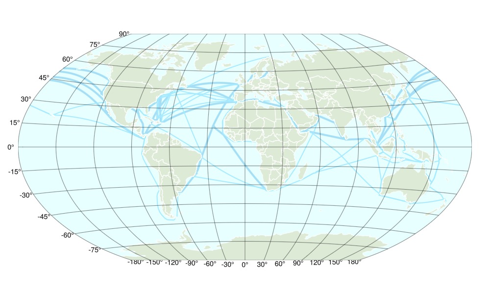
Plotting the pirate attacks
sp1 = scatter!(ax, group1_data.centers; markersize = sqrt.(group1_data.markersizes) .* 1.5, color = color = RGBf(156/255, 96/255, 178/255))
sp2 = scatter!(ax, group2_data.centers; markersize = sqrt.(group2_data.markersizes) .* 1.5, color = RGBf(65/255, 183/255, 153/255))
sp2.alpha = 0.6
# ylims!(ax, -60, 84)
translate!(sp1, 0, 0, 1)
# ax.aspect[] = 360 #= degrees longitude =# / (84 + 60) #= degrees latitude =#
fig
Preparing the legend
We'll do a manual legend here.
leg_gl = GridLayout(fig[1, 2])
leg1 = Legend(
leg_gl[1,1],
[MarkerElement(; marker = sp2.marker, color = sp1.color, markersize) for markersize in sqrt.([5, 15, 30, 60]) .* 1.5],
["1-10", "11-20", "21-40", "41-80"],
"Pirate Attacks 2015-2020"
)
leg2 = Legend(
leg_gl[2,1],
[MarkerElement(; marker = sp2.marker, color = sp2.color, markersize) for markersize in sqrt.([5, 15, 30, 60]) .* 1.5],
["1-10", "11-20", "21-40", "41-80"],
"Pirate Attacks 2010-2015"
)
fig
This page was generated using Literate.jl.